
U.S. Department of Commerce National Oceanic and Atmospheric Administration (NOAA) ·...
42
Scott Lundgren, Emergency Response Division Chief NOAA National Ocean Service U.S. Department of Commerce National Oceanic and Atmospheric Administration (NOAA) NOAA Briefing for Industry Technical Advisory Committee 1
Transcript of U.S. Department of Commerce National Oceanic and Atmospheric Administration (NOAA) ·...
Scott Lundgren, Emergency Response Division ChiefNOAA National Ocean Service
U.S. Department of Commerce
National Oceanic and Atmospheric Administration (NOAA)
NOAA Briefing for
Industry Technical Advisory Committee
1
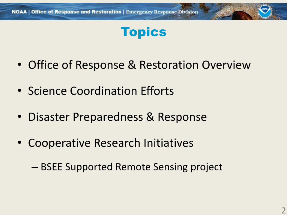
Topics
• Office of Response & Restoration Overview
• Science Coordination Efforts
• Disaster Preparedness & Response
• Cooperative Research Initiatives
– BSEE Supported Remote Sensing project
2

Office of Response &
Restoration Overview
3
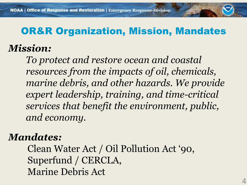
OR&R Organization, Mission, Mandates
Mission: To protect and restore ocean and coastal resources from the impacts of oil, chemicals, marine debris, and other hazards. We provide expert leadership, training, and time-critical services that benefit the environment, public, and economy.
Mandates: Clean Water Act / Oil Pollution Act ‘90, Superfund / CERCLA, Marine Debris Act
4

OR&R Organization, Mission, Mandates
OR&R DirectorDave Westerholm
OR&R Deputy Director
LaTonya Burgess
OR&R Headquarters
Emergency Response
Scott Lundgren
Assessment & RestorationTony Penn
DisasterResponse Center
Charlie Henry
Business Services (A)
Natalie Richardson
Marine Debris
Nancy Wallace
OR&R Data Manager
OR&R Chief Scientist
5

NOAA’s Mandate & Role During Spills
Spill-Specific Roles:
• Scientific Support Coordinator (SSC),
Natural Resource Trustee (including NRDA)
Important NOAA Supporting Roles:
• Weather Forecasting
• Fisheries Management
• Protected/Endangered Species
• Satellite Interpretation
• Emergency Hazard to Nav Detection
• Marine and Aviation Operations, UAS/UAV
• Hydrographic Services
Key SSC Services:
• Trajectory Analysis, Overflights, Resources at Risk, Shoreline Cleanup Assessment Teams, Science Coordination, Information/Data Management including ERMA/COP 6

*
+10/2017: Brandi Todd 7
8

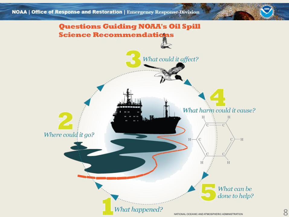
Coordination with the
Scientific Community
9
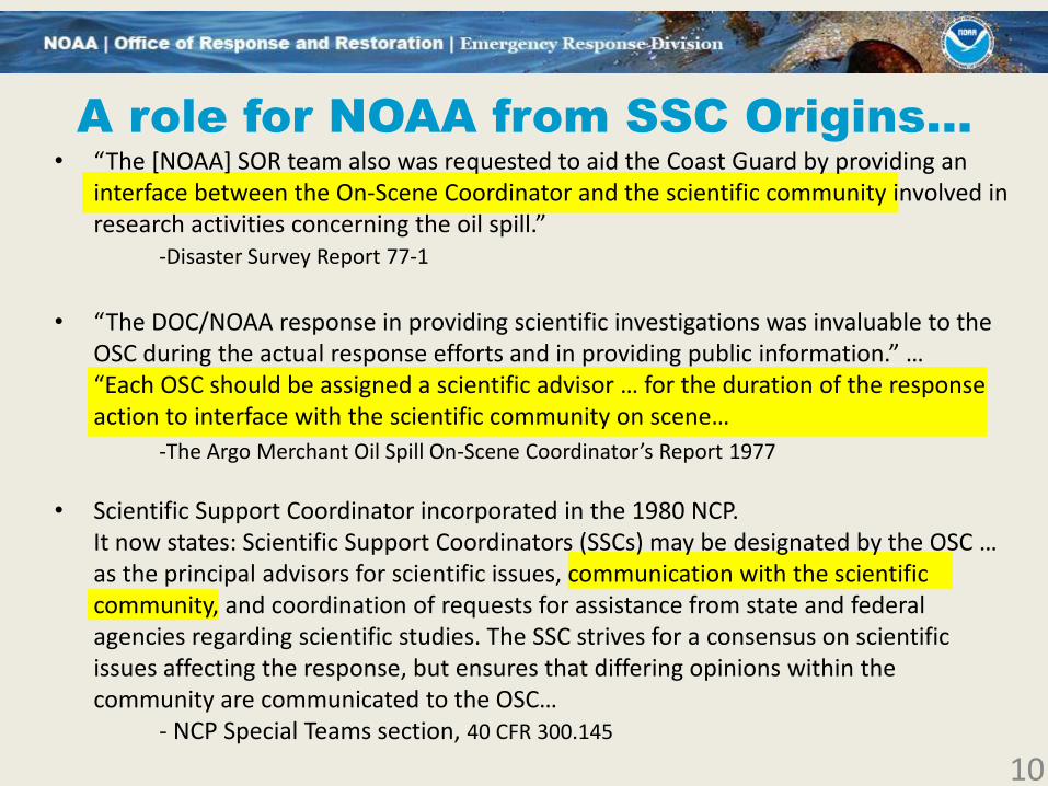
A role for NOAA from SSC Origins…
• “The [NOAA] SOR team also was requested to aid the Coast Guard by providing an interface between the On-Scene Coordinator and the scientific community involved in research activities concerning the oil spill.”
-Disaster Survey Report 77-1
• “The DOC/NOAA response in providing scientific investigations was invaluable to the OSC during the actual response efforts and in providing public information.” … “Each OSC should be assigned a scientific advisor … for the duration of the response action to interface with the scientific community on scene…
-The Argo Merchant Oil Spill On-Scene Coordinator’s Report 1977
• Scientific Support Coordinator incorporated in the 1980 NCP. It now states: Scientific Support Coordinators (SSCs) may be designated by the OSC … as the principal advisors for scientific issues, communication with the scientific community, and coordination of requests for assistance from state and federal agencies regarding scientific studies. The SSC strives for a consensus on scientific issues affecting the response, but ensures that differing opinions within the community are communicated to the OSC…
- NCP Special Teams section, 40 CFR 300.145
10
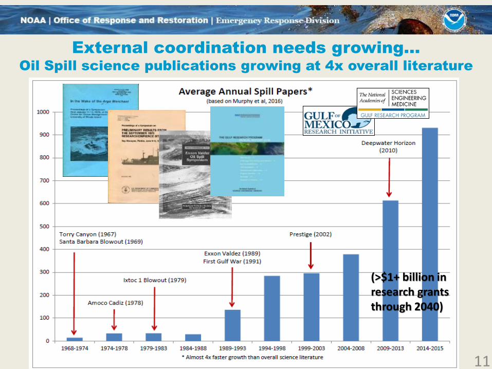
(>$1+ billion in research grants through 2040)
External coordination needs growing…
Oil Spill science publications growing at 4x overall literature
11

A challenging environment
• In confirmation testimony for Commandant, when asked about lessons learned from his experience in the Deepwater Horizon (DWH) incident that he would apply in another major disaster, ADM Paul Zukunft replied:
“biggest challenge during the Gulf oil spill is whole of science.”
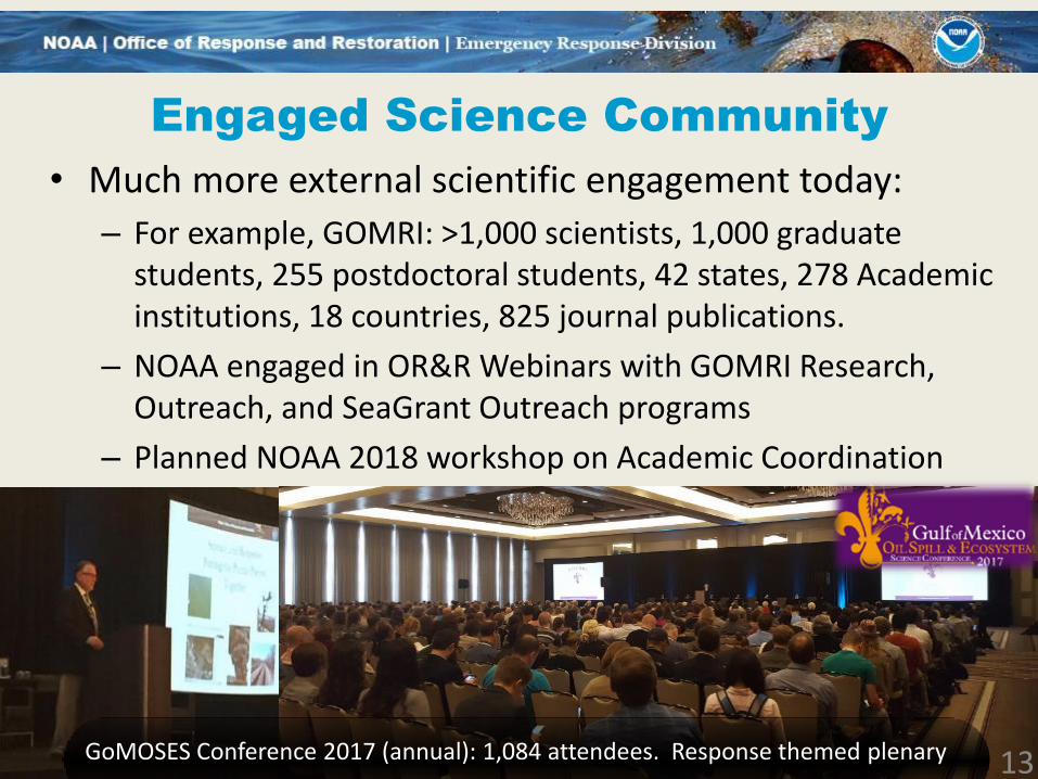
• Much more external scientific engagement today:
– For example, GOMRI: >1,000 scientists, 1,000 graduate students, 255 postdoctoral students, 42 states, 278 Academic institutions, 18 countries, 825 peer reviewed publications.
• Several other marine “black swan” events have also demanded substantial science engagement: Fukushima Daiichi nuclear plant, Indian Ocean Tsunami, Prestige Oil Spill
12
Engaged Science Community
• Much more external scientific engagement today:
– For example, GOMRI: >1,000 scientists, 1,000 graduate students, 255 postdoctoral students, 42 states, 278 Academic institutions, 18 countries, 825 journal publications.
– NOAA engaged in OR&R Webinars with GOMRI Research, Outreach, and SeaGrant Outreach programs
– Planned NOAA 2018 workshop on Academic Coordination
13GoMOSES Conference 2017 (annual): 1,084 attendees. Response themed plenary
OR&R Disaster Preparedness
and Response
14
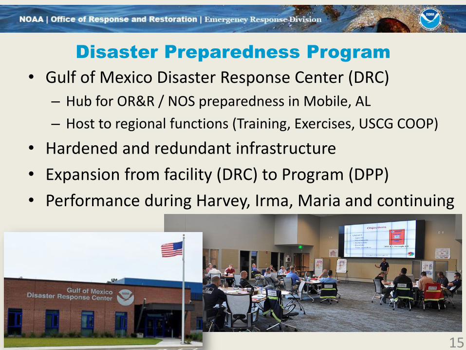
Disaster Preparedness Program
• Gulf of Mexico Disaster Response Center (DRC)
– Hub for OR&R / NOS preparedness in Mobile, AL
– Host to regional functions (Training, Exercises, USCG COOP)
• Hardened and redundant infrastructure
• Expansion from facility (DRC) to Program (DPP)
• Performance during Harvey, Irma, Maria and continuing
15
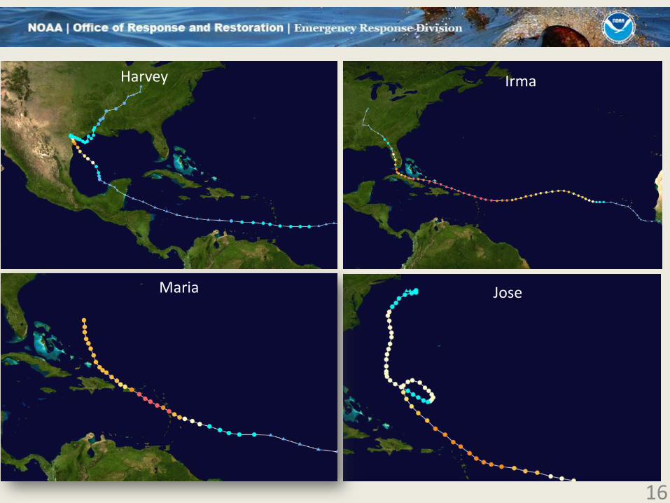
16
JoseMaria
Harvey Irma
Hurricane Roles Aug-Sep Hurricanes
• Scientific Support Coordinators
– Support to Oil/Hazardous Substance mission under disaster response (ESF-10)
– Target classification from aerial remote sensing
– Data sharing arrangements with EPA, USCG
– Environmental consultations / Best Management Practices
• Marine Debris
– Coordination with Debris Task Forces (ESF-3) and States
• Federal Emergency Management Agency
– Representation of National Ocean Service at FEMA National Response Coordination Center
17

Harvey: Data Sharing with EPA Response Manager
18
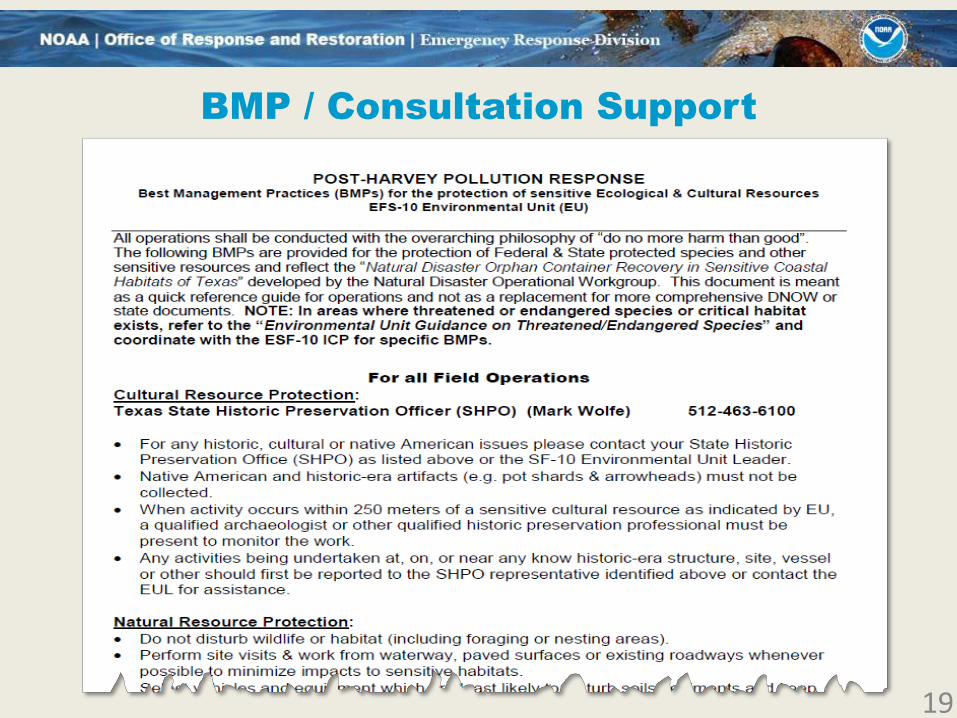
BMP / Consultation Support
19
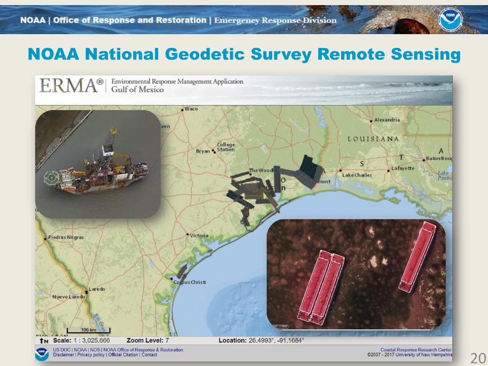
NOAA National Geodetic Survey Remote Sensing
20

Irma, Maria: Florida, Caribbean (PR, USVI)

Multiple remote sensing sources:
NGS, CAP, NCIB
22
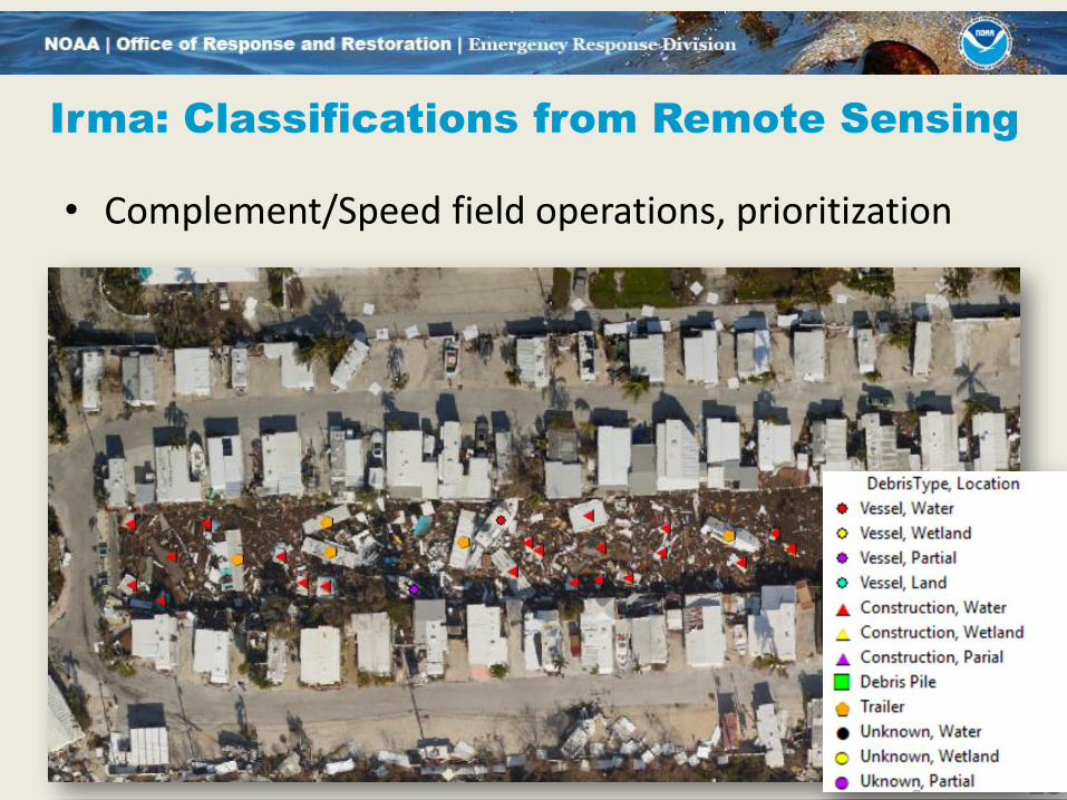
Irma: Classifications from Remote Sensing
• Complement/Speed field operations, prioritization
23
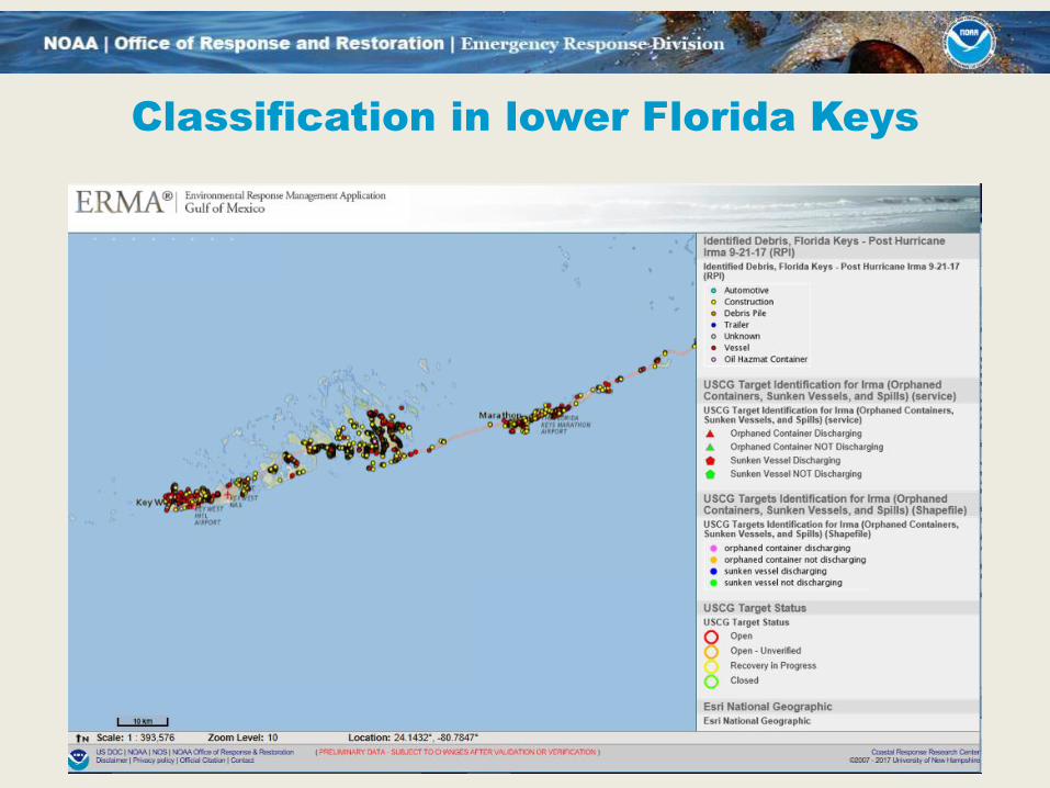
Classification in lower Florida Keys

Vessels aground St. Mary’s, Georgia
25
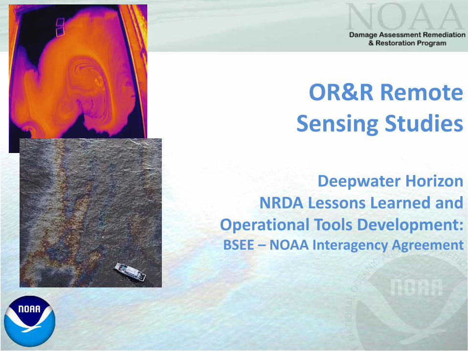
OR&R Remote Sensing Studies
Deepwater HorizonNRDA Lessons Learned and
Operational Tools Development:BSEE – NOAA Interagency Agreement

DWH Remote Sensing
Response and NRDA processed image collections: • 89 days of satellite SAR based oiling extents
• Over 35 days of aerial SLAR oiling extents
• 25 days of MODIS visible/thermal
• 9 days of Landsat MSS
• 1 – 3 days of AVIRIS hyperspectral
• Daily (x2) Ocean Imaging aerial DMSC (source)
• Up to 150+ daily overflights (Fixed, VTOL, Blimp)
• And almost no coordinated ground truth…

Remote Sensing Agreement Project
• Purpose: Better understanding of remote sensing utility to Response and Damage Assessment– Understand the capabilities of remote sensing technologies to assess
the extent and magnitude (thickness) of surface oiling
– Detail the best use of remote sensing tools and data for open water and shoreline oiling assessment in support of response forecasting, operations, resource exposure, pathway determination and identification of potential injuries
Funding & Partners: BSEE – NOAA IA (funded through March 2018)
Federal: BSEE, NOAA, NASA, USGS*, USEPA; Industry: Abt Consulting*, Ocean Imaging*, Water Mapping*, Fototerra, MDA Canada (Radarsat-2), MSRC (GOM)
Academic Partners: UNT*, USF*
* Federal and Industry participants that were part of DWH NRDA

DWH Lessons Learned Studies
• Three Phase Project– Phase 1: Controlled Tank Testing at the BSEE
Ohmsett facility in Leonardo, NJ
– Phase 2: Open Water Testing at an ongoing leaking well field in the Gulf of Mexico
– Phase 3: Development of operational tools for response and damage assessment with NOAA NESDIS
– Topic for ITAC 2018?
–A few teaser slides…
Each Project Phase is related and informs but is not dependent on the other

Sensors and Platforms
• Phase 1: Sensor and platform design • Evaluate sensor platforms used in DWH NRDA• Evaluate currently available platforms and sensors typically
utilized for Federal response support • Solicit participation of new/emerging tools from industry
and research programs• Collect imagery for multiple altitudes and resolutions within
+/- 30 minutes of in situ measurements• Determine effective platforms for oil extent and thickness
characterization• Sensing done on 400 gallons of oil in Ohmsett tank,
weathered 4 days with waves
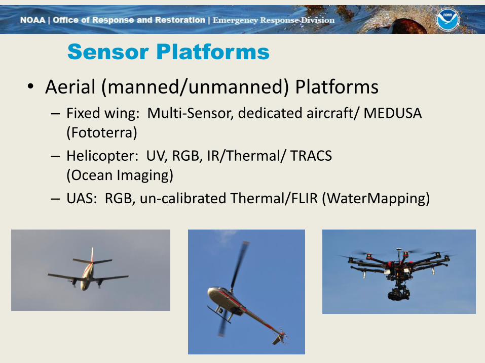
Sensor Platforms
• Aerial (manned/unmanned) Platforms– Fixed wing: Multi-Sensor, dedicated aircraft/ MEDUSA
(Fototerra)
– Helicopter: UV, RGB, IR/Thermal/ TRACS(Ocean Imaging)
– UAS: RGB, un-calibrated Thermal/FLIR (WaterMapping)

Sensor Platforms
• Satellite Platforms
– Radarsat-2 (SAR)
– TerraSAR-X (SAR)
– Worldview 2 and Worldview 3 (Visible/NIR)

• High confidence, classified TRACS output (right) derived from analysis of
TRACS imagery, in situ oil thickness, water content, and available photographs.
OI TRACS Classification of Emulsified Oil
from Ohmsett tank and in situ data
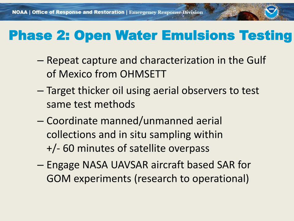
Phase 2: Open Water Emulsions Testing
– Repeat capture and characterization in the Gulf of Mexico from OHMSETT
– Target thicker oil using aerial observers to test same test methods
– Coordinate manned/unmanned aerial collections and in situ sampling within +/- 60 minutes of satellite overpass
– Engage NASA UAVSAR aircraft based SAR for GOM experiments (research to operational)

GOM Surface Oiling Examples
Sheen and Gas
Patchy, weathered oil Thick oil
Emulsified and thicker oil
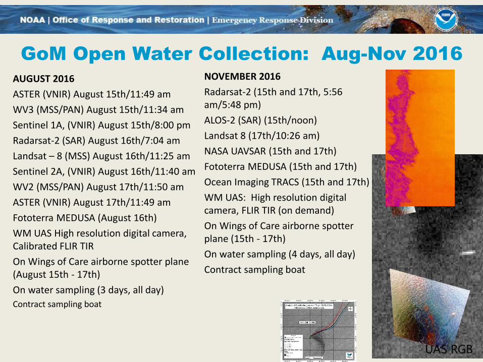
GoM Open Water Collection: Aug-Nov 2016
AUGUST 2016
ASTER (VNIR) August 15th/11:49 am
WV3 (MSS/PAN) August 15th/11:34 am
Sentinel 1A, (VNIR) August 15th/8:00 pm
Radarsat-2 (SAR) August 16th/7:04 am
Landsat – 8 (MSS) August 16th/11:25 am
Sentinel 2A, (VNIR) August 16th/11:40 am
WV2 (MSS/PAN) August 17th/11:50 am
ASTER (VNIR) August 17th/11:49 am
Fototerra MEDUSA (August 16th)
WM UAS High resolution digital camera, Calibrated FLIR TIR
On Wings of Care airborne spotter plane (August 15th - 17th)
On water sampling (3 days, all day)
Contract sampling boat
UAS RGB
NOVEMBER 2016
Radarsat-2 (15th and 17th, 5:56 am/5:48 pm)
ALOS-2 (SAR) (15th/noon)
Landsat 8 (17th/10:26 am)
NASA UAVSAR (15th and 17th)
Fototerra MEDUSA (15th and 17th)
Ocean Imaging TRACS (15th and 17th)
WM UAS: High resolution digital camera, FLIR TIR (on demand)
On Wings of Care airborne spotter plane (15th - 17th)
On water sampling (4 days, all day)
Contract sampling boat
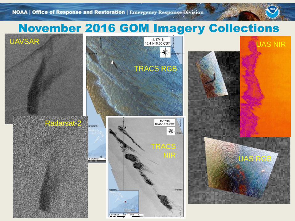
November 2016 GOM Imagery Collections
UAS RGB
UAVSAR
Radarsat-2
TRACS RGB
TRACS
NIR
UAS NIR
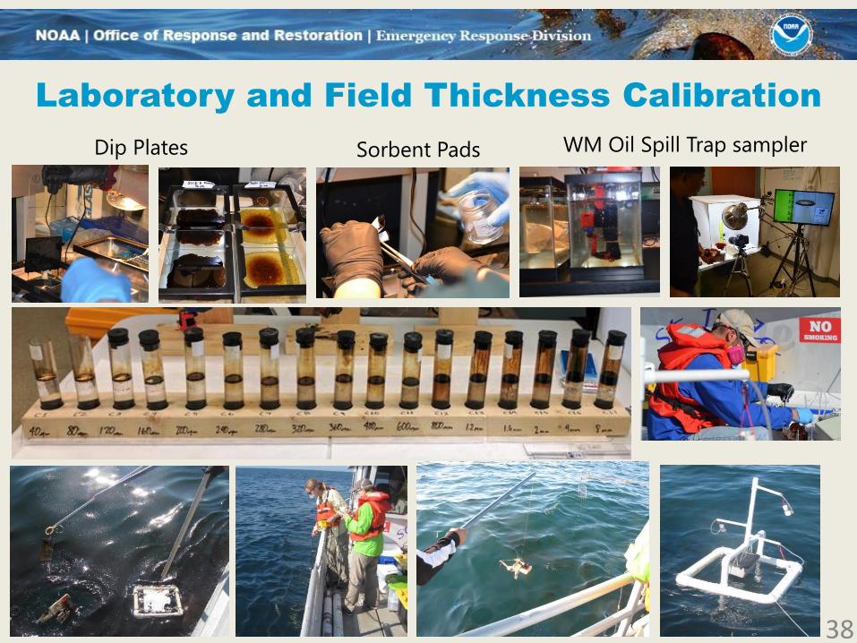
Laboratory and Field Thickness Calibration
38
Dip Plates Sorbent Pads WM Oil Spill Trap sampler
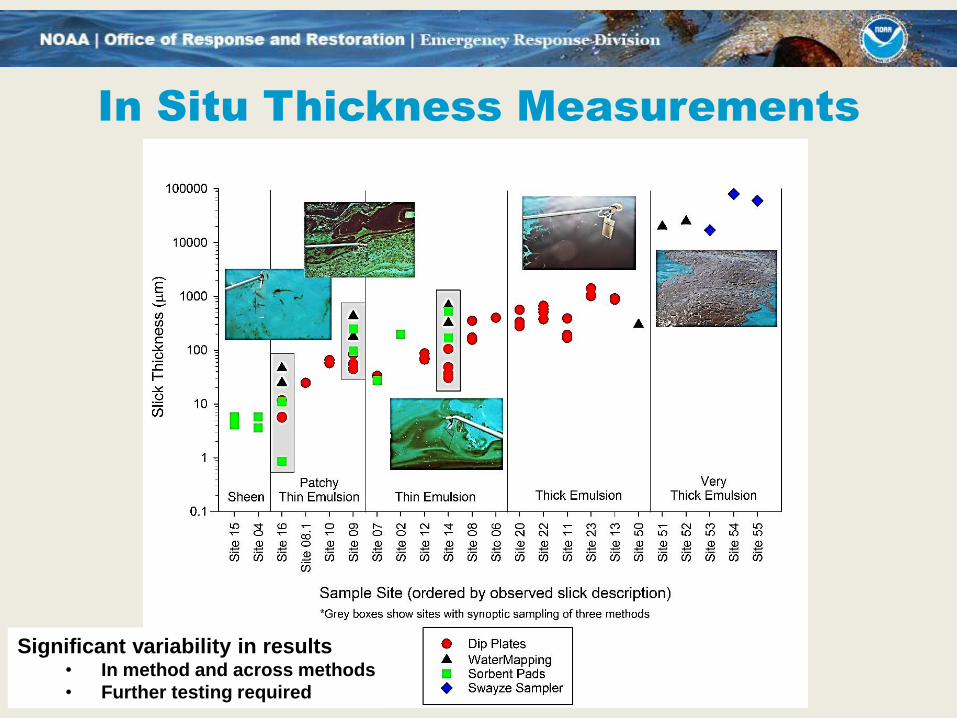
In Situ Thickness Measurements
Significant variability in results• In method and across methods
• Further testing required
DWH Lessons Learned Studies
Review of Deliverables:
– Phase 1 and Phase 2 studies will identify the utility and limits to the use of typically available remote sensing sensors and platforms (Validation of DWH)
– End-of-Phase reports will document utility and enable BSEE and NOAA OR&R to more effectively use available remote sensing data and products
– Development of operational tools and delivery of products to the ERMA® COP and other GIS systems to improve future response and assessment efforts
DWH Lessons Learned Studies
Project Next Steps:
– Compile thickness, chemistry and observational data/products into DIVER and ERMA (ongoing)
– Compare sensor classification successes and limitations to use
– Develop recommendations on practical application for response and assessment
– Continue assessment of near-real time delivery options for operational tools
Scott Lundgren, Emergency Response Division ChiefNOAA National Ocean Service
Office: 240-533-0408Email: [email protected]
Web: response.restoration.noaa.gov
42
Questions?


