URBAN - governmentarchitect.nsw.gov.au · Urban Design relates to all projects and all scales, and...
98
A Better Placed design guide for the built environment. URBAN DESIGN GUIDE Issue no. 01 — 2018 Working draft – for comment
-
Upload
duongthien -
Category
Documents
-
view
213 -
download
0
Transcript of URBAN - governmentarchitect.nsw.gov.au · Urban Design relates to all projects and all scales, and...

Green Infrastructure for climate adaptation and resilienceA Better Placed design guide for the built environment.
URBAN
DESIGNGUIDE
Issue no. 01 — 2018 Working draft – for comment

Design objectives for NSW
Seven objectives define the key considerations in the design of the built environment.
Better fit contextual, local and of its place
Better performancesustainable, adaptable and durable
Better for communityinclusive, connected and diverse
Better for peoplesafe, comfortable and liveable
Better workingfunctional, efficient and fit for purpose
Better value creating and adding value
Better look and feelengaging, inviting and attractive


4

Government Architect’s Foreword
5Urban Design Guide / Foreword
The built environment is fundamental to the quality and wellbeing of people and communities who inhabit it. Cities, precincts, suburbs, places and individual buildings all shape our daily experiences and the way in which we live. How they are planned, designed and constructed is of vital importance to us all, contributing to our health, our happiness, and our prosperity.
The role of Urban Design in this process is crucial. Urban Design practice takes a holistic approach to the ongoing creation of cities and towns, which balances social, economic and environmental factors. This extends to coordinating the requirements and interfaces of infrastructure, public spaces and buildings to ensure design outcomes lead to a positive public domain and the creation of thriving and sustainable communities.
Considered in this way, the fields of planning, design, and development make profound contributions to the urban quality of our cities and our everyday life. The decisions we make today affect not only us, but future generations. The creation of better places for our growing population requires an integrated, collaborative approach, focusing on the delivery of quality outcomes for people.
The Government Architect NSW has a long history of design leadership, with a proven record of delivering a high standard of design. In the past two years, our office has focused on supporting government and industry by offering tailored design guidance and advisory services. In this strategic capacity, we provide thought leadership and champion design excellence across government.
Improving the quality of life for all people in our urban environments requires better integration of design thinking and problem solving in the building process. This document outlines the importance of Urban Design and how to approach it – to support everyone involved in the design, planning, and development of our built environment.
Urban Design relates to all projects and all scales, and Urban Design thinking is instrumental in creating great places for people. It is about collaborating across disciplines – design, development and planning – and engaging with communities to help design healthy, resilient, equitable, and responsive environments. Good Urban Design processes make economic sense and support the delivery of better places for NSW.
Peter PouletGovernment Architect
Working draft – for comment

CONTENTS
6

Developing good Urban Design process 182.1 The distinct features
of Urban Design 202.2 Understanding
challenges and priorities 212.3 Identifying the
opportunities 242.4 Strategies of Leadership
and governance 342.5 Developing good
project process 402.6 Results from Urban Design 422.7 Urban Design
implementation 422.8 The role of the Urban
Designer 43
Achieving good Urban Design outcomes 443.1 Urban Design
considerations 47 3.2 Understanding the
existing context 493.3 Urban settings 513.4 Urban Design elements 543.5 Putting Urban Design
elements into practice 55
Glossary 88
References 92
Credits 94
Towards good Urban Design 8
1.1 Introduction 101.2 Role of the
Urban Design Guide 111.3 Where it fits 121.4 How this guide
is arranged 141.5 Who should use
this guide? 151.6 What is Urban Design? 16
PART ONE PART TWO PART THREE
Issue 1: March 2018 © Crown Copyright 2018NSW Government
DisclaimerWhile every reasonable effort has been made to ensure that this document is correct at the time of printing, the State of NSW, its agents and employees, disclaim any and all liability to any person in respect of anything or the consequences of anything done or omitted to be done in reliance upon the whole or any part of this document.
Copyright noticeIn keeping with the NSW Government’s commitment to encourage the availability of information, you are welcome to reproduce the material that appears in Urban Design Guide for personal, in-house or non-commercial use without formal permission or charge. All other rights are reserved. If you wish to reproduce, alter, store or transmit material appearing in Urban Design Guide for any other purpose, a request for formal permission should be directed to Government Architect NSW, L24, 320 Pitt St, Sydney, NSW 2000.
The Government Architect NSW acknowledges the traditional custodians of the land and pays respect to Elders past, present and future. We honour Australian Aboriginal and Torres Strait Islander peoples’ unique cultural and spiritual relationships to place and their rich contribution to our society. To that end, all our work seeks to uphold the idea that if we care for country, it will care for us.
7Working draft – for comment

PART
GOOD
URBAN
TOWARDS

ONE
URBAN DESIGN
Working draft – for comment

1.1 IntroductionUrban Design is an integrated discipline, and the large-scale process of designing and intentionally shaping the built environment. It is the complex interface between infrastructure, public domain and development (either public or private) and is framed by contending social, economic and environmental factors.
Urban Design is the art of making places – creating and continuing to shape cities, towns and villages. Operating at a broader level than architecture, which focuses on the design of individual buildings, Urban Design responds to larger scale groups of buildings, streets and public spaces, whole neighbourhoods and districts, and entire cities. Its goal is to make urban areas functional, healthy, attractive, and sustainable.
It is also different, but complementary to the practice of planning, which is a strategic, technical and political process, that outlines potential physical, social, and strategic solutions related to land use, the built or natural environment, and public welfare. It establishes integrated, clear and robust design processes which make successful development possible.
Urban Design balances the disciplines of architecture, planning, landscape, along with engineering considerations to moderate the broader social, economic and environmental processes that often drive the planning processes.
As our cities and towns grow and develop to accommodate fluctuating populations, the importance of good Urban Design process is fundamental to ensure that the integrated design of buildings, open space, public realm and infrastructure is balanced to achieve outcomes which are healthy, integrated, responsive, resilient and equitable.
It involves many people from different built environment disciplines who work collaboratively to bring all parts together to achieve an integrated and coherent urban outcome. Urban Designers, urban and transport planners, architects, landscape architects, engineers and others are all involved in bringing specialist knowledge into the design of cities, towns and villages.
“ Urban Design is a very powerful tool – and it is meant to change things. If you are satisfied with the status quo, you don’t need Urban Design. But if you live in a city that is excited by the future, with an eagerness for transformation, you need to have an Urban Design capacity for leadership.”
— Alexandros Washburn, The Nature of Urban Design, Former Chief NYC Urban Designer
10 Working draft – for comment

1.2 Role of the Urban Design GuideThis Urban Design Guide (the Guide) has been prepared by the Government Architect NSW (GANSW). It has been developed to provide detailed Urban Design guidance on how to achieve good urban outcomes, through good Urban Design practice, applicable to range of settings for urban projects in NSW.
The key objectives of the Guide are: — to identify the range of urban situations under which Urban Design projects occur in NSW — to provide best practice guidance on how to achieve good design outcomes for a range of situations — to identify the range of Urban Design tools which are applicable to urban design processes.
This guide builds on and supports the Better Placed and Greener Places policies, which set the framework, aspirations, needs and expectations for the design of our built environments in NSW, by providing strategic guidance to achieve better design processes and outcomes.
It also builds on Integrated Design Approach, the policy which describes the process to implement Better Placed through integrated design. By taking an integrated approach, the best potential of Urban Design can be realised.
11Urban Design Guide / Towards good urban design Working draft – for comment

INTEGRATED DESIG N APPROACHApproach
Vision
BETTER PLACED
An Integrated Design Approach describes a way of working involving all aspects of the built environment and at all scales of design, combin-ing places, spaces, time, fields of work, and disci-plines who work towards integrated outcomes.
Better Placed both responds to and informs our local and regional context, supporting NSW priorities and the role of design, bringing together multiple interests, fostering integration and coordinated responses.
Better Methods provides overarching advice on good design processes including advice sheets, design review, evaluation and procurement methods
1.3 Where it fits?
ADVISORY NOTES
CASE STUDIES
Process
OutcomesGANSW DESIGN GUIDES
Urban Design Guide
BETTER METHODS
GREENER PLACES
Regions Metropolitan
The Urban Design Guide is part of a suite of design guides which describe how to achieve good design outcomes.
GANSW is collaborating with other state agencies and local councils to develop approaches specific to scale, typology and condition.
Advisory Notes are part of the Better Methods series of documents that provide specific advice on ways to improve design process – for example, how to select consultants and how to develop a brief.
Gathering case studies that demonstrate real life scenarios where good design adds value to a place is part of an ongoing process of evaluating and promoting the objectives of Better Placed.
12 Working draft – for comment

13Urban Design Guide / Towards good urban design
This Urban Design guide is one of a suite of documents which support the Government Architect NSW’s role in:
— championing design outcomes for government — connecting people, by fostering public and private sector partnerships, collaboration and design coordination across built environment initiatives — providing strategic and independent advice and quality review to support best practice and outcomes for design projects.
This design guide draws from multiple GANSW policies that support good Urban Design outcomes and great places. These include:
Integrated Design Approach Integrated Design Approach aims to outline an adaptive, responsive and collaborative way of working that can bring together the initiative, expertise and diverse knowledge of those working in our built environment. It enables a response to the changing needs of all citizens. It does not outline a single set of requirements, but instead an approach that can be applied to all infrastructure and development plans, strategies, and projects, across all stages, to achieve enduring outcomes for the people of NSW.
It is inherently positive, exploratory, and inclusive. It is not the exclusive realm of designers, although they do have a skillset that suits this highly collaborative role. Taking an Integrated Design Approach, working collaboratively towards better design of infrastructure, precincts, places, buildings and spaces, will enable better built outcomes and generate social, economic, and environmental impacts for a well-designed built environment.
The intent is to provide: — a framework of how government – and design, planning, and development teams more generally – can benefit from integrated design thinking, achieving results that optimise multiple needs and requirements — a focus on the end-goal of creating cities towns, places, streets and buildings that benefit communities with outcomes centred on people and place — an outline of what constitutes a well-designed built environment, understanding the complex nature of the design, planning, and development disciplines, and the scales of the city in which they operate.
Better PlacedBetter Placed is the integrated design policy for NSW. It seeks to:1. Raise awareness of what the NSW
Government means by good design in the built environment
2. Provide clear, consistent, rigorous objectives to achieve good design throughout the development process
3. Outline the value of design thinking and what is involved in supporting effective design processes
4. Provide a framework for examining places and reviewing proposals from a good design perspective
5. Establish key concepts of design and shared terminology for the built environment
6. Encourage a stronger design culture and active engagement in design.
Greener Places Greener Places is the draft policy for an urban Green Infrastructure policy for NSW. It seeks to:1. Advocate for Greener Places, spaces and
outcomes2. Support industry and government to deliver
green infrastructure3. Enable effective outcomes in the planning,
design and delivery of green infrastructure4. Raise awareness of what the NSW
Government means by green infrastructure and its importance
5. Provide clear, consistent strategies to achieve green infrastructure throughout the development process
6. Provide a framework for examining places and reviewing proposals from a green infrastructure perspective
7. Establish key concepts and shared terminology associated with green infrastructure.
In this context, the purpose of this guide is to build on the above intentions by:1. Articulating further what a well-
designed built environment is, and looks like, incorporating precincts, buildings, streets and spaces, and ‘grey’ and green infrastructure
2. Providing guidance which builds on the objectives, to further inform the design process and outcomes
3. Demonstrating and applying design thinking, across analysis, design and implementation;
4. Providing further direction and specific guidance for examining places and reviewing proposals
5. Expanding concepts and shared terminology for the built environment
6. Making design even more accessible and engaging for all participants.
Working draft – for comment

1.4 How this Guide is arranged
The Urban Design guide is arranged in three parts, as outlined below:
— Part 1: Towards Good Urban Design – information outlining how the guide works, including definitions of Urban Design, and a well-designed built environment — Part 2: Developing Good Urban Design Process – performative information describing good design process and requirements of good design outcomes. This will be useful for evaluating design by outlining a series of considerations and requirements intended to support the delivery of good Urban Design — Part 3: Achieving Good Urban Design Outcomes: detailed explanation of the elements of Urban Design, outlining urban elements and actions to take for good Urban Design outcomes.
14 Working draft – for comment

1.5 Who should use this guide?This guide supports the work of GANSW in advocating for shared responsibility in realising good design processes and outcomes for NSW. The success of this document will be its adoption by multiple user groups and audiences in the NSW community.
The specific purposes or functions of Urban Design Guide for each audience / group, are:
Public/communityTo help people more involved, engaged, interested and knowledgeable.
— To allow those interested to delve further into design process and expected outcomes — To inform discussion/debate, by providing evidence of good practice and appropriate standards of quality — To explain and demonstrate in more detail what good design is, and how it is made manifest in the built environment — To demonstrate/reinforce why good design is important and valuable in the built environment — To educate the public about design process and outputs, building on Better Placed — To provide a reference/resource to inform thinking about significant proposals.
Government / political leadersTo reinforce the importance and value of design rigour and good process.
— To expand knowledge and design literacy — To build the case for better design — To further explain what good design outcomes look like and how they might be measured — To provide a resource for explaining the merits and potentials of major project proposals — To support the Design Review process, and reinforce its value — To support government operating as a good client.
Local authoritiesTo assist in guiding and assessing projects.
— To inform the process for local government-procured projects — To support assessment of project outputs (proposals) — To support government operating as a good client — To guide discussion with proponents in relation to Planning Proposals, Gateway, Development Applications, Vision Statements, Stage 1 DA, Feasibility Studies.
Practitioners, designersTo explain and demonstrate effective, comprehensive, design process.
— To describe good outcomes, without being specific/physical/detailed — To support client communications re process, rigour and outcomes/expectations — To assist in developing the urban narrative for a project, with clear proposals that are supported by a strong Urban Design argument — To assist in the development of a range of Urban Design activities – from masterplans, Urban Design frameworks, planning proposals and DAs — To support discussion/negotiation with clients & authorities.
Clients/developers, builders, owner-builders, home ownersTo clearly articulate expectations and requirements for process and outcomes, for all project types and scales.
— To raise standards of projects generally — To explain the need for, and value of good Urban Design process — To develop the ability to form strong Urban Design justification for proposals — To reinforce the sense of responsibility to the wider built environment — To establish that all projects contribute and are important in the built environment.
15Urban Design Guide / Towards good urban design Working draft – for comment

1.6 What is Urban Design?
While Urban Design is a specialist discipline, it is also widely practiced by a range of professionals including architects, urban/town planners, landscape architects, transport planners and place makers.
This Guide is concerned with achieving better design in the urban built environment, encompassing all design work and projects which influence and contribute to our urban environments. This includes large-scale plans for precincts or large sites, designs for streets and public spaces, and the interface with individual buildings. It is intended to support and inform the work of the broad range of professionals that are involved in shaping built environment outcomes.
Urban Design necessarily extends and overlaps with other disciplinary areas including architecture, transport, landscape architecture, transport planning, urban planning and social planning.
This guide is primarily focused on the public domain – the areas of our towns and cities that are publicly owned and managed and accessible to everyone, all the time. There are many variations of these types of urban spaces, including publicly accessible yet privately owned and semi-public areas.
However, the public realm has a strong relationship with private development, buildings, infrastructure, vegetation and a range of other physical elements. Therefore, Urban Design must consider and address all of these influencing factors.
In this way, Urban Design comprises all interventions in urban built environments. It is fundamental to achieving healthy responsive, integrated, equitable and resilient cities and towns, that are well-designed.
This Guide therefore applies to all interventions – architecture and building design, landscape or streetscape design, master planning and urban planning, and infrastructure design – including the way they interface and their role within the public domain. All contribute to creating Better Places across NSW.
“ No important change can happen in a city without the alignment of politics, finance and design.”
— The Nature of Urban Design, Alexandros Washburn
16 Working draft – for comment

17Urban Design Guide / Towards good urban design Working draft – for comment

DEVELOPING
PART
GOOD
Working draft – for comment

URBAN
TWO
DESIGN PROCESS

It provides a strong story about placeUrban Design has a role in telling the story of a place – through the analysis and interpretation of the existing place, understanding of community needs and being responsive to the aspirations of the desired future place.
A strong narrative runs through all aspects of the Urban Design proposal and tells the story of people who live and work there. The resulting built form strategy, the public domain strategy, and infrastructure, and their relationships to each other have clear justification and support each other to provide good urban outcomes.
This approach ensures that all elements, and particularly those such as height and density, which have the potential to impact public and private amenity, are integrated sensitively with clear Urban Design justification.
It is spatially led, three dimensional and richUrban Design goes beyond land use planning
— which is generally two dimensional – and deals with the physical characteristics of a place in all its complexity and in three dimensions. It results in proposals for specific projects and sites — it is a spatial strategy that may show these proposals in a diagrammatic way, and with a process that grounds them in the physical context of a place — the results are highly visual, synthesising complex ideas in a way which communicates to a wider audience.
It is selective in its interestsA project based on Urban Design begins with a specific problem and focuses on providing answers to that problem. Restricting the remit to issues that are of genuine cross boundary importance for a natural economic area, and cannot be tackled at any other spatial level, keeps the approach effective and efficient. This selectiveness applies not only to the scope of the project but also to its outcomes – a limited set of strategic themes and projects.
It takes an integrated approach to analysis and design Improving the quality of ordinary places is as important as new landmark places and spaces. Urban Design considers how the physical, economic, environmental, social and cultural aspects of a place all influence and contribute to its success, and how its natural assets can be protected and capitalised on. It integrates analysis and proposals, across all boundaries
2.1 The distinct features of Urban Design
and synthesises these into an overall vision with a clear set of objectives. This process involves many disciplines, generally co-ordinated by the lead Urban Designer.
It is an engaging and inclusive processAt the heart of large scale Urban Design is a design process which actively engages everyone – including the client, government, stakeholders, and community. It is often compressed into a number of workshops where key players come together, assisted by an expert team, to scope the work, input data, prioritise areas or themes, consider scenarios, draw up preferred proposals and projects and finalise plans for delivery.
It is focused on deliveryAn integral part of the approach is developing an implementation plan that sets out a programme of priorities, with clear actions of what to do initially, but with the future in mind. By providing a clear policy and delivery framework, it stabilises, coordinates and directs development activity. In areas with low values and little or no developer interest, it creates more attractive conditions for developers and investors. It makes clear to key partners their part in funding, investment, the provision of land, public services and infrastructure.
It is flexibleImplementing a large-scale strategy takes a long time and the context may change, sometimes radically. The new approach accommodates new data being included, and proposals being re-tested and revised. While allowing for flexibility and change, the process and its outputs provide steadfast guidance and detail to ensure quality of the final projects, and effective decision making and delivery.
20 Working draft – for comment

Health“ There is a growing recognition that urban environment has a significant influence on health; a clear relation has been drawn between the built environment and chronic diseases such as overweight and obesity, type 2 diabetes and heart disease.”
— NSW Health
The connection between health and the built environment is complex, with a number of interrelated factors that can impact health. These factors include lifestyle, community, the local economy, physical activities, and the natural and the built environment. In addressing health concerns such as chronic diseases, social, environmental and economic factors need to be understood and analysed simultaneously.
Design methods and processes can help by synthesising the many factors impacting upon heath, and developing solutions for the built environment that incorporate cohesive, integrated and interconnected solutions. Design methods can negotiate multiple factors and develop connective ideas and opportunities based on these inputs. Design can prototype and test ideas, as well as provide feedback into initial analysis to ensure solutions address initial concerns. The design of the built environment can incorporate health priorities to help create healthier places for NSW.
2.2 Understanding challenges and priorities
Climate resilienceA focus on good design will help create resilient cities and places that mitigate and adapt to the effects of a changing climate. The challenge is to ensure that the pressure for development and investment in new and improved infrastructure creates sustainable places, benefiting communities who use them. Decisions made now will continue to affect our lifestyles for decades into the future. Design can help explain the interrelatedness of things such as climate and resources in managing risk and unintended consequences.
Good design can reduce the impacts of extreme weather conditions and climate change by lowering carbon emissions through sustainable practices like use of local materials and resources, and renewable energy sources.
21Urban Design Guide / Developing good urban design process Working draft – for comment

Rapidly growing populationNSW’s population will grow to 9.9 million people by 2036, an increase of 2.7 million people from 2011. Sydney’s metropolitan population is projected to grow by more than 2.1 million (to 6.4 million people – NSW Planning) in the next twenty years. This change will have a major impact on the built environment. How cities are designed, including how housing and transportation demands are met, and how the planning system supports this growth are key to delivering the best outcomes for NSW.
While “97 per cent of Australians believe that cities and towns are better to live in when public buildings and public spaces are well-designed,” (Galaxy Poll) poor design quality can create fear of change. Better Placed promotes an increased focus on how the planning system can better recognise design, and employ design methods early to engage with the community to create and effectively communicate beneficial outcomes for people and places.
Changing lifestyles and demographicsOur population is not only growing, it is also getting older. By 2036, NSW’s population aged over 60 will be more than 2.6 million people – an increase of 56 per cent. Another fast-growing age sector in NSW is the young. By 2036, the number of residents aged 0–19 years will have increased by more than 2.4 million people – an increase of 24 per cent.
As demographics change, there will be a need for diverse options for housing, transportation and community buildings to support growing population groups. Design analysis and research can help understand how our older and younger generations want to live, where they want to live, and how to design places and spaces with these demographics in mind. Design is human focussed, responsive to the needs and aspirations of its people, and equitable, presenting opportunities for all.
22 Working draft – for comment

Infrastructure and urban renewalGovernment, together with the private sector, is delivering and upgrading infrastructure including transport, education facilities and hospitals together with a program of urban renewal on major government-owned sites.
Large-scale urban renewal projects are complex, often involving multiple projects being undertaken in close proximity. Good design processes can help understand disconnected parts more holistically, including the layers of old and new, the user groups, and the required upgrades to infrastructure and public spaces of the area.
An integration of effective design processes will assist in maximising the benefits from this investment and ensure new infrastructure improves existing places and spaces, delivering even greater returns. The quality of built outcomes in the public domain is important and incorporating design methodologies early in the process will support well-considered and integrated outcomes.
23Urban Design Guide / Developing good urban design process Working draft – for comment

The importance and value of good design in the built environment extends well beyond local projects and places. The role of cities and urban areas in contributing to, and addressing, the defining environmental, socio-economic challenges of our time, is increasingly recognised and promoted.
The 17 Sustainable Development Goals, agreed by all nations in 2015, include commitments to Sustainable Cities and Communities, Health and Wellbeing, Reduced Inequalities and Climate Action. These set the framework for all development activity, in all countries. Effective Urban Design can contribute to achieving these Global Goals.
World leaders adopted the New Urban Agenda in 2016, and it is now up to national governments and local authorities to implement the agenda. It will require new urban rules and regulations, improved urban planning and design, and municipal finance, among other things1.
The New Urban Agenda commits to an urban paradigm shift, to readdress the way we plan, finance, develop, govern and manage cities, and to adopt sustainable, people-centred, age- and gender-responsive and integrated approaches to urban development2.
The key challenges and directions for the built environment and urban areas in NSW, as set out in Better Placed, provide an ideal framework for considering the major global shifts and emerging directions for built environment design and city building. These reflect the overarching context in which all built environment design (urban planning, master planning, architecture, public realm design and landscape architecture) should be considered and positioned.
New South Wales is experiencing changing circumstances and perspectives on public health, climate resilience, population growth, lifestyles and demographics and has placed a strategic focus on our urban environments.
While the State is not alone in identifying, and addressing these new circumstances, they add particular importance to a number of factors
that influence the State’s approach to good Urban Design.
Each value responds to characteristics important to achieving a well-designed built environment, as set out in Better Placed. In summary, these characteristics of a well-designed built environment encompass:
A Healthy Environment: urban places that support better physical and mental health for the whole community.
A Responsive Environment: buildings and spaces that are sensitive and responsive to place, local character and context, and to usage patterns and lifestyles.
An Integrated Environment: a built environment that links communities, functions and activities within a cohesive place.
A Resilient Environment: urban places that can withstand, or recover from, social, economic or environmental changes.
An Equitable Environment: a built environment that is fair and accessible to all.
2.3 Identifying the opportunities
24 Working draft – for comment

Creating a Healthy Environment
Integrated health and wellbeingThe links between the built environment and personal health and wellbeing are increasingly recognised and building design is seeking to enhance user conditions and support healthier, happier lifestyles.
Factors such as walkable access, outlook and views, access to nature/vegetation, natural light and ventilation, stable/ non-toxic materials and finishes, effective mechanical systems and visually stimulating yet relaxing environments are all important considerations in designing healthy buildings.
Physical health and wellbeingOpportunities to walk to school, work, and shops, good open spaces which invite activity, and safe, vibrant streets and access paths all contribute to the tendency for community members to be more physically active, supporting better health outcomes.
Access to good fresh food, clean air, natural light and community activities are also essential foundations for community health.
Mental health and wellbeingThe role of the urban environment in mental health outcomes is also increasingly recognised. Creating environments in which people feel safe and connected to other people, within a community, and with opportunities for informal social interaction, is key to supporting social wellbeing.
Low walkability, car-dependent development, limited open space and dispersed housing prevents social interaction, and place people below cars in the order or importance.
Technology and communityThe dramatic rise of communications technology, social media and tech-driven processes for socialising, dining, travel/transport and accommodation, is re-shaping the way urban dwellers connect and engage socially. It is also shifting our definition and understanding of ‘community’ in cities and towns, which is less connected to geography and place.
At the same time, loneliness and isolation is reportedly on the rise in major cities – we engage less with neighbours, and more people live alone, or significant distances away from family and friends.
The design of buildings, the public realm and precincts can facilitate, encourage and support social interaction, which is essential for health, but poor design hinders this vital potential.
Urban food productionFood plays a central role in all our lives, and the production, distribution, access and management of food has a significant bearing on, and from, the design of the built environment.
Crop production interfaces with (or is consumed by) expanding urban areas, while increasingly food logistics impacts lifestyles and traffic loads. Food transportation results in greenhouse gas impacts, while food production and eating habits, affected by other lifestyle traits such as work patterns, affect our health and wellbeing.
More localised food production within and around our cities and towns can potentially enhance the physical health, and mental wellbeing through social interaction opportunities, in our urban communities, while also supporting local economic activity and reducing transportation impacts.
25Urban Design Guide / Developing good urban design process Working draft – for comment

Creating a Responsive EnvironmentUrban Design is necessarily focussed primarily on the public realm and public users, but is defined by the overarching urban form and structure, and by the built form which defines it. These aspects combine to create the public’s experience of the built environment.
The public environment is the shared territory of an urban area. It is edged and surrounded by the considerable visual complexity of buildings and occupied by the equal complexity of its users. Its design for use can provide relief from this visual complexity and give clear evidence, through its design qualities, that the public always come first.
A responsive urban environment supports access, orientation and wayfinding, is visually engaging, reinforces and concentrates movement and activity to encourage safety and welcoming places, and provides a diversity of experiences and opportunities for all.
This value relates closely to NSW Government priorities relating to changing lifestyles and demographics across our state, which is made manifest in numerous ways, including the following:
Ageing population and changing housing preferencesWhile Australia’s ageing population is evident in most areas, and common to many western countries, it is occurring amongst many other demographic trends and shifts, driven by a range of local and global forces. The complex and ever-evolving nature of demographic trends must directly inform our urban policy, design and delivery.
Changing attitudes to ownershipAs housing becomes more unaffordable, and technology allows us to share cars and bikes, music and movies, meet people, and work, learn and communicate remotely, there is an emerging shift away from ownership, and adoption of more flexible, itinerant lifestyles. This shift will increasingly affect the way housing and urban areas are designed.
New housing types and tenure modelsIn response to increasing urban populations, affordability challenges and preferences for well-located urban living, new forms of home rental and ownership are emerging, alongside new housing types which are more communal and cost effective.
Importance of placeThe role and value of place quality is increasingly recognised and important, providing the potential for outdoor recreation, social interaction, economic activity, and personal identification with the location.
Participatory design and governanceNew forms of urban governance are emerging in response to constrained public budgets and resources, short-term political cycles, private sector interest, and adoption of more business-like approaches to urban development.
It is also recognised that genuine community involvement in procurement, design and delivery processes can enhance the public’s sense of identity, pride, ‘ownership’ and investment in the place, creating long-term value and increasing usage and activation.
Prioritising the ‘local’Alongside globalisation forces, there is an increasing interest and commitment to the ‘local’ economy and social setting, as a foundation for happy urban living. Also important is local access, realised by walking and cycling to local facilities, services and transport.
This shift is becoming manifest in the revival of street-based town centres, independent shops
26 Working draft – for comment

and cafes, and the adaptive re-use of existing buildings.
Street as placeAs urban intensification and increased density responds to population growth and urban preferences, streets are increasingly seen as potentially useable public space for social interaction, meetings, events, children’s play and exercise, alongside their access role for vehicles. However, this multi-use approach requires careful design and management of the edges between people and traffic – for effective function as well as safety and amenity in the street.
Cities for children The presence of more families, children and diverse households in cities and towns, not just in suburbs, also demands an effective design approach and response. It is recognised that making cities good for children, makes them good for everyone.
“ Children are an indicator species of great neighbourhoods. If you design your city/town deliberately for kids, families will come!”
If there are no children or families in an urban area, there is probably something wrong or missing in the community. Schools, childcare, playgrounds, facilities and a public environment that is kid- or teenager-friendly, are key design outcomes3.
Our built environment must be safe, human-scale, low-speed, accessible, engaging and visually interesting, with varied places for sitting, play, watching, meeting and enjoyment in the public realm.
27Urban Design Guide / Developing good urban design process Working draft – for comment

Creating an Integrated EnvironmentThe practice, process and implementation of Urban Design is inherently integrated, between public space, built form, infrastructure and land use, and between private, public and ‘third’ sectors, and civil society.
It is not possible or useful to separate the public realm from the planning design of precincts, or the design of buildings, as these aspects work integrally to create the urban experience, and rely on one another.
The experience of the public realm is different for different people and backgrounds, but is influenced by its design an appearance, edge conditions and adjoining activities, size and shape, programming and activities, and the range of potential uses.
Every street, lane, building, and urban element, contributes to an integrated, cohesive, user-friendly urban environment.
Integrated environments can address important NSW Government priorities in various ways, spanning infrastructure and urban renewal, and the following topics:
Infrastructure and city shapingAs our cities and towns increase in size and population, along with increasing demand for effective mobility, and increasing congestion and associated environmental, social and economic impacts, transport infrastructure plays an increasing role in facilitating urban functionality, and shaping the city itself.
Transport and other infrastructure such as education facilities, hospitals and even community facilities provide a focus for development and urban renewal – particularly along movement corridors and around transport nodes, by supporting liveability, access and productivity.
Urban precincts, buildings, streets and spaces must be designed to optimise the benefits of access to infrastructure, at local, regional and metropolitan scales. The design of infrastructure is also essential to provide optimal access, enjoyment and environmental, social and economic benefits.
The value and importance of public transport in cities and towns is increasingly recognised by communities and civic leaders alike. The many costs of traffic congestion, and the relative efficiency of high-capacity public transport, support the ongoing investment in train, light rail and bus infrastructure in our cities and towns.
Integrating the planning and design of transport infrastructure with surrounding development and Urban Design is essential to leveraging maximum value for money from infrastructure investment.
Smart cities and digital connectivity‘Smart cities’ describes a rapidly growing movement of embedding technology and data processing in our city systems and infrastructure, to increase performance, efficiency and sustainability. The operation of
28 Working draft – for comment

functions such as energy and water supply, waste management, traffic monitoring and control, crowding and public transport, can be enhanced through the application of technological systems, allowing rapid and ‘real time’ response to challenges and issues.
The onset of digital connectivity, social media and mobile communications is having a dramatic effect on the way our built environment is used and occupied. Urban Design needs to remain current and responsive to these shifts, while also providing spaces for interpersonal interaction, community activity and simply ‘being’ in the urban environment.
Value capture and sharing opportunities through infrastructure investmentThe concept of ‘value capture’ is increasingly being considered as a potential contributor to funding new infrastructure in areas of growth. The principle of value capture is that part of the financial value ‘uplift’ that individual property owners experience because of new infrastructure, can be ‘captured’ to help fund that infrastructure.
Urban renewalAs the economic role of cities evolves in the global economy, the need to revitalise and find new uses for areas undergoing economic transition – including former industrial areas and locations of disadvantage or decay – is being addressed in a variety of ways. Initiatives in NSW, such as Green Square, Renew Newcastle and The Gosford Challenge, take different approaches to urban renewal, but with a focus on strategic, integrated and long-term initiatives to re-establish sustainable urban economies and great places to live, work and visit.
Urban renewal also provides opportunities to accommodate our expanding urban populations in more central, well-located and well-serviced locations, as well as enhancing the amenity
and attractiveness of the urban environment in these locations.
(Sub)urban infillWhile large, new buildings in major centres are perhaps the most visible aspect of our growing urban populations, the ongoing redevelopment of sites in suburban/residential settings is providing a large proportion of new housing. This context requires more crafted, considered built form interventions in the established urban fabric and careful management of interface conditions with neighbouring properties.
Real mixed-useThe integrated mixing of different land uses and activities, and the provision of flexible spaces to accommodate a variety of uses, is increasingly prevalent as the design process resolves technical obstacles such as accessibility, security and structural considerations to allow this vertical and horizontal mixing in higher-density environments.
Changing models for workplace design, community facilities provision, entertainment and urban housing is driving new thinking around building configuration and adaptability. The proximity and layering of different activities supports accessibility and multi-destination trips in urban areas (for example combining work, shopping, healthcare and dining), encourages more compact development, and supports extended activation across the daytime and evening.
Adaptive re-useThe majority of the buildings that will be in operation by 2050 in our cities and townsare already built. As populations evolve and grow, and living and working needs change over time, the adaptation and re-use of existing buildings is increasingly prevalent and valuable.
This applies equally in highly sought after, central city locations and heritage contexts, as well as more run-down or declining urban areas that are undergoing revitalisation. Good design can breathe new life into older building stock and provide the spatial opportunities for new commercial, community and residential activities. It can so help to retain the inherent value in existing buildings, and retain the character, visual richness and complexity of established urban areas.
Managing large schemes and masterplanningLarge scale Urban Design can be used to instigate and orchestrate the delivery of developments like big retail and employment centres and large housing developments and transport infrastructure. It ensures each project is considered within a wider spatial, economic and social context. This approach maximises the value of investment and spreads the benefits brought about by the development across the whole area and to all sectors of the population.
29Urban Design Guide / Developing good urban design process Working draft – for comment
Creating an Equitable EnvironmentAs we experience rapid population growth especially in our major cities, as well as decline and other demographic shifts across our cities and towns, many challenges and opportunities for an equitable society are presented.
Increasing inequalityUrban inequality remains an endemic and worsening phenomenon globally and, increasingly, in NSW. Across the globe, we see high levels of urban poverty, unemployment and substandard housing, contrasting with wealthy districts in the city centre and gated communities in the suburbs. More prosperous areas tend to be concentrated in more accessible locations close to employment, public transport and other opportunities.
Pressure on major citiesAustralia is among the most highly urbanised countries in the world, with a large proportion of our population living in cities or towns, and this proportion continues to increase as we seek out the social, economic and cultural opportunities that urban living offers.
The clustering of people and jobs places pressure on cities in terms of demand for housing and business space, traffic and congestion, infrastructure constraints and affordability.
Liveable, productive citiesBuilding a sound, long-term employment base and local economic system to support local opportunities and prosperity is a key function of urban agglomerations. Economic activity is one of the fundamental ‘reasons for being’ of cities and towns. The design of cities and towns has a significant bearing on this economic potential.
Building cities and urban places to support community activity, interaction and mutual support is also an essential function of successful, attractive cities and towns. Urban places should be safe, accessible, welcoming and supportive of a range of social activities. The primacy of the public environment (streets and spaces) is a key aspect of the sociable city. Liveability is increasingly linked to productivity and liveable cities and places are attracting global talent and knowledge workers and the benefits they bring to the local and national economy.
Housing Growing populations are perhaps most prominent in the urban housing context, with ‘ripple effects’ in the areas of housing demand
and affordability, housing quality and city planning. The economic and social challenges of dispersed, suburban development patterns are increasingly recognised in contemporary western cities. In parallel, there is an emerging shift in preferences towards higher-density housing (townhouses, units and apartments) in locations that enjoy access to facilities and services. This is driven both by strategic policy, which recognises the benefits of this approach in terms of productivity, liveability and equity, and importantly by increasing consumer preferences for living in highly accessible locations in more compact communities.
However, these preferences, and increasing demand, are leading to increased affordability challenges. Increasing supply of higher-density housing is also having a dramatic impact on urban form and skylines in some locations. These issues reflect significant design challenges.
Housing affordabilityHousing affordability and access to housing has emerged as a defining issue of our major cities in the early 21st century. Simply increasing supply is no longer considered enough. There has been an increased focus on diversifying the mix of housing types and tenures in locations where people have access to transport and the opportunities our cities offer.
The design of new and adaptive housing must address these evolving conditions and changing demand. Good design is essential to achieving appropriate, liveable and affordable housing in well-serviced locations, given the range of challenging circumstances. Design is required to navigate the inherent tensions between economics and finance, market demand, liveability, policy and future-proofing to ensure responsive and accessible urban and regional housing.
Many locations across NSW are undergoing change as the increasing demand for housing is addressed through new construction and urban renewal. While SEPP65 provides a nationally-recognised system for ensuring design quality and amenity in apartments, further potential exists to deliver better design outcomes in a growing city, particularly as medium and high-density living is concentrated in other urban centres outside the central city area.
Density and communal amenityAs our cities increase in population and density, and preferences for well-located housing continue to grow, developments are providing innovative responses to communal or shared amenity.
Beyond the small gym or swimming pool, apartment dwellers can now have access to shared large kitchens and dining areas for entertaining, rooftop deck spaces and wintergardens, cinema rooms, business/
30 Working draft – for comment

office spaces and meeting rooms, bar and café facilities, wine cellars, lounges and libraries, shared cars or bicycles, even ‘spare rooms’ or bookable apartments for overnight guests.
These facilities provide greater lifestyle flexibility for residents, and make efficient use of space in higher-density urban areas, by sharing amenity space rather than dividing amenity space between all apartments.
Layering of uses, longer hoursAs our cities increase in density, the role of public space and shared facilities gains greater importance, along with demand for usage. Therefore, public recreational spaces need to be more intensively used, across longer hours of the day, for a broader range of activities. This informs the design, materials and configuration of the spaces, as well as the ongoing management and programming of the space.
31Urban Design Guide / Developing good urban design process Working draft – for comment

Creating a Resilient EnvironmentThe collective urgent action to mitigate climate change and its impacts will be substantially achieved in our cities and urban environments. The urban environment provides significant opportunities to contribute to global sustainability.
However urban resilience is much broader than the capacity to respond to expected increases in climate-related events and impacts. Resilience encompasses the social and cultural fabric and interrelationships in our cities and towns, and their economic strength and potential, as the foundation for ongoing liveability and prosperity for urban communities.
Preparing our cities and towns to limit, and adapt to, a changing climate, is increasingly urgent and imperative, and climate resilience is identified as a NSW Government priority, affecting all projects, as reflected through various topics:
Resilient cities and townsOur cities and towns need to become adaptable and prepared for change: population growth, natural events, economic shocks and social changes may have increasingly significant impacts on our urban environments. Amidst great uncertainty and increasing risks and impacts from natural and economic events, it is more important than ever that places of concentrated populations, economic activity and social infrastructure are strengthened in terms of their resilience.
It is essential that resilience is designed into our precincts, buildings, spaces and infrastructure, and supports social cohesion, economic prosperity and environmental performance. All design and development projects can contribute to wider urban resilience, through climate protection and adaptation potential, disaster risk protection and other key strategies.
Environmentally sustainable citiesCommunities are increasingly conscious of, and demanding responses to, the growing urgency for cities to use our natural resources more efficiently, reduce climate impacts, and to adapt in response
32 Working draft – for comment

to these impacts. Developing our cities and towns to be more efficient, resource effective and less impactful on natural systems is an essential outcome and a universal design driver.
Globally, cities are restricting urban sprawl, supporting more compact city models, investing in enhanced public transport networks and smarter infrastructure, promoting local, renewable energy production and onsite water retention and recycling, and encouraging and prioritising walking and cycling.
The design of our streets, public spaces, buildings and infrastructure is fundamental to achieving the necessary change
Green buildingsIncreasing commitment and demand for high-performance buildings has created a shift from ‘green’ credentials as a boutique option, to sustainability as a base requirement in all new buildings.
Sustainability technologies are increasingly accessible and affordable, occupants are demanding better performance, and the broader
benefits for health, wellbeing, comfort and workplace productivity are widely recognised.
The sustainability framework informs the location, siting, transport accessibility, orientation, configuration, materials and services systems of a building, whether residential or commercial-focussed. Importantly, high performance sustainability generally aligns with increased comfort and therefore wellbeing and productivity outcomes.
In NSW, the commercial office sector has led the way in this field, however the SEPP65 Policy and Apartment Design Guide, as well as BASIX standards, support ‘green’ outcomes in residential buildings through aspects such as orientation, daylight access and natural ventilation, which reduce energy demand and increase internal comfort.
Facilitating economic growthIn many places goods manufacturing has been replaced with knowledge-based and service sectors, which rely heavily on access to a skilled workforce. These sectors tend to cluster into specialised centres with strong links and complementary relationships within natural economic areas. So, increasingly, competitiveness of places depends on attracting and retaining the right people, which in turn is dependent on providing a distinctive and high quality living and working environment. Economic performance is also affected by how well the physical structure of the natural wider area is designed to facilitate clustering and linkages between the economic centres within it. Where areas are failing to thrive because they are poorly connected to facilities and economic opportunities, large scale Urban Design will identify the most appropriate response.
Using financial resources efficientlyWhen public budgets are tight and there is limited private finance, it is essential to address competing priorities. This means that many public services, and most large scale infrastructure, should be considered across boundaries. Whether evaluating or planning the provision of utilities, transport, higher education institutions or hospitals, there are significant efficiencies to be made through involving all parties in a timely way. This is a key benefit from using large scale Urban Design.
Achieving environmental sustainabilityLarge scale Urban Design can be used to instigate and orchestrate the delivery of developments like big retail and employment centres and large housing developments and transport infrastructure. It ensures each project is considered within a wider spatial, economic and social context. This approach maximises the value of investment and spreads the benefits brought about by the development across the whole area and to all sectors of the population.
33Urban Design Guide / Developing good urban design process Working draft – for comment

Focus on people and communityUltimately, urban places and buildings exist to serve the daily needs of their occupants: households, business workers, the public, community groups, and the many others who will encounter or be affected by a building throughout its life. While the design of buildings requires consideration of many complex technical factors (structure; environmental systems; utilities; buildability; cost; weather protection; thermal and acoustic performance; and so on), the building’s design should address and enhance people’s personal experience of space and its functions as the overarching design priority. This focus should be reflected in the design process.
An integrated leadership and governance model balances the needs of communities and individuals alongside planning and development requirements. A focus on human experience in the process can help create people focused outcomes; a competitive advantage for liveable cities in today’s global society.
1. Put people first by creating human centered objectives and aims for the project.– places are designed for people and should be the starting point for all projects. See GANSW Start with the Place.
2. Think of projects as places that people use, rather than a set of checks, requirements, currency, and materials – taking an approach of understanding the experience of the proposal on the individual or the community can help to add richness to the outcomes.
3. Target outcomes where measurements can be shown by improvements in quality of life – identify indicators such as health which can be measured against the built environment.
4. Engage with community to capture people’s needs, aspirations and desires – the community is a valuable source of information of a place – they know it intimately and are able to help identify challenges, opportunity and the vision.
5. Use community engagement and consultation processes to create shared ownership of projects by their end users – develop a clear community and stakeholder engagement strategy.
6. Use community engagement and consultation processes in all public projects, set up community panels where representation does not exist – explore a range of different engagement process which can be used to communicate with the community. These may include workshops, Design by Enquiry events, walkabouts and soundbite expert panel sessions.
7. Train project groups in human centered approaches – good training will help build capacity between project groups and ensure that all understand the key ways to ensure a human centred approach.
8. Embrace diversity in different user groups – understanding and respecting the demographic profile of a community and its subcultures as well as the range of opinions and values that are likely to emerge.
9. Gather data to support and evaluate outcomes for future projects by doing post occupancy surveys.
2.4 Strategies of leadership and governance
34 Working draft – for comment

Create a collaborative culture with shared responsibilityThe design, planning, and development of the built environment is a collaborative and coordinated effort. Aligning professional mindsets to understand and act upon economic, social, and environmental dynamics is a significant task. An integrated leadership and governance model observes the need for shared interdisciplinary knowledge, where skills intermesh, joint solutions emerge and perspectives change by working together.
1. Embrace a contemporary and global outlook by understanding interconnections, complexities and networks of information – background research and review should look broadly to understand the wider influences at a global and national level on the particular site, and vice versa.
2. Create consistent objectives and aims to balance Individual interests, requirements, and needs alongside the benefits for the public good – objectives are a strong anchoring point and reminder of what the project is trying to achieve. They should span environmental (built and natural), social and economic considerations.
3. Reframe singular issues to the wider goals – enabling systematic rather than ad hoc and uncoordinated problem-solving.
4. Empathise with other points of view – it is important to understand the role of other disciplines and their contribution to the process.
5. Communicate with all parties at all times, especially when there are competing agendas to resolve and synthesise – establish clear lines of communication which ensure clarity of the tasks to be undertaken.
6. Understand how specialist knowledge can be integrated within the process to create efficiencies and shared knowledge – specialist knowledge brings huge value to projects and will differ depending on the project objectives.
7. Embrace change by forming partnerships between institutions, agencies, and communities to achieve better solutions – identify opportunities where natural synergies exist and complementary skills can be brought together.
8. Focus on the interconnectedness between disciplines, scales and ideas – look at causes rather than effect – many disciplines cross over in themes when looking at large scale urban projects and the public domain.
9. Develop new methodologies, new procurement processes, and new ways of working to deliver shared objectives for better quality places for people – adopt an ‘end justifies the means’ approach if alternative and unexpected opportunities for achieving quality outcomes emerge during a project.
10. Recognise shared responsibility between the public and private sector in delivering public space – the interface between the public and private domain is paramount and should be considered and integrated in thinking for the best outcome.
35Urban Design Guide / Developing good urban design process Working draft – for comment

Be accountable for design quality at every stageAn integrated leadership and governance model embraces design criteria for better built environment outcomes. As experts, it is the duty of the disciplines outlined in this document, to help achieve the goal of a high quality, equitable and inclusive built environment. Embedding design expertise and criteria into all projects, across all stages and through the life of a project is essential in improving the quality of the built environment.
1. Balance economic, social and environmental issues to attain quality of life outcomes – finding a workable middle ground to reconcile conflicting project imperatives.
2. Use evaluation criteria to evaluate proposals. See GANSW Evaluating Good Design document which sets evaluation criteria from the Better Placed objectives. These objectives can be adapted to any project, at any stage, and over the life cycle of the project – evidence based and defensible decision making will protect the core values of a design strategy throughout the life of a project.
3. Do not sacrifice quality for short term gain – consider long term lifecycle, inclusive of social and environmental considerations.
4. Projects should accommodate technical requirements alongside design based criteria – particularly where performative outcomes will have a critical impact on the design.
5. Create regular and consistent check points against established criteria – to ensure that work in progress is still focused on the required outcomes and that the criteria are still suitable – adjust if necessary.
6. Collaborate with designers early in the project, before master planning or construction commences to ensure that the design process is used to integrate any unexpected or complex issues into synthesised solutions focused design outcomes.
7. Create long term management strategies to ensure good social, environmental and economic outcomes into the future – ongoing stewardship is required to both maintain the performance, value and condition of public assets as well as finetuning operation and management to lock in long term viability.
8. Build a network of designers who have a creative capacity to help shape outcomes from early on – creative problem solvers to set the groundwork for innovative thinking that will resonate throughout the life of a project as others take over future stages.
9. Use design review processes to improve design quality on projects. See GANSW State Design Review Panel – constructive and independent review that recognizes the strengths of a proposal and provides guidance where further resolution is required.
10. Use innovative procurement practices to get the right project team. Potential project teams should demonstrate their capacity for creative and possibly unexpected insights into a project, through targeted procurement such as design competition, concept designs, project appreciation statements etc.
36 Working draft – for comment

Innovate for future practiceIt is essential that Urban Design, planning and architectural solutions are focused on innovative approaches and outcomes. Establishing strong research partnerships between government, industry and institutions is essential to build in an understanding of what it takes to create great places, and to disseminate new techniques and approaches.
1. Raise awareness through research and education – research and education provide the greatest value in assisting to strengthen the purpose of good Urban Design process and outcomes.
2. Educate community to shift attitudes – community stakeholder events on significant projects or other broader community events focused around ‘creating good places’ can help to raise awareness.
3. Create partnerships with community, industry and government to promote an appreciation of new urban form, growth and development – seek out opportunities for natural synergies between different groups who share a common goal for urban renewal.
4. Engage in new technologies that can help solve complex issues – this can include aspects such as new movement options for vehicles, movement of goods, ways of doing business.
5. Visualise and analyse our built and natural environments. Geographic Information Systems (GIS), for example, permit a greater understanding of spatial relationships between and across organisations for both existing and planned works.
6. Research faster, more efficient and economical construction techniques, understanding the built environment’s impact on climate change will require innovative and well researched responses.
7. Utilise tools and word methodologies that can support an integrated leadership and governance model, including:
— design review — qualitative research — econometric modelling and impact evaluation — GIS / geospatial analytics — benchmarking & case studies — insights/place insights reports — strategy/vision documents — strategic frameworks — design and creative briefs.
37Urban Design Guide / Developing good urban design process Working draft – for comment

38 Working draft – for comment

Be strategic and visionaryDesign solutions have a long-lasting effect and fundamentally alter their built environment; a consistent, forward-looking and long-term vision is paramount. The vision not only demands a sophisticated understanding of the present situation but also a clear view of the factors that will influence decisions and outputs for future generations.
1. Clearly understand the case for change – understanding the problem and the reason for change is fundamental.
2. Set project visions with a diverse team who have multiple inputs – the development of the vision should be the result of a combined input from all team members and key stakeholders including community.
3. Be reasoned, critical and reflective in setting aims and goals – regularly check and reflect that emerging proposals or options are responding to overall aspirations.
4. Enable an ethical value system to guide the vision
5. Use the vision to help tackle challenges facing future generations – the vision needs to consider long-term future longevity and sustainability of a place.
6. Consider good design as an intrinsic value alongside economic value.
7. Debate visions and strategies during the development of them rather than once the vision is finalised. A vision should be used to help shape rules, rather than the other way around and the rules shaping vision.
8. Use the vision to create a clear set of performance criteria that can support the evaluation of project intent – the evaluation criteria for the project can test the ability of the proposals to meet the vision.
39Urban Design Guide / Developing good urban design process Working draft – for comment

Good design outcomes rely on an effective, tailored, participatory and timely process, which integrates all relevant inputs, considerations and perspectives on the design challenges and opportunities.
This section builds on the Design Process outline in GANSW’s guide on Implementing Good Design, by expanding the considerations, actions and approaches that contribute to better processes and outcomes, particular to Urban Design.
This section provides some of the key main steps/considerations to undertake in order to approach good Urban Design outcomes.
1. Really understanding the site – through detailed site visits to document site character and to observe how it operates particularly in its broader context.
2. Review all the background material – that has previously been done to date on the area or site – understand the basis for previous work and identify where there are gaps.
3. Involve community and stakeholders early – to understand about key issues or opportunities which will assist in informing vision and subsequent decisions.
4. Understanding the problem – clearly identify the problem, whether it be driven by a range of social, economic or environmental factors and articulate the ‘case for change’ Identifying who needs to be involved – Determine the range of inter-disciplinary skills required to respond to the problem.
5. Understand key challenges and opportunities – undertake detailed analysis work through mapping, graphics and engagement with stakeholders to clearly understand the design and delivery challenges, and the opportunities.
6. Develop a strong vision and objectives – which set the base starting point for the project.
7. Develop an initial concept and supporting principles – a clear design intent or concept illustrates the key urban decisions that will support the vision and its potential.
2.5 Developing good project process
DISCOVER
DELIVERDISCOVER
CREATE
Explore possibilitiesSynthesiseDevelop ideas
PrototypeEvaluateImplement
DefineInvolveResearch
40 Working draft – for comment

1. Development of the concept ideas which look at different ways of coming at the problem – to create innovative and inspiriting responses to place.
2. Develop scenarios or options – which consider different ways of being able to achieve the vision and concept.
3. Develop evaluation tools at the outset – developing scenarios or options should be coupled with a rigorous system for evaluating and comparing options, involving stakeholders and local communities. The evaluation should be a combination of quantitative and qualitative review, but should allow consistent and reliable application to all options. The evaluation of options and scenarios should occur against economic, social and environmental objectives of the project and the over-arching vision. Repeating evaluation as the Urban Design is refined provides a strong framework for effective design resolution.
4. Utilise Design Review Processes – independent design review integral to inform assessment of projects, survey opinions and test solutions. Review panels include a range of stakeholders including residents and local business.
1. Staging – understand the realm of time and how this affects the delivery of the proposal. Ensure that the staging keeps the vision intact and strong, and is flexible for changes over time – whether they be political or economically (market) driven.
2. Approach investment from a whole-of-life perspective – developing design ideas is naturally affected by cost and other technical constraints, but the focus on cost in the early design stages should be considered in the context of long-term value and benefit. While different building types and procurement models provide varying potential for this, the design process should prioritise seek long-term value, rather than short-term cost savings. A holistic approach to cost analysis, coupled with highly skilled design thinking, results in continual value creation and cost savings throughout the life of a building. A design process committed to a long view of a building’s performance will focus on designing for reduced energy/resources demand, lower maintenance costs, and increased flexibility and adaptability of use to meet changing needs.
3. Design the procurement methodology for the project – the procurement strategy and process should invite innovation while seeking to ensure quality and durability of the outcomes. The process of design, engagement of specialists, transition to delivery/construction, and ongoing management, can significantly influence the outcomes. Contemporary procurement strategies seek to engage new ideas and approaches, delivering greater openness and transparency, and creating wider opportunities for participation.
4. Undertake post-occupancy evaluation of projects – evaluating and understanding how a space is used and occupied, and how it functions and performs, is an important part of Urban Design capability and learning from experience, to inform future design processes. Such evaluation can also inform possible future configurations and use of a building.
CREATE DELIVER
41Urban Design Guide / Developing good urban design process Working draft – for comment

2.6 The results from Urban DesignThe final results of the Urban Design process include:
— the overall ‘story of place’ – a clear description of the change intended through investment and Urban Design interventions in the built and natural fabric of the wider area, based on its identity and potential — a clear set of design principles, design criteria and standards and tools to guide masterplans — and more detailed Urban Design and building proposals as required — a creative and inspiring visual expression of the narrative or story of place ‘story of change’ that can be communicated in an accessible way to a wide audience — a database of quantitative and qualitative information which forms an evidence base and is used to spatially analyse, and through multi-layered analysis. This allows a whole range of issues to be considered together, to identify conflicts, synergies and priorities, develop effective proposals and coordinate their delivery — a synthesis of this analysis into key areas of interest which need to be addressed at this scale or which require greater coordination — a clear vision and objectives — an agreed set of proposals which define the type and location of priority projects under key themes, including specific sites and design briefs for those sites which respond to the vision, objectives and principles.
2.7 Implementing Urban DesignUrban Design results in a series of investigations that progressively shape urban development. Each of these processes, used in sequence or alone (depending on the scale and nature of the area under investigation), complement and support key stages in the State’s planning system.
Outputs of Master Plan process
Strategic FrameworkA statement of aims and objectives for the physical regeneration of large areas of land or parts of the urban area. It may consider a much wider area than the Master Plan. The Strategic Framework functions as the brief for the Spatial Master Plan. It is based on analysis of baseline data and may incorporate potential implementation processes. The term ‘Strategic Framework’ is not commonly used but has been used in this Advisory Note to describe the early stage of the master planning process.
Urban Design FrameworkUrban Design Frameworks involve the generation of ideas and the preparation of realistic design concepts based on consultation, research and analysis. Concepts may be drawn or computer modelled, illustrating how a future outcome will look, to enable communication and testing with stakeholders and the local community. Consultation is a key element in the development of a Framework. To ensure community support for the strategic vision and
The Masterplan process
IMPLEMENTATION PLAN
STRATEGIC FRAMEWORK
Finding
Analysis
Priorities
Vision
Acquisition
Business case
Staging
Baseline data
Detailed strategies
URBAN DESIGN FRAMEWORK
MASTER PLAN
42 Working draft – for comment

2.8 The role of the Urban DesignerThe Urban Designer ensures our cities, towns, and suburbs are coordinated to provide a positive social, economic and environmental impact. They do this in following way:
— leads and guides the over-all design of a place through masterplans, strategic frameworks and implementation plans — leads teams made up of architects, urban planners, landscape architects, traffic and movement, economic development and property demand — leads the co-ordination of a diverse range of technical inputs and evaluate the relative importance of different elements — can think holistically about an urban area and its potential — present research, evaluation and proposals clearly to a wide range of audiences — communicates ideas and proposals clearly through words, diagrams, and three-dimensional illustrations — identifies how a proposal is to be delivered — communicate and explain design decisions to a wide range of stakeholders — brings together the many stakeholder interests as a coherent role, integrating into the proposals.
Key Characteristics — spatial understanding — takes a holistic view — realises the potential of a place — arranges multiple strands of work co-ordinating the relationship between them.
subsequent physical projects, consultation with stakeholders and incorporation of their feedback throughout the process is essential.
Master PlanA three-dimensional proposal for development or redevelopment affecting physical, economic and social factors. It includes technical documentation and written documents describing the proposed design approach and development type.
Implementation PlanA written strategy including, where appropriate, budget, programming and development type, and other proposals relating to the implementation of the Master Plan. Even if actual work on site is not imminent, this stage must be considered early in the process as it may influence.
In response to the nature of problem and opportunity, these pieces of work are processes for building shared understanding of position / vision, that are appropriate to place and stakeholder phase, flexible and contingent to achieving consensus to allow implementation of shared goals and ambitions
43Urban Design Guide / Developing good urban design process Working draft – for comment

PART
ACHIEVING GOOD
Working draft – for comment
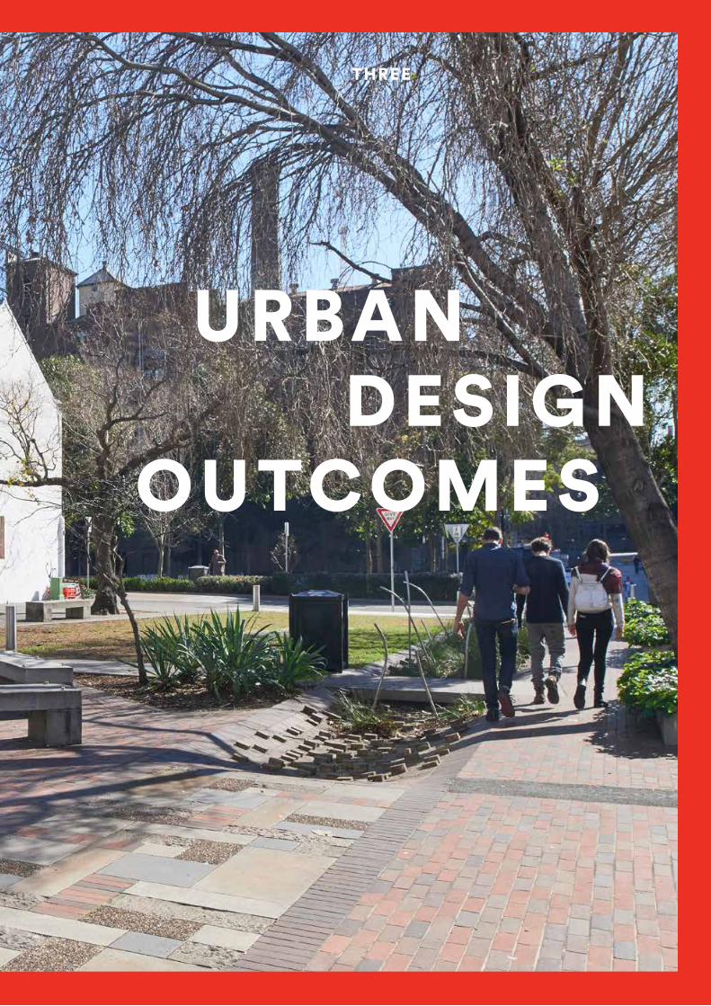
THREE
GOOD
DESIGN URBAN
OUTCOMES

Part 3 provides more detailed explanation and guidance for typical Urban Design processes, applied to a range of urban conditions from districts to precincts, streets, public spaces and individual sites.
It is loosely structured around seven Urban Elements that contribute to a range of urban outcomes, as established through the Better Placed objectives. These Elements – structure, grain, density and mix, height and massing, street and landscape (public realm), facades and interface, details and materials – form a useful framework for organising design guidance.
Design guidance is process-oriented, summarising a series of actions that demonstrate sound methodology. These are sequenced into key stages, which lead to context-responsive and integrated Urban Design outcomes for each of the Urban Elements in part 3.5 of this Guide:
— discover: define, research, involve — create: explore possibilities, synthesise, deliver ideas — deliver: prototype, evaluate, implement.
The Urban Elements contribute to the range of urban outcomes, as established through the Better Placed Objectives.
The broader contextual conditions that underpin these Elements, are outlined in part 3.3 of this Guide.
46 Working draft – for comment

3.1 Urban Design considerations
This part of the Guide contains tailored advice on how Urban Design can be practiced to achieve good built environment outcomes in NSW. It has been structured into different sections so users can directly access guidance relevant to their needs.
3.2 Existing Contextual influencers
Social and economic fabric Natural environment ie topography, landscape, climate etc
Built environment ie urban morphology, building types, patterns and forms, heritage
3.3 Urban Setting
Determining the urban context – provides an overview of defining the locational and elemental context for Urban Design:
What is the settlement type?
Location within the settlement
Urban Design elements
3.4Urban Design Elements
Urban Structure
Urban Grain
Density and Mix
Height and Massing
Streetscape and landscape
Façade and interface
Details and materials
3.5Themes
The following themes are interwoven and linked throughout the elements:
Place
Landscape
Movement
Land Use
Built form
47Urban Design Guide / Achieving good urban design outcomes Working draft – for comment

The elements of Urban Design
ENVIRONMENT + SOCIAL + ECONOMIC
URBAN FORM
BUILT FORM
PUBLIC REALM
APPEARANCE AND CHARACTER
realm of influence
elements
existing contextual influences
PLANNING
LANDSCAPE ARCHITECTURE
URBAN DESIGN
ARCHITECTURE
disciplines
urban structure
density and mix
height and massing
streetscape and landscape
details & materials
facade and interface
urban grain
48 Working draft – for comment
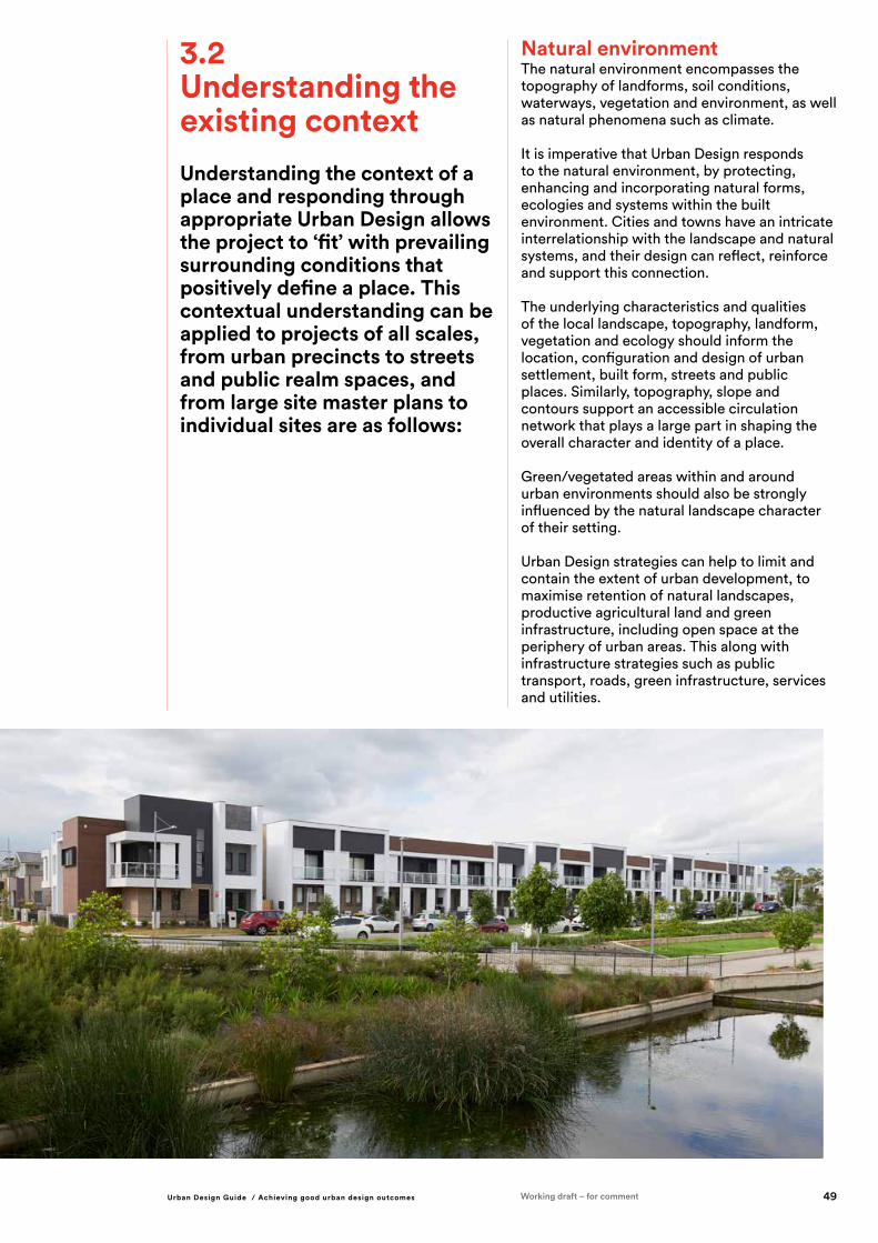
Natural environment The natural environment encompasses the topography of landforms, soil conditions, waterways, vegetation and environment, as well as natural phenomena such as climate.
It is imperative that Urban Design responds to the natural environment, by protecting, enhancing and incorporating natural forms, ecologies and systems within the built environment. Cities and towns have an intricate interrelationship with the landscape and natural systems, and their design can reflect, reinforce and support this connection.
The underlying characteristics and qualities of the local landscape, topography, landform, vegetation and ecology should inform the location, configuration and design of urban settlement, built form, streets and public places. Similarly, topography, slope and contours support an accessible circulation network that plays a large part in shaping the overall character and identity of a place.
Green/vegetated areas within and around urban environments should also be strongly influenced by the natural landscape character of their setting.
Urban Design strategies can help to limit and contain the extent of urban development, to maximise retention of natural landscapes, productive agricultural land and green infrastructure, including open space at the periphery of urban areas. This along with infrastructure strategies such as public transport, roads, green infrastructure, services and utilities.
3.2 Understanding the existing contextUnderstanding the context of a place and responding through appropriate Urban Design allows the project to ‘fit’ with prevailing surrounding conditions that positively define a place. This contextual understanding can be applied to projects of all scales, from urban precincts to streets and public realm spaces, and from large site master plans to individual sites are as follows:
49Urban Design Guide / Achieving good urban design outcomes Working draft – for comment

Built environment The existing built environment of an area includes aspects such as the prevalent patterns of urban form, including building types, building grain and sub-division patterns and building uses. Buildings of heritage significance and conservation areas are also of consideration in understanding the existing built form.
Urban Design responses need to understand the patterns of the built form which contribute and define to the identity of an area. This may include a predominance of a type of housing, such as terrace housing, or former industrial uses, or in some cases, a varied range of building types and uses.
Determining a response to how these existing built form interfaces and relate to adjacent areas or precincts requires careful analysis to stitch in new projects in a way that provides an additional rich layer to the overall urban form of the area.
This analysis by the Urban Design team can be supported by specialist knowledge from heritage architects and those with skills in detailed studies of the urban form and grain of an area.
Social and economic contextSocial and economic fabric as the non-physical aspects of the urban form including social factors (culture, participation, health and wellbeing) as well as the productive capacity and economic productivity of a community. It incorporates aspects such as demographics and life stages, social interaction and support networks.
An awareness of the social and economic context of a locality and wider region, and a consciousness of the role and potential of design to contribute to or enhance the socio-economic conditions, is an essential aspect of any built environment project.
The social context is an essential aspect of the project formation, but is typically complex, diverse and dynamic, requiring comprehensive investigation and understanding. There may be potential for the design of buildings and public realm spaces to sensitively incorporate a range of cultural backgrounds or references.
Urban Design projects should seek design outcomes which deliver value to all end users and act to reduce inequality in urban settings. Projects where the social, environmental and long-term economic value and performance are balanced and optimised, ultimately deliver greater value for money from the initial investment.
Building local economies and economic conditions is a key function of Urban Design. Buildings, streets and public spaces should be designed to support localised economic activity and opportunity, through facilitating small business, local trade and local production of goods and services. However, design outcomes should be informed by rigorous, forward-looking and strategic economic assessments, to achieve the right balance between supporting local economic activity, and avoiding of vacant tenancy spaces.
This analysis should be strongly supported by the inputs of social sustainability consultants, and strategic economic consultants who can provide detailed analysis from their respective disciplines.
50 Working draft – for comment

Towns Towns are smaller than cities, but larger than villages, although they can vary considerably in footprint and population.
Towns generally provide the following range of services and facilities including:
— a town centre with a main street/s and commercial/retail uses — surrounding suburbs/residential areas — religious institutions — education and medical facilities — parks and playing fields — bus terminal & possibly a train terminal, and an airfield.
The general urban characteristics of a town include:
— main street — historic town centre street grid — lower-scale buildings — centrally located community facilities and public spaces — established/older residential areas with clear street grids — may have new fringe subdivisions which interface with rural and semi-rural land.
VillagesVillages are the smallest types of settlements and can be suburban (outlying a larger city or town) or rural and surrounded by natural landscape. They generally have a small centre that provides some services for the local community. Villages generally provide the following range of services and facilities including:
— a main street with some mixed uses and residential buildings — small scale buildings and land parcels — residential areas directly surrounding the centre — village/community park — may have a small education and/or medical facility — may have a community centre.
The general urban characteristics of a village include:
— main street or central street blocks — surrounding residential areas — notable interface with natural environment features and/or agricultural land.
Other AreasSettlements that do not relate to one of the above may be considered general residential areas that are autonomous. These may not have reasonable or identifiable proximity to any centres or public facilities or services.
3.3 Urban settingsSettlement Type A settlement can be described as a place where people come together and establish a community. Settlements can range in population size and footprint and are generally referred to as cities, towns or villages.
CitiesCities are large centres with considerable population concentration. Some smaller towns and centres are still known as cities, even though they may not meet this criterion, because historically they had much larger populations, for example Broken Hill.
Cities generally provide the following range of services and facilities including:
— a central business district (CBD) or core activity area with a range of larger retail outlets — jobs — civic/governmental offices — public service institutions (schools, hospitals etc) — cultural institutions (religious, art galleries, museums etc) — hierarchy and range of open space and recreational facilities (parks, squares, sporting fields etc) — transport infrastructure (air, train, bus etc) — tourism infrastructure — extensive housing choice.
The general urban characteristics of a city include: — central urban core of multiple street blocks with dense development and wide range of uses — extensive range of residential building types — extensive range of building heights and massing that is larger at the centre and smaller towards the edges. — range of smaller suburbans and suburban centres surrounding the city centre.
51Urban Design Guide / Achieving good urban design outcomes Working draft – for comment

Urban settingsThe urban setting of a place has a range of defining characteristics which inform certain Urban Design decisions.
A typical city or a town comprises a series of ‘layers’, each of which have their own distinct pressures and influencers, in relation to providing good levels of amenity and responding to environmental, social and economic factors. In this regard they are closely interrelated, and can help to re-balance inequities of amenity and infrastructure.
The three distinct conditions, usually defined by land-use and density, are:
Inner ring (Centres)The centre is characterised by denser development, with a strong commercial function mixed with institutional and residential uses.
Challenges and opportunities for centres (inner ring) include:
—over-development with tall or over scaled buildings which can impact: —overall form of the city —sunlight access to the public domain and private dwellings — provision of green infrastructure
including open space — pleasant, interconnected walkable streets — provision of active transport infrastructure such as cycle paths.
Characteristics — central historic/regular street grid — density/mix — higher/larger building massing — streetwall development — central concentrated access to a system of public transport, including main train station.
Outer (fringe)Greenfields
Middle (infill)
Rural
Centre
52 Working draft – for comment

Middle ring (Middle suburbs)The middle ring typically includes:
— the established suburbs characterised by a combination of detached or semi-detached dwellings on larger lots — small suburban and neighbourhood centres — links to rail and bus networks connecting with the urban centre — pockets of residual light industry/manufacture (formerly at the edges of the urban centre).
Challenges and opportunities for the middle ring include:
— redevelopment of blocks with the potential for increased capacity including medium density housing — access to public transport — pleasant, interconnected walkable streets which can be protected from traffic impacts — provision of active transport infrastructure such as cycle paths.
Characteristics — established residential areas (historic/regular street grid) — medium-low density/mix — lower/smaller building massing — some suburban village centres/shops — interface with central core — connections to main rail network and bus services.
Outer ring (Greenfield and other)These are defined as newer suburbs on the urban fringe, and in greenfield areas (previously undeveloped land often former pastoral uses). These are characterised by detached dwellings on medium to large lot sizes, and occasionally interspersed with large areas of commercial, institutional or industrial precincts in the form of office campuses or industrial parks. Outer ring settlement is often structured around arterial networks. Challenges for outer ring (greenfield) include:
— land hungry development which does not make most efficient use of land, with prevalence of detached dwellings and large floor plate, big box developments — driveways which dominate the streetscape, limiting positive address with the street and the ability for street trees — access to public transport — absence of pleasant, interconnected walkable streets with priority given to the pedestrian — provision of active transport infrastructure such as cycle paths.
Characteristics — newer residential areas (less defined/autonomous/organic street grids) — some community buildings and park facilities — limited/no shops — interface with rural/bushland areas — connections to main rail network and bus services.
53Urban Design Guide / Achieving good urban design outcomes Working draft – for comment

3.4 Urban Design elementsThe urban environment is made up of a number of key elements, which together make up the built form and the public domain of a precinct or site. These have an influence on the broader themes of place, landscaping, public realm, movement and built form.
These elements are considered from the wider broader macro scale of urban form, moving down scales to the more detailed outcomes and micro level of built form and public domain. The following list is a way of describing this ‘line of sight’ from the macro to the micro’.
At each of the scales, important contextual considerations of environment – both built (urban morphology) and natural (topography, landscape), social factors and economic factors play a part in informing Urban Design decisions.
Decisions made at the macro scale of urban structure, have an influence on decisions at a micro scale, such as façade and interface, and vice versa.
Urban Structure MACRO
Urban Grain
Massing and height
Density and mix
Streetscape and Landscape
Façade and interface
Details and materials MICRO
54 Working draft – for comment

3.5 Putting Urban Design elements into practice
The whole is more than the sum of its parts.
This section describes the Urban Design elements, their areas of influence, key considerations and how to approach Urban Design through the different elements. It describes the inter-relationship between each of the elements, and their role in contributing to the wider realm of influences within built form and public domain.
These elements also correlate and contribute to broader themes of place, movement, landscape, landuse and built form.
55Working draft – for comment

Urban structure may influence a design project in numerous ways, including the following:
PRECINCT LAYOUT: Arrangements of buildings, streets, lanes and open spaces will be influenced by the wider urban structure, in terms of views and visibility, interfaces, legibility and climatic considerations.
MOVEMENT NETWORK: The transport infrastructure and road network, including hierarchy and types of transport corridors, streets and paths determines the movement potential for public and private transport.
SITING: The positioning of built form and open spaces should address aspects of the urban structure, such as view/outlook opportunities, accessibility, noise or other impacts.
ACCESS: Site entry points and access, directions of approach, and orientation or legibility are influenced by broader elements of urban structure, such as transport infrastructure and prominent landmarks which assist way finding.
DEVELOPMENT FORM AND TYPOLOGY: Patterns of development, building types and urban density, which form part of the urban structure, will inform design interventions at the neighbourhood or site scale.
LANDSCAPE INTEGRATION: The design response for a site or precinct may incorporate landscape spaces or interfaces in response to the surrounding open space network, which forms a key element of the urban structure.
It reflects the widest scale of Urban Design consideration, comprising the large structural elements that define and frame an urban or metropolitan area.
In most cases this structure will be largely established and set in place, through strategic planning exercises, but designers will need to be conscious of potential or planned modifications, such as network expansions or upgrades at a wider scale, which will influence decisions at an Urban Design level.
Although the urban structure encompasses the ‘big picture’ aspect of urban context, it will require a considered response, as new interventions of any scale, will impact at a local level that affects infrastructure, precinct design, built form strategies, public domain strategies and individual buildings.
Urban structure
Urban structure is the overall framework of a region, town or precinct, showing relationships between zones of built forms, land forms, natural environments, activities, open spaces along with broader systems of transport and infrastructure networks.
56 Working draft – for comment

Clear definition of the project and its scope:
1. Understanding of the project ‘triggers’ and case for change.
2. Identify the subject site as well as the broader ‘zone of influence’ (which may well be outside the scope of the project).
Identifying and mapping the main features of urban structure, in relation to the subject site:
1. Natural features such as topography and gradients, waterways, ecology corridors.
2. Built-up areas and infrastructure – Blue, Green and Grey (roads and railways) and utilities.
3. Important locations and nodal points within the urban structure, including activity centres, commercial hubs, public transport nodes, significant open spaces or urban squares.
4. Potential places of significance in relation to the indigenous culture and heritage.
Identifying and mapping potential or likely future changes to the urban structure that may affect the subject site:
1. Potential connections/possibilities to integrate with the green infrastructure network.
2. New or expanded infrastructure (including green, grey and blue).
3. Future urban development areas or directions.
4. Future/expanded conservation areas and green spaces.
5. Shifting urban edges or urban/suburban/rural interfaces.
Analysing and understanding:
1. The conditions which have shaped existing urban structure – history, climate, topography, vegetation and other social, cultural and economic characteristics1.
2. How urban structure reflects regional identity and character.
3. How the urban structure influences surrounding land uses, movement patterns and site configurations, and the constraints and opportunities it presents.
4. Relationships between elements within the urban structure, and how they interrelate and interface with one another.
5. Links between activity centres or community hubs within the urban structure, and their ‘catchment’ areas of residential development.
Define / formulate / articulate:
1. An overarching ‘vision’ or idea to guide further thinking in relation to the urban structure, informed by the understandings and insights gained through this research.
2. A series of working principles and outcomes in relation to the prevailing urban structure.
DISCOVER URBAN STRUCTURE THROUGH:
57Urban Design Guide / Achieving good urban design outcomes Working draft – for comment
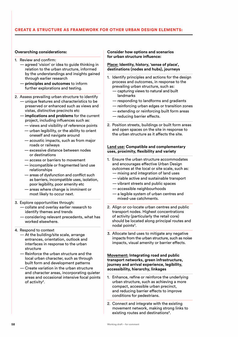
Overarching considerations:
1. Review and confirm: — agreed ‘vision’ or idea to guide thinking in relation to the urban structure, informed by the understandings and insights gained through earlier research — principles and outcomes to inform further explorations and testing.
2. Assess prevailing urban structure to identify — unique features and characteristics to be preserved or enhanced such as views and vistas, distinctive precincts etc — implications and problems for the current project, including influences such as:
— views and visibility of reference points — urban legibility, or the ability to orient oneself and navigate around — acoustic impacts, such as from major roads or railways — excessive distance between nodes or destinations — access or barriers to movement — incompatible or fragmented land use relationships — areas of dysfunction and conflict such as barriers, incompatible uses, isolation, poor legibility, poor amenity etc — areas where change is imminent or most likely to occur next.
3. Explore opportunities through: — collate and overlay earlier research to identify themes and trends — considering relevant precedents, what has worked elsewhere.
4. Respond to context — At the building/site scale, arrange entrances, orientation, outlook and interfaces in response to the urban structure — Reinforce the urban structure and the local urban character, such as through built form and development patterns — Create variation in the urban structure and character areas, incorporating quieter areas and occasional intensive focal points of activity2.
Consider how options and scenarios for urban structure influence:
Place: Identity, history, ‘sense of place’, destinations (nodes and hubs), journeys
1. Identify principles and actions for the design process and outcomes, in response to the prevailing urban structure, such as:
— capturing views to natural and built landmarks — responding to landforms and gradients — reinforcing urban edges or transition zones — extending or reinforcing built form areas — reducing barrier effects.
2. Position streets, buildings or built form areas and open spaces on the site in response to the urban structure as it affects the site.
Land use: Compatible and complementary uses, proximity, flexibility and variety
1. Ensure the urban structure accommodates and encourages effective Urban Design outcomes at the local or site scale, such as:
— mixing and integration of land uses — viable active and sustainable transport — vibrant streets and public spaces — accessible neighbourhoods — a legible system of urban centres and mixed-use catchments.
2. Align or co-locate urban centres and public transport nodes. Highest concentrations of activity (particularly the retail core) should be located along principal routes and nodal points3.
3. Allocate land uses to mitigate any negative impacts from the urban structure, such as noise impacts, visual amenity or barrier effects.
Movement: Integrating road and public transport networks, green infrastructure, journey and arrival experience, legibility, accessibility, hierarchy, linkages
1. Enhance, refine or reinforce the underlying urban structure, such as achieving a more compact, accessible urban precinct, and reducing barrier effects to improve conditions for pedestrians.
2. Connect and integrate with the existing movement network, making strong links to existing routes and destinations4.
CREATE A STRUCTURE AS FRAMEWORK FOR OTHER URBAN DESIGN ELEMENTS:
58 Working draft – for comment

3. The design response should also address the experience of the urban structure, such as for road users, rail passengers, pedestrians and cyclists.
Landscape: Green linkages and connectivity, landscape corridors as urban structure, open space hierarchy, identity of the public realm
1. Modify or refine the urban structure, for better design, social and environmental outcomes. These modifications should seek to enhance local connectivity and legibility, amenity and sense of place, or to establish new patterns of built form and open space/landscape integration.
2. Design on-site landscaping and open space in response to aspects of the urban structure, such as landscape corridors, vegetation patterns, topographic forms and water movements.
3. Utilise landscaping to reinforce and enhance the experience of the urban structure, such as through increasing its visual presence, and mitigating negative impacts.
4. Reinforce Sydney’s Green Grid as a key component of the urban structure.
Built form: Orientation, density, edges, height and skyline
1. Develop site layout/configuration proposals which address and respond to the urban structure (current and future), through:
— Positioning of buildings and spaces on the site — Creation of defined edges to reinforce structural elements — Orientation and buildings and spaces.
2. Allow the urban structure to inform the design response at all scales from the precinct scale, to the individual internal space and external building details.
1. Iterative testing and refinement of options and scenarios in terms of:
— agreed principles and outcomes and agreed vision — viability.
2. Identify an optimal approach that: — achieves agreed criteria — enhances, refines or reinforces the underlying urban structure — enhances local connectivity and legibility, amenity and sense of place — accommodates and encourages effective Urban Design outcomes at the local or site scale — flexibility for future expansion / integration with other urban structural elements — informs the design response at all scales from the precinct scale, to the individual internal space and external building details.
3. Staging and phasing strategies — identify key structural ‘moves’ that will stimulate follow up development — establish priorities to enable staged delivery — identify key components required to support viable precincts and neighbourhoods eg transit node, community hub.
4. Impact of agreed urban structure on other urban elements eg grain, public realm etc.
— articulate guiding principles and follow-up strategies for other Urban Design elements.
DELIVER URBAN STRUCTURE STRATEGIES:
59Urban Design Guide / Achieving good urban design outcomes Working draft – for comment

Urban grain is the next scale down from urban structure, and is defined and characterised by the network of streets and the pattern of subdivision of land into individual properties. These aspects substantially determine the nature and appearance of built form and spaces, and therefore the experience of urban areas for people.
The urban grain is likely to have a significant effect on the design outcome of any urban intervention (streetscape, public space or building or precinct development). It is therefore essential to gain a comprehensive understanding of the prevailing grain, and how this might inform the subject site under consideration. Similarly, considering urban grain for new ‘greenfield’ development establishes the spatial characteristics of a place, from intimate to expansive, and how these can be shaped by future development.
Urban grain may influence a design project in numerous ways and at all scales, spanning Urban Design, buildings and public realm design, including the following:
SITE LAYOUT: The location, orientation and scale of streets, lanes and paths, and therefore the siting of buildings and spaces, is informed by the surrounding grain, and provides the foundations of the site layout.
MOVEMENT FRAMEWORK: The hierarchy and types of streets and paths determines the movement potentials for pedestrians, cyclists and vehicles.
LAND DIVISION BUILT FORM TYPES AND SITING: Building forms and frontage articulation are influenced by the underlying subdivision pattern, and reflect the prevailing urban grain.
OPEN SPACE CONFIGURATION AND POSITIONING: Also related to subdivision and street patterns, the network of open spaces should inform the new or expanded public realm.
GROUND FLOOR CONFIGURATIONS: Tenancies, frontages and individual entrances, as well as design details such as windows, doors, signage and canopies, affect the experience of the urban grain for pedestrians.
EDGES AND FRONTAGES: The way that buildings meet or address site edges and frontages to streets and spaces within or outside the site, will be informed by the prevailing frontage conditions, as part of the urban grain.
The urban grain is influenced by the subsequent elements of streetscape, landscape, density, height and use, and they each inform each other. For example, the street type influences the density and height and the use. This is described in further detail through the section.
Urban grain
Urban grain is the balance of open space to built form, and the nature and extent of subdividing an area into smaller parcels or blocks. For example a ‘fine urban grain’ might constitute a network of small or detailed streetscapes. It takes into consideration the hierarchy of street types, the physical linkages and movement between locations, and modes of transport.
60 Working draft – for comment

Identifying and mapping the urban grain of the local area, including:
1. Network and hierarchy of streets, lanes and paths.
2. Subdivision and land ownership patterns.
3. Built form footprint and open space patterns.
Analysing and understanding:
1. The conditions which have shaped existing urban grain – history, topography, land ownership and other social, cultural and economic characteristics5.
2. How urban grain reflects regional identity and character.
3. How urban grain reflects topography and land use.
4. The basis of a movement framework, considering the street layout, grid pattern, main routes and development clusters.
Identify the aspects of local distinctiveness and the urban elements and usage patterns which contribute to this character6.
Identify local variations in the urban grain, such as in varying density, street/block intensity and built form typologies.
Seek potentials to prioritise and enhance the pedestrian experience of the public realm, on which the urban grain has a significant impact.
Formulate:
1. An overarching ‘vision’ or idea to guide further thinking in relation to the urban grain, informed by the understandings and insights gained through this research.
2. A series of working principles and outcomes in relation to the prevailing urban grain.
DISCOVER THE URBAN GRAIN THROUGH:
61Urban Design Guide / Achieving good urban design outcomes Working draft – for comment

Overarching considerations of:
1. Reviewing and confirming: — an overarching ‘vision’ or idea to guide further thinking in relation to the urban grain, informed by the understandings and insights gained through earlier research — a series of working principles and outcomes to inform further explorations and testing in relation to urban form.
2. Identify potential gaps and obstructions in the open space network or other aspects of the urban grain, and opportunities for new connections.
3. Create a regular block and lot pattern that enables future lot subdivision or consolidation, while avoiding excessive repetition and accommodating variation and local specificity7.
4. Create a coherent framework of streets, blocks, lanes and open spaces, which forms the basis for the design of individual developments8.
5. Utilise local features such as topography or vegetation to create local distinctiveness in the urban grain.
6. Align streets and spaces to allow views to local landscape features or landmark elements, as a reference to local assets and characteristics9.
7. Establish and respond to character areas, defined by the urban grain and built form context, different activities and characteristics10.
8. Ensure that land-use planning and distribution of urban development sets a clear distinction between ‘city’ and ‘country’ areas, without blending these together. Open space within urban development areas should be clearly distinct from the non-urban or rural surrounds11.
9. Assess prevailing urban grain to identify: — unique features and characteristics to be preserved or enhanced such as well-defined open spaces and streets, distinctive views and vistas and precincts, secondary linkages through private open space etc — areas of dysfunction and conflict such as disproportionate scale or lack of human scale — areas where change is imminent or most likely to occur next, eg redundant or dilapidated sites, residual sites.
10. Investigate opportunities to extend and reinforce the urban grain, to ensure the new intervention becomes an integral part of the local context:
— extend local streets, grid patterns and movement networks into the subject site — integrate streets, paths and open spaces across the site boundaries — extend patterns of subdivision and related building types into the site.
11. Explore opportunities through: — collate and overlay earlier research to identify themes and trends — identify and overlay relevant precedents (what has worked elsewhere) — reimagining proposed interventions eg large lot subdivisions, infill development — speculating on impact of future technologies, social and economic trends — using local features such as topography or vegetation to shape the character and texture of urban grain — filling the gaps.
12. Formulate options and scenarios that: — test the limits of alternative approaches, eg from homogenous through to irregular grain — enable the agreed principles and outcomes to be achieved — explore and reveal unforeseen / unexpected opportunities.
CREATE URBAN GRAIN STRATEGIES THROUGH:
62 Working draft – for comment

Consider how options and scenarios for urban grain influence:
Place: History and ‘sense of place’, permeability, integration with context
1. Investigate the potential, where appropriate, to create a finer urban grain in areas where the prevailing pattern is relatively coarse, including areas with large land parcels and large-footprint buildings, as a way of bringing things closer together, creating more vibrant and interesting streets, enhanced pedestrian activity, safety and amenity. This may be achieved through:
— Integration of smaller and narrower lots — Higher-density housing types, such as terrace/townhouse types and apartments, with individual street entries — Narrow-fronted retail/commercial tenancies at ground floor level — More compact commercial uses, or compact frontages to larger industrial buildings — Narrower streets and roads, and expanded pedestrian space, where possible.
2. Utilise grid-based, permeable street networks, to encourage ease of navigation, permeability and flexibility. Create variation in the grid where contextually appropriate, to avoid excessive or relentless repetition.
Movement: Spatial hierarchy, legibility, accessibility, permeability, spacing and interconnection of streets and lanes12
1. Design for ease of walking, and maximise the pedestrian permeability and choices of routes for people where appropriate, while identifying primary walking routes as a focus for pedestrian movement.
2. Create an interconnected, permeable street layout with regular block sizes and streets aligned to preferred movement routes and key destinations13.
3. Align pedestrian connections along desire-lines, for example direct links between homes and destinations such as activity centres and public transport stops – with short and directtravel paths14.
4. Arrange streets and blocks to provide reasonable walking distances from dwellings to activity centres, community hubs and public transport15.
5. Provide rear or side lane vehicle access to lots within activity centres or more intensive urban areas where narrow residential lots predominate, to avoid continuous garage doors along streetscapes16.
6. Develop a movement network that addresses17:
— how routes from the new site will integrate with the existing infrastructure — provision for all forms of movement — how the new development can benefit the wider area in terms of movement and access.
7. Design the street layout to make it easy for pedestrians to orientate themselves and recognise where they are, including capturing important views between places and landmarks18.
8. Ensure the urban grain facilitates direct, convenient access from the new development to existing nodes and destinations around the subject site.
9. In activity centres and compact urban areas, provide a closely spaced and interconnected network of street and lanes19.
10. Consider scale and grain in relation to speed and modes of travel for all street users, ie pedestrian / cyclist / motorist.
11. Connect streets to open space with green networks such as street tree canopy and plantings.
Landscape: Linkages and connectivity, landscape and open space hierarchy, identity of the public realm, landscape corridors as key defining components of the urban grain
1. Position parks and open spaces appropriately within the local network of streets, lanes and built areas, to ensure active edges, appropriate positioning of building frontages (and rear access/interfaces), and convenient access from surrounding built areas.
2. Locate new open spaces in response to wider networks of open spaces where applicable, to increase continuity of open spaces for biodiversity links, and diversity of spaces for recreation.
3. Consider potential of landscape elements to reinforce rhythm and scale of the urban grain.
63Urban Design Guide / Achieving good urban design outcomes Working draft – for comment

Built form: Orientation, rhythm, typology, density, edges
1. Configure built form frontages in response to the prevailing urban grain, or to the immediately adjoining streets and spaces, including modulation of individual tenancies and entrances, frontage setbacks, frontage glazing, doors and windows, canopies, floor levels and frontage landscape areas.
2. When consolidating or subdividing lots, maintain a fine-grained street frontage where appropriate, through the building design and frontage articulation20.
3. Design building frontages, particularly at lower levels, to establish an engaging pedestrian experience, through narrow frontages, visual variation and interest, and high levels of visual permeability between inside and outside.
4. In urban areas, town centres and mixed-use precincts where contextually appropriate, retain and reinforce finer-grain development, utilising smaller lots, narrower frontages and compact building types, as well as a variety of building designs to create visual variation and diversity.
5. In and around urban centres and well-serviced areas, deliver a diversity of lot sizes, with an emphasis on smaller and narrow lots, to encourage higher density and a diversity of forms, uses and tenures. Larger lots should also be retained for integrated housing and apartment-based development where appropriate21.
1. Understanding and identifying land ownership patterns in existing areas that:
— provide opportunities for consolidating land to increase possibilities. This also provides the ability to create efficiencies through shared access points, open space and other amenity to result in a greater outcome.
2. Iterative testing and refinement of options and scenarios in terms of:
— agreed principles and outcomes and agreed vision — viability — different urban form approaches – including different block arrangements based on different consolidation scenarios.
3. Identify an optimal approach that: — achieves agreed criteria — enhances, refines or reinforces the underlying urban structure — enhances local connectivity and legibility, amenity and sense of place — accommodates and encourages effective Urban Design outcomes at the local or site scale — flexibility for future expansion / integration with other urban structural elements — informs the design response at all scales from the precinct scale, to the individual internal space and external building details.
4. Staging and phasing strategies — identify key opportunity sites which are able to start the process — establish priorities to enable staged delivery — identify key components required to support viable precincts and neighbourhoods eg active frontages — identify opportunities for ‘interim’ uses, which can kickstart activation into an area whilst longer term plans are still being implemented.
5. Impact of agreed urban grain on other urban elements eg height and massing, interface, public realm
— articulate guiding principles and follow-up strategies for other Urban Design elements.
DELIVER STRATEGIES FOR URBAN GRAIN:
64 Working draft – for comment

65Urban Design Guide / Achieving good urban design outcomes Working draft – for comment

Mixing uses and development intensity are fundamental aspects of contemporary Urban Design, and substantially influence performance outcomes across sustainability, social and economic aspects.
Density is most often discussed in terms of residential development (the number of people or dwellings within a certain area), but is also applicable to workers/jobs, as well as visitors.
Density is related to built form scale and size, but is not strictly a result of building forms. Other factors influence density, including building spacing, dwelling sizes and configurations, types of use, mixing of uses, and the extent of street space and open space. While taller buildings tend to fit more floor space (and therefore dwellings) on a given site, they need to be spaced further apart, so can produce equivalent or even lower densities than mid-rise or lower-height built form.
Increased densities and mixing of uses are generally favoured, up to a point, because they support a range of potential good outcomes:
WALKABILITY: bringing homes people closer together, in higher densities, creates clusters or catchments with more people located around centres containing retail, cafes and community facilities. These centres have threshold populations which make them economically viable. Locating this catchment within walking distance means people can, and will, walk, and the activity is not ‘lost’ to car use which has a greater distance range.
SOCIAL INTERACTION: Bringing homes and people closer together increases the likelihood of chance meetings and informal interaction in streets and public spaces, as more people are walking for local convenience needs and recreation.
HEALTH: Increased active transport (walking and cycling) and social interaction brings health benefits, both physical and mental. More compact, higher-density precincts provide the opportunity for incidental exercise, such as through walking to shops or community facilities.
ACCESS TO WORK AND EDUCATION: Integrating compact housing with commercial and community uses in mixed-use precincts provides the opportunity for easy, quick access between home, work, school and other regular destinations.
VIBRANT URBAN AREAS: Density, mixing and clustering of activities within compact urban areas contributes to places which are vibrant, with higher levels of activity, people in the public realm, and social and economic exchange.
PUBLIC REALM ACTIVATION: At higher densities, private homes tend to have less indoor and outdoor space than detached houses on larger blocks. Therefore, residents tend to make more use of the public realm for recreation, such as walking on streets and playing in parks.
Density and mix
Density and mix is the intensity of development and the range of different uses (such as residential, commercial, community, institutional or recreational uses).
66 Working draft – for comment

Identifying and mapping:
1. Local site densities, in relation to prevailing built form and building height.
2. Local precinct densities, with consistent allowance for streets and open space, for both residential and non-residential zones and areas.
3. The extent of non-residential uses which may affect residential densities, such as shops, office space, schools and open space.
Analysing:
1. The provision of land uses and facilities in the local area, relative to demand and residential/worker catchments, and identify shortfalls in local provision to inform the future land use mix.
2. The relationships between densities, building scale and public realm/streetscape outcomes, to identify the optimal balance between density/yield, height and user-friendly, human-scale streets and spaces.
3. The potential optimal density uplift to middle ring suburbs, through the introduction of medium density housing, which done in a sensitive way, does not impact amenity. In making more efficient use of middle ring suburbs, subject to their context (natural, built, social and economic), it has the potential to ease densities at each end of the spectrum from high density areas and lower density of greenfield areas both where impacts to amenity are more likely.
Formulating:
1. An overarching ‘vision’ or idea to guide further thinking in relation to the density and land use mix, informed by the understandings and insights gained through this research.
2. A series of working principles and outcomes in relation to the prevailing urban grain.
DISCOVER THE DENSITY AND LAND USE MIX THROUGH:
67Urban Design Guide / Achieving good urban design outcomes Working draft – for comment

Overarching considerations:
1. Relate densities and overall yields to the location and size of urban centres, to:
— provide local pedestrian access to shops and facilities — avoid car-use for local convenience needs, and reduce vehicle movements — support viability and custom for local shops and services.
2. Configure densities in relation to urban elements and locations:
— locate highest densities in and around activity centres, at transport nodes and along key movement routes — moderate to higher densities may be concentrated around areas of greatest amenity such as public open spaces — gradual reduction of densities away from centres and towards urban/rural edges, while retaining clear boundaries between the urban area and non-urban surrounds — evaluate future residential populations in relation to available transport nodes with greatest access to cities.
3. Design built form parameters (form, height, setbacks etc.) according to the urban structure and pedestrian experience, including nodes and centres, street widths and the hierarchy of centres. The built form will then inform the density outcomes.
4. Identify appropriate dwelling typologies for the applicable lot sizes. Avoid excessively large house designs on smaller blocks, as this significantly reduces internal and external amenity, and will also impact neighbourhood amenity such as through reduced tree canopy and excessive built form22.
5. Locate medium and higher density residential and retirement housing close to urban centres and other destinations, to support maximum accessibility by walking for residents23.
6. Locate large public facilities, such as hospitals, schools, and major recreation facilities on public transport routes and at the edges of activity centres24.
7. Design for land use mix and diversity, to support activity throughout the daytime and evening in all locations. Avoid mono-functional areas which are devoid of activity in the daytime or evening.
8. Design the public realm, streetscapes and communal indoor and outdoor spaces to support community activity and social interaction amongst local residents, workers and visitors.
9. Locate density to support public transport viability. Easy walking access to safe and comfortable transport stops and good services encourages patronage, which supports viability of services.
10. Establish a full range of local services and facilities, including commercial, educational, health, spiritual and civic uses, which are conveniently sited and connected to residential areas by safe and comfortable routes25.
11. Create mixed-use development along main streets and in urban centres, including shop-top housing, multi-unit residential and upper level commercial development, as well as entertainment and hospitality facilities, to encourage daytime and evening activity26.
12. Maximise synergies and minimise conflicts between different land uses, through land use distribution, built form design and configuration, and access arrangement.
Consider how options and scenarios for density and land use mix influence:
Place: Street scale and character, activation, building typology, overshadowing
1. Integrate density, mixed uses and amenable streets in the Urban Design outcomes to support walkable neighbourhoods. The presence of local facilities within walking distance of homes, alongside places and spaces where a variety of activities can take place, are essential to achieving successful, sustainable neighbourhoods.
Land Use: Activity, housing mix, compatibility of uses
2. Provide for activities and facilities in new developments, to address needs and requirements in the surrounding neighbourhood 27.
3. Mix housing types and tenures within developments and local areas28.
4. Mix different uses horizontally and vertically to contribute to more interesting, vibrant
CREATE THE DENSITY AND LAND USE MIX STRATEGIES THROUGH:
68 Working draft – for comment

1. Understanding and identifying density and land use patterns in existing areas that:
— provide opportunities for consolidating land to maximise densities easily without compromising amenity.
2. Iterative testing and refinement of options and scenarios in terms of:
— agreed principles and outcomes and agreed vision for density and land use — commercial viability — different configurations that distribute density through a range of different design approaches — clear strategies for non-residential uses which optimise opportunities for arange of uses.
3. Identify an optimal density and land use approach that:
— achieves agreed criteria — enhances, refines or reinforces the underlying urban structure — enhances local connectivity and legibility, amenity and sense of place — accommodates and encourages effective Urban Design outcomes at the local or site scale — flexibility for future densification and change of use — informs the design response at all scales from the precinct scale, to the individual internal space and external building details — responds to Local Government intent in relation to density and land use.
4. Staging and phasing strategies — Identify key opportunity sites / projects which are best suited to start the redevelopment process — Establish priorities to enable staged delivery — Identify key uses required to support viable precincts and neighbourhoods eg active frontages — Identify opportunities for ‘interim uses, which can kickstart activation into an area whilst longer term plans are still being implemented.
5. Impact of agreed density and land use mix on other urban elements eg height and massing, interface, public realm
— Articulate guiding principles and follow-up strategies for other Urban Design elements.
public realm spaces across the daytime and evening.
5. Avoid single-use precincts wherever possible. Encourage single developments and buildings which incorporate multiple land uses. For large-format retail developments in and around urban centres, encourage integration of ‘big box’ uses with other, smaller-footprint, finer-grain buildings and activities 29.
Movement: Circulation, congestion, service access, density to facilitate improved movement, walkable neighbourhoods.
1. The neighbourhood unit provides a useful organising device, coupled with an effective movement framework supporting walkable access, and based on the distance most people will walk from home to a neighbourhood centre (or corner store or bus stop) to access daily convenience needs30, which is generally 5-10 minutes, or 400m-800m walking distance approximately.
2. Design streets to be well-used and visually interesting, by providing continuous and safe movement for pedestrians and cyclists, and reducing the dominance of cars.
3. Provide easy and direct access to high quality public open space, and active movement routes such as walking and cycling paths, to encourage physical activity and active transport.
Built Form: Variety, public experience, adaptability
1. Establish a variety of densities, and corresponding building forms, across the locality, to create variation in the urban form and pedestrian experience.
2. Avoid excessive density and built form which dominates or overwhelms the experience of streets and public realm spaces.
3. Design internal and external spaces to accommodate varied and even unplanned activities, for individuals and groups.
4. Embed adaptability in the design of new buildings, streets and spaces. The capacity to accommodate varied or alternative uses/activities over time will ensure increased value and functionality throughout the project’s life.
DELIVER STRATEGIES FOR DENSITY AND LAND USE MIX:
69Urban Design Guide / Achieving good urban design outcomes Working draft – for comment

Height and massing is the scale of buildings in relation to height and floor area, and how they relate to surrounding land forms, buildings and streets. It also incorporates the building envelope, site coverage and solar orientation. Height and massing creates the sense of openness or enclosure, and affect the amenity of streets, spaces and other buildings.
The height and massing of built form is the characteristic that predominantly influences the experience of the public realm. Height and massing is closely related to, and should be considered in relation to, the spatial dimensions of the public realm, such as street widths and density.
Several aspects of built form height and massing inform the nature of the public realm, including: BUILDING SCALE: The height of buildings contributes to the direct experience of streetscapes and public spaces, as well as the wider skyline and urban morphology, generally viewed from greater distances.
BUILDING BULK: The bulk or mass of a building generally refers to its volume or size, including height and width. Bulk is often appreciated in context, and the perception of building bulk can be increased or reduced depending on the context of other buildings and adjacent spaces.
BUILDING PROFILE: The profile of a building describes its form or envelope in relation to adjoining streets and spaces, including the frontage position or setback, upper level stepping or setbacks and overall height and shape.
BUILDING SPACING: Spacing or separation between buildings can occur at ground/lower levels, or only at upper levels above a continuous built form base in which adjacent buildings are connected along the street frontage.
BUILDING FRONTAGE LINE: The building line describes the position and alignment of buildings in relation to the streetscape, including frontage setbacks.
Well-designed built form height and massing can lead to a range of positive urban outcomes:
URBAN DEFINITION edges and markers: Building forms can demarcate edges to urban areas and open spaces, and mark important locations, nodes and activity centres. These outcomes are largely the result of building height and massing, as well as other design factors.
SKYLINE INTEREST: The massing and height of buildings creates skyline interest, viewed at a range of scales and distances in the urban environment.
SCALE TRANSITIONS: Variation in building scale can create visible transitions between different urban areas or parts of the city, through varied height, width, form and spacing between buildings.
PUBLIC REALM AMENITY light and shade: Built form massing largely determines the extent and balance of sunlight and shade in the public realm.
GREAT STREETS: Built form is an essential component of public realm quality, and the way that buildings address and define the streetscape significantly determines the public realm experience, including the sense of space and openness, balanced with enclosure, which contributes to better streets for pedestrians.
LIVEABILITY: The relative positioning and form of buildings affects the internal comfort, including privacy, daylight access and outlook.
Height and massing
70 Working draft – for comment

Identifying and mapping:
1. The context in terms of built form massing, including heights, setbacks, spacing and profile, to inform the design response.
2. Valued and distinctive aspects of the built form context to be reinforced, and also gaps or problems created by existing built form characteristics.
Analysing:
1. The built form context including consideration of patterns and consistencies in the context, as well as areas of marked variation and diversity in built form and scale. This variation also contributes to the overall character and context, and should inform the design response.
Formulating:
1. An overarching ‘vision’ or idea to guide further thinking in relation to built form and building envelope, informed by an understanding of the future character of the public realm.
2. A series of working principles and outcomes in relation to any existing built form.
3. Potential built form parameters for the subject site/project, including limits to height and envelope which respond to the objectives and design principles.
Overarching considerations:
1. Establish and reinforce built form parameters and limits for the development site, to support a contextual response and better ‘fit’ for new built form in the urban context.
2. Consider the transition between areas of disparate built form massing, such as the insertion of larger-scale built form within or adjoining a lower-scale locality. The interfaces may encompass an abrupt edge condition, or a graduated transition where appropriate.
3. Consider the proportional relationships between buildings and spaces, and the visual impact of built form on views, vistas and skylines31.
4. Clearly define and ‘frame’ public open spaces through the form and alignment of buildings along streets and open space edges.
5. Utilise variation in building form and scale to identify or ‘mark’ important locations and nodal points in the urban area.
6. Use building height and massing to enhance urban legibility and wayfinding by emphasising landmarks and urban centres or nodes, and communicating the transitions between centres and catchments. Increased height and massing should generally align with key corridors or nodes, while respecting views and visibility to landmarks.
7. Design the proportional relationship between building height, building profile and streetscape quality, to enhance the public realm experience, including access to natural sunlight and views to the sky, as well as definition, active edges and visual interest through built form frontages.
DISCOVER THE BUILT FORM AND MASSING CONTEXT THROUGH:
CREATE BUILT FORM AND MASSING STRATEGIES THROUGH:
71Urban Design Guide / Achieving good urban design outcomes Working draft – for comment
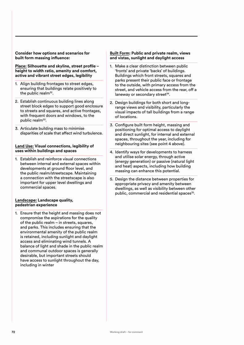
Consider how options and scenarios for built form massing influence:
Place: Silhouette and skyline, street profile – height to width ratio, amenity and comfort, active and vibrant street edges, legibility
1. Align building frontages to street edges, ensuring that buildings relate positively to the public realm32.
2. Establish continuous building lines along street block edges to support good enclosure to streets and squares, and active frontages, with frequent doors and windows, to the public realm33.
3. Articulate building mass to minimise disparities of scale that affect wind turbulence.
Land Use: Visual connections, legibility of uses within buildings and spaces
1. Establish and reinforce visual connections between internal and external spaces within developments at ground floor level, and the public realm/streetscape. Maintaining a connection with the streetscape is also important for upper level dwellings and commercial spaces.
Landscape: Landscape quality, pedestrian experience
1. Ensure that the height and massing does not compromise the aspirations for the quality of the public realm – in streets, squares, and parks. This includes ensuring that the environmental amenity of the public realm is retained, including sunlight and daylight access and eliminating wind tunnels. A balance of light and shade in the public realm and communal outdoor spaces is generally desirable, but important streets should have access to sunlight throughout the day, including in winter
Built Form: Public and private realm, views and vistas, sunlight and daylight access
1. Make a clear distinction between public ‘fronts’ and private ‘backs’ of buildings. Buildings which front streets, squares and parks present their public face or frontage to the outside, with primary access from the street, and vehicle access from the rear, off a laneway or secondary street34.
2. Design buildings for both short and long-range views and visibility, particularly the visual impacts of tall buildings from a range of locations.
3. Configure built form height, massing and positioning for optimal access to daylight and direct sunlight, for internal and external spaces, throughout the year, including for neighbouring sites (see point 4 above).
4. Identify ways for developments to harness and utilise solar energy, through active (energy generation) or passive (natural light and heat) aspects, including how building massing can enhance this potential.
5. Design the distance between properties for appropriate privacy and amenity between dwellings, as well as visibility between other public, commercial and residential spaces35.
72 Working draft – for comment

DELIVER STRATEGIES FOR BUILT FORM, HEIGHT AND MASSING:
Understanding and identifying height and massing patterns in existing areas that will inform responses to height and building envelope:
1. Iterative testing and refinement of options and scenarios in terms of:
— agreed principles and outcomes and agreed vision — amenity impacts such as building separation, privacy impacts, sunlight and daylight access. — different configurations that distribute height and mass through a range of scenarios that explore and test impacts of alternative building envelope strategies.
2. Identify an optimal approach that: — achieves agreed criteria — enhances, refines or reinforces the underlying urban structure and existing urban character as expressed through building height and envelope.
— enhances local legibility, amenity and sense of place — achieves optimal Urban Design outcomes at the local or site scale — informs the design response at all scales from the precinct scale, to the individual internal space and external building details — is largely consistent with the Local Government provisions or intentions in relation to building height and envelopes.
3. Impact of agreed height and massing strategies on other urban elements eg grain, public realm etc.
— Articulate guiding principles and follow-up strategies for other Urban Design elements — formulate design excellence strategies for ‘landmark’ scaled sites.
73Urban Design Guide / Achieving good urban design outcomes Working draft – for comment

Some aspects of privately owned space such as the bulk and scale of buildings, courtyards and entries that are traversed by the public or gardens that are visible from the public realm, can also contribute to the overall result. At times, there is a blurring of public and private realms, particularly where privately owned space is publicly used.
Streetscape and landscape are significant components of the public realm and describe the design of public spaces such as streets, open spaces and pathways, including landscaping, microclimate, shading and planting.
Given the primacy of the public realm in the experience of the built environment, as the place for all to enter and use, for all kinds of activities, its design, from network through to place, is fundamental to urban quality. It promotes a range of important outcomes for cities and towns:
CHARACTER: the design of the public realm is pivotal in the definition, clarity and communication of local identity, character and place-distinctiveness. This ranges from spatial characteristics through to materials, planting species, colours, textures, fixtures and details.
USEABILITY: Landscape design significantly affects the range of potential activities that may take place in an urban open space. Factors such as size, hard/soft surfaces, spatial divisions, seating, edge conditions, gradients and levels, all affect potential activities.
ACCESSIBILITY: Streetscape design is a key factor for universal accessibility, which is affected by surface continuity, gradients, maintenance and damage, directions, road crossings, lighting, seating and many other contributors.
SAFETY: Public realm design can support personal safety from crime, through visibility, lighting and passive surveillance, as well as technical safety such as slip resistance, traffic management and pedestrian accessibility.LEGIBILITY: Streetscape design influences urban legibility, informing pedestrians of directions, resting/gathering spaces, and nodal points or local centres. Integrity and continuity of streetscape treatments help to define and demarcate local areas or activity centres, and add to the character of the place.
QUALITY AND CARE: Well-designed public realm treatments communicate a sense of place and civic pride through quality, maintenance and care for the public. Streetscapes will look and feel better, making them more useable and enjoyable.
COMFORT AND AMENITY: Factors such as shade, shelter, seating, and even the texture and ‘feel’ of materials, in wet and dry conditions, affect the comfort of people in the public realm.
PERFORMANCE: Aspects such as water management/capture, energy efficiency (for lighting), energy generation potential, durability and robustness, as well as embodied energy in materials, and microclimate benefits such as local cooling and air quality enhancement, should be optimised.
MOVEMENT FRAMEWORK: The hierarchyand types of streets and paths organises the movement of pedestrians, cyclistsand vehicles through urban areas, and the quality of that experience.
Streetscape, landscape and the public realm
The Public Realm – Much of Urban Design is concerned with the design and management of publicly used space (also referred to as the public realm or public domain) and the way this is experienced and used. The public realm includes the natural and built environment used by the general public on a day-to-day basis such as streets, plazas, parks, and public infrastructure.
74 Working draft – for comment

Identifying and mapping:
1. The public realm, including publicly accessible private open space.
2. The significant features of the public realm, including landscape and edge conditions.
3. The local character and distinct place qualities of the location, and how the public realm embodies and communicates this character.
Analysing:
1. The allocation of space in streetscapes and throughout the public realm for different transport modes, hard and soft surfaces, the location and regularity/spacing of trees and other vegetation, the presence of signage or other furniture.
2. The different functions of the public realm and the effect that these elements have on mobility, accessibility, legibility and way-finding.
Formulating:
1. An overarching ‘vision’ or idea to guide further thinking in relation to streetscape and landscape, informed by an understanding of the future character of the public realm.
2. A series of working principles and outcomes in relation to any existing streets and open spaces.
3. Landscape and streetscape provisions for the subject site/project.
4. Opportunities to implement landscape proposals into a wider green infrastructure strategy within the site area and beyond in adjacent areas.
Overarching considerations:
1. Utilise urban context analysis to identify opportunities to enhance the public realm.
2. Establish foundation principles to support the public realm as a safe, attractive and well cared for environment, to encourage people to walk and linger in streets and public spaces36.
3. Reimagine streets as social spaces for everyone, accommodating a broad range of potential activities: active and passive, social, restive, slow and fast, while retaining flexibility for unplanned activities37.
4. Envisage streets as “places”, rather than “roads” – challenge the rigid street geometries of road layouts and vehicle movements, to create more people-friendly environments (spaces more tailored to human movement patterns).
5. Integrate streets as part of a network of public spaces, in response to the local context38.
6. Investigate the potential of future technologies on the public realm, such as autonomous vehicles, ‘smart’ sensor networks, communication and localised energy production.
7. Investigate opportunities for continuity and connectivity of green spaces and vegetation networks throughout urban areas through green infrastructure principles39 (refer Greener Places).
8. Investigate design approaches to balancing vegetation and natural habitat within the urban environment40.
9. Establish open spaces as connected networks, for greater visual amenity, recreational use and wildlife linkages, rather than isolated and unrelated landscape elements41.
10. Prioritise walkability and pedestrian access, for all parts of the community including children, those with limited mobility, wheelchair users and those with buggies, prams and trolleys.
11. Allow the buildings and pedestrian spaces to shape the design of intersections, not vehicle movement geometries42.
DISCOVER THE PUBLIC REALM DESIGN CONTEXT THROUGH:
CREATE PUBLIC REALM, STREETSCAPE AND LANDSCAPE DESIGN STRATEGIES:
75Urban Design Guide / Achieving good urban design outcomes Working draft – for comment

12. Establish local streets for low speed traffic, to allow pedestrians, cyclists and vehicles to mix safely43.
13. Create streets which provide convivial, attractive, safe routes, and a comfortable experience for pedestrians44.
14. Establish significant vegetation extent and continuity to support biodiversity and natural habitat in urban areas, as well as shade and shelter and a general ‘green’ character.
Consider how options and scenarios for streetscape and landscape influence:
Place: People first, integrated sustainability, active edges, clearly identifiable public space, active and passive recreation, safety and security for users
1. Create pedestrian and cycle-friendly streets, using streetscape design to connect the places people want to go, with convenient, direct routes, ease of movement and safe crossings.
2. Embed visible sustainability performance in the public realm, such as solar and wind energy generation, urban greening, and stormwater treatment and re-use.
3. Retain and reinforce the primacy of the public realm in the urban environment. At the precinct scale, establish the public realm as a starting point (streets, lanes, paths, cycle infrastructure, key open spaces), which can then inform the configuration of development land and built form.
4. Ensure that local open spaces have active frontages to their edges (rather than ‘backs’) and edges to streets (rather than rear fences to adjoining properties).
5. Clearly indicate what spaces are public and accessible, by using built form, landscaping and materials to define the extent and limits of the public realm.
6. Ensure that publicly accessible open space on private land looks and feels unambiguously ‘public’, to invite usage and activation by pedestrians.
7. Investigate and test the proposed area and dimensions of new public spaces against well known built examples, for the intended
usage and for potential to accommodate unexpected uses over time.
8. Accommodate informal and active recreation through appropriate types and sizes of public open spaces, to serve the intensity and type of surrounding development45.
9. Support active recreation in the public realm, such as walking, jogging, cycling and games, for all ages/abilities, reflecting its important role in accommodating and encouraging activity, especially in higher-density, highly populated locations.
10. Accommodate passive recreation, including sitting, reading, eating, resting, low-intensity games and quiet meditation or contemplation, for individuals and small groups, in public realm spaces.
11. Maximise actual and perceived safety in the public realm, to support social experiences.
Land Use: Public realm as an expansion of building uses, opportunities for new public spaces appropriate to development and social gathering
1. Expand and/or improved public realm through new development. This may comprise additional space, seating, amenity, safety, shelter, and activation or engagement between buildings and the public realm.
2. Contribute more significantly to the public environment through larger developments, such as through additional public space, community facilities and integration of public art46.
3. Accommodate a wide range of planned and unplanned social activities in streets and public spaces.
4. Accommodate potential for events and gatherings in streets and public spaces.
5. Accommodate one larger group, or multiple smaller groups, in local public spaces.
6. Avoid over-sized public realm spaces as a result of accommodating events – the public realm needs small, human-scale, intimate spaces every day, while events or larger gatherings are less frequent and can typically be accommodated in specifically selected locations.
76 Working draft – for comment

Movement: Influence traffic movement, integrate cycling, accessible and convenient public transport, accessibility for all ages and mobility, enriched visual experience
1. Slow traffic down by encouraging drivers to use caution through streetscape design, thereby creating more social spaces47.
2. Develop convenient, safe, enjoyable cycling opportunities, including clear, direct routes and separate cycle lanes or paths, even if this reduces vehicle traffic space48.
3. Make it convenient to catch the bus, by providing frequent, accessible bus stops, and space, shelter and separation from heavy traffic at bus stops.
4. Accommodate an appropriate amount of parking in street layouts, as this can have a beneficial traffic calming effect. Avoid continuous rows of parked cars, and allow room for street trees, ensuring freedom of movement for pedestrians49.
5. Optimise the experience of pedestrians (including children, wheelchair users, people with trolleys, prams and buggies), cyclists, drivers and passengers, including public transport, in the public realm, including paths and lanes, materials/surfaces, and building frontages.
6. Maximise comfort, amenity, shelter and safety for all streetscape users, while prioritising pedestrians, cyclists and public transport over private vehicles in the urban environment.
7. Maximise visual permeability and navigability in the built environment, to encourage walking and exploring, and ease of access to important destinations.
Landscape: Local identity, considered materials, minimise visual clutter, street tree and canopy, optimise opportunities for social interaction
1. Utilise materials, colours and textures which respond to and reinforce identified local characteristics.
2. Avoid ‘pastiche’ applications of characteristic elements, but seek contemporary, sophisticated and subtle use of locally relevant species and materials, which also meet other functionality and performance requirements.
3. Minimise visual clutter in the streetscape, through careful selection and placement of fixtures such as signage, lighting and street furniture50.
4. Utilise street trees and canopies to provide shade and shelter in streetscapes where the context supports this.
5. Utilise fittings and fixtures which can be efficiently and quickly repaired or replaced, such as through a ‘kit of parts’ proprietary system, for ease of maintenance and design cohesion within a local area.
6. Engage with performance standards early in the design process, such as for water management, lighting, energy production and consumption, and microclimate responses and benefits.
7. Manage and mitigate any impacts, and reinforce benefits to the public realm through the design project.
8. Maximise opportunities for social interaction in the public realm, by providing adequate seating for individuals and small groups, which is comfortable, and provides a range of conditions: open and secluded, large and intimate, vibrant and peaceful, ‘soft/green’ and ‘hard/urban’.
9. Position seating to facilitate conversation and engagement between individuals, while maintaining comfort and a welcoming, non-confrontational environment.
10. Ensure landscape details and materials are developed with Local Council to ensure ongoing ease of maintenance – from aspects such as tree planting, hard paving specification, furniture, lighting and kerb and drainage details.
Built Form: Positive and engaging, edges and frontages
1. Contribute positively to adjoining or nearby streets, lanes and public spaces through new development, to create clear public realm value.
77Urban Design Guide / Achieving good urban design outcomes Working draft – for comment

1. Ensure principles for green infrastructure are integrated through the process and allow for easy implementation of streetscape and design.
2. Clear public domain strategy which co-ordinates the various elements which make up the public domain.
3. Clear identification and understanding of the responsibility for delivery of the public domain – whether it be Local Governments in a situation of purely government owned land – or with the assistance of private developers in the case of private developments which interface with the public domain.
4. Clear and achievable phasing strategy to deliver streetscapes, coordinated with Local Government programs and operations.
5. Ensure details of the public realm are coordinated with Local Government standards.
DELIVER STRATEGIES FOR STREETSCAPE AND LANDSCAPE DESIGN:
78 Working draft – for comment

79Urban Design Guide / Achieving good urban design outcomes Working draft – for comment

The edge, where buildings meet the public domain, is vital to the quality and vitality of the street. Active edges provide a combination of transparency and privacy, encouraging interaction between the facade and the footpath.
These are opposed to inactive edges which lack activity and interaction with the street such as car park edges, closed frontages, service areas and plant rooms and may create unsafe environments.
Active edges apply to shops and cafés as well as residential apartments and dwellings. Active edges for retail have multiple narrow shopfronts, transparent facades, large windows, openings and goods on display. Active edges in residential areas have semi-private front yards or well-designed terraces with entry gates encouraging lively interaction with people.
The design of facades and public realm interfaces significantly affects the urban experience for the public, through the following factors:
VISUAL INTEREST: Creating variety, diversity and richness in facades and scale makes urban areas more interesting and engaging, and therefore enjoyable for people to be in and move through. Built form frontages can also affect the opportunity for landscaping in the street, and therefore the visual ‘softening’ effect of vegetation.
SAFETY: Passive surveillance/overlooking and visual connectivity between the public realm and building interiors, and regular entrances facilitating people movements to and from the streetscape, make the public realm look and feel safer.
VIBRANCY: The visibility of people and activity in buildings enhances the sense of vibrancy in the area.
SCALE AND PROPORTION: The setback, alignment (and scale) of buildings in relation to streets directly informs the spatial experience and proportions of the streetscape, as well as solar access and views, for example. This also has relevance to the pedestrian visual interest in relation to creating an intimate streetscape which facilitates social interaction.
PRIVACY: Landscaped setbacks should be designed for usage by residents, so a degree of privacy or moderation of visibility from the streetscape is appropriate.
LEGIBILITY: The design of facades and frontage conditions can communicate the building’s function and level of public accessibility, thereby enhancing the legibility of urban areas and guiding pedestrians. Also, appropriate positioning and alignment of building frontages and ‘backs’ relative to streets and lanes enhances legibility and streetscape outcomes.
QUALITY AND CARE: The design, detailing, materials and maintenance of building frontages communicates the level of quality, attention to detail and care for the building, with wider impacts on perceptions of the local area character.
PERFORMANCE: Aspects of facades such as window positioning and orientation, sun shading, wall thickness and materials, and integrated vertical greenery, can contribute to the sustainability performance of the building. These aspects are important in terms of their relationship with the public realm.
Façade and interface
Facade and interface is the relationship of buildings to the site, street and neighbouring buildings (alignment, setbacks, boundary treatment) and the architectural expression of their facades (projections, openings, patterns and materials).
80 Working draft – for comment

1. Measure and map frontage conditions in the local area, including heights, setbacks, building profiles and landscape spaces fronting streets.
2. Identify ‘average’ or typical frontage conditions, as well as distinctive responses such as at street corners or particular building types or ages.
3. Assess the implications of existing frontage conditions, for visibility, safety, passive surveillance and streetscape amenity.
4. Analyse the built form and landscape response at local street corners as well as major intersections as applicable.
DISCOVER THE CONTEXT OF FRONTAGES THROUGH:
81Urban Design Guide / Achieving good urban design outcomes Working draft – for comment

Consider how options and scenarios for façade and interface influence:
Place: Visual interest, edges, activation, rhythm, amenity, personal safety, legibility
1. Provide visual interest at a range of scales or distances of perception. The overall composition should relate to views from greater distances, while details and materials address closer views.
2. Establish building frontage heights to respond to context, including street width and existing built form and preferred character, while supporting cohesion and continuity between buildings. Taller built form may be accommodated through upper levels which are set back and visually distinct from the building base or podium at the street frontage.
3. Create buildings which appropriately address and respond to street corners and intersections, including the geometry of street alignments, pedestrian desire lines and the wider urban grain and layout.
Land Use: Overlooking, activation, address, entry and access, legibility
1. Configure building footprints and ground floor frontages appropriately for the site size and interfaces, including positioning of active frontages and ‘back of house’ areas in relation to adjoining streets, lanes and public spaces.
2. Restrict the location and extent of ‘back of house’ functions such as utilities, servicing and vehicle entries to rear access lanes where possible, while minimising impacts on street frontages.
Movement: Arrival and address, accessibility, legibility, rhythm
1. Position commercial/retail ground floors at the same level as the footpath, to support the success and accessibility of retail, commercial, SOHO (small office / home office) and community activities51.
2. Establish main streets to accommodate many, narrow property frontages, rather than large properties with wide frontages, to increase numbers of building entrances, supporting movement, activity and high levels visual interest52.
Built Form: Articulation, edges, setbacks and transitions, address, accessibility, legibility, transparency, scale
1. Establish highly transparent ground floor frontages in urban centres.
2. Enhance the public realm through new development, by providing active, visually permeable frontages, visual interest for pedestrians, and opportunities for visual interaction and therefore increased safety53.
3. Compose facades as part of the streetscape, even if buildings are separated rather than continuous at the frontage. While integrity and cohesion is important, facades should provide an appropriate degree of variation, difference and visual distinction, to contribute to a varied and interesting streetscape.
4. Establish or reinforce building frontages to generally have zero- or minimum setbacks at ground floor level and up to level 4-5, where appropriate in urban centres or retail/commercial areas, while providing weather protection to the public realm where suitable.
5. Limit the level difference between residential ground floor levels and the footpath, and utilise landscaping, terrace spaces, screens and other design devices to provide a balance of privacy and visual connectivity between the dwelling and the streetscape.
6. Establish or reinforce a consistent line of building frontages to the street at ground floor level, and avoid concealed spaces or niches in the building line, which can create personal safety risks.
7. Provide individual entries from the street to ground floor apartments or townhouses54.
8. Select façade materials, details and applied finishes to support longevity, durability and visual quality over time.
9. Ensure that ground floor frontages remain highly visually permeable, typically through shopfront-type glazing, while upper frontage levels should display more articulation and design detail.
CREATE THE FAÇADE AND INTERFACE STRATEGIES:
82 Working draft – for comment

DELIVER FAÇADE AND INTERFACE STRATEGIES
10. Respond to local microclimate conditions through façade design, with varying treatments depending on orientation, neighbouring built form and outlook.
11. Maximise sunlight to internal and external spaces, whole providing passive or active solar control to north, east and west-facing facades where required.
1. Detailed provisions for façade and interfaces are incorporated into relevant development and built form controls and co-ordinated with provisions for the public realm and streetscape.
2. Identify key opportunity sites / projects which are best suited to creating continuous and coordinated street edges to establish the agreed street edge and interface principles.
83Urban Design Guide / Achieving good urban design outcomes Working draft – for comment

This is perhaps the most tactile, human-scale component of the Urban Design Elements, but from a built environment / Urban Design perspective, these aspects of built form and public realm design also affect longer-range views and appearances, and influence outcomes such as accessibility and perceptions of ‘welcome’ (or exclusivity).
The design of details and materials significantly affects the urban experience for the public, through the following factors:
VISUAL INTEREST, DIVERSITY, RICHNESS: The selection and distribution of material and details can create a rich, diverse and characterful experience of the public realm, while reinforcing local places and characteristics. Consider weathering as a positive factor that contributes to the richness of a place.
ACCESSIBILITY: The way that buildings and spaces present visually, through materials and details, affects how welcoming and accessible, or exclusive and inaccessible, they appear to the public.
COMFORT: Including thermal and visual comfort from solar impacts, tactile comfort from surfaces and furniture elements, and visual comfort through material finishes and colours, glare and other potential impacts.
CLIMATIC PERFORMANCE: The skin of buildings, and public realm surfaces and materials, significantly affect their environmental performance.
URBAN TEXTURE: Combinations and extent of materials contribute to a sense of texture, character and urban qualities in building facades and public spaces. ‘Softer’ and textured natural materials such as timber and bricks can achieve greater human appeal than more polished and smooth materials such as metal cladding.
LEGIBILITY: Materials, finishes, colours and details can also inform urban legibility, by defining key movement routes, destinations, important buildings and spaces, and delineation between the public and private realm.
VISUAL QUALITY: The quality of materials and rigour of details communicates the level of design and construction quality in built form and the public realm, and this is highly perceptible by the public.
Details and materials
Details and materials can be defined as the close-up appearance of objects and surfaces and the selection of materials in terms of detail, craftsmanship, texture, colour, durability, sustainability and treatment. It includes public and private structures and space, street furniture, paving, lighting and signage. It contributes to human comfort, safety and enjoyment of the public or private domain.
84 Working draft – for comment

1. Identify the range of materials, finishes, colours and details employed in the local area. This should include natural materials that have influenced the site through its layers of history.
2. Seek to understand the rationale for contextual design choices – why were certain materials and details used?
3. Analyse materials and details in the context of building type, land use and built form scale.
DISCOVER THE DETAILING AND MATERIALS CONTEXT THROUGH:
85Urban Design Guide / Achieving good urban design outcomes Working draft – for comment

Consider how options and scenarios for details and materials influence:
Place: Character, amenity and comfort, history, legibility
1. Utilise materials and details in response to the context and local character, but also to enhance the visual interest and richness of the locality.
2. Utilise materials to make buildings and spaces appear welcoming, visually open and connected with the public realm.
3. Apply materials and finishes to encourage tactile engagement in the public realm, in ground surfaces, seating and urban furniture. Consider material qualities and details in all weather conditions.
4. Consider advantages of weathering.
Land Use: Legibility, building typology
1. Adaptively re-use existing buildings and/or materials, where possible, to enhance the texture and visual character and quality of the location.
2. Consider materials and details that signify building typology.
Movement: Legibility, robustness, visibility, orientation
1. Support physical access through materials and details, including ground surfaces suitable for all weather conditions, entry thresholds, levels, and legibility of access routes.
2. Apply materials in the public realm to communicate key access routes, arrival/entry points, destinations and passive/lingering spaces.
Built Form: Amenity, texture, rhythm, scale, orientation
1. Employ materials and details which are durable, weather-resistant and responsive to wear and tear over time, to avoid a degraded appearance in the public realm.
2. Balance the need for robustness and damage-resistance in the public realm, with the imperative to reflect design quality, investment in and commitment to the public realm.
3. Design-in maintenance for potential damage in materials or elements, such as through replaceable components.
4. Select the highest quality materials, and apply considered detailing, as appropriate to the building type and location.
5. Avoid visual and thermal impacts from materials such as reflection/glare, or excessive heat or cold in surfaces, in response to local conditions.
6. Utilise materials to optimise thermal envelope performance in buildings.
7. Utilise natural, locally sourced, renewable materials, to reduce environmental impacts and embodied energy outcomes.
8. In urban settings, design for an appropriate level of ‘urban’ character or qualities, in buildings and the public realm, such as through varied, textured materials and more complex compositions.
CREATE DETAIL AND MATERIAL DESIGN STRATEGIES:
86 Working draft – for comment

DELIVER STRATEGIES FOR DETAILING AND MATERIALS:
1. Principles and provisions for details and materials are incorporated into relevant controls and coordinated with provisions for the public realm and streetscape. Ensure clarity of intent and outcome if provisions are performative rather than prescriptive.
2. Ensure that the materials to be specified can be used for the long-term, in relation to ongoing building and public realm maintenance. Avoid the need to have to match a material with one of inferior quality later down the line.
87Urban Design Guide / Achieving good urban design outcomes Working draft – for comment

GLOSSARY
88 Working draft – for comment

A
Adaptable A building, place or space that is able to adjust to new conditions, or to be modified for a new purpose.
Adding value Leveraging and building on the existing characteristics and qualities of a building place or space to increase social, economic and environmental benefits to the community.
Attractive A building, place or space that is aesthetically-pleasing, or appealing.
B
Brief (design brief)
A set of instructions, aspirations and requirements that outline the specific task or job to be completed. The design brief outlines the ambitions, objectives and needs of the project (without prescribing a solution or aesthetic). A good design brief is an evolving document becoming more complex and detailed as the project develops.
Built environment
Comprises the extent of our human-made environment, as distinguished from the natural environment. It includes all aspects of our surroundings made by people that provide the place for human activity. The built environment can be understood to include cities and towns, neighbourhoods, parks, roads, buildings and even utilities like water and electricity.
C
Case Study A specific building, place or space that has been researched and analysed in order to demonstrate and evaluate its worthiness. A case study can assist in the design of new spaces by understanding best practice as well as lessons learned.
Cities and towns A large urban structure with complex and multiple considerations required for development including layout of streets, buildings, infrastructure and open space.
Comfortable A building, place or space that provides physical and emotional ease and wellbeing for its people.
Competitive design process
Involves multiple teams who offer ideas, solutions and/or services to a brief to encourage multiple innovative outcomes. A competitive design process may involve a design competition.
Connected A building, place or space that establishes links with its surrounds, allowing visitors and residents to move about freely and sustainably
Contextual A building, place or space that responds to the context in which it is designed.
Context The physical, social, cultural, economic, environmental and geographic circumstances that form the setting for a place or building.
Creating value
Conceiving and designing in new opportunities to a building, place or space for increased social, economic and environmental benefits to the community.
D
Design Is both a process and an outcome – a way of thinking and a result of making. See Better Placed for more information.
Design competition
A design competition is a competitive process in which an organisation or government body invites designers to submit a proposal for a precinct, site or building. An independent panel of design professionals selects the winner based on an agreed selection criteria.
Design Excellence
See pXX ‘Design excellence in NSW’ for full description. Design Excellence is most commonly used to describe a competitive design process used in NSW and brought into effect by statutory planning regulations such as LEPs. It is often also used as an ‘umbrella’ term in planning legislation to describe ‘good design’.
Design guide A set of standards outlining the application and implementation of given information in order to achieve best practice outcomes.
Design process See pXX Design Process for full description.A design process involves a series of actions or steps taken to achieve a particular end. Design processes are not linear; they are iterative, collaborative and circular where feedback and ideas are intertwined and continual. Design processes help provide solutions to complex problems where many inputs/concerns are needed to be resolved.
Design Review Panel
A panel comprising a diverse group of people with expertise in design and the built environment. The panel offers independent, impartial advice on the design to achieve the best built outcome for stakeholders.
Design thinking Refers to creative strategies designers use in the process of designing.
Diverse A building, place or space that embraces a richness in use, character and qualities.
Durable A building, place or space that is built to be able to withstand wear and pressure.
E
Efficient A building, place or space that is constructed and functions with minimal wasted effort.
Engaging A building, place or space that draws people in with features that arouse interest.
Equitable A built environment that is fair and accessible for all citizens.
F
Fit for purpose A building, place or space that works according to its intended use.
89Urban Design Guide / Glossary Working draft – for comment

Functional A building, place or space that is designed to be practical and purposeful.
G
Green Grid Strategic planning document for the greater Sydney region, and a precursor to the Greener Places policy comprising a cohesive map of green assets across metropolitan Sydney.
Green infrastructure
Describes the network of green spaces and water systems that deliver multiple environmental, economic and social values and benefits to urban communities. Refer to Part 1.1 of this document for entire definition.
Grey Infrastructure
Refers to the human-engineered infrastructure for water resources such as water and wastewater treatment systems, piped drainage and reservoirs.
Green space An area of grass, trees, and other vegetation set apart for recreational or aesthetic purposes in an urban environment.
H
Healthy A building, place or space that promotes positive social, emotional and physical health for its people.
I
Identify Establish or indicate who or what (someone or something) is.
Inclusive A building, place or space that embraces the community and individuals who use it.
Integrated A built environment that links communities and functions and activities within a cohesive place.
Interface A point where two systems, subjects, elements or organisations, meet and interact.
Inviting A building, place or space that is welcoming to visitors, community and individuals.
L
Liveable A built environment which supports and responds to people’s patterns of living, and is suitable and appropriate for habitation, promoting enjoyment, safety and prosperity.
Local A building, place or space that relates to an area, or neighbourhood.
M
Manual An instructive document to direct how an action is best performed.
Massing The overall form of a building including its overall height and bulk.
Master plan A framework document showing how development will occur in a given place and includes building parameters like height, density, shadowing and environmental concerns. It is a visual document that details a clear strategy or plan for the physical transformation of a place, supported by financial, economic, and social policy documents which outline delivery mechanisms and implementation strategies.
O
Of its place A building, place or space that relates to its surrounds.
Open space Land that has no buildings or other built structures, which is accessible to the public, including green space.
Option Something that you can choose in a particular situation.
Outcome The result of a process, generally having a final product.
P
Place Is a social and a physical concept –a physical setting, point or area in space conceived and designated by people and communities. In this sense, place can describe different scales of the built environment – for example, a town is a place, as well as a building can be a place.
Place-making Proposes a multi-faceted approach to the planning, design and management of public spaces. ‘Place-making’ looks at understanding the local community with the intention of creating public spaces that promote health and wellbeing.
Precinct A designated area within real or perceived boundaries of a specific building or place. A precinct can be of different scales and usually responds to a study area of a particular place.
Public domain The collective, communal part of cities and towns, with shared access for all. It is the space of movement, recreation, gathering, events, contemplation and relaxation. The public realm includes streets, pathways, rights of way, parks, accessible open spaces, plazas and waterways that are physically and visually accessible regardless of ownership.
Q
Quality The standard of something, measured comparatively against things of a similar kind.
R
Resilient A building, place or space that can withstand or recover from difficult conditions.
Respond
Responsive Buildings and spaces that are react positively to place and local character and context.
90 Working draft – for comment

S
Safe A building, place or space that protects its people from harm or risk of harm.
Scale The relative size or extent of something – scale is a device used to quantify objects in a sequence by size; for example a city scale, or a building scale. In architecture, scale is also used to describe a ratio of size in a map, model, drawing, or plan.
Spatial framework
Is design and research document that is produced to provide background understanding and analysis to a particular area or place. It is completed prior to traditional design stages or master plan phases of a project. The framework follows a process of analysis, data collection and reporting in order to propose a delivery strategy and vision for the area being analysed.
Streetscape The visual elements of a street, including the road, adjoining buildings, sidewalks, street furniture, trees and open spaces, etc, that combine to form the street's character.
Sustainable Relates to the endurance of systems, buildings, spaces and processes – their ability to be maintained at a certain rate or level, which contributes positively to environmental, economic and social outcomes.
T
Topography The arrangement of the natural and artificial physical features of an area.
Typology The comparative study of physical or other characteristics of the built environment into distinct types.
U
Urban canopy The layer of leaves, branches, and stems of trees that cover the ground when viewed from above.
Urban Design An inter-disciplinary subject that utilizes elements of many built environment professions, including landscape architecture, urban planning, architecture, civil and municipal engineering.
Urban Grain The balance of open space to built form, and the nature and extent of subdividing an area into smaller parcels or blocks.
Urban Structure The overall framework of a region, town or precinct, showing relationships between zones of built forms, land forms, natural environments, activities, open spaces along with broader systems of transport and infrastructure networks.
V
Value (of design) A measure of what design is worth. Value is not merely related to economics, but includes the understanding of social, and environmental factors as components contributing to the value of good design.
91Urban Design Guide / Glossary Working draft – for comment

REFERENCES
92 Working draft – for comment

For more information on the references used in this document, please see below.
Part one:1. http://www.un.org/sustainabledevelopment/
blog/2016/10/newurbanagenda/
2. UN General Assembly, Resolution 75/216, New Urban Agenda, December 2016.
3. Brett Toderian, Planetizen, 24/9/2012
Part two:1. Urban Design Compendium
2. Urban Design Compendium
3. Urban Design Compendium
4. Urban Design Compendium
5. Urban Design Compendium
6. Urban Design Compendium
7. Vic
8. Urban Design Compendium
9. Frankston p.138
10. Urban Design Compendium
11. Frankston p.130
12. Vic
13. UD Guidelines for Victoria
14. Victoria
15. Victoria
16. Vic
17. Urban Design Compendium
18. Urban Design Compendium
19. Vic
20. Vic
21. Urban Design Compendium
22. Frankston UD Guide, p.128
23. Victoria
24. Vic
25. UDC
26. Frankston, p87
27. Vic
28. UDC
29. Frankston, p.137
30. UDC
31. Urban Design Guidance, p.53
32. UDC
33. UDC
34. UDC
35. UDC
36. UDC
37. UDC
38. UDC
39. Greener Places
40. Greener Places
41. UDC
42. UDC
43. UDC
44. UDC
45. Vic
46. Frankston, p.138
47. UDC
48. UDC
49. UDC
50. Frankston
51. Bowden UD Guide, p30
52. Frankston, p87
53. Frankston, p.138
54. Bowden p.31
GANSW Documents and publications:
Integrated Design Approach
Urban Design Protocol
Better Placed
Greener Places
Open Space for Recreation Manual
Urban Tree Canopy Manual
Bushland and waterways manual
93Urban Design Guide / References Working draft – for comment

CREDITS
94 Working draft – for comment

Government Architect New South Wales Peter PouletBen HewettOlivia Hyde
Barbara SchafferDillon KombumerriJane ThrelfallMichelle Washington
Cristina AranzubiaAngus BellMelanie BuettikoferMatt DavisAmelia HollidayLee HillamMichael HoltMarissa LoobyNic MooreAlicia PozniakGeorge SavoulisDiana SnapeDarlene van der Breggen
Contributor/EditorSimon McPherson
PhotographyAll imagery Government Architect New South Wales unless stated Government ArchitectNew South WalesL3, 320 Pitt StreetSydney NSW 2000
government.architect @planning.nsw.gov.au
95Urban Design Guide / Credits Working draft – for comment

Working draft – for comment

Working draft – for comment