Up River - Mobile Ethnography
24
mobile media learning amazing uses of mobile devices for learning edited by: Seann Dikkers John Martin Bob Coulter
description
Transcript of Up River - Mobile Ethnography
mobile media learningamazing uses of mobile devices for learning
edited by:Seann Dikkers
John MartinBob Coulter

Copyright © by
by Seann Dikkers, John Martin, Bob Coulter et al.
& ETC Press 2011
ISBN: 978–1–105–79363–9
Library of Congress Control Number: 2012940558
TEXT: The text of this work is licensed under a Creative Commons
Attribution–NonCommercial–NonDerivative 2.5 License
(http://creativecommons.org/licenses/by–nc–nd/2.5/)
IMAGES: All images appearing in this work are used and reproduced
with the permission of the respective copyright owners,
and are not released into the Creative Commons.
The respective owners reserve all rights.
Design & composition by Szu Yuan Scott Chen
(www.scottchendesign.com)
mobile media learning: amazing uses of mobile devices for learning
seann dikkers
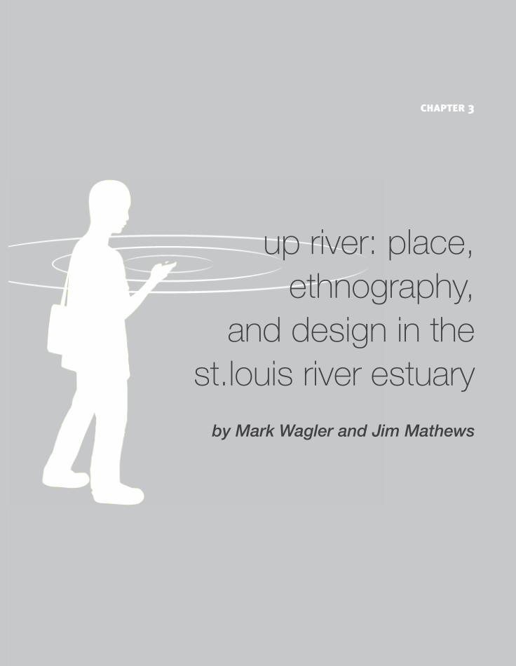
up river: place, ethnography,
and design in the st.louis river estuary
by Mark Wagler and Jim Mathews
chapter 3

40
41
mo
bile ethno
grap
hym
ark wag
ler and jim
mathew
s
As teachers, we typically investigate nearby places with our students, and together design interactive stories intended for local audiences. As part of a larger research and outreach project, we built on these classroom experiences to design Up River, a mobile story and an associated two– day workshop — intended especially for teachers and students interested in working as ethnogra-phers and designers to explore and represent their own local places. In Up River, players travel upstream from the Duluth harbor in search of wild rice and native fish species. Along the way they become physically immersed in the estuary, exploring tourist attractions, industrial sites, restored habitats, and fishing piers. To complement these real– world experiences, they also access geo– located stories and science via their mobile devices. In the workshop, participants engage in mobile design activities that can be further developed back in their classrooms. duration: 2– 3 hourslocation: In the estuary formed by the St. Louis River as it flows into Lake Superior at Duluth, Minnesota and Superior, Wisconsin.
place Place is the core of Up River — it is the context for collaborations and designs, subject for inquiries and documentation, locus for hands– on and virtual expe-
up river: place, ethnography, and design in the st.louis river estuaryby Mark Wagler and Jim MathewsUniversityofWisconsin—Madison,LocalGamesLab
42
riences, and a complex system whose dynamics are progressively revealed through the storyline. We designed Up River by immersing ourselves in the estuary. As we headed upstream from Duluth, then back downstream on the other side towards Superior, we probed every possible access to the St. Louis River. We explored boat launches and beaches, parks and forests, backwaters and rapids, camp-grounds and historic sites, and many wharfs and other private businesses — if there was a path to the river, we followed it. During these field excursions we met a variety of people connected to the estuary; at the same time we began identifying locations and stories that would later help us immerse players in the same environments.
st.louis river estuaryThe St. Louis River flows 179 miles and drains a 3,634 square mile watershed. The lower river opens into a largely wild, 12,000– acre estuary before it finds its outlet in the highly industrialized Duluth— Superior harbor, the world’s largest freshwater seaport. Here’s how we describe the estuary at the begin-ning of Up River: The St. Louis River is the largest of the U.S. rivers that flow into Lake Supe-rior. As it nears the lake, the river broadens out into an “estuary,” or “drowned river mouth.” The estuary is a mixture of water from the river coming down-stream and water from the lake moving upstream. A variety of waterfowl and other wildlife use the estuary for breeding and migration including about 54 species of fish (e.g. lake sturgeon, walleye, yellow perch, northern pike, and black crappie). locationsUp River takes place in three major locations, each presenting a unique view of the estuary. While water, resources, and contaminants flow downstream, the narrative guides players upstream — from a tourist district, to the hub of ship-
43
mo
bile ethno
grap
hym
ark wag
ler and jim
mathew
s
ping and industry, and finally to a restored wetland. The story begins in Canal Park, once a warehouse district, and now the center of Duluth’s entertainment industry, with restaurants, hotels, shops, and tourist attractions. Here a local chef sets the stage by giving players their main quest:
Hithere!I’mhopingtomakeamealtonightbasedonlocalingredientsandI
needyourhelp.WhilealotofrestaurantshereinCanalParkservewalleye,most
ofitcomesfromCanada.Also,the“wild”ricetheyhaveonthemenuisusually
commerciallyraised.Iwantmymealtobeaslocalaspossible,soIneedyou
tobringmefishandwildricefromtheSt.LouisRiverestuary.Youcanstart
bycollectinginformationherealongtheDuluthharbor,butyou’llneedtohead
upriverinordertocompleteyourmission.
As the players explore key sites along the St. Louis River, they meet a variety of contemporary people, both real and fictional, who live and work in the estuary. In Canal Park, they interact with a fishing guide, ship watcher, rice vendor, and several recreational and commercial fishermen. They also meet historical figures, such as Henry Schoolcraft, a 19th century geographer and ethnologist, who shares original journal entries describing the harbor area in the early 1800s, long before it was altered by large scale European settlement and industrialization. Some people appear on the players’ mobile devices as virtual characters, while others are real people who agreed to serve as prearranged interview subjects. Some of them serve as guides and help players complete sub– quests, while others simply share their musings about the estuary, or even attempt to distract players from their main quest by encouraging them to engage in side activities, such as watching a cargo ship entering the harbor, eating at a local restaurant, or doing some sightseeing. Unable to catch a legal– size walleye, or purchase “real” wild rice, players must travel several miles upriver to the second location, Rice’s Point, where they encounter a dramatic change in environment. Here in the center of shipping
44
and industry in the Twin Ports, surrounded by ships and docks being loaded and unloaded with cargo, players can look across the deep river channel to Connor’s Point in Superior, or just a little upstream to the sewage treatment plant. A new group of virtual characters await them — a fisheries specialist, a boater, an invasive species researcher, and a conservation coordinator with the U.S. Fish and Wildlife Service — as well as documents exploring the history of sawmills at Rice’s Point, the impact of the sewer plant on water quality, and the invasion of zebra mussels. Still searching for that elusive wild rice, as well as additional fish species, players must travel even further up river to their final location, Grassy Point — a restored wetland representing what the river might have looked like before industrial development and heavy dredging. Located next to the farthest upstream wharf still in operation on the river, this was once the site of several lumber mills. While the mills played a central role in the industrial and economic development of Duluth, they also caused severe ecological damage. As players explore Grassy Point, they learn about the industrial past through photos and historical accounts, but also about the efforts to restore the area and improve it as a habitat for fish and birds. It is here they encounter John Turk, who shares a story about gathering wild rice just across the river as a child in the 1930s, several birders who help players identify different bird species, and an angler who describes how the restoration improved fishing in the area. systemsWhile exploring Up River, players learn about the natural ecosystems of the estuary. They learn that wild rice won’t grow in deep or swift water; the round goby is an invasive species introduced through the ballast water of ships; restored industrial sites, like Grassy Point, support a range of aquatic plant and bird species; and decomposing waste uses up oxygen needed by fish. More significantly, they experience the estuary by walking on the shore of Lake Superior, standing at the end of a pier above a deep river channel, and exploring the wetland where Keene Creek enters the St. Louis River.
45
mo
bile ethno
grap
hym
ark wag
ler and jim
mathew
s
Players also learn about the cultural systems of the estuary. They walk past tourist attractions such as the Lake Superior Marine Museum, see charter fishing boats and 1,000 foot cargo ships travel through the shipping channel, explore a boat launch in the middle of the industrial section of the harbor, and walk past an active wharf with enormous piles of dry bulk commodities. On their mobile devices, they interview virtual fishermen and dock workers; shop from a rice vendor; and go fishing. These interactions, and the stories players hear, help connect them with the people and places in the estuary. Most importantly, Up River draws attention to past and present interactions between the cultural and natural ecosystems in the estuary. At Rice’s Point, for example, players are asked to consider the connection between natural resources flowing down the river and sediments and contaminants flowing into the estuary. The following text accompanies an historic photo of a large log flotilla that was taken at Rice’s Point:
ThelumberindustrydominatedWisconsin’sConnorsPoint[thepointdirectly
acrosstheriverfromRice’sPoint]between1860and1909.Whitepinelogs
felledintheSt.Louiswatershedwerefloateddownstream.By1894atleast
fifteensawmillswerelocatedalongbothsidesoftheSt.LouisRiver.These
sawmills,alongwithironworks,shipbuildingyards,andotherindustries,intro-
ducedaheavyloadofcontaminantsintotheestuary.
The logging boom ended quickly so that by 1925 only one sawmill remained in Duluth, and the white pine forests, which once seemed inexhaustible, had disappeared. After the trees were clear cut (deforestation), the rainwater that once infiltrated the forests now runs off more quickly, carrying eroded soil with it. Much of the resulting sedimentation ends up in the lower St. Louis River, degrading the ecology of the estuary. Learning about the estuary through the stories of people who live and work there helps players “see beyond” what is in front of them, making transparent some of the complex systems at play in the estuary.
46
ethnography Ethnography is central to Up River. Not only did we conduct research using ethnographic methods, we designed the story itself to guide players in prac-ticing simple ethnographic techniques. By ethnography we mean everything from people watching and conversations in everyday life, to the systematic observation, recording, and analysis of cultural phenomena undertaken by professionals in many disciplines. Up River represents a distinctive genre of mobile storytelling. Instead of relying solely on fictitious or historical characters, it emphasizes contemporary real people whenever possible. Up River also encourages players to observe, interview, and record real people, places, and interactions. Indeed, Up River served as a model during our workshop for how readily ethnographic docu-ments can be incorporated into a mobile story. Many teachers were intrigued by this approach and easily began generating ideas for how they could conduct ethnographic research with their own students. ethnographic fieldworkOur first step towards designing an ethnographic story rooted in place was to immerse ourselves in the estuary. As we visited multiple sites up and down both sides of the river, we took hundreds of photos and conducted extended field observations. This gave us an entree into the rich culture of the estuary and provided a frame of reference for the many conversations we initiated during repeated visits to our core locations. By referencing what we were learning about local places, practices, people, and events, we were able to further immerse ourselves in the estuary and develop even more nuanced ques-tions and understandings. We slowly discovered a local network of people who live, work, and play in the estuary; most were eager to share their experiences and ideas. Since many of the people we talked with were fishing, we began thinking of how to include fishing in our mobile design. For that we needed more informa-
47
mo
bile ethno
grap
hym
ark wag
ler and jim
mathew
s
tion. Web resources for this geographical area are bountiful and answered most of our basic questions (e.g., related to fish populations, water quality, invasive species, commercial fishing). We were also grateful for interviews conducted by landscape ecologists on our research team and the vignette they wrote about fishing for our project web site. What we were missing, however, were personal stories tied to the specific places we wanted to include in Up River. For that, we needed to conduct longer, recorded interviews in the field. One of our favorite locations to conduct field interviews was Boy Scout Landing, a boat launch just above the historic Oliver Bridge, some twelve miles upriver from Lake Superior. The small landing, which includes a fishing pier, boat ramp, and tiny sandy swimming beach, is on the Duluth side of the river, between the mouth of Sargent Creek and River Place Campground. Across the river, on the Wisconsin side, the land is undeveloped — with wetlands in the foreground and forest behind. In addition to providing easy access to the river, Boy Scout Landing is also a great place to meet anglers. On one visit we met a young man who lives in the neighborhood, fishes at the landing, and used to swim there. He told us that it is mostly local people who fish on the pier, except during the spring walleye run, when the fish head upriver from Lake Superior to spawn — “on opening weekend, they come 20, 30 people on the dock.” As we talked more, he told us that he catches a lot of bass and catfish in the river, as well as some invasive species like white perch, gobies, and roughies, but then added, “I really like fishing for northern and muskie, they’re more fun to catch.” This sparked him to show us some of the lures he uses, including a top– water spinner that works well in shallows because the vibrations attract fish, and a floating rapala that moves side– to– side and works because “it looks like a dead or wounded fish.” We also talked a bit about sturgeon and he pointed to another fisherman on the dock who caught a fifteen– pounder. But since they are endan-gered, it’s illegal to keep them, so they unhook them as fast as they can.
48
When we asked him what he does with the fish he catches, he told us that he eats some, but mainly catches them for sport, then releases them. “A lot of mercury in the water, and they say the older the fish and the bigger they are, the more mercury they contain.” Before we left, he told us that fishing has gotten better in the area and that he sees fewer diseased or unhealthy looking fish — something that was common in the past. Extended field interviews like this helped us develop a feel for the people and places in the estuary. We conducted many of them, in multiple locations along both sides of the river. In the end, they were invaluable because they provided ideas and content for our design and made it possible for us to more accurately present local people, stories, and issues in the final version of Up River. ethnographic contentOne of our main design goals was to give Up River an authentic real– world feel. Our extended fieldwork and documentation helped in this regard because it allowed us to build our narrative around site– specific media and stories. We also used photos and videos we took in the field to more accurately “place,” or situate the final story. For example, players see Mark Howard, a commercial fisherman, at Howard’s Fish House & Farmer’s Market where we interviewed him. Wearing his white apron, and talking with expressive gestures, he describes one environmental threat to his profession:
Mostoftheeffectsonthefishingthathavehappenedherehavebeenthrough
theintroductionofexoticspecies,thesmelt,thesalmon,zebramussels,the
gobies,theroughyfish;andtheyhavecompetedwiththenativefishforfood
sourcesandhabitatandeatenthefish.
Smeltarecarnivorous;theyarethemostdevastatingthingtoevercomehere...
Theyateallthebabywhitefishandherringandthewalleyesandtheperches
thatwerethereinthebay.Theywouldcomeinenmasseandjustwipeout
everythingwhentheyspawned.
49
mo
bile ethno
grap
hym
ark wag
ler and jim
mathew
s
Similarly, we used a picture of Don Nelson’s charter fishing sign to help players find his boat in the harbor, an image of a restaurant’s menu to clue players into the source of the food they serve, and a link to a Facebook page depicting a local organization’s effort to clean up Grassy Point. We also took photos of people standing in the same location where players encounter them in the story as a way to connect virtual interviews to real–world places. present– focused ethnographyWhile stories from the past can be found in Up River, the narrative emphasizes the present–day practices, beliefs, expressions, and social fabric of the local culture. Even when stories about the past are used, they are framed in a way that draws us toward the present. Consider the following text, transcribed from an audio clip that appears in Up River, excerpted from a much longer interview conducted by one of the landscape ecologists on our project:
TherewassomehugebedsofriceontheSt.Louisintheearly30s.AndIdidalot
ofwildricinginthe1940s,late40s,andintothe1950s,andthat’swhenitstarted
todisappear.ButallthesebaysabovetheOliverBridge,andbelowtheOliver
Bridge,werefull,fullofwildrice.BigPokegamaBay,AllouezBayhadalotofrice,
everybayherewasloadedonbothsides,theMinnesotasideandtheWisconsin,
therewasmorericeontheWisconsinsidethantheMinnesotaside.Everybay
herewasloaded,wasloadedwithwildrice.
When players encounter the speaker, John Turk, a lifetime resident of Oliver, Wisconsin, they get more than bare historical facts. Through a contemporary storytelling style — the intimacy of his voice, his cadence, word choice (e.g. lots of dates and place names), and especially his rhetorical patterns (e.g. the accumulative impact of repetition) — John communicates his present and deep connection to the estuary. This is not an abstract past, but living memory passed to the present. His voice sounds authentic, his personal experience lends authority. Additionally, while John’s story depicts wild rice harvesting in the 1940s and 1950s, the narrative in Up River encourages players to ask questions about current cultural practices surrounding wild ricing.
50
ethnographic nudgesWe want players to observe and to interview. Thus we designed Up River to kindle attention to and interaction with the local environment. Early on, players look for native fish at the Nels J., a former fishing boat turned seafood snack stand on the shore of Lake Superior. Using a dialogue script, players ask: “BTW … what’s the story of the Nels J.?” The attendant replies: “The boat was once used to fish on Lake Superior. You can learn more by reading the posters on the kiosk right in front of us.” Instead of placing the text and photos from the kiosk in Up River, which would focus their eyes on their mobile device, we use character prompts to guide players’ attention to their physical surroundings. Similarly, after learning about the industrial past and subsequent restoration of Grassy Point, players are given a set of questions nudging them to observe the current activity at an adjacent wharf:
Whilethesawmillsarenolongerhere,thereisstillalotofcommercialactivityin
thisarea.Howhascommerciallandusechangedovertheyearsinthislocation
andwhy?Whatdoyouthinkcomesandgoesoutofthewharfjusttothewest?
Whatarethosebigpiles?Wheredothoseresourcesgetusedandhow?Check
yourinventoryforawharfreportthatmighthelpyouanswersomeofthose
questions.
This prompt, along with the additional details delivered via the wharf report, encourages players to notice and ask questions about the various materials being loaded and offloaded there. It also reinforces what they learned moments earlier about the actions taken to restore Grassy Point from a contaminated industrial site to a relatively healthy wetland. We also nudge players to talk with and even interview real people. Immedi-ately upon arrival at Rice’s Point, for example, players receive a phone call from the Chef with an ethnographic assignment — interview live people at this site, and record these interviews (and perhaps take photos) with your mobile device:
51
mo
bile ethno
grap
hym
ark wag
ler and jim
mathew
s
JustheardthereareseveralpeopleoutatRice’sPointrightnowyou’llwantto
talkto.Theymightbewalkingaround,sousetheirphotostofindthem....Lookfor
MarkHoward,afisherman,andPatCollins,aconservationcoordinator.
Sowecanrememberwhatyoufindout,Ineedyoutodocumentit....Tapthe
“MORE”buttonatthebottomofyourscreentouseyourdigitalrecorderto
captureaudiointerviews.Shortclips!Saveyourbattery!There’sacamera,too,if
youwanttoshowmesomephotos.
Up to this point players have only conducted interviews with virtual characters by selecting questions from a list and reading pre– scripted answers. In case some players might hesitate to approach a real person, Up River makes the task easier by suggesting kinds of questions they might ask:
FindPatCollins.He’s...withtheU.S.FishandWildlifeService.AskhimifitisOK
toeatfishyoucatchatRice’sPoint,oristhewatercleanerandthefishhealthier
ifyougofartherupstream.Forsurehe’lltellyouhowWLSSD,thelocalsewage
treatmentplant,haschangedwaterqualityintheSt.LouisRiverEstuary.Also
askhimabouthabitatrestorationintheestuaryandwhetherithasimprovedfish
spawningandtheavailabilityofwildrice.
design Design pulls together everything we worked on across the project. We planned, built, and refined Up River and the associated workshop by continuously highlighting place and ethnography. In this section we present a few of the additional goals, opportunities, and strategies that guided our thinking as we designed Up River.
52
participatory design with partnersUp River was designed as part of a larger research and educational outreach project, “Stressor Gradients and Spatial Narratives of the St. Louis River Estuary,” in which a multi– disciplinary team gathered, analyzed, visualized, and disseminated scientific and cultural data. Limnologists and aquatic ecologists at the University of Minnesota — Duluth and University of Wisconsin — Superior sampled multiple estuary locations to determine the relationship between human impact (via sediments, nutrients, and contaminants) and environmental indicators (water quality, wetland plant and macroinvertebrate communities). Landscape ecologists from the University of Wisconsin — Madison and Bemidji State University combined this data with ethnographic interviews to create a series of vignettes — developed around five core themes (shipping, fishing, mining, recreation, and wild rice) — to represent human— ecological relationships in the estuary. Outreach specialists and educators from Wisconsin and Minnesota Sea Grant developed educational materials and programming. Our role, at the Local Games Lab of the University of Wisconsin— Madison, was to design a mobile story playable in the estuary. Throughout the design process, we repeatedly tapped the knowledge, professional expertise, and creativity of our project partners, including people we met in the field and teachers and students at the workshop. Early in the project, we implemented a two– part design jam where we introduced our partners to mobile storytelling by having them playtest a prototype we designed for Grassy Point. After they provided feedback on our design (which was later incorporated into the final version of Up River), we asked them to brainstorm and mock– up their own story set in the estuary. In teams of two or three, they quickly came up with story ideas and components on sticky notes, arranged them into a narrative, and reported out to the group. The initial, rough narrative for Up River was born at this session.
53
mo
bile ethno
grap
hym
ark wag
ler and jim
mathew
s
selecting locationsWe located Up River across three key places, a minimum we thought for exploring the many aspects of a large estuary. We chose locations that would highlight the cultural and scientific research of our partners and pull together the five core themes of the entire project. We also wanted sites that would offer a variety of cultural and ecological features; provide rich sensory and cognitive experiences; and represent past and present uses and conditions. While seeking sites that were easily accessible, we also wanted to direct users upriver and away from the Duluth Lakewalk, a primary destination for visi-tors and school groups. In part, this was driven by our belief that in order to “experience the estuary” one needs to explore less– travelled areas that also exemplify its richness and complexity. flowOur project team sometimes referenced “flow” as a unifying theme for the estuary. Natural resources like taconite (from iron mines), grain, salt, and coal flow in and out of the estuary in ships, trucks and railroad cars. Sediments and contaminants flow into the river through outfalls and tributaries, then down-stream with the current. Meanwhile, lake water flows upstream as the result of a seiche effect, fish swim upstream (in the St. Louis and its smaller tributaries) to spawn, and the development of industries and settlement of neighborhoods historically flowed upstream from the harbor cities. We integrated flow into our mobile story, and hence movement into our narrative, by having players head upriver to catch native fish and find wild rice. This was accentuated through the design, as virtual characters point players to sites or experiences further upstream — “you’ll find better fishing up at Rice’s Point” — and the quest structure requires them to complete tasks across multiple sites. In the end, players experience the river as it transitions from a heavily dredged outlet, to a fast moving channel in the center of the harbor, to a wide river with grass– filled bays.
54
interconnected themesAs John Muir famously said, “When we try to pick out anything by itself, we find it hitched to everything else in the Universe.” We designed Up River to help players better understand the estuary as a complex cultural and ecological system. To achieve this, we imagined storylines that highlighted one of our five “spatial narratives” — fishing, mining, recreation, shipping, and harvesting wild rice — and how each of these human activities stress or are stressed by the environment. Alone, however, this was not enough. We discovered we could more readily create a complex representation of the estuary by combining at least two of these themes in our narrative. When we paired fishing and harvesting wild rice, the idea of finding ingredients for an estuary meal emerged — and we had the main quest for our players. It was easy, then, to bring in secondary connections to shipping and recreation. In retrospect, it almost feels as if Up River wrote itself, given how obviously the narrative fits the needs of our project — and triggers investigating the estuary. In truth, we spent a lot of time exploring locations and developing our own understanding of the estuary before finding a narrative that “clicked into place” some of the complexity in the estuary. humorSometimes Up River can feel as loaded as a Lake Superior freighter. Feeling a tension between providing rich details, but avoiding too much content, we regularly reminded ourselves that players can go to the project web site for more information. What they needed, particularly in the beginning, was a lighter touch to get them engaged. Enter the Chef — depicted as a cartoon cook, demanding and always in a hurry — who serves as the player’s employer, the stage manager who hands out primary and secondary quests, and rewards players’ success or failure. After taking a moment to sample oysters from a fish stand, the player is imme-diately busted: “Hey, taking a break already? What are you eating? Oysters? Those aren’t from the estuary. It’s hard to find good help these days!” The nearby Ship Watcher commiserates, “Chef giving you a hard time? He fired me
55
mo
bile ethno
grap
hym
ark wag
ler and jim
mathew
s
because I’m not a work maniac like him. What’s he got you doing?” When the player buys “wild rice” from the Street Vendor, the Chef comes back to scold, “Hmmm . . . looks like you got fooled! That’s cultivated ‘wild’ rice raised by farmers, not the rice that grows in the wild.” Still, the Chef can be kind and occasionally encourages players to keep their chin up.
workshop While teachers can use many approaches to cultivate student interest in studying local places, a well– designed interactive mobile story or game can engage, inform, and structure student field experiences, and lead to an extended place– based project. We wanted Up River to immerse teachers and students in the estuary, but also serve as a model for how they could design a similar experience with their own students. Not only could Up River serve as a hook to get teachers and students interested in studying the estuary, it could also hook their interest in designing similar place– based mobile stories in their own school or community. We embedded Up River in a workshop, so that teachers and students would have time and support for envisioning and planning their own place– based mobile projects. Up River was first implemented in a two– day workshop with eight secondary teachers from the region, fifteen of their students, and some of the professionals involved in the larger project. debriefing sessionsParticipants worked through the first segment of Up River while still indoors in Duluth’s Great Lakes Aquarium, accessing digital content without experiencing its real– world context. When they next braved November weather to play the final two segments outdoors, players had to visit specific GPS locations in order to interact with virtual characters and obtain other geo– specific multimedia via their mobile devices. We facilitated debriefing sessions after playing Up River for two main
56
purposes: one, we wanted feedback for future re– designs; and two, we wanted participants to transition from thinking like players to thinking like designers. Several students reflected that it felt “more real” and “more interesting” when they played out in the real world, because playing indoors is “not the same as being there.” Participants reported several software and design bugs that interfered with their play, which we noted for possible fixes. Students in particular thought we should reduce the amount of reading, replacing some of the text with more video. designing with ARISWe created Up River with ARIS, “a user– friendly, open– source platform for creating and playing mobile games, tours and interactive stories,” available free at http://arisgames.org. We included a “how to” session in the workshop during which participants learned how to use the ARIS authoring tool in order to design their own stories. In this semi– structured learning environ-ment, participants were guided through a basic design sequence, but then had time to ask individual questions and experiment on their own. As individuals and pairs completed their designs, they shared them with each other in order to work out technical issues and receive ideas for improvement. As is typical, several teachers and students quickly learned the basic functions of the software and emerged as experts, moving around the room to assist others. design jamThe pedagogical power of ARIS comes less from students playing stories designed by others than from students researching and designing their own stories. As participants began to develop a deeper sense of the core ideas — especially the confluence of place, ethnographic fieldwork, and mobile– based storytelling — we asked them to begin planning a similar project they could implement at their own school. Using a template we created, each school team brainstormed possibilities. As part of this process, we asked them to consider places, issues, and themes relevant to their community (and curriculum goals), as well as data, organizations, people, and any additional resources that might assist them in their design journey.
57
mo
bile ethno
grap
hym
ark wag
ler and jim
mathew
s
After reflecting on their ideas, each team picked one to develop further. At this point, they created a map and began to place people, items, and locations that might appear in a final mobile story. One of the teams developed a mock– up of a story exploring the history of a local running path. Another school, situated near the St. Louis River, presented an idea for studying their community and adding it as a new location to Up River. Other groups planned to investigate the effect of river pollution on human health, the impact of logging on natural habitats, the relationship between land use practices and water quality in a local river, and changes that have happened to a riverside town.
lessons As we discussed next steps with teachers at the workshop, we developed a set of talking points for how different school teams might be able to move forward given their specific needs, interests, and context. With this in mind, we end by sharing nine rules of thumb that emerged from the workshop, as well as from our own experiences as teachers and designers. 1. start smallCreate a simple tour before embarking on a more complex effort to design a mobile game or interactive story with lots of moving parts. Experimenting with many simple (and smaller) ideas helps build your fluency with the tools, clues you into what does and doesn’t work, and often sparks ideas for more complex designs. Some teachers start by designing something for their personal use in order to learn the tools and experiment with different design ideas. Another strategy for starting small is building a tour or story around a single person or location, versus multiple people or locations. For example, imagine walking through a park with a biologist as she points out and discusses different invasive species, or touring a neighborhood with a resident who has lived there for 40 years as he tells stories about things that have changed; but now while you walk through the physical park or neighborhood, the biologist or resident you encounter are virtual characters on a mobile device.
58
2. start localBuild something that revolves around your school, schoolyard, or immediate neighborhood as a way to build your fluency with ethnographic fieldwork and mobile design. This allows you to experiment with the technologies and teaching strategies without having to organize lengthy field trips. 3. pilot your teaching strategiesImplement a small design project with a subset of students. In some contexts, this might mean running an after– school workshop or organizing a field trip for a group of highly interested students. Or you might organize a design competition, allow students to design a mobile– based story to meet another class requirement, or organize a workshop similar to the Up River workshop. These experiences can be used to test learning activities and build your and your students’ capacity for doing ethnographic and mobile design work. 4. collaborate with studentsAt the Up River workshop, teachers and students learned how to use ARIS in teams. Several students picked up the software quickly and helped teach other students and teachers. In some cases, students’ previous gaming and media design experiences came into play, as it helped them understand some of the language embedded in ARIS (e.g., quest structures, NPCs, items) and develop design ideas. Also, engage students as co– designers when you develop pilot projects, by actively seeking their advice for how to improve the project and embedded activities. These same students can serve as experts or classroom assistants when the project is implemented more broadly. 5. experiment with design Build students’ interest and expertise with the tools through game jams, where they build games that are not related to any specific content. This allows students to initially explore the tools and design processes, before adding the constraint of specific content or concepts. Later, students can use their under-standing of the tools to design media that aligns more closely with your specific curriculum area.
59
mo
bile ethno
grap
hym
ark wag
ler and jim
mathew
s
6. look for content– rich places and issuesWhile all places are rich in content, we have found it useful to design mobile stories around places and issues that are already well documented with source materials readily accessible for classroom use. For example, one reason we selected Grassy Point as one of our locations was because we found a rich cache of photos, text, and video associated with this place. 7. teach ethnographic skillsFieldwork is critical in any place– based learning. The practices we described above for immersing ourselves in and documenting the estuary need to be developed by teaching fieldwork skills. Observation, for example, requires more than “pay attention” and “take notes” — students need examples of very specific things to pay attention to. Students need more than a list of questions to engage in successful interviews — they need demonstrations and practice in class of how to follow up on answers, so that listening is emphasized more than asking questions. Students also need practice in class with using cameras and digital recorders — even a short lesson in class can improve the quality of video and photos. Although observing places and interviewing experts are important for studying ecological environments, these techniques should be supplemented by monitoring with digital probes. Finally, field data must be analyzed and discussed before students understand it well enough to select data to represent the place they are studying. 8. consider multiple uses for mediaIf you are doing a project around a particular place or issue, a mobile media game might be the only one of the things students design. They could also use their ethnographic work to publish a book, organize a photo exhibit, or start a website where others can add their own stories. Also consider contributing the media you create to the public domain (e.g., through Creative Commons) so that others can use it in the future. Use release forms to obtain permission from people early in the process, since it is easier to get permission when you initially interview or photograph someone than to secure it later. Finally, develop a system for archiving fieldwork documents and media for use in future projects.
60
9. cultivate partnershipsIdentify and recruit partners who can help with all aspects of the project. Our partners in Up River were invaluable. They shared content and resources, helped us understand key concepts, provided feedback on our design, and helped us connect with an audience of local teachers and students. Partners can make classroom projects richer for students and help teachers design more complex place– based learning experiences.
coda While acknowledging the constraints associated with integrating new content, technologies, and practices into the curriculum, we believe that engaging students in ethnographic fieldwork and design presents unique place– based learning opportunities. The complexity and richness involved in designing ethnographic mobile stories increases students’ motivation, provides wonderful opportunities to learn new skills and content, and develops students’ under-standing of local human and ecological systems. Perhaps most importantly, it encourages students and teachers to ask new questions about where they live and fosters a connection to place. We hope our own adventure inspires you to explore your local community. We’ll see you upriver!