Unsupervised and Self-taught Learning for Remote Sensing ... · Unsupervised and Self-taught...
57
1 Unsupervised and Self-taught Learning for Remote Sensing Image Analysis Ribana Roscher Institute of Geodesy and Geoinformation, Remote Sensing Group, University of Bonn
Transcript of Unsupervised and Self-taught Learning for Remote Sensing ... · Unsupervised and Self-taught...
1
Unsupervised and Self-taught Learning for Remote Sensing Image Analysis
Ribana Roscher
Institute of Geodesy and Geoinformation,
Remote Sensing Group, University of Bonn
2
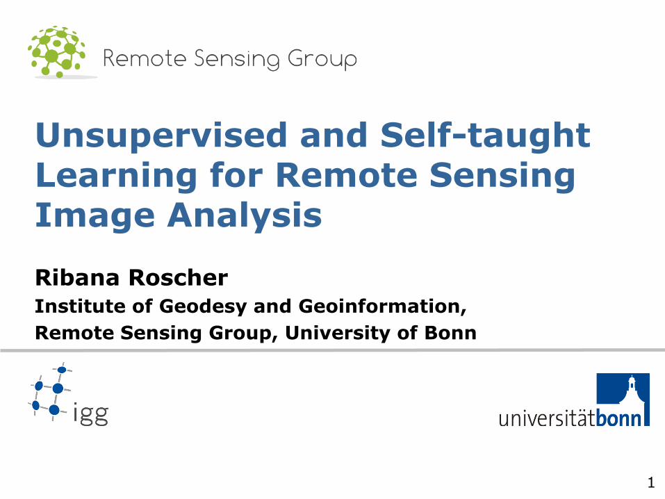
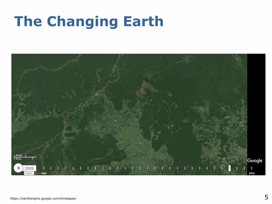
The Changing Earth
https://earthengine.google.com/timelapse/

3
The Changing Earth
https://earthengine.google.com/timelapse/
4
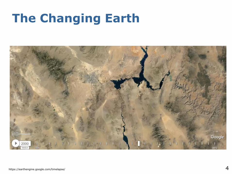
The Changing Earth
https://earthengine.google.com/timelapse/
5
The Changing Earth
https://earthengine.google.com/timelapse/
6
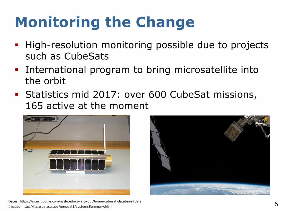
Monitoring the Change
High-resolution monitoring possible due to projects such as CubeSats
International program to bring microsatellite into the orbit
Statistics mid 2017: over 600 CubeSat missions, 165 active at the moment
Dates: https://sites.google.com/a/slu.edu/swartwout/home/cubesat-database#defs
Images: http://tia.arc.nasa.gov/genesat1/systemsSummary.html

7
Challenges
Amount of data (volume)
Permanent change makes monitoring difficult (velocity)
Various data sources are not combinable in a trivial way (variaty)
Data uncertainty (veracity)
typical Big Data challenges

8
Remote Sensing Tasks
Self-taught learning for classification
Sparse representation-based spectral clustering for change detection
Archetypal analysis for unmixing
9
Self-taught Learning for Classification
10
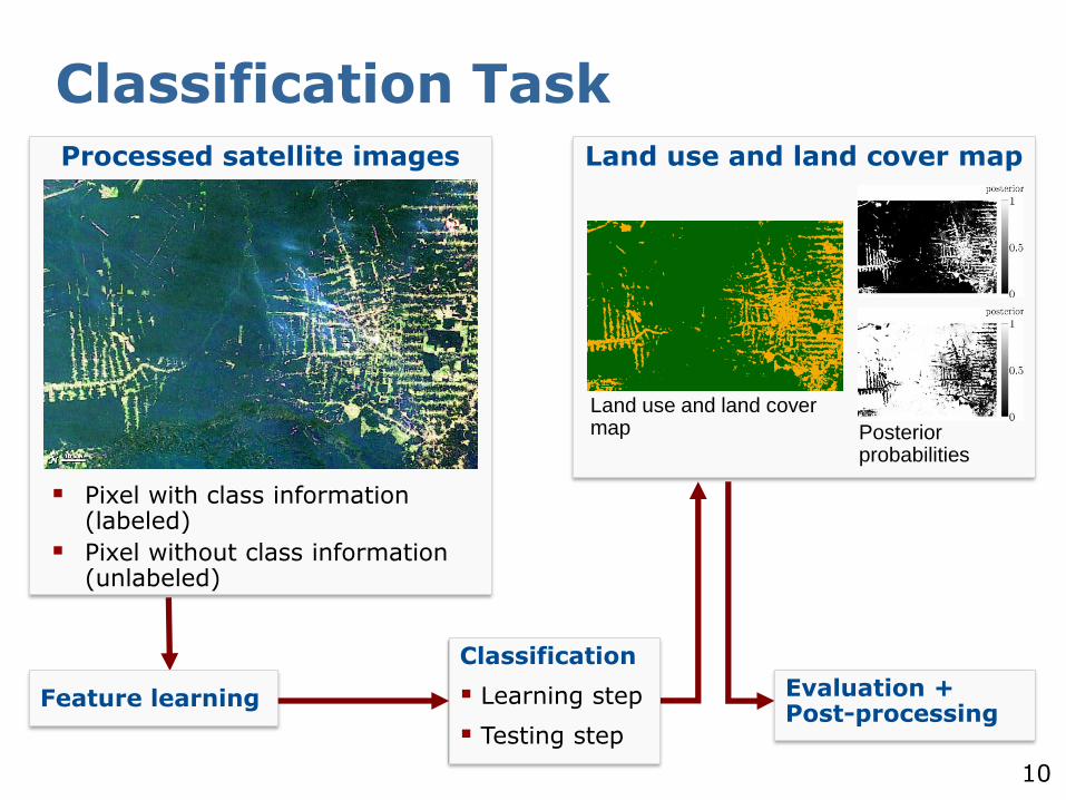
Classification TaskProcessed satellite images
Pixel with class information (labeled)
Pixel without class information (unlabeled)
Feature learning
Classification
Learning step
Testing step
Evaluation + Post-processing
Land use and land cover map
Land use and land cover map Posterior
probabilities
11
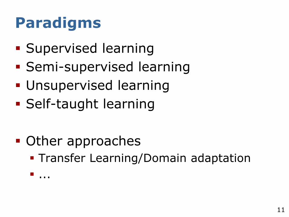
Paradigms
Supervised learning
Semi-supervised learning
Unsupervised learning
Self-taught learning
Other approaches
Transfer Learning/Domain adaptation
...
12
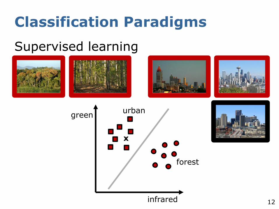
Classification Paradigms
Supervised learning
infrared
greenurban
forest
x
13
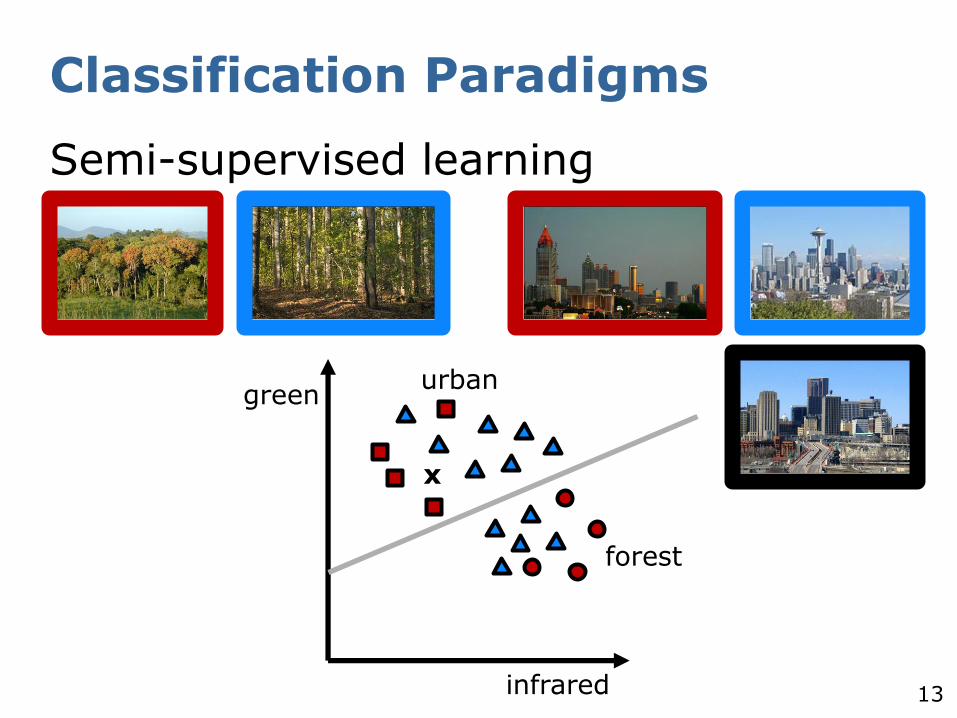
Classification Paradigms
Semi-supervised learning
infrared
green
forest
x
urban

14
Classification Paradigms
Unsupervised learning
x
infrared
green
15
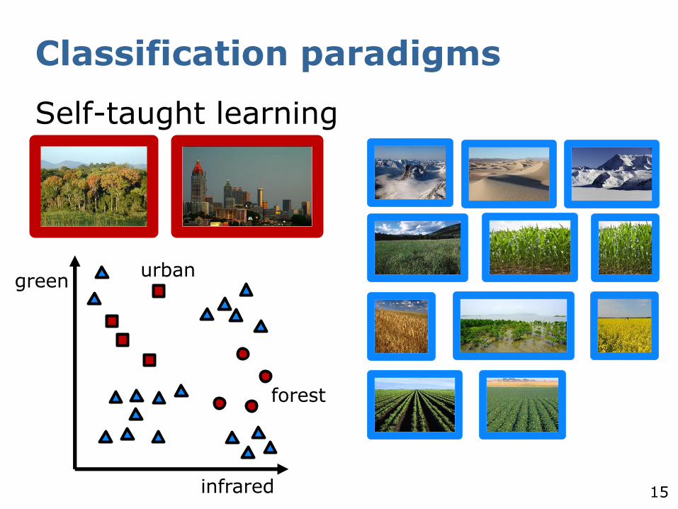
Classification paradigms
Self-taught learning
infrared
greenurban
forest
16
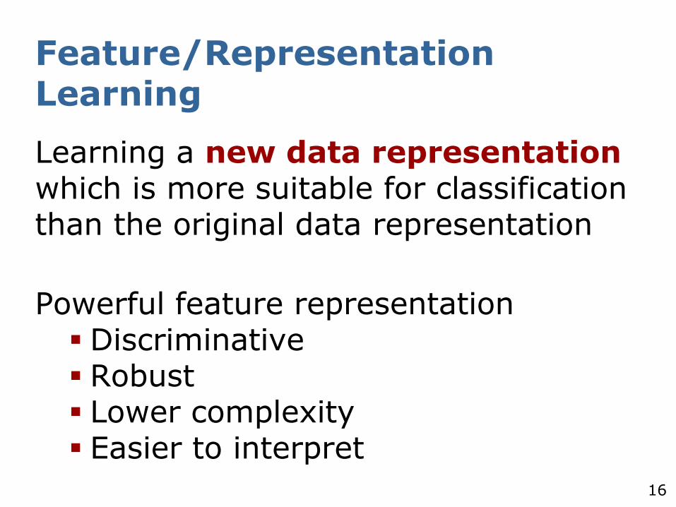
Feature/Representation Learning
Learning a new data representation which is more suitable for classification than the original data representation
Powerful feature representation Discriminative Robust Lower complexity Easier to interpret
17
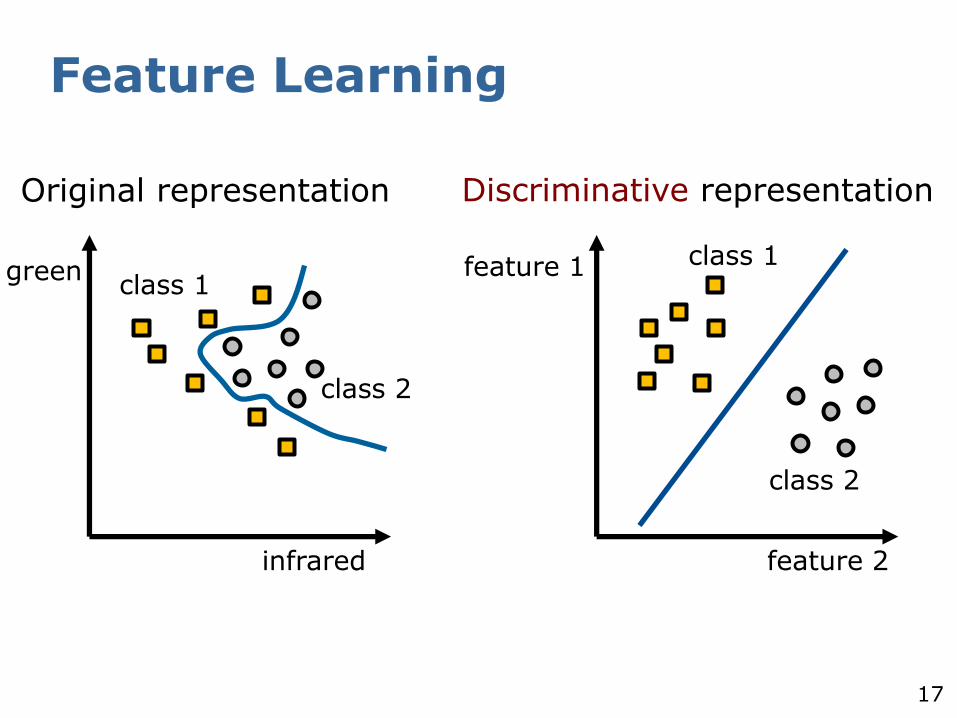
Feature Learning
infrared
greenclass 1
class 2
feature 2
feature 1 class 1
class 2
Original representation Discriminative representation
18
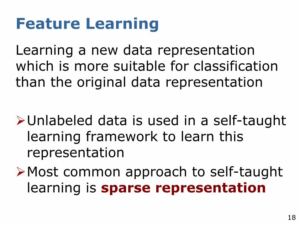
Feature Learning
Learning a new data representation which is more suitable for classification than the original data representation
Unlabeled data is used in a self-taught learning framework to learn this representation
Most common approach to self-taught learning is sparse representation
19
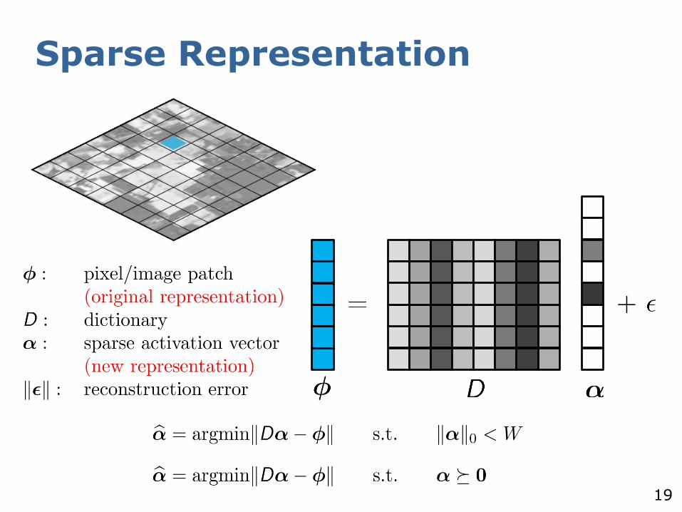
Sparse Representation
20
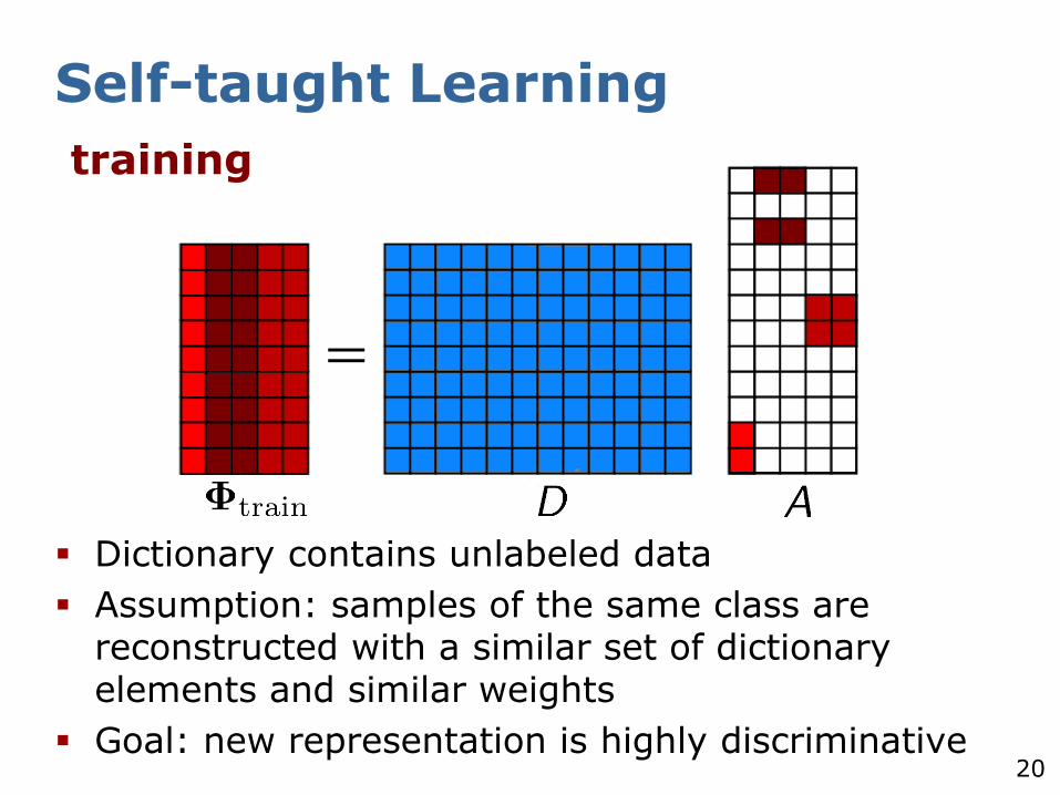
Self-taught Learning
Dictionary contains unlabeled data
Assumption: samples of the same class are reconstructed with a similar set of dictionary elements and similar weights
Goal: new representation is highly discriminative
training
21
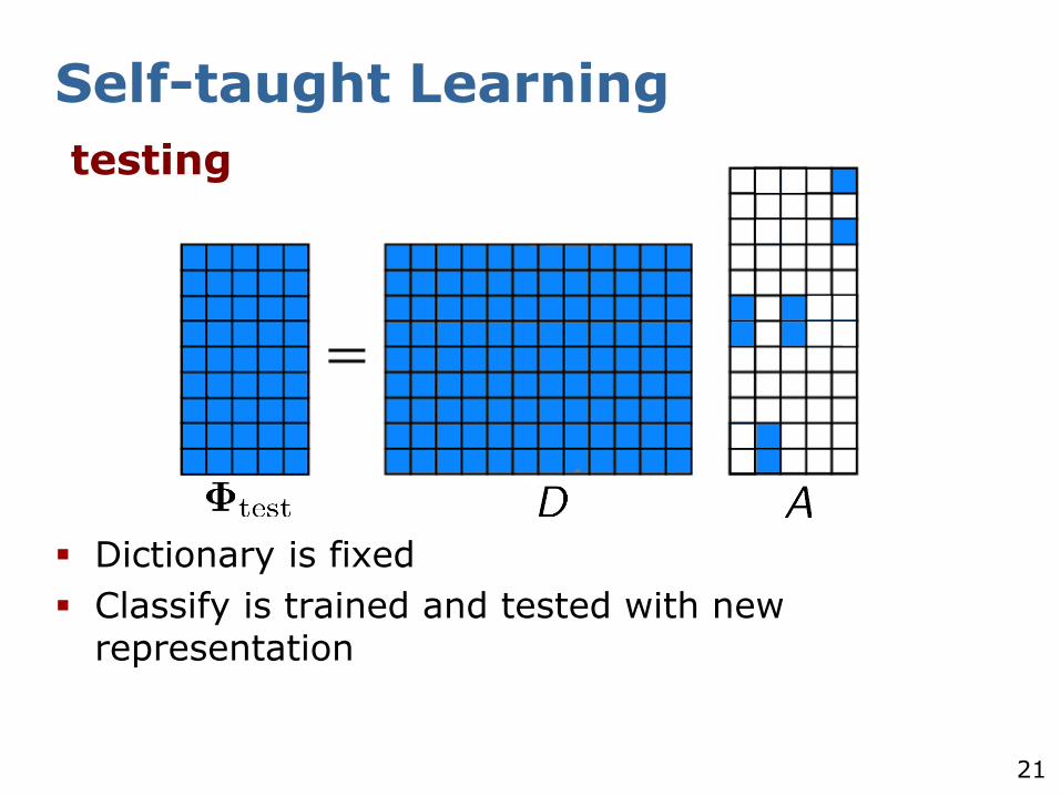
Self-taught Learning
Dictionary is fixed
Classify is trained and tested with new representation
testing
22
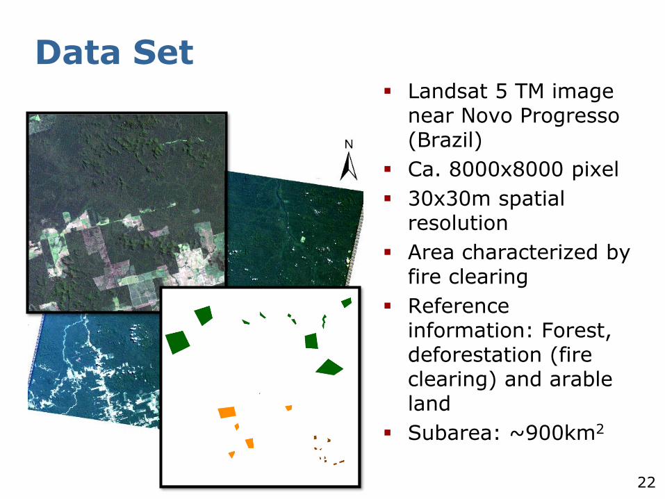
Data Set Landsat 5 TM image
near Novo Progresso (Brazil)
Ca. 8000x8000 pixel
30x30m spatial resolution
Area characterized by fire clearing
Reference information: Forest, deforestation (fire clearing) and arable land
Subarea: ~900km2
23
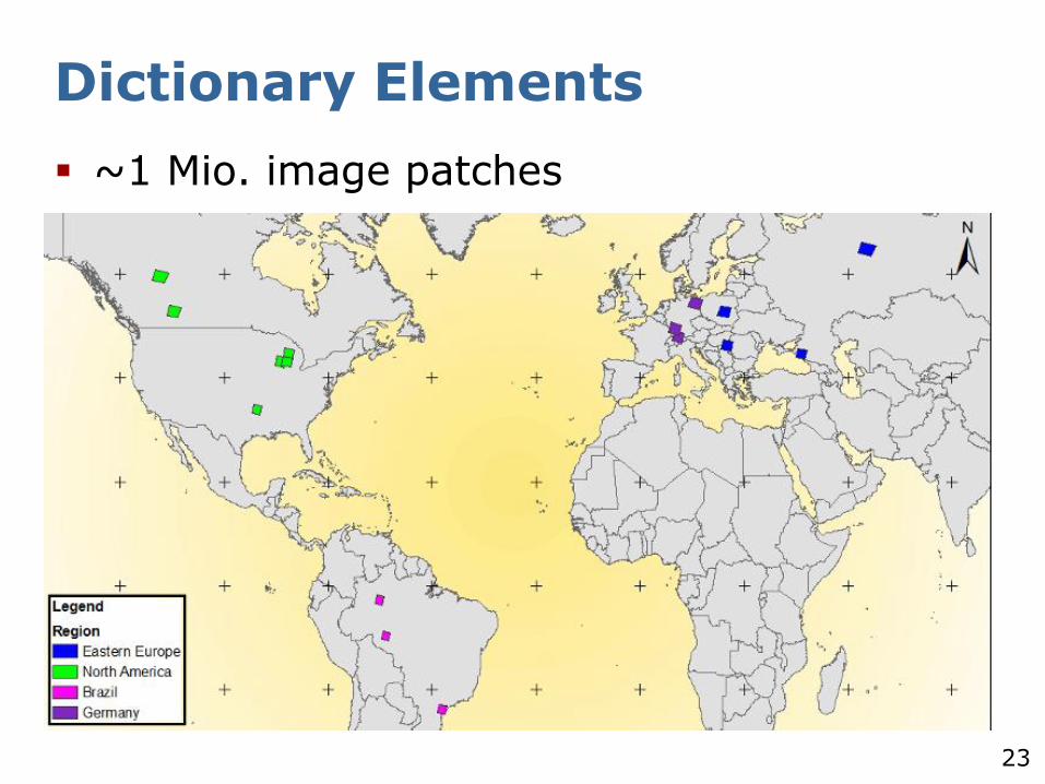
Dictionary Elements
~1 Mio. image patches
24
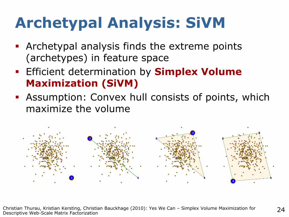
Archetypal Analysis: SiVM
Archetypal analysis finds the extreme points (archetypes) in feature space
Efficient determination by Simplex Volume Maximization (SiVM)
Assumption: Convex hull consists of points, which maximize the volume
Christian Thurau, Kristian Kersting, Christian Bauckhage (2010): Yes We Can – Simplex Volume Maximization for Descriptive Web-Scale Matrix Factorization
25
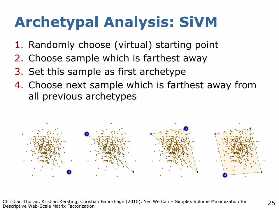
Archetypal Analysis: SiVM
1. Randomly choose (virtual) starting point
2. Choose sample which is farthest away
3. Set this sample as first archetype
4. Choose next sample which is farthest away from all previous archetypes
Christian Thurau, Kristian Kersting, Christian Bauckhage (2010): Yes We Can – Simplex Volume Maximization for Descriptive Web-Scale Matrix Factorization
26
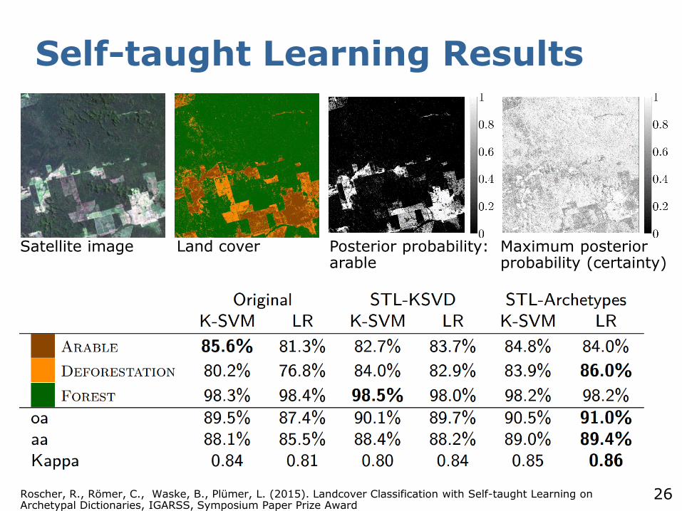
Self-taught Learning Results
Roscher, R., Römer, C., Waske, B., Plümer, L. (2015). Landcover Classification with Self-taught Learning on Archetypal Dictionaries, IGARSS, Symposium Paper Prize Award
Satellite image Land cover Maximum posterior probability (certainty)
Posterior probability: arable
27
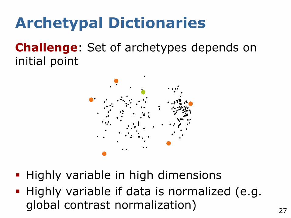
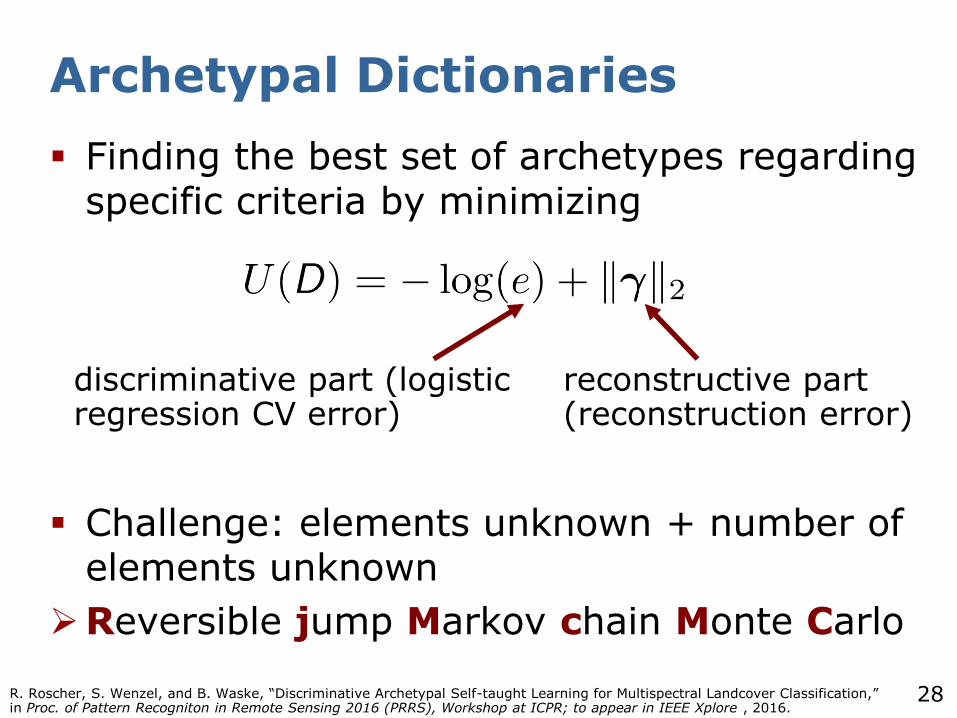
Archetypal Dictionaries
Challenge: Set of archetypes depends on initial point
Highly variable in high dimensions
Highly variable if data is normalized (e.g. global contrast normalization)
28
Archetypal Dictionaries
Finding the best set of archetypes regarding specific criteria by minimizing
Challenge: elements unknown + number of elements unknown
Reversible jump Markov chain Monte Carlo
discriminative part (logistic regression CV error)
reconstructive part (reconstruction error)
R. Roscher, S. Wenzel, and B. Waske, “Discriminative Archetypal Self-taught Learning for Multispectral Landcover Classification,” in Proc. of Pattern Recogniton in Remote Sensing 2016 (PRRS), Workshop at ICPR; to appear in IEEE Xplore , 2016.

29
Reversible Jump Markov Chain Monte Carlo
Advantages
Finds global optimum
Drawbacks
Computation of discriminative part and sparse representation is slow
30
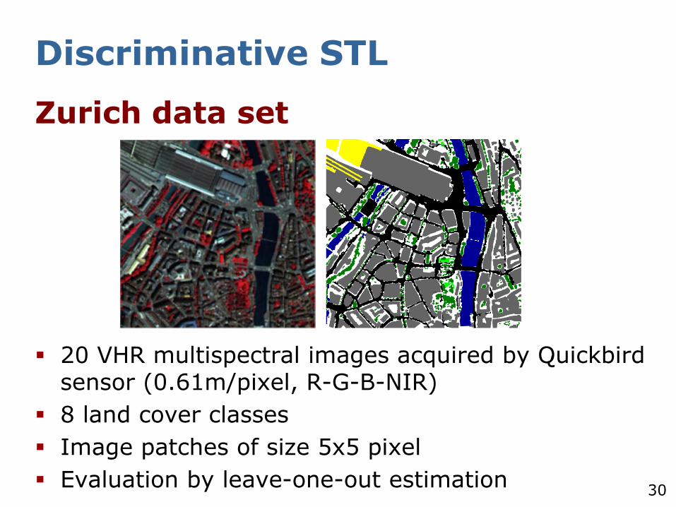
Discriminative STL
Zurich data set
20 VHR multispectral images acquired by Quickbirdsensor (0.61m/pixel, R-G-B-NIR)
8 land cover classes
Image patches of size 5x5 pixel
Evaluation by leave-one-out estimation
31
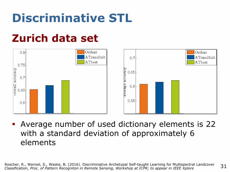
Discriminative STL
Zurich data set
Average number of used dictionary elements is 22 with a standard deviation of approximately 6 elements
Roscher, R., Wenzel, S., Waske, B. (2016). Discriminative Archetypal Self-taught Learning for Multispectral Landcover Classification, Proc. of Pattern Recogniton in Remote Sensing, Workshop at ICPR; to appear in IEEE Xplore
32
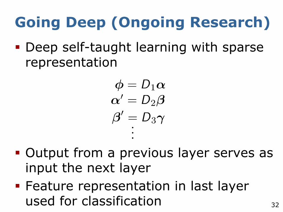
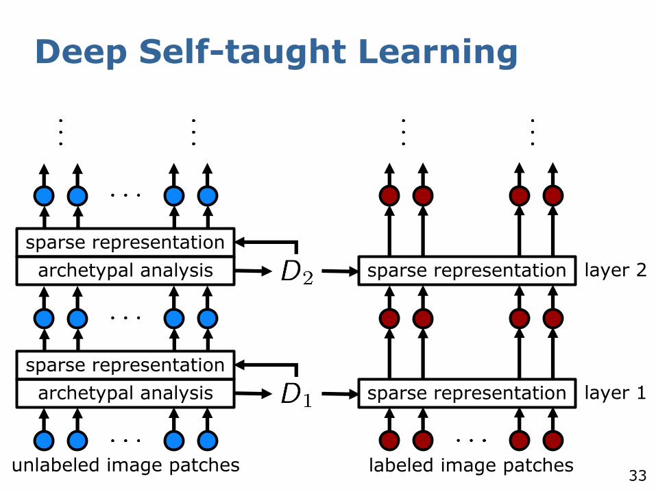
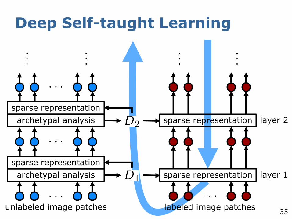
Going Deep (Ongoing Research)
Deep self-taught learning with sparse representation
Output from a previous layer serves as input the next layer
Feature representation in last layer used for classification
33
Deep Self-taught Learning
archetypal analysis sparse representation
sparse representation
unlabeled image patches labeled image patches
layer 1
archetypal analysis sparse representation
sparse representation
layer 2
34
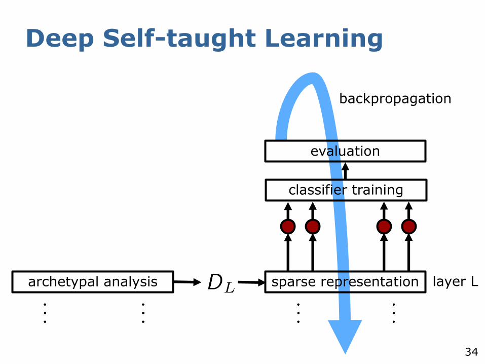
Deep Self-taught Learning
archetypal analysis sparse representation layer L
classifier training
evaluation
backpropagation
35
Deep Self-taught Learning
archetypal analysis sparse representation
sparse representation
unlabeled image patches labeled image patches
layer 1
archetypal analysis sparse representation
sparse representation
layer 2
36
Self-taught Learning - Résumé
Self-taught learning with sparse representation can find a discriminative feature representation
Archetypal dictionaries are undercomplete, yet powerful
Initialization of archetypal analysis influences the classification success
Extension to Deep STL promising
All activations can be interpreted as mixings of archetypes
Deeper layers are deeper mixings
37
Sparse Representation-based Spectral Clustering for Change
Detection
38
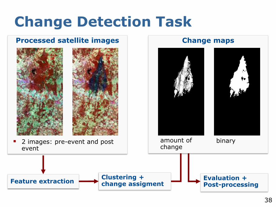
Change Detection TaskProcessed satellite images
2 images: pre-event and post event
Feature extractionClustering + change assigment
Evaluation + Post-processing
Change maps
binaryamount of change
39
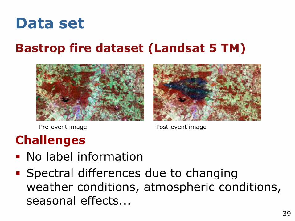
Data set
Bastrop fire dataset (Landsat 5 TM)
Challenges
No label information
Spectral differences due to changing weather conditions, atmospheric conditions, seasonal effects...
Pre-event image Post-event image
40
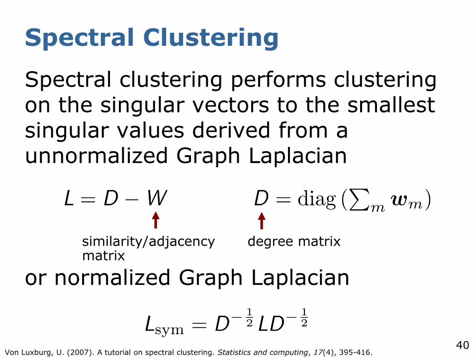
Spectral Clustering
Spectral clustering performs clustering on the singular vectors to the smallest singular values derived from a unnormalized Graph Laplacian
or normalized Graph Laplacian
degree matrixsimilarity/adjacency matrix
Von Luxburg, U. (2007). A tutorial on spectral clustering. Statistics and computing, 17(4), 395-416.
41
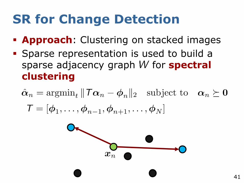
SR for Change Detection
Approach: Clustering on stacked images
Sparse representation is used to build a sparse adjacency graph for spectral clustering
42
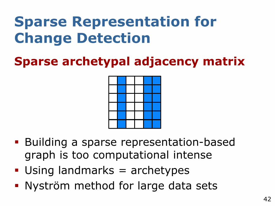
Sparse archetypal adjacency matrix
Building a sparse representation-based graph is too computational intense
Using landmarks = archetypes
Nyström method for large data sets
Sparse Representation for Change Detection
43
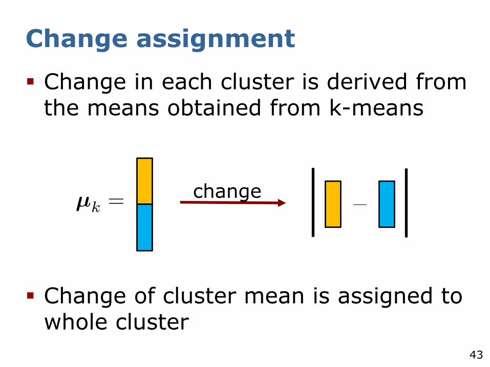
Change assignment
Change in each cluster is derived from the means obtained from k-means
Change of cluster mean is assigned to whole cluster
change
44
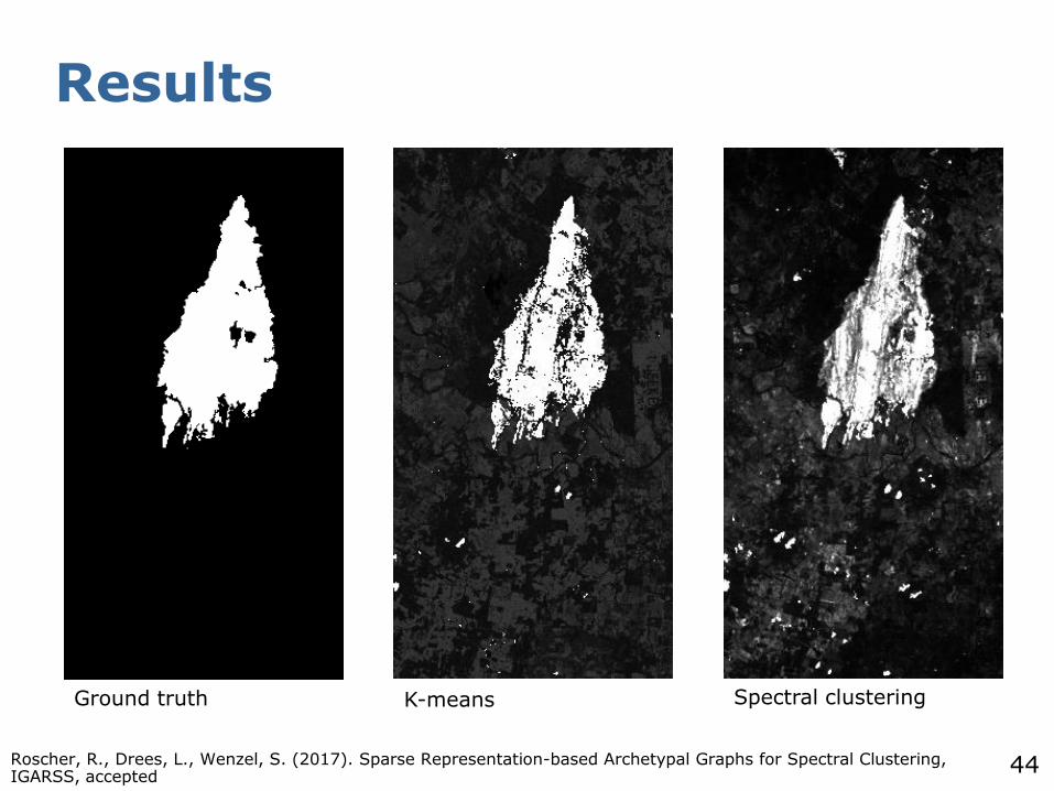
Results
Roscher, R., Drees, L., Wenzel, S. (2017). Sparse Representation-based Archetypal Graphs for Spectral Clustering, IGARSS, accepted
Ground truth K-means Spectral clustering
45
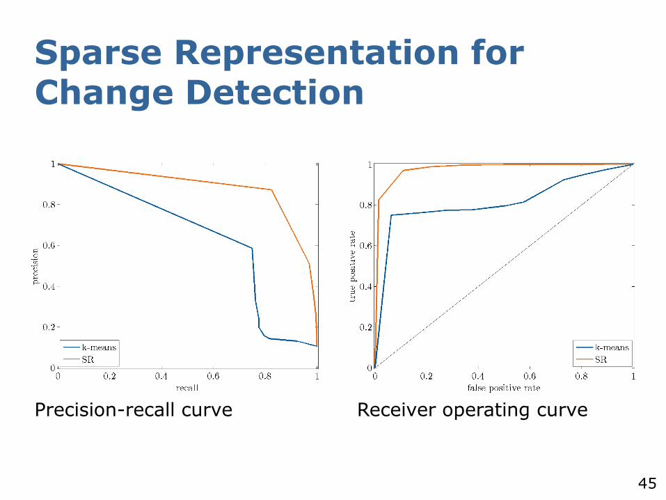
Sparse Representation for Change Detection
Precision-recall curve Receiver operating curve

46
Archetypal Analysis for Unmixing
47
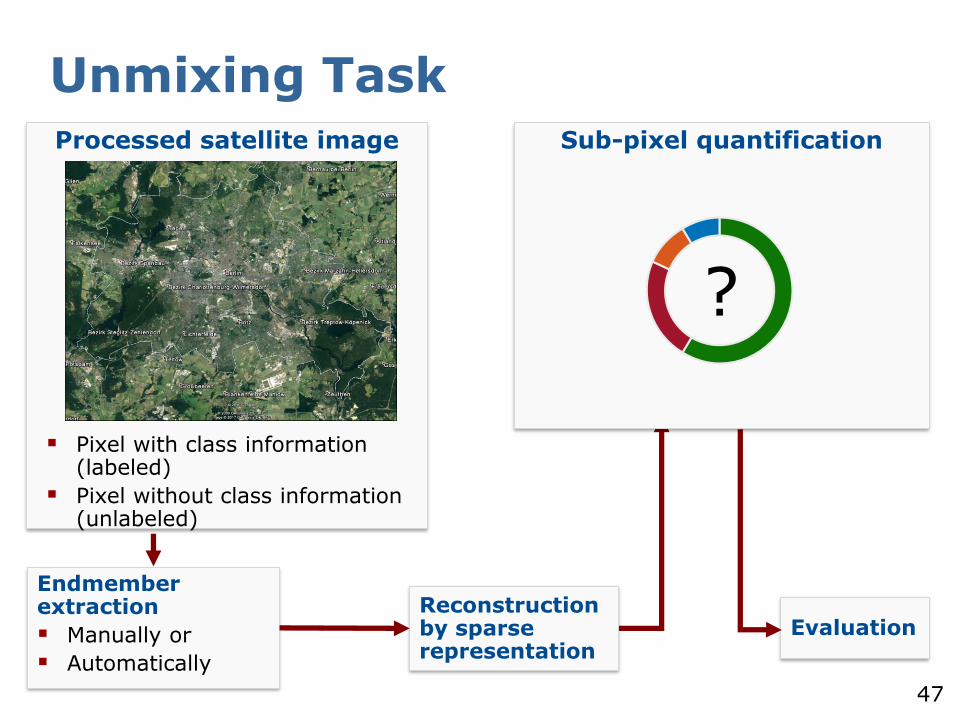
Unmixing TaskProcessed satellite image
Pixel with class information (labeled)
Pixel without class information (unlabeled)
Endmember extraction
Manually or
Automatically
Reconstruction by sparse representation
Evaluation
Sub-pixel quantification
?
48
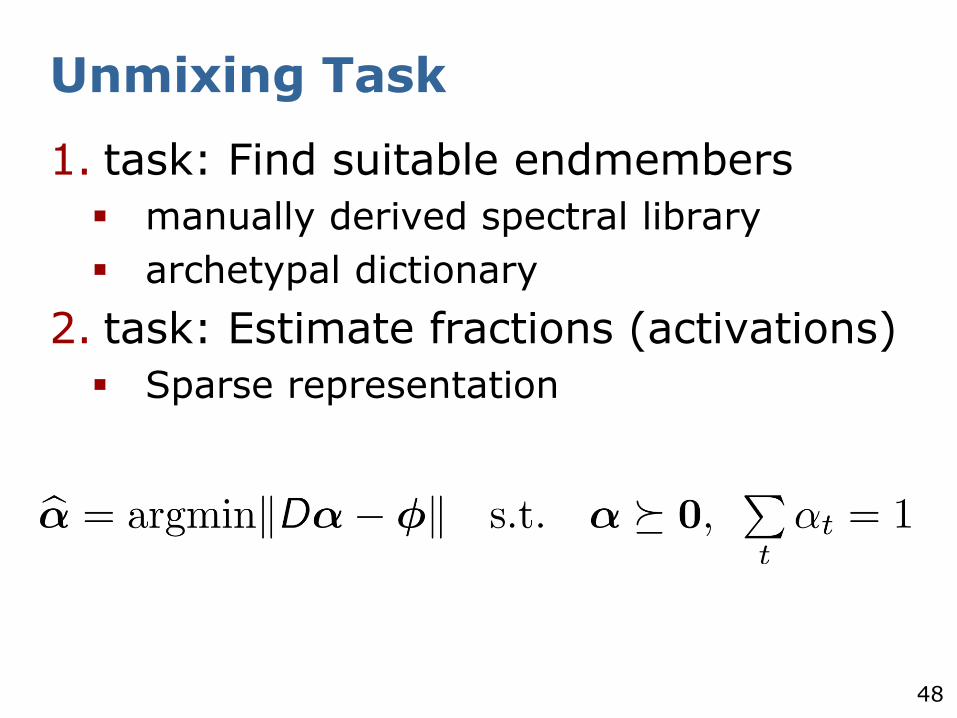
Unmixing Task
1. task: Find suitable endmembers
manually derived spectral library
archetypal dictionary
2. task: Estimate fractions (activations)
Sparse representation
49
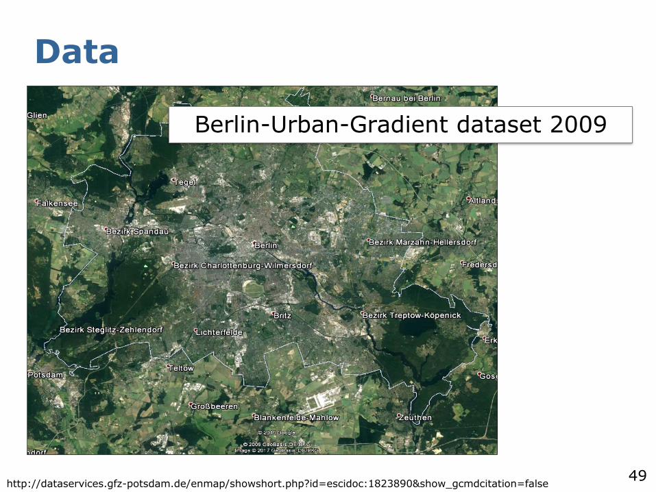
Data
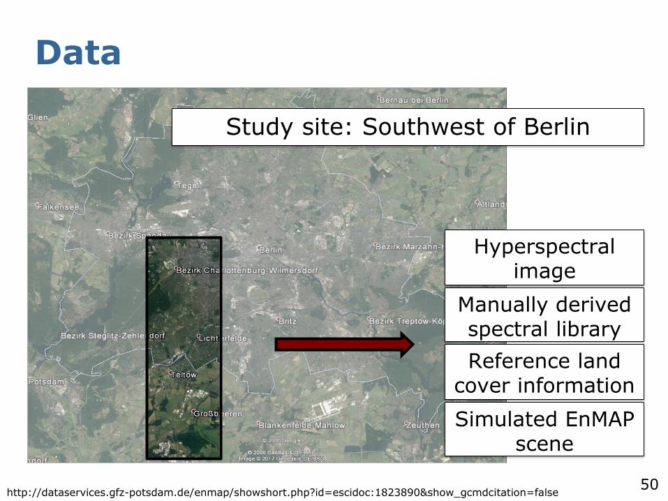
Berlin-Urban-Gradient dataset 2009
http://dataservices.gfz-potsdam.de/enmap/showshort.php?id=escidoc:1823890&show_gcmdcitation=false
50
Data
http://dataservices.gfz-potsdam.de/enmap/showshort.php?id=escidoc:1823890&show_gcmdcitation=false
Study site: Southwest of Berlin
Hyperspectral image
Manually derived spectral library
Reference land cover information
Simulated EnMAP scene
51
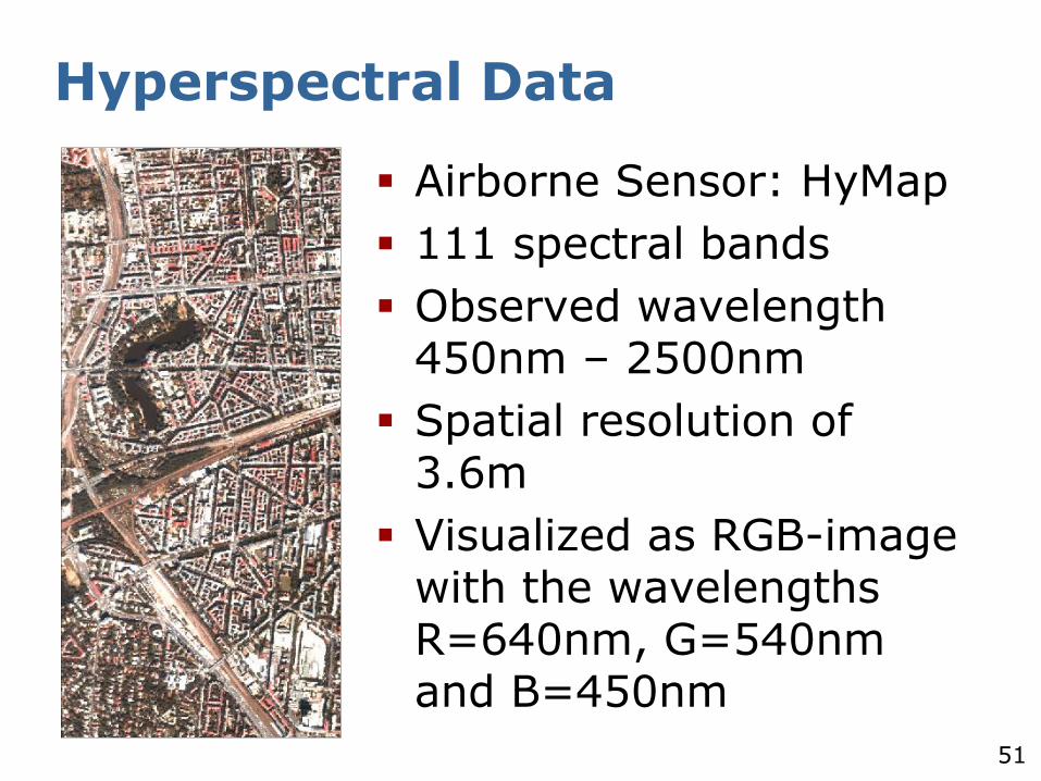
Hyperspectral Data
Airborne Sensor: HyMap
111 spectral bands
Observed wavelength 450nm – 2500nm
Spatial resolution of 3.6m
Visualized as RGB-image with the wavelengths R=640nm, G=540nm and B=450nm
52
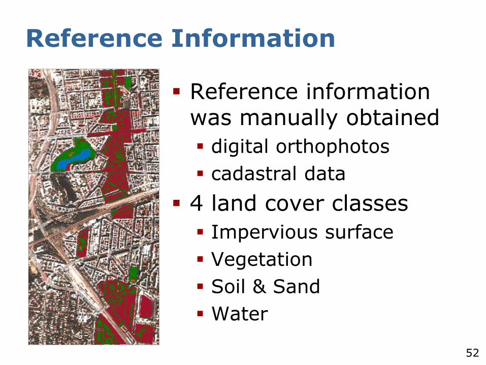
Reference Information
Reference information was manually obtained
digital orthophotos
cadastral data
4 land cover classes
Impervious surface
Vegetation
Soil & Sand
Water
53
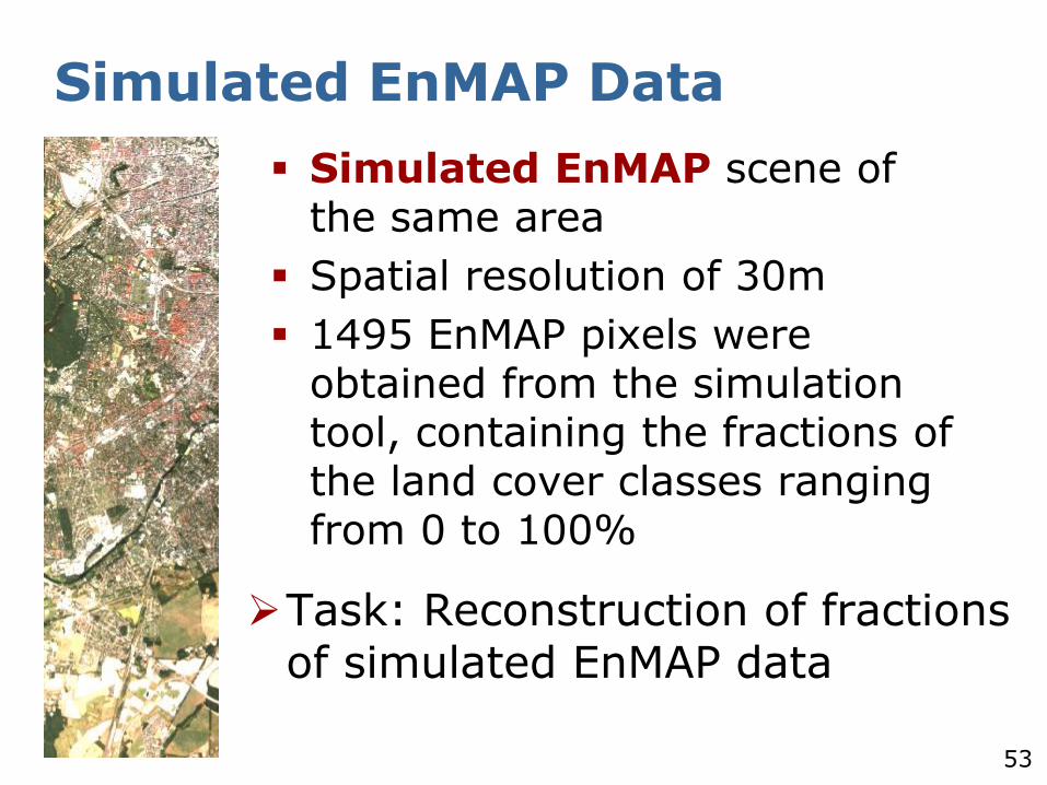
Simulated EnMAP Data
Task: Reconstruction of fractions of simulated EnMAP data
Simulated EnMAP scene of the same area
Spatial resolution of 30m
1495 EnMAP pixels were obtained from the simulation tool, containing the fractions of the land cover classes ranging from 0 to 100%
54
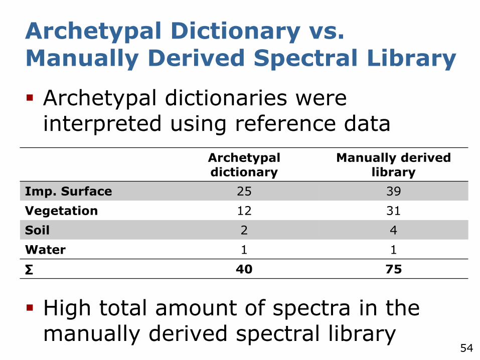
Archetypal dictionaries were interpreted using reference data
High total amount of spectra in the manually derived spectral library
Archetypal Dictionary vs. Manually Derived Spectral Library
Archetypaldictionary
Manually derived library
Imp. Surface 25 39
Vegetation 12 31
Soil 2 4
Water 1 1
∑ 40 75
55
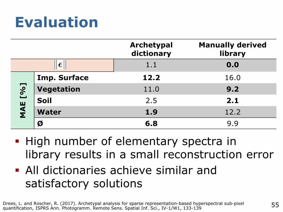
Evaluation
High number of elementary spectra in library results in a small reconstruction error
All dictionaries achieve similar and satisfactory solutions
Archetypaldictionary
Manually derived library
1.1 0.0
MA
E [
%]
Imp. Surface 12.2 16.0
Vegetation 11.0 9.2
Soil 2.5 2.1
Water 1.9 12.2
Ø 6.8 9.9
Drees, L. and Roscher, R. (2017). Archetypal analysis for sparse representation-based hyperspectral sub-pixel quantification, ISPRS Ann. Photogramm. Remote Sens. Spatial Inf. Sci., IV-1/W1, 133-139
56
Summary
Exploitation of unlabeled samples for learning
Self-taught learning
Unsupervised learning
Sparse representation is a versatile tool
More and more research goes into the direction of unsupervised pre-training in combination with supervised learning
57
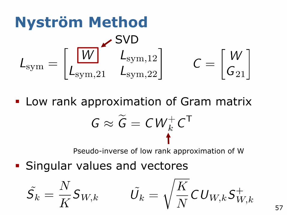
Nyström Method
Low rank approximation of Gram matrix
Singular values and vectores
Pseudo-inverse of low rank approximation of W
SVD