Unit 4: Political Geographyhistorywithcoacht.weebly.com/uploads/7/0/4/5/70451899/unit_4... · Unit...
37
Unit 4: Political Geography
Transcript of Unit 4: Political Geographyhistorywithcoacht.weebly.com/uploads/7/0/4/5/70451899/unit_4... · Unit...
Unit 4: Political Geography
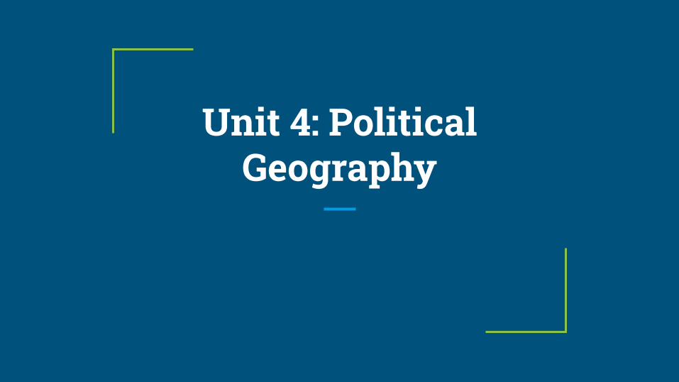
Political Geography
❖ The study of the political organization of the world➢ How people organize space
State
❖ State➢ The largest political unit ➢ Independent political unit holding sovereignty over a territory➢ Usually capitalized to should what “state” is being talked about
❖ Requirements to be a state➢ Have a defined boundary➢ Permanent population➢ Has a government and organized economy➢ Has sovereignty over domestic and international affairs➢ Recognized by other states
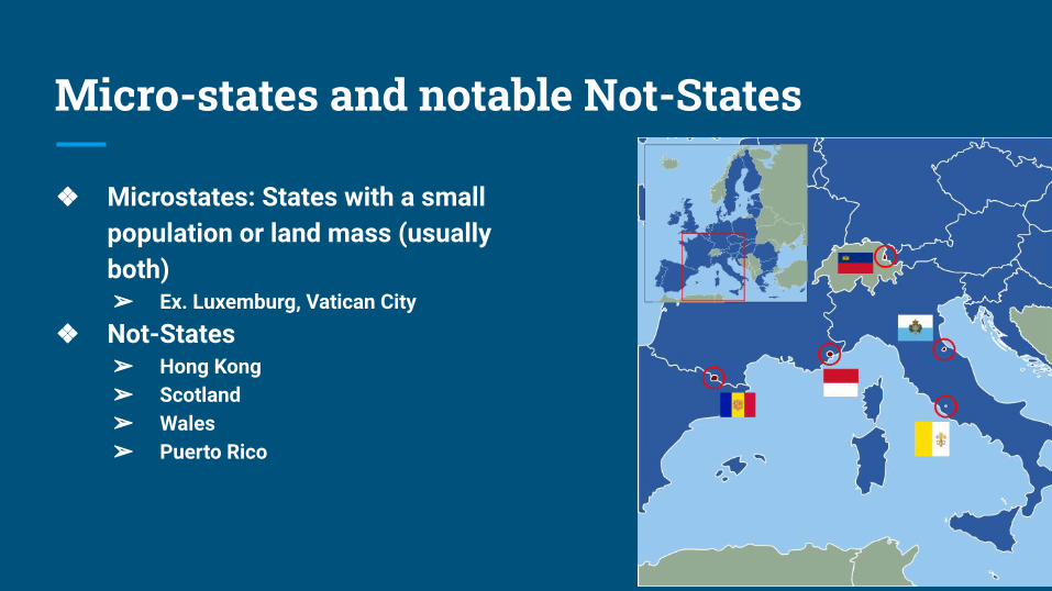
Micro-states and notable Not-States
❖ Microstates: States with a small population or land mass (usually both)➢ Ex. Luxemburg, Vatican City
❖ Not-States➢ Hong Kong➢ Scotland➢ Wales➢ Puerto Rico
Nation
❖ Community of people with a common ancestry, culture, and territory❖ A nation does not have to be a state and their can be several nations within
a state❖ Nation-States
➢ When a nation of people have a State of their own ➢ Ex. Iceland and Japan➢ Usually when 85% of a state’s population is one ethnic group
Multi-Nation State
❖ Multi-Nation State➢ A state that contains more than one nation ➢ Usually consist of one dominant nation that controls most of the power➢ Can lead to acceptance of another culture or oppression ➢ Ex. US, Russia
❖ Autonomous Regions ➢ Area with a high degree of self-governance and freedom ➢ Created by some multi-nation states to maintain cohesion
Multi-State Nation and Stateless Nation
❖ Multi-State Nation➢ When a nation has a country of their own, but the nation stretches into other neighboring
states➢ Or nation spread among several States➢ Ex. Palestinians and Albanians
❖ Stateless Nation➢ Nation that does not have a state of its own ➢ Can stretch over several nations ➢ Ex. Kurds
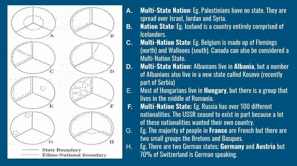
A. Multi-State Nation: Eg. Palestinians have no state. They are spread over Israel, Jordan and Syria.
B. Nation State: Eg. Iceland is a country entirely comprised of Icelanders.
C. Multi-Nation State: Eg. Belgium is made up of Flemings (north) and Walloons (south). Canada can also be considered a Multi-Nation State.
D. Multi-State Nation: Albanians live in Albania, but a number of Albanians also live in a new state called Kosovo (recently part of Serbia)
E. Most of Hungarians live in Hungary, but there is a group that lives in the middle of Romania.
F. Multi-Nation State: Eg. Russia has over 100 different nationalities. The USSR ceased to exist in part because a lot of these nationalities wanted their own country.
G. Eg. The majority of people in France are French but there are two small groups the Bretons and Basques.
H. Eg. There are two German states; Germany and Austria but 70% of Switzerland is German speaking.
Forces that have shaped the world map
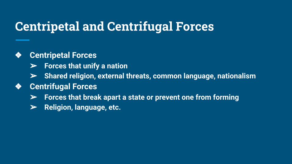
Centripetal and Centrifugal Forces
❖ Centripetal Forces➢ Forces that unify a nation➢ Shared religion, external threats, common language, nationalism
❖ Centrifugal Forces➢ Forces that break apart a state or prevent one from forming➢ Religion, language, etc.
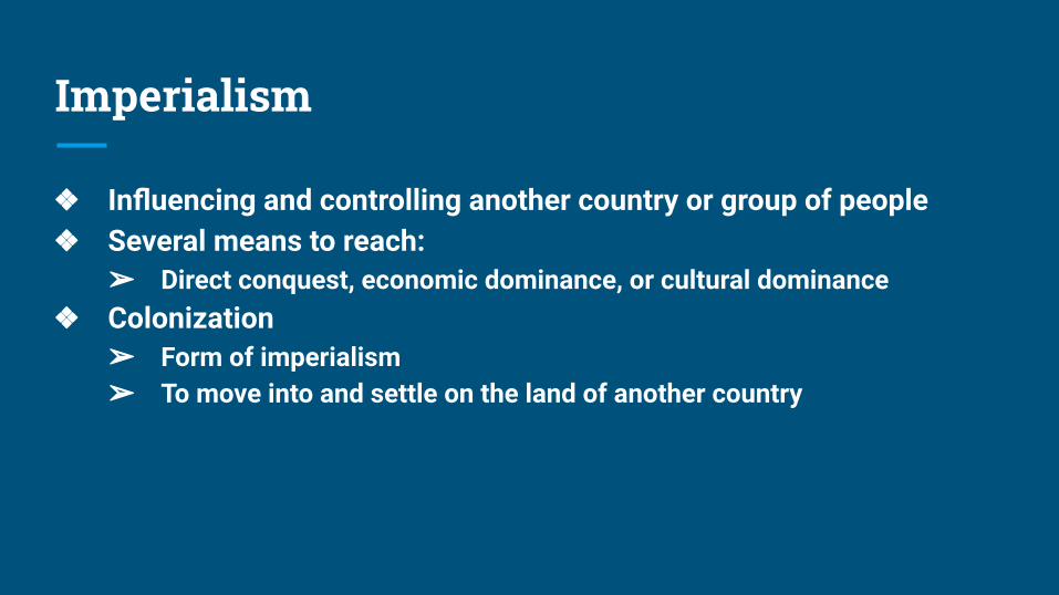
Imperialism
❖ Influencing and controlling another country or group of people ❖ Several means to reach:
➢ Direct conquest, economic dominance, or cultural dominance❖ Colonization
➢ Form of imperialism ➢ To move into and settle on the land of another country
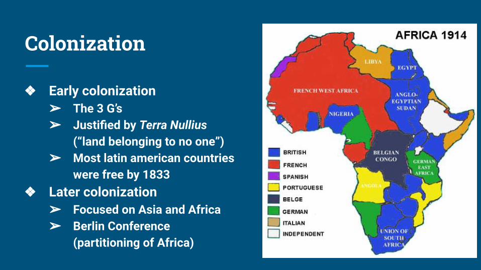
Colonization
❖ Early colonization➢ The 3 G’s ➢ Justified by Terra Nullius
(“land belonging to no one”)➢ Most latin american countries
were free by 1833❖ Later colonization
➢ Focused on Asia and Africa➢ Berlin Conference
(partitioning of Africa)
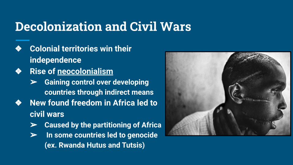
Decolonization and Civil Wars
❖ Colonial territories win their independence
❖ Rise of neocolonialism ➢ Gaining control over developing
countries through indirect means❖ New found freedom in Africa led to
civil wars ➢ Caused by the partitioning of Africa ➢ In some countries led to genocide
(ex. Rwanda Hutus and Tutsis)
Territoriality
❖ Influence or control over a geographic area❖ Geographic expression of power❖ Territorial integrity
➢ Government has right to keep the borders and territory of a state intact and free from attack
❖ Commonwealth➢ Territory with a mutual agreement with another state for the benefit of
both parties ➢ Puerto Rico and the US
Forms of Government: Unitary
❖ Highly centralized government where the capital city serves as a focus of power.➢ Centralized governments & uniform laws➢ relatively few internal contrasts➢ strong sense of national identity and unity➢ little provincial/local power
➢ Examples: France, Japan, China and newly independent states developed out of former colonies.
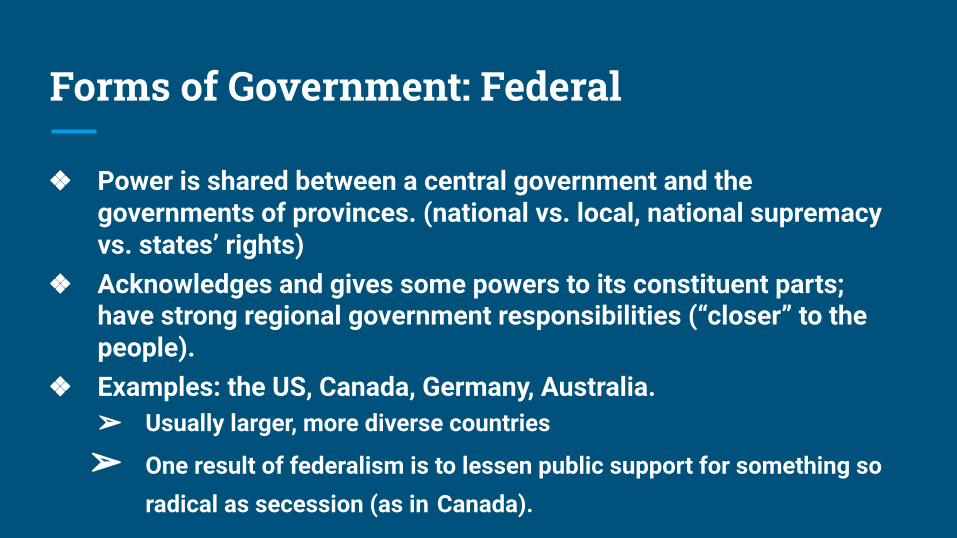
Forms of Government: Federal
❖ Power is shared between a central government and the governments of provinces. (national vs. local, national supremacy vs. states’ rights)
❖ Acknowledges and gives some powers to its constituent parts; have strong regional government responsibilities (“closer” to the people).
❖ Examples: the US, Canada, Germany, Australia.➢ Usually larger, more diverse countries
➢ One result of federalism is to lessen public support for something so radical as secession (as in Canada).
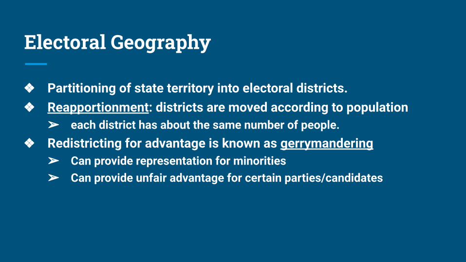
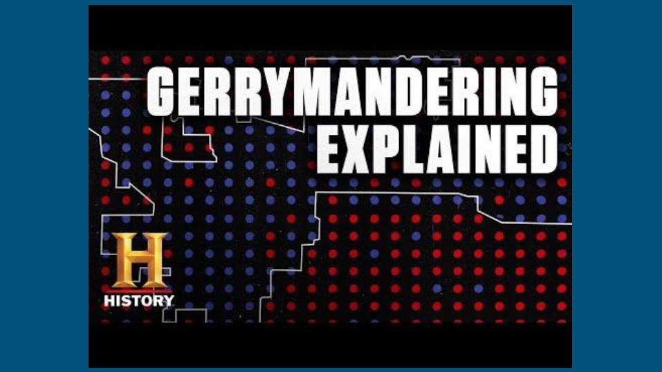
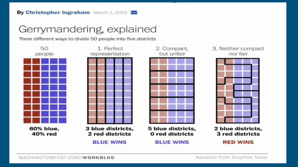
Electoral Geography
❖ Partitioning of state territory into electoral districts. ❖ Reapportionment: districts are moved according to population
➢ each district has about the same number of people.❖ Redistricting for advantage is known as gerrymandering
➢ Can provide representation for minorities➢ Can provide unfair advantage for certain parties/candidates
Geopolitics
Organic Theory
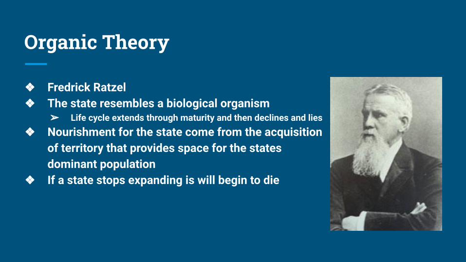
❖ Fredrick Ratzel ❖ The state resembles a biological organism
➢ Life cycle extends through maturity and then declines and lies
❖ Nourishment for the state come from the acquisition of territory that provides space for the states dominant population
❖ If a state stops expanding is will begin to die
Heartland Theory
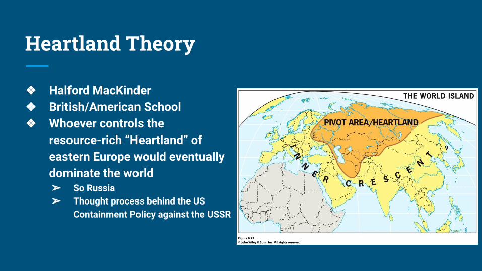
❖ Halford MacKinder❖ British/American School ❖ Whoever controls the
resource-rich “Heartland” of eastern Europe would eventually dominate the world➢ So Russia➢ Thought process behind the US
Containment Policy against the USSR
Rimland Theory
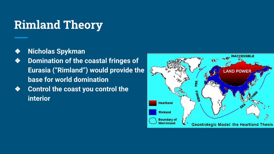
❖ Nicholas Spykman❖ Domination of the coastal fringes of
Eurasia (“Rimland”) would provide the base for world domination
❖ Control the coast you control the interior
Domino Theory
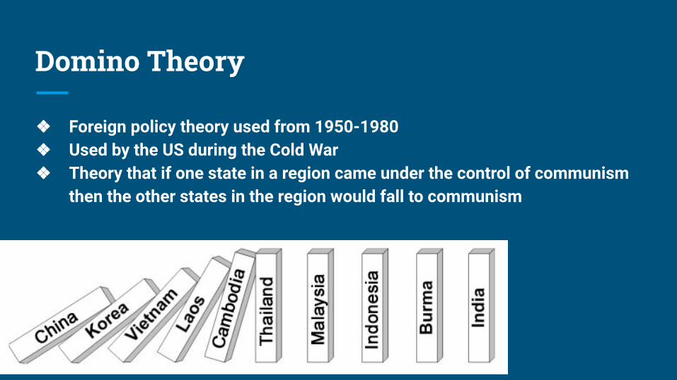
❖ Foreign policy theory used from 1950-1980❖ Used by the US during the Cold War❖ Theory that if one state in a region came under the control of communism
then the other states in the region would fall to communism
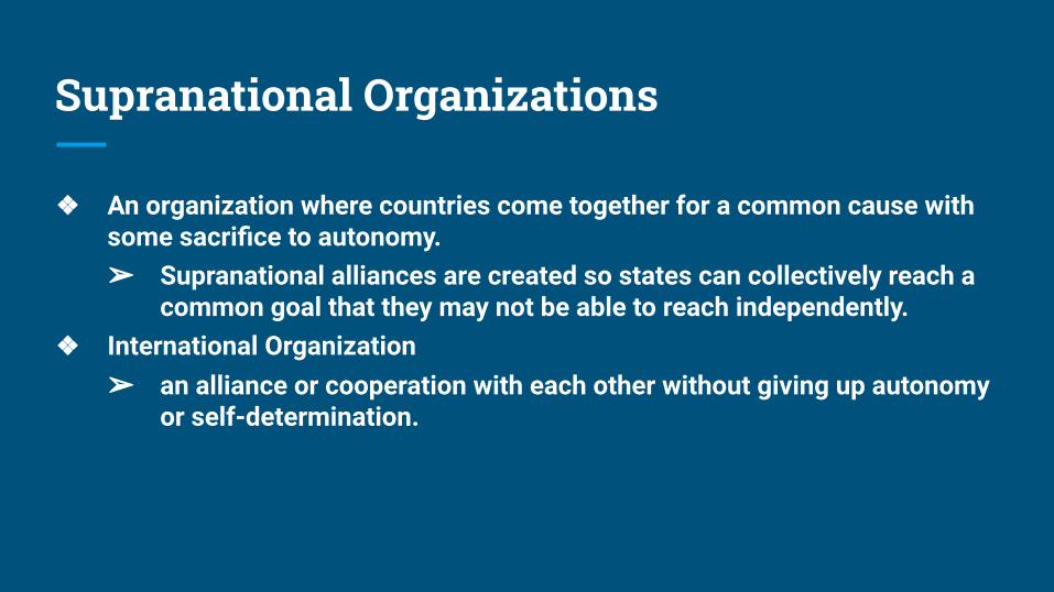
Supranational Organizations
❖ An organization where countries come together for a common cause with some sacrifice to autonomy. ➢ Supranational alliances are created so states can collectively reach a
common goal that they may not be able to reach independently. ❖ International Organization
➢ an alliance or cooperation with each other without giving up autonomy or self-determination.
Shapes of States
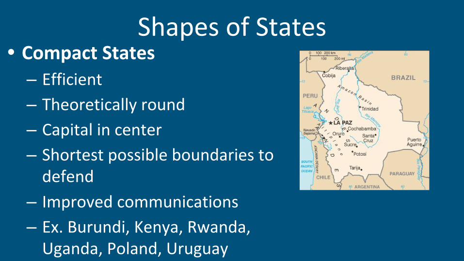
Shapes of States• Compact States
– Efficient
– Theoretically round
– Capital in center
– Shortest possible boundaries to defend
– Improved communications
– Ex. Burundi, Kenya, Rwanda, Uganda, Poland, Uruguay
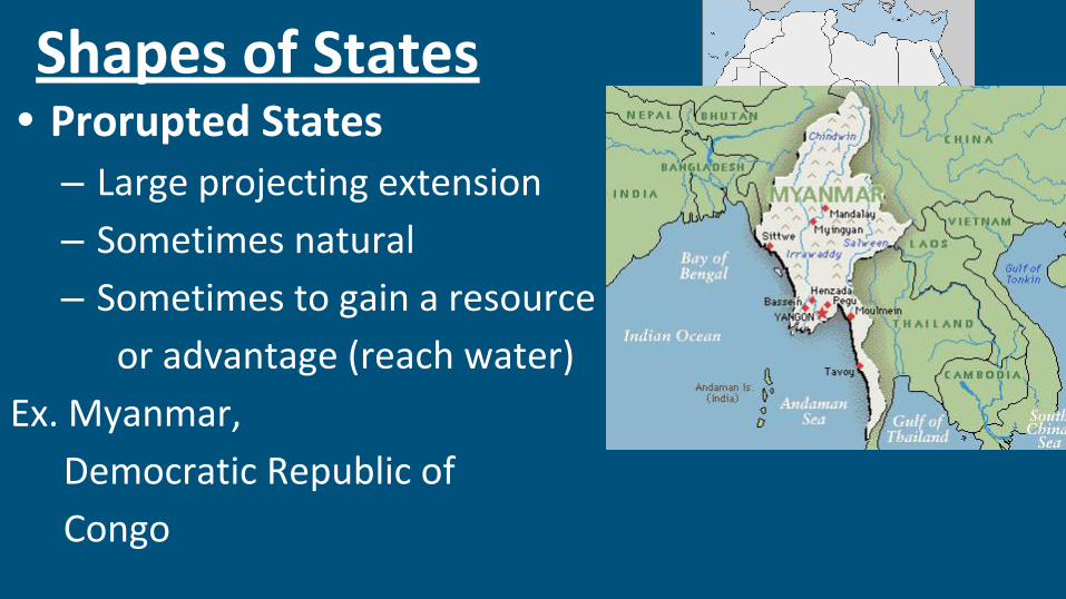
Shapes of States• Prorupted States
– Large projecting extension
– Sometimes natural
– Sometimes to gain a resource
or advantage (reach water)
Ex. Myanmar,
Democratic Republic of
Congo
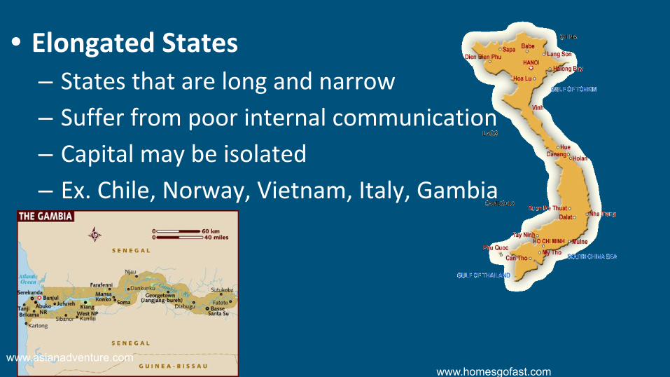
• Elongated States– States that are long and narrow
– Suffer from poor internal communication
– Capital may be isolated
– Ex. Chile, Norway, Vietnam, Italy, Gambia
www.homesgofast.comwww.asianadventure.com
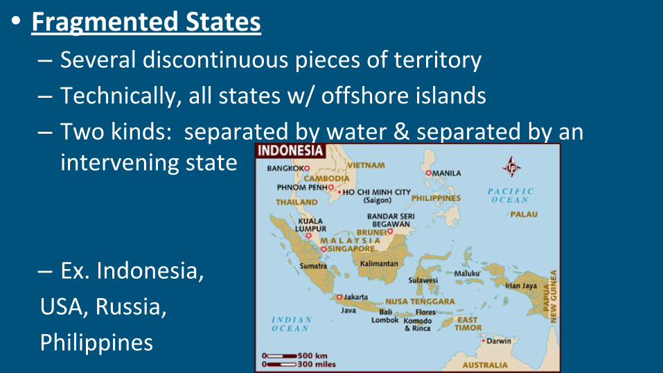
• Fragmented States– Several discontinuous pieces of territory
– Technically, all states w/ offshore islands
– Two kinds: separated by water & separated by an intervening state
– Ex. Indonesia,
USA, Russia,
Philippines
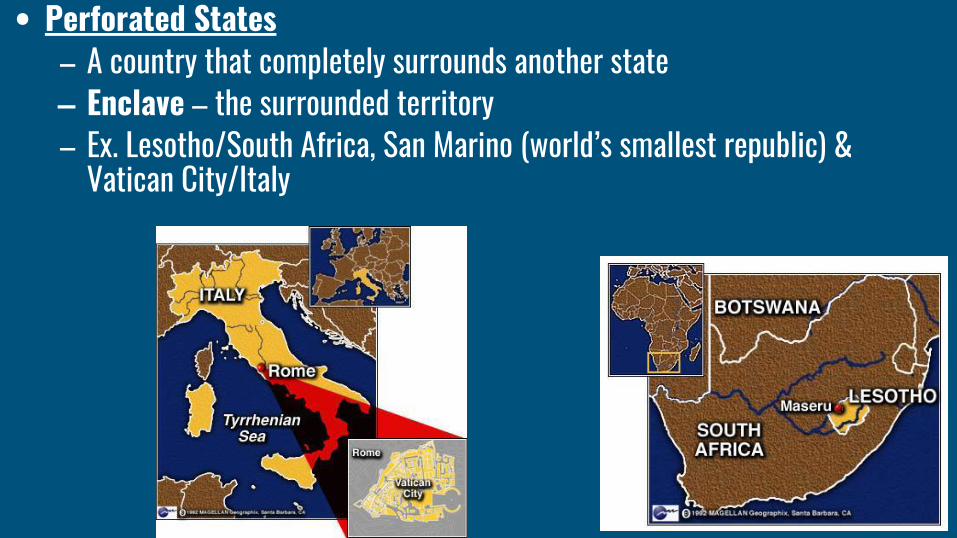
• Perforated States– A country that completely surrounds another state– Enclave – the surrounded territory– Ex. Lesotho/South Africa, San Marino (world’s smallest republic) &
Vatican City/Italy
Enclaves• area surrounded by a country but not ruled by
it.– It can be self-governing or an exclave of another
country. Example-- Lesotho
– Can be problematic for the surrounding country.
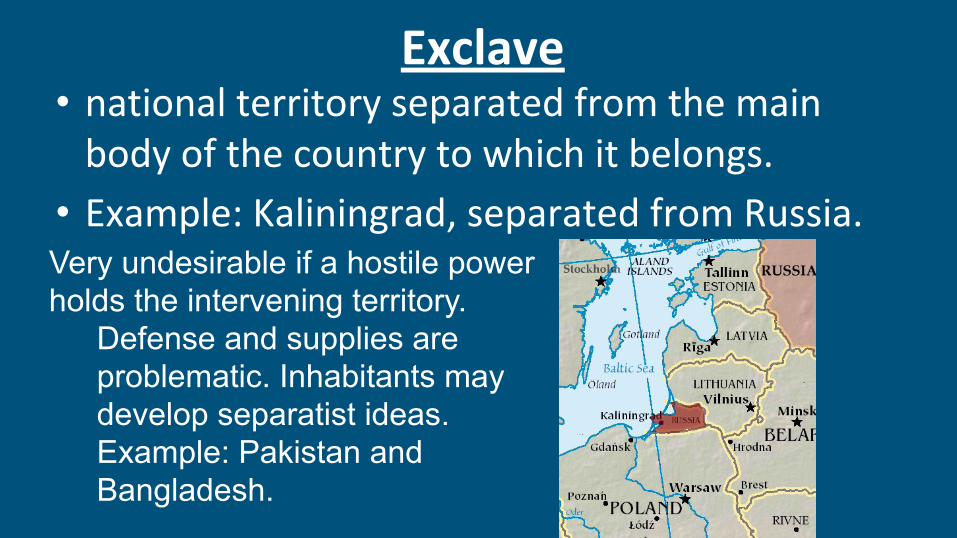
Exclave • national territory separated from the main
body of the country to which it belongs.
• Example: Kaliningrad, separated from Russia. Very undesirable if a hostile power holds the intervening territory.
Defense and supplies are problematic. Inhabitants may develop separatist ideas.Example: Pakistan and Bangladesh.
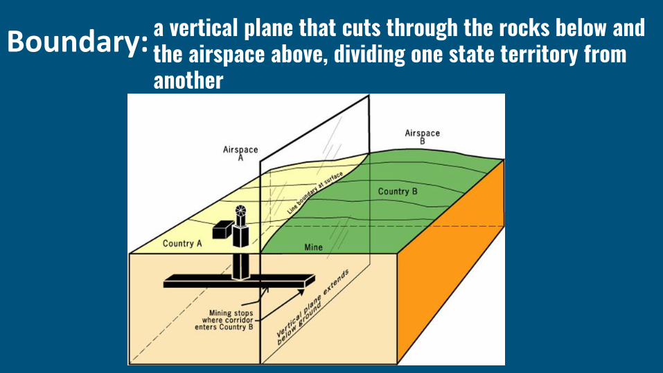
Boundary: a vertical plane that cuts through the rocks below and the airspace above, dividing one state territory from another
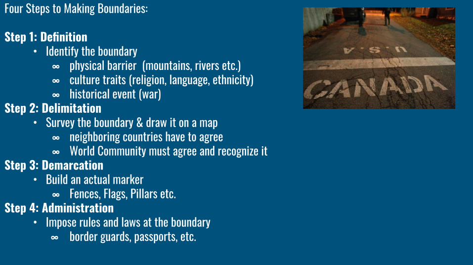
Four Steps to Making Boundaries:
Step 1: Definition• Identify the boundary
∞ physical barrier (mountains, rivers etc.)∞ culture traits (religion, language, ethnicity)∞ historical event (war)
Step 2: Delimitation• Survey the boundary & draw it on a map
∞ neighboring countries have to agree∞ World Community must agree and recognize it
Step 3: Demarcation • Build an actual marker
∞ Fences, Flags, Pillars etc.Step 4: Administration
• Impose rules and laws at the boundary∞ border guards, passports, etc.
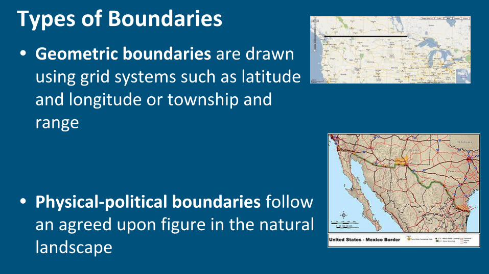
Types of Boundaries
• Geometric boundaries are drawn using grid systems such as latitude and longitude or township and range
• Physical-political boundaries follow an agreed upon figure in the natural landscape
You can even classify boundaries in the following way:
Antecedent – The boundary was set up before a settlement – Land was surveyed first. Ontario and it’s Concession System.
Subsequent – The boundary was set up after the settlement established itself. Most of the borders in the world were established after the fact so to speak.
Superimposed – Another country puts down the boundary. Colonial powers. Most of Africa was done this way – this is one of the reasons why Africa has issues
Relic - Boundaries that are no longer there, but still exist in a cultural sense. French Canada is somewhat like this.