Moving Beyond Access: Unlocking the Potential of Moving Image Archive Collections

UKHO Archive Catalogue of Collections
Document Security
Any person, other than the authorised holder, upon obtaining possession of the document should take it to the nearest Police Station or
forward it, together with their name and address in a sealed envelope to: The Principal Security Advisor,
The UK Hydrographic Office, Admiralty Way, Taunton, Somerset, TA1 2DN, United Kingdom. Telephone (01823) 337900 Facsimile
(01823) 284077
Document Control
Authors Annabel Welsh, Dr Adrian Webb, Zoe Watson
Reference/Version V1
Version Date 22.05.2019
Master Soft Copy SharePoint: 20171221 Collections level catalogue by
Welsh and Webb
Approval Archive, Dr Adrian Webb, Lorna McCarty

2
Contents UKHO Archive Catalogue of Collections 1
Introduction to the catalogue 5
Acknowledgements 6
Overview of collections 7
Catalogue of collections 11
AAC Additional Admiralty charts (not OCB ‘old copy bundles’) 11
ACB Air Chart Branch records 16
ACO Artificial collections 16
ACS Accessions (2016 onwards) 18
ADM 344 Views 18
APR Admiralty Raster Chart Service (ARCS) production records 21
ART Artifacts 22
AWN Allied Worldwide Navigation Information System (AWNIS) records 22
BDR Bathymetric data records 22
CAB Cables records 23
CBR Chart Branch records 24
CCO Chart Corrections Office (C.C.O.) records 91
CCP Catalogues of printed charts and publications 91
CIB Chart Issues Branch records 93
CMU Chart Maintenance Unit records 95
COD Catalogues of original documents 95
CON Conservation records 99
CPY Copies of records 100
CRB Composite Remark Books 100
CTR Contracts Branch records 101
DIS Displays created by the Archive and other departments 101
DVY Discovery Committee records 102
EPR Electronic Navigational Charts production records 103
FNR Finance records 103
GDY Geodesy records 103
GEB GEBCO (General Bathymetric Chart of the Oceans) records 104
HD Registered Files ‘HD’ Papers 105
HIG Hydrographic instruction graphics 106

3
HOL Hydrographic Office library 107
HOO Hydrographic Office orders to ships 108
HOP Hydrographic Office pictures 108
HOR Hydrographic Office reports 109
HRR Human Resources records 109
HTP Hydrographic Office technical publications 110
ICT Information Communication Technology Services records 111
IHO International Hydrographic Organization (IHO) records 111
ILB Indexes to Letter Books 112
IMB Indexes to Minute Books 113
IPR Intellectual Property records 113
IRB Individual Remark Books 114
ISLB Indexes to Surveyors' Letter Books (out letters) 114
LB Letter Books 115
LLR Lights Lists records 115
LOD Lists of oceanic depths 117
LOS Law of the Sea records (and maritime limits) 118
LP 1857 Incoming Letters prior to 1857 119
MAM Marketing advertising material 120
MAP Maps, published 121
MB Minute Books 134
MBE Enclosures to Minute Books 138
MEF Media films 139
MEL Meteorological data 139
MLP Miscellaneous Letters and Papers 141
MP Miscellaneous Papers (Remark Books) 142
MR Miscellaneous rolls 142
NAO Her Majesty’s Nautical Almanac Office records 143
NEM NEMEDRI [North European, Mediterranean Routing Instructions] 145
NMR Notices to mariners records 145
NPR Nautical publications records 148
OAW Original artwork 154
OCB Record copies of Admiralty charts (‘old copy bundles’) 155
OCC Other printed chart catalogues (non UKHO) 158

4
OCG Official corporate gifts 162
OCS Cancelled and superseded Foreign Government Symbols, Abbreviations and Terms
used on charts 162
OCY Oceanography records 165
OD Original Documents 166
ONM Other notices to mariners records (non-UKHO) 166
OPC Other printed charts and maps (non-Admiralty) 167
OPT Offprints 174
PGY Photogrammetry records 174
PMC Polar Medal Committee records 175
PRR Production records 176
H, HA Registered files 183
REG Registry records 183
RNW Radio Navigational Warnings records 200
RSR Radio Signals records 201
S Papers S Papers 202
SAR Sailing Directions Branch records 203
SCR Ships’ commissioning records 205
SCT Secretariat records 206
SFD Survey field data 206
SL Incoming Surveyors’ Letters 211
SLB Surveyors' Letter Books (out letters) 212
SLG Ships’ logs 212
SMB Special Minute Books 212
SPD Ships’ plans and diagrams 213
SPR Survey planning records 213
TBR Tidal Branch records 214
UHR Unofficial hydrographic records 216
UNR Unidentified records which require further attention 217
USR Unofficial staff records (including clubs, societies, publications etc) 217
WKO Wrecks Office records 218
Hydrographic surveys and incoming data, 1713-2016 218
Appendices 221
Appendix 1: Hydrographers of the Navy 221

5
Appendix 2: Abbreviations 223
Appendix 3: Accessions 232
Bibliography 243
Introduction to the catalogue
This is a high-level catalogue of the data types and collections held in the UKHO Archive. As well as
providing a description of all the collections held in the Archive, it lists the series within each
collection, together with covering dates. It predominantly covers analogue records, with a few
exceptions for records held on CD. The UKHO’s practice for selecting born digital records will remain
essentially the same as that for paper and steps are currently under way to plan for their availability.
We plan to maintain the availability of our products for researchers across the transition from the
paper chart to succeeding electronic forms.
Collections have been arranged by creator if possible. In some cases, due to the seemingly ever
changing office structure, it has not proved possible to identify the creator’s role, or office and
therefore the material has been arranged by record type. It is hoped that when the individual series
within each of these collections is catalogued in greater detail, a creator can be identified and the
records transferred to sit within the appropriate collection. As cataloguing progresses the following
collections’ descriptions, listings and covering dates will be refined and updated.
UKHO staff should use this catalogue with the ‘UKHO Collections Listing 2016’ spreadsheet. This
gives further information regarding the extent and location of records under the following headings:
• Title of collection
• Title of series
• Title of sub-series
• Unique UKHO Archive ref
• Former UKHO ref
• TNA catalogue title (if applicable)
• TNA catalogue ref (if applicable)
• First date
• Last date
• Description of content
• Creator(s)
• Public record (yes/no)
• Authority for selecting this as a public
record
• Retention period
• Format
• Extent
• Catalogued to TNA standards?
• Estimate of number of person years to
catalogue to item level
• Conservation requirements
• Finding aids
• Arrangement
• Reprographic rights
• Location
Where a catalogue or other finding aid exists for a collection, this is indicated in the spreadsheet and
in this Catalogue. For those collections which have not been listed, details of the title and location
of items within a series may sometimes be found in the ‘Complete Document Listing’ spreadsheet
entitled Contents - numbers, complete listings.
Hydrographers of the Navy are referred to in the following collections descriptions by surname only,
except for J.F. and W.E. Parry. A complete list of the names of appointment and termination of

6
Hydrographers can be found in Appendix 1 at the end of this document. Note: there were two
members of the Parry family who served as Hydrographer, necessitating the use of the initials of
their forenames when mentioned.
The terminology used in this document has been simplified wherever possible. The term
‘Hydrographic Office’, or ‘H.O.’, refers to the office established in 1795 that is today’s UK
Hydrographic Office. This has been used instead of the term ‘Department’ as there were many
departments within the Hydrographic Office during the period when the vast majority of classes of
records were created.
Due to the large amount of transformation work and retrospective cataloguing work required within
the archive, some of the records in this guide may require appraisal and selection before being
formally accessioned and recognised as the part of the UKHO’s place of deposit. This is a work in
progress.
As much archive material has been made available as possible to researchers. However, some items
in the collections will be subject to data protection legislation, and some items may be closed for
security reasons.
Until such time as all the 19th century records have been catalogued in full, this catalogue of collections should be used in conjunction with ACF David’s A Provisional Catalogue of Logs, Journals, Documents, Letters, Record Copies of Books and Pamphlets published by The Hydrographic Department, 1974. Some of the Provisional Catalogue of Logs, Journals, Documents, Letters, Record Copies of Books and Pamphlets have been replaced by more detailed descriptions.
Some information provided in this Catalogue has been used by The National Archives to update the UKHO’s retention instrument.
Acknowledgements
This Catalogue was compiled by Annabel Welsh, Dr Adrian Webb and Zoe Watson. Many colleagues have contributed to specific entries relating to their area of subject matter expertise. The authors express their thanks for their co-operation. A special note of thanks goes to our colleagues in the Archive who have answered numerous questions about the provenance of many of the collections documented in this Catalogue.

7
Overview of collections
The Archive comprises the following collections:
AAC Additional Admiralty charts (not OCB ‘old copy bundles’)
ACB Air Chart Branch records
ACO Artificial collection
ACS Accessions (2016 onwards)
ADM 344 Views
APR Admiralty Raster Chart Service (ARCS) production records
ART Artifacts
BDR Bathymetric data records
CAB Cables records
CBR Chart Branch records
CCP Catalogues of printed charts and publications
CIB Chart Issues Branch records
CMU Chart Maintenance Unit records
COD Catalogues of original documents
CON Conservation records
CPY Copies of records
CRB Composite Remark Books
CTR Contracts Branch records
DIS Displays created by the Archive and other departments
DVY Discovery Committee records
EPR Electronic Navigational Charts production records
FNR Finance records
GDY Geodesy records
GEB GEBCO (General Bathymetric Chart of the Oceans) records
HD Registered Files HD Papers

8
HIG Hydrographic instruction graphics
HOL Hydrographic Office library
HOO Hydrographic Office orders
HOP Hydrographic Office pictures
HOR Hydrographic Office reports
HRR Human Resources records
HTP Hydrographic Office technical papers
IHO International Hydrographic Organization records
ILB Indexes to Letter Books
IMB Indexes to Minute Books
IPR Intellectual Property records
ISLB Indexes to Surveyors' Letter Books (out letters)
LB Letter Books
LLR Lights Lists records
LOD Lists of oceanic depths
LOS Law of the sea records (and maritime limits)
LP 1857 Incoming Letters prior to 1857
LR Long rolls
MAM Marketing advertising material
MAP Maps
MB Minute Books
MBE Enclosures to Minute Books
MEL Meteorological data
MLP Miscellaneous Letters and Papers
MP Miscellaneous Papers (Remark Books)
MR Miscellaneous rolls
NAO Her Majesty’s Nautical Almanac Office records

9
NEM NEMEDRI
NMR Notices to mariners records
NPR Nautical publications records
OAW Original artwork
OCB Record copies of Admiralty charts (‘old copy bundles’)
OCC Other printed chart catalogues (non UKHO)
OCG Official corporate gifts
OCS Cancelled Foreign Government Symbols, Abbreviations and Terms on charts
OCY Oceanography records
OD Original Documents
ONM Other notices to mariners records (non-UKHO)
OPC Other printed charts and maps (non-Admiralty)
OPT Offprints
PGY Photogrammetry records
PMC Polar Medal Committee records
PRR Production records
REG Registry records, see also:
Bath Bath series files
CIB CIB series files
H H series files
HA HA series files
HC HC series files
HH HH series files
HMO HMO series files
HP HP series files
HP HP (Nottingham) series files
(Nottingham)
10
HS HS series files
HW HW series files
RSR Radio Signals records
S Papers S Papers
SAR Sailing Directions records
SCR Ships’ commissioning records
SCT Secretariat records
SFD Survey field data
SL Incoming Surveyors’ Letters
SLB Surveyors' Letter Books (out letters)
SLG Ships’ logs
SMB Special Minute Books
SPD Ships’ plans and diagrams
SPR Survey planning records
TBR Tidal Branch records
UHR Unofficial Hydrographic records
UNR Unidentified records which require further investigation
USR Unofficial staff records (including clubs, societies, publications etc)
WKO Wrecks Office records

11
Catalogue of collections
AAC Additional Admiralty charts (not OCB ‘old copy bundles’)
These are printed Admiralty charts that were passed to the archive but were never entered into the
OCB (‘old copy bundle’) series, usually because they did not have a standard number or were
overlooked. There may be some duplication between the collections below and the OCB series, as
well as the ‘Original Documents’.
These are an addition to the main OCB series and reflect the diverse nature of charts produced by
the office from 1800-2012. This series also contains examples of charts from surveys funded by the
Admiralty or the British Government before the Hydrographic Office published its first chart in 1800.
For example, AAC 3 is a 1774 printing of Great Britain’s Coasting Pilot that was first published in
1693; AAC 6 is a 1776 printing of Prof. Murdoch Mackenzie’s surveys prepared whilst he served as
‘Admiralty Surveyor’; AAC 12 contains some examples of charts produced by Alexander Dalrymple
whilst Hydrographer to the HEIC; AAC 47 comprises charts and views based on the work of J.F.W.
Des Barres, Army and Royal Navy surveyors in the second half of the 18th century on the east coast
of North America.
AAC 1 Coastguard charts of England, Scotland and Ireland, corrected to 1914
AAC 2 Beaufort atlas of Karamania, 1811-1812
AAC 3 Greenvile Collins folio, 1774
AAC 4 Smyth's atlas of Malta and Sicily, 1823
AAC 5 Dalrymple's chart atlas of New Holland and Pacific, 1796
AAC 6 Atlas of charts of Ireland and West coast of Britain, 1776
AAC 7 East India Company cancelled chart atlas, c. 1866-c. 1900
AAC 8 Experimental chart (2649) for HM ships experiment on radar, c. 1952
AAC 9 Route chartlets of East coast of England and Northern Europe, c. 1939-c.
1945
AAC 10 Australian fleet charts special folio, withdrawn 1930
AAC 11 Australian sailing directions charts, late 19th century
AAC 12 Pulls of chart copper plates, 18th-19th centuries
AAC 14 Ships Boats Charts and Drawing Material, c. 1940-c. 1950
AAC 15 World Distances, undated [c. 1900-1950s]

12
AAC 16 Royal Tour charts, includes tours by Queen Elizabeth II and HRH Prince
Philip, and other members of the Royal family, 1952-1989
AAC 17 Charts and material relating to Queen Elizabeth II's Diamond Jubilee 2012;
Olympic games material 2012; commemorative 25th anniversary poster for
the Falkland Islands conflict 2007, 2007-2012
AAC 18 Fleet Review charts, 1856-2005
AAC 19 Eastern Mediterranean Press Charts, 1915-1919
AAC 20 General Air Charts 200-401, 1918-1919
AAC 21 Coastal Charts, 1918
AAC 22 Eastern Mediterranean Survey, 1935-1936
AAC 23 Fleet Hydrographic Office Middle East, 1941-1943
AAC 24 German Black Sea Mine Charts, 1918-1919
AAC 25 Surveys of Egypt ‘local charts’, 1917-1920
AAC 26 Eastern Mediterranean ‘D’ Charts, 1915-1918
AAC 27 Eastern Mediterranean Press Hydrographic Department, miscellaneous
charts, 1916-1919
AAC 28 ‘E’ series of chartlets accompanying local notices to mariners, Egypt, 1916-
1919
AAC 29 Miscellaneous folder of East Mediterranean and Black Sea charts, 1916-1918
AAC 30 ‘M’ Charts produced by Fleet Hydrographic Officer, Alexandria, Egypt, 27
Mar 1940 and 31 Dec 1943, with index information
AAC 31 Charts and tracings formerly ex Base Defences Mediterranean, 1935-1936,
including correspondence relating to the return of charts
AAC 32 Berserk chain in the Portsmouth, England area, 1958-1959
AAC 33 North Sea Hydrographical Commission Charts, 1973-1992 [Former reference
number NSHC 1-2]
AAC 34 Scapa Flow and approaches, Orkney Islands, 1946 [Annotated to show
wrecks]

13
AAC 35 Battle of Jutland
AAC 35/1 Operations Division of Naval Staff under the superintendence of Captain
J.E.T. Harper M.V.O., R.N. and produced by the Hydrographic Department,
Admiralty, 19161
AAC 35/2 German plans of intended operations, Battle of Jutland, 1916, Nos. 1-7 2
AAC 36 East Indies Chart Production Unit, 1945
AAC 36/1 East Indies Chart Production Unit, under direction of Captain A. Day CBE, RN,
1945 [Some charts produced in HMS White Bear], Nos. E.I.10.018-E.I.10.305
AAC 36/2 E.I. Miscellaneous nos. 13-44, Including Plotting table diagram with grid
overprint, 1945
AAC 37 Eastern Fleet Chart Production Unit, under direction of Capt A.G.N. Wyatt
R.N., 1943-1946
AAC 37/1 Nos. 1-532, with index, 1943-1944
AAC 37/2 Miscellaneous nos. 1-13, 1943-1946
AAC 38 Miscellaneous charts found with Eastern Fleet Chart Production Unit and
East Indies Chart Production Unit, 1945
AAC 39 East Africa Force Charts nos. EAF 249-730, 1913-1941, reproductions of
Italian and British charts, reproductions of French maps, gridded British
charts of Indo-China and Eastern archipelago area, Gnomonic D/F chart of
Indian Ocean
AAC 40 Technical History Section of Admiralty Charts, 1917
AAC 41 Zeebrugge Charts, 1930
AAC 42 Sea Ice Distribution in the Atlantic between 7 and 92 W, John A. Heap, 1963,
published by Hydrographic Department
AAC 43 Naval Staff Intelligence Department, 1929
AAC 44 Map prepared by Admiralty War Staff, I.D., drawn and printed at Ordnance
Survey, of Baltic States, Turkey and River Euphrates (H1704/1919), 1917
AAC 45 Fleet Review Charts, 1910s-1960s
1 [Digitised] 2 [Digitised]

14
AAC 46 Proofs of copper plates 18th – 19th century. See also AAC 12
AAC 46/1 Proofs of copper plates, numbers 0-5000 and upwards, including index
sheets A-V2, W 18th – 19th century
AAC 46/2 Proofs of copper plates by Alexander Dalrymple, 18th – 19th century
AAC 46/3 Proofs of copper plates by Horsburgh, 18th – 19th century
AAC 47 Des Barres’ charts and views, 18th- 20th century
Joseph Frederick Wallet Des Barres was descended from a refugee
Huguenot family and was trained at Woolwich. He was present at the St
Lawrence Campaign of the Seven Years War with Captain James Cook and
Major Samuel Holland. After the Peace of Paris he was sent to Nova Scotia
and the American colonies for 10 years continuous surveying. He returned
to England in 1774 and was engaged on the publication of his charts of the
American coast which became urgent because of the outbreak of the
American War of Independence.
The result was a series of engravings of views and charts, first published in
1777 as the "Atlantic Neptune" series and revised over a period of ten years
(see Professional Paper 13 for further details).
There were in all between 250 and 260 separate sheets of which many were
re-issued in amended form as new information came to hand, so extending
to a complete set of over 780 distinct issues. The engraved copper plates
remained in the possession of Des Barres until 1820 when they were
purchased by the Board of Admiralty. In later years the charts from these
plates were superseded by others, and in 1828 the plates were examined
with a result that 167 were set aside for replenishing for further engraving
of charts and 84 were sold. Of those retained untouched, 30 were of the
Canadian coast and 34 of the eastern shores of the USA. In view of their
historical interest, these were presented by the Admiralty in 1946 and 1947
to the governments of the countries whose territories they cover (See
Appendix C).
The Hydrographic Office holds in addition to the manuscript surveys, copies
of the charts that were engraved and published. These are in 2 forms and
are shown on a graphical index.
Appendix A-C available as separate documents.
Appendix A [ref AAC 47]
Of the early impressions from plates by Des Barres we hold approximately
170 charts and 30 views. The copies sometimes show differences as the
plates were amended between issues. Many are hand coloured to
distinguish topographical details. They have been given a designated office

15
number from 1 to 84. Appendix A is not the complete list of Des Barres
holdings in the Hydrographic Office. The copper plates which were disposed
of had proofs pulled before destruction. A complete set of these are held
and can be identified as Cancelled Copper 'A' charts. Please refer to the
Cancelled Copper Pulls Catalogue 'A' series. The list has not been checked
against the holdings – 2019.
Appendix B
The Nova Scotia Atlas. These are copies of the "Atlantic Neptune" bound
into a volume. The index shows the charts cross referenced to the separate
sheets in Appendix A.
Appendix C
List of Copper Plates presented to USA and Canada.
See also: Z52 Originals surveys by Des Barres from which the plates were
engraved
Z52/1 Nova Scotia between the entrance to St. Margaret's Bay and Canso,
1764-1765
Z52/2 Nova Scotia between the entrance to St. Margaret's Bay and Canso,
1764-1765
Z52/3 SW of Nova Scotia from Isle Hope to Cape Sable, Seal Islands, Cape
Fourchu, 1764-1765
Z52/4 Nova Scotia, Sambro light house to Rugged Islands, 1764-1765
Z52/5 North coast of Nova Scotia, River Philip to Thoms Head, 1764-1765
Z52/6 Port Amherst and Townsend Harbour, 1764-1765
Z52/7 Ramshick Harbour to River Philip, 1764-1765
Z52/8 Port Hood, 1764-1765
Z52/9 Richmond Harbour to Richmond Inlet, 1764-1765
Z52/10 St Peters Bay, 1764-1765
Z52/11 Crow Harbour and view, 1764-1765
Z52/12 No details
Z52/13 Views of Cape Blowmedown, Cape Split, Spencers Island and
entrance to Mines Bason, Isle Haut and Cape Chegrecto, 1764-1765

16
Z52/14 Torbay with colour view of Berry Head and White Head Islands,
1764-1765
Z52/15 Nova Scotia, 1764-1765
AAC 47/1 Index of impressions made from Des Barres copper plates in 1947-1948
including areas of West Indies, Newfoundland to Bermuda, Cape Breton to
Delaware Bay, 18th Century-1948
AAC 47/2 Des Barres Charts numbers 1-84, 18th Century
AAC 47/3 Des Barres Views 8-81, 1-28, 18th Century
AAC 47/4 Des Barres A series cancelled copper plate pulls, 18th Century
AAC 47/5 Des Barres modern pulls from copper plates, 18th Century – 20th Century
AAC 47/6 Des Barres mounted prints from copper plates, 18th Century – 20th Century
AAC 47/7 Des Barres original drawings, 18th Century
Related records:
OCB Record copies of Admiralty charts (‘old copy bundles’)
OPC Other printed charts and maps (non-Admiralty)
ACB Air Chart Branch records
ACB 1 Naval air pilots, 1943
ACB 2 User guide for airdata extract system, 1991
ACO Artificial collections
These collections have not evolved as part of the activities or administration of the Hydrographic
Office but have been assembled by staff (at an unknown date) for a particular purpose.
ACO 1 ‘D’ Day material, 1942-2004
ACO 2 Falklands conflict, 1980s-1990s
ACO 3 Building plans, construction paperwork and related records, mainly 2000s
ACO 4 Operation Neptune, c. 1939-1945

17
ACO 5 Operation Granby, 1990-1991
ACO 6 Coastguard Charts 1874, used by the Hydrographic Department
ACO 7 Miscellaneous Folios, printed charts, data sources, 1878-1970
ACO 8 Folder of miscellaneous diagrams and information, 1854-1932
ACO 9 Examples Illustrating the State of Admiralty Charts, 1 Sept 1945
ACO 10 Fleet Review Pamphlets, 1910s-1960s
ACO 11 Charts by various producers, 18th-19th century
ACO 13 Collection of documents perhaps separated from their original location, 19th
century: 1 Non-Hydrographic office item, Portsea Island reclamation; 2 Non-
Hydrographic office item, chart of the Bay of Charges, Royal Society, plate V,
1829; 3 Non-Hydrographic office item, chart of the Bay of Limon or Navy
Bay, Royal Society, plate IV, 1829; 4 Tracing of River Thamer, Barrow Deep,
tracing to fit chart, 1607; 5 Survey with cross reference to enclosure
S76/1893, I, Boura Bay, c. 1893; 6 Survey with cross reference to S76/1893,
II, Port Bouquet, Tupeti Bay and Nemmen Bay, c. 1893; 7 Survey with cross
reference to S76/1893, III, Banaie Bay, c. 1893; 8 Survey roughs, Carataka
Shoals, 4 miles south of the west end of the Grand Hubby Bank, undated; 9
Survey roughs, The Vivorillas, undated; 10 Survey roughs, Nicaragua, Hog
Cay, Mosquito Coast [refer to L753, D2946, D2947 and chart 605 12 N or S
unknown 20’, 83 37’ W], undated; 11 Survey Caribbean, South Coast of
Dominican Republic, vicinity of Jacmel, Smith and Alenutt, 1951; 12 Costa
Rica, Pope Island, Saddle Hill, Captain Barnett, HMS Thunder, 1839-1840; 13
Costa Rica, Plantain Cay, Toobo Bo Bight, Captain Barnett, HMS Thunder,
1839-1840; 14 Survey roughs, Ascension Bay, undated
ACO 14 Cobweb surveys by the Royal Navy, c. 1930s-1940s
ACO 14/1 Cobweb surveys of River Humber, c. 1930s-1940s
ACO 14/2 Cobweb surveys of River Thames, c. 1930s-1940s
ACO 14/3 Cobweb surveys of River Medway, c. 1930s-1940s
ACO 15 River Severn barrage feasibility study and set of surveys, surveyed by the
Royal Navy, 1926-1927

18
ACS Accessions (2016 onwards)
Accessions received by the Archive from 2016 onwards. This does not include extensions to existing
series records received from 2016 onwards that have been added. From 2011-2016 only a few
details about accessions were recorded and any paperwork was kept with the records themselves.
Any accessions received before 2016 will not have been given the reference ACS. Many accessions
before 2010 (except survey data) may not have any accompanying paperwork, unless they have a
reference written on them starting with a letter ‘H’ or ‘S’; this is followed by a short series of
numbers which refers to a registered file that may or may not have survived.
Once an accession is fully catalogued, it will join an existing collection (or form a new collection
where appropriate) and be allocated that collection’s three letter reference code (the accessions
number will remain ‘in the background’ for administrative purposes).
Staff should use the Accessions Register for a complete and up-to-date listing. See also Appendix 3.
ADM 344 Views
Views were used in the publication of charts and sailing directions, and occasionally for planning
purposes.
Coastal views were created to provide navigators with depictions of the coast, especially harbours,
ports, navigational lights, markers and hazards. Some of these views appeared on published
Admiralty charts and in Admiralty sailing directions. They are found in albums and sketch books, as
extracts from printed and manuscript charts. These views were created by Royal Navy, Merchant
Navy and civilian personnel. They are of world-wide coastal and riverine scenes.3
The quality and size of the views varies. Some are watercolour sketches; others are simple drawings
in pen and ink. Many are published, such as engravings, photographs, lithographs and postcards.
Some are thumbnail sketches, whereas the longest is 5 metres by 1 metre.4 This collection also
contains photographic prints, hand drawn sketches, rolls of photographic film, tracings, drawings on
film, some correspondence, all in varying shapes and sizes, from the 1830s up to the 1980s.5
They provide a record of geological formations, physical geography, coastal topography, shipping,
shore installations, lighthouses, navigational figures, forts and other buildings. They also show the
work of the hydrographic surveyor over a period of 250 years. As drawing was a fundamental part of
a young sailor’s education, there are some examples of views that are of a high standard and are
3 A.J. Webb, Guide to the Views in the United Kingdom Hydrographic Office Archive Collection’, (2017), p.4. 4 UKHO Archive, D1377 view of Sevastapol. 5 Webb, Guide to the Views in the United Kingdom Hydrographic Office Archive Collection’, p.4.

19
works of art in their own right.6 Roughly speaking the quality of views accumulated by the Admiralty
developed from some basic profiles into works of artistic merit by the end of the 18th century. By the
end of the 19th century the practical use of views meant that the basic profile was all that was
required for Admiralty products. About the same time photography was becoming more common,
and this eventually became the normal way of recording views of the coast.7
There were five types of view. These were classified in 1980 as panoramic, portrait, pilotage, aerial
oblique and close-up.8
In addition to views being of primary use to navigation, occasionally illustrations of ethnographical
interest were recorded. Sometimes these were simply included as they appeared in the view of the
coast. At other times they were drawn separately, specifically as a matter of record of something
that must have been unusual and noteworthy.9
The Admiralty was accruing coastal views before the Hydrographic Office was established in 1795. In
1823 Lieutenant A.B. Becher started listing the ‘original documents’ in the office. These were mainly
manuscript surveys and foreign government charts, but included some views. Subsequently when a
volume of views was received it was usually given a unique archival reference. He inserted the
smaller views and sketches in 'View Portfolios' that were later migrated into View Albums.10 It
appears that many views that were in volumes, such as sketch books, were kept as such until the
end of the nineteenth century.11
The first photographic views were received in the Department as early as 1854.12
The usual practise was to include views and sketches on the original survey fair sheet. A landmark
decision in 1861 resulted in an order for views to be sent in to the office on separate sheets and
recorded and retained in the View Albums. This made the production process simpler as the view
engraver did not have to handle the survey fair chart.13
Many of the view originals were disposed of in the 1880s during a re-cataloguing of the collection.14
A ‘Guide to the views in the UK Hydrographic Office Archive Collection’ was compiled by Dr Adrian
Webb in 2017. This includes an introduction and general history of views, as well as details on the
arrangement and composition of the various series of views held at the UKHO. There is also
6 Webb, ‘Guide to the Views in the United Kingdom Hydrographic Office Archive Collection’, p.4. 7 Webb, ‘Guide to the Views in the United Kingdom Hydrographic Office Archive Collection’, p.6. 8 Hydrographic Department, Views for sailing directions (Taunton, 1980), p.9. 9 Webb, ‘Guide to the Views in the United Kingdom Hydrographic Office Archive Collection, p.6. 10 Pascoe, The story of the Curator of the Hydrographic Department of the Admiralty, pp.36-37 and Webb, ‘Guide to the Views in the United Kingdom Hydrographic Office Archive Collection, p.7. 11 Ex inf Dr A.J. Webb, 2017. 12 Pascoe, The Story of the Curator of the Hydrographic Department of the Admiralty, p.29. 13 Webb, ‘Guide to the Views in the United Kingdom Hydrographic Office Archive Collections, pp.7-8. 14 Pascoe, The Story of the Curator of the Hydrographic Department of the Admiralty, p.28.

20
information about what other material in the Archive should be consulted when looking for views.
This guide is held electronically and there is also a hard copy version available in the Research
Room.15
ADM 344, held at The National Archives, currently only contains part of the series of views
accumulated by the Hydrographic Department. The remaining 25,000 documents are held in the
UKHO Archive and are being reviewed, packaged and catalogued. The prefix ‘ADM 344’ is being
used for this cataloguing project.
The following arrangement is the result of either artificial gatherings of records, or due to a
production process. To make this arrangement clearer the terms ‘Series One’, ‘Series Two’, etc have
been created. These are artificial terms, but their addition clearly shows the arrangement of the
records; this arrangement is described in detail in the guide.16
SDRA, 2005-present [2019]
From 2005 the majority of views received in the office were included in the Source Data Receipt system, unless they have copyright limitations. Access to this series can only be made through a member of staff.
Admiralty Library, c. 1600-1900
Amongst the many atlases and flat documents held by the Admiralty Library are numerous documents containing views. For more information contact the Admiralty Library.
ADM 344/ Series One, 1743-1972
ADM 344/ Series Two, 1800-1943
ADM 344/ Series Three, c. 1830-2000
ADM 344/ Series Four, c. 1900-1980
ADM 344/ Series Five, 1931-1994
ADM 344/ Series Six, 1931-1994
ADM 344/ Series Seven, c. 1790-1900
Related records:
AAC Additional Admiralty charts (not OCB ‘old copy bundles’)
15 Webb, ‘Guide to the Views in the United Kingdom Hydrographic Office Archive Collection’. 16 Webb, ‘Guide to the Views in the United Kingdom Hydrographic Office Archive Collection’, p.8.

21
COD 7 Registers of view albums
CRB Chart Branch records
IRB Individual Remark Books
MP Miscellaneous Papers (Remark Books)
NPR Nautical publications records
OCB Record copies of Admiralty charts (‘old copy bundles’)
OD Original Documents
OPC Other printed maps and charts (non-Admiralty)
SAR Sailing Directions records
Hydrographic surveys
REG Registered files, 1866-2009
APR Admiralty Raster Chart Service (ARCS) production records
The Admiralty Raster Chart Service (ARCS) is an electronic raster chart service provided by the UKHO.
Charts are exact digital copies of British Admiralty paper charts used for marine navigation,
produced in a raster format. The service was established c. 1995.
APR 1 Raster Base maintenance update record samples, 1993-1994

22
ART Artifacts
A collection of objects related to the history of the Hydrographic Office, or to the field of
hydrography and related disciplines more generally. The largest series within this collection is a
collection of drawing instruments. H.M.N.A.O. hold a small number of artifacts dating from before
2008 when they moved from Didcot to Taunton to join with the U.K.H.O. These have been given the
code ART.
ART 1-95 Various artifacts, 19th century to present [2019]
Related records:
NAO Her Majesty’s Nautical Almanac Office
OCG Official corporate gifts
AWN Allied Worldwide Navigation Information System (AWNIS) records
AWNIS collates, coordinates and communicates navigational safety and security information to
merchant shipping and military authorities within an operational area. As this information relates to
the general maritime community, it works almost exclusively through the existing Worldwide
Navigational Warning Service (WWNWS) architecture. Responsible for both classified and
unclassified information, AWNIS delivers assurance to military commanders and merchant mariners
against the additional risks to safety and security of Navigation that are associated with maritime
operations. 17
AWN 1 Working papers of a desk officer, 1946-1960s
BDR Bathymetric data records
Records created and processed by the Bathymetric Data Centre (BDC). BDC was renamed in 2016 to
the Scientific Analysis Group, Terrestrial Team. Data from 2012-2017 was recorded electronically.
Earlier records are found in other series, particularly in the OCB series, where the results of
observations can be found incorporated into charts published by the UKHO.
BDR 1 Bathymetric validation and appraisal checklists, 2001-2011
17 Taken from https://mc.nato.int/nsc/page14865015.aspx, accessed 21 May 2019

23
CAB Cables records
The first submarine cable was laid in 1850 from Dover to Calais. Plans to expand this activity and
create a much larger network required information on oceanic depths. The initial focus was on the
Atlantic and, owing to the American Civil War, the organisation of the transatlantic cable project fell
more to Britain and the Hydrographic Department than to its American counterpart.18 The telegraph
companies supplied the Department with copies of all the large scale surveys of the original lays and
subsequent splices and small scale Secret Telegraph Charts were issued to the Fleet and embassies,
showing the position of all the cables.19 There was ongoing concern about the damage done to
submarine cables by trawlers. Despite this, in 1911, the Admiralty maintained their decision not to
show cables on Admiralty charts.20
In 1968, after the relocation of staff from the Cricklewood site to Taunton, a specific branch was
created with a responsibility for Cables.21
CAB 1 Blueprints, 1934-1972
CAB 2 Working papers, c. 1970s-c. 2005
CAB 3 Cable beacons, c. 1960s-c. 1970s
CAB 4 Fleet charts, c. 1960s
CAB 5 Information relating to telegraph cables ledgers, 1908-1984
CAB 6 Fleet telegraph chart folios, c. 1930s-c. 1960s
Related records:
LOD Lists of oceanic depths
18 A. Day, The Admiralty Hydrographic Service (London, 1967), pp.70 and 83. 19 L.N. Pascoe, The Story of the Curator of the Hydrographic Department of the Admiralty 1795 to 1975, (unpublished), p.37. 20 Day, The Admiralty Hydrographic Service, p.265. 21 R.O. Morris, Charts and Surveys in Peace and War: The History of the RN Hydrographic Service 1919-1970 (London, 1995), p.213.

24
CBR Chart Branch records
The activity undertaken by Chart Branch can be traced back to the establishment of the Department
in 1795 when the first Hydrographer, Dalrymple, was given the budget to employ one permanent
draughtsman. More draughtsmen were employed on both a permanent and temporary basis from
1808 to 1829 to deal with an increasing backlog of work.22 This number increased to four in 1831
and six by 1855.23 The title Chart Branch first appeared in the Navy Estimates for 1854-1855. It
embraced naval assistants, draughtsmen, packers and porters. The first Superintendent of Charts
was appointed in 1862. In 1879 that title became Officer in Charge, Chart Branch, but in 1908 the
title of Superintendent of Charts was reassumed.24
Chart Branch was responsible for the compilation of charts, i.e. the bringing together of sources and
drawing up of a ‘compilation’ that was then sent to an engraver for engraving onto copper. Once it
had been decided to produce a chart of a particular area, on a particular scale, all data held on that
area in the archives would be gathered by the cartographer or draughtsman. These sources would
be examined, differences reconciled, and from them a ‘compilation drawing’ would be made. The
work would be checked before being approved for production.25 Initially the work of the Branch also
involved the engraving and printing of charts, but from c. 1830 onwards this was done by external
private firms.26 See PRR Production records for further information on the printing of charts.
In 1909 the Treasury approved an increase from 14 to 19 draughtsmen. At this time they also agreed
to the new title of cartographer as more descriptive of the duties of the graduate chart compilers
than simply draughtsmen.27 A further expansion in personnel occurred during the First World War
when the Hydrographer, J.F. Parry, brought in a number of temporary draughtswomen. After the
war, in 1924, Chart Branch moved out of the Admiralty building into Cornwall House, at the southern
end of Waterloo Bridge.28
In the 1930s Chart Branch was staffed by a Superintendent of Charts, with a Superintending
Cartographer, 26 cartographers, 38 draughtsmen and three paperkeepers. They were organised into
four geographical sections, dividing the world up between them. Each section compiled new charts
and kept up to date the existing charts covering its own area. A fifth section compiled and kept up to
date the Admiralty List of Wireless Signals and the Telegraph Charts. A sixth section was formed in
22 Webb, A.J. ‘The Expansion of British Naval Hydrographic Administration 1808-1829’ (PhD thesis, Exeter,
2010) 23 Morris, Charts and Surveys in Peace and War, pp.6 and 11. 24 Day, The Admiralty Hydrographic Service, pp.48 and 345. 25 Morris, Charts and Surveys in Peace and War, pp.33-34. 26 Admiralty Technical History Section, The Technical History and Index: A Serial History of Technical Problems Dealt with by Admiralty Departments. Vol.3, Part 22. The War Work of the Hydrographic Department (1914-18) (1919), p.6. 27 Morris, Charts and Surveys in Peace and War, p.18. 28 Morris, Charts and Surveys in Peace and War, pp.20 and 34.

25
1937 to produce air charts.29 For details of the areas of responsibility around this time see p.79 of
R.O. Morris, Charts and Surveys in Peace and War. The History of the Hydrographic Service 1919-
1970 (London, 1995).
On the outbreak of World War II in 1939, Chart Branch moved to the Royal School in Bath. In 1941
The Royal School was becoming overcrowded and the Department moved again, to Ensleigh on
Landsdown Hill. At the end of the war in 1945 Chart Branch staff were moved to Cricklewood. The
number of staff increased during this period from 45 cartographers and 122 draughtsmen in 1944 to
54 cartographers and 127 draughtsmen in 1950.30
In 1968, Chart Branch and staff from Cricklewood relocated to Creechbarrow House, Taunton.
Before the move the number of sections in Chart Branch had grown to fourteen. In the new location
it was organised into eight Nautical Chart Branches each responsible for a geographical area and
seven Marine Science Branches with responsibilities ranging from Geodesy, the Archives and
Photogrammetry to Geophysical and Submarine Charting and Professional Division training. During
this time computers began to be introduced for chart compilation purposes.31
A small office was established as a separate branch based in Whitehall that dealt with incoming
printed information, as opposed to the assessment of charts or surveys. It remained in Whitehall
during the Second World War. As well as the drawing for all Notices to Mariners work, the Branch
produced special charts such as the top secret charts of minefields and a series of wreck charts (see
OCB series). The Branch remained in Whitehall in the immediate post-war years.32 Cartographic
staff supported the work in Whitehall until perhaps just before 1951.33
The printed charts from work undertaken in Chart Branch are mainly held in the OCB collection, for
which an incomplete spreadsheet of holdings is available (see OCB Record copies of Admiralty charts
(‘old copy bundles’) for more information).
CBR 1 Compilation job folders, c. 1950-2015
CBR 2 Data examination records, c. 1990-2015. Includes survey and foreign
government chart examination forms
CBR 3 Source data records of holdings, 2003-2004
CBR 4 Charting standards and orders, c. 1920-2015
CBR 5 Black and white bases of published Admiralty Territorial Waters charts,
originating from Chart Branch Whitehall, MS2 and TWO, c. 1960-c. 1980.
29 Morris, Charts and Surveys in Peace and War, pp.78 and 80. 30 Morris, Charts and Surveys in Peace and War, pp.108-109, 153 and 156. 31 Morris, Charts and Surveys in Peace and War, pp.213 and 217. 32 Morris, Charts and Surveys in Peace and War, pp.113 and 153. 33 Morris, Charts and Surveys in Peace and War, pp.154.

26
MS2 undertook Defence related work, such as Air radar charts and overlays,
and bespoke products including the production of Royal Tour charts for
coffee table distribution and as a giveaway to visitors to the Royal Lounge on
HMY Britannia. Thematic chart compilation bundles, 2000s-2010s
CBR 6 HM Dockyard plans, 1937-1958
CBR 7 Polar exploration chart compiled by Pascoe, 1933
CBR 8 Record copies of obsolete Form H of measured distances, 1948-1964
CBR 9 Fleet source overlays, 2007
CBR 10 Guide to Air Charts, c. 1940s
CBR 11 Association of Cartographers minutes, 1945-1960
CBR 12 Association of CHOs minutes, 1951-1984
CBR 13 Lectures and instructions, c. 1933-1997
CBR 14 Working records, c. 1980s-c1990s
CBR 15 Chart Standardisation Committee (CSC) papers, 1980s-2000
CBR 16 Chart Branch (Whitehall) drawings Curators’ copy, pre-1980
CBR 17 Chart Branch – Branch Standards, no. 4-F6498, c. 1980s-2012
CBR 18 Small scale chart compilation bundles and related material, 1970s-1990s
CBR 18/1 Small scale chart compilation bundle number 4010, NC 1986, NC 1986, NE
1992, c. 1986-1992
CBR 18/2 Small scale chart compilation bundle number 4011, NC 1985, NC 1992, c.
1985-1992
CBR 18/3 Small scale chart compilation bundle number 4012, NC 1985, NE 1992, c.
1985-1992
CBR 18/4 Small scale chart compilation bundle number 4013, NC 1985, NE 1992, c.
1985-1992
CBR 18/5 Small scale chart compilation bundle number 4014, NC 1975, NE 1984, NE
1992 c. 1975-1992
CBR 18/6 Small scale chart compilation bundle number 4020, NC 1982, NE 1991, c.
1982-1991
CBR 18/7 Small scale chart compilation bundle number 4021, NC 1975, NE 1984, NE
1991, c. 1975-1991

27
CBR 18/8 Small scale chart compilation bundle number 4022, NC 1985, NE 1991, c.
1985-1991
CBR 18/9 Small scale chart compilation bundle number 4024, NC 1987, c. 1987
CBR 18/10 Small scale chart compilation bundle number 4050, NC 1985, NE 1992, c.
1985-1992
CBR 18/11 Small scale chart compilation bundle number 4051, NC 1985, NE 1992, c.
1985-1992
CBR 18/12 Small scale chart compilation bundle number 4052, NC 1990, NE 1992, c.
1990-1992
CBR 18/13 Small scale chart compilation bundle number 4053, NC 1987, NE 1992, c.
1987-1992
CBR 18/14 Small scale chart compilation bundle number 4060, NC 1989, NE 1992, c.
1989-1992
CBR 18/15 Small scale chart compilation bundle number 4061, NC 1998, c. 1998
CBR 18/16 Small scale chart compilation bundle number 4062, NC 1985, NE 1992, c.
1985-1992
CBR 18/17 Small scale chart compilation bundle number 4063, NC 1987, c. 1987
CBR 18/18 Small scale chart compilation bundle number 4064, NC 1986, c. 1986
CBR 18/19 Small scale chart compilation bundle number 4065, NC 1986, c. 1986
CBR 18/20 Small scale chart compilation bundle number 4070, NC 1975, NE 1978, NE
1985, NE 1992, c. 1975-1992
CBR 18/21 Small scale chart compilation bundle number 4071, NC 1977, NE 1978, NE
1985, NE 1992, c. 1977-1992
CBR 18/22 Small scale chart compilation bundle number 4072, NC 1979, NE 1985, NE
1992, c. 1979-1992
CBR 18/23 Small scale chart compilation bundle number 4073, NC 1979, NC 1985, NE
1992, c. 1979-1992
CBR 18/24 Small scale chart compilation bundle number 4074, NC 1983, c. 1983
CBR 18/25 Small scale chart compilation bundle number 4075, NC 1984, c. 1984
CBR 18/26 Small scale chart compilation bundle number 4100, NC 1979, NE 1992, c.
1979-1992
CBR 18/27 Small scale chart compilation bundle number 4101, NC 1979, NE 1989, NE
1992, c. 1979-1992

28
CBR 18/28 Small scale chart compilation bundle number 4102, NC 1972, NE 1976, NE
1982, NE 1987, NE 1991, c. 1972-1991
CBR 18/29 Small scale chart compilation bundle number 4103, NC 1979, NE 1988, NE
1992, c. 1979-1992
CBR 18/30 Small scale chart compilation bundle number 4104, NC 1978, NE 1980, NE
1988, NE 1992, c. 1978-1988
CBR 18/31 Small scale chart compilation bundle number 4112, NC 1976, NE 1986, NE
1991, c. 1976-1986
CBR 18/32 Small scale chart compilation bundle number 4113, NC 1976, NE 1986, NE
1992, c. 1976-1992
CBR 18/33 Small scale chart compilation bundle number 4114, NC 1977, NE 1982, NE
1988, NE 1991, c. 1977-1991
CBR 18/34 Small scale chart compilation bundle number 4115, NC 1977, NE 1988, NE
1991, c. 1977-1991
CBR 18/35 Small scale chart compilation bundle number 4200, NC 1980, NE 1984, NE
1991, c. 1980-1991
CBR 18/36 Small scale chart compilation bundle number 4201, NC 1976, NE 1985, NE
1991, c. 1976-1991
CBR 18/37 Small scale chart compilation bundle number 4202, NC 1980, NE 1985, NE
1991, c. 1980-1991
CBR 18/38 Small scale chart compilation bundle number 4203, NC 1972, NE 1976, NE
1982, NE 1986, NE 1991, c. 1972-1991
CBR 18/39 Small scale chart compilation bundle number 4204, NC 1975, NE 1978, NE
1984, NE 1991, c. 1975-1991
CBR 18/40 Small scale chart compilation bundle number 4205, NE 1982, NE 1991, c.
1982-1991
CBR 18/41 Small scale chart compilation bundle number 4206, NE 1983, NE 1991, c.
1983-1991
CBR 18/42 Small scale chart compilation bundle number 4207, NC 1980, NE 1982, NE
1991, c. 1980-1991
CBR 18/43 Small scale chart compilation bundle number 4208, NC 1978, NE 1982, c.
1978-1982
CBR 18/44 Small scale chart compilation bundle number 4209, NC 1974, NE 1977, NE
1983, NE 1986, NE 1991, c. 1974-1991

29
CBR 18/45 Small scale chart compilation bundle number 4212, NC 1985, c. 1985
CBR 18/46 Small scale chart compilation bundle number 4213, NC 1985, c. 1985
CBR 18/47 Small scale chart compilation bundle number 4214, NC 1986, c. 1986
CBR 18/48 Small scale chart compilation bundle number 4215, NC 1979, NE 1986, NE
1991, c. 1979-1991
CBR 18/49 Small scale chart compilation bundle number 4216, NC 1979, NE 1986, NE
1991, c. 1979-1991
CBR 18/50 Small scale chart compilation bundle number 4300, NC 1988, NE 1991, c.
1988-1991
CBR 18/51 Small scale chart compilation bundle number 4301, NC 1976, NE 1983, NE
1991, c. 1986-1983
CBR 18/52 Small scale chart compilation bundle number 4302, NC 1985, NE 1991, c.
1985-1991
CBR 18/53 Small scale chart compilation bundle number 4400, NC 1985, NE 1992, c.
1985-1992
CBR 18/54 Small scale chart compilation bundle number 4401, NC 1982, NE 1992, c.
1982-1992
CBR 18/55 Small scale chart compilation bundle number 4402, NC 1982, NE 1992, c.
1982-1992
CBR 18/56 Small scale chart compilation bundle number 4403, NC 1975, NE 1978, NE
1983, NE 1992, c. 1975-1983
CBR 18/57 Small scale chart compilation bundle number 4404, NC 1974, NE 1978, NE
1988, NE 1992, NE 1998, c. 1974-1998
CBR 18/58 Small scale chart compilation bundle number 4405, NC 1977, NE 1991, c.
1977-1991
CBR 18/59 Small scale chart compilation bundle number 4406, NC 1977, NE 1989, NE
1992, c. 1977-1992
CBR 18/60 Small scale chart compilation bundle number 4407, NE 1982, NC 1979, NE
1992, c. 1982-1992
CBR 18/61 Small scale chart compilation bundle number 4506, NC 1983, NE 1990, NE
1992, c. 1983-1992
CBR 18/62 Small scale chart compilation bundle number 4507, NC 1988, NE 1992, c.
1988-1992

30
CBR 18/63 Small scale chart compilation bundle number 4509, NC 1980, NE 1988, NE
1992, LNE 19509 c. 2005, c. 1980-2005
CBR 18/64 Small scale chart compilation bundle number 4510, NC 1980, NE 1988, NE
1992, c. 1980-1992
CBR 18/65 Small scale chart compilation bundle number 4511, NC 1980, NE 1988, NE
1992, c. 1980-1992
CBR 18/66 Small scale chart compilation bundle number 4512, NC 1982, NE 1988, NE
1992, NE 1993, c. 1982-1993
CBR 18/67 Small scale chart compilation bundle number 4521, NC 1982, NC 1983, NE
1991, c. 1982-1991
CBR 18/68 Small scale chart compilation bundle number 4600, NC 1975, NE 1985, NE
1992, c. 1975-1992
CBR 18/69 Small scale chart compilation bundle number 4601, NC 1974, NE 1977, NE
1991, c. 1974-1991
CBR 18/70 Small scale chart compilation bundle number 4602, NC 1975, NE 1985, NE
1992, c. 1975-1992
CBR 18/71 Small scale chart compilation bundle number 4603, NC 1977, NE 1991, NE
1985, c. 1977-1985
CBR 18/72 Small scale chart compilation bundle number 4604, NC 1977, NE 1989, NE
1992, c. 1977-1992
CBR 18/73 Small scale chart compilation bundle number 4605, NC 1980, NE 1986, NE
1992, c. 1980-1986
CBR 18/74 Small scale chart compilation bundle number 4606, NC 1980, NE 1992, c.
1980-1992
CBR 18/75 Small scale chart compilation bundle number 4607, NC 1976, NE 1992, c.
1976-1992
CBR 18/76 Small scale chart compilation bundle number 4608, NC 1981, NE 1984, NE
1992, c. 1981-1992
CBR 18/77 Small scale chart compilation bundle number 4609, NC 1981, NE 1985, NE
1992, c. 1981-1992
CBR 18/78 Small scale chart compilation bundle number 4610, NC 1979, NE 1983, NE
1992, c. 1979-1992
CBR 18/79 Small scale chart compilation bundle number 4611, NC 1979, NE 1982, NE
1992, c. 1979-1992

31
CBR 18/80 Small scale chart compilation bundle number 4612, NC 1979, NE 1983, NE
1992, c. 1979-1992
CBR 18/81 Small scale chart compilation bundle number 4613, NC 1979, NE 1982, NE
1992, c. 1979-1992
CBR 18/82 Small scale chart compilation bundle number 4614, NC 1978, NC 1979, NE
1982, NE 1992, c. 1978-1992
CBR 18/83 Small scale chart compilation bundle number 4615, NE 1982, NE 1992, c.
1982-1992
CBR 18/84 Small scale chart compilation bundle number 4616, NC 1979, NE 1983, NE
1992, c. 1979-1983
CBR 18/85 Small scale chart compilation bundle number 4617, NC 1980, NE 1992, c.
1980-1992
CBR 18/86 Small scale chart compilation bundle number 4618, NC 1984, NE 1992, c.
1984-1992
CBR 18/87 Small scale chart compilation bundle number 4619, NC 1985, NE 1992, c.
1985-1992
CBR 18/88 Small scale chart compilation bundle number 4700, NC 1975, NE 1978, NE
1986, NE 1992, c. 1975-1986
CBR 18/89 Small scale chart compilation bundle number 4701, NC 1972, NE 1977, NE
1982, NE 1986, NE 1991, c. 1977-1991
CBR 18/90 Small scale chart compilation bundle number 4702, NC 1974, NE 1977, NE
1982, c. 1974-1982
CBR 18/91 Small scale chart compilation bundle number 4703, NC 1974, NE 1977, NE
1982, NE 1985, NE 1991, c. 1974-1991
CBR 18/92 Small scale chart compilation bundle number 4704, NC 1973, NE 1976, NE
1982, NE 1987, NE 1991, c. 1973-1991
CBR 18/93 Small scale chart compilation bundle number 4705, NC 1977, NE 1980, NE
1991, c. 1977-1991
CBR 18/94 Small scale chart compilation bundle number 4706, NC 1977, NE 1980, NE
1991, c. 1977-1991
CBR 18/95 Small scale chart compilation bundle number 4707, NC 1974, NE 1977, NE
1982, NE 1985, c. 1974-1985
CBR 18/96 Small scale chart compilation bundle number 4708, NC 1977, NE 1984, NE
1991, c. 1977-1991

32
CBR 18/97 Small scale chart compilation bundle number 4709, NC 1977, NE 1985, NE
1992, c. 1977-1992
CBR 18/98 Small scale chart compilation bundle number 4710, NC 1978, NE 1982, NE
1991, c. 1978-1991
CBR 18/99 Small scale chart compilation bundle number 4711, NC 1978, NE 1982, NE
1991, c. 1978-1991
CBR 18/100 Small scale chart compilation bundle number 4712, NC 1979, NE 1982, NE
1992, c. 1979-1992
CBR 18/101 Small scale chart compilation bundle number 4713, NC 1978, NE 1982, NE
1992, c. 1978-1992
CBR 18/102 Small scale chart compilation bundle number 4714, NC 1978, NE 1982, NE
1991, c. 1978-1991
CBR 18/103 Small scale chart compilation bundle number 4801, NC 1981, NE 1992, c.
1981-1992
CBR 18/104 Small scale chart compilation bundle number 4802, NC 1983, NE 1992, c.
1983-1992
CBR 18/105 Small scale chart compilation bundle number 4805, NE 1982, NE 1992, c.
1982-1992
CBR 18/106 Small scale chart compilation bundle number 4806, NC 1982, NE 1992, c.
1982-1992
CBR 18/107 Small scale chart compilation bundle number 4807, NC 1982, NE 1992, c.
1982-1992
CBR 18/108 Small scale chart compilation bundle number 4808, NC 1985, NE 1992, c.
1985-1992
CBR 18/109 Small scale chart compilation bundle number 4809, NC 1981, NE 1992, c.
1981-1992
CBR 18/110 Small scale chart compilation bundle number 4810, NC 1980, NE 1983, NE
1992, c. 1980-1992
CBR 18/111 Small scale chart compilation bundle number 4813, NC 1980, NE 1983, NE
1992, c. 1980-1992
CBR 18/112 Small scale chart compilation bundle number 4814, NC 1980, NE 1983, NE
1992, c. 1980-1992

33
CBR 19 BA Adopted International Chart and BA Produced International Charts, 1: 10M
CBR 19/1 BA Adopted International Chart and BA Produced International Charts, 1: 10
M, 4010, c. 1976-1983
CBR 19/2 BA Adopted International Chart and BA Produced International Charts, 1: 10
M, 4011, c. 1985
CBR 19/3 BA Adopted International Chart and BA Produced International Charts, 1: 10
M, 4012, c. 1983
CBR 19/4 BA Adopted International Chart and BA Produced International Charts, 1: 10
M, 4013, c. 1978-1984
CBR 19/5 BA Adopted International Chart and BA Produced International Charts, 1: 10
M, 4014, c. 1982
CBR 19/6 BA Adopted International Chart and BA Produced International Charts, 1: 10
M, 4020, c. 1977-1982
CBR 19/7 BA Adopted International Chart and BA Produced International Charts, 1: 10
M, 4021, c. 1983
CBR 19/8 BA Adopted International Chart and BA Produced International Charts, 1: 10
M, 4022, c. 1980-1982
CBR 19/9 BA Adopted International Chart and BA Produced International Charts, 1: 10
M, 4050, c. 1980-1985
CBR 19/10 BA Adopted International Chart and BA Produced International Charts, 1: 10
M, 4051, c. 1983-1985
CBR 19/11 BA Adopted International Chart and BA Produced International Charts, 1: 10
M, 4052, c. 1981-1989
CBR 19/12 BA Adopted International Chart and BA Produced International Charts, 1: 10
M, 4053, c. 1981-1987
CBR 19/13 BA Adopted International Chart and BA Produced International Charts, 1: 10
M, 4060, c. 1987-1988
CBR 19/14 BA Adopted International Chart and BA Produced International Charts, 1: 10
M, 4061, c. 1978-1988
CBR 19/15 BA Adopted International Chart and BA Produced International Charts, 1: 10
M, 4062, c. 1979-1985
CBR 19/16 BA Adopted International Chart and BA Produced International Charts, 1: 10
M, 4070, c. 1972-1980

34
CBR 19/17 BA Adopted International Chart and BA Produced International Charts, 1: 10
M, 4071, c. 1975-1980
CBR 19/18 BA Adopted International Chart and BA Produced International Charts, 1: 10
M, 4072, c. 1979-1980
CBR 19/19 BA Adopted International Chart and BA Produced International Charts, 1: 10
M, 4073, c. 1978-1980
CBR 19/20 BA Adopted International Chart and BA Produced International Charts, 1: 10
M, 4100, c. 1976-1990
CBR 19/21 BA Adopted International Chart and BA Produced International Charts, 1: 10
M, 4101, c. 1976-1989
CBR 19/22 BA Adopted International Chart and BA Produced International Charts, 1: 10
M, 4102, c. 1981
CBR 19/23 BA Adopted International Chart and BA Produced International Charts, 1: 10
M, 4103, c. 1976-1986
CBR 19/24 BA Adopted International Chart and BA Produced International Charts, 1: 10
M, 4104, c. 1976-1986
CBR 19/25 BA Adopted International Chart and BA Produced International Charts, 1: 10
M, 4112, c. 1973-1985
CBR 19/26 BA Adopted International Chart and BA Produced International Charts, 1: 10
M, 4113, c. 1985
CBR 19/27 BA Adopted International Chart and BA Produced International Charts, 1: 10
M, 4200, c. 1978
CBR 19/28 BA Adopted International Chart and BA Produced International Charts, 1: 10
M, 4201, c. 1974-1984
CBR 19/29 BA Adopted International Chart and BA Produced International Charts, 1: 10
M, 4202, c. 1976-1985
CBR 19/30 BA Adopted International Chart and BA Produced International Charts, 1: 10
M, 4203, c. 1985
CBR 19/31 BA Adopted International Chart and BA Produced International Charts, 1: 10
M, 4204, c. 1974-1981
CBR 19/32 BA Adopted International Chart and BA Produced International Charts, 1: 10
M, 4209, c. 1979-1985
CBR 19/33 BA Adopted International Chart and BA Produced International Charts, 1: 10
M, 4215, c. 1977

35
CBR 19/34 BA Adopted International Chart and BA Produced International Charts, 1: 10
M, 4216, c. 1977
CBR 19/35 BA Adopted International Chart and BA Produced International Charts, 1: 10
M, 4300, c. 1985
CBR 19/36 BA Adopted International Chart and BA Produced International Charts, 1: 10
M, 4301, c. 1972-1980
CBR 19/37 BA Adopted International Chart and BA Produced International Charts, 1: 10
M, 4402, c. 1981
CBR 19/38 BA Adopted International Chart and BA Produced International Charts, 1: 10
M, 4400, c. 1978
CBR 19/39 BA Adopted International Chart and BA Produced International Charts, 1: 10
M, 4401, c. 1976-1987
CBR 19/40 BA Adopted International Chart and BA Produced International Charts, 1: 10
M, 4402, c. 1975
CBR 19/41 BA Adopted International Chart and BA Produced International Charts, 1: 10
M, 4403, c. 1973-1988
CBR 19/42 BA Adopted International Chart and BA Produced International Charts, 1: 10
M, 4404, c. 1973
CBR 19/43 BA Adopted International Chart and BA Produced International Charts, 1: 10
M, 4405, c. 1975-1987
CBR 19/44 BA Adopted International Chart and BA Produced International Charts, 1: 10
M, 4406, c. 1975-1987
CBR 19/45 BA Adopted International Chart and BA Produced International Charts, 1: 10
M, 4506, c. 1981-1988
CBR 19/46 BA Adopted International Chart and BA Produced International Charts, 1: 10
M, 4507, c. 1981
CBR 19/47 BA Adopted International Chart and BA Produced International Charts, 1: 10
M, 4508, c. 1977-1980
CBR 19/48 BA Adopted International Chart and BA Produced International Charts, 1: 10
M, 4509, c. 1975-1983
CBR 19/49 BA Adopted International Chart and BA Produced International Charts, 1: 10
M, 4510, c. 1975-1979
CBR 19/50 BA Adopted International Chart and BA Produced International Charts, 1: 10
M, 4511, c. 1975-1983

36
CBR 19/51 BA Adopted International Chart and BA Produced International Charts, 1: 10
M, 4512, c. 1979-1983
CBR 19/52 BA Adopted International Chart and BA Produced International Charts, 1: 10
M, 4600, c. 1974-1983
CBR 19/53 BA Adopted International Chart and BA Produced International Charts, 1: 10
M, 4601, c. 1973-1982
CBR 19/54 BA Adopted International Chart and BA Produced International Charts, 1: 10
M, 4602, c. 1974-1982
CBR 19/55 BA Adopted International Chart and BA Produced International Charts, 1: 10
M, 4603, c. 1974-1984
CBR 19/56 BA Adopted International Chart and BA Produced International Charts, 1: 10
M, 4604, c. 1974-1980
CBR 19/57 BA Adopted International Chart and BA Produced International Charts, 1: 10
M, 4605, c. 1983
CBR 19/58 BA Adopted International Chart and BA Produced International Charts, 1: 10
M, 4606, c. 1976
CBR 19/59 BA Adopted International Chart and BA Produced International Charts, 1: 10
M, 4607, c. 1974-1988
CBR 19/60 BA Adopted International Chart and BA Produced International Charts, 1: 10
M, 4608, c. 1977-1984
CBR 19/61 BA Adopted International Chart and BA Produced International Charts, 1: 10
M, 4609, c. 1977
CBR 19/62 BA Adopted International Chart and BA Produced International Charts, 1: 10
M, 4617, c. 1979
CBR 19/63 BA Adopted International Chart and BA Produced International Charts, 1: 10
M, 4700, c. 1974-1976
CBR 19/64 BA Adopted International Chart and BA Produced International Charts, 1: 10
M, 4701, c. 1985
CBR 19/65 BA Adopted International Chart and BA Produced International Charts, 1: 10
M, 4702, c. 1985
CBR 19/66 BA Adopted International Chart and BA Produced International Charts, 1: 10
M, 4703, c. 1976-1987
CBR 19/67 BA Adopted International Chart and BA Produced International Charts, 1: 10
M, 4704, c. 1975-1981

37
CBR 19/68 BA Adopted International Chart and BA Produced International Charts, 1: 10
M, 4705, c. 1974-1980
CBR 19/69 BA Adopted International Chart and BA Produced International Charts, 1: 10
M, 4706, c. 1974
CBR 19/70 BA Adopted International Chart and BA Produced International Charts, 1: 10
M, 4707, c. 1981-1986
CBR 19/71 BA Adopted International Chart and BA Produced International Charts, 1: 10
M, 4708, c. 1974-1983
CBR 19/72 BA Adopted International Chart and BA Produced International Charts, 1: 10
M, 4709, c. 1974-1984
CBR 19/73 BA Adopted International Chart and BA Produced International Charts, 1: 10
M, 4801, c. 1975
CBR 19/74 BA Adopted International Chart and BA Produced International Charts, 1: 10
M, 4802, c. 1979
CBR 19/75 BA Adopted International Chart and BA Produced International Charts, 1: 10
M, 4809, c. 1975
CBR 19/76 BA Adopted International Chart and BA Produced International Charts, 1: 10
M, 4810, c. 1977-1982
CBR 19/77 BA Adopted International Chart and BA Produced International Charts, 1: 10
M, 4811, c. 1980
CBR 19/78 BA Adopted International Chart and BA Produced International Charts, 1: 10
M, 4813, c. 1976-1982
CBR 19/79 BA Adopted International Chart and BA Produced International Charts, 1: 10
M, 4814, c. 1976-1983
CBR 20 BA Mid Ocean Charts 1:35 M
CBR 20/1 BA Mid Ocean Charts 1:35 M, 4114, c. 1988
CBR 20/2 BA Mid Ocean Charts 1:35 M, 4115, c. 1987
CBR 20/3 BA Mid Ocean Charts 1:35 M, 4205, c. 1982
CBR 20/4 BA Mid Ocean Charts 1:35 M, 4206, c. 1982
CBR 20/5 BA Mid Ocean Charts 1:35 M, 4207, c. 1977
CBR 20/6 BA Mid Ocean Charts 1:35 M, 4208, c. 1977
CBR 20/7 BA Mid Ocean Charts 1:35 M, 4407, c. 1980

38
CBR 20/8 BA Mid Ocean Charts 1:35 M, 4521, c. 1982
CBR 20/9 BA Mid Ocean Charts 1:35 M, 4522, c. 1983
CBR 21 Mid Ocean Charts 1:35 M
CBR 21/1 Mid Ocean Charts 1:35 M, 4610, c. 1980
CBR 21/2 Mid Ocean Charts 1:35 M, 4611, c. 1980
CBR 21/3 Mid Ocean Charts 1:35 M, 4612, c. 1980
CBR 21/4 Mid Ocean Charts 1:35 M, 4613, c. 1980
CBR 21/5 Mid Ocean Charts 1:35 M, 4614, c. 1980
CBR 21/6 Mid Ocean Charts 1:35 M, 4615, c. 1980
CBR 21/7 Mid Ocean Charts 1:35 M, 4616, c. 1980
CBR 21/8 Mid Ocean Charts 1:35 M, 4618, c. 1980
CBR 21/9 Mid Ocean Charts 1:35 M, 4619, c. 1980
CBR 21/10 Mid Ocean Charts 1:35 M, 4710, c. 1980
CBR 21/11 Mid Ocean Charts 1:35 M, 4711, c. 1980
CBR 21/12 Mid Ocean Charts 1:35 M, 4712, c. 1980
CBR 21/13 Mid Ocean Charts 1:35 M, 4713, c. 1980
CBR 21/14 Mid Ocean Charts 1:35 M, 4714, c. 1980
CBR 21/15 Mid Ocean Charts 1:35 M, 4805, c. 1980
CBR 21/16 Mid Ocean Charts 1:35 M, 4806, c. 1980
CBR 21/17 Mid Ocean Charts 1:35 M, 4807, c. 1980
CBR 22 Southern Ocean charts 1:10 M
CBR 22/1 Southern Ocean charts 1:10 M, 4024, c. 1986
CBR 22/2 Southern Ocean charts 1:10 M, 4063, c. 1986
CBR 22/3 Southern Ocean charts 1:10 M, 4064, c. 1986
CBR 22/4 Southern Ocean charts 1:10 M, 4065, c. 1984
CBR 22/5 Southern Ocean charts 1:10 M, 4074, c. 1983
CBR 22/6 Southern Ocean charts 1:10 M, 4075, c. 1985

39
CBR 22/7 Southern Ocean charts 1:10 M, 4212, c. 1985
CBR 22/8 Southern Ocean charts 1:10 M, 4213, c. 1985
CBR 22/9 Southern Ocean charts 1:10 M, 4214, c. 1985
CBR 23 Old Fathom small scale charts
CBR 23/1 Old Fathom small scale charts MAG curves job folders 367-788, 1975
CBR 23/2 Old Fathom small scale charts MAG curves job folders 449-789, 1980
CBR 23/3 Old Fathom small scale charts MAG curves job folders 788-4013, 1970
CBR 23/4 Old Fathom small scale charts MAG curves job folders 789-2422, 1975
CBR 23/5 Old Fathom small scale charts MAG curves job folders 1263-2444, 1980
CBR 23/6 Old Fathom small scale charts MAG curves job folders 2444-4023, 1975
CBR 23/7 Old Fathom small scale charts MAG curves job folders 2459-4009, 1980
CBR 24 ‘7.5 million charts’ job folder, including 4007, 4008, 4009, 4010, 4011, 4012, 4013,
4014, 4016, 4019A, 4019B, 1970s-1980s
CBR 25 Miscellaneous charts job folder, including 2177, 2260, 4006, 4023, c. 1970s-1980s
CBR 26 SP 20 was a former IHB publication listing doubtful hydrographic data, c. 1980s
CBR 26/1 HO interleaved SP 20/01 North Atlantic Ocean, c. 1980s
CBR 26/2 HO interleaved SP 20/02 South Atlantic Ocean, c. 1980s
CBR 26/3 HO interleaved SP 20/03 Indian Ocean, c. 1980s
CBR 26/4 HO interleaved SP 20/04 North Pacific Ocean, c. 1980s
CBR 26/5 HO interleaved SP 20/05 South Pacific Ocean, c. 1980s
CBR 26/6 SP 20/06 North Atlantic Ocean volume 1 of 6 000-043, c. 1980s
CBR 26/7 SP 20/07 North Atlantic Ocean volume 2 of 6 044-045, c. 1980s
CBR 26/8 SP 20/08 North Atlantic Ocean volume 3 of 6 046-081, c. 1980s
CBR 26/9 SP 20/09 North Atlantic Ocean volume 4 of 6 082-142, c. 1980s
CBR 26/10 SP 20/10 North Atlantic Ocean volume 5 of 6 143-150, c. 1980s
CBR 26/11 SP 20/11 North Atlantic Ocean volume 6 of 6 151-934, c. 1980s
CBR 26/12 SP 20/12 South Atlantic Ocean volume 1 of 3 300-335, c. 1980s
CBR 26/13 SP 20/13 South Atlantic Ocean volume 2 of 3 336-407, c. 1980s

40
CBR 26/14 SP 20/14 South Atlantic Ocean volume 3 of 3 408-586, c. 1980s
CBR 26/15 SP 20/15 Indian Ocean volume 1 of 5 026-068, c. 1980s
CBR 26/16 SP 20/16 Indian Ocean volume 2 of 5 069-328, c. 1980s
CBR 26/17 SP 20/17 Indian Ocean volume 3 of 5 329-365, c. 1980s
CBR 26/18 SP 20/18 Indian Ocean volume 4 of 5 366-402, c. 1980s
CBR 26/19 SP 20/19 Indian Ocean volume 5 of 5 403-549, c. 1980s
CBR 26/20 SP 20/20 North Pacific Ocean volume 1 of 6 008-024, c. 1980s
CBR 26/21 SP 20/21 North Pacific Ocean volume 2 of 6 025-026, c. 1980s
CBR 26/22 SP 20/22 North Pacific Ocean volume 3 of 6 027-061, c. 1980s
CBR 26/23 SP 20/23 North Pacific Ocean volume 4 of 6 062-094, c. 1980s
CBR 26/24 SP 20/24 North Pacific Ocean volume 5 of 6 095-130, c. 1980s
CBR 26/25 SP 20/25 North Pacific Ocean volume 6 of 6 131-238, c. 1980s
CBR 26/26 SP 20/26 South Pacific Ocean volume 1 of 7 307-320, c. 1980s
CBR 26/27 SP 20/27 South Pacific Ocean volume 2 of 7 321-322, c. 1980s
CBR 26/28 SP 20/28 South Pacific Ocean volume 3 of 7 323-353, c. 1980s
CBR 26/29 SP 20/29 South Pacific Ocean volume 4 of 7 354-357, c. 1980s
CBR 26/30 SP 20/30 South Pacific Ocean volume 5 of 7 358-389, c. 1980s
CBR 26/31 SP 20/31 South Pacific Ocean volume 6 of 7 390-422, c. 1980s
CBR 26/32 SP 20/32 South Pacific Ocean volume 7 of 7 423-571, c. 1980s
CBR 26/33 SP 20/33 Photocopies of historical IHB doubtful hydrographic data
publications North Atlantic Ocean, c. 1980s
CBR 26/34 SP 20/34 Photocopies of historical IHB doubtful hydrographic data
publications South Atlantic Ocean, c. 1980s
CBR 26/35 SP 20/35 Photocopies of historical IHB doubtful hydrographic data
publications Indian Ocean, c. 1980s
CBR 26/36 SP 20/36 Photocopies of historical IHB doubtful hydrographic data
publications North Pacific Ocean, c. 1980s
CBR 26/37 SP 20/37 Photocopies of historical IHB doubtful hydrographic data
publications South Pacific Ocean, c. 1980s

41
CBR 26/38 SP 20/38 Original SP 20 publications North and South Atlantic Oceans, c.
1980s
CBR 26/39 SP 20/39 Original SP 20 publications North and South Pacific Oceans, c.
1980s
CBR 26/40 SP 20/40 Original SP 20 publications Indian Ocean general list of
supplements, c. 1980s
CBR 26/41 SP 20/41 South China Seas new publications, 1960s
CBR 26/42 SP 20/42 Small Scale dangers, undated
CBR 26/43 SP 20/43 Dangers list NC5 1950s-1960s
CBR 27 Foreign Government chart branch records, 1970s-1990s
CBR 27/1 FG 1: Argentina, Australia, Brazil, Canada, Chile, Cuba, Denmark, Ecuador,
Fiji, France, 1970s-1990s
CBR 27/2 FG 2: Germany, Iceland, India, Indonesia, Italy, Japan, Mexico, Netherlands,
New Zealand, Norway, Portugal, Russia, South Africa, Spain, Taiwan, 1970s-
1990s
CBR 27/3 FG 3: United States of America, 1970s-1990s
CBR 27/4 FG 4: Volume entitled original documents not submitted to Hydrographer to
be used for all countries, 1950s-1990s
CBR 28 Index to international bathymetric charts produced by regional mapping projects,
c.2005
CBR 29 Compilation or job chart bundles, c. 1950s-2000s
Arranged by chart number and contains multiple graphics. These have not been
weeded.
See also: corresponding quality control file in HA 405 series of files.
CBR 29/1 Compilation chart job bundle number 2
CBR 29/2 Compilation chart job bundle number 7
CBR 29/3 Compilation chart job bundle number 11
CBR 29/4 Compilation chart job bundle number 12
CBR 29/5 Compilation chart job bundle number 18
CBR 29/6 Compilation chart job bundle number 19
CBR 29/7 Compilation chart job bundle number 28

42
CBR 29/8 Compilation chart job bundle number 30
CBR 29/9 Compilation chart job bundle number 32
CBR 29/10 Compilation chart job bundle number 35
CBR 29/11 Compilation chart job bundle number 42
CBR 29/12 Compilation chart job bundle number 44
CBR 29/13 Compilation chart job bundle number 45
CBR 29/14 Compilation chart job bundle number 46
CBR 29/15 Compilation chart job bundle number 47
CBR 29/16 Compilation chart job bundle number 48
CBR 29/17 Compilation chart job bundle number 50
CBR 29/18 Compilation chart job bundle number 51
CBR 29/19 Compilation chart job bundle number 55
CBR 29/20 Compilation chart job bundle number 56
CBR 29/21 Compilation chart job bundle number 58
CBR 29/22 Compilation chart job bundle number 59
CBR 29/23 Compilation chart job bundle number 76
CBR 29/24 Compilation chart job bundle number 77
CBR 29/25 Compilation chart job bundle number 78
CBR 29/26 Compilation chart job bundle number 79
CBR 29/27 Compilation chart job bundle number 82
CBR 29/28 Compilation chart job bundle number 84
CBR 29/29 Compilation chart job bundle number 87
CBR 29/30 Compilation chart job bundle number 89
CBR 29/31 Compilation chart job bundle number 99
CBR 29/32 Compilation chart job bundle number 106
CBR 29/33 Compilation chart job bundle number 109
CBR 29/34 Compilation chart job bundle number 110
CBR 29/35 Compilation chart job bundle number 115
CBR 29/36 Compilation chart job bundle number 120
CBR 29/37 Compilation chart job bundle number 121
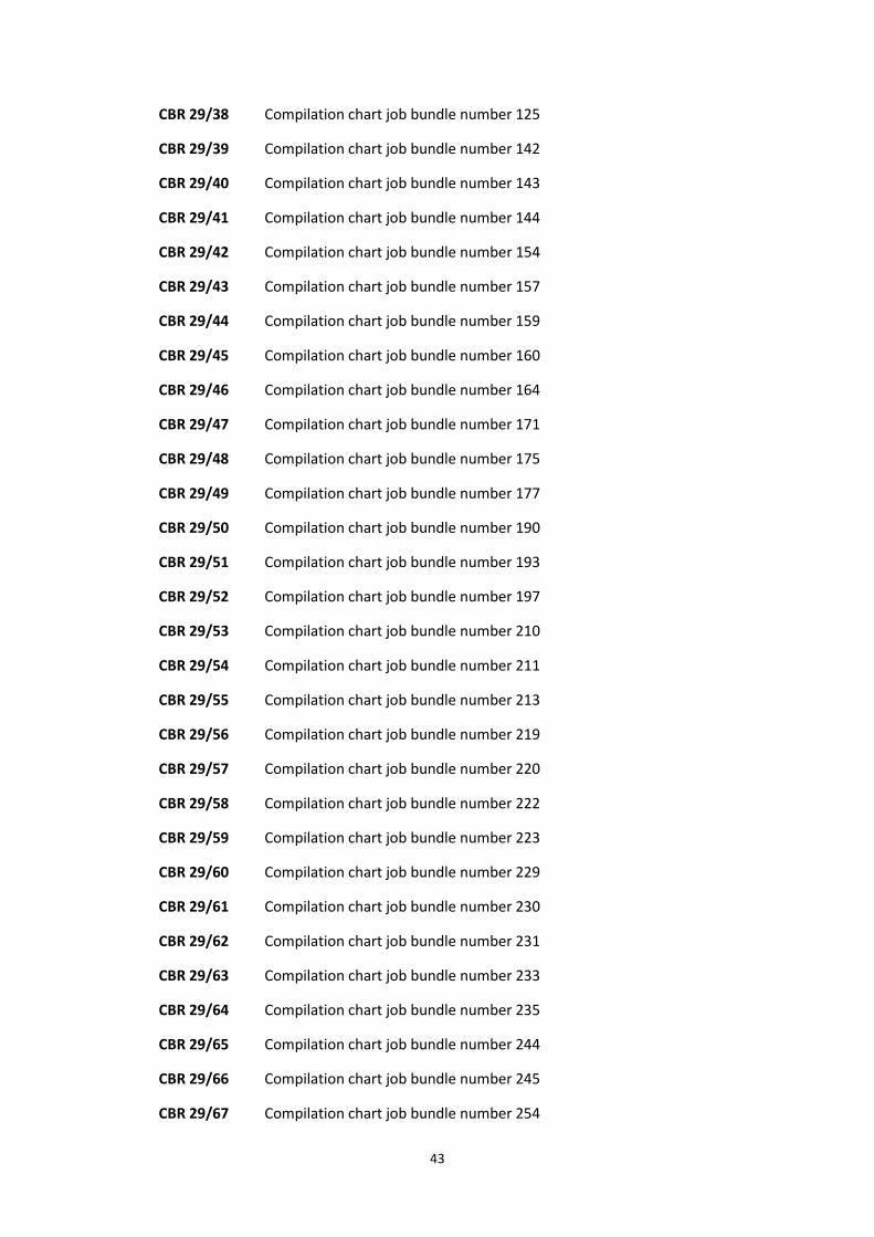
43
CBR 29/38 Compilation chart job bundle number 125
CBR 29/39 Compilation chart job bundle number 142
CBR 29/40 Compilation chart job bundle number 143
CBR 29/41 Compilation chart job bundle number 144
CBR 29/42 Compilation chart job bundle number 154
CBR 29/43 Compilation chart job bundle number 157
CBR 29/44 Compilation chart job bundle number 159
CBR 29/45 Compilation chart job bundle number 160
CBR 29/46 Compilation chart job bundle number 164
CBR 29/47 Compilation chart job bundle number 171
CBR 29/48 Compilation chart job bundle number 175
CBR 29/49 Compilation chart job bundle number 177
CBR 29/50 Compilation chart job bundle number 190
CBR 29/51 Compilation chart job bundle number 193
CBR 29/52 Compilation chart job bundle number 197
CBR 29/53 Compilation chart job bundle number 210
CBR 29/54 Compilation chart job bundle number 211
CBR 29/55 Compilation chart job bundle number 213
CBR 29/56 Compilation chart job bundle number 219
CBR 29/57 Compilation chart job bundle number 220
CBR 29/58 Compilation chart job bundle number 222
CBR 29/59 Compilation chart job bundle number 223
CBR 29/60 Compilation chart job bundle number 229
CBR 29/61 Compilation chart job bundle number 230
CBR 29/62 Compilation chart job bundle number 231
CBR 29/63 Compilation chart job bundle number 233
CBR 29/64 Compilation chart job bundle number 235
CBR 29/65 Compilation chart job bundle number 244
CBR 29/66 Compilation chart job bundle number 245
CBR 29/67 Compilation chart job bundle number 254

44
CBR 29/68 Compilation chart job bundle number 255
CBR 29/69 Compilation chart job bundle number 256
CBR 29/70 Compilation chart job bundle number 257
CBR 29/71 Compilation chart job bundle number 259
CBR 29/72 Compilation chart job bundle number 260
CBR 29/73 Compilation chart job bundle number 262
CBR 29/74 Compilation chart job bundle number 266
CBR 29/75 Compilation chart job bundle number 267
CBR 29/76 Compilation chart job bundle number 268
CBR 29/77 Compilation chart job bundle number 272
CBR 29/78 Compilation chart job bundle number 273
CBR 29/79 Compilation chart job bundle number 274
CBR 29/80 Compilation chart job bundle number 275
CBR 29/81 Compilation chart job bundle number 278
CBR 29/82 Compilation chart job bundle number 289
CBR 29/83 Compilation chart job bundle number 291
CBR 29/84 Compilation chart job bundle number 292
CBR 29/85 Compilation chart job bundle number 294
CBR 29/86 Compilation chart job bundle number 295
CBR 29/87 Compilation chart job bundle number 298
CBR 29/88 Compilation chart job bundle number 299
CBR 29/89 Compilation chart job bundle number 301
CBR 29/90 Compilation chart job bundle number 304
CBR 29/91 Compilation chart job bundle number 323
CBR 29/92 Compilation chart job bundle number 327
CBR 29/93 Compilation chart job bundle number 332
CBR 29/94 Compilation chart job bundle number 333
CBR 29/95 Compilation chart job bundle number 334
CBR 29/96 Compilation chart job bundle number 351
CBR 29/97 Compilation chart job bundle number 360

45
CBR 29/98 Compilation chart job bundle number 371
CBR 29/99 Compilation chart job bundle number 373
CBR 29/100 Compilation chart job bundle number 374
CBR 29/101 Compilation chart job bundle number 376
CBR 29/102 Compilation chart job bundle number 388
CBR 29/103 Compilation chart job bundle number 390
CBR 29/104 Compilation chart job bundle number 396
CBR 29/105 Compilation chart job bundle number 397
CBR 29/106 Compilation chart job bundle number 398
CBR 29/107 Compilation chart job bundle number 410
CBR 29/108 Compilation chart job bundle number 414
CBR 29/109 Compilation chart job bundle number 420
CBR 29/110 Compilation chart job bundle number 425
CBR 29/111 Compilation chart job bundle number 427
CBR 29/112 Compilation chart job bundle number 431
CBR 29/113 Compilation chart job bundle number 432
CBR 29/114 Compilation chart job bundle number 433
CBR 29/115 Compilation chart job bundle number 442
CBR 29/116 Compilation chart job bundle number 444
CBR 29/117 Compilation chart job bundle number 446
CBR 29/118 Compilation chart job bundle number 449
CBR 29/119 Compilation chart job bundle number 454
CBR 29/120 Compilation chart job bundle number 456
CBR 29/121 Compilation chart job bundle number 457
CBR 29/122 Compilation chart job bundle number 458
CBR 29/123 Compilation chart job bundle number 459
CBR 29/124 Compilation chart job bundle number 462
CBR 29/125 Compilation chart job bundle number 464
CBR 29/126 Compilation chart job bundle number 466
CBR 29/127 Compilation chart job bundle number 467

46
CBR 29/128 Compilation chart job bundle number 471
CBR 29/129 Compilation chart job bundle number 474
CBR 29/130 Compilation chart job bundle number 475
CBR 29/131 Compilation chart job bundle number 477
CBR 29/132 Compilation chart job bundle number 478
CBR 29/133 Compilation chart job bundle number 481
CBR 29/134 Compilation chart job bundle number 483
CBR 29/135 Compilation chart job bundle number 485
CBR 29/136 Compilation chart job bundle number 486
CBR 29/137 Compilation chart job bundle number 489
CBR 29/138 Compilation chart job bundle number 491
CBR 29/139 Compilation chart job bundle number 493
CBR 29/140 Compilation chart job bundle number 499
CBR 29/141 Compilation chart job bundle number 500
CBR 29/142 Compilation chart job bundle number 501
CBR 29/143 Compilation chart job bundle number 502
CBR 29/144 Compilation chart job bundle number 504
CBR 29/145 Compilation chart job bundle number 508
CBR 29/146 Compilation chart job bundle number 510
CBR 29/147 Compilation chart job bundle number 512
CBR 29/148 Compilation chart job bundle number 513
CBR 29/149 Compilation chart job bundle number 517
CBR 29/150 Compilation chart job bundle number 520
CBR 29/151 Compilation chart job bundle number 521
CBR 29/152 Compilation chart job bundle number 522
CBR 29/153 Compilation chart job bundle number 525
CBR 29/154 Compilation chart job bundle number 526
CBR 29/155 Compilation chart job bundle number 528
CBR 29/156 Compilation chart job bundle number 529
CBR 29/157 Compilation chart job bundle number 530

47
CBR 29/158 Compilation chart job bundle number 531
CBR 29/159 Compilation chart job bundle number 535
CBR 29/160 Compilation chart job bundle number 536
CBR 29/161 Compilation chart job bundle number 539
CBR 29/162 Compilation chart job bundle number 540
CBR 29/163 Compilation chart job bundle number 543
CBR 29/164 Compilation chart job bundle number 545
CBR 29/165 Compilation chart job bundle number 549
CBR 29/166 Compilation chart job bundle number 551
CBR 29/167 Compilation chart job bundle number 552
CBR 29/168 Compilation chart job bundle number 555
CBR 29/169 Compilation chart job bundle number 556
CBR 29/170 Compilation chart job bundle number 557
CBR 29/171 Compilation chart job bundle number 558
CBR 29/172 Compilation chart job bundle number 560
CBR 29/173 Compilation chart job bundle number 561
CBR 29/174 Compilation chart job bundle number 564
CBR 29/175 Compilation chart job bundle number 566
CBR 29/176 Compilation chart job bundle number 575
CBR 29/177 Compilation chart job bundle number 583
CBR 29/178 Compilation chart job bundle number 584
CBR 29/179 Compilation chart job bundle number 585
CBR 29/180 Compilation chart job bundle number 586
CBR 29/181 Compilation chart job bundle number 587
CBR 29/182 Compilation chart job bundle number 588
CBR 29/183 Compilation chart job bundle number 590
CBR 29/184 Compilation chart job bundle number 591
CBR 29/185 Compilation chart job bundle number 592
CBR 29/186 Compilation chart job bundle number 593
CBR 29/187 Compilation chart job bundle number 594

48
CBR 29/188 Compilation chart job bundle number 596
CBR 29/189 Compilation chart job bundle number 597
CBR 29/190 Compilation chart job bundle number 601
CBR 29/191 Compilation chart job bundle number 604
CBR 29/192 Compilation chart job bundle number 605
CBR 29/193 Compilation chart job bundle number 608
CBR 29/194 Compilation chart job bundle number 610
CBR 29/195 Compilation chart job bundle number 611
CBR 29/196 Compilation chart job bundle number 612
CBR 29/197 Compilation chart job bundle number 614
CBR 29/198 Compilation chart job bundle number 616
CBR 29/199 Compilation chart job bundle number 618
CBR 29/200 Compilation chart job bundle number 623
CBR 29/201 Compilation chart job bundle number 625
CBR 29/202 Compilation chart job bundle number 632
CBR 29/203 Compilation chart job bundle number 633
CBR 29/204 Compilation chart job bundle number 635
CBR 29/205 Compilation chart job bundle number 641
CBR 29/206 Compilation chart job bundle number 642
CBR 29/207 Compilation chart job bundle number 644
CBR 29/208 Compilation chart job bundle number 646
CBR 29/209 Compilation chart job bundle number 648
CBR 29/210 Compilation chart job bundle number 649
CBR 29/211 Compilation chart job bundle number 658
CBR 29/212 Compilation chart job bundle number 659
CBR 29/213 Compilation chart job bundle number 660
CBR 29/214 Compilation chart job bundle number 680
CBR 29/215 Compilation chart job bundle number 697
CBR 29/216 Compilation chart job bundle number 702
CBR 29/217 Compilation chart job bundle number 728

49
CBR 29/218 Compilation chart job bundle number 733
CBR 29/219 Compilation chart job bundle number 734
CBR 29/220 Compilation chart job bundle number 735
CBR 29/221 Compilation chart job bundle number 736
CBR 29/222 Compilation chart job bundle number 737
CBR 29/223 Compilation chart job bundle number 738
CBR 29/224 Compilation chart job bundle number 739
CBR 29/225 Compilation chart job bundle number 741
CBR 29/226 Compilation chart job bundle number 764
CBR 29/227 Compilation chart job bundle number 774
CBR 29/228 Compilation chart job bundle number 777
CBR 29/229 Compilation chart job bundle number 791
CBR 29/230 Compilation chart job bundle number 793
CBR 29/231 Compilation chart job bundle number 794
CBR 29/232 Compilation chart job bundle number 795
CBR 29/233 Compilation chart job bundle number 797
CBR 29/234 Compilation chart job bundle number 799
CBR 29/235 Compilation chart job bundle number 817
CBR 29/236 Compilation chart job bundle number 818
CBR 29/237 Compilation chart job bundle number 823
CBR 29/238 Compilation chart job bundle number 826
CBR 29/239 Compilation chart job bundle number 849
CBR 29/240 Compilation chart job bundle number 867
CBR 29/241 Compilation chart job bundle number 868
CBR 29/242 Compilation chart job bundle number 871
CBR 29/243 Compilation chart job bundle number 893
CBR 29/244 Compilation chart job bundle number 897
CBR 29/245 Compilation chart job bundle number 899
CBR 29/246 Compilation chart job bundle number 900
CBR 29/247 Compilation chart job bundle number 902

50
CBR 29/248 Compilation chart job bundle number 903
CBR 29/249 Compilation chart job bundle number 906
CBR 29/250 Compilation chart job bundle number 917
CBR 29/251 Compilation chart job bundle number 937
CBR 29/252 Compilation chart job bundle number 946
CBR 29/253 Compilation chart job bundle number 953
CBR 29/254 Compilation chart job bundle number 959
CBR 29/255 Compilation chart job bundle number 960
CBR 29/256 Compilation chart job bundle number 969
CBR 29/257 Compilation chart job bundle number 994
CBR 29/258 Compilation chart job bundle number 1009
CBR 29/259 Compilation chart job bundle number 1015
CBR 29/260 Compilation chart job bundle number 1018
CBR 29/261 Compilation chart job bundle number 1020
CBR 29/262 Compilation chart job bundle number 1021
CBR 29/263 Compilation chart job bundle number 1022
CBR 29/264 Compilation chart job bundle number 1023
CBR 29/265 Compilation chart job bundle number 1025
CBR 29/266 Compilation chart job bundle number 1027
CBR 29/267 Compilation chart job bundle number 1029
CBR 29/268 Compilation chart job bundle number 1033
CBR 29/269 Compilation chart job bundle number 1034
CBR 29/270 Compilation chart job bundle number 1042
CBR 29/271 Compilation chart job bundle number 1043
CBR 29/272 Compilation chart job bundle number 1055
CBR 29/273 Compilation chart job bundle number 1061
CBR 29/274 Compilation chart job bundle number 1063
CBR 29/275 Compilation chart job bundle number 1073
CBR 29/276 Compilation chart job bundle number 1077
CBR 29/277 Compilation chart job bundle number 1078

51
CBR 29/278 Compilation chart job bundle number 1081
CBR 29/279 Compilation chart job bundle number 1082
CBR 29/280 Compilation chart job bundle number 1083
CBR 29/281 Compilation chart job bundle number 1089
CBR 29/282 Compilation chart job bundle number 1090
CBR 29/283 Compilation chart job bundle number 1097
CBR 29/284 Compilation chart job bundle number 1098
CBR 29/285 Compilation chart job bundle number 1107
CBR 29/286 Compilation chart job bundle number 1112
CBR 29/287 Compilation chart job bundle number 1119
CBR 29/288 Compilation chart job bundle number 1121
CBR 29/289 Compilation chart job bundle number 1125
CBR 29/290 Compilation chart job bundle number 1127
CBR 29/291 Compilation chart job bundle number 1128
CBR 29/292 Compilation chart job bundle number 1129
CBR 29/293 Compilation chart job bundle number 1148
CBR 29/294 Compilation chart job bundle number 1149
CBR 29/295 Compilation chart job bundle number 1152
CBR 29/296 Compilation chart job bundle number 1160
CBR 29/297 Compilation chart job bundle number 1161
CBR 29/298 Compilation chart job bundle number 1166
CBR 29/299 Compilation chart job bundle number 1168
CBR 29/300 Compilation chart job bundle number 1176
CBR 29/301 Compilation chart job bundle number 1177
CBR 29/302 Compilation chart job bundle number 1178
CBR 29/303 Compilation chart job bundle number 1179
CBR 29/304 Compilation chart job bundle number 1182
CBR 29/305 Compilation chart job bundle number 1183
CBR 29/306 Compilation chart job bundle number 1185
CBR 29/307 Compilation chart job bundle number 1186

52
CBR 29/308 Compilation chart job bundle number 1187
CBR 29/309 Compilation chart job bundle number 1188
CBR 29/310 Compilation chart job bundle number 1190
CBR 29/311 Compilation chart job bundle number 1191
CBR 29/312 Compilation chart job bundle number 1192
CBR 29/313 Compilation chart job bundle number 1217
CBR 29/314 Compilation chart job bundle number 1218
CBR 29/315 Compilation chart job bundle number 1219
CBR 29/316 Compilation chart job bundle number 1220
CBR 29/317 Compilation chart job bundle number 1221
CBR 29/318 Compilation chart job bundle number 1227
CBR 29/319 Compilation chart job bundle number 1233
CBR 29/320 Compilation chart job bundle number 1234
CBR 29/321 Compilation chart job bundle number 1237
CBR 29/322 Compilation chart job bundle number 1239
CBR 29/323 Compilation chart job bundle number 1270
CBR 29/324 Compilation chart job bundle number 1276
CBR 29/325 Compilation chart job bundle number 1277
CBR 29/326 Compilation chart job bundle number 1289
CBR 29/327 Compilation chart job bundle number 1314
CBR 29/328 Compilation chart job bundle number 1315
CBR 29/329 Compilation chart job bundle number 1319
CBR 29/330 Compilation chart job bundle number 1320
CBR 29/331 Compilation chart job bundle number 1331
CBR 29/332 Compilation chart job bundle number 1344
CBR 29/333 Compilation chart job bundle number 1348
CBR 29/334 Compilation chart job bundle number 1375
CBR 29/335 Compilation chart job bundle number 1388
CBR 29/336 Compilation chart job bundle number 1389
CBR 29/337 Compilation chart job bundle number 1400

53
CBR 29/338 Compilation chart job bundle number 1401
CBR 29/339 Compilation chart job bundle number 1403
CBR 29/340 Compilation chart job bundle number 1407
CBR 29/341 Compilation chart job bundle number 1408
CBR 29/342 Compilation chart job bundle number 1409
CBR 29/343 Compilation chart job bundle number 1410
CBR 29/344 Compilation chart job bundle number 1411
CBR 29/345 Compilation chart job bundle number 1412
CBR 29/346 Compilation chart job bundle number 1413
CBR 29/347 Compilation chart job bundle number 1414
CBR 29/348 Compilation chart job bundle number 1415
CBR 29/349 Compilation chart job bundle number 1431
CBR 29/350 Compilation chart job bundle number 1438
CBR 29/351 Compilation chart job bundle number 1446
CBR 29/352 Compilation chart job bundle number 1447
CBR 29/353 Compilation chart job bundle number 1462
CBR 29/354 Compilation chart job bundle number 1464
CBR 29/355 Compilation chart job bundle number 1468
CBR 29/356 Compilation chart job bundle number 1471
CBR 29/357 Compilation chart job bundle number 1473
CBR 29/358 Compilation chart job bundle number 1478
CBR 29/359 Compilation chart job bundle number 1479
CBR 29/360 Compilation chart job bundle number 1481
CBR 29/361 Compilation chart job bundle number 1482
CBR 29/362 Compilation chart job bundle number 1484
CBR 29/363 Compilation chart job bundle number 1489
CBR 29/364 Compilation chart job bundle number 1491
CBR 29/365 Compilation chart job bundle number 1498
CBR 29/366 Compilation chart job bundle number 1499
CBR 29/367 Compilation chart job bundle number 1503
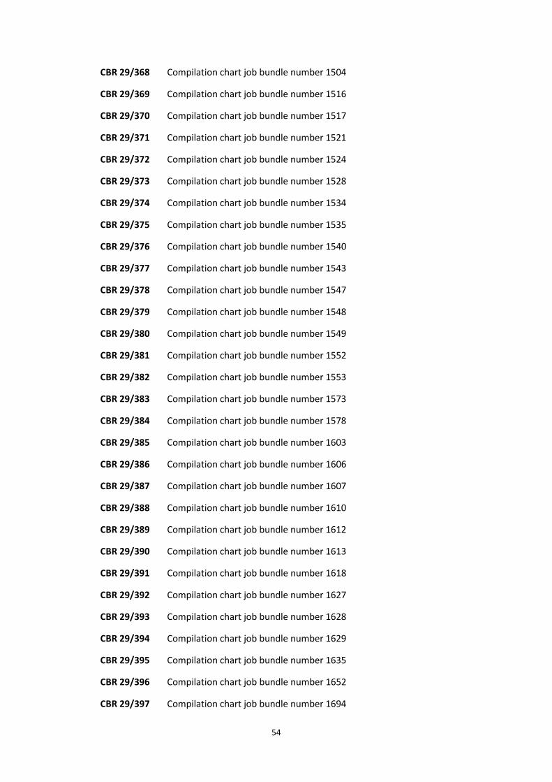
54
CBR 29/368 Compilation chart job bundle number 1504
CBR 29/369 Compilation chart job bundle number 1516
CBR 29/370 Compilation chart job bundle number 1517
CBR 29/371 Compilation chart job bundle number 1521
CBR 29/372 Compilation chart job bundle number 1524
CBR 29/373 Compilation chart job bundle number 1528
CBR 29/374 Compilation chart job bundle number 1534
CBR 29/375 Compilation chart job bundle number 1535
CBR 29/376 Compilation chart job bundle number 1540
CBR 29/377 Compilation chart job bundle number 1543
CBR 29/378 Compilation chart job bundle number 1547
CBR 29/379 Compilation chart job bundle number 1548
CBR 29/380 Compilation chart job bundle number 1549
CBR 29/381 Compilation chart job bundle number 1552
CBR 29/382 Compilation chart job bundle number 1553
CBR 29/383 Compilation chart job bundle number 1573
CBR 29/384 Compilation chart job bundle number 1578
CBR 29/385 Compilation chart job bundle number 1603
CBR 29/386 Compilation chart job bundle number 1606
CBR 29/387 Compilation chart job bundle number 1607
CBR 29/388 Compilation chart job bundle number 1610
CBR 29/389 Compilation chart job bundle number 1612
CBR 29/390 Compilation chart job bundle number 1613
CBR 29/391 Compilation chart job bundle number 1618
CBR 29/392 Compilation chart job bundle number 1627
CBR 29/393 Compilation chart job bundle number 1628
CBR 29/394 Compilation chart job bundle number 1629
CBR 29/395 Compilation chart job bundle number 1635
CBR 29/396 Compilation chart job bundle number 1652
CBR 29/397 Compilation chart job bundle number 1694

55
CBR 29/398 Compilation chart job bundle number 1698
CBR 29/399 Compilation chart job bundle number 1717
CBR 29/400 Compilation chart job bundle number 1721
CBR 29/401 Compilation chart job bundle number 1749
CBR 29/402 Compilation chart job bundle number 1751
CBR 29/403 Compilation chart job bundle number 1752
CBR 29/404 Compilation chart job bundle number 1753
CBR 29/405 Compilation chart job bundle number 1757
CBR 29/406 Compilation chart job bundle number 1765
CBR 29/407 Compilation chart job bundle number 1770
CBR 29/408 Compilation chart job bundle number 1772
CBR 29/409 Compilation chart job bundle number 1773
CBR 29/410 Compilation chart job bundle number 1777
CBR 29/411 Compilation chart job bundle number 1778
CBR 29/412 Compilation chart job bundle number 1779
CBR 29/413 Compilation chart job bundle number 1785
CBR 29/414 Compilation chart job bundle number 1787
CBR 29/415 Compilation chart job bundle number 1790
CBR 29/416 Compilation chart job bundle number 1791
CBR 29/417 Compilation chart job bundle number 1793
CBR 29/418 Compilation chart job bundle number 1794
CBR 29/419 Compilation chart job bundle number 1795
CBR 29/420 Compilation chart job bundle number 1796
CBR 29/421 Compilation chart job bundle number 1797
CBR 29/422 Compilation chart job bundle number 1807
CBR 29/423 Compilation chart job bundle number 1819
CBR 29/424 Compilation chart job bundle number 1820
CBR 29/425 Compilation chart job bundle number 1826
CBR 29/426 Compilation chart job bundle number 1827
CBR 29/427 Compilation chart job bundle number 1834

56
CBR 29/428 Compilation chart job bundle number 1835
CBR 29/429 Compilation chart job bundle number 1838
CBR 29/430 Compilation chart job bundle number 1840
CBR 29/431 Compilation chart job bundle number 1847
CBR 29/432 Compilation chart job bundle number 1853
CBR 29/433 Compilation chart job bundle number 1859
CBR 29/434 Compilation chart job bundle number 1864
CBR 29/435 Compilation chart job bundle number 1866
CBR 29/436 Compilation chart job bundle number 1867
CBR 29/437 Compilation chart job bundle number 1879
CBR 29/438 Compilation chart job bundle number 1883
CBR 29/439 Compilation chart job bundle number 1889
CBR 29/440 Compilation chart job bundle number 1890
CBR 29/441 Compilation chart job bundle number 1892
CBR 29/442 Compilation chart job bundle number 1900
CBR 29/443 Compilation chart job bundle number 1901
CBR 29/444 Compilation chart job bundle number 1904
CBR 29/445 Compilation chart job bundle number 1905
CBR 29/446 Compilation chart job bundle number 1906
CBR 29/447 Compilation chart job bundle number 1907
CBR 29/448 Compilation chart job bundle number 1929
CBR 29/449 Compilation chart job bundle number 1935
CBR 29/450 Compilation chart job bundle number 1938
CBR 29/451 Compilation chart job bundle number 1942
CBR 29/452 Compilation chart job bundle number 1944
CBR 29/453 Compilation chart job bundle number 1946
CBR 29/454 Compilation chart job bundle number 1950
CBR 29/455 Compilation chart job bundle number 1951
CBR 29/456 Compilation chart job bundle number 1953
CBR 29/457 Compilation chart job bundle number 1954

57
CBR 29/458 Compilation chart job bundle number 1967
CBR 29/459 Compilation chart job bundle number 1969
CBR 29/460 Compilation chart job bundle number 1975
CBR 29/461 Compilation chart job bundle number 1977
CBR 29/462 Compilation chart job bundle number 1978
CBR 29/463 Compilation chart job bundle number 1979
CBR 29/464 Compilation chart job bundle number 1981
CBR 29/465 Compilation chart job bundle number 1984
CBR 29/466 Compilation chart job bundle number 1991
CBR 29/467 Compilation chart job bundle number 1994
CBR 29/468 Compilation chart job bundle number 2000
CBR 29/469 Compilation chart job bundle number 2001
CBR 29/470 Compilation chart job bundle number 2002
CBR 29/471 Compilation chart job bundle number 2004
CBR 29/472 Compilation chart job bundle number 2005
CBR 29/473 Compilation chart job bundle number 2006
CBR 29/474 Compilation chart job bundle number 2007
CBR 29/475 Compilation chart job bundle number 2010
CBR 29/476 Compilation chart job bundle number 2011
CBR 29/477 Compilation chart job bundle number 2017
CBR 29/478 Compilation chart job bundle number 2019
CBR 29/479 Compilation chart job bundle number 2020
CBR 29/480 Compilation chart job bundle number 2036
CBR 29/481 Compilation chart job bundle number 2037
CBR 29/482 Compilation chart job bundle number 2040
CBR 29/483 Compilation chart job bundle number 2045
CBR 29/484 Compilation chart job bundle number 2046
CBR 29/485 Compilation chart job bundle number 2047
CBR 29/486 Compilation chart job bundle number 2049
CBR 29/487 Compilation chart job bundle number 2052

58
CBR 29/488 Compilation chart job bundle number 2053
CBR 29/489 Compilation chart job bundle number 2057
CBR 29/490 Compilation chart job bundle number 2060
CBR 29/491 Compilation chart job bundle number 2061
CBR 29/492 Compilation chart job bundle number 2064
CBR 29/493 Compilation chart job bundle number 2065
CBR 29/494 Compilation chart job bundle number 2071
CBR 29/495 Compilation chart job bundle number 2076
CBR 29/496 Compilation chart job bundle number 2079
CBR 29/497 Compilation chart job bundle number 2090
CBR 29/498 Compilation chart job bundle number 2092
CBR 29/499 Compilation chart job bundle number 2093
CBR 29/500 Compilation chart job bundle number 2094
CBR 29/501 Compilation chart job bundle number 2096
CBR 29/502 Compilation chart job bundle number 2106
CBR 29/503 Compilation chart job bundle number 2125
CBR 29/504 Compilation chart job bundle number 2126
CBR 29/505 Compilation chart job bundle number 2131
CBR 29/506 Compilation chart job bundle number 2133
CBR 29/507 Compilation chart job bundle number 2137
CBR 29/508 Compilation chart job bundle number 2146
CBR 29/509 Compilation chart job bundle number 2154
CBR 29/510 Compilation chart job bundle number 2156
CBR 29/511 Compilation chart job bundle number 2159
CBR 29/512 Compilation chart job bundle number 2162
CBR 29/513 Compilation chart job bundle number 2163
CBR 29/514 Compilation chart job bundle number 2168
CBR 29/515 Compilation chart job bundle number 2169
CBR 29/516 Compilation chart job bundle number 2171
CBR 29/517 Compilation chart job bundle number 2172

59
CBR 29/518 Compilation chart job bundle number 2173
CBR 29/519 Compilation chart job bundle number 2179
CBR 29/520 Compilation chart job bundle number 2182
CBR 29/521 Compilation chart job bundle number 2183
CBR 29/522 Compilation chart job bundle number 2184
CBR 29/523 Compilation chart job bundle number 2189
CBR 29/524 Compilation chart job bundle number 2190
CBR 29/525 Compilation chart job bundle number 2191
CBR 29/526 Compilation chart job bundle number 2192
CBR 29/527 Compilation chart job bundle number 2194
CBR 29/528 Compilation chart job bundle number 2195
CBR 29/529 Compilation chart job bundle number 2198
CBR 29/530 Compilation chart job bundle number 2199
CBR 29/531 Compilation chart job bundle number 2200
CBR 29/532 Compilation chart job bundle number 2201
CBR 29/533 Compilation chart job bundle number 2205
CBR 29/534 Compilation chart job bundle number 2207
CBR 29/535 Compilation chart job bundle number 2208
CBR 29/536 Compilation chart job bundle number 2209
CBR 29/537 Compilation chart job bundle number 2210
CBR 29/538 Compilation chart job bundle number 2219
CBR 29/539 Compilation chart job bundle number 2220
CBR 29/540 Compilation chart job bundle number 2221
CBR 29/541 Compilation chart job bundle number 2222
CBR 29/542 Compilation chart job bundle number 2241
CBR 29/543 Compilation chart job bundle number 2248
CBR 29/544 Compilation chart job bundle number 2249
CBR 29/545 Compilation chart job bundle number 2250
CBR 29/546 Compilation chart job bundle number 2252
CBR 29/547 Compilation chart job bundle number 2253

60
CBR 29/548 Compilation chart job bundle number 2254
CBR 29/549 Compilation chart job bundle number 2255
CBR 29/550 Compilation chart job bundle number 2257
CBR 29/551 Compilation chart job bundle number 2258
CBR 29/552 Compilation chart job bundle number 2261
CBR 29/553 Compilation chart job bundle number 2262
CBR 29/554 Compilation chart job bundle number 2264
CBR 29/555 Compilation chart job bundle number 2267
CBR 29/556 Compilation chart job bundle number 2268
CBR 29/557 Compilation chart job bundle number 2271
CBR 29/558 Compilation chart job bundle number 2273
CBR 29/559 Compilation chart job bundle number 2275
CBR 29/560 Compilation chart job bundle number 2276
CBR 29/561 Compilation chart job bundle number 2290
CBR 29/562 Compilation chart job bundle number 2297
CBR 29/563 Compilation chart job bundle number 2299
CBR 29/564 Compilation chart job bundle number 2306
CBR 29/565 Compilation chart job bundle number 2318
CBR 29/566 Compilation chart job bundle number 2319
CBR 29/567 Compilation chart job bundle number 2323
CBR 29/568 Compilation chart job bundle number 2324
CBR 29/569 Compilation chart job bundle number 2326
CBR 29/570 Compilation chart job bundle number 2333
CBR 29/571 Compilation chart job bundle number 2341
CBR 29/572 Compilation chart job bundle number 2343
CBR 29/573 Compilation chart job bundle number 2345
CBR 29/574 Compilation chart job bundle number 2357
CBR 29/575 Compilation chart job bundle number 2372
CBR 29/576 Compilation chart job bundle number 2373
CBR 29/577 Compilation chart job bundle number 2378

61
CBR 29/578 Compilation chart job bundle number 2379
CBR 29/579 Compilation chart job bundle number 2380
CBR 29/580 Compilation chart job bundle number 2381
CBR 29/581 Compilation chart job bundle number 2382
CBR 29/582 Compilation chart job bundle number 2386
CBR 29/583 Compilation chart job bundle number 2387
CBR 29/584 Compilation chart job bundle number 2388
CBR 29/585 Compilation chart job bundle number 2389
CBR 29/586 Compilation chart job bundle number 2390
CBR 29/587 Compilation chart job bundle number 2392
CBR 29/588 Compilation chart job bundle number 2393
CBR 29/589 Compilation chart job bundle number 2394
CBR 29/590 Compilation chart job bundle number 2396
CBR 29/591 Compilation chart job bundle number 2397
CBR 29/592 Compilation chart job bundle number 2399
CBR 29/593 Compilation chart job bundle number 2411
CBR 29/594 Compilation chart job bundle number 2417
CBR 29/595 Compilation chart job bundle number 2420
CBR 29/596 Compilation chart job bundle number 2423
CBR 29/597 Compilation chart job bundle number 2424
CBR 29/598 Compilation chart job bundle number 2427
CBR 29/599 Compilation chart job bundle number 2434
CBR 29/600 Compilation chart job bundle number 2449
CBR 29/601 Compilation chart job bundle number 2450
CBR 29/602 Compilation chart job bundle number 2451
CBR 29/603 Compilation chart job bundle number 2452
CBR 29/604 Compilation chart job bundle number 2454
CBR 29/605 Compilation chart job bundle number 2455
CBR 29/606 Compilation chart job bundle number 2456
CBR 29/607 Compilation chart job bundle number 2462

62
CBR 29/608 Compilation chart job bundle number 2474
CBR 29/609 Compilation chart job bundle number 2475
CBR 29/610 Compilation chart job bundle number 2476
CBR 29/611 Compilation chart job bundle number 2479
CBR 29/612 Compilation chart job bundle number 2480
CBR 29/613 Compilation chart job bundle number 2481
CBR 29/614 Compilation chart job bundle number 2484
CBR 29/615 Compilation chart job bundle number 2485
CBR 29/616 Compilation chart job bundle number 2486
CBR 29/617 Compilation chart job bundle number 2488
CBR 29/618 Compilation chart job bundle number 2489
CBR 29/619 Compilation chart job bundle number 2490
CBR 29/620 Compilation chart job bundle number 2491
CBR 29/621 Compilation chart job bundle number 2492
CBR 29/622 Compilation chart job bundle number 2494
CBR 29/623 Compilation chart job bundle number 2495
CBR 29/624 Compilation chart job bundle number 2496
CBR 29/625 Compilation chart job bundle number 2498
CBR 29/626 Compilation chart job bundle number 2499
CBR 29/627 Compilation chart job bundle number 2500
CBR 29/628 Compilation chart job bundle number 2501
CBR 29/629 Compilation chart job bundle number 2502
CBR 29/630 Compilation chart job bundle number 2504
CBR 29/631 Compilation chart job bundle number 2509
CBR 29/632 Compilation chart job bundle number 2510
CBR 29/633 Compilation chart job bundle number 2511
CBR 29/634 Compilation chart job bundle number 2515
CBR 29/635 Compilation chart job bundle number 2523
CBR 29/636 Compilation chart job bundle number 2524
CBR 29/637 Compilation chart job bundle number 2528

63
CBR 29/638 Compilation chart job bundle number 2529
CBR 29/639 Compilation chart job bundle number 2532
CBR 29/640 Compilation chart job bundle number 2533
CBR 29/641 Compilation chart job bundle number 2534
CBR 29/642 Compilation chart job bundle number 2537
CBR 29/643 Compilation chart job bundle number 2538
CBR 29/644 Compilation chart job bundle number 2540
CBR 29/645 Compilation chart job bundle number 2541
CBR 29/646 Compilation chart job bundle number 2545
CBR 29/647 Compilation chart job bundle number 2552
CBR 29/648 Compilation chart job bundle number 2562
CBR 29/649 Compilation chart job bundle number 2563
CBR 29/650 Compilation chart job bundle number 2564
CBR 29/651 Compilation chart job bundle number 2565
CBR 29/652 Compilation chart job bundle number 2568
CBR 29/653 Compilation chart job bundle number 2571
CBR 29/654 Compilation chart job bundle number 2572
CBR 29/655 Compilation chart job bundle number 2579
CBR 29/656 Compilation chart job bundle number 2580
CBR 29/657 Compilation chart job bundle number 2581
CBR 29/658 Compilation chart job bundle number 2584
CBR 29/659 Compilation chart job bundle number 2594
CBR 29/660 Compilation chart job bundle number 2595
CBR 29/661 Compilation chart job bundle number 2601
CBR 29/662 Compilation chart job bundle number 2602
CBR 29/663 Compilation chart job bundle number 2603
CBR 29/664 Compilation chart job bundle number 2604
CBR 29/665 Compilation chart job bundle number 2605
CBR 29/666 Compilation chart job bundle number 2610
CBR 29/667 Compilation chart job bundle number 2611

64
CBR 29/668 Compilation chart job bundle number 2613
CBR 29/669 Compilation chart job bundle number 2615
CBR 29/670 Compilation chart job bundle number 2617
CBR 29/671 Compilation chart job bundle number 2622
CBR 29/672 Compilation chart job bundle number 2626
CBR 29/673 Compilation chart job bundle number 2628
CBR 29/674 Compilation chart job bundle number 2631
CBR 29/675 Compilation chart job bundle number 2635
CBR 29/676 Compilation chart job bundle number 2642
CBR 29/677 Compilation chart job bundle number 2643
CBR 29/678 Compilation chart job bundle number 2644
CBR 29/679 Compilation chart job bundle number 2649
CBR 29/680 Compilation chart job bundle number 2652
CBR 29/681 Compilation chart job bundle number 2655
CBR 29/682 Compilation chart job bundle number 2669
CBR 29/683 Compilation chart job bundle number 2670
CBR 29/684 Compilation chart job bundle number 2675
CBR 29/685 Compilation chart job bundle number 2692
CBR 29/686 Compilation chart job bundle number 2693
CBR 29/687 Compilation chart job bundle number 2696
CBR 29/688 Compilation chart job bundle number 2697
CBR 29/689 Compilation chart job bundle number 2699
CBR 29/690 Compilation chart job bundle number 2702
CBR 29/691 Compilation chart job bundle number 2703
CBR 29/692 Compilation chart job bundle number 2704
CBR 29/693 Compilation chart job bundle number 2706
CBR 29/694 Compilation chart job bundle number 2707
CBR 29/695 Compilation chart job bundle number 2708
CBR 29/696 Compilation chart job bundle number 2709
CBR 29/697 Compilation chart job bundle number 2710

65
CBR 29/698 Compilation chart job bundle number 2715
CBR 29/699 Compilation chart job bundle number 2720
CBR 29/700 Compilation chart job bundle number 2721
CBR 29/701 Compilation chart job bundle number 2722
CBR 29/702 Compilation chart job bundle number 2723
CBR 29/703 Compilation chart job bundle number 2725
CBR 29/704 Compilation chart job bundle number 2726
CBR 29/705 Compilation chart job bundle number 2728
CBR 29/706 Compilation chart job bundle number 2730
CBR 29/707 Compilation chart job bundle number 2731
CBR 29/708 Compilation chart job bundle number 2739
CBR 29/709 Compilation chart job bundle number 2740
CBR 29/710 Compilation chart job bundle number 2752
CBR 29/711 Compilation chart job bundle number 2754
CBR 29/712 Compilation chart job bundle number 2767
CBR 29/713 Compilation chart job bundle number 2769
CBR 29/714 Compilation chart job bundle number 2770
CBR 29/715 Compilation chart job bundle number 2771
CBR 29/716 Compilation chart job bundle number 2789
CBR 29/717 Compilation chart job bundle number 2790
CBR 29/718 Compilation chart job bundle number 2792
CBR 29/719 Compilation chart job bundle number 2793
CBR 29/720 Compilation chart job bundle number 2798
CBR 29/721 Compilation chart job bundle number 2799
CBR 29/722 Compilation chart job bundle number 2800
CBR 29/723 Compilation chart job bundle number 2802
CBR 29/724 Compilation chart job bundle number 2804
CBR 29/725 Compilation chart job bundle number 2806
CBR 29/726 Compilation chart job bundle number 2807
CBR 29/727 Compilation chart job bundle number 2808

66
CBR 29/728 Compilation chart job bundle number 2809
CBR 29/729 Compilation chart job bundle number 2810
CBR 29/730 Compilation chart job bundle number 2811
CBR 29/731 Compilation chart job bundle number 2813
CBR 29/732 Compilation chart job bundle number 2814
CBR 29/733 Compilation chart job bundle number 2815
CBR 29/734 Compilation chart job bundle number 2816
CBR 29/735 Compilation chart job bundle number 2817
CBR 29/736 Compilation chart job bundle number 2818
CBR 29/737 Compilation chart job bundle number 2822
CBR 29/738 Compilation chart job bundle number 2825
CBR 29/739 Compilation chart job bundle number 2829
CBR 29/740 Compilation chart job bundle number 2839
CBR 29/741 Compilation chart job bundle number 2841
CBR 29/742 Compilation chart job bundle number 2845
CBR 29/743 Compilation chart job bundle number 2849
CBR 29/744 Compilation chart job bundle number 2850
CBR 29/745 Compilation chart job bundle number 2851
CBR 29/746 Compilation chart job bundle number 2852
CBR 29/747 Compilation chart job bundle number 2860
CBR 29/748 Compilation chart job bundle number 2866
CBR 29/749 Compilation chart job bundle number 2878
CBR 29/750 Compilation chart job bundle number 2881
CBR 29/751 Compilation chart job bundle number 2890
CBR 29/752 Compilation chart job bundle number 2896
CBR 29/753 Compilation chart job bundle number 2904
CBR 29/754 Compilation chart job bundle number 2905
CBR 29/755 Compilation chart job bundle number 2907
CBR 29/756 Compilation chart job bundle number 2919
CBR 29/757 Compilation chart job bundle number 2921
67
CBR 29/758 Compilation chart job bundle number 2922
CBR 29/759 Compilation chart job bundle number 2924
CBR 29/760 Compilation chart job bundle number 2968
CBR 29/761 Compilation chart job bundle number 2987
CBR 29/762 Compilation chart job bundle number 2988
CBR 29/763 Compilation chart job bundle number 2991
CBR 29/764 Compilation chart job bundle number 3026
CBR 29/765 Compilation chart job bundle number 3041
CBR 29/766 Compilation chart job bundle number 3044
CBR 29/767 Compilation chart job bundle number 3046
CBR 29/768 Compilation chart job bundle number 3053
CBR 29/769 Compilation chart job bundle number 3055
CBR 29/770 Compilation chart job bundle number 3063
CBR 29/771 Compilation chart job bundle number 3064
CBR 29/772 Compilation chart job bundle number 3070
CBR 29/773 Compilation chart job bundle number 3076
CBR 29/774 Compilation chart job bundle number 3082
CBR 29/775 Compilation chart job bundle number 3083
CBR 29/776 Compilation chart job bundle number 3084
CBR 29/777 Compilation chart job bundle number 3089
CBR 29/778 Compilation chart job bundle number 3090
CBR 29/779 Compilation chart job bundle number 3091
CBR 29/780 Compilation chart job bundle number 3092
CBR 29/781 Compilation chart job bundle number 3095
CBR 29/782 Compilation chart job bundle number 3096
CBR 29/783 Compilation chart job bundle number 3098
CBR 29/784 Compilation chart job bundle number 3110
CBR 29/785 Compilation chart job bundle number 3111
CBR 29/786 Compilation chart job bundle number 3125
CBR 29/787 Compilation chart job bundle number 3136

68
CBR 29/788 Compilation chart job bundle number 3146
CBR 29/789 Compilation chart job bundle number 3148
CBR 29/790 Compilation chart job bundle number 3150
CBR 29/791 Compilation chart job bundle number 3151
CBR 29/792 Compilation chart job bundle number 3160
CBR 29/793 Compilation chart job bundle number 3167
CBR 29/794 Compilation chart job bundle number 3175
CBR 29/795 Compilation chart job bundle number 3183
CBR 29/796 Compilation chart job bundle number 3186
CBR 29/797 Compilation chart job bundle number 3187
CBR 29/798 Compilation chart job bundle number 3188
CBR 29/799 Compilation chart job bundle number 3190
CBR 29/800 Compilation chart job bundle number 3192
CBR 29/801 Compilation chart job bundle number 3204
CBR 29/802 Compilation chart job bundle number 3224
CBR 29/803 Compilation chart job bundle number 3226
CBR 29/804 Compilation chart job bundle number 3235
CBR 29/805 Compilation chart job bundle number 3261
CBR 29/806 Compilation chart job bundle number 3271
CBR 29/807 Compilation chart job bundle number 3272
CBR 29/808 Compilation chart job bundle number 3274
CBR 29/809 Compilation chart job bundle number 3275
CBR 29/810 Compilation chart job bundle number 3279
CBR 29/811 Compilation chart job bundle number 3281
CBR 29/812 Compilation chart job bundle number 3282
CBR 29/813 Compilation chart job bundle number 3283
CBR 29/814 Compilation chart job bundle number 3284
CBR 29/815 Compilation chart job bundle number 3290
CBR 29/816 Compilation chart job bundle number 3291
CBR 29/817 Compilation chart job bundle number 3292

69
CBR 29/818 Compilation chart job bundle number 3293
CBR 29/819 Compilation chart job bundle number 3294
CBR 29/820 Compilation chart job bundle number 3295
CBR 29/821 Compilation chart job bundle number 3297
CBR 29/822 Compilation chart job bundle number 3298
CBR 29/823 Compilation chart job bundle number 3315
CBR 29/824 Compilation chart job bundle number 3318
CBR 29/825 Compilation chart job bundle number 3319
CBR 29/826 Compilation chart job bundle number 3337
CBR 29/827 Compilation chart job bundle number 3338
CBR 29/828 Compilation chart job bundle number 3339
CBR 29/829 Compilation chart job bundle number 3381
CBR 29/830 Compilation chart job bundle number 3382
CBR 29/831 Compilation chart job bundle number 3384
CBR 29/832 Compilation chart job bundle number 3391
CBR 29/833 Compilation chart job bundle number 3409
CBR 29/834 Compilation chart job bundle number 3410
CBR 29/835 Compilation chart job bundle number 3412
CBR 29/836 Compilation chart job bundle number 3413
CBR 29/837 Compilation chart job bundle number 3415
CBR 29/838 Compilation chart job bundle number 3422
CBR 29/839 Compilation chart job bundle number 3433
CBR 29/840 Compilation chart job bundle number 3442
CBR 29/841 Compilation chart job bundle number 3451
CBR 29/842 Compilation chart job bundle number 3452
CBR 29/843 Compilation chart job bundle number 3454
CBR 29/844 Compilation chart job bundle number 3455
CBR 29/845 Compilation chart job bundle number 3456
CBR 29/846 Compilation chart job bundle number 3457
CBR 29/847 Compilation chart job bundle number 3458
70
CBR 29/848 Compilation chart job bundle number 3459
CBR 29/849 Compilation chart job bundle number 3462
CBR 29/850 Compilation chart job bundle number 3488
CBR 29/851 Compilation chart job bundle number 3489
CBR 29/852 Compilation chart job bundle number 3490
CBR 29/853 Compilation chart job bundle number 3493
CBR 29/854 Compilation chart job bundle number 3497
CBR 29/855 Compilation chart job bundle number 3501
CBR 29/856 Compilation chart job bundle number 3506
CBR 29/857 Compilation chart job bundle number 3509
CBR 29/858 Compilation chart job bundle number 3510
CBR 29/859 Compilation chart job bundle number 3512
CBR 29/860 Compilation chart job bundle number 3517
CBR 29/861 Compilation chart job bundle number 3519
CBR 29/862 Compilation chart job bundle number 3531
CBR 29/863 Compilation chart job bundle number 3537
CBR 29/864 Compilation chart job bundle number 3539
CBR 29/865 Compilation chart job bundle number 3561
CBR 29/866 Compilation chart job bundle number 3562
CBR 29/867 Compilation chart job bundle number 3563
CBR 29/868 Compilation chart job bundle number 3580
CBR 29/869 Compilation chart job bundle number 3619
CBR 29/870 Compilation chart job bundle number 3632
CBR 29/871 Compilation chart job bundle number 3633
CBR 29/872 Compilation chart job bundle number 3658
CBR 29/873 Compilation chart job bundle number 3659
CBR 29/874 Compilation chart job bundle number 3683
CBR 29/875 Compilation chart job bundle number 3686
CBR 29/876 Compilation chart job bundle number 3687
CBR 29/877 Compilation chart job bundle number 3688

71
CBR 29/878 Compilation chart job bundle number 3691
CBR 29/879 Compilation chart job bundle number 3692
CBR 29/880 Compilation chart job bundle number 3695
CBR 29/881 Compilation chart job bundle number 3698
CBR 29/882 Compilation chart job bundle number 3699
CBR 29/883 Compilation chart job bundle number 3703
CBR 29/884 Compilation chart job bundle number 3709
CBR 29/885 Compilation chart job bundle number 3718
CBR 29/886 Compilation chart job bundle number 3719
CBR 29/887 Compilation chart job bundle number 3724
CBR 29/888 Compilation chart job bundle number 3725
CBR 29/889 Compilation chart job bundle number 3726
CBR 29/890 Compilation chart job bundle number 3739
CBR 29/891 Compilation chart job bundle number 3740
CBR 29/892 Compilation chart job bundle number 3741
CBR 29/893 Compilation chart job bundle number 3746
CBR 29/894 Compilation chart job bundle number 3747
CBR 29/895 Compilation chart job bundle number 3749
CBR 29/896 Compilation chart job bundle number 3750
CBR 29/897 Compilation chart job bundle number 3752
CBR 29/898 Compilation chart job bundle number 3755
CBR 29/899 Compilation chart job bundle number 3764
CBR 29/900 Compilation chart job bundle number 3773
CBR 29/901 Compilation chart job bundle number 3782
CBR 29/902 Compilation chart job bundle number 3783
CBR 29/903 Compilation chart job bundle number 3796
CBR 29/904 Compilation chart job bundle number 3800
CBR 29/905 Compilation chart job bundle number 3803
CBR 29/906 Compilation chart job bundle number 3812
CBR 29/907 Compilation chart job bundle number 3814

72
CBR 29/908 Compilation chart job bundle number 3831
CBR 29/909 Compilation chart job bundle number 3833
CBR 29/910 Compilation chart job bundle number 3841
CBR 29/911 Compilation chart job bundle number 3842
CBR 29/912 Compilation chart job bundle number 3843
CBR 29/913 Compilation chart job bundle number 3844
CBR 29/914 Compilation chart job bundle number 3846
CBR 29/915 Compilation chart job bundle number 3847
CBR 29/916 Compilation chart job bundle number 3848
CBR 29/917 Compilation chart job bundle number 3849
CBR 29/918 Compilation chart job bundle number 3850
CBR 29/919 Compilation chart job bundle number 3851
CBR 29/920 Compilation chart job bundle number 3853
CBR 29/921 Compilation chart job bundle number 3854
CBR 29/922 Compilation chart job bundle number 3856
CBR 29/923 Compilation chart job bundle number 3857
CBR 29/924 Compilation chart job bundle number 3858
CBR 29/925 Compilation chart job bundle number 3892
CBR 29/926 Compilation chart job bundle number 3893
CBR 29/927 Compilation chart job bundle number 3907
CBR 29/928 Compilation chart job bundle number 3908
CBR 29/929 Compilation chart job bundle number 3910
CBR 29/930 Compilation chart job bundle number 3912
CBR 29/931 Compilation chart job bundle number 3913
CBR 29/932 Compilation chart job bundle number 3914
CBR 29/933 Compilation chart job bundle number 3919
CBR 29/934 Compilation chart job bundle number 3928
CBR 29/935 Compilation chart job bundle number 3933
CBR 29/936 Compilation chart job bundle number 3935
CBR 29/937 Compilation chart job bundle number 3936

73
CBR 29/938 Compilation chart job bundle number 3950
CBR 29/939 Compilation chart job bundle number 3952
CBR 29/940 Compilation chart job bundle number 3955
CBR 29/941 Compilation chart job bundle number 3957
CBR 29/942 Compilation chart job bundle number 3958
CBR 29/943 Compilation chart job bundle number 3959
CBR 29/944 Compilation chart job bundle number 3962
CBR 29/945 Compilation chart job bundle number 3963
CBR 29/946 Compilation chart job bundle number 3965
CBR 29/947 Compilation chart job bundle number 3970
CBR 29/948 Compilation chart job bundle number 3971
CBR 29/949 Compilation chart job bundle number 3972
CBR 29/950 Compilation chart job bundle number 3973
CBR 29/951 Compilation chart job bundle number 3974
CBR 29/952 Compilation chart job bundle number 3975
CBR 29/953 Compilation chart job bundle number 3977
CBR 29/954 Compilation chart job bundle number 3978
CBR 29/955 Compilation chart job bundle number 3979
CBR 29/956 Compilation chart job bundle number 3980
CBR 29/957 Compilation chart job bundle number 3981
CBR 29/958 Compilation chart job bundle number 3986
CBR 29/959 Compilation chart job bundle number 3987
CBR 29/960 Compilation chart job bundle number 3997
CBR 29/961 Compilation chart job bundle number 4012
CBR 29/962 Compilation chart job bundle number 4013
CBR 29/963 Compilation chart job bundle number 4020
CBR 29/964 Compilation chart job bundle number 4024
CBR 29/965 Compilation chart job bundle number 4032
CBR 29/966 Compilation chart job bundle number 4039
CBR 29/967 Compilation chart job bundle number 4040

74
CBR 29/968 Compilation chart job bundle number 4050
CBR 29/969 Compilation chart job bundle number 4051
CBR 29/970 Compilation chart job bundle number 4052
CBR 29/971 Compilation chart job bundle number 4053
CBR 29/972 Compilation chart job bundle number 4060
CBR 29/973 Compilation chart job bundle number 4061
CBR 29/974 Compilation chart job bundle number 4062
CBR 29/975 Compilation chart job bundle number 4065
CBR 29/976 Compilation chart job bundle number 4072
CBR 29/977 Compilation chart job bundle number 4073
CBR 29/978 Compilation chart job bundle number 4074
CBR 29/979 Compilation chart job bundle number 4075
CBR 29/980 Compilation chart job bundle number 4102
CBR 29/981 Compilation chart job bundle number 4119
CBR 29/982 Compilation chart job bundle number 4121
CBR 29/983 Compilation chart job bundle number 4122
CBR 29/984 Compilation chart job bundle number 4128
CBR 29/985 Compilation chart job bundle number 4140
CBR 29/986 Compilation chart job bundle number 4200
CBR 29/987 Compilation chart job bundle number 4201
CBR 29/988 Compilation chart job bundle number 4202
CBR 29/989 Compilation chart job bundle number 4207
CBR 29/990 Compilation chart job bundle number 4216
CBR 29/991 Compilation chart job bundle number 4217
CBR 29/992 Compilation chart job bundle number 4218
CBR 29/993 Compilation chart job bundle number 4219
CBR 29/994 Compilation chart job bundle number 4220
CBR 29/995 Compilation chart job bundle number 4222
CBR 29/996 Compilation chart job bundle number 4223
CBR 29/997 Compilation chart job bundle number 4224

75
CBR 29/998 Compilation chart job bundle number 4225
CBR 29/999 Compilation chart job bundle number 4227
CBR 29/1000 Compilation chart job bundle number 4231
CBR 29/1001 Compilation chart job bundle number 4242
CBR 29/1002 Compilation chart job bundle number 4245
CBR 29/1003 Compilation chart job bundle number 4246
CBR 29/1004 Compilation chart job bundle number 4247
CBR 29/1005 Compilation chart job bundle number 4249
CBR 29/1006 Compilation chart job bundle number 4250
CBR 29/1007 Compilation chart job bundle number 4255
CBR 29/1008 Compilation chart job bundle number 4258
CBR 29/1009 Compilation chart job bundle number 4259
CBR 29/1010 Compilation chart job bundle number 4262
CBR 29/1011 Compilation chart job bundle number 4264
CBR 29/1012 Compilation chart job bundle number 4265
CBR 29/1013 Compilation chart job bundle number 4266
CBR 29/1014 Compilation chart job bundle number 4267
CBR 29/1015 Compilation chart job bundle number 4400
CBR 29/1016 Compilation chart job bundle number 4401
CBR 29/1017 Compilation chart job bundle number 4402
CBR 29/1018 Compilation chart job bundle number 4403
CBR 29/1019 Compilation chart job bundle number 4404
CBR 29/1020 Compilation chart job bundle number 4405
CBR 29/1021 Compilation chart job bundle number 4406
CBR 29/1022 Compilation chart job bundle number 4410
CBR 29/1023 Compilation chart job bundle number 4503
CBR 29/1024 Compilation chart job bundle number 4608
CBR 29/1025 Compilation chart job bundle number 4609
CBR 29/1026 Compilation chart job bundle number 4610
CBR 29/1027 Compilation chart job bundle number 4615

76
CBR 29/1028 Compilation chart job bundle number 4616
CBR 29/1029 Compilation chart job bundle number 4618
CBR 29/1030 Compilation chart job bundle number 4733
CBR 29/1031 Compilation chart job bundle number 4734
CBR 29/1032 Compilation chart job bundle number 4735
CBR 29/1033 Compilation chart job bundle number 4736
CBR 29/1034 Compilation chart job bundle number 4737
CBR 29/1035 Compilation chart job bundle number 4738
CBR 29/1036 Compilation chart job bundle number 4739
CBR 29/1037 Compilation chart job bundle number 4740
CBR 29/1038 Compilation chart job bundle number 4741
CBR 29/1039 Compilation chart job bundle number 4745
CBR 29/1040 Compilation chart job bundle number 4746
CBR 29/1041 Compilation chart job bundle number 4747
CBR 29/1042 Compilation chart job bundle number 4748
CBR 29/1043 Compilation chart job bundle number 4749
CBR 29/1044 Compilation chart job bundle number 4750
CBR 29/1045 Compilation chart job bundle number 4751
CBR 29/1046 Compilation chart job bundle number 4752
CBR 29/1047 Compilation chart job bundle number 4753
CBR 29/1048 Compilation chart job bundle number 4754
CBR 29/1049 Compilation chart job bundle number 4755
CBR 29/1050 Compilation chart job bundle number 4756
CBR 29/1051 Compilation chart job bundle number 4757
CBR 29/1052 Compilation chart job bundle number 4758
CBR 29/1053 Compilation chart job bundle number 4762
CBR 29/1054 Compilation chart job bundle number 4763
CBR 29/1055 Compilation chart job bundle number 4764
CBR 29/1056 Compilation chart job bundle number 4765
CBR 29/1057 Compilation chart job bundle number 4766

77
CBR 29/1058 Compilation chart job bundle number 4767
CBR 29/1059 Compilation chart job bundle number 4768
CBR 29/1060 Compilation chart job bundle number 4769
CBR 29/1061 Compilation chart job bundle number 4770
CBR 29/1062 Compilation chart job bundle number 4774
CBR 29/1063 Compilation chart job bundle number 4775
CBR 29/1064 Compilation chart job bundle number 4776
CBR 29/1065 Compilation chart job bundle number 4777
CBR 29/1066 Compilation chart job bundle number 4778
CBR 29/1067 Compilation chart job bundle number 4779
CBR 29/1068 Compilation chart job bundle number 4780
CBR 29/1069 Compilation chart job bundle number 4781
CBR 29/1070 Compilation chart job bundle number 4782
CBR 29/1071 Compilation chart job bundle number 4783
CBR 29/1072 Compilation chart job bundle number 4784
CBR 29/1073 Compilation chart job bundle number 4785
CBR 29/1074 Compilation chart job bundle number 4786
CBR 29/1075 Compilation chart job bundle number 4787
CBR 29/1076 Compilation chart job bundle number 4788
CBR 29/1077 Compilation chart job bundle number 4789
CBR 29/1078 Compilation chart job bundle number 4790
CBR 29/1079 Compilation chart job bundle number 4791
CBR 29/1080 Compilation chart job bundle number 4794
CBR 29/1081 Compilation chart job bundle number 4932
CBR 29/1082 Compilation chart job bundle number 4936
CBR 29/1083 Compilation chart job bundle number 4953
CBR 29/1084 Compilation chart job bundle number 4958
CBR 29/1085 Compilation chart job bundle number 4960
CBR 29/1086 Compilation chart job bundle number 4961
CBR 29/1087 Compilation chart job bundle number 4962
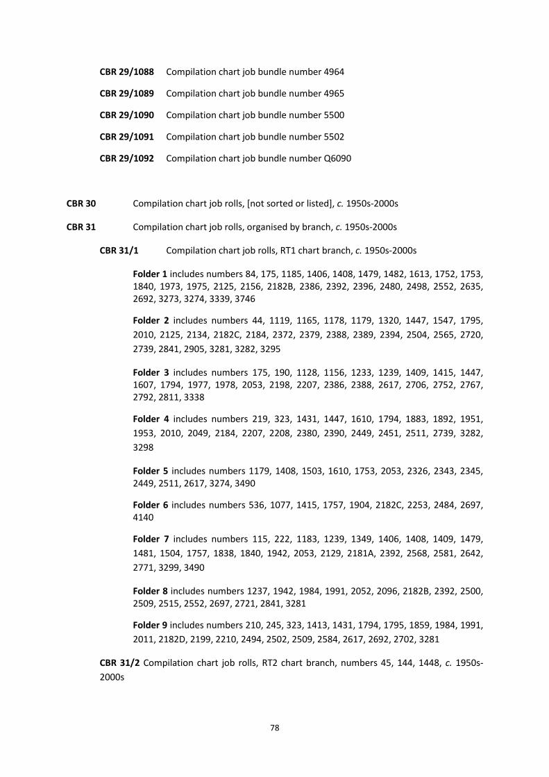
78
CBR 29/1088 Compilation chart job bundle number 4964
CBR 29/1089 Compilation chart job bundle number 4965
CBR 29/1090 Compilation chart job bundle number 5500
CBR 29/1091 Compilation chart job bundle number 5502
CBR 29/1092 Compilation chart job bundle number Q6090
CBR 30 Compilation chart job rolls, [not sorted or listed], c. 1950s-2000s
CBR 31 Compilation chart job rolls, organised by branch, c. 1950s-2000s
CBR 31/1 Compilation chart job rolls, RT1 chart branch, c. 1950s-2000s
Folder 1 includes numbers 84, 175, 1185, 1406, 1408, 1479, 1482, 1613, 1752, 1753, 1840, 1973, 1975, 2125, 2156, 2182B, 2386, 2392, 2396, 2480, 2498, 2552, 2635, 2692, 3273, 3274, 3339, 3746
Folder 2 includes numbers 44, 1119, 1165, 1178, 1179, 1320, 1447, 1547, 1795,
2010, 2125, 2134, 2182C, 2184, 2372, 2379, 2388, 2389, 2394, 2504, 2565, 2720,
2739, 2841, 2905, 3281, 3282, 3295
Folder 3 includes numbers 175, 190, 1128, 1156, 1233, 1239, 1409, 1415, 1447, 1607, 1794, 1977, 1978, 2053, 2198, 2207, 2386, 2388, 2617, 2706, 2752, 2767, 2792, 2811, 3338
Folder 4 includes numbers 219, 323, 1431, 1447, 1610, 1794, 1883, 1892, 1951,
1953, 2010, 2049, 2184, 2207, 2208, 2380, 2390, 2449, 2451, 2511, 2739, 3282,
3298
Folder 5 includes numbers 1179, 1408, 1503, 1610, 1753, 2053, 2326, 2343, 2345, 2449, 2511, 2617, 3274, 3490
Folder 6 includes numbers 536, 1077, 1415, 1757, 1904, 2182C, 2253, 2484, 2697, 4140
Folder 7 includes numbers 115, 222, 1183, 1239, 1349, 1406, 1408, 1409, 1479,
1481, 1504, 1757, 1838, 1840, 1942, 2053, 2129, 2181A, 2392, 2568, 2581, 2642,
2771, 3299, 3490
Folder 8 includes numbers 1237, 1942, 1984, 1991, 2052, 2096, 2182B, 2392, 2500, 2509, 2515, 2552, 2697, 2721, 2841, 3281
Folder 9 includes numbers 210, 245, 323, 1413, 1431, 1794, 1795, 1859, 1984, 1991,
2011, 2182D, 2199, 2210, 2494, 2502, 2509, 2584, 2617, 2692, 2702, 3281
CBR 31/2 Compilation chart job rolls, RT2 chart branch, numbers 45, 144, 1448, c. 1950s-
2000s

79
CBR 31/3 Compilation chart job rolls, master proofs to sort for branch HDB/RT1, c. 1950s-
2000s
Includes numbers 222, 728, 736, 1156, 1183, 1415, 1431, 1447, 1610, 1757, 1838,
1840, 2129, 2184, 2528, 2568, 2581, 2740, 3299
CBR 32 Source overlays, c. 1950s-2000s
CBR 32/1 Organised by chart branch, mostly arranged by number, c. 1950s-2000s
CBR 32/1/1 Source overlays chart branch RT1, c. 1950s-2000s
Folder 1 includes numbers 1077, 2503, 3490
Folder 2 includes numbers 2136, 2147, 2669, 3653, 3654, 3655, 3656, 3659, 3670,
3674
CBR 32/1/2 Source overlays chart branch RT2, c. 1950s-2000s
Folder number ranges 53-299
Includes 53, 57, 83, 85, 86, 87, 110, 112, 114, 133, 137, 140, 142, 144, 149, 172, 193, 235, 275, 299
Folder number ranges 485-916
Includes 485, 509, 562, 565, 644, 665, 773, 774, 798, 847, 849, 873, 879, 900, 903, 916
Folder number ranges 1054-1155
Includes 1054, 1079, 1080, 1083, 1088, 1089, 1090, 1106, 1111, 1114, 1122,
1131, 1133, 1155
Folder number ranges 1181-1996
Includes 1181, 1189, 1195, 1327, 1343, 1448, 1466, 1473, 1505, 1535, 1539, 1588, 1600, 1626, 1643, 1658, 1685, 1700, 1701, 1702, 1703, 1704, 1705, 1706, 1707, 1756, 1757, 1764, 1768, 1769, 1848, 1872, 1873, 1874, 1875, 1941, 1950, 1959, 1974, 1985, 1996
Packet contains number range: 2114-2299
2114, 2115, 2116, 2118, 2138, 2150, 2166, 2212, 2215, 2222, 2223, 2224, 2225, 2225, 2226, 2227, 2241, 2243, 2246, 2248, 2251, 2252, 2264, 2271, 2273, 2276, 2278, 2280, 2284, 2288, 2288, 2291, 2296, 2297, 2298, 2299
Packet contains number range: 2300-2599
2300, 2303, 2305, 2306, 2307, 2308, 2310, 2315, 2317, 2321, 2328, 2330, 2333, 2337, 2338, 2340, 2350, 2356, 2357, 2360, 2361, 2362, 2366, 2367, 2368, 2369, 2370, 2371, 2393, 2395, 2590, 2594, 2595, 2596, 2597

80
Packet contains number range: 2646-2834
2646, 2663, 2672, 2673, 2733, 2734, 2745, 2750, 2761, 2816, 2817, 2831, 2832, 2834
Packet contains number range: 2929-2982
2929, 2962, 2963, 2966, 2982
Packet contains number range: 3000-F6189
F6189, 3003, 3034, 3036, 3041, 3062, 3114, 3126, 3127, 3136, 3141, 3142,
3143, 3144, 3145, 3147, 3155, 3156, 3157, 3163, 3168, 3169, 3170, 3180,
3181, 3191, 3194, 3211, 3217, 3224, 3261, 3262, 3266, 3268, 3318, 3368,
3369, 3405, 3406, 3407, 3415, 3435, 3436, 3437, 3465, 3546, 3547, 3556,
3557, 3633, 3634, 3635, 3636, 3638, 3640, 3712, 3717, 3767, 4011, 4014,
4100, 4101, 4112, 4113, 4114
CBR 32/1/3 Source overlays chart branch RT3, c. 1950s-2000s
Folder 1 includes numbers 308, 312, 666, 1322, 2007, 2203, 2237, 2283, 2939, 3133,
3352
Folder number range 30-188
36, 118, 119, 140, 165, 176, 177, 178, 180, 183, 186, 187, 188
Folder number range 189-238
189, 196, 200, 201, 202, 203, 204, 206, 211, 212, 220, 224, 236, 237, 238
Folder number range 239-367
239, 242, 243, 269, 302, 305, 307, 309, 310, 311, 351, 354, 355, 356, 366, 367
Folder number range 412-595
412, 455, 497, 515, 563, 574, 575, 577, 578, 580, 595
Folder number range 657-689
657, 659, 663, 665, 666, 667, 668, 674, 683, 685, 686, 689
Folder number range 711-722
711, 712, 713, 716, 717, 718, 721, 722
Folder number range 724-851
724, 740, 742, 776, 796, 805, 812, 814, 822, 840, 842, 848, 849, 851
Folder number range 852-914

81
852, 856, 860, 861, 862, 863, 886, 906, 907, 908, 914
Folder number range 915-1032
915, 916, 917, 963, 964, 965, 966, 973, 974, 992, 1003, 1004, 1005, 1006, 1018, 1030, 1031, 1032
Folder number range 1037-1099
1037, 1038, 1040, 1041, 1054, 1055, 1056, 1057, 1058, 1061, 1062, 1085, 1086, 1087, 1091, 1092, 1093, 1095, 1099
Folder number range 1147-1232
1147, 1184, 1198, 1202, 1204, 1205, 1208, 1210, 1212, 1213, 1215, 1232
Folder number range 1272-1363
1272, 1274, 1275, 1279, 1321, 1322, 1356, 1357, 1359, 1361, 1362, 1363
Folder number range 1363-1385
1363, 1364, 1365, 1380, 1381, 1383, 1384, 1385
Folder number range 1386-1456
1386, 1387, 1398, 1417, 1418, 1419, 1426, 1439, 1443, 1444, 1445, 1456
Folder number range 1467-1554
1467, 1471, 1483, 1486, 1497, 1506, 1513, 1522, 1526, 1531, 1532, 1538, 1539, 1541, 1554
Folder number range 1556-1591
1556, 1562, 1563, 1567, 1571, 1574, 1580, 1582, 1585, 1590, 1591
Folder number range 1595-1689
1595, 1596, 1598, 1599, 1608, 1618, 1636, 1644, 1657, 1661, 1662, 1663, 1664, 1665, 1675, 1676, 1683, 1685, 1687, 1688, 1689
Folder number range 1690-1780
1690, 1691, 1699, 1706, 1707, 1724, 1726, 1769, 1771, 1780
Folder number range 1806-1887
1806, 1816, 1831, 1845, 1847, 1856, 1857, 1858, 1860, 1862, 1863, 1869, 1870, 1887
Folder number range 1908-1992
1908, 1909, 1911, 1912, 1941, 1950, 1956, 1958, 1980, 1985, 1992
Folder number range 1996-2121

82
1996, 1998, 1999, 2070, 2074, 2078, 2080, 2082, 2083, 2087, 2088, 2091, 2095, 2121
Folder number range 2122-2217
2122, 2123, 2124, 2147, 2187, 2200, 2201, 2202, 2203, 2212, 2213, 2214, 2217
Folder number range 2230-2284
2230, 2232, 2233, 2234, 2236, 2237, 2238, 2242, 2243, 2282, 2283, 2284
Folder number range 2285-2537
2285, 2286, 2399, 2402, 2404, 2405, 2406, 2429, 2478, 2537
Folder number range 2538-2719
2538, 2573, 2574, 2578, 2623, 2632, 2634, 2711, 2717, 2719
Folder number range 2741-2968
2741, 2744, 2773, 2774, 2812, 2926, 2927, 2929, 2930, 2931, 2932, 2933, 2934, 2935, 2949, 2968
Folder number range 3048-3132
3048, 3051, 3093, 3099, 3100, 3101, 3102, 3103, 3104, 3113, 3118, 3119, 3132
Folder number range 3133-3300
3133, 3134, 3135, 3139, 3206, 3211, 3286, 3287, 3300
Folder number range 3302-3316
3302, 3303, 3304, 3307, 3310, 3311, 3312, 3313, 3316
Folder number range 3317-3403
3317, 3321, 3323, 3325, 3327, 3343, 3344, 3347, 3352, 3361, 3362, 3371, 3400, 3401, 3402, 3403
Folder number range 3432-3681
3432, 3433, 3434, 3447, 3448, 3460, 3466, 3532, 3648, 3679, 3681
Folder number range 3870-4158
3870, 3873, 3876, 3877, 3930, 4021, 4022, 4070, 4104, 4136, 4141, 4142, 4146, 4150, 4151, 4152, 4153, 4154, 4155, 4158
Folder number range 4159-4701

83
4159, 4173, 4174, 4203, 4205, 4206, 4208, 4209, 4300, 4301, 4302, 4700,
4701
CBR 32/1/4 Source overlays chart branch RT4, c. 1950s-2000s
Folder number range 1-38
1, 3, 6, 8, 13, 14, 15, 16, 27, 38
Folder number range 39-63
39, 40, 43, 58, 59, 61, 63
Folder number range 64-123
64, 65, 66, 67, 81, 82, 84, 100, 123
Folder number range 136-171
136, 141, 143, 157, 168, 171
Folder number range 212-262
212, 216, 233, 234, 239, 240, 241, 253, 262
Folder number range 287-548
287, 333, 400, 452, 453, 492, 514, 538, 542, 548
Folder number range 666-792
666, 670, 671, 672, 673, 699, 707, 708, 709, 725, 726, 727, 732, 753, 754, 755, 756, 757, 758, 759, 760, 761, 762, 763, 764, 765, 766, 767, 768, 769, 770, 771, 772, 773, 774, 775, 776, 777, 778, 779, 780, 781, 792
Folder number range 801-859
801, 817, 818, 819, 823, 824, 825, 826, 833, 834, 859
Folder number range 912-999
912, 918, 920, 928, 932, 933, 941A, 942A, 942B, 943, 945, 946, 950, 967, 971, 975, 976, 983, 986, 999
Folder number range 1011-1223
1011, 1014, 1052, 1066, 1075, 1140, 1214, 1223, 1224
Folder number range 1228-1284
1228, 1265, 1268, 1269, 1284
Folder number range 1311-1487

84
1311, 1312, 1336, 1338, 1348, 1358, 1398, 1419, 1420, 1470, 1474, 1486, 1487
Folder number range 1508-1697
1508, 1509, 1564, 1565, 1566, 1584, 1586, 1587, 1654, 1655, 1680, 1681, 1697
Folder number range 1748-1964
1748, 1788, 1789, 1794, 1799, 1823, 1844, 1852, 1885, 1925, 1926, 1949, 1964
Folder number range 2012-2153
2012, 2014, 2056, 2058, 2068, 2090, 2099, 2109, 2111, 2112, 2132, 2133,
2134, 2137, 2139, 2149, 2152, 2153
Folder number range 2374-2598
2374, 2414, 2422, 2426, 2441, 2442, 2443, 2523, 2555, 2556, 2569, 2575, 2577, 2585, 2586, 2587, 2598, 2670
Folder number range 2621-2797
2621, 2624, 2627, 2638, 2640, 2736, 2738, 2758, 2776, 2778, 2785, 2791
Folder number range 2837-2870
2837, 2847, 2851, 2854, 2858, 2869, 2870
Folder number range 2872-2884
2872, 2873, 2876, 2877, 2882, 2884
Folder number range 2886-2970
2886, 2887, 2888, 2889, 2892, 2893, 2894, 2895, 2896, 2917, 2964, 2970
Folder number range 3011-3296
3011, 3012, 3013, 3014, 3017, 3022, 3029, 3040, 3049, 3051, 3171, 3172,
3173, 3174, 3175, 3177, 3178, 3179, 3193, 3214, 3215, 3239, 3241, 3242,
3243, 3244, 3296
Folder number range 3323-3414
3323, 3404, 3405, 3409, 3410, 3411, 3413, 3414
Folder number range 3445-3482
3445, 3446, 3447, 3460, 3461, 3464, 3466, 3471, 3476, 3482
Folder number range 3483-3525

85
3483, 3484, 3485, 3511, 3518, 3519, 3520, 3521, 3522, 3523, 3525
Folder number range 3526-3719
3526, 3530, 3542, 3543, 3558, 3574, 3584, 3595, 3599, 3616, 3626, 3660, 3661, 3662, 3706, 3713, 3714, 3715, 3718, 3719
Folder number range 3720-3743
3720, 3721, 3722, 3723, 3727, 3728, 3729, 3731, 3732, 3733, 3734, 3735,
3736, 3737, 3739, 3743
Folder number range 3744-3780
3744, 3745, 3747, 3752, 3757, 3758, 3772, 3773, 3774, 3775, 3776, 3777, 3778, 3779, 3780
Folder number range 3781-3790
3781, 3783, 3784, 3785, 3786, 3787, 3788, 3789, 3790
Folder number range 3791-3831
3791, 3792, 3796, 3798, 3812, 3819, 3821, 3831
Folder number range 3833-3933
3833, 3836, 3838, 3843, 3919, 3920, 3921, 3931, 3933
Folder number range 3936-3983
3936, 3937, 3940, 3941, 3946, 3947, 3948, 3949, 3950, 3951, 3953, 3961, 3963, 3964, 3965, 3983
Folder number range 4035-4478
4035, 4037, 4039, 4041, 4042, 4044, 4071, 4413, 4414, 4416, 4417, 4470, 4471, 4472, 4473, 4474, 4475, 4476, 4477, 4478
Folder number range 4479-4492
4479, 4480, 4481, 4482, 4483, 4484, 4485, 4486, 4487, 4489, 4490, 4491, 4492
Folder number range 4507-F6498
4507, 4508, 4702, 4703, 4704, 4705, 4706, 4707, F6192, F6498
Folder number range 175-3788
175, 190, 222, 1234, 1520, 1610, 1872, 1926, 2153, 2443, 2449, 2565, 2886, 2965, 3781, 3788

86
Folder 1 includes numbers 161, 162, 1655, 3726, 3790, 3880, 3949
Folder 2 includes numbers 328, 933, 1822, 2139, 2155R, 2373, 3173
Folder 3 includes numbers 3176, 3738, 3739
Folder 4 includes numbers 36, 186, 243, 455, 497, 650, 712, 825, 963, 1202, 1456,
1870, 2243, 2812, 2926, 2936, 3304, 3795, 3797, 4702
CBR 32/1/5 Source overlays chart branch RT5, c. 1950s-2000s
Folder number range 17-991
17, 41, 214, 215, 225, 339, 377, 384, 385, 416, 440, 441, 446, 449, 480, 488, 731, 744, 745, 746, 748, 750, 751, 752, 761, 762, 764, 806, 935, 936, 951, 952, 968, 991
Folder number range 1103-1803
1103, 1107, 1109, 1244, 1382, 1436, 1469, 1494, 1570, 1575, 1576, 1577, 1581, 1603, 1638, 1660, 1670, 1674, 1682, 1741, 1750, 1775, 1779, 1801, 1802, 1803
Folder number range 1918-4634
1918, 1962, 1965, 3875, 3986, 3987, 3988, 3989, 3990, 4061, 4634
Folder number range 94-1578
94, 341, 343, 346, 626, 749, 854, 878, 937, 1016, 1058, 1251, 1254, 1255,
1257, 1259, 1260, 1261, 1262, 1270, 1457, 1459, 1555, 1558, 1578
Folder number range 2691-3998
2691, 2906, 2907, 2925, 2928, 2983, 3039, 3041, 3044, 3200, 3205, 3404,
3552, 3553, 3566, 3570, 3571, 3573, 3587, 3588, 3593, 3597, 3629, 3710,
3711, 3714, 3716, 3996, 3997, 3998
Folder number range 1808-F2583
F2517, F2518, F2519, F2583, 1808, 1813, 1871, 2505, 2506, 2507, 2508, 2512, 2513, 2514, 2526, 2527, 2543, 2545, 2546, 2547, 2550, 2553, 2560, 2561
Folder number range 4009-4621
4009, 4024, 4052, 4053, 4060, 4063, 4064, 4065, 4074, 4075, 4213, 4506, 4511, 4521, 4600, 4601, 4603, 4605, 4611, 4612, 4621
Folder number range 4601-4629
4601, 4606, 4607, 4613, 4614, 4617, 4619, 4622, 4623, 4624, 4625, 4629
Folder number range 4630-4907

87
4630, 4631, 4632, 4633, 4636, 4637, 4638, 4638, 4640, 4648, 4653, 4655, 4656, 4657, 4709, 4710, 4711, 4712, 4714, 4720, 4726, 4727, 4900, 4904, 4907
Folder number range AUS 4- AUS 250
AUS 14, AUS 20, AUS 27, AUS 32, AUS 58, AUS 112, AUS 114, AUS 115, AUS
117, AUS 137, AUS 154, AUS 172, AUS 199, AUS 201, AUS 207, AUS 208, AUS
237, AUS 238, AUS 244, AUS 245, AUS 246, AUS 247, AUS 250
Folder number range NZ 43-NZ 6821
NZ 43, NZ 55, NZ 61, NZ 62, NZ 63, NZ 522, NZ 531, NZ 532, NZ 541, NZ 681, NZ 827, NZ 5322, NZ 5324, NZ 5613, NZ 5712, NZ 6142, NZ 6321, NZ 6422, NZ 6612, NZ 6821
Folder number range 1602-2432
1602, 1603, 1619, 1621, 1737, 1767, 1815, 1915, 1917, 1918, 1919, 2119,
2127, 2128, 2130, 2161, 2265, 2279, 2287, 2293, 2376, 2432
Folder 1 includes numbers 1126, 3586, AUS 56, AUS 155, AUS 216, AUS 237, AUS
249, AUS 316, AUS 320, AUS 823, NZ 68, NZ 86, NZ 681, NZ 8275
CBR 32/1/6 Source overlays chart branch RT6, c. 1950s-2000s
Includes numbers 1452, 2810, 3847
CBR 32/1/7 Source overlays no identified chart branch, c. 1950s-2000s
Folder 1 includes numbers 3452, 3469, 3490, 3497
Folder 2 includes numbers 3462, 3653, 3654, 3655, 3656, 3666, 3669, 3670, 3673,
3683, 3694, 3695, 3696, 3697
Folder 3 includes numbers 3542, 3546, 3548, 3578, 3587, 3588
Folder 4 includes numbers 1349, 1406, 1408, 1504, 2182A
CBR 32/1/8 Source overlays ‘folio 5600-5607’, c. 1950s-2000s
Folio 5600, Folio 5601, Folio 5602, Folio 5603, Folio 5604, Folio 5605, Folio 5606,
Folio 5067
CBR 32/1/9 Miscellaneous source overlays, c. 1950s-2000s
Including: 6, 14, 66, 159, 163, 164, 188, 286, 306, 333, 346, 453, 460, 497, 607, 644,
693, 707, 918, 932, 999, 1004, 1087, 1274, 1279, 1312, 1497, 1625, 1925, 1955,
1998, 1999, 2070, 2185, 2205, 2213, 2216, 2375, 2429, 2444, 2639, 2658, 2659,

88
2786, 2795, 2796, 2797, 2851, 2882, 2883, 2888, 2889, 2903, 2908, 2909, 2910,
2911, 2915, 2916, 2936, 2941, 2948, 2952, 2964, 2970, 2992, 2994, 3015, 3017,
3029, 3049, 3265, 3285, 3288, 3291, 3471, 3492, 3497, 3518, 3599, 3604, 3642,
3688, 3692, 3706, 3709, 3713, 3715, 3725, 3729, 3741, 3749, 3750, 3751, 3757,
3758, 3774, 3787, 3790, 3812, 3844, 3850, 3912, 3913, 3914, 3928, 3940, 3946,
3951, 3961, 3966, 4041, 4074, 4119, 4122, 4123, 4128, 4129, 4463, 4464
CBR 32/2 Catzoc [Category of Zone of Confidence] overlays, c. 1950s-2000s
CBR 32/2/1 Catzoc overlays, arranged by number, c. 1950s-2000s
Including numbers BA 18, BA 28, BA 30, BA 31, BA 32, BA 34, BA 35, BA 60, BA 105, BA 108,
BA 115, BA 121, BA 128, BA 129, BA 134, BA 147, BA 148, BA 152, BA 154, BA 156, BA 175,
BA 190, BA 210, BA 213, BA 222, BA 223, BA 266, BA 267, BA 268, BA 272, BA 273, BA 274,
BA 278, BA 291, BA 292, BA 294, BA 295, BA 442, BA 633, BA 728, BA 733, BA 734, BA 735,
BA 736, BA 737, BA 741, BA 777, BA 807, BA 808, BA 871, BA 883, BA 1076, BA 1077, BA
1078, BA 1119, BA 1136, BA 1137, BA 1148, BA 1149, BA 1152, BA 1156, BA 1160, BA 1161,
BA 1164, BA 1165, BA 1166, BA 1167, BA 1168, BA 1169, BA 1176, BA 1178, BA 1182, BA
1183, BA 1187, BA 1190, BA 1191, BA 1192, BA 1200, BA 1233, BA 1234, BA 1237, BA 1320,
BA 1344, BA 1346, BA 1403, BA 1407, BA 1409, BA 1410, BA 1411, BA 1413, BA 1431, BA
1438, BA 1446, BA 1462, BA 1463, BA 1464, BA 1478, BA 1481, BA 1482, BA 1484, BA 1503,
BA 1504, BA 1512, BA 1540, BA 1547, BA 1548, BA 1549, BA 1552, BA 1553, BA 1607, BA
1610, BA 1630, BA 1634, BA 1652, BA 1752, BA 1753, BA 1757, BA 1765, BA 1770, BA 1772,
BA 1773, BA 1777, BA 1785, BA 1790, BA 1791, BA 1794, BA 1795, BA 1819, BA 1820, BA
1826, BA 1827, BA 1828, BA 1835, BA 1859, BA 1864, BA 1866, BA 107, BA 1867, BA 1879,
BA 1889, BA 1890, BA 1900, BA 1902, BA 1904, BA 1906, BA 1907, BA 1942, BA 1951, BA
1953, BA 1954, BA 1967, BA 1970, BA 1972, BA 1973, BA 1975, BA 1977, BA 1978, BA 1981,
BA 1991, BA 1994, BA 2000, BA 2007, BA 2010, BA 2011, BA 2013, BA 2021, BA 2022, BA
2035, BA 2036, BA 2037, BA 2038, BA 2041, BA 2044, BA 2045, BA 2049, BA 2053, BA 2057,
BA 2076, BA 2092, BA 2094, BA 2096, BA 2126, BA 2131, BA 2154, BA 2156, BA 2159, BA
2162, BA 2168, BA 2171, BA 2172, BA 2173, BA 2175, BA 2198, BA 2199, BA 2207, BA 2208,
BA 2209, BA 2210, BA 2220, BA 2221, BA 2249, BA 2250, BA 2253, BA 2255, BA 2268, BA
2290, BA 2320, BA 2326, BA 2343, BA 2345, BA 2372, BA 2379, BA 2380, BA 2381, BA 2382,
BA 2383, BA 2386, BA 2387, BA 2388, BA 2389, BA 2390, BA 2392, BA 2394, BA 2396, BA
2424, BA 2450, BA 2451, BA 2454, BA 2474, BA 2475, BA 2476, BA 2479, BA 2480, BA 2481,
BA 2482, BA 2491, BA 2494, BA 2495, BA 2498, BA 2500, BA 2501, BA 2502, BA 2503, BA
2504, BA 2505, BA 2509, BA 2510, BA 2511, BA 2515, BA 2524, BA 2528, BA 2529, BA 2533,
BA 2534, BA 2540, BA 2541, BA 2550, BA 2551, BA, 2554, BA 2562, BA 2565, BA 2568, BA
2574, BA 2575, BA 2576, BA 2579, BA 2580, BA 2581, BA 2584, BA 2610, BA 2611, BA 2615,
BA 2617, BA 2625, BA 2629, BA 2631, BA 2647, BA 2652, BA 2667, BA 2675, BA 2692, BA
2696, BA 2697, BA 2702, BA 2703, BA 2704, BA 2720, BA 2721, BA 2722, BA 2723, BA 2725,
BA 2767, BA 2771, BA 2789, BA 2793, BA 2798, BA 2800, BA 2802, BA 2811, BA 2841, BA
2845, BA 2878, BA 2883, BA 2905, BA 3410, BA 3146, BA 3164, BA 3271, BA 3272, BA 3273,
BA 3274, BA 3275, BA 3281, BA 3282, BA 3283, BA 3284, BA 3292, BA 3294, BA 3295, BA
3297, BA 3298, BA 3299, BA 3315, BA 3319, BA 3335, BA 3337, BA 3338, BA 3418, BA 3490,
BA 3653, BA 3656, BA 3741, BA 3746

89
CBR 32/2/2 Catzoc overlays arranged by number range, c. 1950s-2000s
Folder containing number range 99-171
99, 332, 398, 465, 466, 467, 471
Folder containing number range 254-499
254, 255, 256, 257, 258, 260, 334, 396, 454, 456, 457, 458, 462, 463, 464, 475, 481, 486, 489, 499
Folder containing number range 502-867
502, 583, 584, 585, 597, 605, 697, 797, 867
Folder containing number range 519-1273
519, 522, 527, 533, 572, 596, 791, 799, 868, 959, 1073
Folder containing number range 1139-2485
1139, 1400, 1401, 1450, 1489, 1797, 2019, 2020, 2064, 2485
Folder containing number range 1315- 3936
1315, 1452, 1573, 2016, 2065, 2687, 2988, 3111, 3907, 3908, 3912, 3913, 3914,
3935, 3936
with folders of paperwork
CBR 32/2/3 Catzoc overlays, arranged by chart branch and then number, c. 1950s-2000s
Regions RT1, RT3, RT4
Folder 1 includes numbers 115, 219, 322, 323, 1553, 1794, 1942, 2052, 2210, 2386,
2451, 2494, 2565, 2571, 2697
Folder 2 includes numbers 223, 1185, 1415, 1447, 1479, 1607, 1752, 1753, 1757,
1892, 1984, 2000, 2045, 2156, 2199, 2584, 2721, 2841, 2905, 3281, 3282, 3339
Folder 3 includes numbers 109, 1188, 1609, 1794, 1828, 1834, 1901, 1967, 2010,
2500, 2617, 2722, 2811, 3281, 3497
Folder 4 includes numbers 44, 536, 777, 849, 1178, 1237, 1320, 1351, 1607, 1794,
1826, 1883, 1892, 1904, 1953, 1975, 1991, 2010, 2171, 2652
Folder 5 includes numbers 1415, 2049, 2096, 2125, 2207, 2326, 2343, 2372, 2380,
2388, 2389, 2390, 2394, 2511, 2565, 2740, 2767, 2769, 3298
Folder 6 includes numbers 36, 177, 211, 666, 775, 776, 796, 849, 850, 851, 1590,
1613, 2812, 3338, 3490, 3683

90
Folder 7 includes numbers 153, 157, 453, 601, 693, 2074, 2441, 2537, 2681, 2851,
2858
CBR 32/2/4 Miscellaneous cable LNE’s (Limited New Edition): 1573, 1797, 2754, 2755, 2860,
3441, 4954, 4962
CBR 32/2/5 Catzoc overlays, arranged by number, [were rolled] c. 1950s-2000s
Includes numbers 6, 7, 11, 12, 15, 16, 27, 55, 56, 63, 64, 81, 100, 159, 164, 171, 194,
233, 326, 327, 328, 333, 452, 460, 483, 542, 548, 801, 1214, 1223, 1224, 1235, 1265,
1268, 1269, 1890, 1955, 2132, 2133, 2373, 2374, 2375, 2441, 2442, 2443, 2444,
2523, 2577, 2599, 2658, 2659, 2854, 2884, 2895, 2896, 3040, 3043, 3171, 3173,
3175, 3172, 3173, 3174, 3176, 3177, 3178, 3179, 3214, 3409, 3410, 3411, 3413,
3415, 3493, 3511, 3518, 3519, 3520, 3520, 3522, 3523, 3526, 3526, 3530, 3599,
3660, 3661, 3739, 3752, 3772, 3773, 3774, 3775, 3777, 3780, 3781, 3739, 3752,
3772, 3773, 3774, 3775, 3777, 3780, 3781, 3782, 3783, 3784, 3787, 3788, 3789,
3790, 3790, 3791, 3812, 3842, 3950, 3951
CBR 33 Compilation bundles, c. 1950s-2000s
These rolls were weeded in March 2019 to remove items without comments added
by UKHO staff. Numbers 1630, 2360, 2664 have been kept as examples of the work
processes of the chart branches
Includes numbers 20, 45, 50, 110, 120, 122, 125, 126, 128, 140, 144, 174,
207, 281, 286, 288, 299, 355, 426, 430, 893, 894, 901, 906, 926, 931, 938,
954, 1090, 1119, 1153, 1168, 1169, 1205, 1374, 1402, 1444, 1447, 1455,
1473, 1521, 1630, 1631, 1632, 1635, 1700, 1701, 1732, 1872, 1873, 1874,
1904, 1946, 1953, 1959, 2108, 2208, 2212, 2218, 2241, 2248, 2251, 2261,
2291, 2296, 2300, 2301, 2302, 2333, 2344, 2354, 2355, 2359, 2360, 2361,
2362, 2393, 2395, 2449, 2490, 2583, 2591, 2592, 2596, 2652, 2663, 2664,
2676, 2720, 2771, 2802, 2817, 2987, 3084, 3089, 3111, 3132, 3137, 3275,
3316, 3438, 3439, 3440, 3504, 3537, 3540, 3553, 3555, 3569, 3618, 3634,
3688, 3847, 3857, 4103, 4711, 4787, 4940
CBR 34 Hydrographic Office compilation drawings, 1930s-1960s
Related records:
OCB Record copies of Admiralty charts (‘old copy bundles’)
PRR Production records

91
CCO Chart Corrections Office (C.C.O.) records
Records created and held by the Chart Corrections Office.
CCO 1 Chart corrections log, 1999
Related records:
NMR Notice to Mariners
OCB Record copies of Admiralty charts (‘old copy bundles’)
CCP Catalogues of printed charts and publications
This series contains Admiralty publications only; for foreign government and commercial producers’
catalogues see OCC. The concept of selling Admiralty charts was raised by Captain Hurd and the first
list of charts for sale published in 1821.34 The 1825 edition, which is the earliest held by the UKHO,
lists 643 charts or surveys and 98 views (CCP 1/1).35
The chart catalogue for 1839 was printed ‘for Her Majesty’s Stationary Office’. This was the first
mention of HMSO, which had been established in 1786. An important innovation was introduced in
this catalogue: the numbering of charts using Arabic numbers.36 As charts were not given Arabic
numbers before 1839, identifying charts held in the H.O. archive that were published but cancelled
or withdrawn before this date can sometimes be problematic. These charts are referred to as ‘never
numbered’ and a working list by L Pascoe is held in the Archive library section on the open shelves.
The 1905 catalogue gave charts a second, ‘new’, number in parenthesis, running consecutively from
1 to 3,437 through the navigational charts. There had been a similar numbering scheme (or system)
in place five years previously, and on both occasions the gigantic task of any renumbering
presumably proved too formidable. When a chart was cancelled the number was re-used for a new
chart, perhaps of another area, after a period of five years. This had been the practice for some fifty
years.37 Chart numbering should be viewed with caution as there are some anomalies.
In 1909 the published chart catalogue was completely recompiled with more detailed information,
and photographic reductions of the A to V index charts, made at the Ordnance Survey office, were
34 Webb, A.J. ‘The Expansion of British Naval Hydrographic Administration 1808-1829’ (PhD thesis, Exeter, 2010) 35 Morris, Charts and Surveys in Peace and War, p.10. 36 Day, The Admiralty Hydrographic Service, pp.50-51. 37 Day, The Admiralty Hydrographic Service, p.216.

92
included.38 These index charts show the geographical limits covered by the charts advertised for sale
in the catalogues.
In 1962 the chart catalogue was given the Nautical Publication code NP 131.
The Archive does not hold the earliest catalogue or any supplements issued before 1825. The
catalogues that are held were microfilmed in the 1990s and copies were sent to all major libraries
and T.N.A.. In the 2010s selected catalogues were digitised and made available through the UKHO’s
website. The catalogues can be used to identify chart numbers in the OCB collection (for more
information see OCB Record copies of Admiralty charts (‘old copy bundles’)).
At the end of the First World War a technical report was written detailing all the Fleet charts
produced during the conflict. This technical history has been digitised and is available on request.
Printed Fleet charts are normally classified until they are fifty years old and not available to the
public until they are declassified.
For a history of chart sales and the earliest catalogues during the period 1808 to 1829 see Adrian
Webb’s PhD thesis The Expansion of British Naval Hydrographic Administration 1808-1829 (Exeter,
2010), available from the University of Exeter website.
CCP 1 Catalogues of Admiralty charts, 1825-2016
CCP 2 Catalogues of Admiralty Fleet charts, 1903-present [2019]
CCP 2/1 Catalogues of Admiralty Fleet charts, HD303, NP229, NP111 1903-
present [2019]
CCP 2/2 Supplements to HD303 Catalogues of Admiralty Fleet charts, 1940-
1944
CCP 2/3 HD303a Index to Admiralty Fleet charts, semi-confidential charts and
miscellaneous charts, 1941
CCP 2/4 HD303b Catalogues of Gridded charts including indexes, 1943
CCP 2/5 HD336 Catalogues of most secret charts, 1940-1945
CCP 2/6 HD336 supplements to Catalogues of most secret charts, 1940-1941
CCP 2/7 HD336a List of chart maps and beach chartlets, 1944
CCP 2/8 HD342 List of outline and wall charts, 1940-1945
38 Pascoe, The Story of the Curator of the Hydrographic Department of the Admiralty, p.59.

93
CCP 2/9 Other listings of Admiralty Fleet charts not assigned HD numbers,
1939-1945
CCP 3 Catalogue of new and withdrawn publications, c. 1904-1932
CCP 4 Index to Beach Gradient Diagrams, 1944
CCP 5 Graphical indexes to published Admiralty charts, 1875-1895
Related records:
NPR Nautical publications records
OCB Record copies of Admiralty charts (‘old copy bundles’)
OCC Other printed chart catalogues (non UKHO)
CIB Chart Issues Branch records
The title of Chart Issues Branch was first used in 1888. The H.O.’s main objective had been to provide
its own sailing directions for the Royal Navy since 1798 and charts since 1800.
An innovation in the issue of charts came about during Hurd’s time as Hydrographer in 1809. He
implemented the proposals of the Chart Committee, including issuing charts and publications to
ships of the Fleet arranged by station.39 A ship serving on a particular station was supplied only with
charts for that geographical area, thus reducing the number they needed to carry. At the same time
this assured that ships only carried ‘officially sanctioned’ charts that had been approved for use by
hydrographic specialists.
By 1825 the boxes that had held printed charts had been abandoned for stiff marbled covers and
charts were sold either as a series in these folios, or separately. Chart sales were through agents. In
1860 the Stationary Office took over responsibility for the sale of charts, but within a few months
had returned the task to the Department, where it has remained ever since.40
This system of boxes was replaced by chart folios and records in this collection include lists of the
contents and amendments to those folios since 1863. It is therefore possible to use these lists to
show what charts were available to naval vessels on a particular station. Before this date the chart
catalogues (in the CCP collection) should be consulted and records in the MLP series.
39 Webb, A.J. ‘The Expansion of British Naval Hydrographic Administration 1808-1829’ (PhD thesis, Exeter, 2010) 40 Morris, Charts and Surveys in Peace and War, p.14.

94
In the early nineteenth century, as well as issuing charts the Department became involved in chart
sales. In 1816 the Hydrographer, Hurd, proposed a plan to help increase revenue for the
Department. After a plate had been engraved and a sufficient number of charts struck off it for Naval
uses, the remaining impressions were sold at a moderate price for the benefit of the trading interest.
This was agreed to by the Board in 1819 and the first sales were made in 1821.41
In 1939, Potters became an agent rather than, as it had been for many years, the sole agent for
Admiralty charts and publications, and a small sales staff from the Department operated from the
Vine Street premises until evacuation to Bath in September following the outbreak of war. In June
1941 Sales, along with Production and Supplies moved to Creechbarrow House at Taunton.42
In July 1942 the post of Superintendent of Sales was abolished and the Superintendent of Issues
became responsible for sales as well as for issues to the Fleet.43
After the First World War the Department had attempted to impose an overreaching system of chart
distribution on the commercial market, effectively cutting out traditional agents. This mistake was
not repeated after the Second World War and as early as July 1944 meetings were held with the
British Nautical Instrument Trade Association to discuss ways in which Admiralty charts and
publications would be marketed when peace returned. The system which had evolved after the
withdrawal of direct supply from the Admiralty to ships in 1921, of a world-wide chain of agents
selling charts and publications with a trade discount to them was reinstated.44
CIB 1 Ships' folio lists, 1863-1931
CIB 2 Chart accounts, 1882-1911
CIB 3 Papers relating to the Chronometer Section and sales of Admiralty charts, c.
1938-1984
CIB 4 Chart Folio 82: Western North Atlantic Ocean including Bermuda, 1959
Related records:
CCP Catalogues of printed charts and publications
41 Morris, Charts and Surveys in Peace and War, p.8. 42 Morris, Charts and Surveys in Peace and War, pp.80 and 118. 43 Morris, Charts and Surveys in Peace and War, p.118. 44 Morris, Charts and Surveys in Peace and War, p.157.

95
CMU Chart Maintenance Unit records
From 1809 Dockyard storekeepers were responsible for managing the supply of charts, but how
regularly they corrected them by hand is unclear. A detailed record of boxes received at Portsmouth
survives at the National Maritime Museum, Greenwich.45 Chart Maintenance units were established
in the 1930s to keep stocks of charts corrected at the main naval bases.46 The records of these units
which survive in the Archive are only examples of how charts were corrected. The units were closed
in the 2010s and replaced by digital print on demand and electronic charts that did not require
updating by hand. Some information relating to the operation of these units can be found in the
registered file series.
CMU 1 Examples of chart corrections applied at Chart Maintenance units, 1990s-c.
2010s
Related records:
HA Registered files
COD Catalogues of original documents
These catalogues reflect the work of the curator’s office. The first person to undertake any curatorial
duties was Alexander Dalrymple who was appointed in 1795 to sort through all the plans and other
records that had accumulated over the years. A list of commercially published charts from this
period that were in the H.O.’s archive, written by Dalrymple, has survived47. However, there appears
to have been no systematic organisation and referencing scheme in place, therefore in 1823
Lieutenant A.B. Becher was appointed as the first naval assistant to catalogue the records held in the
H.O. (within the Admiralty).48 He was confronted with at least nine thousand documents, none of
which were numbered, and about three thousand Remark Books ‘all lying in a disordered state in
heaps, without any geographical order of arrangement, and filthy with dust.’49
From 1826 onwards when surveys were received they were given a unique reference number and a
date of receipt was recorded in the survey ledger. In addition to this any pre-1823 surveys already
held within the Admiralty that were found in and after 1823 were catalogued by Becher often show
45 Webb, A.J. ‘The Expansion of British Naval Hydrographic Administration 1808-1829’ (PhD thesis, Exeter, 2010) 46 Ex inf Dr Adrian Webb, Aug 2016 and MLP 113. 47 Dalrymple Survey of Commercial Charts, available from UKHO archive staff. 48 Webb, A.J. ‘The Expansion of British Naval Hydrographic Administration 1808-1829’ (PhD thesis, Exeter, 2010) 49 Pascoe, The Story of the Curator of the Hydrographic Department of the Admiralty, p.11.

96
no indication when they had been received or executed. Never numbered published Admiralty
charts may be traced through a series of specialised quasi-catalogues which tackle the non-
numbered and withdrawn charts prior to 1826, although these volumes are not necessarily
complete.50
Becher started cataloguing by allocating charts and surveys (indiscriminately) in no particular order
numbers starting at 1. When he got to 999 he realised he could go on past 10,000, which could lead
to the possible misreading of numbers. He therefore adopted an alphanumerical system starting at
a1 through to a99, then b1 to b99, and so on. He then used a capital letter prefix A1 to A99, B1 to
B99, and also extended the numbers to A999 and B999. The system also involved physically
relocating many documents onto shelves relative to areas of the world, so that America was A, Asia
B, Africa C, Europe D, Polynesia E, Australia F and world maps and charts G. The divisions were then
geographically subdivided and given the letters Aa, Ab, Ba, Bb etc and the related documents placed
on similarly marked shelves. Where documents overflowed one shelf additional shelves were
consecutively numbered, e.g. West Indies had six shelves Ag1 to Ag6. The East Indies also had six
shelves Ba1 to Ba6.51 These catalogued records became known as “original documents” or “ODs”
and should not be confused with the “OD” series used by the HO Sailing Directions Branch.
Becher’s first list, or inventory, was recorded in a single volume now known as Book A (COD 1/1).
Subsequent ledgers were numbered from 1 to 11 and referred to as Book 1, etc. Photocopies of all
the ledgers are available in the Research Room.52 By 1829 Becher had put in place an efficient
system that remained virtually unchanged in principle for 180 years when the “original documents”
were arranged into alpha-numeric order.53
As documents were no longer required, or could no longer be located, the relevant entry in the
ledger was subsequently crossed out in red ink. A very small proportion of these documents have
survived amongst the records of the Admiralty Library housed in the Historic Dockyard, Portsmouth.
These are mainly for the nineteenth century or earlier and are currently being catalogued at
Portsmouth. Copies of some of the items from this collection are held in micrograph format in the
Research Room.54 Some post Becher records were found in the Chart Branches in 2011 and returned
to their original sequence, even though their existence had been expunged for the accession ledgers
some years ago.
Charts and surveys recorded in the survey ledgers are indexed in two ways: a series of index charts
showing the limits of geographical coverage, and in a series of geographical ledgers. Both are divided
up into three time periods (pre 1930, 1930-1979 and 1980-c. 2006). All of these index charts have
50 A.J. Webb, Charting Procedures and Standards, Volume 3, Section 1, Identifying and Retrieving Source Data, (unpublished, 2013), section 0003.4. 51 ‘Abbreviations found in the survey ledgers, 1826-present’ available from archive staff 52 Webb, Charting Procedures and Standards, section 0003.1. 53 A.J. Webb, The Expansion of British Naval Hydrographic Administration 1808-1829, (PhD thesis, Exeter, 2010), p.141. 54 Webb, Charting Procedures and Standards, section 0003.1.

97
been scanned into the Source Data Receipt and Acquisition System (SDRA). From January 2009 the
analogue ledgers and indexes were no longer maintained. It should be noted that prior to 1850
many of the original documents are not shown on the indexes but are included in the geographical
ledgers. This is particularly the case for areas outside of Home Waters and UK dependencies, most
notably Canada and the USA. To supplement this deficiency a Supplement to geographical index
North and South America, West Indies and Polar Regions for items relating to Canadian and adjacent
waters recorded up to 1850 and held in the Hydrographic Office, Taunton (Taunton, 1993) by Lt-Cdr
A.C.F. David RN is available in the Research Room.55
In 1862 the original documents numbered over twenty thousand. By 1864 there were over thirty
thousand and by the 1930s the collection amounted to some half a million sheets.56 It was in 1865
when Commander Davis took over from Becher, that the title of ‘Curator’ was instituted.57
Under the curatorship of A Gibson from 1877 there was a great reduction in the number of
documents held, probably largely due to the continuous problem of lack of space. Some major policy
decision must have been made by the Hydrographer but to date no documentation on this has been
sighted.58 This was a highly lamentable decision that has left a significant gap in the HO’s records.
In 1911 the original documents were recorded as being housed in the sub-basement [London?],59
which is partly the cause of so much dirt visible on records held in the archive prior to this date.60
Following moves to Cornwall House in 1924, the Royal School Bath in 1939 and Ensleigh in 1941,
there was little improvement to these conditions over the following decades and by the late 1940s
the records were kept in the damp, poorly ventilated cellars at the Admiralty building in
Cricklewood.61
In 1958 the Public Record Act was passed, which required departments that held public records to
afford the public adequate access as in the Public Record Office (PRO) itself. Since the establishment
of the PRO in 1856, the Hydrographer had stressed the necessity for keeping the records within the
Department and the case that the retention of the survey charts and records were necessary for the
day-to-day working of his office was stated again in 1958.62 Due to the nature of marine charting
there is still, in 2017, a daily call on records from the nineteenth century in order for the HO to meet
its SOLAS and other obligations.63
55 Webb, Charting Procedures and Standards, section 0003.2. 56 Day, The Admiralty Hydrographic Service, pp.74 and 87 and Morris, Charts and Surveys in Peace and War, p.80. 57 Day, The Admiralty Hydrographic Service, 345-6. 58 Pascoe, The Story of the Curator of the Hydrographic Department of the Admiralty , p.42. 59 Day, The Admiralty Hydrographic Service, p.224. 60 Ex inf Mr D. Saunders, 2017. 61 Morris, Charts and Surveys in Peace and War, p.153. 62 Pascoe, The Story of the Curator of the Hydrographic Department of the Admiralty, pp.34 and 82. 63 Ex inf Dr A. Webb, 2017.

98
In 1968, all staff from Cricklewood and the Archives were relocated to the Taunton site. There was a
structural reorganisation at the time of the move and the Archives became the responsibility of one
of the seven Marine Science branches established within Chart Branch.64 The new building took into
account plans which had been in place from 1964 to provide adequate and permanent
accommodation for the Curator and the records, ensuring appropriate temperature and humidity
controls.65 Facilities were also made for the restoration and repair of old originals and a repair staff
was trained.66
A card system was introduced in the 1970s to record the movements of documents in the Archive
(including charts and surveys), but unfortunately these cards were destroyed in the 1990s.67 In 2006
the Source Data Receipt and Acquisition System (SDRA) was introduced and documents were
recorded in the analogue ledgers in tandem with the newly scanned records until December 2008
when the ledgers were formally superseded.68
In the 1990s the Archive came under the Hydrographic Data Centre. The last Curator of Original
Documents, Mr J.K. Atherton was replaced by a Data Centre Manager. In 2015 the Archive changed
from the National Hydrographer to Corporate Services directorate.69
From 2006 all new and non–Defence records were processed by the SDRA and in 2016 paper
versions of source data (mainly foreign government charts) were no longer sent to the Archive for
storage.70 The introduction of a formal accessions process and Microsoft SharePoint provided a
more robust system for recording archival information.
COD 1 Accession ledger of documents received, 1826-2008
COD 2 Geographical indexes to original documents, 1826-2009
COD 3 Register of Documents Issued, 1845-1854
COD 4 Registers of Archival Locations, 1945-1968, 1985-1988
COD 5 CB Form Register Sheets, 1981-1999
COD 6 Research request forms, 2003-present [2019]
COD 7 Registers of view albums, c. 1920-c. 2000
COD 8 Catalogue of historic manuscripts, remark books, etc, 1974
64 Morris, Charts and Surveys in Peace and War, p.213. 65 Pascoe, The Story of the Curator of the Hydrographic Department of the Admiralty, p.85. 66 Pascoe, The Story of the Curator of the Hydrographic Department of the Admiralty, p.87. 67 Information from Colin Lewis, Archives Officer, August 2016. 68 Webb, Charting Procedures and Standards, section 0003.1. 69 Information from Dr Adrian Webb, Head of Archives Services, August 2016. 70 Information from Dr Adrian Webb, Head of Archives Services, August 2016.

99
COD 9 List of data books compiled by Archive staff, c. 1945-2017
COD 10 Catalogue of ships' remark books, c. 2000-c. 2015
COD 11 Curator's working papers, c. 1950s-2016
COD 12 OCB copy bundle indexes, 2000s-2015
COD 13 Historical records of published Admiralty charts
COD 14 Classified Documentation, 1971-1998
COD 15 Hydrographic Publications, 1831-1992
COD 16 Catalogues and lists of Fleet charts and publications, 1903-1983
COD 17 Lake Nyasa charts, 1950s-1960s
COD 18 Index to HH files, undated [20th century]
COD 19 Record card of Royal Navy survey ships and contract surveys recording types
of records sent to the hydrographic office, c. 1962-1990
COD 20 Fleet chart index, 1950s
CON Conservation records
Records of conservation work in the Archives overseen by the Curator. Before the appointment of a
dedicated conservator there is evidence that documents were being repaired. UKHO Conservators
include Tom Hopper 1940s to 1980, Tim Gabler 1972 to 2008, Mandy Martins 1980 to 1986, Rachel
Marsh 2005 to 2014 and Andy White 2014 to present [2019].
Before 1974 when Mr Gabler took over Conservation there was no system for recording repairs. The
paper volumes were superseded by detailed digital records created by Andy White in 2015.
CON 1 Record of documents received for conservation, 1987-1994
CON 2 Repair registers, 1974-1990s

100
CPY Copies of records
Surrogate copies of records and significant holdings held in the Archive and elsewhere, have been
made by the Archive or other departments for various purposes over the years. These are mainly
35mm film copies of charts and surveys, but microfiche copies of other records also exist. The
“Admiralty Collection” prints also form part of this class. Copies of key publications regarding the
history of the Hydrographic Office also make up this series. The records in this collection date from
the Second World War to the present [2019].
CPY 1 Glass plates and film stills, c. 1939-1945
CPY 2 Admiralty collection
CPY 3 Publications
CPY 4 Surveys
CPY 5 Slides
CPY 6 Catalogues and indexes
CPY 7 Records related to the Hydrographic Office held in other repositories
CPY 8 Admiralty Library books and records
CPY 9 Admiralty charts held in the OCB series
CRB Composite Remark Books
Royal Navy ships in commission, whilst on deployment, were required to record navigational and
strategic information. This started in the 1750s; see MP series for further information. Some
volumes also contain letters, coastal views and simple drawings of surveys. This series of composite
remark books are individual volumes bound together into epochs.
This is a continuation of the MP Miscellaneous Papers (Remark Books) series. From 1834-1839 there
is considerable overlap between this series and MP.
CRB Composite Remark Books, 1834-1861
Related records:
COD 10/2 Catalogue of Composite Remark Books
IRB Individual Remark Books
MP Miscellaneous Papers (Remark Books)

101
CTR Contracts Branch records
Records created and held by Contracts Branch. From c. 2000 contractual records were included in
the registered file series (HA). From c.2015 all contracts were only stored electronically.
CTR 1 Sample of supplementary contracts records, c. 2000
Related records:
HA files
DIS Displays created by the Archive and other departments
These are collections of research materials and displays mainly created and assembled by Archives
staff for specific exhibition purposes. The displays were mainly created after 2010, although some
(such as DIS 13-15) are earlier in date.
DIS 1 Indonesia charting, c. 2015
DIS 2 Archaeology, historic and antiquity, undated [c. 2010s]
DIS 3 Captain James Cook RN, undated [c. 2010s]
DIS 4 Learning at work 2011: technology, undated [c. 2010s]
DIS 5 HMS Erebus and HMS Terror, undated [c. 2010s]
DIS 6 Trafalgar Day and Lord Horatio Nelson, undated [c. 2010s]
DIS 7 World War One hydrography, undated [c. 2010s]
DIS 8 “May Corry Be Damned” chart, undated [c. 2010s]
DIS 9 Rear Admiral ‘Steve’ Ritchie RN, undated [c. 2010s]
DIS 10 Portsmouth and the Mary Rose, undated [c. 2010s]
DIS 11 Falklands conflict, c. 2010
DIS 12 Longitude, Chronometers and the British Hydrographic Office, 1675-1855,
undated [c.2010s]
DIS 13 Tracks of HMS Challenger, 1873-1876, c. 1952
DIS 14 Tracks of Captain James Cook's voyages: Endeavour 1768-1771 and
Resolution 1772-1775 and 1776-1780, c. 1957
102
DIS 15 Original drawing showing how tidal observations were made at sea 1840,
with modern typed description and extract of a tidal chart, c. 1960
DIS 16 William Bligh Display, 2017
DIS 17 World Hydrography Day display, 2017
DIS 18 Recipients of the Alexander Dalrymple Award, undated [2010s]
DIS 19 World Hydrography Day: 100th Anniversary of the Royal Air Force 1918-
2018 (Schneider Trophy) and 430th Anniversary of the Spanish Armada
1588-2018, Jun 2018
DIS 20 International Display material, undated [2010s]
DIS 21 Lusitania display, undated [2010s]
DIS 22 Duplicate chart number NZ 7612 of Duskey and Breaksea Sounds, New
Zealand, 1773, 1995, undated [c. 2010s]
DIS 23 Duplicate charts, 19th century, undated [c. 2010s]
DVY Discovery Committee records
The Discovery Committee was a popular name for the Interdepartmental Committee for the
Dependencies of the Falkland Islands. It was established by the British Government in 1923 to carry
out scientific investigations (which became known as ‘Discovery Investigations’) and to propose
nature resource conservation and economic development policies for the Falkland Islands
Dependencies. During more than twenty-five years (1925–1951) of pioneering work, the
Committee's research ships Discovery, William Scoresby and Discovery II collected an enormous
amount of oceanographic, biological, and geographical data published in thirty-eight volumes (which
are not held at the HO) contributing greatly to the knowledge of the world's southern regions.
Particularly extensive was the new data related to all aspects of the island of South Georgia. Among
the results of the investigations was also the discovery of the natural boundary of Antarctica, the
Antarctic Convergence.71
Other records may also be found in the registered files series (H) and the OD Original Document
series.
71 Wikipedia, ‘Discovery Committee’, <https://en.wikipedia.org/wiki/Discovery_Committee> (viewed on 24/08/2016).

103
DVY 1 Minutes, 1927-1932
DVY 2 Miscellaneous papers, 1922-1932
Related records:
OD Original documents
H Registered files
EPR Electronic Navigational Charts production records
Electronic navigational charts, or ENCs, were first issued in the 1990s. The records in this collection
mainly date from the 2000s.
EPR 1 Electronic navigational charts, arranged by cells, c. 2000s
FNR Finance records
Records created and held by the Finance department. Detailed records of expenditure (from 1795)
and income (from 1821) were weeded out and destroyed prior to 1974, apart from a few survivals.
Some financial information can be found in the Hydrographer’s Annual Reports, registered files, MLP
series and Parliamentary papers. The records in this series are only examples of different types of
financial records kept to show the type of information that has been destroyed.
FNR 1 Sample finance records, 1990s-2010
GDY Geodesy records
Geodesy is the science of accurately measuring and understanding the Earth's geometric shape,
orientation in space, and gravity field. From the establishment of the Department positional
information was essential. The science of measuring the Earth’s shape is represented in the SFD
series from c. 1800 – 1950, and GDY 5 in manuscript, with a larger proportion in GDY 1.

104
In 1968 all staff from Cricklewood relocated to the Taunton site. At the same time there was an
organisational restructuring and Geodesy became the responsibility of one of the seven Marine
Science Branches established within Chart Branch.72 In 2016 the section dealing with geodetic
matters became part of the Scientific Analysis Group.
GDY 1 Library, 19th century – 20th century
GDY 2 Geodetic reports and data, 1930s-2000s
GDY 3 Ordnance Survey descriptions of stations, 1960s-2000s
GDY 4 HMS Endurance geodetic records, c. 1948-1994
GDY 5 Geographical positions data, early 19th century - late 20th century
GDY 6 Indexes of geographical positions, late 19th century - late 20th century
GDY 7 Astronomical and geographical positions atlases, late 20th century
GDY 8 Working records, 2000
GDY 9 Geodetic information arranged by chart number, 1990-2005
GEB GEBCO (General Bathymetric Chart of the Oceans) records
The General Bathymetric Chart of the Oceans (GEBCO) consists of an international group of experts in ocean mapping, who develop and make available a range of bathymetric data sets and data products.
GEBCO is involved in creating and making available data sets and maps showing the shape of the seafloor. Rather than being a flat and featureless plain, the seafloor consists of deep basins, vast mountain chains and long ocean trenches. This landscape helps steer ocean currents that in turn affect climate, and influences hazards facing coastal communities like approaching tsunamis.73
GEB 1 Plotting sheets of General Bathymetric Chart of the Oceans, tracks 001-522,
soundings C001-8416 also known as Red ‘C’s’, ‘C’ track plots C039-C567,
sounding sheets 016-454, 484-518, C039-C568, c. 1970s-1980s
GEB 2 Red 'C' track sheets, c. 1970s-1980s
72 Morris, Charts and Surveys in Peace and War, p.213. 73 https://www.gebco.net/about_us/, accessed 15 Feb 2019

105
GEB 3 Number only sounding sheets, c. 1970s-1980s
GEB 4 Number only track sheets, c. 1970s-1980s
GEB 5 GEBCO plotting sheets, 1980s-1990s
GEB 5/1 GEBCO plotting sheets - Australia, 1980s-1990s
GEB 5/2 GEBCO plotting sheets - Canada, 1980s-1990s
GEB 5/3 GEBCO plotting sheets - Chile, 1980s-1990s
GEB 5/4 GEBCO plotting sheets - France, 1980s-1990s
GEB 5/5 GEBCO plotting sheets - Germany, 1980s-1990s
GEB 5/6 GEBCO plotting sheets - Indonesia, 1980s-1990s
GEB 5/7 GEBCO plotting sheets - Japan, 1980s-1990s
GEB 5/8 GEBCO plotting sheets - Netherlands, 1980s-1990s
GEB 5/9 GEBCO plotting sheets - New Zealand, 1980s-1990s
GEB 5/10 GEBCO plotting sheets - Philippines, 1980s-1990s
GEB 5/11 GEBCO plotting sheets - South Africa, 1980s-1990s
GEB 5/12 GEBCO plotting sheets - Turkey, 1980s-1990s
GEB 5/13 GEBCO plotting sheets - United States of America, 1980s-1990s
GEB 5/14 GEBCO plotting sheets - Mediterranean, 1980s-1990s
GEB 5/15 GEBCO plotting sheets - South America, 1980s-1990s
HD Registered Files ‘HD’ Papers
These papers comprise inter-departmental dockets with minutes and correspondence between the
Hydrographic Department and other Admiralty and government departments. They form a
continuation of MB Minute Book series. Their content is varied and includes:
• Reports of vessel collisions / subsequent damage
• Loss of vessels
• Release of staff from HD to join the colours
• Proposals for pay increases (Hydrographic and Naval staff)
• Recruitment of female clerks / draughtswomen
• Loss of equipment i.e.: Hack watches and chronometers
106
• Reports of vessels grounding
• Salvage services provided
• Changes to regulations regarding navigational lights
• Loss of life at sea
Since 1922 inter-departmental dockets raised in the department have been filed in the appropriate
registered file. Each docket has a reference number followed by the last two digits of the year the
docket was created e.g. 1234/19.
HD Papers have been indexed in IMB Indexes to Minute Books. These indexes are arranged
alphabetically by subject. Sometimes officers' surnames, ships' names and geographical areas are
also indexed.
These records are listed in The National Archives’ Discovery catalogue as ADM 347, but are not held
by TNA. They remain at UKHO. A calendar of surviving dockets in this is being compiled [2019].
Please note: HD Papers should not be confused with HTP 7 HD Publications.
HD Registered Files HD Papers, c. 1913-1922
Related records:
IMB Indexes to Minute Books
MB Minute Books
HIG Hydrographic instruction graphics
These are graphics showing the limits of areas to be surveyed. During the period these records
cover, these graphics were prepared by Chart Branch staff. Written instructions to accompany the
graphics can be found in registered files and the reports of survey series (SFD 16). From c. 2010
written and graphical instructions were only produced electronically.
HIG 1 Graphics, c. 1970-c. 2010

107
HOL Hydrographic Office library
The Hydrographer was once responsible for the Admiralty Library. The earliest known record of the
library was in July 1828 when Parry was authorised to accept and keep books presented by George
IV.74 In 1860 the Hydrographer explained to the chief clerk how purchases were made on the
authority of Board members, the Secretary, or chief clerk, and by the Hydrographer, who needed
books of voyages for writing sailing directions. Books were obtained through the Admiralty chart-
agent at twenty-five per cent below cost price.75
Wharton was unsuccessful in his attempts to have a successor appointed for a copyist who had
begun an index of library books. Little progress in the organisation of the library had been made by
1898 when the Hydrographer proposed monthly lists of additions and eventually a new catalogue to
replace that of 1875. At that date, the Hydrographer also recorded that hope had been abandoned
of moving the library into proper accommodation in the new building.76 However, in 1908 an official
librarian was appointed and the Hydrographer handed over to the library several valuable books,
such as Cook’s Voyages, which had been kept in the Chief Civil Assistant’s room for want of a better
place.77
The library grew so large that much of the older material formed the Admiralty Library (which is now
held in Portsmouth). Books retained by the Department went into different office libraries, the
largest of which was the Chart Branch Library. When this was dispersed, a library containing all sorts
of subject matter was maintained until c. 2003. A review of the books was undertaken and those of
value were passed to the Archive.78 A title list was prepared by Archive staff and is available on
request.
Other libraries within the Hydrographic Office include: The Research Room Library created in 1999
for improved access to departmental records and historical information; Geodesy library that was
transferred to the archive in 2012; HMNAO library transferred in 2008; Law of the Sea transferred in
2019; Wrecks Office transferred in 2017. Items from the Chart Branch library can be found in all of
the other sub libraries.
HOL 1 Former main library books
74 Day, The Admiralty Hydrographic Service, p.75. 75 Day, The Admiralty Hydrographic Service, p.74. 76 Day, The Admiralty Hydrographic Service, p.136. 77 Day, The Admiralty Hydrographic Service, pp.223-224. 78 Ex inf from Dr Adrian Webb, Aug 2016.

108
HOO Hydrographic Office orders to ships
These orders (or instructions) are an anomaly in record keeping. From 1795 orders can be found at
The National Archives in ADM2. This soon changed when the Hydrographer took upon himself a
greater level of responsibility for approving appointments of officers and directing surveying
voyages. The records he retained are in different series, mainly the letter books (LB), minute books
(MB), surveyors’ letter books (SLB) and registered files (H). Further instructions were often issued by
letter and appear in the records many months after a ship, or officer, was first deployed.
HOO 1 Surveying ships’ orders, 1926-1949
HOO 2 Surveying ships’ orders, 1945-1966
HOP Hydrographic Office pictures
These are pictures, including paintings and photographs, of subjects connected with the
Hydrographic Office. It has not been possible to determine where in the organisation they were
created or who they belonged to and as such they have been placed together in this collection.
When they are catalogued in further detail it may be necessary to transfer some items to other
collections.
HOP 1 Buildings, c. 1960
HOP 2 Staff, c. 1939-2000s
HOP 3 Hydrographers, 1795- present [2019]
HOP 4 Ships, 1960s
HOP 5 Other portraits, c. 1770s-c. 1830s
HOP 6 Other, 1936-1960s
HOP 7 Mixed collections, 1940s-c. 2003
Related records:
OAW Original artwork
OCG Official corporate gifts
SFD Survey field data
SPD Ships’ plans and diagrams
UHR Unofficial Hydrographic records

109
HOR Hydrographic Office reports
This collection comprises reports compiled by the Hydrographic Office, both published and
unpublished. Some of the earliest reports on the organisation of the office and the state of World
charting were prepared in the 1820s. There can be found in the MLP series.
Annual reports, which are included within HOR 2, are a major source of information on the activities
of the Department from 1879. During Douglas’ time as Hydrographer, between 1924 and 1932, an
extremely abbreviated format was introduced, making the report little more than a list of the ships
in commission and a table of their surveying achievements. Under Collins in the 1950s, the reports
once again became an interesting and informative document. In the following decade Irving
continued and further developed the more informative style of report.79
HOR 1 Unpublished reports, 1910s-1939
HOR 2 Hydrographer’s annual published reports, 1879-present [2019]
HOR 3 Other one-off reports, c. 1920-1980s
HOR 4 Annual reports by the Hydrographic Service, 1985-1999
HOR 5 Reports by other bodies, associated with the Hydrographic Office, 1865-
1937
HRR Human Resources records
The letter book, minute book and registered files series contain information on former members of
staff [some information is closed]. Current information is held by the Human Resources branch.
A specific series of registers relating to Royal Naval hydrographic surveyors can be found in MLP;
these series, which were transcribed by Lt-Cdr R. Wilson RN., is available on request.
79 Morris, Charts and Surveys in Peace and War, pp.15, 28, 143 and 200.

110
HTP Hydrographic Office technical publications
This collection comprises a variety of technical papers prepared and sometimes published by the
Hydrographic Office.
HTP 7 is a collection of record copies of a series of booklets called Hydrographic Department
Publications numbered consecutively from 1 and given the prefix HD. Some of these publications
were put on sale but most were for internal use in the Hydrographic Department, or for issue to the
Fleet as part of their complement of nautical publications. Many of the earlier publications are
possibly unique single survival copies and are unlikely to be held elsewhere. The subjects covered by
the publications vary significantly from documents concerning currents, tides, soundings,
observations and instructions on surveying, to name a few.80 There is an electronic listing of HD
publications, with dates of publication and any additional notes and former reference numbers.
Note that HTP 2 is not a complete series, but the missing editions might be held in HTP 7.
HTP 1 Professional papers, 1947-1990
HTP 2 Marine Science, c. 1950-c. 2000
HTP 3 Technical, c. 1950-c. 2000
HTP 4 Work Study Unit, c. 1950-c. 2000
HTP 5 Lectures, 1967-1971
HTP 6 Other technical papers, c. 1950-c. 2000
HTP 7 ‘HD’ numbered series of publications, 1833-c. 1989
HTP 8 ‘MO’ numbered series of publications, 1891-c. 1975
HTP 9 ‘MOM’ numbered series of publications, 1940s
HTP 10 ‘MOM Misc’ numbered series of publications, 1940s
80 E. Down, Guide to the UKHO Archive, (unpublished, 2014).
111
ICT Information Communication Technology Services records
Records created and held by the UKHO’s Information Communication Technology Services
department. These records are managed by ICTS and are regularly reviewed and weeded.
ICT 1 Software licences and CDs, c. 1990-c .2010s
IHO International Hydrographic Organization (IHO) records
The International Hydrographic Organization (IHO) is an intergovernmental consultative and
technical organization that was established in 1921 to support safety of navigation and the
protection of the marine environment. For the British Hydrographic Office’s involvement in
international matters see Cook’s article81 and Webb’s thesis82.
International cooperation in the field of hydrography in the form of ‘conferences’ began with a
conference held in Washington in 1899, followed by two others in Saint Petersburg, in 1908 and
1912. In 1919, 24 nations met in London for a Hydrographic Conference, during which it was decided
that a permanent body should be created. The resulting International Hydrographic Bureau (IHB)
began its activity in 1921 with 19 member states. In 1970, an intergovernmental convention entered
into force which changed the Organization's name and legal status, creating the IHO, with its
headquarters (the IHB) permanently established in Monaco. The Organization currently has a
membership of 85 maritime States, with several others in the process of becoming members.83 The
records held at the UKHO listed below are annotated letters and publications issued by the IHO.
IHO 1 Circular letters, 1968-2001
IHO 2 Conference circular letters, 1919
IHO 3 Information papers, 1981-1989
IHO 4 The International Hydrographic Review, 1923-2008
IHO 5 Limits of oceans and seas, 1928-1953
81 Cook, A.S. ‘The Publication of British Admiralty Charts for British Columbia in the Nineteenth Century’, in Charting Northern Waters (Canada, 2004). 82 Webb, A.J. ‘The Expansion of British Naval Hydrographic Administration 1808-1829’ (PhD thesis, Exeter, 2010). 83 Wikipedia, ‘International Hydrographic Organization’, <https://en.wikipedia.org/wiki/International_Hydrographic_Organization> (viewed on 24/08/2016).

112
IHO 6 IHO Yearbooks, 1970-1995
IHO 7 Conference proceedings, 1919-1962
IHO 8 Repertory of the Technical Resolutions and Supplements, 1930-1971
IHO 9 Bulletins and technical publications, 1947-1986
IHO 10 Statutes, 1926-1967
IHO 11 Reports of the work done by the Bureau, 1926-1971
IHO 12 Financial reports, 1936-1981
IHO 13 Proposals, 1928-1936
IHO 14 Staff regulations, 1959-1974
IHO 15 Convention and regulations, 1967-1971
IHO 16 Administrative resolutions, 1961-1971
IHO 17 Guide for conferences, 1961-1971
IHO 18 IHO Annual Reports, 1925-1991
Related records:
H registered files
HA registered files
MLP series
ILB Indexes to Letter Books
These volumes are indexes to the material contained within the LB letter book series. They cover
volumes 14-29 of the Letter Books. There are no separate volumes of indexes for LB volumes 1-13,
30-32 and 42.
ILB 1 Indexes to letter books, 1846-1883
Related records:
LB Letter Books

113
IMB Indexes to Minute Books
These volumes index the material contained within the MB Minute Books. From c. 1912-1922 these
are also the indexes for HD Registered Files HD Papers.
Please note: these indexes only refer to the MB Minute Book volumes. They do not index MBE
Enclosures to Minute Books or SMB Special Minute Books.
IMB Indexes to Minute Books, 1846-1922
Related records:
HD Registered Files HD Papers
MB Minute Books
IPR Intellectual Property records
Records created by the Intellectual Property department. Examples of products containing UKHO
data that were licensed to be used by licensees are also held in the Archive in the HA registered files
series. Correspondence is held in the HA series.
IPR 1 Legal case papers, early 21st century
IPR 2 Licensees agreements, c. 2005-c. 2017
IPR 4 Unregistered files, unsorted, 2000s
Related records:
HA Registered Files HA Papers

114
IRB Individual Remark Books
These records represent written summaries of the voyages made by specific vessels, with particular
emphasis on navigation such as sightings, positions, weather conditions and local coastal anomalies.
Some volumes also contain letters, coastal views and simple survey drawings. A list of ship names
and the year(s) the volume covers is available on request.
This is a continuation of the MP Miscellaneous Papers (Remark Books) series and CRB series.
IRB 1 Individual Remark Books, 1861-1909
Related records:
COD 10/3 Catalogue of Individual remark books
CRB Composite remark books
MP Miscellaneous Papers (remark books)
ISLB Indexes to Surveyors' Letter Books (out letters)
These index the material contained within the SLB Surveyors' letter books (‘out’ letters) series. The
first volume (1857-1866) also abstracts letters received from surveyors, as well as referring to the
official responses which are in the LB Letter Books volumes for this period. The other three indexes
only refer to SLB Surveyors' letter books (‘out’ letters).
ISLB 1 Indexes to Surveyors’ Letter Books (‘out’ letters), 1857-1925
Related records:
LB Letter Books
SLB Surveyors' Letter Books (‘out’ letters)

115
LB Letter Books
These volumes hold copies of out-letters containing the official responses to correspondence
received. They also contain out-letters to surveyors from 1815 to 1866.
Please note: No 31 (1884-1886) has been missing for at least 50 years and there is an odd volume
numbered 42 (1892-1893).
These volumes are listed in The National Archives’ Discovery catalogue as ADM 357, but are not held
by TNA. They remain at UKHO. The letters from 1815-1829 have been transcribed and typed.
LB Letter Books, 1815-1893
Related records:
ILB Indexes to Letter Books
ISLB Indexes to Surveyors' Letter Books (out letters)
UHR 2/6 Historical Indexes
LLR Lights Lists records
Lights Lists were first published in book format by the Department in 1832 and continue to the
present day [2019]. Early editions carried the title 'Light Houses of the World'. These volumes
provide comprehensive details and world-wide coverage of all fixed lights, fog signals and some lit
floating marks of navigational significance.
In 1885 Lights Lists were recompiled into seven books instead of ten, but ten years later that
increased to eight.84 In 1926 the number of volumes increased to 9, in 1939 to 10, in 1941 to 12 and
in 2014 to 14.
In 1887 a bi-monthly List of Corrections to Admiralty Lights Lists was instituted. Each list contained
all the corrections to be made in the Admiralty Lights Lists whether from information published in
Notices to Mariners or from information received in the Hydrographic Department which had not
been issued in the Notices. The system remained in force until 1911 when the publication was made
a monthly one. From April of that year the information was issued every week in the Supplementary
portions of the Weekly Notices.85
84 Day, The Admiralty Hydrographic Service, p.129. 85 Webb, Charting Procedures and Standards, section 0002.10.

116
In 1902 details of wireless-telegraphy stations were given and from 1912 Lights Lists included time
signals which, prior to this date, had been in a separate publication.86
Lights Lists staff remained in Whitehall during the Second World War. During those years many
navigational lights were extinguished, or were only exhibited at reduced power, for a limited time. It
had been envisaged that these limitations would be covered by a monthly supplement to the normal
Lists of Lights. However, a special publication, HD 335 ‘Navigational Aids in War’ (see HTP 7) which
covered Home Waters, was produced and kept corrected by its own section in the Notices to
Mariners. Naval stations abroad were responsible for promulgating information about their own
lighting restrictions by station message. A manuscript master set of Light Lists was kept in the
Department to record all these matters, for office use in compiling and correcting charts.87
In 1968 Lights Lists staff moved to Taunton.88
Record copies of almost all editions are held in the Archive. In addition, working volumes are held
which have been annotated to give authorities for changes to the text. Record copies of
supplements issued 1925-1945 and weekly corrections issued from 1924 are also held.89 The original
source material for the updates during the nineteenth century is scattered and not contained in one
series of documents.90 Foreign government Lights Lists have not been retained.
LLR 1 Record copies of published volumes of Lights Lists, 1851-present [2019]
LLR 2 Interleaved and annotated editions of published volumes of Lights Lists,
1895-2007
LLR 3 Supplements to Lights Lists, 1926-1945
LLR 4 Time Signals, 1880-1898
LLR 5 Weekly Notices to Mariners, 1924-2015
LLR 6 Lights Lists office procedures, c. 1922-1958
86 Day, The Admiralty Hydrographic Service, pp.129 and 304. 87 Morris, Charts and Surveys in Peace and War, pp.112 and 114. 88 Morris, Charts and Surveys in Peace and War, p.211. 89 Down, Guide to the UKHO Archive. 90 Webb, Charting Procedures and Standards, section 0002.10.

117
Related records:
HTP 7 Navigational Aids in War
NPR 95 The Guide to Publications and Information Services (1985)
Foreign Government Notices to Mariners91
LOD Lists of oceanic depths
By the mid-nineteenth century, the increasing interest in the laying of submarine cables meant there
was a call for more detailed information about global oceanic depths. The Hydrographer appreciated
that knowledge of the depths of the open ocean was not only desirable for itself, but that it could
help to eliminate some of the numerous reported dangers with which oceanic charts were
encumbered.92
Between 1857 and 1950 all oceanic depths were recorded (and subsequently from 1888) published
by the Hydrographic Office in a yearly publication. Unbound copies of the reports are available in the
HD publication series HTP 7, alternatively single bound volumes containing reports for multiple years
1880-1950 are located in the Archive. Each ship’s report was entered in a volume called Index of
Authorities. Where they have survived the original reports are spread across the OD, MLP, S Papers
and H Series.93
Annual lists of oceanic depths and serial temperatures received from surveying ships, the Indian
Marine and telegraph companies were published from 1889.94 In 1896 three charts of oceanic
soundings in the Atlantic, the Indian and the Pacific oceans were published.
LOD 1 Lists of Oceanic Depths, 1857-1950
LOD 1/1 Lists of Oceanic Depths, 1880-1901
LOD 1/2 Lists of Oceanic Depths, 1901
LOD 1/3 Lists of Oceanic Depths, 1898
LOD 1/4 Lists of Oceanic Depths, 1888-1897
LOD 1/5 Lists of Oceanic Depths, 1888-1900
91 Available digitally, scanned into the UKHO’s Source Data Receipt and Acquisition System (SDRA). 92 Morris, Charts and Surveys in Peace and War, p.14. 93 Webb, Charting Procedures and Standards, section 0002.11. 94 Day, The Admiralty Hydrographic Service, p.125.

118
LOD 1/6 Lists of Oceanic Depths, 1838-1901
LOD 1/7 Lists of Oceanic Depths, 1902-1920
LOD 1/8 Lists of Oceanic Depths, 1921-1934
LOD 1/9 Lists of Oceanic Depths, 1935-1950
LOD 1/10 Lists of Oceanic Depths, 1908-1927
LOD 1/11 Lists of Oceanic Depths, 1908-1928
LOD 1/12 Lists of Oceanic Depths, 1928-1939 [missing 2017]
LOD 1/13 Record of Oceanic Soundings Vol 19 Antarctic Ocean, undated
LOD 1/14 Record of Oceanic Soundings Index to Authorities, undated
LOD 1/15 Oceanic Sounding files, with index cards no. 1-599, 1950s-1990s
Related records:
CAB Cables
H H Series files
HTP 7 HD numbered series of publications
MLP Miscellaneous Letters and Papers
OD Original Documents
S Papers S Papers
LOS Law of the Sea records (and maritime limits)
These records have been created and accumulated by the Law of the Sea department within the
Hydrographic Office. The Admiralty’s Territorial Waters officer was based in Whitehall before
moving to Taunton. Law of the Sea is a body of international law that concerns the principles and
rules by which public entities, especially states, interact in maritime matters, including navigational
rights, sea mineral rights, and coastal waters jurisdiction. It is the public law counterpart to
Admiralty law, which concerns private maritime intercourse. The United Nations Convention on the
Law of the Sea, concluded in 1982 and put into force in 1994, is generally accepted as a codification

119
of customary international law of the sea.95 These records date from the mid nineteenth century to
2010, some of which are classified.
LOS 1 Reference works, including printed works, 1880s-2000
LOS 2 Minutes, 1923
LOS 3 Court cases, 1912-c. 1980s
LOS 4 International conference papers on boundary disputes, c. 1924-c. 1958
LOS 5 Territorial Waters folios, 1920s-1960s
LOS 6 Law of the sea conference, 1958-1960
LOS 7 Hydrographic surveys in colonial waters, c. 1827-1940
LOS 8 PCGN spelling of names, 1940-1954
LOS 9 General Limits, 1860s-1968
LOS 10 UK national baselines, base points, closing lines and limits, 1930-1997
Related records:
H Registered files
HH Registered files
HA Registered files
OCB Record copies of Admiralty charts (‘old copy bundles’)
LP 1857 Incoming Letters prior to 1857
This discrete collection comprises over 10,000 letters and enclosures to the Hydrographer from a
wide variety of people both within the Navy and outside. It includes many letters from surveyors
that should have been filed in the SL series of ‘in’ letters. The majority of the letters were written
between 1830 and 1855 when Beaufort was Hydrographer. This series has been heavily used by
historians over the last 50 years and extracts have been published in numerous works.
95 Wikipedia, ‘Law of the Sea’, <https://en.wikipedia.org/wiki/Law_of_the_sea>, (viewed on 24/08/2016).

120
A spreadsheet of surnames of the sender, and the date of the letter, and another of select abstracts
is available on request. Letters from 1808 to 1829 have been transcribed and typed.
LP 1857 Incoming Letters prior to 1857, c. 1805-1857
Related records:
UHR 2/6 Historical Indexes
MAM Marketing advertising material
Material produced by the Hydrographic Office for marketing and advertising purposes, for both
internal and external audiences.
MAM 1 Brochures and leaflets, late 20th century – early 21st century
MAM 2 Posters, c. 1990-c. 2015
MAM 3 UKHO News / Compass Point / Hydra, 1951-2015
MAM 4 ECDIS Today, c. 2007
MAM 5 Admiralty World, c. 2001-2006
MAM 6 Chart Agents Update, 1999
MAM 7 UKHO Defence Update, 2001
MAM 8 Quality Matters, 1998
MAM 9 Marketing ephemera, c. 1990s
MAM 10 Hydrography in the Royal Navy poster, 1976
Related records:
USR Unofficial staff records (including clubs, societies,
publications etc)

121
MAP Maps, published
Maps accessioned as flat sheets before c. 1900 can be found in the main series of surveys (‘Original
Documents’). Many of these were weeded out over the years. A few very old map sheets, prior to
1800, were transferred to the British Library in the 1990s. Similarly maps from c. 1900 to 2010 have
also been weeded, especially in 2000. The remaining maps are grouped together by producer, or
kept in original order as collected together by the originating department within the UKHO.
MAP 1 Maps created by the Directorate of Overseas Surveys and some foreign
government publications, arranged in original order, 1980s
MAP 1/1 Map of British Antarctic Territory, Falkland Island Dependencies, original ref
D503, 1980s
MAP 1/2 Map of Falkland Island Dependencies, original ref D811, 1980s
MAP 1/3 Map of British Antarctic Territory, original ref D812, 1980s
MAP 1/4 Map of British Antarctic Territory, original ref D601, 1980s
MAP 1/5 Map of British Antarctic Territory, original ref D503, 1980s
MAP 1/6 Map of Belize, original reference E755, 1980s
MAP 1/7 Map of Caribbean Islands, original ref E803, 1980s
MAP 1/8 Map of Cayman Islands, original ref E821, 1980s
MAP 1/9 Map of Belize, original ref E953, 1980s
MAP 1/10 Map of Bermuda, original ref E8110, 1980s
MAP 1/11 Map of Turks and Caicos Islands, original ref E8112, 1980s
MAP 1/12 Map of Turks and Caicos Islands, original ref E8113, 1980s
MAP 1/13 Map of Falkland Islands, original ref H791-T10, 1980s
MAP 1/14 Map of Falkland Islands, original ref H792, 1980s
MAP 1/15 Map of Norway, original ref HLC, 1980s
MAP 1/16 Map of Iraq, original ref K042M, 1980s
MAP 1/17 Map of Cyprus, original ref K717, 1980s
MAP 1/18 Map of Iraq, original ref K743, 1980s
MAP 1/19 Map of Iraq, original ref K753, 1980s
MAP 1/20 Map of Iran, original ref K757, 1980s
MAP 1/21 Map of Iran, original ref K758, 1980s

122
MAP 1/22 Map of Cyprus, original ref K912, 1980s
MAP 1/23 Map of Iraq, original ref K941, 1980s
MAP 1/24 Map of Iran, original ref K951, 1980s
MAP 1/25 Map of Fiji, original X951, 1980s
MAP 1/26 Map of Malta, original ref M898, 1980s
MAP 1/27 Map of Gibraltar, original ref M781, 1980s
MAP 1/28 Map of East Siberia, original ref N504, 1980s
MAP 1/29 Map of Australia, original ref R503, 1980s
MAP 1/30 Map of Tuvalu, original ref X041, 1980s
MAP 1/31 Map of Fiji, original ref X754, 1980s
MAP 1/32 Map of Kingdom of Tongs, original ref X872, 1980s
MAP 1/33 Map of South Georgia, original ref GSGS 5436A, 1980s
MAP 1/34 Map of Falkland Islands, original ref GSGS 5456, 1980s
MAP 1/35 Map of Falkland Islands, original ref GSGS 5457, 1980s
MAP 1/36 Map of Falkland Islands, original ref GSGS 5460, 1980s
MAP 1/37 Map of Iran, original ref GSGS 5832, 1980s
MAP 1/38 Map of Libya, original ref GSGS 5457, 1980s
MAP 1/39 Map of Belize, original ref GSGS 5609, 1980s
MAP 1/40 Map of Eastern Adriatic, original ref GSGS 5730, 1980s
MAP 2 Maritime Patrol Air Tactical Chart, areas 1-39, 300-312, 1980s
MAP 3 Tactical Pilotage Charts, various creators including Defense Mapping Agency
Aerospace Centre and Director of Military Survey, Ministry of Defence,
1970s-2000s
MAP 3/1 Tactical Pilotage Charts Area TPC - K, 1970s-2000s
MAP 3/2 Tactical Pilotage Charts Area TPC - L, 1970s-2000s
MAP 3/3 Tactical Pilotage Charts Area TPC - M, 1970s-2000s
MAP 3/4 Tactical Pilotage Charts Area TPC - N, 1970s-2000s
MAP 3/5 Tactical Pilotage Charts Area TPC - P, 1970s-2000s

123
MAP 3/6 Tactical Pilotage Charts Area TPC - Q, 1970s-2000s
MAP 3/7 Tactical Pilotage Charts Area TPC - R, 1970s-2000s
MAP 3/8 Tactical Pilotage Charts Area TPC - S, 1970s-2000s
MAP 3/9 Tactical Pilotage Charts Area TPC - T, 1970s-2000s
MAP 3/10 Tactical Pilotage Charts Area TPC - U, 1970s-2000s
MAP 3/11 Tactical Pilotage Charts Area TPC (M), 1970s-2000s
MAP 3/12 Tactical Pilotage Charts Area TPC - Italy Training, 1970s-2000s
MAP 3/13 Tactical Pilotage Charts Area TPC - JNC, 1970s-2000s
MAP 3/14 Tactical Pilotage Charts Area ONC - A, 1970s-2000s
MAP 3/15 Tactical Pilotage Charts Area ONC - B, 1970s-2000s
MAP 3/16 Tactical Pilotage Charts Area ONC - C, 1970s-2000s
MAP 3/17 Tactical Pilotage Charts Area ONC - D, 1970s-2000s
MAP 3/18 Tactical Pilotage Charts Area ONC - E, 1970s-2000s
MAP 3/19 Tactical Pilotage Charts Area ONC - F, 1970s-2000s
MAP 3/20 Tactical Pilotage Charts Area ONC - G, 1970s-2000s
MAP 3/21 Tactical Pilotage Charts Area ONC - H, 1970s-2000s
MAP 3/22 Tactical Pilotage Charts Area ONC - J, 1970s-2000s
MAP 3/23 Tactical Pilotage Charts Area ONC - K, 1970s-2000s
MAP 3/24 Tactical Pilotage Charts Area ONC - L, 1970s-2000s
MAP 3/25 Tactical Pilotage Charts Area ONC - M, 1970s-2000s
MAP 3/26 Tactical Pilotage Charts Area ONC - N, 1970s-2000s
MAP 3/27 Tactical Pilotage Charts Area ONC - P, 1970s-2000s
MAP 3/28 Tactical Pilotage Charts Area ONC - Q, 1970s-2000s
MAP 3/29 Tactical Pilotage Charts Area ONC - R, 1970s-2000s
MAP 3/30 Tactical Pilotage Charts Area TPC - S, 1970s-2000s
MAP 3/31 Tactical Pilotage Charts Area ONC - T, 1970s-2000s
MAP 3/32 Tactical Pilotage Charts Area ONC - U, 1970s-2000s
124
MAP 3/33 Tactical Pilotage Charts Area TCP - B, 1970s-2000s
MAP 3/34 Tactical Pilotage Charts Area TCP - C, 1970s-2000s
MAP 3/35 Tactical Pilotage Charts Area TCP - D, 1970s-2000s
MAP 3/36 Tactical Pilotage Charts Area TCP - E, 1970s-2000s
MAP 3/37 Tactical Pilotage Charts Area TCP - F, 1970s-2000s
MAP 3/38 Tactical Pilotage Charts Area TCP - G, 1970s-2000s
MAP 3/39 Tactical Pilotage Charts Area TCP - H, 1970s-2000s
MAP 3/40 Tactical Pilotage Charts Area TCP - J, 1970s-2000s
MAP 3/41 Transit Flying Chart TFC - L, 1970s-2000s
MAP 4 Overseas Survey Directorate, 1960s-2000s
MAP 4/1 Overseas Survey Directorate, 1960s-2000s
MAP 4/1/1 Overseas Survey Directorate maps, Includes Pitcairn Islands, Barbados,
Kiribati, Tristan da Cuhna and Christmas Island, 1960s-2000s
MAP 4/1/2 Overseas Survey Directorate map 053 Falkland Islands, 1960s-2000s
MAP 4/2 Directorate of Overseas Surveys maps, 1980s-1990s
MAP 4/2/1 Directorate of Overseas Surveys map of 043 Anguilla, 1980s-1990s
MAP 4/2/2 Directorate of Overseas Surveys map of 217 St. Vincent and the Grenadines,
1980s-1990s
MAP 4/2/3 Directorate of Overseas Surveys map of 255 Cyprus, 1980s-1990s
MAP 4/2/4 Directorate of Overseas Surveys map of 260 St. Helena, 1980s-1990s
MAP 4/2/5 Directorate of Overseas Surveys map of 301 Jamaica, 1980s-1990s
MAP 4/2/6 Directorate of Overseas Surveys map of 304 Seychelles, 1980s-1990s
MAP 4/2/7 Directorate of Overseas Surveys map of 310 British Antarctic Territory,
1980s-1990s
MAP 4/2/8 Directorate of Overseas Surveys map of 336 Kiribati, 1980s-1990s
MAP 4/2/9 Directorate of Overseas Surveys map of 323 Tristan da Cuhna, 1980s-1990s
MAP 4/2/10 Directorate of Overseas Surveys map of 347 Solomon Islands, 1980s-1990s
MAP 4/2/11 Directorate of Overseas Surveys map of 355 Cyprus, 1980s-1990s

125
MAP 4/2/12 Directorate of Overseas Surveys map of 367 Kiribati (formerly X042) , 1980s-
1990s
MAP 4/2/13 Directorate of Overseas Surveys map of 418 Barba, 1980s-1990s
MAP 4/2/14 Directorate of Overseas Surveys map of 428 Cayman Islands, 1980s-1990s
MAP 4/2/15 Directorate of Overseas Surveys map of 493P Mauritius, 1980s-1990s
MAP 4/2/16 Directorate of Overseas Surveys map of 436 Kiribati, 1980s-1990s
MAP 4/2/17 Directorate of Overseas Surveys map of 443 St. Kitts and Nevis, 1980s-1990s
MAP 4/2/18 Directorate of Overseas Surveys map of 446 British Virgin Islands, 1980s-
1990s
MAP 4/2/19 Directorate of Overseas Surveys map of 453 Falkland Islands, 1980s-1990s
MAP 4/2/20 Directorate of Overseas Surveys map of 467 Kiribati, 1980s-1990s
MAP 4/2/21 Directorate of Overseas Surveys map of 529 Mauritius, 1980s-1990s
MAP 4/2/22 Directorate of Overseas Surveys map of 604 Seychelles, 1980s-1990s
MAP 4/2/23 Directorate of Overseas Surveys map of 608 Zanzibar, 1980s-1990s
MAP 4/2/24 Directorate of Overseas Surveys 648 map of Fiji, 1980s-1990s
MAP 4/2/25 Directorate of Overseas Surveys 649 map of Belize, 1980s-1990s
MAP 4/2/26 Directorate of Overseas Surveys 653 map of Falkland Islands, 1980s-1990s
MAP 4/2/27 Directorate of Overseas Surveys 701 map of Falkland Islands, 1980s-1990s
MAP 4/2/28 Directorate of Overseas Surveys 813 map of British Antarctic Territory,
1980s-1990s
MAP 4/2/29 Directorate of Overseas Surveys 865 map of Vanuatu, 1980s-1990s
MAP 4/2/30 Directorate of Overseas Surveys 867 map of Kiribati, 1980s-1990s
MAP 4/2/31 Directorate of Overseas Surveys 906 map of Falkland Islands, 1980s-1990s
MAP 4/2/32 Directorate of Overseas Surveys 943 map of Anguilla, 1980s-1990s
MAP 4/2/33 Directorate of Overseas Surveys 950 map of South Georgia, 1980s-1990s
MAP 4/2/34 Directorate of Overseas Surveys 958 map of Belize, 1980s-1990s
MAP 4/2/35 Directorate of Overseas Surveys 960 map of Falkland Islands, 1980s-1990s
MAP 4/2/36 Directorate of Overseas Surveys 997 map of British Virgin Islands, 1980s-
1990s

126
MAP 4/2/37 Directorate of Overseas Surveys 6007 map of Gilbert and Ellice Islands
(formerly X844), 1980s-1990s
MAP 4/2/38 Directorate of Overseas Surveys 0061 map of Maldives, 1980s-1990s
MAP 4/2/39 Directorate of Overseas Surveys 009 map of Turks and Caicos Islands, 1980s-
1990s
MAP 4/2/40 Directorate of Overseas Surveys 0029 map of Mauritius, 1980s-1990s
MAP 4/2/41 Directorate of Overseas Surveys 038 map of Tuvalu and Kiribati, 1980s-
1990s
MAP 4/2/42 Directorate of Overseas Surveys 046 map of British Virgin Islands, 1980s-
1990s
MAP 4/2/43 Directorate of Overseas Surveys 059 map of Monserrat, 1980s-1990s
MAP 4/2/44 Directorate of Overseas Surveys 060 map of St. Helena, 1980s-1990s
MAP 4/2/45 Directorate of Overseas Surveys 065 map of New Hebrides, 1980s-1990s
MAP 4/2/46 Directorate of Overseas Surveys 104 map of Seychelles, 1980s-1990s
MAP 4/2/47 Directorate of Overseas Surveys 159 map of Monserrat, 1980s-1990s
MAP 4/2/48 Directorate of Overseas Surveys 208 map of Zanzibar, 1980s-1990s
MAP 4/2/49 Directorate of Overseas Surveys 201 map of Jamaica, 1980s-1990s
MAP 4/2/50 Directorate of Overseas Surveys 204 map of Seychelles, 1980s-1990s
MAP 4/3 Department of Lands and Surveys maps, c. 1980s
MAP 4/3/1 Department of Lands and Surveys 17 Cyprus, c. 1980s
MAP 4/3/2 Department of Lands and Surveys 32 Cyprus, c. 1980s
MAP 4/4 ‘DMS’ maps, United States Government, Department of Defense, 1970s-
1980s
MAP 4/4/1 DMS 1101 World maps, 1970s-1980s
MAP 4/4/2 DMS 1106 Small scales world series, 1970s-1980s
MAP 4/4/3 DMS 1144 Small scales world series, 1970s-1980s
MAP 4/4/4 DMS 1142 Small scales world series, 1970s-1980s
MAP 4/4/5 DMS 1150 Small scales world series, 1970s-1980s
MAP 4/4/6 DMS 1209 Small scales world series, 1970s-1980s

127
MAP 5 English Nature, Sites of Special Scientific and other Statutory Sites in the UK,
1990s
MAP 6 Maps of the Island of Ireland created by Ordnance Survey of Northern
Ireland and Ordnance Survey of Ireland, 1900s-1960s
MAP 6/1 Map of Antrim, c. 1900s-1960s
MAP 6/2 Map of Clare, c. 1900s-1960s
MAP 6/3 Map of Cork, c. 1900s-1960s
MAP 6/4 Map of Donegal, c. 1900s-1960s
MAP 6/5 Map of Down, c. 1900s-1960s
MAP 6/6 Map of Dublin, c. 1900s-1960s
MAP 6/7 Map of Galway, c. 1900s-1960s
MAP 6/8 Map of Kerry, c. 1900s-1960s
MAP 6/9 Map of Armagh, c. 1900s-1960s
MAP 6/10 Map of Kilkenny, c. 1900s-1960s
MAP 6/11 Map of Leitrim, c. 1900s-1960s
MAP 6/12 Map of Limerick, c. 1900s-1960s
MAP 6/13 Map of Londonderry/Derry, c. 1900s-1960s
MAP 6/14 Map of Louth, c. 1900s-1960s
MAP 6/15 Map of Sligo, c. 1900s-1960s
MAP 6/16 Map of Mayo, c. 1900s-1960s
MAP 6/17 Map of Meath, c. 1900s-1960s
MAP 6/18 Map of Waterford, c. 1900s-1960s
MAP 6/19 Map of Wexford, c. 1900s-1960s
MAP 6/20 Map of Wicklow, c. 1900s-1960s
MAP 6/21 Ordnance Survey maps of North and South of Ireland, ½ inch to 1 mile scale,
1900s-1960s
MAP 6/22 Ordnance Survey maps of North and South of Ireland, ¼ inch to 1 mile scale,
1900s-1960s

128
MAP 6/23 Ordnance Survey maps of North and South of Ireland, 1 inch to 1 mile scale,
1900s-1960s
MAP 7 BAS British Antarctic Survey maps, 1989-2005
MAP 7/1 British Antarctic Survey minimaps of Antarctica, 1989-2005
MAP 7/2 British Antarctic Survey satellite image, Port Lockroy, 1989-2005
MAP 7/3 British Antarctic Survey Scistamap, 1989-2005
MAP 7/4 British Antarctic Survey Geomaps, 1989-2005
MAP 7/5 British Antarctic Survey Digital topographic maps, 1989-2005
MAP 7/6 British Antarctic Survey maps series 10, 25, 100, 250 and 500, 1989-2005
MAP 7/7 British Antarctic Survey maps miscellaneous, 1989-2005
MAP 8 ‘APC’ [Antarctic Place-names Committee], South Georgia and miscellaneous
government of South Georgia and South Sandwich Islands, 2009
MAP 9 Canadian Bathymetric maps, 1960s-1970s
MAP 10 Maps relating to the Philippines, various producers, 1970s
MAP 11 Indexes to maps for mapping of Antarctic, c. 2006
MAP 12 Miscellaneous maps A sequence, various producers, 1910s-1970s
MAP 13 Maps of the Isle of Man, Ordnance Survey, 1970s-1980s
MAP 14 British Geological Survey Maps
MAP 14/1 British Geological Survey Maps 1:250 000 series, 1970s-1980s
MAP 14/2 British Geological Survey Maps 1:50 000 series, 1970s-1990s
MAP 14/3 British Geological Survey Maps 1:1 000 000 series, 1980s
MAP 15 Maps of Channel Islands, various producers, various scales, 1950s-1980s
MAP 16 Collection of maps entitled miscellaneous series, 1950s-2000s
MAP 16/1 Maps of Falkland Islands, Directorate of Colonial Surveys, 1950s [Former reference number 1308]
MAP 16/2 Maps of Australian Antarctic Territory, Mapping Department of National Development Australia, 1950s-1960s [Former reference number 1524]
MAP 16/3 Maps of South Atlantic Ocean, Gough Island, Royal Geographic Society, 1956 [Former reference number 1507]

129
MAP 16/4 Maps of Bird Island, South Georgia [no creator], c. 1961 [Former reference number 1587]
MAP 16/5 Maps of Falkland Island Dependencies, complied by Manor A.G. Bomford ARICS, with index map, 1960 [Former reference number 1589]
MAP 16/6 Maps of Viwa and other islands, Fiji, Department of Lands, Mines, Surveys Fiji, 1961 [Former reference number 1592]
MAP 16/7 Maps of Viwa and other islands, Fiji, Department of Lands, Mines, Surveys Fiji, 1961 [Former reference number 1594]
MAP 16/8 Maps of Falkland Island Dependencies, Signy Island, Geography Department of University College Swansea, 1950s [Former reference number 1608]
MAP 16/9 Maps of Courbes de Niveau, Terre Adelie [no creator], 1961 [Former reference number 1610]
MAP 16/10 Maps of Dronning Maud Land, Antarctic, Norsk Polarinstitutt, c. 1962 [Former reference number 1613]
MAP 16/11 Maps of Dronning Maud Land, Antarctic, Norsk Polarinstitutt, c. 1962 [Former reference number 1619]
MAP 16/12 Maps of Australian Antarctic Territory, Department of National Development Australia, 1960s-1970s [Former reference number 1621]
MAP 16/13 Maps of Nouvelles Hebrides Ile Vate [no creator], c. 1964 [Former reference number 1632]
MAP 16/14 Maps of Nouvelles Hebrides Ile Vate [no creator], c. 1964 [Former reference number 1633]
MAP 16/15 Maps of Port Vila [no creator], with index map, c. 1964 [Former reference number 1634]
MAP 16/16 Maps of Australian Antarctic Territory, Department of National Development Australia, 1963 [Former reference number 1638]
MAP 16/17 Maps of Fiji, Department of Lands, Mines, Surveys Fiji, with index map, 1950s [Former reference number 1643]
MAP 16/18 Maps of Antarctic, Adelaide Island [no creator], c. 1967 [Former reference number 1654]
MAP 16/19 Maps of Royal Bay, South Georgia, 42 Survey Engineer Regiment, 1970 [Former reference number 1672]
MAP 16/20 Maps of Gibraltar, Government of Gibraltar, 1970 [Former reference number 1675]
MAP 16/21 Maps of Seychelles, Directorate of Oversea Surveys, c. 1970 [Former reference number 1680]
MAP 16/22 Maps of Beaufort Island, Lands and Survey Department of New Zealand, 1960 [Former reference number 1699]

130
MAP 16/23 Maps of Cape Crozier, Lands and Survey Department of New Zealand, 1962 [Former reference number 1700]
MAP 16/24 Maps of Australian Antarctic Territory, Department of National Development Australia, 1969-1971 [Former reference number 1703]
MAP 16/25 Maps of Port of Victoria Land, Facilities in the region of Scott Base [no creator], 1966 [Former reference number 1704]
MAP 16/26 Maps of British Antarctic Territory, Directorate of Oversea Surveys, 1971 [Former reference number 1716]
MAP 16/27 Maps of Falkland Island Dependencies, Base Y local Survey, 1966 [Former reference number 1719]
MAP 16/28 Maps of Structural model of Italy, Grafica Editoriale Cartografica, 1973 [Former reference number 1736]
MAP 16/29 Maps of Terres Australes et Antarctiques Français Iles Kergelen, Institut Géographique National, 1973 [Former reference number 1740]
MAP 16/30 Maps of Belgium, Scheepvaartwegen roies navigables, Belgian Government, 1978 [Former reference number 1741]
MAP 16/31 Maps of Arctic region, American Geographical Society, 1976 [Former reference number 1776]
MAP 16/32 Maps of Africa, Survey of Ghana, c. 1978 [Former reference number 1794]
MAP 16/33 Maps of British Antarctic Territory, Foreign Office, 1950s [Former reference number 1808]
MAP 16/34 Maps of British Antarctic Territory, Foreign Office, 1980s-2002 [Former reference number 1820]
MAP 16/35 Maps of British Antarctic Territory, Foreign Office, 1950s-1990s [Former reference number 1821]
MAP 16/36 Maps of unidentified area [no creator], c. 1980 [Former reference number 1823]
MAP 16/37 Maps of Mombasa Island, Survey of Kenya, 1977 [Former reference number 1828]
MAP 16/38 Maps of Mombasa Island, Survey of Kenya, 1977 [Former reference number 1829]
MAP 16/39 Maps of Antarctic, Ministry of Geology of USSR, 1975 [Former reference number 1840]
MAP 16/40 Maps of Terre Adélie, French Government, 1955 [Former reference number 1850]
MAP 16/41 Maps of North Atlantic Ocean: Bathymetry and plate tectonic evolution, Geographical Society of America, 1981 [Former reference number 1867]

131
MAP 16/42 Maps of Bathymetry of the Norwegian Greenland and Western Barents Sea, Geographical Society of America, 1980 [Former reference number 1902]
MAP 16/43 Maps of Fiji, Mineral Resources Department of Fiji, 1980s [Former reference number 1904]
MAP 16/44 Maps of Bathymetry of the Argentine continental margin and adjacent areas, American Association of Petroleum Geologists, 1978 [Former reference number 1950]
MAP 16/45 Maps of Rennell, Mu Nggava [no creator], c. 1980s [Former reference number 1951]
MAP 16/46 Maps of Fiji, Government of Fiji, 1980s-1990s [Former reference number 1955]
MAP 16/47 Maps of Bathymetry of Arctic Ocean, Geographical Society of America, 1986 [Former reference number 1960]
MAP 16/48 Maps of South Georgia, Foreign and Commonwealth Office, 1990s [Former reference number 1974]
MAP 16/49 Maps of Lambasa and environs, Lands and Surveys Department, Fiji, 1982 [Former reference number 2006]
MAP 16/50 Maps of Inland waterways of Bangladesh, Department of Hydrography, BITWA, 1988 [Former reference number 2051]
MAP 16/51 Maps of Bathymetry of South Atlantic Ocean, Geographical Society of America 1989 [Former reference number 2057]
MAP 16/52 Maps of Fiji, Lands and Surveys Department, Fiji, 1980s [Former reference number 2069]
MAP 16/53 Maps of Estonian waters, Regio 1991 [Former reference number 2083]
MAP 16/54 Maps of Northern Norwegian-Greenland Sea, Geographical Society of America, 1994 [Former reference number 2084]
MAP 16/55 Maps of Irish Aquaculture, La Tene Maps Ltd, c. 1994 [Former reference number 2084]
MAP 16/56 Maps of Cyprus, Cyprus Tourism Organisation, 1988 [Former reference number 2089]
MAP 16/57 Maps of Cyprus, Cyprus Tourism Organisation, 1988 [Former reference number 2090]
MAP 16/58 Maps of Geological map of the world, UNESCO/CGMW, 1990 [Former reference number 2092]
MAP 16/59 Maps of Franz Josef land area, Geographical Society of America, 1995 [Former reference number 2095]
MAP 16/60 Maps of Muscat, National Survey Authority, 1990s [Former reference number 2097]

132
MAP 16/61 Maps of Antarctica, National Geographic Society, 1994 [Former reference number 2098]
MAP 16/62A Maps of Energy and power of the world, various creators, 1990s [Former reference number 2099]
MAP 16/62B Maps of Fishing areas of the world, various creators, 1990s [Former reference number 2100]
MAP 16/63 Maps of Mediterranean Sea, Department of Navy and Oceanography of USSR, 1987-1993 [Former reference number 2103]
MAP 16/64 Maps of Eastern Mediterranean Sea, Geographical Survey of Israel 1981 [Former reference number 2109]
MAP 16/65 Maps of Central Eastern Atlantic, Intergovernmental; Oceanographic Commission, 1999-2000 [Former reference number 2110]
MAP 16/66 Maps of Arctic basin, Russian Academy of Sciences, 1995 [Former reference number 2111]
MAP 16/67 Maps of Arctic ocean, Russian Academy of Sciences, 1995 [Former reference number 2112]
MAP 16/68 Maps of Malta, Mapping Unit, 1993 [Former reference number 2113]
MAP 16/69 Maps of Israel, Israel Mapping Centre, with translation document, c.2000 [Former reference number 2118]
MAP 16/70 Maps of Israel, Survey of Israel, 1997 [Former reference number 2119]
MAP 16/71 Maps of Cartographie des Fonds de Pêche Profonde de L’Atlantique du Nord-Est, European Union, 1998 [Former reference number 2117]
MAP 16/72 Maps of Port Stanley, Falkland Island Government Publications Department, 2000 [Former reference number 2121]
MAP 16/73 Maps of Belfast, Collins, 2000 [Former reference number 2122]
MAP 16/74 Maps of Mediterranean submarine cables system, Global Marine Systems Ltd, 2002 [Former reference number 2123]
MAP 16/75 Maps of Israel [in Hebrew?], 2003-2005 [Former reference number 2124]
MAP 16/76 Maps of Antarctica, Sevicio Geográficodel Ejécito, 1992-1994 [Former reference number 2125]
MAP 16/77 Maps of Trinidad, Government of Republic of Trinidad and Tobago, 1991 [Former reference number 2127]
MAP 16/78 Maps of Tobago, Government of Republic of Trinidad and Tobago, 1991 [Former reference number 2128]
MAP 16/79 Maps of Mississippi River, Flood Control and Navigation Maps, US Army Corps of Engineers, 1998 [Former reference number 2130]

133
MAP 16/80 Maps of Qatar, State of Qatar and Geomatrics Canada, 1995 [Former reference number 2131]
MAP 16/81 Maps of Barents and Kara Sea, Geological Society of America, 1991 [Former reference number 2133]
MAP 16/82 Maps of Residual magnetic anomaly chart of the Arctic ocean region, Naval Research Laboratory 1980s [Former reference number 2134]
MAP 16/83 Maps of Caribbean Sea and Gulf of Mexico, UNESCI 1992 [Former reference number 2135]
MAP 16/84 Maps of Ad Oammān and Jizān, Directorate of Military Survey, Kingdom of Saudi Arabia, 2002 [Former reference number 2135]
MAP 16/85 Maps of Albania, Instituti Gjeografik Ushtarak, Shqiperise, 2002 [Former reference number 2138]
MAP 16/86 Maps of Admiralty Bay, King George Island, Institute of Ecology Polish Academy of Sciences, 1990 [Former reference number 2139]
MAP 16/87 Maps of Korea, National Geographic Institute, Korea, 2006 [Former reference number 2140]
MAP 16/88 Maps of Mediterranean Sea and North Israel [no creator], c.2006 [Former reference number 2141]
MAP 16/89 Maps of 1987 Development Map, Ras Al Khaimah Fujairdh Border Study, United Arab Emirates, 1995 [Former reference number 2142]
MAP 16/90 Maps of Mediterranean coast of Israel, Geological Survey of Israel, 1984 [Former reference number 2143]
MAP 16/91 Maps of South West Pacific [no creator], 1983 [Former reference number 2144]
MAP 16/92 Maps of South West Pacific [no creator], c. 2007 [Former reference number 2145]
MAP 16/93 Maps of Franz Josef land area, Geographical Society of America, 1995 [Former reference number 2146]
MAP 16/94 Maps of East Mediterranean Sea, Geographical Survey of Israel, 1994 [Former reference number 2147]
MAP 16/95 Maps of Antarctic, Alfred Wegener Institute for Polar and Marine Research, 2007 [Former reference number 2148]
MAP 16/96 Maps of Kerguelen Plateau, Bureau of Mineral Research, Geology and Geography Australia, undated [Former reference number 2150]
MAP 16/97 Maps of Caribbean Sea and Gulf of Mexico, UNESCO, 1992 [Former reference number 2149]
MAP 17 Oceanographic Charts, various creators number 8-74, 1960s-1970s

134
MAP 18 Oceanographic Charts, Japan, 1970s
MAP 19 Oceanographic Charts, New Zealand, 1960s-1970s
Related records:
Surveys (‘Original Documents’)
MB Minute Books
These volumes are a mixture of ‘in’ letters, ‘out’ letters, minutes, memoranda, reports, estimates
etc, with notes (usually in red ink) of action taken by the Hydrographic Department. They cover the
period 1825 to January 1912.
Departmental minutes from January 1912 to January 1922 are continued in HD Registered Files HD
Papers. Since 1922 incoming and outgoing correspondence and reports, together with departmental
minutes and action, have been filed in the appropriate file series or 'Jacket'.
Enclosures to the MB series are stored as a separate series in MBE, and were referred to as ‘Guard
Books’. Any enclosures contained in the MB series have been listed, a copy of which is available on
request.
These are listed in The National Archives’ Discovery catalogue as ADM 347, but are not held by TNA.
They remain at UKHO.
The minutes from 1825 to 1829 have been transcribed and typed.
MB Minute Books, 1825-1912
MB 1 Minute book, 1825-1832
MB 2 Minute book, 1831-1837
MB 3 Minute book, 1837-1842
MB 4 Minute book, 1842-1845
MB 5 Minute book, 1845-1846
MB 6 Minute book, 1846-1849
MB 7 Minute book, 1849-1852
MB 8 Minute book, 1852-1854

135
MB 9 Minute book, 1854-1856
MB 10 Minute book, 1856-1860
MB 11 Minute book, 1860-1863
MB 12 Minute book, 1863-1865
MB 13 Minute book, 1865-1867
MB 14 Minute book, 1867-1868
MB 15 Minute book, 1869-1870
MB 16 Minute book, 1870-1871
MB 17 Minute book, 1871-1872
MB 18 Minute book, 1873-1874
MB 19 Minute book, 1874-1875
MB 20 Minute book, 1875-1877
MB 21 Minute book, 1877-1878
MB 22 Minute book, 1878-1879
MB 23 Minute book, 1879-1880
MB 24 Minute book, 1880-1881
MB 25 Minute book, Jun 1881 - Dec 1881
MB 26 Minute book, Jan 1882 - Dec 1882
MB 27 Minute book, 1882-1883
MB 28 Minute book, 1883-1884
MB 29 Minute book, 1884-1885
MB 30 Minute book, 1885-1886
MB 31 Minute book, 1886-1887
MB 32 Minute book, 1887-1888
MB 33 Minute book, 1888-1889
MB 34 Minute book, 1889-1891
MB 35 Minute book, 1891-1892

136
MB 36 Minute book, 1892-1893
MB 37 Minute book, 1893-1894
MB 38 Minute book, 1894-1895
MB 39 Minute book, 1895-1896
MB 40 Minute book, Oct - Dec 1896
MB 41 Minute book, Jan - Jun 1897
MB 42 Minute book, Jun - Dec 1897
MB 43 Minute book, Jan - Apr 1898
MB 44 Minute book, May - Aug 1898
MB 45 Minute book, Sep - Dec 1898
MB 46 Minute book, Dec 1898 - May 1899
MB 47 Minute book, May - Sep 1899
MB 48 Minute book, Sep - Nov 1899
MB 49 Minute book, Nov 1899 - Apr 1900
MB 50 Minute book, Apr - Aug 1900
MB 51 Minute book, Aug - Dec 1900
MB 52 Minute book, Enclosures
MB 53 Minute book, Apr - Aug 1901
MB 54 Minute book, Aug - Dec 1901
MB 55 Minute book, Dec 1901 - Mar 1902
MB 56 Minute book, Apr - Jun 1902
MB 57 Minute book, Aug – Dec 1902
MB 58 Minute book, Jan - Mar 1903
MB 59 Minute book, Mar - Jun 1903
MB 60 Minute book, Jun - Sep 1903
MB 61 Minute book, Oct - Sep 1903
MB 62 Minute book, Dec 1903- Apr 1904

137
MB 63 Minute book, Apr - Jul 1904
MB 64 Minute book, Jul - Oct 1904
MB 65 Minute book, Oct - Dec 1904
MB 66 Minute book, Dec 1904 – Mar 1905
MB 67 Minute book, Mar - Jun 1905
MB 68 Minute book, Jun - Sep 1905
MB 69 Minute book, Oct - Nov 1905
MB 70 Minute book, Dec 1905 – Mar 1906
MB 71 Minute book, Mar - Jun 1906
MB 72 Minute book, May - Oct 1906
MB 73 Minute book, Sep - Dec 1906
MB 74 Minute book, Dec 1906 - Mar 1907
MB 75 Minute book, Jan - Jun 1907
MB 76 Minute book, Jun - Sep 1907
MB 77 Minute book, Sep - Dec 1907
MB 78 Minute book, Dec 1907 – Mar 1908
MB 79 Minute book, Mar – Jun 1908
MB 80 Minute book, Jun - Sep 1908
MB 81 Minute book, Oct - Dec 1908
MB 82 Minute book, Jan - Apr 1909
MB 83 Minute book, Apr - Jun 1909
MB 84 Minute book, Jul - Oct 1909
MB 85 Minute book, Oct - Dec 1909
MB 86 Minute book, Nov 1909 - Apr 1910
MB 87 Minute book, Apr - Jul 1910
MB 88 Minute book, Jul - Oct 1910
MB 89 Minute book, Oct - Dec 1910

138
MB 90 Minute book, Dec 1910 - Jan 1911
MB 91 Minute book, Jan - Apr 1911
MB 92 Minute book, Mar 1910 – Sep 1911
MB 93 Minute book, Aug 1911 -Jan 1912
Related records:
HD Registered Files HD Papers
IMB Indexes to Minute Books
MBE Minute Book Enclosures
UHR 2/6 Historical Indexes
MBE Enclosures to Minute Books
The original enclosures to in-letters and carbon copies of out-letters were bound in volumes entitled
'Enclosures to Minute Books' (termed 'Guard Books' in the MB Minute Books). The existence of
enclosures is indicated by the note 'see Guard Book' in a Minute Book entry. The enclosures
themselves bear blue Chinagraph numbers which relate to the page number in the appropriate
Minute Book. For example, numbered 26-40, they contain enclosures to the correspondingly
numbered Minute Books. There are two volumes numbered 26, 33 and 39; but no volume numbered
29.
These appear in The National Archives’ Discovery catalogue as ADM 347, but are not held by TNA.
They remain at UKHO.
MBE Enclosures to Minute Books, 1882-1896
Related records:
MB Minute Books

139
MEF Media films
Films concerning the work of the Hydrographic Office and its products. These were not all created by
the UKHO or its predecessors.
MEF 1 Admiralty Hydrographic Department film, c. 195096
MEF 2 Admiralty A463 Charting the Seas film, 194897
MEF 3 BBC ‘Points West’ transmission, 2011
MEF 4 The Offset Story, c. 196898
MEF 5 The Key to Automated Cartography – the E-51 Digital Coordination System,
196599
MEF 6 A3039 Charting the Seas, 1948
MEF 7 Plumbing the Depths’, undated
MEF 8 Internal communications and marketing films, c. 2000s-2010s
MEF 9 Parliamentary debate on the UKHO, 2006
MEF 10 Corporate production film - Visits Team, 1990s
MEF 11 BBC news, Spotlight on Hydrographic Office, Nisbet Glen, surveyor, c. 2004
MEL Meteorological data
In the early years of the Hydrographic Office, ‘although observations of the state of the weather
were regularly kept in naval ships’ logs, more precise observations for particular fixed points were
not systematically collected…[although] Royal Naval vessels on longer voyages involving some aspect
of scientific work kept their own meteorological registers, such as that on HMS Blonde between 28
November 1824 and 14 June 1825.’100
During the nineteenth century hydrographic surveyors were increasingly encouraged to collect
meteorological data. Beaufort had always been interested in meteorology and kept meticulous logs
96 Digitised copy held 97 Digitised copy held 98 Digitised copy held 99 Digitised copy held 100 Webb, The Expansion of British Naval Hydrographic Administration, p.184.

140
himself. His interest led him to develop a numerical scale of wind speed, known today in its
modernised form as the Beaufort Scale, as well as a standardised notation for providing a detailed
description of the weather using single-letter abbreviations.101 He was keen to disseminate data to
meteorological scientists and from 1835 onwards, forwarded a steadily increasing flow of
meteorological journals from his officers and others to the Royal Society Meteorological
Committee.102
In 1853 the Board decided that all ships were to keep a meteorological journal.103
Initially, ‘the only way the Hydrographer found to disseminate meteorological information was
through its inclusion in sailing directions issued to naval ships. It was not until the Board of Trade
established a Meteorological Department in 1854 that a focussed attempt to organise the subject
took place’.104
The Royal Naval Meteorological Service was transferred to the Air Ministry following the formation
of the Royal Air Force in 1918. It was recognised, however, that a supplementary organisation
dealing with the forecasting, and the promulgation of forecasts, for purely naval purposes would still
be required. An Admiralty Meteorological Service was set up in August 1918 as a branch of the
Hydrographic Department.105
In August 1920 all weather services were brought together under the Air Ministry’s Meteorological
Office. However, a Navy Services Division within the Meteorological Office remained responsible,
under the Hydrographer, for supervising the meteorological work of the Fleet and for providing the
weather forecasts and other services the Fleet required.106
The Naval Meteorological Service became independent of the Hydrographer in 1947, although it
later came back under the Hydrographer’s wing in 1966.107
There is an electronic listing of HD publications HTP 7, which also includes a list of Meteorological
Documents with dates and titles of those documents.
MEL 1 Meteorological log for HM ships, 2012
101 R. Cock, Sir Francis Beaufort and the Co-ordination of British Scientific Activity, 1829-55, (unpublished PhD thesis, Cambridge, 2003), p.159-161. 102 Cock, Sir Francis Beaufort, p.163. 103 Day, The Admiralty Hydrographic Service, p.57. 104 Webb, The Expansion of British Naval Hydrographic Administration, p.184. 105 Morris, Charts and Surveys in Peace and War, p.25. 106 Morris, Charts and Surveys in Peace and War, pp.34-35. 107 Morris, Charts and Surveys in Peace and War, p.153.

141
Related records:
HTP 7 HD numbered series of publications
RB Remark books
H Registered files
MP Miscellaneous papers series
MLP Miscellaneous Letters and Papers
These are letters and papers of a wide sphere of interest, for example:
MLP 153 Surveying Expenses, c. 1881-c. 1888
MLP 154 Instructions to Surveying Ships, 1926-1936
MLP 158 Abstracts of Letters Received, 1866-1928
This collection does contain a number of records which would be more appropriately stored within
other series, such as the Parry Papers that were gifted to the HO. However, the decision has been
made not to move them as they have been referred to as MLP records for some time and cited as
such by researchers.
MLP Miscellaneous Letters and Papers, 1803-2005
Related records:
MP Miscellaneous Papers (Remark Books)
SAR 11 Pads
SL Incoming Surveyors’ Letters
S Papers S Papers
UHR 2/6 Historical indexes

142
MP Miscellaneous Papers (Remark Books)
From c. 1750 it was obligatory for all captains and masters of naval ships to record observations
about the coasts and ports they visited and render them to the Admiralty in ship's remark books.
These records were passed to the Hydrographic Office on its foundation in 1795 and were chiefly
used in the compilation of charts. These volumes are mostly in manuscript. They often include the
following headings: place and time of observations; descriptions for sailing into and out of ports with
soundings, marks for particular rocks, shoals etc with latitudes and longitudes, tides and variations of
the compass; marks for anchoring; of wooding and watering; of provisions and refreshment;
descriptions of fortifications and landing places; further descriptions in regards to trade, shipping
etc. In some cases these remark books also include correspondence, charts, sketches of coast and
plans of harbours and anchorages visited.
Volumes 1-27 are held at The National Archives as ADM 346. The remaining volumes are held at the
UKHO.
Volumes 109-114 cover voyages in the West Indies and North America.
From 1834-1839 there are two series of remark books, i.e. the IRB Individual Remark Books and CRB
Composite Remark Books. Remark books can also be found in the OD Original Documents series and
the H series of registered files up to c. 1930.
MP Miscellaneous Papers, 1757-1853
Related records:
COD 7/5 Geographical listing of views found in the MP Miscellaneous
Papers (Remark Books) series
COD 10/1 Catalogue of MP Miscellaneous Papers (Remark Books)
CRB Composite Remark Books
IRB Individual Remark Books
MLP Miscellaneous Letters and Papers
OD Original Documents
MR Miscellaneous rolls
These are collections of data that were not worthy of being recorded with a letter prefix (e.g. K1233)
when they were received in Archive during the mid-twentieth century. Many are supporting
documents for surveying and charting purposes. There are some anomalies, such as MR 183 which
contains notes by Mr Pascoe on methods of direct reproduction from charts, and includes many
different examples across a wide time period. For some unknown reason this series was stopped,

143
but many other un-referenced records were found in 2016 when a collections level survey of the
Archive was undertaken. Numbers 239 to 260 were added to this series at that time.
This collection requires further detailed cataloguing, but a basic list of part of the collection is
available electronically.
See MLP 231 for some contemporary notes made in the 1980s when this series was mustered and
weeded.
MR 1-260 Miscellaneous rolls, mid-twentieth century
Related records:
MLP 231 Miscellaneous letters and papers
Original surveys
MTM Hydrographic Department Management Team meetings, 1968-1976
MTM 1 Hydrographic Department Management Team meeting minutes,
1968-1986
MTM 2 Hydrographic Department Management Team meeting agenda,
1974-1979
MTM 3 Hydrographic Department Management Team meeting working
papers, 1976-1979
NAO Her Majesty’s Nautical Almanac Office records
In 1714 the Longitude Act was passed by Parliament and a Board of Longitude was established to
examine the problem of determining longitude at sea. It was under the Royal Astronomer Nevil
Maskelyne (1732-1811) that the first edition (prepared for the year 1767) of the first nautical
almanac ever to contain data dedicated to the convenient determination of longitude at sea was
published as The Nautical Almanac and Astronomical Ephemeris in 1766.
In the first part of the nineteenth century, during the time of the Astronomer Royal John Pond
(1767-1836) the Almanac fell into disrepute and became notorious for its errors. In 1818 Thomas
Young (1773-1829) was appointed as the first Superintendent of the Nautical Almanac. In 1828,
when the Board of Longitude was abolished, the Almanac came directly under the Board of the
Admiralty, and Young continued as Superintendent and scientific adviser to the Admiralty. Young
was followed by W.S. Stratford (1791-1853) in 1831. With the abolishment of the Board of
Longitude, the Nautical Almanac Act of 1828 was passed. The act, with revisions in 1980, is still in

144
force today (although the stamp duty provisions were repealed by the UK Hydrographic Office in
2003). The Nautical Almanac Office was established within the Royal Observatory as a separate
institution by Stratford at some point between late 1831 and early 1832 (the actual date is not
recorded). From 1832, responsibility for publication was transferred to the newly established office.
Part 1 of The Nautical Almanac and Astronomical Ephemeris (containing the astro-navigational data)
was published separately as The Nautical Almanac and Astronomical Ephemeris, Part I between 1896
and 1913. After a redesign in 1914, this publication was known as The Nautical Almanac Abridged for
the Use of Seamen and then as The Abridged Nautical Almanac from 1952. Part II was also published
separately between 1896 and 1930.
Superintendents of the office during the second half of the nineteenth century and the first half of
the twentieth century were J.R. Hind (1823-95) from 1853, A.M.W. Downing (1850-1917) from 1892,
P.H. Cowell (1870-1949) from 1910 and L.J. Comrie (1893-1950) from 1930. Significant changes to
publications were introduced during D.H. Sadler’s (1908-1987) time as superintendent between
1936 and 1971. In 1958 (with the issue for the year 1960), the Nautical Almanac Office and the US
Naval Observatory began to jointly publish a unified Nautical Almanac, for use by the navies of both
countries. At this time the official titles were redesigned and unified under the titles The
Astronomical Ephemeris and The Nautical Almanac.
G.A. Wilkins was appointed Superintendent in 1970. In 1981 the title The Astronomical Almanac
replaced The Astronomical Ephemeris. From 1960 to 1980 the publication had been prepared jointly
by the United Kingdom and United States, but printed separately. From 1981 it was published
jointly.
B.D. Yallop served as Superintendent from 1989. In 1996 the post was replaced by that of Head of
the Nautical Almanac Office. A.T. Sinclair served in this position until 1998, and Dr S.A. Bell took over
from P.T. Wallace in 2006.
The UKHO took over the responsibility for the Office from April 2006 when it moved to Taunton.108
The following books and records came to the Archive in 2006.
NAO 1 Library books, mid-18th century to present [2019]
NAO 2 Record copies of published data, 1767-2016
NAO 3 Working records, 20th century to present [2019]
NAO 4 Artifacts, 19th century - 2019
108 C. Hohenkerk , ‘The Nautical Almanac and its Superintendents 250 Years: 1767-2017’,
<http://astro.ukho.gov.uk/nao/history/index.html>, (viewed 24/08/2016).

145
From c. 2013 correspondence and related material is filed in the HA file system. An anomaly with
the HA filing means that many records created before 2013 were placed in HA files in 2013. Some of
this material dates back to c. 1950. A box list is available.
Related records:
HA HA series files
NEM NEMEDRI [North European, Mediterranean Routing Instructions]
International Routeing and Reporting Authority publications. Includes information on danger areas,
routes and instructions for North-West Europe, Baltic, Mediterranean, Black Sea, and Barents Sea.
The 9th edition was numbered NP 273 in 1964, the renumbered NP 730 in 1968.
NEM 1/1-10 NEMEDRI, 1946-1961
NEM 2/1-5 Amendments and updates, 1947-1966
Related records:
NPR 273/1 NEMEDRI, 9th edition, 1964
NPR 730/1 NEMEDRI, 10th edition, 1968
NMR Notices to mariners records
It is not clear when any organisation introduced a formal system of issuing notices to mariners for
British waters. Trinity House had been issuing printed notices since at least the seventeenth century
and the Admiralty issued notices during the eighteenth century. In 1822 Hurd issued a printed sheet
internally to the Royal Navy designed to inform the commanding officer on the Irish Station of
omissions in an Admiralty sponsored survey of the late eighteenth century.109
In 1832, Beaufort published the first issue of the Nautical Magazine, principally to disseminate
information of navigational significance to subscribers before it was incorporated in new charts. The
Magazine soon became both popular and full of general marine matters. In November 1834, the
109 Webb, Charting Procedures and Standards, section 0002.3.

146
chart correcting information was removed and published separately as Notices to Mariners.110
However, no naval assistant was specifically employed to work on this until 1874.111
From 1834 to 1890 Notices were printed on foolscap sheets and were issued singly to the ships or
squadrons affected by the information given. In 1890 the weekly groupings of Notices to Mariners
were instituted. Under the new system the notices issued during the week were bound together in
octavo sheets and issued to all HM ships.112
In May 1906, a new system was begun for recording the corrections to chart plates contained in
sixteen volumes and known as ‘Chart Histories’. They replaced the journals begun in 1861.113 These
records can also be found within the NMR collection.
In July 1915, the title Admiralty Notices to Mariners was introduced to avoid confusion with the
various notices produced by other organisations such as the Board of Trade, Trinity House, and
harbour authorities.114
During the First World War all extant publications were kept under revision as far as possible. It was
acknowledged that information on charts, or in publications on sale, had wide circulation and
therefore could not be prevented from reaching the enemy. Consequently much new information
was not inserted on Admiralty charts, or given in Notices to Mariners and was instead promulgated
to the Fleet in Confidential Fleet Notices (NMR 15), or by special charts (see the OCB series of letter
prefix charts).115
The Red Standard system (NMR 8), which was designed to record minor information that was not
considered to justify Notice to Mariners action, was introduced in 1954. It was applied to all charts
until the introduction of the Revised Print (RP) system in 1972 (the only surviving records of these
amendments to charts appear in the Chart Histories ledgers NMR 5). It continued for those charts
not already in the RP system until the introduction of the Green Standard system (NMR 1) in 1987.116
During the Second World War, Notices to Mariners staff remained in Whitehall. In 1968, Notices to
Mariners, which now included Radio Navigational Warnings, moved to the Taunton site. 117
The ledgers which comprise NMR 5 are a chronological history of corrections to Admiralty charts by
Notices to Mariners, including costs of engraving, dates of reprinting, revision, corresponding entries
in compilation books and other facts in the life of a chart number, arranged by chart number. There
are two sub-series of records. Sub-series one is arranged by chart number (reference NMR 5/1). Sub-
110 Down, Guide to the UKHO Archive. 111 Day, The Admiralty Hydrographic Service, p.346. 112 Webb, Charting Procedures and Standards, section 0002.3. 113 Day, The Admiralty Hydrographic Service, p.217. 114 Morris, Charts and Surveys in Peace and War, p.21. 115 Day, The Admiralty Hydrographic Service, p.296. 116 Webb, Charting Procedures and Standards, section 0002.6-8. 117 Morris, Charts and Surveys in Peace and War, pp.112-13 and 211.
147
series two is prefixed with a letter (reference NMR 5/2). Within Sub-series 2 the records of charts
prefixed with the letter “L” are arranged by the chart number and are not in strict alphabetical
order. The L series all relates to Decca and Loran and ceased in 1999; the decision to do so can be
found attached to the record card L(D1)20. When these records were sorted, some sheets were
found that had no chart number, only a title. These sheets can be found at the start of the series in
the first box.
When a chart was removed from circulation the number stopped being used for a period of five
years. Therefore some record cards contain Notices to Mariners for a chart of a particular number
which at different times covered two, or more, different areas. Some cards have got more than one
number written in the top right hand corner, and, confusingly, different chart numbers written
elsewhere on the card. To help resolve this confusion a spreadsheet was created showing the card
number showing where these previous and additional numbers appear. Therefore if you are looking
for chart “Misc 1234” but there is no card, the spreadsheet will tell you to look at card “F5678”, as
this is the last number it was given.
The first five volumes in the NMR 14 series have been conserved and digitised.
To cite record cards in this series, for the record card in Sub-series 1 for chart 1234 please quote
NMR 5/1/1234 Chart Histories record card number 1234, followed by the date of the corrections
where appropriate.118
NMR 1 Green Standard ledgers, c. 1987-1991
NMR 2 Journal for Engraving and Corrections of Charts, 1861-1915
NMR 3 Index to Engraving Journals and Chart Corrections, 1866-1936
NMR 4 History of Charts, c. 1906-1914
NMR 5 Chart Histories ledgers, 1904 - late 20th century
NMR 6 Fleet Notices to Mariners Journal, 1939-1975
NMR 7 Admiralty Notices to Mariners Journal, 1965-1991
NMR 8 Red Standard chart records, c. 1953-1985
NMR 9 Air Chart correction records, 1939-1965
NMR 10 Admiralty Air Notices, 1918-1966
NMR 11 Mine Warnings to Mariners, 1918-1929
118 Ex inf Dr Adrian Webb, 2017.

148
NMR 12 Bi-Monthly Notices to Mariners, 1877-1910
NMR 13 Corporation of Trinity House and Other Notices to Mariners, 1841-1852
NMR 14 Admiralty Notices to Mariners, 1834-2016
NMR 15 Fleet Notices to Mariners, 1911-2016
NMR 16 Annual Summary of Admiralty Notices to Mariners, 1976-2016
NMR 17 Summary of Fleet Auxiliaries Notices to Mariners, 1915-1957
NMR 18 Cumulative Notices to Mariners, 1987-2016
NMR 19 Small Craft Notices to Mariners, 1978-2016
NMR 20 Weekly Notices to Mariners, 1990-2016
NMR 21 Notices to Mariners reports, 1978
NMR 22 Navigational warnings, 1951-1971
NMR 23 Secret navigational warnings, World War II, c. 1940-1947
NMR 24 Register of registered files seen by Notices to Mariners Branch, 1937-1939
NMR 25 Navarea reprint logs and Hydrolants, 1974-1991
NMR 26 Green Standard: Tanganyika and Kenya, c. 1944
Related records:
OCB Record copies of Admiralty charts (‘old copy bundles’)
ONM Other notices to mariners records (non-UKHO)
NPR Nautical publications records
‘Nautical publications’ is the term used for pamphlets and books that were produced and printed by
the Hydrographic Office. From 1833 until c. 1989 the Department used a HD reference on most of
its book and pamphlet publications as a type of print code. In 1966 the HD reference was replaced
with a NP reference, signifying a Nautical Publication. The NPR number allocated in this list is the
same as the existing NP number. Therefore, the numbering in the list here has many gaps as not all
of the publications were sent to the Archive, nor were all of the NP numbers allocated. NPR 0 has
been used for those publications that were not allocated either a HD or NP code. Some publications
have been allocated the three letter prefix of the office they originated from and further details can
be found under that collection heading. For example, NPR 1-73 is listed with other Sailing Directions
records under SAR 1 as they were created by that branch.

149
Many of the earliest Departmental publications are held at the Admiralty Library, Portsmouth and
elsewhere. For a list covering 1795-1808 see A.S. Cook, Alexander Dalrymple (1737-1808), (PhD
thesis, University of St. Andrews, 1992) and for the period 1808-1829 see A. J. Webb, The Expansion
of British Naval Hydrographic Administration 1808-1829, (PhD thesis, Exeter, 2010).
NPR 0/1 Dimensions of Docks at Home and Abroad and Dimensions of Graving Docks,
Building Slips, Floating Basins etc, 1865-1882
NPR 0/2 English Channel Handbook, 1943
NPR 0/3 Pocket Tidal Stream Atlases, 1942-1946
NPR 0/4 Supplement No. 3 to South East Asia Admiralty Tide and Tidal Stream Tables
for the Year 1946, 1945
NPR 0/5 Logarithmic Speed, Time and Distance Scale, 1960s
NPR 0/6 North Sea Handbook, 1919
NPR 1-73 These are listed as SAR 1. See SAR 1 for further information.
NPR 74-89 These are listed as LLR 1. See LLR 1 for further information.
NPR 91 Catalogue of Admiralty Charts Home Editions, 1962-1974
NPR 95 Guide to Publications and Information Services, 1978-1985
NPR 100 The Mariners' Handbook, 1962-2015
NPR 105 Catalogue of Caribbean Standard Nautical Charts and Leisure Products,
2001-2010
NPR 106 Catalogue of Mediterranean Standard Nautical Charts and Leisure Products,
2001-2010
NPR 107 Catalogue of Scandinavian Standard Nautical Charts, 2001-2010
NPR 109 NW Europe Standard Nautical Charts and Leisure Products Catalogue, 1979-
2013
NPR 109a Catalogue of NW Europe Leisure Products, 1992-2005
NPR 110 Catalogue of Admiralty Air Charts, 1970-1984
NPR 111 Fleet Chart and Publications Catalogue, 1985-2007
NPR 120 Admiralty Manual of Tides, 1941-1980
NPR 121 This is listed as RSR 3. See the entry for RSR 3 for further information.
NPR 122 Admiralty Tidal Handbook, 1964-1986
NPR 131 This is listed as CCP 1. See the entry for CCP 1 for further information.

150
NPR 132 Numerical Supply List, 1965-1988
NPR 133 Hydrographic Supplies Handbook and Chart Correction Log/Paper Chart
Maintenance Record, 1963-2014
NPR 134A Admiralty Manual of Hydrographic Surveying, 1938-1965
NPR 134B Admiralty Manual of Hydrographic Surveying, 1969-1982
NPR 135 General Instructions for Hydrographic Surveyors, 1877-1996
NPR 136 Ocean Passages for the World, 1895-2016
NPR 137 Helicopter Survey Photography. A Practical Handbook, undated [1960s-
1980s]
NPR 139 Echo Sounding Correction Tables, 1939-1980
NPR 140 Views for Sailing Directions, 1980
NPR 145 Hydrographic Quality Assurance Instructions, 2001
NPR 150 Fisherman's Pilots: North Sea, 2001-2003
NPR 151 Fisherman's Pilots: North and West Scotland, 2002-2003
NPR 152 Fisherman's Pilots: Ireland and Irish Sea, 2002-2003
NPR 153 Fisherman's Pilots: Western Approaches, 2003
NPR 159 Admiralty Method of Tidal Prediction, 1975
NPR 160 Tidal Harmonic Constraints, 1990-2015
NPR 164 Dover Tide Tables, 2004-2016
NPR 167 Tidal Streams in the approaches to HM Naval Bases, 1991-2010
NPR 190 Admiralty Tide Tables for Yachtsmen: Isles of Scilly to Portland, 1994
NPR 191 Admiralty Tide Tables for Yachtsmen: Swanage to Chichester, 1994
NPR 192 Admiralty Tide Tables for Yachtsmen: Channel Islands and French Coast,
1994
NPR 200-208 This is listed as TBR 15. See the entry for TBR 15 for further information.
NPR 209 Admiralty Tidal Stream Atlas: Orkney and Shetland Islands, 1964-1986
NPR 214 Admiralty Co-Tidal Atlas: Persian Gulf, 1995-1999
NPR 215 Admiralty Co-Tidal Atlas: South East Asia, 1979
NPR 217 Admiralty Tidal Stream Atlas: Hong Kong, 1975

151
NPR 218 Admiralty Tidal Stream Atlas: North Coast of Ireland West Coast of Scotland,
1963-1995
NPR 219 Admiralty Tidal Stream Atlas: Portsmouth Harbour and Approaches, 1990-
1991
NPR 220 Admiralty Tidal Stream Atlas: Rosyth Harbour and Approaches, 1990-1991
NPR 221 Admiralty Tidal Stream Atlas: Plymouth Harbour and Approaches, 1990-1991
NPR 222 Admiralty Tidal Stream Atlas: Firth of Clyde and Approaches, 1992
NPR 232 Admiralty Guide to ECDIS Implementation, Policy and Procedures, 2014
NPR 233 Admiralty Tidal Stream Atlas: Dover Strait, 1975-1995
NPR 235 This is listed as NMR 18. See the entry for NMR 18 for further information.
NPR 236 Tables of Natural Scale, 1971
NPR 239 Table of Meridional Parts, 1963
NPR 240 Spheroidal Tables, 1973
NPR 246 This is listed as NMR 19. See the entry for NMR 19 for further information.
NPR 247 This is listed as NMR 16. See the entry for NMR 16 for further information.
NPR 249 Admiralty Tidal Stream Atlas and Co-Tidal Charts: Thames Estuary, 1985
NPR 250 Admiralty Tidal Stream Atlas: The English Channel, 1973-1992
NPR 251 Admiralty Tidal Stream Atlas: North Sea Southern Part, 1976-2005
NPR 252 Admiralty Tidal Stream Atlas: North Sea North Western Part, 1963-2005
NPR 253 Admiralty Tidal Stream Atlas: North Sea Eastern Part, 1978-2004
NPR 254 Admiralty Tidal Stream Atlas: The West Country, 2003
NPR 255 Admiralty Tidal Stream Atlas: Falmouth to Padstow including Isles of Scilly,
2004
NPR 256 Admiralty Tidal Stream Atlas: Irish Sea and British Channel, 1962-1992
NPR 257 Admiralty Tidal Stream Atlas: Approaches to Portland, 1973
NPR 258 Admiralty Tidal Stream Atlas: Bristol Channel, 2006
NPR 259 Admiralty Tidal Stream Atlas: Irish Sea Eastern Part, 2006
NPR 263 Admiralty Tidal Stream Atlas: Lyme Bay, 2003
NPR 264 Admiralty Tidal Stream Atlas: Channel Islands, 1984-1993

152
NPR 265 Admiralty Tidal Stream Atlas: France West Coast, 1978-2005
NPR 273 NEMEDRI, 1961-1968
NPR 274 Loran-C and Decca Navigation, 1986
NPR 275 This is listed as RSR 1, RSR 3, RSR 7, RSR 8, and RSR 9. See the entries for RSR
1, RSR 3, RSR 7, RSR 8, and RSR 9 for further information.
NPR 280 This is listed as RSR 1 and RSR 5. See the entries for RSR 1 and RSR 5 for
further information.
NPR 281 This is listed as RSR 1, RSR 3 and RSR 4. See the entries for RSR 1, RSR 3 and
RSR 4 for further information.
NPR 282 This is listed as RSR 1, RSR 3, RSR 4 and RSR 7. See the entries for RSR 1, RSR
3, RSR 4 and RSR 7 for further information.
NPR 283 This is listed as RSR 1, RSR 3, RSR 4 and RSR 8. See the entries for RSR 1, RSR
3, RSR 4 and RSR 8 for further information.
NPR 284 This is listed as RSR 1, RSR 3 and RSR 4. See the entries for RSR 1, RSR 3 and
RSR 4 for further information.
NPR 285 This is listed as RSR 1, RSR 3, RSR 4 and RSR 9. See the entries for RSR 1, RSR
3, RSR 4 and RSR 9 for further information.
NPR 286 This is listed as RSR 1, RSR 3, RSR 4 and RSR 10. See the entries for RSR 1,
RSR 3, RSR 4 and RSR 10 for further information.
NPR 287 This is listed as RSR 1 and RSR 3. See the entries for RSR 1 and RSR 3 for
further information.
NPR 288 This is listed as RSR 1. See the entry for RSR 1 for further information.
NPR 289 This is listed as RSR 1. See the entry for RSR 1 for further information.
NPR 290 This is listed as RSR 1. See the entry for RSR 1 for further information.
NPR 291 This is listed as RSR 1. See the entry for RSR 1 for further information.
NPR 294 How to correct your chart the Admiralty Way and How to keep your
Admiralty products up-to-date, 1997-2016
NPR 301 Rising and Setting Diagrams for High Northern Latitudes, 1952
NPR 303 This is listed as NAO 2. See the entry for NAO 2 for further information.
NPR 314 This is listed as NAO 2. See the entry for NAO 2 for further information.
NPR 321 This is listed as NAO 2. See the entry for NAO 2 for further information.

153
NPR 323 Star Finder and Identifier, 1970
NPR 337 Admiralty Tidal Stream Atlas: The Solent, 1993
NPR 350(1) Admiralty Distance Tables: Atlantic Ocean, 1976-2003
NPR 350(2) Admiralty Distance Tables: Indian Ocean, 1978-2007
NPR 350(3) Admiralty Distance Tables: Pacific Ocean, 1984-2009
NPR 351 Admiralty Distance Tables: North and West Coasts of Europe, 1915-1950
NPR 352 Admiralty Distance Tables: Mediterranean, Black and Red Seas, 1911-1949
NPR 353 Admiralty Distance Tables: Eastern Shore of the Atlantic Ocean and the
Indian Ocean, 1913-1950
NPR 354 Admiralty Distance Tables: Western Shores of the Atlantic Ocean, 1916-1951
NPR 355 Admiralty Distance Tables: Pacific Ocean, 1919-1953
NPR 399A Sight Form, 1987
NPR 401 This is listed as NAO 2. See the entry for NAO 2 for further information.
NPR 438A Weather on the Australia Station, 1942
NPR 438B Weather on the Australia Station, 1942
NPR 439 Naval Oceanography and Meteorology Memoranda: An Icing Climatology for
Helicopters, 1985
NPR 462 Forecasters' Reference Book, undated
NPR 486A Naval Oceanography and Meteorology Memoranda: Forecasting Sea, Swell
and Surf and The Effects of the Environment on Radio and Radar Wave
Propagation, 1984-1994
NPR 486B Naval Oceanography and Meteorology Memoranda: A Synoptic
Meteorology of the Tropical Oceans, 1988
NPR 490 Naval Oceanography and Meteorology Memoranda: Guide to
Oceanographic Publications and Charts, 1984
NPR 522 Underwater Handbook: Tidal Stream Supplement 'Waters Adjacent to the
British Isles', 1985
NPR 620 Underwater Handbook, 1965
NPR 621 Companion Volume, Underwater Handbook Series: Oceanography and
Underwater Sound for Naval Application, 1968
NPR 628 Sea Surface Current Chart, c. 1997

154
NPR 629 Strait of Gibraltar (Water Movements), 1944
NPR 640 Oceanographic Atlas of the Polar Seas, 1957
NPR 641 Reproduction of official German Naval Atlas of Sea Water Density
Conditions, 1943
NPR 644 Mediterranean Sea- Temperature and salinity of the water, 1943
NPR 683 Marine Magnetic Surveying prepared by Geophysics Section UKHO, undated
NPR 688 BUTEC Raasay Range, 1976
NPR 720 Table of Converting Metres into Feet and Fathoms, 1932-1973
NPR 727 Wallet Containing Ships' Boats' and Charts' Drawing Materials, 1975-2014
NPR 730 NEMEDRI, 1968
NPR 731 CHINPACS, 1968
NPR 735 IALA Maritime Buoyage System, 1980-2012
NPR 750 The Royal Naval Surveying Service 1920-1960, Vice Admiral Sir Archibald
Day, 1972
NPR 760 Hydrographic Chart Raster Format, 1994
Related records:
CCP Catalogues of printed charts and publications
LLR Lights Lists records
NAO Her Majesty’s Nautical Almanac Office
NMR Notices to mariners records
RSR Radio Signals records
TBR Tidal Branch records
OAW Original artwork
This series contains artwork not created specifically for navigation purposes. Surveyors and civilian
staff on board ship were trained to provide navigational information through artwork, diagrams and
textual records. Some naval officers recorded extra information which was not required for chart
making or sailing direction updates, but for reporting purposes on the events and encounters of the
155
voyage.119 Very little of this type of material survives in the archive. Some usually relates to
depictions of surveys vessels.
Another piece of original artwork previously held at the UKHO Archive, The formation of the British
Fleet at the Battle of Copenhagen, by William Bligh (1801) is now held at The National Archives, ref:
ADM 345.
OAW 1 Sketches of scenery on North West coast of America by John Sykes, c. 1792
OCB Record copies of Admiralty charts (‘old copy bundles’)
The main series of record copies of printed Admiralty charts held at the HO is known as the ‘old copy
bundles’. They were arranged by N. Atherton, Chief Cartographer, between 1934 and 1958. These
bundles do not contain every state of every Admiralty chart that has ever been printed since 1800.
Nor do they contain every new chart or new edition, especially during the early nineteenth century
and throughout the Second World War.120
Many charts published prior to 1850 that are not found in the HO archive can be found at the BL,
NMM, RGS and major overseas libraries. A detailed study of charts from 1800 to 1808 can be found
in Dr Andrew Cook’s thesis on Alexander Dalrymple.121 Charts were not given Arabic numbers (as
they are today) until 1839, subsequently searching for charts withdrawn before this date cannot be
done by chart number but by its title.
Following the copyright Act of 1842, copies of every chart published, except those issued only to the
Fleet, were sent to the British Museum and to the other designated authorities. The British Museum
already held most of the charts published before that date. The Department did not retain copies of
its own charts until 1879.122 At first new charts were given ‘office mark’ numbers, listed in the
chronological Catalogue of Admiralty charts and retained on a new shelf. In 1879 that system was
revised and the record copy was not given an ‘office mark’ but kept under its own number and listed
in a separate Curator’s copy of the chart catalogue. In 1881 the original record charts of 1878 were
included under their chart numbers. This was the beginning of the ‘Old Copy Bundle’ series.123
Consequently there are no record copies of some of the earlier charts. Becher even used some
charts as wrappers for other documents as part of his archiving process, only some of which have
survived (see OCB 102 for an example).
119 The National Archives, Discovery, ADM 345, <http://discovery.nationalarchives.gov.uk/details/r/C16281>, (viewed 12/10/2016). 120 Webb, Charting Procedures and Standards, section 0002.2. 121 Ex inf Dr Adrian Webb, 2017. 122 Pascoe, The Story of the Curator of the Hydrographic Department of the Admiralty, p.30. 123 Pascoe, The Story of the Curator of the Hydrographic Department of the Admiralty, pp.47-48.

156
Since its foundation, the Hydrographic Office has supplied charts to the Navy. The first printed chart
with a HO imprint is dated November 1800. Before 1821 charts were designed mainly for the use of
HM ships. They are kept up to date by Fleet Notices to Mariners (see NMR Notices to Mariners for
more information). After fifty years have expired all Fleet charts are declassified. The collection of
Fleet charts and letter prefixed charts has been partially catalogued; as of 2017 this catalogue
contained over 70,000 entries.
The first ‘D’ charts were issued in 1890.124 From 1895 onwards a small number of miscellaneous
diagrams were produced, some of which were for use within the Department and others of more
general utility were on general sale to the public. These were known as ‘X’ charts.125 The first ‘F’
Fleet navigational charts were issued in 1905.126
During the First World War a number of additional categories of charts were introduced. The prefix
‘X’ had been used for diagrams on sale since 1896, but in December 1914 it was adopted for those
not on sale, others being prefixed ‘D’.127 There was a subdivision of ‘X’ charts in 1917 due to their
increasing number and diverse character. ‘Y’ prefix was given to ‘X’ charts which were of a
confidential but not excessively secret nature and secret ‘X’ charts were renumbered as ‘Z’ charts.128
‘OXO’ charts were also introduced after being instigated by the Director of Naval Intelligence.129
Air charts were first produced in December 1914 in strip form for the use of coastal patrolling
airships and seaplanes (ART 11). In 1917, when some pilots in the RNAS preferred to use cuttings of
Admiralty charts, it became clear they needed something more tailored and specific. This led to the
production of a new type of chart, for which Admiralty charts were used as the basis.130
Submarine or ‘S’ charts were produced during the First World War to provide as much information
as possible on the nature of the bottom. ‘TS’ (Tidal Submarine) and ‘DS’ (Density) charts were also
introduced. 131
The Department also prepared Telegraph charts, on which were plotted all known information
regarding the positions of the various submarine cables, whatever their ownership, in all parts of the
world. This information was of a secret nature and as such was not given on Admiralty charts.132
‘P’ charts were produced soon after the armistice for the special requirements of the Peace
Conference.133 By the end of the First World War almost all the letters from ‘A’ (Air Charts) to ‘Z’
124 Pascoe, The Story of the Curator of the Hydrographic Department of the Admiralty, p.59. 125 War Work of the Hydrographic Department, p.14. 126 Pascoe, The Story of the Curator of the Hydrographic Department of the Admiralty, pp.59-60. 127 Day, The Admiralty Hydrographic Service, pp.296-298. 128 War Work of the Hydrographic Department, pp.31-34. 129 Day, The Admiralty Hydrographic Service, pp.296-298. 130 Day, The Admiralty Hydrographic Service, pp.296-298. 131 Day, The Admiralty Hydrographic Service, pp.296-298 and War Work of the Hydrographic Department, pp.48-49. 132 War Work of the Hydrographic Department, p.52.

157
(Most Secret Charts) were in use.134 Some of the classified charts produced during the Second World
War, each of which were consecutively numbered and later officially destroyed, were never included
in the collection of record copies and it is not now possible to sight a record copy of every chart
issued during that period.135
Each record copy of an Admiralty chart in the OCB series held at the UKHO has a unique reference.
This reference is made up of three elements: the chart number, the new chart series and the
number within the series e.g. OCB 1234 B1.136 Every time a chart was revised and a new chart issued
a new series letter was started. Numbers were allocated up to chart number 19000.137
There is no complete listing of all the Admiralty charts held at the UKHO. An incomplete spreadsheet
of charts in this series is available that contains 68,000 charts in the numbered series.
All the charts published before June 2008 that were archived and placed in the OCB series are
available on microfilm (CPY 9) in the Research Room. Since June 2008 microfilming has stopped but
chart images are held electronically. Images are digital tiffs, produced as part of the normal chart
production process and are in SDRA, which members of staff can access.
OCB 1-19000 Standard navigational charts
Related records:
AAC Additional Admiralty charts (not in the standard numbered
OCB series known as the ‘old copy bundles’)
CCP Catalogues of printed charts and publications
NMR 2 Journal for Engraving and Corrections of Charts
NMR 3 Index to Engraving Journals and Chart Corrections
NMR 4 History of Charts
NMR 5 Chart Histories ledgers
OPC Other printed charts and maps (non-Admiralty)
133 War Work of the Hydrographic Department, p.53. 134 Pascoe, The Story of the Curator of the Hydrographic Department of the Admiralty, p.60. 135 Pascoe, The Story of the Curator of the Hydrographic Department of the Admiralty, p.77. 136 Webb, Charting Procedures and Standards, section 002.2. 137 Ex inf Dr Adrian Webb, 2017.

158
OCC Other printed chart catalogues (non UKHO)
This is a collection of foreign government and commercial chart catalogues received in the HO from
1944 to 2015. Many of the catalogues were annotated by staff in the chart branches with details of
new editions, cancellations and reprints.
Foreign government charts from before 1944 can be found in the ‘Original Document’ series (also
known as surveys). Each one has a unique reference number, usually a capital letter followed by a
four-figure number e.g. C4695.
OCC 1 Foreign governments’ chart catalogues, 1903-2018
OCC 1/1 Foreign governments’ chart catalogues - Algeria, 1985, 1998
OCC 1/2 Foreign governments’ chart catalogues - Argentina, 1989-1990, 1998, 2001,
2004, 2007
OCC 1/3 Foreign governments’ chart catalogues - Australia, 1992, 1994-2001, 2003-
2009
OCC 1/4 Foreign governments’ chart catalogues - Bahamas, undated
OCC 1/5 Foreign governments’ chart catalogues - Bahrain, 1996, 2008
OCC 1/6 Foreign governments’ chart catalogues - Bangladesh, undated
OCC 1/7 Foreign governments’ chart catalogues - Belgium, 1986, 1989, 1996, 2002,
2004-2006, 2009, c. 2010, 2012
OCC 1/8 Foreign governments’ chart catalogues - Brazil, 1993, 2008
OCC 1/9 Foreign governments’ chart catalogues - Bulgaria, 2018
OCC 1/10 Foreign governments’ chart catalogues - Burma, 1961
OCC 1/11 Foreign governments’ chart catalogues - Canada, 1989, 1992, 1994-1998
2001-2003
OCC 1/12 Foreign governments’ chart catalogues - Chile, 1991, 1996, 2000-2002,
2005-2006
OCC 1/13 Foreign governments’ chart catalogues - China, 1986-1987, 1990, 1994,
2002, 2005, 2007-2013, 2015-2018
OCC 1/14 Foreign governments’ chart catalogues - Colombia, 1997, c. 2004
OCC 1/15 Foreign governments’ chart catalogues - Croatia, 1994, 1998, 2001, 2006,
2008, 2016-2017
OCC 1/16 Foreign governments’ chart catalogues - Cuba, 1984, 1986, 1993, 1995, 2004

159
OCC 1/17 Foreign governments’ chart catalogues - Denmark, Greenland and Faroes,
1991, 1993, 1996-2004, 2007-2009
OCC 1/18 Foreign governments’ chart catalogues - Ecuador, 1990, 1999
OCC 1/19 Foreign governments’ chart catalogues - Dominican Republic, c. 1961
OCC 1/20 Foreign governments’ chart catalogues - Egypt, 2000
OCC 1/21 Foreign governments’ chart catalogues - Estonia, 1994, 2001-2002, 2012
OCC 1/22 Foreign governments’ chart catalogues - Fiji, 1992
OCC 1/23 Foreign governments’ chart catalogues - Finland, 1995, 2001, 2003-2005,
2009
OCC 1/24 Foreign governments’ chart catalogues - France, 1984, 1992, 1995-2000,
2002-2012, 2014-2015
OCC 1/25 Foreign governments’ chart catalogues - Germany, 1997, 1999, 2001, 2003-
2004, 2006-2013, 2018
OCC 1/26 Foreign governments’ chart catalogues - Greece, 1991, 1999, 2007
OCC 1/27 Foreign governments’ chart catalogues - Hong Kong, 2009, 2016
OCC 1/28 Foreign governments’ chart catalogues - Iceland, 1982, 1995, 1997-2000,
2002-2004, 2006, 2008, 2010
OCC 1/29 Foreign governments’ chart catalogues - India, 1986, 2002, 2004, 2007
OCC 1/30 Foreign governments’ chart catalogues - Israel, c. 1963
OCC 1/31 Foreign governments’ chart catalogues - Indonesia, 1986, 1995-1996, 2000,
2002, 2004
OCC 1/32 Foreign governments’ chart catalogues - Italy, 1986, 1997, 1999, 2001, 2003,
2005, 2006, 2008-2009, 2012-2013, 2015-2016
OCC 1/33 Foreign governments’ chart catalogues - Japan, 1982, 1994-2013, 2015-2016
OCC 1/34 Foreign governments’ chart catalogues - Korea, 1991, 1996, 2000-2001,
2006, 2008, 2012, 2015
OCC 1/35 Foreign governments’ chart catalogues - Kuwait, c. 2002
OCC 1/36 Foreign governments’ chart catalogues - Latvia, 1995, 1998, 2002, 2004-
2005, 2007-2010
OCC 1/37 Foreign governments’ chart catalogues - Malaysia, 1996, 1999, 2004-2005
OCC 1/38 Foreign governments’ chart catalogues - Mexico, 1993

160
OCC 1/39 Foreign governments’ chart catalogues - Morocco, 1958, 1986
OCC 1/40 Foreign governments’ chart catalogues - Mozambique, 2007
OCC 1/41 Foreign governments’ chart catalogues - Netherlands, 1996-2001, 2003,
2005, 2007-2010
OCC 1/42 Foreign governments’ chart catalogues - New Zealand, 1991, 1997-1999,
2001-2002, 2005-2006
OCC 1/43 Foreign governments’ chart catalogues - Norway, 1990-1991, 1996, 1998,
2000, 2004-2008
OCC 1/44 Foreign governments’ chart catalogues - Oman, 2004, 2009, 2017
OCC 1/45 Foreign governments’ chart catalogues - Pakistan, c. 2001-2007
OCC 1/46 Foreign governments’ chart catalogues - Peru, 1986, 2003
OCC 1/47 Foreign governments’ chart catalogues - Philippines, 1999, 2006
OCC 1/48 Foreign governments’ chart catalogues - Poland, 1984, 1992, 2000, 2002,
2004, 2007
OCC 1/49 Foreign governments’ chart catalogues - Portugal, 1903, 1961, 1977, 1988,
1994, 1996-2005, 2007, 2009, 2010, 2013
OCC 1/50 Foreign governments’ chart catalogues - Romania, 1994, 2002, 2006
OCC 1/51 Foreign governments’ chart catalogues - Russia, 1979, 1985, 1992, 1994-
1995, 1997-2001, 2003, 2005-2009
OCC 1/52 Foreign governments’ chart catalogues - Sarawak, 2003
OCC 1/53 Foreign governments’ chart catalogues - Saudi Arabia, c. 2008
OCC 1/54 Foreign governments’ chart catalogues - Singapore, 2010
OCC 1/55 Foreign governments’ chart catalogues - Solomon Islands, c. 1970s
OCC 1/56 Foreign governments’ chart catalogues - Slovenia 2001, c. 2007
OCC 1/57 Foreign governments’ chart catalogues - South Africa, 1991, 1996, 1998-
2000, 2004, 2009
OCC 1/58 Foreign governments’ chart catalogues - Spain, 1989, 1991, 1995, 1997,
2000-2002, 2004, 2007, 2009, 2011, 2013-2018
OCC 1/59 Foreign governments’ chart catalogues - Sri Lanka, 2009
OCC 1/60 Foreign governments’ chart catalogues - Sweden, 1995, 1997, 2000-2001,
2003, 2005-2006, 2008-2009, 2014

161
OCC 1/61 Foreign governments’ chart catalogues - Taiwan, 1992, 2009, 2015
OCC 1/62 Foreign governments’ chart catalogues - Thailand, 1942, 1978-1979, 1991,
1996-1997, 1999, c. 2003-2007
OCC 1/63 Foreign governments’ chart catalogues - Turkey, 1993-1994, 2000, 2003-
2004, 2009
OCC 1/64 Foreign governments’ chart catalogues - Ukraine, 2003, 2009
OCC 1/65 Foreign governments’ chart catalogues - Uruguay, 1995, 2003, 2016
OCC 1/66 Foreign governments’ chart catalogues - United States of America, 1987-
1988, 1990-1991, 1995-2000, 2002, 2004-2006
OCC 1/66A Foreign governments’ chart catalogues - Vietnam, 2017
OCC 1/67 Foreign governments’ chart catalogues - Venezuela, 1986, c. 2005-2006
OCC 1/68 Foreign governments’ chart catalogues - Yugoslavia, 1990
OCC 1/69 Foreign governments’ chart catalogues - Unidentified country, undated
OCC 2 Other chart catalogue suppliers, 1993-2002
OCC 2/1 Other chart catalogue suppliers - Imray charts, 1994, 1997, 2001-2002
OCC 2/2 Other chart catalogue suppliers - Ordnance Survey of Northern Ireland
catalogue, 1996
OCC 2/3 International Hydrographers Organisation Catalogue of International Chart
Guidance for Regional Coordinators, 1993
OCC 2/4 Other chart catalogue suppliers - Stanfords, 2002
OCC 2/5 Other chart catalogue suppliers - Kingfisher, 1994
Related records:
CCP Catalogues of printed charts and publications

162
OCG Official corporate gifts
This is a collection of gifts presented in an official capacity to the Hydrographic Office and its staff.
They are mainly from foreign hydrographic services and include books, paintings, medals and other
objects. The majority date from the 1990s to the present [2019].
Related records:
ART Artifacts
OCS Cancelled and superseded Foreign Government Symbols, Abbreviations
and Terms used on charts
OCS 1 Cancelled Foreign Government Symbols, Abbreviations and Terms used on
charts, 1904-2015
OCS 1/1 Cancelled Foreign Government Symbols, Abbreviations and Terms used on
charts – Algeria, 1981
OCS 1/2 Cancelled Foreign Government Symbols, Abbreviations and Terms used on
charts – Argentina, 1998, 1990
OCS 1/3 Cancelled Foreign Government Symbols, Abbreviations and Terms used on
charts – Belgium, 1986, 1989
OCS 1/4 Cancelled Foreign Government Symbols, Abbreviations and Terms used on
charts – Brazil, 1982
OCS 1/5 Cancelled Foreign Government Symbols, Abbreviations and Terms used on
charts – Canada, 1984, 1988, 1992, 1996, 2004
OCS 1/6 Cancelled Foreign Government Symbols, Abbreviations and Terms used on
charts – Chile, 1995
OCS 1/7 Cancelled Foreign Government Symbols, Abbreviations and Terms used on
charts – China, including Hong Kong and Singapore, 1986, c.1989, 1997,
1990, 1998, 2006, 2010
OCS 1/8 Cancelled Foreign Government Symbols, Abbreviations and Terms used on
charts – Colombia, 1997
OCS 1/9 Cancelled Foreign Government Symbols, Abbreviations and Terms used on
charts – Croatia, 1988, 2002
163
OCS 1/10 Cancelled Foreign Government Symbols, Abbreviations and Terms used on
charts – Cuba, 1976
OCS 1/11 Cancelled Foreign Government Symbols, Abbreviations and Terms used on
charts – Denmark, 1986, 1991, 2000, 2004, 2007, 2008
OCS 1/11A Cancelled Foreign Government Symbols, Abbreviations and Terms used on
charts – Estonia, 1995
OCS 1/12 Cancelled Foreign Government Symbols, Abbreviations and Terms used on
charts – Finland, 1991, 1995, 2001, 2003
OCS 1/13 Cancelled Foreign Government Symbols, Abbreviations and Terms used on
charts – France, 1965, 1984, 1992, 1996, 2002, 2006, 2012, 2016
OCS 1/14 Cancelled Foreign Government Symbols, Abbreviations and Terms used on
charts – Germany, 1904, 1983, 1987, 1989, 1996, 2005, 2008, 2011, 2015
OCS 1/15 Cancelled Foreign Government Symbols, Abbreviations and Terms used on
charts – Greece, 1951, 1987
OCS 1/16 Cancelled Foreign Government Symbols, Abbreviations and Terms used on
charts – Iceland, 2001
OCS 1/17 Cancelled Foreign Government Symbols, Abbreviations and Terms used on
charts – India, 1980
OCS 1/18 Cancelled Foreign Government Symbols, Abbreviations and Terms used on
charts – Indonesia, 1986
OCS 1/19 Cancelled Foreign Government Symbols, Abbreviations and Terms used on
charts – Italy, 1980, 1984, 1987, 1991, 1992, 1996, 2001, 2006
OCS 1/20 Cancelled Foreign Government Symbols, Abbreviations and Terms used on
charts – Japan, 1987
OCS 1/21 Cancelled Foreign Government Symbols, Abbreviations and Terms used on
charts – Korea, 1996, 1999, 2001, 2006, 2012
OCS 1/22 Cancelled Foreign Government Symbols, Abbreviations and Terms used on
charts – Latvia, 2001
OCS 1/22A Cancelled Foreign Government Symbols, Abbreviations and Terms used on
charts – Mexico, 2013
OCS 1/23 Cancelled Foreign Government Symbols, Abbreviations and Terms used on
charts – Netherlands, 1981
OCS 1/24 Cancelled Foreign Government Symbols, Abbreviations and Terms used on
charts – Norway, 1980, 1990, 1997, 2002, 2013

164
OCS 1/25 Cancelled Foreign Government Symbols, Abbreviations and Terms used on
charts – Peru, 1985
OCS 1/26 Cancelled Foreign Government Symbols, Abbreviations and Terms used on
charts – Poland, 1970, 1977, 1984, 1994, 2004, 2006
OCS 1/27 Cancelled Foreign Government Symbols, Abbreviations and Terms used on
charts – Portugal, 1961, 1977, 1996, 2003, 2013
OCS 1/28 Cancelled Foreign Government Symbols, Abbreviations and Terms used on
charts – Romania, 1985
OCS 1/29 Cancelled Foreign Government Symbols, Abbreviations and Terms used on
charts – Russia, 1933, 1964, 1971, 1985, 2005
OCS 1/30 Cancelled Foreign Government Symbols, Abbreviations and Terms used on
charts – Slovenia, undated
OCS 1/31 Cancelled Foreign Government Symbols, Abbreviations and Terms used on
charts – South Africa, 1990, 1995, 1998, 2002
OCS 1/32 Cancelled Foreign Government Symbols, Abbreviations and Terms used on
charts – Spain, 1955, 1969, 1983, 1993, 2002, 2007-2008, 2011, 2015
OCS 1/33 Cancelled Foreign Government Symbols, Abbreviations and Terms used on
charts – Sweden, 1980, 1985, 1986, 1990, 1998, 2005, 2008
OCS 1/34 Cancelled Foreign Government Symbols, Abbreviations and Terms used on
charts – Taiwan, 1987, 1992, 1995
OCS 1/35 Cancelled Foreign Government Symbols, Abbreviations and Terms used on
charts – Thailand, 1942, 1965, 1989
OCS 1/36 Cancelled Foreign Government Symbols, Abbreviations and Terms used on
charts – Turkey, 1963, 1967, 1982, 1988, 1989, 1992, 1994, 1998
OCS 1/37 Cancelled Foreign Government Symbols, Abbreviations and Terms used on
charts – United States of America, 1968, 1975, 1984, 1990, 1997
OCS 1/38 Cancelled Foreign Government Symbols, Abbreviations and Terms used on
charts – Yugoslavia, 1974, 1988, 1989
OCS 1/39 International Hydrographic Bureau
Including Glossary of Cartographic Terms, Manual of Symbols and
Abbreviations and Yearbook, 1951-1997
OCS 1/40 Cancelled Foreign Government Symbols, Abbreviations and Terms used on
charts – unidentified country [Arabic script], undated

165
OCY Oceanography records
An interest in oceanography and the Royal Navy can be traced back to the seventeenth century. In
the early nineteenth century many officers were practicing elements of oceanography and under
Beaufort this expanded. However, the identification of oceanography as a discipline in its own right
by the Admiralty did not materialise until the mid-nineteenth century.138 In many ways, the pure
science of oceanography can be said to have emerged from the world voyage of Challenger from
1872-1876.139
Despite remaining an interest of the Hydrographic Office from the nineteenth century, it was not
until the inter-war years that oceanography came to the fore. In 1929-1930 it was proposed to build
a special oceanographical surveying vessel. Consequently HMS Challenger was launched on 1 June
1931 and completed in November of that year.140
In c.1945 a dedicated Oceanographic Branch was created.141 In 1968 all staff from the Cricklewood
site relocated to Taunton. Following the move, Chart Branch was organised into eight Nautical Chart
Branches and seven Marine Science Branches, one with a responsibility for oceanography.142
The British Oceanographic Data Centre was established at Cricklewood in the 1960s following
innovations in equipment which, it was hoped, would greatly increase the volume of data
available.143
OCY 1 Incoming data, 1960s
OCY 2 Unpublished scientific reports produced by the German Hydrographic
Institute, Hamburg, 1946
OCY 3 Films of the sea bed and related papers, c. 1946-c. 1950s
OCY 4 V 84 Bottom Topography of the North Atlantic Ocean, 1975 Special
Publication, 1975
138 Webb The Expansion of British Naval Hydrographic Administration, p.182. 139 Morris, Charts and Surveys in Peace and War, p.15. 140 Morris, Charts and Surveys in Peace and War, p.31. 141 Morris, Charts and Surveys in Peace and War, p.153. 142 Morris, Charts and Surveys in Peace and War, p.213. 143 Morris, Charts and Surveys in Peace and War, p.208.

166
Related records:
OCB Published Admiralty Charts
SFD 5 Survey field data: oceanographic data
H Registered Files
OD Original Documents
This collection comprises documents (mainly sailing directions) and remark books from which
considerable information was used for compiling sailing directions. This collection should not be
confused with the same term given to charts, maps and surveys accessioned by curators and termed
‘original documents’. Many of these documents were written by surveying officers during the
course of their surveys. The term ‘Original Documents’ was given by the Sailing Directions Branch
and some of these documents pre-date the formation of this branch.
A list is available on request.
OD Original Documents, c. 1790-c. 1953
Related records:
MP Miscellaneous Papers (Remark Books)
ONM Other notices to mariners records (non-UKHO)
Historically, the British Admiralty was the second (the French being the first) to issue official notices
to mariners, but the number of countries producing them gradually increased.144 This collection
contains non-British Admiralty notices to mariners.
Prior to the 1960s it appears that notices to mariners received in the Department were filed in the
registered files system (H series). After this, runs of continuous notices to mariners were maintained
until 2006. In 2006 notices to mariners were stored electronically in the Source Data Receipt and
Acquisition (SDRA) system.145
144 Webb, Charting Procedures and Standards, section 0002.4. 145 Ex inf Dr Adrian Webb, August 2016.

167
ONM 1 Foreign governments, 1968-2006
ONM 2 Port authorities, 1976-2006
ONM 3 Commercial organisations, c. 1974-1988
Related records:
MLP Miscellaneous Letters and Papers
H Registered files
HH Registered files
S Papers S papers, containing notices from Trinity House from 1805
to c. 1900
SAR 11 PADS series, including Trinity House notices
OPC Other printed charts and maps (non-Admiralty)
By the late nineteenth century, the miscellaneous collection of maps and charts held in the
Hydrographic Office by the Curator was developing into a comprehensive Empire coastal map
library. Many maps of other countries were by this time kept in a separate Map Section.146
‘In almost all of the countries of Europe and America, the coastal marine survey was
completed and the national charts were published many years before the completion of the
land survey and the publication of comprehensive topographical maps. Elsewhere in the
world the early charts were also the only ‘maps’ available until the establishment, much
later, of National Land survey offices. By 1910 accurate national maps were being published
of the coastal areas of almost the whole world.’147
This collection includes foreign government charts. In 1916 it was proposed that all foreign
government charts should be recorded under their own chart number. At the time there were more
than six thousand held. When new editions were received the chart was withdrawn from the foreign
chart shelf and replaced by the newer edition, the earlier (withdrawn) copy being sent for reference
purposes to the relevant drawing office station. If the chart was superseded, then the previous
edition was scrapped.148
146 Pascoe, The Story of the Curator of the Hydrographic Department of the Admiralty, p.63. 147 Pascoe, The Story of the Curator of the Hydrographic Department of the Admiralty, p.63. 148 Pascoe, The Story of the Curator of the Hydrographic Department of the Admiralty, pp.61-62.

168
Some of these charts that had been sent to the relevant drawing office for reference purposes, were
retrieved in the 2010s and brought back to the Archive. With agreement with the UKHO’s client
manager at TNA any chart published before 1950 was retained. A business decision to keep selected
charts from 1950-2005 was made, but these charts will eventually be destroyed.
OPC 1 United States field sheets, 1940s-1980s
OPC 2 Second World War silk maps produced by United States HO, c. 1939-1945
OPC 3 Battle of Jutland published charts and dispatches, 1915
OPC 4 Second World War Japan field charts, c. 1939-1945
OPC 5 Granby campaign map, 1990-1991
OPC 6 Albert Close charts, 1928-1964
OPC 7 Number not used
OPC 8 World War Two Russian charts, 1940-1943
OPC 9 North Star charts, 1941
OPC 10 General Staff, Geographic Section (GSGS), maps, c. 1943-c. 1944
OPC 11 Silk maps of Europe, c. 1939-1945
OPC 12 Southern hemisphere surface weather maps, 1949
OPC 13 International Antarctic Analysis microfilms, 1959
OPC 14 Pre-1950 foreign government charts
OPC/14/1/1-33 Argentina numbers 2a-94, 1928-1950
OPC/14/2/1 Australia numbers 570, 1944
OPC/14/3/1-13 Chile numbers H-10325, 1943-1951
OPC/14/4/1-18 Denmark numbers 13a-90, 1907-1948
OPC/14/5/1-12 Estonia numbers 22-38, 1922-1934
OPC/14/6/1-154 France numbers 913-5999, 1883-1951
OPC/14/7/1-12 Germany numbers 212-1154, 1902-1935
OPC/14/8/1-33 Italy numbers 0308-1401, 1913-1942
OPC/14/9/1-51 Indonesia numbers 28-374, 1909-1954
OPC/14/10/1-179 Japan numbers 84-10095, c. 1910-c. 1944
OPC/14/11/1-3 Latvia numbers 1-3, 1931-1934

169
OPC/14/12/1-18 Netherlands numbers 23-3273, 1913-1923
OPC/14/13/1-9 Portugal numbers 9-410, 1916-1935
OPC/14/14/1-16 Russia numbers 955-1609, 1916-1937
OPC 14/15/1-6 Spain numbers 51-234a, 1867-1927
OPC 14/16/1-49 United States of America numbers 101-5781, 1920-1949
OPC 15 Chinese Maritime Customs Charts no. 201-288, published by order of the
Inspector General of Customs China, Upper Yangtze River Ichang to
Chungking, 1920-1927 and Taiwanese Maritime Customs numbers 16-267
OPC 16 German Charts
OPC 16/1 Pre-1950 German Charts, 1941-1943
OPC 16/2 German gridded charts, 1925-1941
OPC 16/3 Reproductions of German Charts, 1910-1914, numbers 5-250
OPC 17 Charts by A. Arrowsmith, 1809-1866
OPC 18 Tenix LADS Lidar survey of Crossapol Bay, Scotland, 2003
OPC 19 Ice Atlas of the Northern Hemisphere, 1946, published by Hydrographic
Office of U.S. Navy
OPC 20 Map of North Greenland, 1: 300 000, surveyed by Lauge Koch in 1917-1923,
published by Geodetic Institute of Denmark, 1932
OPC 21 Natural Illumination Charts, Department of Navy Bureau of Ships, 1952
OPC 22 Charts produced by Civil Engineering Services Dept, Hong Kong and other
Hong Kong agencies, 1986-1992
OPC 23 Maps of India and adjacent countries, Surveyor General of India, numbers 1-101, 1900s-1930s
OPC 24 Indian Atlas, Surveyor General of India, Includes index and quarter sheets
numbers 1-128, 1873-1898
OPC 25 Maps of India, Surveyor General of India, 1900s-1930s
OPC 26 Ordnance Survey Map, Railway map of Austria-Hungary, 1916
OPC 27 Metropolitan Drainage Board, City of Hobart, Tasmania, Australia, Plans 31-
33, 1912
OPC 28 Survey Department, Federation of Malaya, Port Swettenham (see also
H07522/56), 1955

170
OPC 29 Great Trigonometrical Survey of India, Government of India, 1873
OPC 30 Service Géographique de L’Armeé, [France?], Asia, 1901
OPC 31 Madras Town [creator unknown] (see also H1896/1926), 1924
OPC 32 Surveyor General ‘FMS’ [Federated Malay States] and ‘SS’ [Straits
Settlements], Asia, (see also H3756/37, H2903/1925, H6413/1932,
H1438/1923, H1086/1925, H2043/1934), 1920s-1930s
OPC 33 Edward Stamford, Map of Cyprus, 1897
OPC 34 W & A.K. Johnston Ltd, Plan of Edinburgh, 1913-1914
OPC 35 Department of Interior, maps of Canada (H1586/33), 1929-1933
OPC 36 Surveyor General of India, Iran and Iraq, numbers 3-40, with index sheet,
1925
OPC 37 Surveyor General of India, Arabia, 1916
OPC 38 Albert Bonniers Forlag, Stockholm, Sweden, c. 1917
OPC 39 Maps of Lakes in Macedonia [unknown creator], 1902
OPC 40 Unknown chart of Principle measurements of length in use in European
States and scales of the most important maps published by the governments
of European States, undated
OPC 41 Maps of Eire and Northern Ireland, provisional edition [creator unknown]
sheet numbers 2-35, undated
OPC 42 Unknown producer states ‘Published under the direction of the Hon’ble
Colonel’ of Arabia and Persian Gulf, c. 1914
OPC 43 Gwynt y Môr Offshore Wind Farm, north Wales, N Power, 2007
OPC 44 Imray charts, 1990s
OPC 44/1 Imray Y charts, 1990s
OPC 44/2 Imray C series charts, 1990s
OPC 44/3 Imray A, B, D series charts, 1990s
OPC 45 Stanford charts, 1990s

171
OPC 46 Cancelled Foreign Government Charts, 1950-1998
This series was extensively weeded in December 2018. All charts dated
1998 and later, as well as all charts with an RSDRA number were destroyed.
All of these charts were either microfilmed and are available for viewing in
the research room or they were scanned. However, all charts for Argentina,
Chile, Indonesia, Portugal and the Philippines have been retained.
OPC 46/1 Cancelled Foreign Government Charts: Albania, c. 1950-1998
OPC 46/2 Cancelled Foreign Government Charts: Argentina, c. 1950-1998
OPC 46/3 Cancelled Foreign Government Charts: Australia, c. 1950-1998
OPC 46/4 Cancelled Foreign Government Charts: Bahrain, c. 1950-1998
OPC 46/5 Cancelled Foreign Government Charts: Bangladesh, c. 1950-1998
OPC 46/6 Cancelled Foreign Government Charts: Brazil, c. 1950-1998
OPC 46/7 Cancelled Foreign Government Charts: British Solomon Islands, c. 1950-1998
OPC 46/8 Cancelled Foreign Government Charts: Bulgaria, c. 1950-1998
OPC 46/9 Cancelled Foreign Government Charts: Canada, c. 1950-1998
OPC 46/10 Cancelled Foreign Government Charts: Chile, c. 1950-1998
OPC 46/11 Cancelled Foreign Government Charts: China, c. 1950-1998
OPC 46/12 Cancelled Foreign Government Charts: Colombia, c. 1950-1998
OPC 46/13 Cancelled Foreign Government Charts: Croatia, c. 1950-1998
OPC 46/14 Cancelled Foreign Government Charts: Cuba, c. 1950-1998
OPC 46/15 Cancelled Foreign Government Charts: Denmark, c. 1950-1998
OPC 46/16 Cancelled Foreign Government Charts: Dominica, c. 1950-1998
OPC 46/17 Cancelled Foreign Government Charts: Ecuador, c. 1950-1998
OPC 46/18 Cancelled Foreign Government Charts: Egypt, c. 1950-1998
OPC 46/19 Cancelled Foreign Government Charts: El Salvador, c. 1950-1998
OPC 46/20 Cancelled Foreign Government Charts: Estonia, c. 1950-1998
OPC 46/21 Cancelled Foreign Government Charts: Fiji, c. 1950-1998
OPC 46/22 Cancelled Foreign Government Charts: Finland, c. 1950-1998
OPC 46/23 Cancelled Foreign Government Charts: France, c. 1950-1998

172
OPC 46/24 Cancelled Foreign Government Charts: Germany, c. 1950-1998
OPC 46/25 Cancelled Foreign Government Charts: Greece, c. 1950-1998
OPC 46/26 Cancelled Foreign Government Charts: Iceland, c. 1950-1998
OPC 46/27 Cancelled Foreign Government Charts: India, c. 1950-1998
OPC 46/28 Cancelled Foreign Government Charts: Indonesia, c. 1950-1998
OPC 46/29 Cancelled Foreign Government Charts: Italy, c. 1950-1998
OPC 46/30 Cancelled Foreign Government Charts: Iran, c. 1950-1998
OPC 46/31 Cancelled Foreign Government Charts: Japan, c. 1950-1998
OPC 46/32 Cancelled Foreign Government Charts: Kuwait, c. 1950-1998
OPC 46/33 Cancelled Foreign Government Charts: Latvia, c. 1950-1998
OPC 46/34 Cancelled Foreign Government Charts: Malaysia, c. 1950-1998
OPC 46/35 Cancelled Foreign Government Charts: Mexico, c. 1950-1998
OPC 46/36 Cancelled Foreign Government Charts: Morocco, c. 1950-1998
OPC 46/37 Cancelled Foreign Government Charts: Mozambique, c. 1950-1998
OPC 46/38 Cancelled Foreign Government Charts: Netherlands, c. 1950-1998
OPC 46/39 Cancelled Foreign Government Charts: New Zealand, c. 1950-1998
OPC 46/40 Cancelled Foreign Government Charts: North Korea, c. 1950-1998
OPC 46/41 Cancelled Foreign Government Charts: Norway, c. 1950-1998
OPC 46/42 Cancelled Foreign Government Charts: Oman, c. 1950-1998
OPC 46/43 Cancelled Foreign Government Charts: Pakistan, c. 1950-1998
OPC 46/44 Cancelled Foreign Government Charts: Peru, c. 1950-1998
OPC 46/45 Cancelled Foreign Government Charts: Philippines, c. 1950-1998
OPC 46/46 Cancelled Foreign Government Charts: Poland, c. 1950-1998
OPC 46/47 Cancelled Foreign Government Charts: Portugal, c. 1950-1998
OPC 46/48 Cancelled Foreign Government Charts: Romania, c. 1950-1998
OPC 46/49 Cancelled Foreign Government Charts: Russia, c. 1950-1998
OPC 46/50 Cancelled Foreign Government Charts: Sarawak, c. 1950-1998

173
OPC 46/51 Cancelled Foreign Government Charts: Saudi Arabia, c. 1950-1998
OPC 46/52 Cancelled Foreign Government Charts: South Africa, c. 1950-1998
OPC 46/53 Cancelled Foreign Government Charts: South Korea, c. 1950-1998
OPC 46/54 Cancelled Foreign Government Charts: Spain, c. 1950-1998
OPC 46/55 Cancelled Foreign Government Charts: Sri Lanka, c. 1950-1998
OPC 46/56 Cancelled Foreign Government Charts: Taiwan, c. 1950-1998
OPC 46/57 Cancelled Foreign Government Charts: Thailand, c. 1950-1998
OPC 46/58 Cancelled Foreign Government Charts: Trinidad and Tobago, c. 1950-1998
OPC 46/59 Cancelled Foreign Government Charts: Turkey, c. 1950-1998
OPC 46/60 Cancelled Foreign Government Charts: United States of America, c. 1950-1998
OPC 46/61 Cancelled Foreign Government Charts: Uruguay, c. 1950-1998
OPC 46/62 Cancelled Foreign Government Charts: Venezuela, c. 1950-1998
OPC 46/63 Cancelled Foreign Government Charts: Yugoslavia, c. 1950-1998
OPC 47 Port of London Authority Hydrographic Service Charts, 2009-2011
OPC 48 United Sates of America Depiction of Territorial Sea Limit, chart numbers 62033,
62361, 62512, 62521, 62531, 62541, 62591, 1990s-2000s
Related records:
AAC Additional Admiralty charts (not OCB ‘old copy bundles’)
OCB Record copies of Admiralty charts (‘old copy bundles’)

174
OPT Offprints
Before 1999 short papers were sometimes sent to the Department’s library for filing. In 1999 a large
quantity of offprints were found which related to materials held in the Archive and these formed the
basis of the offprint collection. This is an eclectic mix of material including offprints from journals,
newspaper cuttings, pamphlets, etc. A complete list, including a keyword index, is available
electronically.149 This series is still maintained [2019].
OPT 1-1029 Offprints, 18th century-2018
PGY Photogrammetry records
It is known that the French Hydrographic Office used aerial photography taken from a balloon off
Algiers prior to the First World War. This was then used by the French to compile a chart of the area
which was subsequently adopted by the British Hydrographic Office. Prior to the Second World War
it is thought there was little detailed use of aerial photography in the British Hydrographic Office as a
specialist section was not established until the early 1950s. This is reflected in the fact that the
earliest photoplot is dated 1952.150
When all staff from the Cricklewood site relocated to Taunton in 1968 there was a structural
reorganisation. Chart Branch was organised into eight Nautical Chart Branches and seven Marine
Science Branches, one with a responsibility for photogrammetry.151
The UKHO holds several groups of aerial (vertical) photographs, products and supporting
documentation generated by the Photogrammetry office (now known as the Geodesy and Imagery
Centre (GIC)) dating from the 1940s up until 2011. With the introduction of digital imagery the
number of analogue photographs, products and records received into the Archive ceased.152
Most of the photographs are black and white prints. The first use of colour was undertaken at the
request of Photogrammetry section through HMS Hecate.153
Please note that United Kingdom aerial imagery and photography flown by the Royal Navy over 30
years old are public records and as such are UNCLASSIFIED though remain subject to Crown
Copyright. Any imagery of Antarctica, below 60 degrees South, is subject to the “Antarctic Treaty
149 Ex inf Dr Adrian Webb, 2017. 150 A.J. Webb, ‘Locating Aerial Photography’, p.2. 151 Morris, Charts and Surveys in Peace and War, p.213. 152 Webb, ‘Locating Aerial Photography’, p.2. 153 Webb, ‘Locating Aerial Photography’, p.2.

175
where all imagery [including photography] south of 60 degrees south should be marked
UNCLASSIFIED". See file reference HA156/001/001-01 enclosure E21.154
A 2011 guide by Dr Adrian Webb to ‘Locating Aerial Photography’ is available electronically. This
explains how to use the geographical finding aids to locate aerial photography.155 These records date
from the Second World War to c.2011. In 2017 a project was started to catalogue the collection of c.
400 000 prints.
PGY 1 Incoming data
PGY 2 Flight diagrams and camera reports
PGY 3 Incoming images and data
PGY 4 Photoplot compilation records
PGY 5 Camera calibration records
PGY 6 Photoplot job folders
PGY 7 Index to aerial sorties, c. 1940-c. 1990
Related records:
Registered files series
PMC Polar Medal Committee records
The first polar award was called the Arctic Medal and was issued for the first time in 1857 for several
expeditions, including the expedition to discover the fate of Sir John Franklin and his crew who were
lost while looking for the Northwest Passage in 1847. The second presentation of the Arctic Medal
was to the crews of three ships exploring the Arctic in 1875-1876.
In 1904, the Polar Medal was inaugurated for members of Captain Scott's first expedition to
Antarctica. It was also awarded to the crews of both rescue ships, Terra Nova and Morning.
Subsequent medals were also awarded to members of Ernest Shackleton's expeditions in 1907–1909
and 1914–1917.
Until 1968, the Polar Medal was presented to anyone who participated in a polar expedition
endorsed by the governments of any Commonwealth realms. However, since then the rules
154 Webb, ‘Locating Aerial Photography’, p.2. 155 Webb, ‘Locating Aerial Photography’.

176
governing its presentation have been revised with greater emphasis placed on personal
achievement.156
A published list of recipients is held in the Archives Research Room. Some of the related records are
closed.
PMC 1 Polar Medal reference books, 1950s-1980s
Related records:
Files containing details of recipients can be found in the registered filing
system under H, HA and HW. A list is available on request.
PRR Production records
By 1797 the first Hydrographer, Alexander Dalrymple (1737-1808), in addition to an assistant and
draughtsman, employed three copper plate engravers and a printer.157 By 1831 manually drawn
charts were being sent for engraving to Walkers of Castle Street, Holborn. Once the plates were
engraved they were sent back to the Admiralty, where one or two printers ran off copies as
required.158
Once a ‘compilation drawing’ had been drawn up for a new chart and the work had been approved
(see CBR Chart Branch records for further information), the engraver would then take that drawing,
transfer the detail in reverse onto a copper plate by engraving it so that a master printing plate was
created. When any correction was required, the area of the old detail could be hammered out from
behind, the plate smoothed clean, and the whole of the area re-engraved with the new material.
From the engraved copper the finished chart would be printed by direct impression on a flat-bed
printer.
In 1891 the Hydrographer proposed the major step of duplicating chart plates by electrotyping. A
few years later in 1904, the use of heliozincography demonstrated that plates could readily be made
from dry proofs stored at the Admiralty or British Museum. This was a less expensive way of insuring
against disaster than the duplication or copper plates, whose correction had in any case fallen into
arrears. Photo-etching of coppers was being introduced and more photography was being used in
Chart Branch. In 1906, charts were printed on pegamoid for torpedo-boat destroyers and torpedo-
156 Wikipedia, ‘Polar Medal’, <https://en.wikipedia.org/wiki/Polar_Medal>, (viewed 24/08/2016). 157 Morris, Charts and Surveys in Peace and War, p.6. 158 Morris, Charts and Surveys in Peace and War, p.11.

177
boats in Home Waters, but they needed waterproofing with varnish after correction, and were
abandoned in 1908.159
The process of chart production was modified in the late 1930s when the more efficient method of
printing from a zinc plate (copied from the original copper) was adopted. In 1957 experiments were
begun with plastic sheets in place of zinc or copper plates. Plastic materials soon came to dominate
the draughting process. During this period there was also an increasing use of colour on charts.160
Although in the first half of the nineteenth century, charts were printed in house, in 1855 Malbys
took over this task, although the copper plates were still kept in the basement of the Admiralty in
the Hydrographer’s charge when not in use. In 1883, engraving was still undertaken outside the
Department by contract, as was printing. In the early 1900s charts were still printed by Malbys and
engraved by two firms, Davies and Weller.161 A few years later, following dissatisfaction with the
services provided, it was decided to bring chart printing back under the Hydrographer’s direct
control. In 1919, approval was given to set up an Admiralty Chart Establishment, which opened at
Cricklewood in 1922. At first this was operated by HM Stationary Office on the Hydrographer’s
behalf, but in 1929 it was transferred to the Hydrographer’s direct control.162
From c.1835 the practice of permanently retaining printing plates of charts compiled from original
British surveys was introduced. However, in the 1880s about four hundred of the old copper printing
plates in store were disposed of, with three ‘pulls’ of each plate being retained for record purposes.
The pulls are found in AAC 12, AAC 46 and AAC 48. Up until 1923 all plates were stored in the
Admiralty building, but from this date cancelled plates were retained in the new Chart Establishment
at Cricklewood. Admiralty plates were transferred into the basement of Cornwall House when Chart
Branch and the Archives moved to the new site.163 In 1936 it was discovered that some of these had
been stolen and the collection was then moved to Cricklewood.
In 1938 the Superintendent of the Admiralty Chart Establishment had under him 114 non-industrial
staff and 222 industrials. From 1936 he had as his Assistant Superintendent (Production) a senior
cartographer. He also had an Assistant Superintendent (Supplies) dealing with the chart depot side
of the business, the issue of charts and other publications to the Fleet.164
In 1941 all the cancelled copper plates were brought together at Taunton.165 Some cancelled plates
were sold as scrap for the value of the copper, but those thought to be of historic or aesthetic
interest were retained and some were presented to relevant Commonwealth countries. After the
159 Day, The Admiralty Hydrographic Service, pp.126, 215 and 218. 160 Morris, Charts and Surveys in Peace and War, pp.33-34 and 156. 161 Morris, Charts and Surveys in Peace and War, pp.14-15 and 18. 162 Morris, Charts and Surveys in Peace and War, pp.19 and 34. 163 Pascoe, The Story of the Curator of the Hydrographic Department of the Admiralty, p.38. 164 Morris, Charts and Surveys in Peace and War, p.80. 165 Pascoe, The Story of the Curator of the Hydrographic Department of the Admiralty, pp.48 and 65-66.

178
Second World War the Des Barres plates, from the 18th century, were presented to various
institutions and museums in Canada and USA.166
Early in the war the Cricklewood printing factory suffered air raid damage. A new large printing
establishment, Creechbarrow House, was built at the site that had been purchased in 1938 at
Taunton.167 In 1940, a proportion of the production staff were moved from Cricklewood to Exeter.168
The facilities at Exeter were wiped out during the bombing of the city but fortunately the facilities at
Taunton had just come into operation.169
By November 1940 a useful group of disused printing machinery of a suitable size for printing charts
had been found at Nottingham and was requisitioned and put to work. Emergency premises were
also set up in Ironbridge and Armadale.170 At the end of June 1941 the chart reproduction, printing
and issues sections moved from the Admiralty Chart Establishment at Cricklewood to the newly
acquired site at Taunton, known as Creechbarrow House. However, the establishments at
Nottingham, Ironbridge and Armadale were kept open until the end of the War.171
The work undertaken at Taunton, in addition to printing departmental publications, included work
for H.M.S.O.. In 2016 printing ceased in Taunton after exactly 75 years; this was mainly due to print
on demand, the increase in use of digital charts and outsourcing.172
PRR 1 Catalogues of copper plates, 1866-1912
PRR 2 Records of items sent from Taunton, 1963-1985
PRR 3 Production printing plates and reproduction methods, 19th – 20th century
PRR 3/1 Copper plates, 19th – 20th century
PRR 3/1/1 Copper plate number 10C, Anchorages on the Coast of Arabia, 1888
PRR 3/1/2 Copper plate number 11, Jazireh-Ye-Kh_rk to Ganaveh, 1964
PRR 3/1/3 Copper plate number 26, with slip Magnetic curves of equal variation; World
between Lat 60N and 55S, undated
PRR 3/1/4 Copper plate number 31, Fowey Harbour, 1928
166 Pascoe, The Story of the Curator of the Hydrographic Department of the Admiralty, p.66. 167 Pascoe, The Story of the Curator of the Hydrographic Department of the Admiralty, p.76. 168 Morris, Charts and Surveys in Peace and War, p.116. 169 A.J. Webb, ‘The bombing of the Admiralty printing plant in Exeter’ in Devon & Cornwall Notes & Queries, XXXIX (2005), 219-22. 170 Morris, Charts and Surveys in Peace and War, pp.116-117. 171 Morris, Charts and Surveys in Peace and War, p.117 172 Ex inf Dr Adrian Webb, 2017.

179
PRR 3/1/5 Copper plate number 52, Wicklow Roadstead and Harbour, 1884
PRR 3/1/6 Copper plate number 85A and B, undated
PRR 3/1/7 Copper plate number 261, Plans in Arctic America, 1912
PRR 3/1/8 Copper plate number 357, Ethiopic or Southern Ocean and Part of the Pacific
Ocean, 1808
PRR 3/1/9 Copper plate number 455, Anchorages on the Coast of California and Oregon,
1878
PRR 3/1/10 Copper plate number 495, Sau Sau Passage to Ringgold Channel, 1964
PRR 3/1/11 Copper plate number 745, undated
PRR 3/1/12 Copper plate number 746, undated
PRR 3/1/13 Copper plate number 747, undated
PRR 3/1/14 Copper plate number 769, Sungei Sedili Besar to Kuala Pahang, 1949
PRR 3/1/15 Copper plate number 790, undated
PRR 3/1/16 Copper plate number 796, Stazousa Point to Cape Elœa, 1972
PRR 3/1/17 Copper plate number 797, undated
PRR 3/1/18 Copper plate number 808, Herm and Sark; Channel Islands, 1973
PRR 3/1/19 Copper plate number 829, Cocan_da to Bassein River, 1877
PRR 3/1/20 Copper plate number 830, Bassein River to Pulo Penang, including the
Andaman and Nicobar Islands, 1877
PRR 3/1/21 Copper plate number 843, Approaches to Bass Harbour, 1941
PRR 3/1/22 Copper plate number 846, Plans on the Coast of Cyprus, 1938
PRR 3/1/23 Copper plate number 847, Plans on the Coast of Cyprus, 1935
PRR 3/1/24 Copper plate number 848, Malindi to Juba, 1891
PRR 3/1/25 Copper plate number 849, Sea Mouth of the Murray River, 1879
PRR 3/1/26 Copper plate number 850, Cape Aspro to Cape Kiti, 1940
PRR 3/1/27 Copper plate number 883, undated
PRR 3/1/28 Copper plate number 1012 and slip, Arabian Sea, 1960

180
PRR 3/1/29 Copper plate number 1034, Cape Naturaliste to King George Sound and
Doubtful Island Bay, 1878
PRR 3/1/30 Copper plate number 1035, undated
PRR 3/1/31 Copper plate number 1036, Plans on the coast of Syria, 1960
PRR 3/1/32 Copper plate number 1037, Anchorages on the South West Coast of Australia,
1879
PRR 3/1/33 Copper plate number 1038, undated
PRR 3/1/34 Copper plate number 1039, Cooktown to Booby Island and Port Moresby,
1968
PRR 3/1/35 Copper plate number 1064 and slip, Views on the South Coast of Terra
Australis, 1814
PRR 3/1/36 Copper plate number 1073 and slip, Hamilton Harbour, 1962
PRR 3/1/37 Copper plate number 1074 and slip, Views on the East and North Coasts of
Terra Australis, 1814
PRR 3/1/38 Copper plate number 1086, undated
PRR 3/1/39 Copper plate number 1087, undated
PRR 3/1/40 Copper plate number 1174, Suvorov Islands, 1922
PRR 3/1/41 Copper plate number 1240, Chart of the South Polar Sea, undated
PRR 3/1/42 Copper plate number 1326, Berkeley Sound, 1841
PRR 3/1/43 Copper plate number 1354A and B, Falklands Islands, 1884
PRR 3/1/44 Copper plate number 1386, Islands in the South Pacific Ocean, 1876
PRR 3/1/45 Copper plate number 1459, Venezia, Porto Marghera, 1950
PRR 3/1/46 Copper plate number 1466, undated
PRR 3/1/47 Copper plate number 1539, The Shannon, Middle Ground to Scarlet Reach,
1879
PRR 3/1/48 Copper plate number 1540, The Shannon, Scarlet Reach to Limerick, 1843
PRR 3/1/49 Copper plate number 1541S, The Shannon, Glin to Foynes, 1845

181
PRR 3/1/50 Copper plate number 1542, Ports and Anchorages in Southern Spain, 1967
PRR 3/1/51 Copper plate number 1547, The Shannon - Carrigaholt to Scattery, 1843
PRR 3/1/52 Copper plate number 1548E, S, The Shannon, 1843
PRR 3/1/53 Copper plate number 1549, The Shannon, 1843
PRR 3/1/54 Copper plate number 1606, The Ancient Halicarnassus, 1851
PRR 3/1/55 Copper plate number 1695A and B, Bass Strait, 1868
PRR 3/1/56 Copper plate number 1696A, B and C, Lombok to Flores including the
Paternoster and Postillion Islands, 1892
PRR 3/1/57 Copper plate number 1851, English Harbour, 1864
PRR 3/1/58 Copper plate number 1855, undated
PRR 3/1/59 Copper plate number 1870, Lanzarote to Gran Canaria, 1954
PRR 3/1/60 Copper plate number 1903, Galway harbour, 1848
PRR 3/1/61 Copper plate number 1917, undated
PRR 3/1/62 Copper plate number 1967, Plymouth Sound, 1941
PRR 3/1/63 Copper plate number 2014, undated
PRR 3/1/64 Copper plate number 2152, Approaches to Port Swettenham, 1967
PRR 3/1/65 Copper plate number 2177, Arctic Sea - Baffin Bay, 1852
PRR 3/1/66 Copper plate number 2243, Noto Hant, 1955
PRR 3/1/67 Copper plate number 2253, Dartmouth Harbour, 1855
PRR 3/1/68 Copper plate number 2340, Balaclava Bay, 1854
PRR 3/1/69 Copper plate number 2448, undated
PRR 3/1/70 Copper plate number 2625, Approaches to Portsmouth, 1941
PRR 3/1/71 Copper plate number 2763S, Coral Sea and Great Barrier Reefs, 1860
PRR 3/1/72 Copper plate number 2764, Coral Sea and Great Barrier Reefs, 1886
PRR 3/1/73 Copper plate number 5074, Lough Neagh, 1835
PRR 3/1/74 Copper plate number 5077, Loch Lomond, 1862

182
PRR 3/1/75 Copper plate number 5100 and slip, Discoveries in the Arctic Sea (1666 to
1927), c. 1927
PRR 3/1/76 Copper plate number A86, undated
PRR 3/1/77 Copper plate number H395B, undated
PRR 3/1/78 Folder containing information about copper plates sent to Portsmouth,
undated
PRR 3/1/79 Unidentified copper plate, undated
PRR 3/2 Lithographic stones, 19th – 20th century
PRR 3/3 Enamel plates, 20th century
PRR 3/4 Plastic bases, 20th century
PRR 3/5 Astrofoil, 20th century
PRR 3/6 Zinc plates, 20th century
PRR 4 Production manuals and guides, 20th century-2002
PRR 5 List of machinery, 1944-c. 1950
PRR 6 Production training records, 1965
PRR 7 Third party production work, 2000s
PRR 8 East Indies Chart Production Unit, 1942-1946
PRR 9 Account of the Weekly Reports of the Employment of Draughtsmen in the
Hydrographic Office and the Progress made by the Engravers, 1827-1832
PRR 10 Folder of notes and papers relating to printing, 1961-c. 2001
PRR 10/1 Papers used by Production Division staff, undated [c. 1960s-c. 2001]
PRR 10/2 A brief account of the main processes involved in the production of
the British Admiralty charts by B.W. Burton, 1961
PRR 11 Card system of chart bases used in production of admiralty charts, c. 1980-
2005
PRR 12 Chart bases, c. 1970s
PRR 13 Miscellaneous digital production, including flowline, c. 2014

183
Related records:
CBR Chart Branch records
CIB Chart Issues Branch records
H, HA Registered files
REG Registry records
From 1866 to 2018 there have been a number of different series of correspondence, some of which
have overlapped, that are referred to as S Papers, jackets or registered files. All of this
correspondence has been weeded, resulting in some source data being lost and an incomplete
record of the Office’s working and decision making being the result.147 Some of this was undertaken
with little understanding of the long term value of these records, particularly those from World War
Two. A formal registry system involving specific series of registers, files and indexes, appears to only
have left such records from 1908. Before this period the records, such as correspondence, can be
found in the LB, LP, LP1857, MB, MLP, MP, SL and SLB collections.
REG 1 to REG 10 contain reference numbers to files created by Registry Staff. Each entry has a
unique identifying number. However, not all the files have survived. It is possible, in some cases, to
find references to subjects the office were involved with.
From 1988 the filing was split between geographical information (HH series) and administration (HA
series). The HH series was closed in 2009 and all source data became classed as departmental
record. The HA series was closed in 2018. The titles of both series of files are held electronically,
from 1967 to 2018.148
Content
Bath series, 1939-1945 – H series (5 figure numbers).
During and just after the Second World War, 1939-1945, parts of the Professional and Naval Divisions were housed at Bath. Jackets in the H series started at Bath were given 5 figure numbers instead of the usual 4 figure numbers.
CIB Chart Issues Branch series (1914-1923)
*Please note: this series has been weeded and as a result the source data no longer exists. This series did contain information relating to chart sales and chart depots for the period when Chart Issues Branch was housed separately to the remainder of the department during the First World War, 1914-1918.
H Hydrographic Department series, 1908-1988
These are the continuation of the H papers. The files are in folders also known as jackets. The jackets are continued in bundles sorted chronologically for each year. The series contains correspondence and consequential action arising in the chart branch and naval division of the

184
department and deal mainly with hydrographic matters. Since 1968 this series has also contained information relating to chart production and sales.
HA Hydrographic Administration series, 1988-2018
These files provided business by aggregating papers covering the same activity. Only files which were deemed to be of long-term historical or evidential value have been kept, in accordance with UKHO records management procedures and legal obligations.
The titles were made up of two layers of business related keywords and then a free text title. The document H390A173 provided a list of keywords and is available to search. Each file should have included an enclosure minute sheet, its contents were filed in reverse chronological order and remained open for 5 years only.
Keyword Significance First General Work area Second Area of interest/topic Third Specific title
First word grouping table
Numbers Title Area 100-199 General 200-299 Administration 300-399 Bodies 400-499 Charts 500-599 Naval 600-699 SOS (previously MS6) 700-799 SOS (previously MS7) 800-899 Personnel 900-999 Books/Publications
The contents of the files can include: correspondence, in the form of letters, fax, email; reports; abstracts; minutes; agenda; extracts of charts; financial information; memoranda; personnel information; legal information; copyright; agreements.
The information is usually on paper but also includes Compact Discs and 3 ½” floppy discs.
HC HC series, c. 1923-1967
These contain information relating to chart production and sales and was extant during the time that the Printing and Sales division were housed separately from the Chart Branch and the Naval Division.
Contents can include: copy charts; correspondence; memoranda; financial information and legal information.
173 H390A available as an Excel file: 20160523 H390A First and second words.xlsx

185
HH Hydrographic Information series, 1988-2009
This is a geographically arranged series. It contains a unique collection of decisions and minutes relating to data received between 1988 and 2009. The file numbers indicated the country and area of interest and also used keywords.
Keyword Significance First Country Second Area of interest/topic Third Sequential part number
Contents can include: publications; leaflets; updates to publications; Notices to Mariners; correspondence; notes and reports; reference material; photographs; minutes; graphics; charts.
HMO H(MO) series, 1968-1978
In 1968, the Metrological and Oceanographic Branches of the Navy came partly under the administration of the Hydrographer, with joint offices in the Ministry of Deference headquarters building, Whitehall. This series contains correspondence and matters relating to the Metrological and Oceanographic Branch and from 1968-1974 the correspondence and administrative matters relating to the Hydrographer staff in Whitehall, formerly the H(W) sequence.
Contents can include: Minutes, correspondence; reports; photographs; graphics.
HP Hydrographic Printing series, 1939-1945
This series deals with matters arising at the stand-by printing establishment at Exeter. There is overlap between HP (Nottingham).
There were only 2 files located.
Contents can include: Correspondence, report and plans.
HP (Nottingham) Hydrographic Printing (Nottingham) series, 1940-1945
*Please note: this series has been weeded and as a result the source data no longer exists. This
series did contain material dealing with printing and personnel matters arising in Nottingham and
possibly Armidale, where stand-by printing establishments had been set up during the Second World
War, 1939-1945, in case the main printing works in London was destroyed. A department was also
set up at Exeter – see HP series.
HS Hydrographic Supplies series, 1939-1941
*Please note: this series was badly weeded and as a result the files no longer exists. This series dealt
mainly with chart supplies and chart depots, from when the Chart Supplies Branch was housed in
London separate to the printing and Production Division, from 1939, until it moved to Taunton in
1941.
HW Hydrographic Department, Whitehall series, 1951-1993
These files contain administrative and personnel matters such as movement and refits of surveying
ships, officers’ appointments, etc. dealt with by members of the Hydrographer’s staff housed in the

186
Ministry of Defence Headquarters building, Whitehall. For the years 1968-1974 see the HMO H(MO)
series.
Contents can include: Correspondence, reports and plans.
REG 1 H series registers and indexes, 1912-1988
REG 1/1/1 H Series Numerical Register, 1912
REG 1/1/2 H Series Numerical Register, 1916
REG 1/1/3 H Series Numerical Register, 1917
REG 1/1/4 H Series Numerical Register, 1918
REG 1/1/5 H Series Numerical Register, 1919
REG 1/1/6 H Series Numerical Register, 1920
REG 1/1/7 H Series Numerical Register, 1921
REG 1/1/8 H Series Numerical Register, 1922
REG 1/1/14 H Series Numerical Register, 1928
REG 1/1/15 H Series Numerical Register, 1929
REG 1/1/16 H Series Numerical Register, 1930
REG 1/1/17 H Series Numerical Register, 1931
REG 1/1/18 H Series Numerical Register, 1932
REG 1/1/19 H Series Numerical Register, 1933
REG 1/1/20 H Series Numerical Register, 1934
REG 1/1/33 H Series Numerical Register, 1946
REG 1/1/34 H Series Numerical Register, 1947
REG 1/1/35 H Series Numerical Register, 1948
REG 1/1/36 H Series Numerical Register, 1949
REG 1/1/37 H Series Numerical Register, 1950
REG 1/1/38 H Series Numerical Register, 1951
REG 1/1/39 H Series Numerical Register, 1952
REG 1/1/40 H Series Numerical Register, 1953
REG 1/1/41 H Series Numerical Register, 1954

187
REG 1/1/42 H Series Numerical Register, 1954
REG 1/1/43 H Series Numerical Register, 1955
REG 1/1/44 H Series Numerical Register, 1955
REG 1/1/45 H Series Numerical Register, 1956
REG 1/1/46 H Series Numerical Register, 1956
REG 1/1/47 H Series Numerical Register, 1957
REG 1/1/48 H Series Numerical Register, 1957
REG 1/1/49 H Series Numerical Register, 1958
REG 1/1/50 H Series Numerical Register, 1958
REG 1/1/51 H Series Numerical Register, 1959
REG 1/1/52 H Series Numerical Register, 1959
REG 1/1/53 H Series Numerical Register, 1960
REG 1/1/54 H Series Numerical Register, 1960
REG 1/1/55 H Series Numerical Register, 1961
REG 1/1/56 H Series Numerical Register, 1962
REG 1/1/57 H Series Numerical Register, 1963
REG 1/1/58 H Series Numerical Register, 1964
REG 1/1/59 H Series Numerical Register, 1964
REG 1/1/60 H Series Numerical Register, 1965
REG 1/1/61 H Series Numerical Register, 1966
REG 1/1/62 H Series Numerical Register, 1966 - 1968
REG 1/1/63 H Series Numerical Register, 1968
REG 1/1/64 H Series Numerical Register, 1968
REG 1/1/65 H Series Numerical Register, 1969
REG 1/1/66 H Series Numerical Register, 1970
REG 1/1/67 H Series Numerical Register, 1971
REG 1/1/68 H Series Numerical Register, 1972

188
REG 1/1/69 H Series Numerical Register, 1973
REG 1/1/70 H Series Numerical Register, 1973
REG 1/1/71 H Series Numerical Register, 1974
REG 1/1/72 H Series Numerical Register, 1975
REG 1/1/73 H Series Numerical Register, 1976
REG 1/1/74 H Series Numerical Register, 1977
REG 1/1/75 H Series Numerical Register, 1978
REG 1/1/76 H Series Numerical Register, 1979
REG 1/1/77 H Series Numerical Register, 1980
REG 1/1/78 H Series Numerical Register, 1980
REG 1/1/79 H Series Numerical Register, 1981
REG 1/1/80 H Series Numerical Register, 1982
REG 1/1/81 H Series Numerical Register, 1983
REG 1/1/82 H Series Numerical Register, 1984
REG 1/1/83 H Series Numerical Register, 1985
REG 1/1/84 H Series Numerical Register, 1986
REG 1/1/85 H Series Numerical Register, 1987
REG 1/1/86 H Series Numerical Register, 1988
REG 1/2/1 H Series Source Index, 1917 - 1918
REG 1/2/2 H Series Source Index, 1919
REG 1/2/3 H Series Source Index, 1920 - 1921
REG 1/2/4 H Series Source Index, 1922
REG 1/2/5 H Series Source Index, 1923
REG 1/2/6 H Series Source Index, 1924
REG 1/2/7 H Series Source Index, 1925
REG 1/2/8 H Series Source Index, 1926
REG 1/2/9 H Series Source Index, 1927

189
REG 1/2/10 H Series Source Index, 1928
REG 1/2/11 H Series Source Index, 1929
REG 1/2/12 H Series Source Index, 1930
REG 1/2/13 H Series Source Index, 1931
REG 1/2/14 H Series Source Index, 1932
REG 1/2/15 H Series Source Index, 1933
REG 1/2/16 H Series Source Index, 1934
REG 1/2/17 H Series Source Index, 1935
REG 1/2/18 H Series Source Index, 1936
REG 1/2/19 H Series Source Index, 1937
REG 1/2/20 H Series Source Index, 1938
REG 1/2/21 H Series Source Index, 1939
REG 1/2/22 H Series Source Index, 1940
REG 1/2/23 H Series Source Index, 1941
REG 1/2/23a H Series Source Index, 1942
REG 1/2/24 H Series Source Index, 1943
REG 1/2/25 H Series Source Index, 1944
REG 1/2/26 H Series Source Index, 1945
REG 1/2/27 H Series Source Index, 1946
REG 1/2/28 H Series Source Index, 1947
REG 1/2/29 H Series Source Index, 1948
REG 1/2/30 H Series Source Index, 1949
REG 1/2/31 H Series Source Index, 1950
REG 1/2/32 H Series Source Index, 1951
REG 1/2/33 H Series Source Index, 1952
REG 1/2/34 H Series Source Index, 1953
REG 1/2/35 H Series Source Index, 1954

190
REG 1/2/36 H Series Source Index, 1954
REG 1/2/37 H Series Source Index, 1955
REG 1/2/38 H Series Source Index, 1955
REG 1/2/39 H Series Source Index, 1956
REG 1/2/40 H Series Source Index, 1956
REG 1/2/41 H Series Source Index, 1957
REG 1/2/42 H Series Source Index, 1957
REG 1/2/43 H Series Source Index, 1958
REG 1/2/44 H Series Source Index, 1958
REG 1/2/45 H Series Source Index, 1959
REG 1/2/46 H Series Source Index, 1959
REG 1/2/47 H Series Source Index, 1960
REG 1/2/48 H Series Source Index, 1960
REG 1/2/49 H Series Source Index, 1961
REG 1/2/50 H Series Source Index, 1961
REG 1/2/51 H Series Source Index, 1962
REG 1/2/52 H Series Source Index, 1962
REG 1/2/53 H Series Source Index, 1963
REG 1/2/54 H Series Source Index, 1964
REG 1/2/55 H Series Source Index, 1965
REG 1/2/56 H Series Source Index, 1966
REG 1/2/57 H Series Source Index, 1967
REG 1/2/58 H Series Source Index, 1968
REG 1/3/1 H Series General Index, 1917
REG 1/3/2 H Series General Index, 1918 - 1919
REG 1/3/3 H Series General Index, 1920 - 1921
REG 1/3/4 H Series General Index, 1922

191
REG 1/3/5 H Series General Index, 1923
REG 1/3/6 H Series General Index, 1924
REG 1/3/7 H Series General Index, 1925
REG 1/3/8 H Series General Index, 1926
REG 1/3/9 H Series General Index, 1927
REG 1/3/10 H Series General Index, 1928
REG 1/3/11 H Series General Index, 1929
REG 1/3/12 H Series General Index, 1930
REG 1/3/13 H Series General Index, 1931
REG 1/3/14 H Series General Index, 1932
REG 1/3/15 H Series General Index, 1933
REG 1/3/16 H Series General Index, 1934
REG 1/3/17 H Series General Index, 1935
REG 1/3/18 H Series General Index, 1936
REG 1/3/19 H Series General Index, 1937
REG 1/3/20 H Series General Index, 1938
REG 1/3/21 H Series General Index, 1939
REG 1/3/22 H Series General Index, 1940
REG 1/3/23 H Series General Index, 1941
REG 1/3/24 H Series General Index, 1942
REG 1/3/25 H Series General Index, 1943
REG 1/3/26 H Series General Index, 1943 -1944
REG 1/3/27 H Series General Index, 1944
REG 1/3/28 H Series General Index, 1945
REG 1/3/29 H Series General Index, 1946
REG 1/3/30 H Series General Index, 1947
REG 1/3/31 H Series General Index, 1948

192
REG 1/3/32 H Series General Index, 1949
REG 1/3/33 H Series General Index, 1950
REG 1/3/34 H Series General Index, 1951
REG 1/3/35 H Series General Index, 1952
REG 1/3/36 H Series General Index, 1953
REG 1/3/37 H Series General Index, 1954
REG 1/3/38 H Series General Index, 1955
REG 1/3/39 H Series General Index, 1956
REG 1/3/40 H Series General Index, 1957
REG 1/3/41 H Series General Index, 1958
REG 1/3/42 H Series General Index, 1959
REG 1/3/43 H Series General Index, 1960
REG 1/3/44 H Series General Index, 1961
REG 1/3/45 H Series General Index, 1962
REG 1/3/46 H Series General Index, 1963
REG 1/3/47 H Series General Index, 1964
REG 1/3/48 H Series General Index, 1965
REG 1/3/49 H Series General Index, 1966
REG 1/3/50 H Series General Index, 1967
REG 1/3/51 H Series General Index, 1968
REG 1/3/52 H Series General Index, 1969
REG 1/3/53 H Series General Index, 1970
REG 1/3/54 H Series General Index, 1971
REG 1/3/55 H Series General Index, 1972
REG 1/3/56 H Series General Index, 1973
REG 1/3/57 H Series General Index, 1974
REG 1/3/58 H Series General Index, 1975

193
REG 1/3/59 H Series General Index, 1976
REG 1/3/60 H Series General Index, 1977
REG 1/3/61 H Series General Index, 1978
REG 1/3/62 H Series General Index, 1979
REG 1/3/63 H Series General Index, 1980
REG 1/3/64 H Series General Index, 1981
REG 1/3/65 H Series General Index, 1982
REG 1/3/66 H Series General Index, 1983
REG 1/3/67 H Series General Index, 1984
REG 1/4/1 H Series Geographical Index, 1918 - 1919
REG 1/4/2 H Series Geographical Index, 1920 - 1921
REG 1/4/3 H Series Geographical Index, 1922
REG 1/4/4 H Series Geographical Index, 1923
REG 1/4/5 H Series Geographical Index, 1924
REG 1/4/6 H Series Geographical Index, 1925
REG 1/4/7 H Series Geographical Index, 1926
REG 1/4/8 H Series Geographical Index, 1927
REG 1/4/9 H Series Geographical Index, 1928
REG 1/4/10 H Series Geographical Index, 1929
REG 1/4/11 H Series Geographical Index, 1930
REG 1/4/12 H Series Geographical Index, 1931
REG 1/4/13 H Series Geographical Index, 1932
REG 1/5/1 H Series General Index, excluding ships, 1916
REG 1/5/2 H Series General Index, excluding ships, 1916
REG 1/5/3 H Series General Index, excluding ships, 1916 - 1917
REG 1/5/4 H Series General Index, excluding ships, 1916
REG 1/5/5 H Series General Index, excluding ships, 1919

194
REG 1/5/6 H Series General Index, excluding ships, 1920
REG 1/5/7 H Series General Index, excluding ships, 1921
REG 1/5/8 H Series General Index, excluding ships, 1922
REG 1/5/9 H Series General Index, excluding ships, 1923
REG 1/6/1 H Series Register of files issued and received, 1917-1918
REG 1/6/2 H Series Register of files issued and received, 1918 - 1920
REG 1/6/3 H Series Register of files issued and received, undated
REG 1/7/1 H Series Index, 1968 - 1984
REG 2 HC series registers and indexes, 1935-1969
REG 2/1/1 HC Series Numerical Register, 1936 - 1939
REG 2/1/2 HC Series Numerical Register, 1939 - 1941
REG 2/1/3 HC Series Numerical Register, 1940 - 1941
REG 2/1/4 HC Series Numerical Register, 1941 - 1942
REG 2/1/5 HC Series Numerical Register, 1943
REG 2/1/6 HC Series Numerical Register, 1944
REG 2/1/7 HC Series Numerical Register, 1945
REG 2/1/8 HC Series Numerical Register, 1946
REG 2/1/9 HC Series Numerical Register, 1947
REG 2/1/10 HC Series Numerical Register, 1948
REG 2/1/11 HC Series Numerical Register, 1949
REG 2/1/12 HC Series Numerical Register, 1950
REG 2/1/13 HC Series Numerical Register, 1951
REG 2/1/14 HC Series Numerical Register, 1952
REG 2/1/15 HC Series Numerical Register, 1953
REG 2/1/16 HC Series Numerical Register, 1953
REG 2/1/17 HC Series Numerical Register, 1954
REG 2/1/18 HC Series Numerical Register, 1954 - 1956

195
REG 2/1/19 HC Series Numerical Register, 1955
REG 2/1/20 HC Series Numerical Register, 1956
REG 2/1/21 HC Series Numerical Register, 1957
REG 2/1/22 HC Series Numerical Register, 1958
REG 2/1/23 HC Series Numerical Register, 1959
REG 2/1/24 HC Series Numerical Register, 1960
REG 2/1/25 HC Series Numerical Register, 1961
REG 2/1/26 HC Series Numerical Register, 1962
REG 2/1/27 HC Series Numerical Register, 1963
REG 2/1/28 HC Series Numerical Register, 1964
REG 2/1/29 HC Series Numerical Register, 1965
REG 2/1/30 HC Series Numerical Register, 1966
REG 2/1/31 HC Series Numerical Register, 1967
[REG 2/2 No records in this series]
REG 2/3/1 HC (and PD) Series General Index, 1935
REG 2/3/2 HC (and PD) Series General Index, 1936
REG 2/3/3 HC (and PD) Series General Index, 1937
REG 2/3/4 HC (and PD) Series General Index, 1938
REG 2/3/5 HC (and PD) Series General Index, 1939
REG 2/3/6 HC (and PD) Series General Index, 1940
REG 2/3/7 HC (and PD) Series General Index, 1941
REG 2/3/8 HC (and PD) Series General Index, 1942
REG 2/3/9 HC (and PD) Series General Index, 1943
REG 2/3/10 HC (and PD) Series General Index, 1944
REG 2/3/11 HC (and PD) Series General Index, 1945
REG 2/3/12 HC (and PD) Series General Index, 1946
REG 2/3/13 HC (and PD) Series General Index, 1947

196
REG 2/3/14 HC (and PD) Series General Index, 1948
REG 2/3/15 HC (and PD) Series General Index, 1949
REG 2/3/16 HC (and PD) Series General Index, 1950
REG 2/3/17 HC (and PD) Series General Index, 1951
REG 2/3/18 HC (and PD) Series General Index, 1952
REG 2/3/19 HC (and PD) Series General Index, 1953
REG 2/3/20 HC (and PD) Series General Index, 1954
REG 2/3/21 HC (and PD) Series General Index, 1955
REG 2/3/22 HC (and PD) Series General Index, 1956
REG 2/3/23 HC (and PD) Series General Index, 1957
REG 2/3/24 HC (and PD) Series General Index, 1958
REG 2/3/25 HC (and PD) Series General Index, 1959
REG 2/3/26 HC (and PD) Series General Index, 1960
REG 2/3/27 HC (and PD) Series General Index, 1961
REG 2/3/28 HC (and PD) Series General Index, 1962
REG 2/3/29 HC (and PD) Series General Index, 1963
REG 2/3/30 HC (and PD) Series General Index, 1964
REG 2/3/31 HC (and PD) Series General Index, 1965
REG 2/3/32 HC (and PD) Series General Index, 1966
REG 2/3/33 HC (and PD) Series General Index, 1967-1968
REG 2/3/34 HC (and PD) Series General Index, 1969
REG 2/3/35 HC (and PD) Series General Index, 1949 - 1953 for files numbered 5000 and
above
REG 2/3/36 HC (and PD) Series General Index, 1954 - 1955 for files numbered 5000 and
above
REG 2/3/37 HC (and PD) Series General Index, 1954 - 1955 for files numbered 5000 and
above
REG 3 HW series registers and indexes, 1950-1965
REG 3/1/1 HW Series Numerical Register, 1950-1951

197
REG 3/1/2 HW Series Numerical Register, 1952
REG 3/1/3 HW Series Numerical Register, 1953
REG 3/1/4 HW Series Numerical Register, 1954
REG 3/1/5 HW Series Numerical Register, 1955
REG 3/1/6 HW Series Numerical Register, 1956
REG 3/1/7 HW Series Numerical Register, 1957
REG 3/1/8 HW Series Numerical Register, 1958
REG 3/1/9 HW Series Numerical Register, 1959
REG 3/1/10 HW Series Numerical Register, 1960
REG 3/1/11 HW Series Numerical Register, 1961
REG 3/1/12 HW Series Numerical Register, 1962
REG 3/1/13 HW Series Numerical Register, 1963
REG 3/1/14 HW Series Numerical Register, 1964
REG 3/1/15 HW Series Numerical Register, 1965
REG 3/2/1 HW Series Source Index, 1950 - 1953
REG 3/2/2 HW Series Source Index, 1963
REG 3/2/3 HW Series Source Index, 1964
REG 3/3/1 HW Series General Index, 1950 - 1951
REG 3/3/2 HW Series General Index, 1952 - 1953
REG 3/3/3 HW Series General Index, 1954
REG 3/3/4 HW Series General Index, 1955
REG 3/3/5 HW Series General Index, 1956
REG 3/3/6 HW Series General Index, 1957
REG 3/3/7 HW Series General Index, 1958
REG 3/3/8 HW Series General Index, 1959
REG 3/3/9 HW Series General Index, 1960
REG 3/3/10 HW Series General Index, 1961
198
REG 3/3/11 HW Series General Index, 1962
REG 3/3/12 HW Series General Index, 1963
REG 3/3/13 HW Series General Index, 1964
REG 3/3/14 HW Series General Index, 1965
REG 3/3/15 HW Series General Index, 1966
REG 3/3/16 HW Series General Index, 1967
REG 4 Bath series registers and indexes, 1939-1945
REG 4/1/1 Bath Series Numerical Register, 1939 - 1941
REG 4/2/1 Bath Series Source Index, 1939 - 1941
REG 4/2/2 Bath Series Source Index, 1942 - 1943
REG 4/2/3 Bath Series Source Index, 1944
REG 4/3/1 Bath Series General Index, 1939 - 1942
REG 4/3/2 Bath Series General Index, 1945
REG 5 HO series registers and indexes, 1939-1945
REG 5/1/1 HO Series Numerical Register, 1939 - 194O
REG 5/1/2 HO Series Numerical Register, 1941 - 1942
REG 5/1/3 HO Series Numerical Register, 1943
REG 5/1/4 HO Series Numerical Register, 1944
REG 5/1/5 HO Series Numerical Register, 1945
REG 6 CIB series registers and indexes, 1914-1915
REG 6/1/1 CIB Series Register and index of Chart Issues Branch files, 1914 - 1915
REG 7 HP series registers and indexes, 1939-1942
REG 7/1/1 HP Series Numerical Register, 1939 - 1942
REG 7/1/2 HP Series Numerical Register, 1939
REG 7/3/1 HP Series General Index, 1939
REG 7/3/2 HP Series General Index, 1940
REG 7/3/3 HP Series General Index, 1941

199
REG 7/3/4 HP Series General Index, undated
REG 7/3/5 HP Series General Index, undated
REG 7/3/6 HP Series General Index, undated
REG 8 HM series registers and indexes, 1937-1945
REG 8/1/1 HM Series Numerical Register, 1937 - 1945
REG 8/2/1 HM Series Source Index, 1939 - 1943
REG 8/2/2 HM Series Source Index, 1944 - 1945
REG 8/3/1 HM Series General Index, 1940 - 1945
REG 9 NWS series registers and indexes, 1946-1952
REG 9/1/1 NWS Series Numerical Register, 1946 - 1952
REG 9/1/2 NWS Series Numerical Register, 1953 - 1959
REG 9/2/1 NWS Source Index, 1946 - 1952
REG 9/3/1 NWS Series General Index, 1946 - 1952
REG 10 Unidentified series registers and indexes, 1952-1967
REG 10/2/1 Unidentified series Source Index, 1952
REG 10/2/2 Unidentified series Source Index, 1954
REG 10/2/3 Unidentified series Source Index, 1955
REG 10/2/4 Unidentified series Source Index, 1956 - 1957
REG 10/2/5 Unidentified series Source Index, 1958 - 1959
REG 10/2/6 Unidentified series Source Index, 1960
REG 10/2/7 Unidentified series Source Index, 1961
REG 10/2/8 Unidentified series Source Index, 1965
REG 10/2/9 Unidentified series Source Index, 1966
REG 10/2/10 Unidentified series Source Index, 1967
REG 10/2/11 Unidentified series Source Index, 1966
REG 10/2/12 Unidentified series Source Index, 1959
REG 11 Post Books, 1989-2004

200
REG 12 HH series working procedures, c. 1990s-2015
REG 12/1 HH Files series working procedures notes, c. 1990s-2015
REG 12/2/1–2 Jacketing Officer Instructions, c. 1990s-2015
REG 13 Covers of registered files destroyed from 2010 - 2017
Related records:
LP Incoming Letters prior to 1857
MLP Miscellaneous Letters and Papers
MP Miscellaneous Papers (Remark Books)
SL Incoming Surveyors’ Letters
S Papers S Papers
RNW Radio Navigational Warnings records
RNW 1 International conflicts, 1980-2003
RNW 2 Masterlogs, 1983-1995
RNW 3 Printouts of navigational warnings [retained for 5 years only], 2014-2018
[correct in 2019]

201
RSR Radio Signals records
Admiralty Lists of Radio Signals (ALRS) were first published in 1922 and continue to the present day
[2019]. These volumes provide a comprehensive source of information on all aspects of maritime
radio communication.
There was a great increase immediately after the Second World War in the scope of the ALRS,
reflecting both the increase in facilities for ships and the number and size of ship carrying radio
equipment, which placed a heavy and continuous load on the section concerned.174
Record copies of almost all editions are held. Between 1902 and 1922 details of wireless stations
were given in Admiralty List of Lights LLR 1. Standard copies showing authorities for changes are also
held. Some early editions are not divided into volumes, so there is only one volume per year.175
RSR 1 Published volumes of ALRS, 1973-2016
RSR 2 ARLS weekly updates, 1970-2015
RSR 3 ARLS annotated record copies, 1922-2016
RSR 4 ARLS Senior Editors' interleaved record copies, 1991-2017
RSR 5 ARLS small craft annotated and interleaved, 1980-1983
RSR 6 ROFAC Radio Guides, 1981-1984
RSR 7 Annotated record copies of ALRS: Radio Beacon Diagrams, 1971-1990
RSR 8 Annotated record copies of ALRS: Weather Reporting and Forecast Area
Diagrams, 1974-1989
RSR 9 Annotated record copies of ALRS: Radio Communication and Position-Fixing
System Diagrams, 1975-1990
RSR 10 Annotated record copies of ALRS: Port Operations, Pilot Services and Traffic
Management Diagrams, 1982-1989
RSR 11 Records of the history and development of ALRS, 2015
RSR 12 Admiralty Lists of Radio Signals (ALRS) index cards, c. 1970-2000
RSR 13 Admiralty Lists of Radio Signals, 1937-1969
174 Morris, Charts and Surveys in Peace and War, p.156. 175 Down, Guide to the UKHO Archive.

202
Related records:
LLR 1 Lights List records
NPR 95 The Guide to Publications and Information Services (1985)
contains general details on the use and purpose of the List
of Radio Signals
S Papers S Papers
This series comprises correspondence with officers in charge of surveys. It is mainly incoming letters,
but includes some annotations by office staff after information was received. This collection forms
the bulk of the correspondence received in the office between 1866 and 1908, after which the
system of 'jackets' (files) was introduced. The records have been subject to weeding in the past, with
the result that some data has been lost.
In the 1870s the series was divided into four sub-series:
S Series comprises numbered letters from officers in charge of surveys.
M Series comprises numbered letters with miscellaneous hydrographic information from a
variety of sources including officers no longer in charge of surveys.
IS Series comprises letters from officers in charge of surveys in the Indian Marine.
Misc Series This sub-series comprises unnumbered letters and documents sorted into
bundles. Contents vary year to year, but normally contain some of the following:
Astronomer Royal or Greenwich Observatory, Government Departments, Board of Trade,
War Office, India Office, Colonial Office, Foreign Office, Ordnance Office, Meteorological
Office, Lloyds, Trinity House, Northern Lights, Irish Lights, miscellaneous letters and
miscellaneous hydrographic. Government department bundles include letters and
documents from the War Office, India Office etc when these are not in separate bundles.176
These records were assigned the prefix ADM 348, but are not held by TNA. They remain at UKHO.
S Papers: S Series S series of S papers, 1877-1916
S Papers: M Series M series of S papers, c. 1870-1897
176 David, A Provisional Catalogue of Logs, Journals, Documents, Letters, Record Copies of Books and Pamphlets, p. N3.

203
S Papers: IS Series IS series of S papers, 1875-1915
S Papers: Misc Series Miscellaneous series of S papers, 1866-1913
Some correspondence up to 1908, which was used for amending Sailing Directions and retained by
that branch, can be found in SAR 11 Pads, or in the OD series. Some papers were transferred to the
Geographical Positions series GDY 5-7, TBR, MLP and S Papers: S Series. Related material is held in
MLP 158 and SL.
Related records:
GDY 5-7 Geographical Positions
MLP Miscellaneous Letters and Papers
OD Original Documents
SAR 11 Pads
SL Incoming Surveyors’ Letters
TBR Tidal Branch records
SAR Sailing Directions Branch records
The first printed sailing direction was published by Dalrymple in 1798. Admiralty sailing directions
were published in a standard size by Parry in 1828. In 1970 the size was changed to A4 and continues
to the present day [2019]. The style of text became more succinct, and the change to metric units
was made.177,178 They amplify charted details and contain information needed for safe navigation
which is not available from charts or other hydrographic publications. In 1908 sailing directions
began to embody views and the following year the title of Superintendent of Sailing Directions was
established. 179
For source data received between c. 1857 and 2004 that was seen by revisers of Admiralty Sailing
Directions, a record was made by the reviser in an ‘interleaved’ copy of the previous published
edition. The earliest interleaved copy of Sailing Directions is for the North Sea Pilot in 1857.180 In
most cases there are two interleaved copies of each book. The 'Jacketing Officer's' interleaf was used
for recording new incoming information and the 'Reviser's' interleaf was used to record authorities
177 Morris, Charts and Surveys in Peace and War, p.215 178 Ex inf Dr Adrian Webb, 2017. 179 Day, The Admiralty Hydrographic Service, pp.217 and 346. 180 Day, The Admiralty Hydrographic Service, p.74.

204
for changes to the text. These volumes should be used with caution as many of the earlier entries
are heavily abbreviated and many of the sources, especially publications, cited are no longer held in
the UKHO. This system was phased out from 1995 when digital versions of the directions began to
be compiled.181
On the outbreak of war in 1939, Sailing Directions Branch moved to the Royal School in Bath. In 1941
The Royal School was becoming overcrowded and the Branch moved again, to Ensleigh on
Landsdown Hill.182
By the late 1960s there had been concern for some time that in contrast to other publications
produced by the Department, the volumes of sailing directions still maintained the format and
language of the nineteenth century.
With the exception of a few early editions, a complete set of all editions is held. Record copies184 of
supplements to Sailing Directions and of Hydrographic Notices, issued in the latter half of the
nineteenth century to promulgate major new additions to Sailing Directions, are also held (SAR 2).185
Current geographical limits of sailing directions are printed in The Mariners’ Handbook NPR 100 and
the Admiralty Chart Catalogue NP 131. Where the geographic coverage of volumes has changed over
the years a very useful hand-list detailing these changes and showing the titles of previous volumes
is held in the Research Room: ‘UK Hydrographic Office sailing directions: major changes of series,
title, limits and format 1820-1995’ by Dr A.S. Cook.186
J.S.N. Pryor’s A Record of Officers Employed in Revising Admiralty Sailing Directions 1828-1982
(1983) is held in the Research Room Library.
SAR 1 Record copies and interleaved editions of Admiralty Sailing Directions, 1830-
2016
SAR 2 Supplements to Admiralty Sailing Directions, 1855-2006
SAR 3 Catalogues and indexes to Sailing Directions, 19th century-1946
SAR 4 Sailing Directions Notices to Mariners, 1982-2007
SAR 5 Office working records, 1919-1996
SAR 6 Incoming data retained by Sailing Directions Branch, 1930s-1980s
181 Webb, Charting Procedures and Standards, section 0003.8. 182 Morris, Charts and Surveys in Peace and War, pp.108-109. 184 Ref OPT 1030 185 Down, Guide to the UKHO Archive. 186 Ref OPT 3031; Ex inf Dr Adrian Webb, 2017.

205
SAR 7 Views and chartlets arranged by Sailing Directions volume number, 1920s-
1980s
SAR 8 Instructions for revising Sailing Directions, 1896-c. 1995
SAR 9 Experimental Sailing Directions publications, 1980s
SAR 10 Non-standard Sailing Directions publications, 1913-1944
SAR 11 Pads, 1840-1908
SAR 12 Letters between surveying officers and the Superintendent of Sailing
Directions, 1856-1941
Related records:
H H Series files
HH HH series files
NPR 95 The Guide to Publications and Information Services provides
general details on the use and purpose of Sailing Directions
NPR 100 The Mariners’ Handbook includes current geographical
limits of sailing directions
SCR Ships’ commissioning records
This is a small series. Any information of note should have been recorded in a registered file (REG)
from 1908-2010. Other record series contain information on this subject such as H, LB, MB, MLP,
etc.187
SCR 1 HMS Somerset Commissioning Book, 1975
Related records:
REG Registered files
187 Ex inf Dr Adrian Webb, 2017.
206
SCT Secretariat records
Records created and held by the Secretariat.
SCT 2 Telephone directories, 1966-2000
SCT 3 Organisational diagrams, c. 1950-1999
SCT 4 Visitors books, 1961-ongoing
SCT 5 Calendars, 1993-2000
SCT 6 Bicentenary material, 1995
SCT 7 UKHO Christmas cards, 1914 onwards
SCT 8 Hydrographic Office standing orders, 1932-1990s
SCT 9 Site development papers, 2007-2008
SCT 10 Trading fund status information and miscellaneous letters, c. 1984
SCT 11 Line managers' briefing packs, c. 2009-c. 2012
SCT 12 Press releases, 1990s
SCT 13 Photographic record of HMS Challenger cruise, 1950-1953
SCT 14 Press cuttings, c. 1960s
SCT 15 Framed Queen's Award for Export Achievement, 1978-1983
SCT 16 Signal concerning British Forces departure from Hong Kong, 1997
SCT 17 External awards and certificates, 1990s
Related records:
H H Series files
HH HH series files
SFD Survey field data
This collection comprises hydrographic data gathered by Royal Naval, contract and port surveyors
and submitted to the Hydrographic Office.
The collection includes some wreck data, but please note that prior to 1915 wreck records were not
kept in a distinct collection and as such details can be found in a variety of series of records including
the HH files and original surveys. In 1915 a card index of wreck details was begun, which was

207
converted into electronic format in the 1970s. The old cards are in ACS 2019/182. This database can
be searched by UKHO staff.
From 1826 the majority of survey data received in the HO was given a unique accession number,
along with other materials collected during the survey. Over the years these different types of data
were split up, used and stored by different branches. Subsequently many different classes contain
data collected during the course of a survey, which in an ideal world would have been kept together.
This is a good reflection of the fact that the HO is a working archive and decisions were made
outside of the archive to use and store different types of data to the best use of the department.188
‘SFD 7-SFD 10 Survey Data Books Guide’, compiled by Dr Adrian Webb in 2017, is available
electronically and in hard copy format in the Research Room. SFD 16 is complimented by the HHS
series which are reports relating to surveys that were stored with the HA and HH registered files.
Some items in these series are closed.
SFD 1 Survey field data sonar tracks on paper, 1960s-2000s
SFD 2 Survey field data sonar tracks on cinefilm, c. 1960s
SFD 3 Returns of hydrographic surveys, 1851-2010
SFD 4 Wreck data, c. 1960s-1990s
SFD 5 Oceanographic data, c. 1960s-1990s
SFD 6 Survey data, 1969-2003
SFD 7 Astronomical Observation Books, 1825-1894
SFD 8 Survey Data Books, c. 1820-1980
SFD 9 Miscellaneous (Triangulation) Books, 1801-1955
SFD 10 Triangulation Guard Books, 1849-1946
SFD 11 Royal Naval field data, 1960s-1970s
SFD 12 Surveying order books, 1904-1911
SFD 13 Photographic records of Royal Naval surveying, 1950-1989
SFD 14 Forms for submitting field data, 1960s-1987
SFD 15 Hydrographic Note H.102 from HMS Hecla, 1993
188 Ex inf Dr Adrian Webb, 2017.

208
SFD 16 Reports of surveys, c. 1850-2000
SFD 17 Named reports by the Hydrographic Office, 1970s-2000
SFD 18 River Thames port survey, 1954-1973
SFD 19 Plotting sheets and survey data from Royal Navy ships, 1950s-1990s
SFD 19/1 Digital Cruise, plotting sheets and survey data from Royal Navy ships which
were digitised, 1991-1999
SFD 19/1/1 Digital Cruise plotting sheets, 1991
SFD 19/1/2 Digital Cruise plotting sheets, 1992
SFD 19/1/3 Digital Cruise plotting sheets, 1993
SFD 19/1/4 Digital Cruise plotting sheets, 1994
SFD 19/1/5 Digital Cruise plotting sheets, 1995
SFD 19/1/6 Digital Cruise plotting sheets, 1996
SFD 19/1/7 Digital Cruise plotting sheets, 1997
SFD 19/1/8 Digital Cruise plotting sheets, 1999
SFD 19/2 Plotting sheets and survey data from Royal Navy ships 1951-1954, 1956-
1995
SFD 19/2/1 Plotting sheets and survey data from Royal Navy ships, 1951
SFD 19/2/2 Plotting sheets and survey data from Royal Navy ships, 1952
SFD 19/2/3 Plotting sheets and survey data from Royal Navy ships, 1953
SFD 19/2/4 Plotting sheets and survey data from Royal Navy ships, 1954
SFD 19/2/5 Plotting sheets and survey data from Royal Navy ships, 1956
SFD 19/2/6 Plotting sheets and survey data from Royal Navy ships, 1957
SFD 19/2/7 Plotting sheets and survey data from Royal Navy ships, 1958
SFD 19/2/8 Plotting sheets and survey data from Royal Navy ships, 1959
SFD 19/2/9 Plotting sheets and survey data from Royal Navy ships, 1960
SFD 19/2/10 Plotting sheets and survey data from Royal Navy ships, 1961
SFD 19/2/11 Plotting sheets and survey data from Royal Navy ships, 1962
SFD 19/2/12 Plotting sheets and survey data from Royal Navy ships, 1963

209
SFD 19/2/13 Plotting sheets and survey data from Royal Navy ships, 1964
SFD 19/2/14 Plotting sheets and survey data from Royal Navy ships, 1965
SFD 19/2/15 Plotting sheets and survey data from Royal Navy ships, 1966
SFD 19/2/16 Plotting sheets and survey data from Royal Navy ships, 1967
SFD 19/2/17 Plotting sheets and survey data from Royal Navy ships, 1968
SFD 19/2/18 Plotting sheets and survey data from Royal Navy ships, 1969
SFD 19/2/19 Plotting sheets and survey data from Royal Navy ships, 1970
SFD 19/2/20 Plotting sheets and survey data from Royal Navy ships, 1971
SFD 19/2/21 Plotting sheets and survey data from Royal Navy ships, 1972
SFD 19/2/22 Plotting sheets and survey data from Royal Navy ships, 1973
SFD 19/2/23 Plotting sheets and survey data from Royal Navy ships, 1974
SFD 19/2/24 Plotting sheets and survey data from Royal Navy ships, 1975
SFD 19/2/25 Plotting sheets and survey data from Royal Navy ships, 1976
SFD 19/2/26 Plotting sheets and survey data from Royal Navy ships, 1977
SFD 19/2/27 Plotting sheets and survey data from Royal Navy ships, 1978
SFD 19/2/28 Plotting sheets and survey data from Royal Navy ships, 1979
SFD 19/2/29 Plotting sheets and survey data from Royal Navy ships, 1980
SFD 19/2/30 Plotting sheets and survey data from Royal Navy ships, 1981
SFD 19/2/31 Plotting sheets and survey data from Royal Navy ships, 1982
SFD 19/2/32 Plotting sheets and survey data from Royal Navy ships, 1983
SFD 19/2/33 Plotting sheets and survey data from Royal Navy ships, 1984
SFD 19/2/34 Plotting sheets and survey data from Royal Navy ships, 1985
SFD 19/2/35 Plotting sheets and survey data from Royal Navy ships, 1986
SFD 19/2/36 Plotting sheets and survey data from Royal Navy ships, 1987
SFD 19/2/37 Plotting sheets and survey data from Royal Navy ships, 1988
SFD 19/2/38 Plotting sheets and survey data from Royal Navy ships, 1989
SFD 19/2/39 Plotting sheets and survey data from Royal Navy ships, 1990

210
SFD 19/2/40 Plotting sheets and survey data from Royal Navy ships, 1991
SFD 19/2/41 Plotting sheets and survey data from Royal Navy ships, 1992
SFD 19/2/42 Plotting sheets and survey data from Royal Navy ships, 1993
SFD 19/2/43 Plotting sheets and survey data from Royal Navy ships, 1994
SFD 19/2/44 Plotting sheets and survey data from Royal Navy ships, 1995
SFD 19/3 Plotting sheets and survey data from Royal Navy ships miscellaneous items,
1950s-1990s
Including Mammerick X and Fisher plotting sheets, index of contour sheets
and National Institute of Oceanography contour sheets and General
Bathymetric Charts of the Oceans Canada
SFD 19/4 Miscellaneous plotting sheets, formerly held by HDC DR, with index, 1950s-
1990s
SFD 19/4/1 Miscellaneous plotting sheets - Australia
SFD 19/4/2 Miscellaneous plotting sheets - Canada
SFD 19/4/3 Miscellaneous plotting sheets - Chile
SFD 19/4/4 Miscellaneous plotting sheets - France
SFD 19/4/5 Miscellaneous plotting sheets - Germany
SFD 19/4/6 Miscellaneous plotting sheets - Indonesia
SFD 19/4/7 Miscellaneous plotting sheets - Japan
SFD 19/4/8 Miscellaneous plotting sheets - Netherlands
SFD 19/4/9 Miscellaneous plotting sheets - New Zealand
SFD 19/4/10 Miscellaneous plotting sheets - Philippines
SFD 19/4/11 Miscellaneous plotting sheets - South Africa
SFD 19/4/12 Miscellaneous plotting sheets - Turkey
SFD 19/4/13 Miscellaneous plotting sheets - United States of America
SFD 19/4/14 Miscellaneous plotting sheets - Med
SFD 19/4/15 Miscellaneous plotting sheets - South America

211
Related records:
ADM 344 Views
H H Series files
HH HH series files
OCY Oceanography records
OD Original documents
PGY Photogrammetry
WKO Wrecks Office records
Original surveys
SL Incoming Surveyors’ Letters
Letters received from surveying officers. This is an incomplete collection. In 1975 the S Papers series
was rearranged and some letters transferred to form a continuation of SL.
Letters dating from 1823-1866 are indexed in Historical Indexes 6-11 (UHR 2/6). There are also three
indexes for 1866-1913 arranged alphabetically by officer's surname (IMB).
SLI Incoming Surveyors’ Letters, 1823-1966
Related records:
LB Letter books of ‘out’ letters, 1815-1893
LP 1857 Incoming Letters prior to 1857
MB Minute books, 1825-1912
MLP Miscellaneous Letters and Papers
MLP 158 Abstracts of Letters Received
UHR 2/6 Historical Indexes

212
SLB Surveyors' Letter Books (out letters)
These are copies of ‘out’ letters to surveyors. The last volume is not bound and the letters are loose
within six folders. Before 1866 ‘out’ letters to surveyors are held in the general series of office ‘out’
letter books (LB Letter Books).189 There are four indexes arranged alphabetically by officers'
surnames ISLB Indexes to Surveyors' Letter Books (out letters) 1857-1925. In some cases
geographical areas and ships' names were also indexed.
SLB 1 Surveyors' Letter Books (out letters), 1866-1925
Related records:
ISLB Indexes to Surveyors' Letter Books (out letters)
LB Letter Books
SLG Ships’ logs
This series contains a handful of lieutenants’ log books. These were thought to have been deposited
at the HO because of their content relating to surveying voyages.
SLG 1 Navigation log books, 1822-1885
Related records:
MLP Miscellaneous Letters and Papers
MP Miscellaneous Papers
OD Original Documents
SMB Special Minute Books
Also termed Confidential Minute Books, these contain entries similar to the Minute Books MB,
together with original enclosures. These volumes cover the periods February 1899 to November
1912, September 1913 to December 1914, and May 1921 to March 1922.
189 Ex inf Dr Adrian Webb, 2017.

213
The HH numbers found on labels stuck to the spines of the volumes were assigned by the
Hydrographic Department in 1958 and refer to abstracts made for Admiral Day's History of the
Hydrographic Service 1795-1919. For volumes of abstracts see Historical Indexes UHR 2/6.
These are listed in The National Archives’ Discovery catalogue as ADM 347, but are not held by TNA.
They remain at the UKHO.
SMB 1 Special Minute Books, 1899-1922
Related records:
UHR 2/6 Historical Indexes
SPD Ships’ plans and diagrams
SPD 1 Ships’ plans and diagrams, 1964-1965
SPD 2 Engineering drawings of equipment on survey vessels, 1870s-1880s
Related records:
H Registered files
MLP Miscellaneous letters and papers
SPR Survey planning records
SPR 1 Surveys required and undertaken, 1919-1987
Related records:
REG Registered files
SFD Survey Field Data

214
TBR Tidal Branch records
In the late 1820s in Britain there was a revival of interest in the study of tides. Prior to this ‘the
obvious importance to commercial and naval navigation ensured that tide tables for a number of
ports were compiled and published by private individuals, but with little more than a pretence to
accuracy’.190 In 1834 Beaufort was instrumental in setting up a survey in which tidal observations
were to be taken continuously and simultaneously by Coast Guard officers around the British Isles.191
The experiment was repeated in 1835, when the scope was extended, at Beaufort’s suggestion, to
include observations at 537 stations in the British Isles as well as 28 on the east coast of the United
States, 24 in Denmark, 24 in Norway, 18 in the Netherlands, 16 in France, seven in Spain, seven in
Portugal, and five in Belgium.192
Tide Tables were first published by the Hydrographic Office in 1833 and continue to the present day
[2019]. The 1833 tables gave predictions for the four principal home ports only. Those in 1914 gave
predictions for 26 British and 14 colonial and foreign ports.193 By 1858 the Tide Tables contained
predictions for 23 home ports and one colonial port.194
In 1831 there was one clerk helping with tidal information. By 1855 there was still one tidal
computer.195 A Superintendent of Tidal Work was not appointed until 1917.196 By the 1930s Tidal
Branch was staffed by a naval Superintendent and four naval assistants.197
In 1924, Tides moved out of the Admiralty building into Cornwall House, at the southern end of
Waterloo Bridge. On the outbreak of war in 1939, the Department moved to the Royal School in
Bath. However, by 1941 The Royal School was becoming overcrowded and the Department moved
again, to Ensleigh on Landsdown Hill.198
Tide Tables have been published in metric units since 1972.199
The collection includes material from the nineteenth century to the present day [2019]. Foreign tide
tables are also kept in the Archive, but are destroyed after ten years. Unfortunately only a handful of
pre-1950 original tidal observations have survived and are scattered amongst different series,
including HH, OD and SFD 8.
TBR 1 Tidal analysis records created by UKHO, 1940s-2000s
190 Cock, Sir Francis Beaufort, p.119. 191 Cock, Sir Francis Beaufort, p.126. 192 Cock, Sir Francis Beaufort, pp.130-133. 193 War Work of the Hydrographic Department, p.78. 194 Day, The Admiralty Hydrographic Service, p.47. 195 Morris, Charts and Surveys in Peace and War, p.11. 196 Day, The Admiralty Hydrographic Service, p.346. 197 Morris, Charts and Surveys in Peace and War, p.80. 198 Morris, Charts and Surveys in Peace and War, pp.34 and 108-109 199 Morris, Charts and Surveys in Peace and War, p.215.

215
TBR 2 Tidal stream atlas working copies, 1940s-2000s
TBR 3 IHB constants data, 1930s-1950s
TBR 4 Tidal Branch reference books, 1880s-1990s
TBR 5 North Sea Hydrographic Commission, 1992-1993
TBR 6 Barograph records, 1960s-1970s
TBR 7 Lt-Cdr Merriman papers on tidal theory, 1940s-1990s
TBR 8 Port Authority discs of tidal data, 1980s-2000s
TBR 9 Tidal streams data, 1890s-1990s
TBR 10 Tidal streams computer calculations, 1970s
TBR 11 Tide pole readings, 1960s-1980s
TBR 12 Ordnance Survey bench mark lists, 1940s-1970s
TBR 13 Annotated record copies of Admiralty Tide Tables, 1833-2015
TBR 14 Charts examined by Tidal Branch and updated at NE or NC stage, 1988-2008
TBR 15 Published Admiralty Tide Tables, 1833-2016
TBR 16 Tidal levels and datums including tide observations, mid-19th century - 1974
TBR 17 British and European tidal streams records, 1900s-1940s
TBR 18 Tidal stream observation records, 1950s-2000s
TBR 19 Total tide and tide calc, 1990s-2005
TBR 20 Rhu Narrows tidal stream data, 1990s-2011
TBR 21 Tidal data supplied by third parties, 1950s-2000s
TBR 22 Minutes of the Tidal Committee, 1923-1924
TBR 23 Tidal gauge print outs, c. 1976-c. 1989
TBR 24 Tidal stream ledgers, 19th century – early 21st century
TBR 24/1 Tidal stream ledger numbers 0-99, 19th century – early 21st century
TBR 24/2 Tidal stream ledger numbers 100-199, 19th century – early 21st century
TBR 24/3 Tidal stream ledger numbers 200-487, 19th century – early 21st century
TBR 24/4 Tidal stream ledger numbers 488-999, 19th century – early 21st century

216
TBR 25 Tides benchmark cards, with index ledger, 19th century – early 21st century
Mainly for the UK, includes some overseas
TBR 26 Tidal harmonic constants cards, H246a, 19th century – early 21st century
TBR 27 Ledger of chart index notes, 19th century – early 21st century
TBR 28 Blank Tidal Branch forms kept as samples of working methods, 19th century
– early 21st century
TBR 29 Files of information created by Tidal Branch, outside of the official
Hydrographic Office filing systems, 20th century
Includes N. Glen and surveys
TBR 30 Perth Tidal data 0236b, 1999-2000
Tide graph records
TBR 31 Box of drawing instruments, HO 801, Undated
TBR 32 Admiralty Tidal handbooks, various editions, 1964-1986
NP 122 (1-3)
TBR 33 Global Ocean Harmonic Co-Tidal Atlases and IHO Tidal Constituent Bank
Stationary Catalogues, 20th century
TBR 34 Quality Managements Systems
Related records:
HH HH series files
NPR 95 The Guide to Publications and Information Services provides
general details on the use and purpose of Tide Tables
OD Original documents
SFD 8 Survey data books
UHR Unofficial hydrographic records
This collection comprises material created and accumulated by former members of Hydrographic
Office staff and others which is not of an official nature, but is relevant to the activities within the
Department or the wider field of hydrography. Notable omissions from this series are the Parry,

217
Friendly and Beaufort Papers in the MLP series. A large number of unofficial hydrographic records
can be found in the accession system which are waiting to be catalogued.
UHR 1 Hydrographers of the Navy, 1830s-c. 2003
UHR 2 Other Hydrographic Office staff, 19th century-2015
UHR 3 Non-Hydrographic Office staff, c. 1902-c. 2015
Related records:
HOP Hydrographic Office pictures
MLP Miscellaneous Letters and Papers
UNR Unidentified records which require further attention
UNR 1 Proofs of engravings of standard text used for appointments, c. 1910-1936
UNR 2 Radar station pointer, undated [20th century]
UNR 3 North Sea Project Slides, 1970s
UNR 4 Unknown photograph of men in uniform, undated [c. 1890s]
USR Unofficial staff records (including clubs, societies, publications etc)
Many unofficial staff activities are recorded in the different in-house magazines. Some items in the
Artifact series relate to these activities.200
USR 1 Beaufort Society Papers, 1953-2000
USR 2 Civil Service Mariners Football Club photos, accounts and reports, 1970s-
1980s
200 Ex inf Dr Adrian Webb, 2017.

218
Related records:
ART Artifacts
MAM Marketing advertising material
WKO Wrecks Office records
Records created by the Wrecks Office. Information concerning wrecks was recorded in the
registered filing system and onto a card system. The information in the card system was
computerised and ‘Wrecks Database’ created. A sample selection of cards has been retained.201 A
subseries within the SFD series contains information on wreck surveys, please ask archive staff for
assistance accessing these.
WKO 1 Reference Materials, 1860-1950
WKO 2 Register of Norwegian, Swedish and Danish vessels lost during the First
World War, undated [20th century]
WKO 3 German grid system diagrams, undated [20th century]
WKO 4 Wreck charts with index, 1939-1945
Related records:
REG Registered files
SFD Survey field data
Hydrographic surveys and incoming data, 1713-2016
This series contains hydrographic surveys predominantly conducted and drawn by officers of the
Royal Navy and other individuals, as well as printed navigational charts and maps acquired from
other sources, including the Hon. East India Company, commercial publishers and foreign
governments. Constructed predominantly for navigational purposes. Coverage ranges from small
anchorage areas to whole oceans. Content varies, but surveys and charts often include depths,
navigational features, high and low water marks, views of the coast, lighthouses, buoys, topography
201 Ex inf Dr Adrian Webb, 2017.
219
and land marks. Maps contain more topographic information with less focus on the coastline, and
more commonly include details of land use, buildings and settlements.
This series includes 24 sheets, in manuscript, of Capt. Greenvile Collins’ surveys of Great Britain,
1681-1687; Captain Cook’s survey of the east coast of Australia, 1770s; Sir Ernest Shackleton’s tracks
of his failed attempt to reach the South Pole, early 20th century, amongst, approximately 100,000
sheets in this large series.
Today approximately 400 surveys are received electronically, including those by Royal Navy
Surveying Squadron, contract survey companies and other contractors and developers. All are
registered and copied before being evaluated by the relevant chart branch.
Many have been published in their entirety, or included in part, as printed Admiralty charts (OCB
and AAC series).
Items in this series received in the Hydrographic Office from 1795 were allocated references
numbers in 1824 and the numbering system was in use until 2008. This series does not have a three
letter prefix as the other collections have. The reason for this is because the reference numbers on
these documents have been widely cited. The documents have been cited internally to the
Admiralty and the Hydrographic Office since 1826. After World War Two the office published
Professional Paper 13 which opened up this collection to a very wide audience. To change this would
inevitably cause a great deal of confusion.
*Please note: a number of the earliest dated surveys have already been transferred to The National
Archives and are held as ADM 352. This includes Captain Cook’s survey of New Zealand and Captain
Matthew Flinders’ surveys of Terra Australis and Australia.
Related records:
CRB Composite Remark Books
H H files
HD HD Papers
HH HH files
IRB Individual Remark Books
MB Minute books (enclosures)
MLP Miscellaneous Letters and Papers
MP Miscellaneous Papers (Remark Books)
MR Miscellaneous rolls
OD Original Documents
S Papers S Papers

220
SFD Survey field data
From 2008 surveys will only be found in the Source Data Receipt and Acquisition System (SDRA)
which archive staff can advise on accessing. Surveys within the United Kingdom’s waters can be
found at the Admiralty Marine Data Portal202.
202 https://data.admiralty.co.uk/portal/apps/sites/#/marine-data-portal [accessed Mar 2019]

221
Appendices
Appendix 1: Hydrographers of the Navy203
Dates Served Name
1795 – 1808 Alexander Dalrymple
1808 – 1823 Captain Thomas Hurd
1823 – 1829 Rear-Admiral Sir William Parry
1829 – 1855 Rear-Admiral Sir Francis Beaufort
1855 – 1863 Rear Admiral John Washington
1863 – 1874 Vice Admiral Sir George Richards
1874 – 1884 Captain Sir Frederick Evans
1884 – 1904 Rear Admiral Sir William Wharton
1904 – 1909 Rear Admiral Mostyn Field
1909 – 1914 Rear Admiral Herbert Purey-Cust
1914 – 1919 Rear Admiral Sir John Parry
1919 – 1924 Vice Admiral Frederick Learmonth
1924 – 1932 Vice Admiral Percy Douglas
1932 – 1945 Vice Admiral Sir John Edgell
1945 – 1950 Rear Admiral Arthur Norris Wyatt
1950 – 1955 Vice Admiral Sir Archibald Day
1955 – 1960 Rear Admiral Kenneth Collins
1960 – 1966 Rear Admiral Sir Edmund Irving
203 Wikipedia, ‘Hydrographer of the Navy’, <https://en.wikipedia.org/wiki/Hydrographer_of_the_Navy>, (viewed 24/08/2016).

222
1966 – 1971 Rear Admiral George Ritchie
1971 – 1975 Rear Admiral Geoffrey Hall
1975 – 1985 Rear Admiral Sir David Haslam
1985 – 1990 Rear Admiral Roger Morris
1990 – 1994 Rear Admiral John Myres CB
1994 – 1996 Rear Admiral Nigel Essenhigh
1996 – 2001 Rear Admiral John Clarke
2001 – 2003 Captain Mike Barritt
2003 – 2005 Captain David Lye
2005 – 2007 Captain Ian Turner
2007 – 2010 Captain Robert Stewart
2010 – 2012 Captain Vaughan Nail
2012 – 2013 Captain Stephen Malcolm
2013 – 2016 Captain David Robertson
2016 - 2017 Captain Matt Syrett
2017 – present [2019] Captain Gary Hesling

223
Appendix 2: Abbreviations
A. Abbreviations in the survey ledgers, 1826-2008 (COD 1)
triangulation
Survey by H.R.H. The Prince of Wales
(prelim) preliminary
Adlty. Admiralty
Ady. Admiralty
Anch anchorage
Anche anchorage
Archo archipelago
B Bay
B.A. British Admiralty
C Cape
c Corrections
corr corrections/corrected
C in C Commander in Chief
Capt Captain
CE civil engineer(s)
CG coastguard
cht. chart
chts. charts
Co company
Com Commander
Commr Commissioner?
Corpn corporation
Dig digital
drgs drawings
e environs
EC east coast
ECT Entry crossed through
E.I.C. East India Company

224
Fd fiord
Ft fort
G. Gulf
Hd head
H.E.I.C. Honorable East India Company
Hr harbour
I island
I India (office charts and surveys)
IN Irish Navy
Is islands
Jap. Chart Japanese chart
L lake
Lieut Lieutenant
Lt Lieutenant
Lt Light
m military?
Mag magnetic survey
Ms manuscript
Mt mount
NC north coast
NEC north east coast
Nos numbers
NWC north west coast
O/S Ordnance Survey
OCB Old copy bundle
Ord Ordnance
P Print
P port
Pl plan
P/S plotting sheet
P/Sheets plotting sheets
perm. permatrace
perms. permatraces
pl. plotting sheet

225
pos. positive
Pr Prince
prelimy. preliminary
Promy promontory
Pt Point
Pta Punta
pts prints
R river
Rf reef
Rfs reefs
RK rock
RMS Royal mail ship
R.O.S. report of survey
RYS Royal yacht squadron
SC south coast
SEC south east coast
Sd Sound
S.Pt Sun print
S.Pts Sun prints
Sndgs. Soundings
SS steam ship
Tr Tracing
Trans. Transparency
Transpt. Transparent
Transt. Transparent
US United States
U.S. chart United States chart
WC west coast
B. Scale abbreviations in the Survey Ledgers, 1826-2006 (COD 1)
m minute
d degree

226
The figures of scale denote inches and tenths. This system was introduced in the 1850s
and should be used in conjunction with the scale table held in the Research Room.
C. Shelf mark abbreviations in the Survey Ledgers, 1826-2006 (COD 1)
1. Geographical key to shelf marks
A North and South America, general and interior
Aa North America, general maps
Ab South America, general maps
Ac Behring Strait to Panama
Ad Panama to Magellan Strait
Ae South Shetlands and adjacent
Af Tierra del Fuego to R. Orinoco
Ag West Indies, Gulf of Mexico, Florida
Ah Florida to Hudson Strait, Bermuda
Ai Hudson Strait and Polar
Ak East Coast of Greenland, Iceland, Spitzbergen
Al Tracks on North America and West Indies Station
Am Tracks on South America Station
B Asia, general and interior
Ba Arabia to Malacca Strait
Bb Eastern Archipelago, Philippines and South East Asia to Yellow Sea
Bc China, Japan to Behring Strait
Bd North and South Pacific, Indian Ocean and Tracks
Be Tracks to and from India and East India Station
Bf Plans of Towns etc in Asia
C Africa, general and interior
Ca Gibraltar Strait to Cape of Good Hope
Cb East Coast of Africa and Madagascar
Cc Red Sea, Caspian Sea
Cd General charts, Mediterranean and tracks
Ce Gibraltar to Messina
Cf Adriatic

227
Cg Morea Archipelago, Karamania
Ch Dardanelles, Black Sea
Ci Mediterranean, South Shore, Egypt, Syria
Ck Tracks to and from Cape of Good Hope
Cl Plans of Towns in Africa
D Europe, General and interior
Da Great Britain, general maps
Db Channel and North Coast of France
Dc South Coast of England
Dd Ireland, West Coast of England, Scotland
De Shetlands to Dover, East Coast of England and Scotland
Df North Sea and France to Norway
Dg Sleeve, Cattegat and Baltic
Dh North Coast of Europe and Asia
Di North and South Atlantic general charts and tracks
Dk Bay of Biscay and West Coast of France
Dl Spain and Portugal to Strait of Gibraltar
Dm Europe countries, maps
Dn Plans of Towns in Europe
Do Canals, Docks, Railroads in England
E Pacific Islands
F Australia, New Guinea, Solomons
G Maps and Charts of the World. Variation Charts, Tracks of Circumnavigators,
and maps of North and South Hemispheres.
Other shelf marks:
He Bay of Bengal
Hm Kattegat, Baltic
Ho Baltic
Hu Denmark
Js Japan south coast
P Pacific Ocean
Pe Pacific, north Pacific
Ph France

228
Os Scotland east coast
Rp Gibraltar, Mediterranean, Sicily
Sr Japan
Tp North America
Ts Greenland, Arctic Ocean
Ut South America east coast
Ve New Guinea, Philippines, Bay of Bengal
2. Shelf Mark abbreviations for ‘Folios’
C America Central America
Eastern Arch. Eastern Archipelago
Fol. Folio
Med Mediterranean
N Sea North Sea
NZ New Zealand
S America South America
Scot Scotland
Tracks Tracks of soundings recorded of voyages
US United States of America
View Coastal views of landfalls, harbours, etc
W Indies West Indies
There are also folios covering Africa, Atlantic, Australia, Baltic, Canada, China,
England, France, India, Indian Ocean, Ireland, Japan, North Sea, Pacific, Spain,
and Spain and Portugal.
D. Abbreviations in the Journals of Engraving (NMR 2)
fms fathoms
H.N. Hydrographic Note
H.O. Hydrographic Office
I.S.D. Interleaved Sailing Direction
J. of E. Journal of Engraving
Lt. light

229
N.I.D. Naval Intelligence Department
S.D. Sailing Direction
U.S. United States of America
E. Abbreviations in the Catalogue of Old Chart Bundles (OCB)
s Shilling - Prefix with “Pr.” Only record up to and including 1866
d Pence - Prefix with “Pr.” Only record up to and including 1866
C/C Cancelled copy (Cancel Plate stamp)
CP Corrected plate
INT International Chart number
JD Julian date used from approx. 1903-1960’s found on top RH side of chart
LC Large correction, sometimes used instead of new edition date on early
charts
LUNE Limited Urgent New Edition
N/A Not available, used in reference to scale on chart
NC New Chart
NE New Edition
LNE Limited New Edition
NL New Lattice Chart
NM Notice to Mariners viewed as 2002-1267 at bottom LH corner but entered in
format 267/2002”
PDS In house correction to printing plate on early charts e.g (3.4)/1933
PR Price
RL New Edition of Lattice chart
RP Post 1970, e.g. [10.5]/1987
SC Small correction, used before June 1918 e.g. ix/1901
SD Square date pre 1970, e.g. [2.4]/1927 or [ii.4]/1958
WM Water mark e.g. J Whatman Turkey Mill [and date]; Ruse & Turners [and
date]; F & JH Kent; T Edmonds, Wycombe; S Evans & Co
230
F. Terms used in the Catalogue of Old Chart Bundles (OCB)
a. “X” Chart
A chart that has been published with a New Edition while the Previous Edition is
kept updated with NMs owing to a major change to chart detail such as a TSS
(Traffic Separation Scheme) changing direction or Buoyage system being
redesigned.
b. Independent Chart withdrawal
A chart which is being cancelled without replacement.
c. Cancelled chart or, cancelled plate
This is the term when a chart is no longer issued.
d. Branch Standard = “Z” copy (from chart Histories)
The most up to date printing of a chart before it is cancelled.204 Marked with a large
“Z” in blue chinograph pencil.
G. Abbreviations in the Davis List
Aus. Austrian
Belg. Belgian
Br. Au. British Authorities
Brz. Brazilian
ch. chart
Col. Colonial
d. degree of latitude
Da. Danish
Du. Dutch
For. Foreign
204 These are used to check the copies in HDCG for any information that needs to be updated by correction in Chart Correcting Office (CCO).

231
Geog. Geographical
Ger. German
Han. Hanoverian
H.O. Hydrographic Office
Ital. Italian
l. lithograph
m. map
m. Nautic mile
Norw. Norwegian
Off. Office
Ord. Ordnance
P. printed
pl. plan
Por. Portuguese
Pr. Prussian
R. Received
Ru. Russian
Sp. Spanish
Sw. Swedish
tr. tracing
U.S. United States
Other Abbreviations
C.B. Chart Branch
C.B. (w) Chart Branch (Whitehall)
TNA The National Archives
SDRA Source Data Receipt and Acquisition System
232
Appendix 3: Accessions
ACS2016/1 Additional to UHR 3/3
ACS2016/2 Additional to SFD 6
ACS2016/3 Additional to SFD 6
ACS2016/4 Environmental publications, including manuscript books, undated
ACS2016/5 UKHO Marketing and promotional prints, 2015
ACS2016/6 Military coins, 2016
Chief Executive coins - UHKO Est 1795
ACS2016/7 Preview Ocean Survey System for HMS Scott, 1995
VHS copy
ACS2016/8 HMS Herald Cape Verde Islands survey, 1992
Samples of seabed sediment
ACS2016/9 Negatives
Ledger negatives, red and green standards negatives, chart histories,
1997-1998
ACS2016/10 Compilation drawing sheets [hand drawn], 1992-1995
ACS2016/11 Copy pulls [on paper], 1975-1978
ACS2016/12 Contract documentation for E-Navigator/Digital Delivery, 2009-2012
ACS2016/13 Seascape, undated
ACS2016/14 Distributor files, undated
ACS2016/15 Agent files, undated
ACS2016/16 Credit management, undated
ACS2016/17 Claims for Renumeration, undated
ACS2016/18 ARCS folder, undated
ACS2016/19 Financial planning records, undated
ACS2016/20 [Closed]
ACS2016/21 [Closed]

233
ACS2016/22 Wooden storage cupboard, 1970 - 2010
[Portable draughtsman storage unit on wheels known as a Dalek]
ACS2016/23 Wooden filing system for NM corrections, 1920
ACS2016/24 [Closed]
ACS2016/25 Wrecks Office records
ACS2016/26 River map - Russian 971, 1982
ACS2016/27 Sail Safe Admiralty charts and publications, with 1 plastic clock,
undated
ACS2016/28 [Closed]
ACS2016/29 IPS1 documentation, undated [Integrated Production System 1]
ACS2016/30 [Closed]
ACS2016/31 [Closed]
ACS2016/32 [Closed]
ACS2016/33 2 boxes of miscellaneous books and CDs, undated
ACS2016/34 [Closed]
ACS2016/35 Admiralty Chart Agent brass plaque, undated [late 1990s]
ACS2016/36 Fleet chart compilation books and diagrams, 1937-2004
Books include air charts, graphics, MS2 journal and The World true
bearing and distance diagrams, prepared by Naval Intelligence
ACS2016/37 Additional to MEF 4-6
ACS2016/38 Cartography Instruments, undated
Mainly straight edge brass, includes nautical miles ruler
ACS2016/39 UKHO Operation Division Tree/Staff Structure Layouts, undated
ACS2016/40 Sailing Instruments, 19th century
Day and night telescope and octant; on loan
ACS2016/41 Additional to MEF 8
ACS2016/42 UK Hydrographic Office ball point pen, with case, undated
ACS2016/43 Printing copper plates, unknown engraving, undated

234
ACS2016/44 Poster of UK Hydrographic Office Executive Committee and Board
leadership team, 2016
ACS2016/45 Maps of the World, 1942 - 1946
With bearing/distances from different points: Freetown, Cape Town,
Cairo, Buenos Aires, Bombay, Bermuda, Berlin, Baghdad, Accra,
Falkland Islands, Cyprus. Edinburgh, Delhi, Colombo, Melbourne and
Hong Kong
ACS2016/46 HMS Dampier sign, undated
ACS2016/47 Assistant Hydrographer wallet, undated
ACS2016/48 Chart of Inner Fjords - Rovde and Molde, JD180.26 OCB955/C6a,
undated
ACS2017/49 Additional to MEF 9
Additional to SCT 9/1,2,3
ACS2017/50 Survey Field Data record, 2001
Field data record - Ship: HMS Endurance, Survey: Pebble Sound
ACS2017/51 Blank H Forms used by the UKHO, 1980-1987
Numbers 159(a), 469, 514, 572, 577, Diagram C SFD 14/1-6
ACS2017/52 Additional to COD 1/1-12; COD 1/15/1-3
ACS2017/53 Additional to FNR 1/1-4
ACS2017/54 HI 876 and HI 877, undated
ACS2017/55 [Closed]
ACS2017/56 [Closed]
ACS2017/57 [Closed]
ACS2017/58 Additional to MEF 10
Additional to SCT 17/1-8
Additional to ART 71-79
ACS2017/59 Posters of “Hydrography Comes to Somerset” for World
Hydrography Day, 2017
ACS2017/60 Additional to MAM 9/2/1-3
ACS2017/61 Additional to MAM 1/2/1-2

235
ACS2017/62 [Closed]
ACS2017/63 Additional to HOP 1
ACS2017/64 Additional to ICT 1/1
ACS2017/65 [Closed]
ACS2017/66 [Closed]
ACS2017/67 Additional to ART 87/1-2
ACS2017/68 Fleet chart folio number 725, 1998 - 2005
[12 of 14 charts are closed]
ACS2017/69 Sample of thumb labels from chart agent, 2010 - 2015
ACS2017/70 Photographs taken during filming of Antiques Road Trip visit to
UKHO, 5 Jul 2017
ACS2017/71 [Closed]
ACS2017/72 [Closed]
ACS2017/73/1-3 Additional to RSR 3
Additional to RSR 4
ACS2017/74 Additional to NPR – various
ACS2017/75 Collection of Admiralty Air charts, 1961 - 2010
ACS2017/76 Additional to GDY 9/1-39
ACS2017/77 Bristol Channel Tea Tray [UKHO marketing product], c. 1980
ACS2017/78 Dandy roll, undated
[Membrane with 'Admiralty' printed on the outside]
ACS2017/79 Photographs of Chart Branch at Cricklewood, 1953
ACS2017/80 Hydrographic Survey training films, 1950s
ACS2017/81 Hydrographic Office memoirs, undated
ACS2017/82 Atlas of illustrations for Cook's Voyages, undated
ACS2017/83 HMS Hecate items, undated
Includes bell, crest, framed photograph, book of photographs,
trophy and correspondence

236
ACS2017/84 Additional to ART 50
ACS2017/85 Additional to ART 90
ACS2017/86 Additional to MMR 1
ACS2018/87 Demonstration photographs of past UKHO machinery, 1990s - 2001
ACS2018/88 [Closed]
ACS2018/89 [Closed]
ACS2018/90 [Closed]
ACS2018/91 [Closed]
ACS2018/92 [Closed]
ACS2018/93 [Closed]
ACS2018/94 [Closed]
ACS2018/95 [Closed]
ACS2018/96 Loots-Man Atlas Va18, undated; on loan from the Admiralty Library
ACS2018/97 [Closed]
ACS2018/98 Notice to Mariners office records, 1857 - 2007
Staff list 1857 – 1958 [part closed due to Data Protection]; Fleet
NMs 1976 - 1996
ACS2018/99 Corporate Communications records, undated
Includes staff surveys [closed], Christmas cards, new build, Ritchie
opening records
ACS2018/100 [Closed]
ACS2018/101 Printing Production samples, c. 1997
Enamel plate No. 554; enamel training plate; negatives of coasters
ACS2018/102 Print of HMS Stork, undated
ACS2018/103 Compilation drawings by Paul Guy, undated
ACS2018/104 [Closed]
ACS2018/105 [Closed]
ACS2018/106 [Closed]

237
ACS2018/107 CDs of photographs of 2008 Site Survey, Staff, Archive Training
School, Disaster Day, 2008
ACS2018/108 Withdrawn charts, 2018
D6069B - Sub Relative Plotting
D6098 - Monitor Plot
D6143 - Plot Sheet US BC Charts
H408(B) - Beach Recce Forms
Metform (4237)
Metform 5823
NP 303 (4)
NP 400 Sight Form
NP 445A Met Log
H 408 (A) Beach Gradient Diagram
ACS2018/109 [Closed]
ACS2018/110 Additional to CBR 2
ACS2018/111 Examination Forms, 1987-2007
Examination Forms from RT5 area (11 items in 4 boxes)
ACS2018/112 [Closed]
ACS2018/113 [Closed]
ACS2018/114 Photographs of the UKHO Archives, May 2018
ACS2018/115/1-4 Hand drawn compilations, 1960
438 - Boulogne, 3868 – on tracing paper
ACS2018/116 Echo, video of an electronic chart service, undated
ACS2018/117 [Closed]
ACS2018/118 Printing plates, 2016
ACS2018/119 Items from Edgell Print Room, c. 2010 - 2016
Including OCE Printing for Professionals, 2010; Print and Supply
Project, 2013; Quality Control sign off sheet; Form H359 Paper

238
Requisition; various print proofs and test sheets; Avery Ink Scales
(14lbs)
ACS2018/120 Regulations and warning signs from Edgell Machine Room/Engineer
stores, undated
ACS2018/121 Union Flag, undated
ACS2018/122 CD of photographs of Guard Service, Hockey Team, Greenwich and
Ritchie Block, c. 2003
ACS2018/123 [Closed]
ACS2018/124 [Closed]
ACS2018/125 Signs and plans from Edgell building, undated
Including floor plans of previous location
ACS2018/126 Printer’s artwork examples, undated
ACS2018/127 Ships photographs, undated
ACS2018/128 Compilation new chart 1481, Dundee, Scotland, c. 1940
ACS2018/129 Lt. D.J. Knight’s work book, 1948 - 1956
Containing observations and calculations while surveying Zanzibar,
Kuwait, Gulf of Aden, Pembu Island, Bu Tini, Gulf of Oman on HMS
Owen
ACS2018/130 [Closed]
ACS2018/131 [Closed]
ACS2018/132 List of Radio Signals, 1995 - 2018
ACS2018/133 Jeff Bryant Collection, 1973 - 2018
ACS2018/134 Owen Club items [UKHO club], undated
Includes bank statement and accounts and Hydrographers shield
(Pool club)
ACS2018/135 Examples of cables, undated
ACS2018/136 Nautical Almanac Records, undated
ACS2018/137 Queens Diamond Jubilee Pageant - River Thames plans, 2011 - 2012
UKHO Admiralty Defence Maritime, River Thames and Estuary plans
- Geospatial Intelligence Centre, Mercator Projection World
Geodetic System 1984 Datum

239
ACS2018/138 Photogrammetry Records, 1940 - 2011
ACS2018/139 [Closed]
ACS2018/140 Two Hundred Years of The Admiralty Chart 1795 – 1995, undated
Miscellaneous papers including Admiralty Collection
ACS2018/141 [Closed]
ACS2018/142 Law of the sea international boundary records, 1893 – c. 1990
File created outside the UKHO file system, unregistered records
ACS2018/143 Chart Standards NCWG, M4, SOLAS records, undated
ACS2018/144 Number not used
ACS2018/145 [Closed]
ACS2019/146 Training Branch records, 1900 - 2010s
Items showing how charts were compiled, printed and corrected,
with training materials
ACS2019/147 Printers' proofs, staff photographs, posters, certificates and
microscope by C. Baker of London, 1960 - 2000s
[The proofs are unique and include examples of contract printing in
the 1970s]
ACS2019/148 [Closed]
ACS2019/149 [Closed]
ACS2019/150 [Closed]
ACS2019/151 Diagrams and plans of firing exercise areas and dockyard limits,
1940s - 1970s
ACS2019/152 Staff photographs, 1980s - 2000s
ACS2019/153 Offshore Oil and Gas features index cards database, undated
ACS2019/154 Hydrographic Department Photographic Society savings bank book,
1958 - 1977
ACS2019/155 [Closed]
ACS2019/156 [Closed]
ACS2019/157 Beach Recce report of Fermain Bay Guernsey, with photographs,
undated

240
ACS2019/158 Photoplots, 2015 - 2019
ACS2019/159 Paul Fournier D'Albe staff pictures, c. 1980
ACS2019/160 Marketing material, including photographs, 1990
ACS2019/161 Wooden box containing metal heads for chart corrections, with mini
flat head screwdriver, 1950
ACS2019/162 Cables Records, 1885 - 2007
Including The Anglo-American Telegraph Company Limited;
magazine, Trawling and Submarine Cables; Cables (copy 1107);
Submarine Telegraph Act 1885; International Convention for the
Protection of Submarine Telegraph cables; ARC Licences 1/2004;
Route Position list Abbreviations; Muster list 3/2007; 4pp - Cables,
cable areas and Prohibited Anchorage - (H3625/64, HW739/66)
ACS2019/163 HB files, undated
Relating to training courses - containing evaluations, course
arrangements
ACS2019/164 HB Files, undated
Includes proofs of Shadwell Prize NP 138 and NP 670 Tongue of
Ocean Bahamas; master copies of NP 412A and NP 412B (SSM/I);
schematic diagrams for Goods in Dept
ACS2019/165 Documents from Ocean Environment/MEIC, undated
ACS2019/166 Digital Imaging Department (DID) items, undated
ACS2019/167 [Closed]
ACS2019/168 [Closed]
ACS2019/169 [Closed]
ACS2019/170 [Closed]
ACS2019/171 Plaque award by Compsron One, 2005
ACS2019/172 Items which were on UKHO office building walls, prior to UKHO
move to new building
ACS2019/173 RNW Incidents and Procedures, 1980s - 2000s
ACS2019/174 [Closed]
ACS2019/175 Wall charts and flow charts, undated

241
ACS2019/176 Wall charts and flow charts, undated
ACS2019/177 Wall charts, flow charts and paperwork, undated
ACS2019/178 Wall charts, flow charts and paperwork, undated
ACS2019/179 [Closed]
ACS2019/180 Various Flow charts - diagrams, undated
ACS2019/181 Data Science Accelerator Geospatial Hub poster and team names,
undated
ACS2019/182 Wreck Record Cards, undated
ACS2019/183 [Closed]
ACS2019/184 Global Publishing posters, undated
ACS2019/185 Chart Adoption Team Records, 1990s - 2000s
ACS2019/186 Digital Imaging Department records, undated
ACS2019/187 Charting records, meetings, symbols, third party publications for
Japan, Korea, Hong Kong, China, Asia, undated
ACS2019/188 Wall and flow charts, undated
ACS2019/189 [Closed]
ACS2019/190 UKHO’s Smarter Ways of Working - 'WOW', undated
Includes posters and photographs of new UKHO building under
construction
ACS2019/191 Wall and flow charts and paperwork, undated
ACS2019/192 [Closed]
ACS2019/193 [Closed]
ACS2019/194 Regional Team items GTM Hub: Asia and Americas, Pacific and
Southern Ocean Hub, undated
Includes wall charts, overlays, miscellaneous paperwork
ACS2019/195 [Closed]
ACS2019/196 NM Support Fleet Notices, NMS etc, undated
Books etc in connection with Fleet Notices, NMS and Histories

242
ACS2019/197 Room and floor plans for former UKHO buildings on site at Taunton,
undated
ACS2019/198 [Closed]
ACS2019/199 Admiralty POD Colour Test Chart ZZ0001, 1641 - 1704
ACS2019/200 [Closed]
ACS2019/201 [Closed]
ACS2019/202 [Closed]
ACS2019/203 RNW material, undated
Index Nautilus: British Isles; World Wide Navigational Warning
Service; RNW Move to Taunton; Nav Warnings; History of RNWs
ACS2019/204 Port Index Cards, undated
ACS2019/205 Colombo Area Port Intelligence Summary: parts 1 – 3, 1942 - 1943
ACS2019/206 Additional to NMR 13/1
Additional to NMR 14/1 - 14/4
ACS2019/207 Oil and Gas Authority Rock Anhydrite, undated
ACS2019/208 [Closed]
ACS2019/208 [Closed]
ACS2019/210 [Closed]
ACS2019/211 UKHO site and engineering plans [some closed for current building],
c. 1950 - 2019

243
Bibliography
Printed works
Admiralty Manual of Navigation 1914 (London, 1914).
A standard work on navigation for the information and guidance of the officers of His
Majesty’s Fleet.
HTP 1 A Summary of Selected Manuscript Documents of Historic Importance Preserved in the
Archives of the Department, Hydrographic Department Professional Paper No 13. (London, 1950).
Brief list of early charts and surveys of East and West Coast of North America, Pacific
voyages in early 18th century, charts and surveys of Australia, East Indies, British
Coasts and Arctic and Antarctic explorations.
NPR 134A Admiralty Manual of Hydrographic Surveying Volume 1, (London, 1965).
A complete revision of the 1938 edition, it principally covers the theory and practical
mathematics which are necessary to enable the surveyor to carry out his work.
NPR 135 General Instructions for Hydrographic Surveyors of the Admiralty 1915, (London, 1915).
Technical instructions expanding on the work by Wharton.
NPR 135 General Instructions for the Hydrographic Surveyors of the Admiralty 1933, (London, 1933).
Technical instructions.
Admiralty Technical History Section, The Technical History and Index: A Serial History of Technical
Problems Dealt with by Admiralty Departments. Vol.3, Part 22. The War Work of the Hydrographic
Department (1914-18), (1919).
‘The Development of Admiralty Notices to Mariners and Radio Navigational Warnings’, in the Journal
of the Institute of Navigation, Vol.XI, No.4 (1958).
Beaglehole, J.C. The Life of Captain James Cook (London, 1974).
The definitive account of his life.
Blewett, M. Surveys of the Seas (London, 1957).

244
A brief history of British hydrography, with examples of documents held by the
UKHO.
Cock, R. ‘Sir Francis Beaufort and the Co-ordination of British Scientific Activity, 1829-55’
(unpublished PhD thesis, Cambridge, 2003).
Cook, A.S. ‘Alexander Dalrymple (1737-1808)’, (PhD thesis, University of St. Andrews, 1992).
A study of the publications and publishing practices of Dalrymple, Hydrographer of
the Navy 1795-1808.
Cook, A.S. ‘The Publication of British Admiralty Charts for British Columbia in the Nineteenth
Century’, in Charting Northern Waters (Canada, 2004).
David, A.C.F. ‘Provisional Catalogue of Logs, Journals, Documents, Letters, Record Copies of Books
and Pamphlets (unpublished, Hydrographic Department, Taunton, 1974).
David, A.C.F. (ed.), The Charts and Coastal Views of Captain Cooks Voyages (London, 1988-1997).
Volume 1: The Voyage of Endeavour 1768-1771
Volume 2: The Voyage of Resolution 1772-1775
Volume 3: The Voyage Resolution and Discoveries 1776-1780
A record containing images held by the UKHO, the British Library, etc.
Dawson, L.S. Memoirs of Hydrography, Parts 1 & 2 (Eastbourne, 1885).
Covers the work of the Surveying Service between the years 1750 to 1885 and
includes brief biographies of the principal officers.
Day, A. The Admiralty Hydrographic Service 1795-1919 (London, 1967).
Adds to the work by Dawson to 1885 and continues in similar format to 1919.
Down, E. ‘Guide to the UKHO Archive’ (unpublished, 2014).
Edgell, J. Sea Surveys (London, 1965).
Britain’s contribution to hydrography (summarized in 29 pages).

245
Fanning, A.E. Steady As She Goes (London, 1986).
A definitive history of the Compass Department of the Admiralty.
French, J. Tooley’s Dictionary of Mapmakers (1999-2004).
Four volumes containing biographical and bibliographical information.
Friendly, A. Beaufort of the Admiralty (London, 1977).
The life of Sir Francis Beaufort, 1774-1857, Hydrographer of the Navy 1829-55.
Fry, H.T. Alexander Dalrymple and the Expansion of British Trade (London, 1970).
Dalrymple’s extensive contribution to knowledge about New Guinea and how his
influence in government circles was to be a major factor in bringing about
Vancouver’s survey.
Gould, R.T. The Marine Chronometer (London, 1923).
The history and development of the chronometer.
Hall, G. Sailor’s Luck at Sea and Ashore in Peace and War (Crook Town, 1999).
Howse, D. and M. Sanderson, The Sea Chart (Newton Abbot, 1973).
Historical introduction by Rear Admiral Ritchie. History of the sea chart, from the
earliest times to 1791.
Jackson, ‘Memoirs of Hydrography Part III, 1883 – 1932’ (unpublished typescript).
A continuation of the work undertaken by Dawson.
Lloyd, C. Mr Barrow of the Admiralty (London, 1970).
The Life of Sir John Barrow 1764-1848.
Luff, L.A. ‘For The Record’ (unpublished).
An account of forty years’ service in the Hydrographic Department 1914 – 1955.
Markham, C.R. The Arctic Navy List (Portsmouth, 1992).

246
A century of Arctic and Antarctic Officers, 1773 – 1873 together with a list of officers
of the 1875 expedition, and their services.
Morris, R.O. ‘Survey Ships 1681 – 1986’, in The Mariners Mirror, Vol 72, No. 4 (London, 1986).
Surveying ships of the Royal Navy from Cook to the computer age.
Naish, J. Seamarks – Their History & Development (London, 1985).
A study on a wide range of historical and foreign sources of the landmarks of the
coasts and offshore water i.e. buoys, towers, fire beacons and lighthouses.
Parry, A. Parry of the Arctic (London, 1963).
The story of Admiral Sir Edward Parry 1790-1855, Hydrographer of the Navy 1823-
29.
Pascoe, L.N. ‘The Story of the Curator of the Hydrographic Department of the Admiralty 1795 to
1975’ (unpublished).
Pryor, J.S.N. ‘A Record of Officers Employed in Revising Admiralty Sailing Directions 1828-1982’
(unpublished, 1983).
Includes details of the books and supplements they have revised.
Ritchie, G.S. The Admiralty Chart (Edinburgh, 1995).
Covers British naval hydrography in the nineteenth century, with an introductory
essay by Lt-Cdr Andrew David, RN.
Ritchie, G.S. Challenger – The Life of a Survey Ship (London, 1957).
The story of Challenger when under Ritchie’s command between 1932 and 1942.
Ritchie, G.S. ‘HMS Challenger’s surveys in Labrador, 1932-1934’ in Glover, W. Charting Northern
Waters (Canada, 2004).
Ritchie, G.S. No Day too Long – An Hydrographer’s Tale (Durham, 1992).
An autobiography described as a skilful blend of personal experience and technical
detail, including his period as Hydrographer of the Navy.

247
Robinson, A.H.W. Marine Cartography in Britain (Leicester, 1962).
Traces the development of charting in Britain from the early years of Henry VIII to
the accurate coastal surveys promoted and directed by Admiral Sir Francis Beaufort
in the mid-nineteenth century.
Somerville, B. The Chart-Makers (London, 1928).
HMS Dart surveys of Queensland, New Hebrides and Persia.
Taylor, E.G.R. The Haven-Finding Art (London, 1956).
A history of navigation from Odysseus to Captain Cook.
Taylor, E.G.R. (ed.), A Regiment for the Sea and Other Writings on Navigation by William Bourne, of
Gravesend, a gunner (c. 1535-1582) (Cambridge, 1963).
Perhaps the earliest technical seaman’s manual written by an Englishman.
Tizzard, T.H. List of British Discovery and Survey Vessels from the Earliest Time to 1900 (1900).
Chronological list of the officers conducting British maritime discoveries and surveys,
together with names of the vessels employed from the earliest times to 1900. A
heavily annotated version is held in the archives.
Tooley, R.V. Maps and Map-Makers (London, 1949).
Information and illustrations of the principal map-makers and their work from the
earliest times to the nineteenth century.
Webb, A.J. ‘Charting Procedures and Standards, Volume 3, Section 1, Identifying and Retrieving
Source Data’ (unpublished, 2013).
Webb, A.J. ‘The Expansion of British Naval Hydrographic Administration 1808-1829’ (PhD thesis,
Exeter, 2010).
Webb, A.J. ‘Locating Aerial Photography’ (2011).
Webb, A.J. ‘Guide to the Views in the UK Hydrographic Office Archive Collection’ (2017).

248
Whall, W.B. The Romance of Navigation (London, no date).
A general history of navigation.
Wharton, W.J.L. Hydrographic Surveying (London, 1898).
A description of the means and methods employed in constructing marine charts.
Wharton, W.J.L. and Mostyn Field, A., Hydrographic Surveying (London, 1920).
A description of means and methods employed in constructing marine charts.
Whitfield, P. The Charting of the Oceans: Ten Centuries of Maritime Maps (London, 1996).
Includes illustrations from the UKHO Archive.
Wilkins, I.K. ‘Nineteenth Century Naturalists and Voyages of Survey and Discovery in Australian
Waters’ (unpublished BA thesis, University of Queensland, 1995).
Wyatt, A.E.N. Charting the Seas in Peace and War (London, 1947).
The story of the Hydrographic Office (condensed to 24 pages) over a hundred and
fifty years, 1795 – 1945.
Websites
Hohenkerk , C. ‘The Nautical Almanac and its Superintendents 250 Years: 1767-2017’,
<http://astro.ukho.gov.uk/nao/history/index.html>, (viewed 24/08/2016).
Wikipedia, ‘Discovery Committee’, <https://en.wikipedia.org/wiki/Discovery_Committee> (viewed
on 24/08/2016).
Wikipedia, ‘International Hydrographic Organization’,
<https://en.wikipedia.org/wiki/International_Hydrographic_Organization> (viewed on 24/08/2016).
Wikipedia, ‘Law of the Sea’, <https://en.wikipedia.org/wiki/Law_of_the_sea>, (viewed on
24/08/2016).

249
Wikipedia, ‘Hydrographer of the Navy’, <https://en.wikipedia.org/wiki/Hydrographer_of_the_Navy>,
(viewed 24/08/2016).
Wikipedia, ‘Polar Medal’, <https://en.wikipedia.org/wiki/Polar_Medal>, (viewed 24/08/2016).