UK in space 2010
40
UK in Space 2010
-
Upload
uk-space-agency -
Category
Documents
-
view
219 -
download
0
Transcript of UK in space 2010

8/6/2019 UK in space 2010
http://slidepdf.com/reader/full/uk-in-space-2010 1/40
UK in Space 2010

8/6/2019 UK in space 2010
http://slidepdf.com/reader/full/uk-in-space-2010 2/40
B
U K
i n
S p a
c e
2 0 1 0
CONTENTS
1 Introduction
3 SpaceintheUK
4 InternationalNews
8 SpaceIndustryandGrowth14 SpaceScience
22 EarthObservation
29 SpaceDebrisandNearEarthObjects
32 Education
34 Communications
36 Finance

8/6/2019 UK in space 2010
http://slidepdf.com/reader/full/uk-in-space-2010 3/40
1
IGSreport
Welcome to the 2010 edition of our annual report, covering theachievements of the past year and looking forward to the next 12 months.
As most readers will know, the UK Space Agency was created on 1 April2010. This will therefore be the last report for BNSC covering the activitiesin its nal year of operations.
The Agency resulted in part from a public consultation launched in thesummer of 2009, on the funding and management of UK civil spaceactivities, and the industry-led Innovation Growth team Strategy (IGS),published in February 2010.
Respondents to the public consultation agreed that BNSC was doingwell but that its role could be strengthened by co-ordinating funding and
programmes for UK civil space activities across Government. Among theIGS recommendations was the agreement that a UK space agency shouldlead all UK civil space activities.
In July 2009, the European Space Agency (ESA) opened a facility at Harwellin Oxfordshire. This is the rst ESA facility in the UK and the rst time thatESA has set up for business at an existing large science and technology
facility. It will focus on robotics, novel power sources, climate change andeconomic services utilising satellite data streams.
On the mission front, the Herschel and Planck space telescopes aregoing strong a year after their launch. Images from Planck have revealedthe forces driving the initial stages of star formation. Herschel made anunexpected discovery when it found a hole in space, which astronomersthink is part of the end of the star formation process.
In late 2009, the Soil Moisture and Ocean Salinity (SMOS) satellite waslaunched. With UK designed software on board to control one of the
IntroductionDavidWilliams,ChiefExecutive(Acting)
oftheUKSpaceAgency
DavidWilliams

8/6/2019 UK in space 2010
http://slidepdf.com/reader/full/uk-in-space-2010 4/40
2
U K
i n
S p a
c e
2 0 1 0
instruments, SMOS data will lead to better forecasting of weatherand extreme-weather events. It will also help studies of regions ofsnow and ice.
In April 2010, CryoSat-2 was launched from the BaikonurCosmodrome in Kazakhstan. CryoSat’s role in Earth Observationwill help to determine whether Arctic ice masses are thinning due toglobal warming. CryoSat-2 was built by ESA and the science team forthe mission is being led by the UK.
Looking ahead to the next 12 months, we will continue the work toestablish the Agency as a full executive agency, and this will take asignicant effort over the coming months. We will also be reecting on
the potential impact of the economic issues facing Government and howthese may affect the space programme. Space has continued to growas an economic area throughout the recession. It is our role to ensurethis momentum is maintained as one of the growth areas that willassist in the economic recovery. We also look forward to the launch ofHylas, a highly exible broadband satellite, and to continued data owfrom the science and environment satellite missions already in orbit.
So, another busy year behind us and more to look forward to in thecoming months. I hope you enjoy reading this edition of the annualreport.
Dr David Williams
UKexpertisecanbefoundonESA
missionsCryoSat-2(above)and
SMOS(below)
Credit:ESA
Credit:ESA

8/6/2019 UK in space 2010
http://slidepdf.com/reader/full/uk-in-space-2010 5/40
3
BNSC brought together representatives from Government,science, industry and education to promote advances inspace technology and science to ensure the UK’s investments inspace produce maximum benet. BNSC also supported the use of space toinspire young people and played a key role in the teaching of mathematics,technology, engineering and science.
Superseded from 1 April 2010 by the UK Space Agency, BNSC consisted ofa partnership of six Government departments, two Research Councils, theMet Ofce and the Technology Strategy Board. It reported to the Ministerfor Science and Innovation in the Department for Business, Innovation
and Skills and represented the UK in civil space matters at European andinternational level.
This report covers the last year of BNSC and gives an overview of currentand future activities covered by the new UK Space Agency.
SpaceintheUKSet up in 1985, the British NationalSpace Centre, (BNSC), was responsible forco-ordinating UK civil space activities and was
at the heart of Government efforts to exploreand exploit space.
Astriumbuilt
Inmarsat’slatest
generationof telecommunications
satelliteswithkey
payloadtechnology
inventedand
manufactured
intheUKCredit:Astrium

8/6/2019 UK in space 2010
http://slidepdf.com/reader/full/uk-in-space-2010 6/40
4
U K
i n
S p a
c e
2 0 1 0
Over the past 25 years, BNSC has co-ordinated the UK’s relations with theworld’s civil space community. This extended from projects with Europeanpartners and single nations, to global organisations such as the Committeeon Earth Observation Satellites, the International Space ExplorationCoordination Group and the United Nations.
WorkingwithEurope
Around seventy per cent of UK civil space investment by BNSC’s partners
is channelled through the European Space Agency (ESA). UK funding forweather forecasting and climate research is also invested in the EuropeanOrganisation for the Exploitation of Meteorological Satellites (EUMETSAT).
With 18 member states, and one associate member, ESA is one of theworld’s leading space agencies. The ESA’s programmes are featuredthroughout this publication and include missions to study the Earth, explorethe Solar System and understand the Universe.
UK commitments to ESA programmes are agreed at Ministerial level.The last such meeting was held in November 2008, where it was agreed
ThefullsplendourofSaturn’sstatelyringscapturedbytheCassinispacecraft
InternationalNewsThe full potential of space can only be realisedif nations work together. Almost everythingthe UK does in space is in partnership with
other countries, agencies or organisations. Byworking with international partners, the UK canparticipate in a wide range of space activitiesthat it would never have the resources to carryout alone.
Credit:ESA

8/6/2019 UK in space 2010
http://slidepdf.com/reader/full/uk-in-space-2010 7/40
5
SUOTING
USINESSA signicant levelof funding forcollaborative researchand development inEurope comes fromthe European Union’s
7th Research andDevelopment FrameworkProgramme (FP7). In2009 BNSC held two FP7space information andnetworking events for theUK space community.The call for proposals was worth around £200 million.
The rst event, held in July 2009, included presentations on the mainareas of the work programme: the Global Monitoring for Environment andSecurity (GMES) initiative, which supports projects such as monitoringclimate change; and Strengthening Space Foundations, which coversanything from space exploration to protecting vulnerable space assets.
The second event, held in September 2009, included speakers from theEuropean Commission and ESA to elaborate on the sort of research FP7 isaiming to fund.
Envisatimageofa
cloud-freeFrance
C
Credit:ESA

8/6/2019 UK in space 2010
http://slidepdf.com/reader/full/uk-in-space-2010 8/40
6
U K
i n
S p a
c e
2 0 1 0
to set up a new ESA research facility in the UK. This centre, at theHarwell Science and Innovation Campus in Oxfordshire, was formallylaunched in July 2009. Work is progressing on establishing thisfacility to focus on key UK strengths in space. These include climatechange modelling, innovative robotics systems and the design of new
power sources.The ESA facility sits alongside the new International Space InnovationCentre (ISIC) that is being established at Harwell. This is a partnershipbetween industrial partners (Astrium, SSTL, Infoterra, Vega and Logica)and the UK Space Agency, the Science Technology Facilities Council (STFC),Technology Strategy Board (TSB), Natural Environment Research Council(NERC) and the South East England Development Agency (SEEDA). TheISIC will provide an end-to-end satellite control, data exploitation andvisualization facility where businesses, universities, the Government andother space-related organisations can work together with wider UK scienceand engineering communities. This will become the centre of amajor cluster of space activities in the UK.
In October 2009, BNSC supported the European Inter-
Parliamentary Space Conference (EISC) held in London. Thisannual event brings together parliamentarians from acrossEurope with industry representatives, ESA, the EU and otherspace nations. The aim is to create a permanent forum forco-operation between European national parliaments and develop acontinuing dialogue on space policy issues. The event also looks tosupport the national governments and European institutions in their
efforts to achieve a common European space policy. The conferenceprovided an excellent opportunity to highlight UK achievements andlook forward to future successes.
TheDiamondLight
Sourceatthe
HarwellCentreCredit:UKAEA
EuropeanInter-
arliamentarySpace
Conference(EISC)Credit::aulDawson

8/6/2019 UK in space 2010
http://slidepdf.com/reader/full/uk-in-space-2010 9/40
7
In the same month, Ministers from the 29 ESA and EU member statesmet for the rst EU-ESA International Conference on Human SpaceExploration. The conference provided an opportunity for Ministers toprepare a roadmap towards the development of policy on possible futuremissions to the Moon and Mars.
Globalcooperation
The UK collaborates with most of the world’s space agencies andcontinues to forge new international partnerships. BNSC has activelypromoted UK space interests through international exhibitions, tradedelegations, seminars and publicity campaigns. BNSC has also beenone of the founding partners of the International Space ExplorationCoordination Group (ISECG). Established in 2007, this group improveshow agencies work together, strengthening exploration programmesand coordinating activities.
The UK’s longest standing international partner is the United States. Spacemissions with US, UK and European involvement include Cassini-Huygens,STEREO and the James Webb Space Telescope. UKscientists and engineers also worked with India (on its rst
mission to the Moon) and the Japanese space agency (JAXA)on both Hinode and ESA’s mission to Mercury, BepiColombo.Earth observation missions involving internationalpartnerships include the Disaster Monitoring Constellation.
The UK works with the United Nations Ofce for Outer SpaceAffairs, responsible for promoting international cooperationin the peaceful uses of outer space. The UK is also taking
a leading role in tackling the problem of space debris (seepage 29).
Credit:NASA
Artist’sconceptoftheJamesWebbSpace
Telescope

8/6/2019 UK in space 2010
http://slidepdf.com/reader/full/uk-in-space-2010 10/40
8
U K
i n
S p a c e
2 0 1 0
In July 2009, the Government commissioned a reportto develop a 20-year vision to grow the UK’s share of theglobal space market. Chaired by the CEO of Logica, theSpace Innovation and Growth Team involved Government,industry and academia. The ndings were announced in February2010 with a strategy aimed at positioning Britain as a leader in the worldspace landscape, as well as contributing revenue, jobs and value to the
UK economy.The Space Innovation and Growth Strategy (Space IGS) identies futuremarket opportunities and projects to enable the UK space industry togrow to a turnover of more than £40 billion a year. The IGS made 16recommendations including increasing research and development spendingwithin industry and a doubling of the civil space budget. The full report isavailable on the UK Space Agency website.
Developments in space technology are nding new applications andgenerating new business opportunities. BNSC, in partnership with the
SpaceIndustryandGrowthFutureGrowth
The space industry is a successful and importanthi-tech sector of the UK economy. It covers a
broad range of areas, ranging from satellitemanufacturers and software designers, tosatellite operators and service providers. Despitethe economic downturn, evidence suggests thatthe UK space industry continues to grow.
SurreySatellite
Technology
Ltdplaysan
importantrolein
ritain’sspace
industryCredit:SSTL

8/6/2019 UK in space 2010
http://slidepdf.com/reader/full/uk-in-space-2010 11/40
9
Technology Strategy Board, has worked with industry to encourage,strengthen and seek funds for the future development of the space sector.
BNSC has carried out periodic surveys of the size and health of the UKspace industry since 1991. The most recent study, in 2008, found that theindustry employed around 19,000 staff, generating a turnover of £5.8 billion.This represented a rise of 8% on the previous survey two years previously.The UK Space Agency has commissioned a further study in 2010.
The UK’s strong and competitive space industry can be divided into twomain areas: upstream and downstream. Upstream industries includesatellite manufacturers, technology development and software businesses.These companies are featured throughout this document and continue to
win new contracts and develop innovative products.The largest area of growth in recent years has been in the downstreamsector: the applications and services that use space. With an annualturnover of £5,006 million, this sector represents the largest proportionof space industry business. It includes satellite broadcast serviceproviders and communications companies, such as Inmarsat andAvanti Communications, as well as businesses that provide Earth
Observation products or satellite navigation services, insurance,consultancy and nance services for the space industry.
Communications
Satellite communications have made possible the massivegrowth in digital broadcasting, telephone and web services.Broadband satellite technology has the potential to bringfast and affordable communications to even the most remotecommunities. BNSC and its partner the Technology Strategy Boardhave been committed to maximising the benets of this technology.
SSTListheworld’sleading
manufacturerof
smallsatellitesCredit:SSTL

8/6/2019 UK in space 2010
http://slidepdf.com/reader/full/uk-in-space-2010 12/40
10
U K
i n
S p a c e
2 0 1 0
The UK is home to the world’s largest global mobile satellitecommunications provider. Inmarsat currently provides broadband coverageto some 85% of the world’s landmass. The satellites have largely been builtby Astrium in its Stevenage and Portsmouth factories.
The Government is committed to improving access to broadband services
in even the most remote areas. A cost-effective way of doing this is throughspace technology and a new satellite has been built to provide affordablehigh speed broadband Internet to rural areas. The Highly Adaptable Satellite(Hylas) has been designed and built by Astrium for Avanti Communications.It is based around a low cost, low risk satellite that is nonetheless packedwith new technology.
The satellite automatically allocates varying amounts of powerand bandwidth to the different regions within its footprint,reacting to dips and peaks in demand. This means thatbetween 150,000 and 300,000 users can be online via Hylas atthe same time. Hylas has now successfully completed a seriesof tests designed to expose the satellite to the rigours of spaceand is due for launch in 2010 from the European spaceport in
French Guiana.To make of the most of the UK’s reputation and expertise insatellite communications technology, the UK has committed €121 millionto ESA’s Advanced Research in Telecommunication Systems (ARTES)programme. During the past year, research and development workequivalent to £50 million was started in the UK as a result of this investment.The eventual benets for the UK economy are expected to be considerable.
The UK is also taking a leading role in ESA’s Integrated ApplicationsPromotion (IAP). The aim of this programme is to develop applications from
Artist’srenderingof
HYLAS1inorbitCredit:CourtesyofOrbital
SciencesCorporation

8/6/2019 UK in space 2010
http://slidepdf.com/reader/full/uk-in-space-2010 13/40
11
space technology in a wide range of elds includinghealth, energy and transport. The UK currentlyhas six feasibility projects and two demonstrationprojects in progress or planned for 2010.
Satellitenavigation
Europe is developing a new satellite navigationsystem called Galileo. This will work in tandem with the existing US GPSsystem providing a much more accurate and reliable service than currenttechnology. Galileo and its precursor EGNOS allow for use in so called‘safety of life’ environments such as air trafc control.
EGNOS is to be ofcially certied for use later this year.
The rst two test satellites for the Galileo system, GIOVE-Aand GIOVE-B have successfully completed their test anddemonstration missions and continue to operate, providingadditional and valuable data for the design and operationof the full system. GIOVE-A was built in the UK by SurreySatellite Technology Limited (SSTL) and Astrium built thepayload and ground control system for GIOVE-B.
The next stage of the project is ‘In-Orbit Validation’ (IOV)when four IOV satellites will be launched and tested inspace. Astrium in Portsmouth is building the payloads forthese satellites, which include clocks so precise they lose just one second in 300,000 years. The rst two satellitepayloads are complete and due for launch in 2011.
Galileo
The UK is a world leader in satellite and space technology. UK businessesmanufacture sophisticated communications satellites, scientic instruments
AGalileosatellitebeing
testedinAstrium’sanechoicchamberCredit:Astrium
Artist’simageoftheGalileoconstellation
satellitesCredit:Astrium
8/6/2019 UK in space 2010
http://slidepdf.com/reader/full/uk-in-space-2010 14/40
12
U K
i n
S p a c e
2 0 1 0
and satellite navigation systems. Satellites built in the UK are beingused to provide global broadband services, TV broadcasts andsecure communications systems. UK technology is also at theheart of Europe’s new global positioning system, Galileo.
A British company was awarded a key contract in Galileo,
Europe’s new satellite navigation system. In January 2010,the European Space Agency (ESA) selected Surrey SatelliteTechnology Ltd (SSTL) to supply 14 navigation payloads for thedeployment phase of Galileo.
SSTL is teamed with OHB–System of Bremen, Germany for the provisionof these full specication Galileo satellites. SSTL will design and build all the
navigation payloads on board the satellites.The contract is worth €236 million for SSTL and conrms the business’reputation as a world leader in sophisticated satellites and payloads. It alsohighlights how the UK is a worldwide destination for the space industry. TheUK space industry is forecast to grow on average by about 5% a year until2020, a position strengthened by this new contract.
Meanwhile UK companies have been quick to exploit satellite navigationtechnology, addressing immediate needs and preparing to exploit the newservices Galileo will provide. National, ESA and European Commissionprogrammes have supported these activities in areas as diverse as makingnational rail infrastructures more efcient and monitoring the threat ofGPS jammers.
Launchertechnology
A new facility for the development of a UK spaceplane has been ofciallyopened near to Reaction Engines’ main base at the Culham Science Centre
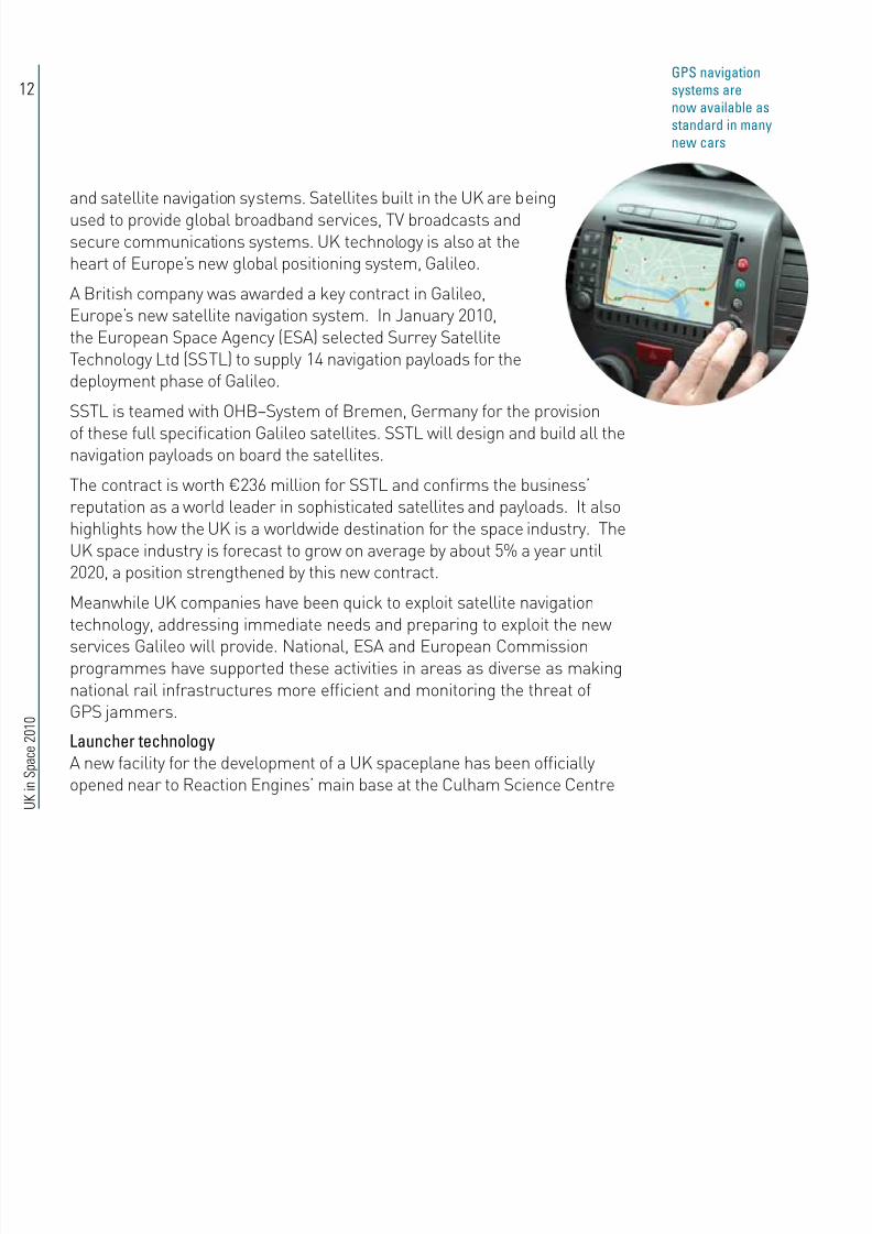
GSnavigation
systemsare
nowavailableas
standardinmany
newcars

8/6/2019 UK in space 2010
http://slidepdf.com/reader/full/uk-in-space-2010 15/40
13
in Oxfordshire. The site will be used to construct components for theSABRE engine being built for Skylon.
Skylon is designed to take off and land using a traditional airport runwaywith the ability to carry over 12 tonnes into orbit. With its unpiloted designand air-breathing rocket engines, Skylon could provide inexpensive access
to space compared with today’s costly launches.
With the backing of BNSC, the company behind the project – ReactionEngines – was awarded one million Euros by ESA to develop new enginetechnologies for a spaceplane. The money is being invested in reningthe engine’s high performance heat exchangers and other critical enginetechnologies. The new production facility is a major step forward in proving
that the manufacture of the SABRE engine is a practical proposition.
Artist’simageofSkylonCredit:eactionEngines

8/6/2019 UK in space 2010
http://slidepdf.com/reader/full/uk-in-space-2010 16/40
14
U K
i n
S p
a c e
2 0 1 0
The UK is collaborating with itsinternational partners on missions to theSun, Mercury, Mars, Venus and Saturn.
UK research teams are also working onspace observatories including Herschel,Planck, XMM-Newton and Hubble; aswell as future missions such as LISAPathnder and the James Webb SpaceTelescope.
The majority of missions are led byESA and the UK is the second largestcontributor to ESA’s space scienceprogramme. The UK also collaborateswith most other space agencies includingNASA, the Indian Space ResearchOrganisation and the Japanese Space
Agency (JAXA). The International Space Exploration Co-ordination Group– of which the UK is a founder member – is working towards globallycoordinated space exploration.
TheHebesChasma,amountainregioninsideagiantcanyon,
capturedbytheMarsExpressspacecraft
SpaceScienceUK science and engineering teams are involved in more than twentyactive missions to explore the Solar System, investigate the Galaxyand understand the Universe. Not only do these missions increase
our knowledge of the cosmos, they help us better appreciateprocesses on Earth and lead to the development of new expertiseand technologies.
Credit:ESA

8/6/2019 UK in space 2010
http://slidepdf.com/reader/full/uk-in-space-2010 17/40
15
UnderstandingtheUniverse
Launched together in May 2009, ESA’sHerschel and Planck missions aredelivering superb images and valuablescientic data. Early scientic results
from Herschel were presented at aconference in Madrid in December 2009.They reveal previously hidden detailsof star formation and include the rstimages of stardust – the material thatmakes up everything in the Universe.
Herschel is the largest-ever infrared
observatory and is designed to examinesome of the coldest and most distantobjects in space. Its major objectivesare to discover how the rst galaxiesformed and evolved. One of the threeinstruments on board, SPIRE (Spectraland Photometric Imaging Receiver),
was designed in the UK and is led by ascientist at Cardiff University.
Planck is measuring Cosmic Microwave Background radiation – ancientlight left over from the Big Bang. It is designed to help answer fundamentalquestions, such as how did the Universe and galaxies form. The spacecraft,which has detectors operating at just 0.1 degrees above absolute zero,
completed its rst complete survey in February 2010. The aim is to completefour full surveys before the end of the mission. Early results include an
“Scientists working on the mission have been amazedat the high quality of the data at such an early stage”Matt Grifn, Cardi niversity
lanckseesatapestryofcolddust
Credit:ESA/HFIConsortium,IAS

8/6/2019 UK in space 2010
http://slidepdf.com/reader/full/uk-in-space-2010 18/40
16
U K
i n
S p
a c e
2 0 1 0
Hubblecelebratedits20thyearinspaceduring
2010andcapturedthisimageoftheCarina
Nebula7500lightyearsaway
TheLisa
athnderFlight
ScienceModule
beingprepared
fortestsCredit:Astrium
Credit:ESA
insight into the complex forces driving star formation.Images from Planck reveal giant laments of duststretching through the Milky Way.
The UK is playing a major role in the Planck missionwith several UK institutes – including the University of
Manchester, STFC’s Rutherford Appleton Laboratory(RAL) and Cardiff University – involved in developinginstruments. UK research groups make up the LondonPlanck Analysis Centre and Cambridge Planck AnalysisCentre.
Other missions with UK involvement include Europe’s X-ray telescope,
XMM-Newton and Swift, which is investigating powerful cosmic explosionscalled gamma ray bursts.
Futuremissions
An extensive testing programme has been carried out prior to the launchof the UK-led Laser Interferometer Space Antenna (LISA) Pathnder. Duefor launch in 2012, LISA Pathnder is a spacecraft and propulsion modulethat will prove the technologies for future missions to detect gravitational
waves – ripples in time and space predicted by Einstein’s Theory of GeneralRelativity.
LISA Pathnder is the rst ESA science mission to be led from the UKsince Giotto in 1985. It is designed to prove that a test mass can oatfreely in space so that any effects on its trajectory will only be the result ofexternal gravitational forces. This complex engineering challenge is beingtackled by Astrium, as the main contractor, and SciSys Limited as thesoftware architect.

8/6/2019 UK in space 2010
http://slidepdf.com/reader/full/uk-in-space-2010 19/40
17
Thismodelofthe
MIIdetector(in
green)issimilar
tothecharge-
coupleddevices
indigitalcamerasCredit:NASA
Other missions under development with key UK involvement includeBepiColombo, the international mission to Mercury; and Gaia, an ambitiousmission to chart a three-dimensional map of our Galaxy. Astrium isresponsible for Gaia’s guidance and control systems as well as the powerfulcomputers needed to process data. The ‘eye’ of the spacecraft’s camera will
use 106 detectors made by UK company e2v Limited.The James Webb Space Telescope (JWST), a joint mission between ESA,NASA and the Canadian Space Agency, will investigate the origin andevolution of galaxies, stars and planetary systems. A team led by STFC’sAstronomy Technology Centre in Edinburgh is developing MIRI [Mid InfraRedInstrument], one of the telescope’s three cameras. In March 2010, asophisticated working replica of MIRI was shipped to the United States for
testing alongside other components for the telescope. Meanwhile, workcontinues on the ight instrument, due for delivery in 2011.
ExploringtheSolarSystem
Missions exploring the Sun, Mars, Venus and Saturncontinue to generate exciting results. A UK-builtinstrument has also own on India’s rst mission to
the Moon and Britain is working with its internationalpartners on the future exploration of Mars.
With their world-class expertise in solar physics,UK science teams are involved in three internationalmissions to study the Sun: SOHO, Hinode and STEREO(Solar Terrestrial Relations Observatory). Results fromthese spacecraft will give us a better understanding
of space weather – the effect the Sun’s activity hason the Earth. Solar storms, eruptions and the stream
“We’ve reached another important milestone in theconstruction of this new window on the ancient Universe”avid Parker, K pace gency
STEEO()spacecraftobservedacoronalmass
ejection(CME)thateruptedonthesuninMay2009
Credit:NASA/SOHO

8/6/2019 UK in space 2010
http://slidepdf.com/reader/full/uk-in-space-2010 20/40
18
U K
i n
S p
a c e
2 0 1 0
of charged particles – known as the solar wind – can disrupt satellites,communications systems and even electrical supplies.
A UK consortium, led by RAL and the University of Birmingham, developedone of the key instruments for NASA’s twin STEREO spacecraft. Over thepast 12 months, the two satellites have been moving further apart to allowthem to see more of the Sun at the same time. University of Leicesterscientists have used STEREO to develop more accurate predictions of whenblasts of solar wind will reach Earth, Venus and Mars.
The largest interplanetary spacecraft ever built, Cassini-Huygens,continues its extended mission to explore Saturn and its many moons.Highlights this year include evidence for a large body of liquid waterbeneath the icy surface of the moon Enceladus. The UK has been at theforefront of the design, engineering and science of this important mission.
Mission operations for the ESA Mars Express and Venus Express missionshave been extended until the end of 2012. This reects the continuingsuccess of these programmes with results that are transforming theunderstanding of our nearest planets.
A European spacecraft on a ten-year journey to rendezvous with a comethas made a nal swing-by past the Earth. Rosetta passed close to our
planet in November 2009, using the Earth’s gravity to boost it on the nalstage of its journey to comet 67P/Churyumov-Gerasimenko, where it is dueto arrive in 2014.
Dramaticplumes,bothlargeandsmall,spraywatericeoutfromSaturn’smoonEnceladus
Venus’southern
hemisphereinthe
ultravioletCredit:ESA©2007MS/DL-F/IDA
Credit:NASA/JL/SpaceScienceInstitute

8/6/2019 UK in space 2010
http://slidepdf.com/reader/full/uk-in-space-2010 21/40
19
osettacapturedthisimageofpartofSouthAmericaandAntarcticaasitewpasttheEarth
TheUK-builtinstrumentC1XSperformedextremelywellonboard
Chandrayaan-1,whichtookthisclose-upoftheMoon’ssurface
Credit:ESA
Credit:ISO

8/6/2019 UK in space 2010
http://slidepdf.com/reader/full/uk-in-space-2010 22/40
20
U K
i n
S p
a c e
2 0 1 0
LATO’ssearch:oneofthemethods
fordetectingexoplanetsistolookfora
dropinbrightnesscausedwhenthey
passinfrontoftheirparentstar
Credit:CNES
Artist’simageoftheEuclidsatelliteCredit:ESA
Artist’ssketchoftheSolarOrbiterCredit:ESA
Missions to investigate dark energy, the mysteries of our Sun and
habitable planets around other stars have been selected by ESAas candidates for two space science missions to be launchedno earlier than 2017. The mission concepts were chosen inFebruary 2010 from six ideas that had been carefully evaluatedby technical and scientic experts from across Europe.
The three contenders are: Euclid, which would investigatemysterious dark energy and dark matter that is thought to makeup most of the Universe; PLATO which would search for newplanets orbiting distant stars; and Solar Orbiter, which wouldtake the closest look yet at the Sun. Each of the missions alreadyhas involvement from UK science teams and the UK is wellplaced to contribute to the design and engineering involved.
COSMICVISION
C

8/6/2019 UK in space 2010
http://slidepdf.com/reader/full/uk-in-space-2010 23/40
21
Credit:Astrium
AuroraandthereturntoMars
Aurora is the long-term Europeanprogramme for the exploration of ourSolar System. The UK is taking a leadingrole in the future exploration of Mars. In
2009 the ExoMars mission was redenedas a larger-scale collaboration betweenESA and NASA and now consists of twokey international missions: Mars 2016 andMars 2018.
In 2016 an ESA-led orbiter will study theorigin and distribution of methane and
other trace gases in the atmosphere. Itwill also carry a lander to demonstrateEuropean capability in undertaking acontrolled landing on Mars.
The 2018 NASA mission will land the European ExoMars rover and aNASA rover. Astrium is leading the development of the ExoMars rover and
a team led by the UK is developing its Panoramic Camera System. OtherUK academic institutions and companies are working on instruments,components and software. Research from the Aurora programme hasalready resulted in patents, commercial applications and other spin-offbenets.
Aurora’s long-term goal is for a Mars Sample Return mission. This wouldbring back samples of rock and soil to Earth for analysis. The International
Mars Exploration Working Group – chaired by the UK during 2009/10, isco-ordinating plans for future Mars missions.
ExoMarsrover

8/6/2019 UK in space 2010
http://slidepdf.com/reader/full/uk-in-space-2010 24/40
22
U K
i n
S p
a c e
2 0 1 0
The UK is a world leader in efforts to monitor the Earth from space. BNSCpartner the Natural Environment Research Council has been responsiblefor the UK’s funding of Earth Observation science missions and a numberof UK EO facilities including the National Centre for Earth Observation. Thiscentre brings together highly skilled scientists who use satellite data toinvestigate and understand some of our biggest environmental challenges.
By its very nature, EO is a global endeavour and the UK works closelywith its international partners to co-ordinate space missions and shareresults. The UK supports EO through the European Space Agency (ESA)and the European Organisation for the Exploitation of MeteorologicalSatellites (EUMETSAT). The UK is also an active member of groups suchas the Committee on Earth Observation Satellites (CEOS), the Group on
Earth Observation (GEO) and the International Charter Space and MajorDisasters.
Greatritainand
Irelandin2009as
capturedby
Envisat,anESAmissionextended
until2013Credit:ESA
EarthObservationEarth observation (EO) enables us to monitorchanges to the environment and patternsof land use. It has revolutionised weather
forecasting and the way we monitor the Earth’schanging climate. EO has also transformeddisaster prediction and response. Over the years,satellites have allowed us to accurately map the worldand track pollution. They have also enabled us to witnessthe felling of rainforests, the advance of deserts and retreat ofthe ice sheets.

8/6/2019 UK in space 2010
http://slidepdf.com/reader/full/uk-in-space-2010 25/40
23
Credit:ESA
Artist’simpressionofGOCE
Thenightlaunch
ofSMOSand
roba-2Credit:ESA
EarthExplorers
The UK is a major subscriber to the ESA Earth Observation EnvelopeProgramme. Within this programme, the rst three Earth explorermissions have now been launched: GOCE, SMOS and CryoSat-2.
GOCE (Gravity eld and steady-state Ocean Circulation Explorer) has
been in orbit for more than a year. Following a period of validation, theoperations teams took over control of the satellite in November 2009. GOCEis measuring tiny variations in the Earth’s gravitational eld. The satelliteemploys a sophisticated electric propulsion system built in the UK by QinetiQ.
Following a successful launch in November 2009, ESA’s Soil Moisture andOcean Salinity (SMOS) satellite has begun its survey of moisture levels in thesoil and the salinity of the oceans. These global measurements will improveour understanding of how water is transported around the Earth and how itcirculates through the oceans. They will also lead to more accurate weatherforecasts and climate simulations.
UK companies involved in SMOS include SciSys UK, ComDev andChelton Antennas. Science teams include researchers from the NationalOceanographic Centre and De Montfort University’s Earth and Planetary
Remote Sensing Laboratory.Europe’s ‘ice mission’, CryoSat-2, was launched in April 2010. Over thenext ve years, the satellite will measure the thickness of ice at theEarth’s poles to the nearest centimetre. It will also monitor variationsin Arctic sea ice to help assess long-term trends. The science teamfor the mission is being led from University College London (UCL).
Mapping changes at the poles are vital in our understanding of theEarth’s changing climate. Polar ice is central to the Earth’s climate

8/6/2019 UK in space 2010
http://slidepdf.com/reader/full/uk-in-space-2010 26/40
24
U K
i n
S p
a c e
2 0 1 0
Credit:ESA
CryosatmeasuresthethicknessoficeattheEarth’spoles

8/6/2019 UK in space 2010
http://slidepdf.com/reader/full/uk-in-space-2010 27/40
25
system and a good indicator of what’s happening across the world.Although previous satellites – such as Envisat – have been monitoringthe polar regions, CryoSat-2’s twin radar system and two onboard radarreceivers will be able to produce a much more accurate 3D view of the ice.
Disastermanagement
Information from satellites is proving vital in aiding relief efforts andin assessing damage following disasters. The UK is a member of theInternational Charter Space and Major Disasters. This Charter can betriggered by national civil protection agencies and the United Nationsto acquire and deliver data from satellites, for free, to those affectedby natural or man-made disasters. The UK’s involvement has been acollaboration between BNSC and UK company DMC International Imaging
(DMCii). The Charter was activated 41 times in the nancial year 2009/10,responding to disasters such as the earthquakes in Haiti and Chile, res inGreece and ooding in the southern United States.
Surrey Satellite Technology Limited (SSTL) has builta unique network of satellites designed for disasterresponse. The Disaster Monitoring Constellation (DMC)provides detailed images of most parts of the world intimes of need. The satellites are operated by the UK,Algeria, Nigeria, Spain and China and the DMC family ofsatellites continues to grow.
In July 2009, the UK-DMC2 and Spanish-owned Deimos-1satellites were launched. These new generation satelliteshave improved cameras, enhanced memory capacity
and faster communications. They can image muchlarger areas in a single pass than the previous satellites.
“CryoSat-2 will help unravel the consequences of the dramaticchanges in the poles that we’ve seen in the past two decades”uncan Wingham, Cryoat-2 Principal Investigator, CL
eoplequeueforfoodinHaitifollowingthe7.0
magnitudeearthquakethatstruckinJanuary2010

8/6/2019 UK in space 2010
http://slidepdf.com/reader/full/uk-in-space-2010 28/40
26
U K
i n
S p a c e
2 0 1 0
A further DMC satellite, NigeriaSat-X, wasbuilt as part of a training programme for theWest African country’s future space scientistsand engineers. It is scheduled for launchin 2010 alongside another SSTL satellite,
NigeriaSat-2, the world’s most advancedsmall satellite.
Although disaster management is an important role of the Constellation,its main purpose is to provide satellite images for commercial campaigns.DMCii is currently imaging sub-Saharan Africa for ESA’s GlobalMonitoring for Environment and Security (GMES) programme, followinga successful European campaign in 2007. The Constellation also mapped
Indonesian forest clearing and has captured images of the AmazonBasin for the Brazilian government for ‘six consecutive years’ to measurechanges in deforestation.
Globalview
The UK supports international Earth Observation initiatives and is an active memberof the Group on Earth Observation (GEO). Contributions are made both nationallyand through the Committee on Earth Observation Satellites (CEOS). This committeecontributes the space component to GEO, helping to respond to action areas identied inthe ten year Global Earth Observation System of Systems (GEOSS) implementation plan.
Meanwhile in Europe, the Global Monitoring for Environment and Security (GMES)programme, a joint initiative between the European Commission and ESA, continuesto develop. The UK is actively seeking to develop the GMES initiative to meet UK
requirements and is working closely with ESA and the UK space community toachieve this.
TheeffectsofdeforestationintheAmazon

8/6/2019 UK in space 2010
http://slidepdf.com/reader/full/uk-in-space-2010 29/40
27
Weather
Satellites are used to monitor the weather as it develops,as well as for long-term studies of weather andclimate. The operation of Europe’s weather satellitesis co-ordinated by EUMETSAT, with the Met Ofce
representing the UK.The UK exploits the latest satellite technology to putitself at the forefront of modern weather forecasting. Thecombination of satellite observations and powerful computer models meansthat the accuracy of our two-day forecasts is now the same as one-dayforecasts were ten years ago.
MeteosatSecondGeneration
Geostationary weather satellites provide a constant view of a large regionof the Earth. Meteosat-9 provides images from across Europe and Africaevery 15 minutes. Meteosat-8 serves as a backup and also provides arapid scanning service, sending back images every ve minutes. Thisimproves our ability to monitor rapidly developing weather systems. Satelliteinformation contributed to the accurate advance warnings of the Cumbrianoods in November 2009.
To ensure continuity of data, the Meteosat Third Generation (MTG) ofsatellites is already under development. MTG will provide continuedgeostationary imagery and satellite products beyond 2018.
MetOp
Europe’s rst operational polar-orbiting weather satellite, MetOp-A, waslaunched in 2006 and is the rst of three MetOp satellites. The second,
MetOp-B, is planned for launch in 2012. The nal in the MetOp series,MetOp-C, will be launched after 2016.
Doublevortex
overtheNorth
Seaandthe
Channel,
June2009Credit:EUMETSAT
Severeooding
inCockermouth,
Cumbria,followed
torrentialrain

8/6/2019 UK in space 2010
http://slidepdf.com/reader/full/uk-in-space-2010 30/40
28
U K
i n S p a c e
2 0 1 0
MetOp satellites carry state-of-the art sounding and imaging instruments,providing precise details about atmospheric ozone and other trace gases,as well as wind speed anddirection over the oceans.This improves weather
forecasting and providescontinuous, long-term,data records of the Earth’schanging climate.
Jason-2
Jason-2 was launched in2008. The third satellite in a
series of high-accuracy oceanaltimeters, the Jason seriesprovides us with the capabilityto accurately measuresea level changes overthe world’s oceans. Thesesatellites have improved our
understanding of extremeweather events as well as thecritical role the ocean plays inclimate change. The follow-on programme, Jason-3, iscurrently in the developmentphase and is planned to
provide high-accuracyaltimetry data beyond 2013.
TyphoonNidamovingnorthwardovertheacic,eastofthehilippinesCredit:Eumetsat
Credit:ESA

8/6/2019 UK in space 2010
http://slidepdf.com/reader/full/uk-in-space-2010 31/40
29
The UK has been at the forefront of international efforts to manage thethreat posed by space debris and to prevent it from getting any worse. In
February 2010, the United Nations established a Working Group to examinethe long-term sustainability of space activities. Ultimately reporting to theGeneral Assembly, BNSC has taken a leading role with other spacefaringnations in dening the scope of this important initiative. The groupwill engage with satellite operators and space agencies andmake recommendations aimed at improving and formalisingcoordination between space users.
The UK funds the operation of the Starbrook spacesurveillance sensors. Developed by UK company SpaceInsight Limited, these sensors enable efcient surveys ofdebris in higher Earth orbits. Over the past year BNSC, inassociation with industry and academia, has also led thetechnical development of new international standards (ISO)for debris mitigation. Aimed at satellite manufacturers andoperators, these standards will be rened following furtherconsultation and reviews.
TheInternational
SpaceStation
mustchangeits
orbittoavoid
beinghitbyspacedebrisCredit:ESA
SpaceDebrisandNearEarthObjectsThere are tens of thousands of objects orbiting the Earth but onlyaround 800 of them are operational satellites. The rest are spacedebris, comprising everything from redundant satellites and launch
stages, to fragments of metal and even ecks of paint. Currently morethan 13,000 catalogued objects are being tracked in orbit. This debrisposes a danger to orbiting satellites and can severely damage or evendestroy them.
Therearecurrently
over13,000objects
orbitingtheEarth

8/6/2019 UK in space 2010
http://slidepdf.com/reader/full/uk-in-space-2010 32/40
30
U K
i n S
p a c e
2 0 1 0
Scientists at Surrey Satellite Technology Limited have developed a conceptfor de-orbiting redundant satellites. The Cubesail demonstration missionconsists of a small (10 cm x 10 cm x 30 cm) satellite that deploys a25 square metre plastic sheet. In low Earth orbit, residual air moleculeswill catch the sheet, dragging the satellite towards the Earth to burn up in
the atmosphere. Cubesail is due for launch in 2011 and, if successful, thelow-cost system could be tted to future satellites and launch vehicles.
NearEarthObjects
Comets or asteroids whose orbits come close to our planet are called NearEarth Objects (NEOs). If a fragment of cosmic debris of even a few metresacross were to hit the Earth, it would have a catastrophic effect. A January
“This next level of guidelines will seek to encourage bestpractice and coordination amongst satellite operators inboth government and industry”
Richard Crowther, K pace gency
BNSC (and now the UK Space Agency) regulates UK space activity toensure it complies with Britain’s international obligations, including spacedebris mitigation. The Outer Space Act (OSA) 1986 requires UK individualsor organisations to apply for a licence whenever they launch or procurethe launch of a space object, operate a space object or carry out any otheractivity in outer space.
The UK considers it particularly important that satellite operators are
able to dispose of their satellites once they have reached the end of theiroperational life to avoid contributing to the problem of space debris.
OUTESACEACT
C

8/6/2019 UK in space 2010
http://slidepdf.com/reader/full/uk-in-space-2010 33/40
31
2010 meeting in Mexico City involving government scientists, legislators andastronauts concluded that governments have an important role to play inidentifying and tackling any potential NEO hazard, as well as communicatingthis to the public.
The UK supports international efforts to track NEOs and in 2009/10 chaired
the UN Working Group addressing the NEO threat. The Government alsosupports outreach programmes to provide accurate and timely informationon NEOs to the public and media. In Europe, the ESA Space SituationalAwareness (SSA) programme combines the issues of space debris,coordination of orbital data, NEOs and space weather (the impact of thespace environment on spacecraft and the Earth). The UK is a leader inall of these elds and was one of the founding agencies of the SSA
programme.The UK has two outreach centres: The Spaceguard Centre,located at the former Powys Observatory, near Knighton inmid-Wales; and the Near Earth Object Information Centre(NEOIC), established in response to the Government’sTask Force Report on NEOs. The NEOIC is operated by aconsortium led by the National Space Centre in Leicester(under contract to BNSC) and includes a NEO exhibition. Itprovides a primary contact point for public and media enquiries.
Leicester’s
NationalSpace
CentreCredit:NationalSpaceCentre
Credit:IS

8/6/2019 UK in space 2010
http://slidepdf.com/reader/full/uk-in-space-2010 34/40
32
U K
i n S
p a c e
2 0 1 0
To help enable this, a European Space Education Resource Ofce (ESERO)has been set up in the UK to provide space-related resources to helpteachers to deliver the STEM curriculum. Many of these resources alreadyexist at a local level or elsewhere in Europe, but the ESERO will developnetworks of educators to collate, evaluate and promote them. It is operated
by the National STEM Centre, based at the University of York, and is due tobe available for use from early autumn 2010. Funding is being provided byESA and the Department for Education.
Also this year, a scholarship scheme was announced to support UKstudents to enable them to attend the International Space University inStrasbourg. The aim is to encourage more students to consider careersin the space sector and to increase the number of well-qualied staffavailable to UK companies.
UKastronautTimeakewithstudentsandritain’sprototype
Marsrover
EducationSpace offers one of the most variedand exciting ways to teach science,technology, engineering and
mathematics (STEM) subjects. Thespace industry provides a range ofexciting jobs and needs well-qualiedworkers to continue its expansion.These two strands are mutually-supportive: space can be usedto inspire take-up of STEM subjects and this in turn will result ingreater numbers of skilled workers available to both the space
sector and the wider economy.

8/6/2019 UK in space 2010
http://slidepdf.com/reader/full/uk-in-space-2010 35/40
33
The ‘Space for All’ community funding scheme has, in its rst round,supported 13 groups carrying out education, outreach and promotionactivities across the UK. These include a schools contest in which 160 pupilsfrom 12 schools spent a weekend at Imperial College London designingspace settlements. The winners are due to compete at the international
nals in Houston, Texas in July 2010. Other grants support inspirationalSTEM teaching in Cornwall, space days in primary schools as well as cross-curricular space-based activities run by Queen Mary University of Londonfocused on IT, design and STEM. Support has also been given to a groupcoordinating events surrounding the 50th anniversary of human space ightin 2011 and for the UK Space Conference held at Charterhouse School inApril 2010.
A public consultation was undertaken by BNSC during the summer of2009 on the need for a National Space Conference. There was widespreadsupport throughout the space sector for BNSC to facilitate such aconference to bring together for the rst time various existing events runby different organisations to involve industry, academia, policy-makers,students and the media.

8/6/2019 UK in space 2010
http://slidepdf.com/reader/full/uk-in-space-2010 36/40
34
U K
i n S
p a c e
2 0 1 0
Keepingyouup-to-date
BNSC promoted an array of missions including the Herschel and Planckspace observatories, the Gravity eld and steady-state Ocean CirculationExplorer (GOCE), the Soil Moisture and Ocean Salinity (SMOS) satellite,CryoSat-2 and ExoMars. Other milestones included: coordinating the launchof ESA’s rst facility in the UK at Harwell, Oxfordshire; the completion andresponse to the Space Innovation and Growth Strategy; the announcementof the rst Briton, Tim Peake, selected by ESA to be trained as an astronaut;
and the successful launch of the UK Space Agency – which headlined newsof a £40m investment in the International Space Innovation Centre (ISIC) atHarwell. All these events generated extensive coverage in major nationalnews outlets.
Speaker platforms ranged from the annual conference of UK Studentsfor the Exploration and Development of Space (UKSEDS) – targeted atstudents studying physics, engineering and space related degrees – to theXIth European Inter-parliamentary Space Conference, which showcased
Communications2009-10 was the ‘Year of the Launch’. In thistransformational year the British National SpaceCentre (BNSC) worked closely with the European
Space Agency (ESA), BNSC partners, the researchcommunity and industry contacts, to raise theprole of space in order to share the enormousbenets that space research and technologybrings to us all.
TheUKSpace
Agencywebsite

8/6/2019 UK in space 2010
http://slidepdf.com/reader/full/uk-in-space-2010 37/40
35
UK policy and industrial developments to an inuential audience ofparliamentarians from Europe’s ten leading space nations.
At the start of 2009, the BNSC website, now relaunched as www.ukspaceagency.bis.gov.uk, was refreshed as part of a plan to developthe site into the rst source of information about UK involvement in
space. The website hosts a wide range of information including the latestdevelopments in UK space science and industry, and details of forthcomingspace events. Publications such as the annual report and space:uk magazine, the widely distributed BNSC forum for spacenews and educational articles, are also available for freedownload. In addition, people can now follow us on digitalchannels such as Twitter, YouTube and FaceBook.
Through its communications efforts, the UK Space Agencyis highlighting how important the space and satelliteindustry is to the UK. Space is critical in providing high-speed broadband, high denition television, GPS andweather forecasting to the modern world. The UK SpaceAgency communications team will continue working toensure people can keep up to date with the latest news and
developments in this exciting and inspirational eld.
Space:uk magazine
“Space is a fascinating subject and throughour wide ranging and varied communicationswork we are reaching an ever increasing andworldwide audience”mma Lord, K pace gency

8/6/2019 UK in space 2010
http://slidepdf.com/reader/full/uk-in-space-2010 38/40
36
U K
i n S
p a c e
2 0 1 0
Finance reakdownoffunds–byspendarea(£million)
Amount accruedduring nancialyear 2009/10
UK Contributors
STFC NERC TSB MODMet
OfceDera DECC BIS Total
Earth observation
National 6.84 0.50 0.10 0.50 7.94
ESA 52.17 Note 1 1.00 53.17
EUMETSAT 27.20 0.07 0.26 27.53
AATSR 0.82 0.82
Science/Exploration
National 31.50 0.20 31.70
ESA 80.00 80.00
Telecomms and navigation
National 0.50 Note 2 0.10 0.60
ESA 73.00 73.00
Technology
National 0.10 0.20 0.30
ESA 0.00
Transportation
National 0.00
ESA 7.00 7.00
Other national 0.80 0.80
ESA general budget 18.30 11.36 29.66Total 129.80 70.37 81.00 0.10 27.20 1.17 1.08 1.80 312.52
Note 1. MOD benets
from a number of
ESA programmes
but funding for these
is covered under
National contributions
Note 2. MODexpenditure on
SATCOM for Defence
purposes is not
publicly releaseable
Note 3. Money
contributed to ESA by
DIUS (2008/09) is now
paid by TSB
Note 4. TSB gures
shown are estimated,based on interim
accounts
AuroraisthelargestspaceexplorationprogrammethattheUKhassignicantinterest

8/6/2019 UK in space 2010
http://slidepdf.com/reader/full/uk-in-space-2010 39/40
37
Credit:ESA
in.ItinvolvesdetailedexplorationofthesurfaceofMarsandthereturnofsamples

8/6/2019 UK in space 2010
http://slidepdf.com/reader/full/uk-in-space-2010 40/40
rintedintheUKonpaperwitharecycledcontentof75%July2010.CrownCopyright.UN10/88
UKSpaceAgency
olarisHouse,NorthStarAvenue,Swindon,WiltshireSN21SZTel:+44(0)202155000ukspaceagencyinfo@ukspaceagency.bis.gov.ukwww.ukspaceagency.bis.gov.uk