Turanganui River History - Department of Conservation
42
OCTOBER 2006 The Turanganui River A Brief History Michael Spedding
Transcript of Turanganui River History - Department of Conservation
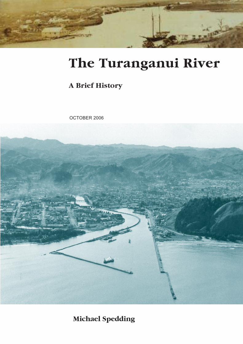
OCTOBER 2006
The Turanganui River
A Brief History
Michael Spedding

The Turanganui River
A Brief History
by Michael Spedding
OCTOBER 2006
Published by
Department of Conservation
PO Box 668
Gisborne, New Zealand
in association with NZ Historic Places Trust, Tairawhiti Museum and Eastland Port Co. Ltd
ISBN:0-478-14120-3© Copyright 2006, New Zealand Department of Conservation

2
CONTENTS
Foreword 5
Acknowledgements 6
Introduction 7
A Contested Site 7
A Heritage Landscape 8
National Identity 9
The River 10
Original Physical Features 10
Physical Modifications 11
Heritage Description 13
Introduction 13
Tangata Whenua 13
First Arrivals 13
Early Inhabitants 15
Arrival of James Cook 17
Maori Settlement on The River 21
From River to Port 23
Turanga to Gisborne 26
Growth of The Port 28
The Cook Landing Site 29
Research Findings 30
Recent Archaeological Findings 30
Weddel Kaiti Freezing Works Site 30
Heinz-Wattie Site 30
Moa Bone and Footprints 31
Location of Te Toka A Taiau 31
Heritage Significance 32
Historical 32
Cultural - A Customary Perspective 33
Summary 37
Conclusion 39
Further Reading 40

3
“The foreshore of the Turanganui River is one of the world’s great voyaging sites. It is the landing place of the Horouta canoe, celebrating the achievements of the Polynesian star navigators. It is the place where Captain James Cook and his companions first came ashore in New Zealand, heralding the traditions of European exploration and discovery.
It is the site where Tupaea, the Ra’iatean high priest navigator who sailed with Cook, first met Maori, marking the links between local people and their ancestral homelands. It is a meeting place of cultures, of challenges and shootings, as well as friendly exchanges. Here Captain Cook and a local man saluted each other with a hongi on Te Toka a Taiau – the first greeting between a Maori and a European.
It is a sacred site for all New Zealanders, to be celebrated with pride and treated with dignity.”
Dame Anne Salmond Chairperson New Zealand Historic Places Trust

4
TE TOKA A TAIAU, TE PITO O TE AO
Te Toka a Taiau is the core of our universe A Tairawhiti perspective Ko Te Toka a Taiau, Te herenga o nga wai, mai te hononga o nga rua. Te Toka a Taiau is a spiritual gathering place of our ancestors Ko Te Toka a Taiau Te whakatinanatanga o te whakapapa We are the kaitiaki/guardians of this very sacred site And Te Toka a Taiau is the physical reminder of our commitment to the land, the people and our environment Ko Te Toka a Taiau he mauri tipua Ko Te Toka a Taiau he mauri tawhito He mauri no te kukunetanga mai i Hawaiki Mauritu nei hei ahurewa tapu Mauritu nei hei tuahu tapu
Derek Lardelli - Ngati Porou/Rongowhakata

5
Foreword
I have commissioned this publication which assesses the heritage value of the Turanganui River as a resource to inform all those with an interest in the heritage significance of this important place.
This work serves to complete a formal heritage significance report initiated by the Trust Board of the Tairawhiti Museum and Historic Places Trust in 2001. The report was initially a contribution to work underway to resolve a long- standing disagreement relating to the planning provisions in the GDC Regional Coastal Environment Plan relating to the Cone of Vision at the Cook Landing Site National Historic Reserve.
Over time the parties involved in mediation to resolve the Cone of Vision planning issue came to a realisation that The Cook Landing Site National Historic Reserve was only one of several sites of importance and focussed on only one aspect of the historic and cultural heritage of the Turanganui River. And, that resolution of the Cone of Vision planning issue was closely linked to providing a solution that would acknowledge, interpret and celebrate all of the heritage aspects of this important place.
From out of a multitude of discussions, hui, and presentations held over the past five years has developed a growing community awareness of the local, national and international significance of the heritage value of this place and, an increasing groundswell of support for a developing concept which has become known as the Tairawhiti National Heritage Project.
The concept is continuing to evolve. The project will play a significant part in acknowledging, interpreting and celebrating the place and the landmark historic events that took place here. It will acknowledge the importance of the place to both Maori and Pakeha and serve to strengthen our national identity as New Zealanders as well as define the heritage status of this important place.
I commend to you this report as an information resource to improve our knowledge of the heritage value of the Turanganui River. I hope it will serve to increase support for the Tairawhiti National Heritage Project at both a local and national level. And that it will provide some impetus for community stakeholders to come together to develop an effective leadership and governance arrangement to progress the project.
Peter WilliamsonConservatorEast Coast Hawke’s Bay Conservancy

6
ACKNOWLEDGEMENT
The idea of compiling a report on the Turanganui River has been around for some time. It was, and still is, seen as an important step in the process of informing our communities about this location, and providing impetus for future action.
Credit for this must go in part, to members of the Tairawhiti Branch Committee of the Historic Places Trust, and those associated with the Tairawhiti Museum, in particular its former Chair, Michael Chrisp.
Thanks go to the Kaumatua and those with knowledge and expertise who freely offered their advice and opinions. Many of them are acknowledged in this reprot. Special thanks to Joe Pihema and Dudley Meadows, Charlie Pera, Anne McGuire, and Monty Soutar.
Finally, I would like to acknowledge staff of the Department of Conservation who saw the need to complete this report and then made it happen. In particular, Kerry Hogan and Pam Bain, who have contributed enormously to this project
Michael Spedding

7
INTRODUCTION
This report will briefly summarise what is known about the area around the Turanganui River, and in doing so, attempt to establish its heritage value or significance. It will not provide a comprehensive history, rather, it will consider the writing, the ideas, and the opinions, of people who over time have focussed their attention on this place. In a publication of the National Trust of Australia, James Kerr writes,
“Cultural significance is a simple concept. Its purpose is to help identify and assess the attributes which make a place of value to us and our society…..Once the significance of a place is understood, informed policy decisions can be made which will enable the significance to be retained, revealed, or at least, impaired as little as possible.”1
Until the significance of this place is established one can not adequately plan and prepare for its future. Furthermore, the significance can only be assessed once all parties with an interest have had input in to the process, and those views are given a fair hearing.
A C O N T E S T E D S I T E
The Turanganui River means different things to different people, and at times these views come in to conflict. As this report will show it has been, and still is, a contested site.
When history is interpreted it tends to disinherit individuals and groups in some way. The recent history of the Turanganui highlights how the dominant Pakeha culture has appropriated the landscape both materially and in other more subtle ways. That presents a problem. When we consider writing a history, or erecting a monument, who writes the text or whose monument is permitted?2 Heritage is created by interpretation, and interpretation creates conflict.
Who has the right to write? The Turanganui River is a place of significance to both Maori and Pakeha. The challenge is to interpret the past in a way that is meaningful to both. Some of the history belongs to particular groups, much of it is shared, whether it be between hapu and iwi, or between Maori and Pakeha. In the introduction to Redemption Songs Judith Binney argues;
The debate about who should write what history, however, can never rest on grounds of religion, race, or gender…Such views are prescriptive of learning and imagination; on the one hand they tie us within patterns of polemical thought and, on the other, make us prisoners of personal experience alone. They also deny the important fact that the historian must aspire to be independent, otherwise written history becomes merely a series of self-referential statements.3
The intention with this report is to produce something that allows different voices to speak for themselves acknowledging that none of us own the past. Binney adds;
1 Kerr, James Semple; The Conservation Plan, National Trust, 1996
2 Hodglain and Redstone (eds.); Contested Pasts. The Politics of Memory, 2003, p. 11
3 Binney, Judith: Redemption Songs. A Life of Te Kooti Arikirangi Te Turuki, Auckland
University Press (1995), p. 5

8
Fig:1- Tairawhiti/East Coast .
Photo : John Logan
..the dialogue must be between each other: that is, it must transcend both self representation and those European notions of claiming uniquely to possess the historical language which establishes an analytical truth.4
A H E R I T A G E L A N D S C A P E
The Cook Landing Site, and its association with Captain Cook, has been a primary focus of attention for over 100 years. However, for many, there are other sites of equal if not greater significance. The area around the Turanganui River represents a network of sites, interconnected, and linked with stories, events, and people. We are not dealing with a single site, event, or moment in time.The area would be more accurately described as a heritage landscape. A landscape with cultural and historic importance, where people have lived, shaped their environment, and created layer upon layer of history over many hundreds of years.
In New Zealand, while we are reasonably good at interpreting the natural environment, there has been little effort to reveal the human history, the multi layered stories that form part of our landscape. We do this in our museums, through projects such as the Dictionary of New Zealand Biography, the Historical Atlas of New Zealand, and the work carried out through the Waitangi Tribunal process. Unfortunately these initiatives do not have any parallel “on the ground”, at the places where things actually happened. Jannelle Warren Findlay, an American public historian who visited New Zealand in 2001 made the following observation,
as an outsider I have found little public interpretation of the built environment or heritage places, little attempt to tell layered stories on the landscape, little effort to reveal human history as part of the natural history that New Zealanders so prize.5
4 Binney,p.5
5 Warren Findlay, Janelle, Human Heritage Management in New Zealand in the Year 2000 and
Beyond, 2001, p.12

9
N A T I O N A L I D E N T I T Y
One of the goals of this report is to assess the national significance of the Turanganui River. Authorities such as Dame Anne Salmond have argued that the place is of both national and international significance. In a recent visit the Prime Minister Helen Clark stated that the process of recognising the importance of the area could lead to a significant “nation building” project.
Recently the Department of the Prime Minister and Cabinet articulated three Government priorities. They are;• Economic transformation• Families-young and old• National Identity
It is worth repeating the explanation of what they meant by the national identity priority;
all New Zealanders to be able to take pride in who and what we are, through our arts, culture, film, sports and music, our appreciation of our natural environment, our understanding of our history and our stance on international issues
They added that government departments should take these themes in to account in all their planning processes and consider how they aligned with core business.
This is a key strategic direction articulated by the Government. It should be kept in mind as we consider the significance of the Turanganui River in terms of our shared history and its contribution, albeit potential contribution, to a growing sense of national identity.

10
Fig 3:Sketch by Ken Phillips indicating geological history of the area
THE RIVER
For the purposes of this report the Turanganui River includes both its eastern and western banks. The boundaries will not be specifically defined as the emphasis is on people and events, and so to create an arbitrary boundary would not be helpful. Furthermore the area is being viewed as a landscape linked to other places.
O R I G I N A L P H Y S I C A L F E A T U R E S
The geological history of the area began approximately 3400 years ago when
the coastline of the bay mirrored the arc of the Taruheru River. The western side of the Turanganui River consists of an emerging sand-beach system a little more than 2000 years old. Phillips makes the following observations on the geological history of the area;
the emergent sand beach system of Gisborne consists of a corrugation of dune ridges and swales running parallel with the coast and extending 7 kms inland. The dune ridges are approximately 50 metres apart and 1-2 meters high. Intervening swales were generally poorly drained and resulting swamps characterized the town landscape during pre 1900 settlement.6
A contributing factor to the geological character of the area came from volcanic ash, most notably from the Taupo (131 AD), and Kaharoa (1250 AD) eruptions. The landscape was diverse comprising grasslands, wetlands, swampy areas as well as magnificent forests that one can only get a sense of
6 Phillips, Ken; Archaeological Survey and Assessment of effects Heinz-Wattie site Gisborne,
Gisborne District Council, 2000, p.4

11
by visiting Grey’s Bush on the Poverty Bay flats.
P H Y S I C A L M O D I F I C A T I O N S
The area around the mouth of the river has changed, and continues to change dramatically. At the time of Polynesian settlement the coastline was in the vicinity of Waikanae Creek. When Cook arrived he walked on sand dunes which had formed on the seaward side of the Waikanae. And so the area has been characterized by a slowly consolidating coastal dune system. These dunes have been largely leveled due to recent commercial and residential development.
Flooding has contributed greatly to modifying the physical landscape. Severe storms around 1650 AD contributed to rapid erosion on the flats. From the early 19th century floods became increasingly frequent with the primary cause being extensive deforestation due to European settlement.
Anne Salmond offers an excellent description of the area that would have been encountered by those aboard the Endeavour;
…the bay was sheltered by ranges covered with thick forest, while the hills nearer the flats were sparsely clad in scrub, with fern and grasses on the ridges. The central plains were braided by the courses and fertile fans of three major rivers, where taro, kumara, gourds and probably yams flourished in sunlit gardens. Gardens were also cleared on frost free hillsides near the rivers’ and fernroot diggings were scattered around the bay. Grasslands, wetlands, swamps, and great stands of kahikatea, pukatea, and tawa trees on the flats provided a variety of foods and materials for weaving and building. Large fortified villages, or pa, were built on river bends or strategic hills, protecting houses, cooking sheds and storage pits for root crops – up to 1300 cubic metres of storage in some places.
Pigeons, kaka, pukeko, and parakeets were plentiful on the plains, and thousands of ducks lived by the rivers and the Awapuni lagoon….The Bay was famous for its crayfish, caught off Titirangi or further north along the coast, and the reefs and the tidal flats harboured quantities of shellfish. Paua were plentiful off Onepoto(now Kaiti) and there were beds of white pipi off Oneroa where the tamure(snapper) came to feed, crunching the shells in their powerful jaws. Sharks, kahawai, kingfish, flounder and many other species of fish were caught in the bay, and there were a number of favourite fishing grounds, including Te Wai o Hi Harore at Waikanae, where a spring seeped in to the ocean, attracting kahawai, which according to one early Land Court witness came there to drink the fresh water. Now and then whales stranded on the beaches, to be claimed by the chiefly leaders of whichever kin-group controlled that part of the shoreline.7
Residential and commercial developments which intensified in the late 1860s have greatly altered the landscape of the area. Drainage of the wetlands and various efforts at reclamation along the banks of the Turanganui River, together with initiatives to develop the wharf and then Port, have made the area all but unrecognizable from the time when its first inhabitants arrived.
The Wai o Potango stream entered the Turanganui River in the vicinity of the
7 Salmond, Anne, Two Worlds, first meetings between Maori and Europeans 1642-1772, Viking,
1991, p.119.

12
current location of Pitt St. The stream was culverted in 1876, infilled by the mid 1880s, and photos show no trace of the watercourse or its debouchment point by 1900.8 Also by 1900 much of the adjacent land had been drained and the dune system referred to earlier levelled to allow for commercial developments.
Apart from drainage, reclamation, and levelling of the sand dunes, rocks were also blasted both at the mouth and up stream on the Turanganui River. These modifications, which continue to this day, highlight how much the physical landscape has been changed by people over time.
8 Phillips, p. 6.
13
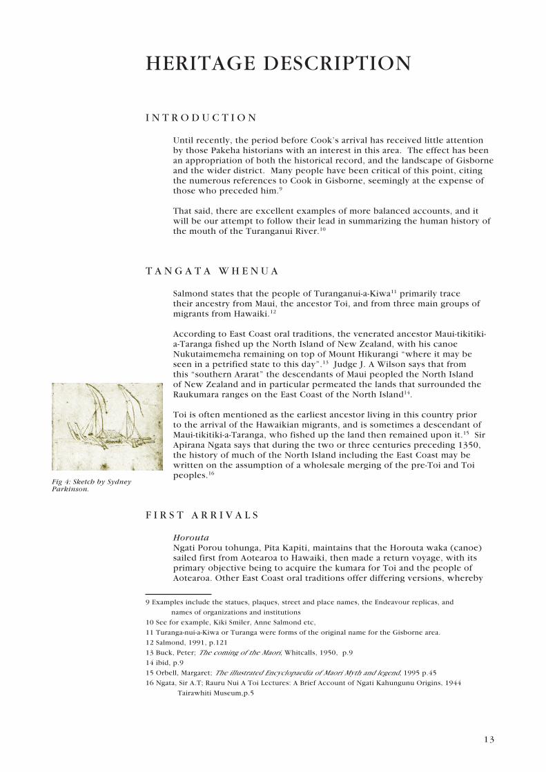
Fig 4: Sketch by Sydney Parkinson.
HERITAGE DESCRIPTION
I N T R O D U C T I O N
Until recently, the period before Cook’s arrival has received little attention by those Pakeha historians with an interest in this area. The effect has been an appropriation of both the historical record, and the landscape of Gisborne and the wider district. Many people have been critical of this point, citing the numerous references to Cook in Gisborne, seemingly at the expense of those who preceded him.9
That said, there are excellent examples of more balanced accounts, and it will be our attempt to follow their lead in summarizing the human history of the mouth of the Turanganui River.10
T A N G A T A W H E N U A
Salmond states that the people of Turanganui-a-Kiwa11 primarily trace their ancestry from Maui, the ancestor Toi, and from three main groups of migrants from Hawaiki.12
According to East Coast oral traditions, the venerated ancestor Maui-tikitiki-a-Taranga fished up the North Island of New Zealand, with his canoe Nukutaimemeha remaining on top of Mount Hikurangi “where it may be seen in a petrified state to this day”.13 Judge J. A Wilson says that from this “southern Ararat” the descendants of Maui peopled the North Island of New Zealand and in particular permeated the lands that surrounded the Raukumara ranges on the East Coast of the North Island14.
Toi is often mentioned as the earliest ancestor living in this country prior to the arrival of the Hawaikian migrants, and is sometimes a descendant of Maui-tikitiki-a-Taranga, who fished up the land then remained upon it.15 Sir Apirana Ngata says that during the two or three centuries preceding 1350, the history of much of the North Island including the East Coast may be written on the assumption of a wholesale merging of the pre-Toi and Toi peoples.16
F I R S T A R R I V A L S
HoroutaNgati Porou tohunga, Pita Kapiti, maintains that the Horouta waka (canoe) sailed first from Aotearoa to Hawaiki, then made a return voyage, with its primary objective being to acquire the kumara for Toi and the people of Aotearoa. Other East Coast oral traditions offer differing versions, whereby
9 Examples include the statues, plaques, street and place names, the Endeavour replicas, and
names of organizations and institutions
10 See for example, Kiki Smiler, Anne Salmond etc,
11 Turanga-nui-a-Kiwa or Turanga were forms of the original name for the Gisborne area.
12 Salmond, 1991, p.121
13 Buck, Peter; The coming of the Maori, Whitcalls, 1950, p.9
14 ibid, p.9
15 Orbell, Margaret; The illustrated Encyclopaedia of Maori Myth and legend, 1995 p.45
16 Ngata, Sir A.T; Rauru Nui A Toi Lectures: A Brief Account of Ngati Kahungunu Origins, 1944
Tairawhiti Museum,p.5
14
the Horouta sets out in the first place from Hawaiki.17 Pawa (or Paoa) is mostly remembered as the ancestor who captained the Horouta during its journey to Aotearoa.
Most versions recount the Horouta capsizing at Ohiwa in the Bay of Plenty, and after making the necessary repairs, continuing its journey around East Cape toward the Poverty Bay district. These events are remembered in the waiata and haka, ‘Haramai a Paoa’ often performed by tangata whenua of Turanganui a Kiwa. According to many accounts, the captain Pawa led a group overland from Ohiwa eventually rendezvousing with the Horouta and its crew somewhere near Turanganui-a-Kiwa.
Some believe the Horouta came to rest on the West Bank of the Turanganui River near the present Gladstone Road Bridge. The crew having disembarked set about following the appropriate rituals, and then proceeded to lay claim and ownership to the district. The Horouta eventually made landfall at Muriwai where Pawa’s sister, Hinehakirirangi18, was the first person ashore.19 Many place-names were left by the Horouta crew that still exist today including the Waipaoa river Te Kuri-a-Pawa (Pawa’s dog), also known as Young Nick’s Head, and Te Tuahenitanga-a-Pawa, now called Tuaheni Point.
Ngata says the Horouta came much earlier than the supposed migration of 1350 and some generations before the Takitimu waka, however many historians couple those canoes as being complementary.20
TakitimuThe story of the Takitimu waka is largely associated with the ancestors, Tupai, Ruawharo and Tamateaarikinui. Some versions mention Kiwa as captain, however most accounts agree the Takitimu was an extremely sacred vessel entrusted with a cargo of “sacred axes and stones and the Gods of the heaven and earth, and the Gods of the whare wananga (ritual house of learning), and other sacred paraphernalia”.21
Respected tribal historian and elder, Hetekia Te Kani te Ua states that Tamateaarikinui was in charge of the canoes that travelled with the sacred canoe, Takitimu. They were stocked with provisions, water, chattels, personal belongings and the wives and children of the priests.22 Te Ua continues,
One of these canoes carried the sacred woman-priestess, Hinehakirirangi. Her duties were to ‘whakanoa’ (ritualistic removal of sacred restrictions) the priests of the Takitimu canoe, to enable them to eat. The procedure was for the priests to disembark from Takitimu canoe onto the one carrying Hinehakirirangi, and with the appropriate karakia (incantations), and passing under her limbs were made ‘noa’ (free from sacred restrictions). After their meal the priests would leave after the appropriate karakia.
Unfortunately, the canoe of Hinehakirirangi lost contact, and landed at Oneroa beach now called Waikanae. The priests were nearly starved to death. The exact spot of where the canoe of Hinehakirirangi landed, is at the beach-end of Stanley road. The septic tank marks the exact spot where the sacred spot was chosen for the sacred fire to commemorate the landing.23
17 Orbell, 1995, p.67
18 Hinehakirirangi is recognised for planting the first kumara tubers in the Gisborne region.
19 Halbert, 1999, p.29
20 Fowler, Leo; Te Mana O Turanga, Penrose/Historic Places Trust, 1974, p.23
21 Ibid; p.14
22 Heta Te Kari Te Ua, Nga Pitopito Korero Tawhito I A Turanganui - A - Kiwa, Manuscript
collection, Tairawhiti Musem, p.3
23 Ibid, p.9

15
When the Takitimu landed Tupai and Ruawharo made sacred fires at different places, which became shrines and remained sacred afterwards.24 Writer and tribal historian Mitchell states that “on approaching the mouth of the Turanganui River and observing the hill nearby to be similar to Titirangi, the hill on which their canoe first took shape, they bestowed the name Titirangi on the hill.25
MaiaThe Maia narrative concludes the main phase of early waka migration, from which the Turanganui-a-Kiwa people draw their ancestry. One account has Maia quarrelling with the great Uenuku26 in Hawaiki and escaping by sailing on a raft of gourds, which brought him to Turanganui-a-Kiwa.27 Fowler states that Maia reached Turanganui-a-Kiwa by the use of magical incantations,28 and landed on the eastern bank of the Turanganui River at a spot near the Cook Monument, while Halbert suggests Maia landed at Tauararo, or Schnapper Bay at the eastern end of Kaiti Beach.29 Later, Maia built a house called Puhi-kai-iti, where the Cook Monument now stands, in reference to the cord, which bound his raft of gourds. That particular house is still remembered and used in the naming of the Kaiti suburb, beach, school and other sites.
Halbert says that Maia built a latrine called Parahamuti, which was situated on the eastern bank near the mouth of the Turanganui River, and obtained his drinking water from a hillside-stream, which he named Murimuri-mai-Hawaiki.30
Regarding the early settlement of the Turanganui-a-Kiwa district Ngata says, “portions of the crews of Horouta, Takitimu and Te Ikaroa-a-Rauru settled at the mouth of the Turanganui River, occupying both sides of it and up the Wai-weherua31 or the forking tributaries, Taruheru and Waimata. They also spread east and west of the mouth of the river; east towards Tuamotu and west along Waikanae”.32
E A R L Y I N H A B I T A N T S
TaiauHalbert states that while Maia was living at Puhi-kai-iti, he frequently crossed the Turanganui River to visit his father-in-law Matuatonga. One day Maia called to a small girl called Taiau, to paddle over in her canoe so he could cross the river. She did this but Maia drowned her.33 However, this was not the arbitrary act of violence that it might appear as Maia transformed her into the treasured rock Te Toka-a-Taiau (the rock of Taiau) which once stood in the channel of the Turanganui River opposite the mouth of the Waikanae Creek.34
However Ngata suggests another Taiau, son of Awapururu and a great-grandson of Porourangi,35 as the originator of the famous rock. Ngata
24 “Echoes of the Pa”;Tairawhiti Maori Association, 1932.
25 Mitchell, 1944, p.42
26 Uenuku was a high chief in Hawaiki.
27 Salmond, 1991, p.121
28 Fowler, 1974, p.23
29 Halbert, 1999, p.31
30 Ibid, p.29.
31 Wai-weherua is the customary name of the confluence where the Taruheru and Waimata
rivers meet.
32 Ngata, 1944, Lecture 5:4
33 Halbert, 1999, p.31
34 Orbell, 1995, p.168
35 Fowler, 1974, p.23
16
continues,
By his chief wife Rerepuhitai Taiau had Tamahinengaro, a son, and by the lesser wife Te Ariaterangi another son, Tahitokurumaranga. We have no record that either of the sons lived anywhere than in the Turanga district. Their home was on the east side of the Turanganui River, where on the Titirangi hill and on the foreshore towards Papawhariki, Tuamotu and round to Wainui there are signs of extensive occupation in the early days. This was the meeting ground of Paikea, Horouta and Takitimu ancestors. Here they intermarried with the earlier settlers, who were probably of the Toi tribes.36
Taiau’s son, Tamahinengaro, is largely remembered for taking a leading role in the avenging of the death of Uekahikatea, a chief from the Opotiki area. For this deed, Tamahinengaro, was presented with numerous gifts including a ceremonial adze called Waikanae, of which some believe the name was then given to the current Waikanae area in memory of the undertaking to avenge the death of Uekahikatea.37
The rock, Te Toka-a-Taiau, was reputedly a mooring place for waka, a valued fishing spot, and was also claimed to be a revered tribal boundary marker. An ancient tribal saying articulates, from Toka-a-Taiau point to the East to Porourangi, from Toka-a-Taiau point to the South to Kahungunu.38 In 1769, Toka-a-Taiau was the site where Captain James Cook and an unknown Maori greeted each other with the pressing of noses. “A powerful place for the first formal greeting between a Maori and a European”.39
In 1877 the Marine Department as part of the harbour development blasted Te Toka-a-Taiau and other rocks in the river40. Although the rock itself can not be seen, local iwi believe that the rock still exists below housing the kaitiaki (guardians) of the Turanganui River.
HeipipiMatuatonga, father-in-law to Maia, lived with his wife Hamokiterangi in the house Matatuahu near the junction of Pitt St and Read’s Quay. Nearby, under the present Gladstone Road Bridge was Hamokiterangi’s drinking well called Heipipi.41
HamoterangiNgata says, “Porourangi’s42 wife, Hamoterangi, was from Turanganui-a-Kiwa of the Ikaroa-a-Rauru migration, which settled at Kaiti and along the banks of the Taruheru stream”.43 According to many accounts, Hamoterangi was a female of the highest order by virtue of her direct genealogical links to Te Ikanui-a-Rauru, Mataatua, and other waka, and was the chief occupant of a pa on Titirangi. Her influence and mana in Turanganui-a-Kiwa remained for many generations with her direct descendant, Materoa, also occupying a pa on Titirangi.44
KahungunuThe famous ancestor Kahungunu45 is said to have stayed at Titirangi while passing through this area. It was from this elevated hilltop position that
36 Ngata, 1944, Lecture 5:3
37 Ibid, 5
38 Maori translation, “I Toka-a-Taiau ahu whakaterawhiti i a Porourangi, i Toka-a-Taiau ahu
whakatetonga i a Kahungunu”.
39 Salmond, 1991, p.127
40 Whyte, Philip; Gisbornes Battle for a Harbour, Gisbrone Harbour Board, 1984
41 Halbert, 1999, p.29
42 Eponymous ancestor of Ngati Porou
43 Ngata, 1944, Lecture 2:6
44 Halbert, 1999
45 Eponymous ancestor of Ngati Kahungunu

17
Fig 4: An English Navel Officer bartering with a Maori.
he looked across the valleys and commented on the immensity of the population, “evidenced by the smoke from the myriad of fires in the area”.46 Some local historians believe that when Kahungunu died as an old man, he was later interred at a secret location at Whare Korero, near Tuaheni Point.
Mahaki and TawhiwhiKahungunu’s grandson Mahaki47 was a celebrated warrior chief of the Turanganui-a-Kiwa and Waikohu Districts. Te Kani te Ua claims Mahaki had a famous fishing village called Pioi in the vicinity of the Waikanae creek, which figured prominently in the war between Mahaki’s people and the Ngati Ira who were occupying Titirangi Pa.48
The main cause of this war was the killing and eating of Mahaki’s elder brother, Tawhiwhi, who was cooked in an earth oven situated just below the present Freezing Works War Memorial.49 Subsequent to this event the Ngati Ira were thoroughly defeated in a battle known as Te Tokoremu-a-Mahaki, or, the closing of the jaws of Mahaki, and expelled from the region.50
A R R I V A L O F J A M E S C O O K
In Redemption Songs A life of Te Kooti Arikirangi Te Turuki, Judith Binney talks about the visionary or matakite, Toiroa Ikariki of Nukutaurua on the Mahia Peninsula, who was an ancestor of Te Kooti. Binney describes how in 1766, three years before Cook first landed in New Zealand, Toiroa foresaw the coming of strangers to his land,
…with their red or white skin, like the earthworm titipa. Toiroa named these people ‘Pakerewha’ possibly alluding to ‘rewha’, disease, which they brought. He drew images of them in the sand, with their ships and carts and horses, although he did not know these names, and he wove items of their clothing out of flax. He made a little basket and when he was finished he put it on his head and called it a taupopoki (hat). He slit a cloak and turned it in to trousers (pukoro) which he wore.
He made a strange article of stone, its stem a branch of the kamokamo shrub, and puffed smoke from a dried pohata leaf through it. He named it ‘he ngongo’ (a pipe). He made a wooden sailing boat with a rudder. Then he took a small black mussel shell (hanea) and set a fire burning within it. It was a the funnel for the steamer, which he called, wryly, ‘ngatoroirangi’ (the fires of heaven)…….All these tokens of a changing world Toiroa transported to the nearby villages, including those of Turanganui a Kiwa – where James Cook would soon make his first landfall…51
Three years later, Cook, on board HMS Endeavour sailed in to Turanganui a Kiwa. Cook had earlier set off from Plymouth England in August 1768 with a crew of 94. He was bound for Tahiti where he was instructed to observe the Transit of Venus. Their mission, which was sponsored by the Royal Academy, was to get to Tahiti before June 1769, establish contact with the
46 Fowler, 1974, p.32
47 Eponymous ancestor of Te Aitanga-a-Mahaki
48 Ibid, p.25
49 Fowler, Leo;. Road to Whangara, p.9.
50 Fowler, 1974, p.33
51 Binney, pp. 11-12

18
Fig 5: Sketches of Poverty Bay by Sydney Parkinson, artist on board the Endeavour
local Tahitians, and set up an observatory.52 They were to observe Venus passing across the sun and in doing so calculate the distance of the sun from the earth.
Once that task was successfully concluded, Cook was to open a second set of instructions which included orders to continue south, looking for a continent or “land of great extent” – Terra Australis. In early August Cook set sail from Tahiti with the Tahitian High Priest Tupaea on board. Tupaea
worked closely with Banks on his ethnographic studies and Cook, with his navigation.53
On Saturday 7 October, Nicholas Young, who was sitting on the mast head, called out land. In the preceding week Cook had felt that they were near land having sighted seals and rock weed floating on the water. Sydney Parkinson, the artist on board the Endeavour wrote that the Captain had promised one gallon of rum for the man who first sighted land by day, and two gallons if it were discovered by night. As they drew near Joseph Banks became confident that they had finally found the Southern Continent although it seemed Cook himself remained sceptical.54
Subsequent research indicates that the land that Nicholas Young first saw was the peak of Arowhana Mountain, not Young Nicks Head, the name given to the southern headland of the Bay by Cook. This name came to supplant that used by tangata whenua - Te Kuri a Paoa.55
At the time of Cook’s arrival the area was occupied by four main tribal groups – Rongowhakata, Ngai Tahupoo (later known as Ngai Tamanuhiri), Te Aitanga a Mahaki, and Te Aitanga a Hauiti.56 There were a number of hapu living in the vicinity of the Turanganui River including Ngati Rakai, Ngai Tawhiri, and further inland Te Whanau a Iwi.57 As this strange vessel approached the Bay fires started around the surrounding hills alerting those
52 The Transit occurred on 3 June 1769.
53 Salmond, Anne; The Trial of the Cannibal Dog. Captain Cook in the South Seas, Penguin,
2003, p.110.
54 Salmond, p. 115
55 Smiler, Kiki; Historical Address given on the arrival in 1769 of Captian Cook and the
Endeavour to Turanganui - a - Kiwa (Poverty Bay), 1996, p.2
56 Salmond, Anne: 1991, pp.119-120
57 Smiler, p.4.

19
in the vicinity of this new arrival on the horizon.58
There are a number of stories concerning what they took the Endeavour to be as it sailed in to the Bay. Some felt that it must have been a floating island. Polack, who visited the area 67 years later, was told that the Endeavour was mistaken for a bird and comments were made as to the beauty and size of its wings. He added,
Upon seeing a smaller bird unfledged (without sails) descending in to the water, and a number of parti coloured beings, but apparently in the human shape also descend, they regarded the larger bird as a house full of divinities.59
The next day Cook recorded that he saw in the bay several canoes, people on the shore and inland, a number of houses. Banks also noted seeing a paling on a small peninsula in the NE enclosing the top of a hill, conjecture being that it must be a park of deer, or a field of oxen or sheep.60 Banks was in fact referring to Tuamotu Island, and Ruruhangenge, the pallisaded pa which encompassed the whole island.61
It was on the 9th of October 1769, that landfall was finally made. Cook, Banks and Solander, accompanied by a party of men in a pinnace came ashore on the eastern bank of the Turanganui River. Cook wrote the following account of the first landfall of a European on the shores of Aotearoa New Zealand;
…we landed abreast of the ship and on the eastern side of the river, but seeing some of the natives on the other side of the river whom I was desirous of speaking with, and finding we could not ford the river, I ordered the yawl to carry us over and the pinnace to lay at the entrance. In the meantime the Indians made off, however we went as far as their huts which lay about 2 or 300 yards from the waterside, leaving 4 boys to take care of the yawl, which we had no sooner left than 4 men came out of the woods on the other side of the river and would certainly have cut her off had not the people in the pinnace discovered them and called to her to drop downstream, which they did, being closely pursued by the Indians. The coxswain of the pinnace who had charge of the boats, seeing this, fired 2 muskets over their heads. The first made them stop and look around them, but the second they took no notice of, apon which a third was fired and killed one of them on the spot just as he was going to dart his spear at the boat.
The person shot by one of Cook’s men was Te Maro who came from Rarohou Pa, located approximately two miles inland on the banks of the Waimata River. Te Maro was from the Ngati Rakai hapu which three generations later evolved in to the present day Ngati Oneone.62 When Cook and his party returned to the eastern bank of the Turanganui they left some beads and nails on his body.
The next day Cook returned to the eastern bank of the Turanganui River this time accompanied by a much larger group including a party of armed marines, and Tupaea. They found that Te Maro was still lying where he had been shot, “his body so steeped in sacred power that no one dared to go near it, for his compatriots were not certain whether he had been killed
58 Salmond, 2003, p. 115
59 Smiler, pp. 2-3, Salmond, 1991 pp 123-124
60 Turanganui a Kiwa Landfall. James Cook’s first landing in New Zealand, 1769, Gisborne
District Council, 1994, pp. 5-6.
61 Smiler, p.3. He adds that it was a fortified pa of Ngati Rakai hapu of Te Aitanga a Hauiti used
as a place of refuge.
62 Smiler, p. 4

20
Fig 6: Drawing by William Leonard Williams depicting events after the arrival of the Endeavour
“Locale of Incidents during Captan Cook’s Visit to Poverty Bay, 1769”, Transactions of the New
Zealand Institute, Vol xxi, 1888.
by humans or atua (ancestral beings)”.63 A large group from Ngai Tawhiri and Whanau a Iwi who had assembled on the western bank of the river, formed in to lines and performed a haka for these strange looking visitors. A musket was fired in to the water and after a time Tupaea began speaking to
them in his own language. He was well understood and was asked where these people had come from. They complained about the killing of Te Maro the day before. The following is an account from Monkhouse as to what happened then;
Tupaea understood them and made himself understood so well that he at length prevailed on one of them to strip off his covering and come across – he landed upon a rock surrounded by the tide and now invited us to come to him – Captain Cook finding him resolved to come no further gave his musket to an attendant and went towards him, but tho’ the man saw Captain Cook give away his weapon to put himself on a footing with him, he had not courage enough to wait his arrival, retreating into the water, however he at last ventured forward, they saluted by touching noses, and a few trinkets put our friend in high spirits.64
The rock where this first formal meeting, including a hongi, took place, was known as Te Toka a Taiau. It has been noted in various oral histories that the rock was a noted mooring place for the various waka that had previously made landfall. It has also been claimed both for and against as a tribal boundary – and its name links to traditional stories about two different people.65
Following this meeting and exchange, a number of other warriors 63 Salmond, 2003, p. 116
64 Turanganui a Kiwa Landfall, p. 8
65 Smiler, p. 5

21
approached and surrounded Cook and his men. They were keen to swap their weapons for the muskets they carried. A short sword was snatched from Mr Green and Cook ordered that the man responsible be fired at. This man was then shot by Banks, and then Monkhouse, who killed him. His name was Te Rakau an important chief from Rongowhakata. Salmond records that according to local tradition Te Rakau had come with a party of warriors from Orakaiapu, a large fortified village in the south of the Bay, with the intention of seizing the Endeavour.
There were a number of other encounters with the tangata whenua of Turanganui a Kiwa including further killings. Cook was genuinely disturbed by these events. He decided to look further to the south of the bay, toward Te Kuri a Paoa, to replenish his water supply. Three boys were taken on board the Endeavour where they spent the night. The next morning a party of men went ashore to collect wood and the boys went ashore on the Waikanae side of the rivermouth and headed inland. Cook and some companions walked along the ridge between the Waikanae Stream and the beach and became aware that they were being followed. All the crew on shore headed to the eastern bank of the river, meanwhile on the western bank 150-200 Maori had assembled. At this time Cook decided to take everyone back on board the Endeavour, including the 3 boys who had spent the previous night on board. They were later taken ashore again.66
The following morning the Endeavour set sail heading South. Initially Cook had intended naming Turanganui a Kiwa, Endeavour Bay, but as he sailed away decided instead on calling it Poverty Bay “because it afforded us no one thing we wanted”
M A O R I S E T T L E M E N T O N T H E R I V E R
Smiler records that at the time Cook landed in Turanganui a Kiwa, hapu factions of Te Aitanga a Hauiti and Te Aitanga a Mahaki living on either side of the Turanganui River were intermittently battling one another.67
Just half a generation after Cook the betrothal of Tamaihikitiaterangi chief of Te Aitanga a Hauiti with Hineka a chieftainess of Te Aitanga a Mahaki and Rongowhakata would bring about peace between these two great tribes.68
Cook and his men noted seeing several houses and large canoes along the western side of the river, with a number of abandoned huts on the northern side of the Waikanae creek. Monkhouse described the houses as being small, with low walls of reeds, and roofs of rush and course grass. A larger house was also described as being of much more robust construction with a low door and a window in the front wall which was set back to form a porch entrance. An internal fire hearth was located near the back of the house. The settlement on the southern side of the Waikanae consisted of 4 or 5 “wigwams” and a ground oven. Phillips, drawing on the writing of Anne Salmond, and evidence from the Maori Land Court, suggests that the two settlements described would have been fishing camps, with the southern one being a canoe landing place used by local tribes as a summer fishing camp. The Waikanae Stream had eel weirs right along its course.69
There were a number of settlement sites and associated urupa that had been occupied for many generations before the arrival of Cook. In a hearing
66 Salmond, 2003, p. 119
67 Smiler, p. 3
68 ibid
69 Phillips, p. 9
22
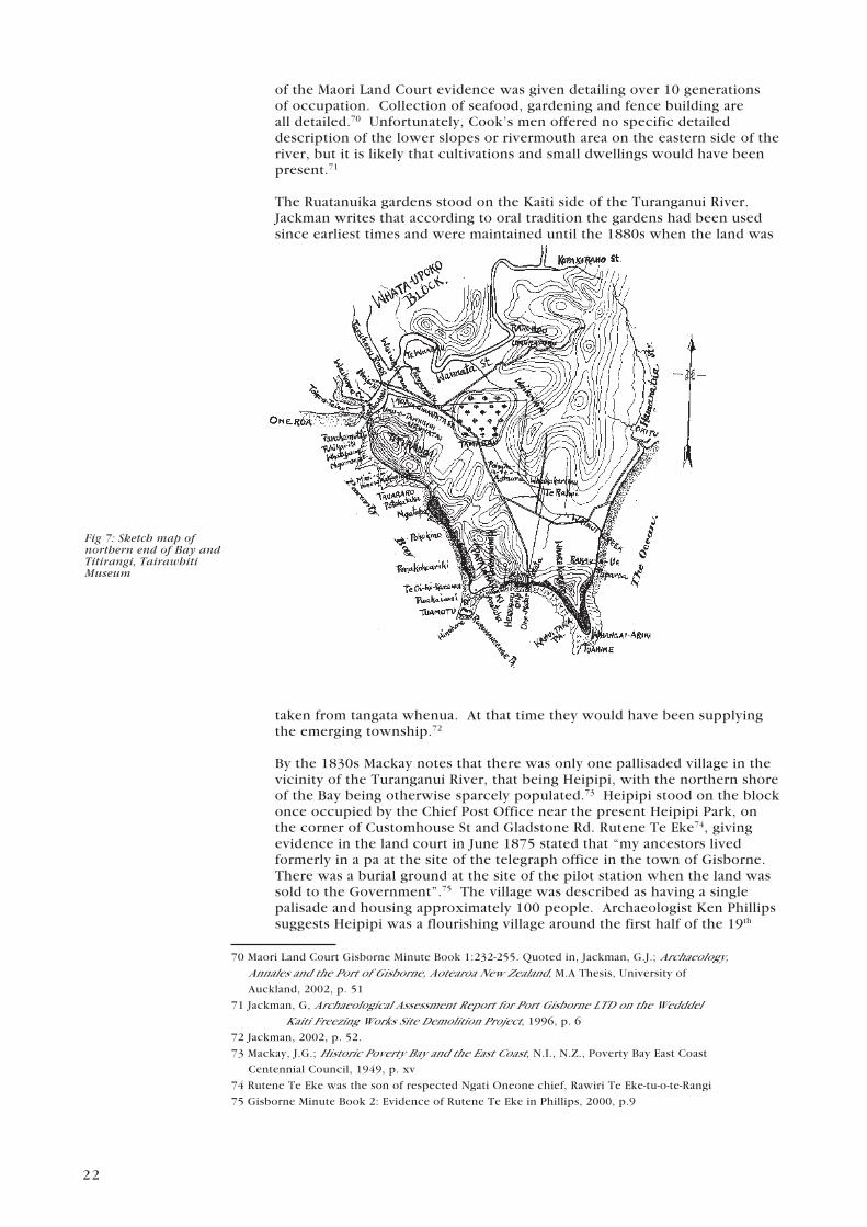
Fig 7: Sketch map of northern end of Bay and Titirangi, Tairawhiti Museum
of the Maori Land Court evidence was given detailing over 10 generations of occupation. Collection of seafood, gardening and fence building are all detailed.70 Unfortunately, Cook’s men offered no specific detailed description of the lower slopes or rivermouth area on the eastern side of the river, but it is likely that cultivations and small dwellings would have been present.71
The Ruatanuika gardens stood on the Kaiti side of the Turanganui River. Jackman writes that according to oral tradition the gardens had been used since earliest times and were maintained until the 1880s when the land was
taken from tangata whenua. At that time they would have been supplying the emerging township.72
By the 1830s Mackay notes that there was only one pallisaded village in the vicinity of the Turanganui River, that being Heipipi, with the northern shore of the Bay being otherwise sparcely populated.73 Heipipi stood on the block once occupied by the Chief Post Office near the present Heipipi Park, on the corner of Customhouse St and Gladstone Rd. Rutene Te Eke74, giving evidence in the land court in June 1875 stated that “my ancestors lived formerly in a pa at the site of the telegraph office in the town of Gisborne. There was a burial ground at the site of the pilot station when the land was sold to the Government”.75 The village was described as having a single palisade and housing approximately 100 people. Archaeologist Ken Phillips suggests Heipipi was a flourishing village around the first half of the 19th
70 Maori Land Court Gisborne Minute Book 1:232-255. Quoted in, Jackman, G.J.; Archaeology, Annales and the Port of Gisborne, Aotearoa New Zealand, M.A Thesis, University of
Auckland, 2002, p. 51
71 Jackman, G, Archaeological Assessment Report for Port Gisborne LTD on the Wedddel Kaiti Freezing Works Site Demolition Project, 1996, p. 6
72 Jackman, 2002, p. 52.
73 Mackay, J.G.; Historic Poverty Bay and the East Coast, N.I., N.Z., Poverty Bay East Coast
Centennial Council, 1949, p. xv
74 Rutene Te Eke was the son of respected Ngati Oneone chief, Rawiri Te Eke-tu-o-te-Rangi
75 Gisborne Minute Book 2: Evidence of Rutene Te Eke in Phillips, 2000, p.9

23
Fig 8: John Harris, of Tairawhiti Museum
Fig 9: Sketch of Turanganui River by William Colenso, 1838, Hawkes Bay Cultural Trust
century “but by mid century the village was in decline”.76
A number of buildings emerged on the eastern side of the river. Te Poho o Rawiri was built by Hirini Te Kani and in 1865 was turned in to a garrisoned magazine to shelter settlers during the conflict between the Crown and members of Pai Marire. Both the house and associated church were relocated to its present location when the land on which it stood was taken by the Crown under the Public Works Act 1882. Adjacent to the original Poho o Rawiri, a military redoubt was also built in 1865 and used as a base for the colonial military force and soldiers from Ngati Porou. Finally a small cottage was built for Archdeacon William Williams on the slopes of Titirangi very near the Cook Landing Site National Historic Reserve. 77
F R O M R I V E R T O P O R T
Some time elapsed between the first dramatic encounters between Maori and European in 1769 and the tentative efforts of settlement by another generation of Europeans on the banks of the Turanganui River.
By the 1830s European traders and whalers began arriving and establishing themselves in the area around the river. Previously interest and settlement in the area was sporadic. Unlike other parts of the country there was no planned and supported settlement pattern. On the contrary the earliest visitors were runaway seamen and shore traders who came to barter. Others were also attracted by the emergence of whaling stations. Mackay argues that the establishment of British sovereignty had brought no advantage or protection to the early settlers in Turanganui a Kiwa, and…”its pioneers were, indeed, regarded by the natives as mere squatters on sufferance”.78 In fact Turanga was a fully autonomous District until 1865.
76 Phillips, 2000, p.10
77 Jackman, 2002…, pp. 55-56
78 Mackay, p. 98

24
Fig 11: G.E.Read, Tairawhiti Museum.
The Waitangi Tribunal Report notes that 24 Maori signed the Treaty of Waitangi in Turanga in 1840, but in the following 25 years there was little evidence that effective sovereignty had been taken up by the Crown. 79
In 1831, John Harris, a 23 year old Englishman from Cornwall, set up the first trading post on the western side of the River adjacent to the Waikanae stream. He arrived on board the Darling and brought with him;
4 bales of woollens1 box of leather9 cases of muskets8 cases of ironmongery1 case of hardware1 cask of oil32 casks of powder1 box of colonial pipes1 puncheon of rum5 baskets of tobacco and stores80
These provisions provided the basis for the first trading station set up on the Turanganui River, with Harris purchasing a block on the northern bank of the Wai o Potango creek.81 Harris bought an acre of land and payment included 29 pounds of gunpowder, an axe, 48 pipes, and 6 pounds of tobacco.82 The land was purchased from Paratene Turangi, Kahutia, and others. Mackay records that no written agreement was made at the time of sale, but later a memorandum of sale was signed. He adds, “Here Harris built a house and store, first in Maori fashion, and then in wood. It is believed that these structures were the first to be erected in wood in Poverty Bay.”83 His arrival signalled the beginning of the transformation of the Turanganui from River to Port.
In the early 1830s Harris married Tukura, first cousin of Rawiri Te Eke and a woman of considerable rank, and later in 1837, he established a whaling station on the eastern bank of the Turanganui River, after briefly operating a station adjacent to his store. The whaling station was called Waikahua. The missionaries William Williams, Colenso, Mathews, and Stack called at Waikahua in January 1838 and found 20 Europeans working at the trading and whaling station.84 That venture did not last long with Harris giving up his whaling interests in 1842.85
Harris purchased a further parcel of land adjacent to the junction of the Turanganui and Taruheru Rivers. He bought the land in partnership with Robert Espie and built a weatherboard store, cottage and other buildings. It was called Wai o Nga Ruawai. The property was bounded to the north west by Heipipi village.86 Much later this property was purchased by Captain Read who added to it by building a jetty.
Trading activity increased dramatically in and around the river. Evidence of the extent of this trade comes from Joseph Montefiore a merchant based in Sydney, who worked as an agent for Harris. In 1831 he spoke favourably of the ability of the “natives” as agriculturalists and talked of having received large quantities of maize, potatoes, flax, pork,
79 Waitangi Tribunnal Report, Summary, p. 2
80 Mackay, p. 96
81 Phillips, p. 11
82 Gillies, Iain; Cook the County and its People, Gisborne Herald Co, LTD, 1989
83 Mackay, p. 139
84 Jackman; 2002, p. 54.
85 The station was moved to Papawhariki, at the northern end of the Bay
86 Mackay, p. 140
25
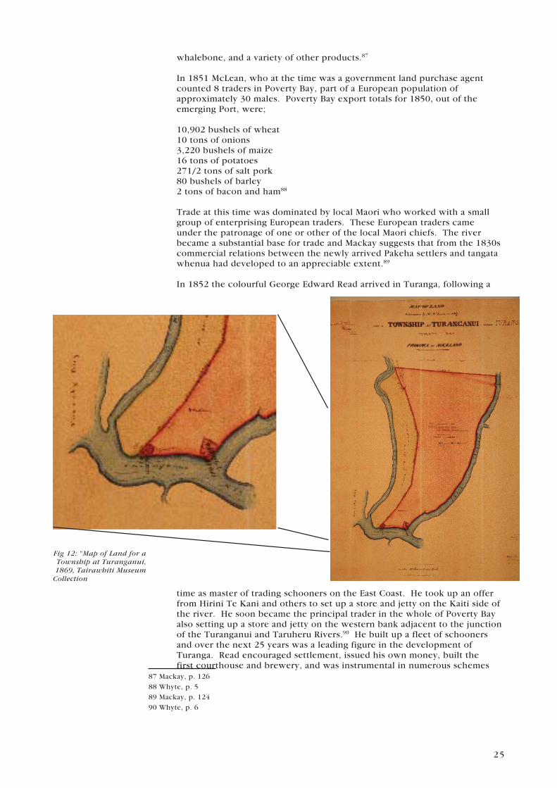
Fig 12: “Map of Land for a Township at Turanganui, 1869, Tairawhiti Museum Collection
whalebone, and a variety of other products.87
In 1851 McLean, who at the time was a government land purchase agent counted 8 traders in Poverty Bay, part of a European population of approximately 30 males. Poverty Bay export totals for 1850, out of the emerging Port, were;
10,902 bushels of wheat10 tons of onions3,220 bushels of maize16 tons of potatoes271/2 tons of salt pork80 bushels of barley2 tons of bacon and ham88
Trade at this time was dominated by local Maori who worked with a small group of enterprising European traders. These European traders came under the patronage of one or other of the local Maori chiefs. The river became a substantial base for trade and Mackay suggests that from the 1830s commercial relations between the newly arrived Pakeha settlers and tangata whenua had developed to an appreciable extent.89
In 1852 the colourful George Edward Read arrived in Turanga, following a
time as master of trading schooners on the East Coast. He took up an offer from Hirini Te Kani and others to set up a store and jetty on the Kaiti side of the river. He soon became the principal trader in the whole of Poverty Bay also setting up a store and jetty on the western bank adjacent to the junction of the Turanganui and Taruheru Rivers.90 He built up a fleet of schooners and over the next 25 years was a leading figure in the development of Turanga. Read encouraged settlement, issued his own money, built the first courthouse and brewery, and was instrumental in numerous schemes
87 Mackay, p. 126
88 Whyte, p. 5
89 Mackay, p. 124
90 Whyte, p. 6

26
Fig 13: Poho o Rawiri, 1865, Rhodes Collection, Alexander Turnball Library
Fig 14: Panorama of Gisborne, 1876. W.F.Crawford Collection, Tairawhiti Museum
to develop the area. He became known as, or styled himself as, – the Uncrowned King of Poverty Bay. Read died suddenly in 1878.
T U R A N G A T O G I S B O R N E
The early to mid 1800s can be summarised as a period approximately 30 years of relatively peaceful coexistence between Maori and the growing population of settlers. This was followed by five years of conflict in the 1860s, in turn followed by a lengthy period of adjustment to a growing settler population, and the influence of the Crown. The Waitangi Tribunal claims that during this time the Crown repeatedly disregarded its own laws in its treatment of Maori from the Turanga area, and that Maori also breached the Treaty. 91
The conflict of the 1860s began in 1865 when the Crown laid siege to the pa at Waerenga a Hika. This was followed by the attack of Te Kooti following his imprisonment and subsequent escape from Wharekauri (Chatham Islands), and in 1868 the attack by Colonial forces on Te Kooti and his
supporters at Ngatapa. The Waitangi Tribunal estimates that from the attack at Waerenga a Hika, to the fall of Ngatapa, approximately 240 men, or 43% of the adult male population of Turanga were killed in armed conflict with the Crown. The Tribunal adds that during this period of conflict the Crown pursued the cession of land in Turanga in order to punish Turanga Maori for their rebellion. They were warned that unless land was given up the Crown would withdraw its military protection.92 And so the scene was set for the Government to take control and ownership over a significant portion of in Turanganui a Kiwa
In 1869 The Turanganui No.2 Block, also known as the “township site” was sold to the Crown. The area shown on the plan was 741 acres 2 roods and 3 perches. The idea was that an inner township would be established bounded by the Turanganui River, Roebuck Rd, and the Waikanae swamp93
91 For a full account of this period see WAI 814. Turanga Tangata Turanga Whenua: The Report on the Turanganui claims. This report was formally handed to the claimants at Whakato
marae in October 2004.
92 WAI 814, executive summary, p.xx.
93 Hall, Sir R de Z, Gisborne Township Origins and Beginnings, Manuscript Collection,
Tairawhiti Museum, 1982, p. 11

27
Fig 15: Site of river diversion cut, 1925. Tairawhiti Museum.
Fig 16: Kaiti Freezing Works, 1920’s, W.F.Crawford Collection, Tairawhiti Museum
At a meeting of the Gisborne Borough Council in 1877, Councillor Townley moved a motion as follows,
that a letter be written to the Colonial Secretary requesting that the whole of the foreshore of the Turanganui River maybe made over to the Borough Council and if not already alienated from the native owners that steps may be taken to have it done.94
It was not long before Townley got his wish. As previously noted the original Te Poho o Rawiri was relocated in 1886 as the land on which it stood had been taken by the Gisborne Harbour Board under the Public Works Act. It was deemed that the land was required to further develop the harbour and was in turn used for the establishment and development of the Freezing Works.95
In June of 1877 the Marine Department called for tenders to blast some rocks in the mouth of the Turanganui River at a cost of 200 pounds. By the end of the year, Te Toka a Taiau, the rock referred to earlier, had been blasted by the Gisborne Harbour Board to improve shipping access in to the emerging Port at Gisborne.96
These efforts of clearing the channel coincided with the first attempt to create the Gisborne Harbour Board with the Gisborne Harbour Board Act 1882 paving the way for its establishment. The Board was made up of Gisborne Borough Councillors.97
It was also during this period that the name Turanga was replaced by Gisborne. William Gisborne was the British Colonial Secretary in the Fox Ministry and one reason given for the change was the confusion between the names Turanga and Tauranga. In 1874 the European population of Gisborne was 554. By 1886 it had grown to 2,194, and 20 years later the European
94 Poverty Bay Herald, 7 September 1877
95 Jackman, 2002, p. 56
96 National Archives M77/2742
97 Whyte, p. 24

28
Fig 17: Cook Committe, 1903Cook Commitee: (left to right) J. Townley, M.Sampson, Captain Tucker,
Rev. H Williams, Bishop W. Williams, Mr Gaudin, Mr Davies.
l. Fig 18: Unveiling of Cook Monument, 1906, W.F.Crawford Collection, Tairawhiti Museum
r. Fig 19: Cone of Vision Gisborne District Council/Nicoll Blackbourne Architects.
population stood at 5,664.
Effectively, control of this area had passed from its original owners to a newly arrived group of European settlers determined to develop the economic and commercial interests of the area for themselves and their descendents.
It is difficult to ascertain the degree of resistance to these new settlers but there is no doubt that their actions, particularly the blasting of Te Toka a Taiau, “the land grab”, and the renaming of Turanga, would have left the local inhabitants shocked and dismayed at the insensitivity of the new settlers.
G R O W T H O F T H E P O R T
Work intensified in the 1890s on the development of the Freezing Works and the Port on the eastern side of the river. Construction began on a 360 metre breakwater, a wooden wharf, blockyard, as well as a railway which was to bring in hard fill from Tuamotu and Papawhariki Islands. The breakwater was completed in 1890 and the Gisborne Sheep Farmers Frozen Meat Company opened in January 1896.
What followed were a succession of plans, reports, and drawings advocating the development of the Port. They included inner and outer harbour schemes, protection measures for the harbour entrance, establishment of breakwaters and much more. The Port was very busy in the early years of the 20th century and in 1914 Gisborne had the highest value of exports per capita in the country. 98
98 Whyte, p. 61

29
Fig 20: Ruatanuika Gardens, Turanganui River, 1874, Tairawhiti Museum
In the 1920s and 1930s the river was completely transformed with efforts concentrated on separating the river from the harbour. The Turanganui was to be diverted to the west along Waikanae Beach by way of a diversion wall. An outer breakwater was to be built to wrap around the eastern side of the river parallel to Kaiti Beach. The banks of the Waikanae were to be reclaimed and a railway bridge constructed.
This work was completed when the final cut was made and the river and harbour separated in 1931. Efforts then focussed on developing the Kaiti basin with the building of goods sheds and a fisherman’s wharf.Meanwhile the Kaiti Freezing Works grew and became a significant part of the Gisborne community until its demise in the 1990s. The western side of the river went through a number of transformations initially hosting a number of large hotels, later the base for Watties, and most recently the venue for a number of residential and accommodation developments
T H E C O O K L A N D I N G S I T E
The Cook Landing Site would be unrecognisable to Cook if he were to see it today, with much of the change occurring in the last few decades.
Interest was shown in the site by Archdeacon William Williams who spent some years living next to it in Waikahua Cottage. In 1888 he gave a paper to the Auckland Institute on Cook’s visit. He was interested in establishing the exact place where he first landed. In 1902 a committee was formed with the goal of erecting a memorial on the site. A financial appeal was launched nationwide – the plan was to have all school children give one penny. The fundraising campaign yielded 203 pounds with the Government contributing a further 500 pounds.
The monument was unveiled on Monday 8 October 1906 amidst street parades, speeches, navy personnel, and a haka party. The unveiling was carried out by Sir James Carroll in front of 5000 people. 99
By the 1950s reclamation was beginning to undermine the integrity of the site. In 1906 when the monument was unveiled, it was 80 feet from the sea. By 1959 the distance was 250 feet. In 1959 the local committee of the Historic Places Trust first met. They put a case to the Gisborne City Council that an area surrounding the monument and a strip of land between the monument and the sea be set aside as a reserve.
Reclamation continued but the Trust were successful in negotiating with Council and the Harbour Board to have a reserve of 1 acre 22 perches set aside in 1966.100 The idea of a visual cone was first suggested in the 1960s and finally established in 1974.
In 1990, the Cook Landing Site was designated a National Historic Reserve, the first one on the mainland of New Zealand. At that time it became the responsibility of the Department of Conservation. Despite these initiatives the battle to preserve the integrity of the site continues to this day.
99 Turanganui a Kiwa Landfall, p. 22
100 Turanganui a Kiwa Landfall, p. 23

30
Fig 21: Surveyed chart of Turanganui River indicating rocks to be removed, Collection of Archives New Zealand Te Whare Tohu Tuhituihonga o Aotearoa
RESEARCH FINDINGS
R E C E N T A R C H A E O L O G I C A L F I N D I N G S
W E D D E L K A I T I F R E E Z I N G W O R K S S I T E
In early 1995 an archaeological survey was carried out on the eastern side of the Turanganui River, on the site of the Weddel Kaiti Freezing Works, for Port Gisborne Ltd. According to archaeologist, Gordon Jackman, the site contains intact stratigraphy covering “the complete era of human habitation”.101 “The whole area of Titirangi is regarded by tangata whenua as wahi tapu (sacred site)” with the following sites identified during the course of the survey; Te Pioi Pa and cemetery situated above and possibly including part of the Freezing Works cattleyards.The watering spring of Hamo situated near the south side of Crawford Road.Te Umu-o-Tawhiwhi situated in an area to the northeast of Crawford Road.Ruatanuika Gardens situated in the mid area of the original blockyards.Waikahua Spring and possible burial area situated near the Williams’ “Waikahua Cottage” site.102
H E I N Z - W A T T I E S I T E
The Heinz-Wattie site is situated on the western bank of the Turanganui River, almost directly opposite the Weddel Kaiti Freezing Works site. “The Heinz-Wattie site was the location of early and prolonged Maori activity as well as the first European occupation in Poverty Bay in 1831, and subsequent pre 1900 residential and commercial development”.103
Archaeologist, Ken Phillips states that prior to the arrival of Cook, permanent Maori settlements were probably focused on the “Turanganui River to the
101 Jackman, 1996, p.2
102 Ibid,p.6
103 Phillips, 2000, p.1

31
north and on the raised banks of the Waikanae Creek to the south”.104 These conclusions are supported by a number of recorded observations by the crew of the Endeavour and local Maori oral traditions.
According to Phillips, the significance of archaeological deposits regarding the early inhabitants of Turanganui-a-Kiwa is undoubtedly high and “has the potential to add significantly to our understanding of the relationship between tangata whenua and the land in a dynamic coastal environment”.105
M O A B O N E A N D F O O T P R I N T S
Moa footprints were discovered on the left bank of the Waikanae Stream. Captain Harris took the first moa bone to Sydney in 1837 giving it to his uncle, Dr John Rule. It ended up in England where it was identified as a bird similar to an ostrich. In a note to his uncle Harris wrote,
….The bone they have a tradition that it belonged to a Bird of the Eagle kind, but which has become extinct – they call it ‘a movie’. They are found buried in the banks of rivers.106
The bone ended up in the hands of English anatomist Richard Owen who, “in 1839 boldly announced the existence of the moa to members of the Zoological Society in London.107
Moa footprints were also excavated from time to time with some being sent to the Auckland Museum in 1871.The location of the footprints suggest moa may have survived here as late as 1650 AD.108
L O C A T I O N O F T E T O K A A T A I A U
Te Toka a Taiau has great significance for the people of this area. Because of this there has been much interest in establishing its location.
Until recently those efforts have been in vain. What is known of the rock has been transmitted orally, with a few written accounts referred to in this report. This evidence clearly positions Te Toka a Taiau as a place of special significance. We also have the references and drawing of William Williams who describes the location of the rock. His evidence, too, must be taken seriously as he lived nearby at Waikahua cottage for 15 years. Unfortunately, however, there is no known photographic record of the rock and its location. Recently some records were located at National Archives relating to the letting of tenders to blast rocks in the Turanganui River in the 1870s. It was a large file, and at the back of it a surveyed chart, dated 1876, with those rocks to be blasted marked in red. By comparing this surveyed chart with the drawings of William Williams it was possible to deduce the location of Te Toka a Taiau109
The challenge then was to work out its current location given that the configuration today of the rivermouth is unrecognisable from the 1870s. By overlaying a contemporary photograph over the surveyed chart it has been possible to establish an approximate location of the site of Te Toka a Taiau
104 Ibid, p.8
105 Ibid, p.10
106 Quoted in, Wolfe, Richard; Moa: The dramatic story of the discovery of a giant bird,
Penguin, 2003, p. 33
107 Wolfe, p. 8
108 Jackman, 2002, p. 58
109 M 1, Sep 1016, Archives New Zealand Te Whare Tohu Tuhituhinga o Aotearoa

32
HERITAGE SIGNIFICANCE
Significance means different things to different people. For some the river is important because of its history. For others the issues are cultural, they are about whakapapa, links to the land as well as ancestors. Yet others see the area as significant economically, through the potential of unlocking opportunities for regional development.
The one thing that can be said is that without exception, all those involved agree that we are dealing with a very important place - to both Maori and Pakeha. The following are a series of accounts from a number of people giving their perspective on the heritage significance of the Turanganui River.
H I S T O R I C A L
Sir Neil Begg in a statement to the Planning Tribunnal in 1987
In my view there is no other single site of such significance in the history of New Zealand as this one.
It is almost impossible to overstate the significance for New Zealand of the event commemorated by the Cook Monument at Kaiti Beach, Gisborne…
In other words, in one afternoon in October 1769, the Maori people suddenly found themselves face to face with a European technological world. Their history has changed irreversibly since that day.110
Sheila Robinson who has had a long association and interest in the history of the area adds,
When I spent twelve years, 1980-1992, as local historian/curator of history in the Gisborne Museum archives, now the Tairawhiti Museum research centre, I gained a good general knowledge of the post-contact history of Tairawhiti and a keen awareness of its geography.I know that before 1769, the Turanganui River mouth was of importance to local Maori as a boundary between significant tribal groupings.I know that Cook’s several landings there on both banks were of life-changing importance to those Maori I know that the findings of the 1768 – 1771 voyage of the Endeavour, one of the first scientific voyages in world history (as distinct from voyages of discovery) were of great importance to the European world for a number of reasons, pre-eminent being the placing and delineation of New Zealand on the world map.
I believe that Cook’s landings at the Turanganui River mouth are of primary significance to the New Zealand nation that has emerged since 1769.
110 Quoted in;Planning Tribunal Decision, 1987, of the Town and Country Planning
Act (1977), p.5

33
Over several days the process of learning about each other took place in incidents involving challenge, welcome, curiosity, overtures of friendship and tragedy - a spectrum of human behaviour between two peoples who were total strangers to each other. The deaths of several Maori were a major part of that learning process.
The New Zealand nation that has emerged began at this place. If our nation is truly proud of our modern identity, we must mark and commemorate its beginnings around the mouth of the Turanganui River with dignity, and respect for the natural surroundings that the Maori knew and the men of the Endeavour witnessed and recorded.
C U L T U R A L - A C U S T O M A R Y P E R S P E C T I V E
Cultural significance for iwi with regard to their respective cultural landscapes, experiences, customary practices and tipuna (ancestors) can only be determined by iwi. That said, this part of the report does not intend to provide a comprehensive iwi perspective on the cultural significance of the area around the mouth of the Turanganui River, but rather focus on a series of personal perspectives from iwi pakeke111 of this region.
Tokorua Te Kani – Ngati OneoneHamoterangi who had her pa on top of Titirangi . . . (her) first husband was Porourangi from Whangara-mai-tawhiti, and of course after Porourangi had died his younger brother Tahupotiki returned back from the South Island . . . for us in Ngati Oneone hapu area we feel very honoured and proud to think our tipuna, Hamoterangi was theoriginator, put it that way, to the Ngati Porou tribal confederation and also to Ngai Tahu.112
. . . its very important for us in our area to realise the significance of Taiau himself and of course the people named the toka after him . . . that’s the spot that Captain Cook when he arrived met our people . . . for me Toka-a-Taiau and Taiau is very important for the history of this area.113
Apirana Mahuika – Ngati Porou There are three areas about Te Toka-a-Taiau that are significant. First of all it is the boundary that marks where the different iwi who are related to one another extend. So that for us Ngati Porou, Te Toka-a-Taiau is an important boundary mark because it is the boundary line between ourselves and our neighbouring iwi on our southern border. So we both share and have a claim in boundary terms to Te Toka-a-Taiau.
Secondly it was also a meeting place of Maori and Pakeha for the first time in our history that is another area of significance of this rock. Thirdly, the blasting away of the rock actually demonstrated at that particular time, the insensitivity of people to a culture other than theirs.”114
111 Pakeke is a term used to refer to well-regarded elderly people.
112 Excerpts from an interview with Tokorua Te Kani in Gisborne, 4/3/03. Original recording
and transcript of interview held at the Tairawhiti Museum.
113 Ibid.
114 Excerpts from an interview with Apirana Mahuika in Gisborne, 29/11/02. Original recording
and transcript of interview held at the Tairawhiti Museum.

34
“. . .everywhere I walk in the Gisborne area, I walk up Kaiti hill there’s everything to Cook, the whole town is Cook. The bicentennial is Cook, the ships that are displayed in the town are Cook and one would think Maori people never existed. . . .This project that we are looking at is a great opportunity for us to tell our total and holistic story, the story of this region, the Maori stories, the European stories, the Chinese stories, everybody else’s stories. But we must not forget the indigenous nature and beginnings of whom Maori people are a major player in this arena.115
. . . it is the story of Tairawhiti it is about us as a people who occupy this region . . . .if we do not record these ourselves who else will do it. Because if we get somebody else to do it what sense of significance and belonging would they provide to this region. We are the only ones who can give the spirituality and meaning to our stories.116
Darcy Ria – Rongowhakaata. . . because the Toka-a-Taiau was in the road they blew it up . . .But the formation of that harbour or the hopeful formation of the new harbour was not to succeed because the Maori said they blew Te Toka-a-Taiau. . .To me that rock was our boundary between us and Ngati Oneone because Ngati Oneone is related to us, we’re close.117
. . . I’d like to see some form of I don’t know whether it’d be a monument or some form of recognition of Te Toka-a-Taiau. I’ll go even further and I’d love to see, I’d like to get hold of Derek Lardelli to have some kind of monument . . .118
Wirangi Tarewa Pera – Te Aitanga a Mahaki
Ko Turanga te parekereke o te koreroTuranga has many beginnings for Te Aitanga a Mahaki:
Whakapapa: Our main whakapapa lines commence with descent from the people who came on the Horouta Waka, in particular the marriage of Kahutuanui, the son of Kiwa to Hineakua, the daughter of Paoa. The prominent descendant of this union was Ruapani whose daughter, Ruarauhanga, married Kahungunu. Their grandchild Te Nonoikua married the eldest son of Mahaki, Te Ranginui a Ihu, the eponymous ancestor of Te Aitanga a Mahaki.
Waka of importance to the people of Turanganui a Kiwa:- Te Aratauwhaiti with Tiwakawaka as captain made landfall at Whakatane and from these people descended Te Tini o Toi- Horouta with Paoa as captain and Taikehu as the tohunga- Takitimu with Kiwa as captain and Ruawharo and Tupai as tohunga- Te Ikaroa a Rauru with Maia as captain- Nukutere with Whironui as captain- Other waka who visited were Kurahaupo, Mataatua
The establishment of Whare Wananga:115 Ibid.
116 Ibid.
117 Excerpts from an interview with Darcy Ria in Manutuke, 24/3/03. Original recording
and transcript of interview held at the Tairawhiti Museum.
118 Ibid.

35
- Matatuahu established by Matuatonga- Tokitoki Whakaonge established by Tupai- Nukutaurua established by Ruawharo- In later years, Taurikura was established at Waingromia by Ngai Tamatea and Maraehinahina established at Waerenga a Hika by Enoka Te Pakaru
Settlement of the land:- Hinehakirirangi, the sister of Paoa, settled at Muriwai and a home was built for her called Paapaatewhai with her well called Umurau.- Maia, who built a house called Puhikaiiti, had cultivations beside the Mangamoteo stream- Te Wharau was the cultivations of Irakaiputahi and Matuatonga- Te Pioi was the cultivation of Taikarangaroa which later became the fishing village of Mahaki- The naming of Turanganui a Kiwa was commorated by the union of Hineakua and Kahutuanui
Derek Lardelli - Ngati Porou/Rongowhakata
TE TOKA A TAIAU, TE PITO O TE AOTe Toka a Taiau is the core of our universe A Tairawhiti perspectiveKo Te Toka a Taiau, Te herenga o nga wai, mai te hononga o nga rua. Te Toka a Taiau is a spiritual gathering place of our ancestors Ko Te Toka a Taiau Te whakatinanatanga o te whakapapa We are the kaitiaki/guardians of this very sacred site And Te Toka a Taiau is the physical reminder of our commitment to the land, the people and our environment Ko Te Toka a Taiau he mauri tipua Ko Te Toka a Taiau he mauri tawhito He mauri no te kukunetanga mai i Hawaiki Mauritu nei hei ahurewa tapu Mauritu nei hei tuahu tapu
Mana Atua From our primal parents Ko te Heketanga a Rangi raua ko Papa Te iratangata me te kanoi o te uha
Mana Tipuna To our earliest ancestors who discovered andpopulated this land’
Mauipotiki Nana i hii ai te whenuanui nei, ko Aotearoa. Ko tona waka ko Nukutaimemeha, kei Hinetakawhiti, Kei Hikurangi maunga.
Ruamatua, Ruakapanga, Ruawharo, Ruapani Ko Turanganui a Rua
Toitehuatahi, Toikairakau, Toitaketake Ko Turanganui a Toi Kiwa Ko Turanganui a Kiwa Paikea

36
Ko Te Urungatapu o Paikea
Porourangi, Hamoterangi, Tahupotiki Ko Porou koa, ko Hamo te wahine koa Ko Tahu koa ko Hamo te wahine koa
Turanga Makaurau, Turanga Tangatarite Ruapani = Wairua(Wairau) I Rongomaipapa Kahungunu = Ruarauhanga I Ruareretai I Hinepuaruari I kahukurawaiaraial Rongomaiwahine I Pouwharekura Mahaki = Hinetapuarau Nga Arikikaiputahi Rongowhakaata = Turahiri I Uetupuke I Moetai Tamanuhiri = Rongamaiawhia I Hinenui Te Whanau a Iwi I Ngai Tawhiri Ngati Oneone /Ngati Rakai I Ngati Mokai
Ko Te Toka a Taiau Te tumu herenga o nga waka Te Toka a Taiau is the mooring post ofour voyaging waka Nukutaimemeha, Mauipotiki = Hineraumaukuuku Nukutere, Te Whironui = Hinearaiara Tereanini, Rongomaituaho = Hauwhakarawarawakitekapua Te Ikaroa a Rauru, Maia = Hinehakitai I Tukaimatangi Takitimu, Tamatea Arikinui = Toto Horouta, Paoa = Kiwa = Rakaitapatahi Tauira, Motataumaitawhiti =
Mangarara, Te Wheketoro =
Ko Te Toka a Taiau Te pataka iringa korero Ko Te Toka a Taiau te tuahu tapu o nga wananga Te Toka a Taiau is of immense importance to tangata whenua Who are the keepers of its sacred knowledge Nga kura huna a Rua: Matatuahu Tokitoki Puhikaiiti Whare Korero Te Rawheoro Taperenui a Whatonga

37
Heritage Significance – Summary
Assessing significance is essential to understanding a place. This report has shown that the Turanganui River is a place of significance for a number of reasons. They include the following;
Historical Significance
The Turanganui River is unique in that it includes the site where the first formal meeting between Maori and European took place. The first landing site of Lieutenant James Cook,The landing place of voyaging waka,A contested boundary marker for neighbouring iwi and hapu,An important site of early trading and whaling activity in the region. A point of convergence of Maori, European, and Polynesian voyaging culturesAn integral part of a larger voyaging landscape of international significanceIt contains the only National Historic Reserve on mainland New Zealand.
Cultural Significance
The Turanganui River contains a number of significant sites for iwi. It includes sites of settlement, whare wananga and urupa, These sites have connections to illustrious ancestors.The entire area has been described as a wahi tapu. Te Toka a Taiau has links with all iwi of Tairawhiti.
Archaeological and Scientific Significance
The only recent archaeological excavations in Tairawhiti have been in this area.The site has the potential for further archaeological investigation and research which may add considerably to what we currently know about the human activity in the areaIt is associated with the first scientific collection of plants by Joseph Banks.It is associated with early scientific discovery and research of the moa
Social Significance
It contains stories of contact and conflict both within and between cultures.It is the focus for commemorative events and has great potential in this regardThe area is easily accessible to the public and provides advocacy and education opportunitiesThe area has associations with nationally important historical figures e.g Taiau, Tupaea, Lieutenant James Cook, Captain Read, Te Kooti ) The first place where Maori names were replaced by European ones in the country.
The Government is committed to the promotion and protection of New Zealand’s historic heritage and in 2004 adopted a policy to guide government departments’ management of this heritage. This policy identifies the importance of research and includes the following key principle:

38
Understanding Significance
The values of historic heritage places are clearly understood before decisions are taken that may result in change. Decision making, where change is being contemplated, takes into account all relevant values, cultural knowledge and disciplines.
The New Zealand Historic Places Trust has a statutory role under its 1993 Act to identify places of heritage value by establishing and maintaining a register of historic places, historic areas, wahi tapu, and wahi tapu areas.This is part of a wider function of NZHPT to identify , protect, preserve and conserve the historical and cultural heritage of New Zealand.

39
CONCLUSION
This report has clearly identified the Turanganui River as a place of local, national, and international significance. For some this point will simply affirm what they already know, yet for many, it is hoped they will begin to see this place differently
There are many challenges ahead, not the least of which is how best to manage the commercial development of the area. This is an issue for the entire community, to ensure that any future development takes account of the heritage landscape of which it is a part.
Another challenge concerns governance and leadership. On a recent visit the Prime Minister Helen Clark noted that central government would be interested in supporting local initiatives in this area, but only when there was consensus as to a way forward. We are not there yet. Any initiatives developed should be driven by a broad range of community interests
It is improtant that we become better educated about our own past and the places that are an integral part our daily experience. Hopefully this report will assist in that process.
In Turanga Tangata Turanga Whenua: The Report on the Turanganui a Kiwa claims;
The Waitangi Tribunal noted that the peoples of Gisborne have a rich and sometimes dramatic shared history. However, it expressed frustration at the lack of local education programmes to ensure local communities are aware of that history. That, it said, remains a primary obstacle to the process of reconciliation.119
119 Turanga Tangata Turanga Whenua: The Report on the Turanganui a Kiwa claims. Summary, p. 2.

40
Further Reading
Some of the material used in this report comes from interviews with people who have knowledge and an interest in the Turanganui River. Information has also been sourced from the manuscript and library collections of the Tairawhiti Museum and the H.B. Williams Memorial Library. Otherwise, this report is based on published and unpublished sources including the following;
Binney, Judith; Redemption Songs. A Life of Te Kooti Arikirangi Te Turuki, Auckland University Press, 1995
Buck, Peter; The Coming of the Maori, Whitcombe and Tombs, 1950
Fowler, Leo; Te Mana o Turanga, Historic Places Trust, 1974
Gillies, Iain; Baskets Away. The Formative Years of Gisborne and District, Gisborne District Council, 1976
Gillies, Iain, John, Angus; Cook the County and its People, Gisborne Herald Co., LTD, 1989
Gundry, Sheridan; Small City Big Heart, Built Heritage of Gisborne’s Commercial District, Gisborne Branch Committee NZHPT, 2006
Halbert, Rongowhakaata; Horouta: The History of the Horouta Canoe, Gisborne and East Coast, Reed, 1999
Jackman, G.H; Archaeology, Annales and the Port of Gisborne, Aotearoa New Zealand, MA Thesis, University of Auckland, 2002
Jackman, G.H; Archaeological Assessment Report for Port Gisborne LTD on the Weddel Kaiti Freezing Works Site Demolition Project, 1996
Mackay, J.A; Historic Poverty Bay, and the East Coast, NI, NZ, Poverty Bay-East Coast Centennial Council, 1949
Mitchell, J.H; Takitimu. A History of the Ngati Kahungunu People, Kiwi, 1990
Oliver and Thompson; Challenge and Response; Gisborne, 1971
Orbell, Margaret; The Illustrated Encyclopaedia of Maori Myth and Legend, 1995
Philips, K.J.S; Archaeological Survey and Assessment of Effects Heinz-Wattie Site Gisborne, Gisborne District Council, 2000
Robinson, Sheila; Gisborne Exposed, The Photographs of William Crawford, 1874-1913, Te Rau Press, 1990
Salmond, Anne; The Trial of the Cannibal Dog. Captain Cook in the South Seas, Penguin, 2003
Salmond, Anne; Two Worlds. First Meetings Between Maori and Europeans 1642-1772, Viking, 1991
Smiler, Kiki; Historical address given on behalf of the constituent hapu of the Tairawhiti, Te Poho o Rawiri, 1996
Tairawhiti Maori Association, Echoes of the Pa, 1932

41
Turanga Tangata Turanga Whenua: The Report on the Turanganui a Kiwa Claims, Waitangi Tribunal, 2004
Turanganui a Kiwa Landfall James Cook’s First Landing in New Zealand, 1769, Gisborne District Council, 1994
Whyte, Philip; Gisborne’s Battle for a Harbour. A History of the Gisborne Harbour Board, Gisborne Harbour Board, 1984
Wolfe, Richard; Moa: The Dramatic Story of the Discovery of a Giant Bird, Penguin, 2003