Treatment Alternatives for the Chieftains Museum/Major Ridge Home
640
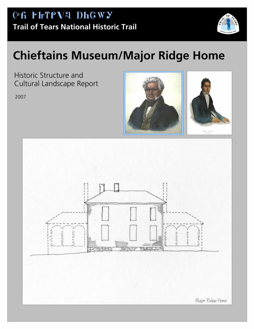
Qz 1_~#oF a%Bf! Trail of Tears National Historic Trail Chieftains Museum/Major Ridge Home 2007 Historic Structure and Cultural Landscape Report Major Ridge Home
Transcript of Treatment Alternatives for the Chieftains Museum/Major Ridge Home
Qz 1_~#oF a%Bf!
Trail of Tears National Historic Trail
Chieftains Museum/Major Ridge Home
2007
Historic Structure and Cultural Landscape Report
Major Ridge Home


Chieftains Museum/Major Ridge Home
2007
Prepared for: Chieftains Museum/Major Ridge Home Rome, Georgia
Glenn D. Simpson Supervisory Exhibit Specialist – Project Manager Division of Facilities Management, Historic Preservation Projects Intermountain Regional Office – Santa Fe, New Mexico National Park Service Mark L. Mortier Historical Architect Division of Facilities Management, Historic Preservation Projects Intermountain Support Office – Santa Fe, New Mexico National Park Service Steve Burns-Chavez Historical Landscape Architect National Trails System Office – Santa Fe, New Mexico National Park Service U.S. Department of the Interior Washington, DC
Historic Structure and Cultural Landscape Report


National Park Service v
Contents
Executive Summary 1 Chieftains Museum Mission Statement and Long Range Goals 1 Acknowledgements 2 Research Completed in Preparation of HSR/CLR 5 Recommendations for Further Research 6 Historical Background and Statements of Significance 11 Site History 11 The Ridge Period Historic Context (1814-1839) 26 The Significance of the Chieftains Museum/Major Ridge Home 43 PART I - HISTORIC STRUCTURE REPORT 53 Chronology of Development and Use 55 Introduction 55 The Ridge Period 57 The Ferguson-Verdery Period 67 The Wright Period 71 The Jones-Jeffries Period 72 The Porter Period 78 The Industrial Period 83 Existing Conditions 85 Architectural Description and Analysis 85
Introduction 85 General Comments 85 Character Defining Features 111 Detailed Description and Analysis 112 Interior Finishes and Analysis 233
Evaluation of Integrity 301 Historical Integrity of the Chieftains Museum/Major Ridge Home 301 PART II - CULTURAL LANDSCAPE REPORT 305 Chronology of Development and Use 307 Introduction 307 The Ridge Period 308 The Ferguson-Verdery Period 343 The Wright Period 349 The Jones-Jeffries Period 350 The Porter Period 362 The Industrial Period 364 Existing Conditions 377 Landscape Description and Analysis 377
Historic Preservation Report vi
PART III – TREATMENT AND USE 437 Treatment and Use 439 Treatment Philosophy for the Chieftains Museum/Major Ridge Home 439 Introduction to Treatment Alternatives 441 Treatment Alternatives for the Chieftains Home 443 Treatment Alternatives for the Chieftains Landscape 503 Preferred Treatment 530 Cost Estimates for Chieftains Museum/Major Ridge Home Treatment Alternatives 533 Cost Estimate for Chieftains Museum/Major Ridge Home Landscape Treatment
Alternative 1 536 Treatment Phasing 538 Treatment Documentation 540 References Cited 543 Appendices 575 Appendix A – Title Abstract 575 Appendix B – Window and Door Schedules 611 Appendix C – HABS Level 1 Documentation 619
National Park Service 1
Chieftains Museum Mission Statement and Long Range Goals
CHIEFTAINS MUSEUM/MAJOR RIDGE HOME MISSION STATEMENT: The mission of the Chieftains Museum / Major Ridge Home is to preserve and interpret the heritage represented by the Chieftains house and campus, a National Historic Landmark. As this house and property is the former home of prominent early nineteenth-century Cherokee leader Major Ridge and his family, its heritage most significantly encompasses the history and traditions of the Cherokee Indians and the clash of cultures in the southeastern United States that culminated in the tragedy known as the “Trail of Tears”.
Adopted May 20, 2002 LONG RANGE GOALS
• To be recognized as a leading source of information about Cherokee culture, history, and heritage in Georgia and attract national visitation as a historically important destination.
• To be recognized as a major center for public archaeology in Georgia. • To be recognized as a leader in community cultural affairs and function as a
center for community activity. • To be recognized as a professionally managed museum that adheres to
national standards.
Established during Strategic Planning, January, 2002
dopted May 20, 2002
EX
EC
UTI
VE S
UM
MA
RY

Historic Preservation Report 2
Acknowledgements
The preparation of this combined Historic Structure and Cultural Landscape Report has been a long and complicated process which has combined the efforts of Chieftains Museum, the National Park Service, Southern Research, the community of Rome, Georgia, and many other interested parties. Without their participation this project would not have been possible. Special thanks go to: HSR/CLR External Review Committee
• Jack Baker, President, National Trail of Tears Association and Representative of The Cherokee Nation
• Bob Blythe, Historian, National Historic Landmark Program, National Park Service, Southeast Regional Office
• Patrick Brennan, Georgia Trust for Historic Preservation • Pat Garrow, Professional Archaeologist, Early Chieftains Excavations • Troy Poteete, Cherokee Nation, Representative of the Government Offices,
Vice President of National Trail of Tears Association • Russ Townsend, Tribal Preservation Officer, Eastern Band of Cherokee
Indians • Susan Thomas, Preservation Architect • Nancy Tinker, National Trust for Historic Preservation • Caroline Wright, Architectural Reviewer, Georgia DNR, Historic
Preservation Division. HSR/CLR Chieftains Internal Review Committee
• Sarah Hill, Chair of Committee, Historian, Board of Directors, Chieftains Museum
• Ben Forrester, President, Board of Directors, Chieftains Museum • Ansley Saville, Vice President, Board of Directors, Chieftains Museum • Marsha Welch, Recording Secretary, Board of Directors, Chieftains Museum • Lenora Santoro, Correspondence Secretary, Board of Directors, Chieftains
Museum • Patti Barron, Treasurer, Board of Directors, Chieftains Museum • Ron King, Assistant Treasurer, Board of Directors, Chieftains Museum • Jacquelyn Wright, Past President, Board of Directors, Chieftains Museum • Gaynelle Grizzard, Advisory Board, Chieftains Museum • Jo Heyman, Board Member, Chieftains Museum • Carey Tilley, Executive Director, Chieftains Museum
Chieftains Museum Board of Directors, 2006-2007 M. J. Chisolm Ruth Demeter Patsy B. Edgar Will Enloe Bob Grizzard Nan Henson Jo Heyman Dr. Sarah H. Hill Cathy Kerce Peggy Nash

National Park Service 3
Harlan Starr III Fielding Stutts Barbara Triplett Scott Wallace Joe Watters Cheryl Yancey Suzanne Clonts, Floyd County Schools Dr. Randy Phillips, Rome City Schools Mary Margaret Mauer, Junior Service League Liaison
Chieftains Museum Board of Advisors, 2006-2007 Dennis Abney Walt Adams Frank Barron Diane Cumming Frances Davis Janice Davis Terry Dollar
Paul Erwin Debbie Galloway Dr. Barrett Gilbert Gaynelle Grizzard Bob Harris Lyons Heyman Patsy Hubbard Nancy Knight Sylvia Brooks Lanier Debbie Law Shelly Marlowe Craig McDaniel Agnew Meyers Nell Milner Dr. Forrest Schrum Matt Sirmans Nancy Star Elizabeth White Bill Wilcox Eddie Wilson Lish Wright
Jeanne Wright Sid Wright
Any factual errors or omissions from this document are the responsibility of Chieftains Museum, the National Park Service, and Southern Research. Historic Preservation Projects program is located in Santa Fe, New Mexico, and is part of the Division of Facilities Management of the National Park Service’s Intermountain Support Office. Historic Preservation Projects has on staff architects, carpenters, exhibit specialists, and masons who work in partnership with parks, other

Historic Preservation Report 4
agencies, partners, and contractors, to help preserve the important buildings and structures located throughout the United States. Questions regarding this document or other projects may be directed to: Glenn D. Simpson, Supervisory Exhibit Specialist Historic Preservation Projects Division of Facilities Management P.O. Box 728 Santa Fe, NM 87504 (505) 988-6794 (505) 986-5203 Fax

National Park Service 5
Research Completed in Preparation of HSR/CLR
For the purposes of developing this combined Historic Structure Report and Cultural Landscape Report, the National Park Service, in conjunction with Chieftains Museum, determined additional historical research was needed to find information relevant to understanding and interpreting the building and landscape history. NPS and Chieftains agreed that historical research should be undertaken at the thorough level as defined in the NPS Cultural Resource Management Guideline (1995:18). In the Spring of 2004, Chieftains Museum entered into contract with Southern Research Historic Preservation Consultants, Inc. to undertake the historical research for this project. Based on a research plan approved by Chieftains Museum and NPS, Southern Research prepared successive drafts of a document presenting the results of their research effort. Southern Research consulted many sources and the results are presented in an edited form in the second and third sections of this report. In general, the results of the research were less than what was hoped for and additional research would likely further benefit the overall understanding and interpretation of the history and current state of the Chieftains property.
Historic Preservation Report 6
Recommendations for Further Research
HISTORICAL RESEARCH The Chieftains Museum/Major Ridge home has a rich history that is hopefully more fully realized and clarified by the present research. Many leads for possible sources of information about the dwelling, the plantation, and the people, who lived there, were investigated in the course of this study. A substantial body of misinformation, bad information, and unsubstantiated assertions about the Chieftains property and its former occupants was encountered along this path. At times some of this dubious information was comical. The most prevalent source of incorrect information was the Internet, although many secondary published sources are flawed. Where possible, the research team attempted to secure access to the primary documents, or at least photocopies of the original documents, so that the facts about Chieftains could be substantiated. To a large extent that goal was accomplished, although many times the researchers had to utilize secondary sources in the place of actual examination of the primary sources. The secondary sources, which include many fine research studies, were reviewed as a separate class of information. The subject of the Cherokees, Cherokee Removal, Major Ridge, and John Ridge, was well represented in historical literature. Despite its pitfalls, the Internet proved to be a wonderful source of information in this study. It also served as an excellent communication viaduct for links with libraries, archives, historical societies, and researchers. Additional research time could have easily been spent examining additional microfilm collections at the National Archives and Records Administration, East Point, Georgia and the Georgia Department of Archives and History (GDAH), Morrow. Time and project funds did not allow a complete review of Bureau of Indian Affairs documents that hold the potential for more details on the life and activities of Major Ridge and John Ridge. Research at the Moravian Archives, Winston-Salem, North Carolina would be productive. Preliminary contact with their archivist identified several items of correspondence of Sarah Ridge, John Ridge, and Susannah Ridge. This archive also contains diaries from the Spring Place and Oothcaloga Moravian missions. These were not examined in the present study and an examination of these letters and diaries should be included in future research plans. A manuscript collection at the Huntington Library, San Marino, California includes writings, receipts and other documents of John Ridge. Although this manuscript collection is summarized and partially transcribed in the journal, Chronicles of Oklahoma (Foreman 1931:233-263) details about the receipts and other miscellaneous items in the collection were not described. Further inspection of this small collection may be warranted. Documents pertaining to the Ridge family and Chieftains, which are held in archival repositories in the northeastern United States were identified from secondary sources and from an annotated bibliography by Kutsche (1986). The most pertinent collections are that of the American Mission Board, which are curated at Houghton Library, Harvard University. Microfilm copies of these documents are housed in the Shorter College Library, Rome, Georgia. The research team learned of their existence at Shorter during the course of the project, but project constraints did not permit their examination.

National Park Service 7
Other collections relevant to the Baptist missions at Hightower and Haeweis are held by the Baptist Archives, Mercer University, Macon, Georgia. These records were not examined but some potential sources were identified. A visit to Mercer University would probably prove fruitful. Records at the Western History Collection, University of Oklahoma Library and Oklahoma Historical Society were partially assessed by a review of the research notes of Dr. Alice Taylor-Colbert, Shorter College. Dr. Taylor-Colbert's research interests include the Ridges and Chieftains Museum but were not totally focused on that subject. The Chieftains Museum would probably derive some benefit from a future visit to these repositories. The John Howard Payne papers are scattered in several archives and libraries in North America, including Columbia University (New York), Newberry Library (Chicago), and the University of Georgia. The collections at Columbia University were not examined and their content is undetermined. Dr. Taylor-Colbert had some notes and photocopies from the Newberry Library collection, but additional study of that collection may be warranted. The finding aid for the John Howard Payne manuscript collection at the University of Georgia was reviewed by this study, but the collection was not examined in detail. Further research could be conducted for written records that demonstrate that Lockwood and Poundstone, an early 20th century Atlanta architectural firm, redesigned the Chieftains house during the period of 1924 to 1928. More information about the first is needed also, if a connection is found. At least four schools built or redesigned by Lockwood and/or Poundstone in the 1920s and 1930s have been placed on the National Register of Historic Places in Georgia. These nominations list the architecture and/or architects on the four nominations as significant under criteria C for their architectural style and the architects, Lockwood and Poundstone. Unfortunately, none of the historic contexts for these nominations provided any useful information about the architects. However, the research conducted during this work was not exhaustive and further research is recommended. Noted architect Odis Poundstone also may have left some manuscripts or architectural plans for posterity. Current managers of the historic buildings built by this firm should be contacted for any information on the architects. The present search for corporate records of the American Chatillon Corporation, Tubize-Chatillon Corporation, and the American Celanese Corporation met with negative results. The parent company of these firms was contacted and an internal search by their media specialist revealed that no such records have survived. Some information was gathered pertaining to the mill in the present study from other sources. An advertisement should be posted in the Rome newspapers or other media seeking information about the mill from its former employees. Over two decades have lapsed since the mill operated and the former employees are aging. A search of Rome newspapers from this period also may yield additional information on the Chieftains property or its former residents.
Historic Preservation Report 8
ARCHITECTURAL RESEARCH In addition to the documentary historical research completed by Southern Research, NPS fielded a research team in November of 2004 to gather existing conditions data from Chieftains. The results of this field research are presented in the first section of the HSR. Like the historical events associated with the Chieftains property, the physical history of the Chieftains property is complex and difficult to interpret. Some additional research could answer some important outstanding questions about the property. For example, a paint chromochronology could be developed that would give some indication of the color schemes present on the exterior and interior of the house during the different periods of use. Also, dendrochronological analysis of the logs and hand-hewn beams of original log structure may help more accurately identify the date range for the construction of the original log structure. Removal of the interior and/or exterior finishes covering the original log building and the addition(s) attributed to Major Ridge might help to see and understand the construction and chronology of the building and its changes. Many important questions might be answered by this such as: whether the central hallway (dogtrot) was originally built as an open space, did logs go across it at some level and did it originally have a floor, was the stairway a part of the original construction or added later, what was the original configuration of roofs during the Ridge Period, was the original front entry on the east or the west, what was the original pattern of fenestration, and did the existing south entry date to the Ridge Period. Other evidence of previous construction or modification may be made more visible by removal of the finishes, as well. Note that while removal of the finishes would be very disruptive to the function of the building, it would be more plausible as the first step in implementation of one of the treatment options, and would have the potential to alter the treatment if useful information was gained by the process. Comprehensive testing for hazardous materials, such as asbestos and lead, would help to better quantify hazards and abatement requirements. This would be recommended for any treatment implementation. ARCHAEOLOGICAL RESEARCH Archaeology at Chieftains has already been used to identify architectural and cultural features, and its continued application could provide more physical details. Careful study of the collections excavated by past projects at Chieftains may provide dating clues that will help identify outbuildings north of the main house. Excavations along foundation walls and under the building (if possible) could help date periods of construction, and provide evidence or confirmation of features that are no longer in existence, such as foundations, walls, porches or additions. Archaeology could also aid in identifying outbuildings and perhaps functions and dates of construction/or use, as well as activity areas at Chieftains beyond those already identified by Garrow (1969, 1974), O'Steen and Garrow (1988), Mozingo (1999), and Worth (2000). Many areas of the Chieftains yard that have been sampled by these researchers should be explored by additional excavations, or remote-

National Park Service 9
sensing, to better define the resources. Ground Penetrating Radar (GPR) may prove useful in delineating features at Chieftains such as roads, pathways, cellars, and cemeteries. The advantage of this technology is that it is non-destructive, which is important for preserving archaeological resources that are not facing immediate destruction. Nevertheless, ground-truthing of the GPR anomalies would be necessary for final verification of any underground anomalies that were identified. One important recommendation is to complete the analysis and reporting of the archaeological work that has been conducted at Chieftains to date. Carey Tilley and his colleagues at the Chieftains Museum/Major Ridge Home are presently working toward this goal. These archaeological collections should be fully identified, studied, and the results reported prior to any further field work. Future excavations could then explore areas beyond those already investigated by these previous studies, including areas east of Chatillon Road, in the ferry vicinity, south of the Chieftains residence, and on the west side of the Oostanaula River. Archaeological research should explore other areas of Land Lots 165, 196 and 205, where Major Ridge had improved land. The search of these areas may yield evidence of the slave housing, agricultural compounds, or other, as yet, unidentified cultural resources. The archaeological research should not be limited to terrestrial study but should include underwater survey to explore the potential for ferry-related resources, fish dams, and nineteenth century debris fields on the bottom or along the banks of the Oostanaula River. Initial efforts to study the underwater historic resources at Chieftains have been taken (Jason Burns, State of Georgia Underwater Archaeologist, personal communication August 26, 2004).
The important concept to consider is that good interpretation of the historical resources at Chieftains should include the combined use of all of these research tools. Each discipline has important contributions to make to a better understanding of the people and places that once were the Chieftains plantation. An integrated approach to future research at Chieftains will yield the best overall picture of this nationally important historical resource.

Historic Preservation Report 10

National Park Service 11
Site History
The home of Major Ridge has stood on the banks of the Oostanaula River for almost 200 years. Ownership of the house and surrounding property has passed through many hands during that time (Figure 1). The size of the property has fluctuated over time going from several hundred acres that Major Ridge owned to nearly a thousand acres during the middle of the nineteenth century, and now to the present 12 acres owned by the Chieftains Museum, Inc. This chapter provides a discussion of the major owners and periods of ownership starting with Major Ridge and focuses on the house and the property associated with it in the courthouse records. This discussion provides the reader with a chronological prospective of land use and ownership changes through time starting with the Ridges. The names of periods are ascribed to the names of the major owners (Table 1).
Table 1. Timeline of Chieftains ownership. *Dual ownership: Ridge’s property was divided into 160 acre tracts by the state of Georgia and raffled off in 1832; however, until Ridge left his property in 1837, neither the lottery winner nor her buyer could occupy the land. THE RIDGE PERIOD (1819-1837) The exact date of the construction of the first house at Chieftains was not found and sufficient data to answer this question may remain unknown. The year 1819 appears to be the best estimated date for the Ridge family’s settlement on the Oostanaula River at the location that became known as Chieftains (Eaton 1978:28, 56; McKenney and Hall 1855:186.) By 1819, a ferry identified as Ridge’s and was in operation on the Oostanaula River. According to a Cherokee law passed at New Town on Oct. 30, 1819,
Widow fool shall also keep in repair for the benefit of her ferry at the fork, the road to commence from the creek above named to where Ridge’s Road now intersects said road east of her ferry, and that the Ridges shall also keep in repair the road to commence at the Two Runs, east of his ferry, and to continue by way of his ferry as
Date Person Description 1819-1837* Major Ridge Owner, planter 1832-1833* Rachel Ferguson Lottery winner, owner 1833-1852* Augustus N. Verdery Owner, planter 1852 Francois/Francis Debray Owner 1852-1855 Ferdinand DeBray DeLongchamps Owner 1855-1863 Augustus R. Wright Owner, planter 1863-1892 Addison A. Jones Owner, planter 1892-1899 Catherine Jones Owner 1899-1924 Henry Jeffries Owner, planter 1924-1928 J. H. Porter Owner 1928-1930 American Chatillon Corporation Owner, mill housing 1930 Tubize Chatillon Corporation Owner, mill housing 1946-1969 Celanese Corporation Owner, mill housing 1969-1987 Junior Service League of Rome Owner, museum 1987-Present Chieftains Museum, Inc. Owner, Museum
HIS
TOR
ICA
L B
AC
KG
RO
UN
D A
ND
STA
TEM
EN
TS O
F SIG
NIF
ICA
NC
E

Historic Preservation Report 12
Figure 1. Project Areafar as where his road intersects the old road, leading from the fork west of his ferry….[signed by Ross, Path Killer, Hicks, and McCoy] (Battey 1994:27).1
1 Without citing a source Wilkins claims that as late as 1824 the Ridge family maintained a home at Oothcalooga and a second home on the Oostanaula (Wilkins
National Park Service 13
A more direct reference to the Ridge’s residence appears in a letter written from the Moravian missionary at Oothcalooga dated April 10, 1822:
I really regret that Sister Ridge (Susannah) had to miss these blessed days because of her great distance and extensive household – they have a ferry about 18 miles down the river where she stays most of the time. (Gambold 1822).
McKenney and Hall (1855:87-88) present some details about the house, noting Ridge’s ambitions led him:
“…to build a house, and cultivate a farm; and accordingly he removed into the wilderness, and reared a mansion of loggs [sic], which had the luxury of a door, and the extravagant addition of a chimney. Nor was this all; roof was added, of long boards, split from logs, and confined in their places by weight poles--and thus completed the usual log-cabin of the frontier settler, an edifice which ranks in architecture next above the lodge or wigwam” and grounds.
The portrait (Figure 2) of a stern white-haired and well-dressed Cherokee is the only known image of Major Ridge that we have.2The portrait, probably painted by Charles Bird King, was the source of derivative lithographs that appeared in books by McKenney and Hall, and many others (Cosentino 1977; McKenney and Hall 1837, 1842, 1844, 1855). One physical description of Major Ridge is given by a traveler, Lucius Veran Bierce, who passed through the Cherokee Nation in 1822. Mr. Bierce described Ridge as:
“…a large, and for an Indian portly man, well formed, and handsome address. He wore a blue broad Cloth frock coat and pantaloons, boots white handkerchief and fur hat, but that on which he seemed to pride himself most was a black silk Cockade with the United States Eagle on it” (Knepper 1966:90).
Prior to settling at Chieftains, Major Ridge and his wife Susannah lived at the Cherokee Pine Log settlement located to the east of Chieftains between the Oostanaula and Etowah rivers in what is now Bartow County (Wilkins 1986:19-20). According to 1835 census data on birth dates, it would appear that most, if not all, of the Ridge children were born prior to their move to their parent’s “mansion” on the Oostanaula River. The oldest child was Nancy Ridge born in 1798 or 1799. John Ridge was born in 1804, followed by another son, Walter “Watty”, born ca. 1806. Their fourth child was Sarah, “Sallie”, born in 1810 or 1814. The birth date of a fifth child, an infant daughter, is unknown, although she died in 1818 (Phillips and Phillips 1998:81; Ancestry.com 2004). McKenney and Hall noted that one of the Ridge children died
1970: 159). It is hoped that further research can establish the exact date the Ridge family moved permanently to the home known today as Chieftains. 2 The portrait was painted in 1834 when Major Ridge was in Washington D.C. (Wilkins 1970: 250, 356 n59).

Historic Preservation Report 14
Figure 2. Portrait of Major Ridge
in infancy while, “Another was deficient in mind, and the other three were well educated” (McKenney and Hall 1855:88).
In 1810, prior to their move from Pine Log to the Oostanaula River, Major Ridge and Susannah sent their eldest children, Nancy and John, to the Moravian Mission School at Spring Place, which had been established in 1800 near the home of James Vann (now Murray County). In 1817, Nancy and John were sent to the Brainerd Mission (established after the Spring Place Mission) on Chickamauga Creek in Tennessee, although John Ridge left within months to attend school in Knoxville in early 1818 (Wilkins 1986:998-99; Phillips and Phillips 1998:443). It is unlikely that Nancy and John spent much time at Chieftains as children.3 The year 1819 has significance for the
Ridge family beyond the likely date that they moved to Chieftains. That
year John Ridge entered the Cornwall Foreign Mission School (or Cornwall College) in Cornwall, Connecticut (Hall 1955:103-104). Sadly, that same year, their eldest child, Nancy, who probably had married sometime in 1818, died in childbirth.4 She was buried near the Ridge’s house, which from the description was probably at Chieftains (Wilkins 1986:116).5 By 1824, John had finished four years of study at Cornwall, married a Connecticut woman, Sarah Bird Northrup, and moved to a home east of the Oostanaula River at a place called Two Run, a few miles northeast of Chieftains (Eaton 1914:56).6
3 According to Wilkins, John Ridge left for Cornwall in the fall of 1818 and arrived at school in late November of the same year. 4 Nancy died in 1818 rather than 1819. A Sept. 12, 1818 entry in the journal of the mission at Brainerd states that “Butrick will go on to preach a funeral sermon on account of the late death of the daughter of a chief who is called the Ridge“(Phillips and Phillips 1998: 81). Wilkins says that Nancy had married an Indian named Ricky (Wilkins 1970: 117). 5 Marion L. Starkey writes that Major Ridge once asked Butrick to hold a Sabbath service in the woods by his daughter’s grave, and following the service “Butrick lingered in the gracious house” (Starkey 1995: 55). Unfortunately Starkey does not cite a reference for her claim. Wilkins specifies that the tragedy of Nancy’s death “struck at Oothcalooga” (Wilkins 1970: 117). 6 Following the preparation of this report independent researcher Anna Smith and National Trail of Tears President Jack Baker located information about the Ridge

National Park Service 15
Figure 3. Portrait of John Ridge.
John Ridge has been cited in a contemporary letter written in 1828 as having had a hand in the remodeling of Chieftains house, although this primary source was not found. A primary source of circumstantial evidence is an 1828 advertisement placed by John Ridge in the Cherokee Phoenix (1828-1829), which offers the services of a
house builder capable of erecting houses in the “latest style”. Primary documentary evidence directly connecting John Ridge to Chieftains was not found. Undoubtedly, he participated in family affairs there, and may have been involved in meetings and gatherings associated with the complex affairs of the Cherokee Nation during the years prior to removal. 7 John Ridge was well educated and became an astute and articulate voice for the Cherokee Nation, as well as working with the Creek Indians in some of their negotiations with the U.S. Government. His portrait is presented in Figure 3. Despite all the efforts Major, John Ridge and other Cherokees made to maintain possession of their territorial lands, the U. S. Government passed the Indian Removal Act in 1830. It was
signed by Andrew Jackson, who sided with the southern states in their demands for Indian lands. Bolstered by the Act, the state of Georgia went ahead with plans to acquire the Cherokee lands of northwest Georgia. They sent land surveyors across Cherokee territory to divide the Cherokee territory into sections that were further divided into districts, which were subdivided into land lots. The land lots measured into either 160 acres or 40 acres lots known as gold lots. The gold lots were located in
house in records of the Moravian Archives, Salem, North Carolina. On Sept. 27, 1826 Moravian missionaries John and Maria Gambold wrote from the mission at Oochgelogy to Brother Schulz in Salem “Major Ridge, as is known from the newspapers, received a good amount of money through the “Treaty” with the Creeks and now wants to build a beautiful, big house. He has been looking for a carpenter for this in Tennessee. He went to Mr. Conger who spoke to his son-in-law Clark about this “Job,” and he also came here with him and finished the job” (Baker, Personal Communication 2006; Schulz 1826). 7 John Ridge joined his father, Major Ridge, and cousin Elias Boudinot, to form and lead the so-called Treaty Party that broke with Principal Chief John Ross and the majority of the Cherokee Nation. Since Major Ridge spoke English poorly, John became the primary spokesman for the party. In 1835 the Treaty Party signed the fraudulent Treaty of New Echota and agreed to removal.

Historic Preservation Report 16
those areas where gold had been discovered in 1829, or in nearby areas that were surmised to contain gold deposits. The gold lots were mostly in the lower Appalachian Mountains to the east of the Ridge and Valley province. There were no gold lots in Floyd County. The surveyors were instructed to record the current conditions of the land, noting all improvements that the Cherokees had made to their lands. Improvements included such things as houses, structures, ferries, bridges, mills, fences, and lands cleared for agricultural fields, orchards, or pastures. Field maps and notes were made and then transcribed for the official state records so that the lands could be distributed through a lottery system. By 1832, the state of Georgia had created one county, Cherokee County, encompassing all of the Cherokee territory of northwest Georgia. Wasting no time, an official state lottery was held in 1832, which awarded the newly formed land lots to non-Cherokee Georgia residents. By the end of 1832, the surveyed land was further subdivided into 10 counties, one being Floyd County where the Ridge property is located. The 1835 Treaty of New Echota signified the Cherokees’ relinquishing of all of their lands east of the Mississippi River. One of the provisions of the treaty gave the Cherokees two years to remove themselves from their properties, starting from the time of the ratification of the Treaty of New Echota in May of 1836 (Kappler 1904:439-448). Nevertheless, the state of Georgia and its citizens were anxious to occupy the Cherokee territories and numerous infringements by settlers occurred with much greater ferocity and regularity after the signing of the 1835 Treaty.8 The Federal Government made some effort to protect the Cherokees and their property from squatters until removal. Appeals were made by William Cleghorn, agent for the Cherokees, to Georgia Governor Lumpkin to help control these infringements (Cleghorn 1833). Lumpkin made some attempts to control squatters. The early but short-lived white settlement of Livingston developed on the Coosa River west and a little downstream from where the Oostanaula and Etowah rivers joined. This area known as the head of the Coosa was owned and occupied by the Cherokee John Ross, who lived there and ran a ferry operation. In 1833 Ross returned from conducting negotiations in Washington, D.C. to find his property had been taken over by whites. Unable to dislodge them he moved his family to a log cabin near the Red Clay settlement in Tennessee at a place on the Tennessee River (Wilkins 1986:252). Governor Lumpkin signed legislation on December 20, 1834 authorizing the removal of the public buildings in the Livingston settlement to Rome, in the vicinity of John Ross’s land. The town of Rome was officially incorporated in this same legislation that authorized the removal of the Livingston settlement. The original town of Rome was located on Lot 245, 23rd District, 34 Section of Floyd County (Georgia General Assembly 1834:25). THE FERGUSON-VERDERY PERIOD (1836-1853) This period of ownership at Chieftains does not truly begin until after Major Ridge
8 Although often ignored, Georgia law officially prohibited taking possession of Cherokee improvements until the Cherokees had abandoned them. As leader of the Treaty Party, Major Ridge and his property received greater protection under this act until he emigrated in 1837.

National Park Service 17
and his family left the property permanently in late December 1836. The state of Georgia conducted a lottery and awarded the part of Ridge’s property containing his house, ferry, store, and other buildings located on Land Lot 196 to Rachel Ferguson in 1832. She was a widow of a Revolutionary War soldier and lived in Richmond County, Georgia. There is no indication that she ever occupied Lot 196. Realizing the value of her lottery winnings, the widow Ferguson promptly sold the property containing Major Ridge’s residence Lot 196 to Augustus N. Verdery for $5,000 in January 1833 (Wright et al. 1929). The 1833 land sale was mysteriously recorded in Stewart County, Georgia (southwest Georgia) and then in January 1836 the transaction was recorded again, this time in Richmond County. The second recordation was probably due to the fact that Major Ridge continued to own the land in the eyes of the Federal Government until the signing of the 1835 Treaty of New Echota, which was ratified in May of 1836. The state of Georgia also made attempts to control white incursions onto Cherokee lands until the Cherokees left their property. The Ridge family left very late in the year of 1836. Augustus Verdery was a first generation (French) American citizen. He was the son of a Frenchman and maintained close ties with his relatives in France (Prather 1942). His father, Mathurin Marechal Verdery, originally lived in Bordeaux, France, but was forced to leave his homeland during the French Revolution. He married Adelaide Pavageau while a resident of San Domingo. The couple then settled in Augusta, Georgia where their son Augustus was born on November 14, 1802. Augustus N. Verdery was married to Susan H. Burton in Richmond County, Georgia on September 1, 1824 (Ancestry.com 2004). In 1836, Augustus Verdery applied to the Georgia Legislature for a license to operate what was formerly Ridge’s Ferry (Georgia General Assembly 1836, Volume 1:128-130). No subsequent details of Verdery’s Ferry operation were found during further research. Verdery also operated a floating bridge during at least part of his period of ownership of the former Ridge plantation. Floating bridges were used in France and elsewhere in Europe during the eighteenth and nineteenth centuries, and this may be where his idea originated. Figure 4 illustrates one such bridge in North Carolina. As the town of Rome, Georgia grew in population and commerce, the need for a permanent bridge increased so that by the mid-1850s a bridge was constructed over the Oostanaula River downstream from Chieftains, resulting in less and less traffic at the ferry crossing. Changes during the Verdery ownership involved land use changes of the property. Agricultural census information, deeds, and other documents indicate that the landscape became more heavily cultivated through time, a common trend as cotton became a big cash crop. What began as approximately 77 acres of improved lands as shown on the 1832 plats eventually became several hundred acres of cleared land. Verdery acquired additional tracts in the vicinity of Land Lot 196 to create a farm comprised of approximately 800 acres, although the core of Verdery’s plantation was comprised of Land Lots 165 and 196, totaling approximately 283 acres (Wright et al. 1929).

Historic Preservation Report 18
Figure 4. Typical ferry crossing in North Carolina. It is unclear how much time Augustus Verdery actually spent at the Chieftains property. He served as a Judge of Superior Court in Richmond County, Georgia from January 9, 1837 to January 14, 1841. These judicial duties probably kept him from investing himself fully into his newly acquired land at Chieftains, since the two locations were on complete opposite sides of Georgia (Prather 1942). Verdery may have had a tenant that ran his plantation in his absence, but no documentation was found to verify that. The 1840 federal census enumerated Augustus Verdery as head of household in Richmond County, Georgia. Verdery’s household consisted of 22 people, including 14 slaves. Eight members of the Verdery household were engaged in agriculture and two were engaged in manufacturing and trade in 1840 in Floyd County (United States Census, Population schedule, Floyd County:291-292). Prior to January 11, 1841, at least seven African-American slaves were living at Augustus Verdery’s farm in Floyd County. These included a man named Henry, two women named Dinah and Eliza, a boy named Jim, and three girls, Molly, Elizabeth, and Lucy. An 1842 mortgage agreement between Verdery and George W. Crawford mentions eight of Verdery's slaves, who were used as collateral in the transaction (Floyd County Deed Book D:318-319). In an 1845 mortgage agreement with Pleasant Stovall, Verdery again uses his slaves and his Floyd County plantation as collateral (Floyd County Deed Book E:26-27). These legal documents and the 1840 slave census information account for at least 19 of Verdery's slaves living in Georgia in the 1830s and 1840s. Their residence was either on Verdery's Richmond County property or at his Chieftains property. The deed records do not specify their place of residence, although those used as collateral are associated with the Floyd County property (Floyd County Deed Book E:26-27). The

National Park Service 19
portion of Land Lot 196 located west of the Oostanaula River was sold by Verdery to Lewis and Richard Parks in 1846 (Wright et al. 1929). Augustus Verdery is not enumerated in the 1850 census; however, 27 slaves were recorded for Verdery in Floyd County (U.S. Census Slave Schedule 1850:47). A possible relative of Verdery’s, Freeman Virderre, an 18 year-old clerk, was listed in the 1850 census for Floyd County, Georgia, although Freeman Virderre was not identified as the head of a household. He was identified as living with a merchant named Miles Johnson (U.S. Census, Population Schedule 1850:195). One of Verdery’s descendants, Emily Prather, wrote a family history covering the years 1794 to 1942 (Prather 1942). Emily gleaned some of her information about the Chieftains years from a fictional account by her mother, Augustus Verdery’s daughter Susan Verdery Prather. Susan lived with her parents at Chieftains until the family moved to Greenville, Alabama, supposedly at the urging of Augustus Verdery’s wife (Prather 1942:43). Susan’s fictional account supposedly wove fact and fancy into a fanciful story about Tahlonika the Cherokee (Prather n.d.). Her descriptions of Chieftains and surrounding areas of the landscape seem fairly accurate at times, but where fiction strays from fact is not always easy to determine. The Verdery’s probably moved away from Chieftains with the sale of the Chieftains property somewhere around 1852. Deed records are missing for Verdery’s sale of the Chieftains property. However, the property ended up in the hands of Ferdinand Debray de Longchamp and his wife Eliza Mirambau on September 24, 1853 for $2,675. Their ownership of the property was brief, and they sold the property to A.R. Wright on December 5, 1855 (Wright et al. 1929). During a portion of the time that de Longchamp owned the Chieftains property and portions of it were leased for agricultural use to James W.M. Berrien. The expansion and development of the Chieftains plantation following the Ridge’s departure reflects a trend that was experienced throughout the former Cherokee Nation. Verdery and other owners who acquired the improved Cherokee properties shortly after 1838 often came into possession of ready-made farms with buildings set up for an agricultural economy based on cash crops. The presence of these Cherokee farms would have given Rome and Floyd County an edge as an economic center of northwest Georgia during the 1830s to 1850s. THE WRIGHT PERIOD (1855-1863) Augustus N. Wright bought the Chieftains property on December 5, 1855 for $7000 (Wright et al. 1929). According to his granddaughter, Ava Louise Wright, her grandfather was born in 1813 in Wrightsboro, Georgia and later attended Franklin College in Athens, Georgia (graduation date unknown). He studied law at the Litchfield Connecticut Law School (Litchfield, Connecticut) where many future political leaders of the United States studied law during the late eighteenth and early nineteenth centuries (http://www.litchfieldhistoriclasociety.org/history-/histlawschool.html.) Wright was admitted to the bar in Georgia in 1835, and began his practice in Crawfordville, Georgia located between Athens and Augusta. The

Historic Preservation Report 20
following year he moved to Cassville, Georgia in Bartow County where he served as a judge for the superior courts of the Cherokee circuit from 1842 to 1849. In 1855, after purchasing the Chieftains property, Wright moved to the Rome, Georgia area where he continued to practice law. Augustus Wright was married twice and had a total of 16 children from the two marriages. Ava Louise Wright, who wrote about her grandfather, descended from the second marriage (A. Wright 1869-1905). The 1860 Federal Census Population Schedule for Floyd County is the only Census that records Wright at Chieftains. A.R. Wright, a 46 years old white male attorney and native Georgian, was listed as head of the household. His real estate was valued at $28,000 and his personal estate was listed at $20,000. Twelve other members of the household were noted, including Wright’s second wife, Adeline E. Wright, and ten children ranging from age 21 to three years old. All were sons with the exception of one daughter. Also residing in the household was H.L. Berrien, a 41 year old female, occupation not listed (United States Census 1860, Population Schedule, Floyd County:194). It appears that Augustus R. Wright was a very successful farmer during the mid-nineteenth century based on the census information in the Population and Agricultural Schedules. These documents provide what little information we have about his years at Chieftains. In 1860, Wright owned 1,000 acres in Floyd County, Georgia of which exactly half was listed as improved. We cannot be certain all of these acres were part of the Chieftains property. His farm was valued at $12,500 and he owned farming implements and machinery worth $500. He also owned livestock valued at $1,500 and reported $500 worth of slaughtered livestock for 1860 (U.S. Census, Agricultural Schedule, 1860). Wright was elected as a Georgia representative to the 35th U.S. Congress, serving from March 4, 1857 to March 3, 1859. When talk about secession from the United States became serious he served on the delegate to Georgia Secession that opposed secession. Nevertheless, when Georgia seceded from the Union, Wright entered the service of the Confederate States of America as a Colonel, and organized Wright’s Legion, which raised 1,250 men. This Legion became the 38th Georgia Infantry (Gulley n.d.; Wright 1969-1905). He held the rank of Colonel throughout the war, although the 38th Georgia Infantry was commanded by others after February 1862. Wright’s Legion was present at the surrender at Appomattox, Virginia on April 9, 1865. Of the 1,200 soldiers who enlisted in Wright’s Legion, only 105 survived the war (Civil-war.net 2004). Although Colonel Wright did not serve on the battlefield with his men in these engagements, he remained active in the political affairs of Georgia. President Lincoln interviewed Judge A.R. Wright in 1864. Wright may have been offered the job of Provisional Governor for the state of Georgia, which he purportedly declined (Wright 1879). Following the Civil War, Wright was elected in 1877 as a delegate to the Constitutional Convention of Georgia, which was tasked with the framing of a new state constitution. Augustus R. Wright sold the Chieftains house and property during the middle of the war to Addision A. Jones in 1863. Wright continued to live in the Rome area (United

National Park Service 21
States Census 1870, Population Schedule, Floyd County:130). Wright built a home, known as Glenwood, which was located at the current site of the Berry College Chapel, and continued practicing law, serving as a judge and a preacher. He died at Glenwood in Rome in 1891 (www.romegeorgia.com/history .html). THE JONES -JEFFERIES PERIOD (1863-1924) Addison A. Jones purchased 283 acres of the Chieftains property from Augustus R. Wright on July 24, 1863, paying $25,000 for the property in Confederate currency. The warranty deed refers to a survey of the property by Eugene Lehardy but no plat was found (Floyd County Deed Book N:404; Wright et al. 1929). Jones was a wealthy Virginian whose family owned land in Alabama, Virginia, and Georgia. He married Susanna (last name unknown) and they had three children. When his daughter Susan Jones married Francis M. Jefferies, Addison gave her a home south of his dwelling along with 20 acres of land (Floyd County Deed Book U:640-642; Wright et al. 1929). Jones owned several properties in northwest Georgia, including commercial property in Rome and farms in Floyd County and neighboring counties (Addison A. Jones 1869-1905; Jones Family papers 1869-1905). The National Register of Historic Places nomination form for the Chieftains house noted that Addison A. Jones remodeled the house “into a charming modern residence” (NPS 1972). However, no supporting documentation was provided with the nomination form, nor was any found, that would verify this claim. Little information was found about Addison A. Jones pertaining specifically to the Chieftains property during his tenure there. Jones wrote and signed his Last Will and Testament on June 9, 1886. He died in 1892 and the will was proven on August 1, 1892. Jones left his son, Andrew T. Jones, as Executor and appointed William A. Porter as the Administrator of the will (Floyd County Will Book D:8-10). The Inventory of Addison Jones' estate included the Jones home place on the Oostanaula River, being parts of lots 196, 205 and 206, Dis. 23, Sec. 3, Floyd County, and containing 140 acres more or less. The estimated value of the real estate was $6,500, which was inventoried to be sold with the exception of six acres with the dwelling left to his daughter Katherine (Catherine) Jones (Wright et al. 1929). Catherine Jones apparently did not live too many years beyond her father, dying in 1899. It appears she never married. Her will was dated April 15, 1899 and was proven on June 5, 1899. She left her six acres and the house that she inherited from her father to her two nephews: J.H. Jeffries and A.J. Jeffries, sons of her sister Susan Jones Jeffries. Catherine left money and other things to her other Jeffries nieces and nephews (Floyd County Will Book D:240; Wright et al. 1929). J.H. Jeffries played a major role in the settlement of the Jones’ and Jeffries’ estates. In 1899, the value of the Chieftains home place, situated on the six acre tract, was appraised at $2,300. By 1902, ownership of the six acre homestead was solely vested in J.H. Jeffries (Floyd County Deed Book KKK:537; Wright et al. 1929), who resided there (Anonymous ca. 1900-1924). Subsequently, the six acres became part of a 100-acre tract. In 1918, J.H. Jeffries conveyed a bond for title of the Chieftains property to

Historic Preservation Report 22
Judson C. Davis. The property consisted of 100 acres in Land Lot 196. J.H. Jeffries deeded the property to T.D. Stevens and J.F. Stevens in February 1922 (Floyd County Deed Books 108:381; 111:275; Wright et al. 1929). Addison A. Jones and his descendants in the Jones and Jeffries families were important residents of Chieftains and Floyd County. Although they lived beyond the city limits of Rome, the members of these families figured prominently in Rome's commerce and economic growth. The Jones and Jefferies owned several stores, rental houses in Rome, and farms in rural Floyd County. An appreciation of their involvement in Rome's commerce is evident from examining some of the volumes of Jones family papers, which are preserved on microfilm at the Georgia Department of Archives and History (GDAH) (Jones Family Papers 1869-1905; originals are at the Chieftains Museum). A cursory examination indicated there were no details about the built environment at Chieftains during this time period. This collection of papers represents a vivid assemblage of receipts, invoices, letters, draft contracts, and other business papers, which attest to the importance of the Jones and Jeffries families in the Rome community. THE PORTER PERIOD (1923-1928) The Chieftains property was sold by T.D. Stevens and J.F. Stevens to J.H. Porter in February 1923 (Floyd County Deed Book 117:409; Wright et al. 1929). J.H. Porter owned Chieftains until May 1928 when he deeded the property to the American Chatillon Corporation (Floyd County Deed Book 134:240; Wright et al. 1929). While biographical information concerning J.H. Porter could not be found, it appears that during his ownership of the Chieftains house that the house experienced significant remodeling. Unfortunately, no specific documents were located pertaining to the remodeling effort in the present research. The 1972 National Register of Historic Places nomination form stated that Porter remodeled Chieftains using the early twentieth century Atlanta architectural firm of Lockwood and Poundstone. The form contains no source citations to corroborate this claim (NPS 1972). Lockwood and Poundstone are recognized as designers of schools in the Classical Revival and Colonial Revival styles of that period. At least four early twentieth century schools in Georgia were designed or redesigned by Lockwood and Poundstone. One of these is the Rome Main High School building, which was listed on the National Register of Historic Places in 2002, with Architecture by the firm listed as one of the criteria for significance (NPS 2002). The value of Porter's Floyd County property and buildings, excluding his property within the City of Rome, was $8,500 in 1923. His property totaled 280 acres and included portions of Lots 196 and 205, District 23, Section 3 and Lots 261 and 264, District 22, Section 3. That value remained unchanged the following year (1924), but for the next year (1925) the assessed value of the same property was $15,000, almost double the previous year. That value remained unchanged in the year 1926. In 1927, Porter's property size, which was reduced to 180 acres in Lots 196, District 23, Section 3 and Lots 261 and 264, District 22, Section 3, was valued at $16,000. In 1928 the value of Porter's land and buildings in rural Floyd County increased to 309 acres, the value

National Park Service 23
of which was assessed at $24,000. The next year (1929) Porter's property holdings had decreased to 239 acres (reflecting the sale of his Chieftains property) and the value of his rural land holdings was assessed at $13,400. Porter appears to have paid taxes on his property in Lot 196 in 1929, but it is unclear if these taxes pertained to the Chieftains residence and associated acreage or not (Floyd County Tax Digests 1923, 1924, 1925, 1926, 1927, 1928, 1929). The increased value of the Chieftains dwelling during Porter's ownership may suggest that renovations to the house contributed to the substantial increase in its value. Unfortunately, there are no specific tax records on the Chieftains property for 1921 and 1922. The assessed property value for taxes paid by J.R. Davis on three acres in District 23, Section 3 (possibly the Chieftains property) in 1921 and 1922 was $1,200.00 (Floyd County Tax Digests: 1921, 1922). THE INDUSTRIAL PERIOD (1928-1969) Although the Chieftains property remained outside of Rome’s city limits into the second quarter of the twentieth century, it was inevitable the property would be affected by the continuing growth and expansion of Rome. In 1928, the land use at Chieftains made a drastic shift from primarily agricultural to primarily industrial. J.H. Porter sold the property to the American Chatillon Corporation (Floyd County Deed Book 134:240; Wright et al. 1929). During the late nineteenth century European researchers were working on developing synthetic fibers based from cellulose acetate products. The first artificial silk, or rayon, was produced by French scientist Count Hilaire de Chardonnet in 1891 (Grindstaff 2005:5). During the early twentieth century products from celluloid were beginning to be produced. A company in Switzerland dating to 1904 went on to form companies in Great Britain and America that produced products made from cellulose acetate such as acetate dope, and cellulose acetate yarn, or artificial silk. A plant was built in Maryland around 1917 to produce cellulose products even moving into acetate molding compounds for making plastic. In 1917 this plant came under the operation of the American Cellulose & Chemical Manufacturing Company in New York. In 1920, the company began developing plastics and produced the first acetate yarn in the United States in 1924. In 1927 the company changed its name to Celanese Corporation of America (Blanke 1952; Acordis Tow 2004; Celanese Chemicals 2004; Paul Reichenbacher personal communication July 2004; Ticona Engineering Polymers 2004). At nearly the same time in 1921 in Chatillon, Italy the first artificial silk/rayon textile plant was built. It was quite successful and two more plants were built in Italy. The Italian financiers quickly evolved into the American Chatillon Corporation and selected Rome, Georgia as one of the first locations in the south for the construction of a rayon textile plan (Grindstaff 2005a:6). The company quickly constructed a textile mill that was in operation by about 1929. A large mill village of 440 company-owned houses was also constructed between 1928 and 1930 (Brattain 1997:99). In the rapidly developing new industry of synthetic fibers and other materials, new companies were quickly formed and merged with name changes occurring often.

Historic Preservation Report 24
Within a short period of time American Chatillon Corporation merged with Tubize Artificial Silk Company to become Tubize Chatillon Corporation (Blanke 1952; Acordis Tow 2004; Celanese Chemicals 2004; Grindstaff 2005:9; Paul Reichenbacher personal communication July 2004; Ticona Engineering Polymers 2004). The mill village was known as Riverside (Brattain 1997:99) and consisted of a network of house rows that surrounded the industrial facility. The Chieftains house was incorporated into the mill village, serving as the home for the plant manager (Carey Tilley personal communication May 20, 2004). Other housing for management was built adjoining the Chieftains house along Riverside Drive. Of the 22 management homes constructed along Riverside, only the two brick houses now on the Chieftains property remain standing (Olin n.d.). In 1946 the Celanese Corporation bought the Tubize Chatillon Corporation plant in Rome. In later years the mill village became known as the Celanese Village according to Paul Reichenbacher (personal communication, July 6, 2004). By 1951, the Celanese Mill at Rome employed 1,568 people, consisting of 80 percent males and 20 percent females (Georgia Power Company, Industrial Development Division 1951). Rome's Celanese Mills closed down in 1977 and the property was sold in 1982. The location of the Celanese Corporation documentation on the mill’s operation was not located. Most recently, real estate developer J.L. Todd Co. converted the site into an industrial park (Paul Reichenbacher, personal communication, July 6, 2004). Because of proposed road alterations along Riverside Drive, the Georgia Department of Transportation (GDOT) in following Section 106 of the National Historic Preservation Act of 1966, has conducted historical research on the mill complex and has completed a draft Historic American Engineering Record on the Celanese Water Works Building, which the form says is to be demolished (Grindstaff 2005b). A Property Information Form was prepared at an unknown date by GDOT. This document describes briefly the mill district layout and history, the proposed boundary of the district, and recommends the Celanese Mill District as eligible for inclusion in the National Register of Historic Places (NRHP). The criterion used for its recommended eligibility is Criterion A, as a largely intact mid-twentieth century industrial community that began as possibly the first solely rayon textile mill in the south. The Mill complex is also recommended eligible under Criterion C as a good example of relatively intact mid-twentieth century mill architecture that has maintained much of their original integrity. The mill village consists of a mixture of Georgian Cottage, Bungalow/ Craftsman style detailing, and English Vernacular Revival types. Included in the mill complex are the Chieftains house, which was the plant manager’s house, and two extant brick managerial houses and garages. These were built in a Colonial Revival style (Olin n.d.). All of these GDOT documents appear to be in the draft stage, including a brief history on the Celanese Mill prepared as a separate document (Grindstaff 2005a). THE MUSEUM PERIOD (1969- PRESENT) The Chieftains house was donated to the JSL of Rome by the Celanese Corporation in 1969. The house then took on the role of museum. In 1987, the JSL turned over the deed of the Chieftains property to the Chieftain Museum, Inc., which is a non-profit

National Park Service 25
corporation with 501 C (3) IRS status. Starting in 2002 the house has been referred to as the Chieftains Museum/Major Ridge Home. The National Historic Landmark house serves as an interpretive museum focusing on the Ridge Family and their influence on early nineteenth century Cherokee history.

Historic Preservation Report 26
The Ridge Period Historic Context Statement (1819-1837)
By the time Hernando De Soto arrived in the Southeast in 1539, southern Indians were living in large compact villages, consisting of hundreds of individuals, and organized into chiefdoms ruled by men and women who derived their power as descendants of the sun god. Agricultural fields surrounded the villages growing corn, squash, beans, and gourds. While men hunted game, Indian society was deeply rooted in agriculture.9 Following the arrival of Europeans, infectious disease swept through villages and compounds killing hundreds of thousands of Indians because they lacked immunity to European diseases. The massive depopulation of southern Indian societies wrecked social havoc on the remaining populations. By the 1700s, surviving populations of Indians were coalescing into tribes, which were new kinds of political and social groups that became known as Cherokees, Creeks, Seminoles, Choctaws, Chickasaws, and many other southeastern Indian groups that we are familiar or not so familiar with today (Ethridge 2003:23; Hudson 1976; Hudson 1994; Smith 2000). In the 1500s, the Cherokees resided in the Appalachian Summit of western North Carolina, eastern Tennessee and northern Georgia. Based on De Soto accounts, the Spanish conquistadors probably did not enter the Cherokee towns, although reputedly some Cherokees traveled to meet de Soto as he was passing nearby. Certainly, the effects of De Soto’s expedition were felt through the infectious diseases they passed on, and through Spanish trade items (found archaeologically in some of the town sites). By the time the English colonists and traders arrived in the Appalachian Summit in the 1700s, the Cherokee settlements consisted of four distinct groups of Cherokee towns. The Middle Cherokee towns were along the upper Little Tennessee, Cullusaja, and Eliija rivers of western North Carolina.10 The Cherokee Valley towns were situated along the upper Hiawasee River and tributaries of the Nottely and Valley rivers in southwestern North Carolina and north Georgia. The Overhill Cherokee settlements were also on the lower Little Tennessee River Valley in southeastern Tennessee.11 The Cherokee Out towns, as they are referred to by ethnohistorians and archaeologists, were located on the Tuckaseegee and Oconaluftee rivers of western North Carolina.12 The Lower Cherokee towns were situated along the Keowee, Seneca, Chattooga and Tallulah rivers of northeastern Georgia and northwestern South Carolina. There were also Lower Cherokee towns along the headwaters of the Chattahoochee River in northern Georgia near Nachoochee Mound, which is outside modern Helen, Georgia (Rodning 2002; www.unc.edu/~crodning/cherarch.html).13
9 Women were the planters and perhaps managers of agricultural crops. Men prepared the fields for them. 10 Middle Towns lay along the Tuckasegee, Oconaluftee, and Little Tennessee Rivers and their tributaries. 11 Overhill towns were on the Tellico, Hiwassee, Ocoee, and Little Tennessee Rivers and their tributaries. 12 Out towns are more commonly grouped with and called Middle Towns. 13 Lower towns lay along the Tugaloo, Keowee, Chattooga, and Chattahoochee Rivers.

National Park Service 27
The Cherokees were skilled farmers and hunters and they readily incorporated the European and African plants and animals that fit into their existing economies. Throughout the eighteenth century, the Cherokees added new crops and animals such as sweet potatoes, peaches, melons, cows and hogs. By the time of the American Revolution, Cherokees were moving away from nucleated towns into a more dispersed settlement pattern, in part to take advantage of free range grazing areas.14 As old settlement patterns broke down, people established new settlements, especially in northern Georgia (Schroedl 2000:207, 219). The late 1700s were times of accelerated change among Cherokees.
Major Ridge was born around 1771 in Highwassee [Hiwassee] in present-day eastern Tennessee. He was born into a time of great turmoil for the Cherokees and all southeastern Indians. According to his contemporary, Superintendent of Indian Affairs Thomas L. McKenney, The Ridge’s parents named him “Nung-noh-hut-tar-hee”, meaning “he who slays the enemy in the path”.15 Later he was called “Kah-nung-da-tla-geh”, or “the man who walks the mountain’s top”, or “Ca nun tah cla kee” “the lion who walks the mountain tops” (McKenney and Hall 1855:77, vol.1; Stuart n.d.: 1). The Ridge’s father’s name and lineage is uncertain. McKenney wrote that Major Ridge’s father was not a great chief. His father was a “full blood” described as “not distinguished in the council of the nation” (McKenney and Hall 1855:78, vol.1). The Ridge’s mother was half Cherokee, with a Cherokee mother and a father (name unknown) who was a Scottish frontiersman. The Ridge’s mother was of the Deer Clan, which placed The Ridge in the same clan since traditional Cherokee kinship was matrilineal (McKenney and Hall 1855:78, vol. 1; Wilkins 1986:7). Hostilities between the United States and the Cherokees influenced the formative years of Major Ridge’s life. As a result of the Americans’ retaliatory destruction of fifty Cherokee towns in the summer of 1776, his father moved the family to a more remote location at Sequatchie Mountain not far from Chattanooga (Wilkins 1986:6-16). The family remained safe there through the American attacks of 1780-81. When The Ridge was 14 years old (around 1785) the family resided at Chestowee where he became a warrior, the traditional occupation for young male Cherokees. In 1788 The Ridge went on his first war party, which planned an attack on Houston’s Station, a
14 Many Cherokee towns had been destroyed by Americans during the Revolution, and many were lost in land sales and cessions. The new settlements established by surviving Cherokees lay more to the west and south in Tennessee, north Georgia, and northern Alabama. The decline of hunting as a viable economy and the Cherokee adoption of animal husbandry favored a more dispersed settlement pattern, which was also compatible with their changing social and belief systems. See Hill 1997: 74-5, 90-97. 15 Thomas L. McKenney (1785-1859) served as Superintendent of Indian trade until the program was abolished. He then became the first Superintendent of Indian Affairs (in the Department of War) and served until he was dismissed by President Andrew Jackson in 1830. While in office he began to compile an archive of portraits and biographies of Indian leaders. He commissioned Charles Bird King, James Otto Lewis, and George Cooke, among others, to paint Indian leaders when they came to Washington on official business. After he was fired by Jackson, McKenney worked with James Hall to publish a folio of Indian images and histories.
Historic Preservation Report 28
small American fort in Tennessee. Abruptly aborting the attack, the Cherokees instead ambushed the fort’s reconnoitering soldiers and The Ridge took his first scalp (Wilkins 1970:16). By this time his father was sick and The Ridge moved him farther from likely scenes of conflict to the Cherokee community of Pine Log between the Oostanaula and Etowah rivers in present day Bartow County, Georgia (Wilkins 1986:19-20). The Ridge then joined an army consisting of combined Creek and Cherokee forces who had been defending Cherokee towns in Tennessee. Under the leadership of John Watts, The Ridge and other Cherokee warriors attacked and destroyed Captain John Gillespie’s station on the Holston River, killing the men, women, and children inside (McKenney and Hall 1855:80, vol.1; Wilkins 1970:17). Watts then led his warriors in additional attacks against White’s Fort and Houston’s Station before taking them into winter quarters on Flint Creek (Unicoi County, Tennessee) at the base of the Smoky Mountains. In January, 1789, Watts and the other warriors were surrounded by American troops under John Sevier and badly defeated (Wilkins 1970:19). Continuing warfare destroyed Cherokee towns and killed men, women, and children. Small pox epidemics in 1780 and again in 1783 had further decimated the Cherokee population (Thornton 1990:33-34). At the height of the calamities, the demoralized Cherokees signed the 1785 Treaty of Hopewell and the 1791 Treaty of Holston, ceding, in total, over 50,000 square miles of Cherokee country to the United States (Schroedl 2000:223). The newly-formed Federal Government adopted a policy of transforming Indians through an initiative that became known as the civilization program (Waselkov and Braund 1995:204). In Article XIV of the 1791 Treaty of Holston, the United States promised to provide the tools and instruction to help the Cherokees adopt white customs of subsistence, settlement, and household structure. They were to be provided with domesticated animals and agricultural tools such as the plow. They were to raise livestock and cash crops such as cotton and wheat. Rather than continuing to live as hunters, men were to become the primary farmers, a role usually assumed by women, and women were to spin, weave, and make cloth. Supporters of the civilization program believed the Cherokees could prosper only by adopting white practices, including English literacy, Christianity, nuclear households, patriarchal families, and market economies. The federal government agreed to send agents to the Cherokees to instruct men and women in their new occupations, and Christian missionaries began their work of teaching Christianity and English literacy (Ethridge 2003:15). Underlying the civilization policy lay the expectation that agriculturalists needed less land than did hunters. As Robbie Ethridge (2003:15) pointedly states, “The real agenda was to assimilate the Indians into American society, undermine their national sovereignty, and appropriate their lands in the process”. Within months after agreeing to the Treaty of Holston, young warriors such as The Ridge felt betrayed by the American failure to respect territorial boundaries and they began agitating for continued war. By 1793 more than a thousand Cherokee and Creek warriors, including The Ridge, were prepared to attack white settlements and forts. Advancing towards Knoxville, a contingent of warriors came upon a small
National Park Service 29
blockhouse occupied by the 13-member family of Alexander Cavett. Although the family surrendered after a brief resistance, a leading warrior named Doublehead killed the captives. McKenney later reported that The Ridge was appalled by Doublehead’s behavior. In response to the treacherous slaughter of women and children, Tennessee troops under the command of John Sevier marched on the Cherokee towns. Sevier’s militia engaged the warriors near the village of Etowah, close to present-day Rome. Soundly defeating the Cherokees, Sevier’s men broke the back of Indian resistance. In 1794 Cherokees agreed to peace and began building their national republic (Wilkins 1970:23-4). Cherokee governance had begun to change prior to the American Revolution. In the early eighteenth century, social control rested primarily in the clan-based kinship organization. Clans regulated their members’ behavior through the principles of blood law, sometimes mistakenly called clan revenge, wherein the clan had the right and duty to avenge wrongs to their members and the right and duty to keep their own members in line. In each town the principal political body was the town council, which governed by consensus of all members of the town. Each town was responsible for its own affairs and for regulating affairs with other towns and with foreigners. By the late eighteenth century, however, Cherokee town councils needed to coordinate their foreign policies, and also needed a centralized body to deal with American pressure for land cessions.16 Over time the Cherokee National Council emerged from the tribal council as a formal governing body.17 By the end of the eighteenth century, men who had influence and economic connections with European-Americans dominated Cherokee leadership. The sons of European American traders and Indian women, especially, rose in prominence and wealth as they could gain admittance to Cherokee society through their mother’s clan affiliations and because they had lucrative business connections through their father’s side (Perdue 1998:82-83, 135-158).18 Around 1792, The Ridge attended the national tribal council as a representative of Pine Log. At that time “he had no property but the clothes he wore, a few silver ornaments, and a white pony, stinted, old and ugly, which he road to council” (McKenney and Hall 1855:84). Wilkins suggests 1792 as the probable date that Major Ridge also married a Cherokee woman, Sehoya, who later took the Christian name of Susannah Catherine Wickett. Susannah, born around 1775, was apparently open to learning white customs. She may have been one of the women seen by Indian agent Benjamin Hawkins when he visited the Pine Log community in 1796. Hawkins wrote that the Pine Log women were raising cotton and were eager to get spinning wheels and looms to turn it into cloth (Wilkins 1986:32, from Hawkins letters Thursday Nov.
16 The frequency of war in the 1700s gave warriors considerably greater prominence in governance than they had ordinarily enjoyed. As a result, councils of warriors gradually came to be considered national governing bodies led by head warriors. Although Cherokees increasingly centralized authority in the 18th century and the council of warriors and headmen assumed increasing authority, the formal National Council did not emerge until the early1800s. 17 The office of principal chief was formally established in 1827 when the Cherokees drafted a constitution and organized a bi-cameral government. 18 The ability to speak and write in English became increasingly important as well.

Historic Preservation Report 30
30th, 1796). Susannah may have influenced Major Ridge and their acceptance of the European American customs (Wilkins 1986:31-32). In 1808, the National Council took steps to formalize its role as a governing and legislative body by passing the first written law. This law formed the Light Horse Guard, which was a police force charged with protecting property and insuring the inheritance rights of widows and orphans. The Ridge commanded one troop of the Light Horse Guard. In 1810, the National Council abolished the custom of clan or blood revenge. The work of the National Council as the central governing body of the nation signified a shift of power from local councils to the Cherokee National Government (Perdue 1991:59-66; 1998:142-143). The Ridge played an increasingly important role in the changing form of governance. Like The Ridge, the former warrior Doublehead was gaining power and prominence. Doublehead had become Speaker of the Cherokee Nation in 1798 and acquired considerable personal property, such as horses and slaves, through land sales to the American government. As Doublehead grew more arrogant, greedy and cruel, many Cherokees began to distrust as well as dislike him. In 1806 he signed a treaty with the U.S. commissioners that relinquished a vast tract of hunting land while secretly acquiring lands for himself at the confluence of the Clinch and Hiawasee rivers (Wilkins 1986:38). Cherokees viewed the secret land speculation as traitorous. In 1807, James Vann, The Ridge, and Alexander Saunders were selected to take action against Doublehead. Unalterably opposed to land cessions, The Ridge and Saunders met Doublehead at a tavern, attacked him and, ultimately, killed him (Wilkins 1986:38-39). 19 During the first two decades of the 19th century The Ridge had numerous opportunities to serve the Cherokee nation as a warrior. When the Creek War (1813-1814) involved American forces, he helped ensure victories for Andrew Jackson (McLoughlin 1986:188). The war began as a civil conflict between members of the so-called friendly tribes, who supported the civilization program and friendship with the
19 Significantly, The Ridge was among the leaders of the faction that coalesced around James Vann in the early 1800’s and held council at the town of Ustanali near present-day Calhoun, Georgia. This council of “Young Chiefs” vied for power with the more established Cherokee leaders like Black Fox and Double Head. Their primary platform was opposition to any land cessions and embracing the “Plan of Civilization” as a strategy to promote the Cherokee economy and to dispel the belief that the Cherokees were incapable of living peaceably within U.S. borders. It was their council that passed an unwritten edict against land cessions and Ridge and Saunders were enforcing that edict when they killed Doublehead. After the death of Doublehead, the Ustanali faction emerged as representing the majority view and there was a renewed focus on unity, centralization, and sovereignty. The Ridge along with Charles Hicks and Alexander Saunders remained at the forefront of the faction even after the death of Vann. In the late 1810’s, John Ross emerged as another central figure among the movement. The culmination of their efforts was the creation of a Constitutional government in 1827. For a thorough discussion of the emergence of the “Young Chiefs” and Ridge’s role in the process see W.G. McLoughlin’s Cherokee Renascence (McLoughlin 1986).
National Park Service 31
federal government and the hostile Red Sticks, conservative Creeks who saw whites as a threat to Native survival. The civil conflict escalated after the Red Sticks attacked Fort Mims in the Mississippi Territory and killed.the men, women, and children taking refuge there. The Tennessee militia, under the command of General Andrew Jackson responded fiercely by destroying several upper Creek towns. Cherokees served as allies to Jackson's army and The Ridge was among the Cherokee warriors who were organized into a Cherokee regiment under command of Colonel Gideon Morgan (Halbert and Ball 1895). As the Creek War approached, Ridge spoke out strongly against the Shawnee prophets and their Creek and Cherokee followers who advocated war against the Americans. He demonstrated his leadership by risking his life with a defiant speech stressing the foolishness of war with the U.S. government and the abandonment of the acculturation process. His stance probably elevated his status significantly in the eyes of both Cherokees and Americans. Ridge went on to be very aggressive in recruiting warriors to aid the Americans in putting down the Creek uprising (Wilkins 1986:59-60). Once the war had begun, The Ridge participated in the battles of Talladega, Hillabee, and Horseshoe Bend (Tohopeka). According to McKenney, Jackson’s forces were struggling at Horseshoe Bend when The Ridge helped steal canoes to ferry Cherokee warriors across the Tallapoosa River. Once across the river the Cherokees drove the Red Sticks over their barricades and into the fire of Jackson’s forces (McKenney and Hall 1855:98-99). According to Wilkins, The Ridge was made a Major in early 1814 when Gideon Morgan assigned ranks to many of the Cherokee leaders (Wilkins 1986:73). Having assumed the rank, The Ridge began using “Major” as his first name. When he visited his son in Cornwall, Connecticut in 1821, Major Ridge wore a U.S. military uniform (Wilkins 1970:131). It was around this time that Major Ridge became acquainted with John Ross, who later became the first principal chief of the Cherokee nation. Fluent in Cherokee and English, Ross impressed Ridge with his leadership abilities. Major Ridge urged that Ross be appointed to an 1815 delegation going to Washington D.C. to settle various boundary disputes and debts arising from the war. (Wilkins 1986:87). Ridge and Ross became close friends and political allies, with Ross eventually settling approximately two miles downstream from Major Ridge at the “Head of Coosa” where the Oostanaula and Etowah rivers joined. Like Ridge, Ross also operated a profitable ferry near his home (Moulton 1985:30). The end of the Creek War may have marked an important turning point for Major Ridge. Abandoning his role of warrior he began participating in the economics and politics of the Cherokee nation. In the next ten years Cherokees asserted a national identity, defined their national borders, and vowed never again to cede even one foot of land to the Americans. Major Ridge played a leading role in those national decisions. The Cherokee nation lived under continuous pressure for land cessions. Traditional Cherokee views on land ownership and individual rights had changed significantly since the mid-1700s. William Bartram observed in his 1770s travels that among Indian nations the lands beyond the towns and villages were for the use of everyone (Waselkov and Braund 1995:155-156). Moreover, as Theda Perdue (1979:55) notes, traditionally Cherokees had considered individual houses and fields as

Historic Preservation Report 32
belonging to a family or lineage (or clan). As American pressure for Cherokee land increased the Cherokee Nation began to place rules of communal ownership on all property, while still allowing personal property and improvements to be disposed of. Perdue notes, “in their initial step toward the acceptance of the concept of inalienable property the Cherokees substituted the possession of an estate in occupancy for the possession of a fee simple.” (1979:55). Cherokee law eventually changed to prohibit the sale of improvements and in October, 1822, the Cherokee government passed a resolution “declaring unanimously…to hold no treaties with any Commissioners of the United States to make any cession of lands, being resolved not to dispose of even one foot of ground” (in Moulton 1978:211 n19). By that time, a considerable number of Cherokees had embraced the civilization program, acquired English literacy, expanded their private landholdings, engaged chattel slavery, and become Christian. Cherokees permitted missionaries to come into the nation for the purpose of instructing children in English. The first mission in the Cherokee territory of Georgia was established by the Moravian Church in 1801. Spring Place Mission (originally spelled Springplace) was developed adjoining the plantation of Cherokee Chief James Vann in present-day Murray County, Georgia (Steiner 1955; Schwarz 1923; McClinton 1996). The following year the Moravians began the education of Cherokee children. In 1821 the Moravians opened a second mission and school at Oothcalooga, the town where Major Ridge once lived.20 The New England Congregationalists (American Board of Commissioners for Foreign Missions) established the Brainerd Mission (originally the Chickamauga Mission), located in present-day Chattanooga, Tennessee, in 1817. Their second mission in Georgia was at Carmel (later Taloney) two years later.21 The American Board mission at Hightower (Cartersville) opened in 1823, and the following year Haweis started about seven miles west of Chieftains near the Coosa River. The Board’s final mission school in Georgia began in 1827 at the Cherokee capitol of New Echota (Phillips and Phillips 1998:4, 396; Gardner 1989:10-11; McLoughlin 1984:129). The Serepta Baptist Mission Society was also active in Cherokee Georgia, and in April, 1821 started a school at Tinsawattee, near the junction of Tinsawattee Creek and the Etowah River, and another at Hickory Log Town on the Etowah River (Gardner 1989:37, 52).22 The federal government subsidized the missions as part of the civilization program. Although it is unclear if he ever converted to Christianity, Major Ridge enthusiastically supported the work of Christian missions and was a frequent visitor in missionaries’ homes. He sent his two oldest children, Nancy and John, to the Spring Place Mission School in 1810 and to Brainerd the first year it was open. (Phillips and Phillips 1998:4, 443). Relying on his considerable political and oratorical skills, Ridge effectively countered any opposition to missions and schools expressed by more conservative leaders of the Cherokee nation (McLoughlin 1984:196). By the middle of the 1820s his wife had converted to Christianity and his son John had
20 Oothcalooga, also spelled Ookelogee and Oochgelogy, was located on Oothcalooga Creek near present-day Calhoun in Gordon County, Georgia. 21 Talona, also Taloney, was in Gilmer County near Talking Rock. 22 Relying on primary documents Gardner (1989:48) states that in 1825 the Tinsawattee School moved about 8 miles down the Etowah River near Bread Town
National Park Service 33
become a leading spokesman for the work of missionaries and the “civilization” of Cherokees. The beginning date for the Ridge occupation of the property on the Oostanaula River that later became known as Chieftains is best determined to be 1819.23 By that date, Major Ridge’s name was associated with the ferry on the Chieftains property and by inference, he had established a claim to the property as allowed under Cherokee law (Battey 1994:27). One reference notes that in 1819 Major Ridge was living two miles away from John Ross, who resided at the Head of Coosa (Eaton 1978:28, 56). 24 If Major Ridge did not establish himself in the area until around that date (1819), it is possible that other Cherokees preceded him and abandoned the property. No documents were located that definitively place any Cherokees on the property prior to Ridge. Other information (U.S. Bureau of Indian Affairs 1814, 1823) suggests that Ridge could have been in the area as early as 1813 or earlier, but this is circumstantial at best. In any case, evidence strongly suggests that Ridge was established by 1819 and operating his ferry at that time. Wilkins, on the other hand, indicates that the Ridges still lived at Oothcalooga in 1818 (Wilkins 1970:115). Furthermore, Ridge’s mark, standing for his signature, appears on an 1820 letter to the Moravian Society in Salem, North Carolina, asking that a mission and school be established at “Ooch-ge-logy, or Oothcaloga Also signed by Hicks and Waytee, the letter implies that all three lived at “this settlement.” (Schwarze 1923:137).25 It is possible that Ridge signed the letter as a supporter of mission schools and former resident of the town. It is also possible that he had not yet fully moved to the Chieftains property and thus maintained two residences. McKenney wrote that Ridge improved his property, “until his farm was in a higher state of cultivation, and his buildings better, than those of any person in that region, the whites not excepted” (McKenney and Hall 1855:88-90). Using African slave labor, the Ridges cleared and improved the land, and farmed and planted an orchard that eventually contained apple, cherry, quince, peach, and plum trees (Hemphill and Liddell 1837). A variety of ornamental shrubs and plants grew in a garden near the house. The Ridges added to their livestock inventory as well as their real estate and may have had more than 280 acres under cultivation (Stuart n.d.:4-5). At the same time, Major Ridge was taking a leading role in the affair of the Cherokee nation. Fully opposed to any reduction in Cherokee landholdings, he boycotted an 1817 council called by federal commissioners to discuss an exchange of southeastern Cherokee land for acreage on the Arkansas River. At a second conference a few months later, the commissioners (including Andrew Jackson) proposed an exchange of all Cherokee nation land for country beyond the Mississippi River. Major Ridge and 66 other chiefs signed a protest against the entire removal policy (Wilkins 1970:95-6). As Speaker of the Council, Major Ridge worked closely with his protégé,
23 Regrettably, no citation accompanies this claim. 24 The distance is actually about three miles. 25 William Hicks was the brother of Chief Charles Hicks; Waytee was Watie (Oowatee), brother of Major Ridge.
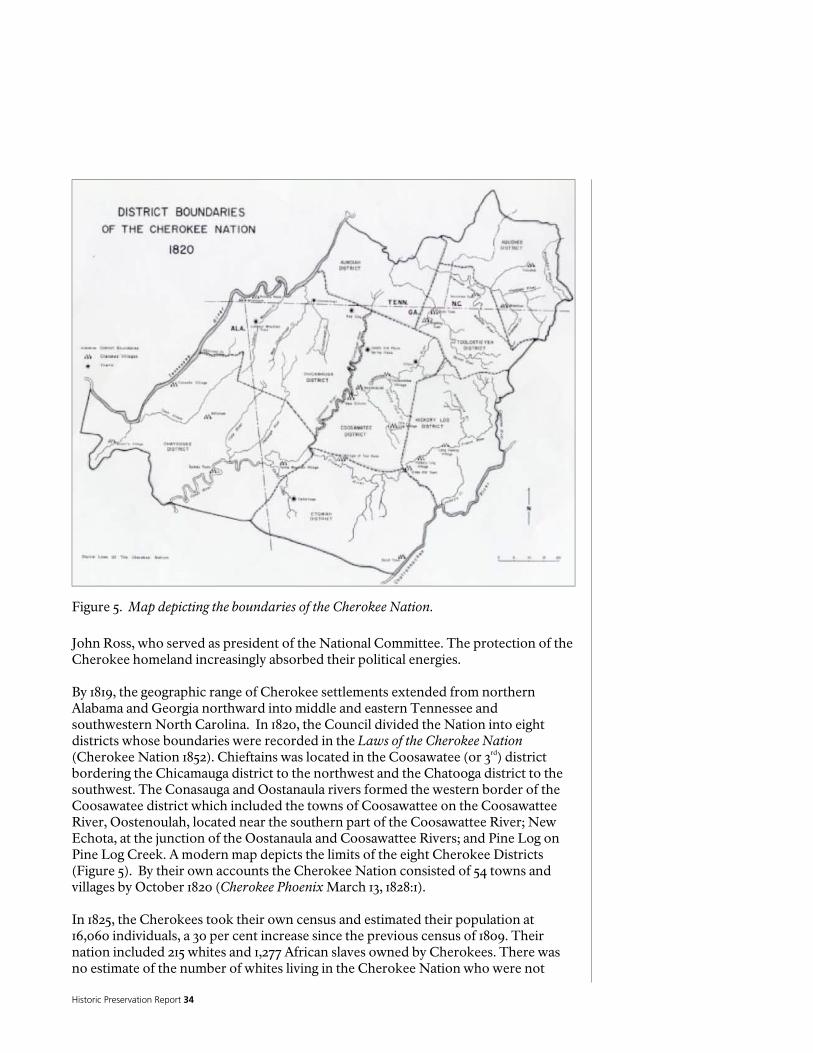
Historic Preservation Report 34
Figure 5. Map depicting the boundaries of the Cherokee Nation.
John Ross, who served as president of the National Committee. The protection of the Cherokee homeland increasingly absorbed their political energies. By 1819, the geographic range of Cherokee settlements extended from northern Alabama and Georgia northward into middle and eastern Tennessee and southwestern North Carolina. In 1820, the Council divided the Nation into eight districts whose boundaries were recorded in the Laws of the Cherokee Nation (Cherokee Nation 1852). Chieftains was located in the Coosawatee (or 3rd) district bordering the Chicamauga district to the northwest and the Chatooga district to the southwest. The Conasauga and Oostanaula rivers formed the western border of the Coosawatee district which included the towns of Coosawattee on the Coosawattee River, Oostenoulah, located near the southern part of the Coosawattee River; New Echota, at the junction of the Oostanaula and Coosawattee Rivers; and Pine Log on Pine Log Creek. A modern map depicts the limits of the eight Cherokee Districts (Figure 5). By their own accounts the Cherokee Nation consisted of 54 towns and villages by October 1820 (Cherokee Phoenix March 13, 1828:1). In 1825, the Cherokees took their own census and estimated their population at 16,060 individuals, a 30 per cent increase since the previous census of 1809. Their nation included 215 whites and 1,277 African slaves owned by Cherokees. There was no estimate of the number of whites living in the Cherokee Nation who were not
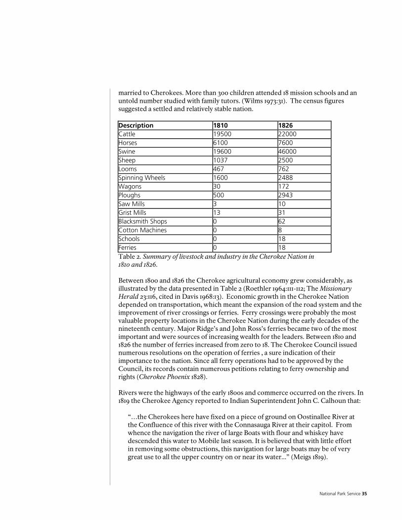
National Park Service 35
married to Cherokees. More than 300 children attended 18 mission schools and an untold number studied with family tutors. (Wilms 1973:31). The census figures suggested a settled and relatively stable nation. Description 1810 1826 Cattle 19500 22000 Horses 6100 7600 Swine 19600 46000 Sheep 1037 2500 Looms 467 762 Spinning Wheels 1600 2488 Wagons 30 172 Ploughs 500 2943 Saw Mills 3 10 Grist Mills 13 31 Blacksmith Shops 0 62 Cotton Machines 0 8 Schools 0 18 Ferries 0 18 Table 2. Summary of livestock and industry in the Cherokee Nation in 1810 and 1826. Between 1800 and 1826 the Cherokee agricultural economy grew considerably, as illustrated by the data presented in Table 2 (Roethler 1964:111-112; The Missionary Herald 23:116, cited in Davis 1968:13). Economic growth in the Cherokee Nation depended on transportation, which meant the expansion of the road system and the improvement of river crossings or ferries. Ferry crossings were probably the most valuable property locations in the Cherokee Nation during the early decades of the nineteenth century. Major Ridge’s and John Ross’s ferries became two of the most important and were sources of increasing wealth for the leaders. Between 1810 and 1826 the number of ferries increased from zero to 18. The Cherokee Council issued numerous resolutions on the operation of ferries , a sure indication of their importance to the nation. Since all ferry operations had to be approved by the Council, its records contain numerous petitions relating to ferry ownership and rights (Cherokee Phoenix 1828). Rivers were the highways of the early 1800s and commerce occurred on the rivers. In 1819 the Cherokee Agency reported to Indian Superintendent John C. Calhoun that:
“…the Cherokees here have fixed on a piece of ground on Oostinallee River at the Confluence of this river with the Connasauga River at their capitol. From whence the navigation the river of large Boats with flour and whiskey have descended this water to Mobile last season. It is believed that with little effort in removing some obstructions, this navigation for large boats may be of very great use to all the upper country on or near its water...” (Meigs 1819).

Historic Preservation Report 36
An 1825 writer stated that “…on Tennessee, Ustanala, and Cansagi rivers, Cherokee commerce floats” (Brown in McKenney 1846). The vessels plying the rivers carried everything from bales of cotton to barrels of whiskey to nearby markets in Georgia, Alabama, and Tennessee. Ridge’s business interests extended beyond the ferry operation. He also had a store located near his house that was operated by his white partner, George Lavender. The partnership was probably initiated in part to circumvent a Cherokee law prohibiting whites from owning or operating trading posts in the Cherokee Nation (Wilkins 1986:188). Although the exact date of this partnership’s origin is not known, it was certainly in effect by 1831. In November of that year Principal Chief John Ross visited the store and then called on Ridge. In the course of their visit someone attempted to kill Ross, who subsequently described the occasion (Cherokee Phoenix and Indians’ Advocate January 21, 1832:1). Lavender also operated Ridge’s ferry, assisted by William Childers (Lavender 1836; Childers 1836). The store appeared to be a profitable venture. Lavender’s daybook contains the accounts of more than 250 customers, including Ridge (Lavender-Ray Papers 1842-1916). Sometime between 1836 and 1838 the business arrangement must have soured Ridge filed a claim for damages at that time that accused Lavender and “Meigs” of poisoning his herd of swine (Lumpkin and Kennedy 1839:8). Although business activities were increasing dramatically among Cherokees, by 1835 they were unquestionably a nation of farmers with 3,120 farms representing around 2,500 families of 16,542 individuals. According to one source, 93 percent of the Cherokees had at least one farm (Mooney 1890:107). As many as 224 Cherokee had two farms and 77 had three farms (Mooney 1890:107). While one Cherokee owned as many as 13 farms, most Cherokees were not wealthy. According to Geographer Douglas Wilms, the Georgia Cherokee population was 9,780 in 1835. For much of his information Wilms used the 1835 Federal census of the Cherokee Nation. He divided the nation into three regions. The Chieftains property fell within the Ridge and Valley area, which constituted much of the western portion of the Cherokee Nation (in Georgia). The other two areas were the Blue Ridge, which included the Appalachian Mountains area, and the Piedmont, which stretched across the southern portion of the territory. The Ridge and Valley included the Coosawattee and Conasauga rivers that formed the Oostanaula River, which then joined with the Armuchee River and flowed into the Etowah River becoming the Coosa River. Fifty-five percent of the Cherokee population resided in the Ridge and Valley, with another 31 per cent in the Piedmont, and the remainder in the Appalachian Mountains. In 1835 the total acreage under cultivation in Floyd County was 2,109 acres with 158 farmers recorded for the county. Along the Oostanaula River in Floyd County the value of improvements totaled $43,290.75 (Wilms 1973:70-71; 81, 151). Floyd County had a population of 772 Cherokees consisting of 703 “full bloods”, 67 “mixed bloods”, 97 slaves, and 5 whites. The 97 slaves worked on 14 of 142 farms. There were a total of 202 Cherokee dwellings and 735 outbuildings in 1836-7. These buildings were distributed on 128 farms, whose average size was 16.4 acres. Approximately 4,802 acres in Floyd County were under cultivation in 1835. This area

National Park Service 37
produced 28,735 bushels of corn, or approximately 13.6 bushels per acre. The county contained 14,009 peach and 2,742 apple trees. Ten farms had livestock lots or animal pens. Six ferries were located in Floyd County at that time. Floyd County followed Cass (now Bartow) County in the number of Cherokee people with improvements (Wilms 1973:81, 84, 96, 128, 136-137, 141, 145). By the time the 1835 census (Henderson Roll) was taken, the Ridge household consisted of three males over 18 and three females over 18. The six free members of the household were all identified as “full blooded” Cherokees. The household included one weaver and one spinner. Six male slaves and nine female slaves also were listed in the household. There were three additional slaves located on Ridge’s other farms. The census noted 300 acres in cultivation on four farms on Oostanaula River owned by Major Ridge. The distribution of acreage for the four farms was not specified. Consequently, the size of the Chieftains plantation in 1835 cannot be determined with certainty from the census information. Major Ridge’s plantation produced 2,000 bushels of corn that year, of which he kept 750 bushels intended for horse mulch. Two ferry boats were listed also. Ridge’s holdings in Floyd and Cass (now Bartow) Counties were valued at $23,263.00. Of this amount, $12,000.00 was the value listed for his ferry at Chieftains (Bureau of Indian Affairs 1835:51; Gardner 1989:153). The fact that almost half of the Ridge’s property value was attributed to the ferry emphasizes the importance of ferries in the Cherokee and European American economy at that time. RIDGE’S FINAL YEARS AT CHIEFTAINS AND CHEROKEE REMOVAL In 1809 Thomas Jefferson proposed that the Cherokees accept land west of the Mississippi River in exchange for all of their southeastern lands. A few Cherokees began the western migration and created new homes for themselves in the Indian Territory.. Although most Cherokees were adamantly opposed, another migration occurred in 1817-1819 following the signing of land-exchange treaties. The Cherokee government, including Major Ridge, found the idea of removal to the west totally unacceptable (Perdue 1979:60-62). Led by wealthy men such as John Ross, Joseph Vann, John Martin, and Major Ridge, the Cherokee political body was becoming became more complex. In 1817, the National Council established a bicameral legislature consisting of the Upper House, called the Standing Committee, whose members were chosen by and from the Council; and the Lower House, which was the Council. The Standing Committee was given responsibility for the affairs of the nation and the Council retained power to review the Committee’s actions. Major Ridge was named Speaker of the Council and John Ross became President of the Committee. In 1820 when the Council divided the Cherokee Nation into eight districts it made each district an administrative unit with a district judge, a council or courthouse, a marshall, and a company of light-horse guards. Each district elected four representatives to the Council who would then chose the 12 members of the National Committee (Perdue 1991:58-60). In addition to serving as speaker of the Council, Major Ridge was one of the representatives from Coosawattee District.
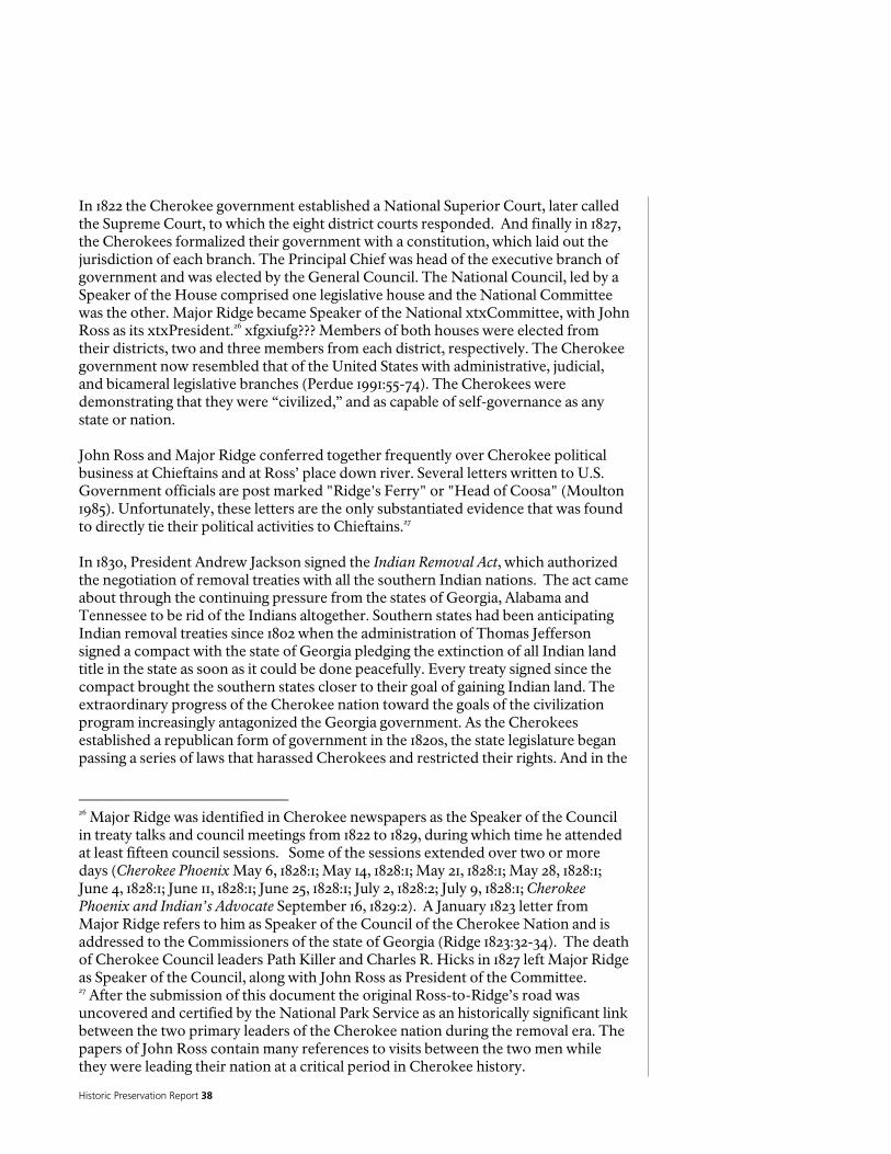
Historic Preservation Report 38
In 1822 the Cherokee government established a National Superior Court, later called the Supreme Court, to which the eight district courts responded. And finally in 1827, the Cherokees formalized their government with a constitution, which laid out the jurisdiction of each branch. The Principal Chief was head of the executive branch of government and was elected by the General Council. The National Council, led by a Speaker of the House comprised one legislative house and the National Committee was the other. Major Ridge became Speaker of the National xtxCommittee, with John Ross as its xtxPresident.26 xfgxiufg??? Members of both houses were elected from their districts, two and three members from each district, respectively. The Cherokee government now resembled that of the United States with administrative, judicial, and bicameral legislative branches (Perdue 1991:55-74). The Cherokees were demonstrating that they were “civilized,” and as capable of self-governance as any state or nation. John Ross and Major Ridge conferred together frequently over Cherokee political business at Chieftains and at Ross’ place down river. Several letters written to U.S. Government officials are post marked "Ridge's Ferry" or "Head of Coosa" (Moulton 1985). Unfortunately, these letters are the only substantiated evidence that was found to directly tie their political activities to Chieftains.27 In 1830, President Andrew Jackson signed the Indian Removal Act, which authorized the negotiation of removal treaties with all the southern Indian nations. The act came about through the continuing pressure from the states of Georgia, Alabama and Tennessee to be rid of the Indians altogether. Southern states had been anticipating Indian removal treaties since 1802 when the administration of Thomas Jefferson signed a compact with the state of Georgia pledging the extinction of all Indian land title in the state as soon as it could be done peacefully. Every treaty signed since the compact brought the southern states closer to their goal of gaining Indian land. The extraordinary progress of the Cherokee nation toward the goals of the civilization program increasingly antagonized the Georgia government. As the Cherokees established a republican form of government in the 1820s, the state legislature began passing a series of laws that harassed Cherokees and restricted their rights. And in the
26 Major Ridge was identified in Cherokee newspapers as the Speaker of the Council in treaty talks and council meetings from 1822 to 1829, during which time he attended at least fifteen council sessions. Some of the sessions extended over two or more days (Cherokee Phoenix May 6, 1828:1; May 14, 1828:1; May 21, 1828:1; May 28, 1828:1; June 4, 1828:1; June 11, 1828:1; June 25, 1828:1; July 2, 1828:2; July 9, 1828:1; Cherokee Phoenix and Indian’s Advocate September 16, 1829:2). A January 1823 letter from Major Ridge refers to him as Speaker of the Council of the Cherokee Nation and is addressed to the Commissioners of the state of Georgia (Ridge 1823:32-34). The death of Cherokee Council leaders Path Killer and Charles R. Hicks in 1827 left Major Ridge as Speaker of the Council, along with John Ross as President of the Committee. 27 After the submission of this document the original Ross-to-Ridge’s road was uncovered and certified by the National Park Service as an historically significant link between the two primary leaders of the Cherokee nation during the removal era. The papers of John Ross contain many references to visits between the two men while they were leading their nation at a critical period in Cherokee history.
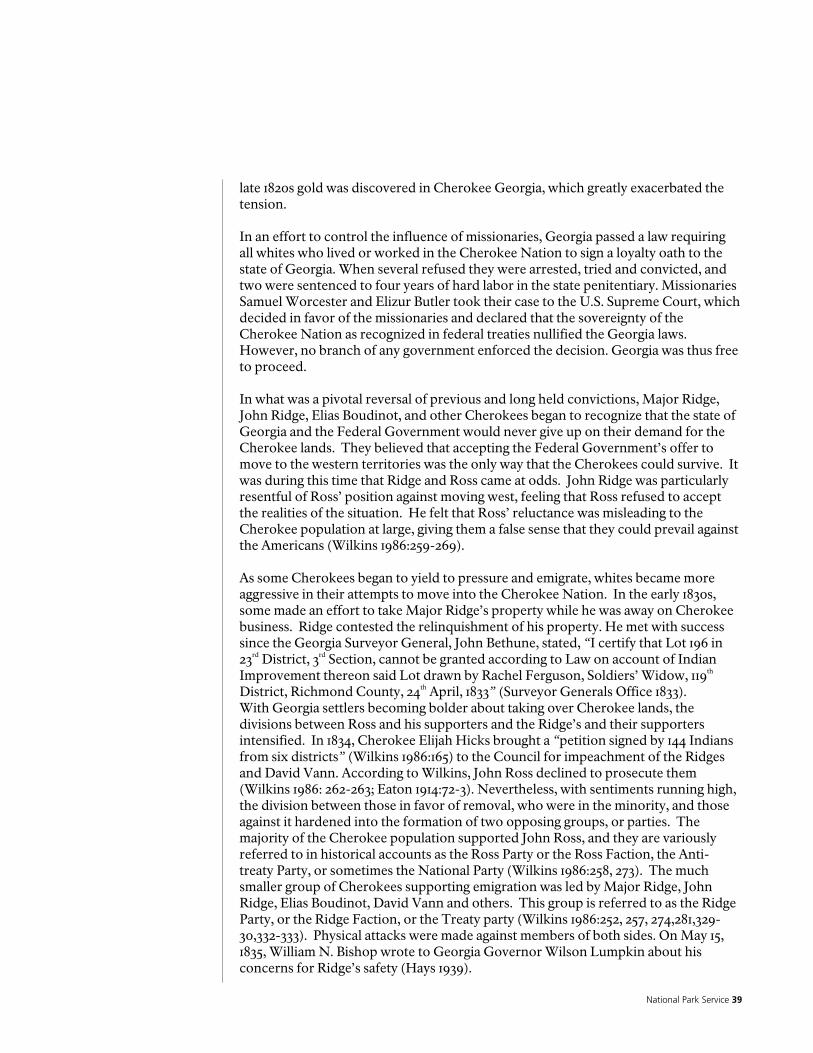
National Park Service 39
late 1820s gold was discovered in Cherokee Georgia, which greatly exacerbated the tension. In an effort to control the influence of missionaries, Georgia passed a law requiring all whites who lived or worked in the Cherokee Nation to sign a loyalty oath to the state of Georgia. When several refused they were arrested, tried and convicted, and two were sentenced to four years of hard labor in the state penitentiary. Missionaries Samuel Worcester and Elizur Butler took their case to the U.S. Supreme Court, which decided in favor of the missionaries and declared that the sovereignty of the Cherokee Nation as recognized in federal treaties nullified the Georgia laws. However, no branch of any government enforced the decision. Georgia was thus free to proceed. In what was a pivotal reversal of previous and long held convictions, Major Ridge, John Ridge, Elias Boudinot, and other Cherokees began to recognize that the state of Georgia and the Federal Government would never give up on their demand for the Cherokee lands. They believed that accepting the Federal Government’s offer to move to the western territories was the only way that the Cherokees could survive. It was during this time that Ridge and Ross came at odds. John Ridge was particularly resentful of Ross’ position against moving west, feeling that Ross refused to accept the realities of the situation. He felt that Ross’ reluctance was misleading to the Cherokee population at large, giving them a false sense that they could prevail against the Americans (Wilkins 1986:259-269). As some Cherokees began to yield to pressure and emigrate, whites became more aggressive in their attempts to move into the Cherokee Nation. In the early 1830s, some made an effort to take Major Ridge’s property while he was away on Cherokee business. Ridge contested the relinquishment of his property. He met with success since the Georgia Surveyor General, John Bethune, stated, “I certify that Lot 196 in 23rd District, 3rd Section, cannot be granted according to Law on account of Indian Improvement thereon said Lot drawn by Rachel Ferguson, Soldiers’ Widow, 119th District, Richmond County, 24th April, 1833” (Surveyor Generals Office 1833). With Georgia settlers becoming bolder about taking over Cherokee lands, the divisions between Ross and his supporters and the Ridge’s and their supporters intensified. In 1834, Cherokee Elijah Hicks brought a “petition signed by 144 Indians from six districts” (Wilkins 1986:165) to the Council for impeachment of the Ridges and David Vann. According to Wilkins, John Ross declined to prosecute them (Wilkins 1986: 262-263; Eaton 1914:72-3). Nevertheless, with sentiments running high, the division between those in favor of removal, who were in the minority, and those against it hardened into the formation of two opposing groups, or parties. The majority of the Cherokee population supported John Ross, and they are variously referred to in historical accounts as the Ross Party or the Ross Faction, the Anti-treaty Party, or sometimes the National Party (Wilkins 1986:258, 273). The much smaller group of Cherokees supporting emigration was led by Major Ridge, John Ridge, Elias Boudinot, David Vann and others. This group is referred to as the Ridge Party, or the Ridge Faction, or the Treaty party (Wilkins 1986:252, 257, 274,281,329-30,332-333). Physical attacks were made against members of both sides. On May 15, 1835, William N. Bishop wrote to Georgia Governor Wilson Lumpkin about his concerns for Ridge’s safety (Hays 1939).
Historic Preservation Report 40
In early December at John Ross’s behest John Ridge and Stand Watie traveled with a delegation of both Treaty Party and Ross’s Faction Cherokees to Washington, D.C. to negotiate a treaty that both parties were agreeable to signing. However, while the delegation was in route John Ross appeared to change his mind, declaring that the Cherokee people would not agree to removal and would rather stay and become citizens of the U.S. John Ridge received word of this while still in route to Washington and quickly wrote a letter to Ross resigning from the delegation. When Ross received John Ridge’s resignation he sent a return note imploring Ridge to continue on to Washington and present some semblance of Cherokee unity before the U.S. Government. Ridge did continue on to Washington (Wilkins 1986:283-285). As it became clear that Ross was not planning on a compromise, a group of Cherokees, including Major Ridge, gathered at New Echota to hold Council on the treaty negotiation. Major Ridge gave an impassioned speech before the council imploring them that it was better for the survival of the Cherokee Nation to move west than to remain east and face the inevitable onslaught of Georgians. A committee of twenty was formed including Major Ridge, Elias Boudinot, John Gunter, Andrew Ross, and William Rogers to negotiate the terms of a treaty for secession with Tennessee Governor William Carroll and John Schermerhorn, who represented the U.S. government. On the night of December 29, 1835 the committee of twenty met at the house of Elias Boudinot with Schermerhorn (Governor William Carroll had pre-signed the document) present as one of the commissioners on the behalf of the United States. With witnesses the committee signed the Treaty of New Echota, which sold all Cherokee lands east of the Mississippi River (Wilkins 1986:286-289). First Schermerhorn signed below Carroll’s signature and then Major Ridge’s was the first Cherokee signature (mark) under Schermerhorn. The treaty was approved by the council the next day and Schermerhorn, along with a delegation including Major Ridge and Elias Boudinot, left for Washington. John Ross was notified of the proceedings at New Echota and of the Treaty. Since none of the treaty signers were authorized by the Cherokee government, there was heated discussion about its legality and morality in Washington. Meanwhile John Ross gathered protest petitions and thousands of Cherokee signatures. Nonetheless the treaty went before the Senate and was finally approved on May 17 by a margin of one vote and ratified by Andrew Jackson on May 23, 1836 (Wilkins 1986:288-292; Kappler 1904:439-448). The New Echota treaty contained a provision allowing the Indians two years from the May 1836 date in which to remove themselves. The Treaty provided for two federal commissioners to work with a Cherokee committee to help process the Cherokee claims for their property so that they could be paid for their property and improvements prior to their departure west. Other provisions in the treaty stated that the U.S. was to provide subsistence for the emigrants at their new western homes. The U.S. also would provide steamboats and baggage-wagons for the transit, along with medical assistance to those emigrating (Kappler 1904:439-448; Wilkins 1986:289, 292, 296). President Jackson chose former Georgia Governor Lumpkin and Governor William Carroll of Tennessee as the federal commissioners. John Ridge was chosen as one of

National Park Service 41
the Cherokee commissioners. In late 1836, the federal commissioners and the Cherokee Committee met at the Cherokee capital of New Echota to begin the emigration process. General John Wool was stationed at New Echota to oversee preparations for removal. John Ridge had already moved his family to New Echota and was renting the Boudinot’s house when Governor Lumpkin arrived at New Echota in October of 1836. The duties of the commissioners were to verify each Cherokee emigrant’s claim, which was based on the 1836 valuations of all Indian properties. Those Cherokees prepared to emigrate soon began arriving, some walking and some riding in carriages and wagons. It was reported that 1,500 to 2,000 Cherokees went to New Echota in preparation for collecting their disbursements and starting their trip west to Oklahoma. Among those were Major Ridge, John Martin and Joseph Vann. Although Governor Lumpkin arrived in October, ready to start the process, there were numerous delays because Governor Carroll did not arrive and had to be replaced. Then the disbursing agent also arrived late. So by the beginning of 1837, only about 600 Cherokees had been processed and were ready to start west. Most of these were the more wealthy Cherokees, who set forth independently on their journey west in wagons and carriages along with their worldly possessions including their slaves, oxen, and horses. The Cherokees moved themselves, taking a route that led them through Tennessee, Kentucky, Illinois, Missouri, and on to their new homeland in Oklahoma (Wilkins 1986:301-304). When Major Ridge arrived in late 1836, he had intended to travel independently, as had the proceeding groups. However, due to failing health he had to postpone his departure. On March 3, 1837, Ridge and his family left with a large contingent of Cherokees, who boarded flatboats at Ross’ Landing on the Tennessee River. This was a difficult trip in open boats to Gunter’s Landing in Alabama. A steamer, the Knoxville, then picked up Major Ridge and his family, who had special accommodations, while many others received deck accommodations only. Those even less fortunate were put on flatboats tied to the stern of the steamer. When low water was encountered, the Indians boarded open railcars and were taken by train to Tuscumbia, where they then embarked on the steamer Newark. The more privileged rode on the Newark, which pulled keelboats carrying the rest of the emigration party. On March 27, they reached Fort Smith, Arkansas and Ridge and his family left the boat and traveled the rest of the way overland. Their destination was Honey Creek, Oklahoma where the Ridges had already claimed land and purchased improvements. Meanwhile, John Ridge did not leave until September of 1837, resigning from the Committee so that he could move his family. They met up with Elias Boudinot and his family on the way and they all then proceeded together to Honey Creek, arriving in late November (Wilkins 1986:306-310). The majority of Cherokees, however, resisted removal and remained on their farms. By the spring of 1838 14 removal forts and camps were established and garrisoned by Georgia militia who had been mustered into the U.S. Army for the purpose of removing the Cherokees. These forts were distributed throughout the Cherokee Nation in Georgia. Major General Winfield Scott took charge of the removal. (Wilkins 1986). The final removal of the remaining Cherokees from their homes in Georgia, Tennessee, and Alabama was completed in 1838, although thousands remained in internment camps in Tennessee until the late fall of 1838.

Historic Preservation Report 42
Beginning in June 1838, about 3,000 Cherokees traveled on foot, horseback and wagon to the Indian Territory. A prolonged drought and low water courses necessitated a delay in the removal of the remainder of the Cherokees, whose departure in the late fall meant that they traveled during one of the harshest winters in memory. Ultimately about 16,000 Cherokees were removed from the East. Between 2,000 and 4,000 died from sickness, disease, malnourishment, exposure, or fatal accidents while en route (Perdue 1979). Early on the morning of June 22, 1839 Major Ridge, John Ridge and Elias Boudinot were killed by a group of Cherokees, who believed they were fulfilling the Cherokee law making unauthorized land sales a capital offense. No one was ever prosecuted for their deaths (Wilkins 1986:333-334).
National Park Service 43
The Significance of the Chieftains Museum/Major Ridge Home
A National Historic Landmark “possesses exceptional value or quality in illustrating or interpreting the heritage of the United States…” Chieftains received this designation in 1974. As the home of Major Ridge, one of the most influential political leaders of the Cherokee Nation in the time before removal, Chieftains Museum/major Ridge Home meets the evaluation criteria listed below:
Criterion 1 - That is associated with events that have made a significant contribution to, and are identified with, or that outstandingly represents the broad national patterns of United States history and from which an understanding and appreciation of those patterns may be gained;
Criterion 2 - That are associated importantly with the lives of persons nationally significant in the history of the United States
Criterion 6 - That have yielded or may likely yield information of major scientific importance by revealing new cultures or by shedding light upon periods of occupation over large areas of the United States. Such sites are those which have yielded, or which may reasonable be expected to yield, data affecting theories, concepts, and ideas to a major degree.
STATEMENT OF SIGNIFICANCE for the RIDGE PERIOD (1819-1837) While Americans have often romanticized the Native American presence in the Southeast, the complexities of their stories are too often generalized, presented as stereotypes, and simply misunderstood. There are far too few physical reminders of their presence in the region. The survival of the home of one of the most influential Cherokee leaders during the tumultuous decades preceding removal is extremely important. Major Ridge’s presence at the Chieftains site in the 1820’s and 1830’s was during a time in which Cherokee culture was undergoing rapid acculturation into one that more closely resembled the European-American way of life. Much of this change was out of necessity based on a depletion of resources and the demands of an ever-expanding white population; however, the acculturation process was hastened by the intentional efforts of the United States government through its “Civilization Plan”. After the devastation of the wars against the Americans in the late Eighteenth Century, Cherokee leaders like Major Ridge understood that peace with this growing neighbor was necessary for their continued survival. To them acculturation was compatible with both the goals of peace and prosperity. They asserted that through such cooperation the sovereignty of the Cherokee people could be retained while remaining in their homeland. Even as the acculturation policy reached its greatest successes among members of the Cherokee elite, the young American government abandoned the plan in favor of a new policy – removal of all Native Americans to land west of the Mississippi River. Although it had been set forth as an option or even desirable goal since the Jefferson administration, the policy was not officially adopted until President Andrew Jackson signed the Indian Removal bill in 1830. The ramifications of the new removal policy

Historic Preservation Report 44
left Native Americans with no good choices. At a time when individual states and the federal government were vying for power, the states demanded Indian land. Despite the fact that the land had been promised to the various Indian nations by numerous federal treaties, the federal government eventually acquiesced to the demands of the states simply by refusing to forcibly uphold the terms of those treaties. The United States tried to legitimize their breech through the negotiation of new treaties. Unfortunately, to politicians supporting removal it was not necessary to make the treaty with duly authorized representatives of the various nations but simply to find compliant individuals with a sufficient reputation of past leadership. As other southeastern tribes fell victim to this strategy, the Cherokees remained as the last holdout. The actions of the state of Georgia, however, made compliance virtually compulsory. The Cherokee’s story of strategies of resistance as well as the causes of factional capitulation is inextricably linked to the life of Major Ridge. It is essential to understanding the road to Cherokee removal. When the United States “Civilization Plan” was set forth in the 1790’s as a potential path to peace, many Cherokees embraced its offerings. While the plan generally made its greatest progress among Cherokees of mixed ancestry who already had a degree of acculturation, Major Ridge stands as an extreme example of the success of the program among Cherokees raised in a more traditional manner. By the time of his departure in 1837, his home, farm, ferry and other holdings on the Oostanaula River near present-day Rome would have rivaled most of the finest contemporary European-American plantations on the Southern frontier. The significance of the life of Major Ridge, however, extends far beyond a mere example of the fruits of an American policy that was abandoned in spite of its successes. The Ridge was a leader of the Cherokee people at a pivotal turning point in Cherokee history. While living at the farm that later became known as “Chieftains” during the 1820’s and 1830’s Ridge played a major role in Cherokee politics as dramatic events unfolded that culminated first in the creation of a Constitutional Government and then in the forced emigration of the Cherokee Nation from their homeland. Major Ridge was born in 1770 or 1771. As a young man he had earned respect as a warrior and eventually was chosen to represent his hometown of Pine Log at the general council meetings gathering at Ustanali. It was here that Ridge was among the leadership of a group of “young chiefs” that won the support of the people over more traditional leaders through staunch opposition to land cessions. This group adhered to a strategy of endorsing the “civilization plan” and unity of the Cherokee people. Above all, they believed in Cherokee sovereignty and that their land base was not for sell. In 1807 Ridge established himself as an enforcer with the execution of Doublehead for agreeing to sell Cherokee land in opposition to an edict passed by the council. Ridge went on to serve as commander of the Lighthorse Guard established to carry out the laws of the council and in 1809 was chosen as a member of the first Cherokee National Committee. During the unrest leading to the Creek war of 1813, Ridge showed his leadership ability again, risking his life to denounce prophets who advocated a return to traditional ways as well as armed resistance to the American

National Park Service 45
government. Ridge was clearly respected by both the Cherokee and European-American leadership and served as a key member of delegations to Washington on several occasions. Some contemporaries referred to Ridge as the “greatest orator of the nation” (Wilkins 1986:142, 256). It was likely because of this ability to eloquently and powerfully represent the will of the people that he was chosen as “Speaker of the National Council” sometime in the late 1810’s. It was while serving in this capacity that the Cherokees formally centralized their government through a series of acts that culminated in the creation of a constitutional government with a bicameral legislature along with a judicial and executive branch (the Principal Chief). Shortly after the Cherokee Constitution was ratified in 1827, the National Council elected Ridge as one of three “councilors” to the nation. Ridge was a proponent of European-American style education as a means for the Cherokees to be able to understand and more effectively assimilate American culture. He sent three of his children to the mission schools established for that purpose. He believed in the necessity of dealing with the representatives of the American government in their own language. Some scholars have even said that in 1828 he sponsored John Ross as the most qualified choice for Principal Chief over himself because of his own deficiencies in communicating with the Americans. Both Cherokees and whites understood the Cherokee Constitution to be an assertion of Cherokee sovereignty and their right to remain in their homeland. The state of Georgia was especially infuriated at this concept and escalated pressure on the Federal government to compel the Cherokees to cede their land. At the same time they passed a series of their own laws denying Cherokee sovereignty and extending state jurisdiction over much of the Cherokee Nation. White harassment of the Cherokees intensified. Ridge and his son John, along with Chief Ross and the council continued to resist any overtures to cede land. Even after Andrew Jackson pushed through the Indian Removal Bill in 1830, the Cherokees refused to back down from their position that their land was their own to relinquish and that fact had been recognized in numerous treaties. With the blessing of the U.S. government, the Cherokee council turned to Major Ridge again to lead a force to remove illegal white squatters from Cherokee land. Although the initial action was successful and peaceful, Georgians flexed their muscle by retaliating with a much larger force of vigilantes who reclaimed the homesteads. The federal government refused to intervene. By the 1830’s the Cherokee population was only a minuscule fraction of that of the whites in Georgia and the surrounding states. Armed resistance would have not only been futile but would have likely resulted in the annihilation of the Cherokee people. Their last hope was in the federal courts. Georgia’s extension of authority over Cherokee land was challenged in the case of Worcester v. Georgia. When the Supreme Court ruled in favor of the Cherokees in March of 1832 it appeared that the Cherokees had won their right to stay without interference from the various states. President Jackson, however, refused to enforce the decision. In the minds of some of the Cherokee leaders and many of their most sympathetic white supporters, it would be impossible for the Cherokee Nation to survive in the east without the intervention

Historic Preservation Report 46
of the federal government. Major Ridge was clearly the most established political figure in this camp. The Worcester decision and Jackson’s refusal to enforce it marked a critical turning point in Major Ridge’s life. From that time on Ridge asserted that it was important for the Cherokee Nation to separate themselves from the pressures of white encroachment and to make a deal for the land that he believed would eventually be taken from them. A treaty of cession could at least provide compensation and a guarantee of sovereignty. Ridge was a critical figure among the treaty advocates and clearly was the person with the most leadership experience. While John Ridge and Ridge’s nephew, Elias Boudinot, both former champions of resistance to cession, took on a very public role in the faction because of their command of the English language, it was Major Ridge who provided the name that gave the position greater credibility among both Cherokees and whites. Major Ridge was the necessary force behind the Treaty Party, which became known as the “Ridge Party”. Principal Chief John Ross was not blind to the increasing peril of the Cherokee Nation and did discuss a potential treaty with the American government; however, when it became clear that the Cherokee Council and a majority of the Cherokee people remained steadfastly opposed to land cession he followed their lead. He perceived the greatest hope of the Nation was to stand united against the outside forces. In his mind dissent would be perceived as a weakness to be exploited. Ridge and his party believed there was not sufficient discussion of their position and that Ross’ actions isolated them from the rest of the nation. Animosity between the two factions greatly intensified during the next few years. Although an October 1835 council held at Red Clay in present-day Tennessee had voted against a Treaty proposal, a representative of the American government (John Schermerhorn) called for another general assembly of the Cherokee people at New Echota in December of that same year to revisit the issue. The general invitation stated that absence would be considered authorization of the actions of those in attendance. At the time of the gathering Ross was on his way to Washington leading a bipartisan delegation of twenty men that included John Ridge. The council was held anyway. Out of a population of roughly 16,000 people less than 400 attended this council. Some claimed that the Ross faction had advised them not to attend. A committee of twenty men including Major Ridge was elected to negotiate a treaty. They presented a version with terms almost identical to the treaty rejected at the well-attended October council. The committee was authorized by this small council representing less than 2 ½ percent of the Cherokee population to sign the treaty on behalf of the Nation. On December 29, 1835 these men signed a treaty ceding all remaining Cherokee land east of the Mississippi River to the United States. Major Ridge’s mark appears immediately after the signature of the American agents indicating that he was the first Cherokee to sign. The Treaty of New Echota, which was ratified by the Senate in May of 1836, provided for approximately five million dollars in compensation for the ceded land in addition to a guarantee of land already promised in the west. Cherokee families would be compensated for the improvements they left behind from the general fund. The treaty also gave the Cherokees two years from the date of ratification to emigrate to
National Park Service 47
modern-day Oklahoma. Although Ridge left within the allotted time, John Ross and the overwhelming majority of the Cherokee people did not. They held that the treaty was not legitimate and that acceptance of any of its terms or compensation would provide it credibility.28 Ross continued to try to build support among both the American government and American people that would allow the Cherokees to retain their homeland. Still, when the date for removal arrived, the United States used its military might to force individual families from their homes ultimately herding them into three concentration camps along the Tennessee River. After several months delay due to a drought, the Cherokees eventually headed west under Ross’ leadership in the fall of 1838. Along the journey of over eight hundred miles between 2,000 and 4,000 Cherokees died. They came to call this experience the “Trail where they cried” or the “Trail of Tears”. Immediately after the departure of the Cherokees, white settlement in the former Cherokee Nation, which was already significant, boomed with the availability of new land. The geography of the southeast was changed forever. In the new home of the Cherokees in the west political struggles continued between the Old Settlers who had arrived before the signing of the Treaty of New Echota, the Treaty party, and the remaining majority who had just arrived from the east. On June 22, 1839 Major Ridge, John Ridge and Elias Boudinot were killed by followers of John Ross. The Ross party called their deaths an execution of Cherokee law enacted in 1829 which stated that:
…if any citizen or citizens of this nation should treat and dispose of any lands belonging to this nation without special permission from the national authorities, he or they shall suffer death… (Wilkins 1986: pp. 208-209)
This law was the written version of the same law that Ridge claimed to be enforcing when he killed Doublehead. It was also advocated by Major Ridge in 1829 and actually transcribed by John Ridge who served as Clerk of the Council at that time. Clearly Major Ridge and his followers were aware of the potential personal consequences of their actions. A newspaper article written over fifty years after the signing of the Treaty of New Echota cites an eyewitness as hearing Major Ridge say, “I have signed my death warrant”. The rivalries that emerged in the Cherokee Nation during the period leading to removal continued to fester for many years with periodic episodes of violence on both sides. The culmination was during the Civil War when Cherokees sided with either the Union or the Confederacy in their own disputes. Loyalties were generally along the old Ridge and Ross party lines. The devastation was immense with the loss of over 4,000 lives (McLoughlin 1993: 220). The Cherokee Nation, however, has survived the devastation of removal and its aftermath. Today it has the second largest Indian population in America with almost 250,000 citizens. Some say that the nation has survived because of Ridge’s actions, others say that it was in spite of it.
28 John Ross and the elected Cherokee government did not actually recognize the Treaty of New Echota until 1845.

Historic Preservation Report 48
The importance of events intertwined with Ridge’s life is undeniable. During the 1820’s and 1830’s while he lived at Chieftains. Cherokee culture was changing rapidly. American Indian policy was evolving from one supporting acculturation to one advocating removal. State, federal, and Cherokee governments were all trying to define their sovereignty. Most significantly, the chain of events that ultimately lead to the “Trail of Tears” were unfolding. Major Ridge was a central Cherokee leader throughout this period. His opinions represent a heavily weighted contemporary point of view and his actions had a profound impact on the Cherokee Nation. Too many of the physical reminders of the Cherokee presence in the east have been lost. The survival of the home of one of their most influential leaders is a rare treasure. Additional archaeological, architectural, and landscape studies will likely yield a greater understanding of the material culture of the Cherokee “aristocracy” on the eve of removal as well as provide valuable opportunities to compare and contrast that culture with that of similarly situated European Americans. On another level, they will likely provide greater detail about the life, home and farm of a nationally significant figure whose actions greatly impacted the Cherokee people and the geography of the Southeastern United States. The Chieftains Museum/Major Ridge Home is a National Historic Landmark. During the period from 1819 to 1837 the Cherokee Indian Major Ridge established his home at this site on the east bank of the Oostanaula River upstream of the eventual location of the town of Rome, Georgia. Chieftains is nationally significant under Criteria 1, 2, 5, and 6 of the National Historic Landmark program. Chieftains is important because its history represents events associated with state and national conflicts between Euro-American settlers and Native Americans in the struggle over land possession (Criterion 1). Major Ridge was an important player in Cherokee politics and the events leading up to the removal of most Cherokees from their homelands in the eastern United States. These events unfolded as the newly formed United States Government endeavored to pull together ideals and philosophies from various political and religious groups into a concerted treatment of Native American populations. The voices of the southern states, which were mostly single minded in their desire to rid themselves of the Indian populations, had to be weighed against the overall goals and welfare of the country. The Chieftains site also contains great potential for providing important archaeological information about the Ridge occupation at the site. There are many pieces of the written history that are missing and that may only be recovered from the ground. The significance of Major Ridge’s Home and Major Ridge is reflected in the struggles of the Cherokees and all southeastern Indians to maintain control over their homelands against the westward expansion of Euro-Americans across the North American continent (Criterion 5). During the late eighteenth century Ridge and numerous other Cherokees first fought against the Americans, but later joined them in resisting a Creek Indian confederacy uprising against the Americans in 1813-1814. Falling into an era of compliance, Ridge and many Cherokees accepted the tenants of the Plan of Civilization espoused by the American Government during the late eighteenth century. This Plan of Civilization was formally noted in the 1791 Treaty of Holston (Article XIV) between the Cherokees and the Federal Government. An Indian Bureau was established and agents were sent into the Cherokee territory to

National Park Service 49
educate them about farming, raising cattle, and home industries such as spinning and weaving. During the first few decades of the 1800s, an elite group of Cherokee farmers emerged. Many of these farmers, although not all, were of a mixed heritage of Cherokee and white ancestry. This group, primarily through their wealth and education, gained enough power in the Cherokee Nation to radically change the Cherokee governing system. Within a short time it mirrored the American system of government with a bicameral legislative branch, a judicial branch and an executive branch. A new Cherokee capital was established (1825) at New Echota (northwest Georgia near Calhoun) that reflected this new centralization of Cherokee power. These elite Cherokees, such as Major Ridge and his son John Ridge, were involved in all levels of the newly organized Cherokee Government. They were involved in the enacting of laws and regulations to control all aspects of the Cherokee Nation’s commerce and policies toward whites. They conducted negotiations with the Federal Government through letters and through the Federal Indian agents, who were sent to the Cherokee Nation. Numerous visits also were made by the Ridges to Washington, D.C. to conduct face to face negotiations with the Federal Government. Most of these negotiations were attempts to hold on to their territorial lands, which were being steadily lost through the signing of treaties. Between the 1791 signing of the Treaty of Holston and the 1830 Indian Removal Act, nine treaties between the Cherokees and the Federal Government were signed relinquishing Cherokee lands, although Major Ridge was not involved in these treaties (Kappler 1904). His involvement occurred during the first decade or so leading up to the Treaty of New Echota of which he was a signer in 1835. Although the Federal Government made some efforts to protect the Cherokees, its primary and somewhat clandestine goal was western expansion. The southern state governments continually exerted pressure on the Federal Government to remove the Indians from all lands east of the Mississippi River. It was the southern states that felt that state’s rights should prevail in matters that related to them in particular. Although Major Ridge could not read or write English, he is said to have been a great orator. His son, John Ridge, was educated in New England and spoke and wrote English eloquently. He composed many letters and treatises on behalf of the Cherokee Nation. In 1830, President Andrew Jackson, whose sentiments lay with the southern states, signed the Indian Removal Act. The passage of this Act sent a clear message to many Cherokees that resistance against the federal and state governments was futile. Friction between the Cherokees and the Creeks and among the Cherokee leadership itself rapidly grew. By 1834, a fissure had developed among the Cherokee leadership between those who were ready to accept emigration west and those that wanted to continue resistance. These opposing groups became known as the Ross party and the Treaty party. The bitterness between the two factions was enormous. On December 29, 1835 the Treaty of New Echota was signed by the group of Cherokees who reasoned that the survival of the Cherokee Nation could only be salvaged if they moved west of the Mississippi River and reestablished their Nation there. Major Ridge and John Ridge, who lead
Historic Preservation Report 50
the treaty signers, were opposed by most of the Cherokee population. This opposing faction was led by Chief John Ross, who legally represented the Cherokee government and the majority of the Cherokee population, most of whom still practiced the more traditional Cherokee ways of agriculture and subsistence. Ross and the Ridges had been close friends and allies for many years; however, the increasing differences in their philosophies over removal during the 1830s resulted in the dissolution of their friendship. Following the 1835 Treaty of New Echota, those who had accepted their fate began to emigrate to the west. All Cherokee properties and improvements had been valuated by the Federal government in 1836-1837, and the treaty provided for the Cherokees to be compensated for their property losses (cultivation of the land and improvements such as buildings, ferries, mills, livestock pens). The removal period covered the years between late 1836 and 1839. Those that had signed the treaty began their emigration in late 1836 and continued into 1837, leaving from the abandoned capital of New Echota. Most of the wealthier Cherokees were among the first group of around 500 to 600 hundred to collect their payments from the Federal Government, and voluntarily leave for the Arkansas territory (now Oklahoma). They left with their slaves and personal property traveling in wagons, carriages and on horseback following a land route through Tennessee, eastern Kentucky, southern Illinois, Missouri, and on to the Arkansas territory. Another group, which included Major Ridge and his household, chose to leave with a government escort in early March of 1837. They mostly followed a river route, traveling on the Tennessee River into the Ohio River, then into the Mississippi River, and finally up the Arkansas River to Fort Smith, Arkansas. John Ridge remained at New Echota until late in the summer of 1837 to help with the processing of Cherokee claims of those emigrating west. John Ridge then moved his family to Oklahoma to join his parents on their new lands. The majority of the Cherokee population continued their resistance. By May of 1838, the expiration date for emigration, as set forth in the terms of the Treaty, had passed. The remaining Cherokees and all remaining southeastern Indians were forcibly rounded up and moved west. This forced exodus has become known as the Trail of Tears. It is estimated that between 2,000 and 4,000 Cherokees died during removal due to the harsh conditions they faced on their long and dangerous trek west. Ultimately, Major Ridge, John Ridge and Elias Boudinot (the editor of the Cherokee Phoenix), three of the principal signers of the 1835 treaty, were assassinated at their new homes in Oklahoma on June 22nd 1839 by a group of Cherokees who banded together to punish them for signing the Treaty of New Echota. The Chieftains Museum/Major Ridge Home is nationally significant (Criterion 2) for its association with Major Ridge and his son John Ridge and the events leading up to the forced removal of most southeastern Indians. Chieftains reflects the Ridge’s successful participation in the Plan for Civilization. Major Ridge and his family developed a profitable plantation that grew fields of cotton, corn, tobacco, and orchards of apples, peaches, and plums, along with livestock. As well, a lucrative ferry operation and a trade store operated on the site. Through acquisition of wealth and a strong belief in education in the ways of western civilization, Major Ridge and his wife sent their son John to New England to be educated. During the years that Major Ridge occupied Chieftains, both he and his son John Ridge became important

National Park Service 51
political figures in the changing Cherokee political system. They worked tirelessly to forge a relationship with the American government in a futile effort to maintain the Cherokee Nation’s lands in the east. They eventually came to the realization, especially after the passing of the 1830 Indian Removal Act, that their efforts would not sway the southern states and the federal government. They strongly believed that for the Cherokee people to survive they must accept removal as their fate. It was a difficult decision, but once made they and other like-minded Cherokees signed the Treaty of New Echota, relinquishing all Cherokee lands east of the Mississippi. They were involved in the negotiations of the treaty terms for the removal process. They hoped that the Cherokees who were resistant to removal would come to realize the futility of it and accept it. The Ridges paid the ultimate price with their lives for what many saw as their betrayal of the Cherokee people. Previous archaeological excavations at Chieftains have yielded evidence of archaeological remains dating to the Ridge period. The site has the potential to yield further important information (Criterion 6) about the Ridge period of occupation. Previous work has shown that the site still possesses depositional integrity and may yield information that can help date the first occupation of the site, and possibly help determine the likely construction date of the earliest portions of the house. Archaeology can also help identify other buildings and features related to the Ridge period of occupation.

Historic Preservation Report 52

National Park Service 53
PART I - HISTORIC STRUCTURE REPORT

Historic Preservation Report 54
National Park Service 55
Introduction
The following history presents a chronological description of the physical manifestations of the Chieftains House as reflected in historical documents. The main dwelling house of Major Ridge and his family, now known as the Chieftains Museum/Major Ridge Home, has a most interesting past. As with many historic buildings, legends and misinformation about Chieftains have been passed down through the years. The construction date of the house and other dates for remodeling seem to be one of the biggest errors; the house is attributed to being built in the 1790’s. The National Register of Historic Places nomination form cites dates for construction and remodeling that cannot be corroborated (National Park Service, National Register of Historic Places 1972). A summary of house history taken from the nomination form describes the house as follows:
“Chieftains, 80 Chatillon Rd., c. 1792. Frame, clapboarding; 2 stories, rectangular, hipped roof; center entrance with transom, side lights, and pedimented hood; arcaded flanking 1-story wings; original 2-story hand hewn log cabin enlarged and remodeled, c. 1837 and 1923. Georgian Revival” (NPS 2004c).
As noted earlier there is no evidence for when the house was built. No documentary evidence has been found for any of the remodeling periods. The remodeling during the Porter period would not have taken place until 1924 or after, but no documentary information was found concerning this remodeling episode either. An early twentieth century source places the original occupation of the house/property date of 1794, although no primary documents were founds supporting that date (Anonymous ca. 1900-1924; Spalding 1990:444). The Sesquicentennial Commission of the City of Rome published a history of Rome and Floyd County in 1985. That volume contains a discussion of the physical structure of the Chieftains House as follows:
“First a 52 x 28 foot hewn log cabin with 'dogtrot' hallway, it was enlarged by Ridge with upper story, side porches, and additional rooms. By 1889 it was ceiled, weatherboarded, and painted white with separate kitchen, cellar, carriage house, and quarters formerly occupied by slaves” (Sesquicentennial Commission of the City of Rome 1985:15).
Again, there is no documentary evidence for the Ridge remodeling nor for the remodeling changes that supposedly took place by 1889.29 The present research team was unable to locate any primary records that support occupation of the Chieftains residence by Major Ridge (or any other Cherokee) in 1794. The ca. 1792-1794 construction date, therefore, remains unconfirmed and speculative. U.S. Government claims resulting from damages to the Cherokees in the Creek War (1813-1814) provide tangential support for Major Ridge’s presence in the
29 Records found in the Moravian Archives in Winston-Salem, North Carolina indicate that significant construction took place around 1826. C
HR
ON
OLO
GY
OF
DEV
ELO
PM
EM
EN
T A
ND
USE
Historic Preservation Report 56
Chieftains vicinity by that time, but these documents could refer to his property at Pine Log or even somewhere else. The likelihood that some other Cherokee built a house at Chieftains prior to Major Ridge was thoroughly explored in this study; however, no evidence for this was identified. Although a Cherokee named Widow’s Fool, or Fool, operated a ferry in the general vicinity of Major Ridge’s residence, it is most likely that the Fool Ferry was at the location where John Ross settled downstream from Ridge’s Ferry at the head of the Coosa River. The following discussion presents construction details, occupation dates and remodeling episodes gleaned from the research documents researched during this study.
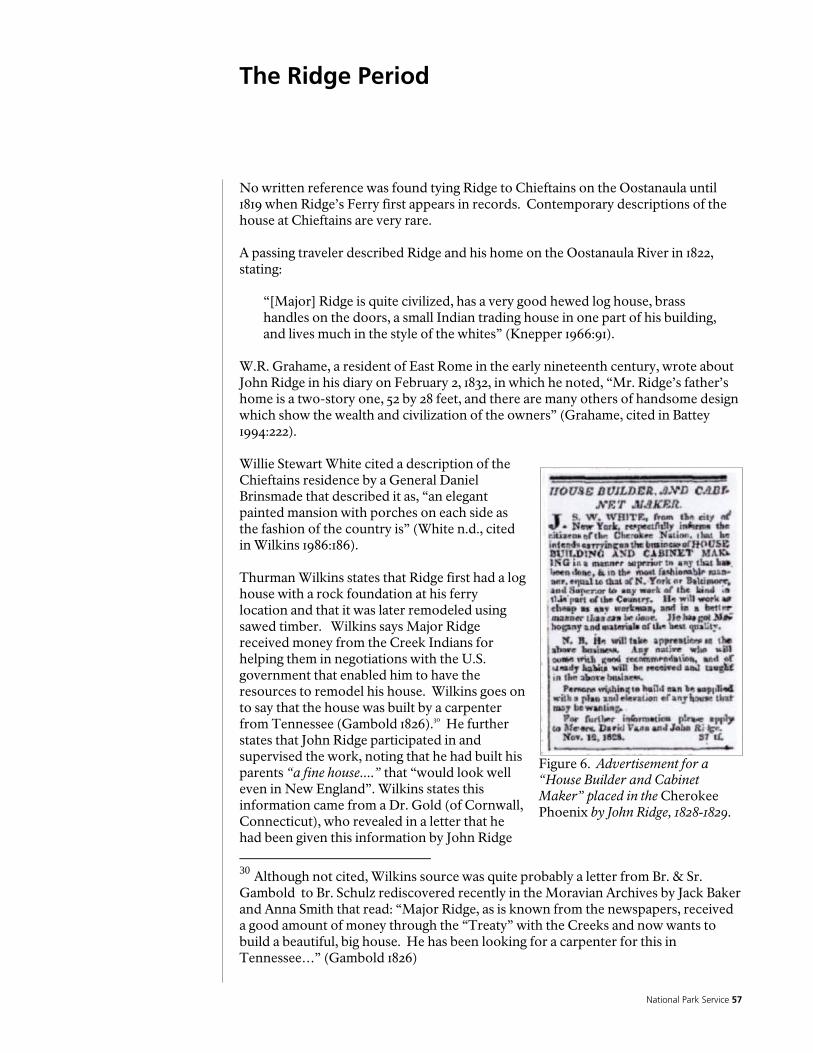
National Park Service 57
The Ridge Period
Figure 6. Advertisement for a “House Builder and Cabinet Maker” placed in the Cherokee Phoenix by John Ridge, 1828-1829.
No written reference was found tying Ridge to Chieftains on the Oostanaula until 1819 when Ridge’s Ferry first appears in records. Contemporary descriptions of the house at Chieftains are very rare. A passing traveler described Ridge and his home on the Oostanaula River in 1822, stating:
“[Major] Ridge is quite civilized, has a very good hewed log house, brass handles on the doors, a small Indian trading house in one part of his building, and lives much in the style of the whites” (Knepper 1966:91).
W.R. Grahame, a resident of East Rome in the early nineteenth century, wrote about John Ridge in his diary on February 2, 1832, in which he noted, “Mr. Ridge’s father’s home is a two-story one, 52 by 28 feet, and there are many others of handsome design which show the wealth and civilization of the owners” (Grahame, cited in Battey 1994:222). Willie Stewart White cited a description of the Chieftains residence by a General Daniel Brinsmade that described it as, “an elegant painted mansion with porches on each side as the fashion of the country is” (White n.d., cited in Wilkins 1986:186). Thurman Wilkins states that Ridge first had a log house with a rock foundation at his ferry location and that it was later remodeled using sawed timber. Wilkins says Major Ridge received money from the Creek Indians for helping them in negotiations with the U.S. government that enabled him to have the resources to remodel his house. Wilkins goes on to say that the house was built by a carpenter from Tennessee (Gambold 1826).30 He further states that John Ridge participated in and supervised the work, noting that he had built his parents “a fine house....” that “would look well even in New England”. Wilkins states this information came from a Dr. Gold (of Cornwall, Connecticut), who revealed in a letter that he had been given this information by John Ridge
30 Although not cited, Wilkins source was quite probably a letter from Br. & Sr. Gambold to Br. Schulz rediscovered recently in the Moravian Archives by Jack Baker and Anna Smith that read: “Major Ridge, as is known from the newspapers, received a good amount of money through the “Treaty” with the Creeks and now wants to build a beautiful, big house. He has been looking for a carpenter for this in Tennessee…” (Gambold 1826)

Historic Preservation Report 58
himself (Wilkins 1986:186). McKenney and Hall also state that John Ridge had a strong influence on the architectural style of his parent’s home at Chieftains (McKenney and Hall 1848 vol 1:377-379). Historical archaeologist Pat Garrow, while teaching at Shorter College in Rome, Georgia, excavated areas behind Chieftains during a period from 1969 to 1971 (Garrow 1974). As part of his work, he conducted historical research and found an advertisement in the Cherokee Phoenix dating to 1828 and early 1829 that might help confirm that John Ridge was involved in the building of Major Ridge’s mansion on the river (Patrick H. Garrow personal communication June 7, 2004). The advertisement, shown in Figure 6, appeared as transcribed:
HOUSE BUILDER AND CABINET MAKER. J. S. W. WHITE, from the city of New York, respectfully informs the citizens of the Cherokee Nation, that he intends carrying on the business of HOUSE BUILDING AND CABINET MAKING in a manner superior to any that has been done, & in the most fashionable manner, equal to that of N. York or Baltimore, and Superior to any work of the kind in this part of the Country. He will work as cheap as any workman, and in a better manner than can be done. He has got Mahogany and materials of the best quality. N. B. He will take apprentices in the above business. Any native who will come with good recommendation and of steady habits will be received and taught in the above business. Persons wishing to build can be supplied with a plan and elevation of any house that may be wanting. For further information please apply to Messrs David Vann and John Ridge. Nov. 12. 1828 (Cherokee Phoenix November 12, 1828:3).
The advertisement suggests John Ridge and David Vann were involved in house building, although no other information that might help further elaborate on these activities was found. Brief glimpses of the Ridge’s house, store and ferry can be gathered from a part of John Ross’s account of the failed assassination attempt against his life, which he described in the Cherokee newspaper in 1832. Ross noted:
“On the 30th of November last [1831] my brother Andrew Ross...accompanied me over to Major Ridge’s for the purposes of transacting some business in the store kept at that place, and when the business was concluded we paid Major Ridge a visit. A short time after we had seated ourselves before the fire, and entered into a conversation with the Major, I heard a loud voice, 'is John Ross here.' Looking round; I saw a tall gaunt person at the door in the passage...I walked out into the Piazza...after this I walked into the house and he returned to the store...” (Cherokee Phoenix and Indians’ Advocate January 21, 1832:1).

National Park Service 59 Figure 7. Lot 196, District 23, 3rd Section, Cherokee County, 1832 Plat Book.
Two stylized drawings of the Chieftains house are shown on the Land Lot 196 plats that were drawn in 1832. These two drawings are the only detailed illustrations of the Chieftains Plantation from the Ridge Period. One of these plats was included in the bound volume of Cherokee County plats and the other was a loose plat (Cherokee County 1832a, 1832b). These are shown in Figures 7 and 8, however, they are quite stylized and their reliability is questionable. Figure 11 is the plat from the Cherokee County plat book, which depicts the house facing south, with the following architectural traits:
2-story hipped roof [shown asymmetrical] single chimney (on west side) central doorway on south side, flanked by rooms with single windows upper story with 3 evenly spaced windows elevated on four pier supports
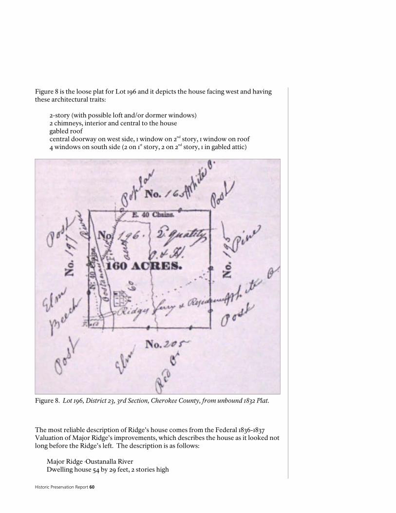
Historic Preservation Report 60
Figure 8. Lot 196, District 23, 3rd Section, Cherokee County, from unbound 1832 Plat.
Figure 8 is the loose plat for Lot 196 and it depicts the house facing west and having these architectural traits:
2-story (with possible loft and/or dormer wind0ws) 2 chimneys, interior and central to the house gabled roof central doorway on west side, 1 window on 2nd story, 1 window on roof 4 windows on south side (2 on 1st story, 2 on 2nd story, 1 in gabled attic)
The most reliable description of Ridge’s house comes from the Federal 1836-1837 Valuation of Major Ridge’s improvements, which describes the house as it looked not long before the Ridge’s left. The description is as follows:
Major Ridge Oustanalla River Dwelling house 54 by 29 feet, 2 stories high
National Park Service 61
four fireplaces, brick. 8 Rooms finished in neat style, outside painted, Balcony on the side of the house [--] turned columns, 30 glass windows, one glass door leading to Balcony on the other side blinds to all 12 door facings and shutters painted, with first rate bolts and Locks. Parlor upstairs finished in first rate style, the whole neatly underpinned with rock. (McKenney and Hall 1948 vol 1:377)
This description, coupled with the two stylized houses on the survey plats, suggests that the Ridge residence is a two-story dwelling with windows on each floor. One plat’s stylized house shows two chimneys while the other shows only one chimney. Pat Garrow also investigated underneath the Chieftains house making several observations about the foundation of the house and its framing. Beneath the house, Garrow made these observations:
“A trip under the house revealed some information of the underpinning that could be used in reconstructing the house. Access through the crawl space was facilitated by an East-West trench 2 2 to 3 feet deep and appr 18 inches wide, which had been left open by plumbers after pipe was laid. Immediately thru the opening in the basement double hand hewn beams were found with an original support pillar still in place. Stone had a chalky white appearance & may have been limestone, but this wasn’t checked closely. Under the west wall (west wall of the cabin) a heavy stone block which originally formed a part of the foundation, had been uncovered by the trenching of the plumbers. A Dry stone wall had been attached to this foundation slab, but only fragments of it remain. Throughout the area under the house stone rubble could be seen and apparently this rubble came from the destruction of the original support pillars. Modern brick pillars found to be in use throughout almost all the area under the house. One pile of rubble could have been a chimney base, but there is no way to tell for sure. It is located roughly under the area where a chimney had reportedly been torn down much earlier. Henry [Jeffries] noted heavy pegged beams roughly under the east wall of the cabin, and the pegs were still in place, but had been damaged during the removal of some unknown structure. The flooring and support beams of the house were modern with very few exceptions. Apparently these were put in at the time the chimney structure previously mentioned was dismantled.” (Garrow 1969b:6-7).
For the attic, Garrow noted:
“The attic yielded more spectacular information in the form of a portion of the original roof of the cabin, preserved below the modern roof. Several photographs were made of the roof structure, including a section of wooden shingle, which is still intact. Reconstruction of the roof should present no problem. A section of wall was removed on the second floor, further revealing the structural details of the original log cabin. A window, roughly cut in the logs, was found, and this will be drawn to scale and record...The

Historic Preservation Report 62
Figure 9. Floor plan of Chieftains (Sesquicentennial Commission of the City of Rome,1985:15).
Major Ridge addition of the 1830’s has been located exactly. It was, according to the roof enclosed in the attic, 20’9” E-W. 23’5” N-S. That addition can be seen on the front part as that part of the central portion of the house not included in the original log cabin. That means that the Major Ridge house was 39’ wide at its maximum width and not 29’ as recorded in the inventory. The Ridge addition consisted of only 2 rooms. The 2 halls would have to count as rooms to satisfy the recorded inventory” (Garrow 1969b:8, 16).
Recent versions of floor plans of the Chieftains Museum were identified during the present research. The earliest of these was published in 1985 in a history of Rome (Sesquicentennial Commission of the City of Rome 1985:15). It is shown in Figure 9.

National Park Service 63
The next set of floor plans was drawn by the Jaeger Company, who conducted a planning study for the Chieftains Museum (The Jaeger Company 1997). The Jaeger Company’s plans depict their interpreted construction sequence for the dwelling. These plans are shown in Figure 14. No other detailed plans of the Chieftains residence were located. The Jaeger Company present two sets of floor plans for the Chieftains residence that pertain to the Ridge period. The first is the original dwelling, which is a two-story dwelling with a single end chimney on the north side and two large rooms on each floor separated by a wide central hallway. Additions to the dwelling attributed to the 1820s include a substantial expansion to the east, forming an L-shaped building. The additions included a large room on both floors and a large balcony (Figure 10). The Jaeger Company's interpretation does not include a chimney on the south side of the dwelling. The 1836 valuation stated that the dwelling had four brick fireplaces. Two of these can be accounted for by the northern chimneys but the other two fireplaces are not addressed by Jaeger. The Jaeger Company presents no citations to indicate how they developed their interpreted floor plans. L.S. Beeson (1933:927-941) presented an overview of examples of Cherokee residences in Georgia and Tennessee that had survived into the early 2oth century. Her list included the houses of Elias Boudinot, Peter Hildebrand, David McNair, John Martin, and Joseph Vann. Each of their houses was a grand example of early nineteenth century Cherokee architecture, not dissimilar to that expressed at the Chieftains residence. Beeson’s article contains images of each of these houses, which have relevance for interpreting the Chieftains house. Other Cherokee houses that were built in the nineteenth century may serve as analogs for reconstructing the virtual house plan for Chieftains. The Joseph Vann house in Spring Place is an impressive brick dwelling that is currently operated as a state historical site. It is a two and one-half story building with a central hall and two rooms opening off the central hall. The second floor has the same plan with a narrow stairway on the second floor leading to a small attic room. The 1832 sketch of Ross’ residence, shown on the land lottery plat (Land Lot 244, District 23, Section 3) indicates that it is a two and one-half story house, but only one chimney (interior) is indicated. The valuations indicate a two-story house 70 feet long by 20 feet wide with a brick chimney and four fireplaces and 20 windows. A 10 feet wide porch spanned one side of the house (Hemphill and Lidell 1837:8-9). John Ridge’s house was a 2 storied frame house measuring 51 feet by 19 feet with a single-story addition that measure 31 feet by 20 feet. The house had three brick chimneys and six fireplaces, 24 windows, and a laid stone foundation around the entire house (Hemphill and Lidell 1836). Examination of the descriptions of several of Major Ridge’s neighbors provide comparative context for the interpretation of Major Ridge’s improvements at Chieftains. Six dwellings in the area are compared below. Robert Benge, a white man, owned a dwelling house valued at $250.00. Benge’s house measured 16 feet by 44 feet and was made of hewn logs with a shed on one side and a good plank floor (U.S. Bureau of Indian Affairs 1837:4).

Historic Preservation Report 64
Figure 10. Sequence of floor plans for Chieftains (Jaeger Company 1997).
The dwelling house of Archilla Smith was valued at $425.00. The main part of Smith’s house was of hewn log construction and measured 24 feet by 18 feet, two stories tall, with a shingle roof, brick chimney on one side, and a balcony. There were two additions, each measuring 18 feet by 29 feet and 1 2 stories high with wooden chimney and “boards nailed on” [clapboard?]. Smith also owned a kitchen (25 feet by 16 feet)

National Park Service 65
made of round logs, one negro house (14 feet by 14 feet, round logs), potato house, smoke house (12 feet by 12 feet) and other improvements (U.S. Bureau of Indian Affairs 1837). The two dwelling houses of John Fields, Jr. had a combined value of $325.00. Field’s residence measured 18 feet by 19 feet, with a 9 feet entry, 1 2 stairs, shed room (19 feet by 10 feet), three fireplaces, plank floor, loft, Piazza on one side, and 2 glazed windows. He also owned a kitchen (18 feet by 16 feet) made of round logs, two smoke houses (one 14 feet by 16 feet and one 12 ft by 12 ft), a negro house (12 feet by 12 feet), as well as cribs, stable, and other improvements (U.S. Bureau of Indian Affairs 1837). At the lower end of the housing spectrum was Rattlesnake Moore, whose dwelling was valued at $50.00. It was made of hewn logs and measured 15 feet by 18 feet. No other details of the dwelling were described, which implies that it was a very simple dwelling. Moore’s house was probably more representative of the typical Cherokee dwelling of the mid-1830s (U.S. Bureau of Indian Affairs 1837). A brief examination of other survey plats from different districts quickly brings out one conclusion: the detail illustrated on the plats was very dependent upon the skills and dedication of the surveyor drawing the plats. John Harvey was the District Surveyor for the surveys of District 23 of the 3rd section, and he appears to have been more meticulous in his renditions than most of the other district surveyors. For Major Ridge, John Ridge and John Ross’ houses he shows them as two-story with windows, doors and chimneys with each house rendered different. David Duke, the surveyor for the 9th district of the 3rd section, was responsible for the survey plat upon which the Joseph Vann house is located (now Murray County, Georgia). Duke’s rendering is a small very stylized one story-looking house, with no attempt to render the Vann’s tall stately brick house, although compared to other Duke survey plats, his representation of the Vann house must mean it was more than ordinary. On other Duke survey plats houses are shown only as small cross-hatched symbols (Shadburn 1989 vol. 2:130, 133, 136,254,256). While only speculation, one might surmise that John Harvey made some attempt to draw a reasonable representation of the houses he recorded on the plats. From the written descriptions and the two plats some conclusions can be drawn about some of the architectural elements of the Major Ridge house. The 1836-1837 valuation says the house was a two-story frame building with eight rooms and four fireplaces. Both of surveyor Harvey’s renderings of the house show a front central door, although neither drawing shows a balcony or porch. The four fireplaces listed in the valuations may have meant there were two chimneys, each chimney having two fireboxes (fireplaces). Both of surveyor Harvey’s renderings of the Ridge house indicate recessed chimneys (although one drawing shows only one chimney) instead of exterior gable-end chimneys. If this is the case, with the chimney erected in the walls between the rooms on each side of the house, a fireplace may have opened into each of the downstairs rooms. Since the valuation identified only four fireplaces then there may have been no fireplaces on the second floor, or maybe only two rooms downstairs had fireplaces and two rooms upstairs had fireplaces. Thirty windows seem like a lot for an eight room house. The upstairs central hall could have had a window or two at each end of the hall. Since he notes a “glass door leading to the

Historic Preservation Report 66
Balcony” separate from the 30 windows, then the 30 windows does not seem to include the “glass door” he lists. It is surmised that the balcony is a porch or “piazza” (as referred to in the Ross description above). The “glass door” listed in the valuation may have been a wood frame door with a transom and sidelights. The Ross description also describes sitting in one of the Ridge rooms before a fire and hearing his name called from outside. Ross describes seeing a figure “at the door in the passage”, which would seem to indicate that he looked through the hallway (passage) to the front door that lead to the “piazza” or porch. According to the valuation description the balcony/porch was supported by turned columns. The house had rock foundations and apparently had a solid rock wall underpinning from the valuation description. Interestingly, McKenney describes Ridge’s original log house at Ridge’s Ferry as being, “neatly underpinned with rock” (McKenney and Hall 1948 vol 1:377). Pat Garrow noted from his investigations under the house in 1969 that a portion of a dry stone wall, which had been attached to stone piers were still visible. He also noted stone rubble scattered across the ground underneath the house and that the stone foundation piers were lying about, most having been replaced with brick pillars. It would appear that the Ridge house does not embody any typical architectural style common to early frontier settlements in other regions of Georgia such as the area along the middle Oconee River of central Georgia (Lindley 1972:22-23). The house may reflect the influences of New England styles that the Ridges were exposed to through their visits to that area. John Ridge supposedly described the house he was building for his father as being suitable for New England as related in a letter written by Dr. Gold of Cornwall, Connecticut (Wilkins 1986:186).
National Park Service 67
The Ferguson-Verdery Period
After the state of Georgia surveyed the Cherokee lands into sections, districts and land lots, each land lot was awarded to a Georgia citizen through the 1832 state lottery. The widow Rachel Ferguson drew Land Lot 196 upon which Major Ridge’s house stood. She never lived on the property and sold it in 1833 to Augustus N. Verdery. The property remained in the ownership of Major Ridge until his departure from Georgia in 1837. Verdery’s primary residence in the 1830s was in Augusta, Georgia and it appears he was an absentee owner for many years after Ridge left, perhaps visiting Chieftains occasionally. Based on a description by his daughter, Susan Verdery Prather (n.d.:1), Verdery moved his family to Chieftains around 1847. As the project progressed, the research team learned from Carey Tilley of a ca. 1837 plat drawing of the Chieftains. This map is referenced in an early twentieth century newspaper article, which is on file at Chieftains Museum (Anonymous ca. 1900-1924). The author of this newspaper article, written sometime between 1900 and 1924, referenced the plat drawing:
“Mr. Jeffries has in his possession a large hand painted map of the land lot, which contained 284 acres of land, showing the roads, springs, creeks, and many of the largest trees, with floor plan of the house. This map was painted and presented to Mr. Verdery in 1837, because of his great hospitality to the civil engineer, Mr. Le Hardy Beauleau” (Anonymous ca. 1900-1924).
Despite an extensive search, this map was not located. Descendants of the Jeffries family, who formerly owned the map, recall that it was drafted by a United States Army engineer and was given as a gift to Augustus N. Verdery. The young engineer was quartered in the house for a period of time and gave Mr. Verdery the drawing in appreciation of the hospitality that he was shown during his stay. Independent corroboration for the existence of the Le Hardy Beaulieu plat was obtained by the research team from a plat recorded in the Floyd County Superior Court (Floyd County Deed Book J:461). The plat (Figure 11), which accompanies a deed conveying the River Bank Farm from George M. Battey to William H. Webb, recorded on January 4, 1855, describes property immediately south of Chieftains. A note below the plat states, “River Bank Farm, Copy of Copy from Original Survey & Plan, E. La Hardy de Beaulieu C. E.” If this cartographic work by Le Hardy Beaulieu can be located, it could be useful for interpretation of the early Chieftains house and property. At this juncture, however, the existence of this map cannot be confirmed. Emily Prather, a granddaughter of Verdery, wrote about the Verdery family in 1942. Most of her descriptions of the Chieftains house and property come from an undated historical fiction account, Tahlonika, The Cherokee, written by her mother, Susan Verdery Prather, the daughter of Augustus Verdery. There is no publication date for the story, although based on a reference to 1919, it likely dates to the 1920’s. Susan V. Prather lived at Chieftains Plantation as a young child, when the property was owned by her father. She was a young girl about 14 years old when her father sold Chieftains; she noted that her family made return visits to Rome, after they moved to Alabama. Her introductory description of Chieftains may reflect her earliest memories of the place when her father owned the property. Alternatively, that description may be a composite one, based on those memories and those generated by subsequent visits to
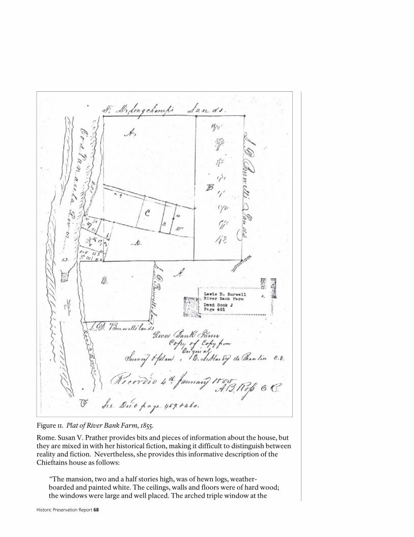
Historic Preservation Report 68
Figure 11. Plat of River Bank Farm, 1855.
Rome. Susan V. Prather provides bits and pieces of information about the house, but they are mixed in with her historical fiction, making it difficult to distinguish between reality and fiction. Nevertheless, she provides this informative description of the Chieftains house as follows:
“The mansion, two and a half stories high, was of hewn logs, weather-boarded and painted white. The ceilings, walls and floors were of hard wood; the windows were large and well placed. The arched triple window at the
National Park Service 69
turn of the fine staircase looked out on a line of Lombardy poplars, then on to the shining Oostanaula, with its fringe of reeds and lilies, and beyond to the spurs of the Blue Ridge mountains in the near distance” (S. Prather n.d.:7).
Elsewhere in her historical fiction account she makes occasional references to physical features of the plantation. She refers to a “colonnade of the mansion” (Prather n.d.:7). She described, “the woodland and down by the brook which ran across the lane nearly a mile from the mansion” (Prather n.d.:21). Towards the end of her account, Prather has a section entitled, “The House on the Oostenaula in 1919 A.D.” In this section she provides an additional description of the Chieftains dwelling as it existed in 1919. She wrote:
“This is a lovely old place! This house breathes romance and makes one feel like exploring every nook. And then, it is so substantially built these hewn logs that make its frame, these great round pillars that support the front roof, these spacious rooms and the four dark, smaller ones, these winding stairs, the seat at the arched triple window looking out on the poplars and beeches and the shining Oostenaula” (Prather n.d.:42).
Susan Prather’s descriptions of Chieftains Plantation are subject to various interpretations. While her account is fictional, her references to the physical traits of the building and grounds should not be completely discounted. From her descriptions one can surmise that in the 1840s and 1850s, the mansion possessed a colonnade, and that a lane was located less than one mile from the mansion. That lane was crossed by a brook, which implies a shallow ford. The area between the mansion and the brook was woodland. No directional information is provided by Prather, although a small stream is located south of the Chieftains residence that was likely crossed by the River Road. That stream is possibly the brook and the River Road now called Riverside Drive or Chatillon Road is possibly the lane mentioned by Prather, although the road’s course has since changed from its earlier location along the riverbank in the area south of Chieftains. Emily Prather supplements Susan Verdery Prather’s description by adding, “There were spacious rooms and hallways; there were great round columns supporting the tall front roof; there were gardens of fruits, vegetables, and roses, orchards, meadows, and splendid trees” (Prather 1942:37). Other than the Prather descriptions, no other source of information on the building history of Chieftains during this period was found. Her information is sparse and comes from a fictional story, making the separation of fact from fiction somewhat problematic. Nevertheless, some grains of truth may appear in the account. Prather refers to the “great round pillars” and the “great round columns.” These may be the “turned columns” of the front porch referred to in the 1836-37 Federal Valuation. This may be an indication the Ridge Period porch remained until 1919. Her description seems to also match some earlier descriptions of the Ridge structure. Interestingly, she says the house is two and one-half stories high, which matches one of the 1832 Harvey plat drawings of the house; however, it does not match the 1836-37
Historic Preservation Report 70
Federal Valuation description. Prather also mentions a triple arched window. From her description, the window was located on the center of the second story on the side of the house facing the Oostanaula River. No other supporting documentation for such a window was found and no evidence was observed, but further architectural investigation of the house might answer this question.

National Park Service 71
The Wright Period
No historical references to historic buildings at the Chieftains plantation during the Wright period were identified from the present research. The 1855 deed that conveyed the Chieftains property from DeLongchamps and Mirambeau to Augustus R. Wright contained no details of any improvements on the property. The continued existence of the main dwelling is inferred from a July 24, 1863 deed from Wright to A.A. Jones, which describes the property as, “the farm whereon said Wright now resides” (Floyd County Deed Books J:753; N:404), but no other details of the property improvements were located.

Historic Preservation Report 72
The Jones-Jeffries Period
Addison A. Jones acquired the Chieftains property and its improvements from Augustus R. Wright on July 24, 1863. Implicit in this transaction was the dwelling, “where Wright now resides”, but no other descriptions of the improvements on the property were found, which is very typical for Georgia deed transactions (Floyd County Deed Book N:404). A.A. Jones, originally a resident of Virginia, owned multiple farms in several states, and it is unclear when he moved to the Chieftains property. A review of the A.A. Jones and Jones Family papers provided no answers to this question. The Jones' were prolific writers and frequently sketched or "doodled" floor plans of houses and drawings of farms with no labels, which make the renderings difficult to connect to a specific property since they owned and speculated on multiple properties. Also, these sketches were found on backs of incoming correspondence that did not mention a property or renovation, leaving one to surmise that the letters were used as scratch paper. Receipts dating after 1870, located within the Jones' papers itemized building materials, which could be an inventory for their stores and cannot be distinguished from purchases specifically associated with Chieftains. By the early 1870s, Jones is established on the property when, in 1873, he deeded 20 acres of the plantation to his newlywed daughter Susan Jones Jeffries (Floyd County Deed Book U:640-641; Wright et al. 1929:15). The inventory of Addison A. Jones’ estate, executed on August 9, 1892, included:
“1 Farm (the Home Place) on the Oostanaula river, being part of lots 196, 205 and 206, Dis. 23, Sec. 3, Floyd County, containing 140 acres more or less” (Wright et al. 1929:19).
By 1900 the Addison A. Jones home place had been divided from a 140-acre farm to two farms, one 128 acres and one 12 acres (Wright et al. 1929). Upon the death of Addison A. Jones’ wife Susanna, ownership of the Jones home place at Chieftains was inherited by his daughter Katherine (or Catherine) Jones. Catherine Jones died in 1899 and her will left the homestead to her two nephews, J.H. Jeffries and A.J. Jeffries (Floyd County Will Book D:240). She left a description of the homestead that included the same cultural features cited in Addison A. Jones’ will. In 1902, J.H. Jeffries, executor for his aunt, Catherine Jones, deeded each one-half interest in a 6-acre tract to himself and his brother A.J. Jeffries, which was described as:
“Starting at the south side of the old ferry place, on the east bank of the Oostanaula river, and following a straight line east to the southwest corner of front yard fence, around yard fence to garden fence, east along garden fence to a gate post and wire fence, north along wire fence to a ditch and a wire fence, west along ditch and a wire fence to corner of graveyard and along graveyard and garden fence west and south to well lot fence, west of well lot fence and back of cow pens to N.W. corner of corn crib, northwest along lot and pasture fence to ash tree on the north side of ditch, west along ditch to river, down said river to starting point” (Floyd County Deed Book NNN:223-224; Wright et al. 1929).
National Park Service 73
A.J. Jeffries promptly conveyed his interest in the property to his brother J.H. Jeffries, giving him sole ownership of Chieftains (Floyd County Deed Book KKK:537; Wright et al. 1929). A petition filed on October 2, 1900 pertaining to the administration of the estate of Addison A. Jones contains a description of a 116-acre tract located in part of Land Lots 196, 205 and 206, which states:
“Starting at a live oak tree on the S.E. corner of the Johnson & Eastman line, and following a ditch north along the east edge of Johnson’s woods to the corner of a wire fence, in the field following said wire fence west to the middle of the Oostanaula river up said river to an old ferry place and following a fence on the south side of the ferry east to the yard fence of the Jones homestead, thence around said yard fence to the garden, up said garden fence to a wire fence along said wire fence to a wire fence running north and along said wire fence to a ditch thence along said ditch west and along the north side of the graveyard truck patch and garden to the northwest corner of the garden thence south along said garden fence to the well lot fence, thence west along said well lot fence to an ash tree at a bridge across the ditch thence west along said ditch to the middle of the river up said river to Cox & Miller’s line, thence east along said line to Mrs. Berry’s and Johnson’s land formerly land of Mat Reece, thence south along said land to the creek, thence down said creek to a ditch and wire fence on the opposite side thence across the creek and east along said ditch and fence to Rome and Decatur R. R. right of way, thence southwest along said right of way to the Eastman line, thence west along said line to starting point” (Wright et al. 1929).
That same 116 acre tract was owned by J.H. Jeffries by July 1902 (Floyd County Deed Books KKK:411, 528; LLL:397; Wright et al. 1929). The Jaeger Company asserts that remodeling of the Chieftains dwelling took place in 1863, although no historical basis for this assertion was located by the present research (1997:6). They state,
“In 1863, the house was sold to Addison A. Jones, who again remodeled the house. It may have been at this time that the house's front façade orientation was changed from the west elevation facing the river to the south elevation”.
The Jaeger Company may have taken this reference from the National Register nomination form which states this information. The Jaeger Company presents in their report floor plans for this alleged 1863 remodel (1997:Illustration 3), although the basis for the plans remain unknown. It seems highly unlikely that Addison A. Jones would have attempted the remodeling of the Chieftains dwelling in late 1863, while the Civil War was raging, the Georgia economy was failing, and advocates of the Confederate cause were becoming increasingly pessimistic. Sherman's Army advanced to Rome by early 1864, less than one year after Jones acquired the property. This would have been an inopportune
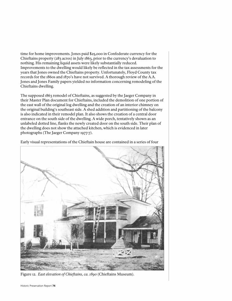
Historic Preservation Report 74
Figure 12. East elevation of Chieftains, ca. 1890 (Chieftains Museum).
time for home improvements. Jones paid $25,000 in Confederate currency for the Chieftains property (283 acres) in July 1863, prior to the currency’s devaluation to nothing. His remaining liquid assets were likely substantially reduced. Improvements to the dwelling would likely be reflected in the tax assessments for the years that Jones owned the Chieftains property. Unfortunately, Floyd County tax records for the 1860s and 1870’s have not survived. A thorough review of the A.A. Jones and Jones Family papers yielded no information concerning remodeling of the Chieftains dwelling. The supposed 1863 remodel of Chieftains, as suggested by the Jaeger Company in their Master Plan document for Chieftains, included the demolition of one portion of the east wall of the original log dwelling and the creation of an interior chimney on the original building's southeast side. A shed addition and partitioning of the balcony is also indicated in their remodel plan. It also shows the creation of a central door entrance on the south side of the dwelling. A wide porch, tentatively shown as an unlabeled dotted line, flanks the newly created door on the south side. Their plan of the dwelling does not show the attached kitchen, which is evidenced in later photographs (The Jaeger Company 1977:7). Early visual representations of the Chieftain house are contained in a series of four
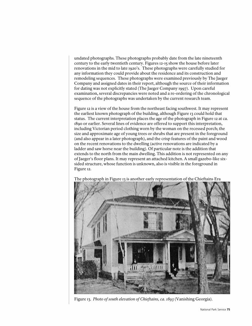
National Park Service 75
Figure 13. Photo of south elevation of Chieftains, ca. 1893 (Vanishing Georgia).
undated photographs. These photographs probably date from the late nineteenth century to the early twentieth century. Figures 12-15 show the house before later renovations in the mid to late 1920’s. These photographs were carefully studied for any information they could provide about the residence and its construction and remodeling sequences. These photographs were examined previously by The Jaeger Company and assigned dates in their report, although the source of their information for dating was not explicitly stated (The Jaeger Company 1997). Upon careful examination, several discrepancies were noted and a re-ordering of the chronological sequence of the photographs was undertaken by the current research team. Figure 12 is a view of the house from the northeast facing southwest. It may represent the earliest known photograph of the building, although Figure 13 could hold that status. The current interpretation places the age of the photograph in Figure 12 at ca. 1890 or earlier. Several lines of evidence are offered to support this interpretation, including Victorian period clothing worn by the woman on the recessed porch; the size and approximate age of young trees or shrubs that are present in the foreground (and also appear in a later photograph), and the crisp features of the paint and wood on the recent renovations to the dwelling (active renovations are indicated by a ladder and saw horse near the building). Of particular note is the addition that extends to the north from the main dwelling. This addition is not represented on any of Jaeger's floor plans. It may represent an attached kitchen. A small gazebo-like six-sided structure, whose function is unknown, also is visible in the foreground in Figure 12. The photograph in Figure 13 is another early representation of the Chieftains Era

Historic Preservation Report 76
dwelling. The image appears to be taken from the southwest facing northeast. The Jaeger Company places the age of this photograph at circa 1893. The late Victorian clothing style of the people on the front porch does suggest that date. This view of the house is consistent with the 1863 floor plans (The Jaeger Company 1997: Illustration B) offered by the Jaeger Company and their age estimate may be correct. Figure 13 offers us clues to help date the later photographs in this series. Of special interest in this photograph is the gabled porch roof and overall fresh appearance of the paint and woodwork on the front porch. Also note that the bottom of the porch is enclosed with wooden slats as it is in Figure 12. The photographs in Figures 14 and 15 were dated to circa 1918 by the Jaeger Company (1997:7, Illustration 3B and 3C; Figure 2030). Figure 14 is taken from the east facing west from a slightly closer vantage point than the photograph in Figure 12. As noted earlier, the large shrub or small tree visible in the foreground of Figure 12 is seen in Figure 14 as a much larger plant and can be useful for estimating the age of the photograph in Figure 14. Based on projected growth and the plant’s tentative identification as a Crepe Myrtle, it is estimated that Figure 14 dates approximately 20 years after Figure 12. Other clues in this photograph, which include the period clothing of the woman and children, and the aged appearance of the wood and paint on the wall and trim of the dwelling, point to a gradual dilapidation of the structure. This photograph, along with Photograph 15, was donated to the Chieftains Museum/Major Ridge Home by Alice Jefferies Keel, the granddaughter of J.H.
Figure 14. Partial view of east elevation of Chieftains, ca. 1915-1919 (Vanishing Georgia).

National Park Service 77
Figure 15. Partial view of southeast corner of Chieftains (Chieftains Museum).
Jefferies. The youngest of the boys in the photograph is her father, Dean Jefferies, who was born on June 9, 1910. Two of the other boys are identified as Henry Jefferies (born ca 1905) and Andrew Jefferies (born ca. 1907), and are Dean Jeffries older brothers (Alice Keel, email correspondence, May 13-17, 2005). A large fingerprint on the photographic negative created a smudge on the print that obscures some details about the northern end of the dwelling, such as the presence or absence of the possible attached kitchen noted in Figure 13. A time span from 1915 to 1919 is a reasonable estimate for this image based on the approximate age of the identified boys. The photograph in Figure 15 is taken from the southeast side of the house facing northwest. It also shows the condition of the dwelling as somewhat dilapidated. Several people are visible in the photograph but the style of their clothing could not be determined, although the three-quarter length hemline on the female in the foreground points to a post World-War I and pre 1925 date. This photograph was donated to the Chieftains Museum/Major Ridge Home by Alice Jefferies Keel and, as the Jefferies left Chieftains in 1919, we can deduce that this image dates prior to 1920. Note in both Figures 14 and 15 the weatherboards closest to the ground are darkened, suggesting they date to the same period. Note that the gable is no longer found on the shed roof of the front porch as seen in Figure 13. Careful examination of the photograph revealed the outline of the previous gabled porch roof on the paint above the roof visible in the image. Also, the east end porch railing is no longer attached as it was in Figure 12 and the enclosure around the bottom of the porch is gone. A large tree seen in Photograph 13 is also not present in this scene.

Historic Preservation Report 78
The Porter Period
Figure 17. Porch on south façade after 1924 (Chieftains Museum).
The 1924-1928 period was one in which the most substantial changes to the architecture of the Chieftains dwelling are reported to have taken place (Anonymous 1971). J.H. Porter owned the home during that short period and he is reputed to have hired the Atlanta architectural firm of Lockwood and Poundstone to execute the redesign. This information is in the National Historic Landmark nomination form, which states that the house was redesigned in the “Georgian Colonial restyling” and one-story side wings were added to each side of the house. More than likely, the NRHP nomination form for Chieftains is the source that The Jaeger Company used in their reference to Lockwood and Poundstone as the architects for the remodeling of Chieftains during the mid 1920s; their report contained no references. It was also noted in a ca. 1971 publication by State Mutual Insurance that Lockwood and Poundstone were the architects for the remodel and this statement has been anecdotally supported by Mary Francis Porter Grant, the daughter of J.H. Porter (Carey Tilley, email correspondence, May 13, 2005). Family descendents of the Porters state that family legend confirms that Lockwood and Poundstone were the architects for the renovations (Carey Tilley, personal communication, September 2004). No documentation to support this claim has been located to date. Six photographs of the Chieftains dwelling (Figures 17-21) have survived from the 1924-1928 Period. These images show the dwelling after the J.H. Porter remodeling was completed.
Figure 17 is taken from the southwest side of the house facing northeast. It is a close-up view with two young girls, Mary Francis Porter (Grant, born ca. 1907), seen here with bobbed hair, and Clara Ella Porter (McWilliams, born ca. 1912), shown in 1920s period clothing (Tilley personal communication May 13, 2005). This photograph was probably taken shortly after the Porter remodeling (1924 or shortly thereafter). Clues for this include the lack of any formal plantings along the front of the house and the fresh look of the woodwork. Note that the weatherboards are darker, unpainted boards. The east side one-story wing addition is seen in the photograph. Also, note that the front porch has been removed and replaced with a portico with a bench. In this view, sidelights appear to be visible around the door and the nine
over nine double-hung sash windows on the lower front façade of the main structure are in evidence.
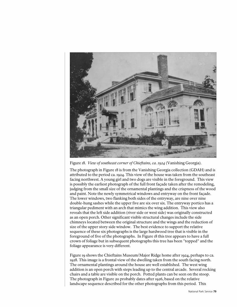
National Park Service 79
Figure 18. View of southeast corner of Chieftains, ca. 1924 (Vanishing Georgia).
The photograph in Figure 18 is from the Vanishing Georgia collection (GDAH) and is attributed to the period ca. 1924. This view of the house was taken from the southeast facing northwest. A young girl and two dogs are visible in the foreground. This view is possibly the earliest photograph of the full front façade taken after the remodeling, judging from the small size of the ornamental plantings and the crispness of the wood and paint. Note the newly symmetrical windows and entryway on the front façade. The lower windows, two flanking both sides of the entryway, are nine over nine double-hung sashes while the upper five are six over six. The entryway portico has a triangular pediment with an arch that mimics the wing addition. This view also reveals that the left side addition (river side or west side) was originally constructed as an open porch. Other significant visible structural changes include the side chimneys located between the original structure and the wings and the reduction of size of the upper story side window. The best evidence to support the relative sequence of these six photographs is the large hardwood tree that is visible in the foreground of five of the photographs. In Figure 18 this tree appears to have a full crown of foliage but in subsequent photographs this tree has been "topped" and the foliage appearance is very different. Figure 19 shows the Chieftains Museum/Major Ridge home after 1924, perhaps to ca. 1928. This image is a frontal view of the dwelling taken from the south facing north. The ornamental plantings around the house are well established. The west wing addition is an open porch with steps leading up to the central arcade. Several rocking chairs and a table are visible on the porch. Potted plants can be seen on the stoop. The photograph in Figure 20 probably dates after 1926, based on the relative landscape sequence described for the other photographs from this period. This

Historic Preservation Report 80
Figure 19. View of south elevation of Chieftains, ca. 1926 (Chieftains Museum).
photograph is taken from the east (on the River Road) facing west. Two early model automobiles (pre-1940s vintage) are visible in the yard. Four chimneys are visible in this image, including one exterior chimney on the northern end of the dwelling. Note also the absence of the possible attached kitchen seen in Figure 12. The photograph in Figure 20 is taken from the east side of the house facing northwest. This photograph was possibly taken on the same day as Figure 21. It provides additional clues about the residence. Two cars are shown in the yard and these are probably the same cars shown in Figure 21. The tops of two or possibly three outbuildings are shown on Figure 20, which are located north of the Chieftains residence. A low fence (possibly a picket fence) is shown in the foreground between the photographer and these buildings, but west of a road (probably on the route of Chatillon Road). A powerline is shown in the front yard and a large topped oak tree is shown southeast of the residence. The various clues about this topped tree were previously noted in the discussion. This tree was likely topped when the electric lines were erected in the area. The additions to the house date after 1924 and the vintage of the cars is pre-1940, so this photograph can be bracketed somewhere in between 1924 and 1940. The car nearest to the camera is a ca. 1924-1928 model, possibly a Chrysler or Pierce-Arrow. The more distant car is a Ford Model T, ca. 1927. The strongest indication of the date of this photograph as well as the photograph in Figure 21 is the

National Park Service 81
Figure 20. View of southeast corner of Chieftains, after 1926 (Chieftains Museum).
Figure 21. View of east end of Chieftains and a remaining section the New Echota Road, ca. 1924 (Vanishing Georgia).

Historic Preservation Report 82
fact that these photographs were donated to Chieftains by the daughter-in-law of one of the daughters from the Porter family, who lived in the house from 1924 to 1928. The presence of two cars in Figures 20 and 21 suggest that the garage area of the residence was on the east or northeast side of the main house. One of the outbuildings shown may be a garage. This photograph also clearly shows the side entrance to the east wing and the two six over six double-hung sash windows on the addition. It would appear that the majority of significant changes to Chieftains occurred between 1924 and 1928. These are seen in the addition of two one-story wings on each side of the house, a Georgian Colonial Revival façade on the main structure, and more formalized landscaping as well.
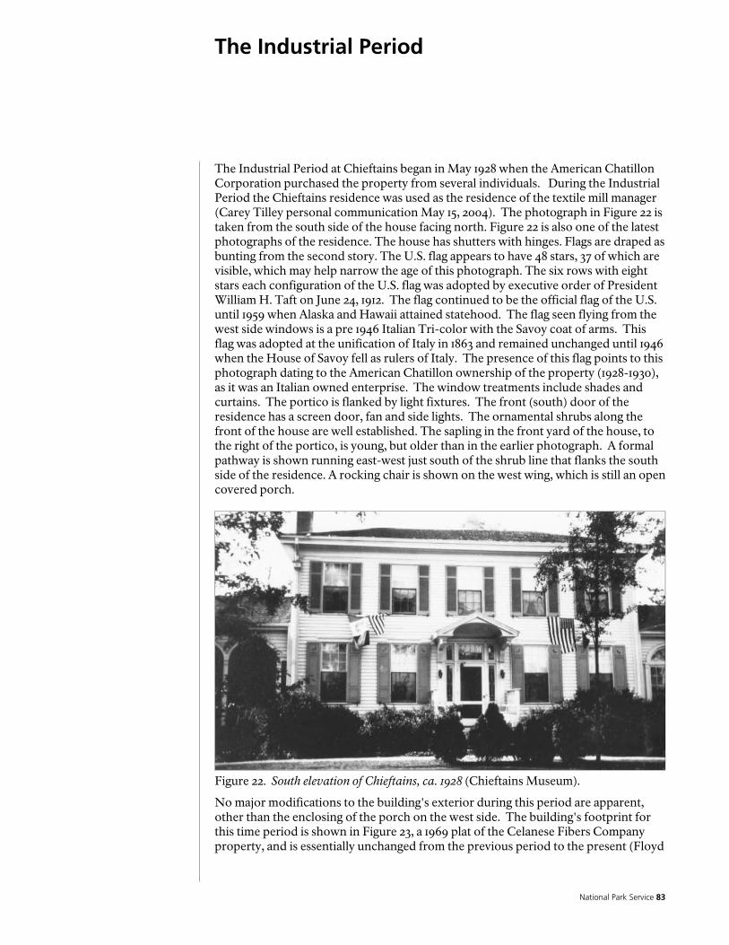
National Park Service 83
The Industrial Period
Figure 22. South elevation of Chieftains, ca. 1928 (Chieftains Museum).
The Industrial Period at Chieftains began in May 1928 when the American Chatillon Corporation purchased the property from several individuals. During the Industrial Period the Chieftains residence was used as the residence of the textile mill manager (Carey Tilley personal communication May 15, 2004). The photograph in Figure 22 is taken from the south side of the house facing north. Figure 22 is also one of the latest photographs of the residence. The house has shutters with hinges. Flags are draped as bunting from the second story. The U.S. flag appears to have 48 stars, 37 of which are visible, which may help narrow the age of this photograph. The six rows with eight stars each configuration of the U.S. flag was adopted by executive order of President William H. Taft on June 24, 1912. The flag continued to be the official flag of the U.S. until 1959 when Alaska and Hawaii attained statehood. The flag seen flying from the west side windows is a pre 1946 Italian Tri-color with the Savoy coat of arms. This flag was adopted at the unification of Italy in 1863 and remained unchanged until 1946 when the House of Savoy fell as rulers of Italy. The presence of this flag points to this photograph dating to the American Chatillon ownership of the property (1928-1930), as it was an Italian owned enterprise. The window treatments include shades and curtains. The portico is flanked by light fixtures. The front (south) door of the residence has a screen door, fan and side lights. The ornamental shrubs along the front of the house are well established. The sapling in the front yard of the house, to the right of the portico, is young, but older than in the earlier photograph. A formal pathway is shown running east-west just south of the shrub line that flanks the south side of the residence. A rocking chair is shown on the west wing, which is still an open covered porch.
No major modifications to the building's exterior during this period are apparent, other than the enclosing of the porch on the west side. The building's footprint for this time period is shown in Figure 23, a 1969 plat of the Celanese Fibers Company property, and is essentially unchanged from the previous period to the present (Floyd
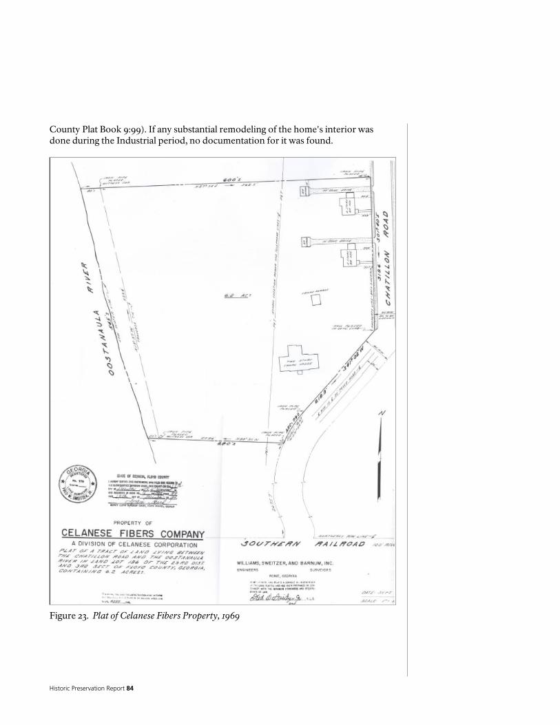
Historic Preservation Report 84
Figure 23. Plat of Celanese Fibers Property, 1969
County Plat Book 9:99). If any substantial remodeling of the home's interior was done during the Industrial period, no documentation for it was found.
National Park Service 85
Architectural Description and Analysis
INTRODUCTION
In October of 2004, a documentation team from the National Park Service’s Intermountain Regional Office, Division of Facilities Management traveled to the Chieftains Museum to under take the documentation required to develop the Historic Structure Report. The team consisted of Exhibit Specialist, Anthony Drake, and Civil Engineer Cliff Walker, and was led by Historical Architect, Mark Mortier. Several subsequent visits were made to the building. The specific purpose of these trips was to gather data on the existing conditions present at Chieftains, and to try and further determine the architectural chronology.
The Chieftains Museum appears to have been constructed and modified in several phases, as described in the section on Chronology of Development and Use, and as shown by the architectural evidence. As with many long standing buildings, it is difficult to know with certainty the history or the sequence of construction and modification that has occurred over the years. The documentation or evidence is scarce, often secondary, Popular, or speculative, and oftentimes contradictory. The extensive modifications which have taken place make it difficult to define discrete beginnings or endings of the different phases of the development of this building, particularly since many of the building materials appear to have been recycled during different episodes of modification. However, based on a thorough physical examination of the building, the following are some general conclusions. Note that room numbers referred to below shown on the floor plans in Figures 31 and 32. GENERAL COMMENTS AND CONCLUSIONS For the purposes of this section what is referred to in the preceding sections as the Ridge Period has been broken into two phases, the Original Log Building period, and the Ridge Addition period. The periods referred to in the preceding sections as the Ferguson-Verdery period, the Wright period, and the Jones-Jeffries period have been grouped into one phase called the Post Ridge period, and the Porter Period to the present is referred to as the Colonial Revival period. The Chieftains Museum is a large, eclectic building that is a conglomeration of multiple periods of construction and remodeling. Over the years, it has undergone major architectural transformations. In its current state, likely the result of a remodeling in the early 2oth century, it appears as a large, colonial revival styled building. Most of the interior and exterior finishes and trim also likely date to this period. As it exists now, the predominant features of the building include several large masses covered with white siding, abundant fenestration, and multiple pitched, hipped roofs, covered with composition shingles. Most of the roofs change slope near the top, transitioning to large, low sloped, hipped areas which are roofed with single ply roofing. These low sloped roofs are not apparent when looking at the building from the ground. The roofs have varying overhangs, characterized by painted wood fascia
EX
ISTI
NG
CO
ND
ITIO
NS

Historic Preservation Report 86
and soffits, all with manufactured metal gutters and downspouts. The walls are logs or wood frame, covered with painted wood clapboard siding, and incorporating various configurations of painted wood trim. The base of the building has a low, painted brick foundation wall, although there is one section of stone foundation wall on the north side of the west façade. Most of the structure sits on a crawl space. There is a basement under the central hallway and the west wing. The first and second floor structure is built with wood joists, as are the second floor ceilings. The roof framing consists of wood joists and rafters. Portions of roofs from the Ridge period are visible in the attic, covered up by the roof structure from the Colonial Revival period remodeling. The south room of the east wing (Room 117) is a sunroom, with large, south facing Palladian windows with fan-lights, as well as a similarly detailed entry door facing east. This door is used as the main entry to the building. The arched openings extend from the floor, and the area below the windows are wood frame with painted wood panels on the exterior. The south room of the west wing (Room 103), once an open porch, was constructed with arched openings that are similar to the sunroom. These openings have now been filled in with screens, windows, and doors. What was the main entry of the house, now no longer used as such, is a Greek Revival styled doorway with sidelights and transoms, covered by a small pitched pedimented roof, which has a coved plaster underside, and is supported by decorative scroll brackets. The brackets sit atop thin painted wood pilasters. There is a small stoop and a set of steps at this entry that appear to be built from poured concrete, and covered with brick. The east façade of the north portion of the building, as well as the interiors of Rooms 113 and 205, suggests that portions of this space were once an open porch, which was enclosed during one of the remodelings. There is a small, enclosed porch on the north side of the building, which has a pitched, hipped roof, walls covered with painted wood lattice and screens, and a wood floor. Several other concrete porches and sets of steps exist on the exterior of the building; at the east entry into Room 113, which is now the main entry, and at the entry into Room 103. There is also a handicapped access ramp at the door into Room 113, built from wood framing and plywood. The doors and windows are built of wood, and are of relatively modern, manufactured construction. The interior doors are generally manufactured frame and panel. Many of the interior doors on the first floor have transoms; some with glass panels and some with wood. All of the doors and windows have wood trim, and all of the woodwork is painted. The interiors are generally finished with hardwood flooring, painted plastered walls, painted wood trim, and painted plastered ceilings. Some of the rooms have elaborate trim, while others are more basic. A few of the rooms have ceramic tile floors, resilient flooring, or carpeting; as well as clapboard siding, or “boxcar siding.”

National Park Service 87
There are three fireplaces, and three brick chimneys. Modern cabinets and fixtures have been installed in the kitchen. The building has a relatively modern plumbing system, forced air heating and refrigerated air conditioning, and electrical system, as well as an intrusion security system. Overall Condition Summary Overall, the Chieftains Museum is in fair condition. In general, the building appears to be structurally sound and stable, although there have been some questionable structural modifications, which bear more investigation. The exterior woodwork, including the siding, trim, doors, and windows, as well as the paint finishes, are weathered and deteriorated. Most of the windows are not operable; many of the doors are sticking. Most of the damage can be attributed to moisture intrusion, primarily due to paint failure and humidity. The interior plaster and paint finishes are also deteriorated. A substantial amount of the plaster is cracked, spalling, or delaminating. The plaster has fallen off the ceilings in a couple of places. Interior paint problems include crazing, cracking, and peeling. The crawl space and basement suffer from moisture intrusion and poor ventilation. The plumbing, mechanical, and electrical systems are very complicated, dysfunctional, and intrusive architecturally. There are serious problems with all of these systems, some of which have the potential to damage the building. There is no humidity control, and the heating and cooling do not conform to accepted standards for museums. There have been many modifications to the building, some of which are not sensitive to the structure or the architecture, and detract from the overall appearance. The main entrance to the building is through the gift shop, which leads to some congestion. Some displays, particularly in the gift shop, are attached to the walls and trim in ways that are damaging the finishes. Secondary interior spaces are packed full of furniture, artifacts, records, and other stored materials. There are numerous code and life safety problems, primarily concerning fire safety and egress, as well as handicapped accessibility. The ramp outside of Room 113 does not conform to accessibility standards or requirements.
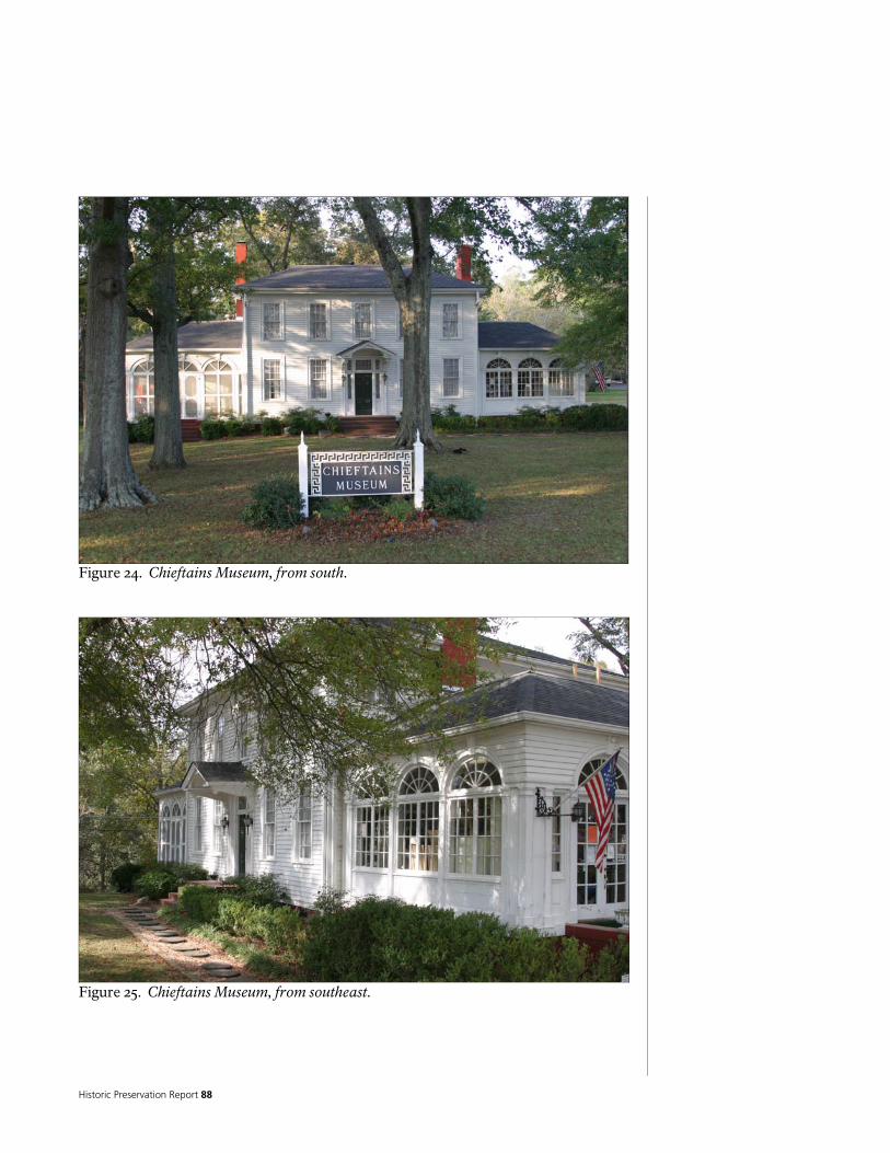
Historic Preservation Report 88
Figure 24. Chieftains Museum, from south.
Figure 25. Chieftains Museum, from southeast.

National Park Service 89
Figure 26. Chieftains Museum, from northeast.
Figure 27. Chieftains Museum, from north.
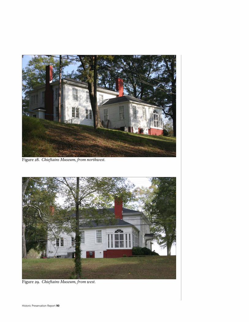
Historic Preservation Report 90
Figure 28. Chieftains Museum, from northwest.
Figure 29. Chieftains Museum, from west.
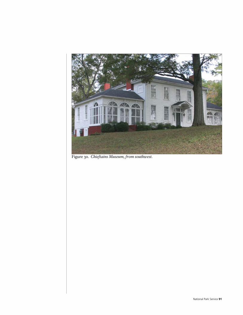
National Park Service 91
Figure 30. Chieftains Museum, from southwest.

Historic Preservation Report 92

National Park Service 93
= Figure 31. Current first floor plan.

Historic Preservation Report 94
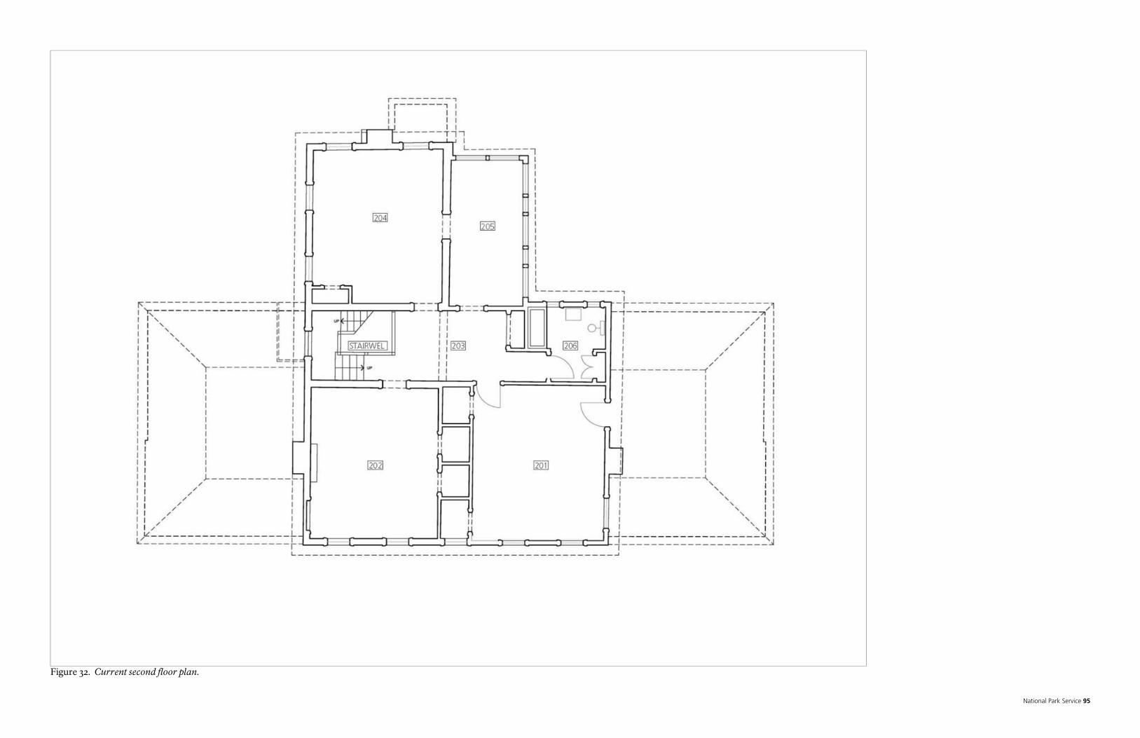
National Park Service 95
Figure 32. Current second floor plan.

Historic Preservation Report 96

National Park Service 97
Original Log Building The original portion of the building appears to have been a rectangular two story log structure measuring approximately 19 feet by 52 feet, built on a north/south axis, with the long facades facing east and west. The building appears to have contained three rooms on each floor, and was built with a Georgian or I-style plan: a narrow central hallway, which likely had a stairway to the second floor, flanked by larger rooms on either side. It is not apparent which was the primary façade. Popular history describes the central hall as having been an open “dog-trot,” without exterior walls on the east and west. However, the architectural evidence, notably the presence of a couple of continuous logs in the upper portion of the east and west walls, as well as evidence of a continuous foundation beam under the east wall, does not support this.
Figure 33. Likely floor plan of original log building. This section of the building has the remains of a stone foundation, which has been extensively modified. Portions of this foundation appear to have been removed, and some portions have been replaced with more modern brick. There is a shallow crawl space. Hand hewn rectangular beams, running across the tops of what appear to be the original foundation walls or piers, appear to have supported the original walls and floor structure. Now there are numerous stone and brick piers, which support a combination of hand hewn beams, sawn beams and girders, and sawn floor framing. Many of these beams, girders, and framing, as well as the flooring, appear to be more modern than the stone foundations and hand hewn members. Part of the crawl space has been excavated to provide a basement, which connects to the basement under an addition to the west.

Historic Preservation Report 98
The logs used in the construction of the walls were hand hewn to provide vertical surfaces on the interior and exterior, resulting in a thickness of approximately 6-inches. The log walls are notable for the interlocking V-joints at the corners, as well as the vertical spacing between the logs themselves. These spaces appear to have had crude wood chinking, but no evidence exists to suggest that they were ever chinked with anything to weatherproof them, such as mud or cementitious products. The siding on the exterior of the northwest side of the north room is installed on crude sawn wood furring, without the sheathing seen on other parts of the building. This suggests two things: that the building may have always been sided, and this is some of the original siding. Large numbers of the logs appear to have been removed, and replaced with wood infill studs.
Figure 33. Conceptual sketch of original log cabin, from the southeast. The floors and ceilings are built with rectangular wood joists, with tongue and groove wood sub flooring, and covered by various finish flooring materials; the predominant being oak tongue and groove. The floor joists under the central hallway (dog-trot), are of different size and character than the others, and are notched into and hung from round perimeter beams. A layer of fir tongue and groove flooring is visible under portions of the oak floor in Room 204.

National Park Service 99
What appears to be the original pitched roof framing, built from sawn wood rafters, is visible in the attic. Although it is hipped now, the architectural evidence suggests that it may have originally had gable ends. The rafters are nailed to a plate on top of the second floor ceiling joists (which project out to form roof overhangs), and are joined at the top with lap joints, held in place with wood pegs. The west, north, and south planes of this roof are exposed and roofed with modern materials, but the east plane is actually concealed under a subsequent addition, and visible from the attic. It is covered with large, spaced wood planks and wood shingles. There is a large opening in the ceiling of the second floor hallway, covered by a wood grill, which goes into a sheet metal plenum in the attic, with two very large fans. Presumably this was an early 2oth century modification to provide ventilation. Popular history provides several contradictory descriptions of the numbers and locations of fireplaces. Currently, there are two fireplaces in this portion of the building. They are located on the south portion of the west wall, one in Room 102, the other directly above, in Room 202. They appear to have been constructed during one of the remodeling campaigns. Architectural evidence such as possible fireplace foundations and openings in floor and roof framing, and ghosts in floor and wall finishes, suggests that there may have been fire places on both stories, inside of the north wall (Rooms 109 and 204), and inside of the south portion of the east wall (Rooms 102 and 202). This is supported by photographic evidence – but this does not help to date when they were constructed, or removed. The chimney on the north is constructed completely outside of the building, and does not appear to have ever been functional. Popular history suggests that the stairway was built after this portion of the building was constructed, but this cannot be confirmed. However, the presence of a wood beam in the west wall of the central hallway (dogtrot), which appears to support the landing, suggests that the stairway may have been built as a part of the original log building. What remains of the original log building is now almost entirely concealed by additions.

Historic Preservation Report 100
Figure 34. Remaining logs on first floor (shaded). Dashed line shows location of missing east wall.
Figure 35. Remaining logs on second floor (shaded). Dashed line shows location of missing east wall.

National Park Service 101
The Ridge Addition The first major modification of the building appears to have been what is referred to as the “Major Ridge Addition.” This appears to have been an addition to the east side of the original log building, which contains two large rectangular rooms (one on each story) located east of the southeast side of the original log cabin. Differences in the construction of this room support the idea that this was not a part of the original building. During this period, there appear to have been four rooms on each story. The addition may have created a two story porch on the east wall of the north half of the building, and an east extension of the central hallway (dog-trot), possibly with small rooms on the east end. The 1836-1837 Federal Valuation discussed in the section on Chronology of Development and Use, above, while having some contradictory statements, does refer to the building as having 8 rooms, and a balcony on the side of the house.
Figure 36. Likely first floor plan of Ridge Addition. Details of porch and rooms on east unknown, based on ca. late 19th century photographs. Second floor plan would have been similar to the first. Popular history puts construction of stairway into this phase. Note that construction of stairway would have resulted in lowering of ceiling over west entrance. The portion of the Ridge Addition containing the two large rooms measures approximately 20 feet by 22 feet. The size of the porch addition is unknown, but presumably it was similar in size to the current enclosed northeast porch addition. It is not obvious whether the Ridge Addition had any continuous perimeter foundations. The floor and wall structure is supported on a series of beams and girders, which are in turn supported on brick piers or short brick foundation walls. The beams on the north side of this structure, as well as the east wall, are hand hewn. All of the other supporting members are sawn.

Historic Preservation Report 102
The floors and ceilings are built with rectangular wood joists, with tongue and groove wood sub flooring, and covered by various finish flooring materials; the predominant being oak tongue and groove flooring. The walls of this addition are built with what appears to be a mixture of post and beam and wood studs. The pitched roof is built from sawn wood rafters, and appears to have been built with a hip on the east end. Similar to the original log building, the rafters of the Ridge Addition are nailed to a plate on top of the second floor ceiling joists (which project out to form roof overhangs). As is the case with the roof over the original log building, portions of this roof are concealed under subsequent additions, but still visible. The south and east roof planes are exposed and roofed with modern materials, but the north plane is concealed beneath another roof, and visible from within the attic. It is covered with large, spaced wood planks and wood shingles.
Figure 37. Conceptual sketch of the Ridge Addition, from the southeast. Architectural evidence suggests that when this roof was added to that of the original log building, the south portion of the original log building roof (and gable end) was removed, and the plane of the Ridge Addition roof was extended to form the hipped corner on the southwest side of the original log building. It is possible that the north end of the original log building was modified into a hip at the same time. Close inspection reveals that the pitches of the Ridge Addition, as well as of the original log building, are all slightly different. The Ridge Addition is several feet wider than the original log building; in order for the ridge lines to meet (as they do), the pitch of the

National Park Service 103
Figure 38. Conceptual sketch of the Ridge Addition, from the northeast. Ridge Addition would need to be flatter. Given that the extension of the Ridge Addition roof plane forms the hip of the original log building, it makes sense to assume that whatever existed on the south end of the original log building roof was modified into its present construction. There is a fireplace on the east side of Room 101, which is detailed similar to the fireplace in Room 102. Ghosts in the flooring of Room 201 suggest that there was a fireplace on the east wall of this room, directly above the fireplace in Room 101, which has been removed. Also, a closed off opening in the roof framing suggests that there was a chimney and likely a fireplace or two located where the Ridge addition joins the original log building. This supported by the recollections of Jeffries (Garrow 1969a). Popular history suggests that the stairway was built during this time, but this cannot be confirmed. However, the presence of a wood beam in the west wall of the central hallway (dogtrot), which appears to support the landing, suggests that the stairway may have been built as a part of the original log building. Note that the ceilings in the first floor of the Ridge Addition are slightly lower than those in the original log building, but the second floors are basically the same level. It is not known if the construction of the main entry and porch in the south wall of the Ridge Addition, nor the removal of the east wall of the south portion of the log building, occurred during this period.

Historic Preservation Report 104
The Post Ridge Period Photographic evidence attributed to the end of the 19th Century or early 20th Century provides a record of how the building looked during this period, and provides some evidence of some of the exterior changes that may have occurred during this time. These photographs show the main entrance located on the south facade, along with several different configurations of porches and porch roofs. It is probable that when the entry was moved to this façade, it was done concurrently with the removal of the east wall of the south portion of the original log cabin – but no evidence exists to confirm when this happened. These photos show a porch on the west façade, as well as a structure attached to the north side of the original log building. There are chimneys located near the intersection of the original log building and the Ridge Addition, as well as inside of the north wall of the original log building. The photographic evidence of the northeast portion of the building also shows an open two story porch and enclosed rooms on both stories. However, the layout of the porch posts and footprint of the enclosed rooms, does not match what exists now, suggesting that this area has been torn down and rebuilt.
Figure 39. Likely first floor plan based on early photographs. Note chimneys inside of building, addition on north, porches on west and south, location and spacing of posts on east porch, east extension of central hallway (dog-trot) and east rooms held back from northeast corner of Ridge Addition, entry door is located in south wall, requiring removal of original east wall of south room of original log building, entry is flanked by two windows on first floor, two windows on south elevation of second floor. Dashed line shows location of missing east wall of south portion of original log building.
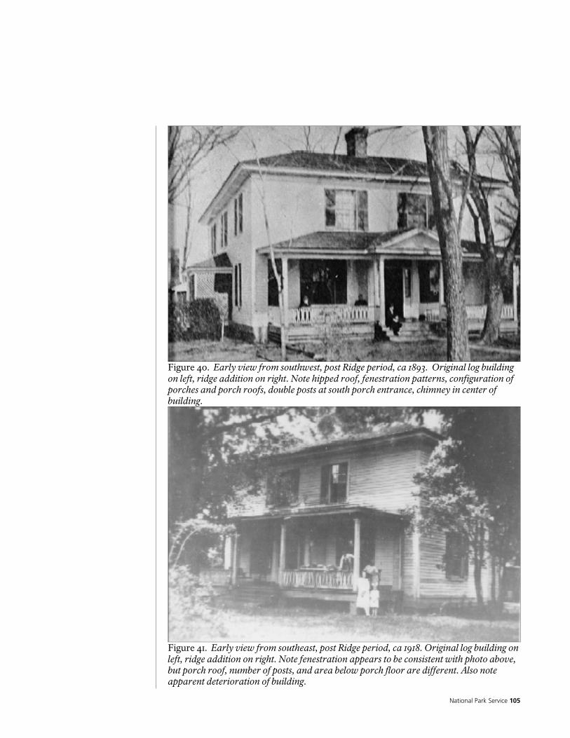
National Park Service 105
Figure 40. Early view from southwest, post Ridge period, ca 1893. Original log building on left, ridge addition on right. Note hipped roof, fenestration patterns, configuration of porches and porch roofs, double posts at south porch entrance, chimney in center of building.
Figure 41. Early view from southeast, post Ridge period, ca 1918. Original log building on left, ridge addition on right. Note fenestration appears to be consistent with photo above, but porch roof, number of posts, and area below porch floor are different. Also note apparent deterioration of building.

Historic Preservation Report 106
Figure 42. Early view from northeast, post Ridge period, ca 1890. Ridge addition on left, original log building behind porch. Note window on north side of second floor of Ridge addition, configuration of rooms and roofs between Ridge addition and porch (behind sawhorses), offset between east end of Ridge addition and the rooms to the north, spacing of porch posts, height of porch roof, interior chimney at north end of original log building, and structure attached to north side of original log building.
Figure 43. Early view from northeast, post Ridge period, ca 1915-1919. Ridge addition on left, original log building behind porch. Note similarities to photo above, but building appears to have deteriorated. Note offset between Ridge addition on left and rooms on right, as well as roof offsets.

National Park Service 107
The Colonial Revival Period The most significant change during this time period was the remodeling of the building into its present style, and the reconstruction of the roofs into their present configuration. Most likely, this occurred in the early 20th Century during the “Porter Period,” It is likely that the majority of the exterior and interior and finishes, the brick foundation walls, and the doors and windows, date to this period. Changes during this period included the removal and replacement of the porch and rooms that may have been part of the addition attributed to Major Ridge (see above) with what became the enclosed northeast porch and hall/bathroom area; changes to the fireplaces and chimneys; construction of one story additions forming the east and west “wings;” replacement and reconfiguration of the pattern of the windows and doors; construction of the south entry porch as it exists; and construction of the small porch on the north. It is also probable that the brick foundation walls were built at this time, and that this is when electricity and plumbing were added to the building. More changes have been made since the Colonial Revival remodeling took place, including the enclosure of the porch on the southwest (Room 103), removal of the shutters, removal of the seats on the sides of the south entry porch, “modernization” of the plumbing, mechanical , and electrical systems, and minor changes to the interiors and exteriors.
Figure 44. View from southeast, post Ridge period, ca 1924. Building has been remodeled into colonial revival style. Note fenestration patterns different from earlier photographs, configuration of porch and overhang on south elevation, and open porch on west.
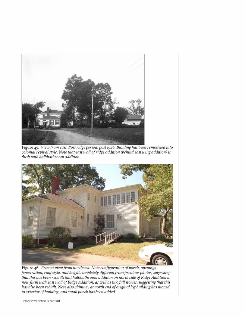
Historic Preservation Report 108
Figure 45. View from east, Post ridge period, post 1926. Building has been remodeled into colonial revival style. Note that east wall of ridge addition (behind east wing addition) is flush with hall/bathroom addition.
Figure 46. Present view from northeast. Note configuration of porch, openings, fenestration, roof style, and height completely different from previous photos, suggesting that this has been rebuilt; that hall/bathroom addition on north side of Ridge Addition is now flush with east wall of Ridge Addition, as well as two full stories, suggesting that this has also been rebuilt. Note also chimney at north end of original log building has moved to exterior of building, and small porch has been added.

National Park Service 109
Figure 47. Current first floor plan. Note demolition of south and west porches, demolition of addition on north, demolition and reconstruction of northeast porch and extension of central hallway (dog-trot) and east rooms (to line up with northeast corner of Ridge Addition), addition of east and west wings, addition of south entrance stoop and roof, addition of north porch, change in number and location of windows on all façades, chimneys on exterior of building. Dashed line shows location of missing east wall of south portion of original log building. Final Considerations Popular history of the building suggests or discusses several features that could not be substantiated during the architectural investigation for this report. These include a “triple arched window,’ in the upper central hallway (dogtrot), a west facing porch or balcony, with turned columns, and a west facing main entrance into the building. No investigation was undertaken to find evidence of the triple arched window, or of a west facing porch or balcony. To investigate properly this would require the removal of the exterior siding and/or interior plaster from the west walls of the building, to see if the log structure or infill framing shows any evidence of this. Archeological investigation of the site might also reveal evidence or clues. Since the building has been remodeled so extensively, any evidence of these features may have already been removed or modified beyond recognition. The building may have had a main entrance on the west façade at some point in time, especially if the stair was not part of the original log building. But, the orientation of the stairway suggests that when it was built, the main entrance was probably on the east, as it is more typical to enter a building facing the stair, rather than entering
Historic Preservation Report 110
under the stair. And, there appears to be a beam in the wall plane at the level of the stair landing, with logs above it, which suggests that this was built as part of the original building. Cherokee cultural tradition of the time period typically would place the entrance facing east. The location of the New Echota Road leading to Ridge’s Ferry during the Ridge Period also suggests the entrance faced east towards the road. Regardless, given the limited headroom below the beam and landing along the west wall, and the mass of the two flights of stairs on either side of the landing, a main entrance on that side would have been somewhat dark and cramped. Note that photographs from the late 19th or early 20th Century do show a covered entrance on the west façade, but it appears to be a secondary entrance.
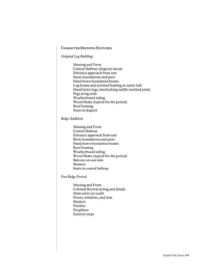
National Park Service 111
CHARACTER DEFINING FEATURES Original Log Building: Massing and Form Central Hallway (dogtrot) layout Entrance approach from east
Stone foundations and piers Hand hewn foundation beams Log beams and notched framing at center hall Hand hewn logs, interlocking saddle notched joints Pegs at log ends Weatherboard siding Wood Shake (typical for the period) Roof framing Stairs in dogtrot
Ridge Addition:
Massing and Form Central Hallway Entrance approach from east Brick foundations and piers Hand hewn foundation beams Roof framing Weatherboard siding Wood Shake (typical for the period) Balcony on east side Shutters Stairs in central hallway
Post Ridge Period:
Massing and Form Colonial Revival styling and details Main entry on south Doors, windows, and trim Shutters Finishes Fireplaces Exterior steps

Historic Preservation Report 112
DETAILED DESCRIPTION AND ANALYSIS Site The Chieftains Museum sits on the edge of a relatively flat site, which drops down steeply just to the west of the building, to the floodplain of the Ostanaula River. The site is characterized by a mowed grass lawn, and many large trees. Presumably, the underlying soils are typical for the area, and do not present any unusual problems. The finished first floor level of the building is well above the surrounding grade, while the floor of the crawl space is level with the surrounding grade. The building is generally surrounded by foundation planting, in beds which are covered with mulch. The lack of positive drainage leads to the potential for rainwater to pond around the building, and saturate the soil. Foundation/Crawl Space/Basement The foundation of the building has been extensively modified. Portions have been removed or reconstructed, and new foundations have been added. Materials appear to have been recycled, making it difficult to determine the age or sequence of the construction. From the outside, the foundation presents itself primarily as a series of low, painted brick walls, of modern construction. Generally, these walls are one course thick, apparently un-reinforced, and with pilasters built in at periodic intervals. There is no obvious foundation below the brick. The top of the brick supports the floor and/or wall framing, which bears directly on it with no obvious anchorage or reinforcement. The uniformity of the construction suggests that these walls were all built at the same time, although there are differences in the character of the brick, when viewed from within the crawl space. There are cast iron ventilation grates at regular intervals around the perimeter of the building. There is a small section of crude stone masonry, laid in lime based mortar, and surrounded by brick, visible on the north side of the west wall of the original log building. This may be part of the original foundation. The foundation walls enclose a shallow crawl space, which averages around 18-inches in height. Periodically, there are openings in the walls for ventilation, which are covered with cast iron grills, held in place by friction. Inside the crawl space, a bewildering array of structural and architectural features is present. These include portions of crudely built low stone walls and piers, set with lime based mortar. There are numerous brick piers, and sections of brick foundation walls, appearing to be of varying ages. Some of these appear to be quite old and are crudely built; others appear to be more modern and carefully constructed.

National Park Service 113
Figure 48. Foundation plan. The stone foundation wall sections and stone piers appear to define the perimeter of the original log building, and appear to support the floor framing and log walls above. Several stone and brick piers are located inside of this perimeter, and support the floor framing above. There are numerous pieces of stone and masonry rubble, which appear to be from portions of stone foundations that have been demolished to be replaced with brick foundations; or demolished to provide openings for access, plumbing, mechanical, or electrical systems. This material may also be from the remains of fireplace foundations; one located under the north end of the kitchen (Room 109), and the other located inside of the east wall of the south room of the original log building (Room 102). It is not obvious whether the Ridge Addition originally had any continuous perimeter foundations. There are short portions of brick foundation walls and brick piers under the east wall and northeast corner of this addition, as well as numerous brick piers supporting the floor framing. The brick foundations are of varying character, and appear to be of varying ages. They have been extensively modified, probably when additions were made to the north and east. Of particular note is a large brick pier at the northeast corner of the Ridge Addition. This pier appears to originally have been an “L” shaped corner pier, supporting beams that ran under the north and east perimeter walls of the addition. An additional portion was added to the north, apparently to support the floor and wall framing of Room 115. Differences in the height of the pier, as well as the height of the framing, and twisting of one member, may be the cause of the lump seen in the floor of Room 115.

Historic Preservation Report 114
Under what was called the dogtrot, or central hall, the space has been excavated, and retained with modern poured concrete walls, to form a basement. This space has a concrete floor slab, and connects into the basement which is under the “west wing” of the building. The south wall of this space turns the corner, and becomes the east wall of the basement. Below the enclosed porch (Rooms 111, 112, and 113), the brick foundation wall follows the north and east perimeter of the crawl space; the east foundation wall of the original log building forms the west edge, and there is no foundation between this portion of the building and the portion to the south (Room 106). The east and west wings contain porches on the south (Rooms 117 and 103) that have modern slab on grade construction. The slabs are supported on raised earthen fill, which is held in place by modern brick foundation walls. Below Room 115 and 116, the brick foundation wall follows the north and east perimeter of the crawl space; the north wall of the porch (Room 117) forms the south edge, and the brick walls and piers from the Ridge Addition form the west edge. Below Room 110 (the north porch), there is a brick foundation wall that follows the perimeter of the porch. There is a basement under Room 103, in the west wing. The exterior foundation walls in this area are modern poured concrete, about 4 ½-feet tall, with modern brick walls above (matching the other exterior brick foundation walls). The brick walls support the framing above. The south wall is of similar construction as the exterior walls, except the brick portion of the wall is the same wall that retains the earth below the porch slab. There are four openings in the exterior wall in this space, two on the north, and two on the west. Presumably these were for windows, ventilation, or access. Three of these (two on the west, one on the north) have been closed off. There is also a modern 8-inch concrete block wall which divides the basement into two rooms. In general, the basement and crawl spaces are dark, cramped, poorly ventilated, and damp. Water flows into the basement during heavy rains. Access into the crawl space is through the ventilation grates in the foundation walls, or through small openings accessed from the basement, near the stair. Many of the ventilation grates are blocked off, exacerbating the lack of ventilation. Although a variety of insects and spiders were observed, including numerous wasps in the basement, no sign of active termite infestation was seen. Inside of the crawl space are numerous trenches and holes that have been dug for access and to fit ductwork and plumbing. There is a large opening that has been cut into the remaining stone wall (under the west wall of the north portion of the original log building), for a heating/cooling duct, which is not only visually intrusive, but is poorly constructed and sealed. The floor slab in Room 117 is cracking and settling; it is lower than the level of the sill that surrounds it.

National Park Service 115
Figure 49. Typical brick foundation wall, with access panel/vent removed.
Figure 50. Typical brick foundation wall.

Historic Preservation Report 116
Figure 51. Stone Foundation wall on north side west wall original log building.
Figure 52. Crawl space access into area under Room 102, original log building, from basement under Room 106.
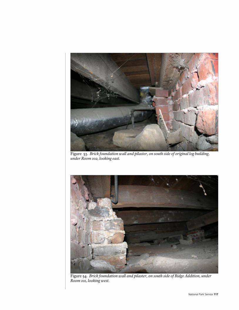
National Park Service 117
Figure 53. Brick foundation wall and pilaster, on south side of original log building, under Room 102, looking east.
Figure 54. Brick foundation wall and pilaster, on south side of Ridge Addition, under Room 101, looking west.
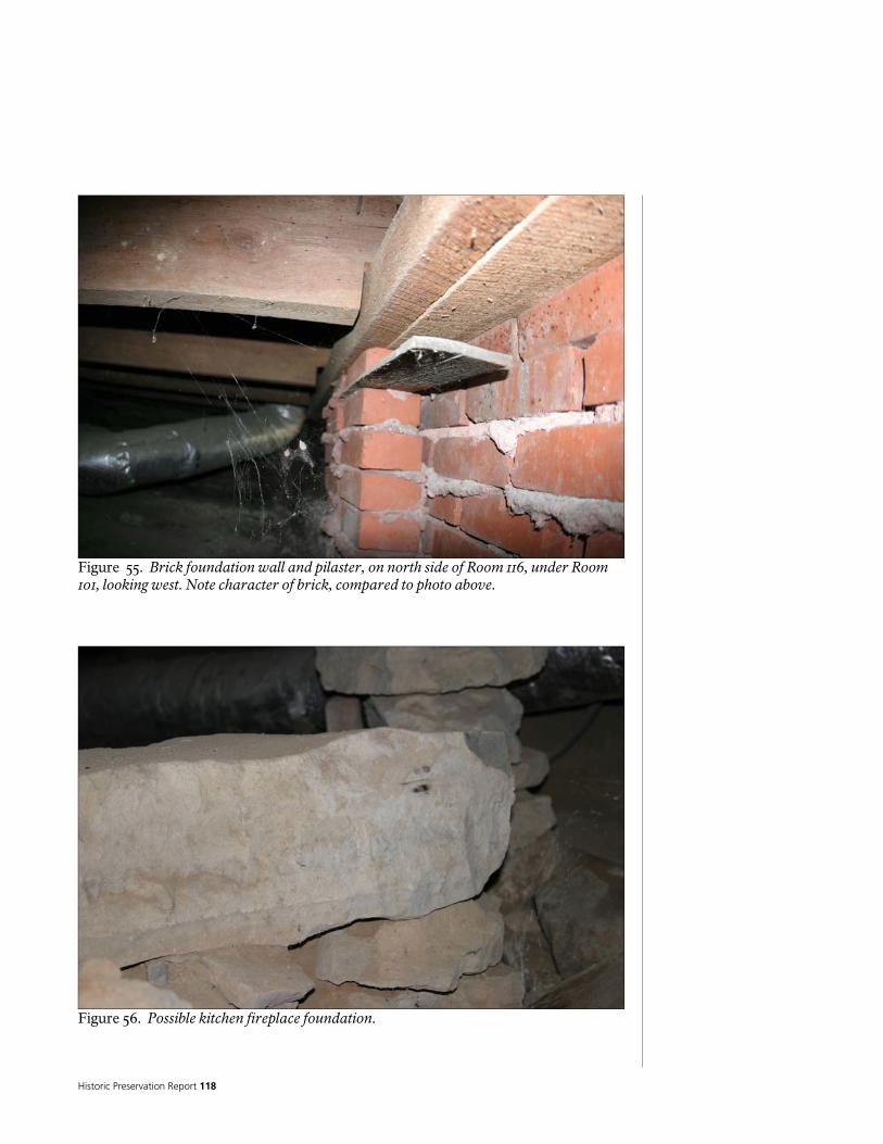
Historic Preservation Report 118
Figure 55. Brick foundation wall and pilaster, on north side of Room 116, under Room 101, looking west. Note character of brick, compared to photo above.
Figure 56. Possible kitchen fireplace foundation.

National Park Service 119
Figure 57. Possible kitchen fireplace foundation.
Figure 58. Stone foundation at north side of west wall of original log building.
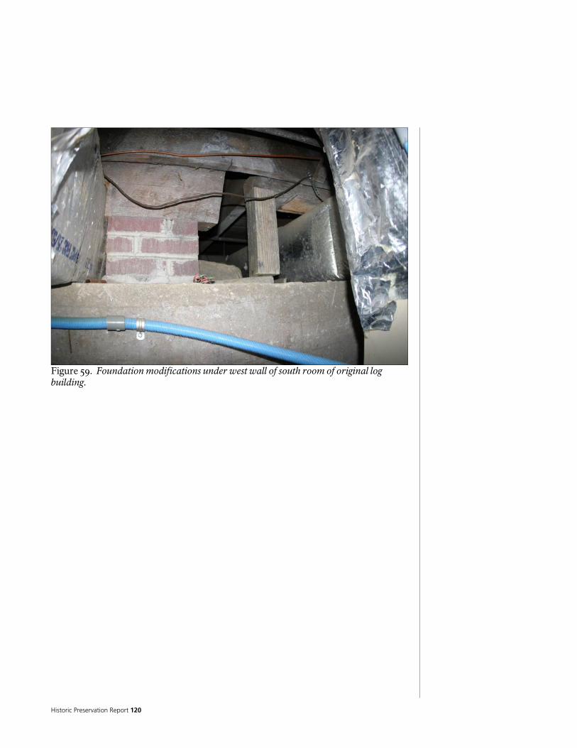
Historic Preservation Report 120
Figure 59. Foundation modifications under west wall of south room of original log building.

National Park Service 121
Figure 60. Basement showing rainwater on floor.

Historic Preservation Report 122
First Floor Structure and Subflooring The floor system has been extensively modified. Portions have been removed or reconstructed, and new framing and flooring has been added. Materials appear to have been recycled, making it difficult to determine the age or sequence of the construction. Generally, the floors are built from wood joists, supported on a variety of beams, girders, plates, and ledgers.
Figure 61. First floor framing. Under the east wall of the original log building, as well as the north wall of Room 102, and the north portion of the west wall (Room 109) are several large hand hewn rectangular beams, which run across the tops of the original stone foundation walls or stone piers. These appear to be what is left of the original beams that defined the perimeter of the original log building, and supported the walls and floor structure. Where sections of these beams are missing, or have been altered, the structure is supported with more modern beams, framing, or masonry. Note that the beam on the east appears to run continuously under the entire length of the building, going under the dogtrot, or central hallway (dog-trot). Under the center of each of the original log building’s main rooms are girders built up from double, nominal 2-inch by 6-inch members, running north south. These bear on brick or stone piers, and support the floor joists above. The floor joists are nominal 3-inch by 9-inch in size, and run east/west. The sub-flooring on top of these joists is nominal 1 ¼-inch by 6-inch wood tongue and groove.
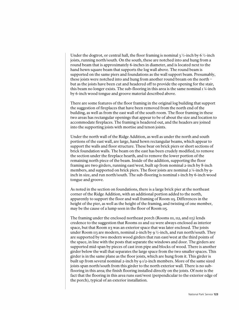
National Park Service 123
Under the dogtrot, or central hall, the floor framing is nominal 3 ½-inch by 6 ½-inch joists, running north/south. On the south, these are notched into and hung from a round beam that is approximately 6-inches in diameter, and is located next to the hand hewn square beam that supports the log wall above. The round beam is supported on the same piers and foundations as the wall support beam. Presumably, these joists were notched into and hung from another round bream on the north – but as the joists have been cut and headered off to provide the opening for the stair, this beam no longer exists. The sub-flooring in this area is the same nominal 1 ¼-inch by 6-inch wood tongue and groove material described above. There are some features of the floor framing in the original log building that support the suggestion of fireplaces that have been removed from the north end of the building, as well as from the east wall of the south room. The floor framing in these two areas has rectangular openings that appear to be of about the size and location to accommodate fireplaces. The framing is headered out, and the headers are joined into the supporting joists with mortise and tenon joints. Under the north wall of the Ridge Addition, as well as under the north and south portions of the east wall, are large, hand hewn rectangular beams, which appear to support the walls and floor structure. These bear on brick piers or short sections of brick foundation walls. The beam on the east has been crudely modified, to remove the section under the fireplace hearth, and to remove the lower portion of the remaining north piece of the beam. Inside of the addition, supporting the floor framing are two girders, running east/west, built up from nominal 2-inch by 8-inch members, and supported on brick piers. The floor joists are nominal 2 ¼-inch by 9-inch in size, and run north/south. The sub-flooring is nominal 1-inch by 6-inch wood tongue and groove. As noted in the section on foundations, there is a large brick pier at the northeast corner of the Ridge Addition, with an additional portion added to the north, apparently to support the floor and wall framing of Room 115. Differences in the height of the pier, as well as the height of the framing, and twisting of one member, may be the cause of a lump seen in the floor of Room 115. The framing under the enclosed northeast porch (Rooms 111, 112, and 113) lends credence to the suggestion that Rooms 111 and 112 were always enclosed as interior space, but that Room 113 was an exterior space that was later enclosed. The joists under Room 113 are modern, nominal 2-inch by 9 ½-inch, and run north/south. They are supported by two modern wood girders that run east/west at the third points of the space, in line with the posts that separate the windows and door. The girders are supported mid-span by pieces of cast iron pipe and blocks of wood. There is another girder below the wall that separates the large space from the two smaller spaces. This girder is in the same plane as the floor joists, which are hung from it. This girder is built up from several nominal 2-inch by 9 1/2-inch members. More of the same sized joists span north/south from this girder to the north exterior wall. There is no sub-flooring in this area; the finish flooring installed directly on the joists. Of note is the fact that the flooring in this area runs east/west (perpendicular to the exterior edge of the porch), typical of an exterior installation.
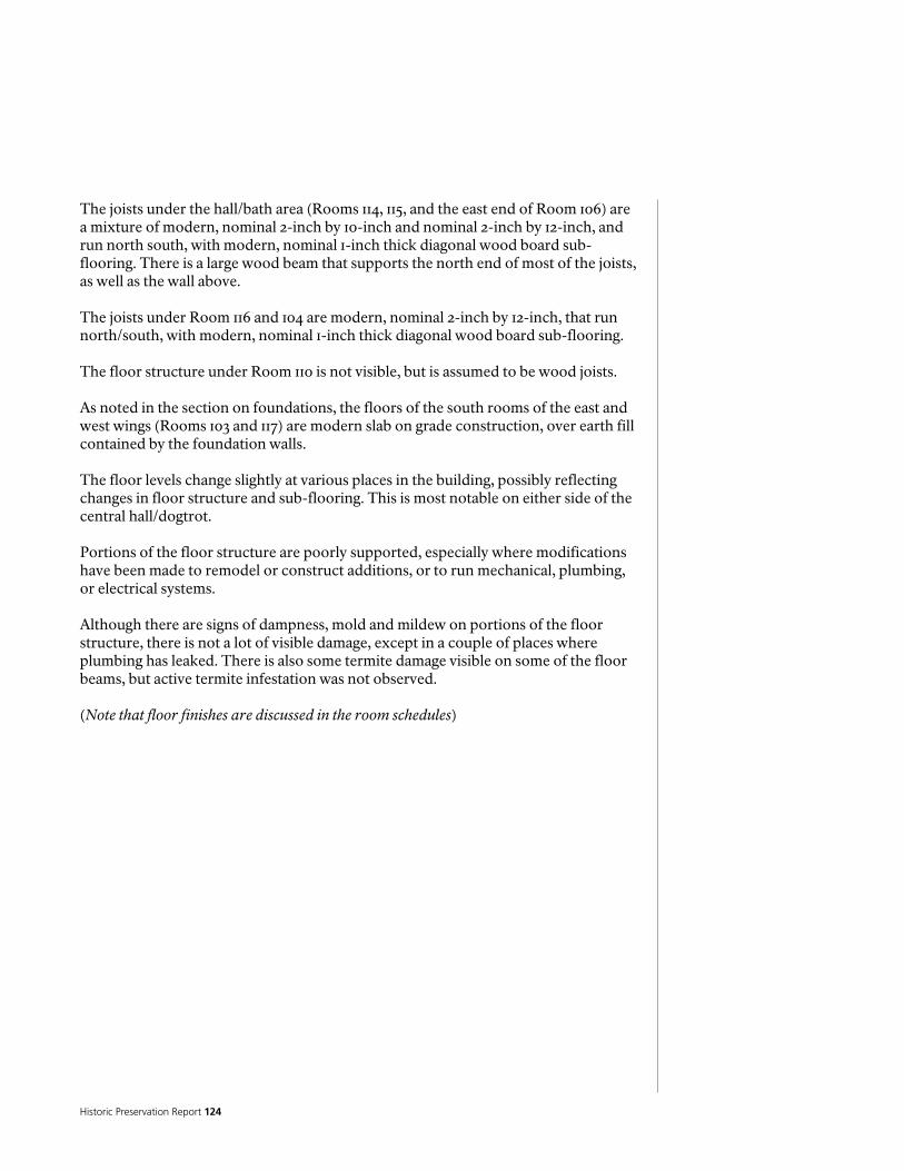
Historic Preservation Report 124
The joists under the hall/bath area (Rooms 114, 115, and the east end of Room 106) are a mixture of modern, nominal 2-inch by 10-inch and nominal 2-inch by 12-inch, and run north south, with modern, nominal 1-inch thick diagonal wood board sub-flooring. There is a large wood beam that supports the north end of most of the joists, as well as the wall above. The joists under Room 116 and 104 are modern, nominal 2-inch by 12-inch, that run north/south, with modern, nominal 1-inch thick diagonal wood board sub-flooring. The floor structure under Room 110 is not visible, but is assumed to be wood joists. As noted in the section on foundations, the floors of the south rooms of the east and west wings (Rooms 103 and 117) are modern slab on grade construction, over earth fill contained by the foundation walls. The floor levels change slightly at various places in the building, possibly reflecting changes in floor structure and sub-flooring. This is most notable on either side of the central hall/dogtrot. Portions of the floor structure are poorly supported, especially where modifications have been made to remodel or construct additions, or to run mechanical, plumbing, or electrical systems. Although there are signs of dampness, mold and mildew on portions of the floor structure, there is not a lot of visible damage, except in a couple of places where plumbing has leaked. There is also some termite damage visible on some of the floor beams, but active termite infestation was not observed. (Note that floor finishes are discussed in the room schedules)
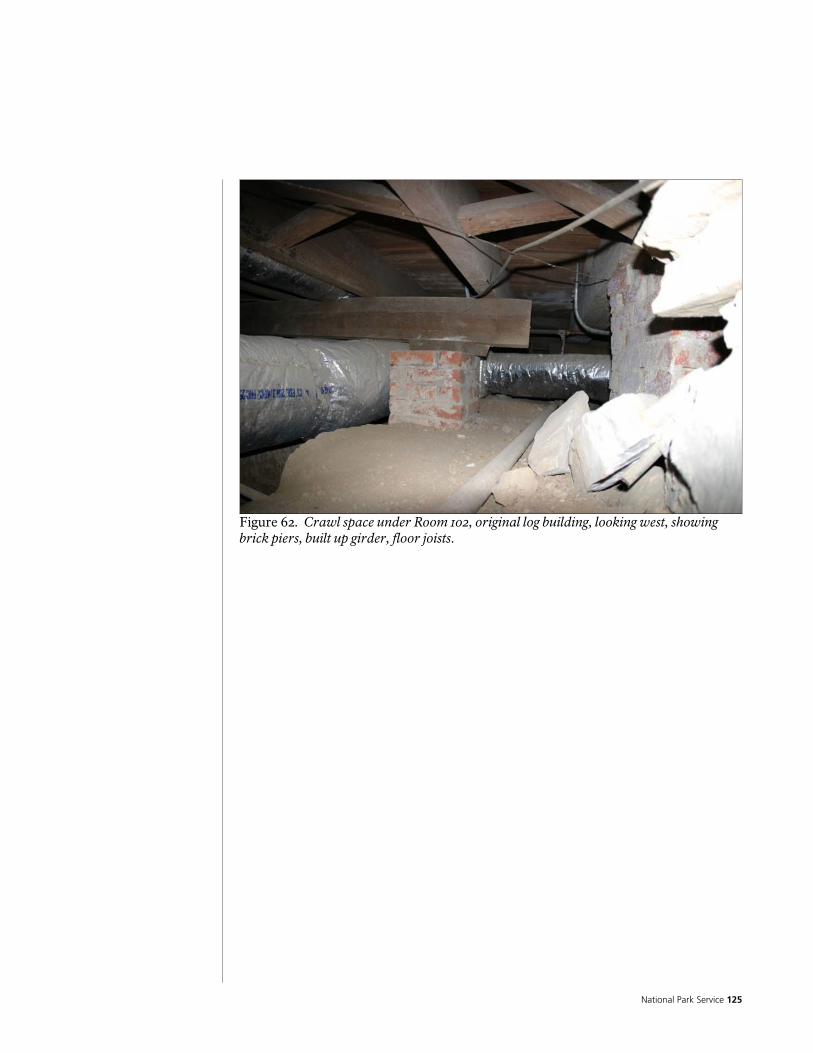
National Park Service 125
Figure 62. Crawl space under Room 102, original log building, looking west, showing brick piers, built up girder, floor joists.

Historic Preservation Report 126
Figure 63. Crawl space under Room 102, showing typical stone pier, supporting beams under wall between Room 102 and Room 106, original log building

National Park Service 127
Figure 64. Crawl space under Room 102, original log building, looking east. Note original east perimeter beam, cut off at duct, and mortise and tenon (?) joint in floor framing, possibly for fireplace or hearth.
Figure 65. Crawl space under Room 102, original log building, looking southeast; original east perimeter beam on left.

Historic Preservation Report 128
Figure 66. Crawl space under Room 102, original log building, looking east at original east perimeter beam. Note stone rubble and trench for HVAC duct.
Figure 67. Crawl space under Room 102, original log building, looking northeast, at beam under north wall Room 102, resting on original east perimeter beam of log building.
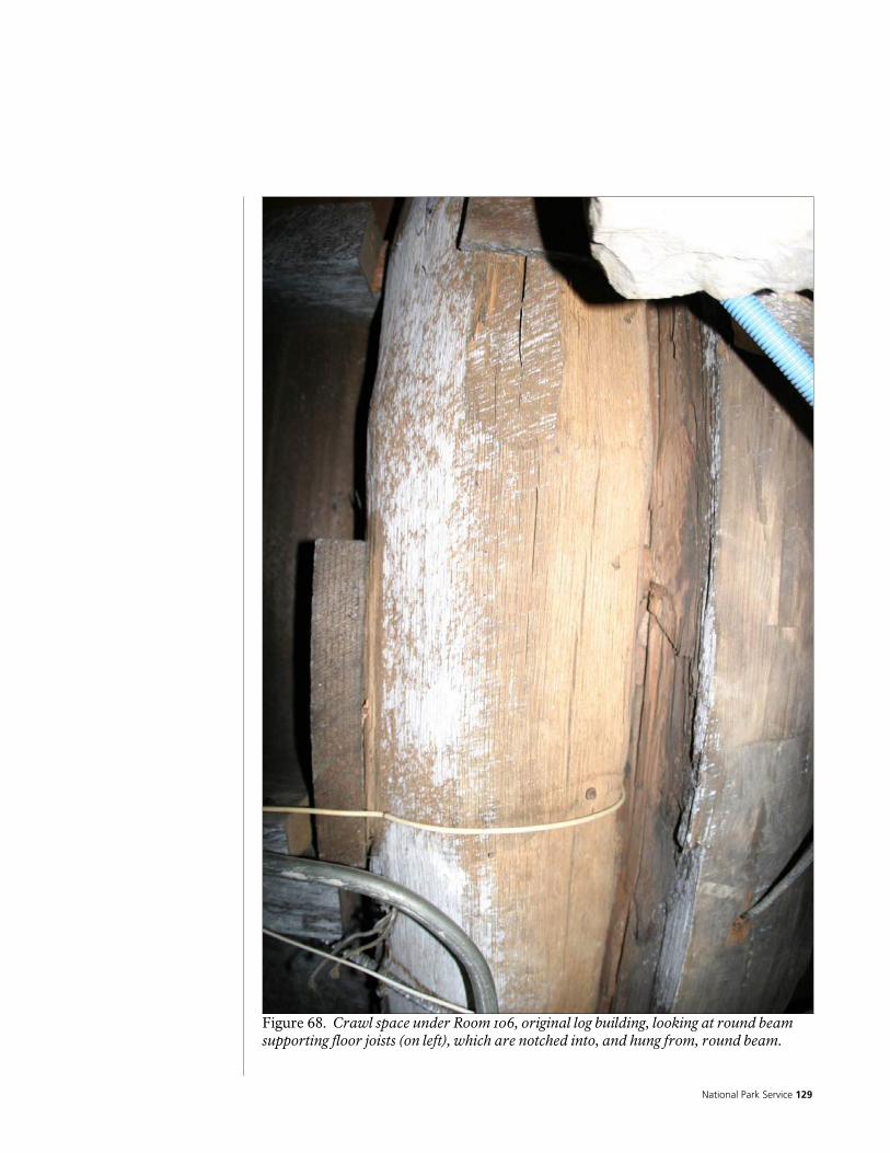
National Park Service 129
Figure 68. Crawl space under Room 106, original log building, looking at round beam supporting floor joists (on left), which are notched into, and hung from, round beam.

Historic Preservation Report 130
Figure 69. Crawl space under Room 106, original log building, looking west, showing floor joists notched into and hung from round beam (on left).
Figure 70. Crawl space under Room 107/109, original log building, looking northwest, showing stone foundation wall under north portion of west wall of original log building.

National Park Service 131
Figure 71. Crawl space under Room 107/109, original log building, looking northwest, showing brick pier, built up girder, and floor joists.
Figure 72. Crawl space under Room 107/108, original log building, looking northeast, showing floor joists.

Historic Preservation Report 132
Figure 73. Crawl space under Room 107/108, original log building, looking east, showing floor joists and original east perimeter beam.
Figure 74. Crawl space under Room 109, original log building, showing mortise opening in floor joist from possible fireplace support framing.

National Park Service 133
Figure 75. Crawl space under Room 109, original log building, showing floor framing member with tenon on end, that was from possible fireplace support framing, sistered with new joist on north (left).
Figure 76. Crawl space under Room 109, original log building, looking east, showing floor joists and original east perimeter beam.

Historic Preservation Report 134
Figure 77. Crawl space under Room 101, Ridge Addition, looking southeast, showing floor joists, built up headers, brick piers, built up girders, fireplace hearth, and brick foundation wall. Note hand hewn beam at south end of east wall, which appears to have been cut off below fireplace hearth.
Figure 78. Crawl space under Room 101, Ridge Addition, looking northeast, showing brick pier under northeast corner, hand hewn beam at east wall (on right), which has had lower portion removed, and hand hewn beam under north wall (on left).
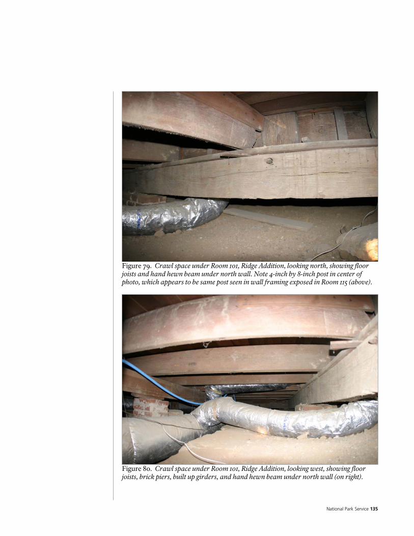
National Park Service 135
Figure 79. Crawl space under Room 101, Ridge Addition, looking north, showing floor joists and hand hewn beam under north wall. Note 4-inch by 8-inch post in center of photo, which appears to be same post seen in wall framing exposed in Room 115 (above).
Figure 80. Crawl space under Room 101, Ridge Addition, looking west, showing floor joists, brick piers, built up girders, and hand hewn beam under north wall (on right).
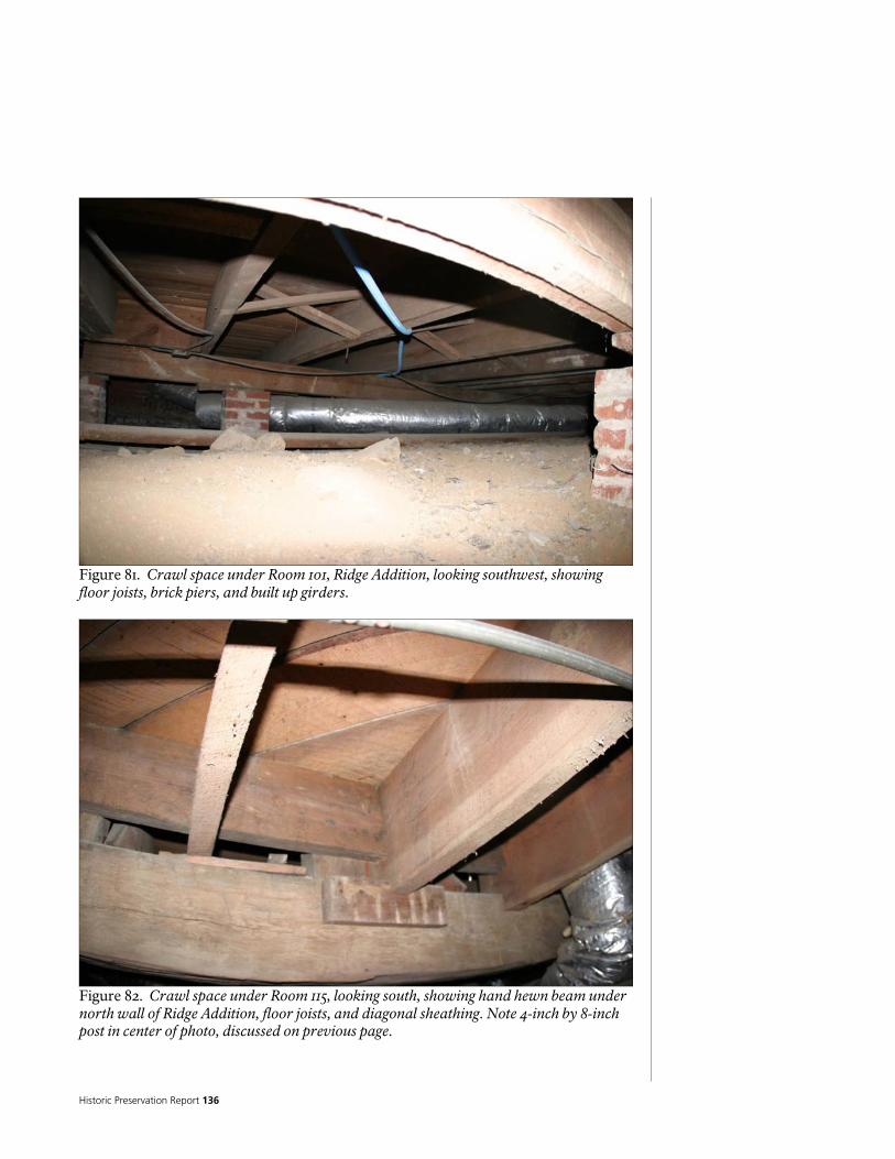
Historic Preservation Report 136
Figure 81. Crawl space under Room 101, Ridge Addition, looking southwest, showing floor joists, brick piers, and built up girders.
Figure 82. Crawl space under Room 115, looking south, showing hand hewn beam under north wall of Ridge Addition, floor joists, and diagonal sheathing. Note 4-inch by 8-inch post in center of photo, discussed on previous page.
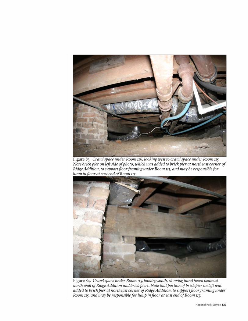
National Park Service 137
Figure 83. Crawl space under Room 116, looking west to crawl space under Room 115. Note brick pier on left side of photo, which was added to brick pier at northeast corner of Ridge Addition, to support floor framing under Room 115, and may be responsible for lump in floor at east end of Room 115.
Figure 84. Crawl space under Room 115, looking south, showing hand hewn beam at north wall of Ridge Addition and brick piers. Note that portion of brick pier on left was added to brick pier at northeast corner of Ridge Addition, to support floor framing under Room 115, and may be responsible for lump in floor at east end of Room 115.

Historic Preservation Report 138
Figure 85. Crawl space under Room 115, looking west, showing floor joists and hand hewn beam at north wall of Ridge Addition on left.
Figure 86. Crawl space under Room 114, showing sewer lines from bathroom above. Note plastic sheeting stuffed into missing cleanout.

National Park Service 139
Figure 87. Crawl space under Rooms 114/115, looking north, showing floor joists and sewer lines.
Figure 88. Crawl space under Room 116, looking southwest, showing floor joists, and brick pier at northeast corner of Ridge Addition. Note addition to pier on north (right), was added to support floor framing under Room 115, and may be responsible for lump in floor at east end of Room 115.

Historic Preservation Report 140
Figure 89. Crawl space under Room 116, looking southeast, showing floor joists on ledgers, on brick foundation walls. Note character of brick, compared to other photos.
Figure 90. Crawl space under Room 116, looking east, showing floor joists on ledgers, and brick foundation walls. Note character of brick, compared to other photos.

National Park Service 141
Figure 91. Crawl space under Room 111, looking north into to crawl space under rooms 111 and 112, showing floor joists, brick foundation walls and piers, and girder underneath north wall of Room 111.
Figure 92. Crawl space under Rooms 111 and 113, looking northwest, showing floor joists, girder under north wall of Room 113, and east perimeter beam of original log cabin, on left. Note stone pier under perimeter beam.
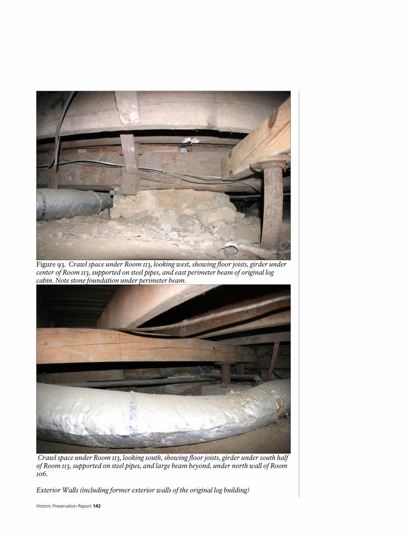
Historic Preservation Report 142
Figure 93. Crawl space under Room 113, looking west, showing floor joists, girder under center of Room 113, supported on steel pipes, and east perimeter beam of original log cabin. Note stone foundation under perimeter beam.
Crawl space under Room 113, looking south, showing floor joists, girder under south half of Room 113, supported on steel pipes, and large beam beyond, under north wall of Room 106. Exterior Walls (including former exterior walls of the original log building)

National Park Service 143
The exterior wall structure of the original log building is built from hand hewn logs, notable for the interlocking v-joints at the corners. The size of the logs varies, but they are hewn to a thickness of approximately 6-inches, possibly to provide a vertical surface for furring (nailers), used to attach the exterior siding and interior finishes. The gaps between the logs appear to have had crude wood chinking (some of which remains), but no evidence exists to suggest that they were ever chinked with anything else, such as mud or cementitious products, that provided weather-proofing. This suggests that the logs may never have been exposed; that the walls were covered with siding as soon as they were built. There are also holes and pegs at the corners; the purpose is not obvious. They do not appear to be holding the logs together; they may actually be for the original corner boards. The tops of the log walls have nominal 6-inch by 12-inch hand hewn rectangular beams laid on top of the last course of logs, presumably to provide a flat surface to support floor and/or ceiling framing, and possibly to act as bond beams, tying the tops of the walls together. Large portions of the log walls have been removed and replaced with wood infill studs. A hand hewn wood beam visible in the upstairs central hallway appears to be the continuation of the beam over the top of the log wall to the north. A rectangular beam, with several courses of logs above, spans across the west end of the central hall (dogtrot), beginning at the level of the stair landing. They are fit into the logs forming the corners of the large rooms on the north and south. There do not appear to be any continuous logs above them, and it is impossible to see if there were logs below, which have been removed. However, the location o f these logs and the beam coinciding with the level of the stair landing, suggest that the stair may have been built at the same time as the original log building. The interior surfaces of the log walls have been covered with gypsum plaster, on modern wood lath, on wood furring. Finishes are described in more detail below. The furring and fasteners appear to have been recycled. Portions of the log walls have been exposed to view by removal of the interior wall finishes. This sheds some light on their construction, but does not provide enough visual access to hidden features make any conclusive overall determinations. Several unused window openings are seen in the exposed logs; these may be the original window locations. Termite damage is visible in some of the exposed logs on the east wall of the second story, but no signs of active termites were observed. The rectangular beam at the top of the east wall of the second story appears to be charred. No evidence of charring was found on the logs underneath this beam, suggesting this beam may have been recycled from another location.
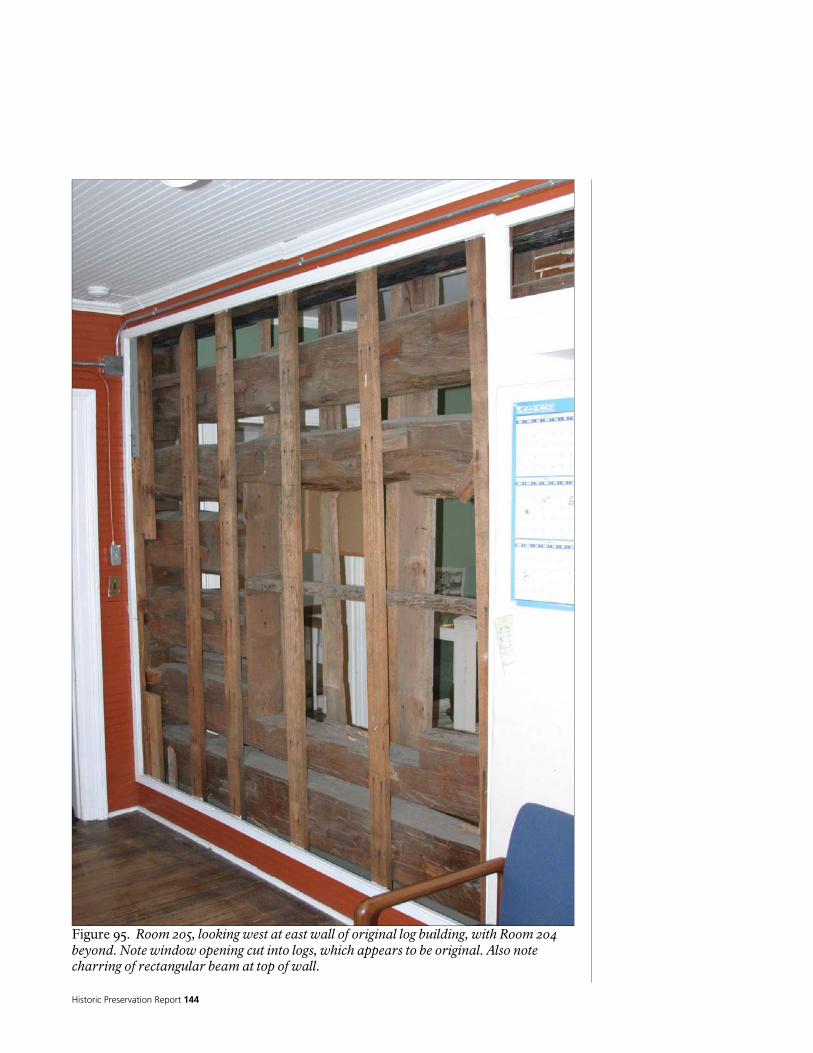
Historic Preservation Report 144
Figure 95. Room 205, looking west at east wall of original log building, with Room 204 beyond. Note window opening cut into logs, which appears to be original. Also note charring of rectangular beam at top of wall.
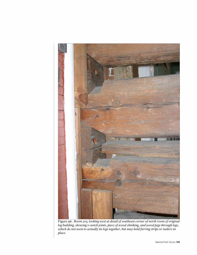
National Park Service 145
Figure 96. Room 205, looking west at detail of southeast corner of north room of original log building, showing v-notch joints, piece of wood chinking, and wood pegs through logs, which do not seem to actually tie logs together, but may hold furring strips or nailers in place.

Historic Preservation Report 146
Figure 97. Detail of logs from original log building, showing attachment of furring strips or nailers.

National Park Service 147
Figure 98. Room 205, looking northwest at east wall of original log building. Note window opening cut into logs on right side of photo, which appears to be original, and wood stud infill framing where logs have been removed.
Figure 99. North wall of Room 106, showing logs and wood stud infill framing at south wall of north room of original log building.
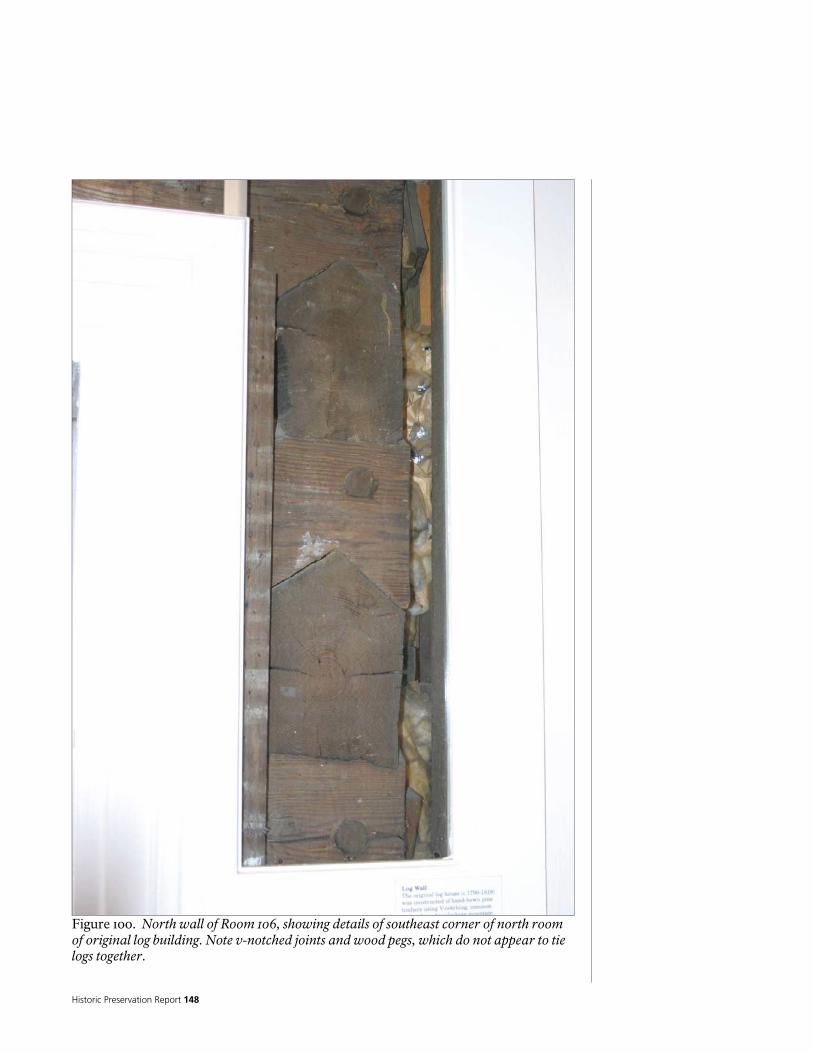
Historic Preservation Report 148
Figure 100. North wall of Room 106, showing details of southeast corner of north room of original log building. Note v-notched joints and wood pegs, which do not appear to tie logs together.
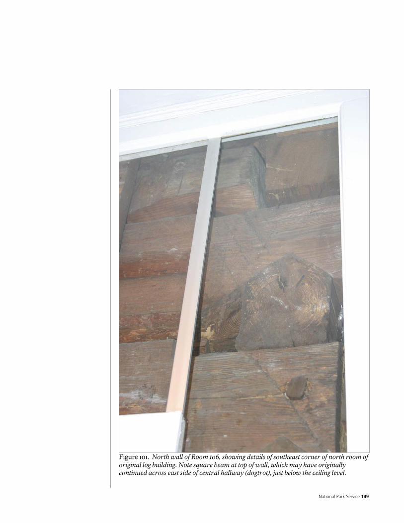
National Park Service 149
Figure 101. North wall of Room 106, showing details of southeast corner of north room of original log building. Note square beam at top of wall, which may have originally continued across east side of central hallway (dogtrot), just below the ceiling level.

Historic Preservation Report 150
Figure 102. Room 204, looking east at east wall of original log building, with Room 205 beyond. Note recycled wood used as furring strips or nailers.
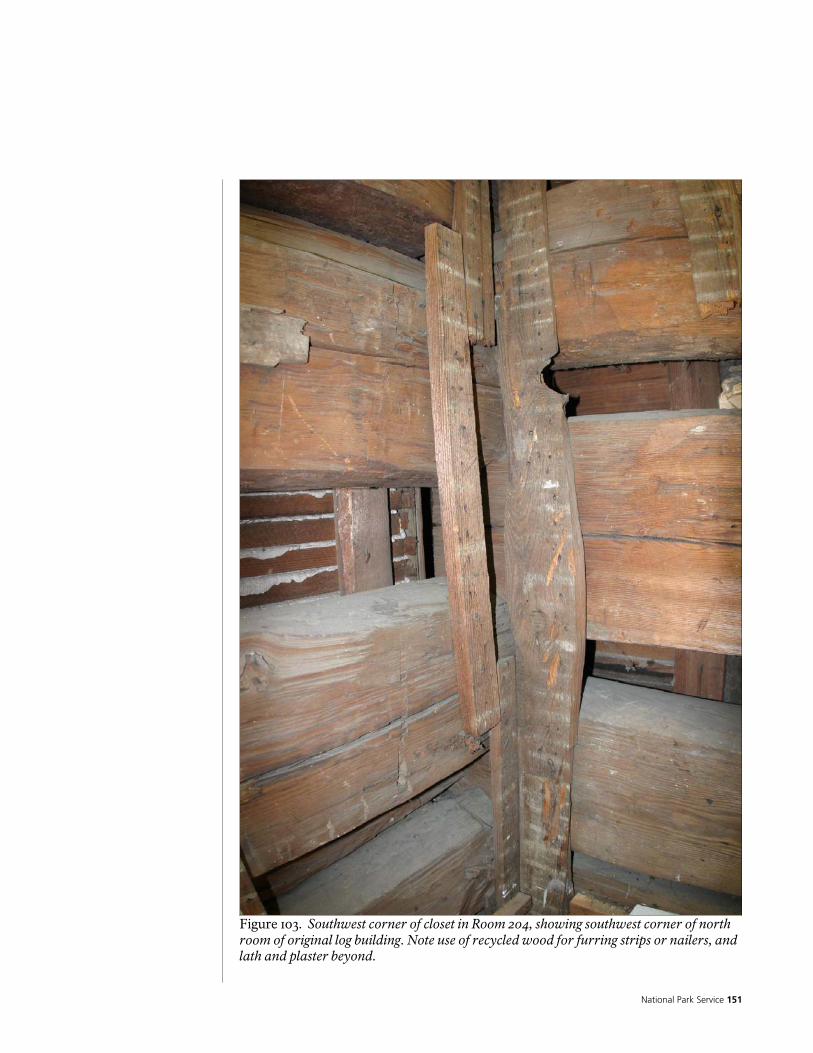
National Park Service 151
Figure 103. Southwest corner of closet in Room 204, showing southwest corner of north room of original log building. Note use of recycled wood for furring strips or nailers, and lath and plaster beyond.
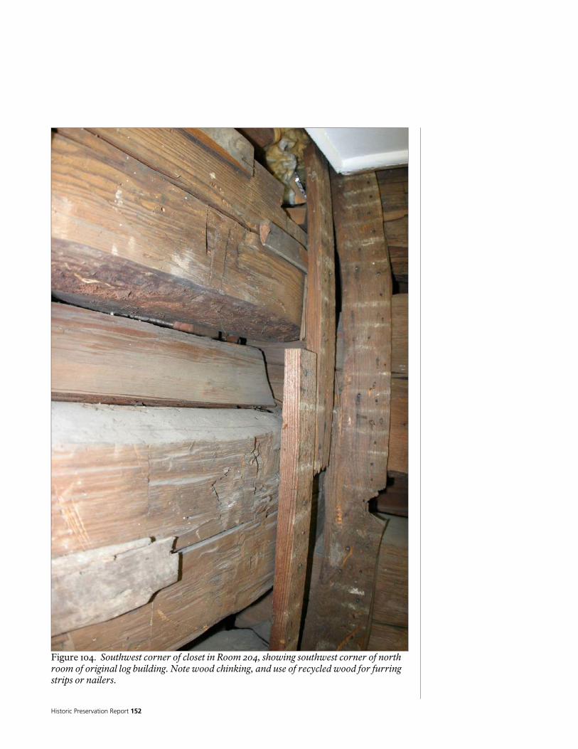
Historic Preservation Report 152
Figure 104. Southwest corner of closet in Room 204, showing southwest corner of north room of original log building. Note wood chinking, and use of recycled wood for furring strips or nailers.

National Park Service 153
Figure 105. Detail of west wall of closet in Room 204. Note wood pegs, which appear to have been used to attaché furring or nailers to the exterior, and use of recycled wood for furring strips or nailers.
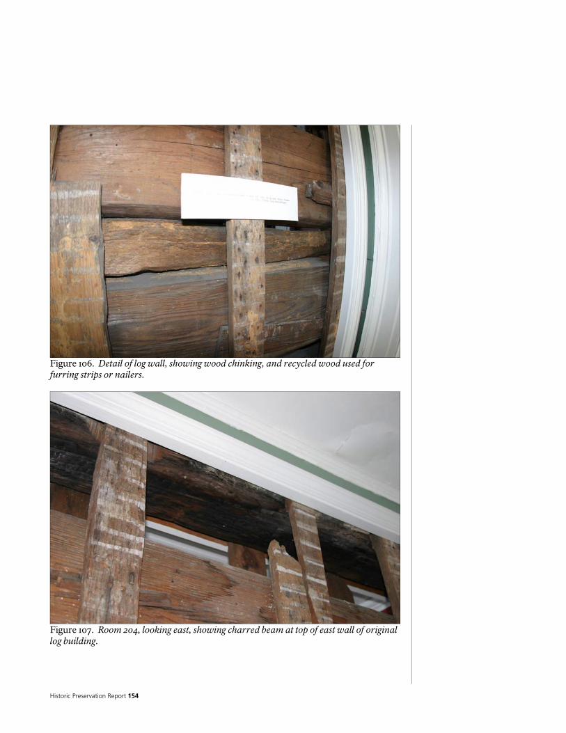
Historic Preservation Report 154
Figure 106. Detail of log wall, showing wood chinking, and recycled wood used for furring strips or nailers.
Figure 107. Room 204, looking east, showing charred beam at top of east wall of original log building.

National Park Service 155
Figure 108. Room 113, looking west, showing north portion of east wall of original log building. Note wood stud infill, where logs have been removed, and lath and plaster beyond.

Historic Preservation Report 156
The exterior walls of the Ridge Addition appear to be built with a mixture of post and beam construction, and nominal 2-inch by 4-inch wood infill studs. This is exposed in the northeast corner of the first story, where the wall finish has been removed, and clear glazing has been installed.
Figure 109. North wall of Ridge Addition, exposed in Room 115, showing nominal 4-inch by 8-inch post in wall, which is also visible in crawl space. (See photos in section on floors). The exterior walls of the Post Ridge period, as well as the Colonial Revival period, appear to be nominal 2-inch by 4-inch wood studs; of modern origin in the case of the Colonial Revival period. The exterior walls are covered with painted wood clapboard siding (also referred to as “weatherboard siding”). The size and thickness of the boards varies, as does the exposure, which ranges from about 4-inches to nearly 5-inches. In general, the siding is installed on nominal ¾-inch wood board sheathing. On the log walls at the north side of the west wall of the original log building, the siding is installed on crude wood furring strips, which are installed directly to the logs. This suggests that this may be some of the oldest siding on the building, and may be original. The exterior walls of the sun porch and screen porch (Rooms 117 and 103), appear to be a mixture of wood post and beam, with wood stud framing above the arched openings. There are wood infill panels below the windows on the exterior of Room 103.

National Park Service 157
The exterior walls have Greek Revival style painted wood trim that includes frieze boards (with small cornice and architrave), corner boards, some stylized as pilasters, and a “water table” at the base of the siding, that in some cases has a painted sheet metal flashing incorporated into it. The door and window trim is Architrave style. The interior surfaces of the exterior walls are, for the most part, covered with gypsum plaster on modern wood lath, or painted wood siding. Finishes are described in more detail below. The siding and trim is weathered and deteriorated, and in fair to poor condition. Some of the wood is visibly damp, and the paint is failing. Many deteriorated or damaged pieces of siding and trim have been cut out and replaced.
Figure 110. Exterior view of building.

Historic Preservation Report 158
Figure 111. Exterior view of building.
Figure 112. Exterior view of building.

National Park Service 159
Figure 113. Exterior view of building.
Figure 114. Detail of patch in siding at bottom of wall.

Historic Preservation Report 160
Figure 115. Detail of patching in wood trim. Interior Walls There do not appear to have been any interior walls in the original log building. However, several of the original exterior walls are now enclosed by remodeling or additions, and have become interior walls. These include the remains of the east wall, as well as the walls separating the original large rooms form the dogtrot, or central hallway (dogtrot). These walls have hand hewn logs, which are described in the section on exterior walls, above. Modern, nominal 2-inch by 4-inch, wood stud- framed walls have been built inside of the original rooms, to reconfigure or subdivide the rooms into smaller spaces. Several areas of the log walls are exposed to the interior of the building, where the finishes have been removed, and clear glazing has been installed. There do not appear to have been any interior walls in the original Ridge Addition. However, as noted above, several of the original exterior walls are now enclosed by remodeling or additions, and have become interior walls. These include portions of the north and east walls. Also, as in the log building portion, modern, nominal 2-inch by 4-inch wood stud framed walls have been built inside of some of the rooms, to reconfigure them, and to provide closet spaces. Portions of the wall construction are exposed in the northeast corner of the first story, where the wall finish has been removed, and clear glazing has been installed. The interior walls at the remainder of the building all appear to be built from modern, nominal 2-inch by 4-inch wood studs.
National Park Service 161
The interior walls are, for the most part, covered with gypsum plaster on modern wood lath, or painted wood siding. Finishes are described in more detail below. First Floor Ceiling/Second Floor Structure and Subflooring (Original Log Building, Ridge Addition, Room 203, Enclosed Northeast Porch [Room 205], and Room 206,) The first floor ceiling/second floor structure in the original log building appears to be nominal 3-inch by 8-inch joists at 24-inches on center, running east/west. The subflooring appears to be nominal 1 ¼-inch by 6-inch tongue and groove, with two layers of flooring above. Presumably, the Ridge Addition is framed with wood joists similar in size and character, as are Rooms 203 and 206. Note that the ceiling height in Room 101 (of the Ridge Addition first floor) is lower than in the surrounding rooms, suggesting that the joists in this area may be slightly deeper. The structure in the enclosed northeast porch area (Room 205) is difficult to see, so some assumptions have been made. It appears that the finish flooring on the second floor is installed directly over modern nominal 2-inch by 6-inch wood joists, which run east/west. There appears to be a shallow space below these, and what is presumed to be the original sloped floor/ceiling is located below, framed with similar sized joists. The total thickness of this floor ceiling is approximately 20-inches. First Floor Ceiling/Attic Floor (at East and West Wings) In the east wing, which does not have a second floor, the roof and ceiling structure is readily visible from in the attic. However, as there is no attic access over the west wing, the framing in this area was not investigated. It is probably similar to that over the east wing. The first floor ceiling/attic floor structure over the east wing consists of modern, nominal 2-inch by 6-inch joists. These joists project out approximately 8-inches beyond the wall framing. The tops of these joists are located approximately 1-inch above the finished floor in the Ridge Addition (Room 201). The ends of these joists are ripped down 1 1/2-inches to accommodate nominal 1-inch by 6-inch plates that support the rafters. Second Floor Ceiling/Attic Floor (at two story portions): The second floor ceiling/attic floor structure over the original log building consists of nominal 3-inch by 8 1/2-inch joists, which are notched to fit over the beam on the top of the log walls, and project out approximately 11 to 12 inches beyond the wall structure. There is no flooring in this portion of the attic. As noted elsewhere, one wood beam runs across the central hall (dogtrot), just below the ceiling level of the second floor. This log is shaved on the north end, and presumably fits into the log corners of the original large rooms to the north and south. The bottom of this log is notched, apparently for posts or studs, and there are

Historic Preservation Report 162
numerous nail holes in its surfaces. The surface of this beam shows charring, similar to the beam at the top of the log wall on the east side of Room 204.
Figure 116. Ceiling of Room 203, looking east, showing log/beam running across room, just under level of ceiling.
Figure 117. Close-up of north end of log/beam, showing shaved end, presumably to fit into logs at corner of north room. Note charring.

National Park Service 163
Figure 118. Close-up of log/beam, showing notching, presumably for wood studs. The second floor ceiling/attic floor structure over the Ridge Addition consists of nominal 2 ¾-inch by 8 3/4-inch joists, which project out approximately 17 inches beyond the wall framing. There is no flooring in this portion of the attic. The second floor ceiling/attic floor structure over the enclosed northeast porch (Room 205) is not visible, but is assumed to consist of modern, nominal 2-inch by 4-inch joists, similar to the roof joists in this area. Thee is a sight slope to the ceiling. It is not obvious if these joists project out beyond the wall structure, to form the eve, but it is probable. There is no flooring in this portion of the attic. The second floor ceiling/attic floor structure over Rooms 206 and the east portion of Room 203 consists of modern, nominal 2-inch by 6-inch joists, which end on top of the wall structure. Short sections of framing are sistered on to the joists, and project out approximately beyond the wall structure, a similar distance to the projection of the joists in the Ridge Addition. There is a double plate on top of the ends of these members, which supports the rafters. There is no flooring in this portion of the attic. Roof System The roof system of the building, although it appears relatively simple from the exterior, is actually quite complicated. There are multiple pitched, hipped roofs, several of which were added during the Colonial Revival period remodeling. Framing, plank sheathing, and wood shingles still in place on the older roofs, only visible from within the attic, may date to the Ridge Period.
Historic Preservation Report 164
The lower portions of the roofs are of medium steepness, changing slope near the top, becoming large, low sloped hipped areas. There is also a low sloped roof over the enclosed northeast porch. Close inspection of the steeper roof planes, which at first appear to all be the same pitch, reveal that there is quite a bit of variation, from approximately 4 ½ in 12 to approximately 6 ½ in 12. The original log building appears to originally have had continuous pitched, gabled roof, built from nominal 4-inch wide by 3-inch deep sawn wood rafters. The tops of the rafters are joined with lap joints, and held in place with wood pegs. The bases of the rafters are nailed to a nominal 1-inch by 6-inch plate, which is attached to the top of the second floor ceiling joists. Short pieces of wood have been sistered on to the joists to extend the roof overhang beyond the ends of the joists. Evidence of possible modifications and recycling of materials suggests that at one time the roof had gable ends on the north and south, but was later modified into the hipped design that exists now. Most notable is the presence of recycled wood framing members with unused mortise and tenon joints, suggesting that the gable end walls were built with vertical studs/posts, joined to plates at top and bottom. The west, north, and south planes of this roof are exposed and covered with modern tongue and groove wood sheathing, but a portion of the east plane is actually concealed from the exterior by additions, and is only visible from the attic. The visible portion is covered with large wood planks and some wood shingles near the top which may date to the Ridge Period. The roof structure over the Ridge Addition is built from nominal 2 1/2-inch by 4-inch sawn wood rafters, which bear on nominal 1-inch by 6-inch plates, with chamfered outside edges. These plates bear on the ends of the ceiling joists. There is a nominal 3/4-inch by 5 ½-inch ridge board. Similar to the roof over the log building, the north plane of this roof is concealed under subsequent additions. It has rough nominal 1-inch thick boards on top of the rafters. The south and east roof planes are exposed and covered with modern tongue and groove wood sheathing, but the north plane is concealed beneath another roof, and only visible from within the attic. The roof over the Ridge Addition is pitched, with a hip on the east end. Architectural evidence suggests that when this roof was added to that of the original log building, the south portion of the original log building roof (and gable end) was removed, and the plane of the Ridge Addition roof was extended to form the hipped corner on the southwest side of the original log building. It is possible that the north end of the original log building was modified into a hip at the same time. Close inspection reveals that the pitches of the Ridge Addition, as well as of the original log building, are all slightly different. The Ridge Addition is several feet wider than the original log building; in order for the ridge lines to meet (as they do), the pitch of the Ridge Addition would need to be flatter. Given that the extension of the Ridge Addition roof plane forms the hip of the original log building, it makes sense to assume that whatever existed on the south end of the original log building roof was modified into its present construction. Consistent with the floor/ceiling framing below, there appears to have been a
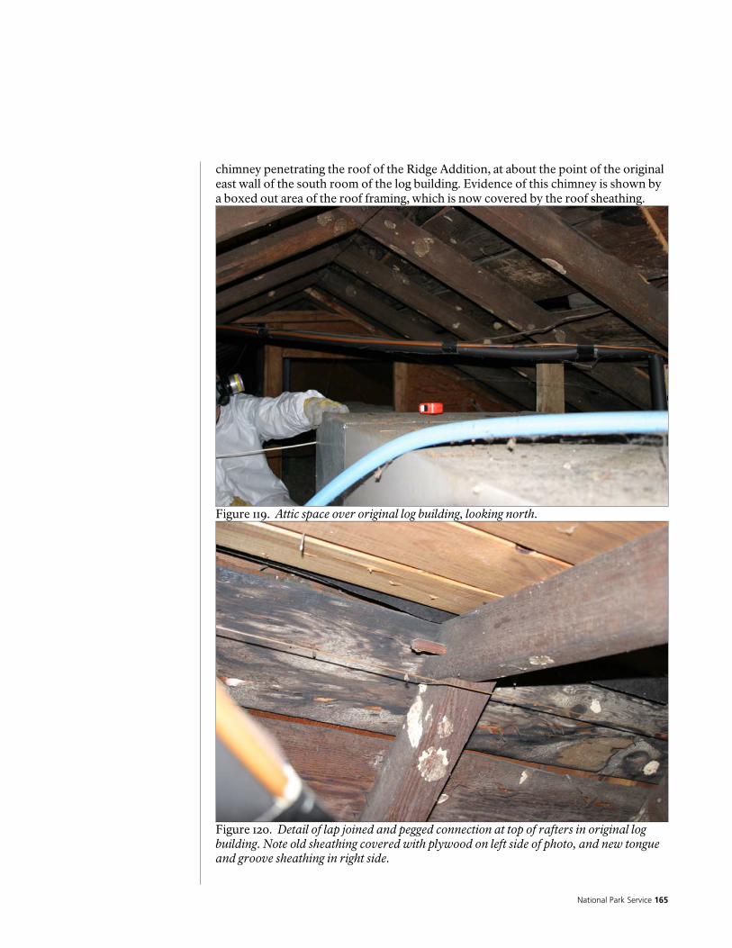
National Park Service 165
chimney penetrating the roof of the Ridge Addition, at about the point of the original east wall of the south room of the log building. Evidence of this chimney is shown by a boxed out area of the roof framing, which is now covered by the roof sheathing.
Figure 119. Attic space over original log building, looking north.
Figure 120. Detail of lap joined and pegged connection at top of rafters in original log building. Note old sheathing covered with plywood on left side of photo, and new tongue and groove sheathing in right side.
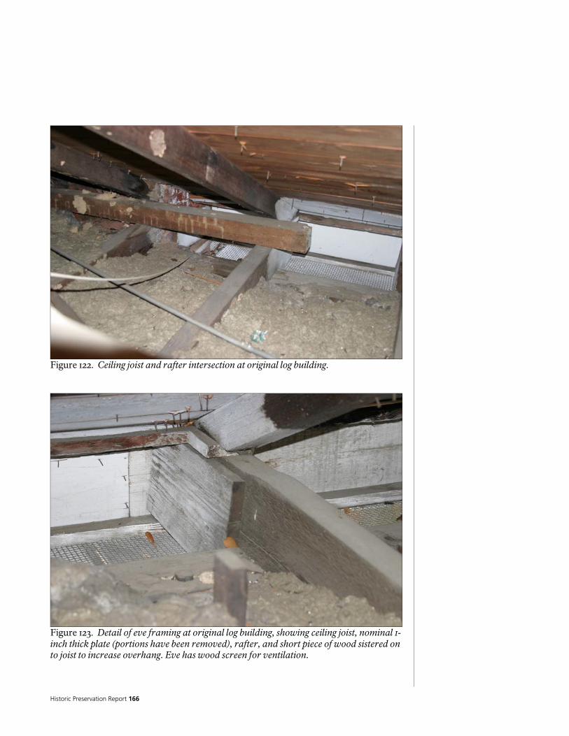
Historic Preservation Report 166
Figure 122. Ceiling joist and rafter intersection at original log building.
Figure 123. Detail of eve framing at original log building, showing ceiling joist, nominal 1-inch thick plate (portions have been removed), rafter, and short piece of wood sistered on to joist to increase overhang. Eve has wood screen for ventilation.
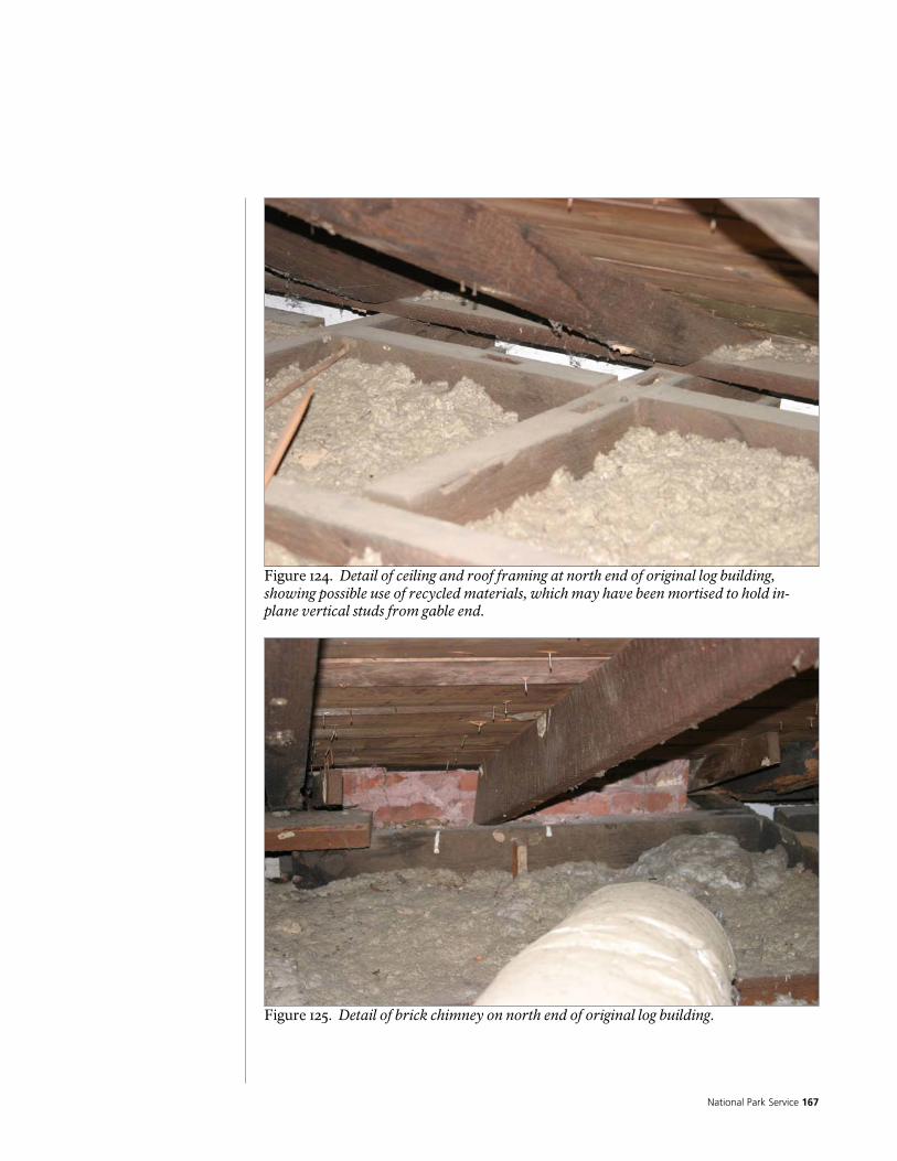
National Park Service 167
Figure 124. Detail of ceiling and roof framing at north end of original log building, showing possible use of recycled materials, which may have been mortised to hold in-plane vertical studs from gable end.
Figure 125. Detail of brick chimney on north end of original log building.
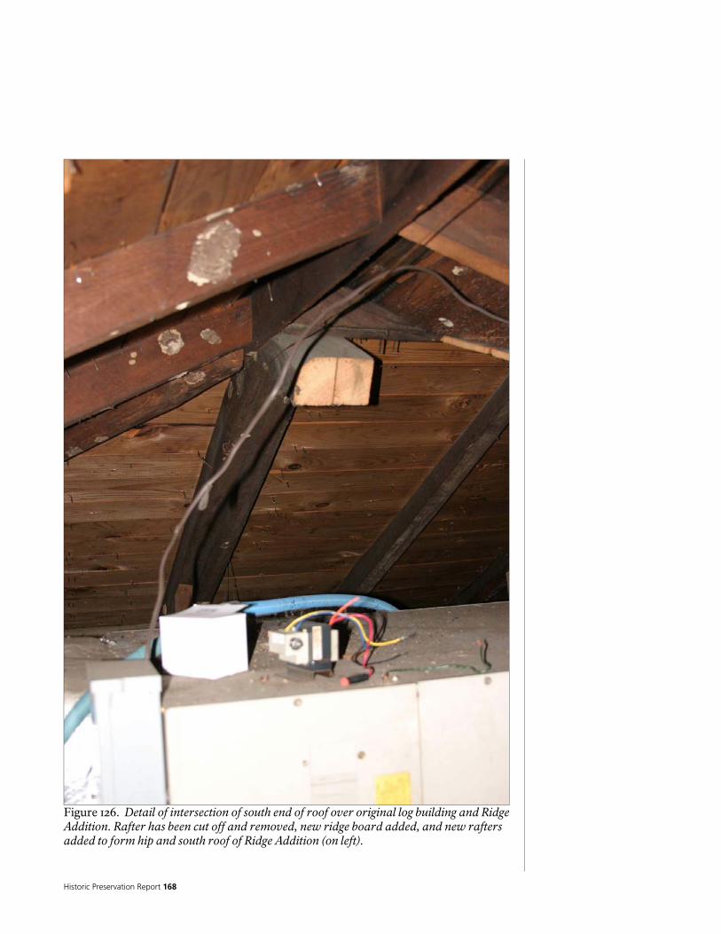
Historic Preservation Report 168
Figure 126. Detail of intersection of south end of roof over original log building and Ridge Addition. Rafter has been cut off and removed, new ridge board added, and new rafters added to form hip and south roof of Ridge Addition (on left).
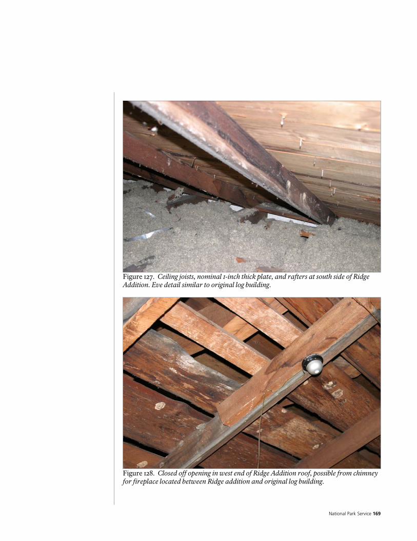
National Park Service 169
Figure 127. Ceiling joists, nominal 1-inch thick plate, and rafters at south side of Ridge Addition. Eve detail similar to original log building.
Figure 128. Closed off opening in west end of Ridge Addition roof, possible from chimney for fireplace located between Ridge addition and original log building.

Historic Preservation Report 170
Figure 129. Detail of intersection of east plane of original log building roof and north plane of Ridge Addition roof, concealed by new roof. Framing, sheathing, and shingles may date to Ridge Period.
Figure 130. Detail of mid-point of north plane of Ridge Addition roof, concealed by new roof. Note that section of roof has been removed to facilitate installation of HVAC ductwork and access into attic created by new roof.
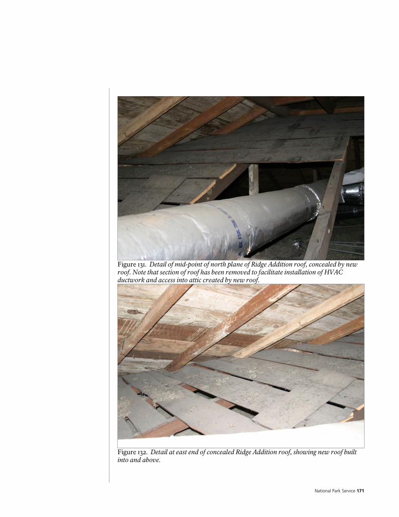
National Park Service 171
Figure 131. Detail of mid-point of north plane of Ridge Addition roof, concealed by new roof. Note that section of roof has been removed to facilitate installation of HVAC ductwork and access into attic created by new roof.
Figure 132. Detail at east end of concealed Ridge Addition roof, showing new roof built into and above.
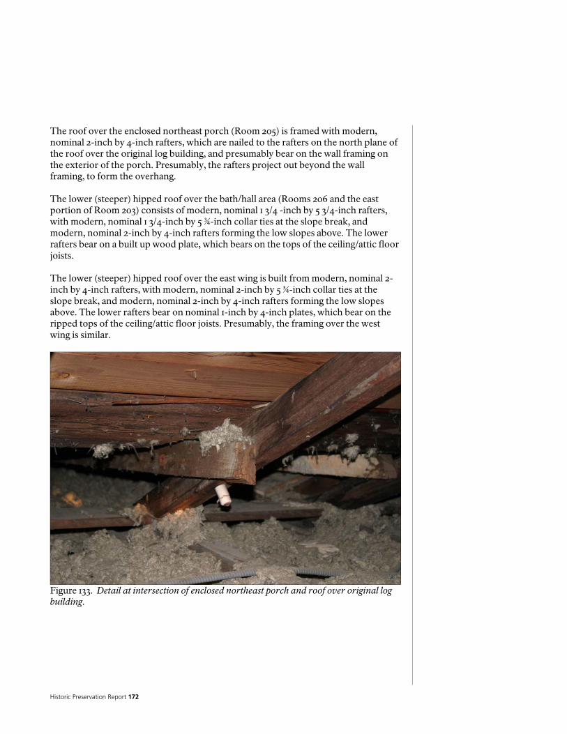
Historic Preservation Report 172
The roof over the enclosed northeast porch (Room 205) is framed with modern, nominal 2-inch by 4-inch rafters, which are nailed to the rafters on the north plane of the roof over the original log building, and presumably bear on the wall framing on the exterior of the porch. Presumably, the rafters project out beyond the wall framing, to form the overhang. The lower (steeper) hipped roof over the bath/hall area (Rooms 206 and the east portion of Room 203) consists of modern, nominal 1 3/4 -inch by 5 3/4-inch rafters, with modern, nominal 1 3/4-inch by 5 ¾-inch collar ties at the slope break, and modern, nominal 2-inch by 4-inch rafters forming the low slopes above. The lower rafters bear on a built up wood plate, which bears on the tops of the ceiling/attic floor joists. The lower (steeper) hipped roof over the east wing is built from modern, nominal 2-inch by 4-inch rafters, with modern, nominal 2-inch by 5 ¾-inch collar ties at the slope break, and modern, nominal 2-inch by 4-inch rafters forming the low slopes above. The lower rafters bear on nominal 1-inch by 4-inch plates, which bear on the ripped tops of the ceiling/attic floor joists. Presumably, the framing over the west wing is similar.
Figure 133. Detail at intersection of enclosed northeast porch and roof over original log building.
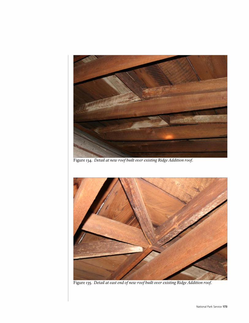
National Park Service 173
Figure 134. Detail at new roof built over existing Ridge Addition roof.
Figure 135. Detail at east end of new roof built over existing Ridge Addition roof.
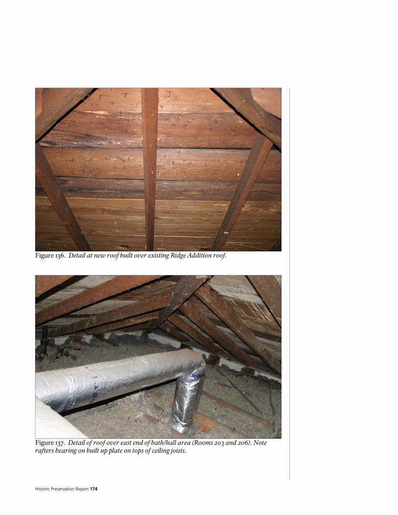
Historic Preservation Report 174
Figure 136. Detail at new roof built over existing Ridge Addition roof.
Figure 137. Detail of roof over east end of bath/hall area (Rooms 203 and 206). Note rafters bearing on built up plate on tops of ceiling joists.
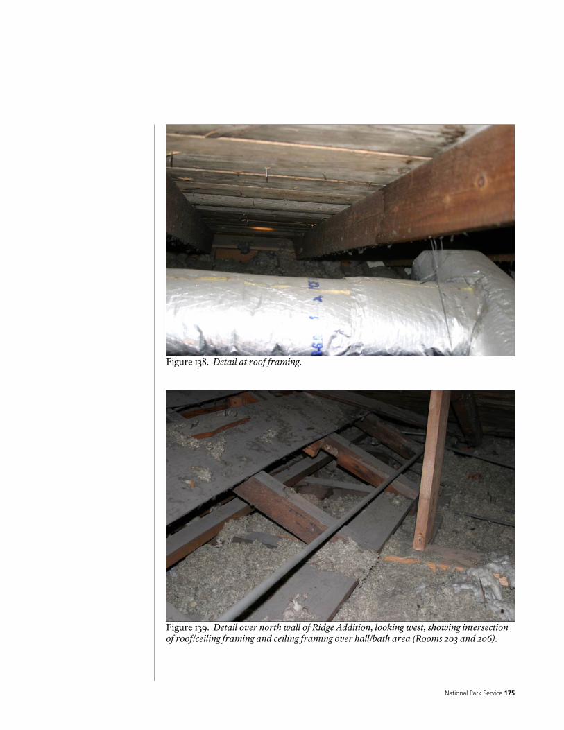
National Park Service 175
Figure 138. Detail at roof framing.
Figure 139. Detail over north wall of Ridge Addition, looking west, showing intersection of roof/ceiling framing and ceiling framing over hall/bath area (Rooms 203 and 206).
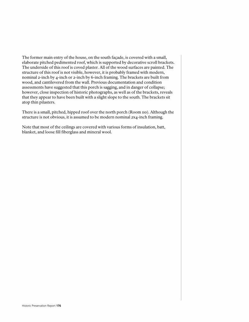
Historic Preservation Report 176
The former main entry of the house, on the south façade, is covered with a small, elaborate pitched pedimented roof, which is supported by decorative scroll brackets. The underside of this roof is coved plaster. All of the wood surfaces are painted. The structure of this roof is not visible, however, it is probably framed with modern, nominal 2-inch by 4-inch or 2-inch by 6-inch framing. The brackets are built from wood, and cantilevered from the wall. Previous documentation and condition assessments have suggested that this porch is sagging, and in danger of collapse; however, close inspection of historic photographs, as well as of the brackets, reveals that they appear to have been built with a slight slope to the south. The brackets sit atop thin pilasters. There is a small, pitched, hipped roof over the north porch (Room 110). Although the structure is not obvious, it is assumed to be modern nominal 2x4-inch framing. Note that most of the ceilings are covered with various forms of insulation, batt, blanket, and loose fill fiberglass and mineral wool.
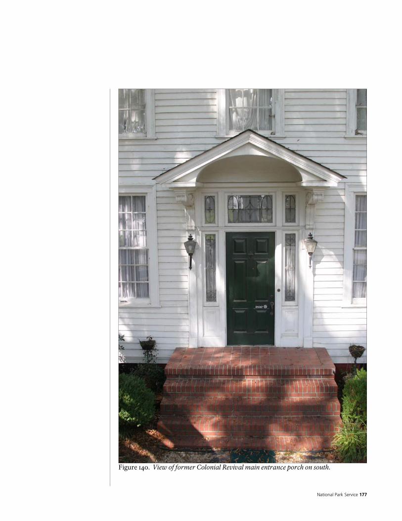
National Park Service 177
Figure 140. View of former Colonial Revival main entrance porch on south.
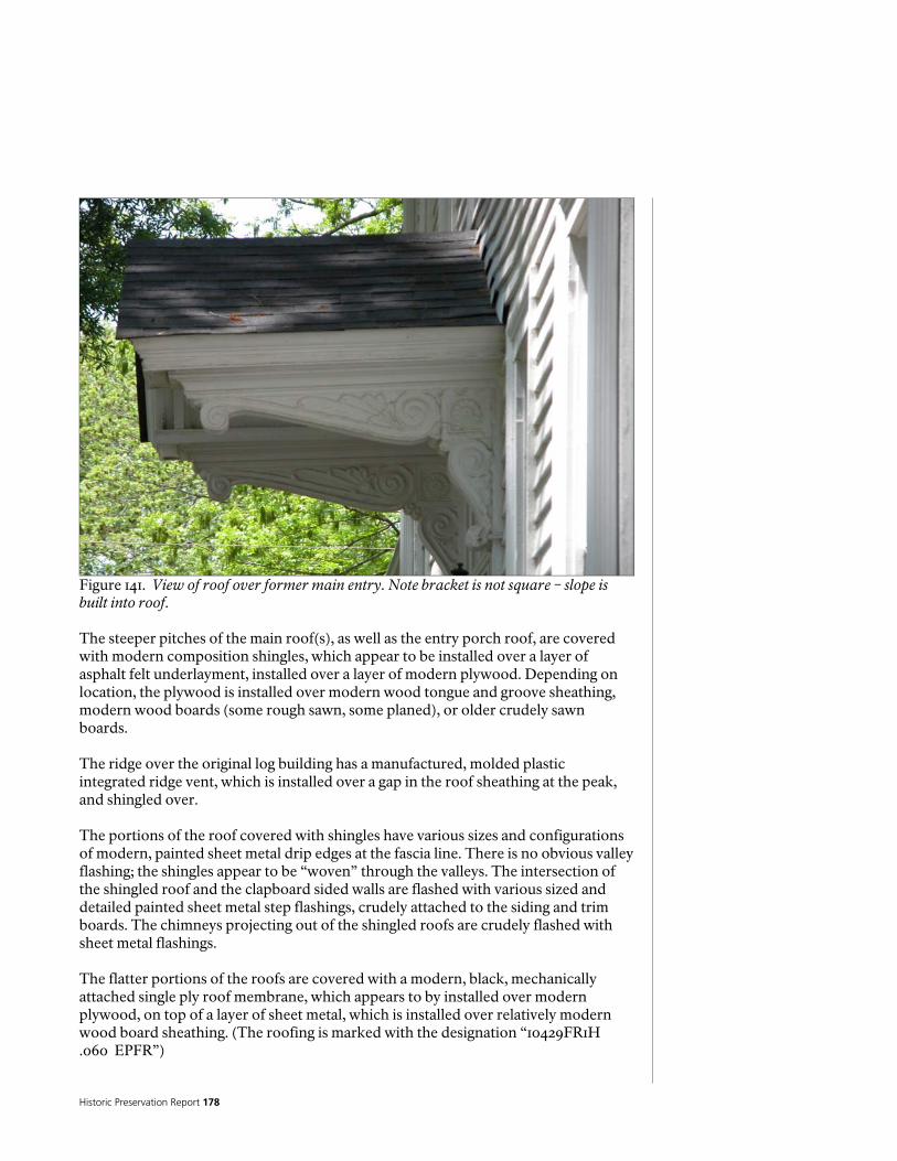
Historic Preservation Report 178
Figure 141. View of roof over former main entry. Note bracket is not square – slope is built into roof. The steeper pitches of the main roof(s), as well as the entry porch roof, are covered with modern composition shingles, which appear to be installed over a layer of asphalt felt underlayment, installed over a layer of modern plywood. Depending on location, the plywood is installed over modern wood tongue and groove sheathing, modern wood boards (some rough sawn, some planed), or older crudely sawn boards. The ridge over the original log building has a manufactured, molded plastic integrated ridge vent, which is installed over a gap in the roof sheathing at the peak, and shingled over. The portions of the roof covered with shingles have various sizes and configurations of modern, painted sheet metal drip edges at the fascia line. There is no obvious valley flashing; the shingles appear to be “woven” through the valleys. The intersection of the shingled roof and the clapboard sided walls are flashed with various sized and detailed painted sheet metal step flashings, crudely attached to the siding and trim boards. The chimneys projecting out of the shingled roofs are crudely flashed with sheet metal flashings. The flatter portions of the roofs are covered with a modern, black, mechanically attached single ply roof membrane, which appears to by installed over modern plywood, on top of a layer of sheet metal, which is installed over relatively modern wood board sheathing. (The roofing is marked with the designation “10429FR1H .060 EPFR”)
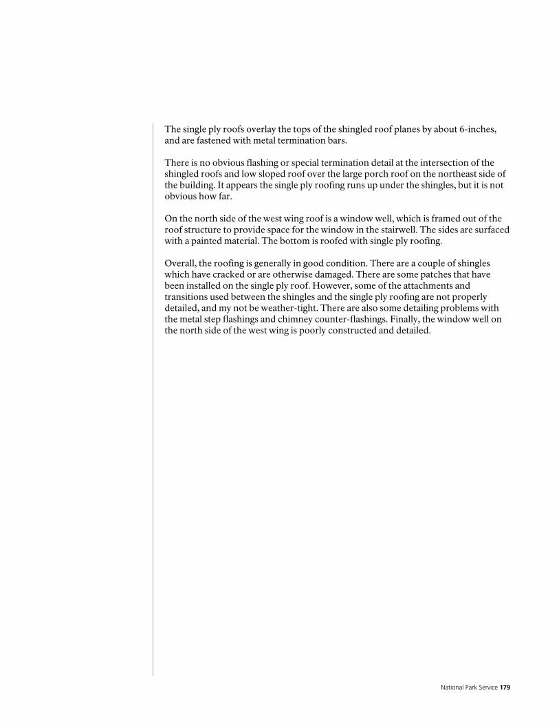
National Park Service 179
The single ply roofs overlay the tops of the shingled roof planes by about 6-inches, and are fastened with metal termination bars. There is no obvious flashing or special termination detail at the intersection of the shingled roofs and low sloped roof over the large porch roof on the northeast side of the building. It appears the single ply roofing runs up under the shingles, but it is not obvious how far. On the north side of the west wing roof is a window well, which is framed out of the roof structure to provide space for the window in the stairwell. The sides are surfaced with a painted material. The bottom is roofed with single ply roofing. Overall, the roofing is generally in good condition. There are a couple of shingles which have cracked or are otherwise damaged. There are some patches that have been installed on the single ply roof. However, some of the attachments and transitions used between the shingles and the single ply roofing are not properly detailed, and my not be weather-tight. There are also some detailing problems with the metal step flashings and chimney counter-flashings. Finally, the window well on the north side of the west wing is poorly constructed and detailed.

Historic Preservation Report 180
Figure 142. View of south roof planes, from east.
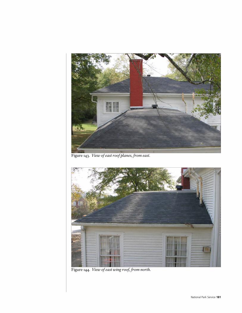
National Park Service 181
Figure 143. View of east roof planes, from east.
Figure 144. View of east wing roof, from north.

Historic Preservation Report 182
Figure 145. Roof over south end of original log building, Ridge Addition to right side.
Figure 146. Low slope roof on top of main east /west roof (over south end of Original log building and Ridge Addition).
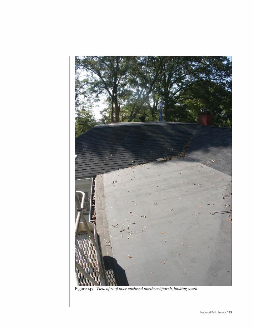
National Park Service 183
Figure 147. View of roof over enclosed northeast porch, looking south.

Historic Preservation Report 184
Figure 148. View of low slope roof on top of main east /west roof (over south end of Original log building and Ridge Addition), low slope roof over enclosed northeast porch, and north south ridge of original log building, on left.
Figure 149. View of north end of roofs over enclosed northeast porch and original log building.

National Park Service 185
Figure 150. View of west plane of roof over original log building, with west wing below.

Historic Preservation Report 186
Figure 151. Detail of step-flashing at intersection of shingled roof and clapboard siding. Note that flashing is installed under each siding board.
Figure 152. Detail of roof vent at ridge of original log building.
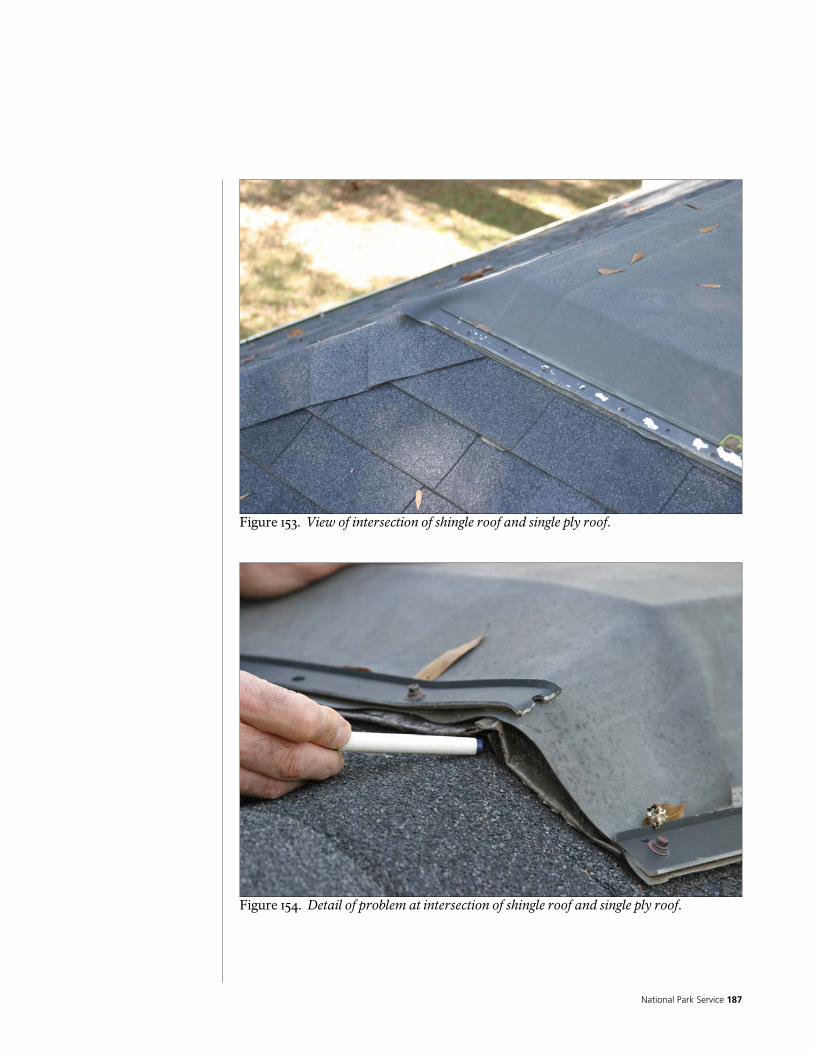
National Park Service 187
Figure 153. View of intersection of shingle roof and single ply roof.
Figure 154. Detail of problem at intersection of shingle roof and single ply roof.

Historic Preservation Report 188
Figure 155. Detail of patch at single ply roof.
Figure 156. Window well in north side of west wing roof.
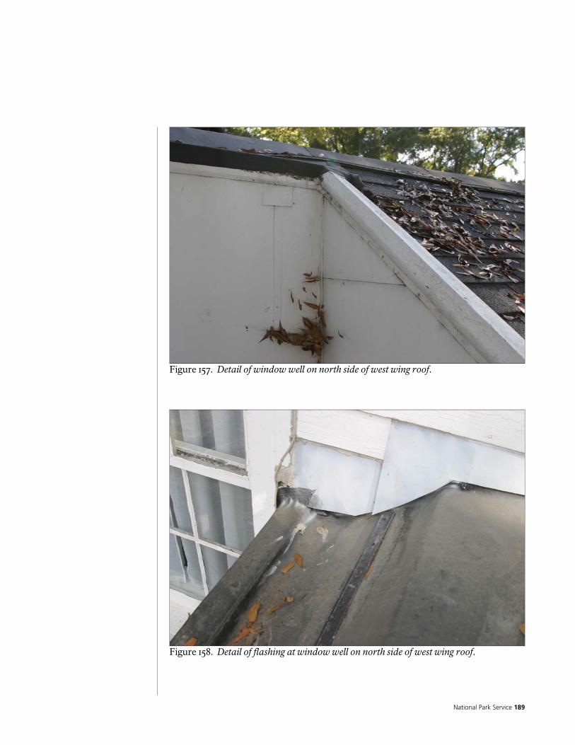
National Park Service 189
Figure 157. Detail of window well on north side of west wing roof.
Figure 158. Detail of flashing at window well on north side of west wing roof.

Historic Preservation Report 190
Figure 159. Detail of flashing at window well on north side of west wing roof.
Figure 160. Detail at penetrations for plumbing vent stacks at north side of east wing.

National Park Service 191
Figure 161. Detail at turbine type roof vent.
Figure 162. Detail at sheet metal roof vent.
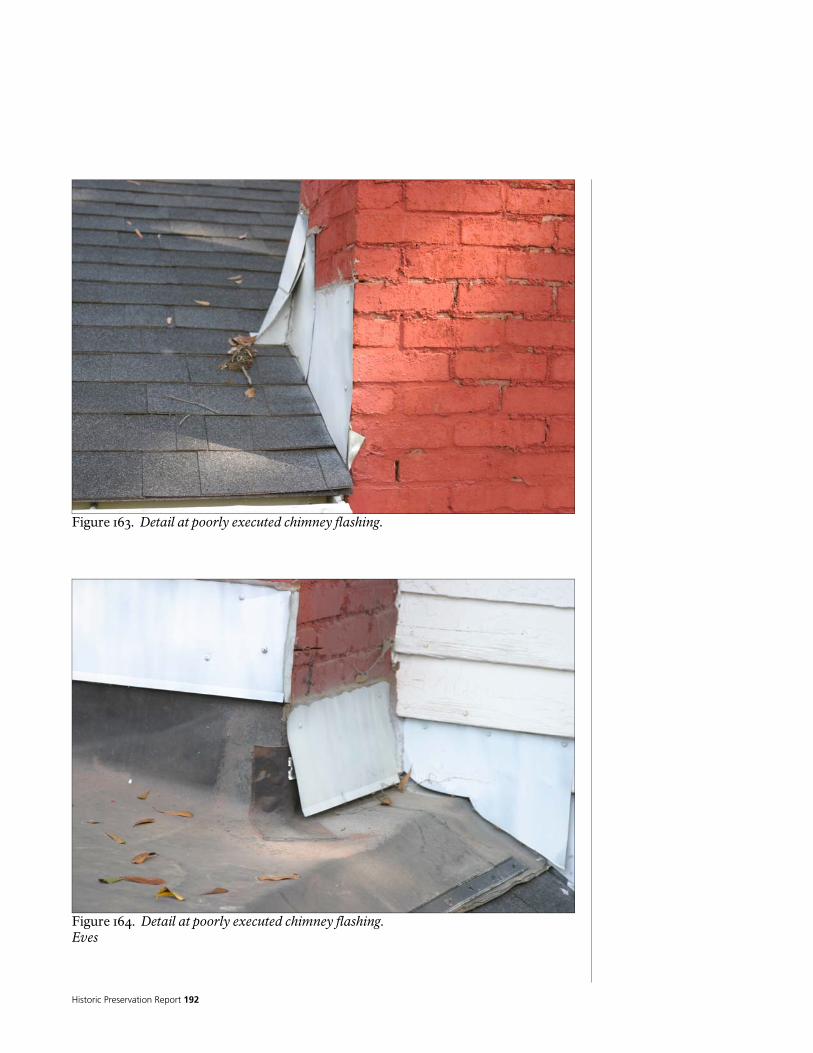
Historic Preservation Report 192
Figure 163. Detail at poorly executed chimney flashing.
Figure 164. Detail at poorly executed chimney flashing. Eves
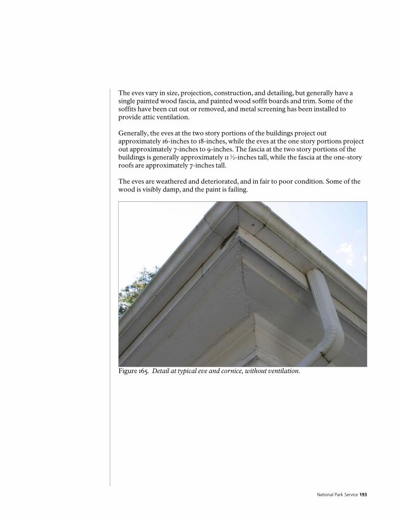
National Park Service 193
The eves vary in size, projection, construction, and detailing, but generally have a single painted wood fascia, and painted wood soffit boards and trim. Some of the soffits have been cut out or removed, and metal screening has been installed to provide attic ventilation. Generally, the eves at the two story portions of the buildings project out approximately 16-inches to 18-inches, while the eves at the one story portions project out approximately 7-inches to 9-inches. The fascia at the two story portions of the buildings is generally approximately 11 ½-inches tall, while the fascia at the one-story roofs are approximately 7-inches tall. The eves are weathered and deteriorated, and in fair to poor condition. Some of the wood is visibly damp, and the paint is failing.
Figure 165. Detail at typical eve and cornice, without ventilation.

Historic Preservation Report 194
Figure 166. Detail at deteriorated wood eve. Note paint failure.

National Park Service 195
Figure 167. Detail at typical eve and cornice, with ventilation.
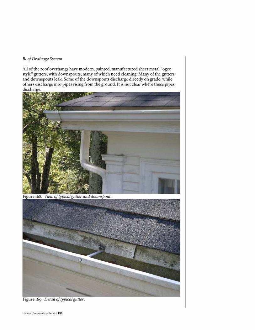
Historic Preservation Report 196
Roof Drainage System All of the roof overhangs have modern, painted, manufactured sheet metal “ogee style” gutters, with downspouts, many of which need cleaning. Many of the gutters and downspouts leak. Some of the downspouts discharge directly on grade, while others discharge into pipes rising from the ground. It is not clear where these pipes discharge.
Figure 168. View of typical gutter and downspout.
Figure 169. Detail of typical gutter.
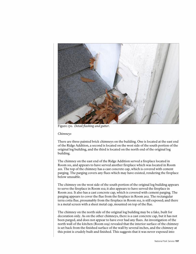
National Park Service 197
Figure 170. Detail flashing and gutter. Chimneys There are three painted brick chimneys on the building. One is located at the east end of the Ridge Addition, a second is located on the west side of the south portion of the original log building, and the third is located on the north end of the original log building. The chimney on the east end of the Ridge Addition served a fireplace located in Room 101, and appears to have served another fireplace which was located in Room 201. The top of the chimney has a cast concrete cap, which is covered with cement parging. The parging covers any flues which may have existed, rendering the fireplace below unusable. The chimney on the west side of the south portion of the original log building appears to serve the fireplace in Room 102; it also appears to have served the fireplace in Room 202. It also has a cast concrete cap, which is covered with cement parging. The parging appears to cover the flue from the fireplace in Room 202. The rectangular terra cotta flue, presumably from the fireplace in Room 102, is still exposed; and there is a metal screen with a sheet metal cap, mounted on top of the flue. The chimney on the north side of the original log building may be a fake, built for decoration only. As on the other chimneys, there is a cast concrete cap, but it has not been parged, and does not appear to have ever had any flues. An investigation of the north wall of the kitchen (Room 109) revealed that the interior surface of the chimney is set back from the finished surface of the wall by several inches, and the chimney at this point is crudely built and finished. This suggests that it was never exposed into

Historic Preservation Report 198
this Room. It is possible, however, that there may be a flue connection for a wood stove, which is not obvious. Upstairs, in Room 204, patches in the walls and flooring suggest that there once was a fireplace in this Room, which may have been connected to the chimney. Refer to the section on roofing for a discussion of the flashing. All of the chimneys have deteriorated mortar joints, and are in need of repointing. Some of the concrete caps and parging are cracked or deteriorated, and in need of maintenance. The east chimney appears to be leaning out, and may be in need of structural stabilization.
Figure 171. View of west chimney.
Figure 172. View of north chimney, west chimney in distance.

National Park Service 199
Figure 173. View of north chimney.

Historic Preservation Report 200
Figure 174. View of east chimney.

National Park Service 201
Figure 175. Detail at top of west chimney. Note parging on top.
Figure 176. Detail at top of east chimney. Note parging on top.

Historic Preservation Report 202
Figure 177. Detail at east chimney, showing deteriorated mortar joints.

National Park Service 203
Figure 178. Detail at top of north chimney, showing monolithic cast concrete cap. Windows and Doors In general, the doors and windows are built from wood, and are of relatively modern, manufactured construction, probably dating to the Colonial Revival period remodeling in the early 20th Century, with some elements of the south entry possibly dating to an earlier period. The doors are a mixture of frame and panel and frame with glass lites (“French doors”); the windows are a mixture of casement and double hung. There is wood trim on the interior and the exterior. The doors, windows, and trim are all painted. The doors, glazing, and screens, including the fan lites, at the exterior of Room 103, appear to be more modern additions. The exterior doors and windows are generally in fair to poor condition. As is the case with the other exterior woodwork, the doors and windows are weathered and deteriorated, and suffering from moisture damage. Most of the windows are inoperable, the others, as well as the doors, are sticky and difficult to use. Some doors have been removed to facilitate museum operations and are stored off-site. The doors and windows are described in more detail in the door and window schedules, in the appendix.

Historic Preservation Report 204
Entrances/Steps/Porches There are five entrances to the building; each has a set of steps from grade to the floor level. The former main entrance, on the south elevation, has a set of concrete steps, covered with brick. The entrances to the screened porch (Room 103), as well as the east entrance, to Room 117, have a set of painted poured concrete steps, enclosed on the sides by short painted brick walls, with painted poured concrete caps. There is indoor/outdoor carpeting on the steps at the east entrance, as well as a wrought iron hand rail. The entrances to the northeast porch (Room 113), and the north porch (Room 110), have poured concrete steps, covered with brick. A wood framed ramp has been built over the entrance to the northeast porch (Room 113). Most of the steps are in good condition, except for the steps to the screened porch, which appear to be settling. The ramp is in fair condition, but does not conform to accessibility requirements. None of the other entrances conform to accessibility requirements.
Figure 179. Entry porch on south, formerly main entrance.

National Park Service 205
Figure 180. Entry at screened porch (Room 103). Note settlement of steps.
Figure 181. Entry porch at entrance to east wing, now serving as main entrance.
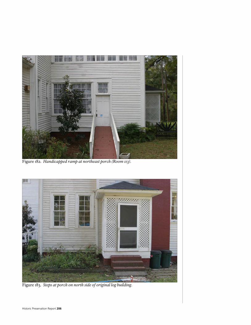
Historic Preservation Report 206
Figure 182. Handicapped ramp at northeast porch (Room 113).
Figure 183. Steps at porch on north side of original log building.
National Park Service 207
Stairways There is a well crafted stairway to the second floor, built with a wood frame, with wood treads, and a wood rail. Each section has a different pitch, as well as a different width. The treads are finished with clear sealer, and appear to be attached with cut nails, visible in the centers of the treads. The balusters and rails are hand carved. The balusters are painted and the rail is finished with clear sealer. The baseboard at the stair appears to be of a slightly different configuration than the rest of the house. The landing framing is visible through the wall from Room 104, as is the back side of the plastered west wall, and the baseboard. The baseboard and the lath for the plaster are attached to nominal 2x6-inch tongue and groove boards used as furring, which are in turn attached to the interior surface of the log walls. It appears the baseboard was attached first, then the lath above the baseboard, and finally the plaster was applied to be nearly flush with the outside face of the baseboard (although an ogee trim piece actually separates the base board from the plaster). The landing is supported on flat nominal 2x4-inch framing, which is in turn supported on a rectangular wood beam that is in plane with the log walls. The area below the landing has a low, plastered ceiling. Refer to discussion in the General Comments and Conclusions section above for a discussion on the possible time periods for the construction of the stair. The stair is in surprisingly good condition. The treads are somewhat worn from use. The bottom tread is cracked and split – an event that just recently happened, according to Chieftains’ staff.

Historic Preservation Report 208
Figure 184. View of stair from east.
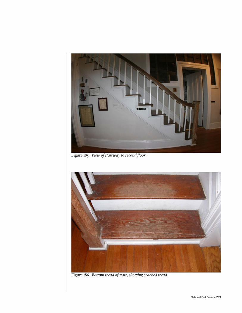
National Park Service 209
Figure 185. View of stairway to second floor.
Figure 186. Bottom tread of stair, showing cracked tread.
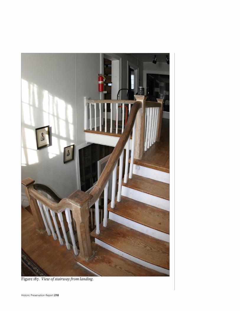
Historic Preservation Report 210
Figure 187. View of stairway from landing.

National Park Service 211
There is another stairway, which goes down to the basement. This stair appears to have been built when the colonial revival remodeling took place, to provide access to the basement under the west wing. The floor framing of the central hallway (dogtrot) has been cut and headered off to form the opening. This stair is crudely constructed from rough lumber. It is steep, poorly lit, has limited headroom, open riser spaces, and does not have a handrail. There is a landing at the bottom, making a 180 degree turn, and with more tread to the basement floor. The stairwell is lined with painted beaded tongue and groove siding.
Figure 188. Stairway to basement.
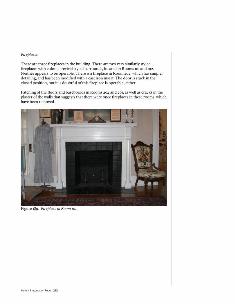
Historic Preservation Report 212
Fireplaces There are three fireplaces in the building. There are two very similarly styled fireplaces with colonial revival styled surrounds, located in Rooms 101 and 102. Neither appears to be operable. There is a fireplace in Room 202, which has simpler detailing, and has been modified with a cast iron insert. The door is stuck in the closed position, but it is doubtful of this fireplace is operable, either. Patching of the floors and baseboards in Rooms 204 and 201, as well as cracks in the plaster of the walls that suggests that there were once fireplaces in these rooms, which have been removed.
Figure 189. Fireplace in Room 101.
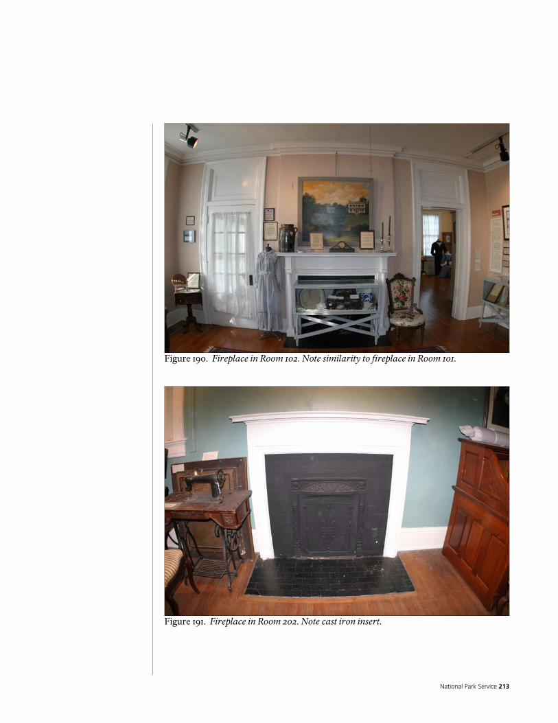
National Park Service 213
Figure 190. Fireplace in Room 102. Note similarity to fireplace in Room 101.
Figure 191. Fireplace in Room 202. Note cast iron insert.

Historic Preservation Report 214
Figure 192. Patching of the base, and floor, as well as cracking in plaster of Room 204, suggesting fireplace has been removed.
Figure 193. Patching of the floor of Room 201, suggesting fireplace has been removed.

National Park Service 215
Cabinet, display cases, and closet modifications There are built in cabinets in the kitchen (Room 109, and the pantries (Room 107 and 112). The kitchen cabinets look to be relatively modern, and appear to have been built in place. They are built from clear finished knotty pine, with plastic laminate countertops. The cabinets in the other two rooms appear to date to the colonial revival remodeling; they are also built in place from painted wood with linoleum countertops. The upper doors in Room 107 are built with glass panels in wood frames.
Figure 194. Kitchen cabinets.
Figure 195. Cabinets in Room 107.
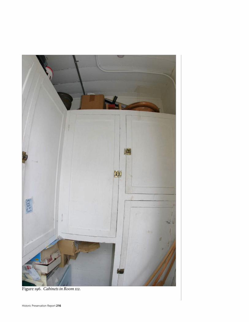
Historic Preservation Report 216
Figure 196. Cabinets in Room 112.

National Park Service 217
Several closets have been modified to provide cabinets or display cases, or to provide for other needs such as mechanical systems. Modifications include the full or partial removal of the closet doors and the insertion of lockable hinged glass panels or the insertion of wood panels used to support mechanical systems.
Figure 197. Closet in Room 106, modified into display case.
Figure 198. Closet in Room 203, modified into display case.

Historic Preservation Report 218
Figure 199. Closet in Room 105, modified to provide return air duct for heating/cooling system.
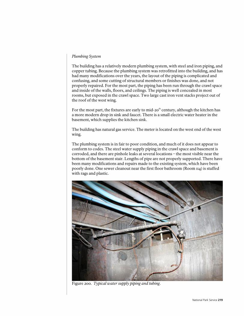
National Park Service 219
Plumbing System The building has a relatively modern plumbing system, with steel and iron piping, and copper tubing. Because the plumbing system was retrofitted into the building, and has had many modifications over the years, the layout of the piping is complicated and confusing, and some cutting of structural members or finishes was done, and not properly repaired. For the most part, the piping has been run through the crawl space and inside of the walls, floors, and ceilings. The piping is well concealed in most rooms, but exposed in the crawl space. Two large cast iron vent stacks project out of the roof of the west wing. For the most part, the fixtures are early to mid-20th century, although the kitchen has a more modern drop in sink and faucet. There is a small electric water heater in the basement, which supplies the kitchen sink. The building has natural gas service. The meter is located on the west end of the west wing. The plumbing system is in fair to poor condition, and much of it does not appear to conform to codes. The steel water supply piping in the crawl space and basement is corroded, and there are pinhole leaks at several locations – the most visible near the bottom of the basement stair. Lengths of pipe are not properly supported. There have been many modifications and repairs made to the existing system, which have been poorly done. One sewer cleanout near the first floor bathroom (Room 114) is stuffed with rags and plastic.
Figure 200. Typical water supply piping and tubing.

Historic Preservation Report 220
Figure 201. Water supply piping showing rust and pinhole leaks.
Figure 202. Sewer cleanout below first floor bathroom, stuffed with rags and plastic.
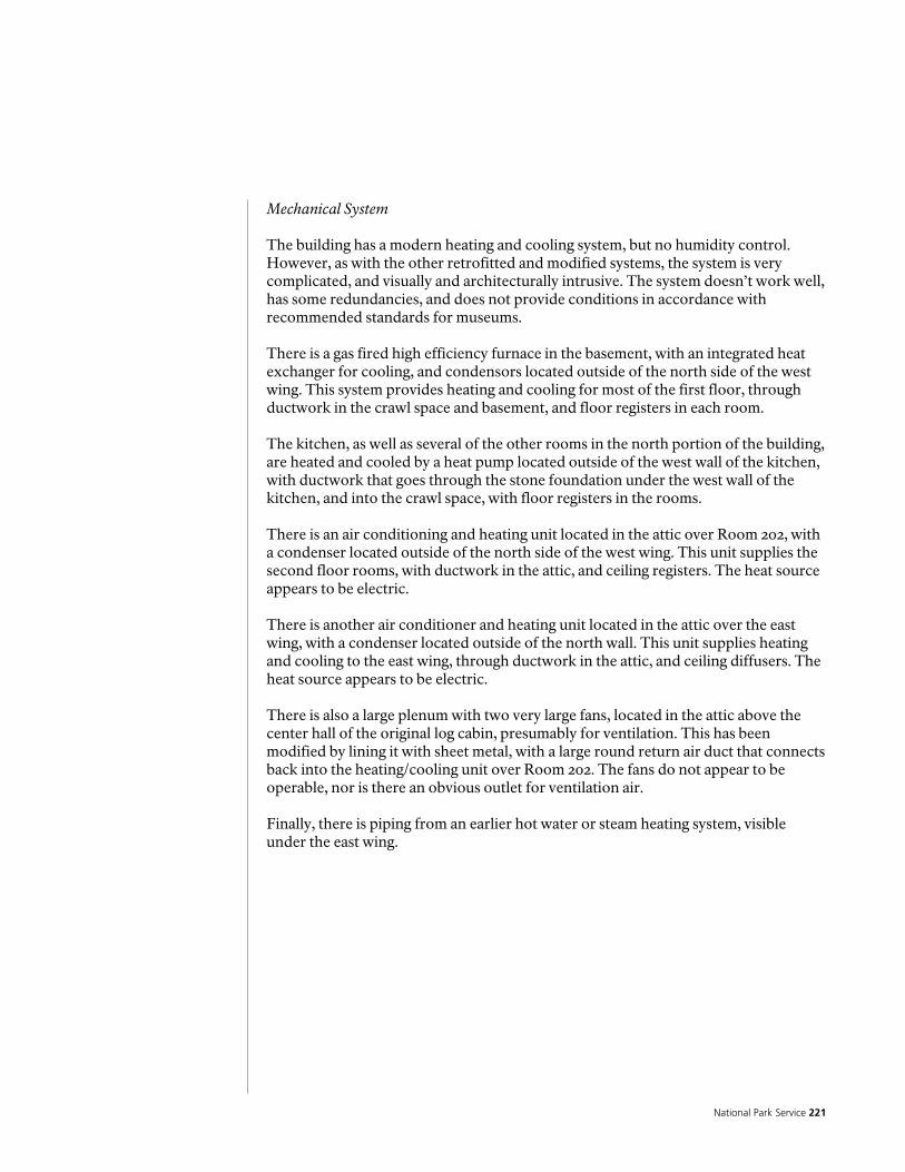
National Park Service 221
Mechanical System The building has a modern heating and cooling system, but no humidity control. However, as with the other retrofitted and modified systems, the system is very complicated, and visually and architecturally intrusive. The system doesn’t work well, has some redundancies, and does not provide conditions in accordance with recommended standards for museums. There is a gas fired high efficiency furnace in the basement, with an integrated heat exchanger for cooling, and condensors located outside of the north side of the west wing. This system provides heating and cooling for most of the first floor, through ductwork in the crawl space and basement, and floor registers in each room. The kitchen, as well as several of the other rooms in the north portion of the building, are heated and cooled by a heat pump located outside of the west wall of the kitchen, with ductwork that goes through the stone foundation under the west wall of the kitchen, and into the crawl space, with floor registers in the rooms. There is an air conditioning and heating unit located in the attic over Room 202, with a condenser located outside of the north side of the west wing. This unit supplies the second floor rooms, with ductwork in the attic, and ceiling registers. The heat source appears to be electric. There is another air conditioner and heating unit located in the attic over the east wing, with a condenser located outside of the north wall. This unit supplies heating and cooling to the east wing, through ductwork in the attic, and ceiling diffusers. The heat source appears to be electric. There is also a large plenum with two very large fans, located in the attic above the center hall of the original log cabin, presumably for ventilation. This has been modified by lining it with sheet metal, with a large round return air duct that connects back into the heating/cooling unit over Room 202. The fans do not appear to be operable, nor is there an obvious outlet for ventilation air. Finally, there is piping from an earlier hot water or steam heating system, visible under the east wing.
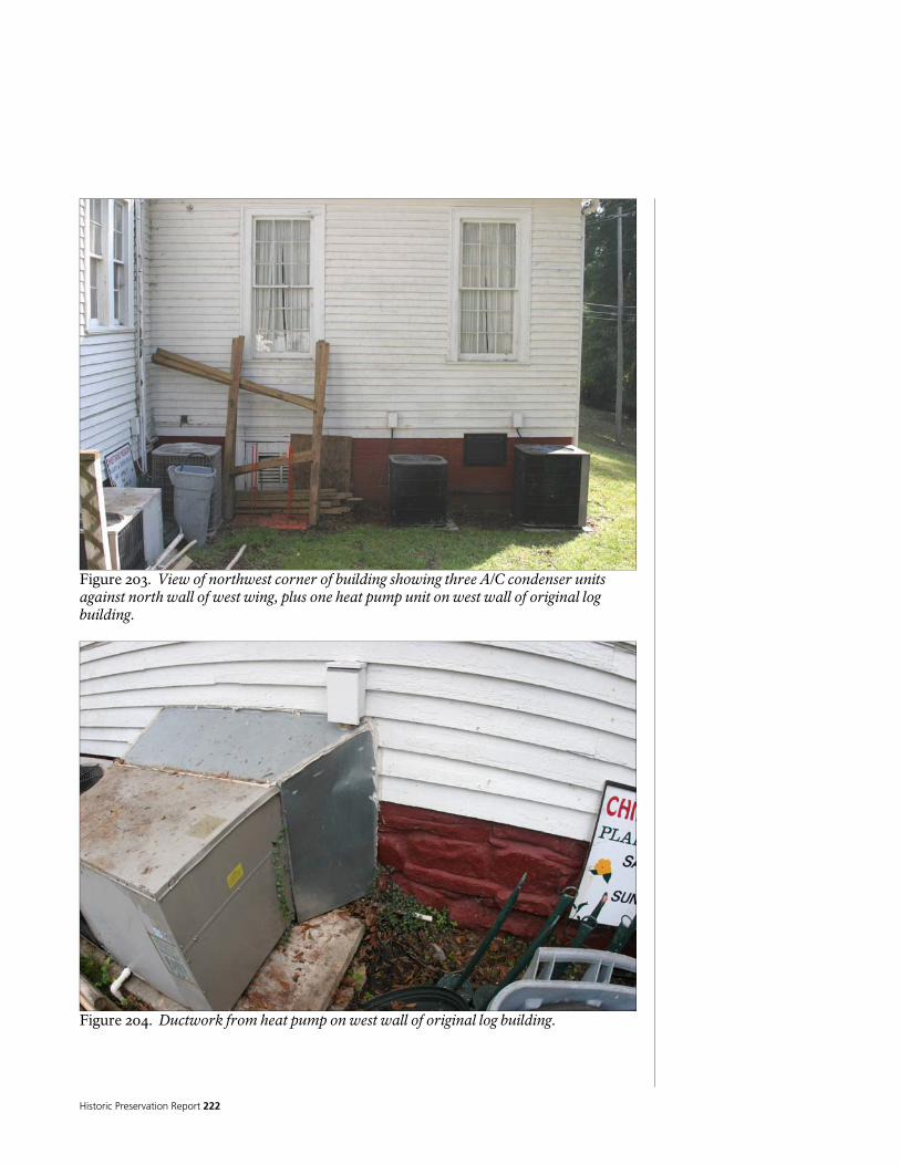
Historic Preservation Report 222
Figure 203. View of northwest corner of building showing three A/C condenser units against north wall of west wing, plus one heat pump unit on west wall of original log building.
Figure 204. Ductwork from heat pump on west wall of original log building.

National Park Service 223
Figure 205. Ventilation grill opening to plenum in ceiling of Room 203. plenum is lined with sheet metal, and there is a large round return air duct on the left (south) side, going into the attic and to the Heating/cooling unit located over Room 202.
Figure 206. Fans above ventilation grill above Room 203.

Historic Preservation Report 224
Electrical System The building has a relatively modern electrical system, which includes phone service and a security system. The service entrance is located on the north side of the log building, where it is fed from an overhead drop. The meter is located on the north side of the west wall of the original log building. From the service entrance, two large conduits go through the crawl space to two side by side 200 amp panels, which are located in the basement. From the panels, the distribution and wiring spreads out into the building in a complicated mix of rigid and flexible conduit, armored cable, sheathed cable, and flush and surface mounted boxes. Most of the fixtures and devices are modern, but many early 20th century fixtures and devices remain, apparently disconnected. There are bits and pieces of old knob and tube wiring, as well as abandoned modern wiring, scattered throughout the building. The phone service enters the building on the north side of the west wall of the original log building. The phone wires are run throughout the building, in the crawl space, and on the surface of walls and ceilings. The security system, which provides intrusion alarm through motion sensors, and fire alarm through smoke detectors, is a hard wired system. The wires are run throughout the building, in the crawl space, and on the surface of walls and ceilings. There is a keypad near the east entrance, and a security panel in the closet in Room 116. The intrusion alarm has an audible alarm; it also contacts a central monitoring station if intrusion is detected. The fire alarm has an audible alarm; it contacts the fire department in the event of detection of a fire. There is bare copper wiring run throughout the building that appears to part of an old security system. The electrical system is very complicated, and appears to have some serious functional, safety, and code problems. It is very intrusive visually and architecturally.
Figure 207. Electrical service entrance (on left), meter, and phone connection box.

National Park Service 225
Figure 208. Electrical panels in basement.
Figure 209. Old knob and tube wiring exposed in wall.

Historic Preservation Report 226
Figure 210. Detail of surface mounted conduit and box on wall.

National Park Service 227
Hazardous Materials and Pests The primary hazardous materials usually encountered in old buildings are asbestos, lead, mold, and mildew. Other hazardous materials are found in materials stored in or near the buildings, such as petroleum products, solvents, chemicals, insecticides, and poisons. Asbestos is often found in resilient flooring and leveling products, pipe and duct insulation, roofing, window glazing, drywall compound, and plaster. Asbestos is not considered a hazard unless the fibers are released into the air, through construction or remodeling activities, improper removal, or deterioration of asbestos containing materials. The more likely a material is to delaminate, crumble, or turn to dust and release fibers into the air, the higher the hazard. Lead is found in paint, roof flashings, solder, window glazing, and some caulking. As with asbestos, it is not considered a hazard until it is released into the air, through construction or remodeling activities, improper removal, or deterioration of lead containing materials. Lead is also a hazard when ingested, either directly (eating paint chips, for example), or indirectly (drinking water that passes through copper pipes with lead solder). Suspect materials found in this building include resilient flooring, window glazing, paint and plaster. Samples of the plaster and resilient flooring were collected and tested for asbestos. While the plaster was found to be asbestos free, the resilient flooring did contain asbestos. A copy of the report is included in the appendix. All paint surfaces were assumed to have layers that contained lead based paint. A detailed inspection for mold and mildew was not carried out, but m0ld, mildew, and even moss was observed on crawl space and foundation materials, as well as wood structural materials, exterior finishes, and roof drainage features. Pests found in and around the building include the usual compliment of insects and spiders. No poisonous spiders were observed, although it is probable that Black Widow and Brown Recluse spiders are present. Numerous wasps (hornets?) were observed outside of the building, as well as in the basement. Evidence of termites is present in many parts of the structure, although no active termites or colonies were observed. No rodents or snakes were seen, although they cannot be ruled out.

Historic Preservation Report 228
Interior Finishes The interior finishes in the building are primarily hardwood flooring, painted plastered walls, painted plaster ceilings, and painted wood trim. The hardwood flooring is primarily 2 ¼-inch oak tongue and groove; although there is some similar sized fir, as well. The plastered walls and ceilings have gypsum plaster on modern wood lath. Most of these finishes appear to date to the Colonial Revival remodeling in the early 20th Century. Other finishes found in the building include modern resilient sheet flooring (over particle board), modern carpet, ceramic tile (which also appears to date to the Colonial Revival remodeling), painted clapboard siding, and painted wood boards. The condition of the interior finishes varies, depending on material and location. In general, the hardwood floors are in good condition, although some of them are in need of refinishing. The ceramic tile floors are in fair condition due to some cracking of grout and chipping of tile. The resilient flooring is in fair to poor condition; it is worn out, cracking and tearing. The carpet is worn. The plastered walls and ceilings are generally in fair to poor condition. The plaster suffers from cracking, spalling, and swelling, as well as delamination and separation from the lath. In a couple of areas, the plaster has fallen off the walls or ceilings. There are also areas where the plaster has been patched. There are numerous examples of paint failure throughout the interior, where the paint is cracking or peeling. Some of the plaster and paint failures appear to be moisture related, possible from roof leaks, mechanical and plumbing system leaks, leaks in the exterior siding, and leaks at doors and windows. The interior finishes are discussed in more detail in the room finish schedules, below.
Figure 211. Detail of plaster failure. Note cracking, spalling, swelling, and delamination.
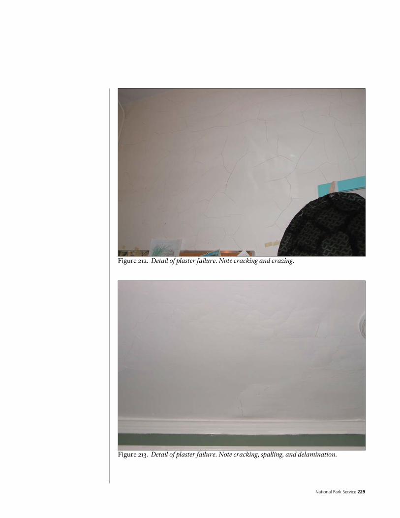
National Park Service 229
Figure 212. Detail of plaster failure. Note cracking and crazing.
Figure 213. Detail of plaster failure. Note cracking, spalling, and delamination.
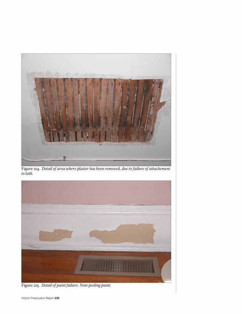
Historic Preservation Report 230
Figure 214. Detail of area where plaster has been removed, due to failure of attachement to lath.
Figure 215. Detail of paint failure. Note peeling paint.

National Park Service 231
Figure 216. Detail of plaster failure. Note cracking and crazing, as well as delamination.
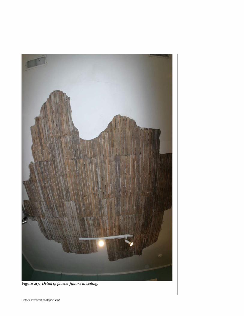
Historic Preservation Report 232
Figure 217. Detail of plaster failure at ceiling.
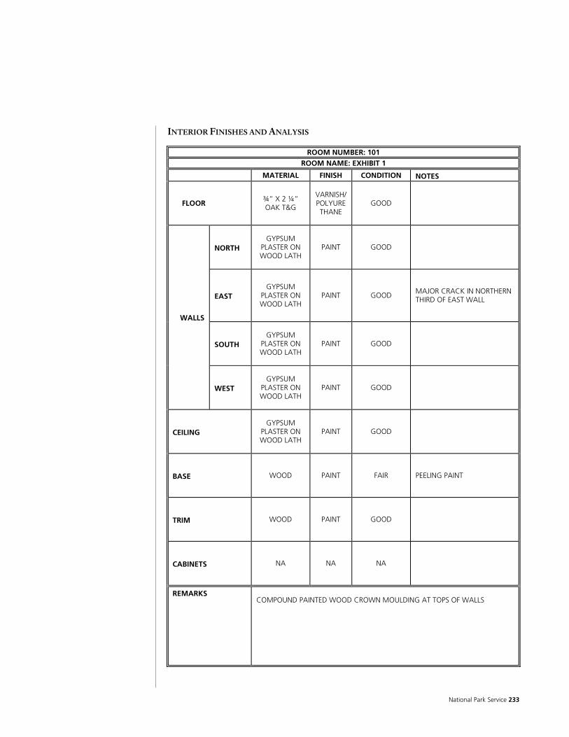
National Park Service 233
INTERIOR FINISHES AND ANALYSIS
ROOM NUMBER: 101 ROOM NAME: EXHIBIT 1
MATERIAL FINISH CONDITION NOTES
FLOOR ¾” X 2 ¼” OAK T&G
VARNISH/POLYURETHANE
GOOD
NORTH GYPSUM
PLASTER ON WOOD LATH
PAINT GOOD
EAST GYPSUM
PLASTER ON WOOD LATH
PAINT GOOD
MAJOR CRACK IN NORTHERN THIRD OF EAST WALL
SOUTH GYPSUM
PLASTER ON WOOD LATH
PAINT GOOD
WALLS
WEST GYPSUM
PLASTER ON WOOD LATH
PAINT GOOD
CEILING GYPSUM
PLASTER ON WOOD LATH
PAINT GOOD
BASE WOOD PAINT FAIR
PEELING PAINT
TRIM WOOD PAINT GOOD
CABINETS NA NA NA
REMARKS COMPOUND PAINTED WOOD CROWN MOULDING AT TOPS OF WALLS
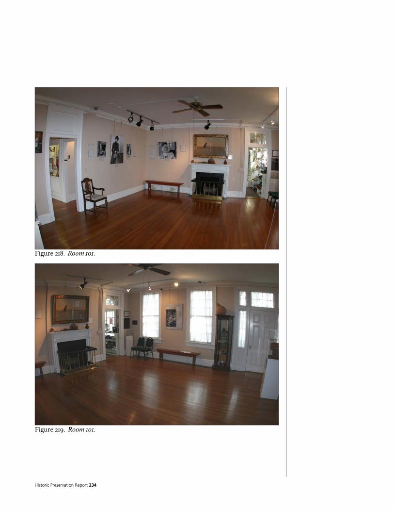
Historic Preservation Report 234
Figure 218. Room 101.
Figure 219. Room 101.

National Park Service 235
Figure 220. Room 101.
Figure 221. Room 101.
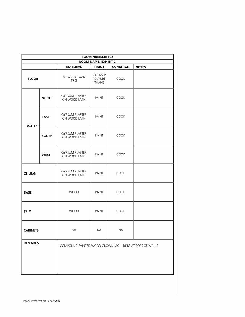
Historic Preservation Report 236
ROOM NUMBER: 102 ROOM NAME: EXHIBIT 2
MATERIAL FINISH CONDITION NOTES
FLOOR ¾” X 2 ¼” OAK
T&G
VARINSH/POLYURETHANE
GOOD
NORTH GYPSUM PLASTER ON WOOD LATH
PAINT GOOD
EAST GYPSUM PLASTER ON WOOD LATH
PAINT GOOD
SOUTH GYPSUM PLASTER ON WOOD LATH
PAINT GOOD
WALLS
WEST GYPSUM PLASTER ON WOOD LATH
PAINT GOOD
CEILING GYPSUM PLASTER ON WOOD LATH
PAINT GOOD
BASE WOOD PAINT GOOD
TRIM WOOD PAINT GOOD
CABINETS NA NA NA
REMARKS COMPOUND PAINTED WOOD CROWN MOULDING AT TOPS OF WALLS
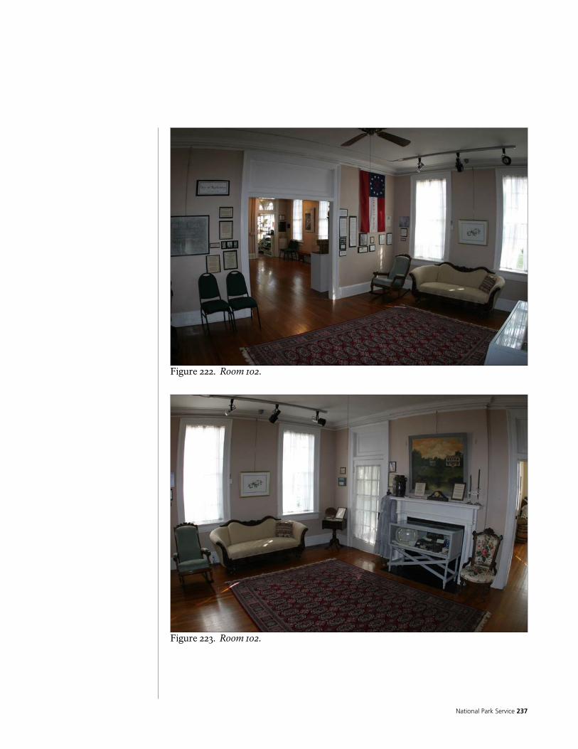
National Park Service 237
Figure 222. Room 102.
Figure 223. Room 102.
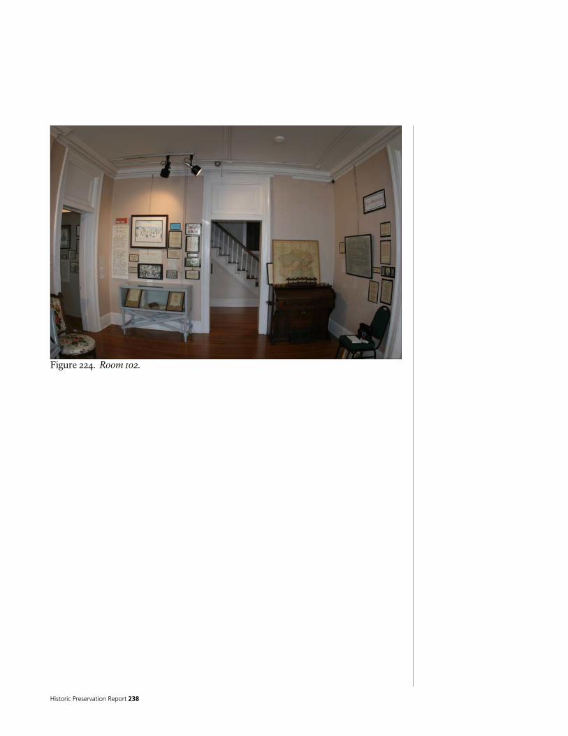
Historic Preservation Report 238
Figure 224. Room 102.

National Park Service 239
ROOM NUMBER: 103 ROOM NAME: PORCH 2
MATERIAL FINISH CONDITION NOTES
FLOOR
RECTANGU-LAR QUARRY
TILE OVER CONCRETE
NA FAIR
RUNNING BOND PATTERN
NORTH WOOD
CLAPBOARD PAINT GOOD
EAST WOOD
CLAPBOARD PAINT GOOD
SOUTH WOOD
CLAPBOARD PAINT GOOD
WALLS
WEST WOOD
CLAPBOARD PAINT GOOD
CEILING WOOD
BOXCAR SIDING
PAINT GOOD
BASE WOOD PAINT GOOD
SMALL PAINTED WOOD WOOD BASE WITH SHOE
TRIM WOOD PAINT GOOD
CABINETS NA NA NA
REMARKS SMALL PAINTED WOOD CROWN MOULDING AT TOPS OF WALLS
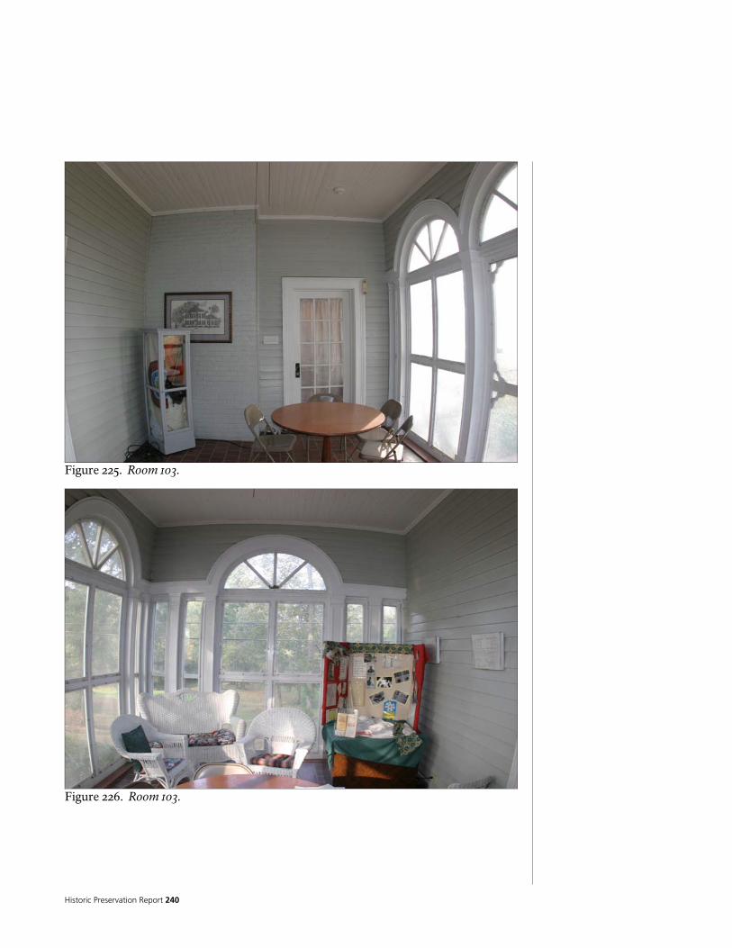
Historic Preservation Report 240
Figure 225. Room 103.
Figure 226. Room 103.

National Park Service 241
ROOM NUMBER: 104 ROOM NAME: EXHIBIT 4
MATERIAL FINISH CONDITION NOTES
FLOOR ¾” X 2 ¼” OAK T&G
VARNISH/POLYURETHANE
GOOD
NORTH GYPSUM
PLASTER ON WOOD LATH
PAINT GOOD
EAST GYPSUM
PLASTER ON WOOD LATH
PAINT GOOD
PORTIONS OF WALL HAVE HAD FINISHES REMOVED TO EXPOSE LOG STRUCTURE
SOUTH GYPSUM
PLASTER ON WOOD LATH
PAINT GOOD
WALLS
WEST GYPSUM
PLASTER ON WOOD LATH
PAINT GOOD
CEILING GYPSUM
PLASTER ON WOOD LATH
PAINT GOOD
BASE WOOD PAINT GOOD
TRIM WOOD PAINT GOOD
CABINETS NA NA NA
REMARKS COMPOUND PAINTED WOOD CROWN MOULDING AT TOPS OF WALLS. ROOM REPAINTED IN APRIL OF 2005, AFTER ARCHITECTURAL DOCUMENTATION
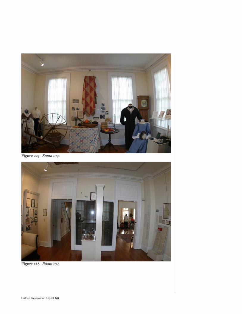
Historic Preservation Report 242
Figure 227. Room 104.
Figure 228. Room 104.

National Park Service 243
ROOM NUMBER: 105 ROOM NAME: HALL 4
MATERIAL FINISH CONDITION NOTES
FLOOR ¾” X 2 ¼” OAK
T&G
VARNISH/POLYURETHANE
GOOD
NORTH NA NA NA
EAST NA NA NA
SOUTH NA NA NA
WALLS
WEST GYPSUM
PLASTER ON WOOD LATH
PAINT GOOD
CEILING PLYWOOD? PAINT FAIR
BASE WOOD PAINT FAIR
PEELING PAINT
TRIM WOOD PAINT FAIR
PEELING PAINT
CABINETS WOOD PAINT FAIR
SMALL CABINET BUILT INTO CLOSET ON SOUTH WALL
REMARKS PAINTED BOXCAR SIDING ON STAIRWELL INTO BASEMENT
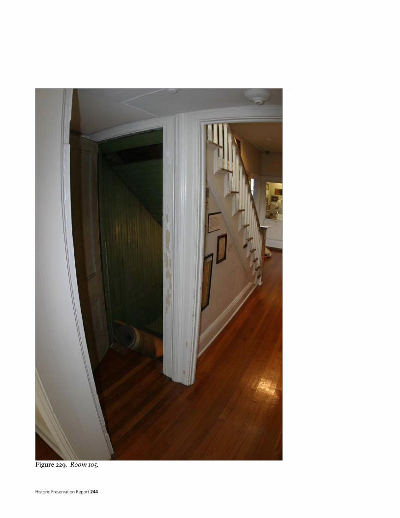
Historic Preservation Report 244
Figure 229. Room 105.

National Park Service 245
ROOM NUMBER: 106 ROOM NAME: HALL 2 (DOWNSTAIRS)
MATERIAL FINISH CONDITION NOTES
FLOOR ¾” X 2 ¼” OAK T&G
VARNISH/POLYURETHANE
GOOD
NORTH GYPSUM
PLASTER ON WOOD LATH
PAINT GOOD
PORTIONS OF WALL HAVE HAD FINISHES REMOVED TO EXPOSE LOG STRUCTURE
EAST GYPSUM
PLASTER ON WOOD LATH
PAINT GOOD
SOUTH GYPSUM
PLASTER ON WOOD LATH
PAINT GOOD
WALLS
WEST GYPSUM
PLASTER ON WOOD LATH
PAINT GOOD
CEILING GYPSUM
PLASTER ON WOOD LATH
PAINT GOOD
BASE WOOD PAINT GOOD
BASE AT STAIR DIFFERENT FROM REST OF ROOM – MAY BE ORIGINAL
TRIM WOOD PAINT GOOD
CABINETS WOOD PAINT GOOD
REMARKS SMALL PAINTED WOOD CROWN MOULDING AT TOPS OF WALLS

Historic Preservation Report 246
Figure 230. Room 106.
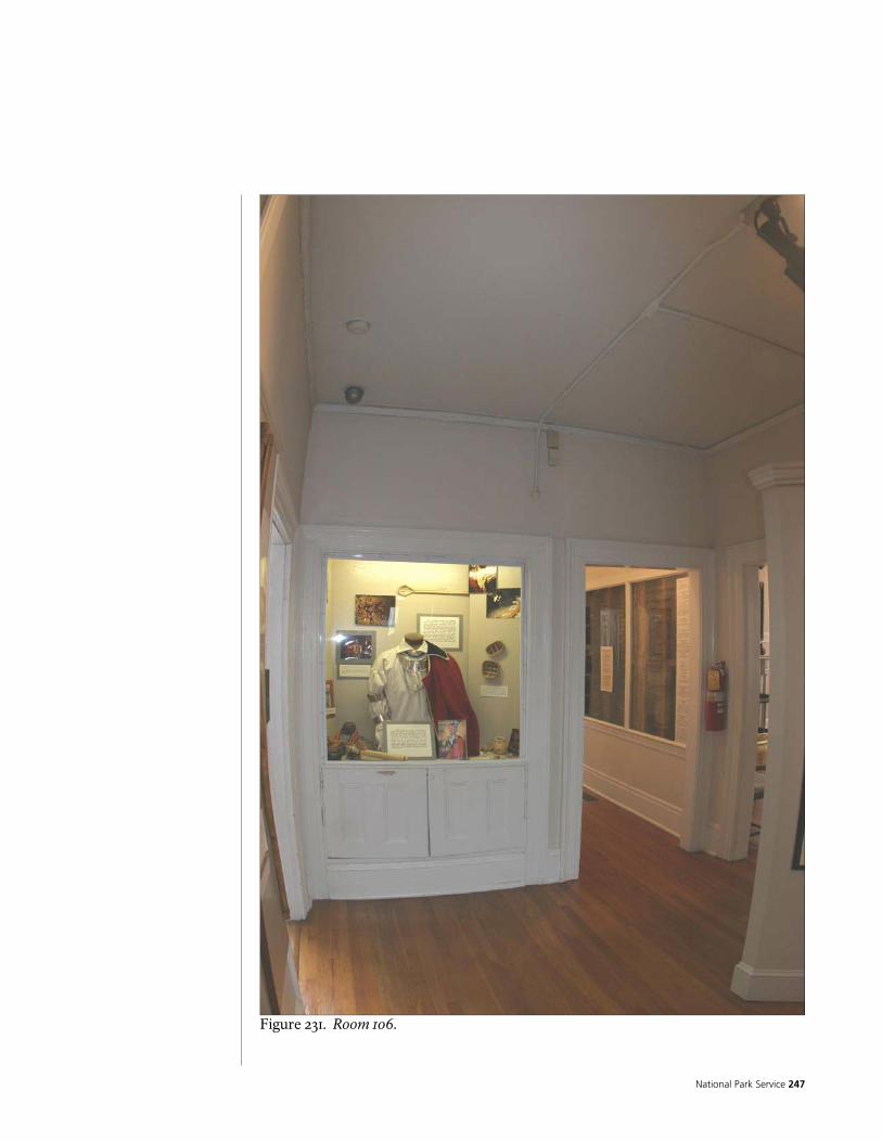
National Park Service 247
Figure 231. Room 106.

Historic Preservation Report 248
Figure 232. Room 106.
Figure 233. Room 106.

National Park Service 249
ROOM NUMBER: 107
ROOM NAME: PANTRY 2 MATERIAL FINISH CONDITION NOTES
FLOOR SHEET RESILIENT OVER PARTICLE
BOARD NONE FAIR/POOR
NORTH GYPSUM
PLASTER ON WOOD LATH
PAINT FAIR/POOR
EAST GYPSUM
PLASTER ON WOOD LATH
PAINT FAIR/POOR
SOUTH GYPSUM
PLASTER ON WOOD LATH
PAINT FAIR/POOR
WALLS
WEST GYPSUM
PLASTER ON WOOD LATH
PAINT FAIR/POOR
CEILING GYPSUM
PLASTER ON WOOD LATH
PAINT FAIR/POOR
BASE WOOD PAINT FAIR
PEELING PAINT
TRIM WOOD PAINT FAIR
PEELING PAINT
CABINETS WOOD PAINT FAIR
PEELING PAINT
REMARKS CABINETS BUILT INTO CLOSETS ON EAST WALL PLASTER CRACKING, SPALLING, LOOSE, DETERIORATED – THIS IS THE WORST ROOM PEELING PAINT AT TRIM

Historic Preservation Report 250
Figure 234. Room 107.
Figure 235. Room 107.
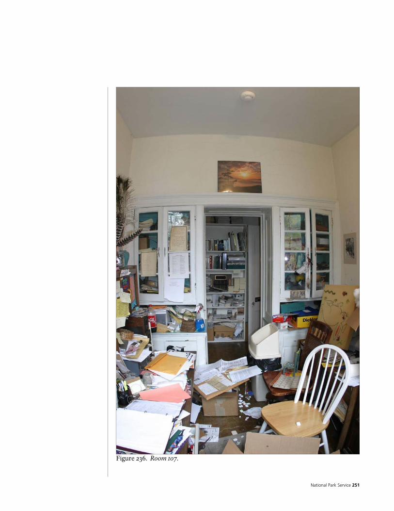
National Park Service 251
Figure 236. Room 107.

Historic Preservation Report 252
ROOM NUMBER: 108 ROOM NAME: HALL 3
MATERIAL FINISH CONDITION NOTES
FLOOR SHEET RESILIENT ON
PARTICLE BOARD NONE FAIR/POOR
NORTH GYPSUM PLASTER ON WOOD LATH
PAINT GOOD
EAST GYPSUM PLASTER ON WOOD LATH
PAINT GOOD
SOUTH GYPSUM PLASTER ON WOOD LATH
PAINT GOOD
WALLS
WEST GYPSUM PLASTER ON WOOD LATH
PAINT GOOD
CEILING GYPSUM PLASTER ON WOOD LATH
PAINT GOOD
BASE WOOD PAINT FAIR
PEELING PAINT
TRIM WOOD PAINT FAIR
PEELING PAINT
CABINETS NA NA NA
REMARKS PEELING PAINT AT TRIM

National Park Service 253
Figure 237. Room 108.
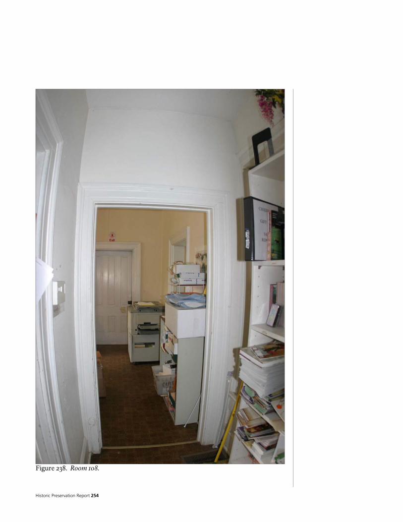
Historic Preservation Report 254
Figure 238. Room 108.

National Park Service 255
ROOM NUMBER: 109 ROOM NAME: KITCHEN
MATERIAL FINISH CONDITION NOTES
FLOOR SHEET RESILIENT
ON PARTICLE BOARD
NONE FAIR/POOR
NORTH GYPSUM
PLASTER ON WOOD LATH
PAINT GOOD
EAST GYPSUM
PLASTER ON WOOD LATH
PAINT GOOD
SOUTH GYPSUM
PLASTER ON WOOD LATH
PAINT GOOD
WALLS
WEST GYPSUM
PLASTER ON WOOD LATH
PAINT GOOD
CEILING GYPSUM
PLASTER ON WOOD LATH
PAINT GOOD
BASE WOOD PAINT GOOD
TRIM WOOD PAINT GOOD
CABINETS PINE STAIN/SE
AL GOOD
PINE FACE FRAME CABINETS WITH TRANSPARENT STAINED/SEALED FINISH – PROBABLY BUILT ON SITE. PLASTIC LAMINATE COUNTER TOPS DROPPED SOFFIT ABOVE CABINETS
REMARKS

Historic Preservation Report 256
Figure 239. Room 109.
Figure 240. Room 109.

National Park Service 257
ROOM NUMBER: 110 ROOM NAME: NORTH PORCH
MATERIAL FINISH CONDITION NOTES
FLOOR ¾” X 2 ¼” FIR T&G FLOORING
PAINTED FAIR
NORTH WOOD
FRAME/SCREENS/TRIM
PAINTED GOOD
EAST WOOD
FRAME/SCREENS/TRIM
PAINTED GOOD
SOUTH WOOD
CLAPBOARD SIDING
PAINTED GOOD
WALLS
WEST WOOD
FRAME/SCREENS/TRIM
PAINTED GOOD
PAINTED WOOD BOARDS COVERING BRICK CHIMNEY
CEILING WOOD BOARDS PAINTED GOOD
BASE
TRIM WOOD PAINT GOOD
CABINETS
REMARKS MOST OF THE WALLS OF THIS ROOM ARE ACTUALLY SCREENS INSERTED INTO WOOD FRAMING – WITH LATTICE INSTALLED ON THE EXTERIOR.

Historic Preservation Report 258
Figure 241. Room 110.

National Park Service 259
ROOM NUMBER: 111 ROOM NAME: HALL 2
MATERIAL FINISH CONDITION NOTES
FLOOR
SHEET RESILIENT ON PARTICLEBOARD, OVER ¾” X 2 ¼” OAK FLOORING
NONE FAIR/POOR
OAK FLOORING RUNS EAST/WEST
NORTH GYPSUM PLASTER ON WOOD LATH
PAINT GOOD
EAST GYPSUM PLASTER ON WOOD LATH
PAINT
GOOD
SOUTH GYPSUM PLASTER ON WOOD LATH
PAINT GOOD
WALLS
WEST GYPSUM PLASTER ON WOOD LATH
PAINT
GOOD
CEILING GYPSUM PLASTER ON WOOD LATH PAINT GOOD
BASE WOOD PAINT FAIR
PEELING PAINT
TRIM WOOD PAINT FAIR
PEELING PAINT
CABINETS NA NA NA
REMARKS
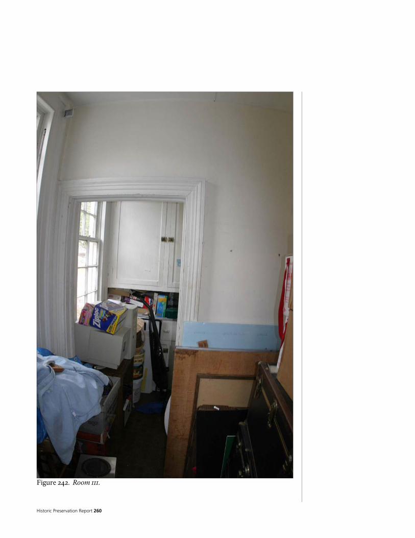
Historic Preservation Report 260
Figure 242. Room 111.

National Park Service 261
ROOM NUMBER: 112 ROOM NAME: PANTRY 1
MATERIAL FINISH CONDITION NOTES
FLOOR
SHEET RESILIENT ON
PARTICLEBOARD, OVER ¾” X 2 ¼” OAK FLOORING
NONE FAIR/POOR
OAK FLOORING RUNS EAST/WEST
NORTH GYPSUM
PLASTER ON WOOD LATH
PAINT GOOD
EAST GYPSUM
PLASTER ON WOOD LATH
PAINT GOOD
SOUTH GYPSUM
PLASTER ON WOOD LATH
PAINT GOOD
WALLS
WEST GYPSUM
PLASTER ON WOOD LATH
PAINT GOOD
CEILING NOMINAL 9-INCH WIDE
WOOD PLANKS PAINT GOOD
PLANKS RUN EAST WEST
BASE WOOD PAINT FAIR
TRIM WOOD PAINT FAIR
CABINETS WOOD PAINT FAIR
FRAME CABINETS WITH FLUSH DOORS– PROBABLY BUILT ON SITE. PLASTIC LAMINATE COUNTER TOPS
REMARKS

Historic Preservation Report 262
Figure 243. Room 112.

National Park Service 263
Figure 244. Room 112.
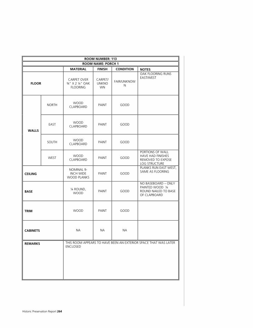
Historic Preservation Report 264
ROOM NUMBER: 113 ROOM NAME: PORCH 1
MATERIAL FINISH CONDITION NOTES
FLOOR CARPET OVER
¾” X 2 ¼” OAK FLOORING
CARPET/UNKNO
WN
FAIR/UNKNOWN
OAK FLOORING RUNS EAST/WEST
NORTH WOOD CLAPBOARD PAINT GOOD
EAST WOOD CLAPBOARD
PAINT GOOD
SOUTH WOOD
CLAPBOARD PAINT GOOD
WALLS
WEST WOOD
CLAPBOARD PAINT GOOD
PORTIONS OF WALL HAVE HAD FINISHES REMOVED TO EXPOSE LOG STRUCTURE
CEILING NOMINAL 9-INCH WIDE
WOOD PLANKS PAINT GOOD
PLANKS RUN EAST WEST, SAME AS FLOORING
BASE ¼ ROUND,
WOOD PAINT GOOD
NO BASEBOARD – ONLY PAINTED WOOD ¼ ROUND NAILED TO BASE OF CLAPBOARD
TRIM WOOD PAINT GOOD
CABINETS NA NA NA
REMARKS THIS ROOM APPEARS TO HAVE BEEN AN EXTERIOR SPACE THAT WAS LATER ENCLOSED

National Park Service 265
Figure 245. Room 113.
Figure 246. Room 113.

Historic Preservation Report 266
Figure 247. Room 113.

National Park Service 267
ROOM NUMBER: 114 ROOM NAME: BATH 1
MATERIAL FINISH CONDITION NOTES
FLOOR 1” HEXAGON
CERAMIC MOSAIC TILE
NONE FAIR
ON MORTAR BED
NORTH GYPSUM
PLASTER ON WOOD LATH
PAINT GOOD
EAST GYPSUM
PLASTER ON WOOD LATH
PAINT GOOD
SOUTH GYPSUM
PLASTER ON WOOD LATH
PAINT GOOD
WALLS
WEST GYPSUM
PLASTER ON WOOD LATH
PAINT GOOD
CEILING GYPSUM
PLASTER ON WOOD LATH
PAINT FAIR
SOME CRACKING
BASE NONE NONE NONE
TRIM WOOD PAINT GOOD
CABINETS WOOD PAINT FAIR
REMARKS CERAMIC TILE WAINSCOTE AND TUB/SHOWER SURROUND – RECTANGULAR TILE IN RUNNING BOND PATTERN WITH TILE TRIM CAP

Historic Preservation Report 268
Figure 248. Room 114.
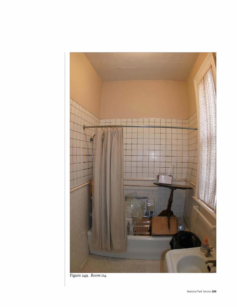
National Park Service 269
Figure 249. Room 114.

Historic Preservation Report 270
ROOM NUMBER: 115 ROOM NAME: HALL 1
MATERIAL FINISH CONDITION NOTES
FLOOR ¾” X 2 ¼” OAK
T&G
VARNISH/POLYURETHAN
E GOOD
NORTH GYPSUM
PLASTER ON WOOD LATH
PAINT GOOD
EAST GYPSUM
PLASTER ON WOOD LATH
PAINT GOOD
SOUTH GYPSUM
PLASTER ON WOOD LATH
PAINT GOOD
PORTIONS OF WALL HAVE HAD FINISHES REMOVED TO EXPOSE WALL STRUCTURE
WALLS
WEST GYPSUM
PLASTER ON WOOD LATH
PAINT GOOD
CEILING GYPSUM
PLASTER ON WOOD LATH
PAINT GOOD
BASE WOOD PAINT GOOD
TRIM WOOD PAINT GOOD
CABINETS NA NA NA
REMARKS LUMP IN FLOOR NEAR SOUTHEAST CORNER SMALL PAINTED WOOD CROWN MOULDING AT TOPS OF WALLS

National Park Service 271
Figure 250. Room 115.

Historic Preservation Report 272
Figure 251. Room 115.
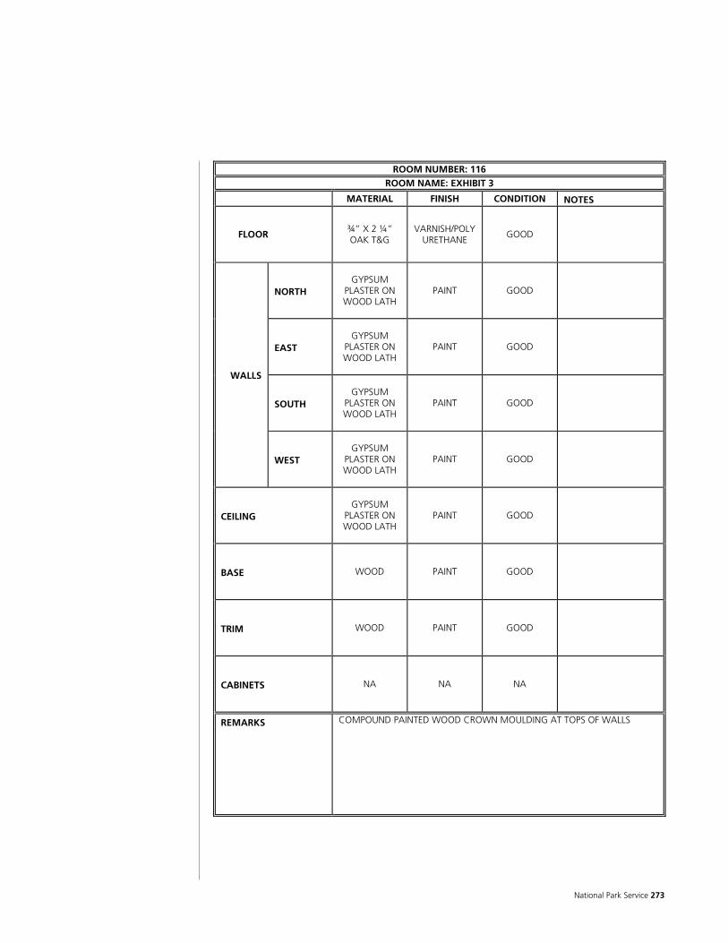
National Park Service 273
ROOM NUMBER: 116 ROOM NAME: EXHIBIT 3
MATERIAL FINISH CONDITION NOTES
FLOOR ¾” X 2 ¼” OAK T&G
VARNISH/POLYURETHANE
GOOD
NORTH GYPSUM
PLASTER ON WOOD LATH
PAINT GOOD
EAST GYPSUM
PLASTER ON WOOD LATH
PAINT GOOD
SOUTH GYPSUM
PLASTER ON WOOD LATH
PAINT GOOD
WALLS
WEST GYPSUM
PLASTER ON WOOD LATH
PAINT GOOD
CEILING GYPSUM
PLASTER ON WOOD LATH
PAINT GOOD
BASE WOOD PAINT GOOD
TRIM WOOD PAINT GOOD
CABINETS NA NA NA
REMARKS COMPOUND PAINTED WOOD CROWN MOULDING AT TOPS OF WALLS
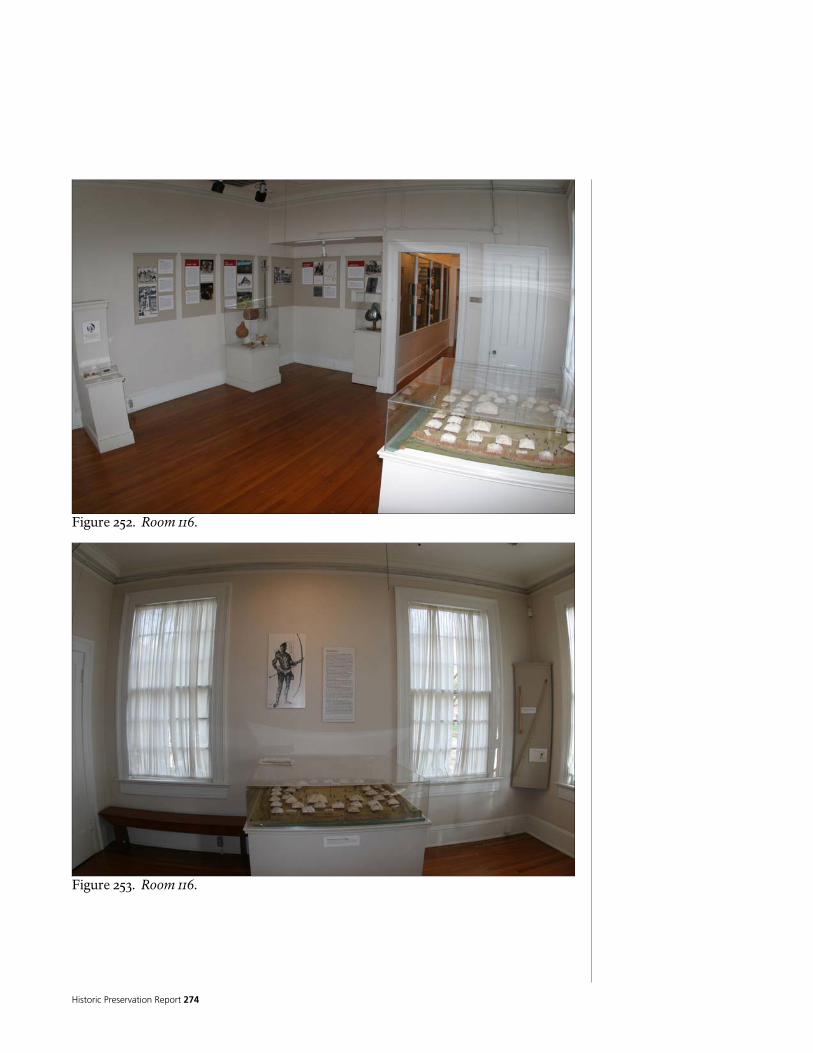
Historic Preservation Report 274
Figure 252. Room 116.
Figure 253. Room 116.

National Park Service 275
Figure 254. Room 116.

Historic Preservation Report 276
ROOM NUMBER: 117 ROOM NAME: GIFT SHOP (SUN ROOM)
MATERIAL FINISH CONDITION NOTES
FLOOR 6-INCH SQUARE
QUARRY TILE OVER CONCRETE
NONE FAIR
RUNNING BOND PATTERN
NORTH GYPSUM PLASTER ON
WOOD LATH PAINT GOOD
EAST GYPSUM PLASTER ON
WOOD LATH PAINT GOOD
SOUTH GYPSUM PLASTER ON
WOOD LATH PAINT GOOD
WALLS
WEST GYPSUM PLASTER ON
WOOD LATH PAINT GOOD
CEILING GYPSUM PLASTER ON
WOOD LATH PAINT GOOD
BASE WOOD PAINT GOOD
TRIM WOOD PAINT GOOD
CABINETS NA NA NA
REMARKS COMPOUND PAINTED WOOD CROWN MOULDING AT TOPS OF WALLS
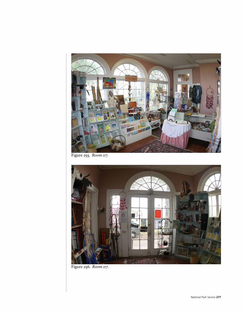
National Park Service 277
Figure 255. Room 117.
Figure 256. Room 117.

Historic Preservation Report 278
ROOM NUMBER: 201 ROOM NAME: OFFICE 2
MATERIAL FINISH CONDITION NOTES
FLOOR ¾” X 2 ¼” OAK
T&G
VARNISH/POLYURETHANE
GOOD
NORTH GYPSUM PLASTER ON WOOD LATH
PAINT GOOD
EAST GYPSUM PLASTER ON WOOD LATH
PAINT GOOD
SOUTH GYPSUM PLASTER ON WOOD LATH
PAINT GOOD
WALLS
WEST GYPSUM PLASTER ON WOOD LATH
PAINT GOOD
CEILING GYPSUM PLASTER ON WOOD LATH
PAINT GOOD
BASE WOOD PAINT GOOD
TRIM WOOD PAINT GOOD
CABINETS
REMARKS PATCHING IN EAST END OF FLOOR SUGGESTS HEARTH WHICH WAS REMOVED SMALL PAINTED WOOD CROWN MOULDING
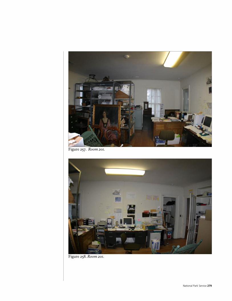
National Park Service 279
Figure 257. Room 201.
Figure 258. Room 201.

Historic Preservation Report 280
Figure 259. Room 201.
Figure 260. Room 201.

National Park Service 281
ROOM NUMBER: 202 ROOM NAME: OFFICE 1 (GREEN ROOM)
MATERIAL FINISH CONDITION NOTES
FLOOR ¾” X 2 ¼” OAK T&G
VARNISH/POLYURETHAN
E GOOD
NORTH GYPSUM
PLASTER ON WOOD LATH
PAINT GOOD
EAST GYPSUM
PLASTER ON WOOD LATH
PAINT GOOD
SOUTH GYPSUM
PLASTER ON WOOD LATH
PAINT GOOD
WALLS
WEST GYPSUM
PLASTER ON WOOD LATH
PAINT GOOD
CEILING GYPSUM
PLASTER ON WOOD LATH
PAINT POOR
CEILING IS RAPIDLY DETERIORATING
BASE WOOD PAINT GOOD
TRIM WOOD PAINT GOOD
CABINETS NA NA NA
REMARKS CEILING APPEARS TO BE FALLING OUT DUE TO DETERIORATION FROM A/C UNIT MOUNTED ABOVE – CONDENSATION?

Historic Preservation Report 282
Figure 261. Room 202.
Figure 262. Room 202.
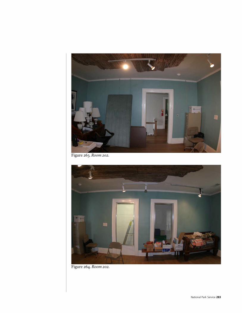
National Park Service 283
Figure 263. Room 202.
Figure 264. Room 202.

Historic Preservation Report 284
Figure 265. Room 202.

National Park Service 285
ROOM NUMBER: 203 ROOM NAME: HALL 2 UPPER STORY
MATERIAL FINISH CONDITION NOTES
FLOOR ¾” X 2 ¼” OAK
T&G
VARNISH/POLYURETHANE
GOOD
NORTH GYPSUM PLASTER ON WOOD LATH
PAINT GOOD
EAST GYPSUM PLASTER ON WOOD LATH
PAINT GOOD
SOUTH GYPSUM PLASTER ON WOOD LATH
PAINT GOOD
WALLS
WEST GYPSUM PLASTER ON WOOD LATH PAINT GOOD
CEILING GYPSUM PLASTER ON WOOD LATH PAINT FAIR/POOR
PART OF CEILING JUST EAST OF BEAM FALLING DONE – HELD IN PLACE WITH EXPANDED METAL LATH AND WOOD BOARDS.
BASE WOOD PAINT FAIR
SOME DAMAGE NOTED
TRIM WOOD PAINT GOOD
CABINETS NA NA NA
REMARKS BEAM AT EAST WALL LOG BUILDING RUNS THROUGH THIS ROOM LARGE VENT/GRILL IN CEILING JUST WEST OF CEILING BEAM SMALL PAINTED WOOD CROWN MOULDING

Historic Preservation Report 286
Figure 266. Room 203.

National Park Service 287
Figure 267. Room 203.
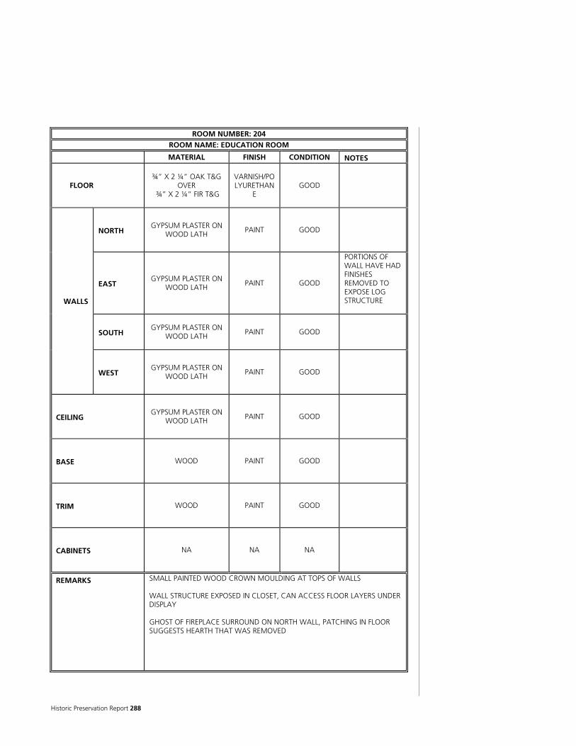
Historic Preservation Report 288
ROOM NUMBER: 204 ROOM NAME: EDUCATION ROOM
MATERIAL FINISH CONDITION NOTES
FLOOR ¾” X 2 ¼” OAK T&G
OVER ¾” X 2 ¼” FIR T&G
VARNISH/POLYURETHAN
E GOOD
NORTH GYPSUM PLASTER ON
WOOD LATH PAINT GOOD
EAST GYPSUM PLASTER ON
WOOD LATH PAINT GOOD
PORTIONS OF WALL HAVE HAD FINISHES REMOVED TO EXPOSE LOG STRUCTURE
SOUTH GYPSUM PLASTER ON
WOOD LATH PAINT GOOD
WALLS
WEST GYPSUM PLASTER ON
WOOD LATH PAINT GOOD
CEILING GYPSUM PLASTER ON
WOOD LATH PAINT GOOD
BASE WOOD PAINT GOOD
TRIM WOOD PAINT GOOD
CABINETS NA NA NA
REMARKS SMALL PAINTED WOOD CROWN MOULDING AT TOPS OF WALLS WALL STRUCTURE EXPOSED IN CLOSET, CAN ACCESS FLOOR LAYERS UNDER DISPLAY GHOST OF FIREPLACE SURROUND ON NORTH WALL, PATCHING IN FLOOR SUGGESTS HEARTH THAT WAS REMOVED
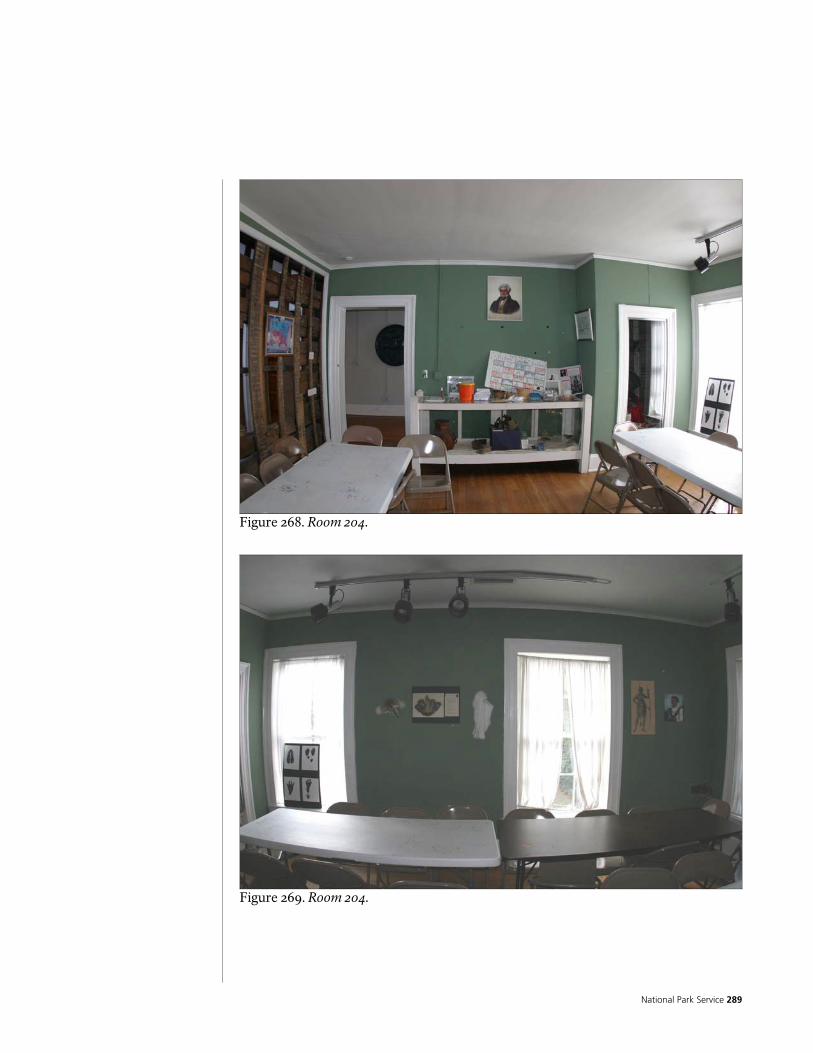
National Park Service 289
Figure 268. Room 204.
Figure 269. Room 204.
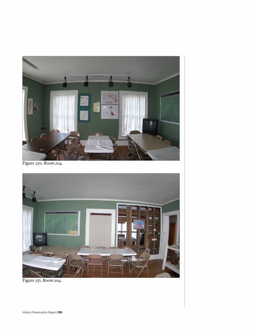
Historic Preservation Report 290
Figure 270. Room 204.
Figure 271. Room 204.

National Park Service 291
ROOM NUMBER: 205 ROOM NAME: PORCH 3
MATERIAL FINISH CONDITION NOTES
FLOOR ¾” X 2 ¼” FIR/PINE
T&G
VARNISH/POLYURETHAN
E FAIR
FINISH IS WORN
NORTH WOOD BOXCAR
SIDING PAINT GOOD
EAST WOOD BOXCAR
SIDING PAINT GOOD
SOUTH WOOD BOXCAR
SIDING PAINT GOOD
WALLS
WEST WOOD BOXCAR
SIDING PAINT GOOD
PORTIONS OF WALL HAVE HAD FINISHES REMOVED TO EXPOSE LOG STRUCTURE
CEILING WOOD BOXCAR
SIDING PAINT FAIR
BASE WOOD PAINT GOOD
TRIM WOOD PAINT GOOD
CABINETS NA NA NA
REMARKS PAINT ON WALL FINISH AND TRIM PEELING SMALL PAINTED WOOD CRWON MOULDING AT TOPS OF WALLS THIS ROOM MAY HAVE BEEN AN EXTERIOR PORCH, LATER CLOSED IN PAINTED WOOD ¼ ROUND BASE AT WALLS

Historic Preservation Report 292
Figure 272. Room 205.
Figure 273. Room 205.

National Park Service 293
Figure 274. Room 205.
Figure 275. Room 205.
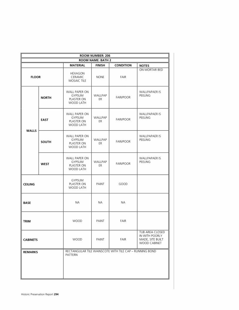
Historic Preservation Report 294
ROOM NUMBER: 206 ROOM NAME: BATH 2
MATERIAL FINISH CONDITION NOTES
FLOOR HEXAGON CERAMIC
MOSAIC TILE NONE FAIR
ON MORTAR BED
NORTH
WALL PAPER ON GYPSUM
PLASTER ON WOOD LATH
WALLPAPER
FARI/POOR
WALLPAPAER IS PEELING
EAST
WALL PAPER ON GYPSUM
PLASTER ON WOOD LATH
WALLPAPER
FARI/POOR
WALLPAPAER IS PEELING
SOUTH
WALL PAPER ON GYPSUM
PLASTER ON WOOD LATH
WALLPAPER
FARI/POOR
WALLPAPAER IS PEELING
WALLS
WEST
WALL PAPER ON GYPSUM
PLASTER ON WOOD LATH
WALLPAPER
FARI/POOR
WALLPAPAER IS PEELING
CEILING GYPSUM
PLASTER ON WOOD LATH
PAINT GOOD
BASE NA NA NA
TRIM WOOD PAINT FAIR
CABINETS WOOD PAINT FAIR
TUB AREA CLOSED IN WITH POORLY MADE, SITE BUILT WOOD CABINET
REMARKS RECTANGULAR TILE WAINSCOTE WITH TILE CAP – RUNNING BOND PATTERN

National Park Service 295
Figure 276. Room 206.
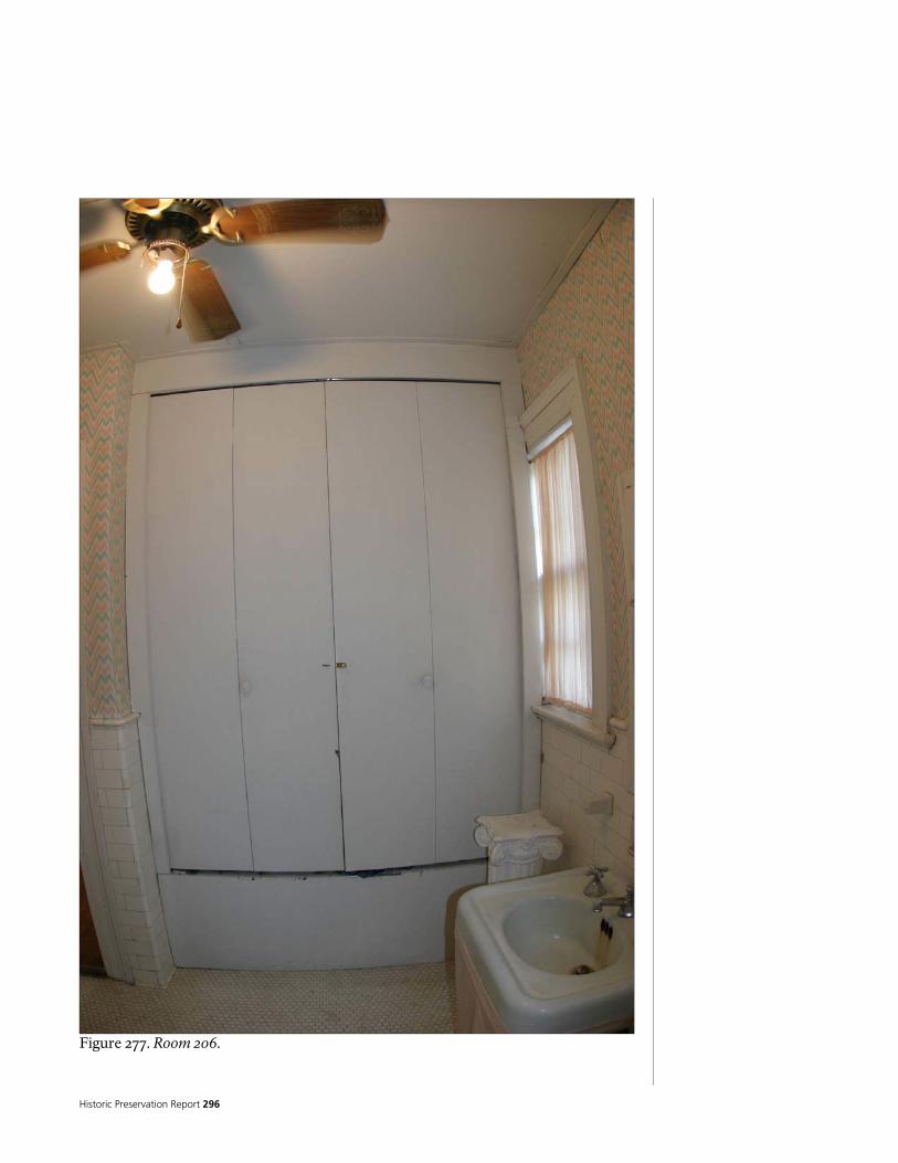
Historic Preservation Report 296
Figure 277. Room 206.

National Park Service 297
ROOM NUMBER: 201 CLOSETS ROOM NAME: CLOSET 1A AND 1B
MATERIAL FINISH CONDITION NOTES
FLOOR ¾” X 2 ¼” OAK
T&G
VARNISH/POLYURETHANE
FAIR
NORTH WOOD PLANKS PAINT FAIR
EAST WOOD PLANKS PAINT FAIR
SOUTH WOOD PLANKS PAINT FAIR
WALLS
WEST WOOD PLANKS PAINT FAIR
CEILING WOOD PLANKS PAINT FAIR
LOW CEILINGS
BASE WOOD PAINT FAIR
TRIM WOOD PAINT FAIR
CABINETS NA NA NA
REMARKS BOTH CLOSETS CONVERTED INTO DISPLAY CASES

Historic Preservation Report 298
Figure 278. 201 Closet.

National Park Service 299
ROOM NUMBER: 202 CLOSETS ROOM NAME: CLOSET 2A AND 2B
MATERIAL FINISH CONDITION NOTES
FLOOR ¾” X 2 ¼” OAK
T&G
VARNISH/POLYURETHAN
E FAIR
NORTH WOOD PLANKS PAINT FAIR
EAST WOOD PLANKS PAINT FAIR
SOUTH WOOD PLANKS PAINT FAIR
WALLS
WEST WOOD PLANKS PAINT FAIR
CEILING WOOD PLANKS PAINT FAIR
BASE WOOD PAINT FAIR
TRIM WOOD PAINT FAIR
CABINETS NA NA NA
REMARKS CLOSET 2A CONVERTED INTO DISPLAY CASE
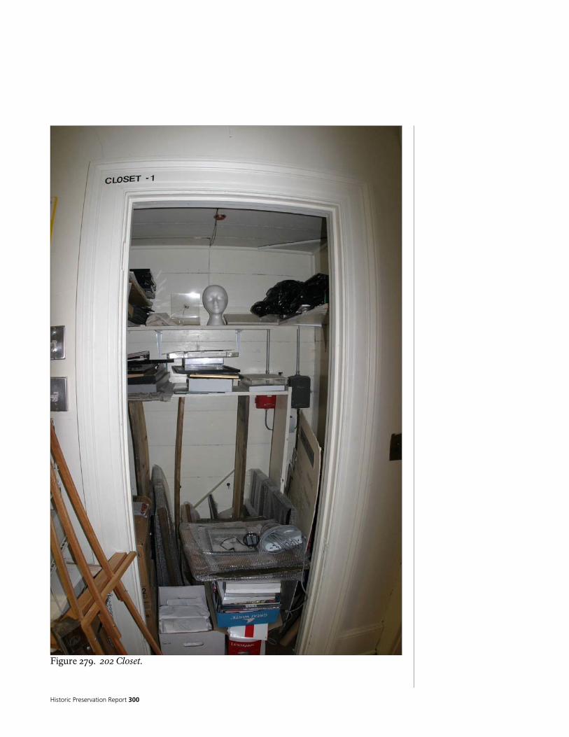
Historic Preservation Report 300
Figure 279. 202 Closet.
National Park Service 301
The Historical Integrity of the Chieftains Museum/Major Ridge Home
INTEGRITY AND THE NATIONAL HISTORIC LANDMARK SURVEY
Integrity is the ability of a property to convey its historical associations and attributes. The evaluation of integrity is somewhat of a subjective judgment, but it must always be grounded in an understanding of a property’s physical features and how they relate to its historical associations and attributes. The National Historic Landmark Survey recognizes the same qualities of integrity as the National Register of Historic Places. These are location, design, setting, materials, workmanship, feeling, and association. In order to successfully plan for future treatment of the home, it is first necessary to evaluate its historical integrity. A thorough evaluation of Chieftains integrity for each of the historic periods identified during the documentary research, combined with the description of existing conditions at Chieftains, form the information basis from which treatment alternatives may be developed and analyzed to determine the potential of these treatment to affect the overall integrity of the Chieftains house. Below, each historic period for Chieftains is listed followed by evaluations of each of the seven aspects of integrity for that period. The Ridge Period Location: High. Structure remains in its original location. Design: NA/Fair. Structure does not reflect a formal architectural design, but the remains of the log structure are still able to convey reflect significant aspects of building types associated with the Ridge Period. However, these aspects are obscured by later modifications. Setting: Fair to High. While the structure remains in its original location, Much of the plantation lands associated with the structure During the Ridge Period have been developed during later periods. Nevertheless, the home still sits adjacent to the river which remains undeveloped. Some landscape features associated with the Ridge Period may still be recognized and help to convey the structure’s historical character. Materials: Fair. Approximately 50 percent of the original log walls from the Ridge Period are still present in their original locations. Some hand-
hewn beams and roof framing is also present that may date to the Ridge Period. Further analysis of the physical features of the structure will clarify the extent of Ridge Period materials still present.
Workmanship: Fair. The remaining materials from the Ridge Period clearly reflect
building methods and techniques of the period. Feeling: Poor. Due to the numerous modifications the structure struggles to
convey the feeling of the Ridge Period. These modifications greatly obscure the original structure. The areas where the original structure is still visible cannot collectively convey the character of the structure
EV
ALU
ATI
ON
OF
INTE
GR
ITY
Historic Preservation Report 302
during the Ridge Period; it is difficult to get a sense of what Cherokee plantation structures and life were like during the Ridge occupation up to the time of removal.
Association: Poor. Similar to the integrity of Feeling, the numerous modifications the structures struggles to convey the structures association with the Ridge Period. These modifications greatly obscure the original structure. The areas where the original structure is still visible cannot collectively convey the character of the structure during the Ridge Period; it is difficult to get a sense of what the structure was like when it was occupied by and subsequently left by Major Ridge. The Ferguson-Verdery Period – Unable to determine until further research is completed to determine the extent of the changes. If no additional documentation is obtained, the analysis of integrity for this period may have to be undertaken during the initial rehabilitation phase when later period materials are removed. The Wright Period – Unable to determine until further research is completed to determine the extent of the changes. If no additional documentation is obtained, the analysis of integrity for this period may have to be undertaken during the initial rehabilitation phase when later period materials are removed. The Jones-Jeffries Period – Unable to determine until further research is completed to determine the extent of the changes. If no additional documentation is obtained, the analysis of integrity for this period may have to be undertaken during the initial rehabilitation phase when later period materials are removed. The Porter Period Location: High. The building is its original location. Design: High. The Porter Period remodel brought the interior and exterior of the structure to its current appearance and configuration. Setting: High. The building is its original setting, though some landscape features may no longer be present. Materials: High. The Porter Period remodel brought the interior and exterior of the structure to its current appearance and configuration. Nearly all Porter Period materials are still present. Workmanship: High. The Porter Period remodel brought the interior and exterior of the structure to its current appearance and configuration. Evidence of the Porter Period workmanship is extensive. Feeling: High. The Porter Period remodel brought the interior and exterior of the structure to its current appearance and configuration. Collectively, the extensive features from the Porter Period easily convey the feeling of a Colonial Revival building.

National Park Service 303
Association: High. Extensive remnants of the Porter Period remodel allow the building to easily convey the structures association with the Porter Period. The Industrial Period – Same as the Porter Period.

Historic Preservation Report 304

National Park Service 305
PART II - CULTURAL LANDSCAPE REPORT

Historic Preservation Report 306

National Park Service 307
Introduction
While the historical documents provide many details about the elements that were present on the landscape surrounding the Chieftains house, there is almost no way to tie most of these elements physically to the ground at present. The following descriptions are presented chronologically based on the historic periods identified in the Site History chapter. This discussion includes descriptions of the outbuildings and land features identified in the historical records. The only landscape studies of Chieftains Plantation are several archaeological studies that examined portions of the Chieftains Museum property. Archaeological investigation of the Chieftains House yard began in 1969 with excavations led by Pat Garrow, using Shorter College students and volunteers. Garrow’s excavations at Chieftains continued until 1972. His work represents the most extensive archaeological explorations that have been conducted thus far at the site. Although Garrow’s work from that era remains largely unpublished and is incompletely analyzed, a general understanding of his findings can be obtained from examination of his unpublished field notes and subsequent archaeological studies by O’Steen and Garrow (1988), Mozingo (1999), and Worth (2000). Most of Garrow’s investigations were focused on the area north of the Chieftains residence. O’Steen and Garrow examined an area further north of Garrow’s earlier work, but their study was limited to systematic shovel tests and small test units. Mozingo’s efforts are not fully reported, but they included systematic shovel tests south, west and east of the Chieftains residence. Additional excavations by the Coosawattee Foundation (led by Mozingo and/or Worth) included several small test units located north, east and south of the Chieftains residence. Worth provides the most comprehensive site plan of the excavations based on all previous research. An enhanced version of Worth’s site plan, which shows the approximate locations of all previous excavations, is presented in Figure 294. These archaeological data provide information on some of the other improvements on the Chieftains property, which are discussed in the following sections.
CH
RO
NO
LOG
Y O
F D
EV
ELO
PM
EM
EN
T A
ND
USE
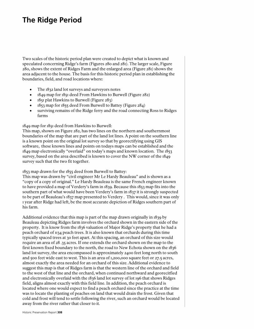
Historic Preservation Report 308
The Ridge Period
Two scales of the historic period plan were created to depict what is known and speculated concerning Ridge’s farm (Figures 280 and 281). The larger scale, Figure 280, shows the extent of Ridges Farm and the enlarged area (Figure 281) shows the area adjacent to the house. The basis for this historic period plan in establishing the boundaries, field, and road locations where:
• The 1832 land lot surveys and surveyors notes • 1849 map for 1851 deed From Hawkins to Burwell (Figure 282) • 1851 plat Hawkins to Burwell (Figure 283) • 1853 map for 1855 deed From Burwell to Battey (Figure 284) • surviving remains of the Ridge ferry and the road connecting Ross to Ridges
farms 1849 map for 1851 deed from Hawkins to Burwell: This map, shown on Figure 282, has two lines on the northern and southernmost boundaries of the map that are part of the land lot lines. A point on the southern line is a known point on the original lot survey so that by georectifying using GIS software, these known lines and points on todays maps can be established and the 1849 map electronically “overlaid” on today’s maps and known location. The 1853 survey, based on the area described is known to cover the NW corner of the 1849 survey such that the two fit together. 1853 map drawn for the 1855 deed from Burwell to Battey: This map was drawn by “civil engineer Mr Le Hardy Beauleau” and is shown as a “copy of a copy of original.” Le Hardy Beauleau is the same French engineer known to have provided a map of Verdery’s farm in 1839. Because this 1853 map fits into the southern part of what would have been Verdery’s farm in 1837 it is strongly suspected to be part of Beauleau’s 1837 map presented to Verdery . This would, since it was only 1 year after Ridge had left, be the most accurate depiction of Ridges southern part of his farm. Additional evidence that this map is part of the map drawn originally in 1839 by Beauleau depicting Ridges farm involves the orchard shown in the eastern side of the property. It is know from the 1836 valuation of Major Ridge’s property that he had a peach orchard of 1134 peach trees. It is also known that orchards during this time typically spaced trees at 30 feet apart. At this spacing, an orchard of this size would require an area of 28 .35 acres. If one extends the orchard shown on the map to the first known fixed boundary to the north, the road to New Echota shown on the 1836 land lot survey, the area encompassed is approximately 2400 feet long north to south and 500 feet wide east to west. This is an area of 1,200,000 square feet or 27.5 acres, almost exactly the area needed for an orchard of this size. Additional evidence to suggest this map is that of Ridges farm is that the western line of the orchard and field to the west of that line and the orchard, when continued northward and georecitfied and electronically overlaid with the 1836 land lot survey of lot 196 that shows Ridges field, aligns almost exactly with this field line. In addition, the peach orchard is located where one would expect to find a peach orchard since the practice at the time was to locate the planting of peaches on land that would drain the frost. Given that cold and frost will tend to settle following the river, such an orchard would be located away from the river rather that closer to it.

National Park Service 309 Figure 280. Extent of farm, Historic Period Plan, Ridge Period, 1819-1837 (National Park Service 2005)

Historic Preservation Report 310

National Park Service 311
Figure 281. Enlarged area of Ride’s farm, Historic Period Plan, Ridge Period, 1819-1837 (National Park Service 2005).

Historic Preservation Report 312
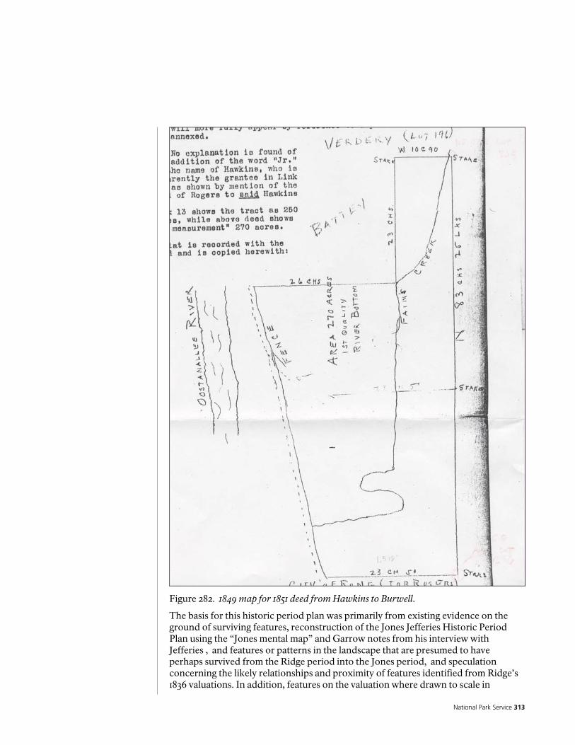
National Park Service 313
Figure 282. 1849 map for 1851 deed from Hawkins to Burwell. The basis for this historic period plan was primarily from existing evidence on the ground of surviving features, reconstruction of the Jones Jefferies Historic Period Plan using the “Jones mental map” and Garrow notes from his interview with Jefferies , and features or patterns in the landscape that are presumed to have perhaps survived from the Ridge period into the Jones period, and speculation concerning the likely relationships and proximity of features identified from Ridge’s 1836 valuations. In addition, features on the valuation where drawn to scale in

Historic Preservation Report 314
Figure 283. 1851 plat Hawkins to Burwell.
speculating their locations. This historic period plan while based on know features from the Ridge period and drawn to scale according to their documented size when that is known, is based to varying degrees on speculation as to how those features may have been arranged. In addition, the speculated layout of outbuildings and features on the enlarged historic period plan are based on a magnetic north south layout and a logical complex of buildings based on their purpose and uses relative to each other. A pattern of building layout along cardinal directions is commonly seen during this time and the original layout of the Ridge home as well as the archeological foundation ruins believed to be Lavenders store are aligned with magnetic North. This gives credibility
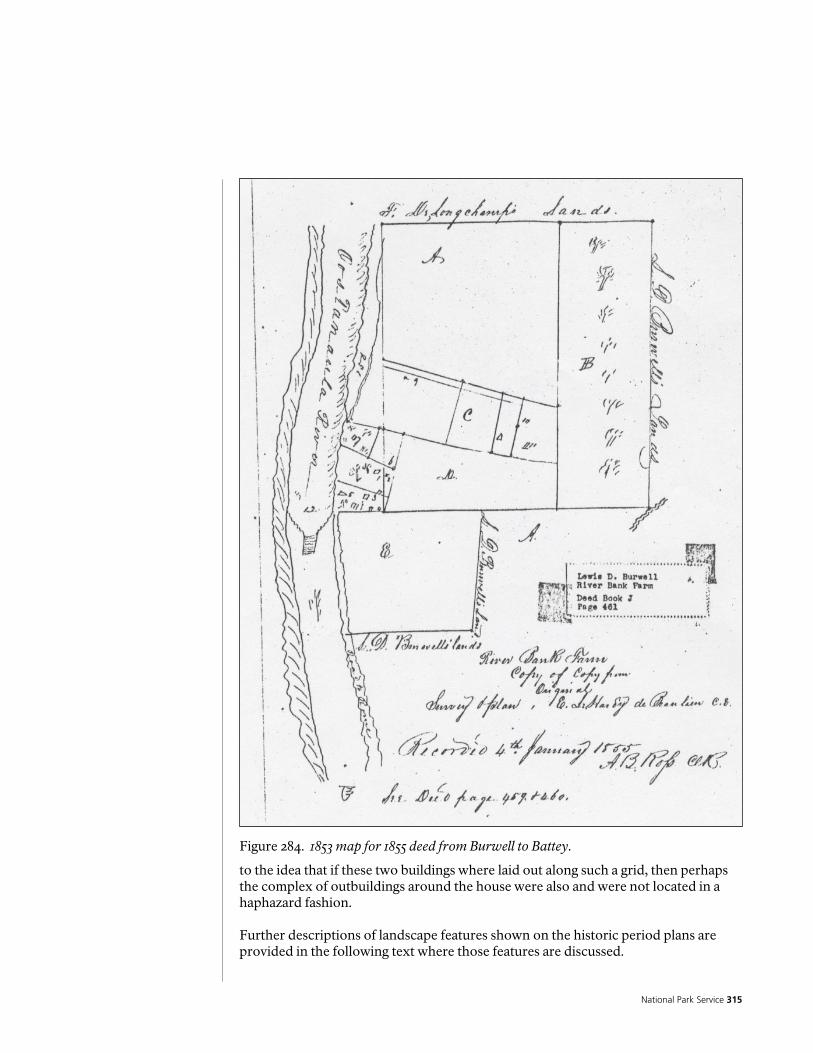
National Park Service 315
Figure 284. Lewis 1805 Map of Georgia.
Figure 284. 1853 map for 1855 deed from Burwell to Battey.
to the idea that if these two buildings where laid out along such a grid, then perhaps the complex of outbuildings around the house were also and were not located in a haphazard fashion. Further descriptions of landscape features shown on the historic period plans are provided in the following text where those features are discussed.
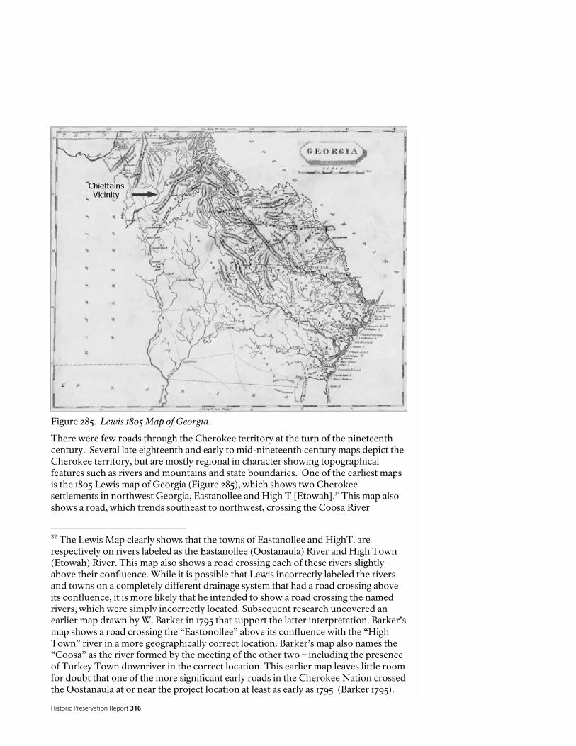
Historic Preservation Report 316
Figure 285. Lewis 1805 Map of Georgia.
There were few roads through the Cherokee territory at the turn of the nineteenth century. Several late eighteenth and early to mid-nineteenth century maps depict the Cherokee territory, but are mostly regional in character showing topographical features such as rivers and mountains and state boundaries. One of the earliest maps is the 1805 Lewis map of Georgia (Figure 285), which shows two Cherokee settlements in northwest Georgia, Eastanollee and High T [Etowah].32 This map also shows a road, which trends southeast to northwest, crossing the Coosa River
32 The Lewis Map clearly shows that the towns of Eastanollee and HighT. are respectively on rivers labeled as the Eastanollee (Oostanaula) River and High Town (Etowah) River. This map also shows a road crossing each of these rivers slightly above their confluence. While it is possible that Lewis incorrectly labeled the rivers and towns on a completely different drainage system that had a road crossing above its confluence, it is more likely that he intended to show a road crossing the named rivers, which were simply incorrectly located. Subsequent research uncovered an earlier map drawn by W. Barker in 1795 that support the latter interpretation. Barker’s map shows a road crossing the “Eastonollee” above its confluence with the “High Town” river in a more geographically correct location. Barker’s map also names the “Coosa” as the river formed by the meeting of the other two – including the presence of Turkey Town downriver in the correct location. This earlier map leaves little room for doubt that one of the more significant early roads in the Cherokee Nation crossed the Oostanaula at or near the project location at least as early as 1795 (Barker 1795).

National Park Service 317 Figure 286. Melish 1815 Seat of War map.
southwest of the confluence of the Oostanaula and Etowah rivers. This road leads northwest to the Tennessee River through what is referred to as the “Mississippi Territory”, which is the territory that later became Alabama. This road, which continued south to Buzzard’s Roost and Barnard’s on the Flint River in Georgia, may be one of the earliest routes through the Cherokee territory (Lewis 1805). A later map (Figure 286) titled, “Seat of War, Creek Indians...War Department” (Melish) dating to 1815 shows no Cherokee towns in the northwest Georgia vicinity, nor does it depict any roads in the vicinity of the Etowah, Oostanaula, and Coosa confluences. This map does show the Georgia Road (Federal Road) and the route of General Cocke’s army’s march to Fort Armstrong from Tennessee (Melish 1815). Fort Armstrong was a U.S. Army garrison that was established on the Coosa River in present-day eastern Alabama. It was an active post during the Creek War. Fort Armstrong was garrisoned by Cherokee and Tennessee troops and was the nearest military post to the Chieftains area during that period. An important early map showing Cherokee roads and developments is the 1831 John Bethune Map of the Cherokee territory in Georgia. (Bethune 1831) This map indicates that by the early 1830s there were roads, ferries and other improvements throughout the Cherokee territory of Georgia. A detail view of this map (Figure 287) depicts the Alabama Road crossing the Etowah River and extending in a generally west to southwest direction toward Alabama. The Alabama Road ran south of the Ridge

Historic Preservation Report 318
Figure 287. Annotated enlargement of Bethune 1831 Map of Cherokee County.
property. North of the Alabama Road two roads (unnamed on the map) merged on the east side of the Oostanaula River. This juncture is labeled “ Jn. Ridge”, with one road coming from the northeast (the road to New Echota) and meeting the second road, which traversed in an east-west direction that paralleled the more southerly Alabama Road. The label on the map showing Jn. Ridge at the crossroads location instead of Major Ridge appears to be confusion on the part of Bethune. The location of John Ross’ Ferry also is depicted on the map, located immediately north of the confluence of the Etowah and the Oostanaula Rivers on the west bank. H.S. Tanner’s 1834 map of Georgia (Figure 288) shows the counties surveyed by the state of Georgia in 1832. This map also depicts several cultural features in the Oostanaula/Etowah/Coosa River valley, including Ridge’s residence, several white settlements and the same three roads observed in the 1831 Bethune map. Tanner’s map shows the road to New Echota intersecting the east-west road (going to Ft. Armstrong in Alabama) slightly west of Ridge’s property, which is depicted slightly east of the Oostanaula River. Interestingly, Ross’ residence is not depicted on the map, but the white settlement of Livingston is shown located on the Coosa River west of where Ross’ property was located. This omission may reflect Ross’s displacement from his property by the white settlers in 1835 (Moulton 1978:62). Livingston, the short-lived original seat of Floyd County does, however, appear on the Tanner Map. The county seat, including the public buildings, was moved to Rome which was incorporated on December 20th, 1834. (Georgia General Assembly 1834:2560).
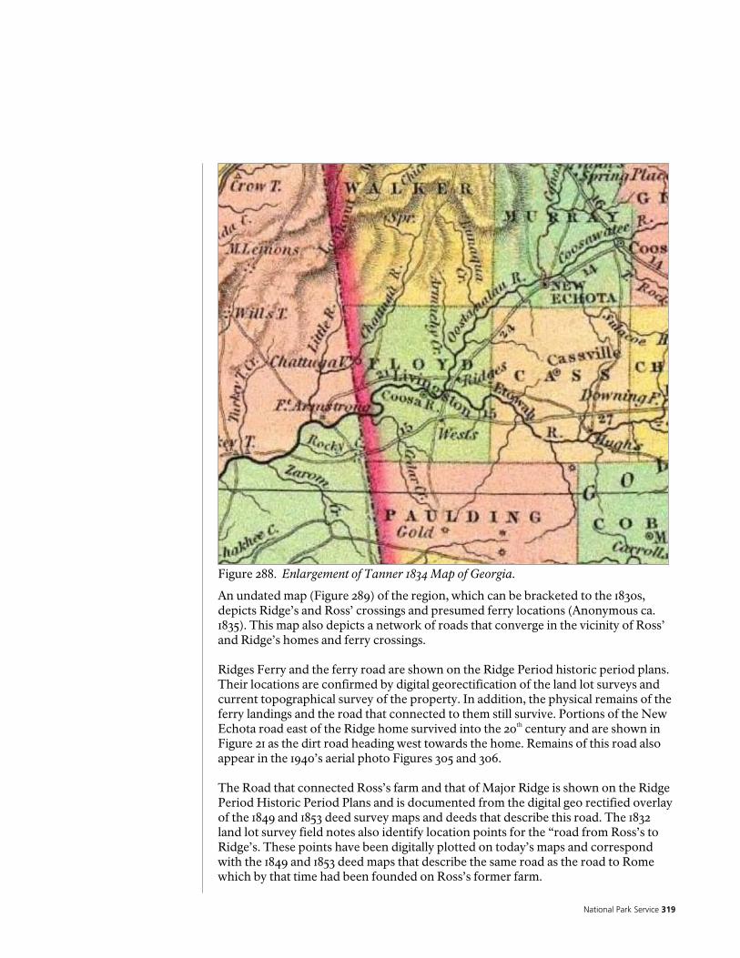
National Park Service 319
Figure 288. Enlargement of Tanner 1834 Map of Georgia.
An undated map (Figure 289) of the region, which can be bracketed to the 1830s, depicts Ridge’s and Ross’ crossings and presumed ferry locations (Anonymous ca. 1835). This map also depicts a network of roads that converge in the vicinity of Ross’ and Ridge’s homes and ferry crossings. Ridges Ferry and the ferry road are shown on the Ridge Period historic period plans. Their locations are confirmed by digital georectification of the land lot surveys and current topographical survey of the property. In addition, the physical remains of the ferry landings and the road that connected to them still survive. Portions of the New Echota road east of the Ridge home survived into the 20th century and are shown in Figure 21 as the dirt road heading west towards the home. Remains of this road also appear in the 1940’s aerial photo Figures 305 and 306. The Road that connected Ross’s farm and that of Major Ridge is shown on the Ridge Period Historic Period Plans and is documented from the digital geo rectified overlay of the 1849 and 1853 deed survey maps and deeds that describe this road. The 1832 land lot survey field notes also identify location points for the “road from Ross’s to Ridge’s. These points have been digitally plotted on today’s maps and correspond with the 1849 and 1853 deed maps that describe the same road as the road to Rome which by that time had been founded on Ross’s former farm.

Historic Preservation Report 320
Figure 289. Enlargement of Map of Cherokee County, ca.1835 (source unattributed).
Cartographic evidence for other of Major Ridge’s improvements on the Oostanaula River in the study area was disappointingly scant. The best information comes from individual land lot plats and the plat of District 23, 3rd District, Cherokee County, which were drafted by District Surveyor John Harvey in 1832 (see Figures 7 and 8). James Smith’s 1838 District 23 Section 3 map (Figure 290), shows all the land lots in the district, but reveals few details other than the streams and roads that pass through the district (Smith 1838:40). Figure 291 is a composite map of Harvey’s 1832 individual land lots showing all the land lots surrounding the land 196 where Chieftains is located. Other land lots that probably comprised parts of Major Ridge’s plantation on the Oostanaula River include lots 165, 204, and 205. This assertion is based on the extent of the areas shown as cleared (or improved) land on the 1832 lottery survey plats. These improved areas form a contiguous block surrounding Ridge’s residence and no other dwellings are indicated on the plats in the immediate vicinity. The improved land on the 1832 lottery survey plats shows the acreage as follows (Hemphill and Liddell 1837:12-13): Acres Description 60 Lot 196, improved 100 Lot 196, wooded or river 5 Lot 165 155 Lot 165, wooded or river 12 Lot 204 148 Lot 204, wooded or river 77 Total Cleared or Improved Land Shown
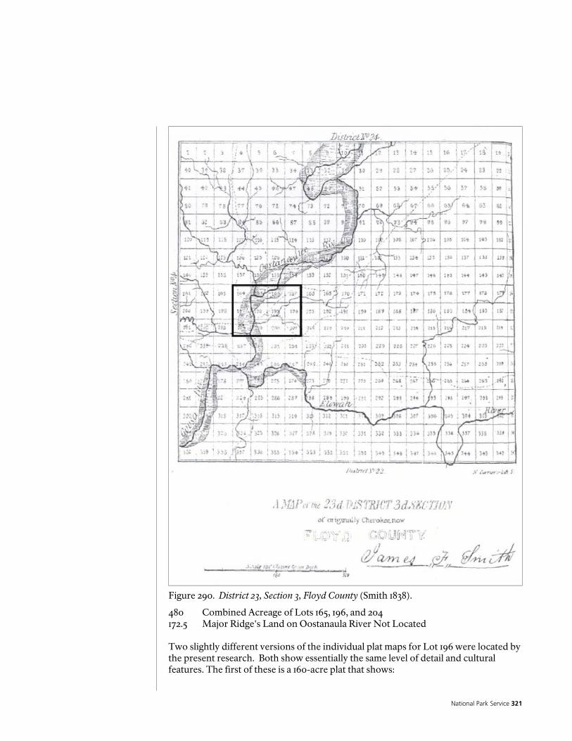
National Park Service 321
Figure 290. District 23, Section 3, Floyd County (Smith 1838).
480 Combined Acreage of Lots 165, 196, and 204 172.5 Major Ridge's Land on Oostanaula River Not Located Two slightly different versions of the individual plat maps for Lot 196 were located by the present research. Both show essentially the same level of detail and cultural features. The first of these is a 160-acre plat that shows:
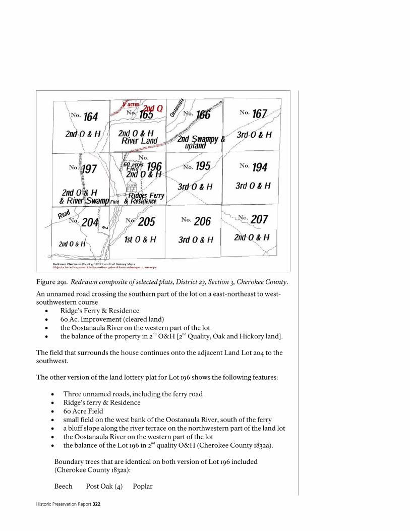
Historic Preservation Report 322
Figure 291. Redrawn composite of selected plats, District 23, Section 3, Cherokee County.
An unnamed road crossing the southern part of the lot on a east-northeast to west- southwestern course
• Ridge’s Ferry & Residence • 60 Ac. Improvement (cleared land) • the Oostanaula River on the western part of the lot • the balance of the property in 2nd O&H [2nd Quality, Oak and Hickory land].
The field that surrounds the house continues onto the adjacent Land Lot 204 to the southwest. The other version of the land lottery plat for Lot 196 shows the following features:
• Three unnamed roads, including the ferry road • Ridge’s ferry & Residence • 60 Acre Field • small field on the west bank of the Oostanaula River, south of the ferry • a bluff slope along the river terrace on the northwestern part of the land lot • the Oostanaula River on the western part of the lot • the balance of the Lot 196 in 2nd quality O&H (Cherokee County 1832a).
Boundary trees that are identical on both version of Lot 196 included (Cherokee County 1832a):
Beech Post Oak (4) Poplar

National Park Service 323
Elm (2) Red Oak Pine White Oak (2)
District Surveyor Harvey recorded the acreage of cleared land in the 23rd District in his fieldbook notes. He indicates that a total of 642 acres in District 23 was identified by Surveyor Harvey as cleared land. Of this acreage, 414 acres were located on 24 lots described as, “Lots on which Indians resided at the time of survey”, and 228 acres were on 25 lots described as, “Lots improved but not resided on” (Harvey 1832a:120-121). Of the 228 acres, however, specific lot locations were provided in Harvey’s field book notes for only 110 acres. Harvey showed 60 acres of cleared land on Land Lot 196 identified as “Major Ridge’s house, ferry and field” (Harvey 1832a). The acreage shown as developed on the 1832 plats does not match that shown in the valuations or the census. This may be due to the fact that the census (1835)33 and valuations (1837) occur a few years later. And it may also be attributed to differences in the enumerators and their degree of accuracy in their recordings. A summary of Major Ridge's land holdings in the Cherokee Nation based on the 1837 Valuation follows: Acres Description 42.5 Pine land 42.6 43 2nd land 42.7 27 2nd low land 42.8 36.5 Upland 42.9 20.5 Upland 42.10 19 River land 42.11 21.5 River land8 Cleared 13.5 1/2 Cleared 18 Low Ground, Ridge dispossessed of in 1836 249.5 Total in 1836 231.5 Total in 1837 Additional information on the Cherokee improvements in the 23rd District is contained in a letter, dated February 5, 1834, from William G. Spring, Agent for the Cherokees in Georgia, to Governor Wilson Lumpkin, which stated:
“I have been now two days in the 23rd District 3rd Section about & around the Head of Coosa John Ross is not at home I went there & found his House on Lot No 244- and his improvements extend on to several other lots 237 & 243 & some on the South Side of the River Coosa & as there is no improvement in 3 or 4 Miles of him except the Ridges lot No. 194 [possibly an erroneous reference to Lot 196] which is not Subject I need not particularise” (Hays 1940:264-265).
33 The 1835 Census identifies Major Ridge as possessing 300 acres on 4 farms (all apparently in the Oostanaula River Valley). At that time he grew 2,000 Bushels of corn of which he sold 1,500 bushels at an average of $0.50 per bushel (Trail of Tears Association 2002:51).
Historic Preservation Report 324
No documents definitively identifying Major Ridge’s neighbors, other than the John Ross reference above, were identified by the present research. Ridge’s neighbors on the Oostanaula River can be tentatively determined by examining the 1835 Census and 1836 valuations. The chronological sequence that the valuations followed may correspond to the geographical sequence of landowners. Unfortunately because of the poor quality of the microfilm the 1835 Census enumerations of head of household are mostly illegible. Major Ridge’s name falls between several illegible names.34 The 1835 census lists John Ridge and Major Ridge who are separated by 30 other households, including one unidentified person living on the Coosa River. A total of 34 households on the Oostanaula River are listed. The plantations of Major Ridge and John Ridge were both examined and valued by Hemphill and Liddell on September 20, 1836. The plantations of their neighbors on the Oostanaula (Moor, Moores, and others) were examined three days later (September 23). Names of Cherokees living on the Oostanaula River, who appear on both the 1835 census and the 1836 valuations, include Major Ridge, John Ridge, Charles/Charley Moor[e]35, Ground Mole, and Watie/Waitee (Hemphill and Liddell 1836). The inventory of Major Ridge's real estate and property on the Oostanaula River (Chieftains), recorded in 1836-1837, is presented in Table 3. The Chieftains house and Lavender storehouse or trading post with surviving archeological evidence are the only buildings definitively tied to the physical locations on the current landscape. Other buildings along with orchards and other landscape features can be speculated with varying degrees of certainty and are identified on the historic period plans. The 1836-1837 inventory of Major Ridge’s Oostanaula River property, his plantation lists the following:
Large dwelling houseFerry 2 kitchen; Stable Smokehouse Cribs Hen house Stable Hot house cellar Orchard
34 Additional research using the version of the 1835 Census published by the Oklahoma Chapter of the Trail of Tears Association in 2002 lists Major Ridge and his household as entry #702. The five previous entries include Kieneekee (#697 w/ 3 acres and one structure), Archester (# 698 w/ 5 acres and four structures), Ponch (#699 w/ no acres or structures), Drownding (#700 w/ no acres or structures), and Wyooskee (#701 w/ 12 acres and 3 structures). Of these five household heads, all but Drownding are listed as living on the Oostanaula. Ponch and Drownding who are single “Farmers” over 18 with no apparent dwelling are possibly employed by Ridge. Only one family appears after Ridge as living within the boundaries of Floyd County. Entry #703 is Clay, who is part Creek and owns a 5-acre farm with three structures. (Trail of Tears Association 2002: 51). 35 Charley More appears as entry #694 on the 1835 Census with a farm of 15 acres and six structures. Luther More is entry #696 with 15 acres and 4 structures. Each grew 360 bushels of corn. (Trail of Tears Association 2002:51).
National Park Service 325
3 Negro houses Fields 1 Other house Woodlands 2 Lumber houses
The following section discusses outbuildings and other landscape features identified in the historical records. Kitchens Two kitchens were listed in the 1836 valuation of Major Ridge's property on the Oostanaula River. Each was described as 16 feet by 18 feet in size and constructed of round logs. Their locations were not described or shown on any plat. These cultural features could not be precisely located based on the present evidence. If continuity of the kitchens was maintained from the Ridge Period to the Late Bellum-Early twentieth century Period, then the approximate location of these two kitchens may be surmised from examining later historic documents. Later photographic evidence shows the kitchen attached to the main dwelling at Chieftains as a single rectangular addition on the original building's north end (see photograph 16). In the photograph the kitchen has a recessed porch that attaches directly to the rear porch creating a breezeway. The kitchens in the Ridge Period may have been more distant from the main house. The different functions of the two kitchens were not described. The likely location of at least one of these kitchens is drawn to scale and shown on the enlarged Ridge Period historic period plan as number 2 Garrow's 1969-1972 archaeological excavations identified a building that he interpreted as a store, based on an abundance of kitchen-related artifacts from the Ridge Period. This would have possibly been Lavenders store. Garrow noted that this building was destroyed by fire (Garrow 1969:1). A building appears in a late nineteenth century photograph on the same long axis (facing the Oostanaula River) as the original Ridge dwelling. It is possible that the remains may represent one of the two kitchens listed in the 1836 valuation of Major Ridge's Oostanaula River property. The one and a half story building is located approximately 17 meters north of the main house and has two gable-end brick chimneys. It is difficult to ascertain from the photograph whether or not the building was of log construction, yet the one and a half story proportions could be indicative of a log structure under the siding. The archaeological ruin found by Garrow is of a building with two end chimneys. The building in the photograph is of similar configuration and in the same approximate location as Garrow's archaeological find. Garrow acknowledged, from his conversations with members of the Jones and Jeffries families in 1969 that a kitchen existed in the early twentieth century on the same site as the swimming pool/cellar site (Garrow 1969). The two buildings may be synonymous, or the building in the photograph may represent a later building erected on the same site. 20th// Major Ridge Oustanalla River Dwelling house 54 by 29 feet, 2 stories high four fireplaces, brick. 8 Rooms finished in neat style, outside painted, Balcony on the side of the house [--] turned columns, 30 glass windows, one glass door leading to Balcony on the other side blinds to all 12 door facings and shutters painted, with first rate bolts and Locks. Parlor upstairs finished in first rate style, the whole neatly underpinned with rock 5100.0

Historic Preservation Report 326
Two Kitchens 16 by 18 RL [Round Log] 60.0 Smoke house 18 by 18 NL 35.0 Hen house 18 by 16 RL 30.0 Hot house cellar 15 by 14 RL 20.0 Cribs* double 6 by 18 rack old 20.0 Stables 48 by 24 paddocks (for stocks?) loft stalls Arranged inside, outside, Back, trough Gate and Lot 200.0 Stable 16 by 20 framed plank roof 50.0 Store 54 by 17 HL Brick chimney Shed room & brick chimney 300.0 Lumber house attached to Store House 20 by 18 RL 30.0 Lumber house 18 by 18 RL 20.0 Two Negro houses 14 by 16 old RL 30.0 ------ do [ditto] 14 by 14 RL 15.0 $5910.0 Account brought forward 5910.0 Field 42 2 acres pine land at 12$ 510.0 Field 43 acres 2nd land 8$ 344.0 Field 27 acres 2nd low lands 8$ 216.0 Field 36 1/2 acres, upland at 6 1/2 $ 240.25 Field 20 1/2 do do do [ditto] 133.25 Field 19 do [ditto] river* land at 12$ 228.0 House 16 by 14 RL 30.0 Lumber house 14 by 16 RL 16.0 Field 21 1/2 acres riverland, 8 acres cleared at 12$ per acre 96.0 13 1/2 acres half cleared at 6$ 81.0 ---- 1134 Peach Trees at 80 cents 907.20 418 apple Trees at 2.50 1045.0 11 Quince Trees at $2 22.0 7 Peach Trees at $2 ------ 14.0 21 Cherry Trees at 50 cents 10.50 4 Plumb orchards (variety) 20.0 Paled garden, variety of ornamental Shrubs, Nursery, Viney and do [ditto] 100.0 Ferry on Oustenalla River 9923.20 Nett income 12$ per ----------- $9720.00 M Ridge was dispossessed of 18 Acres of low grounds the last year By the laws of the State Ferry valuation $12000.0
0 as corrected $-----.20
By mistake B as we are ------- Informed B The* --- claims of the Above described Ferry of Major Ridge [illegible]
Table 3. Transcription of 1836-1837 Valuation of Major Ridge’s Improvements (U.S. Bureau of Indian Affairs 1837-1845).

National Park Service 327
Figure 292. Example of 19th Century chicken house in western North Carolina (Dunford 2001).
Given the evidence to date, an interpretation of Garrow's ruin as Lavenders store or a detached kitchen from the Ridge Period is suggested. Hen House One hen house was listed in the 1836 valuation of Major Ridge's property on the Oostanaula River. It was described as 18 feet by 16 feet in size and of round log construction. Figure 292 illustrates an example of a nineteenth century hen house preserved at the Mountain Farm Museum in the Great Smoky Mountain National Park, North Carolina. The hen house at Chieftains location was not described or shown on any plat. This cultural feature could not be located based on the present evidence. The hen house would have contained Ridge's flock of chickens (and possibly other domesticated fowl). It was advantageous to keep this type of farm structure relatively close to inhabited areas to monitor and reduce the threat from predators as well as in proximity to the kitchen and garden area. This is shown as number 10 on the historic period plan. Hot House Cellar One hot house cellar was listed in the 1836 valuation of Major Ridge's property on the Oostanaula River. It was described as 15 feet by 14 feet in size and of round log construction. Its location was not described or shown on any plat. This cultural feature could not be located based on the present evidence. Cellars were a common
Historic Preservation Report 328
feature on farms in the eighteenth and nineteenth century south. A "hot house cellar" may imply a distinction from a cellar intended to keep food cool, such as a potato/root cellar. The hothouse cellar was possibly a semi-subterranean structure in which plants were protected from cold weather. This building, which may have been similar to a cold frame or a greenhouse, may have employed some form of passive heat source, such as that generated by solar heat or by rotting manure or it may have been artificially heated in extremely cold weather. Ridge's hot house cellar may have performed several useful functions, including protecting cold-sensitive plants. from frost and sprouting seedlings in early spring36. The location of this feature is not shown on the historic period plan since insufficient information existed to speculate how this might have been located relative to other landscape features and the character of the landscape. “Negro Houses” Three "Negro houses" were listed in the 1836 valuation of Major Ridge's property on the Oostanaula River. Two of these houses measured 14 feet by 16 feet in size and were of round log construction. The other dwelling measured 14 feet by 14 feet and was constructed of round logs. Their locations were not described or shown on any plat. These cultural features could not be definitively located based on the present evidence. The 1835 census information for Major Ridge lists 15 slaves in his household. The census lists three other slaves living on Ridge’s other three farms. If one asserts that all 15 of the slaves were housed in these three dwellings, a distribution of five people per dwelling is returned. Some of Ridge's slaves may have resided in the main dwelling, however, and some may have been housed on Ridge's more distant landholdings. No documentation was found on contemporary examples of Cherokee slave architecture in northwest Georgia, northeastern Alabama, or Tennessee. The speculated location of these structures is shown on the historic period plan as number 13. The evidence for the location shown is very speculative and based on the logic that perhaps these cabins would have been near the main house and in proximity to the stables and other concentration of outbuildings for practical purposes. They are also located along the main road to the ferry which is similar to the pattern at the Vann House in which layout of slave cabins was along the roads. At the Hermitage, however, slave cabins are also located near the fields which would suggest another possibility that Ridge’s slave cabins could have been to the North or South of the house where his main fields where located. If to the south, they could perhaps have been located along the Ross to Ridge road and perhaps have been one of the structures that are shown on the 1853 Burwell to Battey map. It is likely that
36 In 1791, American Naturalist, William Bartram described a traditional southeastern Indian semi-subterannean building that he refers to as a “hot house”:
…each house or habitation has besides a little conical house, covered with dirt, which is called the winter or hot-house; this stands a few yards distance from the mansion-house opposite the front door. (Harper 1998: 232).
Additional comparative research as well as continued archaeological research could shed light on the intent of the “valuators” in using the term hot house. If traditional, its presence on Major Ridge’s acculturated plantation would be very significant.

National Park Service 329
Figure 293. Speculative sketch of Lavender’s Store (Worth 2000b).
these cabins could have been located in different areas of Ridge’s farm. Store House A store, or storehouse, was listed in the 1836 valuation of Major Ridge's property on the Oostanaula River. This was most likely the same building as Lavender's store. Major Ridge's store was built of hewn logs, measuring 54 feet by 17 feet with a brick chimney. The store had a lumber house attached. The location of the store within the Chieftains property is not explicitly stated in the 1836 valuation. Modern scholars are divided in their interpretation of the location of this commercial building. Archaeologists Garrow and Worth, based on artifact concentrations, consider the archaeological building remains that were defined in the 1969-1972 excavations north of the Chieftains residence to be Lavender's store with several shed additions off the side of the house.37
37Garrow interpreted the archaeological ruins immediately north of Chieftains as the building referred to in the 1837 valuations as the “store” based on artifact type and frequencies as well as historic references to the close proximity of the Trading Post to the primary residence. According to Garrow “the artifacts found behind the building represent breakage in transit”. He specifically references the presence of a spoon with the initials “GL” found in this area as showing a clear association with George Lavender who operated the Trading Post. (Garrow, personal communication, 2006).

Historic Preservation Report 330
A member of the Jeffries family suggests (discussed in Jones-Jeffries period) that a The dimensions of the ruins of a stone cellar containing Ridge-period artifacts are too large (25’ x 14’ on the interior) to fit the dimensions provided for either of the kitchens (16’ x 16’) It is highly improbable that a cellar would be larger than the structure above it. Garrow is currently working with Chieftains on an analysis of the archaeological material excavated between 1969-1971, much of which consists of material excavated around these ruins. A full report including a discussion of the function of the structure will be completed in late 2006 or early 2007. Preliminary results of a Ground Penetrating Radar survey currently in progress suggest the location of a structure that is potentially one of the kitchens between the house and the stone cellar. Further archaeological investigation will likely be helpful in locating outbuildings and determining their specific use.
Figure 294. Archeological Excavation Plan, Chieftains Museum Grounds (Worth 2000).
National Park Service 331
former tenant house that was located east of the Chieftains dwelling was possibly the location of the trading post (Lavender's Store). That location was marked by a cluster of trees suggestive of a former building site on the 1928 perspective aerial photograph and the 1943 aerial photograph (see Figures 303-306). This location has not received any documented archaeological study; however, this location would be a more logical place for the store because of its proximity to the Etowah Road.38 A store at this location would have been convenient to travelers destined to cross Ridge's Ferry and seemingly more convenient to travelers than the building remains located north of the Chieftains dwelling, in a spot more like the locations of a outdoor kitchen. It may be that as the trading post business expanded, the building location was moved and or expanded so that both locations may have served as the store. The location of Lavender's store may be resolved with the available historical and archaeological information. Currently, the property east of the house is not part of the Chieftains 12 acre tract. Lumber Houses Two lumber houses were listed in the 1836 valuation of Major Ridge's property on the Oostanaula River. One was described as a round log structure, measuring 18 feet by 18 feet. The other measured 20 feet by 18 feet (also of round log construction) and was attached to the storehouse. Lumber houses in contemporary northwest Georgia are open shed structures with sturdy, simple racks for stacking lumber. These buildings serve to keep the wood relatively sheltered from precipitation and elevated above ground level to protect the wood from termites and moisture. Smoke House One smoke house was listed in the 1836 valuation of Major Ridge's property on the Oostanaula River. The smoke house measured 18 feet by 18 feet in size and was constructed of "NL", or nailed logs [possibly planks nailed on a log frame]. Figure 295 illustrates a smoke house of similar construction located in northwestern North Carolina. Smoke houses were used to smoke and store meat. They were typically secure structures with a dirt or brick floor. A smoldering fire in the floor produced the smoke that circulated and permeated the meat and preserved it for human consumption. The logical location of a smoke house would have been in proximity to the main house and especially the kitchen. Later smoke houses replaced the smoke with salt as the preservation medium, although the name "smoke house" was retained. The replacement of smoke by salt as a preferred method probably post-dates the Ridge Period. The speculated location of this structure is drawn to scale and shown near the hen house, kitchen, and pale garden as number 9. Stable Two stables were listed in the 1836 valuation of Major Ridge's property on the Oostanaula River. One stable was a 16 fee by 20 feet framed structure with a plank roof. The other consisted of 48 feet by 24 feet paddocks, loft stalls, and, "arranged
38 Although no official report was written, Garrow and his crew conducted significant excavations around the ruins of a structure in this location in 1969. The earliest artifacts found dated from the mid-nineteenth century. No material from the Ridge period was recovered. A discussion of this site will be included in the forthcoming report by Garrow. (Garrow, Personal Communication 2005).

Historic Preservation Report 332
Figure 295. Example of 19th Century smokehouse in western North Carolina (Dunford 2001).
inside, outside, Back, trough, gate and lock". The stables would most likely have been located in proximity to the house to keep a close eye on valuable stock but at a distance to avoid the smell of manure. The location of the “old log barn” survived into the Jefferies period and may indicate the same location was used during the period. The speculated location of the stable and paddock structure is drawn to scale and shown in the area of the Jones Jefferies “old log barn” to the North of the house and on the same north south axis as the house. The smaller stable would likely have been in close proximity to the larger stable and paddock. Both structures are drawn to scale and are identified on the historic period plan as numbers 5 and 6. Although not listed on the valuations, it is likely that Major Ridge would have had animal enclosures for the animals he owned that are listed in his spoliation claims. Their location and existence, although likely, are very speculative. Most likely these would have been in proximity to the stables and paddocks but located farther from the house to avoid the odor. If similar to the Vann House farm, these would have been in such proximity. No size or scale is known or any indication of their location or existence is documented except that it is known that Ridge had a considerable number of farm animals. Based on speculation, however, enclosures for animals are drawn to scale located to the north of the stable and paddocks as a likely possibility for where Major Ridge may have had such enclosures on level ground near the stables and not too far from the house or too close. These enclosures are laid out along the north south axis established by the house and Lavender store and identified

National Park Service 333
Figure 296. Example of 19th Century corn crib in western North Carolina (Dunford 2001). on the historic period plan as number 17. A farm access road is known to have existed in the Jones Jefferies period and may have existed during the Ridge Period to access this area. Cribs Cribs were listed in the 1836 valuation of Major Ridge's property on the Oostanaula River. These structures were described as double cribs, measuring 6 feet by 18 feet, in old condition. Cribs were used to store corn, other grain, and hay, and protect them from vermin and the elements. These structures typically had a roof to protect from precipitation and were elevated to protect from rats and other vermin (see Figure 296 for illustration of a corn crib preserved at the Mountain Farm Museum in the Great Smoky Mountain National Park, North Carolina). Because these stored feed, it is common for these structures to be located in proximity to the stables and paddocks where the horses or animals would be located. The speculated location of this structure is drawn to scale on the north south axis and layout of the house and shown on the historic period plan as number 4 Fields Fields [agricultural fields] were listed in the 1836 valuation of Major Ridge's property on the Oostanaula River. Ridge's fields, as listed in that document, included the following:
Historic Preservation Report 334
42.5 acres, pine land 43 acres, 2nd quality land 21.5 acres, river land 36.5 acres, uplands 27 acres, 2nd quality low lands 20.5 acres, uplands 19 acres, uplands river land [seemingly contradictory description] 8 acres, cleared 13.5 acres, half cleared
A review of the 1832 plats for District 23, Section 3, Cherokee County provides an approximate understanding of where some of Major Ridge's agricultural fields on his Oostanaula River plantation were located. The loose plat for Lot 196 shows a 60-acre field on the east side of the Oostanaula River, surrounding Ridge's residence (Cherokee County 1832a, 1832b). The extent of this field and its configuration is known with a high degree of certainty. It is shown on the Ridge Period Historic Period Plan as bounded by points 1, 6, 10, 11, 12, and 13. The northern extent of this field is drawn on the land lot survey and based on existing known points today this 1832 drawing has been computer georectified to reproduce it to scale overlaid with today’s air photos and conditions. The southern boundary of this field is reproduced based on computer georectification of the 1853 Burwell to Battey maps as described on page 284. The location of the west edge of the field on the Burwell to Battey map to the south and the 1832 land lottery map to the north match almost exactly when the two are computer georectified making it highly likely that this is in fact the same field and represents the complete configuration of Ridge’s main field. The plat for lot 196 also shows a small area of fields in the southwest corner of the land lot on the west bank of the Oostanaula River and immediately south of the road. This field is known to have been a 12 acre field and its exact configuration is known based on the land lot survey showing the north and west fence lines of the field and the survey notes from the land lot survey that identify the southern edge of the field. These exact known points have been georectified on the computer to known points on the ground today and the exact location of the field and its configuration are shown as the 12 acre field bounded on the south by survey point number 3 on the Ridge Period Historic Period Plan 1” = 100’ scale drawing. The plat for Lot 196 that was recorded in the Cherokee County plat book also shows the field on the east side of the Oostanaula River in nearly the same configuration. The only difference between the two is that the loose plat shows the field continuing off of a bluff into the river bottom. The plat recorded in the book does not depict the field on the west bank of the river. Orchard Fruit trees and orchards are listed in the 1836 valuation of Major Ridge's property on the Oostanaula River. Major Ridge's orchards on the Oostanaula River contained:
1134 peach trees

National Park Service 335
418 apple trees 21 cherry trees 11 quince trees 4 plumb [plum] orchards (including several varieties)
The location of Ridges orchards: Two orchards listed in Ridge’s valuation are significantly larger than the others. These are the peach orchard and the apple orchard. These orchards, given their size would likely have been grown as commercial crops as opposed to being used for subsistence. The location of these orchards and their configuration is shown on the Ridge Period Historic Period Plan 1”=100’ scale drawing. These orchard locations and their size and configurations are known with a very high degree of certainty based on evidence from several sources and the computer georectification of the 1832 land lot survey and 1853 Burwell to Battey map as described on page 284. The location of the apple orchard shown on the historic period plan is based on the similar growing requirements between peaches and apples and therefore the likelihood that they would be planted in similar growing condition locations. If one extends the layout of the peach orchard to the north from the fixed and known boundary of the Echota road, given the same spacing of 30 foot on center, the area required for 418 trees is as shown on the Historic Period Plan. The smaller cherry and quince orchards listed in Major Ridge’s valuation were almost certainly used for subsistence and would have been located close to the house, kitchen and garden area. This proximity is known with a high degree of certainty although the exact location is speculative. A likely possibility for their location is shown and drawn to scale on the detailed 1”equals 30’ scale Ridge Period Historic Period Plan. Cherry trees during this period where often used as a sweetener before processed sugarcane became widely available and also used for ornamental purposes at the approach of a home. Ridge may have located his 21 cherry trees for ornamental purposes at or near the entry to his home. Although probably overlooked by anyone not familiar with the early history of farming in the US, the small plumb orchard is an important testament to Major Ridge’s status as a wealthy businessman and his level of acculturation to white society. In the 1830’s men of “stature” were considered “planters” and exhibited their level of stature in their agricultural enterprises much like someone today would indicate their status or be recognized in society by degree title from Ivy League schools. In 1836 “variety plumbs” would have been imported, most likely from England. This is a very early period for the growing of imported plumbs and would require that Ridge would have to have had access to international trade. Only men of “planter” status would have been engaged in the experimental growing of such imported fruit trees and thus is an indication of the wealth and level of acculturation that Ridge had achieved (Susan Dolan personal communication, March 2005). Garden A paled garden (enclosed with a stick fence) that contained a variety of ornamental shrubs, a nursery, and "Viney and do", was listed in the 1836 valuation of Major Ridge's property on the Oostanaula River. Again the size and location of the garden was not described or shown on any plats.

Historic Preservation Report 336
The location of the “paled garden:” A speculated location for the paled garden is shown on the Ridge Period Historic Plan as number 8. The size and exact location of this garden is quite speculative. In general, it is shown as a simple square enclosed area common for the time period and laid out on the same magnetic north south grid as the house and store. It is located near the house, speculating that it would have been located in a functional proximity to the house and also near the kitchen. In addition to ornamental shrubs, it is likely that the paled garden would have served as a kitchen garden which would have been a necessary feature of Ridges Farm and would most certainly have been in proximity to the kitchen. It is also know that the same general area is identified in the Jones Jefferies mental map as a garden. It is possible, and perhaps even likely, that the area used for a garden by Ridge and subsequent owners did not change substantially and survived into the Jones Period. Ornamental shrubs that were specific to the Cherokees in northwest Georgia from
the early nineteenth century are unknown. Euro-American ornamental shrubs from this time period in Georgia are better known. These would include (Adams 2004; Radford 1968; Westmacott 1992:179; Hamel 1992; Sumner and Forti 2004; Welch 1989, 1995):
American wisteria Boxwood Crepe myrtle English ivy fig grape muscadine mock orange pear periwinkle (vinca minor) privet quince rasberry rose scuppernong strawberry tea olive yaupon holly (Ilex vomitoria)
The yaupon holly (ilex vomitoria) was the source of the black drink (or cassina), well known among many southeastern Indian groups for its purging qualities and its importance in certain southern Indian rituals (Hudson 1979). While the yaupon holly is not indigenous to northwest Georgia, it easily may have been imported. Ferry Numerous references to ferries in the Cherokee Nation were gleaned from the Cherokee newspapers. These references indicate the degree to which ferries were regulated by the Cherokee government and highlights their importance. Interestingly, none of these regulatory decisions seem to have pertained to either Ridge’s or Ross’
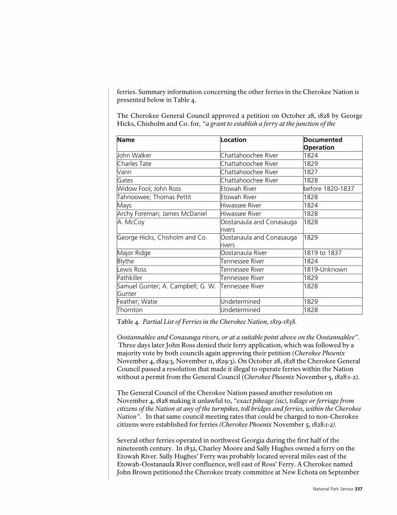
National Park Service 337
ferries. Summary information concerning the other ferries in the Cherokee Nation is presented below in Table 4. The Cherokee General Council approved a petition on October 28, 1828 by George Hicks, Chisholm and Co. for, “a grant to establish a ferry at the junction of the
Table 4. Partial List of Ferries in the Cherokee Nation, 1819-1838. Oostannahlee and Conasauga rivers, or at a suitable point above on the Oostannahlee”. Three days later John Ross denied their ferry application, which was followed by a majority vote by both councils again approving their petition (Cherokee Phoenix November 4, 1829:3, November 11, 1829:3). On October 28, 1828 the Cherokee General Council passed a resolution that made it illegal to operate ferries within the Nation without a permit from the General Council (Cherokee Phoenix November 5, 1828:1-2). The General Council of the Cherokee Nation passed another resolution on November 4, 1828 making it unlawful to, “exact pikeage (sic), tollage or ferriage from citizens of the Nation at any of the turnpikes, toll bridges and ferries, within the Cherokee Nation”. In that same council meeting rates that could be charged to non-Cherokee citizens were established for ferries (Cherokee Phoenix November 5, 1828:1-2). Several other ferries operated in northwest Georgia during the first half of the nineteenth century. In 1832, Charley Moore and Sally Hughes owned a ferry on the Etowah River. Sally Hughes’ Ferry was probably located several miles east of the Etowah-Oostanaula River confluence, well east of Ross’ Ferry. A Cherokee named John Brown petitioned the Cherokee treaty committee at New Echota on September
Name Location Documented Operation
John Walker Chattahoochee River 1824 Charles Tate Chattahoochee River 1829 Vann Chattahoochee River 1827 Gates Chattahoochee River 1828 Widow Fool; John Ross Etowah River before 1820-1837 Tahnoowee; Thomas Pettit Etowah River 1828 Mays Hiwassee River 1824 Archy Foreman; James McDaniel Hiwassee River 1828 A. McCoy Oostanaula and Conasauga
rivers 1828
George Hicks, Chisholm and Co. Oostanaula and Conasauga rivers
1829
Major Ridge Oostanaula River 1819 to 1837 Blythe Tennessee River 1824 Lewis Ross Tennessee River 1819-Unknown Pathkiller Tennessee River 1829 Samuel Gunter; A. Campbell; G. W. Gunter
Tennessee River 1828
Feather; Watie Undetermined 1829 Thornton Undetermined 1828

Historic Preservation Report 338
3, 1837 during the emigration process for “...the recovery of the value of his ferry over the Tennessee River and other property there” (Hargrett n.d. File 59, Folder 3). The earliest reference to Ridge’s Ferry that has been identified by the present historical research team appears in a law passed October 30, 1819, at New Town (New Echota), which reads as follows:
“Widow Fool shall also keep in repair for the benefit of her ferry at the fork, the road to commence from the creek above named to where Ridge’s Road now intersects said road east of her ferry, and that the Ridges shall also keep in repair the road to commence at the Two Runs, east of his ferry, and to continue by way of his ferry as far as where his road intersects the old road, leading from the fork west of his ferry . . ." [signed by Ross, Path Killer, Hicks and McCoy] (Battey 1994:27).
The relationship between the Widow Fool’s and Ridge’s Ferry is confused by the following passage, however, which is extracted from the Cherokee Laws:
“ The THIRD DISTRICT, shall be called by the name of COOSAWATEE, and bounded as follows; beginning at the widow Fool’s Ferry on the Oostannallah river, where the Alabama road crosses it, along said wagon road eastwardly; leading towards Etowah town to a large creek above Thomas Pettit’s plantation...” (Cherokee Phoenix April 3, 1828 :1).
That description places the Widow Fool’s Ferry on the Oostanaula River and not the Etowah River where John Ross’s Ferry is later established. When the 23rd District of Cherokee County was surveyed in 1832, the field surveyors noted Major Ridge’s and John Ridge’s Ferry and road improvements in several entries in their logbook. These include:
• Road to Ridge’s ferry • Road to Ross’ & Ridge’s • Road to Ridge’s (8 instances) • Jno. Ridge’s fields • Road to ferry [presumably Ridge’s ferry over the Oostanaula River] (Harvey 1832a:5, 13, 18, 21, 23, 24, 25, 27, 29, 35, 73).
On September 21, 1836 George M. Lavender certified that the ferry he had operated at Major Ridge’s Ferry on the Oostanaula was a valuable asset. His certificate, which was filed at the Head of Coosa in Floyd County, Georgia stated:
“This is to certify that I have resided a number of years, at Major Ridges ferry on the Eastanalle [Oostanaula] River, and Some six or seven years ago the Ferry was very valuable, and considered to be a ferry as valuable as any within the Cherokee Nation and also the ferry owned by Mr. John Ross bought of the Widow Fool at the Junction of Hightower and Eastanallee was also considered as equally valuable as Maj [Major] Ridges ferry,...I think that each of the above Ferries five or six years since made from three to four dollars pr. [per] day “ (Lavender 1836).

National Park Service 339
Lavender’s certification as to the value of Ridge’s Ferry was corroborated by William Childers in a statement dated September 20, 1836 and filed in Floyd County, Georgia, “I do hereby certify some seven years ago I resided at Major Ridges Ferry and occasionally had charge of said ferry and from my knowledge of its income at that time I am of opinion that it would average four dollars per day” (Childers 1836). Other accounts of Ridge’s Ferry were recorded by travelers passing through Cherokee Country. Lucius Verus Bierce traveled on Ridge’s Ferry on April 1, 1822, and he recorded in his journal, “Struck tents, and after a march of seventeen miles came to the Eastanoby [Oostanaula] river, a large navigable stream, and a principal branch of the Coosa. Here we crossed in a ferry owned by Majr. Ridge, a half breed, who is Chief Orator of the 'Nation' (Knepper 1966:90). When Ridge’s Ferry was appraised in 1837, its value was appraised at $12,000.00 (Hemphill and Liddell 1837:12-13). On October 27, 1821 the Cherokee National Committee and Council passed a resolution that provided:
“That any person or persons who ...has a public ferry croossing [sic] opposite his or their reservations, such person or persons shall not be permitted to keep a white ferryman on the lands belonging to the Nation, neither shall he be permitted to tend any land thereon, for the use of his ferryman; but nothing shall be so construed in the above resolution, as to affect the rights and privileges of such citizens as may have moved off the ceded lands and now living in the Nation” (Cherokee Phoenix April 3, 1828:1).
The Cherokee National Committee and Council passed a resolution pertaining to ferries in the Cherokee Nation on November 4, 1828, which was approved by John Ross. That resolution provided:
“That the power of regulating the rates of tolls & ferriages, at all the turnpikes, toll Bridges and ferries, belonging to individuals within the limits of the Cherokee Nation, which have been established agreeably to law, and which have not been rated heretofore by the Committee and Council, be, and is hereby vested in the Circuit Court of the district in which such turnpike, toll Bridge or ferry may be located; and it shall be the duty of the said court whenever application may be made for such regulation, to fix upon reasonable and moderate rates, and to cause the clerk of said court to keep a correct record of the same” (Cherokee Phoenix January 14, 1829:1).
On November 13, 1828, the Cherokee Council repealed a law that had been passed in July 1827, “authorizing the Treasurer of the Nation, to lease out, to the highest bidder, the ferry and improvements on the Chattahoochee River, on the federal road” (Cherokee Phoenix December 29, 1828). John Ross presented a message to the Cherokee Council on October 14th 1829, which included these comments relevant to ferries and the Alabama Road in the vicinity of Ross’ property:
“a survey has been made by the authority of Georgia, which is called a new line:

Historic Preservation Report 340
beginning at Suwanna Old Town on the Chattahoochie River, thence to the Six’s on the Etowah River, thence imagining said river as a part of the boundary line, to its confluence with the Oostanalee, they resumed the survey from the north bank of my ferry landing at the mouth of the Oostanalee, through my lane and along the Waggen [sic] road leading to Alabama to a point 16 or 17 miles west of my residence, which road in the surveyors report, they have been pleased to style the Old Creek path” (Cherokee Phoenix and Indians’ Advocate October 21,
1829:2-3). Table 4. Partial List of Ferries in the Cherokee Nation, 1819-1838.39 Ridge's Ferry on the Oostanaula River was operated by Major Ridge from about 1819 (or possibly earlier) to 1837. One research question sought to determine if a ferry was operated by any Cherokees prior to Ridge's endeavor. Two other Cherokee ferry
39 The 1835 Census lists a total of 70 Ferry Boats owned by Cherokees in the Cherokee Nation. While a majority of these crossings were in present-day Tennessee, 16 were within the present-day limits of Georgia. (Trail of Tears Association 2002: 66-67) It is possible that there was more than one boat at some crossings. The Ridge is listed as having two ferry boats on the Oostanaula. Interestingly, Wyooskee who appears as the head of the household appearing immediately before Major Ridge in the Census is reported as owning one of the 16 Georgia ferry boats. John Ridge is listed as owning a separate ferry boat – probably representing an operation he purchased from Pathkiller’s heirs at Turkey Town on the Coosa River (Trail of Tears Association 2002: 51; Shadburn 1989: 131; U.S. Bureau of Indian Affairs 1837-1845: No. 318). The Register of Payments 1837-1845 additionally list Major Ridge as owning two shares of a ferry on the Chatooga River (U.S. Bureau of Indian Affairs 1837-1845: No. 8).
Name Location Documented Operation
John Walker Chattahoochee River 1824 Charles Tate Chattahoochee River 1829 ann Chattahoochee River 1827 Gates Chattahoochee River 1828 Widow Fool; John Ross Etowah River before 1820-1837 Tahnoowee; Thomas Pettit Etowah River 1828 Mays Hiwassee River 1824 Archy Foreman; James McDaniel Hiwassee River 1828 A. McCoy Oostanaula and Conasauga
rivers 1828
George Hicks, Chisholm and Co. Oostanaula and Conasauga rivers
1829
Major Ridge Oostanaula River 1819 to 1837 Blythe Tennessee River 1824 Lewis Ross Tennessee River 1819-Unknown Pathkiller Tennessee River 1829 Samuel Gunter; A. Campbell; G. W. Gunter
Tennessee River 1828
Feather; Watie Undetermined 1829 Thornton Undetermined 1828
National Park Service 341
operators were identified as suspects, Widow Fool and Yonah Killer (Cherokee Phoenix April 3, 1828:1; Shadburn 1989:132). The historical documents did not link these two men to the Ridge's Ferry location. Ridge's Ferry and two ferry boats were listed in the 1836 valuation of Major Ridge's property on the Oostanaula River. The ferry's general location is shown on the two 1832 plats of Lot 196. One of the roads on the District 23 plat is shown crossing the Oostanaula River on Lot 196. The land lot plat for Lot 196 also shows this road crossing, which is identified as “Ridge’s Ferry”. The ferry crossing is not identified on the District 23 plat map, nor is Ross’s Ferry shown on the Etowah River (Harvey 1832b). Recent archaeological reconnaissance preliminarily confirmed that this location is the ferry landing (Jason Burns, state of Georgia Underwater Archaeologist, personal communication August 26, 2004). Traces of a road leading to the Oostanaula River from the east and exiting to the west are visible on the 1943 aerial photograph (see Figure 305). The location of Ridges Ferry is not speculated but is one of the very few surviving historic landscape features from the Ridge period. It is labeled as “ferry crossing” on the Ridge Period Historic Period Plan. There are three cuts in the bank of the river on both sides that correspond to each other. One is known to be Ridges ferry landing and another very large cut on the West bank of the river is believed to be associated with Verdery’s “floating bridge. “ The third cut in the river bank is a smaller one that’s association is not verified. It could be that it was an alternate ferry landing site or one used for a short term for some reason. The ferry cut believed to be that of Major Ridge’s ferry is the cut located farthest to the South on both sides of the river. This is believed to be Ridges ferry because on the West bank of the river, there is very clear evidence of the road that connected to it that also exists and parallels the river for a short distance before disappearing. This is the road shown on the 1832 land lot map in the same location and when this map is georectified with GIS software, Ridges ferry landing site corresponds to the southernmost cut in the bank. In addition, diagnostic artifacts from the Ridge period have been found here. The most dramatic and deepest cut on the West bank of the river is the center of the three cuts. This one is believed to be associated with Verdery’s floating bridge due to its size which assumes that the floating bridge had a more substantial bank and headwall construction then would have been needed for Ridge’s ferry. Roads Several roads are shown on the individual 1832 plats, which cross Major Ridge's property on the Oostanaula River. These roads also are mentioned in the field surveyor's notes. One branch of the Etowah Road led to Ridge's Ferry while another portion of the road continued west into Alabama. The loose plat shows the Etowah Road making a split on the west side of the Oostanaula, immediately after crossing the river. This is shown on the Ridge Period Historic Period Plan as number 2 and its location is based on the surviving portion of this road and the by locating the surveyors point on the georectified maps. One road fork bears west and the other heads north-northwest, paralleling the Oostanaula River. The loose plat also shows the ferry road on the east side of the Oostanaula making a fork, just west of the Lot 195 and Lot 196 boundary line. This fork is shown as number 16 on the Ridge Period

Historic Preservation Report 342
Historic Period Plan and is based on the georectified overlays of the 1832 land lot survey. The plat recorded in the Cherokee County plat book shows only one road crossing the ferry on Lot 196 with no forks. One of the roads that crossed the Oostanaula River at Ridge's Ferry led to the Cherokee capital of New Echota and would have been a very busy thoroughfare in the 1830s. As the City of Rome grew, the traffic that had crossed Ridge's Ferry shifted southward and the early route of the Etowah Road became a minor road. Vestiges of this road, on the east side of the Oostanaula River, are visible in the 1928 perspective aerial photograph of the Celanese Mill (see Figure 303). Once the mill was constructed, however, only minor traces of the road remained. One small section of the road may be visible in the 1943 aerial photograph. Other fossil pieces of the Etowah Road, on both sides of the Oostanaula River, may still exist but have not been identified. Another important road located south of chieftains was the Alabama Road shown on the 1831 Bethune map as running in an east-west direction and located south of the Etowah River. The road would have connected the Cherokee Nation to the Creek Nation in Alabama. The state of Alabama was created in 1819 following the Creek land cessions in the Treaty of Fort Jackson in 1815. The road was frequented by Creeks, Cherokees, and Euro-Americans. There are numerous Alabama Roads in other areas of Georgia. A lesser road but perhaps one of the most important roads to have served and witnessed the historical events leading to the forced removal of the Cherokee on the Trail of Tears, was the “Ross to Ridge” Road. This is the road that connected the homes of Chief John Ross and Major Ridge who, although friends and allies for many years, became the central figures in the opposing views within the Cherokee Nation concerning removal. This road is identified in the surveyor’s notes on several occasions as mentioned earlier. Its location has been identified and much of it exists today as the Ridge Ferry Park River walk. The River walk is known to have been a very early North South road to Rome paralleling the river that was replaced in the 1930’s by Riverside Parkway. When the 1832 land lot maps are geo- rectified and the survey points of the road plotted, they correspond to what is now the River walk. In addition, the 1853 Burwell to Battey map clearly shows this same road at this point leading to Rome and labeled as the “Road to Rome.” This imp0rtant extant road is shown on the Ridge Period Historic Period Plan as number 11.

National Park Service 343
The Ferguson-Verdery Period
Scant information was found for this period immediately following the emigration of the Ridges. No historic period plan was completed for this period due to the lack of information. It does not appear that Augustus Verdery moved to Chieftains until around 1847. Apparently Verdery bought up surrounding lands amassing 800 acres by 1843. It is appears that for at least part of this time the property was leased. Other Buildings No detailed historical reference to any other buildings at Chieftains plantation during this period were located. An 1852 lease agreement from Longchamps to Berrien refers to, "dwellings and outbuildings attached" (Floyd County Deed Book H:356). The continued operation of the Chieftains plantation as an agriculture farm implies the existence of support buildings, including housing for the slaves, barns, storage buildings, and other ancillary structures, but the number, type, and geographic distribution of these buildings was not determined from the historical research. Garden, Orchards, Pasture and Cleared Land No documentation for gardens, orchards, pastures or other cleared land was found. Documentation for this is contained in an 1843 promissory note from Verdery to the Georgia R.R. & Company [Georgia Rail Road and Banking Company] (Floyd County Deed Book D:500-501). Verdery used his plantation as collateral for a $5,000.00 loan and his "Ridges Ferry place" included 800 acres in Lots 164, 165, 194, 196, and 197, District 23, Section 3. An 1852 lease agreement refers to, "the garden...[and]...the use of all fruits" on the "Chieftan's" property (Floyd County Deed Book H:356). That lease gave the rights to James W.M. Berrien to “plant and cultivate” an unspecified portion of cleared land on approximately 140 acres of the Chieftains property. The 1852 lease also mentioned “the spring & road to the spring and also the first pasture field on the right”, which were located within the 140 acres. Another 1852 lease for cleared land at Chieftains from F. Longchamp to James W.W. Berrien noted that:
“Berrien is to plant and cultivate said land in such proportions of cotton, corn, wheat and oats, any either or all as he may wish and is to pay as rent, one third of the corn fodder and oats and one fourth of the wheat in kind and one fourth of the next proceeds of the cotton crop in cash. He is to deliver the corn crops in the crib on the premises. The Pea crop to be exclusively the said Berrien. I am to keep the fences in good repair for & during the time of said lease” (Floyd County Deed Book H:324).

Historic Preservation Report 344
Corn Crib A corn crib at Chieftains is mentioned in a 1852 lease agreement (Floyd County Deed Book H:324). The location of this crib is not specified. Ferry According to Georgia Law, Ridge's Ferry over the Oostanaula River on Lot 196, District 23, Section 3 became the property of Augustus N. Verdery in 1836. Verdery petitioned the Georgia Legislature for a license to operate the ferry, which was granted in 1836. An act of the Georgia General Assembly, which was passed in November and December, 1836, pertained to ferries, particularly the one operated by Augustus N. Verdery (former owner of the Major Ridge home). Sections 2 and 3 of this Act provided the following:
“Sec. 2. And be it further enacted, That Augustus N. Verdery, his heirs and assigns, be, and are hereby authorized to establish and keep up a ferry across the Oastanallee river, in Floyd county, on his own land; namely, on lot number one hundred and ninety-six, of the twenty-third district, so soon as the present occupant, John Ridge, shall leave the same: Provided, the said Augustus N. his heirs and assigns, do keep a good and sufficient flat or ferry boat, for the conveyance of passengers, and give due attention thereto.
Section 3 of the 1836 Act set forth the rates to be charged for ferry tolls. They were: 50 cents for a loaded wagon, team and driver 37 cents for an empty wagon, team and driver 25 cents for a four wheel pleasure carriage 12 2 cents for a two wheel pleasure carriage 25 cents for a cart, team and driver 6 cents for a man on a horse 2 cents for each head of neat cattle 6 1/4 cents for each led or loose horse 1 cents for each head of hog, sheep or goat (Georgia General Assembly 1836:129) No subsequent historical references to the ferry and its operation after Verdery obtained his license were identified in the present research. By 1852, Verdery operated a floating bridge (see discussion below), which would have likely negated the need for a ferry. A deed, dated June 15, 1853 but not recorded until March 27, 1860, conveyed 400 acres of land on the west side of the Oostanaula River in Lots 164 and 197 and one-half interest in "Ridge's old Ferry" from Joshua, Daniel and Lafayette Lamar to Asahee R. Smith (Floyd County Deed Book M:186-187). This deed conveyed the rights to, "the Lands and Ferry privileges". The land and ferry rights, which had been the property of Joshua Daniel in 1852, sold for $8,000.00. Ferries continued to be vital for transportation on the Coosa, Etowah, and
National Park Service 345
Oostanaula rivers into the early twentieth century (Aycock 1981:47-52). Their role was gradually replaced by bridges across these rivers. Later ferries across the Oostanaula River included Bell’s, Hutchins’, Johnson’s, Miller’s, and Pope’s. Attempts to build a bridge across the Oostanaula River in Rome were in motion by 1851 but a bridge was not completed until several years later. Rome’s bridges were destroyed by the Union Army on May 17, 1864. After the war, Augustus R. Wright and Alfred Shorter, who then operated the bridge company, ran ferries in Rome until the bridges could be rebuilt (Aycock 1981:52-53). Floating Bridge Augustus N. Verdery built and maintained a floating bridge across his property on the Oostanaula River. It continued to operate after the Chieftains plantation was sold to the Longchamps. The earliest reference to "Verdery's Bridge" is contained in an 1849 deed from Rogers to Hawkins (Floyd County Deed Book G:90-91). A bond for title from Augustus N. Verdery to Francois Debray, dated August 25, 1852, included title to “one-half of the floating bridge” (Floyd County Deed Book H:269-270; Wright et al. 1929). This transportation feature is referenced in several deeds from the 1850s, although none identify its precise location and no plats were located that identify it. Its approximate location in Lot 196, District 23, Section 3, can be determined from the deed descriptions (Floyd County Deed Book H:680). The most likely location for the bridge would be at the same road crossing as the ferry, although nowhere in the deeds is this specifically stated. The floating bridge is also cited in an 1852 lease of the property from F. Longchamps to James W. M. Berrien. An 1853 deed refers to it as “the floating bridge ferry” (Floyd County Deed Books H:169, 356, 680, 687; Wright et al. 1929). The title attorneys concluded that, “a floating bridge seems to have taken the place of the old ferry operated by Chieftan [sic] Ridge, and a road laid off from the town of Rome to this bridge, the bridge and road being referred to in later deeds” (Wright et al. 1929). Neither the floating bridge, nor the ferry, is mentioned in Floyd County deed records after 1853, which may indicate its approximate time of abandonment. No detailed descriptions of Verdery's and Longchamp's floating bridge were identified in the present research. By the 1850s the Oostanaula River was traveled by shallow draft steamboats and a bridge across the river would have presented a substantial impediment to this traffic. Verdery's solution, a floating bridge, may have allowed for continued river traffic while, at the same time, it presented an improved mode of land transport over the Oostanaula River. The floating bridge was possibly similar to a drawbridge, although instead of raising and lowering the bridge to permit boats through, one may surmise that the bridge was pivoted upstream to allow the boats to pass. The engineering aspects of such a construction are intriguing but presently undocumented. It was possibly a hybrid construction, part bridge and part ferry, as suggested by its description as a "floating bridge ferry" in an 1853 deed (Floyd County Deed Book H:680). See Figure 4 for an example of a floating bridge. Only one extant floating bridge is known in the eastern United States. That bridge is located in Brookfield, Vermont (Central Vermont Chamber of Commerce 2004). Numerous examples of floating bridges are known in Europe, including Austria, Belgium, England, and Russia. Further research would likely identify French

Historic Preservation Report 346
Figure 297. Enlargement of Burr 1839 Map of Alabama and Georgia.
examples and since Verdery was French and his family still maintained estates in France, he was certainly familiar with this type of transportation feature. This technology dates at least to the early eighteenth century. A floating bridge was established across the River Itchen in England in 1836 and at least two mid-nineteenth century illustrations of this bridge are known (Cosgrove 2004). A floating bridge at Gosport, England operated from 1838 to 1960 (Hampshire County Council 2004). The development of other bridges across the Oostanaula and Coosa Rivers in the 1850s and later, coupled with the rising commercial growth of the City of Rome, probably supplanted the need for the bridge crossing at the Chieftains plantation. No references to this transportation feature were identified after the mid-1850s. Preliminary archaeological reconnaissance of the suspected site of Verdery's floating ferry revealed timbers on both banks of the Oostanaula River, which may or may not be associated with the bridge (Jason Burns, State of Georgia Underwater Archaeologist, August 26, 2004). Roads The Burr map of Alabama and Georgia (Figure 297) of 1839 shows five roads converging on the town of Rome, Georgia. One of these roads trends northwest-southeast and crosses the Oostanaula River in the approximate vicinity of Ridge’s Ferry. Two roads are shown crossing the Etowah River. One of these trends northeast-southwest and may correlate to Ross’ Ferry crossing. This map depicts Rome as being in the forks north of the Etowah and east of the Oostanaula River.

National Park Service 347
Deeds in the Verdery period mention several roads that crossed the Chieftains plantation. One 1855 plat depicts one of these roads. These include references to: "the road leading from the new town road to the floating bridge" in an 1852 lease; "the Road to Rome " in an 1855 deed (Floyd County Deed Book J:459-461). The road on the Lot 196 that crossed the Oostanaula River remained an important thoroughfare during the Verdery period, although its importance was beginning to decline by the end of this period. Preliminary archaeological reconnaissance conducted in August 2004 revealed traces of the old road leading west from the ferry and floating bridge site (Jason Burns, State of Georgia Underwater Archaeologist personal communication August 26, 2004). The mental map drawn from the remembrances of Mr. Dean Jeffries has the ferry crossing just south of the house (Figure 301). Fish Dam and Trap The earliest physical trace for people harnessing the river is evidenced by stone fish dams or weirs. Fish weirs were used from prehistoric (Archaic period) times to the twentieth century and are well distributed throughout the rivers and streams of Georgia (Frazier 1998). A published history of Rome contains a photograph of the Oostanaula River near Chieftains. The caption for that photograph identifies features that were interpreted as “masonry dam fish traps”, which were built by the Cherokees before the, “coming of white man” (Sesquicentennial Commission of the City of Rome 1985:15). Additional documentation for old fish traps in this section of the river is found in the 1886 report by the Chief of Engineers, War Department to the United States Congress, House of Representatives. The report describes the navigational improvements that were accomplished in the vicinity of the study area between 1874 and 1876:
“Battey’s Shoals, two miles above Rome. ---Two wing-dams were built, one from each bank, and an old fish-trap was removed. Twelve inches have been gained in depth, and there are now 28 inches in the channel at the lowest stage of water. Cox’s Shoal, three miles above Rome. ---Thirty cubic yards of rock in bowlders were blasted in the channel, there will be a channel of 30 inches in depth at low water”. (U.S. Congress, Executive Documents 1876:792-794)
An 1851 deed from Jobe Rogers to George M. Battey for 50 acres in Lot 205, District 23, Section 3 contains, "the Fish Trap Shoal" (Floyd County Deed Book G:233-234). This document indicates that a fish trap existed on the Oostanaula River in Lot 205 by 1851. A fish dam and trap on the property in Lot 205, District 23, Section 3, immediately south of the Chieftains Plantation is referenced in two 1855 deeds and an attached plat (Floyd County Deed Book J:459-461). The shoals where this dam and trap were located are known historically as Battey Shoals, which were named by a former owner, George Battey. The property containing this feature was conveyed by Lewis H. Burwell to George M. Battey in 1854 (Floyd County Deed Book J:460-461). The 1855 deed from George Battey to William H. Webb conveyed the rights to, "all the watter and [illegible] and fish traps & shoal privileges...[and]...every privilige and all land watter rights and [illegible] priviliges Roads & River banks" (Floyd County Deed Book J:459-460).

Historic Preservation Report 348
Figure 298. Redrawn map showing U.S. Army Corps of Engineers Navigational Improvements at Batty’s Shoals, 1876.
A series of sketch maps entitled, “Sketch Showing the Condition January 1, 1876 of the Improvements Made in the Oostenaula and Coosawattee Rivers...” accompanied the Corps of Engineers report and Sheet 1 from this series, which depicts the fish trap at Battey's Shoals, was redrawn and is shown in Figure 298.

National Park Service 349
The Wright Period
F Augustus N. Wright purchased the Chieftains property on December 5, 1855 for $7000 from Ferdinan Debray de Longchamp and his wife Eliza Mirambau. There were no records found to indicate how they acquired the property from Verdery, however. Information pertaining to activities on the property during this period is the most lacking. Other Buildings No historical references were found referencing any outbuildings on the Chieftains property during Wright’s ownership. In 1856, the Chieftains property was comprised of approximately 283 acres in Lots 165 and 196, District 23, Section 3. The property was located on the east side of the Oostanaula River, but the 1856 deed conveying the property and the 1863 deed contain no other details of the landscape features contained within it (Floyd County Deed Books J:753; N:404). The reduction in size of the Chieftains plantation from its maximum of 800 acres in 1853 to 283 acres in 1856 is inferred from the transaction from Wright to Jones, although Wright continued to own property in Floyd County, north of Rome on the west side of the Oostanaula River. Wright's land holdings in that area were not considered part of the Chieftains plantation. Gardens and Agricultural Fields The 1860 agricultural census provides some information about the types of crops Wright was growing. The census enumerated: 2,000 bushels of Indian corn, 100 bushels of oats, 2 bales of ginned cotton (400 lbs), 2,000 bushels of peas and beans, 30 bushels of Irish potatoes, 300 bushels of sweet potatoes, 25 gallons of wine, and three quarters of a ton of hay (U.S. Census, Agricultural Schedule, Floyd County, 1860). The wine production suggests he may have had vineyards, unless the wine was made from blackberries or peaches. Cattle The 1860 agricultural census also listed that Wright’s livestock was valued at $1,500 and included 3 horses, 4 asses and mules, 12 milk cows, 10 other cattle, 30 sheep, and 75 swine. From his milk cows 500 pounds of butter were produced. From the sheep 70 pounds of wool were produced. Wright slaughtered $500 worth of livestock that year (U.S. Census, Agricultural Schedule, Floyd County, 1860). Obviously he would have had barns and animal pens for the cattle, horses, mules, and sheep.
Historic Preservation Report 350
The Jones-Jeffries Period
A Addison A. Jones purchased the Chieftains property, consisting of 283 acres, from Augustus R. Wright on July 24, 1863. The purchase price was $25,000 in confederate States currency. The warranty deed (Floyd County Deed Book N:404) refers to a survey of the property by Eugene Lehardy, but no plat has been found (Floyd county Deed Book N:404; Wright et al. 1929). Figure 299 offers a schematic reconstruction of Chieftains based on a ca. 1900 plat description. The Jones-Jefferies tenure was one of the longest private ownerships in the property’s history. The Historic Period Plan for the Jones-Jeffries period is shown as Figure 300. Other Dwellings A house occupied by Susan (Jones) Jeffries was located on the aforementioned 2o acre tract that she received as a wedding gift from her father A.A. Jones. The location of this dwelling was not described in the July 1873 warranty deed (Wright et al. 1929:15). The house was probably located on a portion of Lot 196, District 23, Section 3, but the deed omits the lot number. Another source of information on the plan of the Chieftains house and yard was a former resident of the area, Dean Jeffries. Mr. Jeffries visited the Shorter College archaeological team, which was led by Patrick Garrow, on numerous occasions during the excavations at Chieftains from 1969 to 1972 (Patrick H. Garrow, personal communication, June 15, 2004; Paul A. Webb, personal communication June 25, 2004). Mr. Jeffries provided an oral history of the property, which was translated by Garrow into a schematic map (or mental map) of Mr. Jeffries recollection of the property, as it existed in 1919 (Jeffries 1969). While this map is not cartographically accurate in terms of scale, proportion, or direction, it is valuable because it contains information that was available from no other source. Jeffries “Mental Map” is reproduced in Figure 301. Jeffries' "Mental Map" shows the general location of "Dr. F. M. Jeffries original house", which "burned about 1910" south of the Chieftains residence. The F.M. Jeffries place is probably the same dwelling first owned by his wife, Susan Jones Jeffries. Archaeological evidence for a possible brick structure from this period was identified by Mozingo's survey shovel tests (Mozingo 1999:1-2). This locale yielded "drilled" bricks, which Mozingo assigned to a Civil War/Post Bellum time period. The dimensions and function of this possible structure is not presently determined. Jeffries’ map depicts the Chieftains house with an attached kitchen, gravel and brick walks, and three porches. The attached kitchen is shown connected to the house at its center on the northern side of the house. Garrow’s archaeological field notes from the 1969 excavations at Chieftains contain information gathered in conversation with Henry Jeffries pertaining to the Chieftains house. Mr. Jeffries noted that he had lived at Chieftains as a boy. Walking inside the dwelling he walked to the front door and reminisced on the interior of the dwelling. His information is important because it is a first hand account (as recorded by Garrow on September 6, 1969) of the dwelling, as it existed prior to the J.H. Porter remodel. Pertinent extracts from Garrow’s interview with Mr. Jeffries are presented below:
“There was a small type of entrance hall with [a] large chimney at [the] end of it. (Where the present log wall is missing) A fireplace was on both sides of the chimney since it was in the middle of the room. The chimney was brick. Neither

National Park Service 351
Figure 299. Schematic reconstruction of Chieftains property, ca. 1900, based on Floyd County Deed Book KKK:537.
Historic Preservation Report 352
of the present fireplaces were there. Big windows where West fireplace is now located. There was a door to the North of the present living room which is not there now. The kitchen fireplace jutted deep into the kitchen with deep cabinets on each side. The fireplace held a 16” grate for coal. A butlers kitchen was between kitchen and stairway hall. The kitchen doors had latches and barred bolts. There was a closet under the stairway. There was a ladder by the upstairs banister leading to the attic. This may account for the change in the banister at this point. The upstairs, back bedroom had no door to the porch (Present sun room). There was a window (possibly where door now is instead of window cut in the logs). There were no windows on the North side of this room and only one window on the west side (in the middle of the present 2 windows). Fireplace was on the North side of the room with chimney inside the house. The present closet was not in the room. There was a window to the North of upstairs Ridge addition room... Mr. Jeffries’ father removed cedar shingles off the back of the house and replaced them with tin. There was a second long kitchen on to [the] present kitchen. Boards were running north-south on [the] kitchen ceiling. Just a short distance away was a house with a cellar. It had four rooms - 2 up and 2 down. You would step off the porch at about 485 S [Garrow here refers to the archaeological site grid south coordinate]. The East wall of the cellar house was just between 475 S. and 465 S. This would locate this house where the present swimming pool is. (Mrs. Jones told us on her visit that they filled in a big hole with concrete for the pool). This house had a chimney on both ends. On the bank at lower end of test trench approximately at squares 480 S. and 460 E. was the latrine. It was on top of the ground with no hole dug because of the slope of the ground. The well was located off Southwest corner of garage on an angle toward hedge at west. The well was bricked up from inside from bottom up. There were two barns behind present garage (in area where septic tank was found). The dairy barn was first [in relation to its distance from the Chieftains residence] and then an old log (approximately behind first Celanese house). Road to the barns was to the East of present garage. Black locust trees were near barn. There was a mound of red clay about at 3rd power pole - directly up from the spring down near the river. Arrows and etc. were found in the mound. The mound has been washed away.

National Park Service 353
Figure 300. Historic Period Plan, Jones-Jeffries Period, 1863-1924 (National Park Service 2005).

Historic Preservation Report 354
National Park Service 355
Pasture land between barns and river. The smoke house was between well and house (at fig bush). No chimney B frame building. Across the road was a trading post. In the yard was a hickory nut or scally bark tree. There was a well (just a dug well) out the back door 30’ B 40’ away. The trading post faced North at square 545 S.” (Garrow 1969).
To summarize the salient features referenced by Jeffries, the pre-1919 Chieftains house had a small entrance hallway leading to a brick chimney with fireplaces on each side; a large window had been located at the west fireplace; a door, north of the living room, had been closed in; an upstairs door was located where a window had formerly been; and the house had two kitchensCone kitchen with a large chimney and a butler’s kitchen. Just north of the kitchen was a four room 2-story house with two rooms on both floors. Comparison of Mr. Henry Jeffries’ oral description with the “mental map”, drawn by Garrow from Dean Jeffries’ recollections, helped identify many cultural features that existed at Chieftains prior to 1919. Many of these features were destroyed during the Porter remodeling episode (done between 1923 and 1928), or by later undocumented renovations. The Last Will and Testament of Addison A. Jones, dated June 9, 1886 and proven on August 1, 1892 provides details on cultural features at Chieftains. Jones left to his wife Susanna:
“...the dwelling house we now occupy; also the well yard, cow pens, corn crib and other buildings thereon; also the garden and graveyard; also the lot of land beyond the garden, called the truck patch; also the bottom field between the house and the river, up to the ditch; supposed to contain in all six acres more or less” (Floyd County Will Book D:8-10; Wright et al. 1929:18).
Barn and Cow Barn Jeffries “Mental Map” (see Figure 301) of Chieftains includes a number of cultural features beyond the main house. The barn is shown north of the house and northwest of the orchard. It is symbolized by a rectangle whose long axis was oriented north. Jeffries made a distinction between the barn and a cow barn, which were two separate buildings. The cow barn is shown on Jeffries "Mental Map" between the larger barn and the river bluff. It is shown as a smaller rectangle than the barn and it is oriented with its long axis perpendicular to the barn. Outhouse The outhouse was located on Jeffries "Mental Map" in the backyard of the house northwest of the back of the house additions. Jeffries is referring to an outdoor toilet, which was a common fixture on farmhouses in northwest Georgia prior to the introduction of indoor plumbing.
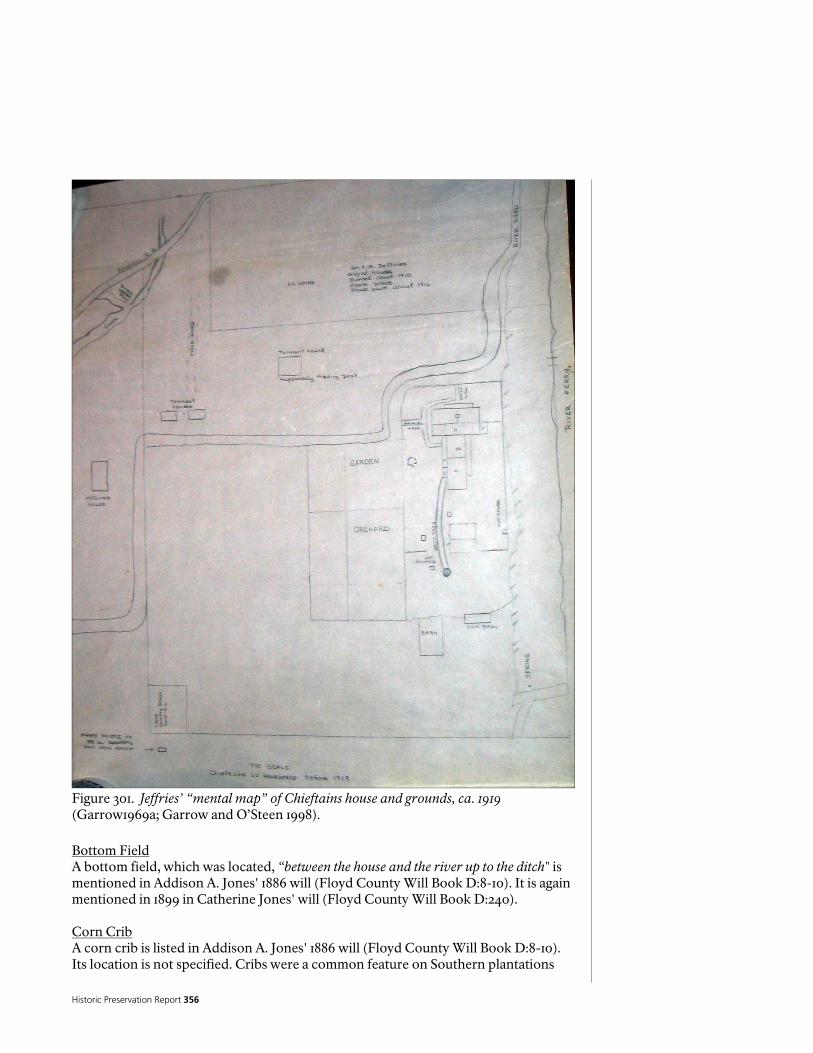
Historic Preservation Report 356
Figure 301. Jeffries’ “mental map” of Chieftains house and grounds, ca. 1919 (Garrow1969a; Garrow and O’Steen 1998). Bottom Field A bottom field, which was located, “between the house and the river up to the ditch" is mentioned in Addison A. Jones' 1886 will (Floyd County Will Book D:8-10). It is again mentioned in 1899 in Catherine Jones' will (Floyd County Will Book D:240). Corn Crib A corn crib is listed in Addison A. Jones' 1886 will (Floyd County Will Book D:8-10). Its location is not specified. Cribs were a common feature on Southern plantations
National Park Service 357
and cribs were identified in the 1836 valuations of Major Ridge's Oostanaula River property. The absence of any written reference to cribs in the period between 1836 and 1886 does not indicate their absence but merely their ubiquity as a farm feature, which did not merit any mention. The corn crib is again mentioned in 1899, apparently copied from the description in Addison A. Jones' will (Floyd County Will Book D:240). The corn crib is again referenced in an executor's deed in 1902 conveyed approximately six acres of Catherine Jones' estate to A. J. Jeffries (Floyd County Deed Book NNN:223). It was described as a landmark on the property line between the cow pens and the pasture fence, which would be generally northeast of the Chieftains dwelling. Cow Pens Cow pens are listed in Addison A. Jones' 1886 will (Floyd County Will Book D:8-10). Their locations are not specified in the will. Animal pens also were identified in the 1836 valuations and would have been a common feature on the plantation. The cow pens are again mentioned in 1899, apparently copied from the description in Addison A. Jones' will (Floyd County Will Book D:240). The cow pens are again referenced in a 1902 executor's deed, when they were a landmark on the property between the well lot fence and the corn crib (Floyd County Deed Book NNN:223). Dipping Vat A livestock dipping vat was located north of the Chieftains residence prior to 1919. The dipping vat is a small feature that was described by Jeffries as located west of the orchard, south of the barn, and east of a brick path. The approximate location of this cultural feature is shown on Jeffries' "Mental Map". Cattle dipping vats were first used in 1907 as part of the Cattle Fever Tick Eradication Program, which was a cooperative state-federal eradication effort. By the mid-twentieth century the program had achieved success and these cultural features on the southern landscape were rapidly forgotten. Cattle dipping vats were constructed throughout the South and were generally made of concrete and, “The cattle were walked through the vat, which was filled with arsenic. Today, arsenic is no longer used on cattle and the tick which causes cattle fever has been eradicated” (The Crypt 2004). Ditches At least one ditch of unknown function was located near the Chieftains plantation and it is first mentioned during the 1880s. A deed from A.A. Jones to Jas. J. Reece, dated October 20, 1885, contains the first mention of this feature as, “the head of a ditch on the side of said hill, thence due west parallel with the lot line in the south edge of said ditch” (Floyd County Deed Book OO:68-69. This ditch is listed in Addison A. Jones' 1886 will (Floyd County Will Book D:8-10). Its location is adjacent to a "bottom field", which was described by Jones as between the house and the river. The ditch is again mentioned in 1899, apparently copied from the description in Addison A. Jones' will (Floyd County Will Book D:240). The ditch is again referenced in a 1902 executor's deed, when it was a landmark on the property between the pasture fence and the Oostanaula River (Floyd County Deed Book NNN:223). The ditch (or ditches) precise location on the modern landscape was not determined from the deed descriptions. The 1885 description refers to an east-west oriented ditch, whereas the reference in a 1901 deed describes a north-south trending ditch (Floyd County Deed Book LLL:395-398). This ditch was not detected from examination of the 1943 aerial
Historic Preservation Report 358
photograph, nor has it been described by archaeologists who surveyed the Chieftains property (Mozingo 1999; Worth 2000). Garden A garden and a “truck patch garden” are listed in Addison A. Jones' 1886 will (Floyd County Will Book D:8-10). Its location is not specified in the will. Truck gardens were vegetable gardens grown to harvest vegetables to be trucked to local markets for sale. Truck gardens were again mentioned in 1899, apparently copied from the description in Addison A. Jones' will (Floyd County Will Book D:240). The garden fence is referenced in a 1902 property boundary description (Floyd County Deed Book NNN:223). The garden is shown on Jeffries "Mental Map" northeast of the house located along the north edge of the River Road (see Figure 301). Graveyard A graveyard is listed in Addison A. Jones' 1886 will (Floyd County Will Book D:8-10). Its location is not specified in the will. The graveyard is again mentioned in 1899, apparently copied from the description in Addison A. Jones' will (Floyd County Will Book D:240). This reference indicates that persons who died prior to 1886 were interred there. Other than the reference to Nancy Ridge being buried somewhere at Chieftains in 1819, this is the earliest written reference to a graveyard at Chieftains. Family cemeteries were a common cultural feature on Southern farms and plantations; it could have considerable antiquity. The graveyard and a common fence that divided the graveyard and garden are landmarks described in a 1902 executor's deed for a six acre portion of the Catherine Jones estate (Floyd County Deed Book NNN:223). It is also referenced with similar detail in other Floyd County court documents from the first decade of the twentieth century (Wright et al. 1928:24, 25; Floyd County Deed Book LLL:397). The precise location of the graveyard cannot be determined from these property descriptions and no plat of these tracts was located. It may be surmised that the cemetery was generally located northeast of the Chieftains dwelling. It probably lies outside of the property currently owned by the Chieftains Museum/Major Ridge Home. Any surface indications of the graveyard were likely masked or destroyed by construction of the support facilities of the Celanese Mill. Although the graveyard is first mentioned in 1886 it may be much older, possibly extending back to the Ridge Period. If the subsequent owners of the property lost any kin while living there, none was identified by the present research. All of the owners from Ridge to Addison A. Jones owned slaves. It is likely, given the generally poor health conditions and the high infant mortality rate among slaves during the nineteenth century, many slaves probably died and were buried on the Chieftains plantation without record. They may also be occupants of the graveyard. Orchard The orchard is shown on Jeffries "Mental Map" immediately north of the garden east of the house and touching River Road.

National Park Service 359
Pasture Fence and Other Fences A pasture fence is cited in a 1902 property description for six acres carved from the Catherine Jones estate (Floyd County Deed Book NNN:223). By inference the Chieftains property contained a pasture at that time. References to other fences are contained in the early twentieth century court records pertaining to the settlement of the estate of Catherine Jones (Wright et al. 1928). Well yard A well yard is listed in Addison A. Jones' 1886 will (Floyd County Will Book D:8-10). Its location is not specified in the will. This feature is again mentioned in 1899, apparently copied from the description in Addison A. Jones' will (Floyd County Will Book D:240). Ferry Although the ferry no longer operated during the early twentieth century a newspaper article refers to the ferry location at Chieftains noting that the ferry crossing was still evident:
The old Georgia and Alabama road passed in front of his house [Chieftains] and crossed the river by ferry. The old roadbed can be traced through the yard and has since been changed, and now passes down the river through the city and crosses the Ootanula [sic] at Fifth avenue, over the bridge linking the old town of DeSoto, now the fourth ward, with Rome” (Anonymous ca. 1900-1924)
Roads The River Road is the most prominent roadway at Chieftains in the Late-Bellum to Early twentieth century Period. Plats for property south of Chieftains depict this road following a north-south course on the east bank of the Oostanaula River (Floyd County Deed Books H:197; J:461). No plats were located that depict the route of this road across Lot 196, where the Chieftains dwelling is located. Jeffries' "Mental Map" contains several other roads near Chieftains. Early twentieth century deed descriptions for the Chieftains property make no mention of a road. Jeffries map shows River Road approaching Chieftains from the south and then bearing east, northeast, and east away from the Chieftains plantation (see Figure 301). The road leading to the ferry was abandoned during this period or in the preceding period. The 1917 soil map of Floyd County (Figure 302) shows the approximate course of River Road as it approaches Chieftains from the south, on a route just east and parallel to the Oostanaula River. At Chieftains the road then veers to the east, ceasing to parallel the river. The eastern section of the road from Chieftains may be the same as the Etowah Road of the early nineteenth century. Railroad Line A railroad line is located on the southern side of the Chieftains plantation. The Rome-Decatur Railroad was founded in the 1870s and this rail line linked Rome, Georgia with Decatur, Alabama. It connected with the Southern Railway in Rome (Commissioners of Roads and Revenues for Floyd County 1895). A railroad trestle across the Oostanaula River, a short distance south of Chieftains, was constructed by that enterprise. This same railroad line later became part of the Southern Railroad

Historic Preservation Report 360
Figure 302. Enlargement of Bureau of Soils 1917 Map of Floyd County.
network. Although the Rome-Decatur Railroad Company and the Southern Railroad are defunct, that railroad line and trestle across the Oostanaula River continues as an active railroad line. A right of way for the railroad corridor on portions of Lots 205 and 206 was conveyed by Florence W. Eastman and E.M. Eastman to the Rome &

National Park Service 361
Dalton Railroad Company in 1887 (Floyd County Deed Book KK:105-107). A small plat accompanying this conveyance shows the railroad corridor running from the Jones property line, across the Eastman property to the Johnson property. A 1911 photographic postcard shows the railroad trestle as viewed from the River Road (Scott 2001:88). The Chieftains residence is not shown in this view, but it is one of the few early glimpses of an area of the Chieftains plantation, south of the main house (Scott 2001:88). The route of the Rome-Dalton Railroad Company line, in the area south of Chieftains, is probably essentially the same as the current railroad route. The Corps of Engineers made improvements to navigation on the Oostanaula River in an attempt to make the river navigable to Resaca, Georgia. In 1888 Captain R. L. Hoxie, Army Engineer, reported, however, that, “...the Oostanaula River has recently been obstructed by the construction of a railroad bridge a short distance above the city of Rome, Ga., by the Rome and Decatur Railroad, which is without a draw-opening and without sufficient height...it constitutes a greater obstruction than any existing natural obstruction in the river” (U.S. Congress, House Executive Documents 1888:1278). The U.S. Army Engineers apparently made no attempt to keep the Oostanaula navigable after 1888. The railroad bridge cited by Captain Hoxie is probably the same route that crosses the Oostanaula River a short distance south of the Chieftains. Pumping Station A water pumping station was built on the west side of the Oostanaula River, below the Chieftains property in 1893. A 1911 photographic postcard shows the intact Oostanaula Pumping Plant’s brick intact station, as viewed from the River Road (Scott 2001:88). A deed from Charles J. Graves to John D. Moore, Trustee conveyed the property for the pumping station, which was described as, "in the rear of the New City Water Works pumping station”. That deed also refers to a "Reservoir on Fort Jackson", although this reservoir and the fort represent a separate land tract (Floyd County Deed Book ZZ:336-338).

Historic Preservation Report 362
The Porter Period
The Porter Period is one of the shortest ownerships of the Chieftains property by any of the owners of the property since Rachel Ferguson sold the lot after winning it in the 1832 lottery. It is also one of the least documented periods of ownership as well. Apparently, significant changes to the house were made during Porter’s ownership, but there is no documentation to support these changes, nor is there any documentation that might contribute information about the surrounding landscape. Other Buildings Two other buildings, north of the Chieftains residence, are visible in Photograph 26. The one closest to the house is obscured by vegetation and no details can be discerned other than to describe it as a single story structure. The other building is larger and appears to be of wooden construction. It also is obscured by vegetation. A small window is visible on the eastern side of this building. It may represent a barn or garage. Both of these outbuildings are more than 15 feet in length. The northernmost building is less than 125 feet north of the Chieftains residence (These distances were estimated by comparison with the Chieftains residence and the nearby automobiles). River Road Photograph 25 is taken from the River Road from a position east of the Chieftains residence. The road has a dirt surface. Another road or lane, bearing north from the River Road at the edge of the Chieftains yard, is visible in this photograph. The deed from J.H. Porter to American Chatillon Corporation was written on May 14, 1928 and recorded on May 24, 1928. The property sold for $44,500.00 (Floyd County Deed Book 134:240-241). The property, which included parts of Lots 196 and 205, was described as follows:
“Beginning at the Northwest corner of the H.J. Hine tract, formerly the Susan Jeffries tract, at the low water mark of th Oostanaula River; thence on to the center of said River, said direction being a continuation of the line of the said Hines tract; thence North, along the center of said River, to a point directly opposite the Harrison line, formerly the Cox and Miller line; thence East to the East Bank of said River at low water mark; thence East, along the said Harrison line, to the A.A. Burton line and the North and South line on the East side of land lot number 196; thence South, along the original land line between lots numbers 195 and 196, to the East Bank of Reece’s Creek; thence South with said Creek to Porter’s corner; thence West to an iron stake, said point being 196 feet South from the original South line of land lot number 196; thence North in a direct line to the Northeast corner of the said H.J Hines tract; thence West along the line of the said Hine tract to the starting point. Excepted from the above described land is the thirty-foot right of way for J.H. Jackson’s (formerly Richard Harrison’s) road through the North Section, as it now runs. Said tract herein above described containing one hundred acres, more or less” (Floyd County Deed Book 134:240-241).
The deed description also conveyed, “the use and occupancy of the dwelling house for himself and family [J.H. Porter] for a period of ninety days...and the use and occupancy of the servants’ house and barn and lot for a like period” (Floyd County Deed Book 134:240-241).

National Park Service 363
From the above-described deed important information is provided about cultural features contained within J.H. Porter’s 100-acre tract, which include a dwelling house, servants’ house, barn lot, and a 30 foot right of way for an old road that crossed the property. The location of these features within the tract, however, cannot be determined from the deed description. Any other improvements contained on the property at the time of Porter’s sale in 1928 are not listed in the deed.

Historic Preservation Report 364
The Industrial Period
The Industrial Period at Chieftains began in May 1928 when the property was purchased by the American Chatillon Corporation from several individuals. The tracts acquired for this purpose included the previously described 100 acres from J.H. Porter, 110 acres from Mrs. Jessie Glover Hogg, 167.70 acres from John H. Jackson, a 100 foot wide strip from Mrs. Ida E. Reece and others, 52 acres from Mrs. S.S. Puryear, 16 acres from Mrs. Jessie Hine Moore, 50.2 acres from Mrs. Julia Varner Todd, 57.2 acres from E.A. Whitehead, and property from C.T. Autry, A.A. Burton, Cephus Hardy, J.W. McGinnis, and possibly others (Floyd County Deed Book 134:240-248, 261, 581-584). The American Chatillon Corporation acquired these properties in May and June, 1928. From 1928 to 1969, the official Floyd County land records are nearly mute regarding activities at Chieftains. Few relevant plats or deeds for Chieftains were recorded over that time span. This dearth of documentary evidence for a 40-year period attests to the stability of the textile mill's land holdings. The Historic Period Plans for the Industrial period are shown in Figures 303 and 304. Figures 305-310 present additional aerial photographs of the Chatillon holdings including Chieftains. Brick Dwelling 1 A two storied brick house was constructed northeast of the Chieftains residence on Chatillon Road during the textile mill operation period. This two storied home served as a residence for the textile mill's management personnel and their families. The home also included a concrete drive, brick garage and walkway. This building is presently used by the Chieftains Museum/Major Ridge Home for a conference room and archaeological laboratory. The building is also used for events, staff offices and collection storage (Personal Communication, Carey Tilley, February 2005) This building is shown on a 1969 plat of property of the Celanese Fibers Company (Floyd County Plat Book 9:99). Brick Dwelling 2 A two storied brick house was constructed northeast of the Chieftains residence on Chatillon Road during the Industrial Period. This two storied home served as the resident for the textile mill's management personnel and their families. The home also included a concrete drive, brick garage and walkway. The house was originally an exact copy of Brick Dwelling 1 (Carey Tilley, Personal communication, February 2005). This building is shown on a 1969 plat of property of the Celanese Fibers Company (Floyd County Plat Book 9:99). Currently this house serves as the residence of the Museum Director. Brick Garage 1 A brick garage, associated with Brick Dwelling 1, was constructed north of the Chieftains dwelling in the Industrial Period. This garage is shown on a 1969 plat of property of the Celanese Fibers Company (Floyd County Plat Book 9:99). This structure has been made Americans with Disabilities Act (ADA) compliant and offers restroom facilities.

National Park Service 365 Figure 303. Historic Period Plan, Industrial Period, 1928-1969 (National Park Service 2005).

Historic Preservation Report 366
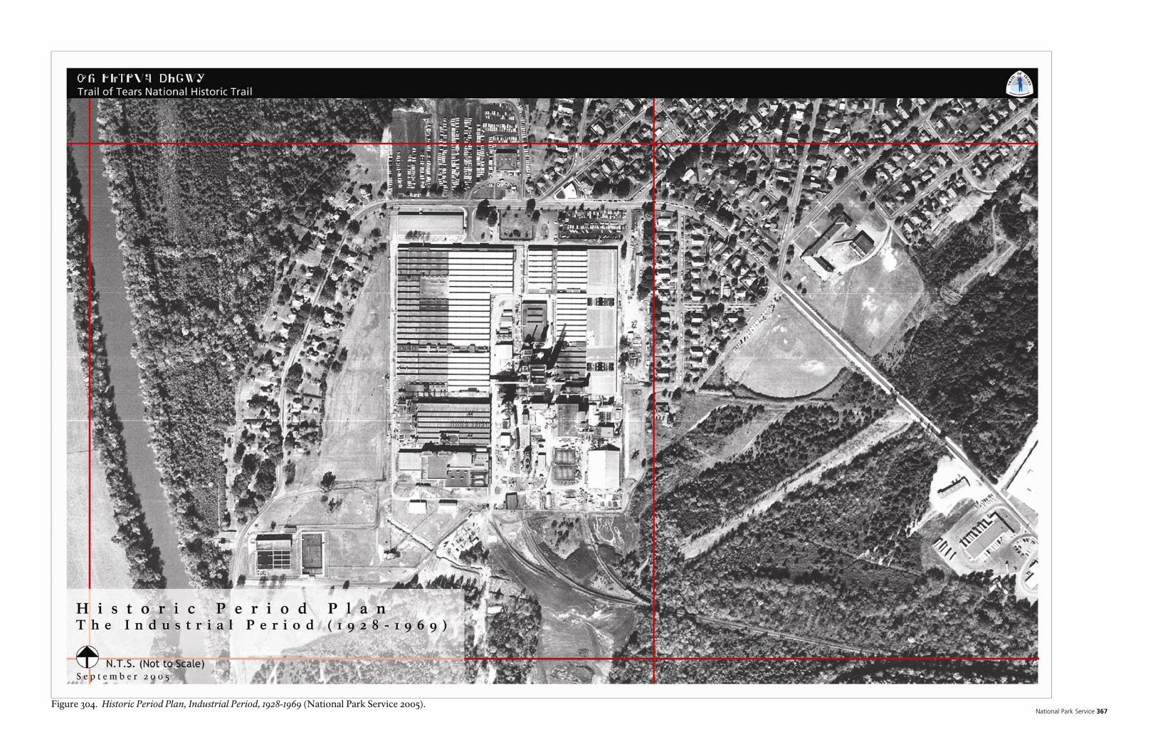
National Park Service 367 Figure 304. Historic Period Plan, Industrial Period, 1928-1969 (National Park Service 2005).

Historic Preservation Report 368
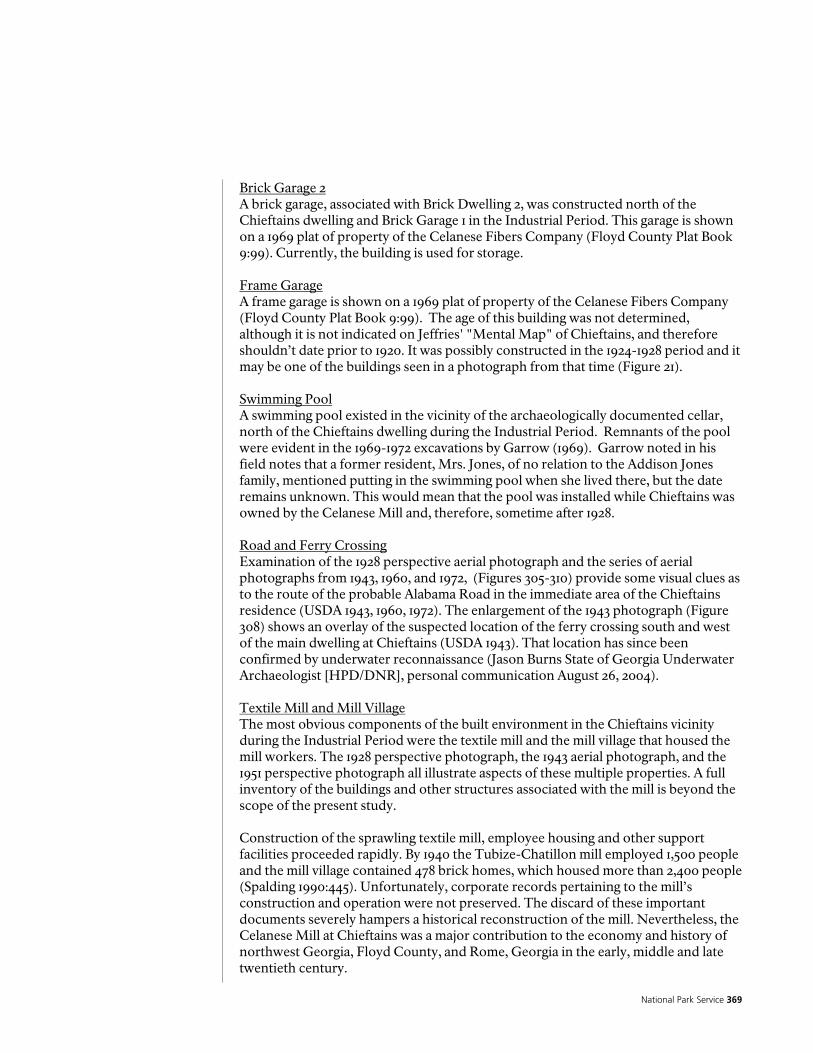
National Park Service 369
Brick Garage 2 A brick garage, associated with Brick Dwelling 2, was constructed north of the Chieftains dwelling and Brick Garage 1 in the Industrial Period. This garage is shown on a 1969 plat of property of the Celanese Fibers Company (Floyd County Plat Book 9:99). Currently, the building is used for storage. Frame Garage A frame garage is shown on a 1969 plat of property of the Celanese Fibers Company (Floyd County Plat Book 9:99). The age of this building was not determined, although it is not indicated on Jeffries' "Mental Map" of Chieftains, and therefore shouldn’t date prior to 1920. It was possibly constructed in the 1924-1928 period and it may be one of the buildings seen in a photograph from that time (Figure 21). Swimming Pool A swimming pool existed in the vicinity of the archaeologically documented cellar, north of the Chieftains dwelling during the Industrial Period. Remnants of the pool were evident in the 1969-1972 excavations by Garrow (1969). Garrow noted in his field notes that a former resident, Mrs. Jones, of no relation to the Addison Jones family, mentioned putting in the swimming pool when she lived there, but the date remains unknown. This would mean that the pool was installed while Chieftains was owned by the Celanese Mill and, therefore, sometime after 1928. Road and Ferry Crossing Examination of the 1928 perspective aerial photograph and the series of aerial photographs from 1943, 1960, and 1972, (Figures 305-310) provide some visual clues as to the route of the probable Alabama Road in the immediate area of the Chieftains residence (USDA 1943, 1960, 1972). The enlargement of the 1943 photograph (Figure 308) shows an overlay of the suspected location of the ferry crossing south and west of the main dwelling at Chieftains (USDA 1943). That location has since been confirmed by underwater reconnaissance (Jason Burns State of Georgia Underwater Archaeologist [HPD/DNR], personal communication August 26, 2004). Textile Mill and Mill Village The most obvious components of the built environment in the Chieftains vicinity during the Industrial Period were the textile mill and the mill village that housed the mill workers. The 1928 perspective photograph, the 1943 aerial photograph, and the 1951 perspective photograph all illustrate aspects of these multiple properties. A full inventory of the buildings and other structures associated with the mill is beyond the scope of the present study. Construction of the sprawling textile mill, employee housing and other support facilities proceeded rapidly. By 1940 the Tubize-Chatillon mill employed 1,500 people and the mill village contained 478 brick homes, which housed more than 2,400 people (Spalding 1990:445). Unfortunately, corporate records pertaining to the mill’s construction and operation were not preserved. The discard of these important documents severely hampers a historical reconstruction of the mill. Nevertheless, the Celanese Mill at Chieftains was a major contribution to the economy and history of northwest Georgia, Floyd County, and Rome, Georgia in the early, middle and late twentieth century.

Historic Preservation Report 370
Figure 305. Aerial photograph of the Celanese Mill and Village, ca. 1928.
Figure 306. Enlargement of above photograph showing Chieftains.
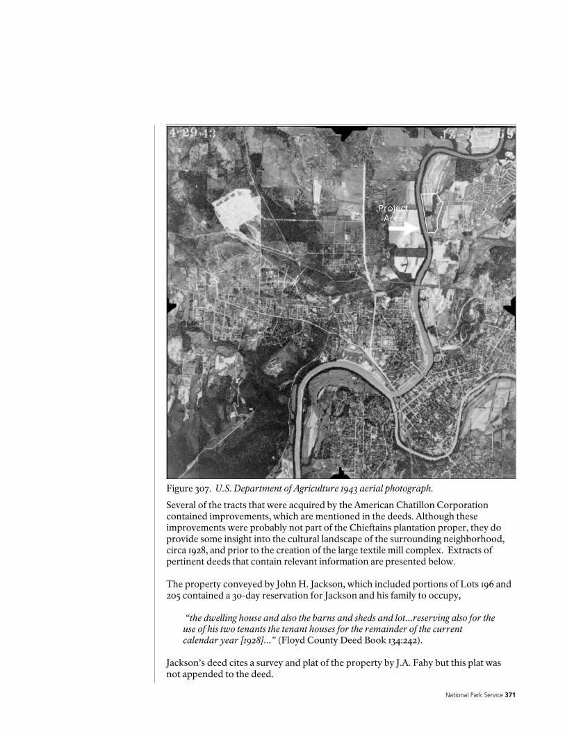
National Park Service 371
Figure 307. U.S. Department of Agriculture 1943 aerial photograph.
Several of the tracts that were acquired by the American Chatillon Corporation contained improvements, which are mentioned in the deeds. Although these improvements were probably not part of the Chieftains plantation proper, they do provide some insight into the cultural landscape of the surrounding neighborhood, circa 1928, and prior to the creation of the large textile mill complex. Extracts of pertinent deeds that contain relevant information are presented below. The property conveyed by John H. Jackson, which included portions of Lots 196 and 205 contained a 30-day reservation for Jackson and his family to occupy,
“the dwelling house and also the barns and sheds and lot...reserving also for the use of his two tenants the tenant houses for the remainder of the current calendar year [1928]...” (Floyd County Deed Book 134:242).
Jackson’s deed cites a survey and plat of the property by J.A. Fahy but this plat was not appended to the deed.
Historic Preservation Report 372
Figure 308. Enlargement of preceding photograph (Figure 307) showing Chieftains.
The property conveyed by Mrs. S.S. Puryear, which was located on Lot 195, included the following reservation:
“the right to remove all buildings, except the dwelling house occupied by Fowler and the barns and the cribs, and also reserving all other improvements, including green houses, boiler houses, water works, nursery stock, bulbs, and any and all other growing plants or shrubbery...” (Floyd County Deed Book 134:242-243).

National Park Service 373
Figure 309. U.S. Department of Agriculture 1960 aerial photograph.
The property conveyed by Mrs. Jessie Hine Moore, which was located on the south part of Lot 196, contained the following reservation:
“the use and occupancy of the house, servant house, garage and about two and a half acres of land, lying immediately East of the Road, till November 30th, 1928, and reserves the right to within that time to remove certain of the flowers and shrubbery” (Floyd County Deed Book 134:248).
That portion of the property from C.T. Autry, located on Lot 205 was described as:
“between the road leading to the City of Rome to the (formerly A.A. Jones farm on the Oostanaula River, commencing at Burrell’s Creek, and extending along and between said road and said River to the right of way of Rome and Decatur Railroad....with all the water privileges belonging thereto, being all of the frontage of the three tracts first described herein lying between the road and the river...Also all such rights as may exist in the premises conveyed as the obligor may have to the use of the water from the City waterworks...” (Floyd County

Historic Preservation Report 374
Figure 310. U.S. Department of Agriculture 1972 aerial photograph.
Deed Book 134581-582). The property conveyed by Mrs. Jessie Glover Hogg, which included portions of Lots 204, 205 and 206, contained this property description:
“Beginning at a point on the East side of the Oostanaula River about one mile from the City of Rome in said County [Floyd], on the original land lot line between lots numbers 196 and 205 where the lands of party of the first part join the lands of party of the second part, thence Easterly, along said original land lot line to the lands formerly owned by J.H. Porter, now owned by second party; thence Southerly 196 feet to a monument; thence Easterly 1255 feet to the right of way of the Southern Railway thence Southwesterly and Westerly along said right of way to the Oostanaula River; thence Northerly along the said Oostanaula River to the beginning point; said tract and parcel of land containing 110 acres, more or less, excepting, however, from the above described property the road or highway, and such easements or rights as may exist as to the banks of the river” (Floyd County Deed Book 134:261).

National Park Service 375
The deed from Mrs. Ida E. Reece and others cites an attached plat, which was located elsewhere (Floyd County Plat Book 1:178). This plat was not examined in the present research effort. A deed conveying property in Lot 205 from Wilson M. Hardy to Tubize-Chatillon Corporation, dated August 19, 1930, was recorded during this period (Floyd County Deed Book 143:210-211). Another deed, dated December 31, 1935, conveyed property including a 40 acre tract in Lots 205 and 235 from Tubize Chatillon to the City of Rome (Floyd County Deed Book 158:585). This deed was apparently intended to provide the City of Rome with additional land for their pumping station on the Oostanaula River. On January 1, 1938, the City of Rome deeded this property that was originally intended for a park to Tubize Chatillon Corporation (Floyd County Deed Book 171:115). On September 22, 1938, the Tubize Chatillon Corporation deed property in Lots 205 and 236 to the City of Rome (Floyd County Deed Book 173:336). On September 14, 1941 the Tubize Chatillon Corporation conveyed property for a county right of way for a public road, to be known as the "Rome to Tubize Road". The right of way was 30 feet wide and was located in Lots 236 and 205,
“…beginning at a bridge or culvert across Burwells Creek and running thence Northerly a distance of approximately 4500 feet to a point where said new road right of way connects with right of way of the old road near the East Bank of the Oostanaula River” (Floyd County Deed Book 187:460).
A plat of the property containing the Chieftains residence and two 2-story brick mill houses was drawn in 1969. That tract contained 6.2 acres and was bounded on the east by Chatillon Road, west by the Oostanaula River, and north and south by east-west property lines. Cultural features shown on this plat include a two story frame house (Chieftains residence), two two-story brick houses, two brick garages, a frame garage, concrete drives, sidewalks, the paved Chatillon Road; and approximate location of the power and telephone lines (Floyd County Plat Book 9:99). This plat is shown in Figure 23. A plat of the Chatillon Road Subdivision, which was drafted in 1985 and recorded in 1986, after the Celanese Mill was defunct, shows property south of Chieftains. That plat shows a series of subdivided tracts on the former mill property (Floyd County Plat Book 17:150-151).

Historic Preservation Report 376

National Park Service 377
Landscape Description and Analysis
The existing conditions of the Chieftains Museum Major Ridge home are documented on the “Existing Conditions” plans for the current Chieftains Museum property ownership and the area of the historic extent of the Ridge farm. The Major Ridge property has undergone extensive change since its initial period of development during Ridge’s occupation as documented in the landscape history section of this report. Most of what exists today within the boundaries of what was once Major Ridges improved property is a result of the industrial period of development of the Celanese Mill or later. The following section of the Cultural Landscape Report documents the character features of the existing landscape looking at the larger scale and extent of the original Ridge property and at a more detailed scale of the current smaller land ownership of the Chieftains Museum Major Ridge Home. Landscape Character Features: Buildings: For the purposes of documentation in this report of the existing conditions of the historic landscape, buildings and structures are separate landscape features. Buildings are landscape features that generally are habitable or completely enclosed. Structures are landscape features such as walls, fences, bridges, or smaller buildings. The present landscape of the Chieftains Museum Major Ridge Home retains only one building from the Ridge Period which is the home of Major Ridge. The home has been extensively remodeled as documented in the historical documentation and Historic Structure Report section of this report. This Ridge Period entrance to the home from the East along the no longer extant New Echota Road and down to the Ridge ferry has been modified with the main entrance to the house now on the South side. Industrial Period mill houses occupy the only other buildings on the current property of the Chieftains Museum. Other industrial period and post industrial buildings on what was the historic extent of the Ridge farm are too numerous to document here and are located mostly along Riverside Parkway to the North and South of the Ridge Home. The most notable buildings are the mill itself and other mill and post mill buildings to the east of the Ridge Home in what would have been Ridges fields and other buildings on the East side of Riverside Parkway and within Ridge Ferry Park South of Ridge’s Home. Some of the existing Industrial and post industrial buildings are identified in the existing conditions photographs under “land use” within this section of the report and are shown on the existing conditions plan (Figure 313-314).
EX
ISTI
NG
CO
ND
ITIO
NS

Historic Preservation Report 378
Figure 311. View of Industrial period entrance of Chieftains Museum Major Ridge Home changed from the earlier East side front entry to a South side front entry.
Figure 312. View today of East Side Ridge period front entry to Home with industrial period wing additions.

National Park Service 379
Figure 313. Existing Conditions Plan, Extent of Farm (National Park Service 2005).

Historic Preservation Report 380
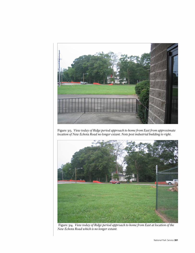
National Park Service 381
Figure 313. View today of Ridge period approach to home from East from approximate location of New Echota Road no longer extant. Note post industrial building to right.
Figure 314. View today of Ridge period approach to home from East at location of the New Echota Road which is no longer extant.
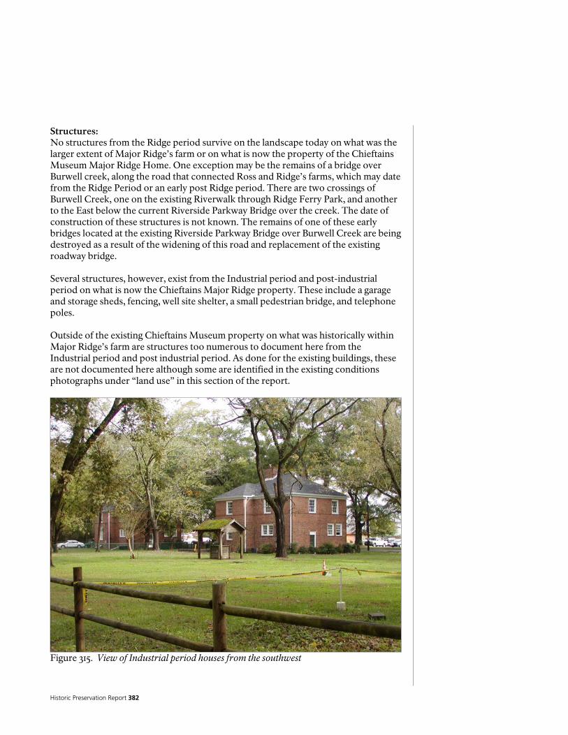
Historic Preservation Report 382
Structures: No structures from the Ridge period survive on the landscape today on what was the larger extent of Major Ridge’s farm or on what is now the property of the Chieftains Museum Major Ridge Home. One exception may be the remains of a bridge over Burwell creek, along the road that connected Ross and Ridge’s farms, which may date from the Ridge Period or an early post Ridge period. There are two crossings of Burwell Creek, one on the existing Riverwalk through Ridge Ferry Park, and another to the East below the current Riverside Parkway Bridge over the creek. The date of construction of these structures is not known. The remains of one of these early bridges located at the existing Riverside Parkway Bridge over Burwell Creek are being destroyed as a result of the widening of this road and replacement of the existing roadway bridge. Several structures, however, exist from the Industrial period and post-industrial period on what is now the Chieftains Major Ridge property. These include a garage and storage sheds, fencing, well site shelter, a small pedestrian bridge, and telephone poles. Outside of the existing Chieftains Museum property on what was historically within Major Ridge’s farm are structures too numerous to document here from the Industrial period and post industrial period. As done for the existing buildings, these are not documented here although some are identified in the existing conditions photographs under “land use” in this section of the report.
Figure 315. View of Industrial period houses from the southwest
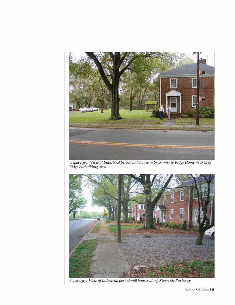
National Park Service 383
Figure 316. View of Industrial period mill house in proximity to Ridge Home in area of Ridge outbuilding area.
Figure 317. View of Industrial period mill houses along Riverside Parkway.
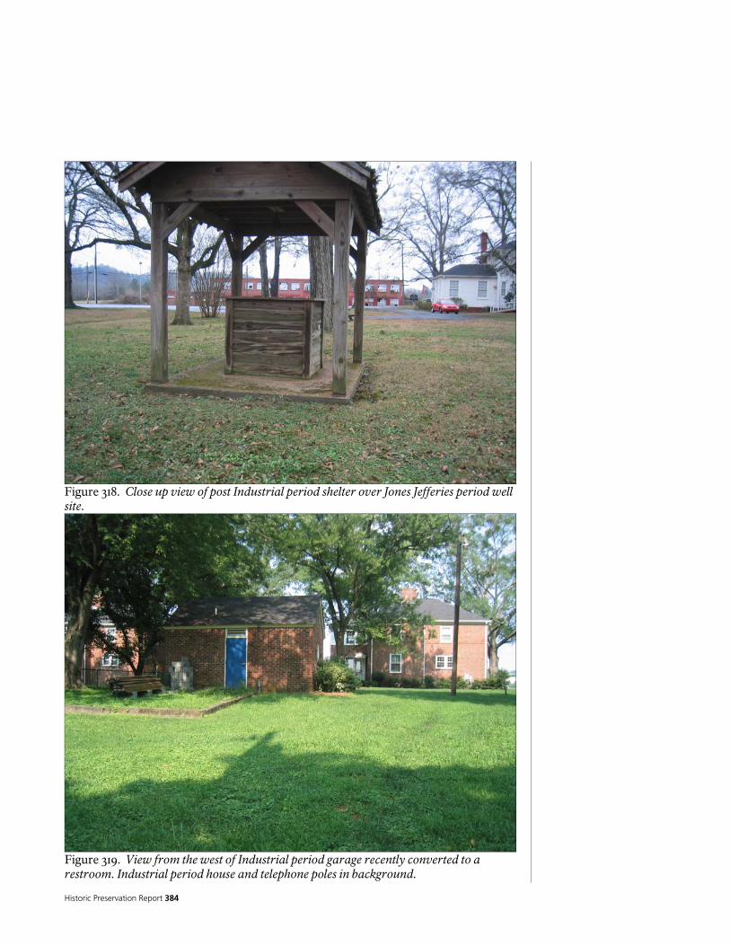
Historic Preservation Report 384
Figure 318. Close up view of post Industrial period shelter over Jones Jefferies period well site.
Figure 319. View from the west of Industrial period garage recently converted to a restroom. Industrial period house and telephone poles in background.
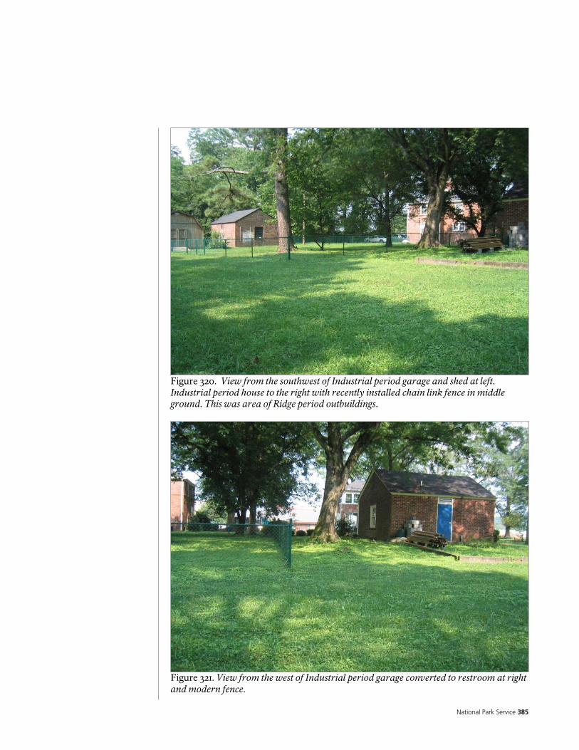
National Park Service 385
Figure 320. View from the southwest of Industrial period garage and shed at left. Industrial period house to the right with recently installed chain link fence in middle ground. This was area of Ridge period outbuildings.
Figure 321. View from the west of Industrial period garage converted to restroom at right and modern fence.

Historic Preservation Report 386
Figure 322. View from the west of post Industrial period pedestrian bridge.
Figure 323. View of post Industrial period shelter over Jones Jefferies period well site.

National Park Service 387
Figure 324. View of abandoned Industrial period pump house and modern fence in vicinity of the site of Ridge’s Ferry. Note overgrowth of vegetation.
Figure 325. View of early Burwell Creek bridge abutment ruins under existing Riverside Parkway Bridge currently being widened.

Historic Preservation Report 388
Figure 326. View of North bank of early Burwell Creek bridge abutment ruins under existing Riverside Parkway Bridge currently being widened.
Figure 327. View of South bank of early Burwell Creek bridge abutment ruins under existing Riverside Parkway Bridge
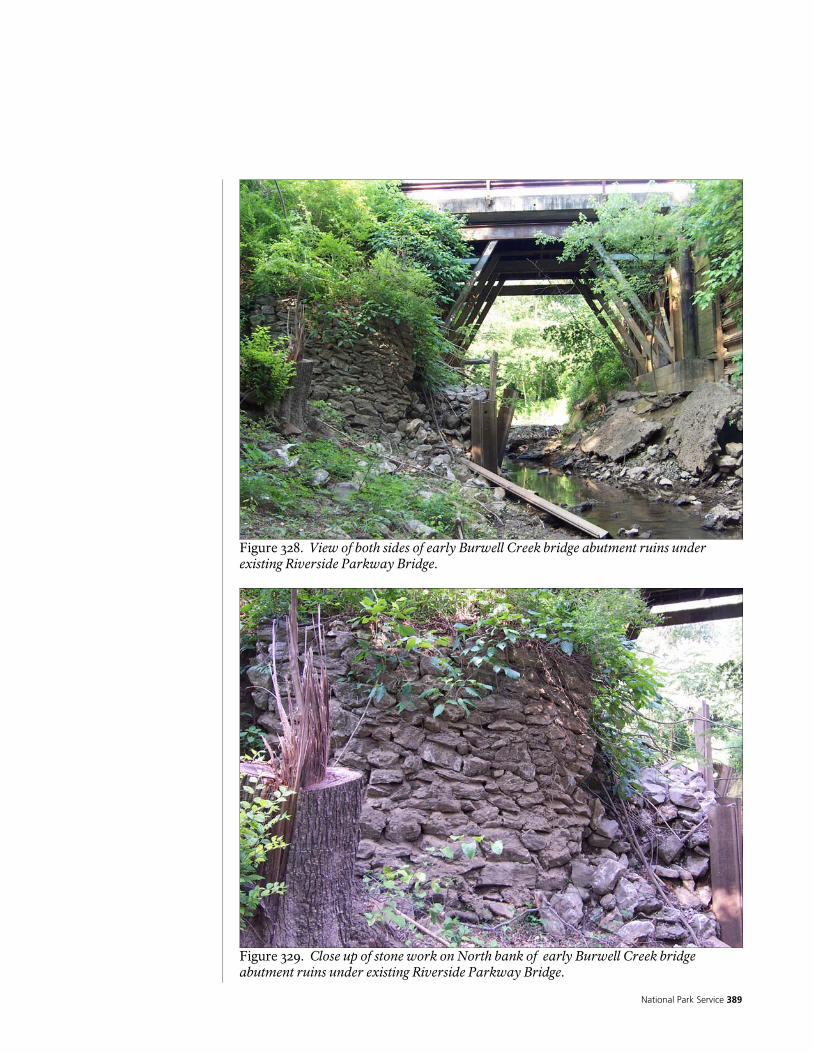
National Park Service 389
Figure 328. View of both sides of early Burwell Creek bridge abutment ruins under existing Riverside Parkway Bridge.
Figure 329. Close up of stone work on North bank of early Burwell Creek bridge abutment ruins under existing Riverside Parkway Bridge.
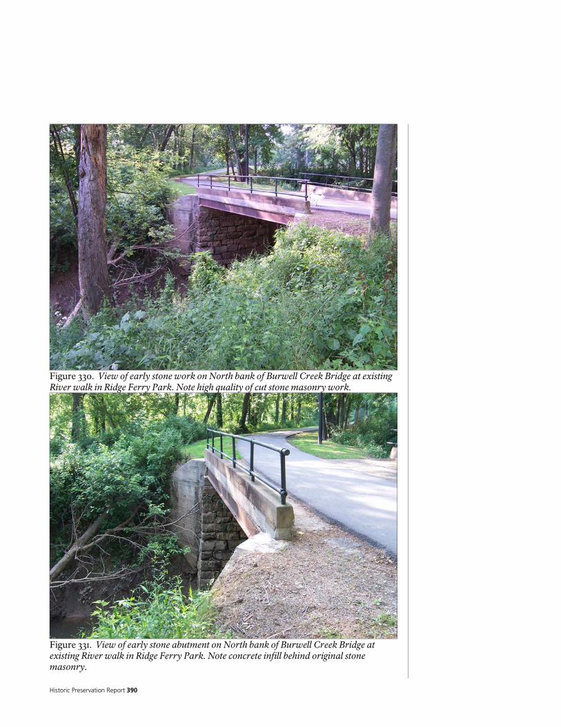
Historic Preservation Report 390
Figure 330. View of early stone work on North bank of Burwell Creek Bridge at existing River walk in Ridge Ferry Park. Note high quality of cut stone masonry work.
Figure 331. View of early stone abutment on North bank of Burwell Creek Bridge at existing River walk in Ridge Ferry Park. Note concrete infill behind original stone masonry.

National Park Service 391
Figure 332. View of early stone abutment on North bank of Burwell Creek Bridge at existing Riverwalk in Ridge Ferry Park. Note concrete infill behind original stone masonry and concrete abutment failure at abutment in foreground. Archeological Sites: Within the current boundary of the Chieftains Museum Major Ridge home extensive archeological investigation has occurred over a number of years as identified in the historical documentation of this report. More archeological investigation of this area in addition to the larger area that was part of the original Ridge farm is anticipated in the future that may continue to inform a better understanding of the historic landscape of the Ridge farm and later periods of use and modification. Today on the Chieftains Museum Major Ridge Home property the most visible archeological building feature from the Ridge period is the site of what is believed to be Lavender’s trading post and store. A spring is identified in deed descriptions from the Jones Jefferies period that indicate its location somewhere north of the existing mill houses. Its exact location has not been conclusively identified. Thorough field investigation of the area north of the house occurred as part of the existing conditions field documentation for this report and the site of a possible spring was identified but at this point it is not possible to conclusively say that this is a spring site. It is suspected that the spring referenced in the Jones Jefferies period deed could be the same source of water that would have been used during the Ridge Period. Unfortunately, the source of water which would have been a critical feature of the Ridge Period landscape and its development at this location has not been identified at this time. The suspected spring site documented here was in a wet area and there were indications of older brick scattered within the

Historic Preservation Report 392
vicinity, however, if this site was an active spring sufficient to provide good drinking water it is no longer the case today. Other post Ridge period visible archeological features also exist in the landscape including the well site, remnants of a brick walk, and to the north of the property the ruins of removed mill homes.
Figure 333. View of Lavender store archeological site looking south.
Figure 334. View of Lavender store archeological site looking east.
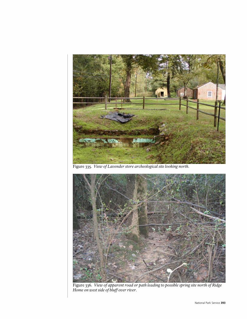
National Park Service 393
Figure 335. View of Lavender store archeological site looking north.
Figure 336. View of apparent road or path leading to possible spring site north of Ridge Home on west side of bluff over river.

Historic Preservation Report 394
Figure 337. View of Industrial period mill house foundations north of Ridge Home and south of Fudruckers restaurant on Riverside Parkway. Circulation System (roads paths etc.): Within the current boundaries of the Chieftains Museum Major Ridge Home landscape, the circulation system of roads and paths are primarily from the Industrial period or post industrial period of development. Two notable exceptions, outside of the current Chieftains Museum property, are significant historic landscape circulation features including the Ridge ferry landings and remnants of the New Echota Road and the Ross to Ridge’s road (Harvey 1832, p. 46).39 In the following, these and other existing circulation systems on what was the original extent of the historic Ridge farm as well as the current property of the Chieftains Museum landscape are discussed in more detail. Riverside Parkway: 39 In the surveyor’s notes this road is the junction of a road called “Road to Ridges” (from New Echota) and a road from the east-southeast that was called the “Etowa” road. Both roads are named along the N-S line between Land lots 196 and 195. The two roads merge just west of the line and jointly head straight toward Ridge’s house and the ferry beyond. (Harvey 1832, p. 76) Significantly, the Etowah road was called by that name before the intersection with Ross’ road from the NW indicating that the main E-W- road headed for Ridge’s ferry and not the Head of Coosa or Ross’ Ferry. The road to the jct of the rivers is clearly Ross’ branch of the road from New Echota continues to be called “Ross’s Road” (p.76).

National Park Service 395
The primary roads within the existing landscape of what would have been Ridge’s farm are vehicular roads most notable of which is Riverside Parkway. This road is currently being widened and modified from two to four lanes as part of a Georgia DOT project. The road is located across from the Ridge Home through the center of what would have been Ridge’s fields. This road was a principle part of the original road system that provided access to the Mill. Loop driveway: A small loop drive in front of the house likely dates to perhaps as early as the Jones Jefferies period and at least the industrial period where it appears to be visible in the 1923 photo. Within the larger landscape of what would have been Ridge’s farm many new roads have been developed that are primarily from the industrial period or post industrial period. Not all of these existing modern roads are documented here. The ferry landing sites with remnants of the New Echota road as well as the Ross to Ridge road are very significant extant landscape circulation features. Ridge’s ferry landing: Just south of the Current Museum property on the East bank of the Oostanaula River are the clear remains of Ridges ferry landing site. This cut in the bank is the most distinguishable of three clearly identifiable bank cuts on the east bank of the river. Just to the North of this first cut on Chieftains property are two smaller cuts. Each of these three landing sites in the bank is matched on the west bank of the river on Berry College property. On the Berry College property, the three bank cuts are much more distinguishable and also indicative of their use and age. One of the cuts, the one farthest to the south of the other two, has a very clear old road swale leading to it working its way down the bank and on top of the bank can be followed along the river for a short distance. The characteristics of this road and bank cut almost certainly indicate that this is the Ridge ferry landing and remnant of the New Echota Road. The cut to the north or the middle cut is extremely deep and incised into the river bank. This is a dramatic cut that clearly involved more work than the other two cuts. This could have been the cut for the Verdery period “floating bridge,” that presumably would have required a more extensive abutment and bridge construction than Ridge’s ferry. The last cut to the north is a shallow one similar in its less pronounced incision to the northern most cut on the west bank of the River on the Chieftains property. The purpose of this cut is unknown. Perhaps this was a temporary landing during construction of the floating bridge or a secondary or older ferry landing. Road from Ross to Ridge’s: The historic road that once connected the farm, home, and ferry of Chief John Ross at the head of Coosa in what is today downtown Rome, and Major Ridge’s home, is mostly extant and survives today as the River walk along the Oostanaula River through Ridge Ferry Park. This road, that connected arguably the two most important figures in the events of Cherokee removal and the Trail of Tears, retains what is very likely much of its original alignment through Ridge Ferry Park including

Historic Preservation Report 396
characteristic very old road features of a deeply incised swale along its outside edge. The road alignment was likely improved since the Ridge period when it became the principle North South road connecting Rome and the mill but the construction of the current Riverside Parkway to replace this older road ensured it’s preservation with minimal alteration to its width and alignment. The road has a remains of an older 20th century pavement below the surface and has recently had a walkway pavement installed over this for use as the River walk. Along with the Ridge ferry landing sites and remnant segment of the New Echota Road on the Berry College property, this road is an extremely important historic landscape feature of the Ridge Period with a high degree of integrity that contributes to and conveys the significance of the historic Ridge farm and property.
Figure 338. View of Riverside Parkway and Ridge Home entry loop drive with Industrial period Mill and other post industrial period buildings just East of the Ridge Home.

National Park Service 397
Figure 339. View of Riverside Parkway and a part of the Ridge Home entry loop drive just East of the Ridge Home.

Historic Preservation Report 398
Figure 340. View of Riverside Parkway and other Industrial period road just east of the Ridge Home.
Figure 341. View of Riverside Parkway looking south from the Ridge Home. The road curve is located on top of what would very likely have been the curve on the Ridge to Ross road at the meeting point of the Ridge Ferry or New Echota Road.

National Park Service 399
Figure 342. View of Riverside Parkway looking south where it intersects with Turner McCall. Just past the bridge is the location of the 1832 land lot survey point identifying the road from Ross to Ridge’s.
Figure 343. View of southern most Ridge Ferry landing on Ridge Home side of the river. Note overgrowth of vegetation
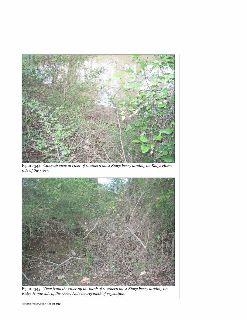
Historic Preservation Report 400
Figure 344. Close up view at river of southern most Ridge Ferry landing on Ridge Home side of the river.
Figure 345. View from the river up the bank of southern most Ridge Ferry landing on Ridge Home side of the river. Note overgrowth of vegetation

National Park Service 401
Figure 346. View from the water of southern most Ridge Ferry landing on Ridge Home side of the river to opposite bank of Berry College.
Figure 347. View from the water of middle Ridge Ferry landing on Ridge Home side of the river located just below the house to opposite bank of Berry College .

Historic Preservation Report 402
Figure 348. View towards the water of northern Ridge Ferry landing on Ridge Home side of the river just below the house. Note the clearly incised swale leading towards the riverbank and overgrowth of vegetation.
Figure 349. View towards the house of northern Ridge Ferry landing on Ridge Home side of the river just below the house. Note the clearly incised swale leading towards house and overgrowth of vegetation.

National Park Service 403
Figure 350. View of northernmost smaller ferry landing site on Berry College looking north. Note remnant road leading down bank toward the river landing to the right.
Figure 351. View of middle most deeply incised bank cut likely Verdery period floating bridge site on Berry College looking uphill from the river towards the bank.

Historic Preservation Report 404
Figure 352. View of middle most deeply incised bank cut likely Verdery period floating bridge site on Berry College looking towards the river. Depth of cut is 8-10 feet
Figure 353. View of middle most deeply incised bank cut likely Verdery period floating bridge site on Berry College looking towards the river from the top of the right bank .
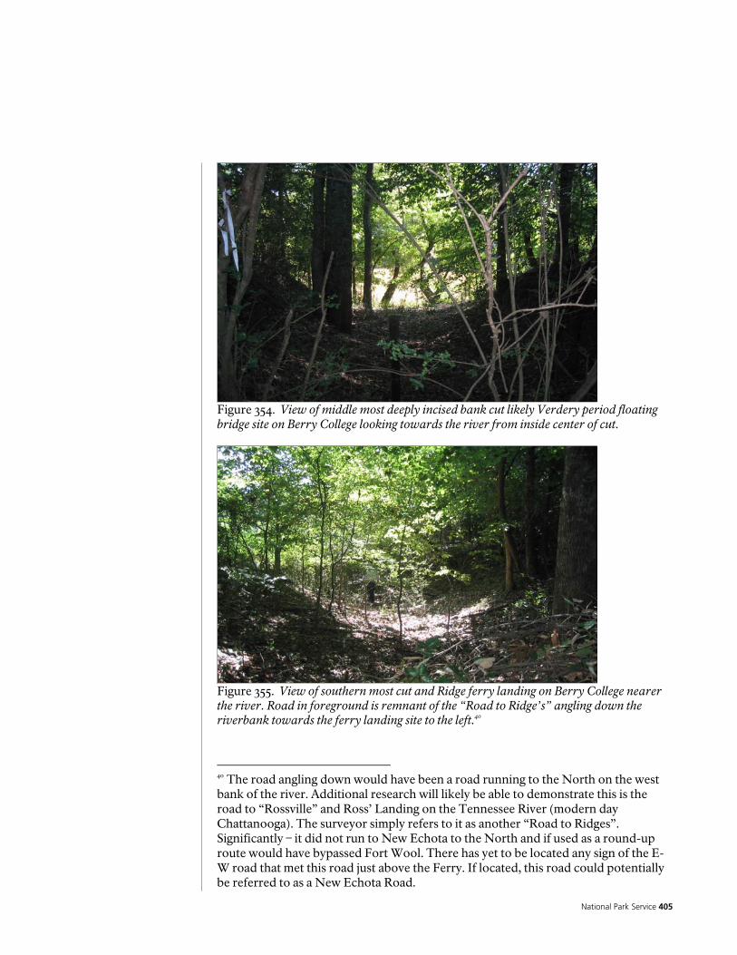
National Park Service 405
Figure 354. View of middle most deeply incised bank cut likely Verdery period floating bridge site on Berry College looking towards the river from inside center of cut.
Figure 355. View of southern most cut and Ridge ferry landing on Berry College nearer the river. Road in foreground is remnant of the “Road to Ridge’s” angling down the riverbank towards the ferry landing site to the left.40
40 The road angling down would have been a road running to the North on the west bank of the river. Additional research will likely be able to demonstrate this is the road to “Rossville” and Ross’ Landing on the Tennessee River (modern day Chattanooga). The surveyor simply refers to it as another “Road to Ridges”. Significantly – it did not run to New Echota to the North and if used as a round-up route would have bypassed Fort Wool. There has yet to be located any sign of the E-W road that met this road just above the Ferry. If located, this road could potentially be referred to as a New Echota Road.

Historic Preservation Report 406
Figure 356. View of southern most cut and Ridge ferry landing on Berry College nearer the river. Road in foreground is remnant of the “Road to Ridge’s” angling down the riverbank towards the ferry landing site to the left.
Figure 357. View of southern most cut and Ridge ferry landing on Berry College at the river.
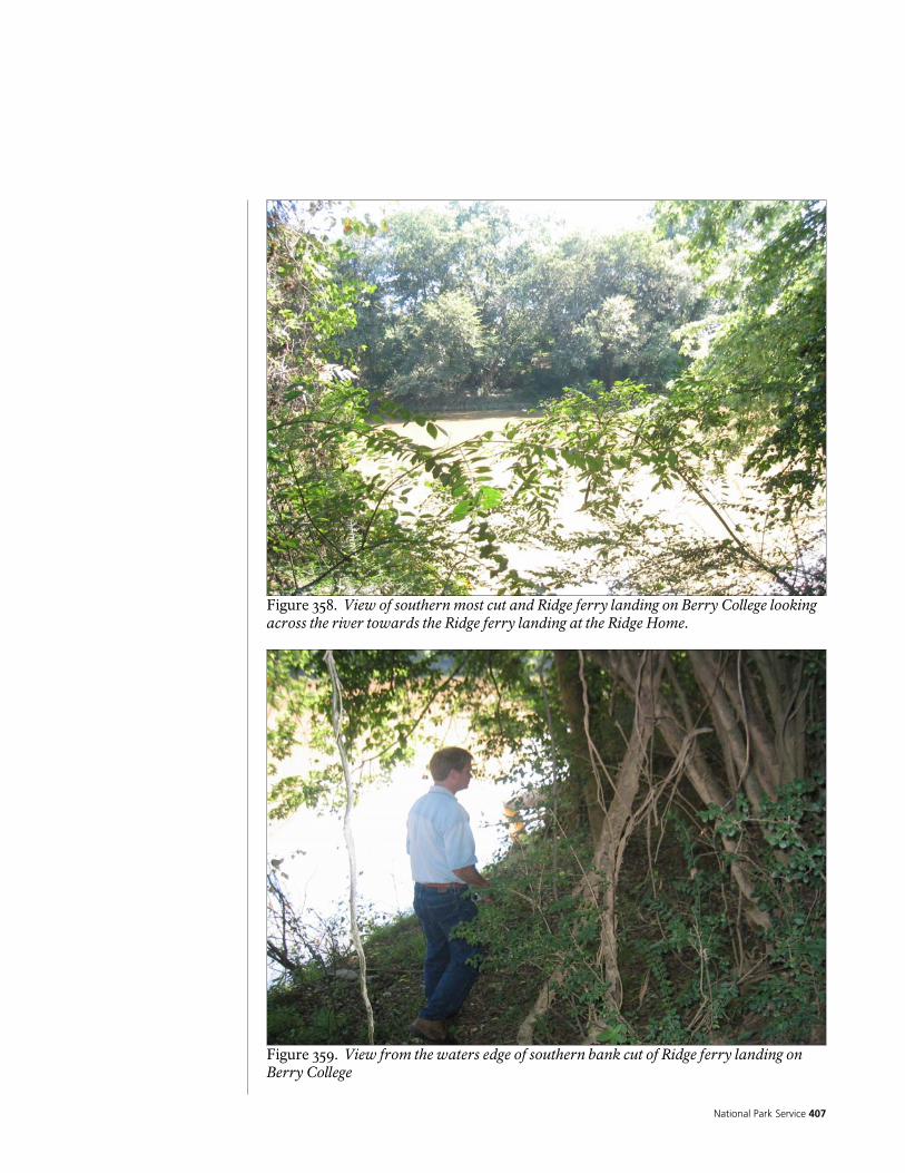
National Park Service 407
Figure 358. View of southern most cut and Ridge ferry landing on Berry College looking across the river towards the Ridge ferry landing at the Ridge Home.
Figure 359. View from the waters edge of southern bank cut of Ridge ferry landing on Berry College

Historic Preservation Report 408
Figure 360. Ross to Ridge’s road just south of the Ridge home looking North. Riverside Parkway at curve ahead is likely over original route alignment. Note bank cut at right and river walk pavement
Figure 361. Ross to Ridge’s road in Ridge Ferry Park south of the Ridge home looking south. Note old road bank swale on left.
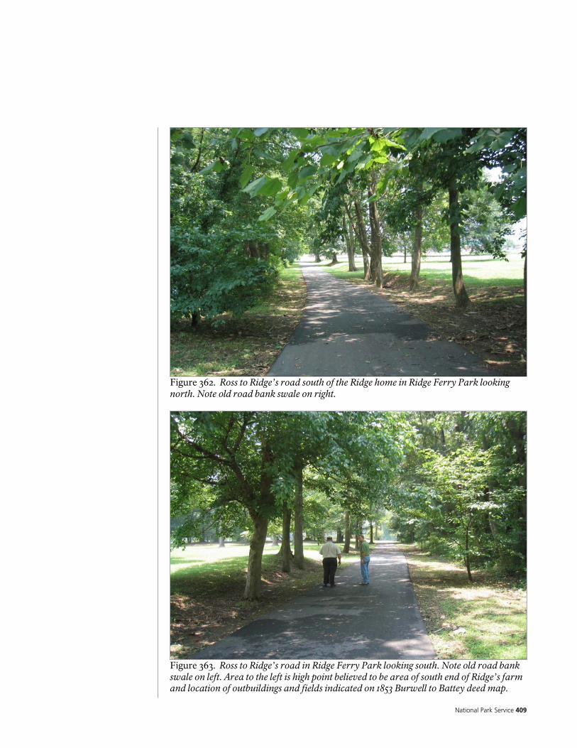
National Park Service 409
Figure 362. Ross to Ridge’s road south of the Ridge home in Ridge Ferry Park looking north. Note old road bank swale on right.
Figure 363. Ross to Ridge’s road in Ridge Ferry Park looking south. Note old road bank swale on left. Area to the left is high point believed to be area of south end of Ridge’s farm and location of outbuildings and fields indicated on 1853 Burwell to Battey deed map.

Historic Preservation Report 410
Figure 364. Ross to Ridge’s road in Ridge Ferry Park looking south. Note old road bank swale on left. Area to the left is high point believed to be area of south end of Ridge’s farm and location of outbuildings and fields indicated on 1853 Burwell to Battey deed map
Figure 365. Ross to Ridge’s road in Ridge Ferry Park looking south. Note existing park playground equipment at left.
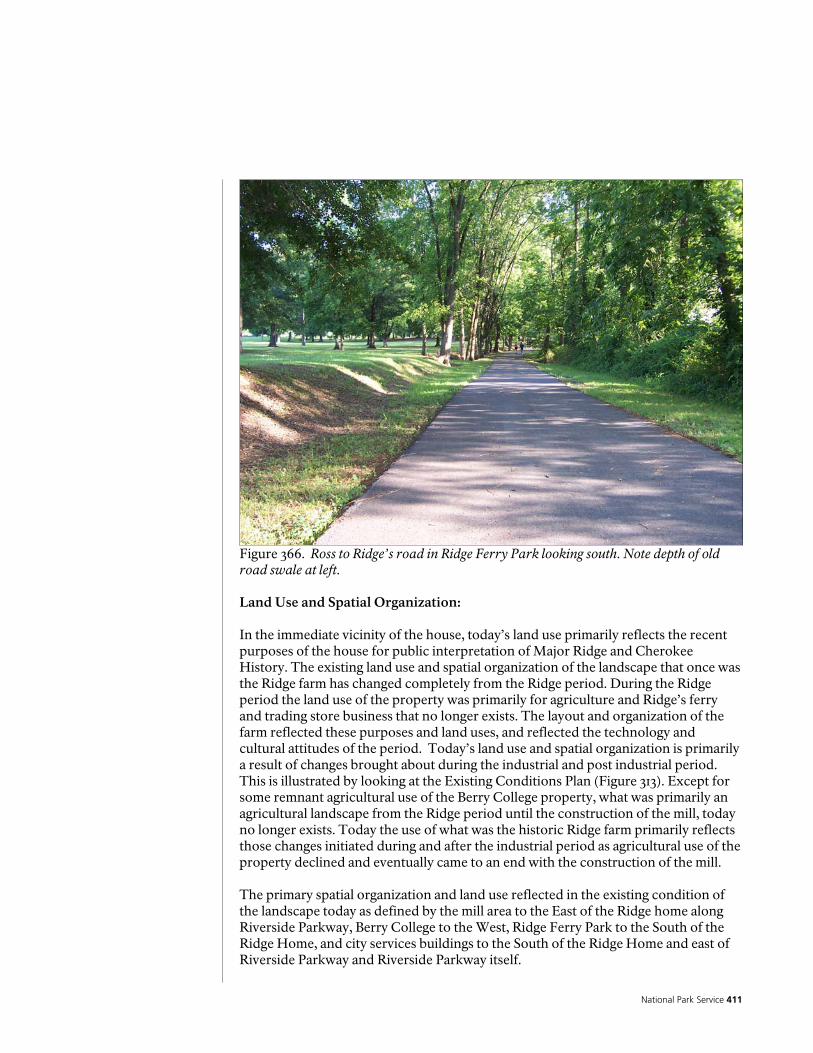
National Park Service 411
Figure 366. Ross to Ridge’s road in Ridge Ferry Park looking south. Note depth of old road swale at left. Land Use and Spatial Organization: In the immediate vicinity of the house, today’s land use primarily reflects the recent purposes of the house for public interpretation of Major Ridge and Cherokee History. The existing land use and spatial organization of the landscape that once was the Ridge farm has changed completely from the Ridge period. During the Ridge period the land use of the property was primarily for agriculture and Ridge’s ferry and trading store business that no longer exists. The layout and organization of the farm reflected these purposes and land uses, and reflected the technology and cultural attitudes of the period. Today’s land use and spatial organization is primarily a result of changes brought about during the industrial and post industrial period. This is illustrated by looking at the Existing Conditions Plan (Figure 313). Except for some remnant agricultural use of the Berry College property, what was primarily an agricultural landscape from the Ridge period until the construction of the mill, today no longer exists. Today the use of what was the historic Ridge farm primarily reflects those changes initiated during and after the industrial period as agricultural use of the property declined and eventually came to an end with the construction of the mill. The primary spatial organization and land use reflected in the existing condition of the landscape today as defined by the mill area to the East of the Ridge home along Riverside Parkway, Berry College to the West, Ridge Ferry Park to the South of the Ridge Home, and city services buildings to the South of the Ridge Home and east of Riverside Parkway and Riverside Parkway itself.

Historic Preservation Report 412
As Riverside Parkway, currently being widened and realigned for increased traffic use and to serve as a major north south transportation corridor for Rome and the new ball park to the north changes, this will significantly change again the land use and spatial organization of what was the historic landscape of Ridge’s farm. This change will also significantly modify the landscape of the industrial period. This major change to Riverside Parkway will undoubtedly have a drastic visual impact as well as auditory impact on the landscape of the Major Ridge home.
Figure 367. View showing fallow fields and remaining agricultural land use at Berry College on west side of river across from the Chieftains Museum Major Ridge Home.

National Park Service 413
Figure 368. Fields and remaining agricultural land use in vicinity of Ridge’s 12 acre field at Berry College near ferry landing site.
Figure 369. Ditch believed to be that described in post Ridge period deeds just north and near river from Ridge home. Appears to be a natural drainage and water flow most likely modified and excavated for control of drainage for fields. Date of excavation unknown.
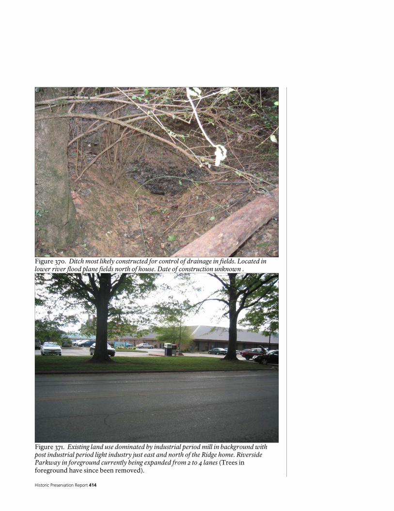
Historic Preservation Report 414
Figure 370. Ditch most likely constructed for control of drainage in fields. Located in lower river flood plane fields north of house. Date of construction unknown .
Figure 371. Existing land use dominated by industrial period mill in background with post industrial period light industry just east and north of the Ridge home. Riverside Parkway in foreground currently being expanded from 2 to 4 lanes (Trees in foreground have since been removed).
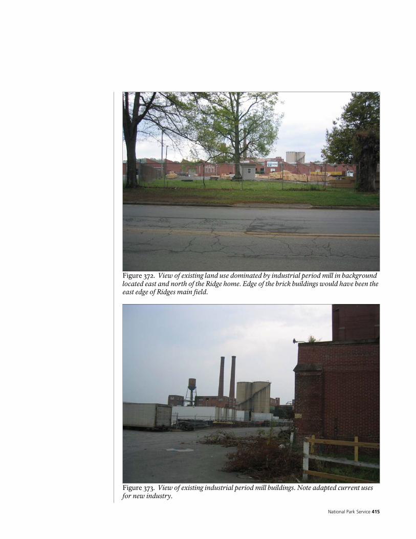
National Park Service 415
Figure 372. View of existing land use dominated by industrial period mill in background located east and north of the Ridge home. Edge of the brick buildings would have been the east edge of Ridges main field.
Figure 373. View of existing industrial period mill buildings. Note adapted current uses for new industry.
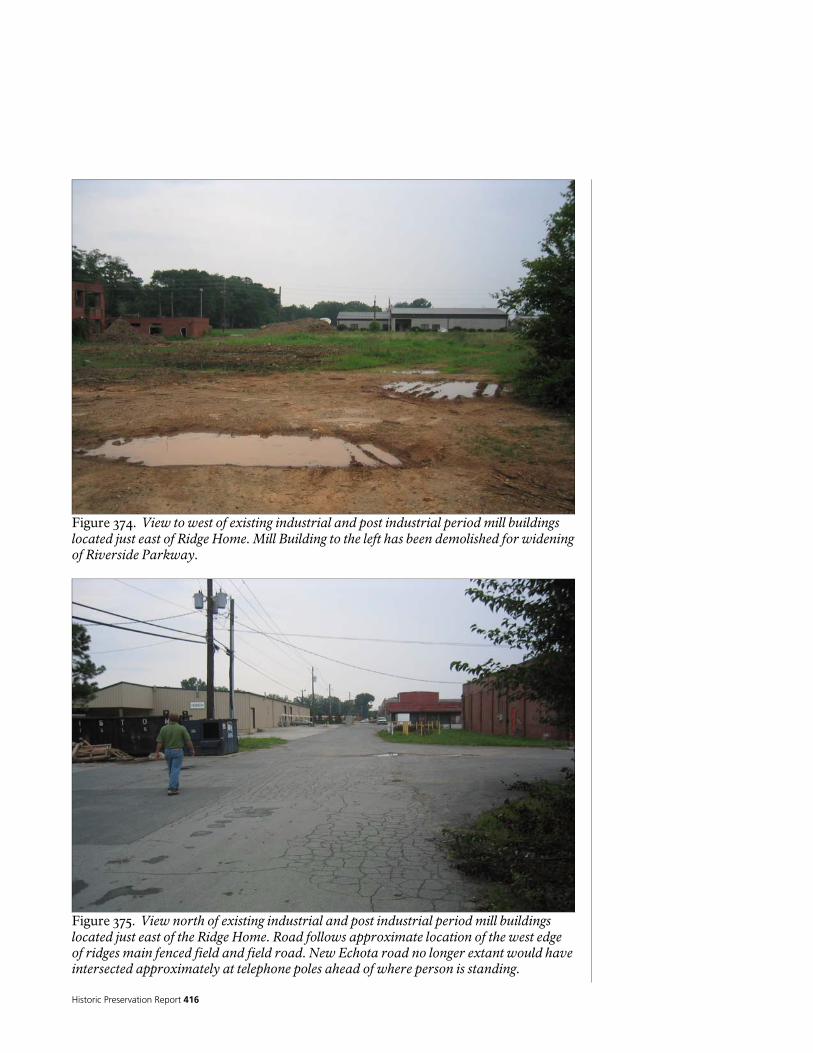
Historic Preservation Report 416
Figure 374. View to west of existing industrial and post industrial period mill buildings located just east of Ridge Home. Mill Building to the left has been demolished for widening of Riverside Parkway.
Figure 375. View north of existing industrial and post industrial period mill buildings located just east of the Ridge Home. Road follows approximate location of the west edge of ridges main fenced field and field road. New Echota road no longer extant would have intersected approximately at telephone poles ahead of where person is standing.

National Park Service 417
Figure 376. View of existing industrial period mill buildings east of the Ridge Home. Note adapted current uses for new industry.
Figure 377. View of existing industrial and post industrial period buildings east of the Ridge Home. Ridge Home is in background center. New Echota road would have been to the right of this road approaching the house. Ridge orchards then fields would have been ahead.

Historic Preservation Report 418
Figure 378. View of area south of mill and southeast of Ridge home along existing sewer line looking south along approximate location of west field road at what is believed to be Ridge’s peach orchard that would have been to the right in this photo. Area is currently second growth forest and hazardous waste site.
Figure 379. View of area south of mill and southeast of Ridge home along existing sewer line looking south along approximate location of west field road of what is believed to be Ridge’s peach orchard that would have been to the right in photo. Note standing water to right.

National Park Service 419
Figure 380. Standing near the southern end of Ridge’s farm looking north on Riverside Parkway towards the Ridge Home. Ridge Ferry Park to left and School District office to right top of picture. Ridge’s peach orchard would have been to right of where trees are on the right with field left and right of road.
Figure 381. View to the south from existing soccer field south of the School District office towards existing rr tracks. This area would have been in the southern end of Ridges farm and fields. Building in background is just south of Ridge’s southern fence line. Ridge’s 1134 peach tree orchard would have been to the left of the trees at the left.

Historic Preservation Report 420
Figure 382. Looking south from School District office. To right in photo is Riverside Parkway and river. This area would have been in Ridges main field.
Figure 383. Looking south from School District office. To right in photo is Riverside Parkway and river. This area would have been in Ridges main field.
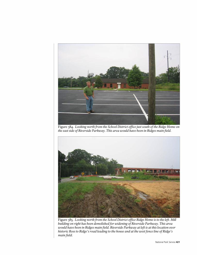
National Park Service 421
Figure 384. Looking north from the School District office just south of the Ridge Home on the east side of Riverside Parkway. This area would have been in Ridges main field.
Figure 385. Looking north from the School District office Ridge Home is to the left. Mill building on right has been demolished for widening of Riverside Parkway. This area would have been in Ridges main field. Riverside Parkway at left is at this location over historic Ross to Ridge’s road leading to the house and at the west fence line of Ridge’s main field.
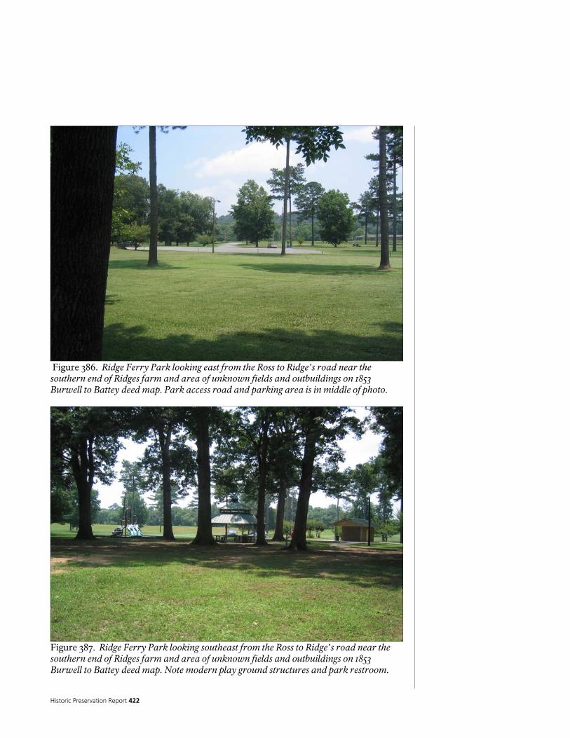
Historic Preservation Report 422
Figure 386. Ridge Ferry Park looking east from the Ross to Ridge’s road near the southern end of Ridges farm and area of unknown fields and outbuildings on 1853 Burwell to Battey deed map. Park access road and parking area is in middle of photo.
Figure 387. Ridge Ferry Park looking southeast from the Ross to Ridge’s road near the southern end of Ridges farm and area of unknown fields and outbuildings on 1853 Burwell to Battey deed map. Note modern play ground structures and park restroom.
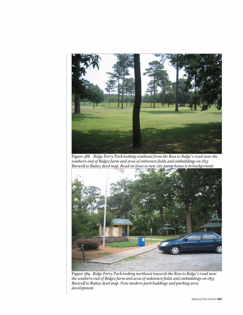
National Park Service 423
Figure 388. Ridge Ferry Park looking southeast from the Ross to Ridge’s road near the southern end of Ridges farm and area of unknown fields and outbuildings on 1853 Burwell to Battey deed map. Road on levee to new city pump house is in background.
Figure 389. Ridge Ferry Park looking northeast towards the Ross to Ridge’s road near the southern end of Ridges farm and area of unknown fields and outbuildings on 1853 Burwell to Battey deed map. Note modern park buildings and parking area development.
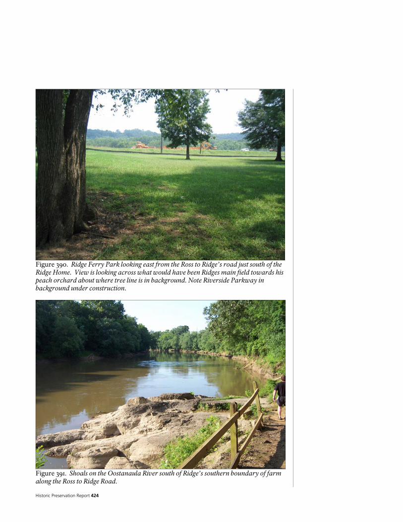
Historic Preservation Report 424
Figure 390. Ridge Ferry Park looking east from the Ross to Ridge’s road just south of the Ridge Home. View is looking across what would have been Ridges main field towards his peach orchard about where tree line is in background. Note Riverside Parkway in background under construction.
Figure 391. Shoals on the Oostanaula River south of Ridge’s southern boundary of farm along the Ross to Ridge Road.
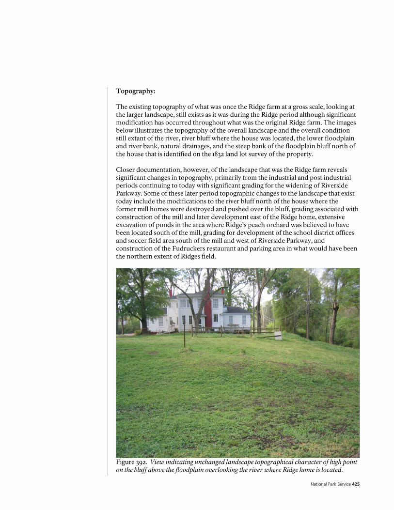
National Park Service 425
Topography: The existing topography of what was once the Ridge farm at a gross scale, looking at the larger landscape, still exists as it was during the Ridge period although significant modification has occurred throughout what was the original Ridge farm. The images below illustrates the topography of the overall landscape and the overall condition still extant of the river, river bluff where the house was located, the lower floodplain and river bank, natural drainages, and the steep bank of the floodplain bluff north of the house that is identified on the 1832 land lot survey of the property. Closer documentation, however, of the landscape that was the Ridge farm reveals significant changes in topography, primarily from the industrial and post industrial periods continuing to today with significant grading for the widening of Riverside Parkway. Some of these later period topographic changes to the landscape that exist today include the modifications to the river bluff north of the house where the former mill homes were destroyed and pushed over the bluff, grading associated with construction of the mill and later development east of the Ridge home, extensive excavation of ponds in the area where Ridge’s peach orchard was believed to have been located south of the mill, grading for development of the school district offices and soccer field area south of the mill and west of Riverside Parkway, and construction of the Fudruckers restaurant and parking area in what would have been the northern extent of Ridges field.
Figure 392. View indicating unchanged landscape topographical character of high point on the bluff above the floodplain overlooking the river where Ridge home is located.

Historic Preservation Report 426
Figure 393. View indicating unchanged landscape topographical character of floodplain below house.
Figure 394. View indicating unchanged landscape topographical character of higher ground that were Ridges fields in Ridge Ferry Park.

National Park Service 427
Figure 395. View indicating natural topographical condition of the river and river bank appears relatively unchanged along its length of the extent of what was the Ridge farm along both banks of the river.
Figure 396. Extensive grade modification to the natural topography done for construction of Industrial period mill pump house.
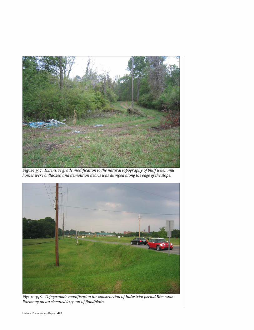
Historic Preservation Report 428
Figure 397. Extensive grade modification to the natural topography of bluff when mill homes were bulldozed and demolition debris was dumped along the edge of the slope.
Figure 398. Topographic modification for construction of Industrial period Riverside Parkway on an elevated levy out of floodplain.
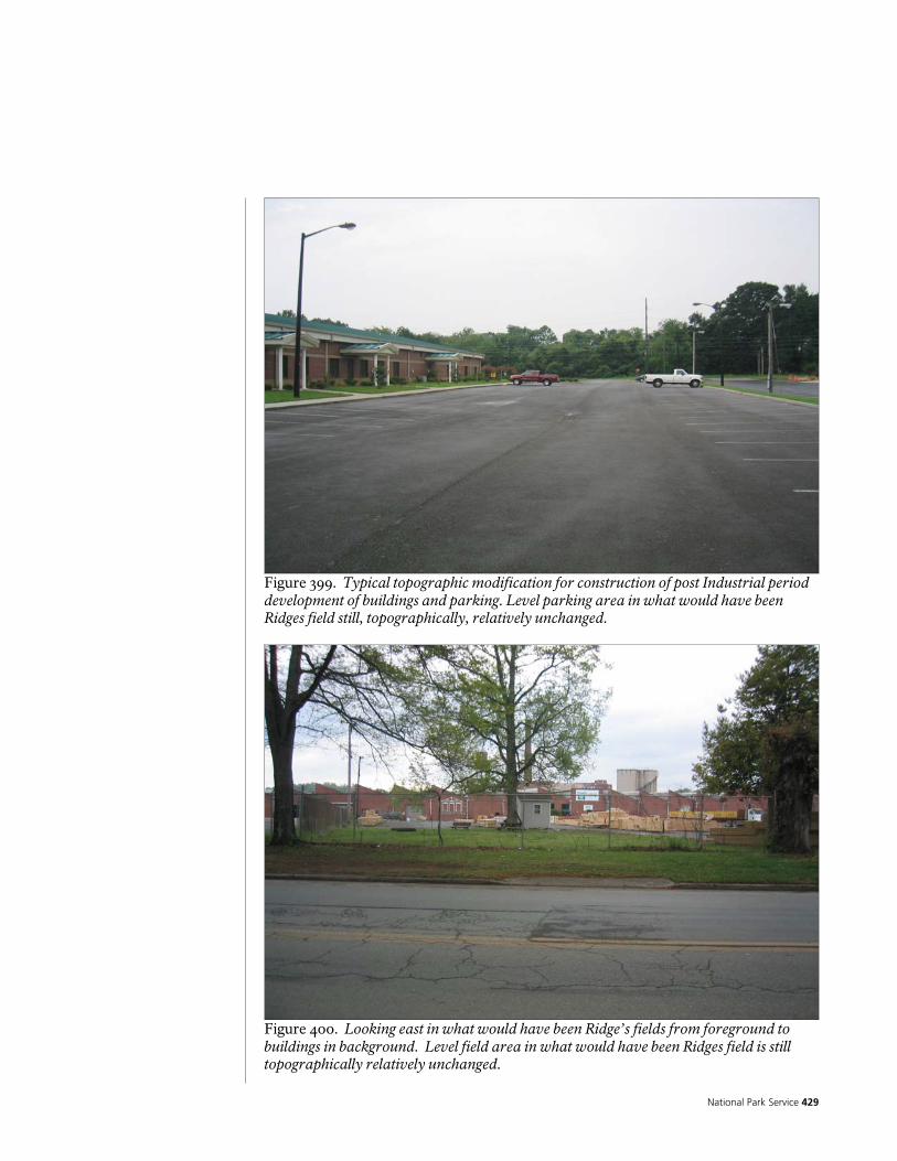
National Park Service 429
Figure 399. Typical topographic modification for construction of post Industrial period development of buildings and parking. Level parking area in what would have been Ridges field still, topographically, relatively unchanged.
Figure 400. Looking east in what would have been Ridge’s fields from foreground to buildings in background. Level field area in what would have been Ridges field is still topographically relatively unchanged.

Historic Preservation Report 430
Vegetation: The vegetation that comprises the landscape today on what was the Ridge period farm primarily represents changes that have occurred as a result of the industrial or post industrial periods. The vegetation for the most part reflects today’s land use as discussed previously and is shown on the aerial photo existing conditions and the detailed existing conditions survey plans. There no longer exists an agricultural landscape and vegetation that continued from the Ridge period into the 20th century and ended mostly around the time the mill was constructed. Only a small area of what was Ridge’s farm on the West side of the river on Berry College retains any semblance of an agricultural landscape although the location of specific vegetation planting on the landscape here or on other parts of the Ridge farm is mostly unknown. An exception to this may be the location of the peach orchard and fields which, as discussed in the previous historical documentation section of this report, provides strong evidence as to their location. None of the vegetation or continued patterns of agricultural planting remains, however, and the vegetation found today over much of what was Ridge’s farm is a result of modern industrial and post industrial periods. The only area with perhaps the most unchanged vegetation condition of the former Ridge farm may be the banks of the river. This area has presumably never been severely altered for any use and is likely as it was from the time Ridge occupied the property until today. Around the Ridge Home, individual large trees may date to as far back as the Jones Jefferies period although an examination of this possibility has not been done. More than likely, the oldest trees date to the early part of the industrial period and construction of the mill in the 1920’s. The large individual water oaks planted as street trees along Riverside Parkway were planted during the construction of the mill houses and Riverside Parkway. Today the dominant planted or maintained vegetation encountered throughout what was once the Ridge farm is mowed lawn and ornamental tree, shrub, perennial, and annual plants associated with modern development. Of these, mowed lawn occupies the largest area around the house and to the south in Ridge Ferry Park on what was Ridge’s farm. At the outside edges of what was the Ridge farm, where his cleared land would have ended, this would presumably have been native forest. No native forest within the proximity of the boundaries of Ridge’s farm were identified as a result of this study and the field work documenting existing conditions for this report or are known to exist. Surpassing the mowed lawn in extent of area dominant vegetation of what was once Ridge’s farm is second growth forest in areas that were formally agricultural, and that have not been developed or that do not today have any particular use. To the north of the Ridge home much of the area from the river to Riverside Parkway that was once cleared field is now second growth forest. The is also true to the south of the house and in much of the area where Ridge’s extensive peach orchard is believed to have been east of Riverside Parkway and the school district building. These second growth forests have been invaded by non-native Privet.
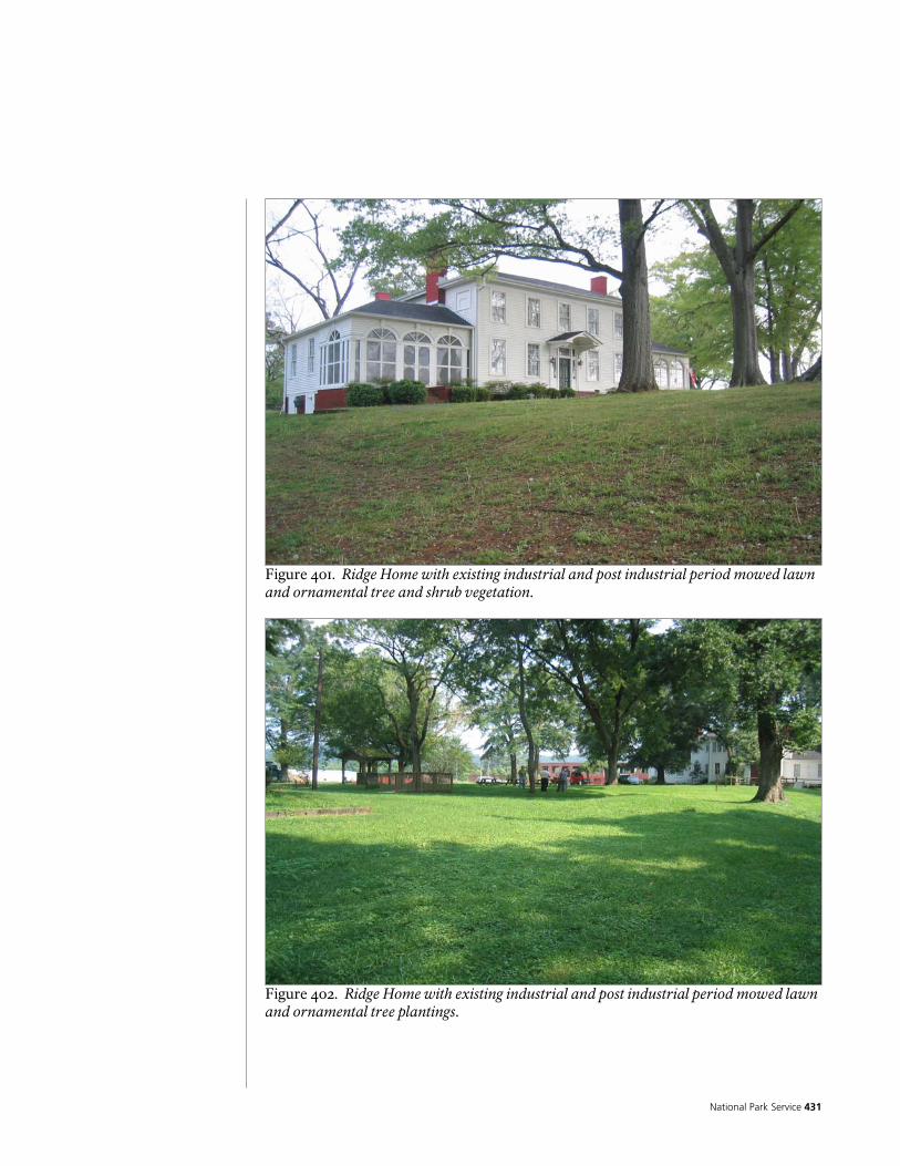
National Park Service 431
Figure 401. Ridge Home with existing industrial and post industrial period mowed lawn and ornamental tree and shrub vegetation.
Figure 402. Ridge Home with existing industrial and post industrial period mowed lawn and ornamental tree plantings.

Historic Preservation Report 432
Figure 403. Existing industrial period oak street tree plantings and recently planted ornamental flower beds around residences.
Figure 404. Existing post industrial period vegetation of mowed lawn and ornamental trees at Ridge Ferry Park within the southern end of Ridge’s fields and outbuildings identified in 1853 Burwell to Battey deed map.

National Park Service 433
Figure 405. Existing agricultural field at Berry College on west side of river near Ridge’s ferry landing site and 12 acre field. This is the last remaining agricultural area associated with what was Ridge’s original farm.
Figure 406. Existing second growth forest just north and west of Ridge Home on what was Ridge period cleared fields.
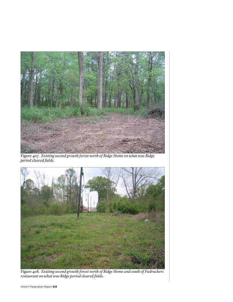
Historic Preservation Report 434
Figure 407. Existing second growth forest north of Ridge Home on what was Ridge period cleared fields.
Figure 408. Existing second growth forest north of Ridge Home and south of Fudruckers restaurant on what was Ridge period cleared fields.

National Park Service 435
Figure 409. Existing river bank native forest vegetation likely unchanged since Ridge period.

Historic Preservation Report 436

National Park Service 437
PART III – TREATMENT AND USE

Historic Preservation Report 438
National Park Service 439
Treatment Philosophy for the Chieftains Museum/Major Ridge Home
The basic intent of any historic preservation treatment plan is to preserve or restore the historic character and features of a property. A treatment plan must also consider feasibility, the integrity and significance of the property, the intended use of the property, and the financial resources of the property owner. The HSR/CLR team has adopted a treatment philosophy for the Chieftains Museum property based on the stated ‘Preservation Philosophy’ of the Chieftains Museum/Major Ridge Home and the National Park Service’s own traditions, philosophies, and guidelines for the evaluation and treatment of historic properties. In May of 2005, the Chieftains Museum/Major Ridge Home Board of Directors unanimously passed a ‘Preservation Philosophy’ statement. The most significant part of the statement reads,
“… the Ridge occupation at Chieftains (c. 1819 – 1837) as being of overriding historic significance in comparison to later occupations. It is the reason that Chieftains has been designated a National Historic Landmark. Because of its overwhelmingly greater significance, we believe that the Ridge period should be considered first as a guiding force in establishing preservation treatments. In consideration of treatment alternatives, we do not, however, condone the elimination of elements of later periods of significance without compelling reasons.”
National Park Service treatment philosophy is guided by The Secretary of the Interior’s Standards and Guidelines For Archeology and Historic Preservation, The Secretary of the Interior’s Standards for the Treatment of Historic Properties with Guidelines for Preserving, Rehabilitating, Restoring, and Reconstructing Historic Buildings, The Secretary of the Interior’s Standards for the Treatment of Historic Properties with Guidelines for the Treatment of Cultural Landscapes, and NPS-28, National Park Service Cultural Resource Guideline, as well as the vast and cumulative experience of the National Park Service as the nation’s leader in historic preservation and resources stewardship. The HSR/CLR team supports Chieftains view that the primary period of significance is the Ridge Period. From the outset of this study, NPS and Chieftains have sought to identify later periods of occupation and the resulting changes and consider them as potentially having historical significance. Data collected during this study at the ‘thorough’ level suggests that later periods may potentially have some historical significance at the local and state level, but the evidence collected is not enough to warrant strong consideration. Further research has the possibility to yield additional information which may enable reconsideration, but recognition of additional periods of significance would also be dependent on the level of physical integrity the structure and grounds retain, and for the periods of occupation other than the Ridge Period, the Porter Period, and the Industrial Period, there is limited integrity. Therefore, the preservation philosophy guiding the treatment alternatives and recommendations offered in this document seek primarily to preserve the Chieftains Museum/Major Ridge Home to the Ridge Period. Therefore, the selected preservation treatment must be consistent for the house and landscape reflecting the same period of significance. The Major Ridge Home presents a complicated
TREA
TMEN
T A
ND
USE

Historic Preservation Report 440
condition in which the overwhelmingly great period of significance associated with Major Ridge, as manifested in the house and landscape, has been greatly obscured by later periods of development. While best preservation practice generally aims to preserve a property as it has evolved through time to its last period of significance, this was determined to be an incompatible strategy for treatment of the Ridge home and landscape. Because of the importance attributed to the Ridge Period and the site’s central focus on the Ridge period for interpretation and use, its was determined later considerably less significant periods of use and development that obscured the understanding of the Ridge period property should not be preserved. These later additions conflict with the ability to better use, convey, and interpret the Ridge period property for public appreciation and understanding.
In general, the Secretary of the Interior has established for types of treatment for historic properties. Preservation maintains the existing integrity and character of a historic structure by arresting or retarding deterioration caused by natural forces and normal use. It includes both maintenance and stabilization. Maintenance is a systematic activity mitigating wear and deterioration of a structure by protecting its condition. Stabilization involves reestablishing the stability of an unsafe, damaged, or deteriorating structure while maintaining its existing character. Rehabilitation improves the utility or function of a historic structure, through repair or alteration, to make possible a compatible contemporary use while preserving those portions or features that are important in defining its significance. Restoration accurately presents the form, features, and character of a historic structure as it appeared at a specific period. It may involve the replication of missing historic features and removal of later features, some having cultural value in themselves. Reconstruction entails reproducing the form, features, and character of a non-surviving historic structure, or any part thereof, as it appeared at a specific time and place. In exploring the treatment alternatives and recommendation for a historic property one of the four types of treatments is usually selected as a primary treatment for the property as a whole. The primary treatment provides a philosophical framework for the entire property and guides treatment of individual features. Treatment of individual features will likely utilize secondary types of treatment other that the primary. For example, if rehabilitation is selected as the primary treatment, treatment of may include the preservation, restoration, or reconstruction of individual features, even though the overall project is considered a rehabilitation.

National Park Service 441
Introduction to Treatment Alternatives
The treatment of a historic property is never simple. The complexities of the historic structure and corresponding landscape and their history must be well understood in order to select an appropriate treatment. Careful planning is the cornerstone of appropriate treatment. The treatment alternatives for the structure and landscape of the Chieftains Museum property that follow were generated through successive steps in the planning process. Historic research was conducted at the “thorough” level to gather new information to help us understand the chronology of development of the property. The Ridge home and grounds were physically documented to identify existing conditions and further understand the chronology of development. Chieftains Museum then offered treatment workshops for the building and landscape. The workshops were attended by Chieftains Museum staff, members of the board of directors, and other stakeholders, as well as by other NPS offices state government offices and the issues of possible treatment were identified and discussed within the context of historic preservation standards and guidelines. Based on the outcomes of the treatment workshops, NPS was able to develop six treatment alternatives for the Ridge Home and four treatment alternatives for the Ridge landscape. The National Park Service team was asked to identify and provide preferred treatments for the Ridge home and landscape. If the Chieftains property was an NPS unit, the preferred treatment would likely be implemented; however, the non-profit entity of Chieftains Museum retains the right and privilege of selecting any or none of the treatment alternatives presented here. The NPS preferred treatment is that which NPS has determined to be most effective in following the standards and guidelines for historic preservation and the mission of Chieftains Museum based on the complexity of the existing conditions and their corresponding historical documentation. The preferred treatments identified are compatible for the house and landscape to insure that separate approaches to the house and landscape were avoided. While the preferred treatment most clearly favors the enhanced interpretation of the Ridge period within the Secretary of the Interiors Standards and Guidelines and best preservation practices, there is no way to make an absolute case for any proposed treatment of this property. Like many historic properties that have evolved and changed over time, definitive documentation may never be reached. There always remain unanswerable questions and a degree of uncertainty. The Chieftains Museum/Major Ridge Home remains a complex balance of historic documentation, use, and interpretation. And while a reasonable case can be made for all of the treatment alternatives presented below, any preferred treatment would be controversial. Ideally, further historical and archeological research would assist in developing a complete and detailed chronology of development of the home and landscape, but this outcome is not guaranteed. There are still many information gaps in the knowledge of the home and landscape which may never be filled. There is, however sufficient knowledge of the structure and landscape for NPS to offered a preferred treatment which makes sense given the current state of the property.

Historic Preservation Report 442
While some of the treatments proposed here are seemingly dramatic and challenge the long-held concepts of what Chieftains Museum is and should be, examples of striking treatments of privately held properties exist elsewhere. One extremely germane example is James Madison’s Montpelier and the efforts of the Montpelier Foundation to restore this nationally significant property. Located in Virginia and owned by the National Trust for Historic Preservation, the existing structure of Montpelier was thoroughly studied in a manner similar to Chieftains even using one of the same consultants. The results of the study showed that the nationally significant core of the building from the Madison Period from 1809-1812 was still clearly identifiable. Like Chieftains, Montpelier was modified during periods of successive ownership. These changes were especially pronounced during the period from 1901 to 1928 when William F. duPont owned the property. Major additions were made to the structure including new wings added to the rear which substantially changed the building form. Currently, the restoration has included removing the wings added onto the mansion by the duPont family in the early 1900’s even though the duPont period of ownership has been identified as being of national significance. NPS strongly recommended the Board of Directors for Chieftains Museum/Major Ridge Home examines the history and progress of the Montpelier restoration when considering the selection of the alternatives presented here. Please go to http://www.montpelier.org/. Other aspects of treatment that should be considered are on-going archeological investigation focusing on both the mitigation of affects of treatment as well as important research questions. If one of the treatment alternatives involves exposing all of the Ridge Period logs, a core sampling plan should be developed and core samples should be taken from inconspicuous places of every log and accessioned into the museum’s collection for later use in determining the exact construction date of the log portion of the home. Also, NPS strongly recommends Chieftains engage the services of a conservator to study the existing material and finishes in detail as well as any new materials and finishes which may be discovered during treatment.

National Park Service 443
Treatment Alternatives for the Chieftains Museum/Major Ridge Home
All of the alternatives presented below follow the Secretary of the Interior’s Standards for the Treatment of Historic Properties (36 CFR 68.3). The Secretary of the Interior’s Standards provide for four possible overall treatments for historic properties: preservation, rehabilitation, restoration or reconstruction. These apply to a property undergoing treatment, depending upon the property's significance, existing physical condition, and the extent of documentation available and interpretive goals. The standards are applied taking into consideration the economic and technical feasibility of each project. Elements of each of these types of treatments may be incorporated into an overall treatment. For example, an overall treatment of rehabilitation based upon a change in use may have elements of preservation, restoration and even reconstruction. (a) Preservation.
(1) A property will be used as it was historically, or be given a new use that maximizes the retention of distinctive materials, features, spaces and spatial relationships. Where a treatment and use have not been identified, a property will be protected and, if necessary, stabilized until additional work may be undertaken. (2) The historic character of a property will be retained and preserved. The replacement of intact or repairable historic materials or alteration of features, spaces and spatial relationships that characterize a property will be avoided. (3) Each property will be recognized as a physical record of its time, place and use. Work needed to stabilize, consolidate and conserve existing historic materials and features will be physically and visually compatible, identifiable upon close inspection and properly documented for future research. (4) Changes to a property that have acquired historic significance in their own right will be retained and preserved. (5) Distinctive materials, features, finishes and construction techniques or examples of craftsmanship that characterize a property will be preserved. (6) The existing condition of historic features will be evaluated to determine the appropriate level of intervention needed. Where the severity of deterioration requires repair or limited replacement of a distinctive feature, the new material will match the old in composition, design, color and texture. (7) Chemical or physical treatments, if appropriate, will be undertaken using the gentlest means possible. Treatments that cause damage to historic materials will not be used. (8) Archeological resources will be protected and preserved in place. If such resources must be disturbed, mitigation measures will be undertaken.
(b) Rehabilitation.

Historic Preservation Report 444
(1) A property will be used as it was historically or be given a new use that requires minimal change to its distinctive materials, features, spaces and spatial relationships. (2) The historic character of a property will be retained and preserved. The removal of distinctive materials or alteration of features, spaces and spatial relationships that characterize a property will be avoided. (3) Each property will be recognized as a physical record of its time, place and use. Changes that create a false sense of historical development, such as adding conjectural features or elements from other historic properties, will not be undertaken. (4) Changes to a property that have acquired historic significance in their own right will be retained and preserved. (5) Distinctive materials, features, finishes and construction techniques or examples of craftsmanship that characterize a property will be preserved. (6) Deteriorated historic features will be repaired rather than replaced. Where the severity of deterioration requires replacement of a distinctive feature, the new feature will match the old in design, color, texture and, where possible, materials. Replacement of missing features will be substantiated by documentary and physical evidence. (7) Chemical or physical treatments, if appropriate, will be undertaken using the gentlest means possible. Treatments that cause damage to historic materials will not be used. (8) Archeological resources will be protected and preserved in place. If such resources must be disturbed, mitigation measures will be undertaken. (9) New additions, exterior alterations or related new construction will not destroy historic materials, features and spatial relationships that characterize the property. The new work will be differentiated from the old and will be compatible with the historic materials, features, size, scale and proportion, and massing to protect the integrity of the property and its environment. (10) New additions and adjacent or related new construction will be undertaken in such a manner that, if removed in the future, the essential form and integrity of the historic property and its environment would be unimpaired.
(c) Restoration.
(1) A property will be used as it was historically or be given a new use that interprets the property and its restoration period.

National Park Service 445
(2) Materials and features from the restoration period will be retained and preserved. The removal of materials or alteration of features, spaces and spatial relationships that characterize the period will not be undertaken. (3) Each property will be recognized as a physical record of its time, place and use. Work needed to stabilize, consolidate and conserve materials and features from the restoration period will be physically and visually compatible, identifiable upon close inspection and properly documented for future research. (4) Materials, features, spaces and finishes that characterize other historical periods will be documented prior to their alteration or removal. (5) Distinctive materials, features, finishes and construction techniques or examples of craftsmanship that characterize the restoration period will be preserved. (6) Deteriorated features from the restoration period will be repaired rather than replaced. Where the severity of deterioration requires replacement of a distinctive feature, the new feature will match the old in design, color, texture and, where possible, materials. (7) Replacement of missing features from the restoration period will be substantiated by documentary and physical evidence. A false sense of history will not be created by adding conjectural features, features from other properties, or by combining features that never existed together historically. (8) Chemical or physical treatments, if appropriate, will be undertaken using the gentlest means possible. Treatments that cause damage to historic materials will not be used. (9) Archeological resources affected by a project will be protected and preserved in place. If such resources must be disturbed, mitigation measures will be undertaken. (10) Designs that were never executed historically will not be constructed.
(d) Reconstruction.
(1) Reconstruction will be used to depict vanished or non-surviving portions of a property when documentary and physical evidence is available to permit accurate reconstruction with minimal conjecture and such reconstruction is essential to the public understanding of the property. (2) Reconstruction of a landscape, building, structure or object in its historic location will be preceded by a thorough archeological investigation to identify and evaluate those features and artifacts that are essential to an accurate reconstruction. If such resources must be disturbed, mitigation measures will be undertaken.

Historic Preservation Report 446
(3) Reconstruction will include measures to preserve any remaining historic materials, features, and spatial relationships. (4) Reconstruction will be based on the accurate duplication of historic features and elements substantiated by documentary or physical evidence rather than on conjectural designs or the availability of different features from other historic properties. A reconstructed property will re-create the appearance of the non-surviving historic property in materials, design, color and texture. (5) A reconstruction will be clearly identified as a contemporary re-creation. (6) Designs that were never executed historically will not be constructed.

National Park Service 447
ALTERNATIVE A. PRESERVATION TO THE RIDGE PERIOD (SHELTERED RUIN) In this alternative, all non-Ridge period features and finishes would be removed from the building; and the remaining Ridge period features and finishes (if any) would be stabilized and left in place, supplemented with stabilization features such as braces or other structural supports. The building would appear to be a ruin, and maintained as such. A shelter would be constructed around the ruin to provide protection from the elements. Demolition would include removing the Colonial Revival period features such as the east and west wings, the hall/bathroom addition, the north porch, and the enclosed northeast porch; as well as the Colonial Revival roof structure. In addition, all other non-Ridge period structural features, walls, finishes, doors, windows, trim, fireplaces; and plumbing, mechanical and electrical systems and equipment would be removed. Asbestos and lead abatement would be completed, as well. What would be left of the Ridge period building would be portions of the stone foundations, log walls of the original log building, wood frame walls and sheathing of the Ridge addition, roof framing over the original log building and the Ridge addition, some roof sheathing, and some roof shingles. The remaining historic fabric would be stabilized, braced, and supported No restoration or reconstruction activities would be attempted; nor would there be any attempt to provide new plumbing, mechanical, or electrical systems; fire suppression, or security systems. The resulting space would be smaller than the present building. Its appearance would be of a ruin, and it would not contain any useable interior or conditioned space. Interpretative features would be required to explain the different periods, and would need to be suitable for exposure to the elements. Other interpretive materials, as well as museum, administrative and support functions would have to be housed in a separate building. Much of this work would be based on architectural evidence already found during the investigation of the building, and the description of the building in the 1836/7 Federal Valuation (as discussed in the section on Architectural Description and Analysis, above). However, prior to initiation of this alternative, additional research, including destructive architectural investigation, would be necessary to verify the form, massing, plan, structure, appearance, and other features of the Ridge period building; to determine the extent of the remaining historic fabric; and to provide more information on typical construction techniques used during the Ridge period. Some of this information may never be found, leading to some speculation in executing this alternative. To complicate this alternative, little of the original Ridge period features or fabric appear to remain. This alternative would not provide an accurate portrayal of how the building looked during the Ridge period; it would only present an accurate sense of the Ridge period structural construction materials and techniques, and the building massing. Features and fabric from subsequent periods would be lost, and the structure would struggle

Historic Preservation Report 448
to convey. The shelter would need to be designed to be sympathetic to the historic interpretation of the site, the building, and the Ridge period, in order to avoid a contextual problem of inserting a structure that never existed on the site. This alternative is also problematic because it would result in historic fabric still being exposed to environmental threats not mitigated by a shelter such as, horizontal wind-driven rain, fire, and vandalism. The initial costs to implement this alternative would be less than the other alternatives presented below. The maintenance costs for the ruin and the shelter would also be lower than any of the other alternatives, as well. Estimated Cost: $1.0 to 1.25 Million

National Park Service 449
ALTERNATIVE B. RESTORATION to the RIDGE PERIOD In this alternative, all non-Ridge period features and finishes would be removed, and the building would be restored to its appearance at the end of Ridge’s occupation, circa 1837; supplemented with the reconstruction of features necessary to provide an accurate, complete, and usable building. Demolition would include removing the Colonial Revival period features such as the east and west wings, the hall/bathroom addition, the north porch, and the enclosed northeast porch; as well as the Colonial Revival roof structure. In addition, all other non-Ridge period structural features, walls, finishes, doors, windows, trim, fireplaces; and plumbing, mechanical and electrical systems and equipment would be removed. Asbestos and lead abatement would be completed, as well. The restored building would be a simply finished, painted, weather-boarded, L shaped building, consisting of the original log building and the Ridge addition, as well as any east or west facing porches. The main entrance would be returned to the east end of the central hallway (dogtrot). The doors, windows, trim, roof, features and finishes would be restored to their appearance during this period, as would the fireplaces and chimneys. Structural elements would be repaired, replaced, or supplemented as necessary. New plumbing, mechanical and electrical systems, as well as fire suppression and security systems, would be carefully integrated into the building, as unobtrusively as possible. Limited exposure of the Ridge period structure would be made through the use of “viewports,” made by removing surface treatments to expose the structure behind, and covered with glass or plastic, similar to what has already been done in the building, but done in a more aesthetic manner. The resulting enclosed and conditioned space would be smaller than the present building, and would not contain any support spaces such as offices or rest-rooms. The building would work well as a house museum, and would provide a good alternative for the interpretation of the Ridge period. Interpretation would be required to explain the different periods. Interpretation could use tactile, visual and audio media to supplement the interpretation of the visible physical structure. Administrative and support functions would be housed in a new interpretive and administrative center building, as described in the Cultural Landscape section of this report. Currently, there is not enough information available to complete an accurate restoration consistent with the Secretary of the Interior’s Standards and Guidelines for Restoration. Much of this work would have to be based on architectural evidence already found during the investigation of the building, the description of the building in the 1836/7 Federal Valuation (as discussed in the section on Architectural Description and Analysis, above), and historic photographs. However, prior to initiation of this alternative, additional, more ‘exhaustive’ research, as well as additional destructive architectural investigation, would need to be completed to verify, in greater detail the appearance, form, massing, plan, structure, finishes, fenestration, and porches, details, and other features of the Ridge period building; to determine the extent of the remaining historic fabric; and to provide more information on typical construction

Historic Preservation Report 450
techniques used during the Ridge period. There is an inherent risk that critical documentary and physical information may not be found, and without it, this alternative would be highly speculative in addressing some areas of the restoration, especially related to finishes and details of the building. The restoration would then have to rely on knowledge of comparative examples from this period. To complicate this alternative, other than the existing logs and a few other timbers, little of the original Ridge period features or fabric appear to remain, thus requiring extensive reconstruction. Ongoing analysis of the structure during the rehabilitation process may help to fill some of the information gaps, and the final treatment plan would have to identify at which points during the rehabilitation extra care should be taken to collect and analyze new data. This alternative would provide the most accurate portrayal of how the building looked during the Ridge period. Features and fabric from subsequent periods would be lost. The initial costs to implement this alternative would be higher than Rehabilitation Alternative C or Preservation Alternative F, but substantially lower than Restoration Alternatives D and E, for the Colonial Revival/Ridge period building. The maintenance costs would be similar to Rehabilitation Alternative C, but substantially lower than the Preservation or Restoration alternatives for the Colonial Revival/Ridge period building. Estimated Cost: $2.25 to 2.75 Million
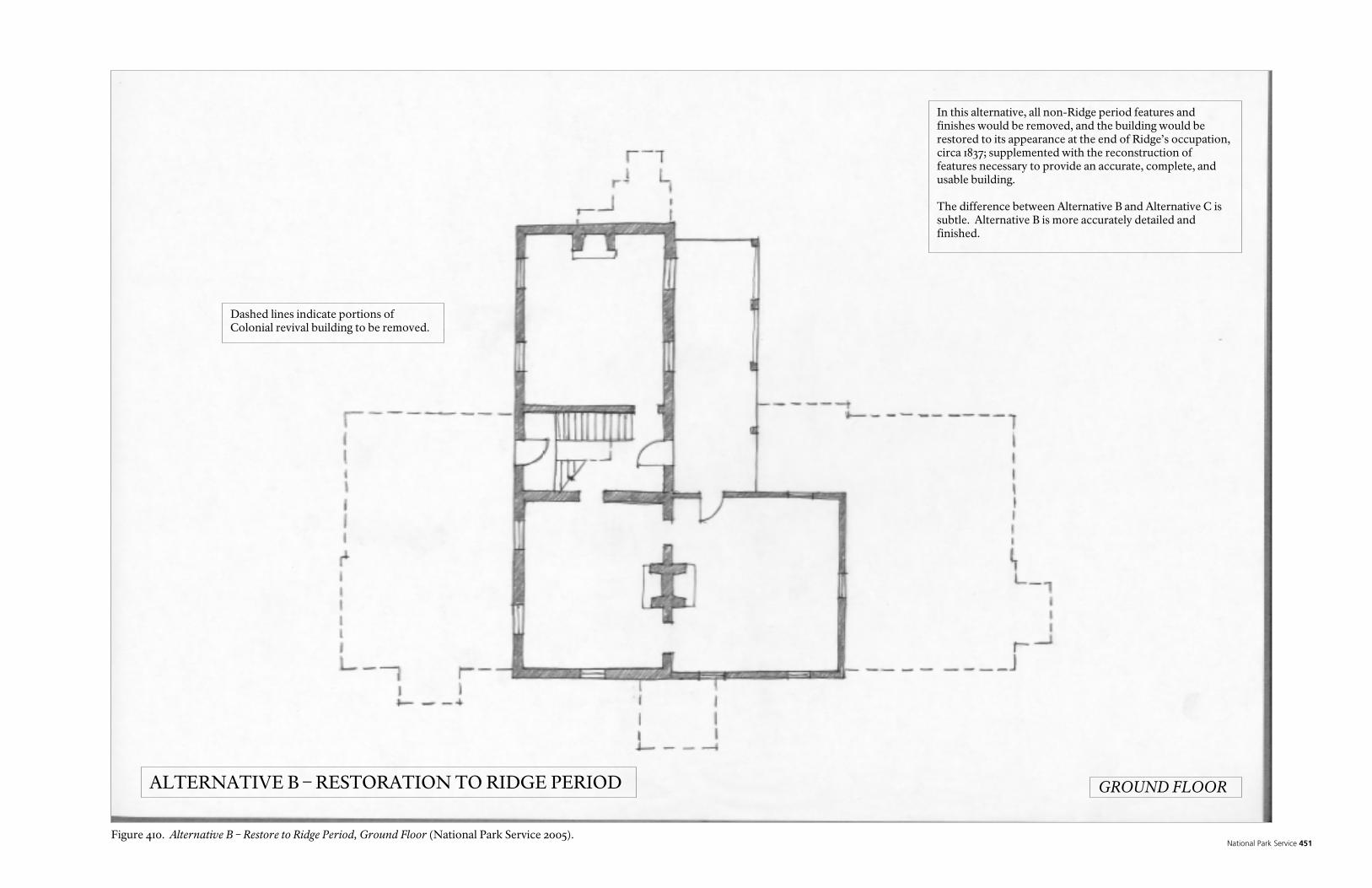
National Park Service 451
In this alternative, all non-Ridge period features and finishes would be removed, and the building would be restored to its appearance at the end of Ridge’s occupation, circa 1837; supplemented with the reconstruction of features necessary to provide an accurate, complete, and usable building. The difference between Alternative B and Alternative C is subtle. Alternative B is more accurately detailed and finished.
Dashed lines indicate portions of Colonial revival building to be removed.
ALTERNATIVE B – RESTORATION TO RIDGE PERIOD GROUND FLOOR
Figure 410. Alternative B – Restore to Ridge Period, Ground Floor (National Park Service 2005).

Historic Preservation Report 452
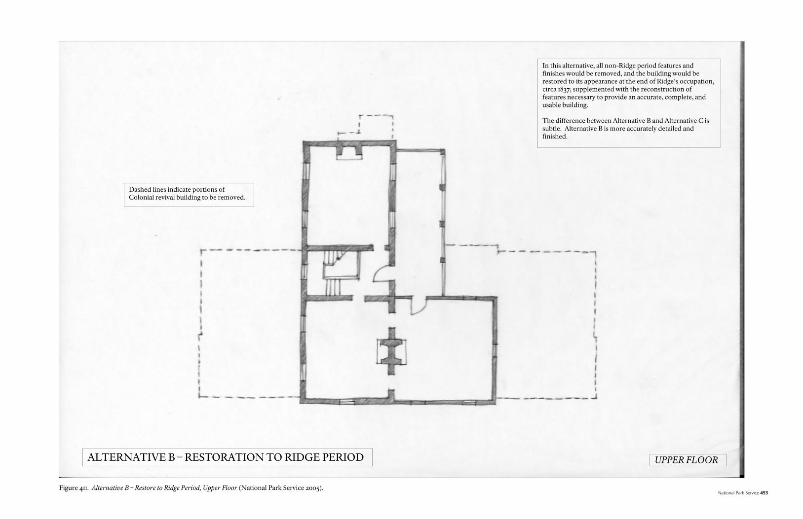
National Park Service 453
In this alternative, all non-Ridge period features and finishes would be removed, and the building would be restored to its appearance at the end of Ridge’s occupation, circa 1837; supplemented with the reconstruction of features necessary to provide an accurate, complete, and usable building. The difference between Alternative B and Alternative C is subtle. Alternative B is more accurately detailed and finished.
Dashed lines indicate portions of Colonial revival building to be removed.
ALTERNATIVE B – RESTORATION TO RIDGE PERIOD UPPER FLOOR
Figure 411. Alternative B – Restore to Ridge Period, Upper Floor (National Park Service 2005).

Historic Preservation Report 454

National Park Service 455
In this alternative, all non-Ridge period features and finishes would be removed, and the building would be restored to its appearance at the end of Ridge’s occupation, circa 1837; supplemented with the reconstruction of features necessary to provide an accurate, complete, and usable building. The difference between Alternative B and Alternative C is subtle. Alternative B is more accurately detailed and finished.
Dashed lines indicate portions of Colonial revival building to be removed.
ALTERNATIVE B – RESTORATION TO RIDGE PERIOD SOUTH ELEVATION
Figure 412. Alternative B – Restore to Ridge Period, South Elevation (National Park Service 2005).

Historic Preservation Report 456

National Park Service 457
In this alternative, all non-Ridge period features and finishes would be removed, and the building would be restored to its appearance at the end of Ridge’s occupation, circa 1837; supplemented with the reconstruction of features necessary to provide an accurate, complete, and usable building. The difference between Alternative B and Alternative C is subtle. Alternative B is more accurately detailed and finished.
Dashed lines indicate portions of Colonial revival building to be removed.
ALTERNATIVE B – RESTORATION TO RIDGE PERIOD EAST ELEVATION
Figure 413 Alternative B – Restore to Ridge Period, East Elevation (National Park Service 2005).

Historic Preservation Report 458

National Park Service 459
ALTERNATIVE C. REHABILITATION TO THE RIDGE PERIOD In this alternative, all non-Ridge period features would be removed, and the building would be rehabilitated for visitor use and interpretation, to closely depict its general appearance at the end of Ridge’s occupation, circa 1837. Existing historic features and fabric would be supplemented with construction of new features necessary to provide a complete and usable building. The rehabilitated building would provide a general sense of the form and massing of the building during this period, with less emphasis on the details and finishes, than would be done in Restoration Alternative B. What is known of the Ridge period building form, massing, plan, appearance, detailing, and finish would be preserved or reconstructed. However, rehabilitation would not necessarily attempt to accurately restore or reconstruct missing features or fabric, as, unless the specific details of the features or fabric was known. Rather, they would be preserved or constructed in a way to be sympathetic to the Ridge period, but clearly distinguishable as non-original fabric. Demolition would include removing the Colonial Revival period features such as the east and west wings, the hall/bathroom addition, the north porch, and the enclosed northeast porch; as well as the Colonial Revival roof structure. In addition, all other non-Ridge period structural features, walls, finishes, doors, windows, trim, fireplaces; and plumbing, mechanical and electrical systems and equipment would be removed. Asbestos and lead abatement would be completed, as well. The rehabilitated building would be a simply finished, painted, weather-boarded, L shaped building, consisting of the original log cabin and the Ridge addition, as well as an east facing porch. The main entrance would be returned to the east end of the central hallway (dogtrot). Based on what is known, the doors, windows, trim, roof, features and finishes would be returned to their approximate appearance during the Ridge period. Structural elements would be repaired, replaced, or supplemented as necessary. New plumbing, mechanical and electrical systems, as well as fire suppression and security systems, would be carefully integrated into the building, as unobtrusively as possible. Limited exposure of the Ridge period structure would be made through the use of “viewports,” made by removing surface treatments to expose the structure behind, and covered with glass or plastic, similar to what has already been done in the building, but done in a more aesthetic manner. Features that were known to exist, but impossible to reconstruct, such as missing walls, openings, and fireplaces, could be “ghosted” into the building, in a way that suggests where they were located, to give a sense of their presence. The resulting enclosed and conditioned space would be smaller than the present building, and would not contain any support spaces such as offices or rest-rooms. The building would lend itself to use as a house museum, and would provide a good alternative for the interpretation of the Ridge period. Interpretation would be required to explain the different periods. Interpretation could use tactile, visual and audio media to supplement the interpretation of the visible physical structure. Administrative and support functions would be housed in a new interpretive and

Historic Preservation Report 460
administrative center building, as described in the Cultural Landscape section of this report. Much of this work would be based on architectural evidence already found during the investigation of the building, the description of the building in the 1836/7 Federal Valuation (as discussed in the section on Architectural Description and Analysis, above), and historic photographs. However, prior to initiation of this alternative, some additional research and destructive fabric investigation would need to be completed, to further verify the appearance of the building during this period; to determine the extent of the remaining historic fabric; and to provide more information on typical construction techniques used during the Ridge period. Some of this information may never be found. Without it, this alternative would be somewhat speculative, and would have to rely on knowledge of comparative examples from this period. To complicate this alternative, not much of the original Ridge period fabric or features appear to remain; also requiring extensive reconstruction. Ongoing analysis of the structure during the rehabilitation process may help to fill some of the information gaps, and the final treatment plan would have to identify at which points during the rehabilitation extra care should be taken to collect and analyze new data. This alternative would provide a less accurate, more generalized portrayal of the massing, form and scale of the building at this time, when compared to Restoration/Reconstruction Alternative B. Features and fabric from subsequent periods would be lost. However, it would provide a much more accurate portrayal and basis for interpretation of the Ridge period than any of the Colonial Revival/Ridge period alternatives discussed below. The initial costs to implement this alternative would be lower than Restoration/Reconstruction Alternative B, and higher than Preservation Alternative F; but substantially lower than Restoration Alternatives D and E, for the Colonial Revival/Ridge period building. The maintenance costs would be similar to Restoration/Reconstruction Alternative B, but substantially lower than the Preservation or Restoration alternatives for the Colonial Revival/Ridge period building. Estimated Cost: $2.25 to 2.75 Million

National Park Service 461
In this alternative, all non-Ridge period features would be removed, and the building would be rehabilitated for visitor use and interpretation, to closely depict its general appearance at the end of Ridge’s occupation, circa 1837. Existing historic features and fabric would be supplemented with construction of new features necessary to provide a complete and usable building. The rehabilitated building would provide a general sense of the form and massing of the building during this period, with less emphasis on the details and finishes, than would be done in Restoration Alternative B. The difference between Alternative B and Alternative C is subtle. Alternative B is more accurately detailed and finished.
Dashed lines indicate portions of Colonial revival building to be removed.
ALTERNATIVE C – REHABILITATION TO RIDGE PERIOD GROUND FLOOR
Figure 414. Alternative C – Rehabilitate to Ridge Period, Ground Floor (National Park Service 2005).

Historic Preservation Report 462

National Park Service 463
In this alternative, all non-Ridge period features would be removed, and the building would be rehabilitated for visitor use and interpretation, to closely depict its general appearance at the end of Ridge’s occupation, circa 1837. Existing historic features and fabric would be supplemented with construction of new features necessary to provide a complete and usable building. The rehabilitated building would provide a general sense of the form and massing of the building during this period, with less emphasis on the details and finishes, than would be done in Restoration Alternative B. The difference between Alternative B and Alternative C is subtle. Alternative B is more accurately detailed and finished.
Dashed lines indicate portions of Colonial revival building to be removed.
ALTERNATIVE C – REHABILITATION TO RIDGE PERIOD UPPER FLOOR
Figure 415. Alternative C – Rehabilitate to Ridge Period, Upper Floor (National Park Service 2005).

Historic Preservation Report 464
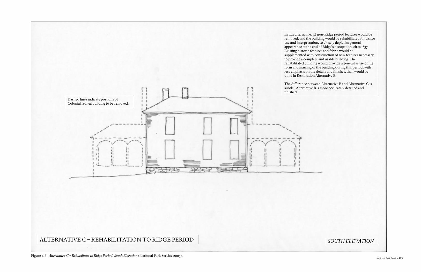
National Park Service 465
In this alternative, all non-Ridge period features would be removed, and the building would be rehabilitated for visitor use and interpretation, to closely depict its general appearance at the end of Ridge’s occupation, circa 1837. Existing historic features and fabric would be supplemented with construction of new features necessary to provide a complete and usable building. The rehabilitated building would provide a general sense of the form and massing of the building during this period, with less emphasis on the details and finishes, than would be done in Restoration Alternative B. The difference between Alternative B and Alternative C is subtle. Alternative B is more accurately detailed and finished.
Dashed lines indicate portions of Colonial revival building to be removed.
ALTERNATIVE C – REHABILITATION TO RIDGE PERIOD SOUTH ELEVATION
Figure 416. Alternative C – Rehabilitate to Ridge Period, South Elevation (National Park Service 2005).

Historic Preservation Report 466

National Park Service 467
In this alternative, all non-Ridge period features would be removed, and the building would be rehabilitated for visitor use and interpretation, to closely depict its general appearance at the end of Ridge’s occupation, circa 1837. Existing historic features and fabric would be supplemented with construction of new features necessary to provide a complete and usable building. The rehabilitated building would provide a general sense of the form and massing of the building during this period, with less emphasis on the details and finishes, than would be done in Restoration Alternative B. The difference between Alternative B and Alternative C is subtle. Alternative B is more accurately detailed and finished.
Dashed lines indicate portions of Colonial revival building to be removed.
ALTERNATIVE C – REHABILITATION TO RIDGE PERIOD EAST ELEVATION
Figure 417. Alternative C – Rehabilitate to Ridge Period, East Elevation (National Park Service 2005).

Historic Preservation Report 468

National Park Service 469
ALTERNATIVE D. RESTORE PORTIONS OF THE COLONIAL REVIVAL/ INDUSTRIAL PERIOD BUILDING AND REHABILITATE PORTIONS OF THE RIDGE PERIOD BUILDING In this alternative, all non-Ridge period features and finishes would be removed from the interior spaces and surfaces of the Ridge period portion of the building; and the Ridge period portion of the building would be rehabilitated for visitor use and interpretation. The rehabilitated portion of the building would provide a general sense of the size, layout, and character of the interior spaces of the building during the Ridge period, but would be plainly finished, with little attempt to restore or reconstruct missing features, and with little emphasis on recreating the details and finishes of the Ridge period. The remaining Colonial Revival period portions of the building, including all of the exterior walls, would be restored to their appearance during the Industrial period. The Ridge period portion of the building would be visible from the interior only, and distinguished by its contrast to the Colonial Revival features and finishes. Demolition would include removing all non-Ridge period features from the interior of the Ridge period portion of the building. This would include the removal of non-Ridge period features and finishes from former exterior walls now enclosed by non-Ridge period additions, such as the east wall of the north rooms of the original log building; as well as removal of the fireplaces in the south rooms. If possible the walls separating the south rooms from the Ridge Addition would be removed. Post Industrial period alterations made to the Colonial Revival period portions of the building, would also be removed. Plumbing, mechanical and electrical systems would be removed from the entire building, although existing historic plumbing and electrical fixtures would be salvaged and reused, if possible. Asbestos and lead abatement would be completed for the entire building. The Ridge period portions of the building would be plainly finished with materials and details typical of the Ridge period, selected for their contrast to the details and finishes of the Colonial Revival period. The non-Ridge portions of the building would be restored to their appearance during the Industrial Revival period. If possible, the wall separating the south rooms of the original log building from the Ridge Addition would be reconstructed. Structural elements would be repaired, replaced, or supplemented as necessary. New plumbing, mechanical and electrical systems, as well as fire suppression and security systems, would be carefully integrated into the building, as unobtrusively as possible. Limited exposure of the Ridge period structure would be made through the use of “viewports,” made by removing surface treatments to expose the structure behind, and covered with glass or plastic, similar to what has already been done in the building, but done in a more aesthetic manner. Features that were known to exist, but impossible to reconstruct, could be “ghosted” in to the building, in a way that suggests where they were located, to give a sense of their presence. Under this alternative, the exterior appearance of the building would appear to be essentially unchanged from its present appearance. The resulting space would be unchanged in size from the present building, and could contain support spaces such as offices or non-accessible rest-rooms, provided they were located outside of the
Historic Preservation Report 470
Ridge period portions of the building. Due to the contrasts between the finishing and detailing of the different period portions of the building, it would be difficult to use the building as a house museum for any one period. However, it might be possible to treat each portion of the building as a separate house museum, based on its period. In any case, interpretation would be required to explain the different periods. Interpretation could use tactile, visual and audio media to supplement the interpretation of the visible physical structure. Much of this work would be based on architectural evidence already found through the investigation of the building, the description of the building in the 1836/7 Federal Valuation (as discussed in the section on Architectural Description and Analysis, above), and historic photographs. However, prior to initiation of this alternative, some additional research and destructive architectural investigation would be necessary to verify the, plan, structure, appearance, and other features of the Ridge period building; to determine the extent of the remaining historic fabric; and to provide more information on typical construction techniques used during the Ridge period. Some of this information may never be found, leading to some speculation in executing this alternative, supplemented by knowledge of comparative examples from the Ridge period. To complicate this alternative, not much of the original Ridge period fabric appears to remain; requiring some reconstruction. This alternative would provide a less accurate, more confusing portrayal of the Ridge period, as well as of the subsequent periods, when compared to Restoration Alternative B or Rehabilitation Alternative C for the Ridge period, discussed above. The exterior of the building would not portray the Ridge period; it would continue to suggest to the uninformed visitors that Ridge lived in a very different style. However, it would preserve much of the post Ridge period construction, and the building’s exterior appearance would be virtually unchanged from its present appearance. The contrast inside the building, between the Ridge period and the Colonial Revival period, would be jarring, and would portray the building in a way that would have never existed. The initial costs to implement this alternative would be much higher than Restoration Alternative B or Rehabilitation Alternative C for the Ridge Addition period, as well as for Preservation Alternative F. The maintenance costs would also be much higher than Restoration Alternative B or Rehabilitation Alternative C, mainly due to the larger building area. Estimated Cost: $3.75 to 4.25 Million

National Park Service 471
In this alternative, all non-Ridge period features and finishes would be removed from the interior spaces and surfaces of the Ridge period portion of the building; and the Ridge period portion of the building would be rehabilitated for visitor use and interpretation. The rehabilitated portion of the building would provide a general sense of the size, layout, and character of the interior spaces of the building during the Ridge period, but would be plainly finished, with little attempt to restore or reconstruct missing features, and with little emphasis on recreating the details and finishes of the Ridge period. The remaining Colonial Revival period portions of the building, including all of the exterior walls, would be restored to their appearance during the Industrial period. The Ridge period portion of the building would be visible from the interior only, and distinguished by its contrast to the Colonial Revival features and finishes. Clearly differentiate finishes of Ridge Period portion of building, even if not historically accurate. Exterior is i il t Alt ti E d F
Dashed lines indicate ghosted walls or features. Darkened wall lines and stipple floor indicate Ridge Period footprint.
ALTERNATIVE D – RESTORATION OF PORTIONS OF COLONIAL REVIVAL PERIOD AND REHABILITATION OF PORTIONS OF RIDGE PERIOD GROUND FLOOR
Figure 418. Alternative D – Restoration of Portions of Colonial Revival Period and Rehabilitation of Portions to Ridge Period, Ground Floor (National Park Service 2005).

Historic Preservation Report 472
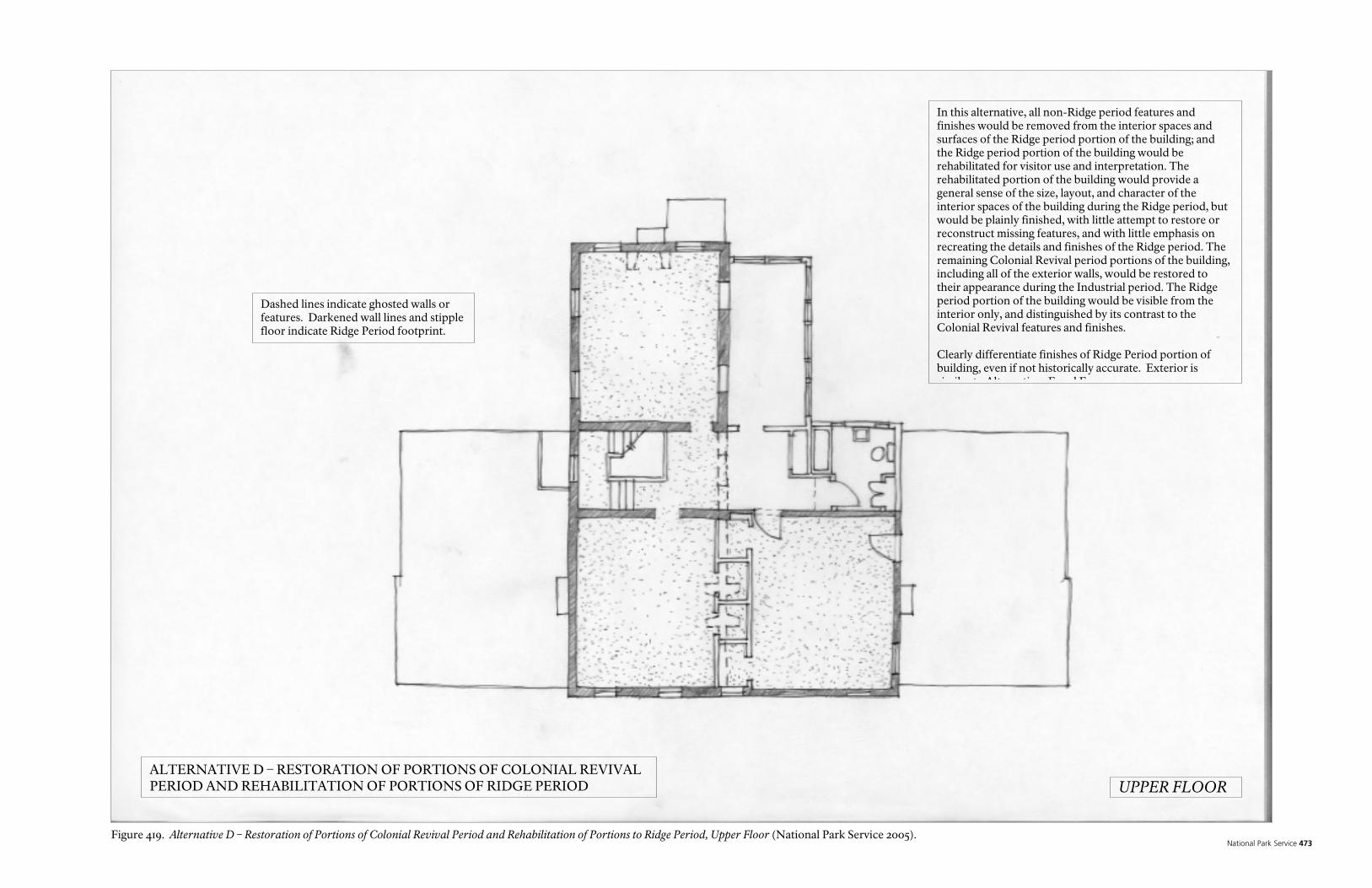
National Park Service 473
In this alternative, all non-Ridge period features and finishes would be removed from the interior spaces and surfaces of the Ridge period portion of the building; and the Ridge period portion of the building would be rehabilitated for visitor use and interpretation. The rehabilitated portion of the building would provide a general sense of the size, layout, and character of the interior spaces of the building during the Ridge period, but would be plainly finished, with little attempt to restore or reconstruct missing features, and with little emphasis on recreating the details and finishes of the Ridge period. The remaining Colonial Revival period portions of the building, including all of the exterior walls, would be restored to their appearance during the Industrial period. The Ridge period portion of the building would be visible from the interior only, and distinguished by its contrast to the Colonial Revival features and finishes. Clearly differentiate finishes of Ridge Period portion of building, even if not historically accurate. Exterior is i il t Alt ti E d F
Dashed lines indicate ghosted walls or features. Darkened wall lines and stipple floor indicate Ridge Period footprint.
UPPER FLOORALTERNATIVE D – RESTORATION OF PORTIONS OF COLONIAL REVIVAL PERIOD AND REHABILITATION OF PORTIONS OF RIDGE PERIOD
Figure 419. Alternative D – Restoration of Portions of Colonial Revival Period and Rehabilitation of Portions to Ridge Period, Upper Floor (National Park Service 2005).

Historic Preservation Report 474
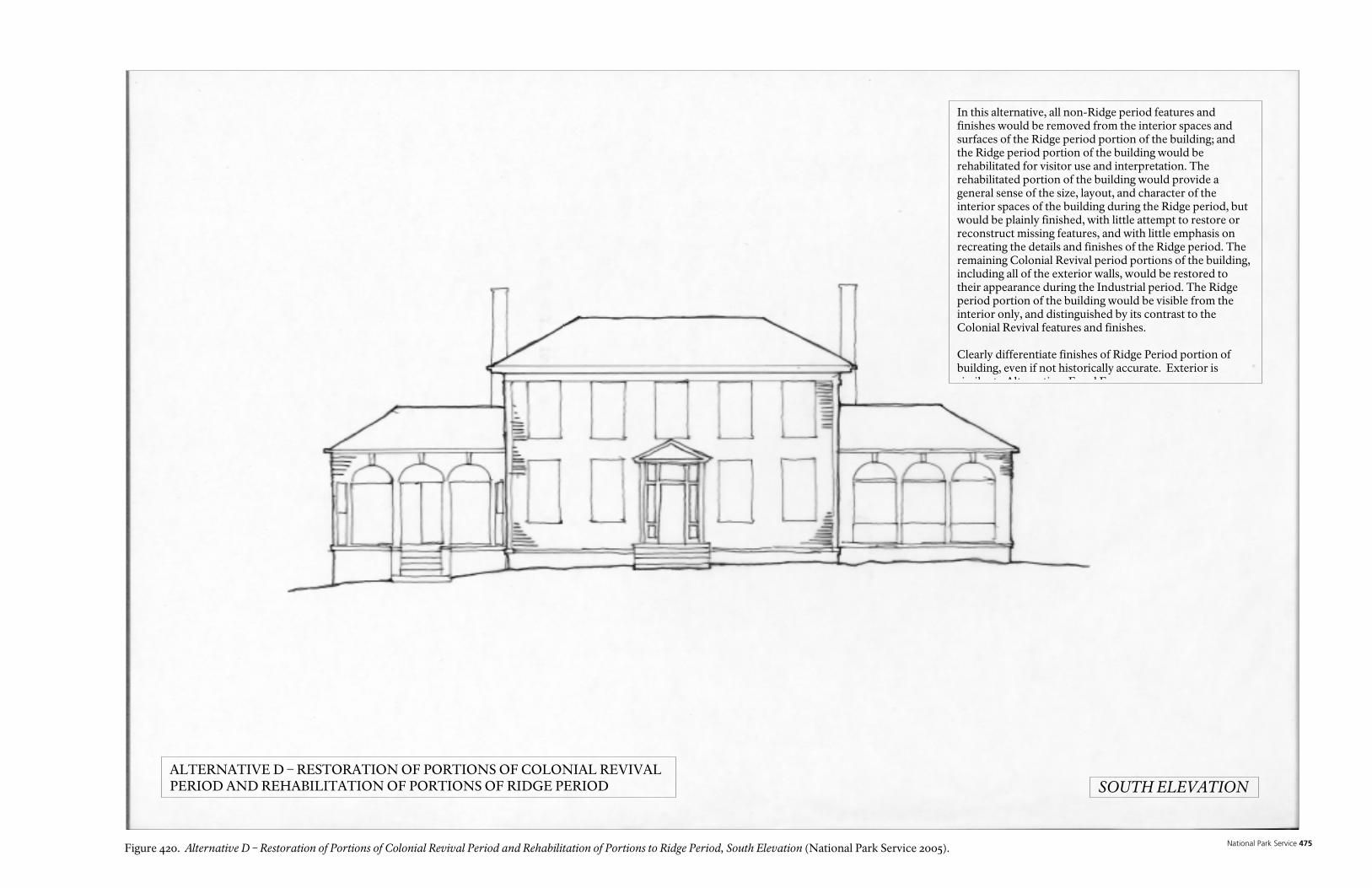
National Park Service 475
In this alternative, all non-Ridge period features and finishes would be removed from the interior spaces and surfaces of the Ridge period portion of the building; and the Ridge period portion of the building would be rehabilitated for visitor use and interpretation. The rehabilitated portion of the building would provide a general sense of the size, layout, and character of the interior spaces of the building during the Ridge period, but would be plainly finished, with little attempt to restore or reconstruct missing features, and with little emphasis on recreating the details and finishes of the Ridge period. The remaining Colonial Revival period portions of the building, including all of the exterior walls, would be restored to their appearance during the Industrial period. The Ridge period portion of the building would be visible from the interior only, and distinguished by its contrast to the Colonial Revival features and finishes. Clearly differentiate finishes of Ridge Period portion of building, even if not historically accurate. Exterior is i il t Alt ti E d F
SOUTH ELEVATIONALTERNATIVE D – RESTORATION OF PORTIONS OF COLONIAL REVIVAL PERIOD AND REHABILITATION OF PORTIONS OF RIDGE PERIOD
Figure 420. Alternative D – Restoration of Portions of Colonial Revival Period and Rehabilitation of Portions to Ridge Period, South Elevation (National Park Service 2005).

Historic Preservation Report 476
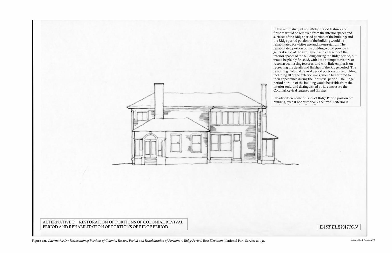
National Park Service 477
In this alternative, all non-Ridge period features and finishes would be removed from the interior spaces and surfaces of the Ridge period portion of the building; and the Ridge period portion of the building would be rehabilitated for visitor use and interpretation. The rehabilitated portion of the building would provide a general sense of the size, layout, and character of the interior spaces of the building during the Ridge period, but would be plainly finished, with little attempt to restore or reconstruct missing features, and with little emphasis on recreating the details and finishes of the Ridge period. The remaining Colonial Revival period portions of the building, including all of the exterior walls, would be restored to their appearance during the Industrial period. The Ridge period portion of the building would be visible from the interior only, and distinguished by its contrast to the Colonial Revival features and finishes. Clearly differentiate finishes of Ridge Period portion of building, even if not historically accurate. Exterior is i il t Alt ti E d F
EAST ELEVATIONALTERNATIVE D – RESTORATION OF PORTIONS OF COLONIAL REVIVAL PERIOD AND REHABILITATION OF PORTIONS OF RIDGE PERIOD
Figure 421. Alternative D – Restoration of Portions of Colonial Revival Period and Rehabilitation of Portions to Ridge Period, East Elevation (National Park Service 2005).

Historic Preservation Report 478

National Park Service 479
Colonial Revival finishes and trim outside of Ridge Period footprint.
View ports show log detailing behind wall finishes.
INTERIOR VIEW AT TOP OF STAIRS
Simple floor, finishes, and trim inside of Ridge Period footprint, clearly differentiated from Colonial revival portion of building.
Line of ghosted wall shows transition between Ridge and Colonial Revival periods.
ALTERNATIVE D – RESTORATION OF PORTIONS OF COLONIAL REVIVAL PERIOD AND REHABILITATION OF PORTIONS OF RIDGE PERIOD
Figure 422. Alternative D – Restoration of Portions of Colonial Revival Period and Rehabilitation of Portions to Ridge Period, Interior View at Top of Stairs (National Park Service 2005).

Historic Preservation Report 480
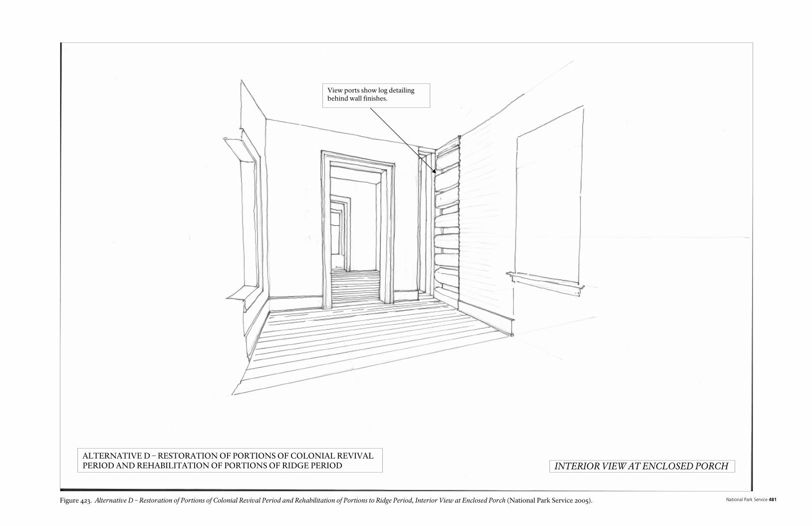
National Park Service 481
View ports show log detailing behind wall finishes.
INTERIOR VIEW AT ENCLOSED PORCHALTERNATIVE D – RESTORATION OF PORTIONS OF COLONIAL REVIVAL PERIOD AND REHABILITATION OF PORTIONS OF RIDGE PERIOD
Figure 423. Alternative D – Restoration of Portions of Colonial Revival Period and Rehabilitation of Portions to Ridge Period, Interior View at Enclosed Porch (National Park Service 2005).

Historic Preservation Report 482

National Park Service 483
ALTERNATIVE E. RESTORATION TO THE COLONIAL REVIVAL/INDUSTRIAL PERIOD In this alternative, all post Industrial period features and finishes would be removed, and the building would be restored to its appearance during the Colonial Revival/Industrial period. No attempt would be made to further expose, restore, or reconstruct features or finishes of the Ridge period; nor of any other period. The Ridge period features would not be visible, except as noted below. Demolition would include removal of all post Industrial period features. Mechanical and electrical systems would be removed from the entire building, although existing historic plumbing and electrical fixtures would be salvaged and reused, if possible. Asbestos and lead abatement would be completed for the entire building. Post Industrial period features would be removed. The doors, windows, trim, roof, features and finishes would be restored to their appearance during the Industrial period, as would the fireplaces and chimneys. Structural elements would be repaired, replaced, or supplemented as necessary. New plumbing, mechanical and electrical systems, as well as fire suppression and security systems, would be carefully integrated into the building, as unobtrusively as possible. Limited exposure of the Ridge period structure would be made through the use of “viewports,” made by removing surface treatments to expose the structure behind, and covered with glass or plastic, similar to what has already been done in the building, but done in a more aesthetic manner. Features that were known to exist during the Ridge Period, but impossible to reconstruct, could be “ghosted” in to the building, in a way that suggests where they were located, to give a sense of their presence. Under this alternative, the exterior appearance of the building would appear to be essentially unchanged from its present appearance. The resulting space would be unchanged in size from the present building, and could contain support spaces such as offices or non-accessible rest-rooms. There would be limited exposure of elements of the Ridge period portion of the building. It would be difficult to use the building as a house museum for the Ridge period. Interpretation would be required to explain the different periods. Interpretation could use tactile, visual and audio media to supplement the interpretation of the visible physical structure. Much of this work would be based on architectural evidence already found through the investigation of the building, and historic photographs. However, prior to initiation of this alternative, limited additional research and destructive architectural investigation would be necessary to verify the existing conditions of the building. This alternative would provide a less accurate, more confusing portrayal of the Ridge period, as well as of the subsequent periods, when compared to Restoration Alternative B or Rehabilitation Alternative C for the Ridge period, discussed above. The exterior of the building would not portray the Ridge period; it would continue to suggest to uninformed visitors that Ridge lived in a very different style. However, it would preserve the post Ridge period changes and construction, and the building’s exterior appearance would be virtually unchanged from its present appearance.

Historic Preservation Report 484
The initial costs to implement this alternative would be much higher than Restoration Alternative B or Rehabilitation Alternative C for the Ridge Addition period, as well as for Preservation Alternative F. The maintenance costs would also be much higher than Restoration Alternative B or Rehabilitation Alternative C, mainly due to the larger building area. Estimated Cost: $3.75 to 4.25 Million

National Park Service 485
In this alternative, all post Industrial period features and finishes would be removed, and the building would be restored to its appearance during the Colonial Revival/Industrial period. No attempt would be made to further expose, restore, or reconstruct features or finishes of the Ridge period; nor of any other period. The Ridge period features would not be visible, except as noted below. The difference between Alternative E and Alternative F is subtle. Alternative E is more accurately detailed and finished.
ALTERNATIVE E – RESTORATION TO COLONIAL REVIVAL PERIOD GROUND FLOOR
Figure 424. Alternative E – Restoration to Colonial Revival Period, Ground Floor (National Park Service 2005).

Historic Preservation Report 486
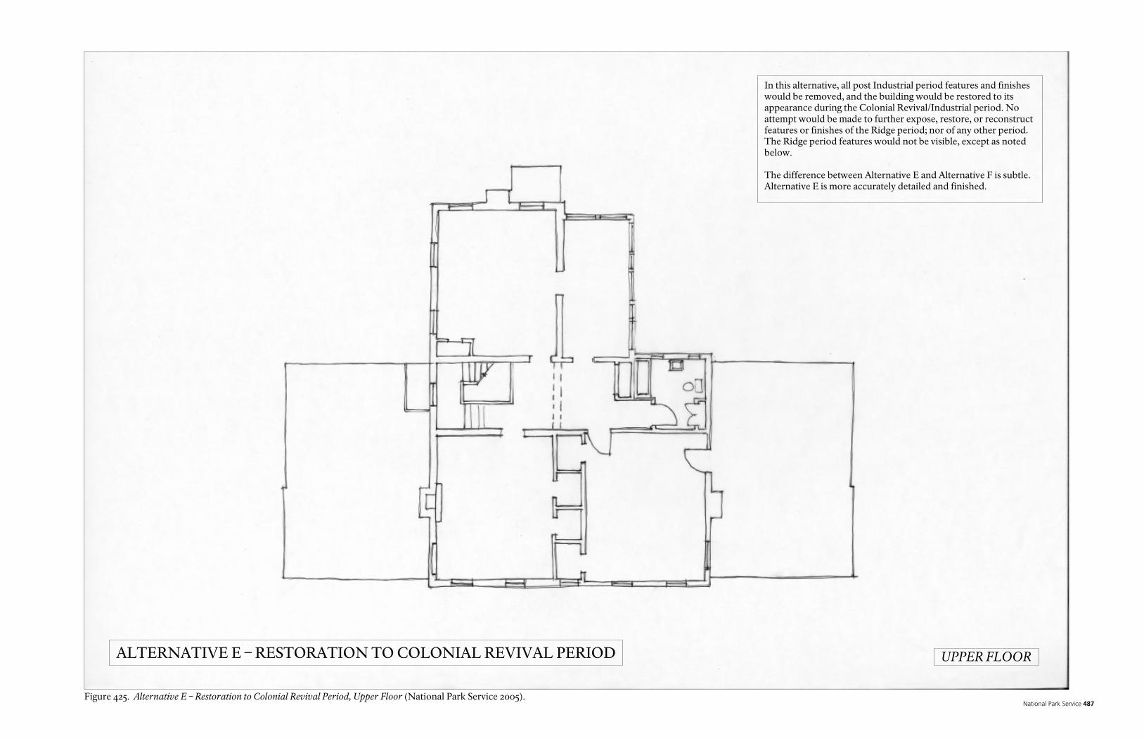
National Park Service 487
In this alternative, all post Industrial period features and finishes would be removed, and the building would be restored to its appearance during the Colonial Revival/Industrial period. No attempt would be made to further expose, restore, or reconstruct features or finishes of the Ridge period; nor of any other period. The Ridge period features would not be visible, except as noted below. The difference between Alternative E and Alternative F is subtle. Alternative E is more accurately detailed and finished.
ALTERNATIVE E – RESTORATION TO COLONIAL REVIVAL PERIOD UPPER FLOOR
Figure 425. Alternative E – Restoration to Colonial Revival Period, Upper Floor (National Park Service 2005).

Historic Preservation Report 488

National Park Service 489
In this alternative, all post Industrial period features and finishes would be removed, and the building would be restored to its appearance during the Colonial Revival/Industrial period. No attempt would be made to further expose, restore, or reconstruct features or finishes of the Ridge period; nor of any other period. The Ridge period features would not be visible, except as noted below. The difference between Alternative E and Alternative F is subtle. Alternative E is more accurately detailed and finished.
ALTERNATIVE E – RESTORATION TO COLONIAL REVIVAL PERIOD SOUTH ELEVATION
Figure 426. Alternative E – Restoration to Colonial Revival Period, South Elevation (National Park Service 2005).

Historic Preservation Report 490

National Park Service 491
In this alternative, all post Industrial period features and finishes would be removed, and the building would be restored to its appearance during the Colonial Revival/Industrial period. No attempt would be made to further expose, restore, or reconstruct features or finishes of the Ridge period; nor of any other period. The Ridge period features would not be visible, except as noted below. The difference between Alternative E and Alternative F is subtle. Alternative E is more accurately detailed and finished.
ALTERNATIVE E – RESTORATION TO COLONIAL REVIVAL PERIOD EAST ELEVATION
Figure 427. Alternative E – Restoration to Colonial Revival Period, East Elevation (National Park Service 2005).

Historic Preservation Report 492

National Park Service 493
ALTERNATIVE F. PRESERVATION OF THE BUILDING AS IT EXISTS In this alternative, the building would be repaired, stabilized and preserved, essentially as it exists now. No attempt would be made to further expose, restore, or reconstruct features or finishes of the Ridge period; nor of any other period. Alterations and non-original fabric would be left in place. The Ridge period features would not be exposed, except as noted below. Preservation activities would be directed towards mitigating existing conditions which are threatening the building, correcting unsafe conditions, and performing deferred maintenance. Features or fabric in good condition would be left as is. Conditions to be dealt with under this alternative would include repair and stabilization of damaged or deteriorated roofing and roof drainage features, doors, windows, trim, cabinets, paint, interior plaster, tile, hardware, fireplaces and chimneys. Structural elements would be repaired, replaced, or supplemented as necessary. The existing mechanical, plumbing, and electrical systems would be removed from the building, although existing historic plumbing and electrical fixtures would be salvaged and reused, if possible. New plumbing, mechanical, and electrical systems, as well as fire suppression and security systems, would be carefully integrated into the building, as unobtrusively as possible. Asbestos and lead abatement would be completed for the entire building. Limited exposure of the Ridge period structure would be left as is, using the existing “viewports,” which were made by removing surface treatments to expose the structure behind, and covered with plexiglass. The work of this alternative would be based on the features and finishes of the building as it exists, as well as the architectural evidence already found through the investigation of the building, and historic photographs. Prior to initiation of this alternative, limited additional research and destructive architectural investigation would be necessary to verify the existing conditions of the building. Under this alternative, the exterior and interior appearance of the building would appear to be essentially unchanged from its present appearance, and the interior space would be unchanged in size and function. There would be limited exposure of elements of the Ridge period portion of the building. It would be difficult to use the building as a house museum for the Ridge period. Interpretation would be required to explain the different periods. Interpretation could use tactile, visual and audio media to supplement the interpretation of the visible physical structure. This alternative provides a less accurate, more confusing portrayal of the Ridge period, as well as of the subsequent periods, when compared to Restoration or Rehabilitation alternatives for the Ridge period discussed above. The exterior of the building would not portray the Ridge period; it would continue to suggest to uninformed visitors that Ridge lived in a very different style. However, it would preserve the post Ridge period changes and construction, and the building’s exterior appearance would be virtually unchanged from its present appearance. The museum would continue to function poorly for its intended purpose.
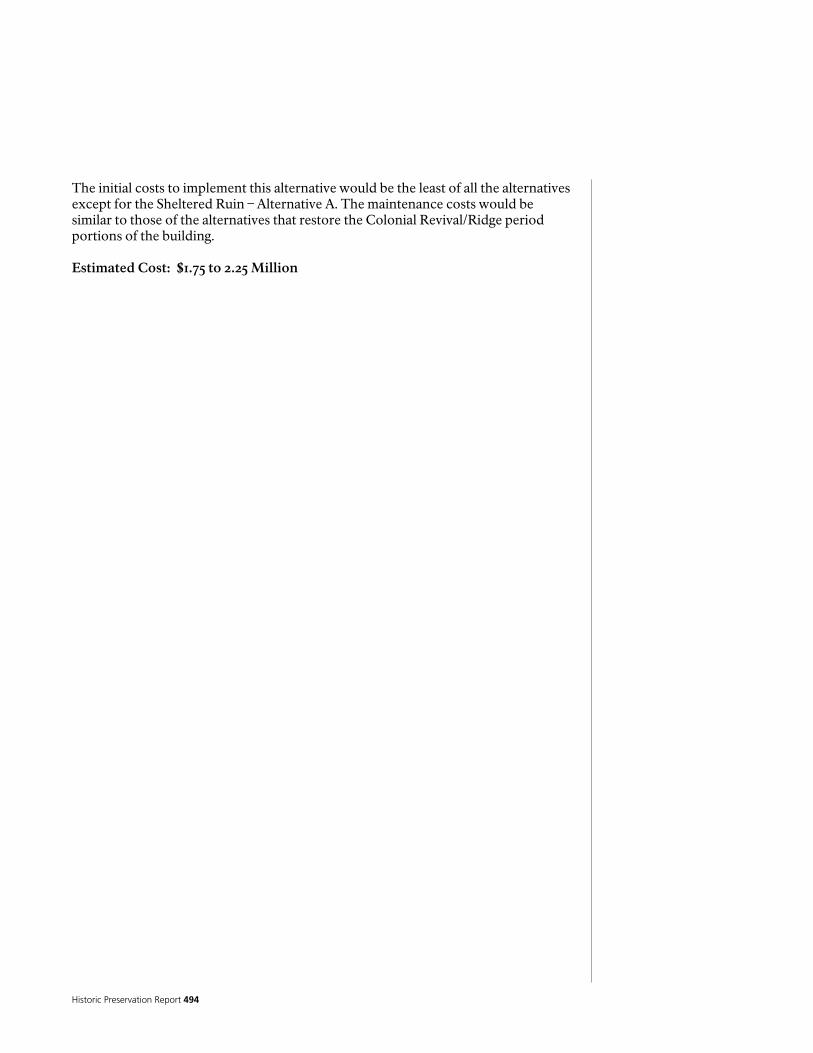
Historic Preservation Report 494
The initial costs to implement this alternative would be the least of all the alternatives except for the Sheltered Ruin – Alternative A. The maintenance costs would be similar to those of the alternatives that restore the Colonial Revival/Ridge period portions of the building. Estimated Cost: $1.75 to 2.25 Million

National Park Service 495
In this alternative, the building would be repaired, stabilized and preserved, essentially as it exists now. No attempt would be made to further expose, restore, or reconstruct features or finishes of the Ridge period; nor of any other period. Alterations and non-original fabric would be left in place. The Ridge period features would not be exposed, except as noted below. The difference between Alternative E and Alternative F is subtle. Alternative E is more accurately detailed and finished.
ALTERNATIVE F – PRESERVE COLONIAL REVIVAL PERIOD GROUND FLOOR
Figure 428. Alternative F – Preserve Colonial Revival Period, Ground Floor (National Park Service 2005).

Historic Preservation Report 496

National Park Service 497
In this alternative, the building would be repaired, stabilized and preserved, essentially as it exists now. No attempt would be made to further expose, restore, or reconstruct features or finishes of the Ridge period; nor of any other period. Alterations and non-original fabric would be left in place. The Ridge period features would not be exposed, except as noted below. The difference between Alternative E and Alternative F is subtle. Alternative E is more accurately detailed and finished.
ALTERNATIVE F – PRESERVE COLONIAL REVIVAL PERIOD UPPER FLOOR
Figure 429. Alternative F – Preserve Colonial Revival Period, Upper Floor (National Park Service 2005).

Historic Preservation Report 498

National Park Service 499
In this alternative, the building would be repaired, stabilized and preserved, essentially as it exists now. No attempt would be made to further expose, restore, or reconstruct features or finishes of the Ridge period; nor of any other period. Alterations and non-original fabric would be left in place. The Ridge period features would not be exposed, except as noted below. The difference between Alternative E and Alternative F is subtle. Alternative E is more accurately detailed and finished.
ALTERNATIVE F – PRESERVE COLONIAL REVIVAL PERIOD SOUTH ELEVATION
Figure 430. Alternative F – Preserve Colonial Revival Period, South Elevation (National Park Service 2005).

Historic Preservation Report 500
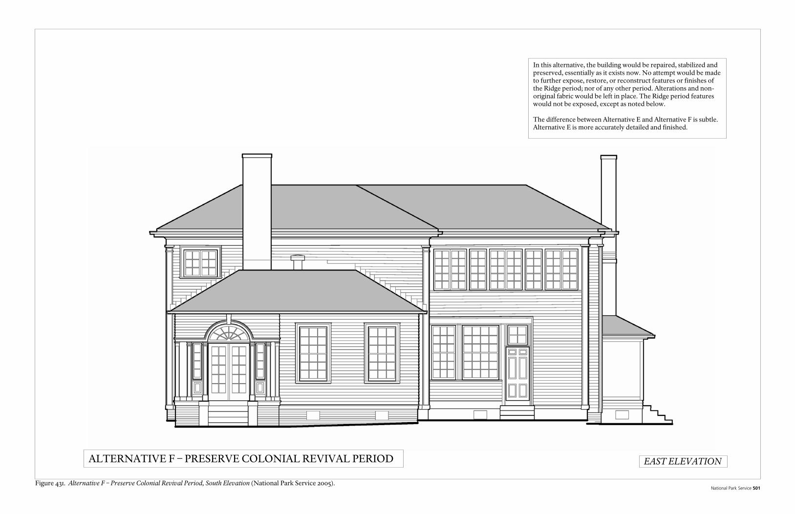
National Park Service 501
In this alternative, the building would be repaired, stabilized and preserved, essentially as it exists now. No attempt would be made to further expose, restore, or reconstruct features or finishes of the Ridge period; nor of any other period. Alterations and non-original fabric would be left in place. The Ridge period features would not be exposed, except as noted below. The difference between Alternative E and Alternative F is subtle. Alternative E is more accurately detailed and finished.
ALTERNATIVE F – PRESERVE COLONIAL REVIVAL PERIOD EAST ELEVATION
Figure 431. Alternative F – Preserve Colonial Revival Period, South Elevation (National Park Service 2005).

Historic Preservation Report 502

National Park Service 503
Treatment Alternatives for the Chieftains Museum/Major Ridge Landscape
The Chieftains Museum Major Ridge Home historic landscape from the Ridge primary period of significance as identified earlier in the evaluation of integrity has been mostly obliterated and has no historical integrity as reflecting the Ridge period farm. Several very significant landscape character defining features and resources from the Ridge period, however, have been documented and should be preserved and interpreted as proposed under all of the alternatives. The ultimate treatment and use of the landscape, despite this overall lack of integrity to convey the Ridge farm as it existed, will be to accommodate visitors for interpretation of Major Ridge and the history of Cherokee removal. Visitor use and interpretation of the house and landscape history varies slightly under each of the treatment alternatives presented. The variation, however, is mostly different in terms of the degree of interpretive opportunities in conveying the landscape of the Ridge Period. All of the alternatives presented follow the Secretary of the Interior’s Standards for the Treatment of Historic Properties Guidelines for the Treatment of Cultural Landscapes. The Secretary of the Interior’s Standards provide for four possible overall treatments for historic landscapes. These are: (a) Preservation.
Standards require retention of the greatest amount of historic fabric, including the landscape’s historic form, features, and details as they have evolved over time When the property’s distinctive materials, features, and spaces are essentially intact and thus convey the historic significance without extensive repair or replacement; when depiction at a particular period of time is not appropriate; and when a continuing or new use does not require additions or extensive alterations, preservation may be considered as a treatment.
(b) Rehabilitation.
Standards acknowledge the need to alter or add to a cultural landscape to meet continuing or new uses while retaining the landscape’s historic character. When repair and replacement of deteriorated features are necessary; when alterations or additions to the property are planned for a new or continued use; and when its depiction at a particular period of time is not appropriate, Rehabilitation may be considered as a treatment.
(c) Restoration.
Standards allow for the depiction of a landscape at a particular time in its history by preserving materials from the period of significance and removing materials from other periods. When the property’s design, architectural, or historical significance during a particular period of time outweighs the potential loss of extant materials, features, spaces, and finishes that characterize other historical periods; when there is substantial physical and documentary evidence for the work; and when contemporary alterations and additions are not planned, Restoration may be considered as treatment.

Historic Preservation Report 504
(d) Reconstruction.
Standards establish a framework for re-creating a vanished or non-surviving landscape with new materials, primarily for interpretive purposes Reconstruction is defined as the act or process of depicting, by means of new construction, the form, features, and detailing of a non-surviving site, landscape, building, structure, or object for the purpose of replicating its appearance at a specific period of time and in its historic location.
Because of the condition and lack of historical integrity of the Ridge period landscape, the lack of completed documentation, change of land use, and the anticipated ultimate treatment and use of the property for interpretation of the property primarily of the Ridge period, only two of the four treatment alternatives were considered feasible. These were rehabilitation and preservation. For the proposed preservation treatment alternative, the landscape would be preserved as it has evolved to the last period of historical significance which, although a lower level of significance than the Ridge period, would be the industrial period and the construction of the mill. Under the rehabilitation alternative treatment greater flexibility is allowed to accommodate contemporary uses within the framework of preservation of character defining features of the landscape. In this case few Ridge period character defining landscape features remain but are preserved and interpreted and the proposed contemporary use of the property adapts the property for interpretation of Ridges farm. The illustrations below show some of the proposed treatment alternatives and are described here. Rehabilitation Treatment Alternatives. For all of the rehabilitation treatment alternatives, the primary use of the house and landscape would be for interpretation to the visiting public the history and significance of Major Ridge and Cherokee removal and the property of Major Ridge. New construction is accommodated to provide needed visitor facilities and to better interpret Major Ridge and the history and significance of the property. Under all of the rehabilitation alternatives, it is anticipated that significant increases in visitation would occur as a result of implementation of the treatment due to significant enhancement and improvements in interpretation, visitor facilities, and most importantly, the creation of an attractive experience that immerses the visitor in a landscape more reflective of the character, feelings, and associations of the Ridge period. Under these alternatives, much of what is known about the Ridge farm would be interpreted in the landscape. The Ridge period would be the primary focus of interpretation while later periods would receive secondary interpretation, including the removal of some later period landscape features. Based on the documentation described in earlier sections of this report, landscape interpretive features would be created to provide visitors a more tactile sense and awareness of the scale layout and perceptions of Ridges farm. Each of the landscape features of the farm would be interpreted and what is known and not known would be provided for visitors in wayside exhibits. A visitor would have the opportunity then to imagine and even be provoked to explore in their own mind how the known features of Ridges farm may

National Park Service 505
have existed. The landscape features of the Ridge farm created under these alternatives are not intended to be reconstructions but rather three dimensional extensions to the interpretation and wayside exhibits associated with experiencing what remains of Ridges property. Each is described in the details of the alternatives.

Historic Preservation Report 506
Landscape Rehabilitation Alternative 1 (numbers and letters refer to site feature numbers and interpretive sites shown on plan) Entrance and parking (no. 1): Visitors would enter the property north of the existing house and a new parking area would expand the existing parking capacity of the site. Two bus and 24 car parking is provided with opportunity to expand or provide overflow parking of possibly double that amount farther to the north. The currently under construction widening of Riverside Parkway to 4 lanes will significantly detract from the historic setting and character of the Ridge home even more so than the current 2 lane road. This road cuts through what was historically the heart of Ridge’s fields. In an attempt to compensate for this intrusion, along the length of a stretch of this road north and south of the house the landscape would be changed to reflect and interpret what is known about Ridges farm. The character along this road would be distinctly different from the surrounding landscape and reflect and convey an agricultural character consistent with the historical nature of Major Ridge’s farm and interpretive and visitor use purposes of the property. Planting surrounding the proposed parking area would be in agricultural crops to immediately provide a perceptual change for visitors entering the site that is reflective of its historical significance. Interpretive Center (no. 3,4): Visitors would be immediately led to a new interpretive center. An interpretive entry plaza would lead from the parking and drop off area to the front entrance. This interpretive plaza could contain outdoor exhibits that provide a strong sense of purpose and introduction to the Ridge property. A few highly graphic images would be sufficient to introduce and provoke a visitor to the history and significance of Major Ridge. Perhaps a large scale quote and or image of Ridge or something similar would be developed here. Shown on the plan is a 3 dimensional sculpture of Major Ridge on his carriage that could be a center piece to the introduction of Major Ridge. As shown on the plan, the building would be approximately 50’x 60’ or 3000 square feet. Since no architectural study has yet been done for this facility, the size would need to be more accurately determined during later architectural programming and design study. In addition, further interpretive and exhibit planning and design would need to be done with qualified exhibit designers. Cost considerations would also have to be more accurately studied in determining the design and size of the building. The primary concept however for the building would be that it resemble a large barn to be sympathetic to the period of significance for the property and to reflect the agricultural nature of the farm while clearly conveying that it is not an historic structure. This would also further the objective of having all of the Ridge period property more accurately convey an agricultural character. Although this building would likely be simpler, a similar example of this concept applied is the visitor center at Point Reyes National Seashore (Figure 432) or the visitor center at Audubon Acres in Chattanooga, Tennessee (http://www.chattanoogaaudubon.org/Audubon-Acres.html). The interior of the center would house professionally developed interpretive exhibits and perhaps a short film or video that would provide an overall context and orientation for Major Ridge including who he was and his significance in the history of Cherokee Removal as well as an introduction for visitors to experience what remains of his house and property. The second story or a loft area in the tradition of barns could provide a
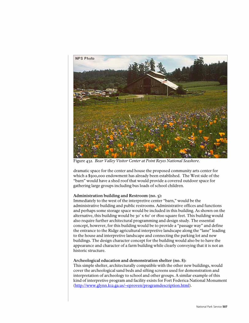
National Park Service 507
Figure 432. Bear Valley Visitor Center at Point Reyes National Seashore. dramatic space for the center and house the proposed community arts center for which a $500,000 endowment has already been established. The West side of the “barn” would have a shed roof that would provide a covered outdoor space for gathering large groups including bus loads of school children. Administration building and Restroom (no. 5): Immediately to the west of the interpretive center “barn,” would be the administrative building and public restrooms. Administrative offices and functions and perhaps some storage space would be included in this building. As shown on the alternative, this building would be 30’ x 60’ or 1800 square feet. This building would also require further architectural programming and design study. The essential concept, however, for this building would be to provide a “passage way” and define the entrance to the Ridge agricultural interpretive landscape along the “lane” leading to the house and interpretive landscape and connecting the parking lot and new buildings. The design character concept for the building would also be to have the appearance and character of a farm building while clearly conveying that it is not an historic structure. Archeological education and demonstration shelter (no. 8): This simple shelter, architecturally compatible with the other new buildings, would cover the archeological sand beds and sifting screens used for demonstration and interpretation of archeology to school and other groups. A similar example of this kind of interpretive program and facility exists for Fort Federica National Monument (http://www.glynn.k12.ga.us/~eproven/programdescription.html).

Historic Preservation Report 508
Outdoor amphitheater (no. 6): A small and simple outdoor amphitheater is provided on the gently sloping area towards the river. The landscape would be cleared similar to a more open cleared landscape that is likely to have existed during the Ridge period so that perhaps views of the river would exist from here. The amphitheater would seat 100 to 200 people for special events, or group educational programs. Trees would provide shade and the construction would be simple rustic material such as stone or wood so that the facility would blend into the natural surroundings. Wagon, pedestrian, service lane (no. 9): This lane connects the entire interpretive landscape of the Ridge house and outbuildings area. It is possible, if not likely, that such a lane may have existed to connect the historic features of Ridges farm during the Ridge period. North of the interpretive “animal lots,” are all of the new visitor facilities that provide the context and orientation for visitors prior to experiencing the interpretive landscape features of the Ridge property. The lane is paved between the parking lot and the fence line. The fence line becomes a threshold to enter the interpretive landscape features of the Ridge period and provides a perceptual change when crossing that threshold or entrance where the lane would take on the appearance of a dirt road. It is proposed that the material be an asphalt road treated with a low cost bonding agent such as Duraweld C and native soil. This would provide the durability and usability of a road with the desired appearance of a dirt road that would have been more characteristic of the Ridge period. This lane into addition to providing the primary pedestrian access and interpretive route to the house and landscape also would serve as the primary vehicular service access to the house. With this service access to the house and the visitor parking, and modern intrusion to the North and away from the house, this allows for the elimination of the visual intrusion of vehicles within the proximity of the house and interpretive historic landscape. It also eliminates the need for access off of Riverside Parkway and the extensive pavement requirements for access off of that road that would be a drastic visual intrusion within immediate proximity to the house. Horse drawn shuttle (no.11): To further interpret and convey to visitors a sense of the agricultural landscape of the Ridge period, it is proposed in this treatment alternative to introduce horses and a horse drawn shuttle along the lane between the interpretive center and the house. This would provide a new dimension to the experience of the Ridge Home and introduce the sights, smells, sounds, feelings, and perceptual experience that would have been more characteristic of the Ridge period. It is expected that such an experience would provide an additional draw for visitors to the proposed Ridge Home and property experience. The shuttle could operate occasionally for special events or on a more regular schedule depending on operational requirements and costs. Animal lots interpretive feature (letters a,b,c,d,e,f,g,h): This is the area suspected where Ridge may have had his animals as documented in the historic period plans and historic documentation section of this report. The size and location, however, of any animal lots remains speculative. The layout of the fence lines corresponds to magnetic north and aligns with this north directional grid
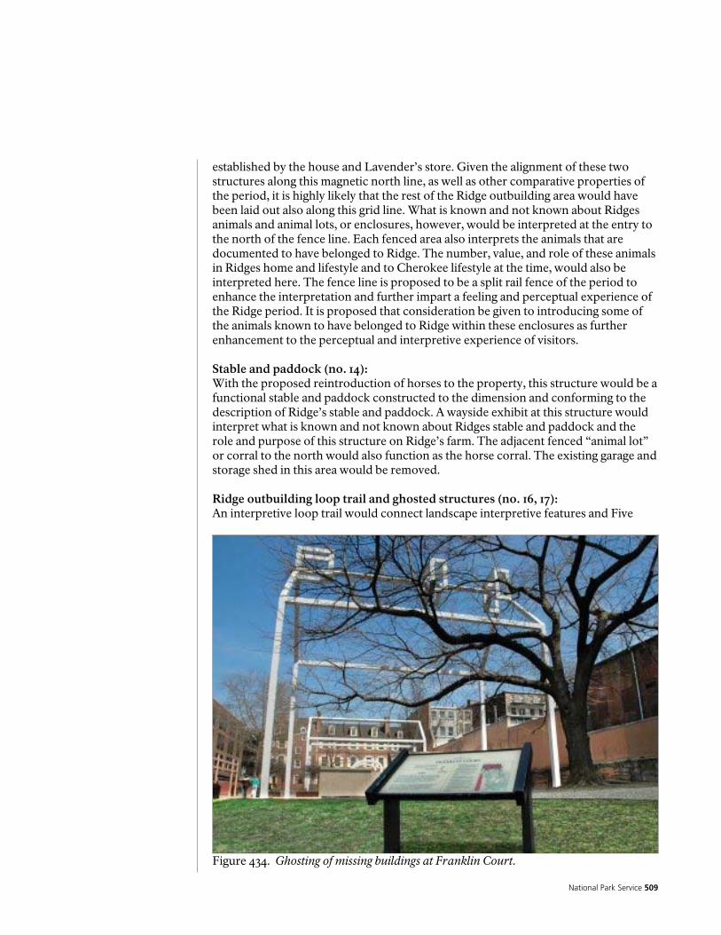
National Park Service 509
established by the house and Lavender’s store. Given the alignment of these two structures along this magnetic north line, as well as other comparative properties of the period, it is highly likely that the rest of the Ridge outbuilding area would have been laid out also along this grid line. What is known and not known about Ridges animals and animal lots, or enclosures, however, would be interpreted at the entry to the north of the fence line. Each fenced area also interprets the animals that are documented to have belonged to Ridge. The number, value, and role of these animals in Ridges home and lifestyle and to Cherokee lifestyle at the time, would also be interpreted here. The fence line is proposed to be a split rail fence of the period to enhance the interpretation and further impart a feeling and perceptual experience of the Ridge period. It is proposed that consideration be given to introducing some of the animals known to have belonged to Ridge within these enclosures as further enhancement to the perceptual and interpretive experience of visitors. Stable and paddock (no. 14): With the proposed reintroduction of horses to the property, this structure would be a functional stable and paddock constructed to the dimension and conforming to the description of Ridge’s stable and paddock. A wayside exhibit at this structure would interpret what is known and not known about Ridges stable and paddock and the role and purpose of this structure on Ridge’s farm. The adjacent fenced “animal lot” or corral to the north would also function as the horse corral. The existing garage and storage shed in this area would be removed. Ridge outbuilding loop trail and ghosted structures (no. 16, 17): An interpretive loop trail would connect landscape interpretive features and Five
Figure 434. Ghosting of missing buildings at Franklin Court.
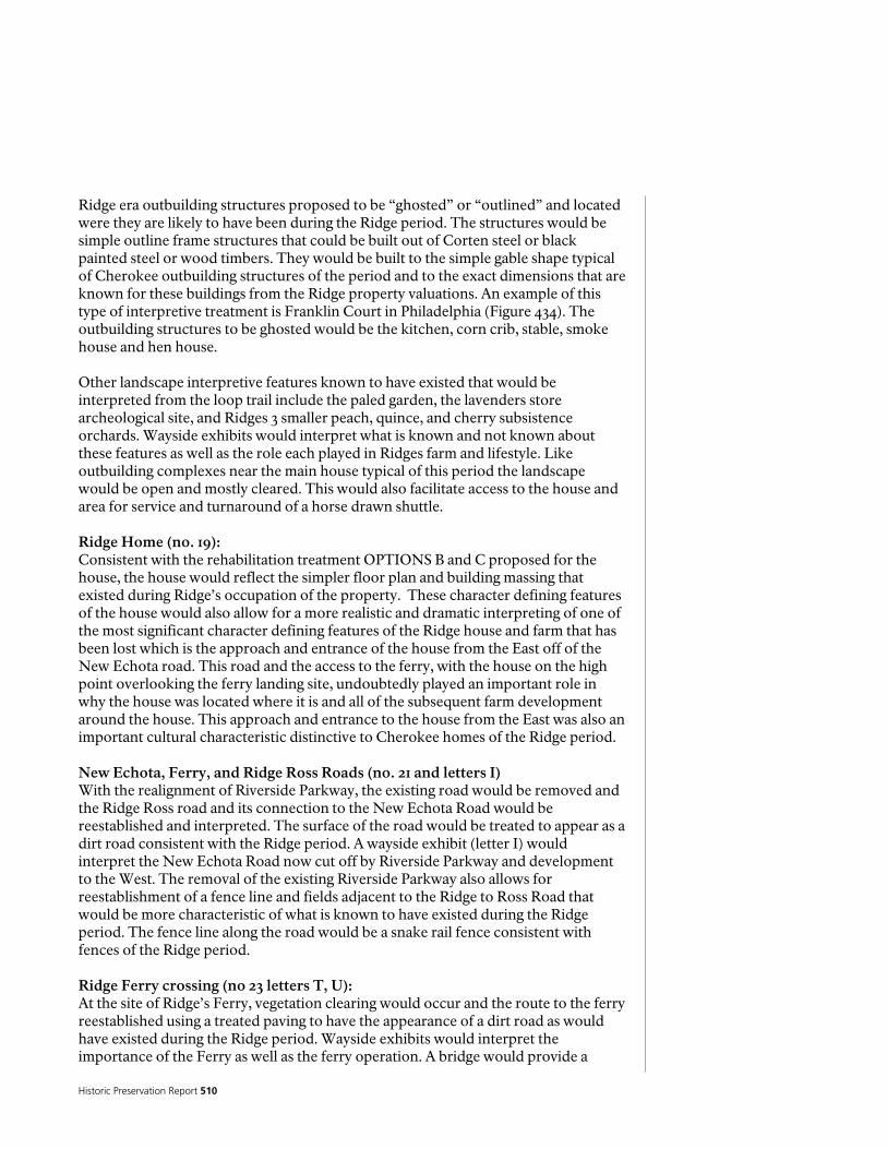
Historic Preservation Report 510
Ridge era outbuilding structures proposed to be “ghosted” or “outlined” and located were they are likely to have been during the Ridge period. The structures would be simple outline frame structures that could be built out of Corten steel or black painted steel or wood timbers. They would be built to the simple gable shape typical of Cherokee outbuilding structures of the period and to the exact dimensions that are known for these buildings from the Ridge property valuations. An example of this type of interpretive treatment is Franklin Court in Philadelphia (Figure 434). The outbuilding structures to be ghosted would be the kitchen, corn crib, stable, smoke house and hen house. Other landscape interpretive features known to have existed that would be interpreted from the loop trail include the paled garden, the lavenders store archeological site, and Ridges 3 smaller peach, quince, and cherry subsistence orchards. Wayside exhibits would interpret what is known and not known about these features as well as the role each played in Ridges farm and lifestyle. Like outbuilding complexes near the main house typical of this period the landscape would be open and mostly cleared. This would also facilitate access to the house and area for service and turnaround of a horse drawn shuttle. Ridge Home (no. 19): Consistent with the rehabilitation treatment OPTIONS B and C proposed for the house, the house would reflect the simpler floor plan and building massing that existed during Ridge’s occupation of the property. These character defining features of the house would also allow for a more realistic and dramatic interpreting of one of the most significant character defining features of the Ridge house and farm that has been lost which is the approach and entrance of the house from the East off of the New Echota road. This road and the access to the ferry, with the house on the high point overlooking the ferry landing site, undoubtedly played an important role in why the house was located where it is and all of the subsequent farm development around the house. This approach and entrance to the house from the East was also an important cultural characteristic distinctive to Cherokee homes of the Ridge period. New Echota, Ferry, and Ridge Ross Roads (no. 21 and letters I) With the realignment of Riverside Parkway, the existing road would be removed and the Ridge Ross road and its connection to the New Echota Road would be reestablished and interpreted. The surface of the road would be treated to appear as a dirt road consistent with the Ridge period. A wayside exhibit (letter I) would interpret the New Echota Road now cut off by Riverside Parkway and development to the West. The removal of the existing Riverside Parkway also allows for reestablishment of a fence line and fields adjacent to the Ridge to Ross Road that would be more characteristic of what is known to have existed during the Ridge period. The fence line along the road would be a snake rail fence consistent with fences of the Ridge period. Ridge Ferry crossing (no 23 letters T, U): At the site of Ridge’s Ferry, vegetation clearing would occur and the route to the ferry reestablished using a treated paving to have the appearance of a dirt road as would have existed during the Ridge period. Wayside exhibits would interpret the importance of the Ferry as well as the ferry operation. A bridge would provide a
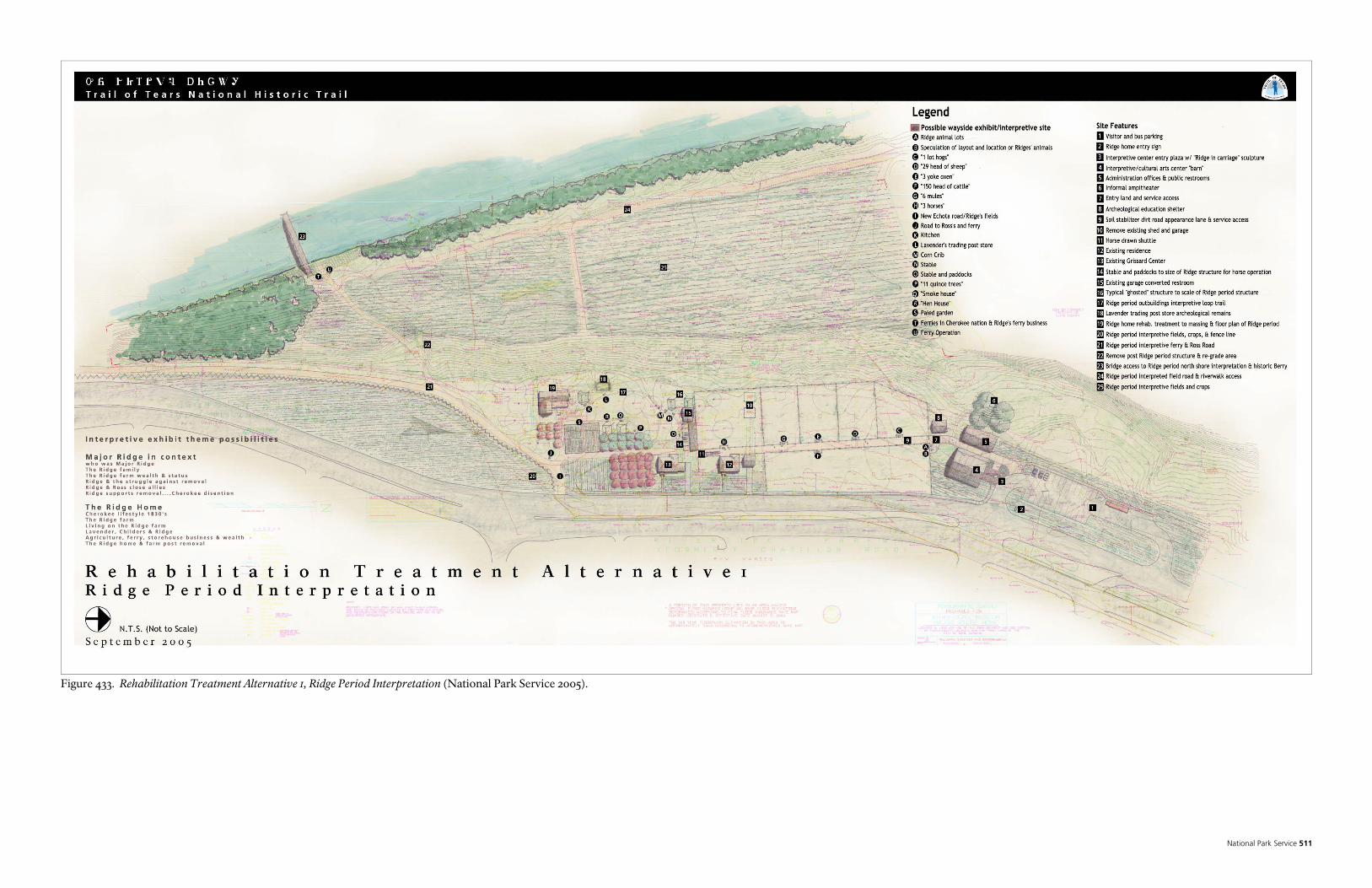
National Park Service 511
Figure 433. Rehabilitation Treatment Alternative 1, Ridge Period Interpretation (National Park Service 2005).

Historic Preservation Report 512
National Park Service 513
pedestrian reconnection to the ferry landings on both sides of the river. A gate could be provided on the bridge to control access as desired by Berry College or the Chieftains Museum Major Ridge Home. Interpretation and landscape interpretive features would be developed on the Berry College side of the ferry landing as shown in Rehabilitation Treatment Alternative 2. If further study and historical documentation proved feasible, consideration could be given to reconstructing a ferry similar to what would have existed during the Ridge period. Careful historical documentation would be needed as part of any reconstruction presented or interpreted as an accurate example of a Ridge period ferry. Given that the ferry was extremely significant to the Ridge farm and his wealth, considerable emphasis should be made to interpret the ferry, the ferry site and its importance. The fact that the location of the Ferry sites and their dramatic landscape features is known and exists, as well as a part of the new Echota Road on the Berry College side of the river, provides an excellent opportunity to interpret this exceptional and important resource from the Ridge period. Other alternatives for interpretive consideration of the ferry would include construction of some facsimile of a Ridge period ferry to interpret the Ridge ferry without the ability to have a working ferry. The sites of the later Verdery floating bridge would also be interpreted. Riverwalk, lowland crops, and mill water pump house (no 22,24,25): The area below the house would be cleared and returned to agricultural crops planted during the Ridge period as part of a more consistent landscape interpretation to the Ridge period. The mill water pump house would be removed and this area re-graded to restore the natural topography that would have existed before its construction. From historical documentation of the Ridge farm on the 1832 land lot surveys, it is known that the edge of fields often were fenced and had a road parallel to the field. This is logical since a road adjacent to the edge of a field is a practical necessity. It is likely then that the lower fields along the river bottom would have had such a field road parallel to the river along the edge of the field as shown in the proposed treatment plan. The proposed road would not only serve to access the field, but would also provide the connection across the Chieftains Museum Major Ridge Home to the City of Rome riverwalk. This road would also be treated with a paving surface to have the appearance of a dirt road. Mill Period garage restroom, residence and Grizzard center (no. 12, 13, and 15): These mill period structures would continue to be used for their existing purposes and would exist somewhat as anomalies in the interpretive landscape of the Ridge period. There functional use, however, would continue to serve visitor use and administration of the property. The restroom would likely receive greater use and function better in its location connected to the outbuilding interpretive loop trail. The two former mill houses would sit within a landscape changed as shown on the plan to interpret the Ridge period. Included in the landscape change would be the removal of existing ornamental planting beds and the planting of simple Ridge era crops adjacent to Riverside Parkway to, as previously mentioned, provide a contrast

Historic Preservation Report 514
to the surrounding landscape and convey the historic agricultural nature and interpretive purpose of the Ridge Home.

National Park Service 515
Landscape Rehabilitation Alternative 2 (numbers and letters refer to site feature numbers and interpretive sites shown on plan) This alternative provides the most dramatic, compelling, and provocative visitor experience of Major Ridge, John Ross, and the Cherokee removal story of all of the alternatives. As shown in the plan, it also encompasses a more extensive visitor experience and presentation of the extent of Ridge’s farm and would require a strong commitment and partnership with the Chieftains Museum, the City of Rome, and Berry College in order to be realized since much of the visitor experience includes former parts of the Ridge farm now part of Ridge Ferry Park and Berry College. This partnership could be developed over time to facilitate this alternative. The alternative is described below following the plan from the South to the North. The blow up enlargement area of the house and outbuilding area would be the same as shown on Alternative 1. To the North of the proposed interpretive animal lot fence line in this alternative, however, there would be no public parking area and interpretive center. This area as shown on the 1832 land lot survey would have been planted in crops as part of Ridge’s main field. Some limited employee and administrative parking could be located in this area and the area north of the fence would be planted in agricultural crops known to have been planted by Ridge to further interpret and impart in visitors an understanding and appreciation of the size and extent of Ridge’s farm and fields. For the land currently owned by the county in this area and West towards the river, an agreement and partnership would need to be developed with the county. Entrance and parking (no. 1, 2, 7, 8): The entrance to the Ridge farm would begin just to the south of what is strongly believed to be Ridges historic farm southern boundary. The new 46 vehicle parking area would be accessed off the existing drive to the new Rome pump house. The entry, however, would be through a restored native forest. This area would likely have been native forest during the Ridge period and would provide a dramatic contrast to the cleared fields at the southern end of Ridges farm and would provide visitors with a sense of boundary and the environment that would have existed at this southern edge of the Ridge farm. A drop off area at the west end of the parking area would provide access to a new interpretive center facility. Interpretive Center and restrooms (no. 3, 4, 5): Similar to the interpretive center facility described in rehabilitation Alternative 1 this center would include exhibits and perhaps a short video or film to provide visitors an overview and context for understanding Major Ridge, his historical significance in Cherokee and removal history as well as his farm. Additionally within this alternative that includes an experience of much of the road from Ross to Ridges, exhibits could interpret John Ross and the relationship of these two principle figures in the history of the Cherokee people and the national turmoil of Cherokee removal in US history. Like in Alternative 1 the concept for the design of the building would to resemble a barn but clearly convey to visitors that it was not an historic building. As with Alternative 1 the side of the “barn” would include a shed roof addition to provide covered gathering space for large groups. An entry interpretive plaza is also provided to the building as in Alternative 1. Adjacent to the interpretive center and entry plaza would be a public restroom. The parking area, interpretive center and restroom would all need to be constructed on fill (no. 7) to be out of the flood plane and likely

Historic Preservation Report 516
at a level close to the pump house access road which is on fill about 8 feet above the surrounding ground. Ridge’s southern fence line, fields, Ross to Ridge road and horse drawn shuttle (no. 6, 9, 10, 11, 13): From the interpretive center, visitors would exit the building on the North side along a walk through the restored forest and at the end of the walk encounter the southern fence line and fields of Ridges farm. This would provide a dramatic sense of the Ridge farm size and context within what would likely have been a surrounding native forest at the edges of his farm. The fields or fence divisions believed to be part of Ridges farm would be reestablished as shown on the plan no. 13. The existing modern restroom would be removed and park playground equipment would be relocated to other recreational use areas of the park The mystery of the field or fence divisions would be interpreted to visitors and what is known and not known would be interpreted to provoke in their own minds what they believe may have been in these areas. The mystery of the “variety” plumb orchard would be interpreted and the possibility and evidence for the location of this orchard would also be interpreted. Since the plumb orchard, while it seems of little importance, is in fact a telling feature of who Ridge was and his status as well as that of the Cherokee elite at the time of removal, it provides a provocative opportunity to interpret for visitors the social dynamics of Ridges life and farm and what it represented at the time of removal. Since a “variety” plum orchard during the Ridge period would have been imported varieties from England, only planters of wealth and access to European markets would have had such varieties. Also, since “planters” and those who would have had such variety imports were a status indicator of the day, this social importance would also be interpreted. This presents an opportunity for visitors to better understand Major Ridge and his historical significance through an interpretive experience of the Ridge farm and landscape. At the southern field the fence would be a split rail snake fence and an opening in the fence would provide access to the southern most fenced area that would serve as the staging and operations area for a horse drawn shuttle. At the west end of the field road where it ends at Riverside Parkway (letter E) the extent of Ridge’s fields to the east would be interpreted as well as the location of the large peach orchard and apple orchard. As with Alternative 1 the introduction of horses would become an added interpretive experience for visitors. The horse drawn shuttle would connect this southern end of Ridges farm with the Ridge home and main outbuilding interpretive landscape area to the North. Of great appeal in this alternative would be the ability to enter the Ridge House site from the southern end of the farm and along the original Ross to Ridge road experiencing a landscape very similar to what would have been experienced by Ridge and Ross as well as others during the Ridge period. This would be a profoundly compelling interpretive experience for visitors. The field roads as well as the Ross to Ridge road would be treated with a paving material to appear as dirt roads. Other landscape interpretive opportunities along the Ross to Ridge road would include the field road on the southern edge of Ridges main field and the main or “great field” of Ridges that is identified on the 1832 land lot survey drawing. An
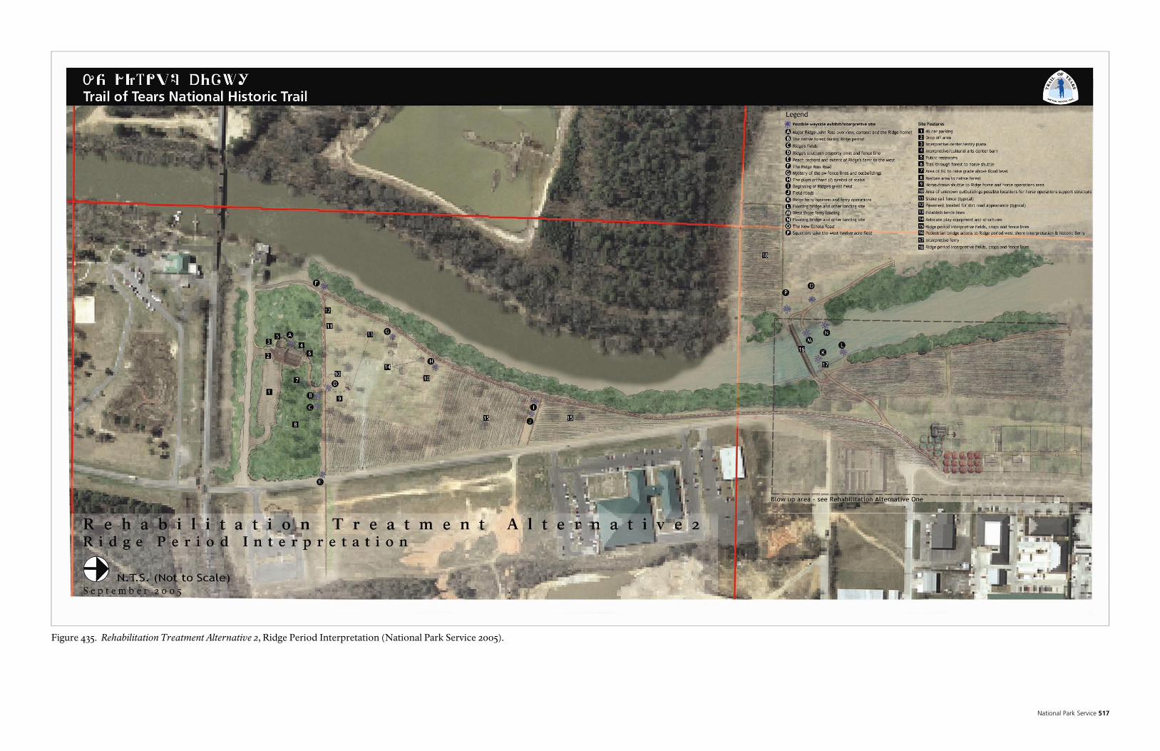
National Park Service 517
Figure 435. Rehabilitation Treatment Alternative 2, Ridge Period Interpretation (National Park Service 2005).

Historic Preservation Report 518
National Park Service 519
appreciation for the extent of Ridges fields and property can be gained from here as well and would be interpreted to convey in the minds of visitors the expansive scope of Ridges farm that extended far to the north and west across Riverside Parkway and the mill and other developed areas. Berry College west shore and landing of Ridge’s ferry (no. 18 letters P, O): On the Berry College side of Ridge’s ferry landing a visitor would experience a strong sense of an earlier agricultural landscape with few modern intrusions. This is an aspect that is difficult to impart in visitors on what was Ridge’s farm on the East side of the River, even with what is proposed in this alternative by developing the Ridge period interpretive landscape. One of the most impressive documented landscape features of the Ridge Period are the ferry landings of Ridge’s ferry and especially the landings on the Berry College side of the Oostanaula River that have a very high degree of historical integrity. The Ridge ferry landing with its dramatic section of historic New Echota road leading down to the landing would be cleared and interpreted with wayside exhibits. The deeply cut and dramatic landing of the Verdery floating bridge would also be interpreted. The pedestrian bridge and other ferry interpretive possibilities described under Alternative 1 would also apply to this alternative. In addition, a portion of Ridges confirmed and documented 12 acre field on this side of the river would be planted with a split rail snake fence along the perimeter and the first hand account written in a letter from Lavender to John Ridge about the loss of this field to white squatters just prior to removal would be interpreted here on a wayside exhibit. Finally, a pedestrian trail access from the ferry landing area to Historic Berry would be provided and visitors would be encouraged to visit both historic sites from either Berry College or the Ridge Home. The physical link of both sides of the river reconnecting what was Ridges original property would require the development of a partnership that would benefit Berry College as well as the Ridge Home by encouraging greater visitation to both sites and access from either.

Historic Preservation Report 520
Landscape Rehabilitation Alternative 2A (numbers and letters refer to site feature numbers and interpretive sites shown on plan) This alternative is similar in all respects to Alternative 2 except that the entry, visitor parking, and interpretive center would be located south of the existing railroad tracks and the interpretive center would be within the rehabilitated existing historic pump house. While there are some obvious advantages to rehabilitating an existing historic structure for interpretive purposes, this alternative lacks the advantages of immediate proximity to the southern fence line of Ridges farm as well as a clear separation from adjacent recreational uses and other modern intrusions. In addition, rehabilitation of the existing pump house does not afford the opportunity to define an interpretive center “barn like” building character and concept more strongly compatible with the interpretation of the historic Major Ridge farm. Entrance and parking (no. 7, 8, 9, 8) Entrance to the interpretive center and parking would use the existing road access to the park and pump house building. The entry road would be realigned slightly to accommodate a separate parking area for experiencing the Ridge farm and interpretive experience. As with Alternative 2, the entry would be restored to a native forest to convey and impart in visitors a dramatic contrast that would have existed with what would have been the surrounding native forest and Ridge’s cleared fields and farm. The restored forest also helps to creates a separation and distinguish the interpretive experience of Major Ridges historic farm and the other surrounding recreational uses of the park. This restoration would also expand on and be compatible with the existing native forest environmental education area (no 11) just south of the proposed parking area. A turnaround and pedestrian bus drop off area is provided (no. 7, 8) to the entry area of the building. Pedestrian Entry, Interpretive Plaza (no. 2, 6) The existing drive and landscape area to the pump house building is proposed to be redesigned as a pedestrian entrance through the restored native forest. The existing second story deck would be enhanced to create an interpretive entry plaza as with the other rehabilitation alternatives. This space would serve as an attractive introduction to the interpretive themes of the exhibits with a few simple powerful quotes or images to convey and provoke in visitors the story of Major Ridge, John Ross, and other themes that the city has in consideration for interpretation within the building. Interpretive Center (no. 1, 5) In this alternative the existing historic building would be rehabilitated as an interpretive center. Further architectural study and programming would be needed to explore the design and rehabilitation of the building for this purpose. It is suggested as shown in the alternative, however, that the covered first floor picnic pavilion modern addition is removed and the building be clearly separated from the other recreational uses of the park. The restoration of the forest along this side of the building as shown on the plan serve to create this separation as well as enhance the aesthetic appeal of the building by eliminating the extensive pavement around this attractive historic structure. Exit from the building is proposed at the first floor where a visitor would immediately encounter the Ross to Ridge road after experiencing the interpretive overview in the center and gaining knowledge and understanding of the

National Park Service 521
significance of Ross and Ridge as well as the road and farm they then precede to experience first hand. The visitor would then continue to the north along the river walk or Ross to Ridge road to the horse drawn shuttle as in Alternative 2.

Historic Preservation Report 522

National Park Service 523 Figure 436. Rehabilitation Treatment Alternative 2A, Ridge Period Interpretation (National Park Service 2005).

Historic Preservation Report 524

National Park Service 525
Landscape Preservation Alternative This alternative is distinctly different from all of the rehabilitation alternatives in that the historic landscape is preserved to the industrial period (1928-1969) which is the last period of significance determined eligible to the national register. Under this alternative the landscape is preserved as it has evolved through time including all of its changes up to the industrial period of historical significance. The ultimate use of the property would continue to be for interpreting primarily the Ridge Period to the visiting public, however, fewer opportunities for developing interpretive landscape features exist under this alternative. The house under this alternative would also be preserved mostly in its present form as identified in greater detail in the HSR treatment sections of this report. The details of this treatment alternative are explained below. (Numbers and letters refer to site feature numbers and interpretive sites shown on plan) Entrance and parking (no. 1, 2, 3) Visitors would enter the site from a proposed new parking area north of the Director’s Residence but closer to that residence than proposed in the rehabilitation alternatives. Because the proposed interpretive center follows the mill housing area layout and is closer to the Grizzard center the parking area also needs to be farther south so that the planed entry south drive off of Riverside Parkway will not work where it is located directly across from the drive on the East side of the street. A single entrance to the parking area is provided with a turnaround and drop of area needed at the south end of the parking lot. Interpretive Center, Restrooms, amphitheater, and entry plaza (no. 4, 5, 6, 7, 8, 9, 10, 11 12 13): A pedestrian interpretive plaza entry area is created for visitors similar to that shown in the rehabilitation alternatives. A covered shelter area at the end of the entry plaza and before the interpretive center would accommodate gathering large school groups in an outdoor covered space. Outdoor exhibits could also be located under this shelter and to the north and south of the shelter along the interpretive plaza that is more linear in this alternative. The proposed restrooms and archeological education and demonstration shelter are located immediately adjacent to the shelter and to the west. A small amphitheater similar to the other alternatives is shown also to the west of the restrooms. The interpretive center as with the rehabilitation Alternative 1 could also serve as a combined facility with the proposed community arts center as discussed in the rehabilitation Alternative 1. The building would be located and designed to be sympathetic to the industrial period mill houses that existed along Riverside Parkway and similar to the two remaining mill houses on the property. The size and design of the building would require further architectural study and programming. The size, however, as shown on the plan could be flexible and expand to the west as shown (no. 13). To experience the landscape and access the Ridge Home, visitors would exit the new interpretive center and follow the existing sidewalk to the house. This historic sidewalk would be widened to accommodate an expected increase in pedestrian use to the house.
Historic Preservation Report 526
Ridge Home, adjacent landscape (no. 20, 19): Under this alternative, the house would be preserved essentially as it exists with all of its changes from the industrial period. Other interpretive efforts would be employed to convey to visitors the changes that have occurred to the house and how the house existed during the Ridge period. This is discussed in greater detail in the HSR part one of this report. Because of the larger footprint of the existing Industrial period house, as well as other industrial period landscape features that would be preserved, fewer opportunities exist for creating landscape interpretation of the Ridge period. Wayside exhibits would be provided to suggest to visitors what is known of the configuration of Ridge’s outbuildings and landscape near the house. A portion of the “paled garden” could be interpreted and created as well as the Ridge period entry to the east side front of the house as shown on the plan. (Letters c, d, g, f) The Ridge period kitchen would be identified on the ground and interpreted with a wayside exhibit. The Lavender trading post would also be interpreted as well as post ridge buildings that are missing such as the garage on the loop entry drive. Industrial period Riverside Parkway and loop entry drive (no. 21, 26) Because the existing loop entrance drive is part of the Industrial period landscape this would be preserved along with a section of Riverside Parkway that will be no longer used when the current road widening project is complete. Access off of the newly widened road would occur in front of the house to the loop entry drive and the abandoned section of the Mill road would be preserved and used as overflow parking or for special events. Fields and Vegetation treatment, Ferry landing and riverwalk (no. 23, 24, 25): Since the industrial period landscape around the house was no longer in agriculture and was mostly cleared fields or second growth forest, the vegetation would be cleared and managed to reflect this period as shown. The Ridge ferry landing sites and a pedestrian bridge connection with Berry College would be interpreted and developed as shown and similar to what is shown in the rehabilitation treatment alternatives. Connection and access to the Riverwalk would be developed as shown on the plan. A different alignment of the river walk from the rehabilitation alternatives would occur that reflects the preservation of the mill pump house and the abandoned section of Riverside Parkway.

National Park Service 527 Figure 437. Preservation Treatment Alternative, Industrial Period Interpretation (National Park Service 2005).

Historic Preservation Report 528

National Park Service 529
Other Rehabilitation Alternatives Variations Considered Two other rehabilitation alternative variations could be considered that are not shown in the drawings. These would be access, entry, and new interpretive center and parking located at Berry College and in association with Historic Berry, and access, entry, and new interpretive center and parking located farther to the North on Riverside Parkway sharing the parking and entrance of the existing Fudruckers restaurant. Ridge Home entrance and access from Berry College: This alternative would take advantage of the existing facilities, educational purposes and visitor interpretation mission of Historic Berry College as compatible with the mission and purposes of the Ridge Home. A close partnership would be required for co-development of facilities and joint interpretation opportunities. Under this alternative, either the existing Berry College museum or a new facility adjacent to or in a new location would be developed, as with the other alternatives, to provide the overview interpretation of Major Ridge, his historical significance the context of Cherokee removal and Ridge’s farm. The Ridge period farm features near the ferry landing site would be interpreted as shown under the other alternatives. The significant distance from the developed area and parking of the Berry College museum or Historic Berry Home would require a shuttle of some sort to access the pedestrian bridge and Ridge Home across the river. Ridge Home entrance and access shared with Fudruckers parking: Under this alternative the entrance to the Ridge Home would share the existing parking and entrance with the restaurant. The parking would be expanded to the south to accommodate increased visitation and use to the Ridge Home. An entry to the new interpretive center would be the same as shown in Alternative 1 and the preservation alternative. The end of the new parking area and interpretive facility would be located approximately where the north parking entry drive is shown on the rehabilitation Alternative 1. In this alternative, a partnership arrangement would need to be developed with the existing Fudruckers restaurant as well as the county for use of this property. The benefits of this alternative would be the presumably efficient joint use of parking and the visitor and restaurant benefit of having both facilities in proximity.

Historic Preservation Report 530
Other Long-term Treatment Considerations For the first time, much as a result of this study, a clearer picture of the scope, layout, and extent of Major Ridge’s farm is beginning to become clear. Much of what was part of Ridge’s extensive farm and landholdings prior to removal has been developed and impacted, especially as a result of the construction of the mill. Riverside Parkway especially with its expansion to 4 lanes, goes through what was the heart of Ridge’s fields and greatly impacts the historic character of what was once his farm and our ability to interpret the historic landscape to the public. There are, however, areas of Ridges farm that remain undeveloped. As part of a long term strategy to better preserve and interpret the Ridge farm, consideration should be given to land acquisition of the remaining undeveloped portions of his farm that could provide visitor interpretive opportunities. If opportunities arise to remove modern developments and return a more agricultural characteristic to historic areas of Ridge’s farm those opportunities should also be pursued. This would be especially true for the area adjacent to the Ridge Home. In addition, over the very long term, consideration should be given to ensuring that the Statewide Transportation improvement plan and other transportation planning efforts locally consider a complete relocation of Riverside Parkway away from the Ridge Home farther to the East. This would provide over the long term, an opportunity to create a more compatible agricultural landscape setting and buffer to the core of the Ridge farm around the house. Finally, as additional research uncovers more information and greater knowledge concerning the house and landscape, this should be used where applicable to enhance the interpretation and more accurately depict the Ridge farm.
National Park Service 531
Preferred Treatment
The preferred rehabilitation treatments are the most consistent with the Secretary of The Interior’s Standards and Guidelines for the Treatment of Historic Properties, and the mission and preservation philosophy of Chieftains Museum. These treatments are based on the complexity of the existing conditions and their corresponding historical documentation, as well as the change in use of the whole property from the Ridge period farm to a house museum and interpretive center. The recommended treatment alternatives will significantly enhance the interpretive use of the property to tell the story Major Ridge and the Cherokee Removal. In addition, the preferred historic structure treatment and the preferred landscape treatment have been paired to present the most appropriate and advantageous treatment. PREFERRED HISTORIC STRUCTURE TREATMENT Historic Structure Rehabilitation Alternative C – The selection of this treatment was guided by the combined preservation philosophy of the Chieftains Museum/Major Ridge Home and the established guidelines and traditions of the National Park Service. This alternative presents the best interpretive opportunity for the Ridge Period for the least capital investment. Each of the other alternatives presented difficulties in following these guidelines. Alternative A which would call for identification of all Ridge period historic fabric and the total removal of all non-Ridge period fabric would create a ruin that would involve the creation of a new structure that would have visual/aesthetic impacts to the rest of the property and would not completely protect the remaining historic fabric from the elements. This alternative would also present a very incomplete picture of how the Ridge period home appeared and would be very difficult to interpret. Alternative B calls for total restoration to the Ridge period, however, there currently is not enough information available to undertake this alternative, and even if ‘exhaustive’ research is performed, there is no guarantee that the required information would be found. Alternative D calls for a combination of restoration and rehabilitation in which all non-Ridge period features and finishes would be removed from the interior spaces and surfaces of the Ridge period portion of the building, and the Ridge period portion of the building would be rehabilitated for visitor use and interpretation. This alternative was not selected because the building massing would still represent the Colonial Revival period, the Ridge period would be more challenging to interpret, and treatment costs would be higher. Alternative E would restore the building as it appeared during the Colonial Revival Period and would strongly convey the historical significance of this period over the Ridge Period. The cost of restoration would be high and the Ridge Period would also be very difficult to interpret. Alternative F, would have the same challenges as Alternative E, but the cost would be comparable to Alternative C, which better conveys the historical significance of the Ridge Period. PREFERRED LANDSCAPE TREATMENT Landscape Rehabilitation Alternative 2 – The selection of this treatment was guided by several factors. These included consistency with the preferred rehabilitation
Historic Preservation Report 532
treatment of the house, complete lack of historical integrity for the property to the Ridge period, and most importantly, the desire to better interpret the life, farm, and importance of Major Ridge. This alternative provides the greatest opportunity for enhancing the visitor experience and interpretation of Major Ridge by fully addressing and enabling visitors to encounter the extent of what is known of Ridge’s farm. None of the other alternatives allows for this experience to the same extent. Landscape Rehabilitation Alternative 1 is the next best treatment alternative for interpreting Ridge’s farm; however, it does not include rehabilitation of the extent of the Ridge farm outside of the present ownership of Chieftains Museum. Landscape Rehabilitation Alternative 2 would require a partnership and agreement among the Chieftains Museum, the City of Rome, and Berry College that may or may not be possible. It may also be feasible through time to include parts of Landscape Rehabilitation Alternative 2 with Landscape Rehabilitation Alternative 1 to address the areas of Ridge’s farm that are not owned by Chieftains Museum. The only other possible landscape treatment alternative consistent with the Secretary of the Interior’s Standards and Guidelines is the Landscape Preservation Alternative. This alternative, however, consistent with the house Preservation Alternative F, would require the preservation of later Industrial period changes to the landscape and would prevent meaningful interpretation of the Major Ridge’s farm. For this reason the Landscape Preservation Alternative is not recommended.
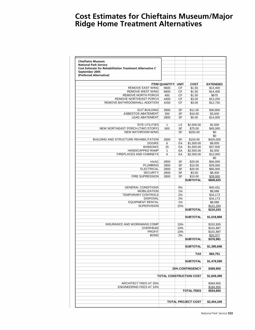
National Park Service 533
Cost Estimates for Chieftains Museum/Major Ridge Home Treatment Alternatives
CHIEFTAINS MUSEUMESTIMATE OF PROBABLE COSTTREATMENT ALTERNATIVE - RIDGE ADDITION9/15/2005
ITEM QUANTITY UNIT COST EXTENDEDREMOVE EAST WING 9600 CF $1.50 $14,400
REMOVE WEST WING 9600 CF $1.50 $14,400REMOVE NORTH PORCH 450 CF $1.50 $675
REMOVE NORTHEAST PORCH 4400 CF $3.00 $13,200REMOVE BATHROOM/HALL ADDITION 4250 CF $3.00 $12,750
GUT BUILDING 2800 SF $11.00 $30,800ASBESTOS ABATEMENT 350 SF $10.00 $3,500
LEAD ABATEMENT 2800 SF $5.00 $14,000
SITE UTILITIES 1 LS $2,500.00 $2,500NEW NORTHEAST PORCH (TWO STORY) 600 SF $75.00 $45,000
NEW BATHROOM WING SF $250.00 $0$0
BUILDING AND STRUCTURE REHABILITATION 2800 SF $150.00 $420,000DOORS 6 EA $1,500.00 $9,000
WINDOWS 25 EA $1,500.00 $37,500HANDICAPPED RAMP 1 EA $2,500.00 $2,500
FIREPLACES AND CHIMNEYS 6 EA $2,000.00 $12,000$0
HVAC 2800 SF $20.00 $56,000PLUMBING 2800 SF $10.00 $28,000
ELECTRICAL 2800 SF $20.00 $56,000SECURITY 2800 SF $3.00 $8,400
FIRE SUPRESSION 2800 SF $10.00 $28,000SUBTOTAL $808,625
GENERAL CONDITIONS 5% $40,431MOBILIZATION 1% $8,086
TEMPORARY CONTROLS 2% $16,173DISPOSAL 2% $16,173
EQUIPMENT RENTAL 1% $8,086SUPERVISION 15% $121,294
SUBTOTAL $210,243
SUBTOTAL $1,018,868
INSURANCE AND WORKMANS COMP 15% $152,830OVERHEAD 10% $101,887
PROFIT 10% $101,887BOND 2% $20,377
SUBTOTAL $376,981
SUBTOTAL $1,395,848
TAX $83,751
SUBTOTAL $1,479,599
25% CONTINGENCY $369,900
TOTAL CONSTRUCTION COST $1,849,499
ARCHITECT FEES AT 20% $369,900ENGINEERING FEES AT 10% $184,950
TOTAL FEES $554,850
TOTAL PROJECT COST $2,404,349
Chieftains MuseumNational Park Service Cost Estimate for Rehabilitation Treatment Alternative C September 2005 (Preferred Alternative)
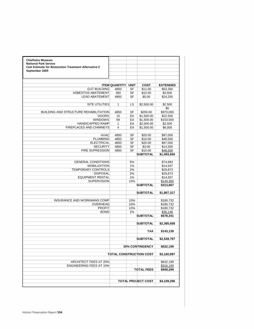
Historic Preservation Report 534
CHIEFTAINS MUSEUMESTIMATE OF PROBABLE COSTTREATMENT ALTERNATIVE - RESTORATION9/15/2005
ITEM QUANTITY UNIT COST EXTENDEDGUT BUILDING 4850 SF $11.00 $53,350
ASBESTOS ABATEMENT 350 SF $10.00 $3,500LEAD ABATEMENT 4850 SF $5.00 $24,250
SITE UTILITIES 1 LS $2,500.00 $2,500$0
BUILDING AND STRUCTURE REHABILITATION 4850 SF $200.00 $970,000DOORS 15 EA $1,500.00 $22,500
WINDOWS 69 EA $1,500.00 $103,500HANDICAPPED RAMP 1 EA $2,500.00 $2,500
FIREPLACES AND CHIMNEYS 4 EA $1,500.00 $6,000
HVAC 4850 SF $20.00 $97,000PLUMBING 4850 SF $10.00 $48,500
ELECTRICAL 4850 SF $20.00 $97,000SECURITY 4850 SF $3.00 $14,550
FIRE SUPRESSION 4850 SF $10.00 $48,500SUBTOTAL $1,493,650
GENERAL CONDITIONS 5% $74,683MOBILIZATION 1% $14,937
TEMPORARY CONTROLS 2% $29,873DISPOSAL 2% $29,873
EQUIPMENT RENTAL 1% $14,937SUPERVISION 10% $149,365
SUBTOTAL $313,667
SUBTOTAL $1,807,317
INSURANCE AND WORKMANS COMP 10% $180,732OVERHEAD 10% $180,732
PROFIT 10% $180,732BOND 2% $36,146
SUBTOTAL $578,341
SUBTOTAL $2,385,658
TAX $143,139
SUBTOTAL $2,528,797
25% CONTINGENCY $632,199
TOTAL CONSTRUCTION COST $3,160,997
ARCHITECT FEES AT 20% $632,199ENGINEERING FEES AT 10% $316,100
TOTAL FEES $948,299
TOTAL PROJECT COST $4,109,296
Chieftains Museum National Park Service Cost Estimate for Restoration Treatment Alternative E September 2005

National Park Service 535
CHIEFTAINS MUSEUMESTIMATE OF PROBABLE COSTTREATMENT ALTERNATIVE - PRESERVATION9/15/2005
ITEM QUANTITY UNIT COST EXTENDEDASBESTOS ABATEMENT 350 SF $10.00 $3,500
LEAD ABATEMENT 4850 SF $5.00 $24,250
BUILDING AND STRUCTURE STABILIZATION 4850 SF $100.00 $485,000DOORS 15 EA $1,000.00 $15,000
WINDOWS 69 EA $1,000.00 $69,000HANDICAPPED RAMP 1 EA $2,500.00 $2,500
FIREPLACES AND CHIMNEYS 3 EA $1,000.00 $3,000
HVAC REPAIRS 4850 SF $5.00 $24,250PLUMBING REPAIRS 4850 SF $5.00 $24,250
ELECTRICAL REPAIRS 4850 SF $5.00 $24,250SECURITY SYSTEM 4850 SF $3.00 $14,550FIRE SUPRESSION 4850 SF $10.00 $48,500
SUBTOTAL $738,050
GENERAL CONDITIONS 5% $36,903MOBILIZATION 1% $7,381
TEMPORARY CONTROLS 2% $14,761DISPOSAL 2% $14,761
EQUIPMENT RENTAL 1% $7,381SUPERVISION 10% $73,805
SUBTOTAL $154,991
SUBTOTAL $893,041
INSURANCE AND WORKMANS COMP 10% $89,304OVERHEAD 10% $89,304
PROFIT 10% $89,304BOND 2% $17,861
SUBTOTAL $285,773
SUBTOTAL $1,178,813
TAX $70,729
SUBTOTAL $1,249,542
25% CONTINGENCY $312,386
TOTAL CONSTRUCTION COST $1,561,928
ARCHITECT FEES AT 20% $312,386ENGINEERING FEES AT 5% $78,096
TOTAL FEES $390,482
TOTAL PROJECT COST $1,952,410
Chieftains MuseumNational Park Service Cost Estimate for Preservation Treatment Alternative F September 2005

Historic Preservation Report 536
Cost Estimate for Chieftains Museum/Major Ridge Landscape Treatment Alternative
National Park Service Estimate
Estimate By: Steve Burns
Project: Ridge Home Rehab Treatment Alt 1 Date: 10/20/2005 Park: Trail of Tears National Historic Trail
Package: Reviewed By:
Date:
Item No. Description Qty. Unit Cost/Unit Net Cost 001 Site Prep
002 Clearing & Grubbing (medium) 7.3 acre
$11,400.00 $83,220
003 Minor Grading (top 2-3 inches) 2 ac 9680 S.Y. $5.40 $52,272
004 shed and garage demolition 7704 C.F. $0.44 $3,390
005 mill water pump station demolition 3500 C.F. $0.44 $1,540
006 Riverside Parkway Demo (920'x24'=22080 /9=) 2453 S.Y. $11.00 $26,983
007 Paving and Parking Area 008 Parking lot 24 spaces $2,160.00 $51,840 009 bus parking 2 spaces $6,170.00 $12,340
010 Interpretive Center Site Improvements
011 entry paving 89 S.Y. $97.00 $8,633 012 wayside exhibits 2 ea $1,000.00 $2,000
013 access lane paving 3069 s.f. / 9= 341 S.Y. $97.00 $33,077
014 Interpretive Center
015 Interpretive Center building 3000 S.F. $270.00 $810,000
016 Interpretive Center Exhibits 1000 S.F $300.00 $300,000
017 Exhibit Planning and Design .28 percent $300.000 $84,000
018 Exhibit Construction Contract Supervision .15 percent $300,000 $45,000
019 175 seat informal amphitheater 175 seat $1,080.00 $189,000
020 archeology educational demonstration shed 500 S.F $70.30 $35,150
021 Administrative Offices and Public Restrooms
022 1800 S.F. $162.00 $291,600
023
Site Improvements/ Landscape Interpretive Features
024 split rail fencing (3 rail) 1945 L.F $19.50 $37,928 025 snake rail fencing (3 rail) 900 L.F $19.50 $17,550

National Park Service 537
026 wayside exhibits 23 ea $1,000.00 $23,000 027 ghosted buildings 6 ea $3,000.00 $18,000 028 orchard planting 39 trees $351.00 $13,689 029 pasture planting 3.6 AC $5,480.00 $19,728 030 crop planting 7.6 AC $5,480.00 $41,648
031
farm access lane natural soil look pavement (660'x12=7920/9=') 880 S.Y. $27.00 $23,760
032 interpretive loop trail (4' wide=450 s.f.) 50 S.Y. $27.00 $1,350
033 paled garden fence (picket) 220 L.F $21.60 $4,752
034
New Echota, ferry and farm natural roads natural soil look pavement (580'x12'=6960s.f.) 773 S.Y. $27.00 $20,871
035 Stable 1200 S.F. $70.30 $84,360
036 Subtotal of Direct Construction Costs
$1,907,680
037 Design Contingency (10 to 30 Percent) 20% Percent $ 381,536
038 General Requirements (4 to 20 percent) 10% Percent $190,768
039
Exhibit Design and Construction from lines 016 through 018 $429,000
040 Total Construction Costs $2,908,984
NET Construction Cost $2,908,984

Historic Preservation Report 538
Treatment Phasing
DRAWINGS AND SPECIFICATIONS Upon selection of the most appropriate structure and landscape treatment alternatives, Chieftains Museum will then need to engage the services of a qualified historical architect and landscape architect who will develop a complete treatment package which includes written specifications and drawings. The specifications identify how the project will be executed, the materials and methods to be used, documentation requirements, the submittal process, as well as other details of execution. The drawing package should be based on the existing drawings prepared by Frazier Associates which may be annotated to show where and how specific treatments should be implemented. The drawing package should also contain new drawings which explicate specific details alluded to in the conceptual drawings. The development of the specification and drawing package will incur significant costs which would be combined with treatment oversight. The approximate cost of architectural services will be 15-20 percent of the treatment. COST ESTIMATING Once the specification and drawing package is complete, Chieftains Museum will then be able to gather cost estimates through requests for proposals from qualified contractor(s) for the treatment. The requests for proposals (RFP) should include a request for documentation on past projects, a reference contact list, banking references, and vendor references. The historical and landscape architects will review the cost estimates in preparation for contractor(s) selection. Selecting the lowest bidder is not advised, but rather the selection should be made based on the best value of the proposals received. FINDING A QUALIFIED HISTORIC PRESERVATION CONTRACTOR(S) After all of the proposals have been received, the project historical and landscape architects will review each proposal and evaluate the contractor(s) ability to complete the project on time, on budget, and to specification. References must then be checked. Based on the information gathered the selection of a contractor(s) may then be made. CONTRACTOR OVERSIGHT The project historical and landscape architects (project management team) who assembled the specification and drawing package should also be tasked with project management which includes contractor(s) oversight. The project management team will: be responsible for holding the contractor(s) to the drawings and specifications and safety protocols, clarify technical aspects of the project, authorize progress payments, and to negotiate change orders.

National Park Service 539
CHANGE ORDERS During the course of the project, the contractor(s) may encounter unanticipated site/building conditions which may require a different approach to treatment then found in the specification and drawing package. The project management team will be responsible for determining the validity of a proposed change order and negotiate the cost of change orders with the contractor(s). Change orders should be expected and will likely result in elevated project costs. INTERPRETATION AND EXHIBIT PLANNING This document does not fully address interpretive and exhibit planning especially for exhibits that would be in the proposed new interpretive center or inside the Ridge home. An important aspect of any treatment of the Chieftains property is the development of an Interpretive Plan. An interpretive plan will mitigate the problems associated with conveying the history of the property that will be encountered with any of the treatment alternatives offered here. Interpretive planning will identify the themes, interpretive media, content, and location of indoor and outdoor exhibits which can be both static and interactive. It will identify the structure of the visitation for all types of visitors. Interpretive planning will help tell the story of the Ridges and the Cherokee Removal where the physical property is unable and work within the framework of the selected treatment alternatives for the home and landscape. The development of the interpretive plan and exhibit construction will incur significant costs. The costs for new proposed interpretive center and wayside exhibits are included in the Landscape Treatment Alternative 1 estimate; however, the costs for exhibit construction and installation within the Ridge Home are not included.
Historic Preservation Report 540
Treatment Documentation
Treatment documentation is one of the most important aspects of any historic preservation project and is often the most overlooked part of the treatment of historic structures. Guidance for documentation related to treatment may also be found in NPS 28, Cultural Resource Management Guideline (NPS 1997). Documentation should include any information that is relevant to the project and which may be referenced to understand how decisions regarding treatment were made, to evaluate the success or failure of treatment, what was treated, and when it was treated. A simple rule of thumb for deciding what to include in the documentation is to ask what information will be needed when the project area is treated again in the future. There are three main components to treatment documentation and these components must be included in the treatment the Chieftains Home: Pre-Treatment Documentation – The area for which treatment is planned should be photographed and described in detail so that accurate comparisons may be made when analyzing the effectiveness of the treatment, and so that the area does not receive redundant treatment. Treatment Documentation – During all phases treatment, the area being treated and any materials that were prepared away from the area as part of the treatment should also be photographed and described in detail so that the success or failure of the treatment may be attributed to the materials and methods used in the treatment. Documentation should focus on the materials used, the method of their employment, and the environmental factors present during treatment. Post-Treatment Documentation – After treatment has been completed, all information related to the treatment should be gathered together into one place such as a paper file or digital data. This information should then be complied into a formal Record of Treatment. The Record of Treatment may be a little a memorandum or as large as a multi-volume report. The contents of the Record of Treatment must include a photographic and written narrative of the treatment process, steps taken to be in compliance with the National Historic Preservation Act or other requirements, project correspondence if there was any, weekly or daily work reports, the safety plan, materials data such as product information and Materials Safety Data Sheets (MSDS), a vendor list including contact addresses and telephone numbers, any drawings and notes prepared as part of the treatment, and any other relevant information that might help understand and evaluate the treatment. PHOTOGRAPHIC DOCUMENTATION Because of advances in digital imaging technology the format standards for treatment documentation are changing. Digital imaging is a far superior method for capturing the details of treatment as high resolution images can be made much more practically than traditional film images, however, the longevity of image storage methods such as CD-ROM and DVD-ROM are in question as are also the availability of the software and hardware required to read these storage mediums in the distant future. Though this is a concern, digital photography may still be used for documentation. The best
National Park Service 541
film alternative is high-resolution black-and-white 35mm film photography, though this takes more skill to use. The benefit of black-and-white 35mm film photography is that its long history of use has shown that it is stable storage medium is stored in an equally stable environment such as a curatorial facility that meets recognized standards. Regardless of which photography format is used, the photographer should seek to fill the frame of each image with as much of the subject as possible. Consideration of lighting conditions is also important, because the presence or absence of shadows may be needed to convey the meaning of the image. In addition, a photo log should be kept during treatment and should at minimum include the project name, image number, photographer, date, perspective, and a description of the subject. WRITTEN DOCUMENTATION Written documentation supplements the photographic description of treatment by including information that can not be determined from photographic images alone. The written description should also tie together all of the aspects of the project together and may include selected photographs for further illustration. Written documentation should include a description of the sequences of specific tasks such as when and how tools and materials were used to perform an area-specific wood replacement. The written documentation is where specific names of materials, quantities, dimensions, tools types and sizes, and other information should be provided. For example, a photograph may show a piece of exterior wood being cleaned with a liquid and a brush. The written description is where one would specify that the liquid being used is a mild 10:1 solution of purified water and Clorox bleach and that the brush is soft brass 1-3/8 x 7-3/4-inch plater’s brush with 1/2-inch bristles from the GSA Supply Catalog. Regardless of whether a memorandum of a multi-volume Record of Treatment is prepared at the end of a treatment project, multiple copies of the documentation should be made and at the very least distributed to the Chieftains curator along with original film prints and negatives. Additional copies may be distributed to Chieftains Board Members and others involved in the operation of the Chieftains Museum, all stakeholder organizations, the NPS Southeastern Regional Office, the NPS National Trails System Office, and the NPS Technical Information Center and the Denver Service Center (https://amoebawww.den.nps.gov/amoeba/TIC/TIC.NSF).

Historic Preservation Report 542

National Park Service 543
References Cited
Acordis Tow 2004 Acordis Tow. http://www.acordistow.com/html/history.htm, July 10, 2004.
Adams, D.W 2004 Restoring American Gardens: An Encyclopedia of Heirloom Ornamental
Plants, 1640-1940. Timber Press, Portland, Oregon.
Allen, P. J. 1982 Ross Family. Leaves from the Family Tree. [pp. 220-223, compiled newspaper
articles, 1933-1937] Southern Historical Press, Easley, South Carolina.
American State Papers 1831-1834 American State Papers, Class II, Indian Affairs, 2 Volumes. Gales and
Seaton, Washington, D.C.
Anderson, W. L., editor 1991 Cherokee Removal: Before and After. University of Georgia Press, Athens.
Anderson, William and James A. Lewis 1983 A Guide to Cherokee Documents in Foreign Archives. Metuchen, New Jersey,
The Scarecrow Press.
Andrew, J. A., III 1992 From Revivals to Removal : Jeremiah Evarts, the Cherokee Nation, and the
Search for the Soul of America. University of Georgia Press, Athens.
Anonymous Undated. Notice of Appraising Agents for Settling Claims. State Library Cherokee
Collection. The Tennessee State Library and Archives, Nashville, Tennessee.
Anonymous ca. 1835 Map of the Cherokee Country. Archives, Museum of the Cherokee Indian,
Cherokee, North Carolina.
ca. 1900-1924 AMaterial Being Collected for Revolutionary Reader@, Unattributed newspaper clipping [ca. 1900-1924], Chieftains Museum/Major Ridge Home, Rome, Georgia.
ca. 1928-1930 Unattributed Aerial Perspective Photograph of Chatillon Mill and
Village (Internal Reference Number: FIC 2004.130.001). Chieftains Museum/Major Ridge Home, Rome, Georgia.
1971 ‘Historic “Chieftains”’, State Mutual Anchor, Vol. XXXV, Third Quarter. ca. 1980 George Michael Lavender. Manuscript on file, Chieftains Museum/Major
Ridge Home, Rome, Georgia.
REFE
REN
CES C
ITED
Historic Preservation Report 544
Antonio Waring Papers 1826 Extract of a Letter from opothle Yoholo, and Others, Composing the Creek
Deputation, to the Secretary of War, dated Washington 1 April 1826. Antonio Waring Papers, Origin in Keith Reid Collection, Hargrett Rare Book and Manuscript Library, University of Georgia Libraries, Athens.
Ashton, S.S.
1996 Guide to Cherokee Indian Records Microfilm Collection, Oklahoma Historical Society, Archives and Manuscripts Division. Ashton Books, Norman, OK.
Aycock, R. D.
1981 All Roads Lead to Rome. W. H. Wolfe Associates, Roswell, Georgia.
Ballenger, T. L. 1973 Death and Burial of Major Ridge. Chronicles of Oklahoma 51(1).
Bass, A. 1936 Cherokee Messenger. University of Oklahoma Press, Norman.
Battey, G. M. 1922 A History of Rome and Floyd County, State of Georgia, United States of America;
Including Numerous Incidents of More than Local Interest, 1540-1922. Webb and Vary Co., Atlanta, Georgia.
1957 Letter to John L. Harris, June 2, 1957. Lavender vertical files, Sarah Hightower
Regional Library, Rome, Georgia.
1994 A History of Rome and Floyd County, Georgia, 1540-1922. Cherokee Publishing Company, Atlanta, Georgia. Reprint of 1922 edition.
Beeson, L.S.
1933 Homes of Distinctive Cherokee Indians. Chronicles of Oklahoma 11(3):927-941.
Bethune, J.
1831 A Map of that Part of Georgia Occupied by the Cherokee Indians. Surveyor General of the State of Georgia, Milledgeville. Alabama Department of Archives and History, Montgomery. http://alabamamaps.ua.edu /historicalmaps/nativeamericans/index.html, July 10, 2004.
Big Halfbreed, Rige [Ridge], Buckeye, and Walking Stick
1814 Letter to Return J. Meigs, January 16, 1814. Bureau of Indian Affairs, RG75, M208, R6. National Archives and Records Administration, East Point, Georgia.
Blakely, R. L., editor
1988 The King Site: Continuity and Contact in Sixteenth Century Georgia. University of Georgia Press, Athens.

National Park Service 545
Blancke, H. 1952 Celanese Corporation of America, the Founders and the Early Years.
Newcomen Society in North America, New York, New York.
Blankenship, B. 1978 Cherokee Roots. Bob Blankenship, Cherokee, North Carolina.
Boudinot, E., editor 1828-1830 Cherokee Phoenix. Historic Newspaper Project. University of Georgia
Libraries, Athens.
n.d. Cherokee Phoenix and Indian Advocate. Historic Newspaper Project. University of Georgia Libraries, Athens.
Brown, J. P. 1938 Eastern Cherokee Chiefs. Chronicles of Oklahoma 16(1):3-35.
Butrick, D. S. 1845 Journal, 1819-1845. Microfilm, American Board of Commissioners for
Foreign Missions, Houghton Library, Harvard University, Cambridge, Massachusetts.
Cafiero, J.
1985 >Historical Value= Saving Grace for Old Bells Ferry Road House. Rome News-Tribune, Friday, November 29, 1985:1a-2a.
Caldwell, Mary French, Papers
n.d. Mary French Caldwell Papers. Tennessee State Library and Archives, Nashville, Tennessee.
Celanese Chemicals
2004 Celanese. Celanese Chemicals. History. http://www.celanesechemicals.us/index-c/the_company-c/history-c.htm, July 10, 2004.
Central Vermont Chamber of Commerce
2004 Floating Bridge. http://www.central-vt.com/visit/attract/slides/floating.htm, August 25, 2004.
Chepesiuk, R. and A. Shankman, compilers
1982 American Indian Archival Material. A Guide to Holdings in the Southeast. Greenwood Press, Westport, CN.
Cherokee and Choctaw Missions 1830 Cherokee and Choctaw Missions, MSS 87-05, Archives, Museum of the Cherokee, Cherokee, NC.

Historic Preservation Report 546
Cherokee County 1832a Cherokee County, Land Lottery Plat Book. Georgia Department of Archives
and History, Morrow. 1832b Loose Plats. Cherokee County, Section 3, District 23. Georgia Department of
Archives and History, Morrow.
Cherokee Indian Papers 1836 Inventory and Sail [Sic] of Property Belonging to the Indians in Said [Floyd]
County on May 30-June 16, 1838. 1 Notebook. Cherokee Indian Papers, Folder 3, MS927, Georgia Historical Society, Savannah.
Cherokee Indian Site Photographs
n.d. Manuscript Collection MS1431. Hargrett Rare Book and Manuscript Library, University of Georgia Libraries, Athens.
Cherokee Letters Pertaining to Removal
1832, 1835, 1836 Cherokee Letters Pertaining to Removal, MS 87-114, Archives, Museum of the Cherokee, Cherokee, NC.
Cherokee Nation
1852 Laws of the Cherokee Nation: Adopted by the Council at Various Periods [1808-1835]. Cherokee Advocate Office, Tahlequah, Cherokee Nation. Henry E. Huntington Library, San Marino, California.
2004 Old Districts. http://www.cherokee.org/Culture/HistoryPage.asp?ID=109
October 7, 2004.
Cherokee Nation Paper 1849 Inventory of Estate of Major Ridge & Wife, October 16, 1849. Cherokee
Nation Papers, Box 160, Folder 6541. Western History Collection, University of Oklahoma.
Cherokee Phoenix
1828 Cherokee Laws. Cherokee Phoenix, December 29, 1828. 1(42):1. http://library.wcu.edu/CherokeePhoenix/ Vol1/no42/pg1col1b.htm
Cherokee Treaty of Hopewell
1785 Cherokee Treaty of Hopewell, Manuscript Collection MS1346. Hargrett Rare Book and Manuscript Library, University of Georgia Libraries, Athens.
Chieftains Museum/Major Ridge Home
1909-1919 Unattributed Photograph of Chieftains, ca. 1910-1919. Chieftains Museum/Major Ridge Home, Rome, Georgia.
Before 1923 Unattributed Photograph of Chieftains, pre-1923. Chieftains
Museum/Major Ridge Home, Rome, Georgia.
After 1923a Unattributed Photograph of Chieftains, pre-1923. Chieftains Museum/Major Ridge Home, Rome, Georgia.

National Park Service 547
After 1923b Unattributed Photograph of Chieftains, pre-1923. Chieftains Museum/Major Ridge Home, Rome, Georgia.
c.1928-1930 Unattributed Perspective Photograph of American Chatillon Mill
Complex. Chieftains Museum/Major Ridge Home, Rome, Georgia.
n.d. The Polson Cemetery. Unattributed photocopy extract from an unidentified history book, Chieftains Museum/Major Ridge Home, Rome, Georgia.
Chieftains Museum/Major Ridge Home 2004 RFP. Chieftains Museum/Major Ridge Home, Historical Research and
Documentation in Support of a Cultural Landscape Report/Historic Structures Report. Manuscript on file, Southern Research, Ellerslie, Georgia.
Childers, W.
1836 Penelope Johnson Collection, MS2033, Box 1, Folder 146, Document 0258. Allen Hoskins Special Collections Library, University of Tennessee, Knoxville.
Chronicles of Oklahoma
1929 Chronicles of Oklahoma 7 (3), September 1929. Oklahoma Historical Society, Oklahoma City, Oklahoma.
1934 The Trial of Stand Watie. Chronicles of Oklahoma 12(3):305-339. Oklahoma
Historical Society, Oklahoma City, Oklahoma.
1935 Chronicles of Oklahoma 13(2), June, 1935. Oklahoma Historical Society, Oklahoma City, Oklahoma.
2004 Chronicles of Oklahoma. http://digital.library.okstate.edu/Chronicles, July
10, 2004.
Civil-war.net 2004 History & Service Record of the 38th Regiment Georgia Volunteers, Lawton=s
Brigade 2nd Corps Army of Northern Virginia. http://www.civil-war.net/38thGA/history.htm, June 28, 2004.
Claims of Heirs
1837-1846 Ridge Claim of Heirs, received Oct. 31, 1831, Claim from administrators of John Ridge and Major Ridge. National Archives and Records Administration, (M574, R6, File 53).
Cleghorn, W. H.
1833 Letter from William H. Cleghorn to Wilson Lumkin, Head of Coosa Van=s Valley, Floyd Coty, Geoa, June 25, 1833. Telamon Cuyler Collection, Hargrett Rare Book and Manuscript Library, University of Georgia Libraries, Athens.
Commissioners of Roads and Revenues for Floyd County
1895 A View of Rome from the Beautiful Myrtle Hill Cemetery. Commissioners of Roads and Revenues for Floyd County, Rome, Georgia. Georgia Department of Archives and History, Morrow.
Historic Preservation Report 548
Corkran, D. H.
1962 The Cherokee Frontier: Conflict and Survival, 1740-62. University of Oklahoma Press, Norman.
Cosgrove, D.
2004 Floating Bridge in Mid-19th Century. http://www.geog.port.ac.uk/webmap/itchen/pict15.jpg and http://www .geog.port.ac.uk/webmap/itchen/pict18.jpg, August 25, 2004.
Cosentino, A. F.
1977 The Paintings of Charles Bird King (1785-1862). National Collection of Fine Arts, Smithsonian Institution Press, Washington, D.C.
Cothran, M.J.
1954 Major Ridge, Red Man, Rome=s First Citizen, The Chattanooga Times, Sunday, August 4, 1954, Chattanooga, TN.
Cunningham, H. T.
1930 A History of the Cherokee Indians. Chronicles of Oklahoma 8(4):407-440.
Cuyler, Telamon Cruger Smith 1754-1905 Telamon Cuyler Manuscript Collection MS1170. Hargrett Rare Book
and Manuscript Library, University of Georgia Libraries, Athens.
Dale, E. E., and G. Litton 1939 Cherokee Cavaliers: Forty Years of Cherokee History as Told in the
Correspondence of the Ridge-Watie-Boudinot Family. Civilization of the American Indian Series. University of Oklahoma Press, Norman.
Davis, K. P.
1968 Ousting the Cherokees from Georgia. M.A. thesis, Department of History, Georgia State College, Milledgeville, Georgia.
1979 Chaos in the Indian Country: The Cherokee Nation, 1828-1835. In The
Cherokee Indian Nation. A Troubled History, edited by D. H.King, pp. 129-147. University of Tennessee Press, Knoxville.
Dean, T.M.
2002 Vann's Valley National Register District Nomination. Southern Research, Ellerslie, Georgia. Submitted to Georgia Department of Natural Resources, Atlanta, Georgia.
Dickens, R. S., Jr.
1979 The Origins and Development of Cherokee Culture. In The Cherokee Indian Nation. A Troubled History, edited by D. H.King, pp. 3-32. University of Tennessee Press, Knoxville.

National Park Service 549
Douthat, J. L., compiler 1999 Cherokee Ration Books: 1836-1837-1838 New Echota. Mountain Press, Signal
Mountain, Tennessee.
Duncan, B. R., and B. H. Riggs 2003 Cherokee Heritage Trails Guidebook. Published in association with Museum
of the Cherokee Indian by University of North Carolina Press, Chapel Hill.
Dunford, Patricia 2004 Mountain Crafts and Traditions and Their Changes Over Time
http://aam.wcu.edu/pdunford /phototable.htm
Early American Newspapers 1789-1872 Early American Newspapers, MSS 87-03, Archives, Museum of the
Cherokee, Cherokee, NC.
Eaton, R. C. 1978 John Ross and the Cherokee Indians. AMS Press, New York. Reprint of 1914
edition.
Ehle, J. 1988 Trail of Tears. The Rise and Fall of the Cherokee Nation. Anchor Press Book,
Doubleday, New York, New York.
Elliott, D. T., K. G. Wood, G. F. Keith, and S. J. Keith 2003 Archaeology of the New Echota State Historic Site, Gordon County, Georgia.
Southern Research, Ellerslie, Georgia. Submitted to Georgia Historic Preservation Division, Office of State Archaeologist, Atlanta, Georgia.
Ethridge, Robbie F.
2003 Creek Country: The Creek Indians and Their World. The University of North Carolina Press, Chapel Hill.
Ethridge, R. F., and C. H. Hudson, editors
2002 The Transformation of the Southeastern Indians, 1540-1760. University Press of Mississippi, Jackson.
Evans, I.P.
n.d. Account of Cherokee After 1827 [annotated date, circa 1830s or 1840s]. Volume 4 of the John Howard Payne Manuscript, Archives, Cherokee Museum of the Indian, Cherokee, NC.
Featherstonehaugh, G. W.
1847 A Canoe Voyage up the Minnay Sotor with an Account of the Lead and Copper Deposits in Wisconsin, of the Gold Region in the Cherokee Country, and Sketches of Popular Manners, &c. &c. &c. 2 Volumes. R. Bentley, London, England.

Historic Preservation Report 550
Floyd County, Clerk of Superior Court 1833-1975 Deed Books A, B, C, D, E, F, G, H, J, K, L, M, N, O, P, R, S, T, U, V, W, X,
Y, Z, AA, BB, CC, FF, GG, JJ, OO, PP, SS, UU, XX, YY, AAA, CCC, JJJ, KKK, LLL, NNN, PPP, 93, 111, 103, 104, 108, 110, 111, 112, 117, 126, 128, 129, 130, 134, 135, 137, 143, 144, 146, 147, 157, 158, 162, 163, 165, 171, 173, 177, 187, 195, 196, 198, 280, 283, 303, 350, 351, 438, 482, 495, 507. Government Building, Rome, Georgia and Georgia Department of Archives and History, Morrow.
1882-1895 Estate Records, Letters of Administration, Georgia Department of
Archives and History, Morrow. General Index to Plats, Book 1, A-Z. Government Building, Rome, Georgia. Homestead Records, Books A and B, 1868-1933. Georgia Department of Archives and History, Morrow. Index to Numbers, Land Lots Recorded, Floyd County, Books 1, 2, 3, 4, and 5. Government Building, Rome, Georgia. Index to Plats, 1855-1961. Georgia Department of Archives and History, Morrow. Plat Books 1, 2, 7, 8, 9, 15, 17, and 18.
Floyd County, Court of Ordinary
Various Dates. Appraisements and Schedules, Book D:439. Georgia Department of Archives and History, Morrow.
1871-1918 Wills, Volume C-D, 1871-1918. Georgia Department of Archives and HistoryMorrow.
Floyd County, Tax Digest
1852 Floyd County, Tax Digest. Georgia Department of Archives and History, Morrow.
1900 Floyd County, Tax Digest. Georgia Department of Archives and History, Morrow.
1901 Floyd County, Tax Digest. Georgia Department of Archives and History, Morrow.
1902 Floyd County, Tax Digest. Georgia Department of Archives and History, Morrow.
1903 Floyd County, Tax Digest. Georgia Department of Archives and History, Morrow.
1904 Floyd County, Tax Digest. Georgia Department of Archives and History, Morrow.
1905 Floyd County, Tax Digest. Georgia Department of Archives and History, Morrow.
1906 Floyd County, Tax Digest. Georgia Department of Archives and History, Morrow.
1921 Floyd County, Tax Digest. Georgia Department of Archives and History, Morrow.
1922 Floyd County, Tax Digest. Georgia Department of Archives and History, Morrow.
1923 Floyd County, Tax Digest. Georgia Department of Archives and History, Morrow.
1924 Floyd County, Tax Digest. Georgia Department of Archives and History, Morrow.

National Park Service 551
1925 Floyd County, Tax Digest. Georgia Department of Archives and History, Morrow.
1926 Floyd County, Tax Digest. Georgia Department of Archives and History, Morrow.
1927 Floyd County, Tax Digest. Georgia Department of Archives and History, Morrow.
1928 Floyd County, Tax Digest. Georgia Department of Archives and History, Morrow.
1929 Floyd County, Tax Digest. Georgia Department of Archives and History, Morrow.
Foreign Mission School Members
1820 Foreign Mission School Members, MSS 87-42, Archives, Museum of the Cherokee, Cherokee, NC.
Foreman, C. T.
1929 The Foreign Mission School at Cornwall, Connecticut. Chronicles of Oklahoma 7(3):242-259.
Frazier, B.
2003 The Oostenaula and Coosawattee Rivers, Georgia. Chief of Engineer Reports to the United States Congress, House Executive Documents. Archaeological Survey Team, Atlanta, Georgia. Submitted to The Coosawattee Foundation, Crane Eater, Georgia.
Fries, A.L., D.L. Rights, M.J. Smith, and K.G. Hamilton, editors
1922-1969 Records of the Moravians in North Carolina. North Carolina Historical Commission, Raleigh. Publications of the North Carolina Historical Commission, Volumes 1-6; Publications of the State Department of archives and History, Volume 7. Edwards & Broughton Printing Company, Raleigh, North Carolina.
Gambold, Br. And Sr. 1826 “Br. & Sr. Gambold to Br. Schulz, Oothcalloga, 1826” in Letters from
Springplace and Oochgeelogy, 1826 (English Translation). M 412:1. Moravian Archives, Salem. Salem, North Carolina].
Gambold, John R.,
1822 John R. Gambold to Rev. Van Vleck, Oothcalooga, April 10, 1822” in Letters from Springplace and Oochgeelogy, 1822 (English Translation). M412B. Moravian Archives, Salem. Salem, North Carolina.]
Gardner, C. M., and H. H. Dickson
1883 City Directory of Rome, South Rome, East Rome, Forrestville, DeSoto and Cartersville, GA. And Cherokee Gazetteer for the Northern Counties of Georgia. C. M. Gardner & Co., Atlanta, Georgia. Sarah Hightower Regional Library, Rome, Georgia.

Historic Preservation Report 552
Gardner, R. G. 1989 Cherokees and Baptists in Georgia. Georgia Baptist Historical Society,
Atlanta, Georgia.
Garrow, P. K. 1969a Chieftains as Remembered before 1919. Mental Map by Dean Jeffries, as
Related to Patrick H. Garrow. Manuscript map on file, Chieftains Museum/Major Ridge Home, Rome, Georgia.
1969b The Chieftains B Field Notes. Manuscript on file, Chieftains Museum/Major
Ridge Home, Rome, Georgia. 1974 The Chieftains Excavations, 1969-1971. Manuscript on file, Chieftains
Museum/Major Ridge Home, Rome, Georgia.
Gassman, W. B. 1966 A History of Rome and Floyd County, Georgia in the Civil War. M.A. thesis,
Department of History, Emory University, Atlanta, Georgia. Copy on file, Sarah Hightower Regional Library, Rome, Georgia.
Georgia Department of Archives and History [GDAH]
2004a Vanishing Georgia. Chieftains. FLO-27. http://www.sos.state.ga.us/archives/web/vg, June 20, 2004.
2004b Vanishing Georgia. Chieftains. FLO-24.
http://www.sos.state.ga.us/archives/web/vg, June 20, 2004. 2004c Vanishing Georgia. Chieftains. FLO-32.
http://www.sos.state.ga.us/archives/web/vg, June 20, 2004.
Georgia Department of Transportation 1940 Floyd County Highway Map. Georgia Department of Transportation,
Atlanta, Georgia.
Georgia General Assembly 1834 An Act to Establish a Ferry on the Oostanaulee River, on Lot Number Fifty-
seven, Fourteenth District and Third Section in the County of Murray, and to Regulate the Toll of the Same. [and] An Act to Authorize John Bethune to Establish and Keep up a Ferry across Oostanaulee River, at Newtown, on Lot of Land Number Ninety-two, in the Fourteenth District of the Third Section of Cherokee, now Murray County, and to Regulate the Same; and to Authorize Louis M. Cantclow of Talbot County to Establish and make Permanent a Ferry across Flint River, at the Place Formerly Known by the Name of Hooten's Ferry. [and] An Act to Remove the Public Buildings of the County of Floyd from the Town of Livington, and locate them permanently at Rome in Said County, and to Incorporate the Same. Acts of the General Assembly of the State of Georgia, Passed in Milledgeville at an Annual Session in November and December, 1834, Volume 1:128-130, 250.

National Park Service 553
1836 An Act, To Authorize George Akins to Establish a Ferry Across Tugulo River; Elisha Lowny to Establish a Ferry across Coosawattee River; John M. McAfee to Establish a Ferry across the Oastanallee River; and Augustus N. Verdery, to Establish a Ferry across the Oastanallee River, on Their Own Lands, and to Regulate the Tolls of the Same. Acts of the General Assembly of the State of Georgia, Passed in Milledgeville at an Annual Session in November and December, 1836. Acts of the General Assembly of the State of Georgia, Passed in November and December, 1836. Ferries. Vol. 1:128-130.
Georgia Power Company, Industrial Development Division
1951 Rome, Georgia. Favorable Location for New Industry. Georgia Power Company, Atlanta, Georgia.
Georgia Railway & Power Company
ca. 1924 Industrial Georgia Cotton Manufactures. Georgia Railway & Power Company. n.p. Georgia Room, University of Georgia Libraries, Athens.
Gilmer, G. R.
1926 Sketches of Some of the First Settlers of Upper Georgia, of the Cherokees, and the Author. Americus Book Company, Americus.
Green, Orange
1833a A map of the 3rd and 4th sections of that part of Georgia now known as the Cherokee TerritoryYall districts and lots designated as gold districts (G6). Hargrett Rare Book and Manuscript Library, University of Georgia Libraries, Athens.
1833b A map of the 1st section of that part of Georgia now known as the Cherokee
TerritoryYall districts and lots designated as gold districts (G6a). Hargrett Rare Book and Manuscript Library, University of Georgia Libraries, Athens.
Gulley, G. W.
n.d. Augustus R. Wright. Chieftains Museum/Major Ridge Home, Rome, Georgia.
Guttmann, A.
1965 States= Rights and Indian Removal: The Cherokee Nation v. The State of Georgia. D. C. Heath and Company, Atlanta, Georgia.
Halbert, H.S., and T.H. Ball
1895 The Creek War of 1813 and 1814. White, Woodruff & Fowler, Montgomery, Alabama.
Hall, B.M.
1896 Geological Survey of Georgia, A Preliminary Report on a Part of the Water-Powers of Georgia. Bulletin No. 3-A. Franklin Printing, Atlanta, Georgia.

Historic Preservation Report 554
Hamel, P. 1992 Cherokee Plants: Their Uses-A 400-Year History. Book Publishing Company,
Summertown, Tennessee.
Hampshire County Council 2004 Water Transport.
http://www.hants.gov.uk/museum/gosport/LocalHistory/L_History7/water.html, August 25, 2004.
Hand, F. C.
1887 Map Showing Geographical Position and Railroad Connections of Rome by the Rome Land Co. In Rome Land Company, p. 29. by Rome Land Company, James P. Harrison & Co., Atlanta, Georgia.
Hargrett Collection
n.d. Hargrett Collection, MS 87-126, Folder 2 (File numbers 30, 34), Folder 3 (File numbers 52, 57, and 59), and File number 145 (Box 4), Archives, Museum of the Cherokee, Cherokee, NC.
Harper, Francis, Editor.
1998 The Travels of William Bartram: Francis Harper’s Naturalist Edition. The University of Georgia Press, Athens, Georgia.)
Harvey, John
1832a Field Notes of the 23d District 3d Section Cherokee County Commenced April 16th 1832. Georgia Department of Archives and History, Morrow, Georgia.
1832b District 23, 3rd Section, Cherokee County [plat]. Georgia Department of
Archives and History, Morrow.
Hawkins, G.C., and B. Hawkins 2000 A Historical Novel. The Turkeytown Cherokees' Trail of Tears. Banner Press,
LLC, Birmingham, Alabama. Harvey, John. Field Notes of the 23rd District – 3rd Section Cherokee County.
1832 Commenced April 16th, Georgia Department of Archives and History.
Hays, L. B. [Mrs. J.E.], compiler 1939 Cherokee Indians Letters, Talks and Treaties 1786-1838. Typescript. W.P.A.
Project No 4341. Three Volumes. Georgia Department of Archives and History, Morrow, Georgia.
1940 Indian Letters. 1782-1839. Typescript. Georgia Department of Archives and
History, Morrow, Georgia.
Hemphill, P., and J. Liddell 1837 Cherokee Valuations for Floyd and Walker Counties, Ga., Records of the
First Board of Cherokee Commissioners, Property Valuations, pp. 12-13. RG 75, National Archives and Records Administration, East Point, Georgia.

National Park Service 555
Herringshaw, T. W. 1902 Herringshaw=s Encyclopedia of American Biography of the Nineteenth
Century. American Publishers= Association, Chicago, Illinois.
Hertford & Perquimans CountyNorth Carolina 2004 http://www.albemarle-nc.com/hertford/history/postcard/hrf0005f.jpg.
Hicks, J. W. 1871 Map of Floyd County, Georgia. Chieftains Museum/Major Ridge Home,
Rome, Georgia.
Hill, S. H. 1997 Weaving New Worlds: Southeastern Cherokee Women and Their Basketry.
University of North Carolina Press, Chapel Hill.
Hoig, S. W. 1998 The Cherokees and Their Chiefs. In the Wake of Empire. University of
Arkansas Press, Fayetteville.
Hoole, W. S., and A. S. Hoole, editors 1980 The Cherokee Indians in Georgia [by Belle K. Abbot] and Georgia in the 1840=s
[by Jabez L. M. Curry]. Confederate Publishing, University, Alabama.
Horan, J. D. 1972 The McKenney-Hall Portrait Gallery of American Indians. Crown Publishers,
Inc., New York.
Hudson, Charles M., editor 1979 Black Drink: A Native American Tea. The University of Georgia Press,
Athens. Hudson, Charles M. and Carmen Chaves Tesser, editors
1984 Hernando de Soto Expedition, 1539-1543. In Forgotten Centuries: Indians and Europeans in the American South, 1521-1704, 74-103. University of Georgia Press, Athens.
Hughes, E.
1917 Brief Social and Economic Survey of Floyd County, Georgia. State Teachers College, Athens. Bulletin of the State Normal School 4(4), ser. no. 16. Georgia Room, Hargrett Rare Book and Manuscript Library, University of Georgia Libraries, Athens.
Huntington Library
1634-1913 AThe Cherokee War Path@ [by John Ridge], American Indian File, 1634-1913. Miscellaneous Items. Huntington Library, San Marino, California.
Historic Preservation Report 556
The Jaeger Company 1997 Master Plan: Chieftains Museum, Rome, Georgia. The Jaeger Company,
Gainesville, Georgia. Submitted to Board of Directors Chieftains Museum and City of Rome, Rome, Georgia.
Jahoda, G.
1995 The Trail of Tears. The Story of the American Indian Removals 1813-1855. Wing Books, New York.
Jeffries, D.
1919 As I Remember Chieftains Before 1919. [Manuscript map] Chieftains Museum/Major Ridge Home, Rome, Georgia.
Johnson, J.G.
1932 Notes on Manufacturing in Ante-Bellum Georgia. Georgia Historical Quarterly 16:214-231.
Jones, Addison A.
1869-1905 Addison A. Jones Papers. Papers and Correspondence of A. A. Jones and Family, Rome, Ga., 1869-1905. Microfilm. Georgia Department of Archives and History, Morrow, Georgia.
Jones Family Papers
1868-1905 Jones Family Papers. Papers and Correspondence of A. A. Jones and Family, Rome, Ga., 1869-1905. Microfilm. Georgia Department of Archives and History, Morrow, Georgia.
Kappler, C.J., compiler and editor
1904 Indian Affairs: Laws and Treaties.Volume II (Treaties) in Part. Government Printing Office, Washington.
Keyes, ___, Lieutenant
1838 Views of posts & distances in the Cherokee Nation, to illustrate Maj. Gen. Scott=s operations in 1838. Belongs in Letters of Gen. Scott. National Archives and Records Adminstration, Cartographic Unit, RG75, Map CA 96l College Park, Maryland.
King, D. H., editor
1979 The Cherokee Indian Nation. A Troubled History. University of Tennessee Press, Knoxville.
Kinney, S. F.
1983 Floyd County, Georgia, Records, 9 Volumes. S. F. Kinney, Rome, Georgia.
Kinney, S., M. Tate, and S. Junkins, editors 1985 Floyd County, Georgia, Cemeteries. Volume 1. Northwest Georgia Historical
and Genealogical Society, Rome, Georgia.
Knepper, G. W., editor
National Park Service 557
1966 Travels in the Southland 1822-1823. The Journal of Lucius Verus Bierce. Ohio State University Press, Columbus, Ohio.
Kutsche, P.
1986 A Guide to Cherokee Documents in the Northeastern United States. Scarecrow Press, Metuchen, New Jersey.
Ladd, K.
2004 Pix, Sarah Ridge. The Handbook of Texas Online. http://www.tsha.utexas.edu/handbook /online/articles/view/PP/fpi30.html, June 23, 2004.
Lavender, George
n.d.a. George Lavender Papers. Georgia Department of Archives and History, Morrow.
n.d.b. George Lavender. Vertical file. Sarah Hightower Regional Library, Rome,
Georgia.
1836 Certificate [of] Geo M. Lavender, 1836 Sept. 21, Head of Coosa, Floyd County, Georgia / Geo M. Lavender. Penelope Johnson Collection, MS2033, Box 1, Folder 147, document pao259. Allen Hoskins Special Colections Library, University of Tennessee, Knoxville.
Lavender-Ray Papers
1842-1916 Lavender-Ray Papers. MSS 49-012. Georgia Department of Archives and History, Morrow.
Ledbetter, R. J., W. D. Wood, K. G. Wood, R. F. Ethridge, and C. O. Braley
1987 Cultural Resources Survey of the Allatoona Lake Area, Georgia. Southeastern Archeological Services, Inc., Athens, Georgia. Submitted to U.S. Army Corps of Engineers, Mobile District, Mobile, Alabama.
Lewis, Samuel
1805 Map of Georgia. Hargrett Rare Book and Manuscript Library, University of Georgia Libraries, Athens.
Lindley, John
1972 Architecture of Middle Georgia: The Oconee Area. University of Georgia Press, Athens.
Lockwood, L. V.
1913 Colonial Furniture in America. New York, C. Scribner's sons, New York, New York.
Long, D. D.
1917 Floyd County, Soil Map. In Soil Survey of Floyd County, Georgia. , by D.D. Long. Government Printing Office, Washington, D.C.
Historic Preservation Report 558
1921 Soil Survey of Floyd County, Georgia. Government Printing Office, Washington, D.C.
Lumpkin, W.
1917 Wilson Lumpkin Manuscript Collection MS659. Hargrett Rare Book and Manuscript Library, University of Georgia Libraries, Athens.
1907 The Removal of the Cherokee Indians from Georgia. 2 Volumes. Dodd, Mead
and Company, New York.
Lumpkin, W., and J. Kennedy 1836-1838 Record of Spoilations [Claims], No. 1, 1836-1838. 1 Volume. Cherokee
Indian Papers, Folder 2, MS927, Georgia Historical Society, Savannah.
McClinton, R. 1996 The Moravian Mission Among the Cherokees at Springplace, Georgia. Ph. D.
Dissertation, University of Kentucky, Lexington.
McLoughlin, W. G. 1984 Cherokees and Missionaries, 1789-1839. Yale University Press, New Haven.
1986 Cherokee Renascence in the New Republic. Princeton University Press, Princeton, New Jersey.
1990 Champion of the Cherokee. Evan and John B. Jones. Princeton University
Press, Princeton, New Jersey.
1993 After the Trail of Tears: The Cherokees Struggle for Sovereignty, 1839-1880. University of North Carolina Press, Chapel Hill.
McKee, L.
1996 The Archaeology of Rachel's Garden. In Landscape Archaeology, Reading and Interpreting the American Historical Landscape, edited by R. Yamin and K. B. Metheny, pp 70-90. University of Tennessee Press, Knoxville.
McKenney, Thomas L.
1846 Memoirs, Official and Personal; with Sketches of Travels Among the Northern and Southern Indians; Embracing a War Excursion, and Descriptions of Scenes Along the Western Borders. 2 Volumes. Paine and Burgess, New York.
McKenney, T.L. and J. Hall
1837 History of the Indian Tribes of North America with Biographical Sketches and Anecdotes of the Principal Chiefs Embellished with One Hundred and Twenty Portraits From the Indian Gallery in the Department of War, at Washington. Volume 1. D. Rice and A.N. Hart, Philadelphia, Pennslvania.

National Park Service 559
1842 History of the Indian Tribes of North America with Biographical Sketches and Anecdotes of the Principal Chiefs Embellished with One Hundred and Twenty Portraits From the Indian Gallery in the Department of War, at Washington. Volume 2. D. Rice and A.N. Hart, Philadelphia, Pennsylvania.
1844 History of the Indian Tribes of North America with Biographical Sketches and
Anecdotes of the Principal Chiefs Embellished with One Hundred and Twenty Portraits From the Indian Gallery in the Department of War, at Washington. Volume 3. D. Rice and A.N. Hart, Philadelphia, Pennsylvania.
1855 History of the Indian Tribes of North America, 3 Volumes. D. Rice and A.N.
Hart, Philadelphia, Pennsylvania.
McNeir, K. A. P. n.d. A Brief Biography of the Indian Princess Sarah Ridge. Publisher unknown.
Cited in D. Ridenour.
Mauelshagen, C., translator 1986a Moravian Mission Diaries, Murray County, Georgia,Volume I, 1800-1818.
Georgia Department of Archives and History, Morrow, Georgia [typescript].
1986b Moravian Mission Diaries, Murray County, Georgia, Volume II:1819-1836. Georgia Department of Archives and History, Morrow, Georgia [typescript].
Malone, H. T.
1956 Cherokee of the Old South. A People in Transition. University of Georgia Press, Athens.
Martin Collection
n.d. Martin Collection, MSS 87-146, Archives, Museum of the Cherokee, Cherokee, NC.
Martin, J., J. Ridge, and W. S. Coodey
1832 Cherokee Indians : Memorial of a Delegation of the Cherokee Tribe of Indians. [5 pp] Presented to 22d U.S. Congress, 1st session, Ho. of Reps., Doc. no. 45. Washington, D.C.
Mathis, R., and M. Mathis
1977 Introduction and Index to the John Horry Dent Farm Journals and Accounts Books, 1840-1892. University of Alabama Press, University.
Melish, John
1815 Map of the Seat of War Among the Creek Indains from the Original Drawing in the War Department. John Melish, Philadelphia, Pennsylvania. David Rumsey Collection, Cartographic Associates.
Meigs, R.
1819 Letter to John C. Calhoun, November 5, 1819. Cherokee Agency, Cherokee
Historic Preservation Report 560
Country, Georgia. Record Group 75, M574, Reel 25, File 131. National Archives and Records Administration, Washington, D.C.
Merrill, W.E.
1864 Part of Northern Georgia from Rome to Franklin. [Map] (M46 no. 2). Hargrett Rar Book and Manuscript Library, University of Georgia Libraries, Athens.
Mooney, J.
1890 Cherokee Theory and Practice of Medicine. Cambridge, Riverside Press, Cambridge, Massachussetts.
1900 The Cherokee Country. [Map] Julius Bien & Co., New York, New York.
University of Georgia Libraries, Athens.
1975 Historical Sketch of the Cherokee. Aldine Publishing Company, Chicago, Illinois.
Moore, H. B.
1931 Manufacturing in Georgia 1919 to 1929. Bureau of Business Research, School of Commerce, University of Georgia, Athens.
Moravian Historical Society
1923 Transactions of the Moravian Historical Society, Special Series, Volume 1, Bethlehem, Pennsylvania.
Morgan, G.
1813 Letter from Gideon Morgan to [Return J. Meigs], dated November 23, 1813. Bureau of Indian Affairs, RG75, M208, R6. National Archives and Records Administration, Washington, D.C.
1814 Letter from Gideon Morgan to Return J. Meigs, dated February 4, 1814, Fort
Armstrong. Morgan Papers. Tennessee State Library and Archives, Nashville, Tennessee.
Moulton, G. E., editor 1978 John Ross: Cherokee Chief. The University of Georgia Press, Athens, Georgia.
1985 The Papers of Chief John Ross. Two Volumes. University of Oklahoma Press,
Norman. Mozingo, D.
1999 Archaeological Survey at Chieftains Museum, June 11, 1999. Coosawattee Foundation, Calhoun, Georgia. Submitted to Chieftains Museum, Rome, Georgia.
National Association of Sheet Metal Contractors [NMASC]
1929 Standard Practice in Sheet Metal Work. National Association of Sheet Metal Contractors, Pittsburgh, Pennsylvania.
National Park Service 561
Neville, B. 1966 Steamboats on the Coosa River in the Rome, Georgia-Gadsden-Greensport,
Alabama Trades, 1845-1920's. Selma, Alabama. University of Georgia Libraries, Athens.
Nordmen, D.
2004 Steamboats in General. History. http://romegeorgia.com/dnordmen/romindex.htm, July 12, 2004.
O=Steen, L. D., and P. H. Garrow
1988 An Archaeological Survey of Portions of the Chieftains Museum Property, Rome, Georgia. Garrow and Associates, Atlanta. Submitted to Chieftains Museum, Rome, Georgia.
Pardoe, [Miss]
1839 Beauties of the Bosphorus. Illustrated in a Series of Views of Constantinople and Its Environs. George Virtue, Ivy Lane, London, England. [The Floating Bridge]
Parins, J. W.
2004 John Rollin Ridge, His Life and Works. Nebraska University Press, Lincoln.
Payne, John Howard 1791-1852 John Howard Payne Letterbooks. Manuscript Collection MS2645.
Hargrett Rare Book and Manuscript Library, University of Georgia Libraries, Athens.
n.d. John Howard Payne, MSS 87-04, Archives, Museum of the Cherokee,
Cherokee, NC.
The Pennsylvannian 1839 Newspaper article, AJohn Ridge, The Cherokee Indian@, The Pennsylvannian
p.2, column 4, Saturday July 20.
Perdue, Theda 1979 Cherokee Planters: The Development of Plantation Slavery Before Removal.
In The Cherokee Indian Nation. A Troubled History, edited by D. H.King, pp. 110-128. University of Tennessee Press, Knoxville.
1991 The Conflict Within: Cherokees and Removal. In Cherokee Removal: Before
and After, edited by William L. Anderson, pp. 55-74. Athens: University of Georgia Press.
1993 Slavery and the Evolution of Cherokee Society, 1540-1866. University of
Tennessee Press, Knoxville.
1998 Cherokee Women: Gender and Culture Change, 1700-1835. University of Nebraska Press, Lincoln.
Historic Preservation Report 562
2004 George Washington and the ACivilization@ of the Southern Indians. In George Washington=s South, edited by Tamara Harvey and Greg O=Brien, pp. 313-326. Gainesville: University Press of Florida.
Persico, V. R., Jr.
1979 Early Nineteenth-Century Cherokee Political Organization. In The Cherokee Indian Nation. A Troubled History, edited by D. H.King, pp. 92-109. University of Tennessee Press, Knoxville.
Phillips, J. B., and P. G. Phillips, editors
1998 The Brainerd Journal : a mission to the Cherokees, 1817-1823. University of Nebraska Press, Lincoln.
Pike County Algenweb
2004 Pike County Algenweb. http://www.rootsweb.com/~alpike/index.html, July 12, 2004.
Pillsbury, R.
1983 The Europeanization of the Cherokee Settlement Landscape Prior to Removal: A Georgia Case Study. In Historical Archaeology of the Eastern United States, edited by R. W. Neuman:59-69. Louisiana State University, Geoscience and Man Volume 23, Baton Rouge.
Prather, E.
1942 The Verderys of Georgia, 1794-1942 A.D. Williams Printing Company, Atlanta, Georgia.
Prather, S. V.
n.d. Tahlonika the Cherokee. Foote and Davies Company, Atlanta, Georgia.
Printup City Land & Improvement Company n.d. Visit Printup City During Your Stay in Rome. The Future Suburban Village
of Rome, Georgia. Rome History Museum, Rome, Georgia.
1887 Map of Printup City, Rome, Ga. Rome History Museum, Rome, Georgia.
1906 Printup-City. Plat filed May 10, 1906, Recorded May 12, 1906. Floyd County Courthouse, Rome, Georgia.
Purina Mills
2004 Horse Nutrition. http://horse.purinamills.com/, October 6, 2004.
Radford, A.E., H. Ahles, and C.R. Bell 1968 Manual of the Vasular Flora of the Carolinas. The University of North
Carolina Press, Chapel Hill.
Read, Keith Various Keith Read Manuscript Collection MS921. Hargrett Rare Book and
Manuscript Library, University of Georgia Libraries, Athens.
National Park Service 563
Reynolds, H. 1944 The Coosa River Valley from DeSoto to Hydroelectric Power. The Hobson
Book Press, Cynthiana, Kentucky.
Richardson, M M., J. J. Mize, and J. F. Smith 1832 Cherokee Land Lottery: Index to Revolutionary Soldiers, Their Widows and
Orphans Who were Fortunate Drawers. Heritage Papers, Danielsville, Georgia.
Ridenour, Paul 2003 Email Corresondence to Chieftains Museum, February 14, 2003. Ms. On file,
Chieftains Museum/Major Ridge Home, Rome, Georgia.
2004 Brief Genealogy and Summary of Events of the Ridge-Watie-Boudinot Family and Ridge-Pascal-McNeir Families.
Ridge, John
1835 Letter to John Howard Payne, Running Water, September 24, 1835. John Howard Payne Papers, Gilcrease Museum, Tulsa, Oklahoma.
1837 Letter to General Nathaniel Smith, New Echota, February 1, 1837. Cherokee
Indian Papers, Item 8, MS927, Georgia Historical Society, Savannah. Ridge, Major
1823 Letter from Major Ridge, In Journal [of the] Cherokee Commissioners, 1823 Jan. 16 [to] 1823 Feb. 10, by Blair, James Blair and Thomas Glascock. Telemon Cuyler Collection, Box 77, Folder 11 ,Document 1. Hargrett Rare Book and Manuscript Library, University of Georgia Libraries, Athens.
Roberts and Company
n.d. Pertinent Facts Concerning Rome, Georgia. Industrial Department Central of Georgia Railway, Savannah, Georgia.
n.d. Map of Rome, GA. Roberts and Company, Atlanta. Copy on file, Sarah Hightower Regional Library, Rome, Georgia.
Robinson, A. P. 1906 Lavender-- the Trading Post Man. Angus P. Robinson, Dolton, Illinois.
Georgia Department of Archives and History, Morrow
Rodning, Christopher 2002 Reconstructing the Coalescence of Cherokee Communities in Southern
Appalachia. In The Transformation of the Southeastern Indians, 1540-1760, edited by Robbie Ethridge and Charles Hudson, pp. 155-175. Jackson: University Press of Mississippi.
Roethler, M. D.
1964 Negro Slavery Among the Cherokee Indians, 1540-1866. Ph.D dissertation, Fordham University, New York.

Historic Preservation Report 564
Roop, B. O. 1996 Sarah Ridge Taxed. Article on file, Dr. Alice Taylor-Colbert, Shorter
College, Rome, Georgia.
Rome Land Company 1887 Rome Land Company, Rome, Georgia. James P. Harrison & Co., Atlanta,
Georgia.
Ross, J., Lowrey, G. Ridge, M., and E. Hicks 1824 Letter dated 1824 Jan. 19, Washington to James Monroe, President of the
United States, Jno Ross, Geo Lowrey, Major Ridge, [and] Elijah Hicks. Telemon Cuyler Collection, Box 77, Folder 34, Document 6. Hargrett Rare Book and Manuscript Library, University of Georgia Libraries, Athens. Southeastern Native American Documents, 1730-1842.
Royce, C. C.
1975 The Cherokee Nation of Indians. Aldine Publishing Company, Chicago, Illinois.
Sanborn Fire Insurance Company
1885 Rome. Sanborn Fire Insurance Company. Schwob Library, Columbus State University, Columbus, Georgia.
1888 Rome. Sanborn Fire Insurance Company. Schwob Library, Columbus State
University, Columbus, Georgia. 1893 Rome. Sanborn Fire Insurance Company. Schwob Library, Columbus State
University, Columbus, Georgia. 1898 Rome. Sanborn Fire Insurance Company. Schwob Library, Columbus State
University, Columbus, Georgia. 1903 Rome. Sanborn Fire Insurance Company. Schwob Library, Columbus State
University, Columbus, Georgia. 1909 Rome. Sanborn Fire Insurance Company. Schwob Library, Columbus State
University, Columbus, Georgia. 1915 Rome. Sanborn Fire Insurance Company. Schwob Library, Columbus State
University, Columbus, Georgia. 1926 Rome. Sanborn Fire Insurance Company. Schwob Library, Columbus State
University, Columbus, Georgia.
Savannah Georgian 1825-1826 Savannah Georgian. October 4, 1825:1; September 24, 1825:2; November
12, 1825:2; November 19, 1825:2; December7, 1825:2; December 19, 1825:2; May 27, 1826:2. Georgia Historical Society, Savannah, Georgia.
National Park Service 565
Sophia Sawyer Papers, 1814 July-1833 October 13. William L. Clement Library. University of Michigan, Ann
Arbor.
Schroedl, Gerald 2000 Cherokee Ethnohistory and Archaeology from 1540 to 1838. In Indians of the
Greater Southeast: Historical Archaeology and Ethnohistory, edited by Bonnie G. McEwan, pp. 204-241, Gainesville: University Press of Florida.
Schwarze, E. 1923 History of the Moravian Missions Among Southern Indian Tribes of the United
States. Transactions of the Moravian Historical Society. Special Series, Volume 1. Times Publishing Company, Bethlehem, Pennsylvania.
Schwarze, E.
1923 History of the Moravian Missions Among Southern Indian Tribes of the United States. Transactions of the Moravian Historical Society. Special Series, Volume 1. Times Publishing Company, Bethlehem, Pennsylvania.
Schultz, Br. 1826 “Br. & Sr. Gambold to Br. Schulz, Oothcalloga, 1826” in Letters from
Springplace and Oochgeelogy, 1826 (English Translation). M 412:1. Moravian Archives, Salem. Salem, North Carolina].
Scott, R. L.
2001 Rome, Georgia in Vintage Postcards. Arcadia Publishing, Charleston, South Carolina.
Sequicentennial Commission of the City of Rome
1985 Rome and Floyd County. An Illustrated History 1834-1984. The Delmar Company, Charlotte, North Carolina.
Shadburn, D. L.
1989 Cherokee Planter in Georgia, 1832-1838: Historical Essays on Eleven Counties in the Cherokee Nation of Georgia. Pioneer-Cherokee Heritage Series, Volume 2. W. H. Wolfe Associates, Historical Publications Division, Roswell, Georgia.
Simons, G. W., Jr.
1948 Comprehensive Plan for the City of Rome and Floyd County Georgia. George W. Simons, Jr., Jacksonville, Florida. Submitted to City of Rome and Floyd County, Rome, Georgia. Manuscript on file, Tracy M. Dean, Consultant, Columbus, Georgia.
Small, M.B.
1951 Steamboats on the Coosa. Alabama Department of Archives and History, Montgomery, Alabama.

Historic Preservation Report 566
Smith, B. A. 1979 Distribution of Eighteenth-Century Cherokee Settlements. In The Cherokee
Indian Nation. A Troubled History, edited by D. H.King, pp. 46-60. University of Tennessee Press, Knoxville.
Smith, Charlotte A., R. Jerald Ledbetter, Karen G. Wood and W. Dean Wood
1988 Sacred Corn and Rich Mountain: Intensive Cultural Resources Survey of Oglethorpe Power Corporation=s Proposed Hydroelectric Facility, Pickens County, Georgia. Southeastern Archaeological services, Inc. Prepared for Oglethorpe Power Corporation, Tucker, Georgia.
Smith, J.F.
1838 The 1832 Cherokee Land Lottery of Georgia. Harper and Brothers, New York.
Southern Research, Historic Preservation Consultants, Inc. 2004 Proposal to Conduct Historical Research and Documentation Supporting
Cultural Landscape and Historic Structures Reports for the Chieftains Museum/Major Ridge Home. Southern Research, Historic Preservation Consultants, Inc., Ellerslie, Georgia.
Spalding, P.
1990 Georgia. WPA Guide to Town and Country. University of South Carolina Press, Columbia. Reprint of 1940 edition.
Stanley-Price, Nicholas, and Jukka Jokilehto
2001 The Decision to Shelter Archaeological Sites: Three Case Studies from Sicily. In Conservation and Management of Archaeological Sites. Special Issue on Protective Shelters 5(1 & 2), pp. 19-34.
Stanley-Price, Nicholas, and Frank G. Matero, editors
2001 Conservation and Management of Archaeological Sites. Special Issue on Protective Shelters 5(1 & 2).
Starr, E.
1968 Old Cherokee Families. AOld Families and Their Genealogy@. Reprinted from History of the Cherokee Indians and Their Legends and Folk Lore. University of Oklahoma, Norman.
State Mutual Anchor
1971 Historic AChieftains@. State Mutual Anchor 35(3):1-18.
Steadman, E. 1858 The Southern Manufacturer: Showing the Advantages of Manufacturing the
Cotton in the Fields Where It is Grown. Gray & Boyers, Gallatin, Tennessee.
Steiner, A. 1955 Cherokee Mission Diaries of Moravian Missionaries at Spring Place and
Oochacaloga, 1800-1834. 2 Microfilm reels, University of Georgia Libraries, Athens.

National Park Service 567
J. R. Stevens & Co. 1866 Directory of Real Estate in Cherokee Georgia and Alabama for Sale by J.R.
Stevens & Co., Real Estate Agents, Rome, Ga. Rome Courier Job Office, Rome, Georgia. Special Collections, Treasure Collection, Auburn University, Auburn, Alabama.
Stuart, J.
1975 A Sketch of the Cherokee and Choctaw Indians. Woodruff & Pew, Little Rock, Arkansas. Microfilm of 1837 edition, Yale University Library Photographic Services.
Stuart, K.A.P.M.
n.d. A Brief Biography of the Indian Princess Sarah Ridge [by her granddaughter]. N.p.
Sumner, J., and J. Forti
2004 American Household Botany: A History of Useful Plants, 1620-1900. Timber Press, Portland, Oregon.
Surveyor Generals Office
1833 Document of April 24, 1833, by John Bethune. Copy on file at the Chieftains Museum.
Tanner, H. S.
1834 Map of Georgia. Carl Vinson Institute of Government. Athens, Georgia.
Tennessee State Library and Archives, Manuscript Division 1966 Cherokee Collection. Microfilm Accession No. 815. [Finding aid and 8
microfilm reels]. Tennessee State Library and Archives, Nashville, Tennessee.
The Crypt 2004 Bullhead Bluff.
http://www.camdencounty.org/history/bull_head_bluff.html#3, August 25, 2004.
Thomas, S., and C. L. Tilley 2001 Preservation Plan: Chieftains Museum, Rome, Georgia. Chieftains Museum,
Rome, Georgia and Georgia Department of Natural Resources, Historic Preservation Division, Atlanta.
Thornton, Russell
1990 The Cherokees: A Population History. Lincoln: University of Nebraska Press.
1991 The Demography of the Trail of Tears Period: A New Estimate of Cherokee Population Losses. In Cherokee Removal: Before and After, edited by William L. Anderson, pp. 1-29. Athens: University of Georgia Press.
Ticona Engineering Polymers

Historic Preservation Report 568
2001 Milestones in the history of Ticona, Celanese and Hoechst. http://www.ticona.com/index/company/history/ timeline_chrono.htm#1927, July 10, 2004.
Trail of Tears Association
2002 1835 Cherokee Census. Monograph Two. Park Hill, Oklahoma. Trail of Tears Research Data
n.d. National Park Service, MSS 91-01, Folder 467 (Flashback 21(3), 1971, Archives, Museum of the Cherokee, Cherokee, NC.
Turner, F. J.
1935 The Frontier in American History. Henry Holt and Company, New York.
Tuttle, S. 1830 Letters and Conversations on the Cherokee Mission. By the Author of
Conversations on the Bombay Mission. Revised by the Publishing Committee. T.R. Marvin, for the Massachusetts Sabbath School Union, Boston.
U.S. Bureau of the Census
1840 Population Schedule, Floyd County, Georgia. 1850 Population Schedule, Floyd County, Georgia. 1850 Slave Schedule, Floyd County, Georgia. 1860 Population Schedule, Floyd County, Georgia. 1860 Georgia 8th Census, Agricultural. Catoosa County. 1860 Georgia 8th Census, Agricultural. Floyd-Murray Counties. 1870 Population Schedule, Floyd County, Georgia. 1880 Georgia Manufacturing Census, Water Power. Microfilm, University of
Georgia Libraries, Basement of Main Library.
U.S. Bureau of Indian Affairs 1801-1802 Correspondence and Other Records. Bureau of Indian Affairs, RG75,
M208, R1. National Archives and Records Administration, East Point, Georgia.
1813-1815 Correspondence and Other Records. Bureau of Indian Affairs, RG75, M208, R6. National Archives and Records Administration, East Point, Georgia.
1814 Report of Stocks, Destroyed by the Army=s Marching Through the Cherokee
Against the Hostile Creeks on Blount and Camp Ross Roads leading to Fort Armstrong. National Archives and Records Administration, M574, R17, File 104, No 139, No 149, No 97.
1816-1818 Correspondence and Other Records. Bureau of Indian Affairs, RG75, M208, R7. National Archives and Records Administration, East Point, Georgia.
1819-1820 Correspondence and Other Records. Bureau of Indian Affairs, RG75, M208, R8. National Archives and Records Administration, East Point, Georgia.

National Park Service 569
U.S. Bureau of Indian Affairs 1823 Report of Stocks, Destroyed by the Army=s Marching Through the Cherokee
Against the Hostile Creeks on Blount and Camp Ross Roads leading to Fort Armstrong. National Archives and Records Administration, M574, R17, No. 69.
1835 Census of Cherokee Residing Within the Limits of Georgia in 1835 as Taken by C. H. Nelson and Included in the AHenderson Roll@, Floyd County Taken by Geo. W. Underwood, Esq. Census & Enrolling Agent of the U. States, Cherokee Agency East, December 19th 1835. Census Rolls. Bureau of Indian Affairs, RG75. Georgia Department of Archives and History, Morrow.
1836-1837 Valuations of Cherokee Property. Hemphill and Liddell Valuations, Mays and Hargrove Valuations, Yancey and Worley Valuations, Shaw and Kellogg Valuations, Rice and McCoy Valuations, Young and McMillan Valuations, Hutchins, Shaw and Kellogg Valuations. Bureau of Indian Affairs, RG75, Georgia Department of Archives and History, Morrow.
1837-1845 Register of Payments: Book A. Records of the First Board of Cherokee
Commissioners. U.S. Bureau of Indian Affairs, RG75. National Archives and Records Administration, Washington, D.C.
U.S. Coast Survey Office
1863 Northern Alabama and Georgia (N6). Hargrett Rare Book and Manuscript Library, University of Georgia Libraries, Athens.
U.S. Congress
1950 Biographical Directory of the American Congress, 1774-1949: The Continental Congress September 5, 1774, to October 21, 1788 and The Congress of the United States From the First to the Eightieth Congress March 4, 1789 to January 3, 1949, Inclusive. United States Government Printing Office, Washington, D.C.
U.S. Congress, House Executive Documents
1876 Report of the Chief of Engineers, War Department, Volume 2, No. 1, Pt. 1. Government Printing Office, Washington, D.C. Emory University Library, Atlanta, Georgia.
1888 Report of the Chief of Engineers, War Department, Volume 2, Pt. 2.
Government Printing Office, Washington, D.C. Emory University Library, Atlanta, Georgia.
U.S. Department of Agriculture [USDA]
1938 Rome North. Index Sheet. Aerial Photograph. Map Library, University of Georgia Libraries, Athens, Georgia.
1943 Aerial Photograph. Map Library, University of Georgia Libraries, Athens, Georgia.
1950 Aerial Photograph. Map Library, University of Georgia Libraries, Athens, Georgia.
1954 Aerial Photograph. Map Library, University of Georgia Libraries, Athens, Georgia.

Historic Preservation Report 570
1971 Aerial Photograph. Map Library, University of Georgia Libraries, Athens, Georgia.
U.S. Department of the Interior, National Park Service [NPS]
1983 The Secretary of the Interior’s Standards and Guidelines for Archeology and Historic Preservation, 48 FR 44716, in National Park Service Cultural Resource Guideline. Release No. 5, U.S. Department of the Interior, National Park Service, Washington, D.C. (1997).
1995 The Secretary of the Interior’s Standards for the Treatment of Historic Properties
with Guidelines for Preserving, Rehabilitating, Restoring, and Reconstructing Historic Buildings. U.S. Department of the Interior, National Park Service, Washington, D.C.
1997 National Park Service Cultural Resource Guideline. Release No. 5, U.S.
Department of the Interior, National Park Service, Washington, D.C. 2004a Trail of Tears National Historic Trail Strategic Planning, June 11-12, 2002.
Memphis, Tennessee. http://www.nps.gov/trte/StrategicPlan.doc, March 18, 2004.
2004b Draft Trail of Tears NHT Interpretive Plan.
http://data2.itc.nps.gove/parks/trte/ppdocuments/ TRTEIPdraft4.pdf, March 18, 2004.
2004c Rome. Chieftains. http://www.nr.nps.gov/RedBooks/71000273.red.pdf, June
29, 2004. 2004d Fayetteville. Ridge House.
http://www.nr.nps.gov/RedBooks/71000273.red.pdf, June 29, 2004. 2004e NRIS Search, http://www.nr.nps.gov/, August 24, 2004. 2006 How to Prepare National Historic Landmark Nominations, National Register
Bulletin, http://www.cr.nps.gov/nr/publications/bulletins/nhl/nhlstart.htm, December 13, 2006.
Vail, Herman Landon, Collection
1821-1952 Herman Landon Vail Collection, 1821-1952. Manuscripts and Archives, Yale University Library, New Haven, Connecticut.
Vanishing Georgia
1910-1915 Floyd County. Photograph of the house called AChieftains@, Rome, Floyd County, Georgia, between 1910 and 1915 . Rome, River Road at Celanese Village, 1910-1915. Chieftains (rear view). Photograph FLO-032. Vanishing Georgia, Georgia Department of Archives and History, Morrow.

National Park Service 571
ca. 1924-1926 Photograph of the house called AChieftains@, Rome, Floyd County, Georgia, ca. 1924-1926? Rome, late 1920s (actually a little before). Chieftans (front). FLO-029. Vanishing Georgia, Georgia Department of Archives and History, Morrow.
ca. 1927-1929 Floyd County, Photograph of the house called AChieftains@, Rome,
Floyd County, Georgia, ca. 1927-1929? Rome, late 1920s. Chieftans after remodeling.Photograph FLO-027. Vanishing Georgia, Georgia Department of Archives and History, Morrow.
ca. 1900s Floyd County, Photograph of the John Rush House. Photograph FLO-
107. Vanishing Georgia, Georgia Department of Archives and History, Morrow.
Verdery, W. M. 1870-1896 William Mathusen Verdery Diaries, 1870-1896. Special Collections,
Mercer University Main Library, Macon, Georgia.
Walker, R.S. 1931 Torchlights to the Cherokee. The Brainerd Mission. Macmillan, New York.
Washington County Historical Society 2004 Ridge House. [Photograph]
http://www.washcohistoricalsociety.org/hispro/rh.php, June 29, 2004.
Watson, L. S., compiler 2004 Cherokee Emigration Records, 1829-1835. Reprint of Senate Document # 403, 24th Congress, 1st Session. Histree, Laguna Hills, California.
Welch, W.C. 2004 Perennial Garden Color: Perennials, Cottage Gardens, Old Roses, and Companion Plants. Taylor Trade Publishing, Lanham, Maryland. 2003 The Southern Heirloom Garden. Taylor Trade Publishing, Lanham, Maryland.
Westmacott, R. 1992 African-American Gardens and Yards in the Rural South. University of
Tennessee Press, Knoxville.
White, W. S. n.d. The Cherokee Indians of North Georgia. W. S. White Papers, Southern
Historical Collections, University of North Carolina Library, Chapel Hill.
Whittelsey, Theodore 1839 Letter, MSS 87-161, Archives, Museum of the Cherokee, Cherokee, NC.
Wilkins, T. 1986 [1979] Cherokee Tragedy: The Ridge Family and the Decimation of a People.
Second Edition, Revised. University of Oklahoma Press, Norman, Oklahoma.

Historic Preservation Report 572
Williams, Sweitzer, and Barnum, Inc. 1969 Property of Celanese Fibers Company. A Divison of Celanese Corporation.
Plat of a Tract of Land Lying Between the Chatillon Road and the Oostanaula River in Land Lot 196 of the 23rd Dist and 3rd Sect of Floyd County, Georgia, Containing 6.2 acres. Williams, Sweitzer, and Barnum, Inc., Rome, Georgia.
Wilms, D.
1973 Cherokee Indian Land Use in Georgia, 1800-1838. Phd dissertation, Department of Geography, University of Georgia, Athens.
Wood, B.
1984 Slavery in Colonial Georgia, 1730-1775. University of Georgia Press, Athens.
Wood, K. G. 1994 Archaeological Testing at the New Echota State Historic Site, Gordon County,
Georgia. Southern Research, Ellerslie, Georgia. Submitted to Georgia Department of Natural Resources, Parks, Recreation and Historic Sites Division.
Wood, W. D., and K. G. Wood
1995 Cherokee Settlement at the Time of Removal in Northern Georgia. Paper presented in the Symposium, Recent Advancements in Historic Cherokee Archaeology, at the 1995 Southeastern Archaeological Conference, Knoxville, Tennessee.
Wool, J. E.
1836 General Order, November 3, 1836. State Library Cherokee Collection. The Tennessee State Library and Archives, Nashville, Tennessee.
Worchester, S. A.
1826-1837 Selected Papers Relating to the Removal of the Cherokee Indians from Georgia, 1826-1837. Microfilm, American Board of Commissioners for Foreign Missions, Houghton Library, Harvard University, Cambridge, Massachusetts.
Worth, J. E.
2000a Chieftains Revisited: An Historical and Archaeological Overview. The Coosawattee Foundation, Calhoun, Georgia. Submitted to Chieftains Museum, Rome, Georgia.
2000b Hypothetical Sketch of Lavender=s Store, Chieftains Museum. Chieftains
Museum/Major Ridge Home, Rome, Georgia.
Wright, A. L. 1869-1905 Sketch of My Grandfather, Augustus R. Wright of Georgia. [by Ava
Louise Wright]. In Jones Family Papers. Papers and Correspondence of A. A. Jones and Family, Rome, Ga., 1869-1905. Microfilm, Reel 3. Georgia Department of Archives and History, Morrow, Georgia.

National Park Service 573
Wright, A. R. n.d. Wright folder. Vertical file. Sarah Hightower Regional Library, Rome,
Georgia. 1859 Speech of Hon Augustus R. Wright of Georgia, on the Distributing of the Public
Lands Delivered in the House, February 2, 1859. Congressional Globe Office, Washington, D.C. Document on file in Wright folder. Vertical file. Sarah Hightower Regional Library, Rome, Georgia.
1879 Letter to L. W. Avery, July 6, 1879. Judge A. R. Wright Interviewed by
President Lincoln in 1864 (From the Philadelphia Times, July 6, 1879). Chieftains Museum/Major Ridge Home, Rome, Georgia.
Wright, Caleb
1932 Affidavit, October 18, 1932. Chronicles of Oklahoma 10(4):597.
Wright, Wright and Covington 1929 Abstract of Title to That Part of the Lands of the American Chatillon
Corporation Near Rome, Georgia, Containing One Hundred Acres More or Less, in Land Lots 196 and 205 in the 23rd District and 3rd Section, Floyd County, Georgia, Being the J.H. Porter Tract. Wright, Wright and Covington, Rome, Georgia. Chieftains Museum/Major Ridge Home, Rome, Georgia.
Yamin, R., and K. B. Metheny, editors 1996 Landscape Archaeology, Reading and Interpreting the American Historical Landscape. University of Tennessee Press, Knoxville.

Historic Preservation Report 574

National Park Service 575
Appendix A – Title Abstract
APPEN
DIC
ES
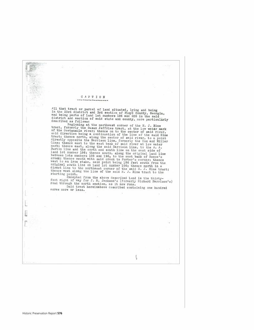
Historic Preservation Report 576

National Park Service 577

Historic Preservation Report 578

National Park Service 579

Historic Preservation Report 580

National Park Service 581

Historic Preservation Report 582

National Park Service 583
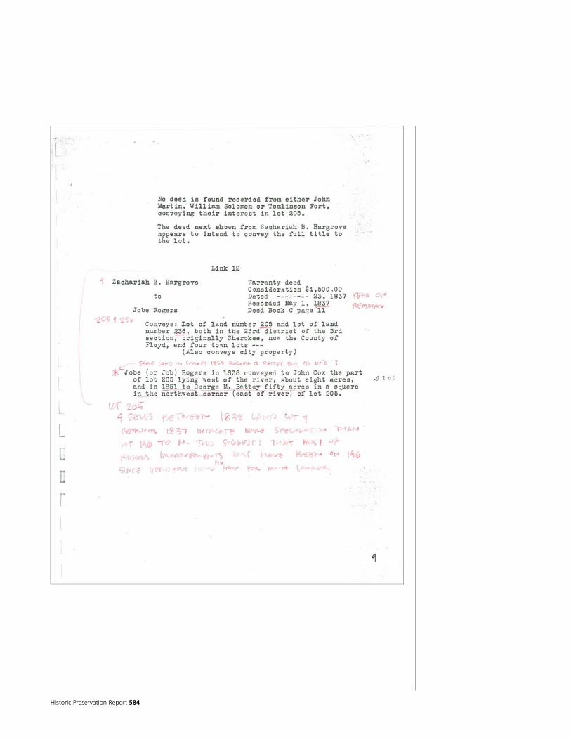
Historic Preservation Report 584
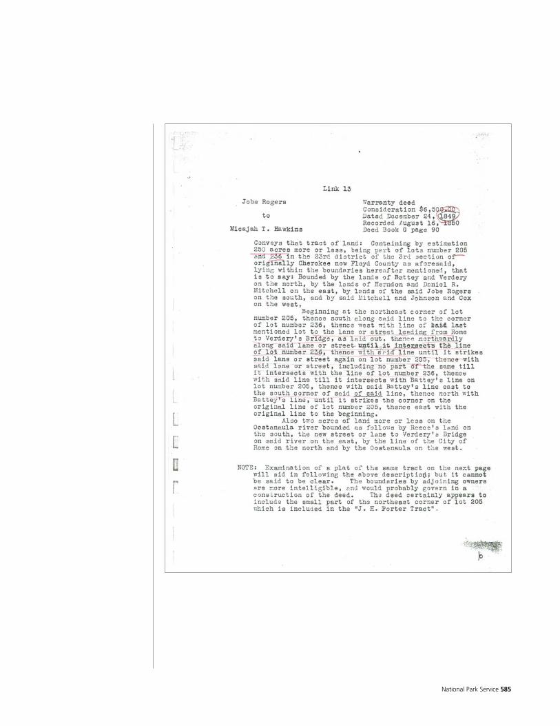
National Park Service 585

Historic Preservation Report 586
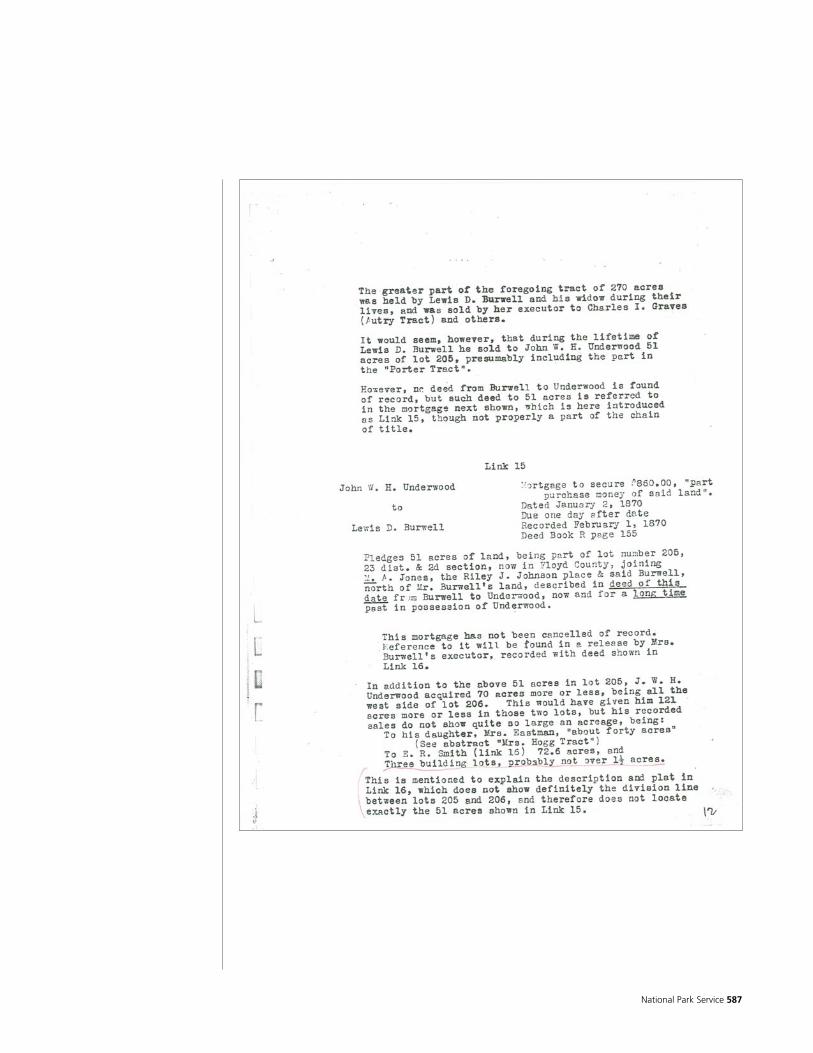
National Park Service 587
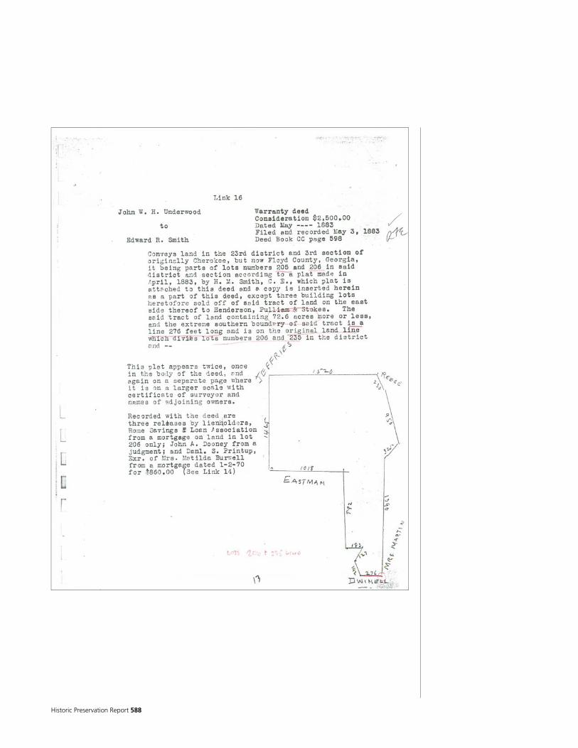
Historic Preservation Report 588

National Park Service 589

Historic Preservation Report 590

National Park Service 591

Historic Preservation Report 592

National Park Service 593

Historic Preservation Report 594

National Park Service 595
Historic Preservation Report 596
National Park Service 597

Historic Preservation Report 598
National Park Service 599
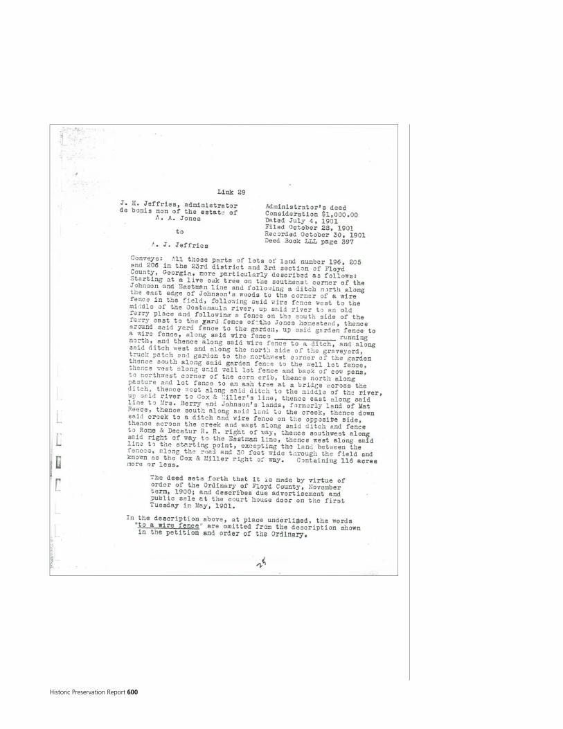
Historic Preservation Report 600
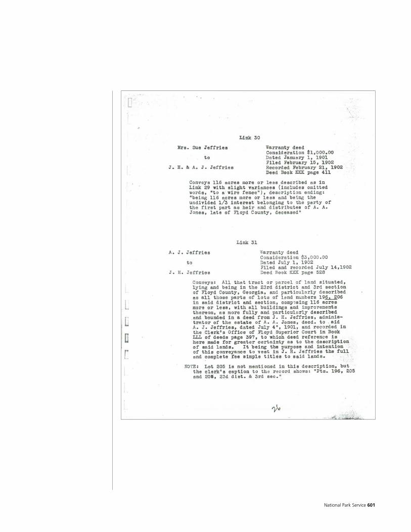
National Park Service 601
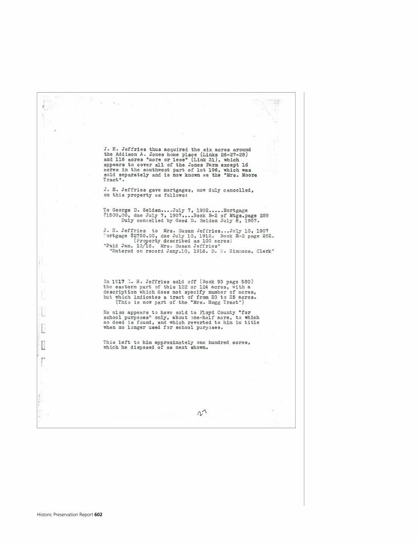
Historic Preservation Report 602
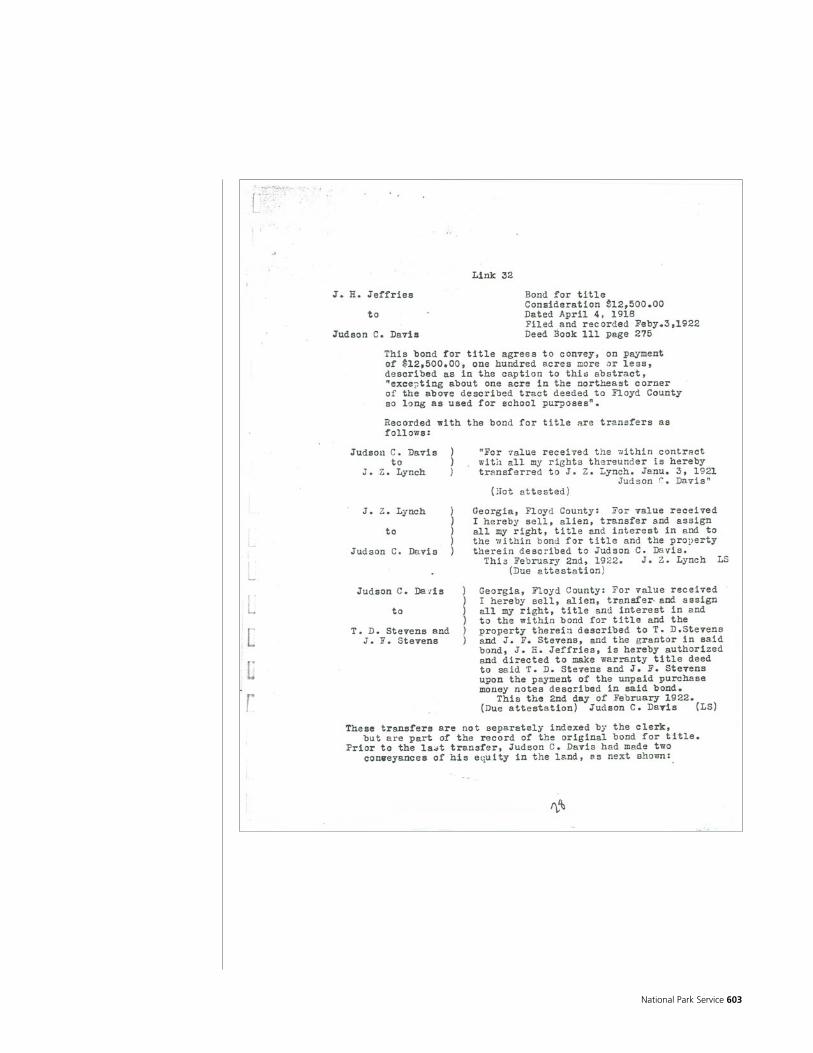
National Park Service 603

Historic Preservation Report 604
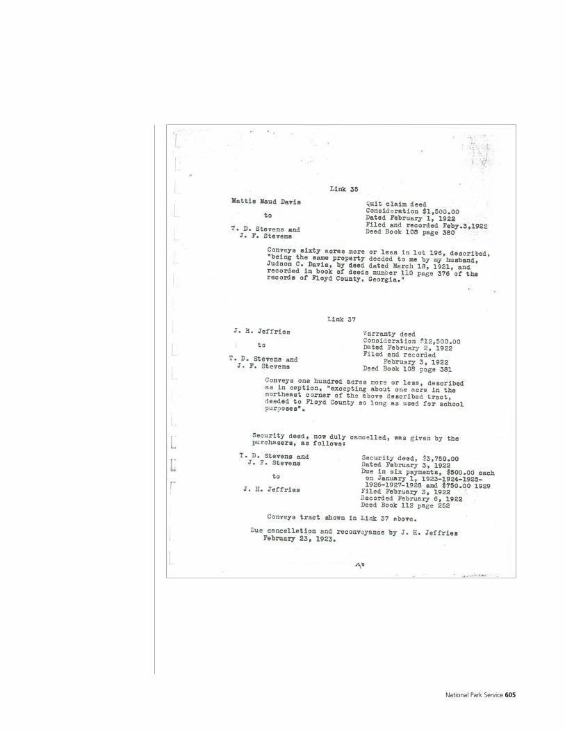
National Park Service 605
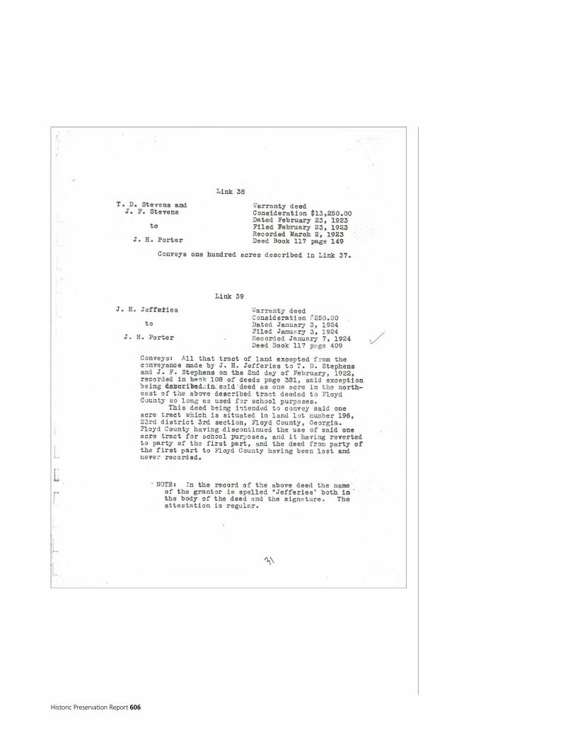
Historic Preservation Report 606

National Park Service 607

Historic Preservation Report 608

National Park Service 609
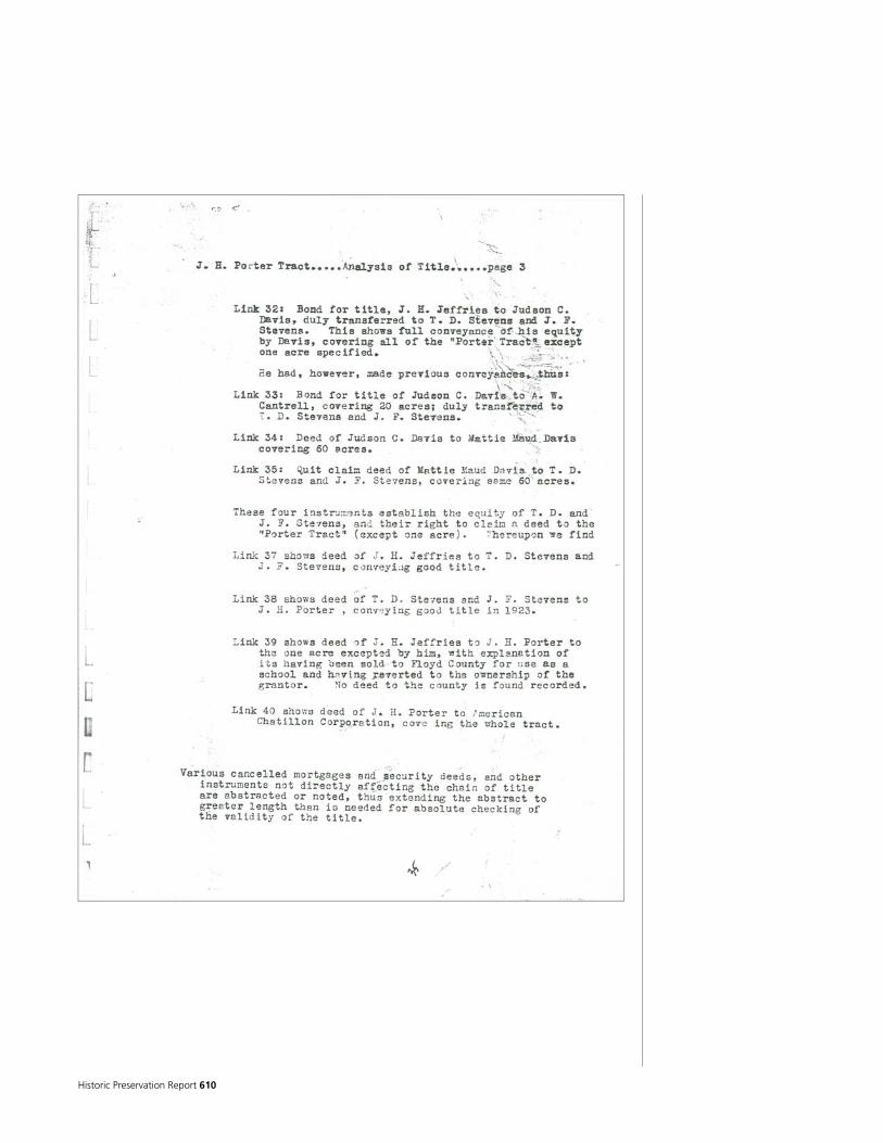
Historic Preservation Report 610

National Park Service 611
Appendix B – Window and Door Schedules
First Floor Window and Door Schedule
S.1.W.1 S.1.W.2 S.1.W.4 S.1.W.5
S.1.W.3
103
102
104
105
107
106
109
108
111 112
113
114
115
116
117
101
S.1.W.6 S.1.W.7 S.1.W.8
S.1.W.10
S.1.W.11 S.1.W.13 S.1.W.14 S.1.W.15 S.1.W.16 S.1.W.17 S.1.D.2S.1.D.1A S.1.D.1B W.1.W.11
W.1.W.10
W.1.W.9
W.1.W.8 W.1.W.7
W.1.W.6
W.1.W.5
W.1.W.4 W.1.W.3
W.1.W.2 W.1.W.1
N.1.W.7 N.1.W.6 N.1.W.5
N.1.W.4 N.1.W.3 N.1.W.2 N.1.W.1
E.1.D.2
E.1.W.7
E.1.W.8
E.1.W.6
E.1.W.5
E.1.W.4
E.1.W.3
E.1.D.1A
E.1.D.1B E.1.W.2
E.1.W.1
110N.1.D.1
I.110.D.1
I.111.D.1
I.107.D.2
I.107.D.1
I.107.D.3A
I.107.D.4A
I.107.D.4B
I.105
.D.2
B I.1
05.D
.2A
I.113.W.1
I.106.W.1
N.1.W.8 N.1.W.9 N.B.W.1
I.102.D.1
I.104.D.1
I.117.D.1
I.114.D.1
I.116.D.2
I.116.D.1
S.1.W.12S.1.W.9
I.107.D.3B
I.105.D.1
I.102.D.2
I.102.D.3
I.115.D.1
I.106.D.1
I.109.D.1
I.109.D.2
I.112.D.1
I.101.D.1

Historic Preservation Report 612
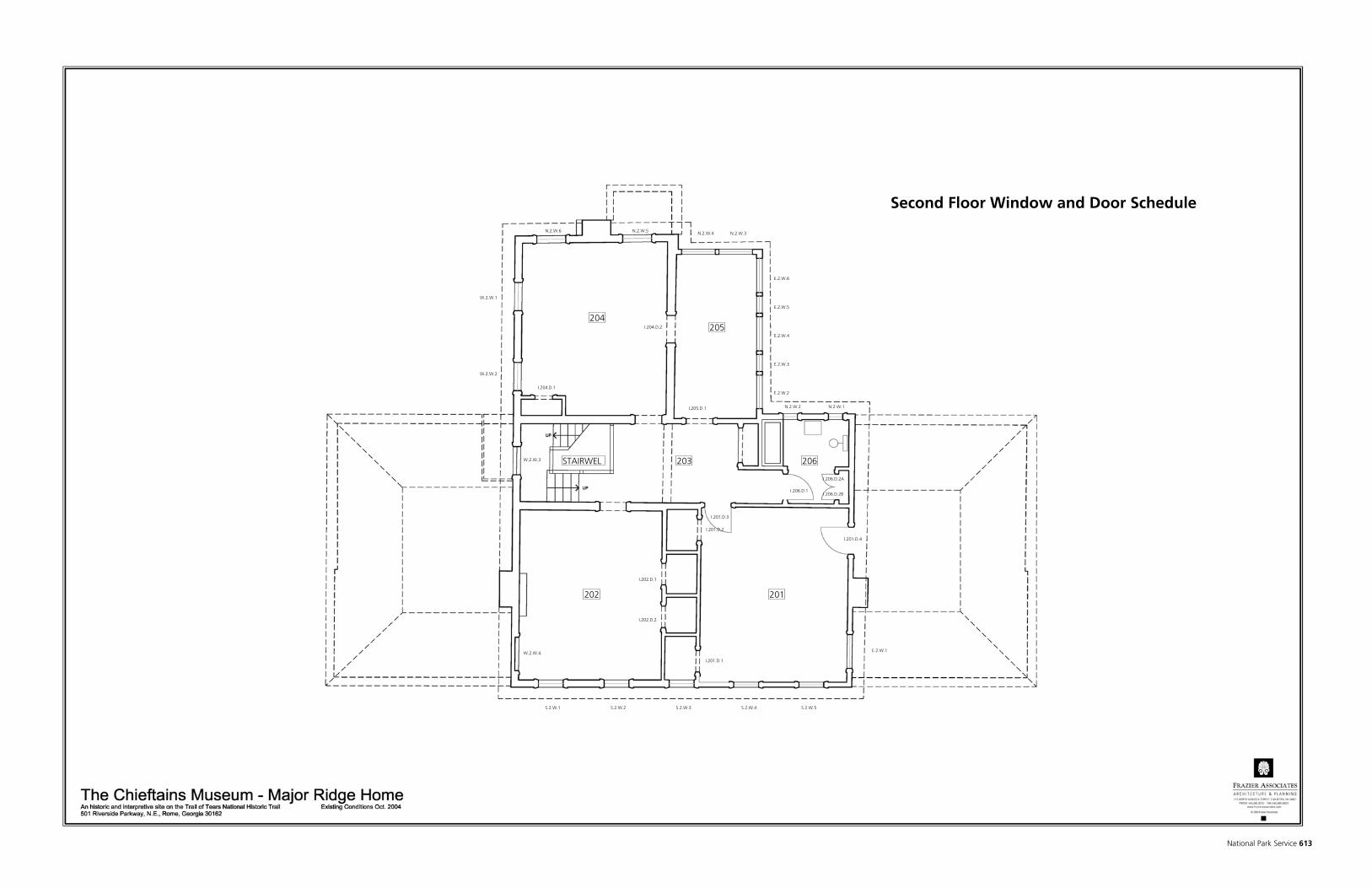
National Park Service 613
Second Floor Window and Door Schedule
206
201
203
205204
202
S.2.W.5S.2.W.4S.2.W.3S.2.W.2S.2.W.1
E.2.W.1
E.2.W.2
E.2.W.3
E.2.W.4
E.2.W.5
E.2.W.6
N.2.W.1N.2.W.2
N.2.W.3N.2.W.4N.2.W.5N.2.W.6
STAIRWEL
W.2.W.1
W.2.W.2
W.2.W.3
W.2.W.4
I.206.D.1
I.206.D.2A
I.206.D.2B
I.201.D.3
I.201.D.4
I.201.D.2
I.201.D.1
I.202.D.1
I.202.D.2
I.204.D.1
I.204.D.2
I.205.D.1

Historic Preservation Report 614

National Park Service 615
ALIGNMENT SCREENS STORMS
N,S,E,W N,S,E,W N,S,E,W
N.1.W.1 Y 9/9 Double Hung P P N Y R B P P N Y R R B P P M N N.1.W.1
N.1.W.2 Y 9/9 Double Hung P P N Y R B P P N Y R R B P P M M N.1.W.2 CODE DESCRIPTION
N.1.W.3 Y 6/6 Double Hung P P N Y R 1 B P P N Y R B P P M M N.1.W.3 B Broken
N.1.W.4 Y 6/6 Double Hung P P N Y R B P P N R 2 B P P M M N.1.W.4 C Replace
N.1.W.5 Y 6/6 Double Hung P P N 2 B P P N B P P M M N.1.W.5 D Deteriorated/Rotted
N.1.W.6 Y 6/6 Double Hung P P N N B P P N B P P M M N.1.W.6 F Fixed
N.1.W.7 Y 6/6 Double Hung P P N B P P N R B P P M M N.1.W.7 M Missing
N.1.W.8 Y 9/9 Double Hung P P N R B P P N B P P M M N.1.W.8 N No
N.1.W.9 Y 9/9 Double Hung P P N B P P N 1 B P P M M N.1.W.9 NH Hardware Not Present
N.B.W.1 Y Missing (may have been awning or hopper style) N.B.W.1 P Paint
S.1.W.1 Y Sidelight P P N PS S.1.W.1 PS Plexi-glass and/or Screen
S.1.W.2 Y Ribbon Palladian P P N PS S.1.W.2 R Repair
S.1.W.3 Y Elliptical Fan P P N PS S.1.W.3 S Scratched
S.1.W.4 Y Ribbon Palladian P P N PS S.1.W.4 Y Yes
S.1.W.5 Y Sidelight P P N PS S.1.W.5
S.1.W.6 Y 9/9 Double Hung P P N Y B P P N Y R B P P M M S.1.W.6
S.1.W.7 Y 9/9 Double Hung P P N Y R 1 B P P N Y R 1 B P P M M S.1.W.7
S.1.W.8 Y Sidelight P P F N n/a P P B P P M M S.1.W.8
S.1.W.9 Y Sidelight Transom P P F N 1 n/a P P B P P M M S.1.W.9
S.1.W.10 Y Transom P P F N n/a P P B P P M M S.1.W.10
S.1.W.11 Y Sidelight P P F N 2 n/a P P B P P M M S.1.W.11
S.1.W.12 Y Sidelight Transom P P F N n/a P P B P P M M S.1.W.12
S.1.W.13 Y 9/9 Double Hung P P N Y R 3 B P P N N B P P M M S.1.W.13
S.1.W.14 Y 9/9 Double Hung P P N Y R 1 S 1 B P P N N B P P M M S.1.W.14
S.1.W.15 Y Ribbon Palladian P P N N R 2 B P P M M S.1.W.15
S.1.W.16 Y Ribbon Palladian P P N N R B P P M M S.1.W.16
S.1.W.17 Y Ribbon Palladian P P N N R 1 B P P S.1.W.17
E.1.W.1 Y Sidelight P P F B P P E.1.W.1
E.1.W.2 Y Elliptical Fan P P F B P P E.1.W.2
E.1.W.3 Y Sidelight P P F B P P E.1.W.3
E.1.W.4 Y 9/9 Double Hung P P N Y R 1 B P P N Y R R B P P M M E.1.W.4
E.1.W.5 Y 9/9 Double Hung P P N Y R B P P N Y R R B P P M M E.1.W.5
E.1.W.6 Y 9/9 Double Hung R P P N N B P P N R R North B P P M M E.1.W.6
E.1.W.7 Y 12/12 Double Hung R P P N N P P N R B P P M M E.1.W.7
E.1.W.8 Y Transom P P N N B P P E.1.W.8
W.1.W.1 Y 4/4 Double Hung P P N Y B P P N R B P P M M W.1.W.1
W.1.W.2 Y 4/4 Double Hung P P N Y B P P N Y 1 B P P M M W.1.W.2
W.1.W.3 Y 4/4 Double Hung P P N Y R B P P N Y 2 1 B P P M M W.1.W.3
W.1.W.4 Y 4/4 Double Hung P P N Y R 1 B P P N 1 2 B P P M M W.1.W.4
W.1.W.5 Y 9/9 Double Hung P P N B P P N B P P Y M M W.1.W.5
W.1.W.6 Y 9/9 Double Hung P P N B P P M M W.1.W.6
W.1.W.7 Y Sidelight P P N PS W.1.W.7
W.1.W.8 Y Sidelight P P N PS W.1.W.8
W.1.W.9 Y Palladian P P N PS W.1.W.9
W.1.W.10 Y Sidelight P P N PS W.1.W.10
W.1.W.11 Y Sidelight P P N PS W.1.W.11
I.106.W.1 Y Fixed I.106.W.1
I.113.W.1 Y Fixed P P N B P P N Y B P P I.113.W.1
N.2.W.1 Y 4/4 Double Hung P P N Y R 1 B P P N Y R R 2 B P P M M N.2.W.1
N.2.W.2 Y 4/4 Double Hung P P N Y R B P P N Y R R R West B P P M M N.2.W.2
N.2.W.3 Y Double Casement P P N R 1 B P P N.2.W.3
N.2.W.4 Y Double Casement P P N R 1 B P P N.2.W.4
N.2.W.5 Y 6/6 Double Hung P P N Y R 1 B P P N Y R R B P P M M N.2.W.5
N.2.W.6 Y 6/6 Double Hung P P N Y R B P P N Y R R B P P M M N.2.W.6
S.2.W.1 Y 6/6 Double Hung P P N Y R B P P N Y R R B P P M M S.2.W.1
S.2.W.2 Y 6/6 Double Hung P P N Y R 1 B P P N Y R R B P P M M S.2.W.2
S.2.W.3 Y 6/6 Double Hung P P N Y R B P P N Y R R B P P M M S.2.W.3
S.2.W.4 Y 6/6 Double Hung P P N Y R B P P N Y R R B P P M M S.2.W.4
S.2.W.5 Y 6/6 Double Hung P P N Y R B P P N Y R R B P P M M S.2.W.5
E.2.W.1 Y Double Casement E.2.W.1
E.2.W.2 Y Double Casement P P N Y R B P P M M E.2.W.2
E.2.W.3 Y Fixed P P F R B P P E.2.W.3
E.2.W.4 Y Double Casement P P N R 2 B P P E.2.W.4
E.2.W.5 Y Fixed P P F R R South 3 B P P E.2.W.5
E.2.W.6 Y Double Casement P P N R 1 B P P E.2.W.6
W.2.W.1 Y 6/6 Double Hung P P N Y R R South B P P N Y R R B P P M M W.2.W.1
W.2.W.2 Y 6/6 Double Hung P P N Y R B P P N Y R R 2 S B P P M M W.2.W.2
W.2.W.3 Y 6/6 Double Hung P P N Y R 1 B P P N Y R R 3 B P P M M W.2.W.3
W.2.W.4 YMissing (may have been 6 light Double Casement as on East
Elevation)W.2.W.4
TOTALS TOTALS
Repairs Repairs
Replacements Replacements
Counts Counts
Other Totals Other Totals
Present
LEGEND
Lock Handle Adjust Meeting Rail Alignment Present
Number of Muntins to be
Replaced
Glazing Putty
Interior Surface Finishes
Exterior Surface Finishes
Meeting Rail
Stiles Number of Broken Panes
Number of Muntins to be
Repaired
Exterior Surface Finishes
Operable Adjust for Fit Lower Rail
Number of Muntins to
be Repaired
Number of Muntins to
be Replaced
Glazing Putty
Interior Surface Finishes
Upper Rail Meeting Rail
Stiles Number of Broken Panes
Interior Surface Finishes
Exterior Surfcae Finishes
Operable Adjust for Fit
Interior Stop Sill Stool Tube
BalancesHeadJambs Blind
StopParting Bead
69 TOTAL WINDOWS WINDOW SCHEDLUE - CHIEFTAINS MUSEUM
WINDOW NO. SURVEYED TYPE
FRAMING UPPER SASH or SINGLE SASH (Includes trasom, casement, clerestory, and sidelights) LOWER SASH
WINDOW NO.Lintel

Historic Preservation Report 616

National Park Service 617
N,S,E,W
N.1.D.1 Y SC P P Y Y P P N.1.D.1
S.1.D.1A Y PS S.1.D.1A CODE DESCRIPTION
S.1.D.1B Y PS S.1.D.1B B Broken
S.1.D.2 Y WLE P P Y N P P Y, * N N S.1.D.2 C Replace
E.1.D.1A Y WLE *S P P Y Y R R *, R R P P Y Y N N E.1.D.1A CM Casement Style Cabinet Door
E.1.D.1B Y WLE P P Y Y R R R R P P Y Y N N E.1.D.1B N No
E.1.D.2 Y WPI *S P P Y Y *, R P P Y Y N N E.1.D.2 P Paint
I.101.D.1 Y NP * I.101.D.1 NP No Longer Present
I.102.D.1 Y WLE P P Y Y R P P Y Y, * N N I.102.D.1 PS Plexi-glass and/or Screen
I.102.D.2 Y NP * I.102.D.2 R Repair
I.102.D.3A Y NP * I.102.D.3A *N North Jamb - evidence of strike plate, hinge, or mortise
I.102.D.3B Y NP * I.102.D.3B *S South Jamb - evidence of strike plate, hinge, or mortise
I.104.D.1 Y WLE P P Y N P P Y Y, * N N I.104.D.1 * Evidence of door, strike plate, hinge or mortise
I.105.D.1 Y WPI P P Y Y P P Y N N N Clean I.105.D.1 SC Screen Door
I.105.D.2A Y WPI P P Y N R C R R R P P Y N N N Modified I.105.D.2A WLE Exterior Wooden Door with Lites
I.105.D.2B Y WPI P P Y N R C R R R P P N N N N Modified I.105.D.2B WPI Interior Paneled Door
I.106.D.1 Y NP * I.106.D.1 Y Yes
I.107.D.1 Y WPI P P Y N P P N N N I.107.D.1
I.107.D.2 Y WPI R east P P Y N P P N N N I.107.D.2
I.107.D.3A Y CM P P Y N P P Cabinet I.107.D.3A
I.107.D.3B Y CM P P Y N P P Cabinet I.107.D.3B
I.107.D.4A Y CM P P Y N P P Cabinet I.107.D.4A
I.107.D.4B Y CM P P Y N P P I.107.D.4B
I.109.D.1 Y NP * I.109.D.1
I.109.D.2 Y NP * I.109.D.2
I.110.D.1 Y WPI R east P P Y N R P P Y Y N N N I.110.D.1
I.111.D.1 Y WPI P P Y N P P Y N N N I.111.D.1
I.112.D.1 Y NP * I.112.D.1
I.114.D.1 Y WPI R P P Y N R P P Y N N N I.114.D.1
I.115.D.1 Y NP * I.115.D.1
I.116.D.1 Y WPI *S P P Y N *, R P P N N N N I.116.D.1
I.116.D.2 Y WPI P P Y *, N P P N N N I.116.D.2
I.117.D.1 Y WLE *N,*S P P Y N * P P Y I.117.D.1
I.201.D.1 Y NP * I.201.D.1
I.201.D.2 Y NP * I.201.D.2
I.201.D.3 Y WPI *N P P Y N R P P Y N N N I.201.D.3
I.201.D.4 Y NP * I.201.D.4
I.202.D.1 Y NP * I.202.D.1
I.202.D.2 Y NP * I.202.D.2
I.204.D.1 Y NP * I.204.D.1
I.204.D.2 Y NP * I.204.D.2
I.205.D.1 Y NP * I.205.D.1
I.206.1 Y WPI P P Y N P P N N N N I.206.1
I.206.2A Y CM P P Y Y P P N N N N Cabinet I.206.2A
I.206.2B Y CM P P Y N P P N N N N Cabinet I.206.2B
TOTALS TOTALS
Repairs 3 4 Repairs
Replacements Replacements
Counts Counts
Other Totals Other Totals
LEGEND
Exterior Color
Evidence of Earlier
Screen/Storm
Screen Present
Storm Present
Hinges (missing parts)
Adjust Knobs/Levers
Repair Lockset
Interior Color
Number of Broken Panes
Number of Muntins to be
Repaired
Number of Muntins to be
Replaced
Framing SurroundPanels
Tounge and Groove Boards
Interior Surface Finishes
Exterior Surface Finishes
Bottom Rail Latch Stile Hinge
StileIntermediate
StilesOperable Adjust for Fit Top Rail Intermediate
RailsThreshold/Sill WeatherstrippingInterior Surface Finishes
Exterior Surfcae Finishes
Interior Side
Casing
Interior Head
Casing
Exterior Head
Casing
Exterior Side
CasingLintel Head
JambsStop
SCREENS/STORMS
NOTES DOOR NO.
45 TOTAL EXTERIOR AND INTERIOR DOORS or OPENINGS DOOR SCHEDLUE - CHIEFTAINS MUSEUM
DOOR NO. SURVEYED TYPE
FRAMING DOOR INSET GLAZING HARDWARE COLOR

Historic Preservation Report 618

National Park Service 619
Appendix C – HABS Level 1 Drawings

Historic Preservation Report 620
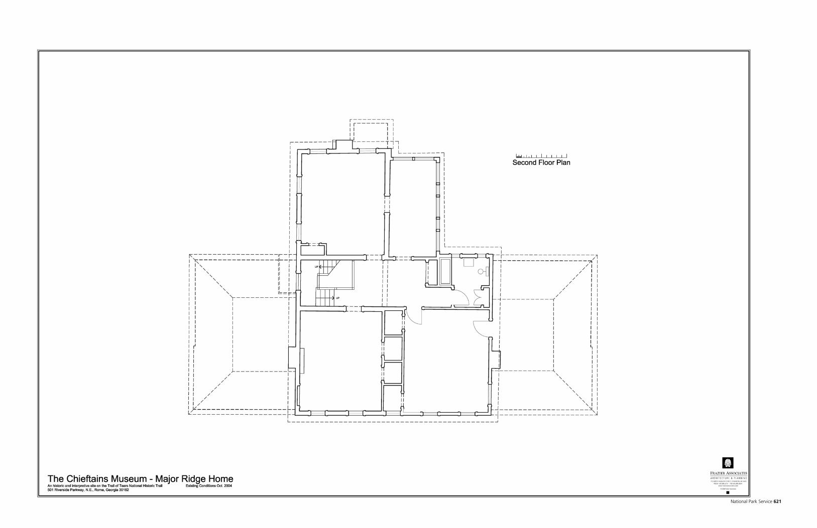
National Park Service 621

Historic Preservation Report 622

National Park Service 623

Historic Preservation Report 624
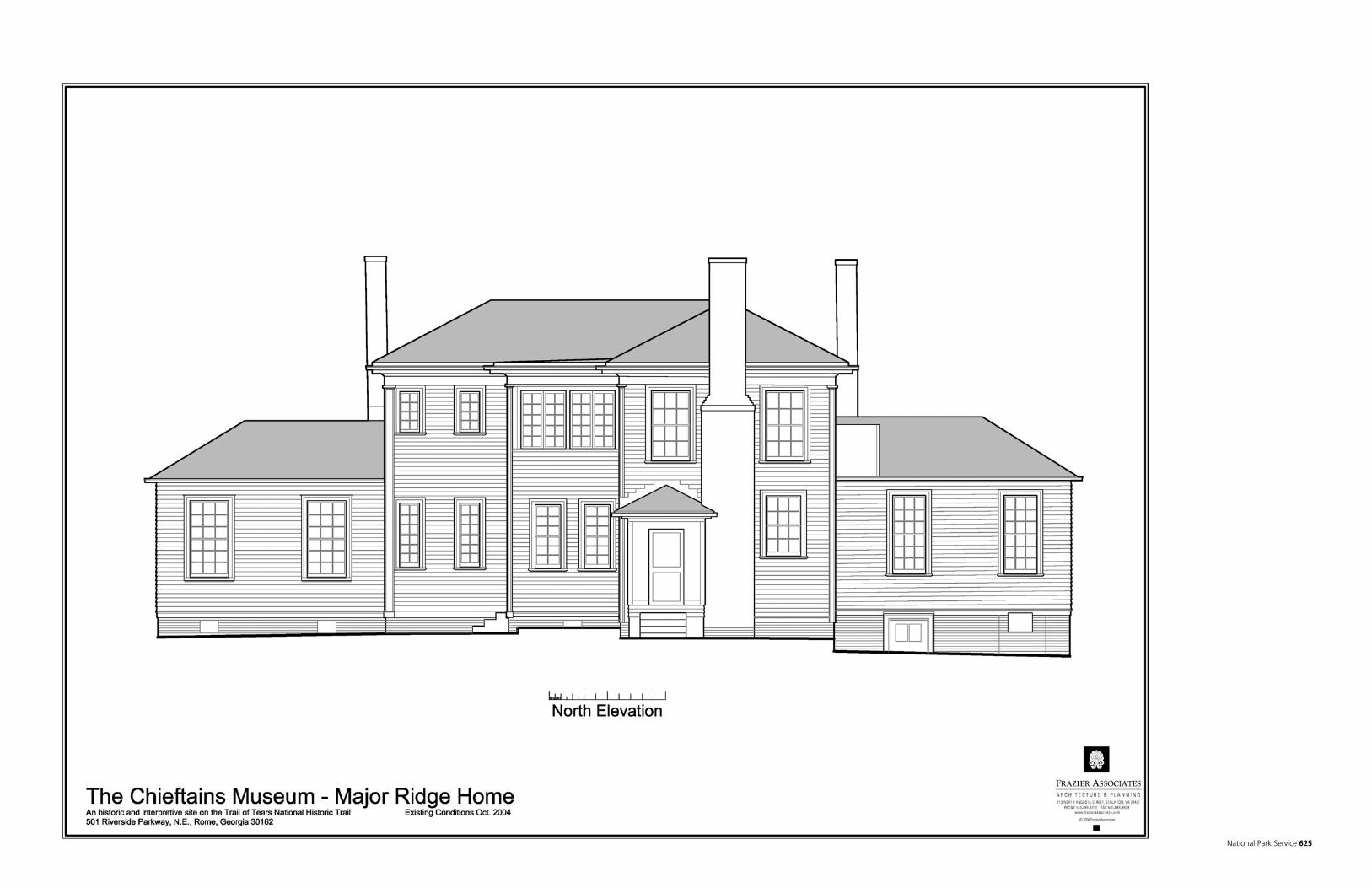
National Park Service 625

Historic Preservation Report 626

National Park Service 627

Historic Preservation Report 628
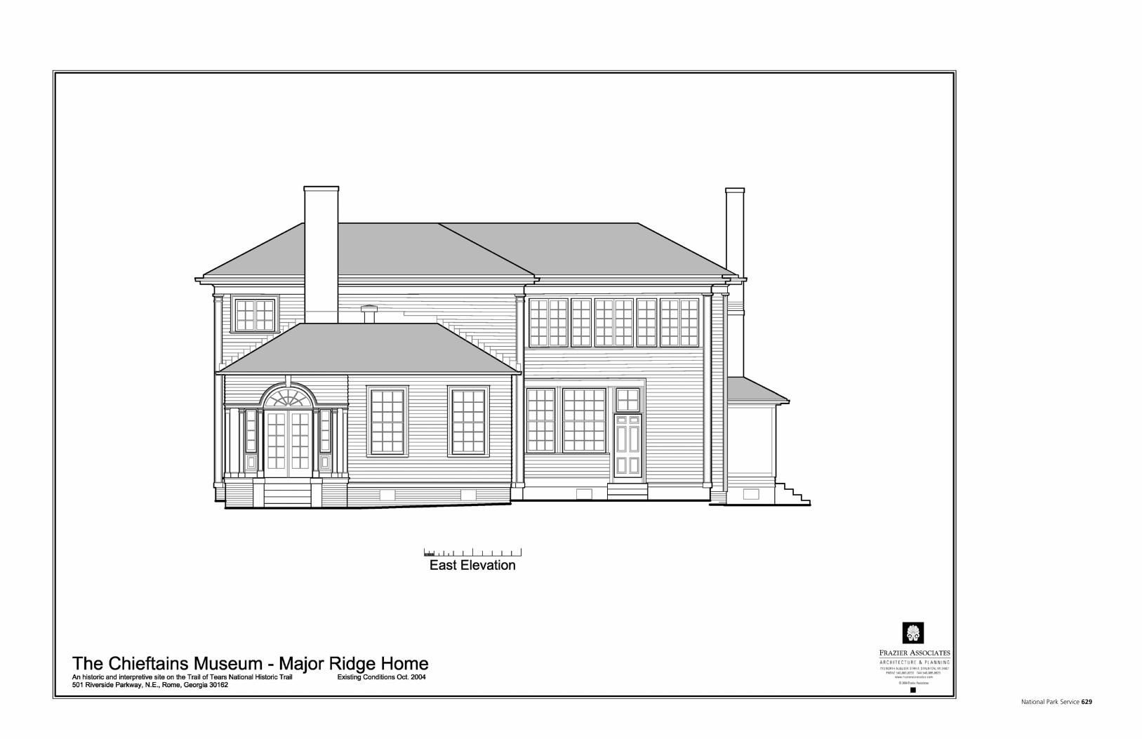
National Park Service 629

Historic Preservation Report 630
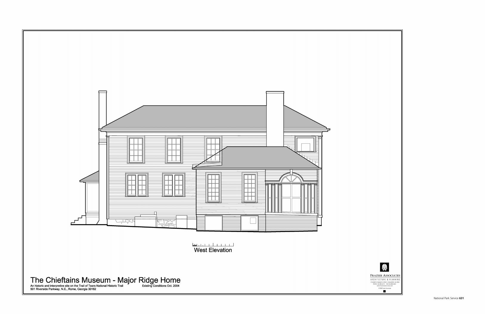
National Park Service 631

Historic Preservation Report 632

As the nation's principal conservation agency, the Department of the Interior has responsibility for most of our nationally owned public lands and natural resources. This includes fostering sound use of our land and water resources; protecting our fish, wildlife, and biological diversity; preserving the environmental and cultural values of our national parks and historical places; and providing for the enjoyment of life through outdoor recreation. The department assesses our energy and mineral resources and works to ensure that their development is in the best interests of all our people by encouraging stewardship and citizen participation in their care. The department also has a major responsibility for American Indian reservation communities and for people who live in island territories under U.S. administration.

EXPERIENCE YOUR AMERICA
Qz 1_~#oF a%Bf!
Trail of Tears National Historic Trail