
Transit-Oriented Development (TOD) Program · types of TOD strategies – Agency TOD and Community...
41
Transit-Oriented Development (TOD) Program STRATEGIC PLAN UPDATE April 24, 2014
Transcript of Transit-Oriented Development (TOD) Program · types of TOD strategies – Agency TOD and Community...

Transit-Oriented Development (TOD) ProgramSTRATEGIC PLAN UPDATEApril 24, 2014

Table of ContentsIntroduction 3 Transit-Oriented Development: What and Why 3
A TOD Policy Vision 4
TOD Policy Goals 4
TOD Policy Strategies 4
TOD Program Strategic Plan Overview and Purpose 5
Sound Transit TOD Program 6
TOD Program Strategic Priorities 6
Strategic Priority 1: Corridor Alignment and Transit System Planning 7
Strategic Priority 2: TOD Planning for Stations and Station Areas 10
Strategic Priority 3: Surplus Property Disposition 16
Related Sound Transit Policies 19
TOD Regulatory Framework 20
Sound Transit TOD Portfolio 22
Glossary of Terms 30
Sound Transit Policies 32
Sound TransitUnion Station, 401 S. Jackson St., Seattle WA 98104 1-800-201-4900 / TTY Relay: 711 / [email protected] soundtransit.org

TRANSIT-ORIENTED DEVELOPMENT STRATEGIC PLAN – APRIL 2014 3
IntroductionTransit-Oriented Development: What and WhySound Transit’s regional system provides the building blocks for a sustainable future. In 10 years, Sound Transit will operate 50 miles of light rail along with an extensive network of bus and commuter rail services. Expanding transit improves air quality and eases congestion to help make the Puget Sound region a better place to live and work.
With over one million more residents anticipated in the region by 2030, Sound Transit’s Transit-Oriented Development (TOD) program brings more of the region’s residents within easy walking distance of its services and increases ridership. It reduces car travel, improves quality of life, and helps the region realize its vision for land use, transportation and economic development.
SoundTransit’spolicydefinesTODasa“landdevelopmentpatternthatintegratestransitandlandusebypromotingtransitridershipwhilesupportingcommunitylanduseanddevelopmentvisions.TODtypicallyconsistsofpublicandprivatedevelopmentprojectsthatcreatedense,pedestrian-orientedenvironmentswithamixoflandusesandactivitiesatandaroundtransitfacilities.Thedesign,configuration,andmixofbuildingsandactivitiesaroundthetransitfacility,aswellasthelocationanddesignofthetransitfacility,shouldencouragepeopletousetransitandfosterahealthy,livableenvironment.”1
Reconnecting America – a national non-profit organization focused on integrating transportation and land use policies – credits Transit-oriented development with creating “location efficiency” and “a sense of community and of place.” 2
A TOD Policy VisionFederal, state, regional and local governments set forth a consistent vision for land use and transit integration in the Central Puget Sound. This vision provided the impetus for the creation of Sound Transit, and was reflected in its enabling legislation. A critical element of this vision is:
Compact, walkable, urban centers linked by fast and frequent high capacity transit service, which promote economic and environmental vitality, increase personal mobility and improve public health.3
Sound Transit’s Transit-Oriented Development Policy was adopted in December 2012 through Resolution R2012-24 and provides the foundation for the TOD Program Strategic Plan. The Policy is included in Appendix A.
1 Sound Transit Transit-Oriented Development Policy, R2012-24, Attachment A.
2 Reconnecting America: What is TOD? From reconnectingamerica.org.
3 Washington State’s Growth Management Act establishes a mandate for land use and transit integration and serves as the basis of support for tran-sit-oriented development (RCW 36.70A).
Regionally, this vision for land use-transit integration is embodied in Puget Sound Regional Council’s VISION 2040 (2008) and is supported by Sound Transit in Appendix D of Sound Move (1995), its Long-range Plan (2005) and Appendix D of Sound Transit 2 (2008).
Community TOD at Othello Station

TRANSIT-ORIENTED DEVELOPMENT STRATEGIC PLAN – APRIL 2014 4
TOD Policy Goals Sound Transit’s TOD policy is, first and foremost, intended to increase the value and effectiveness of transit by increasing ridership. TOD also may generate revenue for the system and provide cost-sharing opportunities. TOD policy goals support the region’s vision of compact, walkable urban centers connected by high capacity transit. They foster relationships with others to facilitate TOD; emphasize non-motorized access to trains and buses; and support market-rate and affordable housing near transit.
TOD Policy StrategiesSound Transit’s TOD Policy outlines four strategy areas that help guide the TOD Program. This TOD Strategic Plan defines how they will be implemented: 4
1. TOD strategies – Agency TOD and Community TOD: Sound Transit will work cooperatively on two types of TOD strategies – Agency TOD and Community TOD (see Section IV: Glossary of Terms). The distinction between Agency TOD and Community TOD strategies is intended to clarify the roles that Sound Transit may play in evaluating and facilitating TOD, recognizing the appropriate roles of the transit agency, local and regional governments, and private and public development.
2. TOD in early planning: Sound Transit will assess TOD early in system planning, throughout all phases of its transit projects and during transit system operations.
3. TOD resources: Sound Transit will allocate sufficient resources and develop a strategic plan, procedures and guidelines to implement a TOD program consistent with Board-adopted policies and in the context of its financial plan.
4. TOD reporting: Sound Transit staff will report regularly to the Sound Transit Board on TOD activities and progress toward TOD goals, and to seek direction on implementation priorities.
Mount Baker Lofts, Artspace USA’s third Seattle project, will be completed Summer 2014. The $18 million project will be a mixed-use arts facility containing 57 rental units of affordable live/work space for artists and their families. Formerly occupied by a Firestone retail auto service center, the business was relocated in 2009 by Sound Transit to a new site as the result of adjacent station construction, keeping 15 jobs and the annual sales tax of $240,000 a year in the neighborhood.
4 Sound Transit Resolution R2012-24, Attachment A, Section 3.
Before

TRANSIT-ORIENTED DEVELOPMENT STRATEGIC PLAN – APRIL 2014 5
TOD Program Strategic Plan Overview and Purpose The Sound Transit TOD Program Strategic Plan, completed in 2010, introduced the adopted policy framework for the TOD work program within the larger context of the Sound Transit’s mission: implementation of regional high capacity transit as detailed in Sound Move (1996), and ST2 (2008). One of the most significant changes in this Plan update is the additional attention paid to role of TOD in long-range and project planning. Additionally it responds to the fact that federal funding decisions (see TOD Regulatory Framework, below) now require consideration of land use as a major factor in transit planning decisions.
Intended Audience
The Plan is intended for use by the following audiences:
¡ The Board of Directors, as a reference tool to support system planning, project planning and property disposition decisions.
¡ Sound Transit staff to support the analysis, creation and implementation of TOD projects.
¡ Local jurisdictions and partner agencies, to provide insight into Sound Transit’s work to serve and support urban centers, and also to articulate the potential for partnership opportunities to leverage Sound Transit’s transit investment in support of successful place making.
How the Plan is Organized
The TOD Program Strategic Plan is organized for readers to easily find the information they need to assist with decision-making and TOD program implementation. Three connected terms are used in this document to describe Sound Transit’s TOD work: Plan, Policy, and Program.
¡ Plan refers to this Strategic Plan, which provides the framework for how the TOD goals and strategies will be implemented.
¡ Program refers to the staff and consultant activities within the agency focused on TOD.
¡ Policy refers to the TOD Policy adopted by the Board of Directors in December 2012 (R2012-24). “Disposition Policy” refers to the Real Property Excess, Surplus, and Disposition Policy adopted by the Board of Directors in December 2013.
After
TRANSIT-ORIENTED DEVELOPMENT STRATEGIC PLAN – APRIL 2014 6
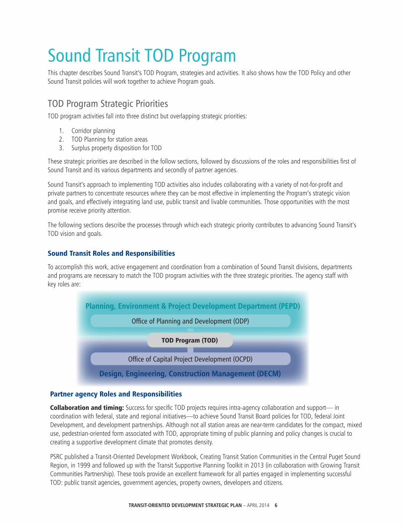
Sound Transit TOD Program This chapter describes Sound Transit’s TOD Program, strategies and activities. It also shows how the TOD Policy and other Sound Transit policies will work together to achieve Program goals.
TOD Program Strategic Priorities TOD program activities fall into three distinct but overlapping strategic priorities:
1. Corridor planning 2. TOD Planning for station areas 3. Surplus property disposition for TOD
These strategic priorities are described in the follow sections, followed by discussions of the roles and responsibilities first of Sound Transit and its various departments and secondly of partner agencies.
Sound Transit’s approach to implementing TOD activities also includes collaborating with a variety of not-for-profit and private partners to concentrate resources where they can be most effective in implementing the Program’s strategic vision and goals, and effectively integrating land use, public transit and livable communities. Those opportunities with the most promise receive priority attention.
The following sections describe the processes through which each strategic priority contributes to advancing Sound Transit’s TOD vision and goals.
Sound Transit Roles and Responsibilities
To accomplish this work, active engagement and coordination from a combination of Sound Transit divisions, departments and programs are necessary to match the TOD program activities with the three strategic priorities. The agency staff with key roles are:
Planning,Environment&ProjectDevelopmentDepartment(PEPD)
Design,Engineering,ConstructionManagement(DECM)
Office of Planning and Development (ODP)
Office of Capital Project Development (OCPD)
Partner agency Roles and Responsibilities
Collaboration and timing: Success for specific TOD projects requires intra-agency collaboration and support— in coordination with federal, state and regional initiatives—to achieve Sound Transit Board policies for TOD, federal Joint Development, and development partnerships. Although not all station areas are near-term candidates for the compact, mixed use, pedestrian-oriented form associated with TOD, appropriate timing of public planning and policy changes is crucial to creating a supportive development climate that promotes density.
PSRC published a Transit-Oriented Development Workbook, Creating Transit Station Communities in the Central Puget Sound Region, in 1999 and followed up with the Transit Supportive Planning Toolkit in 2013 (in collaboration with Growing Transit Communities Partnership). These tools provide an excellent framework for all parties engaged in implementing successful TOD: public transit agencies, government agencies, property owners, developers and citizens.
TOD Program (TOD)

TRANSIT-ORIENTED DEVELOPMENT STRATEGIC PLAN – APRIL 2014 7
Strategic Priority 1: Corridor Alignment and Transit System PlanningThe most significant new direction from the 2012 TOD Policy5 is that Sound Transit will assess TOD early in system planning, including development and updates to the Regional Long-Range Plan, System Plans and Corridor Studies. This is consistent with the GMA and the region’s long range planning processes, and also with recent guidance from the FTA, which promotes early planning for TOD during system planning and recognizes it in its project ratings for projects competing for federal funding. This strategic priority is typically a long-term process, often ten or more years before a transit project is completed.
At this early planning stage various modes and corridors will be under consideration and a high-level assessment of TOD opportunities will be conducted. Looking at TOD in the context of alignment options, station locations and local market conditions allows for a more informed decision-making process in support of TOD implementation.
Sound Transit Roles and Responsibilities
The TOD Program will work with other agency departments, listed below. The level of involvement with these departments will vary depending on the specific implementation activity.
Office of Capital Project Development Focus long-range planning on the HCT system expansion, ensuring that the corridors, when possible, implement regional planning goals.
Office of Planning and Development Initiate or participate in regional activities and studies that inform land use and transit connectivity.
Lynnwood Link Extension: Station Area Transit-oriented Development (TOD) Potential
5 Sound Transit Resolution R2012-24, 3.B. December 2012.

TRANSIT-ORIENTED DEVELOPMENT STRATEGIC PLAN – APRIL 2014 8
Corridor Alignment and Transit System Planning Implementation Activities
HighLevelPlanning
u Consistency: Confirm consistency with state, regional and local urban growth strategies.
¡ Document comprehensive plan land uses within a project area. These may change over time and will be re-evaluated during project development.
u PSRC: Continue participation with PSRC and the Growing Transit Communities efforts.
Early corridor planning development potential assessment

TRANSIT-ORIENTED DEVELOPMENT STRATEGIC PLAN – APRIL 2014 9
Federal Way Link Extension TOD Assessment Station area zoning
Evaluating Corridor Alignments and HCT Plans
u Focus on centers: Sound Transit’s regional system planning calls for connecting the region’s designated growth centers.
¡ Evaluation criteria: Consider regional connectivity to and between centers; potential to create or support transit communities; potential to support economic development; and service to transit-dependent markets.
u TOD potential: Identify TOD potential based on information available at the time of the study and input from local jurisdictions. Methods include:
¡ Land uses: Quantify land most likely to redevelop and/or support transit (commercial, multi-family, or mixed use zones). Quantify land least likely to redevelop (parks and recreation, right-of-way, or institutional).
¡ Demographics: Existing and future population and employment within the project area, potential corridors and potential station areas.
¡ High need populations: Existing poverty, minority, and zero-car ownership populations in potential corridors and station areas.
¡ Connections: Quality and quantity of connections to transit facilities.
¡ Peds and bikes: Existing non-motorized connections to transit, and pedestrian and bicycle facilities, plans and policies.
¡ Activity centers: Assess activity centers based on regional and local adopted plans, policies, and key employment, recreational, and housing centers.
Partner Agency Roles and Responsibilities
Corridor Alignment and Transit System Planning Partner Agency Activities
TOD Readiness
u Infrastructure: Assess infrastructure needs near proposed transit corridors and station areas and begin the process of implementing improvements to support TOD.
u Comprehensive plans: Update Comprehensive Plans to reflect transit corridor plans.
u Regulations: Implement regulatory changes to accommodate future transit corridor(s).
u Information sharing: Provide technical information to support planning analysis.
TRANSIT-ORIENTED DEVELOPMENT STRATEGIC PLAN – APRIL 2014 10
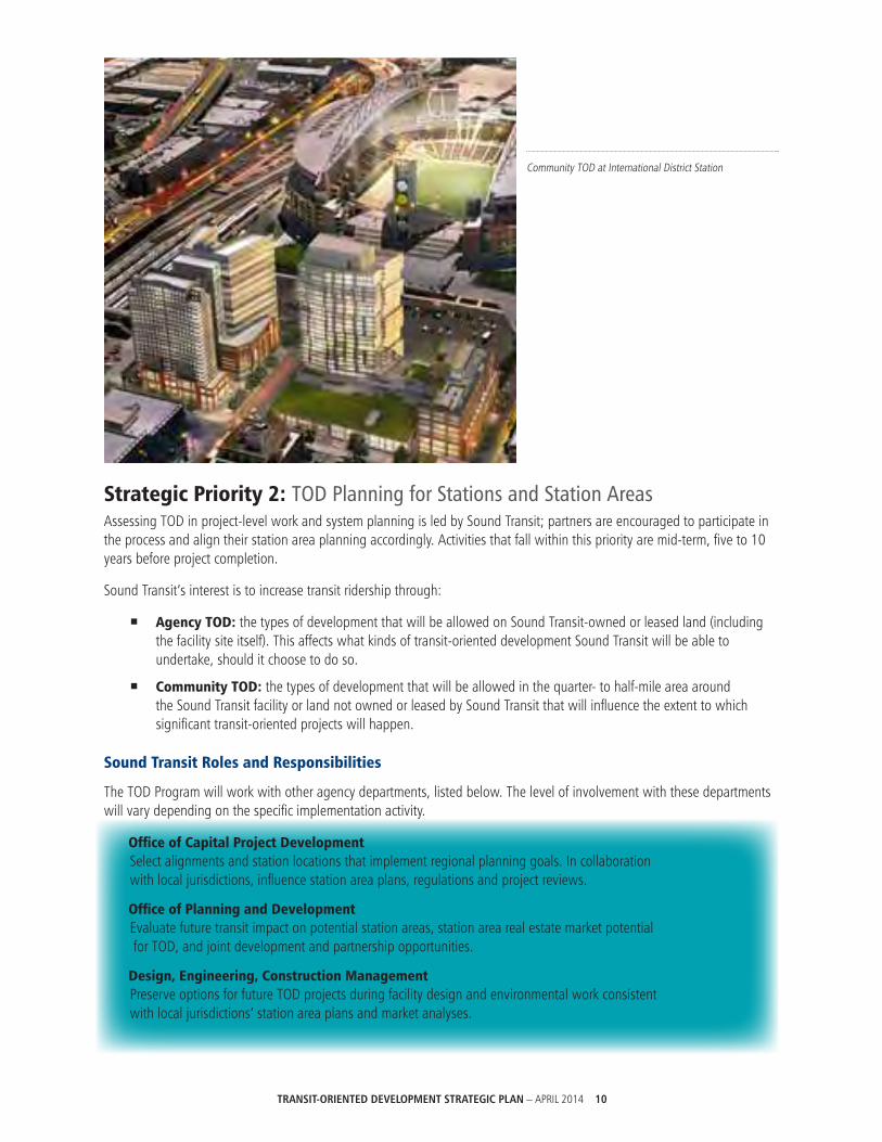
Strategic Priority 2: TOD Planning for Stations and Station Areas Assessing TOD in project-level work and system planning is led by Sound Transit; partners are encouraged to participate in the process and align their station area planning accordingly. Activities that fall within this priority are mid-term, five to 10 years before project completion.
Sound Transit’s interest is to increase transit ridership through:
¡ Agency TOD: the types of development that will be allowed on Sound Transit-owned or leased land (including the facility site itself). This affects what kinds of transit-oriented development Sound Transit will be able to undertake, should it choose to do so.
¡ Community TOD: the types of development that will be allowed in the quarter- to half-mile area around the Sound Transit facility or land not owned or leased by Sound Transit that will influence the extent to which significant transit-oriented projects will happen.
Sound Transit Roles and Responsibilities
The TOD Program will work with other agency departments, listed below. The level of involvement with these departments will vary depending on the specific implementation activity.
Office of Capital Project Development Select alignments and station locations that implement regional planning goals. In collaboration with local jurisdictions, influence station area plans, regulations and project reviews.
Office of Planning and Development Evaluate future transit impact on potential station areas, station area real estate market potential for TOD, and joint development and partnership opportunities.
Design, Engineering, Construction Management Preserve options for future TOD projects during facility design and environmental work consistent with local jurisdictions’ station area plans and market analyses.
Community TOD at International District Station

TRANSIT-ORIENTED DEVELOPMENT STRATEGIC PLAN – APRIL 2014 11
Planning for Stations and Station Areas Implementation Activities
Plans and Policies
u Document TOD plans and policies from regional and local jurisdictions.
u Advocate for TOD at the local level to create the greatest opportunity for ridership and livable transit communities.
StakeholderSupport
u Education and involvement: Reach out to governments, interested parties and communities adjacent to Sound Transit stations and facilities.
¡ Share TOD expertise and experience with jurisdictions, partner agencies and other special interest groups. Participate in:
• Co-sponsorships with interest-based groups promoting compact, sustainable communities.
• Legislative initiatives for TOD supportive changes to statutes and regulations.
• Proposals for creating local funding strategies and incentives.
• TOD best practices events including the annual RailVolution conference.
Station Design Support
u Assess TOD potential within proposed station areas to inform the design process; coordinate with environmental process. Consider:
¡ TOD supportive existing conditions: population and employment densities, urban design features, mix of land uses.
¡ Non-motorized station access: walk shed/bike shed, street network and pattern, transit connections.
¡ Transit-supportive plans and policies: parking policies, development and design treatment requirements, development programs and incentives.
¡ Potential development opportunities: projected residential and employment densities, improvement-to-total assessed value ratios, existing-transit supportive uses, availability of larger development parcels, demand for market segments based on preliminary market assessment (detailed below: “Real Estate and Market Assessment”).
u Refine analysis at each project stage: Move from existing and general to detailed and specific as the project moves from alternatives analysis, to the DEIS, to the FEIS.
u Construction staging area potential: Identify construction staging areas and support facilities that could provide Agency and/or Community TOD opportunities.
Depiction of TOD adjacent to Mt. Baker Transit Center

TRANSIT-ORIENTED DEVELOPMENT STRATEGIC PLAN – APRIL 2014 12
Station Access
u Multi-modal access: Evaluate access and advocate for multi-modal access to station locations to support successful TOD and generate ridership.
u Improve non-motorized access: Work collaboratively with partners on access improvements that would increase ridership.
¡ Resolution R2013-03 states: “Access infrastructure investments may be made by Sound Transit or others. Sound Transit may take a lead or a support role in identifying and implementing access infrastructure investments.”
u Map existing walksheds and bikesheds within 15 to 20 minutes of proposed stations.
u Assess conditions of existing and planned facilities for walk (0.5 mile) and bike (1.0 mile) access to stations, including physical conditions.
u Partner jurisdiction agreements: Develop agreements to improve station access.
u Access recommendations and cost estimates: Address non-motorized access improvements not considered mitigation under the EIS process.
u Quantify effects on the transit system. Consider ridership; total costs; lifecycle costs including partnership costs for joint projects with third party; Sound Transit and local jurisdiction plans and planning documents; public input.
Lynnwood TOD assessment pedestrian conditions

TRANSIT-ORIENTED DEVELOPMENT STRATEGIC PLAN – APRIL 2014 13
Station Area Planning
u Support TOD in station area planning: Station area planning is led by jurisdictions but Sound Transit can encourage TOD best practices, transit overlay zones, Planned Action SEPA, and scheduled local capital improvements that reinforce regional land use and density goals. Provide technical assistance with:
¡ Education to local jurisdictions regarding TOD and redevelopment best practices.
¡ Station area visioning and necessary modifications to zoning designations.
¡ Creation of plans, policies and incentives that promote compact, mixed-use development and a mix of affordable and market-rate housing.
Real Estate and Market Assessment
u Real estate market assessments: Conduct assessments appropriate to each project phase in consultation with affected jurisdictions and agencies:
¡ Station area analysis: Initial high-level evaluation of real estate properties, market conditions, development trends, regulatory climates within jurisdictions and their readiness to capitalize on a major transit investment. As station sites are narrowed, conduct more detailed real estate market analyses.
¡ Realistic expectations: Ensure jurisdictions’ expectations of TOD benefits are realistic in terms of timing and market conditions.
u Internal technical assistance for OPD and DECM for facility sites that may have TOD potential based on initial analysis.
¡ Support Office of Capital Projects with real estate evaluations including feasibility studies, valuation assessments, and cost-benefit and sensitivity analyses (frequently in response to requests for “betterments” by local jurisdictions). Assess possible impacts to project scope, schedule and budget, while incorporating the vision and goals of this Plan.
u Uses of surplus real property: Prior to project construction, evaluate Sound Transit properties no longer needed to determine market-feasible uses; determine the best future use and fair market value of surplus real property.
When evaluating station locations there are many considerations, including the potential surplus property available for TOD as evidenced in the drawings of potential station locations and alignments for the Lynnwood link station at the Lynnwood Transit Center.

TRANSIT-ORIENTED DEVELOPMENT STRATEGIC PLAN – APRIL 2014 14
Sustainability
u Sustainability Initiative and Strategic Plan: Incorporate Plan criteria into alignment and early planning processes. Develop project-specific sustainability design and construction plans. Identify sustainability measures early in the Project and prior to Final Design.
u Design Criteria Manual: Incorporate sustainability measures from the Manual into relevant specifications, including landscaping and low impact development specifications.
u Energy self-sufficiency: Seek opportunities to make stations and station areas self-sufficient by analyzing energy efficiency methods and incorporating LEED and LEED ND considerations: improved pedestrian and bicycle access; reduced parking ratios; shared car locations; charging stations. Investigate applicability of ENVISION and the Sustainability Sites Initiative (SITES).
CoordinationwithPartners
u Station area planning: Assess the ability of local jurisdictions to create TOD supportive plans, programs and development regulations.
¡ The TOD Program will provide technical assistance to OCPD to encourage and support station area plan development and implementation.
¡ Provide technical assistance to partner jurisdictions to influence station area plans and TOD overlay zoning supportive of TOD Program goals. The level of Sound Transit’s involvement will reflect the local community’s participation, its needs and interests, as well as the agency’s own priorities and resource availability.
u Joint Development: Consider future Joint Development opportunities during conceptual station planning and design, integrating TOD or Joint Development into the capital project budget, scope and schedule.
¡ For federally-assisted properties, FTA policy encourages a forward-looking approach to determine if Joint Development can occur through the selection of right-of-way, station design and by creating partnerships with existing property owners. FTA-approved Joint Development may also occur following completion of the Project if new federal funding is used to create revenue for the transit agency, to stimulate private investment and to facilitate local economic development that contributes to transit ridership.
Partner Agency Roles and Responsibilities
Planning for Stations and Station Areas Partner Agency Activities
Right-of-WayProtectionandOtherAgreements
u Right-of-way protection: Enter into appropriate agreements with Sound Transit. The State Regional Transportation Planning statute (RCW 81.104.080) directs:
“(5) Cities and counties along corridors designated in a high capacity transportation system plan shall enter into agreements with their designated regional transportation planning organizations, for the purpose of participating in a right of way preservation review process which includes activities to promote the preservation of the high capacity transportation rights of way. The regional transportation planning organization shall serve as the coordinator of the review process.
“(a) Cities and counties shall forward all development proposals for projects within and adjoining to the rights of way proposed for preservation to the designated regional transportation planning organizations, which shall distribute the proposals for review by parties to the right of way preservation review process.”
Station Area Planning

TRANSIT-ORIENTED DEVELOPMENT STRATEGIC PLAN – APRIL 2014 15
SENIOR CITY AT FEDERAL WAY TRANSIT CENTER The Korean Women’s Association (KWA) obtained the 30,000 square foot parcel at the Federal Way Transit Center through a competitive process in 2008 and completed the 62 unit senior housing project in 2010. The $18.3 million dollar mixed-use building includes KWA’s offices, a multipurpose room, underground parking (.3 stalls per unit), and proximate to the Transit Center which provides over 1,000 weekly local and regional bus connections. KWA funded the project with a HUD 202 award, a 4% low-income housing tax credit, an ARRA energy conservation block grant, allocations from the Washington State Housing Finance Commission and State Housing Trust Fund, King County Housing Finance Program, and a City of Federal Way Community Development Block Grant.
u Develop station area plans or subarea plans around stations on a schedule that provides Sound Transit with information that feeds into station and potential alignment design. For those projects following the FTA New Starts process, early supportive planning information by jurisdictions can be used in the application process.
¡ Adopt station area projects or plans into jurisdiction’s Capital Improvement Plan (CIP) or Transportation Improvement Program (TIP).
¡ Implement zoning and municipal (building) code changes to support TOD within the station area.
u Supply relevant station area data to Sound Transit including, but not limited to: plans and policies affecting the station area, demographic information, permit and development information.
AccessandOtherImprovements
u Identify regional and local access and infrastructure improvements near proposed transit corridors and station areas and implement these improvements so they will be completed or near completion when transit service begins.

TRANSIT-ORIENTED DEVELOPMENT STRATEGIC PLAN – APRIL 2014 16
Strategic Priority 3: Surplus Property Disposition This section of the TOD Strategic Plan does not supersede the Real Property Disposition Policies, Procedures and Guidelines (Disposition Guidelines), or the Real Property Excess, Surplus, Disposition Policy (Disposition Policy). TOD activities will be coordinated with the Real Property procedures and guidelines and focus on surplus property disposition.
As outlined in the Disposition Guidelines, Sound Transit is required to dispose of surplus property in a uniform and fair way at fair market value. The Policy specifically states that a disposition priority is to 6:
Encourage transit-oriented development, joint development, and public and private projects at and around Sound Transit facilities through early involvement in project planning and design, and the realization of other objectives as appropriate while maximizing the financial return to Sound Transit, such as:
¡ Increasing transit ridership
¡ Supporting economic development efforts
¡ Supporting state, regional and local growth plans, policies, and strategies
¡ Fostering relationships with local jurisdictions, regional agencies, private developers, local residents, businesses, community groups and other stakeholders
¡ Encouraging convenient, safe multi-modal access to the transit system, with an emphasis on non-motorized access
¡ Encouraging creation of housing options including market-rate and affordable units
Activities within this strategic priority are varied and can range from capital construction projects to real estate development projects that are typically short-term and completed within in five years.
Capitol Hill TOD: The largest TOD project Sound Transit has done to date.
6 Sound Transit Resolution R2013-30. December 2013.

TRANSIT-ORIENTED DEVELOPMENT STRATEGIC PLAN – APRIL 2014 17
Sound Transit Roles and Responsibilities
The TOD Program will work with other agency departments, listed below. The level of involvement with these departments will vary depending on the specific implementation activity.
Office of Capital Project Development and Design, Engineering, Construction Management Implement appropriate evaluations prior to right-of-way acquisition to ensure that transit supportive and transit oriented development is consistent with the Policy and Guidelines.
Identify potential TOD and Joint Development opportunities.
Real Estate, Property Management, Legal, Grants, Contracts, Finance, Risk Management Assist with property negotiations as requested.
Section III includes those TOD properties that Sound Transit is either in the process of disposing or is the planning phase for disposal of real properties. The list and status of projects will be updated annually.
Surplus Property Disposition Planning Implementation Activities
Property Disposition
u Disposition Planning: Agency property will be disposed of consistent with the Disposition Policy, taking into account TOD/Joint Development assessment and potential partnership discussions. Due diligence in disposition planning considers timing the market for optimum responses to Requests for Qualifications, Requests for Proposals or in direct negotiation partnerships with adjacent property owners.
¡ Sale versus lease: Assess best and/or most appropriate disposition method.
¡ Redevelopment of surplus properties: Following construction, Sound Transit facilities and adjacent surplus properties may provide opportunities for redevelopment; FTA guidance and Sound Transit Board policies support after-the-fact TOD and public or private development partnerships using agency assets.
• Public competitive process: In most cases, a public, competitive process for property disposition will be followed. Sound Transit’s property ownership may be key to stimulating area redevelopment due to the location or features of agency property.
• Direct negotiations: An adjacent property owner may propose a development concept that leads to a property transaction. In such cases where interested parties are adjacent, the agency may enter into direct negotiations, forgoing the typical competitive RFQ/RFP process.
• Sharing of information: While Sound Transit is precluded from providing financial assistance to private parties, the TOD Program will share publicly available information, as appropriate.
¡ Not-for-profits and public agencies: Targeted assistance to not-for-profit or public agencies lacking TOD or development partnership expertise will be provided on a case-by-case basis, subject to resource and scheduling limitations.

TRANSIT-ORIENTED DEVELOPMENT STRATEGIC PLAN – APRIL 2014 18
Joint Development
u Seek TOD and Joint Development opportunities: Such opportunities may require property purchases in partnership with others to create additional transit benefits, or for acquisition of a transit asset owned by a partner agency that lacks the resources to implement TOD or development partnerships. Follow agency and FTA guidelines.
u Assess TOD partnership potential: A TOD partner is a public or private entity that adequately shares in risks and benefits, and commits time and financial resources for the purposes of leveraging Sound Transit projects to meet TOD goals. See TOD Policy, R2012-24; Attachment A, 5.D #1 - #7.
u Assess opportunities for creative approaches for the use of agency real estate, per Board policy. Analyze the financial feasibility of uses for capital project purposes, such as office space which can be incorporated into most TOD or joint development space programs, which can create a long-term asset for Sound Transit.
u Sale, transfer, trade or lease, including air rights: Outcomes include transit-oriented development on sites sold or owned by Sound Transit and Joint Development partnerships in advance of, or following, the design of Project facilities to increase density and ridership within station areas. Follow the Disposition Policy.
Federal or FTA Involvement
u Federally-assisted property acquisitions: The Federal Transit Administration or other agencies must be involved for review and concurrence; explicitly defined processes will be used for negotiating TOD and development partnership projects, including Board adopted policies and FTA regulations. In many cases, pre-existing agreements with Sound Transit’s regional partners will guide the negotiations and considerations (such as the agency’s Good Neighbor Policy) as well as other precedents and state law.
Sustainability
u Encumber sustainability requirements as a part of real property disposition transactions for TOD; meet or exceed industry standards and confirm to Sound Transit’s Sustainability Checklist in the Design Criteria Manual.
u Coordinate real estate disposition with sustainability measures included in the Sustainability Initiative and Strategic Plan.
Reporting
u Biennial inventory and plan: Participate in preparation of the agency’s biennial surplus real property inventory and utilization plan, prepared for the RTA, intended to guide surplus real property transactions, including preserving future TOD opportunity sites.
u Annual Report to the Board of Directors: Annual status report to the Sound Transit Board of Directors reflecting all activities on the parcels included in the TOD portfolio.
Partner Agency Roles and Responsibilities
Surplus Property Disposition Partner Agency Activities
Joint Development
u Partner contributions: Participate in Joint Development or Public-Public Partnership discussions including determination of appropriate partner contribution (land, financial, permitting expedition, etc).
u Public facility needs: Coordinate known public facility needs with Sound Transit to determine if there are Joint Development opportunities.
¡ Where publicly held land is adjacent to a Sound Transit station location work to leverage public dollars through joint development.

TRANSIT-ORIENTED DEVELOPMENT STRATEGIC PLAN – APRIL 2014 19
Related Sound Transit PoliciesBoard-adopted policies closely linked to Sound Transit’s TOD Program are: real property disposition, joint development, sustainability and system access. These policies address Sound Transit’s role in protecting the environment by providing alternatives to automobile travel, helping to reduce the number of vehicle miles traveled, and encouraging compact, urban development at regional centers consistent with the Growth Management Act.
Real Property Disposition Policy
The Real Property Excess, Surplus, and Disposition Policy (Disposition Policy) (Resolution R2013-30, adopted Dec. 19, 2013) states that Sound Transit will consider a number of priorities in determining surplus real property disposition. Specific to TOD, Sound Transit’s priorities are:
“Encourage transit-oriented development, joint development, and public and private projects at and around Sound Transit facilities through early involvement in project planning and design, and the realization of other objectives as appropriate while maximizing the financial return to Sound Transit such as:
¡ Increasing transit ridership
¡ Supporting economic development efforts
¡ Supporting state, regional, and local growth plans, policies, and strategies
¡ Fostering relationships with local jurisdictions, regional agencies, private developers, local residents, businesses, community groups and other stakeholders
¡ Encouraging convenient, safe multi-modal access to the transit system, with an emphasis on non-motorized access
¡ Encouraging creation of housing options including market-rate and affordable units”
The TOD Strategic Plan is intended to be consistent with and complement the Real Property Excess, Surplus, and Disposition Policy or Guidelines; TOD activities will be coordinated with the Real Property procedures and guidelines and focus on surplus property disposition to create TOD projects.
Capitol Hill TOD: Five future TOD sites

TRANSIT-ORIENTED DEVELOPMENT STRATEGIC PLAN – APRIL 2014 20
Joint Development
Joint development is “a formalized relationship between Sound Transit and a public or private entity to include TOD as part of a Sound Transit project or using Sound Transit property.” Specific TOD Program implementation strategies related to joint development are primarily conducted during surplus property disposition. Developing joint development partnerships could occur during station and station area planning.
Joint Development requirements apply to properties acquired by Sound Transit for the Central Link project because they were acquired in part with federal funds; the requirements could continue to apply to system expansion if federal funds are used.
Sound Transit encourages regional sustainability through its core mission to provide affordable, environmentally-friendly travel options that connect the places where people live, work and play. The Board adopted a Sustainability Initiative (Resolution No.R2007-12) Broadens the agency’s commitment beyond environmental protection, and the related Executive Order No.1 reinforces that sustainable business practices are integrated “throughout the Sound Transit organization, including planning, designing, constructing, and operating existing and new transit systems and facilities.”
Second to building transit infrastructure, supporting and creating compact development near transit facilities is one of the most important actions the agency can take to foster a healthy environment, community and economy. The implementation of the TOD Strategic Plan contributes directly to the agency’s ability to implement its Sustainability Plan.
Systems Access Policy
The goals of Sound Transit’s System Access Policy (R2013-03) are to:
¡ Increase transit ridership
¡ Encourage convenient and safe connections to Sound Transit services through all access modes.
These goals support TOD by increasing the walking and biking near stations, and reducing auto dependence. Together, TOD and system access improvements increase ridership.
TOD Regulatory Framework
Federal Transit Administration (FTA)
The Federal Transit Administration (FTA) establishes guidelines for the use of FTA funding, including federally-assisted acquisitions used for TOD and Joint Development, as described in the draft Federal Transit Administration Guidance on Joint Development (2013).
Federal transportation policy, specifically New Starts funding for light rail and bus, establishes land use as a primary consideration in making grants for transit systems. Evolving federal policy seeks to strengthen the relationships between transit and housing. Moving Ahead for Progress in the 21st Century Act (MAP-21), enacted in July 2012, modified some program aspects including placing greater emphasis on land use and economic development.

TRANSIT-ORIENTED DEVELOPMENT STRATEGIC PLAN – APRIL 2014 21
Washington State
Washington State’s Growth Management Act (GMA) requires urban areas to designate urban growth areas and to support them through a variety of measures. State statute requires that “regional transportation plans and local comprehensive plans … address the relationship between urban growth and an effective high capacity transportation system plan.” It requires the integration of land use planning with regional transportation planning, stating “Interlocal agreements shall be consistent with state planning goals as set forth in chapter 36.70A RCW. Agreements shall also include plans for concentrated employment centers, mixed-use development and housing densities that support high capacity transportation systems.”
In addition, agencies providing high capacity transportation services are to promote transit-compatible land uses and cooperate with public and private interests for development, “which includes joint development” .
Puget Sound Regional Council (PSRC)
The Puget Sound Regional Council’s major policy plans are VISION 2040 (PSRC 2008), the region’s land use plan, and Transportation 2040 (PSRC 2010), the region’s transportation plan. VISION 2040 lays out how and where the region should accommodate approximately 1.5 million additional people for a total population of 5 million, as well as 1.2 million new jobs for a total employment of nearly 3 million.
Central to VISION 2040 is the importance of “Centers” that are “characterized by compact, pedestrian-oriented development with a mix of uses. Centers provide proximity to a diverse collection of services, shopping, recreation, and jobs as well as a variety of attractive and well-designed residences… Centers create environments of improved accessibility and mobility – especially for walking, biking, and transit – and, as a result, play a key transportation role as well. Centers also provide the backbone for the region’s transportation network…”
The investments in Transportation 2040 support VISION 2040 and an anticipated 40 percent increase in the demand for travel. Transportation 2040 also proposes a strategy for reducing transportation’s contribution to climate change and its impact on important regional concerns such as air pollution and the health of Puget Sound.
The PSRC’s Growing Transit Communities program focuses on capitalizing on transit investments by growing and strengthening communities around station areas. A central strategy of the program is to promote compact, equitable communities along the region’s growing mass transit corridors. This includes equitable access to housing, jobs, and services close to transit that will make transit a viable and affordable travel option for many people.
Local Jurisdictions
The GMA requires local governments to develop and adopt growth management policies, plans and regulations. Comprehensive plans must address land use, housing, capital facilities, utilities, rural lands (counties only) and transportation.
County and local city comprehensive plan policies throughout the Sound Transit District reinforce the need for mass transit to support new population and employment developments, as well as provide for vibrant urban communities that offer alternatives to the automobile.
As a special purpose government agency Sound Transit does not have land use authority. Sound Transit relies on local jurisdictions to prepare designated station areas for development of transit supportive land uses by setting land use regulations that are responsive to market conditions and favor uses that add jobs and/or housing to station areas. To incentivize TOD, local jurisdictions can take a number of actions: they can work in advance to provide necessary infrastructure to support additional density at station locations; fund projects that improve station access; support development projects in advance of transit that add ridership to station areas; set aside funds and can expedite permitting.

TRANSIT-ORIENTED DEVELOPMENT STRATEGIC PLAN – APRIL 2014 22
Sound Transit TOD Portfolio The following TOD portfolio has been created in collaboration with Sound Transit’s Design, Engineering and Construction Management division through the annual incorporation process into the TOD work program. This portfolio is derived from the Central Link properties and will be updated as Sound Transit acquires more real property for new transit projects.

TRANSIT-ORIENTED DEVELOPMENT STRATEGIC PLAN – APRIL 2014 23
Brooklyn4332 Brooklyn Ave NE Seattle, WA 98105
ApproximateLotSize(SF/acres): 37,080/0.85
BaseZoning/Overlays: Mixed Use - Mid Rise/NE 45th St. Station Area; University District NW Urban Center Village
StationArea: U-District Station
TargetDevelopmentDate: 2024
APN: 1142000185; 1142000225
UNIVERSITYOFWASHINGTONATU-DISTRICTSTATION
Sound Transit’s required acquisition of a University of Washington building for a U District Station entrance led to an early analysis for potential air rights development above the below-grade station. That analysis demonstrated the feasibility of at least a 65 foot tall commercial building (office or residential) using the station structure for the foundation. A negotiated fair market value transaction traded future air rights to the UW for their property to create a TOD project based on the UW’s future plans.
CapitolHillparcels(fivesites)Addresses unassigned
ApproximateLotSize(SF/acres):
Site A: 46,487/ 1.07
Site B-north: 15,878/ .36
Site B-south: 15,459/ .35
Site C: 17,683/ .41
Site D: 10,383/ .24
BaseZoning/Overlays: Mixed Use - Low Rise/ CH Station Area; CH Urban Center Village/ Capitol Hill Development Agreement
StationArea:Capitol Hill Station
TargetDevelopmentDate: 2014
APN: Site A: 600300-2025/ Site B-north: 600350-1105/ Site B-south: 600350-1135/ Site C: 600300-1380/Site D: 600300-1320
CAPITOL HILL TOD AT CAPITOL HILL STATION
Nineteen properties were converted to five redevelopment parcels through the lot boundary adjustment process in 2013. Once construction of the Station is sufficiently completed in early 2016, the redevelopment of the parcels will begin for the 107,000 s.f. that will have been sold to developers through a competitive process in 2015. A Development Agreement negotiated with and approved
by the City of Seattle will guide the construction of approximately 400 residential units, including an exclusive affordable housing site. In partnership with the City of Seattle, 36% of all units will achieve affordability through the Multifamily Tax Exemption Program and funding from the City Housing Levy.
In process
In process

TRANSIT-ORIENTED DEVELOPMENT STRATEGIC PLAN – APRIL 2014 24
In process Mt.Baker2921 Rainier Avenue S Seattle, WA 98144
ApproximateLotSize(SF/acres): 23,306/0.54
Zoning/Overlay: Mixed Use - Mid Rise/MC Station Area; SE Seattle Reinvestment Area; N Rainier Hub Urban Village
StationArea: Mt Baker Station
TargetDevelopmentDate: 2012
APN: 7138800010; 0003600056
MOUNT BAKER LOFTS AT MOUNT BAKER STATION
Mount Baker Lofts, Artspace USA’s third Seattle project, will be completed Summer 2014 at the Mount Baker light rail station. The $18 million project will be a mixed-use arts facility containing 57 rental units of affordable live/work space for artists and their families. The ground floor includes a community room and 12 commercial spaces for non-profits, creative enterprises and community-serving businesses. The roof features areas for urban agriculture and will have panoramic views of downtown and Mount Rainier.
Othello6956 Martin Luther King Jr Way S Seattle, WA 98118
ApproximateLotSize(SF/acres):45,174/1.04
BaseZoning/Overlays:Mixed Use - Mid Rise/ Othello Station Area; SE Seattle Reinvestment Area; MLK at Holly St Residential Urban Village
StationArea: Othello Station
TargetDevelopmentDate: 2014
APN: 3333002910; 3333002920
MYRTLE APARTMENTS AT OTHELLO STATION
In March 2014, Mercy Housing Northwest was awarded the right to negotiate for this 30,000 s.f. Rainier Valley site. MHNW intends to build two buildings, one using 4% and the other 9% tax credits, for a total of 108 units of affordable workforce family housing and ground floor office space to accommodate Mercy’s local staff. In early 2014 Sound Transit applied to the City to permit a Facilities vehicle parking area at the adjacent Transit Power Substation (TPSS). A lot boundary adjustment process will separate the TPSS parking area from the parcel Mercy will purchase with funding from the City of Seattle’s Community Cornerstones program funded by the U.S. Department of Housing and Urban Development.
In process

TRANSIT-ORIENTED DEVELOPMENT STRATEGIC PLAN – APRIL 2014 25
Being evaluated
Being evaluated
Columbia City 4733, 4742, 4804, 4815 Martin Luther King Jr Way S
ApproximateLotSize(SF/acres): 39,272/ .90
BaseZoning/Overlays: Townhouse/ Light Rail ED
StationArea: Columbia City
TargetDevelopmentDate:2015
APN:1756700005; 1756700010; 1756700015, 2124049280, 2124049284, 2124049002, 5414100230, 5414100220, 5414100205, 5414100090, 5414100095, 5414100100
COLUMBIA CITY STATION
Between South Angeline and South Ferdinand Streets are fourteen parcels on both sides of the center platform in Martin Luther King, Jr. Way South. These parcels underwent environmental and geo-technical review, including removal of a minor amount of contaminated soil. In 2014 the fourteen parcels will be boundary line adjusted into four or five buildable parcels. Current zoning allows low-rise residential development, in keeping with similar new construction in the immediate vicinity. The disposition process in 2015 will include consideration of a single developer who can deliver all sites within an acceptable time period.
East Portal26th Avenue S & Forest Street Seattle, WA 98144
ApproximateLotSize(SF/acres): 79,300/1.82
BaseZoning/Overlays:Residential Low Rise/ MC Station Area; SE Seattle Reinvestment Area; N Rainier Hub Urban Village
StationArea: Mt Baker Station
TargetDevelopmentDate: 2015
APN: 3085002085
EAST PORTAL – MOUNT BAKER STATION
This 79,000 s.f. rectangular hillside parcel is currently used for agency transit activities. The site is located in a liquefaction zone, subject to special City regulations affecting development potential. A 2013 geo-technical site investigation determined that the soils conditions do not preclude potential development. The 2014 due diligence work includes zoning-driven structural foundation design evaluations which will then be tested for financial feasibility against real estate market conditions. If there is a favorable assessment for permitted uses, Sound Transit will discuss with the University of Washington its interest in working together for the potential redevelopment of its property adjacent the University of Washington Consolidated Laundry, in concert with Sound Transit’s upland property.

TRANSIT-ORIENTED DEVELOPMENT STRATEGIC PLAN – APRIL 2014 26
Being evaluated Howell902 Howell Street Seattle, WA 98101
ApproximateLotSize(SF/acres):9,456/0.22
BaseZoning/Overlays: Downtown Mixed Commercial - High Rise/Denny Triangle Urban Center Village
Stationarea: Westlake Station
TargetDevelopmentDate: 2017
APN: 0660001095
901HOWELL
Located within the Denny Triangle Urban Center Village, this property is immediately northwest of the Convention Place Station. Zoned for mixed commercial or residential to a height between 290 and 400 feet, the property is in area of continuous redevelopment. Across Olive Way from the current Convention Place Station and will be served in the future by the Westlake Station. Due diligence activities begun in 2014 are investigating the development potential of the site.
OrcasApproximateLotSize(SF/acres):14,094/ .32
BaseZoning/Overlays: C1-40
StationArea:Columbia City
TargetDevelopmentDate: 2015
APN:2341300145, 2341300135, 2341300125
ORCAS
Three parcels at the corner of Martin Luther King, Jr. Way South and South Orcas Street are being permitted for soil remediation work so that the property can be sold as clean once groundwater monitoring is completed in 2015. The three parcels total 11,659 s.f. The adjacent Centioli Family LLC property shares an unused 2,800 s.f. alley. The LLC has been approached to consider combining its 6,300 s.f. and the alley vacation to create a building site of 20,700 s.f., large enough for a 60 unit residential project under the existing zoning. On-going discussions with the LLC and the City regarding the alley vacation will continue in 2014.
Being evaluated

TRANSIT-ORIENTED DEVELOPMENT STRATEGIC PLAN – APRIL 2014 27
Pine Street Triangle919 Pine Street Seattle, WA 98101
ApproximateLotSize(SF/acres):19,695/0.45
BaseZoning/Overlays:Downtown Mixed Use - Commercial High Rise/Denny Triangle Urban Center Village
StationArea:Westlake Station
TargetDevelopmentDate:2017
APN:0660000975
PINE STREET TRIANGLE
The Triangle, bounded by Pine Street, the Paramount Theater building, and Interstate 5, includes at and below grade light rail transit support facilities. The 20,000 s.f. property is zoned for downtown mixed commercial, at heights varying between 290 and 400 feet. Across from the current Convention Place Station, development at this location will be served in the future by the Westlake Station. Due diligence activities begun in 2014 are investigating the development potential of the site.
Roosevelt6600 Roosevelt Way NE Seattle, WA 98115
ApproximateLotsize: 73,440/ 1.68
BaseZoning/Overlays: Mixed Use - Mid Rise/Roosevelt Residential Urban Village
StationArea: Roosevelt Station
TargetDevelopmentDate: 2018
APN: 3658700135
TOD AT ROOSEVELT STATION
Adjacent to the NE 67th Street Roosevelt Station entrance, a future surplus property of approximately 30,000 s.f., will be available for development after 2020 when light rail staging is completed. Originally planned for a five over one residential building with a grocery store on the ground level, the mixed use property was recently rezoned to 85 feet. Within that development envelope, 180 to 200 residential units are possible above ground floor retail or commercial uses.
Being evaluated
Future

TRANSIT-ORIENTED DEVELOPMENT STRATEGIC PLAN – APRIL 2014 28
Future
Future
First Hill1014 Boylston Ave Seattle, WA 98104
ApproximateLotSize(SF/acres):21,600/0.50
BaseZoning/Overlays: Mixed Use - High Rise/ First Hill Urban Center Village
StationArea:First Hill Street Car- Madison Stop
TargetDevelopmentDate: 2016
APN:1978201160; 1978201155
1014 BOYLSTON AVENUE AT FIRST HILL STREET CAR
One-half block from the Broadway and Madison streetcar stop, “First Hill” continues as income-producing occupied property. The 21,000 s.f. site is zoned for a 160 foot tall building, either mixed use or office or residential. Several residential towers planned on nearby blocks will range from 275 to 300 units each.
Mt.BakerTriangle2824 Rainier Avenue S Seattle, WA 98144
ApproximateLotSize:21,210/.49
BaseZoning/Overlays:Mixed Use - Mid Rise/MC Station Area; SE Seattle Reinvestment Area; N Rainier Hub Urban Village
StationArea: Mt Baker Station
TargetDevelopmentDate: 2018
APN: 0003600063
“KREMEWORKS”ATMOUNTBAKERTRANSITCENTER(APN:0003600063)
This former donut batter factory abuts the Mount Baker Transit Center to the south. “Kremeworks” is scheduled for demolition in 2014. The subsurface conditions may make necessary either considerable excavation or an extensive pile-driven foundation system. Environmental contamination may exceed MTCA levels, requiring an unknown amount of remediation.
A previous analysis looked at combining the 58,000 s.f. Transit Center property, the 22,800 s.f. “Kremeworks” property, and adjacent properties to create a 300 unit mixed use project. One impediment to this approach is that the cost to overbuild the Transit
Center and preserve its operation is not currently financially feasible. Additionally, a suggested merger by the owner of an adjacent gas station site with the “Kremeworks” to create a smaller mixed use project failed due to the business value of the gas station property.

TRANSIT-ORIENTED DEVELOPMENT STRATEGIC PLAN – APRIL 2014 29
NE45thStreet4500 Roosevelt Way NE Seattle, WA 98105
ApproximateLotSize(SF/acres):18,034/0.41
BaseZoning/Overlays: Mixed Use - Mid Rise/ NE 45th Station Area; University District NW Urban Center Village
StationArea: U-district Station
TargetDevelopmentDate: 2022
APN: 7733600155
TODAT45THANDROOSEVELTWAY
Four blocks west of the University of Washington campus at the northeast corner of the intersection, this 18.000 s.f. parcel has a current height limit of 85 feet which may be increased by the City in a district-wide rezone. Projected to have a continuous light rail construction support use until 2020, this site has excellent street level retail exposure on two major arterials with permitted upper floor uses of residential or office.
RainierBeachA9142 , 9228 Martin Luther King Jr Way S Seattle, WA 98118
ApproximateLotSize(SF/acres): North:34,943/0.80, South: 117,504/ 2.70
BaseZoning/Overlays: Mid Rise - Commercial or Residential/HN Station Area
StationArea: Rainier Beach Station
TargetDevelopmentDate:2015
APN:North: 8072000025, South: 8072000047, 8072000049
RAINIER BEACH STATION
The “North” parcel, at 29, 700 s.f., is four hundred feet south of the station platform entrance at South Henderson Street. The “South” parcel, at 175,000 s.f., is eight hundred feet from the platform, immediately south of the unimproved Beacon Avenue South right-of-way. While the “South” properties are substantially flat, several thousand square feet of vegetated steep slope is likely unbuildable under City regulation. Both “North” and “South” properties front Martin Luther King, Jr. Way South, with only north bound access and egress, restricting market functionality. A 2014 market analysis for these sites investigated the station area market and found no likely near-term TOD-related commercial real estate uses.
Future
Future

TRANSIT-ORIENTED DEVELOPMENT STRATEGIC PLAN – APRIL 2014 30
Glossary of TermsAgency TOD strategies facilitate or create TOD on Sound Transit property that has been acquired for a transit purpose. Agency
TOD may include joint development and other partnerships.
Air Rights means the space location above, at or below (subterranean) the surface of the ground, lying within a project’s Real Property limits.
Community TOD strategies promote and facilitate TOD within the larger area around a Sound Transit facility (typically .5 mile, or a 10-15 minute walk, around a transit facility and along corridors that provide key connections to the regional transit system.) Community TOD strategies may be identified and implemented by Sound Transit or by others and may include partnerships.
Corridor Study includes review of alignments, modes and station locations help narrow the range of high-capacity transit alternatives; evaluate potential routes; inform local comprehensive planning; prepare for formal environmental and engineering; and position the Sound Transit Board of Directors to evaluate options and establish the next highest priorities for transit system implementation. Corridor studies generally include public outreach; preliminary environmental assessment and ridership forecasting; and conceptual engineering and cost estimating.
Excess Real Property is property Sound Transit has acquired that does not currently have transit use.
Excess Real Property Inventory is a property utilization plan that identifies Sound Transit-owned property not needed for transit purposes.
Fair Market Value means an amount in an open and competitive market that a well-informed, willing seller, who desires but is not required to sell, would accept, and that a well-informed willing buyer, who desires but is not required to buy, would pay for Real Property after due consideration of all the elements affecting value.
FTA means the Federal Transit Administration of the United States Department of Transportation.
High Capacity Transportation (HCT) means a system of public transportation services within an urbanized region operating principally on exclusive rights of way, and the supporting services and facilities necessary to implement such a system, including interim express services and high occupancy vehicle lanes, which taken as a whole, provides a substantially higher level of passenger capacity, speed and service frequency than traditional public transportation systems operating principally in general purpose roadways (as provided by 81.104.015 RCW).
Joint Development means a transportation project that enhances economic development or incorporates private investment including commercial and/or residential development, pedestrian and bicycle access to a mass transportation facility, and/or the renovation and improvement of historic transportation facilities, because the project: (1) enhances the effectiveness of a mass transit project, and is related physically and functionally to that mass transit project; or (2) establishes new or enhanced coordination between mass transportation and other transportation; and, (3) provides a fair share of revenue for mass transportation use, all as more fully defined in the FTA Joint Development Rules (Appendix B of FTA Circular 9300.1A; FTA “Policy on Transit Joint Development,” 62 Federal Register, Number 50, March 14, 1997, pages 122266-122269; and the “Joint Development” Appendix of FTA Circular 5010.1C dated October 1, 1998).
Phase Gate is a Sound Transit process which reviews a capital project and determines the readiness of the project to advance to the next stage. The process consists of a series of project phases and gates. Gates represent key transition and/or decision points in a project’s progression through design and environmental review, construction and transition to operations. The process also provides the Board with visibility into projects and control over key project decisions -specifically scope, schedule and budget.

TRANSIT-ORIENTED DEVELOPMENT STRATEGIC PLAN – APRIL 2014 31
Real Property means land, including affixed land improvements, structures and appurtenances, and including fee estates, leaseholds, easements, vested reversionary interests, future interests and other real property interests, but not including movable machinery and equipment.
Regional Long-Range Plan represents Sound Transit’s goals, policies and strategies to guide the long-term development of the HCT system. It guides how the Sound Transit system can best address the region’s mobility needs and support growth management objectives. The long-range plan is implemented in a series of phases and is updated over time.
Surplus Real Property means real property that is in excess and no longer needed for transit use.
System Plan(s) are those submitted to the voters for approval (e.g., Sound Move, ST2) that address the types of HCT to be provided; identify alignments and station locations; describe performance characteristics of modes included; present ridership forecasts; detail a financing plan with the phasing and costs of each HCT line; describe the relationship of HCT and land use plans; assess impacts; and describe mobility characteristics of the transit system.
Transit-Oriented Development (TOD) is a land development pattern that integrates transit and land use by promoting transit ridership while supporting community land use and development visions. TOD typically consists of public and private development projects that create dense, pedestrian-oriented environments with a mix of land uses and activities at and around transit facilities. The design, configuration and mix of buildings and activities around the transit facility, as well as the location and design of the transit facility, should encourage people to use transit and foster a healthy, livable environment. TOD is generally focused on land within approximately one-half mile, or 10- to 15 minute walk, of a transit facility and along corridors that provide key connections to the regional transit system. Joint Development is a subset of Transit-Oriented Development.

TRANSIT-ORIENTED DEVELOPMENT STRATEGIC PLAN – APRIL 2014 32
Sound Transit Policies Transit-Oriented Development
Real Property Excess, Surplus and Disposition

TRANSIT-ORIENTED DEVELOPMENT STRATEGIC PLAN – APRIL 2014 33

TRANSIT-ORIENTED DEVELOPMENT STRATEGIC PLAN – APRIL 2014 34

TRANSIT-ORIENTED DEVELOPMENT STRATEGIC PLAN – APRIL 2014 35

TRANSIT-ORIENTED DEVELOPMENT STRATEGIC PLAN – APRIL 2014 36

TRANSIT-ORIENTED DEVELOPMENT STRATEGIC PLAN – APRIL 2014 37

TRANSIT-ORIENTED DEVELOPMENT STRATEGIC PLAN – APRIL 2014 38

TRANSIT-ORIENTED DEVELOPMENT STRATEGIC PLAN – APRIL 2014 39

TRANSIT-ORIENTED DEVELOPMENT STRATEGIC PLAN – APRIL 2014 40

TRANSIT-ORIENTED DEVELOPMENT STRATEGIC PLAN – APRIL 2014 41


![· (Kumon Mathematics) High Distinction 1 E Distinction 7 E Outstanding Student of the Advanced Student Honor Roll High Distinction 3 E Distinction 7 E Merit I Distinction 20] Merit](https://static.fdocuments.net/doc/165x107/5eaabb3af5f6da73ac1abdb6/kumon-mathematics-high-distinction-1-e-distinction-7-e-outstanding-student-of.jpg)


