TRAINING MATERIALS FOR LAND ACQUISITION AND RESETTLEMENT PLAN PREPARATION AYSE KUDAT SOCIAL...
76
TRAINING MATERIALS FOR LAND ACQUISITION AND RESETTLEMENT PLAN PREPARATION AYSE KUDAT SOCIAL ASSESSMENT PRESENTED TO G.W. UNIVERSITY 2003
-
Upload
abigayle-king -
Category
Documents
-
view
215 -
download
0
Transcript of TRAINING MATERIALS FOR LAND ACQUISITION AND RESETTLEMENT PLAN PREPARATION AYSE KUDAT SOCIAL...

TRAINING MATERIALS FOR LAND ACQUISITION AND
RESETTLEMENT PLAN PREPARATION
AYSE KUDATSOCIAL ASSESSMENTPRESENTED TO G.W.
UNIVERSITY 2003

A resettlement action plan (RAP) is a document
specifying procedures thatthe responsible agency will
follow and the actions itwill take to properly
resettle and/or compensateaffected people and
communities
not an easytask---even forprojects with
modestsocial impacts

Landlessness Joblessness Homelessness Marginalization Food security and loss of income Illness/Mortality Loss of Common Property Resources Social Disruption
WHY do we need it? To Reduce Risks Associated with Resettlement in a deliberate, planned and consultativemanner

RELATED WORLD BANK POLICY OP 4.12: RESETTLEMENT ACTION PLAN
Resettlement POLICIES apply to the projectswhere people involuntarily lose their
lands, homes or other IMMOVABLE assets.

RAP is NOT merely an annex to a project document!!!
It’s a formal document which regulates the actions to be taken to in balancing the income and lives of the adversely impacted communities.

RAP is a must for the financial institutions investing in projects. It is also a must for central and local governments supporting them. Private companies also prepare RAPs whether or not they seek IFI support. If actions promised in a RAP are not implemented, financial institutions may cancel lending. Other actors would also take remedial action.
Rap is not a joke!!!!!!!

THE TERM “RESETTLEMENT” MAY BE MISLEADING. MITIGATING THE ECONOMIC
DISPLACEMENT IS AS IMPORTANT AS ENSURING THE PHYSICAL RESETTLEMENT OF
AFFECTED POPULATIONS
Physical impacts arise when the project causes demolishment of homes or workplaces
Economic impacts arise when land acquisition and/or other types of restricted access to productive resources reduce incomes

Private sector institutions pay a special attention to RAP as part of their CSR and long-term business success in a project area.• BTC• Ilusu dam• Tangguh LNG
Pressure on the Private Sector to Improve itsRAP performance has increased

Restitution
of lost Incomeis the most
Important factor in a
Resettlement ActionPlan

In an Oil Pipeline Project careful planning can avoid physical resettlement; but economic impacts of land acquisition cannot
be escaped

• Pipeline length : 1,070 km• Affected number of cities : 10• Affected number of villages : 298• Affected parcels : 10,066 * • Expropriated land area : 2,996 ha• Forest land : 270 ha
BTC / Turkey snapshot

8 m corridor28 m corridor
Size of affected plotTotal household land ownership0
20000
40000
60000
80000
100000
120000
140000
160000
180000
aver
age
size
of
lan
d (
sq. m
.)
Province
Household Land Ownership and Affected Land
Households affected by BTC in Turkey lose a small portion of their land

BTC / Turkey --few households lose more than half of their land holdings
Source: RAP, Survey Data, 2002.
Source: RAP Survey, 2002
Source: RAP Survey, 2002
1.00.90
.80.70
.60.50
.40.30
.20.10
0.00
140
120
100
80
60
40
20
0
Std. Dev = .15
Mean = .17
N = 666.00
# of
Aff
ecte
d P
lots
% of Plot Affected by 28 meter Corridor

In Georgia joint construction of oil and gas pipelines cause greater economic dislocation:• Average land size holding is very low (0.2 - 0.3 ha)• Average compensation is $2,000• Average annual household income is lower than $1500

Ad
ige
ni
Akh
altsikh
e
Bo
rjom
i
Ga
rda
ba
ni*
Te
tritskaro
Tsa
lka
Land size within 44 meters corridor
Land that is directly impacted from the project
Total Land size
0
100
200
300
400
500
600
Plo
t si
ze (
ha
)
Cities
Private Plots (ha)
Source: GIS Survey, BTC Georgia, 2002.
Many households in the Georgia portion of BTC lose all or majority of their lands…
Land size within 32 meters corridor

0.00 25.00 50.00 75.00 100.00
# of Affected Plot by 44 meter Corridor
0
25
50
75
# o
f A
ffec
ted
Plo
ts
In Gardabani city, Georgia 51% of the households lost at least half of their total land holdings.
Source: GIS Survey, BTC Georgia, 2002.

Source: GIS Survey, BTC Georgia, 2002.
25.00 50.00 75.00 100.00
var00001
0
100
200
300
Co
un
t
BTC PROJECT IMPACTS OF 44m. CORRIDOR RELATIVE TOTHE TOTAL SIZE OF AFFECTED PLOTS
# of
Aff
ecte
d Pl
ots
% of Plot Affected By 44 meter Corridor
In Georgia overall 27% of the households lost at least half of their total land holdings.

In Indonesia, most of the population work in agriculture and fisheries. Due to economic and physical dislocation, affected population will lose their agricultural income. They will lose
fisheries income due to the Project imposed use restrictions. If BP did not provided employment, these communities would have
suffered.

THE THE ILISU DAM ILISU DAM THE THE ILISU DAM ILISU DAM
Dam type : Zoned rockfill with
clay core
Dam height above foundation : 135 m
Reservoir area : 313 km2
Active dam reservoir volume : 7.5 x 10⁹ m3
Installed capacity : 1200 MW
Power : 3833 GWh/yr
Dam type : Zoned rockfill with
clay core
Dam height above foundation : 135 m
Reservoir area : 313 km2
Active dam reservoir volume : 7.5 x 10⁹ m3
Installed capacity : 1200 MW
Power : 3833 GWh/yr

The area that will be impacted by the Ilisu Dam is vast. The area that will be impacted by the Ilisu Dam is vast.

Large number of settlements are affected by the dam
Partially affected Fully affected
104 79
57 VillageVillage
47 HamletHamlet
2929VillageVillage
4949HamletHamlet
11TownTown
HasankeyfHasankeyf
A total of 183 settlements impacted
Inhabited 37
Vacant20
Inhabited 16
Inhabited 18
Inhabited 26
Vacant21
Vacant13
Vacant31

HOUSEHOLD LAND OWNERSHIP, CULTIVATED AREA, AND FAMILY HOLDINGS
0
500
1000
1500
2000
2500
3000
PERCENT OF POPULATION
DEC
AR
ES
FAMILY HOLDING LAND
TITLED LAND
CULTIVATED LAND
HOUSEHOLD LAND OWNERSHIP, CULTIVATED AREA, AND FAMILY HOLDINGS
0
500
1000
1500
2000
2500
3000
PERCENT OF POPULATION
DEC
AR
ES
FAMILY HOLDING LAND
TITLED LAND
CULTIVATED LAND
Land is owned by a few as many families work as tenant farmersLand is owned by a few as many families work as tenant farmers
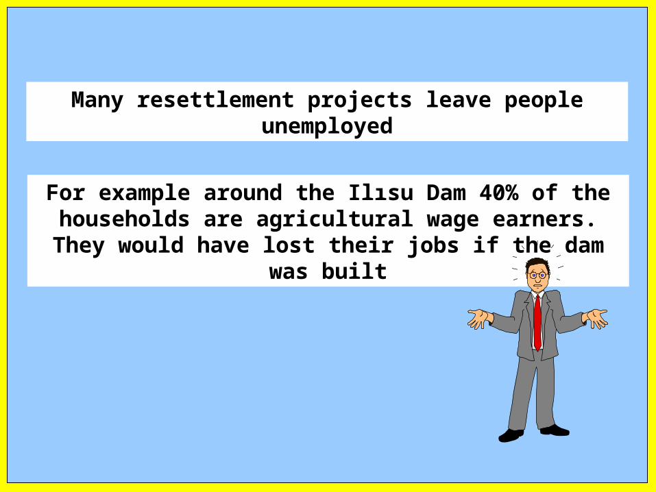
Many resettlement projects leave people unemployed
For example around the Ilısu Dam 40% of the households are agricultural wage earners. They would
have lost their jobs if the dam was built

BTC-Turkey affects different types of land: RAP must cover them all

Type of affected land: Case of BTC/Turkey
Private Owners Public Owners
Registered Not RegisteredLocal Authority
State Authority
Private User
Tenant FarmersUsers of common property Resources
Squatters on Public & Private Lands

Type of affected land: Case of BTC/Turkey
Grazing Lands
Othercommon areas
Treasury Lands
Forest Lands
Pastures
Private Owners Public Owners
Title deed registered
Title deed and land registration system not available
Local AuthorityState Authority
Private User
Tenant Farmers
Users of common property Resources
Squatters on Public & Private Lands

Type of affected land: Case of BTC/Turkey
Grazing Lands
Other common areas Treasury
LandsForestLands
Pastures
Public Owners
Local Authority State Authority
Water resources
Irrigation network
Riverbanks
Village common lands
Village specific network
Inter village networks
Lakes and other fresh water resources
2B
Under use by private persons
Demarcated for the useof individual households
Forest lands collectively used
Vacant treasury lands
Lands used by squatters

Type of affected land: Case of BTC/Turkey
Private Owners
Title deed registered
Title deed and land registration system not available
Clean deed with joint owners
Clean deed with one owner
Some owners in the community
All owners in the community
Deed in the name of a deceased person
Joint rights are not demarcated
Joint rights are demarcated
All heirs in the community
Some heirs in the community
Land used for 20 continuous years
Users outside the community have claims
All users of land are in the community
Land used for less than 20 years (displaced populations)
Owners of land in displaced communities

Private Land Users: BTC/Turkey
Private Users
Tenant Farmers Users of common property Resources
Squatters on Public & Private Lands
With formal arrangement
Informal tenant arrangement
Tenant with infrastructure investment on land
Squatters on Public lands
Squatters on private lands

Mitigation to reduce resettlement risks vary
Compensation of Land – Provide similar cultivatable land to people who lose all their land
Land-for-land
This strategy is a must for certain communities in Georgia

Many RAPs give importance to training activities in developing new livelihoods for the affected groups. In
Georgia and Azerbaijan portion of BTC providing agricultural technical assistance is a crucial activity. But
not in Turkey
Education and training in rural areas can be difficult.
Providing jobs to restore income from lost assets
Providing housing to the homeless
BP-Tangguh RAP

Many RAPs include actions to increase agricultural yields through training and machinery
Food security and agricultural income support
Pipeline projects such as BTC often help increase the agricultural and livestock yields outside the RAP
frameworks.

Compensation for loss of public resources
In many projects the loss of forests or pastures are compensated by providing alternative livelihood development
projects. For instance Chad-Cameroon pipeline uses this alternative.
BTC Turkey,• Provided funds for forest development• In addition part of the compensation was given to Ministry of
Forestry, which in turn had to spend 1/3 of the funds in forestry development

Therefore in BTC, a RAP FUND is created
Unknown/unanticipated impacts mayemerge in the course of implementation

RAP is designed to provide answers to a range of displacement issues and risks
associated with adverse impactscaused by development projects

RAP Main Features
Policy/Legal framework for displacement
Determining Characteristics of Affected populations
Detailed Budget
Implementation timetable
Description of Institutional responsibilities
A framework for public consultation/participatory
Provisions for redress of grievances
Framework for Monitoring / Evaluation
Identification of project impacts
Description of Compensation plan, resettlement assistance and restoration of livelihoods

Farmers unwilling to give up their landHistorical land acquisition performance in Turkey extremely poorLand is short in mountain villages where BTC pipeline passes throughMany different types of land are affectedNot all landowners can be reached. For instance, Absentee ownership creates excessive problems for agencies acquiring landConsultation/negotiation arrangements are difficult with several categories of landownersConflict of interest pressures land acquisition agency to use force major
Issue identification: BTC/Turkey

Inadequate legal framework –a frequent phenomena (e.g., BTC/Georgia expropriation law)Inconsistent legal framework –not surprising eitherIncongruity of traditional and formal legal frameworkUnacceptable local laws to serve as the basis of internationally acceptable RAPs
Legal Framework

Typology of Affected Lands and the Discrepancybetween local and international entitlement policies
Users of Grazing Lands
userscommon areas
Users of Treasury Lands
Users of Forest Lands
User ofPastures
Private Owners Public Owners
Title deed registered
Title deed and land registration system not available
Local Authority State Authority
Private User
Tenant Farmers
Users of common property Resources
Squatters on Public & Private Lands
Gaps between the local laws and international policies of entitlements

RAP Main Features
Policy/Legal framework for displacement
Determining Characteristics of Affected populations
Detailed Budget
Implementation timetable
Description of Institutional responsibilities
A framework for public consultation/participatory
Provisions for redress of grievances
Framework for Monitoring / Evaluation
Identification of project impacts
Description of Compensation plan, resettlement assistance and restoration of livelihoods

Accurate census information is crucial
Identification of property owners Initiation of required
administrative procedures Preparation of socio-economic
research Establishment of monitoring and
evaluation system

Private Lands
Kahramanmaraş Province
Andırın District
Geben VillageIPT1 Area
IPT1 Camp Site
Examples of permanent and transitionary impacts

Most of the affected parcels are parcels created by cadastre
Newly created parcels (rivers, roads, cadastral roads, etc)

İller Toplam
Köy Sayısı
Toplam KöyNüfusu2000
ToplamKöy Nüfusu
İllerdeki KentAlanı
ToplamKentNüfusu 2000
Toplam KentNüfusu1997
Etkilenen Yerleşim Yerleri
DolaysızEtkilenen Nüfus 2000
DolaysızetkilenenNüfus1997
Ardahan 243 94,031 98,534 6 39,725 34,779 28 30,554 29,386 Kars 385 182,871 182,495 8 142,145 138,546 24 13,226 12,444 Erzurum 1,052 376,838 374,390 19 560,551 515,704 66 56,009 61,315 Erzincan 560 144,635 123,287 9 172,206 156,548 37 35,628 29,738 Gümüşhane 336 109,383 93,125 6 77,570 64,672 5 1,068 1,070
Sivas 1,267 333,287 317,177 17 421,804 390,468 46 22,634 22,190 Kayseri 486 328,078 299,021 17 732,354 679,906 29 12,472 13,683 K.Maraş 529 466,377 469,265 10 536,007 555,976 32 63,107 61,736
O smaniye 170 146,788 144,212 7 311,994 297,335 13 10,089 9,884 Adana 547 451,625 418,515 14 1,397,853 1,270,640 13 16,036 13,992
TOTAL 5,575 2,633,913 2,520,021 113 4,392,209 4,104,574 293 260,823 255,438
Source: BTC, and State Institute of Statistics 2002
BTC / Turkey affected population

BTC / Turkey: Identification of impacts
Resettlement has to identify all population that have the possibility of loosing their property, income and wealth due to the project.
Identification steps can include:
Thematic maps showing the land quality, flora/fauna and infrastructure.
Census
Inventory of affected immovables
Socio-economic survey
Main features of the compensation
Consultative and participatory planning

0
100
200
300
400
Are
a (
Ha
)
AD
AN
A
AR
DA
HA
N
ER
ZIN
CA
N
ER
ZU
RU
M
GU
MU
SH
AN
E
K.M
AR
AS
KA
RS
KA
YS
ER
I
OS
MA
NIY
E
SIV
AS
8m.
28m.
Affected private parcels - 8m ve 28m corridor

% Of Affected Districts In Ardahan District
33%
67%
DAMAL
HANAK
MERKEZ
POSOF
Not AffectedDistricts
% Of Affected Districts In K.Maras District
20%
80%
ANDIRIN
GÖKSUN
Not AffectedDistricts
% Of Affected Districts In Erzurum District
58%
42%
ASKALE
AŞKALE
HORASAN
ILICA
KÖPRÜKÖY
MERKEZ
PASİNLER
ŞENKAYA
Not AffectedDistricts
Pipeline goes through limited number of towns in the affected cities and that limits the adverse impacts of the BTC/Turkey at the city level

Lessons learned from the socio-economic survey about
the affected population of BTC / Turkey Project

How do socio-economic surveys help prepare RAP?
Estimate the severity of adverse impacts
Calculate the losses and the compensation at community level
Inform the community
Document the needs of the community systematically and transparently.
Analyze/profile the affected community and determine the risk factors.
Analyze the pre-Project income and living standards

Ratio of yearly income loss over total income due to the project
Ratio of agricultural income over yearly income loss
Adana 0.23 1.03
Osmaniye 0.41 1.36
Kars 0.18 0.61
Ardahan 0.52 1.18
Kahramanmaraş 0.27 1.33
Kayseri 0.20 0.72
Erzurum 1.14 2.37
Erzincan 0.33 0.81
Gümüşhane 0.20 0.57
Sivas 0.27 0.58
Total 0.47 1.17
BTC / Turkey has determined the RAP problems and solutions through surveys

The impact of the BTC/Turkey project on income and wealth is modest
Results of the socio-economic survey
The amount of land that will be used permanently and temporarily is small when compared to the total property ownership of the affected population
The amount of the agricultural income loss is also small when compared to total income

8 m corridor28 m corridor
Size of affected plotTotal household land ownership0
20000
40000
60000
80000
100000
120000
140000
160000
180000
aver
age
size
of
lan
d (
sq. m
.)
Province
Household Land Ownership and Affected Land
Only a small portion of the total land ownership will be expropriated by the project

Current use of the affected plot by landowners
0%10%20%30%40%50%60%70%80%90%
100%
Province
Pe
rce
nt
of
ho
us
eh
old
s
Self cultivate
Rent orsharecrop
Not undercultivation
Most of the plot owners self cultivate

Plots cultivated by tenants do not exceed 1/5 of all plots
Exclusionary practices are thus unlikely

0
10
20
30
40
50
60
70
80
90
100
Nobody leases land Harvest is sharedequally between
owner andsharecropper
Sharecroppers payfixed fee per decare
per
cen
t o
f h
ou
seh
old
s
Different forms of tenant arrangements exist
0
10
20
30
40
50
60
70
80
90
100
Other leasearrangements
50/50 harvestsharing
Sharecroppers payfixed fee per acre
pe
rce
nt
of s
har
ec
rop
per
ho
us
eh
old
s
…but in most cases land is rented for cash

Formal title
No formal title
Customary ownership
Do not have title for other reasons*
Most of the property owners have titles
…but still a lot remaining without the titles
*Other reasons include forgetting, lack of cadastre work, and ongoing paperwork

Ad
an
a
Ard
ah
an
Erzin
can
Erzu
rum
Gü
mü
sha
ne
K.M
ara
s
Ka
rs
Ka
yseri
Osm
an
iye
Siva
s0
2
4
6
8
10
12
Pe
rce
nta
ge
of
Pe
op
le
Percentage of Project Affected Population
% of Deeded Ownership
% of Customary Ownership(zillet)
In Sıvas, Erzurum and Erzincanmost of the plots have titles
But not everybody has the title registration

There are complaints about the mistakes in the titles and the other complaints are;
•Some claim that land consolidation was done incorrectly
•Some have not registered their inheritance
•Problems land registration records complicate expropriation procedures

Average Number of Plot Owners
012345678
Provinces
nu
mb
er o
f ow
ner
s
Average number of owners accordingto deed
Average number of owners accordingto respondent
Property owners lack information of the others who are also registered to their property titles.

POSOF(ARDAHAN-TURKEY)
POSOF(ARDAHAN-TURKEY)
TOTAL 618 PARCELS AFFECTED BY BTC PROJECT
REGISTERED 53 PARCELS
UNREGISTERED 565 PARCELS (CUSTOMARY
OWNERSHIP)
SI NGLE OWNER (383 PARCELS)
2 OWNERS (82 PARCELS)
3 OWNERS (33 PARCELS)
4+ OWNERS (67 PARCELS)
ONLY 1 WOMAN AMONG OWNERS
ONLY 2 WOMEN AMONG OWNERS
SI NGLE OWNER(20 PARCELS)
2+ OWNERS (24PARCELS)
FOREST PARCELS(4 PARCELS)
PASTURE PARCELS(3 PARCELS)
Woman are worse of in
cases where the owners
have customary title of the land

Female Ownership of Affected Plots by province
0
10
20
30
40
50
60
70
80
90
100
Provinces
per
cen
t of p
lots
with
at l
ease
on
e fe
mal
e o
wn
er
GIS inputs show that in Ardahan only 10% of the affected plots has female property owners where as in Osmaniye 70% of the affected plots has at least one female owner
87 percent customary ownership

0
20
40
60
80
100
120
140
US
D
Province
Estimated annual income from trees on affected plot (USD)
Only a few percent of the affected plots have trees on them but their contribution to income is substantial
Do not derive
income from trees
Derive income
from trees

Communities near the forests
Communities away from the forest
Communities which are directly affected that are living in the forest or near it.
100% benefit from the forest resources
0
10
20
30
40
50
60
Firewoodcollection
Animal grazing Mushrooms andspice for self-consumption
Working forwages
perc
ent
of h
ouse
hold
s cl
ose
to a
for
est
Affected
Not affected
Negative effects of the pipeline has been observed.
Community resource loss

Absentee land owners
It is not easy to locate these owners although the new law requires it.

POPULATION LIVING OUTSIDE THE VILLAGE CAUSE PROBLEMS
o BOTAS’s new report shows the number of property owners living outside the village as 4,600+
o Still there will be a lot of unidentified people remaining.

20% of the property owners outside of the village do not want to be represented by others
37% do not have relatives living in the village

RAP Main Features
Policy/Legal framework for displacement
Determining Characteristics of Affected populations
Detailed Budget
Implementation timetable
Description of Institutional responsibilities
A framework for public consultation/participatory
Provisions for redress of grievances
Framework for Monitoring / Evaluation
Identification of project impacts
Description of Compensation plan, resettlement assistance and restoration of livelihoods

Route Selection, Site Investigation and Land Acquisition
Identification of the land owners along the route considering 500 m. corridor (22m. Cor. -250m. + 250m.)
Identification of the route axis of 28m. and connection of IP points to national GPS Network
Preparation of the construction corridor to maps and expropriation maps
Cadastral Survey and Title Deed Registers
Definition of specified corridor (100m.) through environmental and social consideration
Further narrowing the corridor to 28m.
Registering to the public owned areas on behalf of the treasury and transferring the treasury registrations to Botas
Application for expropriation of forest areas and pastures
Surveying assets (Tree, Building, Wall, Well etc.) Along the construction corridor
Obtaining the list of the owners of the areas which will be expropriated
Announcing the expropriation and securing provisional rights to permanent land
Starting the compensation process
Valuation of the land

Process of Private Land AcquisitionTurkish Case
All assets on plots identified and inventory prepared
Valuation commission established, each plot is visited, all agencies contacted as specified by the Law to provide information relevant for land valuation
Land owners contacted to attend negotiations
Agreement on land transition reached
Addresses of all owners for each plot obtained
Land owner certifies disagreement
Land owners non-responsive
Negotiation commission established
No agreement possible
Road to acquisition open
Land owners attend negotiations
All Steps for plot and ownership identification completed
Land owner refuses to certify disagreement
New letter sent to owner
Court

Steps involved in Disputed Land Acquisition
Establish commission at the county level
Show actual land to the valuation commission
Establish and document land value in accordance with Law
Go to court
Send documents to the defendant (landowner)
First Court Date Settlement arrived
Inspectors visit land
Commission prepares report
Second court date
Second commission valuation
Opposition from administration
Third court date
2nd commission report
Court Decision
Court Process
Inform Directorate of Land Announce decision in local paper
Wait for opposition to decision
Opposition to decision
Resolve in 180 days
No opposition to decision
Deposit money for landand transfer deed

Steps in Land Acquisition When Deed is in the Name of a Deceased Person
Confirmation through communities that the owner is deceased
Gendarmerie confirmation of heirs addresses
Contacting heirs asking them to register their inheritance
In case of failure seek Court authorization for inheritance determination
Obtaining necessary documentation from registration office and village elderly committee
Submitting to the court necessary documentation
Court issues legal inheritance documentation recognizing the claims of heirs
Court date set and heirs are called to court
Land acquisition proceeds according to applicable law (see Chart on “Time Necessary for Acquisition – Public Acquisition Law No 2942 (D. 4650)”)
Land acquired
Requesting birth registration documents to identify heirs
Informal investigation of heirs’ addresses
If addresses cannot be found, public notices are sent out
If there is success, invitations are sent for negotiations
Estimated Process completion minimum 9 months

Land Acquisition with joint owners of Registered land
Commission evaluates land / assets and determines a value
A formal letter is sent to each owner, inviting them for negotiation
Negotiations held
Specific shares of individuals are known Specific shares of individuals are not known
Land deed available but jointly owned
No agreement Agreement
Some owners agreeAll owners disagree Determination of shares and representative(s) by court, according to civil law
Court
Share of agreeable owner meets the needs
Share of disagreeing owner is needed
Road to acquisition of land open

Time Necessary for Acquisition – Public Acquisition Law No 2942 (D. 4650)
Process Involved in Non-negotiated Cases
Court
1st Court Session
Invitation for negotiation30 days
1st Inspection by the Court Appointed Valuation Commission
10 days
2nd Court Session
30 days
Valuation Report15 days
2nd Inspection by the Court Appointed Valuation Commission
15 days
3rd Court Session
15 days15 days
Appeals to the decision of this session can be made only to the High Court (Yargitay)
Value of Land Deposited in the Bank
10 daysCourt Decision
Road to Land Acquired Open
15 daysIf necessary, additional time for
bank deposit15 daysDeed transfer made
Estimated Process Completion Minimum 150 days
Owners certifies disagreement Owners does not certifies disagreement
Authority Informs Owner of Decision in by writing
Authority Prepares Files
Disagrees Agreement
Agreement
Disagrees
Valuation Report
15 days

RAP Main Features
Policy/Legal framework for displacement
Determining Characteristics of Affected populations
Detailed Budget
Implementation timetable
Description of Institutional responsibilities
A framework for public consultation/participatory
Provisions for redress of grievances
Framework for Monitoring / Evaluation
Identification of project impacts
Description of Compensation plan, resettlement assistance and restoration of livelihoods

A relatively large percent of owners-users are informed of the Project but few have specific information on the size of the land affected and of the legal framework that provides protection to them.
Few people are informed!!
In fact, as late as May 2002, over 95 percent of the people did not know that the expropriation law had been changed.
A substantial proportion of the affected communities are forest communities and residents are concerned of adverse impacts