
Tracking dramatic changes at Lake Waiau, Hawaiʻi’s only alpine lake
13
Matthew Patrick US Geological Survey – Hawaiian Volcano Observatory Tracking dramatic changes at Lake Waiau, Hawaiʻi’s only alpine lake Thanks to James Kauahikaua (HVO), Donna Delparte (Idaho State), Fritz Klasner (OMKM)
-
Upload
hawaii-geographic-information-coordinating-council -
Category
Data & Analytics
-
view
139 -
download
0
Transcript of Tracking dramatic changes at Lake Waiau, Hawaiʻi’s only alpine lake

Matthew Patrick US Geological Survey – Hawaiian Volcano Observatory
Tracking dramatic changes at Lake Waiau, Hawaiʻi’s only alpine lake
Thanks to James Kauahikaua (HVO), Donna Delparte (Idaho State), Fritz Klasner (OMKM)


Lake Waiau’s surface area has diminished greatly over the past few years
• High resolution satellite imagery provides an easy way to monitor these changes
• We used Worldview, Quickbird, and IKONOS images to monitor changes since 2000
• These images have resolution down to 0.5 m

The drop in surface area began in 2010
By the end of 2013, the area was just a few percent of normal
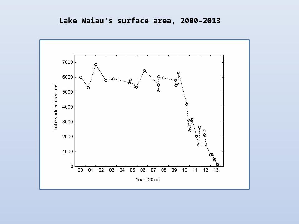
Lake Waiau’s surface area, 2000-2013

Field visit on September 26, 2013
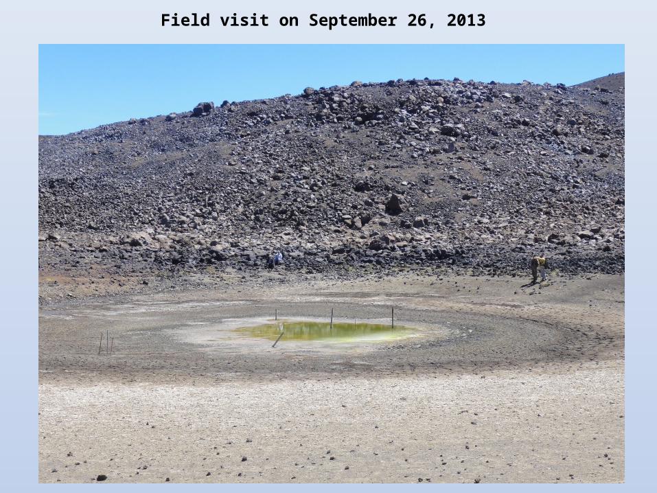
Field visit on September 26, 2013

Are these changes unusual, or even unprecedented?
Brigham, 1909
• Historical record includes aerial photos (back to 1950s), field photos (back to late 1800s) and field descriptions (back to early 1800s)
• Result: Yes, these changes are highly unusual, if not unprecedented, in historic record

Lake Waiau surface area over the past 100+ years
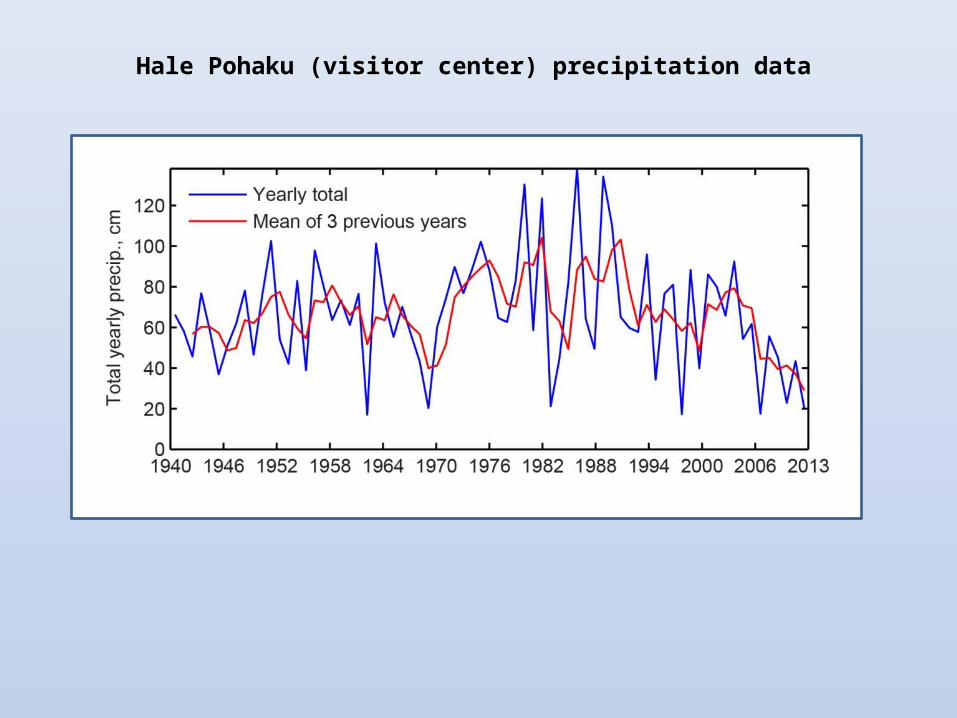
Hale Pohaku (visitor center) precipitation data
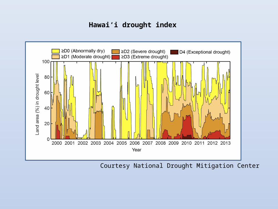
Hawaiʻi drought index
Courtesy National Drought Mitigation Center

Lake Waiau surface area has rebounded over past winter

• Lake Waiau’s surface area dropped to unusually low (if not
unprecedented) levels during 2010-2013
• We used high resolution satellite imagery to monitor the changes
• The shrinking of the lake is consistent with the ongoing drought
• The lake area has rebounded significantly over the past winter,
but is still below normal
Summary


