Township of Lower Makefield
32
Township of Lower Makefield Planning Commission 1100 Edgewood Road (267) 274-1100 Yardley Pa 19067 Fax: (215) 493-3053 Website: www.lmt.org MAY 14, 2018 AGENDA 7:30 P.M. I. CALL TO ORDER II. APPROVAL OF MINUTES FROM THE 4/23/2018 MEETING III. #663 - CADDIS HEALTHCARE REAL ESTATE ASSISTED LIVING FACILITY PRELIMINARY LAND DEVELOPMENT PLAN TAX PARCEL 20-032-008-002 & 20-032-009 1667 DOBRY ROAD IV. OTHER BUSINESS V. ADJOURNMENT
Transcript of Township of Lower Makefield

Township of Lower Makefield
Planning Commission
1100 Edgewood Road (267) 274-1100 Yardley Pa 19067 Fax: (215) 493-3053
Website: www.lmt.org
MAY 14, 2018
AGENDA
7:30 P.M.
I. CALL TO ORDER
II. APPROVAL OF MINUTES FROM THE 4/23/2018 MEETING
III. #663 - CADDIS HEALTHCARE REAL ESTATE ASSISTED LIVING FACILITY
PRELIMINARY LAND DEVELOPMENT PLAN
TAX PARCEL 20-032-008-002 & 20-032-009
1667 DOBRY ROAD
IV. OTHER BUSINESS
V. ADJOURNMENT


2003 Lower State Road, Suite 122 Doylestown, PA 18901
215.622.2525 [email protected]
WWW.TRAFFICPD.COM
May 1, 2018
Mr. James Majewski
Planning and Zoning Administrator
Lower Makefield Township
1100 Edgewood Road
Yardley, PA 19067-1696
RE: Caddis Senior Living Subdivision
Land Development Plan Review
TPD No. LOMT.00060
Dear Mr. Majewski:
In our role as Township Traffic Engineer, Traffic Planning and Design, Inc. (TPD) has reviewed the
following information for the above referenced project:
• Land Development Plans, prepared by Dynamic Engineering dated March 16, 2018;
Based on this review, we offer the following comments:
Land Development Plan Comments
1. The site will access a state route and will require the applicant to obtain a PennDOT Highway
Occupancy Permit (HOP). Please submit all HOP plans and documents to our office for
review.
2. The applicant should perform a traffic study per Township ordinance and PennDOT
standards. The applicants engineer should contact the Township Traffic Engineer for a scope
of work.
3. The following sight distance note should be provided for the driveways on Dobry Road and
Oxford Valley Road. The sight distances should be calculated for each driveway based on the
appropriate grades and speeds using PennDOT’s sight distance formula.
“All sight distance obstructions (including but not limited to embankments and
vegetation) shall be removed by the applicant to provide a minimum of xxx’ feet of
sight distance to the left and xxx’ feet of sight distance to the right for a driver exiting
the proposed driveway onto Road. The driveway must be considered to be positioned
10’ from the near edge of the closest highway through travel lane at an eye height of three
feet-six inches (3’-6”) above the pavement surface. The point sighted by the exiting
driver shall be three feet-six inches (3’-6”) above the pavement surface located in the
center of the closest highway travel lane designated for use by approaching traffic.
This sight distance shall be maintained by the applicant and/or the applicant’s
successors and assignors”.
Sight distance triangles indicating the heretofore-described sight distance should be shown
on the landscaping plans to ensure that the proposed landscaping will not restrict sight
distance.
2003 Lower State Road, Suite 122 Doylestown, PA 18901
215.622.2525 [email protected]
Mr. James Majewski
May 1, 2018 / Page 2
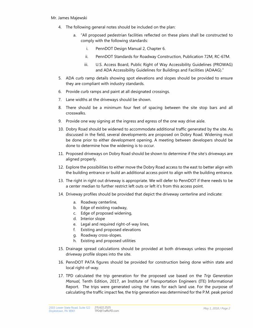
4. The following general notes should be included on the plan:
a. “All proposed pedestrian facilities reflected on these plans shall be constructed to
comply with the following standards:
i. PennDOT Design Manual 2, Chapter 6.
ii. PennDOT Standards for Roadway Construction, Publication 72M, RC-67M.
iii. U.S. Access Board, Public Right of Way Accessibility Guidelines (PROWAG)
and ADA Accessibility Guidelines for Buildings and Facilities (ADAAG).”
5. ADA curb ramp details showing spot elevations and slopes should be provided to ensure
they are compliant with industry standards.
6. Provide curb ramps and paint at all designated crossings.
7. Lane widths at the driveways should be shown.
8. There should be a minimum four feet of spacing between the site stop bars and all
crosswalks.
9. Provide one way signing at the ingress and egress of the one way drive aisle.
10. Dobry Road should be widened to accommodate additional traffic generated by the site. As
discussed in the field, several developments are proposed on Dobry Road. Widening must
be done prior to either development opening. A meeting between developers should be
done to determine how the widening is to occur.
11. Proposed driveways on Dobry Road should be shown to determine if the site’s driveways are
aligned properly.
12. Explore the possibilities to either move the Dobry Road access to the east to better align with
the building entrance or build an additional access point to align with the building entrance.
13. The right in right out driveway is appropriate. We will defer to PennDOT if there needs to be
a center median to further restrict left outs or left it’s from this access point.
14. Driveway profiles should be provided that depict the driveway centerline and indicate:
a. Roadway centerline,
b. Edge of existing roadway,
c. Edge of proposed widening,
d. Interior slope
e. Legal and required right-of-way lines,
f. Existing and proposed elevations
g. Roadway cross-slopes.
h. Existing and proposed utilities
15. Drainage spread calculations should be provided at both driveways unless the proposed
driveway profile slopes into the site.
16. PennDOT PATA figures should be provided for construction being done within state and
local right-of-way.
17. TPD calculated the trip generation for the proposed use based on the Trip Generation
Manual, Tenth Edition, 2017, an Institute of Transportation Engineers (ITE) Informational
Report. The trips were generated using the rates for each land use. For the purpose of
calculating the traffic impact fee, the trip generation was determined for the P.M. peak period

2003 Lower State Road, Suite 122 Doylestown, PA 18901
215.622.2525 [email protected]
Mr. James Majewski
May 1, 2018 / Page 3
of adjacent street traffic (4:00 – 6:00 P.M.). Table 1 below is a summary of the results of the
trip generation analysis.
Table 1
Trip Generation Summary
Land Use Land Use
Code
Variable used to
Calculate Trips
New
Trips
Total
Trips
Assisted Living 254 98 Beds 25 25
The proposed development is located within Transportation Service Area 2 established for the
Lower Makefield Traffic Impact Fee Ordinance. Therefore, the development is subject to a
traffic impact fee of $2,812.00 per new P.M. peak hour trip. The calculation of this fee is as
follows:
25 new P.M. peak hour trips x $2,812.00 P.M. peak hour trip = $70,300
We reserve the right to make additional comments upon receipt of subsequent submissions.
If you have any questions, please contact me at your earliest convenience.
If you have any questions, please contact Bill Zadrovicz ([email protected]) or me at
your earliest convenience.
Sincerely,
TRAFFIC PLANNING AND DESIGN, INC.
Philip Wursta, P.E.
Township Traffic Engineer
cc: Lower Makefield Township Board of Supervisors
Terry Fedorchak, Township Manager
David Truelove, Esq., Township Solicitor
Andrew Pockl, P.E., Remington & Vernick Engineers


Lower Makefield Township
POLICE DEPARTMENT
TO: Lower Makefield Twp. Planning Commission
FROM: Tom Roche, Traffic Safety Officer
DATE: 3/27/2018
SUBJECT: Traffic Safety suggestions, “MEMORY & ASSISTED LIVING (Caddis Healthcare)” Dobry Rd
In going over the plans as submitted (Page 1 of 3, 3/16/18) to the police department regarding the
“MEMORY & ASSISTED LIVING” Dobry Rd, the following traffic safety issues were noted;
• Entrance Exit onto Oxford Valley Rd. The NO LEFT TURN (R3-2) requested in January was
applied to the plan however the DO NOT ENTER (R5-1) type sign visible to the outbound traffic was
not. We still fell this sign is needed, OR an ‘in’ arrow on the pavement so as to advise the outbound
traffic not to use the inbound lane from Oxford Valley Rd.
• Traffic Signal. With this care facility and the project across Dobry Rd, it may be prudent to think of
a traffic signal at Dobry and Oxford Valley Rd. We receive complains now from Dobry Rd residents,
and residents of the 200 block of Oxford Valley Rd that they cannot exit easily during rush hours.
If a traffic signal does not make into the final plans, the
following is requested. Northbound Oxford Valley Rd traffic
headed for this facility and the new development across Dobry
Rd, as stated, will be turning left. This will increase greatly, the
left hand turning numbers over the present level of left turn
numbers. Currently there is a 2-way center turn lane on Oxford
Valley Rd, that is not marked (arrows) as such. Southbound
homeowners of the homes south of the intersection using the
center lane, have head-on collision potential with the northbound
traffic wanting to use the same center lane.
To help advise and make aware to the northbound turning traffic
that this is a 2-way turn lane, we would request that 2-sets of 2-
way Left Turn Markers be placed in the center lane (1 at the first
drive, 1 at the third drive). The existing ‘Begin
Center Lane 2-way left” sign is approx. 290’ south
of Dobry Rd.
Also, nighttime reflective lane markers in the same
2-way left turn lane area, to indicate to motorists
approaching in opposite directions, that there is a
vehicle in the same lane and to take the necessary
precautions.

Lower Makefield Township
POLICE DEPARTMENT
• A NO LEFT TURN (R3-2) sign should be placed across from the project’s exit onto Oxford Valley
Rd. notifying northbound motorists of the no left into the project at this drive.
• As shown on the plan, utility pole # 26170 at the Caddis Project Oxford Valley exit, is to be
relocated. A street light at this location would help serve Caddis exit as well as the Regency decel
lane and exit, and increasing the overall safety of the Oxford Valley Roadway.
Existing NO LEFT TURN (R3-2) sign for the Regency
Project next door to the Caddis Project.

To: Jim Majewski, Director of Planning and Zoning/Lower Makefield Township
From: Ginni Torbert, Chairperson, Citizens Traffic Commission
Re: Caddis Assisted Living Preliminary Plan
April 23, 2018
Below are a few preliminary CTC comments on the Caddis Plan:
1. Since all northbound traffic on Oxford Valley Road will have to use Dobry Road due to the “low volume, right in right out” entrance on Oxford Valley Road and likely much of the southbound traffic will as well, (since it will be the first entrance they come to), Dobry will likely have to
handle the bulk of traffic, particularly traffic entering the site.
For this reason, serious consideration should be given to upgrading Dobry Road, including
widening it and striping the center. It appears from maps that some sections are only 17-18 feet
wide.
2. The speed limit on Oxford Valley Road in this area is 40mph, though average speeds tend to be
higher (50mph and above), particularly during peak hours. I believe the ADT in that section of
Oxford Valley Road is around 20,000. Given these high traffic volumes and speeds, left and right
hand turn lanes on Oxford Valley Road for turning into Dobry may be necessary to reduce
accidents
3. I believe there is an issue with the right in/right out access crossing Township property. Has this
been resolved?

April 24, 2018
Jim Majewski
Township Planning and Zoning Director
Lower Makefield Township
1100 Edgewood Road
Yardley, Pa. 19067
Re: Preliminary Plans for Caddis Healthcare (Heartis Village at Yardley)
Dear Mr. Majewski:
The Lower Makefield Township Environmental Advisory Council (EAC) has completed
its review of the Preliminary Plans for Caddis Healthcare.
The current site at the intersection of Dobry Road and Oxford Valley Road will be
subdivided into Lot A (2.01 acres) and Lot B (6.06 acres). Lot A will have an existing
home. On Lot B the plans propose a 51,125 sq. ft., 2-story 98 bed assisted living and
memory care facility. The will also be 72 parking spots and a total of 2.9 acres of
impervious surface (47.8% of Lot B). The total impervious surface on both Lot A and Lot
B will be 3.25 acres. The site contains 2.01 acres of resource protected lands (wetlands,
wetland buffers, and woodlands).
This review covered the following submissions by the applicant:
• Plans “Preliminary Subdivision & Land Development Site Plan for Caddis
Acquisitition Partners, 29 Sheets (Dynamic Engineering, dated March 16, 2018).
• Post-Construction Stormwater Management Plan Narrative, Dynamic
Engineering (March 16, 2018)
Below are the EAC’s comments on the submittals.
1. Pervious Pavement Parking Spots
The developer should consider the use of pervious pavement for the parking spots
proposed. There are numerous environmental benefits if pervious pavement is used at the
site including a significant reduction of stormwater runoff, improvement of stormwater
water quality, and ground water recharge. The 42 parking spots located to the east of the
healthcare facility would be an ideal location for pervious parking spots because adequate
infiltration was measured near that location (Pit No. SW-5 and SW-6).
2. Wetlands Buffer - Sheet 2 of Plans
a. It indicates that 2,899 sq. ft. of wetlands buffer will be loss after applying the buffer
averaging technique described in Chapter 200-51(B)(4). While the use of buffering
averaging is permitted, no net loss of wetlands buffer is allowed when using it.
b. Part of the portion of the wetlands buffer shown as 75 ft. should be 100 ft. The area is
part of the existing homes lawn and the vegetation height is less than 12 inches.
c. It is not clear where the buffer averaging was done
2
3. Post-Construction Stormwater Management Plan Narrative
a. Recommended Basin Loading Ratios Exceeded
Page 15 shows that the recommended basin loading ratios are significantly exceeded by
the proposed bioretention basin and the underground basin #2.
b. Soil Infiltration Testing
Page 19 – 20. Infiltration testing was only conducted at two locations. Per Chapter 178-
93(B)(3), there should be at least 7 locations where infiltration testing should have been
conducted.
c. Underground Infiltration Basin and Above-ground Detention Basin Assumed
Infiltration Rates
No soil infiltration testing has been conducted at or close to Underground Basin #1 or the
above-ground detention basin. In addition, they are located where the soil hydrological
group of CbB that generally has poor infiltration (either C or D). Why are stormwater
control structures located there if there is no basis for quantifying infiltration rates.
d. Volume Reduction Credit
Underground Infiltration Basins - Page 13 of the report states that no volume reduction
credit will be taken for the two underground infiltration basins. However, page 16 shows
that 26,418 ft3 of volume reduction was taken in order to meet the requirements of
controlling the 2-year/24-hour design storm runoff.
Rain Garden - page 16 shows that 12,787 ft3 of volume reduction was taken in order to
meet the requirements of controlling the 2-year/24-hour design storm runoff. The area of
the rain garden is 3,888 ft2, the measured infiltration rate at that location with safety
factor is 0.31 inches/hr. Therefore, it may take up to 127.3 hours for the rain garden to
infiltrate the 2-year stormwater. The depth of the water in the rain garden will exceed 3 ft
at times.
4. Sidewalks and Connectivity
This design does not take into full consideration connection to the surrounding use areas.
The existing sidewalk along the Oxford Valley Road frontage is shown to remain, but no
connection is provided from the proposed buildings on site to that sidewalk. In addition,
no sidewalks are shown along the Dobry Road frontage of the site. The sidewalk needs
to be complete along the road frontage as per Chapter 178-47(A).
In addition, to ensure connectivity to the nearby Regency development the EAC requests
that a sidewalk be provided to the south of the proposed building to the Regency
development.
5. Basin Planting
In the PCSM Narrative with appendix on page 22, BMP 6.4.8 calls for the use of native
vegetation within the vegetated swale. On that same page BMP5.6.2 regarding the
disturbance of existing soils states “The basin will planted with lawn, turf, and/or

3
meadow”. In order to provide for improvements to water quality and to increase habitat,
the EAC requests that the basin be planted with native species and naturalized similar to
the vegetated swale, not lawn or turf. For both locations the EAC requests that a
diversity of plant species be considered for the plantings.
A similar item that would also reduce stormwater quantity, improve quality, and provide
habitat would be the incorporation of a green roof. While we realize that this is not a
requirement by code, this should reduce the below grade construction in addition to the
stormwater benefits.
The Project Leader for this evaluation is EAC Member Alan Dresser. Thank you for your
attention to this matter.
. Sincerely,
LMT EAC

The Almshouse Neshaminy Manor Center 1260 Almshouse Road
Doylestown, Pennsylvania 18901 215.345.3400 FAX 215.345.3886
E-mail: [email protected]
PLANNING COMMISSION:
Edward Kisselback, Jr., Chairman
Robert M. Pellegrino, Vice Chairman
R. Tyler Tomlinson, Esq., Secretary
Craig E. Bryson Joan M. Cullen
James J. Dowling David R. Nyman
Carol A. Pierce Walter S. Wydro
Evan J. Stone Executive Director
COUNTY COMMISSIONERS:
Robert G. Loughery, Chairman, Charles H. Martin, Vice Chairman, Diane M. Ellis-Marseglia, LCSW Visit us at : www.buckscounty.org
April 19, 2018 BCPC #12305 MEMORANDUM TO: Lower Makefield Township Board of Supervisors Lower Makefield Township Planning Commission FROM: Staff of the Bucks County Planning Commission SUBJECT: Preliminary Plan of Land Development for Caddis Senior Living Facility TMP #20-32-8-2; 20-32-9 Applicant: Caddis Acquisition Partners, LLC Owner: Mary A. and Joseph D. Shennard; Matthew & Susan Jinu Plan Dated: March 16, 2018 Date Received: March 27, 2018 This proposal has been reviewed by the Bucks County Planning Commission professional staff, which prepared the following comments in accordance with the Pennsylvania Municipalities Planning Code (Section 502). GENERAL INFORMATION Proposal: Relocate the lot line between two existing parcels and construct a nursing home facility on
one of the parcels. Currently, TMP #20-32-8-2 contains 7.20 acres and TMP #20-32-9 contains 1.42 acres. The proposed subdivision would provide TMP #20-32-8-2 with frontage along Oxford Valley Road and result in the following lot sizes: TMP #20-32-8-2 (Proposed Lot B)—6.06 acres, and TMP #20-32-9 (Proposed Lot A)—2.01 acres.
A 95,587-square-foot, 98-bed nursing home, consisting of 2 stories, is proposed on Lot B. Access to the facility is provided through two driveways; one on Dobry Road and one on Oxford Valley Road. A total of 72 parking spaces is shown on the site. Public water and sewer facilities are proposed to serve the development.
Location: Along the southern side of Dobry Road, just west of Oxford Valley Road. Zoning: C-3 General Business/Industrial District permits Nursing Home by right on a minimum lot
size of 5 acres with a minimum lot width of 300 feet. Within the C-3 District, the maximum building coverage and maximum impervious surface ratio are 35 and 65 percent, respectively.
Present Use: Residential; agricultural.

BCPC #12305 2 April 19, 2018
COMMENTS 1. Variance—Plan Sheet 7 of 26 indicates that a variance is required from the minimum front
yard setback of 100 feet from Dobry Road for proposed Lot A. The plan indicates that the variance is needed due to the increase of an existing nonconformity resulting from the required future right-of-way for Dobry Road. This issue should be resolved.
2. Requested waivers—The site plan and correspondence included with the submission
indicate that the applicant is requesting waivers from the following subdivision and land development ordinance requirements:
Section 178-19.b from submitting 25 sets of preliminary plans and data Section 178-19.D(11) from submitting the initial preliminary plan to the Bucks County
Conservation District Section 178-20.C(9) to permit an aerial of the plan in lieu of showing all existing features
located within 200 feet Section 178-20.D from submitting an Environmental Impact Assessment (EIA) report
Section 178-20.E(29) from submitting pavement core samples for all existing roads abutting the site
Section 178-57.G to permit parking areas within 20 feet of a building Section 178-57.Q from providing refuge islands within the parking area located along the
northern side of the building Section 178-85.H(4) from requiring that all replacement trees be planted on-site
Section 178-93.D(6) to allow the maximum slope of the detention basin embankments to be three horizontal to one vertical instead of the required four horizontal to one vertical
Section 178-93.F(3)(c) to permit storm drainage pipes with a diameter of less than 18 inches Section 178-93.F(5)(b) from requiring a minimum drop of 2 inches in an inlet between the
lowest pipe invert elevation and the outlet pipe invert elevation.
The applicant has submitted a rationale for some of the requested waivers. In accordance with the requirement of Section 512.1(b) of the Pennsylvania Municipalities Planning Code (MPC), the applicant must state in full the grounds and facts of unreasonableness or hardship on which the request for each waiver is based, and the minimum modification necessary. Per Section 512.1(a) of the MPC, a determination as to whether the requested waivers shall be granted will be necessary.
3. Site capacity calculations—Plan Sheet 2 includes site capacity calculations for the entire
tract, which includes Lot A, which contains the existing residential dwelling, and Lot B, on which the nursing home land development is proposed. To accurately demonstrate compliance with the natural resource protection standards and allowable building and impervious surface ratios for the development site, the plan should also provide site capacity calculations based on the land area of and amount of resources on proposed Lot B. Also, the amount of resources on the site which are proposed to be removed should be clearly noted on the plan.
4. Site access—The plan shows two driveways onto public roads, a right-in/right-out access on
Oxford Valley Road and a full-movement access on Dobry Road. According to Section 200-63.B of the zoning ordinance, Oxford Valley Road is classified as an arterial roadway. Since

BCPC #12305 3 April 19, 2018
the site has frontage along two roadways, it is recommended that the plan be redesigned to designate the driveway on Dobry Road as the site’s primary access and the driveway on Oxford Valley Road as an emergency-only access. Limiting access points along arterial roadways, such as Oxford Valley Road, is an access management technique intended to preserve the function of the higher order street, and is a safer layout than having numerous curbcuts along a busy roadway.
5. Pedestrian issues
a. Sidewalks—Section 178-47.A of the subdivision and land development ordinance requires sidewalks along both sides of all streets where required by the township for safety and convenience. Sidewalks provide pedestrians with a safe route separate from roadways with moving vehicles. It is recommended that a sidewalk be provided on the site, along Dobry Road.
b. Asphalt walk along Oxford Valley Road—An existing asphalt walk along Oxford Valley Road in this location is approximately 6 feet wide. The asphalt walk is identified as an existing walkway and bicycle path on the township’s Walkway System Map. According to Section 178-48.B.(1)(b) of the subdivision and land development ordinance, the width of the bike path shall be 8 feet when it is in close proximity to an arterial or collector street, and a minimum width of 6 feet along all other streets.
The plan shows the removal of the existing walk to accommodate widening Oxford Valley Road just south of the intersection of Dobry and Oxford Valley roads. The new asphalt walk, shown just west of Oxford Valley Road, is proposed to be only 4 feet wide. The plan should be revised to comply with the required minimum width for bike paths.
c. Crosswalk—To promote pedestrian safety, it is recommended that crosswalks be provided across the proposed driveway accessing Oxford Valley Road and across Dobry Road at its intersection with Oxford Valley Road. The crosswalks should connect into the asphalt walkways to provide safe pedestrian routes.
6. Parking
a. Parking along access drives—The Plan shows 22 perpendicular parking spaces along the proposed drive accessing Oxford Valley Road. It is recommended that this driveway access be designed as an emergency-only access (see Comment #4 above.) However, if the driveway onto Oxford Valley Road remains a primary access to the site, as is proposed, consideration should be given to redesigning the circulation system to separate the parking spaces from the moving aisle between Oxford Valley Road and the building. Separating perpendicular parking from a main driveway will help to reduce potential conflicts between moving vehicles and vehicles backing out of parking spaces.
In addition, two handicap parking spaces are located directly off of the main drive in front of the building, at a slight bend in the driveway. It is recommended that the two handicap spaces be relocated so that vehicles exiting the spaces do not have to back into the moving aisles of the driveway.

BCPC #12305 4 April 19, 2018
b. Number of handicapped-accessible parking spaces—Six of the designated 72 parking spaces proposed for the development are designated as handicapped parking spaces. This complies with the handicapped-accessible parking requirement in zoning ordinance Section 200-78.E.(4), which requires one handicapped-accessible space for every 25 spaces in a parking area. However, given that the proposed nursing home is likely to have more older individuals visiting residents of the facility compared with other uses, it is recommended that consideration be given to providing additional handicapped parking spaces for the development.
c. Parking space size—The plan shows parking stall sizes of 9 by 18 feet. However, General Note 7.A on Plan Sheet 7 of 26 references the requirement from Section 200-78.E.1.A of the zoning ordinance and states, “Each parking space shall be ten (10) feet by twenty (20) feet, unless otherwise permitted by the Board of Supervisors during the process of reviewing and approving a subdivision or land development application.” This issue should be discussed and the plan should be revised for consistency.
7. Dobry Road—The plan shows improvements, such as widening, to Dobry Road. Assurances
should be provided that the roadway is upgraded to township standards.
8. Traffic impact study—Section 178-20.E.23 of the subdivision and land development ordinance requires a traffic impact study when required by the township’s Act 209 Traffic Improvement Plan. We did not receive a transportation impact study for this project nor does the plan indicate that the township has waived the need for such a study. The township officials should determine if a traffic impact study is required for this proposed development.
9. Landscaping—The Landscape Plan on Sheet 17 of 26 includes a plant schedule listing
proposed trees, shrubs, grasses, perennials, and a ground cover for the development site. Some of the proposed plantings are not listed in the Lower Makefield Township Native Plant List in Exhibit 1 of the township’s subdivision and land development ordinance.
In addition, we note that 18 Quercus palustris (pin oak) and 18 Quercus phellos (willow oak) trees are proposed. These trees are susceptible to bacterial leaf scorch, which is an infectious chronic disease that is affecting several species of oak trees in southeastern Pennsylvania. Given the potential disease risk, we recommend that the applicant consider other suitable types of trees, or other species of oaks, in place of some or all of the proposed pin and willow oaks. The Bucks County Cooperative Extension office has recommended Quercus bicolor (swamp white oak) and Quercus alba (white oak) as oak trees not being affected by bacterial leaf scorch in our region.
10. Tree protection
a. Fencing—Information on Plan Sheet 14 of 26 indicates that along some areas of trees that are to remain, a combination of super silt fence and tree protection fencing is proposed. While the detail for tree protection fencing on Sheet 16 of 26 shows a 48-inch high snow fence, which is in compliance with Section 178-85.D.(3) of the subdivision and land development ordinance, a detail for the super silt fence indicates a height of 33 inches. The required tree protection fencing and the super silt fence are generally intended to serve different purposes. For compliance with Section 178-

BCPC #12305 5 April 19, 2018
85.D.(3) of the subdivision and land development ordinance, protection fencing along the areas of the proposed tree line should have a minimum height of 48 inches.
b. Protection of trees on neighboring properties—Plan Sheet 14 of 26 indicates that regrading is proposed within the driplines of several trees on the adjacent property to the west of the site. To help ensure the survival of the trees, tree protection fencing should be shown around the driplines of the trees and the fencing should be installed in accordance with the requirements in Section 178-85 of the subdivision and land development ordinance.
10. Stormwater management
a. Underground basins—In addition to a bioretention basin and a rain garden, the plan shows two proposed underground stormwater basins in the parking areas. As many of the soils in this area of the township are poor to poorly drained soils with seasonal high water table conditions, it is recommended that this issue be closely examined to ensure that soils on this site are suitable for the proposed underground basins.
b. Low-impact development standards—Township officials should be assured that the plan complies with the applicable low-impact development design standards and stormwater management practices adopted in Ordinance No. 363 (adopted December 20, 2006.)
11. Sewage facilities—The applicant must submit a Sewage Facilities Planning Module
Application Mailer to the Pennsylvania Department of Environmental Protection (PaDEP) to determine if an Act 537 Planning Module must be submitted for this proposed land development. We recommend that the planning module be submitted at the preliminary plan stage to coordinate the land development review with the planning module review.
This review will be included in the Bucks County Planning Commission board materials for the May 2, 2018, meeting. It is not necessary for you to attend this meeting, but you are welcome to do so and to offer comments on the proposal to the BCPC board and staff. In order that we may be more aware of your concerns, please send us a copy of all municipal decisions sent to this applicant. LMW:dc cc: Eric Reiter, Caddis Acquisition Partners, LLC Justin A. Geonnotti, P.E., Dynamic Engineer Consultants, PC Edward F. Murphy, Esq., Wisler Pearlstine, LLP Andrew Pockl, P.E., Remington & Vernick Engineers, Township Engineer Terry Fedorchak, Township Manager (via email) Jim Majewski, P.E., P.P., C.F.M., Township Director of Planning & Zoning (via email)