Town of Hilton Head Island FY 2012 Consolidated Municipal Budget

1
1
Town of Hilton Head Island
Hurricane Matthew GIS Support
Town of Hilton Head Island
GIS Mission
• Our goal is to provide high level GIS
products to internal and external
customers.
• Train every day for future
emergencies
• Improve decision making process for
Town of Hilton Head Island staff /
HHI Fire Rescue
2

2
GIS Infrastructure
• GIS Staff (2); Fire Rescue
Address Technician (1)
• ArcGIS Desktop 10.4.1
• ArcGIS Server
• ArcGIS Online
• Collector for ArcGIS
• Apple iPad 2 (20)
• Samsung Galaxy Phones
• Fire Rescue CAD Viewer
• Data Interoperability3
Personnel Overview
4

3
Emergency
Management Cycle
5
Storm Preparations
• Confirm access to replicated GIS
o Located at Dispatch/EOC
o No access to normal GIS system
• Run Damage Assessment data models
• Confirm inspectors access to
Collector
• General Maps for EOC
o Storm Surge, Evacuation Routes, etc.
6

4
Response / Operations History
•No ArcGIS Server
• 1 Computer with ArcGIS
Desktop
•No Data Workflow
•No defined deliverables
7
Response / Operations
•GIS EOC Support
• Fire Rescue CAD Viewer
•Mapping Support
•Damage Assessment Preparations
8
5
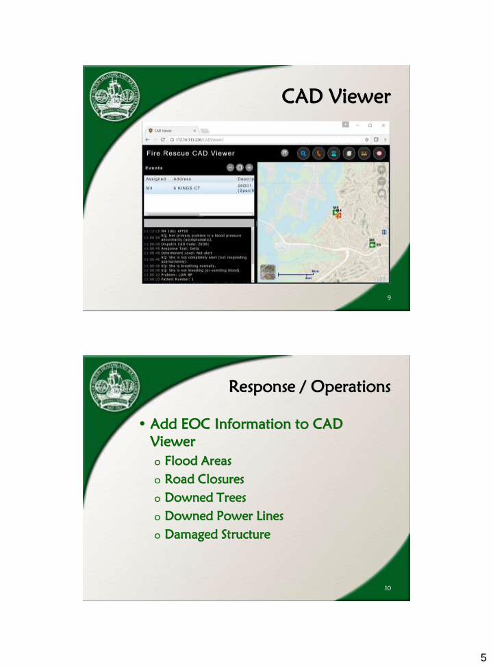
CAD Viewer
9
Response / Operations
• Add EOC Information to CAD
Viewer
o Flood Areas
o Road Closures
o Downed Trees
o Downed Power Lines
o Damaged Structure
10

6
EOC CAD Viewer
11
EOC CAD Viewer
12

7
GIS Operations in EOC
13
Recovery
14
•Damage Assessment
•Debris Management Support
•Pictometry
•General Map Requests
8
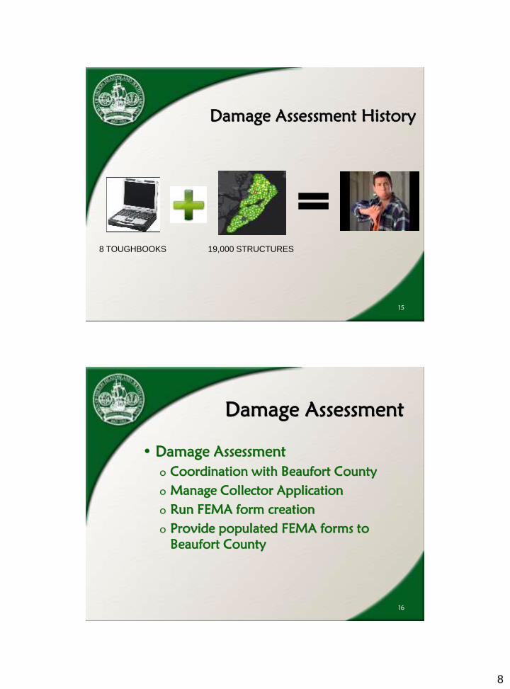
Damage Assessment History
15
8 TOUGHBOOKS 19,000 STRUCTURES
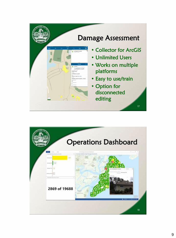
Damage Assessment
• Damage Assessment
o Coordination with Beaufort County
o Manage Collector Application
o Run FEMA form creation
o Provide populated FEMA forms to
Beaufort County
16
9
Damage Assessment
• Collector for ArcGIS
• Unlimited Users
• Works on multiple
platforms
• Easy to use/train
• Option for
disconnected
editing
17
Operations Dashboard
18

10
Debris Management
• Track Approval Status
• Coordination with Crowder Gulf and
Tetra Tech
• Communicate status to public
• FEMA Private Property Debris
Removal
o Private Road Maps (outside of PUDs)
o Private Road Maps (inside PUDs)
19
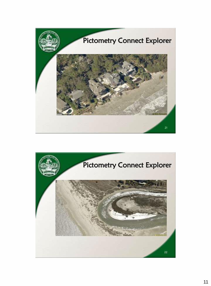
Pictometry Connect Explorer
20
11
Pictometry Connect Explorer
21
Pictometry Connect Explorer
22

12
Pictometry Connect Explorer
23
Where do we go from here?
• Public data submission (GEOFORM)
• Drone Flights
• Mapping debris locations
• Enable staff to collect field notes and
submit photos and videos.
• Improve damage assessment form
creation
24

13
Where do we go from here?
25
Questions?
26