Tower Services Brochure
12
Transcript of Tower Services Brochure

Overview• Structural Leadership
Seth Harrelson, P.E. – President 704.751.1791 [email protected]
William B. Holt, P.E. – Director of Structural Services 704.472.5147 [email protected]
Tyler Mora, E.I. – TSA Division Manager 910.690.6432 [email protected]
Alex Mora – Project/Construction Manager 704.751.1123 [email protected]

Structural Engineering Services
Telecommunications structure site designs All required drawings – zoning, construction, and “as-built” Structural analysis Tower reinforcement design
Retrofit Modifications to Existing Towers Third Party Review and Consulting for Modification Efficiency and
Constructability LiDAR Enforced To Scale Compound Drawings
Pre-Modification Fit Up Verification Carrier EPA Calculation / Carrier Lease Verification Report
Geotechnical analysis
Utilis Engineering specializes in the analysis and design of telecommunications structures. Our licensed, industry-experienced staff includes project/program managers, engineers, CAD operators, and construction managers. Utilis draws on these knowledgeable in-house resources to offer our customers complete, end-to-end, wireless site development services, including:
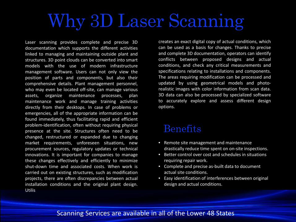
Why 3D Laser ScanningLaser scanning provides complete and precise 3Ddocumentation which supports the different activitieslinked to managing and maintaining outside plant andstructures. 3D point clouds can be converted into smartmodels with the use of modern infrastructuremanagement software. Users can not only view theposition of parts and components, but also theircomprehensive details. Plant management personnel,who may even be located off-site, can manage variousassets, organize maintenance processes, planmaintenance work and manage training activitiesdirectly from their desktops. In case of problems oremergencies, all of the appropriate information can befound immediately, thus facilitating rapid and efficientproblem-identification, often without requiring physicalpresence at the site. Structures often need to bechanged, restructured or expanded due to changingmarket requirements, unforeseen situations, newprocurement sources, regulatory updates or technicalinnovations. It is important for companies to managethese changes effectively and efficiently to minimizeshut-down time and associated costs. When work iscarried out on existing structures, such as modificationprojects, there are often discrepancies between actualinstallation conditions and the original plant design.Utilis
• Remote site management and maintenance drastically reduce time spent on on-site inspections.
• Better control over cost and schedules in situations requiring repair work.
• Complete and precise as-built data to document actual site conditions.
• Easy identification of interferences between original design and actual conditions.
creates an exact digital copy of actual conditions, whichcan be used as a basis for changes. Thanks to preciseand complete 3D documentation, operators can identifyconflicts between proposed designs and actualconditions, and check any critical measurements andspecifications relating to installations and components.The areas requiring modification can be processed andupdated by using geometrical models and photo-realistic images with color information from scan data.3D data can also be processed by specialized softwareto accurately explore and assess different designoptions.
Benefits
Scanning Services are available in all of the Lower 48 States
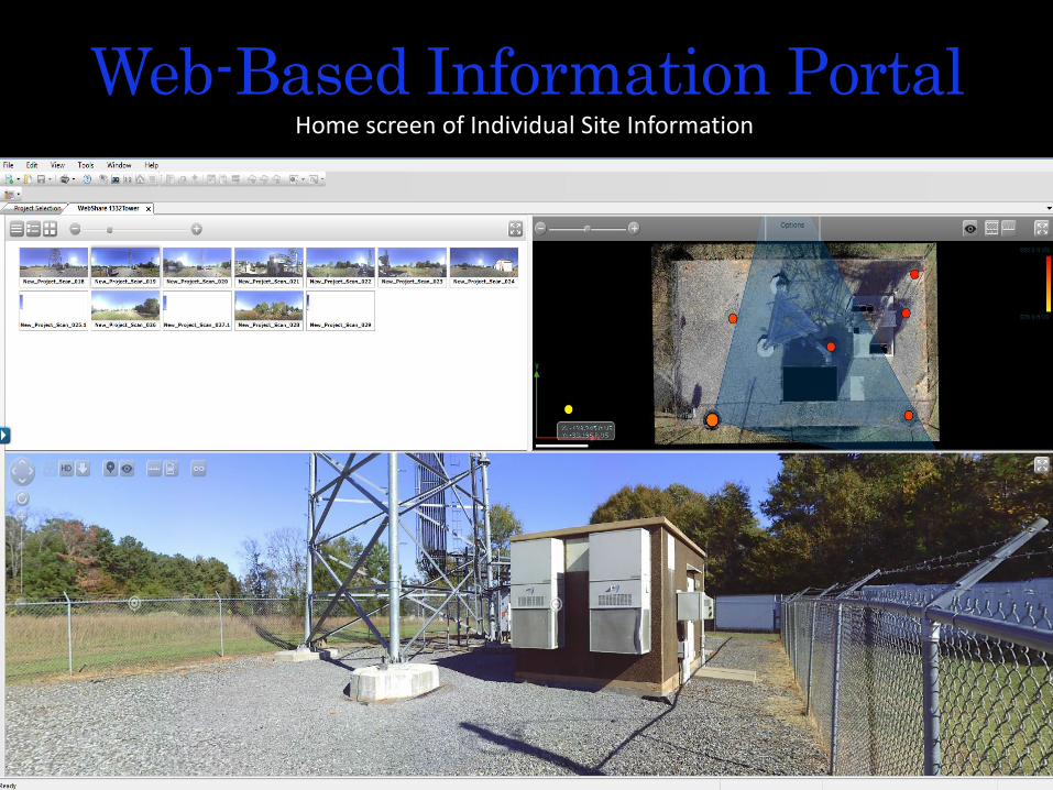
Web-Based Information PortalHome screen of Individual Site Information

Quickly & Accurately identify and calculate area to validate actual space leased or space available
Site Plan View

Pull precise linear measurements with the click of the mouse.
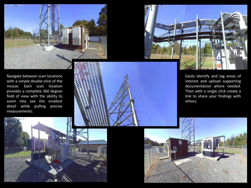
Navigate between scan locationswith a simple double-click of themouse. Each scan locationprovides a complete 360 degreefield of view with the ability tozoom into see the smallestdetail while pulling precisemeasurements.
Easily identify and tag areas ofinterest and upload supportingdocumentation where needed.Then with a single click create alink to share your findings withothers.

3D Point CloudsReflecting “Real Time” and “Real Position” Data

With Our Cloud based software, laser scans andadditional information such as CAD drawings,photographs or site plans can quickly be sharedvia the internet with the push of a button. Thatmakes collaboration with others involved in theproject much easier. WebShare access is carriedout via a standard internet browser. Directmeasurements can also be done there. In thisway all the project partners can work on datasimultaneously, which significantly speeds upthe processes.
“ Your Cloud or Ours ? ”
Construction Management
• General Contracting, Construction Management
• Site Supervision• Bid Management and Evaluation• Budget Development• Materials Procurement and Light
Fabrication• Pre-construction Services• At-risk Construction Management• Light Maintenance and Repair
• Post Modification Inspections• Program Management• Subcontractor Qualification

“Quality is never an accident. It is always the result of intelligent effort” – John Ruskin
Utilis Engineering, PAOffice Locations:
1300 S. Dekalb St Shelby, NC 28152
19 West Hargett St, Suite 601Raleigh, NC 27601
PresidentSeth Harrelson – [email protected]
EVP of Corporate DevelopmentJon Owen– [email protected]
EVP of OperationsMatt Ward– [email protected]