Towards a meteorological domain model: next steps
19
Towards a meteorological domain model: next steps Andrew Woolf, Dominic Lowe STFC Rutherford Appleton Laboratory
Transcript of Towards a meteorological domain model: next steps
Towards a meteorological domain model: next steps
Andrew Woolf, Dominic LoweSTFC Rutherford Appleton Laboratory
Outline
• Background• Related activities• Case study: GeoSciML• Case study: INSPIRE• Next steps

Background• Nov ’08: 1st ISO/OGC workshop (ECMWF)
– met. model (elements: features/coverages/observations)
• Mar ’09: OGC TC Athens– Met Domain Working Group established
• Jun ’09: OGC TC Boston– actors (e.g. INSPIRE, IPET-MDI, CSML, NNEW, CDM, WXXM, ...)
• Sep ’09: OGC TC Darmstadt– ‘what’ (info. classes, patterns, registers, ...)
• Nov ’09: 2 nd ISO/OGC workshop (Météo-France)– ‘how’...

Related activities• WMO IPET-MDI• ISO 19156 (Observations and Measurements)• Weather for Aviation {Conceptual, Exchange} Model
(WXCM, WXXM)• NextGen Network Enabled Weather (NNEW)• Climate Science Modelling Language (CSML)• Unidata netCDF Common Data Model• Weather Objects Model Language (WOML)
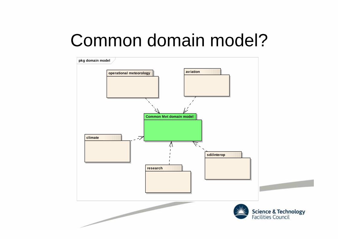
Common domain model?pkg domain model
Common Met domain model
operational meteorology av iation
research
climate
sdi/interop

Case study: GeoSciML
• Data model for the geoscience community
• Scope– restricted to “those geoscience objects which form
the main components of a geological map”– Faults, Boreholes, Geological Ages, ...
• Not in scope– aspects with no governance remit– concepts defined elsewhere– e.g. GroundWaterML: derived from GeoSciML,
separately governed

Case study: GeoSciML• Governance
– IUGS Commission for the Management and Application of Geoscience Information (IUGS CGI)
– CGI Interoperability Working Group– Active participants: BGS (UK), BRGM (FR), CSIRO (AU),
GA (AU), GSC (CA), APAT (IT), JGS (JA), SGU (SE), USGS (US), ...
• Remit– develop a conceptual data model– map to a common interchange format– testbed demonstration

Case study: GeoSciML
• CGI IWG method– Steering Committee + Task Groups
• Use-cases and requirements task group• GeoSciML Design task group• Outreach and Technical assistance task group• Geoscience Concept Definitions
– roughly bi-annual physical meetings

Case study: GeoSciML
• Infrastructure– OneGeology portal– testbeds– registry– wiki– mailing lists– subversion repository– documentation– UML tools
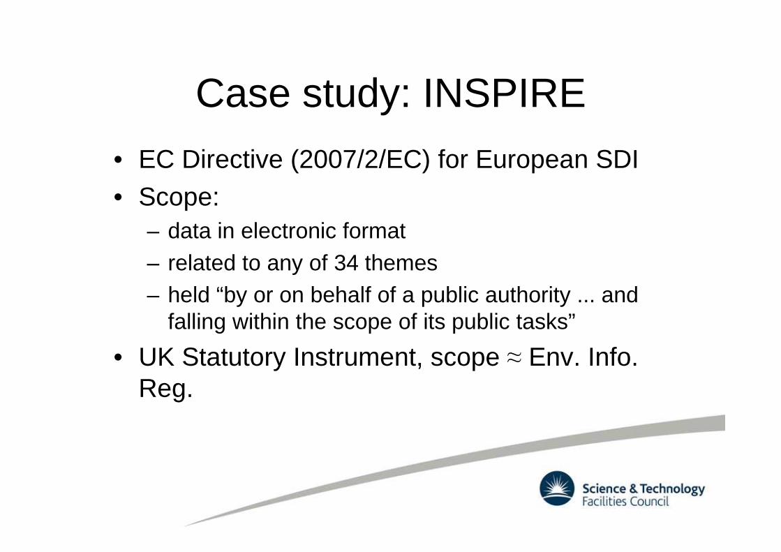
Case study: INSPIRE
• EC Directive (2007/2/EC) for European SDI
• Scope:– data in electronic format– related to any of 34 themes– held “by or on behalf of a public authority ... and
falling within the scope of its public tasks”
• UK Statutory Instrument, scope ≈ Env. Info. Reg.

Case study: INSPIREAnnex I
Coordinate reference systems Geographical grid systems Geographical namesAdministrative units Addresses Cadastral parcelsTransport networks Hydrography Protected sites
Annex IIElevation Land cover OrthoimageryGeology
Annex IIIStatistical units Buildings Land useHuman health and safety Utility and governmental
servicesEnvironmental monitoring facilities
Production and industrial facilities
Agricultural and aquaculture facilities
Population distribution –demography
Area management/restriction/regulation zones and reporting units
Natural risk zones Atmospheric conditions
Meteorological geographical features
Oceanographic geographical features
Sea regions
Bio-geographical regions Habitats and biotopes Species distributionsEnergy resources Mineral resources
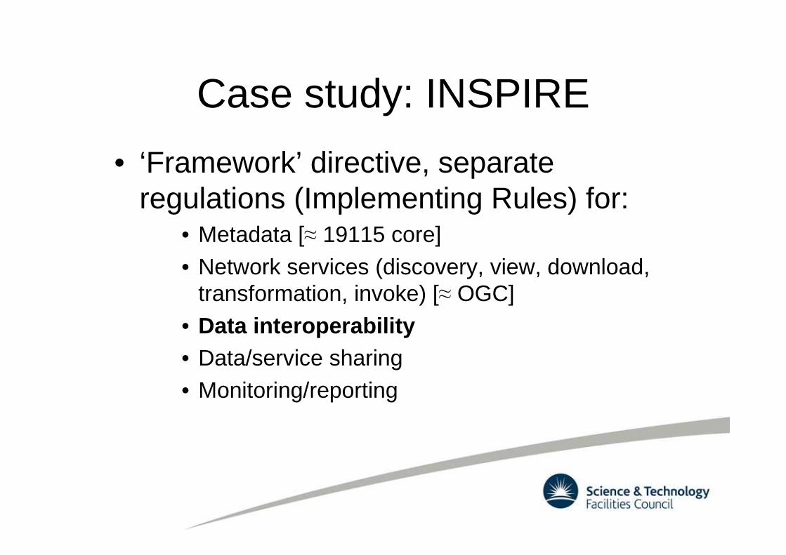
Case study: INSPIRE
• ‘Framework’ directive, separate regulations (Implementing Rules) for:
• Metadata [≈ 19115 core]• Network services (discovery, view, download,
transformation, invoke) [≈ OGC]• Data interoperability• Data/service sharing• Monitoring/reporting

Case study: INSPIRE
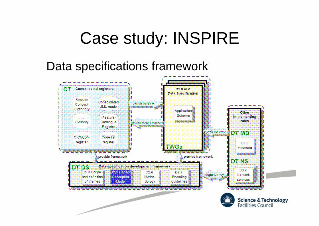
Case study: INSPIRE
Data specifications framework

Case study: INSPIRE
• Thematic Working Groups (TWGs)– small (< 10 members)
– Facilitator: manages the specification process
– Editor: documents the data specification, inc. application schema
– Domain experts: expertise about thematic domain and application data

Case study: INSPIRE
Data specifications development process
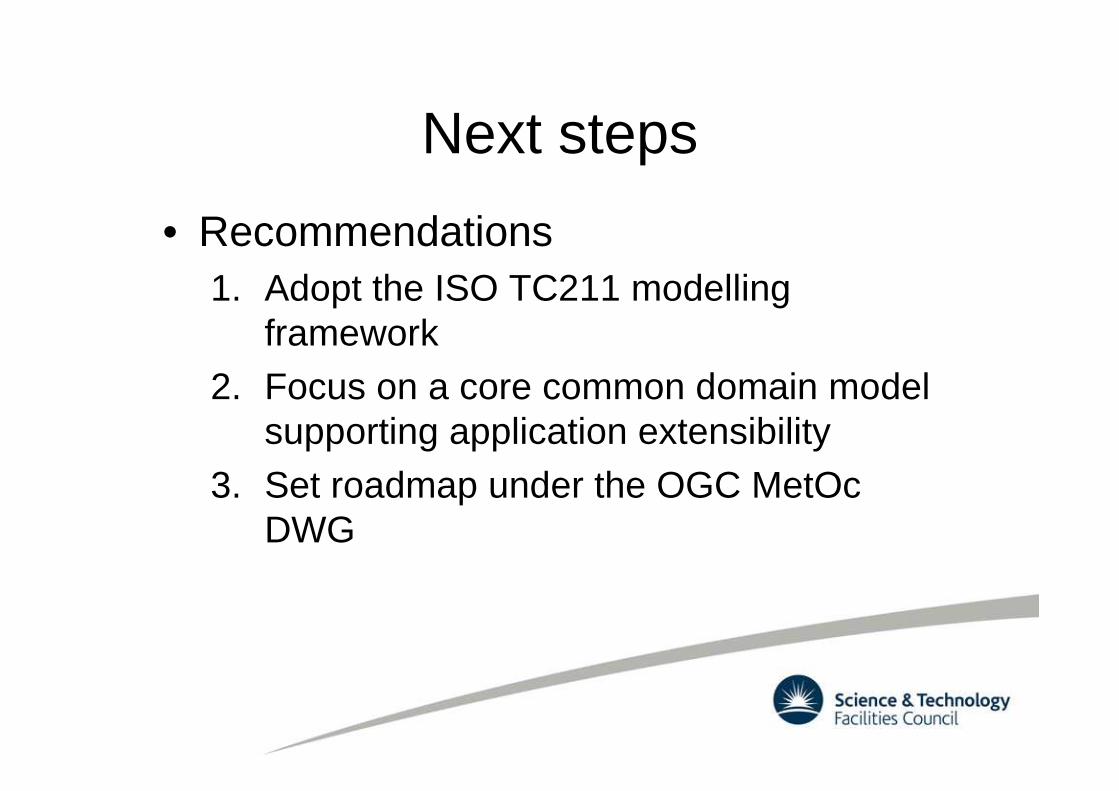
Next steps
• Recommendations1. Adopt the ISO TC211 modelling
framework2. Focus on a core common domain model
supporting application extensibility
3. Set roadmap under the OGC MetOc DWG

Next steps
• Questions1. Scope of a common domain model?
2. What working structure to adopt?3. Resourcing/infrastructure?
4. Roadmap and methodology?

(Immediate) next steps
• ‘Case studies’ document for more info• Working Group ‘Conceptual modelling’
– bring ideas– modellers bring a ‘model overview’ slide