Topography powerpoint
17
What is TOPOGRAPHY? Topography is the physical and natural features of the land A topographic map shows natural features (such as elevation) and man made features (such as schools)
-
Upload
jennifer-bertolino -
Category
Education
-
view
271 -
download
2
Transcript of Topography powerpoint
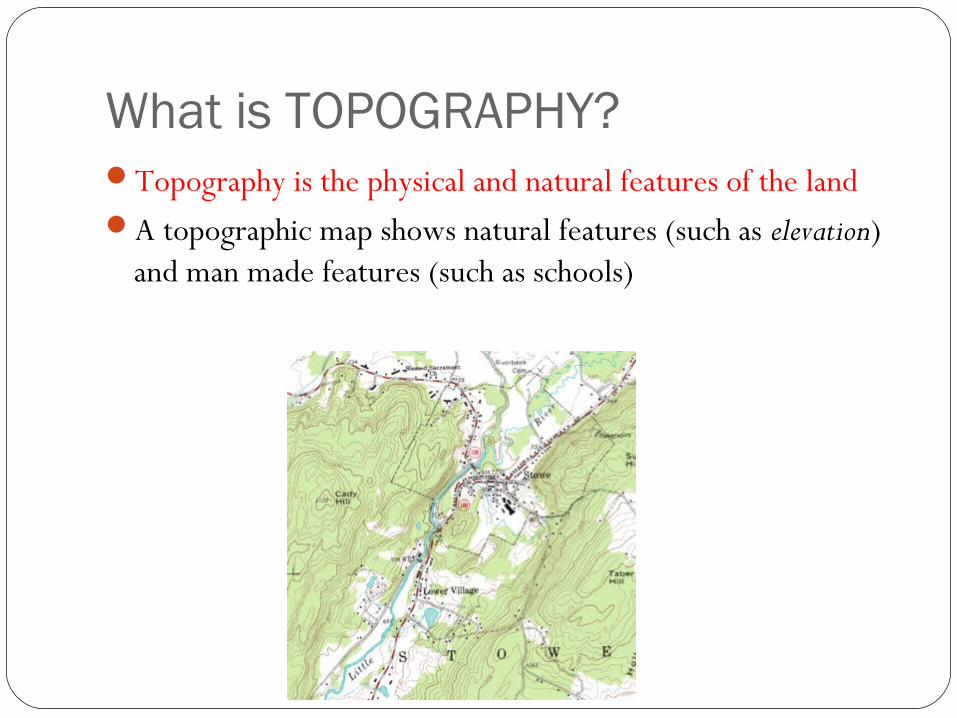
What is TOPOGRAPHY?Topography is the physical and natural features of the landA topographic map shows natural features (such as elevation)
and man made features (such as schools)
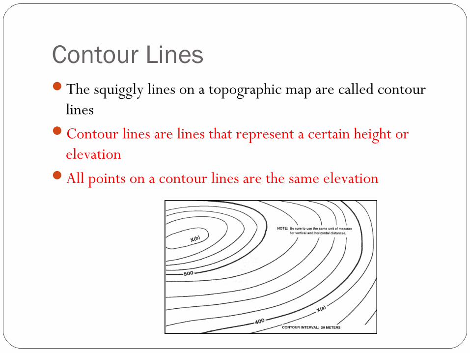
Contour LinesThe squiggly lines on a topographic map are called contour
linesContour lines are lines that represent a certain height or
elevationAll points on a contour lines are the same elevation
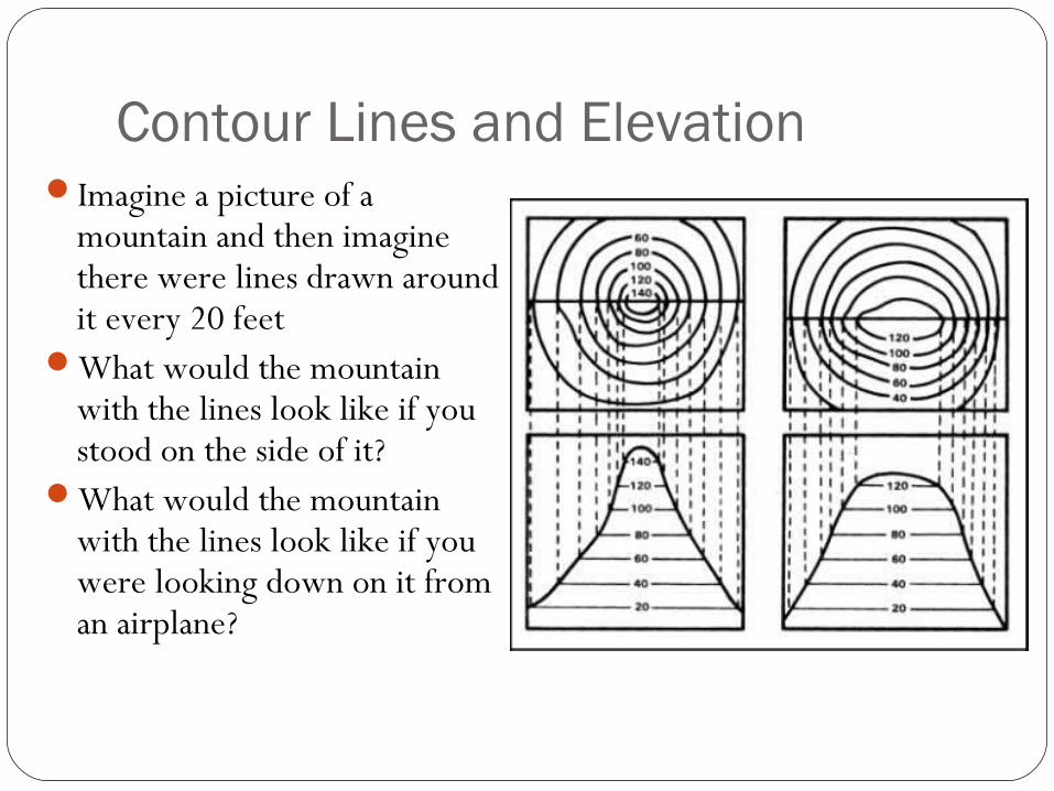
Contour Lines and ElevationImagine a picture of a
mountain and then imagine there were lines drawn around it every 20 feet
What would the mountain with the lines look like if you stood on the side of it?
What would the mountain with the lines look like if you were looking down on it from an airplane?
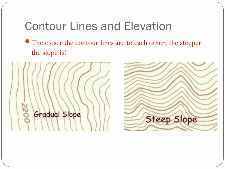
Contour Lines and ElevationThe closer the contour lines are to each other, the steeper
the slope is!
Other Topographic TermsMap scale – compares distances on the map with distances on
earth.Legend – explains symbols used on the map.Index contours – contour lines that are labeled to help you
find the contour interval.Relief – the difference in elevation between any 2 pointsA contour interval is the difference in elevation between two
contour lines that are side by side.Remember that a contour interval is not the distance
between the two lines – to get the distance you need to use the map scale.
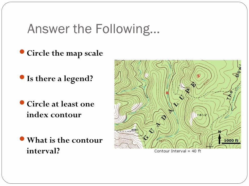
Answer the Following…
Circle the map scale
Is there a legend?
Circle at least one index contour
What is the contour interval?
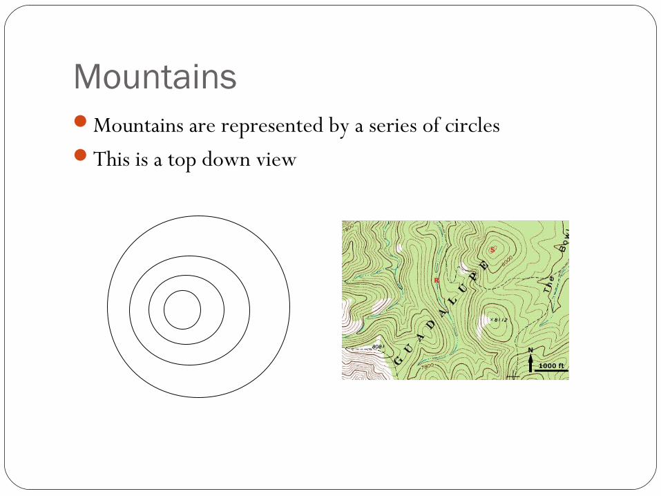
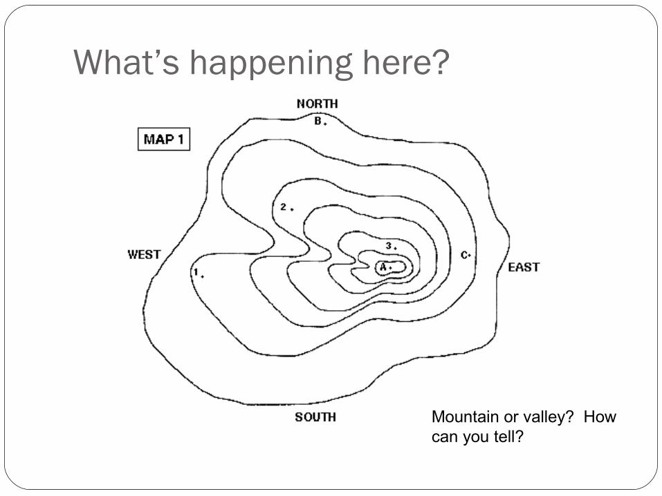
Mountains Mountains are represented by a series of circlesThis is a top down view
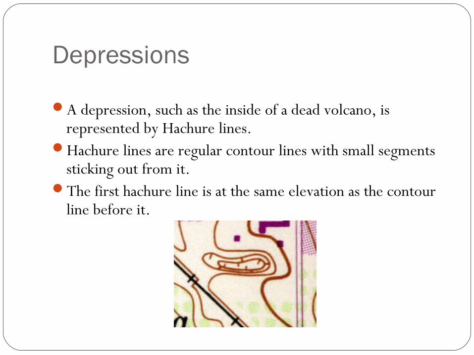
Depressions
A depression, such as the inside of a dead volcano, is represented by Hachure lines.
Hachure lines are regular contour lines with small segments sticking out from it.
The first hachure line is at the same elevation as the contour line before it.
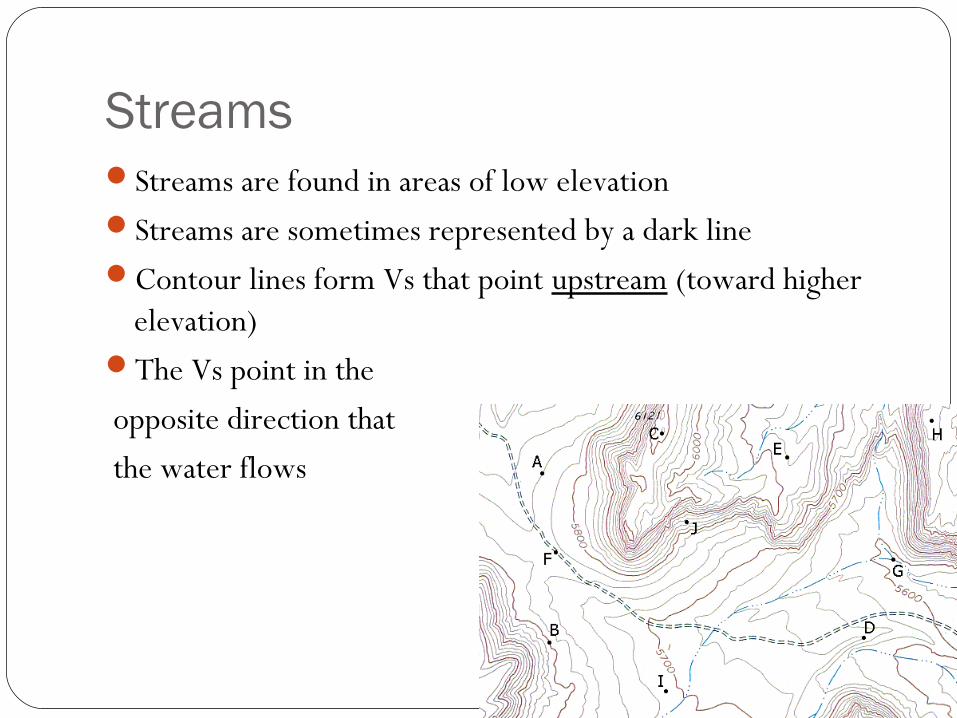
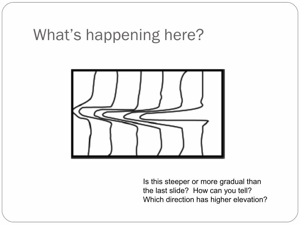
StreamsStreams are found in areas of low elevationStreams are sometimes represented by a dark lineContour lines form Vs that point upstream (toward higher
elevation)The Vs point in the opposite direction that the water flows
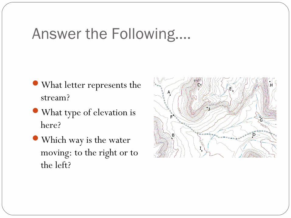
Answer the Following….
What letter represents the stream?
What type of elevation is here?
Which way is the water moving: to the right or to the left?
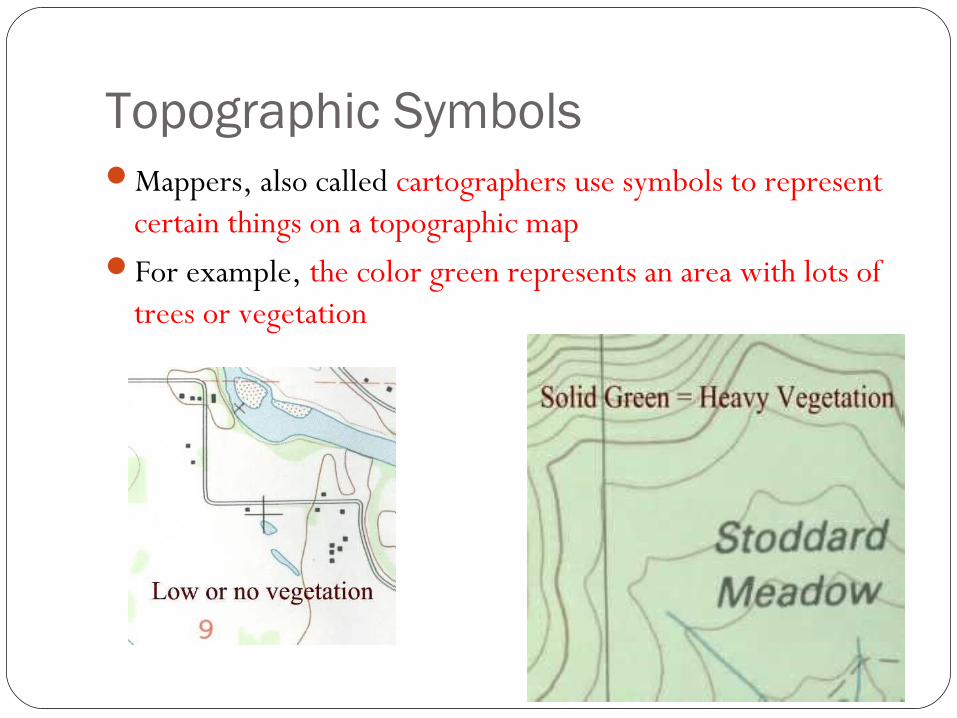
Topographic SymbolsMappers, also called cartographers use symbols to represent
certain things on a topographic mapFor example, the color green represents an area with lots of
trees or vegetation
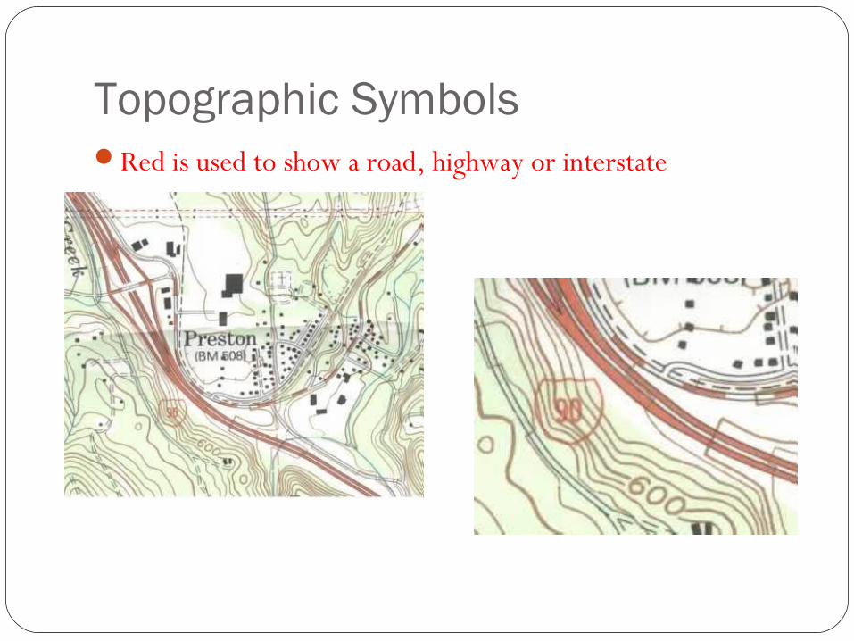
Topographic SymbolsRed is used to show a road, highway or interstate
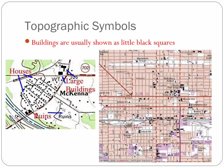
Topographic SymbolsBuildings are usually shown as little black squares

What landforms can be shown on a topographic map?Canyons – deep valleys with steep sides, often with streams
flowing throughRiver deltas – “end” of a river, where the river enters a
larger body of waterMountains or hills – high elevationValleys/depressions – low elevationRidges – long, narrow elevation or chain of mountains
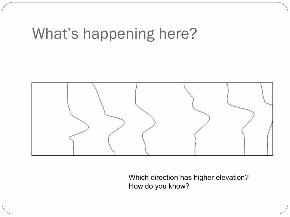
What’s happening here?
Which direction has higher elevation? How do you know?
What’s happening here?
Is this steeper or more gradual than the last slide? How can you tell?Which direction has higher elevation?
What’s happening here?
Mountain or valley? How can you tell?