Topography of Arid Lands Chapter 18. Deserts of the Worlds.
31
Topography of Arid Lands Chapter 18
-
Upload
vivian-wilmot -
Category
Documents
-
view
214 -
download
1
Transcript of Topography of Arid Lands Chapter 18. Deserts of the Worlds.
Topography of Arid Lands
Chapter 18
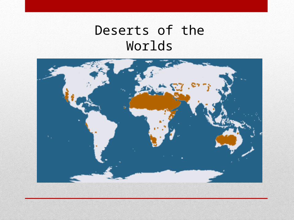
Deserts of the Worlds
Specialized Environment
• Special Conditions in Deserts
• Weathering- mostly mechanical• Different Soil and Regolith- little soil or
regolith exposing bedrock to erosion• Soil Creep – minor in desert slopes• Impermeable Surfaces - most surfaces are
impermeable to percolating water
• Sand – Deserts have lots of sand• Sand cover allows water to infiltrate- inhibits drainage via streams or
overflow• Sand is readily moved by heavy rains• Sand can be shifted and shaped by the wind
• Rainfall- much of the rainfall in the desert areas in intense, often coming from convective thunderstorms.
• Fluvial Deposition – all streams are ephemeral- effective agents of erosion
• Wind – most deserts don’t have wind as a large effect- some have high winds, but not all
• Basins of Interior Drainage - areas of many drainages that never make it to the ocean - such as the Great Basin
• Vegetation – perhaps the most important condition- the lack of vegetation has the effect on the topography
Special Conditions in Deserts
• Running water is by far the most important external agent of landform development
• Surface Water in the desert• Exotic Streams - permanent streams in dry lands (where the
water comes from adjacent mountains or wetter areas) and have sufficient volume to survive to the ocean- examples Colorado River or Nile River
• Desert Lakes – dry lake beds – called playas or salines if there is a large amount of salt present• Playas - are the flattest, most level of all landforms• Saline lakes – permanent lakes in desert areas, Great Salt
Lake a good example
Water in Arid Regions
• Differential Erosion - whenever a land surface erodes, variations in rock type and structure produce differences in the slope and shape of the resulting land form. • Results – cliffs, pinnacles, spires
• Residential Erosional Surfaces - steep-sided mountains called inselbergs- these resemble “island mountains”• A type of inselberg is called a bornhardt.
• Desert Stream Channels - normally dry beds of ephemeral streams• Called arroyos, gullies, washes or coulees
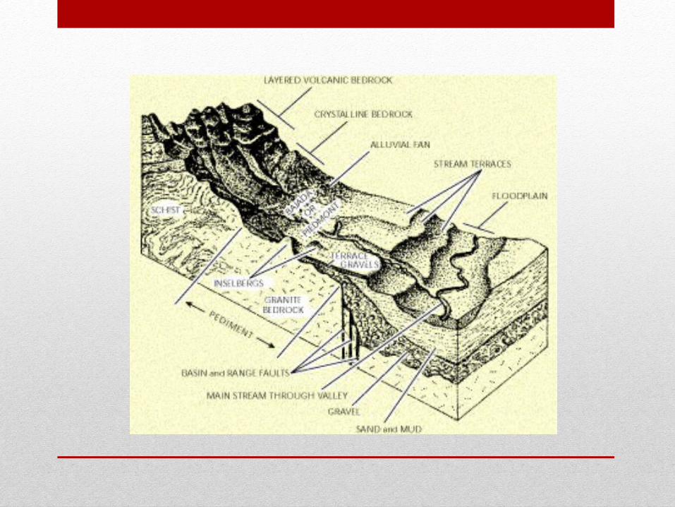
Fluvial Erosion in Arid Lands
Fluvial Deposition in Arid Lands
• Piedmont - generic term meaning any zone at the foot of a mountain range
• Piedmont Zone – one of the most prominent area of fluvial deposition
• Piedmont Angle - a pronounced change in the angle of slope at the mountain base
Characteristics of Desert Surfaces
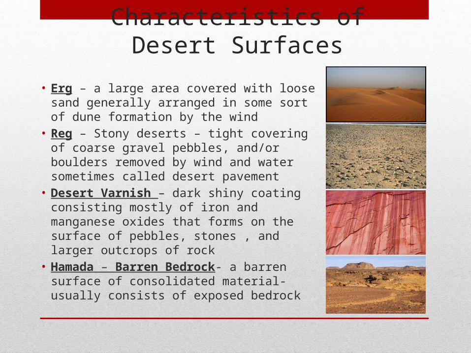
• Erg – a large area covered with loose sand generally arranged in some sort of dune formation by the wind
• Reg – Stony deserts – tight covering of coarse gravel pebbles, and/or boulders removed by wind and water sometimes called desert pavement
• Desert Varnish – dark shiny coating consisting mostly of iron and manganese oxides that forms on the surface of pebbles, stones , and larger outcrops of rock
• Hamada – Barren Bedrock- a barren surface of consolidated material- usually consists of exposed bedrock
The Work of the Wind
• Aeolian Processes – those related to wind action • Aeolian Erosion• Deflation- the shifting of loose particles as a
result of their being blown either through the air or along the ground• Abrasion- the same as fluvial abrasion
except that the Aeolian is less effective – Require “tools” in the form of airborne sand and dust particles – Doesn’t construct- merely sculptures what is already there
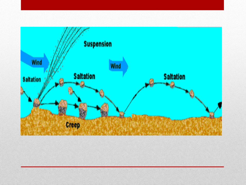
• Rock material carried by the wind much like in the water but less effectively
• The is done by “saltation” and “traction”• Large particles move by traction• Small particles are moved by saltation• Entire surfaces moves in a “creep” not like the soil
creep
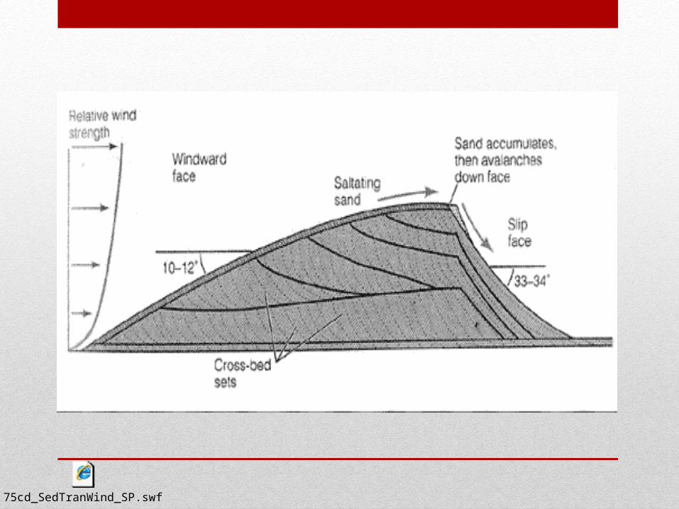
Aeolian Transportation
75cd_SedTranWind_SP.swf
Aeolian Deposition
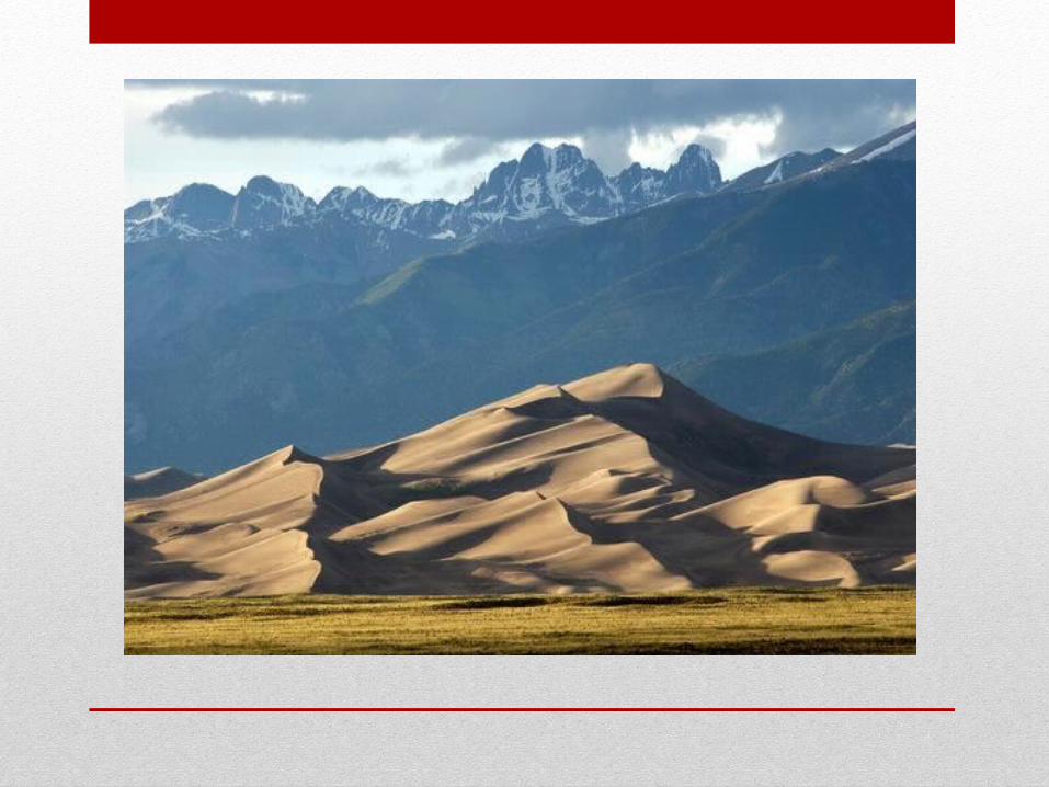
• Sand and Dust Moved by Wind eventually deposited into sand plains or sand dunes
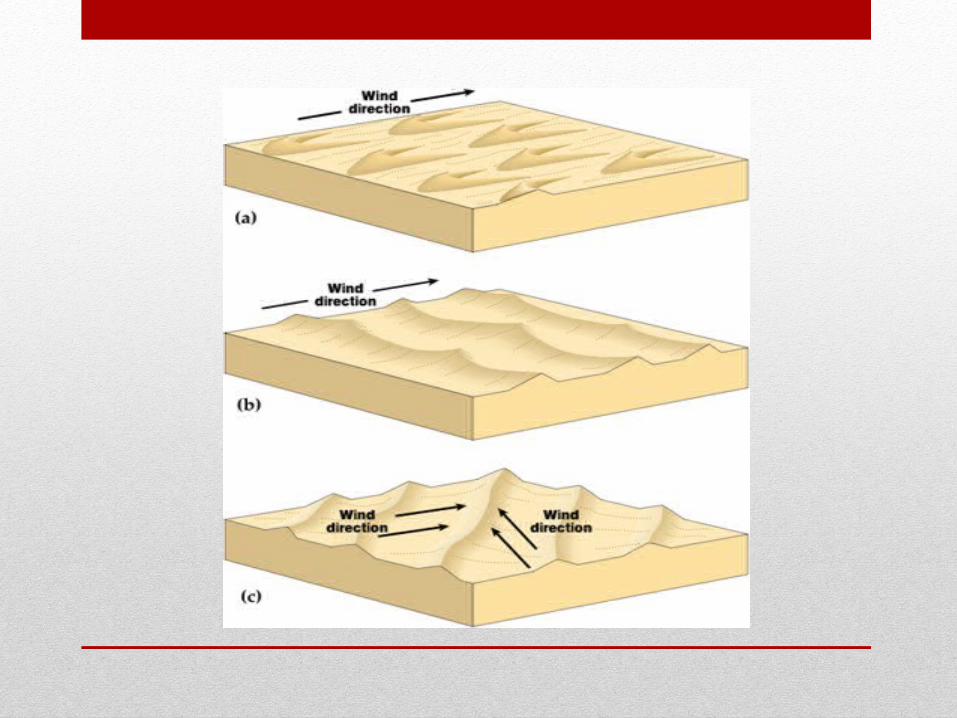
• Desert Sand Dunes – composed entirely of unanchored sand that is mostly uniform grains of quartz - three kinds of dune patterns
48cd_Crossbed_SP_v2.swf
75cd_SedTranWind_SP.swf
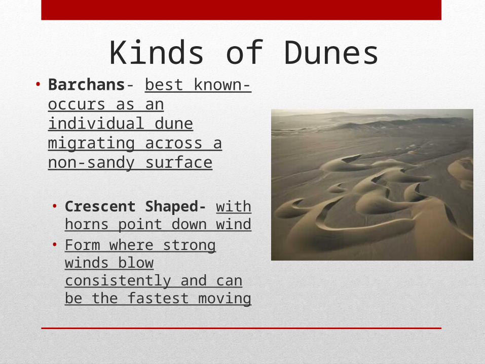
• Barchans- best known- occurs as an individual dune migrating across a non-sandy surface
• Crescent Shaped- with horns point down wind
• Form where strong winds blow consistently and can be the fastest moving
Kinds of Dunes
Kinds of Dunes
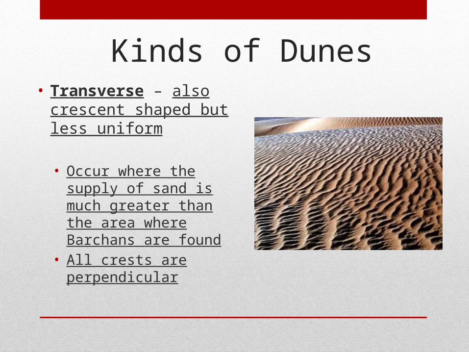
• Transverse – also crescent shaped but less uniform
• Occur where the supply of sand is much greater than the area where Barchans are found
• All crests are perpendicular
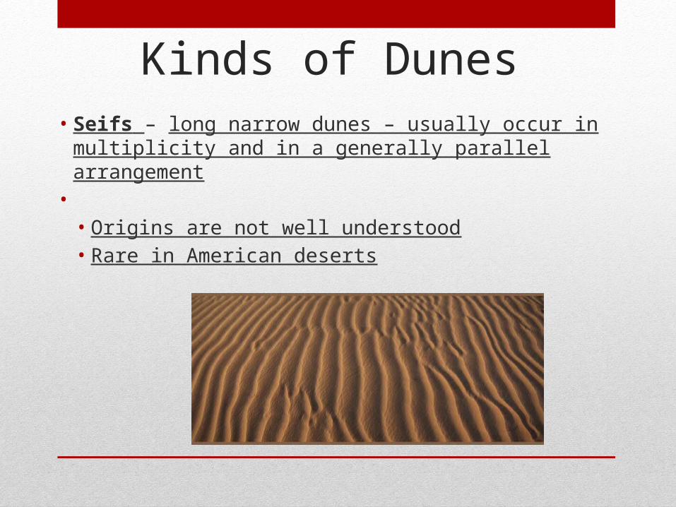
• Seifs – long narrow dunes – usually occur in multiplicity and in a generally parallel arrangement
• • Origins are not well understood• Rare in American deserts
Kinds of Dunes
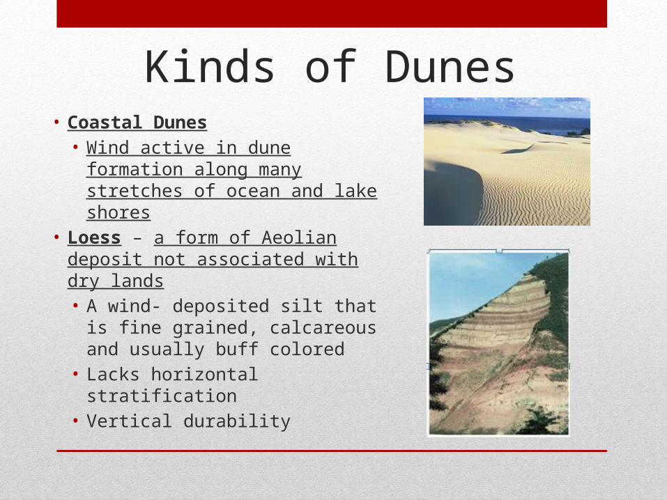
Kinds of Dunes• Coastal Dunes• Wind active in dune formation
along many stretches of ocean and lake shores
• Loess – a form of Aeolian deposit not associated with dry lands• A wind- deposited silt that is fine
grained, calcareous and usually buff colored
• Lacks horizontal stratification• Vertical durability
Two Characteristics Desert Landform
Assemblages
Most common desert landform is a
mountain or mountain range flanked
by plains
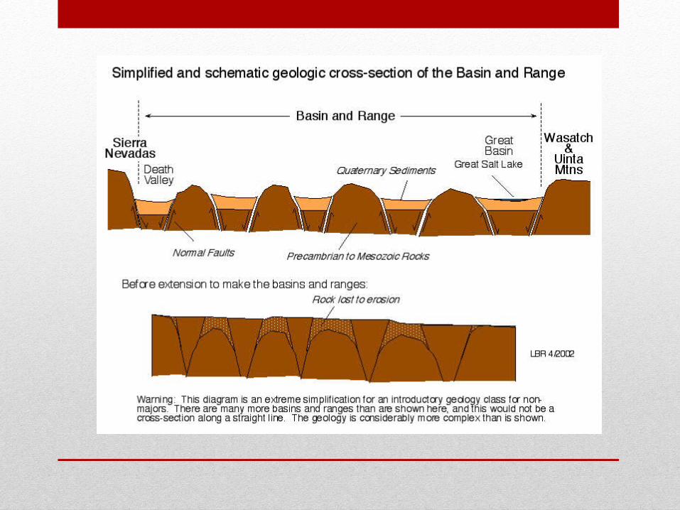
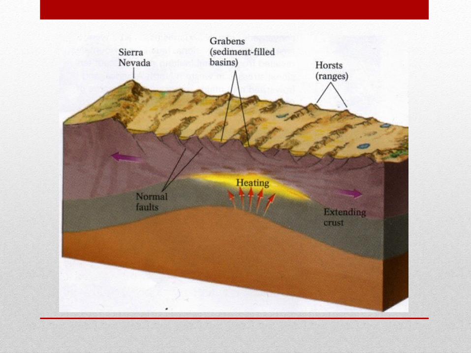
Basin and Range Terrain
Mesa and Scarp Terrain
• Land largely without external drainage• Has few exotic rivers flowing through or out of the
region• Three principal features – ranges, piedmont zones,
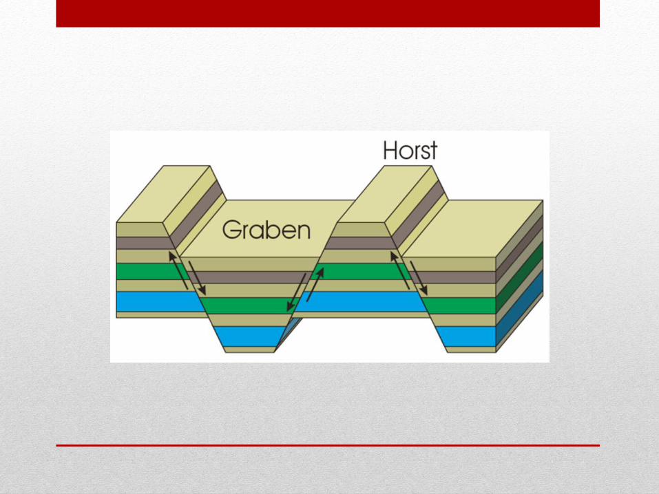
and basins• Ranges – dominate the horizons• Prevalence of steep and rocky slopes• Ridge crests & peaks are usually sharp steep cliffs• The ranges have been eroding for a long time
Basin-and-Range Terrain
• The Piedmont Zone• At the base of the ranges, a sharp break in the slope
( the piedmont angle)• Transition area from slopes of ranges to the near
flatness of the basin
• Alluvial Fan - found at the mouth of canyons where streams empty and deposit their debris• Bajada or Piedmont Alluvial Plain- where alluvial
fans build up and join together
Basin-and-Range Terrain
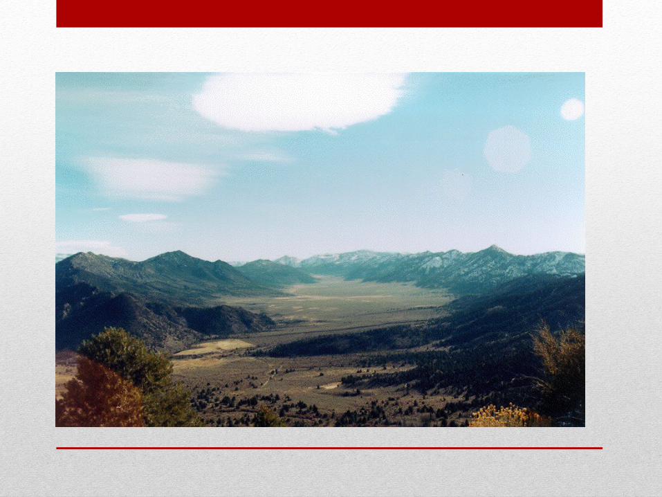
• Beyond the piedmont is the flattish floor of the basin• Low point is usually in a playa• Drainage channels across the basin floor sometimes clear
cut but more often shallow and ill defined, frequently disappearing before reaching the low point
• Salt accumulations are commonplace• Sometimes the water runs into playa lakes• Extensive but shallow• Persist for only a few days or weeks• Basin floor is covered with very fine-grained material • Death Valley is example of Basin and Range Terrain
Basin-and-Range Terrain
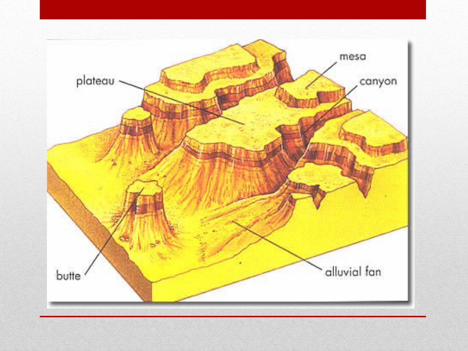
Mesa and Scarp Terrain
• Mesa (Table) • Scarp (Short for escarpment)• Normally associated with horizontal sediment strata• Differential erosion shows up prominently• Resistant strata weather and erode into mesas or scarps• The more easily eroded strata yield the gentler the
inclined slope• Much of the undermining done by a process called
sapping- groundwater seeps and trickles out of the scarp face, eroding fine particles and weathering the cohesion of the face
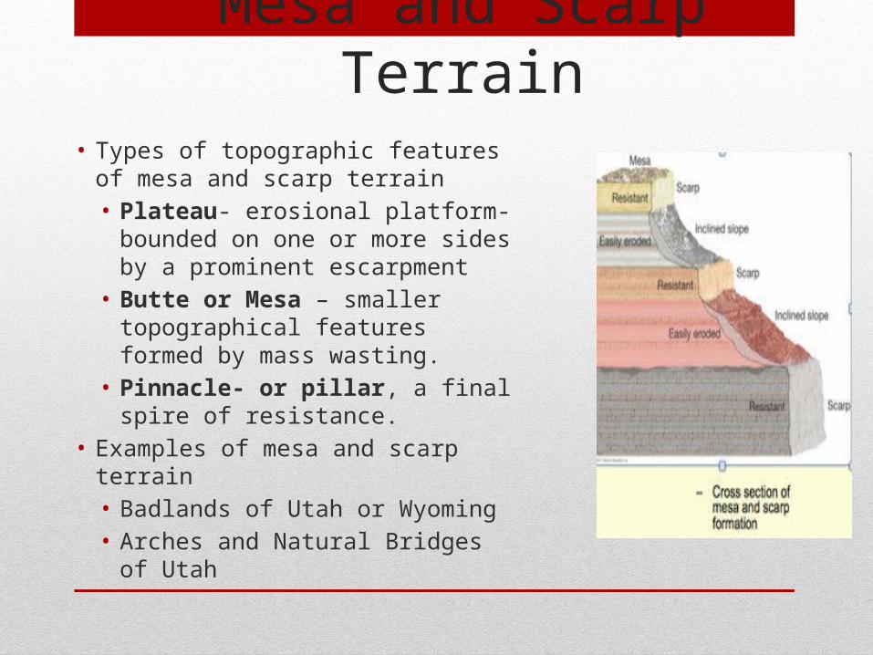
• Types of topographic features of mesa and scarp terrain• Plateau- erosional platform-
bounded on one or more sides by a prominent escarpment
• Butte or Mesa – smaller topographical features formed by mass wasting.
• Pinnacle- or pillar, a final spire of resistance.
• Examples of mesa and scarp terrain• Badlands of Utah or Wyoming• Arches and Natural Bridges of Utah
Mesa and Scarp Terrain