
Thriving Places: A Case Study Toolkit of ... - Park...
29
THRIVING PLACES A Case Study Toolkit of Urban Parks and Open Spaces in the Greater Golden Horseshoe
Transcript of Thriving Places: A Case Study Toolkit of ... - Park...

ThrivingPlaces
A Case Study Toolkit of Urban Parks and Open Spaces
in the Greater Golden Horseshoe

Park People is an independent charity that builds stronger communities by animating and improving parks, placing them at the heart of life in the city.
acknowledgements
A huge heartfelt thanks to the municipal park and planning staff that helped identify and review case
studies, talked to me on the phone, answered countless emails, and took me on park tours, especially:
John Spencer (Brampton), Sonya Drumond (Brampton), Walter Fischer (Barrie), Jyoti Pathak (Guelph),
Ian Panabaker (Guelph), Le’Ann Seely (Hamilton), Leila Todd (Hamilton), Linda Irvine (Markham), Sharon
Chapman (Mississauga), Jason Unger (Newmarket), Ted Horton (Newmarket), Dean Jacobs (Pickering),
Arnold Mostert (Pickering), Tracey Steele (Richmond Hill), Corinne Fox (Toronto), Jennifer Kowalski
(Toronto), Carol Martin (Toronto), Martin Traveres (Vaughan), and Jaime Bronsema (Vaughan). Finally,
thank you to the Government of Ontario for funding this work.
Thank you also to Wendy and Emerald at Gravity Inc. who always do amazing work.
Published: March 2016
Written by: Jake Tobin Garrett
Designed by: Gravity Inc.
Park People
119-401 Richmond Street West
Toronto, ON
M5V 3A8
www.parkpeople.ca
Thriving Places was produced by Park People with support from
the Government of Ontario.
Cover Photo: Urban design by John D. Bell Associates Ltd.

introduction 1Purpose of the case study toolkit ........................... 2
Making connections ................................................. 3
Provincial and municipal policy context ................. 4
Trends, challenges, and opportunities .................. 5
references 23
casestudyFramework 24
endnotes 25
Overview ..................................................................... 6
Methodology ............................................................ 7
Downtown Parks and Squares
11 Wellesley W, Toronto ........................................... 8
Riverwalk Commons, Newmarket ........................... 9
Scholars’ Green, Mississauga ................................ 10
Memorial Square-Meridian Place, Barrie ............. 11
Parks and Streets
Gore Park, Hamilton ............................................... 12
Market Square, Guelph .......................................... 13
TaBleOFcOnTenTs
Neighbourhood Parks
Gibson Park, Toronto ............................................. 14
Pollinator Park, Guelph .......................................... 15
Dollar Hamlet Park, Markham ............................... 16
Mount Pleasant Village Square, Brampton .......... 17
Trails and Linear parks
Pipeline Trail, Hamilton .......................................... 18
Simcoe Promenade, Markham .............................. 19
Plans
Black Creek Parks and Open Space Renewal, Vaughan ......................................20
Richmond Hill Regional Centre Land Use Study, Richmond Hill ............................. 21
Downtown Pickering Intensification Vision, Pickering .............................22
casestudies

– 1 –
introduction
With the intensification of many communities in the Greater Golden Horseshoe, we are seeing a change in the way people use parks and new ways that municipalities are planning, designing, and funding parks to serve new neighbourhoods.
Thriving Places showcases some of this exciting work by sharing best practices and innovative ways of planning and designing parks and open spaces in higher density communities.
The Provincial Growth Plan has guided much of this new development. The Growth Plan is a bold, innovative plan to direct development in the Greater Golden Horseshoe, with a special focus on encouraging intensification in a number of key urban growth centres.
Memorial Square-Meridian Place in Barrie John D. Bell Associates Ltd.

– 2 –
This intensification is critical to begin making the growth in the GGH more sustainable and building more livable communities.
A crucial element of building these urban growth centres is ensuring the necessary infrastructure for sustainable growth and a high quality of life. A strong park system is a central element of that infrastructure.
Parks and open spaces in these new higher density neighbourhoods are work horses. They are relied on by urban residents who no longer have access to their own private backyards for outdoor exercise and social activities. They are heavily used for different types of programming—from outdoor film screenings to yoga to food festivals—necessitating different design features, outdoor stages, and other amenities that can withstand and facilitate various events.
Parks are becoming our natural outdoor living rooms, the places that we go to meet friends, take a relaxing nap under a tree, or experience cultural activities. They are the places where workers go on their lunch breaks and where tourists gather to experience the energy of a new place. They are where our communities thrive.
Creating these places in dense, urban settings requires a new way of doing things.
It requires planning for new categories of parks such as linear parks and urban squares, but also expanding the scope of the open space network to include opportunities in our infrastructure corridors, schoolyards, streets, and other public spaces.
It includes creative designs that leverage adjacent street space as flexible, shared space and all-year amenities that provide people with activities whether it’s hot or cold outside. It also includes new ways of funding and acquiring parkland, whether sharing maintenance costs with nearby property owners or tapping into private donations and sponsorships.
We don’t always need to look to cities such as New York, Vancouver, and San Francisco for creative park ideas when so many municipalities across the GGH are stepping up with innovative projects.
These are exciting times for parks and open spaces in the GGH as municipalities intensify and new models are explored. The case studies included in Thriving Places highlight these through a range of projects that showcase some of the incredible work being done in the region.
Through these new parks, municipalities are creating dynamic, high-quality spaces by building new partnerships, putting a special focus on programming, and creating thriving places in the hearts of new communities.
Purpose of Thriving PlacesThe Thriving Places case study toolkit showcases creative parks and open space projects in the Greater Golden Horseshoe that respond to the challenges of intensification, population growth, and demographic change.
Case studies were chosen to highlight a diverse selection of both built and planned projects, pulling out key elements from each that can be applied more broadly as lessons for other municipalities.
Case studies are organized by type, including downtown parks and squares, parks and streets, linear parks and trails, neighbourhood parks, and master plans.
These projects point a way forward to new ways of planning, designing, funding, and operating parks and open spaces in the GGH. It is hoped that the projects highlighted here inspire further creative park projects and encourage the sharing of best practices across municipalities.

– 3 –
Making ConnectionsThriving Places expands on Park People’s 2015 report, Making Connections: Planning Parks and Open Space Networks in Urban Neighbourhoods. This report explored innovative public space strategies that cities in North America are developing in order to create a more connected system of parks and open spaces in higher density communities. The report can be downloaded at www.parkpeople.ca/makingconnections.
2 3 4Proactively plan central green spaces as the heart of networks that connect many different forms of open space.
Creative green connections that become places themselves and can act as links between larger parks and open spaces.
Be flexible in design and use so that the space we have can be used efficiently and adapt to changing needs.
Broaden the park to include the space beyond its edges so that parks and green spaces spill out into our streets and sidewalks.
1
Making Connections lays out Eight Guiding Principles for planning parks and open space networks based on a review of nearly 20 case studies from cities such as Toronto, Vancouver, Montreal, San Francisco, New York, and Philadelphia. These eight principles were used to help define the case studies in this toolkit and highlight key points and learnings. They are:
6 7 85Find park space in overlooked and unexpected places such as schoolyards and under overpasses.
Empower communities by building new partnership models that allow for more local decision-making and programming to meet diverse needs.
Experiment and be nimble by employing quick designs to test ideas and gather feedback.
Creative collaborations and pool funding sources to bring multiple city divisions on board and find new money for park improvements.

– 4 –
Provincial and Municipal Policy Context
Provincial Policy Statement, 2014
The Provincial Policy Statement, 2014 sets the over-arching policy vision for planning within the Province of Ontario. It includes policies to support healthy, active communities including the provision of a public realm that facilitates community connections and the “equitable distribution” of parks and open spaces for recreation.1
Provincial Growth Plan, 2006
The Growth Plan for the Greater Golden Horseshoe, 2006 sets out a framework for managing growth in the region by encouraging intensification and the creation of complete communities. The policies within the Plan that relate to parks and open spaces, encourage municipalities to establish an “urban open space system” in built-up areas that could include element such as rooftop gardens.2
In 2013, the Province launched a co-ordinated review of the Growth Plan, Greenbelt Plan, Oak Ridges Moraine Conservation Plan, and Niagara Escarpment Plan resulting in the report Planning for Health, Prosperity and Growth in the Greater Golden Horseshoe: 2015-2041.
This report made a number of suggestions and observations related to parks and open space planning, including:
• Creative approaches that look beyond traditional
parkland acquisition to understand how hydro
and rail corridors, institutional lands, school yards,
streetscapes, and other public spaces can be
leveraged as part of an overall parks and open
space system.3
• Encouraging the inclusion of green infrastructure
elements within parks and open space design.4
• Exploring new funding and acquisition strategies
in intensification areas, such as partnerships with
private land owners.5
These observations were used to help narrow areas of focus and highlight key points within the case studies included in this report.
Municipal Park and Intensification Master PlansMany municipalities in the region have developed parks and recreation master plans that aim to guide parks development and service planning. These plans are crucial to set out a vision and policy framework to ensure park systems keep pace with development and services keep pace with changing demographic and cultural needs.
Dollar Hamlet Park in Markham City of Markham

– 5 –
These plans, such as the Town of Richmond Hill’s 2013 Parks Plan, also directly tackle the challenge of growth and intensification by creating new updated Official Plan policies to facilitate park acquisition and planning for higher density areas, such as establishing an alternative dedication rate or contemplating the use of Section 37 funds for park projects.
A list of master plans consulted for this report is found under References.
Trends, Challenges, and OpportunitiesWhile each municipality and community deal with their own unique contexts, a number of common elements are emerging that can provide an overall look at trends, challenges, and opportunities that municipalities in the Greater Golden Horseshoe are experiencing related to parks and open space planning and design. These are the result of speaking with planners and park staff in municipalities around the Greater Golden Horseshoe as well as reviewing park master and service plans (see References).
• Increased importance of parks and open spaces
in areas of higher density developments as these
residents don’t have access to their own private
green spaces.
• An aging population that requires a shift in
park amenities and programming to encourage
physical activity, outdoor exercise equipment
and tai chi.
• More demand on park space for unstructured, spontaneous activities and passive uses rather
than organized sports.
• Need for new park classification typologies that
respond to the need to provide different types
of parks and open spaces in intensification areas,
such as public squares, linear parks, and parkettes.
• The traditional land dedication model may not be suitable to provide an adequate amount
of parkland in intensification areas due to the
smaller development sizes of higher density
developments.
• New avenues for park funding and acquisition
need to be explored, including the use of the
alternative parkland dedication rate, Section 37
funds, public-private partnerships, land swaps,
and sponsorships.
• Increasing popularity of trails and pathways for
walking and cycling and the need to create an
interconnected network.
• Greater and more diverse use of parks for different
types of community activities, such as outdoor
movie nights and festivals, and a desire for more
supportive infrastructure in parks to allow these
to happen (power hook-ups, water access, hard-
surface spaces, etc.)
• Increased population densities resulting in
higher maintenance costs for parks and a need
for higher quality materials that can withstand
more intense use.
• Greater interest of community members to
volunteer their time to improve their local park and
a need to create ways to channel this interest in a
positive way that can help municipalities maintain
parks, such as creating an adopt-a-park program.
• Desire for multi-functional, flexible park spaces
that offer opportunities for many different types
of activities, as opposed to single-purpose parks
that accommodate just one type of activity (e.g., a
baseball field).
• Incorporating sustainability features within
parks that perform important environmental
functions, such as storm water management
and flood mitigation.

– 6 –
Trails and Linear parks
Plans
Neighbourhood Parks
Black Creek Renewal, VaughanUsing a large naturalization project to create green space amenity and unlock development potential through flood protection.
Richmond Hill Regional Centre Land Use Study, Richmond HillPlanning infrastructure corridors as active transportation routes and linear parks to make connections between communities.
Downtown Pickering Intensification Vision, PickeringUsing natural systems as part of a place-making strategy in a proactive plan to ensure everyone is within 5 minutes of a park.
Gibson Park, TorontoIncorporating neighbourhood history and a heritage building in a park revitalization serving a high-rise community.
Pollinators Park, GuelphReusing a landfill as parkland and partnering with a volunteer group to create and maintain natural habitat and educational programming.
Dollar Hamlet Park, MarkhamIncorporating cultural diversity into park planning and design based on community feedback.
Mount Pleasant Village Square, BramptonCreating a new neighbourhood focal point in a walkable community adjacent to a major transit node.
Pipeline Trail, HamiltonExpanding and upgrading an existing urban trail that connects neighbourhoods, community amenities, and green space.
Simcoe Promenade, MarkhamCreating a transit-way and linear park corridor to connect people along new high-density developments.
Gore Park, HamiltonCombining park revitalization with pedestrianization of adjacent street to create more pedestrian space at a key downtown park.
Market Square, GuelphDesigning a flexible, shared street as part of an overall new public square that can accommodate many different types of programming.
Parks and Streets
11 Wellesley W, TorontoCreatively pooling parkland dedications from nearby developments to get a larger park space.
Riverwalk Commons, NewmarketCreating a central signature park space and animating it with creative ideas such as a book exchange hut.
Scholars’ Green, Mississauga Partnering with an institution to create a park that serves multiple users (students and residents).
Memorial-Square Meridian Place, BarrieCollaborative funding arrangements to create a new signature space for events and activities.
Downtown Parks and Squares
Scholars Green gh3/Terraplan Landscape Architects
casestudies

– 7 –
Methodology
Staff were asked to recommend candidate sites in areas that are undergoing or planned for intensification. Staff completed a standard case study framework that was used to create specific narratives that highlight key areas of interest. Interviews and site visits were done as needed.
Final case studies were chosen based on a number of criteria:
• An appropriate geographic spread around
the region
• Ability to highlight different aspects of parks
and open space planning
• A mix of typologies, including linear parks,
squares, streetscapes, and trails
• A balance between built and planned projects
Case studies were chosen by reaching out to municipalities in the Greater Golden Horseshoe that include an urban growth centre in the Province’s Growth Plan.
Memorial Square-Meridian Place John D. Bell Associates Ltd.
– 8 –
New park
size: Approx. 0.6haexpectedcompletion:2018
11WellesleyW,Toronto
lan dscapearchitect: DTAH cost: $2.7 million
Key points
• Consolidation of parkland dedications can help create new parks in infill situations
• Combining parkland purchases with parkland dedications can further expand a park
• Parks constructed over parking garages present design challenges
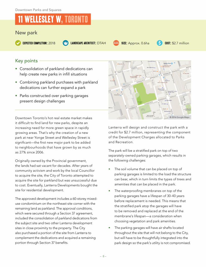
Downtown Toronto’s hot real estate market makes it difficult to find land for new parks, despite an increasing need for more green space in rapidly growing areas. That’s why the creation of a new park at near Yonge Street and Wellesley Street is significant—the first new major park to be added to neighbourhoods that have grown by as much as 27% since 2006.
Originally owned by the Provincial government, the lands had sat vacant for decades. After years of community activism and work by the local Councillor to acquire the site, the City of Toronto attempted to acquire the site for parkland but was unsuccessful due to cost. Eventually, Lanterra Developments bought the site for residential development.
The approved development includes a 60-storey mixed-use condominium on the northeast site corner with the remaining land as parkland. The approval conditions, which were secured through a Section 37 agreement, included the consolidation of parkland dedications from the subject site and two other Lanterra development sites in close proximity to the property. The City also purchased a portion of the site from Lanterra to complement the dedications and acquired a remaining portion through Section 37 benefits.
Lanterra will design and construct the park with a credit for $2.7 million, representing the component of the Development Charges allocated to Parks and Recreation.
The park will be a stratified park on top of two separately-owned parking garages, which results in the following challenges:
• The soil volume that can be placed on top of
parking garages is limited to the load the structure
can bear, which in turn limits the types of trees and
amenities that can be placed in the park.
• The waterproofing membranes on top of the
parking garages have a lifespan of 30-40 years
before replacement is needed. This means that
the stratified park atop the garages will have
to be removed and replaced at the end of the
membrane’s lifespan—a consideration when
choosing vegetation and park amenities.
• The parking garages will have air shafts located
throughout the site that will not belong to the City,
but will have to be thoughtfully integrated into the
park design so the park’s utility is not compromised.
© 2016 Google Maps
Downtown Parks and Squares
– 9 –
New park
size: 1.9hacompleted: 2011 lan dscapearchitect: Janet Rosenberg & Studio cost: $10.1 million
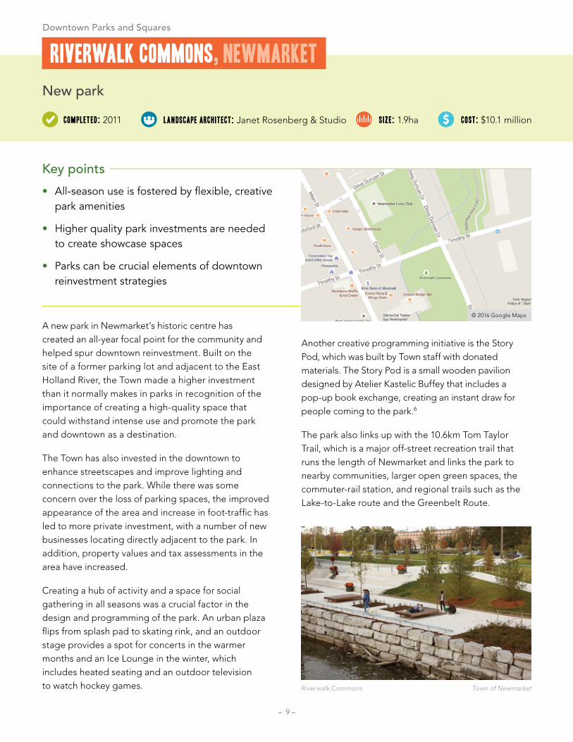
A new park in Newmarket’s historic centre has created an all-year focal point for the community and helped spur downtown reinvestment. Built on the site of a former parking lot and adjacent to the East Holland River, the Town made a higher investment than it normally makes in parks in recognition of the importance of creating a high-quality space that could withstand intense use and promote the park and downtown as a destination.
The Town has also invested in the downtown to enhance streetscapes and improve lighting and connections to the park. While there was some concern over the loss of parking spaces, the improved appearance of the area and increase in foot-traffic has led to more private investment, with a number of new businesses locating directly adjacent to the park. In addition, property values and tax assessments in the area have increased.
Creating a hub of activity and a space for social gathering in all seasons was a crucial factor in the design and programming of the park. An urban plaza flips from splash pad to skating rink, and an outdoor stage provides a spot for concerts in the warmer months and an Ice Lounge in the winter, which includes heated seating and an outdoor television to watch hockey games.
Another creative programming initiative is the Story Pod, which was built by Town staff with donated materials. The Story Pod is a small wooden pavilion designed by Atelier Kastelic Buffey that includes a pop-up book exchange, creating an instant draw for people coming to the park.6
The park also links up with the 10.6km Tom Taylor Trail, which is a major off-street recreation trail that runs the length of Newmarket and links the park to nearby communities, larger open green spaces, the commuter-rail station, and regional trails such as the Lake-to-Lake route and the Greenbelt Route.
riverwalkcommons,newmarket
Key points
• All-season use is fostered by flexible, creative park amenities
• Higher quality park investments are needed to create showcase spaces
• Parks can be crucial elements of downtown reinvestment strategies
© 2016 Google Maps
Riverwalk Commons Town of Newmarket
Downtown Parks and Squares

– 10 –
New park
size: 0.5ha
completed: 2011 lan dscapearchitect: gh3/ Terraplan Landscape Architects
cost: $2.6 million
Key points
• Parks can be designed to serve multiple users, such as residents and students
• Cost-sharing agreements with nearby institutions or organizations can help with maintenance
• Amenities such as charging stations and wi-fi help create an outdoor living room
Scholars’ Green is a downtown park in Mississauga that does double-duty as the open space heart of the Sheridan College campus and a community park for local residents and workers. The park is situated within a growing high-density neighbourhood and nearby other important parks and open spaces, such as Celebration Square and Community Common.
The design and construction costs of the park were split evenly between the college and the City. Due to its double-nature as both a community and student space, on-going engagement between the City and college is critical.
Both parties have members that sit on a Landlord/Tenant Liaison Committee to review ongoing park operations. For example, special snow-clearing was required that met the needs of college users, as well as higher maintenance standards given its downtown location and heavy use.
The park’s design also aims to balance the needs between community space and academic common. Light fixtures include outlets for charging devices and accommodating programming needs, while a central pavilion meant as a hub for both community and academic use includes hooks so it can be used as an outdoor gallery space. The park includes free wi-fi.
A dense network of criss-crossing pathways creates distinct areas, including small treed groves, café seating, grass lawns, and a sunken teaching amphitheatre with built-in seating. Environmentally sustainable elements were combined with creative design elements such as “permeable recycled glass paving with glow-in-the-dark concrete patterns.”7
scholars’green,Mississauga
© 2016 Google Maps
Scholars Green gh3/Terraplan Landscape Architects
Downtown Parks and Squares

– 11 –
Key points
• Closing adjacent streets creates opportunities for larger, continuous park spaces
• Collaborative funding agreements including sponsorship deals can help cover costs
• Partnerships with a BIA can bring year-round programming to animate public spaces
Collaborative funding is behind the revitalization and expansion of a central downtown park in Barrie that aims to transform the space into more of a “people place” and a year-round tourism destination.
Currently called Memorial Square, the redesign will unite two separate open spaces by closing the street that bisects them, becoming part of a larger continuous space called Memorial Square-Meridian Place. The revitalization also fits within the City’s goal to better connect Heritage Park on the waterfront to the downtown core by creating a new open space connection through the park expansion.
A collaborative funding arrangement is an important factor in the revitalization, with the Square development funded through a three-way partnership between the local Downtown Barrie BIA, the City of Barrie, and a number of sponsorships and donations.
One key sponsorship was a naming rights agreement with Meridian Credit Union valued at $750,000 that will be paid out over 10 years. Aside from naming rights, the deal included the rights to install one Meridian ATM on the square. Other funding arrangements
include low- impact development features paid for with funding from the Lake Simcoe Region Conservation Authority and a $130,000 Molson Community grant to fund an outdoor stage from the Outdoor Performance Centre Association.8
The Downtown Barrie BIA is a big partner, not only providing a third of the funding, but taking a lead on the majority of programming, such as outdoor vendor markets, in partnership with the City’s Department of Culture. Exciting programming is crucial to the City’s plans for using the square to regenerate the downtown core and establish it as a destination locally and in surrounding areas.
Public square revitalization and expansion
size: 0.52ha
Proposedcompletion: 2017
Memorialsquare-MeridianPlace,Barrie
lan dscapearchitect: John D. Bell & Associates
cost: $4.2 million
© 2016 Google Maps
Memorial Square-Meridian Place John D. Bell Associates Ltd
Downtown Parks and Squares
– 12 –
Key points
• Road and park projects can be done together to produce better public spaces
• Pilot projects are important to test new ideas and gain input from businesses and the public
• Service access can be maintained through pedestrian streets using flexible design
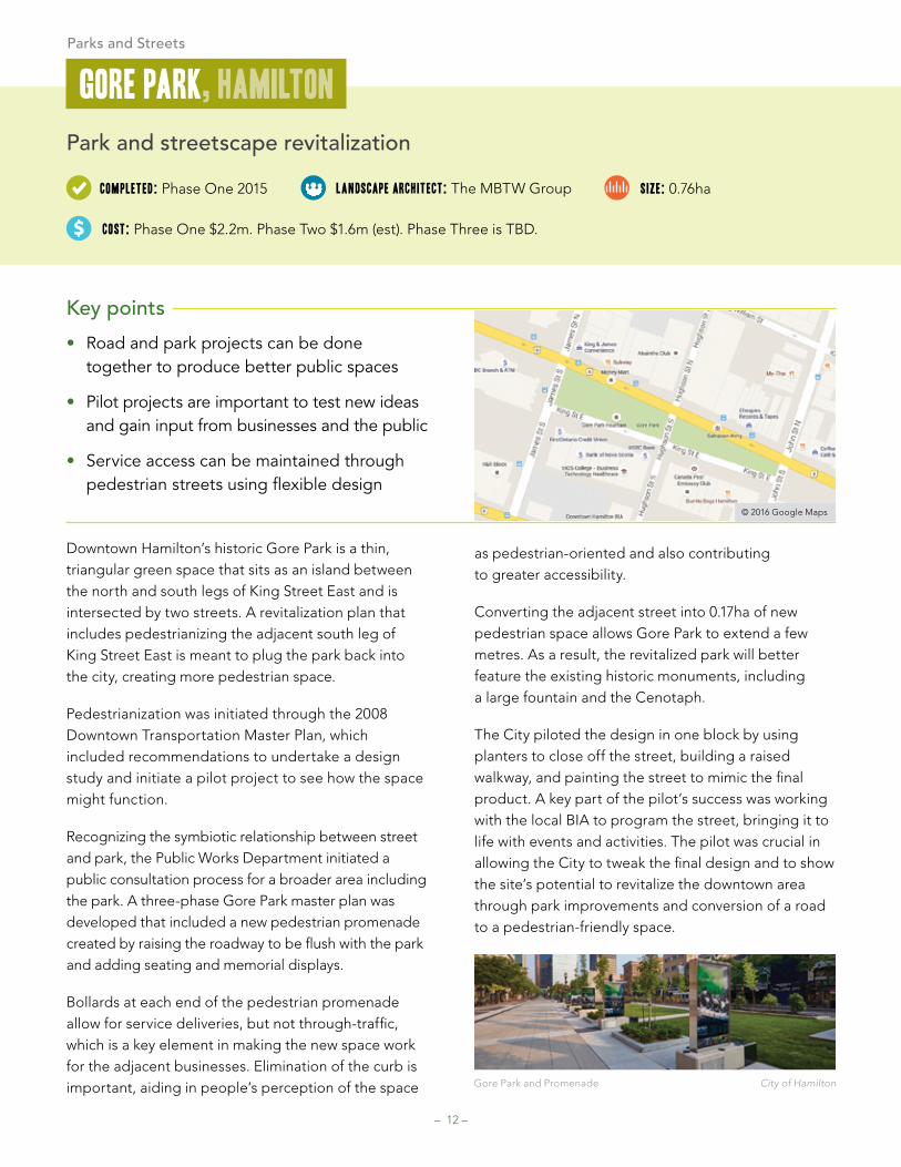
Downtown Hamilton’s historic Gore Park is a thin, triangular green space that sits as an island between the north and south legs of King Street East and is intersected by two streets. A revitalization plan that includes pedestrianizing the adjacent south leg of King Street East is meant to plug the park back into the city, creating more pedestrian space.
Pedestrianization was initiated through the 2008 Downtown Transportation Master Plan, which included recommendations to undertake a design study and initiate a pilot project to see how the space might function.
Recognizing the symbiotic relationship between street and park, the Public Works Department initiated a public consultation process for a broader area including the park. A three-phase Gore Park master plan was developed that included a new pedestrian promenade created by raising the roadway to be flush with the park and adding seating and memorial displays.
Bollards at each end of the pedestrian promenade allow for service deliveries, but not through-traffic, which is a key element in making the new space work for the adjacent businesses. Elimination of the curb is important, aiding in people’s perception of the space
as pedestrian-oriented and also contributing to greater accessibility.
Converting the adjacent street into 0.17ha of new pedestrian space allows Gore Park to extend a few metres. As a result, the revitalized park will better feature the existing historic monuments, including a large fountain and the Cenotaph.
The City piloted the design in one block by using planters to close off the street, building a raised walkway, and painting the street to mimic the final product. A key part of the pilot’s success was working with the local BIA to program the street, bringing it to life with events and activities. The pilot was crucial in allowing the City to tweak the final design and to show the site’s potential to revitalize the downtown area through park improvements and conversion of a road to a pedestrian-friendly space.
Park and streetscape revitalization
completed: Phase One 2015 lan dscapearchitect: The MBTW Group
cost: Phase One $2.2m. Phase Two $1.6m (est). Phase Three is TBD.
size: 0.76ha
gorePark,hamilton
© 2016 Google Maps
Gore Park and Promenade City of Hamilton
Parks and Streets

– 13 –
Key points
• Flexible, shared streets provide ability to accommodate larger events when needed
• Special staff training may be required for new forms of parks that include shared streets
On a former parking lot, Guelph has created a new signature downtown public plaza with a flexible, shared street space that can be closed to accommodate larger events. It’s an early effort in the City to showcase the value of creative public space design. The square is located adjacent to City Hall and nearby to the Guelph Central Station transit hub.
An “edge-to-edge” design concept incorporated a new front yard for City Hall along with a redesign of Carden Street, the street that runs adjacent to the square. The flexibility of the space enables the square to take on larger programming when needed and maintain vehicle access to adjacent businesses.
The shared space concept was implemented using uninterrupted brick pavers and a rolled-curb that continues the feel of the plaza onto the street, ensuring that it reads as one continuous pedestrian space when closed for events.
Coordinating the road and plaza construction was a challenge. Complex mechanical and electrical requirements in the design meant full infrastructure replacements in the roadway. In addition, since this is a different model than other parks and public spaces that are more often standalone, special staff approaches were needed to create an operations
program for the square due to its flexible nature and ongoing relationship with the adjoining businesses.
The Square features a reflecting pool with custom water jets, which converts to a skating rink in the winter. One of the most popular aspects of the design is the full colour, programmable, LED lighting that projects onto the water or ice.
Funding for the Square was amassed from multiple sources, including federal infrastructure dollars, but also a fundraising campaign, including local businesses, that brought in $1.1 million. The City kicked in $5.9 million.9
New public plaza and streetscape
size: 0.75hacompleted: 2011
Marketsquare,guelph
landscapearchitect: Janet Rosenberg & Studio cost: $8 million
© 2016 Google Maps
Parks and Streets
Market Square at night Kim Lawrence-City of Guelph
– 14 –
© 2016 Google Maps
Park revitalization
size: 0.75hacompleted: 2015 lan dscapearchitect: NAK Design Group cost: $1.3 million
Key points
• Heritage-related public art themes can be used for placemaking and education
• Nearby condo developments and mixed land ownership are opportunities for shared maintenance agreements
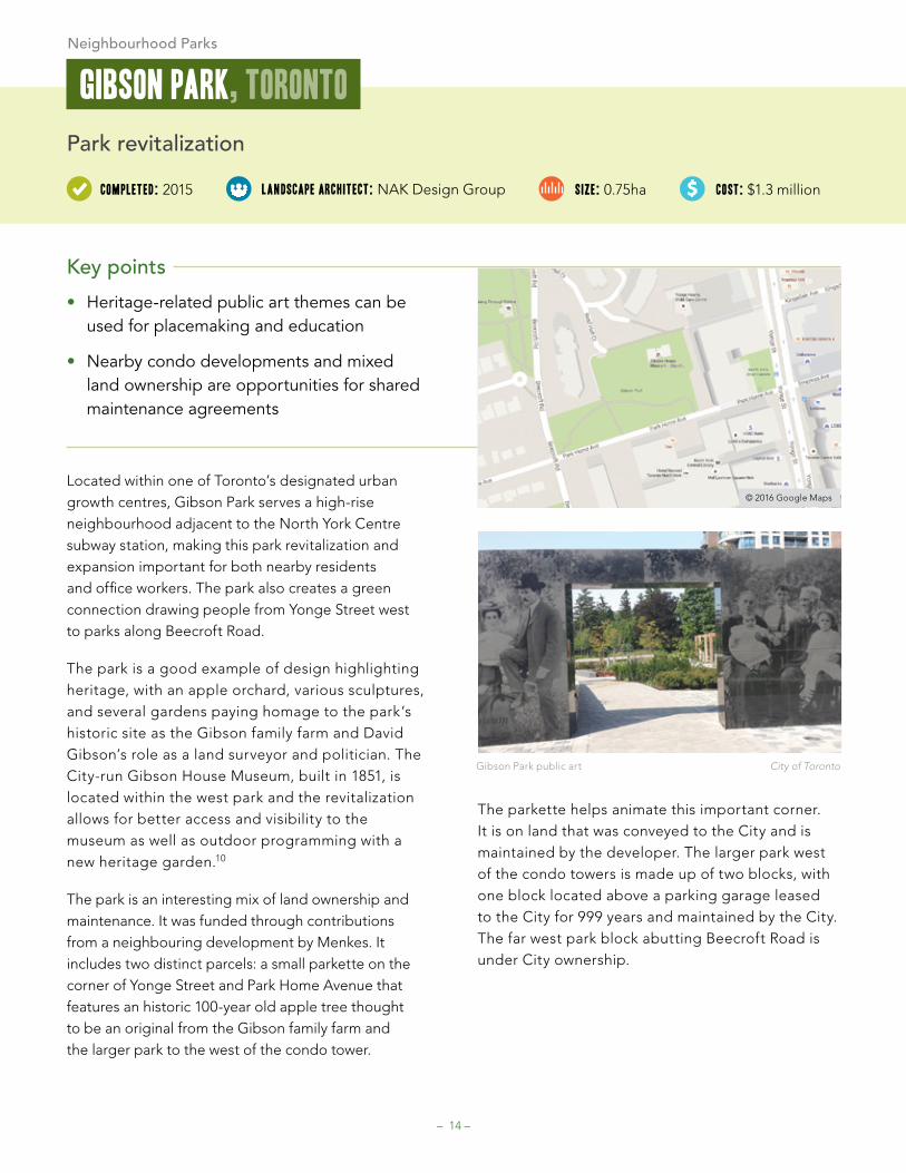
Located within one of Toronto’s designated urban growth centres, Gibson Park serves a high-rise neighbourhood adjacent to the North York Centre subway station, making this park revitalization and expansion important for both nearby residents and office workers. The park also creates a green connection drawing people from Yonge Street west to parks along Beecroft Road.
The park is a good example of design highlighting heritage, with an apple orchard, various sculptures, and several gardens paying homage to the park’s historic site as the Gibson family farm and David Gibson’s role as a land surveyor and politician. The City-run Gibson House Museum, built in 1851, is located within the west park and the revitalization allows for better access and visibility to the museum as well as outdoor programming with a new heritage garden.10
The park is an interesting mix of land ownership and maintenance. It was funded through contributions from a neighbouring development by Menkes. It includes two distinct parcels: a small parkette on the corner of Yonge Street and Park Home Avenue that features an historic 100-year old apple tree thought to be an original from the Gibson family farm and the larger park to the west of the condo tower.
The parkette helps animate this important corner. It is on land that was conveyed to the City and is maintained by the developer. The larger park west of the condo towers is made up of two blocks, with one block located above a parking garage leased to the City for 999 years and maintained by the City. The far west park block abutting Beecroft Road is under City ownership.
gibsonPark,Toronto
Gibson Park public art City of Toronto
Neighbourhood Parks

– 15 –
© 2016 Google Maps
Naturalized area
size: 45haFirstphaseplanted: 2015 lan dscapearchitect: N/A cost: Approx. $270,000 ($6,000/ha)
Key points
• Former landfill sites can be repurposed for naturalized areas
• Partnerships for planting and maintenance can engage communities
• Increased natural habitat crucial for at-risk species, such as pollinators
Located near a growing neighbourhood in Guelph’s east end, the Pollinator Park is a result of the City partnering with local community members to turn 45ha of decommissioned landfill into a naturalized pollinator habitat and a citywide destination.
Pollination Guelph, a registered charity made up of community members from various backgrounds—pollination, landscape design, ecology, non-profit experience—was formed with the goal of increasing pollinator habitat in the city. The group oversees the design, implementation, and maintenance of the Pollinator Park in phases through an agreement with the City of Guelph and in-kind support from City parks staff. After raising $23,000, the group planted its first three hectares in September 2015.
The goal is to both provide an open prairie-like habitat for species at risk and a space for residents to learn about the importance of pollinators. The park includes a bee hotel that provides nesting opportunities for some species of solitary bees and wasps and interpretive signage.
Less maintenance is required since the area is naturalized. The site will be mowed every few years to control for invasive species and woody plants. Normally, controlled burns would be used but due to methane gasses produced and captured from the former landfill, fires are not permitted.11
The methane capture systems present a challenge. Safety concerns mean the site is not open to the general public; however, people can access the site through tours provided by Pollination Guelph. They can also access a demonstration garden located outside of the fenced area. When the landfill stops off-gassing, the site will open to the public. The hope is that this park can act as a model for the creation of pollinator habitat on brownfield or landfill sites across Ontario and beyond.
PollinatorPark,guelph
Pollinator Park Anna Bowen
Neighbourhood Parks

– 16 –
© 2016 Google Maps
Key points
• Inclusive consultation essential for culturally diverse park design
• Park use and amenities may shift as a reflection of different cultural traditions
• New processes, designs, and construction materials may be required
In the southeast corner of Dollar Hamlet Park is a circular pattern of stones set into the pavement of a walking path. The pattern—an abstract lotus flower—is actually a traditional Asian reflexology pebble path, meant to massage the feet when walked on.
The pebble path shows how the City of Markham welcomes an inclusive design process that meets the needs of both newcomers and visible minorities in new park projects. This is born out of the City’s Diversity Action Plan entitled “Everyone Welcome”, which seeks to ensure that the City’s services and facilities serve its diverse population.12
Approximately 65% of Markham residents are visible minorities, including 34% from Asia and 17% from South Asia. When the City hosted design consultations for the park, they initially proposed a playground. Instead, the community requested a mosaic reflexology pathway—an amenity that was not even on the City’s radar.
One challenges was identifying a qualified mosaic artist since installations of this kind are not common in North America. Fortunately, the City was able to find one through the Mosaic Art Association of Canada. The result is a park amenity that better
reflects the needs of the surrounding community, providing a unique cultural experience.
The park, which functions as an urban square, was built as part of a new high-density, mixed-use community and secured as a land dedication through the approval of subdivision. It is designed as a passive park space, with a large open lawn surrounded by a circular pathway, trees, and stone benches cut from boulders found on the site.
New park
size: 0.4ha
completed: 2008
DollarhamletPark,Markham
landscapearchitect: Schollen and Company Inc.
cost: $400,000 capital cost plus $45,000 for the mosaic
Dollar Hamlet Park City of Markham
Dollar Hamlet Park Pebble Mosaic City of Markham
Neighbourhood Parks

– 17 –
© 2016 Google Maps
New public square
size: 0.9hacompleted: 2011 lan dscapearchitect: NAK Design Strategies cost: $4.5 million
Key points
• Parks located near transit hubs provide an important focal point
• Parks built adjacent to schools and libraries allow for cross-programming
• Heritage structures incorporated into parks can be placemaking opportunities
At the centre of a new urbanism community, Mount Pleasant Village, sits a new public square and green space that forms the heart of the neighbourhood. Completed in 2011 under a cost-sharing agreement with the Federal Government’s Infrastructure Stimulus Fund, the park is directly adjacent to the Mount Pleasant GO Station, identified by the City of Brampton’s Official Plan as a Gateway Mobility Hub.
The neighbourhood, designed as an “urban transit village,” is a medium-density, mixed-use, walkable community that includes a mix of housing types from single-family homes to live-work units to low-rise apartment buildings.13 The alternative design standards for the development included provisions for reduced building setbacks, laneways, and lay-by parking to create a more urban, compact feel.
The park acts as an important focal point, situated adjacent to three-storey live-work units with retail at the base on the east side, four-storey residential condominium buildings to the west, a library and two-storey elementary school to the north, and Mount Pleasant Village Terminal and Mount Pleasant GO Station to the south. The park includes shade structures, skating rink/reflection pool, and both an open lawn and hard-surface plaza to accommodate events and activities, such as Zumba classes, a farmer’s market, and movie nights.
The design of the park highlights the area’s railroad heritage, including several public art features and materials and detailing that pull this theme throughout the park. One large-scale public art piece, “Ghost Train”, creates a compelling focal point at the southeast edge of the park. Also included within the park redesign was the reconstruction of a former downtown CPR station.
In the longer term, multi-use pathways and bicycle lanes will connect the park to other nearby green spaces, including the Mount Pleasant Natural Heritage System, allowing residents to plug into a larger cycling and pathway network.
MountPleasantvillagesquare,Brampton
Mount Pleasant Village Square City of Brampton
Neighbourhood Parks

– 18 –
© 2016 Google Maps
Urban trail extension and revitalization
size: 6kmMasterPlancompleted: 2015 consultant: O’Connor Mokrykce cost: Approx. $5 million
Key points
• Urban trails can increase green space and connect park deficient areas to nearby parks
• Encouraging local community group involvement assists with environmental stewardship and programming
• Publicly-owned infrastructure corridors (pipeline, hydro, and rail) can be leveraged to create urban trails
Running diagonally through residential neighbourhoods and some industrial areas in Hamilton’s east end is a 20-metre wide infrastructure corridor that follows the route of the first water pipe laid in the city in 1859. The pipe carried water from the waterworks at Woodward Avenue (now a museum) to a reservoir located near the escarpment. It’s also the site of the Pipeline Trail, a popular urban trail that the City is revitalizing and extending through a master plan.14
Increasing connectivity is a key element of the Pipeline Trail, allowing it to plug into existing trails through the escarpment and waterfront. An important aspect of the extended trail is that it will weave several communities together that are deemed parkland deficient and connect them to important nearby parks, such as Gage Park, improving the accessibility of the green space system.
In addition to this increased accessibility, the trail itself provides opportunities to create more green space and increased tree canopy in urban areas, provide natural habitat and gardens, and introduce low impact development infrastructure. This focus on environmental sustainability and habitat creation was a
key desire of the community, along with creating safe and attractive routes for cycling and walking. The trail will connect many neighbourhood amenities, such as schools, playgrounds, commercial areas, and bus stops.
The current trail, which is in need of revitalization in several areas, is highly used by the community and an active community group has sprung up to advocate for the trail and its extension. This group organizes community events and activities, such as parades and Jane’s Walks, and has planted and maintained a pollinator garden in one spot with plans for future gardens in the works.
PipelineTrail,hamiltonTrails and Linear parks
Lantern festival along the Pipeline Trail Jake Tobin Garrett

– 19 –
© 2016 Google Maps
Key points
• Linear parks can link residents, retail, and other green spaces
• Hard-surface plazas at strategic points create community gathering spots
• Shared space concepts require overcoming complex implementation challenges
The first phase of a larger planned linear park, Simcoe Promenade runs along the south edge of a new high-density residential community in Markham Centre, the City’s developing downtown. The park is parallel to a new bus-only rapidway linking a nearby station. The master plan proposes the linear park extend from Warden Avenue to Kennedy Road, parallel to Enterprise Drive, through Markham Centre to provide a car-free, transit-oriented, park-like pedestrian corridor connecting residential neighbourhoods, retail, and parks.
Although the park and rapidway appear as two separate spaces, they were originally conceived as one shared, programmable, connected public space accommodating bus rapid transit, pedestrians, cyclists, and park amenities—principles endorsed by City Council.
During the design process, a stakeholder working group was created to identify and address requirements associated with delivery, operation, and on-going maintenance of this shared space.
In the end, matters relating to safety, maintenance, liability, and functional requirements resulted in the
‘shared space concept’ not being fully implemented, with the park and rapidway constructed as distinct, adjacent spaces. The surfacing on the rapidway was meant to be permeable concrete pavers, creating a more fluid transition with the park edge; however, the pavers buckled under pressure from the busses and the space was repaved with asphalt.
Key to Markham Centre is a 4ha park that will act as the central park for the downtown and the site of events and activities. The promenade will connect residents to that future central park along a green space and transit spine. The adjacent mid-rise development opens at several points onto the linear park, where hard-surface plazas and lighting are used to create community focal points. The future vision would see the promenade extend through the downtown to Sciberras Road to the new York University Campus.
New linear park
completed: 2013 lan dscapearchitect: Schollen and Company Inc.
cost: $400,000 capital costsize: 0.87ha
simcoePromenade,Markham
Simcoe Promenade City of Markham
Trails and Linear parks
– 20 –
© 2016 Google Maps
Key points
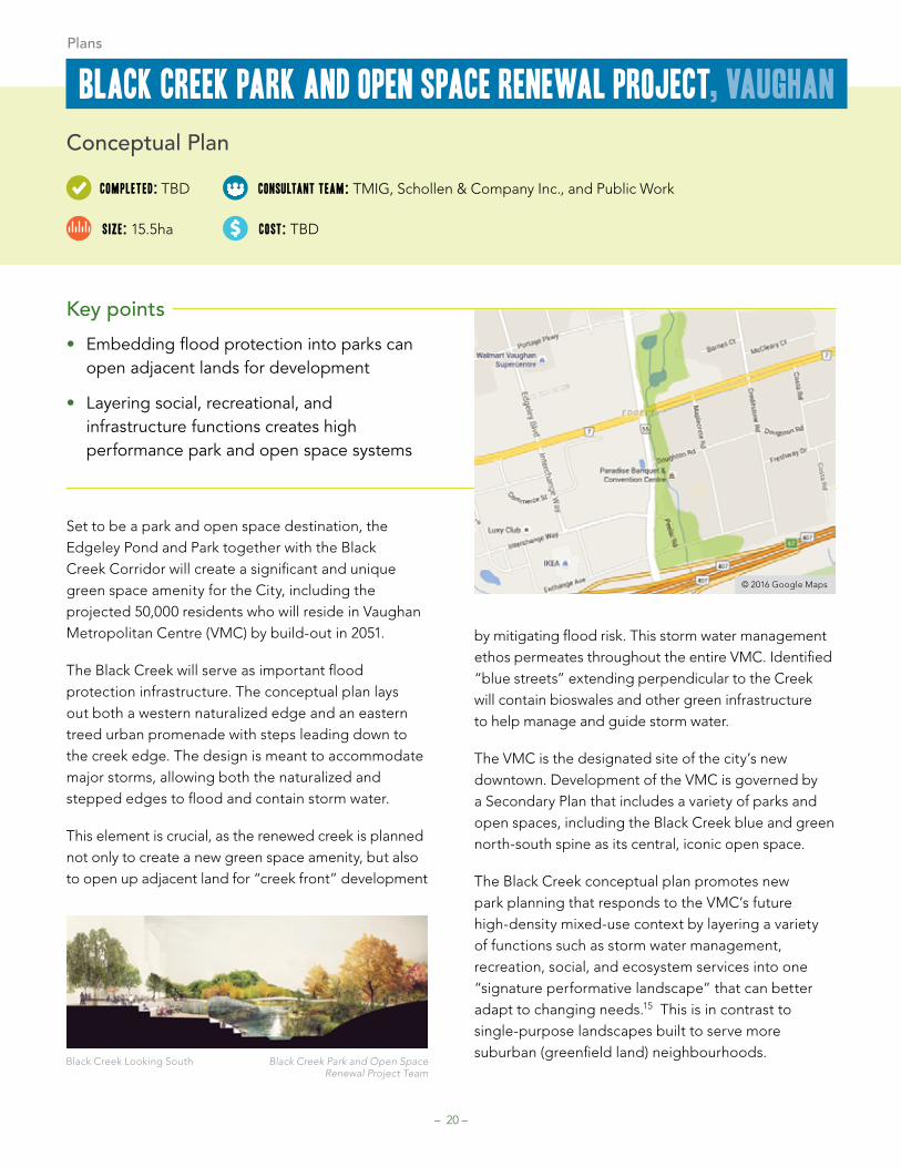
• Embedding flood protection into parks can open adjacent lands for development
• Layering social, recreational, and infrastructure functions creates high performance park and open space systems
Set to be a park and open space destination, the Edgeley Pond and Park together with the Black Creek Corridor will create a significant and unique green space amenity for the City, including the projected 50,000 residents who will reside in Vaughan Metropolitan Centre (VMC) by build-out in 2051.
The Black Creek will serve as important flood protection infrastructure. The conceptual plan lays out both a western naturalized edge and an eastern treed urban promenade with steps leading down to the creek edge. The design is meant to accommodate major storms, allowing both the naturalized and stepped edges to flood and contain storm water.
This element is crucial, as the renewed creek is planned not only to create a new green space amenity, but also to open up adjacent land for “creek front” development
by mitigating flood risk. This storm water management ethos permeates throughout the entire VMC. Identified “blue streets” extending perpendicular to the Creek will contain bioswales and other green infrastructure to help manage and guide storm water.
The VMC is the designated site of the city’s new downtown. Development of the VMC is governed by a Secondary Plan that includes a variety of parks and open spaces, including the Black Creek blue and green north-south spine as its central, iconic open space.
The Black Creek conceptual plan promotes new park planning that responds to the VMC’s future high-density mixed-use context by layering a variety of functions such as storm water management, recreation, social, and ecosystem services into one “signature performative landscape” that can better adapt to changing needs.15 This is in contrast to single-purpose landscapes built to serve more suburban (greenfield land) neighbourhoods.
Conceptual Plan
completed:TBD consultantTeam: TMIG, Schollen & Company Inc., and Public Work
cost: TBD
BlackcreekParkandOpenspacerenewalProject,vaughan
size: 15.5ha
Black Creek Looking South Black Creek Park and Open Space Renewal Project Team
Plans

– 21 –
Master Plan
size: TBDapproved: 2010 consultantteam: Urban Strategies cost: TBD
Key points
• Infrastructure corridors provide both active transportation and recreational opportunities
• Linear park forms can increase the amount of people within walking distance
• Land dedication may not be enough to provide parkland in high-density areas
One of the key features of Richmond Hill’s Regional Centre Study16 is a parks and open space framework that proposes a network of linear parks to facilitate active transportation, provide green space amenity, and connect different neighbourhoods. Currently, the Centre contains little open space besides a woodlot and small parkette.
The Study plans for higher density growth within the Centre while providing for a public realm that leverages barriers such as rail and hydro corridors as open space amenities and opportunities for connection.
The proposed linear park system includes the Garden Extension Greenway, which will run along the northern edge of a hydro corridor; the Sunnywood Linear Green, which will unite neighbourhoods bisected by a railway with a pedestrian bridge as a connection; and the multi-use corridor proposed to run north-south along the edge of the CP rail corridor that cuts through the Centre’s middle.
In addition to the Study, the Town completed a 2013 Parks Plan that outlined a need to establish new park typologies for intensification areas: urban squares and
linear parks. The plan included a needs assessment for each park typology, which resulted in a need to use the full Planning Act alternative dedication rate (1ha per 300 dwelling units) in order to maintain a desirable ratio of parkland per population.
It also highlighted a need to purchase parkland in areas designated for growth. The land dedication mechanism used to provide parkland in typical suburban developments would not be suitable to supply parkland for higher density areas due to smaller development site sizes.
Although the Town would like to purchase parkland in the Centre ahead of development to take advantage of lower land values, the conceptual nature of the Centre plan makes this challenging, as actual areas may develop differently. However, the Town has been successful in acquiring land dedications associated with development to build out part of the Sunnywood Linear Green.
richmondhillregionalcentrelandUsestudy,richmondhillPlans
Urban Strategies Inc. and Town of Richmond Hill

– 22 –
Vision Document
size: TBDapproved: 2013 consultantteam: Urban Strategies cost: TBD
Key points
• Using a metric such as a 5-minute walk can ensure walkability of parks and open space system
• Identify key “catalyst projects” that can help spur nearby investment and development
• Building setbacks at corners can create urban plazas at key intersections
Currently the area around Pickering Town Centre, a designated Urban Growth Centre in the Provincial Growth Plan, contains a mix of residential, office, commercial and light industrial uses with many surface parking lots and a single 1.6ha park. However, the Downtown Pickering Vision, a document meant to guide the City to 2031, presents a framework to accommodate additional population and employment density while providing a network of parks and open spaces.
One of the key guiding principles of the Vision is to ensure that all residences and work places are within a 5-minute walk of a public space by planning for a “diverse network of open spaces for different types of activity.”17
This includes the Krosno Creek watercourse project, which will form part of a “green parks” system and is identified in the plan as a “catalyst project” that can help “spur adjacent development.” Currently in a contained channel, the creek will be re-naturalized to form the South Downtown’s central green space,
Krosno Creek Park. This park will include both a naturalized area that can be used for educational programming and a plaza for more active uses, such as a splash pad.
Positioning the creek as a central green space amenity also allows the City to explore opportunities for low-impact development. As the vision notes, the “City will work in partnership with the TRCA to ensure natural heritage and storm water management objectives are achieved in park design.”18 Way-finding and interpretive signage could be used to illustrate the creek’s historical alignment beyond the park, displaying information about ecological functions.
The vision also calls for a number of other public realm components that connect with the overall park system, such as corner squares where buildings would be set back to create small plazas at key intersections.
DowntownPickering:avisionforintensificationandframeworkforinvestment,Pickering
Plans
City of Pickering

– 23 –
references
Greater Golden Horseshoe Parks Master Plans and Service Plans
City of Barrie, Parks & Recreation Strategic Master Plan, 2010
City of Guelph, Recreation, Parks & Culture Strategic Master Plan, 2009
City of Kitchener, Parks Strategic Plan, 2010
City of Markham, Integrated Leisure Master Plan, 2010
City of Mississauga, Future Directions: Master Plan for Parks and Forestry, 2014
Town of Oakville, Parks, Recreation, Culture & Library Master Plan, 2006
Town of Richmond Hill, Parks Plan: Better Choice for People at Play, 2013
City of St. Catharines, Parks Policy Plan, 2005
City of Toronto, Parks Plan, 2013
City of Vaughan, Active Together Master Plan: Parks, Recreation & Libraries, 2013
City of Waterloo, Recreation and Leisure Services Master Plan, 2008
Other plans and reports
Advisory Panel on the Coordinated Land Use Review, Planning for Health, Prosperity and Growth in the Greater Golden Horseshoe: 2015 – 2041, 2015
Park People, Making Connections: Planning Parks and Open Space Networks in Urban Neighbourhoods, 2015
Province of Ontario, Growth Plan for the Greater Golden Horseshoe, 2006
Province of Ontario, Provincial Policy Statement, 2014

– 24 –
casestudyFramework
MunicipalityStatus (completed year, plan)Project type (revitalization, new build)Landscape ArchitectTypology (park, plaza, linear park, trail)
Amenities/User Groups• Amenities available in the park (playground, garden, splash pad)• Main user groups targeted for the park (children, sport groups, seniors)
Design• Design concepts and major features• Sustainability features
Funding• Innovative funding models used (grants, private donations, sponsorships)• Land swaps or other arrangements
Community Engagement/Partnerships• Neighbourhood groups or other partners involved in the park• Any ongoing role for partners/community members in the park? (adopt a park, park friends group,
community garden, plantings)
Operations/Maintenance• Special considerations or needs• Programming• Types of programming the City offers• Types of programming outside groups offer (residents, non-profits, other groups)
Surrounding context and connections• General neighbourhood/area profile (demographics, land use, building types)• Connections to rest of park system (trails, nearby significant parks/public spaces)
Reason needed• Why park was/will be created or revitalized (serve new residents, growth, demographic change,
changing use needs)
Challenges encountered/anticipated• Site remediation, cost of land, etc.
Major opportunities• Programming, neighbourhood focal point, connections to other public spaces, etc.

1. Provincial Policy Statement, p. 15.
2. Growth Plan, p. 31.
3. Planning for Growth, Prosperity and Health in the GGH, p. 55.
4. Planning for Growth, Prosperity and Health in the GGH, p. 55.
5. Planning for Growth, Prosperity and Health in the GGH, p. 57.
6. Bozikovic, Alex (October 2, 2015): “Community in a box: how modern design is helping bring a town together” in The Globe & Mail.
7. Osborne, Catherine (October 25, 2012): “gh3’s maze of a park opens in Mississauga” in Azure Magazine.
8. Burton, Bob (October 9, 2014): “Meridian’s first payment to rename lower tiers of Barrie’s Memorial Square will be made in December” in The Barrie Examiner.
9. City of Guelph (September 28, 2015): “The story behind the square” from www.guelph.ca.
10. Hanes, Tracy (May 29, 2015): “Gibson Square revives historical spirit of North York” in The Toronto Star.
11. Seto, Chris (September 20, 2013): “Pollination Guelph sows seeds to give new life to dead landfill” in Guelph Mercury.
12. Fee, lung (2011): “Parks and placemaking” in Ground Magazine, Issue 13: Spring 2011.
13. City of Brampton (n.d.): “Mount Pleasant Village: A New Transit-oriented Neighbourhood in Brampton” from www.brampton.ca.
14. O’Connor Mokrykce Consultants for City of Hamilton (2015): Pipeline Trail Master Plan.
15. EDA Collaborative Inc. et all for City of Vaughan (2015): Vaughan Metropolitan Centre Streetscape and Open Space Plan, p. 70.
16. Urban Strategies Inc. for Town of Richmond Hill (2010): Richmond Hill Regional Centre Design and Land Use Study.
17. Urban Strategies Inc. for City of Pickering (2013): Downtown Pickering: A vision for intensification and framework for investment, p. 28.
18. ibid, p. 45.
endnotes
– 25 –

Toronto Park People 401 Richmond St. W., Ste. 119
Toronto, Ontario M5V 3A8 [email protected]
416.583.5776
parkpeople.caCharitable Registration Number:
84644-9437-RR0001