
M Rawashdeh, MD, MSc, FRCPProfessor of Pediatrics, Gastroenterology & Nutritionindex.net
The Use of Geomatic Techniques to Monitor Environmental Degradation
Dr. Samih Al Rawashdeh
A i t P f D t f S i d G ti E FAssociate. Prof., Dept. of Surveying and Geomatics Engrg., Fac. of Engrg., Al-Balqa’ Applied University, Al-Salt 19117, Jordan,
E-mail: [email protected] or samih alrawashdeh@yahoo [email protected]
Dr. Bassam SalehFull. Prof., Dept. of Surveying and GeomaticsFull. Prof., Dept. of Surveying and Geomatics
This work presents geospatial monitoring of amajor landslide on a highway during the periodmajor landslide on a highway during the period2007 to 2012.
Many landslides occurred along Amman-Jerash-Irbid Highway in Jordan during its construction in1991 and 1992.1991 and 1992.
The importance of this study comes from theneed to protect and guarantee the continuity of aneed to protect and guarantee the continuity of amajor, active highway which links Amman tonorthern parts of kingdom hence Syrian borders.
11/26/2012Dr. Samih Al Rawashdeh; Dr
bassam malkawi 2

A l f h t h h i th ff tA sample of photographs showing the effect of landslides in some parts of the study area.
11/26/2012
Dr. Samih Al Rawashdeh; Dr bassam malkawi
3

11/26/2012Dr. Samih Al Rawashdeh; Dr bassam malkawi 4

The efficiency of the use of differentgeomatics techniques to monitor and tostudy the carriageway stability over time.
Evaluation of the annual mass movementalong this road sectionalong this road section.
The prediction of any important failures inThe prediction of any important failures inthe area.
11/26/2012
Dr. Samih Al Rawashdeh; Dr bassam malkawi
5

11/26/2012Dr. Samih Al Rawashdeh; Dr
bassam malkawi 6
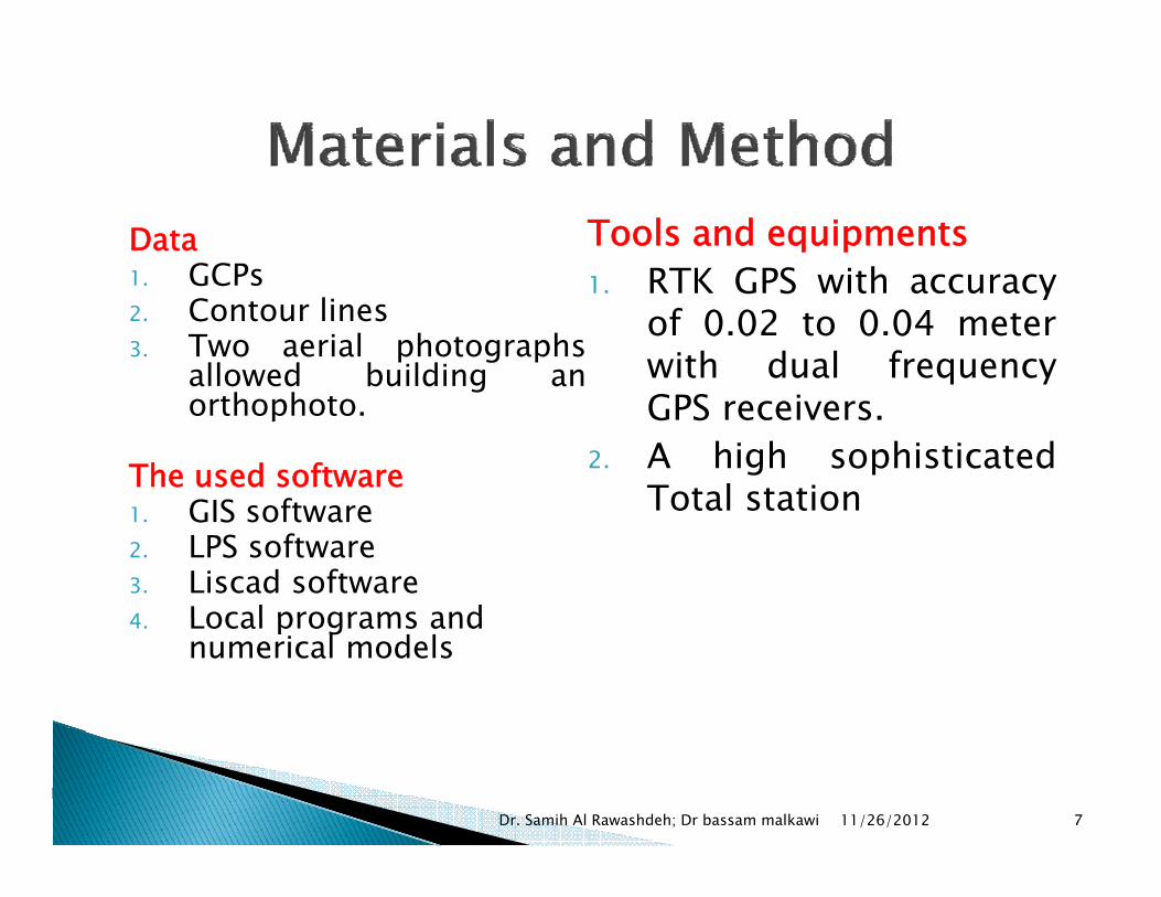
Data1 GCPs
Tools and equipments1 RTK GPS with accuracy1. GCPs
2. Contour lines 3. Two aerial photographs
allowed building anh h
1. RTK GPS with accuracyof 0.02 to 0.04 meterwith dual frequencyg
orthophoto.
The used softwareGIS soft are
GPS receivers.2. A high sophisticated
Total station1. GIS software2. LPS software3. Liscad software4 Local programs and
Total station
4. Local programs and numerical models
11/26/2012Dr. Samih Al Rawashdeh; Dr bassam malkawi 7
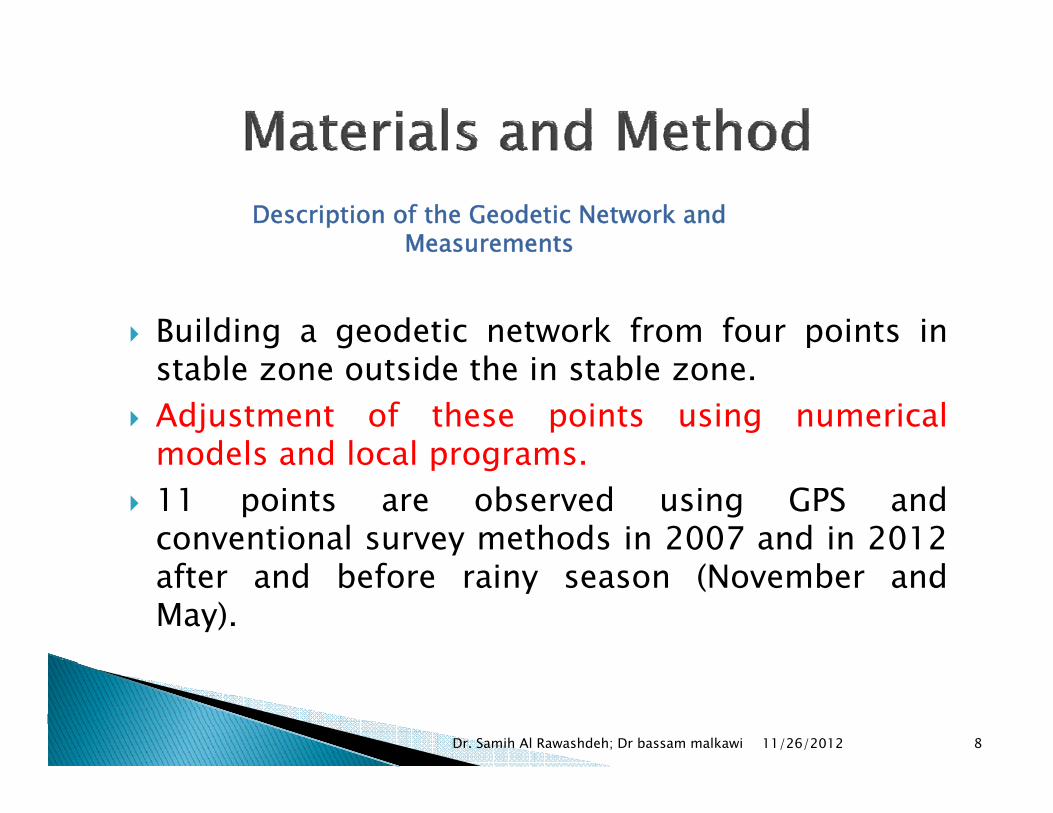
Description of the Geodetic Network and Measurements
Building a geodetic network from four points instable zone outside the in stable zone.Adjustment of these points using numericalmodels and local programsmodels and local programs.11 points are observed using GPS andconventional survey methods in 2007 and in 2012after and before rainy season (November andMay).
11/26/2012Dr. Samih Al Rawashdeh; Dr bassam malkawi 8

B
11/26/2012Dr. Samih Al Rawashdeh; Dr
bassam malkawi 9
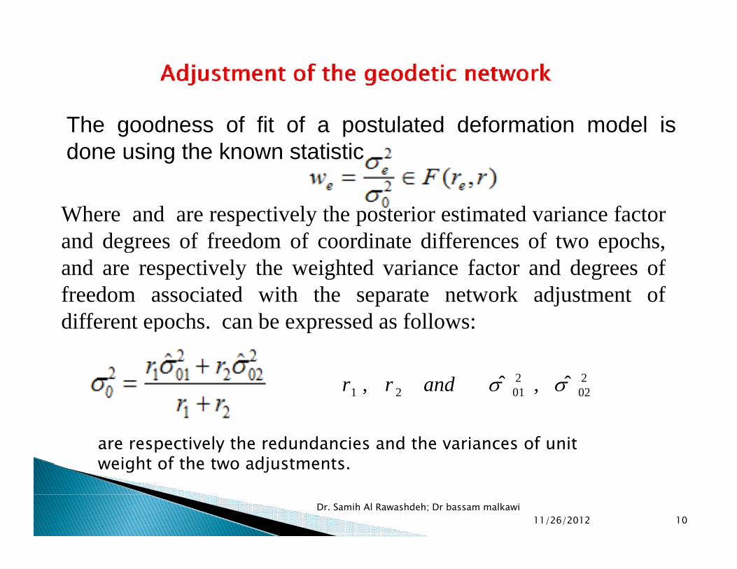
The goodness of fit of a postulated deformation model is done using the known statistic
Where and are respectively the posterior estimated variance factorand degrees of freedom of coordinate differences of two epochs,g p ,and are respectively the weighted variance factor and degrees offreedom associated with the separate network adjustment ofdifferent epochs can be expressed as follows:different epochs. can be expressed as follows:
202
20121 ˆ ,ˆ , σσandrr 020121 ,,
are respectively the redundancies and the variances of unit weight of the two adjustments
11/26/2012Dr. Samih Al Rawashdeh; Dr bassam malkawi
10
weight of the two adjustments.

Before the comparison, the systematic errorsbetween the different epochs are eliminatedby applying the parameters of transfor-mations obtained from the reference GPSmations obtained from the reference GPSnetwork and the error ellipsis are taken inconsideration.
11/26/2012Dr. Samih Al Rawashdeh; Dr
bassam malkawi 11

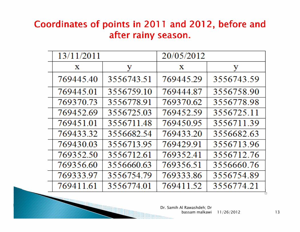
Coordinates of points in 2007 and 2008 before and after rainyCoordinates of points in 2007 and 2008, before and after rainy season.
11/26/2012Dr. Samih Al Rawashdeh; Dr bassam malkawi 12
11/26/2012Dr. Samih Al Rawashdeh; Dr
bassam malkawi 13

11/26/2012Dr. Samih Al Rawashdeh; Dr
bassam malkawi 14

11/26/2012Dr. Samih Al Rawashdeh; Dr bassam malkawi
15

11/26/2012Dr. Samih Al Rawashdeh; Dr
bassam malkawi 16
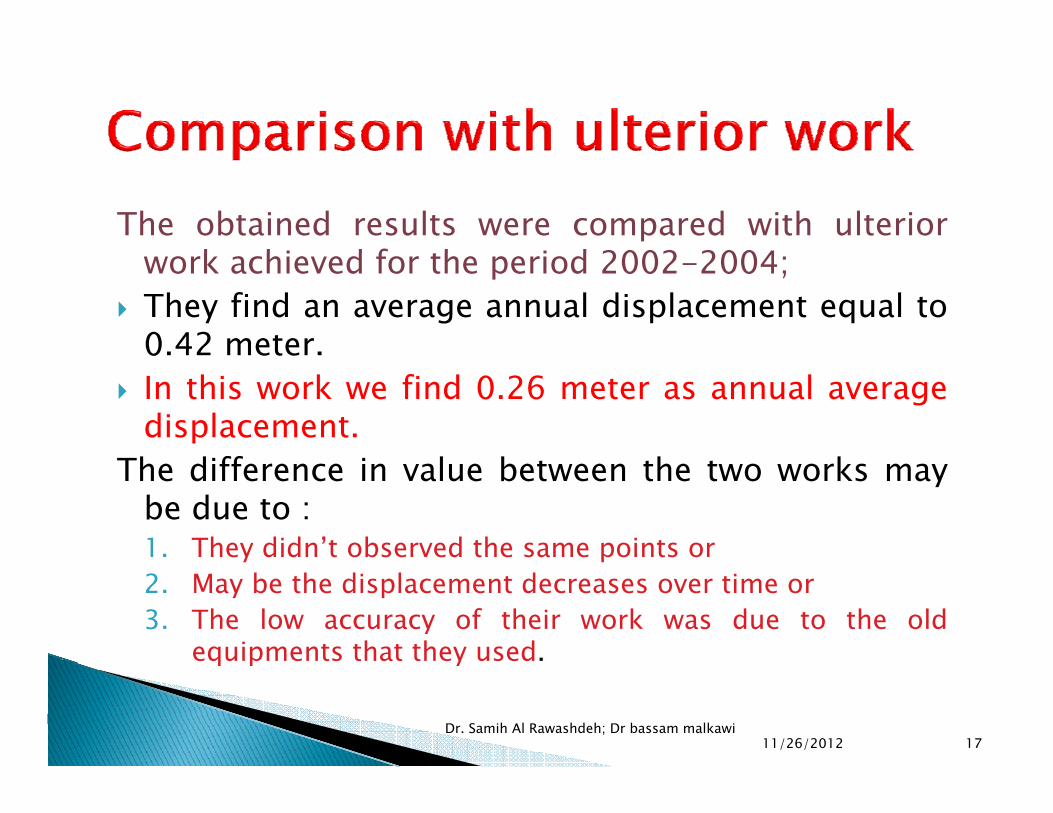
The obtained results were compared with ulteriork hi d f h i d 2002 2004work achieved for the period 2002-2004;
They find an average annual displacement equal to0.42 meter.0 eteIn this work we find 0.26 meter as annual averagedisplacement.
Th diff i l b h kThe difference in value between the two works maybe due to :1. They didn’t observed the same points ory p2. May be the displacement decreases over time or3. The low accuracy of their work was due to the old
equipments that they used.q p y
11/26/2012Dr. Samih Al Rawashdeh; Dr bassam malkawi
17

This study proved the efficiency of geomaticstechniques for landslide monitoring due to thelarge deformation in the site arealarge deformation in the site area.The RTK GPS technique provides an economicaland labor saving method to monitor displacementsGPS and conventional survey give similar resultsGPS and conventional survey give similar results.The maximum observed annual deformation is1.92 m.Cracks are likely to occur in the area in case ofCracks are likely to occur in the area, in case ofheavy rains.The construction of an alternative road, parallel tothe existing road to deviate the traffic in case of athe existing road to deviate the traffic in case of afailure.The road should be monitored annually.
11/26/2012Dr. Samih Al Rawashdeh; Dr bassam malkawi 18


