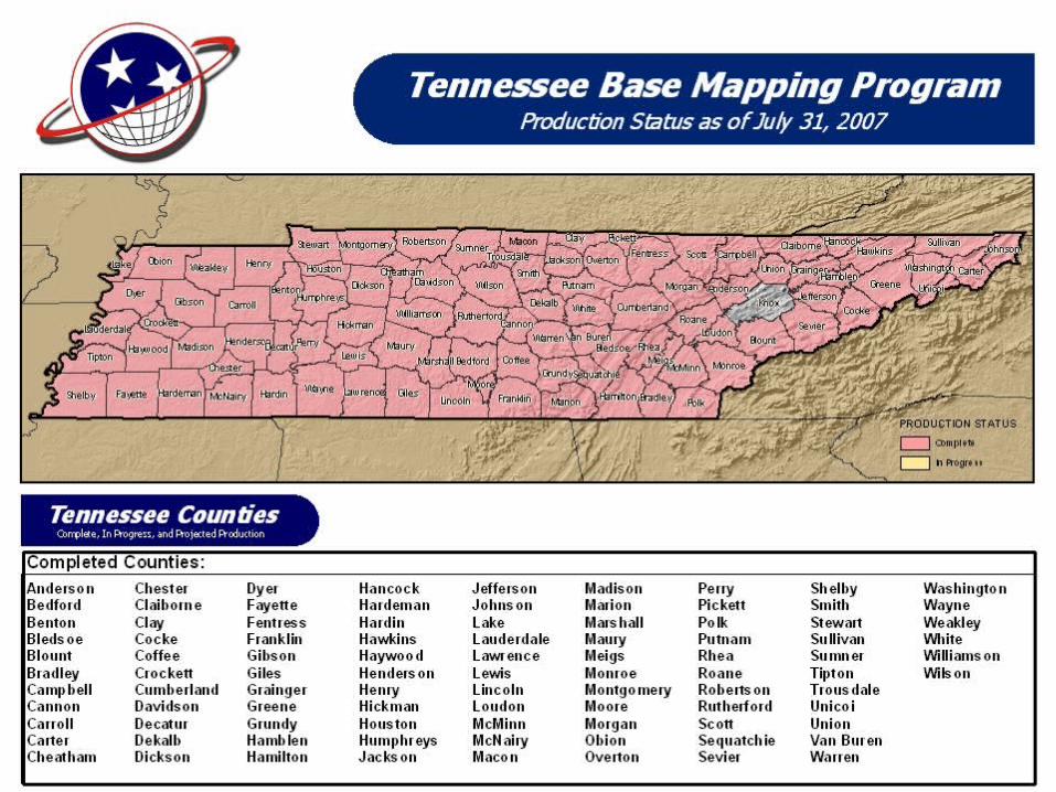
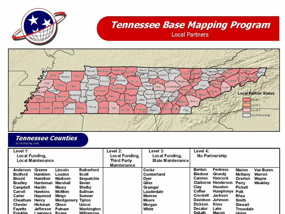
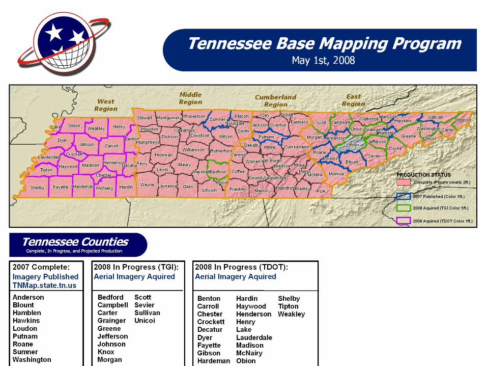
The Tennessee Base Mapping Program
34
Office for Information Resources GIS Services The Tennessee Base The Tennessee Base Mapping Program Mapping Program “Moving Forward” Dennis Pedersen, Director Dennis Pedersen, Director OIR – GIS Services OIR – GIS Services
description
The Tennessee Base Mapping Program. Dennis Pedersen, Director OIR – GIS Services. “Moving Forward”. TNBMP…Moving Forward. Initial Production Complete Ortho Imagery Pilot Program TDOT Partnership Enterprise GIS – TNMap. TNBMP…Moving Forward. Let’s take a look back…. - PowerPoint PPT Presentation
Transcript of The Tennessee Base Mapping Program
Office for Information Resources
GIS Services
The Tennessee The Tennessee Base Mapping Base Mapping ProgramProgram
The Tennessee The Tennessee Base Mapping Base Mapping ProgramProgram
“Moving Forward”
Dennis Pedersen, DirectorDennis Pedersen, DirectorOIR – GIS ServicesOIR – GIS Services
Dennis Pedersen, DirectorDennis Pedersen, DirectorOIR – GIS ServicesOIR – GIS Services
OIR – GIS Services 2
Moore County 5/13/08
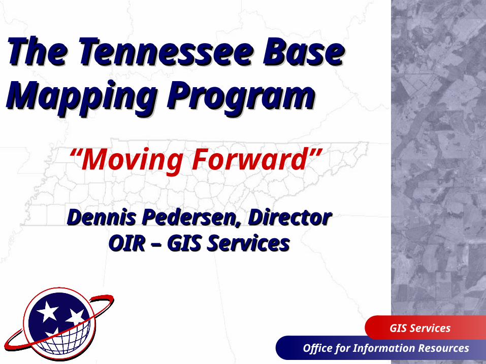
• Initial Production Complete• Ortho Imagery Pilot
Program• TDOT Partnership• Enterprise GIS – TNMap
TNBMP…Moving ForwardTNBMP…Moving ForwardTNBMP…Moving ForwardTNBMP…Moving Forward
OIR – GIS Services 3
Moore County 5/13/08
Let’s take a look back…
TNBMP…Moving ForwardTNBMP…Moving ForwardTNBMP…Moving ForwardTNBMP…Moving Forward
OIR – GIS Services 4
Moore County 5/13/08
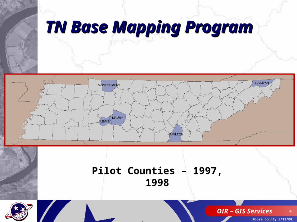
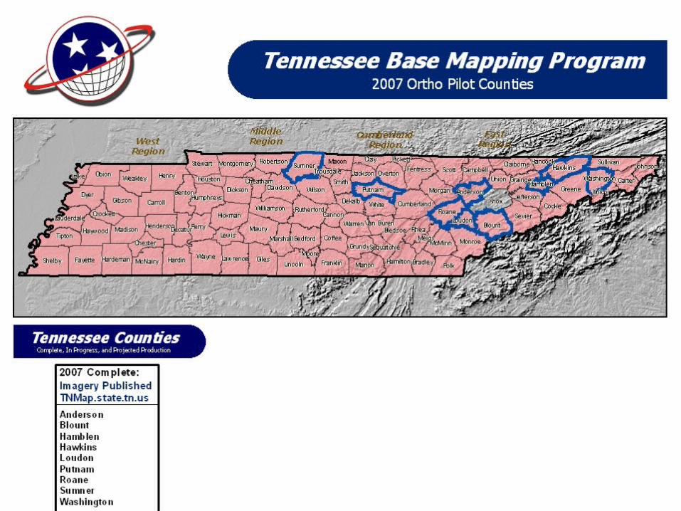
Pilot Counties – 1997, 1998
TN Base Mapping TN Base Mapping ProgramProgramTN Base Mapping TN Base Mapping ProgramProgram
OIR – GIS Services 5
Moore County 5/13/08
OIR – GIS Services 6
Moore County 5/13/08
OIR – GIS Services 7
Moore County 5/13/08
OIR – GIS Services 8
Moore County 5/13/08
OIR – GIS Services 9
Moore County 5/13/08
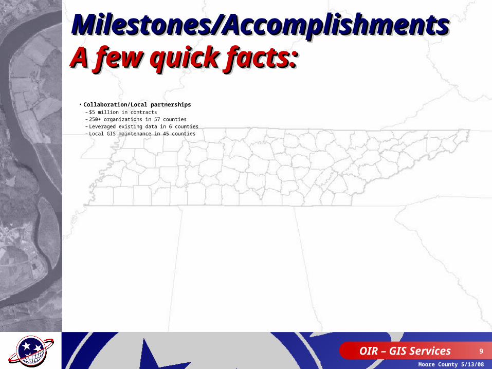
Milestones/Milestones/AccomplishmentsAccomplishmentsA few quick facts:A few quick facts:
Milestones/Milestones/AccomplishmentsAccomplishmentsA few quick facts:A few quick facts:
• Collaboration/Local partnerships– $5 million in contracts– 250+ organizations in 57 counties– Leveraged existing data in 6 counties– Local GIS maintenance in 45 counties
OIR – GIS Services 10
Moore County 5/13/08
OIR – GIS Services 11
Moore County 5/13/08
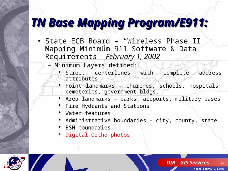
• State ECB Board – “Wireless Phase II Mapping Minimum 911 Software & Data Requirements” February 1, 2002– Minimum Layers defined:
Street centerlines with complete address attributes Point landmarks – churches, schools, hospitals,
cemeteries, government bldgs. Area landmarks – parks, airports, military bases Fire Hydrants and Stations Water features Administrative boundaries – city, county, state ESN boundaries Digital Ortho photos
TN Base Mapping TN Base Mapping Program/E911:Program/E911:TN Base Mapping TN Base Mapping Program/E911:Program/E911:
OIR – GIS Services 12
Moore County 5/13/08
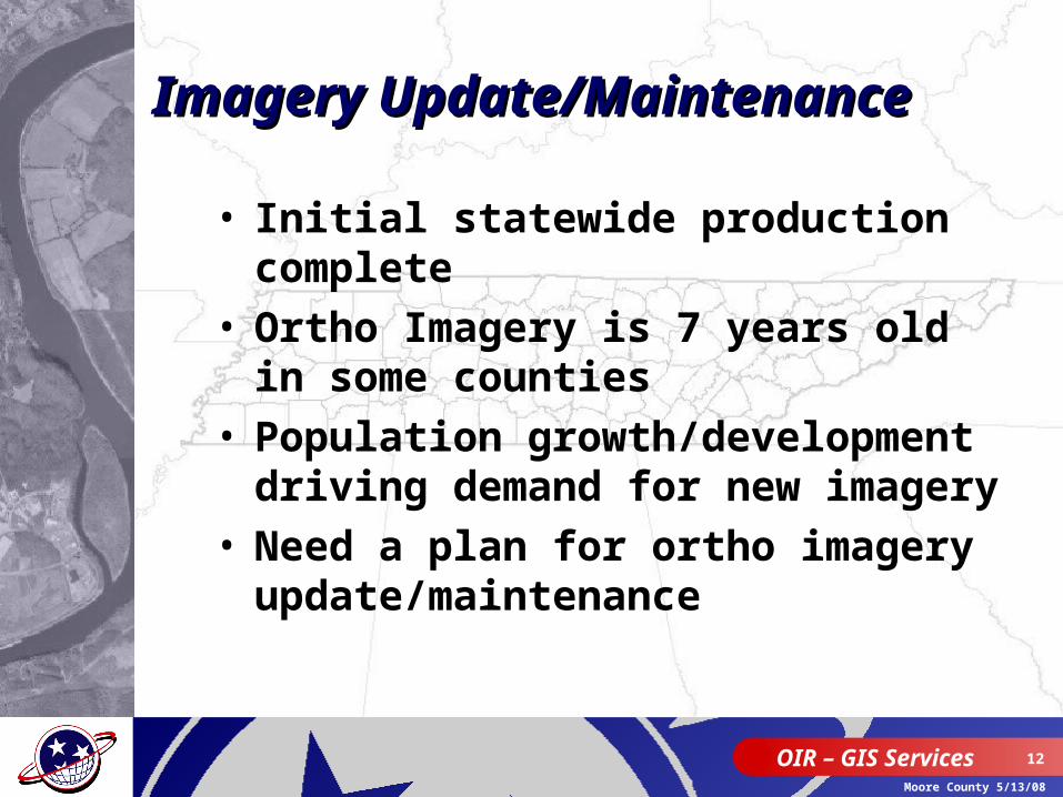
Imagery Imagery Update/MaintenanceUpdate/Maintenance
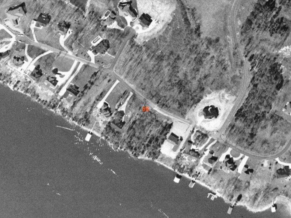
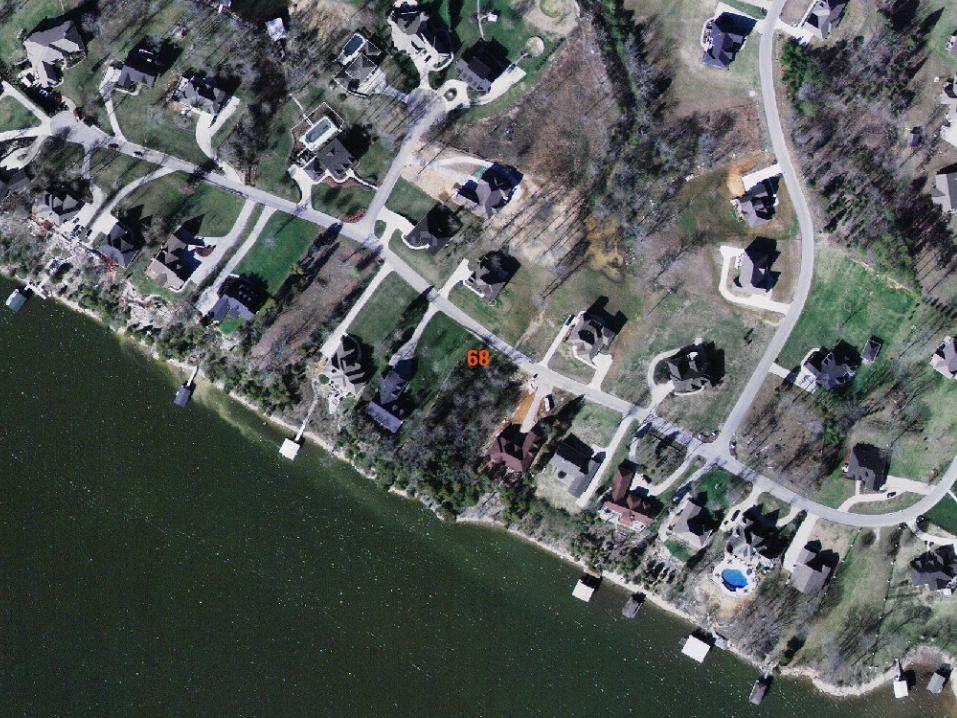
• Initial statewide production complete
• Ortho Imagery is 7 years old in some counties
• Population growth/development driving demand for new imagery
• Need a plan for ortho imagery update/maintenance
OIR – GIS Services 13
Moore County 5/13/08
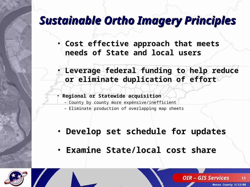
Sustainable Ortho Imagery Sustainable Ortho Imagery PrinciplesPrinciples
• Regional or Statewide acquisition– County by county more expensive/inefficient– Eliminate production of overlapping map sheets
• Develop set schedule for updates
• Cost effective approach that meets needs of State and local users
• Leverage federal funding to help reduce or eliminate duplication of effort
• Examine State/local cost share

OIR – GIS Services 14
Moore County 5/13/08
• Secure Funding to support ortho pilot• Extended current contract to 10/08 and
modified specs to emulate “Imagery for the Nation” and local requirements
• Identify counties with significant growth, imagery that is outdated, TDOT region 1 (upper East TN)
• Continue operating under current cost share model (75% State / 25% local)
Imagery Maintenance Imagery Maintenance StrategiesStrategies
OIR – GIS Services 15
Moore County 5/13/08
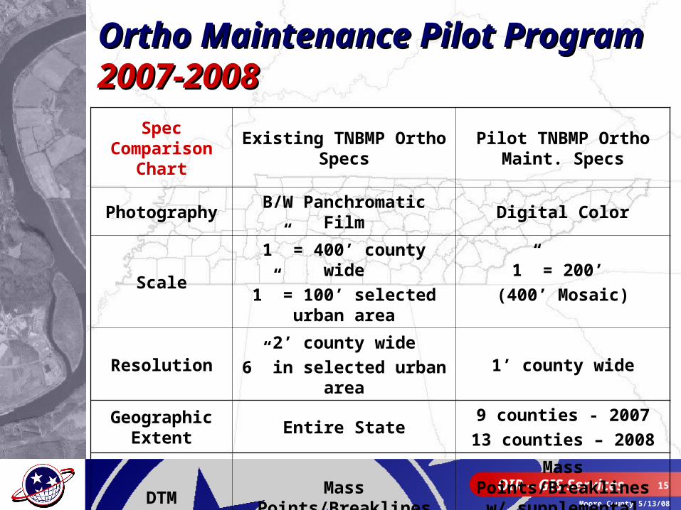
Spec Comparison
Chart
Existing TNBMP Ortho Specs
Pilot TNBMP Ortho Maint. Specs
Photography B/W Panchromatic Film Digital Color
Scale1” = 400’ county wide
1” = 100’ selected urban area
1” = 200’
(400’ Mosaic)
Resolution2’ county wide
6” in selected urban area1’ county wide
Geographic Extent
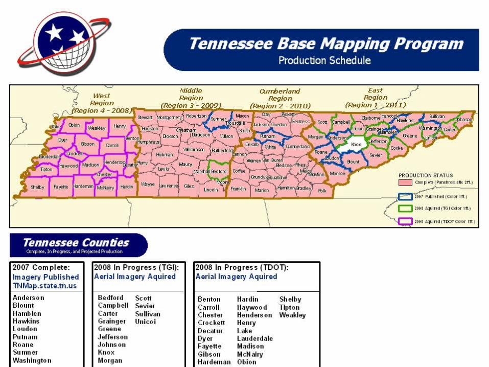
Entire State9 counties - 2007
13 counties – 2008
DTM Mass Points/BreaklinesMass Points/Breaklines w/ supplemental data
Ortho Maintenance Pilot Ortho Maintenance Pilot ProgramProgram2007-20082007-2008
OIR – GIS Services 16
Moore County 5/13/08
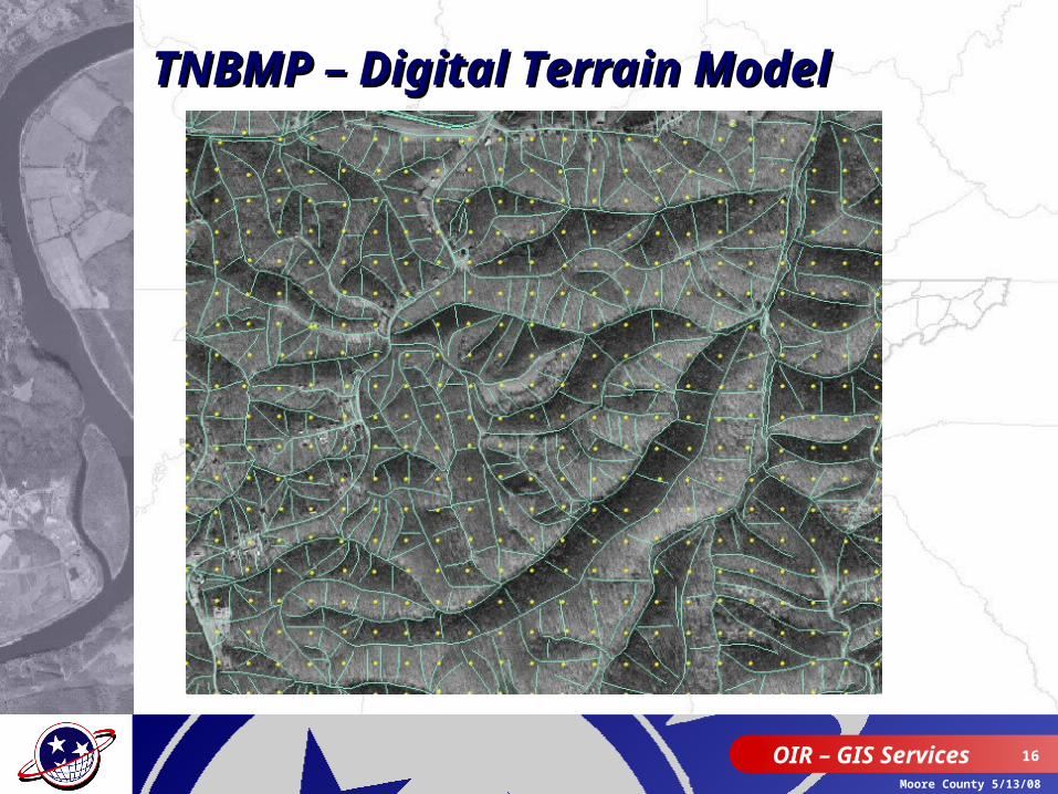
TNBMP – Digital Terrain ModelTNBMP – Digital Terrain Model
OIR – GIS Services 17
Moore County 5/13/08
OIR – GIS Services 18
Moore County 5/13/08
OIR – GIS Services 19
Moore County 5/13/08
OIR – GIS Services 20
Moore County 5/13/08
OIR – GIS Services 21
Moore County 5/13/08
OIR – GIS Services 22
Moore County 5/13/08
OIR – GIS Services 23
Moore County 5/13/08
Dept. of TransportationDept. of Transportation
• Need to develop or enhance internal processes for using new technology
• Completed “Gap” analysis to provide detailed recommendations
• Existing analog aerial photography program– Large scale engineering projects (site specific)– Right-of-way corridor studies– Regional planning efforts
• Identified need to update current photogrammetry processes
OIR – GIS Services 24
Moore County 5/13/08
OIR-GIS/TDOT - PartnershipOIR-GIS/TDOT - Partnership
• TDOT Modernizing Equipment– Digital camera suitable for ortho photo production– Training staff on new photogrammetry production req.– ortho acquisition for ¼ of State annually
• 2008 Acquisition: Region 4 (West TN)
• OIR-GIS responsible for data hosting and distribution– TNMap enterprise GIS– Dissemination to local government

OIR – GIS Services 25
Moore County 5/13/08
OIR – GIS Services 26
Moore County 5/13/08
OIR – GIS Services 27
Moore County 5/13/08
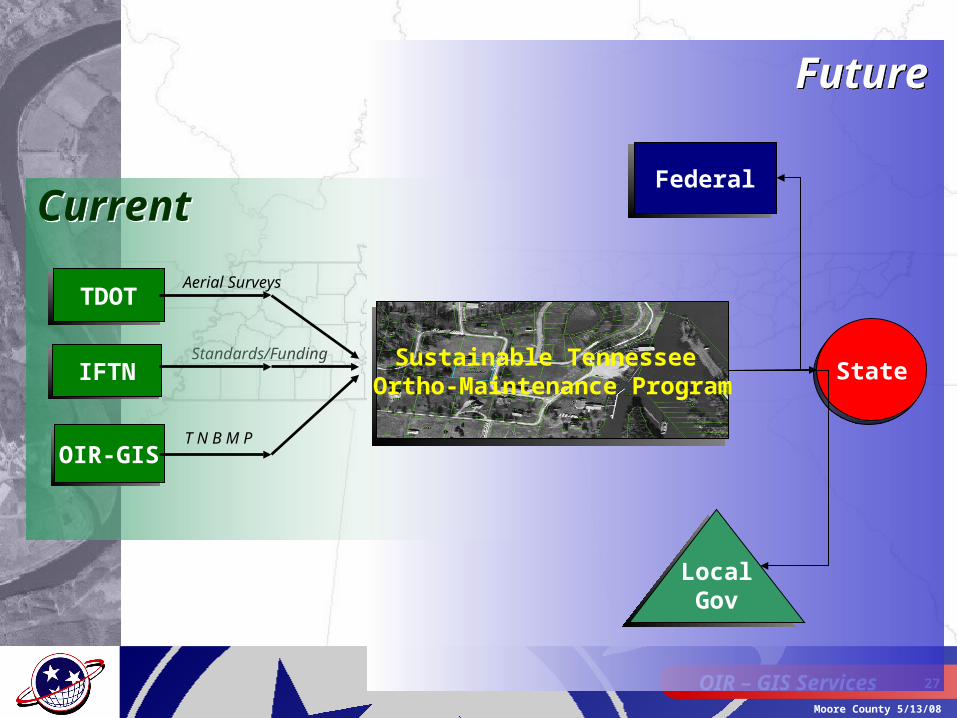
Standards/Funding
CurrentCurrent
TDOT
IFTN
OIR-GIS
Sustainable Tennessee Ortho-Maintenance Program
Aerial Surveys
T N B M P
FutureFuture
Federal
LocalGov
State

OIR – GIS Services 28
Moore County 5/13/08
Sustainable Ortho Imagery Sustainable Ortho Imagery PrinciplesPrinciples
• Regional or Statewide acquisition– County by county more expensive/inefficient– Eliminate production of overlapping map sheets
• Develop set schedule for updates– 4 year cycle
• Cost effective approach that meets needs of State and local users
• Leverage federal funding to help reduce or eliminate duplication of effort
• Revisit State/local cost share
OIR – GIS Services 29
Moore County 5/13/08
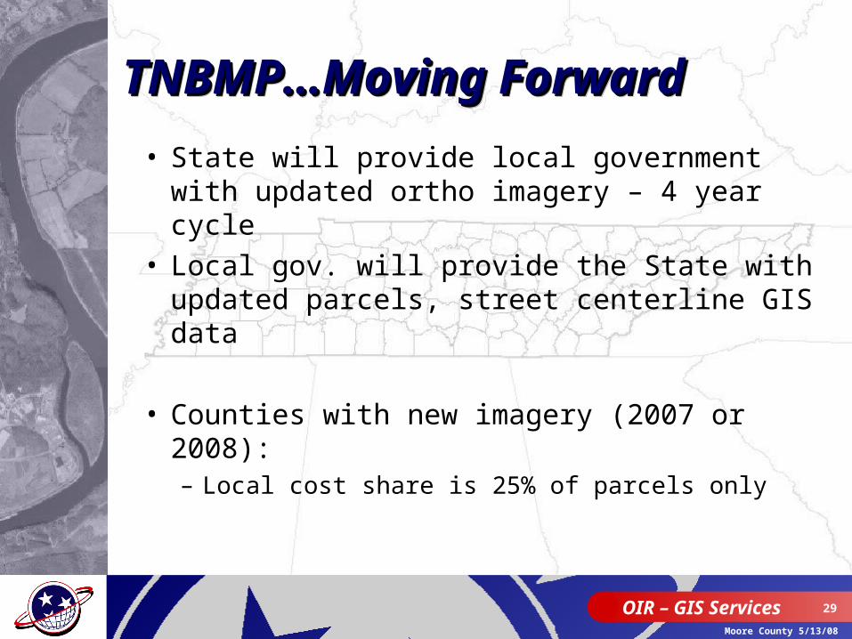
• State will provide local government with updated ortho imagery – 4 year cycle
• Local gov. will provide the State with updated parcels, street centerline GIS data
• Counties with new imagery (2007 or 2008):– Local cost share is 25% of parcels only
TNBMP…Moving ForwardTNBMP…Moving ForwardTNBMP…Moving ForwardTNBMP…Moving Forward
OIR – GIS Services 30
Moore County 5/13/08
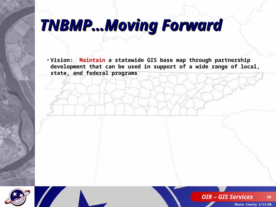
• Vision: Maintain a statewide GIS base map through partnership development that can be used in support of a wide range of local, state, and federal programs
TNBMP…Moving Forward TNBMP…Moving Forward TNBMP…Moving Forward TNBMP…Moving Forward
OIR – GIS Services 31
Moore County 5/13/08
OIR – GIS Services 32
Moore County 5/13/08
OIR – GIS Services 33
Moore County 5/13/08
OIR – GIS Services 34
Moore County 5/13/08
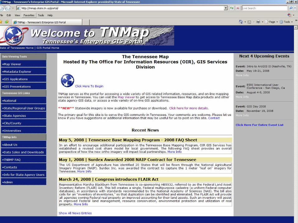
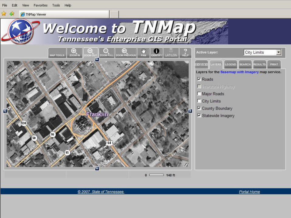
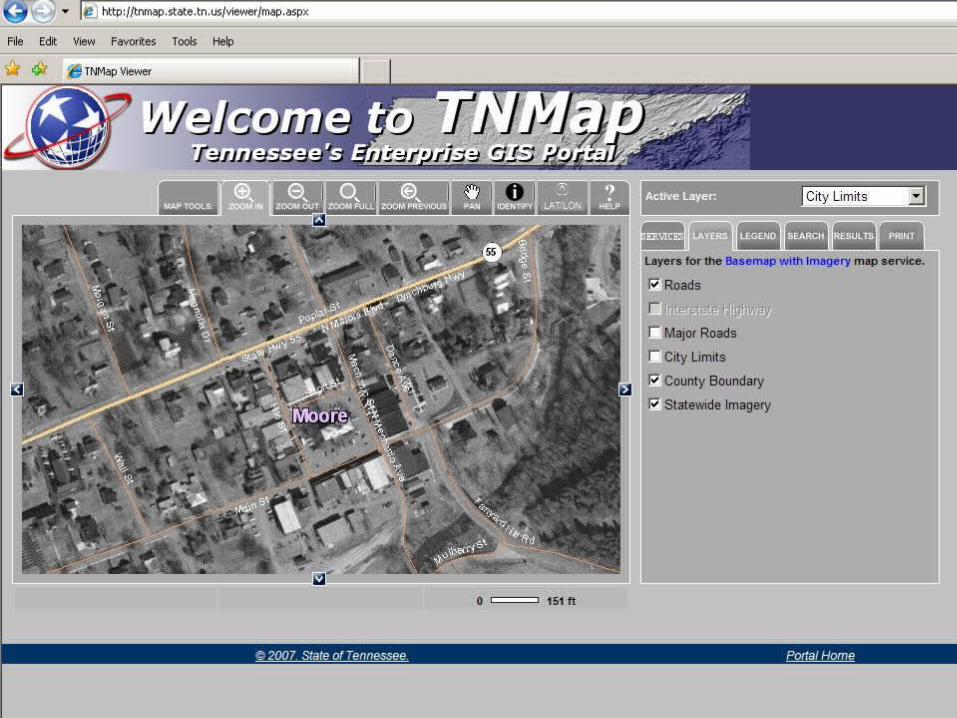
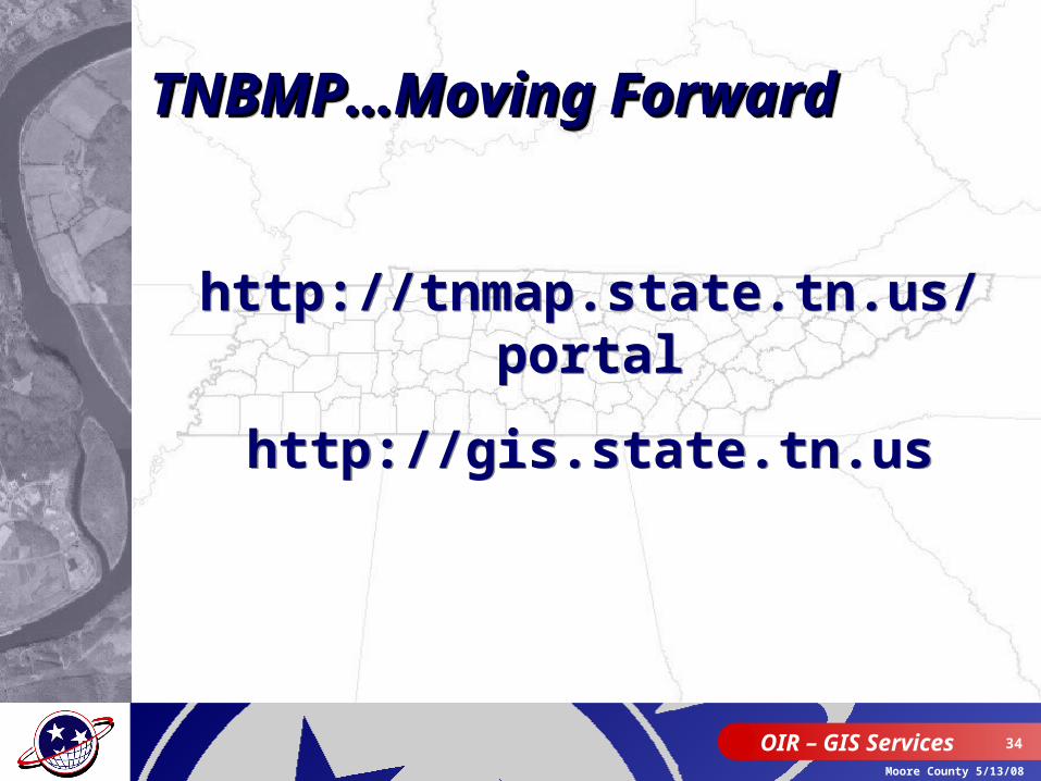
http://tnmap.state.tn.us/portal
http://gis.state.tn.us
http://tnmap.state.tn.us/portal
http://gis.state.tn.us
TNBMP…Moving Forward TNBMP…Moving Forward TNBMP…Moving Forward TNBMP…Moving Forward