Jordan Gerth 1 Cooperative Institute for Meteorological Satellite Studies.
The Second Asia/Oceania
Meteorological Satellite Users’ Conference
6-9 December 2011, Tokyo
Abstracts Brochure
Hosted by Japan Meteorological Agency (JMA)
Co-Sponsorship: China Meteorological Administration (CMA)
Korea Meteorological Administration (KMA)
Australian Bureau of Meteorology (AuBoM)
World Meteorological Organization (WMO)
Group on Earth Observations (GEO)

Status of 22 November 2011
Opening James Purdom,
Chair, International Conference Steering Committee Jin Matsubara, Senior Vice-Minister of Ministry of Land, Infrastructure, Transport and Tourism (MLIT), Japan Mitsuhiko Hatori, Director-General of Japan Meteorological Agency (JMA) Caiying Wei, Deputy Director General of National Satellite Meteorological Center (NSMC), China Meteorological Administration (CMA) Ae-Sook Suh, Director General of National Meteorological Satellite Center (NMSC), Korea Meteorological Administration (KMA) John Le Marshall, Australian Bureau of Meteorology (AuBoM) José Achache, Director of GEO Secretariat, Group on Earth Observations (GEO) Wenjian Zhang Director of WMO OBS Department, World Meteorological Organization (WMO)
Session 1: Current and future satellite programs and systems Status and Future Plans of the Chinese FengYun Meteorological Satellites…………………………….1-1 Caiying Wei, CMA Current Status and Future Plan of Korea Meteorological Satellite Program……………………………1-2 Ae-Sook Suh, NMSC/KMA Current Status and Future Plan of Japanese Meteorological Satellite Program………………………1-3 Satoru Tsunomura, JMA Current Status and Future Plan of JAXA Earth Observation Programs…………………………………….1-4 Tamotsu Igarashi, JAXA Current and future satellite programs and systems of the Roshydromet………………………………1-5 Liubov Kramareva, ROSHYDROMET
Status of current and future EUMETSAT satellite programmes……………………………………………...1-6 Mikael Rattenborg, EUMETSAT Status of Current and Future NOAA Satellite Programs………………………………………………………….1-7 Gregory Robinson, NOAA/NESDIS
Session 2: Facilitation of satellite data access and utilization FengYun Satellite Data Service……………………………………………………………………………………………….2-1 Jiashen Zhang, NSMC/CMA Current Status of COMS MI Operation and It’s Data Service…………………………………………………..2-2 Seung-Hee Sohn, KMA GOES-R AWG Product Processing System Framework……………………………………………………….……2-3 Shanna Sampson, NOAA/NESDIS Land and ocean satellite data products from the Australian Bureau of Meteorology…….………2-4 Ian Grant, AuBoM The operational use of meteorological satellite data at the Meteorological Service of New Zealand………………………………………………………………………………………………………………………………...2-5 Wim Van Dijk, MetService of New Zealand MTSAT derived products for operational meteorological services at BMKG Indonesia…………..2-6 Riris Adriyanto, BMKG Use of satellite products for weather and environmental monitoring in Singapore……………….2-7 Keng Oon Chiam, National Environment Agency (Singapore) Community Satellite Processing Package (CSPP) - A Level 0 to Level 2 Software System for NPP/JPSS Real Time Processing and Applications…………………………………………………………………..2-8 Hung-Lung Allen Huang, University of Wisconsin-Madison Overview of GSICS: Strategy, Implementation, and Benefits…………………………………………………..2-9 Mitch Goldberg, NOAA/NESDIS A New Cross-calibration Approach for Different Thermal Emissive Bands in FY-2 Satellite with On-orbit Lunar Observations……………………………………………………………………………………………….2-10 Qiang Guo, NSMC/CMA COMS and COMS INR, One Year into the Mission…………………………………………………………………2-11 Han-dol KIM, KARI NOAA Operational Calibration Support to NPP/JPSS Program………………………………………………2-12 Fuzhong Weng, NOAA/NESDIS

JMA Inter-Calibration Activities under WMO GSICS Framework…………………………………………..2-13 Arata Okuyama, MSC/JMA Status of Asia-Pacific Regional ATOVS Retransmission Services……………………………………………2-14 Norio Kamekawa, MSC/JMA Application of COMS data in KMA……………………………………………………………………………………….2-15 Eun ha Sohn, NMSC/KMA Study on Super-Resolution Image Reconstruction of Remote Sensing Images of Meteorological Satellite……………………………………………………………………………………………………………………………….2-16 Boyang Chen, NSMC/CMA Satellite Image for weather forecasting in case Tropical cyclone "Nok Ten"………………………….2-17 Aroon Sankwan, Thai Meteorological Department (TMD) Utilization of satellite data in weather forecasting of Vietnam…………………………………………….2-18 Thi Hoang Giang Nguyen, National Hydro-Meteorological Service of Viet Nam Utilization of Meteorological Satellite Data and Products to support Weather Forecasting and Warning Services in Hong Kong…………………………………………………………………………………………...2-19 Chi Kuen So, Hong Kong Observatory (HKO) Facilitation of satellite data access and utilization……………………………………………………………….2-20 Mikael Rattenborg, EUMETSAT NOAA Satellite Data Utilization and Applications for Societal Benefits…………………………………2-21 Mitch Goldberg, NOAA/NESDIS Satellite data utilization at the Roshydromet……………………………………………………………………..2-22 Nina Sviridova, ROSHYDROMET GeoMetWatch-STORM: Global Constellation of Next-Generation Ultra-Spectral Geostationary Observatories………………………………………………………………………………………………………………………2-23 Hung-Lung Allen Huang, University of Wisconsin-Madison Global dataset of geostationary meteorological satellites and its applications…………………….2-24 Atsushi Higuchi, Chiba University
Session 3: Satellite data application for atmosphere, ocean and land Spectral bands and their Applications……………………………………………………………………………………3-1 James Purdom, Senior Research Scientist emeritus, CIRA Fellow Recalibrating and Reprocessing the HIRS Data to infer Global Cloud Properties and Trends….3-2 Paul Menzel, University of Wisconsin-Madison
Estimation of radiation budget using Geostationary satellites…….…………………………………………3-3 Hideaki Takenaka, Chiba University Atmospheric parameter retrievals from hyperspectral data in the presence of clouds……………3-4 Xu Liu, NASA Langley Research Center Tracking of volcanic ash emanated through Shinmoedake eruption by using MTSAT split-window imagery…………………………………………………………………………………………………………….3-5 Toshihisa Itano, National Defense Academy Investigation of Two Extreme Summer Arctic Sea-Ice Extent Anomalies in 2007 and 1996…….3-6 Xiquan Dong, University of Tokyo / University of North Dakota (USA) Spatio-temporal change of Net Primary Production in South-East Asia from 1985 to 2006……3-7 Guicai Li, NSMC/CMA Post-Storm Satellite Images to Trace Tornado Damage Path from the Wind Borne Debris Deposits…………………………………………………………………………………………………………………………….....3-8 Radhika Sudha, Tokyo Polytechnic University 15-year Clear Sky Radiance dataset processing at MSC/JMA…………………………………………………3-9 Takahito Imai, MSC/JMA
Session 4: Earth observation satellite Overview of Global Change Observation Mission (GCOM)……………………………………………………..4-1 Haruhisa Shimoda, Tokai University Global Precipitation Measurement (GPM)……………………………………………………………………………..4-2 Kenji Nakamura, Nagoya University Overview of Global Satellite Mapping for Precipitation (GSMaP)…………………………………………..4-3 Misako Kachi, JAXA Current status of the EarthCARE satellite mission and its sciences…………………………………………4-4 Teruyuki Nakajima, University of Tokyo J-Simulator: development of the joint satellite simulator and cloud evaluation of the global 3.5km mesh simulation by NICAM…………………………………………………………………………………………4-5 Masaki Satoh, University of Tokyo Session 5: GEOSS Asian Water Cycle Initiative (AWCI) GEOSS Water Cycle Integrator……………………………………………………………………………………………….5-1 Toshio Koike, University of Tokyo
Land-Lake-Atmosphere Interaction and its Effects on Rainfall, Soil Moisture, and Local Water Use in Cambodia……………………………………………………………………………………………………………………5-2 Kumiko Tsujimoto, Deputy Director General of Technique./ MOWRAM Reducing Climate Change Risks and Vulnerabilities……………………………………………………………….5-3 Karma Chophel , Hydro-met Services Flood Monitoring and Early Warning System in Thailand……………………………………………………….5-4 Thada Sukhapunaphan, Ministry of Agriculture and Cooperatives Flood and Drought Impacts and Climate Change……………………………………………………………………5-5 Singthong Pathoummady, DDG of DMH, MoNRE Drought Data Integration and Information Fusion in Asia………………………………………………………5-6 Patricia Jaranilla Sanchez, University of Tokyo Verification of Satellite Derived Monthly Rain Rate Fields in Siberia……………………………………….5-7 Oleg M. Pokrovsky, ROSHYDROMET
Session 6: Severe weather and precipitation Use of Meteosat Second Generation Data for convection nowcasting……………………………………6-1 Marianne König, EUMETSAT Analysis of Rapidly Developing Cumulus Areas from MTSAT-1R Rapidscan observation images…………………………………………………………………………………………………………………………………..6-2 Akira Sobajima, MSC/JMA WMO Support for Monitoring and Prediction of Severe Weather in Asia and the Pacific……….6-3 Kuniyuki Shida, WMO Space-based Precipitation Datasets: Opening New Frontiers in Atmospheric and Hydrologic Applications……………………………………..6-4 Agnes Lane, Australian Bureau of Meteorology (AuBoM) Estimating Tropical Cyclone Vertical Gradient Parameter (TC VGP) using satellite microwave sounding data……………………………………………………………………………………………………………………….6-5 Xin Wang, NSMC/CMA Imagery with Heavy Rainfall Potential Areas – a satellite product to support severe weather monitoring…………………………………………………………………………………………………………………………….6-6 Ayako Takeuchi, MSC/JMA
Session 7: Application of satellite data to numerical weather prediction Use of NPP and FY-3 data in the Joint Center for Satellite Data Assimilation………………………….7-1 Lars Peter Riishojgaard, JCSDA Data quality of FY-3 sounders and its application in NWP………………………………………………………7-2 Qifeng Lu, NSMC/CMA Satellite Data Assimilation - Improving Specification of Current and Future Atmospheric State John Le Marshall, Australian Bureau of Meteorology (AuBoM)………………………………………………7-3 Some applications of satellite data in the WMO THORPEX Programme……………………………..….7-4 Samuel J Caughey, WMO Improved Coastal Precipitation Forecasts with Direct Assimilation of GOES-11/12 Imager Radiances………………………………………………………………………………………………………………………………7-5 Xiaolei Zou, Florida State University The Use and Impact of Satellite-derived Atmospheric Motion Vectors in Numerical Models…..7-6 David Santek, CIMSS Derivation and Application of Mesoscale Atmospheric Motion Vectors in KMA/NIMR……………7-7 Jeong-Hyun Park, NIMR/KMA Study of relationship of time intervals and target box sizes for rapid-scan Atmospheric Motion Vector computation……………………………………………………………………………………………………………….7-8 Masahiro Hayashi, MSC/JMA
Session 8: Climate Monitoring from Space Architecture for Monitoring Climate from Space……………………………………………………………………8-1 Tillmann Mohr, Special Advisor to the Secretary-General of WMO on Satellite Matters GEOSS Climate Societal Benefit Area……………………………………………………………………………………..8-2 Masami Onoda, GEO World Climate Research Programme (WCRP): Climate Research in Service to Society……………8-3 Teruyuki Nakajima, University of Tokyo Barbara Ryan, WMO……………………………………………………………………………………………………………..8-4
Poster Presentations WIGOS Benefits……………………………………………………………………………………………………………………..P-1 James Purdom, Senior Research Scientist emeritus, CIRA Fellow
WIGOS Capacity Building……………………………………………………………………………………………………….P-2 James Purdom, Senior Research Scientist emeritus, CIRA Fellow Isolated cumulonimbus initiation observed by MTSAT-1R (rapid scan), 95-GHz FM-CW radar, X-band radar, and photogrammetry in the Kanto region, Japan…………………………………………….P-3 Fumiaki Kobayashi, National Defense Academy Impact of the assimilation of GPS slant total delay observations on a local heavy rainfall forecast……………………………………………………………………………………………P-4 Takuya Kawabata, MRI/JMA Improvement of rainfall forecast by assimilations of ground-based GPS data and radio occultation data…………………………………………………………………………………………………………………….P-5 Hiromu Seko, MRI/JMA Optimal Estimation Technique for Sea Surface Temperature Retrieval from Infrared Multichannel Data…………………………………………………………………………………………………………………P-6 Yukio Kurihara, MSC/JMA Convective Cloud Towers and Precipitation Initiation, Frequency and Intensity……………………..P-7 Reza Khanbilvardi, City College of New York National Severe Storms Laboratory Comparisons of precipitable water using special observation data in winter at incheon in Korea…………………………………………………………………………………………………………………………………….P-8 YEON-HEE KIM, NIMR/KMA Effects of the 2010 summer special observation data on the rainfall predictability……………….P-9 Seung-Sook SHIN, NIMR/KMA Unique algorithms for retrieving sea ice and soil moisture information using AQUA/AMSR-E measurements…………………………………………………………………………………………………………………….P-10 Sungwook Hong, NMSC/KMA GPS Meteorology: Under Estimation of IPWV by Ground Based GPS system in some meso-scale Thunder storms – A case study………………………………………………………………………….P-11 N.Puviarasan, IMD Use of rapid scan data for retrieving properties of growing convective storms…………………….P-12 Atsushi Hamada, University of Tokyo International TOVS Working Group (ITWG)………………………………………………………………………….P-13 Hung-Lung Allen Huang, University of Wisconsin-Madison International Direct Broadcast User's Training Workshop…………………………………………………….P-14 Hung-Lung Allen Huang, University of Wisconsin-Madison Direct Broadcast End-To-End Processing and Application System…………………………………………P-15 Hung-Lung Allen Huang, University of Wisconsin-Madison

High-performance GPU-based Radiative Transfer Model for Hyperspectral/Ultraspectral Sounder……………………………………………………………………………………………………………………………….P-16 Hung-Lung Allen Huang, University of Wisconsin-Madison GeoMetWatch-STORM- Partnership and Collaboration Opportunity……………………………………P-17 Hung-Lung Allen Huang, University of Wisconsin-Madison An Equal-Angle Space-Time Gridding Tool for NPP Cloud Products………………………………………P-18 Paul Menzel, University of Wisconsin-Madison The WMO/CGMS Virtual Laboratory for Education and Training in Satellite Meteorology…..P-19 Barbara Ryan, WMO Space Program The International Precipitation Working Group……………………………………………………………………P-20 Vincenzo Levizzani, IPWG Co-Chair emeritus

Session 1: Current and Future Satellite Programs and Systems

Session 1: Current and Future Satellite Programs and Systems
1-1
Status and Future Plans of the Chinese FengYun Meteorological Satellites
Caiying Wei
National Satellite Meteorological Center, China Meteorological Administration
ABSTRACT This presentation reports on the current status and future plans of Chinese polar and geostationary orbiting meteorological satellite program. The polar-orbiting satellite FY-3 series is a new generation to substitute the FY-1. The first two FY-3 satellites FY-3A/B were launched in May 2008 and in November 2010 respectively. After FY-3A&B, 4 operational FY-3 satellites with improved sounding capability and add on greenhouse monitoring instrument will be developed. The status of current FY-2 geostationary programme will be reported. The programme has produced 5 satellites FY-2A/B/C/D/E capable of S-VISSR imagery observation. Currently FY-2D and FY-2E are operationally active, which are positioned at 86.5E and 105E respectively, two satellites alternatively observe to transmit image every 15 minutes during rainy season from Jun-September, and every 30 minutes from October-May. To keep the operational continuity, an extended plan with three identical satellites has been approved. The new generation of geostationary satellite FY-4 will be also discussed.
Session 1: Current and Future Satellite Programs and Systems
1-2
Current Status and Future Plan of Korea Meteorological Satellite Program
Ae-Sook Suh
KMA/NMSC(National Meteorological Satellite Center)
ABSTRACT Korea Meteorological Administration (KMA) has been developed Meteorological Satellite program since 2003 and successfully launched first Korean geostationary weather satellite - Communication, Ocean, and Meteorological Satellite (COMS) on June 26, 2010. Korea became the world’s 7th nation to possess an independent meteorological satellite now. COMS produces full disk imagery every 3 hours and extended Northern Hemisphere imagery every 15 minutes. In particular, COMS has been focusing on the Korean Peninsula 8 times an hour to expect early detect of abrupt high-impact weather events such as typhoons and summertime heavy rains which frequency increase by a factor of 4 compared with the past. 2011 5th typhoon MEARI is the good example of well applied COMS high temporal data. COMS Meteorological Data Processing System (CMDPS) provides 16 baseline products including information on Atmospheric motion vector, Asian dust, sea surface temperature and land surface temperature over the East Asian region. These products will help improve the performance of NWP models for weather analysis and forecast. In the long term, they will be used in the analysis and prediction of climate change around the Asian region. Since April 1 2011, National Meteorological Satellite Center (NMSC) provides COMS data to countries in the Asia Pacific region for free and actively deploys the satellite receiving system support project for the countries in Southeast Asia for improving the utilization of satellite data. In particular, KMA/NMSC has been providing a training program for about one month for the forecasters and satellite imaging analysis experts in the Asia Pacific region including the Philippines, Vietnam, Mongolia and Papua New Guinea every year since 2007. COMS follow-on satellite development program will kick-off on 2012. The COMS follow-on consists of a pair of satellites for multi-purpose. One is for meteorological mission only and will be scheduled to launch in 2017. KMA is considering a meteorological instrument comparable to the ABI (GOES-R) or FCI (MTG) as follows: - Multi-channel capacity : 16 channels (including 2-3 visible channels) - Spatial resolution : 0.5 km for visible channels and 2 km for infrared channels - Fast imaging : less than 10 minutes for Full Disk observation - Flexibility for the regional area selection and scheduling
Session 1: Current and Future Satellite Programs and Systems
1-3
Current Status and Future Plan of Japanese Meteorological Satellite Program
Satoru Tsunomura
JMA/MSC
ABSTRACT
This report briefly presents the status of geostationary meteorological satellites, MTSAT-1R and -2 operated by the Japan Meteorological Agency (JMA), the applications of their observing data and the plan of follow-on satellites. MTSAT-2 (145°E) is now operational in imaging over the West Pacific region, and MTSAT-1R (140°E) serves as its backup. MTSAT-1R has continuously performed the services of MTSAT-2 imagery dissemination and data collection even since the switchover of the imaging function on 1 July, 2010. The DCS (data collection system) of MTSAT-1R is functioning properly as it always has been. There are two types of MTSAT imagery data dissemination methods via MTSAT-1R; High Rate Information Transmission (HRIT) for full resolution data dissemination and Low Rate Information Transmission (LRIT) for low resolution data dissemination. These images are provided to users in the Asian and Oceania regions including NMHSs. From the images, many products are generated, such as atmospheric motion vectors, cloud information and sea surface temperatures, and are used for weather analysis, aeronautical works, numerical weather prediction and environment monitoring. JMA takes part in the Global Satellite Inter-calibration System (GSICS) operationally. Under the framework of GSICS JMA provides the calibration information of MTSAT infrared and visible data and also tries to compute calibration information of past satellite data. JMA also participates in the Sustained Coordinated Processing of Environmental Satellite Data for Climate Monitoring (SCOPE-CM). JMA has (re)processed the historical AMV and CSR dataset and made the results available to the re-analysis community. Using the backup satellite MTSAT-1R, JMA performed small-sector observation around Japan at five-minute intervals during the daytime from June to September 2011. The observed images were provided to aeronautical users for monitoring of severe weather conditions around airports and in airspace. In its role as part of the WMO Information Service (WIS), JMA was designated as the GISC for Tokyo, and MSC was selected as a DCPC at the 16th WMO Congress in May 2011. JMA plans to start GISC and DCPC operations from March 2012. As follow-on satellites of the MTSAT series, JMA plans to launch Himawari-8 in summer 2014 and commence its operation in 2015, when MTSAT-2 is scheduled to complete its period of operation. The Agency also plans to launch Himawari-9 in 2016. In July 2009, JMA completed contract arrangements for the manufacture of Himawari-8 and -9, which have identical specifications. Currently, their production is in the design phase. Himawari-8 and -9 carry Advanced Himawari Imager (AHI) units comparable to the Advanced Baseline Imager (ABI) on board GOES-R to enable enhanced nowcasting, NWP and environment monitoring. Two ground stations will be installed to establish site diversity in the interests of mitigating the rain attenuation effect on the Ka-band to be used for the imagery data downlink. The downlinked data will be delivered to the Meteorological Satellite Center, which generates satellite products and delivers them to users.
Session 1: Current and Future Satellite Programs and Systems
1-4
Current Status and Future Plan of JAXA Earth Observation Programs
Tamotsu Igarashi
JAXA
ABSTRACT JAXA has GOSAT and TRMM in operation continuously, however recently we had the ending of ALOS satellite operation by the last observation in Apr. 22, 2011, and the discontinuity of observation since automatically halt of AMSR-E on Oct.4 2011. Hereupon the present status, from the view point of contingency plan for gap-less data continuity; we had many endorsements from national and international science, research and operational user’s communities for the sustained Earth Observation. In the near future plan of Earth Observation Satellite Programs in five years, JAXA is developing following satellites with launch target year as GCOM-W1/AMSR2 in 2012, GPM/DPR in JFY2013, GCOM-C/SGLI in JFY2014, EarthCARE/CPR in 2015, ALOS-2/PALSAR-2 in JFY2013, and ALOS-3/Optical Sensors under discussion in JFY2015. For the empowerment of the international coordination and collaboration for the Earth Observation System, JAXA has been acting as a member of CEOS and CGMS/GCICS, and supporting GEO/GEOSS 10 year implementation plan by 2015. In the Asia-Pacific Region, JAXA has been promoting regional space activities; APRSAF, Sentinel-ASIA as well as bi-lateral advanced data applications and capacity building of space technology such as small satellite R&D projects. JAXA as the space R&D organization has research on the future programs, science and engineering on the innovative sensors and instruments, satellites, and the development of synergy products optimizing mixing of sensor observation data and models, and new methodology on calibration and validation technology using sensor simulator.
Session 1: Current and Future Satellite Programs and Systems
1-5
Current and future satellite programs and systems of the Roshydromet
Liubov Kramareva
ROSHYDROMET
ABSTRACT Overview of current and future satellite programs and systems at the Roshydromet is represented at the report. General characteristics and basic instruments’ specifications for currently used satellites METEOR-M, ELECTRO-L and planned to be launched satellites KANOPUS-V and RESURS-P , Ground System of Receiving, Processing, Archiving and Distribution of Roshydromet Satellite Data are examined.

Session 1: Current and Future Satellite Programs and Systems
1-6
Status of current and future EUMETSAT satellite programmes
Mikael Rattenborg
EUMETSAT
ABSTRACT EUMETSAT is currently operating 1 LEO and 3 GEO satellites. The Metop-A LEO satellite has had a very significant positive impact in particular on NWP forecast quality since its launch in 2006. In 2012 Metop-B and MSG-3 will be launched, and the Meteosat Third Generation satellite programme has started its full development phase in 2011. The programme for the next generation of Metop satellites is under initial preparation. The presentation will provide a broad overview of all EUMETSAT satellite programmes, services and applications.
Session 1: Current and Future Satellite Programs and Systems
1-7
Status of Current and Future NOAA Satellite Programs
Gregory Robinson
NOAA/NESDIS
ABSTRACT NOAA acquires and manages the nation’s operational environmental satellites to support NOAA’s mission to observe, understand and predict changes in the Earth’s environment and conserve and manage coastal and marine resources to meet our nation’s economic, social and environmental needs. Data from NOAA’s satellite systems provide critical atmospheric oceanographic, terrestrial, climatic and space weather products supporting weather forecasting and warnings, climatologic analysis and prediction, ecosystems management, and safe and efficient public and private transportation on the land, in the air and on the sea. NOAA maintains a constellation of polar-orbiting and geostationary satellite systems to meet the need for space-based data. NOAA’s current systems, the NOAA Polar-orbiting Operational Environmental Satellite (POES) series and the Geostationary Operational Environmental Satellite (GOES) series, are described. The status and planned capabilities of the next generation Joint Polar Satellite System (JPSS) and GOES-R programs now under development are summarized. Highlights of early results from the NPOESS Preparatory Program (NPP), launched October 28, 2011, are presented. Current programs transitioning research to operations, including COSMIC, solar wind follow-on, and Jason-3 and Jason CS altimetry missions are described. The key role of international partnerships and multilateral coordination of satellite systems in assuring availability of data for users worldwide is highlighted. International partnerships are crucial to obtaining continuity, global coverage, filling gaps in observations, and assuring societal benefits.

Session 1: Current and Future Satellite Programs and Systems

Session 2: Facilitation of Satellite Data Access and Utilization

Session 2: Facilitation of Satellite Data Access and Data Utilization
2-1
FengYun Satellite Data Service
Liu Jian, Zhang Jiashen, Xian Di, Xu Zhe, Gao Yun
National Satellite Meteorological Center, China Meteorological Administration
ABSTRACT The purpose of this paper is to introduce satellite data service and sharing in National Satellite Meteorological Center. Since 1978, National Satellite Meteorological Centre (NSMC) has been receiving, processing and archiving data from Chinese and overseas meteorological satellites. So far, NSMC has archived the total satellite data exceeding 900TB, and it becomes one of the largest satellite data centers in China. Now, NSMC receives, processes and archives 13 satellites data, including FY-1D, FY-2E/2D, FY-3A/3B, kinds of product exceeds 600, and the amount of archived data is about 2TB. Facing the magnanimous data, how provides the effective service for the user is an important factor to display the satellite benefit. Satellite data and products of all levels received and processed by the National Satellite Meteorological Centre (NSMC) are mainly delivered to users by the following three approaches: FengYunCast( CMACast), website service and FTP service. For international user, CMACast and website service are mainly manners. For website service, only registered users can download the data by subscribing data via Internet. It is free for users to register. Users only need to properly register by the user name, password and e-mail address on the registration page. When you become a register user, you can login our website (http://satellite.cma.gov.cn) to search, browse and download satellite data. Following the development of satellite, more and more satellite data were archived. So it is possible to provide satellite data for climate research. Based on re-calibration, archived data were processed again and built long term series data set. Now, NSMC made a 20- year data set. It includes L1 data and some kinds of product, such as NDVI, snow cover, cloud amount, OLR and LST. All of these data give important support for operation and research.
Session 2: Facilitation of Satellite Data Access and Data Utilization
2-2
Current Status of COMS MI Operation and It’s Data Service
Byung-Il Lee, Hyun-Jong Oh, Sung-Chul Jung, Jae-Dong Jang, Seung-Hee Sohn, Ae-Sook Suh
National Meteorological Satellite Center, KMA
ABSTRACT COMS (Communication, Ocean, and Meteorological Satellite), the first Korean geostationary meteorological satellite, was launched successfully on June 27th, 2010 and has been operating at a longitude of 128.2°E since April 1st, 2011. COMS meteorological mission is performed by MI (Meteorological Imager) with one visible channel and four infrared channels. NMSC has tuned radiometric and geometric parameters during the In-Orbit Test and all the radiometric and geometric performances are within the specifications. The COMS MI data are disseminated to M/SDUS (Medium/Small Scale Data Utilization Stations) users in H/LRIT (High/Low Rate Information Transmission) formats within 15 minutes after data acquisition. Also, NMSC provide high quality COMS MI level 1B data through land-based network via NMSC (National Meteorological Satellite Center) website (http://nmsc.kma.go.kr) and FTP. Some MI meteorological level 2 products such as cloud detection and analysis, sea surface temperature, fog, dust detection also are available on website and more level 2 data service will be posted in the near future. In this presentation, we introduce the current status of radiometric and geometric performance and future plans of data services for COMS MI.
Session 2: Facilitation of Satellite Data Access and Data Utilization
2-3
GOES-R AWG Product Processing System Framework
Shanna Sampson1, Walter Wolf2, R. Garcia4, Graeme Martin4, Xingpin Liu3, Tianxu Yu1,
William Straka4, Aiwu Li3, Jaime Daniels2, Eva Schiffer4, and Mitch Goldberg2
(1)IMSG, Kensington, (2)NOAA/NESDIS/STAR, (3)PSGS, (4)CIMSS
ABSTRACT NOAA/NESDIS/STAR has designed, developed, and implemented the GOES-R Algorithm Working Group (AWG) Product Processing System Framework. The Framework enabled the development and testing of the Level 2 Advance Baseline Imager (ABI) and the GOES-R Lightning Mapper (GLM) products within a single system. The Framework was designed to be a plug-and-play system with the scientific algorithms. To enable the plug-and-play capabilities, the ABI and GLM algorithms were adjusted such that any data required is brought into the algorithm through an API. The algorithms can then be developed either within the Framework or within the scientist’s offline research system. This approach provided both the algorithm developers and algorithm integrators the ability to work on the same software since the algorithm may be “dropped” into both systems resulting in simple algorithm rollbacks. Fifty-six GOES-R ABI algorithms and one GLM algorithm have been integrated and run with full product precedence. A variety of proxy (GOES, MODIS, SEVIRI) and/or simulated data have been used in generating the ABI and GLM products. The algorithms have been run using common ancillary data, shared scientific constants and library functions. The Framework has been crucial as both a testbed for the ABI and GLM algorithms as well as the tool to create the ABI and GLM Level 2 product test data sets that were deliveries by the AWG to the GOES-R Ground Segment Project.
Session 2: Facilitation of Satellite Data Access and Data Utilization
2-4
Land and ocean satellite data products from the Australian Bureau of Meteorology
Ian Grant, Paul T. M. Loto’aniu, Leon Majewski, George Paltoglou
Australian Bureau of Meteorology
ABSTRACT The Australian Bureau of Meteorology acquires direct readout data from several meteorological and environmental satellites, most notably the MTSAT and FY-2 geostationary satellites, and the NOAA, EOS and MetOp polar orbiting satellites. A key use of this data is as input to numerical weather prediction, and as more general support for the Bureau’s weather forecasting and severe weather warning services. However, the Bureau derives several land and ocean data products from these satellites to support a broad range of other environmental monitoring services. This paper describes the recent development, current status, and future plans for the Bureau’s satellite-based land and ocean data products for Australia and its region. These include solar resource mapping to support the renewable energy industry, grassland dead fraction for fire risk assessment, and sea surface temperature for marine science and as an input to ocean modelling. The paper also describes collaborations with other Australian agencies. These include satellite estimation of evapotranspiration and rainfall as components of national monitoring of terrestrial water balance, and the AusCover data service to improve access to satellite land data from Australian agencies for research and environmental management.
Session 2: Facilitation of Satellite Data Access and Data Utilization
2-5
The operational use of meteorological satellite data at the Meteorological Service of New Zealand
Wim Van Dijk
Meteorological Service of New Zealand Limited
ABSTRACT Operational forecasting staff at the Meteorological Service of New Zealand Limited are required to produce forecasts to tight deadlines. Forecasters are therefore required to be efficient in their use of all meteorological data, including satellite products. This paper illustrates (a) how New Zealand forecasters use satellite products, (b) which tools provide the most benefit, and (c) why some products are more useful than others in the New Zealand context. The paper concludes with an explanation of why low latency in satellite data is important to forecast operations in New Zealand.
Session 2: Facilitation of Satellite Data Access and Data Utilization
2-6
MTSAT derived products for operational meteorological services at
BMKG Indonesia
Riris Adriyanto
BMKG
ABSTRACT

Session 2: Facilitation of Satellite Data Access and Data Utilization
2-7
Use of satellite products for weather and environmental monitoring in
Singapore
Keng Oon Chiam
National Environment Agency (NEA)
ABSTRACT
Session 2: Facilitation of Satellite Data Access and Data Utilization
2-8
Community Satellite Processing Package (CSPP) - A Level 0 to Level 2 Software System for NPP/JPSS Real Time Processing and Applications
Hung-Lung Allen Huang, Liam Gumley, Kathy Strabala
Space Science and Engineering Center, University of Wisconsin-Madison
ABSTRACT Cooperative Institute for Meteorological Satellite Studies (CIMSS) of the Space Science and Engineering Center (SSEC) has supported the global Direct Broadcast (DB) community since 1985 via the International TOVS and ATOVS Processing Packages (ITPP, IAPP) for NOAA POES and since 2000 via the International MODIS/AIRS Processing Package (IMAPP) for NASA Terra and Aqua. Since 2007, CIMSS/SSEC has also participated in the development of DB versions of CrIS and ATMS SDR software, and VIIRS atmosphere and cloud EDR software. In cooperation with the NASA/NOAA NPP/JPSS program, CIMSS/SSEC continues to facilitate the use of polar orbiter satellite data through the initial development of a newly conceived Community Satellite Processing Package (CSPP) that will support the NPP/JPSS, and subsequently build up over time, to support GOES-R and other international polar orbiting and geostationary meteorological and environmental satellites for the global Real Time Regional (RTR) user community. CSPP will emulate the successful Community Radiative Transfer Model (CRTM) software model conceived by NOAA to develop a cross cutting processing software system that can support global RTR users in both polar orbiting and geostationary satellite data processing and applications. CSPP would be supported by JPSS and GOES-R and expanded to include all satellite data from international meteorological and environmental satellite agencies that provide real time direct broadcast data down link to all users who are capable of receiving such data stream through either X-band or L-band receiving systems. This paper highlights more than 10 years of success of IMAPP as a pathway to the development of a freely available software package to transform VIIRS, CrIS, and ATMS (Raw Data Records) RDRs (i.e. Level 0) to Sensor Data Records (SDRs) (i.e. Level 1), and SDRs to Environmental Data Records (EDRs) (i.e. Level 2) in support of NPP and subsequently the JPSS missions under the CSPP frame work. Furthermore, this paper is to summarize the CSPP-NPP/JPSS effort in achieving the following goals: ・ Continue to support the US and international community of POES, Terra, and Aqua direct
broadcast users through the transition to NPP and JPSs; ・ Engage US and international RTR users in the calibration and validation of JPSS Level 1/SDR
and Level 2/EDR products; ・ Allow accelerated development of improved and alternative algorithms for deriving
products from NPP and JPSS observations, such as collocated VIIRS/CrIS/ATMS retrievals of temperature moisture and cloud products;
・ Facilitate training workshops to promote the use of NPP/JPSS RTR products and applications and foster the next generation of remote sensing students and scientists;
・ Foster collaboration with NOAA, NASA, and other government agencies, universities, industry and international partners to facilitate broad and efficient uses of NPP/JPSS data
Session 2: Facilitation of Satellite Data Access and Data Utilization
2-9
Overview of GSICS: Strategy, Implementation, and Benefits
Mitch Goldberg
NOAA/NESDIS
ABSTRACT The overarching objective of GSICS is to improve the calibration and characterization of space-based measurements through satellite intercalibration of the international satellite observing system. The WMO Space Programme GSICS program currently includes participation from the United States (NOAA, NASA, NIST), Europe (CNES/France, EUMETSAT), China (CMA), Japan (JMA), Korea (KMA) and India (ISRO, IMD). These agencies have agreed to take steps to ensure better comparability of satellite measurements made by different instruments and to tie these measurements to absolute standards. The direct benefit of improved satellite observations will be improved weather and climate assessments and predictions. Satellite intercalibration is vital for reducing measurement uncertainty and to optimally integrate data from different observing systems: a) to generate blended products, b) to improve weather forecasting data assimilation and c) to generate long-term climate data records from multiple sensors.. The GSICS activities are currently focused on the intercalibration of operational satellites from United States, Europe, China, Japan, Korea and India using high quality operational and research instruments as reference.
Session 2: Facilitation of Satellite Data Access and Data Utilization
2-10
A New Cross-calibration Approach for Different Thermal Emissive Bands in FY-2 Satellite with On-orbit Lunar Observations
Qiang Guo1, Boyang Chen1, Changjun Yang2
(1) OSD/NSMC/CMA, (2) SMI/NSMC/CMA
ABSTRACT The Moon is widely considered as an ideal source for radiometric calibration and on-orbit lunar observations have been primarily applied in reflective solar bands successfully. In this article, a new cross-calibration (CC) approach for different thermal emissive bands (TEBs) is proposed with some original defined parameters, namely universal dual- or tri-band emissivity ratio (UDER or UTER) as well as on-orbit lunar observations within corresponding spectrums, where one reference band with higher accuracy in calibration is needed without any pre-known knowledge about lunar emissivity or temperature. This method is especially suitable for instruments such as FY-2 visible infrared spin-scan radiometer (VISSR), which is not equipped with any outer blackbody (BB) for on-orbit absolute radiometric calibration. It is demonstrated that, by selecting long-wave infrared (IR1) band as the reference one, CC results of FY-2E VISSR in long-wave infrared split window (IR2) and water vapor (IR3) bands have been significantly improved by about 6 to 9K with respect to the representative targets, i.e. cumulonimbus, ocean surface and Moon surface, where brightness temperature (BT) relationships between IR1 and IR2/IR3 become more rational, particularly in a low temperature region. When applying the CC method to analyze FY-2E in-lab calibration data, the maximal BT errors for IR2 and IR3 calibrations are about 1K within the dynamic ranges. At least in CC, on-orbit lunar observations have been proved to be helpful for TEB, and they will be benefit to the absolute radiometric calibrating procedure if the lunar emissivity can be measured precisely on ground ahead of time.
Session 2: Facilitation of Satellite Data Access and Data Utilization
2-11
COMS and COMS INR, One Year into the Mission
Han-dol KIM
Korea Aerospace Research Institute
ABSTRACT The COMS (Communication, Ocean and Meteorological Satellite) has been launched on June 26, 2010, and has been in orbit for 15 months now. Jointly developed by EADS Astrium and KARI, it has 3 different payloads; MI (Meteorological Imager), GOCI (Geostationary Optical Color Imager) and the Ka-band communication payload. These three payloads pose some conflicting requirements in terms of satellite overall configuration, pointing accuracy and stability, maneuvers and the Image Navigation and Registration (INR), however, COMS has been successfully developed and launched, dealing with these conflicting requirements masterfully, and has now proven its full performances in orbit with respect to its requirements. Its versatility makes it easy to carry on different earth observation missions from the GEO orbit, and especially MI and GOCI data, complemented by each other, are expected to provide some added dimension to GEO remote sensing research and applications. COMS INR, on the other hand, has been developed by taking quite a novel approach and now has demonstrated great performances in orbit, which is an essential and critical element for both MI and GOCI missions. This paper presents an overview of COMS and COMS INR, focusing on MI, and addresses and discusses its in-orbit performances and the posing implications observed so far. .
Session 2: Facilitation of Satellite Data Access and Data Utilization
2-12
NOAA Operational Calibration Support to NPP/JPSS Program
Fuzhong Weng
NOAA/NESDIS
ABSTRACT Since the launch of the TIROS-N satellite on October 13, 1978, NOAA has been leading for operational calibration of the instruments on board the polar-orbiting satellites. An enterprise approach has been proposed and developed since the launch of NOAA-15 satellite in 1998. Prior to each new NOAA launch, prelaunch TVAC data is analyzed for our independent assessments on key instrument performance. During the intensive calval period (normally 45 days after satellite launch), a high quality level-1b radiance data are delivered for applications at NOAA and other centrals. The state-of-the art calibration algorithms are developed, tested and implemented for operation, including lunar calibration and correction models, correction for instrument sudden jumps, simultaneous nadir over-passing (SNO) for cross-calibration, and double difference using forward model and deep convective clouds (DCC), etc. NOAA scientists has been working closely with the international community through WMO GSICS and CEOS Working Group CalVal (WGCV) and developing the best practices for instrument calibration. These operational calibration components are now further enhanced for NPP and JPSS missions. This presentation will be focusing on NOAA operational calibration support for NPP/JPSS instruments (e.g. CrIS, VIIRS, ATMS and OMPS) and long-term monitoring systems for trending the instrument performance and charactering the instrument biases with respect to other operational sensors and NWP simulations. .
Session 2: Facilitation of Satellite Data Access and Data Utilization
2-13
JMA Inter-Calibration Activities under WMO GSICS Framework
Arata Okuyama1, Kenji Date1, Hiroyuki Tsuchiyama1, Ryuichiro Nakayama1, Yuki Kosaka1,
Yoshihiko Tahara1, Satoru Fukuda2, Hideaki Takenaka3, Tamio Takamura3, Teruyuki Nakajima2
(1)MSC/JMA, (2)AORI, University of Tokyo, (3)CeReS, Chiba University
ABSTRACT GSICS is an international collaborative effort initiated in 2005 by WMO and CGMS to monitor, improve and harmonize the quality of observations from operational weather and environmental satellites of the Global Observing System (GOS). GSICS aims at ensuring consistent accuracy among space-based observations worldwide for climate monitoring, weather forecasting, and environmental applications. JMA have participated GSICS since its establishment. GSICS developed a standard inter-calibration procedure for infrared channels carried on geostationary satellites under cooperation among GSICS members including JMA. JMA implemented the method into MTSAT-1R/2 data on routine basis. It can bring out brightness temperature bias for MTSAT imager infrared channel. JMA has monitored MTSAT-2 visible channel calibration status based on a vicarious calibration approach, which is developed under a collaborative research with Atmosphere and Ocean Research Institute, the University of Tokyo and Center for Environmental Remote Sensing, Chiba University. The outcomes of both calibration efforts can be monitored on JMA/MSC Web page, and are available on a GSICS data server in EUMETSAT.

Session 2: Facilitation of Satellite Data Access and Data Utilization
2-14
Status of Asia-Pasific Regional ATOVS Retransmission Services
Norio Kamekawa
MSC/JMA
ABSTRACT Regional ATOVS Retransmission Services (RARS) are international arrangements to distribute the observation data of sounders on board polar-orbiting satellites acquired at direct readout ground stations over the world. The data is distributed to the numerical weather prediction (NWP) centers to be assimilated as quickly as possible and to improve analysis and forecast skills. RARS is comprised of several regional components. The Asia Pacific Regional ATOVS Retransmission Service (AP-RARS) is one of the components covering the Asia-Pacific Region. The Meteorological Satellite Center (MSC) of the Japan Meteorological Agency (JMA) joins AP-RARS and directly receives the data of NOAA-16, 18, and 19 and Metop-A at Kiyose in Tokyo now. The acquired ATOVS data is distributed to the NWP centers via the Global Telecommunication System (GTS). JAM also processes ATOVS data received at the Syowa station in Antarctica with the cooperation of the National Institute of Polar Research (NIPR). JMA is trying to implement the software (OPS-LRS) to process Metop/IASI data. In addition, JMA plans to upgrade the ground system to receive X-band broadcast data from NPP. In future, JMA will distribute the data of IASI and NPP/CrIS, as RARS activities are extended to the exchange of hyper-spectral resolution sounder data. In addition to the direct readout services, JMA operationally monitors the ATOVS data collected from the AP-RARS stations for the support of AP-RARS operations, as follows 1) Monitoring quality flags and indicators attached with the ATOVS data, 2) Analyzing navigation and calibration accuracy by comparing with global ATOVS data distributed from NOAA/NESDIS, 3) Analyzing the timeliness of ATOVS data received at RTH Tokyo. The monitoring results are disclosed on the MSC Web page (http://mscweb.kishou.go.jp/rars/index.htm).
Session 2: Facilitation of Satellite Data Access and Data Utilization
2-15
Application of COMS data in KMA
Eun ha Sohn, Sung-Rae Chung, Jae-Myun Shim, and Jong Seo Park
National Meteorological Satellite Center, KMA
ABSTRACT KMA has been serviced operationally meteorological products derived from data of Communication, Ocean, and Meteorological Satellite(COMS) from April 1, 2011. In advent of COMS, there are two big changes comparing with MTSAT era in KMA. One of them is that COMS scans every 15 minutes over the Extended Northern Hemisphere which is double the temporal resolution than current MTSAT 30-minute scan and most of all, we also can obtain COMS data of 8 times an hour during over the Korean peninsula. Such a fact is very helpful to monitor rapidly developing cloud and heavy rain producing convective cloud coming from yellow sea which radar cannot observe. National Meteorological Satellite Center(NMSC)/KMA developed the algorithm of Convective Initiation (CI) and Convective Rainfall Rate (CRR) using COMS data and has been providing them with forecasters for short-term forecasting. And hourly predicted rainfall rate and movement location of convective cloud which is expected to influence on Korean peninsula has been estimated using COMS data. Currently COMS makes an important role to analyze the center location of typhoons approaching to Korean peninsula because it provides much more distinctive image and higher temporal images than MTSAT. The other is that 16 different meteorological products such as Atmospheric Motion Vector (AMV), Aerosol Index(AI), Cloud Analysis(CLA) etc., have been producing operationally by COMS meteorological data processing system. These products are used effectively as objective data for real-time weather analysis. COMS Fog minimizes discontinuity of detection during sunset and sunrise and COMS CLA provides various physical parameter for clouds such as cloud phase, cloud top temperature and pressure (CTTP) etc. As well as, COMS AMVs were evaluated in terms of error characteristics for NWP data assimilation and used as input data of NWP from August, 2011. The performance of NWP with COMS AMV usage is neutral (slightly positive). NMSC/KMA will try to manage accuracy of COMS meteorological products and such an efforts is anticipated to contribute the development of the post-COMS data processing system.

Session 2: Facilitation of Satellite Data Access and Data Utilization
2-16
Study on Super-Resolution Image Reconstruction of Remote Sensing Images of Meteorological Satellite
Chen Boyang, Guo Qiang, Gu Songyan
National Satellite Meteorological Center of China Meteorological Administration
ABSTRACT First of all, the existent instrument using SR(Super-Resolution ) image reconstruction technology is introduced, and SR image reconstruction in theory is analysed. It summarizes the correlative effect among image registration, SNR(signal to noise) and SR image reconstruction technology, and then it defines the formula that image registration affects the effect of SR image reconstruction, the formula shows the reason that two images with 50% image phase difference are fit to be processed with SR image reconstruction technology. In laboratory, we design and realize the image acquirement system using SR image reconstruction technology, after reconstruction process, the spatial resolution of the image processed is 1.8 times higher as that of original image. The 3.5um band on MCSIR (Multi-Channel Scanning Imagery Radiometer) is designed to detect fog and area with fire on the earth surface at two different characteristics of the target. MCSIR is a instrument on boarding the new generational geosychronous orbit meteorological satellite FY-4, the 3.5um band has two different pre-amplifier gain settings (parameter I) and two different spatial resolutions (parameter II), these two parameters are modulated by the atmosphere transmission equation and responding from the 3.5um band energy. Fire on the earth surface has high energy reflection on 3.5um band, so using SR image reconstruction technology could improve the 3.5um band’s spatial resolution under the stars from 4000m to about 2000m. In addition, the SNR of the image after dropping 8 ~ 10dB cased by image reconstruction still meet the system requirements. Analysis shows that the effect of phase error to the image reconstruction can be ignored, while the phase error of the original image sequence brought about by instability of the scanning mirror’s speed is less than 10% of the pixel. After the measurement of the scanning mirror’s instantaneous speed on MCSIR, there is a conclusion that the phase error of the original image sequence resulting from the scanning mirror could meet the phase precision requirements of the image reconstruction arithmetic Finally, we reconstruct high resolution image using FY-3 microwave radiation imager original data, the result shows that the spatial resolution of the image processed with SR image reconstruction is about 2 times higher as that of original image. That is, this study approves SR image reconstruction is significant and feasible in meteorological satellite remote sensing.
Session 2: Facilitation of Satellite Data Access and Data Utilization
2-17
Satellite Image for weather forecasting in case Tropical cyclone "Nok Ten"
Aroon Sankwan
Thai Meteorological Department
ABSTRACT
Session 2: Facilitation of Satellite Data Access and Data Utilization
2-18
Utilization of satelite data in weather forecasting of Vietnam
Nguyen Thi Hoang Giang
National Hydro-Meteorological Service of Viet Nam
ABSTRACT
Session 2: Facilitation of Satellite Data Access and Data Utilization
2-19
Utilization of Meteorological Satellite Data and Products to support
Weather Forecasting and Warning Services in Hong Kong
Chi Kuen So
Hong Kong Observatory
ABSTRACT Satellite data and products are indispensable for monitoring hazardous weather phenomena. The Hong Kong Observatory (HKO), as the meteorological authority in Hong Kong, makes extensive use of meteorological satellite data and products in the provision of weather forecasting and warning services for the general public, the aviation community, the marine community, government departments and other users. Apart from using directly received imagery for monitoring tropical cyclone, rainstorm, fog and haze, a number of tailor-made satellite derived products on deep convection, dust storm, volcanic ash and etc., have been developed to support weather services and other users’ demands. With a view to arousing public awareness of natural disasters, HKO makes available on its website and various mobile platforms (e.g., iPhone, Android, PDA, etc.) real-time weather information including satellite images. This presentation will talk how HKO uses geostationary satellites such as FY-2 and MTSAT and polar orbiting satellites such as ASCAT to support its weather forecasting and severe weather warning services. As there are a number of new meteorological satellites, e.g. Korea COMS, Chinese FY-3 series and European MetOp series satellites, has been launched or will be launched in the coming years, HKO will continue to explore the potential uses of these new meteorological satellites for improving its weather forecast and severe weather warning services for the benefits of the public as well as the aviation community.
Session 2: Facilitation of Satellite Data Access and Data Utilization
2-20
Facilitation of satellite data access and utilization
Mikael Rattenborg
EUMETSAT
ABSTRACT Key to the EUMETSAT mission is the commitment to the delivery of data originating from its operational weather satellites. To achieve this, efficient processes for the collection, storage, cataloguing and dissemination of the data are in place, and user interfaces available to enable easy access to the data. EUMETSATs near-realtime data distribution services are provided via EUMETCAst, a satellite-based transmission system using off-the shelf DVB technology and commercial telecommunications satellites. EUMETCast offers a low-cost user platform, high availability and high scalability to meet evolving user needs. Through trusted partnerships, EUMETSAT is engaged in the exchange of data between Europe, the Americas and Asia-Pacific. Using the GEONETCast network, of which EUMETCast is one component, these data are delivered in near-real-time to users world-wide. Historical data from EUMETSAT satellites are archived in the EUMETSAT Data Centre and made available through an online ordering system. The Data Centre provides users easy and free access to historical data and products of Meteosat, Metop, Jason-2 and NOAA satellites. These data are delivered via FTP and offline media. As the central node in the existing Archive network with the Satellite Application Facilities (SAF), the EUMETSAT Data Centre hosts a central ordering catalogue, comprising all entries of products generated in the SAF’s and the Central Application Facility at EUMETSAT. The EUMETSAT EO Portal offers a harmonised user interface to all EUMETSAT’s near-real-time and on-demand services. The Product Navigator is the central online catalogue listing all data and services provided by EUMETSAT and facilitating the discovery of and access to Earth observation data. It allows product searches according to keywords and provides descriptions and metadata on the products, including information on delivery mechanisms. The EO Portal also allows users to register for all EUMETSAT data services through one single sign-on. As one application of interoperable web-based standards, EUMETSAT is currently developing a pilot Web Map Service to facilitate open access to visualise EUMETSAT data sets directly through the EO Portal using standard GIS technologies. The paper will present the recent development in EUMETSAT regarding data access and reflect on the future challenges.
Session 2: Facilitation of Satellite Data Access and Data Utilization
2-21
NOAA Satellite Data Utilization and Applications for Societal Benefits
Mitch Goldberg
NOAA/NESDIS
ABSTRACT NOAA operational satellites provide global and hemispheric coverage from polar and geostationary orbits, and provide a large number of atmospheric, oceanic and terrestrial products, which can be used in applications for societal benefits. Application areas include:
• Tropical Cyclone Applications • Cryosphere Applications • Severe Weather/Aviation Applications • Ocean/Coastal Applications (Coral Bleaching, Harmful Algal Bloom alerts) • Land Applications (Agriculture, Droughts) • Hazards Applications (Smoke, Fire, Aerosols, Air Quality, Flash Floods) • Data Assimilation Applications • Imagery/Visualization Applications • Climate Applications
This presentation surveys the range of NOAA geostationary and polar environmental satellite missions, summarizes their operational and research requirements, identifies major data products, and addresses the effectiveness of these products for end-user decision support.
Session 2: Facilitation of Satellite Data Access and Data Utilization
2-22
Satellite data utilization at the Roshydromet
Nina SVIRIDOVA
Roshydromet
ABSTRACT The report examines satellite data's application at the Roshydromet, such as: clouds and atmospheric dynamics observation; monitoring of snow and ice cover dynamics, precipitation, temperature of sea and earth surface, emergency situations with natural origin: wildfires, flooding, volcanic eruption.
Session 2: Facilitation of Satellite Data Access and Data Utilization
2-23
GeoMetWatch-STORM: Global Constellation of Next-Generation Ultra-Spectral Geostationary Observatories
HungLung Allen Huang1, William L. Smith1, David J. Crain2, Eugene Pache Jr.2, John Elwell3
(1)Space Science and Engineering Center, University of Wisconsin-Madison, (2)GeoMetWatch, Inc.,
(3)Space Dynamic Laboratory, Utah State University
ABSTRACT GeoMetWatch (GMW) is the first, and currently only, commercial, fee-for-service company licensed by the US Government to operate a global geostationary ultra-spectral imaging/sounding system. GMW leverages the state-of-the-art technology developed by NASA and NOAA to provide an affordable and innovative solution to deliver a constellation of next-generation ultra-spectral sensors that will provide frequent, global infrared/visible measurements for weather, climate and environmental use, but at a fraction of the cost of conventional, dedicated systems. GMW’s license allows for a method to deliver these advanced data with limited export control restriction. GMW is partnering with the key science and technology developers in the NASA GIFTS and NOAA HES programs, namely Space Dynamic Laboratory (SDL), the developer of GIFTS sensor, and Space Science and Engineering Center (SSEC), the developer of GIFTS/HES science, algorithms and ground processing system. By leveraging these capabilities, GMW and its partners are developing an advanced sensor dubbed, “Sounding & Tracking Observatory for Regional Meteorology (STORM)”. STORM is a derivative of GIFTS which has more than 1000 hours of comprehensive testing. GMW is licensed to observe and deliver simultaneous imaging and sounding products. Each STORM sensor package is designed to make measurements in: Pan Imaging band at 300m ground sample distance (GSD). Visible/Near IR bands (0.5-3.5 micron) at 500m GSD. Ultra-spectral IR Data (4.3-5.2 micron) with 0.6-2.5 cm-1 spectral resolution at 2km GSD,
depending upon customer requirements. GMW will provide a minimum of Level 1b data (calibrated and navigated radiances) from each band/channel. GMW can also provide derived sounder weather products (Levels 2 and 3) such as high vertical resolution profiles of temperature and water vapor, altitude resolved water vapor winds, and highly accurate sea surface temperature, land surface emissivity, and other customer-specified multi-dimensional atmospheric and surface products. In addition aviation, pollution, fire, renewable energy, and trace gas products can also be provided. All these data and products are to be delivered in near real-time (< 30 minutes) around the clock. GMW first launch is slated for 2015, with the full complement GMW global constellation, comprised of the Six-Satellite-STORM-System (S4), to be fully deployed by 2019-2020. Each GMW STORM sensor makes full-disk observations in all bands every 20 minutes to 1 hour. Regional observation (~1000km x ~1000km) modes allow faster observation of severe weather events, such as hurricanes/typhoons, every 1-2 minutes. Larger regions, or customer-specified observation areas of special interest, are possible with various high temporal resolutions ranging from 5 to 15 minutes. In this oral paper, we’ll unveil the exciting and challenging GeoMetWatch-STORM project, and discuss the realization of the first of a global constellation of next-generation ultra-spectral geostationary observatories to be deployed first in the Asia area.
Session 2: Facilitation of Satellite Data Access and Data Utilization
2-24
Global dataset of geostationary meteorological satellites and its applications
Higuchi, Atsushi1, Hideaki Takenaka1, Munehisa K. Yamamoto2, Masamitsu Hayasaki3,
Hiroaki Kuze1, Tamio Takamura1, Naoko Saito1, Fumihiko Nishio1
(1)Center for Environmental Remote Sensing (CEReS), Chiba University, (2)Graduate School of Science, Kyoto
University, (3)Graduate School of Science and Engineering for Research, University of Toyama
ABSTRACT For better understanding and diagnosing the climate system of the earth, fine-time resolution satellite observations play crucial rule. Under the framework of collaboration among four universities climate research related-centers/institute named “virtual laboratory” (hereafter VL) since 2007, VL-CEReS group collected, processed and published geostationary meteorological satellites data from operational agencies (see http://www.cr.chiba-u.jp/~4vl/). Published data products through the internet are consists of latitude-longitude coordinated gridded format with calibration table. Currently most of geostationary satellite data processing are finished from 1998 to 2009, in addition, quasi-realtime data processing and publishing service available for MTSAT, FY2-D and GOES-W, -E with the collaboration of Weathernews Inc. We will plant to present two examples to utilize our datasets; one is focus on the coastal region’s convective activity over tropics, the other is the evaluation of cloud resolving modeling (CReSS, developed by Nagoya University) using multiple satellite sensors including geostationary observations. .

Session 3: Satellite Data Application for Atmosphere, Ocean and Land

Session 3: Satellite Data Application for Atmosphere, Ocean and Land
3-1
Spectral bands and their Applications
James Purdom, Wenjian Zhang
WMO
ABSTRACT For space based remote sensing systems four critical questions must be addressed. They all deal with resolution and by their very nature are focused and driven by a variety of user needs, the desire for advanced applications and a continuing quest for knowledge. Those resolutions are: 1) spatial – what picture element size is required to identify the feature of interest, what is its spatial variability, and over what scale must it be observed; 2) spectral - each spatial element has a continuous spectrum that may be used to analyze the earth’s surface and atmosphere, what portions of the spectrum and what spectral resolutions are needed for a particular application; 3) temporal – how often the feature of interest needs to be observed; and, 4) radiometric – signal to noise, or how accurately does an observation need to be. This presentation will deal with understanding the various spectral bands available from meteorological satellites and their uses. The primary focus is on the visible and infrared portions of the spectrum (0.4 - 15 microns) with which most users are familiar. There are three major goals of the presentation. They are understand: 1) the basic underlying principles behind channel selection; 2) what information can be obtained using the various satellite imaging channels; and, 3) how to interpret data from various channels individually and in combination with other channels. As part of the presentation, a spectral animation from the ultraviolet into the near infrared portion of the spectrum (0.4 - 2.5 microns) of a single AVIRIS scene, with a spectral resolution of approximately 10 nanometers, will be used to illustrate how various atmospheric constituents selectively absorb radiation and how surface reflectance varies across the spectrum. This concept will be extended into the infrared portion of the spectrum (4 - 15 microns) achieve the goals set forth above.
Session 3: Satellite Data Application for Atmosphere, Ocean and Land
3-2
Recalibrating and Reprocessing the HIRS Data to Infer Global cloud Properties and Trends
W. Paul Menzel1, Erik Olson1, Bryan A. Baum1, Donald P. Wylie1,
Utkan Kolat1, Darren L. Jackson2, and John J. Bates3
(1)Cooperative Institute for Meteorological Satellite Studies, Space Science and Engineering Center,
(2)Cooperative Institute for Research in Environmental Sciences, (3)National Climatic Data Center, NESDIS
ABSTRACT The frequency of occurrence of tropospheric clouds has been extracted from NOAA/HIRS polar orbiting satellite data using CO2 slicing to infer cloud amount and height. The HIRS sensor has been flown on fifteen satellites from TIROS-N through NOAA-19 and METOP-A forming a 30-year record. In order to address issues affecting sensor to sensor radiance calibration and calculation of clear sky radiances, high spectral resolution infrared data from IASI has been used to adjust spectral response functions in the recent HIRS data; Satellite Nadir Overpasses (SNO) are being used to intercalibrate the HIRS sensors before IASI. Thirty year trends in cloud cover and high cloud frequency have been reprocessed.
Session 3: Satellite Data Application for Atmosphere, Ocean and Land
3-3
Estimation of radiation budget using Geostationary satellites
Hideaki Takenaka1, Higuchi, Atsushi1, Munehisa K. Yamamoto2, Masamitsu Hayasaki3, Naoko Saito1, Fumihiko Nishio1, Hiroaki Kuze1, Tamio Takamura1, Teruyuki Nakajima4
(1)Center for Environmental Remote Sensing, Chiba University, (2)Graduate School of Science, Kyoto University,
(3)Graduate School of Science and Engineering for Research, University of Toyama,
(4)Center for Earth Surface System Dynamics, University of Tokyo
ABSTRACT Clouds can cool the Earth by reflecting solar radiation and also can keep the Earth warm by absorbing and emitting terrestrial radiation. They are important in the energy balance at the Earth surface and the Top of the Atmosphere (TOA) and are connected complicatedly into the Earth system as well as other climate feedback processes. Aerosols reflects solar radiation and cools the earth, and it is called a direct effect. Moreover, aerosols influences the condensation of the cloud particles by indirect effect. Thus, cloud and aerosol are one of the significant element in Earth energy system, and it's important to be estimate radiation budget for better understanding of climate and environmental change. Geostationary satellite observations are useful for estimating the upward and downward radiation budget at the surface and the TOA over wide regions and at high temporal resolution. In this study, SW radiation budget analysis is introduced in first step: five satellites used for global analysis (GMS-5, GOES-8, GOES-10, METOSAT-5, METEOSAT-7). The result is applied to validation of General Circulation Model (GCM). Additionally, photovoltaic power generation is evaluated by quasi-real-time analysis system for development of forecast technique of PV electricity.

Session 3: Satellite Data Application for Atmosphere, Ocean and Land
3-4
Atmospheric parameter retrievals from hyperspectral data in the presence of clouds
Xu Liu
NASA Langley Research Center
ABSTRACT Hyperspectral satellite sensors such as Infrared Atmospheric Sounding Interferometer (IASI) and Cross-track Infrared Sounder (CrIS) have high spectral and spatial resolution. They provide abundant information on atmospheric and surface properties. In order to retrieve atmospheric temperature, water, and trace gas vertical profiles from these high spectral resolution data, one has to account for cloud contributions to the top of atmospheric (TOA) radiance spectra. Usually there are two methods for dealing with clouds: cloud-clearing (CC) and cloud-retrieval (CR). The CC is used by the AIRS level 2 data processing algorithm and by the Joint Polar Satellite System (JPSS) Cross-track Infrared and Microwave Sounder Suite (CrIMSS) algorithm. At NASA Langley Research Center (LaRC), we have developed a retrieval algorithm, which explicitly retrieves cloud properties together with other parameters such as atmospheric temperature, moisture, and trace gases profiles, surface skin temperature and emissivity. We will present results of testing the CrIMSS Environmental Data Record (EDR) operational algorithm and the LaRC CR method using IASI satellite data.
Session 3: Satellite Data Application for Atmosphere, Ocean and Land
3-5
Tracking of volcanic ash emanated through Shinmoedake eruption by using MTSAT split-window imagery
Toshihisa Itano, Yuki Matsuura and Takao Eguchi
Department of Earth and Ocean Sciences, National Defense Academy
ABSTRACT Slight difference in emissivity between IR1 (10.3-11.3μm) and IR2 (11.5-12.5μm) channels against mineral particles enables us to discriminate volcanic ash clouds from water clouds by calculating difference on brightness temperature between these two split-window channels (Patra 1989). By using this technique, the evolution of the volcanic ash emanated through Shinmoedake eruption on January 26, 2011 is tracked over the MTSAT imagery. This event was the first severe volcanic activity since MTSAT was launched in 2005, and the high-accuracy (16 Bit) split-window radiometer equipped on it successfully detects the volcanic ash clouds as regions of negative temperature difference, i.e. Tb(ir1)-Tb(ir2)<0. A consecutive look of the split-window difference imagery reveals eastward diffusion of volcanic ash. But due to the wind shear in the westerlies with height and the difference in the height of plumes emanate from each eruption events, the spreading area of the volcanic ash bifurcates into two directions, forming a pitchfork shape elongating from the volcano. Some other statistical results are also calculated from the MTSAT HRIT dataset.
Session 3: Satellite Data Application for Atmosphere, Ocean and Land
3-6
Investigation of Two Extreme Summer Arctic Sea-Ice Extent Anomalies in 2007 and 1996
Xiquan Dong1, Behnjamin J. Zib2, Baike Xi2, Yi Deng3, Xiangdong Zhang4, Charles N. Long5,
Robert S. Stone6
(1)University of Tokyo/University of North Dakota, (2)University of North Dakota,
(3)Georgia Institute of Technology, (4)IARC, University of Alaska Fairbank
(5)DOE Pacific Northwest National Laboratory, (6)CIRES
ABSTRACT A warming Arctic climate is undergoing significant environmental change, most evidenced by the reduction of Arctic sea-ice extent during the summer. In this study, we examine two extreme anomalies of September sea-ice extent in 2007 and 1996, and investigate the impacts of cloud fraction (CF), atmospheric precipitable water vapor (PWV), downwelling longwave flux (DLF), surface air temperature (SAT), pressure and winds on the sea-ice variation in 2007 and 1996 using both satellite-derived sea-ice products and MERRA reanalysis. The area of the Laptev, East Siberian and West Chukchi seas (70-90oN, 90-180oE) has experienced the largest variation in sea-ice extent from year-to-year and defined here as the Area Of Focus (AOF). The record low September sea-ice extent in 2007 was associated with positive anomalies of CF, PWV, DLF, and SAT over the AOF. Persistent anti-cyclone positioned over the Beaufort Sea coupled with low pressure over Eurasia induced easterly zonal and southerly meridional winds. In contrast, negative CF, PWV, DLF and SAT anomalies, as well as opposite wind patterns to those in 2007, characterized the 1996 high September sea-ice extent. Through this study, we hypothesize the following positive feedbacks of clouds, water vapor, radiation and atmospheric variables on the sea-ice retreat during the summer 2007. The record low sea-ice extent during the summer 2007 is initially triggered by the atmospheric circulation anomaly. The southerly winds across the Chukchi and East Siberian seas transport warm, moist air from the north Pacific, which is not only enhancing sea-ice melt across the AOF, but also increasing clouds. The positive cloud feedback results in higher SAT and more sea-ice melt. Therefore, more water vapor could be evaporated from open seas and higher SAT to form more clouds, which will enhance positive cloud feedback. This enhanced positive cloud feedback will then further increase SAT and accelerate the sea-ice retreat during the summer 2007.
Session 3: Satellite Data Application for Atmosphere, Ocean and Land
3-7
Spatio-temporal change of Net Primary Production in South-East Asia from 1985 to 2006
Guicai Li1, Junbang Wang2, Xiaohui Lin2
(1)Lab of Radiometric Calibration and Validation for Environmental Satellites, China Meteorological Administration,
(2) Institute of Geographical Sciences and Nature Resources Research, Chinese Academy of Sciences
ABSTRACT Net Primary productivity (NPP) of was simulated using GLOPEM-CEVSA model in South-East Asia. And the main model inputs include the meteorological data and 8 km GIMMS/NDVI. The result indicates that average NPP of forest ecosystem in South-East Asia are 1713.84.28 g/m2d C from 1985 to 2006. NPP fluctuates with an obviously seasonal dynamics like the air temperature, and ranges in 0-8 g/m2d C in different vegetation regions. The peak value of NPP exists in July, when are with the adaptable temperature and precipitation. The NPP from the last ten days of June to August are approximately the 40% of NPP of whole year. The NPP from April to September are approximately the 75% of NPP of whole year. NPP preserves with a low value in the period with low temperature from late autumn to the next early spring. NPP in China indicates linear relation with air temperature and precipitation with the R2 0.97. The model can simulate the NPP with well seasonal change. Furthermore, the precision of simulating NPP needs to validate using observed data.
Session 3: Satellite Data Application for Atmosphere, Ocean and Land
3-8
Post-Storm Satellite Images to Trace Tornado Damage Path from the Wind Borne Debris Deposits
Radhika Sudha, Yukio Tamura, Masahiro Matsui
Wind Engineering Research Centre, Tokyo Polytechnic University
ABSTRACT Tornadoes, one of the nature’s most violent storms that raise dust and debris violently as the wind force increases near the surface of the earth; finally result in catastrophic damages to life and building structures in its path. Asiatic countries such as Japan, northeastern India, Bangladesh, Philippines, China and much parts of USA are the most vulnerable regions which are susceptible to the destructions caused by such violent tornadoes. Rapid tracking of the damaged location provides immediate help to the injured and also facilitates apposite maintenance to damaged structures. Development in the field of satellite communication aided the data availability for the identification of the exact damage location. In the present investigation a rapid automatic tracking of the foot prints of some of the most fatal tornadoes that occurred both in Asian countries as well as in USA, is attained from the wind borne debris distributed around the damaged building structures. Data is acquired in the form of post-storm satellite as well as post-storm aerial imageries, which covers a wider region of investigation making the damage tracking much faster. Always after violent tornado damage, major portion in the post-storm image the damaged area is covered with wind borne debris. The current investigation observed a particular pattern for these debris deposits, when compared with the other smooth surfaces. A newly introduced method, wavelets based texture analysis, named texture-wavelet analysis is done and the debris deposit is traced automatically from the post storm imageries successfully, making the tracking of damaged location much faster thereby saving more lives and faster reconstruction. Results are validated using manual-visual identification as well as field investigation data
Session 3: Satellite Data Application for Atmosphere, Ocean and Land
3-9
15-year Clear Sky Radiance dataset processing at JMA/MSC
Takahito Imai
MSC/JMA
ABSTRACT The Meteorological Satellite Center (MSC) of the Japan Meteorological Agency (JMA) operationally generates Clear Sky Radiance (CSR) data from imagery data of Japanese geostationary meteorological satellite (MTSAT). The data are provided to numerical weather prediction (NWP) centers and used for creating initial fields of forecast by assimilating into analysis system. MSC also generated historical CSR dataset, and provided it to re-analysis community for climate study. The period of CSR dataset is from July 1995 to December 2010, during which GMS-5, GOES-9 and MTSAT-1R were operated over the West Pacific region. The CSR dataset is planned to be used in the Japanese 55-year ReAnalysis (JRA-55). The results of observing system experiment for the CSR dataset conducted to evaluate the usage of the dataset in the re-analysis will be also presented.

Session 3: Satellite Data Application for Atmosphere, Ocean and Land

Session 4: Earth Observation Satellite

Session 4: Earth Observation Satellite
4-1
Overview of Global Change Observation Mission (GCOM)
Haruhisa Shimoda
Tokai University
ABSTRACT As a follow on of ADEOSII mission, JAXA is now planning GCOM mission which is composed of a series of satellites. They are now called GCOM-W and GCOM-C satellites. Both series are composed of 3 satellites with 5 year lifetime. Hence, 13 years of continuous observation can be assured with 1 year overlaps. The first satellite of GCOM-W will be launched in fiscal 2011 while the first one of GCOM-C will be launched in fiscal 2014. GCOM-W1 will carry AMSR F/O (now called as AMSR2). AMSR2 will be very similar to AMSR on ADEOSII and AMSR-E on EOS-Aqua with some modifications. The orbit of GCOM-W is A-train to continue the AMSR-E observation. GCOM-C will carry GLI F/O (now called as SGLI). The SGLI will be rather different from GLI. The main targets of SGLI are atmospheric aerosols, coastal zone and land. In order to measure aerosols over both ocean and land, it will have a near ultra violet channel, as well as polarization and bi-directional observation capability. For, coastal zone and land observation, the IFOV of SGLI for these targets will be around 250m. The instrument will be composed of several components. The shorter wavelength region will adopt push broom scanners, while long wave region will use a conventional whisk broom scanner. The orbit of GCOM-C is almost the same as that of ADEOSII, i.e. around 800km altitude, and 10:30 descending node time.
Session 4: Earth Observation Satellite
4-2
Global Precipitation Measurement (GPM)
Kenji Nakmura
Nagoya University
ABSTRACT The Global Precipitation Measurement (GPM) is a successor of the Tropical Rainfall Measuring Mission (TRMM) which has opened a new era for precipitation system measurement from space. The scope of GPM is much wider than that of TRMM. GPM will provide three hourly precipitation observation over the globe, that is, much higher temporal resolution with wider coverage than TRMM. Current precipitation measurement is far from enough for the water resources management which requires very high spatial and temporal resolution. The three hourly global precipitation observation with GPM which will be attained by international collaboration with microwave radiometers will greatly contribute not only to the precipitation sciences but also to real-world applications. GPM consists of a core satellite and constellation satellites. The GPM core satellite will be equipped with a dual-wavelength radar (DPR) and a microwave radiometer, and will work to provide reference standard for the GPM constellation radiometers. DPR, the key instrument, is now under development by JAXA, and the development is going well.
Session 4: Earth Observation Satellite
4-3
Overview of Global Satellite Mapping for Precipitation (GSMaP)
Misako Kachi1, Takuji Kubota1, Tomoo Ushio2, Shoichi Shige3, Satoshi Kida1, Kazumasa Aonashi4, Ken'ichi Okamoto5, and Riko Oki1
(1)Japan Aerospace Exploration Agency, (2)Osaka University, (3)Kyoto University,
(4)Meteorological Research Institute (MRI), (5) Tottori University of Environmental Studies
ABSTRACT Recently, there are significant improvements in producing global rainfall maps based on satellite observations. As the accuracy of satellite precipitation estimates improves and observation frequency increases, the applicability of those data to a more variety of societal benefits as well as climate studies is expected to enhance. There remain, however, many challenges in producing and distributing global rainfall map in near-real-time. To meet users' needs in application to disaster prevention that higher temporal resolution is desired with near-real-time availability, we are developing and operating the “JAXA Global Rainfall Watch” system, which produces hourly global rainfall map data called GSMaP_NRT data in 0.1 degree grid resolution, and disseminates it four hours after observation. The algorithms are based on the achievement of the Global Satellite Mapping for Precipitation (GSMaP) project, which combined observation data from microwave and infrared radiometers aboard multiple satellites. GSMaP is a Japanese research project to produce global rainfall maps that are highly accurate and in high temporal and spatial resolution by combining a number of microwave radiometer and geostationary infrared imager data. In addition, observation data from the Precipitation Radar aboard the Tropical Rainfall Measuring Mission (TRMM) is also utilized to develop precipitation physical models used in rain rate retrieval algorithm for microwave radiometers, and construct its database. To assure near-real-time availability, GSMaP_NRT system simplified a part of algorithm and its data processing. The GSMaP_NRT product gives higher priority to data latency than accuracy. Several activities to apply GSMaP_NRT data to some flood warning systems/tools are underway, to utilize high temporal and spatial resolution and data latency of four hour after observation. GSMaP_NRT data and its system are a proto-type for the Global Precipitation Measurement (GPM) mission, whose core satellite will be launched in 2013, and challenges and possibilities of new application are explored for that purpose.
Session 4: Earth Observation Satellite
4-4
Current status of the EarthCARE satellite mission and its sciences
Teruyuki Nakajima1, EarthCARE science team
(1) AORI, University of Tokyo
ABSTRACT The EarthCARE mission is an ESA-JAXA joint satellite mission for the ESA Earth Explorer program to make earth observation with space-borne cloud radar of 94 GHz (CPR), high spectral resolution lidar (HSRL), broadband radiation budget sensor (BBR), and multi-spectral imager (MSI). The instrumentation package is optimized to attain an accurate earth radiation budget measurement of 10 Wm-2 for instantaneous Top of the Atmosphere (TOA) radiative flux values. Toward the launch scheduled in 2015, construction of the satellite platform and ground system are now being developed with active interaction between ESA and JAXA. Retrieval algorithms are unique in combining remote sensing algorithms of active and passive sensors to derive vertical stratification of atmospheric particulate matters, i.e. aerosols and clouds. Mission status and science activities will be introduced in the presentation.
Session 4: Earth Observation Satellite
4-5
J-Simulator: development of the joint satellite simulator and cloud evaluation of the global 3.5km mesh simulation by NICAM
Masaki Satoh
University of Tokyo
ABSTRACT

Session 4: Earth Observation Satellite

Session 5: GEOSS Asian Water Cycle Initiative (AWCI)

Session 5: GEOSS Asian Water Cycle Initiative (AWCI)
5-1
GEOSS Water Cycle Integrator
Toshio Koike
University of Tokyo
ABSTRACT It is critically important to recognize and co-manage the fundamental linkages across the water-dependent domains; land use, including deforestation; ecosystem services; and food-, energy- and health-securities. We need to develop an effective collaboration mechanism for working together across different disciplines, sectors and agencies, and thereby gain a holistic view of the continuity between environmentally sustainable development, climate change adaptation and enhanced resilience. To promote effective multi-sectoral, interdisciplinary collaboration based on coordinated and integrated efforts, the Global Earth Observation System of Systems (GEOSS) is now developing a “GEOSS Water Cycle Integrator (WCI)”, which integrates “Earth observations”, “modeling”, “data and information”, “management systems” and “education systems”. GEOSS/WCI sets up “work benches” by which partners can share data, information and applications in an interoperable way, exchange knowledge and experiences, deepen mutual understanding and work together effectively to ultimately respond to issues of both mitigation and adaptation. (A work bench is a virtual geographical or phenomenological space where experts and managers collaborate to use information to address a problem within that space). GEOSS/WCI enhances the coordination of efforts to strengthen individual, institutional and infrastructure capacities, especially for effective interdisciplinary coordination and integration.
Session 5: GEOSS Asian Water Cycle Initiative (AWCI)
5-2
Land-Lake-Atmosphere Interaction and its Effects on Rainfall, Soil Moisture, and Local Water Use in Cambodia
Kumiko Tsujimoto
The University of Tokyo
ABSTRACT In Cambodia, there is a great lake called Tonle Sap in the center of the country. The Land-lake-atmosphere interaction and its effects on rainfall, soil moisture, and local water use are studied by using satellite data, in-situ data, and numerical model. It has been shown from MTSAT-1R visible data and numerical simulations by a regional climate model (ARPS) that this lake generates a lined-up convective system over the lake along the southwestern lakeshore during night in the post-monsoon season. When the down-slope wind from the Annam Range is strong during night, this convective system develops into a deeper convective system and brings precipitation at the western side of the lake. Therefore, western Cambodia receives more rainfall than other regions in the post-monsoon season. Such a rainfall distribution affects the soil-moisture distribution as well. In order to detect the soil-moisture distribution over the whole Cambodia, we adopt two approaches: (1) land-data assimilation system (LDAS-UT) by using AMSR-E and (2) algorithm development by using PALSAR. This soil-moisture data is then used for the initial condition of ARPS to simulate rainfall which is in tern used as an input to a hydrological model to simulate river discharge. We are also coordinating with agricultural sectors to offer useful information to farmers.

Session 5: GEOSS Asian Water Cycle Initiative (AWCI)
5-3
Reducing Climate Change Risks and Vulnerabilities
Karma Chhophel
Hydro-met Services
ABSTRACT
Session 5: GEOSS Asian Water Cycle Initiative (AWCI)
5-4
Flood Monitoring and Early Warning System in Thailand
Thada Sukhapunaphan
Hydrology and Water Management Center for Central Region Royal Irrigation Department, Thailand
ABSTRACT Affected by global climate change and related factors, the problems of flood hazards, landslide and debris flow in most regions of Thailand have obviously increased in recent years and still have trend to occur with more frequency, severity and area extension. These disasters causes economic and life losses nationwide in each year. The main cause of the floods comes from the same source that is the rainfall. During the wet season, humidity brought from the ocean onto the land by southwest monsoon influences upon the region is the main source of rainfall meanwhile tropical storms and depression troughs with high intensive rainfall are the triggers of the floods. Deforestation, encroachment of the upstream area for settlement and cropping including the extended settlement into the vulnerable part of the urban area resulted by the population growth are also the antecedent factors that support flood problem. Moreover the infrastructure development such as road construction in the mountain areas and plains, bridge piers, dam and weir could become the obstructions against runoff drainage during the storm events and reinforce the severity of flood. With realization of the flood hazard which causes suffer and losses each year, the Royal Irrigation Department (RID) with cooperation and supports by AWCI, set up the telemetering network system in Mae Wang Basin, the upstream sub-basin of Chao Phraya Basin in Chiang Mai province, northern Thailand. The network consists of 16 automatic rain gauge stations (4 super-telemetering sites and 12 normal rain gauge sites) to survey and collect the meteo-hydrological data related with flooding such as rainfall, runoff, water level, air temperature, soil humidity and ground water level etc. The data collected by automatic data-logger transferred directly to the center office by cell phone modem connection is helpful for real-time flood monitoring and early warning. Besides, the available information from other sources such as the weather map, weather forecasting, storm-track satellite images, daily rainfall reports and regional hourly rainfall radar images are also employed for concurrent analysis before disseminating the flood forecasting and warning. Anyway, although flood warning announcement or flood information may be prepared from advance sources or some multiple high technology instruments but in the stage of dissemination to the public through any type of media, it should be simplified into the friendly interfaces for the people to access and understand conveniently. Flood information board installed at the landmark point of the community is one of the simple channels for public relation that people can monitor the current river situation by themselves, symbolic colour painted staff gauge at the riverside could be a clear and simple concrete water level indicator and the information broadcasted on radio and television or even on internet websites should not to be too complicated to understand. The model of flood warning system from Mae Wang Basin demonstration project now applied to The Chao Phraya Basin, the main basin of the central region, but there are still some parameters to be adjusted for appropriate application due to the differences of physical factors and area characteristics. Different from typical northern mountainous basins, The Chao Phraya is the vast lowland flat plain that not grant for quick drainage as the slope area of the north, The meandering channels of old age rivers and the effect of back-water by tides of the Gulf of Thailand stalling the flow of drainage to the sea and moreover the adding side flow from lower tributaries aggravate the situation, these factors cause the overbank-flow floods rather than flash flood or debris flow. The inundations always take long duration of weeks or months with high water level that cause the tremendous economic losses and living condition suffering. The warning system aims to prevent and mitigate the hazard of flood disaster from any losses. People need to be informed with quick, accurate and reliable information and be able to estimate the scale of flood for preparation and dealing with the situation in any stages of pre-flood, during flood or post-flood without panic or careless. Furthermore the results from the warning system research and development may partly lead us to find the resolution for global warming and climate crisis in comprehensive dimensions and sustainability.

Session 5: GEOSS Asian Water Cycle Initiative (AWCI)
5-5
Flood and Drought Impacts and Climate Change
Singthong Pathoummady
DDG of DMH, MoNRE
ABSTRACT
Session 5: GEOSS Asian Water Cycle Initiative (AWCI)
5-6
Drought Data Integration and Information Fusion in Asia
Patricia Ann Jaranilla Sanchez
University of Tokyo
ABSTRACT The Asian region is frequently visited by extreme events such as floods and droughts. Monitoring of these extreme events rely on ground-based measurements of hydrological parameters. However, not all these parameters are readily available in all locations especially in un-gauged or poorly gauged basins. Drought data integration at the basin scale is being done using a combination of satellite information, re-analysis data, assimilation outputs, observation data and the hydrological model WEB-DHM (Water and Energy Budget Based Distributed Hydrological Model). The drought index SA (Standard Anomaly Index) was utilized to identify the monthly drought categories of different drought types based on the inputs and outputs of the model. Information fusion from different data sources to conduct an integrative drought assessment at the basin scale may be useful for water resources management in drought prone regions to improve the resilience of the local communities to this extreme event.
Session 5: GEOSS Asian Water Cycle Initiative (AWCI)
5-7
Verification of Satellite Derived Monthly Rain Rate Fields in Siberia
Oleg M. Pokrovsky
Main Geophysical Observatory
ABSTRACT Various spatial statistics (deviation fields, averaged standard deviations, cross-correlation coefficients, et al) were derived and analyzed for the monthly rain rate fields over Siberia based on the satellite derived estimates and gauge station data for the 1989-2010 years. The modified Kriging procedure for the spatial field gridding was used. The annual monthly rain rate distribution in Siberia is also investigated. The maximum was achieved in 1998 and the minimum – in 2004. The climate trend exploring showed that there was a negative tendency in rain rate from seventies till middle of nineties, and positive trend was occurred since then until 1998. It was found that there are too many sparse data areas for ground meteorological rain rate observations of the North-East Siberia including the Yakutia, Kamchatka and Chukcha peninsulas. Inter-annual rain rate variability fields are explored for each month of the year for both the remote sensing and the gauge data sets. Difference between these variability fields demonstrates the contribution of the satellite data in the Siberia sparse data areas. The bias difference between satellite and conventional data sets in collocated domains are estimated. The average cross correlation coefficients between the satellite derived and the gauge data inferred fields locate in the interval 40-45%. Corresponding standard deviation values averaged over space give 1.2-1.6 mm/day for summer months and 0.7-1.1 mm/day for other seasons. The scenarios for the optimal extension of the gauge network including automatic stations into sparse data areas of Siberia were developed. These scenarios take into account for location of the existed meteorological sites of Roshydromet in the habitant villages. The optimization procedure is based on the simulation of the rain rate fields obtained in an assumption that the new tested gauge sites are incorporated in existed network.

Session 5: GEOSS Asian Water Cycle Initiative (AWCI)

Session 6: Severe Weather and Precipitation

Session 6: Severe Weather and Precipitation
6-1
Use of Meteosat Second Generation Data for convection nowcasting
Marianne König
EUMETSAT
ABSTRACT The high spectral, spatial and temporal resolution data of EUMETSAT's geostationary Meteosat Second Generation (MSG) satellites support a large range of nowcasting applications, as e.g. detection of fog, desert dust and volcanic ash, general air mass characteristics, and it specifically enables the detailed monitoring of the various stages of convection, starting with the pre-convective environment, followed by the onset of convective initiation, ultimately leading to mature storms with overshooting tops and cold ring or V-shape structures. Combining the infrared channels in the atmospheric window and in atmospheric absorption bands with forecast data provides forecasters with a view on the atmospheric conditions in the pre-storm and still cloud free environment. This allows an early assessment of possibly critical areas, identified by high instability and instability gradients, where storms may occur within the next 3-12 hours. Once first clouds form, the detailed spectral characteristics of individual clouds, together with temporal changes of these characteristics, can help identifying those clouds which actually convectively initiate and may grow into larger storms, where this satellite based identification precedes the radar signal, i.e. provides additional lead time of up to one hour. Cloud top structures of mature storms as overshooting tops are often associated with particularly severe weather on the ground (hail, wind gusts etc.). As weather radars cannot well detail the high cloud tops, the satellite observations are again of additional value. All these stages of convection are the topic of the EUMETSAT Convection Working Group, composed of satellite experts, satellite product developers and operational forecasters. The aim of this group is to demonstrate the warning potential of the satellite products, as detailed above, through provision of test cases and training material. The group has recently published a first draft of a "Best Practice" document, summarising all these developments. The presentation will provide a short overview over the recent developments in describing pre-convective environment, convective initiation and mature storm tops, illustrating this with corresponding MSG observations. A short outlook is provided in the end on additional benefits of future geostationary instruments as the planned Meteosat Third Generation, which will not only carry an imaging instrument but also an infrared hyper-spectral sounder and a lightning imager, which will be all very relevant in the area of convection nowcasting.
Session 6: Severe Weather and Precipitation
6-2
Analysis of Rapidly Developing Cumulus Areas from MTSAT-1R Rapidscan observation images
Akira Sobajima1, Takahito Imai1, Izumi Okabe2, Yasushi Izumikawa1
(1)MSC/JMA, (2)JMA
ABSTRACT MSC/JMA is developing a nowcasting satellite product called Rapidly Developing Cumulus Areas (RDCA). The objectivity of this product is to provide aviation users with the information of severe weather expected to be evolved into thunderstorms earlier than the similar information generated from rain radar observations. RDCA is produced from short-time-interval infrared and visible images from MTSAT-1R rapidscan observation. The methodology of RDCA is to detect not only characteristics of developing cumulus from single image, but their temporal variations in short-time. RDCA algorithm consists of three steps. A part of the algorithm is based on EUMETSAT’s Convective Initiation product. First, the candidate areas of the RDCA are selected using visible and infrared images. Secondly, parameters such as standard deviation of visible, that of 10.8 µm brightness temperature (TB), and temporal variation of 10.8 µm TB are computed from the images. These parameters are expected to stand for characteristics of clouds before/in the developing stage. For the computation of the temporal variation parameters, cloud movement is taken into account. Finally, rapidly developing areas are detected using an index, which is based on logistic regression model between the parameters and lightning strikes. RDCA computation was examined by using MTSAT-1R rapidscan imagery data observed in summer 2011. The results show the potential of RDCA for the use of thunderstorm detection in early stage. In the conference, the current status of the RDCA development and the results of the experiment will be reported.
Session 6: Severe Weather and Precipitation
6-3
WMO Support for Monitoring and Prediction of Severe Weather in Asia and the Pacific
Kuniyuki Shida
WMO
ABSTRACT WMO has supported its Members in Regional Association II (Asia) and Regional Association V (South-West Pacific) to enhance the capacity and capabilities of National Meteorological and Hydrological Services (NMHSs) for monitoring and prediction of severe weather through the implementation of strategic plans and activities of relevant working groups. In RA II, the Pilot Project to Develop Support for NMHSs in Satellite Data, Products and Training, since its establishment in December 2008 led by co-coordinators of Japan and Republic of Korea, has contributed to improve the flow of satellite derived information including satellite imagery, data and application products, especially in developing countries including least developed countries (LDCs), to fulfill their mandates. WMO has also supported its Members through the Regional Programme, the Technical Cooperation Programme including the Voluntary Cooperation Programme (VCP), the WMO Programme for LDCs and resource mobilization by providing equipment and training courses. WMO’s Global Data-Processing and Forecasting System (GDPFS) supports the Severe Weather Forecasting Demonstration Project (SWFDP), which is a project carried out by the Commission for Basic Systems (CBS) to further explore and enhance the use of outputs of existing numerical weather prediction (NWP) systems, including ensemble prediction systems (EPS). It aims to contribute to capacity building helping developing countries to access and improve their use of existing NWP products for improving warnings of hazardous weather conditions and weather-related hazards. Within Asia and the Pacific, after the successful implementation of SWFDP in the South-West Pacific for nine Members, the SWFDP in Southeast Asia (Cambodia, Lao PDR, Thailand and Viet Nam) has been initiated. A new SWFDP in the Bay of Bengal (Bangladesh, India, Maldives, Myanmar, Sri Lanka and Thailand) is being developed.
Session 6: Severe Weather and Precipitation
6-4
Space-based Precipitation Datasets: Opening New Frontiers in Atmospheric and Hydrologic Applications
Agnes Lane1, Elizabeth Ebert2, Paul Kucera3, Vincenzo Levizzani4, Joe Turk5
(1) Australian Bureau of Meteorology, (2)Centre for Australian Weather & Climate Research,
(3)NCAR Research Applications Laboratory, (4)ISAC-CNR, (5) Jet Propulsion Laboratory
ABSTRACT The past decade has witnessed a rapid expansion of the diversity of applications for space-based high-resolution precipitation datasets. Recognizing this, the International Precipitation Working Group (IPWG) was established as a permanent Working Group of the Coordination Group for Meteorological Satellites (CGMS) in 2001. The IPWG focuses the scientific community on operational and research satellite based quantitative precipitation measurement issues and challenges. Early IPWG activities focused on algorithm development and validation, with an emphasis on making these data available publicly and in many cases in near real-time. A recent survey of the IPWG community revealed that the precipitation datasets are now being used for a wide variety of applications across many new frontiers in atmospheric and hydrologic sciences, such as streamflow forecasting, water balance, landslide warning, disease control, energy production, and model validation. This talk will highlight significant scientific findings and societal applications that have resulted from the analysis and use of high resolution precipitation datasets.
Session 6: Severe Weather and Precipitation
6-5
Estimating Tropical Cyclone Vertical Gradient Parameter (TC VGP) using satellite microwave sounding data
Wang Xin, Fang Xiang, Liu Nianqing
The National Satellite Meteorological Center of China Meteorological Administration
ABSTRACT Tropical Cyclone (TC) generated over Northwest Pacific and the South Sea is the prominent influential weather system to China coastal areas, it generally produces gale and rainstorm, for this reason, knowing the TC process and modification which result from its structure and intensity is conductive to accurately weather forecasting. In recent years, some microwave instruments on boarding the polar satellites provide more products to detect the TC inner structure, It is long been recognized that microwave sounding unit could penetrate clouds with little attenuation, giving a clear view of the TC vertical temperature and humidity profiles. In this paper, the representative TCs are selected from all TCs occurred in 2009 to 2010, and in their developing period analyzed with the vertical temperature data from the Advanced Microwave Sounding Unit (AMSU) on boarding the new generation of environmental satellites –NOAA-K/L/M. To the Northwest Pacific TCs, it is found that the symmetric structure of TC upper warm core is formed with the TCs gradually powerful, and with TC intensity weaken the warm core is destroyed and sinking with slope asymmetric distribution. And the vertical sloping feature particularly exist through all the South Sea TCs life because of their structure usually asymmetric. That is the vertical warm core structure could indicate the every stage TC intensity. Based on the good correspondence between the TC intensity with the vertical structure, especially the upper warm core structure, our studies are then focus on calculating a vertical structure index with collecting the warm core altitude, scope, shape, the warm core center location and the ground fixed position. We define it the Vertical Gradient Parameter (VGP). We compute TC VGP time sequence with the homologous center lowest pressure of the six illustrated TCs, which formed from 2009-2010, the Goni (0907), Morakot (0908), Chanthu (1003), Meranti (1010), Fanapi (1011) and Megi (1013). The results present the VGP is well fitted to the TC intensity and sensitive with the intensity change, the maximum statistics coefficient of correlation reach 0.6. Meanwhile, it also found anomalous and abrupt point in the time sequence, by the analysis of TC development course, it is result from the TC on the point of landing (landing TCs) or close to land (turning direction TCs near land ). With the FY-3 polar orbiting series meteorological satellites launch, the Micro Wave Humidity Sounder (MWHS) is on boarding the FY-3A/B, in the future study, we will use the compositive microwave data to improve the data time resolution, including NOAA serial satellites and FY-3A/B, and will add many years historical TCs to the VGP calculating improvement and achieving operational apply in all the TCs detecting.
Session 6: Severe Weather and Precipitation
6-6
Imagery with Heavy Rainfall Potential Areas – a satellite product to support severe weather monitoring
Ayako Takeuchi, Koutarou Saitou, Toshiharu Izumi and Yoshishige Shirakawa
MSC/JMA
ABSTRACT We developed a new satellite product showing potential areas of heavy rainfall, based on a comparison of brightness temperatures (TB) observed by MTSAT with the Global Satellite Mapping of Precipitation (GSMaP) product. Comparison with GSMaP product shows that TB in 10.8μm and TB difference between 10.8μm and 12.0μm are indicators of rainy areas. In addition, it also shows TB difference of 10.8μm and 6.7μm is related to rainfall rate. Based on these results, JMA started to provide a new product, called Imagery with Heavy Rainfall Potential Areas, through the JMA/MSC website. The potential areas cover about 79% of rainfall zones with GSMaP rainfall rate of more than 20 mm/h in the southwest Pacific region. We expect that our product is helpful in severe weather monitoring for the regions in absence of radar coverage.
Session 7: Application of Satellite Data to Numerical Weather Prediction

Session 7: Application of satellite data to numerical weather prediction
7-1
Use of NPP and FY-3 data in the Joint Center for Satellite Data Assimilation
Lars Peter Riishojgaard
Joint Center for Satellite Data Assimilation
ABSTRACT One of the main activities of the NASA/NOAA/DoD Joint Center for Satellite Data Assimilation in the US is to prepare for the operational assimilation of data from future satellite systems to be flown either by the US or by other countries and international agencies. This preparatory work is important since the earlier in the operational lifetime of a new satellite system its data is implemented operationally in prediction models, the longer the period over which end users are able to benefit from the data will be. Some of the most important observations for numerical weather prediction purposes are the satellite soundings obtained from various platforms in sun-synchronous polar low-earth orbit. The Joint Center is heavily involved in preparing for assimilation of data from the US NPP mission and from China’s FY-3 sensors in the Global Forecast System operated by NOAAs National Centers for Environmental Prediction. We provide an overview of the role of these data in the GFS as well as sample results from the preparatory experiments.
Session 7: Application of satellite data to numerical weather prediction
7-2
Data quality of FY-3 sounders and its application in NWP
Qifeng Lu
National Satellite Meteorological Center, China Meteorological Administration
ABSTRACT FY-3A and FY-3B, launched in May 2008 and Nov 2010, are the first two in a series of seven polar orbiting meteorological satellites due to be launched by China’s Meteorological Administration in the period leading up to 2020. The FY-3A/B payload includes four instruments of particular interest for numerical weather prediction (NWP): microwave temperature and humidity sounders, a microwave imager, and an infrared sounder. Data from the FY-3A/B mission were introduced into the ECMWF Integrated Forecasting System, CMA GRAPES system and WRF model system in order to assess the data quality and the influence of the data on analyses and forecasts. An analysis of first-guess departures has shown the data to be of good quality overall. In observing system experiments, the FY-3 instruments, show considerable skill when added to observation depleted control experiments. These initial results are encouraging and build confidence that the following series of FY-3 instruments will be widely used in NWP data assimilation systems.
Session 7: Application of satellite data to numerical weather prediction
7-3
Satellite Data Assimilation - Improving Specification of Current and Future Atmospheric State
Le Marshall J.1, Seecamp R.2, Xiao Y.1, Jung J.3, Tingwell C.1, Norman R.4, Harris B.1, P. Steinle1
(1)Centre for Australian Weather and Climate Prediction, (2)Bureau of Meteorology,
(3)Joint Centre for Satellite Data Assimilation, (4)RMIT University
ABSTRACT During this decade satellite missions have resulted in a five order of magnitude increase in the volume of data available for use by operational and research communities. These data have exhibited accuracies and spatial, spectral and temporal resolution never before achieved. Data from new instruments such as the Advanced Sounders AIRS and IASI, data from the recent COSMIC GPS based radio-occultation system and high spatial and temporal resolution observations from geostationary orbit have allowed the Earth system state to be described with the precision to significantly improve analysis and prediction. The significant improvements in monitoring and predicting the Earth system resulting from assimilating these data will be summarised. Specific examples will be shown of significant improvements in atmospheric analysis and predictability from use of advanced sounder data, continuous winds from geostationary observations and use of occultation data from the COSMIC constellation in the Australian Community Climate Earth System Simulator (ACCESS) with 4D Var. Finally, areas where improvements may be expected, both in terms of better use of observations and data application methodologies will be discussed and their importance to earth system monitoring and prediction will be noted.
Session 7: Application of satellite data to numerical weather prediction
7-4
Some applications of satellite data in the WMO THORPEX Programme
Samuel J Caughey
WMO
ABSTRACT The WMO THORPEX (THe Observing system Research and Predictability EXperiment) Programme is a response to the challenges of improving numerical weather predictions of high impact events worldwide on timescales ranging from one day to two weeks ahead for the benefit of society and the economy. A brief outline of the structure of the programme is given including the plans and priorities of the three global working groups – Data Assimilation and Observing Systems, Predictability and Dynamical Processes and the THORPEX Interactive Grand Global Ensemble – Global Interactive Forecasting System. The Regional Committee structure of the programme will also be described with a focus on the plans and interests of the Asian Regional Committee (ARC). Some examples of the importance and use of satellite data within the programme will be given including some results from the THORPEX Pacific-Asian Regional field Campaign (T-PARC - which focused on tropical cyclones throughout their life cycle) and the Year of Tropical Convection project (YOTC- which investigates the role of organised tropical convection in global NWP). The use of the Giovanni system developed by NASA for application within YOTC will also be described. Examples will also be given of assessments of the relative impacts of various types of satellite data in global NWP systems.
Session 7: Application of satellite data to numerical weather prediction
7-5
Improved Coastal Precipitation Forecasts with Direct Assimilation of GOES-11/12 Imager Radiances
Xaolei Zou1, Zhengkun Qin1, and Fuzhong Weng2
(1)Florida State University, (2)NOAA/NESDIS/Center for Satellite Applications and Research
ABSTRACT Our previous study showed that assimilation of GOES imager radiance with conventional observations can lead to a significant improvement in the quantitative precipitation forecasts (QPFs) near Gulf of Mexico (Zou et al., 2011). In our continual studies, impacts of GOES imager radiances on coastal QPFs are examined in the presence of other satellite observations (e.g., AMSU-A, AIRS, HIRS3/4, MHS, GOES Sounder etc.) which have been assimilated in Gridded Statistical Interpolation (GSI) system. Numerical experiments show that direct assimilation of GOES imager radiances in clear-sky conditions can result in a large positive impact on QPFs, compared to all other types of observations. It is also shown that the impact of the AMSU-A data on this coastal QPF ranks the highest among all the experiments while that of the GOES imager radiance is the second. It is clearly demonstrated that adding MHS and/or GOES sounder data to the AMSU-A experiment significantly degraded the forecast skill and the GOES imager radiances can further improve the forecast skill. The reasons that MHS and GOES sounder radiances produce such a negative impact are still not very clear. Perhaps, the quality control and bias correction scheme of MHS and GOES sounder data in GSI are poor and need to be further optimized.
Session 7: Application of satellite data to numerical weather prediction
7-6
The Use and Impact of Satellite-derived Atmospheric Motion Vectors in Numerical Models
David Santek, Chris Velden
CIMSS, University of Wisconsin-Madison
ABSTRACT The use of Atmospheric Motion Vectors (AMV) continues to be important in Numerical Weather Prediction (NWP) models, especially in traditionally data void regions. The Cooperative Institute for Meteorological Satellite Studies (CIMSS), along with our colleagues at NOAA, have developed techniques over the last four decades for tracking cloud and water vapor features from geostationary and polar orbiting satellite images. The resulting AMVs are an operational NOAA product which are assimilated in weather models at the majority of NWP centers, worldwide. We also collaborate directly with these centers in determining the proper utilization of the AMVs to achieve the best forecast impact. This presentation will focus on the current AMV techniques used by CIMSS and NOAA, assimilation and forecast impacts, and future considerations for the next series of geostationary and polar orbiting satellites.
Session 7: Application of satellite data to numerical weather prediction
7-7
Derivation and Application of Mesoscale Atmospheric Motion Vectors in KMA/NIMR
Jeong-Hyun Park, Mi-Lim Ou, Somyoung Kim
National Institute of Meteorological Research/KMA
ABSTRACT Satellite-derived wind vectors are exploited to identify synoptic-scale and mesoscale flows such as tropical lows, wind shears, and jet locations. Korea Meteorological Administration/National Institute of Meteorological Research (KMA/NIMR) has developed atmospheric motion vectors (AMVs) algorithm using geostationary satellite imagery and optimized it. AMV errors are mainly related to target selection methods in tracking process and pixel selection approaches in height assignment. To mitigate AMV errors and increase vectors with high quality, the sensitivity for those components is investigated in synoptic-scale and mesoscale algorithms, respectively. As assimilation of mesoscale AMVs in NWP model affords positive impact on nowcasting and short range forecast, additional quality control methods are tested. When the accuracy of winds compared with radiosonde and CALIPSO satellite observations, it could contribute to improve the performance of AMVs and NWP model with data assimilation.
Session 7: Application of satellite data to numerical weather prediction
7-8
Study of relationship of time intervals and target box sizes for rapid-scan Atmospheric Motion Vector computation
Kazuki Shimoji, Masahiro Hayashi
MSC/JMA
ABSTRACT The Japan Meteorological Agency (JMA) plans to launch the next generation satellites Himawari-8 and -9 in 2014 and 2016, respectively. Their observing function will be enhanced as higher horizontal resolutions, higher temporal observing frequency and the number of observing bands increased. These satellites will provide full disk images in 10-minute intervals and regional images around Japan in 2.5-minute intervals. To utilize such high frequent images, JMA is studying to develop the retrieval of Atmospheric Motion Vectors (AMV) using the rapidly scanned images (rapid-scan AMV), which are expected to provide more wind information tracing small scale cloud system, and then the winds are expected to be used in assimilation on high-resolution NWP model, study on typhoon analysis and so on. As the basis of rapid-scan AMV computation, the relationship between the temporal intervals of satellite images, the size of target box used for tracing cloud targets and the lifetime of clouds contained in the boxes is studied. It is expected to increase the number of AMV by tracing short lifetime cloud targets by using short time interval images and the appropriate size of target box. For the evaluation of the relationship, five-minute interval images observed by the backup satellite MTSAT-1R are used. (The observation was conducted to provide aviation users with rapidly developing cloud information in summer.) The time intervals of images are varied from 5 minutes to 30 minutes and target box sizes are varied from 5x5 pixels to 30x30 pixels. The result shows that 24x24-pixel target box is appropriate for the computation of AMV from 30-minute interval images, smaller target box than 16x16 pixels might be applicable for 15-minutes interval AMV computation, and much smaller target box might be used for 5 minutes interval AMV computation. AMV computation around typhoon was also examined by using the MTSAT-1R rapid scan images. The result shows larger number of AMV was computed using the appropriate size of target box.

Session 8: Climate Monitoring from Space

Session 8: Climate Monitoring from Space
8-1
Architecture for Monitoring Climate from Space
Tillmann Mohr
WMO
ABSTRACT As the global community faces the need, expressed by the Global Framework for Climate Services, to better organize its effort for improved and sustained monitoring of climate from space, WMO proposed in 2010 to establish a spacebased architecture for climate monitoring, in collaboration with GCOS, CGMS, CEOS and GEO, The architecture should enhance, and be modelled after, the end-to-end spacte component of the WMO Integrated Global Observing System which has been successfully created over the past fifty years to support weather observations, research, modelling, forecasting, and services. In an end-to-end approach, the architecture should address the following building blocks: · Analysis of user requirements ; · Observing capabilities; · Essential Climate Variable (ECV) product generation and analysis; · Data management, access and dissemination ; · User interface; · Coordination and governance.

Session 8: Climate Monitoring from Space
8-2
GEOSS Climate Societal Benefit Area
Masami Onoda
GEO
ABSTRACT
Session 8: Climate Monitoring from Space
8-3
World Climate Research Programme (WCRP): Climate Research in Service to Society
Teruyuki Nakajima
AORI, University of Tokyo
ABSTRACT The World Climate Research Programme is an international body sponsored by the World Meteorological Organization (WMO), the International Council for Science (ICSU) and the Intergovernmental Oceanographic Commission (IOC) of UNESCO to facilitate analysis and prediction of Earth system variability and change for use in an increasing range of practical applications of direct relevance, benefit and value to society. The two overarching objectives of the WCRP are 1) to determine the predictability of climate; and 2) to determine the effect of human activities on climate. Recent trend of the climate study is an emphasis on climate research in service to society under the large pressure from society to solve the societal problems such as global warming and others. Visioning of the new WCRP framework is being discussed in parallel with the ICSU visioning process for the period after 2013. I like to overview on-going projects and future important areas for climate studies.

Session 8: Climate Monitoring from Space

Poster Presentations

Poster Presentations
P-1
WIGOS Benefits
Tillmann Mohr, Wenjian Zhang, James Purdom
WMO
ABSTRACT This two panel poster will illustrate the benefits of WIGOS through the integration of observations from multiple platforms that will contribute to a better under¬standing of our environment, paving the way for a better future for the planet.

Poster Presentations
P-2
WIGOS Capacity Building
James Purdom, Jeff Wilson
WMO
ABSTRACT This one panel poster will address Capacity Building in the WIGOS era recognizing the importance of "the tried and true along with the new" in the areas of education and training, infrastructure improvement and resource mobilization.
Poster Presentations
P-3
Isolated cumulonimbus initiation observed by MTSAT-1R (rapid scan), 95-GHz FM-CW radar, X-band radar, and photogrammetry
in the Kanto region, Japan
Fumiaki Kobayashi1, Tamio Takamura2, Toshiaki Takano3, Toshiyuki Kurino4, Youichi Saitou2, Akihito Katsura1
(1) National Defense Academy, (2) Center for Environmental Remote Sensing, Chiba University,
(3) Graduate School of Engineering, Chiba University, 4) Japan Meteorological Agency
ABSTRACT Simultaneous observations of cumulonimbi using the MTSAT-1R (rapid scan), the 95-GHz FM-CW cloud radar, the X-band radar, and photogrammetry were carried out during the summer of 2010 in the Kanto region, Japan. Isolated cumulonimbus developed above and around the cloud radar site in the midsummer days. Although a continuous generation of turrets was observed, the growth rates of the turrets were quite different. The first radar echo of the X-band radar was detected at 3 km above ground level (AGL), three minutes after the turret reached its maximum height. The cloud radar detected echoes approximately two minutes after the generation of the turret (Kobayashi et al. 2011). The time sequences of the visible and IR image of the rapid scan data, the radar echoes and the cloud image of the cumulonimbus at 5-minute intervals would be presented in the conference.
Poster Presentations
P-4
Impact of the assimilation of GPS slant total delay observations on a local heavy rainfall forecast
Takuya Kawabata, Yoshinori Shoji, Hiromu Seko, Kazuo Saito
Meteorological Research Institute / Japan Meteorological Agency
ABSTRACT A meso convective system was initiated around 14 h on 19 August 2009 on the south sea of Naha, Okinawa island. After that, a small cumulonimbus, about 2 km x 2 km square, was initiated on the north of that system. This cloud rapidly induced freshet in small Ga-bu river in Naha. This freshet swept away 5 persons who constructed a bridge and 4 persons of them were passed away. For the prediction on this heavy rainfall event, it is necessary to use the initial field with precise water vapor information, especially in the south sea of Naha. To modify the initial field, we conducted the assimilation experiment which assimilated the grand based GPS-derived water vapor observations. In this experiment, we assimilated 3 types of observations, i.e. precipitable water vapor on the GPS observation point, zenith total delay observations, and slant total delay observations to the GPS satellites (STD), and investigated the impact of the 3 h rainfall forecasts. The results showed that the assimilation of STD provided the best rainfall forecast, because the assimilation modified the water vapor distribution of the sea around Okinawa island.
Poster Presentations
P-5
Improvement of rainfall forecast by assimilations of ground-based GPS data and radio occultation data
Hiromu Seko, Masaru Kunii, Yoshinori Shoji and Kazuo Saito
Meteorological Research Institute / Japan Meteorological Agency
ABSTRACT Impacts of three kinds of GPS-derived water vapor data, i.e., precipitable water vapor (PWV), slant water vapor (SWV) and radio occultation (RO) data, were investigated using the Meso 4D-Var system of Japan Meteorological Agency (JMA) for a heavy rainfall case on 16 July 2004. When PWV or SWV data were assimilated individually, water vapor in the rainfall region was increased and on the northern sides was decreased, and then the shape of the rainfall region became similar to the observed one. However, the reproduced rainfall amount remained smaller than the observed one. Compared with PWV, SWV made the horizontal contrast of water vapor larger. When RO data were assimilated, the low-level water vapor was increased so that the rainfall amount was largely increased. However, the rainfall region became wider than the observed one. When SWV and RO data were assimilated simultaneously, low-level water vapor in the rainfall region and on its southern side was increased, and then both shapes of rainfall region and of rainfall amount became similar to the observed ones.
Poster Presentations
P-6
Optimal Estimation Technique for Sea Surface Temperature Retrieval from Infrared Multichannel Data
Yukio Kurihara
MSC/JMA
ABSTRACT Sea Surface Temperature (SST) is an important parameter for monitoring and researches on oceanography, climatology and meteorology. The Meteorological Satellite Center (MSC) of the Japan Meteorological Agency (JAM) has operationally retrieved SST from infrared imagery data observed by the Japanese meteorological geostationary satellites (GEO) since GMS-5 launched in 1995. The advantage of using GEO data comparing to low earth orbit (LEO) satellites is the high frequency of the observation, and the product is expected to contribute on JMA SST analysis. The current algorithm of MTSAT SST at MSC is the MCSST method (McClain et. al, 1985), which retrieves SST empirically correcting atmospheric attenuation by multi channel observations. But, MTSAT SST has a negative bias problem. The biases increase as satelite zenith angles increase. To mitigate the biases, 1DVAR method is introduced to compute atmospheric attenuation instead of the empirical method. In the conference, the details on the method and the latest result will be presented.
Poster Presentations
P-7
Convective Cloud Towers and Precipitation Initiation, Frequency and Intensity
Reza Khanbilvardi1, Brian Vant-Hull1, Shahesteh Mahani1, Rober Rabin2
(1)NOAA-CREST, City College of New York, (2)National Severe Storms Laboratory
ABSTRACT Geosynchronous satellite retrieval of precipitation is desirable because it would provide continuous observation throughout most of the globe in regions where radar data is not available. The majority of IR retrieval algorithms are pixel and or local texture based, not taking into account the larger geometry of clouds. In the current work the distribution of precipitation rates is examined as a function of cloud tower area and cloud top temperature. A thunderstorm tracking algorithm developed at Meteo-France is used to track cumulus convective towers that are matched up with radar data at 5 minute 1 km resolution. It is found that most (80%) of the precipitation occurs in the cloud mass that surrounds the towers, and when a tower is first detected the precipitation is already in progress 50% of the time. The average density of precipitation per area is greater as the towers become smaller and colder, yet the averaged shape of the precipitation intensity distribution is remarkably constant in all convective situations. This suggests that on average all convective precipitation events look the same, despite the higher frequency of occurrence per area inside the convective towers. The smaller total area of the convective towers compared to the overall cloud mass means that the total precipitation from the relatively more active cloud towers is overshadowed by the rest of the cloud.
Poster Presentations
P-8
Comparison of Precipitable Water Using Special Observation Data in Winter at Inchon in Korea
Yeon-Hee Kim, Da-Young Choi, Dong-Kyun Kim, Do-Woo Kim
Forecast Research Laboratory, National Institute of Meteorological Research
ABSTRACT Atmospheric water vapor plays an important role on energy transfer and changes in atmospheric phenomena. Present atmospheric water vapor measurements using radiosonde, microwave radiometer, lidar, and soon have inhomogeneity due to spatio-temporal limitation and economic cost. So it is difficult to understand the spatio-temporal distribution of atmospheric water vapor at real time or quasi-real time basis. Developed nations take steps to advance weather researches based on Global Positioning System (GPS) and apply them to operational uses but Korea Meteorological Administration (KMA) and National Institute of Meteorological Research (NIMR) are at an early stage of using GPS on weather researches. We compared the accuracy of precipitable water (PW) based on Global Positioning System (GPS) with that from radiosonde (RS) and microwave radiometer (MWR) for understanding structures of heavy snowfall that affecting in the Seoul metropolitan area of Korea by using special observation data collected from 27 Dec 2010 to 28 Feb 2011. For an application of GPS PW to real time, the orbit type of GPS used in this study is rapid type and the flight time of radiosonde observation is considered for the analysis time. The correlation coefficients of PW among these instruments were high over 0.92. These results indicate GPS-PW, RS-PW, and MWR-PW observed at the same location and height. The root mean square (RMS) errors between RS-PW and GPS-PW, RS-PW and MWR-PW, and GPS-PW and MWR-PW were 1.2 mm, 2.1 mm, and 2.8 mm, respectively. The biases among these instruments were from 0.85 to 1.44 mm. If we consider the RS-PW as the most reliable data, GPS underestimates PW by about 0.7 mm and MWR overestimates PW by about 1.1 mm.
Poster Presentations
P-9
Effects of the 2010 Summer Special Observation Data on the Rainfall Predictability
Seung-Sook Shin, Jong-Im Park, and Yeon-Hee Kim
National Institute of Meteorological Research, Seoul, Republic of Korea
ABSTRACT To improve the predictability of numerical models, the uncertainty of initial conditions should be minimized. So, using more accurate atmospheric data as a model input is important. In order to improve the severe weather predictability and collect high–quality observation data, the National Institute of Meteorological Research (NIMR) has performed a special observation in Dongducheon, Yangpyeong, and the Incheon Airport from August 14 to September 4, 2010. In this study, the observation system experiment (OSE) is carried out by using these data. To examine the effects of the 2010 summer special observation data on the rainfall predictability, a sensitivity analysis was performed by using the mesoscale model, three dimensional variational data assimilation system of the Weather Research and Forecasting (WRF-3DVAR). Two experiments of the control and additional experiment were conducted. The first experiment used the observation data through the Global Telecommunication System (GTS) and the second one used the special observation data additionally. The 24-hour rainfall was calculated for each experiment. It was shown that the inclusion of the special observation data into the GTS data had a positive effect on improving the rainfall predictability in the Seoul metropolitan and west sea areas. Also according to the qualitative Equitable Threat Score (ETS) analysis, it can contribute to the improvement of the rainfall predictability. The ETS of the additional experiment was increased about 25.7% compared to that of the control experiment in a case that the 24-hour rainfall was greater than 15 mm. Keywords: Observation System Experiment, Equitable Threat Score, predictability, WRF-3DVAR
Poster Presentations
P-10
Unique algorithms for retrieving sea ice and soil moisture information using AQUA/AMSR-E measurements
Sungwook Hong, Inchul Shin, Sumi Koh, Jongseo Park, Jae-Myun Shim
NMSC/KMA
ABSTRACT The sea ice and soil moisture play a key role in the climatology and hydrology, respectively. The AMSR-E sensor onboard the AQUA satellite launched in 2002 is important to monitor various geophysical parameters including sea surface temperature, wind speed, precipitation, snow depth, sea ice and soil moisture. Recently, the NMSC/KMA has developed its own algorithms for retrieving the surface properties such as surface roughness and refractive index from the AMSR-E observations. Particularly, the surface roughness and refractive index of polar sea ice provides the areal information on the sea ice melting. Time series and seasonal variation of those surface properties support the reduction of sea ice in the Arctic region. The soil moisture algorithm is based on the characteristics of the polarization ratio for rough surfaces around the Brewster angle and Hong’s approximation. This algorithm is validated in comparison with the ground observation data, SMEX 03. This soil moisture algorithm estimates the soil moisture within the estimated accuracy of AMSR-E surface soil moisture, 0.06m3/m3, without requiring a priori information about the roughness and the dielectric constants of the surface. The NMSC/KMA has a plan to provide those satellite products to world-wide users through the web service. We expect that our satellite products will make a big contribution to common benefits among Japan, China, and Korea.
Poster Presentations
P-11
GPS Meteorology: Under Estimation of IPWV by Ground Based GPS system in some meso-scale Thunder storms – A case study
N. Puviarasan, A.K.Sharma, R.K.Giri, D.K.Malik
IMD
ABSTRACT Water vapour is an important atmospheric gas. The concentration of water vapour in the atmosphere is highly variable both spatially and temporally. In normal atmospheric condition nearly 50% of water vapour in the atmosphere is between sea level and 1.5 km above sea level. Less than 5 % is between 5 to 12 km above sea level and less than 1% in the stratosphere. Horizontally, average Precipitable water is less than 5 mm near the poles and greater than 50 mm near the equator. Active weather is strongly correlated to the water vapour distribution in the atmosphere. The conventional method of measurements of water vapour does not normally have a resolution high enough to resolve these variations. Its accurate measurement is very important when making weather forecasts and nowcasting. In recent years techniques have been developed for remote sensing of integrated precipitable water vapour between the ground based Global positioning system (GPS) receivers and the GPS satellites with an accuracies of the order of less than 1.5 mm comparable to radiosondes and water vapour radiometers. In the present work we have studied three similar meso-scale thunderstorm events that occurred over the GPS station during Indian summer monsoon in which GPS underestimate precipitable water in one of the events which is of the order of more than 20 mm (or of the order of 130 mm in ZWD). We have analysed various source of error such as azimuthal symmetry of the atmosphere, error in determining the mean temperature of the atmosphere, the hydrostatic approximation, horizontal gradients etc. We conclude that the number of GPS satellites which are spanning the atmosphere and the size of the thunder cells play a major role in determining the accuracy of precipitable water vapour using GPS. Key words : GPS Precipitable water, Zenith total delay, Zenith wet delay, Slant wet Delay, thunderstorms.
Poster Presentations
P-12
Use of rapid scan data for retrieving properties of growing convective storms
Atsushi Hamada, Yukari N. Takayabu
AORI, the University of Tokyo
ABSTRACT Rapid scan measurements of visible (VIS) and infrared (IR) radiances from the Multifunctional Transport Satellite (MTSAT) are used to describe possibilities to infer characteristics of growing convective storms, such as cloud-top evolution, updraft strength, and precipitation intensity. After examining the common characteristics of subjectively identified rapidly growing convective storm events, this study seeks to find what combination of one VIS and four IR measurements is good candidate for inferring each of storm characteristics. We will also discuss the relationships between the satellite-inferred storm evolution and extremely intense precipitation observed by radar and rain-gauges.
Poster Presentations
P-13
International TOVS Working Group (ITWG)
Hung-Lung Allen Huang1, Stephen English2, ITWG Co-Chair
(1)University of Wisconsin-Madison, (2)ECMWF
ABSTRACT The International TOVS Working Group (ITWG) operates as a sub group of the International Radiation Commission (IRC) and is endorsed by the World Meteorological Organization (WMO). The ITWG is comprised of scientists from every continent on Earth working with the TOVS and ATOVS, and other atmospheric sounding and imaging instruments. Our web site is at http://cimss.ssec.wisc.edu/itwg where you can find more details about the group. The ITWG meets every 18 months to present research papers, discuss global weather satellite issues, and plan for future events. One very significant outcome of these meetings is the Working Group Reports that address key issues in our field. The ITSC Working Group Report includes recommendations and requests for action from the user community to the international weather satellite data providers, satellite data processing and numerical weather prediction centres, and major research centres. One of the goals of the International TOVS Study Conferences is to promote the expanded use of atmospheric sounder data within the meteorological and remote sensing communities. We seek to expand the technology and the applications of these data to the developing countries of the world, primarily through use of direct broadcast. The most recent ITWG conference, the seventeenth International TOVS Study Conference (ITSC-XVII) was held in Monterey, California from 12 to 20 April 2010. A ITSC-XVII report was written that covers the current ITWG status, objectives, activities, along with recommendations formulated during the conference and forwarded to space agencies, operational NWP centers and the scientific community on issues ranging from data processing methods, derived products, and the impacts of radiances and inferred atmospheric temperature and moisture fields on numerical weather prediction, and weather and climate studies. Also reported are activities of the technical sub-groups which meet informally to coordinate ATOVS processing software, radiative transfer models, sounding data for climate studies, use of sounding data in data assimilation/NWP, international issues, and future systems and frequency protection issues relevant to ATOVS. As the result of ITSC-XVII, a paper report and electronic proceedings have been published. The ITWG web site (http://cimss.ssec.wisc.edu/itwg/) also contains electronic versions of the conference papers, presentations and posters from earlier ITSCs. Together, these documents and web pages reflect the conduct of highly successful international collaborations and provide detail as how satellite sounding data are continue to be critical to the various uses in weather forecasting, nowcasting, climate monitoring and research and environmental applications

Poster Presentations
P-14
International Direct Broadcast User's Training Workshop
Hung-Lung Allen Huang
University of Wisconsin-Madison
ABSTRACT

Poster Presentations
P-15
Direct Broadcast End-To-End Processing and Application System
Hung-Lung Allen Huang
University of Wisconsin-Madison
ABSTRACT

Poster Presentations
P-16
High-performance GPU-based Radiative Transfer Model for Hyperspectral/Ultraspectral Sounder
Hung-Lung Allen Huang
University of Wisconsin-Madison
ABSTRACT
Poster Presentations
P-17
GeoMetWatch-STORM- Partnership and Collaboration Opportunity
Hung-Lung Allen Huang
University of Wisconsin-Madison
ABSTRACT
Poster Presentations
P-18
An Equal-Angle Space-Time Gridding Tool for NPP Cloud Products
Nadia Smith, W. Paul Menzel, Elisabeth Weisz, Bryan A. Baum
SSEC, University of Wisconsin-Madison, Madison, WI
ABSTRACT We introduce a method with which to calculate dynamic gridded products from polar-orbiting Level 2 cloud retrievals. The method is instrument independent and derives a time average for each grid cell from statistically significant daily averages. The latter is calculated from a cluster of nearest neighborhood retrievals with a minimum size threshold ¬defined by the mean number of retrievals minus 1.5 times the standard deviation. The value of this approach is illustrated by (i) contrasting it with the traditional nearest neighborhood gridding method, and (ii) comparing global monthly averages of high cloud top pressure retrievals from three instruments on a 1.0 degree equal-angle grid.
Poster Presentations
P-19
The WMO/CGMS Virtual Laboratory for Education and Training in Satellite Meteorology
Stephan Bojinski, Barbara Ryan, James Purdom
WMO
ABSTRACT Established by the World Meteorological Organization (WMO) and the Coordination Group for Meteorological Satellites (CGMS), the Virtual Laboratory for Training and Education in Satellite Meteorology (VLab) is a global network of specialized training centres and meteorological satellite operators working together to improve the utilization of data and products from meteorological and environmental satellites. Eight satellite operators are involved: CMA, CONAE, EUMETSAT, INPE, JMA, KMA, NOAA and ROSHYDROMET, and twelve training centres – called Centres of Excellence (CoEs) – located in Argentina (Buenos Aires and Cordoba), Australia (Melbourne), Barbados (Bridgetown), Brazil (Cachoeira Paulista), China (Beijing and Nanjing), Costa Rica (San Jose), Kenya (Nairobi), Niger (Niamey), Oman (Muscat), Republic of Korea (Jincheon), the Russian Federation (Moscow and St Petersburg) and South Africa (Pretoria). Three CoEs are linked to universities (Buenos Aires, St. Petersburg and Nanjing). The CoEs, working closely with one or more of the satellite operators and often co-located with WMO Regional Training Centres, are established in all WMO Regions to meet user needs for increased skills and knowledge in using satellite data within their Region. The VLab activities are also supported by the Cooperative Institute for Research in the Atmosphere (CIRA), Eumetcal, the European Virtual Organisation for Meteorological Training and the COMET Program of the United States. Through the home page of the VL, located at http://www.wmo-sat.info/vlab/ , users can link to current VL News, the VL library for on line training materials, regional focus groups training events, and publications which include CoE reports. Within the VLab library, all members are cooperating to develop and share training material and software tools for either on-line training or face-to-face lectures. Virtual Resource Libraries providing a wealth of training material are accessible via individual web pages of VLab CoEs and some collaborators. These training resources are composed of presentations and lectures on the use of satellite data and products, as well as data samples and on-line training material, which are applicable in multiple WMO Regions. A good example of the collaborative learning proposed by the VLab is the regular running of Regional Focus Groups (RFGs). RFGs are online sessions organised by VLab CoEs, where participants (e.g. students, trainers, researchers, practitioners) get together on a regular basis to discuss a chosen topic on satellite imagery and products. Topics are usually presented by a trainer and then discussed with the participants who have the opportunity to ask questions and add comments, new ideas and suggestions. These online sessions have proved to widen the access to training events and training resources to countries within the regional area of VLab CoEs. The benefits of these events are numerous, most importantly that these learning activities are representative of a practice-based culture, strengthening regional collaboration amongst professionals. The VL resource is open to all users and is a valuable resource for continued education and further development of expertise in the utilization of meteorological satellite data and products.
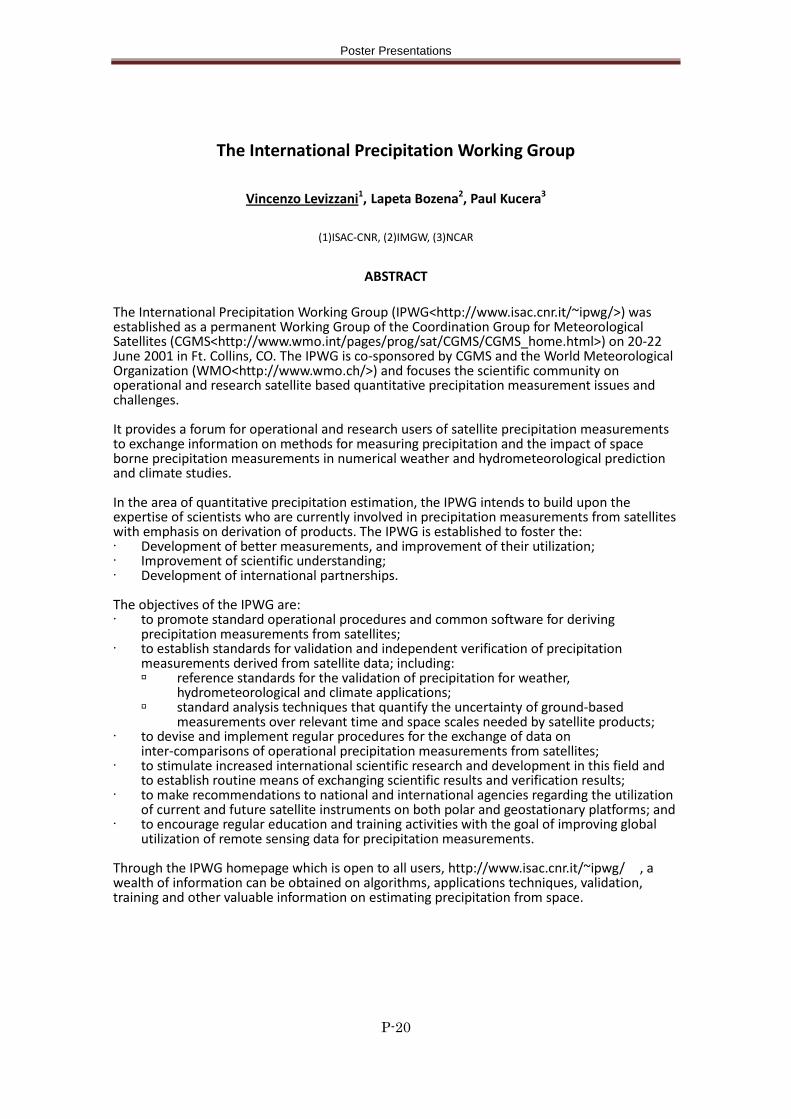
Poster Presentations
P-20
The International Precipitation Working Group
Vincenzo Levizzani1, Lapeta Bozena2, Paul Kucera3
(1)ISAC-CNR, (2)IMGW, (3)NCAR
ABSTRACT The International Precipitation Working Group (IPWG<http://www.isac.cnr.it/~ipwg/>) was established as a permanent Working Group of the Coordination Group for Meteorological Satellites (CGMS<http://www.wmo.int/pages/prog/sat/CGMS/CGMS_home.html>) on 20-22 June 2001 in Ft. Collins, CO. The IPWG is co-sponsored by CGMS and the World Meteorological Organization (WMO<http://www.wmo.ch/>) and focuses the scientific community on operational and research satellite based quantitative precipitation measurement issues and challenges. It provides a forum for operational and research users of satellite precipitation measurements to exchange information on methods for measuring precipitation and the impact of space borne precipitation measurements in numerical weather and hydrometeorological prediction and climate studies. In the area of quantitative precipitation estimation, the IPWG intends to build upon the expertise of scientists who are currently involved in precipitation measurements from satellites with emphasis on derivation of products. The IPWG is established to foster the: · Development of better measurements, and improvement of their utilization; · Improvement of scientific understanding; · Development of international partnerships. The objectives of the IPWG are: · to promote standard operational procedures and common software for deriving
precipitation measurements from satellites; · to establish standards for validation and independent verification of precipitation
measurements derived from satellite data; including: reference standards for the validation of precipitation for weather,
hydrometeorological and climate applications; standard analysis techniques that quantify the uncertainty of ground-based
measurements over relevant time and space scales needed by satellite products; · to devise and implement regular procedures for the exchange of data on
inter-comparisons of operational precipitation measurements from satellites; · to stimulate increased international scientific research and development in this field and
to establish routine means of exchanging scientific results and verification results; · to make recommendations to national and international agencies regarding the utilization
of current and future satellite instruments on both polar and geostationary platforms; and · to encourage regular education and training activities with the goal of improving global
utilization of remote sensing data for precipitation measurements. Through the IPWG homepage which is open to all users, http://www.isac.cnr.it/~ipwg/ , a wealth of information can be obtained on algorithms, applications techniques, validation, training and other valuable information on estimating precipitation from space.