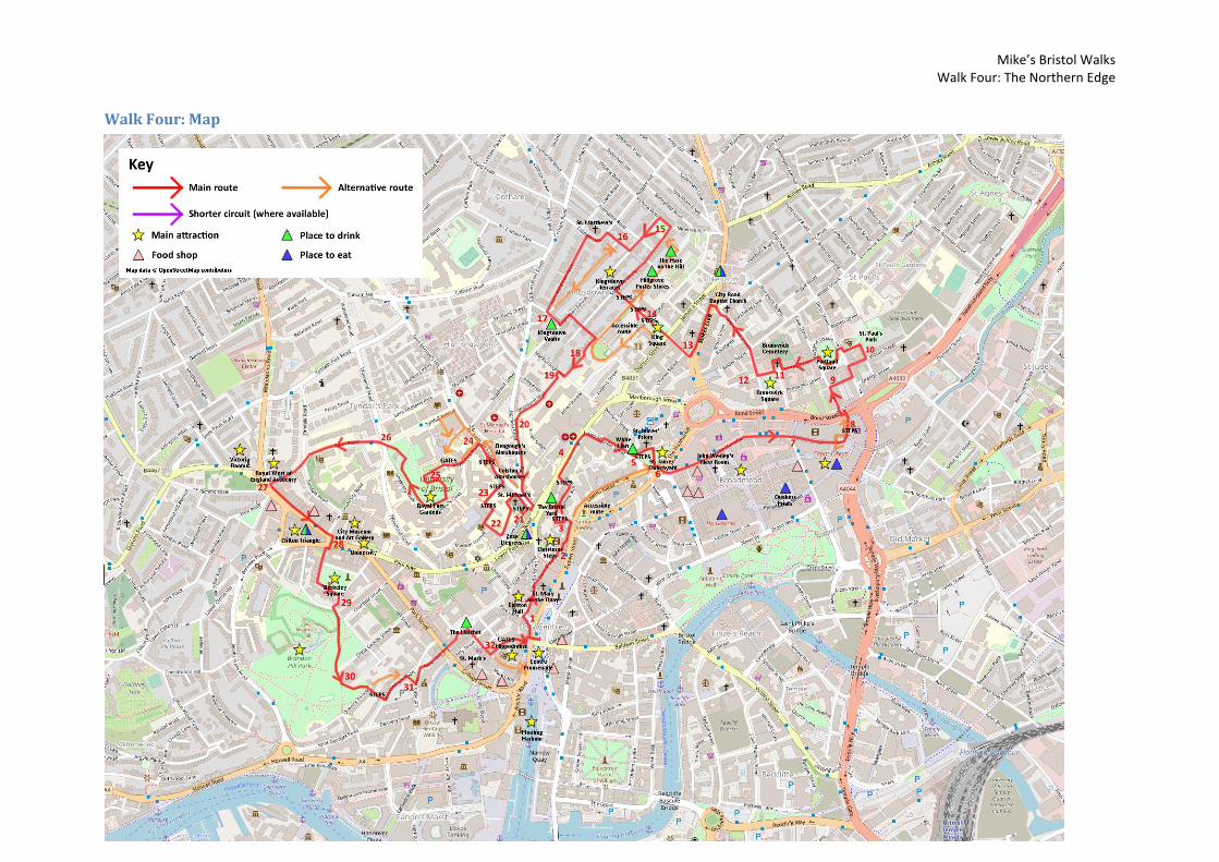
The Route Walk Four: The Northern Edge
19
Mike’s Bristol Walks Walk Four: The Northern Edge 1 Walk Four: The Northern Edge Last updated: June 2020 The northern edge of Bristol City Centre is defined by a steep escarpment running from Kingsdown in the east to Clifton in the west. This steep hillside underwent a great deal of development during the Georgian period as wealthy merchants sought to relocate out of the increasingly unhealthy and unsavoury central area. The legacy of this period was a series of attractive Georgian terraces and squares bordering the city centre, some of which were lost to the Blitz and post-war development but many of which survive. Walk Four visits some of these historic areas and takes in a few panoramic views – but be warned, there are steep hills ahead. Useful Information Terrain: Steeply hilly. Includes steep steps (can be avoided with detours). Ground: Paved or gravel. Key Attractions: Floating Harbour, Colston Hall, Christmas Steps shops, St. James’ Churchyard, Broadmead shops, Cabot Circus shops, Portland Square, Brunswick Square, King Square, Kingsdown terraces, Royal Fort Gardens, Royal West of England Academy, Victoria Rooms, Clifton Triangle shops, City Museum and Art Gallery, University of Bristol, Berkeley Square, Brandon Hill, Hippodrome. Refreshments: Pubs available at various points en route but particularly at the top of the hill in Kingsdown and at the start and end of the walk. Food available at some of these pubs and also a wide range of food options in the Clifton Triangle and the Broadmead and Cabot Circus area. Starting point: Centre Promenade Getting there: Widely accessibly on foot or by bus. 20 minutes’ walk from Temple Meads Station. Multi-storey car parks at Berkeley Place, Trenchard Street, Harbourside, Prince Street, Queen Charlotte Street, Nelson Street and Rupert Street. Approx. Time: 3 hours 30 minutes Approx. Distance: 4.9 miles The Route Our route starts, once again, at the Centre Promenade, overlooking the Floating Harbour. See Walk One ‘Introduction to Bristol’ for more information about this important central space. Neptune at the Centre Promenade Find the point where Baldwin Street crosses the Centre Promenade. From here, cross the road to the west (St. Augustine’s Parade) via the traffic lights at the end of Baldwin Street. Head north and then bear immediately left into St. Augustine’s Place (1) to reach the bottom of Colston Street. At the bottom of Colston Street you will find the copper-clad foyer of the Colston Hall. Both the concert hall and the street in front of it are named after the 17 th Century merchant Edward Colston, who has been celebrated in the past for his philanthropic deeds in Bristol, but was also a leading figure in the transatlantic slave trade. A statue of Colston that stood on the Centre Promenade was torn down in June 2020 as part of the Black Lives Matter protests. The concert hall is closed for refurbishment at the time of writing. Reflecting concerns over continuing to commemorate such a figure, it has been announced that, when it reopens, it will have a new name. Walk past the front of the Colston Hall and bear right into Host Street.
Transcript of The Route Walk Four: The Northern Edge

Mike’s Bristol Walks Walk Four: The Northern Edge
1
Walk Four: The Northern Edge
Last updated: June 2020
The northern edge of Bristol City Centre is defined by a steep escarpment running from Kingsdown in the east to Clifton in the west. This steep hillside underwent a great deal of development during the Georgian period as wealthy merchants sought to relocate out of the increasingly unhealthy and unsavoury central area. The legacy of this period was a series of attractive Georgian terraces and squares bordering the city centre, some of which were lost to the Blitz and post-war development but many of which survive. Walk Four visits some of these historic areas and takes in a few panoramic views – but be warned, there are steep hills ahead.
Useful Information
Terrain: Steeply hilly. Includes steep steps (can be avoided with detours). Ground: Paved or gravel.
Key Attractions: Floating Harbour, Colston Hall, Christmas Steps shops, St. James’ Churchyard, Broadmead shops, Cabot Circus shops, Portland Square, Brunswick Square, King Square, Kingsdown terraces, Royal Fort Gardens, Royal West of England Academy, Victoria Rooms, Clifton Triangle shops, City Museum and Art Gallery, University of Bristol, Berkeley Square, Brandon Hill, Hippodrome.
Refreshments: Pubs available at various points en route but particularly at the top of the hill in Kingsdown and at the start and end of the walk. Food available at some of these pubs and also a wide range of food options in the Clifton Triangle and the Broadmead and Cabot Circus area.
Starting point: Centre Promenade Getting there: Widely accessibly on foot or by bus. 20 minutes’ walk from Temple Meads Station. Multi-storey car parks at Berkeley Place, Trenchard Street, Harbourside, Prince Street, Queen Charlotte Street, Nelson Street and Rupert Street.
Approx. Time: 3 hours 30 minutes Approx. Distance: 4.9 miles
The Route
Our route starts, once again, at the Centre Promenade, overlooking the Floating Harbour. See Walk One ‘Introduction to Bristol’ for more information about this important central space.
Neptune at the Centre Promenade
Find the point where Baldwin Street crosses the Centre Promenade. From here, cross the road to the west (St. Augustine’s Parade) via the traffic lights at the end of Baldwin Street. Head north and then bear immediately left into St. Augustine’s Place (1) to reach the bottom of Colston Street.
At the bottom of Colston Street you will find the copper-clad foyer of the Colston Hall. Both the concert hall and the street in front of it are named after the 17th Century merchant Edward Colston, who has been celebrated in the past for his philanthropic deeds in Bristol, but was also a leading figure in the transatlantic slave trade. A statue of Colston that stood on the Centre Promenade was torn down in June 2020 as part of the Black Lives Matter protests. The concert hall is closed for refurbishment at the time of writing. Reflecting concerns over continuing to commemorate such a figure, it has been announced that, when it reopens, it will have a new name.
Walk past the front of the Colston Hall and bear right into Host Street.

Mike’s Bristol Walks Walk Four: The Northern Edge
2
Host Street
Host Street is a narrow back lane that dates back to the Mediaeval period, when it was known as Horse Street and was an important through route on the road to Henbury and Aust via St. Michael’s Hill. These days, it is a cul-de-sac that, although dominated by the backs of office blocks on Colston Avenue, still retains some buildings of character and an old-world feel. As you proceed down the street note Zed Alley, an ancient stepped thoroughfare that crosses Host Street about half way along.
At the bottom of the hill, at the back of the Christmas Steps pub, turn right through a small opening into a covered walkway under the Centre Gate building (2). Bear left to emerge on the final tiny cobbled section of Host Street.
Christmas Steps climbs to the left. Christmas Steps and the streets above it are home to a number of galleries and shops of niche interest that are well worth a visit. At the bottom of Christmas Steps you will also find the ancient St. Bartholomew’s Hospital, with its arched doorway opening on intriguing spaces to the rear.
Continue through the next covered walkway to emerge on Lewin’s Mead.
Lewin’s Mead is a bit of a concrete jungle, but there is a cluster of notable historic buildings to the left on the aptly named Narrow Lewin’s Mead. The Hotel du Vin occupies a pair of converted historic buildings at one end, while at the other end you will find a former Unitarian chapel, a fine building in ashlar limestone. Don’t miss the slightly sinister Cloaked Rider statue outside the modern St. Bartholomew’s office building, whilst a statue of philanthropist and abolitionist Samuel Morley occupies the central traffic island.
Take the narrow turning to the left of the Hotel du Vin to access Johnny Ball Lane (3).
Dickensian: Johnny Ball Lane
Johnny Ball Lane is another little-known mediaeval thoroughfare. As you climb the lane, which owes its name to an historical
The Christmas Steps, on the corner of Host Street and the street that gives the pub its name, is the first of several pubs you will encounter on this route.
Around the Christmas Steps area more generally you can find more food and drink options.
Mike’s Bristol Walks Walk Four: The Northern Edge
3
figure rather than the television personality, the massive arched structure on the left that dominates the rather Dickensian scene is the back of Colston Yard, a former Brewery.
At the top of Johnny Ball Lane, turn right into Upper Maudlin Street.
Upper Maudlin Street carries much of the through traffic to the north of the city centre. It is also at the heart of Bristol’s hospital district, as signified by the looming and rather blank visage of the Bristol Royal Infirmary (4).
Take the first right into Lower Maudlin Street.
Lower Maudlin Street offers a slightly quieter route back down the hill towards the Broadmead shopping centre, and is home to Bristol Dental Hospital and Bristol Eye Hospital. In Whitson Street, next to the White Hart, you will find the entrance to one of Bristol’s oldest buildings, St. James’ Priory.
Just beyond the White Hart, take the short flight of steps to the left to reach St. James’ Parade (5).
St. James’ Parade is home to Bristol’s smallest Conservation Area. Tree-lined St. James’ Churchyard, which adjoins the walkway, is a welcome sanctuary from the racket of traffic on Haymarket (the nearby main road) and the hubbub of shoppers visiting Broadmead. Meanwhile, nearby Cannon Street offers a useful secondary entrance to the bus station, allowing visitors the city to avoid the misery of
the underpasses at the nearby St. James’ Barton roundabout (known locally as the ‘Bear Pit’).
St. James’ Parade
At a crossing of paths just beyond St. James’ Priory where Cannon Street joins from the left, turn right and proceed down a pleasant tree-lined walkway to reach the bottom of the Haymarket (6). The accessible route rejoins the main route here. Cross the Haymarket at the traffic lights to reach St. James’ Place
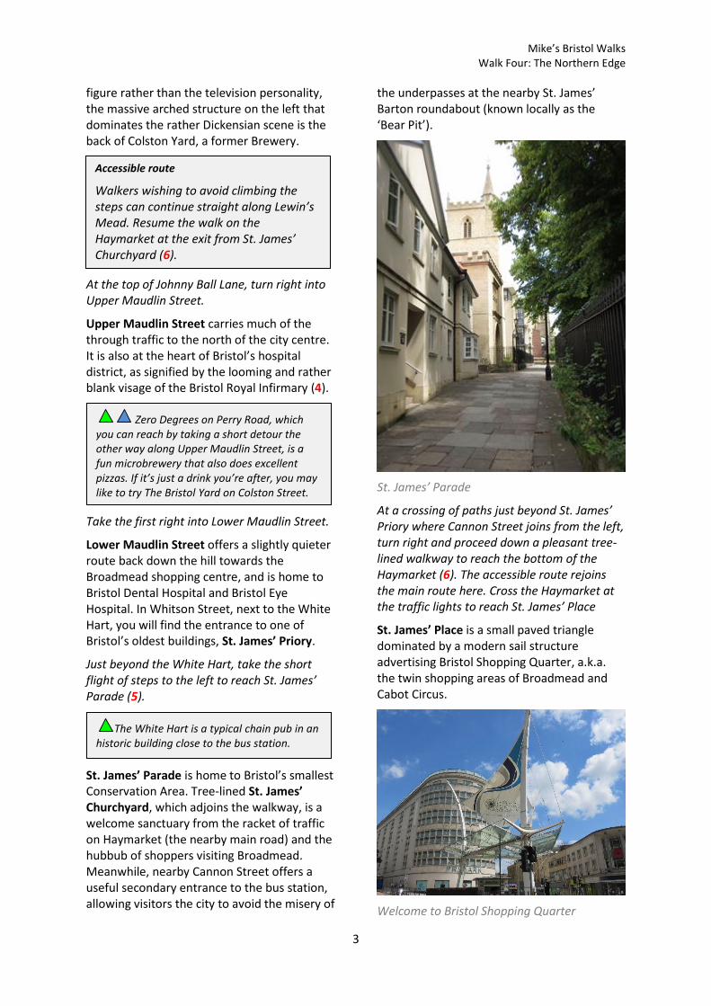
St. James’ Place is a small paved triangle dominated by a modern sail structure advertising Bristol Shopping Quarter, a.k.a. the twin shopping areas of Broadmead and Cabot Circus.
Welcome to Bristol Shopping Quarter
Accessible route
Walkers wishing to avoid climbing the steps can continue straight along Lewin’s Mead. Resume the walk on the Haymarket at the exit from St. James’ Churchyard (6).
Zero Degrees on Perry Road, which you can reach by taking a short detour the other way along Upper Maudlin Street, is a fun microbrewery that also does excellent pizzas. If it’s just a drink you’re after, you may like to try The Bristol Yard on Colston Street.
The White Hart is a typical chain pub in an historic building close to the bus station.
Mike’s Bristol Walks Walk Four: The Northern Edge
4
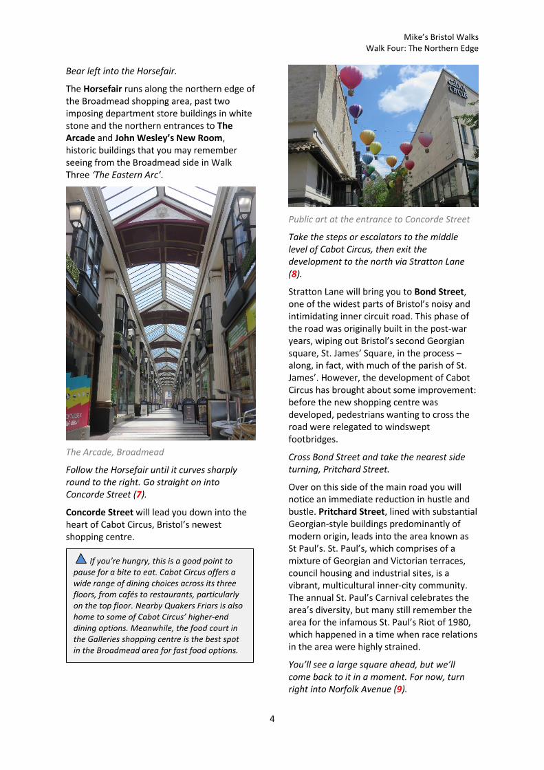
Bear left into the Horsefair.
The Horsefair runs along the northern edge of the Broadmead shopping area, past two imposing department store buildings in white stone and the northern entrances to The Arcade and John Wesley’s New Room, historic buildings that you may remember seeing from the Broadmead side in Walk Three ‘The Eastern Arc’.
The Arcade, Broadmead
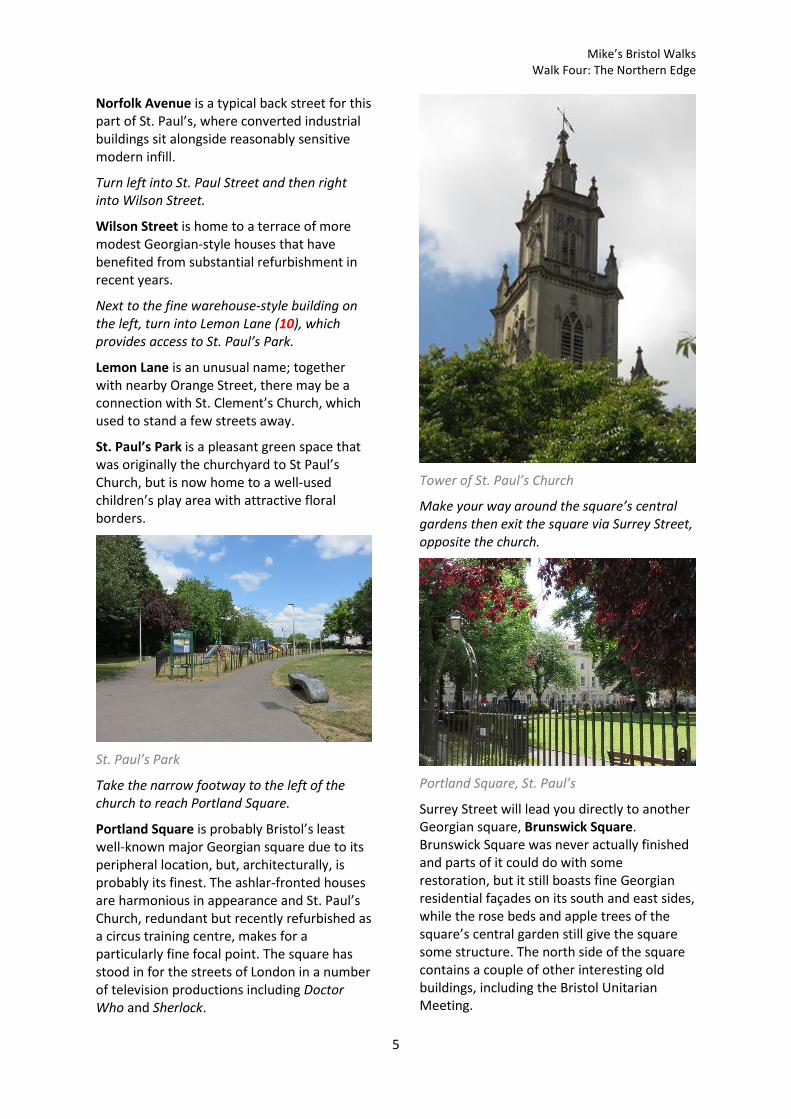
Follow the Horsefair until it curves sharply round to the right. Go straight on into Concorde Street (7).
Concorde Street will lead you down into the heart of Cabot Circus, Bristol’s newest shopping centre.
Public art at the entrance to Concorde Street
Take the steps or escalators to the middle level of Cabot Circus, then exit the development to the north via Stratton Lane (8).
Stratton Lane will bring you to Bond Street, one of the widest parts of Bristol’s noisy and intimidating inner circuit road. This phase of the road was originally built in the post-war years, wiping out Bristol’s second Georgian square, St. James’ Square, in the process – along, in fact, with much of the parish of St. James’. However, the development of Cabot Circus has brought about some improvement: before the new shopping centre was developed, pedestrians wanting to cross the road were relegated to windswept footbridges.
Cross Bond Street and take the nearest side turning, Pritchard Street.
Over on this side of the main road you will notice an immediate reduction in hustle and bustle. Pritchard Street, lined with substantial Georgian-style buildings predominantly of modern origin, leads into the area known as St Paul’s. St. Paul’s, which comprises of a mixture of Georgian and Victorian terraces, council housing and industrial sites, is a vibrant, multicultural inner-city community. The annual St. Paul’s Carnival celebrates the area’s diversity, but many still remember the area for the infamous St. Paul’s Riot of 1980, which happened in a time when race relations in the area were highly strained.
You’ll see a large square ahead, but we’ll come back to it in a moment. For now, turn right into Norfolk Avenue (9).
If you’re hungry, this is a good point to pause for a bite to eat. Cabot Circus offers a wide range of dining choices across its three floors, from cafés to restaurants, particularly on the top floor. Nearby Quakers Friars is also home to some of Cabot Circus’ higher-end dining options. Meanwhile, the food court in the Galleries shopping centre is the best spot in the Broadmead area for fast food options.
Mike’s Bristol Walks Walk Four: The Northern Edge
5
Norfolk Avenue is a typical back street for this part of St. Paul’s, where converted industrial buildings sit alongside reasonably sensitive modern infill.
Turn left into St. Paul Street and then right into Wilson Street.
Wilson Street is home to a terrace of more modest Georgian-style houses that have benefited from substantial refurbishment in recent years.
Next to the fine warehouse-style building on the left, turn into Lemon Lane (10), which provides access to St. Paul’s Park.
Lemon Lane is an unusual name; together with nearby Orange Street, there may be a connection with St. Clement’s Church, which used to stand a few streets away.
St. Paul’s Park is a pleasant green space that was originally the churchyard to St Paul’s Church, but is now home to a well-used children’s play area with attractive floral borders.
St. Paul’s Park
Take the narrow footway to the left of the church to reach Portland Square.
Portland Square is probably Bristol’s least well-known major Georgian square due to its peripheral location, but, architecturally, is probably its finest. The ashlar-fronted houses are harmonious in appearance and St. Paul’s Church, redundant but recently refurbished as a circus training centre, makes for a particularly fine focal point. The square has stood in for the streets of London in a number of television productions including Doctor Who and Sherlock.
Tower of St. Paul’s Church
Make your way around the square’s central gardens then exit the square via Surrey Street, opposite the church.
Portland Square, St. Paul’s
Surrey Street will lead you directly to another Georgian square, Brunswick Square. Brunswick Square was never actually finished and parts of it could do with some restoration, but it still boasts fine Georgian residential façades on its south and east sides, while the rose beds and apple trees of the square’s central garden still give the square some structure. The north side of the square contains a couple of other interesting old buildings, including the Bristol Unitarian Meeting.
Mike’s Bristol Walks Walk Four: The Northern Edge
6
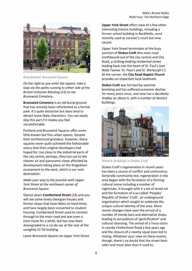
Refurbished: Brunswick Square
On the right as you enter the square, take a loop via the paths running to either side of the Bristol Unitarian Meeting (11) to see Brunswick Cemetery.
Brunswick Cemetery is an old burial ground that has recently been refurbished as a formal park. It’s quite attractive but does tend to attract some likely characters. You can easily skip this part if it makes you feel uncomfortable.
Portland and Brunswick Squares offer some little-known but fine urban spaces. Despite their architectural grandeur, however, these squares never quite achieved the fashionable status that their original developers had hoped for: too close to the industrial parts of the city centre, perhaps, they lost out to the cleaner air and panoramic views afforded by development taking place on the Kingsdown escarpment to the west, which is our next destination.
Make your way to the junction with Upper York Street at the northwest corner of Brunswick Square.
Glance down Cumberland Street (12) and you will see some lovely Georgian houses and former shops that have fallen on hard times and have largely been converted to student housing. Cumberland Street used to connect through to the main road and was even a tram route for a while, but has now been downgraded to a cul-de-sac at the rear of the unsightly 51°02 building.
Leave Brunswick Square via Upper York Street.
Upper York Street offers view of a few other interesting historic buildings, including a former school building in Backfields, most recently used as coroner’s court but now vacant.
Upper York Street terminates at the busy junction of Stokes Croft (the main road northbound out of the city centre) and City Road, a striking-looking residential street leading back into the heart of St. Paul’s (see Walk Twelve ‘St. Paul’s and St. Werburgh’s’). At the corner, the City Road Baptist Church provides an important local landmark.
Stokes Croft was hit hard by wartime bombing and has suffered economic decline for many years since, and now has a decidedly shabby air about it, with a number of derelict buildings.
Historic buildings in Stokes Croft
Stokes Croft’s regeneration in recent years has been a source of conflict and controversy. Generally community-led, regeneration in the area began with the formation of a thriving cultural scene including a number of nightclubs. It brought with it a lot of street art and the formation of a so-called ‘Peoples’ Republic of Stokes’ Croft’, an underground organisation which sought to celebrate the unique cultural identity of the area. More recent changes have seen the arrival of a number of trendy bars and alternative shops, leading to accusations of ‘gentrification’ and cultural cleansing. The arrival of a Tesco store in nearby Cheltenham Road a few years ago and the closure of a nearby squat even led to rioting. Whatever your view on these events, though, there’s no doubt that the street feels safer and more alive than it used to.

Mike’s Bristol Walks Walk Four: The Northern Edge
7
Local businesses in Stokes Croft
Turn left into Stokes Croft and make your way back down towards the city centre.
Stokes Croft widens as you enter the area most heavily damaged during the Blitz, where modern buildings predominate, including a monolithic block which bridges the bottom end of the road, effectively isolating Stokes Croft from the rest of the city centre. The building, which started life as offices for the now defunct Avon County Council, has since been converted to flats and rebranded as 51°02. To the left is the Full Moon public house, the last survivor of the historic development of North Street (the name originally given to last stretch of road into St. James’ Barton).
Just before 51°02, take the hard right into King Square Avenue (13).
King Square Avenue, an unbecoming street next to Mickelburgh’s (a piano store which has been in business on the same site since the early 20th Century), will lead you to King Square, another once fine Georgian square that has fallen on harder times. A mix of historic buildings, replica buildings and unashamedly brutal modern buildings enclose the historic urban space. Most recently, the largest of these modern buildings has been converted into student flats and re-fronted in a pastiche Georgian style.
King Square, Kingsdown
Cross the road to enter the central garden of King Square.
Go straight on across the square to reach the bottom of Spring Hill (14). Climb the steps of Spring Hill, crossing Dove Street along the way.
Spring Hill is the footpath by which you will be making the steep climb up to Kingsdown. The first part of Spring Hill takes you past massive blocks of council flats that, regrettably, replaced large parts of historic Kingsdown after the Second World War (despite bomb damage in the area not being too extensive). Originally, Kingsdown was characterised by a lively variety of Georgian buildings fronting onto a grid of parallel streets, some of which ran along the contours of the hillside while others climbed steeply up the hill, stepped in places. Spring Hill is the last of these steep uphill streets that survives for all of its length, albeit in a somewhat eroded form; the weed-
These days there are a number of places in Stokes Croft where you can get a drink or something decent to eat.
Accessible route
The climb up Spring Hill involves two flights of steep steps. The steps can be avoided by taking a fairly long detour; unfortunately it is a less attractive option, but it will get you to the top of the hill.
Exit the central garden of King Square via the left side gate and take the turning for Dove Street South at the top left corner of the square. Loop round past the playground into Dove Street, avoiding the first flight of steps. To avoid the second flight of steps, continue along Dove Street and take Thomas Street North to reach Fremantle Square (15) by an alternative route.

Mike’s Bristol Walks Walk Four: The Northern Edge
8
strewn remnants of a disused cobbled carriageway in the section above Dove Street add to the air of abandonment and ill-use.
Looking back down Spring Hill
After the last flight of steps, turn right into Somerset Street.
The character of the area changes completely as you cross Dove Street, to enter the surviving Georgian area. At the top of the escarpment, Somerset Street is one of the two major Kingsdown streets that have retained their character (the other being Kingsdown Parade beyond). Of the two, Somerset Street is the subservient street, but has the most interesting variety of buildings. Pause to look back at the panorama offered by Spring Hill, in which 51°02, Portland and Brunswick Squares and Cabot Circus are prominent, before setting off along the cobbled street. Then, as you make your way along the charming backwater, note the variety of interesting historic houses that make up the terrace on the right hand side and the characterful gardens opposite.
Somerset Street, Kingsdown
At the end of Somerset Street you will emerge in Fremantle Square (15). The accessible route rejoins the main route here.
Fremantle Square is a small sloping square with a raised central garden that bookends Somerset Street and Kingsdown Parade. The square is in the approximate location of the Prior’s Hill fort, an important part of Bristol’s civil war defences. From the bottom corner of the square, steep Nine Tree Hill offers views back down to Stokes Croft on the frontier between Kingsdown and Cotham.
Leave the square at its top corner so that you travel parallel to Somerset Street. Cross the junction with Fremantle Road and go straight on to approach the imposing Georgian terrace of Kingsdown Parade.
Imposing Kingsdown Parade
There are several opportunities to pause for a drink in Kingsdown. The first two of these can be found on Dove Street, just below Somerset Street. If you a fancy a cider, try the Hillgrove Porter Stores; or, if real ale is more to your fancy, try the Hare on the Hill.
Mike’s Bristol Walks Walk Four: The Northern Edge
9
Kingsdown Parade is a road of two distinct sides. The tall Georgian terrace on the left hand side is hard up against the pavement and looms imposingly over the street. To the right, the other terrace is set well back, taking full advantage of its southeasterly aspect with private, sunlit front gardens.
Turn right into St. Matthew’s Avenue, a cobbled alleyway to the rear of Fremantle Road (16).
You are now leaving Kingsdown and entering Cotham, one of the city’s popular inner suburbs (we won’t be here for long, but check out Walk Fourteen ‘Cotham and Redland’ if you would like to explore the area further).
Turn left into Cotham Side.
Cotham Side, in contrast to the proud terraces on the hillside, offers quiet seclusion as you pass the pretty garden of St. Matthew’s Church.
A jay on the railings of St. Matthew’s Church
Opposite the church, turn left into St. Matthew’s Road.
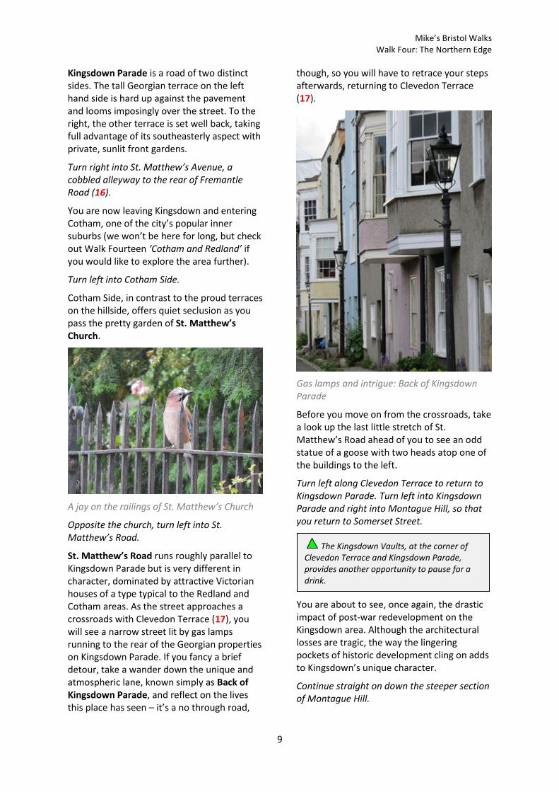
St. Matthew’s Road runs roughly parallel to Kingsdown Parade but is very different in character, dominated by attractive Victorian houses of a type typical to the Redland and Cotham areas. As the street approaches a crossroads with Clevedon Terrace (17), you will see a narrow street lit by gas lamps running to the rear of the Georgian properties on Kingsdown Parade. If you fancy a brief detour, take a wander down the unique and atmospheric lane, known simply as Back of Kingsdown Parade, and reflect on the lives this place has seen – it’s a no through road,
though, so you will have to retrace your steps afterwards, returning to Clevedon Terrace (17).
Gas lamps and intrigue: Back of Kingsdown Parade
Before you move on from the crossroads, take a look up the last little stretch of St. Matthew’s Road ahead of you to see an odd statue of a goose with two heads atop one of the buildings to the left.
Turn left along Clevedon Terrace to return to Kingsdown Parade. Turn left into Kingsdown Parade and right into Montague Hill, so that you return to Somerset Street.
You are about to see, once again, the drastic impact of post-war redevelopment on the Kingsdown area. Although the architectural losses are tragic, the way the lingering pockets of historic development cling on adds to Kingsdown’s unique character.
Continue straight on down the steeper section of Montague Hill.
The Kingsdown Vaults, at the corner of Clevedon Terrace and Kingsdown Parade, provides another opportunity to pause for a drink.
Mike’s Bristol Walks Walk Four: The Northern Edge
10
Montague Hill resembles Spring Hill, with its view of central Bristol and disused central carriageway. However, unlike Spring Hill, this route no longer runs all the way down the hill. It is interrupted by the Dove Street flats before re-emerging between hospital buildings further down.
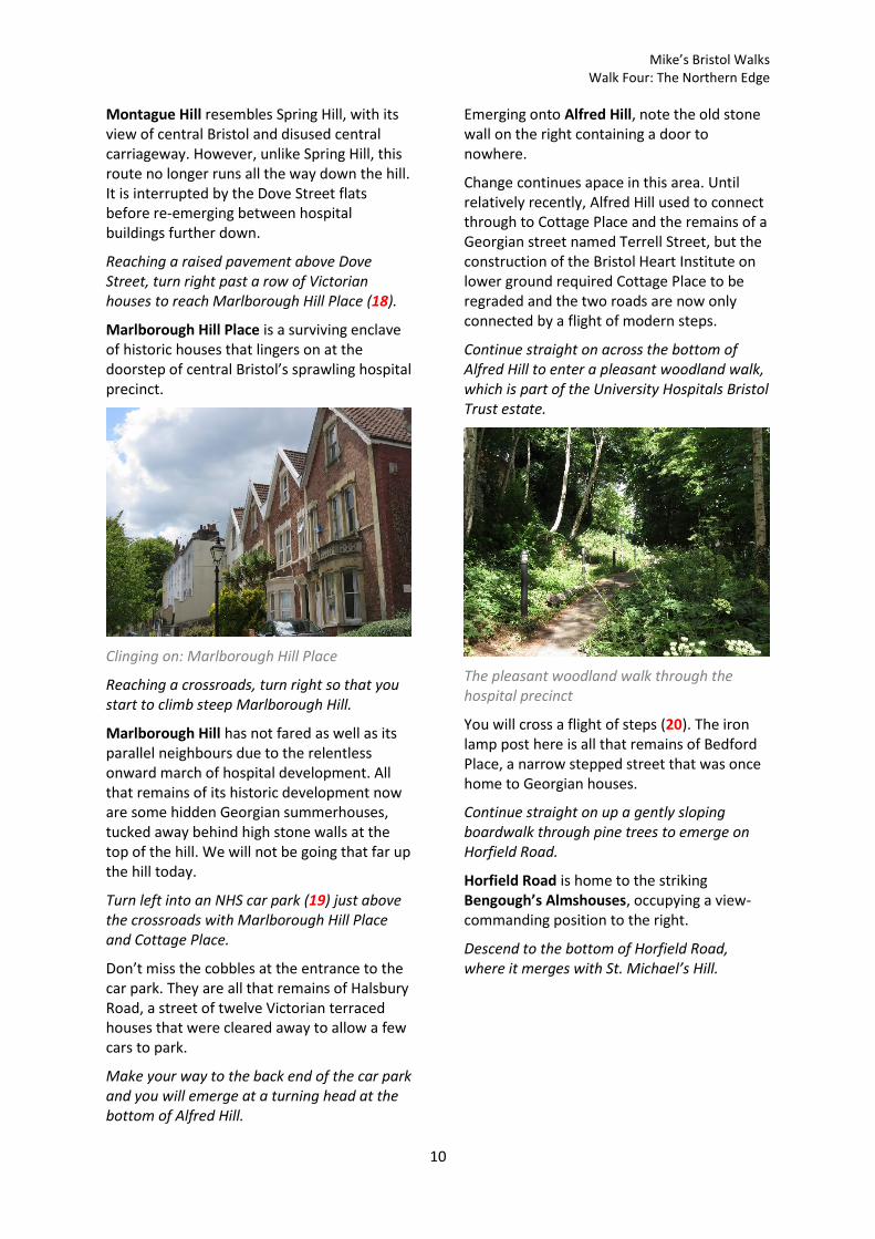
Reaching a raised pavement above Dove Street, turn right past a row of Victorian houses to reach Marlborough Hill Place (18).
Marlborough Hill Place is a surviving enclave of historic houses that lingers on at the doorstep of central Bristol’s sprawling hospital precinct.
Clinging on: Marlborough Hill Place
Reaching a crossroads, turn right so that you start to climb steep Marlborough Hill.
Marlborough Hill has not fared as well as its parallel neighbours due to the relentless onward march of hospital development. All that remains of its historic development now are some hidden Georgian summerhouses, tucked away behind high stone walls at the top of the hill. We will not be going that far up the hill today.
Turn left into an NHS car park (19) just above the crossroads with Marlborough Hill Place and Cottage Place.
Don’t miss the cobbles at the entrance to the car park. They are all that remains of Halsbury Road, a street of twelve Victorian terraced houses that were cleared away to allow a few cars to park.
Make your way to the back end of the car park and you will emerge at a turning head at the bottom of Alfred Hill.
Emerging onto Alfred Hill, note the old stone wall on the right containing a door to nowhere.
Change continues apace in this area. Until relatively recently, Alfred Hill used to connect through to Cottage Place and the remains of a Georgian street named Terrell Street, but the construction of the Bristol Heart Institute on lower ground required Cottage Place to be regraded and the two roads are now only connected by a flight of modern steps.
Continue straight on across the bottom of Alfred Hill to enter a pleasant woodland walk, which is part of the University Hospitals Bristol Trust estate.
The pleasant woodland walk through the hospital precinct
You will cross a flight of steps (20). The iron lamp post here is all that remains of Bedford Place, a narrow stepped street that was once home to Georgian houses.
Continue straight on up a gently sloping boardwalk through pine trees to emerge on Horfield Road.
Horfield Road is home to the striking Bengough’s Almshouses, occupying a view-commanding position to the right.
Descend to the bottom of Horfield Road, where it merges with St. Michael’s Hill.

Mike’s Bristol Walks Walk Four: The Northern Edge
11
To continue along the main route, cross the bottom of St. Michael’s Hill at the traffic lights and begin to climb back up St. Michael’s Hill, then immediately turn left into narrow Lower Church Lane.
A narrow backwater, Lower Church Lane conceals a distinctive house with gothic arched windows. It’s hard to believe it now, but prior to the construction of nearby Perry Road in the mid 19th Century, Lower Church Lane was an important link between Park Row and St. Michael’s Hill, between which there was no main road connection.
Turn right just before the gothic house, climbing a couple of steps (21) to enter a raised paved area.
The raised area opens out to reveal the church of St. Michael on the Mount Without, presently redundant and, sadly, derelict and decaying. The church takes its curious name from the fact that it originally stood outside the city wall.
Reaching the bottom of St. Michael’s Hill, colourful timber framed houses frame a view up the steep and characterful road with its raised, stepped pavement.
St. Michael’s Hill
Turn left just past the church onto Upper Church Lane, leaving St. Michael’s Hill for the moment.
Upper Church Lane takes you into a maze of tight little by-ways behind St Michael’s Hill and Perry Road. At first you wind around behind the church, and then you pass between the playgrounds of St. Michael’s on the Mount primary school. You will then pass a University car park on the left, which provides an unusual view of the backs of the historic shops on Perry Road at upper storey level.
St. Michael’s Church peeps through the trees
Turn right at the end of the lane into Old Park Hill (22).
Accessible route
The main route is about to explore a maze of lanes and stepped footpaths around St. Michael’s Church. If you wish to avoid the steps, bypass this section. Turn right up St. Michael’s Hill, staying on the right hand side to avoid further steps, passing the Colston’s Almshouses. Please note that the gradient is very steep.
Cross over at the crest of the hill – a pedestrian crossing is available – to rejoin the main route at Royal Fort Road (24).

Mike’s Bristol Walks Walk Four: The Northern Edge
12
You have now entered the University precinct, which, over the decades, has come to dominate more and more of this area. Originally part of Tyndall’s Park, the area became a sprawling, eclectic and maze-like Georgian residential neighbourhood, of which only traces now remain.
In Old Park Hill, a terrace of quaint little houses clings on in the shadow of the looming modern buildings of the University – another Bristol oddity.
Turn right into Old Park, passing the back of a substantial property with further gothic trappings. Turn left into Park Lane.
Park Lane has been partly taken over by St. Michael’s school. The school buildings frame a good view over central Bristol, with the 1960s Robinson tower in Redcliff Street taking centre stage. The large mustard-coloured property at the top of Park Lane is known as the Manor House, and must have fine city views of its own.
View of the city from Park Lane
Climb the steps of Park Lane and turn right past the Manor House into Park Place (23).
Park Place has lost almost all of its historic character, but one characteristic remains, which is that it returns you to the raised
pavement of St. Michael’s Hill, about half way up, via an archway opposite the Colston’s Almshouses.
Colston’s Almshouses, St. Michael’s Hill.
The graceful Colston’s Almshouses, faced in limestone ashlar, occupy a quadrangle opposite. There has been no word yet as to whether Edward Colston’s name will be removed from these as well.
Turn left up St. Michael’s Hill, climbing up to the turning for Royal Fort Road (24). The accessible route rejoins the main route here.
St. Michael’s Hill offers panoramic views over the city centre, with a distinctive Georgian townscape stepping down the raised footway. Above the Colston’s Almshouses you will find Winstone Court, a residential block. The development was named after Reece Winstone, a prominent and outspoken Bristol photographer who captured the city at its time of greatest change in the mid-20th Century. Thanks to Winstone, an extensive photographic record exists of many townscapes that are now lost. His prolific series of self-published Bristol As It Was photo books has, sadly, been out of print for many years, but it’s worth seeking out second hand copies if you are interested in local history.
Turn left into Royal Fort Road and go straight on to enter the Royal Fort Gardens via Prince Rupert’s Gate.
The gate to the Royal Fort Gardens is usually open, but if it is shut you can take a detour, entering the gardens via the steps further up St. Michael’s Hill or, for an accessible alternative, entering the gardens from Tyndall Avenue, a bit further up again.
Mike’s Bristol Walks Walk Four: The Northern Edge
13
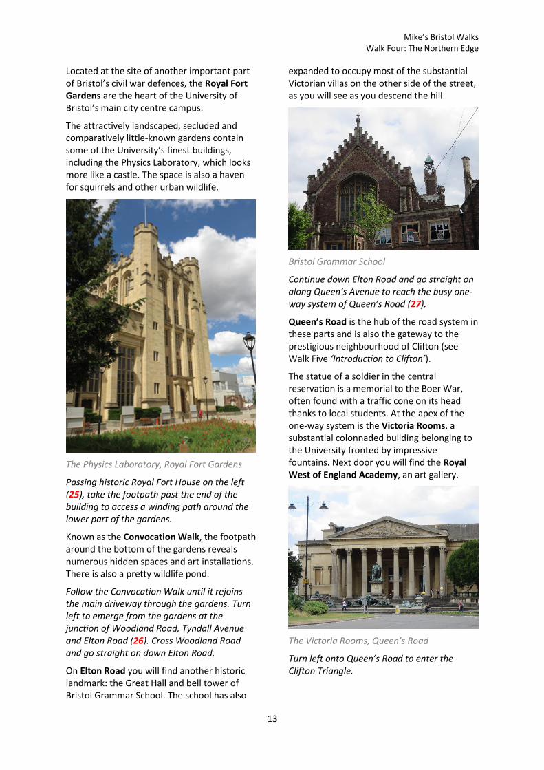
Located at the site of another important part of Bristol’s civil war defences, the Royal Fort Gardens are the heart of the University of Bristol’s main city centre campus.
The attractively landscaped, secluded and comparatively little-known gardens contain some of the University’s finest buildings, including the Physics Laboratory, which looks more like a castle. The space is also a haven for squirrels and other urban wildlife.
The Physics Laboratory, Royal Fort Gardens
Passing historic Royal Fort House on the left (25), take the footpath past the end of the building to access a winding path around the lower part of the gardens.
Known as the Convocation Walk, the footpath around the bottom of the gardens reveals numerous hidden spaces and art installations. There is also a pretty wildlife pond.
Follow the Convocation Walk until it rejoins the main driveway through the gardens. Turn left to emerge from the gardens at the junction of Woodland Road, Tyndall Avenue and Elton Road (26). Cross Woodland Road and go straight on down Elton Road.
On Elton Road you will find another historic landmark: the Great Hall and bell tower of Bristol Grammar School. The school has also
expanded to occupy most of the substantial Victorian villas on the other side of the street, as you will see as you descend the hill.
Bristol Grammar School
Continue down Elton Road and go straight on along Queen’s Avenue to reach the busy one-way system of Queen’s Road (27).
Queen’s Road is the hub of the road system in these parts and is also the gateway to the prestigious neighbourhood of Clifton (see Walk Five ‘Introduction to Clifton’).
The statue of a soldier in the central reservation is a memorial to the Boer War, often found with a traffic cone on its head thanks to local students. At the apex of the one-way system is the Victoria Rooms, a substantial colonnaded building belonging to the University fronted by impressive fountains. Next door you will find the Royal West of England Academy, an art gallery.
The Victoria Rooms, Queen’s Road
Turn left onto Queen’s Road to enter the Clifton Triangle.

Mike’s Bristol Walks Walk Four: The Northern Edge
14
The Clifton Triangle is a shopping area just north of Park Street, which is so named as a reference to the layout of the three main roads that define it. The grand shopping frontage on Queen’s Road, known originally as the Royal Promenade, is the heart of the shopping area.
Royal Promenade and the Wills Memorial Building, Queen’s Road
Emerging from the shops, cross to the central island (28).
Behind you, at the bottom of University Road, you will see the original City Museum, a fine Italianate building which was blitzed, briefly used as the University refectory, and is now a Brown’s Restaurant. Just below is the present home of the City Museum and Art Gallery, with the tower of the Wills Memorial Building beyond.
Continue across the main road and go straight on into the side turning opposite.
As you leave the Triangle, the prominent red brick curve of Berkeley Crescent marks the entrance to Berkeley Square.
Berkeley Square
Berkeley Square is one of Bristol’s more ad-hoc seeming Georgian squares, trapezoid in shape and uncomfortably occupying a sloping site. The raised central garden is heavily enclosed by overgrown trees, giving it a damp and shadowy feel. However, if you delve into the gardens a little you will find the remains of a replica of Bristol’s High Cross, which once stood on College Green after the original was removed from the top of High Street and Corn Street. The original, which is still intact, stands at Stourhead, a National Trust property in Wiltshire.
Otherwise, continue around the perimeter of the square. Exit the square at the far corner via Brandon Hill Lane (29). Take the path on the left to enter Brandon Hill park.
Brandon Hill is a large urban park that centres around Cabot Tower, a monument at the top of the hill. The park is also home to many fine old trees and is a haven for wildlife, particularly squirrels, who enjoy being fed in the autumn. I offer a fuller exploration of the park in Walk Five ‘Introduction to Clifton’; for now, we will take a more direct route down the hill.
If you’d like to round the walk out with a meal, there are several drinking and dining options in the Clifton Triangle area.
Mike’s Bristol Walks Walk Four: The Northern Edge
15
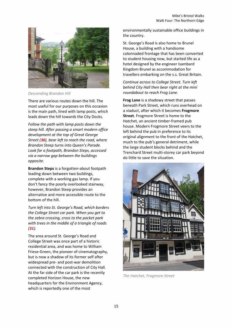
Descending Brandon Hill
There are various routes down the hill. The most useful for our purposes on this occasion is the main path, lined with lamp posts, which leads down the hill towards the City Docks.
Follow the path with lamp posts down the steep hill. After passing a smart modern office development at the top of Great George Street (30), bear left to reach the road, where Brandon Steep turns into Queen’s Parade. Look for a footpath, Brandon Steps, accessed via a narrow gap between the buildings opposite.
Brandon Steps is a forgotten-about footpath leading down between two buildings, complete with a working gas lamp. If you don’t fancy the poorly overlooked stairway, however, Brandon Steep provides an alternative and more accessible route to the bottom of the hill.
Turn left into St. George’s Road, which borders the College Street car park. When you get to the zebra crossing, cross to the pocket park with trees in the middle of a triangle of roads (31).
The area around St. George’s Road and College Street was once part of a historic residential area, and was home to William Friese-Green, the pioneer of cinematography, but is now a shadow of its former self after widespread pre- and post-war demolition connected with the construction of City Hall. At the far side of the car park is the recently completed Horizon House, the new headquarters for the Environment Agency, which is reportedly one of the most
environmentally sustainable office buildings in the country.
St. George’s Road is also home to Brunel House, a building with a handsome colonnaded frontage that has been converted to student housing now, but started life as a hotel designed by the engineer Isambard Kingdom Brunel as accommodation for travellers embarking on the s.s. Great Britain.
Continue across to College Street. Turn left behind City Hall then bear right at the mini roundabout to reach Frog Lane.
Frog Lane is a shadowy street that passes beneath Park Street, which runs overhead on a viaduct, after which it becomes Frogmore Street. Frogmore Street is home to the Hatchet, an ancient timber-framed pub house. Modern Frogmore Street veers to the left behind the pub in preference to its original alignment to the front of the Hatchet, much to the pub’s general detriment, while the large student blocks behind and the Trenchard Street multi-storey car park beyond do little to save the situation.
The Hatchet, Frogmore Street

Mike’s Bristol Walks Walk Four: The Northern Edge
16
In front of the Hatchet, turn right into Denmark Avenue.
Denmark Avenue leads to a crossroads where Unity Street and Orchard Street form a quiet Georgian enclave below College Green. An imposing red brick building, the former Merchant Venturers’ Technical College (now converted into flats) dominates the junction.
Denmark Street
Beyond, Denmark Street is a narrow thoroughfare containing a number of historic buildings and the back entrance to the Hippodrome theatre. Due to the narrowness of the street and the height of the buildings, Denmark Street always seems to be in shadow, and has a very different atmosphere from much of the city centre. If more of historic Bristol had survived the combined assault of the Blitz and post-war planning, however, then perhaps there would be more areas like this today.
At the rear of the Hippodrome, turn left into Gaunts Lane. Go straight on through the gates into Augustine’s Courtyard.
Augustine’s Courtyard is a private space, but the gates are usually open on weekdays. It’s a pleasant and quiet space ringed by offices in converted historic buildings.
Bear right through the courtyard and walk through the tunnel beyond to return to the Centre Promenade and complete Walk Four.
Alternatively, if the gates to Augustine’s Courtyard are shut, return to Denmark Street and turn left to complete Walk Four via that route.
Coming Up
In Walk Five ‘Introduction to Clifton’ we will finally be venturing into Clifton, historically the home of Bristol’s well-heeled merchant classes but now a vibrant and cosmopolitan area with a number of visitor attractions.
The Hatchet may look small, but there’s plenty of room both inside and out for a drink in a quiet but very central location.
Mike’s Bristol Walks Walk Four: The Northern Edge
17
Walk Four: Map

Mike’s Bristol Walks Walk Four: The Northern Edge
18

Mike’s Bristol Walks Walk Four: The Northern Edge
19