The EOC Incident Mapper - Amazon S3€¦ · Tallahassee - Leon County Geographic Information...
36
2-May-08 The EOC Incident The EOC Incident Mapper Mapper Tallahassee Tallahassee - - Leon County Geographic Information Systems Leon County Geographic Information Systems As presented by As presented by Lee Hartsfield, GISP Lee Hartsfield, GISP Tallahassee Tallahassee - - Leon County GIS Coordinator Leon County GIS Coordinator
Transcript of The EOC Incident Mapper - Amazon S3€¦ · Tallahassee - Leon County Geographic Information...

2-May-08
The EOC Incident The EOC Incident MapperMapperTallahassee Tallahassee -- Leon County Geographic Information SystemsLeon County Geographic Information Systems
As presented byAs presented by Lee Hartsfield, GISPLee Hartsfield, GISPTallahasseeTallahassee--Leon County GIS CoordinatorLeon County GIS Coordinator

2-May-08
Hurricanes
TORNADOES
Wildfires
Flooding
Terrorism
Hazardous Materials
Severe Storms
Using GIS in Managing Disaster
Response

2-May-08
OutlineOutline
Tallahassee-Leon County GISIntegrating GISPutting the Pieces All TogetherEOC Incident Mapper Application Demonstration
College Baseball Newsflash
April 15, 2008
Florida State 4
Florida 2

2-May-08
77
11
22 33 44
55 66
GIS ExecutiveCommittee
LCCOT PA GIS Steering
Committee
LCCOT PA
City of Tallahassee Leon County LC Property Appraiser
GIS Interlocal Staff
12 Full time/permanent
GIS Coordinator
Development Team
City CommissionerCounty Commissioner
Property Appraiser
City Manager or designeeCounty Administrator or designee
Assistant Property Appraiser
Representatives of Departmental Users
From top to bottom, the Organizational
Structure ensures the appropriate oversight,
participation and involvement in TLC GIS.
2-May-08
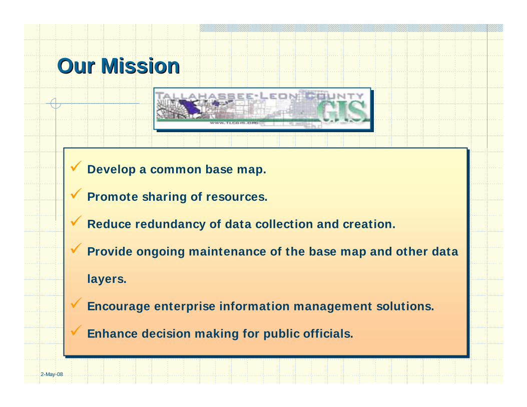
Our MissionOur Mission
Develop a common base map.
Promote sharing of resources.
Reduce redundancy of data collection and creation.
Provide ongoing maintenance of the base map and other data
layers.
Encourage enterprise information management solutions.
Enhance decision making for public officials.
Develop a common base map.
Promote sharing of resources.
Reduce redundancy of data collection and creation.
Provide ongoing maintenance of the base map and other data
layers.
Encourage enterprise information management solutions.
Enhance decision making for public officials.

2-May-08
Meeting Needs in Meeting Needs in Emergency ManagementEmergency Management
9/11 and the severe weather of 2004 provided the catalyst for reviewing how well governments had integrated technology into Emergency Management operations. The GIS Steering Committee directed TLC GIS staff to evaluate how GIS technology was being used within the business processes of Emergency Management.
Leon County operates the Leon County Emergency Operations Center which coordinates all emergency operations within Leon County.
The City of Tallahassee operates an Area Command Center in orderto facilitate the many functions of city services.

2-May-08
GIS & Emergency ManagementGIS & Emergency Management““An OutsiderAn Outsider’’s Perspectives Perspective””
Getting StartedWhat’s happening now?Observe, Listen and QuestionIdentify and enlist the assistance of the business process owner representative with a vision.
Key QuestionsWhere is the emergency?How do we get the necessary resources there?Who is or what is impacted?Are there any complicating factors relative to the location or the route to get there?
2-May-08
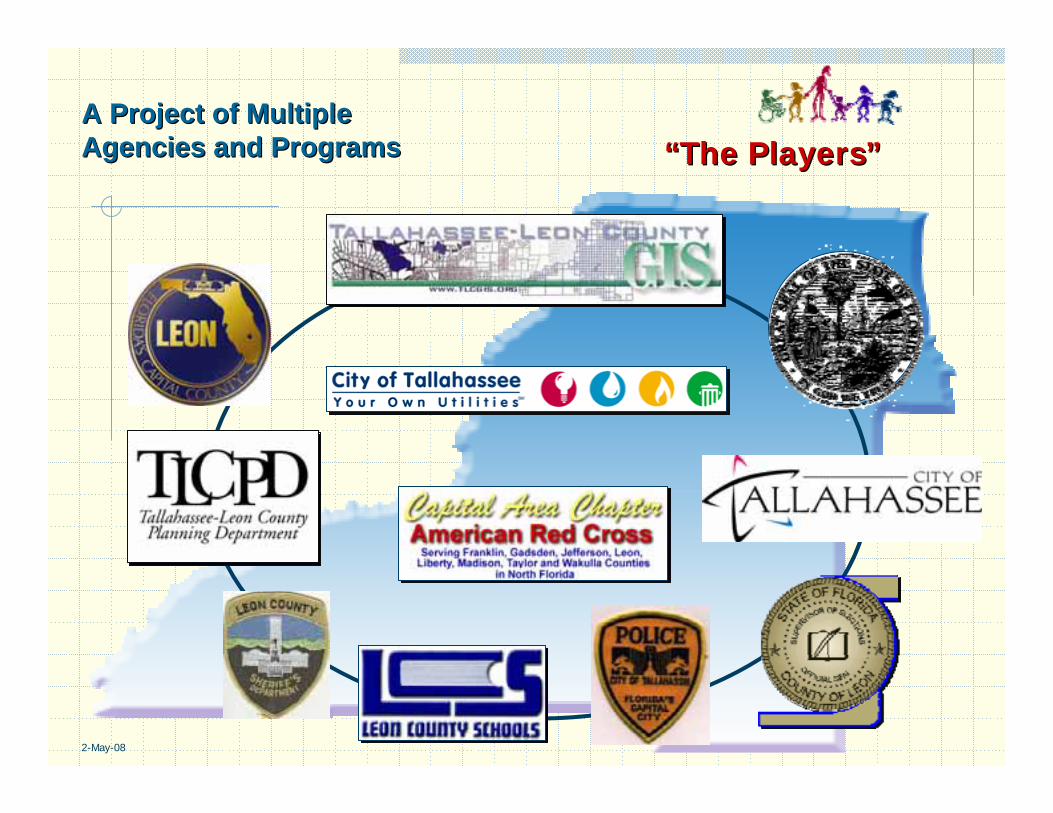
A Project of MultipleA Project of MultipleAgencies and ProgramsAgencies and Programs ““The PlayersThe Players””

2-May-08
Meeting the PlayersMeeting the Players
Leon County Emergency ManagementCity of Tallahassee Emergency ManagementSheriff’s OfficeTallahassee Police DepartmentTallahassee Fire DepartmentLeon County Public WorksCity of Tallahassee Public WorksFacilities ManagementEmergency Medical ServicesCity and County Information SystemsCity and County AdministrationCity Utilities (Gas, Water, Sewer and Electric)Leon County School BoardLeon County Animal Control

2-May-08
Developing the Action Plan for Developing the Action Plan for ImplementationImplementation
Steps:Steps: • Identify the process to be reviewed
• Identify all the players
• Discuss the process with the players
• Generate a conceptual plan
• Build infrastructure support
• Monitor and review the cycle
77
11
22 33 44
55 66
Partnerships based on a Partnerships based on a commitment to learn.commitment to learn.

2-May-08
Where to begin?Where to begin?Formalize the InformalFormalize the Informal
Dedicated Emergency Management staff along with public safety and local government professionals have provided outstanding service to the community for many years. They have a successful track record and they are the experts in delivering emergency management services.

2-May-08
Key StepsKey StepsIn May of 2005, Leon County Emergency Management called a meeting of all the participants of the Emergency Operations Center in order to provide an update of recent technology advancements.
TLC GIS, Red Cross and City Stormwater provided demonstrations of their various efforts in technology.
TLC GIS provided a “straw man” application which provided an improvised idea for interactive mapping (building on already proven efforts of support).
The TLC GIS Coordinator invited the group to comment on the application and what they thought should be the next steps.
A work group was created that includes users and technical support in order to identify and implement improvements. TLC GIS staff continue to support additional application development. It also continues to provide support during exercises.
Partnered with ESRI to develop application in ArcGIS Server.
Emergency Management staff inform TLC GIS, they have a seat at the table.

2-May-08
Emergency Operations Support Plan (Simple to Emergency Operations Support Plan (Simple to Complex, Use All the Tools)Complex, Use All the Tools)
Paper Maps Pre-defined Maps (Shelters and Evacuation Routes)Pre-set ArcMap Projects (Allows for zoom & print)
Mobile MapsTLC GIS Viewer (Map Objects & ArcEngine Versions, disconnected)
Browser-based Applications (ArcIMS & ArcGIS Server)The EOC Incident Mapper (ArcGIS Server)
Viewer VersionEditor Version
ArcIMS Sister Site
Future Product IntegrationOblique PhotographyPlume ModelingArcGIS Mobile Interface (Connected & Disconnected)

2-May-08
EOC Incident Tracker InfrastructureEOC Incident Tracker Infrastructure““Building the FoundationBuilding the Foundation””

2-May-08
PrePre--defined Mapsdefined Maps

2-May-08
PdfPdf MapsMaps
The working group provided input on the most common information or map requests. TLC GIS created Pdf’s and placed them on the ArcIMS site for easy access. This allows each agency to pre-determine needs prior to an event.

2-May-08

2-May-08
PrePre--set set ArcMapArcMap ProjectsProjects

2-May-08
ArcMapArcMap PrePre--set Projectset Project

2-May-08
TLC GIS ViewerTLC GIS Viewer
Currently, the TLC GIS Viewer is being used by over 550 individualswithin the Interlocal. They include; Leon County Sheriff’s Office, City of Tallahassee Police Department, City and CountyGrowth Managements and the Property Appraiser’s Office..

2-May-08
Mobile MapsMobile Maps
2-May-08
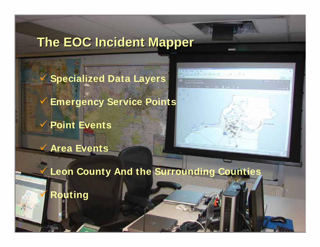
Specialized Data Layers
Emergency Service Points
Point Events
Area Events
Leon County And the Surrounding Counties
Routing
The EOC Incident The EOC Incident MapperMapper

2-May-08
Specialized Data LayersSpecialized Data Layers
Local Nuisance Flood AreasFEMA Flood ZonesStorm Surge CategoriesHazardous Materials & Radius ZonesPopulation DensityCritical FacilitiesEvacuation RoutesSpecial Needs CitizensLeon County Basemap

2-May-08
Hazardous MaterialsHazardous Materials

2-May-08
Emergency Service PointsEmergency Service Points
Red Cross SheltersSupply Distribution Points Sandbag Distribution LocationsEmergency Crew Zones
Staging LocationsFeeding LocationsRefueling LocationsDebris Collection Sites
Status Changes: Open, Closed and Standby

2-May-08
Emergency Service PointsEmergency Service Points
The emergency service points are those facilities or service locations which just need their status defined to convey the desired information for general consumption.

2-May-08
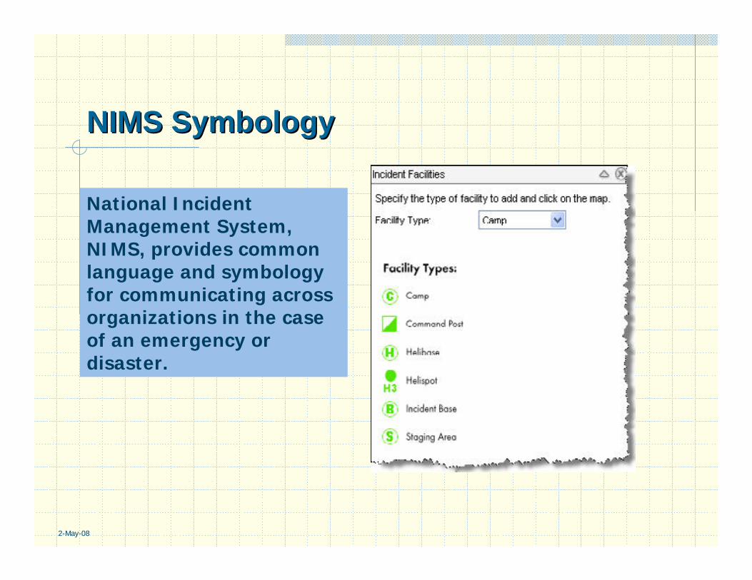
Point EventsPoint EventsA Point Event would equate to a fire, a hazardous
chemical spill or a confined event to a specific location.
National Incident Management System, NIMS, Training which has recently been required for counties within the state. One central element to the training is the normalization of communications. NIMS symbologyis central to the Point Events.

2-May-08
NIMS NIMS SymbologySymbology
Using aerial photography, a Incident Command Post, Staging Areas, Incident Base, Camps or heliport can be quickly located from the EOC or from any PC or laptop which has the aerial photography.
This type of interface allows a daylight perspective even at night (future application improvements to include oblique photography).
2-May-08
NIMS NIMS SymbologySymbology
National Incident Management System, NIMS, provides common language and symbologyfor communicating across organizations in the case of an emergency or disaster.

2-May-08
Area EventsArea EventsAn area event includes both man-induced and natural disasters which impact a non-site specific location or multiple locations across a region.
ArcGIS Server provides an application that easily adapts from a point event to an area event with multiple incidents. It overcomes the primary issue for tracking multiple incidents during a disaster. A real time multiple editor environment.
2-May-08
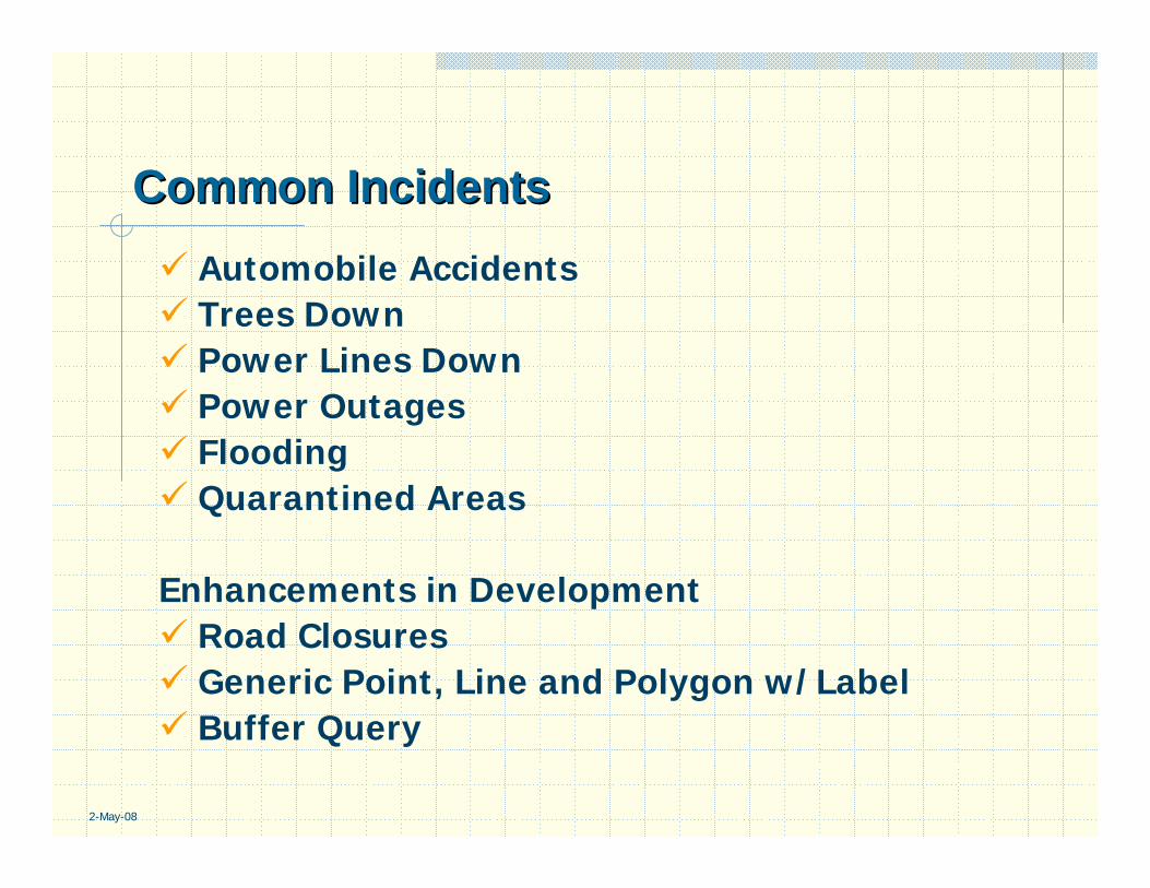
Common IncidentsCommon IncidentsAutomobile AccidentsTrees DownPower Lines DownPower OutagesFloodingQuarantined Areas
Enhancements in DevelopmentRoad ClosuresGeneric Point, Line and Polygon w/LabelBuffer Query

2-May-08
Point IncidentsPoint Incidents

2-May-08
Incident AttributesIncident Attributes
The common incidents carry statuses of open, closed or assigned. These are date-stamped for future reporting efforts.
As incidents are opened, editors identify whether they are impeding traffic. This allows for public safety officials to bypass areas where roads are blocked (future application improvements will incorporate automated routing).
2-May-08
GIS & GIS & ArcGISArcGIS ServerServer
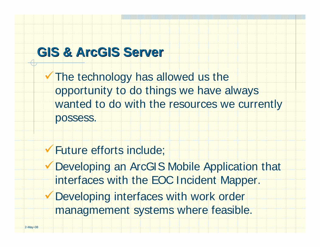
The technology has allowed us the opportunity to do things we have always wanted to do with the resources we currently possess.
Future efforts include;Developing an ArcGIS Mobile Application that interfaces with the EOC Incident Mapper.Developing interfaces with work order managmement systems where feasible.
2-May-08
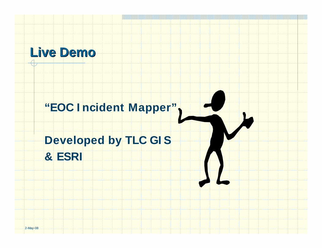
“EOC Incident Mapper”
Developed by TLC GIS & ESRI
Live DemoLive Demo

QuestionsQuestions
Thank YouThank You