The Convair 580 SAR Facility – Recent Activities and Future ...workshop...Convair 580 SAR...
17
The Convair 580 SAR Facility – Recent Activities and Future Opportunities Dr. Carl E. Brown Emergencies Science and Technology Section Environment Canada Ottawa, Ontario
Transcript of The Convair 580 SAR Facility – Recent Activities and Future ...workshop...Convair 580 SAR...

The Convair 580 SAR Facility – Recent Activities and Future Opportunities
Dr. Carl E. BrownEmergencies Science and Technology SectionEnvironment CanadaOttawa, Ontario

Sub-orbital Platforms and Nanosatellites Workshop – Page 2 – April 14-16, 2010
ESTS Airborne Remote Sensing
• DC-3, C-GRSB– Oil spill remote sensor R&D– Operational emergency and
oil spill response
• Convair 580, C-GRSC– Available for rapid response, all weather oil spill mapping– Advanced SAR data collection flights for federal departments
and agencies - VNR

Sub-orbital Platforms and Nanosatellites Workshop – Page 3 – April 14-16, 2010
Convair 580 SAR Facility
• EC took over operation of the CV-580 in November 1996 from CCRS/NRCan
• Objectives– Retain advanced SAR facility capability for federal government – Operational all-weather oil spill response capability
• Initially operating under commercial and private state operating certificates

Sub-orbital Platforms and Nanosatellites Workshop – Page 4 – April 14-16, 2010
C-GRSC

Sub-orbital Platforms and Nanosatellites Workshop – Page 5 – April 14-16, 2010
CV 580 SAR System
• Advanced airborne SAR system– C- and X-band systems– 6 m resolution– Variable viewing geometry
(nadir, narrow, wide)• C-band full polarimetric capabilities
HH, HV, VH, VV polarizations• C-band interferometric modes (InSAR)
– Along-track– Across-track
Image courtesy Doug Percy

Sub-orbital Platforms and Nanosatellites Workshop – Page 6 – April 14-16, 2010
SAR Transmitters/Receivers

Sub-orbital Platforms and Nanosatellites Workshop – Page 7 – April 14-16, 2010
SAR Data Products
• Real-time and post-flight data streams• Real-time
– Imagery recorded onto hard disk and 8 mm digital tapes, VHS video tape, imagery available on CD in common formats (e.g. tif, jpg), also 64-level grayscale hardcopy
Image courtesy DRDC-O

Sub-orbital Platforms and Nanosatellites Workshop – Page 8 – April 14-16, 2010
SAR Data Products
• Signal data - Post-flight data processing– Recorded on digital video tape (helical scan)– Transcribed onto 8 mm tapes for processing– Processing at DRDC-O (includes geometric and radiometric
calibration)
• Now recorded directly onto hard disk to enhance reliability and avoid need for timely transcription process
– Recent development courtesy DRDC-O – (Dr. Chuck Livingstone)
Sub-orbital Platforms and Nanosatellites Workshop – Page 9 – April 14-16, 2010
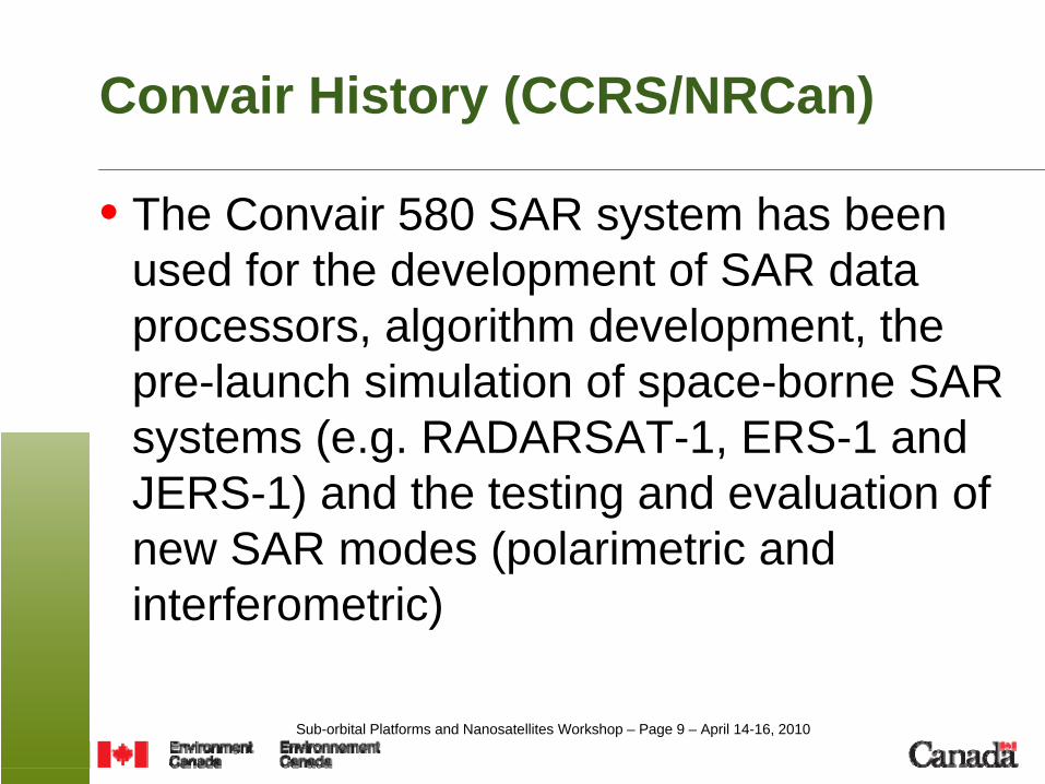
Convair History (CCRS/NRCan)
• The Convair 580 SAR system has been used for the development of SAR data processors, algorithm development, the pre-launch simulation of space-borne SAR systems (e.g. RADARSAT-1, ERS-1 and JERS-1) and the testing and evaluation of new SAR modes (polarimetric and interferometric)

Sub-orbital Platforms and Nanosatellites Workshop – Page 10 – April 14-16, 2010
Environment Canada Convair 580 - RADARSAT-2• Canadian Space Agency undertook a flight program with
the Convair-580 SAR in the early 2000s to help the SAR user community prepare for the advanced features of RADARSAT-2
– Enhanced polarization capabilities– including like-polarization, cross-polarization, dual-polarization,
and in the polarimetric mode (HH + VV +HV +VH)
– GMTI/MODEX• Data collection flights over a variety of targets to
simulate RADARSAT-2 data• Provided data sets and polarimetric software to user
community
Sub-orbital Platforms and Nanosatellites Workshop – Page 11 – April 14-16, 2010
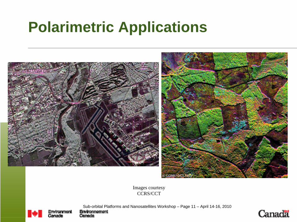
Polarimetric Applications
Images courtesy CCRS/CCT

Sub-orbital Platforms and Nanosatellites Workshop – Page 12 – April 14-16, 2010
CV 580 – Late 1990s & Early 2000s
Clients• CSA• CCRS• DREO / DRDC-O• TSB• EC-MSC (Canadian Ice Service)• AgCan• GSC
SAR Modes• Polarimetric, InSAR / GMTI, Bistatic, X/C 4-channel, C 2-
channel Envisat simulation, RADARSAT-2 simulation
Images courtesy CCRS/CCT

Sub-orbital Platforms and Nanosatellites Workshop – Page 13 – April 14-16, 2010
Environment Canada – Late 2000s
• DND AIMP Radar Development and Testing Program• Replacement for Aurora Search and Rescue Radars• Economical alternative
– Use existing SAR pedestal to mount new AIMP radar
– Construct new larger radome
– Flight testing and certification of radome
– Numerous flights in Ottawa area & Maritimes
– Advanced SAR modes

Sub-orbital Platforms and Nanosatellites Workshop – Page 14 – April 14-16, 2010
Late 2000s – DRDC-O
• DRDC-O Dr. Chuck Livingstone• C-band fully polarimetric SAR• Flights in Ottawa area and 3 week acquisition program
on west coast, based out of Victoria, BC – Under-flights of RADARSAT-2– GMTI mode– Testing of new solid-state data recording system
• 2nd maritime flight program, east coast

Sub-orbital Platforms and Nanosatellites Workshop – Page 15 – April 14-16, 2010
Current and Future Opportunities
• DRDC-O flight program (Chuck Livingstone) late summer early fall 2010
The Future?
• Other SAR or Electro-Optical sensor testing?• Satellite sensor validation flights?

Sub-orbital Platforms and Nanosatellites Workshop – Page 16 – April 14-16, 2010
Thanks!! Convair Support
• Aircraft Flight Operations, Maintenance– Bryan Healey, Bill Chevrier, Doc O’Connor,
Theo van Westerop, Iain Bogie, John Mintha• Flight Planning/Project Coordination
– Bill Bayer, Bryan Healey, Bill Chevrier• Operational Support
– Lloyd Gamble, Dave Roy, Ina Henry• Scientific Support
– Bob Hawkins, Chuck Livingstone, Kevin Murnaghan, Paul Daleman …• Operators/Sensor Maintenance
– Reid Whetter, Doug Percy, Richard Marois• Partners
– CSA Daniel Delisle– DRDC-O, CCRS, RSI, EC/CIS, DND/AIMP, NRC/IAR

Sub-orbital Platforms and Nanosatellites Workshop – Page 17 – April 14-16, 2010
Questions?


![[XLS] · Web view580 580 580 580 580 580 580 580 580 580 580 580 580 580 580 580 580 580 580 580 580 580 580 580 580 580 580 580 580 580 580 580 580 580 580 580 580 580 580 580 580](https://static.fdocuments.net/doc/165x107/5ba1448d09d3f2666b8bff1c/xls-web-view580-580-580-580-580-580-580-580-580-580-580-580-580-580-580-580.jpg)