Tectonic Geomorphology of the Sagaing fault · Tectonic Geomorphology of the Sagaing fault Hla Hla...
23
Tectonic Geomorphology of the Sagaing fault Hla Hla Aung Senior Researcher Former Lecturer in Geology Myanmar Earthquake Committee Geology Department Myanmar Engineering Society University of Yangon
Transcript of Tectonic Geomorphology of the Sagaing fault · Tectonic Geomorphology of the Sagaing fault Hla Hla...
Tectonic Geomorphology of the Sagaing fault
Hla Hla Aung Senior Researcher Former Lecturer in Geology Myanmar Earthquake Committee Geology Department Myanmar Engineering Society University of Yangon
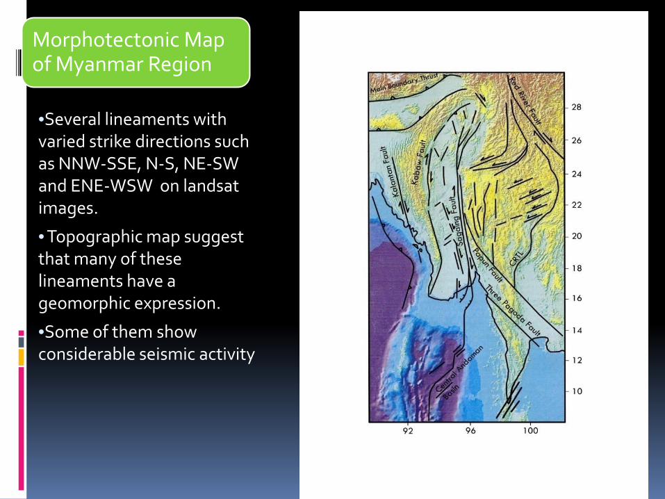
Morphotectonic Map of Myanmar Region
•Several lineaments with varied strike directions such as NNW-SSE, N-S, NE-SW and ENE-WSW on landsat images.
• Topographic map suggest that many of these lineaments have a geomorphic expression.
•Some of them show considerable seismic activity
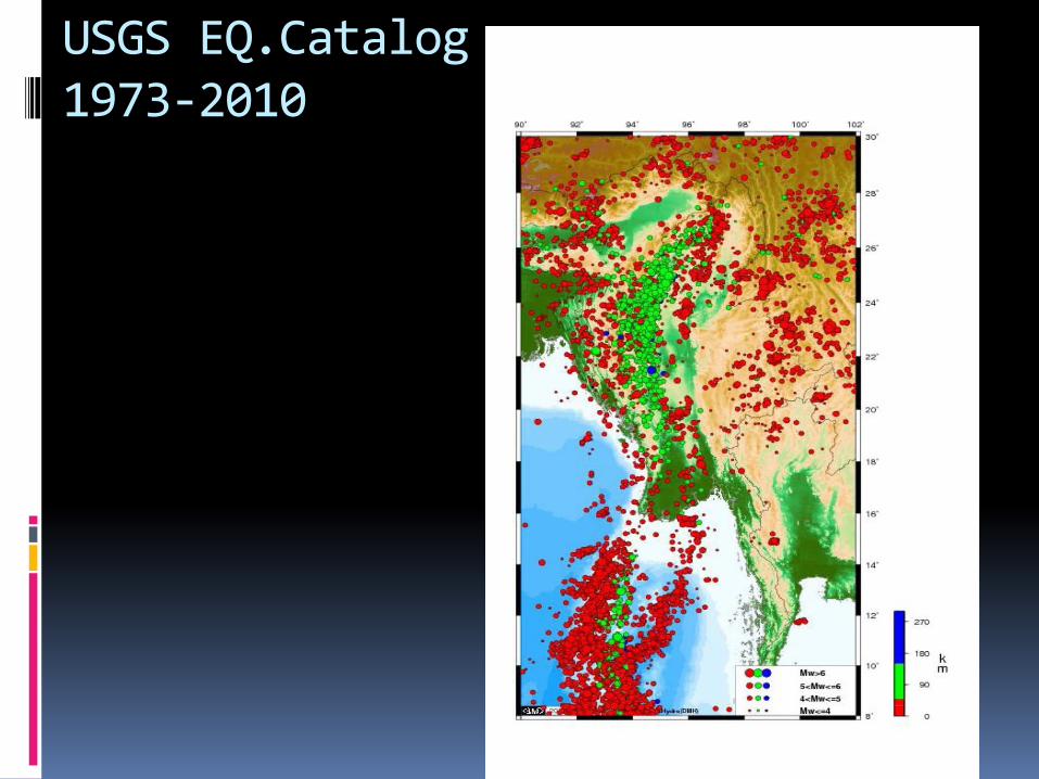
USGS EQ.Catalog 1973-2010
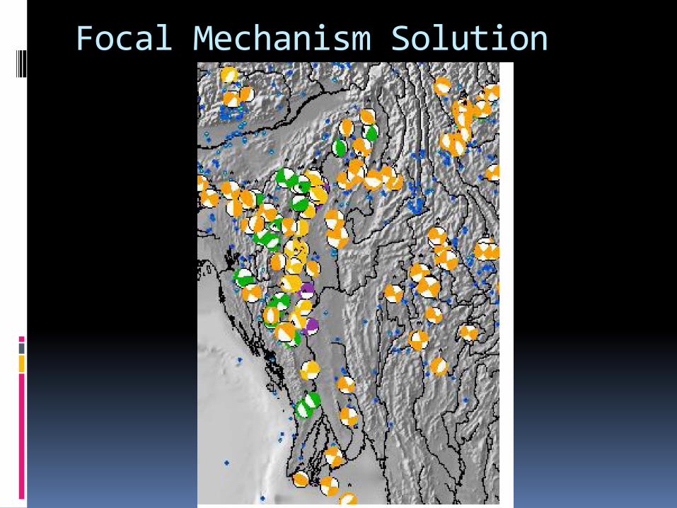
Focal Mechanism Solution
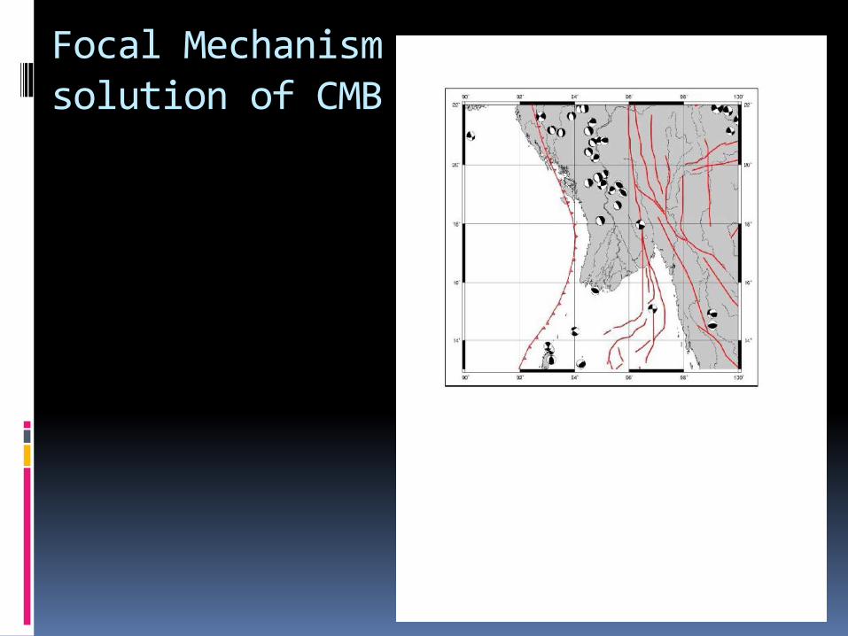
Focal Mechanism solution of CMB
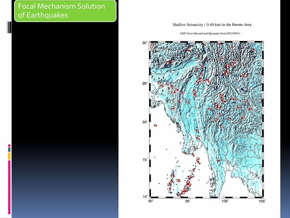
Focal Mechanism Solution of Earthquakes
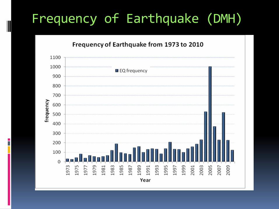
Frequency of Earthquake (DMH)
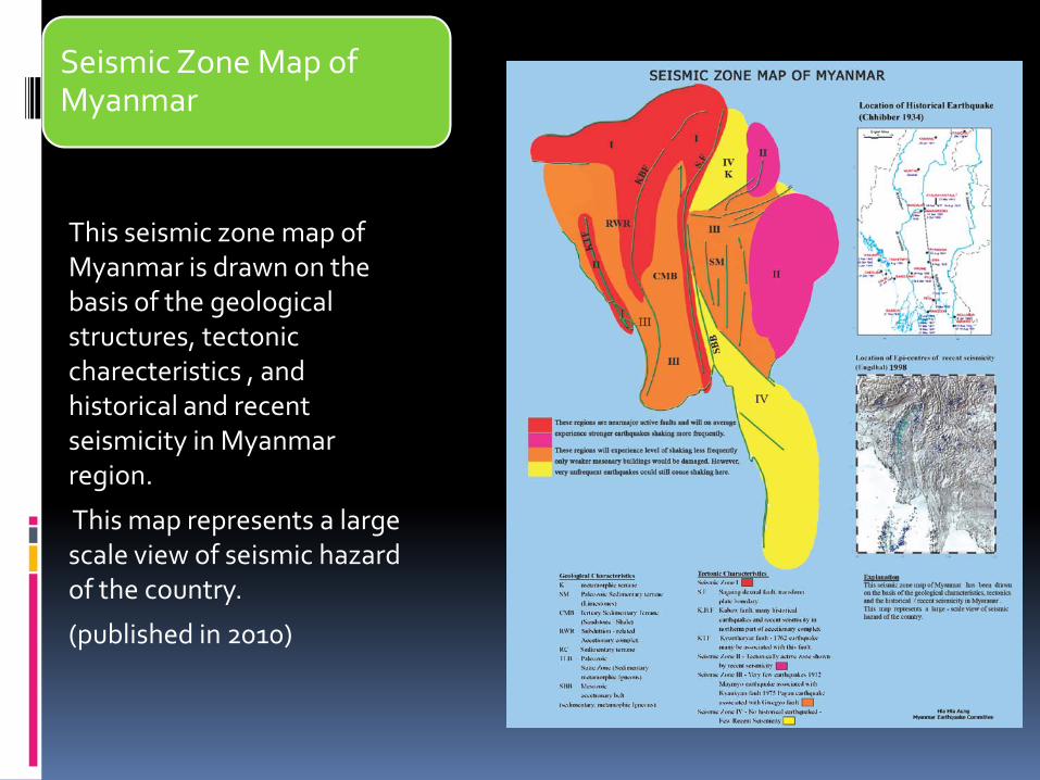
Seismic Zone Map of Myanmar
This seismic zone map of Myanmar is drawn on the basis of the geological structures, tectonic charecteristics , and historical and recent seismicity in Myanmar region.
This map represents a large scale view of seismic hazard of the country.
(published in 2010)
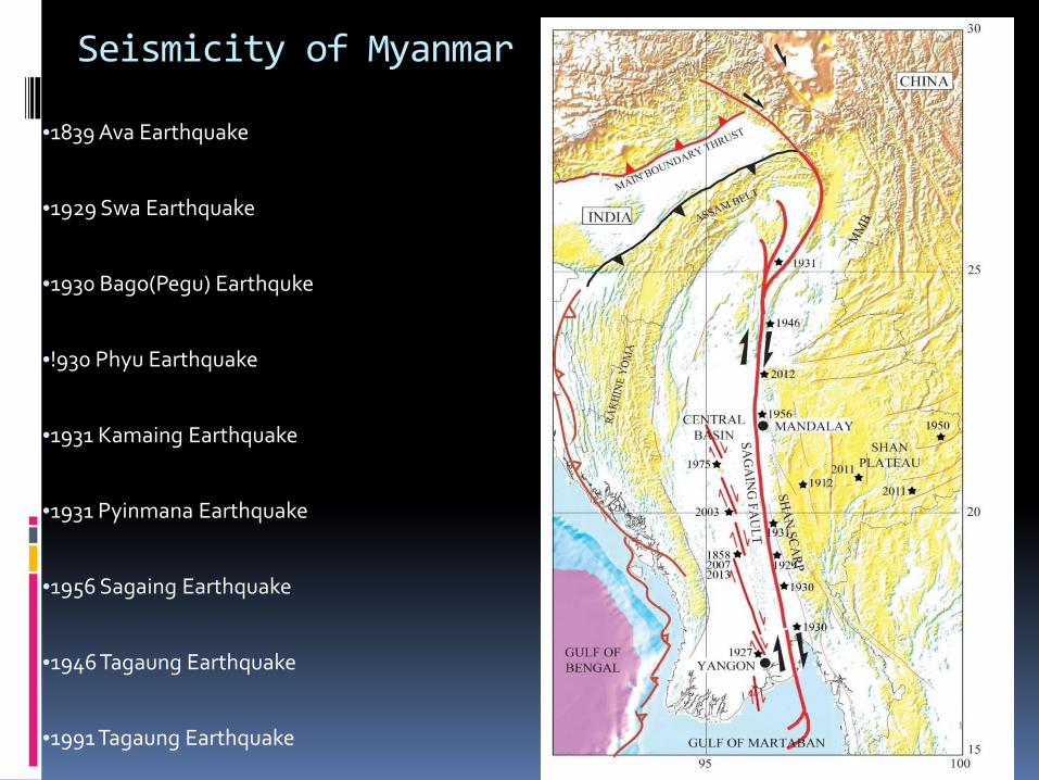
Seismicity of Myanmar
•1839 Ava Earthquake
•1929 Swa Earthquake
•1930 Bago(Pegu) Earthquke
•!930 Phyu Earthquake
•1931 Kamaing Earthquake
•1931 Pyinmana Earthquake
•1956 Sagaing Earthquake
•1946 Tagaung Earthquake
•1991 Tagaung Earthquake
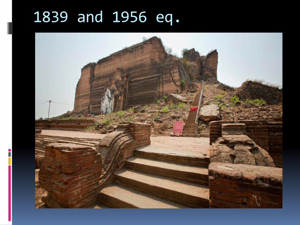
1839 and 1956 eq.
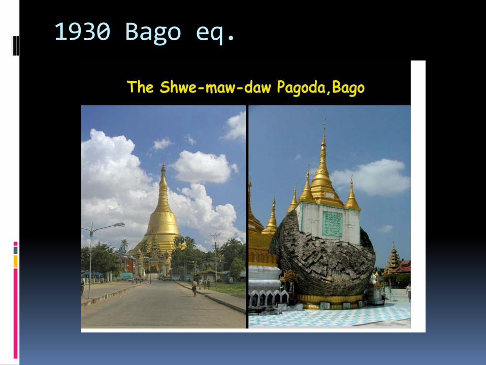
1930 Bago eq.
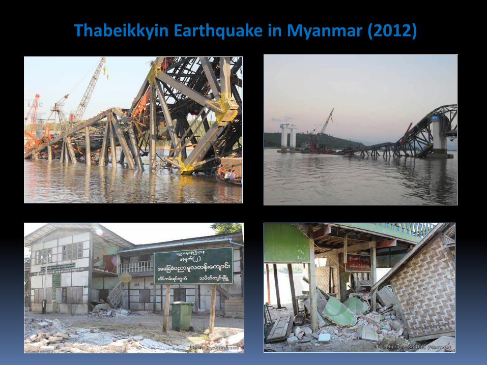
Thabeikkyin Earthquake in Myanmar (2012)
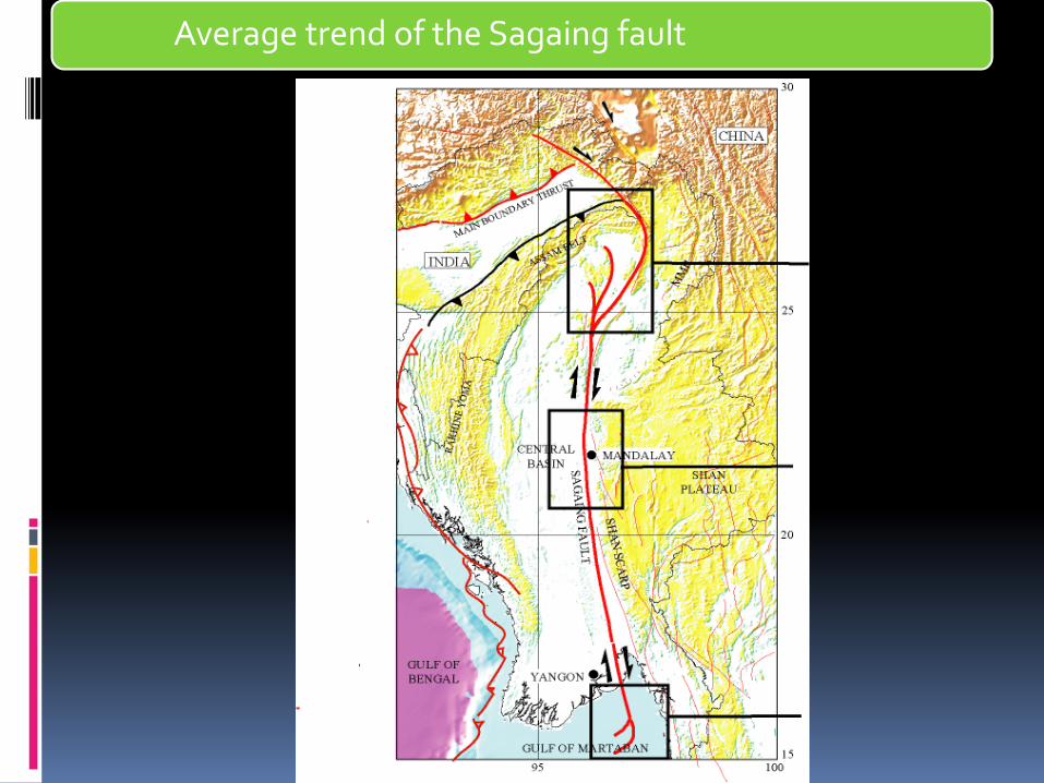
Average trend of the Sagaing fault

Fault geometry of the Sagaing fault
Fault longitude-96° 30E to 96° 08E to 96° 43E
Relatively more westerly in the south-N-S in the central – then easterly in the north
Average fault trend- N 9° W
Depth-96km
Velocity-18-25mm/yr
Spreading in CAB- N29° W at a rate of 30mm/yr
NW-SE oriented spreading and drifting of Burma plate along ridge segments in Gulf of Mottama
Southern end of Sagaing Fault is northernmost of these oceanic transforms
Offset-150km
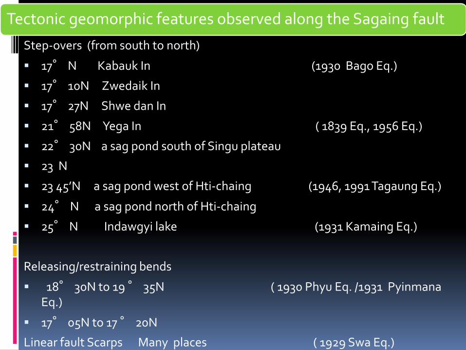
Tectonic geomorphic features observed along the Sagaing fault
Step-overs (from south to north)
17° N Kabauk In (1930 Bago Eq.)
17° 10N Zwedaik In
17° 27N Shwe dan In
21° 58N Yega In ( 1839 Eq., 1956 Eq.)
22° 30N a sag pond south of Singu plateau
23 N
23 45’N a sag pond west of Hti-chaing (1946, 1991 Tagaung Eq.)
24° N a sag pond north of Hti-chaing
25° N Indawgyi lake (1931 Kamaing Eq.)
Releasing/restraining bends
18° 30N to 19 ° 35N ( 1930 Phyu Eq. /1931 Pyinmana Eq.)
17° 05N to 17 ° 20N
Linear fault Scarps Many places ( 1929 Swa Eq.)
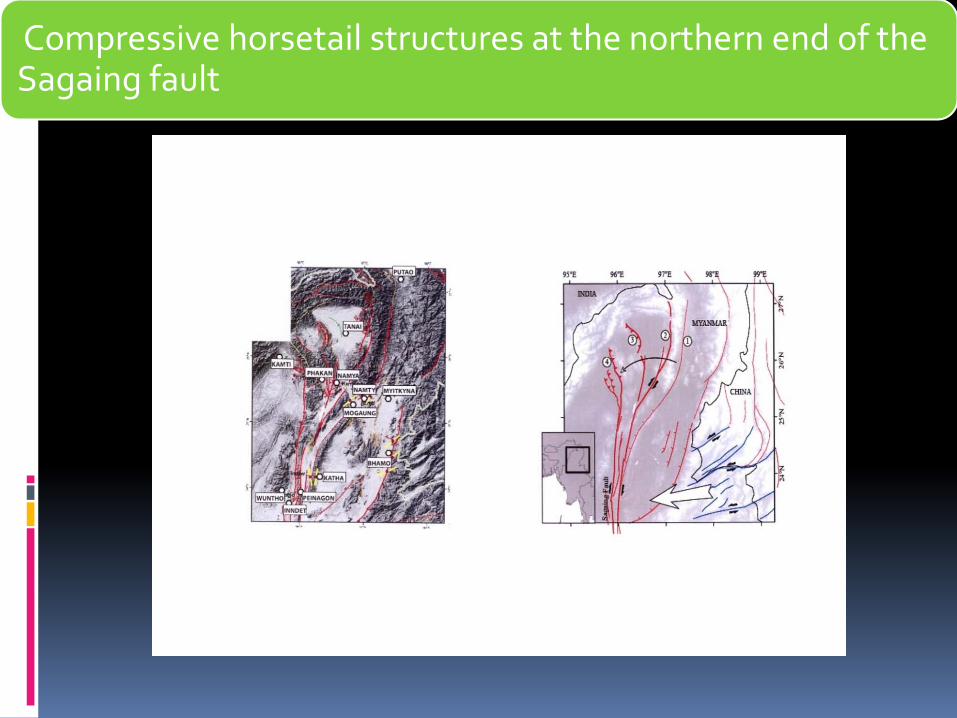
Compressive horsetail structures at the northern end of the Sagaing fault
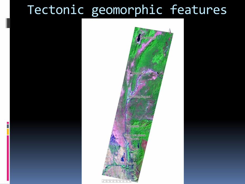
Tectonic geomorphic features
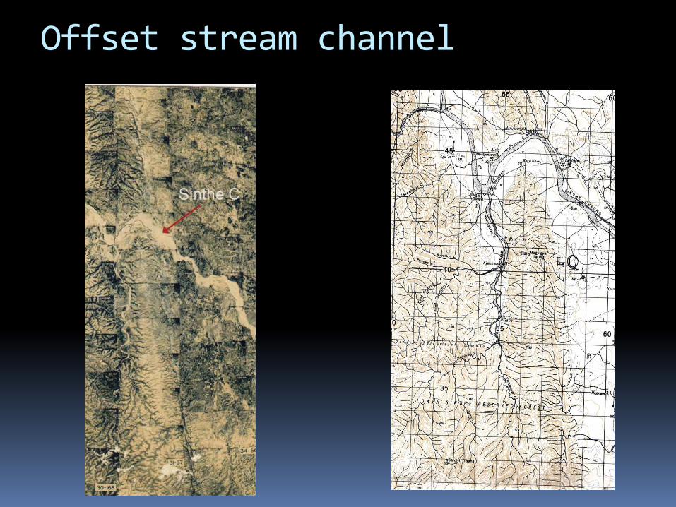
Offset stream channel
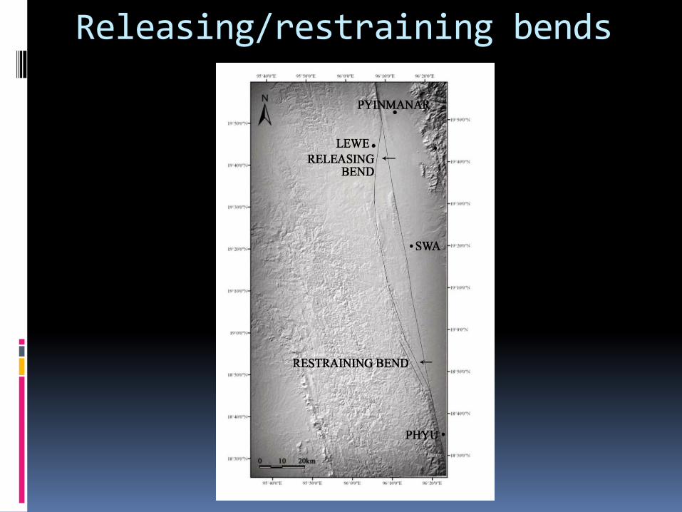
Releasing/restraining bends

90 m digital elevation model
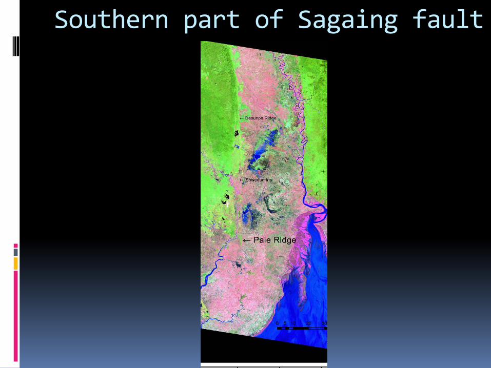
Southern part of Sagaing fault

Extensional Horsetail structures at the southern end of the fault in the Mottama Gulf
From Nyaunglebin-Bago latitude, the Sagaing fault branch into two main faults: WSF & ESF
WSF connects to CAB with a series of pull-apart basins offset by transform faults
WSF is active fault
(Source: GIAC Project)

Thank you all !