Technical Wetland Delineation
52
1 Technical Wetland Delineation
Transcript of Technical Wetland Delineation
1
Technical Wetland Delineation
Today’s Talk
2
• Wetland Definitions and Importance of Wetlands
• Overview of the Wetland Delineation Approach
• Vegetation Parameter
• Soils Parameter
• Hydrology Parameter
• Some Wetland Permits of the Past
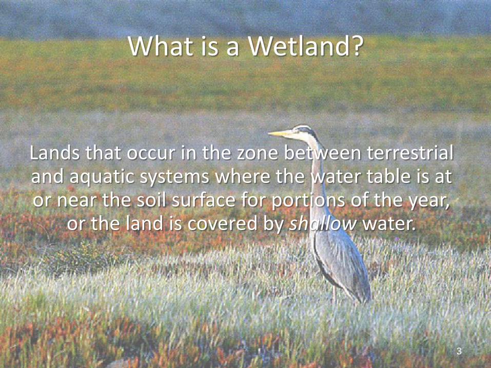
What is a Wetland?
Lands that occur in the zone between terrestrial and aquatic systems where the water table is at or near the soil surface for portions of the year,
or the land is covered by shallow water.
3
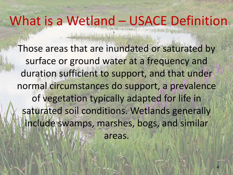
What is a Wetland – USACE Definition
Those areas that are inundated or saturated by surface or ground water at a frequency and
duration sufficient to support, and that under normal circumstances do support, a prevalence
of vegetation typically adapted for life in saturated soil conditions. Wetlands generally include swamps, marshes, bogs, and similar
areas.
4
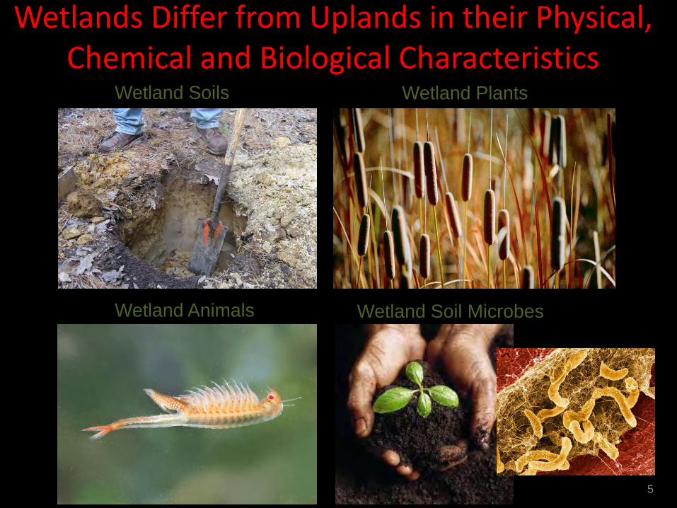
Wetlands Differ from Uplands in their Physical, Chemical and Biological Characteristics
5
Wetland Soils Wetland Plants
Wetland Animals Wetland Soil Microbes
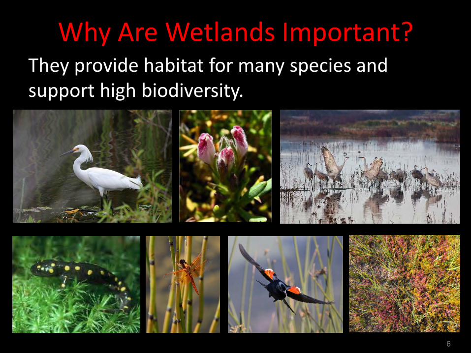
Why Are Wetlands Important? They provide habitat for many species and support high biodiversity.
6
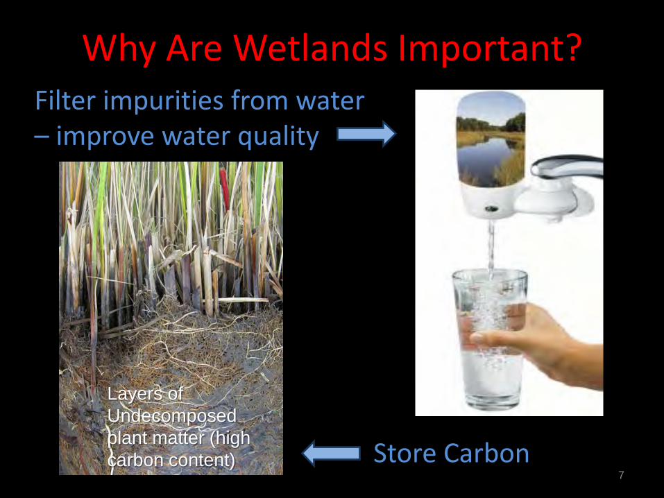
Why Are Wetlands Important? Filter impurities from water – improve water quality
7 Store Carbon
Layers of Undecomposed plant matter (high carbon content)
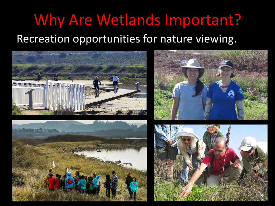
Why Are Wetlands Important? Recreation opportunities for nature viewing.
8
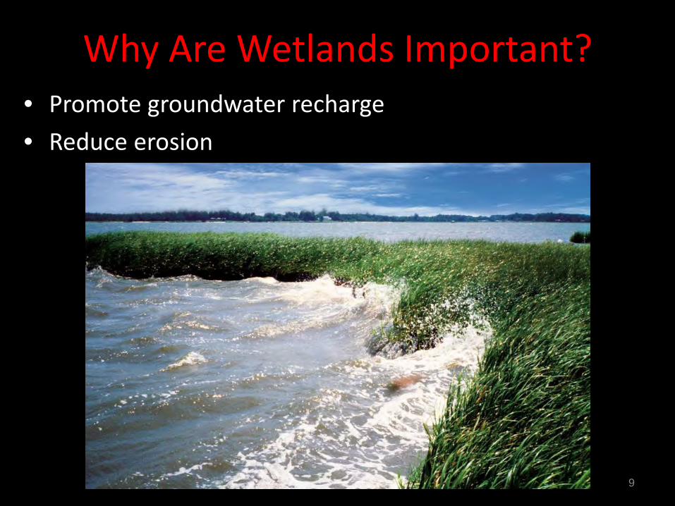
• Promote groundwater recharge • Reduce erosion
Why Are Wetlands Important?
9
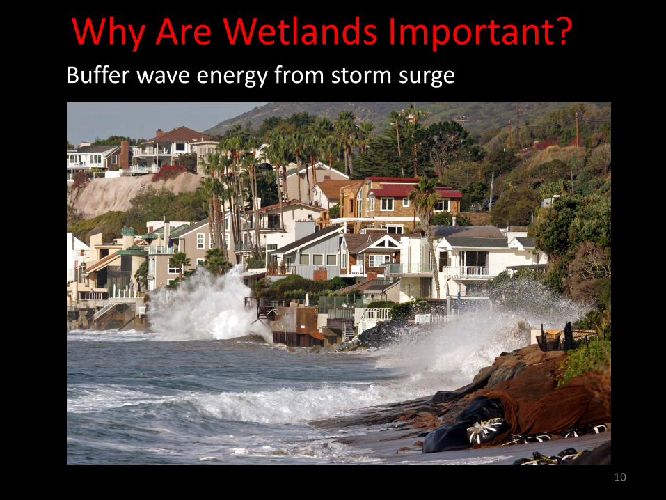
Buffer wave energy from storm surge
Why Are Wetlands Important?
10
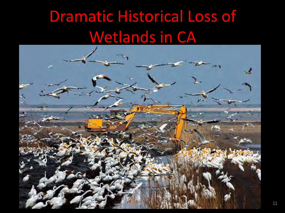
Dramatic Historical Loss of Wetlands in CA
11
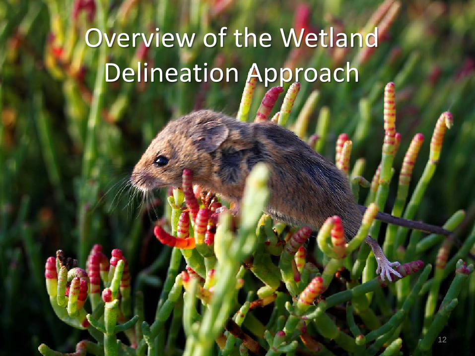
Overview of the Wetland Delineation Approach
12
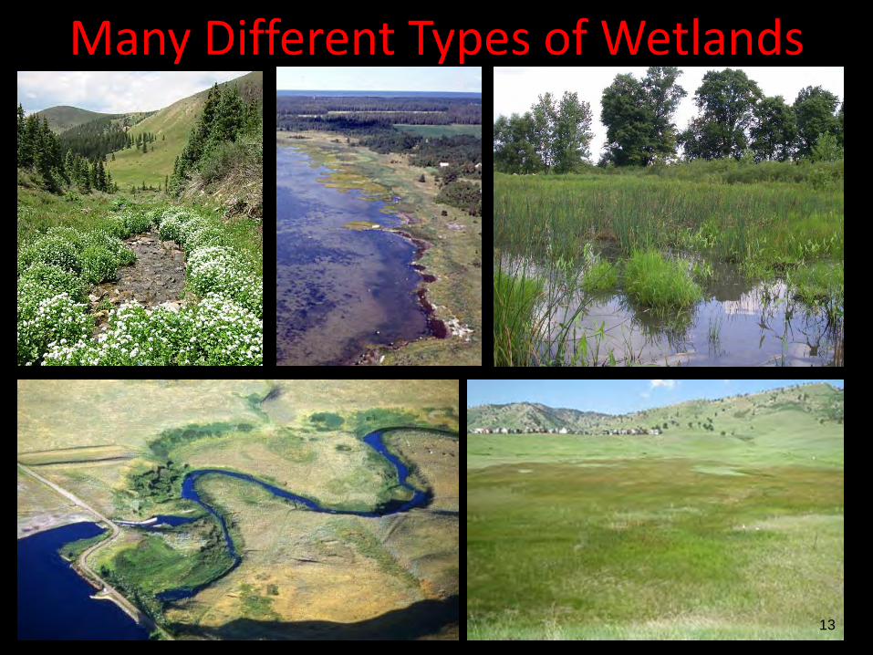
Many Different Types of Wetlands
13
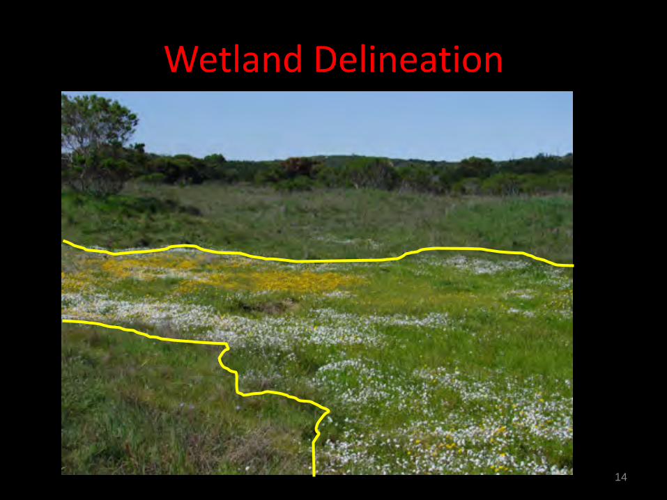
Wetland Delineation
14
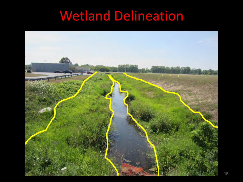
Wetland Delineation
15

Typical Delineation
16
Property Line
100’ Buffer
Local Pond
Proposed Development
17
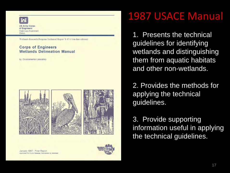
1987 USACE Manual 1. Presents the technical guidelines for identifying wetlands and distinguishing them from aquatic habitats and other non-wetlands.
2. Provides the methods for applying the technical guidelines. 3. Provide supporting information useful in applying the technical guidelines.
18
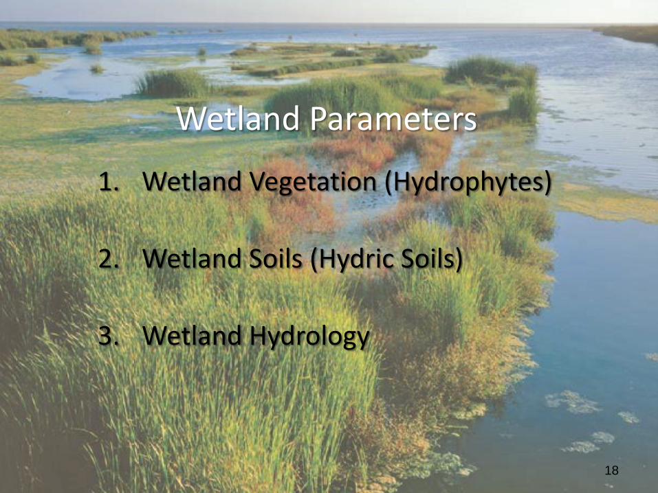
Wetland Parameters
1. Wetland Vegetation (Hydrophytes)
2. Wetland Soils (Hydric Soils)
3. Wetland Hydrology
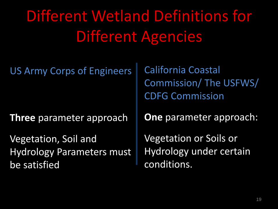
Different Wetland Definitions for Different Agencies
US Army Corps of Engineers Three parameter approach
Vegetation, Soil and Hydrology Parameters must be satisfied
California Coastal Commission/ The USFWS/ CDFG Commission
One parameter approach:
Vegetation or Soils or Hydrology under certain conditions.
19
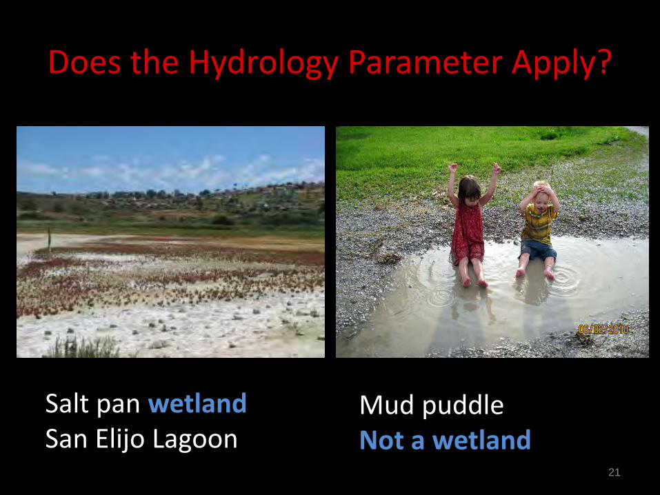
Does the Hydrology Parameter Apply?
21
Salt pan wetland San Elijo Lagoon
Mud puddle Not a wetland
22
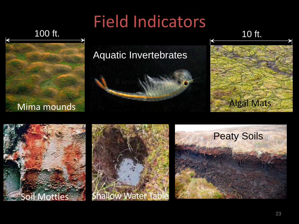
Field Indicators
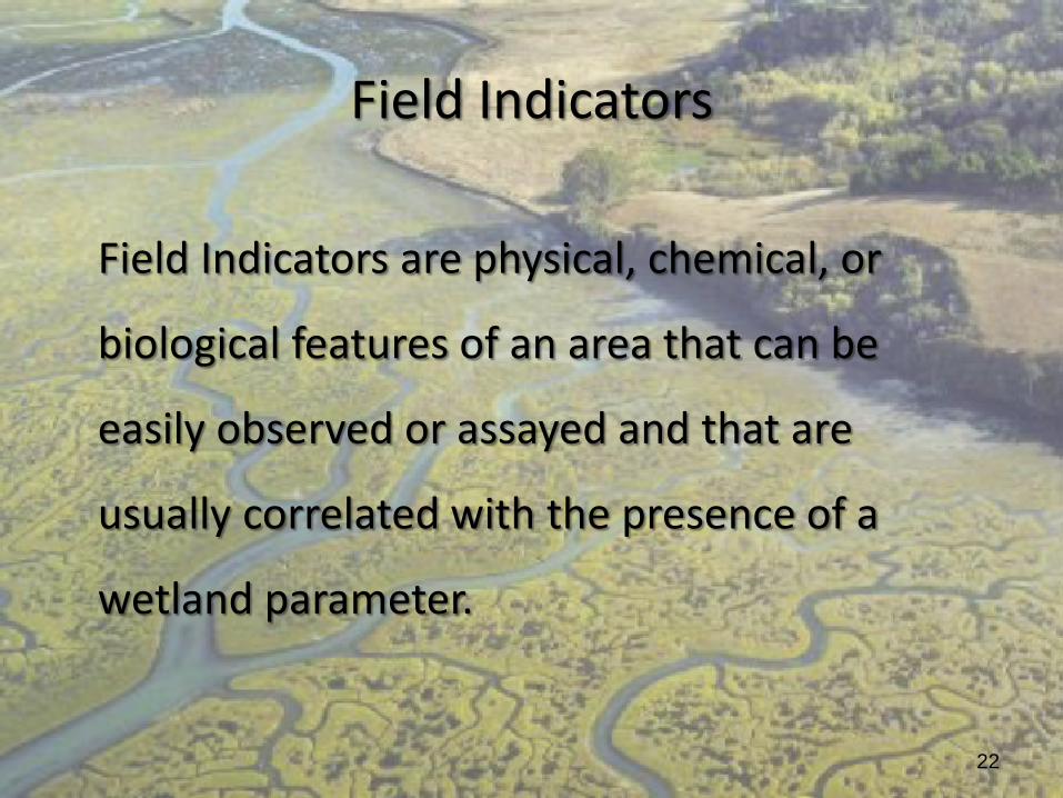
Field Indicators are physical, chemical, or
biological features of an area that can be
easily observed or assayed and that are
usually correlated with the presence of a
wetland parameter.
Field Indicators
23
Algal Mats
Aquatic Invertebrates
Peaty Soils
Mima mounds
Soil Mottles Shallow Water Table
100 ft. 10 ft.
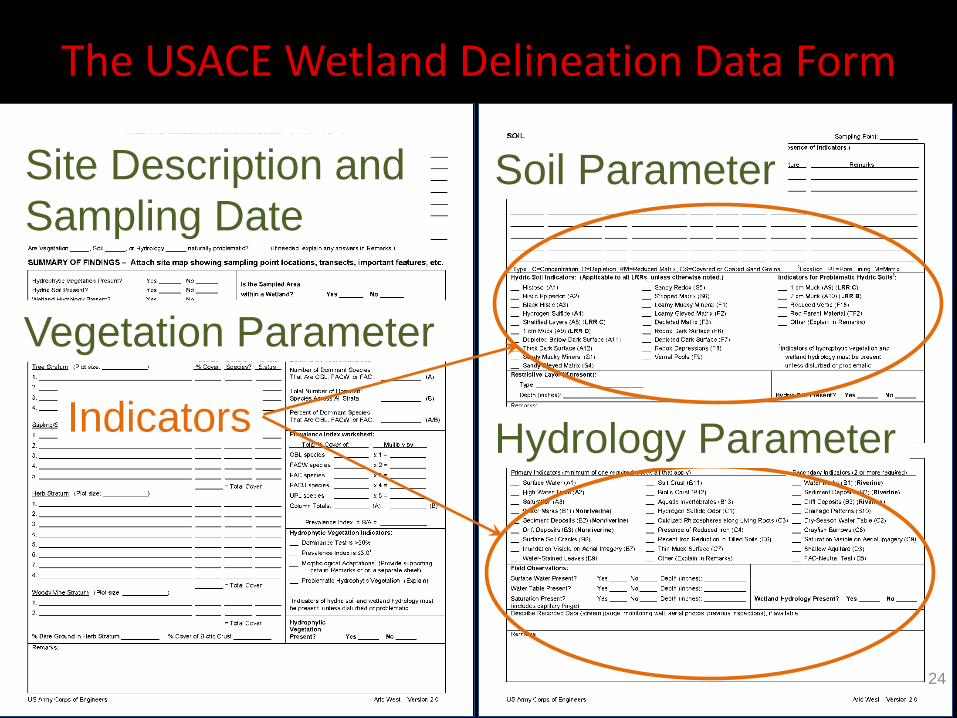
The USACE Wetland Delineation Data Form
Indicators Hydrology Parameter
Soil Parameter
Vegetation Parameter
Site Description and Sampling Date
24
25
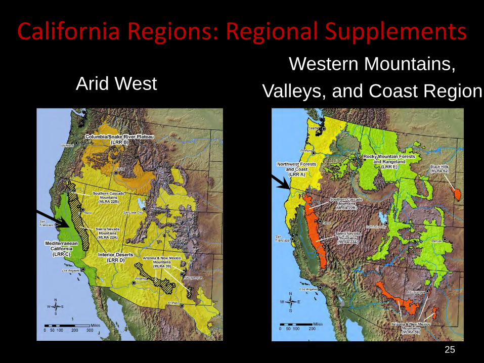
California Regions: Regional Supplements
Arid West Western Mountains,
Valleys, and Coast Region
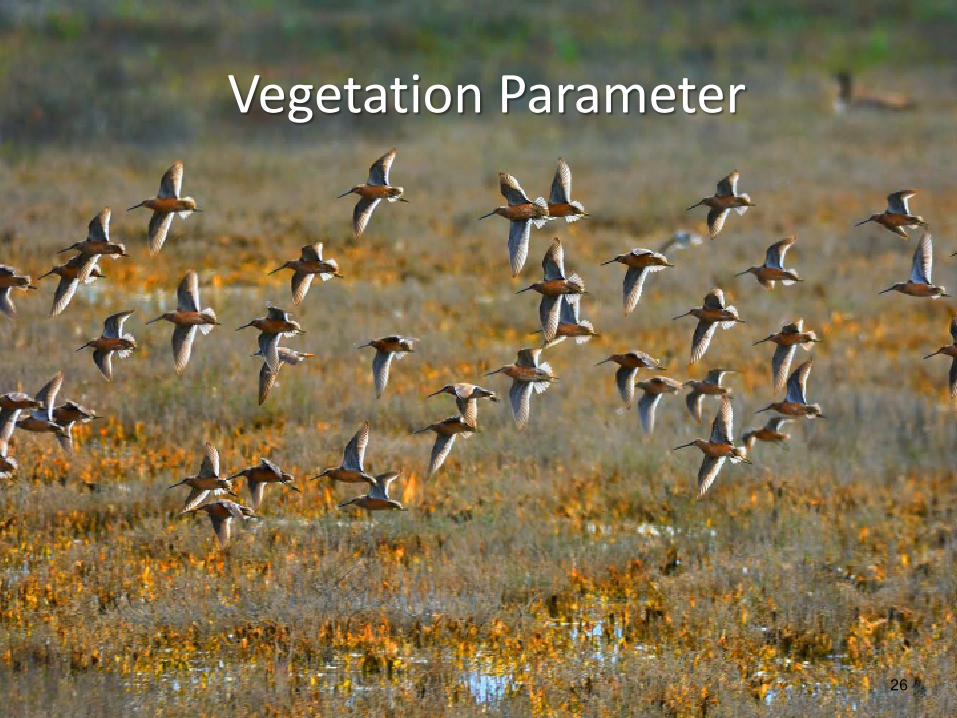
Vegetation Parameter
26
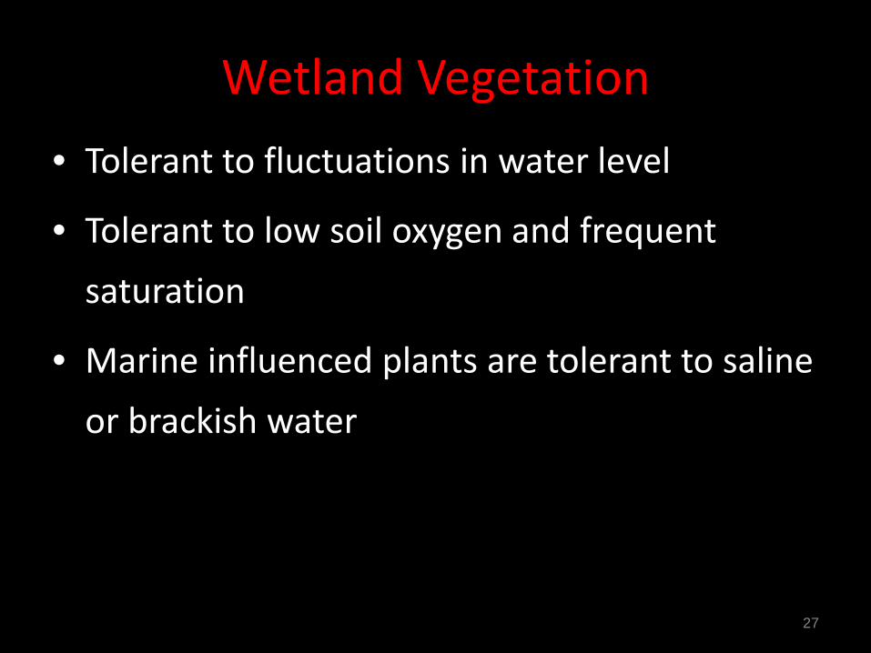
Wetland Vegetation • Tolerant to fluctuations in water level
• Tolerant to low soil oxygen and frequent saturation
• Marine influenced plants are tolerant to saline or brackish water
27
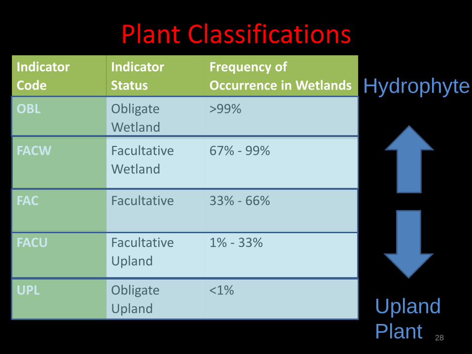
Plant Classifications
28
Indicator Code
Indicator Status
Frequency of Occurrence in Wetlands
OBL Obligate Wetland
>99%
FACW Facultative Wetland
67% - 99%
FAC Facultative 33% - 66%
FACU Facultative Upland
1% - 33%
UPL Obligate Upland
<1%
Hydrophyte
Upland Plant
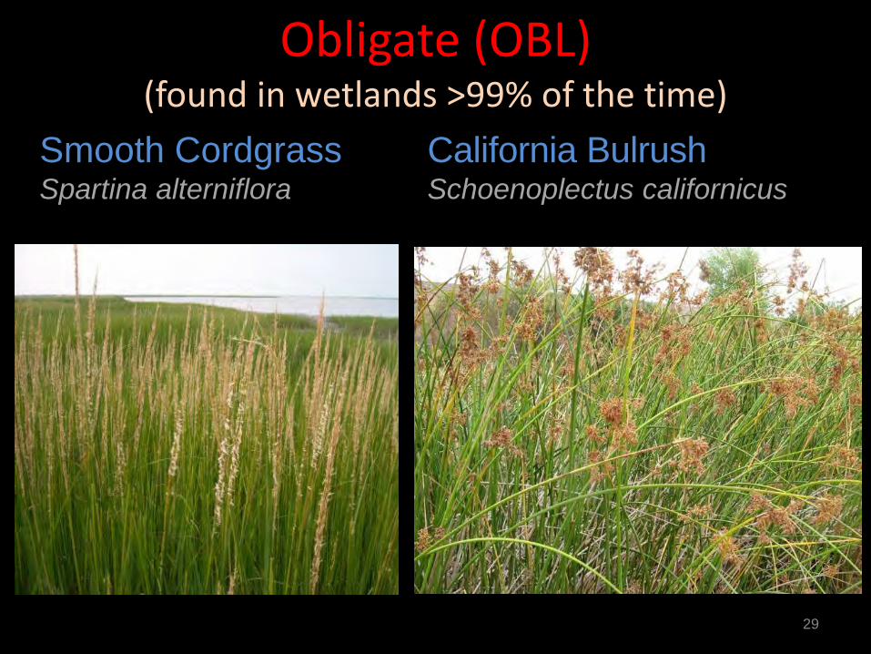
Obligate (OBL) (found in wetlands >99% of the time)
29
Smooth Cordgrass Spartina alterniflora
California Bulrush Schoenoplectus californicus
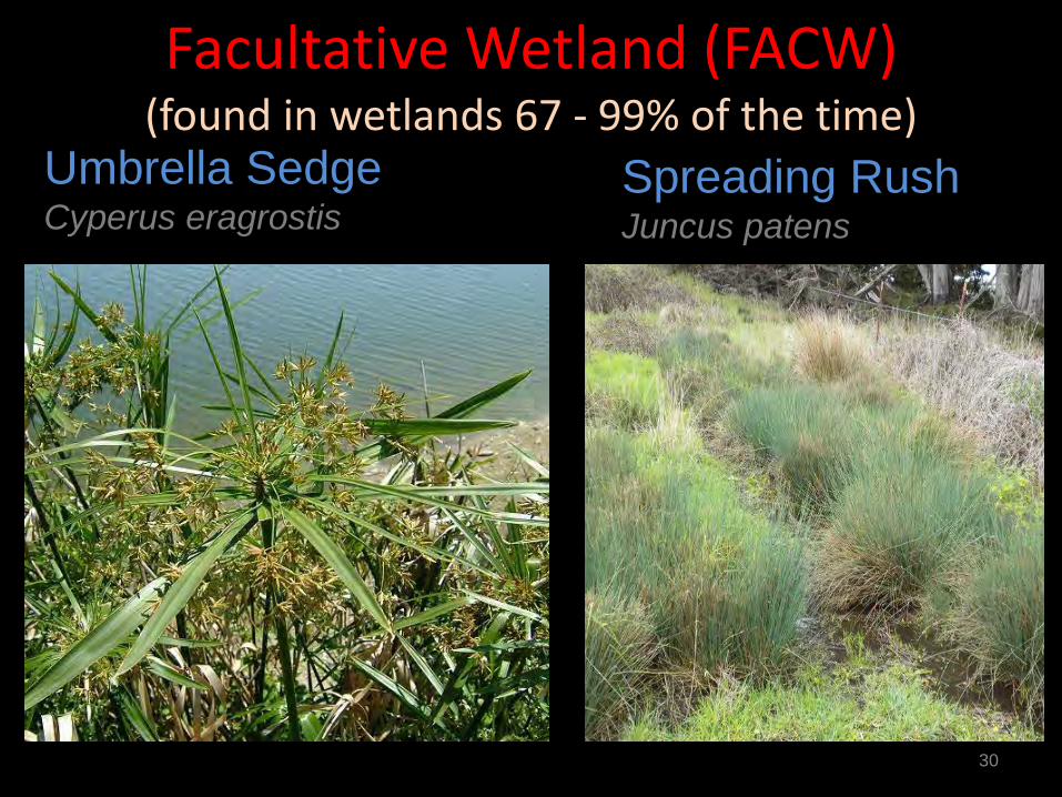
Facultative Wetland (FACW) (found in wetlands 67 - 99% of the time)
30
Umbrella Sedge Cyperus eragrostis
Spreading Rush Juncus patens

Facultative (FAC) (found in wetlands 33 - 67% of the time)
31
Fragile Sheath Sedge Carex fracta
Western Larkspur Delphinium hesperium
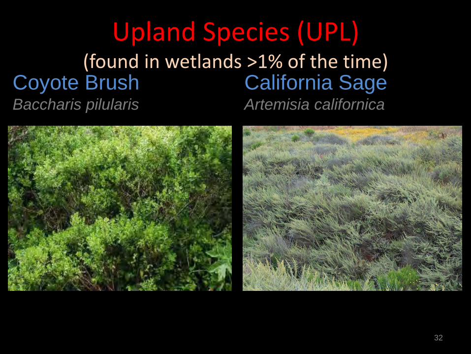
Upland Species (UPL) (found in wetlands >1% of the time)
32
Coyote Brush Baccharis pilularis
California Sage Artemisia californica
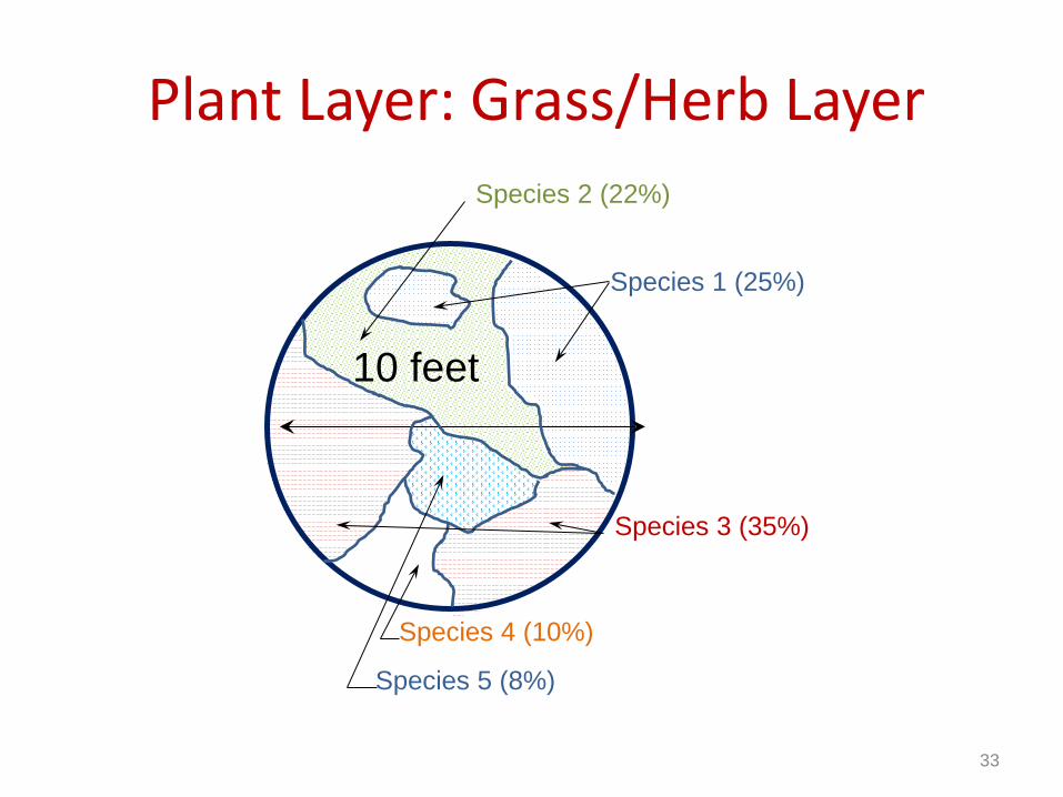
Plant Layer: Grass/Herb Layer
10 feet
Species 1 (25%)
Species 3 (35%)
Species 2 (22%)
Species 4 (10%)
Species 5 (8%)
33
34
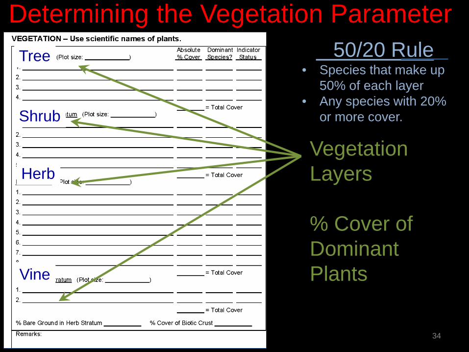
Determining the Vegetation Parameter
Vegetation Layers % Cover of Dominant Plants
50/20 Rule • Species that make up
50% of each layer • Any species with 20%
or more cover.
Tree
Shrub
Herb
Vine
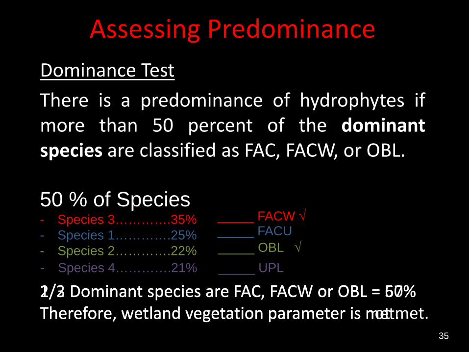
Assessing Predominance Dominance Test There is a predominance of hydrophytes if more than 50 percent of the dominant species are classified as FAC, FACW, or OBL.
35
50 % of Species - Species 3………….35% - Species 1………….25% - Species 2………….22%
2/3 Dominant species are FAC, FACW or OBL = 67% Therefore, wetland vegetation parameter is met.
_____ FACW √ _____ FACU _____ OBL √
- Species 4………….21% _____ UPL
1/2 Dominant species are FAC, FACW or OBL = 50% Therefore, wetland vegetation parameter is not met.
Soil Parameter Identifying Hydric Soils
36
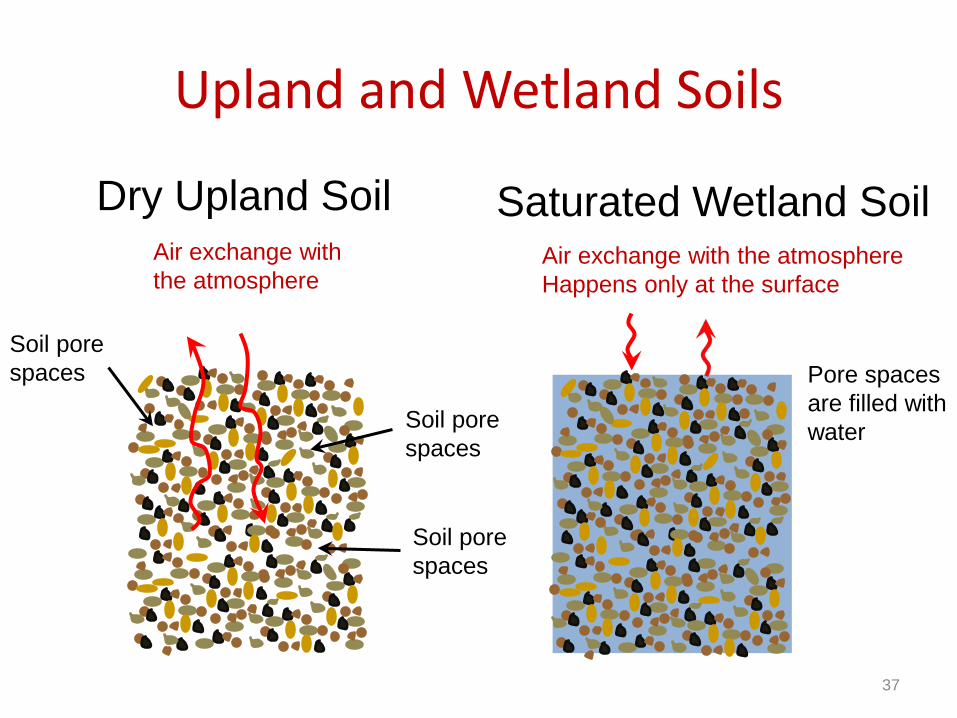
Upland and Wetland Soils
37
Soil pore spaces
Soil pore spaces
Soil pore spaces
Air exchange with the atmosphere
Dry Upland Soil Saturated Wetland Soil
Pore spaces are filled with water
Air exchange with the atmosphere Happens only at the surface
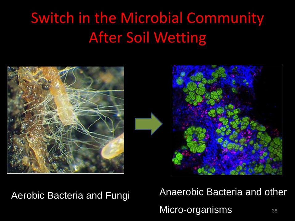
Switch in the Microbial Community After Soil Wetting
38
Aerobic Bacteria and Fungi Anaerobic Bacteria and other
Micro-organisms
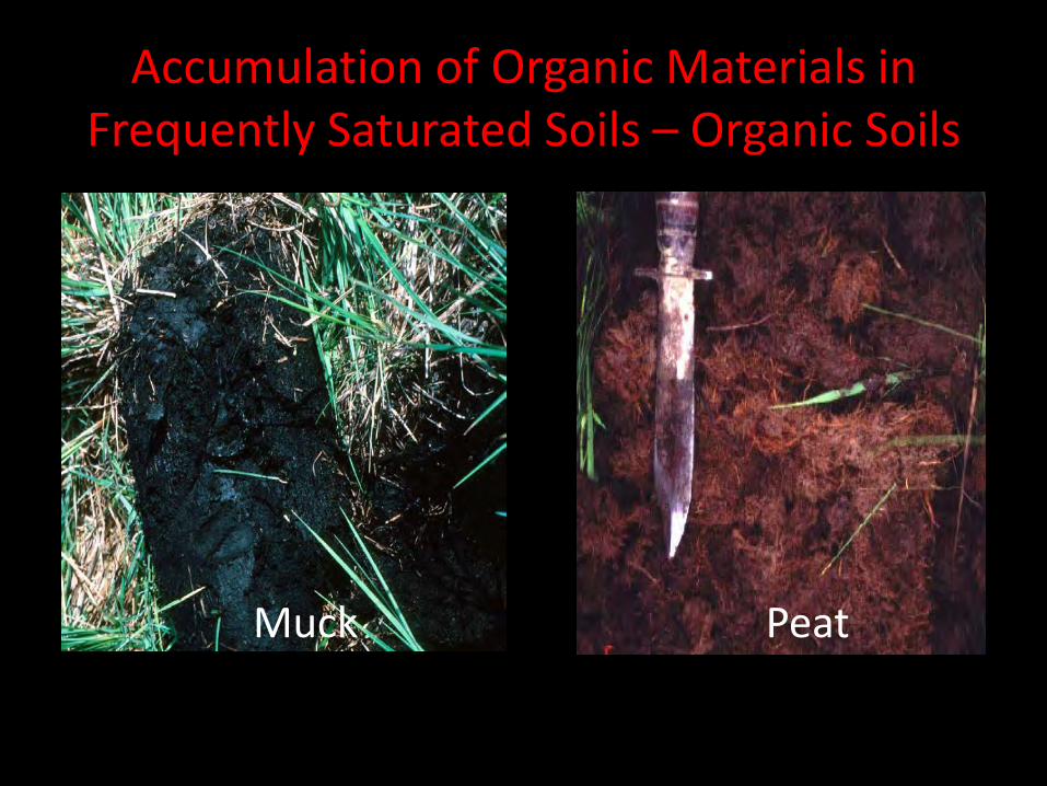
Accumulation of Organic Materials in Frequently Saturated Soils – Organic Soils
39
Muck Peat
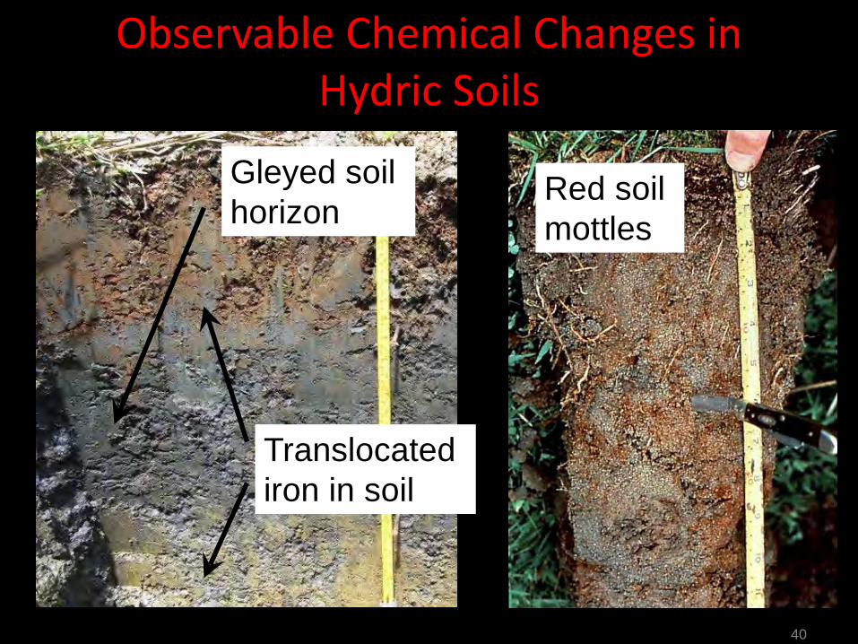
Observable Chemical Changes in Hydric Soils
40
Gleyed soil horizon
Translocated iron in soil
Red soil mottles
41
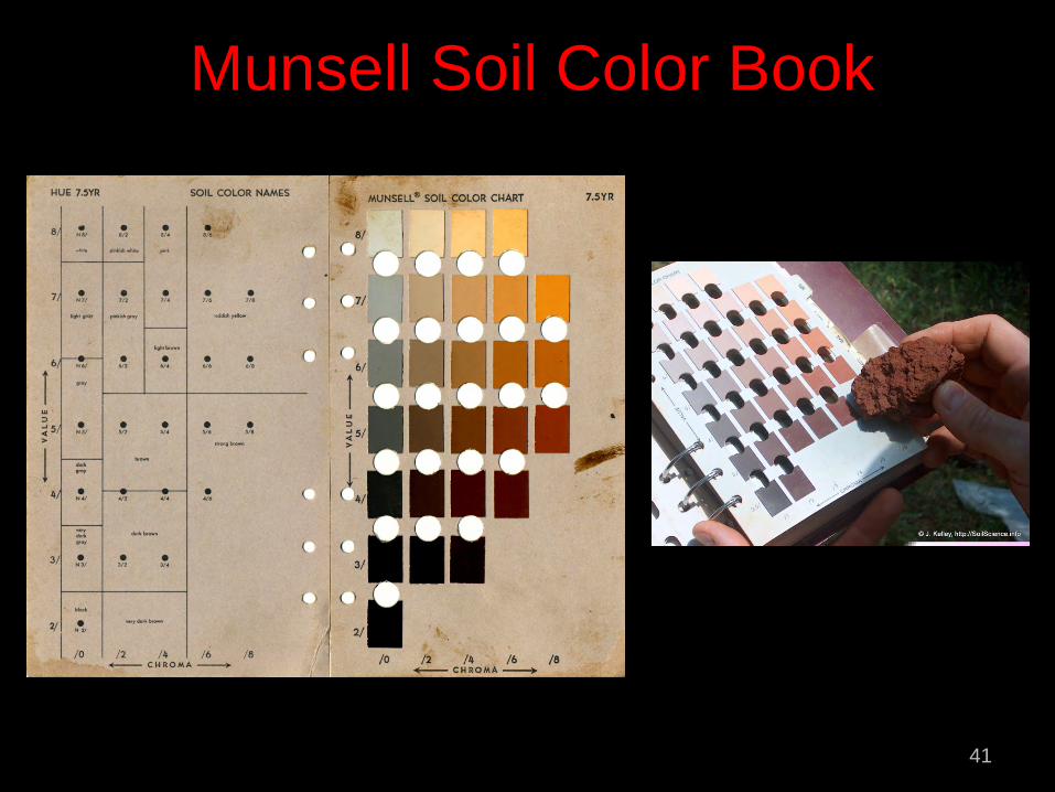
Munsell Soil Color Book
42
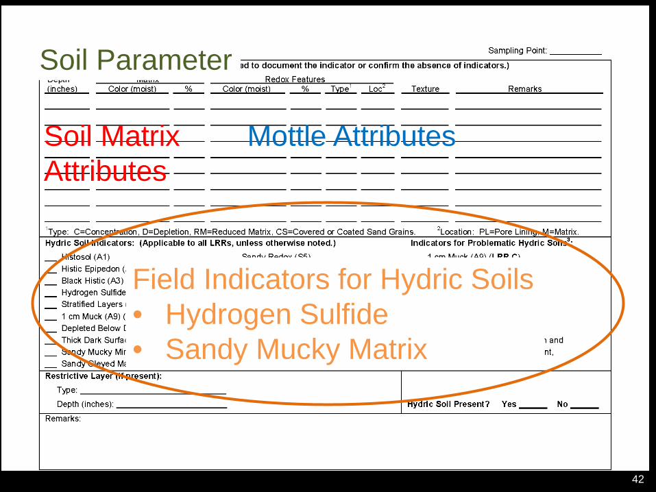
Soil Parameter
Soil Matrix Attributes
Mottle Attributes
Field Indicators for Hydric Soils • Hydrogen Sulfide • Sandy Mucky Matrix
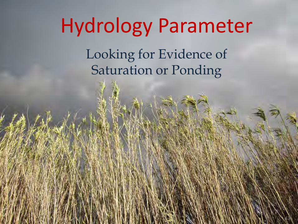
Hydrology Parameter Looking for Evidence of Saturation or Ponding
43
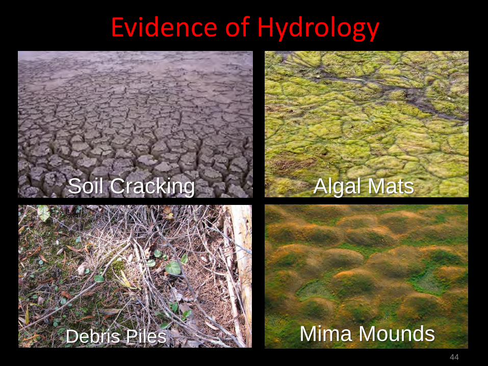
Evidence of Hydrology
44
Algal Mats Soil Cracking
Mima Mounds Debris Piles

Evidence of Hydrology: Oxidized Rhizosphere and Shallow Water Table
45
Water Table Near Surface Oxidized Rhizosphere
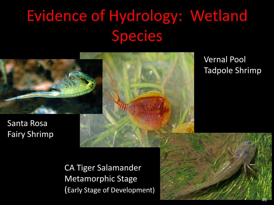
Evidence of Hydrology: Wetland Species
Vernal Pool Tadpole Shrimp
Santa Rosa Fairy Shrimp
CA Tiger Salamander Metamorphic Stage (Early Stage of Development)
46
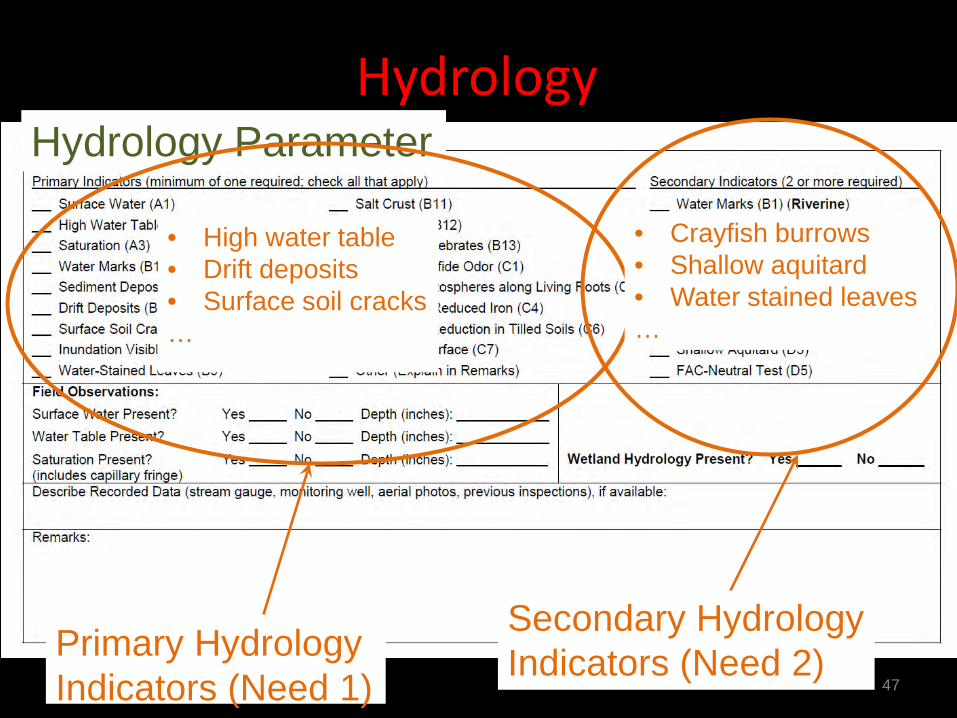
Hydrology
47
Hydrology Parameter
Primary Hydrology Indicators (Need 1)
• High water table • Drift deposits • Surface soil cracks …
Secondary Hydrology Indicators (Need 2)
• Crayfish burrows • Shallow aquitard • Water stained leaves …
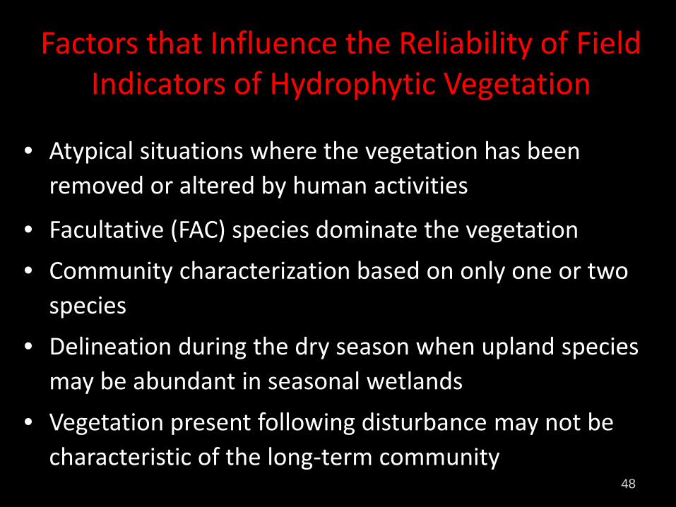
Factors that Influence the Reliability of Field Indicators of Hydrophytic Vegetation
• Atypical situations where the vegetation has been removed or altered by human activities
• Facultative (FAC) species dominate the vegetation • Community characterization based on only one or two
species • Delineation during the dry season when upland species
may be abundant in seasonal wetlands • Vegetation present following disturbance may not be
characteristic of the long-term community 48
49
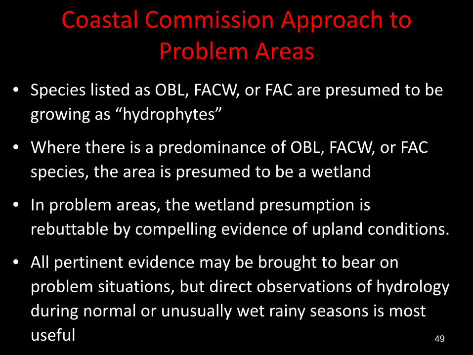
Coastal Commission Approach to Problem Areas
• Species listed as OBL, FACW, or FAC are presumed to be growing as “hydrophytes”
• Where there is a predominance of OBL, FACW, or FAC species, the area is presumed to be a wetland
• In problem areas, the wetland presumption is rebuttable by compelling evidence of upland conditions.
• All pertinent evidence may be brought to bear on problem situations, but direct observations of hydrology during normal or unusually wet rainy seasons is most useful

50
Highway 90 Median Area
Sand Spurry Rabbit’s foot Grass
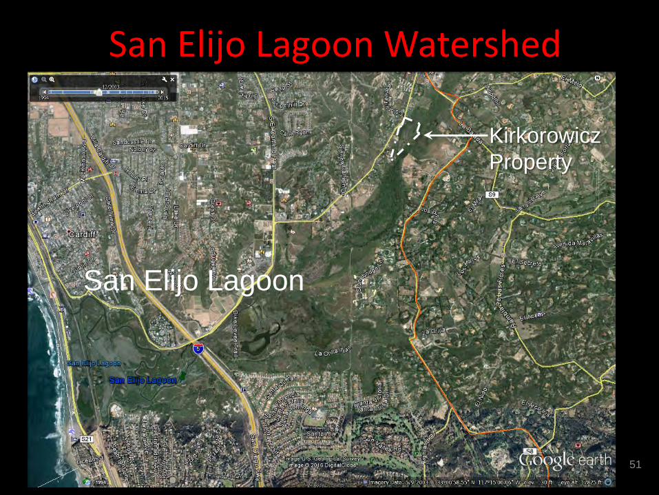
San Elijo Lagoon Watershed
51
Kirkorowicz Property
San Elijo Lagoon
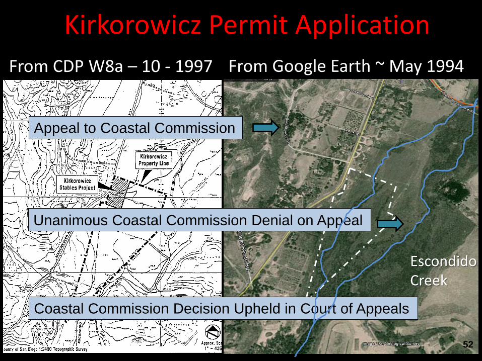
Kirkorowicz Permit Application From Google Earth ~ May 1994 From CDP W8a – 10 - 1997
Escondido Creek
Appeal to Coastal Commission
Unanimous Coastal Commission Denial on Appeal
Coastal Commission Decision Upheld in Court of Appeals
52
53
Thank You