Tax Units Update and Submission A collaborative partnership between the State of Kansas Department...
15
Tax Units Update and Submission A collaborative partnership between the State of Kansas Department of Revenue – Property Valuation Division, the Kansas GIS Policy Board’s Data Access & Support Center (DASC), and Kansas County Clerks
-
Upload
jason-evans -
Category
Documents
-
view
220 -
download
0
Transcript of Tax Units Update and Submission A collaborative partnership between the State of Kansas Department...

Tax Units Update and Submission
A collaborative partnership between theState of Kansas Department of Revenue –
Property Valuation Division,the Kansas GIS Policy Board’s
Data Access & Support Center (DASC),and Kansas County Clerks
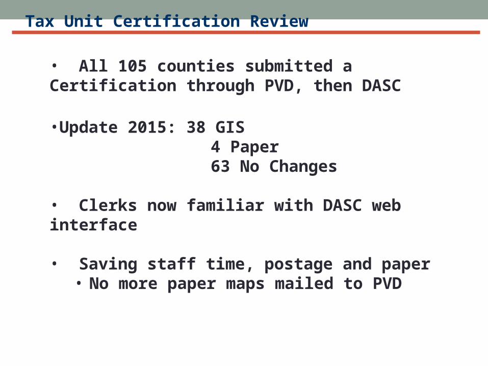
Tax Unit Certification Review
• All 105 counties submitted a Certification through PVD, then DASC
•Update 2015: 38 GIS 4 Paper 63 No Changes
• Clerks now familiar with DASC web interface
• Saving staff time, postage and paper• No more paper maps mailed to PVD
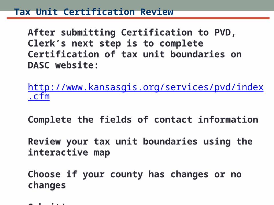
After submitting Certification to PVD, Clerk’s next step is to complete Certification of tax unit boundaries on DASC website:
http://www.kansasgis.org/services/pvd/index.cfm
Complete the fields of contact information
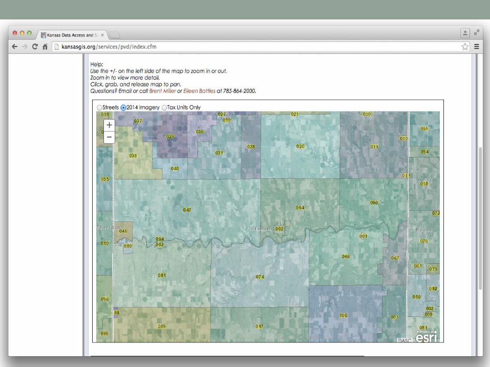
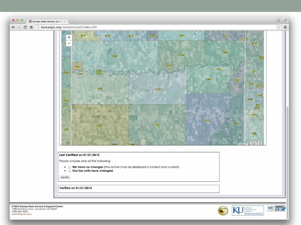
Review your tax unit boundaries using the interactive map
Choose if your county has changes or no changes
Submit!
Tax Unit Certification Review

Tax Unit Certification – What browser do you use?


If your county has no changes …
You are done!
If your county has changes you have 3 choices …
1. Please have DASC send us a paper map for editing
2. We have our own paper maps and will mail a map with our edits to DASC.
3. We have changes and will submit our tax units through a GIS file.
Tax Unit Certification Review

1 - Tax Unit GIS file submission• County removed and replaced with new data
2 - Parcel GIS file submission• Heads up digitizing, boundary comparison
3 - Paper map submission• Heads up digitizing, PDF review
Final step, clean up topology errors and confirm no null values.
DASC internal editing process

Statewide Tax Unit GIS database
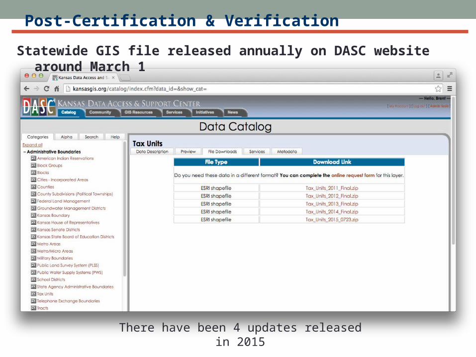
Statewide GIS file released annually on DASC website around March 1
Post-Certification & Verification
There have been 4 updates released in 2015
Unintentional Data Certification Errors
• Staff Turnover
• Boundaries in wrong location
• Legal description wrongly interpreted
Ongoing Maintenance Issues

Standardization and Integration of Statewide NG911 GIS Data Layers
• Address Point• Emergency Service Boundaries• Roads/Centerline Data• Municipal Boundaries*
*Emergency Service and Municipal Boundaries are critical for locating calls for service in NG911
Need more information on NG911? http://kansasgis.org/initiatives/NG911/index.cfmhttp://www.kansas911.org
Kansas NG911 Project

Contact Information
Eileen BattlesGIS Project Manager/Local Government [email protected]
Brent MillerGIS Specialist/Geodatabase [email protected]