Task 3
27
Task 3 Task 3 Institutional Institutional Incentives for Incentives for Efficient Water Use Efficient Water Use
-
Upload
jordan-kirby -
Category
Documents
-
view
16 -
download
0
description
Task 3. Institutional Incentives for Efficient Water Use. Objectives. technical assistance, applied research, and educational programs. Provide to improve district water management and modernization. Vision. To build a GIS-based decision support system - PowerPoint PPT Presentation
Transcript of Task 3

Task 3Task 3
Institutional Incentives for Institutional Incentives for Efficient Water UseEfficient Water Use

Provide
to improve district water management and modernization
ObjectivesObjectives
• technical assistance,technical assistance,• applied research, andapplied research, and• educational programseducational programs

Vision...
To build a GIS-based
decision support system
for total irrigation district managementSuch as:• scheduling field irrigation and water delivery• distribution network management• regional water conservation planning

GIS-based DMS
Weather Data
Crop Modeling
Routing Models
Irrigation Scheduling

Water Balance Equation: Change in storage + inflows - outflows +Precipitation - Et - Infiltration
Irrigation District Water Balance Equation:
Field demands
ReservoirStorage Field demands
seepageseepage seepage
spills spills
ET ETET
Controlgatecanal canal canal
River Pump
Field demands
Rain
Multiplied 100 plus...
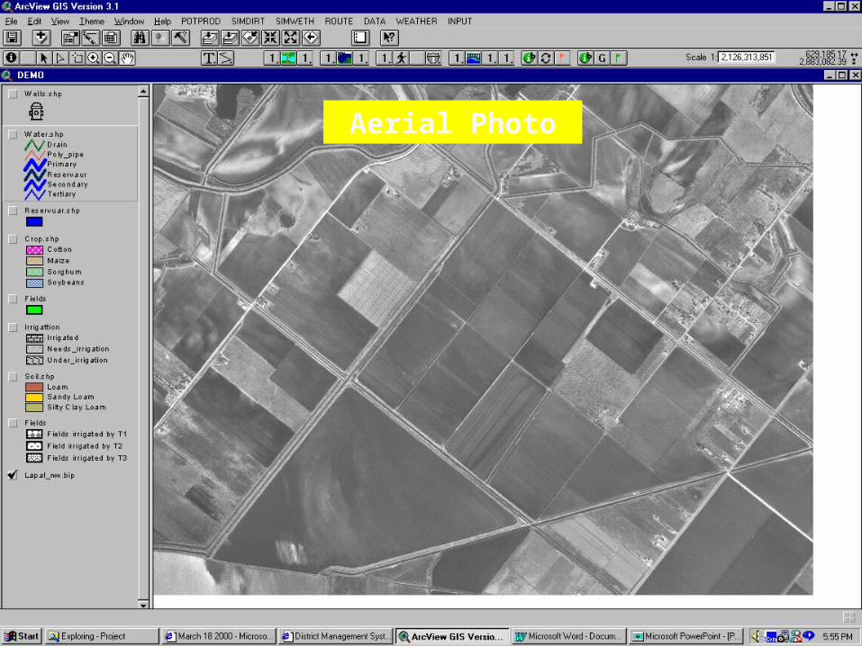
Aerial Photo

Conveyance system

Fields

Crops
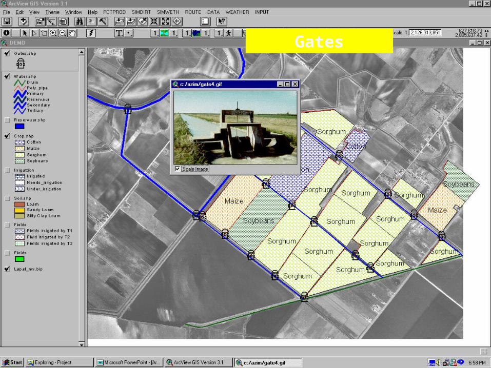
Gates

Work Plan1. Provide education and research
programs on improved district water management and modernization
2. Evaluate emerging technologies for automatic gate and flow control, canal lining, etc.
3. Investigate use of remote sensing, satellite and aerial photography.

Work Plan
4. Develop and implement a water demand forecasting system
5. Establish training and certification programs for canal riders
6. Continue to develop and implement GIS-based District Management System (DMS).

Focus for 2002• Continue District Assistance/Training• Thermal Imaging• District Management System
Development– GIS-Based Distribution Network Model– Web-Based GIS Products and Services for
Districts– Verification of an Irrigation Demand
Forecasting Model

District Assistance
Continued support of districts in GIS mapping and database development and implementation

District Assistance (cont.)
In-District Support and Training (by mutual
agreement)Workshops
Hands-on GPSArcView 8.1

District Assistance (cont.)
Evaluating canal lining alternatives to determine water savings and cost effectiveness.
a)San Benito – (on-going) b)2002
– Edinburg– Harlingen
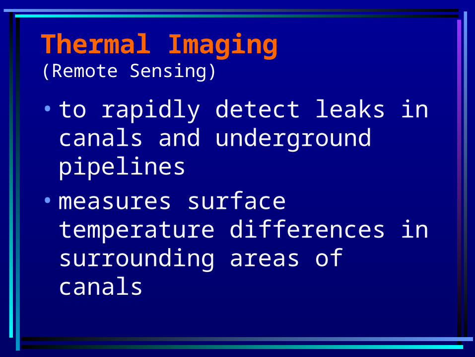
Thermal Imaging (Remote Sensing)
• to rapidly detect leaks in canals and underground pipelines
• measures surface temperature differences in surrounding areas of canals

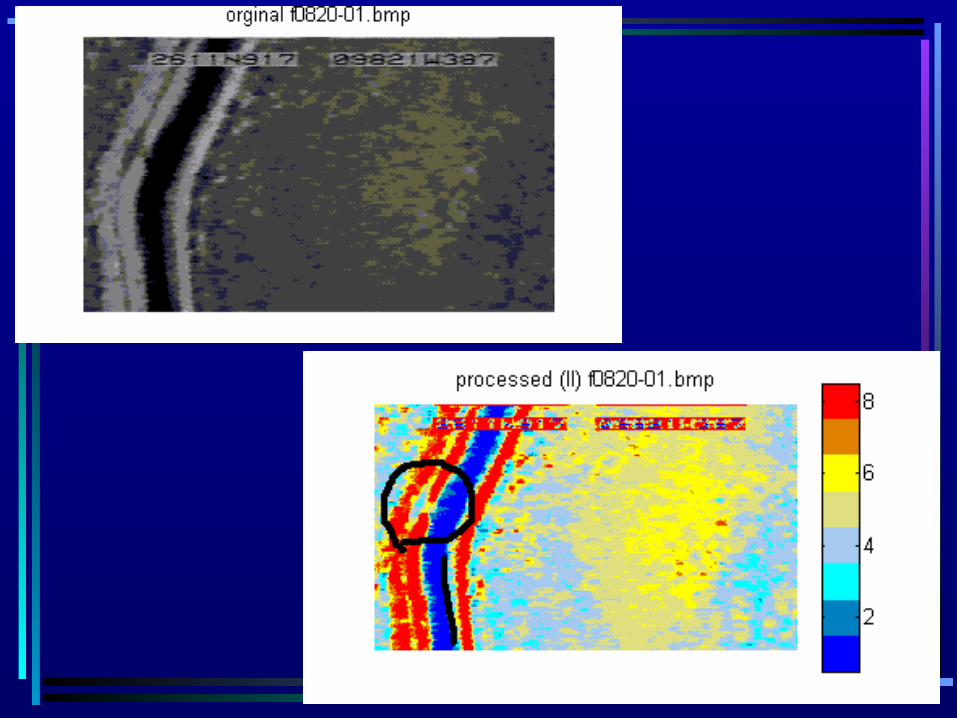
Thermal Imaging: Work Done
• Flyover in August 2001 of United and San Benito Irrigation Districts
• Processed and enhanced images
• Selected canal segments for field verification


Thermal Imaging: What is Next?
• Field reconnaissance of selected segments for verification
• Flyovers in Summer & Winter 2002
• Using an improved multi-band imaging sensor

Distribution Network Model
Existing models do not work due to:
• Small hydraulic gradient• Combination of open channels
and pipelines• Need GIS compatibility

Distribution Network Model
Possible Uses:• Optimize management for
distribution networks• Evaluate need for rehabilitation• Determine “head”
improvement

•Create a new distribution network model with OOP (Object-Oriented Programming) in C++ and ArcView
•GIS Interface with automatic gate and pump control algorithms
GIS-Based Distribution Network Model
Web-Based GIS Products and Services
Develop prototype systems:•Allow growers to access their
accounts on the web to verify field boundaries and other information
• Integrating district communication and data management

Irrigation Demand Forecasting Model
•Collecting crop production data from 6 fields of furrow and center pivot irrigation for model verification
•Enhance model capabilities