Tame flood risk_management
44
River Tame Flood Risk Management Strategy May 2011
-
Upload
will-williams -
Category
Education
-
view
1.916 -
download
0
Transcript of Tame flood risk_management
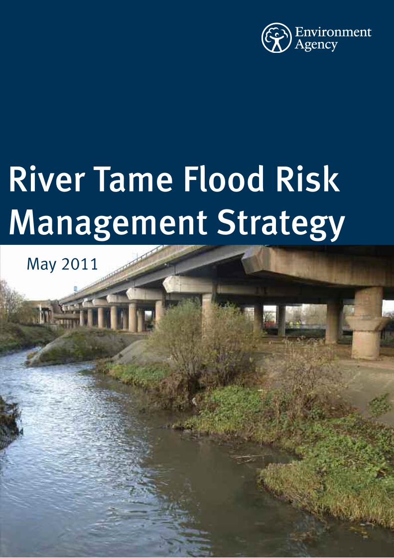
River Tame Flood RiskManagement Strategy
May 2011
Published by:
Environment Agency
Sapphire East
550 Streetsbrook Road
Solihull
B91 1QT
Tel: 03708 506506
Email: [email protected]
www.environment-agency.gov.uk
© Environment Agency
All rights reserved. This document may be reproduced with
prior permission of the Environment Agency.
We are the Environment Agency. It’s our job to look after yourenvironment and make it a better place – for you, and forfuture generations.
Your environment is the air you breathe, the water you drinkand the ground you walk on. Working with business,Government and society as a whole, we are making yourenvironment cleaner and healthier.
The Environment Agency. Out there, making your environmenta better place.
Environment Agency River Tame Flood Risk Management Strategy 3
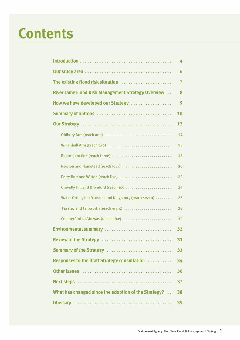
Contents
Introduction . . . . . . . . . . . . . . . . . . . . . . . . . . . . . . . . . . . . . . 4
Our study area . . . . . . . . . . . . . . . . . . . . . . . . . . . . . . . . . . . . 6
The existing flood risk situation . . . . . . . . . . . . . . . . . . . . . 7
River Tame Flood Risk Management Strategy Overview . . 8
How we have developed our Strategy . . . . . . . . . . . . . . . . . 9
Summary of options . . . . . . . . . . . . . . . . . . . . . . . . . . . . . . . 10
Our Strategy . . . . . . . . . . . . . . . . . . . . . . . . . . . . . . . . . . . . . 12
Oldbury Arm (reach one) . . . . . . . . . . . . . . . . . . . . . . . . . . . . . . . . . 14
Willenhall Arm (reach two) . . . . . . . . . . . . . . . . . . . . . . . . . . . . . . . . 16
Bescot Junction (reach three) . . . . . . . . . . . . . . . . . . . . . . . . . . . . . . 18
Newton and Hamstead (reach four) . . . . . . . . . . . . . . . . . . . . . . . . . 20
Perry Barr and Witton (reach five) . . . . . . . . . . . . . . . . . . . . . . . . . . 22
Gravelly Hill and Bromford (reach six) . . . . . . . . . . . . . . . . . . . . . . . 24
Water Orton, Lea Marston and Kingsbury (reach seven) . . . . . . . . 26
Fazeley and Tamworth (reach eight) . . . . . . . . . . . . . . . . . . . . . . . . 28
Comberford to Alrewas (reach nine) . . . . . . . . . . . . . . . . . . . . . . . . 30
Environmental summary . . . . . . . . . . . . . . . . . . . . . . . . . . . . 32
Review of the Strategy . . . . . . . . . . . . . . . . . . . . . . . . . . . . . 33
Summary of the Strategy . . . . . . . . . . . . . . . . . . . . . . . . . . . 33
Responses to the draft Strategy consultation . . . . . . . . . . 34
Other issues . . . . . . . . . . . . . . . . . . . . . . . . . . . . . . . . . . . . . 36
Next steps . . . . . . . . . . . . . . . . . . . . . . . . . . . . . . . . . . . . . . . 37
What has changed since the adoption of the Strategy? . . 38
Glossary . . . . . . . . . . . . . . . . . . . . . . . . . . . . . . . . . . . . . . . . 39
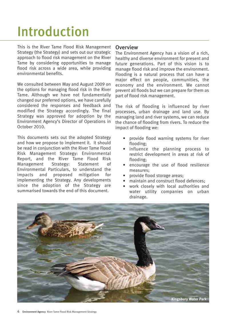
This is the River Tame Flood Risk ManagementStrategy (the Strategy) and sets out our strategicapproach to flood risk management on the RiverTame by considering opportunities to manageflood risk across a wide area, while providingenvironmental benefits.
We consulted between May and August 2009 onthe options for managing flood risk in the RiverTame. Although we have not fundamentallychanged our preferred options, we have carefullyconsidered the responses and feedback andmodified the Strategy accordingly. The finalStrategy was approved for adoption by theEnvironment Agency’s Director of Operations inOctober 2010.
This documents sets out the adopted Strategyand how we propose to implement it. It shouldbe read in conjunction with the River Tame FloodRisk Management Strategy: EnvironmentalReport, and the River Tame Flood RiskManagement Strategy: Statement ofEnvironmental Particulars, to understand theimpacts and proposed mitigation forimplementing the Strategy. Any developmentssince the adoption of the Strategy aresummarised towards the end of this document.
OverviewThe Environment Agency has a vision of a rich,healthy and diverse environment for present andfuture generations. Part of this vision is tomanage flood risk and improve the environment.Flooding is a natural process that can have amajor effect on people, communities, theeconomy and the environment. We cannotprevent all floods but we can prepare for them aspart of flood risk management.
The risk of flooding is influenced by riverprocesses, urban drainage and land use. Bymanaging land and river systems, we can reducethe chance of flooding from rivers. To reduce theimpact of flooding we:
• provide flood warning systems for riverflooding;
• influence the planning process to restrict development in areas at risk of flooding;
• encourage the use of flood resiliencemeasures;
• provide flood storage areas; • maintain and construct flood defences;• work closely with local authorities and
water utility companies on urbandrainage.
4 Environment Agency River Tame Flood Risk Management Strategy
Introduction
Kingsbury Water Park
Environment Agency River Tame Flood Risk Management Strategy 5
To plan our activities we take a wide view of floodrisk across a large geographical area. We call thisa Flood Risk Management Strategy. ForBirmingham, the Black Country and Tamworth wehave produced the River Tame Flood RiskManagement Strategy. This Strategy examinesthe options available for managing flood riskfrom the River Tame. The objectives of theStrategy are:
• understanding and raising awareness ofthe risk of flooding on the River Tame,both now and in the future;
• developing a plan for the management offlood risk on the River Tame that issustainable, taking into account futurechanges in the environment (human,
built or natural) and the climate;• ensuring all proposals are technically
feasible, economically viable, sociallyacceptable and environmentallyappropriate (by meeting the strategicenvironmental objectives);
• seeking opportunities for environmentalimprovements wherever possible throughthe recommendation of integrated floodrisk management measures;
• working in partnership with andencouraging co-operation betweenstakeholders.
This document is a summary of our proposals formanaging flood risk in the area for the next 100years (from 2009 to 2109).
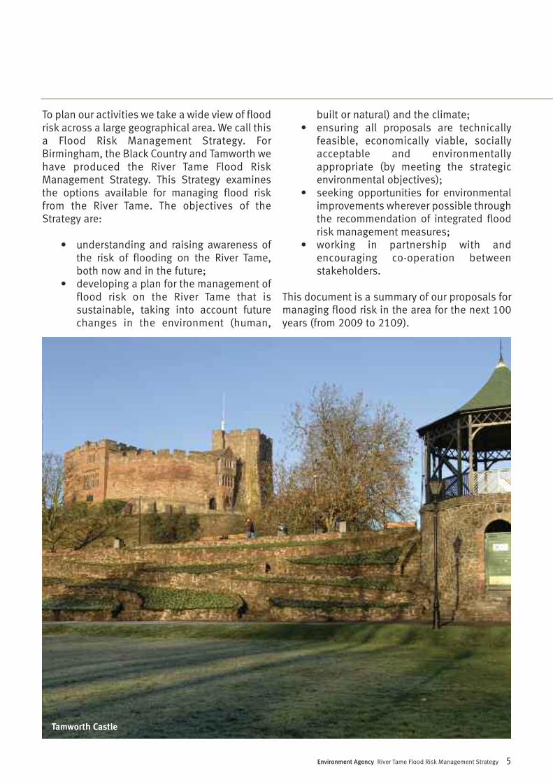
Tamworth Castle
The River Tame is the largest tributary of the RiverTrent. The total catchment is approximately 1500square kilometres and the river is 100 kilometreslong. Over 1.7 million people live within thecatchment area. The River Tame starts as twodistinct watercourses: the Oldbury Arm and theWillenhall Arm, in the Black Country. Thesecombine at Bescot and continue eastwardsthrough Birmingham before changing directionat Water Orton. The river then flows norththrough Tamworth to the confluence with theRiver Trent. It has a number of major tributaries.The most significant are the Ford Brook, RiverRea, River Cole, River Blythe and the River Anker.The tributaries are not included within theStrategy.
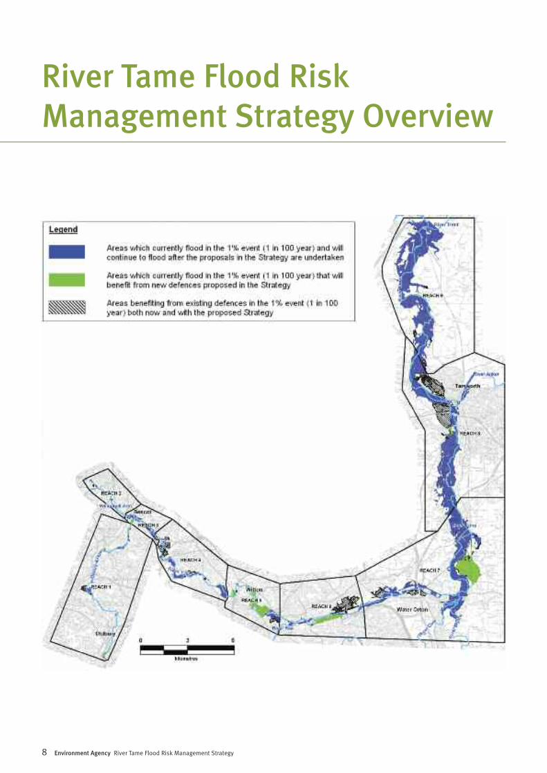
Our study area starts at Ashes Road on theOldbury Arm and County Bridge on the WillenhallArm and finishes where the River Tame enters theRiver Trent. The study area is divided into ninesections or reaches as shown on the plan onpage 7.
Over time, the River Tame has been heavily
modified by human activity. Sections of the riverhave been engineered with brick walls andconcrete. This is not unusual for an urbanisedcatchment. This has resulted in a river that isvery different to its original size, shape andcourse. The alterations are mainly in the uppercatchment of Birmingham and the Black Country.
History of flooding along the River TameLike all major river systems, the River Tame has ahistory of flooding. In Summer 2007, Englandexperienced the wettest three months sincerecords began. Flood events in June and July2007 caused widespread flooding on the RiverTame. Areas that were significantly affectedinclude Bescot, Witton, Water Orton, Fazeley,Tamworth and Elford. Other notable flood eventson the River Tame occurred in June 1955, August1987, December 1992, September 1994, January1999 and November 2000.
We have used the information from these floodevents to inform the River Tame Strategy,ensuring that past knowledge guides futuredecisions.
6 Environment Agency River Tame Flood Risk Management Strategy
Our study area
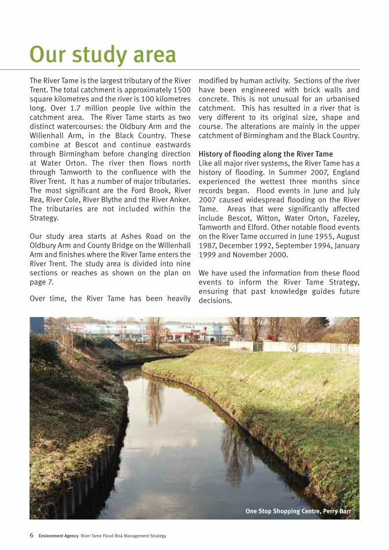
One Stop Shopping Centre, Perry Barr
Environment Agency River Tame Flood Risk Management Strategy 7
TerminologyWhen we explain flood risk we refer to ‘floodevents’. Flood events are characterised by theirsize and how often they occur. The larger a floodevent, the less often it will occur.
A flood event with a 1% probability of occurringis also expressed as a flood that has a 1 in 100chance of occurring in any given year. If a floodevent of this magnitude occurs in one year thechance of it occurring the following year is stillthe same, 1 in 100.
A flood event with 0.5% probability of occurringis expressed as a flood that has a 1 in 200chance of occurring in any given year. A flood ofthis size occurs less frequently and so it is largerthan a flood event with a 1% probability.Consequently, more properties will flood.
In this document we refer to numbers ofproperties (residential and commercial) at risk offlooding. Unless otherwise stated these figuresrefer to the number of properties (residential andcommercial) that would be flooded in a floodevent with a 1% probability (1 in 100 chance ofoccurring in any given year) of occurring.
All reference to left/right banks in this documentare based on looking at the river in adownstream direction.
Existing Flood Risk ManagementCurrently, there are 3,100 residential andcommercial properties at risk from flooding. From2025 this number is forecast to increase to 5,400properties as a result of the impact of climatechange on flood levels.
There is an existing flood risk managementscheme in place in the upper catchment of theRiver Tame, which provides a varied level of floodrisk management. This is a combination ofchannel maintenance, earth embankments,flood walls and flood water storage areas. Thestorage areas hold flood water until a flood eventhas passed, after which it is slowly released backinto the River Tame. The existing storage areasare:-
• Sheepwash Balancing Ponds: this areaholds 166,000m3 of water
• Ocker Hill Balancing Pond: this area holds19,000m3 of water
• Bescot Controlled Washland: this areaholds 37,000m3 of water
• Forge Mill Lake at Sandwell Valley: thisarea holds 575,000m3 of water
• Perry Hall Playing Fields: this area holds156,000m3 of water
This system was designed in the 1970s to reducerisk of flooding to an event which at that timehad a 2% annual probability of occurring. ForgeMill Lake is the most significant storage area andholds more than double the amount of water ofany other location. Other localised flooddefences exist downstream at Water Orton,Minworth, Whitacre Heath, Fazeley andTamworth. We have identified that some of theexisting flood defences need replacement in thenear future. If we do not take appropriate actionthere is a risk that in the future these defencescould fail and cause widespread flooding.
Climate changeGovernment guidance sets out how we shouldpredict the effect that climate change may haveon flood levels in the future. Using computerflood modelling we can identify how manyproperties may be affected by these changes.
The Strategy allows us to plan how we respond tothese changes. We have predicted that a further2,300 properties could be at risk in the future(from 2025) as a result of climate change.
The existing flood risk situation
8 Environment Agency River Tame Flood Risk Management Strategy
River Tame Flood RiskManagement Strategy Overview
Environment Agency River Tame Flood Risk Management Strategy 9
The key aim of the Strategy is to enable us, withpartners, to manage flood risk sustainably overthe long term. We have developed a Strategywhich seeks to embrace a holistic approach andhave developed the strategy to follow four keyaims of sustainability; maximisingenvironmental benefit; developing safeschemes; and securing value for money.
We apply a clearly defined approach to assessingflood risk management options which is set bythe Department for Environment, Food and RuralAffairs (Defra).
To develop our Strategy we have identified all thepossible options to manage flood risk at a broadstrategic level. We identified the followingoptions:
• Do nothing – This would be a ‘walk away’option. It would mean that all of the workwe currently do now, such as floodwarning, channel and defencemaintenance would stop. This is astandard option against which thebenefits and costs of the other optionsare compared.
• Do minimum – This would mean that wewould continue to maintain the existingwalls and embankments. However, at theend of their design-life the defenceswould not be replaced.
• Do something – Under this approach wewould change what we do now to manageflood risk. The Strategy has consideredlarge-scale options for the whole areaand more local options. These optionsincluded combinations of:
‘ managing the causes of floodingby changing the way people design and use urban and rural
land;
‘ storing water during a flood and slowlyreleasing it back into the river afterwards;
‘ improving the flow of water down a river(this is called conveyance);
‘ providing defences to reduce the risk offlooding.
We have engaged external stakeholders to shareideas and expertise and we have assessed theseoptions against the following criteria:
1 The cost of each option compared withthe benefits gained, including thenumber of properties affected.
2 Whether the option would effectivelymanage flood risk.
3 The environmental impact of each option.
The tables on pages 10 and 11 give a summaryof the option assessment:-
How we have developedour Strategy
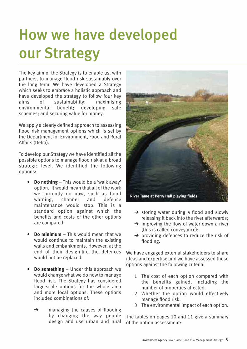
River Tame at Perry Hall playing fields
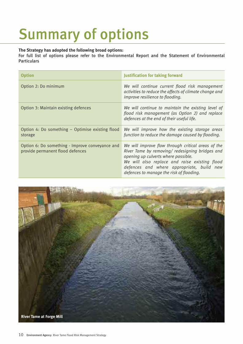
Option
Option 2: Do minimum
Option 3: Maintain existing defences
Option 4: Do something – Optimise existing floodstorage
Option 6: Do something - Improve conveyance andprovide permanent flood defences
The Strategy has adopted the following broad options:For full list of options please refer to the Environmental Report and the Statement of EnvironmentalParticulars
Justification for taking forward
We will continue current flood risk managementactivities to reduce the affects of climate change andimprove resilience to flooding.
We will continue to maintain the existing level offlood risk management (as Option 2) and replacedefences at the end of their useful life.
We will improve how the existing storage areasfunction to reduce the damage caused by flooding.
We will improve flow through critical areas of theRiver Tame by removing/ redesigning bridges andopening up culverts where possible.We will also replace and raise existing flooddefences and where appropriate, build newdefences to manage the risk of flooding.
Summary of options
River Tame at Forge Mill
10 Environment Agency River Tame Flood Risk Management Strategy
Environment Agency River Tame Flood Risk Management Strategy 11
Summary of options
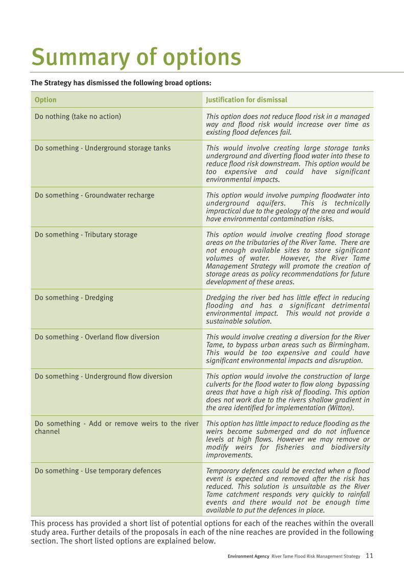
Option
Do nothing (take no action)
Do something - Underground storage tanks
Do something - Groundwater recharge
Do something - Tributary storage
Do something - Dredging
Do something - Overland flow diversion
Do something - Underground flow diversion
Do something - Add or remove weirs to the riverchannel
Do something - Use temporary defences
Justification for dismissal
This option does not reduce flood risk in a managedway and flood risk would increase over time asexisting flood defences fail.
This would involve creating large storage tanksunderground and diverting flood water into these toreduce flood risk downstream. This option would betoo expensive and could have significantenvironmental impacts.
This option would involve pumping floodwater intounderground aquifers. This is technicallyimpractical due to the geology of the area and wouldhave environmental contamination risks.
This option would involve creating flood storageareas on the tributaries of the River Tame. There arenot enough available sites to store significantvolumes of water. However, the River TameManagement Strategy will promote the creation ofstorage areas as policy recommendations for futuredevelopment of these areas.
Dredging the river bed has little effect in reducingflooding and has a significant detrimentalenvironmental impact. This would not provide asustainable solution.
This would involve creating a diversion for the RiverTame, to bypass urban areas such as Birmingham.This would be too expensive and could havesignificant environmental impacts and disruption.
This option would involve the construction of largeculverts for the flood water to flow along bypassingareas that have a high risk of flooding. This optiondoes not work due to the rivers shallow gradient inthe area identified for implementation (Witton).
This option has little impact to reduce flooding as theweirs become submerged and do not influencelevels at high flows. However we may remove ormodify weirs for fisheries and biodiversityimprovements.
Temporary defences could be erected when a floodevent is expected and removed after the risk hasreduced. This solution is unsuitable as the RiverTame catchment responds very quickly to rainfallevents and there would not be enough timeavailable to put the defences in place.
This process has provided a short list of potential options for each of the reaches within the overallstudy area. Further details of the proposals in each of the nine reaches are provided in the followingsection. The short listed options are explained below.
The Strategy has dismissed the following broad options:
Following the public consultation exercise, wehave modified our Strategy to take account of theissues raised. Although fundamentally we havenot changed our preferred options, there arevarious issues we are now aware of that haveassisted us in our understanding of flood riskissues and how the Strategy could beimplemented. We have also added clarificationto parts of our Strategy as a result of responsesreceived.
This document contains our final Strategy. Wehave also produced a Statement ofEnvironmental Particulars as required by theEnvironmental Assessment of Plans andProgrammes Regulations 2004. It sets out howthe findings of the Environmental Report andviews expressed during the consultation periodhave been taken into account as the TameStrategy has been finalised and formallyapproved (adopted). This Strategy should beread in conjunction with the EnvironmentalReport and the Statement of EnvironmentalParticulars in order to understand what
information the Strategy has taken into accountwhen being drafted and finalised. We alsoexplain the potential impacts of implementingthe Strategy, the mitigation proposed to reduceor remove these impacts, and potentialenvironmental and social improvements that wepropose to undertake in tandem withimplementing the Strategy.
The Tame Strategy study area contains a highlyurbanised upstream catchment and a ruraldownstream catchment. The existing flood riskmanagement involves a combination of floodstorage areas, flood walls and embankments.Consequently, there is no simple solution formanaging flood risk along the river. The Strategyhas identified that it is not viable to provide thesame level of flood risk management across allthe communities in the flood plain. As a result weare suggesting different proposals within each ofthe nine reaches. These proposals are based ona high level study undertaken as part of theStrategy development. Whilst we don’tanticipate that the preferred options will change,the method of implementation e.g. exact heightsof walls may change as a result of more detailedwork. The Strategy proposals involve a number ofkey components which are summarised below.
Management activitiesWe currently undertake a range of flood riskmanagement activities and we are proposing tocontinue with these:
• improving the flood warning service andpromoting its wider use;
• channel maintenance, where necessary;• maintaining existing flood defences and
replacing them when they reach the endof their useful life, unless there arespecial circumstances in which we wouldeither cease maintenance or remove thedefence;
• continuing to influence planning anddevelopment proposals;
• continuing to provide advice onprotecting individual properties toincrease their resistance to flooding.
Our Strategy
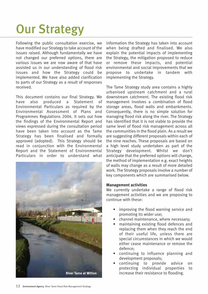
River Tame at Witton
12 Environment Agency River Tame Flood Risk Management Strategy
Environment Agency River Tame Flood Risk Management Strategy 13
Optimise upstream storageWe propose to optimise the existing floodstorage areas in the upper sections of the RiverTame. We have identified that changes can bemade to the existing flood storage areas, inparticular at Forge Mill and Perry Hall playingfields to reduce the risk of flooding downstream.
Remove obstructions to flowWhere possible, we will remove or redesignstructures that impede the flow of the River Tamein critical locations such as Brookvale Road(Atlas Industrial Estate Bridge) and Nechells/StarCity (utility crossings). The alternative is that theheight of the flood walls and embankment alongparts of the River would need to be increased.This could result in increased construction costsand significant social and environmentalimpacts.
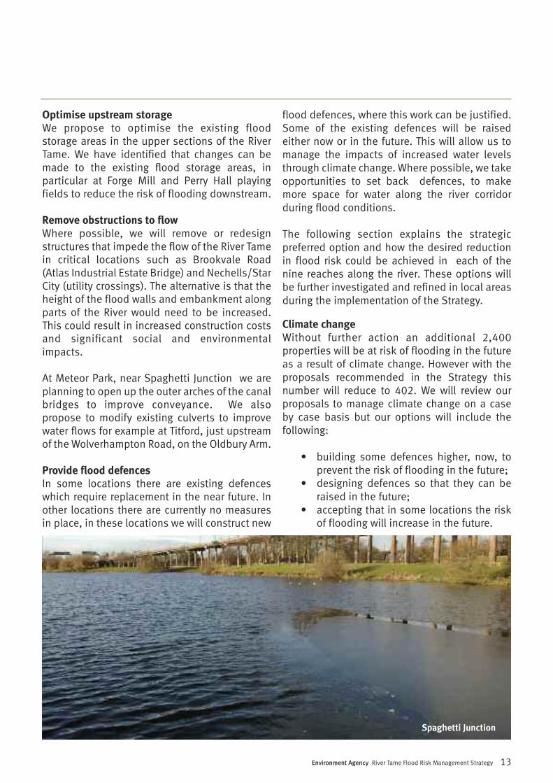
At Meteor Park, near Spaghetti Junction we areplanning to open up the outer arches of the canalbridges to improve conveyance. We alsopropose to modify existing culverts to improvewater flows for example at Titford, just upstreamof the Wolverhampton Road, on the Oldbury Arm.
Provide flood defencesIn some locations there are existing defenceswhich require replacement in the near future. Inother locations there are currently no measuresin place, in these locations we will construct new
flood defences, where this work can be justified.Some of the existing defences will be raisedeither now or in the future. This will allow us tomanage the impacts of increased water levelsthrough climate change. Where possible, we takeopportunities to set back defences, to makemore space for water along the river corridorduring flood conditions.
The following section explains the strategicpreferred option and how the desired reductionin flood risk could be achieved in each of thenine reaches along the river. These options willbe further investigated and refined in local areasduring the implementation of the Strategy.
Climate changeWithout further action an additional 2,400properties will be at risk of flooding in the futureas a result of climate change. However with theproposals recommended in the Strategy thisnumber will reduce to 402. We will review ourproposals to manage climate change on a caseby case basis but our options will include thefollowing:
• building some defences higher, now, toprevent the risk of flooding in the future;
• designing defences so that they can beraised in the future;
• accepting that in some locations the riskof flooding will increase in the future.
Spaghetti Junction
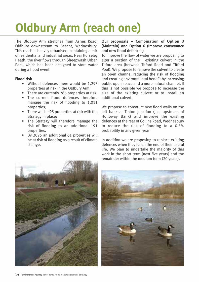
The Oldbury Arm stretches from Ashes Road,Oldbury downstream to Bescot, Wednesbury.This reach is heavily urbanised, containing a mixof residential and industrial areas. Near HorseleyHeath, the river flows through Sheepwash UrbanPark, which has been designed to store waterduring a flood event.
Flood risk• Without defences there would be 1,297
properties at risk in the Oldbury Arm;• There are currently 286 properties at risk;• The current flood defences therefore
manage the risk of flooding to 1,011properties;
• There will be 95 properties at risk with theStrategy in place;
• The Strategy will therefore manage therisk of flooding to an additional 191properties.
• By 2025 an additional 61 properties willbe at risk of flooding as a result of climatechange.
Our proposals – Combination of Option 3(Maintain) and Option 6 (Improve conveyanceand new flood defences) To improve the flow of water we are proposing toalter a section of the existing culvert in theTitford area (between Titford Road and TitfordPool). We propose to remove the culvert to createan open channel reducing the risk of floodingand creating environmental benefit by increasingpublic open space and a more natural channel. Ifthis is not possible we propose to increase thesize of the existing culvert or to install anadditional culvert.
We propose to construct new flood walls on theleft bank at Tipton Junction (just upstream ofHolloway Bank) and improve the existingdefences at the rear of Collins Road, Wednesburyto reduce the risk of flooding to a 0.5%probability in any given year.
In addition we are proposing to replace existingdefences when they reach the end of their usefullife. We plan to undertake the majority of thiswork in the short term (next five years) and theremainder within the medium term (20 years).
14 Environment Agency River Tame Flood Risk Management Strategy
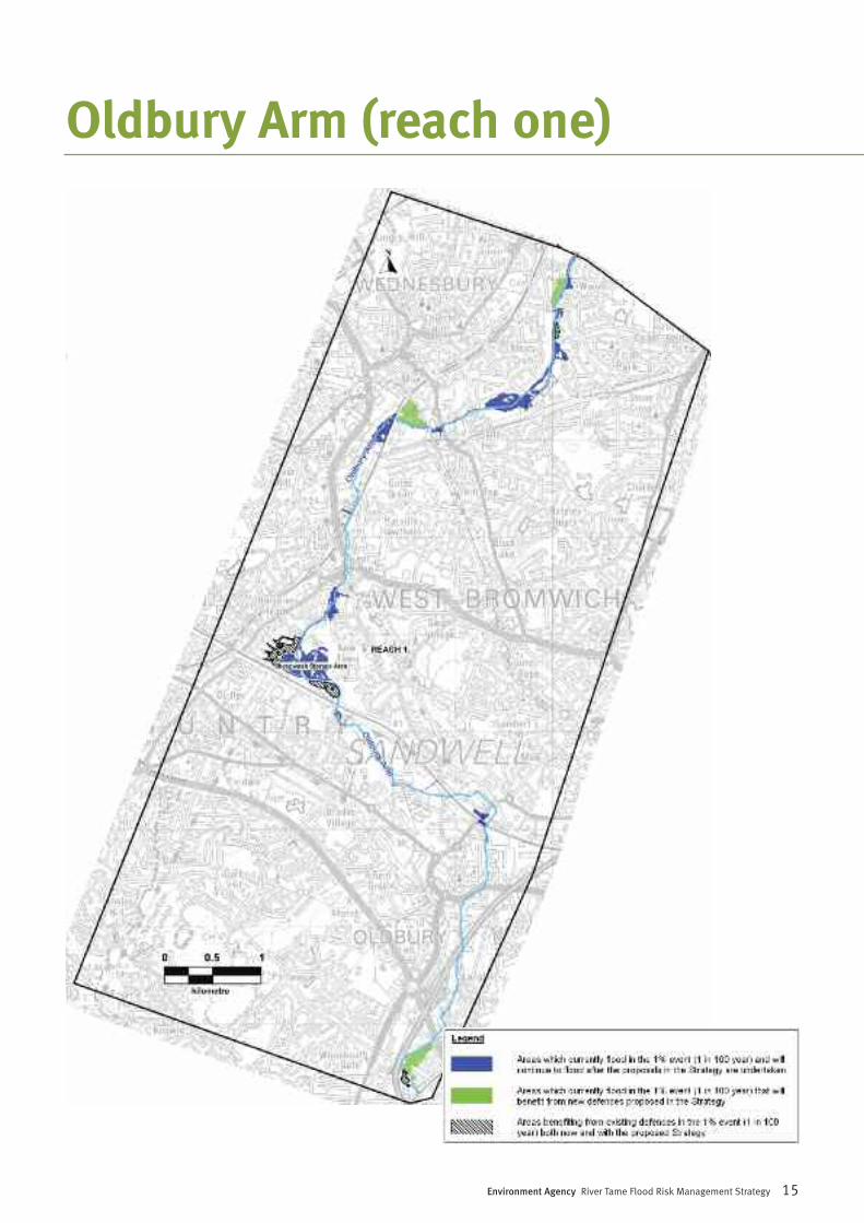
Oldbury Arm (reach one)
Environment Agency River Tame Flood Risk Management Strategy 15
Oldbury Arm (reach one)
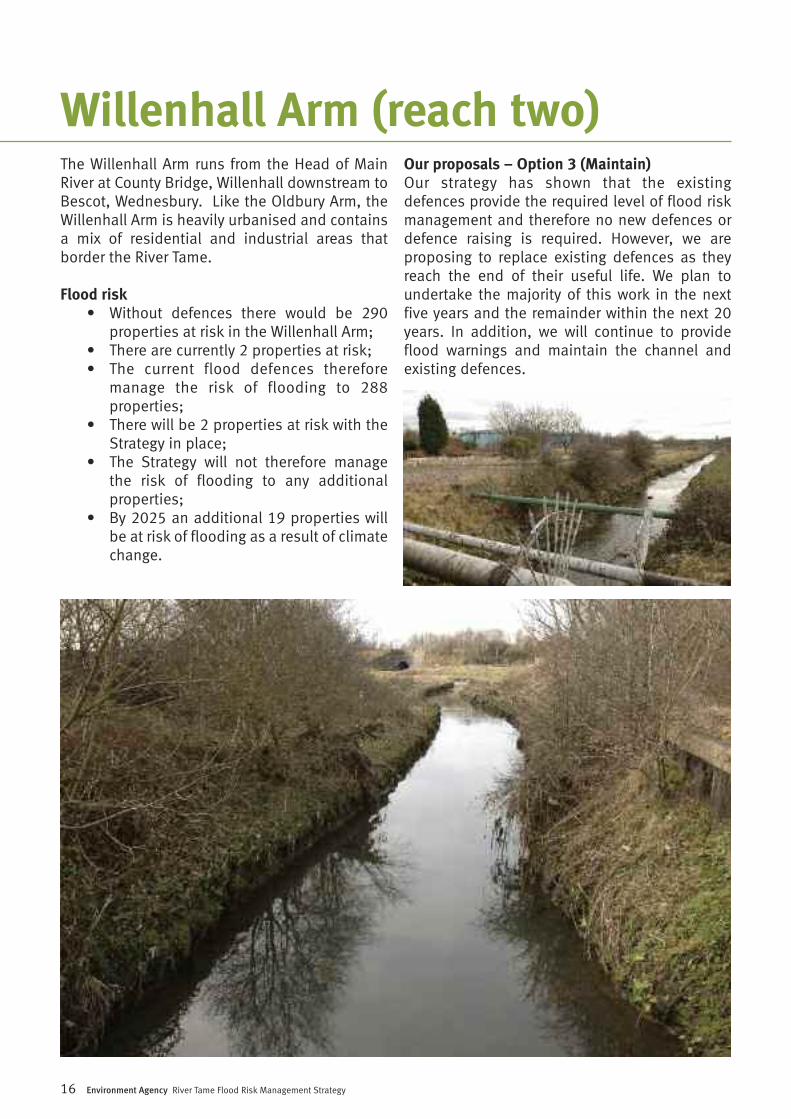
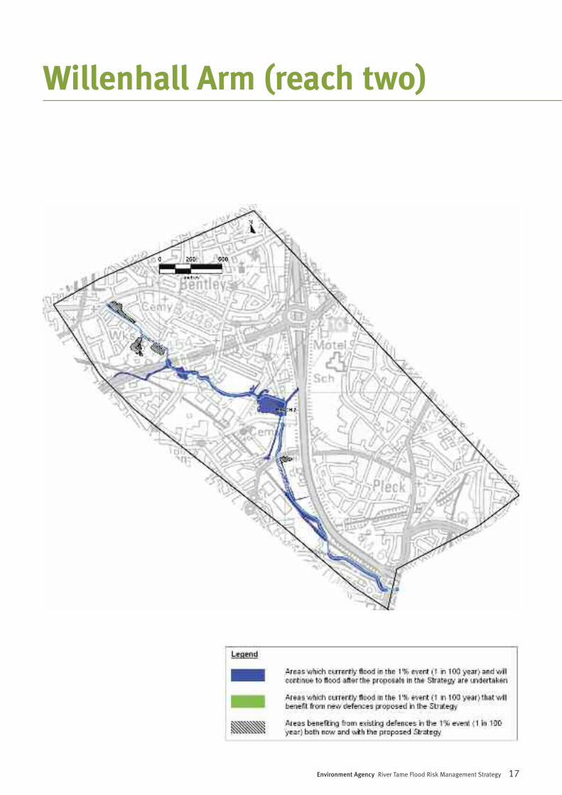
The Willenhall Arm runs from the Head of MainRiver at County Bridge, Willenhall downstream toBescot, Wednesbury. Like the Oldbury Arm, theWillenhall Arm is heavily urbanised and containsa mix of residential and industrial areas thatborder the River Tame.
Flood risk• Without defences there would be 290
properties at risk in the Willenhall Arm;• There are currently 2 properties at risk;• The current flood defences therefore
manage the risk of flooding to 288properties;
• There will be 2 properties at risk with theStrategy in place;
• The Strategy will not therefore managethe risk of flooding to any additionalproperties;
• By 2025 an additional 19 properties willbe at risk of flooding as a result of climatechange.
Our proposals – Option 3 (Maintain) Our strategy has shown that the existingdefences provide the required level of flood riskmanagement and therefore no new defences ordefence raising is required. However, we areproposing to replace existing defences as theyreach the end of their useful life. We plan toundertake the majority of this work in the nextfive years and the remainder within the next 20years. In addition, we will continue to provideflood warnings and maintain the channel andexisting defences.
16 Environment Agency River Tame Flood Risk Management Strategy
Willenhall Arm (reach two)
Environment Agency River Tame Flood Risk Management Strategy 17
Willenhall Arm (reach two)
18 Environment Agency River Tame Flood Risk Management Strategy
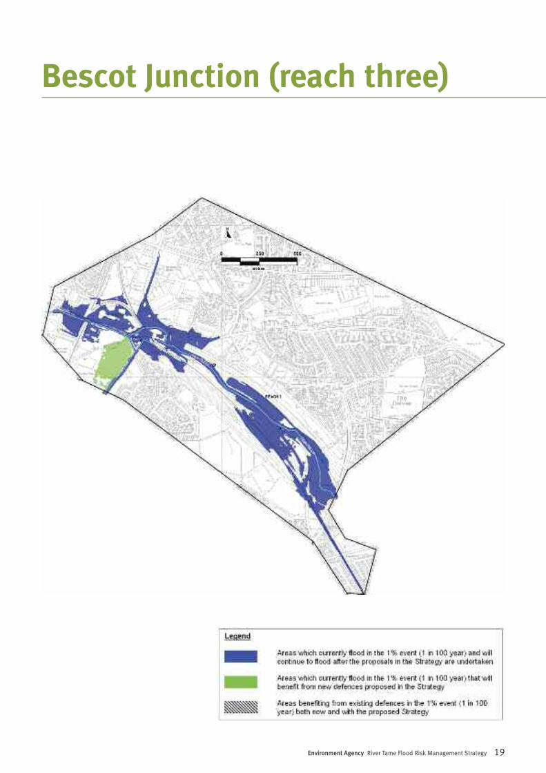
The Bescot Junction location contains a mix ofresidential and industrial properties includingthe local landmark of Walsall Football Clubstadium and a nationally important rail freightyard.
Flood risk• Without defences there would be 34
properties at risk;• There are currently 34 properties at risk;• The current flood defences therefore do
not manage the risk of flooding to anyproperties;
• There will be 20 properties at risk with theStrategy in place;
• The Strategy will therefore manage therisk of flooding to 14 additionalproperties;
• By 2025 an additional 5 properties will beat risk of flooding as a result of climatechange.
Our proposals – Option 3 (Maintain) The Strategy proposes to increase the height ofthe existing embankment to approximately 2metres on the left bank to reduce flood risk to theformer Spear & Jackson works. This will reducethe risk of flooding to 0.5% probability in anygiven year.
We are also proposing to replace existingdefences when they reach the end of their usefullife. We plan to undertake the majority of thiswork in the next five years and the remainderwithin the next 20 years.
Bescot Junction (reach three)
Environment Agency River Tame Flood Risk Management Strategy 19
Bescot Junction (reach three)
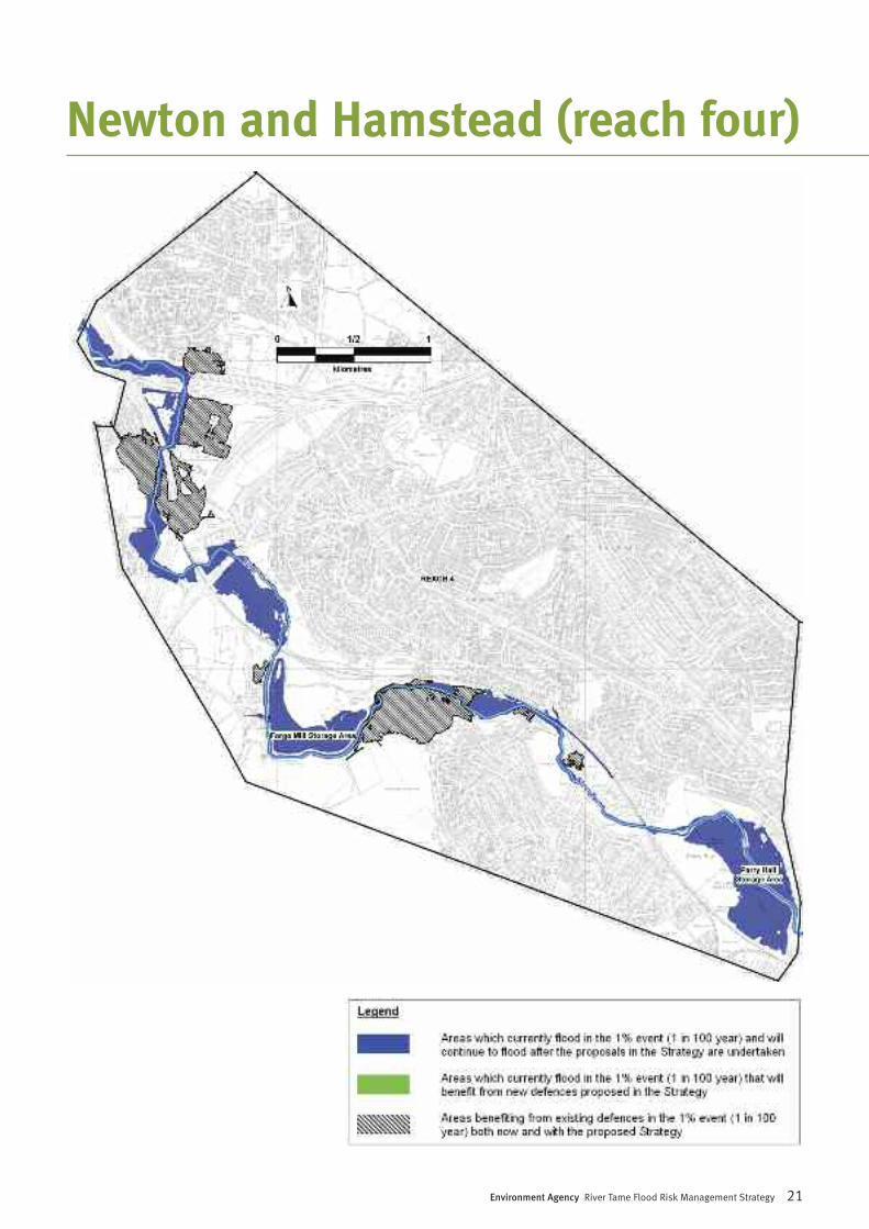
Downstream of Bescot Junction the River Tameflows past Yew Tree and on towards the SandwellValley Country Park, which provides 1700 acresof public open space in the heart of the WestMidlands. This area is an important haven forflora and fauna and plays an important role inthe flood risk management of the River Tame.Forge Mill Lake in the Country Park providesessential flood water storage, in addition tobeing a Royal Society for the Protection of Birds(RSPB) nature reserve.
Downstream of the park, the river flows throughthe residential and industrial area of Perry Barr,before entering Perry Hall Playing Fields. ThePlaying Fields also provide flood water storage.
Flood risk• Without defences there would be 160
properties at risk;• There are currently no properties at risk;• The current flood defences therefore
manage the risk of flooding to 160properties;
• There will be no properties at risk with theStrategy in place;
• The Strategy will not therefore managethe risk of flooding to any additionalproperties;
• By 2025 an additional 24 properties willbe at risk of flooding as a result of climatechange.
Our proposals – Option 3 (Maintain) and Option4 (Optimised Storage)We propose to improve the way in which theflood storage areas of Forge Mill and Perry Hallfunction. This will be done by allowing water toenter them earlier in a flood event. This willreduce flood risk to communities downstream atWitton in reach five.
One section of defence within this reach isnearing the end of its useful life and is proposedto be replaced within the next five years. Furtherreplacement of existing defences is proposedover the next 20 years.
20 Environment Agency River Tame Flood Risk Management Strategy
Newton and Hamstead (reach four)
Environment Agency River Tame Flood Risk Management Strategy 21
Newton and Hamstead (reach four)
22 Environment Agency River Tame Flood Risk Management Strategy
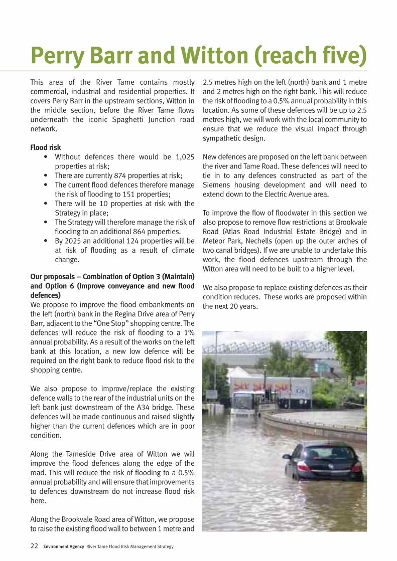
This area of the River Tame contains mostlycommercial, industrial and residential properties. Itcovers Perry Barr in the upstream sections, Witton inthe middle section, before the River Tame flowsunderneath the iconic Spaghetti Junction roadnetwork.
Flood risk• Without defences there would be 1,025
properties at risk;• There are currently 874 properties at risk;• The current flood defences therefore manage
the risk of flooding to 151 properties; • There will be 10 properties at risk with the
Strategy in place; • The Strategy will therefore manage the risk of
flooding to an additional 864 properties. • By 2025 an additional 124 properties will be
at risk of flooding as a result of climatechange.
Our proposals – Combination of Option 3 (Maintain)and Option 6 (Improve conveyance and new flooddefences) We propose to improve the flood embankments onthe left (north) bank in the Regina Drive area of PerryBarr, adjacent to the “One Stop” shopping centre. Thedefences will reduce the risk of flooding to a 1%annual probability. As a result of the works on the leftbank at this location, a new low defence will berequired on the right bank to reduce flood risk to theshopping centre.
We also propose to improve/replace the existingdefence walls to the rear of the industrial units on theleft bank just downstream of the A34 bridge. Thesedefences will be made continuous and raised slightlyhigher than the current defences which are in poorcondition.
Along the Tameside Drive area of Witton we willimprove the flood defences along the edge of theroad. This will reduce the risk of flooding to a 0.5%annual probability and will ensure that improvementsto defences downstream do not increase flood riskhere.
Along the Brookvale Road area of Witton, we proposeto raise the existing flood wall to between 1 metre and
2.5 metres high on the left (north) bank and 1 metreand 2 metres high on the right bank. This will reducethe risk of flooding to a 0.5% annual probability in thislocation. As some of these defences will be up to 2.5metres high, we will work with the local community toensure that we reduce the visual impact throughsympathetic design.
New defences are proposed on the left bank betweenthe river and Tame Road. These defences will need totie in to any defences constructed as part of theSiemens housing development and will need toextend down to the Electric Avenue area.
To improve the flow of floodwater in this section wealso propose to remove flow restrictions at BrookvaleRoad (Atlas Road Industrial Estate Bridge) and inMeteor Park, Nechells (open up the outer arches oftwo canal bridges). If we are unable to undertake thiswork, the flood defences upstream through theWitton area will need to be built to a higher level.
We also propose to replace existing defences as theircondition reduces. These works are proposed withinthe next 20 years.
Perry Barr and Witton (reach five)
Environment Agency River Tame Flood Risk Management Strategy 23
Perry Barr and Witton (reach five)
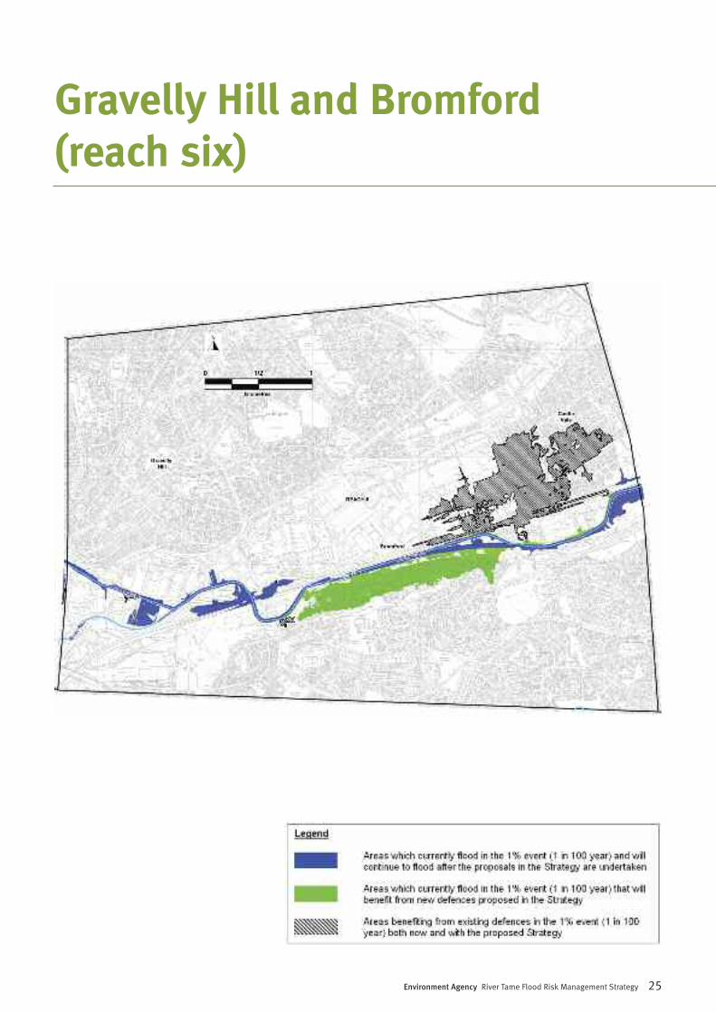
Downstream of Spaghetti Junction the River Tameflows underneath the M6, through Gravelly Hill,Bromford and Castle Vale. The Gravelly Hill areacontains a high number of commercial andindustrial properties. Further on, the river flowspast the large residential areas of Bromford onthe right bank, and Castle Vale on the left bank.
Flood risk• Without defences there would be 3,410
properties at risk;• There are currently 1,250 properties at
risk;• The current flood defences therefore
manage the risk of flooding to 2,160properties;
• There will be 11 properties at risk with theStrategy in place;
• The Strategy will therefore manage therisk of flooding to an additional 1,239properties.
• By 2025 an additional 17 properties willbe at risk of flooding as a result of climatechange.
Our proposals – Combination of Option 3(Maintain) and Option 6 (Improve conveyanceand new flood defences) We propose to raise the height of the existingdefence on the right bank to manage flood risk inBromford. This will reduce the risk of flooding toa 1% probability for any given year and will beachieved by constructing new flood defences 1.8metres high. Flood defences are also proposedto protect the area of Castle Vale on the left bankof the River Tame. These will be built to a 1%annual probability of flooding and will consist ofwalls between 1 metre and 2.5 metres in heightand an embankment approximately 1.5 metreshigh. These will replace a section of old defencesapproximately 1 metre high and are required toensure that the improvements proposed forBromford do not increase flood risk to CastleVale.
We are also proposing to replace existingdefences when they reach the end of their usefullife. Some of this work is proposed in the nextfive years, but the majority will be undertakenwithin the next 20 years.
24 Environment Agency River Tame Flood Risk Management Strategy
Gravelly Hill and Bromford(reach six)
Environment Agency River Tame Flood Risk Management Strategy 25
Gravelly Hill and Bromford(reach six)
26 Environment Agency River Tame Flood Risk Management Strategy
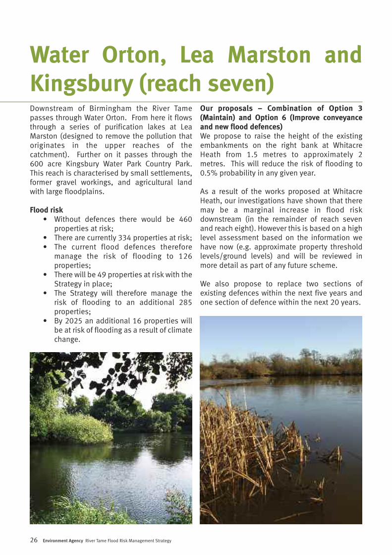
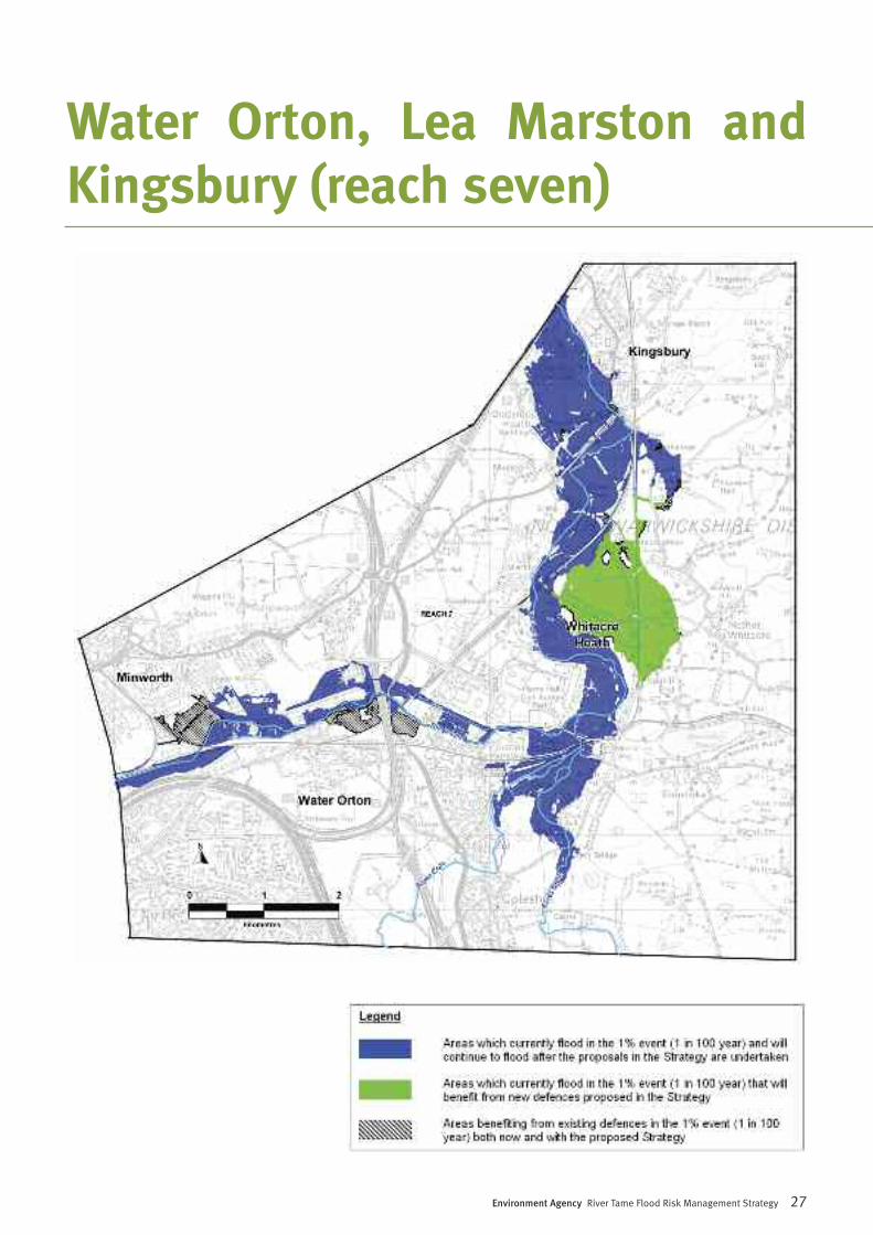
Downstream of Birmingham the River Tamepasses through Water Orton. From here it flowsthrough a series of purification lakes at LeaMarston (designed to remove the pollution thatoriginates in the upper reaches of thecatchment). Further on it passes through the600 acre Kingsbury Water Park Country Park.This reach is characterised by small settlements,former gravel workings, and agricultural landwith large floodplains.
Flood risk• Without defences there would be 460
properties at risk;• There are currently 334 properties at risk;• The current flood defences therefore
manage the risk of flooding to 126properties;
• There will be 49 properties at risk with theStrategy in place;
• The Strategy will therefore manage therisk of flooding to an additional 285properties;
• By 2025 an additional 16 properties willbe at risk of flooding as a result of climatechange.
Our proposals – Combination of Option 3(Maintain) and Option 6 (Improve conveyanceand new flood defences) We propose to raise the height of the existingembankments on the right bank at WhitacreHeath from 1.5 metres to approximately 2metres. This will reduce the risk of flooding to0.5% probability in any given year.
As a result of the works proposed at WhitacreHeath, our investigations have shown that theremay be a marginal increase in flood riskdownstream (in the remainder of reach sevenand reach eight). However this is based on a highlevel assessment based on the information wehave now (e.g. approximate property thresholdlevels/ground levels) and will be reviewed inmore detail as part of any future scheme.
We also propose to replace two sections ofexisting defences within the next five years andone section of defence within the next 20 years.
Water Orton, Lea Marston andKingsbury (reach seven)
Environment Agency River Tame Flood Risk Management Strategy 27
Water Orton, Lea Marston andKingsbury (reach seven)
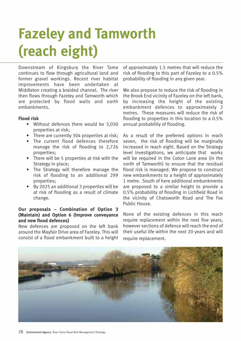
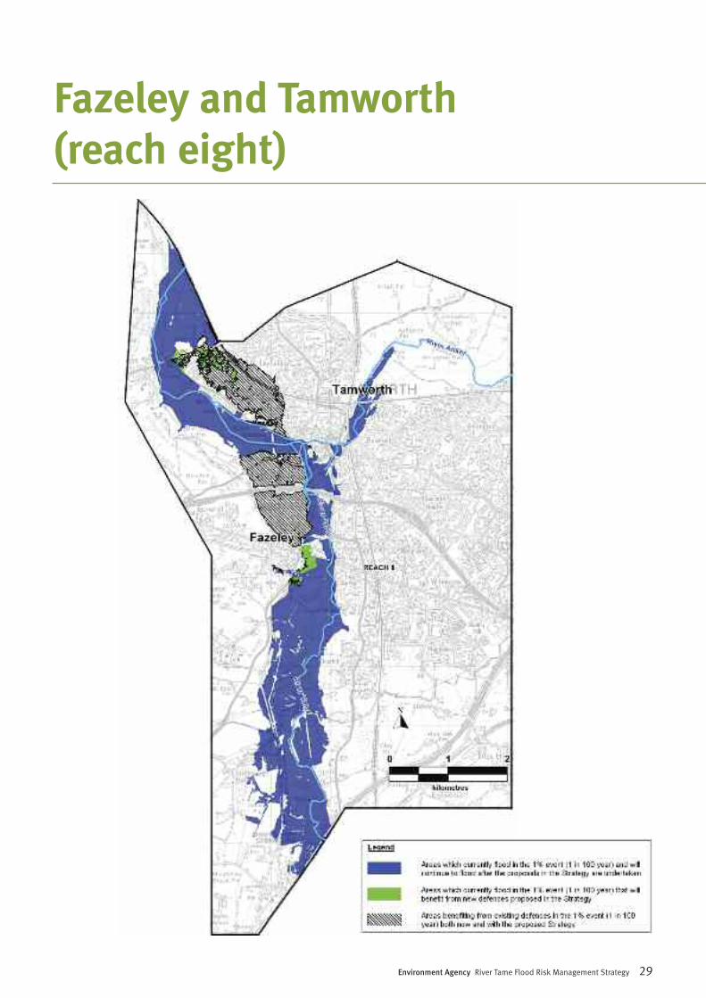
Downstream of Kingsbury the River Tamecontinues to flow through agricultural land andformer gravel workings. Recent river habitatimprovements have been undertaken atMiddleton creating a braided channel. The riverthen flows through Fazeley and Tamworth whichare protected by flood walls and earthembankments.
Flood risk• Without defences there would be 3,030
properties at risk;• There are currently 304 properties at risk;• The current flood defences therefore
manage the risk of flooding to 2,726properties;
• There will be 5 properties at risk with theStrategy in place;
• The Strategy will therefore manage therisk of flooding to an additional 299properties;
• By 2025 an additional 3 properties will beat risk of flooding as a result of climatechange.
Our proposals – Combination of Option 3(Maintain) and Option 6 (Improve conveyanceand new flood defences) New defences are proposed on the left bankaround the Mayfair Drive area of Fazeley. This willconsist of a flood embankment built to a height
of approximately 1.5 metres that will reduce therisk of flooding to this part of Fazeley to a 0.5%probability of flooding in any given year.
We also propose to reduce the risk of flooding inthe Brook End vicinity of Fazeley on the left bank,by increasing the height of the existingembankment defences to approximately 2metres. These measures will reduce the risk offlooding to properties in this location to a 0.5%annual probability of flooding.
As a result of the preferred options in reachseven, the risk of flooding will be marginallyincreased in reach eight. Based on the Strategylevel investigations, we anticipate that workswill be required in the Coton Lane area (in thenorth of Tamworth) to ensure that the residualflood risk is managed. We propose to constructnew embankments to a height of approximately1 metre. South of here additional embankmentsare proposed to a similar height to provide a0.5% probability of flooding in Lichfield Road inthe vicinity of Chatsworth Road and The FoxPublic House.
None of the existing defences in this reachrequire replacement within the next five years,however sections of defence will reach the end oftheir useful life within the next 20 years and willrequire replacement.
28 Environment Agency River Tame Flood Risk Management Strategy
Fazeley and Tamworth(reach eight)
Environment Agency River Tame Flood Risk Management Strategy 29
Fazeley and Tamworth(reach eight)
30 Environment Agency River Tame Flood Risk Management Strategy
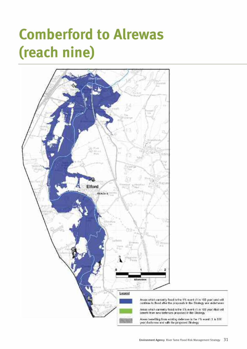
Downstream of Tamworth the river flows througha largely rural landscape with wide floodplains,passing the small settlements of Comberfordand Elford which are situated on the right bank,before the confluence with the River Trent.
Flood risk• Without defences there would be 285
properties at risk;• There are currently 26 properties at risk;• The current flood defences therefore
manage the risk of flooding to 259properties;
• There will be 31 properties at risk with theStrategy in place;
• We predict that the Strategy willmarginally increase flood risk to 5properties;
• By 2025 an additional 133 properties willbe at risk of flooding as a result of climatechange.
Our proposals – Option 3 (Maintain) We propose to continue maintaining currentdefences and structures to the existing standardof protection, plus removing blockages wherethey cause a flood risk.
Based on the information we know now, weexpect that the measures proposed upstream onthe river will marginally increase flood risk to asmall number of properties in this reach. Theseproperties are already at risk of flooding, but weexpect them to be put at marginally increasedflood risk as a result of the Strategy proposalsupstream. We will engage with the communityand property owners concerned to address thisissue and will undertake appropriate flood riskmanagement measures (if required) to minimisethis impact. This may for example, includeindividual property protection. In addition, wewill also promote increased use of our floodwarning service.
Comberford to Alrewas(reach nine)
Environment Agency River Tame Flood Risk Management Strategy 31
Comberford to Alrewas(reach nine)
Strategic Environmental AssessmentWe have undertaken a Strategic EnvironmentalAssessment (SEA) to understand the impacts ofthe draft Strategy and propose mitigation forthem. We have documented this in theEnvironmental Report (ER). We have explainedhow we have dealt with responses to theconsultation on the draft Strategy, along withhow consultation responses have changed theSEA and the final Strategy, within the Statementof Environmental Particulars (SoEP). Both ofthese documents should be read in conjunctionwith this Strategy.
The high level environmental and social impactsof the Strategy are explained in the ER. We haveidentified mitigation to reduce or eliminate theseimpacts in the ER, and updated this withconsultation responses in the SoEP.
Environmental opportunitiesThere are significant opportunities forenvironmental and social improvements whichcan either be integrated in our flood riskmanagement work or be undertaken alongsideour works.
The opportunities that are identified within theER and updated by the SoEP focus on thesethemes:
• habitat improvements to improvebiodiversity;
• improvements to public access andenjoyment of the River Tame corridor, andinterpretation of this environment for thepublic benefit;
• improvements to fish passage andhabitat by installing fish passes on weirsor removing weirs, and creation of fishrefuges;
• river restoration and naturalisation.
The opportunities we develop further will dependon the flood risk management works weundertake, our funding, willingness andinvolvement of partners, whether the proposalswill help us achieve our targets to improve theenvironment, and whether we can achievetargets for other organisations along with ours.We want to work in partnership with otherorganisations and communities to take more ofthese opportunities forward than we could do byourselves.
The Strategy will include and develop themitigation and environmental improvementsidentified within the ER and SoEP alongsidedeveloping the flood risk management works.
32 Environment Agency River Tame Flood Risk Management Strategy
Environmental summary
River Tame at Lady Walk
Environment Agency River Tame Flood Risk Management Strategy 33
As we implement the Strategy, we will review it toensure that it remains appropriate. At anappropriate point in the future, for examplebefore our next set of flood risk managementassets need to be replaced, we will review thepreferred Strategy options along with the
strategic environmental assessment todetermine whether they are still valid or needreassessing. Our reviews would includedetermining whether the on-going managementactivities provide value for money and whetherthey should be continued.
Review of the Strategy
Summary of the StrategyThe Strategy proposals will reduce the risk offlooding from the River Tame for 2,850residential and commercial properties. Inaddition it will manage flood risk to an additional6,900 properties by maintaining/replacingexisting flood defences,
However, there are 223 properties where wecannot justify the economic cost of increasingthe level of flood risk management. The majority
of these are located in the following reaches:
• Oldbury Arm• Bescot • Water Orton and Lea Marston • Comberford to Alrewas
We will work with these communities to providegeneral advice and where appropriate identifyways of improving flood resilience.
How we consultedPublic consultation was carried out between Mayand August 2009. We aimed to contact andprovide information to all those affected andinterested by the proposals. Consultationdocuments were made available at our offices, atpublic libraries as well as on our public website.
We carried out a wide range of consultationactivities, including public meetings and drop insessions. We contacted statutory consulteessuch as Natural England, English Heritage andlocal planning authorities. We also consultedparish councils and local flood groups that usethe river or have an interest on how it ismanaged. We did leaflet drops at severallocations and issued press releases in localnewspapers to raise awareness of consultationon the draft Strategy and to identify interestedand affected parties.
We are aware that we may not have reachedeveryone that has an interest in the Strategy.There will be future opportunities fororganisations and individuals to have their sayon our proposals when they are developed intomore detail, as many detailed decisions stillneed to be made.
Specific responses to the consultationMany of the respondents requested furtherinformation that we endeavoured to provide.There were many comments relevant to theStrategic Environmental Assessment(Environmental Report), which are dealt with inthe Statement of Environmental Particulars.Many comments have resulted in clarifications ofor additional information being included in theStrategy above. The following are the keyremaining suggestions or issues raised on theStrategy along with our responses to them.
Query: The proposals to improve flood riskmanagement in the upper reaches will increaseflooding to downstream locations. How will thisbe managed?
Response: We will ensure that any impacts as aresult of measures undertaken elsewhere aremitigated and that no property receives areduced standard of protection as a result of theproposals.
Query: There is a risk that flooding may be madeworse temporarily if the improvements start atthe upstream end and progress down the river.How will the work be sequenced to avoid thissituation?
Response: As part of the Strategyimplementation stage, we will review thesequencing of the work to ensure that flooding isnot made worse for anyone.
Query: The Strategy should make it clear that theEnvironment Agency has responsibility overgroundwater flooding.
Response: Currently, there is no singleorganisation responsible for all forms offlooding, including groundwater flooding. Recentrecommendations have been made to give theEnvironment Agency sole responsibility for allforms of flooding. However, at present we areunable to take responsibility for groundwaterflooding.
Query: The Strategy doesn’t refer to RegionalSpatial Strategy, which proposes a significantincrease in house building across the WestMidlands region, in particular Birmingham andthe Black Country.
Response: The Strategy doesn’t refer to specifichousing development within the Tamecatchment area, as any new developments builton floodplain would need to provide their ownflood risk management measures.
34 Environment Agency River Tame Flood Risk Management Strategy
Responses to the draft Strategyconsultation
Environment Agency River Tame Flood Risk Management Strategy 35
Query: The Strategy should give provide greaterdetail on how the flood warning system operatesand how local businesses and residents can signup to receive warnings.
Response: The Environment Agency can issuedirect flood warnings to customers when riverlevels begin to rise and there is a risk of yourproperty flooding. You can receive warnings bytelephone, mobile, email, sms text message orfax. You can find out if your property or businessis at risk of flooding by calling Floodline on0845 988 1188 or by visiting www.environment-agency.gov.uk/floodmidlands. You can sign upto the Environment Agency’s free 24 hour floodwarning service online or via the Floodlinenumber above.
Query: Vegetation growth and littering causeblockages in the water course and increaseflooding - who is responsible for clearingvegetation and removing litter?
Response: The Environment Agency mayundertake routine maintenance of its assets onmain rivers, however ultimate responsibility toremove vegetation and litter lies with the riparianowners. However, if there are blockages in thewatercourse, which cause increased flood risk,we may take action to remove them. Everyonecan reduce the likelihood of blockages causingflooding by not littering or dumping rubbish nearrivers.
Query: The Strategy fails to recognise the seriousproblems caused by building the large bundsaround the Water Ski Centre, just north ofKingsbury village. These bunds have beenerected in recent years on natural flood plainwith the result that during severe flood events,more water is pushed towards the Birminghamand Fazeley Canal exacerbating floodingproblems in Kingsbury.
Response: Whilst the Strategy does notspecifically make reference to the bunds aroundthe Water Ski Centre the Strategy has identifiedthat they cause minimal impact to flood levelsdue to the wide nature of the floodplain. We arecurrently working with the landowner to reinstatethe floodplain by altering the bunds. This willavoid the need to remove the bunds, whichwould cause significant local disruption.
Query: Will the proposal to increase the height ofthe existing embankments on the right bank atWhitacre Heath by 500mm send more wateralong the valley into the Kingsbury Water Parkand potentially increase flooding in the park?
Response: We have investigated this issue aspart of the Strategy. Based on the information weknow now, we expect that there will be amarginal increase to flood risk at KingsburyWater Park. As we obtain more information anddetails, we will be able to quantify the impact, ifany and discuss any mitigation works with therelevant parties.
The following is a summary of issues that wereraised through the consultation exercise, whichhave not been considered in detail in theStrategy. These issues will be considered as theStrategy is implemented and as more detailsbecome available.
• Review flood risk in the Titford Road area(Oldbury Arm), taking in to account therecent drainage improvements undertakenby Severn Trent Water Authority.
• The affect that raised defences may haveon the canal network.
• Any proposed works to improve flooddefences should take in to account publicrights of ways and ensure there are nonegative impacts.
• Need to identify opportunities in the urbansections of the Tame to re-engage thepublic with the River course, throughpromotion and development of the Tamewalkway, linkages from adjacent parks andopen space and education/recreation.
• Any proposed works near/adjacent to theStrategic Road Network will need to bediscussed and reviewed with theHighways Agency.
• To consult with the relevant emergencyplanning organisations such as theStaffordshire Resilience Forum.
• To identify opportunities to improverecreational areas and promote wildlifeespecially in the urban areas inconsultation with local communities.
• Any new/improvement works to thedefences in Witton will need to take in toaccount the proposal for a new residentialdevelopment on the old Siemens site, offBrookvale Road.
• Investigate the flood route along theBirmingham & Fazeley Canal which causesflooding to a number of cottages inKingsbury Water Park as well as flooding ofa housing estate close to the marinaat Fazeley.
• Investigate the culvert along the A51 bythe Fox Public House (reach eight) which isthought to contribute to flooding in thislocation.
36 Environment Agency River Tame Flood Risk Management Strategy
Other issues
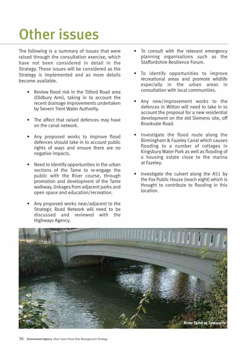
River Tame at Tamworth
Environment Agency River Tame Flood Risk Management Strategy 37
We will now look at specific solutions to reducingflood risk in line with the adopted Strategy. Thiswill involve further investigation and design ofthe individual works that can be justified andpromoted.
Key stagesThe Strategy has now been approved by theEnvironment Agency, allowing us to moveforward to implementation. To enable this, wewill produce more detailed proposals for each ofthe recommendations made in the Strategy toensure that the solutions are developed withinthe strategic vision and in an integrated manner.In doing so, the Tame Flood Risk ManagementStrategy will provide the best opportunity to:
a) reduce flood risk;b) minimise and mitigate potential impacts;c) maximise opportunities for environmental
improvements.
We have developed a programme to take forwardthe recommendations made within the Strategy.We plan (subject to funding) to deliver the shortterm (five year) recommendations through anumber of separate projects, which may bephased over several years depending on fundingavailability and the most efficient way ofdelivering the works on the ground.
To support the delivery of the Strategyrecommendations, in some areas we will need to
secure contributions from beneficiaries. Anycontributions we receive (financial or costavoidance) towards the costs of implementingthe improvement works will increase thelikelihood of those works going ahead. This is in line with the Environment Agency’sFlood and Coastal Risk Management ExternalContributions Policy (http://www.environment-agency.gov.uk/research/planning/33700.aspx)
We have recently completed one of therecommendations made in the Strategy througha scheme which has optimised the Perry HallFlood Storage Area at Perry Hall Playing Fields,Birmingham. This has improved the standard ofprotection to downstream communities in theWitton area of Birmingham.
For each of the projects arising from the Strategywe will obtain more information and data toestablish whether the Strategy option can beimplemented and to develop detailed proposalsin each area. We will consult further with localcommunities to explain these proposals and ouroverall timetable.
The longer term measures recommended in theStrategy will be reviewed and updated as thechanges and developments occur within thecatchment. Programmes of work to deliver thiswork will be identified and delivered in line withthe Strategy in order to manage flood risk overthe next 100 years.
Next steps
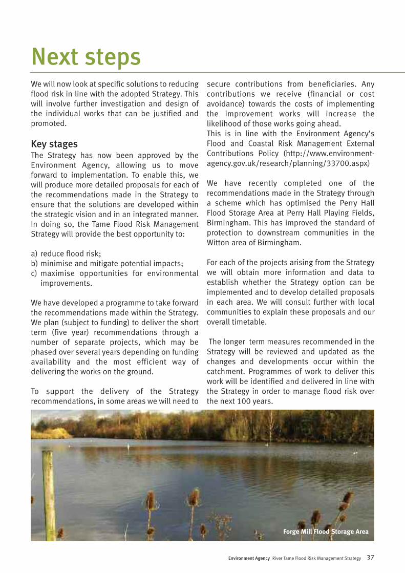
Forge Mill Flood Storage Area
Since the adoption of the Strategy, there hasbeen a number of policy changes within theEnvironment Agency, which has resulted in arefocus on our priorities. These are summarisedbelow:
• Following recent changes to EnvironmentAgency policy we have amended our approach toenvironmental improvements on the River Tame.The draft Strategy recommended the creation ofBiodiversity Action Plan (BAP) habitat as themain environmental opportunity. However, largescale freshwater BAP habitat creation atMiddleton Lakes is no longer a priority target forthe Environment Agency. New environmentaltargets set by government include our statutoryrequirement under the Water FrameworkDirective to improve the ecological quality ofwater bodies, for example improvements towater quality or creation of more naturalchannels, especially in the urban areas.Therefore, we will review environmentalopportunities proposed in the Strategy and SEAand our priority will change to focus on thesenew targets. We have discussed this change withthe key stakeholders affected.
• We have reviewed the proposals to improveflood storage in the upper Tame in more detailwhile investigating ways to implement thepreferred option in reach four. As part of theconsultation exercise, concerns were raised bythe RSPB and Sandwell Metropolitan BoroughCouncil regarding the impact on birds and thenature reserve of using the storage area at ForgeMill more frequently. Further detailedinvestigation in to the operation of the existingflood storage areas has identified that standalone improvements at Perry Hall Playing Fieldswill provide an acceptable reduction in flood riskdownstream at Witton. This means that theStrategy can currently be implemented with noneof the foreseen impacts at Forge Mill Lake. Theimprovements to the storage area at Perry Hallplaying fields have recently been completed onsite.
• In some cases the Strategy identifiesnew/improved defences which would benefitdevelopment land only. In these cases, we wouldexpect the landowner to provide their owndefences as part of any future redevelopmentproposals.
38 Environment Agency River Tame Flood Risk Management Strategy
What has changed since theadoption of the Strategy?
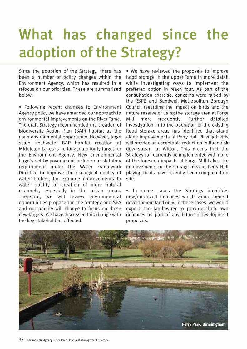
Perry Park, Birmimgham
Environment Agency River Tame Flood Risk Management Strategy 39
Assets These are flood defences and structures such as sluices that we maintain and mayalso own.
Braided channel A river with a variation in water depths and water flow. It incorporates series ofinter-connecting channels. This encourages river biodiversity.
Catchment The area contributing flow to a point on a drainage system.
Climate change The predicted variations in the earths climate whether by human or natural causes.
Confluence Where one river joins another.
Conveyance The flow of a river through a section of channel. Conveyance can be reduced byobstacles or constrictions to flow.
Culvert A man-made channel usually used to divert flows around or under structures.A culvert can be covered to form a tunnel.
Design life The time when a defence is considered acceptable in terms of serviceability andstructural strength.
Dredging Lowering the river bed or widening the banks to create a larger or deeper channelprofile.
Flood resilience These are measures that can be introduced to properties that limit damage during ameasures flood and subsequently speed up recovery after a flood.
Floodplain Any area of land over which water flows or is stored during a flood event or wouldflow but for the presence of flood defences.
Flood Risk The level of flood risk is the product of the frequency or likelihood of the floodevents and their consequences (such as loss, damage, harm, distress and disruption).
Flood Risk A long-term (usually 100 years) documented plan for river or coastal management,Management Strategy including all necessary work to meet defined flood and coastal defence objectives for
the target area.
Impacts A change in the baseline condition due to the implementation of the option (e.g. theworks associated with the construction of defences on the River Tame).
Statement of A document that outlines the changes that have occurred to a Plan or Strategy asEnvironmental a result of consultation on the draft Plan or Strategy. It explains how environmental
information has influenced the Strategy as adopted.
Reach Sections or lengths of river.
Standard The level of flood protection provided by a defence.of protection
Glossary
Particulars

40 Environment Agency River Tame Flood Risk Management Strategy
Strategic The application of environmental assessment at a strategic level in the decision-Environmental making process. The application has become statutory under both UK andAssessment (SEA) European legislation.
Sustainability Development which meets the needs of the present without affecting the ability offuture generations to meet their own needs. It should also take account, for example,of the long-term demands for non-renewable materials.

Environment Agency River Tame Flood Risk Management Strategy 41
Notes

42 Environment Agency River Tame Flood Risk Management Strategy
Notes
Related publications
River Tame Flood Risk Management Strategy: Environmental Report (May2009) - this documents the likely impacts of the draft Strategy, how theycould be mitigated, and opportunities for environmental improvements.The impacts and mitigation have not fundamentally changed sinceconsultation during finalisation of the Strategy.
This document is available on our website under the following chapters:
Chapter 1 - Introduction and Background, Chapter 2 - Approach to SEA,Chapter 3 - Relevant Plans and Strategies, Chapter 4 - ConsultationProduct code: GEMI0511BTWV-E-E
Chapter 5 - Key Issues, Constraints and Opportunities, Chapter 6 -Assessment of Environmental Effects and Evaluation of Impact Significance(part 1/2)Product code: GEMI0511BTWW-E-E
Chapter 6 - Assessment of Environmental Effects and Evaluation of ImpactSignificance (part 2/2)Product code: GEMI0511BTWX-E-E
Chapter 7 - Implementation and Monitoring Plan and FiguresProduct code: GEMI0511BTWY-E-E
Glossary of terms and abbreviations, Appendix A: Relevant Plans andPolicies, Appendix B: ConsultationProduct code: GEMI0511BTWZ-E-E
Appendix C: Results of Option Screening, Appendix D: Summary of OptionsAppraisal - Individual Flood CellsProduct code: GEMI0511BTXA-E-E
Appendix E: Indicative Landscape PlansProduct code: GEMI0511BTXB-E-E
River Tame Flood Risk Management Strategy: Statement of EnvironmentalParticulars (May 2011) - this document explains how consultationresponses on the draft Strategy have been taken into account, how theenvironment has been taken into account when finalising the Strategy,clarifies aspects of the Environmental Report, adds more detail to somemitigation, and identifies additional opportunities for environmentalimprovements.
This document is availabe on our website.
Statement of Environmental Particulars:Product code GEMI0511BTWU-E-E
GEMI0511BTWT-E-E
Environment first: This publication is printed on paper madefrom 100 per cent previously used waste. By-products from
making the pulp and paper are used for composting and fertiliser, formaking cement and for generating energy.
Would you like to find out more about us,or about your environment?
Then call us on03708 506506 (Mon-Fri 8-6)
email [email protected]
or visit our website www.environment-agency.gov.uk
incident hotline 0800 80 70 60 (24hrs)
floodline 0845 988 1188