
Talbot County Transportation Planning Study/ Thoroughfare · PDF file ·...
6
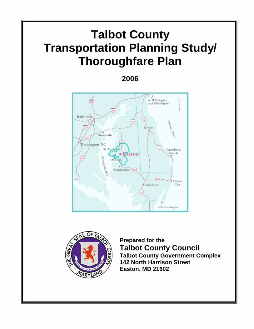
Talbot County Transportation Planning Study/ Thoroughfare Plan 2006 Prepared for the Talbot County Council Talbot County Government Complex 142 North Harrison Street Easton, MD 21602
Transcript of Talbot County Transportation Planning Study/ Thoroughfare · PDF file ·...
Talbot County Transportation Planning Study/
Thoroughfare Plan
2006
Prepared for the Talbot County Council Talbot County Government Complex 142 North Harrison Street Easton, MD 21602
Talbot County, Maryland
Transportation Planning Study/Thoroughfare Plan 2006
TABLE OF CONTENTS Page ii
TALBOT COUNTY TRANSPORTATION PLANNING STUDY/ THOROUGHFARE PLAN
Table of Contents Page Executive Summary.....................................................................................................vii A. Introduction and Background ............................................................................1
1. Introduction .........................................................................................................2 2. Overview of Current Talbot County Conditions ...............................................2 3. Talbot County Comprehensive Plan Policies ...................................................4 4. Easton Comprehensive Plan Policies ...............................................................5 5. Planning Study Philosophy and Approach.......................................................6
a. Existing Conditions..................................................................................6 b. Future Conditions.....................................................................................8
B. Data Sources .......................................................................................................9
1. Introduction .......................................................................................................10 2. Traffic Data Sources .........................................................................................10
a. Turning Movement Counts ....................................................................10 b. Design Period Justification ...................................................................10 c. Forecasting Data ...................................................................................11 d. Signal Timing ..........................................................................................11 e. Accident data..........................................................................................12
3. System Inventory ..............................................................................................12 a. State Roadway System ..........................................................................12 b. County Roadway System.......................................................................12
C. Quantifying Design Year Volumes (2015 and 2030) .......................................14 1. Introduction .......................................................................................................15 2. Travel Forecasting ............................................................................................16
a. Network Development............................................................................17 i Transportation Analysis Zones.............................................................17 ii Roadway Network...................................................................................17 iii Centroids.................................................................................................17 iv Centroid Connectors..............................................................................17 v External Stations ....................................................................................20
b. Trip Generation.......................................................................................22 i Demographic and Economic Data ........................................................22 ii Determining Internal and External Trips........................................................ 27 iii Determining Pass-Through Trips ................................................................... 29
c. Trip Distribution......................................................................................32 d. Traffic Assignment and Link Volumes..................................................32 e. Post Processing .....................................................................................32

Talbot County, Maryland
Transportation Planning Study/Thoroughfare Plan 2006
TABLE OF CONTENTS Page iii
f. Turning Movements ...............................................................................34
D. Capacity and Operational Analyses ................................................................35 1. Level of Service.................................................................................................36
a. Introduction.............................................................................................36 b. Mitigation Recommendations................................................................36 c. Intersection Level of Service .................................................................37
i Highway Capacity Manual Technique .................................................37 ii Critical Lane Analysis Technique ........................................................38
d. Roadway Link/ Corridor Level of Service.............................................38 2. Intersections......................................................................................................39
a. Existing Conditions................................................................................39 i Intersection Conditions ........................................................................39 ii Volumes .................................................................................................39 iii Level of Service.....................................................................................40 iv Existing Volume Signal Warrant Analysis ..........................................43 v Existing Conditions Needs Evaluation................................................44
b. Future Conditions – Short Term (2015) and Long Term (2030) ..........48 i Volumes .................................................................................................48 ii Level of Service.....................................................................................49 iii Future Volume Signal Warrant Analysis .............................................53 iv Future Roundabout Analysis ...............................................................54 v Short Term (2015) and Long Term (2030) Needs Evaluation.............54 vi Town of Trappe .....................................................................................64 vii Commercial Development ....................................................................64
3. Corridors............................................................................................................65 a. Existing Conditions................................................................................65
i Roadway Conditions.............................................................................65 ii Volumes .................................................................................................65 iii Level of Service.....................................................................................67 iv Existing Conditions Needs Evaluation................................................69
b. Future Conditions – Short Term (2015) and Long Term (2030) ..........70 i Volumes .................................................................................................70 ii Level of Service.....................................................................................72 iii Short Term (2015) and Long Term (2030) Needs Evaluation.............74
E. Safety Analysis..................................................................................................76 1. Introduction .......................................................................................................77 2. Accidents ...........................................................................................................77 3. Roadway Conditions.........................................................................................79 4. Roadway Standards..........................................................................................81 5. Intersection Safety ............................................................................................82 6. Bicycle Accessibility.........................................................................................82 7. Safety Improvements ........................................................................................83 8. Emergency Vehicles .........................................................................................84
Talbot County, Maryland
Transportation Planning Study/Thoroughfare Plan 2006
TABLE OF CONTENTS Page iv
9. Evacuation Routes............................................................................................85
F. Conclusion and Recommendations ................................................................86 1. Conclusion.........................................................................................................87
a. Current State Highway Initiatives..........................................................87 b. Current Talbot County Initiatives ..........................................................89
2. Recommendations ............................................................................................90 a. Access Management ..............................................................................91 b. Travel Demand Management .................................................................91
List of Tables Page Table 1 - Talbot County Land Use - 2000................................................................3 Table 2 - Talbot County Population as Percent by Jurisdiction - 2000................3 Table 3 - Age Distribution as Percent of Total Population - 2000.........................4 Table 4 - Study Intersections...................................................................................7 Table 5 - Study Corridors.........................................................................................8 Table 6 - Known Developments in Talbot County (2005 to 2015).......................24 Table 7 - Trip Attraction Rates...............................................................................24 Table 8 - Retail and Nonretail Employment in Talbot County.............................24 Table 9 - Worker Flows to Census Tracts in Talbot County ...............................26
Table 10 - Retail and Nonretail Employment in Talbot County by Census Tract26 Table 11 - Retail and Nonretail Jobs in Talbot County ........................................26 Table 12 - External to Internal (XI) Flows..............................................................27 Table 13 - Internal to External (IX) Flows..............................................................27 Table 14 - External to Internal (XI) Flows Apportioned to Station ......................28 Table 15 - Internal to External (IX) Flows Apportioned to Station ......................28 Table 16 - External to Internal (XI) and Internal to External (IX) Trips................29 Table 17 - External to External (XX) Vehicle Trips in 2004, 2015 and 2030........30 Table 18 - XX Trips 2004.........................................................................................31 Table 19 - XX Trips 2015.........................................................................................31 Table 20 - XX Trips 2030.........................................................................................31 Table 21 – Travel Forecast Link Volumes in 2015, 2030......................................33 Table 22 - HCM LOS Criteria for Signalized Intersections ..................................37 Table 23 - HCM LOS Criteria for Unsignalized Intersections ..............................38 Table 24 - CLA LOS Criteria...................................................................................38 Table 25 - Existing Intersection Levels of Service – Critical Lane Technique ..41 Table 26 - Existing Intersection Levels of Service - HCM Technique.................42 Table 27 - Future Critical Lane Analysis Intersection Level of Service .............50 Table 28 - Future HCM Technique Intersection Levels of Service......................52 Table 29 - Existing Corridor Volumes...................................................................66 Table 30 - Existing Corridor Levels of Service.....................................................68 Table 31 - Proposed Existing Year Conditions Corridor Level of Service.........69 Table 32 - Future Corridor Volumes......................................................................71 Table 33 - Future Corridor Levels of Service .......................................................73
Talbot County, Maryland
Transportation Planning Study/Thoroughfare Plan 2006
TABLE OF CONTENTS Page v
Table 34 - Proposed Future Year Conditions Corridor Level of Service - 2015 74 Table 35 - Proposed Future Year Conditions Corridor Level of Service - 2030 75 Table 36 - Accident Summary Notable Trends (2002-2004) ................................77 Table 37 - Corridor Accident Summary Notable Trends (2002-2004) ................78 Table 38 - County Roadways with Significant Accident Frequencies (2002-2004) 78 Table 39 - Deficient Safety Conditions County Roadways..................................80 Table 40 - Safety Improvement Methods ..............................................................85 Table 41 - Access Management Techniques........................................................91 Table 42 - Travel Demand Management Techniques...........................................92 Table 43 – Talbot County Intersections Improvement Needs/Concerns ...........93 Table 44 – Talbot County Study Corridors Improvement Needs/Concerns ......94 Table 45 – Talbot County Corridor Concerns ......................................................95 List of Figures Page Figure 1 - Intersections Modeled...........................................................................15 Figure 2 - Travel Forecasting Flow Chart .............................................................16 Figure 3 - Transportation Analysis Zones............................................................18 Figure 4 - Roadway Network, Centroids and Centroid Connectors ...................19 Figure 5 - External Stations ...................................................................................21 Figure 6 - Census Tracts........................................................................................25 Figure 7 - Average Travel Time by Trip Purpose .................................................32 Figure 8 - Site 12 (US50 @ MD322) Existing Needs Proposed Conditions........44 Figure 9 - Site 19 (US50 @ Dutchman’s Ln.) Existing Needs Proposed Conditions 45 Figure 10 - Site 27 (US50 @ MD404) Existing Needs Proposed Conditions......46 Figure 11 - Site 33 (US50 @ MD328) Existing Needs Proposed Conditions......47 Figure 12 - Site 34 (US50 @ MD331) Existing Needs Proposed Conditions......48 Figure 13 - Site 6 (MD322 @ MD333) Short Term Needs Proposed Conditions 55 Figure 14 - Site 8 (MD33 @ MD322) Short Term Needs Proposed Conditions ..56 Figure 15 - Site 12 (US50 @ MD322) Short Term Needs Proposed Conditions.57 Figure 16 - Site 13 (US50 @ MD309) Short Term Needs Proposed Conditions.58 Figure 17 - Site 27 (US50 @ MD404) Short Term Needs Proposed Conditions.59 Figure 18 - Site 19 (US50 @ Dutchman’s Ln.) Long Term Needs Proposed Conditions 60 Figure 19 - Site 25 (US50 @ Barber Rd.) Long Term Needs Proposed Conditions 61 Figure 20 - Site 27 (US50 @ MD404) Long Term Needs Proposed Conditions 62 Figure 21 - Site 32 (US50 @ Chapel Rd.) Long Term Needs Proposed Conditions 63 Figure 22 - Site 39 (US50 @ MD565) Long Term Needs Proposed Conditions 64
Talbot County, Maryland
Transportation Planning Study/Thoroughfare Plan 2006
TABLE OF CONTENTS Page vi
List of Appendices A. Base Data
1. Study Intersection Photographs 2. Study Corridor Photographs 3. Traffic Turning Movement Counts 4. 2002-2004 Accident Data 5. Traffic Signal Timing Data 6. SHA Highway Needs Inventory 7. SHA Consolidated Transportation Program 8. Validation of Existing Turning Movement Count Data
B. Engineering Study
1. Existing and Future Year Critical Lane Analyses 2. Intersection Volume Summary 3. Highway Capacity Intersection Analyses 4. Highway Capacity Corridor Analyses 5. MUTCD Traffic Signal Warrant Summary 6. County Roadway Inventory 7. Conceptual Improvement Critical Lane Analyses 8. Conceptual Improvement Highway Capacity Intersection Analyses 9. Conceptual Improvement Highway Capacity Corridor Analyses 10. Standard Details and Recommended Typical Sections
C. Displays
1. Study Intersections and Corridors 2. Existing Condition Intersection Level of Service 3. Future Conditions 2015 Intersection Level of Service 4. Future Conditions 2030 Intersection Level of Service 5. Existing Conditions Corridor Level of Service 6. Future Conditions 2015 Corridor Level of Service 7. Future Conditions 2030 Corridor Level of Service 8. Existing Intersection & Corridor Improvement Needs 9. Short Term (2015) Intersection & Corridor Improvement Needs 10. Long Term (2030) Intersection & Corridor Improvement Needs
`


