Suru Saha and Hua-Lu Pan, EMC/NCEP With Input from Stephen Lord, Mark Iredell, Shrinivas Moorthi,
35
Suru Saha and Hua-Lu Pan, EMC/NCEP With Input from Stephen Lord, Mark Iredell, Shrinivas Moorthi, David Behringer, Ken Mitchell, Bob Kistler, Jack Woollen, Huug van den Dool, Catherine Thiaw and others Design of the 30-year NCEP CFSRR T382L64 Global Reanalysis and T126L64 Seasonal Reforecast Project (1979-2008)
-
Upload
montana-irwin -
Category
Documents
-
view
51 -
download
0
description
Design of the 30-year NCEP CFS RR. T382L64 Global R eanalysis and T126L64 Seasonal R eforecast Project (1979-2008). Suru Saha and Hua-Lu Pan, EMC/NCEP With Input from Stephen Lord, Mark Iredell, Shrinivas Moorthi, David Behringer, Ken Mitchell, Bob Kistler, - PowerPoint PPT Presentation
Transcript of Suru Saha and Hua-Lu Pan, EMC/NCEP With Input from Stephen Lord, Mark Iredell, Shrinivas Moorthi,
Suru Saha and Hua-Lu Pan, EMC/NCEP
With Input fromStephen Lord, Mark Iredell, Shrinivas Moorthi,
David Behringer, Ken Mitchell, Bob Kistler, Jack Woollen, Huug van den Dool, Catherine Thiaw and others
Design of the 30-year NCEP CFSRR
T382L64 Global Reanalysis and
T126L64 Seasonal Reforecast Project(1979-2008)
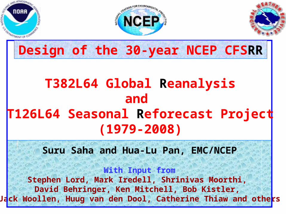
For a new Climate Forecast System (CFS) implementation
Two essential components:
A new Reanalysis of the atmosphere, ocean, seaice and land over the 31-year period (1979-2009) is required to provide
consistent initial conditions for:
A complete Reforecast of the new CFS over the 29-year period (1981-2009), in order to provide stable calibration and skill
estimates of the new system, for operational seasonal prediction at NCEP

For a new CFS implementation (contd)
1. Analysis Systems : Operational GDAS:Atmospheric (GADAS)-GSIOcean-ice (GODAS) andLand (GLDAS)
2. Atmospheric Model :Operational GFS
New Noah Land Model
3. Ocean Model : New MOM4 Ocean Model
New SEA ICE Model

For a new CFS implementation (contd)
1. An atmosphere at high horizontal resolution (spectral T382, ~35 km) and high vertical resolution (64 sigma-pressure hybrid levels)
2. An interactive ocean with 40 levels in the vertical, to a depth of 4737 m, and high horizontal resolution of 0.25 degree at the tropics, tapering to a global resolution of 0.5 degree northwards and southwards of 10N and 10S respectively
3. An interactive sea-ice model
4. An interactive land model with 4 soil levels

There are three main differences with the earlier two NCEP Global Reanalysis efforts:
• Much higher horizontal and vertical resolution (T382L64) of the atmosphere (earlier efforts were made with T62L28 resolution)
• The guess forecast will be generated from a coupled atmosphere – ocean – seaice - land system
• Radiance measurements from the historical satellites will be assimilated in this Reanalysis
To conduct a Reanalysis with the atmosphere, ocean, seaice and land coupled to each other will be a novelty, and will hopefully address important issues, such as the correlations between sea surface temperatures and
precipitation in the global tropics, etc.

• Hybrid vertical coordinate (sigma-pressure)
• NOAH Land Model : 4 soil levels. Improved treatment of snow and frozen soil
• Sea Ice Model : Fractional ice cover and depth allowed
• Sub grid scale mountain blocking
• Reduced vertical diffusion
• RRTM long wave radiation
• ESMF (3.0)
UPGRADES TO THE ATMOSHERIC MODEL

• Enthalpy
• MODIS Albedo
• AER RRTM Shortwave Radiation
• Ferrier-Moorthi Microphysics
• New Boundary Layer Parameterization
• New Shallow Convection
• New Aerosol Treatment
• New Convection Scheme (RAS)
• New convective gravity wave drag formulation
• Inclusion of historical CO2, solar cycle and volcanic aerosols
SOME TEST UPGRADES TO THE ATMOSHERIC MODEL

GSI – NCEP’s New Generation Analysis System
John Derber1, Lidia Cucurull2, Daryl Kleist3, Xu Li3, Curtis Marshall3, Dave Parrish1, Manuel Pondeca3, Jim Purser3, Russ Treadon1, Paul
vanDelst2, Wan-Shu Wu1
1 NOAA/NWS/NCEP/EMC, 2 UCAR, 3 SAIC
Courtesy : Russ Treadon, EMC

Assimilated data types• All data types currently assimilated by SSI may
also be assimilated by GSI– Sondes, ship reports, surface stations, aircraft data,
profilers, etc
– Cloud drift and water vapor winds
– TOVS, ATOVS, AQUA, and GOES sounder brightness temperatures
– SBUV ozone profiles and total ozone
– SSM/I and QuikScat surface winds
– SSM/I and TMI rain rates
Courtesy : Russ Treadon, EMC
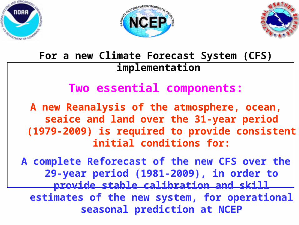
GSI development: Analysis variables
• SST analysis– Physical retrieval from AVHRR Tb data
– Option to add / assimilate in-situ SST data
Slight, but consistent reduction in rms and bias fits to independent buoy SST data
rms
bias
Courtesy : Russ Treadon, EMC

GSI development: New radiance data
• Aqua AIRS/AMSU-A– Operational as of 12 UTC, 31 May 2005– Future improvements
• Examine all FOVs to determine warmest spots• Use MODIS data for cloud detection
• SSM/I– Use of Tb data reduces model moisture bias – Forward model for emissivity includes effects of
surface winds • Assimilation of SSM/I Tb data can affect surface winds• Could (should) turn off assimilate of SSM/I wind product
Courtesy : Russ Treadon, EMC
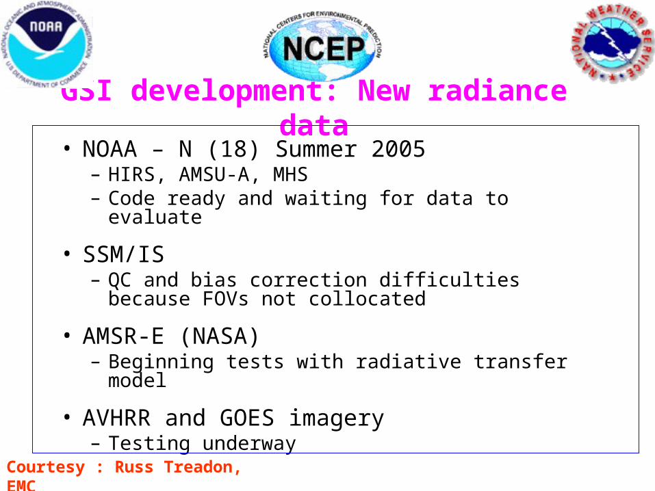
GSI development: New radiance data• NOAA – N (18) Summer 2005
– HIRS, AMSU-A, MHS– Code ready and waiting for data to evaluate
• SSM/IS– QC and bias correction difficulties because FOVs
not collocated
• AMSR-E (NASA)– Beginning tests with radiative transfer model
• AVHRR and GOES imagery– Testing underway
Courtesy : Russ Treadon, EMC
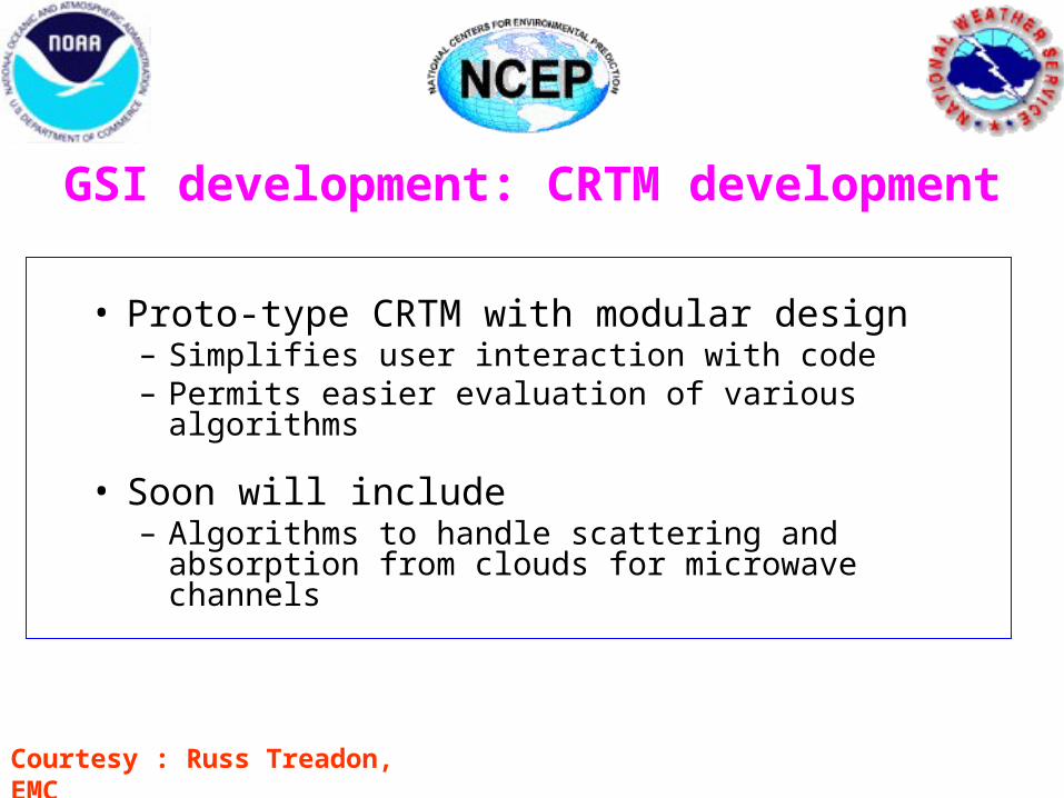
• Proto-type CRTM with modular design– Simplifies user interaction with code– Permits easier evaluation of various algorithms
• Soon will include – Algorithms to handle scattering and absorption
from clouds for microwave channels
Courtesy : Russ Treadon, EMC
GSI development: CRTM development

Observation influence extends into mountains
indiscriminately
Anisotropic vs Isotropic Error Covariances
Observation influence restricted to areas of similar elevation
Error Correlations Plotted Over Utah Topography
Courtesy : Russ Treadon, EMC

Test and Evaluation of
RRTM-SW Radiation on GFS/CFSYu-Tai and Suru Saha
1. RRTM-SW radiation scheme has been recoded to fit into GFS/CFS new radiation module structure. In additional, other physical processes such as solar-cycle, aerosol optical effect, historical volcanic aerosol effect, and historical CO2 variation effect, etc are also developed for the experiment.
2. For the experiment, a T126 model (v.op3t3) was used starting from ic 01/01/1948 for 60 year runs.
3. Comparison of global mean SST, T2m anomalies, and global map of SST climatology shows promising improvement over the control model.

Comparing with
CDAS, RRTM
run result shows
better overall
magnitude than
the control run.

Both model runs
show CO2 effect
from 90’s and
beyond.

RRTM run
shows reduced
SST warm bias


IBM Power 5
Specs for T382L64 Reanalysis, including a
2-day T382L64 forecast every day
(4 simultaneous streams)
88 nodes, 7-8 days /day
Will take 1 calendar year
(on HAZE upgrade)
Specs for 8 one-year coupled reforecasts (T126L64)
(2 per stream)
16 nodes, 24 hours
Will take 8 calendar months to complete
2 initial months
(on ZEPHYR)
Total Disk Space 100 TB
Total Mass Store (HPSS) Space 1.5 PB
T382L64 CFS REANALYSIS AND T126L64 REFORECASTS

An upgrade to the coupled atmosphere-ocean-seaice-land NCEP Climate Forecast System (CFS) is being planned for Jan 2010.
This upgrade involves changes to all components of the CFS, namely:
• improvements to the data assimilation of the atmosphere with the new NCEP Gridded Statistical Interpolation Scheme (GSI) and major improvements to the physics and dynamics of operational NCEP Global Forecast System (GFS)
• improvements to the data assimilation of the ocean and ice with the NCEP Global Ocean Data Assimilation System, (GODAS) and a new GFDL MOM4 Ocean Model
• improvements to the data assimilation of the land with the NCEP Global Land Data Assimilation System, (GLDAS) and a new NCEP Noah Land model

4 Simultaneous Streams
• Oct 1978 – Sep 1986 8 years• Apr 1986 – Oct 1993 7 1/2 years• Apr 1993 – Oct 2000 7 1/2 years• Apr 2000 – Dec 2009 10 years
6 month overlap for ocean and land spin ups
Total of 31 years (1979-2009) +
21 overlap months

12Z GSI 18Z GSI 0Z GSI
9-hr coupled T382L64 forecast guess (GFS + MOM4 + Noah)
12Z GODAS
0Z GLDAS
2-day T382L64 coupled forecast ( GFS + MOM4 + Noah )
6Z GSI
ONE DAY OF REANALYSIS
18Z GODAS 0Z GODAS 6Z GODAS
1 Jan 0Z 1 Jan 6Z 1 Jan 12Z 1 Jan 18Z 2 Jan 0Z

• Atmospheric T382L64 (GSI) Analysis at 0,6,12 and 18Z, using radiance data from satellites, as well as all conventional data
• Ocean and Sea Ice Analysis (GODAS) at 0,6,12 and 18Z
• From each of the 4 cycles, a 9-hour coupled guess forecast (GFS at T382L64) is made with half-hourly coupling to the ocean (MOM4 at 1/4o equatorial, 1/2o global)
• Land (GLDAS) Analysis using observed precipitation with Noah Land Model at 0Z
• Coupled 2-day forecast from initial conditions once per day, will be made with the T382L64 GFS with half-hourly coupling to the ocean (MOM4 at 1/4o equatorial, 1/2o global) for sanity check.
ONE DAY OF REANALYSIS

1 year T126L64 coupled forecast ( GFS + MOM4 + Noah )
CFS REFORECASTS
1 Jan 0Z 2 Jan 6Z 3 Jan 12Z 4 Jan 18Z 6 Jan 0Z
Coupled one-year forecast from initial conditions 30 hours apart will be made for 2 initial months (April and October) with the T126L64 GFS with half-hourly coupling to the ocean (MOM4 at 1/4o equatorial, 1/2o global). Total number of forecasts = 28 x 2 x 30 = 1680
For each cycle, there will be approximately 7 members per month, with a total of 210 members over a 30-year period. This ensures stable calibration for forecasts originating from each cycle, for a given initial month

SOME NOTES
PROPOSED TIME LINE FOR COMPLETION OF CFSRR
•January to December 2008: Begin Production and Evaluation of the CFS Reanalysis for the full period from 1979 to 2008 (30 years)
January to December 2008: Begin running CFS Retrospective Forecasts for 2 initial months: October and April, and evaluate the monthly forecasts as well as the seasonal winter (Lead-1 DJF) and summer (Lead-1 JJA) forecasts.January to October 2009: Continue running the CFS Reforecasts (for the rest of the 10 calendar months) November 2009: Begin computing calibration statistics for CFS daily, monthly and seasonal forecasts.
January 2010: Operational implementation of the next CFS monthly and seasonal forecast suite.

HUMAN REQUIREMENTS
Project Managers
Suru Saha and Hua-Lu Pan
REANALYSIS
6 people (TBD) managing 4 streams and rotating
through
3 people (TBD) managing 4 streams and rotating
through
REFORECASTS
Internal Advisory PanelsSCIENTIFIC : Huug van den Dool, Mark Iredell, Shrinivas Moorthi, Glenn White,
Ken Mitchell, Dave Behringer, Stephen Lord and others
TECHNICAL : Bob Kistler, Jack Woollen, Catherine Thiaw, Diane Stokes and others
DATA and DIAGNOSTICS: Wesley Ebisusaki, Wanqiu Wang, Jae Schemm and others
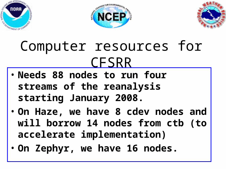
Computer resources for CFSRR
• Needs 88 nodes to run four streams of the reanalysis starting January 2008.
• On Haze, we have 8 cdev nodes and will borrow 14 nodes from ctb (to accelerate implementation)
• On Zephyr, we have 16 nodes.

Resource issue• We were anticipating the arrival of the
upgrade to Haze to add the 44 nodes needed.• Haze upgrade is delayed until June or July
2008.• The reanalysis completion date may slip 6
months or more.• Requesting more nodes from Haze and Mist
(22 nodes each)

Justification
• 90% of the climate modeling work is in the preparation : the reanalysis and the reforecast
• Routine CFS production run takes very little of the total CCS resource compared to the 30% budgeted

Reforecast• The CFS refoecast is on schedule to
start in 2009 pending the upgrade of dew and mist.

Status• Satellite radiance bias estimates for each
new satellite needs a 3-month run of the GDAS. There are 10 satellites to do.
• New format and improved SBUV ozone data• SSU radiance data need calibration for drift• Making a T62 reanalysis of the atmosphere to
go through all atmospheric data


SOME NOTES - 1
DATA ARCHIVAL
Using 1 TB tapes, we would need more than 1500 tapes to make the master copy (with second copy parity, maybe 15% more ?)
EMC does not have the resources to do any data distribution, except that CPC will be provided with whatever data they need for their operational CFS predictions.
NCDC/NOAA has decided to be a partner in the archival and distribution of both the CFS Reanalysis and Reforecasts, through their NOMADS system. They will work with EMC to siphon all data, while it is being generated in real time and make it available to the community in mid 2009.

SOME NOTES - 2
REANALYSIS WITH CONVENTIONAL DATA
CPC may be interested in using the same CFS Reanalysis system, but with conventional data only (no satellite data) to go back to 1948, and continue into the future with the same system.
This Reanalysis may be more homogeneous over a longer period (60+ years) and be more suitable for CPC’s monitoring of the atmosphere, land and ocean.
EMC will help in this endeavor.