Sunderland City Council and South Tyneside Council ... City Council and South Tyneside Council...
29
Sunderland City Council and South Tyneside Council International Advanced Manufacturing Park Area Action Plan Landscape Technical Background Report February 2017 PSD17
Transcript of Sunderland City Council and South Tyneside Council ... City Council and South Tyneside Council...
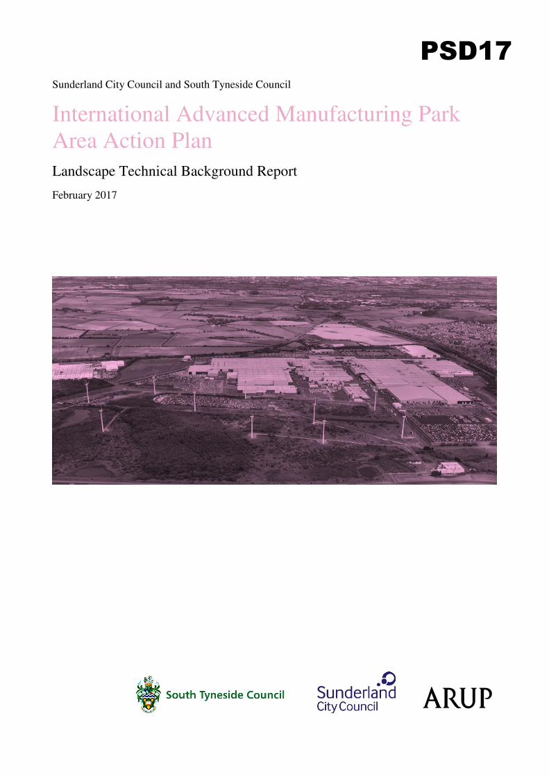
Sunderland City Council and South Tyneside Council
International Advanced Manufacturing Park
Area Action Plan
Landscape Technical Background Report
February 2017
PSD17
Sunderland City Council and South Tyneside Council
International Advanced Manufacturing Park Area Action Plan
Landscape Technical Background Report
February 2017
This report takes into account the particular
instructions and requirements of our client.
It is not intended for and should not be relied
upon by any third party and no responsibility
is undertaken to any third party.
Job number 242745-00
Ove Arup & Partners Ltd
Central Square
Forth Street
Newcastle upon Tyne NE1 3PL
United Kingdom
www.arup.com
Sunderland City Council and South Tyneside Council International Advanced Manufacturing Park Area Action PlanLandscape Technical Background Report
| February 2017 |
Contents
Page
Glossary i
1 Purpose 1
1.1 Overview 1
1.2 Introduction to the IAMP 1
1.3 Structure of this Report 2
2 Evidence Review 3
2.1 Overview 3
2.2 The European Landscape Convention 4
2.3 National Planning Policy 4
2.4 Local Planning Policy 5
2.5 Landscape Character Assessment 8
2.6 Great North Forest Plan 10
2.7 Green Infrastructure Strategy 11
2.8 Playing Field Policy 12
2.9 Environmental Workshops 13
2.10 Summary of Landscape Character and Features of the Land within the AAP Area and the Wider Area 14
3 Key Issues 16
3.1 Overview 16
3.2 Key Issues and Constraints 16
3.3 Potential Opportunities 19
4 Interventions and Actions 20
4.1 Overview 20
4.2 Key Proposed Interventions to be Progressed Through the AAP 20
Sunderland City Council and South Tyneside Council International Advanced Manufacturing Park Area Action PlanLandscape Technical Background Report
February 2017 |
Page i
Glossary
AAP Area Action Plan PRoW Public Right of Way
BIS Department of Business,
Innovation and Skills NPS National Policy Statement
CIRIA Construction Industry
Research and Information
Association
NSIP Nationally Significant
Infrastructure Project
DBAP Durham Biodiversity Action
Plan NWL Northumbrian Water Ltd
DCO Development Consent Order PwC Price Waterhouse Coopers
DEFRA Department of Environment,
Food and Rural Affairs SA Sustainability Appraisal
DPD Development Plan Document SEA Strategic Environmental
Assessment
EZ Enterprise Zone SEP Strategic Economic Plan
EU European Union SCC Sunderland City Council
FRA Flood Risk Assessment SCI Statement of Community
Involvement
IAMP International Advanced
Manufacturing Park STC South Tyneside Council
GBSSO Green Belt and Site Selection
Options Paper SuDS Sustainable Drainage System
LDF Local Development
Framework UDP Unitary Development Plan
LHA Local Highways Authority
LPA Local Planning Authority
LVIA Landscape and Visual Impact
Assessment
LWS Local Wildlife Site
MoU Memorandum of
Understanding
NELEP North East Local Enterprise
Partnership
NPPF National Planning Policy
Framework
PPG Planning Practice Guidance
Sunderland City Council and South Tyneside Council International Advanced Manufacturing Park Area Action PlanLandscape Technical Background Report
February 2017 |
Page 1
1 Purpose
1.1 Overview
1. This is the Landscape Background Technical Report for the International
Advanced Manufacturing Park (IAMP) Area Action Plan (AAP). The aim of this
report is to provide the technical landscape evidence to inform the approach and
policies in the IAMP AAP.
2. The term “landscape” is defined in the European Landscape Convention1 (ELC)
as “an area, as perceived by people, whose character is the result of the action
and interaction of natural and/or human factors”. This definition has been
adopted for this report which looks at the background evidence relevant to the
topic of landscape, setting out issues that should be taken into account in
developing the approach and policy of the IAMP AAP, and advising on the
potential actions that should be further considered in progressing the IAMP
proposal to delivery.
3. This report is one of a suite of Technical Background Reports which form part of
the evidence base for the IAMP AAP. The full set of reports can be accessed
using the following links:
• www.sunderland.gov.uk/iamp
• www.southtyneside.gov.uk/localplan
1.2 Introduction to the IAMP
4. The IAMP represents a unique opportunity for the automotive sector in the UK.
Located next to Nissan UK’s Sunderland plant, the UK's largest and most
productive car manufacturing plant, the IAMP will provide a bespoke, world class
environment for the automotive supply chain and related advanced manufacturers
to innovate and thrive, contributing significantly to the long-term economic
success of the north-east of England and the national automotive sector.
5. The proposal is for 260,000 sq. m. Gross Internal Area (GIA) development aimed
primarily at the automotive, advanced manufacturing and related distribution
sectors. The IAMP will be located on land to the north of the existing Nissan car
manufacturing plant, to the west of the A19 and to the south of the A184. This
location benefits from its close proximity to Nissan and excellent transport links
with opportunities for integrated connectivity provided by the surrounding
Strategic Road Network, rail and port infrastructure.
6. Development of the IAMP will underpin the continued success of the automotive
and advanced manufacturing sectors in the United Kingdom and North East of
England.
1 Council of Europe (2000, ratified in the UK in 2006) European Landscape Convention
Sunderland City Council and South Tyneside Council International Advanced Manufacturing Park Area Action PlanLandscape Technical Background Report
February 2017 |
Page 2
1.3 Structure of this Report
7. The report is structured as follows:
• Section 2 Evidence Review - sets out the evidence relevant to this Background
Technical Report;
• Section 3 Key Issues - draws on the evidence to set out the key issues that
should be taken into account in developing the approach and policy of the
IAMP AAP; and
• Section 4 Interventions and Actions - advises on the potential actions that
should be considered in further progressing the IAMP proposal to delivery.
Sunderland City Council and South Tyneside Council International Advanced Manufacturing Park Area Action PlanLandscape Technical Background Report
February 2017 |
Page 3
2 Evidence Review
8. This section presents a summary of the key findings from the evidence review.
The information and documents considered in this review are listed in section 2.2
below.
2.1 Overview
9. The land within the IAMP AAP area is relatively flat and comprises primarily
medium to large scale, open arable fields, which are enclosed by hedgerows. Tree
cover is generally sparse, limited to a few hedgerow trees and small pockets of
woodland. The River Don runs west to east through the centre of the area covered
by the IAMP AAP. A number of isolated farms and other buildings as well as
large scale pylons and power lines are located within the IAMP site.
10. The IAMP AAP site is located within an area currently designated as Green Belt,
Strategic Green Infrastructure Corridors of Sunderland and South Tyneside and
Great North Forest. Within the centre of the IAMP AAP site along the River Don
lies Hylton Grove Bridge (Grade II Listed Building). A number of Public Rights
of Ways including the Great North Forest Heritage Trail long distance path cross
the IAMP site.
11. The key issues relating to landscape are established through a number of policies,
studies and workshops. In summary these are as follows:
• European Landscape Convention1;
• National Planning Policy Framework2;
• Sunderland Unitary Development Plan3;
• Sunderland Local Plan: Draft Core Strategy and Development Management
Policies4;
• South Tyneside Local Development Framework: Core Strategy5;
• South Tyneside Local Development Framework: Development Management
Policies Development Plan Document6;
2 Department for Communities and Local Government (2012) National Planning Policy
Framework. 3 Sunderland City Council Unitary Development Plan (including adopted alteration no. 2) (SD16)
http://www.cartogold.co.uk/sunderland/text/00cont.htm Accessed 22 May 2016. 4 Sunderland City Council (August 2013) Sunderland Local Plan: Core Strategy and Development
Management Policies. Draft Revised Preferred Options. (SD17)
http://www.sunderland.gov.uk/CHttpHandler.ashx?id=17920&p=0&fsize=6Mb&ftype=Draft Core
Strategy Sept 2013.PDF Accessed 19 May 2016. 5 South Tyneside Council (2007) South Tyneside Local Development Framework Core Strategy.
(SD22) http://www.southtyneside.gov.uk/CHttpHandler.ashx?id=2468&p=0 Accessed 19 May
2016 6 South Tyneside Council (2011) South Tyneside Local Development Framework Development
Management Policies. (SD21)
http://www.southtyneside.gov.uk/CHttpHandler.ashx?id=13672&p=0. Accessed 28 June 2016
Sunderland City Council and South Tyneside Council International Advanced Manufacturing Park Area Action PlanLandscape Technical Background Report
February 2017 |
Page 4
• South Tyneside SPD3: Green Infrastructure Strategy7;
• City of Sunderland Landscape Character Assessment8;
• South Tyneside Landscape Character Study9;
• Great North Forest Plan10;
• Sunderland Partnership Green Infrastructure Strategy Framework11;and
• Guidelines for Landscape and Visual Impact Assessment 3rd Edition
(GLVIA3)12.
2.2 The European Landscape Convention
12. The European Landscape Convention1 (ELC) is an international treaty and is
aimed at the protection, management and planning of all landscapes, including
outstanding as well as everyday and degraded landscapes. It covers natural, rural,
urban and peri-urban areas. The treaty promotes the use of landscape character
and visual impact assessments to enhance the natural environment.
13. Natural England is working with and advising the Government, stakeholders and
the public in England and across the UK to develop an implementation strategy to
help promote and develop the principles of the ELC further.
2.3 National Planning Policy
14. The National Planning Policy Framework2 (NPPF) sets out the Government’s
planning policies for England and how these are expected to be applied. The
paragraphs which are considered most relevant to landscape issues associated with
the IAMP AAP site have been outlined below.
15. Paragraph 14 of the NPPF sets out a clear presumption in favour of sustainable
development. Paragraph 7 identifies three dimensions to sustainable development
– economic, social and environmental. It is the environmental dimension which
identifies that the planning system should contribute to protecting and enhancing
our natural, built and historic environment that is considered most relevant to this
Landscape Technical Background Paper.
16. Paragraph 17 of the NPPF sets out twelve core planning principles that should
underpin all plan-making and decision-taking. These include seeking to secure
high quality design and a good standard of amenity for all existing and future
occupants; taking account of the different roles and character of different areas,
7 South Tyneside Council (February 2013) South Tyneside Local Development Framework
Supplementary Planning Document 3: Green Infrastructure (SD48) 8 Land Use Consultants (September 2015) City of Sunderland Landscape Character Assessment
(SD45) 9 Land Use Consultants (March 2012) South Tyneside Landscape Character Study (SD46) 10 Great North Forest Partnership (2003) Great North Forest Plan 11 Green Infrastructure Steering Group on behalf of the Sunderland Partnership (March 2011)
Green Infrastructure Strategy Framework 12 Landscape Institute and Institute of Environmental Management and Assessment (2013)
Guidelines for Landscape and Visual Impact Assessment Third Edition (GLVIA3)
Sunderland City Council and South Tyneside Council International Advanced Manufacturing Park Area Action PlanLandscape Technical Background Report
February 2017 |
Page 5
including recognising the intrinsic character and beauty of the countryside;
conserving and enhancing the natural environment, including allocating land of
lesser environmental value; promoting mixed use development; conserving
heritage assets; and focusing development in sustainable locations.
17. Paragraph 56 identifies that “Good design is a key aspect of sustainable
development, is indivisible from good planning, and should contribute positively
to making places better for people.”
18. Paragraph 58 outlines that developments should respond to local character and
add to the overall quality of the area. This is further supported by Paragraph 61,
which requires planning policies and decisions to address “the integration of new
development into the natural, built and historic environment.”
19. Paragraph 74 seeks to protect existing open space, sports and recreational
buildings and land, including playing fields, from development unless they are
shown to be surplus to requirement, they will be replaced with equivalent or better
provision in terms of quality and quantity or the development is for alternative
sports or recreational provision.
2.4 Local Planning Policy
2.4.1 Sunderland City Council
2.4.1.1 Sunderland Unitary Development Plan
20. The adopted Sunderland Unitary Development Plan3 (UDP) (SD16) sets out saved
policies which with regards to landscape inter alia:
• Secure improvements within and adjacent to degraded land on the urban fringe
and prominent edges of built up areas (Policy B1);
• Enhance the best qualities of the locality and relate harmoniously to adjoining
areas by respecting scale, massing, layout and setting (Policy B1);
• Avoid adverse effects on character or setting of listed buildings (Policy B10);
• Protect and enhance landscape features, buildings of character, significant
wildlife habitats, strategic and local wildlife corridors, trees and hedgerows
(Policy CN1);
• Restrict development which would have harmful impact on the landscape due
to its siting, materials or design (Policy CN1);
• Ensure that the visual amenities of the Green Belt will not be harmed by
development proposals within or conspicuous from the Green Belt, without
being prejudicial to the purposes of the Green Belt13 (Policy CN5);
13 It should be noted that Green Belt is not a landscape designation. Green Belt policy within the
National Planning Policy Framework does not consider visual amenity or landscape character and
quality to be relevant to the purposes of Green Belt. Green Belt and the potential impact on Green
Sunderland City Council and South Tyneside Council International Advanced Manufacturing Park Area Action PlanLandscape Technical Background Report
February 2017 |
Page 6
• Enhance and protect the landscape on the urban fringe by improving the
landscape (including tree planting) (Policy CN7);
• Protect and enhance important public views of townscape, landscape and other
features (such as Penshaw Monument – officially The Earl of Durham's
Monument, Grade I listed) from perceived transport corridors and outdoor
venues. New developments shall not interrupt or prejudice views (Policy
CN13);
• Support the creation of the Great North Forest (Policy CN15);
• Protect valued and important aspects of natural and built environment,
avoiding risk of serious environmental damage (Policy R1);
• Encourage intensive planting of tree belts and woodlands using locally native
species within and adjacent to the existing Nissan complex, where possible
(Policy WA21); and
• Support a long term standard of 1.6-1.8 hectares per 1,000 population for open
sport and recreation (Policy L4).
2.4.1.2 Sunderland Local Plan: Draft Core Strategy and
Development Management Policies
21. The Sunderland Local Plan: Draft Core Strategy and Development Management
Policies4 (SD17) with regard to landscape seeks to:
• Protect and conserve the city’s natural environment (Policy CS7.1);
• Create an environment, which makes a positive contribution to local character
and establishes a distinctive sense of place (Policy CS7.2);
• Protect, conserve and enhance varied landscape character and the separate
identity of settlements (Policy CS7.6);
• Protect, conserve and enhance listed buildings and their setting (Policy
CS7.9);
• Create places with character and identity based on local context, constraints
and distinctiveness, ensuring the layout, scale and massing is compatible with
the surroundings (Policy DM7.1);
• Create developments which are sensitive to the character of the countryside
and local distinctiveness (Policy DM7.18);
• Create schemes which retain or enhance existing landscape features or offer
appropriate mitigation measures for loss of landscape features to reflect local
landscape character (Policy DM7.19);
• Retain all trees, woodlands and hedgerows of amenity and wildlife value,
which contribute individually or as part of a group within the broader
landscape setting (Policy DM7.20); and
Belt is considered in detail in the Exceptional Circumstances for Release of Land from the Green
Belt Technical Background Paper.
Sunderland City Council and South Tyneside Council International Advanced Manufacturing Park Area Action PlanLandscape Technical Background Report
February 2017 |
Page 7
• Protect land used for sport or recreation unless it can be demonstrated that the
development brings substantial benefits to the community that would
outweigh the harm resulting from the loss of open space and alternative
provisions are provided (Policy DM7.23).
22. The emerging Sunderland Local Plan has not yet been adopted, it therefore carries
less weight than the adopted Sunderland UDP.
2.4.2 South Tyneside Council
23. The adopted South Tyneside Local Development Framework (LDF) provides the
current policy environment for South Tyneside relevant to landscape issues
associated with the IAMP AAP site. The South Tyneside LDF comprises several
documents, those considered most relevant to the topic of landscape are the Core
Strategy5 (SD22), Development Management Policies Development Plan
Document6 (DPD) (SD21) and Supplementary Planning Document 3 (SPD3):
Green Infrastructure7 (SD48).
2.4.2.1 Core Strategy
24. Strategic Objective 16 within the Core Strategy (SD22) seeks to “protect and
enhance the quality of the Borough’s land and landscapes”.
25. Core Strategy Policy EA1: Local Character and Distinctiveness aims to ‘protect
and enhance the openness of the Green Belt’, to ‘preserve the special and separate
characters of the urban fringe villages’ and to ‘implement the Great North Forest
strategies for access, education, enterprise and biodiversity’ by inter alia
enhancing the River Don Valley farmland into a well-wooded recreational
landscape and enhancing the North Sunderland fringe by significantly increasing
the tree cover.
Development Management Policies DPD (SD21)
26. Development Management Policy DM1: Management of Development contains a
number of relevant sections, the first five of which seek to protect or enhance the
landscape and the features within it. Section A seeks to ensure that new
development considers its surroundings and where possible local setting,
reinforces local identity, has regard to the scale and proportions, alignment, form,
use of materials and architectural detailing of the development. Section B seeks to
protect residential amenity while Section C seeks to protect existing vegetation,
providing replacement planting where necessary. Section D supports the provision
of high quality well-designed external spaces which are linked, where possible,
into the wider green infrastructure network, improving visual amenity. Section E
seeks to incorporate landmarks and focal points within external spaces to aid the
legibility of the development.
27. Development Management Policy DM6: Heritage Assets and Archaeology seeks
to protect, preserve and where possible enhance the visual appearance of setting of
heritage assets and their settings, including listed buildings and buildings
contained on the South Tyneside’s list of locally significant heritage assets.
Sunderland City Council and South Tyneside Council International Advanced Manufacturing Park Area Action PlanLandscape Technical Background Report
February 2017 |
Page 8
SPD3: Green Infrastructure
28. The content of SPD3: Green Infrastructure7 considered relevant to the topic of
landscape has been considered under Section 2.7.2 below.
2.5 Landscape Character Assessment
2.5.1 City of Sunderland Landscape Character Assessment
29. The City of Sunderland Landscape Character Assessment8 (SD45) (the
Assessment) describes and assesses the landscape within the administrative area
of the City of Sunderland. The Assessment forms part of the evidence base for
development plan documents.
30. The southern part of the IAMP AAP site, which adjoins the existing Nissan plant,
is classed in the Assessment as forming part of the Coalfield Lowland Terraces
Landscape Character Type (LCT) and the Usworth Lowland Landscape Character
Area (LCA).
31. The Assessment highlights that the character of the wider Coalfield Lowland
Terraces LCT area is negatively impacted by the existing infrastructure, including
the major roads as well as the industrial and business park. Sensitive features are
recreational value of paths and cycle ways, the settlement fringe character and the
distinction between settlements.
32. The Assessment summarises the following guidelines for the Coalfield Lowland
Terraces LCT area:
• Integrate any new roads through careful alignment;
• Preserve access routes for pedestrians and cyclists;
• Maintain green network connections, compensating any loss of woodland,
trees or open space with new accessible spaces;
• Enhance and extend landscaping;
• Integrate new buildings into the landscape;
• Utilise locally native species;
• Enhance maintenance of landscapes in and around industrial/commercial
premises, including woodland and hedges;
• Avoid adversely encroaching on Green Belt or block green corridors;
• Enhance accessibility including upgrading and maintaining links between
communities and recreational areas;
• Enhance routes through the area such as the footpath and bridleway at
Barmston Lane to the south of Nissan;
• Promote pedestrian and cycle access to work;
• Provide links to wider networks such as River Wear Trail and neighbouring
areas;
Sunderland City Council and South Tyneside Council International Advanced Manufacturing Park Area Action PlanLandscape Technical Background Report
February 2017 |
Page 9
• Avoid modification of streams or negative impact on water quality or flood
incidences;
• Enhance/strengthen settlement boundaries such as woodland belts;
• Avoid piecemeal development, which would erode the distinction between
urban and rural landscape; and
• In accordance with Green Belt policy and supporting studies ensure careful
consideration of development proposals, which could erode the separation of
settlements.
33. The Assessment identifies the following key issues in the Usworth Lowland LCA
area which contribute to its landscape value:
• Large undeveloped area, which acts as a break between the settlements of
Washington and Sunderland;
• Continuation of large area of similar farmland to the north;
• North East Land, Air and Sea Museum (NELSAM) visitor attraction,
highlighting the history of the landscape as an airfield; and
• Barmston Pond Local Nature Reserve providing ecological interest.
34. The Assessments describes the following landscape strategy for the Usworth
Lowland LCA:
• Enhance landscape towards a high-biodiversity area, incorporating potential
for recreation associated with existing and future commercial development;
• Maintain existing hedges and trees in the north and enhance as part of new
proposals;
• Retain openness between Sunderland and South Tyneside in line with Green
Belt purpose where applicable;
• Retain views to Boldon Downhill as they provide a sense of place;
• Improve connections through better green networks around existing land uses,
linking current isolated features such as the Barmston Pond nature reserve;
and
• Providing pedestrian and cycle links between adjacent residential areas and
the River Wear as they would improve recreational opportunity and routes to
work.
2.5.2 South Tyneside Landscape Character Study
35. The South Tyneside Landscape Character Study9 (SD46) (the Study) describes
and assesses the landscape within the administrative area of South Tyneside. The
assessment forms part of the evidence base for the Council's development plan
documents, including the IAMP AAP.
36. The northern part of the IAMP AAP site forms part of the Boldon Fell Local
Landscape Character Area. This is described as a flat, urban fringe landscape with
primarily large scale, open arable fields and ‘gappy’ hedges. Smaller field parcels
Sunderland City Council and South Tyneside Council International Advanced Manufacturing Park Area Action PlanLandscape Technical Background Report
February 2017 |
Page 10
can be found toward the A19. The area comprises farms and country houses. The
tree cover is sparse and locally concentrated around farms and along roads.
37. The River Don follows the borough boundary with small drains discharging from
the area into the river. There are overhead power lines and a major arterial roads
such as the A19 and the A184, which impose a strong human influence onto the
area. This open flat landscape allows generally unimpeded long views towards
landmarks such as Penshaw Monument. There is restricted access into this area,
limited to a few footpaths.
38. The Study identifies the following guidelines for the IAMP AAP area:
• Reinstatement of hedges for landscape and habitat value;
• Planting of new woodland areas to reinforce landscape structure;
• Prevent removal of remaining mature woodland;
• Avoid further increase of overhead power lines (‘wirescape’) across the area;
• Enhance access networks across the area, using existing paths and promoting
new links;
• Create linear habitat links between sites of habitat value, using new hedge and
woodland planting, in particular along watercourses;
• Retain open landscape and views, in particular from the north; and
• Avoid woodland planting which would obstruct key views.
39. Boldon Fell lies within the Great North Forest Local Management Zone LM1 –
Don Valley Farmland. The Study highlights that Boldon Fell, which the IAMP
AAP site is part of, plays an important role in maintaining the separate identity of
South Tyneside towards Gateshead and Sunderland. Boldon Fell can be seen from
residential areas to the north, from Boldon Downhill and long views from
Penshaw Monument as well as transport corridors including the A184, the A194
and the A19.
40. The Study concludes that an increase in woodland within Boldon Fell will
enhance the value of the Green Belt as it enhances the perceptual separation
between settlements. Key southwards views from Fellgate for instance towards
Penshaw Monument need to be taken into account. Along transport corridors
further woodland would lessen noise and improve the Boldon Fell area for
recreation.
2.6 Great North Forest Plan
41. The IAMP AAP site and much of the surrounding open countryside, which is
enclosed by the nearby settlements of Sunderland, Gateshead, South Tyneside and
Washington, lie within the designated Great North Forest14.
14 The Great North Forest was the first community forest in England. The management
organisation for the Great North Forest was disbanded in 2008.
Sunderland City Council and South Tyneside Council International Advanced Manufacturing Park Area Action PlanLandscape Technical Background Report
February 2017 |
Page 11
42. The Great North Forest Plan10 (the Plan), which set out the management strategies
for the area, identifies the IAMP AAP site and the surrounding landscape as part
of the Central Lowland character area and more precisely as part of the Local
Management Zone LM1 – Don Valley farm land.
43. Don Valley Farmland (LM1) is described as extensive, flat, low-lying arable,
open countryside with large fields and low cut boundary hedges, surrounded by
very visible urban edges.
44. The Plan seeks to enhance this area towards a well-wooded recreational
landscape, which contains ‘surrounding intrusions and new development within
an extensive framework of large and small scale mixed woodlands enclosing a
network of open corridors around the feeder streams of the upper River Don’.
45. The Plan also aims to ‘retain views’ and ‘use woodland as the ’frame’ for
achieving this’.
2.7 Green Infrastructure Strategy
2.7.1 Sunderland Partnership Green Infrastructure Strategy
Framework
46. Sunderland City Council and the Sunderland Partnership are preparing a Green
Infrastructure Strategy for Sunderland. As a first step Sunderland Partnership has
overseen preparation of the Green Infrastructure Strategy Framework11 (SD49)
(the Framework) which was endorsed by the City Council's Cabinet in March
2011 as the basis for preparing the strategy.
47. The Framework sets out the main elements that, together, will form an effective
strategy for the improvement, protection and understanding of green infrastructure
in Sunderland. The Framework identifies a provisional vision for green
infrastructure in Sunderland as follows:
48. “The economic and social development of the city will be enhanced through its
setting in surroundings of high quality green infrastructure that will be provided
through a network of green spaces and links, including coastal, river and other
water features, designed and managed to maximise their multi-functional
potential.”
49. It is outlined that green infrastructure will encompass urban and rural existing and
new green spaces, threading through and surrounding the built environment,
connecting urban areas to the surrounding countryside.
50. The Framework sets out a series of provisional principles for green infrastructure
in Sunderland to be used as a basis for creating green infrastructure schemes and
improvements in the absence of a green infrastructure strategy.
51. The Framework then sets out an action plan for the delivery of the Sunderland
Green Infrastructure Strategy.
Sunderland City Council and South Tyneside Council International Advanced Manufacturing Park Area Action PlanLandscape Technical Background Report
February 2017 |
Page 12
2.7.2 South Tyneside Green Infrastructure Strategy
52. South Tyneside LDF Supplementary Planning Document 37 (SD48) (SPD3)
identifies that green infrastructure is considered essential to help deliver the
spatial vision provided by the South Tyneside Core Strategy. SPD3 provides an
analysis of the existing green infrastructure within the borough and sets out South
Tyneside Council’s vision for its future improvements and provision. The SPD’s
open space and playing fields analysis and needs assessments have since been
updated by the recent South Tyneside Open Space and Playing Pitch Strategy
studies (2015/16).
53. The part of the IAMP AAP site in South Tyneside is located within an area
identified as ‘Green Belt Corridor: Urban Fringe agricultural area’. The priorities
identified for this area are:
• Preserve the separate characters of the Urban Fringe villages;
• Maintain and, where possible, improve green infrastructure links/corridors
with Sunderland and Gateshead Councils; and
• Prevent the merging of South Tyneside’s urban areas with Sunderland,
Washington and Gateshead.
54. SPD3 identifies that green infrastructure provides opportunities to enhance local
identity, visual amenity and landscape character, helping to create a positive sense
of place. It also identifies that it is considered important that development protects
and enhances existing green infrastructure and that green infrastructure should be
used to create an attractive identity for new development.
55. Trees and hedgerows are identified as important elements of the green
infrastructure network, playing an important role in most types of open space and
along roads and areas such as areas of hard standing where the provision of other
types of green infrastructure is not possible. It is outlined that schemes should be
put in place to improve the quantity and quality of street trees and hedgerows.
2.8 Playing Field Policy
2.8.1 Sport England
56. Sport England is the statutory consultee on all planning applications for
development affecting playing field land. It is their policy to oppose any
application which will result in the loss of playing field land unless it is satisfied
that the application meets with one or more of specific exceptions outlined in their
Planning Policy Statement – A Sporting Future for the Playing Fields of
England15. In summary the exceptions are as follows:
• Exception 1 – Excess of provision;
• Exception 2 – Ancillary development;
15 Sport England (unknown) Planning Policy Statement – A Sporting Future for the Playing Fields
of England
Sunderland City Council and South Tyneside Council International Advanced Manufacturing Park Area Action PlanLandscape Technical Background Report
February 2017 |
Page 13
• Exception 3 – Land incapable of forming part of a pitch;
• Exception 4 – Replacement provision; and
• Exception 5 – Sports facilities.
2.8.2 Sunderland City Council
57. The Sunderland City Council Playing Pitch Plan16 (SD47) (PPP) provides a
strategic framework for the maintenance and improvement of existing outdoor
sports pitches and ancillary facilities within Sunderland. The PPP outlines the
following vision:
58. “Sunderland has an accessible range of playing pitch facilities and venues which
offer increased opportunities for all sections of the community to participate in
both formal and informal opportunity, contributing to a higher quality of life.”
59. The PPP is split into three distinct sections:
• The Strategy which sets out the aims and objectives and provides the
framework for improvements;
• The Action Plan which provides recommendations on a site-by-site basis,
based on current levels of usage, quality and demand, as well as identifying
the potential of each site for enhancement; and
• Playing Pitch Plan Priorities which have been developed with the aim of
ensuring maximum benefit and access to pitches for city residents.
60. Plessey Sports Field, which is located to north of the NELSAM on Washington
Road, is identified within the PPP. The playing field is identified as being
overplayed (i.e. when there is more play accommodated than the site is able to
sustain, however this is often dependent upon pitch quality). The recommended
action for the playing field is to “improve the quality of the pitches to increase
carrying capacity”. This is identified as a short term priority.
2.9 Environmental Workshops
61. A series of environmental workshops have been held with the following key
stakeholders:
• Natural England;
• Environmental Agency;
• Royal Society for the Protection of Birds (RSPB);
• Durham Wildlife Trust;
• North East Local Nature Partnership (NELNP); and
• South Tyneside, Sunderland and Gateshead Councils’ ecologists.
16 Knight Kavanagh & Page (January 2015) Sunderland City Council Playing Pitch Plan
Sunderland City Council and South Tyneside Council International Advanced Manufacturing Park Area Action PlanLandscape Technical Background Report
February 2017 |
Page 14
62. Through the workshops, a series of high level ecology and landscape strategy
principles have been developed that highlight the key issues the stakeholders
would like to see considered. The outcomes of these workshops have informed the
key strengths, opportunities, mitigation measures and enhancements outlined, and,
at a high level, will help to inform the development of policies within the AAP.
2.10 Summary of Landscape Character and Features of the Land within the AAP Area and the Wider Area
2.10.1 Site
63. The IAMP AAP site, i.e. the area within the AAP red line boundary, comprises
primarily medium to large scale, open arable fields, which are enclosed by
hedgerows. Hedges are of various condition and range from continuous to
fragmented, generally non-clipped lines of vegetation. Tree cover is generally
sparse and limited to a few hedgerow trees and small areas of woodland.
Woodlands are mainly located along the River Don as well as within a shelterbelt
at Elliscope Farm.
64. An area of playing fields (known as Plessey Sports Field) are located to the north
of the NELSAM on Washington Road.
65. The topography of the IAMP AAP site is relatively flat and low lying. The River
Don gently winds west to east across the centre of the IAMP site. The IAMP AAP
site encompasses many streams and ditches, which drain into the River Don.
There are also a few field ponds and marshy areas within the IAMP AAP site.
66. The IAMP AAP site includes a number of isolated farmsteads, a pub and the
NELSAM. There are large scale pylons and power lines criss-crossing the IAMP
APP site.
67. The Great North Forest Heritage Trail long distance path runs west to east across
the IAMP AAP site along Follingsby Lane and Downhill Lane. There are also
Public Rights of Way (PRoW) within the northern part of the IAMP AAP site.
68. The IAMP AAP site is located within an area designated as Green Belt, Strategic
Green Infrastructure Corridors of Sunderland and South Tyneside and Great North
Forest. Within the centre of the IAMP AAP site along the River Don lies Hylton
Grove Bridge (Grade II Listed Building).
2.10.2 Wider Area
69. The IAMP AAP site lies within the open countryside immediately adjoining a
large industrial area (Nissan manufacturing plant) to the south.
70. To the east of the IAMP AAP site is the A19 dual carriage way, which is a major
north to south transport route. Beyond the A19 lie the residential areas of
Sunderland to the south and agricultural fields to the north. Wide landscape
buffers, comprising a mixture of deciduous woodland rough grassland and
amenity grassland, line both sides of the A19, separating the residential
Sunderland City Council and South Tyneside Council International Advanced Manufacturing Park Area Action PlanLandscape Technical Background Report
February 2017 |
Page 15
development to the east of the A19 from the Nissan manufacturing plant on the
west. Along the western side of the A19 the landscape buffers vary in size from
over 100m wide around the south of the Nissan manufacturing site, reducing to a
pinch point approximately 20m wide in the north of the Nissan manufacturing
site. Along the eastern side of the A19 the landscape buffer between the A19 and
the residential development at Town End Farm and Hylton Castle varies between
approximately 50-75m wide.
71. To the north and west the IAMP AAP site adjoins a small area of open
countryside. This area provides separation between the settlements of Sunderland,
South Tyneside, Washington and Gateshead. Business and residential areas of
South Tyneside are situated approximately 0.7km and 1.4km from the northern
IAMP site boundary, whilst residential areas are located approximately 850m to
the west of the IAMP AAP site.
72. There are long distance views from the countryside towards landmarks such as
Boldon Downhill and Penshaw Monument (Grade I Listed Building). Important
panoramic views designated by Sunderland City Council and which overlook the
IAMP AAP site include views from Penshaw Monument, from the A19 and from
an elevated off-road cycle route to the south of Wearside Golf Course.
73. The wider area around the IAMP AAP site is located within the Green Belt, the
Great North Forest and within the Strategic Green Infrastructure Corridors of
Sunderland and South Tyneside.
74. Listed buildings within the surrounding area include Penshaw Monument (Grade I
Listed Building), Boldon Fellgate Farmhouse (Grade II Listed Building) as well
as buildings associated with Scot’s House (Grade II* Listed Building) to the
north, Laverick Hall (Grade II Listed Building) to the north west, Downhill House
(Grade II Listed Building) to the north east and Usworth Hall Washington
Development Corporation Headquarters (Grade II Listed Building) to the west.
Sunderland City Council and South Tyneside Council International Advanced Manufacturing Park Area Action PlanLandscape Technical Background Report
February 2017 |
Page 16
3 Key Issues
3.1 Overview
75. In response to the evidence base outlined above and the summary of the existing
situation, this section provides an overview of the key landscape issues and
constraints that the IAMP AAP is seeking to address. Key opportunities are also
highlighted.
3.2 Key Issues and Constraints
76. A summary of the broad key issues, constraints and barriers to delivery, as
identified through the evidence review, is outlined below.
3.2.1 The Site's Location within the Green Belt
77. The IAMP AAP site is located within the Green Belt. The release of Green Belt
(refer to the Exceptional Circumstances for Releasing Land from the Green Belt
Background Technical Report17 (PSD12)), and the subsequent development of the
released land would change the landscape character of the IAMP AAP site locally
from open countryside to modern industrial development, in turn affecting the
local visual amenity of the Green Belt. In line with South Tyneside LDF Core
Strategy Policy EA1 and Sunderland UDP Saved Policy CN2 the openness of the
Green Belt should be protected and enhanced. In accordance with Sunderland
UDP Saved Policy CN5 the visual amenity of the Green Belt should not be
harmed by development.
3.2.2 The Visibility of the Site
78. The visibility of the IAMP AAP site from surrounding settlements such as
Fellgate to the north, from the Great North Forest Heritage Trail and surrounding
PRoW network, and from transport corridors, including the A19, represents a
potential constraint, owing to the open and relatively flat nature of the landscape.
There are two PRoWs within the northern part of the IAMP AAP site and the
Great North Forest Heritage Trail, which runs along Follingsby Lane and
Downhill Lane. There are also public views from elevated areas such as Boldon
Downhill and Penshaw Monument (Grade I Listed Building).
79. Development within the IAMP AAP site would change the appearance of large
parts of landscape from open countryside to modern industrial development. In
line with Sunderland UDP Saved Policies CN5 and CN13 the visual amenity of
the Green Belt and important public views should be protected and enhanced.
17 Arup (February 2017 ) Exceptional Circumstances for Releasing Land from the Green Belt
Background Technical Report
Sunderland City Council and South Tyneside Council International Advanced Manufacturing Park Area Action PlanLandscape Technical Background Report
February 2017 |
Page 17
3.2.3 Views Towards Landmarks
80. The open and flat landscape of the IAMP AAP site and the surrounding area
allows long distance views across the countryside towards elevated landmarks
such as Boldon Downhill and Penshaw Monument (Grade I Listed Building). Any
development within the IAMP AAP site generally could reduce this visibility. In
line with Sunderland UDP Saved Policies CN13 (SD16) important public views
should be protected and enhanced. South Tyneside Landscape Character Study
(SD45) highlights unimpeded views across the open countryside within Boldon
Fell towards landmarks such as Penshaw Monument as a key sensitivity and
recommends the retention of the open aspect and views. The City of Sunderland
Landscape Character Assessment also recognises the open character of the
landscape, which allows views towards Boldon Hill.
3.2.4 Existing Trees and Other Vegetation
81. Existing mature trees, woodlands, hedgerows and other structural vegetation
within the IAMP AAP site represent a constraint towards development as they are
important features within the area providing filtering of views from certain
locations and contributing to the character of both the IAMP AAP site and the
wider landscape. The removal of trees and vegetation within the IAMP AAP site
would change the character of the landscape. In line with Sunderland UDP
(SD16) Saved Policies CN1 and CN16, Sunderland Local Plan: Draft Core
Strategy (SD17) and Development Management Policy DM7.20 and South
Tyneside LDF Development Management (SD22) Policy DM1 existing trees and
hedges should be protected.
82. The impact of the loss of trees and vegetation within the IAMP AAP site on
biodiversity in terms of intrinsic value of habitats and their provision for wildlife
is considered in the Ecology Technical Background Paper18.
3.2.5 Loss of Open Countryside
83. The IAMP AAP site is located in an area of open countryside largely comprising
medium to large scale arable fields enclosed by hedgerows with pockets of
woodland located along the River Don. Development of the IAMP AAP site
would lead to a partial loss of this open countryside through the introduction of
built form. In line with Sunderland UDP (SD16) Saved Policies CN2, CN7 and
CN15 and Sunderland Local Plan: Draft Core Strategy and Development
Management Policies (SD17) CS7.5 and DM7.18 and South Tyneside LDF Core
Strategy Policy (SD22) EA1 open countryside should be protected.
84. The impact of open countryside within the IAMP AAP site on biodiversity in
terms of intrinsic value of habitats and their provision for wildlife is considered in
the Ecology Technical Background Paper18 (PSD14)
18 Arup (February 2017) Ecology Technical Background Paper (PSD14)
Sunderland City Council and South Tyneside Council International Advanced Manufacturing Park Area Action PlanLandscape Technical Background Report
February 2017 |
Page 18
3.2.6 River Don
85. The River Don, including its winding course, its margins and vegetated edges, is
an important feature within this landscape. Inappropriate development could
adversely affect the character of this feature. In line with Sunderland UDP (SD16)
Saved Policies CN1, Sunderland Local Plan: Draft Core Strategy and
Development Management Policies (SD17) DM7.1 and DM7.19 and South
Tyneside LDF Core Strategy Policy EA1 (SD22) landscape features such as the
River Don should be protected and enhanced.
3.2.7 Listed Buildings
86. Listed Buildings and their respective settings can present constraints to the
proposed IAMP development. There are several Listed Buildings within the
IAMP AAP area site and the wider surrounding landscape including:
• Hylton Grove Bridge (Grade II Listed Building) which is located within the
IAMP AAP site. The bridge and its setting form an important local landscape
feature within the IAMP site;
• Penshaw Monument (Grade I Listed Building, officially called the Earl of
Durham’s Monument) which is located approximately 4.4km to the south of
the IAMP AAP site and the elevated location of Penshaw Monument means it
is a highly prominent landmark with numerous views towards it from the
wider landscape.
• Scots House (Grade II* Listed Building), the stables at Scots House (Grade II
Listed Building) and Scots House gatehouse, walls gates and gate piers (Grade
II Listed Building) which are located to the north of the IAMP AAP site off
the A184;
• Boldon Fellgate Farmhouse (Grade II Listed Building) also located to the
north of the IAMP AAP site off the A184;
• Laverick Hall and linked outbuildings, and barn ranges at Laverick Hall (Both
Grade II Listed Buildings) located to the north east of the IAMP AAP site off
the A184;
• Donwhill House, the pair of lodge cottages at the entrance to Downhill House,
Downhill Farmhouse, the limekiln to the south east of Downhill Farmhouse,
and the barn and gin-gang to the south of Downhill Farmhouse (all Grade II
Listed Buildings) are located to the north east of the IAMP AAP site across
the A19; and
• Usworth Hall Washington Development Corporation Headquarters (Grade II
Listed Building) located to the west of the IAMP AAP site in Washington.
87. Development within the IAMP AAP site could adversely affect the setting of
these heritage features. The Environmental Statement accompanying the IAMP
Development Control Order (DCO) should consider this issue further and what
mitigation may be appropriate. In line with Sunderland UDP (SD16) Saved Policy
B10, Sunderland Local Plan: Draft Core Strategy and Development Management
Policies (SD17) CS7.9 and DM7.8, and South Tyneside LDF Development
Sunderland City Council and South Tyneside Council International Advanced Manufacturing Park Area Action PlanLandscape Technical Background Report
February 2017 |
Page 19
Management (SD22) Policy DM6 Listed Buildings and their setting should be
protected.
3.2.8 Playing Fields
88. The area of playing fields known as Plessey Sports Field could provide a
constraint to the proposed IAMP development. The NPPF, National Planning
Practice Guidance (NPPG) and Sport England provide clear guidance on the
acceptable circumstances for the development of playing fields. In line with the
NPPF, NPPG, Sunderland UDP Saved Policy L4, Sunderland Local Plan: Draft
Core Strategy and Development Management Policy (SD17) DM7.23, and the
Sunderland City Council PPP the playing fields should be protected or alternative
provision provided.
3.3 Potential Opportunities
89. Development within the IAMP AAP site offers opportunities to create strong links
between biodiversity, flood/drainage and landscape proposals, to provide
multifunctional spaces. Potential examples include:
• Integrating the creation of an area of open space/parkland with ecological
mitigation and habitat creation, whilst enabling public access or views for
recreation (provided access to ecologically sensitive areas can be controlled)
and providing health benefits to employees would be in line with National
Planning Policy, which seeks positive improvements in both the natural
environment and people’s quality of life; and
• Planting trees, scrub and wet woodland around Sustainable Drainage Systems
(SuDS) features such as ponds, to provide a valuable habitat and food source
for species. This would be in line with Sunderland Local Plan: Draft Core
Strategy and Development Management Policy (SD17) CS7.7, which seeks to
ensure that development makes the fullest contribution to enhancing the
biodiversity of priority habitats.
Sunderland City Council and South Tyneside Council International Advanced Manufacturing Park Area Action PlanLandscape Technical Background Report
February 2017 |
Page 20
4 Interventions and Actions
4.1 Overview
90. This section summarises the key proposed interventions, mitigation measures and
actions which are recommended for inclusion in the IAMP AAP and presents
these under the following headings:
• Visual amenity of the Green Belt;
• Existing Trees and Other Vegetation;
• Landscape Buffers;
• River Don;
• Public Rights of Way;
• Listed Buildings;
• Open Space;
• New Planting;
• Building Height;
• Building Materials/Cladding;
• Massing of Buildings;
• Green and Brown Roofs;
• Green Walls;
• Sustainable Urban Drainage Systems; and
• Playing Fields.
4.2 Key Proposed Interventions to be Progressed Through the AAP
91. In accordance with National and local policy (both current and emerging) and the
relevant Landscape Character Assessments, the following measures have the
potential to help integrate the development into its surroundings and protect
important landscape features.
4.2.1 Visual Amenity of the Green Belt
92. The Exceptional Circumstances for Releasing Land from the Green Belt
Background Technical Report17 (PSD12) provides a clear justification for the
release of Green Belt land within the IAMP AAP area.
93. With regards to the protection of visual amenity of the Green Belt, as required by
Sunderland UDP (SD16) Saved Policy CN5 and protection of the openness of the
Green Belt as required by South Tyneside LDF Core Strategy (SD17) Policy EA1,
the IAMP AAP boundary has been minimised and located in the south of the
wider IAMP AAP search area, adjacent to existing large scale industrial
development. Wide bands of tree belt planting, in particular along the northern,
Sunderland City Council and South Tyneside Council International Advanced Manufacturing Park Area Action PlanLandscape Technical Background Report
February 2017 |
Page 21
eastern and western edges of the IAMP AAP area, would provide some screening
of views and help to integrate the proposed development with the surrounding
countryside. These principles should be incorporated into the AAP policies.
4.2.2 Existing Trees and Other Vegetation
94. The retention of mature trees, woodland blocks and hedgerows would provide
maturity and instant screening of the development as well as supporting existing
wildlife (see also the Ecology Technical Background Paper18 (PSD14)). This
would be in line with National Policy, Sunderland UDP (SD16) Saved Policy
CN1, Sunderland Local Plan: Draft Core Strategy and Development Management
Policy (SD17) CS7.9 and South Tyneside LDF Development Management
(SD22) Policy DM1.
4.2.3 Landscape Buffers
95. Surrounding the proposed development with a wide tree belt along the A19 and
landscape buffer along the proposed development edges would help to maintain
the perception of separation between settlements, would provide some screening
of lower level views of the proposed development and may help protect the
setting of surrounding properties including Listed Buildings. This would be in line
with National Planning Policy, Sunderland UDP (SD16) Saved Policies B1, CN7,
CN15 and WA21, Sunderland Local Plan: Draft Core Strategy and Development
Management (SD17) Policy DM7.19, South Tyneside LDF Development
Management (SD22) Policy DM1 and the principles contained within South
Tyneside SPD 3: Green Infrastructure.
96. Incorporating a wide (minimum 50m) landscape buffer incorporating a bund and
tree planting along the A19 would maintain the appearance of separation between
the IAMP AAP site and the housing to the east of the A19 as well as helping to
maintain the amenity of the landscape. The buffer would help soften views, where
possible, from the east. The introduction of a 50m buffer along the eastern edge of
the IAMP site would continue the existing landscape buffer which runs along the
western side of the A19 adjacent to the existing Nissan site, and would be in
keeping with the surrounding landscape character. Opportunities for new walking
or cycling routes could be incorporated within the buffer. A 50m buffer in this
area would also have ecological benefits including screening the A19 to reduce
collision between vehicles and birds and bats, and creating permeable links for
wildlife along the edge of the site.
97. Incorporating a wide (minimum 20m) landscape buffer with trees and shrubs
along the development edges to the north and west would soften the new
settlement’s edges in terms of views from the surrounding settlements and
countryside, helping to protect the setting of surrounding properties and the Grade
II listed Hylton Bridge and to maintain the appearance of settlement separation.
This buffer would help form a robust boundary to the Green Belt. Paragraph 84 of
NPPF requires that amended Green Belt boundaries should be defined using
“physical features that are readily recognisable and likely to be permanent”. A
minimum 20m landscape buffer would allow this requirement of NPPF to be met
Sunderland City Council and South Tyneside Council International Advanced Manufacturing Park Area Action PlanLandscape Technical Background Report
February 2017 |
Page 22
while providing a buffer between buffer between the development and the
countryside.
4.2.4 River Don
98. Maintaining a wide landscape and wildlife corridor along the River Don within
the IAMP AAP site (minimum 50m either side of the river) to protect and enhance
this landscape feature for the benefit of wildlife and amenity would help continue
the link of the existing green corridor, which reaches from the coast to the east
towards the countryside to the west. This would support the aims of Sunderland
UDP (SD16) Saved Policies CN1, CN15 and R1, Sunderland Local Plan: Draft
Core Strategy and Development Management Policies (SD17) DM7.19 and
DM7.20 and South Tyneside LDF Core Strategy (SD22) Policy EA1, South
Tyneside LDF Development Management Policy DM1 and the principles
contained within South Tyneside SPD 3: Green Infrastructure.
4.2.5 Public Rights of Way
99. The principle of incorporating improvements to the PRoW and other rights of way
network including surfacing and safety into the proposed development would
support amenity benefits. Locating paths such as the Great North Forest Heritage
Trail or other paths and cycle links along the River Don landscape corridor or
other landscaped areas rather than through the built up area of the new
development would help users to benefit from the green assets. Paths and access
along the river should be set back from the water edge for health and safety and to
protect ecological sensitive habitats and species along the River Don.
Consideration should also be given to limiting motorised vehicle access to
Folingsby Lane and promoting its use as a right of way. These measures would
support the aims of Sunderland UDP (SD16) Saved Policies C1 and R1,
Sunderland Local Plan: Draft Core Strategy and Development Management
(SD17) Policy CS7.1, South Tyneside LDF Core Strategy (SD22) Policy EA1 and
South Tyneside LDF Development Management (SD21) Policy DM1.
4.2.6 Listed Buildings
100. In line with Sunderland UDP (SD16) Saved Policy B10, Sunderland Local Plan:
Draft Core Strategy and Development Management (SD17) Policies CS7.9 and
DM7.8, and South Tyneside LDF Development Management Policy DM6
(SD22), Hylton Grove Bridge (Grade II Listed Building) on Follingsby Lane
should be retained and its setting within the River Don corridor enhanced as it
forms an important landscape feature within the area.
101. The principles of incorporating a sufficient buffer between the development and
Listed Buildings, using dense planting, lowering development height and breaking
up the mass of the new buildings facing existing buildings and farms may help to
conserve the setting of Listed Buildings. The Environmental Statement
accompanying the IAMP DCO should consider this issue further and identify
appropriate mitigation.
Sunderland City Council and South Tyneside Council International Advanced Manufacturing Park Area Action PlanLandscape Technical Background Report
February 2017 |
Page 23
4.2.7 Open Space
102. Well-sited informal open space/parkland should be incorporated into the design
for the use of local residents and employees to contribute to offsetting the impact
on visual amenity from the loss of open countryside. It would also help to
promote health benefits (both physical and mental), potentially integrating natural
habitats such as rough grassland, meadow, woodland, ponds, trees and hedgerows
as well as log piles and dead wood habitats. Marshy areas with reeds and rushes
would create additional visual interest as well as wildlife benefits. This would be
in line with Sunderland UDP (SD16) Saved Policies CN7 and CN15, Sunderland
Local Plan: Draft Core Strategy and Development Management Policies (SD17)
CS7.2, DM7.1 and DM7.19, South Tyneside Development Management Policy
DM1 (SD22) and the principles contained within South Tyneside SPD 3: Green
Infrastructure.
4.2.8 New Planting
103. New planting along the edges of the development that is native and appropriate to
the local character, with a high proportion of deciduous planting as well as some
native evergreen species, would enhance screening benefits, including during the
winter months. See also Section 4.2.3.Incorporating large growing trees within the
development, setting new buildings back from the road and allowing for a
sufficiently wide green verge would help to break up the appearance of the hard
built development form. Locating underground and overground services outside
these verges, where feasible, would allow for tree growth.
104. Incorporating formal avenues of trees and tree lined streets within the
development would improve legibility of the IAMP AAP site and create green
links through the development for wildlife.
105. Landscape planting should be diverse and incorporate a large proportion of
fruiting and flowering species to create a food source for wildlife. Planting should
be locally sourced in the interest of sustainable development and plant
establishment.
106. These measures would be in line with Sunderland UDP (SD16) Saved Policies
B1, CN7, CN15 and WA21, Sunderland Local Plan: Draft Core Strategy and
Development Management (SD17) Policy DM7.19 and South Tyneside LDF
Development Management (SD22) Policy DM1.
4.2.9 Building Height
107. The consideration of locating larger buildings adjacent to existing industrial areas
or the careful gradation of height of buildings through the site would be beneficial
with regards to protecting long distance views towards landmarks such as Boldon
Downhill and Penshaw Monument (Grade I Listed Building) and integrating the
new development into its surroundings. This would be in line with Sunderland
UDP (SD16) Saved Policies CN1 and CN13, Sunderland Local Plan: Draft Core
Strategy and Development Management (SD17) Policy DM7.1 and South
Tyneside LDF Development Management (SD22) Policy DM1.
Sunderland City Council and South Tyneside Council International Advanced Manufacturing Park Area Action PlanLandscape Technical Background Report
February 2017 |
Page 24
4.2.10 Building Materials/Cladding
108. The detailed design of the IAMP should be addressed through a design code
submitted as part of the DCO application. In general terms, the principle of using
the building materials or cladding, such as non-reflective, matt cladding material
for building facades and roofing, as well as using shades of natural green and
grey, would help to integrate the buildings within their surroundings and make
them less visually apparent within their wider setting. These measures would be in
line with Sunderland UDP (SD16) Saved Policy CN1, Sunderland Local Plan:
Draft Core Strategy and Development Management (SD17) Policy CS7.2 and
South Tyneside LDF Development Management (SD22) Policy DM1.
4.2.11 Massing of Buildings
109. The principle of creating a sensitive built edge along the new development
boundaries, for instance by considering to break up the typical industrial ‘big box’
architectural style, i.e. large scale, appearance of the proposed buildings towards
the development edges, in particular towards nearby residential properties, as well
as PRoW’s and other rights of way would help in the interest of visual amenity
and to correspond to the human scale and proportion. This would be in line with
Sunderland UDP (SD16) Saved Policy B1, Sunderland Local Plan: Draft Core
Strategy and Development Management (SD17) Policy DM7.1 and South
Tyneside LDF Development Management (SD22) Policy DM1.
4.2.12 Green and Brown Roofs
110. Incorporating green and brown roofs on buildings with a large footprint would
help integrate the development in terms of views from elevated locations such as
Boldon Downhill and Penshaw Monument and would create a green link for
wildlife. Any green and brown roofs should be designed in collaboration with an
ecologist for ecology mitigation. The inclusion of green and/or brown roofs within
the proposed IAMP development would support the aims of Sunderland Local
Plan: Draft Core Strategy and Development Management (SD17) Policies DM7.1
and DM7.19, and South Tyneside LDF Development Management (SD22) Policy
DM1.
4.2.13 Green Walls
111. Incorporating green walls, in particular along the development edges, would help
to further screen the development. Green walls are vertical walls covered in
vegetation, which can be in the form of climbing plants growing from the base of
buildings and walls with an integrated plant growing medium. Green walls located
continuously along a road and running through the development site can act as
green links. The inclusion of green walls within the proposed IAMP development
would support the aims of Sunderland Local Plan: Draft Core Strategy and
Development Management (SD17) Policies DM7.1 and DM7.19, and South
Tyneside LDF Development Management (SD22) Policy DM1.
Sunderland City Council and South Tyneside Council International Advanced Manufacturing Park Area Action PlanLandscape Technical Background Report
February 2017 |
Page 25
4.2.14 Sustainable Urban Drainage Systems
112. The principle of designing and maintaining swales and other Sustainable Drainage
Systems (SuDS) features that incorporate shallow edges, wildlife friendly planting
and areas of permanent water, could support recreational and visual amenity, and
provide ecological and water quality benefits. These measures would support the
aims of Sunderland UDP (SD16) Saved Policy CN1, Sunderland Local Plan:
Draft Core Strategy and Development Management (SD17) Policy CS7.1, South
Tyneside LDF Core Strategy Policy EA1 and South Tyneside LDF Development
Management (SD22) Policy DM1.
4.2.15 Playing Fields
The area of playing fields known as Plessey Sports Field will be retained on the
site until deemed surplus to requirement by an up-to-date Playing Pitch needs
assessment, in consultation with Sport England. Should the playing fields be
required for development prior to being evidenced as surplus to requirements,
they should be re-provided elsewhere in the local authority area. This would be in
line with National Planning Policy, Sunderland UDP (SD16) Saved Policy L4,
Sunderland Local Plan: Draft Core Strategy and Development Management
Policy (SD17) DM7.23, Sport England’s Planning Policy Statement and the
Sunderland City Council PPP.