Summary Sheet for Fishway Structures Maintenance GHPA
16
Summary Sheet for Fishway Structures Maintenance GHPA Purpose: This GHPA authorizes maintenance and repair of weir/pool, pool/chute, baffle or streambed control, blasted chute, vertical slot, roughened channel, and steep pass fishways, concrete weirs, sills, walls, log or rock controls and stop logs and guides. Fishway maintenance and repair shall be limited to repositioning of large woody material (LWM), sediment and small woody material removal, and work necessary to return the structure to its originally installed design. Work shall be limited to the WSDOT Right of Way. Key Definitions: Channelized stream: A man-made feature that intercepts and conveys a natural stream. If a channel conveys water through a jurisdictional wetland it will be considered a channelized stream. Large Woody Material (LWM): Trees or tree parts larger than four inches in diameter and longer than six feet in length, including root wads. This material is located wholly or partially waterward of the OHWL. Before conducting work: 1. Coordinate with your region RMEC. 2. Notifying WDFW is not required. 3. Ensure the proposed work fits within the timing limitations (see provision 4 for limitations on year around work). During the work: 1. Ensure the GHPA is on site along with other required documents in provision 5. 2. Read the permit and follow the BMPs in the permit (see sections on fish removal/screening, water quality, bypass, equipment, sediment, woody material and debris, erosion, maintenance/repair, and vegetation). 3. Contact your RMEC if any questions arise on the GHPA provisions. 4. Track the information that needs to be reported in HATS for the annual report (provision 51: SR, milepost, waterbody name, date, how long it took to complete the work, work description including quantity and disposition of LWM moved, quantity of sediment removed, quantity of bank protection material (rip rap) placed). 5. Follow the Maintenance ECAP if any spills occur, if there is a fish kill or other water quality problem, or when the provisions of the GHPA can not be followed. After the work: 1. Record the information collected into HATS. Prepared by Virginia Stone (as of 5/15/19)
Transcript of Summary Sheet for Fishway Structures Maintenance GHPA

Summary Sheet for Fishway Structures Maintenance GHPA
Purpose: This GHPA authorizes maintenance and repair of weir/pool, pool/chute, baffle or streambed control, blasted chute, vertical slot, roughened channel, and steep pass fishways, concrete weirs, sills, walls, log or rock controls and stop logs and guides. Fishway maintenance and repair shall be limited to repositioning of large woody material (LWM), sediment and small woody material removal, and work necessary to return the structure to its originally installed design. Work shall be limited to the WSDOT Right of Way.
Key Definitions:
Channelized stream: A man-made feature that intercepts and conveys a natural stream. If a channel conveys water through a jurisdictional wetland it will be considered a channelized stream.
Large Woody Material (LWM): Trees or tree parts larger than four inches in diameter and longer than six feet in length, including root wads. This material is located wholly or partially waterward of the OHWL.
Before conducting work:
1. Coordinate with your region RMEC.2. Notifying WDFW is not required.3. Ensure the proposed work fits within the timing limitations (see provision 4
for limitations on year around work).
During the work:
1. Ensure the GHPA is on site along with other required documents in provision 5.2. Read the permit and follow the BMPs in the permit (see sections on fish
removal/screening, water quality, bypass, equipment, sediment, woody material anddebris, erosion, maintenance/repair, and vegetation).
3. Contact your RMEC if any questions arise on the GHPA provisions.4. Track the information that needs to be reported in HATS for the annual report
(provision 51: SR, milepost, waterbody name, date, how long it took to complete thework, work description including quantity and disposition of LWM moved, quantity ofsediment removed, quantity of bank protection material (rip rap) placed).
5. Follow the Maintenance ECAP if any spills occur, if there is a fish kill or other waterquality problem, or when the provisions of the GHPA can not be followed.
After the work:
1. Record the information collected into HATS.Prepared by Virginia Stone (as of 5/15/19)

PERMITTEE AUTHORIZED AGENT OR CONTRACTOR
WSDOT
ATTENTION: Virginia Stone
310 Maple Park Ave SE
Olympia, WA 98501-2348
Project Name: Fishway Maintenance
Project Description: Maintenance and repair of fishway structures within WSDOT's Right-Of-Way.
PROVISIONS
1. PROJECT DESCRIPTION: This HPA authorizes maintenance and repair of weir/pool, pool/chute, baffle or streambed control, blasted chute, vertical slot, roughened channel, and steep pass fishways, concrete weirs, sills, walls, log or rock controls and stop logs and guides. Fishway maintenance and repair must be limited to repositioning of large woody material (LWM), sediment and small woody material removal, and work necessary to return the structure to its originally installed design. Work must be limited to the WSDOT Right of Way.
2. Complete rebuilding of the fishway or sequential repairs amounting to a complete rebuilding of the fishway within the five years of this HPA requires an individual HPA. If the applicant cannot comply with the provisions of this HPA due to site-specific or other concerns, a separate written HPA may be sought from the local Habitat Biologist (HB) for the project. See http://wdfw.wa.gov/conservation/habitat/ahb/ for a current listing of HBs and their coverage area(s).
3. NOTIFICATION PRIOR TO STARTING WORK is not required for this work. A list of expected maintenance work will be provided by WDFW annually prior to the work window.
4. TIMING LIMITATIONS: Work under this HPA may begin immediately and must be completed by May 19, 2024. Work may occur year around except: Repair or replacement of damaged log controls, filter fabric, ballast and associated riprap on log control fishways may only occur during the applicable fish life work windows (see ALLOWABLE FRESHWATER WORK TIMES May 2018.docx in the application record) or when the fishway is naturally dry.
5. APPROVED PLANS AND SPECIFICATIONS: You must accomplish the work per plans and specifications submitted with the application and approved by the Washington Department of Fish and Wildlife, except as modified by this Hydraulic Project Approval. You must have a copy of these plans and this HPA available on site during all phases of the project construction. Plans and specifications include, but are not limited to the following:a. WSDOT Environmental Compliance Assurance Procedure (ECAP) for maintenance in WSDOT's Environmental Manual Section 700.02. For work performed by a contractor use ECAP procedures in WSDOT Construction Manual Section 1-07.5.b. The Best Management Practices Field Guide consistent with the most recent version of the Regional Road Maintenance Endangered Species Act Program Guidelines (RRMP) Part 2: Best Management Practices. For work performed by a contractor, the requirements of Section 1-07.15 and 1-07.15(1) of WSDOT Standard Specifications will apply. c. WSDOT’s Standard Fish Moving Protocol.
Page 1 of 10
HYDRAULIC PROJECT APPROVAL
Washington Department of Fish & Wildlife
PO Box 43234
Olympia, WA 98504-3234
(360) 902-2200
Permit Number: 2019-9-3+01
FPA/Public Notice Number: N/A
Application ID: 15399
Project End Date: May 19, 2024
Issued Date: May 20, 2019
d. INVASIVE SPECIES CONTROL: Thoroughly clean all equipment and gear before arriving and leaving the job site to prevent the transport and introduction of invasive species if activities are conducted within the riparian area or floodway. Properly dispose of any water and chemicals used to clean gear and equipment. WSDOT staff must implement the specifications in WSDOT Maintenance Operations AIS (aquatic invasive species) protocols included in the permit application. Additionally, the Washington Department of Fish and Wildlife's Invasive Species Management Protocols (November 2012) are available online at http://wdfw.wa.gov/publications/01490/wdfw01490.pdf for more information.
6. FISH KILL/ WATER QUALITY PROBLEM NOTIFICATION: If a fish kill occurs or fish are observed in distress at the job site, immediately stop all activities causing harm. Immediately notify the Washington Department of Fish and Wildlife of the problem. If the likely cause of the fish kill or fish distress is related to water quality, also notify the Washington Military Department Emergency Management Division at 1-800-258-5990. Activities related to the fish kill or fish distress must not resume until the Washington Department of Fish and Wildlife gives approval. The Washington Department of Fish and Wildlife may require additional measures to mitigate impacts.
FISH REMOVAL AND SCREENING7. Capture and safely move fish life from the work area to the nearest suitable free-flowing water except when work is performed using hand-held equipment and hand-held tools or is limited to the repositioning of woody material. Invasive species captured should not be placed back into the system.
8. If the diversion inlet is a pump diversion in a fish-bearing stream, the pump intake structure must have a fish screen installed, operated, and maintained in accordance with RCW 77.57.010 and 77.57.070. Screen the pump intake with one of the following:a. Perforated plate: 0.094 inch (maximum opening diameter);b. Profile bar: 0.069 inch (maximum width opening); orc. Woven wire: 0.087 inch (maximum opening in the narrow direction).The minimum open area for all types of fish screens is twenty-seven percent. The screened intake facility must have enough surface area to ensure that the velocity through the screen is less than 0.4 feet per second. Maintain fish screens to prevent injury or entrapment of fish
9. Remove fish screens on dewatering pumps in the isolated work area only after all fish are safe and excluded from the work area.
10. The hydraulic capacity of the stream bypass must be sufficiently sized to pass all flows and debris downstream of the project site for the duration of the project.
WATER QUALITY11. Route construction water (wastewater) from the project to an upland area above the limits of anticipated floodwater. Remove fine sediment and other contaminants before discharging the construction water to waters of the state.
12. Prevent project contaminants, such as petroleum products, hydraulic fluid, fresh concrete, sediments, sediment-laden water, chemicals, or any other toxic or harmful materials, from entering or leaching into waters of the state.
13. To prevent leaching, construct forms to contain any wet concrete. Place impervious material over wet concrete that will come in contact with waters of the state. Forms and impervious materials must remain in place until the concrete is cured.
14. Any dewatering required from a contained area with curing concrete must be discharged to a facility or location with no possible re-entry to waters of the state.
Page 2 of 10
HYDRAULIC PROJECT APPROVAL
Washington Department of Fish & Wildlife
PO Box 43234
Olympia, WA 98504-3234
(360) 902-2200
Permit Number: 2019-9-3+01
FPA/Public Notice Number: N/A
Application ID: 15399
Project End Date: May 19, 2024
Issued Date: May 20, 2019

15. No lumber used to repair the fishway may contain creosote, pentachlorophenol, or other preservatives or substances that are toxic to fish.
16. No more than one cubic yard of concrete may be used below the OHWL per fishway repair project without separate written HPA from WDFW.
BYPASS17. Use the least-impacting feasible method to temporarily bypass water from the work area, giving consideration to the physical characteristics of the site and the anticipated volume of water flowing through the work area, except when all of the following three conditions are met: a. Fish removal and screening provisions are followed, b. Work is performed during the approved work windows, and c. Water quality provisions are met.
18. A temporary bypass is not required when the following circumstances exist, provided you can comply with the Hydraulic Project Approval provisions : a. When installing a coffer dam, bypass or similar structure would cause greater impacts to fish life than it would prevent; b. When the work area is in deep or swiftly flowing water; c. When turbidity is not a concern (i.e. the stream is dry, very slow flow); d. When fish can be excluded by nets or screens; or e. When fish are not present; orf. When conducting work with hand-held tools only.
19. Install a cofferdam or similar device at the upstream and downstream end of the bypass to prevent backwater from entering the work area.
20. Minimize the length of any bypass. Return diverted water to the channel immediately downstream of the work area. Dissipate flow energy from the diversion to prevent scour or erosion of the channel and bank.
21. Route construction water (wastewater) from the project to an upland area above the limits of anticipated floodwater. Remove fine sediment and other contaminants before discharging the construction water to waters of the state.
22. All work below the OHWL must be completed prior to releasing the water flow to the project area.
23. Upon completion of the project, remove all materials or equipment from the site and dispose of all excess spoils and waste materials in an upland area above the limits of anticipated floodwater.
24. Return water flow slowly to the bypassed work area to prevent the downstream release of sediment laden water. If necessary, install silt fencing above the bypass outlet to capture sediment during re-watering of the channel.
EQUIPMENT25. Limit the use of equipment waterward of the ordinary high water line to hand-held tools and hand-held equipment whenever site conditions and the maintenance activity to be conducted can be completed without larger equipment.
26. With the exception of bypass pumps, establish staging areas (used for equipment storage, vehicle storage, fueling, servicing, and hazardous material storage) in a location and manner that will prevent contaminants such as petroleum products, hydraulic fluid, fresh concrete, sediments, sediment-laden water, chemicals, or any other toxic or harmful materials from entering waters of the state.
Page 3 of 10
HYDRAULIC PROJECT APPROVAL
Washington Department of Fish & Wildlife
PO Box 43234
Olympia, WA 98504-3234
(360) 902-2200
Permit Number: 2019-9-3+01
FPA/Public Notice Number: N/A
Application ID: 15399
Project End Date: May 19, 2024
Issued Date: May 20, 2019

27. Station and operate equipment on the WSDOT Right of WAY (ROW), pre-constructed access points, or adjacent properties with written landowner permission. Minor grading of the bank to allow temporary access for equipment is allowed provided no materials are brought in from off-site and the site is restored to its pre-existing condition and revegetated as required below upon project completion. Access construction outside the ROW for equipment is not authorized.
28. Equipment used for this project may operate waterward of the wetted perimeter, provided the drive mechanisms (wheels, tracks, tires, etc.) do not enter or operate waterward of the wetted perimeter.
29. Remove soil or debris from the drive mechanisms (wheels, tires, tracks, etc.) and undercarriage of equipment prior to operating the equipment waterward of the ordinary high water line. Equipment may not be left unattended within the stream channel.
30. Check equipment daily for leaks and complete any required repairs in an upland location before using the equipment in or near the water.
SEDIMENT 31. Any bedload sediments, small woody material, or debris not conforming to pre-existing fishway design conditions may be removed from the fishway, and within 25 feet of the fishway inlet and outlet.
32. Sediment removal from the fishway must not result in a head cut in the channel that erodes upstream, or damage to the toe of bank downstream of the site of sediment removal.
33. A Vactor or similar vacuum excavation vehicle may be used to remove sediments. Jetting of material from within the fishway must be performed in the dry, or when water quality can be maintained immediately downstream of the work site. All sediments jetted or vactored from the structure must be removed from the channel.
34. Sediment removal must be limited to restoring the fishway to its pre-existing condition with a gradual taper of ground line to meet the native stream bed to minimize the potential of inducing head cutting and fish entrapment during low flows. Overburden material resulting from the project must be deposited beyond the limits of flood waters or in a way that does not adversely affect the bed or flow of the stream, or the riparian corridor.
35. To avoid fish stranding, the bed must not contain pits, potholes, or large depressions upon completion of the dredging.
WOODY MATERIAL AND DEBRIS36. This HPA does not authorize the cutting of LWM to a length less than the channel width; root wads may not be removed from the LWM trunk; the diameter of the root wad may not be reduced. These actions require a separate individual HPA. Pieces already shorter than the channel width may be cut to facilitate floating or repositioning the LWM away from the fishway, or to eliminate a fish passage barrier. Cutting must be maintained as a final option only when other methods have failed.
37. LWM not conforming to pre-existing fishway design conditions within 25 feet of the fishway inlet and outlet may be moved except: LWM embedded in the bank or stream bed must be left undisturbed and intact.
38. LWM repositioning must be minimized as much as possible. If LWM must be moved it must be repositioned within the channel, floated free, or placed in the channel as near the wetted perimeter as possible immediately downstream of the work site, but shall not be removed from the stream.
39. Woody material not meeting the definition of LWM may be repositioned within the stream, floated downstream, or
Page 4 of 10
HYDRAULIC PROJECT APPROVAL
Washington Department of Fish & Wildlife
PO Box 43234
Olympia, WA 98504-3234
(360) 902-2200
Permit Number: 2019-9-3+01
FPA/Public Notice Number: N/A
Application ID: 15399
Project End Date: May 19, 2024
Issued Date: May 20, 2019

removed.
40. LWM must be floated free or lifted with full suspension to avoid bed and bank disturbance. Do not drag large woody material. Suspend large woody material during placement, repositioning, or removal so it does not damage the bed or banks. A yarding corridor or full suspension is required to protect riparian zone vegetation. Full suspension can be achieved with hand-operated or heavy equipment or aerial log yarding towers.
41. LWM must be repositioned gradually and in a controlled manner to prevent a sudden release of any impounded water, bed, logs, other material or sediments which may result in downstream bed and bank degradation, sedimentation or flooding.
42. Deposit all trash from the project at an appropriate upland disposal location.
EROSION43. Work below the OHWL must be limited to the area within the pre-existing footprint and may not exceed that necessary to restore the site to its pre-existing function and condition. Material types not previously authorized for use at the site are not authorized for use under this HPA except: Riprap may be placed to stabilize erosion to protect the fishway.
44. Where riprap is used for bank protection, the following apply: a. River gravels may not be used as exterior armor.b. Riprap must be sized to withstand peak flows. c. The toe must be constructed to protect the integrity of the bank.d. Riprap must only be placed between the toe of the bank and up to the OHWL or to armor the inlet/outlet of the fishway.e. Riprap placement may not constrict the channel or fishway.f. Native plant material, in conjunction with structural components when necessary, must be used for bank stabilization or repair above the OHWL within riparian areas.
45. Do not release overburden material into the waters of the state when resloping the bank.
VEGETATION46. Riparian vegetation outside of the work area may not be removed or disturbed.
47. Avoid damaging existing vegetation. Riparian vegetation must be straddled with heavy equipment or be pruned as necessary without damaging the roots, to allow the operation of heavy equipment. When possible, vegetation disturbance should be limited to the shaded side of the channel.
48. Protect all disturbed areas from erosion. Maintain erosion and sediment control until all work and cleanup of the job site is complete.
49. All woody plants on the banks or in the bed of state waters damaged by the work beyond their capability to regenerate must be replaced in-kind or with locally-sourced native species. Woody plants must be replaced and maintained at a ratio of at least 1:1 by the end of the first growing season after impact. If replacement plants fail after the end of the growing season, additional plantings, or natural recruitment, are required during the next planting season to achieve and maintain at least 1:1 replacement.
50. Trees with a diameter at breast height larger than 4 inches that are required to be removed as part of this project must be treated as potentially recruited large woody material, and be positioned within the channel as such. Removed trees must also be replaced in-kind or with locally-sourced native species and survival must be maintained at a ratio of
Page 5 of 10
HYDRAULIC PROJECT APPROVAL
Washington Department of Fish & Wildlife
PO Box 43234
Olympia, WA 98504-3234
(360) 902-2200
Permit Number: 2019-9-3+01
FPA/Public Notice Number: N/A
Application ID: 15399
Project End Date: May 19, 2024
Issued Date: May 20, 2019

at least 4:1 by the end of the first growing season after impact. If replacement plants fail, additional plantings, or natural recruitment is required prior to the next growing season to achieve and maintain at least 4:1 replacement. Plantings must be located at the work site, but such that future maintenance will not impact the replacement vegetation.
51. ANNUAL REPORTING: A calendar year annual report in unlocked Microsoft Excel (*.xls) format must be uploaded to Application ID 15399 in the Aquatic Protection Permitting System (APPS) or emailed to [email protected] by February 28 of the following year. In the final year of the HPA, the report must be submitted prior to the expiration date. Reporting debris removal that is part of culvert inspection work using only hand--held equipment and hand-held tools is not required. An annual report is required even if no work was conducted. The annual report must include:a. Permittee, contact person, address, telephone number, date of report, time period.b. The permit number for this HPA, summary of the total number of individual projects by region and statewide.c. Problem(s) encountered: Such as inability to comply with provisions, lack of notification to WDFW, corrective action taken to rectify problems, and impacts to fish life and water quality from activity. If the Environmental Compliance Assurance Procedure (ECAP) or similar procedure was used, state the activity that triggered the procedure.d. Recommendations for improvement to best management practices and permit provisions.e. List of individual projects completed: By region including water body name, road number and milepost if applicable, latitude and longitude, start and end date of work, description of work, including quantity of sediment removed, quantity and disposition of LWM moved, or quantity of bank protection material placed.f. Fish exclusion work conducted under this permit must be submitted, but may be submitted in a separate report.
DEFINITIONSAnticipated floodwater: The highest level of stream flow expected to occur while the bypass system is in place.
Channelized stream: A man-made feature that intercepts and conveys a natural stream. If a channel conveys water through a jurisdictional wetland it will be considered a channelized stream.
Debris: Inorganic material including trash, tires and garbage, etc. This definition does not include Large Woody Material (LWM), woody material smaller than LWM, woody material resulting from beaver activity, or woody material placed in channels for an environmentally beneficial purpose.
Embedded: Secured or fixed within the streambed.
Environmental Compliance Assurance Procedure (ECAP): WSDOT communication protocol to monitor and measure compliance performance.
Hand-held equipment: Equipment held by hand and powered by internal combustion, hydraulics, pneumatics, or electricity. Examples are chainsaws, drills, and grinders.
Hand-held tools: Tools held by hand and are not powered by internal combustion, hydraulics, pneumatics, or electricity. Examples are shovels, rakes, hammers, pry bars, and cable winches.
Jetting: Flushing sediment from a confined space using a high pressure water jet.
Large Woody Material (LWM): Trees or tree parts larger than four inches in diameter and longer than six feet in length, including root wads. This material is located wholly or partially waterward of the Ordinary High Water Line (OHWL).
Ordinary High Water Line (OHWL): The mark on the shores of all waters that will be found by examining the bed and banks and ascertaining where the presence and action of waters are so common and usual and so long continued in
Page 6 of 10
HYDRAULIC PROJECT APPROVAL
Washington Department of Fish & Wildlife
PO Box 43234
Olympia, WA 98504-3234
(360) 902-2200
Permit Number: 2019-9-3+01
FPA/Public Notice Number: N/A
Application ID: 15399
Project End Date: May 19, 2024
Issued Date: May 20, 2019
APPLY TO ALL HYDRAULIC PROJECT APPROVALS
This Hydraulic Project Approval pertains only to those requirements of the Washington State Hydraulic Code, specifically Chapter 77.55 RCW. Additional authorization from other public agencies may be necessary for this project. The person(s) to whom this Hydraulic Project Approval is issued is responsible for applying for and obtaining any additional authorization from other public agencies (local, state and/or federal) that may be necessary for this project.
LOCATION #1: , , WA
WORK START: May 20, 2019 WORK END: May 19, 2024
WRIA Waterbody: Tributary to:
1/4 SEC: Section: Township: Range: Latitude: Longitude: County:
Statewide
Location #1 Driving Directions
ordinary years, as to mark upon the soil or vegetation a character distinct from that of the abutting upland provided that in any area where the ordinary high water line cannot be found the ordinary high water line adjoining saltwater shall be the line of mean higher high water and the ordinary high water line adjoining freshwater shall be the elevation of the mean annual flood.
Riprap: Clean, angular natural rock used for bank protection. This does not include waste concrete or asphalt material.
Sediment(s): Settled particulate matter located in the predominant biologically active aquatic zone, or exposed to the water column. Sediment also includes settled particulate matter exposed by human activity (e.g., dredging) to the biologically active aquatic zone or to the water column.
Toe of Bank: The distinct break in slope between the stream bank or shoreline and the stream bottom or marine beach or bed, excluding areas of sloughing. For steep banks that extend into the water, the toe may be submerged below the ordinary high water line. For artificial structures, such as jetties or bulkheads, the toe refers to the base of the structure, where it meets the stream bed or marine beach or bed.
Wetted Perimeter: The areas of a watercourse covered with flowing or non-flowing water.
WSDOT Right of Way: The area of land dedicated for public use or secured by the public for purposes of ingress and egress to abutting property and other public purposes. ROW includes area maintained by WSDOT through prescriptive rights. It includes the structures necessary to keep the transportation system operational.
Page 7 of 10
HYDRAULIC PROJECT APPROVAL
Washington Department of Fish & Wildlife
PO Box 43234
Olympia, WA 98504-3234
(360) 902-2200
Permit Number: 2019-9-3+01
FPA/Public Notice Number: N/A
Application ID: 15399
Project End Date: May 19, 2024
Issued Date: May 20, 2019

This Hydraulic Project Approval shall be available on the job site at all times and all its provisions followed by the person(s) to whom this Hydraulic Project Approval is issued and operator(s) performing the work.
This Hydraulic Project Approval does not authorize trespass.
The person(s) to whom this Hydraulic Project Approval is issued and operator(s) performing the work may be held liable for any loss or damage to fish life or fish habitat that results from failure to comply with the provisions of this Hydraulic Project Approval.
Failure to comply with the provisions of this Hydraulic Project Approval could result in a civil penalty of up to one hundred dollars per day and/or a gross misdemeanor charge, possibly punishable by fine and/or imprisonment.
All Hydraulic Project Approvals issued under RCW 77.55.021 are subject to additional restrictions, conditions, or revocation if the Department of Fish and Wildlife determines that changed conditions require such action. The person(s) to whom this Hydraulic Project Approval is issued has the right to appeal those decisions. Procedures for filing appeals are listed below.
MINOR MODIFICATIONS TO THIS HPA: You may request approval of minor modifications to the required work timing or to the plans and specifications approved in this HPA unless this is a General HPA. If this is a General HPA you must use the Major Modification process described below. Any approved minor modification will require issuance of a letter documenting the approval. A minor modification to the required work timing means any change to the work start or end dates of the current work season to enable project or work phase completion. Minor modifications will be approved only if spawning or incubating fish are not present within the vicinity of the project. You may request subsequent minor modifications to the required work timing. A minor modification of the plans and specifications means any changes in the materials, characteristics or construction of your project that does not alter the project's impact to fish life or habitat and does not require a change in the provisions of the HPA to mitigate the impacts of the modification. If you originally applied for your HPA through the online Aquatic Protection Permitting System (APPS), you may request a minor modification through APPS. A link to APPS is at http://wdfw.wa.gov/licensing/hpa/. If you did not use APPS you must submit a written request that clearly indicates you are seeking a minor modification to an existing HPA. Written requests must include the name of the applicant, the name of the authorized agent if one is acting for the applicant, the APP ID number of the HPA, the date issued, the permitting biologist, the requested changes to the HPA, the reason for the requested change, the date of the request, and the requestor's signature. Send by mail to: Washington Department of Fish and Wildlife, PO Box 43234, Olympia, Washington 98504-3234, or by email to [email protected]. You should allow up to 45 days for the department to process your request.
MAJOR MODIFICATIONS TO THIS HPA: You may request approval of major modifications to any aspect of your HPA. Any approved change other than a minor modification to your HPA will require issuance of a new HPA. If you originally applied for your HPA through the online Aquatic Protection Permitting System (APPS), you may request a major modification through APPS. A link to APPS is at http://wdfw.wa.gov/licensing/hpa/. If you did not use APPS you must submit a written request that clearly indicates you are requesting a major modification to an existing HPA. Written requests must include the name of the applicant, the name of the authorized agent if one is acting for the applicant, the APP ID number of the HPA, the date issued, the permitting biologist, the requested changes to the HPA, the reason for the requested change, the date of the request, and the requestor's signature. Send your written request by mail to: Washington Department of Fish and Wildlife, PO Box 43234, Olympia, Washington 98504-3234. You may email your request for a major modification to [email protected]. You should allow up to 45 days for the department to process your request.
Page 8 of 10
HYDRAULIC PROJECT APPROVAL
Washington Department of Fish & Wildlife
PO Box 43234
Olympia, WA 98504-3234
(360) 902-2200
Permit Number: 2019-9-3+01
FPA/Public Notice Number: N/A
Application ID: 15399
Project End Date: May 19, 2024
Issued Date: May 20, 2019

APPEALS INFORMATION
If you wish to appeal the issuance, denial, conditioning, or modification of a Hydraulic Project Approval (HPA), Washington Department of Fish and Wildlife (WDFW) recommends that you first contact the department employee who issued or denied the HPA to discuss your concerns. Such a discussion may resolve your concerns without the need for further appeal action. If you proceed with an appeal, you may request an informal or formal appeal. WDFW encourages you to take advantage of the informal appeal process before initiating a formal appeal. The informal appeal process includes a review by department management of the HPA or denial and often resolves issues faster and with less legal complexity than the formal appeal process. If the informal appeal process does not resolve your concerns, you may advance your appeal to the formal process. You may contact the HPA Appeals Coordinator at (360) 902-2534 for more information.
A. INFORMAL APPEALS: WAC 220-660-460 is the rule describing how to request an informal appeal of WDFW actions taken under Chapter 77.55 RCW. Please refer to that rule for complete informal appeal procedures. The following information summarizes that rule.
A person who is aggrieved by the issuance, denial, conditioning, or modification of an HPA may request an informal appeal of that action. You must send your request to WDFW by mail to the HPA Appeals Coordinator, Department of Fish and Wildlife, Habitat Program, PO Box 43234, Olympia, Washington 98504-3234; e-mail to [email protected]; fax to (360) 902-2946; or hand-delivery to the Natural Resources Building, 1111 Washington St SE, Habitat Program, Fifth floor. WDFW must receive your request within 30 days from the date you receive notice of the decision. If you agree, and you applied for the HPA, resolution of the appeal may be facilitated through an informal conference with the WDFW employee responsible for the decision and a supervisor. If a resolution is not reached through the informal conference, or you are not the person who applied for the HPA, the HPA Appeals Coordinator or designee may conduct an informal hearing or review and recommend a decision to the Director or designee. If you are not satisfied with the results of the informal appeal, you may file a request for a formal appeal.
B. FORMAL APPEALS: WAC 220-660-470 is the rule describing how to request a formal appeal of WDFW actions taken under Chapter 77.55 RCW. Please refer to that rule for complete formal appeal procedures. The following information summarizes that rule.
A person who is aggrieved by the issuance, denial, conditioning, or modification of an HPA may request a formal appeal of that action. You must send your request for a formal appeal to the clerk of the Pollution Control Hearings Boards and serve a copy on WDFW within 30 days from the date you receive notice of the decision. You may serve WDFW by mail to the HPA Appeals Coordinator, Department of Fish and Wildlife, Habitat Program, PO Box 43234, Olympia, Washington 98504-3234; e-mail to [email protected]; fax to (360) 902-2946; or hand-delivery to the Natural Resources Building, 1111 Washington St SE, Habitat Program, Fifth floor. The time period for requesting a formal appeal is suspended during consideration of a timely informal appeal. If there has been an informal appeal, you may request a formal appeal within 30 days from the date you receive the Director's or designee's written decision in response to the informal appeal.
C. FAILURE TO APPEAL WITHIN THE REQUIRED TIME PERIODS: If there is no timely request for an appeal, the WDFW action shall be final and unappealable.
Page 9 of 10
HYDRAULIC PROJECT APPROVAL
Washington Department of Fish & Wildlife
PO Box 43234
Olympia, WA 98504-3234
(360) 902-2200
Permit Number: 2019-9-3+01
FPA/Public Notice Number: N/A
Application ID: 15399
Project End Date: May 19, 2024
Issued Date: May 20, 2019

Habitat Biologist [email protected] for Director
WDFWJeffrey Kamps 360-757-3034
Page 10 of 10
HYDRAULIC PROJECT APPROVAL
Washington Department of Fish & Wildlife
PO Box 43234
Olympia, WA 98504-3234
(360) 902-2200
Permit Number: 2019-9-3+01
FPA/Public Notice Number: N/A
Application ID: 15399
Project End Date: May 19, 2024
Issued Date: May 20, 2019
Page:
1
of
5
WASHINGTON STATE AGENCY USE ONLY
Date Received: 2019-04-05
Application ID :15399
Online Submission
Application technically complete and accepted for further processing
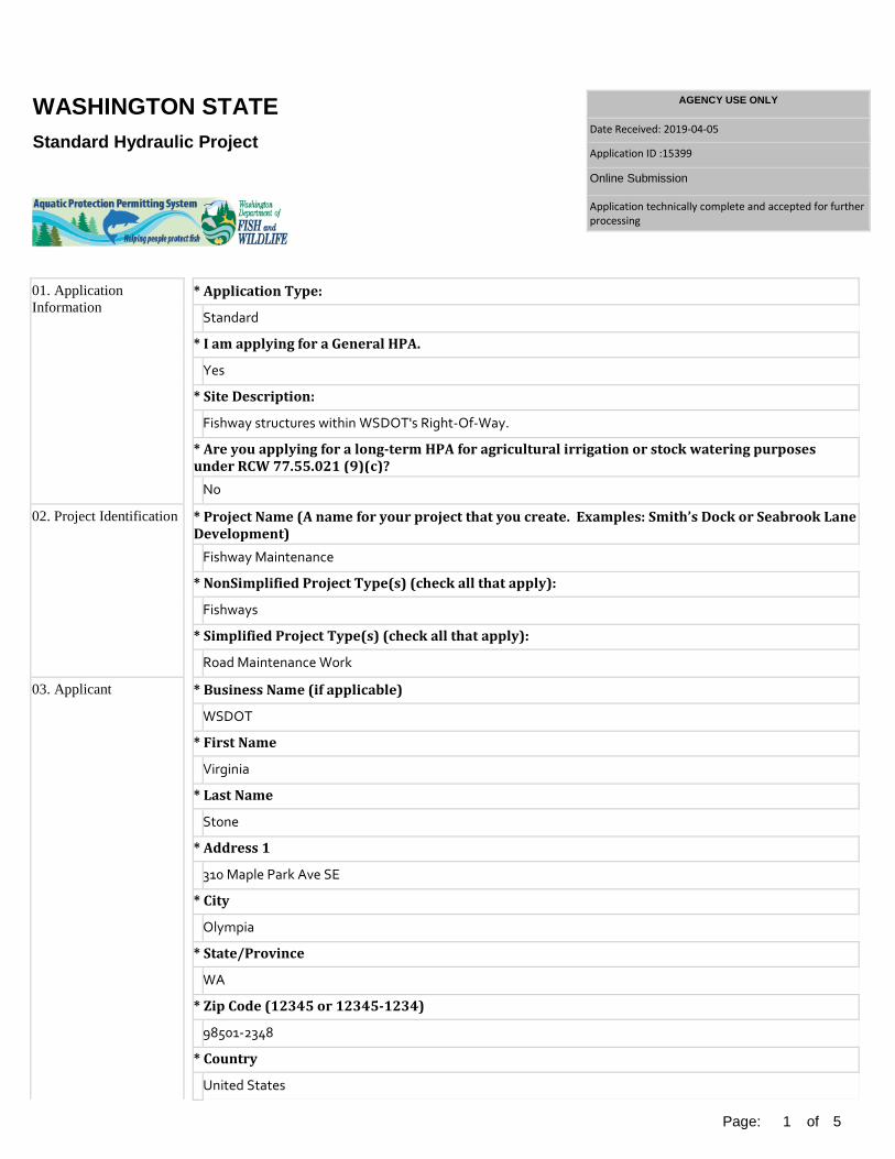
Standard Hydraulic Project
01. ApplicationInformation
* Application Type:
Standard
* I am applying for a General HPA.
Yes
* Site Description:
Fishway structures within WSDOT's Right-Of-Way.
* Are you applying for a long-term HPA for agricultural irrigation or stock watering purposesunder RCW 77.55.021 (9)(c)?
No
02. Project Identification * Project Name (A name for your project that you create. Examples: Smith’s Dock or Seabrook Lane Development)
Fishway Maintenance
* NonSimplified Project Type(s) (check all that apply):
Fishways
* Simplified Project Type(s) (check all that apply):
Road Maintenance Work
03. Applicant * Business Name (if applicable)
WSDOT
* First Name
Virginia
* Last Name
Stone
* Address 1
310 Maple Park Ave SE
* City
Olympia
* State/Province
WA
* Zip Code (12345 or 12345-1234)
98501-2348
* Country
United States

Page:
2
of
5
* Primary Phone No (555-555-5555 Ext.)
360-704-6312
* Mobile Phone No (555-555-5555)
04. Applicant AccountType
* Please select one applicant account type
Government – State
05. Authorized Agent orContact
* No agent will be acting on behalf of the Applicant
Yes
* Business Name (if applicable)
WSDOT
* First Name
Virginia
* Last Name
Stone
* Address 1
310 Maple Park Ave SE
* City
Olympia
* State/Province
WA
* Zip Code (12345 or 12345-1234)
98501-2348
* Country
United States
* Primary Phone No (555-555-5555 Ext.)
360-704-6312
* Mobile Phone No (555-555-5555)
06. Property Owner(s) * Check here if Property Owner is the same as Applicant
Yes
* Business Name (if applicable)
WSDOT
* First Name
Virginia
* Last Name

Page:
3
of
5
Stone
* Address 1
310 Maple Park Ave SE
* City
Olympia
* State/Province
WA
* Zip Code (12345 or 12345-1234)
98501-2348
* Country
United States
* Primary Phone No (555-555-5555 Ext.)
360-704-6312
* Mobile Phone No (555-555-5555)
07. Project Location * Location
Site Name: Work Start Date: Work End Date:
Address: , Statewide, WA, United States Latitude: Longtitude:
WRIA: Stream Number: Stream Name: Parcel No: 100 Year Flood: Drive Direction: --------------------------------------------------------------------------------------------
08. Project Description * Will you be operating equipment in water?
Yes
* Type of equipment used
Debris will be removed using hand tools, wenches, chain saws, backhoe, excavator, crane, or other equipment as required.
* Summarize the overall project.
Maintenance and repair of fishway structures within WSDOT's Right-Of-Way.
* Describe how you plan to construct each project element. Include specific construction methodsand equipment to be used. Identify where each element will occur in relation to the nearestwaterbody. Indicate which activities are within the 100-year flood plain.
Maintenance and repair of fishway structures will be performed to restore flows to preexisting conditions and stop adverse impacts associated with siltation from washouts (erosion of the bank), major reconstruction of the infrastructure caused by erosion, and stranding of fish associated with the waterbody overtopping its banks.
Activities includes repair of weir/pool, pool/chutes, baffle or streambed control, blasted chutes, concrete

Page:
4
of
5
weir, sill, wall, log or rock controls, and stop logs using the equipment listed above. It also includes the removal of bedload material when necessary to make the fishway function properly. Minor repair of erosion may be necessary adjacent to the structure to ensure the structural integrity of the fishway and embankments supporting the roadway structure.
* Requested Project Start Date:
05/20/2019
* Requested Project End Date:
05/19/2024
09. Waterbodies (other than wetlands): Impacts and Mitigation
* Describe how the project is designed to avoid and minimize adverse impacts to the aquatic environment. We will minimize impacts to the aquatic system by:
• Using appropriate BMPs from Part 2 of the Regional Road Maintenance Program to control erosion, sedimentation, and equipment fluids. • Following WDFW’s Allowable Freshwater Work Times for in-water work in fish bearing streams and the installation of diversion structures, when appropriate, for working in the dry. • Removing fish from the work area when in water work is performed using WSDOT’s Standard Fish Moving Protocol and Guidelines when fish exclusion or stream bypass is required. • Using a qualified biologist to lead fish moving activities per the Fish Moving Protocol and Guidelines. • Placing fish screen on the intake hose of water diversion pumps. • Installing block nets to prevent fish from re-entering the work area for stream bypasses. • Using nets to move fish and only use electrofishing if other options are not feasible. • Releasing water slowly from stream bypasses so the actions for this maintenance activity does not exceed water quality standards or release sediment into waterbodies. • Monitoring release of stream bypass to avoid fish stranding. • Avoiding placement of rip rap below the ordinary high water line. • Minimizing damage to native riparian woody species. • Replacing destroyed plants at a 1:1 ratio. • Seeding, mulching, and using other approved BMPs to control erosion of the streambank and stream siltation. • Repositioning large woody material below the OHWL that is creating a blockage system to a location that will not impact the roadway structure. This will ensure a no net loss of habitat structures in the stream. LWM will only be cut if it is not feasible to reposition it.
* Will your project impact a waterbody or the area around a waterbody?
Yes
* Describe how your project will impact a waterbody or the area around a waterbody.
See above.
* Describe impact(s) that cannot be avoided through project design and implementation. For each location, please include the following:General location description where the impact(s) will occur(e.g. stream bank, beach front, 2-foot strip from bank, portion of gravel bar, etc.)Provide length, quantities, and/or area of impact The least impacting methods will be used to avoid impacts to fish life and the stream as listed above. Plants
destroyed by the activity will be replaced at a 1:1 ratio. All areas of bare soils caused by the maintenance activity will be seeded, mulched, or other approved BMPs to control erosion of the bank and siltation of the stream. Trees that need to be removed from the bank will be replaced at a 4:1 ratio that meet LWM criteria.
* Have you prepared a mitigation plan to compensate for the project’s adverse impacts to non-wetland waterbodies? NA
* Have you prepared a mitigation plan to compensate for the project’s adverse impacts to non-wetland waterbodies? The plans, specifications, avoidance and minimization measures, and the GHPA provisions address impacts
to fish life according to the Hydraulic Code. Therefore, activities covered by this GHPA does not require

Page:
5
of
5
compensatory mitigation or a mitigation plan.
* Describe the source and nature of any fill material, amount (in cubic yards) you will use, and how and where it will be placed into the waterbody. Any slope stabilization activities will be conducted within the original project footprint. Rip rap will not be
placed below the OHWL. Fill will come from an approved source. * For all excavating or dredging activities, describe the method for excavating or dredging type and
amount of material you will remove, and where the material will be disposed. Debris will be removed using hand tools, wenches, chain saws, backhoe, excavator, crane, or other
equipment as required. The least impacting method will be used to perform these activities. Type of material removed may include bedload material (rocks, gravels, sands, and silts), small woody material, and manmade debris such as shopping carts. Large Woody Material will be repositioned below the OHWL.
10. SEPA Compliance * Compliance with the State Environmental Policy Act (SEPA). For more information about SEPA, go to "http://www.ecy.wa.gov/programs/sea/sepa/e-review.html" This project is exempt. I will upload, mail, or deliver a draft of the SEPA Letter of Exemption as part of this
application. * Choose Type Of Exemption.
Categorical Exemption
* Under what section of the SEPA administrative code (WAC) is it exempt?
WAC 468-12-800(1)(u)

Best Management Practices Field Guide for ESA § 4 (d) Habitat Protection June 2018
Maintenance and Operations Division Maintenance Office

2

3
Contents
GLOSSARY OF ACRONYMS ................................................................................................................... 5
INTRODUCTION .......................................................................................................................................... 6
MAINTENANCE & RMEC COORDINATION .......................................................................................... 9
#1: ROADWAY SURFACE ....................................................................................................................... 10
ACTIVITIES: ............................................................................................................................................... 10 BMP TABLE: ............................................................................................................................................. 10
#2: ENCLOSED DRAINAGE SYSTEMS ............................................................................................... 14
ACTIVITIES: ............................................................................................................................................... 14 BMP TABLE: ............................................................................................................................................. 14
#3: CLEANING ENCLOSED DRAINAGE SYSTEMS .......................................................................... 17
ACTIVITIES: ............................................................................................................................................... 17 BMP TABLE: ............................................................................................................................................. 17
#4: OPEN DRAINAGE SYSTEMS .......................................................................................................... 19
ACTIVITIES: ............................................................................................................................................... 19 BMP TABLE: ............................................................................................................................................. 19
#5: WATERCOURSES AND STREAMS ............................................................................................... 23
ACTIVITIES: ............................................................................................................................................... 23 BMP TABLE: ............................................................................................................................................. 23
#6: STREAM CROSSINGS ...................................................................................................................... 27
ACTIVITIES: ............................................................................................................................................... 27 BMP TABLE: ............................................................................................................................................. 27
#7: GRAVEL SHOULDERS ..................................................................................................................... 31
ACTIVITIES: ............................................................................................................................................... 31 BMP TABLE: ............................................................................................................................................. 31
#8: STREET SURFACE CLEANING ...................................................................................................... 34
ACTIVITIES: ............................................................................................................................................... 34 BMP TABLE: ............................................................................................................................................. 34
#9: BRIDGE MAINTENANCE .................................................................................................................. 36
ACTIVITIES: ............................................................................................................................................... 36 BMP TABLE: ............................................................................................................................................. 36
#10: SNOW AND ICE CONTROL ........................................................................................................... 40
ACTIVITIES: ............................................................................................................................................... 40 BMP TABLE: ............................................................................................................................................. 40
#11: EMERGENCY SLIDE/WASHOUT REPAIR ................................................................................. 42
ACTIVITIES: ............................................................................................................................................... 42 BMP TABLE: ............................................................................................................................................. 42
#12: CONCRETE ....................................................................................................................................... 45
ACTIVITIES: ............................................................................................................................................... 45 BMP TABLE: ............................................................................................................................................. 45
#13: SEWER SYSTEMS........................................................................................................................... 48

4
ACTIVITIES: ............................................................................................................................................... 48 BMP TABLE: ............................................................................................................................................. 48
#14: WATER SYSTEMS ........................................................................................................................... 51
ACTIVITIES: ............................................................................................................................................... 51 BMP TABLE: ............................................................................................................................................. 51
#15: VEGETATION ................................................................................................................................... 54
ACTIVITIES: ............................................................................................................................................... 54 BMP TABLE: ............................................................................................................................................. 54

5
Glossary of Acronyms
BMPs Best Management Practices ESA Endangered Species Act Highway Activity HATS Tracking System HPA Hydraulic Project Approval IRVM Integrated Roadside Vegetation Plan LWM Large Woody Material RMEC Regional Maintenance Environmental Coordinator RRMP Regional Road Maintenance ESA Program Guidelines ROW Right-of-Way WDFW Washington State Department of Fish and Wildlife WSDOT Washington State Department of Transportation

6
Introduction This guide is intended for WSDOT maintenance crews and regional maintenance environmental coordinators who work within sensitive priority areas – these locations are identified on the Highway Activity Tracking System (HATS) base map. This guide was developed to train and alert staff as to when and where to apply and report implementation of the Regional Road Maintenance Endangered Species Act (ESA) Program Guidelines (RRMP) Best Management Practices (BMPs). Knowing the location of aquatic habitat within the Right-of-Way (ROW) and using BMPs during maintenance activities in these sensitive priority areas will conserve listed ESA threatened salmonids species habitat. The BMPs are not prescriptive, but are outcome based. The best professional judgment of trained maintenance personnel is instrumental in meeting the BMP outcomes (minimize erosion and sedimentation, contain pollutants and minimize impacts to vegetation root zone). This guide provides instructions for completing records using the HATS program and documenting WSDOT compliance with ESA § 4(d) "take" limits for the RRMP. This document constitutes the proof of your compliance with RRMP. Following the Guide will not only conserve listed salmonids, but help protect water quality and quantity, aquatic and shoreline habitats and the traveling public safety. Failure to document compliance could result in a violation under the ESA.

7
Instructions for Maintenance Crews on How to Complete Records for ESA Compliance
Use IPAD HATS program to determine the location of proposed work. The Roadside Sensitive Maintenance Areas are identified on the base map as a green lineal feature. Is work located within a sensitive area? If yes, does the work meet one of the work operation descriptions below? If yes, then complete the HATS form for the work below which will satisfy compliance with the ESA program. The 3rd column to the right describes the form in HATS to use for documenting compliance. If work does not meet the work operation list below, but has the potential to disturb/expose soils, discharge pollutants, disturb vegetation root systems, or could impact water then complete a stand-alone record using the *ESA Compliance form in HATS. Work Operation Code Work Description HATS Form 1142, 1143, 1144, 1212
Shoulder Maintenance Shoulder Maintenance
1211, 1213, 1214 Slide Cleanup / Rip Rap Cribbing / Rockfall Containment
Slide Cleanup / Rip Rap Cribbing / Rockfall Containment
1311 Ditch Maintenance Ditch Maintenance 1329 Channel Maintenance Channel
Maintenance 1332, 1333, 1337, 1337
Culvert / Pipe Maintenance
Culvert
1900 Series Bridge Maintenance HPA 1390 Beaver Dam Removal HPA Fishway Maintenance HPA or Culvert * * Other work that disturbs
soil discharges pollutants or located within natural waters
ESA Compliance
In the HATS form:
• Select the appropriate site specific BMPs for your worksite. • Write in other site specific BMPs used that aren't listed in the pull
down menu.

8
• Write in any comments regarding process or observations on BMPs that can improve the program.

9
Maintenance & RMEC Coordination
1. Maintenance notifies RMEC with proposed in water work activity or potential work activity that could impact water. The notification will include maintenance contact and location (Highway # and mile post). Go to step 2.
2. Review work for consistency with programmatic permits. If no, go to step 3. If yes, go to step 5.
3. RMEC or appropriate individual submits individual permit application. Go to Step 4.
4. RMEC or appropriate individual receives permit approval. Go to Step 5.
5. RMEC or appropriate individual contacts maintenance crew to inform them that work is covered under a programmatic or individual permit. Provide a copy of the applicable permit to the crews. Go to step 6.
6. Maintenance goes to work with copies of the appropriate permits on site.

10
#1: Roadway Surface
Activities:
Activities include the following: pothole and square cut patching; removing paved surface or roadway base; repairing roadway base; repaving; adding gravel or grading roads, access roads, or ROW surfaces; dust control; extending pavement edge; paving gravel shoulder; crack sealing; overlay; chip seal; resurfacing; pavement marking and traffic channelization; traffic control features.
BMP Table:
Routine BMPs BMPs Description
Maintenance of Roadway Surfaces
Perform repairs, replacement and maintenance of roadway surface.
Shoulder Work Maximize opportunities for shoulder work, which will increase infiltration or bio-filtration. (See also Maintenance Category #7, Gravel Shoulders)
Equipment/ Tools
Tools and equipment clean up procedures: • Routinely inspect equipment, tools and vehicles
for leaks or damage. • Keep clean up materials, such as dry absorbent
materials, on site to allow prompt clean up of spills.
• Promptly repair or replace leaking connections, pipes, hoses and/or valves.
Vehicle and equipment maintenance, repair and/or service will be performed at designated repair facilities whenever possible. Use the following practices to reduce the potential for discharge of pollutants to watercourses or streams from vehicle and equipment maintenance, service and repair operations:
• Prohibit discharge of any wastewaters to stormwater drains. Do not pour material down drains or hose down work areas. Use either dry sweeping or damp mopping.
• Remove buildup of oils and grease on equipment. • Perform equipment and vehicle maintenance in
areas that prevent discharges to the storm drain system.
• Use drip pans under equipment when

11
maintaining, repairing or servicing in the field. • Use non-toxic solvents whenever possible. • Clean maintenance area storm drain grates
regularly. • Collect and properly manage (recycle or dispose of)
used materials: grease, oil, oil filters, antifreeze, cleaning solutions, lead-acid batteries, tires, hydraulic and transmission fluids.
Equipment/ Tools
• Surfaces shall be cleaned following any discharge or spill incident.
At end of shift, park equipment in designated areas. Clean equipment and tools offsite in an area where pollutants can be contained. If unable to move tools and equipment off site, control and remove cleaning by-products.
Material/ Debris Disposal
After repairs are completed, remove construction/maintenance waste materials from work site and dispose of and/or recycle. If area is swept with a pick-up sweeper, the material will be hauled out of the area to appropriate disposal site.
Painting/ Marking
Follow state and federal guidelines for handling paint and other traffic marking material. Stripe roadways in dry weather.
Spill Prevention & Control Continued on next page.
Carry spill kit used for small spills related to equipment failure. At a minimum, WSDOT will carry a five-gallon capacity spill kit designed for petroleum products that will be carried on vehicle or with equipment. Desired outcome is to control, absorb or contain spill for clean up and disposal.

12
Site Specific BMPs BMPs Description
Are you disturbing soils?
Exposed and unworked soils shall be stabilized by application of BMPs that protect soil from the erosive forces of raindrop impact and flowing water:
• During winter season – October through June – no soils shall remain exposed and unworked for more than two days.
• During the summer season – July through September – no soils shall remain exposed and unworked for more than seven days.
• These conditions apply to all soils on site, whether or not at final grade.
Prior to BMP removal, clean up accumulated sediments and seed or replant disturbed area.
Site Specific BMPs Continued on next page.
Use any of the three BMP outcome categories at or around the work site to reduce turbidity, sediment and/or pollutants from entering watercourses, streams, wetlands, lakes or other water bodies: “Filter/Perimeter Protection”
Coir Inlet Protection Continuous Berm Kimble Filter Pipe Curb Inlet Sediment Trap Silt Fence Excelsior Filled Sediment Trap Silt Mat Filter Fabric Straw Bale Barrier (1)

13
Site Specific BMPs .
Grass Lined Channel Straw Bale Barrier (2) Gravel Lined Channel Straw Bale Barrier (3) Gravel Filled Sump Straw Log Half Round Filter Washed Rock
“Reduce Potential for Soil Erosion” Back of Slope Planting Live Staking Construction Access Road Mulching Ditch Lining Plastic Covering Dust Control Soil Stabilization
(Blankets/Matting) Filter Fabric Surface Roughening Grass Lined Channel Sweeping Hand Seeding Vegetative Buffer Hydroseeding
“Reduce Water Velocity/Erosive Forces” Back of Slope Planting Sandbag Coir Fabric Silt Fence Coir Log Silt Mat Continuous Berm Straw Bale Barrier (1) Ditch Lining Straw Bale Barrier (2) Excelsior Filled Log Straw Bale Barrier (3) Hand Seeding Straw Log Hydroseeding Stream Bank Bio-Engineering Large Woody Material Surface Roughening Live Staking Triangular Silt Dike Mulching Turbidity Curtain Rip Rap Vegetative Buffer Rock Check Dam
Go to http://www.wsdot.wa.gov/maintenance/roadside/esa.htm For Part 2 BMP installation guidelines.

14
#2: Enclosed Drainage Systems
Activities: Enclosed drainage systems include the following: facilities, retention/detention facilities, pollution control devices, manholes, catch basins, vaults, pipes, access roads and inlets/outlets.
BMP Table:
Routine BMPs BMPs Description
Maintaining Enclosed Drainage Systems
Perform repairs, replacement and maintenance of enclosed drainage systems.
Equipment/ Tools
Tools and equipment clean up procedures: • Routinely inspect equipment, tools and vehicles
for leaks or damage. • Keep clean up materials, such as dry absorbent
materials, on site to allow prompt clean up of spills. • Promptly repair or replace leaking connections,
pipes, hoses and/or valves. Vehicle and equipment maintenance, repair and/or service will be performed at designated repair facilities whenever possible. Use the following practices to reduce the potential for discharge of pollutants to watercourses or streams from vehicle and equipment maintenance, service and repair operations:
• Prohibit discharge of any wastewaters to stormwater drains. Do not pour material down drains or hose down work areas. Use either dry sweeping or damp mopping.
• Remove buildup of oils and grease on equipment. • Perform equipment and vehicle maintenance in
areas that prevent discharges to the storm drain system.
• Use drip pans under equipment when maintaining, repairing or servicing in the field.
• Use non-toxic solvents whenever possible. • Clean maintenance area storm drain grates
regularly. • Collect and properly manage (recycle or dispose
of) used materials: grease, oil, oil filters, antifreeze, cleaning solutions, lead-acid batteries, tires, hydraulic and transmission fluids.

15
• Surfaces shall be cleaned following any discharge or spill incident.
At the end of shift, park equipment in designated areas.
Equipment/ Tools
Clean equipment and tools off site in an area where pollutants can be contained. If unable to move tools and equipment off site, control and remove cleaning by-products.
Material/Debris Disposal
After repairs are completed, remove construction/maintenance waste materials from work site and dispose of and/or recycle.
Spill Prevention & Control
Carry spill kit used for small spills related to equipment failure. At a minimum, WSDOT will carry a five-gallon capacity spill kit designed for petroleum products that will be carried on vehicle or with equipment. Desired outcome is to control, absorb or contain spill for clean up and disposal.
Site Specific BMPs
BMPs Description Are you disturbing soils?
Exposed and unworked soils shall be stabilized by application of BMPs that protect soil from the erosive forces of raindrop impact and flowing water:
• During winter season – October through June – no soil shall remain exposed and unworked for more than two days.
• During the summer season – July through September –
no soils shall remain exposed and unworked for more than seven days.
• These conditions apply to all soils on site, whether or not at final grade.
Prior to BMP removal, clean up accumulated sediments and seed or replant disturbed area.
Site Specific BMPs Continued on next page
Use any of the following three BMP outcome categories at or around the work site to reduce turbidity, sediment and/or pollutants from entering watercourses, streams, wetlands, lakes, or other water bodies: “Filter/Perimeter Protection”
Coir Log Inlet Protection Continuous Berm Kimble Filter Pipe Curb Inlet Sediment Trap Silt Fence Excelsior Filled Sediment Trap Silt Mat Filter Fabric Straw Bale Barrier (1)

16
Grass Lined Channel Straw Bale Barrier (2) Gravel Lined Channel Straw Bale Barrier (3) Gravel Filled Sump Straw Log Half Round Filter Washed Rock
Site Specific BMPs
“Reduce Potential for Soil Erosion” Back of Slope Planting Live Staking Construction Access Road Mulching Ditch Lining Plastic
Covering Dust Control Soil
Stabilization (Blankets/Matting)
Filter Fabric Surface Roughening Grass Lined Channel
Sweeping Hand Seeding Vegetative
Buffer Hydroseeding
“Keep Water from Work Area” Aqua Barrier Plastic Covering Coffer Dam Sandbag Dewatering Stream Bypass Diversion Berm Vactoring Diversion Channel
Go to http://www.wsdot.wa.gov/maintenance/roadside/esa.htm
For Part 2 BMP installation guidelines.

17
#3: Cleaning Enclosed Drainage Systems
Activities: Removing debris, sediments and liquids from enclosed drainage systems using a vacuum/flush truck ("Vactor"), by hand or other mechanical means. Enclosed drainage systems include the following: facilities, retention/detention facilities, manholes, catch basins, vaults, pipes, access roads, pollution control devices and inlets.
BMP Table:
Routine BMPs BMPs Description
Cleaning Enclosed Drainage Systems
Maintain drainage systems.
Pre-Activity Cleaning Enclosed Drainage Systems: Use BMPs that include, but are not limited to:
• Blocking facility outlet. • Using less water. • Blocking downgradient end of pipe.
Equipment/ Tools Continued on next page.
When using high-pressure flushing equipment, vacuum out solids to reduce sediment and turbidity from moving downgrade throughout the drainage system. Tools and equipment clean up procedures:
• Routinely inspect equipment, tools and vehicles for leaks or damage.
• Keep clean up materials, such as dry absorbent materials, on site to allow prompt clean up of spills.
• Promptly repair or replace leaking connections, pipes, hoses and/or valves.
Vehicle and equipment maintenance, repair and/or service will be performed at designated repair facilities whenever possible. Use the following practices to reduce the potential for discharge of pollutants to watercourses or streams from vehicle and equipment maintenance, service and repair operations:
• Prohibit discharge of any wastewaters to stormwater drains. Do not pour material down drains or hose down work areas. Use either dry sweeping or damp mopping.

18
• Remove buildup of oils and grease on equipment.
• Perform equipment and vehicle maintenance in areas that prevent discharges to the storm drain system.
• Use drip pans under equipment when maintaining, repairing or servicing in the field.
• Use non-toxic solvents whenever possible. Equipment/ Tools
• Clean maintenance area storm drain grates regularly.
• Collect and properly manage (recycle or dispose of) used materials: grease, oil, oil filters, antifreeze, cleaning solutions, lead-acid batteries, tires, hydraulic and transmission fluids.
• Surfaces shall be cleaned following any discharge or spill incident.
At the end of shift, park equipment in designated areas. Clean equipment and tools off site in an area where pollutants can be contained. If unable to move tools and equipment off site, control and remove cleaning by-products.
Material/Debris Disposal
Remove and dispose of collected materials and liquids off site. Solid materials removed from the site will be taken to a disposal or recycling area.
Spill Prevention & Control
Carry spill kit used for small spills related to equipment failure. At a minimum, WSDOT will carry a five-gallon capacity spill kit designed for petroleum products that will be carried on vehicle or with equipment. Desired outcome is to control, absorb or contain spill for clean up and disposal.

19
#4: Open Drainage Systems
Activities: These systems include facilities, retention/detention facilities, swales, pollution control devices, manholes, catch basins, vaults, pipes, culverts, ditches and inlets/outlets. (Open drainage systems that are part of the watercourses and streams systems are covered in Maintenance Category #5, Watercourses and Streams.)
BMP Table: Routine BMPs
BMPs Description Maintaining Open Drainage Systems
Maintain drainage systems.
Permits Maintenance activities within waters of the state will be covered under Maintenance Category #5, Watercourses and Streams.
Scheduling Plan and schedule work in dry conditions, except in emergency situations.
Equipment/ Tools Continued on next page.
Vehicle and equipment maintenance, repair and/or service will be performed at designated repair facilities whenever possible. Use the following practices to reduce the potential for discharge of pollutants to watercourses or streams from vehicle and equipment maintenance, service and repair operations.
• Prohibit discharge of any wastewaters to stormwater. • Prohibit discharge of any wastewaters to
stormwater drains. Do not pour material down drains or hose down work areas. Use either dry sweeping or damp mopping.
• Remove buildup of oils and grease on equipment. • Perform equipment and vehicle maintenance in
areas that prevent discharges to the storm drain system.
• Collect and properly manage (recycle or dispose of) used materials: grease, oil, oil filter, antifreeze, cleaning solutions lead-acid batteries, tires, hydraulic and transmission fluid.
• Surfaces shall be cleaned following the discharge

20
or spill incident. At the end of shift, park equipment in designated areas. Clean equipment and tools off site in an area where pollutants can be contained. If unable to move equipment and tools off site, control and remove cleaning by-products.
Follow invasive species prevention guidelines
Material/Debris Disposal .
Remove and dispose of collected materials and liquids off site. Solid materials removed from the site will be taken to a disposal or recycling area.
Spill Prevention & Control
Carry spill kit used for small spills related to equipment failure. At a minimum, WSDOT will carry a five-gallon capacity spill kit designed for petroleum products that will be carried on vehicle or with equipment. Desired outcome is to control, absorb or contain spill for clean up and disposal.
Site Specific BMPs BMPs Description
Are you disturbing soils?
Exposed and unworked soils shall be stabilized by application of BMPs that protect the soil from the erosive forces of raindrop impact and flowing water:
• During winter season – October through June – no soils shall remain exposed and unworked for more than two days.
• During the summer season – July through September – no soils shall remain exposed and unworked for more than seven days.
• These conditions apply to all soils onsite, whether or not at final grade.
Leave vegetative buffer outside of work zone to provide biofiltration and shading outside of the back slope of ditch. Leave vegetative buffer of grasses and small forbs between the shoulder and ditch if the area is wide enough. Leave vegetated sections of grasses and small forbs in ditchline where sediment buildup does not impede flow or infiltration. After removal of sediments from ditch line, consider replanting disturbed soils with grasses and small forbs. Prior to BMP removal, clean up accumulated sediments and seed or replant disturbed area.
Site Specific Use any of the four BMP outcome categories at or

21
BMPs
around the work site to reduce turbidity, sediment and/or pollutants from entering watercourses or streams, wetlands, lakes or other waterbodies: “Filter/Perimeter Protection”
Coir Log Inlet Protection Continuous Berm Kimble Filter Pipe Curb Inlet Sediment Trap Silt Fence Excelsior Filled Sediment Trap Silt Mat Filter Fabric Straw Bale Barrier (1) Grass Lined Channel Straw Bale Barrier (2) Gravel Lined Channel Straw Bale Barrier (3) Gravel Filled Sump Straw Log Half Round Filter Washed Rock
Site Specific BMPs Continued on next page.
“Keep Water from Work Area” Aqua Barrier Plastic Covering Coffer Dam Sandbag Dewatering Stream Bypass Diversion Berm Vactoring Diversion Channel
“Reduce Potential for Soil Erosion” Back of Slope Planting Live Staking Construction Access Road Mulching Ditch Lining Plastic Covering Dust Control Soil Stabilization
(Blankets/Matting) Filter Fabric Surface Roughening Grass Lined Channel Sweeping Hand Seeding Vegetative Buffer Hydroseeding
“Reduce Water Velocity/Erosive Forces” Back of Slope Planting Sandbag Coir Fabric Silt Fence Coir Log Silt Mat Continuous Berm Straw Bale Barrier (1) Ditch Lining Straw Bale

22
Barrier (2) Excelsior Filled Log Straw Bale Barrier (3) Hand Seeding Straw Log Hydroseeding Stream Bank Bio-
Engineering Large Woody Material Surface Roughening Live Staking Triangular Silt Dike Mulching Turbidity Curtain Rip Rap Vegetative Buffer Rock Check Dam
Go to http://www.wsdot.wa.gov/maintenance/roadside/esa.htm
For Part 2 BMP installation guidelines.

23
#5: Watercourses and Streams
Activities: These activities may include structural repair/replacement, slope stabilization, sediment removal, vegetation management, debris removal, access road maintenance, habitat maintenance and improvements (for example, fish ladders, weirs and large woody material).
BMP Table:
Routine BMPs BMPs Description
Maintenance of Watercourses & Streams
Maintain drainage systems that are watercourses and/or streams.
Permits
Maintenance activities within waters of the state will be reviewed by WDFW and permitted with an HPA, as necessary. When required, habitat restoration will be designed and constructed in accordance with applicable permits.
Scheduling Plan and schedule work in dry conditions or when flows are anticipated to be at their lowest when possible.
Fish Exclusion Follow "Fish Exclusion Protocol" (RRMP Appendix E) and permit conditions during maintenance activities. Fish will be excluded from the construction area using appropriate methods such as the use of nets, dewatering at a controlled rate and removal of stranded fish according to HPA permit conditions.
Equipment/ Tools
Vehicle and equipment maintenance, repair and/or service will be performed at designated repair facilities whenever possible. Use the following practices to reduce the potential for discharge of pollutants to watercourses or streams from vehicle and equipment maintenance, service and repair operations:
• Prohibit discharge of any wastewaters to stormwater drains. Do not pour material down drains or hose down work areas. Use either dry sweeping or damp mopping.
• Remove buildup of oils and grease on equipment.
• Perform equipment and vehicle maintenance in

24
areas that prevent discharges to the storm drain system.
• Use drip pans under equipment when maintaining, repairing or servicing in the field.
• Use non-toxic solvents whenever possible. • Clean maintenance area storm drain grates
regularly.
Equipment/ Tools
• Collect and properly manage (recycle or dispose of) used materials: grease, oil, oil filters, antifreeze, cleaning solutions, lead-acid batteries, tires, hydraulic and transmission fluids.
• Surfaces shall be cleaned following any discharge or spill incident.
At the end of shift, park equipment in designated areas. Clean equipment and tools off site in an area where pollutants can be contained. If unable to move tools and equipment off site, control and remove cleaning by-products. Follow invasive species prevention guidelines
Material/Debris Disposal
After repairs are completed, remove construction/maintenance waste materials from work site and dispose of and/or recycle.
Spill Prevention & Control
Carry spill kit used for small spills related to equipment failure. At a minimum, WSDOT will carry a five-gallon capacity spill kit designed for petroleum products that will be carried on vehicle or with equipment. Desired outcome is to control, absorb or contain spill for clean up and disposal.
Site Specific BMPs BMPs Description
Are you disturbing soils? Continued on next page.
Exposed and unworked soils shall be stabilized by application of BMPs that protect soil from the erosive forces of raindrop impact and flowing water:
• During winter season – October through June – no soil shall remain exposed and unworked for more than two days.
• During the summer season – July through September – no soils shall remain exposed and unworked for more than seven days.
• These conditions apply to all soils on site, whether or not at final grade.
Minimize disturbance to riparian vegetation: • Mark job site.

25
• Flag work area. • Operate equipment to minimize damage to
riparian habitat. Leave vegetative buffer of grasses and small forbs between the shoulder and ditch if the area is wide enough. Leave vegetated section in ditchline, where sediment buildup does not impede flow or infiltration. Leave vegetative buffer outside of work zone to provide biofiltration and shading outside of the back slope of ditch. Monitor water quality in accordance with permit requirements.
Are you disturbing soils?
Monitor plantings in accordance with permit requirements. Prior to BMP removal, clean up accumulated sediments and seed or replant disturbed area.
Site Specific BMPs Continued on next page.
Use any of the four BMP outcome categories at or around the work site to reduce turbidity, sediment and/or pollutants from entering watercourses or streams, wetlands, lakes or other waterbodies: “Filter/Perimeter Protection”
Coir Log Inlet Protection Continuous Berm Kimble Filter Pipe Curb Inlet Sediment Trap Silt Fence Excelsior Filled Sediment Trap Silt Mat Filter Fabric. Straw Bale Barrier (1) Grass Lined Channel Straw Bale Barrier (2) Gravel Lined Channel Straw Bale Barrier (3) Gravel Filled Sump Straw Log Half Round Filter Washed Rock
“Keep Water from Work Area” Aqua Barrier Plastic Covering Coffer Dam Sandbag Dewatering Stream Bypass Diversion Berm Vactoring Diversion Channel

26
"Habitat Protection/Maintenance" Coir Fabric Hydroseeding Coir Log Large Woody Material Excelsior Filled Log Live Staking Hand Seeding Streambed Gravel
“Reduce Water Velocity/Erosive Forces” Back of Slope Planting Sandbag Coir Fabric Silt Fence Coir Log Silt Mat Continuous Berm Straw Bale Barrier (1) Ditch Lining Straw Bale Barrier (2) Excelsior Filled Log Straw Bale Barrier (3) Hand Seeding Straw Log Hydroseeding Stream Bank Bio-
Engineering Site Specific BMPs Continued on next page.
Large Woody Material Surface Roughening Live Staking Triangular Silt Dike Mulching Turbidity Curtain Rip Rap Vegetative Buffer Rock Check Dam
Go to http://www.wsdot.wa.gov/maintenance/roadside/esa.htm For Part 2 BMP installation guidelines.

27
#6: Stream Crossings
Activities: Repair, cleaning, maintenance, installation or replacement/upgrade of stream crossing facilities, such as pipes, arch pipes, box culverts, fish ladders, weirs, sediment pools, access roads and bridges. Maintenance within waters of the state will be reviewed by the WDFW.
BMP Table: Routine BMPs
BMPs Description Permits
Maintenance activities within waters of the state will be reviewed by WDFW and permitted with an HPA, as necessary. When required, habitat restoration will be designed and constructed in accordance with applicable permits.
Scheduling
If seasonal watercourses or stream, schedule work during dry conditions. Plan and schedule work in dry conditions or low flow conditions except in emergency situations if possible (HPA).
Fish Exclusion Follow “Fish Exclusion Protocol” (See RRMP Appendix E) and permit conditions during maintenance activities. Fish will be excluded from the construction area using appropriate methods such as the use of nets, dewatering at a controlled rate and removal of stranded fish according to HPA permit conditions.
Equipment/ Tools Continued on next page.
Vehicle and equipment maintenance, repair and/or service will be performed at designated repair facilities whenever possible. Use the following practices to reduce the potential for discharge of pollutants to watercourses or streams from vehicle and equipment maintenance, service and repair operations:
• Prohibit discharge of any wastewaters to stormwater drains. Do not pour material down drains or hose down work areas. Use either dry sweeping or damp mopping.
• Remove buildup of oils and grease on equipment. • Perform equipment and vehicle maintenance in
areas that prevent discharges to the storm drain system.

28
• Use drip pans under equipment when maintaining, repairing or servicing in the field.
• Use non-toxic solvents whenever possible. • Clean maintenance area storm drain grates
regularly. • Collect and properly manage (recycle or dispose
of) used materials: grease, oil, oil filters, antifreeze, cleaning solutions, lead-acid batteries, tires, hydraulic and transmission fluids.
Equipment/ Tools.
• Surfaces shall be cleaned following any discharge or spill incident.
At the end of shift, park equipment in designated areas. Clean equipment and tools off site in an area where pollutants can be contained. If unable to move tools and equipment off site, control and remove cleaning by-products. Follow invasive species prevention guidelines
Material/Debris Disposal
After repairs are completed, remove construction/maintenance waste materials from work site and dispose of and/or recycle.
Spill Prevention & Control
Carry spill kit used for small spills related to equipment failure. At a minimum, WSDOT will carry a five-gallon capacity spill kit designed for petroleum products that will be carried on vehicle or with equipment. Desired outcome is to control, absorb or contain spill for clean up and disposal.
Site Specific BMPs BMPs Description
Are you disturbing soils? Continued on next page.
Exposed and unworked soils shall be stabilized by application of BMPs that protect soil from the erosive forces of raindrop impact and flowing water:
• During winter season – October through June – no soil shall remain exposed and unworked for more than two days.
• During the summer season – July through September – no soils shall remain exposed and unworked for more than seven days.
• These conditions apply to all soils on site, whether or not at final grade.
Minimize disturbance to riparian vegetation: • Mark job site. • Flag work area. • Position equipment to protect riparian habitat.
Monitor water quality. Restore vegetation appropriate for site conditions within

29
riparian areas. Protect outflows by bio-vegetation techniques or armoring to reduce erosion. Monitor vegetation and stream habitat in accordance with permit conditions. Prior to BMP removal, clean up accumulated sediments and seed or replant disturbed area.
Site Specific BMPs
Use any of the 4 BMP outcome categories at or around the work site to reduce turbidity, sediment and/or pollutants from entering watercourses or streams, wetlands, lakes or other water bodies.
Site Specific BMPs Continued on next page.
“Filter/Perimeter Protection” Coir Log Inlet Protection Continuous Berm Kimble Filter Pipe Curb Inlet Sediment Trap Silt Fence Excelsior Filled Sediment Trap Silt Mat Filter Fabric Straw Bale Barrier (1) Grass Lined Channel Straw Bale Barrier (2) Gravel Lined Channel Straw Bale Barrier (3) Gravel Filled Sump Straw Log Half Round Filter Washed Rock
“Keep Water from Work Area” Aqua Barrier Plastic Covering Coffer Dam Sandbag Dewatering Stream Bypass Diversion Berm Vactoring Diversion Channel
"Habitat Protection/Maintenance" Coir Fabric Hydroseeding Coir Log Large Woody Material Excelsior Filled Log Live Staking Hand Seeding Streambed Gravel
“Reduce Water Velocity/Erosive Forces” Back of Slope Planting Sandbag Coir Fabric Silt Fence Coir Log Silt Mat Continuous Berm Straw Bale Barrier (1) Ditch Lining Straw Bale Barrier

30
(2) Excelsior Filled Log Straw Bale Barrier (3) Hand Seeding Straw Log Hydroseeding Stream Bank Bio-
Engineering Large Woody Material Surface Roughening Live Staking Triangular Silt Dike Mulching Turbidity Curtain Rip Rap Vegetative Buffer Rock Check Dam
Go to http://www.wsdot.wa.gov/maintenance/roadside/esa.htm For Part 2 BMP installation guidelines.

31
#7: Gravel Shoulders
Activities: Maintenance tasks performed on gravel shoulders improve drainage, restore proper grade, restore filtering capability, maintain vegetation to provide adequate site distance, smooth rutting and remove buildup of sediment before entering drainage system.
BMP Table:
Routine BMPs BMPs Description
Maintenance of Gravel Shoulders
Perform maintenance. Remove built up sediment and sod. Restore gravel shoulder. Roll shoulder material to ensure proper grade and retention of sediment control qualities.
Scheduling Periodically remove sediment deposits and vegetation during the dry season when possible with a motor grader.
Equipment/ Tools
Vehicle and equipment maintenance, repair and/or service will be performed at designated repair facilities whenever possible. Use the following practices to reduce the potential for discharge of pollutants to watercourses or streams from vehicle and equipment maintenance, service and repair operations:
• Prohibit discharge of any wastewaters to stormwater drains. Do not pour material down drains or hose down work areas. Use either dry sweeping or damp mopping.
• Remove buildup of oils and grease on equipment.
• Perform equipment and vehicle maintenance in areas that prevent discharges to the storm drain system.
• Use drip pans under equipment when maintaining, repairing or servicing in the field.
• Use non-toxic solvents whenever possible. • Clean maintenance area storm drain grates
regularly. • Collect and properly manage (recycle or dispose

32
of) used materials: grease, oil, oil filters, antifreeze, cleaning solutions, lead-acid batteries, tires, hydraulic and transmission fluids.
• Surfaces shall be cleaned following any discharge or spill incident.
At the end of shift, park equipment in designated areas.
Equipment/ Tools
Clean equipment and tools off site in an area where pollutants can be contained. If unable to move tools and equipment off site, control and remove cleaning by-products.
Material/Debris Disposal
After repairs are completed, remove construction/maintenance waste materials from work site and dispose of and/or recycle. Use pickup sweepers to remove materials from roadway in assigned areas.
Spill Prevention & Control
Carry spill kit used for small spills related to equipment failure. At a minimum, WSDOT will carry a five-gallon capacity spill kit designed for petroleum products that will be carried on vehicle or with equipment. Desired outcome is to control, absorb or contain spill for clean up and disposal.
Site Specific BMPs BMPs Description
Are you disturbing soils?
Exposed and unworked soils shall be stabilized by application of BMPs that protect soil from the erosive forces of raindrop impact and flowing water:
• During winter season – October through June – no soil shall remain exposed and unworked for more than two days.
• During the summer season – July through September – no soils shall remain exposed and unworked for more than seven days.
• These conditions apply to all soils on site, whether or not at final grade.
Prior to BMP removal, clean up accumulated sediments and seed or replant disturbed area. Minimize disturbance to vegetation outside of shoulder area. Leave vegetative strip where possible between the gravel and ditch line for biofiltration.
Site Specific BMPs Continued on
Use the BMP outcome category listed below at or around the work site to reduce turbidity, sediment and/or pollutants from entering watercourses or

33
streams, wetlands, lakes or other waterbodies: “Filter/Perimeter Protection”
Coir Log Inlet Protection Continuous Berm Kimble Filter Pipe Curb Inlet Sediment Trap Silt Fence Excelsior Filled Sediment Trap Silt Mat Filter Fabric Straw Bale Barrier (1) Grass Lined Channel Straw Bale Barrier (2)
Site Specific BMPs .
Gravel Lined Channel Straw Bale Barrier (3) Gravel Filled Sump Straw Log Half Round Filter Washed Rock
Go to http://www.wsdot.wa.gov/Maintenance/Roadside/Esa.htm RRMP Part 2 BMPs for installation guidelines.

34
#8: Street Surface Cleaning
Activities: Removing soil, organic material, dust, trash and other debris to keep road surfaces clean and remove sediment from the roadway before it enters the storm drain system, surface water system, watercourses, streams or other waterbodies. The removal of dust also reduces airborne pollution and sediment loading.
BMP Table: Routine BMPs
BMPs Description Pre-Activity Use clean up procedures that protect water quality.
Equipment/ Tools Continued on next page.
Control speed of sweeper to minimize airborne particulates and remove maximum amount of debris. Use water spray system on sweeper to reduce dust. Use pickup sweepers to remove materials from roadway in assigned areas. Vehicle and equipment maintenance, repair and/or service will be performed at designated repair facilities whenever possible. Use the following practices to reduce the potential for discharge of pollutants to watercourses or streams from vehicle and equipment maintenance, service and repair operations:
• Prohibit discharge of any wastewaters to stormwater drains. Do not pour material down drains or hose down work areas. Use either dry sweeping or damp mopping.
• Remove buildup of oils and grease on equipment.
• Perform equipment and vehicle maintenance in areas that prevent discharges to the storm drain system.
• Use drip pans under equipment when maintaining, repairing or servicing in the field.
• Use non-toxic solvents whenever possible. • Clean maintenance area storm drain grates
regularly. • Collect and properly manage (recycle or dispose
of) used materials: grease, oil, oil filters,

35
antifreeze, cleaning solutions, lead-acid batteries, hydraulic and transmission fluids and tires.
• Surfaces shall be cleaned following any discharge or spill incident.
At the end of shift, park equipment in designated areas.
Equipment/ Tools
Clean equipment and tools off site in an area where pollutants can be contained. If unable to move tools and equipment off site, control and remove cleaning by-products.
Material/Debris Disposal
After repairs are completed, remove construction/maintenance waste materials from work site and dispose of and/or recycle.
Spill Prevention & Control
Carry spill kit used for small spills related to equipment failure. At a minimum, WSDOT will carry a five-gallon capacity spill kit designed for petroleum products that will be carried on vehicle or with equipment. Desired outcome is to control, absorb or contain spill for clean up and disposal.

36
#9: Bridge Maintenance
Activities: Bridge maintenance activities include inspecting, testing, repairing, replacing, cleaning, maintaining, painting or resurfacing components of the bridge such as the electrical system, substructure, superstructure, surface footing, piers, supports, access roads, abutments, ramps and vegetation management.
BMP Table:
Routine BMPs BMPs Description
Permits Bridge maintenance activities requiring an HPA will be reviewed with the WDFW and permitted prior to construction in accordance with the HPAs.
Scheduling If bridge maintenance is to be performed in a seasonal watercourse or stream, schedule the work during dry conditions if possible.
Habitat Measures
Maintain or add areas of spawning, migration, feeding, or rearing habitat as directed by WDFW (HPA) permit, public safety and ROW structure conditions allow. Place appropriate streambed material (HPA).
Equipment/ Tools Continued on next page.
Vehicle and equipment maintenance, repair and/or service will be performed at designated repair facilities whenever possible. Use the following practices to reduce the potential for discharge of pollutants to watercourses or streams from vehicle and equipment maintenance, service and repair operations:
• Prohibit discharge of any wastewaters to stormwater drains. Do not pour material down drains or hose down work areas. Use either dry sweeping or damp mopping.
• Remove buildup of oils and grease on equipment.
• Perform equipment and vehicle maintenance in areas that prevent discharges to the storm drain system.
• Use drip pans under equipment when maintaining, repairing or servicing in the field.

37
• Use non-toxic solvents whenever possible. • Clean maintenance area storm drain grates
regularly. • Collect and properly manage (recycle or dispose
of) used materials: grease, oil, oil filters, antifreeze, cleaning solutions, lead-acid batteries, tires, hydraulic and transmission fluids.
Equipment • Surfaces shall be cleaned following any discharge or spill incident.
• At the end of shift, park equipment in designated areas.
• Clean equipment and tools off site in an area where pollutants can be contained.
• If unable to move tools and equipment off site, control and remove cleaning by-products.
• Follow invasive species prevention guidelines
Material/Debris Disposal
After repairs are completed, remove construction/maintenance waste materials from work site and dispose of and/or recycle.
Spill Prevention & Control
Carry spill kit used for small spills related to equipment failure. At a minimum, WSDOT will carry a five-gallon capacity spill kit designed for petroleum products that will be carried on vehicle or with equipment. Desired outcome is to control, absorb or contain spill for clean up and disposal.
Site Specific BMPs BMPs Description
Are you disturbing soils? Continued on next page.
Exposed and unworked soils shall be stabilized by application of BMPs that protect soil from the erosive forces of raindrop impact and flowing water:
• During winter season – October through June – no soil shall remain exposed and unworked for more than two days.
• During the summer season – July through September – no soils shall remain exposed and unworked for more than seven days.
• These conditions apply to all soils on site, whether or not at final grade.
Minimize disturbance to riparian vegetation: • Mark job site.

38
• Flag work area. • Operate equipment to minimize damage to
riparian habitat. • Monitor water quality in accordance with permit
requirements. • Restore vegetation where appropriate for site
conditions within riparian areas (HPA). • Prior to BMP removal, clean up accumulated
sediments and seed or replant disturbed area.
Site Specific BMPs Continued on next page.
Use any of the five BMP outcome categories at or around the work site to reduce turbidity, sediment and/or pollutants from entering watercourses or streams, wetlands, lakes or other waterbodies: “Filter/Perimeter Protection”
Coir Log Inlet Protection Continuous Berm Kimble Filter Pipe Curb Inlet Sediment Trap Silt Fence Excelsior Filled Sediment Trap Silt Mat Filter Fabric Straw Bale Barrier (1) Grass Lined Channel Straw Bale Barrier (2) Gravel Lined Channel Straw Bale Barrier (3) Gravel Filled Sump Straw Log Half Round Filter Washed Rock
“Reduce Potential for Contaminants Falling into Water”
Diaper Netting Plywood Work Platform
"Settling,"
Coir Fabric Silt Mat Continuous Berm Siltation Pond/Tank Curb Inlet Sediment Trap Straw Bale Barrier (1) Excelsior Filled Log Straw Bale Barrier (2) Filter Fabric Straw Bale Barrier (3)

39
Rock Check Dam Straw Log Sandbag Temporary Sediment Trap Sedimentation Sump Triangular Silt Dike Silt Fence Turbidity Curtain
"Habitat Protection/Maintenance"
Coir Fabric Hydroseeding Coir Log Large Woody Material Excelsior Filled Log Live Staking Hand Seeding Streambed Gravel
“Reduce Water Velocity/Erosive Forces”
Back of Slope Planting Sandbag Coir Fabric Silt Fence Coir Log Silt Mat Continuous Berm Straw Bale Barrier (1) Ditch Lining Straw Bale Barrier (2)
Site Specific BMPs Continued on next page.
Excelsior Filled Log Straw Bale Barrier (3) Hand Seeding Straw Log Hydroseeding Stream Bank Bio-
Engineering Large Woody Material Surface Roughening Live Staking Triangular Silt Dike Mulching Turbidity Curtain Rip Rap Vegetative Buffer Rock Check Dam
Go to http://www.wsdot.wa.gov/Maintenance/Roadside/Esa.htm RRMP Part 2 BMPs for installation guidelines.

40
#10: Snow and Ice Control
Activities: Activities include snow blowing, plowing drift removal, winter sand cleanup, sanding anti-icing and de-icing application.
BMP Table:
Routine BMPs BMPs Description
Operational
Minimize use of salt by reducing salt-to-sand ratios. Treat sand clean up as part of the emergency: remove sand as a priority in order to remove sediments. Plow snow in areas that allow vegetation to filter and contain sand. Prioritize clean up efforts to aquatic habitat areas to minimize impacts. Prioritize clean up in areas without sediment collection
systems. Equipment/ Tools Continued on next page.
Tool and Equipment clean up procedures: • Routinely inspect equipment, tools and vehicles
for leaks or damage. • Keep clean up materials, such as dry absorbent
materials, onsite to allow prompt cleanup of spills. • Promptly repair or replace leaking connections,
pipes, hoses and/or valves. Vehicle and equipment maintenance, repair and/or service will be performed at designated repair facilities whenever possible. Use the following practices to reduce the potential for discharge of pollutants to watercourses or streams from vehicle and equipment maintenance, service and repair operations:
• Prohibit discharge of any wastewaters to stormwater drains. Do not pour material down drains or hose down work areas. Use either dry sweeping or damp mopping.
• Remove buildup of oils and grease on equipment. • Perform equipment and vehicle maintenance in
areas that prevent discharges to the storm drain system.
• Use drip pans under equipment when maintaining, repairing or servicing in the field.
• Use non-toxic solvents whenever possible.

41
• Clean maintenance area storm drain grates regularly.
• Collect and properly manage (recycle or dispose of) used materials: grease, oil, oil filters, antifreeze, cleaning solutions, lead-acid batteries, tires, hydraulic and transmission fluids.
Equipment/ Tools
• Surfaces shall be cleaned following any discharge or spill incident.
At the end of shift, park equipment in designated areas. Clean equipment and tools off site in an area where pollutants can be contained. If unable to move equipment and tools off site, control and remove cleaning by-products.
Material/Debris Disposal
Remove construction/maintenance waste materials from work site and dispose of and/or recycle.
Spill Prevention & Control
Carry spill kit used for small spills related to equipment failure. At a minimum, WSDOT will carry a five-gallon capacity spill kit designed for petroleum products that will be carried on vehicle or with equipment. Desired outcome is to control, absorb or contain spill for clean up and disposal.

42
#11: Emergency Slide/Washout Repair
Activities: Slides and washout repair activities may include the following: removal of slide/washout material from ROW; backfilling or stabilizing slope, reestablishment of damaged roadway structures; repairing and cleaning drainage system; restoring access road; revegetating and/or armoring with rock. BMP Table:
Routine BMPs BMPs Description
Permits Follow regions notification procedures. Maintenance within waters of the state will be reviewed by WDFW and permitted with an HPA, as necessary. When required habitat restoration will be designed and constructed in accordance with applicable permits.
Fish Exclusion Where practical and without jeopardizing the emergency response, in a timely manner, "Fish Exclusion Protocol" (See RRMP Appendix E) and permit conditions will be followed during maintenance activities. Fish will be excluded from the construction area using appropriate methods such as the use of net, dewatering at a controlled rate and removal of stranded fish according to HPA permit conditions.
Equipment/ Tools Continued on next page.
Vehicle and equipment maintenance, repair and/or service will be performed at designated repair facilities whenever possible. Use the following practices to reduce the potential for discharge of pollutants to watercourses or streams from vehicle and equipment maintenance, service and repair operations:
• Prohibit discharge of any wastewaters to stormwater drains. Do not pour material down drains or hose down work areas. Use either dry sweeping or damp mopping.
• Remove buildup of oils and grease on equipment.
• Perform equipment and vehicle maintenance in areas that prevent discharges to the storm drain system.
• Use drip pans under equipment when

43
maintaining, repairing or servicing in the field. • Use non-toxic solvents whenever possible. • Clean maintenance area storm drain grates
regularly. • Collect and properly manage (recycle or dispose
of) used materials: grease, oil, oil filters, antifreeze, cleaning solutions, lead-acid batteries, tires, hydraulic and transmission fluids.
Equipment/ Tools
• Surfaces shall be cleaned following any discharge or spill incident.
• At the end of shift, park equipment in designated areas.
• Clean equipment and tools off site in an area where pollutants can be contained.
• If unable to move tools and equipment off site, control and remove cleaning by-products.
Material/Debris Disposal
After repairs are completed, remove construction/maintenance waste materials from site for disposal or recycling.
Spill Prevention & Control
Carry spill kit used for small spills related to equipment failure. At a minimum, WSDOT will carry a five-gallon capacity spill kit designed for petroleum products that will be carried on vehicle or with equipment. Desired outcome is to control, absorb or contain spill for clean up and disposal.
Site Specific BMPs BMPs Description
Are you disturbing soils?
Exposed and unworked soils shall be stabilized by application of BMPs that protect soil from the erosive forces of raindrop impact and flowing water:
• During winter season – October through June – no soil shall remain exposed and unworked for more than two days.
• During the summer season – July through September – no soils shall remain exposed and unworked for more than seven days.
• These conditions apply to all soils on site, whether or not at final grade.
Prior to BMP removal, clean up accumulated sediments and seed or replant disturbed area.
Site Specific BMPs Continued on next page.
Use any of the three BMP outcome categories at or around the work site to reduce turbidity, sediment and/or pollutants from entering watercourses or streams, wetlands, lakes or other waterbodies: “Filter/Perimeter Protection”

44
Coir Log Inlet Protection Continuous Berm Kimble Filter Pipe Curb Inlet Sediment Trap Silt Fence Excelsior Filled Sediment Trap Silt Mat Filter Fabric Straw Bale Barrier (1) Grass Lined Channel Straw Bale Barrier (2) Gravel Lined Channel Straw Bale Barrier (3) Gravel Filled Sump Straw Log Half Round Filter Washed Rock
Site Specific BMPs
“Keep Water from Work Area” Aqua Barrier Plastic Covering Coffer Dam Sandbag Dewatering Stream Bypass Diversion Berm Vactoring Diversion Channel
“Reduce Water Velocity/Erosive Forces” Back of Slope Planting Sandbag Coir Fabric Silt Fence Coir Log Silt Mat Continuous Berm Straw Bale Barrier (1) Ditch Lining. Straw Bale Barrier (2) Excelsior Filled Log Straw Bale Barrier (3) Hand Seeding Straw Log Hydroseeding Stream Bank Bio-
Engineering Large Woody Material Surface Roughening Live Staking Triangular Silt Dike Mulching Turbidity Curtain Rip Rap Vegetative Buffer Rock Check Dam
Go to http://www.wsdot.wa.gov/Maintenance/Roadside/Esa.htm RRMP Part 2 BMPs for installation guidelines.

45
#12: Concrete
Activities: Maintenance activities performed on the concrete structures, such as concrete roadways, sidewalks, driveways, curb and gutter sections include the following: removal or repair of damaged sections and installation of new structures.
BMP Table:
Routine BMPs BMPs Description
Equipment/ Tools Continued on next page.
Vehicle and equipment maintenance, repair and/or service will be performed at designated repair facilities whenever possible. Use the following practices to reduce the potential for discharge of pollutants to watercourses or streams from vehicle and equipment maintenance, service and repair operations:
• Prohibit discharge of any wastewaters to stormwater drains. Do not pour material down drains or hose down work areas. Use either dry sweeping or damp mopping.
• Remove buildup of oils and grease on equipment.
• Perform equipment and vehicle maintenance in areas that prevent discharges to the storm drain system.
• Use drip pans under equipment when maintaining, repairing or servicing in the field.
• Use non-toxic solvents whenever possible. • Clean maintenance area storm drain grates
regularly. • Collect and properly manage (recycle or dispose
of) used materials: grease, oil, oil filters, antifreeze, cleaning solutions, lead-acid batteries, tires, hydraulic and transmission fluids.
• Surfaces shall be cleaned following any discharge or spill incident.
At the end of shift, park equipment in designated areas. Clean equipment and tools off site in an area where pollutants can be contained. If unable to move tools and equipment off site, control and remove cleaning by-products.

46
Material/Debris Disposal
After repairs are complete, remove construction/maintenance waste materials from site for disposal or recycling.
Spill Prevention & Control Continued on next page.
Carry spill kit used for small spills related to equipment failure. At a minimum, WSDOT will carry a five-gallon capacity spill kit designed for petroleum products that will be carried on vehicle or with equipment. Desired outcome is to control, absorb or contain spill for clean up and disposal.
Site Specific BMPs BMPs Description
Are you disturbing soils?
Exposed and unworked soils shall be stabilized by application of BMPs that protect soil from the erosive forces of raindrop impact and flowing water:
• During winter season – October through June – no soil shall remain exposed and unworked for more than two days.
• During the summer season – July through September – no soils shall remain exposed and unworked for more than seven days.
• These conditions apply to all soils on site, whether or not at final grade.
Prior to BMP removal, clean up accumulated sediments and seed or replant disturbed area.
Site Specific BMPs Continued on next page.
Use any of the two BMP outcomes categories at or around the work site to reduce turbidity, sediment and/or worksite pollutants from entering watercourses or streams, wetlands, lakes or other waterbodies: “Filter/Perimeter Protection”
Coir Log Inlet Protection Continuous Berm Kimble Filter Pipe Curb Inlet Sediment Trap Silt Fence Excelsior Filled Sediment Trap Silt Mat Filter Fabric Straw Bale Barrier (1) Grass Lined Channel Straw Bale Barrier (2) Gravel Lined Channel Straw Bale Barrier (3) Gravel Filled Sump Straw Log Half Round Filter Washed Rock
"Containment" Concrete Containment (1) Vactoring

47
Concrete Containment (2) Go to http://www.wsdot.wa.gov/Maintenance/Roadside/Esa.htm RRMP Part 2 BMPs for installation guidelines.

48
#13: Sewer Systems
Activities: Repair, replace, install and maintain operating components of sewer facilities, including, but not limited to, treatment facilities, lift stations, pump stations, main lines, collection lines, interceptors, lake line, access roads, associated ROW and storage/detention facilities.
BMP Table:
Routine BMPs BMPs Description
Maintenance of Sewer Systems
Maintain sewer system.
Equipment/ Tools
Tools and equipment clean up procedures: • Routinely inspect equipment, tools and vehicles
for leaks or damage. • Keep clean up materials, such as dry absorbent
materials, on site to allow promptly clean up of spills.
• Promptly repair or replace leaking connections, pipes, hoses and/or valves.
Vehicle and equipment maintenance, repair and/or service will be performed at designated repair facilities whenever possible. Use the following practices to reduce the potential for discharge of pollutants to watercourses or streams from vehicle and equipment maintenance, service and repair operations:
• Prohibit discharge of any wastewaters to stormwater drains. Do not pour material down drains or hose down work areas. Use either dry sweeping or damp mopping.
• Remove buildup of oils and grease on equipment.
• Perform equipment and vehicle maintenance in areas that prevent discharges to the storm drain system.
• Use drip pans under equipment when maintaining, repairing or servicing in the field.
• Use non-toxic solvents whenever possible. • Clean maintenance area storm drain grates
regularly. • Collect and properly manage (recycle or dispose
of) used materials: grease, oil, oil filters, antifreeze, cleaning solutions, lead-acid

49
batteries, tires, hydraulic and transmission fluids. • Surfaces shall be cleaned following any
discharge or spill incident. At the end of shift, park equipment in designated areas.
Equipment/ Tools
Clean equipment and tools off site in an area where pollutants can be contained. If unable to move tools and equipment off site, control and remove cleaning by-products.
Material/Debris Disposal
After repairs are completed, remove construction/maintenance waste materials from site for disposal or recycling.
Spill Prevention & Control
Carry spill kit used for small spills related to equipment failure. At a minimum, WSDOT will carry a five-gallon capacity spill kit designed for petroleum products that will be carried on vehicle or with equipment. Desired outcome is to control, absorb or contain spill for clean up and disposal.
Site Specific BMPs BMPs Description
Are you disturbing soils?
Exposed and unworked soils shall be stabilized by application of BMPs that protect soil from the erosive forces of raindrop impact and flowing water:
• During winter season – October through June – no soil shall remain exposed and unworked for more than two days.
• During the summer season – July through September – no soils shall remain exposed and unworked for more than seven days.
• These conditions apply to all soils on site, whether or not at final grade.
Prior to BMP removal, clean up accumulated sediments and seed or replant disturbed area.
Site Specific BMPs Continued on next page.
Use any of the three BMP outcome categories at or around the work site to reduce turbidity, sediment and/or pollutants from entering watercourses, streams, wetlands, lakes or other water bodies:
“Filter/Perimeter Protection” Coir Log Inlet Protection Continuous Berm Kimble Filter Pipe Curb Inlet Sediment Trap Silt Fence

50
Excelsior Filled Sediment Trap Silt Mat Filter Fabric Straw Bale Barrier (1) Grass Lined Channel Straw Bale Barrier (2) Gravel Lined Channel Straw Bale Barrier (3) Gravel Filled Sump Straw Log Half Round Filter Washed Rock
Site Specific BMPs
“Keep Water from Work Area” Aqua Barrier Plastic Covering Coffer Dam Sandbag Dewatering Stream Bypass Diversion Berm Vactoring Diversion Channel
“Reduce Potential for Soil Erosion”
Back of Slope Planting Live Staking Construction Access Road Mulching Ditch Lining Plastic Covering Dust Control Soil Stabilization
(Blankets/Matting) Filter Fabric Surface Roughening Grass Lined Channel Sweeping Hand Seeding Vegetative Buffer Hydroseeding
Go to http://www.wsdot.wa.gov/Maintenance/Roadside/Esa.htm RRMP Part 2 BMPs for installation guidelines.

51
#14: Water Systems
Activities: Repair, replace, install and maintain operating components of water system facilities including, but not limited to, treatment plant, transmission mains, distribution lines, fire flow systems, reservoirs, tunnels, pump stations, meters, flushing, dewatering, services, access roads and associated ROWs or water system structures.
BMP Table:
Routine BMPs BMPs Description
Water Systems Maintain sewer system.
Operational Develop protocols for dechlorination of water. Develop a flushing program.
Equipment/ Tools Continued on next page.
Tools and equipment clean up procedures: • Routinely inspect equipment, tools and vehicles
for leaks or damage. • Keep clean up materials, such as dry absorbent
materials, on site to allow promptly clean up of spills.
• Promptly repair or replace leaking connections, pipes, hoses and/or valves.
Vehicle and equipment maintenance, repair and/or service will be performed at designated repair facilities whenever possible. Use the following practices to reduce the potential for discharge of pollutants to watercourses or streams from vehicle and equipment maintenance, service and repair operations:
• Prohibit discharge of any wastewaters to stormwater drains. Do not pour material down drains or hose down work areas. Use either dry sweeping or damp mopping.
• Remove buildup of oils and grease on equipment.
• Perform equipment and vehicle maintenance in areas that prevent discharges to the storm drain system.
• Use drip pans under equipment when maintaining, repairing or servicing in the field.
• Use non-toxic solvents whenever possible. • Clean maintenance area storm drain grates

52
regularly. • Collect and properly manage (recycle or dispose
of) used materials: grease, oil, oil filters, antifreeze, cleaning solutions, lead-acid batteries, tires, hydraulic and transmission fluids.
• Surfaces shall be cleaned following any discharge or spill incident.
Equipment/ Tools
At the end of shift, park equipment in designated areas. Clean equipment and tools off site in an area where pollutants can be contained. If unable to move tools and equipment off site, control and remove cleaning by-products.
Material/Debris Disposal
After repairs are completed, remove construction/maintenance waste materials from site for disposal or recycling.
Spill Prevention & Control
Carry spill kit used for small spills related to equipment failure. At a minimum, WSDOT will carry a five-gallon capacity spill kit designed for petroleum products that will be carried on vehicle or with equipment. Desired outcome is to control, absorb or contain spill for clean up and disposal.
Site Specific BMPs BMPs Description
Are you disturbing soils?
Exposed and unworked soils shall be stabilized by application of BMPs that protect soil from the erosive forces of raindrop impact and flowing water:
• During winter season – October through June – no soil shall remain exposed and unworked for more than two days.
• During the summer season – July through September – no soils shall remain exposed and unworked for more than seven days.
• These conditions apply to all soils on site, whether or not at final grade.
Prior to BMP removal, clean up accumulated sediments and seed or replant disturbed area.
Site Specific BMPs Continued on next page.
Use any of the three BMP outcome categories at or around the work site to reduce turbidity, sediment and/or pollutants from entering watercourses, streams, wetlands, lakes or other water bodies: “Filter/Perimeter Protection”
Coir Log Inlet Protection Continuous Berm Kimble Filter Pipe

53
Curb Inlet Sediment Trap Silt Fence Excelsior Filled Sediment Trap Silt Mat Filter Fabric Straw Bale Barrier (1) Grass Lined Channel Straw Bale Barrier (2) Gravel Lined Channel Straw Bale Barrier (3) Gravel Filled Sump Straw Log Half Round Filter Washed Rock
Site Specific BMPs Continued on next page.
“Keep Water from Work Area” Aqua Barrier Plastic Covering Coffer Dam Sandbag Dewatering Stream Bypass Diversion Berm. Vactoring Diversion Channel
“Reduce Potential for Soil Erosion”
Back of Slope Planting Live Staking Construction Access Road Mulching Ditch Lining Plastic Covering Dust Control Soil Stabilization
(Blankets/Matting) Filter Fabric Surface Roughening Grass Lined Channel Sweeping Hand Seeding Vegetative Buffer Hydroseeding
Go to http://www.wsdot.wa.gov/Maintenance/Roadside/Esa.htm RRMP Part 2 BMPs for installation guidelines.

54
#15: Vegetation
Activities: Activities include repair, replacement, installation, removal and/or maintenance of the vegetation within the ROW. Vegetation is an integral part of the road ROW structure. Vegetation maintenance includes, but is not limited to, mechanical, chemical, cultural and biological control. It also includes the systems and structures that support the vegetation.
BMP Table: Routine BMPs
BMPs Description Maintenance of ROW
Perform repairs, replacement and maintenance of roadway vegetation.
Maintenance of Shoulder Work
Maximize opportunities for shoulder work, which will increase infiltration or bio-filtration. (See also Category #7, Gravel Shoulders.)
Equipment/ Tools Continued on next page.
Tools and equipment clean up procedures: • Routinely inspect equipment, tools and vehicles
for leaks or damage. • Keep clean up materials, such as dry absorbent
materials; on site to allow promptly clean up of spill.
• Promptly repair or replace leaking connections, pipes, hoses and/or valves.
Vehicle and equipment maintenance, repair and/or service will be performed at designated repair facilities whenever possible. Use the following practices to reduce the potential for discharge of pollutants to watercourses or streams from vehicle and equipment maintenance, service and repair operations:
• Prohibit discharge of any wastewaters to stormwater drains. Do not pour material down drains or hose down work areas. Use either dry sweeping or damp mopping.
• Remove buildup of oils and grease on equipment.
• Perform equipment and vehicle maintenance in areas that prevent discharges to the storm drain system.
• Use drip pans under equipment when maintaining, repairing or servicing in the field.
• Use non-toxic solvents whenever possible.

55
• Clean maintenance area storm drain grates regularly.
• Collect and properly manage (recycle or dispose of) used materials: grease, oil, oil filters, antifreeze, cleaning solutions, lead-acid batteries, tires, hydraulic and transmission fluids.
Equipment/ Tools
• Surfaces shall be cleaned following any discharge or spill incident.
At the end of shift, park equipment in designated areas. Clean equipment and tools off site in an area where pollutants can be contained. If unable to move tools and equipment off site, control and remove cleaning by-products.
Material/Debris Disposal
After repairs are completed, remove construction/maintenance waste materials from site for disposal or recycling. If area is swept with a pick-up sweeper, the material will be hauled out of the area to appropriate disposal site.
Spill Prevention & Control
Carry spill kit used for small spills related to equipment failure. At a minimum, WSDOT will carry a five-gallon capacity spill kit designed for petroleum products that will be carried on vehicle or with equipment. Desired outcome is to control, absorb or contain spill for clean up and disposal.
Site Specific BMPs BMPs Description
Are you disturbing soils?
Exposed and unworked soils shall be stabilized by application of BMPs that protect soil from the erosive forces of raindrop impact and flowing water:
• During winter season – October through June – no soil shall remain exposed and unworked for more than two days.
• During the summer season – July through September – no soils shall remain exposed and unworked for more than seven days.
• These conditions apply to all soils on site, whether or not at final grade.
Prior to BMP removal, clean up accumulated sediments and seed or replant disturbed area.
Site Specific BMPs Continued on next page.
Use any of the three BMP outcome categories at or around the work site to reduce turbidity, sediment and/or pollutants from entering watercourses, streams, wetlands, lakes or other water bodies:

56
“Filter/Perimeter Protection” Coir Log Inlet Protection Continuous Berm Kimble Filter Pipe Curb Inlet Sediment Trap Silt Fence Excelsior Filled Sediment Trap Silt Mat Filter Fabric Straw Bale Barrier (1) Grass Lined Channel Straw Bale Barrier (2)
Site Specific BMPs Continued on next page.
Gravel Lined Channel Straw Bale Barrier (3) Gravel Filled Sump Straw Log Half Round Filter Washed Rock
“Reduce Potential for Soil Erosion” Back of Slope Planting Live Staking Construction Access Road Mulching Ditch Lining Plastic Covering Dust Control Soil Stabilization (Blankets/Matting) Filter Fabric Surface Roughening Grass Lined Channel Sweeping Hand Seeding Vegetative Buffer Hydroseeding
“Reduce Water Velocity/Erosive Forces”
Back of Slope Planting Sandbag Coir Fabric Silt Fence Coir Log Silt Mat Continuous Berm Straw Bale Barrier (1) Ditch Lining Straw Bale Barrier (2) Excelsior Filled Log. Straw Bale Barrier (3) Hand Seeding Straw Log Hydroseeding Stream Bank Bio-
Engineering Large Woody Material Surface Roughening Live Staking Triangular Silt Dike Mulching Turbidity Curtain

57
Rip Rap Vegetative Buffer Rock Check Dam
Go to http://www.wsdot.wa.gov/Maintenance/Roadside/Esa.htm RRMP Part 2 BMPs for installation guidelines.
Mowing
Follow IRVM
Brush Cutting
Follow IRVM
Hand Cutting
Follow IRVM
Seeding
Follow IRVM
Chipping Follow IRVM
Chemical Application
Follow IRVM

ALLOWABLE FRESHWATER WORK TIMES May 2018
Check the listing for the county in which you propose to work to determine the work time for that water.
1. The identified time for a county applies to all streams within that county, unless a specific time is given for a listed stream in that county. The time for a listed stream applies to all its tributaries, unless a tributary of that stream is also listed.
1
Washington Counties and State Waters, Including Tributaries, Unless Otherwise Indicated1
Water Resource Inventory Area (WRIA) is given in parentheses
Work Is Allowed Only Between These Dates
“Project-specific Work Time Required” means:
Individual site HPA Required
Adams County July 1 - October 31
Crab Creek (41.0002) July 16 - February 28
Esquatzel Creek (36.MISC) June 1 - February 28
Palouse River (34.0003) July 16 - February 28
Asotin County July 16 - September 15
Snake River (35.0002) See below
Alpowa Creek (35.1440) July 16 - December 15
Asotin Creek (35.1716) July 16 - August 15
Couse Creek (35.2147) July 16 - December 15
Grande Ronde River (35.2192) July 16 - September 15
Tenmile Creek (35.2100) July 16 - December 15
Benton County June 1 - September 30
Columbia River See below
Glade Creek (31.0851) August 1 - September 30
Yakima River (37.0002) June 1 - September 15
Amon Creek (37.0009) June 1 - September 30

ALLOWABLE FRESHWATER WORK TIMES May 2018
Check the listing for the county in which you propose to work to determine the work time for that water.
1. The identified time for a county applies to all streams within that county, unless a specific time is given for a listed stream in that county. The time for a listed stream applies to all its tributaries, unless a tributary of that stream is also listed.
2
Washington Counties and State Waters, Including Tributaries, Unless Otherwise Indicated1
Water Resource Inventory Area (WRIA) is given in parentheses
Work Is Allowed Only Between These Dates
“Project-specific Work Time Required” means:
Individual site HPA Required
Corral Creek (37.0002) June 1 - September 30
Spring Creek (37.0205) June 1 - September 30
Chelan County July 16 - August 15
Columbia River See below
Antoine Creek (49.0294) - Mouth to falls at river mile 1.0 July 1 - February 28
Antoine Creek (49.0294) - Upstream of falls at river mile 1.0 July 1 - March 31
Chelan River (47.0052) - Mouth to Chelan Dam July 16 - September 30
Colockum Creek (40.0760) July 1 - October 31
Entiat River (46.0042) - Mouth to Entiat Falls July 16 - July 31
Entiat River (46.0042) - Upstream of Entiat Falls July 16 - March 31
Crum Canyon (46.0107) July 16 - March 31
Mad River (46.0125) July 16 - July 31
Indian Creek (46.0128) July 16 - February 28
Lake Chelan (47.0052) Project-specific Work Time Required
Railroad Creek (47.0410) July 16 - September 30
Stehekin River (47.0508) Project-specific Work Time Required
Twenty-five Mile Creek (47.0195) July 16 - September 30
Other Lake Chelan tributaries outside North Cascades National Park July 1 - August 15
Other Lake Chelan tributaries within North Cascades National Park Project-specific Work Time Required
Number 1 Canyon (45.0011) July 1 - February 28
Number 2 Canyon (45.0012) July 1 - February 28
Squilchuck Creek (40.0836) - Mouth to South Wenatchee Avenue July 1 - September 30
Squilchuck Creek (40.0836) - Upstream of South Wenatchee Avenue July 1 - February 28
Stemilt Creek (40.0808) - Mouth to falls July 1 - September 30
Stemilt Creek (40.0808) - Upstream of falls July 1 - February 28
Wenatchee River (45.0030) - Mouth to Hwy 2 Bridge in Leavenworth July 15 - September 30

ALLOWABLE FRESHWATER WORK TIMES May 2018
Check the listing for the county in which you propose to work to determine the work time for that water.
1. The identified time for a county applies to all streams within that county, unless a specific time is given for a listed stream in that county. The time for a listed stream applies to all its tributaries, unless a tributary of that stream is also listed.
3
Washington Counties and State Waters, Including Tributaries, Unless Otherwise Indicated1
Water Resource Inventory Area (WRIA) is given in parentheses
Work Is Allowed Only Between These Dates
“Project-specific Work Time Required” means:
Individual site HPA Required Wenatchee River (45.0030) - Hwy 2 Bridge in Leavenworth to Lake
Wenatchee July 15 – August 15
Beaver Creek (45.0751) July 1 - September 30
Chiwaukum Creek (45.0700) July 1 - July 31
Chiwawa River (45.0759) - Mouth to Phelps Creek July 1 - July 31
Chiwawa River (45.0759) - Upstream of Phelps Creek July 1 - July 31
Deep Creek (45.0764) July 1 - February 28
Phelps Creek (45.0875) July 16 - August 15
Icicle Creek (45.0474) - Mouth to Johnny Creek July 1 - July 31
Icicle Creek (45.0474) - Upstream of Johnny Creek July 1 - July 31
Fourth of July Creek (45.0525) July 1 - February 28
Lake Wenatchee (45.0030) Project-specific Work Time Required
Little Wenatchee (45.0985) - Mouth to Wilderness Boundary July 1 - July 31
Little Wenatchee (45.0985) - Upstream of Wilderness Boundary Project-specific Work Time Required
White River (45.1116) - Mouth to White River Falls July 1 - July 31
White River (45.1116) - Upstream of White River Falls July 1 - February 28
Nason Creek (45.0888) July 1 - July 31
Peshastin Creek (45.0232) - Mouth to Negro Creek July 16 - August 15
Peshastin Creek (45.0232) - Upstream of Negro Creek August 1 - February 28
Ingalls Creek (45.0273) - Mouth to Cascade Creek Project-specific Work Time Required
Ingalls Creek (45.0273) - Upstream of Cascade Creek July 16 - February 28
Negro Creek (45.0323) - Mouth to falls at stream mile 2.9 Project-specific Work Time Required
Negro Creek (45.0323) - Upstream of falls at stream mile 2.9 July 16 - February 28
Ruby Creek (45.0318) July 16 - February 28
Tronson Creek (45.0346) August 1 - February 28
Scotty Creek (45.0376) August 1 - February 28

ALLOWABLE FRESHWATER WORK TIMES May 2018
Check the listing for the county in which you propose to work to determine the work time for that water.
1. The identified time for a county applies to all streams within that county, unless a specific time is given for a listed stream in that county. The time for a listed stream applies to all its tributaries, unless a tributary of that stream is also listed.
4
Washington Counties and State Waters, Including Tributaries, Unless Otherwise Indicated1
Water Resource Inventory Area (WRIA) is given in parentheses
Work Is Allowed Only Between These Dates
“Project-specific Work Time Required” means:
Individual site HPA Required
Shaser Creek (45.0365) August 1 - February 28
Clallam County July 16 - September 15
Clallam River (19.0129) August 1 - August 15
Dungeness River (18.0018) Project-specific Work Time Required
Independent Creek (18.MISC) August 1 - August 31
Elwha River (18.0272) August 1 - August 15
Hoko River (19.0148) August 1 - September 15
Jimmycomelately Creek (17.0285) August 1 - August 31
Lake Ozette (20.0046) Project-specific Work Time Required
Little Quilcene River (17.0076) July 16 - August 31
Lake Ozette tributaries July 16 - September 15
Lyre River (19.0031) August 1 - September 15
McDonald Creek (18.0160) August 1 - September 15
Morse Creek (18.0185) August 1 - August 15
Ozette River (20.0046) July 16 - September 15
Pysht River (19.0113) August 1 - September 15
Quillayute River (20.0096, 20.0162, 20.0175) August 1 - August 15
Bogachiel River (20.0162) Project-specific Work Time Required
Calawah River (20.0175) August 1 - August 15
Salmon Creek (17.0245) July 16 - August 31
Sekiu River (19.0203) August 1 - September 15
Snow Creek (17.0219) July 16 - August 31
Sol Duc River (20.0096) Project-specific Work Time Required
Lake Pleasant (20.0313) Project-specific Work Time Required
Lake Pleasant tributaries July 16 - September 15

ALLOWABLE FRESHWATER WORK TIMES May 2018
Check the listing for the county in which you propose to work to determine the work time for that water.
1. The identified time for a county applies to all streams within that county, unless a specific time is given for a listed stream in that county. The time for a listed stream applies to all its tributaries, unless a tributary of that stream is also listed.
5
Washington Counties and State Waters, Including Tributaries, Unless Otherwise Indicated1
Water Resource Inventory Area (WRIA) is given in parentheses
Work Is Allowed Only Between These Dates
“Project-specific Work Time Required” means:
Individual site HPA Required
Sooes River (20.0015) July 16 - September 15
Clark County July 16 - September 30
Columbia River See below
Lacamas Creek (28.0160) - Mouth to dam August 1 - August 31
Lacamas Creek (28.0160) - Upstream of dam August 1 - September 30
Lewis River (27.0168) August 1 - August 15
East Fork Lewis River (27.0173) - Mouth to Lucia Falls August 1 - August 15
East Fork Lewis River (27.0173) - Lucia Falls to Sunset Falls August 1 - February 28
East Fork Lewis River (27.0173) - Upstream of Sunset Falls August 1 - February 28
Lake River (28.0020) January 1 - December 31
Burnt Bridge Creek (28.0143) August 1 - August 31
Salmon Creek (28.0059) August 1 - August 31
Whipple Creek (28.0038) August 1 - September 30 North Fork Lewis River (27.0334) - Confluence of East Fork to Merwin
Dam August 1 - August 15
Cedar Creek (27.0339) August 1 - September 15
North Fork Lewis River (27.0334) - Merwin Dam to Lower Falls July 16 - August 15
Canyon Creek (27.0442) July 16 - February 28
North Fork Lewis River (27.0168) - Upstream of Lower Falls July 16 - August 15
Washougal River (28.0159) - Mouth to headwaters August 1 - August 31
Columbia County July 16 - September 30
Touchet River (32.0097) August 1 - August 15
Grande Ronde River tributaries (35.2192) July 16 - August 15
North Fork Touchet/Wolf Fork (32.0761) Project-specific Work Time Required
South Fork Touchet (32.0708) Project-specific Work Time Required
Tucannon River (35.0009) July 16 - August 15
Walla Walla River (32.0008) - Mouth to Oregon State line July 16 - September 15

ALLOWABLE FRESHWATER WORK TIMES May 2018
Check the listing for the county in which you propose to work to determine the work time for that water.
1. The identified time for a county applies to all streams within that county, unless a specific time is given for a listed stream in that county. The time for a listed stream applies to all its tributaries, unless a tributary of that stream is also listed.
6
Washington Counties and State Waters, Including Tributaries, Unless Otherwise Indicated1
Water Resource Inventory Area (WRIA) is given in parentheses
Work Is Allowed Only Between These Dates
“Project-specific Work Time Required” means:
Individual site HPA Required
Mill Creek (32.1436) - Mouth to Oregon State line August 1 - August 15
Cowlitz County July 16 - September 30 Chehalis River (22.0190/23.0190) - South Fork Chehalis River - Mouth to Fisk Falls August 1 - August 31
Chehalis River (22.0190/23.0190) - South Fork Chehalis River - Upstream of Fisk Falls August 1 - August 31
Columbia River See below
Abernathy Creek (25.0297) July 16 - September 15
Burke Creek (27.0148) August 1 - August 31
Burris Creek (27.0151) August 1 - August 31
Bybee Creek (27.0142) August 1 - August 31
Canyon Creek (27.0147) August 1 - August 31
Coal Creek (25.0340) July 16 - September 15
Clark Creek (25.0371) August 1 - August 31
Cowlitz River (26.0002) - Mouth to barrier dam at river mile 49.5 July 16 - August 15
Coweeman River (26.0003) - Mouth to Baird Creek August 1 - August 31
Coweeman River (26.0003) - Upstream of Baird Creek August 1 - August 31
Cowlitz River (26.0002) - Tributaries below barrier dam to mouth July 16 - September 30
Owl Creek (26.1441) July 16 - September 15
Toutle River (26.0227) July 16 - August 15
North Fork Toutle River (26.0314) - Mouth to Debris Dam July 16 - August 15
North Fork Toutle River (26.0314) - Upstream of Debris Dam July 16 - August 15
Green River (26.0323) - Mouth to Shultz Creek July 16 - September 30
Green River (26.0323) - Upstream of Shultz Creek July 16 - September 30
South Fork Toutle (26.0248) - Mouth to Bear Creek July 16 - September 15
South Fork Toutle (26.0248) - Upstream of Bear Creek July 16 - September 15
Tributaries to Silver Lake July 16 - September 30
Germany Creek (25.0313) July 16 - September 15

ALLOWABLE FRESHWATER WORK TIMES May 2018
Check the listing for the county in which you propose to work to determine the work time for that water.
1. The identified time for a county applies to all streams within that county, unless a specific time is given for a listed stream in that county. The time for a listed stream applies to all its tributaries, unless a tributary of that stream is also listed.
7
Washington Counties and State Waters, Including Tributaries, Unless Otherwise Indicated1
Water Resource Inventory Area (WRIA) is given in parentheses
Work Is Allowed Only Between These Dates
“Project-specific Work Time Required” means:
Individual site HPA Required
Kalama River (27.0002) - Mouth to Kalama Falls August 1 - August 15
Kalama River (27.0002) - Upstream of Kalama Falls August 1 - August 15
Lewis River (27.0168) - Mouth to East Fork Lewis River August 1 - August 15 North Fork Lewis River (27.0334) - Confluence of East Fork to Merwin Dam August 1 - August 15
North Fork Lewis River (27.0334) - Merwin Dam to Lower Falls July 16 - August 15
Mill Creek (25.0284) July 16 - September 15
Schoolhouse Creek (27.0139) August 1 - August 31
Douglas County July 1 - September 30
Columbia River See below
Douglas Creek Canyon (44.0146) May 16 - January 31
Foster Creek (50.0065) August 1 - April 15
McCarteney Creek (44.0002) July 1 - February 28
Pine/Corbaley Canyon Creek (44.0779) September 16 - April 15
Rock Island Creek (44.0630) July 1 - September 30
Ferry County July 1 - August 31
Columbia River See below
Kettle River (60.0002) June 16 - August 31
Boulder Creek (60.0130) - Mouth to Hodgson Road Bridge Project-specific Work Time Required
Boulder Creek (60.0130) - Upstream of Hodgson Road Bridge June 16 - February 28
Deadman Creek (60.0008) - Mouth to SR395 Crossing Project-specific Work Time Required
Deadman Creek (60.0008) - Upstream of SR395 June 16 - February 28
Goosmus Creek (60.0254) June 16 - February 28
Toroda Creek (60.0410) July 1 - September 30
SanPoil River (52.0004) June 16 - September 30
Granite Creek (52.0099) - Mouth to Powerhouse Dam June 16 - September 30
Granite Creek (52.0099) - Upstream of Powerhouse Dam June 16 - February 28

ALLOWABLE FRESHWATER WORK TIMES May 2018
Check the listing for the county in which you propose to work to determine the work time for that water.
1. The identified time for a county applies to all streams within that county, unless a specific time is given for a listed stream in that county. The time for a listed stream applies to all its tributaries, unless a tributary of that stream is also listed.
8
Washington Counties and State Waters, Including Tributaries, Unless Otherwise Indicated1
Water Resource Inventory Area (WRIA) is given in parentheses
Work Is Allowed Only Between These Dates
“Project-specific Work Time Required” means:
Individual site HPA Required
West Fork River SanPoil (52.0192) - Mouth to Deep Creek June 16 - September 30
West Fork San Poil River (52.0192) - Upstream of Deep Creek June 16 - September 30
Gold Creek (52.0197) June 16 - February 28
Franklin County June 1 - September 30
Columbia River See below
Snake River See below
Palouse River (34.0003) July 16 - February 28 North bank tributaries of the lower Snake River between Palouse River
and the mouth of the Snake River June 16 - October 31
Garfield County July 16 - September 30
Snake River (35.0003) See below
Alpowa Creek (35.1440) July 16 - December 15
Asotin Creek (35.1716) July 16 - August 15
Deadman Creek (35.0688) July 16 - December 15
Grande Ronde River tributaries (35.2192) July 16 - August 15
Meadow Creek (35.0689) July 16 - December 15
Tucannon River (35.0009) - Mouth to Panjab Creek July 16 - August 15
Tucannon River (35.0009) - Upstream of Panjab Creek July 16 - August 15
Pataha Creek (35.0123) - Mouth to Pataha Creek January 1 - December 31
Pataha Creek (35.0123) - Upstream of Pataha Creek July 16 - December 31
Grant County July 1 - October 31
Columbia River See below
Crab Creek (41.0002) July 16 - September 15
Grays Harbor County July 16 - October 15
Chehalis River (22.0190/23.0190) - Mouth to Porter Creek August 1 - August 31
Chehalis River (22.0190/23.0190) - Porter Creek to Fisk Falls August 1 - August 15
Chehalis River (22.0190/23.0190) - Upstream of Fisk Falls August 1 - August 15

ALLOWABLE FRESHWATER WORK TIMES May 2018
Check the listing for the county in which you propose to work to determine the work time for that water.
1. The identified time for a county applies to all streams within that county, unless a specific time is given for a listed stream in that county. The time for a listed stream applies to all its tributaries, unless a tributary of that stream is also listed.
9
Washington Counties and State Waters, Including Tributaries, Unless Otherwise Indicated1
Water Resource Inventory Area (WRIA) is given in parentheses
Work Is Allowed Only Between These Dates
“Project-specific Work Time Required” means:
Individual site HPA Required
Cedar Creek (23.0570) August 1 - September 30
Cloquallum Creek (22.0501) August 1 - September 30
Porter Creek (23.0543) August 1 - September 30
Satsop River (22.0360) August 1 - August 31
Wishkah River (22.0191) August 1 - October 15
Wynoochee River (22.0260) August 1 - September 30
Copalis River (21.0767) August 1 - October 15
Elk River (22.1333) July 1 - October 31
Hoquiam River (22.0137) August 1 - October 15
Humptulips River (22.0004) - Mouth to Forks August 1 - September 30
Humptulips River (22.0004) - Upstream of Forks August 1 - September 30
Johns River (22.1270) August 1 - September 30
Moclips River (21.0731) August 1 - October 15
North River (24.0034) August 1 - September 30
Queets River (21.0001) August 1 - August 15
Quinault River (21.0398) August 1 - August 15
Raft River (21.0337) August 1 - October 15
Island County June 16 - October 15
Cavalero Creek (06.0065) June 16 - December 15
Chapman Creek (06.0070) June 16 - December 15
Crescent Creek (06.0002) June 16 - December 15
Cultus Creek (06.0026) June 16 - March 15
Deer Creek (06.0024) June 16 - March 15
Dugualla Creek (06.0001) June 16 - March 15
Glendale Creek (06.0025) June 16 - December 15
Kristoferson Creek (06.0062-06.0063) May 1 - December 15

ALLOWABLE FRESHWATER WORK TIMES May 2018
Check the listing for the county in which you propose to work to determine the work time for that water.
1. The identified time for a county applies to all streams within that county, unless a specific time is given for a listed stream in that county. The time for a listed stream applies to all its tributaries, unless a tributary of that stream is also listed.
10
Washington Counties and State Waters, Including Tributaries, Unless Otherwise Indicated1
Water Resource Inventory Area (WRIA) is given in parentheses
Work Is Allowed Only Between These Dates
“Project-specific Work Time Required” means:
Individual site HPA Required
Maxwelton Creek (06.0029) June 16 - December 15
North Bluff Creek (06.0006) June 16 - March 15
Old Clinton Creek (06.0023) June 16 - March 15
Jefferson County July 16 - October 31
Big Quilcene River (17.0012) - Mouth to Falls July 16 - August 31
Big Quilcene River (17.0012) - Falls to Forks August 1 - February 28
Big Quilcene River (17.0012) - Upstream of Forks August 1 - February 28
Bogachiel River (20.0162) Project-specific Work Time Required
Chimacum Creek (17.0203) July 16 - September 15
Donovan Creek (17.0115) July 1 - October 15
Dosewallips River (16.0442) July 16 - August 15
Duckabush River (16.0351) July 16 - August 15
Dungeness River (18.0018) August 1 - August 15
Elwha River (18.0272) August 1 - August 15
Goodman Creek (20.0406) August 1 - September 15
Hoh River (20.0422) August 1 - August 15
Little Quilcene River (17.0076) July 16 - August 31
Queets River (21.0001) August 1 - August 15
Matheny Creek (21.0165) August 1 - August 15
Sams River (21.0205) August 1 - August 15
Quinault River (21.0398) August 1 - August 15
Salmon Creek (17.0245) July 16 - August 31
Skokomish River (16.0001) August 1 - August 31
Snow Creek (17.0219) July 16 - August 31
Tarboo Creek (17.0129) August 1 - September 30
Thorndyke Creek (17.0170) August 1 - October 15

ALLOWABLE FRESHWATER WORK TIMES May 2018
Check the listing for the county in which you propose to work to determine the work time for that water.
1. The identified time for a county applies to all streams within that county, unless a specific time is given for a listed stream in that county. The time for a listed stream applies to all its tributaries, unless a tributary of that stream is also listed.
11
Washington Counties and State Waters, Including Tributaries, Unless Otherwise Indicated1
Water Resource Inventory Area (WRIA) is given in parentheses
Work Is Allowed Only Between These Dates
“Project-specific Work Time Required” means:
Individual site HPA Required
King County July 16 - September 30
Cedar River (08.0299) - Mouth to Forks August 1 - August 31
Cedar River (08.0299) - Upstream of Forks August 1 - August 31
Issaquah Creek (08.0178) August 1 - August 31
Sammamish River (08.0057) August 1 - August 31
Steele Creek (08.0379) July 16 - February 28
Green River (Duwamish River) (09.0001) - Mouth to Sawmill Creek August 1 - August 31
Green River (Duwamish River) (09.0001) - Upstream of Sawmill Creek August 1 - August 31
Lake Washington tributaries (08.LKWA) August 1 - August 31
Snoqualmie River (07.0219) - Mouth to Snoqualmie Falls August 1 - August 15
Snoqualmie River (07.0219) - Snoqualmie Falls to mouth of South Fork July 16 - February 28
Patterson Creek (07.0376) July 16 - September 30
Middle Fork Snoqualmie River (07.0219) - Mouth to Taylor Creek July 16 - February 28
Middle Fork Snoqualmie River (07.0219) - Upstream of Taylor Creek July 16 - February 28
Goat Creek (07.0754) July 16 - February 28
North Fork Snoqualmie River (07.0527) - Mouth to Lennox Creek July 16 - February 28
North Fork Snoqualmie River (07.0527) - Upstream of Lennox Creek July 16 - February 28
Deep Creek (07.0562) July 16 - February 28
Illinois Creek (07.0624) July 16 - February 28
Lennox Creek (07.0596) July 16 - February 28
Bear Creek (07.0606) July 16 - February 28
Raging River (07.0384) August 1 - September 15
South Fork Skykomish River (07.0012) - Mouth to Sunset Falls August 1 - August 15
South Fork Skykomish River (07.0012) - Upstream of Sunset Falls August 1 - August 15
Beckler River (07.1413) - Mouth to Boulder Creek August 1 - August 15
Beckler River (07.1413) - Upstream of Boulder Creek July 16 - February 28

ALLOWABLE FRESHWATER WORK TIMES May 2018
Check the listing for the county in which you propose to work to determine the work time for that water.
1. The identified time for a county applies to all streams within that county, unless a specific time is given for a listed stream in that county. The time for a listed stream applies to all its tributaries, unless a tributary of that stream is also listed.
12
Washington Counties and State Waters, Including Tributaries, Unless Otherwise Indicated1
Water Resource Inventory Area (WRIA) is given in parentheses
Work Is Allowed Only Between These Dates
“Project-specific Work Time Required” means:
Individual site HPA Required
Rapid River (07.1461) - Mouth to Meadow Creek August 1 - August 31
Rapid River (07.1461) - Upstream of Meadow Creek August 1 - February 28
Index Creek (07.1264) - Mouth to Mud Lake Creek August 1 - August 31 Index Creek (07.1264) - Upstream of Mud Lake Creek including Salmon Creek July 16 - February 28
Miller River (07.1329) - Mouth to Forks August 1 - August 15
Miller River (07.1329) - Upstream of Forks August 1 - August 15
Coney Creek (07.1347) July 16 - February 28
East Fork Miller River (07.1329) - Mouth to Great Falls Creek July 16 - August 15
East Fork Miller River (07.1329) - Upstream of Great Falls Creek July 16 - February 28
Foss River (07.1562) - Mouth to Forks July 16 - August 31
East Fork Foss River (07.1562) - Mouth to Burn Creek July 16 - August 15
East Fork Foss River (07.1562) - Upstream of Burn Creek July 16 - February 28
West Fork Foss River (07.1573) - Mouth to falls at River Mile 2.0 July 16 - August 31 West Fork Foss River (07.1573) - Upstream of falls at River Mile 2.0 July 16 - February 28
West Fork Miller River (07.1335) July 16 - February 28 Money Creek (07.1300) - Mouth to 0.5 mile upstream of Kimball Creek August 1 - August 31 Money Creek (07.1300) - Upstream of 0.5 mile upstream of Kimball Creek August 1 - February 28
Kimball Creek (07.1301) August 1 - August 31
Tye River (07.0012) - Mouth to Alpine Falls August 1 - August 31
Tye River (07.0012) - Upstream of Alpine Falls July 16 - February 28
South Fork Snoqualmie River (07.0467) July 16 - February 28
Denny Creek (07.0517) July 16 - February 28
Tolt River (07.0291) - Mouth to forks August 1 - August 31
North Fork Tolt River (07.0291) - Mouth to Yellow Creek July 16 - September 15
North Fork Tolt River (07.0291) - Upstream of Yellow Creek July 16 - February 28
South Fork Tolt River (07.0302) - Mouth to dam July 16 - September 15

ALLOWABLE FRESHWATER WORK TIMES May 2018
Check the listing for the county in which you propose to work to determine the work time for that water.
1. The identified time for a county applies to all streams within that county, unless a specific time is given for a listed stream in that county. The time for a listed stream applies to all its tributaries, unless a tributary of that stream is also listed.
13
Washington Counties and State Waters, Including Tributaries, Unless Otherwise Indicated1
Water Resource Inventory Area (WRIA) is given in parentheses
Work Is Allowed Only Between These Dates
“Project-specific Work Time Required” means:
Individual site HPA Required
South Fork Tolt River (07.0302) - Upstream of Tolt Reservoir July 16 - February 28
Yellow Creek (07.0337) July 16 - February 28
White River (10.0031) July 16 - August 15
Greenwater River (10.0122) July 16 - August 15
Kittitas County July 1 - September 30
Brushy Creek (40.0612) July 1 - February 28
Colockum Creek (40.0760) July 1 - October 31
Quilomene Creek (40.0613) July 1 - October 31
Stemilt Creek (40.0808) - Upstream of falls July 1 - February 28
Tarpiscan Creek (40.0723) July 1 - February 28
Tekiason Creek (40.0686) July 1 - February 28
Whisky Dick Creek (40.0591) July 1 - February 28
Yakima River (39.0002) - Roza Dam to Teanaway River August 1 - August 31
Naches River (38.0003) - Tieton River to Bumping River July 1 - August 15
Little Naches River (38.0852) - Mouth to Matthew Creek July 16 - August 15
Little Naches River (38.0852) - Upstream of Matthew Creek July 16 - August 15
Pileup Creek (38.0932) July 16 - August 31
Gold Creek (38.MISC) July 16 - February 28
Swauk Creek (39.1157) July 16 - September 30
Baker Creek (39.1157) July 16 - September 30
First Creek (39.1157) July 16 - September 30
Iron Creek (39.1157) July 16 - September 30
Williams Creek (39.1157) July 16 - September 30
Boulder Creek (39.1157) July 16 - February 28
Cougar Gulch (39.1157) July 16 - February 28
Lion Gulch (39.1157) July 16 - February 28

ALLOWABLE FRESHWATER WORK TIMES May 2018
Check the listing for the county in which you propose to work to determine the work time for that water.
1. The identified time for a county applies to all streams within that county, unless a specific time is given for a listed stream in that county. The time for a listed stream applies to all its tributaries, unless a tributary of that stream is also listed.
14
Washington Counties and State Waters, Including Tributaries, Unless Otherwise Indicated1
Water Resource Inventory Area (WRIA) is given in parentheses
Work Is Allowed Only Between These Dates
“Project-specific Work Time Required” means:
Individual site HPA Required
Yakima River (39.0002) - Teanaway River to Easton Dam August 1 - August 31
Yakima River (39.0002) - Upstream of Easton Dam August 1 - August 31
Cle Elum River (39.1434) - Mouth to Dam July 16 - August 31
Cle Elum River (39.1434) - Upstream of Cle Elum Dam Project-specific Work Time Required
Big Boulder Creek (39.1434MISC) August 1 - February 28
Camp Creek (39.1434MISC) August 1 - February 28
Fortune Creek (39.1434MISC) August 1 - August 15
South Fork Fortune Creek (39.1434MISC) August 1 - February 28
Howson Creek (39.1434) July 16 - February 28
Little Salmon Le Sac Creek (39.1482) August 1 - August 15
Paris Creek (39.1434MISC) August 1 - February 28
Salmon Le Sac Creek (39.1520) August 1 - February 28
Kachess River (39.1739) - Upstream of Lake Kachess Project-specific Work Time Required
Kachess River (39.1739) - Below Dam July 16 - August 15
Box Canyon Creek (39.1765) Project-specific Work Time Required
Mineral Creek (39.1792) August 1 - August 15
Lake Keechelus (39.1842) tributaries July 16 - August 15
Gold Creek (Lake Keechelus) (39.1842) Project-specific Work Time Required
Manastash Creek (39.0988) July 16 - September 30
Naneum Creek (39.0821) July 16 - September 30
Taneum Creek (39.1081) - Mouth to I-90 July 16 - August 31
Taneum Creek (39.1157) - Upstream of I-90 July 16 - September 30
Teanaway River (39.1236) July 16 - August 31
NF Teanaway River (39.1260) Project-specific Work Time Required
Umtanum Creek (39.0553) July 16 - September 30

ALLOWABLE FRESHWATER WORK TIMES May 2018
Check the listing for the county in which you propose to work to determine the work time for that water.
1. The identified time for a county applies to all streams within that county, unless a specific time is given for a listed stream in that county. The time for a listed stream applies to all its tributaries, unless a tributary of that stream is also listed.
15
Washington Counties and State Waters, Including Tributaries, Unless Otherwise Indicated1
Water Resource Inventory Area (WRIA) is given in parentheses
Work Is Allowed Only Between These Dates
“Project-specific Work Time Required” means:
Individual site HPA Required
Wenas Creek, Below Dam (39.0032) July 16 - October15
Wenas Creek, Upstream of Wenas Lake (39.0032) July 16 - February 28
Other Yakima River tributaries not listed July 16 - August 31
Kitsap County July 16 - October 15
Anderson Creek (15.0211) August 1 - November 15
Barker Creek (15.0255) August 1 - September 30
Big Beef Creek (15.0389) August 1 - August 15
Big Scandia Creek (15.0280) August 1 - September 30
Blackjack Creek (15.0203) August 1 - September 30
Burley Creek (15.0056) August 1 - September 30
Chico Creek (15.0229) August 1 - October 15
Clear Creek (15.0249) August 1 - September 30
Curley Creek (15.0185) August 1 - September 30
Dewatto River (15.0420) August 1 - August 15
Dogfish Creek (15.0285) August 1 – August 15
Gorst Creek (15.0216) August 1 - August 15
Grovers Creek (15.0299) August 1 – August 31
Johnson Creek (15.0387) August 1 - October 31
Ollala Creek (15.0107) August 1 - September 30
Ross Creek (15.0209) August 1 - November 15
Salmonberry Creek (15.0188) August 1 - November 30
Seabeck Creek (15.0400) August 1 - August 15
Steele Creek (15.0273) August 1 - September 30
Tahuya River (15.0446) August 1 - August 31
Union River (15.0503) August 1 - August 31
Klickitat County July 15 - September 30

ALLOWABLE FRESHWATER WORK TIMES May 2018
Check the listing for the county in which you propose to work to determine the work time for that water.
1. The identified time for a county applies to all streams within that county, unless a specific time is given for a listed stream in that county. The time for a listed stream applies to all its tributaries, unless a tributary of that stream is also listed.
16
Washington Counties and State Waters, Including Tributaries, Unless Otherwise Indicated1
Water Resource Inventory Area (WRIA) is given in parentheses
Work Is Allowed Only Between These Dates
“Project-specific Work Time Required” means:
Individual site HPA Required
Alder Creek (31.0459) August 1 - September 30
Chapman Creek (31.0192) August 1 - September 30
Glade Creek (31.0851) August 1 - September 30
Juniper Canyon Creek (31.0378) August 1 - September 30
Klickitat River (30.0002) - Mouth to Klickitat hatchery Project-specific Work Time Required
Klickitat River (30.0002) - Upstream of Klickitat hatchery Project-specific Work Time Required
Little White Salmon River (29.0131) - Mouth to Cabbage Creek July 16 - January 31
Little White Salmon River (29.0131) - Upstream of Cabbage Creek July 16 - January 31
Pine Creek (31.0354) August 1 - September 30
Rock Creek (31.0014) August 1 - September 30
Six Prong Creek (31.0465) August 1 - September 30
White Salmon River (29.0160) - Mouth to Cascade Creek July 16 - August 15
White Salmon River (29.0160) - Upstream of Cascade Creek July 16 - August 15
Wood Gulch Creek (31.0263) August 1 - September 30
Lewis County August 1 - September 30
Chehalis River (22.0190/23.0190) - Mouth to South Fork Chehalis River August 1 - August 15
Chehalis River (22.0190/23.0190) - Upstream of South Fork Chehalis River August 1 - August 31
Newaukum River (23.0882) - Mouth to South Fork August 1 - August 31
Newaukum River (23.0882) - Upstream of South Fork August 1 - August 31
Skookumchuck River (23.0761) August 1 - August 31
Cowlitz River (26.0002) August 1 - August 15
Cispus River (26.0668) - Mouth to Squaw Creek (26.1010) August 1 - August 15
Cispus River (26.0668) - Squaw Creek to Chambers Creek July 16 - February 28
Cispus River (26.0668) - Upstream of Chambers Creek July 16 - February 28
Yellowjacket Creek (26.0757) August 1 - August 15
McCoy Creek (26.0766) - Mouth to lower falls August 1 - August 15

ALLOWABLE FRESHWATER WORK TIMES May 2018
Check the listing for the county in which you propose to work to determine the work time for that water.
1. The identified time for a county applies to all streams within that county, unless a specific time is given for a listed stream in that county. The time for a listed stream applies to all its tributaries, unless a tributary of that stream is also listed.
17
Washington Counties and State Waters, Including Tributaries, Unless Otherwise Indicated1
Water Resource Inventory Area (WRIA) is given in parentheses
Work Is Allowed Only Between These Dates
“Project-specific Work Time Required” means:
Individual site HPA Required
McCoy Creek (26.0766) - Upstream of lower falls July 16 - February 28
Walupt Creek (26.1010) Project-specific Work Time Required
Packwood Lake Tributaries August 16 - September 15
Tilton River (26.0560) - Mouth to North Fork August 1 - September 30
Tilton River (26.0560) - Upstream of North Fork August 1 - September 30
Toutle River (26.0227) August 1 - August 31
North Fork Toutle River (26.0314) July 16 - August 15
Green River (26.0323) July 16 - September 30
Deschutes River (13.0028) July 16 - August 31
Little Deschutes River (13.0110) July 16 - February 28
Nisqually River (11.0008) - Upstream of Alder Lake July 16 - September 30
Lincoln County June 16 - February 28
Columbia River See below
Hawk Creek (53.0101) - Mouth to falls June 16 - August 31
Hawk Creek (53.0101) - Upstream of falls June 16 - February 28
Upper Crab Creek (42.0001) June 16 - February 28
Wilson Creek (43.0020) June 16 - February 28
Mason County August 1 - October 15
Cloquallum Creek (22.0501) August 1 - September 30
Coulter Creek (15.0002) August 1 - August 31
Dewatto River (15.0420) August 1 - August 31
Goldsborough Creek (14.0035) August 1 - October 15
John Creek (16.0253) August 1 - August 31
Hamma Hamma River (16.0251) - Mouth to falls August 1 - August 31
Johns Creek (14.0049) August 1 - August 15
Lilliwaup River (16.0230) - Mouth to falls August 1 - August 31

ALLOWABLE FRESHWATER WORK TIMES May 2018
Check the listing for the county in which you propose to work to determine the work time for that water.
1. The identified time for a county applies to all streams within that county, unless a specific time is given for a listed stream in that county. The time for a listed stream applies to all its tributaries, unless a tributary of that stream is also listed.
18
Washington Counties and State Waters, Including Tributaries, Unless Otherwise Indicated1
Water Resource Inventory Area (WRIA) is given in parentheses
Work Is Allowed Only Between These Dates
“Project-specific Work Time Required” means:
Individual site HPA Required
Lilliwaup River (16.0230) - Upstream of falls August 1 - February 28
Mill Creek (14.0029) August 1 - August 15
Satsop River (22.0360) August 1 - August 31
Schaerer Creek (16.0326) August 1 - August 31
Sherwood Creek (14.0094) August 1 - August 15
Skokomish River (16.0001) - Mouth to Forks August 1 - August 31
Skokomish River (16.0001) - Upstream of Forks August 1 - August 31
Tahuya River (15.0446) August 1 - August 31
Twanoh Creek (14.0134) August 1 - October 31
Union River (15.0503) August 1 - August 31
Okanogan County July 1 - August 15
Aneas Creek (49.0243) - Mouth to falls July 16 - August 31
Aneas Creek (49.0243) - Upstream of falls July 1 - March 31
Chewiliken Creek (49.0232) - Mouth to falls July 16 - August 31
Chewiliken Creek (49.0232) - Upstream of falls July 1 - March 31
Chiliwist Creek (49.0034) - Mouth to falls July 16 - August 31
Chiliwist Creek (49.0034) - Upstream of falls July 1 - March 31
Foster Creek (50.0065) July 1 - February 28
Methow River (48.0007) - Columbia confluence to Twisp River July 1 - July 31
Methow River tributaries between Black Canyon Creek and Gold Creek July 1 - February 28
Black Canyon Creek (48.0015) - Mouth to Left Fork Project-specific Work Time Required
Black Canyon Creek (48.0015) - Upstream of Left Fork July 1 - February 28
Gold Creek (48.0104) - Mouth to Foggy Dew Creek Project-specific Work Time Required
Foggy Dew Creek (48.0153) - Mouth to Foggy Dew Falls Project-specific Work Time Required
Foggy Dew Creek (48.0153) - Upstream of Foggy Dew Falls July 1 - February 28
Middle Fork Gold Creek (48.0139) July 1 - February 28

ALLOWABLE FRESHWATER WORK TIMES May 2018
Check the listing for the county in which you propose to work to determine the work time for that water.
1. The identified time for a county applies to all streams within that county, unless a specific time is given for a listed stream in that county. The time for a listed stream applies to all its tributaries, unless a tributary of that stream is also listed.
19
Washington Counties and State Waters, Including Tributaries, Unless Otherwise Indicated1
Water Resource Inventory Area (WRIA) is given in parentheses
Work Is Allowed Only Between These Dates
“Project-specific Work Time Required” means:
Individual site HPA Required
North Fork Gold Creek (48.0104) Project-specific Work Time Required
Crater Creek (48.0177) - Mouth to Martin Creek Project-specific Work Time Required
Crater Creek (48.0177) - Upstream of Martin Creek July 1 - February 28
Martin Creek (48.0177) July 1 - February 28
South Fork Gold Creek (48.0105) - Mouth to Rainy Creek Project-specific Work Time Required
South Fork Gold Creek (48.0105) - Upstream of Rainy Creek July 1 - February 28
Rainy Creek (48.0105) July 1 - February 28
McFarland Creek (48.0090) - Mouth to Vinegar Gulch Project-specific Work Time Required
McFarland Creek (48.0090) - Upstream of Vinegar Gulch July 1 - February 28
Methow River tributaries between Libby Creek and Beaver Creek July 1 - February 28
Beaver Creek (48.0307) Project-specific Work Time Required
Frazer Creek (48.0309) July 1 - February 28
Lightning Creek (48.0361) July 1 - February 28
Middle Fork Beaver Creek (48.0307) July 1 - February 28
South Fork Beaver Creek (48.0342) July 1 - February 28
Libby Creek (48.0203) - Mouth to Hornet Draw Creek Project-specific Work Time Required
Libby Creek (48.0203) - Upstream of Hornet Draw July 1 - February 28
Methow River (48.0007) - Twisp River to Goat Creek July 1 - July 31
Methow River (48.0007) - Upstream of Goat Creek July 1 - July 31
Chewuch River (48.0728) - Mouth to Meadow Creek July 1 - July 31
Chewuch River (48.0728) - Upstream of Meadow Creek July 1 - February 28
Early Winters Creek (48.1408) - Mouth to Silver Star Creek Project-specific Work Time Required
Early Winters Creek (48.1408) - Upstream of Silver Star Creek July 1 - February 28
Goat Creek (48.1364) - Mouth to 500' upstream of Montana Creek Project-specific Work Time Required
Goat Creek (48.1364) - 500' Upstream of Montana Creek to Roundup Creek July 1 - February 28

ALLOWABLE FRESHWATER WORK TIMES May 2018
Check the listing for the county in which you propose to work to determine the work time for that water.
1. The identified time for a county applies to all streams within that county, unless a specific time is given for a listed stream in that county. The time for a listed stream applies to all its tributaries, unless a tributary of that stream is also listed.
20
Washington Counties and State Waters, Including Tributaries, Unless Otherwise Indicated1
Water Resource Inventory Area (WRIA) is given in parentheses
Work Is Allowed Only Between These Dates
“Project-specific Work Time Required” means:
Individual site HPA Required
Goat Creek (48.1364) - Upstream of Roundup Creek Project-specific Work Time Required
Lost River (48.0592) July 16 - August 15
Twisp River (48.0374) July 1 - July 31
Buttermilk Creek (48.0466) Project-specific Work Time Required
North Creek (48.0674) Project-specific Work Time Required
North Fork Twisp River (48.0691) July 1 - February 28
South Creek (48.0641) - Upstream of Louis Creek July 1 - February 28
South Creek (48.0641) - Mouth to Louis Creek Project-specific Work Time Required
South Fork Twisp River (48.0698) July 1 - February 28
Wolf Creek (48.1300) Project-specific Work Time Required
Myers Creek (60.0517) July 1 - February 28
Bolster Creek (60.0517) July 1 - February 28
Ethel Creek (60.0517) July 1 - February 28
Gold Creek (60.0517) July 1 - February 28
Mary Ann Creek (60.0517) July 1 - February 28
North Fork Mary Ann Creek (60.0517) July 1 - February 28
Okanogan River (49.0019) - Mouth to Zosel Dam July 1 - August 31
Antoine Creek (49.0294) - Mouth to velocity gradient at river mile 1.0 July 1 - February 28
Antoine Creek (49.0294) - Upstream of falls July 1 - March 31
Bonaparte Creek (49.0246) - Upstream of falls July 1 - March 31
Bonaparte Creek (49.0246) - Mouth to Bonaparte Falls at river mile 1.0 July 1 - February 28
Loup Loup Creek (49.0048) - Mouth to Loup Loup Falls at river mile 2.4 July 1 - February 28 Loup Loup Creek (49.0048) - Upstream of Loup Loup Falls at river mile
2.4 July 1 - March 31
Mosquito Creek (49.0321) - Mouth to falls July 1 - August 31
Mosquito Creek (49.0321) - Upstream of falls July 1 - March 31

ALLOWABLE FRESHWATER WORK TIMES May 2018
Check the listing for the county in which you propose to work to determine the work time for that water.
1. The identified time for a county applies to all streams within that county, unless a specific time is given for a listed stream in that county. The time for a listed stream applies to all its tributaries, unless a tributary of that stream is also listed.
21
Washington Counties and State Waters, Including Tributaries, Unless Otherwise Indicated1
Water Resource Inventory Area (WRIA) is given in parentheses
Work Is Allowed Only Between These Dates
“Project-specific Work Time Required” means:
Individual site HPA Required
Nine Mile Creek (49.0516) July 1 - February 28
Omak Creek (49.0138) - Mouth to Mission Falls at river mile 5.4 July 1 - February 28
Omak Creek (49.0138) - Upstream of falls July 1 - March 31
Salmon Creek (49.0079) - Mouth to diversion July 1 - August 31
Salmon Creek (49.0079) - Upstream of diversion July 1 - February 28
Similkameen River (49.0325) - Mouth to Enloe Dam July 1 - August 31
Similkameen River (49.0325) - Upstream of Enloe Dam July 1 - October 31
Sinlahekin Creek (49.0349) - Mouth to barrier dam at Connors Lake July 1 - August 31
Cecile Creek (49.0447) July 1 - February 28
Chopaka Creek (49.0357) July 1 - February 28
Toats Coulee Creek (49.0368) July 1 - February 28
Cougar Creek (49.0368) July 1 - February 28
Siwash Creek (49.0284) - Falls to headwaters July 1 - March 31
Siwash Creek (49.0284) - Mouth to falls at river mile 1.4 July 1 - February 28
Tonasket Creek (49.0501) - Mouth to Tonasket Falls at river mile 1.8 July 1 - February 28
Tonasket Creek (49.0501) - Upstream of Tonasket Falls at river mile 1.8 July 1 - March 31
Tunk Creek (49.0211) - Mouth to falls July 1 - February 28
Tunk Creek (49.0211) - Upstream of falls July 1 - March 31
San Poil River (52.0004) June 16 - September 30
West Fork SanPoil (52.0192) June 16 - September 30
Gold Creek (52.0197) June 16 - February 28
Toroda Creek (60.0410) July 1 - September 30
Pacific County August 1 - September 30
Bear River (24.0689) August 1 - September 30
Bone River (24.0405) August 1 - September 30
Chehalis River (22.0190/23.0190) August 1 - August 15

ALLOWABLE FRESHWATER WORK TIMES May 2018
Check the listing for the county in which you propose to work to determine the work time for that water.
1. The identified time for a county applies to all streams within that county, unless a specific time is given for a listed stream in that county. The time for a listed stream applies to all its tributaries, unless a tributary of that stream is also listed.
22
Washington Counties and State Waters, Including Tributaries, Unless Otherwise Indicated1
Water Resource Inventory Area (WRIA) is given in parentheses
Work Is Allowed Only Between These Dates
“Project-specific Work Time Required” means:
Individual site HPA Required
Columbia River See below
Chinook River (24.MISC) August 1 - September 30
Grays River (25.0093) July 16 - September 15
Naselle River (24.0543) August 1 - September 15
Nemah River (24.0460) August 1 - September 30
Niawiakum River (24.0417) August 1 - September 30
North River (24.0034) August 1 - September 30
Palix River (24.0426) August 1 - September 30
Willapa River (24.0251) August 1 - September 30
Pend Oreille County July 1 - August 31
Little Spokane River (55.0003) August 1 - March 15
West Branch Little Spokane River (55.0439) August 1 - March 15
Harvey Creek (62.0310) - Mouth to Rocky Fork of Harvey Creek August 1 - August 31
Harvey Creek (62.0310) - Upstream of Rocky Fork of Harvey Creek July 16 - February 28
Pend Oreille River (62.0002) Project-specific Work Time Required
Big Muddy Creek (62.0279) August 1 - March 15
Bracket Creek (62.0815) August 1 - March 15
Calispel Creek (62.0628) August 1 - August 31
Exposure Creek (62.0261) August 1 - August 31
Kent Creek (62.0819) August 1 - March 15
Le Clerc Creek (62.0415) August 1 - August 31
Lime Creek (62.0014) August 1 - March 15
Lodge Creek (62.0859) August 1 - August 31
Lost Creek (62.0322) August 1 - March 15
Marshall Creek (62.0842) August 1 - March 15
Pee Wee Creek (62.0007) - Mouth to falls August 1 - August 31

ALLOWABLE FRESHWATER WORK TIMES May 2018
Check the listing for the county in which you propose to work to determine the work time for that water.
1. The identified time for a county applies to all streams within that county, unless a specific time is given for a listed stream in that county. The time for a listed stream applies to all its tributaries, unless a tributary of that stream is also listed.
23
Washington Counties and State Waters, Including Tributaries, Unless Otherwise Indicated1
Water Resource Inventory Area (WRIA) is given in parentheses
Work Is Allowed Only Between These Dates
“Project-specific Work Time Required” means:
Individual site HPA Required
Pee Wee Creek (62.0007) - Upstream of falls August 1 - March 15
Renshaw Creek (62.0310) August 1 - March 15
Sullivan (O'Sullivan) Creek (62.0074) August 1 - August 31
North Fork Sullivan Creek (62.0075) August 1 - August 31
Tributaries of Deep Creek in Pend Oreille County (61.0195) July 16 - August 15
Currant Creek (61.0249) July 16 - August 15
Meadow Creek (61.0351) July 16 - August 15
Rocky Creek (61.0364) July 16 - August 15
Silver Creek (61.0195) July 16 - August 15
Smackout Creek (61.0226) July 16 - August 15
Pierce County July 16 - August 31
Chambers/Clover Creek Watershed (12.MISC) July 16 - September 30
Flett Creek (12.0009) July 16 - October 31
Leach Creek (12.0008) July 16 - September 30
Nisqually River (11.0008) - Mouth to Alder Lake July 16 - August 31
Nisqually River (11.0008) - Upstream of Alder Lake July 16 - September 30
Mashel River (11.0101) - Mouth to Busy Wild Creek July 16 - September 30
Mashel River (11.0101) - Upstream of Busy Wild Creek July 16 - September 30
Puyallup River (10.0021) - Mouth to PSE Electron Powerhouse Outfall July 16 - August 31
Puyallup River (10.0021) - Upstream of PSE Electron Powerhouse Outfall July 16 - August 15
Carbon River (10.0413) July 16 - August 15
Cayada Creek (10.0525) - Mouth to falls about 800 feet upstream July 16 - August 31
Cayada Creek (10.0525) - Upstream of the falls January 1 - December 31
South Prairie Creek (10.0429) July 16 - August 15
Voight Creek (10.0414) - Mouth to falls at River Mile 4.0 July 16 - August 31
Voight Creek (10.0414) - Upstream of falls River Mile 4.0 July 16 - February 28

ALLOWABLE FRESHWATER WORK TIMES May 2018
Check the listing for the county in which you propose to work to determine the work time for that water.
1. The identified time for a county applies to all streams within that county, unless a specific time is given for a listed stream in that county. The time for a listed stream applies to all its tributaries, unless a tributary of that stream is also listed.
24
Washington Counties and State Waters, Including Tributaries, Unless Otherwise Indicated1
Water Resource Inventory Area (WRIA) is given in parentheses
Work Is Allowed Only Between These Dates
“Project-specific Work Time Required” means:
Individual site HPA Required
White River (10.0031) July 16 - August 15
Clearwater River (10.0080) July 16 - August 15
Greenwater River (10.0122) July 16 - August 15
Huckleberry Creek (10.0253) July 16 - August 15
West Fork White River (10.0186) July 16 - August 15
Sequalitchew Creek (12.0019) July 16 - September 30
San Juan County July 1 - August 31
Cascade Creek (02.0057) Orcas Island - Upstream of lower falls July 1 - February 28 Cascade Creek (02.0057) Orcas Island - Buck Bay to falls located approximately 300 feet above mouth July 1 - October 31
Doe Creek (02.MISC) San Juan Island - Westcott Bay to falls (approximately 250 feet from mouth) June 16 - October 15
False Bay Creek (02.MISC) San Juan Island - Mouth to lake July 1 - October 31
Glenwood Springs Orcas Island - direct tributary to Eastsound Bay July 1 - October 15 Moran Creek (02.MISC) Orcas Island - from Cascade Lake delta upstream 1/4 mile July 1 - October 15
Unnamed Creek (02.0041) San Juan Island - Mouth to lake July 1 - October 15
Skagit County August 1 - September 15
Granite Creek (04.2313) - Upstream of East Creek July 16 - February 28
North Fork Stillaguamish River (05.0135) - Mouth to Squire Creek August 1 - August 15
North Fork Stillaguamish River (05.0135) - Squire Creek to Cascade Creek August 1 - August 15
North Fork Stillaguamish River (05.0135) - Upstream of Cascade Creek July 16 - February 28
Samish River (03.0005) August 1 - September 15
Skagit River (03.0176/04.0176) Project-specific Work Time Required
Baker River (04.0435) - Mouth to Baker Dam Project-specific Work Time Required
Cascade River (04.1411) Project-specific Work Time Required
Day Creek (03.1435) July 16 - February 28
Lookout Creek (04.1447) July 16 - February 28

ALLOWABLE FRESHWATER WORK TIMES May 2018
Check the listing for the county in which you propose to work to determine the work time for that water.
1. The identified time for a county applies to all streams within that county, unless a specific time is given for a listed stream in that county. The time for a listed stream applies to all its tributaries, unless a tributary of that stream is also listed.
25
Washington Counties and State Waters, Including Tributaries, Unless Otherwise Indicated1
Water Resource Inventory Area (WRIA) is given in parentheses
Work Is Allowed Only Between These Dates
“Project-specific Work Time Required” means:
Individual site HPA Required
Sibley Creek (04.1481) July 16 - February 28
Day Creek (03.0299) - Mouth to Rocky Creek Project-specific Work Time Required
Day Creek (03.0299) - Upstream of Rocky Creek August 1 - February 28
Finney Creek (04.0392) - Mouth to Big Fir Creek Project-specific Work Time Required
Finney Creek (04.0392) - Upstream of Big Fir Creek July 16 - February 28
Illabot Creek (04.1346) Project-specific Work Time Required
Sauk River (04.0673) - Mouth to Forks Project-specific Work Time Required
Sauk River (04.0673) - Upstream of Forks August 1 - August 15
Suiattle River (04.0710) Project-specific Work Time Required
Wiseman Creek (03.0280) - Mouth to SR20 Project-specific Work Time Required
Wiseman Creek (03.0280) - Upstream of SR20 July 16 - February 28
South Fork Nooksack River (01.0246) - Mouth to falls at River Mile 30 Project-specific Work Time Required
South Fork Nooksack River (01.0246) - Falls at River Mile 30 to Wanlick Creek
Project-specific Work Time Required
South Fork Nooksack River (01.0246) - Upstream of Wanlick Creek Project-specific Work Time Required
Skamania County July 15 - September 15
Columbia River See below
Cispus River (26.0668) August 1 - August 15
Cispus River (26.0668) tributaries located in Skamania County August 1 - October 31
East Fork Lewis River (27.0173) - Lucia Falls to Sunset Falls August 1 - February 28
East Fork Lewis River (27.0173) - Upstream of Sunset Falls August 1 - February 28
Green River (26.0323) (Tributary of North Fork Toutle River) July 16 - September 30
Hamilton Creek (28.0303) August 1 - August 31
Hardy Creek (28.0303) August 1 - August 31
Little White Salmon River (29.0131) - Mouth to Hatchery July 16 - August 15
Little White Salmon River (29.0131) - Hatchery to Cabbage Creek July 16 - January 31

ALLOWABLE FRESHWATER WORK TIMES May 2018
Check the listing for the county in which you propose to work to determine the work time for that water.
1. The identified time for a county applies to all streams within that county, unless a specific time is given for a listed stream in that county. The time for a listed stream applies to all its tributaries, unless a tributary of that stream is also listed.
26
Washington Counties and State Waters, Including Tributaries, Unless Otherwise Indicated1
Water Resource Inventory Area (WRIA) is given in parentheses
Work Is Allowed Only Between These Dates
“Project-specific Work Time Required” means:
Individual site HPA Required
Little White Salmon River (29.0131) - Upstream of Cabbage Creek July 16 - January 31
North Fork Lewis River (27.0168) - Merwin Dam to Lower Falls July 16 - August 15
Canyon Creek (27.0442) July 16 - February 28
North Fork Lewis River (27.0168) - Upstream of Lower Falls July 16 - February 28
Washougal River (28.0159) - Mouth to Stebbins Creek August 1 - August 31
Washougal River (28.0159) - Upstream of Stebbins Creek August 1 - August 31
White Salmon River (29.0160) - Mouth to Cascade Creek July 16 - August 15
White Salmon River (29.0160) - Upstream of Cascade Creek July 16 - August 15
Wind River (29.0023) August 1 - August 15
Woodward Creek (28.0298) August 1 - August 31
Snohomish County July 16 - September 15
Lake Washington tributaries August 1 - August 15
Sauk River (04.0673) - Mouth to Forks August 1 - August 15
Sauk River (04.0673) - Upstream of Forks August 1 - August 15
Suiattle River (04.0710) August 1 - August 15
Snohomish River (07.0012) - Mouth to Highway 9 August 1 - October 31
Snohomish River (07.0012) - Upstream of Highway 9 August 1 - August 15
Pilchuck River (07.0125) - Mouth to City of Snohomish diversion dam August 1 - August 31 Pilchuck River (07.0125) - City of Snohomish diversion dam to Boulder
Creek August 1 - September 15
Pilchuck River (07.0125) - Upstream of Boulder Creek August 1 - September 15
Skykomish River (07.0012) - Mouth to forks August 1 - August 15
Deer Creek (05.0173) - Mouth to stream mile 0.5 August 1 - August 31
Deer Creek (05.0173) - Upstream of stream mile 0.5 August 1 - February 28
North Fork Skykomish River (07.0982) - Mouth to Bear Creek Falls August 1 - August 31 North Fork Skykomish River (07.0982) - Bear Creek Falls to Deer
Falls August 1 - August 31
North Fork Skykomish River (07.0982) - Deer Falls to West Cady Creek August 1 - February 28

ALLOWABLE FRESHWATER WORK TIMES May 2018
Check the listing for the county in which you propose to work to determine the work time for that water.
1. The identified time for a county applies to all streams within that county, unless a specific time is given for a listed stream in that county. The time for a listed stream applies to all its tributaries, unless a tributary of that stream is also listed.
27
Washington Counties and State Waters, Including Tributaries, Unless Otherwise Indicated1
Water Resource Inventory Area (WRIA) is given in parentheses
Work Is Allowed Only Between These Dates
“Project-specific Work Time Required” means:
Individual site HPA Required North Fork Skykomish River (07.0982) - Upstream of West Cady
Creek August 1 - February 28
Howard Creek (07.1042) July 16 - February 28
Silver Creek (07.1053) - Mouth to Lake Gulch August 1 - August 31
Silver Creek (07.1053) - Upstream of Lake Gulch August 1 - February 28
Troublesome Creek (07.1085) August 1 - February 28
West Fork Troublesome Creek (07.1092) August 1 - August 31
South Fork Skykomish River (07.0012) - Mouth to Sunset Falls August 1 - August 15
Beckler River (07.1413) - Mouth to Boulder Creek August 1 - August 15
Beckler River (07.1413) - Upstream of Boulder Creek July 16 - February 28
Rapid River (07.1461) - Mouth to Meadow Creek August 1 - August 31
Rapid River (07.1461) - Upstream of Meadow Creek August 1 - February 28
Sultan River (07.0881) - Mouth to Diversion Dam at river mile 9.4 August 1 - August 31
Sultan River (07.0881) - Diversion Dam to anadromous fish blockage at river mile 15.7 (0.7 miles downstream of Culmback Dam) (7.0881)
August 1 - August 31
Sultan River (07.0881) – From anadromous fish blockage at river mile 15.7 (0.7 miles downstream of Culmback Dam) to Elk Creek (7.0881)
July 16 - February 28
Sultan River - Upstream of Elk Creek (7.0881) July 16 - February 28
Wallace River (07.0940) - Mouth to Wallace Falls August 1 - August 31
Wallace River (07.0940) - Upstream of Wallace Falls August 1 - February 28
Olney Creek (07.0946) - Mouth to Olney Falls August 1 - August 31
Olney Creek (07.0946) - Upstream of Olney Falls August 1 - February 28
Snoqualmie River Mouth to Falls (07.0219) August 1 - August 15
All other Snohomish River tributaries August 1 - August 31
Stillaguamish River (05.0001) - Mouth to forks August 1 - August 31
North Fork Stillaguamish River (05.0135) - Mouth to Squire Creek August 1 - August 15 North Fork Stillaguamish River (05.0135) - Squire Creek to Cascade
Creek August 1 - August 15
North Fork Stillaguamish River (05.0135) - Upstream of Cascade Creek July 16 - February 28
South Fork Stillaguamish River (05.0001) - Mouth to Deer Creek August 1 - August 15
South Fork Stillaguamish River (05.0001) - Upstream of Deer Creek August 1 - August 15

ALLOWABLE FRESHWATER WORK TIMES May 2018
Check the listing for the county in which you propose to work to determine the work time for that water.
1. The identified time for a county applies to all streams within that county, unless a specific time is given for a listed stream in that county. The time for a listed stream applies to all its tributaries, unless a tributary of that stream is also listed.
28
Washington Counties and State Waters, Including Tributaries, Unless Otherwise Indicated1
Water Resource Inventory Area (WRIA) is given in parentheses
Work Is Allowed Only Between These Dates
“Project-specific Work Time Required” means:
Individual site HPA Required
Spokane County June 16 - August 31
Latah Creek (56.0003) June 16 - August 31
Little Spokane River (55.0600) - Mouth to Deer Creek June 16 - August 31
Little Spokane River (55.0600) - Upstream of Deer Creek June 16 - August 31
Spokane River (57.0001) June 16 - August 31
Stevens County July 16 - August 31
Columbia River See below
Big Sheep Creek (61.0150) July 16 - August 15
Colville River (59.0002) - Mouth to the Falls July 16 - September 30
Colville River (59.0002) - Upstream of the Falls July 16 - September 30
Deep Creek (61.0195) July 16 - August 15
Onion Creek (61.0098) July 16 - August 15
Sheep Creek (59.0861) July 16 - September 30 Lake Roosevelt tributaries from the mouth of the Spokane River to mouth of the Colville River July 16 - February 28
Lake Roosevelt tributaries from the mouth of the Colville River north to the B.C. Border July 16 - February 28
Tributaries of Little Spokane River (55.0600) June 16 - August 31
Calispel Creek (62.0628) August 1 - August 31
Other tributaries to the Pend Oreille River in Stevens County July 1 - August 31
Thurston County July 16 - September 15
Cedar Creek (23.0570) August 1 - September 30
Chehalis River (22.0190/23.0190) - Upstream of Porter Creek August 1 - August 15
Skookumchuck River (23.0761) - Mouth to Skookumchuck Reservoir August 1 - August 31
Skookumchuck River (23.0761) - Upstream of Skookumchuck Reservoir August 1 - August 31
Deschutes River (13.0028) - Mouth to Deschutes Falls July 16 - August 31
Deschutes River (13.0028) - Upstream of Deschutes Falls July 16 - August 31
Ellis Creek (13.0022) May 16 - September 30

ALLOWABLE FRESHWATER WORK TIMES May 2018
Check the listing for the county in which you propose to work to determine the work time for that water.
1. The identified time for a county applies to all streams within that county, unless a specific time is given for a listed stream in that county. The time for a listed stream applies to all its tributaries, unless a tributary of that stream is also listed.
29
Washington Counties and State Waters, Including Tributaries, Unless Otherwise Indicated1
Water Resource Inventory Area (WRIA) is given in parentheses
Work Is Allowed Only Between These Dates
“Project-specific Work Time Required” means:
Individual site HPA Required
Little Deschutes River (13.0110) July 16 - February 28
McLane Creek (13.0138) August 1 - October 31
Percival Creek (13.0029) July 16 - August 31
Nisqually River (11.0008) July 16 - August 31
Tributaries of Nisqually River (11.0008) July 16 - August 31
Porter Creek (23.0543) August 1 - September 30
Schneider Creek (14.0009) August 1 - October 31
Waddell Creek (23.0677) August 1 - September 30
Woodard Creek (13.0012) July 16 - August 31
Woodland Creek (13.0006) July 16 - September 30
Wahkiakum County July 16 - September 15
Columbia River See below
Abernathy Creek (25.0297) July 16 - September 15
Deep River (25.0011) July 16 - September 15
Elochoman River (25.0236) July 16 - September 15
Grays River (25.0093) July 16 - September 15
Mill Creek (25.0284) July 16 - September 15
Naselle River (24.0543) July 16 - September 15
Skamokowa Creek (25.0194) July 16 - September 15
Walla Walla County July 16 - September 30
Walla Walla River (32.0008) - Mouth to Oregon state line July 16 - September 15
Mill Creek (32.1436) - Mouth to Oregon state line August 1 - August 15
Touchet River (32.0097) - Mouth to Forks August 1 - August 15
North Fork Touchet/Wolf Fork (32.0761) Project-specific Work Time Required
South Fork Touchet (32.0708) Project-specific Work Time Required
Whatcom County July 16 - August 15

ALLOWABLE FRESHWATER WORK TIMES May 2018
Check the listing for the county in which you propose to work to determine the work time for that water.
1. The identified time for a county applies to all streams within that county, unless a specific time is given for a listed stream in that county. The time for a listed stream applies to all its tributaries, unless a tributary of that stream is also listed.
31
Washington Counties and State Waters, Including Tributaries, Unless Otherwise Indicated1
Water Resource Inventory Area (WRIA) is given in parentheses
Work Is Allowed Only Between These Dates
“Project-specific Work Time Required” means:
Individual site HPA Required
Damfino Creek (00.0032) July 16 - August 31
Nooksack River (01.0120) Project-specific Work Time Required
Cascade Creek (02.0057) - Mouth to FR 37 Project-specific Work Time Required
Cascade Creek (02.0057) - Upstream of FR 37 July 16 - February 28 Middle Fork Nooksack River (01.0339) - Mouth to City of Bellingham
Diversion Dam Project-specific Work Time
Required Middle Fork Nooksack River (01.0339) - Upstream of City of Bellingham
Diversion Dam Project-specific Work Time
Required
North Fork Nooksack River (01.0120) - Mouth to Nooksack Falls Project-specific Work Time Required
North Fork Nooksack River (01.0120) - Upstream of Nooksack Falls Project-specific Work Time Required
Barometer Creek (01.0513) July 16 - February 28
Ruth Creek (01.0531) July 16 - February 28
Swamp Creek (01.0518) July 16 - February 28
Wells Creek (02.0057) Project-specific Work Time Required
Bar Creek (01.0500) July 16 - February 28
South Fork Nooksack (01.0246) - Mouth to Wanlick Creek Project-specific Work Time Required
South Fork Nooksack (01.0246) - Upstream of Wanlick Creek Project-specific Work Time Required
Samish River (03.0005) July 16 - August 15
Skagit River (03.0176/04.0176) Project-specific Work Time Required
Baker River (04.0435) - Mouth to Baker Lake Dam (04.0435) Project-specific Work Time Required
Baker River (04.0435) - Baker Lake to national park boundary Project-specific Work Time Required
Boulder Creek (04.0499) July 16 - February 28
Park Creek (04.0506) - Mouth to fish passage barrier at river mile 1.6 Project-specific Work Time Required
Park Creek (04.0506) - Upstream of river mile 1.6 July 16 - February 28
Swift Creek (04.0509) - Mouth to Rainbow Creek Project-specific Work Time Required
Swift Creek (04.0509) - Upstream of Rainbow Creek July 16 - February 28

ALLOWABLE FRESHWATER WORK TIMES May 2018
Check the listing for the county in which you propose to work to determine the work time for that water.
1. The identified time for a county applies to all streams within that county, unless a specific time is given for a listed stream in that county. The time for a listed stream applies to all its tributaries, unless a tributary of that stream is also listed.
32
Washington Counties and State Waters, Including Tributaries, Unless Otherwise Indicated1
Water Resource Inventory Area (WRIA) is given in parentheses
Work Is Allowed Only Between These Dates
“Project-specific Work Time Required” means:
Individual site HPA Required Washington Counties and State Waters, Including Tributaries, Unless
Otherwise Indicated1
Water Resource Inventory Area (WRIA) is given in parentheses
Work Is Allowed Only Between These Dates
“Project-specific Work Time Required” means:
Individual site HPA Required
Ross Lake (03.0176/04.0176) tributaries Project-specific Work Time Required
Ruby Creek (04.2199) Project-specific Work Time Required
Canyon Creek (04.2458) - Mouth to Barron Creek Project-specific Work Time Required
Canyon Creek (04.2458) - Upstream of Barron Creek and tributaries October 1 - February 28
Barron Creek (04.2591) October 1 - February 28
Boulder Creek (04.2478) - Mouth to 300 feet upstream Project-specific Work Time Required
Boulder Creek (04.2478) - 300 feet upstream of mouth to headwaters October 1 - February 28
Friday Creek (04.2549) - Mouth to 300 feet upstream Project-specific Work Time Required
Friday Creek (04.2549) - 300 feet upstream of mouth to headwaters October 1 - February 28
Holmes Creek (04.2473) - Mouth to 300 feet upstream Project-specific Work Time Required
Holmes Creek (04.2473) - 300 feet upstream of mouth to headwaters October 1 - February 28
Mill Creek (04.2504) - Mouth to 300 feet upstream Project-specific Work Time Required
Mill Creek (04.2504) - 300 feet upstream of mouth to headwaters October 1 - February 28
Nickol Creek (04.2476) - Mouth to 300 feet upstream Project-specific Work Time Required
Nickol Creek (04.2476) - 300 feet upstream of mouth to headwaters October 1 - February 28
North Fork Canyon Creek (04.2583) - Mouth to Elk Creek Project-specific Work Time Required
Cascade Creek (05.2584) October 1 - February 28
North Fork Canyon Creek (04.2583) - Upstream of Elk Creek October 1 - February 28
Slate Creek (04.2557) - Mouth to falls at River Mile 0.6 Project-specific Work Time Required
Slate Creek (04.2557) - Upstream of falls at River Mile 0.6 October 1 - February 28
Granite Creek (04.2313) - Mouth to East Creek Project-specific Work Time Required
Granite Creek (04.2313) - Upstream of East Creek and tributaries October 1 - February 28

ALLOWABLE FRESHWATER WORK TIMES May 2018
Check the listing for the county in which you propose to work to determine the work time for that water.
1. The identified time for a county applies to all streams within that county, unless a specific time is given for a listed stream in that county. The time for a listed stream applies to all its tributaries, unless a tributary of that stream is also listed.
33
Washington Counties and State Waters, Including Tributaries, Unless Otherwise Indicated1
Water Resource Inventory Area (WRIA) is given in parentheses
Work Is Allowed Only Between These Dates
“Project-specific Work Time Required” means:
Individual site HPA Required
Saar Creek (00.0003) August 1 - September 30
Silesia Creek (00.0042) - Canadian Border to Middle Fork July 16 - August 15
Silesia Creek (00.0042) - Middle Fork to national park boundary July 16 - February 28

ALLOWABLE FRESHWATER WORK TIMES May 2018
Check the listing for the county in which you propose to work to determine the work time for that water.
1. The identified time for a county applies to all streams within that county, unless a specific time is given for a listed stream in that county. The time for a listed stream applies to all its tributaries, unless a tributary of that stream is also listed.
34
Washington Counties and State Waters, Including Tributaries, Unless Otherwise Indicated1
Water Resource Inventory Area (WRIA) is given in parentheses
Work Is Allowed Only Between These Dates
“Project-specific Work Time Required” means:
Individual site HPA Required
Rapid Creek (00.0048) July 16 - February 28
West Fork Silesia Creek (00.0044) July 16 - February 28
Winchester Creek (00.0045) July 16 - February 28
Whitman County July 16 - December 15
Snake River (35.0002) See below
Alkali Flats Creek (35.0570) July 16 - December 15
Almota Creek (35.1017) July 16 - December 15
Little Almota Creek (35.1018) July 16 - December 15
Palouse River (34.0003) - Mouth to Palouse Falls July 16 - September 30
Palouse River (34.0003) - Upstream of Palouse Falls July 16 - February 28
Penewawa Creek (35.0916) July 16 - December 15
Wawawi Canyon Creek (35.1165) July 16 - December 15
Yakima County June 1 - September 15
Glade Creek (31.0851) August 1 - September 30
Klickitat River (30.0002) Project-specific Work Time Required
Yakima River (37.0002/38.0002/39.0002) - Mouth to Roza Dam June 1 - September 15
Ahtanum Creek (37.1382) June 16 - September 30
North Fork Ahtanum Creek (37.1382) Project-specific Work Time Required
South Fork Ahtanum Creek (37.1382) Project-specific Work Time Required
Naches River (38.0003) - Mouth to Tieton River July 1 - October 15 Naches River (38.0003) - Upstream of mouth of Tieton River to Bumping
River July 1 - August 15
Bumping River (38.0998) July 16 - August 15
American River (38.1000) Project-specific Work Time Required
Gold Creek (38.MISC) July 16 - February 28
Kettle Creek (38.1033) Project-specific Work Time Required

ALLOWABLE FRESHWATER WORK TIMES May 2018
Check the listing for the county in which you propose to work to determine the work time for that water.
1. The identified time for a county applies to all streams within that county, unless a specific time is given for a listed stream in that county. The time for a listed stream applies to all its tributaries, unless a tributary of that stream is also listed.
35
Washington Counties and State Waters, Including Tributaries, Unless Otherwise Indicated1
Water Resource Inventory Area (WRIA) is given in parentheses
Work Is Allowed Only Between These Dates
“Project-specific Work Time Required” means:
Individual site HPA Required
Miner Creek (38.1027) July 16 - February 28
Morse Creek (38.1072) - Mouth to SR410 Crossing August 1 - August 15
Morse Creek (38.1072) - Upstream of SR410 Crossing August 1 - February 28
Rock Creek (38.MISC) July 16 - February 28
Timber Creek (38.1062) August 1 - August 15
Union Creek (38.1045) - Upstream of 500' above falls August 1 - February 28
Union Creek (38.1045) - Mouth to 500' above falls Project-specific Work Time Required
Other American River tributaries not listed August 1 - February 28
Deep Creek (38.MISC) Project-specific Work Time Required
Copper Creek (38.MISC) August 1 - August 15
Cowiche Creek (38.0005) - Mouth to South Fork Cowiche Creek July 1 - September 30
North Fork Cowiche Creek (38.0008) July 1 - February 28
South Fork Cowiche Creek (38.0031) - Mouth to Reynolds Creek July 1 - September 30
South Fork Cowiche Creek (38.0031) - Upstream of Reynolds Creek July 16 - October 31
Granite Creek (38.MISC) August 1 - August 15
Little Naches River (38.0852) - Mouth to Matthews Creek July 16 - August 15
Little Naches River (38.0852) - Upstream of Matthews Creek July 16 - August 15
Crow Creek (38.0858) July 16 - August 15
Nile Creek (38.0692) July 16 - October 15
Rattlesnake Creek (38.0518) July 16 - August 15
Tieton River (38.0166) - Mouth to Rimrock Dam July 1 - August 31
North Fork Tieton River (38.0291) - Below Clear Lake Dam Project-specific Work Time Required
North Fork Tieton River (38.0291) - Upstream of Clear Lake July 1 - August 15
Clear Creek (38.0317) July 16 - February 28
South Fork Tieton River (38.0374) - Below South Fork Falls Project-specific Work Time Required

ALLOWABLE FRESHWATER WORK TIMES May 2018
Check the listing for the county in which you propose to work to determine the work time for that water.
1. The identified time for a county applies to all streams within that county, unless a specific time is given for a listed stream in that county. The time for a listed stream applies to all its tributaries, unless a tributary of that stream is also listed.
36
Washington Counties and State Waters, Including Tributaries, Unless Otherwise Indicated1
Water Resource Inventory Area (WRIA) is given in parentheses
Work Is Allowed Only Between These Dates
“Project-specific Work Time Required” means:
Individual site HPA Required
South Fork Tieton River (38.0374) - Upstream of South Fork Falls July 16 - February 28
Indian Creek (38.0302) Project-specific Work Time Required
Tributaries of Tieton River below Rimrock Dam July 16 - February 28
Umtanum Creek (39.0553) July 16 - September 30
Wenas Creek (39.0032) July 16 - October 15
Other Yakima River tributaries July 16 - August 31
Columbia River –
Mouth to the I-205 Bridge August 1 - March 31
I-205 Bridge to Bonneville Dam July 16 - September 15
Bonneville Dam to Snake River July 16 - February 28
Snake River to Priest Rapids Dam July 16 - September 30
Priest Rapids Dam to Mouth of Crab Creek July 16 - February 28
Mouth of Crab Creek to Wanapum Dam July 16 - September 30
Wanapum Dam to the SR 285 bridge in South Wenatchee July 16 - February 28
SR 285 bridge in South Wenatchee to the SR 2 bridge July 16 - September 30
SR 2 bridge to one mile downstream of the Chelan River July 16 - February 28
From one mile downstream of the Chelan River to the SR 97 bridge July 16 - September 30
From SR 97 bridge to Chief Joseph Dam July 16 - February 28
Chief Joseph Dam to Grand Coulee Dam June 16 - March 31
Grand Coulee Dam to Canadian border Project-specific Work Time Required
All Columbia River tributaries See county listings
Snake River –
Mouth to Ice Harbor Dam July 16 - September 30
Ice Harbor Dam to Mouth of Clearwater River July 16 - March 31
Mouth of Clearwater River to State Line August 1 - August 31
All Snake River tributaries See county listings

ALLOWABLE FRESHWATER WORK TIMES May 2018
Check the listing for the county in which you propose to work to determine the work time for that water.
1. The identified time for a county applies to all streams within that county, unless a specific time is given for a listed stream in that county. The time for a listed stream applies to all its tributaries, unless a tributary of that stream is also listed.
37
Washington Counties and State Waters, Including Tributaries, Unless Otherwise Indicated1
Water Resource Inventory Area (WRIA) is given in parentheses
Work Is Allowed Only Between These Dates
“Project-specific Work Time Required” means:
Individual site HPA Required Lakes: Columbia and Snake River reservoirs are not considered lakes. Lake is defined in WAC 220-110-020(47) as any natural or impounded body of standing freshwater, except impoundments of the Columbia and Snake Rivers.
Project-specific Work Time
Required
All waters within Indian tribal reservation, national park, state park, or wilderness boundaries
Project-specific Work Time Required

WSDOT Fish Exclusion Protocols and Standards
Work below the Ordinary High-Water Mark (or Mean Higher High-Water Mark) shall, in
general, be conducted in isolation from flowing waters. Exceptions to this general rule or
performance measure include: 1) implementation of the work area isolation and fish
capture and removal protocols described in this document; 2) placement or removal of
small quantities of material (e.g., wood or rock), or structural best management practices
(e.g., turbidity curtain), under site conditions where potential exposures and effects to fish
life are minimized without isolation from flowing waters1; and, 3) work conducted under
a declared emergency, under emergency conditions, or where flow conditions prevent
safe implementation of work area isolation and fish capture and removal protocols.
Implementation of the work area isolation and fish capture and removal protocols shall be
planned and directed by a WSDOT biologist, or qualified biologist under contract to
WSDOT, possessing all necessary knowledge, training, and experience (the directing
biologist). If electrofishing will or may be used as a means of fish capture, the directing
biologist shall have a minimum of 100 hours electrofishing experience in the field using
similar equipment, and any individuals operating electrofishing equipment shall have a
minimum of 40 hours electrofishing experience under direct supervision. All individuals
participating in fish capture and removal operations shall have the training, knowledge,
skills, and ability to ensure safe handling of fish, and to ensure the safety of staff
conducting the operations.( See Appendix A for requirements)
The directing biologist shall work with Maintenance, Construction, and/or Environmental
staff (as appropriate) to plan the staging and sequence for work area isolation, fish
capture and removal, and dewatering. This plan should consider the size and channel
characteristics of the area to be isolated, the method(s) of dewatering (e.g., diversion with
bypass flume or culvert; diversion with sandbag, sheet pile or similar cofferdam; etc.),
and what sequence of activities will provide the best conditions for safe capture and
removal of fish. Where the area to be isolated is small, depths are shallow, and
conditions are conducive to fish capture, it may be possible to isolate the work area and
remove all fish life prior to dewatering or flow diversion. Where the area to be isolated is
large, depths are not shallow, where flow volumes or velocities are high, and/or
conditions are not conducive to easy fish capture, it may be necessary to commence with
dewatering or flow diversion staged in conjunction with fish capture and removal. The
directing biologist shall use his/her best professional judgment in deciding what sequence
of activities is likely to minimize exposure of fish to conditions causing stress or injury
(including stranding, exposure to extremes of temperature or reduced dissolved oxygen,
risk of injury resulting from electrofishing, etc.).
1 WSDOT shall make this determination with consultation or input from the regulatory agencies with
jurisdiction, including the Washington State Department of Fish and Wildlife (WDFW), U.S. Fish and
Wildlife Service (FWS), and NOAA-National Marine Fisheries Service (NMFS) as appropriate; also, this
exception shall not permit work that requires in-water excavation or that presents a risk of increased
turbidity beyond the immediate work area or for a duration of more than 15 minutes.

WSDOT Fish Exclusion Protocols and Standard
September 2016
2
The directing biologist shall plan work area isolation, fish capture and removal, and
dewatering with consideration for the following: habitat connectivity and fish habitat
requirements; the duration and extent of planned in-water work; anticipated flow and
temperature conditions over the duration of planned in-water work; and, the risk of
exposure to turbidity or other unfavorable conditions during construction. If the area to
be isolated includes only a portion of the wetted channel width (e.g., large or deep rivers
where diversion from the entirety of the wetted channel is difficult or impossible), or if
the bypass flume or culvert will effectively maintain connectivity and fish passage for the
duration of construction activities, it may be less important whether the fish are herded
(and/or captured and released) upstream or downstream of the isolated work area.
However, if the area to be isolated includes the entire wetted channel width, and
especially if conditions make it unlikely that connectivity (i.e., upstream/downstream fish
passage) can be effectively maintained for the duration of construction activities, then the
directing biologist should carefully consider whether to herd fish (and/or capture and
release fish) upstream or downstream of the isolated work area.
If conditions upstream of the isolated work area will or may become unfavorable during
construction then fish should be herded or released to a downstream location; this
situation is probably most common where the waterbody in question is small, where
seasonal flows are substantially diminished, and conditions of elevated temperature
and/or reduced dissolved oxygen are foreseeable. However, the directing biologist shall
also consider whether planned in-water work presents a significant risk of downstream
turbidity and sedimentation; fish herded or released to a downstream location may be
exposed to these conditions.
If large numbers of fish are to be herded (and/or captured and released), and in order to
avoid overcrowding or concentrating fish in areas where their habitat needs cannot be
met, it may be appropriate to relocate fish both upstream and downstream of the isolated
work area. At locations where habitat connectivity or quality is poor, including along
reaches upstream and/or downstream of the isolated work area, the directing biologist
should carefully consider whether relocated fish can meet their minimum habitat
requirements for the duration of planned in-water work. On rare occasions it may be
appropriate to relocate fish at a greater distance upstream and/or downstream (e.g.,
thousands of feet or miles), so as to ensure fish are not concentrated in areas where their
habitat needs cannot be met, or where they may be exposed to unfavorable conditions
resulting from construction. On those rare occasions where relocation to a greater
distance is deemed necessary, the WSDOT shall provide notice to the agencies with
jurisdiction in advance of the operations.
Plans for staging work area isolation, fish capture and removal, and dewatering must
comply with WSDOT safety requirements. Safe implementation is a high priority. The
directing biologist shall design and adjust the plan as necessary to ensure the safety of all
individuals implementing the plan. Under some conditions it may be appropriate to
conduct work without isolation from flowing waters, without placement of block nets,
fish capture or removal; for a discussion of this topic see page 1.

WSDOT Fish Exclusion Protocols and Standard
September 2016
3
In order to comply with WSDOT safety requirements, work in or around water outside of
daylight hours is not generally permissible. If, under unusual circumstances, the
directing biologist identifies work that will or may be necessary outside of daylight hours,
he/she shall coordinate and gain approval for this work with appropriate managers
(including the WSDOT safety officer and/or supervisors with authority).
Work Area Isolation
The directing biologist shall determine appropriate locations for the placement of block
nets, based on site characteristics and a consideration of the type and extent of planned
in-water work. Sites that exhibit reduced flow volume or velocity, uniformity of depth,
and good accessibility are preferred; sites with heavy vegetation, large cobble or
boulders, undercut banks, deep pools, etc. should be avoided due to the difficulty of
securing and/or maintaining nets. Sites with a narrow channel cross-section
(“constriction”) should be avoided if foreseeable flow conditions might overwhelm or
dislodge the block nets, posts, or anchors.
Except when planning and intending to herd fish upstream, and upstream block net shall
be placed first. With a block net secured to prevent movement of fish into the work area
from upstream, a second block net should be used as a seine to herd fish in a downstream
direction. Where the area to be isolated includes a culvert(s), deep pools, undercut banks,
or other cover attractive to fish (e.g., thick overhanging vegetation, rootwads, logjams,
etc.) it may be appropriate to isolate a portion or portions of the work area, rather than
attempting to herd fish from the entirety of the work area in a single downstream pass.
Fish capture and removal will be most successful if an effort is made to strategically
focus and concentrate fish in areas where they can be easily seined and netted. Care shall
be taken not to concentrate fish where they are exposed to sources of stress or to leave
them concentrated in such areas for a long duration (e.g., more than 30 minutes).
Depending upon site characteristics, and the planned staging and sequence for work area
isolation and dewatering, it may or may not be necessary to place a downstream block
net. Typically, however, site characteristics and/or the duration of planned in-water work
will necessitate placement of a net(s) to prevent movement of fish into the work area
from downstream. If groundwater seepage or site drainage has a tendency to re-wet the
area, if the area to be isolated is low-gradient or subject to a backwatering influence, or if
the area to be isolated is large and considerable effort will be expended in capturing and
removing fish life, a downstream block net should be placed. If foreseeable flow
conditions over the duration of planned in-water work might enable fish to re-enter the
work area from downstream, a downstream block net should be placed.
In most instances where gradual dewatering or flow diversion is staged in conjunction
with fish capture and removal, it is appropriate to delay installation of the downstream
block net(s) until after fish have been given sufficient time to move downstream by their
own choosing. If flows are reduced gradually over the course of several hours, or the
length of an entire workday, some (perhaps many) fish will make volitional movements
downstream beyond the area to be isolated. Gradual dewatering can be an effective

WSDOT Fish Exclusion Protocols and Standard
September 2016
4
means by which to reduce the risk of fish stress or injury. Gradual dewatering and the
encouragement of volitional movement are particularly important where the area to be
isolated is large and may hold many fish. However, where the area to be isolated
includes a culvert(s), deep pools, undercut banks, or other cover attractive to fish, some
(perhaps many) fish will not choose to move downstream regardless of how gradually
flows are reduced. The directing biologist should use his/her best professional judgment
in deciding what sequence of activities is likely to minimize fish stress or injury
(including stranding).
Where the area to be isolated is small, depths are shallow, and conditions are conducive
to fish capture, it may be possible to remove all fish life prior to dewatering, or to
implement plans for dewatering staged with fish capture over a relatively short timeframe
(e.g., 1-2 hours). Where the area to be isolated is large, depths are not shallow, where
flow volumes or velocities are high, and/or conditions are not conducive to easy fish
capture, dewatering or flow diversion should be staged in conjunction with fish capture
and removal over a longer timeframe (e.g., 3-6 hours). The largest areas and/or most
difficult site conditions may warrant or require that plans for dewatering and fish capture
proceed over the length of an entire workday, or multiple workdays. Where this is the
case, fish should be given sufficient time and a means to move downstream by their own
choosing so as to reduce the total number of fish exposed to sources of stress and injury
(including fish handling).
The directing biologist shall select block nets that are appropriate for the site and fish
species present. Type of material, length, and depth may vary based on site conditions.
It may be necessary and appropriate to contact other WSDOT Regions or offices with
access to nets (or other materials) suitable for placement under unique or unusual
circumstances. Typically block nets will be composed of 9.5 millimeter stretched nylon
mesh and should be installed at an angle to the direction of flow (i.e., not directly
perpendicular to flow) so as to reduce the risk of impinging fish. Anchor bags filled (or
half-filled) with clean, washed gravel are preferred over sandbags, especially for nets and
anchors that will or may remain in-place for a long duration (i.e., more than two weeks).
Any use or movement of native substrates or other materials found on-site should be
incidental and shall not appreciably affect channel bed or bank conditions.
Block nets shall remain in place until work affecting fish habitat in that reach of stream is
complete and conditions are suitable for the reintroduction of fish2. Block nets require
frequent inspection and debris removal. A qualified biologist, or other field staff trained
in safe fish handling, shall be assigned the responsibility of inspecting the nets and safely
capturing and relocating any impinged fish. The frequency of these inspections shall be
determined on a case-by-case basis. However, block nets shall, at a minimum, be
2 If plans for work area isolation and fish capture and removal include the installation of temporary
cofferdams, and once the directing biologist has confirmed fish life have been successfully excluded from
the entire area enclosed by the cofferdam(s), it may be appropriate to remove block nets and allow fish to
re-enter the previously isolated work area; this approach is particularly relevant and appropriate where
many weeks or months of construction are planned for completion within temporary cofferdams (i.e.,
isolated from flowing waters).

WSDOT Fish Exclusion Protocols and Standard
September 2016
5
inspected for impinged fish (especially juvenile fish) at least three times daily or when
requested by the Engineer. On working days, these inspections shall be performed at the
start, middle and end of the work day. On non-working days, these activities shall be
performed between 6:00 am and 8:00 am, between 11:00 am and 1:00 pm and between
4:00 pm and 6:00 pm. They may need to be checked more frequently for the first 24
hours after a significant rainfall (or change in flow volume or velocity). In the event fish
are found impinged on the net(s), or if weather or flow conditions change significantly,
the directing biologist shall reconsider and adjust the frequency of net inspections so as to
minimize the risk of impinging and injuring fish.
Field staff shall be assigned the responsibility of frequently checking and maintaining the
nets for accumulated debris, general stability, and proper function. The frequency of
these inspections shall be determined on a case-by-case basis, dependent upon the site,
seasonal, and weather conditions. Block nets must be secured along both banks and the
channel bottom to prevent failure as a result of debris accumulation, high flows, and/or
flanking. Some locations may require additional block net support (e.g., galvanized
hardware cloth, affixed metal fence posts, etc.).
Fish Capture and Removal
If dewatering and/or flow diversion is deemed necessary, this work (including related fish
capture and removal operations) shall comply with any provisions contained in the
Hydraulic Project Approval (HPA), or applicable General HPA, issued by the WDFW. If
the FWS and/or NMFS have provided relevant Terms and Conditions from a Biological
Opinion addressing the work (or action), this work shall also comply with those Terms
and Conditions.
If pumps are used to temporarily bypass water or to dewater residual pools or cofferdams,
pump intakes shall be screened to prevent aquatic life from entering the intake. Fish
screens or guards shall comply with Washington State law (RCW 77.57.010 and
77.57.070), with guidelines prescribed by the NMFS3, and any more stringent
requirements contained in the HPA or General HPA issued by the WDFW. If pumps are
to be used on a more permanent basis, as the primary or secondary method for diverting
flow around the isolated work area, plans for dewatering shall address contingencies (i.e.,
extremes of flow or weather). These plans shall include ready access to a larger or
additional “back-up” pump with appropriately screened intake. If the directing biologist
has confirmed that all fish life has been successfully excluded from the area, there is no
risk of entraining fish, and adequate plans are in-place to address contingencies
(including a routine schedule for inspection), then pumps may be operated without a
screened intake.
3 National Marine Fisheries Service. 2011. Anadromous Salmonid Passage Facility Design. Chapter 11:
Fish Screen and Bypass Facilities. NMFS Northwest Region, July 2011, 140 p..

WSDOT Fish Exclusion Protocols and Standard
September 2016
6
Fish Capture and Removal Methods:
Methods for safe capture and removal of fish from the isolated work area are described
below. These methods are given in order of preference. At most locations, a
combination of methods will be necessary. In order to avoid and minimize the risk of
injury to fish, attempts to seine and/or net fish should always precede the use of
electrofishing equipment. Visual observation techniques (e.g. snorkeling, surveying with
polarized glasses or Plexiglas bottomed buckets, etc.) may be used to assess the
effectiveness of these methods, to identify locations where fish are concentrating, or
otherwise adjust methods for greater effectiveness.
If the planned fish capture and removal methods have not been addressed through
consultation (or programmatic consultation), if seining and netting are impracticable (i.e.,
electrofishing is deemed the only viable means of fish capture), and fish listed under the
ESA may be present, the directing biologist shall provide notice to the FWS and/or
NMFS (as appropriate). This notice shall be provided in advance of the operations, and
shall include an explanation of the unique site conditions or circumstances. Work
conducted under a declared emergency (or emergency conditions) shall follow
established ESA notification protocols.
Where fish listed under the ESA will or may be present, the directing biologist shall
insure that fish capture and removal operations adhere to the following minimum
performance measures or expectations:
1) Only dip nets and seines composed of soft (non-abrasive) material shall be used.
2) The operations shall not resort to the use of electrofishing equipment unless other
less injurious methods have removed most or all of the adult and sub-adult fish
(i.e., fish in excess of 300 millimeters); the operations shall conduct a minimum
of three complete passes without capture using seines and/or nets.
3) The operations shall confirm success of fish capture and removal before
completely dewatering or commencing with other work within the isolated work
area; the operations shall conduct a minimum of two complete passes without
capture using electrofishing equipment.
4) Fish listed under the ESA shall not be held in containers for more than 10
minutes, unless those containers are dark-colored, lidded, and fitted with a
portable aerator.
5) A plan for achieving efficient return to appropriate habitat will be developed
before the capture and removal process.
6) Every attempt will be made to release ESA-listed specimens first.

WSDOT Fish Exclusion Protocols and Standard
September 2016
7
• Seining shall be the preferred method for fish capture. Other methods shall be used
when seining is not possible, or when/after attempts at seining have proven ineffective.
Seines, once pursed, should remain partially in the water while fish are removed with dip
nets. Seines with a “bag” minimize handling stress and are preferred. Seines with a bag
are also preferred where obstructions make access to the water (or deployment/retrieval
of the seine) difficult.
In general, seining will be more effective if fish, especially juvenile fish, are moved (or
“flushed”) out from under cover. Methods which may increase effectiveness and/or
efficiency include conducting seining operations at dawn or dusk (i.e., during low-light
conditions), in conjunction with snorkeling, and/or flushing of the cover. In flowing
waters and especially where flow volume or velocity is high or moderately-high, seines
that employ a heavy lead line and variable mesh size are preferred. Small mesh sizes are
more effective across the full range of fish size (and age class), but also increase
resistance and can make deployment/retrieval more difficult in flowing waters. Seines
which use a small mesh size in the bag (or body), and a larger, less resistant mesh size in
the wings may under some conditions be most effective and efficient.
• Baited Minnow Traps are typically used before and in conjunction with seining. Traps
may be left in the isolated work area overnight. Traps shall be inspected at least four
times daily to remove captured fish and thereby minimize predation within the trap.
Traps should be checked more frequently if temperatures are in excess of 15 degrees C
(59 F).
Predation within the trap may be an unacceptable risk when minnow traps are left in-
place overnight; large sculpin and other predators that feed on juvenile fish are typically
much more active at night. The directing biologist shall consider the need and plan for
work outside daylight hours (i.e., inspection and removal) before leaving minnow traps
in-place overnight.
• Dip Nets shall be used in conjunction with seining. This method is particularly
effective when employed during gradual dewatering or flow diversion. To be most
effective and to minimize stress and risk of injury to fish (including stranding), the
directing biologist shall coordinate fish capture operations with plans for dewatering or
flow diversion. Plans for dewatering and/or flow diversion should proceed at a measured
pace (within constraints), to encourage the volitional downstream movement of fish, and
reduce the risk of stranding. Plans for dewatering and/or flow diversion shall not proceed
unless there are sufficient staff and materials on-site to capture and safely remove fish in
a timely manner. Generally, this will require a minimum of two persons (three if
electrofishing), but the directing biologist may find that some sites (especially large or
complicated sites) warrant or require a more intensive effort (i.e., additional staffing).
Once netted, fish shall remain partially in water until transferred to a bucket, cooler, or
holding tank. Dip nets which retain a volume of water (“sanctuary nets”) are preferred.
However, sanctuary nets may be ineffective where flow volume or velocity is high or
moderately-high (i.e., increase resistance lessens ability to net or capture fish). In

WSDOT Fish Exclusion Protocols and Standard
September 2016
8
addition, where water depths are very shallow and/or fish are concentrated in very small
receding pools or coarse substrate, “aquarium” nets may be a better, more effective
choice. Use of dip nets in conjunction with snorkeling, flushing of the cover, or around
the hours of dawn or dusk (i.e., during low light conditions), can be effective for
capturing fish sheltered below cover.
• Connecting Rod Snakes may be used to flush fish out of stream crossing structures
(i.e., culverts). Connecting rod snakes are composed of wood sections approximately
three feet in length. Like other cover attractive to fish, culverts (especially long culverts),
can present a challenge to fish capture and removal operations. The directing biologist
should plan a strategy for focusing and concentrating fish in areas where they can be
easily seined and netted, and should take active steps to prevent fish from evading
capture. When first implementing plans for work area isolation, fish capture and
removal, and dewatering, it may be appropriate to place block nets immediately upstream
and/or downstream of culverts so as to minimize the number of fish that might seek cover
within the culvert(s). Once most or all of the fish have been removed from other parts of
the work area, the block net placed downstream of the culvert(s) should be removed to
encourage volitional downstream movement of fish.
• Electrofishing shall be performed only when other methods of fish capture and removal
have proven impracticable or ineffective at removing all fish. The directing biologist
shall ensure that attempts to seine and/or net fish always precede the use of electrofishing
equipment. Larger fish (i.e., adult and sub-adult fish with comparatively longer spine
lengths) are more susceptible to electrofishing injury than smaller fish. To minimize the
risk of injury (and the number of fish potentially injured), the directing biologist shall
confirm that other methods have been effective in removing most or all of the adult and
sub-adult fish before resorting to the use of electrofishing equipment; see the related
performance measure appearing on page 6. As a general rule or performance measure,
electrofishing should not be conducted under conditions that offer poor visibility (i.e.,
visibility of less than 0.5 meter).
The following performance measures shall apply to the use of electrofishing equipment
as a means of fish capture and removal:
1. If the planned fish capture and removal operations have not been addressed through
consultation (or programmatic consultation), and fish listed under the ESA may be
present, WSDOT shall provide notice to the FWS and/or NMFS prior to the initiation of
electrofishing attempts. Upon request, the WSDOT shall permit the FWS, NMFS, and/or
their designated representative to observe fish capture and removal operations. Work
conducted under a declared emergency (or emergency conditions) shall follow
established ESA notification protocols.
2. Electrofishing shall only be conducted when a biologist with at least 100 hours of
electrofishing experience is on-site to conduct or direct all related activities. The
directing biologist shall be familiar with the principles of electrofishing, including the
effects of voltage, pulse width and pulse rate on fish, and associated risk of injury or

WSDOT Fish Exclusion Protocols and Standard
September 2016
9
mortality. The directing biologist shall have knowledge regarding galvanotaxis, narcosis
and tetany, their relationships to injury/mortality rates, and shall have the ability to
recognize these responses when exhibited by fish.
3. The directing biologist shall ensure that electrofishing attempts use the minimum
voltage, pulse width, and rate settings necessary to create the desired response
(galvonotaxis). Water conductivity shall be measured in the field prior to each
electrofishing attempt to determine appropriate settings. Electrofishing methods and
equipment shall comply with guidelines outlined by the NMFS4.
4. The initial and maximum settings identified below shall serve as guidelines when
electrofishing in waters that may support ESA-listed fish. Only DC or pulsed DC current
shall be used. [Note: some newer, late-model electrofishing equipment includes a “set-
up” or initialization function; the directing biologist shall have the discretion to use this
function as a means to identify proper initial settings.]
Guidelines for initial and maximum settings for backpack electrofishing.5
Initial Settings Conductivity
(µS/cm)
Maximum Settings
Voltage 100 V < 300 800 V
>300 400 V
Pulse Width 500µs 5 ms
Pulse Rate 15 Hz 60 Hz (In general,
exceeding 40 Hz will
injure more fish)
Each attempt shall begin with low settings for pulse width and pulse rate. If fish present
in the area being electrofished do not exhibit a response, the settings shall be gradually
increased until the appropriate response is achieved (galvanotaxis). The lowest effective
settings for pulse width, pulse rate and voltage shall be used to minimize risks to both
personnel and fish. Safe implementation is a high priority. The directing biologist shall
ensure the safety of all individuals assisting with electrofishing attempts; this includes
planning for and providing all necessary safety equipment and materials (e.g., insulated
waders and gloves, first aid/CPR kit, a current safety plan with emergency contacts and
phone numbers, etc.). Only individuals that are trained and familiar with the use of
electrofishing equipment should provide direct assistance during electrofishing attempts.
5. Electrofishing shall not be conducted where spawning adults or redds with incubating
eggs may be exposed to the electrical current. As a general rule or performance measure,
waters that support anadromous salmon should not be electrofished from October 15
4 National Marine Fisheries Service. 2000. Guidelines for electrofishing waters containing salmonids
listed under the Endangered Species Act 5 Adapted from NMFS Backpack Electrofishing Guidelines, June 2000, and WDFW Electrofishing
Guidelines for Stream Typing, May 2001

WSDOT Fish Exclusion Protocols and Standard
September 2016
10
through May 15, and resident waters from November 1 through May 15. If located
within waters that may support bull trout, especially waters located within a local bull
trout population (i.e., that support spawning and rearing), seasonal limitations on the use
of electrofishing equipment may be more restrictive; if you have questions, contact the
FWS. If any, more restrictive work windows have been identified through consultation,
those windows shall apply. The directing biologist shall ensure that electrofishing
attempts are made only during appropriate times of year, and not where spawning adults
or redds with incubating eggs may be exposed to the electrical current.
6. An individual shall be stationed at the downstream block net(s) during electrofishing
attempts to recover stunned fish in the event they are flushed downstream and/or
impinged against the block net(s).
7. The operator shall use caution so as to prevent fish from coming into direct contact
with the anode. Under most conditions, the zone of potential fish injury extends
approximately 0.5 meter from the anode. Netting shall not be attached to the anode, as
this practice presents an increased risk of direct contact and injury. Extra care shall be
taken near in-water structures or undercut banks, in shallow waters, or where fish
densities are high. Under these conditions fish are more likely to come into close or
direct contact with the anode and/or voltage gradients may be intensified. Voltage and
other settings shall be readjusted to accommodate changing conditions in the field,
including channel depth. When electrofishing areas near undercut banks, overhanging
vegetation, large cobble or boulders, or where structures provide cover, fish that avoid
capture may be exposed to the electrical current repeatedly. Repeated or prolonged
exposures to the electrical current present a higher risk of injury, and therefore
galvanotaxis should be used to draw fish out of cover.
8. Electrofishing shall be conducted in a manner that minimizes harm to fish. Once an
appropriate fish response (galvanotaxis) is achieved, the isolated work area shall be
worked systematically. The number of passes shall be kept to a minimum, but is
dependent upon the numbers of fish and site characteristics and shall be at the discretion
of the directing biologist. Electrofishing shall not be conducted unless there are sufficient
staff and materials on-site, to both minimize the number of passes required and to locate,
net, recover, and release fish in a timely manner. Generally, this will require a minimum
of three persons, but the directing biologist may find that some sites (especially large or
complicated sites) warrant or require a more intensive effort (i.e., additional staffing).
Care shall be taken to remove fish from the electrical field immediately and to avoid
exposing the same fish repeatedly. Fish shall not be held in dip nets while electrofishing
is in progress (i.e., while continuing to capture additional fish). [Note: where flow
velocity or turbulence is high or moderately-high (e.g., within riffles) it may be difficult
to see and net fish; these fish may evade capture (resulting in repeated exposure), or may
become impinged on the downstream block net(s); a “frame” net, or small portable block
net approximately 3 feet in width, can be effective under these conditions when held
downstream in close proximity to the anode.]

WSDOT Fish Exclusion Protocols and Standard
September 2016
11
9. The condition of captured fish shall be carefully observed and documented. Dark
bands on the body and/or extended recovery times are signs of stress or injury. When
such signs are noted, settings for the electrofishing unit may require readjustment. The
directing biologist should also review and consider changes to the manner in which the
electrofishing attempt is proceeding. If adjustments to the electrofishing attempt do not
lessen the frequency (or severity) of observed stress, the directing biologist shall have the
authority to postpone fish capture and removal operations6. Each fish shall be capable of
remaining upright and actively swimming prior to release, and will be completely revived
in holding tanks as necessary (See Fish Handling, Holding and Release).
10. Electrofishing shall not be conducted when turbidity reduces visibility to less than
0.5 meter, when water conductivity exceeds 350 μS/cm, or when water temperature is
above 18°C (64 F) or below 4°C (39 F).
Fish Handling, Holding and Release:
• Fish handling shall be kept to the minimum necessary to remove fish from the isolated
work area. Fish capture and removal operations shall be planned and conducted so as to
minimize the amount and duration of handling. The operations shall maintain captured
fish in water to the maximum extent possible during seining/netting, handling, and
transfer for release.
• The directing biologist shall document and maintain accurate records of the operations,
including: fish species, number, age/size class estimate, condition at release, and release
location. Fish shall not be sampled or anesthetized, unless for valid purposes consistent
with the WSDOT’s Section 10 scientific collection permits.
• Individuals handling fish shall ensure that their hands are free of harmful and/or
deleterious products, including but not limited to sunscreen, lotion, and insect repellent.
• The operations shall ensure that water quality conditions are adequate in the
buckets, coolers, or holding tanks used to hold and transfer captured fish. The
operations shall use aerators to provide for clean, cold, well-oxygenated water,
and/or shall stage capture, temporary holding, and release to minimize the risks
associated with prolonged holding. The directing biologist shall ensure that
conditions in the holding containers are monitored frequently and operations
adjusted appropriately to minimize fish stress. If fish listed under the ESA will or
may be held for more than a few minutes prior to release, the directing biologist
should consider using dark-colored, lidded containers only. Fish listed under the
ESA shall not be held in containers for more than 10 minutes, unless those
containers are dark-colored, lidded, and fitted with a portable aerator; small
6 If the FWS and/or NMFS have provided an Incidental Take Statement from a Biological Opinion
addressing the work (or action), the directing biologist shall ensure limits on take have not been exceeded;
if the limits on take are exceeded, or if take is approaching these limits, the directing biologist shall
postpone fish capture and removal operations and immediately notify the federal agency (or agencies) with
jurisdiction.

WSDOT Fish Exclusion Protocols and Standard
September 2016
12
coolers meeting this description are preferred over buckets. Fish will be held for
the shortest time necessary for recovery and release.
• The operations shall provide a healthy environment for captured fish, including low
densities in holding containers to avoid effects of overcrowding. Large fish shall be kept
separate from smaller fish to avoid predation. The operations shall use water-to-water
transfers whenever possible.
• The release site(s) shall be determined by the directing biologist. The directing
biologist should consider both site characteristics (e.g., flow, temperature, available
refuge and cover, etc.) and the types of fish captured (e.g., out-migrating smolt, kelt,
prespawn migrating adult, etc.) when selecting a release site(s). More than one site may
be designated to provide for varying needs, and to separate prey-sized fish from larger
fish. The directing biologist shall consider habitat connectivity and fish habitat
requirements, seasonal flow and temperature conditions, and the duration and extent of
planned in-water work when selecting a fish release site(s). If conditions upstream of the
isolated work area will or may become unfavorable during construction, then fish should
not be released to an upstream location. However, the directing biologist shall also
consider whether planned in-water work presents a significant risk of downstream
turbidity and sedimentation; fish released to a downstream location may be exposed to
these conditions. Site conditions may warrant releasing fish both upstream and
downstream, or relocating fish at a greater distance (e.g., thousands of feet or miles), so
as to ensure fish are not concentrated in areas where their habitat needs cannot be met.
For a fuller discussion of this topic see page 2.
• The directing biologist shall ensure that each fish is capable of remaining upright and
has the ability to actively swim upon release.
• Any ESA-listed fish incidentally killed as a result of fish capture and removal
operations shall be preserved and delivered to the appropriate authority upon request (see
Documentation).
• If the limits on take of ESA-listed species are exceeded (harm or harassment), or if
incidental take is approaching and may exceed specified limits, the directing biologist
shall postpone fish capture and removal operations and immediately notify the federal
agency (or agencies) with jurisdiction. If dewatering or flow diversion is incomplete and
still in-progress, WSDOT shall take remedial actions directed at maintaining sufficient
quantity and quality of flow and lessening sources of fish stress and/or injury. If
conditions contributing to fish stress and/or injury may worsen before the federal agency
with jurisdiction can be contacted, WSDOT should attempt to move fish to a suitable
location near the capture site while keeping fish in water and reducing stress as much as
possible.

WSDOT Fish Exclusion Protocols and Standard
September 2016
13
Reintroduction of Flow and Fish to the Isolated Work Area
If conducting work in isolation from flowing waters has required placement of a block
net(s), fish capture and removal, and temporary dewatering, the directing biologist shall
ensure that the block net(s) remain in place until work is complete and conditions are
suitable for the reintroduction of fish. Flows shall be gradually reintroduced to the
isolated work area, so as to prevent channel bed or bank instability, excessive scour, or
turbidity and sedimentation. The directing biologist shall inspect the work area and
downstream reach to ensure no fish are stranded or in distress during reintroduction of
flows. If conditions causing or contributing to fish stress and/or injury are observed,
WSDOT shall take remedial actions directed at lessening these sources of stress. This
may include a more gradual reintroduction of flow, so as to reduce resulting turbidity and
sedimentation.
All temporary structures and materials (e.g., block nets, posts, and anchors; bypass flume
or culvert; sandbag, sheet pile or similar cofferdam; etc) shall be removed at the
completion of work. The directing biologist shall document in qualitative terms the final
condition of the isolated work area (including temporary bypass). The directing biologist
shall identify and document any obvious signs of channel bed or bank instability resulting
from the work, and shall report these conditions to the appropriate Maintenance,
Construction, and/or Environmental staff for remedy. WSDOT shall document any
additional actions taken to correct channel instability, and the final condition of the
isolated work area (including temporary bypass).
To avoid and minimize the risk of introducing or spreading nuisance or invasive species,
aquatic parasites, or disease, the directing biologist shall ensure that all equipment and
materials are cleaned and dried to protocol before transporting them for use at another
site or waterbody. Once equipment is fully dried, it should stay dry for at least 48 hours
before using in Washington waters. Biologists should avoid the use of felt-soled shoes
since they are difficult to decontaminate.
Documentation
• All work area isolation, and fish capture and handling shall be documented in a log
book with the following information: project location, date, methods, personnel, water
temperature, conductivity, visibility, electrofishing equipment settings, and other
comments.
• All fish captured or handled shall be documented: species, number of each species,
age/size class estimate, condition at release, and location of release.
• If at any time, fish are observed in distress, a fish kill occurs, or water quality problems
develop (including equipment leaks or spills), the directing biologist, if they are a
consultant shall immediate notify WSDOT who shall provide immediate notification to
the WDFW consistent with any provisions contained in the HPA (or applicable General
HPA). Notification shall consist of a phone call or voice mail message directed to the

WSDOT Fish Exclusion Protocols and Standard
September 2016
14
Area Habitat Biologist identified on the HPA and/or the Washington Military Department
Emergency Management Division at (800) 258-5990, as appropriate.
• Any ESA-listed species incidentally killed as a result of fish capture and removal
operations shall be documented with the notification provided to the appropriate authority
(FWS and/or NMFS) within two working days. If the directing biologist is a consultant,
they shall immediately notify WSDOT, who will notify the Services. The consultant shall
not independently contact other agencies. Initial notifications shall consist of a phone call
or voice mail message. Initial notifications shall be directed to the following: (FWS) the
nearest FWS Law Enforcement Office, and the Washington Fish and Wildlife Office at
(360) 753-9440; (NMFS) the NMFS Office of Law Enforcement at (800) 853-1964, and
the Washington State Habitat Office at (360) 753-9530. Any dead specimens shall be
kept whole and preserved on-ice or frozen until WSDOT receives a response and further
directions from the appropriate authority; if WSDOT receives no response within 5
working days, the directing biologist shall have the discretion to dispose of specimens.
Initial notifications shall be followed by a second notification in writing. All
notifications shall provide at a minimum the following: date, time, WSDOT point-of-
contact (the directing biologist and/or supervisor), project name (and FWS and/or NMFS
tracking number if available), precise location of any incidentally killed or injured and
unrecovered fish, number of specimens and species, and cause of death or unrecoverable
injury. If the limits on incidental take are exceeded (harm or harassment), the written
notification shall also include an explanation of the circumstances causing or contributing
to observed levels of take.
• The final condition of the isolated work area (including temporary bypass) shall be
documented in qualitative terms, including any obvious signs of channel bed or bank
instability resulting from the work. WSDOT shall document any additional actions taken
to correct channel instability, and the final condition of the isolated work area (including
temporary bypass).

WSDOT Fish Exclusion Protocols and Standard
September 2016
15
Appendix A
Requirements for Designated Lead Fish Moving Biologist (Directing Biologist)
Completion of a minimum of a two day electrofishing class.
Training in fish ecology and identification
100 hours of electrofishing experience in the Pacific Northwest, at least 20 hours
of which should have been in the last 5 years in the PNW.
Possession of a current CPR certification
Possession of a current first aid certification
Demonstrated understanding of aquatic invasive species and the appropriate
decontamination methods necessary to prevent introducing aquatic invasive
species into the work area.
Demonstrated ability to interpret contract plan sheets/specification, contactor
schedule and plans prepared by the contractor (e.g. Temporary Steam Diversion
Plan and Spill Prevention Control and Countermeasure Plan)
Ability to move fish per the most current version of the “WSDOT Fish
Exclusion Protocols and Standards”
Must develop and deliver on site field training for individuals assisting with fish
moving.
Requirements for Trained Personnel
Possess training, knowledge, skills and ability to ensure safe handling of fish and
to ensure the safety of staff conducting the operations.
Have a current first aid certification.
Training must be conducted on site by the Designated Lead Fish Moving
Biologist prior to initiation of the fish moving and must cover the following:
Review of site specific pre- activity safety plan
A site specific job site analysis and fish exclusion plan.
A discussion of roles, responsibilities, permit requirements, and
species expected.
Review of electrofishing guidelines and equipment manufactures
recommendations.
Definitions of basic terminology (galvanotaxis, narcosis, and
tetany) and an explanation of how electrofishing attracts fish.
A demonstration and discussion of the proper use of electrofishing
equipment (including an explanation of how gear can injure fish
and how to recognize signs of injury) and the role of each crew
member.
A demonstration of proper fish handling including proper netting,
sorting by size, keeping buckets cool, releasing small and large fish

WSDOT Fish Exclusion Protocols and Standard
September 2016
16
in different pools, not overcrowding buckets, avoiding sunscreens/
insect repellants etc on hands moving fish.
A review of common mistakes.
A discussion of the use of personal floatation devices.
A discussion of aquatic invasive species and the decontamination
methods necessary to prevent introducing aquatic invasives into
the work area.

Environmental Compliance Assurance Procedure (ECAP) for Maintenance Activities
Purpose
The purpose of this procedure is to avoid environmental problems that could occur during highway maintenance
activities and to understand the required communication and response measures to prevent violations. This procedure
is a supplement to the Programmatic Field Book for Maintenance Work and serves as ECAP for maintenance as
provisioned in WSDOT General HPA permits and consistent with Chapter 700 of the WSDOT Environmental Procedures
Manual (EPM).
Notification and Response Procedures
1. Spill Response Related To WSDOT Operations [Not third party spills]
All maintenance activities will have available spill kits used for small spills related to equipment failure. If you
have spilled oil or other hazardous material under the following circumstances the notification procedures
below shall be followed:
For spills into or that could enter state waters, municipal storm sewers, or you observe a sheen frompetroleum products on the water, immediately notify the RMEC AND the following 24 hour numbers:
o National Response Center – 1-800-424-8802o Washington Emergency Management – 1-800-258-5990o Ecology Regional Offices (See Ecology region map below)
o Southwest 1-360-407-6300o Northwest – 1-425-649-7000o Central – 1-509-575-2490o Eastern – 1-509-329-3400
When making notification, be prepared to give the following information: Where is the spill? What
spilled? How much spilled? How concentrated is the spilled material? Who spilled? Is anyone cleaning
up the spill? Are there resource damages (e.g. dead fish)? Who is reporting the spill? And how can we
get back to you?
For spills to soil, water or on the roadway that would require more than a basic spill kit to clean upimmediately contact the RMEC and Ecology Regional Office (see contact information above).
Notification is not necessary for spills that meet ALL of the following criteria:o The spill is located in an area that is fully contained (such as some maintenance yards, or
enclosed paved areas).o Can be cleaned up immediately by on-scene personnel using resources immediately available
(e.g. the spill kit in your truck); no additional personnel, equipment or resources required.o Can be disposed in existing drums used for absorbent materials.
RMEC Contact Information:
NWR Andrew Gross 206-440-4951
OR Scott Shannon 360-570-6707
SWR 360-905-2183
SCR 509-577-1758
NCR 509-667-3054
ER
Tom Kohl
Scott Anfinson
Joe Williams
Carson Welch 509-324-6133
Ecology Regional Offices 2018

2. Planned In-water Maintenance Work – Maintenance work in or adjacent to streams, wetlands, lakes, or
marine water may require some form of environmental review and/or notification. This is coordinated through
the Regional Maintenance Environmental Coordinator (RMEC). The RMEC must be notified before beginning
any work in watercourses or that could impact water. If prior notification is not possible due to an emergency
action, then follow the emergency notification procedures below.
3. Emergency In-water Maintenance Work – Emergency response notification procedures for in-water work
have been developed and are made available by each region environmental office. These notification
procedures must be followed for all emergency in-water work. The WDFW through the state Hydraulic Code
requires immediate notification for any emergency work in waters of the state. The WDFW emergency hotline
number is 360-902-2537. The RMEC or Region Environmental Office will make additional notifications as
necessary following their region emergency notification procedures [includes the Corps, NMFS, USFWS etc.]
Maintenance Non-Compliance and Violation Reporting
Compliance Monitoring and Adaptive Management – During the course of maintenance work, permit
provisions that apply to the work will be followed and any appropriate BMP’s will be installed and monitored for
effectiveness. If problems occur:
The site monitor (lead technician or designee) will immediately notify the Supervisor and RMEC (or designee
if the RMEC is not available) of any apparent failures to meet permit compliance or BMP outcomes.
The RMEC will provide recommendations for corrective action to avoid impacts and achieve BMP outcomes
as appropriate. The RMEC will determine whether the apparent failures to meet permit compliance or BMP
outcomes require notifying permit agencies.
In cases where regulations or permits are not complied with the RMEC will notify M&O Water Quality
Manager, Region Environmental Manager, Region Area Superintendent , and Region Maintenance Engineer.
Violation Reporting – If a maintenance action results in a notification from a resource agency that a violation has
occurred the following reporting process will be followed:
On-site maintenance personnel will immediately notify the RMEC, Region Environmental Manager,
Maintenance Superintendent, and Region Maintenance Engineer. Notification will include a description of
the activity that triggered the violation, time and location of work, potential solutions to the problem, how
to prevent the situation in the future, and any related constraints or safety issues.
The Region Environmental Manager and RMEC serves as the lead for resolving the issue that caused the
violation. The RMEC or Region Environmental Manager will notify the Headquarters Maintenance and
Operations Water Quality Manager and Director of Environmental Services. The Headquarters Maintenance
and Operations Water Quality Manager will notify the Director of Maintenance and Operations.