STATUS QUO REPORT ON ENC ACTIVITIES - · PDF filedistribution. According to ... Sulina Canal...
23
“NETWORK OF DANUBE WATERWAY ADMINISTRATIONS” South-East European Transnational Cooperation Programme STATUS QUO REPORT ON ENC ACTIVITIES RO - AFDJ Document ID: O 5.24 Activity: 5.2 Author / Project Partner: Date: Version: Claudiu Dutu / AFDJ 2009-09-23 0.1 Teodor Tanasescu / AFDJ 2009-11-06 Draft version Teodor Tanasescu / AFDJ 2010-02-01 Final version
Transcript of STATUS QUO REPORT ON ENC ACTIVITIES - · PDF filedistribution. According to ... Sulina Canal...

“NETWORK OF DANUBE WATERWAY ADMINISTRATIONS”
South-East European Transnational Cooperation Programme
STATUS QUO REPORT ON ENC ACTIVITIES
RO - AFDJ
Document ID: O 5.24
Activity: 5.2
Author / Project Partner: Date: Version:
Claudiu Dutu / AFDJ 2009-09-23 0.1
Teodor Tanasescu / AFDJ 2009-11-06 Draft version
Teodor Tanasescu / AFDJ 2010-02-01 Final version

TABLE OF CONTENTS
1. List of acronyms abbreviations.......................................................................Fehler! Textmarke nicht definiert.
2. Scope of document.........................................................................................Fehler! Textmarke nicht definiert.
3. IENC coverage.................................................................................................Fehler! Textmarke nicht definiert.
4. Coverage of depth information ......................................................................Fehler! Textmarke nicht definiert.
5. IENC production process ................................................................................Fehler! Textmarke nicht definiert.
6. IENC publication process ................................................................................Fehler! Textmarke nicht definiert.
7. IENC sources and accuracy .............................................................................Fehler! Textmarke nicht definiert.
8. Inland ECDIS Standard ....................................................................................Fehler! Textmarke nicht definiert.
9. Utilisation of location codes and RIS Index.....................................................Fehler! Textmarke nicht definiert.
10. Cooperations..............................................................................................Fehler! Textmarke nicht definiert.
11. Chart updates, updating circle...................................................................Fehler! Textmarke nicht definiert.

O 5.19 Page 3 of 23
1 LIST OF ABBREVIATIONS
Act. Activity
ABBR. Abbreviation
AFDJ River Administration of the Lower Danube Galati - Romania
CCNR Central Commission for Navigation on the Rhine
CARIS Computer Aided Resource Information System
DC Danube Commission
DXF Drawing Exchange Format (data file format developed by Autodesk)
DRVAL Depth Range Value
dGPS Differential Global Positioning System
EC European commission
ECDIS Electronic Chart Display and Information System
ENC Electronic Navigational Chart
FTP File Transfer Protocol
GIS Geographical Information System
IENC Inland Electronic Naivgational Chart
ISRS Inland Ship Reporting Standart
MM Nautical mile
NTX Data file format developed by the company CARIS
RIS River Information Services
RNA Romanian Naval Authority
UTM Universe Transverse Mercator
WGS World Geodetic system

2 SCOPE OF DOCUMENT
Activity 5.2 is related to the harmonisation of activities in the field of Inland ENC production and
distribution.
According to description of work SWP 5.2 (Task 5.2.3) every partner shall identify and describe the
status quo on ENC activities and what are the problems. The status quo shall at least contain
relevant information about:
• IENC coverage of the national stretch (incl. reasons and solution if this is not achieved so
far)
• Availability of depth information within the Inland ENCs
• The IENC production process from raw GIS data into IENC objects, involved persons or
organisations, used equipment and software tools
• IENC publication process (distribution of updates and new releases)
• Sources (data basis) and accuracy for IENC charts
• Create and maintain IENCs according to the Inland ECDIS Standard
• Cooperations
• Updates, updating circle
O 5.19 Page 5 of 23
3 IENC COVERAGE
In Romania national Inland Electronic Navigational Charts (IENCs) are provided for the river
Danube. The total length of the Romanian Danube is 1075 river kilometres (1075 km – MM 0). The
Inland ENCs are available and can be downloaded from A.F.D.J. website free of charge
http://afdj.ro/harta_electronica.html
Romanian Danube chart
In Romania all objects included in an Inland ENC are regarding the Minimum Contents of Inland
ECDIS Standard, Edition 1.02., at a minimum, the following objects shall be included in an IENC:
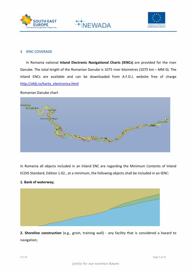
1. Bank of waterway;
2. Shoreline construction (e.g., groin, training wall) - any facility that is considered a hazard to
navigation;

O 5.19 Page 6 of 23
3. Contours of locks and dams (i.e., footprint area);
4. Boundaries of the navigation channel (if defined);
5. Isolated dangers in the navigation channel that are either:
a) under water (obstructions);

O 5.19 Page 7 of 23
b) above water level (e.g., bridges, overhead cables);
6. Official Aids-to-Navigation (e.g. buoys, beacons, lights, notice marks);

O 5.19 Page 8 of 23
7. Waterway axis with kilometres/hectometres, or nautical miles;
At present navigation electronic maps for Romanian sector are available with at least the
minimum information, in accordance with Inland ECDIS Standard, Edition 1.02 including certain
lines of banks, the nature of banks (ex: the natural shore, piers, hydrotehnical buildings, etc..), the
limits of fairway, hazards to navigation inside the fairway or outside the fairway (wrecks, pipelines,
etc.), bridges (height, depth and width of the passing of way), hydro - construction, cable

O 5.19 Page 9 of 23
(underground or overhead), signaling (fairway, the waterway axis with kilometres/hectometres,
buoys, coastal signals,), etc.. .
In the near future we will be able to make electronic navigation maps in Inland ECDIS
Standard Edition 2.1, because in December 2009 was done the operation to update the software.
Romanian ENC contains a total 116 cells with sizes ranging between 20 kb – 150 kb, sectors
covering between 10 - 15 km each. Up to now, in Romania were made a total of 700 km of
navigation electronic map. It represents the Danube sector between Bazias - km 1075 and Chiciu -
km 375. In the first phase of works a 230 km electronic map between Bazias km 1075 - Timok km
845 was done. In the second phase another 470 km of electronic map between Timok km 845 -
Chiciu km 375 was done and the third stage is currently produced a total of 75 km on the electronic
map for the sector Chiciu km 375 - Cernavoda km 300 . At the moment we are working to complete
the Danube IENC on sectors between Chiciu km 375 - Cernavoda km 300 and Cernavoda km 300 -
Sulina Canal - MM0 - Black Sea. We mention that the Chiciu - Cernavoda and Cernavoda - Sulina
Canal - MM0 - Black Sea is in the stage of input of processed date for the map.
By the European Agreement on the inland waterways of international importance, Danube is
nominated as E80 way on inland waterways of international and component of pan-European
Corridor nr.VII of trans-european transport that connects the ports of Rotterdam and Constanta,
has the total length of 2783.4 kilometers, divided into three specific sections along the route, as
follows:
- Upper Danube springs and Gönyu (kmf 2783.4 to kmf 1791);
- Middle Danube between Gönyu and Dobreta Tr Severin (kmf 1791 to kmf 931);
- Lower Danube between Drobeta Turnu Severin and Sulina (km 931 to MM0).
At present we are not working at map of Borcea branch or the Danube - Black Sea. Channel, MACIN
branch, branch of SF.Gheorghe and Chilia branch, we mention that right now our main concern is
the Danube river and Sulina Channel. With the completion of that goal we go to achieve IENC for
the secondary branches.
O 5.19 Page 10 of 23
Currently, the priority of our administration (Administration of Lower Danube Galati) is to
complete the works of IENC at Danube - Sulina Canal kmf 1075 - MM0, because the Danube is
considered the main transport route to the Black Sea. Our next goal is to provide electronic
navigation charts for Danube - Black Sea Channel and the Poarta Alba - Midia Navodari Channel.
4 COVERAGE OF DEPTH INFORMATION
Depth data for objects included in the map are Fairway with attribut DRVAL and DEPARE with
attributes DRVAL, DRVAL 1 or DRVAL 2 (Depth range value).
We consider it necessary for skippers to introduce depths inside the fairway and information
related to certain areas outside the fairway such as the depth at anchorage area, rivers basin,
operating piers and other.
With this type of measurement, we observe certain areas of the river clogged, river exploration of
mineral aggregates, monitoring excavations of gravel, etc; they also serve for the composition of
the flood risk maps and bathymetric maps of critical sections. We consider that data on the
bathymetric, and under water topography are not relevant for skippers, but priority should be
given to description of the fairway and limitations.
Bathymetric information (bathymetric maps) is contained or by calling at the Hydraulic and ENC`s
office within the Lower Danube River Administration from Galati and Giurgiu.
We want to include these data in future in a different cell, only for bathymetric information.
In Romania there are six critical sections, where the depth information can change constantly on
the account of morphologic conditions in rivers and due to dredging operations:
• Salcia km 820 – km 823;

O 5.19 Page 11 of 23
• Bogdan Secian km 783 – km 785;
• Pietrisul km 756 – 758;
• Linovo km 737 – km 739;
• Bechet km 676 – km 678 ;
• Corabia km 629 – km 631;
5 IENC PRODUCTION PROCESS
The providers of software solutions used by the River Administration of the Lower Danube Galati
for data acquisition and processing to achieve topohydrographic and electronic navigation maps for
Inland ECDIS are SevenCs and Hypack.
Electronic navigation map is done with these versions of software:
ENC Designer v 4.4.0,
ENC Manager v 2.3.0,

O 5.19 Page 12 of 23
ENC Optimizer v 2.3.0,
ENC Analyzer v 2.6.0.6,
HYPACK v 6.2A,
HYPACK 6.2.0.44 (2009a)
In December 2009 we update the software according Description of work Task 5.2.1 -
Updating ENC software the new versions of software are:
ENC Designer v 4.4.4,
ENC Manager v 2.3.4,
ENC Optimizer v 2.4.1,
ENC Analyzer v 2.8.0.11, and
IENC Converter
The " River Administrationof the Lower Danube " Galati is a Romanian legal person
operating as autonomous administration under the authority of the Ministry of Transports and
Infrastructure of Romania, in compliance with the provisions of the Decision no. 492/2003 of the
Romanian Government and those of the international conventions and agreements in which
Romania is part.
A.F.D.J. Galati plays the role of waterway authority on the Romanian sector of the
Danube, from its entrance on the Romanian territory, at km 1,075 down to its mouth to the Black
Sea, on Sulina Branch and in Sulina roadstead, on the navigable branches of the Danube, Borcea,
Bala, Macin, Valciu, Caleia, on Chilia branch and its secondary branches, on Sf. Gheorghe Branch
with the rectifying cannels and on the secondary channels of Sulina Channel, known as the Old
Danube. As navigable way authority and according to the provisions of the "Convention Regarding
the Regime of the Navigation on the Danube", AFDJ R.A. Galati has as object of activity to create
the inland electronic naviagtion charts. In according to the order no. 1057/2007 of Romanian
Minister of Transport, the " River Administrationof the Lower Danube " Galati must ensure
continuously for all inland waterways, electronic navigation maps, which will be regularly

O 5.19 Page 13 of 23
updated and provided to the RIS authorities and RIS users. But these maps are recognized by the
ministry in terms of progress in safe navigation.
In the manufacturing process are involved the Hydraulic and ENC`s offices at the
headquarters in the Galati and the office from Giurgiu Section. Basically this specilised office were
created to achieve current navigation maps in electronic format to match the realities on the
ground and making available accurate and regularly updated maps for the skippers, on the
characteristics of the gauges of the navigation fairway the ideal path configuration that a ship
should describe in order to navigate safely through this sector of the Danube.
From 2004, AFDJ is registered as ENC producer and obtain the producer code, 3R 16203.
The first phase took into account both primary data collection resulted from measurements of the
field and existing data collection at that time. Stage two has the purpose of processing the primary
data and processing of existing data at that time. In the third stage of processing entry data is done
on ENC. The collection of data (topographic measurements of various objects and their positioning)
is achieved using a set of sensors (sensors, GPS positioning - DGPS), using radar images to capture
the banks, and echosounder to determine depths, each of them is necessary for the acquisition of
certain features describing the navigational path. The system can perform the collection,
processing and automatic generation of information necessary for navigation electronic map on a
sector of the Danube. Data obtained from sensors, namely the position of the vessel in geographic
coordinates, radar image and depth of the point where the vessel is, after an initial processing, are
grouped according to time, when they were harvested, then processed with a set of Specialized
software they finally generates "electronic navigation map" - ENC.
The information from satelite images and ortophotos was used for fixed objects and was
put on the IENC`s.

O 5.19 Page 14 of 23
The information in addition to the standard are the main transport routes which link the
ports, port facilities (harbour facility - shipyard, harbour master `s office, Pontoon Piers), hydro-
technical constructions.
• Topographic information
Graphical or numerical representation of measured surfaces, drawn maps and topographical plans,
a detailed description of an area of land and its configuration, how they are arranged in space the
elements of a set of points or lines. Information and topographic data obtained from digital
orthophoto images and high resolution satellite images are used to produce IENCs.

O 5.19 Page 15 of 23
• Depth information
Waterway (hydrographic maps witch indicating fairway and the proper river signalization).
Bathymetric measurements, measured mainly at the critical sector, etc. Depth information
is extremely important on critical sections, because there the river bed is changing rapidly.
Therefore it is necessary to update the information much more frequently then the rest of
the sectors. For measuring depth we using a multibeam ecosounder which uses principles of
measurement based on transmission and reception of sound signals of different frequencies
by calculating the depth, issue where sonic high frequency, with which the water depth is
measured. Corroborating technique using sonar depth measurements and measurements
of the exact position using GPS technology, we can make maps of depth or relief maps of
the foundations of the Danube. Later these measurements can be achieved in areas of
interest sections. This type of measurements finds applicability in different fields and can
contribute to the knowledge of geo-morphological conditions of the land:
- Monitoring clogging the river;
- Exploration of mineral aggregates;
- Monitoring excavations of gravel;

O 5.19 Page 16 of 23
- The composition of the flood risk maps;
- Critical sections and bathymetric maps.
• Information for voyage planning (Notice marks)
Marking system data, including the data related to the fairway, buoys, mooring places are
available in the ENC`s, too.

O 5.19 Page 17 of 23
The River Administration of the Lower Danube RA Galati has the responsibility for
topographic and hydrographical information provided to skippers as Authority of the Danube
waterway in Romania.
Attributions that lead to achieving the object was include, in particular the following:
- Providing depth navigation maintenance dredging;
- Performance of measurements for knowledge and follow-up of topo-hydrographical
morphological and alluvial deposits, especially at critical points on the Danube, the measurement
of water flows and mudflows and measurements of current velocity;
- Preparation or, where appropriate, approval of the documentation for maintenance and repairs
works and hydro special protection works for the improvement of navigation conditions and bank
protection;
- Topo-hydrographical surveys, dredging and removal of obstructions in river port and operating
berths at port administrations request, on a contract basis;
- Making and maintaining coastal and floating signalling;

O 5.19 Page 18 of 23
- Hydro-meteorological data collection and processing, production of forecast of water level
variations in the Romanian Danube;
- Editing and disseminating the Danube Hydro-meteorological bulletin;
- Preparation and dissemination of Notices to Skippers;
- Approval of works which are made in the areas of waterways and crossing and under-crossing the
Danube;
- Providing information necessary for drawing up of the Danube Commission is Plan of works;
- Preparation of the roadmap, piloting map and electronic navigation map for the Romanian sector
of Danube;
The used information is made in two layers - a layer that contains information on waterways
signs (signals, buoys and coastal signs) and another layer which contains geographical informations
(localities, roads, ports, etc..), also we have all ENC`s in a single layer for Centres - Vessel Traffic
Management and Information System on Romanian Danube (Severin, Giurgiu, Galati, Constanta).
6 IENC PUBLICATION PROCESS
They are currently public and free information. IENC`s made by the Administration of Lower
Danube river R.A. Galati are available on the website http://afdj.ro/electronic_map.html in S-57
format.

O 5.19 Page 19 of 23
The IENC`s are available for free, the basic version. We intend to do an extended version with a
lot of information that will cost. At present are two sectors of the Danube (km 297 - km 370 and km
375 - km 1070) is at stage of completion or examination and test phase.
7 IENC SOURCES AND ACCURACY
Presently, in Romania topographic measurements are executed in the Projection in Stereo70,
measurements on the Danube river run in relation to water level at time t, which is defined by
reference to the level 0 Sulina by level gauges installed at different points on the Danube and

O 5.19 Page 20 of 23
indicated in the hydrologic bulletin. We do the the surveys using the GPS and multibeam system
and all result are in WGS 84. The sources used are: surveying and hydrographic measurements,
topographic measurement, lifting topo-basin, liquid flow rates, survey verification of critical points,
daily water levels, satellite images, orthophoto images, measurements of levels.
In the future, along with completing the IENC`s, after a detailed analysis of the final version of
the IENC`s, we want to upgrade in respect of standard Inland ECDIS version 2.0.
Sources used by River Administration of the Lower Danube RA Galati are orthophoto images
scale 1:5000 resolution 0.5 meter / pixel, satellite images are high resolution images 1 to 2 m,
measurements with GPS Leica SR20 is capable of centimeter accurate post-processed solutions.
Built with an intuitive survey workflow that is both easy to learn and use, the SR20 offers the
maximum in flexibility out of a GPS receiver, in terms of hydrographic data accuracy is specified
compliance recommendation IHO S44 Standards for Hydrographic Surveys and the Variety of
Requirements for Bathymetric Data.
8 INLAND ECDIS STANDARD
We make the IENC`s in respect of Inland ECDIS standard, Edition 1.02., for the begining of 2010
we intend to provide Inland ECDIS standard, Edition 2.1.
Updates will be done periodically (montly) and will be mainly aimed to inform skippers on
buoyage of critical sectors, the construction of the new bridge over the Danube at km 796 (Calafat -
Vidin) and modifications of buoyage and fairway for the entire sector.
We aim to provide an assessment of the cells of the IENC`s with a certain software (ENC
Analyzer, ENC Referencer) or with the support of our colleagues from other administrations to
prepare electronic navigation maps and a test of the map (axis sailing line, line the banks, the
position of buoys) made with certain viewer software or RADARpilot 720 software, installed on
Donaris ship.
Yes, we make quality control cecks according to S-58 at the end of the production process for each
cell with ENC Analyzer and ENC Optimizer.

O 5.19 Page 21 of 23
9 UTILISATION OF LOCATION CODES AND RIS INDEX
For the moment the Romanian maps not containing the RIS Index. Perhaps it will be introduced
at the end of 2010. The responsibilities in Romania for the provision of the Minimum Data (i.e. also
the RIS Index) as prescribed in the Annex I of the RIS Directive 2005/44/EC are Romanian Naval
Authority and River Administration of The Lower Danube. They work for implementation of RIS
Index. In 2010 the activities of Romanian Naval Authority and River Administration of The Lower
Danube are working together to improve, to develop, to achieving production of the RIS Index. The
RIS Index is a list of location codes with additional information on the objects and is available at
http://www.risexpertgroups.org/index3.html.
10 COOPERATION
There is a close collaboration of the common border section with our partners in Serbia and
Bulgaria. We set up joint working groups with PLOVPUT Belgrade and EAEMDR Bulgaria, which
permitted a permanent exchange of information, data and experience to make a good and
professional product. Meetings of working groups take place twice a year with PLOVPUT and
whenever is necessary with APPD.
At present there are bilateral agreements with Bulgaria and Serbia in terms of administration of the
fairway, concerning the navigation electronic map the agreement stipulates that provide and shall
receive the required information each administration.

O 5.19 Page 22 of 23
11 CHART UPDATES, UPDATING CIRCLE
It`s a possibility to upgrade existing programs, in near future we can produce new edition of
navigation electronic chart, and update them, in respect of the Inland ECDIS Standard, Edition 2.0.
For the moment we don`t collect any feedback from users. Now, we intend to organise a few
meetings with users for different topics: AIS Transponder, Inland ECDIS charts, etc.
- End of document -

O 5.19 Page 23 of 23

![New HOME [] TUDOR declaratie avere.pdf · 2020. 6. 5. · numele adresa Asociatia de locatari ANL Sulina R.A. Administratia Zonei Libere Sulina Consiliul local Sulina Serviciul prestat/()biectul](https://static.fdocuments.net/doc/165x107/60673f8a15330923a92baed9/new-home-tudor-declaratie-averepdf-2020-6-5-numele-adresa-asociatia.jpg)