
STATEMENT OF QUALIFICATIONS - Piburn & Carson · STATEMENT OF QUALIFICATIONS 1 THE FIRM. Piburn &...
26
STATEMENT OF QUALIFICATIONS
-
Upload
truongthuy -
Category
Documents
-
view
216 -
download
0
Transcript of STATEMENT OF QUALIFICATIONS - Piburn & Carson · STATEMENT OF QUALIFICATIONS 1 THE FIRM. Piburn &...
STATEMENT OF QUALIFICATIONS
STATEMENT OF QUALIFICATIONS 1
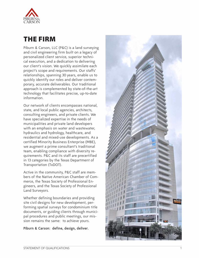
THE FIRMPiburn & Carson, LLC (P&C) is a land surveying and civil engineering firm built on a legacy of personalized client service, superior techni-cal execution, and a dedication to delivering our client’s vision. We quickly assimilate each project’s scope and requirements. Our staffs’ relationships, spanning 30 years, enable us to quickly identify our roles and deliver contem-porary, accurate deliverables. Our traditional approach is complemented by state-of-the-art technology that facilitates precise, up-to-date information.
Our network of clients encompasses national, state, and local public agencies, architects, consulting engineers, and private clients. We have specialized expertise in the needs of municipalities and private land developers with an emphasis on water and wastewater, hydraulics and hydrology, healthcare, and residential and mixed-use developments. As a certified Minority Business Enterprise (MBE), we augment a prime consultant’s traditional team, enabling compliance with diversity re-quirements. P&C and its staff are precertified in 13 categories by the Texas Department of Transportation (TxDOT).
Active in the community, P&C staff are mem-bers of the Native American Chamber of Com-merce, the Texas Society of Professional En-gineers, and the Texas Society of Professional Land Surveyors.
Whether defining boundaries and providing site civil designs for new development, per-forming spatial surveys for condominium title documents, or guiding clients through munici-pal procedures and public meetings, our mis-sion remains the same: to achieve yours.
Piburn & Carson: define, design, deliver.
STATEMENT OF QUALIFICATIONS 2
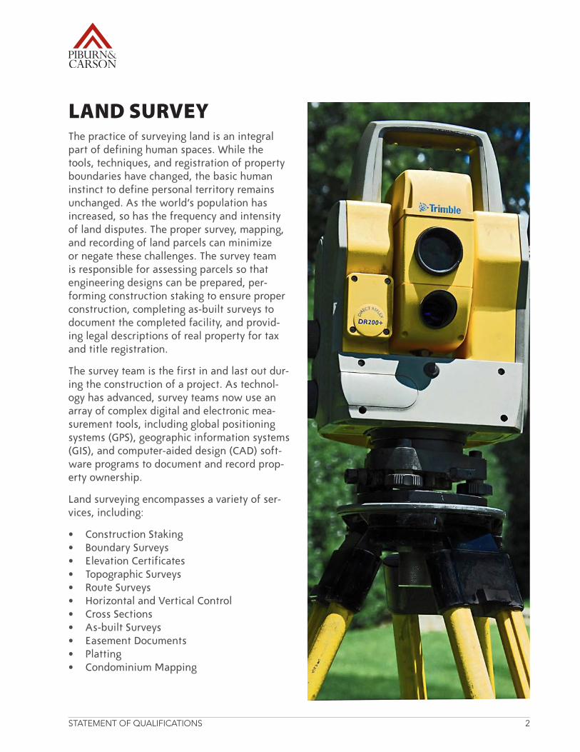
LAND SURVEYThe practice of surveying land is an integral part of defining human spaces. While the tools, techniques, and registration of property boundaries have changed, the basic human instinct to define personal territory remains unchanged. As the world’s population has increased, so has the frequency and intensity of land disputes. The proper survey, mapping, and recording of land parcels can minimize or negate these challenges. The survey team is responsible for assessing parcels so that engineering designs can be prepared, per-forming construction staking to ensure proper construction, completing as-built surveys to document the completed facility, and provid-ing legal descriptions of real property for tax and title registration.
The survey team is the first in and last out dur-ing the construction of a project. As technol-ogy has advanced, survey teams now use an array of complex digital and electronic mea-surement tools, including global positioning systems (GPS), geographic information systems (GIS), and computer-aided design (CAD) soft-ware programs to document and record prop-erty ownership.
Land surveying encompasses a variety of ser-vices, including:
• ConstructionStaking• BoundarySurveys• ElevationCertificates• TopographicSurveys• RouteSurveys• HorizontalandVerticalControl• CrossSections• As-builtSurveys• EasementDocuments• Platting• CondominiumMapping
STATEMENT OF QUALIFICATIONS 3
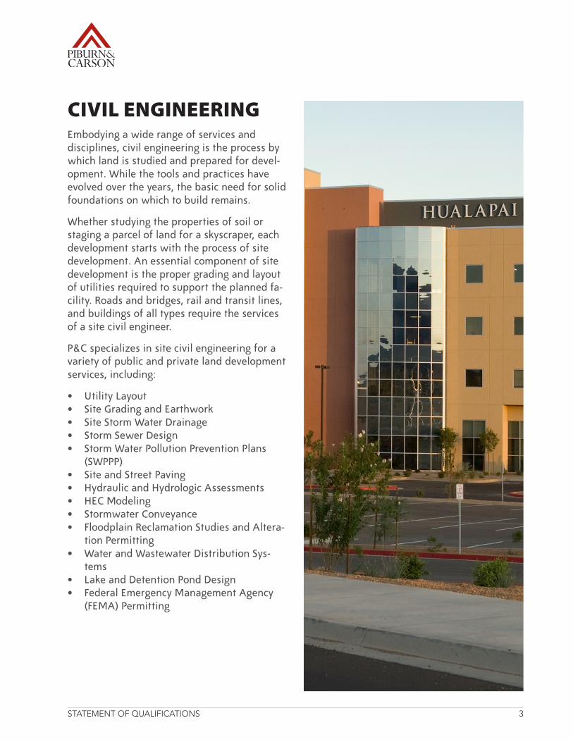
CIVIL ENGINEERINGEmbodying a wide range of services and disciplines, civil engineering is the process by which land is studied and prepared for devel-opment. While the tools and practices have evolved over the years, the basic need for solid foundations on which to build remains.
Whether studying the properties of soil or staging a parcel of land for a skyscraper, each development starts with the process of site development. An essential component of site development is the proper grading and layout of utilities required to support the planned fa-cility.Roadsandbridges,railandtransitlines,and buildings of all types require the services of a site civil engineer.
P&C specializes in site civil engineering for a variety of public and private land development services, including:
• UtilityLayout• SiteGradingandEarthwork• SiteStormWaterDrainage• StormSewerDesign• StormWaterPollutionPreventionPlans
(SWPPP)• SiteandStreetPaving• HydraulicandHydrologicAssessments• HECModeling• StormwaterConveyance• FloodplainReclamationStudiesandAltera-
tion Permitting• WaterandWastewaterDistributionSys-
tems• LakeandDetentionPondDesign• FederalEmergencyManagementAgency
(FEMA)Permitting
STATEMENT OF QUALIFICATIONS 4
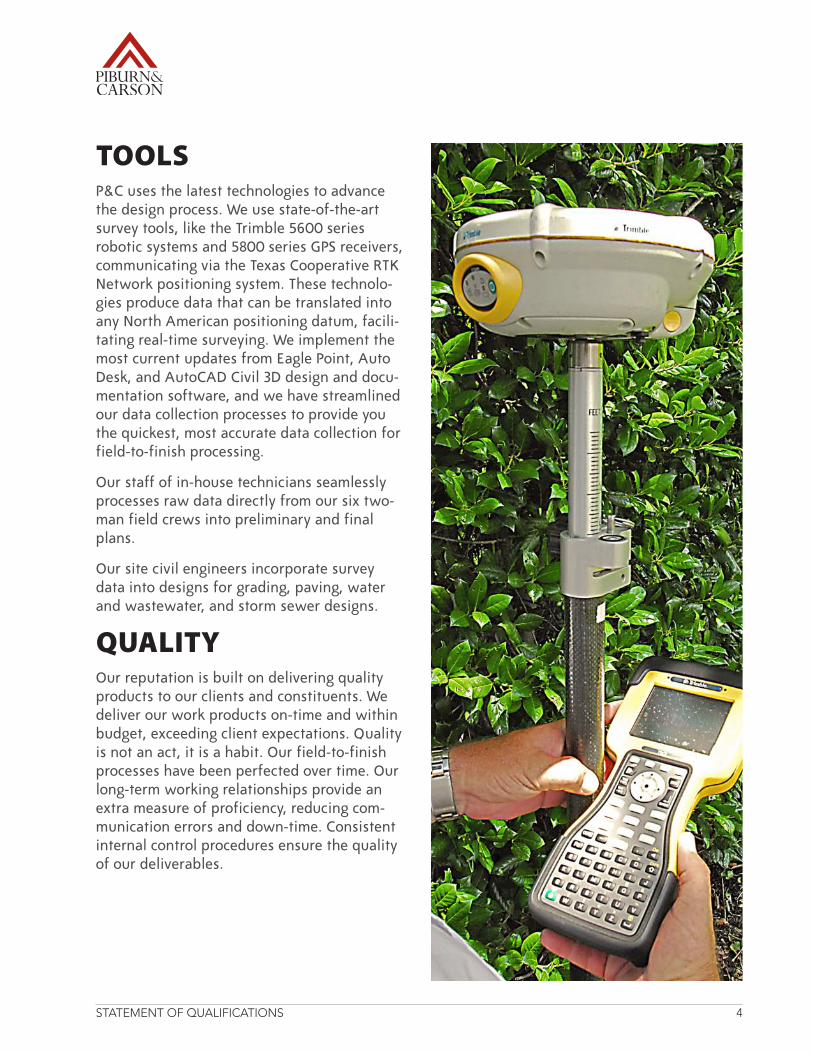
TOOLSP&C uses the latest technologies to advance the design process. We use state-of-the-art survey tools, like the Trimble 5600 series robotic systems and 5800 series GPS receivers, communicatingviatheTexasCooperativeRTKNetwork positioning system. These technolo-gies produce data that can be translated into any North American positioning datum, facili-tating real-time surveying. We implement the most current updates from Eagle Point, Auto Desk, and AutoCAD Civil 3D design and docu-mentation software, and we have streamlined our data collection processes to provide you the quickest, most accurate data collection for field-to-finish processing.
Our staff of in-house technicians seamlessly processes raw data directly from our six two-man field crews into preliminary and final plans.
Our site civil engineers incorporate survey data into designs for grading, paving, water and wastewater, and storm sewer designs.
QUALITYOur reputation is built on delivering quality products to our clients and constituents. We deliver our work products on-time and within budget, exceeding client expectations. Quality is not an act, it is a habit. Our field-to-finish processes have been perfected over time. Our long-term working relationships provide an extra measure of proficiency, reducing com-munication errors and down-time. Consistent internal control procedures ensure the quality of our deliverables.
PR
OJEC
T EXP
ERIEN
CE
PROJECT EXPERIENCE
STATEMENT OF QUALIFICATIONS 5
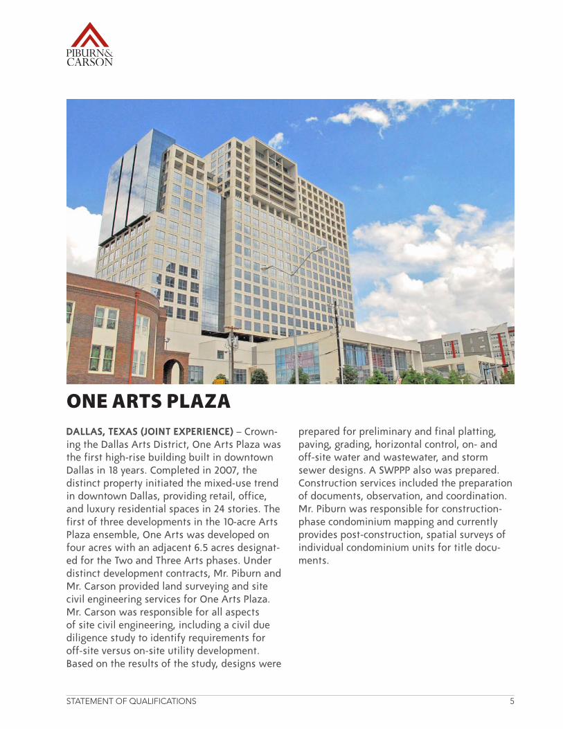
DALLAS, TEXAS (JOINT EXPERIENCE) – Crown-ing the Dallas Arts District, One Arts Plaza was the first high-rise building built in downtown Dallas in 18 years. Completed in 2007, the distinct property initiated the mixed-use trend in downtown Dallas, providing retail, office, and luxury residential spaces in 24 stories. The first of three developments in the 10-acre Arts Plaza ensemble, One Arts was developed on four acres with an adjacent 6.5 acres designat-edfortheTwoandThreeArtsphases.Underdistinct development contracts, Mr. Piburn and Mr. Carson provided land surveying and site civil engineering services for One Arts Plaza. Mr. Carson was responsible for all aspects of site civil engineering, including a civil due diligence study to identify requirements for off-site versus on-site utility development. Based on the results of the study, designs were
prepared for preliminary and final platting, paving, grading, horizontal control, on- and off-site water and wastewater, and storm sewer designs. A SWPPP also was prepared. Construction services included the preparation of documents, observation, and coordination. Mr. Piburn was responsible for construction-phase condominium mapping and currently provides post-construction, spatial surveys of individual condominium units for title docu-ments.
ONE ARTS PLAZA

STATEMENT OF QUALIFICATIONS 6
RICHARDSON, TEXAS (JOINT EXPERIENCE) – In the 1980s, the Greenville Avenue Church of ChristwaslocatedatForestLaneeastofUSHighway75.Incloseproximitytoafloodplainand at the maximum allowable size in the acreage available, the church elected to pur-chaseatractoflandinRichardsononwhichto construct a new complex. Working together at a previous employer and through indepen-dent engagements, Mr. Carson and Mr. Piburn managed civil engineering and land survey-ing components of this evolving property. Mr. Carson prepared the site civil design plans for the new facility, coordinating with the archi-tectural firm. Mr. Piburn performed the perim-eter boundary survey that incorporated all of the church parcels and street abandonments to update the plat.
Since the construction of the Greenville Av-enue location in the 1980s, Mr. Carson has managed a variety of additional engineering projects, including the replatting of property to include recent property acquisitions; updat-ing the master site and landscape plan; and preparing site civil designs for a parking lot expansion that included upgrading on-site and designing off-site storm sewer improvements and other underground utilities. Mr. Piburn’s post-construction work includes the current replatting of the property to include recent property acquisitions, locating and mapping trees for the master site and landscape plan update, and coordinating with the engineering and architectural firms.
GREENVILLE AVENUE CHURCH OF CHRIST
STATEMENT OF QUALIFICATIONS 7
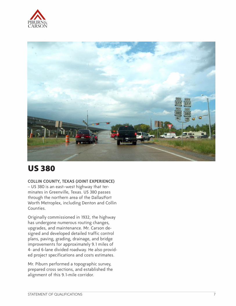
COLLIN COUNTY, TEXAS (JOINT EXPERIENCE) –US380isaneast–westhighwaythatter-minatesinGreenville,Texas.US380passesthroughthenorthernareaoftheDallas/FortWorth Metroplex, including Denton and Collin Counties.
Originally commissioned in 1932, the highway has undergone numerous routing changes, upgrades, and maintenance. Mr. Carson de-signed and developed detailed traffic control plans, paving, grading, drainage, and bridge improvements for approximately 9.1 miles of 4-and6-lanedividedroadway.Healsoprovid-ed project specifications and costs estimates.
Mr. Piburn performed a topographic survey, prepared cross sections, and established the alignment of this 9.1-mile corridor.
US 380
STATEMENT OF QUALIFICATIONS 8
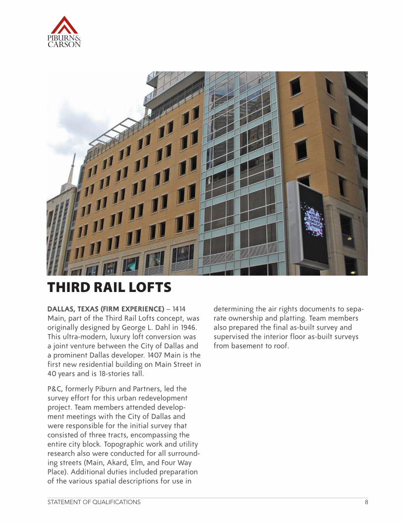
DALLAS, TEXAS (FIRM EXPERIENCE) – 1414 Main,partoftheThirdRailLoftsconcept,wasoriginally designed by George L. Dahl in 1946. This ultra-modern, luxury loft conversion was a joint venture between the City of Dallas and a prominent Dallas developer. 1407 Main is the first new residential building on Main Street in 40 years and is 18-stories tall.
P&C, formerly Piburn and Partners, led the survey effort for this urban redevelopment project. Team members attended develop-ment meetings with the City of Dallas and were responsible for the initial survey that consisted of three tracts, encompassing the entire city block. Topographic work and utility research also were conducted for all surround-ingstreets(Main,Akard,Elm,andFourWayPlace). Additional duties included preparation of the various spatial descriptions for use in
determining the air rights documents to sepa-rate ownership and platting. Team members also prepared the final as-built survey and supervised the interior floor as-built surveys from basement to roof.
THIRD RAIL LOFTS
STATEMENT OF QUALIFICATIONS 9
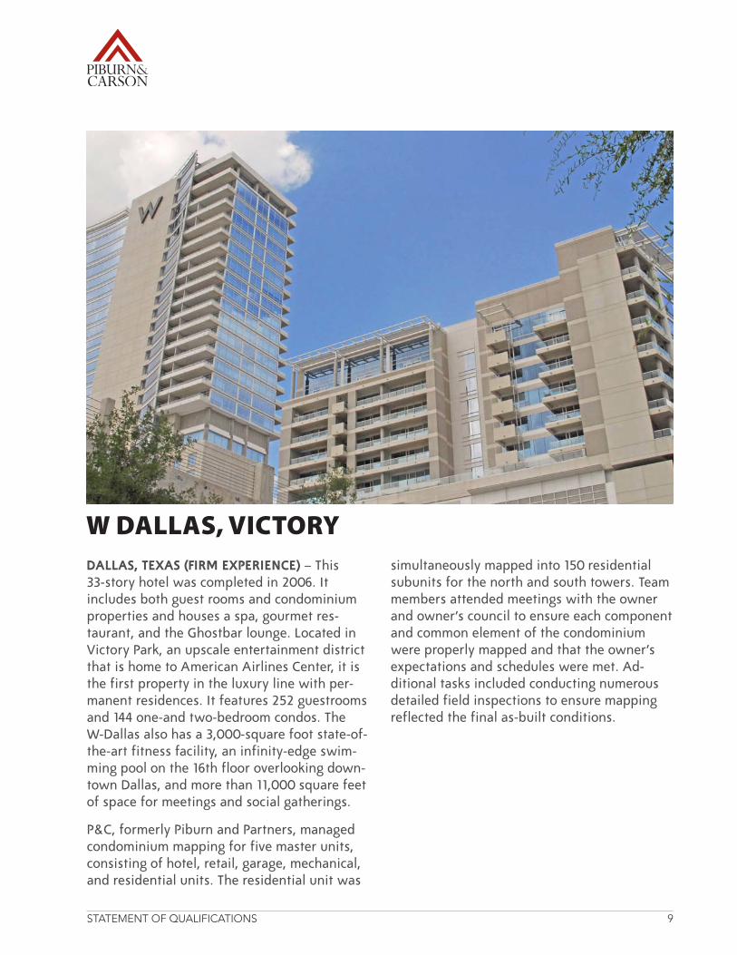
DALLAS, TEXAS (FIRM EXPERIENCE) – This 33-story hotel was completed in 2006. It includes both guest rooms and condominium properties and houses a spa, gourmet res-taurant, and the Ghostbar lounge. Located in VictoryPark,anupscaleentertainmentdistrictthat is home to American Airlines Center, it is the first property in the luxury line with per-manent residences. It features 252 guestrooms and 144 one-and two-bedroom condos. The W-Dallas also has a 3,000-square foot state-of-the-art fitness facility, an infinity-edge swim-ming pool on the 16th floor overlooking down-town Dallas, and more than 11,000 square feet of space for meetings and social gatherings.
P&C, formerly Piburn and Partners, managed condominium mapping for five master units, consisting of hotel, retail, garage, mechanical, and residential units. The residential unit was
simultaneously mapped into 150 residential subunits for the north and south towers. Team members attended meetings with the owner and owner’s council to ensure each component and common element of the condominium were properly mapped and that the owner’s expectations and schedules were met. Ad-ditional tasks included conducting numerous detailed field inspections to ensure mapping reflected the final as-built conditions.
W DALLAS, VICTORY
STATEMENT OF QUALIFICATIONS 10
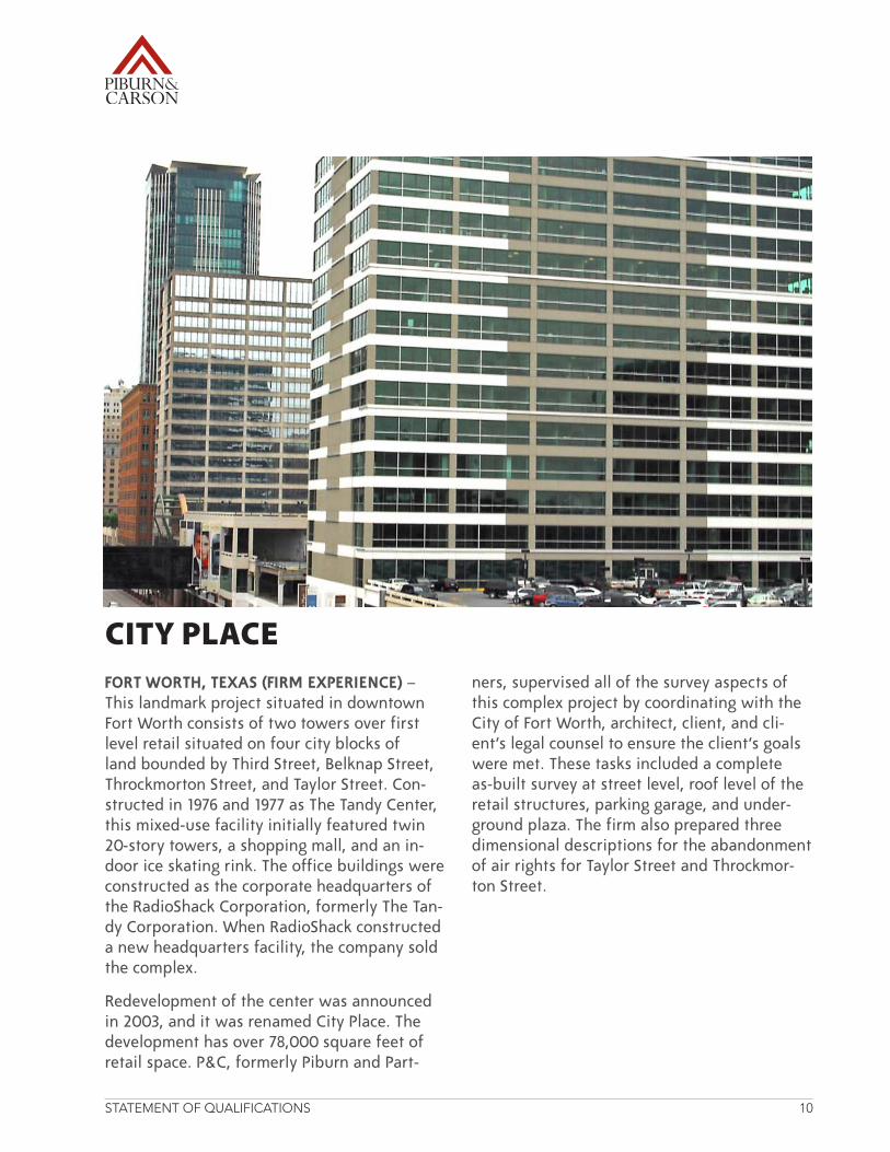
FORT WORTH, TEXAS (FIRM EXPERIENCE) – This landmark project situated in downtown FortWorthconsistsoftwotowersoverfirstlevel retail situated on four city blocks of land bounded by Third Street, Belknap Street, Throckmorton Street, and Taylor Street. Con-structed in 1976 and 1977 as The Tandy Center, this mixed-use facility initially featured twin 20-story towers, a shopping mall, and an in-door ice skating rink. The office buildings were constructed as the corporate headquarters of theRadioShackCorporation,formerlyTheTan-dyCorporation.WhenRadioShackconstructeda new headquarters facility, the company sold the complex.
Redevelopmentofthecenterwasannouncedin 2003, and it was renamed City Place. The development has over 78,000 square feet of retail space. P&C, formerly Piburn and Part-
ners, supervised all of the survey aspects of this complex project by coordinating with the CityofFortWorth,architect,client,andcli-ent’s legal counsel to ensure the client’s goals were met. These tasks included a complete as-built survey at street level, roof level of the retail structures, parking garage, and under-ground plaza. The firm also prepared three dimensional descriptions for the abandonment of air rights for Taylor Street and Throckmor-ton Street.
CITY PLACE
STATEMENT OF QUALIFICATIONS 11
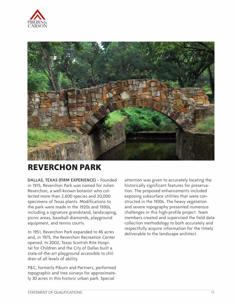
DALLAS, TEXAS (FIRM EXPERIENCE)–Foundedin1915,ReverchonParkwasnamedforJulienReverchon,awell-knownbotanistwhocol-lected more than 2,600 species and 20,000 specimens of Texas plants. Modifications to the park were made in the 1920s and 1930s, including a signature grandstand, landscaping, picnic areas, baseball diamonds, playground equipment, and tennis courts.
In1951,ReverchonParkexpandedto46acresand,in1975,theReverchonRecreationCenteropened.In2002,TexasScottishRiteHospi-tal for Children and the City of Dallas built a state-of-the-art playground accessible to chil-dren of all levels of ability.
P&C, formerly Piburn and Partners, performed topographic and tree surveys for approximate-ly 30 acres in this historic urban park. Special
attention was given to accurately locating the historically significant features for preserva-tion. The proposed enhancements included exposing subsurface utilities that were con-structed in the 1930s. The heavy vegetation and severe topography presented numerous challenges in this high-profile project. Team members created and supervised the field data collection methodology to both accurately and respectfully acquire information for the timely deliverable to the landscape architect.
REVERCHON PARK
STATEMENT OF QUALIFICATIONS 12
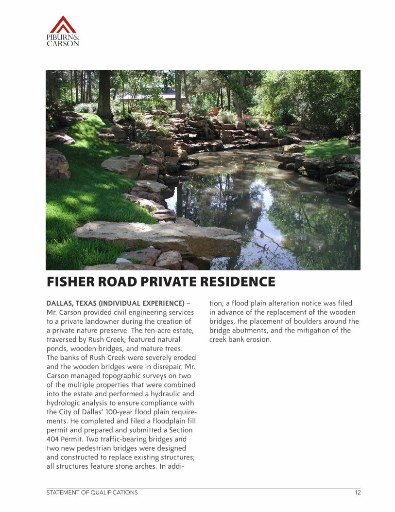
DALLAS, TEXAS (INDIVIDUAL EXPERIENCE) – Mr. Carson provided civil engineering services to a private landowner during the creation of a private nature preserve. The ten-acre estate, traversedbyRushCreek,featurednaturalponds, wooden bridges, and mature trees. ThebanksofRushCreekwereseverelyerodedand the wooden bridges were in disrepair. Mr. Carson managed topographic surveys on two of the multiple properties that were combined into the estate and performed a hydraulic and hydrologic analysis to ensure compliance with the City of Dallas’ 100-year flood plain require-ments.Hecompletedandfiledafloodplainfillpermit and prepared and submitted a Section 404 Permit. Two traffic-bearing bridges and two new pedestrian bridges were designed and constructed to replace existing structures; all structures feature stone arches. In addi-
tion, a flood plain alteration notice was filed in advance of the replacement of the wooden bridges, the placement of boulders around the bridge abutments, and the mitigation of the creek bank erosion.
FISHER ROAD PRIVATE RESIDENCE
STATEMENT OF QUALIFICATIONS 13
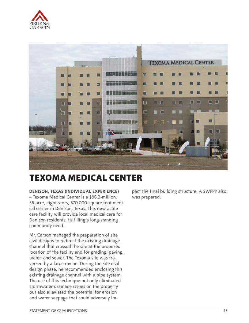
DENISON, TEXAS (INDIVIDUAL EXPERIENCE) – Texoma Medical Center is a $96.2-million, 36-acre, eight-story, 370,000-square foot medi-cal center in Denison, Texas. This new acute care facility will provide local medical care for Denison residents, fulfilling a long-standing community need.
Mr. Carson managed the preparation of site civil designs to redirect the existing drainage channel that crossed the site at the proposed location of the facility and for grading, paving, water, and sewer. The Texoma site was tra-versed by a large ravine. During the site civil design phase, he recommended enclosing this existing drainage channel with a pipe system. The use of this technique not only eliminated stormwater drainage issues on the property but also alleviated the potential for erosion and water seepage that could adversely im-
pact the final building structure. A SWPPP also was prepared.
TEXOMA MEDICAL CENTER
STATEMENT OF QUALIFICATIONS 14
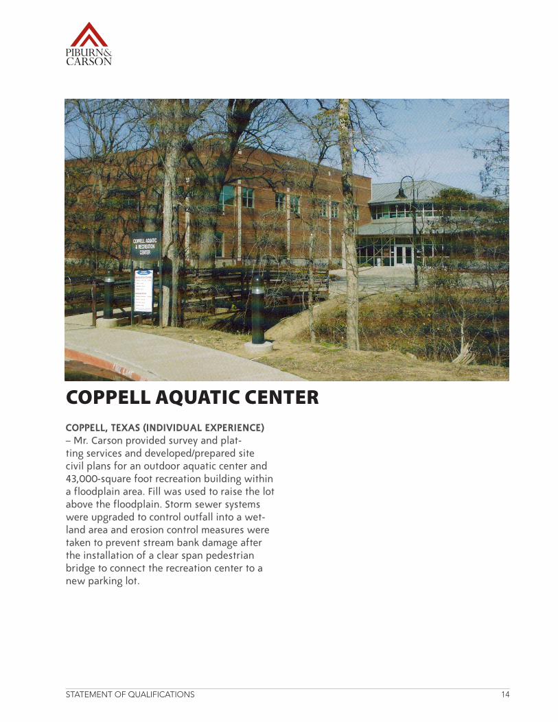
COPPELL, TEXAS (INDIVIDUAL EXPERIENCE) – Mr. Carson provided survey and plat-ting services and developed/prepared site civil plans for an outdoor aquatic center and 43,000-square foot recreation building within afloodplainarea.Fillwasusedtoraisethelotabove the floodplain. Storm sewer systems were upgraded to control outfall into a wet-land area and erosion control measures were taken to prevent stream bank damage after the installation of a clear span pedestrian bridge to connect the recreation center to a new parking lot.
COPPELL AQUATIC CENTER

RESU
MES
RESUMES
STATEMENT OF QUALIFICATIONS 15
Mr. Piburn has 39 years of experience in the field of land surveying for state agencies, municipalities, and private developmentclients.Hehasperformed boundary, topo-graphic, route, and as-built surveys; prepared elevation certificates; determined horizontal and vertical con-trols and cross sections; and condominium mapping. Mr. Piburn manages marketing efforts, quality control pro-cesses, and key projects.
PRIVATE LAND DEVELOPMENTW Dallas-Victory—Dallas, TX (2004) Principal-in-Charge/Project Manager. This 33-story hotel, completed in 2006, in-cludes both guest rooms and condominium properties. It features 252 guestrooms and 144 one-and two-bedroom condos. The W Dallas also has a 3,000-square foot state-of-the-art fitness facility, an infinity-edge swimming pool on the 16th floor overlooking downtown Dallas, and more than 11,000 square feet of space for meetings and social gatherings. Mr. Piburn man-aged condominium mapping for five master units, consist-ing of hotel, retail, garage, mechanical, and residential units. The residential unit was simultaneously mapped into 150 residential subunits for
the north and south towers. Mr. Piburn attended meetings with the owner and owner’s council to ensure each com-ponent and common element of the condominium were properly mapped and that the owner’s expectations andschedulesweremet.Heconducted numerous detailed field inspections to ensure mapping reflected the final as-built conditions.
Land Advisors/Celina—Celina, TX (2009) Principal-in-Charge/Project Manager. As the DFWMetroplexcontinuestoexpand northward, a local development consortium as-sembled approximately 1,800 acres for multi-use develop-ment, including residential, school, and retail uses. Mr. Piburn managed the survey of1,800acres.Hepreparedthe descriptions and exhibits for the creation of a water district to serve the develop-ment and exhibits to support proposed incorporation into the City of Celina.
One Arts Plaza—Dallas, TX (2006 to Present) Principal-in-Charge/Survey Project Man-ager: Crowning the Dallas Arts District, One Arts Plaza was the first high-rise build-ing completed in downtown Dallas in 18 years. The dis-tinct property initiated the
mixed-use trend in downtown Dallas, providing retail, of-fice, and luxury residential spaces in 24 stories. The first of three developments in the 10-acre Arts Plaza ensemble, One Arts was developed on four acres with an adjacent 6.5 acres designated for the Two and Three Arts phases. Mr. Piburn was responsible for construction phase condo-minium mapping and current-ly provides post-construction, spatial surveys of individual condominium units for title documents.
City Place—FortWorth,TX(2005) Principal-in-Charge/Project Manager. This land-mark project located in downtownFortWorthcon-sists of two 20-story towers over first level retail located
EDUCATIONTexas A&M University, 1968-1971
REGISTRATION/CERTIFICATIONRegistered Professional Land Surveyor, TX 3689, 1979
PROFESSIONAL SOCIETIES/AFFILIATIONSTexas Society of Professional SurveyorsAmerican Congress on Surveying and MappingNational Society of Professional SurveyorsNative American Chamber of Commerce
JOHN PIBURN, JR., R.P.L.S.PRESIDENT
STATEMENT OF QUALIFICATIONS 16
on four city blocks of land bounded by Third Street, Belknap Street, Throckmor-ton Street, and Taylor Street. Constructed in 1976 and 1977, the office buildings were the corporate headquarters of theRadioShackCorporation,formerly The Tandy Corpora-tion.WhenRadioShackcon-structed a new headquarters facility, the company sold the complex.Redevelopmentofthe center was announced in 2003 and renamed City Place. The development has over 78,000 square feet of retail space. Mr. Piburn supervised all of the survey aspects of this complex project by coordinating with the City of FortWorth,architect,client,and client’s legal counsel to ensure the client’s goals weremet.Histasksincludeda complete as-built survey at street level, roof level of the retail structures, park-ing garage, and underground plaza.Healsopreparedthreedimensional descriptions for the abandonment of air rights for Taylor Street and Throck-morton Street.
Third Rail Lofts—Dallas, TX (2004) Principal-in-Charge/Project Manager. 1414 Main, partoftheThirdRailLoftsconcept, was originally design by George L. Dahl in 1946. This ultra-modern, luxu-ry loft conversion was a joint venture between the City of Dallas and a prominent
Dallas developer. 1407 Main is the first, new, residential building on Main Street in 40 years and is 18-stories tall. Mr. Piburn led the survey effort for this urban redevelopment project.Heattendeddevelop-ment meetings with the City of Dallas and was responsible for the initial survey that con-sisted of three tracts, encom-passing the entire city block. Topographic work and utility research also was conducted for all surrounding streets (Main,Akard,Elm,andFourWay Place). Additional duties included preparation of the various spatial descriptions for use in determining the air rights documents to separate ownershipandplatting.Healso prepared the final as-built survey and supervised the interior floor as-built sur-veys from basement to roof.
Greenville Avenue Church of Christ—Richardson,TX(1980s to Present) Principal-in-Charge/Project Manager. In the 1980s, the Greenville Avenue Church of Christ was locatedatForestLaneandHighway75.Incloseproxim-ity to a flood plain and at the maximum allowable size in the acreage available, the church elected to purchase atractoflandinRichardsonon which to construct a new complex. Mr. Piburn per-formed the perimeter bound-ary survey that incorporated all of the church parcels
and street abandonments to update the plat. In addi-tion, trees were located and mapped for use in updating the master site and landscape plan for the new facility, co-ordinating with the engineer-ing and architectural firms.
MUNICIPAL/UTILITIESDWU Miscellaneous Water and Wastewater Main Relo-cations—Dallas, TX (2005) Principal-in-Charge/Project Manager. In preparation for utility reconstruction over nine line segments, Mr. Piburn completed 18,000 linear feet of topographic and as-built surveys within both street and alley rights-of-way (ROW).Mr.Piburnsupervisedthe extensive research that was performed for the areas adjacent to the streets and alleys to determine owner-ship and property configura-tion.Hecoordinatedwiththeproject engineer to ensure all data could be assembled inCAD,usingDWUsymbolblocks and format, reducing manpower requirements dur-ing the engineering phase.
Dallas Alley Project, City of Dallas—Dallas, TX (2006) Principal-in-Charge/Project Manager. As part of ongo-ing City bond initiatives, Mr. Piburn performed as-built and topographic surveys for five alley segments. In addi-tion to locating all features, additional data was acquired to create cross-sections for
STATEMENT OF QUALIFICATIONS 17
the project engineer, reduc-ing manpower requirements during the engineering phase. Mr. Piburn supervised all of the boundary determinations foreachROWlineandmadean on-site inspection of each segment to ensure deliver-ables were complete and accurate.
Reverchon Park, City of Dallas—Dallas, TX (2004) Principal-in-Charge/Project Manager.Foundedin1915,ReverchonParkwasnamedforJulienReverchon,awell-known botanist who collected more than 2,600 species and 20,000 specimens of Texas plants. Modifications were made in the 1920s and 1930s, including a signature grand-stand, landscaping, picnic areas, baseball diamonds, playground equipment, and tennis courts. In 1951, ReverchonParkexpandedto 46 acres and, in 1975, the ReverchonRecreationCenteropened. In 2002, Texas Scot-tishRiteHospitalforChildrenand the City of Dallas built a state-of-the-art playground accessible to children of all levels of ability. Mr. Piburn performed topographic and tree surveys for approximate-ly 30 acres in this historic urban park. Special attention was given to accurately locat-ing the historically significant features for preservation. The proposed enhancements included exposing subsurface
utilities that were construct-ed in the 1930s. The heavy vegetation and severe topog-raphy presented numerous challenges in this high-profile project. Mr. Piburn created and supervised the field data collection methodology to both accurately and respect-fully acquire information for the timely deliverable to the landscape architect.
AVIATIONDenton Municipal Airport—Denton, TX (2006) Principal-in-Charge/Project Manager. Denton Municipal Airport is oneofonlythreeFAA-desig-nated super-reliever airports in Texas, accepting general aviation traffic from Dallas/FortWorthInternationalAir-port. It also is a major mid-continent refueling center, with appropriate services to accommodate business users. The airport, which occupies approximately 750 acres of land, has one asphalt runway, measuring 5,999 feet long and 150 feet wide. The Air-port features a new general aviation terminal. It serves a number of major companies for transportation of cargo, personnel, vendors, and pro-spective clients. The Airport is also the base of operations for law enforcement and search and rescue operations, includingCareFlite.TheAir-port has experienced growth in operations requiring the expansion of facilities. Mr.
Piburn managed the topo-graphic survey of approxi-mately 6,100 linear feet of runway and 4,000 linear feet ofrunwayextension.Heledthe topographic survey of an additional approximately 130 acres for drainage, roadway and runway extensions.
EDUCATIONAL FACILITIESDallas Independent School District Bond Program—Dal-las, TX (2004) Principal-in-Charge/Project Manager. Mr. Piburn prepared boundary and topographic surveys for the placement of additional classrooms at 22 school sites. Hesupervisedthesurveyofeach of the individual sites from initial research to final site inspection before issuing drawingstotheclient.Heas-sisted in the determination of all boundaries and, if neces-sary, the placement of miss-ing property corners.
STATEMENT OF QUALIFICATIONS 18
Mr. Carson has 38 years of experience in the field of civil engineering.Hehascomplet-ed a wide range of projects for both public agencies and privatedevelopers.Hehasparticipated in a variety of development types, includ-ing mixed-use developments; healthcare facilities; munici-pal utilities; schools and uni-versities; churches; shopping centers; offices; industrial facilities; distribution centers; residential and multi-family developments; and state and local governmental agencies. Hehasextensiveexperiencein site civil design, including building, facility, and util-ity layout; site grading and earthwork; and design of paving, drainage, and utility improvements. Other areas of expertise include hydraulic and hydrologic analysis for open and closed storm drain-age systems and floodplain reclamation studies; water and wastewater distribution systems; lake design; and FEMAmaprevisions.
PRIVATE LAND DEVELOPMENTOne Arts Plaza—Dallas, TX (2006) Project Manager: Crowning the Dallas Arts Dis-trict, One Arts Plaza was the first high-rise building com-pleted in downtown Dallas in 18 years. The distinct property
initiated the mixed-use trend in downtown Dallas, provid-ing retail, office, and luxury residential spaces in 24 sto-ries. The first of three devel-opments in the 10-acre Arts Plaza ensemble, One Arts was developed on four acres with an adjacent 6.5 acres designated for the Two and Three Arts phases. Mr. Carson was responsible for leading all aspects of civil engineering and design for Phase I, while considering Phase II infra-structurerequirements.Heprepared a civil due diligence study to identify if off-site utility development would be required. Based on the results of the study, he developed plans, including preliminary and final platting, paving, grading, horizontal con-trol, on- and off-site water/wastewater, and storm sewer designs. A SWPPP was also prepared. Construction docu-ments were prepared and construction observation and coordination were performed.
Greenville Avenue Church of Christ—Richardson,TX(1980sto Present) Project Manager. In the 1980s, the Greenville Avenue Church of Christ was locatedatForestLaneeastofUSHighway75.Incloseprox-imity to a flood plain and at the maximum allowable size in the acreage available, the
church elected to purchase atractoflandinRichardsonon which to construct a new complex. Mr. Carson prepared the site civil design plans for the new facility, coordinating with the architectural firm. Since the construction of the Greenville Avenue location in the 1980s, Mr. Carson has managed a variety of engi-neering projects, including
RICHARD CARSON, JR., P.E.EXECUTIVE VICE PRESIDENT
EDUCATIONBachelor of Science, Civil Engineering, University of Texas at El Paso, 1972
REGISTRATION/CERTIFICATIONProfessional Engineer, TX 40854, 1977Professional Engineer, OK 13133, 1982Professional Engineer, NV 014870, 2001Professional Engineer, NC 31334, 2006Professional Engineer, AZ 46934, 2008Registered Professional Land Surveyor, TX 3146, 1980 (Inactive)
PROFESSIONAL SOCIETIES/AFFILIATIONSAmerican Society of Civil EngineersNational Society of Professional EngineersTexas Society of Professional Land SurveyorsCharter Member of the Alumni Academy of Civil Engineers, University of Texas at El Paso
STATEMENT OF QUALIFICATIONS 19
the replatting of property to include recent property acquisitions; updating of the master site and landscape plan; and preparing site civil designs for a parking lot expansion that included up-grading on-site and designing off-site storm sewer improve-ments and other underground utilities.
HEALTHCAREHualapai Mountain Medical Center—Kingman,AZ(2009)Project Manager. Mr. Carson managed the preparation of site civil designs and provided project management and con-struction administration for a new $46 million, 22.76-acre, 189,000-square foot, 70-bed hospital, with a fourth-floor shell space. A planned second phase will allow 36 beds in the shell space to increase capacity to a total 106 beds. Keytasksincludedprepara-tion of a horizontal control plan to ensure the roadways and drives, parking areas, building locations, and land-scape areas defined in the site plan could be constructed within project boundaries. Mr. Carson also prepared designs for paved areas, including sidewalks, parking lots, a truck court, a fire lane, street improvements, and erosion control. Additional responsibilities included plans and specifications for grading, drainage, water, and sanitary sewer. The drain-
age design featured multiple detention ponds to comply with City requirements, as the initial site plan did not support the standard design for a large on-site detention pond to capture surface run-off. A PondPack model was developed to simulate the design. The project required extensive coordination with multiple design consultants, including architects, structur-al engineers, MEP engineers, andlandscapearchitects.Healso coordinated extensively with a local surveyor for the preparation of the final plat andwiththeCityofKingman.
Texoma Medical Center—Denison, TX (2009) Project Manager. Mr. Carson provid-ed civil design services for a $96.2-million, 36-acre, eight-story, 370,000-square foot medical center in Denison, Texas. This new facility will provide local medical care for Denison residents, fulfill-ingalong-standingneed.Hemanaged the preparation of designs to redirect an existing drainage channel that crossed the site at the proposed loca-tion of the facility and for grading, paving, water, and sewer. The Texoma site was traversed by a large ravine. During the site civil design phase, he recommended en-closing the existing drainage channel with a pipe system. The use of this technique not only eliminated storm-
water drainage issues on the property but also alleviated the potential for erosion and water seepage that could adversely impact the final building structure. A SWPPP was prepared.
MUNICIPALMesquite Justice and Public Safety Building, Phase I and II—Mesquite, TX (2009) Proj-ect Manager. Mr. Carson pro-vided civil engineering master planning and on-site and off-site civil engineering de-sign services for the construc-tion of the 108,000-square footMesquiteJusticeandPublic Safety Building. Civil master planning services included schematic design of the overall site, using the owner-approved architectural master site plan, and pre-paring preliminary grading, drainage, water, and sani-tary sewer layouts. On-site civil engineering services for Phase I included horizon-tal control; a drainage area map, and storm sewer, water and sewer, grading, paving, and retaining wall plans; a SWPPP; permits; details; and construction administration. On-site services also included coordination and meetings with the City of Mesquite and the coordination of on-site utility construction with adjacent property owners. Off-site engineering services included storm sewer and channel improvements. A Sec-
STATEMENT OF QUALIFICATIONS 20
tion 404 Permit was secured for this project. Close coor-dination with City officials was required. Phase I was completed in 2009; Phase II construction has begun and completion is anticipated in 2011.
HYDRAULICS AND HYDROLOGY7150 Fisher Road—Dallas, TX (2007) Project Manager. Mr. Carson provided civil engineering services to a private landowner during the creation of a private nature preserve. The ten-acre estate, traversedbyRushCreek,fea-tured natural ponds, wooden bridges, and mature trees. ThebanksofRushCreekwere severely eroded and the wooden bridges were in disrepair. Mr. Carson man-aged topographic surveys on two of the multiple properties that were combined into the estate and performed a hy-draulic and hydrologic analy-sis to ensure compliance with the City of Dallas’ 100-year floodplainrequirements.Hecompleted and filed a flood-plain fill permit and prepared and submitted a Section 404 Permit. Two traffic-bearing bridges and two new pedes-trian bridges were designed and constructed to replace existing structures; all struc-tures feature stone arches. In addition, a flood plain alteration notice was filed in advance of the replacement of the wooden bridges, the
placement of boulders around the bridge abutments, and the mitigation of the creek bank erosion.
MUNICIPAL UTILITIESDWU Miscellaneous Water and Wastewater Main Reloca-tions—Dallas, TX (2004) Prin-cipal/ProjectManager.DWUContract No. 02-063E/064E. Mr. Carson managed the preparation of plans and specifications for the im-provement and relocation of approximately 40,000 linear feet of existing water and gravity wastewater mains. These distribution mains, ranging in diameter from 2- to 12-inches, were situated at 41 various locations within the City of Dallas.
ROADWAYSTxDOT US 380 Paving, Drain-age and Bridge Improve-ments—Collin County, TX (1990s)ProjectManager.US380 is an east–west highway that terminates in Greenville, Texas.US380passesthroughthe northern area of the Dal-las/FortWorthMetroplex,including Denton and Collin Counties. Originally commis-sioned in 1932, the highway has undergone numerous routing changes, upgrades, and maintenance. Mr. Car-son designed and developed detailed traffic control plans, paving, grading, drainage, and bridge improvements for approximately 9.1 miles of 4- and 6-lane divided road-
way.Healsoprovidedproj-ect specifications and costs estimates.
RECREATIONAL FACILITIES AND PARKSCoppell Aquatic and Recre-ation Center—Coppell, TX (1998) Project Manager/Senior Design Engineer. Mr. Carson provided survey and platting services and developed/pre-pared site civil plans for an outdoor aquatic center and 43,000-square foot recreation building within a floodplain area.Fillwasusedtoraisethe lot above the floodplain. Storm sewer systems were upgraded to control outfall into a wetland area and ero-sion control measures were taken to prevent stream bank damage after the installation of a clear span pedestrian bridge to connect the recre-ation center to a parking lot.
STATEMENT OF QUALIFICATIONS 21
Mr. Davison has 14 years of experience in the field of land surveying for state agencies, municipalities, and private developmentclients.Hehasperformed boundary, topo-graphic, route, and as-built surveys; prepared elevation certificates; determined horizontal and vertical con-trols and cross sections; and condominium mapping.
Mr. Davison manages a vari-ety of projects while oversee-ing field crew operations and drafting technicians. Addi-tionally, he is responsible for the information technology and accounting functions of the firm.
Mr. Davison served in the UnitedStatesMarineCorps,receiving a Certificate of Commendation from the Commanding General of the 1stForceServiceSupportGroup, and the Army National Guard from which he received a Certificate of Achievement.
PRIVATE LAND DEVELOPMENTThe Trails of Blue Ridge—BlueRidge,TX(2008)SurveyProject Manager. Mr. Davison managed survey efforts for a 323-acre residential subdivi-sioninBlueRidge,Texas.Heorganized a research team to establish current owner-ship, zoning, and deed in-
formation.Hecoordinatedthe transition to field data acquisition to determine actual horizontal position-ing of property corners, as well as setting overall project control.Hemanagedglobalpositioning related to the Texas State Plane coordinate system.Verticaldatumwastranslated from area bench-marks to the project control points so that the field work to create a boundary and topographic survey could be completed. After the site design was completed by the civil engineer, a preliminary plat was created to subdivide the tract into 74 large residen-tial lots. In accordance with the civil design, all required easements were geometri-cally placed on the plat to encompass facilities. The plat was successfully recorded in Collin County, Texas.
The Village at Fairview Master Condominium—Fairview,TX(2008) Survey Project Man-ager. Mr. Davison managed survey teams for the develop-mentofTheVillageatFair-view Master Condominium, a 14-acre, mixed-use develop-ment. Maps were created to form seven units, comprising spatial components that exist within six structures on the site. Initial maps were cre-ated from base architecture
provided by the client. Mr. Davison provided coordina-tion between the owner and owner’s attorney to create the units and to define limited and general common ele-ments that were appurtenant to one or various units within the condominium as defined bytheTexasUniformCondo-miniumAct.Hecoordinatedfield efforts to ensure that actual horizontal positioning of mapped components com-plied with the specifications outlined in the architectural plans.Heobtainedfieldinfor-mation to determine bound-ary location and performed a final review that compared the owner’s intent with the final map.
DUSTIN DAVISON, S.I.T.VICE PRESIDENT
EDUCATIONBachelor of Science, Management, University of Phoenix, 2010 Associate Degree, Applied Sciences for Computer-Aided Drafting, Dallas County Community College District, 2004Drafting Degree, Great Plains Technology Center, 1992
PROFESSIONAL SOCIETIES/AFFILIATIONSTexas Society of Professional Surveyors
STATEMENT OF QUALIFICATIONS 22
Urban Campus Assembly, IH 30 at Westmoreland—Dallas, TX (2010) Survey Project Man-ager.UrbanCampusisa211-acre mixed-use development, encompassing townhomes, condominiums, multi-family housing, and an industrial research complex, on the westsideoftheTrinityRiverin Dallas, Texas. The area is anticipated to undergo exten-sive revitalization in concert with the redevelopment of theTrinityRiverCorridor.Mr.Davison managed a survey team that researched and established current owner-ship, zoning, and deed infor-mation to aid in the assembly of 24 individual tracts of land, comprising approximately 200 acres. Preliminary draw-ings were created to assist soil engineers to determine test boring locations. Target points were mapped and set via global positioning sys-tems (GPS) to prepare scale reductions of an aerial LI-DARtopographicsurvey.Hecoordinated the acquisition of field data to determine actual horizontal positioning of the individual parcels, set overall project control, and managed global position-ing related to the Texas State Plane coordinate system. Boundary resolutions based on the data acquired in the field resulted in the creation of individual land title surveys for the transfer of real title. Management zoning and sub-
zoning exhibits were created to assist the developer with proposed zoning changes. A tree survey comprising hori-zontal locations and common tree nomenclature identifica-tions was created to satisfy the City of Dallas tree mitiga-tion process. Preliminary and final plats were prepared in accordance with the City of Dallas Platting requirements. Mr. Davison also coordinated with City staff.
MUNICIPALITIESKaty Trail—Dallas, TX (2007) Project Manager. Mr. Davi-son was the project manager for six miles of topographic surveys,ROWeasementpar-cel preparation, and as-built survey, in conjunction with theKatyTrailhike-and-biketrail project in the City of Dal-las. The trail was transformed from an abandoned section of railway into a public trail sys-tem. Mr. Davison established GPS control points along the six-mile corridor for the proposed project. The global positioning coordinates were translated to the Texas State Plane Coordinate System to serve as a secondary check for positioning during subse-quent phases of the project. Fieldworkincludeddataacquisition that related the control points and the railway corridor to all adjacent par-celsofland.Verticalcontrolwas established by conven-tional methods at several key
locations within the project. Heorganizedaresearchteamto establish current owner-ship, zoning, and deed infor-mation to assist in the assem-bly of a composite drawing of the corridor. Individual topographic and cross-section drawings were provided to the civil engineer and several phases of easement exhibits were provided to the City of Dallas for construction.
RAIL/TRANSITBurlington Northern Santa Fe (BNSF) Railroad—FortWorth,TX (2004) Project Manager and Spiral Curve Consultant. Mr. Davison managed con-struction staking and land surveying services for approx-imately 1,600 linear feet of newrailwaywithintheBNSFRRROWnearthecrossingatSpur280inFortWorth,Texas.The project required ad-vanced drafting techniques to recreate railway alignments along spiral curves with track geometry based on chord definition, as defined by the AREMAManualforRailwayEngineering. Mr. Davison managed field crew efforts to layout the horizontal and vertical placement of new tracks, bridge abutments, beams, and piers. Addition-ally, he collected field topo-graphic data and calculated dirt quantities to be removed by the general contractor at the construction site.

9535 FOREST LANE, SUITE 229DALLAS, TX 75243
WWW.PIBURNCARSON.COM