STATE OF NEW HAMPSHIRE SITE EVALUATION COMMITTEE October · PDF fileSTATE OF NEW HAMPSHIRE...
150
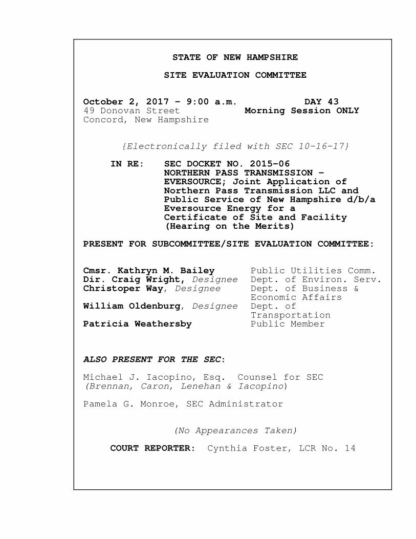
STATE OF NEW HAMPSHIRE SITE EVALUATION COMMITTEE October 2, 2017 - 9:00 a.m. DAY 43 49 Donovan Street Morning Session ONLY Concord, New Hampshire {Electronically filed with SEC 10-16-17} IN RE: SEC DOCKET NO. 2015-06 NORTHERN PASS TRANSMISSION - EVERSOURCE; Joint Application of Northern Pass Transmission LLC and Public Service of New Hampshire d/b/a Eversource Energy for a Certificate of Site and Facility (Hearing on the Merits) PRESENT FOR SUBCOMMITTEE/SITE EVALUATION COMMITTEE: Cmsr. Kathryn M. Bailey Public Utilities Comm. Dir. Craig Wright, Designee Dept. of Environ. Serv. Christoper Way, Designee Dept. of Business & Economic Affairs William Oldenburg, Designee Dept. of Transportation Patricia Weathersby Public Member ALSO PRESENT FOR THE SEC: Michael J. Iacopino, Esq. Counsel for SEC (Brennan, Caron, Lenehan & Iacopino) Pamela G. Monroe, SEC Administrator (No Appearances Taken) COURT REPORTER: Cynthia Foster, LCR No. 14
-
Upload
nguyenhanh -
Category
Documents
-
view
215 -
download
1
Transcript of STATE OF NEW HAMPSHIRE SITE EVALUATION COMMITTEE October · PDF fileSTATE OF NEW HAMPSHIRE...
STATE OF NEW HAMPSHIRE
SITE EVALUATION COMMITTEE
October 2, 2017 - 9:00 a.m. DAY 4349 Donovan Street Morning Session ONLYConcord, New Hampshire
{Electronically filed with SEC 10-16-17}
IN RE: SEC DOCKET NO. 2015-06 NORTHERN PASS TRANSMISSION -
EVERSOURCE; Joint Application of Northern Pass Transmission LLC and Public Service of New Hampshire d/b/a Eversource Energy for a Certificate of Site and Facility (Hearing on the Merits)
PRESENT FOR SUBCOMMITTEE/SITE EVALUATION COMMITTEE:
Cmsr. Kathryn M. Bailey Public Utilities Comm.Dir. Craig Wright, Designee Dept. of Environ. Serv.Christoper Way, Designee Dept. of Business &
Economic AffairsWilliam Oldenburg, Designee Dept. of
TransportationPatricia Weathersby Public Member
ALSO PRESENT FOR THE SEC:
Michael J. Iacopino, Esq. Counsel for SEC(Brennan, Caron, Lenehan & Iacopino)
Pamela G. Monroe, SEC Administrator
(No Appearances Taken)
COURT REPORTER: Cynthia Foster, LCR No. 14
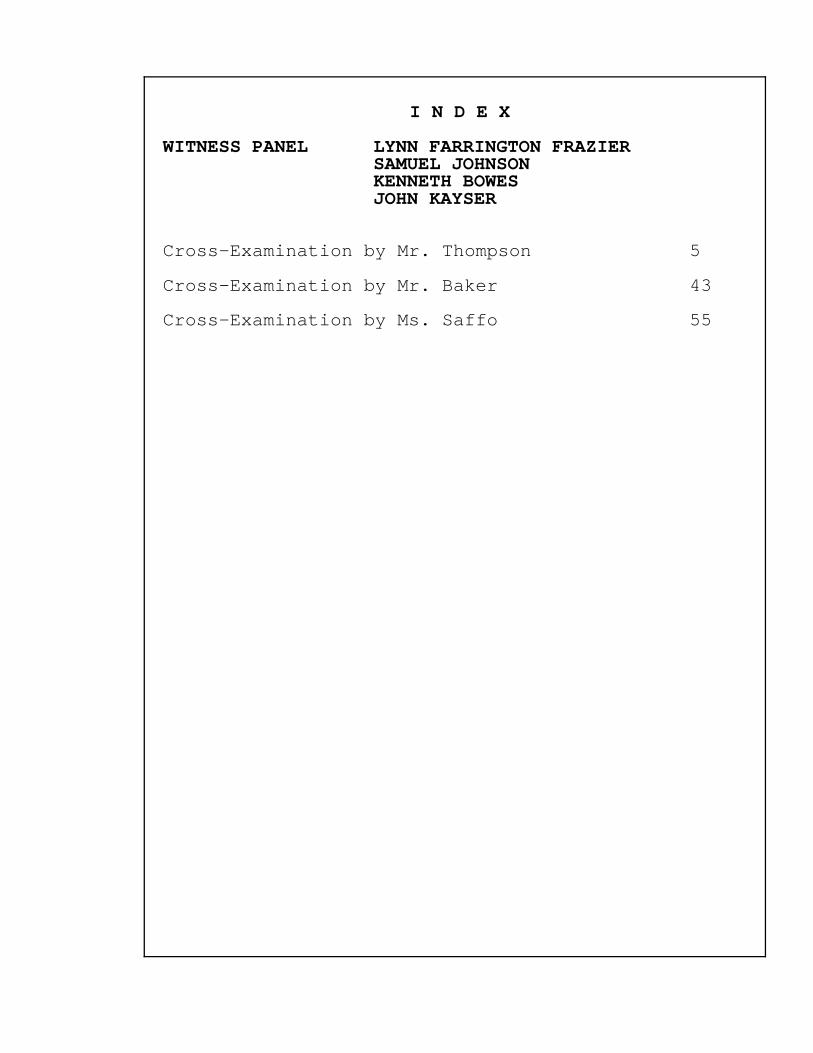
I N D E X
WITNESS PANEL LYNN FARRINGTON FRAZIERSAMUEL JOHNSONKENNETH BOWESJOHN KAYSER
Cross-Examination by Mr. Thompson 5
Cross-Examination by Mr. Baker 43
Cross-Examination by Ms. Saffo 55

E X H I B I T S
EXHIBIT ID D E S C R I P T I O N PAGE NO.
CFP 562 Exception Request 125 85
CS 104 Exception Request 178A 13
CS 104 Exception Request 180 14
CS 104 Exception Request 184 26
CS 104 Exception Request 185 28
CS 105 NRTH_NHDOT Permit Set
ROT 3C104 14
CS 106 NRTH_NHDOT Permit Set 15
CS 107 Splice Vault Diagram 7
CS 108 Exception Request 180
Area Work Space 19
CS 109 Laydown Area NoHill 20
CS 110 Laydown BRR-NoHill 20
CS 111 Laydown BRR&NHill
CS 112a Marie 28
CS 112b Milker Marie 28
CS 112c Young Maries 28
CS 113 Milk Truck Turning
CS 114 Milk Truck Headon
CS 115 Haywagon 27
CS 116 NPT Map Renewable Properties 31
CS 125 Civil Takeoffs Report 41

E X H I B I T S (continued)
EXHIBIT ID D E S C R I P T I O N PAGE NO.
GRAFTON 43 Surveys 55
GRAFTON 44 Conference Report, 9/19/17 58
GRAFTON 45 Media Center Special Projects
NPass DOT's Role 91
GRAFTON 46 Existing Land Use Along the
Project Corridor 140
GRAFTON 47 Applicant's Response to Grafton
County's Data Requests and
Interrogatories - Set 1 88
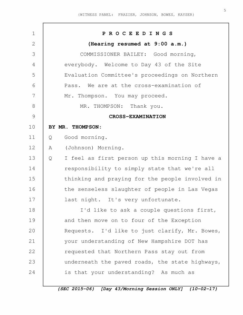
P R O C E E D I N G S
(Hearing resumed at 9:00 a.m.)
COMMISSIONER BAILEY: Good morning,
everybody. Welcome to Day 43 of the Site
Evaluation Committee's proceedings on Northern
Pass. We are at the cross-examination of
Mr. Thompson. You may proceed.
MR. THOMPSON: Thank you.
CROSS-EXAMINATION
BY MR. THOMPSON:
Q Good morning.
A (Johnson) Morning.
Q I feel as first person up this morning I have a
responsibility to simply state that we're all
thinking and praying for the people involved in
the senseless slaughter of people in Las Vegas
last night. It's very unfortunate.
I'd like to ask a couple questions first,
and then move on to four of the Exception
Requests. I'd like to just clarify, Mr. Bowes,
your understanding of New Hampshire DOT has
requested that Northern Pass stay out from
underneath the paved roads, the state highways,
is that your understanding? As much as
{SEC 2015-06} [Day 43/Morning Session ONLY] {10-02-17}
5{WITNESS PANEL: FRAZIER, JOHNSON, BOWES, KAYSER}
1
2
3
4
5
6
7
8
9
10
11
12
13
14
15
16
17
18
19
20
21
22
23
24

possible?
A (Bowes) I would say yes. That's the Utility
Accommodation Manual requirements, and they
allow for Exceptions.
Q Okay. And in my case I'm going to concentrate
on the roughly 7 and a half miles of underground
burial in Clarksville and Stewartstown. So that
would include about a quarter of a mile of 145
in Clarksville and probably a couple miles of
state highway, Bear Rock Road?
A (Bowes) Yes. I think that's accurate.
Q It would also include those two roads.
A (Bowes) That is correct.
Q Thank you. Has anything been said about the
town roads, staying out from under their roads,
the dirt roads?
A (Bowes) So in our Application, Northern Pass has
asked the SEC to assume jurisdiction over the
local roads, and we've also asked that to be
delegated to the New Hampshire DOT for control
as well as for processing the necessary permits
and approving the final design as well as any
Exceptions. So I would say that's similar to
what we have for State roads, but there is a
{SEC 2015-06} [Day 43/Morning Session ONLY] {10-02-17}
6{WITNESS PANEL: FRAZIER, JOHNSON, BOWES, KAYSER}
1
2
3
4
5
6
7
8
9
10
11
12
13
14
15
16
17
18
19
20
21
22
23
24
nuance that we're asking the SEC to assume that
jurisdiction and then delegate.
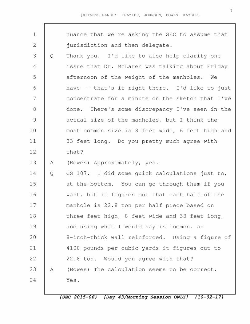
Q Thank you. I'd like to also help clarify one
issue that Dr. McLaren was talking about Friday
afternoon of the weight of the manholes. We
have -- that's it right there. I'd like to just
concentrate for a minute on the sketch that I've
done. There's some discrepancy I've seen in the
actual size of the manholes, but I think the
most common size is 8 feet wide, 6 feet high and
33 feet long. Do you pretty much agree with
that?
A (Bowes) Approximately, yes.
Q CS 107. I did some quick calculations just to,
at the bottom. You can go through them if you
want, but it figures out that each half of the
manhole is 22.8 ton per half piece based on
three feet high, 8 feet wide and 33 feet long,
and using what I would say is common, an
8-inch-thick wall reinforced. Using a figure of
4100 pounds per cubic yards it figures out to
22.8 ton. Would you agree with that?
A (Bowes) The calculation seems to be correct.
Yes.
{SEC 2015-06} [Day 43/Morning Session ONLY] {10-02-17}
7{WITNESS PANEL: FRAZIER, JOHNSON, BOWES, KAYSER}
1
2
3
4
5
6
7
8
9
10
11
12
13
14
15
16
17
18
19
20
21
22
23
24

Q Thank you. Leads me to question the size crane
that would be required to set one of these. Do
you have a feeling of what size tonnage crane
might be necessary?
A (Bowes) Probably 30 to 40-ton crane.
Q Probably 30 to 40 ton. Thank you. Do the
people that do the splicing inside these pits,
are they Eversource people or IBEW people or
subcontractors?
A (Bowes) So the people that would perform the
splicing, the actual lead splicers would be from
the cable manufacturer, and there may be
apprentices used as well which would be IBEW
employees or IBEW workers probably employed by
PAR at that point or --
Q Probably calling somewhat specialized in what
they do, certainly trained and --
A (Bowes) Highly specialized, I would say. This
is their sole profession, and they travel the
road with each project and perform the splicing
activities.
Q Okay. Stated Friday there's roughly 150, 160
manholes in all, somewhere in that range. About
every third of a mile, might be 170?
{SEC 2015-06} [Day 43/Morning Session ONLY] {10-02-17}
8{WITNESS PANEL: FRAZIER, JOHNSON, BOWES, KAYSER}
1
2
3
4
5
6
7
8
9
10
11
12
13
14
15
16
17
18
19
20
21
22
23
24

A (Bowes) I think we gave varying figures. 150,
154. I think there's actually 159 splice
enclosures.
Q Good. 159. It takes about a week to do a
two-section splice, give or take?
A (Bowes) Five days probably, yes. There may be
some setup time and some time at the end to
remove the preparation materials.
Q Leads me to ask the logical question of are
these gentlemen that, people doing the splicing
going to accept the fact that they're working in
a manhole that's only got 4 foot 8 inches of
head room if it's 6 foot high and 8-inch walls?
A (Bowes) Yes. The dimension is a little bit
larger than what you show here. I think it's 7
and a half feet or 8 feet total.
Q And it probably opens up the question of would
you have the crane come back a second time to
take the top off versus having a hole in the top
of the manhole. The option's there.
A (Bowes) So we did discuss last Friday that the
DOT has worked with our contractor and has
talked about some temporary chimneys. Those
would certainly be in the paved roads so we
{SEC 2015-06} [Day 43/Morning Session ONLY] {10-02-17}
9{WITNESS PANEL: FRAZIER, JOHNSON, BOWES, KAYSER}
1
2
3
4
5
6
7
8
9
10
11
12
13
14
15
16
17
18
19
20
21
22
23
24

would not have to come back and remove the
entire cover. We just have to dig down, meet
the chimney, and keep that excavation open for
the time period of the splicing.
Q Um-hum.
A (Bowes) I'm not sure we've come up with how we
plan to do that on the dirt roads, if that would
be also acceptable, or whether we will have to
come back and remove the cover for the splice
enclosure.
Q Do they have special equipment to do the
splicing that they have to get down into the pit
and into the vault?
A (Bowes) Yes, they do.
Q And so the hole, the opening, logically, would
have to be big enough to be able to get that
equipment down in and back out?
A (Bowes) Yes. The typical installation would be
with a paved road with two manholes so there
would be an entry and an exit manhole and all
the equipment for splicing would enter through
the manhole cover.
Q And then that would be disassembled afterwards?
A (Bowes) Correct. That's why I said --
{SEC 2015-06} [Day 43/Morning Session ONLY] {10-02-17}
10{WITNESS PANEL: FRAZIER, JOHNSON, BOWES, KAYSER}
1
2
3
4
5
6
7
8
9
10
11
12
13
14
15
16
17
18
19
20
21
22
23
24
Q It wouldn't be permanent.
A (Bowes) Correct. That's why I said it's
probably about a five-day splicing operation but
maybe a day to put the equipment into the
manhole or splice enclosure and a day to remove
it.
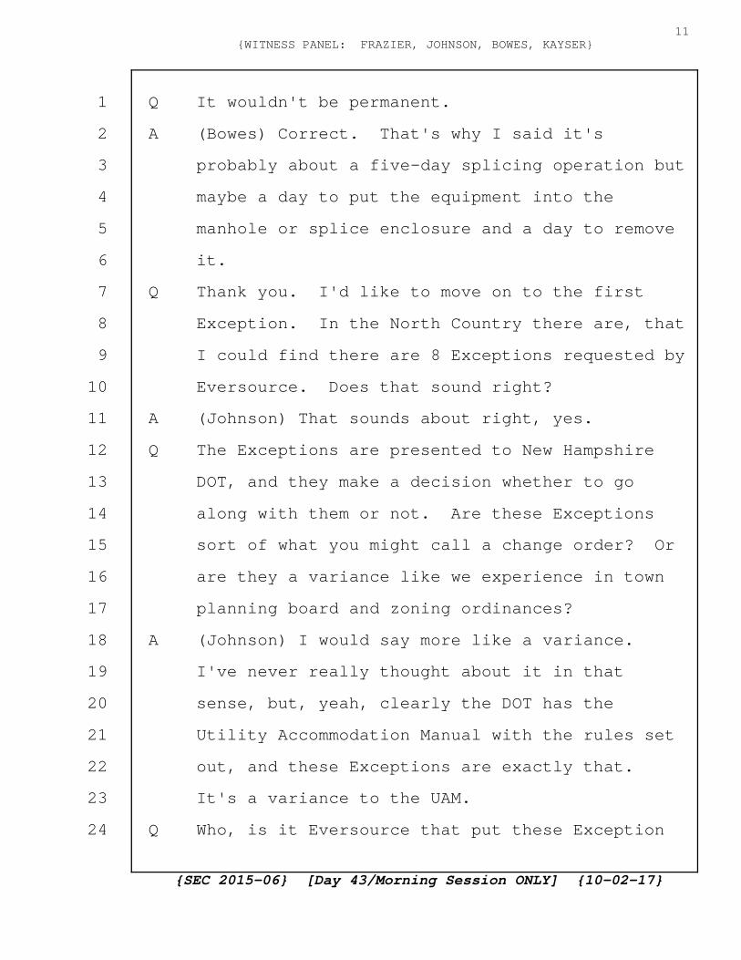
Q Thank you. I'd like to move on to the first
Exception. In the North Country there are, that
I could find there are 8 Exceptions requested by
Eversource. Does that sound right?
A (Johnson) That sounds about right, yes.
Q The Exceptions are presented to New Hampshire
DOT, and they make a decision whether to go
along with them or not. Are these Exceptions
sort of what you might call a change order? Or
are they a variance like we experience in town
planning board and zoning ordinances?
A (Johnson) I would say more like a variance.
I've never really thought about it in that
sense, but, yeah, clearly the DOT has the
Utility Accommodation Manual with the rules set
out, and these Exceptions are exactly that.
It's a variance to the UAM.
Q Who, is it Eversource that put these Exception
{SEC 2015-06} [Day 43/Morning Session ONLY] {10-02-17}
11{WITNESS PANEL: FRAZIER, JOHNSON, BOWES, KAYSER}
1
2
3
4
5
6
7
8
9
10
11
12
13
14
15
16
17
18
19
20
21
22
23
24
Requests together or is it the architect or is
it PAR?
A (Johnson) So it's a combination of the design
engineer and PAR working together from both a
design or engineering aspect and a
constructability aspect, and then that's
reviewed by the owner prior to submittal to the
DOT.
Q Was it done recently or were the Exceptions put
together knowing that they would have to be
asked for as part of the original, at the time
of the original development of the original
request?
A (Johnson) So working with the DOT, we identified
the process of Exception Requests probably late
last year to early this year, 2017, and it's
really been in the sort of spring and summer of
2017 that the Exception Request process has
evolved.
Q So they keep, more issues keep popping up as you
get deeper into it and get far more involved?
A (Johnson) Sure. It's a natural evolution as the
design gets more firm, if you will. Then we
have a better understanding of where those
{SEC 2015-06} [Day 43/Morning Session ONLY] {10-02-17}
12{WITNESS PANEL: FRAZIER, JOHNSON, BOWES, KAYSER}
1
2
3
4
5
6
7
8
9
10
11
12
13
14
15
16
17
18
19
20
21
22
23
24

Exception Requests are.
Q Exception Request number 178 which is my CS 104
is requesting that, typical of a lot of them, I
believe this one is requesting that one entrance
and one exit of the two HDD come out from
underneath or go into the paved, actual paved
road or Route 3 at the steel bridge in
Clarksville or Pittsburg; is that correct?
A (Johnson) That's correct.
Q I'd like to have CS 5 and CS 6, please. This is
the DOT Application to DOT maps, and this is an
area that a few weeks ago we had a tour of the
North Country and the full Committee here, Site
Evaluation Committee were there along with
representatives from pretty much all facets of
what is in this room. We walked, we parked up
around the corner, walked down to Old Canaan
Road, and kind of followed the ditch down toward
the steel bridge heading south on Route 3.
I guess I don't understand why you have to
have one of the two entrances into the pavement
of Route 3 causing certainly at the very least
problems with traffic when the ditch on the
right-hand side that we walked down next to
{SEC 2015-06} [Day 43/Morning Session ONLY] {10-02-17}
13{WITNESS PANEL: FRAZIER, JOHNSON, BOWES, KAYSER}
1
2
3
4
5
6
7
8
9
10
11
12
13
14
15
16
17
18
19
20
21
22
23
24
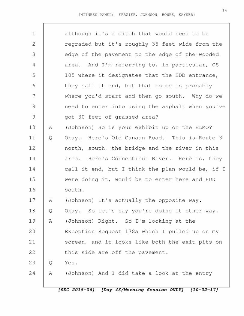
although it's a ditch that would need to be
regraded but it's roughly 35 feet wide from the
edge of the pavement to the edge of the wooded
area. And I'm referring to, in particular, CS
105 where it designates that the HDD entrance,
they call it end, but that to me is probably
where you'd start and then go south. Why do we
need to enter into using the asphalt when you've
got 30 feet of grassed area?
A (Johnson) So is your exhibit up on the ELMO?
Q Okay. Here's Old Canaan Road. This is Route 3
north, south, the bridge and the river in this
area. Here's Connecticut River. Here is, they
call it end, but I think the plan would be, if I
were doing it, would be to enter here and HDD
south.
A (Johnson) It's actually the opposite way.
Q Okay. So let's say you're doing it other way.
A (Johnson) Right. So I'm looking at the
Exception Request 178a which I pulled up on my
screen, and it looks like both the exit pits on
this side are off the pavement.
Q Yes.
A (Johnson) And I did take a look at the entry
{SEC 2015-06} [Day 43/Morning Session ONLY] {10-02-17}
14{WITNESS PANEL: FRAZIER, JOHNSON, BOWES, KAYSER}
1
2
3
4
5
6
7
8
9
10
11
12
13
14
15
16
17
18
19
20
21
22
23
24

pits on the south side of the river, and it
looks like that's where the request is for one
of them to be in the road.
Q So at the south side then, the request is to
enter one of the two from asphalt rather than,
and they both come out in the grassed area?
A (Johnson) That's correct. Yes.
Q Is that predicated in part because of a neighbor
here whose property comes up pretty close to the
corner and you've got to work your way around
and then head north?
A (Johnson) Referring to the south side now?
Q South side of the bridge, correct. CS 106.
A (Johnson) I don't know that it's predicated on
that particular property owner. I think the
alignment here goes from property that's owned
by the Project and crosses underneath the river
and comes up in property that's owned by the
Project as well. I guess it just makes sense
for it to be on property that we manage. I
don't know exactly whether that particular
landowner was part of the decision to locate the
facilities in the locations that they are.
Q Yes. I mean, this is all a great starting point
{SEC 2015-06} [Day 43/Morning Session ONLY] {10-02-17}
15{WITNESS PANEL: FRAZIER, JOHNSON, BOWES, KAYSER}
1
2
3
4
5
6
7
8
9
10
11
12
13
14
15
16
17
18
19
20
21
22
23
24

which would keep you out of the road. The
problem would be crossing underneath this
neighbor's property. Have you talked to them,
possibility of going under their land?
A (Johnson) Again --
A (Bowes) You mean locating outside the road
right-of-way?
Q I'm thinking stay away from Route 3 which is a
pretty heavily traveled area, set up in the
parking lot area, I think that gate here up to
go up into Transition Station number 2, but it
just logically makes sense if you could get
permission to cross under this land to set up in
that big parking lot.
A (Johnson) I don't know the answer, whether we've
talked to the Society or not in that particular
location.
Q Right. Some of the requests do involve
permission to, you're requesting permission to
work underneath the asphalt, both entering and
exiting.
A (Johnson) That is correct.
Q And they talk about plus or minus, left, right,
forward, back of five-foot tolerance. How do
{SEC 2015-06} [Day 43/Morning Session ONLY] {10-02-17}
16{WITNESS PANEL: FRAZIER, JOHNSON, BOWES, KAYSER}
1
2
3
4
5
6
7
8
9
10
11
12
13
14
15
16
17
18
19
20
21
22
23
24

you, how do you control to get within five feet?
I understand that there's a sensor of some sort
on the head so you can pretty much tell where
that cutting head is at any point, but do you
have a feeling for how the thing is steered?
A (Johnson) Again, I'm totally out of my element
here, but I believe that the drilling head is
steerable either through hydraulics or some
other thing, and they're able to move it as
necessary as far as the drill path is concerned.
Q I would have to think it's obviously steerable.
I agree. When you're doing one of these, Ms.
Frazier, and you're waiting for the thing to pop
out in the asphalt some place, plus or minus
five feet, until the point where it actually
occurs, you probably have a little question in
your mind as to what kind of traffic control
you're going to be putting together?
A (Frazier) So I believe since we're closing a
lane at that location, I think they said there's
a five-foot tolerance so that's well within the
travel lane for all of these. So not too much
anxiety over that. Just knowing the approximate
area is enough.
{SEC 2015-06} [Day 43/Morning Session ONLY] {10-02-17}
17{WITNESS PANEL: FRAZIER, JOHNSON, BOWES, KAYSER}
1
2
3
4
5
6
7
8
9
10
11
12
13
14
15
16
17
18
19
20
21
22
23
24

Q So you'd probably aim for the middle of one of
the lanes and plan on five feet plus or minus
still being somewhere in that lane.
A (Frazier) Exactly.
A (Bowes) It's actually a little more precise than
that. The five feet is just a margin of safety
that's added to it. An actual path is laid out
electronically with the machine, and they
actually stake the exit location with either a
stake if it's on, you know, not on pavement or
they'll mark the pavement itself, and any
deviation from that is monitored while the
drilling is taking place, and they correct and
bring it back on to the alignment line that's
laid out. Normally, they come right up where
the stake is, not five feet away, but they want
five feet as a work area around that location.
Q Thank you. Okay. Move to the next request.
Our CS 104 which is Exception Request number
180. This is also, I believe, a request to go
under the asphalt. This is at the corner of
where North Hill Road comes down the hill and
bears left heading east on Bear Rock Road. My
big question here if we can go to CS 108 for a
{SEC 2015-06} [Day 43/Morning Session ONLY] {10-02-17}
18{WITNESS PANEL: FRAZIER, JOHNSON, BOWES, KAYSER}
1
2
3
4
5
6
7
8
9
10
11
12
13
14
15
16
17
18
19
20
21
22
23
24
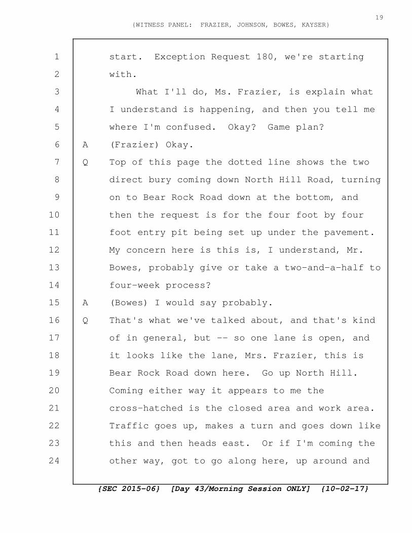
start. Exception Request 180, we're starting
with.
What I'll do, Ms. Frazier, is explain what
I understand is happening, and then you tell me
where I'm confused. Okay? Game plan?
A (Frazier) Okay.
Q Top of this page the dotted line shows the two
direct bury coming down North Hill Road, turning
on to Bear Rock Road down at the bottom, and
then the request is for the four foot by four
foot entry pit being set up under the pavement.
My concern here is this is, I understand, Mr.
Bowes, probably give or take a two-and-a-half to
four-week process?
A (Bowes) I would say probably.
Q That's what we've talked about, and that's kind
of in general, but -- so one lane is open, and
it looks like the lane, Mrs. Frazier, this is
Bear Rock Road down here. Go up North Hill.
Coming either way it appears to me the
cross-hatched is the closed area and work area.
Traffic goes up, makes a turn and goes down like
this and then heads east. Or if I'm coming the
other way, got to go along here, up around and
{SEC 2015-06} [Day 43/Morning Session ONLY] {10-02-17}
19{WITNESS PANEL: FRAZIER, JOHNSON, BOWES, KAYSER}
1
2
3
4
5
6
7
8
9
10
11
12
13
14
15
16
17
18
19
20
21
22
23
24

back. Do I understand that correctly? Am I
missing something?
A (Frazier) Yes. That's correct. Sam was just
saying we could also cut some of that kind of
peak of the triangle off as well to make it a
more gradual turning movement for larger
vehicles.
Q Right at the lower right corner where it turns
to go up if I was headed down Bear Rock?
A (Frazier) At the very top where the kind of
little arrow is around.
Q Let's take a look at that. We'll start off with
CS 109. This is if I'm up on North Hill Road
looking down, and the dotted line goes down the
left-hand side, down at the flat bottom is Bear
Rock Road and you turn left, that's where it's
set up. So you're proposing that we come up and
make a turn and then go back down the other
side.
A (Frazier) Yes.
Q Take a look at CS 110. That's at the bottom
looking up North Hill. Does that feel like it's
going to work to you? This is -- well, I'll ask
that question first.
{SEC 2015-06} [Day 43/Morning Session ONLY] {10-02-17}
20{WITNESS PANEL: FRAZIER, JOHNSON, BOWES, KAYSER}
1
2
3
4
5
6
7
8
9
10
11
12
13
14
15
16
17
18
19
20
21
22
23
24

A (Johnson) Sure. So, obviously, this is an area
that we would be, where the drill rig would
start and so the laydown area as is drawn is
basically encompassing that island, if you will,
the grassy knoll there, and it really is to
allow the drilling company to place their
equipment so that it's not all the way down Bear
Rock Road in a linear fashion.
Certainly the utility pole that's located
there and the actual grassy knoll can be
regraded to assist in the way that we would flow
traffic through here. I think what the designer
has tried to do is maximize or show at least on
the plan a maximum area. Certainly that could
be optimized as the process goes forward. But
ideally, we'd want to be able to turn right on
to the road there and then turn left again to go
back down Bear Rock Road in a continual path.
And, of course, any turning radiuses or anything
else would have to meet DOT standards as far as
large vehicle traffic and other things.
MR. WAY: To the Chair, if I could just
pose a quick question? Just clarification,
where exactly is this spot on the triangle that
{SEC 2015-06} [Day 43/Morning Session ONLY] {10-02-17}
21{WITNESS PANEL: FRAZIER, JOHNSON, BOWES, KAYSER}
1
2
3
4
5
6
7
8
9
10
11
12
13
14
15
16
17
18
19
20
21
22
23
24
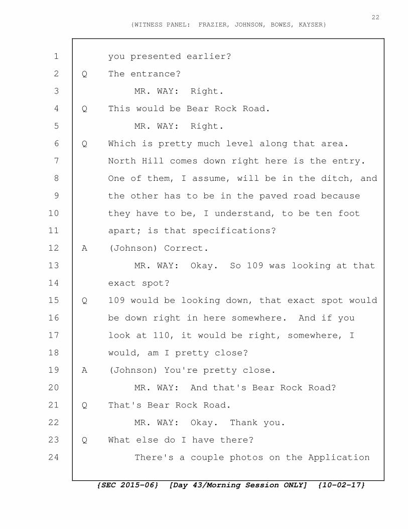
you presented earlier?
Q The entrance?
MR. WAY: Right.
Q This would be Bear Rock Road.
MR. WAY: Right.
Q Which is pretty much level along that area.
North Hill comes down right here is the entry.
One of them, I assume, will be in the ditch, and
the other has to be in the paved road because
they have to be, I understand, to be ten foot
apart; is that specifications?
A (Johnson) Correct.
MR. WAY: Okay. So 109 was looking at that
exact spot?
Q 109 would be looking down, that exact spot would
be down right in here somewhere. And if you
look at 110, it would be right, somewhere, I
would, am I pretty close?
A (Johnson) You're pretty close.
MR. WAY: And that's Bear Rock Road?
Q That's Bear Rock Road.
MR. WAY: Okay. Thank you.
Q What else do I have there?
There's a couple photos on the Application
{SEC 2015-06} [Day 43/Morning Session ONLY] {10-02-17}
22{WITNESS PANEL: FRAZIER, JOHNSON, BOWES, KAYSER}
1
2
3
4
5
6
7
8
9
10
11
12
13
14
15
16
17
18
19
20
21
22
23
24
that I think there are, were there photos in
that Application that also showed it? Maybe
not. That's fine. Strike that.
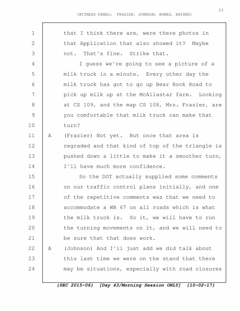
I guess we're going to see a picture of a
milk truck in a minute. Every other day the
milk truck has got to go up Bear Rock Road to
pick up milk up at the McAllastar farm. Looking
at CS 109, and the map CS 108, Mrs. Frazier, are
you comfortable that milk truck can make that
turn?
A (Frazier) Not yet. But once that area is
regraded and that kind of top of the triangle is
pushed down a little to make it a smoother turn,
I'll have much more confidence.
So the DOT actually supplied some comments
on our traffic control plans initially, and one
of the repetitive comments was that we need to
accommodate a WB 67 on all roads which is what
the milk truck is. So it, we will have to run
the turning movements on it, and we will need to
be sure that that does work.
A (Johnson) And I'll just add we did talk about
this last time we were on the stand that there
may be situations, especially with road closures
{SEC 2015-06} [Day 43/Morning Session ONLY] {10-02-17}
23{WITNESS PANEL: FRAZIER, JOHNSON, BOWES, KAYSER}
1
2
3
4
5
6
7
8
9
10
11
12
13
14
15
16
17
18
19
20
21
22
23
24

that are farther down Bear Rock Road if it does
come to that, that we would work with
Mr. McAllaster from a business interruption
perspective to either buy his milk or bring in
smaller trucks, but, obviously, multiple trucks
to get his product to market, but that would be
the sole cost of the Project and not
inconvenience Mr. McAllaster as much as
possible.
Q All right. Have you talked to Mr. McAllaster
about that yet?
A (Johnson) Not yet. Obviously, we need a more
complete design or the final design, but
certainly that is on our list to come out and
have discussions with him regarding the time of
day, to see any seasonal issues he may have, but
certainly that is something that will happen in
the future.
Q You don't feel that it's pretty critical to be
talking to him now?
A (Johnson) We do feel it's critical. I think
what we'd like to do though is present a plan as
you, as Ms. Farrington just said, if we can
present a plan for this particular area that
{SEC 2015-06} [Day 43/Morning Session ONLY] {10-02-17}
24{WITNESS PANEL: FRAZIER, JOHNSON, BOWES, KAYSER}
1
2
3
4
5
6
7
8
9
10
11
12
13
14
15
16
17
18
19
20
21
22
23
24
allows for that type of truck to go through,
then we would certainly want to present that to
him. Obviously, if we are restricted from doing
that, then we'd have to come up with an
alternate plan, and I'd rather have the
alternate plan available before we begin that
conversation.
Q Right. Is that something that your customer
relationship people would do in the field? I
forget the names of them, but --
A (Johnson) I think it would be a concerted
effort. Certainly a customer relations person
would be with us, but I think in this particular
case, it's very important that the design
engineers as well as the owner be represented at
any meeting we'd have with this particular
gentleman.
Q This on the screen now is just to get a feel of
the size vehicle we're talking about.
A (Johnson) Agreed. To complement this, there's
also a lot of logging activity and the trucks
that come down Bear Rock Road are just as
similar to this.
Q Okay. That's that. I'll take that picture
{SEC 2015-06} [Day 43/Morning Session ONLY] {10-02-17}
25{WITNESS PANEL: FRAZIER, JOHNSON, BOWES, KAYSER}
1
2
3
4
5
6
7
8
9
10
11
12
13
14
15
16
17
18
19
20
21
22
23
24

back. Next one is number 184. See if I can
keep these straight. This is the one, this is
the one, the special exception at McAllaster
Road. And we have, this apparently is also a
request to dig in the pavement. Again.
A (Johnson) Correct.
Q Somewhere right around here there's also a
request to cross the road. I'm not too
concerned about that. This one is concerning
because it really is going to make access up on
to McAllaster Road very, at the very least very
difficult. These two photos are part of the
actual request for Exception Number 184. And
it's pointing to a point south, just south of
McAllaster Road which is a, if you're heading
east, in and out Bear Rock Road, McAllaster Road
as a left goes up the hill to the dairy farm.
Shows where the entrance under the asphalt will
occur. It's back a ways, a bit of a ways from
the exit to go up McAllaster Road.
The concern here, again, is the same issue
of closing off McAllaster Road, making it
impossible, making it impossible to get up to
the farm. Again, we take a quick look, this
{SEC 2015-06} [Day 43/Morning Session ONLY] {10-02-17}
26{WITNESS PANEL: FRAZIER, JOHNSON, BOWES, KAYSER}
1
2
3
4
5
6
7
8
9
10
11
12
13
14
15
16
17
18
19
20
21
22
23
24
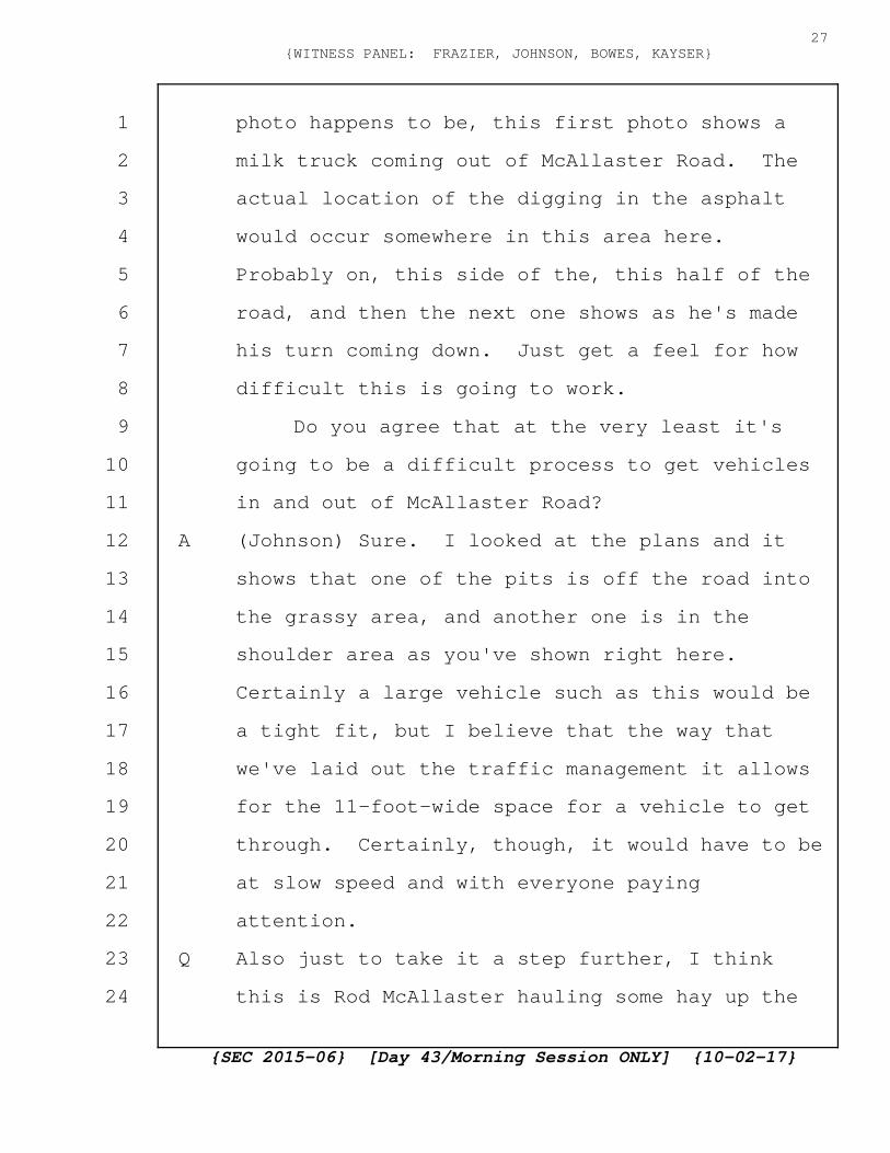
photo happens to be, this first photo shows a
milk truck coming out of McAllaster Road. The
actual location of the digging in the asphalt
would occur somewhere in this area here.
Probably on, this side of the, this half of the
road, and then the next one shows as he's made
his turn coming down. Just get a feel for how
difficult this is going to work.
Do you agree that at the very least it's
going to be a difficult process to get vehicles
in and out of McAllaster Road?
A (Johnson) Sure. I looked at the plans and it
shows that one of the pits is off the road into
the grassy area, and another one is in the
shoulder area as you've shown right here.
Certainly a large vehicle such as this would be
a tight fit, but I believe that the way that
we've laid out the traffic management it allows
for the 11-foot-wide space for a vehicle to get
through. Certainly, though, it would have to be
at slow speed and with everyone paying
attention.
Q Also just to take it a step further, I think
this is Rod McAllaster hauling some hay up the
{SEC 2015-06} [Day 43/Morning Session ONLY] {10-02-17}
27{WITNESS PANEL: FRAZIER, JOHNSON, BOWES, KAYSER}
1
2
3
4
5
6
7
8
9
10
11
12
13
14
15
16
17
18
19
20
21
22
23
24
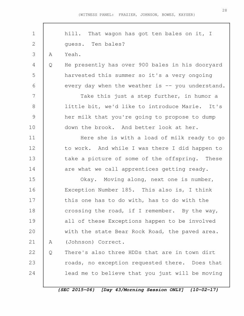
hill. That wagon has got ten bales on it, I
guess. Ten bales?
A Yeah.
Q He presently has over 900 bales in his dooryard
harvested this summer so it's a very ongoing
every day when the weather is -- you understand.
Take this just a step further, in humor a
little bit, we'd like to introduce Marie. It's
her milk that you're going to propose to dump
down the brook. And better look at her.
Here she is with a load of milk ready to go
to work. And while I was there I did happen to
take a picture of some of the offspring. These
are what we call apprentices getting ready.
Okay. Moving along, next one is number,
Exception Number 185. This also is, I think
this one has to do with, has to do with the
crossing the road, if I remember. By the way,
all of these Exceptions happen to be involved
with the state Bear Rock Road, the paved area.
A (Johnson) Correct.
Q There's also three HDDs that are in town dirt
roads, no exception requested there. Does that
lead me to believe that you just will be moving
{SEC 2015-06} [Day 43/Morning Session ONLY] {10-02-17}
28{WITNESS PANEL: FRAZIER, JOHNSON, BOWES, KAYSER}
1
2
3
4
5
6
7
8
9
10
11
12
13
14
15
16
17
18
19
20
21
22
23
24

ahead and digging in the middle of the road? In
the dirt roads?
A (Bowes) So we would plan to follow the same
process if the SEC delegates to the New
Hampshire DOT that responsibility, and that's
what we've asked for on pages 82 and 83 of this
Application. It was also recently granted for
the MVRP Project for Docket number 2015-05. So
we're asking basically for the same delegation
for use of local roads as we did in that past
Project.
Q So that you will be requesting for exception in
the dirt roads also?
A (Bowes) Exactly. It will be the same process we
would use, and whether it goes to the SEC or
whether it goes to the New Hampshire DOT we
would follow the same type of exception process
doing a detailed analysis and putting forth a
package like we've just seen on several of
these.
Q Are you saying that at this point you're really
not sure who's going to make a decision to
approve it or send it back and ask for more
information; SEC or New Hampshire DOT?
{SEC 2015-06} [Day 43/Morning Session ONLY] {10-02-17}
29{WITNESS PANEL: FRAZIER, JOHNSON, BOWES, KAYSER}
1
2
3
4
5
6
7
8
9
10
11
12
13
14
15
16
17
18
19
20
21
22
23
24

A (Bowes) We've asked the SEC, and they would
likely delegate to the New Hampshire DOT who has
the expertise to do that.
Q So Exception Request number 185, I believe, has
to do with crossing the road. Is that correct?
A (Johnson) Yes.
Q My concern isn't so much crossing the road as
why they need to be in the road at all. Who is
Renewable Properties? I know the question has
been asked, but I'd just like to be sure we
understand who they are.
A (Bowes) They're a wholly owned subsidiary of
Eversource Energy.
Q Are you aware that from south on Bear Rock Road
state highway with the paved area, south of
probably within 100 feet of where that entrance
under the asphalt occurs south of McAllaster
Road, for roughly .6-tenths of a mile by GPS, on
the right-hand side and in some cases both
sides, all that property for six-tenths of a
mile is owned by Renewable Properties.
A (Johnson) Correct.
Q We can strum through five of these maps of the
Application to DOT, and it's continuously owned
{SEC 2015-06} [Day 43/Morning Session ONLY] {10-02-17}
30{WITNESS PANEL: FRAZIER, JOHNSON, BOWES, KAYSER}
1
2
3
4
5
6
7
8
9
10
11
12
13
14
15
16
17
18
19
20
21
22
23
24

by Renewable Properties to a point probably two
or three hundred yards of where the state
properties stop. Here is our CS 116. This is
pretty big. This is property bought, the green,
different greens, and this was a map made before
they had purchased all the land they hoped they
needed to go overhead.
I'm referring to this piece of property
right here. This is Wiswell Road, Old County
Road, North Hill Road, Bear Rock Road,
Transition Station 4, Transition Station 3.
That's the 7 and a half miles. This piece of
property right here.
A (Johnson) I'm familiar with that property.
Q Why not use it? You bought it. Why not get off
the road and go underground for six tenths of a
mile up through that land and then come back on
to the road? You'd eliminate -- I'm sorry.
A (Johnson) No. Go ahead. My fault.
Q Point being, among a number of problems that
would be rectified you'd eliminate the blocking
of McAllaster Road?
A (Johnson) So if you look at Exception Request
185 which I think was the start of this
{SEC 2015-06} [Day 43/Morning Session ONLY] {10-02-17}
31{WITNESS PANEL: FRAZIER, JOHNSON, BOWES, KAYSER}
1
2
3
4
5
6
7
8
9
10
11
12
13
14
15
16
17
18
19
20
21
22
23
24
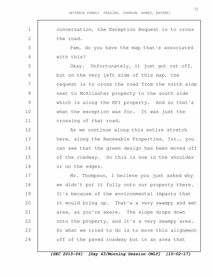
conversation, the Exception Request is to cross
the road.
Pam, do you have the map that's associated
with this?
Okay. Unfortunately, it just got cut off,
but on the very left side of this map, the
request is to cross the road from the north side
next to McAllaster property to the south side
which is along the RPI property. And so that's
what the exception was for. It was just the
crossing of that road.
As we continue along this entire stretch
here, along the Renewable Properties, Inc., you
can see that the green design has been moved off
of the roadway. So this is now in the shoulder
or on the edges.
Mr. Thompson, I believe you just asked why
we didn't put it fully onto our property there.
It's because of the environmental impacts that
it would bring up. That's a very swampy and wet
area, as you're aware. The slope drops down
onto the property, and it's a very swampy area.
So what we tried to do is to move this alignment
off of the paved roadway but in an area that
{SEC 2015-06} [Day 43/Morning Session ONLY] {10-02-17}
32{WITNESS PANEL: FRAZIER, JOHNSON, BOWES, KAYSER}
1
2
3
4
5
6
7
8
9
10
11
12
13
14
15
16
17
18
19
20
21
22
23
24

could be still constructible with the least
amount of environmental impact.
Q The only section that's wetlands is give or take
a couple hundred feet from Bear Rock Road. You
own back 80 percent of the distance up to Noyes
Road. The whole hillside. It's a gradual
sloping side hill, certainly much more workable
than a lot of the land you're going to face in
Dixville, Millsfield and Dummer.
A (Johnson) Sure. From an underground
perspective, though, from a constructability,
getting vehicles in and out, we'd have to build
new access road and cause quite a bit of either
alteration of terrain or tree clearing and other
things. Even though it is our property, the
least impactful environmental route is off the
roadway, but, again, next to the roadway.
Q Okay. Thank you. Next I'd like to get into
some questions concerning Transition Station 4
number 4. The reason, as I understand it, for
the Construction Committee, you people, were
called back was to go into detail on these many
Exceptions and try to understand them, and also
to answer some inaccuracies in the plans that
{SEC 2015-06} [Day 43/Morning Session ONLY] {10-02-17}
33{WITNESS PANEL: FRAZIER, JOHNSON, BOWES, KAYSER}
1
2
3
4
5
6
7
8
9
10
11
12
13
14
15
16
17
18
19
20
21
22
23
24
occurred. Is that --
A (Johnson) That's my understanding. Yes.
Q -- the way I understood it? What I'd like to do
for a few minutes now is to talk about during my
questioning a couple months ago to this Panel,
asked a lot of questions, got into a lot of
details, and I feel I've exposed an area where
I've got an inaccurate answer so that's the
reason that I'm pursuing. Do you remember the
discussions we had about the 30,000 cubic yards
of ledge that had to be excavated, blasted and
excavated out of Transition Station 4?
A (Johnson) I do.
Q After that discussion and day, and as I
recollect, I can't remember which one of you
gentlemen said but there was just probably a
mistake made or a misunderstanding with your
estimator concerning the understanding that it
was 30,000 cubic yards, correct?
A (Bowes) I think it was the cut and fill that was
the mistake.
Q Yeah.
A (Bowes) I think we always knew how much --
Q It was a misunderstanding. You thought it was
{SEC 2015-06} [Day 43/Morning Session ONLY] {10-02-17}
34{WITNESS PANEL: FRAZIER, JOHNSON, BOWES, KAYSER}
1
2
3
4
5
6
7
8
9
10
11
12
13
14
15
16
17
18
19
20
21
22
23
24

cut and fill, and it turns out it's all cut and
get rid of.
A (Bowes) Correct.
Q Yeah. Did you go back to him afterwards and
verify that 30,000 cubic yards?
A (Johnson) We did.
Q And verified that it was 30,000, plus or minus?
A (Johnson) Plus or minus, yes, sir.
Q I happened to do the same thing couple weeks
ago.
Put this one up first.
With a well-known estimator in Gilford
named Kevin Hayes.
Now the next one.
Asked him to do a takeoff. He did it by
quadrant cut and fill. This print right here is
basically the 3.12 acres from a plan view which
means looking straight down from above at it,
cut and fill of that whole area. And this cut
and fill includes the soil materials on top and
the blasted ledge.
Next?
His discovery, the bottom of column 1, is
that there'll be a total of 77,000 cubic yards
{SEC 2015-06} [Day 43/Morning Session ONLY] {10-02-17}
35{WITNESS PANEL: FRAZIER, JOHNSON, BOWES, KAYSER}
1
2
3
4
5
6
7
8
9
10
11
12
13
14
15
16
17
18
19
20
21
22
23
24

and there's some materials coming back making,
crushed bank run to make the driveway and the
landing area and so forth. So the net is
somewhat less than 77. We also, do you
understand CS Cole's research that he has said
that there's soil material on top of the ledge
anywhere from 6 inches to 5 foot 6 inches down?
A (Johnson) I'll take your word for it.
Q So if we, let's say, assume that there's an
average of five feet over that whole area, it
equates out to somewhere in the vicinity of
60,000 cubic yards of ledge and the other 15 or
so thousand is soil and stumps and everything
else. Will you accept that based on Mr. Hayes's
takeoff?
A (Johnson) Sure.
Q My concern here is many fold, and I keep having
to ask the question, and in particular of this
Committee, how are you going to take on a
Project of this magnitude in such a tight area
where now if in fact it's 60,000 cubic yards of
ledge it's got to be hauled off and I think we
can agree, I would expect that would you agree
with me that a 15 yard tri axle dump truck when
{SEC 2015-06} [Day 43/Morning Session ONLY] {10-02-17}
36{WITNESS PANEL: FRAZIER, JOHNSON, BOWES, KAYSER}
1
2
3
4
5
6
7
8
9
10
11
12
13
14
15
16
17
18
19
20
21
22
23
24

hauling crushed ledge would probably have ten to
12 yards in it, if it was crushed it would have
a full 15. Some would agree with that?
A (Johnson) Potentially, yes. Depends how you
process the material.
Q What I'm leading up to is that we're now talking
four or five thousand truck loads to be hauled
out of there to go somewhere. The exposure on
Bear Rock Road or whatever direction it's going.
MR. NEEDLEMAN: Madam Chair, I'm going to
object at this point. This is really akin to
counter testimony on this issue. Also, it's not
clear how it's within the scope of the recall,
but that's a separate issue.
COMMISSIONER BAILEY: Mr. Thompson.
MR. THOMPSON: I feel that the
discrepancies that I'm exposing just magnify the
problems that are going to occur, and I intend
to get into for a minute the blasting, the
amount of dynamite, and the health problems.
It's all being magnified.
COMMISSIONER BAILEY: Mr. Thompson, can you
tell me how this applies to the alleged
inaccuracies?
{SEC 2015-06} [Day 43/Morning Session ONLY] {10-02-17}
37{WITNESS PANEL: FRAZIER, JOHNSON, BOWES, KAYSER}
1
2
3
4
5
6
7
8
9
10
11
12
13
14
15
16
17
18
19
20
21
22
23
24

MR. THOMPSON: The inaccuracies are causing
the problem. It's doubling the amount of
dynamite that's going to be needed. It's vastly
increasing the probability of damage to the
glacial spring well that I own 1100 feet away.
It's a heavy exposure to a family with two
special needs people that live 650 feet away of
which the woman was here --
MR. IACOPINO: Let's focus on the question
the Chair asked you though. How does this apply
to the alleged inaccuracies in the plan? Not
how does it apply to the people who live there
right now, but the questioning is limited to
what inaccuracies in the plan. So can you tell
us what inaccuracy this information applies to.
MR. THOMPSON: The set of plans for
Transition Station No. 4 show a clearcut of
ledge. We talked about that, and the roll which
is on the table shows this huge cut of ledge.
And I guess my direction here is that I'm just
exposing the inaccuracy of the testimony that I
received before and that, in fact, it's a more
serious problem than we had first thought.
MR. NEEDLEMAN: Madam Chair?
{SEC 2015-06} [Day 43/Morning Session ONLY] {10-02-17}
38{WITNESS PANEL: FRAZIER, JOHNSON, BOWES, KAYSER}
1
2
3
4
5
6
7
8
9
10
11
12
13
14
15
16
17
18
19
20
21
22
23
24
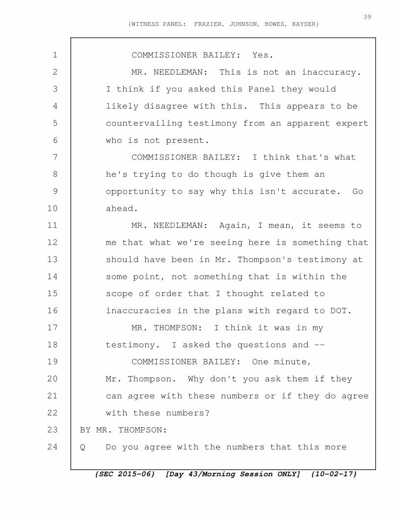
COMMISSIONER BAILEY: Yes.
MR. NEEDLEMAN: This is not an inaccuracy.
I think if you asked this Panel they would
likely disagree with this. This appears to be
countervailing testimony from an apparent expert
who is not present.
COMMISSIONER BAILEY: I think that's what
he's trying to do though is give them an
opportunity to say why this isn't accurate. Go
ahead.
MR. NEEDLEMAN: Again, I mean, it seems to
me that what we're seeing here is something that
should have been in Mr. Thompson's testimony at
some point, not something that is within the
scope of order that I thought related to
inaccuracies in the plans with regard to DOT.
MR. THOMPSON: I think it was in my
testimony. I asked the questions and --
COMMISSIONER BAILEY: One minute,
Mr. Thompson. Why don't you ask them if they
can agree with these numbers or if they do agree
with these numbers?
BY MR. THOMPSON:
Q Do you agree with the numbers that this more
{SEC 2015-06} [Day 43/Morning Session ONLY] {10-02-17}
39{WITNESS PANEL: FRAZIER, JOHNSON, BOWES, KAYSER}
1
2
3
4
5
6
7
8
9
10
11
12
13
14
15
16
17
18
19
20
21
22
23
24
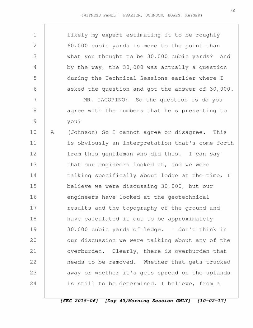
likely my expert estimating it to be roughly
60,000 cubic yards is more to the point than
what you thought to be 30,000 cubic yards? And
by the way, the 30,000 was actually a question
during the Technical Sessions earlier where I
asked the question and got the answer of 30,000.
MR. IACOPINO: So the question is do you
agree with the numbers that he's presenting to
you?
A (Johnson) So I cannot agree or disagree. This
is obviously an interpretation that's come forth
from this gentleman who did this. I can say
that our engineers looked at, and we were
talking specifically about ledge at the time, I
believe we were discussing 30,000, but our
engineers have looked at the geotechnical
results and the topography of the ground and
have calculated it out to be approximately
30,000 cubic yards of ledge. I don't think in
our discussion we were talking about any of the
overburden. Clearly, there is overburden that
needs to be removed. Whether that gets trucked
away or whether it's gets spread on the uplands
is still to be determined, I believe, from a
{SEC 2015-06} [Day 43/Morning Session ONLY] {10-02-17}
40{WITNESS PANEL: FRAZIER, JOHNSON, BOWES, KAYSER}
1
2
3
4
5
6
7
8
9
10
11
12
13
14
15
16
17
18
19
20
21
22
23
24
constructability perspective, but I believe our
numbers that we were talking about specifically,
the 30,000 cubic yards were in relation to
ledge.
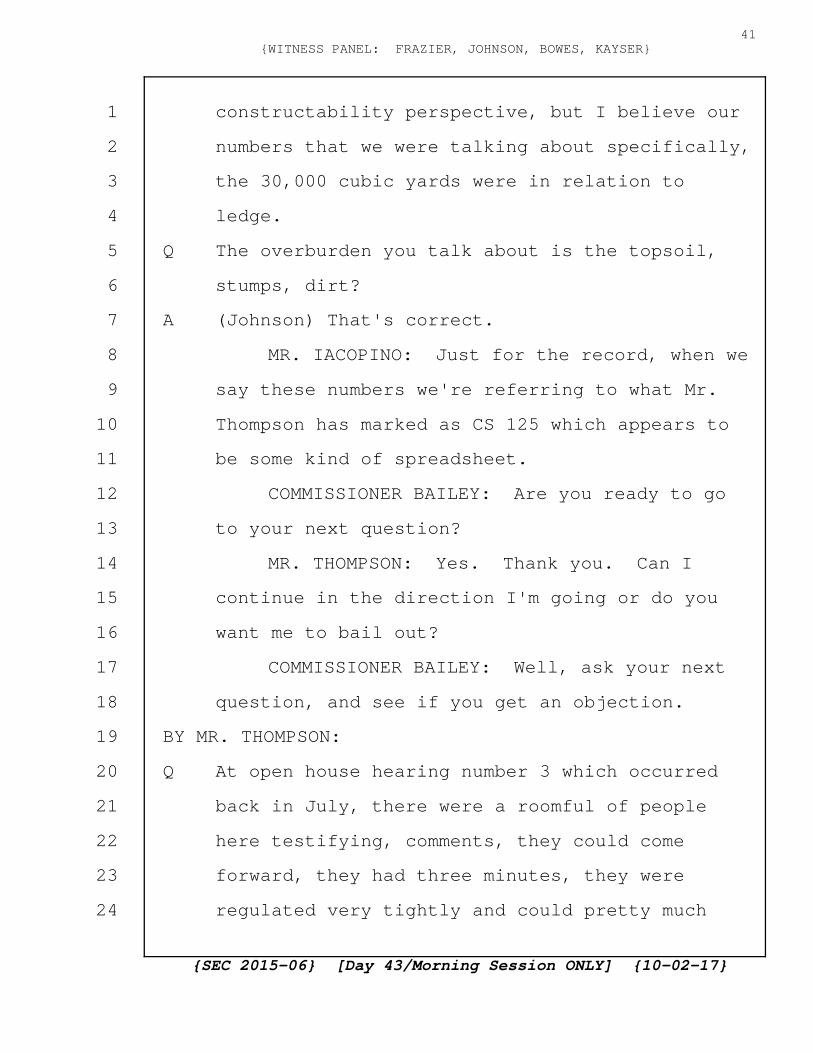
Q The overburden you talk about is the topsoil,
stumps, dirt?
A (Johnson) That's correct.
MR. IACOPINO: Just for the record, when we
say these numbers we're referring to what Mr.
Thompson has marked as CS 125 which appears to
be some kind of spreadsheet.
COMMISSIONER BAILEY: Are you ready to go
to your next question?
MR. THOMPSON: Yes. Thank you. Can I
continue in the direction I'm going or do you
want me to bail out?
COMMISSIONER BAILEY: Well, ask your next
question, and see if you get an objection.
BY MR. THOMPSON:
Q At open house hearing number 3 which occurred
back in July, there were a roomful of people
here testifying, comments, they could come
forward, they had three minutes, they were
regulated very tightly and could pretty much
{SEC 2015-06} [Day 43/Morning Session ONLY] {10-02-17}
41{WITNESS PANEL: FRAZIER, JOHNSON, BOWES, KAYSER}
1
2
3
4
5
6
7
8
9
10
11
12
13
14
15
16
17
18
19
20
21
22
23
24

make comments on whatever they felt like. Kerry
Motiejaitis was of the last people that
afternoon to speak, and she's a resident of
Stewartstown, Bear Rock Road.
For the Committee's direction, if you came
up Bear Rock Road past Noyes Road that goes into
the dip and up to my home, and then you come to
the intersection with Heath Road, if you take a
left and start up the hill, Transition Station 4
is immediately on your left. If you'd taken the
right on Bear Rock Road going around the corner
about 4 or 500 feet, you'd find a home on the
right which is the Motiejaitises, Brian and
Kerry.
Are you aware of the fact that they have
two adult special need people as she testified
that afternoon? Not testified but spoke?
A (Johnson) I was unaware.
Q Are you aware of the fact that, will you accept
the fact that an estimator in the road building
department at Pike industries, Lee Miller, has
indicated that in order to blast the 60,000
cubic yards will require approximately 120,000
pounds of dynamite?
{SEC 2015-06} [Day 43/Morning Session ONLY] {10-02-17}
42{WITNESS PANEL: FRAZIER, JOHNSON, BOWES, KAYSER}
1
2
3
4
5
6
7
8
9
10
11
12
13
14
15
16
17
18
19
20
21
22
23
24
MR. NEEDLEMAN: Objection. I think these
questions are beyond the scope of the recall
order.
COMMISSIONER BAILEY: Mr. Thompson?
MR. THOMPSON: Once again, I'm searching
and looking for answers for the serious
ramifications of what the increased amount of
blasting is going to cause.
COMMISSIONER BAILEY: I'm sympathetic to
that, but I believe this is beyond the scope of
what the recall was for so your objection is
sustained. You have to move on to your next
question, please.
MR. THOMPSON: Thank you. At some point, I
expected this to happen so I'm now done. Thank
you. Appreciate your time.
COMMISSIONER BAILEY: All right.
Mr. Baker. You're on the list as the next up.
MR. BAKER: Thank you, Madam Chairman.
COMMISSIONER BAILEY: You may proceed.
CROSS-EXAMINATION
BY MR. BAKER:
Q Good morning. My name is Bob Baker. I've asked
questions of this Panel before briefly, and I
{SEC 2015-06} [Day 43/Morning Session ONLY] {10-02-17}
43{WITNESS PANEL: FRAZIER, JOHNSON, BOWES, KAYSER}
1
2
3
4
5
6
7
8
9
10
11
12
13
14
15
16
17
18
19
20
21
22
23
24

intend to be even briefer this morning.
My questions relate to only, at least
initially, only the underground portions in the
area you've designated as NRTH where my clients
have real estate. And, specifically, what I
want to know is is the redrawing or reworking of
the maps, surveys of the road right-of-ways for
the town maintained roads in Stewartstown and
Clarksville also occurring like it is for the
White Mountain National Forest area?
A (Johnson) It is.
Q And when will those new maps be available to the
SEC and to the participants in this process?
A (Johnson) As we discussed Friday, I believe
there was a four- to six-week period in the
field, and then another couple weeks so it was 6
to 8 weeks starting last Monday so that's now 5
to 7 weeks.
Q So we're talking, for the sake of my clients'
understanding of what your final determinations
are, we're talking about the end of November?
A (Johnson) Yes. If that's 5 to 7 weeks. Yes.
That's about right.
Q Okay. In that regard, who are you submitting
{SEC 2015-06} [Day 43/Morning Session ONLY] {10-02-17}
44{WITNESS PANEL: FRAZIER, JOHNSON, BOWES, KAYSER}
1
2
3
4
5
6
7
8
9
10
11
12
13
14
15
16
17
18
19
20
21
22
23
24
those maps to for comment, for consent to use
those roads, at the current time?
A (Johnson) So we will submit those to the DOT
through the DOT process. The DOT can decide
whether they are willing to review the local
roads or not. If not, then it will remain
pending until the SEC has made a ruling
regarding the delegation of that right per Mr.
Bowes's testimony earlier.
Q Did I hear earlier, and I apologize, I was
listening carefully but I may have missed it,
Mr. Bowes, did you say that the Applicants have
asked the SEC if they will refer this matter
back to the DOT?
A (Bowes) So we've asked the SEC to rule on this.
It's in our Application on page 82 and 83. And
it goes through all the legal issues around
this, precedence, et cetera, so we believe that
it would be likely that the SEC would delegate
that to the New Hampshire DOT. So it's as
similar to the State road process that we're
using. And therefore, we are preparing all the
same documents including in the original
Appendix 9 and Appendix 10 of our Application
{SEC 2015-06} [Day 43/Morning Session ONLY] {10-02-17}
45{WITNESS PANEL: FRAZIER, JOHNSON, BOWES, KAYSER}
1
2
3
4
5
6
7
8
9
10
11
12
13
14
15
16
17
18
19
20
21
22
23
24

the same process is being used for the local
roads.
Q Okay. I just want to make it clear. Maybe this
is a redundant question, but I assume by your
response that you are not submitting these maps
to any of the local municipalities for their
review, comment, or determination?
A (Bowes) That is correct.
Q If the SEC were to determine that a license from
the towns and municipalities is necessary for
you to do this work in the local roads, how much
longer do you plan that process to take if that
determination doesn't occur until the end of
this case?
A (Bowes) I think you're asking for how long
ultimately?
Q Um-hum.
A (Bowes) If that were to occur, it's a compound
hypothetical. If that were to occur, it would
probably add an extra month to the process.
Q How long has it taken for the iterative process
with the State DOT with all the Exception
Requests you've been making?
A (Bowes) So some have been approved rather
{SEC 2015-06} [Day 43/Morning Session ONLY] {10-02-17}
46{WITNESS PANEL: FRAZIER, JOHNSON, BOWES, KAYSER}
1
2
3
4
5
6
7
8
9
10
11
12
13
14
15
16
17
18
19
20
21
22
23
24
quickly, and some are still ongoing. So I think
once the road right-of-way issues are clear, I
think the process going forward with improved
accuracy of submittals by Northern Pass, I think
that process will be smoother than it has been
in the past.
Q So again, how long has that process taken? When
did you first start dealing with the DOT on the
undergrounding in the White Mountain National
Forest? Was that back in December? A year ago?
That's really my question.
A (Bowes) Sure. I know in October of 2015 there
was a submittal, and then the Application was
submitted in that same time frame. So
approximately two years with the DOT. I think
there were preceding meetings to that as well
over the course of maybe 12 to 18 months prior
to that submittal.
Q So the Applicant's position is that while it
takes the DOT and the Applicant approximately
two years to work these issues through, the
towns will be given one month if it's referred
to the towns?
A (Bowes) I didn't say how long they would be
{SEC 2015-06} [Day 43/Morning Session ONLY] {10-02-17}
47{WITNESS PANEL: FRAZIER, JOHNSON, BOWES, KAYSER}
1
2
3
4
5
6
7
8
9
10
11
12
13
14
15
16
17
18
19
20
21
22
23
24

given. I said how long would it take for them
to review them.
Q Okay. So the month is just the review period.
A (Bowes) Again, you asked a compound hypothetical
question.
Q I did.
A (Bowes) I gave you an answer --
Q That's really not a question, and I withdraw it
and so we'll go to the next question.
If the State DOT at the present time is,
no. Withdrawn.
Am I correct that the State DOT has
declined to review any of the Applicant's
requests for work in the town-maintained roads?
A (Johnson). No, you're incorrect. We have not
submitted any requests in the town roads.
Q Didn't you submit requests to the DOT for survey
or sampling work in the roads, geotechnical
testing?
A (Johnson) So the geotechnical testing along the
town-maintained roads were done on private
property outside of the road right-of-way.
Q I understand. My question is did you submit
geotechnical testing requests to the DOT at any
{SEC 2015-06} [Day 43/Morning Session ONLY] {10-02-17}
48{WITNESS PANEL: FRAZIER, JOHNSON, BOWES, KAYSER}
1
2
3
4
5
6
7
8
9
10
11
12
13
14
15
16
17
18
19
20
21
22
23
24
time?
A (Johnson) So I was answering that, and the
answer is no, because we're not on DOT land. On
the geotechnical we produced the results of
those geotechnical results for them. We also do
not need to request the right for survey. That
is a, anybody can go out and publicly survey a
road.
Q I understand that, but I know that, I'm talking
specifically about geotechnical testing.
Am I incorrect that landowners were given
notice that requests to do geotechnical testing
in the road had been made to the DOT?
A (Johnson) For areas that are roads maintained by
the DOT, yes. For areas that are maintained by
the town, no.
Q Okay. Thank you. If the DOT assumes
responsibility through whatever process for the
work that the Applicants intend to do in
town-maintained roads, will the state be taking
over those roads for purposes of all future
maintenance and care?
A (Bowes) I don't believe so, no.
Q So the towns will then be stuck or at least the
{SEC 2015-06} [Day 43/Morning Session ONLY] {10-02-17}
49{WITNESS PANEL: FRAZIER, JOHNSON, BOWES, KAYSER}
1
2
3
4
5
6
7
8
9
10
11
12
13
14
15
16
17
18
19
20
21
22
23
24
town taxpayers will be stuck with any of the
problems which might arise, and I know your
position is oh, we won't do anything that would
cause a problem, but if it should arise in the
future, the town will be stuck with that?
A (Bowes) So again, I can't answer what the town
would face in the future. A set of conditions
could be provided that are very similar to the
conditions set forth in the New Hampshire DOT
requirements.
Q Is the Applicant prepared to indemnify the towns
involved with your request to use
state-maintained roads to fully indemnify the
towns from all future problems caused by this
problem in those roads including any additional
maintenance and work that has to be done?
A (Bowes) So I think that's probably a question I
would want to review with our lawyers when I saw
the actual wording, but in general, I think
we'll willing to accept conditions that are
consistent with what the New Hampshire DOT has
for the local roads.
Q Then why wouldn't you go to the towns and seek
their permission to license your use of the
{SEC 2015-06} [Day 43/Morning Session ONLY] {10-02-17}
50{WITNESS PANEL: FRAZIER, JOHNSON, BOWES, KAYSER}
1
2
3
4
5
6
7
8
9
10
11
12
13
14
15
16
17
18
19
20
21
22
23
24
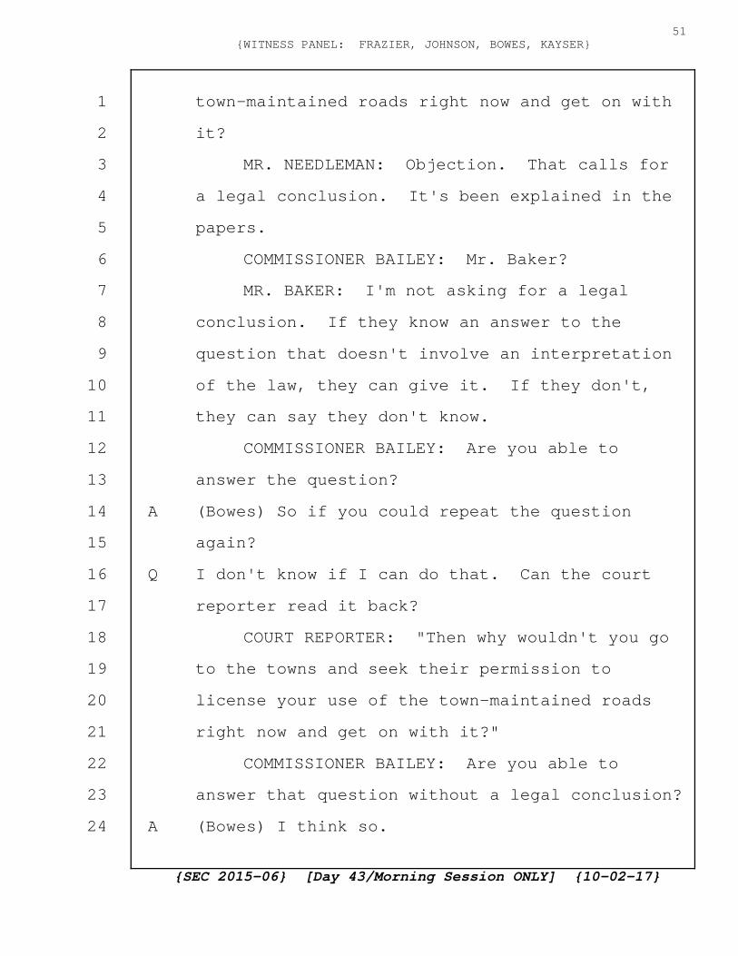
town-maintained roads right now and get on with
it?
MR. NEEDLEMAN: Objection. That calls for
a legal conclusion. It's been explained in the
papers.
COMMISSIONER BAILEY: Mr. Baker?
MR. BAKER: I'm not asking for a legal
conclusion. If they know an answer to the
question that doesn't involve an interpretation
of the law, they can give it. If they don't,
they can say they don't know.
COMMISSIONER BAILEY: Are you able to
answer the question?
A (Bowes) So if you could repeat the question
again?
Q I don't know if I can do that. Can the court
reporter read it back?
COURT REPORTER: "Then why wouldn't you go
to the towns and seek their permission to
license your use of the town-maintained roads
right now and get on with it?"
COMMISSIONER BAILEY: Are you able to
answer that question without a legal conclusion?
A (Bowes) I think so.
{SEC 2015-06} [Day 43/Morning Session ONLY] {10-02-17}
51{WITNESS PANEL: FRAZIER, JOHNSON, BOWES, KAYSER}
1
2
3
4
5
6
7
8
9
10
11
12
13
14
15
16
17
18
19
20
21
22
23
24

COMMISSIONER BAILEY: All right. You may
proceed.
A (Bowes) Because we believe the SEC process
should be followed in this case.
Q Thank you. That's on the record now.
Minor question arising from your testimony
on Friday, and I'm not sure who said it, but you
were talking about the need to cut scrub brush
or scrub bushes along the side of the road in
the White Mountain National Forest area that was
the subject matter of the question. Can you
tell me whether it was one of you that used that
language or did I mishear?
A (Johnson) That was me.
Q Okay. What did you mean by scrub brush?
A (Johnson) So I think we discussed that was four
inches or less diameter tree or shrub and any of
the weeds or any kind of growth along the side
of the road.
Q I think you also talked about the need to take
care not to take down ornamental trees and shade
trees.
A (Johnson) Correct.
Q How are you defining shade trees and ornamental
{SEC 2015-06} [Day 43/Morning Session ONLY] {10-02-17}
52{WITNESS PANEL: FRAZIER, JOHNSON, BOWES, KAYSER}
1
2
3
4
5
6
7
8
9
10
11
12
13
14
15
16
17
18
19
20
21
22
23
24

trees? Is there some reference that you look to
to make that definition?
A (Johnson) There's no specific reference, no.
Q Is there any process that the Applicants have
developed to seek the landowners' input who's
involved as to whether or not they consider
something to be scrub brush or ornamental tree
or a shade tree?
A (Johnson) I would say not directly. However,
there will be construction outreach as we get
further into the design effort that will discuss
or show potential impacts.
Q Assume that the outreach is done and the
landowner says that scrub brush is not scrub
brush. That's an ornamental tree, and I don't
want it removed.
A (Johnson) It would have to be evaluated on a
case-by-case basis.
Q Okay. What will the process be to evaluate
that?
A (Johnson) Are there alternatives of design where
we can potentially come up with an Exception
Request to go back into the road? Would the
DOT, understand the merit of that or evaluate
{SEC 2015-06} [Day 43/Morning Session ONLY] {10-02-17}
53{WITNESS PANEL: FRAZIER, JOHNSON, BOWES, KAYSER}
1
2
3
4
5
6
7
8
9
10
11
12
13
14
15
16
17
18
19
20
21
22
23
24

the merit of that?
Q All right. Do you know at this point who
statutorily has jurisdiction to determine
whether or not that tree gets removed or that
scrub brush gets removed, assuming that the
landowner objects? And the question is do you
know.
A (Johnson) I'm assuming the SEC does as part of
this process by approving the plans or by
delegating that authority to the DOT.
Q I'm going to end my questioning here, and by
ending it, I don't want you to assume I agree
with your response, but I understand it. Thank
you.
COMMISSIONER BAILEY: Thank you, Mr. Baker.
I understand, Ms. Fillmore, you don't have any
questions; is that correct? Thank you.
Ms. Saffo, you're up next.
MS. SAFFO: If we can have the ELMO turned
on, please?
MS. GAGNON: The ELMO is on.
(Discussion off the record)
COMMISSIONER BAILEY: Why don't we take a
ten-minute break now.
{SEC 2015-06} [Day 43/Morning Session ONLY] {10-02-17}
54{WITNESS PANEL: FRAZIER, JOHNSON, BOWES, KAYSER}
1
2
3
4
5
6
7
8
9
10
11
12
13
14
15
16
17
18
19
20
21
22
23
24

(Recess taken 10:23 - 10:38 a.m.)
COMMISSIONER BAILEY: Are you ready,
Ms. Saffo?
MS. SAFFO: I am. Thank you.
COMMISSIONER BAILEY: All right. You may
proceed.
CROSS-EXAMINATION
BY MS. SAFFO:
Q Good morning. I'm starting with Grafton Exhibit
now 43 which is 65 pages of the surveys. Do you
recognize at least the top page of that?
A (Johnson) Not a specific location, but, yes,
it's part of the survey report.
Q Okay. Thank you.
MR. IACOPINO: Did you say 43?
MS. SAFFO: Let me double-check. Yes.
Grafton 43.
BY MS. SAFFO:
Q And we all agreed that now you're redoing these
documents, correct? The surveys?
A (Johnson) Correct.
Q And so these are no longer accurate, correct?
A (Bowes) No. I don't believe that's correct.
Q Okay. So if these are accurate, why are you
{SEC 2015-06} [Day 43/Morning Session ONLY] {10-02-17}
55{WITNESS PANEL: FRAZIER, JOHNSON, BOWES, KAYSER}
1
2
3
4
5
6
7
8
9
10
11
12
13
14
15
16
17
18
19
20
21
22
23
24

redoing them?
A (Bowes) Do you want me to repeat what we went
over on Friday?
Q No, I understand, but for the purpose of lining
this question so we know where the next set of
question is going, fair to say you're redoing
them to confirm the centerline, correct?
A (Bowes) No.
Q Are the easements accurately noted on these
document, these 65 pages?
A (Bowes) Which easements?
Q The easement that you claim that you're able to,
whatever word you use, that you claim you're
able to construct on.
A (Bowes) Do you mean the DOT right-of-way?
Q Yes.
A (Bowes) So I think in most locations it is
accurate. We've been asked to provide
additional details including all the underlying
supporting documents.
Q So you're maintaining that what you have listed
on these documents as the DOT, I'll call it the
DOT right-of-way, my understanding is it's a
road prescriptive easement, but I'll put that
{SEC 2015-06} [Day 43/Morning Session ONLY] {10-02-17}
56{WITNESS PANEL: FRAZIER, JOHNSON, BOWES, KAYSER}
1
2
3
4
5
6
7
8
9
10
11
12
13
14
15
16
17
18
19
20
21
22
23
24

aside or the different kinds of easements, but
your understanding is that's accurately
reflected in this document?
A (Bowes) Yes, I think for the most part.
Q Okay. And, for example, for Route 116, you
primarily used a four-rod layout, correct?
A (Johnson) Correct.
Q Okay. And Mr. Palmer showed you a document
outlining a three-rod layout on Friday, correct?
A (Johnson) Correct.
Q And you'll look at that document in the future?
A (Johnson) Absolutely.
Q Okay. Now, in any event though, we're starting
the survey process, and it won't be ready for 6
to 8 weeks, correct?
A (Johnson) Five to 7 now but yes.
Q In the meantime, so your work with DOT is in
abeyance, correct?
A (Johnson) No. We continue to meet with the DOT
on a monthly basis and continue to have
discussions with them. They are reviewing a
document, the draft survey plan, if you will,
today, and we expect correspondence from them by
the end of today or tomorrow.
{SEC 2015-06} [Day 43/Morning Session ONLY] {10-02-17}
57{WITNESS PANEL: FRAZIER, JOHNSON, BOWES, KAYSER}
1
2
3
4
5
6
7
8
9
10
11
12
13
14
15
16
17
18
19
20
21
22
23
24

Q But you won't have the survey ready for 5 to 7
weeks, correct?
A (Johnson) Correct.
Q Okay. Exhibit 44.
Now, I'm now showing you what is known as
Grafton 44 which is the Conference Report from
the September 19th, 2017, minutes. Do you see
that?
A (Johnson) I do.
Q Were you present for that?
A (Johnson) I was.
Q Okay. And one of the things that it noted, I
put an arrow where I'm reading from, is using
existing and new research, right-of-way plans
will show a geometrically correct survey
centerline with stationing. The resulting
right-of-way determination from the research,
the station and offset to recovered monuments
and key right-of-way points and annotation of
the right-of-way basis with layout and record
plans used. Correct?
A (Johnson) Correct.
Q And the right-of-way survey plans will show
discrepancies between established right-of-way
{SEC 2015-06} [Day 43/Morning Session ONLY] {10-02-17}
58{WITNESS PANEL: FRAZIER, JOHNSON, BOWES, KAYSER}
1
2
3
4
5
6
7
8
9
10
11
12
13
14
15
16
17
18
19
20
21
22
23
24

location and other survey records such as deed
information to provide clarification if there
are questions between documents, correct?
A (Johnson) Correct.
Q And a survey report addendum would then be
issued explaining the process and providing the
above revised right-of-way plans, correct?
A (Johnson) Correct.
Q And when you complete that, will you be mailing
it to the individual landowners along the way as
part of your outreach?
A (Bowes) I don't believe so, no.
Q And why wouldn't you do that?
A (Bowes) It's the first request we've had for it.
Q Okay. So as the Grafton County Commissioners, I
would like to request that you mail those to all
the affected landowners along the way so the
Grafton County citizens are aware of what you're
claiming to be an ability to construct on land
that they may think is theirs. Can you consider
that as a request and do that?
A (Bowes) So I would consider it after the DOT
makes their determination.
Q And why wouldn't you want to tell these
{SEC 2015-06} [Day 43/Morning Session ONLY] {10-02-17}
59{WITNESS PANEL: FRAZIER, JOHNSON, BOWES, KAYSER}
1
2
3
4
5
6
7
8
9
10
11
12
13
14
15
16
17
18
19
20
21
22
23
24

landowners before DOT makes their determination
about what you're claiming is your ability to
impact their private property?
A (Bowes) I guess I would like to see the DOT's
records in confirmation of our survey. They
actually have the responsibility to determine
the DOT right-of-way, not the Applicant.
Q Well, yes, but the private landowners have a
right to look at what people are claiming is the
ability to dramatically impact their property,
correct?
A (Bowes) I don't know where that right exists.
Q Well, if we look at, this would be Grafton 32.
MR. IACOPINO: Before you go to them, can I
just ask a question, Ms. Saffo. This exhibit
that is on the screen right now is Exhibit 44?
MS. SAFFO: Yes. Grafton 44.
MR. IACOPINO: Is the report that last week
you gentlemen said you had not seen yet?
A (Johnson) Correct. It was published late on
Friday afternoon.
MR. IACOPINO: Okay. But you have seen it?
A (Johnson) I read it over the weekend, yes.
MR. IACOPINO: Thank you. Okay.
{SEC 2015-06} [Day 43/Morning Session ONLY] {10-02-17}
60{WITNESS PANEL: FRAZIER, JOHNSON, BOWES, KAYSER}
1
2
3
4
5
6
7
8
9
10
11
12
13
14
15
16
17
18
19
20
21
22
23
24

MS. SAFFO: I obtained it from the website,
the DOT Northern Pass website.
MR. IACOPINO: Thank you.
BY MS. SAFFO:
Q So this is the Declaration of Purpose for New
Hampshire RSA 162-H:1. And it says, "The
legislature recognizes that selection of sites
for energy facilities may have significant
impacts on and benefits to the following." And
the second one in is private property, correct?
It starts with welfare of the population? And
the very next one is private property?
A (Bowes) Yes.
Q So certainly the impacts on private property is
something this Committee wants to hear about,
correct?
A (Bowes) I don't know this document. It's the
first time I've ever seen it so I don't know if
it delegates jurisdictional responsibility to
the SEC or not.
Q I don't think it's the first time you've seen it
because I used it as Grafton 32, and we
discussed it during the last time I was in front
of this Panel, but this is New Hampshire law of
{SEC 2015-06} [Day 43/Morning Session ONLY] {10-02-17}
61{WITNESS PANEL: FRAZIER, JOHNSON, BOWES, KAYSER}
1
2
3
4
5
6
7
8
9
10
11
12
13
14
15
16
17
18
19
20
21
22
23
24
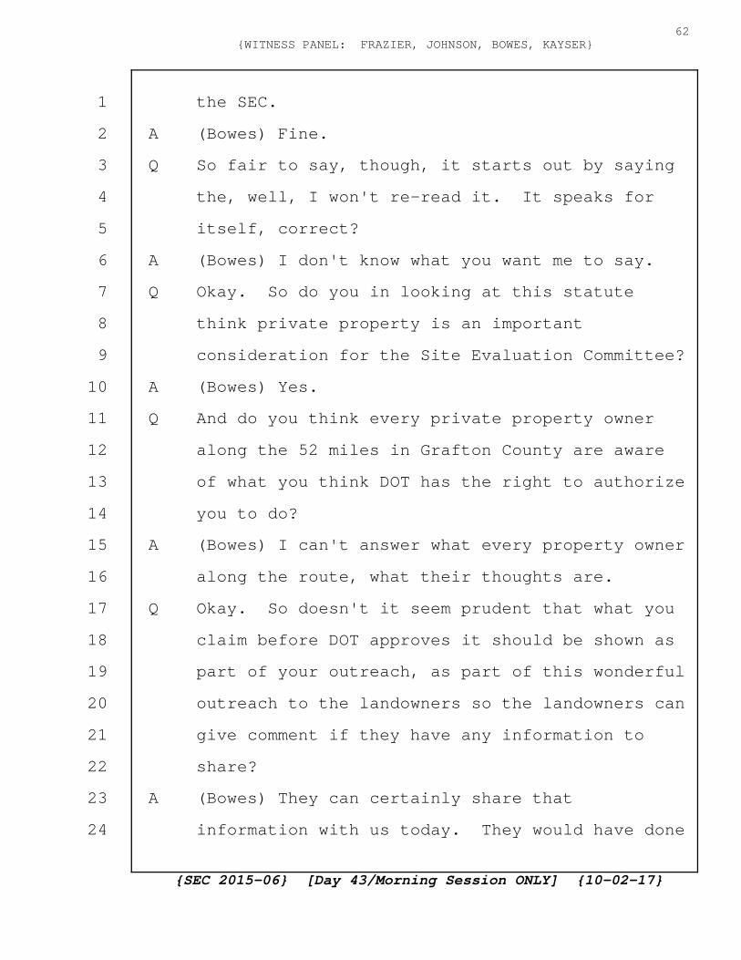
the SEC.
A (Bowes) Fine.
Q So fair to say, though, it starts out by saying
the, well, I won't re-read it. It speaks for
itself, correct?
A (Bowes) I don't know what you want me to say.
Q Okay. So do you in looking at this statute
think private property is an important
consideration for the Site Evaluation Committee?
A (Bowes) Yes.
Q And do you think every private property owner
along the 52 miles in Grafton County are aware
of what you think DOT has the right to authorize
you to do?
A (Bowes) I can't answer what every property owner
along the route, what their thoughts are.
Q Okay. So doesn't it seem prudent that what you
claim before DOT approves it should be shown as
part of your outreach, as part of this wonderful
outreach to the landowners so the landowners can
give comment if they have any information to
share?
A (Bowes) They can certainly share that
information with us today. They would have done
{SEC 2015-06} [Day 43/Morning Session ONLY] {10-02-17}
62{WITNESS PANEL: FRAZIER, JOHNSON, BOWES, KAYSER}
1
2
3
4
5
6
7
8
9
10
11
12
13
14
15
16
17
18
19
20
21
22
23
24

outreach to them. If they have records, as I
think Mr. Palmer shared with us, we'd certainly
welcome that as part our design.
Q Mr. Bowes, last time I was with you we talked
about the outreach to the citizens who did
respond to your letter, didn't we?
A (Bowes) We may have.
Q Well, we did. And what we talked about was how
some citizens did respond to your letters. In
case you don't recall what you said last time,
do you recall that some citizens did respond to
your letters, correct?
A (Bowes) Yes.
Q And you met with those citizens, correct?
A (Bowes) Some of them I'm sure we did.
Q And some of them when you met with them when
this Project began, fair to say you told them
that the Project would be under the roadway,
correct?
A (Bowes) Probably, yes.
Q And so they were under the impression that the
Project was under the roadway, correct?
A (Bowes) We discussed this quite extensively on
Friday as well.
{SEC 2015-06} [Day 43/Morning Session ONLY] {10-02-17}
63{WITNESS PANEL: FRAZIER, JOHNSON, BOWES, KAYSER}
1
2
3
4
5
6
7
8
9
10
11
12
13
14
15
16
17
18
19
20
21
22
23
24

Q Um-hum. No, I know. I spoke to people to make
sure -- never mind. Okay.
Now, the accurate, an accurate centerline
is vital, correct? We can agree on that?
A (Bowes) Certainly.
Q And it's particularly vital because regardless
of what people think is the appropriate layout
of the road, in many cases you count from the
centerline how many feet you can go over,
correct?
A (Bowes) Go over for what?
Q Well, for the, like, for example, if you're
claiming a four-rod layout, you use the
centerline as your starting point of reference,
correct?
A (Bowes) I would say we'd use the outside as our
starting point of reference.
Q The outside of what?
A (Bowes) Outside of the right-of-way.
Q Okay. So how do you determine the outside of
the right-of-way?
A (Bowes) Based upon the survey and the property
records.
Q And what does the survey in the property records
{SEC 2015-06} [Day 43/Morning Session ONLY] {10-02-17}
64{WITNESS PANEL: FRAZIER, JOHNSON, BOWES, KAYSER}
1
2
3
4
5
6
7
8
9
10
11
12
13
14
15
16
17
18
19
20
21
22
23
24
use as their starting point of reference?
A (Bowes) The historic documents that are
available. The DOT plans.
Q Okay. Fair to say the right-of-way is a
reasonable detail to have accurate, correct?
A (Bowes) Yes.
Q Fair to say a centerline is a reasonable detail
to have accurate, correct?
A (Bowes) I've already responded yes to that.
Q Now, turning to the right-of-way plans, is it
accurate to say that the Northern Pass is
proposing that New Hampshire DOT right-of-way
plans, applicable Commissioner's return of
layouts, historic layout records, current
landowner deed references to monuments, and
other record plans referenced in the deeds would
be used to establish the right-of-way?
A (Bowes) Yes. Mr. Johnson covered that
extensively on Friday.
Q And reading from the September minutes, revised
right-of-way survey plans will be submitted in
segments for the Department review through Ms.
Estaburg with copies to the Bureau of Right of
Way; is that still correct?
{SEC 2015-06} [Day 43/Morning Session ONLY] {10-02-17}
65{WITNESS PANEL: FRAZIER, JOHNSON, BOWES, KAYSER}
1
2
3
4
5
6
7
8
9
10
11
12
13
14
15
16
17
18
19
20
21
22
23
24

A (Johnson) Correct.
Q And the Northern Pass will highlight or note
areas of concern for more detailed Department
review, correct?
A (Johnson) Correct.
Q And the Department anticipates 1 to 2 weeks to
review a segment. That's your understanding of
what they told you at the meeting?
A (Johnson) Correct.
Q So how many segments do you anticipate?
A (Johnson) Upwards of 12.
Q So it's 5 to 7 weeks to get them the survey
plans, and then if there's 12 segments, between
12 and 24 weeks for DOT to review those
segments, correct?
A (Johnson) Correct.
Q So that would put us, so we're October 1st now,
to the end of January, correct? That's
conservatively because that's if we're just
saying 12 weeks instead of the 24 weeks to
review.
A (Johnson) So the submittal process will occur on
a rolling basis as the survey information comes
in from the field. So the first submittal is
{SEC 2015-06} [Day 43/Morning Session ONLY] {10-02-17}
66{WITNESS PANEL: FRAZIER, JOHNSON, BOWES, KAYSER}
1
2
3
4
5
6
7
8
9
10
11
12
13
14
15
16
17
18
19
20
21
22
23
24

expected to be next week for this segment
review.
Q So if the first segment's available for review
next week, can you post that on the Northern
Pass site for all of us to review it?
A (Johnson) Possibly, yes. I don't see why not.
The DOT is going to post it to their website as
they do --
Q Next week the first week will be posted?
A (Johnson) As they do for all submittals, yes.
Q Then if we start getting them next week, we're
looking at 12 to 24 weeks from next week to get
through all these documents, correct?
A (Johnson) Which would put us into the December,
yes.
Q End of December because October, November,
December, if we're at the one-week mark, not if
we're at the two week mark, correct?
A (Johnson) Correct.
Q And if it takes two weeks, we're all the way
into the end of March, correct?
A (Johnson) If they take two weeks, yes.
Q So as each segment becomes available, as part of
your outreach can you mail it to the landowners
{SEC 2015-06} [Day 43/Morning Session ONLY] {10-02-17}
67{WITNESS PANEL: FRAZIER, JOHNSON, BOWES, KAYSER}
1
2
3
4
5
6
7
8
9
10
11
12
13
14
15
16
17
18
19
20
21
22
23
24
so they can review it?
A (Bowes) I think you've already asked us that and
we said we'd consider that.
Q I'm trying to get a sense of the public outreach
because it's something that Northern Pass
Transmission is wanting the people along the
underground route to rely on. So that's why
this is an important question. I'm being told
maybe. Is there any reason why you can't
provide an answer to that?
A (Bowes) I think I have answered.
Q You've answered maybe.
A (Bowes) I've answered we'd consider that.
Q You'd consider it.
A (Bowes) After the DOT has ruled on it.
Q So you want the DOT to rule on it with your
input but not the landowners' input?
A (Bowes) I think I've answered that as well. We
welcome the landowners' input.
Q So you want the landowners to give you input and
then you'll take the landowners' input into
account, you'll decide how to put it in the
report to DOT, and then DOT would make a
determination on your report without the
{SEC 2015-06} [Day 43/Morning Session ONLY] {10-02-17}
68{WITNESS PANEL: FRAZIER, JOHNSON, BOWES, KAYSER}
1
2
3
4
5
6
7
8
9
10
11
12
13
14
15
16
17
18
19
20
21
22
23
24

landowners' direct input?
MR. NEEDLEMAN: Objection. This has been
asked and answered, and these are also public
documents that anyone can review and anyone can
comment on.
COMMISSIONER BAILEY: Ms. Saffo?
MS. SAFFO: I don't think it's asked or
answered because, quite frankly, there is
probably 70,000 pages of public documents, and
to expect a citizen along a road for 52 miles to
be able to wade through all this information and
find a document that is vital to their
particular land when we're being told public
outreach is a vital part of this process, I
think the question is fair and needs to be asked
and answered as opposed to we've already
answered it.
COMMISSIONER BAILEY: Are you asking them
if they would provide a copy of the documents on
a specific property owner's, the document that
applies to the specific property owner to the
property owner?
MS. SAFFO: Exactly. I think segment 1
should go to the segment 1 property owners.
{SEC 2015-06} [Day 43/Morning Session ONLY] {10-02-17}
69{WITNESS PANEL: FRAZIER, JOHNSON, BOWES, KAYSER}
1
2
3
4
5
6
7
8
9
10
11
12
13
14
15
16
17
18
19
20
21
22
23
24
Segment 2 can go to the segment 2 property
owners.
COMMISSIONER BAILEY: Did you understand
that was the question?
A (Bowes) Well, she added a whole bunch of other
things in that question of what we should be
doing.
COMMISSIONER BAILEY: Why don't you try to
rephrase it.
BY MS. SAFFO:
Q Can Northern Pass provide the segment 1
documents to the segment 1 landowners when you
submit it to DOT?
A (Bowes) I said we would consider providing it to
the landowners once DOT has ruled on it.
Q And why do you want to have DOT rule on it
without the public's input first?
A (Bowes) I didn't say that.
Q Why would you agree to a process that would have
DOT rendering a decision before the public knows
that this document is out there about their
personal property?
A (Bowes) I didn't say that either.
Q Okay. Why are you only considering this request
{SEC 2015-06} [Day 43/Morning Session ONLY] {10-02-17}
70{WITNESS PANEL: FRAZIER, JOHNSON, BOWES, KAYSER}
1
2
3
4
5
6
7
8
9
10
11
12
13
14
15
16
17
18
19
20
21
22
23
24

instead of doing it?
A (Bowes) Because I don't know the scope and scale
of the request yet.
Q The scope and scale of the request is when you
create a survey for DOT for segment 1, please
mail it to the people along segment 1.
A (Bowes) I don't understand what the requirements
to do that would be so that's why I say we would
consider it. I said we'd consider it after the
DOT has ruled on it.
Q So I'm not talking about legal requirements.
I'm talking about just as part of your public
outreach. Why wouldn't you mail a copy of what
you consider to be the segment 1 accurate
right-of-way survey to the individuals on the
segment 1 right-of-way survey as part of your
public outreach so those citizens, if they have
additional information for DOT to consider, can
provide it to DOT for their consideration prior
to DOT making their decision?
A (Bowes) So I would say same as I've said in the
past. I said we would consider it. And there's
nothing preventing those private citizens from
providing either the Applicant, or if they
{SEC 2015-06} [Day 43/Morning Session ONLY] {10-02-17}
71{WITNESS PANEL: FRAZIER, JOHNSON, BOWES, KAYSER}
1
2
3
4
5
6
7
8
9
10
11
12
13
14
15
16
17
18
19
20
21
22
23
24
choose not to provide it to us, to provide that
information to DOT today.
Q But you're in charge of public outreach, and
you're the one who's talking about your goals to
do public outreach.
A (Bowes) I haven't talked about public outreach
as part of this testimony this morning.
Q Okay. So now when you submitted your
Application, the design plan submitted had no
impact on adjoining landowners because the plan
was to put the lines under the roadway, correct?
I know this is asked and answered. I'm trying
to get through this quickly.
A (Bowes) So we covered this extensively with
other questioners on Friday.
Q I know.
A (Bowes) Would you like me to repeat the answer?
Q Yes.
A (Bowes) What was the question? Have we thought
that, the original plan showed much of the
alignment within the roadway. That is correct.
Q And when you had your community outreach and you
talked to the people who responded to your
letters, you didn't say it was up in the air.
{SEC 2015-06} [Day 43/Morning Session ONLY] {10-02-17}
72{WITNESS PANEL: FRAZIER, JOHNSON, BOWES, KAYSER}
1
2
3
4
5
6
7
8
9
10
11
12
13
14
15
16
17
18
19
20
21
22
23
24
You said this was the plan, correct?
A (Bowes) So we covered this on Friday. Would you
like me to repeat the answer?
Q Yes. I would.
COMMISSIONER BAILEY: Just so yes or no,
please.
A (Bowes) So we showed plans that had it within
the roadway.
Q And so it's fair to say you submitted plans for
52 miles that you knew violated the UAM,
Utilities Accommodation Manual.
A (Bowes) On Friday we talked at length about a
letter that went to the DOT Commissioner in
October of 2015.
Q Yes.
A (Bowes) That outlined our concerns and a general
Exception Request to the Utility Accommodation
Manual. It was filed as part of our Application
to the SEC. I believe it's Appendix Number 9.
Q Yes. And the 30,000 pages in your Application,
correct, and that's the document in front of you
right now?
A (Bowes) I don't know how many pages that were
part of the Application, but it definitely was
{SEC 2015-06} [Day 43/Morning Session ONLY] {10-02-17}
73{WITNESS PANEL: FRAZIER, JOHNSON, BOWES, KAYSER}
1
2
3
4
5
6
7
8
9
10
11
12
13
14
15
16
17
18
19
20
21
22
23
24
part of the Application.
Q That number, the number on the bottom here, do
you recognize that number, the Bate number right
here?
A (Bowes) I do not.
Q So NPT for Northern Pass Transmission, DIS
30067.
A (Bowes) It wasn't on the version I was looking
at.
Q And this issue wasn't resolved before filing the
Application, and it's still not resolved now,
correct?
A (Bowes) Which issue is that?
Q That what exception, where you're going to
exactly bury the line, where you're digging the
hole.
A (Bowes) So, again, along the underground route
portion?
Q Yes.
A (Bowes) So we have filed plans with the DOT,
we're working through an iterative process with
Exception Requests to satisfy both the Utility
Accommodation Manual and any environmental or
aesthetic impacts that would impact the Project.
{SEC 2015-06} [Day 43/Morning Session ONLY] {10-02-17}
74{WITNESS PANEL: FRAZIER, JOHNSON, BOWES, KAYSER}
1
2
3
4
5
6
7
8
9
10
11
12
13
14
15
16
17
18
19
20
21
22
23
24
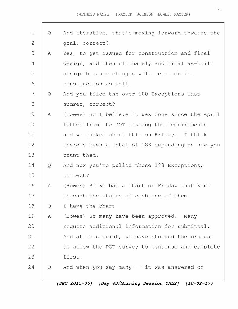
Q And iterative, that's moving forward towards the
goal, correct?
A Yes, to get issued for construction and final
design, and then ultimately and final as-built
design because changes will occur during
construction as well.
Q And you filed the over 100 Exceptions last
summer, correct?
A (Bowes) So I believe it was done since the April
letter from the DOT listing the requirements,
and we talked about this on Friday. I think
there's been a total of 188 depending on how you
count them.
Q And now you've pulled those 188 Exceptions,
correct?
A (Bowes) So we had a chart on Friday that went
through the status of each one of them.
Q I have the chart.
A (Bowes) So many have been approved. Many
require additional information for submittal.
And at this point, we have stopped the process
to allow the DOT survey to continue and complete
first.
Q And when you say many -- it was answered on
{SEC 2015-06} [Day 43/Morning Session ONLY] {10-02-17}
75{WITNESS PANEL: FRAZIER, JOHNSON, BOWES, KAYSER}
1
2
3
4
5
6
7
8
9
10
11
12
13
14
15
16
17
18
19
20
21
22
23
24

Friday. Never mind. Okay. Now, that is an
important point because I'd like to switch over
to the computer screen, please.
So I'll represent that this is Google maps,
okay, so it's like Google maps that anybody can
pull up on the internet, and we tried to outline
the various Exceptions as they impacted Grafton
County, and using our best ability which was
generally a road, street number, marked all the
different Exceptions, correct? Well, you can't
say exactly what this is. So I appreciate the
Exceptions and appreciate trying to track them
and that's part of the reason why we're back
here today, correct?
A (Bowes) I think it was for other reasons. I
don't think it's to track the Exception
Requests.
Q I'd like to go up to, for example, just take 125
as an example. While that's being called up, if
you're a landowner and there's an Exception
Request on your property or near your property,
you're at least an adjoining landowner, do you
think it's important for that landowner to know
about this Exception Request involving their
{SEC 2015-06} [Day 43/Morning Session ONLY] {10-02-17}
76{WITNESS PANEL: FRAZIER, JOHNSON, BOWES, KAYSER}
1
2
3
4
5
6
7
8
9
10
11
12
13
14
15
16
17
18
19
20
21
22
23
24

land?
A (Bowes) I think once the final design is
complete, yes.
Q So as part of your outreach to the public, you
don't want them to be able to provide their
input before the final design is created,
correct?
A (Bowes) I know we've covered this a couple times
already. We'll welcome their input, and they
can go, either go to us. If they choose not to,
they can go directly to the DOT.
Q And as part of soliciting their input that you
welcome so much, have you sent the people who
have one of these 188 Exceptions involving their
property, have you sent them a copy of the
Exception?
A (Bowes) Not until they're ruled upon. We have
not.
Q So you want them to be ruled upon and a final
decision to be made before the public has an
opportunity to provide input on it.
A (Bowes) I didn't say that.
Q You expect the public to weed through 188
Exceptions to see if their land is somehow
{SEC 2015-06} [Day 43/Morning Session ONLY] {10-02-17}
77{WITNESS PANEL: FRAZIER, JOHNSON, BOWES, KAYSER}
1
2
3
4
5
6
7
8
9
10
11
12
13
14
15
16
17
18
19
20
21
22
23
24

involved in the process on their own accord,
correct?
A (Bowes) I didn't say that either.
Q How else would you expect the public to learn
that there's an exception involving land that
involves them?
A (Bowes) So they can reach out to the Project at
any time.
Q So how do you expect them to know? You expect
them to call you and ask you?
A (Bowes) I didn't say that.
Q You said they could reach out to the Project at
any time, correct?
A (Bowes) Yes.
Q And citizens did that, correct?
A (Bowes) Yes.
Q And when they reached out to you --
A (Bowes) And continue to do so.
Q When the citizens reached out to you and you
told them that it was under the roadway, how do
you expect them to know to keep reaching back
out to you to say oh, was what you told us
before still correct?
A (Bowes) Most of the Exception Requests deal or
{SEC 2015-06} [Day 43/Morning Session ONLY] {10-02-17}
78{WITNESS PANEL: FRAZIER, JOHNSON, BOWES, KAYSER}
1
2
3
4
5
6
7
8
9
10
11
12
13
14
15
16
17
18
19
20
21
22
23
24
discuss going back into the roadway.
Q I realize that. But it also meant that if the
exception isn't granted, they're going back out
of the roadway and that would be into somebody's
adjoining land, correct?
A (Bowes) Not necessarily.
Q Of all These 188 Exceptions, if you're not
granted the exception, is a possibility going
into the adjoining landowners' land?
A (Bowes) Within the DOT right-of-way on the
shoulder, in the ditch line, yes.
Q So again, in the beginning people reached out to
you which is what you're saying they need to do,
correct?
A (Bowes) I understand the question. I believe
I've answered this question.
Q I don't believe you have in the context of the
Exceptions. So people have reached out to you,
you told them information which is that it would
be under the road and not to worry about their
land, correct?
A (Bowes) Let's use a specific example. Not a
hypothetical. Is there a specific land owner we
can talk through?
{SEC 2015-06} [Day 43/Morning Session ONLY] {10-02-17}
79{WITNESS PANEL: FRAZIER, JOHNSON, BOWES, KAYSER}
1
2
3
4
5
6
7
8
9
10
11
12
13
14
15
16
17
18
19
20
21
22
23
24

Q I don't want to put any individual landowners on
the front line on this, but you have told me the
last time you testified that Northern Pass did
tell landowners not to worry, it was under the
road. That's what you said to them when they
reached out to you and when they asked about
their private property. They were told it was
going under the road.
A (Bowes) So I agree with the last part of your
statement but not the first part.
Q Okay. Do you agree that landowners reached
out -- we're going to take it again one step at
a time. Do you agree that landowners reached
out to you in response to your letters?
A Some did, yes.
Q And of the some, do you agree that you told them
it was going to be under the road?
A (Bowes) At the time when we talked with them,
the existing design as submitted to the DOT was
under the road.
Q Did you tell them that that existing design that
was submitted to DOT violated the Utilities
Accommodation Manual so you needed permission to
keep it under the road?
{SEC 2015-06} [Day 43/Morning Session ONLY] {10-02-17}
80{WITNESS PANEL: FRAZIER, JOHNSON, BOWES, KAYSER}
1
2
3
4
5
6
7
8
9
10
11
12
13
14
15
16
17
18
19
20
21
22
23
24

A (Bowes) I don't know if we did or not.
Q And then having had that conversation with them,
told them what the existing plans showed, which
was going to be under the road, having left that
conversation, walked away from that landowner,
when the plans changed, did you go back to those
people and tell them that you were not allowed
to go a hundred percent under the road?
A (Bowes) So we've had a very public process with
the DOT.
Q No. My question is not about your public
process. It's the people who reached out to you
who you met with who you told, gave information
to, did you go back to those people and explain
that the information you gave to them was no
longer accurate?
A (Bowes) I don't know.
Q Now, one area that's a significant project is
the microtunnel at Gale River, correct?
A (Bowes) I would say it's a significant part of
the Project.
Q Yes. And it's a significant Project in its own
accord, correct?
A (Bowes) Maybe you could better define what you
{SEC 2015-06} [Day 43/Morning Session ONLY] {10-02-17}
81{WITNESS PANEL: FRAZIER, JOHNSON, BOWES, KAYSER}
1
2
3
4
5
6
7
8
9
10
11
12
13
14
15
16
17
18
19
20
21
22
23
24
mean by a Project then.
Q Well, drilling under a major river is a
significant endeavor in a community, correct?
A (Bowes) Yes. I would agree with that.
Q Okay. Now, it initially started as an HDD and
then it became a microtunnel, correct?
A (Bowes) That is the latest design, yes,
submitted to the DOT.
Q And now we're being told that it might become an
HDD after all, correct?
A (Bowes) So our constructor and the DOT have had
conversations, and they believe they may have a
viable alternative. It has not been submitted
yet to the DOT.
Q Now, exactly what you do at that location,
that's a significant location to the town of
Franconia, correct? Will you agree to at least
that?
A (Bowes) I believe it is. Yes.
Q It's smack-dab in the middle of their downtown,
correct?
A (Bowes) So I think it's to the south of the
downtown area, but it's clearly a major
intersection within the town.
{SEC 2015-06} [Day 43/Morning Session ONLY] {10-02-17}
82{WITNESS PANEL: FRAZIER, JOHNSON, BOWES, KAYSER}
1
2
3
4
5
6
7
8
9
10
11
12
13
14
15
16
17
18
19
20
21
22
23
24
Q Right off the highway exit. So how long you're
there and what you do at that location impacts
the other concerns for the SEC, correct?
A (Bowes) Are you referring to traffic management?
Q Certainly traffic management. But also it would
impact the economics of the town of Franconia,
correct?
A (Bowes) I'm probably not the best witness to
answer that, but I could see how it might.
Q Okay. Now, I want to give you just an example.
I know you just had some so I don't want to
rehash what you had on Friday, but this is the
Exception Request for 125. Numbered 125. And
this is on Route 116. Do you recognize that
area at all?
A (Bowes) Generally, yes.
Q And so you have the entrance area. Which side
is the entrance area? The top of the screen or
the bottom of the screen?
A (Bowes) I'm sorry. The entrance area of the
roadway?
Q No, for the HDD pit.
A (Bowes) Hold on just a sec. We'll pull up the
Exception.
{SEC 2015-06} [Day 43/Morning Session ONLY] {10-02-17}
83{WITNESS PANEL: FRAZIER, JOHNSON, BOWES, KAYSER}
1
2
3
4
5
6
7
8
9
10
11
12
13
14
15
16
17
18
19
20
21
22
23
24
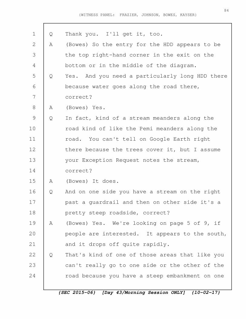
Q Thank you. I'll get it, too.
A (Bowes) So the entry for the HDD appears to be
the top right-hand corner in the exit on the
bottom or in the middle of the diagram.
Q Yes. And you need a particularly long HDD there
because water goes along the road there,
correct?
A (Bowes) Yes.
Q In fact, kind of a stream meanders along the
road kind of like the Pemi meanders along the
road. You can't tell on Google Earth right
there because the trees cover it, but I assume
your Exception Request notes the stream,
correct?
A (Bowes) It does.
Q And on one side you have a stream on the right
past a guardrail and then on other side it's a
pretty steep roadside, correct?
A (Bowes) Yes. We're looking on page 5 of 9, if
people are interested. It appears to the south,
and it drops off quite rapidly.
Q That's kind of one of those areas that like you
can't really go to one side or the other of the
road because you have a steep embankment on one
{SEC 2015-06} [Day 43/Morning Session ONLY] {10-02-17}
84{WITNESS PANEL: FRAZIER, JOHNSON, BOWES, KAYSER}
1
2
3
4
5
6
7
8
9
10
11
12
13
14
15
16
17
18
19
20
21
22
23
24
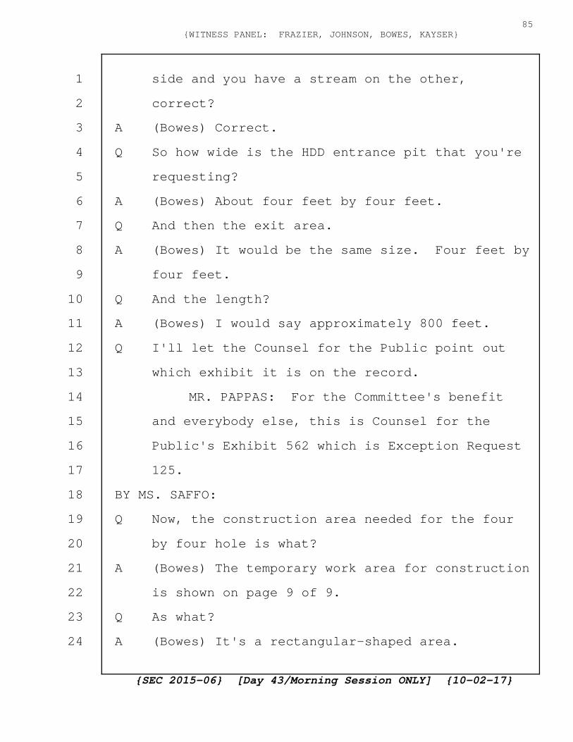
side and you have a stream on the other,
correct?
A (Bowes) Correct.
Q So how wide is the HDD entrance pit that you're
requesting?
A (Bowes) About four feet by four feet.
Q And then the exit area.
A (Bowes) It would be the same size. Four feet by
four feet.
Q And the length?
A (Bowes) I would say approximately 800 feet.
Q I'll let the Counsel for the Public point out
which exhibit it is on the record.
MR. PAPPAS: For the Committee's benefit
and everybody else, this is Counsel for the
Public's Exhibit 562 which is Exception Request
125.
BY MS. SAFFO:
Q Now, the construction area needed for the four
by four hole is what?
A (Bowes) The temporary work area for construction
is shown on page 9 of 9.
Q As what?
A (Bowes) It's a rectangular-shaped area.
{SEC 2015-06} [Day 43/Morning Session ONLY] {10-02-17}
85{WITNESS PANEL: FRAZIER, JOHNSON, BOWES, KAYSER}
1
2
3
4
5
6
7
8
9
10
11
12
13
14
15
16
17
18
19
20
21
22
23
24
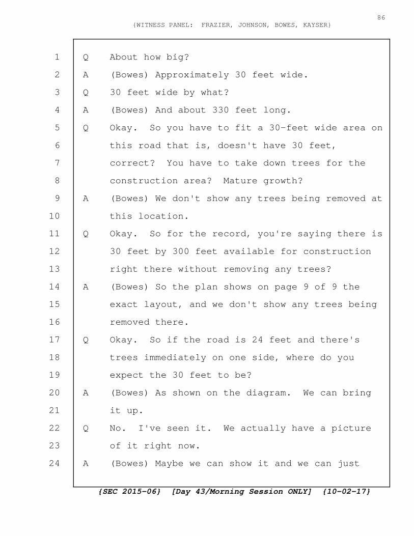
Q About how big?
A (Bowes) Approximately 30 feet wide.
Q 30 feet wide by what?
A (Bowes) And about 330 feet long.
Q Okay. So you have to fit a 30-feet wide area on
this road that is, doesn't have 30 feet,
correct? You have to take down trees for the
construction area? Mature growth?
A (Bowes) We don't show any trees being removed at
this location.
Q Okay. So for the record, you're saying there is
30 feet by 300 feet available for construction
right there without removing any trees?
A (Bowes) So the plan shows on page 9 of 9 the
exact layout, and we don't show any trees being
removed there.
Q Okay. So if the road is 24 feet and there's
trees immediately on one side, where do you
expect the 30 feet to be?
A (Bowes) As shown on the diagram. We can bring
it up.
Q No. I've seen it. We actually have a picture
of it right now.
A (Bowes) Maybe we can show it and we can just
{SEC 2015-06} [Day 43/Morning Session ONLY] {10-02-17}
86{WITNESS PANEL: FRAZIER, JOHNSON, BOWES, KAYSER}
1
2
3
4
5
6
7
8
9
10
11
12
13
14
15
16
17
18
19
20
21
22
23
24
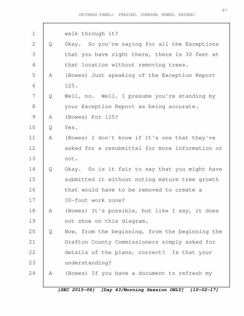
walk through it?
Q Okay. So you're saying for all the Exceptions
that you have right there, there is 30 feet at
that location without removing trees.
A (Bowes) Just speaking of the Exception Report
125.
Q Well, no. Well, I presume you're standing by
your Exception Report as being accurate.
A (Bowes) For 125?
Q Yes.
A (Bowes) I don't know if it's one that they've
asked for a resubmittal for more information or
not.
Q Okay. So is it fair to say that you might have
submitted it without noting mature tree growth
that would have to be removed to create a
30-foot work zone?
A (Bowes) It's possible, but like I say, it does
not show on this diagram.
Q Now, from the beginning, from the beginning the
Grafton County Commissioners simply asked for
details of the plans, correct? Is that your
understanding?
A (Bowes) If you have a document to refresh my
{SEC 2015-06} [Day 43/Morning Session ONLY] {10-02-17}
87{WITNESS PANEL: FRAZIER, JOHNSON, BOWES, KAYSER}
1
2
3
4
5
6
7
8
9
10
11
12
13
14
15
16
17
18
19
20
21
22
23
24

memory, I'll be glad to look at it.
Q Well, are you aware they attended public
hearings?
A (Bowes) Specifically, no.
Q I'm showing you what will be Grafton 47. I
apologize. This is a re-mark. It might have
been marked earlier, but if we could switch --
thank you.
These are the Interrogatories by the
Grafton County Commissioners, and this is the
very first request.
"Please provide any and all surveys, plans,
communications, and engineering documents
current at the time of the Applicant Response
which detail the planned specific path of the
buried lines in quantified relation to the
current road, sidewalks, and buildings
(including the location of the splice pits,
specific distances and depths of the line)
within Grafton County, including information
regarding the extent of interference with and
plans for mitigation of said interference with
existing infrastructure."
Do you see that?
{SEC 2015-06} [Day 43/Morning Session ONLY] {10-02-17}
88{WITNESS PANEL: FRAZIER, JOHNSON, BOWES, KAYSER}
1
2
3
4
5
6
7
8
9
10
11
12
13
14
15
16
17
18
19
20
21
22
23
24

A (Bowes) Yes.
Q And the last line, it is expected that the
detailed design will be completed by late 2016
or early 2017. Do you see that?
A (Bowes) I do.
Q Are you aware of the many pleadings where
Grafton County said let's suspend the process
until we get better plans? Has that been
brought to your attention?
A (Bowes) I know that I've seen one motion that
was filed that's the subject of why we're here
today.
Q Okay. And would it surprise you that prior to
that we said can we just hold things in abeyance
until we get better designs and as soon as we
get better designs we can start right up again?
MR. NEEDLEMAN: Objection. How does this
relate at all to the subject of the order
recalling these witnesses?
COMMISSIONER BAILEY: Ms. Saffo?
MS. SAFFO: I'm setting up the next
question which is how does the Grafton County
Commissioners evaluate the impact on the
communities if they don't know this information.
{SEC 2015-06} [Day 43/Morning Session ONLY] {10-02-17}
89{WITNESS PANEL: FRAZIER, JOHNSON, BOWES, KAYSER}
1
2
3
4
5
6
7
8
9
10
11
12
13
14
15
16
17
18
19
20
21
22
23
24

COMMISSIONER BAILEY: Why don't you just
ask that question.
BY MS. SAFFO:
Q So how does the Grafton County Commissioners
evaluate the impact on their communities if they
don't have a plan that shows them where things
are going to be buried?
A (Bowes) So we have submitted a plan that was
deemed complete by the SEC. We continue to work
with the DOT, receive their conditions. It will
be an iterative process as we go back and forth
dealing with Exceptions or, as I mentioned
before, when we find things during construction,
there will have to be modifications to the plan
made. Holding a certificate for final detailed
design engineering is not a part of the process
that I'm aware of in any state. It's not part
of the process here in New Hampshire either.
So going forward with an approval with a
layout is what's required in most jurisdictions,
and then you delegate that responsibility and,
obviously, in this case the New Hampshire DOT is
doing a very thorough job in reviewing our
plans, finding discrepancies, providing
{SEC 2015-06} [Day 43/Morning Session ONLY] {10-02-17}
90{WITNESS PANEL: FRAZIER, JOHNSON, BOWES, KAYSER}
1
2
3
4
5
6
7
8
9
10
11
12
13
14
15
16
17
18
19
20
21
22
23
24

solutions, that would ease both use of the road
as well as customer impacts. I think you can
rest assured that the New Hampshire DOT is doing
a thorough job in reviewing our plans.
Q So Grafton Exhibit 45, this is from the DOT
Northern Pass website, and, absolutely, I don't
think anybody would dispute that the DOT is
doing a good job getting through this material.
However, where I've underlined it, they write
their second role. The first is a member of the
Committee to decide whether or not a new energy
facility will be permitted. Do you see that?
And then it goes on to say the second role is as
a state agency that has permitting or other
regulatory authority but only, and please note
the word only there, as it relates to the
proposed Project and impacts to transportation
assets. Do you see that?
A (Bowes) Yes, I do.
Q And that makes sense. DOT does transportation.
That's their bailiwick. That's their expertise,
correct?
A (Bowes) Yes, it is.
Q But Northern Pass is so much more than
{SEC 2015-06} [Day 43/Morning Session ONLY] {10-02-17}
91{WITNESS PANEL: FRAZIER, JOHNSON, BOWES, KAYSER}
1
2
3
4
5
6
7
8
9
10
11
12
13
14
15
16
17
18
19
20
21
22
23
24
transportation, and I was going to say just
transportation, but transportation is a huge
deal, and an important deal so to put the word
just in front of it is not correct. Northern
Pass has to deal, the Site Evaluation Committee
has to deal with things that transportation
doesn't deal with. They have to deal with the
welfare of the population, correct?
MR. NEEDLEMAN: Objection. Same argument.
I don't see how this relates to the subject of
the recall.
COMMISSIONER BAILEY: Ms. Saffo?
MS. SAFFO: Yes. The subject of the recall
is the design keeps changing and the plans keep
changing and I've got the order. As I
understand it. Now we've got Exceptions but now
the Exceptions have been withdrawn, and then
we're told they're going to be redrafted and now
we're being told since the order was issued or
least since the motion was filed that the
surveys are going to be redone and the easements
are going to be redrafted. It is incredibly
important, and that's the whole point, is that
it looks like the plan is for there to be no
{SEC 2015-06} [Day 43/Morning Session ONLY] {10-02-17}
92{WITNESS PANEL: FRAZIER, JOHNSON, BOWES, KAYSER}
1
2
3
4
5
6
7
8
9
10
11
12
13
14
15
16
17
18
19
20
21
22
23
24
plan and then delegate it to one of the state
agencies as opposed to all of the agencies in
the Declaration of Purpose.
COMMISSIONER BAILEY: I think that's an
argument, and you can put that in your brief
when we get there.
MS. SAFFO: Okay.
COMMISSIONER BAILEY: So I guess the
objection is sustained.
MS. SAFFO: I'll move on. You've gotten me
to speak and I'll move on.
BY MS. SAFFO:
Q Do you have a plan for how DOT is going to
evaluate aesthetics of your designs as they
develop?
A (Bowes) So just so I understand the question, do
we have a plan for how the DOT will do
something?
Q Yes.
A (Bowes) No. We do not.
Q Do you have a plan for what kind of information
you plan on submitting to DOT about aesthetics?
A (Bowes) So we agreed on Friday that we would
submit Exception Requests for the portion of the
{SEC 2015-06} [Day 43/Morning Session ONLY] {10-02-17}
93{WITNESS PANEL: FRAZIER, JOHNSON, BOWES, KAYSER}
1
2
3
4
5
6
7
8
9
10
11
12
13
14
15
16
17
18
19
20
21
22
23
24
highway that was scenic, cultural highways, as
well as approximately less than one mile where
it's not. We're going to treat the highways for
the underground portion in the same manner for
the DOT roads, and we would be submitting
Exception Requests that deal with mature trees.
Q And do you have a plan for how you're going to
protect private, how you're going to give DOT
information about private property rights when
you submit information to them as part of this
process?
A (Bowes) Yes. That's the protocol that Mr.
Johnson talked about that we expect to get from
the DOT in the next few days.
Q Which is you tell -- never mind. Strike that.
Do you expect DOT to raise as part of its
approval process down the road aesthetic
concerns, private property concerns, overall
economic concerns, historic site concerns and
water quality concerns?
A (Bowes) Some of them, yes.
Q Some of them no?
A (Bowes) Some of them I'm not sure it's their
responsibility.
{SEC 2015-06} [Day 43/Morning Session ONLY] {10-02-17}
94{WITNESS PANEL: FRAZIER, JOHNSON, BOWES, KAYSER}
1
2
3
4
5
6
7
8
9
10
11
12
13
14
15
16
17
18
19
20
21
22
23
24

Q So which of those would you, and you can look at
the Declaration of Purpose for a list. Which
one of those would not be their responsibility?
A (Bowes) So I think most of the environmental
discussion would take place if the Exception
Requests were not granted. And as I said, I
think the last time I spoke there may be some
discussions jointly with New Hampshire DES and
New Hampshire DOT to reconcile what we believe
would be differences between the permit
requirements.
Q Okay. So that takes care of transportation,
environment. What about welfare of the
population?
MR. NEEDLEMAN: Objection. This calls for
a legal conclusion.
MS. SAFFO: No, it doesn't. It's their
opinion as the people heading construction,
submitting plans in this process that they keep
saying is iterative, that is entirely what
they're doing.
MR. NEEDLEMAN: I disagree. Asking these
witnesses how the SEC intends to implement
portions of the Declaration of Purpose of the
{SEC 2015-06} [Day 43/Morning Session ONLY] {10-02-17}
95{WITNESS PANEL: FRAZIER, JOHNSON, BOWES, KAYSER}
1
2
3
4
5
6
7
8
9
10
11
12
13
14
15
16
17
18
19
20
21
22
23
24

statute is the essence of a legal conclusion.
MS. SAFFO: I'm not asking him what the SEC
is going to do, and I'm not asking him what DOT
is going to do. I'm asking him what information
is he going to provide and who does he expect to
be watching out for these interests.
COMMISSIONER BAILEY: That's a fair
question. You can answer it.
A (Bowes) So I think the original was originally
around welfare of the population.
Q Um-hum.
A (Bowes) I think DOT has that, based on the
experience I've had both in this state and other
states. I believe that's their primary focus is
the safe, safety of the public, the welfare of
the public when they're using the transportation
facilities as we have asked to do for the
underground portion of this line. So I think
there's complete alignment between the Project
and the DOT on welfare for the population.
Q Well, this doesn't say welfare of the population
as it relates to transportation only, does it?
A Again, I don't think it does, but I'm not sure
what the legislature's intent was.
{SEC 2015-06} [Day 43/Morning Session ONLY] {10-02-17}
96{WITNESS PANEL: FRAZIER, JOHNSON, BOWES, KAYSER}
1
2
3
4
5
6
7
8
9
10
11
12
13
14
15
16
17
18
19
20
21
22
23
24

Q Who do you think is going to protect the private
property interests as this process goes forward
if the SEC fully delegates --
MR. NEEDLEMAN: Same objection.
COMMISSIONER BAILEY: Yes. I thought the
question was what did you provide to the DOT or
what will you provide to DOT.
MS. SAFFO: I apologize. If you can read
back my last question. What will you provide to
DOT.
COMMISSIONER BAILEY: The question that was
asked before I ruled on the last objection.
COURT REPORTER: I'm not asking him what
the SEC is going to do, and I'm not asking him
what DOT is going to do. I'm asking him what
information is he going to provide and who does
he expect to be watching out for these
interests. And you said that's a fair question.
You can answer it.
COMMISSIONER BAILEY: What information are
you going to provide to DOT with respect to
these issues listed in this part of the statute?
A (Bowes) Okay. So for welfare of the population,
we will prepare a Traffic Management Plan or
{SEC 2015-06} [Day 43/Morning Session ONLY] {10-02-17}
97{WITNESS PANEL: FRAZIER, JOHNSON, BOWES, KAYSER}
1
2
3
4
5
6
7
8
9
10
11
12
13
14
15
16
17
18
19
20
21
22
23
24

equivalent and submit that to make sure that
during construction, we're protecting the public
in accordance with their requirements. For the
design itself, we'll make sure it meets all of
the requirements of the applicable standards and
codes; whether it's, again, a highway crossing
for the overheard portion or whether it's an
underground alignment next to or within the
roadway itself. For private property, the DOT
has asked us to provide a survey to submit for
their review and approval. That's how we'll
protect private property rights as far as the
design goes.
During construction, we'll have a
construction management process that will
respect the individual's property and as stated
in the letter we've sent to property owners, to
try to restore their property to a better
condition than when we found it. The location
and growth of industry is probably a question
better for another witness than for this Panel.
The overall economic growth of the state,
you know, we've touched on that very briefly
with this Panel. Talking about the number of
{SEC 2015-06} [Day 43/Morning Session ONLY] {10-02-17}
98{WITNESS PANEL: FRAZIER, JOHNSON, BOWES, KAYSER}
1
2
3
4
5
6
7
8
9
10
11
12
13
14
15
16
17
18
19
20
21
22
23
24
construction jobs and the type of construction
jobs that would be created. So that's probably
the only role that we could speak to with this
Panel. Environment of the state, we've talked
about that balance of keeping things, whether
it's on the overhead portion of the
right-of-way, making the right-of-way as narrow
as possible by our designs, including using a
V-string design, a certain voltage, using a type
of technology that is different than other HVDC
systems that, again, limits both structure
heighth and width of the right-of-way.
For the underground portions, we've talked
about trying to maintain in disturbed soil areas
when we do our construction and minimize
disturbance to soils that have not been
previously disturbed. Sometimes that's
associated with being in the roadway or adjacent
to the roadway. And I spoke of that process
that we may use to resolve conflicts between
Permit Applications with the New Hampshire DES
and New Hampshire DOT.
The historic sites, I think we've asked for
Exceptions and will ask for Exceptions for the
{SEC 2015-06} [Day 43/Morning Session ONLY] {10-02-17}
99{WITNESS PANEL: FRAZIER, JOHNSON, BOWES, KAYSER}
1
2
3
4
5
6
7
8
9
10
11
12
13
14
15
16
17
18
19
20
21
22
23
24
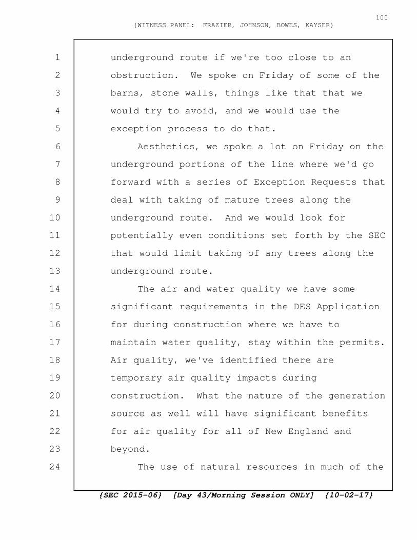
underground route if we're too close to an
obstruction. We spoke on Friday of some of the
barns, stone walls, things like that that we
would try to avoid, and we would use the
exception process to do that.
Aesthetics, we spoke a lot on Friday on the
underground portions of the line where we'd go
forward with a series of Exception Requests that
deal with taking of mature trees along the
underground route. And we would look for
potentially even conditions set forth by the SEC
that would limit taking of any trees along the
underground route.
The air and water quality we have some
significant requirements in the DES Application
for during construction where we have to
maintain water quality, stay within the permits.
Air quality, we've identified there are
temporary air quality impacts during
construction. What the nature of the generation
source as well will have significant benefits
for air quality for all of New England and
beyond.
The use of natural resources in much of the
{SEC 2015-06} [Day 43/Morning Session ONLY] {10-02-17}
100{WITNESS PANEL: FRAZIER, JOHNSON, BOWES, KAYSER}
1
2
3
4
5
6
7
8
9
10
11
12
13
14
15
16
17
18
19
20
21
22
23
24

Project is aligned along either existing
rights-of-way, about 100 miles, or 52 miles in
State roads and the 8 miles in the North Country
so another 160 miles in total is in areas that
have previously been disturbed or previously for
transmission line use.
Impact for natural resources, for example,
wetlands for this Project is very minimal.
About two and a half acres of permanent wetland
impact. So again, that's part of the natural
resources. We've gone forward with the National
Fish & Wildlife Foundation and identified
several species in New Hampshire where we're
providing grants to local universities and
nongovernment organizations.
Q Okay. You don't need to go into that at this
point.
MR. NEEDLEMAN: Wait. The witness should
be permitted to finish the answer.
Q That's okay.
COMMISSIONER BAILEY: Go ahead and finish.
A (Bowes) So in the public health and safety, we
are going to maintain all of our activities in
the design phase within the National Electric
{SEC 2015-06} [Day 43/Morning Session ONLY] {10-02-17}
101{WITNESS PANEL: FRAZIER, JOHNSON, BOWES, KAYSER}
1
2
3
4
5
6
7
8
9
10
11
12
13
14
15
16
17
18
19
20
21
22
23
24

Safety Code. The various FAA regulations for
the overhead portion of the line. We've
petitioned the FAA and got responses on those of
what we need to do for tower identification, for
example. All of our road crossings have gone
through the public utility process. Received
approval for those. Again, with a determination
that they will be safely installed. And we've
set forth a construction and maintenance plan
that will ensure the operation of the line over
its life maintained in accordance with
Eversource standards and industry best
practices.
Q Done?
A (Bowes) I am finished. Thank you.
Q And all of this has been done pertaining to the
52 miles in Grafton County with no assurances as
to exactly where the hole is going to be dug.
A (Bowes) I disagree with that statement.
Q Where is the hole going to be dug?
A (Bowes) So, again, I'm not sure what hole you're
talking about.
Q I'm talking about the line. Where you're
planning on burying the lines. You've
{SEC 2015-06} [Day 43/Morning Session ONLY] {10-02-17}
102{WITNESS PANEL: FRAZIER, JOHNSON, BOWES, KAYSER}
1
2
3
4
5
6
7
8
9
10
11
12
13
14
15
16
17
18
19
20
21
22
23
24
identified some HDD locations. You've
identified some splice vault locations. But
where this line is going to be buried,
landowners still don't know if it's going to be
on the right side of the road, or the left side
of the road, or even in the middle of the road.
A (Bowes) If you select a specific location, I
will tell you where it will be located. You're
dealing with hypotheticals that are just
misrepresenting what we've proposed in this
Project.
Q I have repeatedly asked if you're going to the
right side of the road or the left side of the
road and been told we don't know.
A (Bowes) Where would you like to know?
Q For the record, Exhibit NAPOBP 32. 979 Easton
Valley Road.
A (Bowes) We'll be in the roadway here to the
right of the white line.
Q You'll be in the road.
A (Bowes) Yes.
Q Have you gotten the approval of that?
A (Bowes) We have not got a final design approved
at this point. That will come with the final
{SEC 2015-06} [Day 43/Morning Session ONLY] {10-02-17}
103{WITNESS PANEL: FRAZIER, JOHNSON, BOWES, KAYSER}
1
2
3
4
5
6
7
8
9
10
11
12
13
14
15
16
17
18
19
20
21
22
23
24

design approval.
Q Exactly. You're hoping to be in the road.
A (Bowes) I did not say that.
Q Well, you haven't gotten design approval.
A (Bowes) That is correct.
Q 1372 Easton Valley Road.
A (Bowes) So in this location we are proposing a
splice vault in the previously disturbed area in
front of the Franconia Inn. We have had
outreach to the Franconia Inn, and they have not
responded to us.
Q Have you mailed them the diagram of where you
want the splice vault to go?
A (Bowes) We have reached out both with mail and
telephone. I do not know what was included in
that correspondence.
Q Have you mailed them anything more than the
generic letter that you've sent to everybody?
A (Bowes) We have reached out to them, yes, by
telephone.
Q Have you mailed them a picture of the splice
vault that you plan on putting, NAPOBP 25, in
between their pool area and the Inn?
A (Bowes) Have we mailed them this diagram?
{SEC 2015-06} [Day 43/Morning Session ONLY] {10-02-17}
104{WITNESS PANEL: FRAZIER, JOHNSON, BOWES, KAYSER}
1
2
3
4
5
6
7
8
9
10
11
12
13
14
15
16
17
18
19
20
21
22
23
24

Q Yes.
A (Bowes) I do not know.
Q Have you given them any details?
A (Bowes) We've offered to, yes. If this is an
informal request to relocate the splice vault,
we will certainly consider that.
Q And where would you put it?
A (Bowes) We would have to evaluate where it would
go. It would go somewhere, a couple hundred
feet either to the north or to the south in this
location. Right now this is a very good
location to select because it's previously
disturbed soil. We can also work with this
commercial customer in a manner that suits their
needs as we have with many other customers in
the past that deal with the temporary impacts
that they will face.
Q Another splice vault location. Tamarack Tennis
Camp. Have you reached out to Tamarack Tennis
Camp and sent them the design of what you want
to do on their property?
A (Bowes) So what I would say, no, I don't know if
we have or not, what the actual design is. We
spoke quite a bit about this barn location on
{SEC 2015-06} [Day 43/Morning Session ONLY] {10-02-17}
105{WITNESS PANEL: FRAZIER, JOHNSON, BOWES, KAYSER}
1
2
3
4
5
6
7
8
9
10
11
12
13
14
15
16
17
18
19
20
21
22
23
24
Friday.
Q I know.
A (Bowes) The representation you have on B is not
correct.
Q The representation on A?
A (Bowes) Nor is A correct.
Q It's correct in that adjacent to the road there
is going to be a long hole, correct?
A (Bowes) But it's not represented properly and
there's not two splice vaults going at this
location.
Q And that was from the beginning it was
represented that this would be a one splice
vault location. So the hole, where do you
expect to go in reference to the white line?
A (Bowes) So at this location, it would be
approximately 14 feet in total, and it would be
not directly in front of the barn, but it would
be relocated closer to where it says "splice
vault."
Q But then the actual hole for the trench would
continue down the road, correct?
A (Bowes) It would be off-road, I believe, in this
location as you tried to represent in section A
{SEC 2015-06} [Day 43/Morning Session ONLY] {10-02-17}
106{WITNESS PANEL: FRAZIER, JOHNSON, BOWES, KAYSER}
1
2
3
4
5
6
7
8
9
10
11
12
13
14
15
16
17
18
19
20
21
22
23
24

above.
Q And you talked about the Traffic Management
Plan. Ms. Farrington. Fair to say that
depending on whether, fair to say when you spoke
last time you didn't have a traffic management
plan for 116 or 112 that would involve diverting
the traffic around it, correct?
MR. NEEDLEMAN: Objection. How does this
relate to the subject of the recall?
Q I'll go to the next question. How many
construction teams do you anticipate having in
Grafton County on the underground route at any
given time once construction begins?
MR. NEEDLEMAN: Same objection.
COMMISSIONER BAILEY: How does this relate
to why the Panel was called back today.
MS. SAFFO: Because once again it goes into
the fact that these design plans keep changing
and they keep modifying, and whether, for
example, you have a microtunnel or an HDD or
exactly where you're going to be putting these
particular vaults impacts the time frame work is
going to take. That impacts the time frame that
in turn impacts the economic development of the
{SEC 2015-06} [Day 43/Morning Session ONLY] {10-02-17}
107{WITNESS PANEL: FRAZIER, JOHNSON, BOWES, KAYSER}
1
2
3
4
5
6
7
8
9
10
11
12
13
14
15
16
17
18
19
20
21
22
23
24

region. When they're going to be doing this,
when they plan on doing it, and the fact that we
don't have a plan yet and we have rolling
Exceptions shows we don't know the answers to
those questions.
COMMISSIONER BAILEY: I think you need to
ask him about a specific location where there's
an Exception Request.
MS. SAFFO: Okay.
BY MS. SAFFO:
Q Can we switch back to the screen? Thank you.
While we're doing that, so the 52 miles and
some of these exception areas that you're
requesting, you're going beyond the areas
previously disturbed, correct?
A (Bowes) For the Exception Requests, I don't
believe so.
Q So the purpose of the Exception Requests is to
try not to go beyond the areas previously
disturbed, correct?
A (Bowes) Or to go back within the pavement area,
yes.
Q So if these Exception Requests are denied, then
you are going to be going into areas that have
{SEC 2015-06} [Day 43/Morning Session ONLY] {10-02-17}
108{WITNESS PANEL: FRAZIER, JOHNSON, BOWES, KAYSER}
1
2
3
4
5
6
7
8
9
10
11
12
13
14
15
16
17
18
19
20
21
22
23
24
not been previously disturbed, correct?
A (Bowes) It's possible because, again, we're
planning to go in the shoulder or the ditch
line. If we go outside of the ditch line, I
would agree with that.
Q Okay. And, for example, in looking at 125,
which we were looking at before, and for any of
the HDD Exception Requests, you admit you need a
staging area of 30 feet wide, correct?
A (Bowes) In general, yes.
Q So if you're not in the road, you're outside of
the road, correct?
A (Bowes) Yes.
Q And if either that area was previously disturbed
in which case it's most likely somebody's yard
or a driveway or something, correct?
A (Bowes) In this case, maybe we should speak to
this one?
Q Yes.
A (Bowes) In this case we're not impacting any
driveways.
Q No, you're not impacting any driveways, but you
still have to find 30 feet without closing down
the entire road, correct?
{SEC 2015-06} [Day 43/Morning Session ONLY] {10-02-17}
109{WITNESS PANEL: FRAZIER, JOHNSON, BOWES, KAYSER}
1
2
3
4
5
6
7
8
9
10
11
12
13
14
15
16
17
18
19
20
21
22
23
24

A (Bowes) We don't plan to close the entire road,
and you are correct we would need 30 feet.
Q And so if right where 125 is there's a stream on
that side, then you can't impact the stream,
correct?
A (Bowes) As the design shows, we would not impact
the stream.
Q So then you have to go into the road further
than the width of the road, correct?
A (Bowes) Do you mean lane or do you mean road?
Q The lanes are how wide?
A (Bowes) I'm trying to get to the first question.
Q I look at a road as two lanes.
A (Bowes) So we're not going to take the entire
road if that's what you mean.
Q So where are you finding the 30 feet?
A (Bowes) Page 9 shows it very clearly of where
we're going to be, and it takes approximately
one travel lane, and in this case it is area to
the south.
Q So it's one travel lane which is roughly 12 to
14 feet plus an additional 18 feet past it,
correct?
A (Bowes) Plus the shoulder, the ditch line, so it
{SEC 2015-06} [Day 43/Morning Session ONLY] {10-02-17}
110{WITNESS PANEL: FRAZIER, JOHNSON, BOWES, KAYSER}
1
2
3
4
5
6
7
8
9
10
11
12
13
14
15
16
17
18
19
20
21
22
23
24

would be some area that is outside the ditch
line probably.
Q And there's, okay. Now, you noted that the
construction will respect property lines, right?
A (Bowes) I believe I said something like that.
Yes.
Q So the Exceptions have us going into the
roadway, correct?
A (Bowes) For the most part. For this one, yes.
Q And if the Exceptions aren't granted, you're now
in the property of the people, correct?
A (Bowes) We would be further off the roadway so
it would have more impacts to the land adjacent.
Q And if the final design calls for going into a
private property's front lawn, what can that
private property do to change that design?
A (Bowes) So we can work for an Exception Request
with the New Hampshire DOT.
Q And you would do this after the final design has
been approved?
A (Bowes) Yes. We anticipate that there will be
Exception Requests after the final design.
Q But these are areas where you've already asked
for an Exception Request and the DOT has said
{SEC 2015-06} [Day 43/Morning Session ONLY] {10-02-17}
111{WITNESS PANEL: FRAZIER, JOHNSON, BOWES, KAYSER}
1
2
3
4
5
6
7
8
9
10
11
12
13
14
15
16
17
18
19
20
21
22
23
24
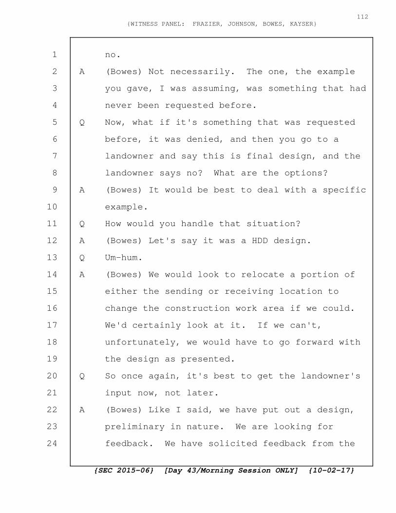
no.
A (Bowes) Not necessarily. The one, the example
you gave, I was assuming, was something that had
never been requested before.
Q Now, what if it's something that was requested
before, it was denied, and then you go to a
landowner and say this is final design, and the
landowner says no? What are the options?
A (Bowes) It would be best to deal with a specific
example.
Q How would you handle that situation?
A (Bowes) Let's say it was a HDD design.
Q Um-hum.
A (Bowes) We would look to relocate a portion of
either the sending or receiving location to
change the construction work area if we could.
We'd certainly look at it. If we can't,
unfortunately, we would have to go forward with
the design as presented.
Q So once again, it's best to get the landowner's
input now, not later.
A (Bowes) Like I said, we have put out a design,
preliminary in nature. We are looking for
feedback. We have solicited feedback from the
{SEC 2015-06} [Day 43/Morning Session ONLY] {10-02-17}
112{WITNESS PANEL: FRAZIER, JOHNSON, BOWES, KAYSER}
1
2
3
4
5
6
7
8
9
10
11
12
13
14
15
16
17
18
19
20
21
22
23
24

residents along this roadway, and as we receive
requests, we certainly go out and meet with
those customers and talk about the impacts. An
example was on Friday the Schoolhouse
Restaurant. We have had conversations with the
Schoolhouse Restaurant.
Q Okay. So as far as you're concerned, the
current design has reasonable detail, correct?
A (Bowes) It's a preliminary layout. We are going
forward with an iterative process to achieve a
final design.
Q Okay.
A (Bowes) Very common process used in siting
underground transmission projects.
Q So right now you have a preliminary layout. Do
you feel it has reasonable design?
A (Bowes) So I think we said on Friday we're about
60 percent design level. As an example, in the
months of August and September, we sited two
other transmission line projects with what I
would say would be a 20 percent design level.
Q So one of the other things that's changed is the
order of hiring. So the order of hiring now is
nonunion, I mean, is union New Hampshire, and
{SEC 2015-06} [Day 43/Morning Session ONLY] {10-02-17}
113{WITNESS PANEL: FRAZIER, JOHNSON, BOWES, KAYSER}
1
2
3
4
5
6
7
8
9
10
11
12
13
14
15
16
17
18
19
20
21
22
23
24
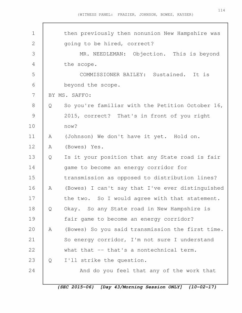
then previously then nonunion New Hampshire was
going to be hired, correct?
MR. NEEDLEMAN: Objection. This is beyond
the scope.
COMMISSIONER BAILEY: Sustained. It is
beyond the scope.
BY MS. SAFFO:
Q So you're familiar with the Petition October 16,
2015, correct? That's in front of you right
now?
A (Johnson) We don't have it yet. Hold on.
A (Bowes) Yes.
Q Is it your position that any State road is fair
game to become an energy corridor for
transmission as opposed to distribution lines?
A (Bowes) I can't say that I've ever distinguished
the two. So I would agree with that statement.
Q Okay. So any State road in New Hampshire is
fair game to become an energy corridor?
A (Bowes) So you said transmission the first time.
So energy corridor, I'm not sure I understand
what that -- that's a nontechnical term.
Q I'll strike the question.
And do you feel that any of the work that
{SEC 2015-06} [Day 43/Morning Session ONLY] {10-02-17}
114{WITNESS PANEL: FRAZIER, JOHNSON, BOWES, KAYSER}
1
2
3
4
5
6
7
8
9
10
11
12
13
14
15
16
17
18
19
20
21
22
23
24

you're doing in your current plan would impact
Route 112's road scenic quality? Would it
invariably alter it? Do you think any work in
your current proposal.
A (Bowes) So I'm going through the process to
understand the question, and I would say we will
have no permanent impacts to visual quality.
There will be temporary impacts during
construction.
Q And you agree that removing mature trees would
impact visual quality?
A (Bowes) I would agree with that.
Q Now, your aesthetics expert, Mr. DeWan, claimed
that he was relying on a reference of not going
more than 6 feet off the shoulder, correct?
MR. NEEDLEMAN: Objection. I'm not sure
that's what he testified to, and I certainly
don't know the context.
Q So if Mr. DeWan said he analyzed aesthetics
based on an understanding that you would not be
going more than 6 feet off a shoulder or a ditch
line, do you know where he would have gotten
that information?
MR. NEEDLEMAN: Same objection.
{SEC 2015-06} [Day 43/Morning Session ONLY] {10-02-17}
115{WITNESS PANEL: FRAZIER, JOHNSON, BOWES, KAYSER}
1
2
3
4
5
6
7
8
9
10
11
12
13
14
15
16
17
18
19
20
21
22
23
24

COMMISSIONER BAILEY: Do you have a
transcript reference?
MR. SAFFO: I can actually find it. That's
absolutely what Mr. DeWan testified to, but I
think I can use it as a hypothetical and then --
COMMISSIONER BAILEY: Okay. Why don't you
do that.
BY MS. SAFFO:
Q Hypothetically, if Mr. DeWan said he was relying
on a presumption that you would not be going
more than six feet off a shoulder or ditch line,
would you think that was an accurate assumption
to make?
A (Bowes) Again, this is an assumption for the
visual impacts from the underground
construction?
Q This is the aesthetics expert. This is your
aesthetics expert's assumption.
A (Bowes) I'm trying to get what your hypothetical
is about. It's about the underground portion of
the line.
Q Just underground. Absolutely.
A On state roads in Grafton County?
Q Yes.
{SEC 2015-06} [Day 43/Morning Session ONLY] {10-02-17}
116{WITNESS PANEL: FRAZIER, JOHNSON, BOWES, KAYSER}
1
2
3
4
5
6
7
8
9
10
11
12
13
14
15
16
17
18
19
20
21
22
23
24
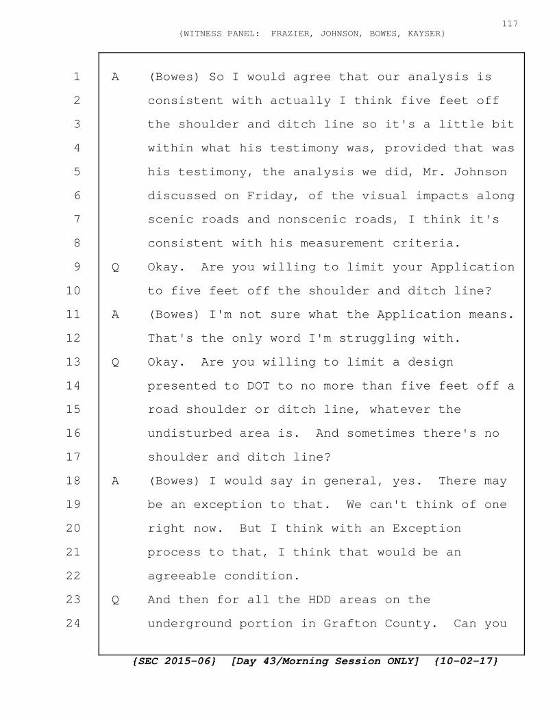
A (Bowes) So I would agree that our analysis is
consistent with actually I think five feet off
the shoulder and ditch line so it's a little bit
within what his testimony was, provided that was
his testimony, the analysis we did, Mr. Johnson
discussed on Friday, of the visual impacts along
scenic roads and nonscenic roads, I think it's
consistent with his measurement criteria.
Q Okay. Are you willing to limit your Application
to five feet off the shoulder and ditch line?
A (Bowes) I'm not sure what the Application means.
That's the only word I'm struggling with.
Q Okay. Are you willing to limit a design
presented to DOT to no more than five feet off a
road shoulder or ditch line, whatever the
undisturbed area is. And sometimes there's no
shoulder and ditch line?
A (Bowes) I would say in general, yes. There may
be an exception to that. We can't think of one
right now. But I think with an Exception
process to that, I think that would be an
agreeable condition.
Q And then for all the HDD areas on the
underground portion in Grafton County. Can you
{SEC 2015-06} [Day 43/Morning Session ONLY] {10-02-17}
117{WITNESS PANEL: FRAZIER, JOHNSON, BOWES, KAYSER}
1
2
3
4
5
6
7
8
9
10
11
12
13
14
15
16
17
18
19
20
21
22
23
24

do the HDD in less than five feet off?
A (Bowes) Not the temporary work space. So that
would be an area where we probably couldn't meet
that condition.
Q And then for the vaults, the 130 vaults in
Grafton County, can you meet that condition?
A (Bowes) Subject to check of the latest design, I
think we could.
Q So I've underlined a part that all entities
planning to construct facilities in the state be
required to provide full and complete disclosure
to the public of such plans. Do you see that?
A (Bowes) I do.
Q Do you think those plans need to be disclosed
prior to the public hearings?
MR. NEEDLEMAN: Objection. Calls for a
legal conclusion.
Q In your opinion, should they be disclosed prior
to the public hearing?
MR. NEEDLEMAN: Same objection. Asking for
his opinion about what the legal requirements
are.
MS. SAFFO: I'm not asking for legal
requirements. I'm just asking for his opinion
{SEC 2015-06} [Day 43/Morning Session ONLY] {10-02-17}
118{WITNESS PANEL: FRAZIER, JOHNSON, BOWES, KAYSER}
1
2
3
4
5
6
7
8
9
10
11
12
13
14
15
16
17
18
19
20
21
22
23
24
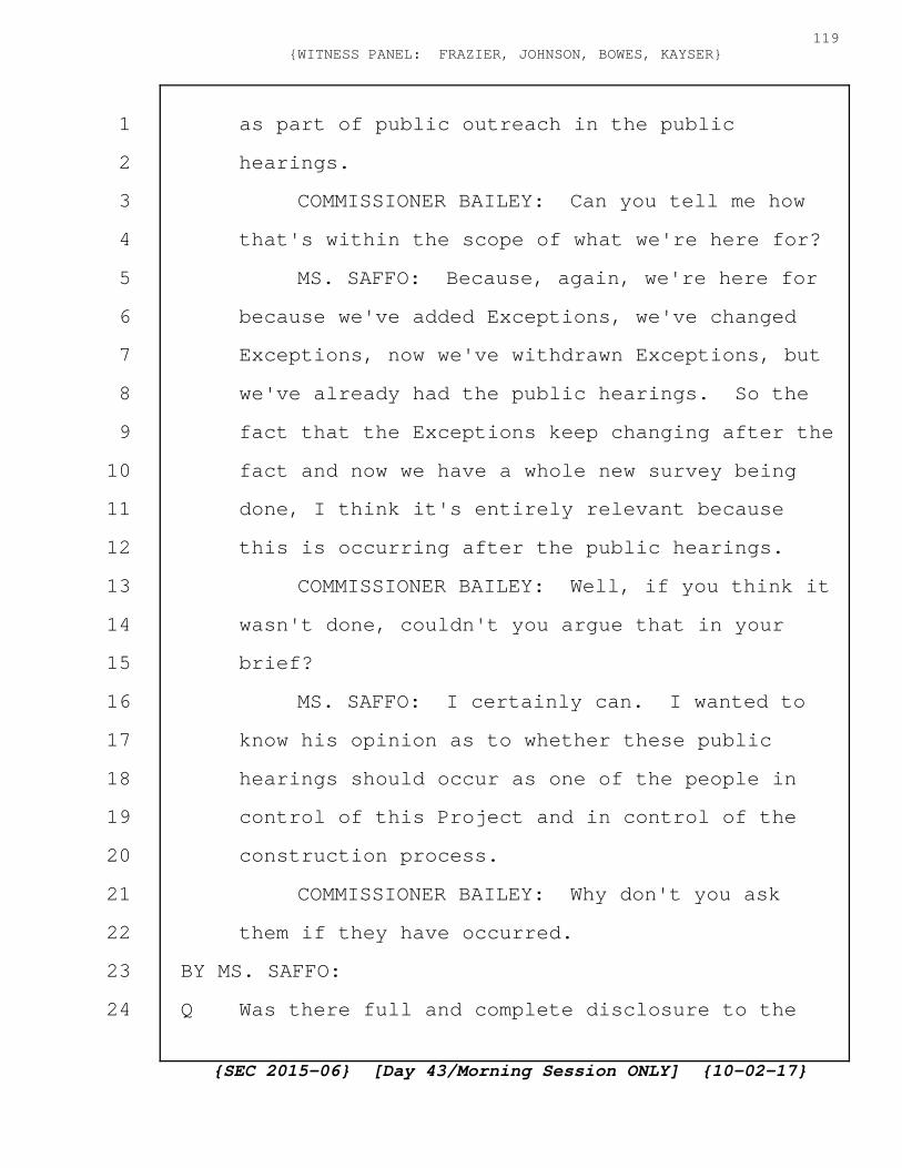
as part of public outreach in the public
hearings.
COMMISSIONER BAILEY: Can you tell me how
that's within the scope of what we're here for?
MS. SAFFO: Because, again, we're here for
because we've added Exceptions, we've changed
Exceptions, now we've withdrawn Exceptions, but
we've already had the public hearings. So the
fact that the Exceptions keep changing after the
fact and now we have a whole new survey being
done, I think it's entirely relevant because
this is occurring after the public hearings.
COMMISSIONER BAILEY: Well, if you think it
wasn't done, couldn't you argue that in your
brief?
MS. SAFFO: I certainly can. I wanted to
know his opinion as to whether these public
hearings should occur as one of the people in
control of this Project and in control of the
construction process.
COMMISSIONER BAILEY: Why don't you ask
them if they have occurred.
BY MS. SAFFO:
Q Was there full and complete disclosure to the
{SEC 2015-06} [Day 43/Morning Session ONLY] {10-02-17}
119{WITNESS PANEL: FRAZIER, JOHNSON, BOWES, KAYSER}
1
2
3
4
5
6
7
8
9
10
11
12
13
14
15
16
17
18
19
20
21
22
23
24
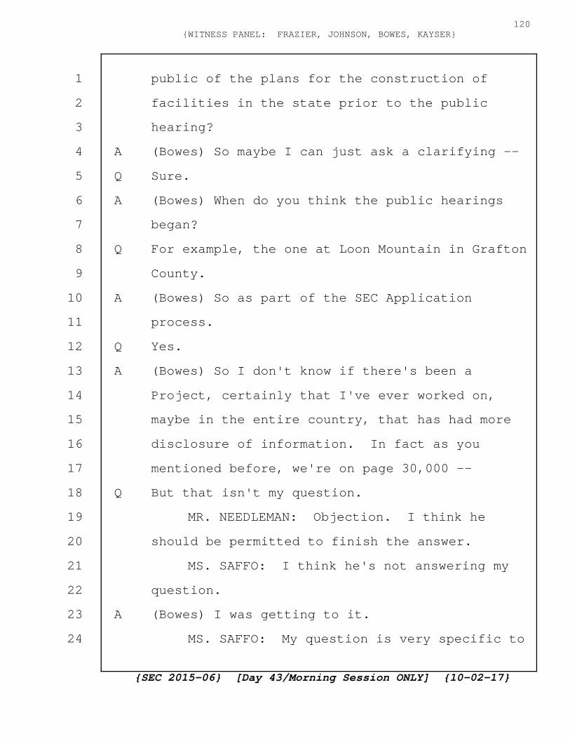
public of the plans for the construction of
facilities in the state prior to the public
hearing?
A (Bowes) So maybe I can just ask a clarifying --
Q Sure.
A (Bowes) When do you think the public hearings
began?
Q For example, the one at Loon Mountain in Grafton
County.
A (Bowes) So as part of the SEC Application
process.
Q Yes.
A (Bowes) So I don't know if there's been a
Project, certainly that I've ever worked on,
maybe in the entire country, that has had more
disclosure of information. In fact as you
mentioned before, we're on page 30,000 --
Q But that isn't my question.
MR. NEEDLEMAN: Objection. I think he
should be permitted to finish the answer.
MS. SAFFO: I think he's not answering my
question.
A (Bowes) I was getting to it.
MS. SAFFO: My question is very specific to
{SEC 2015-06} [Day 43/Morning Session ONLY] {10-02-17}
120{WITNESS PANEL: FRAZIER, JOHNSON, BOWES, KAYSER}
1
2
3
4
5
6
7
8
9
10
11
12
13
14
15
16
17
18
19
20
21
22
23
24
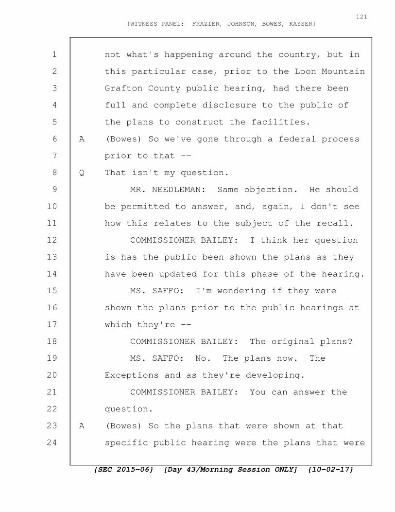
not what's happening around the country, but in
this particular case, prior to the Loon Mountain
Grafton County public hearing, had there been
full and complete disclosure to the public of
the plans to construct the facilities.
A (Bowes) So we've gone through a federal process
prior to that --
Q That isn't my question.
MR. NEEDLEMAN: Same objection. He should
be permitted to answer, and, again, I don't see
how this relates to the subject of the recall.
COMMISSIONER BAILEY: I think her question
is has the public been shown the plans as they
have been updated for this phase of the hearing.
MS. SAFFO: I'm wondering if they were
shown the plans prior to the public hearings at
which they're --
COMMISSIONER BAILEY: The original plans?
MS. SAFFO: No. The plans now. The
Exceptions and as they're developing.
COMMISSIONER BAILEY: You can answer the
question.
A (Bowes) So the plans that were shown at that
specific public hearing were the plans that were
{SEC 2015-06} [Day 43/Morning Session ONLY] {10-02-17}
121{WITNESS PANEL: FRAZIER, JOHNSON, BOWES, KAYSER}
1
2
3
4
5
6
7
8
9
10
11
12
13
14
15
16
17
18
19
20
21
22
23
24
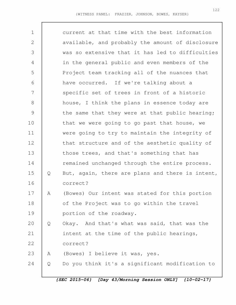
current at that time with the best information
available, and probably the amount of disclosure
was so extensive that it has led to difficulties
in the general public and even members of the
Project team tracking all of the nuances that
have occurred. If we're talking about a
specific set of trees in front of a historic
house, I think the plans in essence today are
the same that they were at that public hearing;
that we were going to go past that house, we
were going to try to maintain the integrity of
that structure and of the aesthetic quality of
those trees, and that's something that has
remained unchanged through the entire process.
Q But, again, there are plans and there is intent,
correct?
A (Bowes) Our intent was stated for this portion
of the Project was to go within the travel
portion of the roadway.
Q Okay. And that's what was said, that was the
intent at the time of the public hearings,
correct?
A (Bowes) I believe it was, yes.
Q Do you think it's a significant modification to
{SEC 2015-06} [Day 43/Morning Session ONLY] {10-02-17}
122{WITNESS PANEL: FRAZIER, JOHNSON, BOWES, KAYSER}
1
2
3
4
5
6
7
8
9
10
11
12
13
14
15
16
17
18
19
20
21
22
23
24
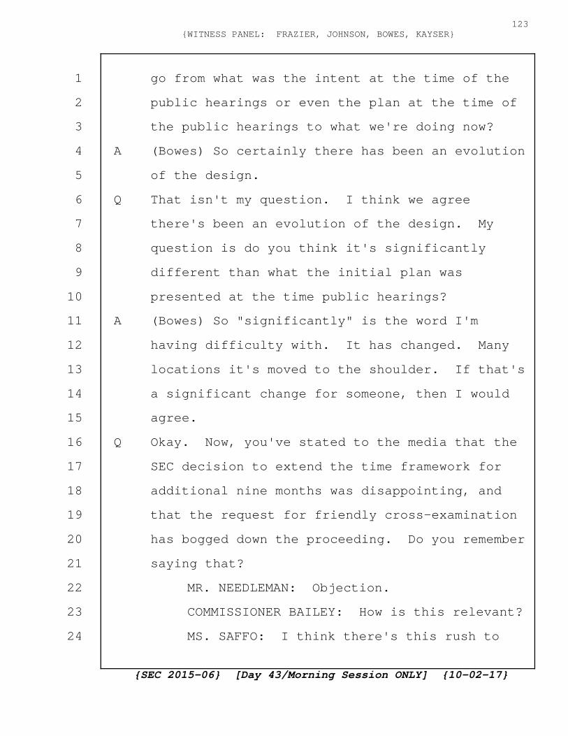
go from what was the intent at the time of the
public hearings or even the plan at the time of
the public hearings to what we're doing now?
A (Bowes) So certainly there has been an evolution
of the design.
Q That isn't my question. I think we agree
there's been an evolution of the design. My
question is do you think it's significantly
different than what the initial plan was
presented at the time public hearings?
A (Bowes) So "significantly" is the word I'm
having difficulty with. It has changed. Many
locations it's moved to the shoulder. If that's
a significant change for someone, then I would
agree.
Q Okay. Now, you've stated to the media that the
SEC decision to extend the time framework for
additional nine months was disappointing, and
that the request for friendly cross-examination
has bogged down the proceeding. Do you remember
saying that?
MR. NEEDLEMAN: Objection.
COMMISSIONER BAILEY: How is this relevant?
MS. SAFFO: I think there's this rush to
{SEC 2015-06} [Day 43/Morning Session ONLY] {10-02-17}
123{WITNESS PANEL: FRAZIER, JOHNSON, BOWES, KAYSER}
1
2
3
4
5
6
7
8
9
10
11
12
13
14
15
16
17
18
19
20
21
22
23
24

get approvals and rush to get a design and then
we're changing, but at the same time the rush is
being created by Northern Pass.
COMMISSIONER BAILEY: That's not really
relevant to what this Panel was called back to
do. So I'm going to sustain the objection.
BY MS. SAFFO:
Q If the SEC delegates the Department of
Transportation, do the property owners have a
mechanism to raise its concerns?
A (Bowes) So is this again for the local roads?
Or for the State-owned roads?
Q Both. Start with the State-owned roads.
A (Bowes) My understanding is they already have
jurisdiction for the State-owned roads. And
we're asking the SEC to take jurisdiction for
the local roads, and they will likely delegate
to the New Hampshire DOT for that process. Is
there a public process as part of that? I
believe there is, yes.
Q So you talked about a timeline for the survey
for the DOT approval, the easements,
identifications, the assessments. When do you
anticipate having a use and occupancy agreement?
{SEC 2015-06} [Day 43/Morning Session ONLY] {10-02-17}
124{WITNESS PANEL: FRAZIER, JOHNSON, BOWES, KAYSER}
1
2
3
4
5
6
7
8
9
10
11
12
13
14
15
16
17
18
19
20
21
22
23
24
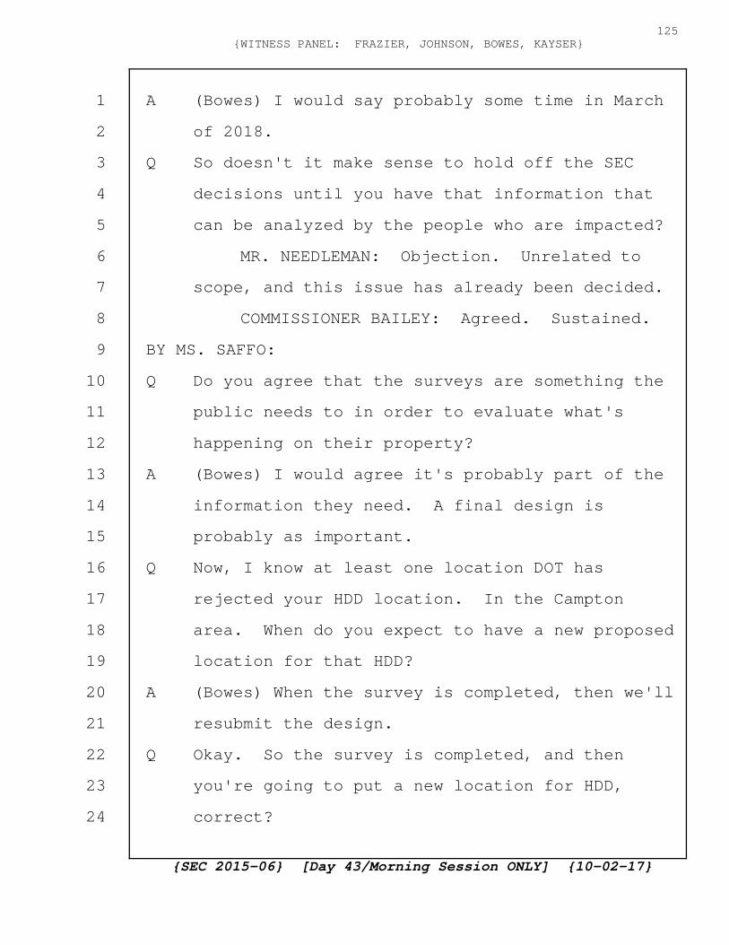
A (Bowes) I would say probably some time in March
of 2018.
Q So doesn't it make sense to hold off the SEC
decisions until you have that information that
can be analyzed by the people who are impacted?
MR. NEEDLEMAN: Objection. Unrelated to
scope, and this issue has already been decided.
COMMISSIONER BAILEY: Agreed. Sustained.
BY MS. SAFFO:
Q Do you agree that the surveys are something the
public needs to in order to evaluate what's
happening on their property?
A (Bowes) I would agree it's probably part of the
information they need. A final design is
probably as important.
Q Now, I know at least one location DOT has
rejected your HDD location. In the Campton
area. When do you expect to have a new proposed
location for that HDD?
A (Bowes) When the survey is completed, then we'll
resubmit the design.
Q Okay. So the survey is completed, and then
you're going to put a new location for HDD,
correct?
{SEC 2015-06} [Day 43/Morning Session ONLY] {10-02-17}
125{WITNESS PANEL: FRAZIER, JOHNSON, BOWES, KAYSER}
1
2
3
4
5
6
7
8
9
10
11
12
13
14
15
16
17
18
19
20
21
22
23
24
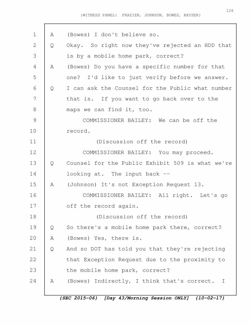
A (Bowes) I don't believe so.
Q Okay. So right now they've rejected an HDD that
is by a mobile home park, correct?
A (Bowes) Do you have a specific number for that
one? I'd like to just verify before we answer.
Q I can ask the Counsel for the Public what number
that is. If you want to go back over to the
maps we can find it, too.
COMMISSIONER BAILEY: We can be off the
record.
(Discussion off the record)
COMMISSIONER BAILEY: You may proceed.
Q Counsel for the Public Exhibit 509 is what we're
looking at. The input back --
A (Johnson) It's not Exception Request 13.
COMMISSIONER BAILEY: All right. Let's go
off the record again.
(Discussion off the record)
Q So there's a mobile home park there, correct?
A (Bowes) Yes, there is.
Q And so DOT has told you that they're rejecting
that Exception Request due to the proximity to
the mobile home park, correct?
A (Bowes) Indirectly, I think that's correct. I
{SEC 2015-06} [Day 43/Morning Session ONLY] {10-02-17}
126{WITNESS PANEL: FRAZIER, JOHNSON, BOWES, KAYSER}
1
2
3
4
5
6
7
8
9
10
11
12
13
14
15
16
17
18
19
20
21
22
23
24

think it was actually because we're locating
within the driveway or roadway into the mobile
home park.
Q Yeah. Absolutely. So where do you, when,
relocating that is a big venture, correct? I
mean, you need 30 feet by 300 feet to put that
entrance, correct?
A (Bowes) I'm just waiting for the Exception
Request to come up.
MR. PAPPAS: That would be Counsel for the
Public's Exhibit 522, I believe.
A (Bowes) So in this case, on page 6, it shows the
two entry pits just into the road or the
driveway right-of-way or in front of that. We
would pull those pits about 50 feet back so the
entry pits would be outside of the driveway.
They would be, the work zone then would slide
approximately 50 feet as well along the roadway
there.
Q And any time you make a modification of that
nature, fair to say whoever's land is adjoining
to that deserves to be able to provide input,
correct?
A (Bowes) That's not the process we have been
{SEC 2015-06} [Day 43/Morning Session ONLY] {10-02-17}
127{WITNESS PANEL: FRAZIER, JOHNSON, BOWES, KAYSER}
1
2
3
4
5
6
7
8
9
10
11
12
13
14
15
16
17
18
19
20
21
22
23
24

using.
Q I realize that isn't the process you've been
using, but now you want the SEC to approve the
whole Project. The process we've been using has
not been to solicit landowner input, correct?
Just a generic letter to them?
A (Bowes) For the HDDs, I believe that may be
accurate. Yes.
Q So we're putting a 30 foot by 300 foot
construction zone adjoining somebody's property,
correct?
A (Bowes) In this case, I believe it's about that
size, yes.
Q And most of the HDD work zones are big, correct?
A (Bowes) Some are larger than that. Yes.
Q Yeah. And the adjoining property owners' input
before something of that nature is put on their
property is particularly important, correct?
A (Bowes) It may be important. Yes. I think once
we have a final design is the time to speak with
them.
Q But again, at that point in time, if they say
you're destroying my front yard, your only
option is to move it to somebody else's front
{SEC 2015-06} [Day 43/Morning Session ONLY] {10-02-17}
128{WITNESS PANEL: FRAZIER, JOHNSON, BOWES, KAYSER}
1
2
3
4
5
6
7
8
9
10
11
12
13
14
15
16
17
18
19
20
21
22
23
24

yard, correct?
A (Bowes) Or again, locate to within the DOT
right-of-way, into the travel lane a little bit
further, yes.
Q But if you need 30 feet, there's only so far,
you're already going into the travel lane,
correct, with a construction zone of that size?
A (Bowes) In this case we're taking the full
travel lane.
Q Yeah. So the only way to go further into the
travel lane is to take over the road and close
it.
A (Bowes) And we're not proposing to do that at
this location.
Q Exactly. For so for HDDs, if you're already
using half the road, the only place to go is to
the adjoining landowner for the remaining
footage, correct?
A (Bowes) It would slide one way or the other and
could impact different landowners. You're
correct.
Q And you don't plan on closing any roads,
correct? For HDD construction?
A (Bowes) For the State roads in Grafton County
{SEC 2015-06} [Day 43/Morning Session ONLY] {10-02-17}
129{WITNESS PANEL: FRAZIER, JOHNSON, BOWES, KAYSER}
1
2
3
4
5
6
7
8
9
10
11
12
13
14
15
16
17
18
19
20
21
22
23
24
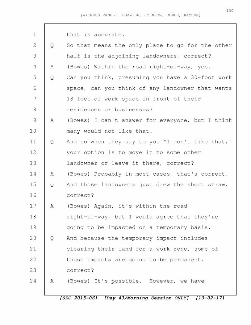
that is accurate.
Q So that means the only place to go for the other
half is the adjoining landowners, correct?
A (Bowes) Within the road right-of-way, yes.
Q Can you think, presuming you have a 30-foot work
space, can you think of any landowner that wants
18 feet of work space in front of their
residences or businesses?
A (Bowes) I can't answer for everyone, but I think
many would not like that.
Q And so when they say to you "I don't like that,"
your option is to move it to some other
landowner or leave it there, correct?
A (Bowes) Probably in most cases, that's correct.
Q And those landowners just drew the short straw,
correct?
A (Bowes) Again, it's within the road
right-of-way, but I would agree that they're
going to be impacted on a temporary basis.
Q And because the temporary impact includes
clearing their land for a work zone, some of
those impacts are going to be permanent,
correct?
A (Bowes) It's possible. However, we have
{SEC 2015-06} [Day 43/Morning Session ONLY] {10-02-17}
130{WITNESS PANEL: FRAZIER, JOHNSON, BOWES, KAYSER}
1
2
3
4
5
6
7
8
9
10
11
12
13
14
15
16
17
18
19
20
21
22
23
24
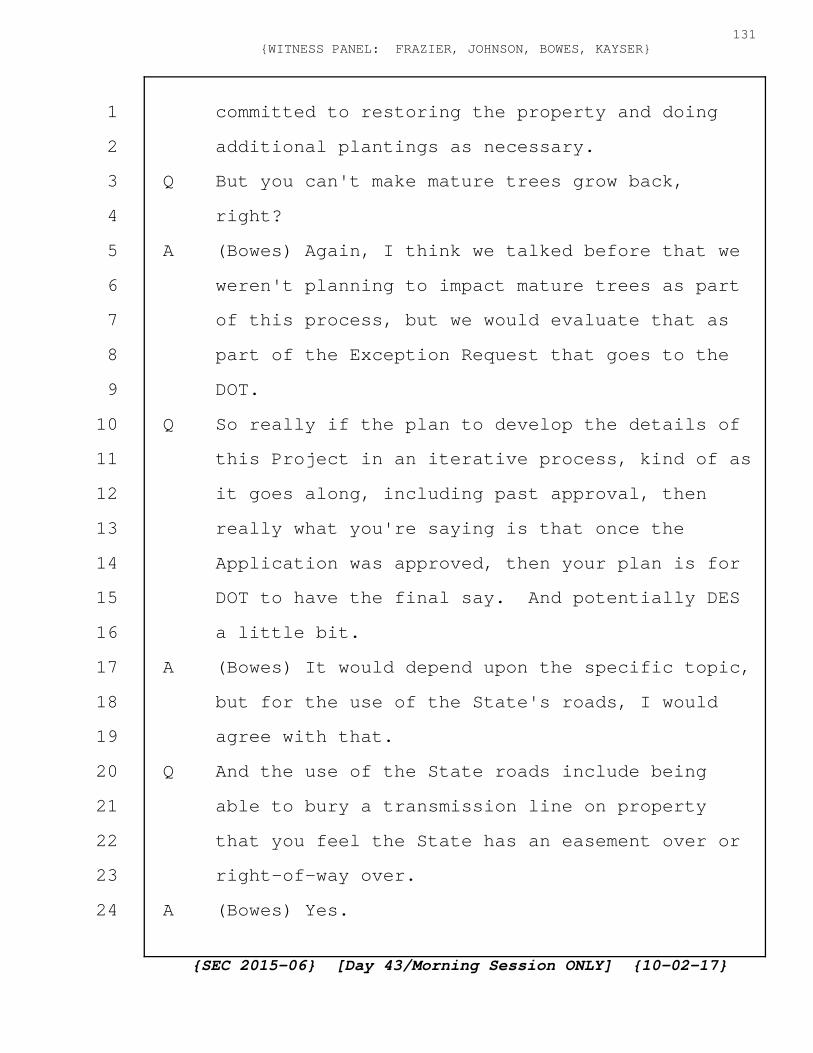
committed to restoring the property and doing
additional plantings as necessary.
Q But you can't make mature trees grow back,
right?
A (Bowes) Again, I think we talked before that we
weren't planning to impact mature trees as part
of this process, but we would evaluate that as
part of the Exception Request that goes to the
DOT.
Q So really if the plan to develop the details of
this Project in an iterative process, kind of as
it goes along, including past approval, then
really what you're saying is that once the
Application was approved, then your plan is for
DOT to have the final say. And potentially DES
a little bit.
A (Bowes) It would depend upon the specific topic,
but for the use of the State's roads, I would
agree with that.
Q And the use of the State roads include being
able to bury a transmission line on property
that you feel the State has an easement over or
right-of-way over.
A (Bowes) Yes.
{SEC 2015-06} [Day 43/Morning Session ONLY] {10-02-17}
131{WITNESS PANEL: FRAZIER, JOHNSON, BOWES, KAYSER}
1
2
3
4
5
6
7
8
9
10
11
12
13
14
15
16
17
18
19
20
21
22
23
24
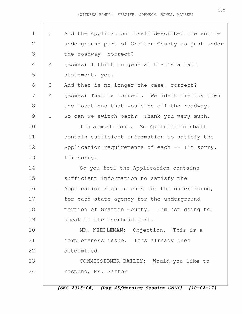
Q And the Application itself described the entire
underground part of Grafton County as just under
the roadway, correct?
A (Bowes) I think in general that's a fair
statement, yes.
Q And that is no longer the case, correct?
A (Bowes) That is correct. We identified by town
the locations that would be off the roadway.
Q So can we switch back? Thank you very much.
I'm almost done. So Application shall
contain sufficient information to satisfy the
Application requirements of each -- I'm sorry.
I'm sorry.
So you feel the Application contains
sufficient information to satisfy the
Application requirements for the underground,
for each state agency for the underground
portion of Grafton County. I'm not going to
speak to the overhead part.
MR. NEEDLEMAN: Objection. This is a
completeness issue. It's already been
determined.
COMMISSIONER BAILEY: Would you like to
respond, Ms. Saffo?
{SEC 2015-06} [Day 43/Morning Session ONLY] {10-02-17}
132{WITNESS PANEL: FRAZIER, JOHNSON, BOWES, KAYSER}
1
2
3
4
5
6
7
8
9
10
11
12
13
14
15
16
17
18
19
20
21
22
23
24

MS. SAFFO: I think one of the purposes to
be here is the Exceptions that are being filed
which are significant from what was in the
Application so I think -- and the design
modifications that are different from what was
in the Application so I think it's a fair
question.
COMMISSIONER BAILEY: I think it's
consistent with the Chair's Order on this Panel,
on the recall of this Panel. You may proceed.
A (Bowes) So could you repeat the question again?
Q I'm sorry, Ms. Stenographer. Do you mind
repeating the question?
COURT REPORTER: So you feel the
Application contains sufficient information to
satisfy the Application requirements for the
underground, for each state agency for the
underground portion of Grafton County. I'm not
going to speak to the overhead part.
A (Bowes) So for the DOT and the DES, I believe
the answer is yes. They've also issued other
conditions for us to meet.
Q What about any other agency? Did the
Application contain sufficient information to
{SEC 2015-06} [Day 43/Morning Session ONLY] {10-02-17}
133{WITNESS PANEL: FRAZIER, JOHNSON, BOWES, KAYSER}
1
2
3
4
5
6
7
8
9
10
11
12
13
14
15
16
17
18
19
20
21
22
23
24
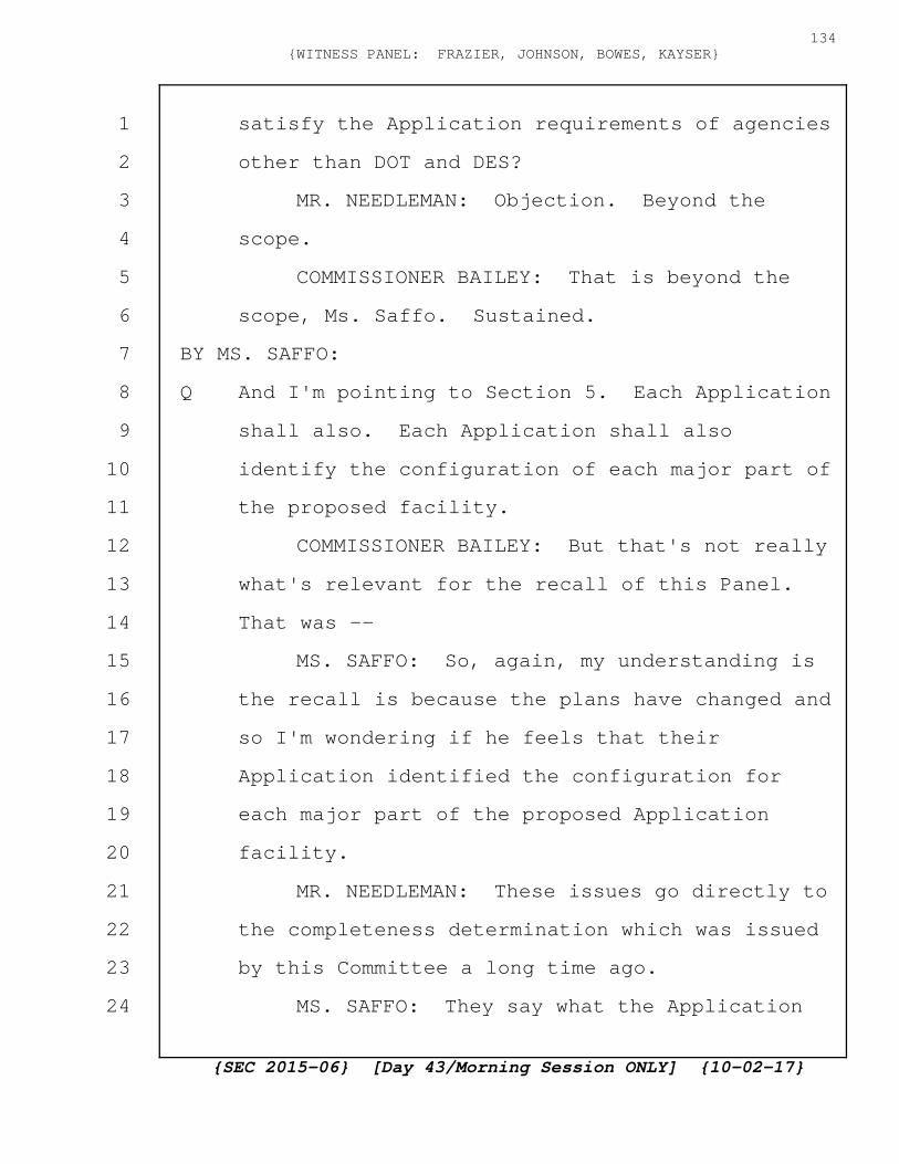
satisfy the Application requirements of agencies
other than DOT and DES?
MR. NEEDLEMAN: Objection. Beyond the
scope.
COMMISSIONER BAILEY: That is beyond the
scope, Ms. Saffo. Sustained.
BY MS. SAFFO:
Q And I'm pointing to Section 5. Each Application
shall also. Each Application shall also
identify the configuration of each major part of
the proposed facility.
COMMISSIONER BAILEY: But that's not really
what's relevant for the recall of this Panel.
That was --
MS. SAFFO: So, again, my understanding is
the recall is because the plans have changed and
so I'm wondering if he feels that their
Application identified the configuration for
each major part of the proposed Application
facility.
MR. NEEDLEMAN: These issues go directly to
the completeness determination which was issued
by this Committee a long time ago.
MS. SAFFO: They say what the Application
{SEC 2015-06} [Day 43/Morning Session ONLY] {10-02-17}
134{WITNESS PANEL: FRAZIER, JOHNSON, BOWES, KAYSER}
1
2
3
4
5
6
7
8
9
10
11
12
13
14
15
16
17
18
19
20
21
22
23
24
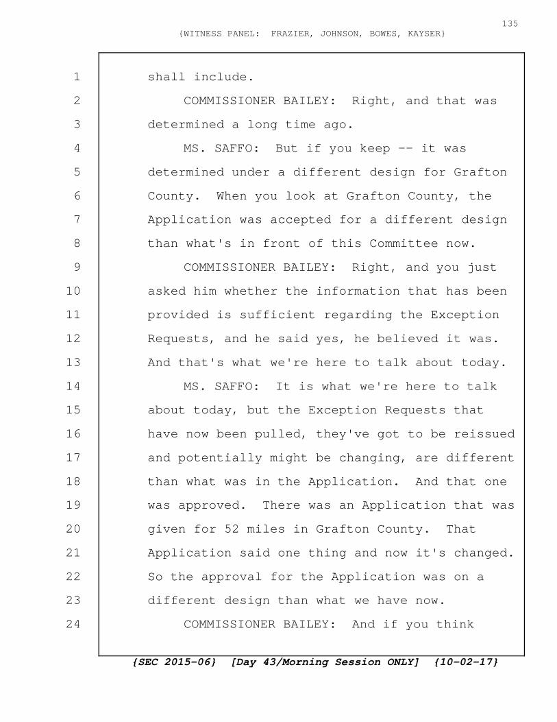
shall include.
COMMISSIONER BAILEY: Right, and that was
determined a long time ago.
MS. SAFFO: But if you keep -- it was
determined under a different design for Grafton
County. When you look at Grafton County, the
Application was accepted for a different design
than what's in front of this Committee now.
COMMISSIONER BAILEY: Right, and you just
asked him whether the information that has been
provided is sufficient regarding the Exception
Requests, and he said yes, he believed it was.
And that's what we're here to talk about today.
MS. SAFFO: It is what we're here to talk
about today, but the Exception Requests that
have now been pulled, they've got to be reissued
and potentially might be changing, are different
than what was in the Application. And that one
was approved. There was an Application that was
given for 52 miles in Grafton County. That
Application said one thing and now it's changed.
So the approval for the Application was on a
different design than what we have now.
COMMISSIONER BAILEY: And if you think
{SEC 2015-06} [Day 43/Morning Session ONLY] {10-02-17}
135{WITNESS PANEL: FRAZIER, JOHNSON, BOWES, KAYSER}
1
2
3
4
5
6
7
8
9
10
11
12
13
14
15
16
17
18
19
20
21
22
23
24
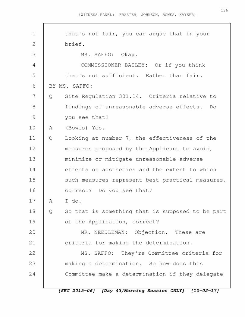
that's not fair, you can argue that in your
brief.
MS. SAFFO: Okay.
COMMISSIONER BAILEY: Or if you think
that's not sufficient. Rather than fair.
BY MS. SAFFO:
Q Site Regulation 301.14. Criteria relative to
findings of unreasonable adverse effects. Do
you see that?
A (Bowes) Yes.
Q Looking at number 7, the effectiveness of the
measures proposed by the Applicant to avoid,
minimize or mitigate unreasonable adverse
effects on aesthetics and the extent to which
such measures represent best practical measures,
correct? Do you see that?
A I do.
Q So that is something that is supposed to be part
of the Application, correct?
MR. NEEDLEMAN: Objection. These are
criteria for making the determination.
MS. SAFFO: They're Committee criteria for
making a determination. So how does this
Committee make a determination if they delegate
{SEC 2015-06} [Day 43/Morning Session ONLY] {10-02-17}
136{WITNESS PANEL: FRAZIER, JOHNSON, BOWES, KAYSER}
1
2
3
4
5
6
7
8
9
10
11
12
13
14
15
16
17
18
19
20
21
22
23
24
to DOT?
A (Bowes) Maybe you should ask them, not me.
Q So if your interpretation is correct regarding
these Exceptions that you can keep submitting
Exceptions that are dramatic, that would have a
dramatic impact on the design, and that the
design can be different than what was in the
Application, then property owners are checkmated
as soon as the Application is approved, correct?
A (Bowes) There's a couple words in there I'm not
sure I understand the meaning of. Dramatic and
checkmated.
Q Okay. So let me start. So under your request
to the Site Evaluation Committee, you submitted
design that would have one impact which is go
down the road. And they approved that
Application. And that approval was based on a
design that would not impact adjoining
landowners. That was your intent when you first
filed the Application.
But then that changes after Application
approval to you can file Exceptions, you can
move it off the road to adjoining the road, and
your answer to being able to do that is we
{SEC 2015-06} [Day 43/Morning Session ONLY] {10-02-17}
137{WITNESS PANEL: FRAZIER, JOHNSON, BOWES, KAYSER}
1
2
3
4
5
6
7
8
9
10
11
12
13
14
15
16
17
18
19
20
21
22
23
24
delegated to DOT, correct?
A (Bowes) So I still don't understand. Is this
still in relation to dramatic and checkmated?
Q Yes. Okay. So yes, so private landowners go to
public hearings at Loon Mountain in Grafton
County. And at Loon Mountain in Grafton County,
their understanding is you're going under the
road and not into adjoining land, and the
Application says that. The design in the
Application says we're going under the road and
not on adjoining land. And we go all the way
through the public hearing process with that
being the understanding, that being what you're
hoping to do. And then it completely changes
and we don't include those private landowners
that went to the public hearings and that
responded to your letters at all until after
final approval of a completely different design.
Is that your plan for the Exceptions and for the
design of this underground roadway for 52 miles?
MR. NEEDLEMAN: Objection. This has been
asked and answered multiple times.
COMMISSIONER BAILEY: I think it has. I
mean, I think he already testified that he was
{SEC 2015-06} [Day 43/Morning Session ONLY] {10-02-17}
138{WITNESS PANEL: FRAZIER, JOHNSON, BOWES, KAYSER}
1
2
3
4
5
6
7
8
9
10
11
12
13
14
15
16
17
18
19
20
21
22
23
24

willing to limit construction activity to five
feet, no more than five feet off the shoulder.
Q Okay. So is your survey going to show the no
more than five feet off the shoulder? Can you
add that line to your surveys?
MR. NEEDLEMAN: I'm not sure it was the
shoulder. I thought it was the ditch line.
Q Ditch, shoulder or roadway. Whatever there is.
COMMISSIONER BAILEY: It is two different
things.
A (Johnson) In our drawings today, we do show the
extent of the work zone.
Q So some roads don't have shoulders, correct?
A (Bowes) Very limited, yes.
Q And some roads have shoulders but no ditches,
correct?
A (Bowes) Yes.
Q And some have roads, shoulders and ditches,
correct?
A (Bowes) Yes.
Q What we call the disturbed area, correct?
A (Bowes) Yes.
Q Okay.
A (Bowes) In general.
{SEC 2015-06} [Day 43/Morning Session ONLY] {10-02-17}
139{WITNESS PANEL: FRAZIER, JOHNSON, BOWES, KAYSER}
1
2
3
4
5
6
7
8
9
10
11
12
13
14
15
16
17
18
19
20
21
22
23
24

Q So five feet from the disturbed area. Can you
note that on your plans? Your new survey?
A (Bowes) We could certainly note that on the
construction drawings, but the survey is really
just the property bounds, not the design. But
on the design we could certainly indicate the
final alignment as well as where we think the
disturbed area is.
Q And then as it relates to property lines. So
when a landowner wants to know what is happening
in front of their property, they can tell.
A (Bowes) Those will be on the final construction
drawings and we can add this new boundary, I
would say, for the disturbed area.
Q And those final construction drawings will be
ready in March.
A (Bowes) Probably a little before that. But yes.
February or March.
Q Too late for any property owner -- okay. Strike
that.
Grafton 46 is Easton. And the reason why
I'm showing you this is is it fair to say this
is the major road in Easton? 116?
A (Bowes) Yes.
{SEC 2015-06} [Day 43/Morning Session ONLY] {10-02-17}
140{WITNESS PANEL: FRAZIER, JOHNSON, BOWES, KAYSER}
1
2
3
4
5
6
7
8
9
10
11
12
13
14
15
16
17
18
19
20
21
22
23
24

Q And pretty much development in Easton is along
this road, correct?
A (Bowes) Yes.
Q So what happens on this road impacts the entire
town, correct?
A (Bowes) I'll accept that. I'm not sure what the
entire town means, but --
Q And what happens on this road impacts the
temporary construction if it's two years or
whatever they plan on it being for this road,
impacts all aspects of this town, ability to get
to work, ability to get to Emergency Services,
correct?
MR. NEEDLEMAN: Objection. Scope.
COMMISSIONER BAILEY: Sustained.
BY MS. SAFFO:
Q So the current plan is to continue to be able to
submit exception requests, correct?
A (Bowes) We're talking about now the New
Hampshire DOT exception process, yes.
Q And the current plan is that the current
Exception Requests might be modified, the ones
that have been technically withdrawn, but the
188 that have been submitted to date would be
{SEC 2015-06} [Day 43/Morning Session ONLY] {10-02-17}
141{WITNESS PANEL: FRAZIER, JOHNSON, BOWES, KAYSER}
1
2
3
4
5
6
7
8
9
10
11
12
13
14
15
16
17
18
19
20
21
22
23
24

changed?
MR. NEEDLEMAN: Objection. Asked and
answered.
MS. SAFFO: I think it's fair. I'm almost
done.
COMMISSIONER BAILEY: I think it has been
asked and answered. Try another question.
MS. SAFFO: Okay.
BY MS. SAFFO:
Q So the current plan is that we don't, a
landowner has to still look at what you define
as the entire right-of-way as potentially on the
table, correct?
A (Bowes) I'm not sure what the landowner, you
want the landowner to look at. Their property
or something else?
Q Well, meaning if I'm a landowner along any of
the 52 miles in Grafton County, just the
underground portion, I have no guarantees about
what's going to happen in front of my house yet,
do I?
A (Bowes) So the, I'm not sure that guarantee is
the right word.
Q Okay. What word would you use?
{SEC 2015-06} [Day 43/Morning Session ONLY] {10-02-17}
142{WITNESS PANEL: FRAZIER, JOHNSON, BOWES, KAYSER}
1
2
3
4
5
6
7
8
9
10
11
12
13
14
15
16
17
18
19
20
21
22
23
24

A (Bowes) I would think that the process will
continue to evolve through the iterations with
the New Hampshire DOT, and, ultimately, a final
design will be issued and approved, and
construction would then begin, and there could
be Exceptions noted during construction if
unforeseen underground obstructions are
encountered.
Q So in light of the fact of this exception
process, if I'm a current landowner on the 52
miles of the underground path in Grafton County,
I need to look at your survey very closely to
see what you consider the right-of-way to be,
correct?
A (Bowes) If they're concerned about the land
rights issue, I could agree with that.
Q If they're concerned about what could happen on
their property.
A (Bowes) I'm not sure I understand.
Q So I'm a landowner with property along 302, 18,
116, 112 and Route 3, the 52 miles of
underground lines. And someone says to me, or I
want to know what is going to happen on my land,
right now what is potentially fair game is
{SEC 2015-06} [Day 43/Morning Session ONLY] {10-02-17}
143{WITNESS PANEL: FRAZIER, JOHNSON, BOWES, KAYSER}
1
2
3
4
5
6
7
8
9
10
11
12
13
14
15
16
17
18
19
20
21
22
23
24

anything in the right-of-way.
A (Bowes) I'm not sure I'd characterize it that
way. I would say it the other way. If a
customer has a specific concern about their
property, they can reach out to the Project.
We'll show them the initial design. We'll show
them the exception that we're asking for, if
any, and we'll show them a probable future
design. And I would even go further. A highly
probable future design based on what we've
learned from the DOT process to date.
Q So if a customer has a concern, you'll show them
the initial design which was if you look online
it's to go down the middle of road, correct?
A (Bowes) I'm not sure it's down the yellow lines,
but I think it was down one travel lane.
Q I'll agree to disagree on that.
And you say that's off the table. And they
go oh, okay. So what's on the table. And then
you show them this, and they go okay, so you can
guarantee nothing more is going to happen on my
property, but you can't, because this is an
iterative process where things could change,
correct?
{SEC 2015-06} [Day 43/Morning Session ONLY] {10-02-17}
144{WITNESS PANEL: FRAZIER, JOHNSON, BOWES, KAYSER}
1
2
3
4
5
6
7
8
9
10
11
12
13
14
15
16
17
18
19
20
21
22
23
24

A (Bowes) So, again, the word guarantee is the
issue.
Q Okay. Let me rephrase it. So if I am a member
of the public that simply wants to know what do
I need to be potentially worried about, meaning
what could happen on my land, the best, is it
fair to say that I should find out exactly what
you think the right-of-way is, correct?
A (Bowes) If that's of concern to them, yes.
Q I think it's fair to say everybody's concerned
about their residences, correct?
A (Bowes) Well, you're talking about the width of
the right-of-way. I think that's a little
different than their residences.
Q Okay. So people are concerned about, you think
it's fair to say that current landowners are
concerned about what's happening from their
front door to what is currently pavement?
A (Bowes) Yes. I could agree with that.
Q Yeah. So and up here, people's houses are their
primary asset. Do you understand that as well?
A (Bowes) So I'm not sure what the "up here"
means.
Q Grafton County along this 5 miles of underground
{SEC 2015-06} [Day 43/Morning Session ONLY] {10-02-17}
145{WITNESS PANEL: FRAZIER, JOHNSON, BOWES, KAYSER}
1
2
3
4
5
6
7
8
9
10
11
12
13
14
15
16
17
18
19
20
21
22
23
24

roads.
A (Bowes) I think that's a universal issue. I
don't think there's something special about your
county.
Q Absolutely. I think you're right. That for
most citizens, their land and their residence is
their primary asset, correct?
A (Bowes) I would agree.
Q Yes. So this is important. What's happening to
their primary asset and their home is important,
correct?
A (Bowes) Again, we're not proposing any takings
of property, homes, or anything like that.
We're proposing to work within the DOT
right-of-way.
Q Exactly. So what you think is the DOT
right-of-way is information that a landowner
needs to know, correct?
A (Bowes) We've provided maps of that to date.
Q Because what you think is the right-of-way can
be used for this Project, correct?
A (Bowes) No.
Q Okay. What you think is the right-of-way is
land that you could be clearing for this Project
{SEC 2015-06} [Day 43/Morning Session ONLY] {10-02-17}
146{WITNESS PANEL: FRAZIER, JOHNSON, BOWES, KAYSER}
1
2
3
4
5
6
7
8
9
10
11
12
13
14
15
16
17
18
19
20
21
22
23
24
if you need it. If the design calls for it.
A (Bowes) I think that's a hypothetical and
improbable. We don't plan to clear the DOT
right-of-way as part of this Project.
Q No, but if you want to be assured of what's
going to happen on your property, you're saying
that DOT has a right-of-way to use that many
feet of what they might consider their front
yard.
A (Bowes) I don't think we're saying that.
Q You are saying the final details are not
complete on this Project, correct?
A (Bowes) The final design does not have to be
issued prior to getting a Certificate for this
Project.
Q And there was 188 Exceptions along the 52 miles
in Grafton County, correct?
MR. NEEDLEMAN: Objection. Asked and
answered.
MS. SAFFO: Okay.
BY MS. SAFFO:
Q Now, clearly, you do need to eventually come up
with an accurate design plan to give the people
who are digging the holes and pouring the
{SEC 2015-06} [Day 43/Morning Session ONLY] {10-02-17}
147{WITNESS PANEL: FRAZIER, JOHNSON, BOWES, KAYSER}
1
2
3
4
5
6
7
8
9
10
11
12
13
14
15
16
17
18
19
20
21
22
23
24

concrete, correct?
A (Bowes) So we've talked a lot about the
issued-for-construction drawings which would be
just that document.
Q And so why not suspend these proceedings until
that plan is developed? You can't start
construction until that is developed anyways.
MR. NEEDLEMAN: Objection. This has been
covered already, and it's beyond the scope.
COMMISSIONER BAILEY: It is beyond the
scope.
MS. SAFFO: Thank you. No further
questions.
COMMISSIONER BAILEY: Thank you, Ms. Saffo.
I believe that concludes the cross-examination
from the parties. So we will take a break for
lunch, and then we'll have questions from the
Committee and redirect. Thank you. We'll
resume at 20 of 2.
(Lunch recess taken at 12:38
p.m. and concludes the Day 43
Morning Session. The hearing
continues under separate cover
in the transcript noted as Day
{SEC 2015-06} [Day 43/Morning Session ONLY] {10-02-17}
148{WITNESS PANEL: FRAZIER, JOHNSON, BOWES, KAYSER}
1
2
3
4
5
6
7
8
9
10
11
12
13
14
15
16
17
18
19
20
21
22
23
24

43 Afternoon Session ONLY.)
{SEC 2015-06} [Day 43/Morning Session ONLY] {10-02-17}
149{WITNESS PANEL: FRAZIER, JOHNSON, BOWES, KAYSER}
1
2
3
4
5
6
7
8
9
10
11
12
13
14
15
16
17
18
19
20
21
22
23
24
C E R T I F I C A T E
I, Cynthia Foster, Registered Professional
Reporter and Licensed Court Reporter, duly authorized
to practice Shorthand Court Reporting in the State of
New Hampshire, hereby certify that the foregoing
pages are a true and accurate transcription of my
stenographic notes of the hearing for use in the
matter indicated on the title sheet, as to which a
transcript was duly ordered;
I further certify that I am neither
attorney nor counsel for, nor related to or employed
by any of the parties to the action in which this
transcript was produced, and further that I am not a
relative or employee of any attorney or counsel
employed in this case, nor am I financially
interested in this action.
Dated at West Lebanon, New Hampshire, this 14th
day of October, 2017.
___________________________Cynthia Foster, LCR