Spatial Data Infrastructure (GDI)
14
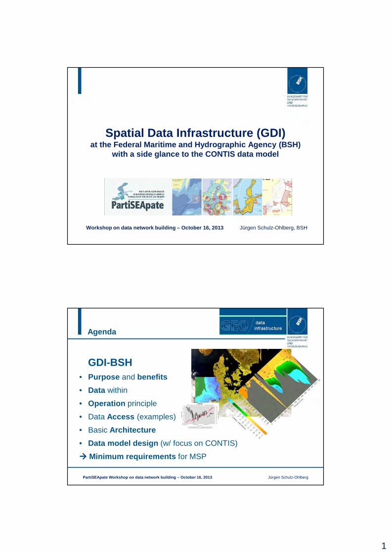
1 Spatial Data Infrastructure (GDI) at the Federal Maritime and Hydrographic Agency (BSH) with a side glance to the CONTIS data model Workshop on data network building – October 16, 2013 Jürgen Schulz-Ohlberg, BSH Agenda • Purpose and benefits • Data within • Operation principle • Data Access (examples) • Basic Architecture • Data model design (w/ focus on CONTIS) Minimum requirements for MSP PartiSEApate Workshop on data network building – October 16, 2013 Jürgen Schulz-Ohlberg GDI-BSH
Transcript of Spatial Data Infrastructure (GDI)
1
Spatial Data Infrastructure (GDI)at the Federal Maritime and Hydrographic Agency (BSH)
with a side glance to the CONTIS data model
Workshop on data network building – October 16, 2013 Jürgen Schulz-Ohlberg, BSH
Agenda
• Purpose and benefits
• Data within
• Operation principle
• Data Access (examples)
• Basic Architecture
• Data model design (w/ focus on CONTIS)
���� Minimum requirements for MSP
PartiSEApate Workshop on data network building – Octob er 16, 2013 Jürgen Schulz-Ohlberg
GDI-BSH
2
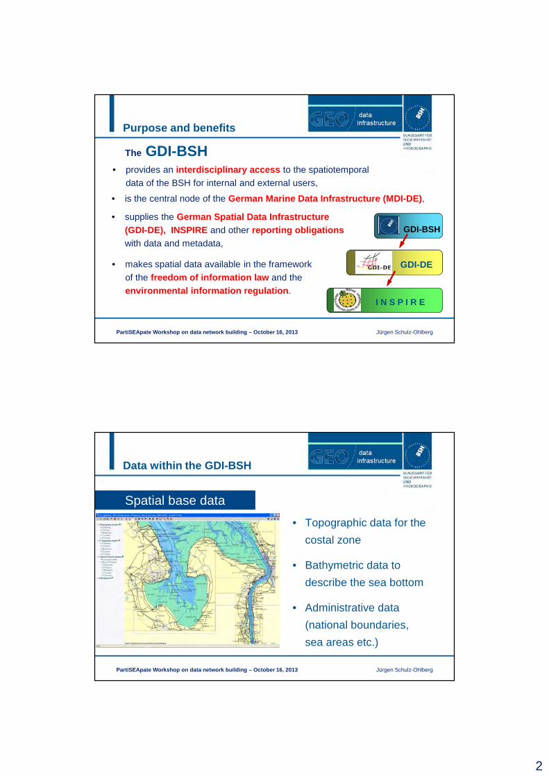
Purpose and benefits
PartiSEApate Workshop on data network building – Octob er 16, 2013 Jürgen Schulz-Ohlberg
• provides an interdisciplinary access to the spatiotemporal
data of the BSH for internal and external users,
• supplies the German Spatial Data Infrastructure (GDI-DE), INSPIRE and other reporting obligationswith data and metadata,
• makes spatial data available in the framework
of the freedom of information law and the
environmental information regulation .
• is the central node of the German Marine Data Infrastructure (MDI-DE) ,
The GDI-BSH
GDI-BSH
GDI-DE
I N S P I R E
Data within the GDI-BSH
PartiSEApate Workshop on data network building – Octob er 16, 2013 Jürgen Schulz-Ohlberg
• Topographic data for the
costal zone
• Bathymetric data to
describe the sea bottom
• Administrative data
(national boundaries,
sea areas etc.)
Spatial base data
3
Data within the GDI-BSH
PartiSEApate Workshop on data network building – Octo ber 16, 2013 Jürgen Schulz-Ohlberg
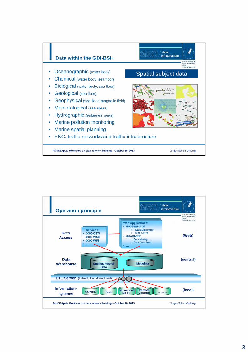
• Oceanographic (water body)
• Chemical (water body, sea floor)
• Biological (water body, sea floor)
• Geological (sea floor)
• Geophysical (sea floor, magnetic field)
• Meteorological (sea areas)
• Hydrographic (estuaries, seas)
• Marine pollution monitoring• Marine spatial planning• ENC, traffic-networks and traffic-infrastructure
Spatial subject data
Data Warehouse
(central)Spatiotemporal
Data
ETL Server (Extract, Transform, Load)
Operation principle
PartiSEApate Workshop on data network building – Octo ber 16, 2013 Jürgen Schulz-Ohlberg
Information-systems
CONTIS ..., ..., ...NumericalModel
RemoteSensingSGE (local)
Metadata
Web Applications:• GeoSeaPortal
o Data Discoveryo Map Client
• dataDIVERo Data Miningo Data Download
• …
Services:• OGC-CSW• OGC-WMS• OGC-WFS• …
(Web)Data
Access
4
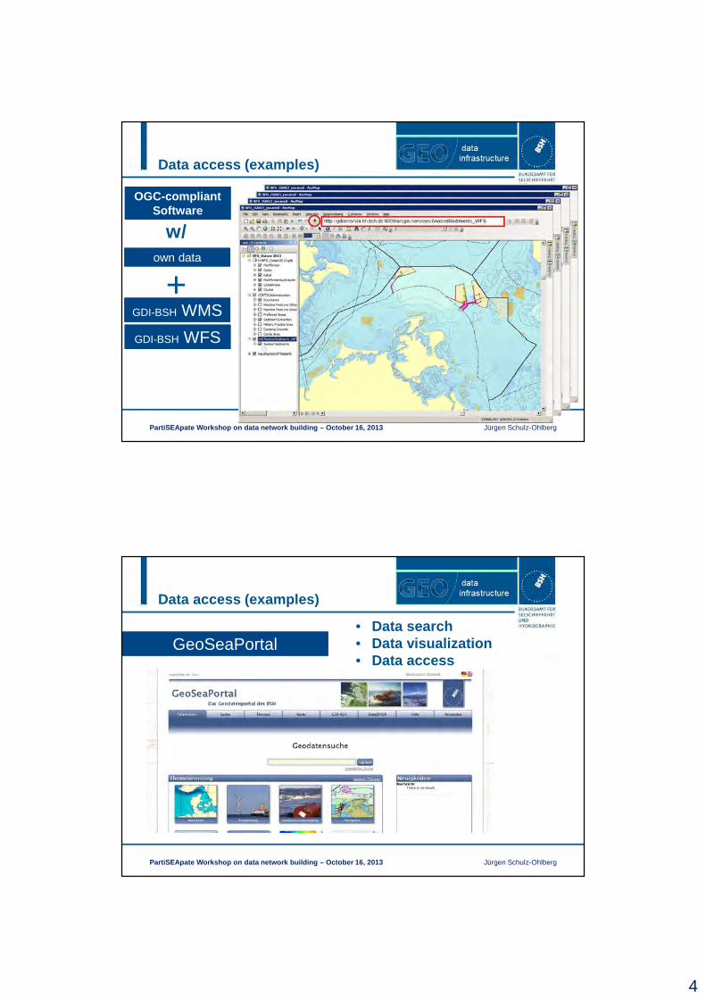
• any application which supports access to OGC services (WMS, WFS)
• e.g. ArcGIS ArcMapown data
OGC-compliant Software
GDI-BSH WFS
Data access (examples)
PartiSEApate Workshop on data network building – Octo ber 16, 2013 Jürgen Schulz-Ohlberg
GDI-BSH WMS+
w/
Data access (examples)
PartiSEApate Workshop on data network building – Octo ber 16, 2013 Jürgen Schulz-Ohlberg
GeoSeaPortal• Data search• Data visualization• Data access
5
Data access (examples)
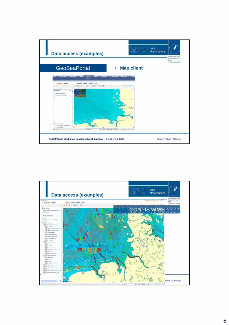
PartiSEApate Workshop on data network building – Octo ber 16, 2013 Jürgen Schulz-Ohlberg
GeoSeaPortal • Map client
Data access (examples)
PartiSEApate Workshop on data network building – Octo ber 16, 2013 Jürgen Schulz-Ohlberg
CONTIS WMS
6
Data access (examples)
PartiSEApate Workshop on data network building – Octo ber 16, 2013 Jürgen Schulz-Ohlberg
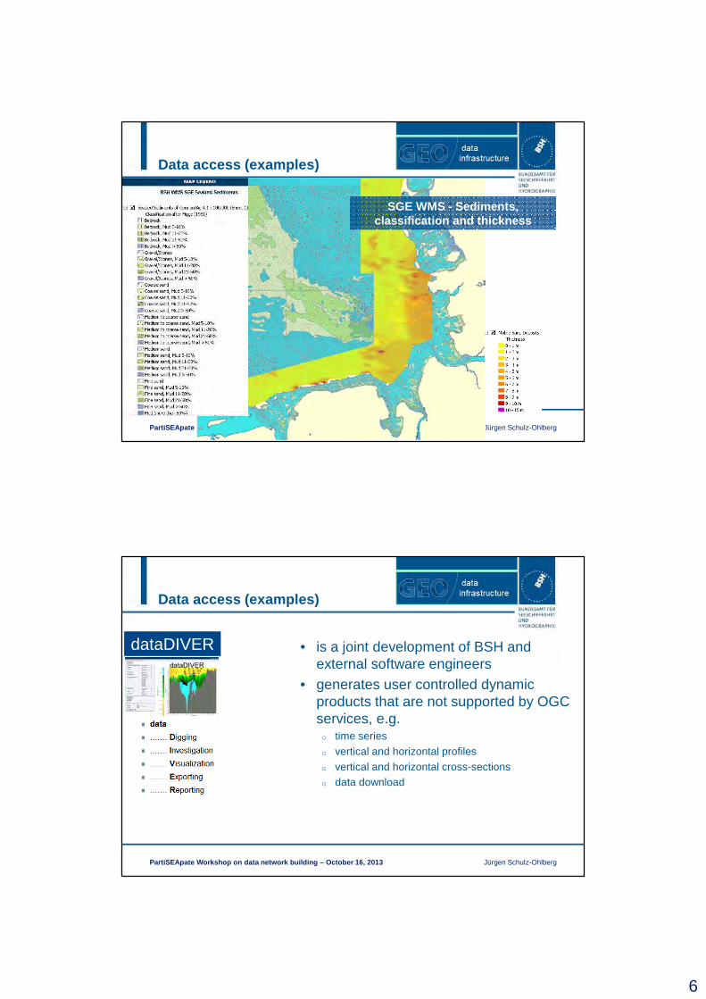
SGE WMS - Sediments, classification and thickness
Data access (examples)
PartiSEApate Workshop on data network building – Octo ber 16, 2013 Jürgen Schulz-Ohlberg
dataDIVER • is a joint development of BSH and external software engineers
• generates user controlled dynamic products that are not supported by OGC services, e.g.o time serieso vertical and horizontal profileso vertical and horizontal cross-sectionso data download
7
Data access (examples)
PartiSEApate Workshop on data network building – Octo ber 16, 2013 Jürgen Schulz-Ohlberg
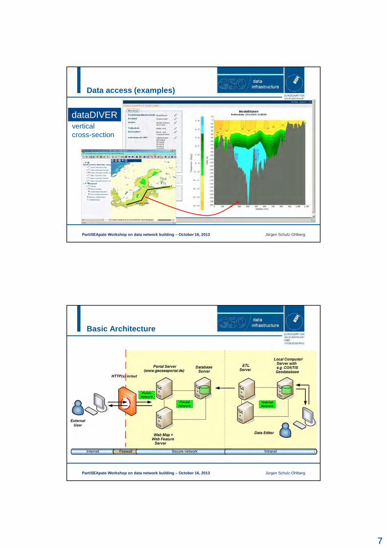
dataDIVERvertical cross-section
Basic Architecture
PartiSEApate Workshop on data network building – October 16, 2013 Jürgen Schulz-Ohlberg
8
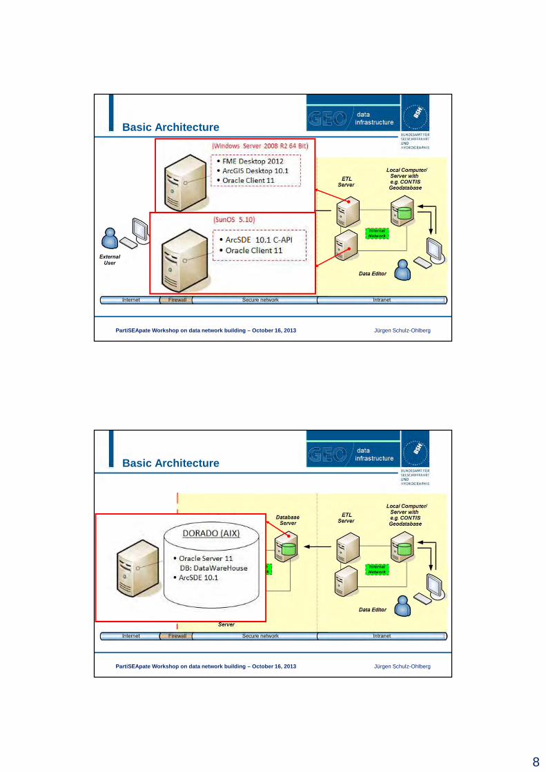
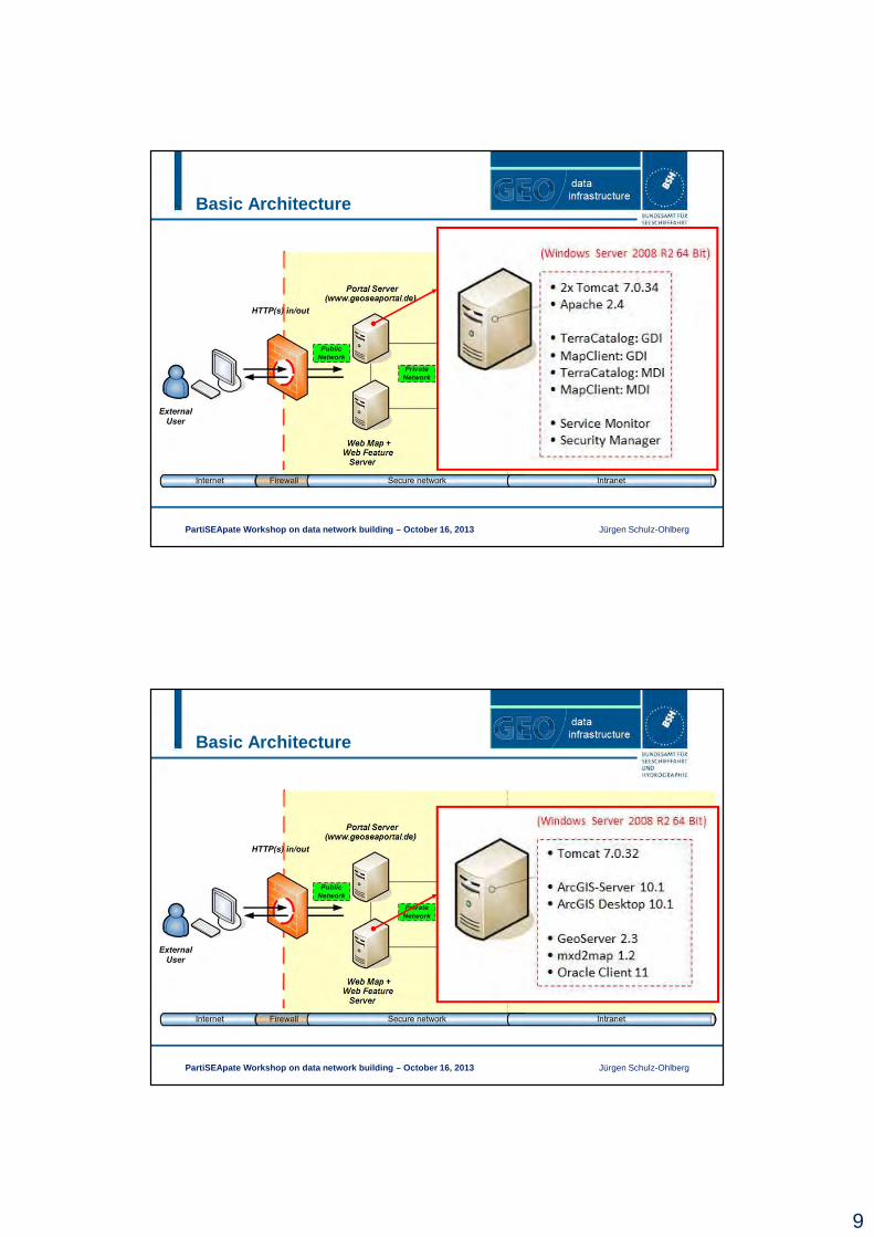
Basic Architecture
PartiSEApate Workshop on data network building – October 16, 2013 Jürgen Schulz-Ohlberg
Basic Architecture
PartiSEApate Workshop on data network building – October 16, 2013 Jürgen Schulz-Ohlberg
9
Basic Architecture
PartiSEApate Workshop on data network building – October 16, 2013 Jürgen Schulz-Ohlberg
Basic Architecture
PartiSEApate Workshop on data network building – October 16, 2013 Jürgen Schulz-Ohlberg
10
Data model design
PartiSEApate Workshop on data network building – Octo ber 16, 2013 Jürgen Schulz-Ohlberg
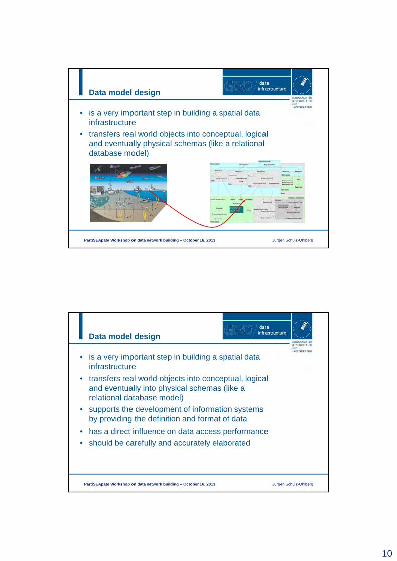
• is a very important step in building a spatial data infrastructure
• transfers real world objects into conceptual, logical and eventually physical schemas (like a relational database model)
Data model design
PartiSEApate Workshop on data network building – Octo ber 16, 2013 Jürgen Schulz-Ohlberg
• has a direct influence on data access performance• should be carefully and accurately elaborated
• is a very important step in building a spatial data infrastructure
• transfers real world objects into conceptual, logical and eventually into physical schemas (like a relational database model)
• supports the development of information systems by providing the definition and format of data
11
Data model design
PartiSEApate Workshop on data network building – Octo ber 16, 2013 Jürgen Schulz-Ohlberg
Data model design (CONTIS)
PartiSEApate Workshop on data network building – Octo ber 16, 2013 Jürgen Schulz-Ohlberg
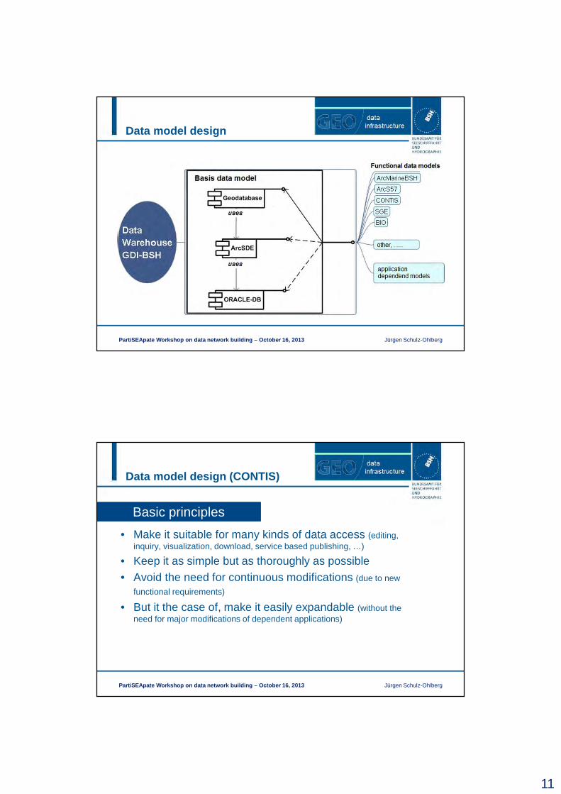
Basic principles
• Make it suitable for many kinds of data access (editing, inquiry, visualization, download, service based publishing, …)
• Keep it as simple but as thoroughly as possible• Avoid the need for continuous modifications (due to new
functional requirements)
• But it the case of, make it easily expandable (without the need for major modifications of dependent applications)
12
Data model design (CONTIS)
PartiSEApate Workshop on data network building – Octo ber 16, 2013 Jürgen Schulz-Ohlberg
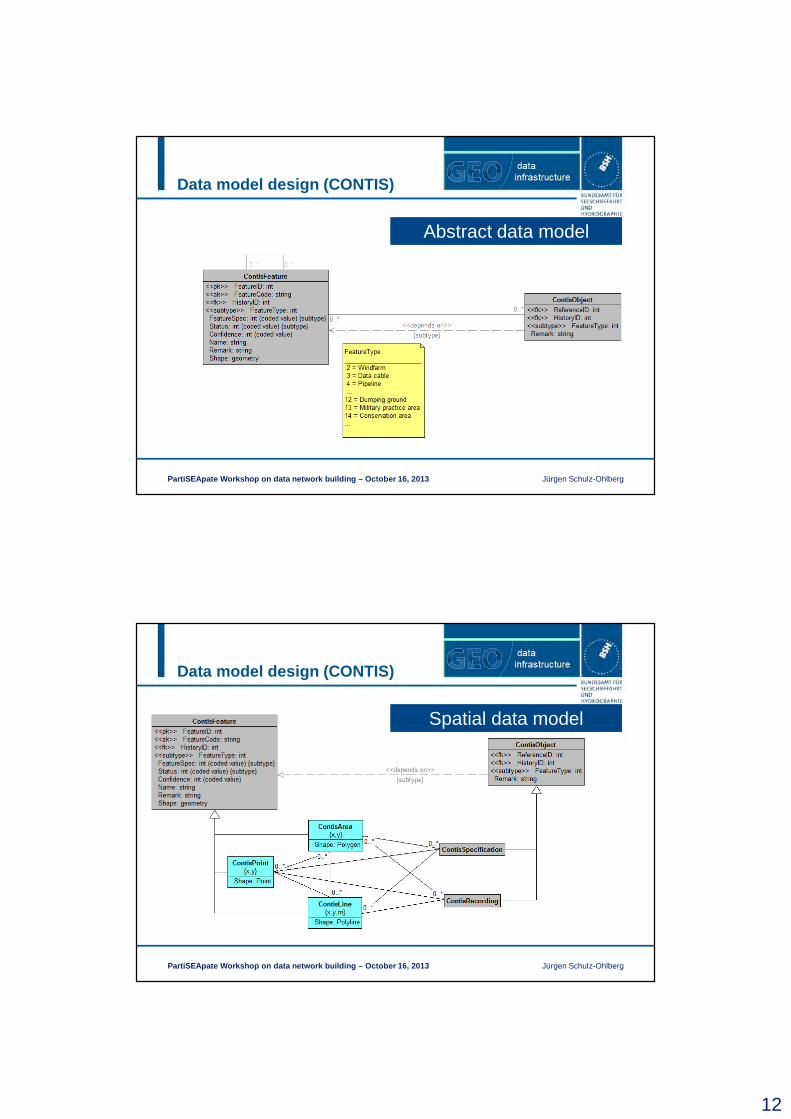
Abstract data model
Data model design (CONTIS)
PartiSEApate Workshop on data network building – Octo ber 16, 2013 Jürgen Schulz-Ohlberg
Spatial data model
13
Data model design (CONTIS)
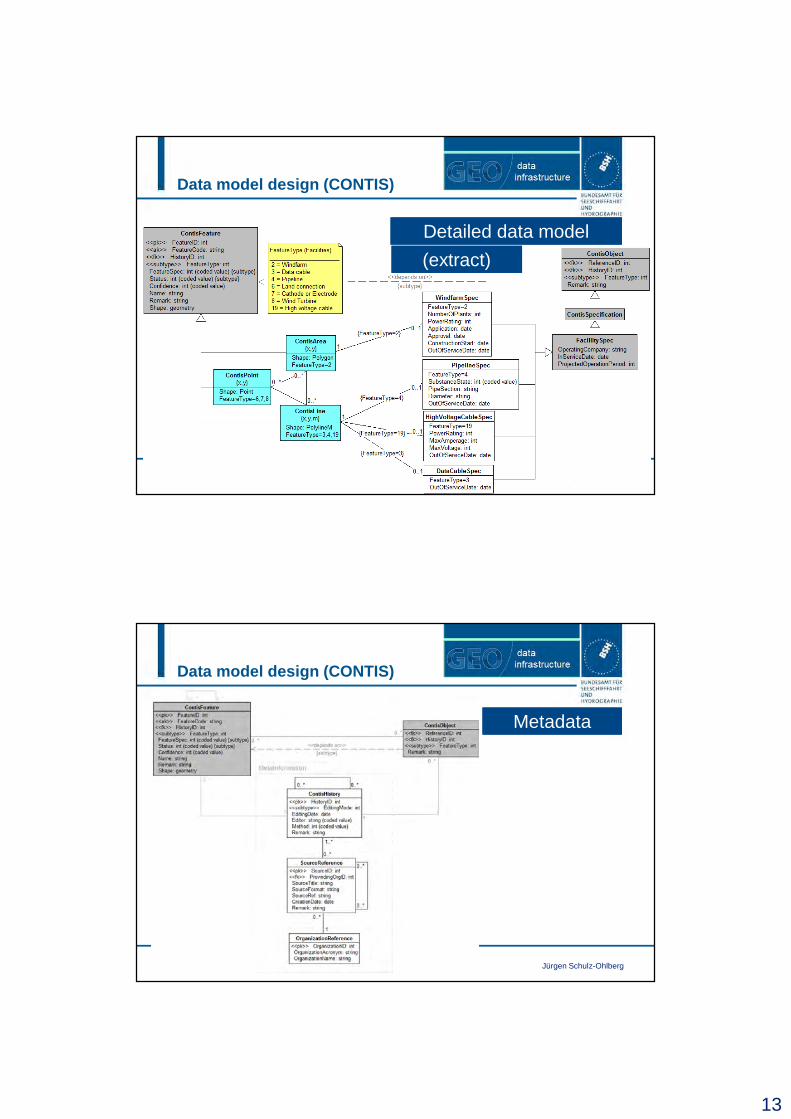
PartiSEApate Workshop on data network building – Octo ber 16, 2013 Jürgen Schulz-Ohlberg
Detailed data model
(extract)
Data model design (CONTIS)
PartiSEApate Workshop on data network building – Octo ber 16, 2013 Jürgen Schulz-Ohlberg
Metadata
14
Minimum (technical) requirements for MSP
PartiSEApate Workshop on data network building – Octo ber 16, 2013 Jürgen Schulz-Ohlberg
• Computer (PC, Workstation, Mainframe, …)
• Web Server (e.g. Apache Tomcat, …)
• Web Map Server supporting OGC standards (e.g. Map Server, Geo Server, ArcGIS Server, …)
• Spatially enabled Database (e.g. Oracle w/ Spatial or ArcSDE, PostgreSQL w/ PostGIS, ESRI Person, ESRI File Geodatabase, Shape file system, …)
• GIS system (e.g. ArcGIS Desktop, …)
• Appropriate and applicable data model (fitting the functional needs)
• Data
Thank you for your attention!
PartiSEApate Workshop on data network building – Octo ber 16, 2013 Jürgen Schulz-Ohlberg
[email protected], +49 40 3190-3410