South East · 2019-03-01 · Association (RYA) cruising routes. A significant number of fishing...
108
South East Social Policy groupings: • Access • Defence • Employment • Fisheries • Governance • Heritage Assets • Infrastructure • Seascape • Social • Tourism and Recreation HLMOs addressed by policies: Ensuring a strong, healthy and just society • People appreciate the diversity of the marine environment, its seascapes, its natural and cultural heritage and its resources and act responsibly. • The use of the marine environment is benefiting society as a whole, contributing to resilient and cohesive communities that can adapt to coastal erosion and flood risk, as well as contributing to physical and mental wellbeing. • There is equitable access for those who want to use and enjoy the coast, seas and their wide range of resources and assets and recognition that for some island and peripheral communities the sea plays a significant role in their community. • Use of the marine environment will recognise, and integrate with, defence priorities, including the strengthening of international peace and stability and the defence of the UK and its interests. Promoting good governance • Marine businesses are subject to clear, timely, proportionate and, where appropriate, plan led regulation • Marine, land and water management mechanisms are responsive and work effectively together, for example through integrated coastal zone management and river basin management plans Achieving a sustainable marine economy • Infrastructure is in place to support and promote safe, profitable and efficient marine businesses See also individual policies linked in templates. This is summarised on the cover page of each group of policies
Transcript of South East · 2019-03-01 · Association (RYA) cruising routes. A significant number of fishing...

South East Social Policy groupings:
• Access• Defence• Employment• Fisheries• Governance
• Heritage Assets• Infrastructure• Seascape• Social• Tourism and Recreation
HLMOs addressed by policies:
Ensuring a strong, healthy and just society • People appreciate the diversity of the marine environment, its seascapes, its natural and
cultural heritage and its resources and act responsibly.• The use of the marine environment is benefiting society as a whole, contributing to resilient
and cohesive communities that can adapt to coastal erosion and flood risk, as well ascontributing to physical and mental wellbeing.
• There is equitable access for those who want to use and enjoy the coast, seas and theirwide range of resources and assets and recognition that for some island and peripheralcommunities the sea plays a significant role in their community.
• Use of the marine environment will recognise, and integrate with, defence priorities,including the strengthening of international peace and stability and the defence of the UKand its interests.
Promoting good governance • Marine businesses are subject to clear, timely, proportionate and, where appropriate, plan
led regulation• Marine, land and water management mechanisms are responsive and work effectively
together, for example through integrated coastal zone management and river basinmanagement plans
Achieving a sustainable marine economy • Infrastructure is in place to support and promote safe, profitable and efficient marine
businesses
See also individual policies linked in templates. This is summarised on the cover page of each group of policies

Plan area South East Grouping Access Related High Level Marine Objectives (HLMO).
Ensuring a strong, healthy and just society There is equitable access for those who want to use and enjoy the coast, seas and their wide range of resources and assets and recognition that for some island and peripheral communities the sea plays a significant role in their community.
Other relevant policies SE-GOV-1 SE-INF-1 SE-INF-3 SE-INF-4 SE-INF-5
Are these policies consistent across other plan areas?
NW
NE
SW

Policy drafting template SE-ACC-1
HLMO Ensuring a strong, healthy and just society.
Sub bullet(s) There is equitable access for those who want to use and enjoy the coast, seas and their wide range of resources and assets and recognition that for some island and peripheral communities the sea plays a significant role in their community.
Grouping Access Code SE-ACC-1
Policy SE-ACC-1 Proposals, including in relation to tourism and recreation, should demonstrate that they will, in order of preference: a) avoid, b) minimise, c) mitigate significant adverse impacts on public access.
What is Access?
1. Access includes ‘physical’ access to the marine area to participate in recreationalactivities, or associated facilities and infrastructure on land to enable and supportactivities in the marine area (for example, paths, benches, slipways, car parks andmarinas). Access also includes ‘interpretive’ and ‘virtual’ access that increaseawareness and understanding of the marine area. For example interpretationboards, viewpoints, signage, films, literature and web based interpretation tools.
Where does access take place in the south east marine plan area?
2. Opportunities for access to the south east marine plan area are focused aroundports, harbours, marinas, heritage assets and tourist destinations. Access is alsoconcentrated near to centres of population where general recreation activitiesfrequently take place such as:
• pleasure boating,• sailing,• recreational diving (including diving near protected areas),• sea angling,• swimming,• kayaking,• paddleboarding and surfing,• cycling,• dog walking.
3. The area hosts several blue flag beaches as well as two Areas of OutstandingNatural Beauty and five UNESCO world heritage sites. Boating activity is prevalentthroughout the area, with over 140 recognised recreational Royal Yachting

Association (RYA) cruising routes. A significant number of fishing vessels operate out of ports such as Ramsgate and West Mersea.
4. Marine tourism and recreation are important aspects of the south east’s economy and while London and the Thames play significant role in this, the coastlines of Suffolk, Essex and Kent are also vital.
5. Along the Essex coast there are several traditional seaside towns including Clacton, Brightlingsea and Southend-on-Sea that attract large numbers of visitors particularly in the summer. The county also contains popular waters for recreational activities including sailing, power boating, angling, canoeing and water skiing. There are also a large number of marinas that support recreational yachting.
6. The northern coast of Kent contains several areas of shallow coastal waters, such as The Swale, which provide excellent opportunities for recreational activities such as water skiing, kayaking, kite surfing, power boating and wind surfing. Traditional Thames barges are often seen in these waters, now providing recreational boat trips. Sea angling takes places from most of the beaches of the North Kent Coast. Bait digging on the mud flats is a common sight. The developed coastal towns of Herne Bay, Leysdown, Margate and Whitstable are, for many, the first seaside towns from the Capital and the area has long been a popular destination.
7. The Thames is tidal up to Teddington Lock and is therefore covered by the south east marine plan. Numerous marinas and mooring facilities along the Thames and into the Medway support extensive recreational boating. The south east section of the English coastal path is complete from Ramsgate to Camber and there are plans to extend it right up to Woolwich.
8. Despite being the smallest plan area with the shortest coastline, the south east still contains numerous blue flag beaches which are a big draw for the area.There are 162 ports and harbours in the south east marine plan area, according to the MMO Strategic scoping report the south east inshore marine plan area contributes over £2.5 billion to the national economy from ports and shipping, the greatest amount of GVA of all the marine plan areas.
9. The England Coast Path is complete for a large section of the south east from Camber to Ramsgate and the section extending to Whitstable is also approved with work taking place.
When does access take place in south east marine plan area?
10. Access to and within the plan areas takes place throughout the year but depends upon the type of access. Access to Ports and Harbours is continual with seasonal variation according to weather and fishing activity. Both tourism and recreation are subject to seasonal highs and lows throughout the year across the south east plan area with higher visitor numbers during the spring and summer months especially around historic buildings, seabird reserves, wrecks (through diving activities) and general recreational access to the marine environment.
Why is access important to the South east marine plan area?
11. This policy directly supports requirements in the Marine Policy Statement, it states‘The provision of slipways, coastal footpaths and ensuring coastal access forexample could encourage economic growth and highlights the importance ofconsidering the links between marine and terrestrial plans’ (3.11.5). Provision formarine access is essential for realising the economic and social benefits for thesouth east marine plan area. The south east marine plan area is important fortourism and this is predicted to continue over the lifespan of the marine planaccording to MMO (2017) Futures analysis for the North East, North West, SouthEast and South West marine plan areas(https://www.gov.uk/government/publications/futures-analysis-for-the-north-east-north-west-south-east-and-south-west-marine-plan-areas-mmo-1127). Access willcreate opportunities to raise environmental awareness in users of the areas.
12. The issue of coastal access is also set out in the National Planning PolicyFramework (S73 and S114) which states ‘access to high quality open spaces andopportunities for sport and recreation can make an important contribution to thehealth and well-being of communities.’ It also notes that local planning authoritiesshould ‘improve public access to and enjoyment of the coast’.
13. Public access plays an important role in supporting social benefits for local peopleand visitors to the south east marine plan area, particularly in support of recreationand tourism. Improved access to the coast through the England Coastal PathProgramme led by Natural Engalnd is expected to bring significant benefits to localeconomies and communities, recreational users, and to public health. This policysupports issues identified in the south east and attempts to protect access toestuarine, coastal and marine areas.
Who is this of interest to?
14. All public authorities including Marine Management Organisation, Natural England,Inshore Fisheries and Conservation Authorities, Planning Inspectorate, TheDepartment for Business, Energy and Industrial Strategy, Joint Nature ConservationCommittee, Maritime Coastguard Agency , Environment Agency, Local PlanningAuthorities, The Department for Digital, Culture, Media & Sport, Defra, Cefas, TheCrown Estate, Historic England, Harbour Authorities, Oil and Gas Authority, LocalEnterprise Partnerships, Local Flood Authorities, Regional Flood and CoastalCommittees, Department for Transport, Ministry of Housing, Communities and LocalGovernment, Seafish, Ministry of Defence, Home Office, Big Lottery Fund, VisitEngland, tourism promotion agencies, destination management organisations, UKHydrographic Office, Office of National Statistics, Animal and Plant Health Agency
How should this policy be applied?
15. Proposals should demonstrate that they will in order of preference avoid, minimise ormitigate significant adverse impacts of construction, operation and decommissioningon existing public access . Proposals cannot proceed to (b)unless they have firstdemonstrated why they cannot meet (a) etc.

16. Inclusion of this information does not indicate that approval of the proposal will follow by default. That will also depend on other material considerations to be taken into account by the decision-maker which may include, for example, other plans.
17. Established developments should be maintained to a suitable standard to make access available to as wide a range of users as practical.
18. Where this is not possible proposals must outline mitigation such as development of alternative access opportunities off site.
19. Public authorities should assess the potential impacts positive and negative, direct and indirect, permanent and temporary, as well as cumulative impacts on the access. Adverse impacts may include physically excluding access to parts of the marine area at all times or some times of the day or year. It is then necessary to confirm that the proposal will (in order of preference): not adversely impact on public access or have minimal adverse effects - this may be due to there being no rights of public access to the proposed site or through scope to provide for public access at certain times.
20. In examining and determining applications for nationally significant infrastructure projects, examining authorities and the Secretary of State for the Ministry of Housing, Communities and Local Government must have regard to this policy for nationally significant infrastructure projects that may have significant adverse impacts on public access.
21. The issues presented in managing access are significant, contributing policies have been developed to consider potential impacts on marine protected areas, ecosystem goods and services, haul outs, breeding colonies, feeding grounds and on highly mobile species.
22. Construction should show evidence of regard for environmental implications in particular those on seasonal species such as over wintering birds or other migratory species. Signposting
23. Existing measures which relate to, and may contribute to the achievement of this policy include:
• The Marine Policy Statement • National Planning Policy Framework • Sport England Strategy • Local authorities (districts, unitary authorities, and counties) set out locally
specific plans for activities that enable diversification of economic activity through measures in related statutory plans
• Tendring Development Plan • Colchester Development Plan • Maldon Development Plan • Rochford Development Plan • Southend-on-Sea Development Plan • Medway Development Plan • Castle Point Development Plan

• Swale Development Plan• Canterbury Development Plan• Thanet Development Plan• Dover Development Plan• Existing MIS data• T&R, protected landscapes, seascapes, coastal path, ports (re diversification)
layers• Visit Britain, Destination Management Plans• Local Enteprise Partnerships
24. Further information and guidance that may help in implementing the policy include:• Planning and access for disabled people: a good practice guide• Separately from the work of marine planning, Natural England is working on
ensuring a right of access around all our open coast of England This right ofaccess underpins an England coast path. As this is being managed byanother agency and principally relates to space above mean high watersprings, this should not be a focus for marine planning, though it willincreasingly play an important role in how people access the marine area. Thedevelopment of the path should be highlighted by the plans for considerationby those carrying out activity near the marine area.
Policy drafting template SE-ACC-2
HLMO Ensuring a strong, healthy and just society
Sub bullet(s) There is equitable access for those who want to use and enjoy the coast, seas and their wide range of resources and assets, and recognition that for some island and peripheral communities the sea plays a significant role.
Grouping Access Code SE-ACC-2
Policy
SE-ACC-2 Proposals demonstrating appropriate enhanced and inclusive public access to and within the marine area, and that consider the future provision of services for tourism and recreation activities, will be supported.
What is Access?
1. Access includes ‘physical’ access to the marine area to participate in recreational activities, or associated facilities and infrastructure on land to enable and support activities in the marine area (for example, paths, benches, slipways, car parks and marinas). Access also includes ‘interpretive’ and ‘virtual’ access that increase awareness and understanding of the marine area. For example interpretation boards, viewpoints, signage, films, literature and web based interpretation tools.
Where does access take place in the south east marine plan area?
2. Opportunities for access to the south east marine plan area are focused around ports, harbours, marinas, heritage assets and tourist destinations. Access is also concentrated near to centres of population where general recreation activities frequently take place such as:
• pleasure boating,• sailing,• recreational diving (including diving near protected areas),• sea angling,• swimming,• kayaking,• paddleboarding and surfing,• cycling,• dog walking.
3. Despite being the smallest plan area with the shortest coastline, the area hosts several blue flag beaches as well as two Areas of Outstanding Natural Beauty(AONB) and five United Nations Educational, Scientific and Cultural Organization

(UNESCO) world heritage sites. Boating activity is prevalent throughout the area, with over 140 recognised recreational Royal Yachting Association (RYA) cruising routes. A significant number of fishing vessels operate out of ports such as Ramsgate and West Mersea.
4. Marine tourism and recreation are important aspects of the south east’s economy and while London and the Thames play significant role in this, the coastlines of Suffolk, Essex and Kent are also vital.
5. Along the Essex coast there are several traditional seaside towns including Clacton, Brightlingsea and Southend-on-Sea that attract large numbers of visitors particularly in the summer. The county also contains popular waters for recreational activities including sailing, power boating, angling, canoeing and water skiing. There are also a large number of marinas that support recreational yachting.
6. The northern coast of Kent contains several areas of shallow coastal waters, such as The Swale, which provide excellent opportunities for recreational activities such as water skiing, kayaking, kite surfing, power boating and wind surfing. Traditional Thames barges are often seen in these waters, now providing recreational boat trips. Sea angling takes places from most of the beaches of the North Kent Coast. Bait digging on the mud flats is a common sight. The developed coastal towns of Herne Bay, Leysdown, Margate and Whitstable are, for many, the first seaside towns from the Capital and the area has long been a popular destination.
7. The Thames is tidal up to Teddington Lock and is therefore covered by the south east marine plan. Numerous marinas and mooring facilities along the Tidal Thames and into the Medway support extensive recreational boating. The south east section of the English coastal path is complete from Ramsgate to Camber and the section extending to Whitstable is also approved with work taking place.
8. There are 162 ports and harbours in the south east marine plan area. According to the MMO Strategic scoping report the south east inshore marine plan area contributes over £2.5 billion to the national economy from ports and shipping, the greatest amount of GVA of all the marine plan areas. The Port of London handled 48.8 million tonnes (9%) of total traffic in 2011. Dover, the top UK port for roll-on roll-off (ro-ro) freight, handled two million ro-ro main freight units. Felixstowe was the UK's largest container port, handling two million containers. Dover, the UK's busiest ferry port, handled 11.9 million passengers in 2012.
When does access take place in south east marine plan area?
9. Access to, and within, the plan areas takes place throughout the year. Access to ports and harbours is continual with seasonal variation, according to weather and fishing activity. Tourism and recreation are subject to seasonal highs and lows throughout the year with higher visitor numbers during the spring and summer months, especially around historic buildings, wrecks and general access to the marine environment.

Why is access important to the south east marine plan area?
10. The High Level Marine Objective to ensure a healthy and just society aims to ensurethat there is equitable access for those who want to use and enjoy the coast, seasand their wide range of resources and assets. Provision for marine access isessential to enable the economic and social benefits that will come from the growthof tourism and recreation in the south east marine plan area. It requires proposals tomanage impacts on public access to the marine area and contributes to the healthand well-being of communities.
11. This policy directly supports requirements in the Marine Policy Statement, it states‘The provision of slipways, coastal footpaths and ensuring coastal access forexample could encourage economic growth and highlights the importance ofconsidering the links between marine and terrestrial plans’ (3.11.5). Provision formarine access is essential for realising the economic and social benefits for thesouth east marine plan area. The south east marine plan area are important fortourism and this is predicted to continue over the lifespan of the marine planaccording to MMO (2017) Futures analysis for the North East, North West, SouthEast and South West marine plan areas(https://www.gov.uk/government/publications/futures-analysis-for-the-north-east-north-west-south-east-and-south-west-marine-plan-areas-mmo-1127). Access willcreate opportunities to raise environmental awareness in users of the areas.
12. The issue of coastal access is also set out in the National Planning PolicyFramework (S73 and S114) which states ‘access to high quality open spaces andopportunities for sport and recreation can make an important contribution to thehealth and well-being of communities.’ It also notes that local planning authoritiesshould ‘improve public access to and enjoyment of the coast’.
13. Public access plays an important role in supporting social benefits for local peopleand visitors to the south east marine plan area, particularly in support of tourism andrecreation. Improved access to the coast through the England Coastal PathProgramme led by Natural England is expected to bring significant benefits to localeconomies and communities, recreational users, and to public health. This policysupports issues identified in the south east and attempts to enhance access toestuarine, coastal and marine areas.
14. Public access plays an important role in supporting social benefits for local peopleand visitors to the south east marine plan area, particularly in support of tourism andrecreation. The MMO Strategic scoping report notes that the extent to which peoplefind an area attractive to visit depends heavily on the appearance and health of themarine and coastal environment.
Who is this of interest to?
15. All public authorities including Marine Management Organisation, Natural England,Inshore Fisheries and Conservation Authorities, Planning Inspectorate, TheDepartment for Business, Energy and Industrial Strategy, Joint Nature ConservationCommittee, Maritime Coastguard Agency , Environment Agency, Local PlanningAuthorities, The Department for Digital, Culture, Media & Sport, Defra, Cefas, TheCrown Estate, Historic England, Harbour Authorities, Oil and Gas Authority, Local

Enterprise Partnerships, Local Flood Authorities, Regional Flood and Coastal Committees, Department for Transport, Ministry of Housing, Communities and Local Government, Seafish, Ministry of Defence, Home Office, Big Lottery Fund, Visit England, tourism promotion agencies, destination management organisations, UK Hydrographic Office, Office of National Statistics, Animal and Plant Health Agency Other management plans and landscape designations/definitions including National parks, Areas of Outstanding National Beauty, Heritage Coasts and neighbourhood management plans.
How should this policy be applied?
16. SE-ACC-2 will make sure that support will be given to proposals such as: • physical, • digital, • interpretative access, • signage,
which enhances public access to, and within, the marine area, that consider the future provision of services for tourism and recreation activities. Services for tourism and recreation activities may include:
• provision for transportation, • parking, • cycle infrastructure, • public transportation, • accommodation, • catering, • toilet facilities, • jetties, • slipways, • reefs • and hospitality services.
17. Achieving inclusive, and accessible, recreational use requires outcomes where all
sectors of society have opportunities for recreational use. It also covers physical and virtual access whereby all have the chance to enjoy and appreciate the marine area in different ways.
18. Policy SE-ACC-2 builds on SE-ACC-1 by requiring proposals to enhance public access. Enhancing public access may include removing unsuitable access in order to improve safety, or accessibility, to the marine area, or to reduce detrimental impacts on other activities. In order to avoid adverse impacts new access needs to consider potential impacts on a number of parameters, including the setting, biodiversity, heritage assets, seascape, existing access, tourism and recreation. Proposals should assess the risk to these and include evidence of any public access related to the proposal area, or elsewhere which it potentially affects. Early engagement with land owners and other relevant parties is strongly recommended.
19. Identifying positive impacts of a proposal does not negate the need to assess adverse impacts in line with relevant legislation. Enhancement is not a substitute for avoidance, protection or mitigation measures.

20. If these criteria cannot be met by a proposal, where it requires an authorisation decision, it will only be authorised if there are relevant considerations in line with the Marine and Coastal Access Act (2009) (Section 58(1)).
21. Public authorities must assess potential impacts, positive and negative, direct and indirect, permanent and temporary, as well as cumulative effects on recreation and tourism activities. Measures to reduce adverse impacts may include restricting access to areas where recreation activities take place, reducing the length of the season within which tourists may visit a natural or historic heritage attraction, or any actual physical impact. Enhancement is not a substitute for avoidance, minimisation or mitigation measures.
22. In examining and determining applications for nationally significant infrastructure projects, examining authorities and the Secretary of State for the Ministry of Housing, Communities and Local Government must have regard to this policy for nationally significant infrastructure projects that may have significant adverse impacts on public access.
23. The issues presented in managing access are significant. Contributing policies have been developed to consider potential impacts on marine protected areas, ecosystem goods and services, and on highly mobile species.
24. Construction should show evidence of regard for environmental implications in particular those on seasonal species such as over wintering birds or other migratory species. Signposting
25. Existing measures which relate, and may contribute, to the achievement of this policy include:
• The Marine Policy Statement • National Planning Policy Framework • Sport England Strategy • Water Framework Directive • Local authorities (districts, unitary authorities, and counties) set out locally
specific plans for activities that enable diversification of economic activity through measures in related statutory plans
• Tendring Development Plan • Colchester Development Plan • Maldon Development Plan • Rochford Development Plan • Southend-on-Sea Development Plan • Medway Development Plan • Castle Point Development Plan • Swale Development Plan • Canterbury Development Plan • Thanet Development Plan • Dover Development Plan • Existing MIS data

• Tourism and Recreation, protected landscapes, seascapes, coastal path,ports (re diversification) layers
• Visit Britain, Destination Management Plans• Local Enterprise Partnerships
26. Further information and guidance that may help in implementing the policy include:• Planning and access for disabled people: a good practice guide• Separately from the work of marine planning, Natural England is working on
ensuring a right of access around all our open coast of England This right ofaccess underpins an England coast path. As this is being managed byanother agency and principally relates to space above mean high watersprings, this should not be a focus for marine planning, though it willincreasingly play an important role in how people access the marine area. Thedevelopment of the path should be highlighted by the plans for considerationby those carrying out activity near the marine area.

Plan area South East Grouping Defence Related High Level Marine Objectives (HLMO).
Ensuring a strong, healthy and just society Use of the marine environment will recognise, and integrate with, defence priorities, including the strengthening of international peace and stability and the defence of the UK and its interests.
Other relevant policies SE-UWN-1 SE-UWN-2 SE-GOV-1 SE-CO-1
Are these policies consistent across other plan areas?
NW
NE
SW

Policy drafting template SE-DEF-1
HLMO Ensuring a strong, healthy and just society
Sub bullet(s) Use of the marine environment will recognise, and integrate with, defence priorities, including the strengthening of international peace and stability and the defence of the UK and its interests.
Grouping Defence Code SE-DEF-1
Policy SE-DEF-1: Defence Proposals in or affecting Ministry of Defence areas should only be authorised with agreement from the Ministry
What is defence?
1. The Ministry of Defence has the primary role of providing defence and security to the people of the UK and overseas territories. Within UK waters in peacetime, military activities are comprised of operational, practice and training activities, routine patrolling, transporting equipment and personnel in and out of the country, and communications including using radar.
2. There are a high number of defence activities and estates in the south east marine plan area. Marine infrastructure can affect their continuity or future use. SE-DEF-1 will avoid conflict between defence activities and new proposals within the plan areas. It will ensure that defence interests are not impeded
Where is defence in the south east marine plan area?
3. The south east marine plan area includes over 800 sq km of military practice and exercise areas. The inshore area contains extensive danger areas used for weapon test and evaluation activities including defence maritime navigational interests.. There are also a number of coastal sites with associated danger and exercise areas used for firing ranges and ordance disposal.
When does defence take place in the south east marine plan area?
4. Areas identified military practice and exercise areas are used regularly for training and exercise purposes across all marine plan area.
5. Defence activities that use the marine environment, directly or indirectly, in support of operational capability are diverse but include operational vessels and aircraft, HM naval bases, surface and sub-surface navigational interests, underwater acoustic ranges, maritime and amphibious exercises, coastal training, test and evaluation ranges. Marine Policy Statement (3.2.4).
Why is defence important to the south east marine plan area?
6. Marine and land-based Ministry of Defence activities are of national importance. There is a prevalence of defence activities and estates in the south east marine plan

areas. Marine infrastructure may have a cumulative or individual effect on their continuity or future use.
7. This policy will avoid conflict between defence activities using the marine environment, and new licensable marine activities within the plan areas. It will make sure that defence interests are not impeded.
8. This policy supports the need for defence activities to take place within the south east marine plan area for the purpose of national security.
Who is this of interest to?
9. Applicants or proponents in shaping and influencing what they may wish to do where and how they may wish to do it
10. All public authorities including MMO, Natural England, IFCA, PINS, BEIS, JNCC, MCA, Environment Agency, Local, Planning Authorities, DCMS, Defra, Cefas, The Crown Estate, Historic England, Harbour Authorities, Oil and Gas Authority, Local Enterprise Partnerships, Local Flood Authorities, Regional Flood and Coastal Committees, DfT, MHCLG, Seafish, MOD, Home Office, Big Lottery Fund, Visit England, UK Hydrographic Office, Office of National Statistics, Animal and Plant Health Agency
How should this policy be implemented?
11. The Ministry of Defence should be consulted in all circumstances to verify whether defence interests will be affected and make sure that national defence capabilities and interests are not compromised Marine Policy Statement (3.2.9). Permission from the Ministry of Defence is needed for any proposals that will have an adverse impact on defence activities in or affecting Ministry of Defence areas.
12. If the Ministry of Defence objects to a proposal the development or activity will not be authorised.
13. Public authorities should take full account of the individual and cumulative effects of marine infrastructure on both marine and land-based Ministry of Defence interests.
14. In examining and determining applications for nationally significant infrastructure projects, examining authorities and the Secretary of State for the Ministry of Housing, Communities and Local Government must have regard to this policy for nationally significant infrastructure projects that may have significant adverse impacts on Ministry of Defence areas.
15. This policy adds clarity to existing national policy National Planning Policy Framework (Section 164) and the Marine Policy Statement (3.2.9) by identifying Ministry of Defence areas (some regulated by byelaws) within the marine plan area (see figure XX). It also clarifies the application process and encourages early intervention in dealing with potential issues or conflicts. It confirms that proposals within Ministry of Defence areas will not be authorised without appropriate approval from the Ministry of Defence.

Signposting – defence
16. Existing measures which relate to, and may contribute to the achievement of this policy include:
• Marine Policy Statement (3.2) (SE-DEF-1) • National Planning Policy Framework (Section 11 and Section 7) (see box 3) • National Security Strategy and Strategic Defence and Security Review 2015

Plan area South East Grouping Employment Related High Level Marine Objectives (HLMO).
Ensuring a strong, healthy and just society There is equitable access for those who want to use and enjoy the coast, seas and their wide range of resources and assets and recognition that for some island and peripheral communities the sea plays a significant role in their community.
Other relevant policies SE-GOV-1 SE-CO-1 SE-TR-1 SE-TR-2
Are these policies consistent across other plan areas?
NW NE
SW

Policy drafting template SE-EMP-2
HLMO Ensuring a strong, healthy and just society
Sub bullet(s) There is equitable access for those who want to use and enjoy the coast, seas and their wide range of resources and assets and recognition that for some island and peripheral communities the sea plays a significant role in their community.
Grouping Employment Code SE-EMP-2
Policy SE-EMP-2 Proposals resulting in a net increase to long term marine related employment will be supported, particularly in areas where the proposals are in line with the skills available in and adjacent to the south east marine plan area
What is employment?
1. A net increase in employment is the additional employment benefit achieved by developments or activities, after accounting for any negative impacts on other activities or developments, especially where employment can be accessed by those in localities close to the south east marine plan area.
2. Marine activities have an influence on employment throughout the marine areas. This can be a direct effect for example fisheries employment or indirect for example associated tourism employment. The influence of marine activities on employment may extend beyond the coast into communities not traditionally associated with marine employment. This may be through increased visitors numbers, seasonal employment or industries that support marine activities.
3. The South East Marine Plan Area is important for tourism, ports, offshore wind and energy generation. There is potential for growth in the ports sector, nuclear power generation and shellfish aquaculture (MMO 1127).
4. The Marine Policy Statement (2.5.3) highlights employment benefits not only from current interests such as fishing and port activity, but also the role of emerging industries such as the renewable energy sector. It also highlights the role of the marine ecosystem in providing economic and social benefits, both nationally and for local communities (2.5.5). National plans such as the Plan for Growth highlight the need to increase employment and re-structure it away from the public sector.
5. Employment also has social benefits, as those in work benefit from improved health and well-being. This approach supports government aspirations such as those set out in the 25 Year Environment Plan, Clean Growth Strategy, Industrial Strategy and the Education and Employment Strategy.

6. The Marine Policy Statement also recognises the value of existing developments and activities and the characteristics of the marine plan area, which may not always fit with projects that bring employment opportunities. Employment is not the only consideration in decision-making and should be used appropriately. For some projects direct employment impact may be minimal, but indirect employment impact may be significant (enabling economic activity rather than generate economic benefit itself), or they may achieve other outcomes, such as environmental or social benefits; these should also be considered.
Where is employment in the south east marine plan area?
7. Coastal towns have been shown to have a higher than average employment deprivation rate (DCLG, 2015). Tourism is an important industry in the plan area, from traditional seaside holidays in Southend-on-Sea to nature watching in conservation areas on the River Medway the marine plan area covers a diverse variety of marine related tourism activity.
8. London and the River Thames are home to extensive tourist and marine activity relying on the tidal river. The river is a key component of London’s infrastructure and provides an important route for cargo into the city. Felixstowe is a significant container port and the port of Dover is the busiest ferry port in Europe.
When does employment take place in south east marine plan area?
9. Tourism related employment can often be very seasonal, peaking in the summer months however other marine activities such as shipping continue throughout the year. Fisheries may follow seasonal trends in stocks and breeding cycles.
Why is employment important to the south east marine plan area?
10. SE-EMP-2 encourages public authorities to consider the long-term employment benefits of a proposal and how the required skills equate to those of the plan area. It enables maximum sustainable activity, prosperity and opportunities for all, now and in the future.
11. Various communities rely on the economic benefits of marine activities, for example there is significant employment reliant upon offshore renewable energy. Ports and shipping and fisheries remain important for communities along the coast and there is significant tourism related employment due to the huge population of London and the surrounding areas.
12. The South East Marine Plan Area is home to a variety of marine activities that contribute to employment in the area. Shipping is an important industry within this plan area, with internationally important ports throughout the region. Felixtowe is Britain’s biggest and busiest container port, handling over 3000 ships a year. The port of Dover is Europe’s busiest ferry port and a growing destination for cruise ships. Tilbury Port serves London and the South East and is an important node in the South East’s infrastructural network.
13. Increased spatial pressures can force market locations such as a renewable energy training facility out of the plan areas, removing economic and employment benefits.

Appropriately planned and sited development and associated supply chains can help encourage investment and stimulate demand for marine products and services. In turn, investment can create job opportunities which bring primary and secondary socio-economic benefits through improved levels of employment and spending of wages, which may be particularly important to areas currently experiencing deprivation. Proposals resulting in a net increase to marine related employment will be supported, particularly where they are in line with the skills available in and adjacent to the south east marine plan area.
14. This policy adds value to existing national policy. It encourages public authorities to consider the additional employment benefits of a proposal and it allows further consideration of the potential for these employment opportunities to be transferred to areas close to the south east marine plan area.
Who is this of interest to?
15. All public authorities (including MMO, Natural England, IFCA, PINS, BEIS, JNCC, MCA, Environment Agency, Local Planning Authorities, DCMS, Defra, Cefas, The Crown Estate, Historic England, Harbour Authorities, Oil and Gas Authority, Local Enterprise Partnerships, Local Flood Authorities, Regional Flood and Coastal Committees, DfT, MHCLG, Seafish, MOD, Home Office, Big Lottery Fund, Visit England, UK Hydrographic Office, Office of National Statistics, Animal and Plant Health Agency).
16. Potential applicants or proponents, covering a range of sectors potentially marine related employment, including (but not limited to) subsea cabling, aquaculture, renewable energy, aggregate extraction, dredging, and tourism and recreation.
17. Other management plans and landscape designations/definitions including National Parks, AONBs and Heritage Coasts, neighbourhood management plans.
How should this policy be applied?
18. Proposals should be supported if they can show that they will contribute to the development of skills relating to marine activities. Proposals should take into account and work alongside local skills strategies where possible.
19. Proposals should demonstrate where employment opportunities can be identified for new and existing marine activities within the south east marine plan area. This should be proportional to the size of the proposal. Proposals that are not of sufficient size to meet the policy requirements should outline reasons why. For example, proposals by small/medium enterprises to support the development and generation of renewable energy may lead to a net increase in employment, but may be unable to source labour from the local labour pool.
20. Public authorities can use the Marine Management Organisation report Maximising the socio-economic benefits of marine planning for English coastal communities, to understand the employment needs and social issues of areas within, and bordering, the south east marine plan area, and consider them in decision-making.
21. The Marine Policy Statement (2.5.2) has a presumption in favour of sustainable development and states, ‘Properly planned developments can provide environmental

and social benefits as well as drive economic development’. This means that, although there is a presumption in favour of economic benefits, proposals should not be approved if there are compelling environmental or social reasons not to do so. This policy applies to all new proposals, be they for continuation of existing interests or relating to new activity.
22. In examining and determining applications for nationally significant infrastructure projects, examining authorities and the secretary of state for The Ministry of Housing, Communities and Local Government must have regard to this policy for nationally significant infrastructure projects that may have significant adverse impacts on achieving a net increase to marine related employment. Signposting
23. Existing measures which relate to, and may contribute to the achievement of this policy include:
• Education and Employment Strategy 2018 • The London Plan
24. Further information and guidance that may help in implementing the policy include:
• Kent County Council- Employment • Essex Employment and Skills Board • Greater London Authority- Skills for Londoners • MMO 1127: Futures Analysis • OECD- Employment and Skills Strategies in England • UKTI-UK Marine Export Strategy

Policy drafting template SE-EMP-3
HLMO Ensuring a strong, healthy and just society
Sub bullet(s) There is equitable access for those who want to use and enjoy the coast, seas and their wide range of resources and assets and recognition that for some island and peripheral communities the sea plays a significant role in their community.
Grouping Employment Code SE-EMP-3
Policy SE-EMP-3 Proposals that promote employment, diversity of opportunities, implementation of new technologies and promote skills related to marine activities, particularly in line with local skills strategies, will be supported,
What is employment?
1. A net increase in employment is the additional employment benefit achieved by developments or activities, after accounting for any negative impacts on other activities or developments, especially where employment can be accessed by those in localities close to the south marine plan area.
2. Marine activities have an influence on employment throughout the marine area. This can be a direct effect e.g fisheries employment or indirect e.g associated tourism employment. The influence of marine activities on employment may extend beyond the coast into communities not traditionally associated with marine employment. This may be through increased visitors numbers, seasonal employment or industries that support marine activities.
3. The south east inshore marine plan area is important for tourism, ports and offshore wind and energy generation. There is potential for growth in the ports sector, nuclear power generation and shellfish aquaculture (MMO 1127).
4. The Marine Policy Statement (2.5.3) highlights employment benefits not only from current interests such as fishing and port activity, but also the role of emerging industries such as the renewable energy sector. It also highlights the role of the marine ecosystem in providing economic and social benefits, both nationally and for local communities (2.5.5). National plans such as the Plan for Growth highlight the need to increase employment and re-structure it away from the public sector. Employment also has social benefits, as those in work benefit from improved health and well-being. This approach supports government aspirations such as those set out in the 25 Year Environment Plan, Clean Growth Strategy, Industrial Strategy and the Education and Employment Strategy.
5. The Marine Policy Statement also recognises the value of existing developments and activities and the characteristics of the marine plan area, which may not always fit with projects that bring employment opportunities. Employment is not the only consideration in decision-making and should be used appropriately. For some projects direct employment impact may be minimal, but indirect employment impact may be significant (enabling economic activity rather than generate economic benefit itself), or they may achieve other outcomes, such as environmental or social benefits; these should also be considered.
Where is employment in the south east marine plan area?
6. Coastal towns have been shown to have a higher than average employment deprivation rate (DCLG, 2015). Tourism is an important industry in the plan area, from traditional seaside holidays in Southend-on-Sea to nature watching in conservation areas on the River Medway the marine plan area covers a diverse variety of marine related tourism activity.
7. London and the River Thames are home to extensive tourist and marine activity relying on the tidal river. The river is a key component of London’s infrastructure and provides an important route for cargo into the city. Felixstowe is a significant container port and the port of Dover is the busiest ferry port in Europe.
When does employment take place in the south east marine plan area?
8. In many parts of the south east marine plan area employment is linked to tourism. Tourism related employment can often be very seasonal, peaking in the summer months however other marine activities such as shipping continue throughout the year. Therefore proposals that extend that employment season and/or offer complementary seasonal employment could be one way of applying this policy.
Why is employment important to the south east marine plan area?
9. Various communities rely on the economic benefits of marine activities. There is significant employment reliant upon offshore renewable energy tourism related employment in the South East Marine Plan Area.
10. The South East Marine Plan Area is home to a variety of marine activities that contribute to employment in the area. Shipping is an important industry within this plan area, with internationally important ports throughout the region. Felixtowe is Britain’s biggest and busiest container port, handling over 3000 ships a year. The port of Dover is Europe’s busiest ferry port and a growing destination for cruise ships. Tilbury Port serves London and the South East and is an important node in the South East’s infrastructural network.
11. Increased spatial pressures can force market locations such as a renewable energy training facility out of the plan areas, removing economic and employment benefits. Appropriately planned and sited development and associated supply chains can help encourage investment and stimulate demand for marine products and services. In turn, investment can create job opportunities which bring primary and secondary socio-economic benefits through improved levels of employment and spending of wages, which may be particularly important to areas currently experiencing deprivation. Proposals resulting in a net increase to marine related employment will

be supported, particularly where they are in line with the skills available in and adjacent to the South East marine plan area.
12. This policy adds value to existing national policy. It encourages public authorities to consider the additional employment benefits of a proposal and it allows further consideration of the potential for these employment opportunities to be transferred to areas close to the south east marine plan area.
Who is this of interest to?
13. All public authorities (including MMO, Natural England, IFCA, PINS, BEIS, JNCC, MCA, Environment Agency, Local Planning Authorities, DCMS, Defra, Cefas, The Crown Estate, Historic England, Harbour Authorities, Oil and Gas Authority, Local Enterprise Partnerships, Local Flood Authorities, Regional Flood and Coastal Committees, DfT, MHCLG, Seafish, MOD, Home Office, Big Lottery Fund, Visit England, UK Hydrographic Office, Office of National Statistics, Animal and Plant Health Agency).
14. Potential applicants or proponents, covering a range of sectors potentially marine related employment, including (but not limited to) subsea cabling, aquaculture, renewable energy, aggregate extraction, dredging, and tourism and recreation.
15. Other management plans and landscape designations/definitions including National Parks, AONBs and Heritage Coasts, neighbourhood management plans.
How should this policy be applied?
16. Proposals should identify how they can contribute to diversifying skills, emerging technology and employment in coastal communities. Proposals that support or contribute to emerging ecomomic activities should be supported in line with local skills and employment strategies.
17. Proposals should demonstrate where employment and skill development opportunities can be identified for new and existing marine activities within the south east marine plan area. This should be proportional to the size of the proposal. Proposals that are not of sufficient size to meet the policy requirements should outline reasons why. For example, proposals by small/medium enterprises to support the development and generation of renewable energy may lead to a net increase in employment, but may be unable to source labour from the local labour pool.
18. Public authorities can use the Marine Management Organisation report Maximising the socio-economic benefits of marine planning for English coastal communities, to understand the employment needs and social issues of areas within, and bordering, the south east marine plan area, and consider them in decision-making.
19. The Marine Policy Statement (2.5.2) has a presumption in favour of sustainable development and states, ‘Properly planned developments can provide environmental and social benefits as well as drive economic development’. This means that, although there is a presumption in favour of economic benefits, proposals should not be approved if there are compelling environmental or social reasons not to do so. This policy applies to all new proposals, be they for continuation of existing interests or relating to new activity.
20. In examining and determining applications for nationally significant infrastructure
projects, examining authorities and the secretary of state for The Ministry of Housing, Communities and Local Government must have regard to this policy for nationally significant infrastructure projects that may have significant adverse impacts on promotion of employment, diversity of opportunities, implementation of new technologies and promotion of skills related to marine activities. Signposting
21. Existing measures which relate to, and may contribute to the achievement of this policy include:
• Coastal Communities Fund • Education and Employment Strategy 2018 • The London Plan
22. Further information and guidance that may help in implementing the policy include:
• Kent County Council- Employment • Essex Employment and Skills Board • Greater London Authority- Skills for Londoners • MMO 1127: Futures Analysis • OECD- Employment and Skills Strategies in England • UKTI-UK Marine Export Strategy

Policy drafting template SE-EMP-4
HLMO Ensuring a strong, healthy and just society
Sub bullet(s) There is equitable access for those who want to use and enjoy the coast, seas and their wide range of resources and assets and recognition that for some island and peripheral communities the sea plays a significant role in their community.
Grouping Employment Code SE-EMP-4
Policy SE-EMP-4 Public authority functions related to employment and skills development must take account of current and future marine activities.
What is employment?
1. Marine activities have an influence on employment throughout the marine area. This can be a direct effect for example fisheries employment or indirect for example associated tourism employment. The influence of marine activities on employment may extend beyond the coast into communities not traditionally associated with marine employment. This may be through increased visitors numbers, seasonal employment or industries that support marine activities.
2. The South East Marine Plan Area is important for tourism, ports and offshore wind and energy generation. There is potential for growth in the ports sector, nuclear power generation and shellfish aquaculture (MMO 1127).
3. The Marine Policy Statement (2.5.3) highlights employment benefits not only from current interests such as fishing and port activity, but also the role of emerging industries such as the renewable energy sector. National plans such as the Plan for Growth highlight the need to increase employment and re-structure it away from the public sector. Employment also has social benefits, as those in work benefit from improved health and well-being. This approach supports government aspirations such as those set out in the 25 Year Environment Plan, Clean Growth Strategy, Industrial Strategy and the Education and Employment Strategy.
4. The Marine Policy Statement also recognises the value of existing developments and activities and the characteristics of the marine plan area, which may not always fit with projects that bring employment opportunities. Employment is not the only consideration in decision-making and should be used appropriately. For some projects direct employment impact may be minimal, but indirect employment impact may be significant (enabling economic activity rather than generate economic benefit itself), or they may achieve other outcomes, such as environmental or social benefits (such as the development of skills); these should also be considered.

Where is employmentin the south east marine plan area?
5. Coastal towns have been shown to have a higher than average employment deprivation rate (DCLG, 2015). Tourism is an important industry in the plan area, from traditional seaside holidays in Southend-on-Sea to nature watching in conservation areas on the River Medway the marine plan area covers a diverse variety of marine related tourism activity.
6. London and the River Thames are home to extensive tourist and marine activity relying on the tidal river. The river is a key component of London’s infrastructure and provides an important route for cargo into the city. Felixstowe is a significant container port and the port of Dover is the busiest ferry port in Europe.
When does employment take place in south east marine plan area?
7. In many parts of the south east marine plan area employment is linked to tourism. Tourism related employment can often be very seasonal, peaking in the summer months however other marine activities such as shipping continue throughout the year. Therefore proposals that extend that employment season and/or offer complementary seasonal employment could be one way of applying this policy.
Why is employment important to the south east marine plan area?
8. Marine related employment is important to the South East as it directly contributes to many communities across the marine plan area. Appropriately planned and sited developments and associated supply chains can help encourage investment and stimulate demand for marine products and services. In turn, investment can create job opportunities which bring primary and secondary socio-economic benefits through improved levels of employment and spending of wages, which may be particularly important to areas currently experiencing deprivation.
9. This policy encourages public authorities to consider the additional employment benefits of carrying out their functions and it allows further consideration of the potential for these employment opportunities to be transferred to areas close to the south east marine plan areas
Who is this of interest to?
10. All public authorities (including MMO, Natural England, IFCA, PINS, BEIS, JNCC, MCA, Environment Agency, Local Planning Authorities, DCMS, Defra, Cefas, The Crown Estate, Historic England, Harbour Authorities, Oil and Gas Authority, Local Enterprise Partnerships, Local Flood Authorities, Regional Flood and Coastal Committees, DfT, MHCLG, Seafish, MOD, Home Office, Big Lottery Fund, Visit England, UK Hydrographic Office, Office of National Statistics, Animal and Plant Health Agency).
11. Potential applicants or proponents, covering a range of sectors potentially marine related employment, including (but not limited to) subsea cabling, aquaculture, renewable energy, aggregate extraction, dredging, and tourism and recreation.

How should this policy be applied?
12. Public Authorities must take into account marine activities with specific regard to related employment and skills in proposals and activities within the Marine Plan Area.
13. Public authorities must consider adverse impacts on employment and skills development opportunities when exercising their functions, including decision-making. Public authorities should also consider cumulative, combined or synergistic effects which their activities, authorisations or consents may have. Public authorities should make decisions in line with local skills strategies.
14. In examining and determining applications for nationally significant infrastructure projects, examining authorities and the Secretary of State for the Ministry of Housing, Communities and Local Government must have regard to this policy for nationally significant infrastructure projects that may have significant adverse impacts on current and future marine activities. Signposting
15. Existing measures which relate to, and may contribute to the achievement of this policy include:
• Education and Employment Strategy 2018 • The London Plan
16. Further information and guidance that may help in implementing the policy include:
• Kent County Council- Employment • Essex Employment and Skills Board • Greater London Authority- Skills for Londoners • MMO 1127: Futures Analysis • OECD- Employment and Skills Strategies in England • UKTI-UK Marine Export Strategy

Plan area South East Grouping Fisheries Related High Level Marine Objectives (HLMO).
Ensuring a strong, healthy and just society There is equitable access for those who want to use and enjoy the coast, seas and their wide range of resources and assets and recognition that for some island and peripheral communities the sea plays a significant role in their community.
Other relevant policies SE-AQ-1 SE-AQ-2 SE-CO-1 SE-GOV-2
Are these policies consistent across other plan areas?
NW
NE
SW
Policy drafting template SE-FISH-1
HLMO Ensuring a strong, healthy and just society
Sub bullet(s) There is equitable access for those who want to use and enjoy the coast, seas and their wide range of resources and assets and recognition that for some island and peripheral communities the sea plays a significant role in their community.
Grouping Fisheries B Code SE-FISH-1
Policy SE-FISH-1 Proposals supporting a sustainable fishing industry, including the industry's diversification and or enhanced resilience to the effects of climate change, should be supported.
What is sustainable fishing?
1. A sustainable fishing industry is reliant on many factors including environmental,social and economic. For example, environmental factors include healthy fish stocks,and appropriate weather and sea conditions to allow fishing. Social factors include asupply of labour to work on vessels and in the subsequent supply chains, andcustomers to purchase the fish. Economically, the industry’s operating costs need tobe affordable to allow fishing to continue into the future.1
2. One particular challenge affecting the fishing industry’s sustainability is climatechange. Climate change is expected to increase storminess and water temperatures.Storminess (for example increased wave heights, strong winds) reduces the numberof days at which vessels can safely operate at sea. This is particularly during wintermonths when storms are more prevalent. Water temperature increases may alter thedistribution and movement of fish species, meaning some species that an industryrelies on may reduce in numbers, whilst different species may become moreprevalent. Some challenges often present a greater risk for smaller vessels, who areless able to fish in stormy seas. Smaller vessels are also more restricted in thedistance they can travel, meaning they are less able to adapt to changes in fishdistributions than larger vessels with a greater range.
3. Diversification is one way fishing industry sustainability can be increased.Diversification includes changes within the fishing sector, for example new fishingtechniques and gear that alter how or what species are targeted, or within theprocessing and fish value chain for example direct sales, or marketing that addsvalue to fish products.
1 Fishing industry sustainability is managed in multiple ways (of which marine planning is one). Another mechanism, separate to marine planning, is the Common Fisheries Policy, which provides the main framework for managing fishing activity in EU waters.

4. Diversification also includes the industry undertaking multiple activities. For example,in addition to generating income from fishing, complementary activities such astourism, can represent diversification into other sectors. Strategic integrated marineand terrestrial planning can increase coherence and synergies, and encourage newlocal markets through attracting tourists that enable diversification.
5. Climate change resilience refers to the ability of the fishing industry to withstand andrecover from the effects of climate change, and so support its sustainability2.Enhancing resilience includes considering the fishing techniques and gear used, thetype of vessels and also shoreside infrastructure.3 Fisheries are also dependent on ahealthy ecosystem to provide habitats and support for fish (including the ThamesEstuary). Environmental resilience is therefore part of ensuring resilience of thefishing industry.
6. Fishing industry sustainability can be increased through other means (in addition todiversification and climate change resilience), for example proposals that encourageor promote a wider range of seafood to customers. An increase in demand fromcustomers, and / or the customer base for seafood provides greater security for theindustry, because there is a greater demand for the food it provides. This in turncontributes to the industry’s sustainability.
Where does fishing occur in the south east marine plan area?
7. Commercial fishing takes place throughout the south east marine plan area, whichlies within ICES Division IVc. In this region, a total of 3,500 t of shellfish and fishworth £3.9 million were taken annually by UK vessels between 2010 and 20144.Under 10 metre and over 10 metre vessels form part of the fishing fleet. Smallervessels (up to 10m) accounted for 44% tonnes landed and 58% value; and largervessels (over 10m) accounted for 56% tonnes landed, and 42% value. Whilst fishingis at a lower intensity in this marine plan area compared to others, there are asignificant number of vessels operating out of ports such as Ramsgate and WestMersea, and in the greater Thames Estuary area.
8. The predominant activity, by tonnes landed, is shellfish (for example whelks, lobstersand oysters) captured by pots and dredge, though there are also landings ofdemersal and pelagic fish (including flatfish and bass).
9. Climate change projections predict warming seas and increased acidification aroundthe UK. These changes will affect many fisheries, although it is challenging to say
2 Definition adapted from US Climate Resilience Toolkit (accessed 7 August 2018). https://toolkit.climate.gov/content/glossary 3 MMO1077: Potential spatial effects of climate change in the South and East Marine Plan Areas (accessed 7 August 2018). https://www.gov.uk/government/publications/potential-spatial-effects-of-climate-change-in-the-south-and-east-marine-plan-areas-mmo1077 4 Futures Analysis for the North East, North West, South East and South West Marine Plan Areas, MMO 2017 (section 11.4). https://assets.publishing.service.gov.uk/government/uploads/system/uploads/attachment_data/file/650895/Futures_analysis_for_the_North_East__North_West__South_East_and_South_West_marine_plan_areas__MMO_1127_.pdf

exactly what fisheries will be affected and in what way in the south east marine plan area.5
When does fishing take place in the south east marine plan area?
10. This policy focusses on supporting the long-term sustainability of the fishing industry. By promoting activities that increase sustainability (including diversification and climate change resilience), this policy should help provide the fishing industry with the flexibility and support necessary for adaptation. Whilst the fishing sector operates throughout the year, some of the sustainability challenges are more pertinent at specific times of year. Storminess is one such example, with a greater number of storms during the winter limiting fishing activity compared to the calmer summer months. Tourism, which can provide some of the diversification opportunities described above, is generally focussed during the summer months. Winter is therefore a time when the fishing industry requires greater support.
Why is supporting a sustainable fishing industry important to the south east marine plan area?
11. In the south east marine plan area, supporting a sustainable fishing industry is important because it helps provide employment in some communities where there may be a lack of alternative work. Promoting diversification can help support sustainability of the fishing industry in the south east marine plan area by allowing flexibility for businesses to expand into other sectors. Diversifying into other sectors (for example fishing for alternative species, or expanding into other sectors such as tourism) can help support a core fishing industry to continue operating into the future. This would ensure the fishing industry remains part of the local identify and culture in the south east marine plan area.
12. Encouraging the local fishing industry’s adaption to climate change can help promote its sustainability. Climate change has significant potential to affect the sustainability of fisheries in the south east marine plan area. This includes altering the availability and growth rates of specific fish populations as they redistribute according to temperature preferences. Climate change may also present new opportunities, especially for species in which growth or distribution is currently limited by temperature, and result in loss of some existing fisheries. Climate change may also significantly alter the location of essential habitat, particularly spawning, nursery and feeding areas due to environmental and oceanographic change.
13. The ability to maintain a viable sustainable fleet of smaller fishing vessels operating in the south east marine plan area is important for the future of traditional fishing communities in this area. Predicted increases in unsettled weather under predicted climate change scenarios represent an operational challenge for such smaller vessels, while restricted ranges limit the ability of a fleet from a particular port to adjust to stock distribution changes.6
5 Marine Climate Change Impacts Partnership: Science Review, 2017. Pinnegar J, Garrett A, Simpson S, Engelhard G and van der Kooij J. Fisheries. Available online at http://www.mccip.org.uk/media/1767/2017arc_sciencereview_007_fis.pdf (accessed 5 October 2018). 6 For details of climate change scenarios see publications from the Intergovernmental Panel on Climate Change: http://www.ipcc.ch/

Who is this of interest to?
14. The following three groups should be aware of this policy, and the organisations in (1) and (2) below should apply the policy:
• All public authorities (including MMO, Natural England, IFCA, PINS, BEIS, JNCC, MCA, Environment Agency, Local Planning Authorities, DCMS, Defra, Cefas, The Crown Estate, Historic England, Harbour Authorities, Oil and Gas Authority, Local Enterprise Partnerships, Local Flood Authorities, Regional Flood and Coastal Committees, DfT, MHCLG, Seafish, MOD, Home Office, Big Lottery Fund, Visit England, UK Hydrographic Office, Office of National Statistics, Animal and Plant Health Agency)
• Potential applicants or proponents, covering a range of sectors relevant to the fishing sector, including (but not limited to) subsea cabling, aquaculture, renewable energy, aggregate extraction, dredging, and tourism and recreation
• The fishing sector (including fishing associations, producer organisations and individuals), may wish to be aware of and respond to consultations for specific activities within the south east marine area. Contact the Marine Licensing team ([email protected]) for details of how to apply to register as a consultee.
How should this policy be applied?
15. Where a proposal demonstrates support for the sustainable fishing industry of the south east marine plan area, decision-makers should support it. Proposals should also demonstrate that they have consulted with the fishing industry during the early stages of project development to enable understanding of industry requirements, and identify where they can support its sustainability. This may include providing the flexibility and opportunity for the fishing industry to diversify into other business areas. This may also include supporting the industry to adapt to the impacts of climate change, so they are more resilient to challenges such as increased storminess reducing fishing opportunities, and lack of alternative employment. Whilst many of these challenges occur year round, winter is a time when they may be particularly pertinent to the fishing sector (in particular smaller vessels because they are more limited by the weather and sea state than larger vessels). Proposals should therefore also demonstrate whether support for the fishing industry occurs year-round or at specific times.
16. Public authorities should consider the implications and impacts of proposals on fishing industry sustainability, including its diversification and resilience to the effects of climate change in developing local plans and in decision-making. Considerations could include but are not limited to: • local plans and employment strategies • how proposals might benefit or impact infrastructure provision, including onshore
processing facilities for novel species that move into the south east marine plan area with changing sea temperature
• bring complementary skills or employment opportunities, or open up opportunities outside of the fishing industry, for example as guard ship vessels, undertaking surveys or within the tourism sector
• altering when and where fishing can occur and therefore potential ability to adapt • support technological advances in monitoring, and where possible, offer
opportunities for better management of fisheries

17. In examining and determining applications for nationally significant infrastructure
projects, examining authorities and the secretary of state for The Ministry of Housing, Communities and Local Government must have regard to this policy for nationally significant infrastructure projects that may have significant adverse impacts on support for a sustainable fishing industry. Signposting
18. Fisheries management is achieved via a range of measures separate to marine planning, such as IFCA and MMO byelaws.
19. Existing measures which relate to, and may contribute to achievement of this policy include:
• Common Fisheries Policy • Fisheries Liaison Plans (voluntary or required) • MMO and IFCA byelaws • Economics of Climate Resilience Natural Environment Theme: Sea fish
CA0401. Defra, 2013 • European Fisheries Areas Network Guides • European Maritime and Fisheries Fund

Policy drafting template SE-FISH-2
HLMO Ensuring a strong, healthy and just society
Sub bullet(s) There is equitable access for those who want to use and enjoy the coast, seas and their wide range of resources and assets and recognition that for some island and peripheral communities the sea plays a significant role in their community.
Grouping Employment N Code SE-FISH-2
Policy SE-FISH-2 Proposals that may have significant adverse impacts on access to or within aquaculture sites, or fishing activities, must demonstrate that they will, in order of preference: a) avoid, b) minimise, c) mitigate significant adverse impacts, d) if it is not possible to mitigate the significant adverse impacts, proposals should state the case for proceeding.
What is access to aquaculture sites and fishing activities?
1. Fishing refers to the wild capture of finfish and shellfish. Aquaculture refers to the controlled rearing of aquatic shellfish and finfish, the cultivation of aquatic plants and algae and the restocking of wild populations, for example using lobster hatcheries where individuals are grown from eggs and released into the marine environment. Aquaculture can take place in both the inshore and offshore marine environment.
2. Access for fisheries and aquaculture includes physical access to resource sites such as viable aquaculture areas, and the wider ability to undertake activities including travel to and from, shoreside facilities (such as processing, storage and distribution) and onward sale to the customer. Reduced or prevented access to aquaculture sites may result from physical obstruction, for example, the presence of structures at sea or on the sea floor, closed areas resulting from other uses and loss of access through transit restrictions or poor provisioning of berthing or landing infrastructure. Similarly, access to fishing opportunities relies on vessels being able to safely and efficiently navigate to and from their home port.
Where does fishing and aquaculture take place in the south east marine plan area?
3. Commercial fishing takes place throughout the south east marine plan area, which lies within ICES Division IVc. The area extends from Felixstowe to near Dover, and includes 1,400 kilometres of coastline and approximately 3,900 square kilometres of sea. In contrast to other English marine plan areas, the south east includes an

inshore area only (other marine plan areas include both inshore and offshore areas) due to its proximity with the median line along the Channel.
When does fishing and aquaculture take place in the south east marine plan area?
4. Commercial fishing takes place throughout the year. There is a seasonality in thedistribution and life-cycle of some fish and shellfish species, and a correspondingseasonality to commercial fishing activities as different species are targeted atdifferent times of year. Aquaculture also takes place year-round, but again has aseasonality as some species are harvested at a particular time of year (e.g. nativeoysters are traditionally harvested from September to April1).
Why is access to fishing and aquaculture important to the south east marineplan area?
5. The Marine Policy Statement (3.8.7 and 3.9.2) identifies the value of prosperous,efficient and effective sustainable fishing and aquaculture industries in providing‘social, cultural and economic benefits to often fragile coastal communities’ includingreduction in emigration and maintenance of traditions, culture and identity. Fish arean important part in the delivery of UK food security, with aquaculture making animportant and growing contribution.
6. In the south east marine plan area, a total of 3,500 t of shellfish and fish worth £3.9million were taken annually by UK vessels between 2010 and 20142. Under 10m andover 10m vessels form part of the fishing fleet. Smaller vessels (up to 10m)accounted for 44% tonnes landed and 58% value; and larger vessels (over 10m)accounted for 56% tonnes landed, and 42% value. Whilst fishing is at a lowerintensity in this marine plan area compared to others, there are a significant numberof vessels operating out of ports such as Ramsgate and West Mersea, and in thegreater Thames Estuary area.
7. The predominant activity, by tonnes landed, is shellfish (molluscs, including cockles,whelks, oysters) captured by dredge, though there are also landings of demersal andpelagic fish (including flatfish and herring, by trawl and seine nets). The percentageof the plan area used by shellfish production is the highest of all plan areas at nearly40%3. Aquaculture species include mussels, native oysters and Pacific oysters.Native oysters are the focus of a restoration project in this plan area.
8. Compared to the other plan areas, the south east is smaller and more intensivelyused. Fisheries (including shellfisheries) are particularly important to the south east.Shellfish aquaculture is also important in the south east marine plan area, and
1 Seafish Native Oyster Cultivation. Available at:http://www.seafish.org/media/Publications/Native_Oyster_Cult_Leaflet.pdf (accessed 11 October2018).2 Futures Analysis for the North East, North West, South East and South West Marine Plan Areas,MMO 2017 (section 11.4).https://assets.publishing.service.gov.uk/government/uploads/system/uploads/attachment_data/file/650895/Futures_analysis_for_the_North_East__North_West__South_East_and_South_West_marine_plan_areas__MMO_1127_.pdf3 MMO 2016. Sustainability appraisal scoping report – North East, North West, South East and SouthWest Marine Plans. https://www.gov.uk/government/publications/sustainability-appraisal-scoping-report-north-east-north-west-south-east-south-west-marine-plans

aquaculture generally is ‘a key focus for future development of a sustainable food source’ and it may be expected that production in this plan area increases accordingly over the lifetime of the plan (MPS, 3.9.2).
9. Reducing or preventing access to fishing sites may redistribute fishing activity from the proposal’s footprint. Redistribution of effort can have negative impacts, increasing pressure on other fishing grounds, specific fish stock components like juveniles, or increasing environmental impacts, particularly if displacement is to suboptimal grounds or previously unfished areas. The need to support co-existence is essential in minimising or mitigating the negative impacts of displacement.
10. This policy seeks to limit significant adverse impacts to access. Policies cover not only aquaculture sites (including sites of current and potential aquaculture) and fishing activity, but also the transit routes to and from sites and any berthing/beaching or landing/loading points (see also policy SE-AQ-2). It is not practical to avoid impacts on access across all proposals. Consequently, policy SE-FISH-2 slows the rate of access loss, whereas policy SE-FISH-3 supports increasing access where practical.
11. Aquaculture is restricted by site suitability for cultured species, and by technical restriction to mainly inshore areas. Therefore proposals that negatively impact access to aquaculture sites directly impact the potential for growth of the sector. Who is this of interest to?
12. The following three groups should be aware of this policy, and the organisations in (1) and (2) below should apply the policy:
• All public authorities (including MMO, Natural England, IFCA, PINS, BEIS, JNCC, MCA, Environment Agency, Local Planning Authorities, DCMS, Defra, Cefas, The Crown Estate, Historic England, Harbour Authorities, Oil and Gas Authority, Local Enterprise Partnerships, Local Flood Authorities, Regional Flood and Coastal Committees, DfT, MHCLG, Seafish, MOD, Home Office, Big Lottery Fund, Visit England, UK Hydrographic Office, Office of National Statistics, Animal and Plant Health Agency)
• Potential applicants or proponents, covering a range of sectors potentially affecting fishing and aquaculture sector access, including (but not limited to) subsea cabling, aquaculture, renewable energy, aggregate extraction, dredging, and tourism and recreation
• The fishing sector (including fishing associations, producer organisations and individuals), may wish to be aware of and respond to consultations for specific activities within the south east marine plan area. Contact the Marine Licensing team ([email protected]) for details of how to apply to register as a consultee.
How should this policy be applied?
13. Proposals should demonstrate that they will, in order of preference, avoid, minimise or mitigate adverse impacts on aquaculture sites and/or fishing activities – proposals cannot proceed to (b) unless they have first demonstrated why they cannot meet (a) etc.

14. Where it is not possible to mitigate significant adverse impacts proposals should state the case for proceeding, in addition to setting out how the proposal supports the South East Marine Plan vision, objectives and other plan policies. Inclusion of this information does not indicate that approval of the proposal will follow by default. That will also depend on other material considerations to be taken into account by the decision-maker which may include, for example, other plans.
15. Proposals will identify potential significant adverse impacts on access. This access relates to both aquaculture, and fishing activities. The Marine Information System provides a data layer which indicate areas of aquaculture activity (lease areas, and bivalve classification areas). This data layer should be used to guide assessment of whether a proposal may have a significant adverse impact on access to aquaculture sites. For fishing activity, identification of impacts and appropriate measures may require consultation with the fishing industry and the preparation of co-existence and fisheries liaison plans, with relevant regulatory bodies identifying issues at scoping stage. For fishing activity, data layers on the Marine Information System are less comprehensive because they do not provide data on smaller vessels. Additionally, areas fished in the future may be different to areas fished in the past, given the mobile nature of fish populations, and anticipated changes to the extent and distribution of fish populations resulting from climate change. As such proposals must provide suitable alternative assessment of impacts as outlined above.
16. Minimising and mitigating significant adverse impacts will vary depending on the proposed activity and whether it affects aquaculture sites or fishing activities. If a proposal involves construction at sea then minimising significant adverse impacts could involve minimising the physical obstruction posed to any nearby aquaculture sites or fishing activities. This could involve consultation with the aquaculture and / or fishing sector to identify the most appropriate navigation routes for construction vessels to and from the site being developed. This would help minimise the impact on fishing activities. For shoreside activities, minimising significant adverse impacts would require proposals to demonstrate an understanding of the aquaculture and / fishing sector’s navigation routes (e.g. for unloading, processing and transporting fish). Proposals would demonstrate measures to minimise significant adverse impacts, for example outlining how the development would minimise physical obstruction to current and planned shoreside fishing and aquaculture processing and distribution activities. More information on what minimisation or mitigation could include for aquaculture and who to consider contacting in pre-application discussions are covered under SE-AQ-1 and SE-AQ-2. Opportunities to minimise or mitigate adverse impact can also include co-location.
17. In determining a proposal, public authorities will take account of a range of relevant considerations including compliance with legislation, regulations and environmental assessment.
18. Public authorities must assess potential significant adverse impacts (direct and indirect, permanent and temporary, as well as cumulative effects) on access to aquaculture sites and fishing activities. Adverse impacts may include restricting access to areas where fishing activities take place, reducing the length of the season within which fishing may take place or any actual physical impact.
19. Public authorities must take into account evidence of consultation with the aquaculture and fishing industries (as appropriate – for example, if a proposal might

only have a significant adverse impact on an aquaculture site, then consultation is required with this sector only, and not the fishing sector), the outcome of those discussions and any mitigation required.
20. In examining and determining applications for nationally significant infrastructure projects, examining authorities and the secretary of state for The Ministry of Housing, Communities and Local Government must have regard to this policy for nationally significant infrastructure projects that may have significant adverse impacts on access to or within aquaculture sites, or fishing activities. Signposting
21. Fisheries management is achieved via a range of measures separate to marine planning, such as IFCA and MMO byelaws.
22. Existing measures which relate to, and may contribute to achievement of this policy include:
• consideration of co-existence and displacement under the Environmental Impact Assessment Directive
• international maritime law, and in particular the United Nations Convention on the Law of the Sea (UNCLOS), in relation to safe navigation
• good practice guidelines promoting co-existence (e.g. Fisheries Liaison with Offshore Wind and Wet Renewables Group: Recommendations for Fisheries Liaison, Best Practice Guidance for Offshore Renewables Developers; European Subsea Cables Association, Fishing Liaison Guidelines).
• Common Fisheries Policy • Co-existence and Fisheries Liaison Plans (voluntary or required) • A summary of requirements relating to marine protected areas • Habitats Regulations Assessment • MMO and IFCA byelaws • MGN 543 Safety of navigation: Offshore renewable energy installations
23. Further information and guidance that may help in implementing the policy include:
• Marine Information System

Policy drafting template SE-FISH-3
HLMO Ensuring a strong, healthy and just society
Sub bullet(s) There is equitable access for those who want to use and enjoy the coast, seas and their wide range of resources and assets and recognition that for some island and peripheral communities the sea plays a significant role in their community.
Grouping Fisheries B Code SE-FISH-3
Policy SE-FISH-3 Proposals that enhance access to or within aquaculture sites, or fishing activities, should be supported.
What is access to aquaculture sites and fishing activities?
1. Fishing refers to the commercial wild capture of finfish and shellfish.1 Aquaculturerefers to the controlled rearing of aquatic shellfish and finfish, the cultivation ofaquatic plants and algae and the restocking of wild populations, for example usinglobster hatcheries where individuals are grown from eggs and released into themarine environment.
2. Access for fisheries and aquaculture includes physical access to resource sites suchas viable aquaculture areas, and the wider ability to undertake activities includingtravel to and from facilities and markets. Enhancing access refers developments thatmake it more efficient for the operation of the fishing and/or aquaculture sectors. Forexample, a new port or marina could include additional berthing or landinginfrastructure for the fishing and aquaculture sectors to use for unloading their catchand mooring vessels.
Where does fishing and aquaculture take place in the south east marine planarea?
3. Commercial fishing takes place throughout the south east marine plan area, whichlies within ICES Division IVc. This area covers 1,400 of coastline, from Felixstowe tonear Dover, and represents 3,900 square kilometres of sea. Whilst fishing is at alower intensity in this marine plan area compared to others, there are a significantnumber of vessels operating out of ports such as Ramsgate and West Mersea, andin the greater Thames Estuary area.
4. The predominant activity, by tonnes landed, is shellfish (molluscs, including cockles,whelks, oysters) captured by dredge, though there are also landings of demersal andpelagic fish (including flatfish and herring, by trawl and seine nets).
1 Recreational fishing is covered under tourism and recreation policies, see SE-TR-1 to 4.

5. The Marine Information System provides further information on the location ofcommercial fishing within the south east marine plan area.2 This data indicatesactivity taking place throughout the marine plan area, with a concentration of inshorefishing effort near Foulness Island, to the north west of Southend-on-Sea.
6. The fisheries and aquaculture sectors are reliant on safe and effective sites to landtheir catch. Once onshore, processing and logistics businesses in the South Eastensure the distribution and supply of fish and shellfish to local, national andinternational markets. These businesses are reliant on an efficient transport network.
When does fishing and aquaculture take place in the south east marine planarea?
7. Commercial fishing takes place throughout the year. There is a seasonality in thedistribution and life-cycle of some fish and shellfish species, and a correspondingseasonality to commercial fishing activities as different species are targeted atdifferent times of year.
8. Commercial fishing takes place throughout the year. There is a seasonality in thedistribution and life-cycle of some fish and shellfish species, and a correspondingseasonality to commercial fishing activities as different species are targeted atdifferent times of year.
Why is enhancing access to aquaculture sites and fishing activities importantto the south east marine plan area?
9. Enhancing access for the fisheries and aquaculture sectors is important for the southeast marine plan area because it contributes to the growth of these sectors. Forexample a proposal enhancing access could improve port facilities to supportmooring, unloading and onward transport of goods. These improvements wouldincrease efficiency for fish and shellfish sector, which would reduce business costs,and contribute to sector growth. Similarly, enhancing access can reduce steamingtimes to landing facilities, which would reduce fuel costs for vessels and save time,again contributing to increased business efficiencies. These increased efficienciescontribute to supporting local economy for the fisheries and aquaculture sectors.This policy can also support the fisheries and aquaculture sectors in responding tochanges resulting from climate change, such as the distribution of fish populations,or species which can be cultivated due to changing environmental conditions.
10. The fisheries and aquaculture sectors are important to the south east marine planarea. In this marine plan area, a total of 3,500 t of shellfish and fish worth £3.9 millionwere taken annually by UK vessels between 2010 and 20143. Under 10m and over
2 Fishing activity data should be used as a guide rather than a definitive indication of where fishing occurs. This is particularly the case for smaller vessels, where data is based on less reliable methods (e.g. vessel sightings) than larger vessels where data is from the more accurate VMS (Vessel Management System). Additionally, fishing areas may change over time depending on the fish populations targeted and their distribution. 3 Futures Analysis for the North East, North West, South East and South West Marine Plan Areas, MMO 2017 (section 11.4). https://assets.publishing.service.gov.uk/government/uploads/system/uploads/attachment_data/file/65

10m vessels form part of the fishing fleet. Smaller vessels (up to 10m) accounted for 44% tonnes landed and 58% value; and larger vessels (over 10m) accounted for 56% tonnes landed, and 42% value.
11. The predominant activity, by tonnes landed, is shellfish (molluscs, including cockles,whelks, oysters) captured by dredge, though there are also landings of demersal andpelagic fish (including flatfish and herring, by trawl and seine nets). The percentageof the plan area used by shellfish production is the highest of all plan areas at nearly40%4. Much of the coastal waters are a bivalve classification area, including north ofthe Thames Estuary from Southend-on-Sea to Clacton-on-Sea, and south of theThames Estuary from Sheerness to near Herne Bay. Aquaculture species includemussels, native oysters and Pacific oysters. Native oysters are the focus of arestoration project in this plan area.
12. The national importance of fisheries and aquaculture sectors is recognised in theMarine Policy Statement (3.8.7 and 3.9.2), which identifies the value of prosperous,efficient and effective sustainable fishing and aquaculture industries in providing‘social, cultural and economic benefits to often fragile coastal communities’ includingreduction in emigration and maintenance of traditions, culture and identity5. Fish arean important part in the delivery of UK food security, with aquaculture making animportant and growing contribution. By enhancing access for aquaculture andfisheries sectors in the south east marine plan area, this policy will also contribute toSeafood 2040, which recognises the opportunity for growth of these sectors.6
Therefore enhancing access for aquaculture sites and fishing opportunities in thesouth east marine plan area will support national aims.
13. This policy seeks to enhance access where possible. It covers not only the sites ofactivity (including sites of current and potential aquaculture, and fishing activities),but also the transit routes to and from sites and any berthing/beaching orlanding/loading points (see also policy SE-AQ-2). See also policy SE-FISH-2, whichaims to reduce adverse impacts of other marine activities to access. It is not practicalto avoid impacts on access across all proposals. Consequently, whereas policy SE-FISH-2 slows the rate of access loss this policy, SE-FISH-3, supports enhancingaccess where practical.
Who is this of interest to?
14. The following three groups should be aware of this policy, and the organisations in(1) and (2) below should apply the policy:
• All public authorities (including MMO, Natural England, IFCA, PINS, BEIS,JNCC, MCA, Environment Agency, Local Planning Authorities, DCMS, Defra,Cefas, The Crown Estate, Historic England, Harbour Authorities, Oil and GasAuthority, Local Enterprise Partnerships, Local Flood Authorities, Regional
0895/Futures_analysis_for_the_North_East__North_West__South_East_and_South_West_marine_plan_areas__MMO_1127_.pdf 4 MMO 2016. Sustainability appraisal scoping report – North East, North West, South East and South West Marine Plans. https://www.gov.uk/government/publications/sustainability-appraisal-scoping-report-north-east-north-west-south-east-south-west-marine-plans 5 HM Government, Marine Policy Statement (2011) 6 Seafood 2040. A strategic framework for England. Seafish. Available from: http://www.seafish.org/media/publications/Seafood_2040_lo-res_050218.pdf (accessed 11 October 2018).

Flood and Coastal Committees, DfT, MHCLG, Seafish, MOD, Home Office, Big Lottery Fund, Visit England, UK Hydrographic Office, Office of National Statistics, Animal and Plant Health Agency)
• Potential applicants or proponents, covering a range of sectors potentially affecting fishing and aquaculture sector access, including (but not limited to) subsea cabling, aquaculture, renewable energy, aggregate extraction, dredging, and tourism and recreation
• The fishing sector (including fishing associations, producer organisations and individuals), may wish to be aware of and respond to consultations for specific activities within the south east marine plan area. Contact the Marine Licensing team ([email protected]) for details of how to apply to register as a consultee.
How should this policy be applied?
15. Proposals should include proportionate supporting information, illustrating how proposals will enhance access to or within aquaculture sites, and for fishing activities.
16. Where fishing and aquaculture activities occur, proposals should demonstrate that they have assessed the extent to which these activities could operate in the vicinity of the same footprint proposed by the development and considered opportunities to enhance access. The development of co-existence and fisheries liaison plans is one example of how this may be achieved.
17. Opportunities to enhance access can include co-location. This could include developing shared use of landing facilities available to fishing or aquaculture where none were previously present, generating increases in the economic and social potential of such facilities for the local community. Further examples of where co- location can help access particularly for aquaculture can be seen in policy SE-AQ-2.
18. In examining and determining applications for nationally significant infrastructure projects, examining authorities and the secretary of state for The Ministry of Housing, Communities and Local Government must have regard to this policy for nationally significant infrastructure projects that may have significant adverse impacts on enhancing access to or within aquaculture sites, or fishing activities. Signposting
19. Existing measures which relate to, and may contribute to achievement of this policy include:
• consideration of co-existence and displacement under the Environmental Impact Assessment Directive
• international maritime law, and in particular the United Nations Convention on the Law of the Sea (UNCLOS), in relation to safe navigation
• good practice guidelines promoting co-existence (e.g. Fisheries Liaison with Offshore Wind and Wet Renewables Group: Recommendations for Fisheries Liaison, Best Practice Guidance for Offshore Renewables Developers; European Subsea Cables Association, Fishing Liaison Guidelines).
• Common Fisheries Policy

• Co-existence and Fisheries Liaison Plans (voluntary or required) • Habitats Regulations Assessment • MMO and IFCA byelaws • MGN 543 Safety of navigation: Offshore renewable energy installations
20. Further information and guidance that may help in implementing the policy include:
• Marine Information System

Policy drafting template SE-FISH-4
HLMO Ensuring a strong, healthy and just society
Sub bullet(s) There is equitable access for those who want to use and enjoy the coast, seas and their wide range of resources and assets and recognition that for some island and peripheral communities the sea plays a significant role in their community.
Grouping Fisheries B Code SE-FISH-4
Policy
SE-FISH-4 Proposals enhancing essential fish habitat, including spawning, nursery and feeding grounds, and migratory routes should be supported. If proposals cannot enhance essential fish habitat, they must demonstrate that they will, in order of preference: a) avoid, b) minimise, c) mitigate significant adverse impact on essential fish habitat, including spawning, nursery and feeding grounds, and migration routes.
What is essential fish habitat?
1. This policy relates to the protection of a natural resource: essential fish habitats.
2. Essential fish habitats are all areas of inter-tidal and sub-tidal water, sea andriverbed, and the associated water column necessary to fish (this includes shellfishand other marine organisms) for spawning, breeding, feeding or growth to maturity.Essential fish habitats also encompass migration routes, such as estuaries orchannels that connect essential fish habitats throughout their life cycle.
3. Together these habitats enhance breeding success, survival and growth of fish andultimately increase stock yields.
4. Sustainable fishing and aquaculture industries provide benefits to coastalcommunities and contribute to UK food security. These activities are restricted inwhere they can operate, making them vulnerable to loss of access caused bysurrounding sea use.
5. Proposals can adversely impact the availability or quality of essential fish habitatsand fish stock sustainability through removal, change to hydrodynamic regimes,pollution or numerous other mechanisms. There is therefore a need to protectessential fish habitats and the services they provide from adverse impacts fromproposals.

Where is essential fish habitat in the South East Marine Plan area?
6. Estuaries are especially important for young fish in the first years of their lives. The estuaries are highly-productive shelters from the open seas, creating hiding places for small fish from predators and storms. The estuaries also offer a range of smaller prey that young fish can feed on. Research has proven that estuaries are so important to the growth and development of young fish, that they have been named ‘nursery areas’ and need special protection.
7. A wide variety of species of fish, shellfish and other marine organisms occupy the South East Marine Plan area. The River Medway Nursery Area is protected by a byelaw and forms part of the UK’s largest no-take zone (12.1km2). This reflects the importance of nursery areas for the health of fish populations, as well as shellfish and other marine organisms, in the south east. When does essential fish habitat take place in the South East Marine Plan area?
8. Habitats may require protection throughout the year or at specific times reflecting key periods in the lifecycle of fish, shellfish species and other marine organisms. Spawning and nursery grounds are often active during certain times of the year. Avoiding these times of the year can be important when considering how to minimise or mitigate a project’s impact within a proposal. Proposals should be informed by local byelaws and restrictions in force in the area. Why is essential fish habitat important to the South East Marine Plan area?
9. The South East Marine Plan area contains some of the most important, productive and intensively used coastal waters in the UK. According to data collected by the MMO, the value of commercial fisheries in the South East Marine Plan area was of almost £7million between September 2017 and August 2018.
10. A sustainable fish population and any associated sustainable fishing industry rely upon essential fish habitats. Such habitats are necessary for spawning, breeding, feeding, and the survival of early life stage and subsequent growth of fish to maturity. Together these habitats enhance breeding success, survival and growth of fish, and ultimately increase stock yields.
11. Young fish often require different food and conditions to adults. Nursery areas are places with suitable food and environmental conditions for these juvenile fish, and also provide shelter to protect them from predation.
12. Many commercial fish species spend their early years in inshore areas, migrating into offshore waters when they reach adulthood and only returning inshore again to spawn. This helps to identify a distinct separation between juvenile and adult habitats and therefore a defined nursery area.
13. By protecting juvenile fish in these distinct nursery areas, it in turn enhances the offshore harvestable stocks of fish. By ensuring these young fish have the best possible chance of survival, they are able to reach adulthood, reproduce and contribute to future populations.

14. Proposals can adversely impact the availability or quality of essential fish habitats and fish stock sustainability through removal, change to hydrodynamic regimes, pollution or numerous other mechanisms.
15. This policy contributes to the aims of the Marine Policy Statement (3.8.1) in supporting the long-term existence of the fisheries sector through support of stock recruitment. It recognises that ‘sustainable fish stocks have the potential to maintain a prosperous and efficient fishing industry providing social, cultural and economic benefits to often fragile coastal communities’ (Marine Policy Statement 3.8.6).
16. This policy contributes to the Marine Strategy Framework Directive descriptors 1, 3, 4 and 6 in line with ecosystem approaches to management recognising wider connections between ecosystem elements. Preservation of essential fish habitats and the species they support is an important part of preservation of biological diversity (descriptor 1), has important consequences for sea floor integrity (descriptor 6), wider elements of marine food webs (descriptor 4) and the commercial resources they sustain (descriptor 3). Who is this of interest to?
17. All public authorities; Marine Management Organisation licensing, Natural England, IFCA, PINS, BEIS, JNCC, MCA, Environment Agency, Local Planning Authorities, DCMS, Defra, Cefas, The Crown Estate, Historic England, Harbour Authorities, Oil and Gas Authority, Local Enterprise Partnerships, Local Flood Authorities, Regional Flood and Coastal Committees, DfT, MHCLG, Seafish, MOD, Home Office, Big Lottery Fund, Visit England, UK Hydrographic Office, Office of National Statistics, Animal and Plant Health Agency.
18. Other management plans and landscape designations/ definitions including National parks, AONBs and Heritage Coasts, neighbourhood management plans, coastal partnership plans.
19. Potential applicants or proponents, covering a range of sectors including (but not limited to) subsea cabling, aquaculture, renewable energy, aggregate extraction, dredging, and tourism and recreation.
20. The commercial and recreational fishing sectors (including fishing associations, the National Federation of Fishermen's Organisation, Producer Organisations, local Fisheries Liaison Officer, and individuals) may wish to be aware of and respond to consultations for specific activities within the South East Marine Plan area. Contact the Marine Licensing team ([email protected]) for details of how to apply to register as a consultee. How should this policy be applied?
21. Proposals should include supporting information demonstrating how they enhance essential fish habitat, including spawning, nursery and feeding grounds, and migratory routes. Enhancement refers to measures taken which have a positive impact. Such measures can include but are not limited to improving or creating new habitat such as estuarine sediments, upstream habitat, river restoration, intertidal habitat, natural flood management, or the improvement or creation of fish passages.
22. Where positive impacts have been identified, proposals must also assess adverse impacts in line with relevant legislation. Enhancement is not a substitute for avoidance, minimisation or mitigation measures.
23. Proposals are still required to be in compliance with relevant legislation and regulations including Habitats Regulations Assessment, Marine and Coastal Access Act, Environmental Impact Assessment and other national legislation.
24. Proposals should demonstrate that they will in order of preference avoid, minimise or mitigate the significant adverse impacts upon essential fish habitat. Examples of avoidance, minimisation and mitigation include careful analysis of alternatives, design stipulations, and ‘best management practices’- proposals cannot proceed to (b) unless they have first demonstrated why they cannot meet (a) etc.
25. Inclusion of this information does not indicate that approval of the proposal will follow by default. That will also depend on other material considerations to be taken into account by the decision-maker which may include, for example, other plans.
26. If these criteria cannot be met by a proposal, where it requires an authorisation decision, it will only be authorised if there are relevant considerations in line with the Marine and Coastal Access Act (Section 58(2)).
27. As essential fish habitats often co-occur in coastal and priority habitats, public authorities should apply this policy in conjunction with the policies SE-BIO-3 and SE-BIO-4.
28. Proposals and public authorities should refer to figure XXX for indicative spawning and nursery grounds in the South East marine plan area. It is important to note that the map is indicative and does not show all the species relevant to this policy, due to limited evidence. It is important for public authorities to use the best available evidence in decision-making.
29. Public authorities should consider essential fish habitat for all fin fish and shellfish species during project level assessments. This would include fully marine species, and those species with a marine element to their lifecycle, for example: salmon, trout and eel, where proposals could impact on migration routes and associated habitat during the transition from marine to freshwater or vice-versa.
30. Public authorities should review data collected for Environmental Impact Assessments as information will be current and at a more appropriate resolution than the indicative data in figure XXX. For public authorities to accurately assess any proposal’s impact on essential fish habitats they must also consider a wider range of best available evidence and in consultation with the local Inshore Fisheries and Conservation Authority and other relevant bodies.
31. In examining and determining applications for nationally significant infrastructure projects, examining authorities and the secretary of state for The Ministry of Housing, Communities and Local Government must have regard to this policy for nationally significant infrastructure projects that may have significant adverse impacts on essential fish habitat.
32. Other additional indicative information can be used including the location of areas closed due to a high abundance of juvenile fish, either seasonal or ‘real-time’ closures, to be found on the Marine Management Organisation’s website. Further essential fish habitat maps or updates may become available through the Marine Management Organisation’s Marine Information System. The Centre for Environment, Fisheries and Aquaculture Science undertakes regular fisheries surveys and reports at the resolution of sub-rectangles of ICES statistical rectangles. Modelled data is available for some species for example MMO1133. The Environment Agency also carries out estuarine fisheries surveys. Signposting
33. Existing measures which relate to, and may contribute to the achievement of this policy include:
• National Planning Policy Framework
34. Further information and guidance that may help in implementing the policy include:
• Marine Information System • Marine Policy Statement
o The high level marine objectives identified for achieving a sustainable marine economy are listed in the Marine Policy Statement
• Marine Management Organisation o MMO 1133 o MMO 1011
• Centre for Environment, Fisheries and Aquaculture Science o CEFAS- C-BASS project
• Kent and Essex Inshore Fisheries and Conservation Authorities local byelaws
35. Other additional indicative information can be used including the location of areas closed due to a high abundance of juvenile fish, either seasonal or ‘real-time’ closures, to be found on the Marine Management Organisation’s website.
36. Further essential fish habitat maps or updates may become available through the Marine Management Organisation’s Marine Information System. The Centre for Environment, Fisheries and Aquaculture Science undertakes regular fisheries surveys and reports at the resolution of sub-rectangles of ICES statistical rectangles.
37. Modelled data is available for some species, for example MMO1133.The Environment Agency also carries out estuarine fisheries surveys.

Policy drafting template SE-FISH-6 HLMO Ensuring a healthy and
just society Sub bullet(s) There is equitable
access for those who want to use and enjoy the coast, seas and their wide range of resources and assets and recognition that for some island and peripheral communities the sea plays a significant role in their community.
Grouping Fisheries D Code SE-FISH-6 Policy SE-FISH-6 Proposals that may significantly displace commercial fishing activities must demonstrate they will, in order of preference: a) avoid; b) minimise; c) mitigate significant displacement, or; d) if it is not possible to mitigate significant displacement, proposals must state the case for proceeding. Where proposals instead demonstrate co-existence with commercial fishing activities, they may be supported. What is fishing, co-existence and displacement?
1. Commercial fishing refers to the wild capture of finfish and shellfish, which provides an important protein source for humans. Using a variety of mobile and static gear, vessels and locations, this activity also provides direct employment, supports a supply chain, and is a longstanding part of coastal communities’ culture including in the south east marine plan area. Fishing is sensitive to displacement from other activities, which can negatively affect the efficiency of commercial fisheries. This policy seeks to avoid significant displacement by promoting co-existence (Marine Policy Statement, 3.8.10). Co-existence is when multiple activities can take place within the same area, with a negligible impact on each other and so maximising compatibility.
2. When activities cause changes in fishing behaviour and patterns, for the purposes of this policy this is known as significant displacement. These changes in behaviour and patterns could be the fishing moving to another geographical area, or being unable to fish at a particular time, or changes to the fishing method. Significant displacement may be direct or indirect, and permanent or temporary. Significant displacement impacts may also include restricting access to areas where fishing activities take place, reducing the length of the season within which fishing may take place or any actual physical impact. Fishing activity is highly linked to the distribution of fish stocks. Whilst stocks and fishing are mobile, it is not necessarily the case that the stocks and fishing will move away from new developments. Significant displacement could be to areas of lower fish density, requiring fishing to take place over a larger area at a greater cost to the sector.
3. Compared to the other marine plan areas, the south east is smallest and more intensively used, for example the area includes the highest number of Nationally Significant Infrastructure Projects (NSIP). This greater number of activities in close proximity to commercial fishing creates a significant displacement risk. This policy intends to respond to these potential displacement challenges specifically facing the fishing sector in the south east marine plan area. See also SE-CO-1, which is a national policy seeking co-existence across all sectors. Where does fishing take place in the south east marine plan area?
4. Commercial fishing takes place throughout the south east marine plan area, which lies within ICES Division IVc.1 This area covers 1,400 of coastline, from Felixstowe to near Dover, and represents 3,900 square kilometres of sea. Whilst fishing is at a lower intensity in this Marine Plan Area compared to others, there is a significant number of vessels operating out of ports such as Ramsgate and West Mersea, and in the greater Thames Estuary area.
5. The predominant activity, by tonnes landed, is shellfish (molluscs, including cockles, whelks, oysters) captured by dredge, though there are also landings of demersal and pelagic fish (including flatfish and herring, by trawl and seine nets).
6. The Marine Information System provides further information on the location of commercial fishing within the south east marine plan area.2 This data indicates activity taking place throughout the marine plan area, with a concentration of inshore fishing effort along Foulness Island, to the north west of Southend-on-Sea. When does fishing take place in the south east marine plan area?
7. Commercial fishing takes place throughout the year. There is a seasonality in the distribution and life-cycle of some fish and shellfish species, and a corresponding seasonality to commercial fishing activities as different species are targeted at different times of year. Why is avoiding significant displacement of fishing and encouraging co-existence important to the south east marine plan area?
8. Avoiding significant displacement of fishing activity and encouraging co-existence is particularly important in the south east marine plan area due to the intensity of activities and developments taking place in this area, and the potential this creates for significant displacement of fishing activities. These activities and developments are broad, and include offshore renewable energy developments, cable laying and aggregates dredging.
9. Smaller vessels represent nearly half of the fishing fleet in the south east marine plan area, and are particularly vulnerable to displacement due to having a smaller 1 Recreational fishing is covered under tourism and recreation policies, see SE-TR-1 to 4. 2 Fishing activity data should be used as a guide rather than a definitive indication of where fishing occurs. This is particularly the case for smaller vessels, where data is based on less reliable methods (e.g. vessel sightings) than larger vessels where data is from the more accurate VMS (Vessel Management System). Additionally, fishing areas may change depending on the fish populations targeted and their distribution.

range, which means they are less able to accommodate changes such as increased steaming distances to fish. Smaller vessels (up to 10 metres length) accounted for 44% tonnes landed and 58% value of fish and shellfish landed by UK vessels in this plan area between 2010 and 2014, therefore forming an important component of the local fleet (larger vessels of over 10 metres length accounted for 56% tonnes landed, and 42% value).3 Collectively, in this plan area a total of 3,500 tonnes of shellfish and fish worth £3.9 million was landed annually between 2010 and 2014.
10. The UK’s Marine Policy Statement (3.8.7) identifies the value of prosperous, efficient and effective sustainable fishing industries in providing ‘social, cultural and economic benefits to often fragile coastal communities’ including reduction in emigration and maintenance of traditions, culture and identity. By seeking to avoid significant displacement, and promote co-existence in the south east marine plan area, this policy also contributes to national aims in the Marine Policy Statement.
11. Significant displacement can increase pressure on other fishing grounds, specific fish stock components like juveniles, or increase environmental impacts, particularly if displacement is to suboptimal grounds or previously unfished areas. Additionally, significant displacement can cause increased crowding, changes to catch value and changes to travel distance (affecting fuel use). For smaller vessels, the changes to travel distance resulting from displacement close to the home port can mean the loss of any viable industry. The need to support co-existence is essential in minimising or mitigating the negative impacts of displacement.
12. The fishing industry and its sustainable growth is important for traditional fishing and coastal communities. This policy seeks firstly to support co-existence between commercial fishing and other activities, and secondly to minimise or mitigate displacement. Who is this of interest to?
13. The following three groups should be aware of this policy, and the organisations in (1) and (2) below should apply the policy:
• All public authorities (including MMO, Natural England, IFCA, PINS, BEIS, JNCC, MCA, Environment Agency, Local Planning Authorities, DCMS, Defra, Cefas, The Crown Estate, Historic England, Harbour Authorities, Oil and Gas Authority, Local Enterprise Partnerships, Local Flood Authorities, Regional Flood and Coastal Committees, DfT, MHCLG, Seafish, MOD, Home Office, Big Lottery Fund, Visit England, UK Hydrographic Office, Office of National Statistics, Animal and Plant Health Agency).
• Potential applicants or proponents, covering a range of sectors relevant to potential interactions with the fishing sector, including (but not limited to) subsea cabling, aquaculture, renewable energy, aggregate extraction, dredging, and tourism and recreation.
• The fishing sector (including fishing associations, producer organisations and individuals), may wish to be aware of and respond to consultations for specific
3 Futures Analysis for the North East, North West, South East and South West Marine Plan Areas, MMO 2017 (section 11.4). https://assets.publishing.service.gov.uk/government/uploads/system/uploads/attachment_data/file/650895/Futures_analysis_for_the_North_East__North_West__South_East_and_South_West_marine_plan_areas__MMO_1127_.pdf

activities within the south east marine plan area. Contact the Marine Licensing team ([email protected]) for details of how to apply to register as a consultee.
How should this policy be applied?
14. Proposals should demonstrate how they will co-exist with commercial fishing activities. If proposals cannot demonstrate co-existence with commercial fishing activities, they must indicate how they will either: a) avoid; b) minimise; c) mitigate significant displacement of commercial fishing activities, d) state the case for proceeding.
15. Minimising significant displacement refers to reducing the impact to the smallest level possible. If applicants propose to minimise significant, the proposal should state explicitly the degree to which the displacement is being minimised, such as the % reduction in displacement that would be achieved. Where it is not possible to mitigate significant displacement, proposals should state the case for proceeding, in addition to setting out how the proposal supports the South East Marine Plan vision, objectives and other plan policies. Inclusion of this information does not indicate that approval of the proposal will follow by default. That will also depend on other material considerations to be taken into account by the decision-maker which may include, for example, other plans.
16. Where fishing activities occur, proposals should demonstrate they have assessed the extent to which these activities could operate in the vicinity of the same footprint proposed by the development and considered opportunities to co-exist. The development of co-existence and fisheries liaison plans is one example of how this may be achieved. Proposals should demonstrate evidence of consulting with the fishing sector to identify whether significant displacement effects would occur from the proposal, and how they would be avoided, minimised or mitigated.
17. The Marine Information System provides an indication as to the location of commercial fishing activities within the south east marine plan area. This should be used by applicants and decision-makers to determine, respectively, whether there is potential significant displacement from the proposed activity on commercial fishing, and whether (if co-existence is unlikely) the appropriate measures to reduce displacement have been proposed.
18. In determining a proposal, public authorities will take account of a range of relevant considerations including compliance with legislation, regulations and environmental assessment.
19. Public authorities must assess potential significant displacement impacts (direct and indirect, permanent and temporary) on fishing activities. Public authorities must also take into account evidence of consultation with the fishing industry, the outcome of those discussions and any mitigation required.
20. In examining and determining applications for nationally significant infrastructure projects, examining authorities and the secretary of state for The Ministry of Housing, Communities and Local Government must have regard to this policy for nationally significant infrastructure projects that may significantly displace commercial fishing activities.

Signposting
21. Fisheries management is achieved via a range of measures separate to marine planning, such as IFCA and MMO byelaws.
22. Existing measures which relate to, and may contribute to achievement of this policy include:
• consideration of co-existence and displacement under the Environmental Impact Assessment Directive
• international maritime law, and in particular the United Nations Convention on the Law of the Sea (UNCLOS), in relation to safe navigation
• good practice guidelines promoting co-existence (e.g. Fisheries Liaison with Offshore Wind and Wet Renewables Group: Recommendations for Fisheries Liaison, Best Practice Guidance for Offshore Renewables Developers; European Subsea Cables Association, Fishing Liaison Guidelines).
• Common Fisheries Policy • Co-existence and Fisheries Liaison Plans (voluntary or required) • Habitats Regulations Assessment • MMO and IFCA byelaws • MGN 543 Safety of navigation: Offshore renewable energy installations
23. Further information and guidance that may help in implementing the policy include:
• Marine Information System
Plan area South East Grouping Governance Related High Level Marine Objectives (HLMO).
Promoting good governance Marine businesses are subject to clear, timely, proportionate and, where appropriate, plan led regulation.
Other relevant policies SE-CO-1 Are these policies consistent across other plan areas?
NW
NE
SW

Policy drafting template SE-GOV-1
HLMO Promoting good governance
Sub bullet(s) Marine businesses are subject to clear, timely, proportionate and, where appropriate, planled regulation.
Grouping Governance Code SE-GOV-1
Policy SE-GOV-1 Proposals that consider transboundary impacts throughout the lifetime of the proposed activity will be supported. Propsals that impact upon one or more marine plan areas or marine proposals that impact upon terrestrial environments must show evidence of the relevant public authorities (including other countries) being consulted.
What are transboundary impacts?
1. Transboundary impacts are those physical, environmental, social and/or economiceffects upon adjacent marine plan areas and/or the terrestrial environment that arecaused by activities or decisions made in the south east marine plan area and viceversa.
Where could marine proposals impact on terrestrial environments in the southeast marine plan area?
2. The south east marine plan area borders the east and south marine plan areas aswell as waters under French jurisdiction in the Hauts-de-France region. There is anoverlap in jurisdiction between the South East Marine Plan and local terrestrialplanning authorities
Why are transboundary impacts important in the south east marine plan area?
3. Alignment of marine planning with other planning, regulation and managementbodies is necessary in order to manage pressures, further environmental health andachieve sustainable development across the coastal areas of the south east.
4. The south east marine plan area shares borders with other marine plan areas andwith terrestrial planning authorities.
5. The UK Marine Policy Statement states that marine plans are required to co-ordinateplanning across administrative boundaries and to sit alongside existing terrestrialplanning regimes. The National Planning Policy Framework states:
6. ‘In coastal areas, planning policies and decisions should take account of the UKMarine Policy Statement and marine plans. Integrated Coastal Zone Managementshould be pursued across local authority and land/sea boundaries, to ensureeffective alignment of the terrestrial and marine planning regimes.’

7. Furthermore, section 58(3) of the Marine and Coastal Access Act states that publicauthorities must have regard to marine plans when a proposed function is capable ofaffecting the marine plan area and section 58(1) states that any public authoritydecision must be in accordance with the appropriate marine plans.
8. The Localism Act (2011) requires local planning authorities and local councils thatare not a local planning authority to engage constructively, actively and on anongoing basis and to have regard to the activities related to the preparation ofmarine plans.
9. The inshore south east marine plan area shares borders with 41 councils, including37 local authorities, 18 local planning authorities, and two development corporationswithin the Greater Thames Estuary area. There is an overlap in authority betweenthe low mean water spring mark and the high mean water spring mark. The overlapin jurisdiction means that decisions made regarding activities or development in thisintertidal zone can have adverse impacts upon the plan objectives of the reciprocalauthorities. Additionally, activities that occur wholly below the low mean water springmark mark or wholly above the high mean water spring mark can have adverseimpacts upon the reciprocal area and thus it is important for public authorities toconsult with all authorities who may be affected by an authorisation or enforcementdecision. The Coastal Concordat provides a framework to assist in the co-ordinationof the processes that exist for the consent of coastal developments in England.
10. Integration of terrestrial and marine systems across plan boundaries should provideconsistency, for example in the management of ecosystems, including estuaries, asa single system, such as in the Thames Estuary. Conflicting decisions betweenplanning zones could have significant adverse impacts in these areas, leading to thefailure for one or more authorities to reach their plan objectives.
11. It is important to ensure transboundary impacts are minimised across internationalborders. In accordance with the Planning Act 2008, decisions or activities should bemade with due regard to the vision and objectives of all adjacent planning areas,both marine and terrestrial, to ensure activities and development within the southeast marine plan area do not cause direct or indirect impacts to these neighbouringareas and vice versa. For example, a decision causing displacement of activities toan adjacent plan area could increase adverse impacts upon the environment orconflicts between sectors in the adjacent plan area.
Who is this of interest to?
• Marine Management Organisation• Maritime and Coastguard Agency• Including but not limited to local authorities, county councils and unitary
authorities• The Government of France
How should this policy be applied?
12. Proposals that occur in the south east marine plan area should consider thetransboundary impacts upon adjacent marine plan areas and the terrestrialenvironment including economic, social and environmental impacts.

13. Proposals that occur in adjacent marine plan areas and above the mean low water spring mark should determine the transboundary impacts upon the marine plan area including economic, social and environmental impacts.
14. In accordance with the Marine and Coastal Access Act 2009 (S58.3), proposals within marine plan areas and terrestrial plans should consider all marine plan policies and not take any policy within the plan in isolation.
15. In accordance with the Marine and Coastal Access Act 2009 (S58.3), local planning authorities should consider the transboundary impacts of authorisation or enforcement decisions upon the south east marine plan area; they should consider all the policies in the South east Marine Plan to ensure that decisions do not cause significant adverse impacts within the marine plan area. These impacts include decisions or local plan policies that would result in economic decline, a reduction in social benefit or detrimental impacts upon the marine environment. Development, adoption and use of the Coastal Concordat, shoreline management plans and coastal change management areas, aligned with this policy, will aid the management of these transboundary effects.
16. In accordance with the Localism Act 2011, marine planning and licensing authorities should consider the transboundary impacts of marine developments upon the area above the mean high water spring mark; they should consider the relevant plan(s) in their decision making to ensure that marine based activities do not conflict with the policies, objectives and vision of local terrestrial plans.
17. Public authorities must consult with relevant bordering authorities when developing plans or making decisions that may impact bordering plan areas. Public authority decisions and plans should be compliant with the relevant local development plans.
18. Public authorities should also consider non-statutory plans and strategies in plan making and decision making and allow for integration of policies where relevant to the local area. For example, shoreline management plans and coastal partnership concordats.
19. Local authorities, in accordance with Section 58(3) of the Marine and Coastal Access Act, when considering terrestrial development will consult terrestrial planning policy and development plan documents which already include policies addressing coastal and estuarine planning, but they will need to consider marine policy guidance and the two will complement each other to ensure:
• liaison between respective responsible authorities for terrestrial and marine planning, including in plan development, implementation and review stages. This will help ensure, for example, that developments in the marine environment are supported by the appropriate infrastructure on land and reflected in terrestrial development plans and vice versa
• sharing the evidence base and data where relevant and appropriate so as to achieve consistency in the data used in plan making and decisions.1 When developing or reviewing regional marine plans and coastal change management policies local and public authorities should consider: relevant statutory and non-statutory plans or strategies to allow for integration of policies of local relevance. Sharing of data between plan authorities and cross-border
1 MPS

and the timely development of Marine Plans for any area will assist in managing transboundary impacts.
20. Public authorities should strive for alignment of marine planning with other planning,
regulation and management that affects the use of the marine area and its resources, such as by public organisation, developers and businesses. Alignment of marine planning will be important to manage coastal change and sustainability. Inter-organisational consultation and sharing of information is determined by this policy to ensure the effective use of the marine environment to create sustainable development and infrastructure that best benefits the physical, economic and social environment of the coastline and adjacent areas.
21. Evidence of consultations conducted between relevant authorities during development phases must be available to decision makers. This evidence may take the form of, but not be limited to, meeting minutes, consultation and survey reports that are available in the public domain (eg forming part of an application to a public authority). Signposting
• Marine and Coastal Access Act • Marine Policy Statement • National Planning Policy Framework • Shoreline management plans • Local plans • Neighbourhood plans • Coastal Concordat • Localism Act (2011)
22. Further information and guidance that may help in implementing the policy include:
• Marine Information System
Plan area South East Grouping Heritage Related High Level Marine Objectives (HLMO).
Ensuring a strong, healthy and just society People appreciate the diversity of the marine environment, its seascapes, its natural and cultural heritage and its resources and act responsibly.
Other relevant policies SE-MPA-5 SE-CO-1 SE-SOC-1 SE-SOC-3 SE-SCP-1
Are these policies consistent across other plan areas?
NW
NE
SW

Policy drafting template SE-HER-1
HLMO Ensuring a strong, healthy and just society
Sub bullet(s) People appreciate the diversity of the marine environment, its seascapes, its natural and cultural heritage and its resources and act responsibly.
Grouping Heritage Assets Code SE-HER-1
Policy SE-HER-1: heritage assets Proposals that demonstrate they will enhance elements contributing to the significance of heritage assets will be supported. Proposals unable to enhance elements contributing to the significance of heritage assets will only be supported if they demonstrate that they will, in order of preference: a) avoidb) minimisec) mitigate harm to the enhance elements contributing to the significance of heritageassetsd) if it is not possible, to minimise or mitigate, then the public benefits for proceedingwith the proposal must outweigh the harm to the significance of heritage assets.
What are heritage assets?
1. Heritage assets are the aspects of the historic environment such as buildings,monuments or landscapes that have a degree of significance meriting considerationin decision-making. The Marine Policy Statement (2.6.6.1) states that ‘The historicenvironment includes all aspects of an area that are the result of an interactionbetween people and places through time, including all surviving physical remains ofpast human activity, whether visible, buried or submerged’.
2. Some heritage assets have a level of interest that justifies statutory designation, thepurpose of which is to ensure that they are protected and conserved for the benefitof this and future generations. In the English marine area, designated heritageassets include:• scheduled monuments designated under the Ancient Monuments and
Archaeological Areas Act 1979• protected wreck sites designated under the Protection of Wrecks Act 1973• sites designated under the Protection of Military Remains Act 1986.• the settings of assets may also be important to the asset and its significance.• listed buildings• conservation areas• registered parks and gardens• registered battlefields.
3. The Marine Policy Statement (2.6.6.8 and 2.6.6.5) continues ‘the more significant theasset, the greater should be the presumption in favour of its conservation’. However,‘many heritage assets are not currently designated as scheduled monuments orprotected wreck sites, but are demonstrably of equivalent significance. The absence

of designation for such assets does not necessarily indicate lower significance and the marine plan authority will seek designation as appropriate prior to planning permission being granted.
Where are heritage assets in the south east marine plan area?
4. A Historic Seascape Characterisation (HSC) of the south east marine plan area has been carried out by Historic England, part of a national HSC database. This characterisation mapped and described the areas’ historic cultural influences and contributed to the South East Seascape Assessment (MMO1134).
5. Historic wrecks are spread widely across the south east marine plan area and are more prevalent in the approaches to the River Thames. Wrecks are also concentrated around the shoal waters between Swin Spitway and Whitaker Beacon. The masts of the SS Richard Montgomery, wrecked in WWII off the Nore Sandbank, are visible above water and explosives on board continue to be a hazard. The plan area contains 15 of the 53 protected wrecks in England. Therefore, proposals in these areas should have greater consideration of the significance of undiscovered or undesignated wrecks.
6. Distinctive landmarks of coastal military heritage are widely prevalent across the plan area. Notable associations with the Thames Estuary, as the major historic maritme route serving England’s capital, include forts at Cliffe, Coalhouse, East Tilbury and Allhallows and at Hoo and Darnet islands. The Dover Strait played a key strategic role in the defence of Britain from the Romans, Norman Conquest, Napoleon and the two World Wars. Fortifications at Dover Castle and Western Heights dominate the skyline at Dover. These assets, and their setting, are important and should be protected from damage caused by footfall and other sources of disturbance.
7. Early human occupation includes evidence of the Neolithic settlement in areas of submerged land in the Blackwater Estuary. Numerous small villages and hamlets developed in the post-medieval period in relation to fishing (at Mersea) with evidence of prehistoric occupation and medieval patterns on higher ground and the marsh edges of the River Thames. Proposals for access and tourism and recreation activities in these areas should, therefore, give greater consideration to their adverse impacts on such assets.
8. When does heritage assets take place in South west marine plan area?The effects of seasonal weather patterns and increased storminess should be considered especially in areas prone to damage of heritage assets through coastal erosion. This is also a factor in the preservation and recording of heritage assets and the timeliness of designation.
9. In spring and summer months there is increase footfall from tourism and recreation activities especially around historic buildings, wrecks (through diving activities) and general access to the marine environment.
Why are heritage assets important to the south east marine plan area?
10. The south east marine plan area has many significant cultural assets. Many of these are protected through existing statutory designations. However, some have little protection despite their contribution to the character of the south east marine

plan areas and tourism economy which makes them especially worthy of consideration by developers and decision-makers.
11. SE-HER-1 makes sure that proposals do not have an adverse impact on marine and coastal heritage assets, regardless of their designation status. This ensures the diversity of the marine environment, and its cultural heritage, is protected. Who is this of interest to?
12. Applicants or proponents in shaping and influencing what they may wish to do where and how they may wish to do it
13. All public authorities; Marine Management Organisation licensing, Natural England, IFCA, PINS, BEIS, JNCC, MCA, Environment Agency, Terrestrial Planning Authorities, DCMS, Defra, Cefas, The Crown Estate, Historic England, Harbour Authorities, Oil and Gas Authority, Local Enterprise Partnerships, Local Flood Authorities, Regional Flood and Coastal Committees, DfT, MHCLG, Seafish, MOD, Home Office, Big Lottery Fund, Visit England, UK Hydrographic Office, Office of National Statistics, Animal and Plant Health Agency, Heritage Lottery Fund, National Trust, , Coastal Partnerships. How should the policy be applied?
14. The aim of this policy is to conserve and enhance marine and coastal heritage assets and to extend consideration to those assets that are, or have the potential to become significant. It will make sure that assets are considered in the decision-making process and extends to those assets that are not designated and those that are discovered during the course of developments.
15. Proposals should consider the potential impact on heritage assets taking into account the risk of damage to, or degradation of, assets. Proposals should therefore seek to avoid locations where heritage assets may be located. Where such locations cannot be avoided, proposals should seek to minimise harm including through the use of less invasive construction techniques and in consultation with Historic England. Historic England and/or the local authority may seek to catalogue assets as appropriate for the Historic Environment Record. In designated areas, heritage assets should be conserved and enhanced in accordance with statutory purposes.
16. Where it is not possible to minimise or mitigate adverse impacts, proposals should state the case for proceeding, including how the proposal supports the South East Marine Plan vision, objectives and other plan policies. The public benefits for proceeding with the proposal must outweigh the compromise or harm to the heritage asset. In assessing public benefits in relation to proposals that may compromise or harm heritage assets, relevant tests set out in the National Planning Policy Framework should be considered. Inclusion of this information does not indicate that approval of the proposal will follow by default. That will also depend on other material considerations to be taken into account by the decision-maker which may include, for example, other plans.
17. Proposals may include plans to avoid locations where heritage assets may be located, to minimise compromise or harm through the use of less invasive construction techniques, or to mitigate for compromise or harm through their location

or cataloguing of assets in consultation with Historic England and/or the local authority responsible for the Historic Environment Record.
18. Public authorities should consult with the relevant regulators and advisors, local authorities and other bodies (such as local civic societies) to make sure that heritage assets, with cultural, social or economic value (especially to the south east area), are considered in the decision- making process. Public authorities should consider evidence for the level of significance of a heritage asset, including information and advice from relevant regulators and advisors and how they are managed. This applies to both identified heritage assets and the potential for such assets to be discovered.
19. Public authorities should consider all heritage assets, including those that are not designated or have been newly identified during development, in line with information and advice from Historic England with the aim of avoiding, minimising or mitigating possible compromise or harm.
20. Public authorities should take into account the historic character of the marine plan area, with particular attention paid to the landscapes, seascapes and groupings of assets that give it a distinctive identity. Further information can be obtained from NE-SCP-1 as a related policy.
21. In examining and determining applications for nationally significant infrastructure projects, examining authorities and the Secretary of State for the Ministry of Housing, Communities and Local Government must have regard to this policy for nationally significant infrastructure projects that may have significant adverse impacts on elements contributing to the significance of heritage assets.
22. Designated wreck sites can be found at figure XX. It should be noted that figure XX does not include all wreck data for the south east marine plan area as such data is incomplete, especially for the offshore area. Further information can be obtained from Historic England and the United Kingdom Hydrographic Office (UKHO).
23. Proposals should also take account of geodiversity and its relevance to heritage assets SE-MPA-5 Other related policies include SE-CO-1, SE-SOC-1, SE-SOC-3 and SE-SCP-1
Signposting
24. Existing measures which relate to, and may contribute to the achievement ofthis/these policies include:• Marine Policy Statement (2.6.6)• National Planning Policy Framework• National Policy Statement for Energy EN-1• National Policy Statement for Ports• SE-CO-1, SE-SOC-1 and SE-SCP-1
25. Further information and guidance that may help in implementing the objective include:• Protocol for Archaeological Discoveries: Offshore Renewables Projects” (The
Crown Estate)
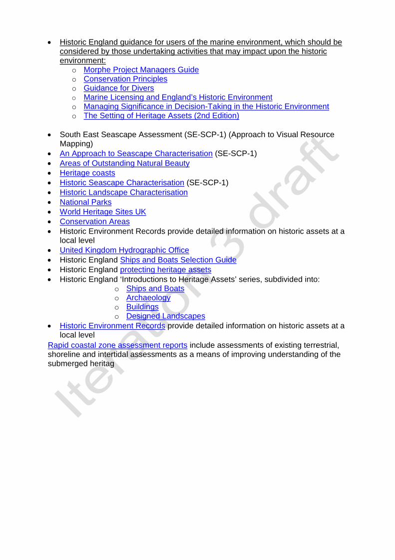
• Historic England guidance for users of the marine environment, which should be considered by those undertaking activities that may impact upon the historic environment:
o Morphe Project Managers Guide o Conservation Principles o Guidance for Divers o Marine Licensing and England’s Historic Environment o Managing Significance in Decision-Taking in the Historic Environment o The Setting of Heritage Assets (2nd Edition)
• South East Seascape Assessment (SE-SCP-1) (Approach to Visual Resource
Mapping) • An Approach to Seascape Characterisation (SE-SCP-1) • Areas of Outstanding Natural Beauty • Heritage coasts • Historic Seascape Characterisation (SE-SCP-1) • Historic Landscape Characterisation • National Parks • World Heritage Sites UK • Conservation Areas • Historic Environment Records provide detailed information on historic assets at a
local level • United Kingdom Hydrographic Office • Historic England Ships and Boats Selection Guide • Historic England protecting heritage assets • Historic England ‘Introductions to Heritage Assets’ series, subdivided into:
o Ships and Boats o Archaeology o Buildings o Designed Landscapes
• Historic Environment Records provide detailed information on historic assets at a local level
Rapid coastal zone assessment reports include assessments of existing terrestrial, shoreline and intertidal assessments as a means of improving understanding of the submerged heritag
Plan area South East Grouping Infrastructure Related High Level Marine Objectives (HLMO).
Achieving a sustainable marine economy Infrastructure is in place to support and promote safe, profitable and efficient marine businesses. Promoting good governance Marine, land and water management mechanisms are responsive and work effectively together, for example through integrated coastal zone management and river basin management plans.
Other relevant policies SE-GOV-1 SE-PS-1
Are these policies consistent across other plan areas?
NW
NE
SW

Policy drafting template SE-INF-1 HLMO Achieving a sustainable
marine economy Sub bullet(s) Infrastructure is in place
to support and promote safe, profitable and efficient marine businesses.
Grouping Infrastructure Code SE-INF-1
Policy SE-INF-1 Appropriate land-based infrastructure which facilitates marine activity (and vice versa) should be supported. What is Infrastructure?
1. Infrastructure is a physical structure or facility which could be in the form of, but not limited to:
• landing, storage and processing facilities for catch or freight • terminals for aggregate or waste handling • slipways • boat repair facilities • infrastructure for passenger transfer • utilities transmission, including cables and associated infrastructure
Where is land-based infrastructure in the south east marine plan area?
2. Small and large scale land-based infrastructure can occur across the intertidal area and on land in areas adjacent to the south east marine plan area. On both land and in the intertidal area land based infrastructure facilitates and connects to activities in the wider marine plan area. Why is land-based infrastructure important to the south east marine plan area?
3. As the ‘maritime gateway to the world’1, land-based infrastructure in the south east marine plan area is critical to realising the economic and social benefits of activities in the south east marine plan area. Infrastructure to maintain and support current and future marine activity may be required. Some examples are:
• new or a changed infrastructure at ports for maritime trade, including short sea shipping and to service the North Sea energy and offshore wind sectors
• infrastructure to maintain and support marine and river assets for the tourism, sport and recreation sector such as slipways and other access points, piers and jetties.
• wharves located along the river Thames to support the Greater London construction industry through aggregate demand and waste transfer.
• quays and landing facilities for fisheries and shellfisheries and their associated processing facilities, transport links and markets.
1 The Draft South East Marine Plan vision defines the area as the maritime gateway to the world.

4. Other infrastructure policies state the importance of landing facilities (SE INF 3) and the importance of ensuring space for land-based infrastructure (SE INF 4).
5. SE-INF-1 is important to ensure ecosystems, including estuaries, are managed as a single system. For example there are currently 18 local planning authorities and two development corporations within the Greater Thames Estuary area which the Thames Estuary 2050 Growth Commission report identifies as a challenge for infrastructure delivery. SE-INF-1 and SE-INF-4 will address this challenge, covering the entirety of the estuary and applying an integrated approach with local planning authorities. SE-GOV-2 expands upon the importance of an integrated approach.
6. SE-INF-1 has been developed to: • clarify the integration of the terrestrial and marine systems as required in
the UK Marine Policy Statement • provide more detail and prescription for land-based, marine and estuarine
public authorities including local planning authorities and statutory harbour authorities
• support the consideration of proposed activities and measures related to land-based infrastructure
• aid in the development and review of plans, for example local plans Who is this of interest to?
• Marine Management Organisation • The Planning Inspectorate • Local planning authorities • Statutory harbour authorities • Environment Agency • The Department of Transport • The Department for Business, Business, Energy and Industrial Strategy • The Ministry of Housing, Communities and Local Government
How should this policy be applied?
7. The phrase ‘appropriate’ in SE-INF-1 refers to the need to be compliant with relevant local plans, for example proposals in the marine area that would significantly compromise terrestrial development plans are unlikely to be supported. The appropriateness of any such infrastructure is to be assessed by public authorities within their decision-making activities. Proposals will be assessed on their individual merits as suitable or proper in the circumstances with local plans as a material of consideration where relevant.
8. SE-INF-1 should be implemented by public authorities when authorising proposals or making decisions which relate to land-based infrastructure supporting marine and terrestrial activity.
9. Public authorities should support marine activities and their associated land-based infrastructure in their decision making as well as in other public authority enforcement or authorisation decisions, for example strategic policy-making authorities in the drafting or amendment of their local plans. Public authorities should also take into account proposals on land that have potential impacts on the
application of marine plan objectives. The Coastal Concordat can be used for decisions on proposals with both terrestrial and marine authorisations providing a co-ordinated process.
10. Examples of land-based infrastructure which facilitates marine activity that should be supported by public authorities include land-based handling and disposal facilities for vessels for refuse, waste water and sewage. SE-INF-1 supports the Waste Management Plan for England (pages 30, 31) which aims to ‘help achieve sustainable waste management by securing adequate provision of new waste management facilities of the right type, in the right place and at the right time’.
11. SE-INF-1 supports the National Policy Statement for Energy where ‘the government is committed to increasing dramatically the amount of renewable energy capacity’ including offshore wind which would require land based infrastructure for utilities transmission and port development to service new sites.
12. In examining and determining applications for nationally significant infrastructure projects, examining authorities and the secretary of state for The Ministry of Housing, Communities and Local Government must have regard to this policy for nationally significant infrastructure projects which facilitate marine activity. Signposting
13. Existing measures which relate to, and may contribute to the achievement of this policy include:
• National Planning Policy Framework • Marine Policy Statement • Localism Act
14. Further information and guidance that may help in implementing the policy include:
• Coastal Concordat • The Thames Concordat - An agreed way of working between the Marine
Management Organisation and the Port of London Authority • Thames Estuary 2050 Growth Commission Report • National Infrastructure Delivery Plan 2016 to 2021 and Annual Reports on
National Infrastructure Construction and Infrastructure Pipelines
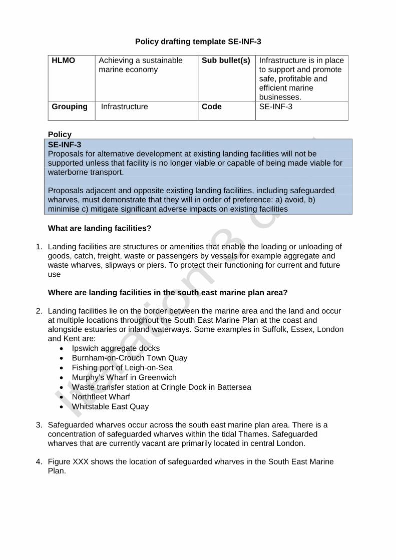
Policy drafting template SE-INF-3 HLMO Achieving a sustainable
marine economy Sub bullet(s) Infrastructure is in place
to support and promote safe, profitable and efficient marine businesses.
Grouping Infrastructure Code SE-INF-3
Policy SE-INF-3 Proposals for alternative development at existing landing facilities will not be supported unless that facility is no longer viable or capable of being made viable for waterborne transport. Proposals adjacent and opposite existing landing facilities, including safeguarded wharves, must demonstrate that they will in order of preference: a) avoid, b) minimise c) mitigate significant adverse impacts on existing facilities What are landing facilities?
1. Landing facilities are structures or amenities that enable the loading or unloading of goods, catch, freight, waste or passengers by vessels for example aggregate and waste wharves, slipways or piers. To protect their functioning for current and future use Where are landing facilities in the south east marine plan area?
2. Landing facilities lie on the border between the marine area and the land and occur at multiple locations throughout the South East Marine Plan at the coast and alongside estuaries or inland waterways. Some examples in Suffolk, Essex, London and Kent are:
• Ipswich aggregate docks • Burnham-on-Crouch Town Quay • Fishing port of Leigh-on-Sea • Murphy’s Wharf in Greenwich • Waste transfer station at Cringle Dock in Battersea • Northfleet Wharf • Whitstable East Quay
3. Safeguarded wharves occur across the south east marine plan area. There is a
concentration of safeguarded wharves within the tidal Thames. Safeguarded wharves that are currently vacant are primarily located in central London.
4. Figure XXX shows the location of safeguarded wharves in the South East Marine Plan.

Why are landing facilities important to the south east marine plan area?
5. Within the south east marine plan area landing facilities are critical to the sustainablesupply and movement of various cargoes and commodities, including constructionmaterials and waste in towns and cities, including Greater London, Medway Townsand Ipswich. The use of the sea and the region’s tidal rivers allow for the increasedsustainable transport of goods and materials, significantly helping to reducecongestion on the region’s roads and helping to improve air quality. SE-PS-4promotes and states the importance of short sea shipping as an alternate to roadand rail transport.
6. Landing facilities are particularly important on the River Thames, the busiest inlandwaterway in the UK. More than 99% of marine dredged aggregates landed in thesouth east marine plan area is landed in the Thames Estuary and in Greater London,for example at Angerstein and Murphy’s Wharves in the Royal Borough ofGreenwich. Wharves along the river Thames landed 8.3 Mt of marine sand andgravel, equivalent to more than half of all English landings1. This supply ofaggregates is critical for the construction sector, especially in London where there issignificant urban growth. Half of all aggregates used in the construction sector inLondon come from marine sources2. Consequently, a significant concentration ofSafeguarded Wharves are located on the Thames where in addition to aggregates,annual freight on London wharves reaches more than 10 Mt3.
7. For proposals involving aggregate extraction at sea, depending on the location,please refer to policies in the South Marine Plan, East Marine Plan or the UK MarinePolicy Statement (section 3.5).
8. Major projects in London derive significant benefits from using landing facilities onthe river for the movement of project cargoes. For example, the Transport for LondonNorthern Line Extension project has removed thousands of lorry journeys off theroads through the movement of 300,000 tonnes of tunnelling spoil by river. TheThames Tideway Tunnel project is also expected to use the river to move more thansix million tonnes of project cargo over the lifetime of the scheme4.
9. Landing facilities also allow the transfer of waste or waste by-products from townsand cities for disposal. In particular, wharves are of importance to the movement ofconstruction, demolition and excavation (CDE) waste. This policy supports the WasteManagement Plan for England (pages 30, 31) that aims to ‘help achieve sustainablewaste management by securing adequate provision of new waste managementfacilities of the right type, in the right place and at the right time’.
10. Landing facilities for passengers, including piers, increase the capacity of masstransit through ferry services, tourist boat trips and river boat services. Theimportance of landing facilities for passenger transport is particularly important inLondon, where The Mayor of London’s Transport Strategy (2018) seeks to ‘use thefull potential of the Thames to carry passengers to integrate river services with the
1 MMO (2017) Futures analysis for the north east, north west, south east and south west marine plan areas. 2 The Port of London Authority (2016) The Vision for The Tidal Thames 3 Greater London Authority (2018) Forecasting London’s Freight Demand and Wharf Capacity on the Thames 4 Thames Tideway Tunnel (2013) Transport Assessment

public transport system, walking and cycling networks’. At present, up to 10 million individuals use the River Thames annually with this forecasted to grow to over 12 million by 20205.
11. SE-PS-1 states the importance of ports and harbours in the South East Marine Plan. Who is this of interest to?
• Marine Management Organisation • Statutory harbour authorities • The Planning Inspectorate • Local planning authorities • Greater London Authority • Kent County Council • Essex County Council • Suffolk County Council • Environment Agency • The Ministry of Housing, Communities and Local Government
How should this policy be applied?
12. A marine license may be required by the Marine Management Organisation for activities or developments in the marine area, including tidal rivers, up to mean high water springs where landing facilities are situated. A River Works Licence may also be required from the relevant authority.
13. SE-INF-3 supports the agent of change principle set out in the Draft London Plan (2018) and the National Planning Policy Framework (2018) where the latter states that “planning policies and decisions should ensure that new development can be integrated effectively with existing businesses and community facilities. Existing businesses and facilities should not have unreasonable restrictions placed on them as a result of development permitted after they were established. Where the operation of an existing business or community facility could have a significant adverse effect on new development (including changes of use) in its vicinity, the applicant (or ‘agent of change’) should be required to provide suitable mitigation before the development has been completed.”
14. Decision-makers must not authorise developments or activities that change the use of a landing facility unless the facility is no longer viable or capable of being made viable for waterborne transport.
15. Decision-makers must also ensure that developments or activities adjacent or opposite landing facilities, including safeguarded wharves, demonstrate that they (a) avoid significant adverse impacts on existing landing facilities. Developments or activities cannot proceed to (b) minimise and (c) mitigate unless they have first demonstrated why they cannot avoid significant adverse impacts on existing landing facilities. Significant adverse impacts includes potential restrictions placed on the functioning of the landing facility as a result of the proposed new development or activity.
5 The Port of London authority (2016) Adding value: The River Thames Public Amenity

16. Public authorities, including strategic policy-making authorities, must have regard to
this policy, marine activities and existing landing facilities in the drafting or amendment of their local plans.
17. In examining and determining applications for nationally significant infrastructure projects, examining authorities and the secretary of state for The Ministry of Housing, Communities and Local Government must have regard to this policy for nationally significant infrastructure projects that may have significant adverse impacts on existing landing facilities.
18. The phrasing ‘adjacent to’ in this policy describes the areas extending at both ends of berth of the landing facility. SE-INF-3 discourages proposals that would have significant adverse impacts on the landing facility in this ‘adjacent to area’ or opposite the landing facility, for example riparian and perpendicular proposals, due to the need for vessels to navigate safely to the landing facility in all maritime conditions.
19. In examining and determining applications for nationally significant infrastructure projects, examining authorities and the secretary of state for The Ministry of Housing, Communities and Local Government must have regard to this policy for nationally significant infrastructure projects for alternative development at existing landing facilities or adjacent and opposite existing landing facilities. Signposting
20. Existing measures which relate to, and may contribute to the achievement of this policy include:
• Mayor of London’s Safeguarded Wharves Review 2018. • The Vision for the Tidal Thames (2016), The Port of London Authority, • National Planning Policy Framework • Marine Policy Statement 1.3.4, 2.5.5, 3.5.3, • The relevant minerals and waste plans within the south east marine plan area. • Draft London Plan (2018) • The Transport for London’s River Freight Toolkit and guide

Policy drafting template SE-INF-4 HLMO Achieving a sustainable
marine economy Sub bullet(s) Infrastructure is in place
to support and promote safe, profitable and efficient marine businesses.
Grouping Infrastructure Code SE-INF-4
Policy SE-INF-4 Public authorities with functions capable of affecting the marine area should ensure provision for appropriate land-based infrastructure that facilitate marine activity What is infrastructure?
1. Infrastructure is a physical structure or facility which could be in the form of, but not limited to:
• landing, storage and processing facilities for catch or freight • terminals for aggregate or waste handling • slipways • boat repair facilities • infrastructure for passenger transfer • utilities transmission, including cables and associated infrastructure
2. Land-based infrastructure can facilitate marine activity or marine industries for
example a quay for the fisheries and shellfisheries industry or a cable landing point facilitating the production of offshore wind energy. Where is land-based infrastructure that facilitates marine activity in the south east marine plan area?
3. Small and large scale land-based infrastructure can occur across the intertidal area. Land-based infrastructure facilitates and connects to activities in the wider marine plan area. Why is it important to ensure provision for land-based infrastructure in the south east marine plan area?
4. As the ‘maritime gateway to the world’1, land-based infrastructure in the south east marine plan area is critical to realising the economic and social benefits of activities in the marine area. Provision for infrastructure to maintain and support current and future activity may be needed, such as:
• new or changed infrastructure at ports for maritime trade, including short sea shipping and to service the North Sea energy and offshore wind sectors
• infrastructure to maintain and support marine and river assets for the tourism, sport and recreation sector such as slipways and other access points, piers and jetties
1 The Draft South East Marine Plan vision defines the area as the maritime gateway to the world.

• wharves located along the river Thames to support the Greater London construction industry through aggregate demand and waste transfer
• quays and landing facilities for fisheries and shellfisheries and their associated processing facilities, transport links and markets
5. There is a strong demand for space in the wider south east of England. The
2014 Strategic Economic Plan produced by the South East Local Enterprise Partnership identifies large areas bordering the south east marine plan area as growth corridors for new housing and jobs including along the Thames and Medway estuaries, Isle of Thanet and Harwich. The Thames Estuary 2050 Growth Commission report highlights that a minimum of 1 million homes will be required to support economic growth in the Thames Estuary by 2050. This equates to 31,250 homes per annum. A number of opportunity areas for housing development in the 2015 London Plan are based on the Thames riverside, especially in east London. To facilitate this demand and ensure that marine businesses remain connected to the coast or to strategic locations such as the banks of the estuaries of the Thames, Medway or Orwell it is important to ensure provision for land-based infrastructure that facilitates marine activities.
6. SE-INF-4 has been developed to: • clarify the integration of the terrestrial and marine systems as required in
the UK Marine Policy Statement • provide more detail and prescription for land-based, marine and estuarine
public authorities including local planning authorities and statutory harbour authorities
• support the consideration of spatial allocation relating to land-based infrastructure that facilitated marine activity
• aid in the development and review of plans, for example local plans Who is this of interest to?
• Developers • Marine Management Organisation • The Planning Inspectorate • Local planning authorities • Statutory harbour authorities • Environment Agency • The Department of Transport • The Department for Business, Energy and Industrial Strategy • The Ministry of Housing, Communities and Local Government
How should this policy be applied?
7. SE-INF-4 policy applies throughout the intertidal area in the south east marine plan area to public authorities with functions cable of affecting the marine area.
8. Public authorities, including strategic policy-making authorities, should ensure there is provision for appropriate land-based infrastructure that facilitate marine activity in any of their relevant public authority functions for example the drafting or amendment of policies in their local plans.

9. In examining and determining applications for nationally significant infrastructure projects, examining authorities and the secretary of state for The Ministry of Housing, Communities and Local Government must have regard to this policy so that relevant nationally significant infrastructure projects facilitate marine activity or ensure there is continued provision for land-based infrastructure that facilitate marine activity.
10. The phrase ‘appropriate’ in SE-INF-4 refers to the need to be aware that some coastal areas will not be appropriate for public authorities to ensure there is provision for land-based infrastructure, including through spatial allocations, due to topographic, bathymetric or erosion features. The appropriateness of any such sites is to be assessed by the functions of public authorities.
11. Examples of land-based infrastructure which facilitates marine activity that should be supported by public authorities include land-based handling and disposal facilities for vessels for refuse, waste water and sewage. SE-INF-4 supports the Waste Management Plan for England (pages 30, 31) which aims to ‘help achieve sustainable waste management by securing adequate provision of new waste management facilities of the right type, in the right place and at the right time’.
12. In examining and determining applications for nationally significant infrastructure projects, examining authorities and the secretary of state for The Ministry of Housing, Communities and Local Government must have regard to this policy for nationally significant infrastructure projects capable of affecting the marine area. Signposting
13. Existing measures which relate to, and may contribute to the achievement of this policy include:
• Local plans of local planning authorities in the south east marine plan area. • The Mayor of London, London Plan. • Industrial Strategy: building a Britain fit for the future • National policy statement for ports • National Planning Policy Framework • Marine Policy Statement • Thames Estuary 2050 Growth Commission report

Policy drafting template SE-INF-5 HLMO Promoting good
governance Sub bullet(s) Marine, land and water
management mechanisms are responsive and work effectively together, for example through integrated coastal zone management and river basin management plans.
Grouping Infrastructure Code SE-INF-5
Policy SE-INF-5 Infrastructure supporting the development of new housing which has a significant adverse impact on the marine plan area should demonstrate that, in order of preference, it will: a) avoid b) minimise c) or mitigate significant adverse impacts to the marine plan area. Where significant adverse impacts cannot be avoided, minimised or mitigated but are in the public interest, they must state the case for proceeding. Infrastructure supporting the development of new housing that can cause significant adverse impacts on the marine environment.
1. Infrastructure that supports the development of new housing includes physical structures or facilities which could be in the form of, but not limited to:
• coastal paths • drainage • underground pipe works • electricity works • coastal defences
Where is current and future housing development that may impact the inshore south east marine plan area?
2. Development of housing and its supporting infrastructure can occur throughout a large majority of coastal areas adjacent to the south east marine plan area.
3. Housing development and growth is expected throughout the Thames estuary corridor as set out by the Thames Estuary 2050 Growth Commission report. The report highlights that growth in the Thames estuary area has been disproportionate when compared to other parts of the UK. A minimum of 1 million homes will be required to support economic growth in the Thames Estuary by 2050. This equates to 31,250 homes per annum.

4. Several of the Opportunity Areas identified for large scale development within the Mayor’s London Plan lie along or close to the River Thames, predominantly in east London. Continuing east along the Thames, there is housing demand in Kent and Essex. There is a drive from the government to speed up the development of 15,000 homes in north Kent, including riverside housing, which is being run by the Ebbsfleet Development Corporation. When can current and future housing development impact the south east marine plan area?
5. Infrastructure supporting housing development can significantly impact the marine area during periods of construction and throughout the lifetime of the infrastructure. Coastal construction can reduce water quality or development may encroach on coastal and marine habitats. Maintenance of infrastructure throughout its lifetime could also have a significant impact on the marine area. Why is infrastructure supporting housing development and the need to address its impact on the marine area important to the south east marine plan area?
6. The National Planning Policy Framework emphasises the importance of strong, vibrant and healthy communities by ensuring that a sufficient number and range of homes can be provided to meet the needs of present and future generations. Achieving the aims of the National Planning Policy Framework can be done by fostering a well-designed and safe built environment with accessible services and open spaces that reflect current and future needs. Accesible services and open spaces contribute to supporting communities’ health, social and cultural well-being. Associated infrastructure is required to support the construction, maintenance and use of housing throughout its lifetime.
7. The current drive to provide more housing is a government response to increasing demand for, and limited supply of, homes. Sustainable development is important to the south east marine plan area to enable the continued economic growth in the area. Supporting infrastructure development will provide economic and social benefits and promote business.
8. It is important that infrastructure and housing development is appropriate and sustainable to allow environmental growth as well as economic growth. New infrastructure for housing developments, such as coastal defence, can cause coastal squeeze, reducing coastal habitats. Other adverse impacts include increased runoff, lower water quality, increased pressure on coastal access points and greater disturbance. Increased pressures on marine and coastal ecosystems may restrict the natural capital that they generate. Who is this of interest to?
• Marine Management Organisation • Ministry of Housing, Communities & Local Government • Environment Agency • Natural England • port and harbour authorities

• Local Planning Authorities How should this policy be applied?
9. This policy applies to the whole of the south east marine plan area and extends to functions that are carried out in adjacent areas that are capable of impacting the south east marine plan area.
10. Proposals should demonstrate that they do not have direct and indirect impacts on the marine area and coastal habitats from infrastructure for houses. Infrastructure for houses that may have an impact on the south east marine area should demonstrate that it will, in order of preference, avoid, minimise or mitigate significant adverse impact on the marine area - proposals cannot proceed to (b) unless they have first demonstrated why they cannot meet (a) etc. Examples of measures include: avoid - careful spatial planning of infrastructure elements by developers and making using of existing infrastructure minimise - reductions in the intensity of proposals through the construction phase and its lifetime. mitigate – innovative design of infrastructure such as green infrastructure.
11. Where proposals cannot avoid, minimise or mitigate adverse impact but the proposal is in the public interest, they must state the case for proceeding. This includes how the proposal supports the south east marine plan vision, objectives and other plan policies. Inclusion of this information does not indicate that approval of the proposal will follow by default. That will also depend on other material considerations to be taken into account by the decision-maker which may include, for example, other plans.
12. Within Natura 2000 sites additional assessment measures are required. The definitions of avoidance, mitigation and compensation are defined under the Offshore Marine Conservation (Natural Habitats &c.) Regulations 2007. Developers should use of green infrastructure where appropriate to reduce the impact on the marine plan area.
13. In examining and determining applications for nationally significant infrastructure projects, examining authorities and the secretary of state for The Ministry of Housing, Communities and Local Government must have regard to this policy for nationally significant infrastructure projects supporting the development of new housing which have a significant adverse impact on marine area. Signposting
• National Planning Policy Framework • The Water Framework Directive • shoreline management plans • Marine and Coastal Access Act 2009 • Local plans by Local Planning Authorities.
14. Further information and guidance that may help in implementing the policy include:
• Marine Information System

Plan area South East Grouping Seascape Related High Level Marine Objectives (HLMO).
Ensuring a strong, healthy and just society People appreciate the diversity of the marine environment, its natural and cultural heritage and its resources and act responsibly.
Other relevant policies SE-GOV-1 SE-CO-1
Are these policies consistent across other plan areas?
NW
NE
SW

Policy drafting template SE-SCP-1
High Level Marine Objective
Ensuring a strong, healthy and just society
Sub bullet(s) People appreciate the diversity of the marine environment, its seascapes, its natural and cultural heritage and its resources and act responsibly.
Grouping Seascape and Landscape Code SE-SCP-1
Policy SE-SCP-1 Seascape and Landscape Proposals should demonstrate how the significant adverse impacts of a development on the seascape and landscape of an area has been considered. The proposal will only be supported if they demonstrate that they will, in order of preference: a) avoidb) minimisec) mitigated) if it is not possible to mitigate, the public benefits for proceeding with the proposalthat outweigh significant adverse impacts to the seascape and landscape of an areaand its significance.
Where possible, proposals should demonstrate that they have considered how highly the seascape and landscapes of an area is valued, its quality, and the areas potential for change. In addition, the scale and design of the proposal should be compatible with its surroundings, and not have a significant adverse impact on the seascape and landscapes of an area or the wider landscape.
What is seascape and landscape?
1. The Marine Policy Statement (2.6.5.1) states that, ‘There is no legal definition forseascape in the UK but the European Landscape Convention (ELC) defineslandscape as “an area, as perceived by people, whose character is the result of theaction and interaction of natural and/or human factors. In the context of thisdocument, references to seascape should be taken as meaning landscapes withviews of the coast or seas, and coasts and the adjacent marine environment withcultural, historical and archaeological links with each other’.
2. Seascape can be broken down into its constituent parts of visual resource andmarine character.• Visual resource - can be interpreted primarily as views of the coast and sea from
the land. Views from the sea to land, and sea to sea are also relevant.• Marine character - In addition to the ELC definition, this includes a combination of
characteristics above the surface, within the water column and on or below theseabed.
3. In a study carried out for the Marine Management Organisation (MMO), the SouthEast Seascape Assessment has described and mapped the visual resource andmarine character of the south east marine plan area (figures XXX and XXX). The

South East Seascape Assessment is available to assist public authorities and others when considering proposals.
Where is seascape/landscape in the south east marine plan area?
4. The south east inshore marine plan area covers an area of approximately 1,400kilometres of coastline stretching from Felixstowe to near Dover, taking in over 3,900square kilometres of sea. This policy applies to the full extent of the south eastmarine plan area including views of and from the Marine Plan Area. Furtherdemonstration is required within or relatively close to nationally designated areas. Inthe south east this relates to• Kent Downs Area of Outstanding Natural Beauty• High Weald Area of Outstanding Natural Beauty• Surrey Hills Area of Outstanding Natural Beauty• South Foreland and Dover to Folkestone heritage coasts• Conservation Areas and other coastally-situated designated areas.
When does seascape and landscape take place in south east marine plan area?
5. Unlike some activities character and the visual perception of an area is happening all of the time. The activities or infrastructure which contribute to an areas character is slowly changing over time. Likewise, those viewing the plan areas from the coast or sea have differing perceptions based on their use or the seasonality of the area. New development such as increase access, diversification towards the tourist industry or the new coastal path provides opportunities for those visiting the coast to enjoy and appreciate its seascape and landscape
Why is seascape and landscape important to the south east marine plan area?
6. To the south of the plan area the famous sheer white chalk cliffs of Dover, a deeply held symbol of national identity. Iconic views across the Dover Strait from the white cliffs, to a clear silhouette of the French coast. This area has a long-standing importance for trade, reflecting its location in proximity to mainland Europe, with long history of seafaring activity. The Dover Strait has played a key strategic role in the defence of Britain for successive invasions and defence including its role in the Dunkirk evacuations of WWII. Today the area has constant movement of ferries and freight around the Port of Dover, Europe’s busiest ferry port.
7. The Thames is embedded in our national culture. It is a principal axis through the cities of Westminster and London lined by many great buildings of the state and royalty including the Palace of Westminster and the Tower of London. It provides a deep and navigable river through London. It is an integral part, or setting, of World Heritage Sites at Maritime Greenwich, Tower of London, Palace of Westminster and Westminster Abbey.
8. The character becomes quieter and more rural further from London. Away from the ports at Harwich and Felixstowe, the rivers Orwell (part of the Suffolk Coast and Heath AONB), Stour and Colne have remained largely unchanged by development.
9. SE-SCP-1 ensures that proposals should only be supported if they manage impactson the seascape and landscapes. It also adds clarity to existing national policy byidentifying the visual resource and key characteristics of the south east marine planarea, enabling these policies to be better supported.
10. This policy adds value to this as it ensures that seascape and landscapes is alsoconsidered in decisions for proposals on developments, activities or managementmeasures. Decisions should aim to avoid, minimise or mitigate potential significantadverse effects within the south east marine plan area. This policy also adds clarityto existing national policy by identifying the visual resource and characteristics of thesouth east marine plan area.
Who is this of interest to?
11. Applicants or proponents in shaping and influencing what they may wish to do whereand how they may wish to do it
12. All public authorities; MMO, Natural England, IFCA, PINS, BEIS, JNCC, MCA,Environment Agency, Terrestrial Planning Authorities, DCMS, Defra, Cefas, TheCrown Estate, Historic England, Harbour Authorities, Oil and Gas Authority, LocalEnterprise Partnerships, Local Flood Authorities, Regional Flood and CoastalCommittees, DfT, MHCLG, Seafish, MOD, Home Office, Big Lottery Fund, VisitEngland, UK Hydrographic Office, Office of National Statistics, Animal and PlantHealth Agency, Heritage Lottery Fund, National Trust, Coastal Partnerships, CPRE.
13. Bodies administering other management plans and landscape designations/definitions including National parks, AONBs, Heritage Coasts, neighbourhoodmanagement plans, Conservation Areas and the statutory heritage designations.
How should this policy be implemented?
14. The Marine Policy Statement (2.6.5.2) states that ‘When developing Marine Plans,marine plan authorities should consider at a strategic level visual, cultural, historicaland archaeological impacts not just for those coastal areas that are particularlyimportant for seascape, but for all coastal areas, liaising with terrestrial planningauthorities as necessary. In addition, any wider social and economic impacts of adevelopment or activity on coastal landscapes and seascapes should be considered’
15. It goes on to state (2.6.5.3) that ‘In considering the impact of an activity ordevelopment on seascape, the marine plan authority should take into accountexisting character and quality, how highly it is valued and its capacity toaccommodate change specific to any development. Landscape CharacterAssessment methodology may be an aid to this process’.
16. There are a range of statutory policies and measures already in place to take intoaccount nationally designated areas, such as National Parks, Areas of OutstandingNatural Beauty and World Heritage Sites.
17. Proposals should not detract from the qualities of a designated area. Proposalsshould demonstrate that they have considered the visual impact on designated areasand its immediate and wider setting. These should be minimised through high quality
design that reflects local landscape character with particular regard to scale, siting, materials and colour.
18. Outside of designated areas, or their settings, proposals where it is not possible to avoid, minimise or mitigate harm will need to demonstrate that the public benefits for proceeding and the benefits of the proposal outweigh the compromise or harm to the l seascape or landscape of an area. Evidence will need to show, for example, how the proposal supports the South East Marine Plan vision, objectives and other plan policies. Inclusion of this information does not indicate that approval of the proposal will follow by default. That will also depend on other material planning considerations to be taken into account by the decision-maker which may include, for example, other plans.
19. On a case-by-case basis public authorities will assess if proposals have considered how highly the seascape and landscapes of an area is valued, its quality and the areas potential for change. In advance of a preferred methodology, public authorities should seek advice from Natural England, Historic England and Local Planning Authorities including designated areas. Where advice states that it is not possible to determine this then there will be no further requirements for consideration by the decision maker. Once a preferred methodology has been adopted, the requirement of how to consider an areas value, quality or potential for change under policy SE-SCP-1 may change. New and evolving advice will not be applied retrospectively to activities that have already been consented.
20. Consideration of potential impacts should take into account visibility, prevailing weather conditions, angle of views and the temporal or permanent nature of a structure, including its scale, design or activity.
21. Public authorities should consider a proposal’s impact on seascape and landscapes, taking into account views to and from the sea, existing marine character and quality, how highly it is valued and its capacity to accommodate change specific to any proposal.
22. In examining and determining applications for nationally significant infrastructure projects, examining authorities and the secretary of state for The Ministry of Housing, Communities and Local Government must have regard to this policy for nationally significant infrastructure projects that may have significant adverse impacts on seascape and landscape.
23. In assessing a proposal, public authorities should consult with relevant bodies including Natural England, Historic England and Local Planning Authorities including designated areas, considering seascape and landscapes assessments where appropriate. Signposting - seascape and landscape
24. Existing measures which relate, and may contribute, to the achievement of this policy include: • Marine Policy Statement (2.6.5) (SE-SCP-1) • National Planning Policy Framework (Section 11 and Section 7) (see box 3) • European Landscape Convention (see box 3)
25. Further information and guidance that may help in implementing the policy include: • An Approach to Seascape Characterisation (SE-SCP-1) • South East Seascape Assessment (SE-SCP-1) (Approach to Visual Resource
Mapping) • Guidelines for Landscape and Visual Impact Assessment (3rd Edition) • Areas of Outstanding Natural Beauty • Heritage coasts • Historic Seascape Characterisation (SE-SCP-1) • Historic Landscape Characterisation • National Parks • World Heritage Sites UK • The Setting of Heritage Assets (2nd Edition)

Plan area South East Grouping Social Related High Level Marine Objectives (HLMO).
Ensuring a strong, healthy and just society There is equitable access for those who want to use and enjoy the coast, seas and their wide range of resources and assets and recognition that for some island and peripheral communities the sea plays a significant role in their community.
Other relevant policies SE-ACC-1 SE-ACC-2 SE-TR-1 SE-TR-2 SE-EMP-1 SE-EMP-2 SE-FISH-1 SE-FISH-4 SE-FISH-6 SE-BIO-1 SE-BIO-3 SE-BIO-4 SE-MPA-1 SE-MPA-2 SE-MPA-6 NE-DIST-1 NE-DIST-2 SE-WQ-1 SE-ML-2 SE-SCP-1 SE-HER-1 SE-CO-1
Are these policies consistent across other plan areas?
NW
NE
SW

Policy drafting template SE-SOC-1
HLMO Ensuring a strong, healthy and just society
Sub bullet(s) There is equitable access for those who want to use and enjoy the coast, seas and their wide range of resources and assets and recognition that for some island and peripheral communities the sea plays a significant role in their community
Grouping Social Code SE-SOC-1
Policy SE-SOC-1 Proposals that enhance or promote social benefits should be supported. Proposals unable to enhance or promote social benefits should demonstrate that they will, in order of preference: a) minimise, or b) mitigate adverse impacts which result in the displacement of other existing or authorised (but yet to be implemented) activities that generate social benefits.
What are social benefits?
1. Social benefits related to marine activities (and the natural and historic environmenton which they are based) include, but are not limited to, improved health and well-being, enjoyment, cultural identity and a sense of place. In the first instance suchbenefits are gained directly by people in coastal communities immediately adjacentto the south east marine area (see Map X). This can be due to residing near thecoast, with views of it, experiencing it in all weathers and seasons, and being able toregularly recreate in and adjacent to the marine area. Some of these benefits can begained by visitors to the area. People who may never visit the south east marinearea may also gain social benefits through virtual experiences or just havingconfidence in its sustainable management. Social benefits are also derived indirectlyfrom people gaining marine area-related employment and skills. Benefits aregenerally contingent on the natural and historic environment on which they arebased. They may also require sector industries for their realisation (see for examplerelated policies on Access, Tourism and Recreation, Fishing, Employment,Seascape, Biodiversity, MPAs, Water Quality and Heritage Assets).
What is displacement?
2. Displacement is when an activity is moved (in time or geographical space) becauseof the introduction or impact of another activity. It can mean that the activity may nolonger be able to take place. There is a recognised need to better understand thepotential social impacts (positive and negative, direct and indirect, permanent andtemporary, as well as those resulting from cumulative effects) of displacement.
Where are social benefits in the South East marine plan area?
3. The coastal typology, developed as part of the MMO Socio-economic study provides an overview of the types of coastal communities and their social and economic characteristics including current position and recent trends in relation to the national average. It describes the diversity between communities within the South East (see Map X) and their levels of deprivation, employment, education and health. This provides an indication of where social benefits are most needed to address challenges faced by local communities.
4. The most common communities in the coastal South East are Prosperous Suburbia, Working Hard, New Towns and Ports, and Coastal Professionals. Prosperous Suburbia, smaller suburban towns such as South Benfleet, Billericay and Rayleigh, also has low levels of deprivation with people who are more likely to be highly qualified, employed and in good health. Working Hard communities have stable populations with relatively low levels of deprivation and a strong economy. Employment is more concentrated in manufacturing and port activities than most other coastal areas. They are found on the edge of towns and in satellite towns such as Southend-on-Sea, Stanford-le-Hope, Margate and Ramsgate as well as some boroughs of London.
5. New Towns and Ports, in the hinterland of Thames Gateway (Basildon, Thurrock (Tilbury), Gravesend and southern coastal (non-resort) areas such as Canvey Island) face challenges relating to poor skills and high levels of worklessness, but counterbalanced by relatively strong economy and often located close to areas of economic growth.
6. Coastal Professionals’ communities are city and market town service centres with highly skilled populations and dynamic economies. They include areas in and around Canterbury, Harwich and some eastern boroughs of London to Romford. A higher proportion of people commute long-distances to work and live in rented accommodation compared to other typologies. While deprivations levels are not as high as many other communities they are higher than those in Prosperous Suburbia and Working Hard. When do social benefits take place in South East marine plan area?
7. Many social benefits are derived all year round. Experiencing a sense of place, enjoyment of the seascape and health and well-being benefits are always available. Others such as personal satisfaction, indirectly obtained from employment and skills, may be seasonal if linked to patterns for fishing and the tourism sectors. Why are social benefits important to the South East marine plan area?
8. All residents of coastal communities and visitors gain social benefits from the South East marine plan area over time, but to various degrees. Displacement of activities which produce social benefits, particularly ones that are important to coastal communities experiencing deprivation or other social challenges, is a concern. It is important to manage negative impacts on activities with social benefits (Marine Policy Statement 3.11.2, NPPF Chapter 8 and Monitoring Engagement with the

Natural Environment 2017-18). The need to encourage co- existence is essential in minimising or mitigating the negative impacts of displacement.
9. Sustainable development requires balanced assessment of environmental, social and economic cumulative impacts. Consideration of social impacts is especially necessary as they are particularly problematic to measure due to being more qualitative, indirect and diffuse.
10. As noted above many social benefits are derived indirectly from employment (in many industries, but including fishing), having skills, access to and within the marine area and recreation and tourism opportunities. Social benefits are also contingent on the natural and historic environment, the seascape, good water quality and reduced marine litter. Social benefits will be partly safeguarded as an indirect consequence of the effective implementation of relevant sector policies (see signposting below). However, as social benefits are derived from such a wide range of sources, and are important to both residents and visitors who experience them in diverse ways, active intervention is required to ensure they continue to be provided. Who is this of interest to?
11. Public authorities such as; • Local Planning Authorities • The Planning Inspectorate • Ministry of Housing, Communities and Local Government • Marine Management Organisation licensing • Trinity House • Maritime and Coastguard Agency • Local Enterprise Partnerships • Local recreational groups
How should this policy be applied?
12. SE-SOC-1 ensures social benefits are explicitly addressed in proposals for new developments or activities and in the authorisations of decision-makers when assessing them. It encourages proposals that enhance or promote social benefits. If proposals are unable to demonstrate how they enhance or promote social benefits then they should demonstrate that they will, in order of preference, minimise or mitigate impacts which result in the displacement of other existing or authorised (but yet to be implemented) activities that generate social benefits. Minimise requires impacts that displace activities to be reduced in size, frequency and extent. Whereas mitigation means steps are taken at the same site of the proposal, or at a different site within or adjoining the south east marine area, to provide new social benefits that offset the loss of those displaced. Proposals cannot proceed to (b) unless they have first demonstrated why they cannot meet (a) etc. Proposals should include supporting information demonstrating how they will enhance or promote social benefits. Adverse impacts must be addressed in addition to describing any positive impacts. Evidence in support of social benefits is not a substitute for avoiding, mitigating or minimising adverse impacts.
13. This policy will be implemented by public authorities assessing proposals. It clarifies the provisions of the Marine Policy Statement, and complements policy SE-CO-1.
14. Proposals should identify and evidence where possible:
• The activities already taking place in the area, and the resources on which
they are based, that provide social benefits. Such activities and resources include, but are not limited to:
o Access to and within the marine area; o Recreation opportunities; o Tourism opportunities and businesses; o MPAs, Biodiversity and Geological features that support recreation,
tourism and general awareness and appreciation; o Heritage assets; o Seascape character; o Fishing businesses and historical associations through past activity.
• The social benefits, that are derived from these activities, including, but not limited to:
o Health and well-being; o Enjoyment; o cultural identity; o a sense of place.
• The displacement of the above activities that would ensue from implementation/operation of the proposal.
• Mechanisms to minimise and mitigate the reduction on social benefits due to the displacement of activities. These may include:
o Alternative access; o New recreation and tourism opportunities (eg interpretation); o Alternative businesses that can provide additional social benefits.
15. Proposals must include a description of potential displacement impacts, including on authorised, but yet to be implemented activities. Some existing activities can be identified via the Marine Information System (and the public register), local plans, shoreline management plans, and heritage coast and coastal partnership plans. This may include consultation (with public authorities, coastal partnerships, industry groups including those representing the recreation and tourism sector) to identify displacement issues at the pre-planning stage, and suggested measures to minimise or mitigate them. If these criteria cannot be met by a proposal,where it requires an authorisation decision, it will only be authorised if there are relevant considerations in line with the Marine and Coastal Access Act (2009)(Section 58(1)).
16. Proposals should identify adverse impacts in terms of both space (physical exclusion or removal from an area) and/or in time (preventing an activity taking place at certain times of day or year).
17. Proposals should include all adverse impacts which may be direct and/or indirect. Direct adverse impacts, for example, could include preventing the existing use of an area by recreational boating. Indirect impacts could include increased competition in another area, created by fishing activity displaced from the proposal area, with consequential impacts on local ports, tourism, the environment, and recreational users obliged to use an area that was previously only used by shipping.

18. To reduce conflict and enhance compatibility, proposals should show how they will,in order of preference: minimise or mitigate adverse social impacts of displacement.For example, impacts could be r minimised through adjusting the:
• area used; or• the times of the day or year when activities are operating.
19. Mitigation may include identification of alternative areas for the existing activity orsupport for new activities that generate similar social benefits to those displaced.
20. Public authorities should consider compliance with legislation and regulationsincluding environmental impact assessments and social impact assessments wherealready required. Enhancement is not a substitute for avoidance,minimisation ormitigation measures.
21. In examining and determining applications for nationally significant infrastructureprojects, examining authorities and the secretary of state for The Ministry of Housing,Communities and Local Government must have regard to this policy for nationallysignificant infrastructure projects that may have significant adverse impacts on socialbenefits.
22. Inclusion of supporting information does not indicate that approval of the proposalwill follow by default. That will also depend on other material considerations to betaken into account by the decision-maker which may include, for example, otherplans.
Signposting
23. Existing measures which relate to, and may contribute to the achievement of thispolicy include:
• Marine Policy Statement (2.5.2 and 2.5.3)• European Maritime and Fisheries Fund• Coastal Communities Fund
24. Further information and guidance that may help in implementing the policy include:• Maximising the socio-economic benefits of marine planning for English
coastal communities (MMO)• Social Impacts of Fisheries, Aquaculture, Recreation, Tourism and Marine
Protected Areas (MPAs) in Marine Plan Areas in England (MMO 1035)• Social Impacts and Interactions between Marine Sectors (MMO 1060)
25. See also related policies: SE-ACC-1, SE-ACC-2, SE-TR-1, SE-TR-2, SE-EMP-1,SE-EMP-2, SE-FISH-1, SE-FISH-2, SE-FISH-4, SE-FISH-6, SE-SOC-3, SE-BIO-1,SE-BIO-3, SE-BIO-4, SE-MPA-1, SE-MPA-6, SE-WQ-1, SE-ML-2, SE-SCP-1, SE-HER-1, SE-CO-1.

Policy drafting template SE-SOC-3
High Level Marine Objective
Ensuring a strong, healthy and just society
Sub bullet(s)
There is equitable access for those who want to use and enjoy the coast, seas and their wide range of resources and assets, and recognition that for some island and peripheral communities the sea plays a significant role in their community.
Grouping Social (knowledge and awareness)
Code SE-SOC-3
Policy SE-SOC-3: Knowledge and awareness Proposals that increase the understanding and enjoyment of the marine environment (including the natural, historic and social value) for the promotion of conservation management and increased education, and skills, should be supported.
What is knowledge and awareness?
1. Knowledge and awareness includes information, understanding and appreciation of the natural, historic environment and social value for those who live, work or enjoy the south east marine plan area. An increased understanding and awareness of the marine environment, its natural processes, heritage assets and culture can provide benefits to conservation management and the quality of life, health and wellbeing of coastal communities.
2. The Marine Policy Statement (2.5.4) states that ‘The marine environment provides national economic and social benefits including for heritage assets, seascape and social value of coastal and marine activities, as well as directly contributing to the quality of life and wellbeing of coastal communities. Marine planning will also therefore make an important contribution towards ensuring vibrant and sustainable coastal communities, helping to build strong local economies and improving quality of life, access to, and enjoyment of their marine areas.’
3. The influence of a proposal in an area including its effects on the marine environment, its wildlife, iconic views and cultural heritage may not be constrained to the marine plan area. The effects a development may have on an area may be felt more broadly including the areas sense of place, its visitor numbers or wellbeing of coastal communities.
Where is knowledge and awareness in the south east marine plan area?
4. Knowledge and awareness is held in the understanding and appreciation of those who live, work and enjoy the south east marine plan area. There are numerous conurbations along the coast with varying levels of population and diverse social typologies. These include a number of tourist hotspots which attract visitors to the area.
5. Access to amenities including blue flag beaches, tourism and recreation, iconic landscapes and seascapes, heritage assets and local landmarks are prevalent. Areas designated for environmental protection have had varying levels of success in raising the knowledge, and understanding, across the plan areas.
When is knowledge and awareness in the south east marine plan area?
6. A proposal should seek to enhance understanding and appreciation of the marine environment (natural, historic and social value) throughout its development including construction, operation and the legacy left by the development or activity once it ceases
Why is knowledge and awareness important to the south east marine plan area?
7. The Marine Policy Statement (3.11.4) states that, ‘Tourism can provide environmental benefits through helping to enhance understanding and appreciation of the marine environment through activities such as eco-tourism and nature watching. Socio-economic benefits include positive economic benefits through increased visitor numbers and improved access. Outdoor recreation and enjoyment of the coast can also provide benefits to physical and mental wellbeing.’
8. There are many benefits which can be realised from an increased knowledge and awareness of the marine environment (natural, historic and social value) for those who live, work and enjoy the south east marine plan area such as:
• An appreciation of the area including its landscape and seascape can improve social factors such as health and wellbeing, and develop a sense of place or ownership of an area. This fosters community cohesion, pride and passion for an area which raises aspirations and stimulates the local economy.
• An increased understanding and appreciation can benefit the natural environment and the many species which are native to the plan area. This may result in more effective conservation management schemes or a reduction in pollution including plastics, litter on beaches and the disturbance to wildlife including marine mammals and bird nesting sites.
• Heritage assets are also under threat from increased access from tourism and recreation activities. Impacts on historic buildings require great appreciation for their setting in the landscape so they can be conserved for future generations. Smaller but equally significant assets require greater awareness. The impact of increased number of people visiting an area and the coastal erosion on buried or submerged heritage assets results in assets being lost before they are discovered.
Who is this of interest to?
9. Applicants or proponents in shaping and influencing what they may wish to do whereand how they may wish to do it
10. All public authorities; Marine Management Organisation licensing, Natural England,IFCA, PINS, BEIS, JNCC, MCA, Environment Agency, Terrestrial PlanningAuthorities, DCMS, Defra, Cefas, The Crown Estate, Historic England, Harbour

Authorities, Oil and Gas Authority, Local Enterprise Partnerships, Local Flood Authorities, Regional Flood and Coastal Committees, DfT, MHCLG, Seafish, MOD, Home Office, Big Lottery Fund, Visit England, UK Hydrographic Office, Office of National Statistics, Animal and Plant Health Agency, Heritage Lottery Fund, National Trust, Coastal Partnerships.
11. Bodies administering other management plans and landscape designations/ definitions including National parks, AONBs, Heritage Coasts, neighbourhood management plans, Conservation Areas and the statutory heritage designations. How should the policy be applied?
12. Proposals that enhance the understanding, and enjoyment, and/or increase the awareness, and appreciation, of the marine environment (natural, historic and social value) for the promotion of conservation management, education and/or provision of skills should be encouraged.
13. Whist conservation management processes will be administered directly through environmental and heritage marine plan policy, this policy contributes to the awareness of adverse impacts by enhancing awareness and understanding of the natural and historic environment.
14. Proposals should consider how knowledge and awareness can be delivered throughout its development including construction, operation and the legacy left by the development or activity once it ceases to realise the benefits set out in the Marine Policy Statement. This may include admission to onsite archaeological excavations, viewing platforms to enable public access to the marine environment, information points describing the site aiding the development of a sense of place, cultural heritage and wellbeing.
15. Public authorities should consult with the relevant regulators and advisors, local authorities and other relevant bodies to make sure that access for the purposes of increased public awareness, knowledge and enjoyment does not have a significant adverse impact on the marine environment (natural, historic and social value).
16. In examining and determining applications for nationally significant infrastructure projects, examining authorities and the Secretary of State for the Ministry of Housing, Communities and Local Government must have regard to this policy for nationally significant infrastructure projects that may have significant adverse impacts on the understanding and enjoyment of the marine environment (including the natural, historic and social value) for the promotion of conservation management and increased education, and skills. Signposting
17. Existing measures which relate, and may contribute, to the achievement of this policy include: • Marine Policy Statement (2.5.4) (3.11.4) (NE-SOC-3) • 25 Year Environment Plan • National Policy Planning Framework

• Local authorities (districts, unitary authorities, and counties) set out locallyspecific plans for activities that enable diversification of economic activity throughmeasures in related statutory plans:
• Marine Plan Policy: NE-HER-1, NE-SCP-1, NE-ACC-1, NE-TR-1, NE-TR-2, NE-MPA-1, NE-MPA-2, NE-DIST-1. NE-DIST-2, NE-BIO-1
18. Landscape designations• Areas of Outstanding Natural Beauty• Heritage coasts• National Parks• World Heritage Sites UK
19. Tourism and access• Visit Britain, Destination Management Plans• Planning and access for disabled people: a good practice guide• Natural England’s coastal path provides right of access around the coast of
England. It will increasingly play an important role in how people access themarine area.
• Sustainable Tourism in England: A framework for action• Managing marine recreational activities (NECR242)
20. Waste and litter• The Litter Strategy for England 2017• The Marine Strategy Regulations 2010• Marine strategy part three: UK programme of measures• OSPAR Regional Action Plan on Marine Litter 2014• G7 Action Plan to Combat Marine Litter• Environmental Protection Act 1990• The Water Environment (Water Framework Directive) (England and Wales)
Regulations 2017• The Waste (England and Wales) Regulations 2011• River Basin Management Plans covering the north east inshore marine plan
areas • Guidance on applying the waste hierarchy• WRAP the UK plastics pact• National planning policy for waste• Operation Clean Sweep – reducing plastic pellet loss to the environment
21. Heritage assets• Protocol for Archaeological Discoveries: Offshore Renewables Projects” (The
Crown Estate)• Historic England guidance for users of the marine environment, which should be
considered by those undertaking activities that may impact upon the historicenvironment:- Morphe Project Managers Guide- Conservation Principles- Guidance for Divers- Marine Licensing and England’s Historic Environment- Managing Significance in Decision-Taking in the Historic Environment
- The Setting of Heritage Assets (2nd Edition) • Historic Environment Records provide detailed information on historic assets at a
local level • Rapid coastal zone assessment reports include assessments of existing
terrestrial, shoreline and intertidal assessments as a means of improving understanding of the submerged heritage
22. Environment, Biodiversity and MPAs
Existing measures which relate to and may contribute to the achievement of this policy include: • Conservation of Habitats and Species Regulations 2017 • Conservation of Offshore Marine Habitats and Species Regulations 2017 • Wildlife and Countryside Act 1981 • Countryside and Rights of Way Act 2000 Further information and guidance that may help in implementing the policy include: • Statutory conservation advice packages for marine protected areas 0-12nm
(Natural England) • Statutory conservation advice packages for marine protected areas 12-200nm
(Joint Nature Conservation Committee) • Joint Nature Conservation Committee Marine Protected Area mapper • Climate Change Act 2009 • Conservation of Habitats and Species Regulations 2017 • Natural Environment and Rural Communities Act 2006 • Town and Country planning (Environmental Impact Assessment) Regulations
2017 • Biodiversity 2020: A strategy for England’s wildlife and ecosystem services • Conservation Advice Packages • Estuary Edges: Ecological Design Advice • Features of Conservation Importance (FOCI) identified by JNCC • S41 List
23. Disturbance • Conservation of Habitats and Species Regulations 2017 • Conservation of Offshore Marine Habitats and Species Regulations 2017 • Harbours Act 1964 • Wildlife and Countryside Act 1981 • Environmental Protection Act 1990 • The Environmental Assessment of Plans and Programmes Regulations 2004 • The Conservation of Seals Act • Natural Environment and Rural Communities Act 2006 • The deliberate disturbance of marine European Protected Species • JNCC guidelines for minimising the risk of injury to marine mammals from
geophysical surveys • JNCC Guidelines for minimising the risk of injury to marine mammals from using
explosives • Standard Marking Schedule for Offshore Installations • Maritime Coastguard Agency Marine Guidance Note MGN 371 • National Policy Statements for Energy Infrastructure
• Guidelines to reduce the impact of offshore installations lighting on birds in the OSPAR maritime area

Plan area South East Grouping Tourism and Recreation Related High Level Marine Objectives (HLMO).
Ensuring a strong, healthy and just society The use of the environment is benefitting society as a whole, contributing to resilient and cohesive communities that we can adapt to coastal erosion and flood risk, as well as contributing to physical and mental wellbeing.
Other relevant policies SE-GOV-1 SE-CO-1 SE-BIO-5
Are these policies consistent across other plan areas?
NW
NE
SW

Policy drafting template SE-TR-1
HLMO Ensuring a strong, healthy and just society
Sub bullet(s) The use of the marine environment is benefiting society as a whole, contributing to resilient and cohesive communities that can adapt to coastal erosion and flood risk, as well as contributing to physical and mental wellbeing.
Grouping Tourism and recreation Code SE-TR-1
Policy SE-TR-1 Proposals supporting, promoting or facilitating sustainable tourism and recreation activities where appropriate, particularly where this creates additional utilisation of related facilities beyond typical usage patterns, should be supported.
What is tourism and recreation?
1. Tourism can be defined as the activities of persons (often recreational in nature)travelling to and staying in, places outside their usual environment. Recreation refersto an activity of leisure, carried out by local residents near where they live and intheir discretionary time.
2. The sea can provide a variety of tourism and recreational opportunities. These willvary from area to area but will include pleasure boating, sailing, recreational diving(including diving on wrecks), sea angling, kayaking and surfing, as well asexploration of underwater and coastal heritage assets. The coast also providesinspiration for a range of artistic and cultural activities and food-based tourism. Thereis also growing interest in eco-tourism and wildlife experiences. All these activitiescan generate a considerable amount of income for the economy and can be amainstay for many coastal towns, supporting their quality of life, and providing healthand wellbeing benefits, with many local businesses relying on the marineenvironment for their livelihoods. These activities will be enhanced by a well-managed and healthy marine environment, attractive and well-maintained beaches,seashore and clean bathing water. Marine Policy Statement (3.11.2)
3. 3.11.3 Many seaside towns have developed cultural facilities to attract visitors allyear round, although some marine activities will of necessity be restricted by theweather and many family holidays are taken during the summer schoolholidays. Marine Policy Statement (3.11.2)

Where does tourism and recreation occur in the south east marine plan area?
4. Marine tourism and recreation are important aspects of the south east’s economy and while London and the Thames play significant role in this, the coastlines of Suffolk, Essex and Kent are also vital.
5. Along the Essex coast there are several traditional seaside towns including Clacton, Brightlingsea and Southend-on-Sea that attract large numbers of visitors particularly in the summer. The county also contains popular waters for recreational activities including sailing, power boating, angling, canoeing and water skiing. There are also a large number of marinas that support recreational yachting.
6. The northern coast of Kent contains several areas of shallow coastal waters, such as The Swale, which provide excellent opportunities for recreational activities such as water skiing, kayaking, kite surfing, power boating and wind surfing. Traditional Thames barges are often seen in these waters, now providing recreational boat trips. Sea angling takes places from most of the beaches of the North Kent Coast. Bait digging on the mud flats is a common sight. The developed coastal towns of Herne Bay, Leysdown, Margate and Whitstable are, for many, the first seaside towns from the Capital and the area has long been a popular destination.
7. The Thames is tidal up to Teddington Lock and is therefore covered by the south east marine plan. Numerous marinas and mooring facilities along the Thames and into the Medway support extensive recreational boating. The south east section of the English coastal path is complete from Ramsgate to Camber and there are plans to extend it right up to Woolwich.
8. Despite being the smallest plan area with the shortest coastline, the south east still contains 15 blue flag beaches which are a big draw for the area. When does tourism and recreation take place in the south east marine plan area?
9. Both tourism and recreation are subject to seasonal highs and lows throughout the year and across the plan area with higher visitor numbers during the spring and summer months especially around historic buildings, seabird reserves, wrecks (through diving activities) and general access to the marine environment. Many seaside towns have developed cultural facilities to attract visitors all year round, although some marine activities will of necessity be restricted by the weather and many family holidays are taken during the summer school holidays. Marine Policy Statement (3.11.2) Construction should show evidence of regard for environmental implications in particular those on seasonal species such as over wintering birds or other migratory species Why is tourism and recreation important to the south east marine plan area? Why are they important?
10. Tourism and recreation are important, established sectors within the south east Marine Plan area. However, they need to be stronger, provide a greater range of opportunities for employment and improve resilience to times of economic uncertainty. This can be achieved through diversification and sustainability.
Diversification may also reduce adverse impacts on natural and historic heritage assets upon which some activities are based, and people’s experience of them.
11. The Marine Policy Statement (3.11.2) recognises that tourism can offer a number of benefits and costs to individuals and local communities specifically in terms of development, town characteristics and well-being effects. These effects can help inform the types of marine activities that could be used to encourage and attract tourism to coastal town and city areas and develop new strains of tourism such as eco-tourism.
12. Tourism and recreation activities are recognised as important contributors to local economies and as sources of income for coastal communities. The recreational boating industry alone has been estimated to contribute £1.042 billion to the UK economy. Tourism and recreation also provides many social benefits for communities such as improved health (mental and physical) and wellbeing, greater social cohesion and it creates jobs. With tourism forecast to increase by 4% annually through to 2025 (Deloittes, 2013) it is essential that it is managed sustainably with focus on diversification and on sectors like eco-tourism. Who is this of interest to?
13. All public authorities; Marine Management Organisation licensing, Natural England, IFCA, PINS, BEIS, JNCC, MCA, Environment Agency, Terrestrial Planning Authorities, DCMS, Defra, Cefas, The Crown Estate, Historic England, Harbour Authorities, Oil and Gas Authority, Local Enterprise Partnerships, Lead Local Flood Authorities, Regional Flood and Coastal Committees, DfT, MHCLG, Seafish, MOD, Home Office, Big Lottery Fund, Visit England, UK Hydrographic Office, Office of National Statistics, Animal and Plant Health Agency, Coastal Partnerships, Welsh Government, Scottish Government, Isle of Man Government. National trust, Hertitage Lottery fund.
14. Other management plans and landscape designations/ definitions including National parks, AONBs and Heritage Coasts, neighbourhood management plans. How should this policy be applied?
15. Proposals for tourism and recreation that support diversification of activities and use of facilities beyond typical usage patterns (in both time and location) should be supported.
16. Proposals should demonstrate how different types of activity add value to the offer and identify how diversity will strengthen the sector and increase the sustainable socio-economic benefits for coastal communities.
17. Proposals should encourage and enable more frequent recreational use by local populations but should at all times consider maintenance or enhancement of the quality of the natural environment, navigational safety, seascape and heritage assets in line with the other plan objectives.
18. Public authorities should identify where opportunities for diversification exist, including tourism and recreation activities which are outside of established patterns of use and seasons.
19. Public authorities should make sure that the development and/or diversification ofactivities should not be to the detriment of already successful (in some casesseasonal) tourism and recreation. This will avoid adverse effects on existingeconomic and social benefits for local people and visitors.
20. In examining and determining applications for nationally significant infrastructureprojects, examining authorities and the Secretary of State for the Ministry of Housing,Communities and Local Government must have regard to this policy for nationallysignificant infrastructure projects that may have significant adverse impacts ontourism and recreation activities.
Signposting
21. Existing measures which relate to, and may contribute to the achievement of thispolicy include:
• Local authorities (districts, unitary authorities, and counties) set out locallyspecific plans for activities that enable diversification of economic activitythrough measures in related statutory plans
o List relevant LA’s here• Local Enterprise Partnerships (LEP) that overlap with the south east marine
plan area are: list relevant LEP’s here• Economic baseline assessment for the North East, North West, South East
and South West marine plans• National Policy Statement for Energy EN-1 (S-REN-1)• Electricity Market Reform EMR (S-REN-1)• Renewable Energy Roadmap (S-REN-1)• Clean Growth Strategy (S-REN-1)• Resource mapping completed by The Crown Estate (S-REN-1)• Offshore Renewable Energy Catapult (S-REN-1)• European Fisheries Areas Network Guides (S-FISH-1)• Marine Policy Statement (3.1) (NE-SCP-1)• National Planning Policy Framework (see box 3)• Solway Coast AONB Management Plan 2015-2020
22. Further information and guidance that may help in implementing the policy include:• Social impacts of fisheries, aquaculture, recreation, tourism and marine
protected areas (MPAs) in marine plan areas in England (MMO 1035)• Managing marine recreational activities (NECR242)• Marine Information System (Recreational Models MMO1064 and RYA
Recreational Boating layers)

Policy drafting template SE-TR-2
HLMO Ensuring a strong, healthy and just society
Sub bullet(s) The use of the marine environment is benefiting society as a whole, contributing to resilient and cohesive communities that can adapt to coastal erosion and flood risk, as well as contributing to physical and mental wellbeing.
Grouping Tourism and recreation Code SE-TR-2
Policy SE-TR-2 Proposals must demonstrate that they will, in order of preference: a) avoidb) minimisec) mitigatesignificant adverse impacts on tourism and recreation activities and on thefunctionality and aesthetics of the marine and coastal ecosystem that supportthem and other natural capital services.
What is tourism and recreation?
1. Tourism can be defined as the activities of persons (often recreational in nature)travelling to and staying in, places outside their usual environment. Recreation refersto an activity of leisure, carried out by local residents near where they live and intheir discretionary time.
2. The sea can provide a variety of tourism and recreational opportunities. These willvary from area to area but will include pleasure boating, sailing, recreational diving(including diving on wrecks), sea angling, kayaking and surfing, as well asexploration of underwater and coastal heritage assets. The coast also providesinspiration for a range of artistic and cultural activities and food-based tourism. Thereis also growing interest in eco-tourism and wildlife experiences. All these activitiescan generate a considerable amount of income for the economy and can be amainstay for many coastal towns, supporting their quality of life, and providing healthand wellbeing benefits, with many local businesses relying on the marineenvironment for their livelihoods. These activities will be enhanced by a well-managed and healthy marine environment, attractive and well-maintained beaches,seashore and clean bathing water. Marine Policy Statement (3.11.2)
3. Many seaside towns have developed cultural facilities to attract visitors all yearround, although some marine activities will of necessity be restricted by the weatherand many family holidays are taken during the summer school holidays. MarinePolicy Statement (3.11.2)

4. Natural capital - Natural capital is the sum of our ecosystems, species, freshwater,
land, soils, minerals, our air and our seas. These are all elements of nature that either directly or indirectly bring value to people and the country at large. They do this in many ways but chiefly by providing us with food, clean air and water, wildlife, energy, wood, recreation and protection from hazards. Where does tourism and recreation occur in the south east marine plan area?
5. Marine tourism and recreation are important espects of the south east’s economy and while London and the Thames play significant role in this, the coastlines of Suffolk, Essex and Kent are also vital.
6. Along the Essex coast there are several traditional seaside towns including Clacton, Brightlingsea and Southend-on-Sea that attract large numbers of visitors particularly in the summer. The county also contains popular watrs for recreational activities including sailing, power boating, angling, canoeing and water skiing. There are also a large number of marinas that support recreational yachting.
7. The northern coast of Kent contains several areas of shallow coastal waters, such as The Swale, which provide excellent opportunities for recreational activities such as water skiing, kayaking, kite surfing, power boating and wind surfing. Traditional Thames barges are often seen in these waters, now providing recreational boat trips. Sea anglingtakes places from most of the beaches of the North Kent Coast. Bait digging on the mud flats is a common sight. The developed coastal towns of Herne Bay, Leysdown, Margate and Whitstable are, for many, the first seaside towns from the Capital and the area has long been a popular destination.
8. The Thames is tidal up to Teddington Lock and is therefore covered by the south east marine plan. Numerous marinas and mooring facilities along the Thames and into the Medway support extensive recreational boating. The south east section of the English coastal path is complete from Ramsgate to Camber and there are plans to extend it right up to Woolwich.
9. Despite being the smallest plan area with the shortest coastline, the south east still contains 15 blue flag beaches which are a big draw for the area. When does tourism and recreation take place in the south east marine plan area?
10. Both tourism and recreation are subject to seasonal highs and lows throughout the year and across the plan area. This means that, where possible, construction should be undertaken during the low season (autumn/winter) with consideration for over wintering mobile species. Why is tourism and recreation important to the south east marine plan area? Why are they important?
11. Tourism and recreation are important, established sectors within the south east Marine Plan area. However, they need to be stronger, provide a greater range of opportunities for employment and improve resilience to times of economic uncertainty. This can be achieved through diversification and sustainability.
Diversification may also reduce adverse impacts on natural and historic heritage assets upon which some activities are based, and people’s experience of them.
12. The Marine Policy Statement (3.11.2) recognises that tourism can offer a number of benefits and costs to individuals and local communities specifically in terms of development, town characteristics and well-being effects. These effects can help inform the types of marine activities that could be used to encourage and attract tourism to coastal town and city areas and develop new strains of tourism such as eco-tourism.
13. Tourism and recreation activities are recognised as important contributors to local economies and as sources of income for coastal communities. The recreational boating industry alone has been estimated to contribute £1.042 billion to the UK economy. Tourism and recreation also provides many social benefits for communities such as improved health (mental and physical) and wellbeing, greater social cohesion and it creates jobs. With tourism forecast to increase by 4% annually through to 2025 (Deloittes, 2013) it is essential that it is managed sustainably with focus on diversification and on sectors like eco-tourism. Who is this of interest to?
14. All public authorities; Marine Management Organisation licensing, Natural England, IFCA, PINS, BEIS, JNCC, MCA, Environment Agency, Terrestrial Planning Authorities, DCMS, Defra, Cefas, The Crown Estate, Historic England, Harbour Authorities, Oil and Gas Authority, Local Enterprise Partnerships, Local Flood Authorities, Regional Flood and Coastal Committees, DfT, MHCLG, Seafish, MOD, Home Office, Big Lottery Fund, Visit England, UK Hydrographic Office, Office of National Statistics, Animal and Plant Health Agency, Coastal Partnerships, Welsh Government, Scottish Government, Isle of Man Government.
15. Other management plans and landscape designations/ definitions inc National parks, AONBs and Heritage Coasts, neighbourhood management plans. How should this policy be applied?
16. Proposals for new developments or activities should demonstrate that they will, in order of preference, avoid, minimise or mitigate impact which result in the displacement of other existing or authorised (but yet to be implemented) activities that generate social benefits - proposals cannot proceed to (b) unless they have first demonstrated why they cannot meet (a) etc. Proposals should include supporting information demonstrating how they will enhance or promote tourism and recreation activities. Evidence in support of tourism and recreation activities is not a substitute for avoiding, mitigating or minimising adverse impacts
17. Inclusion of supporting information does not indicate that approval of the proposal will follow by default. That will also depend on other material considerations to be taken into account by the decision-maker which may include, for example, other plans.
18. If these criteria cannot be met by a proposal, where it requires an authorisation decision, it will only be authorised if there are relevant considerations in line with the Marine and Coastal Access Act (2009) (Section 58(2)).

19. Proposals must include evidence of any recreation and tourism activities taking place
in the subject area, or elsewhere which it potentially affects.
20. Proposals must demonstrate how they have considered tourism and recreation industry activities, including boating routes, to make sure existing activities can continue and grow. This should include a stakeholder consultation strategy and should be carried out early on in the process.
21. Proposals for change of use of existing static infrastructure that would be subject to relevant licensing and permission processes will need to comply with this policy.
22. Public authorities must assess potential impacts, positive and negative, direct and indirect, permanent and temporary, as well as cumulative effects on recreation and tourism activities. Adverse impacts may include restricting access to areas where recreation activities take place, reducing the length of the season within which tourists may visit a natural or historic heritage attraction, or any actual physical impact. Enhancement is not a substitute for avoidance, minimisation or mitigation measures.
23. Public authorities must take into account evidence of consultation with the tourism and recreation industry (including with the recreational boating sector), the outcome of those discussions and any mitigation required.
24. Public authorities, in line with their statutory duties, may need to bring forward proposals to maintain safe navigation within harbour areas or carry out emergency work, such as in response to a marine incident. These activities take precedence over others including recreational activities, see policy NW-PS-3 for more information.
25. This policy builds on the requirement in the environmental impact assessment process to identify issues and list receptors that may be affected by the proposal including the Public Right of Navigation. In assessing the impact of development on tourism and recreation including recreational boating, proposals must also include any provisions set out relating to the assessment of commercial shipping in those policy areas.
26. As some tourism and recreation growth can have a negative impact on the environment, and subsequently a negative impact on itself, its social benefits and associated economic impacts, public authorities and proposals must also consider objectives and policies that seek to protect biodiversity, historic heritage and seascape.
27. In examining and determining applications for nationally significant infrastructure projects, examining authorities and the secretary of state for The Ministry of Housing, Communities and Local Government must have regard to this policy for nationally significant infrastructure projects that may have significant adverse impacts on tourism and recreation activities.

Signposting
28. Existing measures which relate to, and may contribute to the achievement of thispolicy include:
• Local authorities (districts, unitary authorities, and counties) set out locallyspecific plans for activities that enable diversification of economic activitythrough measures in related statutory plans
o List relevenat LA’s here• Local Enterprise Partnerships (LEP) that overlap with the south east marine
plan area are: list relevant LEP’s here• Economic baseline assessment for the North East, North West, South East
and South West marine plans• National Policy Statement for Energy EN-1 (S-REN-1)• Electricity Market Reform EMR (S-REN-1)• Renewable Energy Roadmap (S-REN-1)• Clean Growth Strategy (S-REN-1)• Resource mapping completed by The Crown Estate (S-REN-1)• Offshore Renewable Energy Catapult (S-REN-1)• European Fisheries Areas Network Guides (S-FISH-1)• Marine Policy Statement (3.1) (NE-SCP-1)• National Planning Policy Framework (see box 3)• Solway Coast AONB Management Plan 2015-2020
29. Further information and guidance that may help in implementing the policy include:• Social impacts of fisheries, aquaculture, recreation, tourism and marine
protected areas (MPAs) in marine plan areas in England (MMO 1035)• Managing marine recreational activities (NECR242)• Marine Information System (Recreational Models MMO1064 and RYA
Recreational Boating layers)