“South American Adventures”
15
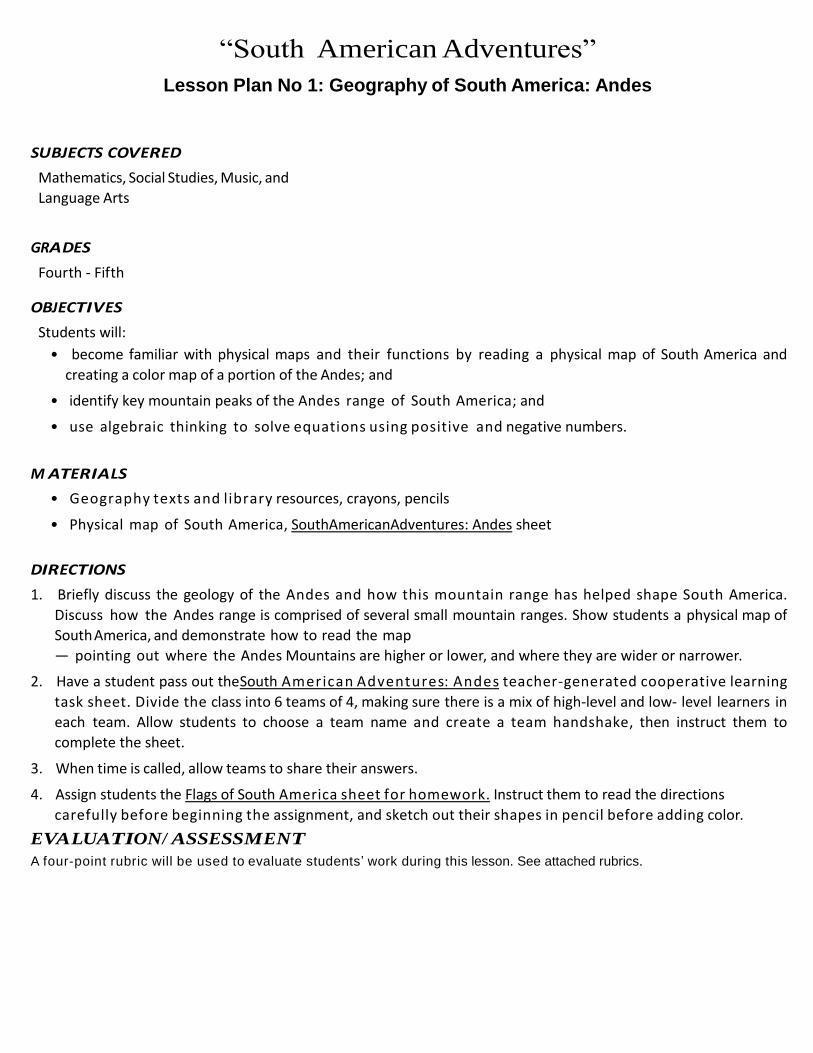
“South American Adventur es” Lesson Plan No 1: Geography of South America: Andes “South American Adventur es” Lesson Plan No 1: Geography of South America: Andes SUBJECTS COVERED Mathematics, Social Studies, Music, and Language Arts GRA DES Fourth - Fifth OBJ ECTI VES Students will: • become familiar with physical maps and their functions by reading a physical map of South America and creating a color map of a portion of the Andes; and • identify key mountain peaks of the Andes range of South America; and • use algebraic thinking to solve e q u a t i o n s u s i n g p o s i t i v e a n d negative numbers. M ATERI A LS • G e o g r a p h y t e x t s a n d l i b r a r y resources, crayons, pencils • Physical map of South America, SouthAmericanAdventures: Andes sheet DIRECTI ONS 1. Briefly discuss the geology of the Andes and how this mountain range has helped shape South America. Discuss how the Andes range is comprised of several small mountain ranges. Show students a physical map of South America, and demonstrate how to read the map — pointing out where the Andes Mountains are higher or lower, and where they are wider or narrower. 2. Have a student pass out theSouth A m e r i c a n A d v e n t u r e s: A n d e s teacher-generated cooperative learning task sheet. Divide the class into 6 teams of 4, making sure there is a mix of high-level and low- level learners in each team. Allow students to choose a team name and create a team handshake, then instruct them to complete the sheet. 3. When time is called, allow teams to share their answers. 4. Assign students the Flags of South A me r i c a s h e e t f o r h o m e w o r k . Instruct them to read the directions carefully before beginning the assignment, and sketch out their shapes in pencil before adding color. EVA LUATION/ ASSESSMENT A four-point rubric will be used to evaluate students ’ work during this lesson. See attached rubrics.
Transcript of “South American Adventures”
“South American Adventures”
Lesson Plan No 1: Geography of South America: Andes
“South American Adventures”
Lesson Plan No 1: Geography of South America: Andes
SUBJECTS COVER ED
Mathematics, Social Studies, Music, and
Language Arts GRADES
Fourth - Fifth OBJECTIVES
Students will:
• become familiar with physical maps and their functions by reading a physical map of South America and
creating a color map of a portion of the Andes; and
• identify key mountain peaks of the Andes range of South America; and
• use algebraic thinking to solve e q u a t i o n s u s i n g p o s i t i v e a n d negative numbers. M ATER IALS
• G e o g r a p h y t e x t s a n d l i b r a r y resources, crayons, pencils
• Physical map of South America, South American Adventures: Andes sheet
DIR ECTIONS
1. Briefly discuss the geology of the Andes and how this mountain range has helped shape South America.
Discuss how the Andes range is comprised of several small mountain ranges. Show students a physical map of
South America, and demonstrate how to read the map
— pointing out where the Andes Mountains are higher or lower, and where they are wider or narrower.
2. Have a student pass out the South A m e r i c a n A d v e n t u r e s: A n d e s teacher-generated cooperative learning
task sheet. Divide the class into 6 teams of 4, making sure there is a mix of high-level and low- level learners in
each team. Allow students to choose a team name and create a team handshake, then instruct them to
complete the sheet.
3. When time is called, allow teams to share their answers.
4. Assign students the Flags of South A m e r i c a s h e e t f o r h o m e w o r k . Instruct them to read the directions
carefully before beginning the assignment, and sketch out their shapes in pencil before adding color.
EVALUATION/ ASSESSMENT
A four-point rubric will be used to evaluate students’ work during this lesson. See attached rubrics.

“South American Adventures”
Lesson Plan No 2: Geography of South America: Capitals
SUBJECTS COVER ED
Mathematics, Social Studies, Music, and
Language Arts
GRADES
Fourth - Fifth OBJECTIVES
Students will:
• become familiar with political maps and their functions by reading a political map of South America and
creating a color map of countries in South America; and
• identify c a p i t a l c i t i e s o f S o u t h American countries and reviewing population data; and
• u s e a l g e b r a i c t h i n k i n g t o s o l v e equations using positive and negative numbers.
M ATER IALS
• Geography texts and library resources, crayons, pencils
• Physical map of South America, South American Adventures: Capitals sheet DIR ECTIONS
1. Show students a political map of Chile and identify its capital, Santiago. Ask students to list characteristics that
lesson and allow them to review their team name and handshake, then instruct them to complete the sheet.
2. Tell students that 5 million people live in Chile’s capital, Santiago. Santiago is the sixth-largest city in South America. Ask them to estimate how many people live in our city, our state, our country.
3. Have a student pass out the South A m e r i c a n A d v e n t u r e s : C a p i t a l s t e a c h e r - g e n e r a t e d c o o p e r a t i v e learning task sheet. Instruct the students to divide into their cooperative learning teams from the previous
4. Review the major mountain range in South America, (Andes), then tell students that the Andes may be broadly divided into three regional zones: the Northern Andes, which includes the mountains that run through Colombia, Venezuela, Ecuador, and parts of northern Peru; the Central Andes, which includes the part of the range that runs through Bolivia, the rest of Peru, northern Argentina, and Chile; and the Southern Andes, which includes the mountains that run through southern Chile and Argentina, through Patagonia, and down to the southernmost tip of South America, Tierra del Fuego.
5. Assign each team one of the Andes’ three regional zones: northern, central, and southern. (There will be two teams working on each zone). Explain that the groups will put together oral reports on their regional zones and then present them to the rest of the class. The reports must be five minutes in length and include these five criteria: • I n f o r m a t i o n o n t h e z o n e ’ s topography (Is this a wide section of the Andes? How high are the
mountains? Etc.) • Typical climate by season • Vegetation • Animals found there • Unique geographic features (highest peaks, major rivers or volcanoes, archeological finds, etc.)

“South American Adventures”
Lesson Plan No 2: Geography of South America: Capitals
6. Talk about how best to divide the work among the group members. One easy way is to assign people specific topics to research and then present during the oral report. (For example, two people could be in charge of finding cultural information, one person in charge of determining climate, two people in charge of creating a physical map, and so on.)
7. Give students time in class and as a homework assignment to research and practice their presentations. Students may use travel magazines; geography texts, encyclopedias, and other library resources; and the Internet to conduct their research. The Web sites listed below have good information on the Andes.
8. Have the groups present their reports to the rest of the class. Allow time for students to ask the presenters questions after each report. Once all the reports have been given, discuss the differences and similarities among the regions.
EVALUATION / ASSESSMENT
A four-point rubric will be used to evaluate students’ work during this lesson. See attached rubric. Additional Information
http://www.blueplanetbiomes.org/andes.htm
http://www.wbu.com/chipperwoods/photos/andes.htm
http://www.jpl.nasa.gov/video/andes.cfm http://peruperu.com/andes-mountains.htm
http://www.vivecuador.com/html2/eng/northern_andes.htm
http://www.vivecuador.com/html2/eng/southern_andes.htm
http://www.chilediscover.com/info/andes.htm http://www.ddg.com/LIS/aurelia/titpag.htm
http://www.andes.org/bookmark.html
http://www.letus.northwestern.edu/projects/esp/top10/andespage/andes.html

“South American Adventures”
Rubric
Math Skill Sheets
CATEGORY
4
3
2
1
mathematical
reasoning
Uses complex and
refined
mathematical
reasoning.
Uses effective
mathematical
reasoning.
Some evidence of
mathematical
reasoning.
Little evidence of
mathematical
reasoning.
mathematical
errors
90-100% of the
steps and
solutions have no
mathematical errors.
Almost all (85-89%) of
the steps and solutions
have no mathematical
errors.
Most (75-84%) of the
steps and solutions
have no mathematical
errors.
More than 75% of the
steps and solutions
have mathematical
errors.
Neatness and
organization
The work is
presented in a neat,
clear, organized
fashion that is easy
to read.
The work is presented
in a neat and
organized fashion that
is usually
easy to read.
The work is presented
in an organized fashion
but may be hard
to read at times.
The work appears sloppy
and unorganized. It is
hard to know
what information goes
together.
Completion
All problems are
completed.
All but 1 of the
problems are
completed.
All but 2 of the
problems are
completed.
Several of the
problems are not
completed.

“South American Adventures”
Rubric
Collaborative Work Skills: Teamwork
CATEGORY
4
3
2
1
Attitude
Never is publicly
critical of the project
or the work of others.
Always has a positive
attitude about
the task(s).
Rarely is publicly
critical of the project or
the work of others.
Often has a positive
attitude about
the task(s).
Occasionally is publicly
critical of the project or
the work of other
members of the group.
Usually has a positive
attitude about the task(s).
Often is publicly critical
of the project or the work
of other members of the
group. Often has
a negative attitude
about the task(s).
Problem-solving
Actively looks for
and suggests
solutions to problems.
Refines solutions
suggested
by others.
Does not suggest or
refine solutions, but is
willing to try out solutions
suggested by others.
Does not try to solve
problems or help others
solve problems.
Lets others do the work.
Pride
Work reflects this
student’s best
efforts.
Work reflects a strong
effort from this
student.
Work reflects some
effort from
this student.
Work reflects very little
effort on the part
of this student.
Working
with
others
Almost always
listens to, shares
with, and supports
the efforts of others.
Tries to keep people
working well together.
Usually listens to,
shares with, and
supports the efforts
of others.
Does not cause
“waves” in the group.
Often listens to, shares
with, and supports the
efforts of others,
but sometimes
is not a good
team member.
Rarely listens to,
shares with, and
supports the efforts of
others. Often is
not a good team player.

“South American Adventures”
Lesson Plans: Additional Information
Below is a map of South America. Use the map to answer the questions.
1. Which is the biggest country?
a) Colombia b) Uruguay c) Brazil d) Chile
2. Which country is east of Argentina?
a) Bolivia b) Uruguay c) Peru d) Chile
3. Which ocean is to the west of Chile?
a) Pacific Ocean b) Arctic Ocean c) Atlantic Ocean
4. To which country do the Galapagos Islands belong?
a) Peru b) Uruguay c) Paraguay d) Ecuador
5. Which country is south of Ecuador?
a) Bolivia b) Venezuela d) Guyana d) Suriname

“South American Adventures”
Lesson Plans: Additional Information
Below is a list of the countries on the continent of South America. Use the list to
answer the questions. Remember: spelling counts!
Venezuela Columbia Guyana
French Guyana Suriname
Argentina Chile Brazil Bolivia
Paraguay Uruguay
Peru Ecuador
1. Which country’s name has the most letters?
2. Which country’s name has the least letters?
3. How many countries begin with the letter P?
4. Write the countries that begin with the letter B:
5. Which country has three letter u’s in its name?
6. How many countries have at least one letter I in their names?

“South American Adventures”
Lesson Plans: Additional Information
Below is a list of the countries on the continent of South America. Use the list to
answer the questions. Remember: spelling counts!
Venezuela
Columbia
Guyana
French Guyana
Suriname
Argentina Chile
Brazil
Bolivia
Paraguay
Uruguay
Peru
Ecuador Your job: put the countries into alphabetical order. Start with the country that begins
with the letter A, then B. If there are two countries that start with letter B, look at the
next letter to see which comes first in the alphabet! J
1. 8.
2.
9.
3.
10.
4.
11.
5.
12.
6.
13.
7.

“South American Adventures”
Lesson Plans: Additional Information
South American Adventures: Capitals
1. The capital of Ecuador
is Quito, population 1.4
million. Color Ecuador
yellow.
2. The capital of Argentina is
Buenos Aires, population
2.8 million. Color
Argentina orange.
3. The capital of Brazil is
Brasilia, population 2.1
million. Color Brazil red.
4. The capital of Venezuela
is Caracas, population 1.9
million. Color Venezuela
blue.
5. The capital of Peru is
Lima, population 6.9
million. Color Peru green.
6. The capital of Paraguay is Asuncion, population 1.3 million. Color Paraguay brown.
7. The capital of Chile is Santiago, population 1 million. Color Chile purple.
8. The capital of Colombia is Bogota, population 6.4 million. Color Colombia black.
9. What is the population of Lima minus Asuncion? million
10. What is the population of Santiago plus Caracas? million
11. What is the population of Buenos Aires plus Quito? million
(Continued on next page)

“South American Adventures”
Lesson Plans: Additional Information
South American Adventures: Capitals (Continued from previous page)
12. Which capital has the largest population?
13. Which capital has the smallest population?
14. List the populations in order from largest to smallest:
Population (million) Capital Country
15. How many countries are there on the continent of South America?
16. Name the South American countries that are not listed in the chart above:
Extra Credit: Super Extra Credit: What is the total population of What is the mean population?
all the capitals added together? (divide total population by 8)
million million

“South American Adventures”
Lesson Plans: Additional Information
South American Adventures: Andes
The Andes Mountains are
the principal mountains
of South America, and
include some of the
world’s highest peaks.
The Andes are the longest
system of high mountains
on earth. The mountains
reach into 7 countries:
Venezuela, Colombia,
Ecuador, Peru, Bolivia,
Chile, and Argentina.
1. Aconcagua is
6,900 meters tall. It
is in Argentina. Color
Argentina yellow.
2. El Toro is 5,800 meters
tall. It is in Peru. Color
Peru orange.
3. Pico Bolivar is 4,900 meters tall. It is in Venezuela. Color Venezuela red.
4. Monte Darwin is 2,500 meters tall. It is in Chile. Color Chile blue.
5. Ancohuma is 6,400 meters tall. It is in Bolivia. Color Bolivia green.
6. Galeras is 4,200 meters tall. It is in Colombia. Color Colombia brown.
7. Cavambe is 5,700 meters tall. It is in Ecuador. Color Ecuador purple.
(Continued on next page)

“South American Adventures”
Lesson Plans: Additional Information
South American Adventures: Andes (Continued from previous page)
8. What is the height of Aconcagua plus El Toro? meters
9. What is the height of Galeras plus Pico Bolivar? meters
10. What is the height of Cavambe minus Monte Darwin? meters
11. What is the height of Ancohuma minus El Toro? meters
12. Which country’s peak is the shortest?
13. Which country’s peak is the tallest?
14. List the peak heights in order from shortest to tallest:
Height (m)
Peak
Country
15. What is the mode (middle)? meters
Extra Credit: Super Extra Credit: What is the total height of What is the mean height?
all the peaks added together? (divide total height by 7)
meters meters

“South American Adventures”
Lesson Plans: Additional Information
South American Adventures: Ecuador
La Sierra means “of the sierra”. The area known as La Sierra is the Andes Mountain range, which runs like a vertical stripe through the center of the country. Draw a thick vertical stripe through the middle of Ecuador with brown.
El Oriente means “the east”. The area known as El Oriente contains the Amazon rainforest in the eastern part of the country. Color the right side of Ecuador green.
La Costa means “of the coast”. The area known as La Costa is the low-lying western part of the country. Its coast touches the Pacific Ocean. Color the coast of Ecuador red.
The Galapagos Islands, a chain of islands west of the mainland, also belongs to Ecuador. Color the Galapagos Islands yellow.
The Pacific Ocean surrounds the Galapagos Islands. Color the Pacific Ocean blue.
1. What is the western part of Ecuador called?
2. What is the eastern part of Ecuador called?
3. What is the middle part of Ecuador called?
4. What ocean touches Ecuador’s coast?
5. Name the islands that belong to Ecuador:
6. What does La Costa mean?
7. What does El Oriente mean?
8. What does La Sierra mean?

“South American Adventures”
Lesson Plans: Additional Information
Circle Geometry: the Galapagos Tortoise
The Galapagos Islands are volcanic islands on the equator, off the
coast of Ecuador. Because the islands were never connected to the
mainland, many species of plants and animals are unique to the
Galapagos.
The Galapagos Giant Tortoise eats great quantities of grass, leaves
and cactus pads. There are only about 15,000 tortoises left in
Galapagos, so there is plenty to eat.
Calculate the area each tortoise eats by FIRST, multiplying the
radius by itself, and THEN multiplying that answer by 3.14.
1. The radius is 2 m. What is the area?
Multiply: radius x radius = multiplied by 3.14 = sq m
2. The radius is 3 m. What is the area?
Multiply: radius x radius = multiplied by 3.14 = sq m
3. The radius is 4 m. What is the area?
Multiply: radius x radius = multiplied by 3.14 = sq m
4. The radius is 5 m. What is the area?
Multiply: radius x radius = multiplied by 3.14 = sq m
5. The radius is 6 m. What is the area?
Multiply: radius x radius = multiplied by 3.14 = sq m

“South American Adventures”
Lesson Plans: Additional Information
South American Adventures: Bolivia
Bolivia is named after
Simon Bolivar, a man
who fought for the
independence of several
South American countries.
Bolivia is surrounded by
land; however, it does have
access to the Atlantic via
the Paraguay River.
Lake Titicaca is located on
the border of Bolivia and
Peru. Color the lake blue.
Going south from Lake Titicaca towards Argentina is the Altiplano, a high plateau that is part of the Andes mountain range. Color the Altiplano brown.
Going north-east from Lake Titicaca towards Brazil is the Amazon rainforest. Color the Amazon rainforest green.
Going south-east along the border of Paraguay and Brazil is the Paraguay River. The river gives Bolivia access to the Atlantic Ocean. Trace the Paraguay River with purple.
Brazil borders Bolivia on the north and east. Color Brazil yellow.
Peru and Chile border Bolivia on the west. Color Peru and Chile orange.
Paraguay and Argentina border Bolivia to the south. Color Paraguay and Argentina red.
1. What river gives Bolivia access to the Atlantic Ocean?
2. The Altiplano is part of which mountain range?
3. Which countries border Bolivia to the west?
4. Which countries border Bolivia to the south?