


Some thoughts on DevSummit 2012 including comments and links (PDF)
53
A1
-
Upload
xander-bakker -
Category
Technology
-
view
707 -
download
1
Transcript of Some thoughts on DevSummit 2012 including comments and links (PDF)
A1

Dia 1
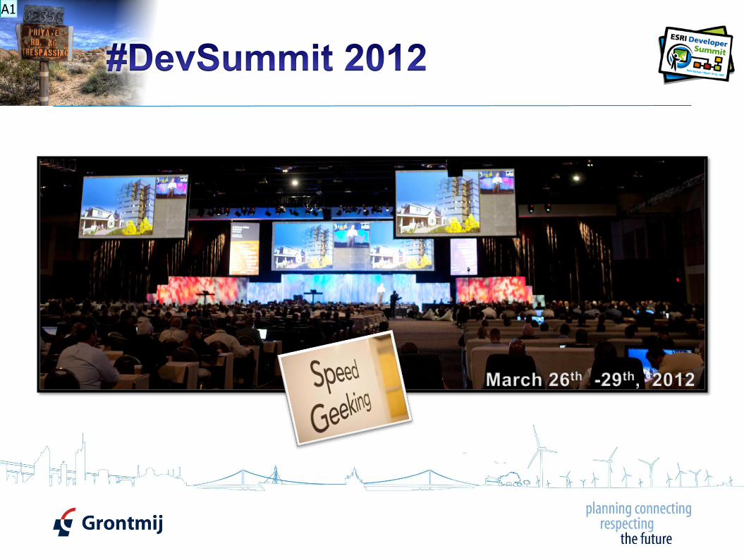
A1 In this presentation I look back at the DevSummit 2012 and will show some personal highlights Auteur; 18-6-2012

2
A2

Dia 2
A2 Going to the DevSummit means you have to make some tough decisions. There are so many interesting presentations and so little time. This was my personal agenda. Auteur; 18-6-2012

3
A3
Dia 3
A3 This is a short list of some personal highlights. Hyperlinks to content are only available if you download the presentationAuteur; 18-6-2012

4
Help Guide book on Python Add-Ins
Python resource center
Python 10.1 Wall reference (PDF)
Python Add-In Wizard
A4

Dia 4
A4 Python Add-Ins is a cool thing. It makes it easier to share customizations with others. Python is easier and the OM is a lot simpler that ArcObjects. This icons in the lower right corner provide access to the presentation. Auteur; 18-6-2012

5
1 2
A5

Dia 5
A5 It’s great to see Jack and all the others giving a whirlwind presentation on all the goodies packed in ArcGIS 10.1. The links to the videos of the Plenary are included in the lower right corner. Auteur; 18-6-2012
Dia 6
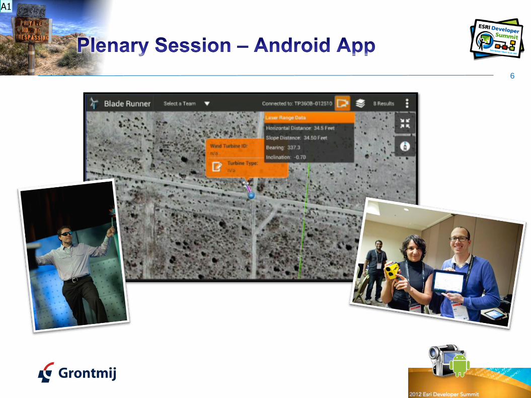
A1 The Blade Runner Android App. Connecting the Rangefinder through Bluetooth to the tablet and add point locations of the objects you look at. At the right you see Sabine and Will (Android team) and behind them Jithen from Esri New Zeeland. On the left David Cardella pretending to be a windmill. He did a great job! Auteur; 18-6-2012

Dia 7
A1 David also showcased some really nice mockup they did on the ArcGIS for iOS on the iPad. In this case showing some routing and using offline data. Auteur; 18-6-2012

8
A2

Dia 8
A2 Some new things they showed were ArcGIS Runtime running on Win8 and MacOS. Morton and Eric did a great job there! If you want to know what tunning new stuff will be presented at the following DevSummit, I recommend you to follow @dotMorton. Auteur; 18-6-2012
9
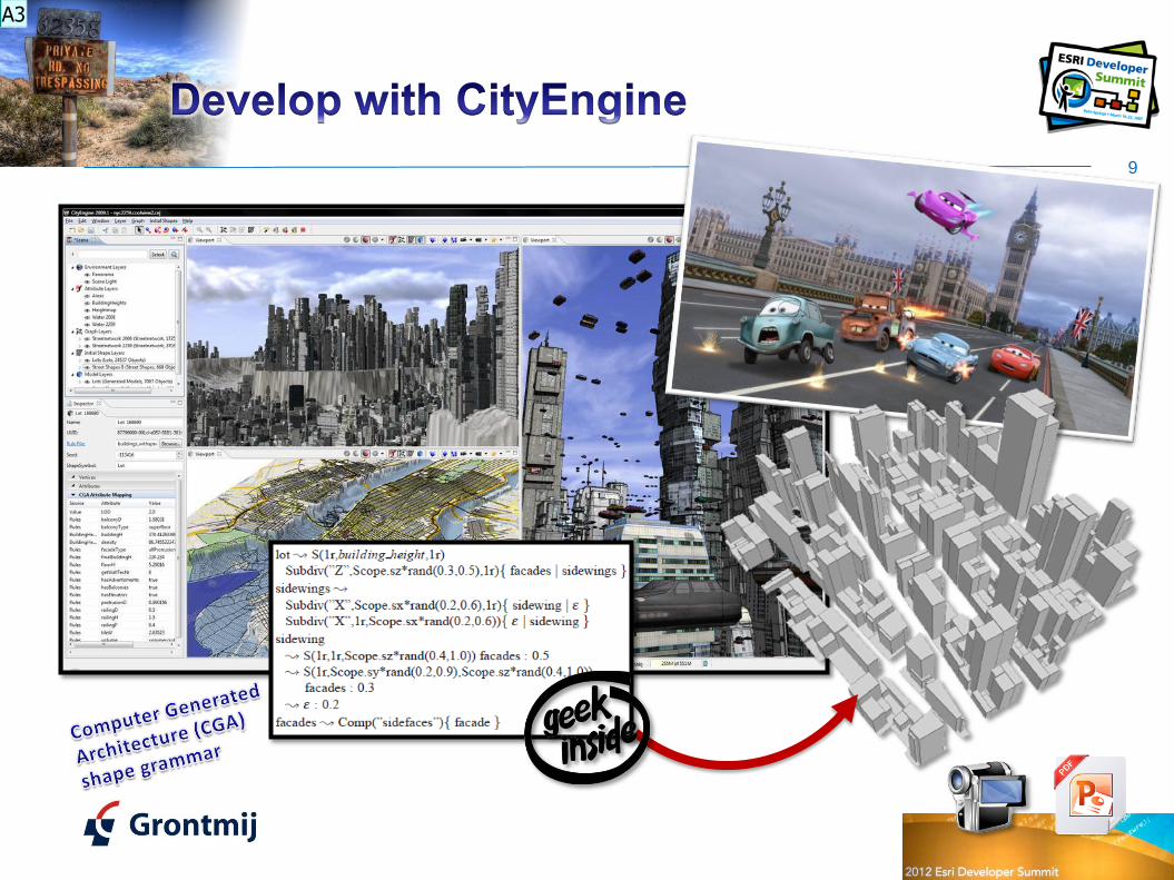
A3
Dia 9
A3 Esri bought Procedural last year and CityEngine is now being integrated into ArcGIS. In this great 3D development software package you can use CGA shape grammar to build up your virtual 3D world. Some real geek stuff here. Auteur; 18-6-2012
10
<Keynote>
<Quote> Servers are disposable horsepower and cloud storage is infinite </Quote>
<Quote> Change happens. You have to adapt or die </Quote>
<Quote> Assume there’ll be threats and design backwards </Quote>
<Quote> Handle failure by killing it and restarting </Quote>
<Quote> Don’t have to waste time trouble shooting problems. Spin up another one </Quote>
</Keynote>
A4

Dia 10
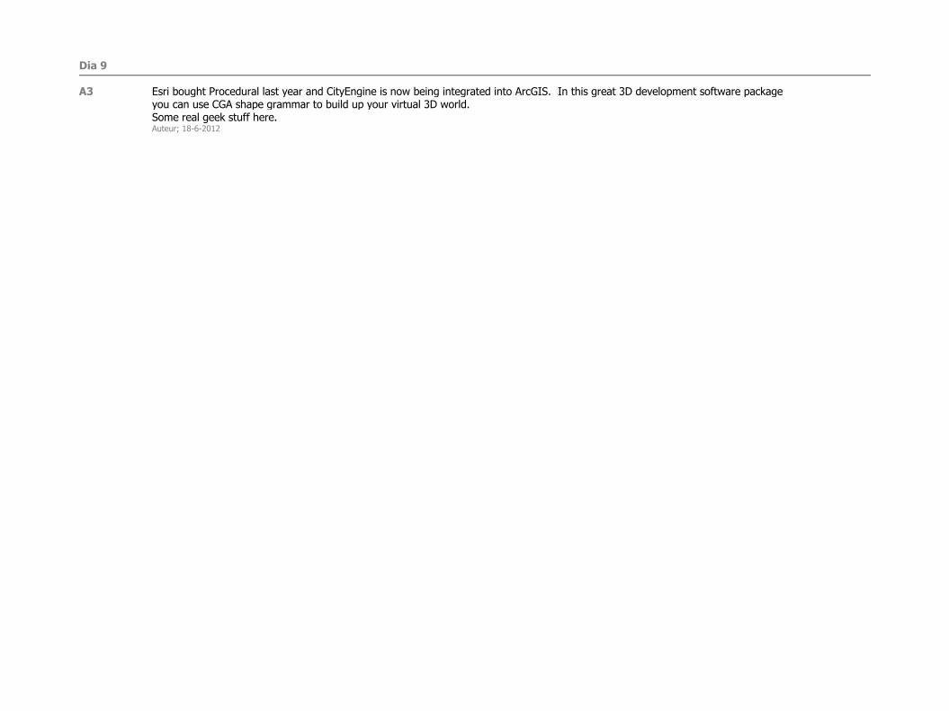
A4 Here you see some quotes by Steve Riley (Riverbed Technical Lead) in his keynote speech “In the Cloud, Everything You Think You Know Is Wrong”. Go and see the presentation for yourself (icon lower right) Auteur; 18-6-2012

Dia 11
A5 This quote represents a simple definition of what the cloud is (or not is) according to Steve Riley. Auteur; 18-6-2012

12
Dave Bouwman
DTS Agile
Source: http://www.slideshare.net/dbouwman/presentations
A6
Dia 12
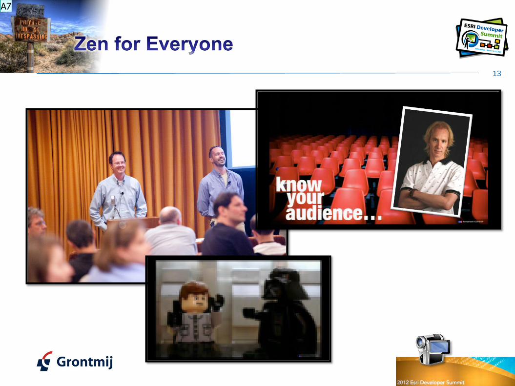
A6 Last year (2011) it was my first time at the DevSummit and I saw most of the user presentations by Dave Bouwman (DTS Agile). He has a very specific way of presenting stuff. Go and check this out for yourself: http://www.slideshare.net/dbouwman/presentations This year he and Brian Noyle entered a presentation that was not technical, but would explain how they at DTS Agile design their slide decks and do the actual presentation. I recommend you to watch the video, since it has some very useful information. I also want to apologize since I am not following many of their recommendations in this slide deck. Not because I disagree, but simply because it was simpler not to do so…Auteur; 18-6-2012

Dia 13
A7 The picture in the upper left corner shows the moment after Dave made a comment on the quality of some images used by Steve Riley at his Keynote speech, not knowing that Steve was actually present in the audience. This led to the comment by Brian that you should know your audience… (watch and see if the keynote speaker is present before you start to criticize his presentation) ;-) Auteur; 18-6-2012

14
http://blogs.esri.com/esri/apl/
A8
Dia 14
A8 The application prototype lab is a group of Esri people that have a great amount of liberty to develop or investigate things they find interesting. If you ever have the possibility to see a presentation by them go check it out. Also visit their blog and check out the contributions. Especially Richie C. (Carmichael) contributes a lot of interesting stuff! Auteur; 18-6-2012

15
http://blogs.esri.com/esri/arcgis/2012/06/07/esri-maps-for-office-public-beta-released
A9

Dia 15
A9 Esri Maps for Office was presented by Art Haddad (CTO Esri) and showed a new piece of software that is aimed to provide GIS functionality to non GIS-users. At this moment it integrates in Office 2010 (Excel and PowerPoint) and allows for interactive maps by integrating ArcGIS online, geocoding and more. It will also become available for other Office software (Access, Word, Outlook) and hopefully at a later phase will integrate with Office 365. Auteur; 18-6-2012
16
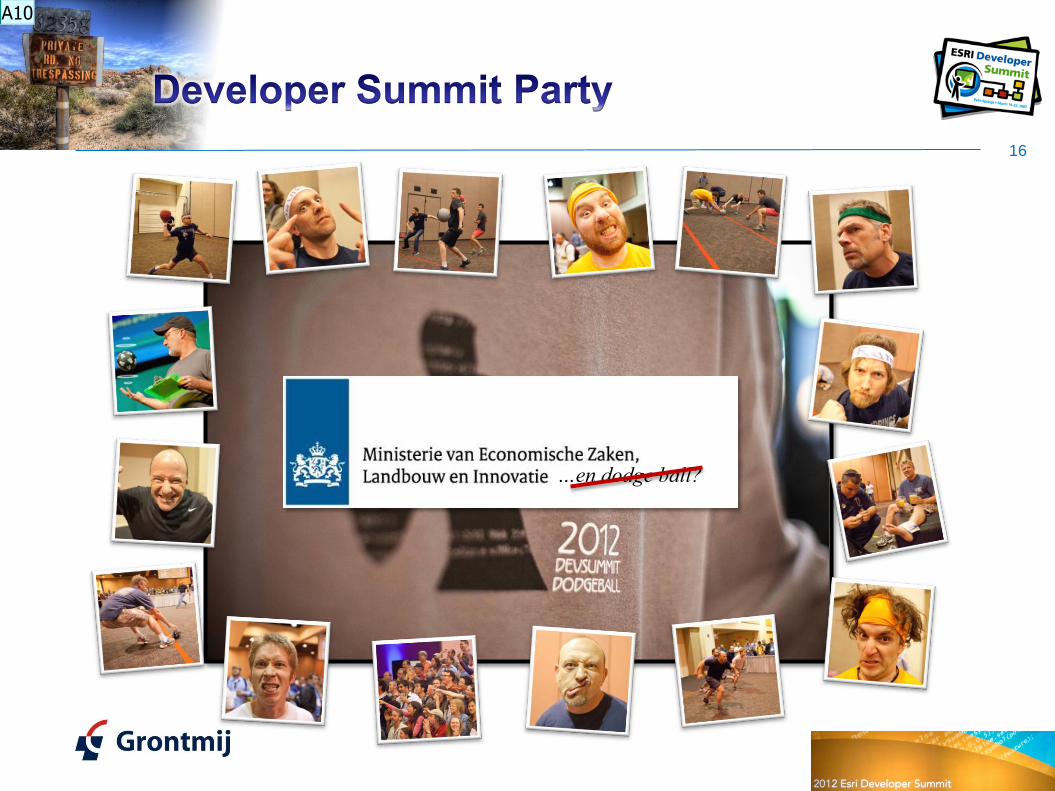
…en dodge ball?
A10

Dia 16
A10 This year I was going to participate in the Dodge ball tournament with some folks from the Dutch Ministry of Economic Affairs, Agriculture and Innovation. Sadly enough they didn’t show up at the tournament registration and I couldn’t participate. Auteur; 18-6-2012

Dia 17
A11 One of the greatest presentations I attended was the one entitled “Killer Apps: HTML5 and Flex” by Sajit Thomas (@SpatialAgent) and Mansour Raad (@mraad). I strongly urge you to go and see this presentation. Auteur; 18-6-2012
Dia 18
A12 Here you see part of 1 of the 10 killer app demos presented by Saijt and Mansour. They created a web application (picture left side) where a user can define the route (XY) and Z from a shark to its lunch (a swimmer). They used a Arduino board to control an inflated shark that floated through the room (photo right side). This presentation was loaded with fun and killer technology (integrating Flex and HTML5), so go and see that video (you really must!). This video icon in the lower right has a direct link to the video. Auteur; 18-6-2012

Dia 19
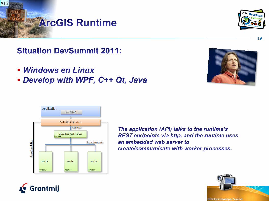
A13 In short; Runtime was presented last year at DevSummit 2011 as the new thing. You could develop using WPF, C++ Qt and Java. GIS on a USB stick. Auteur; 18-6-2012

20
ArcGIS Runtime
SDK for Windows
ArcGIS Runtime
SDK for iOS
ArcGIS Runtime
SDK for Android
ArcGIS Runtime
SDK for Windows
Phone
ArcGIS Runtime
SDK for Windows
Mobile
ArcGIS Runtime
SDK for Linux
Mobile Desktop
A14
Dia 20
A14 Later last year Runtime was presented as the name for all the Mobile and Desktop SDK’s (so there are 7 Runtimes now).At the DevSummit 2012 all mobile and desktop devices are no longer distinguished and all are referred to as devices. I haven’t seen it yet, but I would like to know when the first ArcGIS Runtime (for Linux) appears on the Raspberry Pi. ;-)Auteur; 18-6-2012

21
Supported GP tools
A15

Dia 21
A15 Content of an ArcGIS Runtime application is provided by Map, Tile and Locator packages. You need ArcGIS 10.1 Desktop to author the content. Functionality can come from Geoprocessing packages. A list of supported geoprocessing tools is provided here: http://resourcesbeta.arcgis.com/en/help/runtime-wpf/concepts/index.html Auteur; 18-6-2012

Dia 22
A16 The objectmodel of Runtime is a lot less complex than ArcObjects and provided an easier was to develop functionality. Runtime is part of EDN. If you have an EDN license you can start developing now. Auteur; 18-6-2012

Dia 23
A17 Some comments on customizing Runtime and for what situations you still need to use Engine. Auteur; 18-6-2012
Dia 24
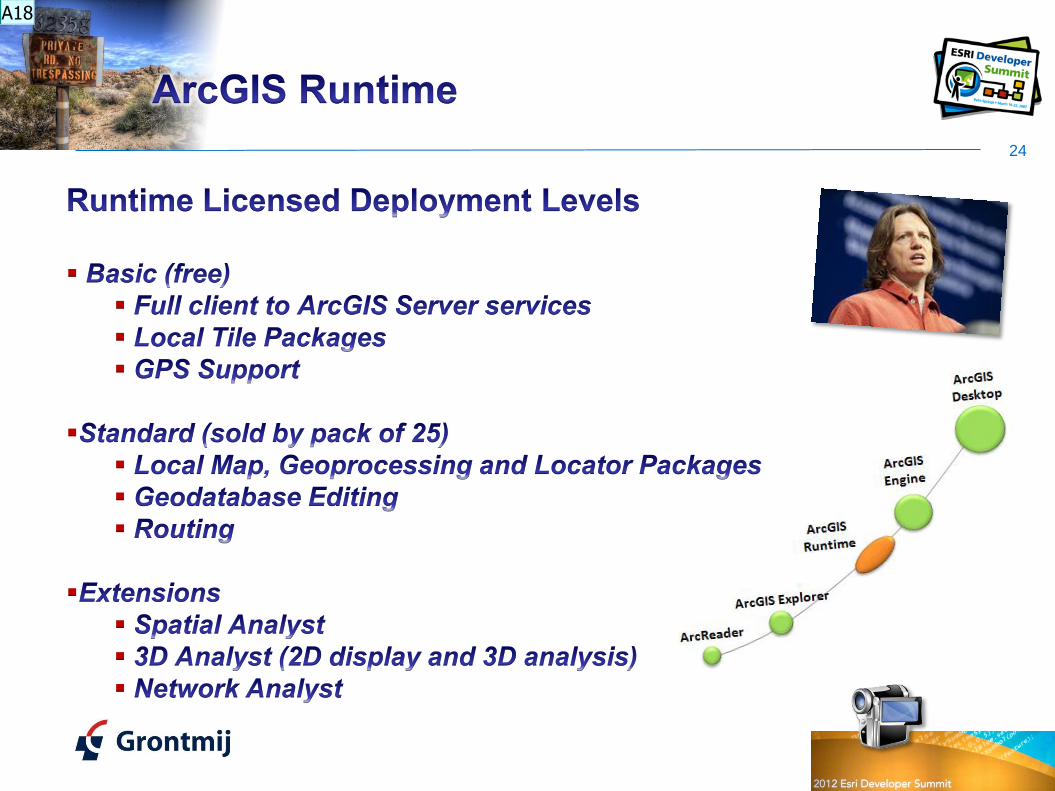
A18 It appears that you can develop an application using content from ArcGIS online and provide this to users for free. If you want to use local content and geoprocessing functionality or locator packages you need to acquire a license. Also functionality from extensions need additional licensing. At this moment SA, 3D and NA extensions are supported. If additional extensions are required, they might be included as well (post requests at the ideas site).Auteur; 18-6-2012
Dia 25
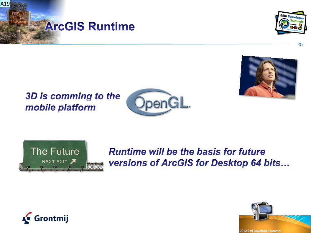
A19 Yes, 3D will come to the mobile platform. Most likely OpenGL will be used for this feature.Runtime will be used for future ArcGIS for Desktop (64 bits) developmentsAuteur; 18-6-2012

26
http://resources.arcgis.com/en/help/pdf/whats_new_in_arcgis.pdf
http://proceedings.esri.com/library/userconf/devsummit12/index.html
A20

Dia 26
A20 There was a lot more, but I could assist as many presentations as possible Auteur; 18-6-2012

Grontmij Netherlands BV :: GIS & ICT – GIS Team :: http://www.Grontmij.com :: +31 30 220 79 11
Xander Bakker
Senior GIS Advisor
http://twitter.com/#!/XanderBakker
http://nl.linkedin.com/in/xanderbakker
Xander [DOT] Bakker [AT] Grontmij [DOT] NL
http://software.grontmij.nl