Solar Panel Site Suitability Study - Portland State...
18
12/8/2011 1 Solar Panel Site Suitability Study Greg Howard, Matt Lenox, and Tracy Ricker http://1800recycling.com/wp-content/uploads/2009/08/HereComesTheSun.jpg Project Goals: • Determine a suitable study area by availability of LiDAR. • Use a LiDAR generated DEM for Solar Analysis. • Use the Oregon Department of Transportation's (ODOT) Solar Project methodologies as a guide to develop a model for use in our study area. • Use the model to determine areas with high solar potential using the Solar Radiation Tools in ArcGIS.
Transcript of Solar Panel Site Suitability Study - Portland State...

12/8/2011
1
Solar Panel Site Suitability Study Greg Howard, Matt Lenox, and Tracy Ricker
http://1800recycling.com/wp-content/uploads/2009/08/HereComesTheSun.jpg
Project Goals:
• Determine a suitable study area by availability of
LiDAR.
• Use a LiDAR generated DEM for Solar Analysis.
• Use the Oregon Department of Transportation's
(ODOT) Solar Project methodologies as a guide to
develop a model for use in our study area.
• Use the model to determine areas with high solar
potential using the Solar Radiation Tools in ArcGIS.

12/8/2011
2
http://topics.nytimes.com/top/news/business/
energy-environment/solar-energy/index.html
http://www.chinahighlights.com/image/map/province/china.jpg
China is currently seen as a leader in
the development and use of solar
energy. The Chinese government
heavily subsidizes green energy.
The average US Home consumed
10,650 kW/Year in 2009.
United States Department of Energy
https://encrypted-
tbn3.google.com/images?q=tbn:ANd9GcTqIVeHIVUx1ULpy4VsrGT6ZvBV_r3oSn5SsV_
a0oOp9UzCtReu
• Rooftop Solar Challenge
o $12 Million
• Recent investment to bolster
technology to concentrate solar
energy
o $60 million
http://energy.gov/science-innovation/energy-sources/renewable-energy/solar
http://energy.gov/articles/doe-awards-12-million-spur-rapid-adoption-solar-energy-rooftop-
solar-challenge

12/8/2011
3
ODOT Study • In 2008, ODOT built the first solar highway project in
the US.
o Generates 130,000 kWh/year.
• ODOT's long term goal is to build enough renewable
energy capacity to make all 47 M kwh required annually.
o signals, illumination, buildings, ramp metering.
Slide from ODOT presentation
ODOT Study: • Criteria Used from ODOT study:
o Southern orientation
o Slope of less than 15% o Identify which sites are in flood plains or that have known
wetlands or protected stream corridors

12/8/2011
4
ODOT Processes
• ODOT didn't use ESRI's Solar Radiation tool.
• ODOT used National Renewable Energy Laboratory
(NREL) tools.
o Make Solar Array
ODOT Processes
PVWatts Grid Data Calculator

12/8/2011
5
ODOT Processes: Online PVWatts Viewer:
http://mapserve3.nrel.gov/PVWatts_Viewer/index.html
http://www.nrel.gov/gis/
NREL Solar Resource Fraction Map

12/8/2011
6
Solar Radiation Tool
Solar Radiation Tool • The solar radiation tool in ArcGIS doesn't include
reflected radiation.
• The total radiation is calculated as the sum of the direct
and diffuse radiation.
http://webhelp.esri.com/arcgiSDEsktop/9.3/index.cfm?TopicName=Calculating_solar_radiation

12/8/2011
7
MODEL
Exclusionary Criteria:
• Slope
• Aspect
• Floodplain
• Wetlands
• Total Solar Fraction
12/8/2011
8
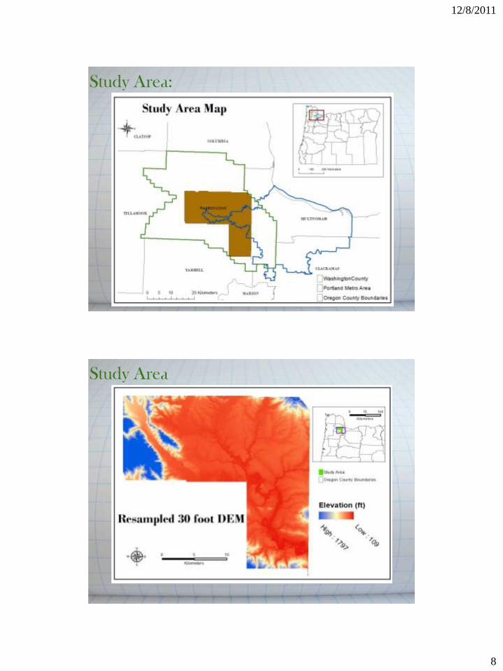
Study Area:
Study Area

12/8/2011
9
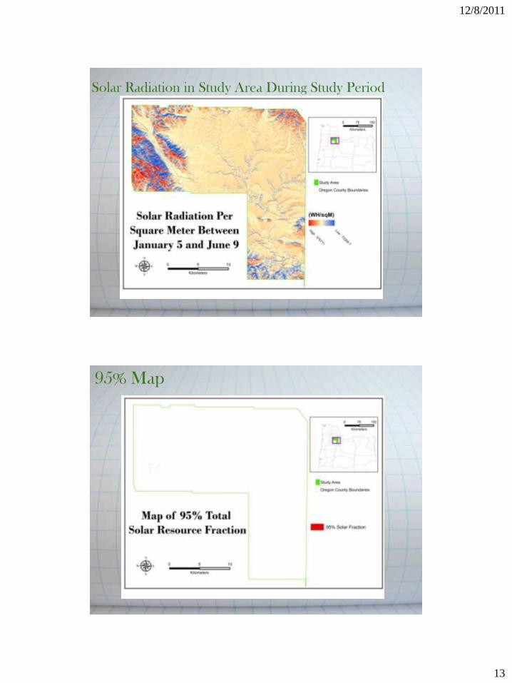
Solar Radiation in Study Area During Study Period
Slope

12/8/2011
10
Aspect
Floodplain

12/8/2011
11
Wetlands
Slope / Aspect Intersect
12/8/2011
12
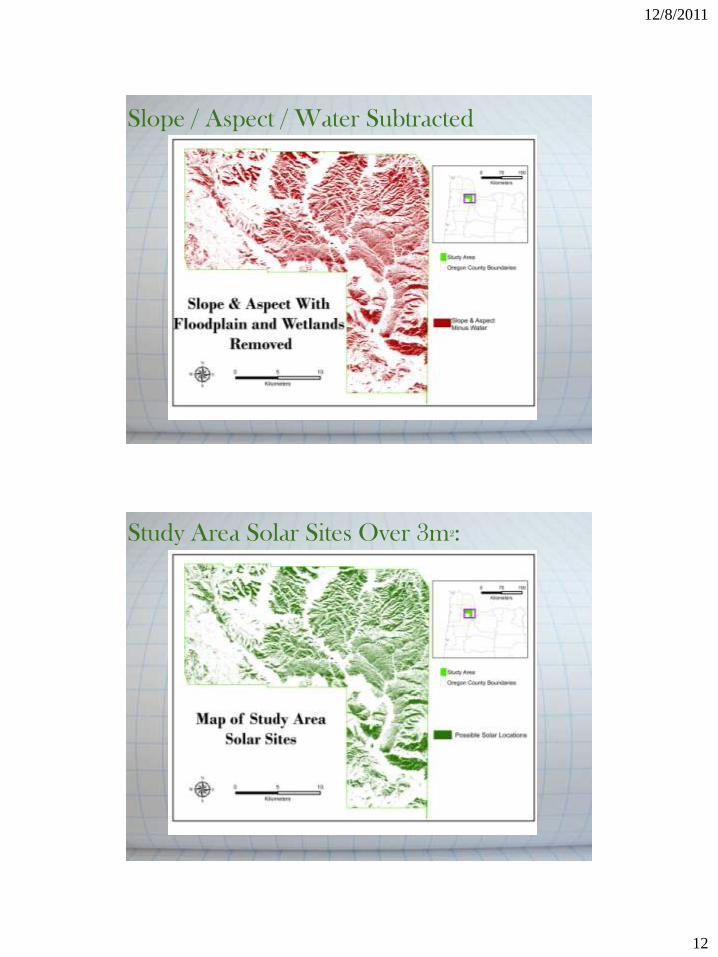
Slope / Aspect / Water Subtracted
Study Area Solar Sites Over 3m2:
12/8/2011
13
Solar Radiation in Study Area During Study Period
95% Map

12/8/2011
14
90% Map
85% Map

12/8/2011
15
Conclusions • Comparing results to NREL lends credibility to our methodologies
Continuing Questions: • There is a pronounced and
unexplained increase in
selected area between the
90% TSRF and 85% maps.
12/8/2011
16
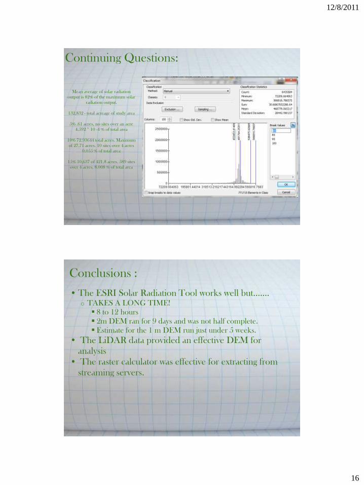
Continuing Questions:
Mean average of solar radiation
output is 82% of the maximum solar
radiation output.
132,832 - total acreage of study area
5% .61 acres, no sites over an acre
4.592 * 10 -4 % of total area
10% 72.93644 total acres. Maximum
of 27.71 acres. 10 sites over 4 acres
0.055 % of total area
15% 10,637 of 421.8 acres. 589 sites
over 4 acres. 8.008 % of total area
Conclusions :
• The ESRI Solar Radiation Tool works well but.......
o TAKES A LONG TIME!
8 to 12 hours
2m DEM ran for 9 days and was not half complete.
Estimate for the 1 m DEM run just under 5 weeks.
• The LiDAR data provided an effective DEM for
analysis
• The raster calculator was effective for extracting from
streaming servers.

12/8/2011
17
Conclusions :
• Developed methodologies to calculate
solar potential based on criterion.
• Able to use LiDAR Derived DEM throughout the
process.
o Took into account terrain
o Worked with raster calculator.
• Throughout the process valuable knowledge and
information was gained. • We Learned A LOT!
Further Investigations:
• Additional exclusionary criteria:
o Land use / availability
o Proximity to solar energy conversion resources
o Hazardous material investigation
• Calculations of possible energy outputs in selected areas.
• Use NREL data and tools.
o Use of meteorology data.
• Make use of the ESRI Point Solar Radiation tool.
• Set custom parameters on Area Solar Radiation tool
12/8/2011
18
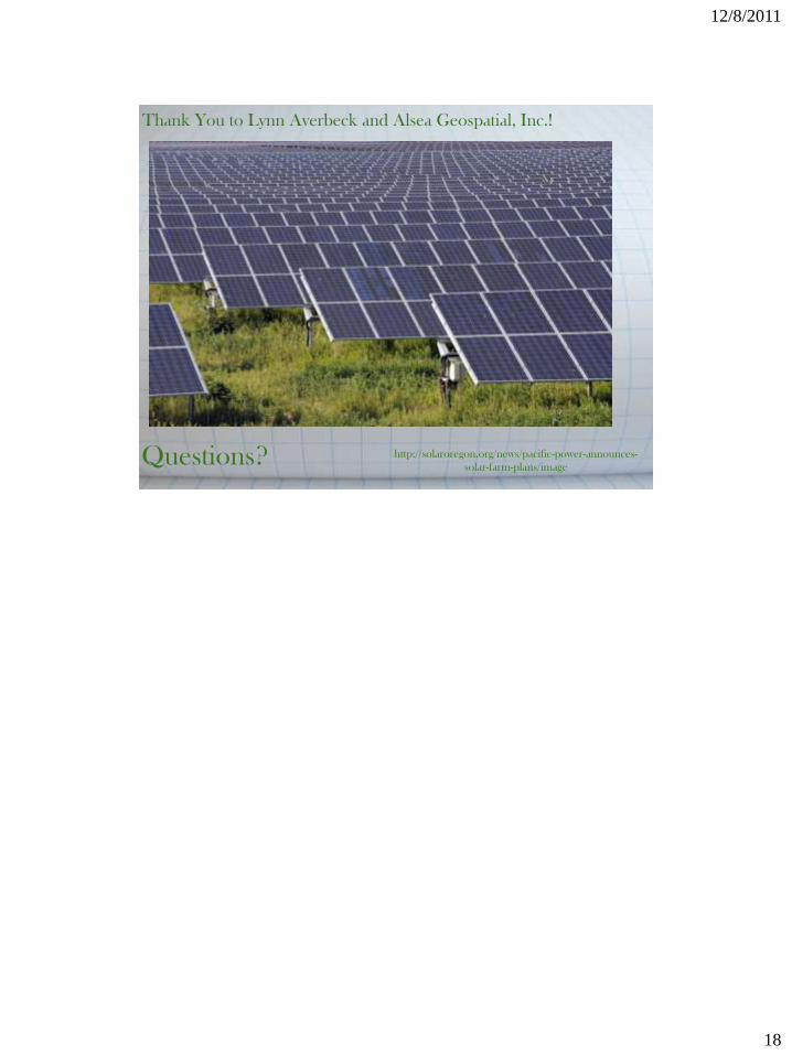
http://solaroregon.org/news/pacific-power-announces-
solar-farm-plans/image Questions?
Thank You to Lynn Averbeck and Alsea Geospatial, Inc.!