Soil Erosion
80
A Project Report On “soil erosion & their Effects ” INDEPENDENT PROJECT SUBMITTED FOR PARTIAL FULFILLMENT OF THE REQUIREMENT FOR AWARD OF THE DEGREE OF BACHLOR OF BUSINESS OF ADMINISTRATION SUBMITTED BY: MAYANK KULKARNI B.B.A. VI th SEMESTER SUBMITTED TO: ARCHANA RAIPURE & Dashrath darbhai VIVEKANAND VIGYAN MAHAVIDHYALAY SADAR, BETUL (AFFILIATED TO BARKATULLAH UNIVERSITY, BHOPAL) JUNE 2014
description
project report
Transcript of Soil Erosion
AProject Report
On“soil erosion & their Effects ”
INDEPENDENT PROJECT SUBMITTED FOR PARTIAL FULFILLMENT OF THE REQUIREMENT FOR AWARD OF THE
DEGREEOF
BACHLOR OF BUSINESS OF ADMINISTRATIONSUBMITTED BY:
MAYANK KULKARNIB.B.A. VIth SEMESTER
SUBMITTED TO:ARCHANA RAIPURE
&Dashrath darbhai
VIVEKANAND VIGYAN MAHAVIDHYALAY SADAR, BETUL
(AFFILIATED TO BARKATULLAH UNIVERSITY, BHOPAL)JUNE 2014
CERTIFICATE This is to certify that mayank kulkarni student of
vivekanand vigyan mahavidhyalay, betul has completed her major

project titled “mutual fund investment awareness among investors” Under our guidance and supervision. The project report is approved for submission towards partial fulfillment of the Degree of Bachelor of Business Administration granted by Barkatullah University, Bhopal.
This is to certify that above statement made by candidate is correct to the best of knowledge.
PROJECT GUIDE PROF. ARCHANA RAIPURE
DECLARATIONI hereby declare that the project report which is being presented on the project entitled “mutual fund investment awareness among investors” for submitted as major project for partial fulfillment of Bachelor of Business

Administration is an authentic record of my own work carried under the guidance of PROF. ARCHANA RAIPURE and was not submitted for the award of any other degree, diploma or certificate.
I hereby declare that above statement is correct to the best of my knowledge.
mayank kulkarni(b.b.a. vith sem.)
ACKNOWLEDGEMENTI sincerely acknowledge with a deep heartful gratitude to project
incharge PROF. ARCHANA RAIPURE for her valuable and faithful guidance, encouragement & suggestions through out the completion of this work. He generously shared his immense knowledge with me. His

personal attention brought the project to be completed successfully. I owe much more to him.
Last but not the least gratitude to all those, who extended their co-operation directly or indirectly in completion of this project work
MAYANK KULKARNI
CONTENTS

Our Beautiful Word…………………………………..4 Glorious Gift of Nature………………………….……….4
Our Earth……………………………………………...5 Where we live…………………………………………....5 What is Soil?......................................................................6 Story of Soil……………………………………………...7 Formation………………………………………………...8
The Five Forming Factors............................................91. Parent Material2. Climate3. Organisims4. Time
Soil Erosion…………………………………………..11 What is Soil Erosion?......................................................11 Did you know …………………………………………..12 Effects of Soil Erosion………………………………....14
Types of Soil Erosion………………………………..15 Water Erosion…………………………………………...15 Wind Erosion…………………………………………....17 Gravitical Erosion…………………………………….…18 Frozen-Melt Erosion…………………………………….19
Causes of Soil Erosion……………………………….21 Climate Factor…………………………………………..22 Soil Feature Factor………………………………….…..23 Geological Factor………………………………………23

Biological Factor………………………………………..25
IMEGES ………………………………27
How to Control Soil Erosion………………………...301. Cover Method…………………………………………30
Mulching Cover crops and green manures Green manures Mixed cropping and inter-cropping Early planting Crop residues Agroforestry Minimum cultivation
2. Barrier methods……………………………………….32
Man-made terraces Contour ploughing Contour barriers Natural tracces
Methods for sloping land…………………………….34
Solution for Soil Erosion…………….........................35
Conclusion……………………………………………36
Bibliography………………………………………….37

OUR BEAUTYFUL WORLD
GLORIOUS GIFT OF NATURE

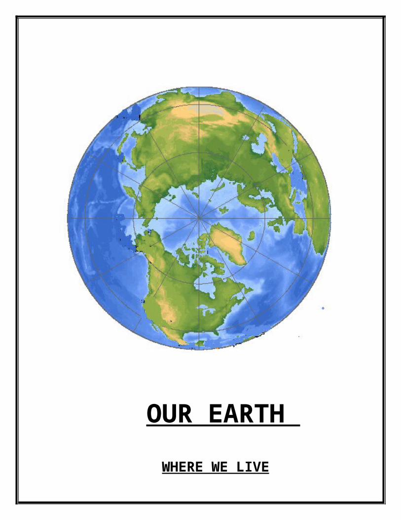
OUR EARTH
WHERE WE LIVE

Soil on which we live and do all those things for survive in this world. Where we do all those activities like:- Agriculture, Economic Activities to fulfill our wants.
SOIL
What is Soil?
SOIL may be defined as a thin layer of earth's crust which serves as a natural medium for growth of plants. It is the unconsolidated mineral matter that has been subjected to, and influenced by, genetic and environmental factors-- parent material, climate, organisms and topography all acting over a period of time. Soil differs from the parent material in the morphological, physical , chemical and biological properties. Also, soils differ among themselves in some or all the properties, depending on the differences in the genetic and environmental factors. Thus some soils are red, some are black; some are deep and some are shallow; some are coarse textured and some are fine-textured. They serve as a reservoir of nutrients and water for crops, provide mechanical anchorage and favourable tilth. The components of soil are mineral matter, organic matter, water and air, the proportions of which vary and which together form a system for plant growth; hence the need to study the soils in perspective. Soil erosion is a natural process. It becomes a problem when human activity causes it to occur much faster than under natural conditions. Soil covers a major portion of the earth's land surface. It is an important natural resource that either directly or indirectly supports most of the planet's life. Life here depends upon soil for food. Plants are rooted in soil and obtain needed nutrients there. Animals get their nutrients from plants or from other animals that eat plants. Many animals make their homes or are sheltered in the soil. Microbes in the soil cause the breakdown and decay of dead organisms, a process that in turn adds more nutrients to the soil.
Soil is a mixture of mineral and organic materials plus air and water. The contents of soil varies in different locations and is constantly changing. There are many different kinds and types of soils. Each has certain characteristics including a specific color and composition. Different kinds

of soils support the growth of different types of plants and also determine how well that plant life grows. Soil is formed slowly, but can be easily destroyed. Therefore, soil conservation is important for continued support of life.*
Story of Soil
Although many of us don't think about the ground beneath us or the soil that we walk on each day, the truth is soil is a very important resource. Processes take place over thousands of years to create a small amount of soil material. Unfortunately the most valuable soil is often used for building purposes or is unprotected and erodes away. To protect this vital natural resource and to sustain the world's growing housing and food requirements it is important to learn about soil, how soil forms, and natural reactions that occur in soil to sustain healthy plant growth and purify water. Soil is important to the livelihood of plants, animals, and humans. However, soil quality and quantity can be and is adversely affected by human activity and misuse of soil.
Certain soils are best used for growing crops that humans and animals consume, and for building airports, cities, and roads. Other types of soil have limitations that prevent them from being built upon and must be left alone. Often these soils provide habitats for living creatures both in the soil and atop the soil. One example of soils that have use limitations are those that hold lakes, rivers, streams, and wetlands. Humans don't normally establish their homes in these places, but fish and waterfowl find homes here, as do the wildlife that live around these bodies of water.
Natural processes that occur on the surface of Earth as well as alterations made to earth material over long periods of time form thousands of different soil types. In the United States alone there are over 50,000 different soils! Specific factors are involved in forming soil and these

factors vary worldwide, creating varied soil combinations and soil properties worldwide.
FormationSoil formation, or pedogenesis, is the combined effect of physical, chemical, biological, and anthropogenic processes on soil parent material resulting in the formation of soil horizons. Soil is always changing. The long periods over which change occurs and the multiple influences of change mean that simple soils are rare. While soil can achieve relative stability in properties for extended periods of time, the soil life cycle ultimately ends in soil conditions that leave it vulnerable to erosion. Little of the soil continuum of the earth is older than Tertiary and most no older than Pleistocene.[7] Despite the inevitability of soils retrogression and degradation, most soil cycles are long and productive. How the soil "life" cycle proceeds is influenced by at least five classic soil forming factors: regional climate, biotic potential, topography, parent material, and the passage of time.
An example of soil development from bare rock occurs on recent lava flows in warm regions under heavy and very frequent rainfall. In such climates plants become established very quickly on basaltic lava, even though there is very little organic material. The plants are supported by the porous rock becoming filled with nutrient bearing water, for example carrying dissolved bird droppings or guano. The developing plant roots themselves gradually breaks up the porous lava and organic matter soon accumulates but, even before it does, the predominantly porous broken lava in which the plant roots grow can be considered a soil.
The Four Soil Forming Factors
1. Parent material: The primary material from which the soil is formed. Soil parent material could be bedrock, organic material, an old soil

surface, or a deposit from water, wind, glaciers, volcanoes, or material moving down a slope.
2. climate: Weathering forces such as heat, rain, ice, snow, wind, sunshine, and other environmental forces, break down parent material and affect how fast or slow soil formation processes go.
3. Organisms: All plants and animals living in or on the soil (including micro-organisms and humans!). The amount of water and nutrients, plants need affects the way soil forms. The way humans use soils affects soil formation. Also, animals living in the soil affect decomposition of waste materials and how soil materials will be moved around in the soil profile. On the soil surface remains of dead plants and animals are worked by microorganisms and eventually become organic matter that is incorporated into the soil and enriches the soil.
4. Time: All of the above factors assert themselves over time, often hundreds or thousands of years. Soil profiles continually change from weakly developed to well developed over time.
Differences in soil forming factors from one location to another influence the process of soil formation

Image courtesy of the United States Department of Agriculture, Soil Conservation Service
SOIL EROSION

What is soil erosion?
Soil is naturally removed by the action of water or wind: such 'background' (or 'geological') soil erosion has been occurring for some 450 million years, since the first land plants formed the first soil. Even before this, natural processes moved loose rock, or regolith, off the Earth's surface, just as has happened on the planet Mars.
In general, background erosion removes soil at roughly the same rate as soil is formed. But 'accelerated' soil erosion — loss of soil at a much faster rate than it is formed — is a far more recent problem. It is always a result of mankind's unwise actions, such as overgrazing or unsuitable cultivation practices. These leave the land unprotected and vulnerable. Then, during times of erosive rainfall or windstorms, soil may be detached, transported, and (possibly travelling a long distance) deposited.
Accelerated soil erosion by water or wind may affect both agricultural areas and the natural environment, and is one of the most widespread of today's environmental problems. It has impacts which are both on-site (at the place where the soil is detached) and off-site (wherever the eroded soil ends up).
More recently still, the use of powerful agricultural implements has, in some parts of the world, led to damaging amounts of soil moving downslope merely under the action of gravity: this is so-called tillage erosion.
Soil erosion is just one form of soil degradation. Other kinds of soil degradationinclude salinisation, nutrient loss, and compaction. Soil erosion is when the soil is blown away by the wind or washed away by the rain.
Soil erosion is common in areas with steep slopes, where trees have been cut down, in droughts when crops and other vegetation grows poorly and in rural areas which are overpopulated. Nepal, in the Himalayan Mountains, has severe problems caused by increased population density and steep slopes. Soil erosion can be reduced by building terraces on hillsides, irrigation schemes to overcome droughts, planting more trees to bind the soil together and make wind breaks, and using fertilisers in overpopulated areas to make the soil more fertile. It is very important that the farming techniques used do not damage the structure of the soil, as this makes it easily eroded. Good farming techniques include contour ploughing, crop rotation and keeping the soil rich in humus. An example of poor techniques was the "Dust Bowl" in the mid-western states of the U.S.A. in the 1930's. Farmers exhausted the soil by monoculture and left the soil bare after harvesting. Soil erosion is a problem of the developed world as well as the developing.*
Did you knowAnnual soil loss in South Africa is estimated at 300 - 400 million tonnes, nearly three tonnes for each hectare of land.
Replacing the soil nutrients carried out to sea by our rivers each year, with fertilizer, would cost R1000 million.
For every tonne of maize, wheat, sugar or other agricultural crop produced, South Africa loses an average of 20 tonnes of soil.
The FAO (Food and Agriculture Organisation, a branch of United Nations) estimates that the global loss of productive land through erosion is 5-7 million ha/year.
EFFECTS OF SOIL EROSIONSoil erosion impacts the agricultural industry as well as the natural environment. The effects of soil erosion can be felt both on-site, meaning at the site of soil disruption, or off-site, meaning the location where the eroded soil deposits. Let's start by building our understanding of the impact of soil erosion on-site. When the topsoil is eroded from an area,
More People
More Hazard
Bare Soil
Desertification
The land provides
More Animal
Insects eat crop
Drought
More crops
More Firefood
Overgazing
Deforestrtion
Overcultivation

that area loses its most nutrient-rich layer, and therefore soil quality is reduced.
Poor soil quality means smaller crop yields and may even wash away seeds and small plants. This may call for more of a need for artificial fertilizers and pesticides, which can runoff of fields and contaminate waterways. Also, when the organic matter that is found within the top layer of soil is removed, it can weaken the soil's ability to hold water, leaving the field susceptible to weather conditions such as droughts.
The soil that is carried away has to go somewhere, and this leads to off-site problems. As mentioned, when soil is carried away from a farmer's field by water, it carries with it contaminants, such as fertilizers and pesticides. This runoff can cause water pollution that contaminates drinking water and disrupts ecosystems of lakes and wetlands. This negatively impacts the fish and wildlife that depend on these downstream waters for food and habitat. Sediments that accumulate down slope of the erosion can obstruct the flow of water in streams and drainage canals, leading to flooding.
As we see, much of the effects of soil erosion are the result of water erosion. But wind erosion can also transport topsoil and weaken soil quality. Wind can also damage young seedlings by blasting them with sand and other small particles. Wind also distributes topsoil, which might uncover and expose some seedlings, while at the same time, burying other seedlings too deep. Also, when farmer's fields undergo excessive tillage, meaning that the field is worked too hard in preparation for planting, the soil structure can be lost, making it more susceptible to erosion.
The loss of soil by the action of rainfall, run off or wind The consequences of which:

Eroded soil may be deposited on other land or in water courses, rivers, lakes, estuaries
Worldwide up to 75 billion tonnes of topsoil are eroded every year equating to:
. 9 million ha. of productive land lost
80% of worlds agricultural soils are affected by erosion. Thompson (1995) Increasing sea level
Agriculture
Weather
Types of Soil Erosion
Water erosion

Raindrops can be a major problem for farmers when they strike bare soil. With an impact of up to 30 mph, rain washes out seed and splashes soil into the air. If the fields are on a slope the soil is splashed downhill which causes deterioration of soil structure. Soil that has been detached by raindrops is more easily moved than soil that has not been detached. Sheet erosion is caused by raindrops. Other types of erosion caused by rainfall include rill erosion and gullies.
Sheet erosion is defined as the uniform removal of soil in thin layers from sloping land. This, of course, is nearly impossible; in reality the loose soil merely runs off with the rain.
Rill erosion is the most common form of erosion. Although its effects can be easily removed by tillage, it is the most often overlooked. It occurs when soil is removed by water from little streamlets that run through land with poor surface draining. Rills can often be found in between crop rows.
Gullies are larger than rills and cannot be fixed by tillage. Gully erosion is an advanced stage of rill erosion, just as rills are often the result of sheet erosion.

Once rills are large enough to restrict vehicular access they are referred to as gullies or gully erosion. Major concentrations of high-velocity run-off water in these larger rills remove vast amounts of soil. This results in deeply incised gullies occurring
along depressions and drainage lines.

Riverbank Erosion:
River bank erosion is a serious problem of Bangladesh. In fact the rivers which cover about 3.4 million hectares of lands are susceptible to widespread bank erosion. In this country about 70% of the total area is formed by alluvial deposit where silts and silty clays predominate the top 15m to 25m and clays , sandy silts and sands dominate at the deeper depths. The soil in the upper layers are mostly non cohesive and therefore, easily vulnerable to erosion and scouring . A network of 250 rivers having a total length of 2400km cover the country flowing down into the Bay of Bengal in an average year 775000Mm of water flows through the river systems of the Ganges, the Brahmaputra and the meghna and their tributaries during the monsoon month i.e. from june to October .Bangladesh receives an enormous sediment inflow during this period from the upper catchment of this three rain rivers . The marked seasonality of river flow in this

country is responsible for erosion during the monsoon due to strong current and sedimentation during the dry season .
The alluvial plains consisting largely of unconsolidated sediments through out the country are not resistant to erosion to erosion by river current and wave action. The river erosion includes shifting of the thawing towards either bank in river meanders , creation of new channels due to under cutting and local scouring due to turbulence caused by obstruction . Erosion is rapid on the outer circumference of the meanders while deposition occurred on the inside loop. sudden changes of river course known as avulsssion are common during floods and cause rapid bank erosion.
Fig: River bank Erosion
The flow of the rivers varies over a wide range of magnitude, and the rivers react with accordingly . They can rapidly shift laterally cutting out old sand bar deposits , forming new ones , and changing the flow alignment and channel geometry within floodplain that are several miles wide and extensive erosion occurs.The ganges river eroded about 5.5 km of its right bank between 1956 and 1975.The Brahmaputra, jamuna river is braided and has multiple channels and large shoals over a flood plain which varies from 8 to 16 km wide. The right bank has eroded westward as much as 0.8km or more in one year at certain points and average shifting has being about 0.08 km per year. On the left bank of the Meghna river near hajimara erosion was estimated to be 610 m during the 1974 flood. Field

measurement and air photo interpretation show that the rivers Ganges, Meghna and Jamuna migrate 60 to 1700 m per flood season. It is estimated that about 1200 km of river bank are under active erosion, of which more than 500 km face severe erosion problem. During 1984-85 and investigation was made by Bangladesh water development board to find out the extent of erosion of river banks and cities within the country. At 283 places of river banks and 85 towns and villages are subjected to severe erosion.
River-wise bank erosion is shown in Table:
Table: Length of Bank Erosion in various Rivers of Bangladesh.
Rivers No. of location of bank erosion
Length of erosion in km.
a)Brahmaputra-Jamuna
38 160
b) Ganges-Padma 30 94.4c) Meghan 6 12.8d) Teesta 8 35.2e) Minor Rivers 18 31.2f) Flashy and other Rivers
165 77.6
g) Tidal Rivers 18 83.2
Every year a considerable area of the country is engulfed by river erosion. Several towns in Bangladesh are threatened by river bank erosion. For example,river bank erosions near shirajganj town by the jamuna river and chandpur town by the meghna river is very severe.
Recent studies show that erosion is taking place in about 150 upazilas invoiving about 50 districts.In 35 upazilas erosion is severe and most recurrent. An estimate shows that about 1 million people are affected by erosion every year and many of these people are affected by erosion every year and many of these people ultimately end up landless and are forced to leavel for other aras including the cities.from a survey carried out on some 16 rivers by the BWDB it was found that more than 250 places were eroding along the banks of these rivers and average length of erosion ranged from 213.4m to 152439m. the river Megna was reported to have eroded some 181.30sq.km.area in Chandpur district till 1984.The land and human settlements in the country’s southern parts particularly Hatiya and Sandwip in Chittagong , Bhola in Barisal and Patuakhali are prone to recurrent bank erosion . The area of Sandwip was 1080 sq . km. In 1780 whice has been reduced to 575 sq.km in 1916 , and only 238 .30 sq km in 1984. Hatiya has been reduced to about half of its original size during the last 45 years . The recent study on the trends of erosion during the period of 1983 to 1988 shows erosion hits the marginal and small land holding farmers more seriously then the absolute landless people.The loss of land due to river bank erosion does not cause on the morphological changes in physical landscape but also in the socieoeconomic conditions of the affected people.
Type of River bank Erosion:

There are mainly four types of Erosion they are followings-
1. Slumping2. Undercutting of bank base and toppling.3. Vertical bank Erosion4. Gully Erosion
Slumping: Potential cause is flood damage. Manage by revegetating with deep rooted native trees. Some other causes are lack of vegetation, flood damage, stock or human access on sandy banks. Manage by planting deep rooted natives and controlling access.
Undercutting of bank base and toppling:
Potential causes are lack of deep rooted native vegetation, wind or wave action in larger rivers or speed of stream flow in smaller streams. Manage by paying special attention to protecting the toe of the bank. Plant native vegetation which does not mind wet feet. Encourage in-stream vegetation such as macrophytes and retain snags against the bank if they are not causing erosion.

Fig: Undercutting of bank base and toppling
Vertical bank Section: Potential causes of channel widening are speed and volume of water flow. Manage by revegetating with native plants from the top of the bank.
Fig: Vertical bank Section
Gully Erosion: Potential causes are runoff from adjacent land, poor drainage, lack of vegetation in appropriate areas and storm water. Manage by addressing drainage issues. Plant water soaking native shrubs and trees at heads of gullies.

Fig: Gully Erosion
Effect of River bank Erosion:
Water quality
Riparian lands become a significant source of sediment and nutrients when vegetation is removed, uncontrolled stock access is allowed and other poor management practices are followed. In some areas, riverbank erosion is the predominant source of suspended sediment and phosphorus, with the erosion of first order streams to form gullies and incised channels a significant problem. Increased erosion leads to decreased water quality, that negatively impacts on in-stream health and can lead to problems of turbidity, increased nutrients (that can form algal blooms) and the loss of native species
Aquatic habitat and physical setting:
Vegetation growing on the bank reinforces the soil and provides overhanging trees, shrubs, grasses and reeds that provide shelter for fish and other aquatic organisms. Tree roots growing along the bank also provide habitat for fish and other animals. When riparian vegetation is removed habitat for aquatic animals declines, with the loss of shading

vegetation increasing water temperature, and the erosion of River banks resulting in increased quantities of sand and gravel entering the river. This type of erosion can produce wider, shallower streams with uniformly sandy beds - unsuitable habitat for many aquatic organisms.
The physical setting of a river changes when riparian vegetation is removed. Without vegetation protecting stream banks they often become steep and eroded. This makes access to streams more difficult and prevents people from undertaking recreational activities. Bare, eroded riverbanks are visually ugly decreasing the scenic amenity of the river and lessening the value people place on these parts of the landscape. Activities such as fishing, bird watching and other wildlife pursuits are compromised, with people moving to those rivers less impacted by clearing, stock access and other damaging management practices.
Weeds
Erosion of riverbanks creates bare, disturbed surfaces which can be a focal point for weed colonization and penetration into river landscapes.
Agricultural production
Riverbank erosion can destroy valuable productive land. Paddocks which have been cleared all the way to the river’s edge are prone to erosion. Over decades, tens of meters of land can be lost to accelerated erosion of the river bank. Preserving a strip of remnant riparian forest or woodland of just 10-30 metres is enough to slow the erosion of river banks to a negligible, natural rate. This short term sacrifice of productive land is compensated for by better long term security of land, fences and other infrastructure.
Cultural heritage

Many riparian areas are valued as sites of cultural and spiritual significance. Accelerated erosion of riverbanks can directly undermine cultural artifacts such as wharfs, bridges, buildings, and monuments. Erosion of riverbanks can negatively impact on water quality and the wildlife riparian areas support, degrading the physical setting of the river and the threatening the cultural links people have to these special parts of the landscape.
Increased volumes of runoff can lead to flooding and a higher velocity or flow of the river. Increased flow creates friction along the stream banks and eventually the bank itself begins to erode away and the loose sediment is carried down stream.
Sediment creates a number of problems for aquatic life:
When sediment settles to the bottom it covers the living space for many bottom-dwelling plants and animals.
a. Sediment can block sunlight for aquatic plants.
b. Sediment can clog the gills of fish.
c. Sediment reduces the amount of dissolved oxygen in the water, which is necessary for aquatic organisms to survive.
River bank erosion control measures : Erosion problems and their control measures in this country usually differ from basin to basin depending on their topographic and local hydrologic conditions. Both direct and indirect protective measures are being practiced in the country both for river bank erosion.

Most of the erosion control measures practiced in Bangladesh consist of those which are widely used throughout the world. The commonly used river bank erosion control measures are: grvones, spurs, earthen embankment with brick mastersinger river closure dams, and bank revetment by cement concrete blocks, sand cement blocks, bricks blocks or stone boulders. In addition, some traditional or primitive erosion control measures are also being applied using locally available materials. Most of the structural measures of river bank erosion are very expensive.
River bank erosion is a dynamic and natural process as streams meander across the landscape. Since European settlement of Australia, however, in many places the rate of River bank erosion has increased markedly. This is as a result of the extensive clearing of deep-rooted, natural vegetation across catchments for agricultural and urban development. In cleared catchments, rainfall moves off the land surface at a much faster rate. This increased flow puts pressure on stream channels that can no longer contain flood peaks, and bank erosion is one result. Access by stock, fire and the removal of riparian vegetation from along River bank increases the problem and weakens the ability of River bank to resist the erosive forces of increased flood flows.
Riparian vegetation helps to protect River bank from erosion. The roots of vegetation reinforce the soil in the same way that steel rods reinforce concrete. Fine roots are more important in this process than thick roots. Root reinforcement by riparian vegetation is usually the most important safeguard against bank collapse. Riparian vegetation also uses much of the water present in River bank and improves the drainage of River bank soils. Banks often collapse when saturated with water, so riparian vegetation, by helping to use that water, reduces the risk of sudden collapse. Vegetation also absorbs the erosive force of flows, preventing that force from being applied to the bank. It also reduces the

extremes of temperature and moisture variation that can loosen sediment from the banks through swelling and shrinking of the soil.
Living Willow stakes have been set into the riverbed at regular intervals, as the framework for weaving the rods.
The flexible Willow rods are woven in between the vertical stakes to create a solid barrier.
The roots of the Willow stakes will provide added strength to the riverbank, and will produce dense green growth during the summer months.
Riverbank vegetation plays an extremely important role in protecting the “health” of river systems, particularly as habitat for aquatic organisms.

Riverbank vegetation stabilizes bank sediments to reduce erosion, and provides a buffer between the river and the rest of the catchments to reduce the amount of sediment and nutrients entering the river. Native riverbank vegetation also provides important habitat for animals living on the bank and in the water.
Wind erosion
Wind erosion is the movement and deposition of soil particles by wind.
Wind erosion occurs when soils bared of vegetation are exposed to high-velocity wind. When its velocity overcomes the gravitational and cohesive forces of the soil particles, wind will move soil and carry it away in suspension.1 Wind moves soil particles 0.1-0.5 mm in size in hopping or bouncing fashion (known as saltation) and those greater than 0.5 mm by rolling (known as soil creep). The finest particles (less than 0.1 mm) detach into suspension. 1 Wind erosion is most visible during the suspension stage, as dust storms, or subsequently as deposition along fencelines and across roads.The process sorts soil particles, removing the finer material containing the organic matter, clay and silt through suspension and leaving the coarser, less fertile material behind. In the short term this reduces the productive capacity of soil, as most of the nutrients plants need are attached to the smaller colloidal soil fraction. Over a longer period the physical nature of the soil changes as the subsoil is exposed.1 Wind erosion also causes damage to public utilities, for

example soil deposition across roads, and reduces crops through sandblasting.2 It has been estimated that 700 000 ha in Victoria are affected, with another 2 800 000 ha susceptible when poor management and unfavorable weather conditions combine. The associated loss production costs $3 million annually inWind erosion, unlike water, cannot be divided into such distinct types.
Occurring mostly in flat, dry areas and moist sandy soils along bodies of water, wind erosion removes soil and natural vegetation, and causes dryness and deterioration of soil structure. Surface texture is the best key to wind erosion hazard potential. All mucks, sands, and loamy sands can easily be detached and blown away by the wind, and thus are rated a severe hazard. Sandy loams are also vulnerable to wind, but are not as susceptible to severe wind erosion as the previously mentioned soils. Regular loams, silt loams, and clay loams, and clays are not damaged by the wind, but on wide level plains, there may be a loss of fine silts, clays, and some organic matter.

A risk of wind erosion occurs on Canterbury's arable soils when they are cultivated. Wind erosion of the soil depends on several factors interacting together before it will occur. Good farm management practices are available which will lower the risk of wind erosion occurring.
It is not possible to classify a risk of wind erosion at a property level without a site survey and professional interpretation of local soil and climatic factors and management practices.
Environment Canterbury has some information and historic survey results which could assist an assessment of wind erosion risk

Slope Instability:
Slope instability can lead to a number of forms of land movement or erosion:
a. Mass movement such as, earth flows, land slip, slumps.
b. Fluvial movements such as, tunnel gullies, gully erosion.
The stability of a slope is governed by slope, soil type, moisture and runoff control, vegetation type and condition and land management.
Base resource data in the form of land inventory and land capability maps were produced in the period 1960 - 1990 for many hill and high country properties. This mapping is at a scales ranging between 1:10,000 and 1:50,000 and will give an indication of inherent land stability.

Environment Canterbury has some records of surveys of hill and high country properties in its archives which may assist a qualified person to make an assessment of the general slope stability of an area. It is not possible to assess the stability of slopes at a property or site level without a professional interpretation of all available information including that held by Environment Canterbury.
Gravitical erosion
In mass movement of soil - slides, slips, slumps, flows and landslides - gravity is the principal force acting to move surface materials such as soil and rock.1 When natural slope stability is disrupted, a range of complex sliding movements may occur. Detailed classification requires analysis beyond the scope of this guide. As a rule of thumb, rapid movements of soil or rock that behave separately from the underlying stationary material and involve one distinct sliding surface are termed landslides. A slower long-term deformation having a series of sliding surfaces and exhibiting viscous movement is termed 'creep'. Such movement is rarely the result of a single factor, but more often the final act in a series of processes involving slope, geology, soil type, vegetation type, water, external loads and lateral support.mass movement.
Generally mass movement occurs when the weight (shear stress) of the surface material on the slope exceeds the restraining (shear strength) ability of that material. Factors increasing shear stress include erosion or excavation undermining the foot of a slope, loads of buildings or embankments, and loss of stabilising roots through removal of vegetation. Vegetation removal and consequent lower water use may increase soil water levels, causing an increase in pore water pressure within the soil profile.2 Increased pore water pressure or greater water absorption may

weaken inter-granular bonds, reducing internal friction and therefore lessening the cohesive strength of the soil and ultimately the stability of
the slope.
Frozen-melt erosion
When water freezes, it expands suddenly and with tremendous force. When water inside a crack in a rock freezes, its expansive strength may be sufficient to crack the rock and to break parts off it. Frost is tremendously active in snow-covered mountains, particularly along the snow boundary where water repeatedly thaws and freezes. It causes steep cliffs in this
region. A particularly mysterious form of frost damage is frost heave, resulting in damaged roads, buildings and cropland. It appears as if the frost heaved sections of the land upward, by as much as 20cm and usually in very irregular ways. As can be expected, frost heave works with the strength of frost.
Frost heave is not predictable but happens after a deep frost period, followed by thawing and freezing again, and a few repeats of this sequence. In permafrost soils of the arctic, it causes engineering headaches that have to be met with special solutions. Frost heave can be understood as follows: a deep frost, or permafrost freezes the soil to a certain depth. When this frost thaws incompletely, it leaves a frozen layer behind. Underneath it, the soil may still be thawed but in permafrost places, this frozen bottom is always present. Above it, melting water collects. A repeated frost now freezes it again from the top down, forming a hard layer on top with water in between the two frozen layers. As the frost progresses deeper, the entire top layer is pushed up a few centimetres. The next thawing/freezing cycle repeats this, ratcheting the top layer higher and higher, and always with the same force. Only when the deepest layer is thawed again, will frost heaving stop. It is not known how much erosion is caused by frost heaving, but it can damage soil structure.

Causes of Soil Erosion
Erosion is an incluxive term for the detachment and removal of soil and rock by the action of running water, wind, waves, flowing ice, and mass movement. on hillslopes in most parts of the world the dominant processes are action by raindrops, running water, subsurface water, and mass wasting. The activity of waves, ice, or wind may be regarded as special cases restricted to particular environment.
Climate and geology are the most important influences on erosion with soil character and vegetation being dependent upon them and interrelated with each other. The web of relationships between the factors which influence erosion is extremly complex. Vegegation, for example, is dependent upon climate, especially rainfall and temperature, and upon the soil which is derived from the weathered rock forming the topography. Vegetation in its turn influences the soil through the action of roots, take-up of nutrients, and provision of organic matter, and it protect the soil from erosion. The importance of this feedback is most obvious when the vegetation cover is inadequate to protect the soil, for eroded soil cannot support a close vegetation cover. The operation of the factors which influence erosion is most readily seen in their effect upon the disposition of storm rainfall. By comparison with the high runoff from an eroded catchment a well-vegetated catchment with a permeable soil will experience higher infiltration, lower surface runoff, and less surface erosion.

Erosion is a function of the eroding power of raindrops, running water, and sliding or flowing earth masse, and the erodibility of the soil, or:
Erosion=f(Erosivity, Erodibility).
Climate factor
The major climatic factors which influence runoff and erosion are precipitation, temperature, and wind. Precipitation is by far the most important. Temperature affects runoff by contributing to changes in soil moisture between tains, it determines whether the precipitation will be in the form of rain or snow, and it changes the absorptive properties of the soil for sater by causing the soil to freeze. Ice in the soil, particularly needle ice, can be very effective in raising part of the surface of bare soil and thus making it more asily removed by rnuoff or wind. The wind effect includes the power to pick up and carry fine soil particles, the influence it exerts on the angle and impact of raindrops and, more rarely, its effect on vegetation, especially by wind-throw of trees.
Many reports of soil erosion phenomena have their value limited by uncertainties in the terminology used, consequently the key terms are defined here.
Raindrop erosion is recognized as being responsible for four effects: (1) disaggregation of soil aggregates as a result of impact; (2) minor lateral displacement of soil particles (a process sometimes referred to as creep );(3) splashing of soil particles into the air (sometimes called saltation); (4) selection or sorting of soil particles by raindrop impact which may occur as a result of two effects-(a) the forcing of fine-

grained particles into soil voids causing the infiltration rate to be reduced and (b)selective splashing of detached grains. wash is the process in which soil particles are entrained and transported by shallow sheet flows (overland flow). Rainwash is the combined effect from raindrops falling into a sheet flow.
Soil feature factor
The soil factor is expressed in the erodibility of the soil. Erodibility, unlike the determination of erosivity of rainfall, is difficult to measure and no universal method of measurement has been developed. The main reason for this deficiency is that into two groups: those which are the actual physical features of the soil; and those which are the result of human use of the soil.
The resistance of soil to detachment by raindrop impact depends upon its shear strength, that is its cohesion (c) and angle of friction. It is difficult, in practice, to measure the appropriate values of c and for grains at the suface of a soil or soil crust, partly because of variability in the size, packing, and shape of particles and partly because of the varying degrees of wetting and submergence of grains by water. More success has been achieved with simplw rotational shear vanes than with most other methods.
Many attempts have been made to relate the amount of erosion from a soil to its physical characterisics. Pinoneer work in this field was done in North American in the 1930s. Bouyoucos (1935) suggested that erodibility is related to the sizes of the particles of the soil in the ratio:
(per cent sand +percent silt)/percent clay

Geological factor
This factor is evident in the steepness and length of slopes. Nearly all of the experimental work on the slope effect has assumed that the slopes are undercultivation. In such conditions raindrop splash will move material further down steep slopes than down gentle ones, there is likely to be more runoff, and runoff velocities will be faster. Because of this combination of factors the amount of erosion is not just proportional to the steepness of the slope, but rises rapidly with increasing angle. Mathematically the relationship is: EµS2
where E is the erosion, S the slope in per cent, and a is an exponent.
Values of a derived experimental range from 1.35 to 2.
The length of slope has a similar effect upon soil loss, because on a long slope there can be a greater depth and velocity of overland flow, and rills can develop more readily than on short slopes. Because there is a greater area of land on long than on short slope facets of the same width, it is necessary to distinguish between total soil loss and soil loss per unit area. The relationship between soil loss and slope length may be expressed as: EµLb
Where E is the soil loss per unit area, L is the length of slope, and b is an exponent. In a series of experiments Zingg found that the values of b are around 0.6 but experiments elsewhere indicated that a rather higher value is more representative.
Biological factor
Vegetation offsets the effects on erosion of the other factors-clmate, topography, and soil characteristics. The major effects of vegetation fall into at least seven main categories:
(1) the interception of rainfall by the vegetation canopy;
(2) the decreasing of velocity of runoff, and hence the cutting action of water and its capacity to entrain sediment;
(3) root effects in increasing soil strength, granulation, and porosity;
(4) biological activityies associated with vegetative growth and their influence on soil porosity;
(5) the transpiration of water, leading to the subsequent drying out of the soil;
(6) insulation of the soil against high and low temperatures which cause cracking or frost heaving and needle ice formation;
(7) compaction of underlying soil.The importance of plantsPlants provide protective cover on the land and prevent soil erosion for

The following reasons:
plants slow down water as it flows over the land (runoff) and this allows much of the rain to soak into the ground;Plant roots hold the soil in position and prevent it from being washed away;Plants break the impact of a raindrop before it hits the soil, thus reducing its ability to erode;Plants in wetlands and on the banks of rivers are of particular importance as they slow down the flow of the water and their roots bind the soil, thus preventing erosion.

The loss of protective vegetation through deforestation, over-grazing, ploughing, and fire makes soil vulnerable to being swept away by wind and water. In addition, over-cultivation and compaction cause the soil to lose its structure and cohesion and it becomes more easily eroded. Erosion will remove the top-soil first. Once this nutrient-rich layer of soil is gone, few plants will grow in the soil again. Without soil and plants the land becomes desert-like and unable to support life - this process is called desertification. It is very difficult and often impossible to restore desertified land.

Images


How to control soil erosion
COVER methods
These methods all protect the soil from the damaging effects of rain-drop impact. Most will also improve soil fertility.
MulchingBare soil between growing plants is covered with a layer of organic matter such as straw, grasses, leaves and rice husks - anything readily available. Mulching also keeps the soil moist, reduces weeding, keeps the soil cool and adds organic matter. If termites are a problem, keep the mulch away from the stems of crops.

Cover crops
Cover crops are a kind of living mulch. They are plants - usually legumes - which are grown to cover the soil, also reducing weeds. Sometimes they are grown under fruit trees or taller, slow maturing crops. Sometimes they also produce food or fodder. Cowpeas, for example may be used both as a cover crop and a food crop.
Green manures
Also usually legumes - are planted specially to improve soil fertility by returning fresh leafy material to the soil. They may be plants that are grown for 1-2 months between harvesting one crop and planting the next. The leaves may be cut and left on the surface of the soil as a mulch or the whole plant dug into the soil. Green manures may also be trees or hedges which may grow for many years in a cropping field from which green leaves are regularly cut for use as mulch (alley cropping).
Mixed cropping and inter-cropping
By growing a variety of crops - perhaps mixed together, in alternate rows, or sown at different times - the soil is better protected from rain splash.
Early planting
The period at the beginning of the rainy season when the soil is prepared for planting, is when the damage from rain splash is often worst. Sowing early will make the period when the soil is bare, as short as possible.
Crop residues

After harvest, unless the next crop is to be immediately replanted, it is a good idea to leave the stalks, stems and leaves of the crop just harvested, lying on the soil. They will give some cover protection until the next crop develops.
Agroforestry
Planting trees among agricultural crops helps to protect the soil from erosion, particularly after crops are harvested. The trees will give some protection from rain splash. Fruit, trees, legume trees for fodder or firewood and alley cropping all help reduce soil erosion.
Minimum cultivation
Each time the soil is dug or ploughed, it is exposed to erosion. In some soils it may be possible to sow crops without ploughing or digging, ideally among the crop residue from the previous crop. This is most likely to be possible in a loose soil with plenty of organic matter.
2. BARRIER methods
Barrier methods all slow the flow of water down a slope. This greatly reduces the amount of soil which run-off water can carry away and conserves water. Any kind of barrier should work. To be effective any barrier must follow the contour lines.
Man-made terraces
In some countries terracing has been successfully practised for centuries - the Philippines, Peru and Nepal, for example. Well-built terraces are one of the most effective methods of controlling soil erosion, especially on

steep slopes. However, terraces require skill and very hard work to build. Each terrace is levelled - first by levelling the sub-soil, then the top soil - and firm side supports are built, often of rock. Man-made terraces are unlikely to be an appropriate method in countries with no tradition of terrace building.
Contour ploughing
Whenever possible all land should be ploughed along the contour line - never up and down, since this simply encourages erosion. In some cultures this may be very difficult due to the pattern of land inheritance. For example the Luo people in Western Kenya inherit land in long strips running down to the river valleys, making contour ploughing extremely difficult. Soil conservation programmes may need to consider land redistribution schemes, or neighbouring farmers will have to work together.
Contour barriers
Almost any available material can be used to build barriers along the contours. Here are some examples: old crop stalks and leaves, stones, grass strips, ridges and ditches strengthened by planting with grass or trees.
Natural terraces
David Stockley encourages the use of grass strips. He writes...‘Why do so much hard work (building terraces) when nature can do it for less? Let us make use of natural erosion. We planted grass along the contour lines. We used fibrous grasses with a dense root system such as Napier grass, Guatemala grass and Guinea grass. The strips of land in

between were cultivated. As the soil is cultivated, nature moves the soil to form a natural terrace. The rainwater passes through the grass strip, depositing any soil carried behind the grass. In our experience in Bangladesh and Brazil, rains formed natural terraces within five years. Once well established, the grass barrier can be planted with banana, pineapple, coffee, fruit or firewood trees.’
Vetiver grass has been very effective in grass strips. It does not spread onto cultivated soil; it produces sterile seeds, has few pest problems and can survive in a wide range of climates.
This is a helpful system for reclaiming badly eroded land which has been used successfully in Bolivia. Medias lunas or crescent shaped depressions are built on sloping land. The crescent shapes are built at the end of the rainy season so the ridges made can be compacted well. The crescent collects the rainwater and soil. Trees - usually legumes - are planted when the next rainy season begins and protected by thorn branches from grazing animals. After 3 or 4 years each media Luna will be covered with vegetation. Later, as the soil continues to improve, crops may be grown in the Medias lunas.

SOLUTIONS FOR SOIL EROSION
1. To prevent erosion of bare soil, it is important to maintain a vegetation cover, especially in the most vulnerable areas e.g. those with steep slopes, a dry season or periods of very heavy rainfall. To do this may mean only partially harvesting forests (e.g. alternate trees) and using seasonally dry or wet areas for pastoral rather than arable agriculture.
2. Where intensive cultivation takes place, farmers should use a crop rotation in order to prevent the soil becoming exhausted. Where soils are ploughed in vulnerable areas, contour ploughing (i.e. round the hillside rather than down the hillside) should be used. Careful management of irrigation, to prevent the application of too much or too little water, should help reduce the problem of salination.
3. Livestock grazing rates must be carefully managed to prevent overgrazing.
4. Perhaps we must attempt to restrict highway construction and urbanization to areas of lower agricultural potential. With extractive industries, a pledge must be secured to restore the land to its former condition before planning permission for quarries or mines is granted.

CONCLUSION
Conclusion:
Environment does not hold records of present erosion or erosion risk
at an individual property level. Historical records of hill and high country
land with visible evidence of erosion at the time of survey are held for
some farm properties. Each of these erosion types relates to a set of
particular geographic and soil type circumstances. The risk of all types’
erosion can be reduced or increased by land management practices or
physical works. To protect the environment, we must have to protect the
River bank erosion.