SMART CITY CHALLENGE - US Department of … · Through the Smart City Challenge grant, ... more...
31
SMART CITY CHALLENGE Mobility Innovation Lab
-
Upload
truongnhan -
Category
Documents
-
view
215 -
download
0
Transcript of SMART CITY CHALLENGE - US Department of … · Through the Smart City Challenge grant, ... more...
SMART CITY CHALLENGEMobility Innovation Lab
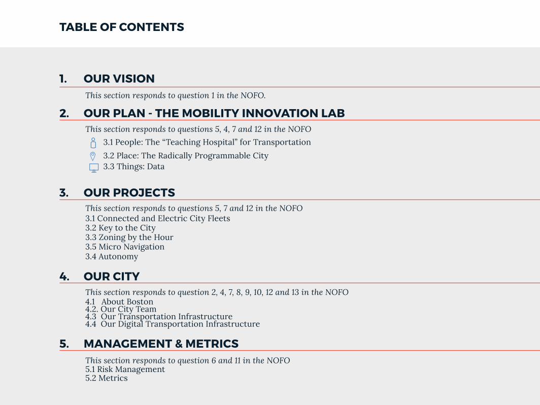
1. OUR VISION
TABLE OF CONTENTS
2. OUR PLAN - THE MOBILITY INNOVATION LAB
3. OUR PROJECTS
5. MANAGEMENT & METRICS
4. OUR CITY
This section responds to question 1 in the NOFO.
This section responds to question 2, 4, 7, 8, 9, 10, 12 and 13 in the NOFO 4.1 About Boston 4.2. Our City Team4.3 Our Transportation Infrastructure4.4 Our Digital Transportation Infrastructure
This section responds to questions 5, 7 and 12 in the NOFO3.1 Connected and Electric City Fleets3.2 Key to the City3.3 Zoning by the Hour3.5 Micro Navigation3.4 Autonomy
This section responds to question 6 and 11 in the NOFO5.1 Risk Management5.2 Metrics
3.1 People: The “Teaching Hospital” for Transportation
3.2 Place: The Radically Programmable City3.3 Things: Data
This section responds to questions 5, 4, 7 and 12 in the NOFO
PAGE 1
1. OUR VISION
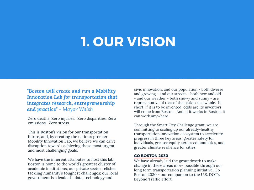
civic innovation; and our population - both diverse and growing - and our streets - both new and old - and our weather - both snowy and sunny - are representative of that of the nation as a whole. In short, if it is to be invented, odds are its inventors will come from Boston. And, if it works in Boston, it can work anywhere.
Through the Smart City Challenge grant, we are committing to scaling up our already-healthy transportation innovation ecosystem to accelerate progress in three key areas: greater safety for individuals, greater equity across communities, and greater climate resilience for cities.
GO BOSTON 2030We have already laid the groundwork to make change in these areas more possible through our long term transportation planning initiative, Go Boston 2030 - our companion to the U.S. DOT’s Beyond Traffic effort.
Zero deaths. Zero injuries. Zero disparities. Zero emissions. Zero stress.
This is Boston’s vision for our transportation future, and, by creating the nation’s premier Mobility Innovation Lab, we believe we can drive disruption towards achieving these most urgent and most challenging goals.
We have the inherent attributes to host this lab: Boston is home to the world’s greatest cluster of academic institutions; our private sector relishes tackling humanity’s toughest challenges; our local government is a leader in data, technology and
"Boston will create and run a Mobility Innovation Lab for transportation that integrates research, entrepreneurship and practice" - Mayor Walsh
PAGE 2
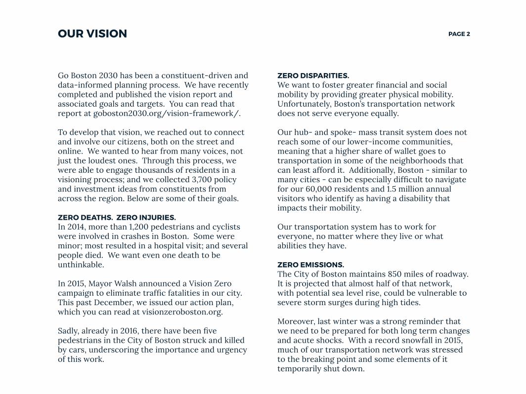
ZERO DISPARITIES.We want to foster greater financial and social mobility by providing greater physical mobility. Unfortunately, Boston’s transportation network does not serve everyone equally.
Our hub- and spoke- mass transit system does not reach some of our lower-income communities, meaning that a higher share of wallet goes to transportation in some of the neighborhoods that can least afford it. Additionally, Boston - similar to many cities - can be especially difficult to navigate for our 60,000 residents and 1.5 million annual visitors who identify as having a disability that impacts their mobility.
Our transportation system has to work for everyone, no matter where they live or what abilities they have.
ZERO EMISSIONS.The City of Boston maintains 850 miles of roadway. It is projected that almost half of that network, with potential sea level rise, could be vulnerable to severe storm surges during high tides.
Moreover, last winter was a strong reminder that we need to be prepared for both long term changes and acute shocks. With a record snowfall in 2015, much of our transportation network was stressed to the breaking point and some elements of it temporarily shut down.
Go Boston 2030 has been a constituent-driven and data-informed planning process. We have recently completed and published the vision report and associated goals and targets. You can read that report at goboston2030.org/vision-framework/.
To develop that vision, we reached out to connect and involve our citizens, both on the street and online. We wanted to hear from many voices, not just the loudest ones. Through this process, we were able to engage thousands of residents in a visioning process; and we collected 3,700 policy and investment ideas from constituents from across the region. Below are some of their goals.
ZERO DEATHS. ZERO INJURIES.In 2014, more than 1,200 pedestrians and cyclists were involved in crashes in Boston. Some were minor; most resulted in a hospital visit; and several people died. We want even one death to be unthinkable.
In 2015, Mayor Walsh announced a Vision Zero campaign to eliminate traffic fatalities in our city. This past December, we issued our action plan, which you can read at visionzeroboston.org.
Sadly, already in 2016, there have been five pedestrians in the City of Boston struck and killed by cars, underscoring the importance and urgency of this work.
OUR VISION
PAGE 3OUR VISION
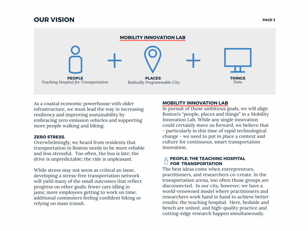
MOBILITY INNOVATION LABIn pursuit of those ambitious goals, we will align Boston’s “people, places and things” in a Mobility Innovation Lab. While any single innovation could certainly move us forward, we believe that - particularly in this time of rapid technological change - we need to put in place a context and culture for continuous, smart transportation innovation.
PEOPLE: THE TEACHING HOSPITAL FOR TRANSPORTATIONThe best ideas come when entrepreneurs, practitioners, and researchers co-create. In the transportation arena, too often those groups are disconnected. In our city, however, we have a world-renowned model where practitioners and researchers work hand in hand to achieve better results: the teaching hospital. Here, bedside and bench are united, and high-quality practice and cutting-edge research happen simultaneously.
As a coastal economic powerhouse with older infrastructure, we must lead the way in increasing resiliency and improving sustainability by embracing zero emission vehicles and supporting more people walking and biking.
ZERO STRESS.Overwhelmingly, we heard from residents that transportation in Boston needs to be more reliable and less stressful. Too often, the bus is late; the drive is unpredictable; the ride is unpleasant.
While stress may not seem as critical an issue, developing a stress-free transportation network will yield many of the small outcomes that reflect progress on other goals: fewer cars idling in jams; more employees getting to work on time; additional commuters feeling confident biking or relying on mass transit.
Teaching Hospital for TransportationPEOPLE
Radically Programmable CityPLACES
MOBILITY INNOVATION LAB
DataTHINGS
PAGE 4OUR VISION
The digital simulator--an expansion of current city simulators from Boston University and other universities -- would allow innovators to model their intervention using a variety of contextual and specific data sets, to understand the impact of their idea on equity, safety and resilience.
Promising ideas will then be tested on city “Beta Blocks” or with a “Beta Fleet.” These will be designated corridors and vehicles in Boston that will be -- and, in some cases, already are -- instrumented so that new technology, materials and uses can be easily tried and evaluated. Locations will reflect a full range of built environments, and vehicles will comprise a variety of sizes, personal and commercial uses, and modes. With paired locations and built-in sensors to make A/B testing results instantaneous, innovations can be quickly tested in an environment that is representative of urban areas and urban fleets.
Successful interventions on the Beta Blocks or with the Beta Fleet will then have quick access to scale in Boston and collaborating cities through hands-on support from the “Scale Team”. The Scale Team will be a small staff embedded in a select group of cities across the nation -- cities selected for a diversity of representative infrastructure and forward-leaning leadership. These cities will help scale ideas quickly by extending data standards,
We envision creating a “Teaching Hospital for Transportation”, co-locating practice, research, and the development of new technology. Cohorts of entrepreneurs from leading startup accelerators, teams of researchers from universities, and government leaders will work side by side to create our next generation streetscapes. The answer you need and the thought partner you seek will never be more than two desks away.
PLACE: THE RADICALLY PROGRAMMABLE CITYThose engaged in the Teaching Hospital for Transportation - and the broader transportation innovation community - will not simply need a place to connect; they will need a place to test their ideas, and a way to get them to scale.
We want a city that is radically programmable - where the infrastructure is built for rapidly deploying innovations sourced from anywhere; where new updates mean pushing software and plugging in modular hardware, not rebuilding from scratch with each new improvement.
Boston will put together infrastructure that shrinks the lag that can exist between “study” and “street.” We will provide three increasingly large arenas for testing: a digital simulator, a set of “Beta Blocks”, and a network of peer cities.
PAGE 5OUR VISION
of streets and sidewalks by time of day and day of week; and improving micro-navigation - wayfinding at a hyper local scale. We believe these projects also drive key steps on the road to autonomy.
Developing this lab and leading these projects will be a natural extension of the work already occurring in Boston. We’ve built one of the nation’s leading civic innovation groups, which has already collaborated to establish a housing innovation lab. We’ve staffed up a citywide analytics group that is pushing the boundaries on using data for quickly designing, implementing, and evaluating policy experiments. And, through Go Boston 2030, we are setting a new high bar for engagement and analysis as part of public processes. This forms a strong municipal foundation for the Mobility Innovation Lab.
We appreciate the opportunity to apply to this challenge. It comes at a great moment of alignment of urgency and opportunity. We’re excited to work with you and other cities across the country to get started.
drafting policy, and helping entrepreneurs and researchers communicate and adjust their concept for the next set of constituents and practitioners.
THINGS: DATA Boston is data rich. We are already leading extensive efforts to catalog, combine, curate, and use transportation data. Extending those efforts through this grant, we will transform data sets to meet available data standards where possible; where necessary, we will crowd-source the development of new standards through collaboration with our public and private sector partners. To ensure that data is research- and product-ready, we will implement APIs and the privacy & security policies necessary to ensure easy access and appropriate use. Our core data vision is to default to open data, either hosting the data ourselves or through a partner, and surfacing updated data at the pace needed for reliable products and meaningful research..
OUR PROJECTSTo help prime the pump for future innovations, the City itself envisions leading a small set of projects. These projects will include: implementing the “Key to the City” - a single booking and payment system to access all modes of travel throughout Boston; deploying Mobile Eye and EV technology in the City fleet; testing ways to dynamically adjust the use
PAGE 6
We need to build the capacity within cities and within government to be more agile in the face of this disruption, more responsive to the changing needs of our constituents, and more capable of testing and scaling good ideas, continuously.
With its alignment of “people,” “places,” and “things”, the mobility lab is that infrastructure for continuous innovation.
2. OUR PLAN the Mobility Innovation Lab
We seek to create the nation’s premier Mobility Innovation Lab. This lab will help drive innovation to improve equity, safety and resilience.
We are at incredible moment of disruption in transportation. Low-cost and high quality consumer technology, robotics, and data analytics have fueled a new generation of services. Meanwhile, a resurgence of cities, growing economic disparities, and the acute shocks and long term risks of climate change have left city leaders seeking newer ways to help people move safely, equitably, and sustainably.
PAGE 7OUR PLAN: PEOPLE The “Teaching Hospital for Transportation”
Research Initiative, Boston University, Harvard University, MIT, Northeastern University, Perkins Tufts University, UPenn, UMass, Worcester Polytechnic Institute, and Transportation for America. See letters for examples of researchers already demonstrating this collaboration.
EntrepreneursProvide a cohort of mobility-focused entrepreneurs through the area’s leading accelerators with concierge access to City resources, and easy street and vehicle implementation access. Partners on this include MassChallenge, Harvard Innovation Lab, Smarter in the City, Venture Cafe, 1776, Transportation for America, and Boston Chamber of Commerce .
Co-LocationCo-locate start-ups and researchers with government representatives in a dedicated space. Set up the space to ensure cross-pollination and all resources needed are never more than two desks away. MassChallenge has already offered co-location space.
2016 PROJECTS: Establish co-located space. Kick off first cohort of startups and researchers. MassChallenge, 1776, Smarter in the City, VentureCafe and Transportation for America, among others, have already offered to assist with
PURPOSE: Inspired by the teaching hospital model, where actual solutions are implemented side-by-side with research, we will create and run a “teaching hospital” for transportation, where those researching, managing, and creating new smart transportation solutions can be co-located.
VISION ELEMENTS: - Strategic Business Models & Partner ship Opportunities- Connected, Involved Citizens
BACKGROUND: Boston has one of the most robust university ecosystems on earth, paired with one of the most engineering-equipped innovation scenes. Unsurprisingly, Boston has originated an impressive array of disruptive research and start ups in the mobility arena. However, these innovators talk to each other extensively only at conferences or via private phone calls. We believe far more can be achieved if these groups naturally worked more closely together.
KEY ACTIONS: ResearchersProvide a cohort of professors and postdoctoral students with concierge access to city resources and opportunities for on-street research, including randomized control trial infrastructure. Partners will include - among others - the Boston Area
PAGE 8
IDEAS FESTIVALSTo accelerate adoption of good ideas, we need to help mobility interventions catch the imagination of the public consciousness. Too often, cutting edge mobility concepts remain buried in the pages of peer-reviewed journals and poster presentations.
We plan on making geeky innovations cool through already-established and popular idea festivals. Sharing ideas on the public stage where people come to shake up the conventional wisdom allows ideas to catch the public imagination and change attitudes, building demand for their implementation. It also attracts new talent to the field. TedxCambridge and Aspen Ideas Festival have both been brainstorming how to structure Smart Cities themes with us.
recruiting, providing space, and programming.
MEASURE OF SUCCESS: Input -- # of researchers, practitioners and entrepreneurs involved;Output -- # of new ventures created; % created through collaboration;Outcome -- Success of new ventures in terms of new knowledge & scaled projects and impact on equity, safety and resilience.
TRACK RECORD: We helped found the Boston Area Research Initiative, a cross-university consortium of professors who study cities. We teamed up to develop District Hall, a public space for Boston’s innovation community, which was so successful it was expanded to a second public innovation center in Roxbury in 2015. We have helped support MassChallenge, VentureCafe, and other innovation labs.
OUR PLAN: PEOPLE The “Teaching Hospital for Transportation”
PAGE 9OUR PLAN: PLACE The Radically Programmable City
KEY ACTIONS: The SimulatorFor the first stage of testing, we partner with local universities to provide a simulator that uses as inputs the design, services and data of our city. The microcosm of a programmable city, this simulator will be publicly available through the Mobility Innovation Lab. The simulator will, in particular, allow us to screen for anticipated impact on equity, safety and resilience. Boston University, and MIT have variants of this simulators.
The Beta Block & The Beta FleetFor the second stage of testing, we designate 3-5 “Beta Block” corridors in our city. These blocks are specifically for testing all the newest ideas: instrumented to make it easy to push or plug in new technology, try out new roadway materials, propose new curb rules, and evaluate experiments. Blocks are paired with other locations with similar metrics, and instrumented for instantaneous results to allow for easy research and A/B testing. Transportation for America has offered to pair locations on metrics. Sidewalk Labs, Current GE among others have flexible hardware. Boston University, Harvard, Northeastern and UMass have suggested their campuses.
Similarly, working with major area fleet providers including our own - we will identify vehicles - a “Beta Fleet”- where it will be quick to pilot EV and
PURPOSE: We will provide the means for new ideas to go rapidly from lab simulation to on-street to citywide and nationwide scale.
VISION ELEMENTS: - Intelligent, sensor-based infrastructure Urban analytics- Connected Vehicles- Smart Grid, Roadway Electrification, Electric Vehicles
CONTEXT: Transportation is being rapidly disrupted. What we can predict about the future is that it is unknown. Our infrastructure must be built for this exciting reality. Rather than needing to be rebuilt for each new innovation, infrastructure should be built to allow new deployments to be easy, smooth and scalable. The cityscape must be radically programmable.
The US DOT award goes to only one city, but the aim is to transform transportation across the nation. To realize this mission, it will be necessary to design projects with a path to scale from the star. As any startup founder can tell you, there is a world of difference between showing that a solution produces benefits in the real world and scaling it to multiple locations. City infrastructure and partnerships can and should smooth the path to scale. We can create structures that make it easy to bring solutions to scale seamlessly.
PAGE 10
TRACK RECORD: We have helped scale civic apps developed or deployed first with the City of Boston to dozens of cities and towns across the nation. These include apps such as Citizens Connect (Spot Reporters), Commonwealth Connect, Where’s My School Bus, and Adopt-A-Hydrant.
Additionally, over the last three years, we have increasingly opened up our streets for experimentation. Boston was the first test site for Soofa, a solar-paneled charging station and bench now found throughout the nation; we’ve additionally piloted camera analytics and car sensing technologies and installed digital trip-planning signs offering real-time travel information. The City’s Innovation Team launched the Public Space Invitational, an opportunity for artists, designers and architects to propose and pilot installations in our streets and parks, expanding our streetscapes.
connected technologies, among others.
The Scale TeamTo take success pilots to scale, we will partner with 5-7 cities across the country and support a “Scale Team” of 3-5 dedicated staff. The Scale Team would be embedded in transportation departments in other cities; they would give entrepreneurs a perspective of how various components work in different cities during concept development and early iteration, and next help take proven concepts to other cities. Cities are selected to represent a wide variety of city infrastructures and forward leaning leadership. Los Angeles ,and University of Pennsylvania have offered to be partners.
2016 PROJECTS: Launch the simulator. (Several universities already have platforms.) Select and instrument the first Beta Block and identify the Beta Fleet. (Projects launch-ready with BU.) Select peer cities and hire Scale Team. (Conversations already on going with Los Angeles.)
MEASURE OF SUCCESS: Input: # of BetaBlocks and BetaFleet vehicles; # of City scale partnerships Output: # and % of experiments in each phase (simulation, Beta Block, expansion)Outcome: # of experiments scaled city-wide and beyond
OUR PLAN: PLACE The Radically Programmable City
PAGE 11OUR PLAN: THINGS Data
CORE CONCEPT: To fuel transportation research and product development, we will provide easy access to both specific and contextual transportation data, with clear use and privacy policies.
VISION ELEMENTS:- Urban Analytics- Architecture & Standards- Low-Cost, Efficient, Secure, and Resilient ICT
BACKGROUND: Transportation data abounds; however, it is often locked away in multiple systems, neither clean, nor well-annotated, nor compliant with any standards. Everyone agrees that this data could have more utility. The challenges are legal (e.g. consents); technical (e.g. storage, APIs, privacy); and operating (e.g. standards).
There is tremendous effort on this already. Boston’s universities host the Massachusetts Green High Performance Computing Center, built for the computationally intensive research that will be required for this work. They also host the Mass Open Cloud and the Dataverse, both of which make data accessible and easy to use for these types of use cases. Inside City Hall, we have built out a fifteen person Citywide Analytics Team of researchers and data scientists dedicated to improving service delivery to residents across Boston.
We believe that an intensive focus on transportation data and related datasets could build off this platform to deliver incredible value beyond what we have today. Key Actions: We will make all relevant, appropriate datasets research- and product-ready. This means they will be open, standardized, and accessible via APIs.
We will dedicate a data librarian position to answer transportation data questions and help build connections to more real-time data sources. We will update requisite privacy policies. We will transform data sets to comply with existing standards, enforcing and extending those standards as needed. We will work with start-ups, industry, and researchers to open-source and co-locate their data exhaust.
Boston Area Research Initiative has offered to help make our datasets research-ready . Other partners who have helped spearhead joint data efforts include Boston University Harvard, and Waze
2016 PROJECTS: Create easy to use APIs and research-ready access for top priority datasets. Bring on a transportation data librarian. (BARI is ready to offer its assistance on this.)
MEASURE OF SUCCESS:Input: # of easy-to-use data sets made availableOutput: Frequency and volume of data accessed by researchersOutcome: # of original products developed and research performed; expansion of adoption of data standards.
TRACK RECORD: Over the last two years, since Mayor Walsh signed an executive order on Open Data, the City has built out a 15-person citywide analytics team, formed data partnerships with, among others, Waze and Uber; ran multiple data-focused hackathons; and maintained an extensive open data portal, viewable at data.boston.gov.
PAGE 12
3. OUR PROJECTSPaths to safety, equity and resilience
CONNECTED & ELECTRIC VEHICLESCORE CONCEPT: To improve the health & safety of pedestrians, cyclists, bus riders, and drivers, we will expand the use of electric vehicles and vehicle-to-vehicle and vehicle-to-person technology.
VISION ELEMENTS:- Connected Vehicles- Smart Grid, Roadway Electrification, Electric Vehicles
CONTEXT: Five cyclists in Boston alone have died in crashes with trucks in the last three years. Perhaps the greatest promise of connected vehicles is to increase the awareness of drivers, cyclists, and pedestrians to avoid crashes. Moreover, a next generation fleet is not just a connected fleet; it is also a zero-emissions fleet.
The City’s Central Fleet Management (CFM) Division currently oversees a fleet over 1,100 vehicles. CFM looks to replace anywhere from 5-10% of this fleet each year, and aspires to do many more. CFM would jump at the opportunity to pull older, inefficient vehicles off the road in batches and to replace them with EVs. We would also be thrilled to improve our charging infrastructure and increase employee access to EVs.
In addition to our MBTA buses, CFM is very intrigued by the possibility of installing Mobile Eye sensors in the City’s fleet. Accidents are a significant problem for us, and we welcome forward-leaning solutions to mitigate accidents in a city well known for its narrow, congested streets and aggressive driving.
PAGE 13OUR PROJECTS: CONNECTED & ELECTRIC VEHICLES
fatalities or injuries; decrease in fleet emissions
TRACK RECORD: In 2013 we launched the nation’s largest truck sideguard pilot project on our own fleet with research support from the USDOT Volpe Center. After a successful trial on 16 trucks, Mayor Walsh enacted an ordinance that requires all vendors doing business with our City to install side guards, special mirrors, and safety decals to their trucks weighing over 10,000 pounds. After six months with our city vendor ordinance in effect, we have gone from our initial 16 truck pilot to more than 60 trucks equipped with upgraded safety devices.
2013 also marked when we began replacing city fleet vehicles with EV’s. Since then we have grown the initial fleet by 10x, with another 50% growth planned in 2016 (see Our City).
CORE CONCEPT: Enable citywide mobility as a service, by providing integrated and account-based payment for all mobility options in the city.
KEY ACTIONS: Connected VehiclesDeploy Mobile Eye sensors on relevant City or other regional fleets. Explore additional people-to-vehicle technology through the Mobility Innovation Lab. Potential partners include Mobile Eye and Nodal .
Electric VehiclesCollaborate with Vulcan on a plan to increase EV infrastructure and switch more cars to zero emission vehicles, through a partnership with the City’s fleet or other major fleet. 2016 PROJECTS: Scope and undertake an initial deployment of Mobile Eye sensors either with the MBTA or with the City’s own large vehicle fleet. Support at least three start-ups or researchers using connected vehicle technology to address Vision Zero objectives.
MEASURE OF SUCCESS:Input: # of EV put on the roads; # of vehicles with Mobile Eye sensors; # of entrepreneurs and researchers supported on this work.Output: % of fleet converted to EV; # of Mobile Eye-equipped trucks in crashes; # of new connected vehicle products developedOutcome: # of pedestrian, cyclist and driver

PAGE 14OUR PROJECTS: KEY TO THE CITY
VISION ELEMENTS:- User-focused Mobility Services and Choices- Strategic Business Models and Partnership Opportunities
BACKGROUND: Many of our communities with the highest percentage of low income families are least well served by transit now. Consequently, many are forced to either own a vehicle, spending a larger share of their paycheck on transportation, or take long and often unreliable trips on transit.Unifying payment platforms across services and providing personalized payment account would have two major benefits. First, easier enrollment in and payment of alternative modes of transportation should speed both expansion to and adoption in underserved areas. Second, an account-based payment system allows us to explore discounting prices by geography, mode, time of day or traveler to meet equity and resilience objectives.
KEY ACTIONS: Implement “Key to the City”, an integrated and account-based method to pay for all modes of travel. Used for mass transit, bike share, car share, para-transit, etc.. Potential partners include, but are not limited to, Ridescout, LA (p.xx who has rolled out a similar program and offered to help, p.xx), Lyft, ZipCar, MBTA, Bridj, ParkingPanda and Hubway (our bike share program)
2016 PROJECTS: Design a payment and account standard working in collaboration with the region’s major mobility partners. Test beta deployments.
MEASURE OF SUCCESS: Input: # of participating transportation providersOutput: # of residents using Key to the City; % of journeys made with Key to the CityOutcome: Average cost of travel and travel time by neighborhood; Percent of journeys in owned vehicle TRACK RECORD: We run one of the most successful bike share programs in the nation (Hubway), with over 1 million trips in 2015. Our program receives particular acclaim for its effectiveness at serving lower income residents through membership programs.
In related effort, we have been running Bounty Bucks, which allows SNAP recipients to get matched funding for the purchase of fresh produce at local farmers markets. Lyft has offered integrated ways to use a similar program for on-demand rides.
PAGE 15
time. With modern user interfaces, uses can be crowdsourced and provide surge capacity in times of increased need or resiliency in disasters.
KEY ACTIONS: Equip streets with programmable markings, and allow back-end programming. Build corresponding user interfaces and V2I lane standards. Potential partners include Google Sidewalk SENSEable City Lab and Waze .
2016 PROJECTS: Install zoning by hour in one BetaBlock location. Run several interventions.
MEASURE OF SUCCESS:Inputs: # of tests of dynamic street zoningOutputs: # of dynamics rezonings implementedOutcomes: % decrease in congestion during peak times, % increase in street use during off-hours
TRACK RECORD: In 2015 we began a partnership with E-Ink to develop dynamic low-power regulatory signs that would replace the clutter of signage in some of our neighborhoods.We are working through the prototype now with an intended deployment this summer.
CORE CONCEPT: Boston’s streets and sidewalks comprise our largest public space. This space is too valuable in a dynamic city to have an essentially fixed use. Experiment with programmable markings in streets to allow streets whose purpose adjusts by time, day and season, as demand requires. Build for V2I for connected and autonomous vehicle navigation.
VISION ELEMENTS:- Smart Land Use- Intelligent sensor based infrastructure- Urban Delivery & Logistics
BACKGROUND: Street space is one of the most constrained commodities in old cities like Boston. Freeing up street space is pivotal for increasing active transportation and decreasing congestion and emissions. It also paves the way for autonomous vehicles. But, currently, our streets are “zoned” once, when they are striped; “rezoning” them can be controversial, lumbering, costly, and construction-intensive.
By allowing for dynamic allocation of our streetscapes, we not only will free up new street space, without building new roads, but also will allow for active streets at times of day and year that they might have otherwise been deserted -- switching between thoroughfare, loading zones, street hockey, and extra parking at any given
OUR PROJECTS: ZONING BY HOUR

PAGE 16
CORE CONCEPT: Build micro-navigation systems for way-finding for the last 30 feet where GPS cannot direct to a precise destination. Test to boost accessibility for the visually impaired.
VISION ELEMENTS:- User-focused mobility services and choices- Urban delivery and logistics
BACKGROUND: Current GPS navigation can only take you most of the way to your destination now, and leaves you at that last 30 feet without clear guidance to find where you are going. This is particularly difficult for the visually impaired. Solving this challenge not only helps the 7.3 million visually impaired individuals in US, but also the general population.
Fine-tuned micro-navigation could also have great utility for any future autonomous vehicles or delivery devices, searching not just for an open space but a particular space.
KEY ACTIONS: Develop and pilot mechanisms to do high-precision way-finding in the last 30 feet to a destination.
2016 PROJECTS: Pilot micro-navigation for Bostonians with vision impediments for several navigation use cases around the city. Perkins, the oldest school for the blind in the US, is spearheading these efforts and is collaborating with the city on development and deployment.
OUR PROJECTS: MICRO NAVIGATION
PAGE 17
No area of tech-driven innovation holds more promise than autonomous vehicles. They could cut crashes, reduce congestion and free up scarce street space for alternative public use.
But, those outcomes are not guaranteed. Hyper-mobility could also lead to hyper-sprawl and increased congestion; high tech vehicles may be too expensive for too many, increasing inequity; and, a road full of autonomous vehicles may be safe for pedestrians, but it may not be pleasing for either the occupant or the pedestrian to be on.
There is a pivotal moment before autonomous vehicles reach scale and ubiquity, where the right preconditions allow our cities to avoid these outcomes.
We want to make sure that autonomous vehicles work great for cities - that they are safe, accessible, zero emission and managed in a way that complements the vibrancy of urban street life. The projects outlined in this section intentionally help us move the technology, our policy, and our community forward towards those ends, in this window of time.
PIVOTAL PRECONDITIONS:Accessible: Our Key to the City project supports
a cultural shift towards mobility as a service. We believe that shift will continue to allow a rise in more affordable alternatives to personal car ownership.
Safe & Green: Our connected and electric vehicle projects help us deliver on the promise of safe and green vehicles.
Complementary: Our zoning by hour pilot will help us explore new methods to manage the right of way to balance the needs of all residents. And, our micro-navigation project will fine-tune our ability to help people and things navigate busy city streets.
These pilots help push the development of technology towards an autonomous vehicle that works for cities - no matter their complexity - and for residents - no matter their mode.
OUR PROJECTS: AUTONOMY
GRAND PRIX FOR AUTONOMOUS VEHICLES
To familiarize the public with autonomous vehicles, Boston envisions co-hosting an autonomous vehicle showcase as part of IndyCar’s Grand Prix of Boston event on Labor Day. IndyCar has begun conversations with Boston on how to structure a showcase.
< HOME >
Boston is diverse, young and growing. More than one quarter of Boston residents are foreign born, and more than half of Boston residents are people of color. More than one third of our population is between the ages of 20 and 34 -- a higher percentage of millennials than any other city in the nation. Between 2000 and 2010, the city grew by 5%, the highest rate of any major U.S. metro area. In many ways, we are a mirror of urban centers around the country - growing rapidly and working towards a better future.
Mark Twain once quipped, “In New York they ask, ‘How much is he worth?’; in Philadelphia, ‘Who were his parents?’; in Boston, ‘How much does he know?’” While some cities export oranges or cars, Boston exports PhDs and MBAs. The city is home to 35 educational and research institutions, a slice of the more than 50 in the metropolitan area.
4.1 ABOUT BOSTONBoston makes a perfect home for the nation’s premier Mobility Innovation Lab.
Boston is the largest city in New England. In 2010, 617,000 residents called Boston home -- 14.7% of the total population of the urbanized area. It is estimated that Boston’s residential population today exceeds 650,000, and our daytime population grows by an additional 340,000 people as individuals travel into the city for work or school.
With more than 12,500 people per square mile, Boston is more dense than similarly-sized cities such as Baltimore, Seattle and Washington D.C.. Packed within our 48 square miles are 26 neighborhoods, 850 miles of roadway, and thousands of acres of parks.
4. OUR CITY
PAGE 19OUR CITY
first comprehensive plan in 50 years. There are additional large-scale planning efforts underway in housing, arts, schools, and open space that will reimagine this city for generations to come. But it’s not just about planning for the future, it’s about acting now.
In the last year, the City has partnered with Zipcar and Enterprise carshare to expand ‘car-lite’ living along the transit rail networks. We expanded Hubway, our bike-share network with new stations throughout the city and continued to work on expansion with our neighbors in Cambridge and Somerville. We’ve launched a mobile app to pay parking meters, which is now being used over 11,000 times every day. We’ve taken a collaborative approach to startup transportation solutions like Bridj, Uber, and Lyft sharing data and curb space. We’ve worked with the traffic app Waze to run controlled experiments focused on road congestion and bicyclist safety. All of that happened after the worst winter on record; imagine the pace of experimentation in a year the city does not receive more than 100 inches of snow!
These efforts from City Hall have come through collaboration both within the building and with outside partners. The Boston Transportation Department (BTD), the Department of Innovation & Technology (DoIT) and the Mayor’s Office of New
It’s not uncommon for global leaders and Fortune 500 CEOs to have spent at least four years of their lives in Boston. People come here to learn, and they take what they experience in our city and share it around the world. And, while we export many ideas and highly-educated individuals, we focus most on helping each of our own residents reach her or his fullest potential.
Like all large cities, we are also facing monumental challenges in the years ahead. Income inequality is at historic highs; aging infrastructure is exacerbated by climate change; and, the stress on our transportation systems continues to increase as our population expands towards 700,000.
All of these challenges have solutions, and, under the leadership of Mayor Martin J. Walsh, we are committed to solving them collaboratively with the urgency the deserve.
4.2 OUR CITY TEAMSince taking office in 2014, Mayor Walsh has tackled some of Boston’s largest challenges by engaging residents in long-term planning and leading his staff in using data to drive decision making.
We are nearing completion of the City’s Go Boston 2030 transportation plan. This is one component of City’s comprehensive land use plan -- the
PAGE 20OUR CITY
an ongoing grant. The Boston Transportation Department signs Access Plan Agreements with the developers of new building projects. These agreements could be leveraged for the installation of sensors, electric vehicle charging stations, and other potential smart infrastructure such as designated bays for automated vehicles in every new building in Boston.
For this grant, we would look to see how elements of it - such as “Beta Blocks” - could be incorporated into major reconstruction projects that are funded through the Boston MPO Transportation Improvements Program (TIP). For example, the Boston University campus is anchored around Commonwealth Avenue, a major arterial in Boston with street car service. A section of this corridor will undergo an $18 million reconstruction starting in Fall 2016 and provides an opportunity to install smart infrastructure connecting students to transit, shared transportation services, and flexible on-street parking in partnership with the the university. This multi-modal corridor, which includes a protected cycle track, will be a cutting-edge “connected” Complete Street.
Similarly, we will explore how current and future NSF-funded grants on which we collaborate with area universities could reinforce the smart city objectives of the US DOT.
Urban Mechanics (MONUM) have been leading transportation transformation efforts within City Hall. BTD manages transportation and develops the City’s policies; DoIT - and their 15-person citywide analytics team - have been core partners in analyzing operations and designing & evaluating pilots; and, MONUM - one of the nation’s first civic innovation groups - has been building partnerships to explore and advance the next generation of service delivery. Reflective of the Mayor’s interest in transportation innovation, he recently appointed one of the founders of MONUM to serve as Boston’s Chief of Streets, overseeing BTD and Public Works.
Staff from these groups would all be deeply involved in (and sit in) the Mobility Innovation Lab.
LeverageAny project within City Hall almost always includes a partner from outside of City Hall. In this last year, we’ve worked with local startups to launch new parking apps, with well-established companies to expand transportation options, and with major universities to embed research fellows within City government. These deep collaborations are a core reason for success, and central to our Mobility Innovation Lab proposal.
We also leverage existing projects to increase impact, whether it is a new construction or

PAGE 21
WALKINGBoston is known as a great walking city. It was designed with the pedestrian in mind. Streets are lined with sidewalks and trees; neighborhoods are anchored by main streets, providing short walks to corner stores and job opportunities; and some transit access is within walking distance of nearly all areas in the city. In fact, more than one third of all trips during the day are on foot. While we have among the lowest rates of in-street crashes in the country, Boston has launched an aggressive Vision Zero campaign to entirely eliminate traffic related fatalities.
BIKINGVisionaries such as Frederick Law Olmsted began building a “necklace” of open space corridors in the 1880’s that began an eventual network of 50 miles of off-road bike paths through parks and along water. Since 2007, Boston has added another 104 miles of on-road bike facilities. In 2015 it started construction of 2.4 miles of on-sidewalk protected cycle tracks, with support from a TIGER grant. Importantly, Boston distributed 1,132 free bikes to low-income residents in 2014 and taught bike riding and safety classes to 6,202 students in grades 2-12 in 2015. Not surprisingly, average daily bike ridership has doubled since 2007.
4.3 OUR TRANSPORTATION INFRASTRUCTUREInnovation in transportation has a long legacy in Boston.
We’ve been reinventing how people get around for centuries -- from the country’s fastest clipper ships in the 1850s to our nation’s first subway tunnel in 1897; from building its first underwater transit line in the 1920s to placing a moratorium on surface highway construction in the 1970s; from ZipCar’s founding in 2000 and to the first of Bridj’s dynamic pick-up locations in 2015. Our system has transformed due to bold investments and big ideas from public and private actors.
This transformation has given Boston an established multimodal network that provides a platform for continuing innovation today. Every morning, fewer than half of all Bostonians drive or carpool to work and more trips start within Boston than outside the city. Shorter trips, many travel options, compact geography, and a young population is fertile ground for new ways to connect people, modes of transport, and places.
Boston’s backbone of fixed infrastructure and its fast-growing use of new mobility alternatives provide opportunities for connecting people to transportation services and for these services to connect to each other in ways that will redefine the nation’s next generation of smart cities.
OUR CITY
PAGE 22
This hard-wired infrastructure is being added to with the current installation of 8,000 smart parking meters throughout the city, complementing our existing parking payment mobile app - Park Boston.
SHARINGThe City of Boston is committed to fostering an atmosphere that is supportive of innovative economic models that bridge the divide between residents, worker, visitors and suppliers of goods and services.
Today, more and more Bostonians are embracing the convenience of shared-transportation in their daily travel. New on-demand services such as Zipcar and Enterprise, Uber and Lyft, and Bridj are complementing and filling gaps in the traditional system, reducing reliance on private vehicles. Carshare vehicles are available in 245 private lots, and, last year, the City made available 80 additional public locations for carshare vehicles. According to ZipCar, its 850,000 members in the Boston area reduce 1.3 billion pounds of C02 per year.
The City-managed bike-share service, Hubway, experienced over a million trips in 2015 supported by 109 stations with 1,851 docks in Boston and more in three surrounding municipalities.
TRANSITMore than 1.3 million people board public transportation in the Boston region every day. They use four rapid transit, three streetcar, and 13 commuter rail lines in addition to more than 150 bus and trackless trolley routes. They access the trains – subway, commuter rail, and streetcars – via 124 stops, 77 of which are within the city. Boston has the nation’s fifth-largest mass transit system by ridership. 2014’s 400 million trips were the highest in the Massachusetts Bay Transportation Authority’s history, despite a 5% fare increase and a steep drop in gas prices. Additionally, The Ride, the MBTA’s paratransit service, provides door to door service for people with physical, cognitive, and mental disabilities.
DRIVINGThe Boston Transportation Department is focused on operating over 800 miles of roadway more efficiently. Its Traffic Management Center controls close to 500 signals remotely supported by 250 closed circuit cameras and linked by an extensive fiber optic cable network. Additional data is collected on traffic flow through a series of inductive loops at major intersections throughout the city.
OUR CITY
MAP
KEY MassChallenge
Harvard -AllstonCampus
BostonUniversityCampus
GrandPrix
JP/Roxbury
SouthBoston -Dot AveDudley
Square
Glover'sCorner
University ofMassachusettsBoston Campus
NortheasternCampus
Development Zones
MassChallenge
Beta Blocks
MBTA Lines
BLUE
GREEN
ORANGE
RED
SILVER
MB A T Stops
EV Charging Stations (164 Stations)
Bus Stops
Esri, HERE, DeLorme, MapmyIndia, © OpenStreetMap contributors, and the GISuser community
Development Zones
MassChallenge
Beta Blocks
MBTA Stops
MBTA Lines
BLUE
GREEN
ORANGE
RED
SILVER
Bus Stops
0 1 20.5 Miles
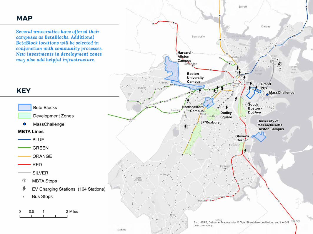
Several universities have offered their campuses as BetaBlocks. Additional BetaBlock locations will be selected in conjunction with community processes. New investments in development zones may also add helpful infrastructure.
Esri, HERE, DeLorme, MapmyIndia, © OpenStreetMap contributors, and the GISuser community
Several universities have offered their campuses as BetaBlocks.Additional areas will be selected in conjunction with community processes. New investments in development zones may also add helpful infrastructure.
HERE, DeLorme, MapmyIndia, © OpenStr0 1 20.5 Miles
PAGE 24
strong analytical insights from the data, Boston can catalyze transportation entrepreneurship by opening up data for use by the broader community.
Fulfilling an executive order by Mayor Walsh, Boston released the City’s Open and Protected Data Policy in July 2015 to make data open, machine-readable, standards-compliant, and easily discoverable. It lays out a process for releasing open data, establishes a Creative Commons license for all data released by the City, and provides a framework for responsibly sharing data with researchers and other partner organizations. The City’s policies and public datasets are at data.boston.gov.
We have hosted or supported hackathons on transportation, healthcare, human trafficking, and permitting. Every year, Boston partners with local universities including Harvard, MIT, Northeastern, and UMass to provide additional datasets for academic research and analysis.
DATA LIBRARIANSThe City is developing a comprehensive catalog of City data and is partnering with area research librarians to make this information more readily accessible. This work is funded through a grant from the Knight Foundation’s News Challenge competition. This holistic approach to City data
The City also manages its own car share program for its employees; that fleet includes two electric vehicles.
ELECTRICThere are 47 additional charging locations on city streets and in private garages. New developments and garages are required through transportation access plan agreements to provide additional charging locations in order to support more EV’s in denser areas. Meanwhile, Boston is continuing to add electric and hybrid-electric vehicles to its municipal fleet.
4.4 OUR DIGITAL TRANSPORTATION INFRASTRUCTUREOne of our core assets for this effort is our data and, more importantly, our culture and leadership in using data and technology to improve service delivery.
Under Mayor Walsh, the City of Boston has built a strong transportation data ecosystem, analyzing existing data more effectively, establishing more internal and external data sources, and ultimately using data to improve quality of life for Boston’s citizens.
OPEN & PROTECTED DATAWe know that while the City can and will deliver
OUR CITY
PAGE 25
for trips, allowing us to better manage the system.
Inductive loopsCopper loop detectors installed in roadways around the region enable us to conduct quick analyses of traffic flows at intersections and along corridors.
Crowd-sourced safety comments and locationsUsing a crowd-sourced map, Boston’s Vision Zero Initiative has collected transportation safety concerns across the city, providing a precise, granular view of public concerns
311 ReportsBoston receives thousands of transportation-related basic city service requests each year from residents that help us do our job, from enforcement requests to reports of missing signs. Data is published in the Open 311 standard.
Transit DataThrough our collaboration with the MBTA, we have access to a wide range of data about bus, subway, and commuter rail usage, schedules, and service levels
Other Transportation & Contextual DataWe continue to pursue data partnerships with organizations such as INRIX, Strava Metro
allows researchers and developers to integrate transportation-related data with other datasets to power more advanced forms of analytics.
KEY TRANSPORTATION DATA SETSParking Tickets & Parking Meter UsageTransaction data allows us to understand parking trends and violations, which can be used to adjust our enforcement strategy and parking policies.
Motor vehicle, pedestrian, and bicycle crash dataThis geo-located data enables the City to track all crashes on roadways that required an emergency medical response as well as information about the severity of the crash.
Waze Jams and AlertsAs part of the Waze Connected Citizen Partnership, we receive speed data, and automatically-detected and user-generated traffic jam reports.
Uber tripsOur unique data-sharing agreement allows the City to see details about Uber trips in Boston, providing a window into TNC demand, and possible locations with insufficient transit or last-mile access.
HubwayWe track usage of the region’s bike share system including time, origin, and destination information
OUR CITY
PAGE 26
bicycle lanes, or increased “blocking the box” enforcement. We have also experimented with novel interventions such as responding to reports of double parked cars reported through Waze with bike-mounted parking enforcement officers.
Improving Safety By Using DataTo support the City’s Vision Zero initiative to reduce serious injuries and eliminate fatalities resulting from crashes on our roadways, Boston Transportation Department (BTD), Emergency Medical Services (EMS), and Boston Police Department (BPD) are now sharing datasets from different systems.
This data includes vehicle, pedestrian, and bicycle crash location, severity, and injury/fatality statistics. We will analyze this data to see trends in traffic behavior, and identify design changes that reduce collisions, injury, and death.
Developing and Promoting StandardsMany topics of interest in urban transportation, lack formal or informal data standards, or have standards which are not designed to facilitate collaboration or real-time coordination between connected systems. Some examples include:
(cycling and running), and Google Maps, to better understand travel patterns and demand across modes. This data, combined with housing, permitting and employment data, can paint a fuller picture of how people move - and could move better - in Boston.
NEXT EFFORTS IN TRANSPORTATION DATA & ANALYSIS Improving Traffic Flow Using DataIn February 2015, Boston began its data-sharing agreement with Waze, the traffic app owned by Google that allows road users to check real-time traffic conditions on Boston’s streets.
This data-sharing agreement allows Boston’s Traffic Management Center (TMC) to push road closure alerts to drivers, and gives the TMC real-time and historic speed, alerts and traffic jam data to inform traffic signal timing and incident response Using this data, we’ve been able to document an 18% reduction in traffic jams at a key intersection in the city as a result of improved signal timing by the TMC.
Waze data has allowed Boston to better evaluate the impacts of infrastructure projects and policy changes, such as the installation of protected
OUR CITY
PAGE 27
Standardized or model data sharing agreements reduce the time and cost to establish a research or policy-making partnership. These could evolve into a well-defined menu of licensing models, privacy rules, and use restrictions, in the spirit of Creative Commons.
The use of APIs can allow researchers and policy-makers to safely query sensitive datasets. As a hypothetical example, rather than providing detailed trip-level data to a government or a researcher, a TNC could offer an API that allows interested parties to run a queries on rider demand for travel between two census tracts at different times of day. This would provide significant value, while protecting privacy and trade secrets of the data provider. Data from multiple operators could be pooled together by a trusted third party or via distributed trust systems like Blockchain to allow visibility into the transportation system, without any single organization risking the release of its proprietary data.
- Regulations on the use of curb space (parking rules) across a city- Dynamic parking pricing- Trip time and price across multiple modes- Availability, routing, and performance of various types of privately-operated shared mobility systems, such as TNCs, vans, etc.- Schedules and routing of private truck delivery vehicles- Real-time roadway disruptions, such as construction, blocked lanes, emergency response, or damaged infrastructure- Traffic signal phasing and timing
Our aim is not to replace traditional standards making processes, but to develop, document, and evolve lightweight data standards alongside the development of applications and research projects. As a convener regulator, and provider, the City and its government partners will create a forum for data formats to be defined and implemented. Our regulatory power may allow us to incentivize private parties to share data and participate in a standards definition process.
Making Data Easier to ShareWe are pursuing techniques to address the legal barriers, privacy fears, and competitive concerns that often conspire to make data sharing difficult.
OUR CITY
PAGE 28
5. MANAGEMENT & METRICS
to be explained in a manner in which connected, involved citizens prefer to consume them. User interfaces on many innovations also allow regular feedback mechanisms and rapid iteration. THE THINGS DO NOT SCALE. Severity: 4/10. Mitigation: Our in-house scale team’s dedicated job is to identify components that are not scaling well, diagnose, and test solutions. Having the team in place from the beginning allows scale-proofing concepts from conception through completion. The legal and privacy gets mired. Severity: 9/10. Mitigation: Our teaching hospital model draws on cutting-edge privacy data scientists and legal minds, sitting next to each other as they encounter new problems. We will create defaults that work for most, and have easy-access consulting open hours for the complex cases.
5.1 RISK MANAGEMENTAny project this large faces execution risks. We have tried to build an anticipation of these risks into the fabric of the plan itself. In particular:
THE TECH DOES NOT WORK. Severity: 8/10. Mitigation: By having both a simulator and on-street testing via “Beta Blocks” along with quick iteration cycles, any tech glitches can be caught early. This depends on having testing environments that closely mirror the rest of the city, which will be a selection criterion for our Beta Block areas.
THE PEOPLE DO NOT LIKE IT. Severity: 5/10. Mitigation: GoBoston 2030, Boston’s visioning lab, means that we start with strong, resident-led calls to action, both quantitative, and, importantly, qualitative. Idea Festivals paired with high spectacle demonstration sites (e.g., BetaBlocks) allow ideas

PAGE 29MANAGEMENT & METRICS
In between these long-term targets and program level measures are a set of metrics that will help us understand whether our interventions are on track. The specific metrics are in development, and we have had several conversations with local universities about how best to establish them. The family of indexes we envision includes:
MOBILITY INDEXA means to understand how time and cost of travel by mode between fixed points in the city change over time, while controlling for growth. This helps us understand how efficiently we are moving people through the city.
ACCESSIBILITY INDEXA means to understand how close in time and cost any particular residence is to a set of destinations including job centers, shopping and schools. This helps us unite our land use, equity and transportation strategies.
SAFETY INDEXA means to track both crash statistics and the feeling of safety for pedestrians, cyclists, transit riders and drivers. This helps us focus our Vision Zero efforts on those interventions with the biggest impacts.RESILIENCE INDEXA means to track emissions at a granularity in time and location that gives us greater utility in our daily street planning, design and management.
THE PARTNERSHIPS GET CUMBERSOME. Severity 2/10. Mitigation: Several partners have offered their expertise in managing communities of partners, and have long track records doing just that. This includes BARI, MassChallenge, and the Mass Open Cloud. Moreover, many have a track record of working together. This is also an area of strong City expertise, exemplified by MONUM’s work.
THE GOVERNANCE GETS COMPLICATED. Severity: 4/10. Mitigation: Universities have proactively offered their campuses for “BetaBlocks,” ensuring that leaders are already bought in. With radical programmability, fewer choices are set in stone, and more are dynamic, allowing a lower stakes community process. With clear metrics, and instantaneous measurement, programs can be continually monitored to ensure they are achieving the original goals.
5.2 METRICSOur long-term targets are clear: zero deaths; zero injuries; zero disparities; zero emissions; zero stress. Within sections 3 & 4 we have laid out sample input, output, and outcome measures for each of the programs we have proposed. Both these aspirational targets and program measures have emerged from the public engagement around the City’s transportation and climate action plans.