Silver Plains Quarry Environmental Effects Reportepa.tas.gov.au/documents/stornoway silver plains...
28
Page | 1 Silver Plains Quarry – Environmental Effects Report. FINAL April 2012 Silver Plains Quarry Environmental Effects Report 13/04/2012 Prepared by Brett Hoyle, General Manager, Stornoway Quarrying For Silver Plains Quarry
Transcript of Silver Plains Quarry Environmental Effects Reportepa.tas.gov.au/documents/stornoway silver plains...

P a g e | 1
Silver Plains Quarry – Environmental Effects Report. FINAL April 2012
Silver Plains Quarry
Environmental Effects Report
13/04/2012
Prepared by
Brett Hoyle, General Manager, Stornoway Quarrying
For Silver Plains Quarry

P a g e | 2
Silver Plains Quarry – Environmental Effects Report. FINAL April 2012
Reason for this submission
This submission has been prepared to enable Stornoway Quarries Pty Ltd to obtain a Level 2
operating permit with an extraction limit of 20,000m3 per annum for the existing Silver Plains
Quarry (1694P/M) for ongoing property road maintenance and future timber harvesting for the
current life expectancy of the quarry (40 years).
Stornoway also requests a one-off project-based permit for extraction of up to 60,000m3 for the
supply of roading and pipe bedding material for the Arthurs Lake Irrigation Supply Pipeline project.
The Arthurs Lake project is scheduled by the Tasmanian Government to be completed by
2013/2014 end of financial year.
It is intended to demonstrate the proposed methods of operation and management procedures will
ensure that the quarry will comply with regulations and permit conditions.
The proposal is for the extraction, crushing and screening process.

P a g e | 3
Silver Plains Quarry – Environmental Effects Report. FINAL April 2012
1.0 The Proponent 1.1 Proponent Details
The operator of the quarry is Stornoway Quarries Pty Ltd.
ACN 008 133 091
PO Box 402 South Hobart Tasmania 7004
Contact Number: 03 6224 4774
Contact Name: Tim Gardner
Established in 1976, Stornoway is a specialist services provider with significant capability and
experience in quarrying and construction material supply; water treatment and asset management.
Our history in quarrying and construction material supply extends back more than 35 years to the
Stornoway family farm in Relbia (close to Launceston).
In the early 1990s, Stornoway established a new quarry on the neighbouring Raeburn property at
Breadalbane. Raeburn has progressively expanded to become one of Tasmania’s leading
quarrying operations, supplying government and business with high quality products for regional
infrastructure projects right across the state. Approval was recently granted for the Raeburn
Quarry to expand the annual output of crushed and screened rock to 500,000 tonnes, representing
an investment of more than $3 million in new plant and crushing equipment and generating
additional jobs.
Our Bakers Beach site combines both a operating quarry and our processing and packaging hub.
The acquisition of this site in 2009 allowed for expansion into the retail and wholesale domestic
and trade landscaping markets with the supply of high quality sand and decorative stone and rock.
This plant incorporates washing, screening, drying and bagging facilities for our range which is
available in 20kg consumer bags, one tonne bags and bulk supply.
Stornoway also holds a number of other mining leases across Tasmania:
Birralee Silica gravel and sand
Domestic, commercial and industrial sand
Decorative stone
Mersey Lea River stone Decorative stone
Queenstown Quartz gravel Construction sub-base
Road resheeting and shoulder material
Roscarborough Dolerite gravel Construction sub-base

P a g e | 4
Silver Plains Quarry – Environmental Effects Report. FINAL April 2012
Stornoway has a strong commitment to the environment, demonstrated through the responsible
sourcing of raw products and carbon offset activities through Greening Australia.
In partnership with Greening Australia, Stornoway’s carbon offsetting is helping to rehabilitate
degraded rural land in Tasmania by planting native trees.
Relationships
Tasmanian Land Conservancy and Stornoway
Tasmanian Land Conservancy approached Stornoway Quarries Pty Ltd to take over the leases
and operations of three quarries including Silver Plains Quarry. These quarries were taken on by
the Tasmanian Land Conservancy (TLC) as part of a property transfer when a number of
properties were purchased from Gunns Pty Ltd by a group of conservationists led by Jan
Cameron. Having purchased a number of properties, the group has handed them on to the TLC on
the basis that the TLC will achieve conservation outcomes, as well we ultimately being in a
position to service a debt to the group who financed the purchase.
Royalties from the quarry operations provide a significant opportunity for the TLC to generate
much needed economic return with limited environmental impact.
Stornoway and the TLC have established a compensation agreement for the Silver Plains Quarry.
Tasmanian Land Conservancy has notified the Tasmanian Irrigation Board that Stornoway is the
appointed operator of the quarries held on all of their land. Any material required for the Arthurs
Lake project that is to be extracted from mining leases on TLC land will need to be purchased
through the operators only.
P a g e | 5
Silver Plains Quarry – Environmental Effects Report. FINAL April 2012
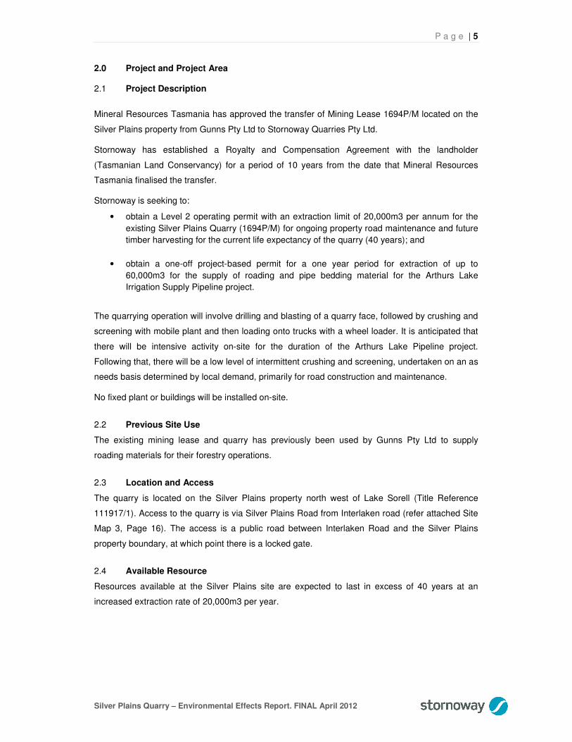
2.0 Project and Project Area 2.1 Project Description
Mineral Resources Tasmania has approved the transfer of Mining Lease 1694P/M located on the
Silver Plains property from Gunns Pty Ltd to Stornoway Quarries Pty Ltd.
Stornoway has established a Royalty and Compensation Agreement with the landholder
(Tasmanian Land Conservancy) for a period of 10 years from the date that Mineral Resources
Tasmania finalised the transfer.
Stornoway is seeking to:
• obtain a Level 2 operating permit with an extraction limit of 20,000m3 per annum for the
existing Silver Plains Quarry (1694P/M) for ongoing property road maintenance and future
timber harvesting for the current life expectancy of the quarry (40 years); and
• obtain a one-off project-based permit for a one year period for extraction of up to
60,000m3 for the supply of roading and pipe bedding material for the Arthurs Lake
Irrigation Supply Pipeline project.
The quarrying operation will involve drilling and blasting of a quarry face, followed by crushing and
screening with mobile plant and then loading onto trucks with a wheel loader. It is anticipated that
there will be intensive activity on-site for the duration of the Arthurs Lake Pipeline project.
Following that, there will be a low level of intermittent crushing and screening, undertaken on an as
needs basis determined by local demand, primarily for road construction and maintenance.
No fixed plant or buildings will be installed on-site.
2.2 Previous Site Use
The existing mining lease and quarry has previously been used by Gunns Pty Ltd to supply
roading materials for their forestry operations.
2.3 Location and Access
The quarry is located on the Silver Plains property north west of Lake Sorell (Title Reference
111917/1). Access to the quarry is via Silver Plains Road from Interlaken road (refer attached Site
Map 3, Page 16). The access is a public road between Interlaken Road and the Silver Plains
property boundary, at which point there is a locked gate.
2.4 Available Resource
Resources available at the Silver Plains site are expected to last in excess of 40 years at an
increased extraction rate of 20,000m3 per year.

P a g e | 6
Silver Plains Quarry – Environmental Effects Report. FINAL April 2012
2.5 Resource Extraction
There will be an initial intensive phase of quarry material extraction associated with the Arthurs
Lake Supply Pipeline project. While the specific production program is yet to be confirmed, it is
anticipated that this will be focused in the period June-December 2012, with the likelihood of some
runover into the first half of 2013.
Following the completion of the project, it is anticipated that production will be undertaken on a
periodic “campaign” basis depending on local market demand, primarily for local road construction
and maintenance. The landholder, Tasmanian Land Conservancy, have indicated that they will
have some demand for material for the maintenance of roads on the Silver Plains and adjacent
properties.
Production is anticipated to occur 2-3 times per year totaling approximately 20 days. Volumes of
5,000-10,000m3 will be produced each time. Due to local climatic conditions, production will be
undertaken outside of the winter period.
2.6 Site Development
The quarry development will be based on the existing quarry design, with development continuing
in an easterly direction from the existing quarry floor level. The existing quarry lease will not be
expanded. Existing vegetation located on the lease is regrowth and grassland. Over the next five
years, it is anticipated that one extra hectare will be opened by stripping, having minimal effect on
flora and fauna. The majority of that disturbance (approx. 50%) will take place over the 1st 12
months due to the Arthurs Lake project, with the balance spread evenly over the subsequent four
years.
Surface material (predominantly clay) will be stripped and stockpiled in bunds surrounding the
development area.
A copy of the Site Development Plan is attached (Page 23).
2.7 Blasting
The quarry faces will be blasted prior to the crushing and screening of material. During the Arthurs
Lake project, it is anticipated that blasting will be undertaken every 1-2 months. Following the
completion of that project, blasting is only anticipated to be required no more than once per year.
Blast timing will vary according to operational requirements. All aspects of the blast operation will
be undertaken in accordance with legislated and regulatory environmental and OHS guidelines.
No explosives will be stored on-site.
2.8 Stockpiling
Stockpiling of material will be located on the quarry floor, using a wheel loader in a pattern of piles
to avoid stock contamination. The stockpile area has been marked on the Site Development Plan
(Page 23).

P a g e | 7
Silver Plains Quarry – Environmental Effects Report. FINAL April 2012
2.9 Hours of operation
We will be intending to work the quarry in the hours of 7am to 7pm Monday to Friday and 8am to
4pm Saturday.
2.10 Site Facilities
Site facilities all be portable/temporary in nature and will include an office, lunch room and toilets.
No permanent or fixed buildings or facilities will be installed on-site.
2.11 Hydrology of the site
The location of the site allows for natural drainage around the site. The undulation of the area
prohibits run off leaving the site except through the drainage channel.
2.12 Soil and Rock Type
The rock to be extracted is a weathered sedimentary limestone. This is overlaid by 1-2m of clay.
2.13 Climate
Silver Plains Quarry is located on the eastern edge of the Central Plateau. Rainfall is highest in the
western Plateau region, averaging up to 2,000 millimeters (mm) per year and decreasing as you
progress east towards the Midlands and into the rain shadow of the western highlands and the
central plateau. The long term annual mean rainfall level for the nearest population centre,
Bothwell, is 530mm.
The Central Plateau is the coldest region of Tasmania, with mean annual
minimum temperatures less than 5°C. There is also great diurnal variation, so that a summer day
temperature of 30°C may fall to 0°C at night. Although winter temperatures may remain near
freezing for 3 to 4 months, soil under plant cover does not freeze for any appreciable length of
time. Severe and prolonged frost is common in winter on the Central Plateau, but due to the
maritime aspect of the climate, snow rarely lies longer than three months. Snow can fall at any
season, but is more common in spring.
Prevailing winds are from the west and north-west.
2.14 Adjacent Land use
The surrounding land has historically been under the ownership of Gunns Ltd and therefore used
for forestry purposes. Since being purchased by the Tasmanian Land Conservancy it is being
managed for conservation purposes and assessed for it’s economic value ie. carbon storage.

P a g e | 8
Silver Plains Quarry – Environmental Effects Report. FINAL April 2012
3.0 Environmental Management
3.1 Flora and Fauna
As this project involves continuing and relatively limited use of an existing, heavily disturbed quarry
site, predominantly for supply to the Arthurs Lake Supply Pipeline project, it was considered
sufficient to rely on the flora and fauna survey undertaken by Tasmanian Irrigation (TI) as the basis
for determining the effects of the project on surrounding flora and fauna. Given that the mining
lease is located within 500m of the pipeline easement, the survey covered the area of the lease
and it’s surrounds.
As the attached Flora and Fauna Survey Map (Page 19) shows, there were no species of
conservation significance or any threatened species identified by Tasmanian Irrigation within the
mining lease or within an area that would be impacted by activities on the mining lease.
Stornoway and TLC have also referenced the Tasmanian Natural Values Atlas and identified no
occurrences of species of conservation significance or any threatened species within the mining
lease.
Outside of the mining lease, the only species of conservation significance identified in the Atlas is
riverbed watercress (Barbarea australis) within the vicinity of Micks Creek, approximately 150m to
the west of the lease boundary. An extract from the Atlas is attached. The only identified risk to the
riverbed watercress is from stormwater run-off. This risk will be managed in accordance with Sect
3.4.
3.2 Weeds and Diseases
TLC have identified ragwort (Senecio jacobaea) as the only weed or disease of concern in the
vicinity of the quarry. The significance of ragwort is the risk of seed contamination in the quarry
product, promoting it’s spread with the distribution of quarry product and the movement of quarry
processing and earthmoving equipment.
TLC have mapped ragwort infestation and undertaken a control program over 4-6 weeks during
February and March 2012. The program is ongoing.
TLC and Stornoway will maintain ongoing monitoring and control activities as required to control
the further spread of weeds. Specifically, ragwort will be monitored for control during its’ flowering
season when it has a highly visible yellow flower.
Stornoway will enforce strict hygiene procedures, ensuring that all quarry processing and
earthmoving equipment is washed down prior to entry to the site and exit from the site.
No other weeds or diseases of significance have been identified.
In relation to the Arthurs Lake pipeline project, approval of the permit for Silver Plains is a key
weed infestation risk mitigation strategy in itself. In order to manage the risk of increased weed
infestation on the Silver Plains property arising from the Arthurs Lake pipeline project generally,
the best source of quarry material for pipe bedding and roading is “on-property”. The TLC have
P a g e | 9
Silver Plains Quarry – Environmental Effects Report. FINAL April 2012
already expressed strong concern to TI regarding the risks associated with importation of quarry
material from elsewhere.
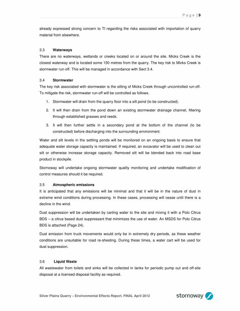
3.3 Waterways
There are no waterways, wetlands or creeks located on or around the site. Micks Creek is the
closest waterway and is located some 150 metres from the quarry. The key risk to Micks Creek is
stormwater run-off. This will be managed in accordance with Sect 3.4.
3.4 Stormwater
The key risk associated with stormwater is the silting of Micks Creek through uncontrolled run-off.
To mitigate the risk, stormwater run-off will be controlled as follows.
1. Stormwater will drain from the quarry floor into a silt pond (to be constructed).
2. It will then drain from the pond down an existing stormwater drainage channel, filtering
through established grasses and reeds.
3. It will then further settle in a secondary pond at the bottom of the channel (to be
constructed) before discharging into the surrounding environment.
Water and silt levels in the settling ponds will be monitored on an ongoing basis to ensure that
adequate water storage capacity is maintained. If required, an excavator will be used to clean out
silt or otherwise increase storage capacity. Removed silt will be blended back into road base
product in stockpile.
Stornoway will undertake ongoing stormwater quality monitoring and undertake modification of
control measures should it be required.
3.5 Atmospheric emissions
It is anticipated that any emissions will be minimal and that it will be in the nature of dust in
extreme wind conditions during processing. In these cases, processing will cease until there is a
decline in the wind.
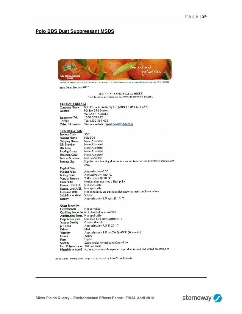
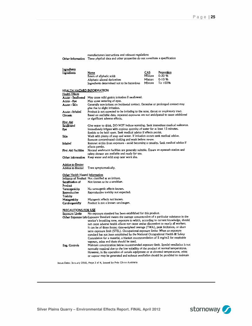
Dust suppression will be undertaken by carting water to the site and mixing it with a Polo Citrus
BDS – a citrus based dust suppressant that minimizes the use of water. An MSDS for Polo Citrus
BDS is attached (Page 24).
Dust emission from truck movements would only be in extremely dry periods, as these weather
conditions are unsuitable for road re-sheeting. During these times, a water cart will be used for
dust suppression.
3.6 Liquid Waste
All wastewater from toilets and sinks will be collected in tanks for periodic pump out and off-site
disposal at a licensed disposal facility as required.

P a g e | 10
Silver Plains Quarry – Environmental Effects Report. FINAL April 2012
3.7 Solid Waste
Any solid waste generated from the operation of this quarry will be kept in an approved garbage
bin for removal to an approved waste centre located at Launceston, Bothwell or Oatlands.
3.8 Production Waste
It is anticipated that there will be no waste from production as all extracted material will be made
into saleable product. This is essential to ensuring the operation is financially viable.
All material from the production process will be stockpiled. Any material that is not sold on closure
of the quarry will be spread on the site as part of the rehabilitation process.
3.9 Hydrocarbons
All hydrocarbon waste (grease cartridges, waste oil etc) generated will be removed and deposited
within an approved waste site or with an approved waste recycler.
An oil spill kit will be on-site during crushing and screening operations.
3.10 Noise
Throughout the duration of the Arthurs Lake project, production activity will be ongoing for 4-6
months, with tapering off over the following three months. On completion of the Arthurs Lake
project, the quarry will only require 20 standard days per year of full production. Given its remote
location, it will have no impact on residential property or any other sensitive use.
All equipment used in the production and loading period will be fitted with industry standard
exhaust systems. At any one time, the most equipment to be running would be a screen, crusher
and a loader and this would not at any time exceed 10db above normal ambient noise levels
during daylight operations as recommended in the Quarry Code of Practice Clause 6.2.
3.11 Transport Impact
As a small and remote quarry, traffic movement to and from the site will be variable depending on
local project requirements. However, it is anticipated that during normal operations, daily truck
movements would be no more than six at 33 tonne.
Silver Plains Quarry will be operated on a campaign basis with the expectant use of product to be
nil for some years after the Arthur Lake project is completed. It is not anticipated that any material
will leave the property. As this is a low use quarry, there will be no impact by transportation of
quarry material on the environment or local government infrastructure.
The ability to supply the Arthurs Lake Irrigation Pipeline project will reduce the amount of truck
movements in and out of the site given that the quarry sits adjacent to the pipeline easement. The
approximate alignment of the pipeline is shown on both Site Maps 1 and 2 (Pages 14 and 15). As
marked on Site Map 1, access to the easement will be on an existing forestry road (approx. 200-
300m). From there, all material will be transported along purpose built construction access roads
within the easement.
P a g e | 11
Silver Plains Quarry – Environmental Effects Report. FINAL April 2012
Should the project permit not be granted, all materials would need to be imported from the midland
near Tunbridge, increasing the impact on local government infrastructure, local traffic, residents
and greenhouse emissions.
3.12 Hazardous Materials
The quarry process will not require any hazardous material to be stored on-site. However, fuel will
be transported to site for the use in quarrying equipment. The citrus based dust suppressant is not
classified as hazardous. However, the material will be stored in an enclosed and bunded storage
area away from the drainage channel. A copy of the MSDS is attached (Page 24).
3.13 Visual Impact
There is very low visual impact from the Silver Plains Quarry. It is located approximately 7 km from
the nearest residential property – a fishing/hunting shack on the foreshore of Lake Sorell that has
intermittent use (location marked on Site Map 2, Page 15).
Due to the location of the quarry within the surrounding landforms and forest, it is virtually not
visible beyond 100-200m.
3.14 Sustainability
Stornoway is currently installing water suppression systems on all crushing and screening
operations that will use six litres of water per minute. The system is designed by Polo Citrus and
uses a citrus based organic chemical to create aerated foam that enlarges water by 100 times,
reducing the water usage and coating the rock particles, eliminating dust by 98%.
With the Arthur Lake project, the use of quarry products from Silver Plains will reduce the
greenhouse emissions due to the closeness of the site. If the product is to come from other sites,
the increased truck movements and long distance freight will increase emissions dramatically.
3.15 Cultural Heritage
As this project involves continuing and relatively limited use of an existing, heavily disturbed quarry
site, predominantly for supply to the Arthurs Lake Supply Pipeline project, it was considered
sufficient to rely on the Aboriginal Site survey undertaken by Tasmanian Irrigation (TI) as the basis
for determining the effects of the project on cultural heritage. Given that the mining lease is located
within 500m of the pipeline easement, the survey covered the area of the lease and it’s surrounds.
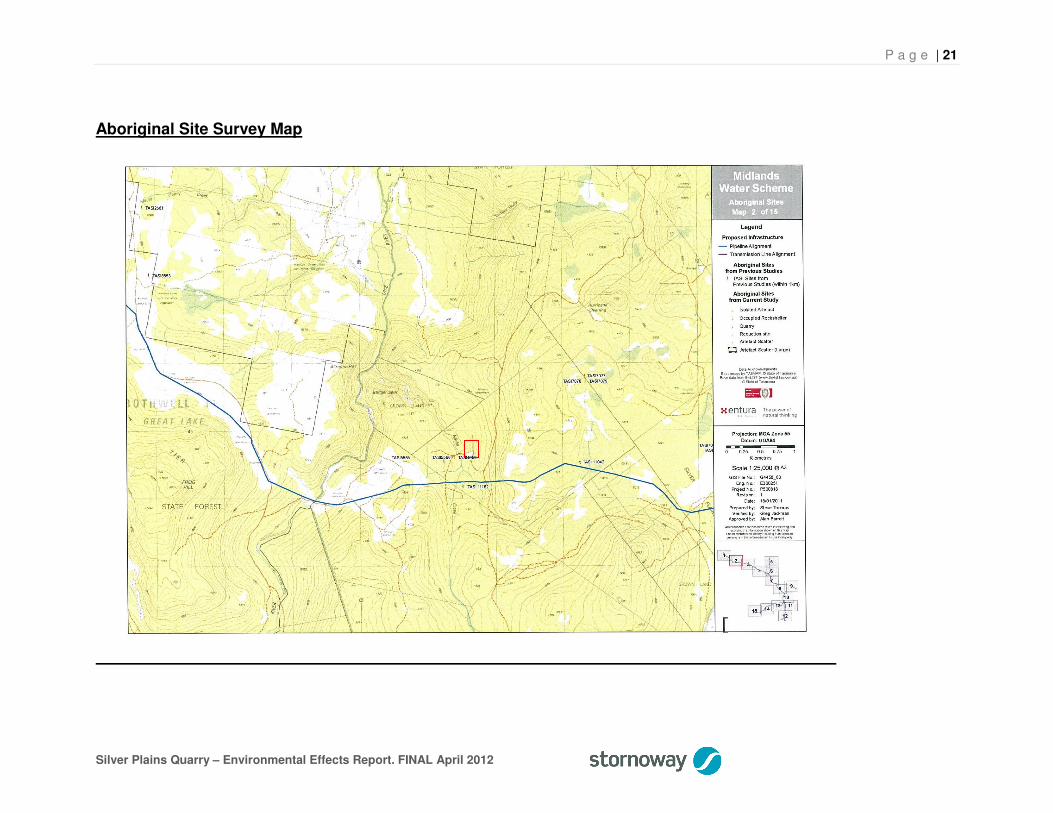
As the attached Aboriginal Site Survey Maps (Pages 21 & 22) show, there were no aboriginal sites
identified within the mining lease.
Outside of the lease, two sites to the west of Micks Creek were identified in the survey (TASI4950
and TASI5566). However, given their location on the western bank of Micks Creek, activity on the
mining lease will have no impact on these sites.

P a g e | 12
Silver Plains Quarry – Environmental Effects Report. FINAL April 2012
4.0 Rehabilitation
Quarrying on the proposed site is expected to continue for more than 40 years, therefore making
firm assessments of the optimal rehabilitation treatment difficult.
The most likely approach would be to revert the area to natural forest and grassland consistent
with the surrounding landscape. It would be ripped to remove all hard stand areas, with the slopes
and faces battered once the mining operation is complete.
The western side of the current operational area will be battered for rehabilitation during the Arthur
Lake project. As the quarry footprint extends to the east in accordance with the Site Development
Plan, equivalent areas will be progressively rehabilitated so that there will be no net increase in the
size of the quarry floor.

P a g e | 13
Silver Plains Quarry – Environmental Effects Report. FINAL April 2012
5.0 Commitments
Number Commitment Completion date By Whom
1 Dust will be managed by the use of dust suppression systems during crushing operations.
Ongoing Contractors
2 Dust will be managed from cartage operations by the use of a water cart to dampen the road surface.
Ongoing Contractors
3 Production operations will cease during extreme wind conditions
Ongoing Stornoway
4 All site stormwater run off will be settled and filtered via a silt pond and the discharge channel to a secondary settling pond to ensure no impact on Micks Creek.
Ongoing Stornoway
5 Domestic waste will be removed to an approved waste recycling/disposal site.
Ongoing Stornoway
6 Liquid waste will be carted off site for disposal in a licensed disposal facility.
Ongoing Stornoway
7 Operation hours will be limited to the hours of 7am to 7pm Monday to Friday and 8am to 4pm Saturday.
Ongoing Stornoway
8 Spill kits will be located on-site during operational activity.
Ongoing Stornoway
9 Weeds will be managed in accordance with the Quarry Code of Practice.
Ongoing TLC and Stornoway
10 Partial rehabilitation will occur at the end of the Arthurs Lake project, leaving the operational size to a minimum.
2012/2013 Stornoway
11 Full rehabilitation will be completed on ultimate site closure.
Site closure Stornoway

P a g e | 14
Silver Plains Quarry – Environmental Effects Report. FINAL April 2012
Site Map 1
Approx. Arthurs Supply Pipeline Easement Alignment
Easement Access (existing forestry road)

P a g e | 15
Silver Plains Quarry – Environmental Effects Report. FINAL April 2012
Site Map 2
Approx. Arthurs Supply Pipeline Alignment
Nearest Residences (Intermittent use)

P a g e | 16
Silver Plains Quarry – Environmental Effects Report. FINAL April 2012
Site Map 3

P a g e | 17
Silver Plains Quarry – Environmental Effects Report. FINAL April 2012
Site Map 4

P a g e | 18
Silver Plains Quarry – Environmental Effects Report. FINAL April 2012
Site Map 5

P a g e | 19
Silver Plains Quarry – Environmental Effects Report. FINAL April 2012
Flora and Fauna Survey Map
Mining Lease

P a g e | 20
Silver Plains Quarry – Environmental Effects Report. FINAL April 2012
Flora and Fauna Survey Map Legend
P a g e | 21
Silver Plains Quarry – Environmental Effects Report. FINAL April 2012
Aboriginal Site Survey Map

P a g e | 22
Silver Plains Quarry – Environmental Effects Report. FINAL April 2012
Aboriginal Site Survey Map 2 (Enlarged)

P a g e | 23
Silver Plains Quarry – Environmental Effects Report. FINAL April 2012
Site Development Plan
Existing quarry operating face
Existing
quarry floor
Stormwater drainage channel
Access Road Direction of Future Quarry Development
100m
Proposed
Silt pond
Stockpile Area
Proposed secondary settling pond
P a g e | 24
Silver Plains Quarry – Environmental Effects Report. FINAL April 2012
Polo BDS Dust Suppressant MSDS
P a g e | 25
Silver Plains Quarry – Environmental Effects Report. FINAL April 2012

P a g e | 26
Silver Plains Quarry – Environmental Effects Report. FINAL April 2012

P a g e | 27
Silver Plains Quarry – Environmental Effects Report. FINAL April 2012

P a g e | 28
Silver Plains Quarry – Environmental Effects Report. FINAL April 2012
Natural Values Atlas Report