SHEll OIL SPILL - USGS Tru.tee Commltt.e fln.1 Report THE SPILL LATE IN THE EVENING OF APRIL 23....
23
SHEll OIL SPILL LITIGATION SETTLEMENT TRUSTEE COMMITTEE 1990-2001
Transcript of SHEll OIL SPILL - USGS Tru.tee Commltt.e fln.1 Report THE SPILL LATE IN THE EVENING OF APRIL 23....
SHEll OIL SPILL
LITIGATION SETTLEMENT
TRUSTEE COMMITTEE
1990-2001

THE PEOPLE WHO MADE
IT POSSIBLE
_Hn ot JlIoo S/tdl Oil SpiU ~Ucn
_tT..,.I.. eom",m..
CIIIllornY~ of Fisll...-...., L """'"Pl:te1 Phlll,psM.,.R,,"
CalIlomlIo Stiltil Unds Commission
0- PIummef, Treasu""ot ,1M! Trust.... Committee
J_ 5eke!5ky
M8'y Howe
National Oceanic and Atrnosp!>e,lcAdmlnl.t,Mlon, NMlonal Marine
Fl'herle' Se,vlcaJames R, BybeeChns MObley
United Statn Fl'h and Wildlife Se,vlce
W<lyoo WhiteDale P,erceGaol KobetlChBetsy Radlke
San Ftancltco Bay Consf!.rvatlon
and Dev.-lopmtnt Comml5alonW,A T,/IYlS, CI\a;"""n ot!he
rNStoo CommolfeeAlan A, Pendleton
Steve McAdam
Eatt Bay II.,....... P_ D1stnc1
Aotle<t E. 00)0Ie,~ et>amnan ot
tile Trustee Commtttee
-,-Conlllklo.. and ....rtkipafrt!l (patti;)! list)
Caldo,"ia Con5efWtion Cofps
Caldomia Departmefll of fishand Game, Reg"", 3
Cal,fo,"la Department of P8r~S
and Rocreation
CalIfornia Department ofTrnnsport8tiOn
California State CoastalConser-a"Cy
California Wildlife ConservationBoard
Cargill Salt
Contra c.:.sta Coonty Mosqoito
and Yeclor Control DtSlnct
0\Icl<s Unllmrlcd
M¥tonez "'ea Land TfUSI
MouflIaon VIeW san,tary Dostnct
Mount 0._ Aud.Jbon Society
NaLonai Manne FIShenes semce$;on r,ancisco 8aI InstJwte
San ffancisco 8aI RegIonal watefQualll)' Control _
Unllcd StaleS FISh and
¥.'~I'e 5eo1ce
SdentJtl. WOfk/n( on .tlNly of
M_',II~"
PeUl' Fiedler aoo ABndy Zebell 01san FrO"CISCO State Uni""rsrly
The CalHo'nla Envl,.,.,,,,,,ntal Tru.t
Josepn E. Bodovitl, President
T,sh Sprague, Vi"" President
OVERVIEW
AS CALIFORNIA'S EVER EXPANDING POPULATION GROWS, THE WILD LANDS AND THE POPULATIONS
of fish and wildlife that depend upon them dwindles. It is for this reason that the people who live
around San Francisco Bay value more highly that which remains.
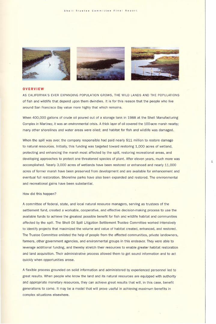
When 400,000 gallons of crude oil poured out of a storage tank in 1988 at the Shell Manufacturing
Complex in Martinez, it was an environmental crisis. A thick layer of oil CO'v'ered the 1()()..ac(e marsh nearby;
many other shorelines and water areas were oiled; and habitat for fish and wildlife was damaged.
When the spill was over, the company responsible had paid nearly $11 million to restore damage
to natural resources. Initially. this funding was targeted toward restoring 1.000 acres of wetland,
protecting and enhancing the marsh most affected by the spilt, restoring recreational areas. and
developing approaches to protect one threatened species of plant. After eleven years, much more was
accomplished. Nearly 3,000 acres of wetlands have been restored or enhanced and nearly 11.000
acres of former marsh have been preserved from development and are available for enhancement and
eventual full restoration. Shoreline parks have also been expanded and restored. The environmental
and recreational gains have been substantial.
How did this happen?
A committee of federal, state, and local natural resource managers, serving as trustees of the
settlement fund. created a workable, cooperative, and effective decision.maklng process to use the
available funds to achieve the greatest possible benefit for fish and wildlife habitat and communities
affected by the spill. The Shell Oil Spill Litigation Settlement Trustee Committee worked intensively
to identify projects that maximized the volume and value of habitat created. enhanced, and restored.
The Trustee Committee enlisted the help of people from the affected communities, private landowners,
farmers, other government agencies. and environmental groups in this endeavor. They were able to
leverage additional funding. and thereby stretch their resources to enable greater habitat restoration
and land acquisition. Their administrative process allowed them to get sound information and to act
Quickly when opportunities arose.
A flexible process grounded on solid information and administered by experienced personnel led to
great results. When people who know tile land and its natural resources are equipped with authority
and appropriate monetary resources. they can achieve great results that will, in this case, benefit
generations to come. It may be a model that will prove useful in achieving maximum benefits in
complex situations elsewhere.
,
Snell Tru.tee Commltt.e fln.1 Report
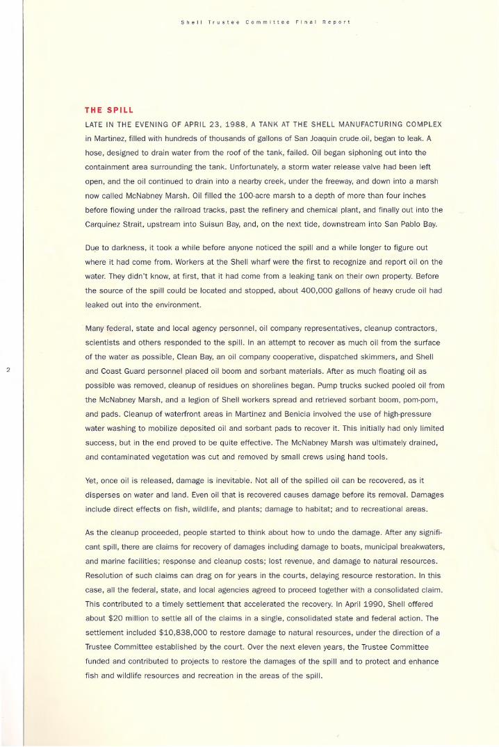
THE SPILL
LATE IN THE EVENING OF APRIL 23. 1988, A TANK AT THE SHELL MANUFACTURING COMPLEX
in Martinez, filled with hundreds of thousands of gallons of san Joaquin crude oil. began to leak. A
hose. designed to drain water from the roof of the tank, failed. Oil began siphoning out into the
containment area surrounding the tank. Unfortunately, a storm water release valve had been left
open, and the oil continued to drain into a nearby creek, under the freeway, and down into a marsh
now called McNabney Marsh. Oil filled the lQO-acre marsh to a depth of more than four inches
before flowing under the railroad tracks, past the refinery and chemical plant, and finally out into the
CarQuinez Strait. upstream into Suisun Bay, and, on the next tide, downstream into San Pablo Bay.
Due to darkness. it took a while before anyone noticed the spill and a while longer to figure out
where it had come from. Workers at the Shell wharf were the first to recognize and report oil on the
water, They didn't know. at first. that it had come from a leaking tank on their own property. Before
the source of the spill could be located and stopped, about 400,000 gallons of heavy crude oil had
leaked out into the environment.
Many federal, state and local agency personnel, oil company representatives, cleanup contractors,
scientists and others responded to the spill. In an attemPt to recover as much oil from the surface
of the water as possible, Clean Bay, an oil company cooperative, dispatched skimmers, and Shell
and Coast Guard personnel placed oil boom and sOrbant materials, After as much floating oil as
possible was removed, cleanup of residues on shorelines began. Pump trucks sucked pooled oil from
the McNabney Marsh, and a legion of Shell workers spread and retrieved sorbant boom, pom-pom,
and pads, Cleanup of waterfront areas in Martinez and Benicia involved the use of high-pressure
water washing to mobilize deposited oil and sorbant pads to recover it. This initially had only limited
success, but in the end proved to be Quite effective. The McNabney Marsh was ultimately drained,
and contaminated vegetation was cut and removed by small crews using hand tools.
Yet, once oil is released, damage is inevitable, Not all of the spilled oil can be recovered, as it
disperses on water and land. Even oil that is recovered causes damage before its removal. Damages
include direct effects on fish, wildlife, and plants; damage to habitat; and to recreational areas.
As the cleanup proceeded, people started to think about how to undo the damage, After any signifi
cant spill, there are claims for recovery of damages including damage to boats, municipal breakwaters.
and marine facilities; response and cleanup costs: lost revenue, and damage to natural resources.
Resolution of such claims can drag on for years in the courts, delaying resource restoration. In this
case, all the federal. state, and local agencies agreed to proceed together with a consolidated claim.
This contributed to a timely settlement that accelerated the recCNery. In April 1990, Shell offered
about $20 million to settle all of the claims in a single, consolidated state and federal action. The
settlement included $10,838.000 to restore damage to natural resources. under the direction of a
Trustee Committee established by the court. Over the next eleven years, the Trustee Committee
funded and contributed to projects to restore the damages of the spill and to protect and enhance
fish and wildlife resources and recreation in the areas of the spill.

S~.II f'U.l •• Commltto. Fln.1 RoPO"
HOW RESTORATION GOT STARTED
AfTER SETTLEMENT OF CLAIMS FROM THE OIL SPILL. A MEMORANDUM OF AGREEMENT
identified the participants and established the purposes of the Trustee Committee. Their fundamental
charge was to restore, rehabilitate, create and acquire the equivalent of the natural resources
damaged by the spill, The Committee was to give special attention to three areas: the marsh area
that had been gravely damaged during the spill; a restoration project at the Benicia State Recreation
Area: and conservation of an endangered plant species. Mason's lilaeopsis.
Under the Memorandum of Agreement, the Trustees had the authority to take any actions they
thought would best contribute to restoration. The Committee was composed of representatives
from two federal agencies (the National Marine FIsheries service and the United States Ash and
Wildlife service), three state agencies (the California Department of Ash and Game, the California
State lands Commission, and the San Francisco Bay Conservation and Development Commission),
and one local agency (the East Bay Regional Park District). The Park District represented the
interests of people liVing near the spill for projects that would benefit their communities. The Bay
Conservation and Development Commission was Included because it represented the interests of
the people who rely upon the Bay for economic, recreational, and aesthetic purposes. The other
four agencies were trustees of the natural resources damaged by the spill and sought to restore
and enhance habitat for fish and wildlife. To serve on the Trustee Committee, agencies appointed
knowledgeable representatives with diverse backgrounds and firsthand knowledge of the natural
resources at riSk. The Trustees recognized the importance of compensating fully for damages caused
by the spill and the opportunity to increase habitat values.
The Trustees arranged for the California Environmental Trust to administer the settlement fund.
The California Environmental Trust is a nonprofit organization established in 1985 to administer
seltlement funds from environmental lawsuits and to help people reach consenSUS on complex
issues of development and environmental protection. This arrangement provided greater flexibility
than administration by any single agency, gave the Trustees the ability to act quiCkly to take advan
tage of opportunities, and kept overhead costs at six percent of total expenditures.
The Trustees sought advice from a technical advisory committee that included many knowledgeable
scientists and resource managers. These representatives of state, federal, and local agencies and
other organizations offered their ideas and expertise to help make restoration a reality.
The Trustees solicited proposals for Wcf/S to restore one thousand acres of wetlands, as specified
in the settlement agreement, and to protect McNabney Marsh and other related habitats in the
areas affected by the spill. Many people responded, submitting 51 ideas. including suggestions for
parcels that could be purchased, marshes that could be restored, and endangered species that
could be saved from extinction. The Trustees held two town hall meetings during which they heard
from a variety of people with all kinds of ideas.
3


Shell T,u"e. Committe. Fln.1 Repo,t
The Trustees set criteria by which to evaluate and prioritize the proposals. These included priority
for restoration projects that were feasible to accomplish in the short term and for acquisition of
wetlands habitat that was vulnerable to development and permanent loss. Meeting every month,
the Trustees methodically worked their w;ry through all of the proposals, looking at feasibility and
relevance to restoring wildlife habitat and enhanc:ing the biology and ecology of the Bay. They made
decisions by consensus, in order to insure that projects selected had strong support from all of the
member agencies.
The Trustees had two responsibilities. They sought to enhance resources that were most important
to people living in areas most affected by the spill, along the shores of Carquinez Strait in Contra
Costa and Solano counties. The Trustees also sought to enhance resources of greatest value and
significance to the Bay ecosystem as a whole. These areas were further west, in Napa and Sonoma
counties. The Trustees sought to achieve a balance in the projects they selected. The areas closest
to the spill site were more highly developed and cost more to acquire than areas further frNay. The
Trustees chose a mix of projects that included impacted areas adjacent to the spill area, as well as
larger projects a bit farther frN<rj. This mixed approach allowed them to restore sites immediately
impacted by the spill while also contributing as much as possible to improving the overall natural
habitat of the B;ry.
While the Trustees carefully evaluated the various projects. they also sought to magnify the effective
ness and Impact of the Fund by partnering with a variety of organizations with additional funds that
could be pooled. The Trustees were successful, and as a result more than doubled the resources
available for creating, enhancing. or restoring wetlands around the Bay.
The participants report that the strong working relationships forged during the eleven years of work
by the Trustee Committee, the public meetings, and the work of the technical advisory committee
have carried over into other areas. contributing to better resource management in many contexts.
Amount 01 L.nd, Acquired, Protected .nd/or Redored
5
Number of .c.... .cqulred .nd Protected
Cargill salt property
Point Pinole
SOuth sonom. Valiey (Camllll)
McNabney M••sh
Mt:Nabney M..sh Upl.nds
Suisun SIJIld
TOTAL
Studies Completed
MasotI$ lillJeop$ls (endangered plant) restoration
San francisco~ Estuary "ties
10,000
'58
530
60
".51
10,947
Humbe. of .Cles Resto.ed (lJlf Of in ~'f)
Tol"" Creek
Sonoma 8&tfands
Petaluma RiYer M..-sh
Benici. State Rl!Cfllatlon Area
CuiliMll Ranch (pendin&)
McNabney Marsh ...etIands (pending)
Carilll Salt. Pond 2a
Slnsun Sand (pendi~
TOT.l
'35
"..29
1,493
60
560
51
2,697


McNabney Marsh Acquisition,
Restoration, and Public Education
MANY PEOPLE DRIVE BY MCNABNEY MARSH
(formerly known as Shell Marsh), located on
Interstate 680 immediately south of the Benicia
Bridge. without recognizing that it provides pro
ductive habitat for fish, birds, invertebrates. and
other creatures. Though nestled between a busy
Interstate freeway, a railroad, an oil refinery, a
sewage treatment plant, a chemical plant, and
a small community, McNabney Marsh is an
Important wetlands area. It is a long marsh.
with tussocks of vegetation peeking up from
Shimmering blue waters. Birds linger. Fish
thrive. Winds rustle the tall grasses. On a fall
day, white pelicans float on the surface, ducks
dabble for food, and shorebirds stalk the crea
tures of the mud. It is the marsh most heavily
oiled during the spill. Because of the direct
and significant Impact of the spill, the court
settlement specified that the Trustees give
special consideration to restoring and enhancing
this marsh. Moreover. a development company,
which then owned most of the Marsh and adja
cent uplands. was proposing to develop the
uplands for an industrial complex.
The Trustees initially focused on preserving and
enhancing the marsh alone. During project
evaluation, the remainder of the parcel. com
prising the 138 acres of uplands to the east,
became available. In 1992, the Trustees funded
purchase of 60 acres of the Marsh and 138
upland acres for $3.000,000. The upland
areas complement the habitat values of the
marsh. Purchase of the upland areas allowed
for establishment of a transition habitat and
a buffer zone. It also would prOVide space to
enable public viewing and interpretation of
the marsh.
The ability of the Trustees to act Quickly and to
pay cash for Pfoperty contributed to the success
of this acQuisition. The East Bay Regional Park
District completed the acQuisition, took title to
the property on behalf of the Trustees and is
managing It along with the other trustee
agencies, in accordance with the fish and
wildlife values of the area.
The goal for restoration of the Marsh is to create
a particularly valuable type of ecosystem-a
brackish marsh. To achieve restoration of
brackish habitat will require return of salt
waters from the Bay to the Marsh. Such flows
have been absent from the Marsh for many
years. because of water control structures built
along the shore. The Marsh receives about two
million gallons per day of freshwater discharge
from the Mountain View Sanitary District. The
salt budget is being depleted over time, however,
and parts of the Marsh are beginning to develop
plants more characteristic of freshwater marshes.
Tidal action Would allow the marsh to retain its
estuarine vegetation and species.
The Trustees retained environmental consulting
firms to recommend ways to protect the
marsh and maximize habitat values. A Marsh
Management Advisory Committee was formed by
the California Department of Fish and Game to
evaluate assessments and make recommenda
tions to the Trustees for further steps to enhance
the wetland habitat values of the marsh.
The CalFed program has also provided funding
to study the Marsh enhancement process.
Researchers have concluded that the Marsh is
one of the most productive wetland systems in
the Bay Area, prOViding food and shelter for a
wide variety of fish, mammals, birds, and inver
tebrates. Counts of fish show large populations.
,

S~.II Tru.t •• Committ •• f'nal Report
8
The San Francisco Bay Regional Water Quality
Control Board contributed to this effort by
directing Santa Fe Pacific Pipeline Partners to
deposit $30.000 in the Shell Trustee Fund to
settle liability for an oil spill into Peyton Slough.
Caltrans also contributed toward the restora
tion, as a means to reduce freeway flOOding.
Considerable effort has gone into developing a
restoration plan for the marsh that is workable
and acceptable to the parties that own or man
age adjacent lands or resources. The current
enhancement effort involves several partners.
The Mountain View Sanitary District, which
owns a portion of the Marsh and releases
treated wastewater into it, has volunteered to
take responsibility for restoration of the entire
marsh. not just the portion that they own.
The Sanitary District has operated successful
wetlands restoration and enhancement projects
using treated wastewater on its property, The
East Bay Regional Park District, in consultation
with the District and the California Department
of Fish and Game. granted an easement to
Mountain View Sanitation District for this
management approach.
To restore tidal flows into the Marsh, the
trustees supported the installation of a set of
"Nekton" gates. an innovative tide gate that
allows water and fish to enter and exit the
Marsh at various times during each tidal cycle.
These are installed next to a chemical plant
at the mouth of the outlet of the Marsh. The
Contfa Costa County Mosquito and Vector
Control District manages water levels through
a newly constructed water control structure
funded in part by the Trustees.
downstream of the tide gates, the San Francisco
Bay Regional Water Quality Control Board has
restricted use of the gates until contaminants
in slough sediments have been removed or
capped. The Board plans to issue an order with
a schedule for the cleanup in the spring of
2001. The cleanup will likely occur in 2002.
The East Bay Regional Park District manages
the 138 acres of upland habitat on the hillside
east of the Marsh. The open, rolling hillsides
offer good venues for views of the ecological
zones and birds of the marsh. The Trustees
allocated funding for the development of
access and public education centers. The
Oepartment of Fish and Game also contributed
$60,000 for interpretive displays. The East Bay
Regional Park. District plans to start construction
in 2001 to allow visitors to view this beautiful
and productive area and to learn about restora--
tion of this valuable wildlife habitat. Though
direct access to the Marsh is prohibited, inter
pretive panels located in the uplands will allow
people to stop and see the pelicans, geese,
ducks, wading birds, and red fox that they miss
when they speed by on the adjacent freeway.
The protection and restoration of the Marsh
are a legacy of many individuals and organi
zations. One who played a key role In these
actions was AI McNabney. As a representative
of Mount DiablO Audubon Society, AI was a
tireless advocate of preservation of the
Marsh, attending many meetings and writing
many letters to draw atlention to the beauty
and values of the area. When it was acquired,
he turned to working to ensure that public
education and access would be part of the
design for the area. He was Instrumental in
obtaining funding for Interpretive elements to
be built there. As a memorial to him and to
commemorate his efforts, the Marsh was
renamed McNabney Marsh.

S~", l'Vll" Committe. Fln.1 Report
RESEARCH PROJECTS
Mason's Illaeopsls
MASON'S LILAEOPSIS IS A PERENNIAL HERB,
related to the carrot, endemic to the area of
the spill. It was. even before the spill, listed as
·rare~ by the State of Califomia. The plant was
vulnerable to damage by the spill and cleanup.
Mason's Iilaeopsis grows in a narrow band in
the intertidal zone. The plants are adapted to
live In tidally inundated, wav&Cut beaches or
levees. The largest and healthiest populations
grow on uninhabited islands in Suisun Bay
where there is no riprap and little human activity.
The Trustees funded a review of the studies in
the scientific literature about this plant, and
funded studies of how the plants had been
affected by being oiled. SCientists also
assessed where the plants live now, how this
compares to where the plants had lived before
and how best to restore the plants.
The field surveys found that the plant is widely
distributed in the Sacramento·San Joaquin
Delta and lower reaches of the Napa
River. No populations were
found west or the
Napa River
system. The
researchers
found that
crude oil
is Quite detri
mental to the
endangered plant,
, • especially in salty environments.
Any increase in salinity of the San
Francisco Estuary and the Delta due to water
diversion would be expected to compromise
the viability of the plant.
Benefit. to Fish Resources
THE ACTUAL ADVERSE EFFECTS OF THE 1988
spill on fish and other aquatic organisms could
not be Quantified, Nonetheless. il was deter·
mined that there were both direct and indirect
impacts from the oil on fish and other aquatic
organisms In their inter-dependent ecosystem.
Very few direct impacts are visible in any sub
merged habitat, especially those in high current
and high turbidity conditions. With this Umlta
tion, some funds from the settlement were
dedicated to assure substantial habitat
improvements that would benefit fish and
aquatic invertebrate species most likely affected
by the spill. Emphasis was placed on habitat of
high value to striped bass. sturgeon, salmon,
and steelhead, focusing primarily on their Juve
nile habitat requirements.
The Trustees concluded that the wetlands
restoration projects fully compensated for the
loss of fish during the spill. The projects added
thousands of acres of the shalloW water habitat
most critical for migrating fish and for rearing
fish, Including Petaluma Marsh, Cargill salt
ponds, Tolay Creek. and Sonoma Baytands,
where juvenile chinook salmon are already
found. Of course, studies that specifically
count the many benefits for fish are beyond
the scope of the Trustees work and will await
the efforts of fisheries researchers.
Computer Data For GeographicInformation Systems
THE TRUSTEES FUNDED WORK BY THE SAN
Francisco Bay Institute to prepare several kinds
of information for a geographic information
computer system. This information, once put
into the system. will be available for a variety
of planning and priority-setting processes.
9

•
-- '::"=..
:: -=
-:: -;..~-- = - -
"
"

TI PAL MUDFLAT
4
SAND
//.&/: -.= ..:::..
SHelLOILCO"'~", .. c. .. v
\
\I~ICJ" STATE
RECR ATlOH ... l AAI:"
_ TIDAL MARSH
[f~ DIKED BAYLAND,
t.:':-==: ~;1 TIDAL WATERS

Snell Trull •• Commill •• Flnel AIPO,1
12
NAPA-SONOMA MARSHES AND
OPPORTUNITIES FOR RESTORATION
ONLY ABOUT TEN PERCENT OF THE TIDAL
and freshwater marshlands that once bordered
San Francisco Bay remain. Airports, harbors.
port facilities. salt ponds, industrial parks, and
houses now cover former Bay Area estuarine
marshes. In such areas, restoring the natural
legacy of wetlands is quite costly.
Fortunately. not all of the Bay's marshes have
been permanently covered over with runways.
subdivisions. and big buildings. In the northern
most shores of San Francisco Bay, much of the
historic wetlands were converted to agricultural
use or commercial salt production. Of particular
Interest are the extensive historic wetland areas
between the Napa River and Sonoma Creek. At
one time these wetlands extended for many
miles Inland and provided extensive and diverse
habitats for all kinds of wildlife. The system as
a whole comprises about 46,000 acres. Most
are no longer in their natural condition, but
present an opportunity for acquisition and
restoration that may never be available again.
As early as the late 19th century, farmers built
levees around wetland parcels to separate
lands from tidal influence and constructed
drainage ditches. Many of these altered historic
wetlands have subsided and are now below
sea level. Freshwater drained from the former
marshes flushed out most salts. A limited
varietY of crops could be grown on these
·reclaimed" lands due to the marsh soils and
limited freshwater for irrigation.
The former wetlands of the North Bay are
beginning to be restored to their natural state.
Resource managers are trying different methods,
sometimes using fill to raise the levels of the
subsided lands, and other times relying on natu
ral sedimentation to restore wetlands over time.
One of the issues that the Trustees wrestled with
was whether to use their resources to protect
lands from development by purchasing them or
to restore lands that were already in public
ownership and needed restoration funding.
Acquisition was attractive because, lands, once
developed, might never again be available to be
restored. RestOfation was attractive because
more funding may be allocated for acquisitioo of
lands than for restoratioo. The Trustees decided
to undertake both acquisition and restoration
projects where the best opportunities arose.
Sonoma Baylands Restoration
THE SONOMA BAYLANOS PILOT MARSH
restoration project created 31 acres of tidal
wetland habitat for endangered species at the
north shore of San Pablo Bay near the mouth of
the Petaluma River. This project was a coopera
tive endeavor between the United States Army
Corps of Engineers and the Port of OaKland. The
Corps of Engineers provided most of the fUnding
for this project. In late 1992, the California
State Coastal Conservancy asked the Trustees
for $70,000 needed as part of the non-federal
matching dollars for the project, and the
Trustees approved the request.
The Corps used dredged material to raise the
level of the marSh area. The fill was completed
in 1995, and a dike was breached for a 3O-acre
pilot project in January 1996. The parcel will
be managed by the California Department of
Fish and Game.

Shill T,"s'.1 CO",,,,itt •• FI~.! RIPOrl
South Sonoma Valley (Camp II) Acquisition
IN THIS PROJECT THE TRUSTEE COMMlnEE
allocated funds to acquIre privately owned
properties just north of Camp Three Island
alOng sonoma Creek. The California Department
of Rsh and Game owned property adjacent to
the eastern side of the parcels, but these
could not be restored without also flooding
the Camp II property. Thus, the purchase of
this property enables the two adjacent areas
to be restored.
The Trustees first considered this property in
the earty 1990's. At the request of the County
of Sonoma, the Trustees initially allocated
$1 million toward the purchase. The Sonoma
County Agricultural Preservation and Open
Space District and the California Department
of Fish and Game also proposed to contribute
to lhis project. In late 1992, the Wildlife
Conservation Board completed an appraisal
of the properties with funding provided by the
Trustees. However, a purchase agreement
could not be reached with the owners at
that time.
In 1998. the Trustees considered the Camp II
property again. The Wildlife Conservation Board
had obtained $840,000 that could be used for
purchase of one of the two parcels of interest.
At the Board's request, the Trustees provided
$358,000 towards purchase of a 528-acre
parcel. Late In the year. a second parcel
became available and was purchased with
$127,000 In funding from the Wildlife
Conservation Board and $80,000 from the
Trustees. The property will be managed by the
California Department of Fish and Game as
part of the San Pablo Bay unit.
Petaluma River Marsh Restoration
ON THE EAST SHORE OF THE PETALUMA
River. just upstream of Highway 37. the Sonoma
Land irus\ aeq\lifeo a 46-acte pareel 01 h\s\otic
marsh that had been diked and dewatered for
farming many years ago, The wetland charac·
teristics could be restored by breaching the
levee that separated it from the rtver. At the
same time. adjoining levees would need to be
raised and strengthened so that the adjacent
farmland would not also be inundated.
Several agencies contributed funding or assis
tance to restore this wetland, Including the
Sonoma Land Trust, United States Army Corps
of Engineers, which directed mitigation funds
from the California State Coastal Conservancy,
and the Lincoln Property Co., as mitigation for
a residential development.
On a summer day in August 1994, friends and
supporters of the wetlands restoration gathered.
A gigantic backhoe approached the levee and
cleared an opening. letting the silty river water
rush in. Silts will gradually settle on the sub
sided former marsh. accumulating until the
depth is suitable to support marsh vegetation.
The marsh is well on Its way to again support
ing a diverse assemblage of fish and wildlife
species including plankton. crab worms.
mussels. fish. and birds.
"
S~e'l Tru.t~~ Comml"ee Flnel RIPort
Cullinan Ranch Restoration
THE FORMER CULLINAN RANCH IS ANOTHER
large property on the north edge of San Pablo
Bay west of Vallejo. The property is separated
from the Bay by Highway 37, originally a toll road
built on fill. Historically the property was part of
a network of tidal marshes and sloughs known
as Island 1. Starting as far back as the late
18OO's, farmers altered the 1,493 acres by
constructing levees and digging drainage ditches
throughout the property. Rainwater collected in
the ditches was pumped into Dutchman's
Slough. which flows behind the property and
connects with the Napa River. Though the area
haS lacked tidal action for many years, it has
functioned as a wetland seasonally flooded by
rainwater. Red-tailed hawks. marsh wrens, and
white-tailed kites are found here.
In the 1980·s. an extensive housing develop.
ment had been proposed for the area and had
received approvals from several government
agencies. A lawsuit led by a local grassroots
effort and several agencies challenged the
project and halted further development. The
United States Fish and Wildlife Service pur
chased the property in 1991 with cooperation
from the CaUfornia State Coastal Conservancy
and the Solano County Farmlands Open Space
Foundation. The property became part of the
San Pablo Bay National Wildlife Refuge.
The Trustees allocated 5560.000 for restors
tion. Part of this funding was used for a hydrol
ogy study of the area. Some restoration work
has begun. A grove of mature eucalyptus trees
has been cleared, and five electsic transmission
towers are being reinforced to withstand daily
tidal flooding. Recyclers are dismantling old
barns and sheds. reclaiming timbers for use
elsewhere. The pump that used to drain the
site has been removed.
The next step will be to breach the levee at
one or more places along Dutchman SlOugh in
order to restore the flow of tidally influenced.
brackish water and sediment from San Pablo
Bay to this area. Funds are being sought for
this work. The process of restoration will take
time. Because the land has subsided. the area
will look like a bay in which ducks and water
birds will rest and feed. Over time. Sediments
in the salt water settle out, and salt marsh
plants will begin to take hold.
Ultimately the parcel is expected to have a mix
of open and more vegetated areas and offer
prime habitat to many bay species, including
the endangered salt marsh harvest mouse.
Restoration costs are estimated to total from
52 million to $15 million over the next 20 years.
In the meantime, many species of resident and
migratory waterfowl and shorebirds are already
using the area in greater numbers since the
curtailment of the farming operations.
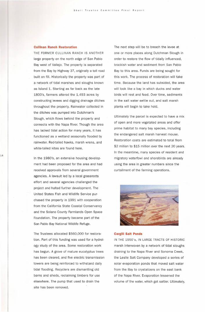
Carilll Salt Ponds
IN THE 1950's, IN LARGE TRACTS OF HISTORIC
marsh interwoven by a network of tidal sloughs
draining to the Napa River and Sonoma Creek.
the leslie Salt Company developed a series of
solar evaporation ponds that moved salt water
from the Bay to crystalizers on the east bank
of the Napa River. Evaporation lessened the
volume of the water. which got saltier. Ultimately,

salt was produced in crystalizer ponds. Cargill
Salt, acquired Leslie's Bay Area operations in
both the nOfth and south bay in 1978.
Their North Bay property includes contiguous
salt ponds. mudflats, and tidal marshes north
and south of state highway 37 between Sonoma
Creek and the Napa River. BiOlOgists report
that as many as 128 species of birds currently
use the area.
In 1990, when Cargill Salt decided to cease
making salt, mothball its operations, and seek
a buyer, little did they know it would create one
of the largest marsh restoration projects in
California. Because this property is very large
nearly 10,000 acres-and not as subsided as
some other areas, It presented a major oppor
tunity for wetland restoration. Unlike many
other former bay area wetlands. the old natural
slough channels are still visible beneath the
ponds, and natural circulation may be able to
be restored. Getting it into public ownership
would anchor plans for ultimate restoration of
the historic wetlands of the North Bay.
Cargill Salt entered into discussions with the
Trustees about acquisition of the property, and
conducted extensive toxicity tests and hydraulic
modeling to demonstrate that emptying the
salts and residues from the ponds was feasible.
A purchase agreement was executed in May
1994 by the California Wildlife Conservation
Board on behalf of the Trustees, who allocated
$7,280,000 of the $10 mililion needed for the
acquisition. Other contributing agencies were
the California Wildlife Conservation Board. the
United States Fish and Wildlife 5eMce, the
california State Lands Commission. and the
California State Coastal Conservancy.
The parcel is managed by the California
Department of Fish and Game and is now the
subject of further environmental impact analysis.
The site poses challenges. To maintain the
movement of water through the site requires
continual management. Removal of the salts
and residues needs to be carefully managed.
The salinity of the Napa River and tributary
sloughs varies by season. and affects the times
when discharges of diluted brines may be
permissible without harming fish, shrimp. Of
other aQuatic organisms. A public advisory
committee provides input for resource mangers
as they plan for restoration of this area.
During the elCtremely wet winter of 1994, all
ponds in the system were full and threatening
to overflow. Pond 2a, was opened to tidal
action with approval of the San Francisco Bay
Regional Water Quality Control Board as a
safety valve and, as a result, got an early start
on restoration. Marsh plants rapidly re-estab
lished themselves. Birds came back. Today.
the area looks like the salt works had never
been there. This success, and the resiliency
of wetland organisms in reclaiming areas that
they had historically occupied, gives wildlife
resource managers at the Department of Fish
and Game hope that restoration can proceed
largely through natural recovery, after ponds
are emptied, levees breached, and waters
returned to more natural conditions.
Restoration of the salt ponds will likely take
many years and Involve the creation of a
mosaic of habitats. Some are likely to be
saltier than others due to their location.
initial salt concentration, and avallability of
freshwater for dilution.
15
Sh&11 T'u81 •• Commill" Final RIPQII
"
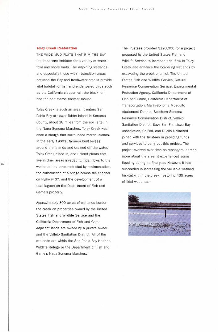
Tolay Creek Restoration
THE WIDE MUD FLATS THAT RIM THE BAY
are important habitats for a variety of water·
fowl and shore birds. The adjoining wetlands,
and especially those within transition areas
bet'Neen the Bay and freshwater creeks provide
vital habitat for fish and endangered birds such
as the California clapper rail, the black rail,
and the salt marsh harvest mouse.
Tolay Creek Is such an area. It enters San
Pablo Bay at lower Tubbs Island in Sonoma
County, about 18 miles from the spill site. in
the Napa Sonoma Marshes. Tolay Creek was
once a slough that surrounded marsh islands.
In the early 1900's. farmers built levees
around the Islands and drained off the water.
Tolay Creek silted in, and upland plants that
live in drier areas invaded it. Tidal flows to the
wetlands had been restricted by sedimentation.
the construction of a bridge across the channel
on Highway 37, and the development of a
tidal lagoon on the Department of Fish and
Game's property.
Approximately 300 acres of wetlands border
the creek on properties owned by the United
States Fish and Wildlife Service and the
California Department of Fish and Game.
Adjacent lands are owned by a private owner
and the Vallejo Sanitation District. All of the
wetlands are within the San Pablo Bay National
Wildlife Refuge or the Department of Fish and
Game's Napa-5onoma Marshes.
The Trustees provided $190.000 for a project
proposed by the United States Fish and
Wildlife Service to increase Udal flow in Tolay
Creek and enhance the bordering wetlands by
excavating the creek channel. The United
States Fish and Wildlife Service, Natural
Resource Conservation Service, Environmental
Protection Agency. California Department of
Fish and Game. California Department of
Transportation. Marin-Sonoma Mosquito
Abatement District, Southern Sonoma
Resource Conservation District. Vallejo
Sanitation District. Save San Francisco Bay
Association, CaiFed. and Ducks Unlimited
joined with the Trustees in providing funds
and services to carry out this project. The
project evolved over time as managers learned
more about the area; it experienced some
flooding during its first year. However. it has
succeeded in increasing the valuable wetland
habitat within the creek, restoring 435 acres
of tidal wetlands.

Snell l,u.tee Committee Final Report
CARQUINEZ STRAIT PROJECTS
Suisun Sand
THE EAST BAY REGIONAL PARK DISTRICT
has begun to develop a new regional shoreline
preserve near Bay Point along the shores
of Suisun Bay, the meeting point of the
Sacramento and San Joaquin Rivers. A land
purchase funded in part by the Trustee
Committee provided a critical first step toward
the new Bay Point/Pittsburg Regional Shoreline.
The Suisun Sand Corporation, a sand mining
and reclamation company, owned a 51.5-acre
former wetland parcel located on the south
ern shore of Suisun Bay near West Pittsburg
in Contra Costa County. The site was zoned
for heavy industry and had been the subject
of a considerable amount of litigation.
The property contains about 15 acres of
healthy marsh. It represents an important
first step toward preserving wetlands along
this shoreline. Future acquisition opportunities
nearby could include a large area of wetlands
at the Concord Naval Station and areas near
Point Edith. The acquisition will allow the Park
District to provide limited public access to the
bay shoreline as well as to restore marshlands.
The Trustees provided $800,000 toward the
acquisition of the property in exchange for
the East Bay Regional Park District"s promise
to restore it. The Park District used its own
funds to complete the litigation regarding
cleanup of the property. The Park District
will also restore the remaining 36 acres to
wetlands and manage the property.
The California State Lands Commission owns
adjacent property, which will be leased to the
Park. District for management. Cal Fed provided
an additional $160,000 in December 1997.
BenIcia State Recreation Area
THE WETLANDS ALONG THE NORTH SHORE
of the Carquinez Strait and Southampton Bay,
part of the Benicia State Recreation Area,
were heavily oiled during the Shell oil spill
and, for this reason, specifically included as
important for project consideration in the
memorandum of understanding.
The California Department of Parks and
Recreation proposed a project involving
removal of oily and other debris that had
accumulated on the shoreline, removal of
invasive plant species, and construction or
improvement of recreational facilities for
people using the park, The Trustee
Committee awarded $65,000 toward the
habitat improvement elements of the project.
which cost a total of about $190,000, The
Federal Emergency Management Agency also
provided funding,
This improvement project, conducted in 1996
and 1997, used helicopters to haul out large
debris to minimize the effects on sensitive
wetland vegetation, Workers from the
California Conservation Corps removed a
total of 51 tons of debris from the wetland
and shoreline area. Work. also included
removal of non-native plant species including
broom, eucalyptus, pampas grass, fig trees,
and exotic shrubs, which were growing in or
immediately adjacent to the wetlands. The
project improved public access to the natural
areas by clearing brush from a trail along the
shoreline. In addition, signs and shelters
were upgraded.

S~.II Trustee Com mitt •• FI~" Report
-,
Point Plnor. Regional Shoreline
THE POINT PINOLE REGIONAL SHORELINE
is the largest park on the East Bay shore of
San Francisco Bay. Funding provided by the
Trustee Committee contributed to the purchase
of a key parcel that had been missing from the
Shoreline and threatened with development. It
also allowed for a two-mile extension for the
right of W<1'f for the San Francisco Bay Trait.
The Point Pinole Regional Shoreline is located
north of Richmond, on a pOint that extends
out Into the bay, surrounded by eucalyptus
and grassland areas. Many species of birds
use the Shoreline, including egrets. herons.
the endangered clapper rail, willets, avocets,
killdeer, grebes, salt marsh song sparrows,
and loons. The Shoreline Park also includes
a very rare type of grassland that has largely
been eliminated from the shores of San
Francisco Bay. It has two large salt marshes
a 36·acre marsh on the southwestern portion
and the 51·acre George Whitten Marsh along
the northern shoreline.
The East Bay Regional Park District acquired
property at Point Pinole in the 1970's, after
Bethlehem Steel proposed to build a steel
mill on the Point. The site was used during
most of the 20th century to manufacture
explosives. Trees were grown on the site to
screen the surrounding area from inadvertent
explosions at the plant. However, the Park
District was not able to acquire all of the
propertY that was Important for the park.
In the 1990's, Pinole Properties Inc, owner
of a large parcel adjacent to the Regional
Shoreline, propOsed to build 650,000 square
feet of office space next to the existing par1l.
The local government had appfOved zoning for
the project. The property had tremendous
value for recreational as well as ecological
reasons, and this development would have
impacted those using the existing park.
The East Bay Regional Park District proposed
to leverage $1.8 million of funding from the
Trustees with $1.8 million from the State
Lands Commission. and about $5 million in
park bonds to acquire the property at Point
Pinole. The Oistrict negotiated a purchase
agreement and acquired the property in
October 1996, preserving the property and
creating a six·mile long shoreline corridor. The
acquisition included 168 acres of property plus
an easement for the San Francisco Bay Trail.
The plan for the Regional Shoreline provides
for recreational and natural areas, with the
majority preserved for wetlands habitat.

Shell T'ustee Committe. finol Rep."
FINANCIAL SUMMARY
INCOME
Shell Trustee Fund
Interest on fund
Caliromia Department of
Fish and Game
Santa Fe Pacific
PipeHne Partners
National Coastal Wetlands
Grant Program (USFWS)
Karnes settlement
(enforcement action)
Reversion of Unused
Studies Fund
Gahagan and Bryant
TOTAL CONTRIBUTED DIRECTLY
ESTIMATED PARTNER CONTRIBUTIONS
EXPENDITURES
Initial deposit for settlement
Interpreti~e access
McNabney Marsh uplands
McNabney Marsh restoration
Cargill 1lCquisition
Point Pinole
Original settlement
CUllinan Ranch
$10,838,000
4,248,165
60.000
30,000
750,000
275,394
236,404
29,911
$16,461,814
$19,191,518
Projects
Mason's IIlaeopsis
McNabney Marsh
Property Acqui\lition
Restoration and
Managament
Uplands Inte,pretl~e
Acceu
Napa/Sonoma Ma.shes
Recipient
S,f. State
University
East Bay Regional
Park District
Mountain View
Sanitary District
East Bay Regional
Park District
Trustees' Estimated Partners'
Contribution Total Cost Contributions
• 191,401 $ 191,401 California Department of "Fish and Game
3,018,428 3,018,428
680,000 1,25m-2.75m Caltrans ($300k),
Santa Fe Pipeline ($30k)
248,700 317.062 California Department
or Fish and Game ($60k)
Cargill Property
acquisition
and restoratlon
Cullinan Ranch
wetlands
resto.atlon
Wildlife
Conser~ation
Board
US Fish and
Wildlife service
7,280,000
589.911
$10,000,000
6 mil to 8 mil
Wildhfe Conser~allon Board
(WCB) ($1.25mil); United
States Fish and Wildlife
Ser~ice (USFWS) ($750kl:
California State Lands
Commission ($500k):
California State Coastal
Conser~ancy ($lmll)
USFWS ($6 mil for purchase)
USFWS/San Francisco Bay
Estuary Program ($115k):
EPA ($30k); Call'e<l ($380k):
Ducks Unlimited ($42k);
LTMS ($30k): WC8: Caltrans

Shell Tru.t •• Commltt.e 'in.1 Rep""
FINANCIAL SUMMARY
EXPENDITURES continue<!
Projects Recipient Trustees' Estimated Partners'
Contribution Total Cost Contributions
Napa/Sonoma Marshes
Petaluma Marsh Sonoma Land Trust • 130,200 ._-- Lincoln Property Company
Restoration (5114,518): BurbankHomes ($5k)
Sonoma Baylands California State 70,000 Corps of Engineers:
'Ilstoration Coastal Conser~ancy California Department of
Fish and Game (managa
restored site); PGE ($30k);
Wildlife Conser~ation Bd.
($35k)
Tolay Creek wetlands Ducks Unlimited 190.000 1.130.000 CalFed ($260k): California
restoration on behalf of USFWS Department of Fish and
Game: Save the Bay ($75k);
five others
South Sonoma Valley Wildlife Conservation 442.000 1.190,000 California Department
(Camp II) proPflrty Board of Fish and Game
acquisition
Property appraisal Wildlife Conservation 5.000 5.000 none
"Board
Buer Marsll Marin-Sonoma 5.700 5.700 OO~
Mosquito Abatement
District
Contra Costa County Wetlands
Suisun Sand property East Bay Regional 800.000 1.100,000 East Bay Regional Park
Acquisition; Park District District ($300k)
Restoration required 500.000 CalFed (5160k)
by agreement
Benicia State Park California Department 64.967 190.308 California Department of
Recreation Area of Parks and Parks and Recreation ($125k)
Rllcreation
Point Pinole property East Bay Regional 1.800.030 10,000.000 State Lands ($1.8 mil);
acquisition Park District EBRPO Park Bond Funds
($6.4mil)
San Francisco San FrarlCisco Bay 30.000
Bay Data Estuary Institute
Project Admlnlstlatlon, 915.538
Management, and
Reporting
TOTAL 516,467,874 $35,000,000-$38,000.000
Project Mltn"l"'rnlmTlsh SPfag~c
Wroter
AITl)' D. Kyle
Design
Mea: Coughlin
IJI~S!lllI'OIl
John B~rgoyne
-,~
p 1/leflto "11M} cou<tcsy 01 Cal,1I~It; COUlle51 01 Call1orn,a CoastalConservancy: eo,mesy 01 Cal,lornlaDepartment 01 f".sh and Game;p 4 coullesy 01 Carlill Salt;p 6 courtesy 01 Cahlornla;Deparlment of f"iSh and Game;
p 13 Don Jao;"-son;p 14 Bob Etller;
p 16 courtesy 01 call1ornia CoMUliConservancy;p 18 Bob Wal~er
San Francisco BayCon~_ Dewlopmenl Comrnlnlon
SO Ca"lomla S\lCCI. StI,te 2600San FrllllClSCO. CA 94111
Printed on recycled paper