Shelburne Canadian Heritage River 10-year Monitoring Report
38
Shelburne River - CHRS 10-year Monitoring Report Shelburne Canadian Heritage River 10-year Monitoring Report 1997 - 2007 Prepared for the Canadian Heritage Rivers Board May 2008 Painting by Alice Reed
Transcript of Shelburne Canadian Heritage River 10-year Monitoring Report

Shelburne River - CHRS 10-year Monitoring Report
Shelburne Canadian Heritage River10-year Monitoring Report
1997 - 2007
Prepared for the Canadian Heritage Rivers Board
May 2008
Painting by Alice Reed

Shelburne River - CHRS 10-year Monitoring Report2
Contents
1.0 Executive Summary . . . . . . . . . . . . . . . . . . . . . . . . . . . . . . . . . . . . . . . . . . . . . . . . . . . . . . . . . . . . . . . . . . . . . . . . 32.0 Introduction . . . . . . . . . . . . . . . . . . . . . . . . . . . . . . . . . . . . . . . . . . . . . . . . . . . . . . . . . . . . . . . . . . . . . . . . . . . . . . . 33.0 Background . . . . . . . . . . . . . . . . . . . . . . . . . . . . . . . . . . . . . . . . . . . . . . . . . . . . . . . . . . . . . . . . . . . . . . . . . . . . . . . 44.0 Methodology . . . . . . . . . . . . . . . . . . . . . . . . . . . . . . . . . . . . . . . . . . . . . . . . . . . . . . . . . . . . . . . . . . . . . . . . . . . . . . 45.0 Chronology of Events . . . . . . . . . . . . . . . . . . . . . . . . . . . . . . . . . . . . . . . . . . . . . . . . . . . . . . . . . . . . . . . . . . . . . . 56.0 Natural Heritage Values . . . . . . . . . . . . . . . . . . . . . . . . . . . . . . . . . . . . . . . . . . . . . . . . . . . . . . . . . . . . . . . . . . . . 7
6.1 Background . . . . . . . . . . . . . . . . . . . . . . . . . . . . . . . . . . . . . . . . . . . . . . . . . . . . . . . . . . . . . . . . . . . . . . . . . . . . . 76.2 Condition of Natural Values Since Designation . . . . . . . . . . . . . . . . . . . . . . . . . . . . . . . . . . . . . . . . . . 13
7.0 Cultural Heritage Values . . . . . . . . . . . . . . . . . . . . . . . . . . . . . . . . . . . . . . . . . . . . . . . . . . . . . . . . . . . . . . . . . . . 147.1 Background & Status . . . . . . . . . . . . . . . . . . . . . . . . . . . . . . . . . . . . . . . . . . . . . . . . . . . . . . . . . . . . . . . . . . . 147.2 Condition of Cultural Values Since Designation . . . . . . . . . . . . . . . . . . . . . . . . . . . . . . . . . . . . . . . . . 19
8.0 Recreational Values . . . . . . . . . . . . . . . . . . . . . . . . . . . . . . . . . . . . . . . . . . . . . . . . . . . . . . . . . . . . . . . . . . . . . . . 198.1 Background & Status . . . . . . . . . . . . . . . . . . . . . . . . . . . . . . . . . . . . . . . . . . . . . . . . . . . . . . . . . . . . . . . . . . . 198.2 Condition of Recreation Values Since Designation . . . . . . . . . . . . . . . . . . . . . . . . . . . . . . . . . . . . . . 25
9.0 Integrity Guidelines . . . . . . . . . . . . . . . . . . . . . . . . . . . . . . . . . . . . . . . . . . . . . . . . . . . . . . . . . . . . . . . . . . . . . . . 2510.0 Review of Management Plan Objectives . . . . . . . . . . . . . . . . . . . . . . . . . . . . . . . . . . . . . . . . . . . . . . . . . . 2811.0 Summary and Conclusions . . . . . . . . . . . . . . . . . . . . . . . . . . . . . . . . . . . . . . . . . . . . . . . . . . . . . . . . . . . . . . . 3712.0 References . . . . . . . . . . . . . . . . . . . . . . . . . . . . . . . . . . . . . . . . . . . . . . . . . . . . . . . . . . . . . . . . . . . . . . . . . . . . . . 38
Tables
Table 1 Shelburne River Natural Heritage Values . . . . . . . . . . . . . . . . . . . . . . . . . . . . . . . . . . . . . . . . . . . . . . . . 9Table 2 Shelburne River Cultural Heritage Values . . . . . . . . . . . . . . . . . . . . . . . . . . . . . . . . . . . . . . . . . . . . . . 15Table 3 Shelburne River Recreational Values . . . . . . . . . . . . . . . . . . . . . . . . . . . . . . . . . . . . . . . . . . . . . . . . . . . 20Table 4 Shelburne River Integrity . . . . . . . . . . . . . . . . . . . . . . . . . . . . . . . . . . . . . . . . . . . . . . . . . . . . . . . . . . . . . . 26Table 5 Shelburne River Management Plan Objectives . . . . . . . . . . . . . . . . . . . . . . . . . . . . . . . . . . . . . . . . . 29
Shelburne River - CHRS 10-year Monitoring Report 3
1.0 Executive Summary
Nova Scotia’s Shelburne River was designated as a Canadian Heritage River in 1997. This report reviews what has happened over the last decade and addresses the state of the river, while looking at progress and research. It examines what has happened to the river since designation, deter-mine whether heritage and recreational values are still intact, and reports on the Canadian Heritage River System (CHRS) integrity guidelines. The study also reports on the degree to which river manage-ment and other goals have been achieved.
Although the Shelburne is a remote wilderness river, many significant events have occurred in the area since designation. In particular, Tobeatic Wilderness Area was officially designated, offering legal protection for the upper and middle reaches of the Shelburne River. The designation is comple-mentary to existing protection within Kejimkujik National Park and National Historic Site of Canada.
Perhaps the most important recent occurrence is the acquisition of 1636 hectares of land with high conservation value that will be designated as the Shelburne River Wilderness Area (see Fig 5.1).This new wilderness area will provide protection to the lower section of the river corridor while securing rare species’ habitat, unique natural fea-tures and opportunities for wilderness recreation. The wilderness area was envisioned when the Province of Nova Scotia purchased 10 050 hect-ares of land from Bowater Mersey Paper Company Limited in March 2007.
As a result of the acquisition, nearly the entire river corridor now lies within land owned by the Prov-ince of Nova Scotia and Nova Scotia Power. With about 5% of the river corridor at the river mouth owned by Nova Scotia Power.
AbitibiBowater remains an active conservation partner for the Heritage River, and will continue to fulfill research and management objectives set out in the Shelburne River Management Plan.A great deal of collaborative research has taken place over the years since designation. New community-based partners, notably the
Mersey Tobeatic Research Institute (MTRI) and the Southwest Nova Biosphere Reserve Association (SNBRA) have been active in the region, support-ing citizen-science and improved understanding and appreciation of protected areas.
Industry partners have met and exceeded objec-tives set out in the Shelburne River management plan, and have sponsored important research on the natural and cultural values of the river and its surrounding region.
Inter-agency partnership remains strong. Kejim-kujik National Park and Historic Site, Nova Scotia Environment, and Nova Scotia Natural Resources have worked with several academics on research and monitoring topics relevant to the river and its watershed. These research projects focussed on topics such as: lichens, Species at Risk, the effects of dams and forestry practices.
Overall, the heritage and recreation values of the Shelburne River remain intact. Only positive changes have taken place on the river. The river is worthy of continued designation as a nationally significant river within the CHRS.
2.0 Introduction
From the wild headwaters at Buckshot Lake, to the outflow at Lake Rossignol, the Shelburne River connects the major waterways of southwestern Nova Scotia in a series of rapids, still waters, lakes and streams. Nova Scotia’s most remote wilder-ness river, it flows 53 km from the granite barrens and patchy old forest in its upper reaches, through

Shelburne River - CHRS 10-year Monitoring Report4
quartzite plains with gently rising eskers, and outwash plains supporting old growth pine and hemlock forests in the lower watershed. Aside from wild, unspoiled beauty there are also out-standing wilderness recreation experiences on the Shelburne River; these include: canoeing, camp-ing, and hiking opportunities. In 1997, after years of study, the Shelburne River was designated as a Canadian Heritage River.
The Canadian Heritage River System (CHRS) is Canada’s program by which to promote freshwa-
ter heritage conservation and recognize Canada’s outstanding rivers based on heritage and recre-ation values. The program is a cooperative effort of federal and provincial/territorial governments, which works to ensure long-term management and conservation of Canada’s river heritage. CHRS requires annual reports, monitoring, and ten-year reviews to ensure that CHRS rivers maintain the values for which they were nominated.
The objectives of this report are to:determine the degree to which the actions outlined in the management plan have been implemented;establish the current condition of the out-standing heritage values based on a review of values for which the river was nominated;determine whether the CHRS integrity guide-lines are still being met;describe changes that have occurred in relation to the river over the past decade; andreview the state of the river and to
•
•
•
•
•
report on progress or setbacks the river has experienced.
3.0 Background
The Shelburne River flows northerly to Pine Lake and then easterly to Lake Rossignol in the central area of Southwestern Nova Scotia, south of Kejim-kujik National Park and Historic Site. The river starts at Buckshot Lake and flows 53 km along a series of seven lakes to Lake Rossignol. The heritage river corridor is limited to the width of the waterway.
In 1986, the Province of Nova Scotia reviewed 45 rivers and conducted detailed studies on the seven highest rated rivers. In 1988, a study of the Shelburne River was completed and a year later the Minister announced that the Department of Natural Resources would work toward nomination of the river. In January 1993, the Shelburne River was accepted for nomination as a CHRS river. The Shelburne Canadian Heritage River Management Plan was submitted to CHRS in 1996 and in 1997 the river was designated as a Canadian Heritage River.
In 1998, lead responsibility for the CHRS program in Nova Scotia was transferred to the Protected Areas Branch of Nova Scotia Department of the Environment from the NS Department of Natural Resources. After the transfer, DNR Regional Servic-es Division continued as a key partner in program delivery. Many of the objectives laid out in the management plan were implemented jointly, or with several partners.
4.0 Methodology
The main approaches used to gain information about the state of the river and progress that has been made are:
(i) review of annual reports submitted to the CHRS Board and field surveys (ii) secondary source research (iii) interviews with key individuals
Interviews with key individuals provided ample in-formation on changes, research and activities that

Shelburne River - CHRS 10-year Monitoring Report 5
have taken place on and around the river since its designation. Discussions took place among Nova Scotia Environment staff, key stakeholders and Mersey Tobeatic Research Institute and Southwest Nova Biosphere researchers.
New CHRS frameworks were developed since the Shelburne River was nominated. This report con-verts identified values to coincide with current national frameworks. The recreational framework used was adapted from the Red River CHRS study. The condition of heritage values since designa-tion was discussed along with relevant projects or management plan actions. The condition of integ-rity guidelines was also examined to determine whether the river was still worthy of designation as a river of national significance within the Cana-dian Heritage River System.
5.0 Chronology of Events
1997 Shelburne River officially designated as a Heritage River within the CHRS.
1998Responsibility for the CHRS program in Nova Scotia transferred to Nova Scotia Department of Environment from Nova Scotia Natural Resources.Tobeatic Wilderness Area officially designated under the Wilderness Areas Protection Act.
1999 - 2000Appointment of a regional protected areas coordinator with responsibility for CHRS rivers in western Nova Scotia.Proposal for Southwest Nova Biosphere Re-serve initiated by a local community Associa-tion.Initiation of water quality monitoring for the Shelburne River, led by NS Environment and Labour and Environment Canada.
2000-2001
Publication of Keep It Wild, a guide for low- impact recreation in Wilderness Areas that follows the principles of Leave No TraceImplementation of an access signage program for Wilderness Areas and identification of
•
•
•
•
•
•
•
•
priority field management initiatives with the Department of Natural Resources.Kejimkujik designated as a National Historic Site recognizing it as a Mi’kmaw Cultural Land-scape.Southwest Nova Biosphere Reserve (which includes the Shelburne Canadian Heritage River) nomination document submitted to United Nations Educational, Scientific and Cul-tural Organization (UNESCO) for consideration, and subsequently designated.A new hydrometric sampling station installed on the Shelburne River; planning underway for community-based water-quality monitoringScoping exercise to begin a management plan-ning process for Tobeatic Wilderness Area.
2001-2002
Kejimkujik initiates planning to review its management plan.Southwest Nova Biosphere Reserve under goes review and receives endorsement from key partners including the Province of Nova Scotia, Parks Canada and 5 county municipali-ties.New hydrometric sampling station installed with plans for a community-based water qual-ity monitoring program.Tobeatic Wilderness Area Management Plan-ning Exercise launched with broad citizen advisory group.
2002-2003The Kejimkujik Management Plan process continues, led by Parks Canada planners and senior staff members of the national park. Several broad stakeholder meetings were completed on a range of topic areas. Following these discussions, a draft management plan
•
•
•
•
•
•
•
•
•
Shelburne River - CHRS 10-year Monitoring Report6
was developed for public comment.Tobeatic Wilderness Area Management Plan-ning exercise begins with the first phase of public consultation meetings of the advisory group.
2003-2004Wilderness Area management: planning ex-ercise for Tobeatic Wilderness Area continues with second phase of advisory group workCollaboration with Kejimkujik to redesign the Back Country Guide and MapRecognition of moose as an endangered species in Nova Scotia.Southwest Nova Biosphere Reserve’s official designation ceremony.
2004-2005Tobeatic Wilderness Area Management Plan-ning Exercise continues with release of Draft Management Plan for Tobeatic Wilderness Area and conclusion of advisory group tasks. Publication of Into the Tobeatic - a guide for planning wilderness travel .Mersey Tobeatic Research Institute (MTRI) es-tablished to facilitate research and monitoring activity.Publication of Paddling the Tobeatic: Canoe Routes of Southwestern Nova Scotia by Nimbus Publishing; the book includes the Shelburne Canadian Heritage River.
2005-2006
•
•
•
•
•
•
•
•
•
Approval of the Tobeatic Wilderness Area Management Plan.Development of The Tent Dwellers heritage ca-noe route project with Heritage River partners.Mersey Tobeatic Research Institute field station continues work on the Parks Canada Innova-tion Project entitled, “Collaborative research, management, and monitoring of aquatic health and landscape connectivity in the Southwest Nova Biosphere Reserve”.Amendments to the Special Places Protec-tion Act streamline the process used in the identification and designation of significant ecological sites on private and crown lands.MTRI receives charitable status and purchases a field station for 6 full-time staff, with match-ing funds from three Heritage River partners (Bowater, Kejimkujik, NSE)MTRI research on: Eastern pipistrelle bat dis-tribution; lichens in old growth forests; ecological effects of forest roads; forest ecosys-tem classification; ecology and management of the pale-winged gray moth; invertebrates as indicators of bog health; and the effects of dams on wetland species at risk.
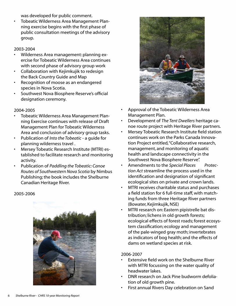
2006-2007Extensive field work on the Shelburne River with MTRI focussing on the water quality of headwater lakes.DNR research on Jack Pine budworm defolia-tion of old growth pine.First annual Rivers Day celebration on Sand
•
•
•
•
•
•
•
•
•

Shelburne River - CHRS 10-year Monitoring Report 7
Lake includes a public guided outingExtensive field evaluation of Bowater lands on the Shelburne River.Acquisition of Bowater land, which will be designated as the Shelburne River Wilderness Area in 2008.Planning and development of The Tent Dwell-ers Centennial Festival with several commu-nity, municipal and agency partners. Friends of Keji as the host organization for the project to commemorate the 1908 publication of the book featuring the Shelburne River.
6.0 Natural Heritage Values
6.1 Background
The designation of the Shelburne River was based on the following key natural heritage features:
outstanding examples of undisturbed glacial landforms, such as eskers and outwash plains, and granite barrenshigh quality pine and hemlock stands, including the Shelburne IBP site which con-
•
•
•
•
•
tains some of the oldest old growth trees in Nova Scotia (They were the oldest known at time of designation, but older trees have since been found south of the watershed).
The Shelburne River was noted for its outstanding wilderness canoeing opportunities, including the most remote wilderness tripping opportunity in Nova Scotia. It offers a variety of canoeing experi-ences and connects to other major routes as well as Kejimkujik National Park.
A new national framework for natural heritage val-ues has been developed since the Shelburne River was designated in 1997:
• A Framework for the Natural Values of Ca-nadian Heritage Rivers, 2nd Edition. 2001
The values for which the Shelburne River was nominated are summarized in the following table, according to this new natural heritage values framework. The table also outlines significant ac-tions over the last ten years, and any changes to nomination values.

Shelburne River - CHRS 10-year Monitoring Report8
Kejim
kujik
Nat
iona
lPar
k
and
His
toric
Site
ofC
anad
a
Tob
eati
cW
ilde
rne
ssA
rea
She
lbur
neC
an
ad
i an
He r
i tag
eR
ive
rPi
neLa
ke
Buck
shot
Lake
Sand
Beac
hLa
ke
Beve
rlyLa
ke
Irvin
gLa
ke
Sand
Lake
Ston
eyD
itch
Lake
Gra
nite
Lake
Spo
rting
Lake
Nat
ure
Res
erve
Spor
ting
Lake
Moo
sehi
deLa
ke
Oak
land
Lake
East
Cra
nber
ryLa
ke
Cle
arw
ater
Lake
Shea
thkn
ifeLa
ke
Han
nah
Lake
Tobe
atic
LakeLi
ttle
Tupp
erLa
ke
Pesk
owes
kLa
ke
Pesk
awa
Lake
Ros
eway
Lake
Cof
anLa
ke
Bow
ers
Lake
Nor
thB
inga
yLa
ke
Min
kLa
keM
oose
Lake
Upp
erPo
rcup
ine
Lake
Littl
eTo
beat
icLa
ke
Dis
hLa
ke
Sisk
ech
Lake
Low
erPo
rcup
ine
Lake
Cad
uesk
yLa
ke
LAK
E
RO
SSIG
NO
L
DigbyCounty
QueensCounty
YarmouthCounty
ShelburneCounty
Prod
uced
byN
ova
Scot
iaE
nviro
nmen
tan
dLa
bour
(NS
EL)
,Mar
ch20
08.
Dat
aob
tain
edco
urte
syof
NS
EL,
the
NS
Dep
artm
ent
ofN
atur
alR
esou
rces
and
Ser
vice
NS
and
Mun
icip
alR
elat
ions
.
©C
row
nC
opyr
ight
,P
rovi
nce
ofN
ova
Scot
ia,2
008.
All
right
sre
serv
ed.
This
map
isa
geog
raph
icre
pres
enta
tion
only
and
shou
ldno
tbe
used
for
lega
lpu
rpos
esor
navi
gatio
n.N
SEL
acce
pts
nolia
bilit
yfo
ran
yer
rors
,or
omis
sion
sco
ntai
ned
here
in.
Dig
by
Que
ensLu
nenb
urg
Shel
burn
eYa
rmou
th
Anna
polis
Map
Ext
ent
02.
55
7.5
10Km
Tobe
atic
Wild
erne
ssAr
ea
Shel
burn
eR
iver
Can
dida
teW
ilder
ness
Are
a
Kejim
kujik
Nat
iona
lPar
kan
dH
isto
ricSi
te
Cro
wn
Land
s
Oth
erLa
nds
Spor
ting
Lake
Nat
ure
Res
erve
Shel
burn
eC
anad
ian
Her
itage
Riv
er
Tobe
atic
Wild
life
Man
agem
entA
rea
Bou
ndar
y
Shel
burn
eR
iver
Terti
ary
Wat
ersh
edB
ound
ary
She
lbur
neC
anad
ian
Her
itag
eR
iver

Shelburne River - CHRS 10-year Monitoring Report 9
Tab
le 1
Sh
elb
urn
e R
iver
Nat
ura
l Her
itag
e V
alu
es
CH
RS
Nat
ura
l Fra
mew
ork
(2
00
1) T
hem
es &
Su
b-t
hem
esSh
elb
urn
e R
iver
Nat
ura
l Her
i-ta
ge
Elem
ents
Des
crip
tio
nSi
gn
ifica
nt
Act
ion
s, R
esea
rch
or
Stu
die
sC
han
ges
or T
hre
ats
to N
om
ina-
tio
n V
alu
e(s)
1 H
ydro
log
y1.
1 D
rain
age
Basi
ns
Atl
anti
c O
cean
Bas
in; s
trea
m
nu
mb
er 2
(th
e ri
ver i
s ac
tual
ly
a tr
ibu
tary
of t
he
Mer
sey
Riv
er,
thro
ug
h L
ake
Ross
ign
ol)
No
ne
1.2
Seas
on
al V
aria
tio
nPe
rio
d o
f hig
hes
t flo
w is
Ap
ril;
per
iod
of l
ow
est fl
ow
is M
ay-S
ep-
tem
ber
No
ne
1.3
Wat
er C
on
ten
tH
eavy
sed
imen
t lo
ad >
400m
g/l
(>
20.0
JU
); ra
ted
low
in T
ota
l Dis
-so
lved
So
lids
(0-5
0 m
g/l
)
Wat
er q
ual
ity
mo
nit
ori
ng
has
ta
ken
pla
ce s
ince
200
0 w
hen
a
new
hyd
rom
etri
c sa
mp
ling
sta
-ti
on
was
inst
alle
d
Wat
er q
ual
ity
mo
nit
ori
ng
on
the
rive
r has
imp
rove
d, b
ut t
he
coo
r-d
inat
ion
of i
nfo
rmat
ion
req
uir
es
furt
her
wo
rkN
SE e
nco
ura
gin
g c
om
ple
tio
n o
f a
cen
tral
dat
abas
e fo
r his
tori
c an
d fu
ture
par
amet
er v
alu
es1.
4 R
iver
Siz
eFl
ow
vo
lum
e at
low
est p
oin
t o
f no
min
atio
n -
smal
l riv
er o
r <
85m
3/se
c. L
eng
th is
85k
m.
No
ne
2 P
hys
iog
rap
hy
2.1
Phys
iog
rap
hic
Reg
ion
sA
pp
alac
hia
n A
cad
ian
Up
lan
ds
No
ne
2.2
Geo
log
ical
Pro
cess
esG
laci
al tr
ansp
ort
feat
uri
ng
co
n-
spic
uo
us
eske
rsN
on
e
2.3
Hyd
rog
eolo
gy
Imp
ervi
ou
s b
edro
ck w
ith
su
rfici
al
un
con
solid
ated
mat
eria
ls o
f lo
w
po
rosi
ty: t
hin
so
ils a
nd
bar
ren
s
No
ne
2.4
Top
og
rap
hyM
od
erat
e g
rad
ien
t (1-
2m/k
m).
Hei
gh
t ab
ove
sea
leve
l is
0-40
0m.
No
ne
3 R
iver
Mo
rph
olo
gy
3.1
Valle
y Ty
pes
Rou
nd
ed in
terfl
uve
s - n
arro
w
floo
dp
lain
No
ne

Shelburne River - CHRS 10-year Monitoring Report10
CH
RS
Nat
ura
l Fra
mew
ork
(2
00
1) T
hem
es &
Su
b-t
hem
esSh
elb
urn
e R
iver
Nat
ura
l Her
i-ta
ge
Elem
ents
Des
crip
tio
nSi
gn
ifica
nt
Act
ion
s, R
esea
rch
or
Stu
die
sC
han
ges
or T
hre
ats
to N
om
ina-
tio
n V
alu
e(s)
3.2
Ch
ann
el T
ypes
Lake
ch
ain
No
ne
3.3
Ch
ann
el P
rofil
ePo
ol a
nd
riffl
eN
on
e3.
4 Fl
uvi
al L
and
form
sM
ild b
raid
ing
No
ne
4 B
ioti
c En
viro
nm
ents
4.1
Aq
uat
ic E
cosy
stem
sLa
ke s
yste
ms:
eutr
op
hic
lake
s;
wet
lan
d s
yste
ms:
bo
gs
and
fen
sRe
sear
ch o
n: i
nver
teb
rate
s as
in-
dic
ato
rs o
f bo
g h
ealt
h; e
ffec
ts o
f d
ams
on
wet
lan
d s
pec
ies
at ri
sk;
and
eco
log
ical
eff
ects
of f
ore
st
road
s
Imp
rove
d a
war
enes
s an
d s
tew
-ar
dsh
ip o
f th
e n
atu
ral a
nd
cu
l-tu
ral h
erit
age
com
po
nen
ts.
Sou
thw
est N
ova
Bio
sph
ere
Rese
rve
Pro
ject
offi
cial
ly d
esig
-n
ated
in 2
000
Cap
acit
y-b
uild
ing
for r
esea
rch
, m
on
ito
rin
g, e
du
cati
on
, an
d c
om
-m
un
ity-
lead
ersh
ip.
MTR
I wo
rkin
g w
ith
Par
ks C
anad
a o
n th
e Ec
olo
gic
al In
teg
rity
Inn
o-
vati
on
Pro
ject
, wh
ich
exa
min
es
aqu
atic
hea
lth
an
d la
nd
scap
e co
nn
ecti
vity
Co
ord
inat
ed re
sear
ch e
ffo
rts.
4.2
Terr
estr
ial E
cosy
stem
sEc
ozo
ne:
Atl
anti
c M
arit
ime
Sou
thw
est N
ova
Bio
sph
ere
Rese
rve
Pro
ject
offi
cial
ly d
esig
-n
ated
in 2
000
Co
ord
inat
ed re
sear
ch e
ffo
rts,
mo
nit
ori
ng
an
d s
tew
ard
ship
.
Am
end
men
ts to
the
Spec
ial
Plac
es P
rote
ctio
n A
ct s
trea
mlin
e th
e p
roce
ss u
sed
in th
e id
enti
fi-ca
tio
n a
nd
des
ign
atio
n o
f sig
nifi
-ca
nt e
colo
gic
al s
ites
on
pri
vate
an
d C
row
n la
nd
Imp
rove
d a
bili
ty to
des
ign
ate
adja
cen
t lan
ds.

Shelburne River - CHRS 10-year Monitoring Report 11
CH
RS
Nat
ura
l Fra
mew
ork
(2
00
1) T
hem
es &
Su
b-t
hem
esSh
elb
urn
e R
iver
Nat
ura
l Her
i-ta
ge
Elem
ents
Des
crip
tio
nSi
gn
ifica
nt
Act
ion
s, R
esea
rch
or
Stu
die
sC
han
ges
or T
hre
ats
to N
om
ina-
tio
n V
alu
e(s)
Rese
arch
on
: eco
log
ical
eff
ects
o
f fo
rest
road
s; fo
rest
eco
syst
em
clas
sific
atio
n; a
nd
eco
log
y an
d
man
agem
ent o
f th
e p
ale-
win
ged
g
ray
mo
th
Co
ord
inat
ed re
sear
ch e
ffo
rts,
mo
nit
ori
ng
an
d s
tew
ard
ship
.
5 V
eget
atio
n5.
1 Si
gn
ifica
nt P
lan
t Co
mm
un
i-ti
esA
qu
atic
/Rip
aria
n p
lan
ts: i
n fl
oat
-in
g b
og
s an
d fe
ns;
Tre
es: d
ynam
ic
old
gro
wth
hem
lock
Rese
arch
on
: lic
hen
s in
old
g
row
th fo
rest
s; e
colo
gic
al e
ffec
ts
of f
ore
st ro
ads;
fore
st e
cosy
stem
cl
assi
ficat
ion
; eco
log
y an
d m
an-
agem
ent o
f th
e p
ale-
win
ged
g
ray
mo
th; a
nd
inve
rteb
rate
s as
in
dic
ato
rs o
f bo
g h
ealt
h
Imp
rove
d re
sear
ch e
ffo
rts.
5.2
Rar
e Pl
ant S
pec
ies
Woo
dwar
dia
areo
lata
(Net
ted
ch
ain
fern
)W
oodw
ardi
a ar
eola
ta is
nat
ion
-al
ly im
per
iled,
sp
ecie
s o
nly
exi
sts
in N
S w
her
e it
is im
per
iled
Imp
rove
d re
sear
ch e
ffo
rts.
Atl
anti
c C
oas
tal P
lain
Flo
raPa
rks
Can
ada,
Ap
plie
d G
eom
atic
s re
sear
ch G
rou
p a
nd
Nat
ura
l Sci
-en
ces
and
En
gin
eeri
ng
Res
earc
h
Co
un
cil o
f Can
ada
rese
arch
on
C
oas
tal P
lain
Flo
ra a
t Bea
vers
kin
an
d P
ebb
lelo
gg
itch
Lak
es.
Imp
rove
d re
sear
ch e
ffo
rts.
6 F
aun
a6.
1 Si
gn
ifica
nt A
nim
al P
op
ula
-ti
on
sM
ain
lan
d m
oo
se a
nd
Eas
tern
p
ipis
trel
le b
ats
Rese
arch
on
: mai
nla
nd
mo
ose
(S
pec
ies
at R
isk)
; Eas
tern
pip
-is
trel
le b
ats;
inve
rteb
rate
s as
in-
dic
ato
rs o
f bo
g h
ealt
h; e
ffec
ts o
f d
ams
on
wet
lan
d S
pec
ies
at R
isk;
an
d e
colo
gy
and
man
agem
ent o
f p
ale-
win
ged
gra
y m
oth
Imp
rove
d re
sear
ch e
ffo
rts
thro
ug
h a
pro
acti
ve e
cosy
stem
m
anag
emen
t an
d o
utr
each
pro
-g
ram

Shelburne River - CHRS 10-year Monitoring Report12
CH
RS
Nat
ura
l Fra
mew
ork
(2
00
1) T
hem
es &
Su
b-t
hem
esSh
elb
urn
e R
iver
Nat
ura
l Her
i-ta
ge
Elem
ents
Des
crip
tio
nSi
gn
ifica
nt
Act
ion
s, R
esea
rch
or
Stu
die
sC
han
ges
or T
hre
ats
to N
om
ina-
tio
n V
alu
e(s)
6.2
Rar
e A
nim
al S
pec
ies
Mai
nla
nd
mo
ose
Rese
arch
on
: mai
nla
nd
mo
ose
(S
pec
ies
at R
isk)
an
d th
e ef
fect
s o
f dam
s o
n w
etla
nd
Sp
ecie
s at
R
isk.
Reco
gn
itio
n, b
y fo
rmal
list
ing
of
Mai
nla
nd
Mo
ose
as
an e
nd
an-
ger
ed s
pec
ies
in N
ova
Sco
tia
in
2003
-200
4
Imp
rove
d re
sear
ch e
ffo
rts.
Imp
rove
d b
y a
pro
acti
ve e
cosy
s-te
m m
anag
emen
t an
d o
utr
each
p
rog
ram
Imp
rove
d p
rote
ctio
n o
f sp
ecie
s in
wat
ersh
ed

Shelburne River - CHRS 10-year Monitoring Report 13
6.2 Condition of Natural Values Since Designation
Water quality monitoring began on the Shelburne River in 2000 when a new hydrometric sampling station was installed. The River is now part of Nova Scotia’s Auto-mated Water Quality Monitoring Program, but work needs to be done in terms of coordination of informa-tion.
These efforts, combined with Mersey Tobeatic Research Initiative and academic research efforts, have improved the quantity of data collected with regards to the river and watershed ecosystems and significant species. The Southwest Nova Biosphere Reserve Project (SWNBRP) and MTRI work has increased capacity for research, monitoring and educational efforts along with aug-menting opportunities for community leadership.
Through collaborative efforts and coordinated research, particularly through the Mersey Tobeatic Research Institute, there is increased awareness and stewardship of the natural and cultural heritage components of the Shelburne River. Also, amendments to the Special Places Protection Act streamline the process used in the identification and designation of significant ecological
sites on private and crown lands.
Some MTRI projects occurred outside of the heritage river corridor, but did take place on lakes that flow into the Shelburne River. Songbird Detectability During Point Counts (Beaverskin Lake); The Kejim-kujik-Mersey Loon Watch Program (Beaverskin Lake, Back Lake, and Lower Silver Lake); and Assessment of Coastal Plain Flora (Beaverskin Lake).
Nova Scotia Department of Natural Resources research identified hemlock stands at Irving Lake, Sand Lake and at the mouth of the river; no damage by pale-winged gray moths was indicated along the Shelburne River. Research did show, however, an outbreak of Jack Pine Budworm to the east of Pine Lake, which affects ma-ture and old growth pine stands.
Many of the actions that have occurred along the Shel-burne River have led to improved protection of species within the watershed. The collaborative work of the MTRI and the SWNBRP, along with the official designation of Tobeatic Wilderness Area and the announcement pro-posed designation of the Shelburne River Wilderness Area, has led to proactive ecosystem management and outreach programs, which often, in turn, lead to improved natural heritage values.

Shelburne River - CHRS 10-year Monitoring Report14
7.0 Cultural Heritage Values
7.1 Background & Status
A new national framework for cultural heritage values has been developed since the Shelburne River was designated in 1997:
• A Cultural Framework for Canadian Heritage Rivers, 2nd Edition. 2000
The Shelburne River was not nominated based on cultural heritage values due to insufficient informa-tion at the time of nomination. Historical context was provided in the nomination document. A variety of cultural values are summarized in the following table, according to the new cultural heritage values framework developed for the CHRS. The table also outlines significant actions over the last ten years, and any changes to cultural heritage values.

Shelburne River - CHRS 10-year Monitoring Report 15
Tab
le 2
Sh
elb
urn
e R
iver
Cu
ltu
ral H
erit
age
Val
ues
CH
RS
Cu
ltu
ral F
ram
ewo
rk
(20
00
)Sh
elb
urn
e R
iver
Cu
ltu
ral H
eri-
tag
e V
alu
e(s)
Sig
nifi
can
t A
ctio
ns,
Res
earc
h o
r St
ud
ies
Ch
ang
es o
r Th
reat
s to
No
min
a-ti
on
Val
ue(
s)1
Res
ou
rce
Har
vest
ing
1.1
Fish
ing
Arc
hae
olo
gic
al s
ites
iden
tifie
d
at m
ou
th o
f riv
er s
ug
ges
t fish
ing
u
se a
t lea
st 3
000
to 5
000
year
s ag
o. T
he
rive
r was
als
o u
sed
for
fish
ing
in th
e 18
00 a
nd
190
0s.
Mi’k
maq
Rig
hts
Init
iati
ve re
-se
arch
on
trad
itio
nal
Mi’k
maq
u
se lo
cate
d p
ote
nti
al a
rch
aeo
-lo
gic
al s
ites
Imp
rove
d k
no
wle
dg
e o
f pre
-co
n-
tact
use
of t
he
rive
r.
1.2
Sho
relin
e Re
sou
rce
Har
vest
-in
gA
rch
aeo
log
ical
evi
den
ce s
ug
-g
ests
hu
nti
ng
on
the
rive
r at
leas
t 300
0-50
00 y
ears
ag
o
A d
raw
do
wn
of w
ater
du
rin
g th
e N
ova
Sco
tia
Pow
er D
am R
efu
r-b
ish
men
t Pro
ject
led
to th
e d
is-
cove
ry o
f hu
nd
red
s o
f Ab
ori
gin
al
arti
fact
s w
her
e th
e Sh
elb
urn
e R
iver
flo
ws
into
Lak
e Ro
ssig
no
l.
Imp
rove
d k
no
wle
dg
e o
f Ab
ori
gi-
nal
use
of t
he
area
.
1.3
Extr
acti
on
of W
ater
The
Mer
sey
Pap
er C
om
pan
y h
ad
a sa
wm
ill n
ear t
he
Shel
bu
rne
Riv
er in
194
0.
No
ne
2 W
ater
Tra
nsp
ort
2.1
Co
mm
erci
al T
ran
spo
rtat
ion
The
Mer
sey
Pap
er C
om
pan
y p
rob
ably
use
d th
e ri
ver f
or t
ran
s-p
ort
atio
n p
urp
ose
s
MTR
I, Pa
rks
Can
ada,
Bo
wat
er
Mer
sey
Pap
er C
om
pan
y, N
SEL,
At-
lan
tic
Cen
ter f
or G
lob
al C
han
ge
and
Eco
syst
ems
Rese
arch
, Aca
dia
U
niv
ersi
ty a
nd
Sch
oo
l fo
r Re-
sou
rce
and
Env
iro
nm
enta
l Stu
d-
ies
(Dal
ho
usi
e U
niv
ersi
ty) w
ork
ed
tog
eth
er to
loca
te d
ams
and
d
am re
mn
ants
(su
ch a
s flu
mes
th
at w
ere
use
d fo
r mov
ing
log
s)
in th
e M
erse
y W
ater
shed
an
d to
d
eter
min
e th
e ef
fect
s o
f dam
s o
n
the
dis
trib
uti
on
of c
erta
in w
et-
lan
d s
pec
ies
at ri
sk.
Imp
rove
d k
no
wle
dg
e o
f dam
an
d d
am re
mn
ant l
oca
tio
ns
wit
h
po
ten
tial
for k
no
wle
dg
e co
n-
cern
ing
thei
r im
pac
t of w
etla
nd
Sp
ecie
s at
Ris
k.

Shelburne River - CHRS 10-year Monitoring Report16
CH
RS
Cu
ltu
ral F
ram
ewo
rk
(20
00
)Sh
elb
urn
e R
iver
Cu
ltu
ral H
eri-
tag
e V
alu
e(s)
Sig
nifi
can
t A
ctio
ns,
Res
earc
h o
r St
ud
ies
Ch
ang
es o
r Th
reat
s to
No
min
a-ti
on
Val
ue(
s)2.
2 Tr
ansp
ort
atio
n S
ervi
ces
No
t dis
cuss
ed a
t tim
e o
f no
min
a-ti
on
No
t ap
plic
able
No
ne
2.3
Exp
lora
tio
n &
Su
rvey
ing
No
t dis
cuss
ed a
t tim
e o
f no
min
a-ti
on
Alb
ert B
igel
ow
Pai
ne
trav
elle
d
the
area
in 1
908;
the
trip
is d
e-ta
iled
in h
is b
oo
k “T
he
Ten
t D
wel
lers
;” m
any
hav
e fo
llow
ed
his
rou
te in
the
last
100
yea
rs.
No
ne
3 R
ipar
ian
Set
tlem
ent
3.1
Siti
ng
of D
wel
ling
sPr
e-co
nta
ct n
ativ
es li
kely
had
se
ttle
men
ts o
n th
e ri
ver
Kej
imku
jik N
atio
nal
Par
k (e
xclu
d-
ing
Sea
sid
e A
dju
nct
) des
ign
ated
as
a N
atio
nal
His
tori
c Si
te o
f C
anad
a as
a M
i’km
aw c
ult
ura
l la
nd
scap
e in
200
0
Imp
rove
d c
ult
ura
l her
itag
e ef
-fo
rts
and
inte
rpre
tive
act
ivit
ies
in
the
reg
ion
3.2
Riv
er-b
ased
Co
mm
un
itie
sTh
ere
is a
rch
aeo
log
ical
evi
den
ce
that
su
gg
ests
a v
illag
e si
te a
t th
e ri
ver’s
mo
uth
A d
raw
do
wn
of w
ater
du
rin
g th
e N
ova
Sco
tia
Pow
er D
am R
efu
r-b
ish
men
t Pro
ject
led
to th
e d
is-
cove
ry o
f hu
nd
red
s o
f Ab
ori
gin
al
arti
fact
s w
her
e th
e Sh
elb
urn
e R
iver
flo
ws
into
Lak
e Ro
ssig
no
l.
Imp
rove
d k
no
wle
dg
e o
f Ab
ori
gi-
nal
use
of t
he
area
.
Mi’k
maq
Rig
hts
Init
iati
ve R
e-se
arch
into
trad
itio
nal
use
sit
es3.
3 R
iver
-influ
ence
d T
ran
spo
rta-
tio
nN
ot d
iscu
ssed
at t
ime
of n
om
ina-
tio
n4
Cu
ltu
re &
Rec
reat
ion
4.1
Spir
itu
al A
sso
ciat
ion
sN
ot d
iscu
ssed
at t
ime
of n
om
ina-
tio
nM
i’km
aq R
igh
ts In
itia
tive
Re-
sear
ch in
to tr
adit
ion
al u
se s
ites
Inve
nto
ry o
f tra
dit
ion
al M
i’km
aq
use
sit
es4.
2 C
ult
ura
l Exp
ress
ion
No
t dis
cuss
ed a
t tim
e o
f no
min
a-ti
on
4.3
Earl
y Re
crea
tio
nC
ano
ein
g th
e Sh
elb
urn
e R
iver
w
as p
op
ula
rize
d in
the
1908
b
oo
k Th
e Te
nt D
wel
lers
by
Alb
ert
Big
elo
w P
ain
e
The
Ten
t Dw
elle
rs c
ano
e ro
ute
is
bei
ng
dev
elo
ped
an
d p
rom
ote
dIm
pro
vem
ents
to th
e h
erit
age
rou
te c
on
cep
t an
d p
rom
oti
on
of
the
rive
r
5 J
uri
sdic
tio
nal
Use
s

Shelburne River - CHRS 10-year Monitoring Report 17
CH
RS
Cu
ltu
ral F
ram
ewo
rk
(20
00
)Sh
elb
urn
e R
iver
Cu
ltu
ral H
eri-
tag
e V
alu
e(s)
Sig
nifi
can
t A
ctio
ns,
Res
earc
h o
r St
ud
ies
Ch
ang
es o
r Th
reat
s to
No
min
a-ti
on
Val
ue(
s)5.
1 C
on
flict
& M
ilita
ry A
sso
cia-
tio
ns
No
t dis
cuss
ed a
t tim
e o
f no
min
a-ti
on
5.2
Bou
nd
arie
sTh
e ri
ver i
s tr
ansb
ou
nd
ary
bet
wee
n Q
uee
ns
and
Dig
by
cou
nti
es. I
t fo
rms
the
bo
un
dar
y b
etw
een
Kej
imku
jik N
atio
nal
Pa
rk &
His
tori
c Si
te a
nd
To
bea
tic
Wild
ern
ess
Are
a. T
he
rive
r als
o
serv
es a
s th
e n
ort
her
n b
ou
nd
ary
of T
ob
eati
c W
ildlif
e M
anag
emen
t A
rea.
no
ch
ang
es
The
rive
r lin
ks th
e lo
wer
po
rtio
n
of t
he
An
nap
olis
Val
ley
to th
e So
uth
Sh
ore
of t
he
pro
vin
ce, i
s o
ne
of a
t lea
st tw
o h
isto
ric
links
an
d s
erve
s as
a h
ub
of a
n in
lan
d
pas
sag
e b
etw
een
the
Bay
of
Fun
dy
and
the
Atl
anti
c O
cean
5.3
Envi
ron
men
tal R
egu
lati
on
No
t dis
cuss
ed a
t tim
e o
f no
min
a-ti
on
The
lake
s co
nta
in re
mn
ants
of
dam
s an
d a
sso
ciat
ed s
tru
ctu
res,
wh
ich
hav
e n
atu
raliz
ed to
thei
r en
viro
nm
ents
MTR
I, Pa
rks
Can
ada,
Bo
wat
er
Mer
sey
Pap
er C
om
pan
y, N
SEL,
At-
lan
tic
Cen
ter f
or G
lob
al C
han
ge
and
Eco
syst
ems
Rese
arch
, Aca
dia
U
niv
ersi
ty a
nd
Sch
oo
l fo
r Re-
sou
rce
and
Env
iro
nm
enta
l Stu
d-
ies
(Dal
ho
usi
e U
niv
ersi
ty)
wo
rked
tog
eth
er to
loca
te d
ams
and
dam
rem
nan
ts(s
uch
as
flum
es th
at w
ere
use
d fo
r mov
-in
g lo
gs)
in th
e M
erse
y W
ater
-sh
ed a
nd
to d
eter
min
e th
e ef
-fe
cts
of d
ams
on
the
dis
trib
uti
on
o
f cer
tain
wet
lan
d s
pec
ies
at ri
sk.
Imp
rove
d k
no
wle
dg
e o
f dam
lo
cati
on
s an
d th
eir e
ffec
ts o
n
wet
lan
d S
pec
ies
at R
isk.

Shelburne River - CHRS 10-year Monitoring Report18
CH
RS
Cu
ltu
ral F
ram
ewo
rk
(20
00
)Sh
elb
urn
e R
iver
Cu
ltu
ral H
eri-
tag
e V
alu
e(s)
Sig
nifi
can
t A
ctio
ns,
Res
earc
h o
r St
ud
ies
Ch
ang
es o
r Th
reat
s to
No
min
a-ti
on
Val
ue(
s)A
po
rtio
n o
f th
e M
erse
y w
ater
-sh
ed h
as b
een
man
aged
as
a sa
nct
uar
y si
nce
192
7, a
Wild
life
Man
agem
ent A
rea
sin
ce 1
968
and
as
Wild
ern
ess
Are
a si
nce
19
98.

Shelburne River - CHRS 10-year Monitoring Report 19
7.2 Condition of Cultural Values Since Designation
Kejimkujik National Park was designated a Cana-dian National Historic Site as a Mi’kmaw cultural landscape in 2000, which has led to improved cultural heritage protection and interpretive efforts in the region. For example, a new publication fea-tures the Aboriginal heritage in southwestern Nova Scotia, on-site learning programs are offered by Mi’kmaq interpreters, and sites of significance such as the petroglyphs found within the national park are routinely patrolled.
The Mi’kmaq Rights Initiative conducted research on traditional use sites within southwestern Nova Scotia at the request of Nova Scotia Environment and the Nova Scotia Department of Natural Resources. The research led to improved knowledge of pre-contact use of the river and an inventory of Mi’kmaq traditional use sites. This data complements existing information concerning sites near Sand Lake and Lake Rossignol to give a broader perspective of aborig-inal land and water use 3500 to 500 years ago.
Mersey Tobeatic Research Institute research into the effects of dams on wetland Species at Risk has led to improved knowledge of dam and dam remnant locations while offering significant potential for knowl-edge concerning their impact of wetland Species at Risk.
Nova Scotia Environment and its government and community partners are celebrating the 100th anniversary of the publish-ing of The Tent Dwellers, by Albert Bigelow Paine . This cel-ebration will focus on the The Tent Dwellers heritage canoe route, and will include interpretation materials and related community events; all of which will increase local and visitor knowledge of the heritage river and its values.
8.0 Recreational Values
8.1 Background & Status
Because there is no national framework for recreational values, the activities listed in the Red River Back-ground Study were adapted for use in this section. • (Canadian Heritage River System: Red River Back-ground Study, 1998)
The values for which the Shelburne River was nominated are summarized in the following table, accord-ing to this recreational values framework. The table also outlines significant actions over the last ten years, and any changes to those values.

Shelburne River - CHRS 10-year Monitoring Report20
Tab
le 3
Sh
elb
urn
e R
iver
Rec
reat
ion
al V
alu
es
Rec
reat
ion
al C
apab
ility
Th
emes
&
Su
b-t
hem
es (a
dap
ted
fro
m
Red
Riv
er C
HR
S B
ackg
rou
nd
St
ud
y)
Ori
gin
al S
hel
bu
rne
Riv
er
Rec
reat
ion
al C
apab
ility
R
atin
g
Sig
nifi
can
t A
ctio
ns,
R
esea
rch
or
Stu
die
sD
escr
ipti
on
of C
urr
ent
Situ
atio
nC
han
ges
or T
hre
ats
to N
om
inat
ion
V
alu
e(s)
1 B
oat
ing
1.1
Wh
itew
ater
can
oe,
kay
ak &
ra
ftW
hit
ewat
er c
ano
ein
g o
p-
po
rtu
nit
ies
exis
tN
on
e
1.2
Exte
nd
ed C
ano
e Tr
ipp
ing
(m
oto
r & n
on
-mo
tor)
No
n-m
oto
rize
d c
ano
ein
g
in th
e m
ain
mea
ns
of r
iver
tr
avel
Into
the
Tobe
atic
gu
ide
pu
blis
hed
by
NSE
L
Pad
dlin
g th
e To
bea
tic
bo
ok
by
An
dre
w S
mit
h
pu
blis
hed
The
Ten
t Dw
elle
rs c
ano
e ro
ute
is b
ein
g d
evel
op
ed
and
pro
mo
ted
Incr
ease
d a
war
enes
s o
f riv
er, w
hic
h m
ay
lead
to in
crea
sed
rec-
reat
ion
al a
nd
inte
r-p
reti
ve u
se
1.3
Day
pad
dlin
g &
row
ing
(fro
m
urb
an c
ente
r)D
ay tr
ips
are
no
t po
ssib
le
du
e to
the
rive
r’s re
mo
te-
nes
s
No
ne
1.4
Hig
h-s
pee
d B
oat
ing
No
t per
mit
ted,
mo
tori
zed
b
oat
s ar
e o
nly
allo
wed
for
rese
arch
/man
agem
ent
pu
rpo
ses
Tob
eati
c M
anag
emen
t p
lan
pro
hib
its
mo
tor
bo
at a
nd
flo
at p
lan
e u
se w
ith
in T
ob
eati
c W
ilder
nes
s A
rea.
Imp
rove
d p
ub
lic
kno
wle
dg
e an
d c
lear
p
olic
y.
1.5
Mo
tori
zed
ple
asu
re c
ruis
ing
/h
ou
seb
oat
sN
ot a
pp
licab
leN
on
e
1.6
Co
mm
erci
al to
urb
oat
sN
ot a
pp
licab
leN
on
e2
An
glin
g2.
1 D
ay a
ng
ling
(fro
m u
rban
ce
nte
r)Th
e Sh
elb
urn
e R
iver
is n
ot
a fis
hin
g d
esti
nat
ion
No
ne
2.2
Wee
ken
d a
ng
ling
(fro
m u
r-b
an c
ente
r)Th
e Sh
elb
urn
e R
iver
is n
ot
a fis
hin
g d
esti
nat
ion
No
ne
2.3
Exte
nd
ed a
ng
ling
vac
atio
nTh
e Sh
elb
urn
e R
iver
is n
ot
a fis
hin
g d
esti
nat
ion
No
ne

Shelburne River - CHRS 10-year Monitoring Report 21
Rec
reat
ion
al C
apab
ility
Th
emes
&
Su
b-t
hem
es (a
dap
ted
fro
m
Red
Riv
er C
HR
S B
ackg
rou
nd
St
ud
y)
Ori
gin
al S
hel
bu
rne
Riv
er
Rec
reat
ion
al C
apab
ility
R
atin
g
Sig
nifi
can
t A
ctio
ns,
R
esea
rch
or
Stu
die
sD
escr
ipti
on
of C
urr
ent
Situ
atio
nC
han
ges
or T
hre
ats
to N
om
inat
ion
V
alu
e(s)
2.4
Fly
fish
ing
The
Shel
bu
rne
Riv
er is
no
t a
fish
ing
des
tin
atio
nN
on
e
2.5
Ice
fish
ing
The
Shel
bu
rne
Riv
er is
no
t a
fish
ing
des
tin
atio
nN
on
e
2.6
Spec
ific
fish
sp
ecie
sLi
mit
ed p
op
ula
tio
n o
f b
roo
k tr
ou
t3
Wat
er C
on
ten
t3.
1 Sw
imm
ing
No
t dis
cuss
ed a
t tim
e o
f n
om
inat
ion
Wat
er q
ual
ity
iis s
uta
ble
fo
r sw
imm
ing.
No
ne
3.2
Wat
er s
kiin
gN
ot d
iscu
ssed
at t
ime
of
no
min
atio
nn
ot a
pp
licab
leN
on
e
3.3
Sno
rkel
/scu
ba
No
t dis
cuss
ed a
t tim
e o
f n
om
inat
ion
no
t ap
plic
able
No
ne
4 W
ater
Ass
oci
ated
Act
ivit
ies
4.1
Trai
l use
(hik
ing,
wal
kin
g,
cycl
ing
)N
ot d
iscu
ssed
at t
ime
of
des
ign
atio
n; s
om
e p
eop
le
use
old
log
gin
g ro
ads
for
thes
e ac
tivi
ties
Hik
ing
po
ten
tial
rec-
og
niz
ed in
To
bea
tic
Wild
ern
ess
Are
a M
an-
agem
ent P
lan
Co
mm
itm
ent t
o c
on
du
ct
feas
ibili
ty s
tud
y fo
r a
lon
g-d
ista
nce
hik
ing
trai
l th
rou
gh
the
rive
r co
rrid
or
Imp
rove
d m
anag
e-m
ent d
irec
tio
n.
4.2
Cam
pin
gLo
w c
apab
ility
Reco
gn
ized
in T
ob
eati
c W
ilder
nes
s A
rea
Man
-ag
emen
t Pla
n
Plan
s to
des
ign
ate
ten
t-in
g s
ites
alo
ng
the
low
er
Shel
bu
rne
Riv
er a
t San
d,
Litt
le T
up
per
an
d T
ob
e-at
ic L
akes
Imp
rove
d m
anag
e-m
ent d
irec
tio
n.
20 in
form
al te
nti
ng
sit
es
wer
e id
enti
fied
on
map
s in
An
dre
w S
mit
h’s
bo
ok
Pad
dlin
g th
e To
bea
tic
alo
ng
wit
h th
ree
cam
ps
(on
e o
f wh
ich
is P
olla
rds
Falls
Ran
ger
Cam
p)
Imp
rove
d p
ub
lic in
-fo
rmat
ion
to s
up
po
rt
man
agem
ent.
and
ex
isti
ng
use
.

Shelburne River - CHRS 10-year Monitoring Report22
Rec
reat
ion
al C
apab
ility
Th
emes
&
Su
b-t
hem
es (a
dap
ted
fro
m
Red
Riv
er C
HR
S B
ackg
rou
nd
St
ud
y)
Ori
gin
al S
hel
bu
rne
Riv
er
Rec
reat
ion
al C
apab
ility
R
atin
g
Sig
nifi
can
t A
ctio
ns,
R
esea
rch
or
Stu
die
sD
escr
ipti
on
of C
urr
ent
Situ
atio
nC
han
ges
or T
hre
ats
to N
om
inat
ion
V
alu
e(s)
4.3
Hu
nti
ng
No
t per
mit
ted
in th
e N
atio
nal
Par
k; li
mit
ed to
6
day
pri
mit
ive
hu
nt i
n W
ild-
life
Man
agem
ent A
rea
Co
mp
leti
on
of T
ob
eati
c W
ilder
nes
s A
rea
Man
-ag
emen
t Pla
n
Veh
icle
use
rest
rict
ed fo
r h
un
tin
g o
r oth
er re
cre-
atio
nal
use
s
Bait
ing
of a
nim
als
for
hu
nti
ng
is p
roh
ibit
ed
wit
hin
To
bea
tic
Wild
er-
nes
s A
rea
Red
uce
d o
pp
ort
un
ity
for h
abit
uat
ion
of
bea
r an
d d
eer.
Red
uce
d im
pac
ts a
s-so
ciat
ed w
ith
veh
icle
u
se.
5 W
inte
r A
ctiv
itie
s5.
1 Sn
ow
mo
bili
ng
/do
g s
led
din
gN
ot d
iscu
ssed
at t
ime
of
no
min
atio
n; n
ot a
pp
li-ca
ble
Tob
eati
c W
ilder
nes
s A
rea
Man
agem
ent P
lan
Se
ctio
n 4
.2.5
)
Veh
icle
use
no
t per
mit
ted
in
Wild
ern
ess
Are
aIm
pro
ved
pu
blic
in-
form
atio
n a
nd
po
licy
clar
ifica
tio
n.
5.2
Cro
ss-c
ou
ntr
y sk
iing
(day
use
u
rban
cen
ter)
No
t dis
cuss
ed a
t tim
e o
f n
om
inat
ion
Peo
ple
use
the
area
fro
m
Peb
ble
log
git
ch L
ake
(Mas
on’
s ca
bin
) alo
ng
the
Shel
bu
rne
Riv
er
No
ne
5.3
Skat
ing
(urb
an c
ente
r)N
ot d
iscu
ssed
at t
ime
of
no
min
atio
n; n
ot a
pp
li-ca
ble
No
ne

Shelburne River - CHRS 10-year Monitoring Report 23
Rec
reat
ion
al C
apab
ility
Th
emes
&
Su
b-t
hem
es (a
dap
ted
fro
m
Red
Riv
er C
HR
S B
ackg
rou
nd
St
ud
y)
Ori
gin
al S
hel
bu
rne
Riv
er
Rec
reat
ion
al C
apab
ility
R
atin
g
Sig
nifi
can
t A
ctio
ns,
R
esea
rch
or
Stu
die
sD
escr
ipti
on
of C
urr
ent
Situ
atio
nC
han
ges
or T
hre
ats
to N
om
inat
ion
V
alu
e(s)
6 N
atu
ral H
erit
age
Ap
pre
ciat
ion
6.1
Wild
life
42 k
m (7
9%) o
f th
e ri
ver
corr
ido
r has
ou
tsta
nd
ing
w
ilder
nes
s at
trib
ute
s; it
is
Nov
a Sc
oti
a’s
mo
st re
mo
te
wild
ern
ess
rive
r
Reg
ion
al P
rote
cted
A
reas
Man
agem
ent
pla
nn
ing
Imp
rove
d o
utr
each
, in
terp
reta
tio
n, a
nd
p
ub
lic a
nd
sta
keh
old
-er
ed
uca
tio
n.
Inte
nt t
o d
esig
nat
e Sh
elb
urn
e R
iver
Wild
er-
nes
s A
rea
Dev
elo
pm
ent o
f Ten
t D
wel
lers
rou
teN
ew w
ilder
nes
s tr
avel
p
lan
nin
g g
uid
es &
the
imp
lem
enta
tio
n o
f th
e K
eep
It W
ild P
rog
ram
Sou
thw
est N
ova
Bio
-sp
her
e Re
serv
e Pr
oje
ct
and
dev
elo
pm
ent o
f M
TRI
6.2
Veg
etat
ion
Old
gro
wth
hem
lock
an
d
pin
e st
and
s; e
xcel
len
t ex
amp
les
of e
xten
sive
b
arre
ns
and
sem
i-bar
ren
s th
at h
ave
bee
n s
ub
ject
to
rep
eate
d b
urn
s
Acq
uis
itio
n o
f lan
d
fro
m B
ow
ater
sec
ure
s ad
dit
ion
al h
igh
qu
alit
y o
ld g
row
th fo
rest
sit
es
Gre
ater
rep
rese
nta
tio
n o
f o
ld fo
rest
sta
nd
sIm
pro
ved
DN
R st
ud
y in
dic
ates
o
utb
reak
of J
ack
Pin
e Bu
dw
orm
aff
ecti
ng
m
atu
re a
nd
old
gro
wth
p
ine
nea
r Pin
e La
ke
Jack
Pin
e Bu
dw
orm
o
utb
reak
has
imp
act-
ed p
ine
stan
ds

Shelburne River - CHRS 10-year Monitoring Report24
Rec
reat
ion
al C
apab
ility
Th
emes
&
Su
b-t
hem
es (a
dap
ted
fro
m
Red
Riv
er C
HR
S B
ackg
rou
nd
St
ud
y)
Ori
gin
al S
hel
bu
rne
Riv
er
Rec
reat
ion
al C
apab
ility
R
atin
g
Sig
nifi
can
t A
ctio
ns,
R
esea
rch
or
Stu
die
sD
escr
ipti
on
of C
urr
ent
Situ
atio
nC
han
ges
or T
hre
ats
to N
om
inat
ion
V
alu
e(s)
6.3
Vis
tas/
scen
ic q
ual
ity
Un
dis
turb
ed b
arre
ns,
bo
gs
and
fore
sts.
Pan
ora
mic
sc
enes
are
ass
oci
ated
wit
h
the
rive
r’s e
sker
s
Acq
uis
itio
n o
f lan
d
fro
m B
ow
ater
sec
ure
s ad
dit
ion
al v
ista
s an
d
scen
ic la
nd
scap
es
Scen
ic v
ista
s al
so a
sso
ci-
ated
wit
h is
lan
ds
in S
and
an
d Ir
vin
g L
akes
, wh
ich
ar
e C
row
n la
nd
Imp
rove
d
6.4
Geo
log
ical
feat
ure
s/w
ater
fe
atu
res
Ou
tsta
nd
ing
exa
mp
les
of
un
dis
turb
ed e
sker
s an
d
sig
nifi
can
t err
atic
s an
d
ou
twas
h p
lain
s
No
ne
7 H
um
an H
erit
age
Ap
pre
ciat
ion
7.1
His
tori
c Si
tes
Pre-
con
tact
arc
hae
olo
gic
al
site
s ex
ist a
t th
e m
ou
th o
f th
e ri
ver
Imp
rove
d in
form
a-ti
on
bas
e fo
r fu
ture
w
ork
.7.
2 C
ult
ura
l Lan
dsc
apes
No
t dis
cuss
ed a
t tim
e o
f n
om
inat
ion
Kej
imku
jik N
atio
nal
Pa
rk h
as b
een
des
ig-
nat
ed a
s a
Nat
ion
al
His
tori
c Si
te o
f Can
ada
as a
Mi’k
maw
cu
ltu
ral
lan
dsc
ape
Imp
rove
d
7.3
Spo
rtin
g E
ven
ts/A
ctiv
itie
sN
ot d
iscu
ssed
at t
ime
of
no
min
atio
n; n
ot a
pp
li-ca
ble
An
nu
al R
iver
s D
ay e
ven
ts
will
take
pla
ce o
n S
hel
-b
urn
e R
iver
Imp
rove
d
7.4
Cu
ltu
ral e
ven
ts/a
ctiv
itie
sN
ot d
iscu
ssed
at t
ime
of
no
min
atio
nA
ctiv
itie
s ar
e b
ein
g
dev
elo
ped
aro
un
d th
e p
rom
oti
on
of T
he
Ten
t D
wel
lers
can
oe
rou
te
Imp
rove
d

Shelburne River - CHRS 10-year Monitoring Report 25
8.2 Condition of Recreation Values Since Designation
There has been increased awareness of the river due to the development and promotion of the Tent Dwellers route. Paddling the Tobeatic: Canoe Routes of Southwestern Nova Scotia describes various ways to travel along the Shelburne River and may make the routes better known. This increased awareness will probably mean greater recreational use of the river and increased interpretive opportunities. There are plans to develop tenting sites along the lower Shelburne and Sand, Tupper and Tobeatic Lakes. Annual Rivers Day events are planned for the Shel-burne River.
Natural heritage appreciation values have been improved since designated through: regional pro-
tected areas management planning; the designation of the river as a candidate wilderness area; the de-velopment and promotion of the Tent Dwellers canoe route, popularized in 1908; new wilderness travel planning guides; implementation of the Keep It Wild program and the emergence of the Mersey Tobeatic Research Institute and the Southwest Nova Biosphere Reserve project.
A number of the recreational capability themes and sub-themes have been supported through priority actions in the management framework of the Tobeatic Wilderness Area Management Plan.
Natural heritage appreciation opportunities have been improved through the acquisition of land from AbitibiBowater, which secured additional high quality old growth forest sites, vistas and scenic land-scapes. The acquisition means greater representation of old forest stands and additional scenic vistas associated with islands in Sand and Irving Lakes, which are Crown land.
9.0 Integrity Guidelines
Natural, Cultural and Recreational integrity guidelines were all considered when the Shelburne River was nominated to the CHRS. However, only natural and recreational guidelines apply as the river was not nominated for its human heritage value.
Table 4 summarizes the condition of the Shelburne River’s integrity since designation. The integrity guidelines in this table are based on the Canadian Heritage Rivers System Principles, Procedures and Op-erational Guidelines from 2001. The table also discusses improvements, threats and changes to integrity.

Shelburne River - CHRS 10-year Monitoring Report26
Tab
le 4
Sh
elb
urn
e R
iver
Inte
gri
ty
CH
RS
Pri
nci
ple
s, P
roce
du
res
& O
per
atio
nal
G
uid
elin
es (2
00
1)
Shel
bu
rne
Riv
er In
teg
rity
Gu
idel
ine(
s)C
han
ges
or T
hre
ats
to R
iver
Inte
gri
ty
3.3
.1 N
atu
ral I
nte
gri
ty G
uid
elin
esTh
e n
om
inat
ed s
ecti
on
is o
f su
ffici
ent s
ize
to
incl
ud
e si
gn
ifica
nt r
epre
sen
tati
on
s o
f all
of
the
nat
ura
l pro
cess
es, f
eatu
res,
or o
ther
ph
e-n
om
ena
wh
ich
giv
e th
e ri
ver i
ts o
uts
tan
din
g
nat
ura
l val
ue
The
Shel
bu
rne
Riv
ers
is 5
3km
in le
ng
th a
nd
is
free
flo
win
g w
ith
a d
rain
age
area
of 2
7739
h
ecta
res.
It is
Nov
a Sc
oti
a’s
larg
est w
ilder
nes
s ri
ver.
The
rive
r’s n
atu
ral v
alu
es h
ave
gre
ater
pro
-te
ctio
n s
ince
the
des
ign
atio
n o
f To
bea
tic
Wil-
der
nes
s A
rea.
Th
is w
ill b
e fu
rth
er im
pro
ved
w
ith
the
des
ign
atio
n o
f Sh
elb
urn
e R
iver
W
ilder
nes
s A
rea.
Th
ese
area
s en
com
pas
s o
ld
gro
wth
fore
sts,
un
dis
turb
ed g
laci
al la
nd
-fo
rms
and
ext
ensi
ve b
arre
ns.
The
no
min
ated
sec
tio
n in
clu
des
tho
se
eco
syst
em c
om
po
nen
ts w
hic
h c
on
trib
ute
si
gn
ifica
ntl
y to
the
pro
visi
on
of h
abit
at fo
r sp
ecie
s in
nee
d o
f pro
tect
ion
Ap
pro
xim
atel
y 95
% o
f th
e ri
ver c
orr
ido
r is
in
pro
vin
cial
cro
wn
ow
ner
ship
an
d is
ess
enti
al-
ly in
wild
ern
ess
con
dit
ion
. Th
e re
mai
nin
g 5
%
is o
wn
ed b
y th
e N
ova
Sco
tia
Pow
er C
orp
ora
-ti
on
.
Mai
nla
nd
mo
ose
, a S
pec
ies
at R
isk,
inh
abit
th
e ri
ver c
orr
ido
r as
wel
l as
wet
lan
d S
pec
ies
at R
isk.
Bo
wat
er s
po
nso
red
Atl
anti
c C
anad
a C
on
serv
atio
n D
ata
Cen
ter r
esea
rch
on
rare
sp
ecie
s in
200
0-01
.
Ther
e ar
e n
o h
um
an-m
ade
imp
ou
nd
men
ts
wit
hin
the
no
min
ated
sec
tio
nN
o im
po
un
dm
ents
exi
st o
n ri
ver
A h
isto
ric
dam
was
rem
oved
fro
m Ir
vin
g
Lake
acc
ord
ing
to re
sear
ch b
y K
aren
McK
-en
dry
on
the
effe
cts
of d
ams
on
wet
lan
d
Spec
ies
at R
isk.
All
key
elem
ents
an
d e
cosy
stem
co
mp
o-
nen
ts a
re u
naf
fect
ed b
y im
po
un
dm
ents
lo
cate
d o
uts
ide
the
no
min
ated
sec
tio
n
Dam
rem
nan
ts e
xist
in th
e w
ater
shed
; th
ey
are
no
t act
ive
and
the
syst
em h
as n
atu
ral-
ized
to th
eir p
rese
nce
. An
act
ive
hyd
roel
ec-
tric
dam
exi
sts
on
Lak
e Ro
ssig
no
l an
d e
ffec
ts
flow
age
on
ass
oci
ated
wit
h th
e lo
wer
Sh
el-
bu
rne
Riv
er.
No
ne
The
wat
er in
the
no
min
ated
sec
tio
n is
un
-co
nta
min
ated
to th
e ex
ten
t th
at it
s n
atu
ral
aqu
atic
eco
syst
em is
inta
ct
The
nat
ura
l aq
uat
ic e
cosy
stem
is in
tact
The
aqu
atic
eco
syst
em is
vu
lner
able
to a
cid
p
reci
pit
atio
n

Shelburne River - CHRS 10-year Monitoring Report 27
CH
RS
Pri
nci
ple
s, P
roce
du
res
& O
per
atio
nal
G
uid
elin
es (2
00
1)
Shel
bu
rne
Riv
er In
teg
rity
Gu
idel
ine(
s)C
han
ges
or T
hre
ats
to R
iver
Inte
gri
ty
The
nat
ura
l aes
thet
ic c
har
acte
r of t
he
no
mi-
nat
ed s
ecti
on
is fr
ee o
f, o
r no
t ad
vers
ely
affe
cted
by,
hu
man
dev
elo
pm
ents
Aes
thet
ics
hav
e n
ot b
een
ad
vers
ely
affe
cted
b
y h
um
an d
evel
op
men
tsN
on
e
3.3
.3 R
ecre
atio
nal
Inte
gri
ty V
alu
esTh
e ri
ver p
oss
esse
s w
ater
of a
qu
alit
y su
it-
able
for c
on
tact
recr
eati
on
al a
ctiv
itie
s, in
-cl
ud
ing
tho
se re
crea
tio
nal
op
po
rtu
nit
ies
for
wh
ich
it is
no
min
ated
Wat
er q
ual
ity
is s
uit
able
for c
ano
ein
g a
nd
o
ther
recr
eati
on
al c
on
tact
act
ivit
ies.
Du
e to
th
e lo
w p
H a
sso
ciat
ed w
ith
loca
l co
nd
itio
ns
and
aci
d p
reci
pit
atio
n,
the
rive
r wat
er m
ay
irri
tate
so
me
swim
mer
’s ey
es.
No
ne
The
rive
r’s v
isu
al a
pp
eara
nce
is c
apab
le o
f p
rovi
din
g ri
ver t
rave
llers
wit
h a
co
nti
nu
ou
s n
atu
ral e
xper
ien
ce, o
r a c
om
bin
ed n
atu
ral
and
cu
ltu
ral e
xper
ien
ce, w
ith
ou
t sig
nifi
can
t in
terr
up
tio
n b
y m
od
ern
hu
man
intr
usi
on
s
The
Shel
bu
rne
Riv
er is
Nov
a Sc
oti
a’s
mo
st re
-m
ote
wild
ern
ess
rive
rs k
no
wn
for e
xten
sive
b
arre
ns,
con
spic
uo
us
eske
rs a
nd
old
gro
wth
fo
rest
s
A S
pec
ial M
anag
emen
t Co
rrid
or e
nsu
res
lon
g te
rm in
teg
rity
of t
he
rive
r is
mai
nta
ined
; ac
qu
isit
ion
an
d d
esig
nat
ion
of 9
5% o
f co
r-ri
do
r as
leg
ally
pro
tect
ed a
rea.
The
rive
r is
cap
able
of s
up
po
rtin
g re
crea
tio
n-
al u
ses
wit
ho
ut s
ign
ifica
nt l
oss
of,
or i
mp
act
on
, its
nat
ura
l an
d c
ult
ura
l val
ues
or i
ts v
isu
al
char
acte
r
The
rive
r has
bee
n u
sed
recr
eati
on
ally
sin
ce
the
1800
s, b
ut m
ain
tain
s it
s o
rig
inal
ap
pea
r-an
ce
The
Ten
t Dw
elle
rs c
ano
e ro
ute
is b
ein
g d
e-ve
lop
ed to
pro
mo
te th
e h
erit
age
valu
es a
nd
ae
sth
etic
s o
f th
e ri
ver

Shelburne River - CHRS 10-year Monitoring Report28
10.0 Review of Management Plan Objectives Management goals and objectives for the Shelburne River were outlined in 1996, as a part of the CHRS nomination process, in The Shelburne Canadian Heritage River Management Plan. The creation of the management plan allowed the Shelburne River to be designated in 1997. Table 5 lists the management plan recommendations and reports on the degree of achievement by government and other groups.
Note: Many references to Nova Scotia Department of Natural Resources (NSDNR) in the management plan now apply to Nova Scotia Environment (NSE), as provincial responsibility for the CHRS was transferred to Environment in 1998.

Shelburne River - CHRS 10-year Monitoring Report 29
Tab
le 5
Sh
elb
urn
e R
iver
Man
agem
ent
Pla
n O
bje
ctiv
es
The
Shel
bu
rne
Can
adia
n H
erit
age
Riv
er
Man
agem
ent
Pla
n (1
99
6)
Deg
ree
of A
chie
vem
ent
(In
itia
ted
, On
-go
-in
g, A
dd
ress
ed, P
arti
al, C
om
ple
te)
Act
ion
(s)
Red
esig
n a
nd
imp
lem
ent a
per
mit
sys
tem
(in
co
op
erat
ion
wit
h K
ejim
kujik
Nat
ion
al P
ark)
th
at w
ill m
eet w
ilder
nes
s tr
avel
man
age-
men
t req
uir
emen
ts
Part
ial -
A s
pec
ific
per
mit
sys
tem
for t
he
Shel
bu
rne
Riv
er w
ill n
ot b
e im
ple
men
ted
at
this
tim
e. In
stea
d, o
ther
too
ls w
ill b
e u
sed,
su
ch a
s th
ose
act
ion
s d
efin
ed in
the
Tob
eati
c W
ilder
nes
s A
rea
Man
agem
ent P
lan
.
Act
ion
reit
erat
ed in
the
Tob
eati
c W
ilder
nes
s A
rea
Man
agem
ent P
lan
as
pri
ori
ty a
ctio
ns
:4.
2.3a
- es
tab
lish
a v
olu
nta
ry u
ser r
egis
tra-
tio
n s
yste
m4.
2.3b
- In
vest
igat
e th
e fe
asib
ility
of e
stab
-lis
hin
g a
man
dat
ory
use
r reg
istr
atio
n s
ys-
tem
, to
pro
vid
e in
form
atio
n a
nd
en
cou
rag
e p
erso
nal
resp
on
sib
ility
for s
afet
yN
SDN
R, in
co
op
erat
ion
wit
h B
ow
ater
an
d N
S Po
wer
, to
est
ablis
h a
nd
mai
nta
in w
ilder
nes
s ca
mp
site
s w
ith
min
imal
bas
ic fa
cilit
ies
Init
iate
d. T
his
act
ion
is s
up
po
rted
for s
ites
w
ith
in th
e To
bea
tic
Wild
ern
ess
Are
a an
d th
e ca
nd
idat
e Sh
elb
urn
e R
iver
Wild
ern
ess
Are
a..
No
on
-sit
e w
ork
has
bee
n d
on
,.
Act
ion
is s
up
po
rted
in th
e To
bea
tic
Wild
er-
nes
s A
rea
Man
agem
ent P
lan
:4.
2.3h
- To
pro
tect
nat
ura
l val
ues
an
d m
ini-
miz
e ad
vers
e re
crea
tio
n im
pac
ts, d
irec
t use
rs
to u
se d
esig
nat
ed a
nd
iden
tifie
d e
xist
ing
te
nti
ng
sit
es a
lon
g th
e Sh
elb
urn
e R
iver
at
San
d B
each
Lak
e, B
ever
ley
Lake
, Gra
nit
e Fa
lls
Irvi
ng
Lak
e, S
and
Lak
e, a
nd
Lak
e Ro
ssig
no
l w
ith
Sh
elb
urn
e C
anad
ian
Her
itag
e R
iver
p
artn
ers
Enco
ura
ge
the
use
of b
ackp
acki
ng
sto
ves
and
mo
nit
or t
he
imp
act o
f cam
pfir
es a
nd
d
eman
d fo
r fire
wo
od
- if
neg
ativ
e im
pac
ts
are
fou
nd,
co
nsi
der
elim
inat
ing
cam
pfir
es
Co
mp
lete
Dev
elo
pm
ent o
f th
e In
to th
e To
beat
ic e
du
ca-
tio
nal
cam
pai
gn
Dev
elo
pm
ent o
f th
e Ke
ep It
Wild
gu
ide
for
low
-imp
act r
ecre
atio
n, w
hic
h fo
llow
s th
e le
ave
no
trac
e p
rin
cip
les

Shelburne River - CHRS 10-year Monitoring Report30
The
Shel
bu
rne
Can
adia
n H
erit
age
Riv
er
Man
agem
ent
Pla
n (1
99
6)
Deg
ree
of A
chie
vem
ent
(In
itia
ted
, On
-go
-in
g, A
dd
ress
ed, P
arti
al, C
om
ple
te)
Act
ion
(s)
Cle
ar a
nd
dev
elo
p p
ort
ages
to a
min
imal
st
and
ard
req
uir
ed fo
r saf
e p
assa
ge
and
min
i-m
ized
sit
e im
pac
ts
Part
ial
Dis
cuss
ion
s ar
e u
nd
erw
ay w
ith
Can
oe
Kay
ak
Nov
a Sc
oti
a an
d lo
cal c
lub
s to
dev
elo
p a
po
r-ta
ge
mai
nte
nan
ce a
gre
emen
t.A
dd
ress
ed in
the
Tob
eati
c W
ilder
nes
s A
rea
Man
agem
ent P
lan
:4.
2.3f
- W
ork
wit
h p
artn
ers
to c
lear
ly m
ark
and
mai
nta
in c
arri
es (p
ort
ages
) on
maj
or c
a-n
oe
rou
tes
on
the
Siss
ibo
o, S
hel
bu
rne,
Ro
se-
way
, an
d W
est B
ran
ch J
ord
an R
iver
s. A
ll o
ther
ca
no
e ro
ute
car
ries
will
rem
ain
un
mar
ked,
u
nle
ss fu
ture
use
leve
ls d
eman
d g
reat
er
man
agem
ent o
f th
ese
rou
tes.
Pro
hib
it m
oto
rize
d b
oat
s, ex
cep
t fo
r wild
life
man
agem
ent p
urp
ose
sC
om
ple
te fo
r up
per
wat
ersh
ed w
ith
in T
WA
, th
is p
roh
ibit
ion
do
es n
ot a
pp
ly to
the
low
er
reac
h o
f th
e ri
ver,
no
r fo
r San
d a
nd
Irvi
ng
la
kes
at th
is ti
me.
The
use
of m
oto
rize
d b
oat
s is
pro
hib
ited
in
the
Tob
eati
c W
ilder
nes
s A
rea
as p
er M
anag
e-m
ent F
ram
ewo
rk 4
.2.5
- N
SEL
will
no
t per
mit
ve
hic
le u
se in
the
Tob
eati
c W
ilder
nes
s A
rea
exce
pt i
n s
pec
ific
limit
ed c
ircu
mst
ance
s, re
c-o
gn
izin
g th
at v
ehic
le u
se is
per
mit
ted
on
the
Cro
wn
road
fro
m In
dia
n F
ield
s to
Silv
ery
and
D
eMo
liter
Lak
es.
The
use
of m
oto
rbo
ats
on
San
d L
ake
will
be
revi
ewed
th
rou
gh
the
des
ign
atio
n o
d S
hel
-b
urn
e R
iver
Wild
ern
ess
Are
a.N
SDN
R w
ill b
uild
an
d m
ain
tain
war
den
s’ ca
bin
sO
n-g
oin
gEx
isti
ng
cab
ins
(Co
fan
, Mas
on’
s, an
d P
olla
rd’s
Falls
) are
bei
ng
mai
nta
ined
thro
ug
h a
par
t-n
ersh
ip b
etw
een
NSE
, DN
R an
d K
ejim
kujik
N
atio
nal
Par
k.

Shelburne River - CHRS 10-year Monitoring Report 31
The
Shel
bu
rne
Can
adia
n H
erit
age
Riv
er
Man
agem
ent
Pla
n (1
99
6)
Deg
ree
of A
chie
vem
ent
(In
itia
ted
, On
-go
-in
g, A
dd
ress
ed, P
arti
al, C
om
ple
te)
Act
ion
(s)
NSD
NR
will
mai
nta
in th
e C
ofa
n a
nd
Bu
ck-
sho
t cam
ps
as c
ult
ura
l fea
ture
sIn
itia
ted
- p
relim
inar
y re
view
of c
abin
sit
es is
co
mp
lete
.A
dd
ress
ed in
the
Tob
eati
c W
ilder
nes
s A
rea
Man
agem
ent P
lan
:4.
2.1b
- Ev
alu
ate
her
itag
e si
tes
and
co
nsi
der
re
sto
rati
on
mea
sure
s to
pro
tect
or c
om
-m
emo
rate
iden
tifie
d v
alu
es. I
n p
arti
cula
r, co
nsi
der
co
mm
emo
rati
on
or r
esto
rati
on
of
the
ran
ger
cab
in a
t Bu
cksh
ot L
ake,
an
d th
e m
ain
ten
ance
of t
he
ran
ger
cab
ins
at S
and
Be
ach
Lak
e an
d a
t To
bea
tic
Lake
.N
SDN
R w
ill p
rod
uce
a b
ack
cou
ntr
y g
uid
e m
ap fo
r th
e Sh
elb
urn
e R
iver
wit
h tr
ip p
lan
-n
ing
info
rmat
ion
, saf
ety
gu
idel
ines
, wild
er-
nes
s et
hic
s an
d in
terp
reti
ve in
form
atio
n
Co
mp
lete
for T
ob
eati
c W
ilder
nes
s A
rea.
The
map
on
the
Into
the
Tob
eati
c b
roch
ure
sh
ow
s p
ort
age
len
gth
s an
d g
ives
so
me
trav
el in
form
atio
n.
NSE
pro
vid
ed re
sou
rce
info
rmat
ion
to A
n-
dre
w L
. Sm
ith
for h
is b
oo
k, P
addl
ing
the
Tobe
atic
: Can
oe R
oute
s of
Sou
thw
este
rn N
ova
Scot
ia
NSD
NR
and
Kej
imku
jik w
ill a
ct in
par
tner
ship
to
co
op
erat
e in
the
recr
eati
on
al u
se m
an-
agem
ent r
equ
irem
ents
of t
he
rive
r
On
-go
ing
Kej
imku
jik N
atio
nal
Par
k an
d T
ob
eati
c W
il-d
ern
ess
Are
a M
anag
emen
t Pla
ns
are
com
-p
lem
enta
ry to
eac
h o
ther
. Mem
ber
s o
f eac
h
advi
sory
co
mm
itte
e sa
t on
the
oth
er g
rou
p’s
com
mit
tee.
Kej
imku
jik’s
Plan
has
no
t bee
n
rele
ased
to th
e p
ub
lic a
t th
is ti
me.
Bow
ater
will
co
nti
nu
e to
rest
rict
pu
blic
ac-
cess
to fo
rest
road
s o
n c
om
pan
y la
nd
s to
en
sure
qu
alit
y w
ilder
nes
s ex
per
ien
ces
On
-go
ing
Bow
ater
is c
om
ply
ing
wit
h th
is a
ctio
n v
ia
pu
blic
acc
ess
con
tro
l at M
erse
y R
iver
bri
dg
e.

Shelburne River - CHRS 10-year Monitoring Report32
The
Shel
bu
rne
Can
adia
n H
erit
age
Riv
er
Man
agem
ent
Pla
n (1
99
6)
Deg
ree
of A
chie
vem
ent
(In
itia
ted
, On
-go
-in
g, A
dd
ress
ed, P
arti
al, C
om
ple
te)
Act
ion
(s)
NSD
NR
will
init
iate
a d
etai
led
inte
rpre
tive
p
lan
Part
ial
Som
e ad
ho
c in
terp
reta
tio
n h
as b
een
co
m-
ple
ted,
an
d th
ere
is a
n in
ten
tio
n d
o m
ore
as
soci
ated
wit
h th
e To
bea
tic
Wild
ern
ess
Are
aTh
e Te
nt D
wel
lers
Cen
ten
nia
l fes
tiva
l is
pla
nn
ed fo
r 200
8.A
dd
ress
ed in
the
Tob
eati
c W
ilder
nes
s A
rea
Man
agem
ent P
lan
:4.
4.2c
- Su
pp
ort
the
dev
elo
pm
ent o
f in
ter-
pre
tati
on
mat
eria
ls fo
r bo
th o
n-s
ite
and
off
-si
te p
rog
ram
min
gFo
rmal
leg
isla
tive
pro
tect
ion
of t
he
Tob
eati
c C
and
idat
e Pr
ote
cted
Are
aC
om
ple
teTh
e To
bea
tic
Can
did
ate
Pro
tect
ed A
rea
be-
cam
e a
Wild
ern
ess
Are
a in
199
8Th
e Sh
elb
urn
e R
iver
Wild
ern
ess
Are
a is
in th
e p
lan
nin
g s
tag
esTh
e es
tab
lish
men
t of a
sp
ecia
l man
agem
ent
corr
ido
r (SM
C) b
y Bo
wat
er w
her
e th
e ri
ver
flow
s th
rou
gh
co
mp
any
lan
ds
Co
mp
lete
Bow
ater
has
ad
her
ed to
the
adm
inis
trat
ive
dir
ecti
on
ou
tlin
ed in
the
Tob
eati
c W
ilder
nes
s A
rea
Man
agem
ent P
lan
:4.
3.1a
- W
ork
wit
h C
row
n la
nd
man
ager
s an
d
ind
ust
ry p
artn
ers
in fo
rest
ry, t
ou
rism
, hyd
ro
po
wer
, min
ing
an
d re
al e
stat
e to
dev
elo
p
com
ple
men
tary
man
agem
ent m
easu
res
for
adja
cen
t lan
ds
Ther
e w
ill b
e n
o h
arve
stin
g in
the
30m
co
r-ri
do
r im
med
iate
ly a
dja
cen
t to
the
rive
rO
n-g
oin
gBo
wat
er h
as a
dh
ered
to th
e ad
min
istr
ativ
e d
irec
tio
n o
utl
ined
in th
e To
bea
tic
Wild
ern
ess
Are
a M
anag
emen
t Pla
n:
4.3.
1a -
Wo
rk w
ith
Cro
wn
lan
d m
anag
ers
and
in
du
stry
par
tner
s in
fore
stry
, to
uri
sm, h
ydro
p
ow
er, m
inin
g a
nd
real
est
ate
to d
evel
op
co
mp
lem
enta
ry m
anag
emen
t mea
sure
s fo
r ad
jace
nt l
and
sTh
ere
will
be
no
har
vest
ing
in fe
ns,
bo
gs
and
sw
amp
s ad
jace
nt t
o th
e ri
ver t
hat
ext
end
b
eyo
nd
the
30m
co
rrid
or
On
-go
ing

Shelburne River - CHRS 10-year Monitoring Report 33
The
Shel
bu
rne
Can
adia
n H
erit
age
Riv
er
Man
agem
ent
Pla
n (1
99
6)
Deg
ree
of A
chie
vem
ent
(In
itia
ted
, On
-go
-in
g, A
dd
ress
ed, P
arti
al, C
om
ple
te)
Act
ion
(s)
The
rem
ain
ing
are
a in
the
Spec
ial M
anag
e-m
ent C
orr
ido
r will
be
man
aged
to m
ain
tain
th
e va
lues
for w
hic
h th
e ri
ver w
as n
om
inat
ed
to th
e C
HRS
wh
ile a
llow
ing
for fi
ber
pro
du
c-ti
on
On
-go
ing
Des
ign
atio
n o
f Sh
elb
urn
e R
iver
Wild
ern
ess
Are
a w
ill re
sult
in p
rote
ctio
n o
f mo
st o
f th
is
corr
ido
r
Wh
ere
man
agem
ent a
ctiv
itie
s o
uts
ide
the
150m
SM
C w
ill im
pac
t on
the
view
s se
en
wh
ile tr
avel
ling
the
rive
r, ca
re w
ill b
e ta
ken
to
red
uce
thei
r im
pac
t
On
-go
ing
This
ob
ject
ive
has
bee
n m
et b
y Bo
wat
er
Op
erat
ion
s w
ill b
e sc
hed
ule
d, w
her
e p
os-
sib
le, o
uts
ide
of p
eak
per
iod
s o
f riv
er tr
avel
On
-go
ing
The
esta
blis
hm
ent o
f an
ag
reem
ent w
ith
NS
Pow
er to
pro
tect
feat
ure
s an
d v
alu
es a
s-so
ciat
ed w
ith
the
low
er p
ort
ion
of t
he
rive
r o
wn
ed b
y th
e p
ow
er c
orp
ora
tio
n
Init
iate
dPr
elim
inar
y d
iscu
ssio
ns
hav
e b
een
init
iate
d
on
this
ob
ject
ive.

Shelburne River - CHRS 10-year Monitoring Report34
The
Shel
bu
rne
Can
adia
n H
erit
age
Riv
er
Man
agem
ent
Pla
n (1
99
6)
Deg
ree
of A
chie
vem
ent
(In
itia
ted
, On
-go
-in
g, A
dd
ress
ed, P
arti
al, C
om
ple
te)
Act
ion
(s)
Reso
urc
e in
ven
tori
es o
f nat
ura
l, cu
ltu
ral a
nd
in
teg
rity
val
ues
Ad
dre
ssed
/ O
n-g
oin
g
A ra
ng
e o
f pro
ject
s h
ave
bee
n c
om
ple
ted
or
init
iate
d th
rou
gh
the
Mer
sey
Tob
eati
c Re
-se
arch
Inst
itu
te, a
nd
oth
er p
artn
ers.
Ad
dre
ssed
in th
e To
bea
tic
Wild
ern
ess
Are
a M
anag
emen
t Pla
n:
4.1.
1a -
Co
nti
nu
e w
ork
tow
ard
s a
com
pre
-h
ensi
ve b
iod
iver
sity
inve
nto
ry to
iden
tify
th
e sp
ecie
s, g
enet
ic v
aria
bili
ty, h
abit
ats
and
ec
osy
stem
s o
f th
e To
bea
tic
Wild
ern
ess
Are
a.4.
1.2a
- In
co
llab
ora
tio
n w
ith
aca
dem
ic,
agen
cy, a
nd
co
mm
un
ity
par
tner
s, im
pro
ve
rese
arch
cap
acit
y b
y b
uild
ing
on
exi
stin
g
pro
gra
ms
and
en
cou
rag
ing
new
rese
arch
p
roje
cts.
4.1.
2b -
Eval
uat
e in
form
atio
n g
aps
and
set
cl
ear r
esea
rch
pri
ori
ties
for t
he
wild
ern
ess
area
4.1.
2c -
Shar
e in
form
atio
n w
ith
par
tner
s to
m
axim
ize
the
use
of r
esea
rch
fin
din
gs.
Wh
ere
po
ssib
le, u
se fi
nd
ing
s o
f rel
evan
t res
earc
h in
th
e re
gio
n to
aid
man
agem
ent.
4.1.
2d -
Dev
elo
p a
co
mp
reh
ensi
ve m
on
ito
r-in
g p
rog
ram
fram
ewo
rk to
iden
tify
key
eco
-sy
stem
fun
ctio
ns,
stru
ctu
res,
and
str
esso
rs.
Dev
elo
p m
on
ito
rin
g a
nd
rep
ort
ing
act
ivit
ies
wit
h re
gio
nal
ag
enci
es, a
nd
co
rpo
rate
an
d
com
mu
nit
y p
artn
ers.
4.2.
1c -
Iden
tify
cu
ltu
ral h
erit
age
rese
arch
n
eed
s, an
d e
nco
ura
ge
new
rese
arch
pro
ject
s, se
ekin
g fu
nd
ing
to s
up
po
rt p
rio
riti
es.
Shelburne River - CHRS 10-year Monitoring Report 35
The
Shel
bu
rne
Can
adia
n H
erit
age
Riv
er
Man
agem
ent
Pla
n (1
99
6)
Deg
ree
of A
chie
vem
ent
(In
itia
ted
, On
-go
-in
g, A
dd
ress
ed, P
arti
al, C
om
ple
te)
Act
ion
(s)
The
ado
pti
on
an
d im
ple
men
tati
on
of a
Wil-
der
nes
s Re
crea
tio
n M
anag
emen
t Str
ateg
yIn
itia
ted
NSE
inte
nd
s to
des
ign
ate
a n
ew w
ilder
nes
s ar
ea, w
hic
h w
ill b
e kn
ow
n a
s th
e Sh
elb
urn
e R
iver
Wild
ern
ess
Are
aA
dd
ress
ed in
the
Tob
eati
c W
ilder
nes
s A
rea
Man
agem
ent P
lan
:4.
2.3j
- D
evel
op
a re
crea
tio
n ri
sk-m
anag
e-m
ent s
trat
egy
wit
h e
stab
lish
ed p
roto
cols
for
sear
ch a
nd
resc
ue
and
em
erg
ency
eva
cua-
tio
n, i
n c
on
jun
ctio
n w
ith
oth
er a
gen
cies
an
d
com
mu
nit
y p
artn
ers.
The
pre
par
atio
n a
nd
imp
lem
enta
tio
n o
f an
in
terp
reti
ve p
lan
Part
ial /
Init
iate
dTh
e Te
nt D
wel
lers
Fes
tiva
l is
pla
nn
ed fo
r 20
08.
Ad
dre
ssed
in th
e To
bea
tic
Wild
ern
ess
Are
a M
anag
emen
t Pla
n:
4.4.
2c -
Sup
po
rt th
e d
evel
op
men
t of i
nte
r-p
reta
tio
n m
ater
ials
for b
oth
on
-sit
e an
d o
ff-
site
pro
gra
mm
ing.
The
esta
blis
hm
ent a
nd
imp
lem
enta
tio
n o
f a
mo
nit
ori
ng
sys
tem
to m
eet C
HRS
req
uir
e-m
ents
Co
mp
lete
A h
ydro
met
ric
sam
plin
g s
tati
on
has
bee
n
inst
alle
d o
n th
e Sh
elb
urn
e R
iver
; it i
s p
art
of N
ova
Sco
tia’
s A
uto
mat
ed S
urf
ace
Wat
er
Qu
alit
y M
on
ito
rin
g N
etw
ork
To e
nsu
re th
e m
ain
ten
ance
of t
he
inte
gri
ty
of t
he
nat
ura
l wild
ern
ess
and
arc
hae
olo
gic
al
valu
es w
ith
in th
e flo
wag
e ar
ea, l
and
s o
wn
ed
by
NS
Pow
er w
ill b
e m
anag
ed in
a m
ann
er
con
sist
ent w
ith
CH
RS o
bje
ctiv
es
On
-go
ing
This
ob
ject
ive
is c
urr
entl
y u
nd
er d
iscu
ssio
n.
NSD
NR
will
giv
e p
rio
rity
, as
reso
urc
es p
erm
it,
to th
e in
ven
tory
of r
are
and
un
iqu
e sp
ecie
s, th
e in
ven
tory
of a
rch
aeo
log
ical
sit
es a
sso
-ci
ated
wit
h th
e ri
ver,
and
the
colle
ctio
n o
f w
ater
qu
alit
y b
ench
mar
k d
ata
On
-go
ing
Ad
dre
ssed
thro
ug
h:
MTR
I an
d M
i’km
aq R
igh
ts In
itia
tive
rese
arch
Wat
er q
ual
ity
mo
nit
ori
ng
thro
ug
h in
stal
la-
tio
n o
f a n
ew h
ydro
met
ric
sam
plin
g s
tati
on

Shelburne River - CHRS 10-year Monitoring Report36
The
Shel
bu
rne
Can
adia
n H
erit
age
Riv
er
Man
agem
ent
Pla
n (1
99
6)
Deg
ree
of A
chie
vem
ent
(In
itia
ted
, On
-go
-in
g, A
dd
ress
ed, P
arti
al, C
om
ple
te)
Act
ion
(s)
The
Tob
eati
c W
ilder
nes
s A
rea
Man
agem
ent
Plan
: 4.
1.1a
Co
nti
nu
e w
ork
tow
ard
s a
com
pre
-h
ensi
ve b
iod
iver
sity
inve
nto
ry to
iden
tify
th
e sp
ecie
s, g
enet
ic v
aria
bili
ty, h
abit
ats,
and
ec
osy
stem
s o
f th
e To
bea
tic
Wild
ern
ess
Are
a.N
SDN
R w
ill e
nco
ura
ge
oth
er g
over
nm
ent
agen
cies
an
d u
niv
ersi
ties
to c
on
du
ct re
-se
arch
on
the
Shel
bu
rne
Riv
er, e
spec
ially
in
asso
ciat
ion
wit
h K
ejim
kujik
Nat
ion
al P
ark
On
-go
ing
Co
llab
ora
tive
rese
arch
is b
ein
g c
on
du
cted
th
rou
gh
the
Mer
sey
Tob
eati
c Re
sear
ch In
sti-
tute

Shelburne River - CHRS 10-year Monitoring Report 37
11.0 Summary and Conclusions
The Shelburne River remains as Nova Scotia’s largest pristine wilderness river. Many of the significant events that followed its recognition as a Heritage River strengthen or improve the protection afforded to its values. These include: designation of Tobeatic Wilderness Area; recognition of Kejimkujik as a Mi’kmaw Cultural Landscape; the designation of the Southwest Nova Biosphere Reserve; and the Crown’s acquisition of the lower river corridor from AbitibiBowater to be designated as Shelburne River Wilder-ness Area. Similarly, the community-led projects of the SNBRA and MTRI have improved understanding and appreciation of the river and the region’s natural heritage.
Due to its remoteness, much of the activity that has taken place along the river has been research ori-ented. Although the river is well-known by wilderness canoeists and environmental researchers, river use remains relatively low.
Impacts from human use or development have been minimal since designation. Annual community events, and The Tent Dwellers 2008 centennial festival, will continue to draw experienced wilderness travellers to the river.
Due to collaborative efforts and management planning, there have been no negative effects on the river since its designation in 1997 - although acid precipitation may have negative effects on already acidic lakes. This report has determined that the heritage and recreational values of the Shelburne River remain intact, or have improved since designation. Based on this report, the Shelburne River is deemed worthy of continued designation as a river of national significance within the Canadian Heritage Rivers System.

Shelburne River - CHRS 10-year Monitoring Report38
12.0 References
Canadian Heritage Rivers System. A Cultural Framework for Canadian Heritage Rivers, 2nd Edition. 2000
A Framework for the Natural Values of Canadian Heritage Rivers, 2nd Edition. 2001
Principles, Procedures and Operational Guidelines. 2001
Hilderman Thomas Frank Cram. Canadian Heritage River System Red River Background Study. 1998
Mersey Tobeatic Research Institute and Parks Canada. Annual Report of Research and Monitoring in the Greater Kejimkujik Ecosystem 2006. Kempt: 2007.
Nova Scotia Department of Environment and Labour. Into the Tobeatic: A Guide for Planning Wilderness Travel in Tobeatic Wilderness Area. 2005
Tobeatic Wilderness Area Management Plan. 2006
Keep It Wild: A Guide for Low Impact Recreation in Nova Scotia’s Wilderness Areas. 2006 Update.
Nova Scotia Department of Natural Resources. Canadian Heritage Rivers System Nomination Document - Shelburne River. 1993
The Shelburne Canadian Heritage River Management Plan. 1996
Rutherford, L.A and associates. Nova Scotia CHRS Background Study - Shelburne River - Study River Reports/Maps. 1988
Smith, Andrew L. Paddling the Tobeatic: Canoes Routes of Southwestern Nova Scotia. Nimbus Publishing, Halifax: 2004.