Session 1 INTRODUCTION Course: S0663 – Land Surveying Year: 2007.
16
Session 1 INTRODUCTION Course : S0663 – Land Surveying Year : 2007
-
date post
21-Dec-2015 -
Category
Documents
-
view
229 -
download
1
Transcript of Session 1 INTRODUCTION Course: S0663 – Land Surveying Year: 2007.

Session 1INTRODUCTION
Course : S0663 – Land Surveying
Year : 2007

Bina Nusantara
Definition (1)
General Description
Surveying is the art and science of taking field measurements include horizontal and slope distance, vertical distances, and horizontal and vertical distances
Look: http://surveying.mentabolism.org/buckner.html

Bina Nusantara
General Background
1. Surveys are made to collect data, which can then be drawn to scale on a plan or map (preliminary surveys or pre-engineering surveys).
2. Field surveys are made to lay out dimensions taken from a design plan and thus define precisely the location of the proposed construction facility.

Bina Nusantara
Definition (2)
Geomatics– A term used to describe the science and technology of dealing with earth measurement data.– Include data collection, data processing, data analysis, and data presentation
Geomatics cover of :– Geodetic– Surveying or Land Surveying– Remote Sensing– Photogrammetry– Cartography– Geographic Information System/ GIS– Global Positioning System (GPS)

Bina Nusantara
Geomatics Data Model
Bina Nusantara
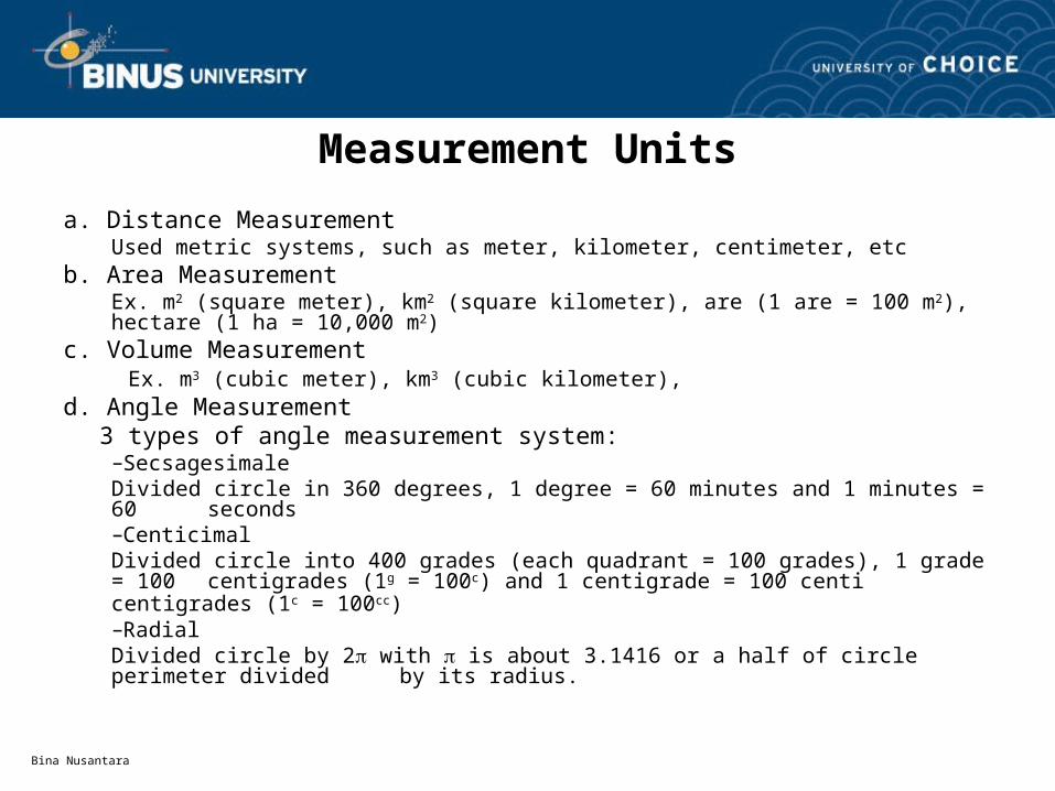
Measurement Units
a. Distance MeasurementUsed metric systems, such as meter, kilometer, centimeter, etc
b. Area MeasurementEx. m2 (square meter), km2 (square kilometer), are (1 are = 100 m2), hectare (1 ha = 10,000 m2)
c. Volume Measurement Ex. m3 (cubic meter), km3 (cubic kilometer),
d. Angle Measurement 3 types of angle measurement system:
–SecsagesimaleDivided circle in 360 degrees, 1 degree = 60 minutes and 1 minutes = 60 seconds
–CenticimalDivided circle into 400 grades (each quadrant = 100 grades), 1 grade = 100 centigrades (1g = 100c) and 1 centigrade = 100 centi centigrades (1c = 100cc)
–RadialDivided circle by 2 with is about 3.1416 or a half of circle perimeter divided by its radius.

Bina Nusantara
Measurement Units
Several Equation of angle measurement
1 circle = 360o = 400 grade = 2π rad
• Degree1o = 60’ (minute)1’ = 60” (second)
• Grade1 grade = 100 centigrade (centesimal)1 centigrade = 100 centicentigrade
• Radian1 rad = 57.30o
Bina Nusantara
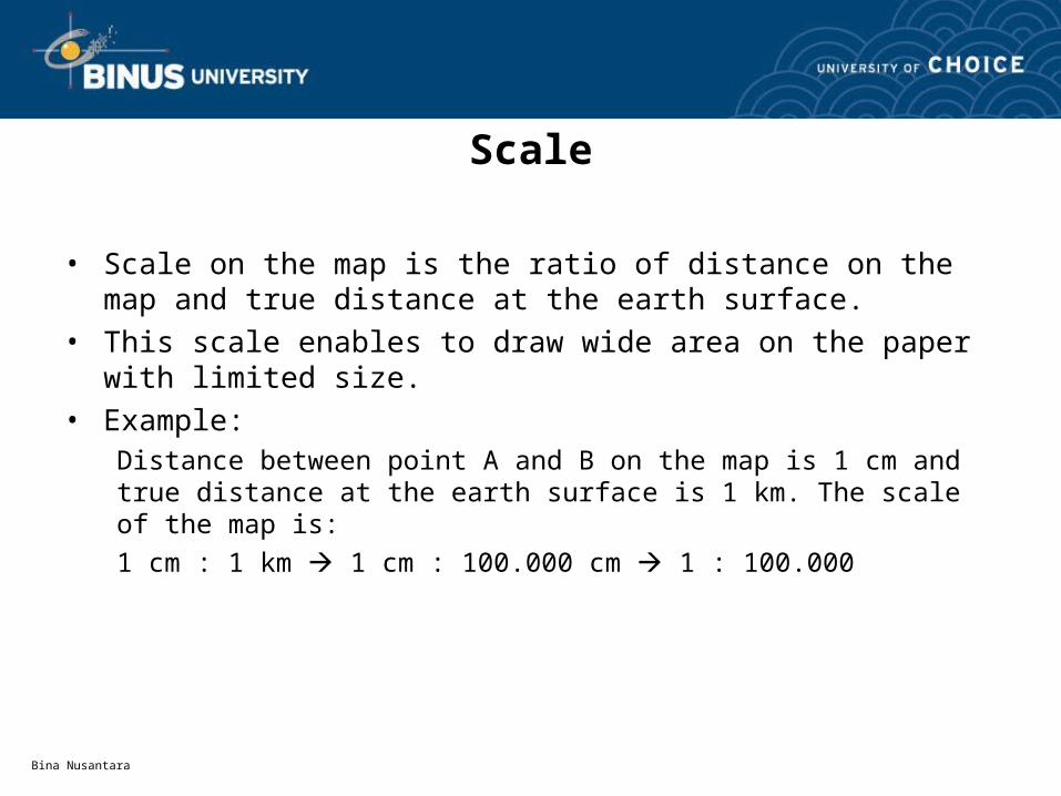
Scale
• Scale on the map is the ratio of distance on the map and true distance at the earth surface.
• This scale enables to draw wide area on the paper with limited size.• Example:
Distance between point A and B on the map is 1 cm and true distance at the earth surface is 1 km. The scale of the map is:
1 cm : 1 km 1 cm : 100.000 cm 1 : 100.000
Bina Nusantara
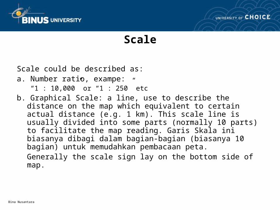
Scale
Scale could be described as:a. Number ratio, exampe:
“1 : 10,000” or “1 : 250” etc
b. Graphical Scale: a line, use to describe the distance on the map which equivalent to certain actual distance (e.g. 1 km). This scale line is usually divided into some parts (normally 10 parts) to facilitate the map reading. Garis Skala ini biasanya dibagi dalam bagian-bagian (biasanya 10 bagian) untuk memudahkan pembacaan peta. Generally the scale sign lay on the bottom side of map.

Bina Nusantara
Scale
• Example of Graphical Scale:
Graphic Scale
0 1 2 3 km1 0.5
Bina Nusantara
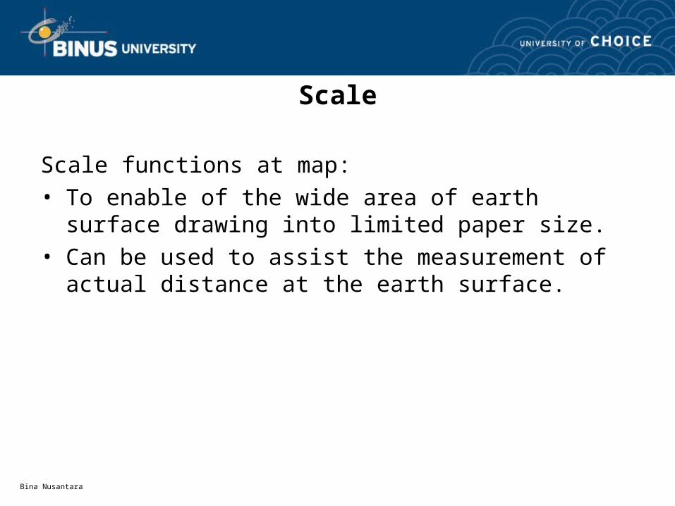
Scale
Scale functions at map:• To enable of the wide area of earth surface drawing into
limited paper size.• Can be used to assist the measurement of actual
distance at the earth surface.

Bina Nusantara
Scale
Scale can be divided into 2 types:
a. Large ScaleTo draw the small area, example “1 : 10” or “1 : 20” or “1: 50” etc.
Use for detail drawing of a location.
b. Small ScaleTo draw the large area, example “1 : 500” or “1: 25,000” etc.
Use for drawing of the wide area of earth surface.

Bina Nusantara
Map
a. Technical Map– Technical map is made for advance construction design before
the construction execution. Example: technical map for building construction, road construction, bridge, hydraulic structure, railway construction etc.
– This map has a scale up to 1 : 10,000, and it is usually adjusted to the condition of planning construction.

Bina Nusantara
Map
b. Topography Map– To describe the high and low of the surface of a region/country.
This map is a detail map of wide area, which use smaller scale than 1 : 10,000 - 1 : 100,000.
– An example, topography map of Indonesia region with scale of 1 : 25,000, which consists of some pages of topography map to describe the regions of our country.

Bina Nusantara
Map
c. Geography Map– A map is used to describe the earth suface condition. This map is
usually made with scale less than 1 : 100,000.
– An example: country map which is made in scale of 1 : 1,000,000.
Bina Nusantara
Map
• The other maps– Geology Map
– Hydrography Map
– Tourism Map
– City Map
– Irrigation Map
– Forestry Map