
Sensor Information Technology (SensIT)...
57
Sensor Information Technology (SensIT) Program Dr. Sri Kumar, DARPA/IPTO Information Processing Technology Office [SensIT Program in the Information Exploitation Office (IXO)] Richard Butler, AFRL/IFGA Distributed Information Systems Branch http://dtsn.darpa.mil/ixo/sensit%2Easp
Transcript of Sensor Information Technology (SensIT)...
Sensor Information Technology (SensIT)Program
Dr. Sri Kumar, DARPA/IPTOInformation Processing Technology Office
[SensIT Program in theInformation Exploitation Office (IXO)]
Richard Butler, AFRL/IFGADistributed Information Systems Branch
http://dtsn.darpa.mil/ixo/sensit%2Easp
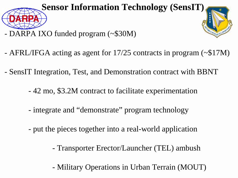
Sensor Information Technology (SensIT)
- DARPA IXO funded program (~$30M)
- AFRL/IFGA acting as agent for 17/25 contracts in program (~$17M)
- SensIT Integration, Test, and Demonstration contract with BBNT
- 42 mo, $3.2M contract to facilitate experimentation
- integrate and “demonstrate” program technology
- put the pieces together into a real-world application
- Transporter Erector/Launcher (TEL) ambush
- Military Operations in Urban Terrain (MOUT)
• This program is NOT developing sensors.It IS developing the methods and capabilities to most effectively and efficiently exploit sensor information.
• Develop innovative and effective software for producing and communicating sensor information
• Demonstrate dense distribution of networked sensors (sensors distributed near threats)
• Leverage effective and low-cost prototyping kits based on commercial off-the-shelf (COTS) components and/or government furnished equipment (GFE)
SensIT Objectives

nodeeenodenode
user
server
serverapplications
node
node node
node
node
node
node
node
Internet
mobile node
node
node node
remoteuser remote
user
node
node
node
wireline LAN
user
Gateway node
Gateway node
SensIT CommunityCommon Platform
Critical InformationTechnology Solutions
multihop, self-assembledwireless networks
diffusion networkprotocols
adaptive and reconfigurable
tactical sensingnanoencryption
database languagesand applications
network signalprocessing
SensIT Thrusts
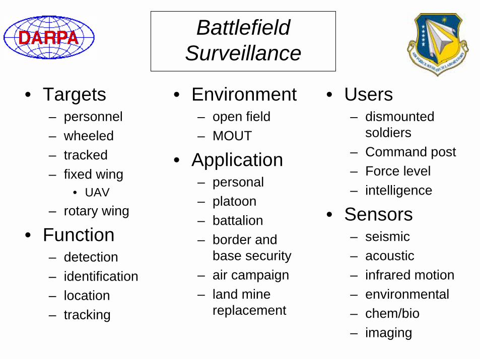
Battlefield Surveillance
• Targets– personnel– wheeled– tracked– fixed wing
• UAV– rotary wing
• Function– detection– identification– location– tracking
• Users– dismounted
soldiers– Command post– Force level– intelligence
• Sensors– seismic– acoustic– infrared motion– environmental– chem/bio– imaging
• Environment– open field– MOUT
• Application– personal– platoon– battalion– border and
base security– air campaign– land mine
replacement
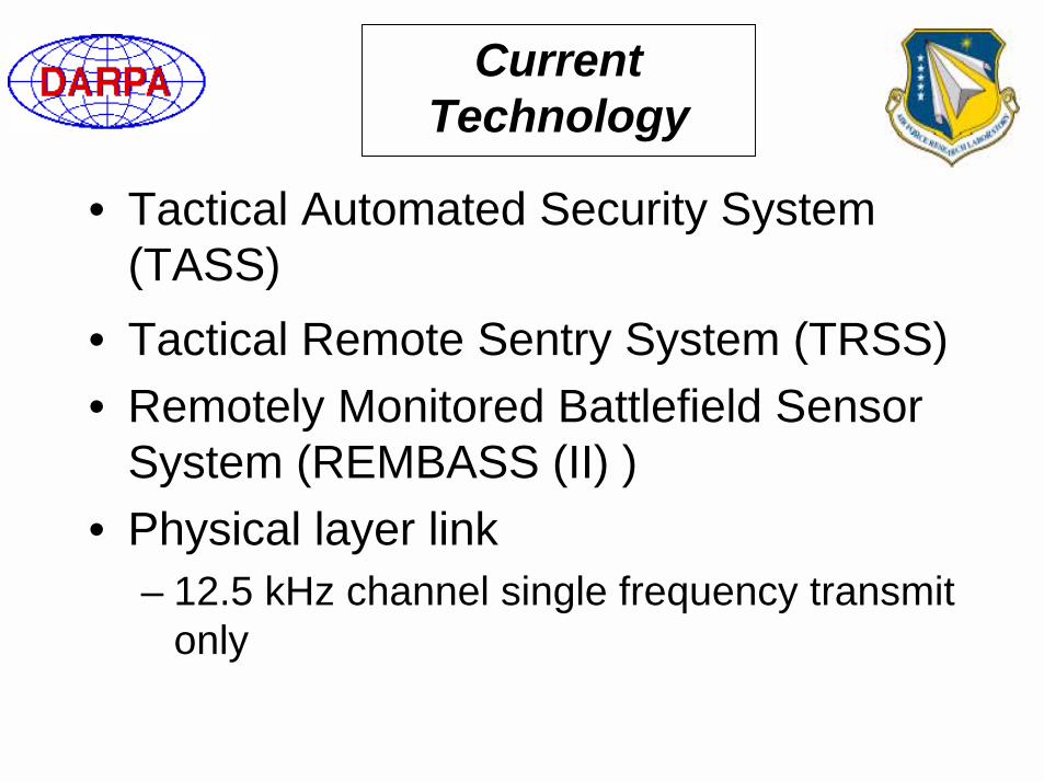
Current Technology
• Tactical Automated Security System (TASS)
• Tactical Remote Sentry System (TRSS)• Remotely Monitored Battlefield Sensor
System (REMBASS (II) )• Physical layer link
– 12.5 kHz channel single frequency transmit only

Current Technology
• Current technology based on:– transmit only nodes– binary state event detection– non-programmable– large– high power– high cost– long range detection paradigm
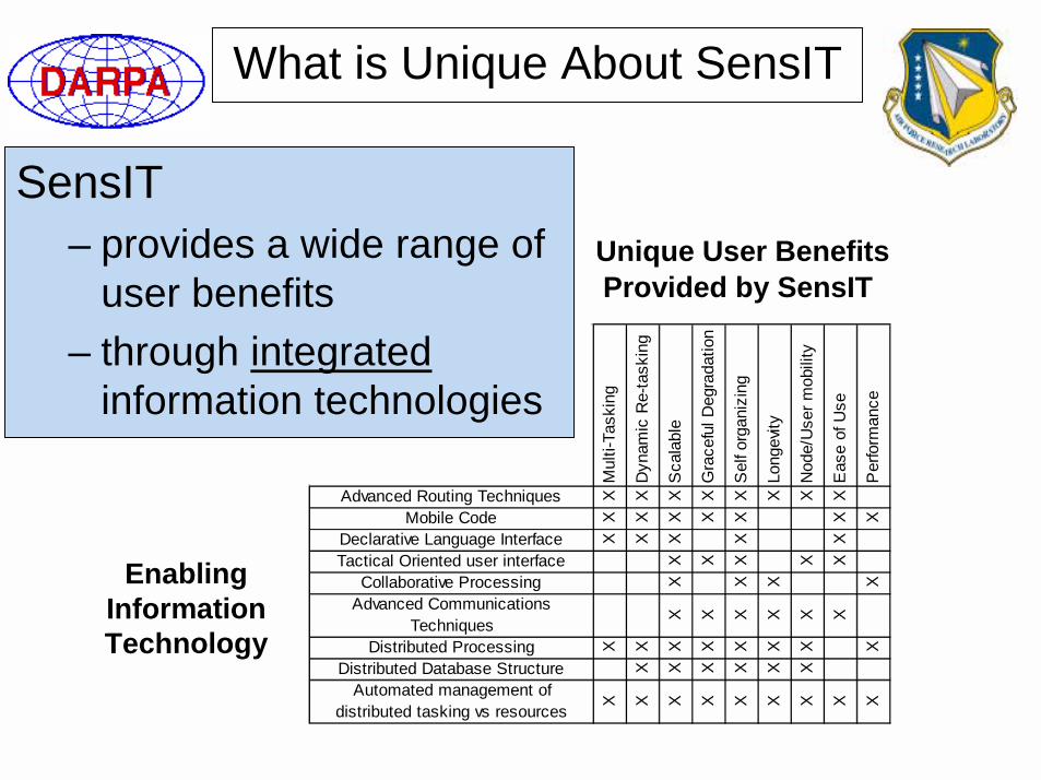
What is Unique About SensIT
Mul
ti-Ta
skin
g
Dyn
amic
Re-
task
ing
Sca
labl
e
Gra
cefu
l Deg
rada
tion
Sel
f org
aniz
ing
Long
evity
Nod
e/U
ser m
obili
ty
Eas
e of
Use
Per
form
ance
Advanced Routing Techniques X X X X X X X X
Mobile Code X X X X X X X
Declarative Language Interface X X X X X
Tactical Oriented user interface X X X X X
Collaborative Processing X X X X
Advanced Communications Techniques X X X X X X
Distributed Processing X X X X X X X X
Distributed Database Structure X X X X X X
Automated management of distributed tasking vs resources X X X X X X X X X
Enabling Information Technology
Unique User Benefits Provided by SensIT
SensIT– provides a wide range of
user benefits – through integrated
information technologies
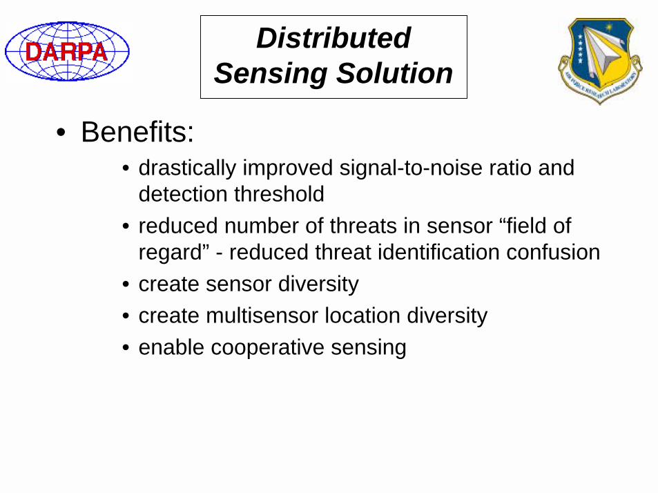
Distributed Sensing Solution
• Benefits:• drastically improved signal-to-noise ratio and
detection threshold• reduced number of threats in sensor “field of
regard” - reduced threat identification confusion• create sensor diversity• create multisensor location diversity• enable cooperative sensing
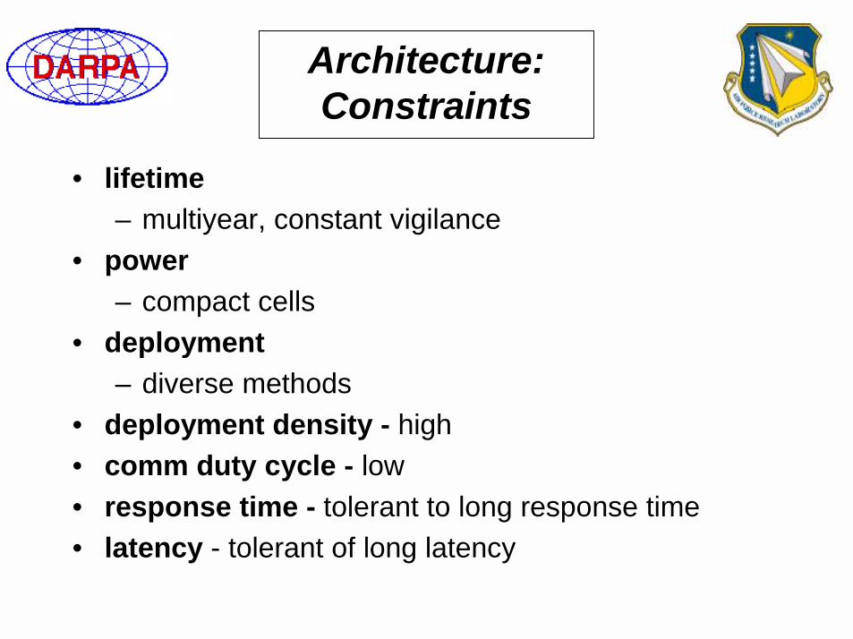
Architecture: Constraints
• lifetime – multiyear, constant vigilance
• power – compact cells
• deployment– diverse methods
• deployment density - high• comm duty cycle - low• response time - tolerant to long response time• latency - tolerant of long latency
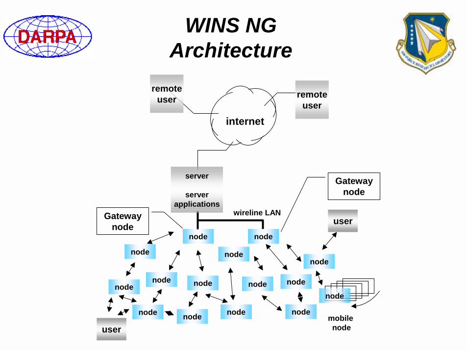
WINS NG Architecture
nodeeenodenode
user
server
serverapplications
node
node node
node
node
node
node
node
internet
mobile node
node
node node
remoteuser remote
user
node
node
node
wireline LAN
user
Gateway node
Gateway node
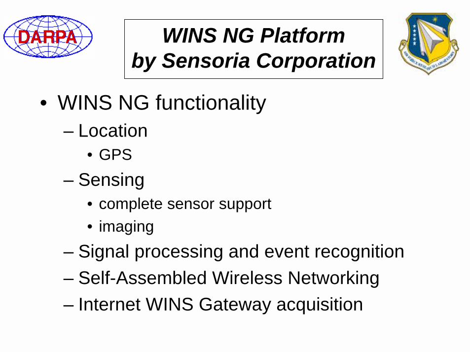
WINS NG Platformby Sensoria Corporation
• WINS NG functionality– Location
• GPS– Sensing
• complete sensor support• imaging
– Signal processing and event recognition– Self-Assembled Wireless Networking– Internet WINS Gateway acquisition
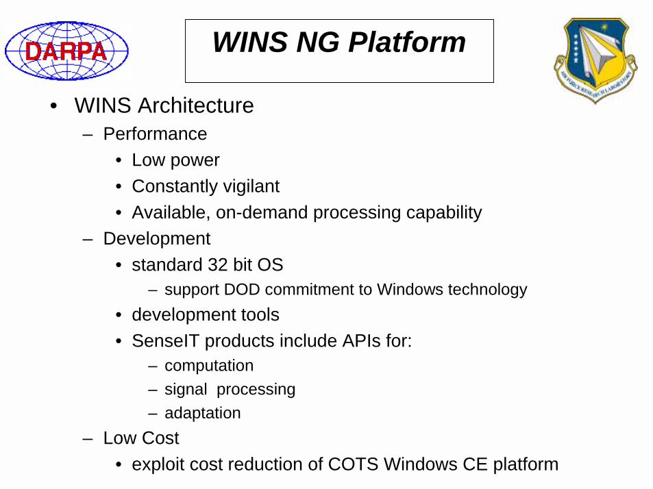
WINS NG Platform
• WINS Architecture– Performance
• Low power• Constantly vigilant• Available, on-demand processing capability
– Development• standard 32 bit OS
– support DOD commitment to Windows technology• development tools• SenseIT products include APIs for:
– computation– signal processing– adaptation
– Low Cost• exploit cost reduction of COTS Windows CE platform
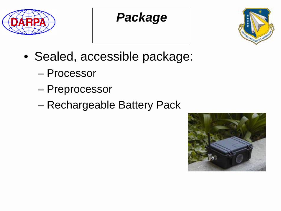
Package
• Sealed, accessible package:– Processor– Preprocessor– Rechargeable Battery Pack
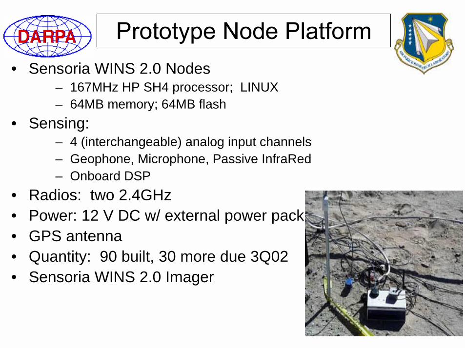
• Sensoria WINS 2.0 Nodes– 167MHz HP SH4 processor; LINUX– 64MB memory; 64MB flash
• Sensing: – 4 (interchangeable) analog input channels– Geophone, Microphone, Passive InfraRed– Onboard DSP
• Radios: two 2.4GHz • Power: 12 V DC w/ external power pack• GPS antenna• Quantity: 90 built, 30 more due 3Q02• Sensoria WINS 2.0 Imager
Sensors
• Select either seismic, acoustic, or IR– Geophone seismic sensor– Acoustic Sensor– IR Motion Sensors
• one to four– Select custom sensor interfaces
• GEC-Marconi program

Field Test History
• Sept 96 29 Palms USMC data collection• Sept 96 29 Palms USMC Desert Fire• Dec 96 29 Palms USMC Steel Knight• April 97 29 Palms USMC Desert Scimitar• June 97 Aberdeen Proving Ground US Army• October 97 USS Rushmore US Navy• December 97 29 Palms Steel Knight• February 98 Army NTC US Army Data Acquisition

• August 2000, MCAGCC, Twenty-nine Palms, CA– WINS 1.0 nodes
• March 2001, MCAGCC - Twenty-nine Palms, CA– Standalone demos
• November 2001, MCAGCC - Twenty-nine Palms, CA– 70 WINS 2.0 nodes– Challenge Problem: Autonomous, real-time, tactical
target localization, tracking, classification, and image capture, on a large distributed ground sensor network
• December 2001, MCAGCC - Twenty-nine Palms, CA – Steel Knight, 7th Marine Regiment Combined Arms
Exercise– Image capture, transmission and display

• Wring out basic end-to-end functionality & operability
• Establish performance baseline
– e.g. sensing performance, network traffic, latency, scaling, survivability, etc.
• Highlight unique features (expand as devel. permits)
– User Benefits• Multiple users/tasking, dynamic (re)tasking, basic collaborative
processing– Enabling Technologies
• Declarative languages, mobile code, advanced routing techniques,collaborative processing, tactical user interface
• Gather data to aid PIs in further development efforts
Program must balance experiment “reach” vs. “risk”Requires prioritization
FY00 Experiment Scenario -Overview
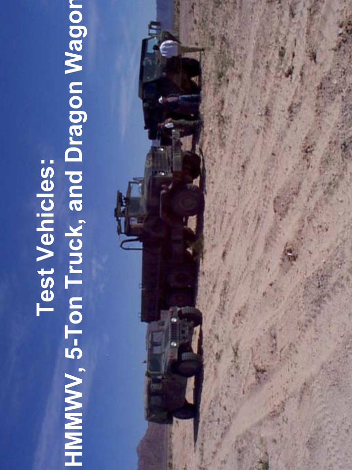
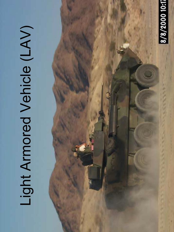
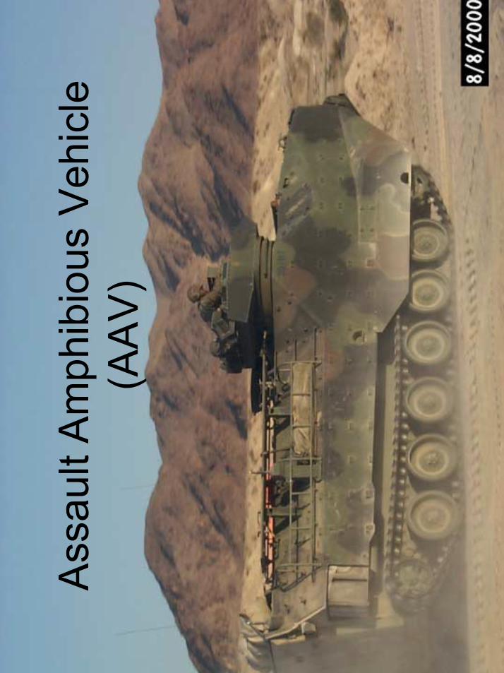
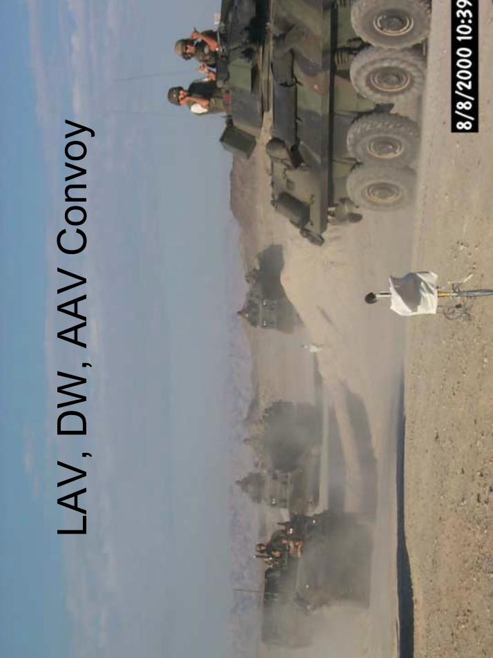
• Transporter Erector/Launchers (TELs) are on the move
• Command needs to determine when and where they are moving.
• Plan– Deploy sensor groups over a wide area.– Use sensors to determine TEL traffic patterns.– Send in Special Operations Force (SOF) to
confirm identification and destroy TELs.
• Potential Locations– 29 Palms– Aberdeen Proving Grounds– Other
• Traffic “Targets”– Heavy trucks, tanks, light vehicles (e.g. HMMVs),
dismounted personnel, other• Target Timeframe
– August 2000• Experimentation Practicalities
– Use battery eliminators (i.e. nodes are AC powered)– Use Ethernet or other hard wired connection to collect data– Some level of experiment monitoring resides on each node

Approximate Summer
prevailing winds
Eastern checkpoint~500m
Northern checkpoint(~290m to Group #2)
Western checkpoint,~410m
Defile
Group #2~1030m
Group #1
Lightly used “cut-off”
Shifted CAX vehicle staging area Preferred base camp
~300m
2nd Alternate base camp
1st alternate base camp~230m
Inte
r-gr
oup
cabl
e ru
n
Bright Green is distance from intersection
200 m
400 m
600 m
1000 m
800 mWhite circles labeled C1-C7: Group 3 nodes (along
the road). Red arrow shows IR sensor MRA.
C1
C4C3
C2
C5
C6
C7
Fig. 1. Sensor Laydown: Big picture, Group 3.
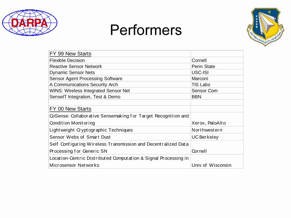
FY 99 New StartsFlexible Decision CornellReactive Sensor Network Penn StateDynamic Sensor Nets USC-ISISensor Agent Processing Software MarconiA Communications Security Arch TIS LabsWINS: Wireless Integrated Sensor Net Sensor ComSenseIT Integration, Test & Demo BBN
FY 00 New StartsCoSense: Collaborative Sensemaking for Target Recognition and Condition Monitoring Xerox, PaloAltoLightweight Cryptographic Techniques NorthwesternSensor Webs of Smart Dust UC BerkeleySelf Configuring Wireless Transmission and Decentralized Data Processing for Generic SN CornellLocation-Centric Distributed Computation & Signal Processing in Microsensor Networks Univ of Wisconsin


Ground TrackerRockwell/ISI/Virginia Tech
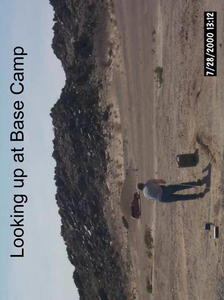
~ 1km//Base Camp
Base Camp~ 300 m//intersection
Tracker/ImagerBAE/Sensoria
Fixed/Mobile(UAV-Deployed Motes)
UC-Berkeley/MLB
Autonomous, distributed ground sensors that track moving vehicles
and transmit processed information to a base camp display
13-14 Mar 01Marine Corps Air Ground Combat Center
Twentynine Palms, CA
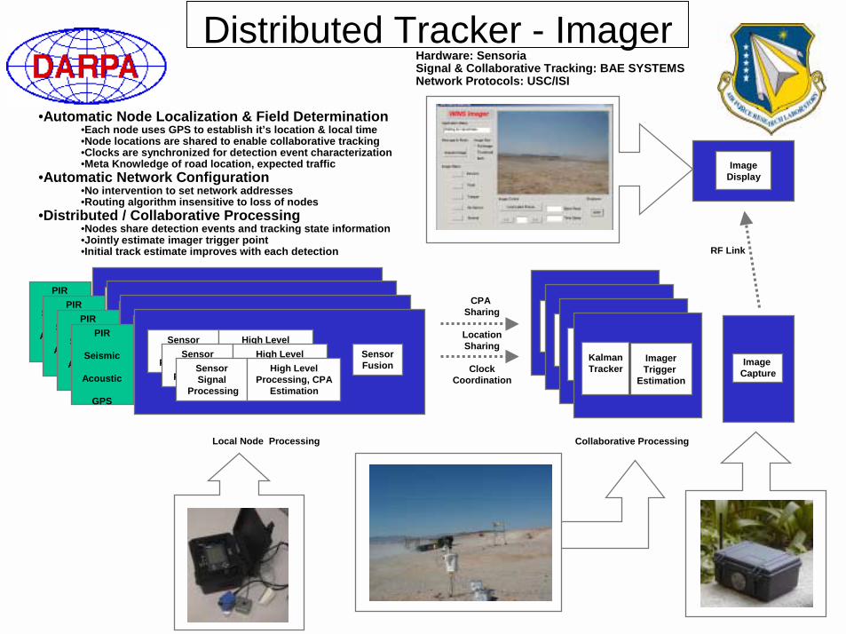
Distributed Tracker - Imager
SensorSignal
Processing
High LevelProcessing, CPA
EstimationSensorFusion
SensorSignal
Processing
High LevelProcessing, CPA
EstimationSensorSignal
Processing
High LevelProcessing, CPA
Estimation
PIR
Seismic
Acoustic
GPS
CPA Sharing
LocationSharing
ClockCoordination
KalmanTracker
ImagerTrigger
Estimation
Image Capture
ImageDisplay
SensorSignal
Processing
High LevelProcessing, CPA
EstimationSensorFusion
SensorSignal
Processing
High LevelProcessing, CPA
EstimationSensorSignal
Processing
High LevelProcessing, CPA
Estimation
PIR
Seismic
Acoustic
GPS
SensorSignal
Processing
High LevelProcessing, CPA
EstimationSensorFusion
SensorSignal
Processing
High LevelProcessing, CPA
EstimationSensorSignal
Processing
High LevelProcessing, CPA
Estimation
PIR
Seismic
Acoustic
GPS
SensorSignal
Processing
High LevelProcessing, CPA
EstimationSensorFusion
SensorSignal
Processing
High LevelProcessing, CPA
EstimationSensorSignal
Processing
High LevelProcessing, CPA
Estimation
PIR
Seismic
Acoustic
GPS
KalmanTracker
ImagerTrigger
EstimationKalmanTracker
ImagerTrigger
EstimationKalmanTracker
ImagerTrigger
Estimation
RF Link
Local Node Processing Collaborative Processing
Hardware: SensoriaSignal & Collaborative Tracking: BAE SYSTEMSNetwork Protocols: USC/ISI
•Automatic Node Localization & Field Determination•Each node uses GPS to establish it’s location & local time•Node locations are shared to enable collaborative tracking•Clocks are synchronized for detection event characterization•Meta Knowledge of road location, expected traffic
•Automatic Network Configuration•No intervention to set network addresses•Routing algorithm insensitive to loss of nodes
•Distributed / Collaborative Processing•Nodes share detection events and tracking state information•Jointly estimate imager trigger point•Initial track estimate improves with each detection
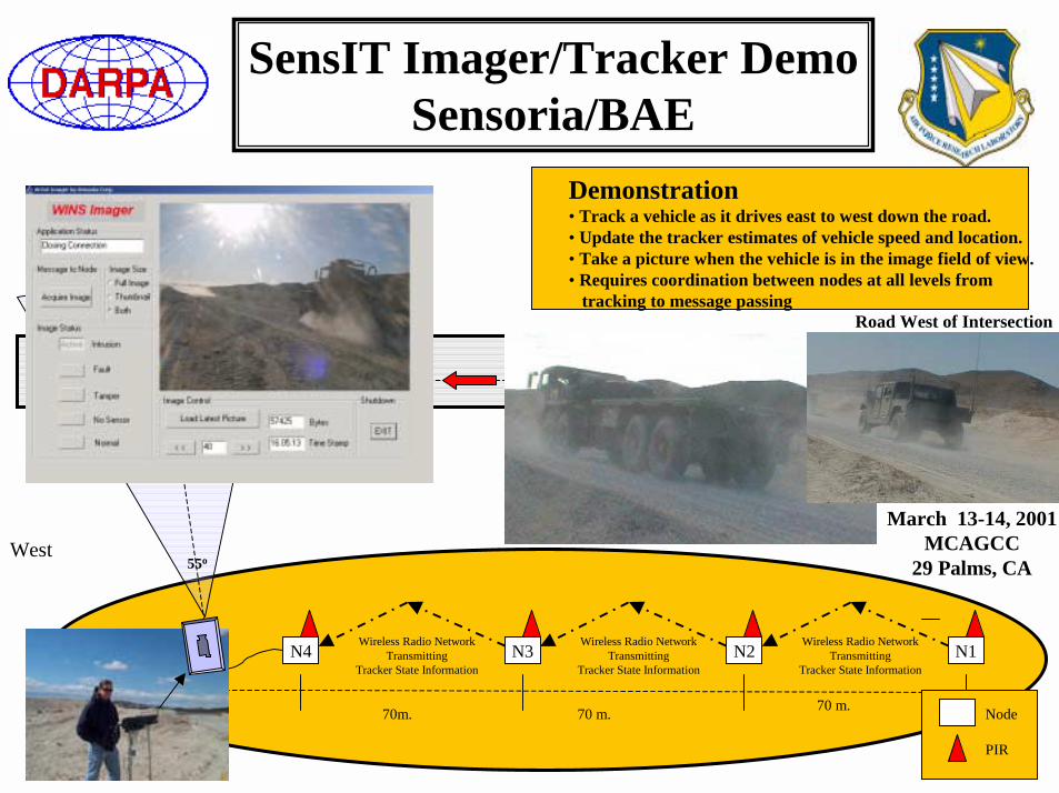
Imager/Tracker Demo
East
N1N2N4 N3
70m. 70 m. 70 m.
SensIT Imager/Tracker DemoSensoria/BAE
Node
PIR
West55o
March 13-14, 2001MCAGCC
29 Palms, CA
Wireless Radio NetworkTransmitting
Tracker State Information
Wireless Radio NetworkTransmitting
Tracker State Information
Wireless Radio NetworkTransmitting
Tracker State Information
Road West of Intersection
Demonstration• Track a vehicle as it drives east to west down the road.• Update the tracker estimates of vehicle speed and location.• Take a picture when the vehicle is in the image field of view.• Requires coordination between nodes at all levels from
tracking to message passing

DSN/Sensorware Experiment Description
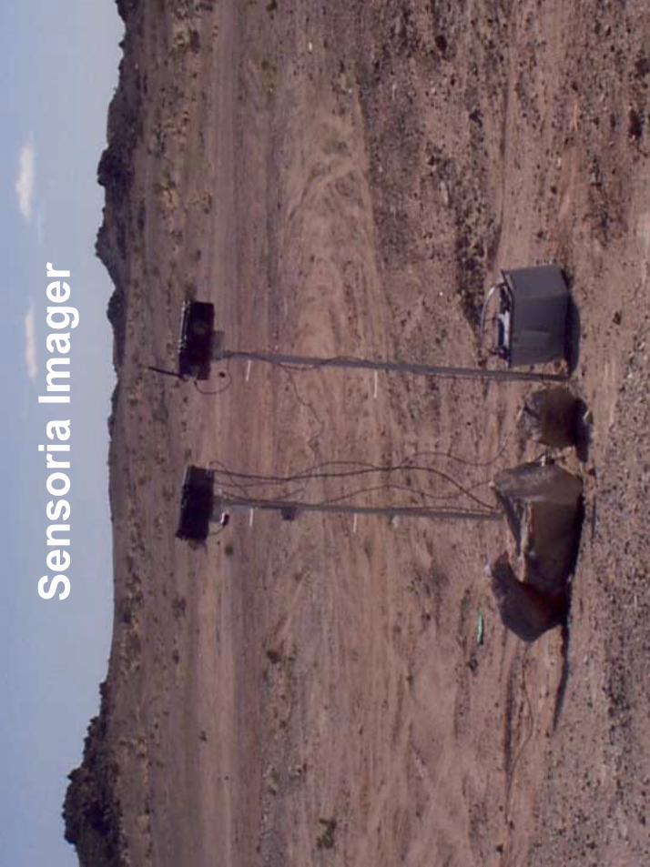
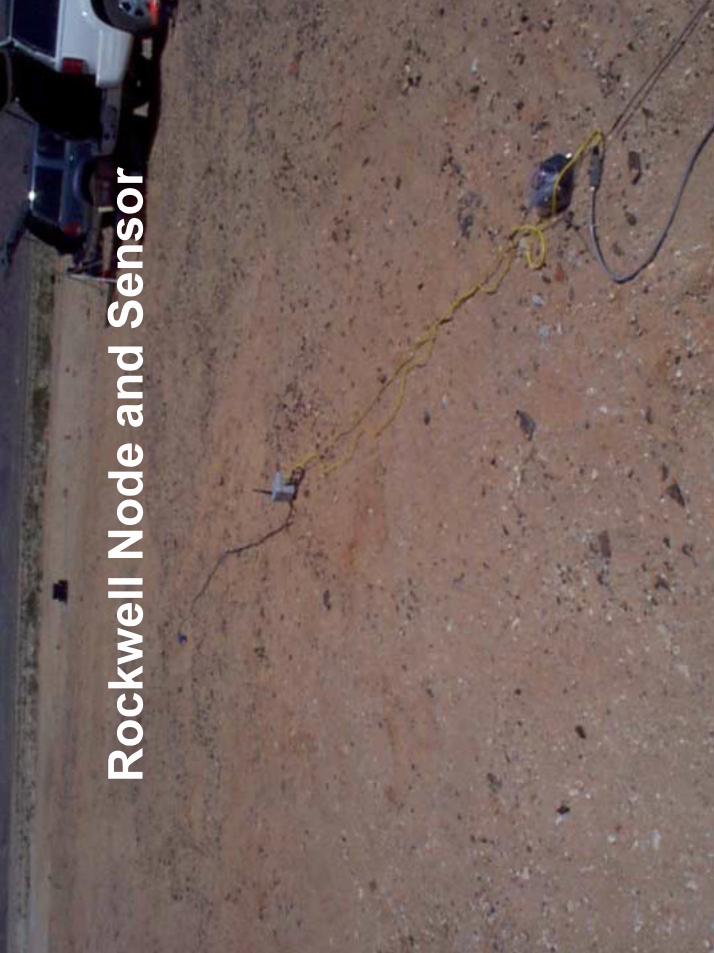
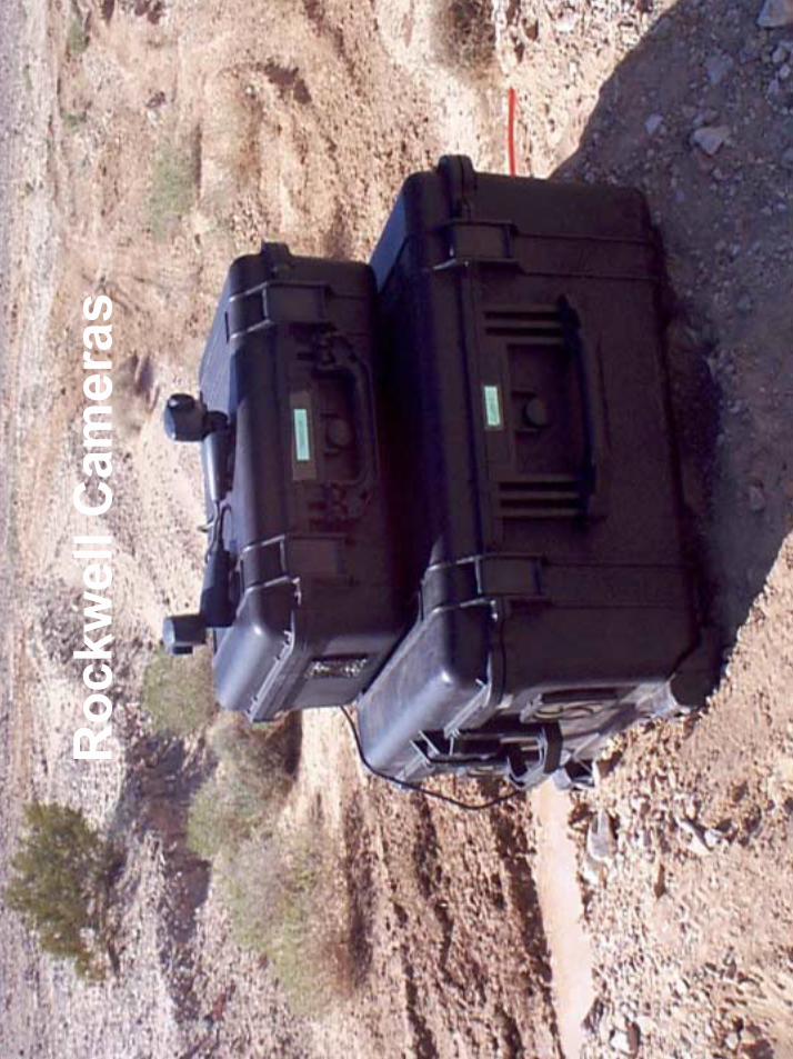
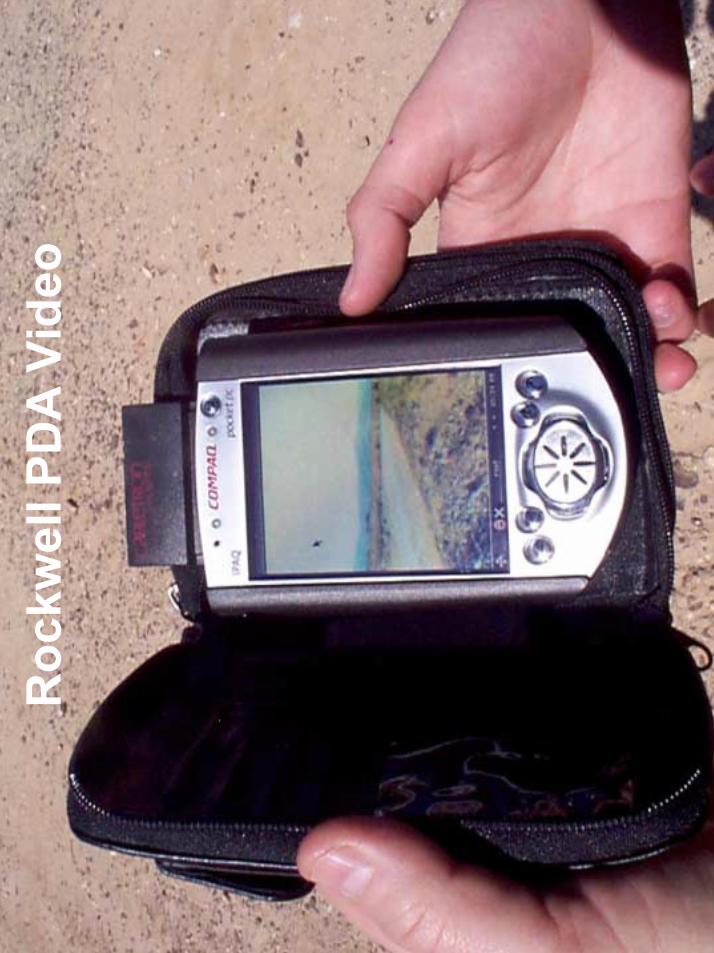
• Wave Intensity Comparison –multiple projections are made from seismic signal energy at sensor node clusters.– Nine Rockwell HYDRA nodes.– Laptop with web cam.– COTS 802.11 wireless Ethernet
bridge to base camp (~1km).
• At Base Camp– Situation status display
GUI (running on laptop).– Live video feed at 5fps on
wireless iPAQ PDA.
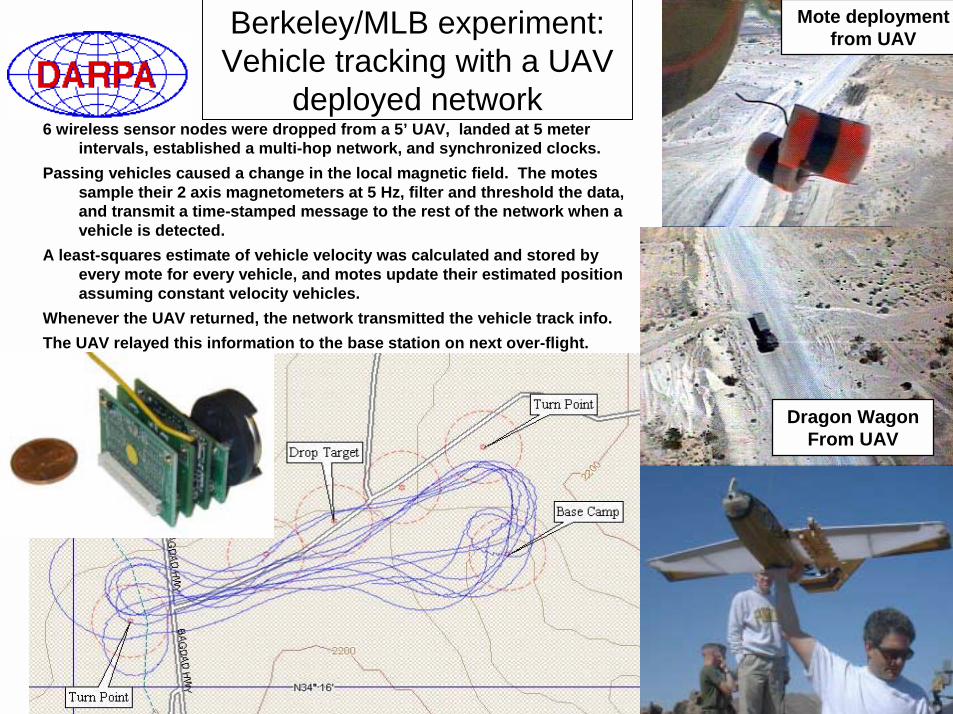
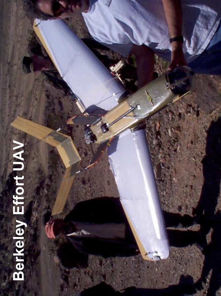
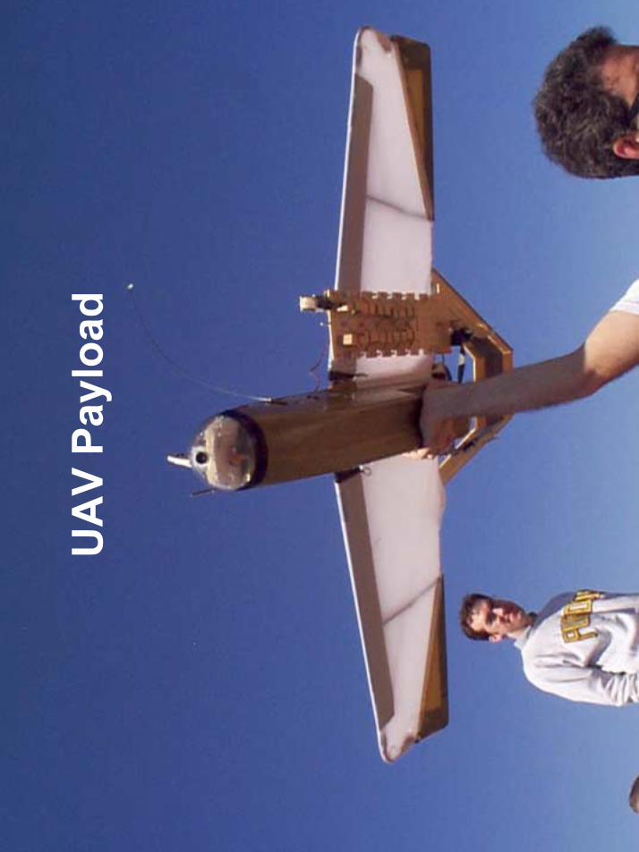
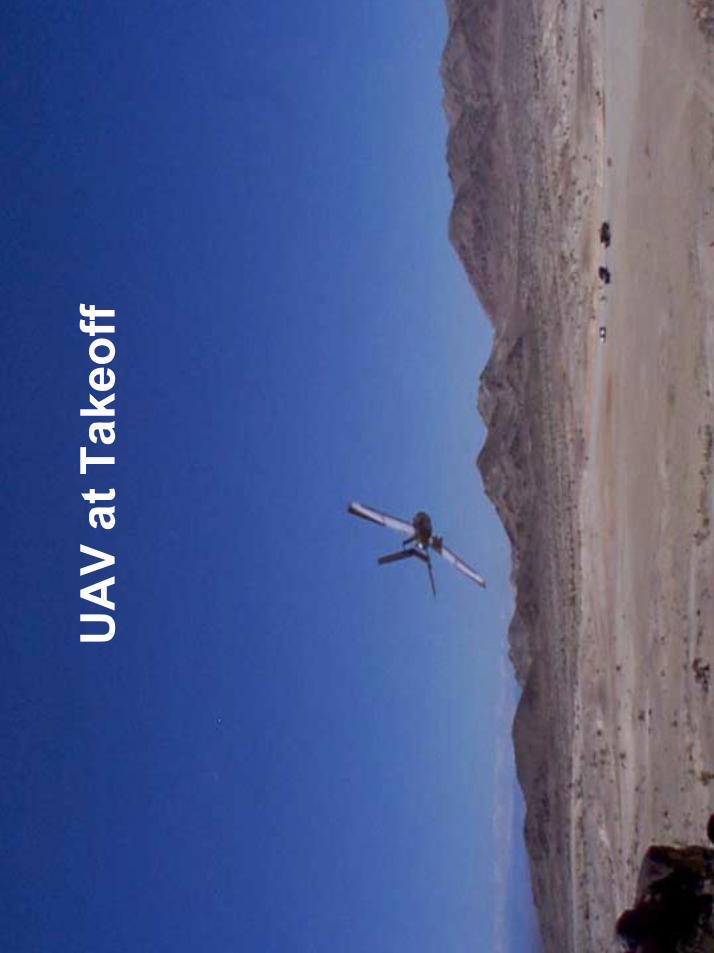
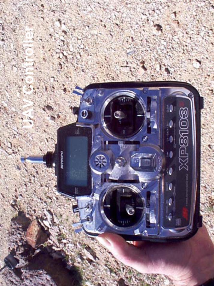
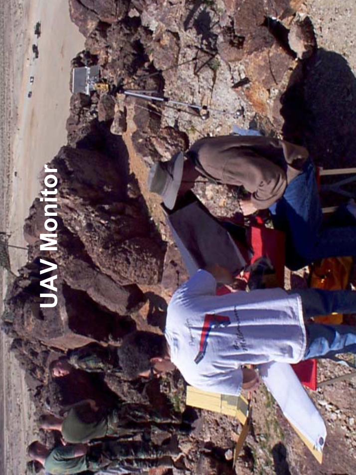
Berkeley/MLB experiment: Vehicle tracking with a UAV
deployed network6 wireless sensor nodes were dropped from a 5’ UAV, landed at 5 meter
intervals, established a multi-hop network, and synchronized clocks. Passing vehicles caused a change in the local magnetic field. The motes
sample their 2 axis magnetometers at 5 Hz, filter and threshold the data, and transmit a time-stamped message to the rest of the network when a vehicle is detected.
A least-squares estimate of vehicle velocity was calculated and stored by every mote for every vehicle, and motes update their estimated position assuming constant velocity vehicles.
Whenever the UAV returned, the network transmitted the vehicle track info.The UAV relayed this information to the base station on next over-flight.
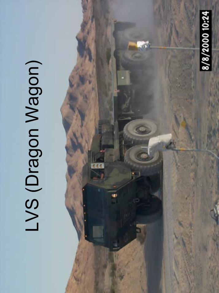
Dragon WagonFrom UAV
Mote deploymentfrom UAV


Base Camp
200 m
400 m
600 m
800 m
Intersection
Gateway/Imager
RF Ethernet
Autonomous, distributed ground sensors that track moving vehicles
and transmit processed information to a base camp display
SensIT Experiment -SITEX02
November 2001Marine Corps Air Ground Combat Center
Twenty-nine Palms, CA
Total: 70 Nodes
East Training Area Prospect Intersection
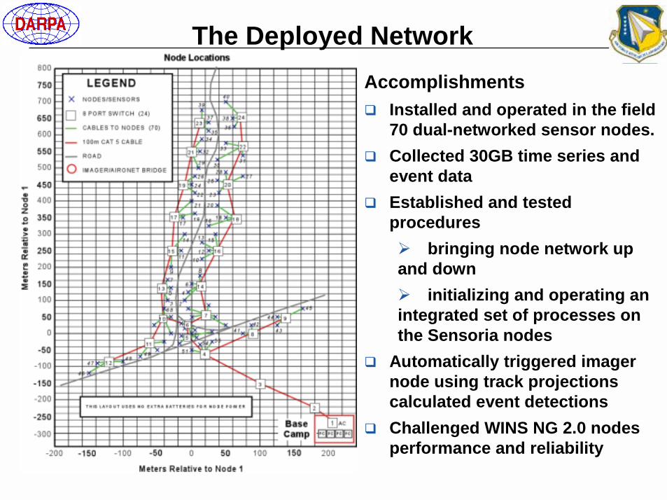
The Deployed NetworkAccomplishments� Installed and operated in the field
70 dual-networked sensor nodes.� Collected 30GB time series and
event data� Established and tested
procedures � bringing node network up and down� initializing and operating an integrated set of processes on the Sensoria nodes
� Automatically triggered imager node using track projections calculated event detections
� Challenged WINS NG 2.0 nodes performance and reliability

Capabilities
SensIT Indoor Testbed
� Operation: 24/7� Data sources:
� Live PIR� Recorded event and time series playback (SITEX02 - 29 Palms)
� Comm.: RF and (private) ethernet
Autonomous, distributed ground sensors that track
moving vehicles and transmit processed
information to a base camp display
Ground Sensor
Networks
� BBN/Cambridge; Spring 2002� Medium-scale network for API
development, debugging, software integration and testing
� 20 WINS NG 2.0 Nodes + 2 Imagers� Secure remote network access for
PI testing and demo
Testing� Network Latency/Packet Loss� Software upgrades� Baseline Software Architecture� GUI development� Tracker Improvements

SensIT Outdoor Testbed - July 2002
� 20+ WINS NG 2.0 Nodes � Acoustic, Seismic, PIR � Road Frontage: ~ 300 feet� Adjacent office space� Video Surveillance� Operation: 24/7� Secure remote access to nodes� WINS RF and wireless ethernet
comms� Alternate laydowns available
Semi-permanent, medium-scale network for development, debugging, software integration and testing using real targets (non-tactical) or simulation
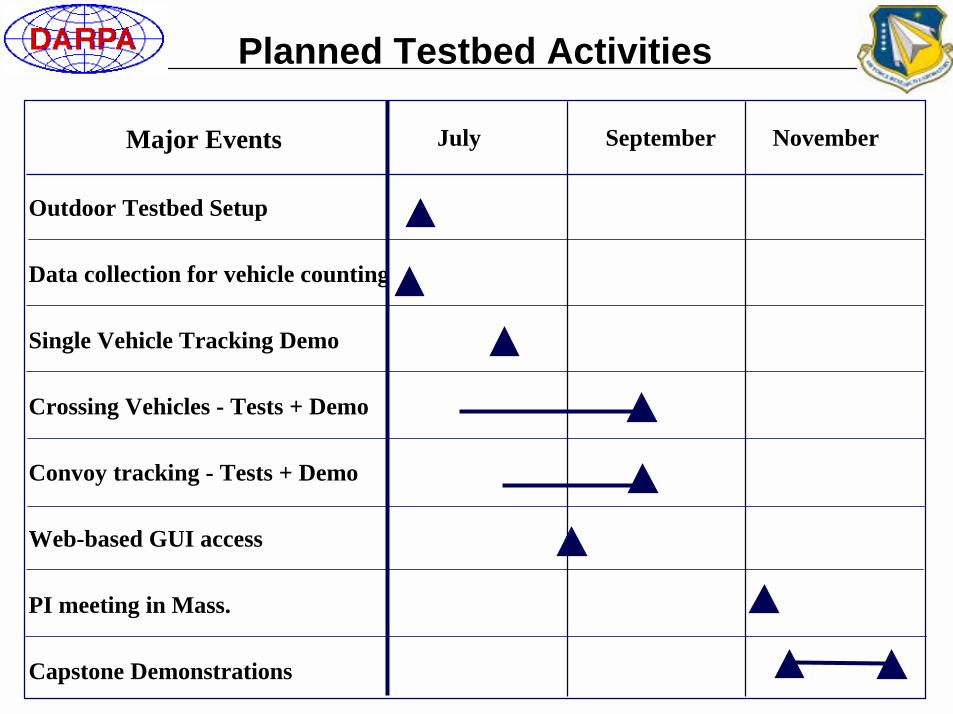
Outdoor Testbed Setup
Data collection for vehicle counting
Single Vehicle Tracking Demo
Crossing Vehicles - Tests + Demo
Convoy tracking - Tests + Demo
Web-based GUI access
PI meeting in Mass.
Capstone Demonstrations
Planned Testbed Activities
July September NovemberMajor Events