Sedimentary Basins: Origin, Depositional Histories, · Lorcan Kennan, who formed the program...
68
Transcript of Sedimentary Basins: Origin, Depositional Histories, · Lorcan Kennan, who formed the program...


Sedimentary Basins: Origin, Depositional Histories, and Petroleum Systems
33rd Annual Gulf Coast Section SEPM FoundationBob F. Perkins Research Conference
2014
Program and Abstracts
OMNI Houston WestsideHouston, Texas
January 26–28, 2014
Edited by
James PindellBrian Horn
Norman RosenPaul Weimer
Menno DinklemanAllen Lowrie
Richard FillonJames GranathLorcan Kennan
Sedimentary Basins: Origin, Depositional Histories, and Petroleum Systems i
Copyright © 2014 by theGulf Coast Section SEPM Foundation
www.gcssepm.org
Published December 2014
The cost of this conference has been subsidized by generous grants from ION Geophysical, Shell, and Hess Corporation.
ii Program and Abstracts

Foreword
“Mommy, where do basins come from?”
Children do ask good questions!
On the one hand, it might seem that this is a rather esoteric question; on the other hand, the simple explanation of plates ramming together or pulling apart does not fully suffice as a satisfactory answer. From the exploration point of view, how the basin formed is of fundamental importance in determining source rock, reservoir, and their distribution in the basin. Although the exact origin of basins is not the main theme of this conference, our goal is cognizance of their origin and to understand better how this affects petroleum systems. For us in the oil and gas business, this is a matter of prime importance.
Our talks, therefore, start with rifting, as passive margins are from the hydrocarbon point-of-view of extreme importance, and then by area. Finding analogs to plays is as important as finding inspiration in the ideas of others and we certainly hope that all attendees will get something out of the conference.
This conference also has one innovation. There has been much discussion by all groups that more must be done to bring the younger generation into our community. Therefore, we sponsored a poster contest with prizes, a course on the structure and stratigraphic framework of the northern Gulf of Mexico, and invited the students to attend the conference. We hope they will understand that face-to-face contact with colleagues (i.e., networking) is just as important (if not more so) than tweeting and texting. Carl Fiduk organized the effort; course teachers were Ursula Hammes, Mike Blum, Bruce Hart, and Carl Fiduk. Thank you for your time and effort in this endeavor.
Unfortunately, I must add the same paragraph that I had in our last conference: My apology for not having the Proceedings ready for distribution at the time of the conference. It used to be that people had time to write and communicate their results and obtaining permission to do so was a relatively easy task. Now the paper must be completed (often later than expected because of work load) and then submitted for approval by people who are not concerned about our deadlines. If all goes well, we will be mailing the DVDs in March 2014.
There are many people to thank for this conference. Alan Lowrie first proposed the topic. Jim Pindell and Brian Horn then took on the task of getting the show on the road. They pulled together an excellent technical committee to recommend and edit papers. Of course, my thanks to the authors who spent the time in writing the papers and preparing a poster. Mike Nault has been invaluable in ensuring adequate physical arrangements for the conference; Arden Callender was once again in charge of arranging for poster boards; Gail Bergan is in charge of getting the program book and Proceedings DVD together; and Sheila Barnette once again volunteered to be at our registration table. A special thank you also goes to our corporate sponsors who are generously supporting our cause. None of this would have been possible without all of the above. Finally, I thank all of the attendees for coming; it would be difficult to have a conference without you.
Norman RosenCoordinator
Sedimentary Basins: Origin, Depositional Histories, and Petroleum Systems iii

Introduction
The 33rd Annual GCSSEPM Foundation Bob F. Perkins Research Conference sought to highlight the structural and depositional diversity of sedimentary basins and continental margins, and their associated petroleum systems. This diversity encompasses rifts, sag basins, pull-apart and low-angle detachment basins, foreland basins, and divergent and transform passive margins.
Technological advances in data acquisition are changing our conceptual models of many facets of geology. This, in turn, impacts the way we think, interpret data, and explore for energy resources. Thus, for the first time in the history of the Perkins meetings, a diverse array of seismic sections were provided in the form of a super-poster by ION Geophysical. The super-poster afforded conference-goers the opportunity to examine and discuss with colleagues many of the phenomena presented in the technical sessions, thereby adding to the practical effectiveness of the meeting in general. In addition, an array of 19 student posters was shown throughout the meeting, providing a chance for our industry’s future to talk with and gain impressions from the active professionals at the meeting; congratulations to Carl Fiduk for getting this program going.
The phenomena addressed by speakers and demonstrated by the posters and super-posters include recognition of the ongoing dynamics of “passive” margins, visualization of the Moho with implications for heat flow history and crustal balancing during extension, appreciation for low-angle detachment faults in extension, exhumation of subcontinental mantle at continent-ocean transition zones, subsalt imaging, and generation of seaward-dipping reflector packages, all of which help to control subsidence histories at passive margins, and the depositional processes that take advantage of that subsidence.
Special thanks are given to Paul Weimer, Menno Dinkleman, Allen Lowrie, Richard Fillon, James Granath, and Lorcan Kennan, who formed the program committee, suggesting several papers, and assisting with reviews of submitted papers. It should be noted that the original concept for this meeting was suggested by Alan Lowrie. We also would like to thank Dr. Norman Rosen for once again being chief cat herder, as well as our corporate sponsors who generously subsidized the cost of the conference.
James Pindell (Tectonic Analysis Ltd)Brian Horn (ION Geophysical)
iv Program and Abstracts
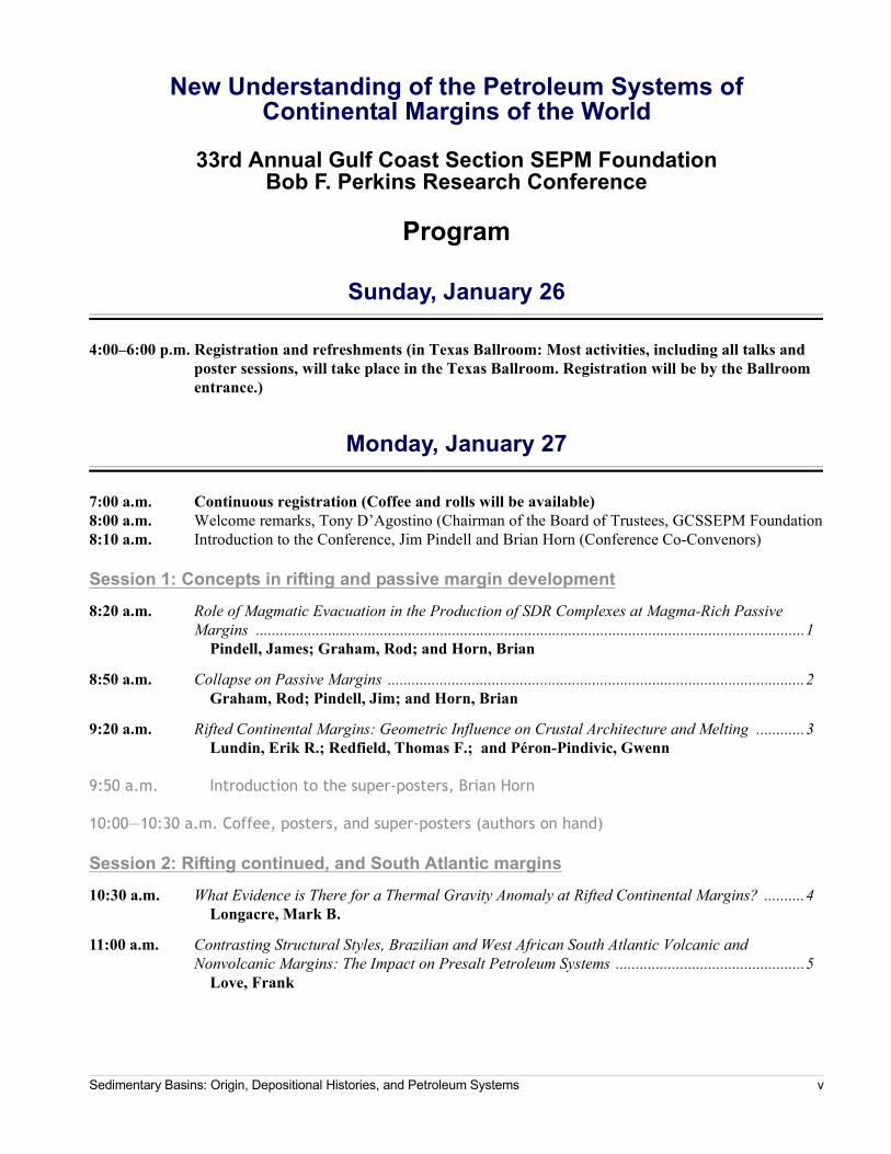
New Understanding of the Petroleum Systems ofContinental Margins of the World
33rd Annual Gulf Coast Section SEPM FoundationBob F. Perkins Research Conference
Program
Sunday, January 26
4:00–6:00 p.m. Registration and refreshments (in Texas Ballroom: Most activities, including all talks and poster sessions, will take place in the Texas Ballroom. Registration will be by the Ballroom entrance.)
Monday, January 27
7:00 a.m. Continuous registration (Coffee and rolls will be available)8:00 a.m. Welcome remarks, Tony D’Agostino (Chairman of the Board of Trustees, GCSSEPM Foundation8:10 a.m. Introduction to the Conference, Jim Pindell and Brian Horn (Conference Co-Convenors)
Session 1: Concepts in rifting and passive margin development
8:20 a.m. Role of Magmatic Evacuation in the Production of SDR Complexes at Magma-Rich Passive Margins .........................................................................................................................................1
Pindell, James; Graham, Rod; and Horn, Brian
8:50 a.m. Collapse on Passive Margins ........................................................................................................2Graham, Rod; Pindell, Jim; and Horn, Brian
9:20 a.m. Rifted Continental Margins: Geometric Influence on Crustal Architecture and Melting ............3Lundin, Erik R.; Redfield, Thomas F.; and Péron-Pindivic, Gwenn
9:50 a.m. Introduction to the super-posters, Brian Horn
10:00—10:30 a.m. Coffee, posters, and super-posters (authors on hand)
Session 2: Rifting continued, and South Atlantic margins
10:30 a.m. What Evidence is There for a Thermal Gravity Anomaly at Rifted Continental Margins? ..........4Longacre, Mark B.
11:00 a.m. Contrasting Structural Styles, Brazilian and West African South Atlantic Volcanic and Nonvolcanic Margins: The Impact on Presalt Petroleum Systems ...............................................5
Love, Frank
Sedimentary Basins: Origin, Depositional Histories, and Petroleum Systems v

11:30 a.m. New Insights into Late Synrift Subsidence from Detailed Well Ties and Seismic Mapping, Campos Basin, Brazil ....................................................................................................................6
Lewis, David S.; Ensley, Ross; and Leander, Mark
12:00 p.m. Restoring the Angolan Margin: From Crustal Stretching to Salt Nappe Formation, and the Relevance of the 3rd Dimension in Modeling ...............................................................................7
von Nicolai, Christina and Scheck-Wenderoth, Magdalena
12:30—2:00 p.m. Seated lunch
Session 3: Ocean crustal fabrics, Atlantic kinematic history, and mantle tomography
2:00 p.m. Formation of Oceanic Core Complexes at Spreading Centers and Implications For Rifted Margins ..........................................................................................................................................9
Casey, John F.
2:30 p.m. Early Central Atlantic Plate Kinematics, and Predicted Subduction History of the proto-Caribbean and Caribbean Lithospheres: Implications for Meso-American Geology ..................10
Pindell, James
3:00 p.m. Atlantic Subduction Beneath the Caribbean and Its Effects on the South American Lithosphere ....................................................................................................................................11
Levander, Alan; Pindell, James; and Schmitz, Michael
3:30—4:15 p.m. Coffee, posters and super-posters (authors on hand)
Session 4: Northern South America
4:15 p.m.
4:45 p.m. Open discussion on rifting and viewing of posters
5:15—8:00 p.m. Hot buffet, open bar, and poster sessions (meet the authors). Student poster sessions, announcement of contest winners.
Tuesday, January 28
7:15 a.m. Continuous registration (Coffee and rolls available)
Session 5: Equatorial Atlantic margins
8:00 a.m. Crustal Type and Tectonic Evolution of Equatorial Atlantic Transform Margin: Implications to Exploration ...............................................................................................................................15
Casey, Katya
8:30 a.m. Structure, Evolution, and Petroleum Systems of the Tano Basin, Ghana .....................................16Lake, Stuart; Derewetzky, Aram; and Frewin, Neil*
PAPER WITHDRAWN
vi Program and Abstracts

9:00 a.m. Multi-Age Plays in Offshore Nigeria; Deep Cretaceous Plays of a Transform Margin, New Ideas in the Paleogene, and Hidden Plays of Neogene Shale Structures .....................................17
Radovich, Barbara J. and Connors, Christopher D.
9:30—10:15 a.m. Extended coffee, posters, and super-posters (authors on hand)
Session 6: Central Atlantic
10:15 a.m. Petroleum Systems of the Central Atlantic Margins, from Outcrop and Subsurface Data ...........18Wach, Grant; Pimentel, Nuno; and Pena dos Reis, Rui
10:45 a.m. Analysis of the Petroleum Systems of the Lusitanian Basin (Western Iberian Margin)—A Tool for Deep Offshore Exploration ......................................................................................................19
Pena dos Reis, Rui and Pimentel, Nuno
11:00 a.m. Overview of the Origin, Depositional Histories, and Petroleum Systems of the Sedimentary Basins of the Eastern United States ..............................................................................................20
Coleman, James L.
11:45—1:15 p.m.Lunch
Session 7: Gulf of Mexico
1:15 p.m. Geologic and Geophysical Constraints on Crustal Type and Tectonic Evolution of the Gulf of Mexico ...........................................................................................................................................22
Ross, Malcolm; Mukherjee, Souvik; Kennan, Lorcan; Steffens, Gary S.; Barker, Steve; Hunter-Huston, Holly; Biegert, Ed; Bergman, Steve; and Petitclerc, Tim
1:45 p.m. Source-to-Sink Sediment Budgets for Paleogene Gulf of Mexico Deep-Water Stratigraphic Predictions .....................................................................................................................................23
Covault, J. A.; Carvajal, C.; Lyons, R.; Milliken, K.; Pyrcz, M.; Sun, T.; and Zarra, L.
2:15 p.m. Paleocene-Eocene Drawdown and Refill of the Gulf of Mexico—Concept History and Status ...24Rosenfeld, Joshua H.
2:45—3:15 p.m. Coffee, removal of all posters
Session 8: Stratigraphic concepts in exploration
3:15 p.m. Deep-Water Sequence Stratigraphy and Exploration Plays in a Frontier Basin: Offshore Tanzania and Mozambique ...........................................................................................................25
McDonough, Katie Joe; Horn, Brian*; and Brouwer, Friso
3:45 p.m. Source-to-Sink Sediment Budget and Partitioning in a Laramide Deep-Water Basin ................26Carvajal, Cristian and Steel, Ron
4:15 p.m. Utilizing Channel-Belt Scaling Parameters to Constrain Discharge and Drainage Basin Character with Application to the Mungaroo Formation, Northwest Shelf Australia ..................27
Milliken, K.T.; Willis, B.J.J.; Sun, T.; Payenberg, T.H.D.; Sixsmith, P.; Bracken, B.; and Connell, S.D.
4:45 p.m. MEETING CLOSURE AND ADJOURN
Sedimentary Basins: Origin, Depositional Histories, and Petroleum Systems vii
POSTERS ONLY
Transportation of Fluids from Ocean Through Sediments and Crust to Mantle, both Ascending and Descending, as Geologically Reasonable in the Northern Gulf of Mexico ............................28
Lowrie, Allen and Fillon, Richard H.
An Interpretation of Crustal Types across the Northern Gulf of Mexico using Seismic, Potential Fields and 1D Basin Modeling ......................................................................................29
Thomas, Kimberly and Ruder, Michal
A Critical Look at the Creation of Accommodation Space for Salt in the Gulf of Mexico ............30Pindell, James; Graham, Rod and Horn, Brian
STUDENT POSTERS
Imaging Buried Culverts Using Ground Penetrating Radar: Comparing 100 MHz Through 1 GHz Antennae .............................................................................................................................31
Aziz, A. A.; Stewart, R. R.; and Green, S. L.
Changes in Late Cretaceous-Quaternary Caribbean Plate Motion Directions Inferred from Paleostress Measurements from Striated Fault Planes .................................................................32
Batbayar, Kherlen; Mann, Paul; and Hippolyte, Jean-Claude
Paleogeography of the Cenozoic Passive Margin of Northeastern South America in Eastern Venezuela and Trinidad from Seismic Data and Well Information ...............................................33
Castill, Karilys
The National Geothermal Data System and Geothermal Gradients in the US Exclusive Economic Zone of the Gulf of Mexico ...........................................................................................34
Christie, Cory; Nagihara, S.; Badger, C.; Ogiamien, N.; and Ajiboye, O.
Geomechanical and Acoustic Properties Measurements on Reconsolidated Mudrock Constituents at Reservoir Stresses .................................................................................................35
Coleff, Daniel M.
Understanding Controls on Production Optimization in the Bakken Petroleum System, Williston Basin: A Geologic Study of Shale Heterogeneities at the Field Level ...........................36
Crews, Corbin W. II
The Lobo Formation of Southern New Mexico: A Laramide Syntectonic Deposit .......................37De los Santos, Marie G.; Lawton, Tim; Copeland, Peter; Hall, Stuart; and Quade, Jay
Three-Dimensional Reconstruction of Marine Clay Nano- and Microfabric: Importance to Fluid Flow Dynamics ...................................................................................................................38
Douglas, Jessica; Curry, Kenneth J.; and Bennett, Richard H.
Velocity Analysis by Residual Moveout after Migration from VSP Data ......................................39Du, Yue; Stewart, Robert R.; and Willis, Mark E.
Comparison of the Depositional and Halokinetic History of Suprasalt and Subsalt Minibasins at Patawarta Diapir, Flinders Ranges, South Australia ...............................................................40
Gannaway, C.E.; Giles, K.A.; Kernen, R.A.; Rowan, M.G.; and Hearon, T.E. IV
Stages of Mesozoic Rifting, Magmatism, and Salt Deposition in the Eastern Gulf Of Mexico Inferred from a Grid of Deep-Penetration Seismic Reflection Data .............................................41
Hasan, Murad and Mann, Paul
viii Program and Abstracts

Oblique Extension and Basinward Tilting along the Cañones Fault Zone, West Margin of the Rio Grande Rift .............................................................................................................................42
Liu, Yiduo and Murphy, Michael
Miocene to Recent Rift History of the Virgin Islands Basin from Integration of Offshore Seismic Data, Inland, Striated Fault Planes, and GPS Results .................................................................43
Loureiro, Patrick; Mann, Paul; Wang, Guoquan; and Hippolyte, Jean-Claude
Role of the Offshore Pedro Banks Left-Lateral Strike-Slip Fault Zone in the Plate Tectonic Evolution of the Northern Caribbean ...........................................................................................44
Ott, Bryan
Recent Advances in In-Situ Stress Estimation Through Inversion of Wide Azimuth Seismic Data at the Middle Bakken Formation, Williston Basin ........................................................................45
Silva, Josimar and Bachrach, Ran
Cenozoic Basin Evolution and Uplift History of the Central Andean Plateau, Southern Peru ...46Sundell, Kurt E. and Saylor, Joel E.
Is There Deep-Seated Subsidence in the Houston-Galveston Area? ............................................48Yangbo, Yu
Detrital Zircon U-Pb and U-Th/He Double Dating of Lower Miocene Samples from the Gulf of Mexico Margin: Insights into Sediment Provenance and Depositional History ......................49
Xu, Jie; Stockli, Daniel F.; Snedden, John W.; and Fulthorpe, Craig S.
Tectonic-Controlled Stratal Architecture Variability of Shelf-Edge, Growth Faulted Deltaic Systems: A Case Study from the Frio Formation in Corpus Christi Bay, South Texas ................51
Zhang, Jinyu and Ambrose, William A.
Author Index.........................................................................................................A-1
Sedimentary Basins: Origin, Depositional Histories, and Petroleum Systems ix

GCSSEPM Foundation
Trustees and Executive DirectorAnthony D’Agostino (Chairman)Hess CorporationHouston, Texas
Jory PachtPintail Oil and GasSugar Land, Texas
Patricia Santogrossi ConsultantHouston, Texas
Bruce HartStatoilHouston, Texas
Norman C. Rosen, Executive DirectorNCR & AssociatesHouston, Texas
Executive Council
PresidentJ. Carl FidukSchlumberger WesternGecoHouston, Texas
President ElectPaul PostBOEMNew Orleans, Louisiana
Vice PresidentThomas HearonColorado School of MinesGolden, Colorado
SecretaryCharlotte JolleyShell InternationalHouston, Texas
TreasurerBrandi Pool SellepackConocoPhillipsHouston, Texas
Past-PresidentMike BlumExxonMobil Upstream Research CompanyHouston, Texas
Audio-Visual and Poster CommitteeMichael J. Nault (Chairman)Applied Biostratigraphix
Arden CallenderApplied Biostratigraphix
Technical Program Co-ChairmenJames PindellTectonic Analysis, Inc.
Brian HornION Geophysical, Inc.
Norman C. RosenNCR & Associates
Technical Program CommitteePaul WeimerUniversity of Colorado
Menno DinkelmanION Geophysical, Inc.
Allen LowrieConsultant
Richard FillonEarth Studies Associates
James GranathGranath and Associates Consulting
Lorcan KennanShell
x Program and Abstracts

Contributors to the GCSSEPM Foundation
Sponsorship CategoriesPlease accept an invitation from the GCSSEPM Section and Foundation to support Geological and Geophysical
Staff and Graduate Student Education in Advanced Applications of Geological Research to Practical Problems of Exploration, Production, and Development Geology.
The GCSSEPM Foundation is not part of the SEPM Foundation. In order to keep our conferences priced at a low level and to provide funding for university staff projects and graduate scholarships, we must have industry support. The GCSSEPM Foundation provides several categories of sponsorship. In addition, you may specify, if you wish, that your donation be applied to Staff support, Graduate support, or support of our Conferences. Please take a moment and review our sponsor categories for 2014, as well as our current and past sponsors. In addition, we ask that you visit our sponsors’ Web sites by clicking on their logo or name. Thank you for your support.
Corporate Sponsorships
Diamond($15,000 or more)
Platinum($10,000 to $14,999)
Gold($6,000 to $9,999)
Silver($4,000 to $5,999)
Bronze($2,000 to $3,999)
Patron($1000 to $1,999)
Individuals & Sole Proprietorships
Diamond($3,000 or more)
Platinum($2,000 to $2,999)
Gold($1,000 to $1,999)
Silver($500 to $999)
Bronze($300 to $499)
Patron($100 to $299)
Sponsor AcknowledgmentFor 2014, all sponsors will be prominently acknowledged on a special page inserted in the 2014 and 2015
Conference Abstracts volume and CDs, and with large placards strategically placed throughout the meeting areas during these conferences.
Corporate-level Diamond sponsors will be acknowledged by having their logo displayed on the back cover of the jewel case for the Conference CD, and having their logo placed in the front matter of the Program & Abstracts volume. Corporate level Platinum sponsors will be acknowledged by having their logo placed in the front matter of the Program & Abstracts volume. All contributions used for scholarships and/or grants will be given with acknowledgment of source.
In addition to the recognition provided to our sponsors in GCSSEPM publications, we proudly provide a link to our sponsors’ Web sites. Just click on their logo or name to visit respective GCSSEPM sponsors.
The GCSSEPM Foundation is a 501(c)(3) exempt organization. Contributions to the organization are tax deductible as charitable gifts and contributions.
For additional information about making a donation as a sponsor or patron, please contact Dr. Norman C. Rosen, Executive Director, GCSSEPM Foundation, 2719 S. Southern Oaks Drive, Houston, TX 77068-2610. Telephone (voice or fax) 281-586-0833 or e-mail at [email protected].
Sedimentary Basins: Origin, Depositional Histories, and Petroleum Systems xi

2013–2014 Sponsors
Corporations
Individuals and Sole Proprietorships
Diamond
Platinum
Silver
Bronze
Platinum Michael Styzen
Gold Michael J. Nault(Applied Biostratigraphix)
xii Program and Abstracts

2012 Sponsors
Corporations
Individuals and Sole Proprietorships
Platinum
Gold
Bronze
Platinum Michael Styzen
Gold Michael J. Nault(Applied Biostratigraphix)
Silver
Ed PicouPatricia Santogrossi
Andy Pulham (ESCA&T)Richard Fillon (Earth Science Associates)
Bronze Nancy Engelhardt-Moore
Sedimentary Basins: Origin, Depositional Histories, and Petroleum Systems xiii
Credits
CD ROM Design and Publishing by
Rockport, Texaswww.bergan.com
Cover ImageThe cover image chosen for this year’s conference is the Eyjafjallajökull glacier and volcano in southern Iceland.
The volcano erupted in April 2010. The ash cloud from the eruption caused cancellation of flights all over the world and for some time closed the entire European airspace. Photo taken May 15, 2010 and obtained from www.dreamstime.com.
xiv Program and Abstracts

Role of Magmatic Evacuation in the Production of SDR Complexes at Magma-Rich Passive Margins
Pindell, JamesTectonic Analysis Ltd.Sussex UK
Graham, RodIndependent ConsultantOxfordshire, UK
Horn, BrianION GeoventuresHouston, Texas USA
Abstract
Seaward dipping reflector or SDR complexes comprise piles of individual basaltic flows and inter-bedded sediments that are thought to have formed subaerially at the flanks of tholeiitic shield volcanoes like those in the Afar or at larger magmatic complexes like Iceland. During the rift process, these flows subse-quently acquire very steep true dips (up to 25°) almost always in the seaward direction. Past explanations for the acquisition of these dips involve progressive burial, loading and flexure by subsequent flows (e.g., Pálma-son, 1980), or listric, landward-dipping faulting and magmatic dilation (Geoffroy, 2005). These factors no doubt play a role, but we feel that such models fall short of a full explanation by exceeding reasonable amounts of flexure and the amount by which huge blocks of continental crust can rotate by faulting alone. Such models also do not provide an explanation for how the topmost SDR layer subsides rapidly to the
depth of normal oceanic crust as the latter begins to form, a problem that has been apparent since Mutter et al. (1982) and Hinz (1981).
Here, we present and discuss some of the main observations visible in long-offset, depth imaged seis-mic reflection records of SDR complexes at magma rich passive margins and propose a new but simple magmatic evacuation model for their production. Hav-ing conducted a global review of seismic data imaging SDR complexes, we present a line from the southern Brazilian margin to serve as a template example that shows most of the important criteria worldwide. After identifying the main observations, we propose a simple model of magmatic evacuation, similar to salt or mud evacuation in sedimentary sequences, to explain the observations. We hope that this simple proposal will spawn new avenues of research to refine and support the general model.
Sedimentary Basins: Origin, Depositional Histories, and Petroleum Systems 1

Collapse on Passive Margins
Graham, RodIndependent ConsultantOxfordshire, UK
Pindell, JimTectonic Analysis Ltd.Sussex, UK
Horn, BrianION GeophysicalHouston, Texas
Abstract
Deep seismic data that have been shot across the world’s passive margins make us reflect that much of the subsidence that post-dates major rifting and conti-nental separation is not thermal in origin, but structural, associated with the localization of extensional dis-placement on a major fault or shear zone along the subcontinental Moho. Displacement surfaces of this kind have been called ‘exhumation faults’ (Manatschal et al., 2007),‘detachment faults’ (Manatschal and Lavier, 2010; Reston and McDermott, 2011), and ‘outer marginal detachments’ (Pindell et al., in prep., and this meeting). On non-volcanic margins they may exhume the Moho at the sea bed; on volcanic margins they may represent magma welds (Pindell, this meeting).
We believe that the subsidence is structural col-lapse of the upper part of the continental crust. On
volcanic margins it is probably associated with the pinching out (boudinage) of the Lower Crust so that the Upper crust effectively collapses onto the mantle. On volcanic margins with SDRs, the collapse of both the continental edge and the lava flows (SDRs) that overlie it may be due to accommodation space being created along an evacuating magma weld.
We believe that this sort of collapse is rapid, far quicker than thermal subsidence, and attempt to sup-port the idea by examples from the Gulf of Mexico, Brazil, the Alps, and the Red Sea.
The recognition of rapid collapse is not new. It is well described in classic stratigraphic literature in the Alps and elsewhere. Here we argue that its occurrence is extremely widespread, but is commonly overlooked.
References Cited
Manatschal, G., and L. Lavier, 2010, The role of detachment faults during crustal thinning, mantle exhumation and continental breakup at magma-poor margins: Conference contribution AGU-Chapman Conference on Detachments in Oceanic Lithosphere, Argos, Cyprus.
Manatschal, G., G. Anatschal, O. Müntener, L.L. Lavier, T.A. Mins-hull, and G. Péron-Pinvidic, 2007, Observations from the Alpine Tethys and Iberia-Newfoundland margins pertinent to the interpretation of continental breakup, in G.D. Karner, G. Manatschal, and L.M. Pinheiro, eds., Imaging, Mapping and Modelling Continental Lithosphere Extension and
Breakup: Geological Society of London Special Publication 282, p. 291-324.
Pindell, J., R. Graham, and B. Horn, 2014, Role of magmatic evac-uation in the production of SDR complexes at magma-rich
passive margins: GCSSEPM Foundation 33rd Annual Bob
F. Perkins Research Conference, this volume.
Reston, T. and K. McDermott, 2011, Successive detachment faults and mantle unroofing at magma poor rifted margins: Geol-ogy, v. 39, p. 1071-1074.
2 Program and Abstracts

Rifted Continental Margins: Geometric Influence on Crustal Architecture and Melting
Lundin, Erik R.Statoil ASATrondheim, 7005NORWAYe-mail: [email protected]
Redfield, Thomas F.Geological Survey of NorwayPO Box 6315 SluppenTrondheim, 7491NORWAY
Péron-Pindivic, GwennGeological Survey of NorwayPO Box 6315 SluppenTrondheim, 7491NORWAY
Abstract
A simple geometrical explanation is provided for the distribution of the well-known architectural zona-tion across fully developed magma-poor margins (e.g.,limited crustal stretching, extreme crustal thinning, exhumed mantle, ultraslow or normal “Penrose” oce-anic crust). This zonation is observed along the lengths of many margins on the super-regional scale. Diachro-nous development of the oceanic crust, younging towards the rift tip, indicates that at the plate tectonic scale break-up occurred on these margins by rift propa-gation. At the local to regional scale propagation occurs by progressive opening of segments. Because the relative motion of crust adjacent to a rift segment can be described by an Euler pole, the local linear plate separation rate can be interpreted as a function of dis-tance to that pole. In turn, plate separation rates
influence the architectural zonation and ultimately the degree of melt generation. Within each rift segment, the rift tip propagates by “unzipping” the hyperex-tended continental crust. A stepwise migration of Euler poles must occur in order for a large continent to break up, leading in turn to faster linear rates and attendant melt generation/oceanization at margin segments that have become more distal. Although this conceptual rifting model primarily explains magma-poor rift archi-tecture, it may also apply to magma-rich margins. The latter may form when continents break apart at a high extension rate following rapid propagation (e.g., a long-distance pole jump). Both rifted margin types can be viewed as end members of the same process, firmly rooted in geometric requirements of plate tectonics.
Sedimentary Basins: Origin, Depositional Histories, and Petroleum Systems 3
What Evidence is There for a Thermal Gravity Anomaly at Rifted Continental Margins?
Longacre, Mark B.MBL, Inc.1952 Chadwyck Ct.Longmont, Colorado 80504e-mail: [email protected]
Abstract
There are many publications describing a ther-mal gravity anomaly associated with young oceanic crust at mid-ocean ridges. This anomaly is due to lat-eral density changes in the lithosphere resulting from temperature variations within the asthenosphere. The amplitude of this thermal Bouguer gravity anomaly can be as large as -300 milliGals at the location where new oceanic crust is formed and is easily observed in the
gravity data. A detailed gravity model extending from
the West African Craton across the Mid-Atlantic Ridge
clearly shows this thermal gravity anomaly and its lat-
eral extent. The model also clearly shows that there is
no evidence of a thermal gravity anomaly at the rifted
continental margin of the Kwanza basin, offshore
Angola.
4 Program and Abstracts

Contrasting Structural Styles, Brazilian and West African South Atlantic Volcanic and Nonvolcanic Margins: The Impact on Presalt Petroleum Systems
Love, Frank Ecopetrol America2800 Post Oak Blvd Suite 5110Houston, Texas e-mail: [email protected]
Abstract
The South Atlantic presalt petroleum system has unique elements which are related to the basin bound-ing structural fabric, accommodation space and climatic conditions. The development of both high total organic carbon lacustrine source rocks and hyper-saline/ hyper-alkaline microbial carbonates requires sequestration of these basins from marine conditions. Sequestration is accomplished by an outer-high which was isostatically elevated by magmatic under-plating. This magmatic under-plating is occurs along the mar-gin from the Santos basin to the Espírito Santo basin and the conjugate Kwanza basin. Where the outer high is absent, such as in the Brazilian Pelotas basin and Namibian basins, the presalt petroleum system fails to
develop. In Gabon where under-plating and basin sequestration occurs, a Brazilian style presalt system fails to develop due to high clastic influx. Gabon lacks the microbial hyper-saline carbonate reservoir. Similar Brazilian style presalt petroleum systems are likely however, to occur on other passive margins where sim-ilar structural styles create a sequestered basin. These basins should occur in regions which are transitional from classic volcanic margins to true nonvolcanic mar-gins. Through better understanding of the Brazilian presalt geodynamic setting we can position ourselves to identify new basins with similar petroleum systems which have created the giant Brazilian presalt discoveries.
Sedimentary Basins: Origin, Depositional Histories, and Petroleum Systems 5

New Insights into Late Synrift Subsidence from Detailed Well Ties and Seismic Mapping, Campos Basin, Brazil
Lewis, David S.Ensley, RossLeander, MarkMaersk Oil Brazil2500 CityWest BoulevardHouston, Texas 77042e-mail: [email protected]
Abstract
Stratigraphic correlations from wells tied to high resolution seismic data offer specific constraints for interpreting tectonic events. Paleogeographic models based on these interpretations can be used to define the paleobathymetry of a basin at specific points in time and space, providing critical constraints on the rifting and subsidence history that are not available from regional structural interpretations.
Based on detailed work undertaken to define the play characteristics of the Campos basin, we propose a new subsidence history for the critical presalt to salt transition time. Mapping of the “synrift” to “sag” tran-sitional stratigraphy indicates a significant erosional unconformity at the base salt level across the outer Campos hinge in the southern Campos basin that results in the removal of the uppermost presalt section and portions of the underlying coquina section. We propose that this erosional unconformity truncates pre-salt stratigraphy where the basin has undergone short wavelength differential subsidence due to ductile extension within the lower crust. The uppermost presalt interval is therefore a late synrift deposit, as opposed to postrift “sag” infill of accommodation created by ther-mal relaxation of thinned crust.
Well correlation within a sequence stratigraphic framework has identified three regionally correlative
flooding surfaces and corresponding sequences within the coquina section that can be mapped with good con-fidence on 3D PSDM data, and extend across the hinge. These indicate a broad, shallow-water lacustrine depositional environment for the coquina and provide an upper limit on the age of differential subsidence. Halokinetic sequences seen in the postsalt section in the Campos basin imply that the original salt thickness was significantly greater downdip of the hinge, which required that enhanced subsidence occurred no later than the end of salt deposition, providing a lower limit on the age of differential subsidence.
Our interpretation of subsidence localized at the Campos hinge by extension expressed within the duc-tile lower crust of the Campos basin is supported by deep seismic imaging that places the zone of maximum crustal thinning, defined by an abrupt shallowing of the Moho reflection, beneath the hinge zone. The localiza-tion of extension and subsidence creates a monocline that is subject to erosion just prior to evaporite deposi-tion in the Campos basin. The differential subsidence across the hinge provides the accommodation for thick evaporites in the outer Campos basin, while the inner Campos basin has only thin evaporite deposits due to the lack of accommodation.
6 Program and Abstracts

Restoring the Angolan Margin: From Crustal Stretching to Salt Nappe
Formation, and the Relevance of the 3rd Dimension in Modeling
von Nicolai, Christina BP Exploration Operating Ltd. Chertsey Road Sunbury on Thames, TW16 7LN, United Kingdom e-mail: [email protected]
Scheck-Wenderoth, Magdalena Helmholtz Centre Potsdam GFZ Telegrafenberg 14473 Potsdam, Germany
Schødt, NielsAndersen, JohanQuirk, DaveMaersk Oil Esplanaden 50 1263 Copenhagen, Denmark
Abstract
It is widely known that, in order to model tec-tonic processes accurately, 3D approaches are required. However, due to the greater numerical challenges and much enhanced costs, most commercially available software packages only offer two-dimensional or “pseudo three-dimensional” (2.5-D) applications to simplify the underlying mathematics. In the 2.5-D approach, the third dimension is generally created by a mere orthogonal projection of a single section in two directions at a certain distance from its original posi-tion. Yet, despite creating a 3D space, lateral variations in the subsurface are ignored and the resulting model often remains an oversimplification that often does not represent natural observations. A particular problem is given in sedimentary basins containing salt. The fluid-like behavior of salt over geological times requires true 3D models to allow for in- and out-of section salt flow and to preserve both the salt mass and its volume. None of this can be achieved in 2D or 2.5-D, respectively. Evaluation of evolutionary models derived from 2D restoration must therefore consider the associated geo-metric simplifications.
In this paper we present examples of 2D and 3D versions of both crustal-scale models and salt tectonic restorations. On the crustal scale we compare models of the Angolan margin using gravity modeling (Fig. 1, von Nicolai, 2011; von Nicolai et al., 2013). The salt tectonic models originate from 3D backstripping of the sedimentary infill of the outer Kwanza basin offshore southern Angola (von Nicolai, 2011).
Based on a Finite Element Method, the applied gravity modeling software IGMAS+ is one of the few “true” 3D potential field software tools, and allows for construction and direct comparison of 2D and 3D
results. Construction of the 2D model fixes the geome-tries of the sediments based on reflection seismic data. Only the basement and middle and lower crust are var-ied to forward model a best fit to the observed anomalies (Fig. 2).
Assuming an Airy-compensated, 3-layered crust, a best fit with the free air gravity field is achieved if the upper crust is cut by deep half-grabens separated by horst blocks. These typical rift structures are com-monly observed on seismic data covering the region. The middle and lower crust are homogeneous and no anomalous thinning or thickening is needed to match the observed gravity anomalies, except for in the outer-most area where the line crossed a sea mount. Here, the lower crust has thickened to form the core of a volcanic pipe, whereas along the rest of the section the thickness can be kept at a constant 1 km. This is somewhat con-trary to the 3D modeling results.
Figure 3 shows the final 3D gravity model (A), and the extracted top basement surface (B), as well as a thickness map of the modeled lower crust (C). Addi-tionally, a 2D cross section AA’ through the 3D model is shown (D). Its location is close to the above shown 2D line. (See Fig. 1 for comparison of locations.) Indented by deep graben-like depressions located to the east of a pronounced escarpment (black stippled line in Fig. 3B), the 3D model is similar to the 2D one in the upper portions of the crust. To match the free air grav-ity field in 3D sufficiently, however, the lower crust also requires substantial modification. The thickness map of the lower crust derived from the 3D gravity model (Fig. 3C) shows a thickness range between 1 km and 7 km. Thickened domains are of regional extent and cover the largest part of the western model area
Sedimentary Basins: Origin, Depositional Histories, and Petroleum Systems 7
(red stippled line, Fig. 3C). A few more confined highs are also found in the east. In cross sectional view (Fig. 3D) the geometries of both the regional and local highs closely resemble that of “high density, lower crustal bodies” that have been found in various passive mar-gins around the world including northern Angola (e.g., Contrucci et al., 2004), despite being considered as characteristic of magma-rich margins. The necessity of including these bodies in the 3D model highlights the difference to 2D approaches. Moreover, it suggests that lack of seismic observations of specific features might indicate a non-geologic origin and reflect an artifact of the chosen modeling technique.
A very similar example rooted in the applied modeling tool comes from the youngest history of the southern Angolan margin (Fig. 4). The origin of the Angola salt nappe, an allochthonous salt sheet that was thrusted over the distal rim of the outer Kwanza basin in the Neogene is examined here. Some authors invoke uplift of the underlying basement, probably due to a short-lived local heat source (e.g., Hudec and Jackson, 2004) to initiate nappe development. This hypothesis, however, is based on a 2D restoration of the salt and sedimentary infill of the basin. To balance the huge amount of salt observed in the central portion of the outer basin (referred to as massive salt province; e.g., Marton et al., 2000) with its comparably thin sedimen-tary cover, localized uplift of the underlying basement of as much as 2000 m has been proposed. Yet, there is no hard evidence for such an event on seismic data, neither in the form of locally restricted unconformities nor by reactivated basement faults.
Using a 3D backstripping technique capable of treating salt as a liquid layer which moves in response to overburden loading and basement subsidence, we found a different explanation for nappe formation. From 3D redistribution of salt in response to changes in sediment loading and a thermally driven basement sub-sidence we derived paleotopography of the sea floor and salt isopach maps for each backstripping step.
Shown in Figure 5, the salt isopach series illus-trate how the salt inflates vertically in the distal portions of the basin by as much as 300% relative to its initial thickness. As a consequence, the corresponding topography maps show shallowing of the basin floor at a late stage of evolution (Fig. 6). Nonetheless, base-ment subsidence curves derived from the model show
no indications of uplift at that time (Fig. 7). Allowing the salt to flow in 3D during backstripping, thus enabling in- and out-of-plane movement, suggests that basement uplift in the 2D restoration is a simple conse-quence of excess salt. Our restoration results in a much simpler explanation for salt nappe formation, an over-flow of the basin due to the inflating salt (Fig. 8).
As is characteristic for linked slope systems, tilt-ing of the margin and sedimentation initiated salt flow in the Kwanza basin shortly after continental break-up. Salt that started to move in the proximal parts of the basin, flowed down the slope and accumulated in more distal regions. This caused updip extension and the evolution of large depocenters on the shelf and upper slope. Downdip, extension was accommodated by compressional diapirism and vertical inflation of a pre-existing, yet thin autochthonous salt mass situated at the seaward end of the basin (Figs. 8 A, B). Vertical growth of the salt mass took place until the its height exceeded that of the basin bounding outer basement high, which had been acting as a lateral boundary for the salt. No longer constraint by this barrier, the salt was able to spread over the basin rim to form an alloch-thonous salt sheet (Fig. 8C).
The transition from vertical growth to lateral advance was probably supported by two factors: (1) An increase in the sedimentation rate from the Paleogene, which increased loading of the shelf and thus acceler-ated basinward salt flow and, consequently, growth of the downdip compressional salt structures including the salt mass; and (2) the vanishing effect of the ther-mally subsiding basement. Assuming a continental break-up age of 112-125 Ma, thermal cooling of the lithosphere beneath the Kwanza basin must have reached its terminal stages by the Late Cretaceous/Early Paleogene. Up to this point, continuous subsid-ence of the basin floor counteracted growth of the salt mass by influx to a certain degree, effectively hinder-ing the top of the salt to rise above the rim of the basin. Once this balancing effect had ceased, continuous inflow of salt quickly filled up the remaining space causing an overflow of the basin like a natural bath tub (Fig. 8C).
The salt restoration example thus shows that the use of 3D modeling techniques does not necessarily complicate modeling but can equally deliver simpler tectonic models than conventional 2D approaches.
8 Program and Abstracts
Formation of Oceanic Core Complexes at Spreading Centers and Implications For Rifted Margins
Casey, John F.University of HoustonHouston, Texase-mail: [email protected]
Abstract
Oceanic core complexes are generally recog-nized at ultraslow, slow, and intermediate rate spreading centers at mid-ocean ridges and back arc basins by their domal morphology and/or corrugated surfaces. Oceanic core complexes may comprise more than 50-60% or more of some spreading centers. Although oceanic core complexes are less accessible for direct observations of detachment faults when com-pared to continental core complexes, there are several advantages for understanding the origin and evolution of core complexes. They represent new mafic oceanic crust and mantle lithospheric components that result from upwelling asthenosphere, they have no complicat-ing preexisting structural history, the detachment faults and domal structures of the core complex are subject to little erosion and masking by sedimentary deposition post formation (which could obscure the structure of the basement detachment surface), and they can be placed in the context of the ridge morphology and depth, basement surface samples collected, and magma supply associated with the particular spreading center.
An attempt is made to bridge the gap between continental core complexes and oceanic core com-plexes in a way that may have significance in our understanding of ocean-continent transitions that may contain mixtures of oceanic crustal, serpentinized man-
tle, and continental basement types. These basement types could commonly be obscured by thick sedimen-tary prisms and acoustic and density uncertainties. Considered are: the range of expression of spreading center core complexes, variations in the nature and composition of footwalls and hanging walls associated with core complexes, the extent of rotation of oceanic detachment faults documented, the role of magmatism in core complex development, fluid rock interaction during development, the role of serpentinization in obscuring the definition of mafic oceanic crust and MOHO, the extent of strain localization, variation in the scale of spreading-center-parallel lateral extent of core complexes, the lateral and slip-parallel extent of mantle exhumation on various detachment faults, lat-eral variation of slip along single detachments, variations in slip amounts among oceanic detachments worldwide, the obscuring effects of rafted or rider blocks in delineating the full extent of detachments, the mechanisms of initiation and termination of core com-plexes, and the correlations of core complex development with ridge depth and overall magma sup-ply. Finally, modeling results based on mantle composition and magma supply controls on core com-plex development are assessed.
Sedimentary Basins: Origin, Depositional Histories, and Petroleum Systems 9

Early Central Atlantic Plate Kinematics, and Predicted Subduction History of the proto-Caribbean and Caribbean Lithospheres: Implications for Meso-American Geology
Pindell, JamesEarth Science DepartmentRice UniversityHouston, Texas, USA
Abstract
Definition of the opening histories of most of the world’s oceans continues to improve. Some improve-ments concern the drift (sea-floor spreading) history and stem from better resolution of oceanic fracture zones and magnetic anomalies, whereas other improve-ments concern the rift history and implications for initial conjugate continental reconstructions as pro-vided by new or improved seismic data collected at continental margins. This work addresses two issues. First, it identifies several aspects of Atlantic opening history that affect the early opening kinematic frame-work between North and South America, showing that
(1) the Yucatan Block must have rotated during the Jurassic evolution of the Gulf of Mexico, and (2) that the older elements of the Caribbean plate must be of Pacific origin. Second, it highlights the predictions made for slab subduction beneath northern South America as a result of Atlantic plate kinematic history and the Pacific origin model for Caribbean evolution. It is seen that there is good correlation between these pre-dictions based on plate kinematics and the observed existence of subducted slabs beneath northern South America via passive seismology and mantle tomography.
10 Program and Abstracts

Atlantic Subduction Beneath the Caribbean and Its Effects on the South American Lithosphere
Levander, AlanPindell, JamesEarth Science DepartmentRice UniversityHouston, Texas, USA
Schmitz, MichaelFUNVISISCaracas, Venezuela
Abstract
We discuss results from a large-scale investiga-tion of the southeastern Caribbean (CAR) plate boundary conducted in Venezuela and the Leeward Antilles by Venezuelan and U.S. scientists. The project, known as BOLIVAR in the U.S. and GEODINOS in Venezuela, included offshore reflection, onshore-off-shore wide-angle reflection/refraction profiling, teleseismic body and surface wave tomography, struc-tural geology, and geochemistry. The various types of seismic imaging of the crust and upper mantle in north-ern South America provide a number of important constraints on the evolution of the Caribbean-South American plate boundary, and identify substantial modifications to crust and upper mantle structure of coastal South America resulting from plate boundary tectonics.
As the Atlantic subducts, the southern end of the descending slab applies a load to the adjacent South American lithosphere, depressing the South American lithosphere and providing space for the leading edge of the Caribbean to overthrust northern South America. This has a number of consequences that extend from the surface to the base of the lithosphere: (1) As sug-gested by others, the descending Atlantic tears from the SA continental margin, producing an isolated nest of intermediate depth earthquakes. This lithospheric tear is associated with, but offset from the eastern end of the South American-Caribbean strike-slip fault boundary. (2) Lithospheric flexure at the South American coast creates space to accommodate overthrusting of South American passive margin deposits and Caribbean island arc and prism terranes, aiding in development of the coastal mountain belts and exhuming HP-LT rocks. (3) Flexure and overthrusting deepens the South Amer-ican Moho to ~50 km in northeastern Venezuela, and overthrust terranes occupy the upper 25-50% of this
thickness. (4) The depressed South American Moho is substantially offset (~15-20 km deeper) from that of the adjacent Antilles arc terranes. (5) Lastly, the subduct-ing Atlantic plate viscously removes the base of the South American passive margin continental litho-spheric mantle at least 100 kilometers south of the plate boundary and destabilizes the continental lithosphere farther inland, triggering convective instabilities in the lithosphere south of the plate boundary.
Once subduction has migrated eastward from a given point along the margin, the load caused initially by Atlantic subduction is removed, allowing the crust to rebound, shallowing the South American Moho, reducing the Moho offset between coastal South Amer-ica and the offshore terranes, and enhancing erosion of accreted terranes. We observe that the continental litho-sphere west of the subduction zone is thinner than expected between the Guayana shield and the plate boundary. We hypothesize that the subducting Atlantic has viscously removed the mantle lithosphere beneath the South American continental margin and destabi-lized the lithosphere farther inland, everywhere west of the current subduction zone. Although modulated by the paleogeography of South America and preexisting lithospheric structures on both the South America and Caribbean plates, this simple time transgressive model of subduction, lithospheric loading, flexure, and vis-cous removal of mantle lithosphere can account for much of the lithospheric structure of northern South America as far west as the Boconó Fault. Development of the Boconó and Santa Marta-Bucaramanga faults has added an additional layer of tectonic complexity in western Venezuela in the past ~10-20 m.y. that over-prints, but does not completely destroy, the effects of the migrating Atlantic subduction zone.
Sedimentary Basins: Origin, Depositional Histories, and Petroleum Systems 11

PAPER WITHDRAWN
12 Program and Abstracts

Crustal Type and Tectonic Evolution of Equatorial Atlantic Transform Margin: Implications to Exploration
Casey, KatyaApache Corporation Inc.2000 Post Oak Blvd. Suite 100Houston, Texas 77056e-mail: [email protected]
Abstract
Recent discoveries in Cretaceous presalt basins of the South Atlantic have brought industry’s attention to a new deep-water play on the conjugate margins of South America and Africa. Some of the key factors impacting exploration success in rifted basins are: basement composition, compartmentalization, and sub-sidence history. Definition of the continent-ocean boundary and configuration of the passive margin are generally inferred from the extent of identified oceanic magnetic anomalies, paleo plate reconstructions, and presence of evaporites. In the absence of magnetic lin-eations on oceanic crust during the “Cretaceous quiet period,” the margin configuration at the onset of oce-anic spreading in the Atlantic is open for debate.
The Equatorial Atlantic Transform Margin was
dominated by shear deformation due to adjustment in
relative plate motions during separation of North
American and African plates to the north and South
American and African plates to the south. Rifting along
the passive margins adjusted to variations in spreading
rate, mantle thermal structure, and rift geometry. To
reveal the original basin shape, filtered Bougüer grav-
ity and seismic reflection data were used and aided by
modeling of South Atlantic opening. This approach
provided boundary conditions for original basin shape
and limits of extended continental crustal.
Sedimentary Basins: Origin, Depositional Histories, and Petroleum Systems 15
Structure, Evolution, and Petroleum Systems of the Tano Basin, Ghana
Lake, Stuart Hess Corporation Hess Tower, 1501 McKinneyHouston, Texas 77010Derewetzky, Aram Hess CorporationHess Tower, 1501 MckinneyHouston, Texas 77010
Frewin, Neil*
Hess Services UK Ltd.
The Adelphi Building, 1-11 John Adam Street
London, WC2N 6AG
*Current address: BG Group, Thames Valley Park,
Reading, RG6 1PT
Abstract
The West Africa Equatorial Margin has recently become a focus area for petroleum exploration, because of recent material success in the deep-water Cretaceous clastic play. The discovery of the Jubilee Field in 2007 has been the catalyst for more intense exploration scrutiny, and the Tano basin has yielded a number of new discoveries. The Tano basin, located on the equatorial margin off the south coast of Ghana, is a prolific petroleum province defined by the Romanche fracture zone to the southeast and the St. Paul fracture zone to the northwest. The break up on this portion of the south Atlantic, of which the Tano basin is a part, initiated during the Aptian. A series of rift basins developed, eventually connecting to the evolving South Atlantic Ocean. Each of the rift segments has a unique structural and depositional history characterized by the interaction of pull apart and lateral shear motions of rift
and transform boundaries, respectively. Asymmetrical rifting dictates alternating narrow and wide margins and, as a consequence, has an enormous influence on the petroleum potential of the basins being created. Deposition of turbidites began during the early drift phase (Cenomanian-Turonian) and continues to this day. Early Cretaceous source rock deposition was strongly influenced by synrift tectonic activity while the postrift marine source rocks were primarily con-trolled by global oceanic anoxic events. The environments of deposition for these source rocks are evident in the molecular composition of discovered hydrocarbon fluids in the Tano basin and are testimony to the complexity and differentiation between each dif-ferent basin along the margin. The quality of discovered fluids is further controlled by maturation, migration, and reservoir transformation.
16 Program and Abstracts

Multi-Age Plays in Offshore Nigeria; Deep Cretaceous Plays of a Transform Margin, New Ideas in the Paleogene, and Hidden Plays of Neogene Shale Structures
Radovich, Barbara J.ION Geophysical Inc.2105 CityWest Blvd., Suite 900Houston, Texas 77042-2837e-mail: [email protected]
Connors, Christopher D. Dept. of Geology Washington and Lee University 116 N. Main St.Lexington, Virginia 24450
Abstract
As offshore Nigeria enters a third decade of deep-water exploration, unsuccessful wells in the struc-tures of the deep-water Outer Fold and Thrust Belt have spurred a reevaluation of plays in the regional basin. Key lines from a newly acquired seismic data set having 10 km long-offset, deep tow acquisition param-eters, and modern PSDM processing are examined here and show significant improvements in deep imaging. The interpretation of these lines advances the under-standing of the setting for Cretaceous plays, the Paleogene Akata Shale, structural styles of mobile shale features, and focuses new attention towards exploration leads of older sediments in intermediate water depths of the Inner Fold and Thrust Belt. The northern transform margin shows a crustal structure having deep Moho reflections, landward-dipping faults and a continental-oceanic boundary (COB), and high-lights a viable deep-water Cretaceous play with tilted fault blocks and onlap pinchout stratigraphic traps. The interpretation of the Tertiary supports the view of the offshore Nigeria as a linked extension to contraction
system driven by gravity spreading. The Inner Fold and Thrust Belt of deep to intermediate water depths has been difficult to image in past data sets showing only thick sections of seismically opaque facies commonly interpreted as shale ‘diapirs’ with only thin sediments. Deep tow data here reveals several deep areas of stacked thrust sheets within the Paleogene strata, and associated floor and roof detachments interpreted throughout the delta. The formation of these ‘duplexes’ uplifted existing Neogene thrusted sediments and folded these sediments often to very shallow depths where they were eroded near the present-day water bot-tom.
Improved resolution of the lower Miocene and Oligocene sediments shows a robust deposition of these sequences that are involved in the inner belt structuring. The Inner Fold and Thrust Belt shows fea-tures that form a variety of hidden, deeper reservoir targets, structures of different timings, and areas where the deeper imbricates of the Akata could provide thick-ened source rock intervals.
Sedimentary Basins: Origin, Depositional Histories, and Petroleum Systems 17

Petroleum Systems of the Central Atlantic Margins, from Outcrop and Subsurface Data
Wach, GrantDalhousie University1355 Oxford StreetHalifax, Nova Scotia, Canada, B3H 4R2e-mail: [email protected]
Pimentel, NunoCentro de Geologia, Faculdade de Ciências da
Universidade LisboaCampo Grande C-61749-016 Lisboa, Portugale-mail: [email protected]
Pena dos Reis, RuiCentro de Geociências, Faculdade de Ciências e
Tecnologia da Universidade de CoimbraLg Marquês de Pombal3000-272 Coimbra, Portugale-mail: [email protected]
Abstract
Coastal exposures of Mesozoic sediments in the Wessex basin and Channel subbasin (southern UK), and the Lusitanian basin (Portugal) provide keys to the petroleum systems being exploited for oil and gas off-shore Atlantic Canada. These coastal areas have striking similarities to the Canadian offshore region and provide insight to controls and characteristics of the reservoirs. Outcrops demonstrate a range of deposi-
tional environments from terrigenous and non-marine, shallow siliciclastic and carbonate sediments, through to deep marine sediments, and clarify key stratigraphic surfaces representing conformable and non-conform-able surfaces. Validation of these analog sections and surfaces can help predict downdip, updip, and lateral potential of the petroleum systems, especially source rock and reservoir.
18 Program and Abstracts

Analysis of the Petroleum Systems of the Lusitanian Basin (Western Iberian Margin)—A Tool for Deep Offshore Exploration
Pena dos Reis, RuiCentro de GeociênciasFaculdade de Ciências e Tecnologia da
Universidade de CoimbraLg Marquês de Pombal3000-272 Coimbra, Portugale-mail: [email protected]
Pimentel, Nuno
Centro de Geologia
Faculdade de Ciências da Universidade Lisboa
Campo Grande C-6
1749-016 Lisboa, Portugal
e-mail: [email protected]
Abstract
A synthesis of the knowledge about the Lusita-nian Basin is presented here, focusing on its stratigraphic record, sedimentary infill, evolution, and petroleum systems. Petroleum system elements are characterized, including Palaeozoic and Mesozoic source rocks, siliciclastic and carbonate reservoirs, and
Mesozoic and Tertiary seals and traps. Related pro-cesses, such as organic matter maturation and hydrocarbons migration are also discussed. The charac-teristics of these elements and processes are analysed and implications for deep offshore exploration are dis-cussed.
Sedimentary Basins: Origin, Depositional Histories, and Petroleum Systems 19

Overview of the Origin, Depositional Histories, and Petroleum Systems of the Sedimentary Basins of the Eastern United States
Coleman, James L.U.S. Geological Survey 130 Wesley Forest DriveFayetteville, Georgia 30214e-mail: [email protected]
Abstract
Sedimentary basins in the eastern United States (U.S.) contain strata ranging in age from Neoprotero-zoic to Holocene and have been the source of petroleum and coal that fueled much of the initial growth and development of the U.S. as a major indus-trial power. It is estimated that at least 87 billion barrels of oil (BBO) and natural gas liquids (BBNGL) and 664 trillion cubic feet of natural gas (TCFG) have been pro-duced to-date from these basins. These basins developed on continental and transitional oceanic-con-tinental crust ranging in age from the Paleoproterozoic to Triassic. Many of these basins have undergone struc-tural readjustment and uplift, some being nearly completely inverted.
The oldest of these basins considered here are Mesoproterozoic to Early Cambrian in age. They include the Midcontinent rift, Reelfoot rift, Rough Creek graben, and Rome trough. These basins are dom-inantly rift basins, which formed within the North American craton, presumably as a result of plate tec-tonic forces associated with the rifting of the Rodina supercontinent and the opening of the Iapetus Ocean. Petroleum systems have been identified or postulated in these four basins.
Overlying these basins are the three large Paleo-zoic-aged sag-foreland basins of the eastern U.S.: the Michigan, Illinois, and Appalachian basins. Addition-ally included are the eastern extent of the Arkoma-Ouachita-Black Warrior foreland basin and a relict Gondwanan basin that was left behind in present-day north Florida following the Mesozoic rifting of Pangea. A mixed siliciclastic–carbonate–evaporite sedimentary section includes reservoirs and seal facies for many play types. Multiple petroleum systems have been identified or postulated in all of these basins.
Succeeding these large Paleozoic sag and fore-land basins are the Late Permian(?) to Early Jurassic rift basins that rim the eastern continental margin of the
U.S. These basins have formed as a result of plate tec-tonic forces associated with the opening of the Atlantic Ocean and the Gulf of Mexico. Basin-fill sequences are generally lacustrine and continental-playa siliciclastic strata containing locally significant coals and minor carbonates. Petroleum systems have been identified or postulated in several of these basins, including the Dan River-Danville, Deep River, Newark, Richmond, and Taylorsville basins.
Finally, overlying this complex stack of Protero-zoic, Paleozoic, and early Mesozoic basins are the great Gulf of Mexico and Atlantic margin basins. The Gulf of Mexico Basin is distinguished by the dominat-ing structural control of the salt and shale tectonics on a mobile substrate, whereas the basins of the western Atlantic margin are associated mainly with faulting associated with the opening of the Atlantic Ocean. Only the Carolina Trough of the western Atlantic mar-gin basins has mobile salt structures. The sedimentary sequences of both basins are a mixed siliciclastic–car-bonate interval containing coal and lignite in variable quantities in the updip portions of the basins. A com-posite total petroleum system has been identified in the Gulf of Mexico basin that incorporates several Meso-zoic and Cenozoic petroleum source rocks with many reservoir rocks and seals throughout the sedimentary sequence. A combination of cultural and tectonic set-ting, sediment provenance and delivery systems, and paleo-oceanographic conditions have made the Gulf of Mexico basin one of the most prolific petroleum prov-inces on the planet. The current understanding of the Atlantic margin basin suggests that it does not appear to have a similar accumulation of petroleum resources as the Gulf of Mexico Basin. Correlated and potential petroleum source rock intervals have been penetrated in several of the offshore post-rift Atlantic margin sub-basins; however, in many places on the shallow shelf, these intervals are generally too organically lean and
20 Program and Abstracts

(or) too immature to be major source rocks. A single petroleum system has been locally demonstrated in the offshore Atlantic by a non-commercial gas-condensate discovery. Additional petroleum systems in the western Atlantic may be identified as research continues. Source rock intervals penetrated by Deep Sea Drilling
Project and Ocean Drilling Program cruises farther off-shore have generative potential, but data from these projects are too sparse to identify petroleum systems connecting these source rocks with potential reservoir targets.
Sedimentary Basins: Origin, Depositional Histories, and Petroleum Systems 21

Geologic and Geophysical Constraints on Crustal Type and Tectonic
Evolution of the Gulf of Mexico
Ross, Malcolm
Shell International Exploration and Production Inc.
3333 Highway 6 South
Houston, Texas 77082
e-mail: [email protected]
Mukherjee, Souvik
Shell Exploration and Production Company
150 North Dairy Ashford
Houston, Texas 77079
e-mail: [email protected]
Kennan, Lorcan
Shell Global Solutions International b.v.
Kessler Park 1
Rijswijk, 2288 GS, The Netherlands
e-mail: [email protected]
Steffens, Gary S.
Shell Exploration and Production Company
150 North Dairy Ashford
Houston, Texas 77079
e-mail: [email protected]
Barker, Steve
Shell Exploration and Production Company
150 North Dairy Ashford
Houston, Texas 77079
e-mail: [email protected]
Hunter-Huston, Holly
Shell International Exploration and Production Inc.
3333 Highway 6 South
Houston, Texas 77082
e-mail: [email protected]
Biegert, Ed
Shell International Exploration and Production Inc.
3333 Highway 6 South
Houston, Texas 77082
e-mail: [email protected]
Bergman, Steve
Shell International Exploration and Production Inc.
3333 Highway 6 South
Houston, Texas 77082
e-mail: [email protected]
Petitclerc, Tim
Shell International Exploration and Production Inc.
3333 Highway 6 South
Houston, Texas 77082
e-mail: [email protected]
Abstract
Although one of the most extensively surveyed
areas on earth, there remains extensive debate on the
origin, nature and evolution of the crust in the deep
Gulf of Mexico (GoM). Key reasons include a lack of
basement penetration by drilling (reflecting the thick
sediment cover that makes the basin prospective), and
inadequate deep imaging data from seismic refraction,
magneto-tellurics, and other geophysical techniques.
The interpretation of potential fields data is compli-
cated but can provide important constraints on deep
crustal structure when combined with analysis of the
shape and stratigraphic fill of the basin. The geometry
and the nature of the Mohorovicic Discontinuity
(Moho) can be constrained using an integrated and iter-
ative approach that considers lithospheric flexure and
isostasy, melt generation as a function of crustal thin-
ning, and dynamic topography while honoring the
gravity and the refraction data.
22 Program and Abstracts

Source-to-Sink Sediment Budgets for Paleogene Gulf of Mexico Deep-Water Stratigraphic Predictions
Covault, J. A.Carvajal, C.Lyons, R.Milliken, K.Pyrcz, M.Sun, T.Zarra, L.Chevron Energy Technology CompanyHouston, Texas 77002 USA
Abstract
We construct a Paleogene North America-Gulf of Mexico sediment budget, accounting for sources and sinks, to constrain the temporal and spatial distribution of sediment. Sediment supply is derived from empirical geomorphic relationships, as well as an integrated, source-to-sink numerical model of landscape evolution for denudation linked to fluvial and deltaic sediment transport and deposition. Knowledge of sediment sup-
ply from source areas informs predictions of unaccounted deposits of the deep-water Wilcox Forma-tion by assuming budget closure. These first-order predictions can be coupled with high-resolution, proba-bilistic geomorphic and stratigraphic scaling relationships to provide long-range trends in deposi-tional facies and architecture that link to oil and gas reservoir modeling.
Sedimentary Basins: Origin, Depositional Histories, and Petroleum Systems 23
Paleocene-Eocene Drawdown and Refill of the Gulf of Mexico—Concept
History and Status
Rosenfeld, Joshua H.
Independent Geologist
7302 Ravenswood Rd.
Granbury, Texas 76049
e-mail: [email protected]
Abstract
Rosenfeld and Pindell (2002, 2003) hypothesized
that late Paleocene-early Eocene docking of the north-
ward migrating Caribbean Plate blocked the 200 km
strait between the Florida/Bahamas Block and Yucatan,
thereby isolating the Gulf of Mexico from the world
ocean (Fig. 1). Within several thousand years, net evap-
oration in the Gulf lowered its level by about 2,000
meters and formed a land bridge across the eastern
Gulf that encompassed Yucatan, Florida, Cuba, and the
Bahamas (Fig. 2). Formation of the land bridge was
enhanced by isostatic uplift of the basin’s margins as
sea level dropped. After about 1 Ma of isolation, recon-
nection with the world ocean resulted in energetic refill
of the basin that cut a deep thalweg between Florida
and Cuba (Fig. 3). This relatively short duration draw-
down explains many phenomena unique to this period
of Gulf history, including:
• the excavation of deep canyons across contem-
porary continental shelves and slopes: e.g., Yoa-
kum (Figs. 4, 5, and 6), St. Landry, Chicontepec/
Bejuco-La Laja (Figs. 7 and 8) paleocanyons,
and the many canyons found along the lower
continental slopes of Florida and Yucatan (dis-
cussed below)
• the sudden deposition, and equally sudden cessa-
tion of a widespread, thick, high net sand blanket
in the deep Gulf Basin (Figs. 9 and 10)
• salt deposition in the barred Tertiary Veracruz
Basin (Fig. 11)
• an unconformity in the eastern, carbonate-domi-nated Gulf Basin (Fig. 12).
The drawdown is coeval with the worldwide Paleocene-Eocene thermal maximum (PETM) possibly triggered by the release of voluminous methane from destabilized hydrates and breached conventional reser-voirs of the Gulf at low stand.
The drawdown also profoundly affected the petroleum geology of the Gulf of Mexico, most obvi-ously by deposition of basal Wilcox “Whopper Sand” reservoirs in U.S. and Mexican waters. Further petro-leum ramifications include porosity enhancement by fresh water infiltration and leaching of reefal carbon-ates of the Golden Lane Atoll and deep-water carbonate detritus reservoirs in the Poza Rica Trend and Campeche Sound K/T breccias.
Although a “smoking gun” has not yet been rec-ognized that induces general acceptance of the Paleocene-Eocene Gulf drawdown, convincing evi-dence may be on the deep-water slopes of western Florida and northeastern Yucatan where sinkholes (Figs. 13 and 14) are present, and steep-walled canyons are observed (Figs. 15, 16, and 17) resembling those along eroded escarpments in present-day sub-aerial environments (Fig. 18).
With increased investigation of the eastern Gulf, the author is confident that definitive evidence will be found that either supports or eliminates the proposed drawdown. Meanwhile, explorers are encouraged to include the idea among their working hypotheses.
24 Program and Abstracts

Deep-Water Sequence Stratigraphy and Exploration Plays in a Frontier Basin: Offshore Tanzania and Mozambique
McDonough, Katie JoeKJM Consulting, LLCPine, Colorado 80470e-mail: [email protected]
Horn, Brian* (speaker)GXT IONQayyum, FarrukhdGB Earth SciencesNijverheidstraat 11-2Enschede, 7511JM, The Netherlands
Brouwer, FrisodGB Earth Sciences1 Sugar Creek Center Blvd, Suite 935Sugar Land, Texas 77006
Abstract
Recent discoveries in offshore Tanzania and Mozambique highlight East Africa as an emerging world-class petroleum province. Estimates for this province total 12.5 BBO and 250 TCF of gas (Brown-field et al., 2012) as yet undiscovered hydrocarbons. Play-opening reservoir systems have been verified in Paleocene, Eocene, and at least two Oligocene deep water submarine fan and intra-slope channel com-plexes (Law, 2011). Evidence continues to mount suggesting that the Late Cretaceous section may also contain deposits from similar depositional settings (TPDC, 2003). There are indications that the petroleum system may contain oil as well as the established gas, and investigations are underway to determine if liquids are also present in the deep water areas. In short, the
petroleum system components are all verified, what remains is the need to rapidly high grade what consti-tutes an enormous play area (> 0.5 million square kilometers) by establishing the extent and distribution of the deep-water reservoir systems. Therefore a strong impetus exists to develop techniques for high grading the area which can be performed on 2D regional (seis-mic-) data. One such technique is presented in this paper. It involves generating high-resolution horizon interpretations from the 2D seismic data. It enables not only the transforming of 2D seismic data into Wheeler (chronostratigraphic) domain (Ligtenberg et al., 2006; de Groot et al., 2010; Qayyum et al., 2012) but also helps in mapping depositional shifts and reservoir dis-tribution.
Sedimentary Basins: Origin, Depositional Histories, and Petroleum Systems 25
Source-to-Sink Sediment Budget and Partitioning in a Laramide Deep-Water Basin
Carvajal, Cristian1500 Louisiana St.ChevronHouston, Texas 77002, U.S.A.e-mail: [email protected]
Steel, Ron
Jackson School of Geosciences
University of Texas
Austin, Texas 78712, U.S.A.
Abstract
We illustrate how sediment budgets can be used to understand the relationships between tectonics and sedimentation and to estimate the partitioning of sedi-ment in shelf, slope, and basin-floor fan compartments within ancient shelf-margin strata. The studied Lewis-Fox Hills shelf margin represents the early Maastrich-tian infill of the Laramide-type Washakie-Great Divide basin of southern Wyoming. The shelf margin shows an evolution in two stages. In Stage 1, the shelf margin is characterized by rising shelf-edge trajectory associ-ated with increasing clinothem volumes, widening marine topsets, and increasing clinoform heights; a rel-atively large fraction of the sediment budget is stored on the shelf compartment through Stage 1. In Stage 2, the shelf-edge trajectory becomes more progradational and is associated with decreasing clinothem volumes,
wide coastal-plain topsets, and stable to decreasing clinoform heights; a larger fraction of the sediment budget is stored within deep-water compartments. We interpret that the evolution from Stage 1 to Stage 2 is driven chiefly by tectonic uplift of the adjacent moun-tains and associated basin subsidence: increasing in Stage 1 and stable to possibly decreasing in Stage 2. Sediment budget calculations suggests that average sediment supply to the basin was 4-16 x 106 ton/y, yield was within 200-2000 ton/km2/y, and hinterland maximum relief was 1000-3000 m. Integration of sedi-ment budget estimates within source-to-sink evolution represents a powerful tool to build improved tectono-stratigraphic models, and develop predictive models for sediment storage across shelf-margin compartments.
26 Program and Abstracts

Utilizing Channel-Belt Scaling Parameters to Constrain Discharge and Drainage Basin Character with Application to the Mungaroo Formation, Northwest Shelf Australia
Milliken, K.T.
Willis, B.J.J.
Sun, T.Clastic Stratigraphy R&DChevron Energy Technology CompanyHouston, Texas, USA
Payenberg, T.H.D.
Sixsmith, P. Clastic Stratigraphy R&DChevron Energy Technology Pty. Ltd.250 St Georges Tce.Perth, WA 6000, Australia
Bracken, B. Connell, S.D.Clastic Stratigraphy R&DChevron Energy Technology CompanySan Ramon, California, USA
Abstract
Fluvial systems possess a range of scaling rela-tionships that reflect drainage basin controls on water and sediment flux. In hydrocarbon exploration and pro-duction, scaling relationships for fluvial deposits can be utilized to constrain environmental and sequence stratigraphic interpretations, as well as predict the lat-eral extent of fundamental reservoir flow units.
This study documents the scales of channel fills, channel bars, channel belts, and coastal plain incised valleys from well constrained Quaternary fluvial sys-tems. Data on channel fill and storey to channel belt scales have been compiled from published thicknesses for sinuous to straight single channel systems, and spa-tial dimensions have been measured from Google Earth and ArcGIS georeferenced geologic maps. Fluvial sys-tems included in this database span 3 orders of magnitude in drainage area, from continental scale sys-tems to small tributaries, and span tropical to subpolar climatic regimes (Fig. 1).
One component of this study focused on trunk stream reaches upstream from backwater effects, so as to minimize inclusion of distributive, highly avulsive systems. The other component investigates channel belt and channel patterns within backwater zones.
All scaling relationships are represented by sta-tistically significant power laws, and absolute
dimensions are scaled to drainage area. A key criterion for scaling fluvial dimensions to drainage basin includes sampling comparable upstream locations as width, thickness, and width to thickness ratios vary substantially upstream of backwater compared to within backwater zones. Additionally, dimensions of channel fills, point bars and channel belts, and incised valleys define distinct populations. Mean width to thickness ratios for channel fills are ~10:1, whereas channel belts commonly range from 20-250:1 depend-ing upon sinuosity. Scales of quaternary examples compare well with previous compilations of channel belt scales interpreted in the ancient record, and with theory.
Comparison of these quaternary scaling relation-ships with width to thickness trends observed in the Mungaroo Formation suggest that the fluvial channel belts of the Mungaroo Formation reside in a downdip (probably backwater) location of the fluvial system. Furthermore, the largest drainage basin or catchment area for the Mungaroo fluvial system was relatively large (on the order of hundreds of thousands of square kilometres), but included many smaller drainage sys-tems.
Sedimentary Basins: Origin, Depositional Histories, and Petroleum Systems 27
Transportation of Fluids from Ocean Through Sediments and Crust to Mantle, both Ascending and Descending, as Geologically Reasonable in the Northern Gulf of Mexico
Lowrie, AllenConsultant238 F. Z. Goss RoadPicayune, Mississippi 39466e-mail: [email protected]
Fillon, Richard H.Earth Studies Group3730 Rue NicholeNew Orleans, Louisiana 70131e-mail: [email protected]
Abstract
Major normal and growth faults are known to extend from sea floor through to base of the sediment wedge, their origins generally occurring along the then shelf break/uppermost slope and with overall less con-temporary tectonics farther landward. The loci of extensional tectonics proceeds basinward, as the entire sediment wedge migrates offshore. Lesser sediment depocenters are successively incorporated due to sea level oscillations. The wedge-transiting faults appear to terminate often into plastic salt accumulations. Semi-plastic unconsolidated clays, whose deposition are dominated by electromagnetic forces (ionic bonding), can create breakage/weakness zones along which extruded fluids from dewatering can migrate. Thus, the sea floor expression of significant faults can range from well-defined fault breaks to varying concentra-tions/domains of clay-sized particles.
Granting continental margin extension from rift-ing while a new ocean basin deepens, normal faults
may occur within subsiding crust. Given synchroneity of extension and subsidence in sediments and crust, breakage zones in both might coincide. Upper crust is brittle fracturing. Lower crust temperatures and pres-sures suggest semi-plasticity with shear dislocations between separate masses. Lying between the upper and lower crust is transitional crust, possibly associated with fluid-injection along brittle fracture zones. As measured by earthquake seismology, crust maintains constant densities of 3.3 and 2.7 for oceanic and conti-nental crust, respectively, and a transition zone between; such density transition indicates the Airy-Pratt controversy is unresolved. The mantle, being plastic and heterogeneous, contains convection cells having lateral extents ranging from 10-100 km to basin-spanning. Fluids from ocean and mantle could find avenues to transit from one to another.
28 Program and Abstracts

An Interpretation of Crustal Types across the Northern Gulf of Mexico using Seismic, Potential Fields and 1D Basin Modeling
Thomas, Kimberly
Errico, Jess
BHP Billiton Petroleum
1360 Post Oak Blvd.
Houston, Texas 77056
e-mail: [email protected]
Ruder, MichalWintermoon Geotechnologies, Inc.650 Cherry Street, Suite 1400Glendale, Colorado 80246
Abstract
The Gulf of Mexico, one of the world’s largest petroleum producing basins, has a complex rift/drift history which began in the Late Triassic with the breakup of Pangaea and ended in the Cretaceous when the Yucatan block reached its present location. Most Gulf of Mexico workers agree that Yucatan separated from North America and rotated into position roughly between 170 and 140 mya; however, its exact path is unclear due to the lack of unequivocal spreading indi-cators. As a result, the distribution of crustal types, specifically the boundary between oceanic and hyper-extended crust is, a source of debate. Understanding the distribution of crustal types provides important insights into basin shape and its influence on sedimen-tation, basinwide variations in heat flow, and early source rock distribution.
For this study, long offset 2D PSTM seismic was used to map crustal types where the seismic image was not adversely influenced by the overlying Sigsbee salt canopy. Stretched continental crust, a necking zone, and oceanic crust were consistently identified in the eastern Gulf. The tilt derivatives of isostatic gravity and RTP magnetic data were calculated and the result-ing maps were compared to the seismically derived distribution of crustal types. In many cases, the poten-tial fields maps showed good agreement with the seismically-interpreted crustal types and were used to infer the distribution of crustal types where seismic was unable to produce an adequate image of the deep structure. Gravity inversion was also incorporated into the crustal mapping.
In addition to seismic and potential fields data, approximately fifty 1D basin models for onshore and
offshore Gulf of Mexico exploration wells were con-structed. The 1D models were calibrated using burial history, corrected well BHT temperatures, and oils data. In addition, the calibration process involved determining an isostatic equilibrium “thickness” of the total section. The total section is defined as the sum of the water/sediment column + the upper crust (UC) + the lower crust (LC) + the mantle lid (ML). A best-fit isostatic equilibrium thickness of ~88 km and a LC thickness were derived by first determining the LC and ML thicknesses at wells on oceanic crust where the upper crust thickness is 0. A 1km variation in the iso-static thickness was accepted and attributed to well-to-seismic depth conversion error and/or variations in bio-stratigraphic age interpretations. Once the isostatic equilibrium thickness was determined, the upper crust and mantle lid were calculated for each well by adjust-ing the mantle lid and upper crust thickness to obtain a best fit to each well’s corrected bottom-hole tempera-tures and solving for a total isostatic thickness of 87-88 km. A total crustal thickness was then calculated.
The total crustal thicknesses from 1D-modeled wells on oceanic and stretched continental crust posi-tively correlated with seismically and potential fields-derived crustal type interpretations. The 1D models identified a discreet area of variable but relatively thin total crust (9-24 km) in the central Gulf. This area posi-tively correlates with an area where the ocean-continental boundary has been interpreted by some authors. Alternatively, the OCB may be farther basin-ward and this area may actually be an area of very thin hyper-extended crust.
Sedimentary Basins: Origin, Depositional Histories, and Petroleum Systems 29

A Critical Look at the Creation of Accommodation Space for Salt in the Gulf of Mexico
Pindell, JamesRice UniversityHouston, TexasTectonic Analysis Ltd.West Sussex, UK
Graham, RodIndependent ConsultantOxfordshire, UK
Horn, BrianION GeoventuresHouston, Texas, USA
Abstract
Interpretation of ION-GXT long-offset 2D depth-imaged and other seismic data suggests that outer continental margins collapse and tilt basinward rapidly as rifting yields to seafloor spreading. The outer continental margin, already thinned by rifting pro-cesses, can be viewed as the hanging wall of a mega-half-graben associated with a landward dipping shear zone. The footwall of the shearmega is the ser-pentinised or serpentinising sub-continental mantle that commonly becomes exhumed as it rises from beneath the thinned and embrittling continental margin. We call this shear zone between the continental crust and the rising sub-continental mantle the “outer marginal detachment.” At magma-poor margins, the outer conti-nental margin collapses to tilt basinward (“outer marginal collapse”) to depths up to 3-3.5 km sub-sea at the continent-ocean transition, so that it normally lies deeper than the adjacent oceanic crust (accreted later by seafloor spreading). We use the term “collapse” because of the rapidity of the deepening, which seems to be <3 Ma, and possibly <1 Ma. Salt deposition or
rapid clastic (deltaic) sedimentation at non-magmatic margins, or SDRs and less organised magmatism at magmatic margins, may accompany the collapse, with salt thicknesses rapidly reaching 5 km and volcanic piles reaching 15-20 km, as controlled by isostasy. This mechanism of rapid salt deposition allows some mega-salt basins (e.g., Gulf of Mexico) to be deposited on synrift sections at global sea level, although other salt basins may form in air-filled depressions below sea level. Outer marginal collapse is “postrift” from the perspective of the continental crust, but of tectonic, and not of thermal, origin, owing to shear on outer marginal detachments. We examine how outer marginal collapse can migrate diachronously along strike, much like the onset of seafloor spreading, as is required in models of ocean creation. We suggest that backstripping esti-mates of lithospheric thinning (beta) at outer continental margins may be excessive, because they probably attribute outer marginal collapse to thermal subsidence.
30 Program and Abstracts

Imaging Buried Culverts Using Ground Penetrating Radar: Comparing 100 MHz Through 1 GHz Antennae
Aziz, A. A. e-mail: [email protected]
Stewart, R. R. e-mail: [email protected]
Green, S. L. e-mail: [email protected] Allied Geophysical LabDepartment of Earth and Atmospheric SciencesUniversity of HoustonHouston, Texas USA
Abstract
A 3D ground penetrating radar (GPR) survey, using three different frequency antennae, was under-taken to image buried steel culverts at the University of Houston’s La Marque Geophysical Observatory 30 miles south of Houston, Texas. The four culverts, under study, support a road crossing one of the area’s bayous. A 32 m by 4.5 m survey grid was designed on the road above the culverts and data were collected with 100 MHz, 250 MHz, and 1 GHz antennae. We used an orthogonal acquisition geometry for the three surveys. Inline sampling was from 1.0 cm to 10 cm (from 1 GHz to 100 MHz antenna) with inline and crossline spacings ranging from 0.2 m to 0.5 m. We used an initial veloc-ity of 0.1 m/ns (from previous CMP work at the site) for the display purposes.
The main objective of the study was to analyze the effect of different frequency antennae on the resul-tant GPR images. We are also interested in the accuracy and resolution of the various images, in addi-
tion to developing an optimal processing flow. The data were initially processed with standard steps that included gain enhancement, dewow and temporal-fil-tering, background suppression, and 2D migration. Various radar velocities were tried in the 2D migration and ultimately 0.12 m/ns was used.
The data are complicated by multipathing from the surface and between culverts (from modeling). Some of this is ameliorated via deconvolution. The top of each of the four culverts was evident in the GPR images acquired with the 250 MHz and 100 MHz antennas. For 1 GHz, the top of the culvert was not clear due to the signal’s attenuation. The 250 MHz shielded antenna provides a vertical resolution of about 0.1 m and is the choice to image the culverts. The 100 MHz antenna provided an increment in depth of pene-tration, but at the expense of a substantially diminished resolution (0.25 m).
Sedimentary Basins: Origin, Depositional Histories, and Petroleum Systems 31

Changes in Late Cretaceous-Quaternary Caribbean Plate Motion Directions Inferred from Paleostress Measurements from Striated Fault Planes
Batbayar, Kherlene-mail: [email protected]
Mann, Paul Department of Earth and Atmospheric SciencesUniversity of HoustonHouston, Texas 77204-5007
Hippolyte, Jean-ClaudeAix-Marseille UniversitéCEREGE UMR 34 CNRS-IRD, BP 8013545 Aix-en-Provence, France
Abstract
We compiled paleostress analyses from previous research works collected at 591 localities of striated fault planes in rocks ranging in age from Late Creta-ceous to Quaternary in the circum-Caribbean and Mexico. The purpose of the study is to quantify a pro-gressive clockwise rotation of the Caribbean plate during its Late Cretaceous to recent subduction of the proto-Caribbean seaway. Paleostress analysis is based on the assumption that slickenside lineations indicate both the direction and sense of maximum resolved shear stress on that fault plane. We have plotted directions of maxi-mum horizontal stress onto plate tectonic reconstructions of the circum-Caribbean plate boundaries and infer that these directions are proxies for paleo-plate motion directions of the Caribbean plate. Plotting these stress directions onto reconstructions provides a better visual-ization of the relation of stress directions to blocks at their time of Late Cretaceous to recent deformation. Older, more deformed rocks of Late Cretaceous to Eocene ages yield a greater scatter in derived paleost-ress directions as these rocks have steeper dips, more pervasive faulting, and likely are affected by large rota-tions as known from previous paleomagnetic studies of Caribbean plate margins.
Despite more scatter in measurements from older rock units, four major events that affected the Carib-
bean plate and the Great Arc of the Caribbean (GAC) are recognizable from changing orientations of stress directions: (1) Late Cretaceous collision of the GAC with southern Mexico and Colombia is consistent with a northeast direction of maximum compression in rocks of this age range in southern Mexico and east-west direction in Colombia, as the GAC approached the proto-Caribbean seaway; (2) Paleocene-Eocene collision of the GAC with the Bahamas platform in Cuba and Hispaniola and with the South American plate in Venezuela is consistent with clockwise rotation of stress directions in rocks of these ages in the northern Caribbean and counter-clockwise rotation of these rocks in the southern Caribbean; (3) Late Miocene collision and indentation of the Panama arc with northwestern South America is consistent with east-west directions in rocks of these ages; and (4) Oli-gocene to recent strike-slip faulting along the northern and southern boundaries of the Caribbean shows con-sistent directions for the northern (northeast) and southern (northwest) Caribbean. Stress directions docu-ment the progressive clockwise rotation of the Caribbean plate and the GAC motion from northeast in the Late Cre-taceous, to east-northeast in the Paleogene, to east-west in the Neogene.
32 Program and Abstracts

Paleogeography of the Cenozoic Passive Margin of Northeastern South America in Eastern Venezuela and Trinidad from Seismic Data and Well Information
Castill, KarilysDepartment of Earth and Atmospheric Sciences University of Houston Houston, Texas 77204-5007e-mail: [email protected]
Abstract
Eastern Venezuelan basin (EVB) is located in the northern South America, in the easternmost part of Venezuela, and it has been filling from the southwest by the Orinoco River since late Miocene – early Plio-cene (?), forming the 12-km- thick Orinoco Delta in the Atlantic Ocean. To improve our understanding of the paleogeography and hydrocarbon potential of the east-ern Venezuelan basin and the adjacent, thickly-buried segment of the South American passive margin, we use 620 km2 of 3D seismic, 650 km of 2D seismic, and five wells with well logs from the Punta Pescador area of northeastern Venezuela near the Columbus Channel and the border with Trinidad.
The following sequence of Cenozoic events affecting the passive margin are proposed: (1) during the Oligocene and early Miocene, south to north flow-ing fluvial systems and associated deltas progradated northward from the Guyana shield; (2) the
late Miocene Messinian event lowered eustatic sea level along the passive margin and produced a major erosional event that breached a continental high which allowed the Orinoco Delta to prograde rapidly into the deeper water Atlantic area in the earliest Pliocene; and (3) early Pliocene to recent progradation of the Orinoco Delta is well documented into the deeper water areas of Trinidad and offshore Venezuela.
The onset of major input of the Orinoco River in this area is thought by most workers to be late Miocene in age, which is supported by a change in the flow direction interpreted in the seismic data, from south-north in the pre-late Miocene–early Pliocene section to southwest to northeast direction in the Pliocene to Recent sequence. Through the Cenozoic time, a super-position of fluvial system over deltaic and deep water facies evidences the progradation of the facies and the filling of the basin.
Sedimentary Basins: Origin, Depositional Histories, and Petroleum Systems 33
The National Geothermal Data System and Geothermal Gradients in the US Exclusive Economic Zone of the Gulf of Mexico
Christie, Corye-mail: [email protected], S.Badger, C.Ogiamien, N.Ajiboye, O.Department of GeosciencesTexas Tech UniversityLubbock, Texas 79409
Abstract
In 2009 the US Department of Energy began a project for establishing an on-line information system for geothermal resources in the United States, its terri-tories, and the surrounding seas. The National Geothermal Data System (NGDS) came on line in 2013 and is now accessible by the public, although it is still receiving data from the state geological surveys, universities, and private entities participating in the project. As part of establishing NGDS, a team based at Texas Tech University examined wire-line logs from 8000+ wells in the US Exclusive Economic Zone of the Gulf of Mexico, and tabulated bottom-hole tempera-tures (BHTs) into a database accessible by geographic information system (GIS) software. BHTs from ~1700 of the wells have been corrected for the thermal distur-bance associated with drill fluid circulation. The volume of the corrected BHT database is three times
greater than the one previously available to the public. The corrected BHTs have been spatially interpolated into GIS maps of geothermal gradients and sedimen-tary temperature distribution of the northern Gulf of Mexico shelf. There, geothermal gradients show a gen-eral trend of high values (> 0.04°C/m) off Texas, especially along the Corsair fault zone, low values (0.015 to 0.02°C/m) off Louisiana, and intermediate values (0.025 to 0.03°C/m) off Alabama. We hypothe-size that the low gradients off Louisiana are primarily due to the thermal effect of high sedimentation rates off the Mississippi Delta. In order to test the hypothesis, we are generating one-dimensional basin models that incorporates the geothermal gradient data, thermal con-ductivity measurements made on core samples, and sedimentation history inferred from well logs and seis-mic data.
34 Program and Abstracts
Geomechanical and Acoustic Properties Measurements on Reconsolidated
Mudrock Constituents at Reservoir Stresses
Coleff, Daniel M.
The University of Houston
Department of Earth & Atmospheric Sciences
e-mail: [email protected]
Abstract
Traditionally, mudrocks have not been studied as
extensively as sandstones yet they constitute approxi-
mately two-thirds of the Earth’s sedimentary column.
Shales and siltstones record the Earth’s paleogeogra-
phy, depositional environments, climate, and biology.
Mudrocks also act as primary source rocks leading to
the formation of hydrocarbons and as seals in petro-
leum systems. As conventional oil and gas reserves
dwindle, there is an ever-increasing interest in oil and
gas shales.
Laboratory measurement of petrophysical prop-
erties results in a better characterization of petroleum
system elements. Acoustic and geomechanical data
gathered from mudrocks are all pertinent to the evalua-
tion of oil and gas prospects. Variables such as
mineralogy, sorting, and grain size all can affect veloc-
ity, porosity, and permeability. The reconsolidation of
geo-materials to create mudrocks in the laboratory
allows the geoscientist to understand the evolution of
important physical properties while controlling these
variables. The cost of core recovery is high and tradi-
tionally shale core has been acquired as a byproduct of
coring sandstone hydrocarbon reservoirs. Laboratory-
created, reconsolidated mudrock is much more uniform
than naturally occurring specimens. Particle-size distri-
butions, mineralogy, stress history, and pore-fluid
chemistry are all known explicitly and can be varied
individually in order to assess their influence on petro-
physical properties. Because individual controls on
rock properties can be isolated using these experi-
ments, forward models for the evolution of mudrock
properties during burial can be developed.
As a part of a proof of concept study to illustrate
the applicability of reconsolidation techniques to
exploration and production problems, four experimen-
tally created mudrocks containing varying proportions
of clay and silt constituents were fabricated and sub-
jected to standard tri-axial strength testing and acoustic
properties measurements. Using oedometer cells fitted
with positive displacement pumps, driven by servo
motors, and controlled by PID loops, the 100 g/l brine-
saturated samples were compacted to an ultimate stress
of 26.5 MPa. The samples were then extruded and
loaded into standard tri-axial test cells. Axial load was
increased while maintaining a constant confining stress
of 20.7 MPa until the samples failed (indicated by pos-
itive volume strains).
The equipment demonstrated results consistent
with published reconsolidation techniques. Acoustic
measurements showed a monotonic increase in veloc-
ity with an increase in stress. P-wave velocities ranged
from approximately 2400 – 2800 m/s and S-wave from
1050 – 1280 m/s. These values fall within the range of
natural mudrocks. Ultimate strength values for the
samples generally decreased as silt content increased
from 0-25%, but increased again between 25% and
50%. This change in strength behavior may suggest
that a percolation threshold was reached. Creep strains
were observed, play an important role, and require fur-
ther investigation.
Sedimentary Basins: Origin, Depositional Histories, and Petroleum Systems 35

Understanding Controls on Production Optimization in the Bakken Petroleum System, Williston Basin: A Geologic Study of Shale Heterogeneities at the Field Level
Crews, Corbin W. IIDepartment of Earth and Atmospheric SciencesUniversity of HoustonHouston, Texas e-mail: [email protected]
Abstract
It is widely recognized that shale resource plays such as the Bakken Petroleum System, in the Williston Basin, North America, are significantly more spatially complex over nearly every geological parameter than previously understood. For example, closely spaced Bakken wells can have much different production rates over their lifetime, despite very similar completion strategies. In ultra-low porosity and permeability regimes typical of shale resources plays, the variations in rock characteristics from well to well may be below the resolvable scales of seismic reflection and well
data. These undetectable variations can lead to varia-tions in organic content or elasticity that in turn affect production. I attempt to address differences in first year cumulated production from wells in the Red Sky sur-vey area of the Ross Field, North Dakota, using results from core studies on bulk mineralogy, clay content, thermal maturity, and in situ stress. These data allow me to make assessments of brittleness and ultimate fra-cability of wells having differing production histories of closely spaced wells within Ross Field.
36 Program and Abstracts
The Lobo Formation of Southern New Mexico: A Laramide Syntectonic Deposit
De los Santos, Marie G.University of Houston Main Campus4800 Calhoun Rd.Houston, TX 77004e-mail: [email protected]
Lawton, Tim Universidad Nacional Autónoma de México
Copeland, PeterHall, Stuart University of Houston
Quade, Jay University of Arizona
Abstract
The Lobo Formation consists of intermontane lacustrine or palustrine, fluvial, and alluvial-fan deposits. The Lobo near Capitol Dome in the Florida Mountains of southwestern New Mexico is about 116 m thick and consists of a basal pebble and cobble con-glomerate containing locally derived carbonate clasts, overlain by very fine to fine-grained sandstone, reddish-brown siltstone and pebbly sandstone, and an upper cob-ble and boulder conglomerate with basement clasts.
In the Victorio Mountains, the Lobo is an upward-fining succession (~325 m thick) composed of alluvial-fan and fluvial deposits. Sediment accumulation slows in the latter half of Lobo deposition as indicated by paleosols in the upper half of the Victorios section; dep-ositional style and paleosols indicate deposition in arid conditions. Basal conglomerate clasts have been derived from diverse sources: a Proterozoic basement, Paleozoic carbonate and siliciclastic strata, Jurassic basalt flows, and Lower Cretaceous strata (Bisbee basin). The Lobo “super-
sol,” a paleosol carbonate, is present along a karstic paleosurface at the base of the Lobo in the Florida Moun-tains section. δ18O values of this carbonate range around -12‰, suggesting a paleo-elevation of ~2400 m above sea level.
The Victorio Mountains contain paleosols approx-imately 140 m up section that have carbonate values that range around -16‰, suggesting a paleo-elevation of about 3500 m above sea level. Preliminary paleomagnetic anal-ysis indicates four brief normal intervals among a mostly reversed section; data suggest deposition occurred between 64 and 51 Ma followed by a post-depositional clockwise rotation of 25-30° about a verti-cal axis. Lobo data correspond well with the proposed Hot Springs Fault System, which suggests an offset by a dextral strike-slip system of approximately 26 km; this sys-tem’s location and displacement is sufficient for our suggested rotation given it occurred post-Lobo time.
Sedimentary Basins: Origin, Depositional Histories, and Petroleum Systems 37

Three-Dimensional Reconstruction of Marine Clay Nano- and Microfabric: Importance to Fluid Flow Dynamics
Douglas, Jessicae-mail: [email protected]
Curry, Kenneth J.The University of Southern MississippiHattiesburg, Mississippi
Bennett, Richard H.SEAPROBE, Inc.Picayune, Mississippi
Abstract
Three-dimensional reconstructions of clay fabric open a new dimension to fluid flow dynamic modeling. The tortuosity of pore pathways (ratio of shortest tortu-ous path to a straight line point-to-point) is an important property of flow dynamics at the clay nano- and micro-scales. Transmission electron micrographs and image analysis software were used to create 3D images of model (laboratory consolidated) and natural (polychaete fecal pellet) marine clay sediment for ana-lyzing pore network properties. Our 3D renderings were segmented into 300 nm subsample cubes, orienta-tion and volume measurements were made, and short pathways were identified. Flow pathway spread sheet maps were created based on orientation and pore diam-eter size. Tortuosity measurements were compared between 2D images and 3D renderings of model and natural sediments.
The natural sediment was more densely packed with higher organic content than our model sample which contained 10% chitin. Three-dimensional ren-derings have significantly more accessible pathways than their comparable 2D counterparts, but if a path can be traversed though a comparable 2D and 3D sample, the path lengths will be similar. For example, we mea-sured 3D tortuosity through a series of 300 nm subsample cubes having paths oriented in the X-direc-tion within the 40–100% porosity range to be 1.04 for the model sample and 1.15 for the natural sample. The 2D tortuosity through sampling cubes with the sample parameters was measured as 1.05 for the model sam-ple, but there were no flow paths with these parameters for the natural sample, thus flow paths are porosity dependent here.
38 Program and Abstracts

Velocity Analysis by Residual Moveout after Migration from VSP Data
Du, Yuee-mail: [email protected]
Stewart, Robert R.University of HoustonDepartment of Earth and Atmospheric Sciences
Willis, Mark E.Halliburton
Abstract
Assessing residual moveout after migration is a useful way to undertake velocity analysis in surface seismic data. In this paper, we apply this concept to walk-away vertical seismic profile (VSP) data. Because of the non-symmetric source and receiver geometry, it is hard to detect the depth residual move-out in conventional common image gathers (CIGs) for VSP data. In this case, we changed the horizontal axis from horizontal offsets from the common image point (CIP) to be receiver depths. We derive a residual move-out function for migrated common receiver gathers assuming a constant velocity model having a single
horizontal reflector. We then extend this tool to a lay-ered medium using a layer stripping, Vrms approach, which allows us to obtain interval velocities of the model layers. It has better results than the classic depth residual moveout. This is further applied to more com-plex, laterally varying velocity models with good results. This is valid since with VSP data we are gener-ally imaging within a small (compared to surface seismic) distance away from the borehole and our anal-ysis method allows us to estimate velocity perturbations away from the trial migration velocity model.
Sedimentary Basins: Origin, Depositional Histories, and Petroleum Systems 39
Comparison of the Depositional and Halokinetic History of Suprasalt and Subsalt Minibasins at Patawarta Diapir, Flinders Ranges, South Australia
Gannaway, C.E.The University of Texas at El Pasoe-mail: [email protected]
Giles, K.A.The University of Texas at El Paso
Kernen, R.A.Shell Exploration and Production
Rowan, M.G.Rowan Consulting, Inc.
Hearon, T.E. IVColorado School of Mines
Abstract
Outcrops of mixed carbonate/siliciclastic strata comprise the Neoproterozoic Wonoka Formation and Patsy Hill Member of the Bonney Sandstone at Patawarta diapir in the Flinders Ranges, South Austra-lia, which is a ramping allochthonous salt sheet flanked by suprasalt and subsalt minibasin strata. Lithofacies distribution, thicknesses, and stratal geometries are analyzed to correlate suprasalt and subsalt Wonoka and Patsy Hill strata within a depositional and halokinetic sequence stratigraphic framework.
Wonoka and Patsy Hill strata represent regional deposition in a storm-dominated carbonate shelf envi-ronment. The subsalt minibasin at Patawarta diapir contains upward-shallowing outer wave-dominated shelf to coastal plain facies in the Wonoka Formation and tidally dominated barrier bar facies in the Patsy Hill Member. The Patsy Hill Member records a major shift in depositional systems from the underlying car-bonate-dominated Wonoka Formation to the overlying siliciclastic-dominated Bonney Sandstone.
Wonoka strata correlate laterally between the suprasalt and subsalt minibasins in terms of facies dis-
tribution and depositional setting. In contrast, Patsy Hill facies show significant lateral variation between suprasalt and subsalt positions, suggesting strong con-trol on deposition by a diapiric high. This is especially evident from the lateral distribution of quartzite pebble conglomerates, which record different periods of expo-sure and erosion of the allochthonous salt sheet during deposition. Subsalt Wonoka and Patsy Hill strata com-pose a tapered composite halokinetic sequence that displays upturn over a distance of 560 m and stratal thinning (1100 to 110 m) toward the diapir. Suprasalt Wonoka and Patsy Hill strata display significant but gradual thinning (1,882 to 19 m) over a distance of 3-5 km forming a broad, open fold with local upturn at the salt-sediment interface. The suprasalt and subsalt mini-basins at Patawarta diapir have been evaluated to generate a depositional model that accounts for lateral and vertical salt migration and salt-modified bathyme-try in a shallow marine environment characterized by allochthonous salt.
40 Program and Abstracts
Stages of Mesozoic Rifting, Magmatism, and Salt Deposition in the Eastern Gulf Of Mexico Inferred from a Grid of Deep-Penetration Seismic Reflection Data
Hasan, Murade-mail: [email protected]
Mann, PaulUniversity of Houston312 Science and Research Bldg. 1Houston, Texas 77204
Abstract
Previous investigations on the Mesozoic rift his-tory of the Gulf of Mexico (GOM) have focused on the pre-rift geometrical fits of continental crust in North America, Mexico, Chiapas, and Yucatan. Less empha-sis has been placed on inferring the process of lithospheric thinning known from other, better studied, rifted margins including: (1) mantle plume vs. crustal controls on rifting; (2) magma-poor vs. magma-rich style; and (3) linking stratigraphic and/or uplift events to each stage of the rifting, including the deposition of massive evaporites.
Observations based on interpretations of ~17,000 km of deep-penetration 2D seismic lines tied to wells have lead to the following interpretations:
(1) Massive lava flows of 8 km in thickness and having eastward dips (seaward-dipping reflectors or “SDR’s”) are mapped across a ~16,600 km2 area of Lloyd Ridge in the northeastern Gulf of Mexico and formed prior to the formation of ocean floor in the deeper, central Gulf;
(2) Stratigraphic correlations show that the SDR’s show they are coeval or slightly later than mas-
sive salt deposition and late Jurassic sedimentary rocks but younger than the formation of oceanic crust in the central Gulf;
(3) The eastern Gulf of Mexico is within ~600 km of the calculated center of the CAMP mantle plume head that created thickened oceanic crust beneath the Bahamas area; for this reason the presence of SDR’s is a likely consequence of the CAMP plume, although no core samples have been recovered to test the age and geochemistry of the volcanic rocks; and
(4) The restoration of now misaligned, subsur-face rifts present on the Yucatan block and in the Florida subsurface constrain the total counter-clock-wise rotation of the Yucatan block to ~32°; rift orientations suggest that the rotation has occurred in two phases: an earlier stage of north-northwest/south-southeast rifting that formed the original set of rifts, followed by a later stage of east-northeast/west-north-west rifting that caused rifts in this orientation to become misaligned.
Sedimentary Basins: Origin, Depositional Histories, and Petroleum Systems 41
Oblique Extension and Basinward Tilting along the Cañones Fault Zone,
West Margin of the Rio Grande Rift
Liu, Yiduo
Murphy, Michael
Department of Earth and Atmospheric Sciences
University of Houston
Room 312, Science & Research Bldg. 1
Houston, Texas, 77204-5007 USA
e-mail: [email protected]
Abstract
The Cañones fault zone in north-central New
Mexico is a boundary between the Colorado Plateau to
the west and the Rio Grande rift to the east. It consists
of a major fault, the Cañones fault, and a series of syn-
thetic and antithetic normal faults within the Abiquiu
embayment in the northwestern Española basin. The
Cañones fault is a southeast-dipping high-angle normal
fault, striking ~N20°E in the south, N40°E in the mid-
dle, and east-west at its northern end. The synthetic and
antithetic faults are sub-parallel to the major fault.
Detailed fault kinematic studies from the master fault
reveal that the trends of slickenlines range S85ºE -
S70ºE, and average approximately S76°E. Slickenlines
on antithetic faults trend S20°W – N30°W, clustering at
~ N70°W. The attitude of fault surfaces and slicken-
lines indicate east-southeast/west-northwest extension
within the Cañones Fault Zone. The sense of motion on
the major fault is normal dominantly with left-slip.
Fault throw is at least 225 m, based on Mesozoic units
as hanging wall and footwall cutoffs. Thus, the heave is
as ~143 m and the left-lateral displacement is ~60 m,
given the averaged fault attitudes.
In contrast to sub-horizontal Permian-Triassic
units in its footwall, hanging wall strata of the Cañones
fault zone dips in two directions: west-dipping Jurassic
Entrada, Todilto, and Morrison formations; and south-
east-dipping Eocene El Rito, Oligocene Ritito, and
Oligocene-Miocene Abiquiu formations. Tilted Juras-
sic strata suggest that the overall structure is
monoclinal, probably resulting from Laramide orogeny
shortening. The Eocene-Miocene basin fill sediments,
surprisingly, dip 10° – 30° away from the Cañones
Fault, instead of dipping northwest towards the fault.
This phenomenon, in contrast to the prediction of the
rollover structure, suggests a different mechanism on
this fault zone. Field observation provides direct evi-
dence that basinward tilting is accommodated by
multiple antithetic normal faults that cut through Perm-
ian to Miocene units. We propose that extensional
fault-propagation folding model is a possible mecha-
nism to result in the regional tilting of the basin fill.
During upward propagation of the fault tip, horizontal-
axis rotation and antithetic and synthetic faulting occur
within a triangle zone above the fault tip. Alternatively,
a buried large-scale low-angle normal fault can also
generate such basinward tilting. In this scenario, the
Cañones fault and other southeast-dipping normal
faults are antithetic faults that grow on the detachment.
These hypothetical mechanisms take into account the
antithetic faulting within a rift-bounding fault zone and
can be indicative of the evolution of other rift basins in
which basin fills dip to the axis, such as the eastern
Española basin and San Luis basin in northern New
Mexico and southern Colorado.
42 Program and Abstracts

Miocene to Recent Rift History of the Virgin Islands Basin from Integration of Offshore Seismic Data, Inland, Striated Fault Planes, and GPS Results
Loureiro, Patricke-mail: [email protected]
Mann, PaulWang, GuoquanDepartment of Earth and Atmospheric SciencesHouston, Texas
Hippolyte, Jean-Claude2 University Aix-Marseille III, France
Abstract
The Virgin Islands basin is a 4.5-km-deep pas-sage that connects the Atlantic and Caribbean seas. A variety of models have been proposed to explain its tectonic origin, which range from right- and left-lateral pull-apart basins to a rotational-type basin or even a simple, orthogonal rift basin. This study integrates three data types to better understand the Miocene to recent kinematics of basin opening and its present-day tectonics known from a parallel zone of earthquakes and GPS results that span the basin from Puerto Rico to St. Croix (U.S. Virgin Islands). A grid of 400 km of 2D seismic lines provided courtesy of the Danish Gala-thea 3 expedition reveals the geometry of faults underlying the offshore basin to a depth of 7.5 seconds two-way time.
The basin is asymmetrical having more throw along the southeastern normal fault than the normal fault along its northwestern edge. The island of St. Croix, is the uplifted footwall of the southeastern nor-mal fault while the island of Vieques, Puerto Rico, is the uplifted footwall of the northwestern fault. Seismic
data show that both bounding normal faults are listric and have associated rollover anticlines in the basin cen-ter. A linear, possibly strike-slip fault system can be traced for a distance of 4.7 km in the center of the basin. Fourteen normal fault planes have been mea-sured in Miocene and younger rocks on the footwall blocks of Vieques and St. Croix and revealed dip-slip normal faults having fault planes oriented northeast to east-northeast and parallel to the long axis of the off-shore basin.
A GPS baseline between continuously recording sites in southwest Puerto Rico and St. Croix reveals that that the basin is presently opening in a direction of 100 ̊ - or roughly at right angles to its long axis - at a rate of 2.5 mm/yr. We conclude based on seismic data, striated fault planes, and GPS results that the present-day opening of the basin and perhaps its early evolu-tion is the result of simple, orthogonal rifting in a northwest-southeast or west-northwest/east-southeast direction.
Sedimentary Basins: Origin, Depositional Histories, and Petroleum Systems 43
Role of the Offshore Pedro Banks Left-Lateral Strike-Slip Fault Zone in the Plate Tectonic Evolution of the Northern Caribbean
Ott, BryanUniversity of Houstone-mail: [email protected]
Abstract
Previous workers, mainly mapping on-land active faults on Caribbean islands, defined the northern Caribbean plate boundary zone as a 200-km-wide and bounded by two active and parallel strike-slip faults: the Oriente fault along the northern edge of the Cay-man trough having a GPS rate of 14 mm/yr, and the Enriquillo-Plaintain Garden fault zone (EPGFZ) hav-ing a rate of 5-7 mm/yr. In this study, we used 5,000 km of industry and academic data from the Nicaraguan Rise south and southwest of the EPGFZ in the mari-time areas of Jamaica, Honduras, and Colombia to define an offshore, 700-km-long, active, left-lateral strike-slip fault in what had been considered previously the stable interior of the Caribbean plate as determined from plate-wide GPS studies. The fault was named by previous workers as the Pedro Banks fault zone (PBFZ) because a 100-km-long segment of the fault forms an escarpment along the Pedro carbonate bank of the Nicaraguan Rise.
Two fault segments of the PBFZ are defined: the 400-km-long eastern segment that exhibits large nega-tive flower structures 10-50 km in width; fault
segments rupture the sea floor as defined by high reso-lution 2D seismic data; and a 300-km-long western segment that is defined by a narrow zone of anomalous seismicity first observed by previous workers. The western end of the PBFZ terminates on a Quaternary rift structure, the San Andres rift, associated with Plio-Pleistocene volcanism and thickening trends indicating initial rifting in the late Miocene. The southern end of the San Andreas rift terminates on the western Hess fault which also exhibits active strands consistent with left-lateral, strike-slip faults. The total length of the PBFZ-San Andres rift-Southern Hess escarpment fault is 1,200 km and traverses the entire western end of the Caribbean plate. Our interpretation is similar to previ-ous models that have proposed the "stable" western Caribbean plate is broken by this fault, the rate of dis-placement of which is less than the threshold recognizable from the current GPS network (~3 mm/yr). The late Miocene age of the fault indicates it may have activated during the late Miocene to recent His-paniola-Bahamas oblique collision event.
44 Program and Abstracts

Recent Advances in In-Situ Stress Estimation Through Inversion of Wide Azimuth Seismic Data at the Middle Bakken Formation, Williston Basin
Silva, JosimarUniversity of Houston(currently at Schlumberger)e-mail: [email protected]
Bachrach, Ran Sayers, Colin M. Schlumberger
Abstract
Wide-azimuth, long-offset seismic data allow azimuthal anisotropy and direction resulting from the presence of natural fractures and anisotropic in situstress to be estimated. This can be done by measuring how seismic velocities and amplitudes vary as a func-tion of the acquisition azimuth. Rock intrinsic properties like anisotropy, azimuth of fast and slow directions, fracture density, and total porosity, as well as the in-situ principal stress components, can be inferred and used to help with well design, placement, and completion strategies.
Recent advances in seismic azimuthal analysis of media having orthotropic symmetry (an orthotropic
medium has three orthogonal planes of mirror symme-try), and quantitative interpretation work flows are illustrated using high resolution pre-stack seismic inversion in an unconventional play in the Williston basin in North America. The algorithm, valid for ortho-tropic symmetry, was first tested on synthetic data, and then applied to real wide-azimuth 3D data. Results indicate that AVAz (Amplitude Versus Azimuth) analy-sis of wide-azimuth seismic data for orthotropic media can be used to estimate anisotropy, azimuth, and to constrain the orientation and magnitude of the principal in situ stresses.
Sedimentary Basins: Origin, Depositional Histories, and Petroleum Systems 45

Cenozoic Basin Evolution and Uplift History of the Central Andean Plateau, Southern Peru
Sundell, Kurt E.e-mail: [email protected]
Saylor, Joel E.Department of Earth and Atmospheric SciencesUniversity of Houston312 Science and Research Building 1, Rm. 312Houston, Texas 77204
Abstract
In the central Andes of South America, a combi-nation of crustal shortening and thickening, lithospheric densification and delamination, and surficial and climate interactions have resulted in development of the 3–5 km-high central Andean plateau and flanking 6–7 km peaks of the Eastern and Western cordilleras. Questions remain concerning the timing and rate of surface uplift and the relative roles of these mechanisms in producing and supporting these extreme elevations. End-member models attempting to answer these questions propose either a large-magnitude, rapid late Miocene uplift event, or rather slow and steady topographic growth ini-tiating in the late Oligocene–early Miocene. The former model is based primarily on climate- and tem-perature-sensitive stable isotope analysis of carbonate material as a paleo-elevation proxy and is consistent with an uplift mechanism involving large-scale delamination and foundering of negatively buoyant lower crust and mantle lithosphere. The latter model is consistent with surface uplift driven directly by crustal shortening and is supported by climate simulations that suggest a nonlinear climate response to topographic uplift, indicating instead that there are threshold changes in temperature and isoto-pic composition of precipitation with rising topography, and highlighting that the use of such proxies may overestimate uplift rate and magnitude.
The majority of research focusing on the mecha-nism(s) driving uplift, deformation, and support of the central Andean plateau has taken place in Bolivia. How-ever, to the north, Cenozoic intermontane basins in southern Peru present an opportunity to test predictions of the end-member models. Multiple hinterland basins have been targeted that have had little (e.g., Ayacucho, Ayaviri, Crucero, Macusani, Putina, Ene,) to no (e.g., Huaccochullo) investigation involving paleo-elevation, anal-ysis (Fig. 1). To determine the uplift and deformation history of the central Andean plateau we use a novel approach to constrain paleo-elevation by conducting stable isotopic analysis of deuterium from hydrated volcanic glass sampled from interbedded tuffs. This paleo-elevation proxy provides a snapshot of the isotopic composition of surface water at the time of tuff deposition, and is tem-perature-insensitive, thus circumventing several of the caveats highlighted by climate simulation models. Here, we present preliminary results that suggest delam-ination and rapid surface uplift the northeastern central Andean plateau may initiate in the late Miocene. When compared with published estimates for paleo-elevation, results are consistent with a rapid surface uplift model, but one that is spatially and temporally variable, as there appears to be a broad trend of younger rapid uplift par-allel to the direction of the northeast-directed subducting Nazca plate.
46 Program and Abstracts
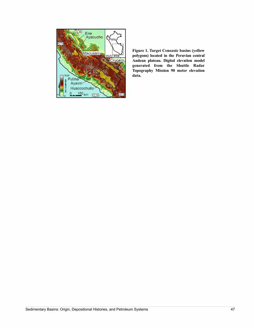
Figure 1. Target Cenozoic basins (yellow polygons) located in the Peruvian central Andean plateau. Digital elevation model generated from the Shuttle Radar Topography Mission 90 meter elevation data.
Sedimentary Basins: Origin, Depositional Histories, and Petroleum Systems 47
Is There Deep-Seated Subsidence in the Houston-Galveston Area?
Yangbo, YuDpartment of Earth and Atmospheric SciencesUniversity of HoustonHouston, Texase-mail: [email protected]
Abstract
Long-term continuous monitoring in the Hous-ton-Galveston area indicates that, during the past two decades (1993-2012), the overall land subsidence has been decreasing, while the groundwater head has been increasing. Subsidence in downtown Houston, the area along the Houston Ship Channel, and the coastal area of Gal-veston has almost ceased. Slight ground surface rebound has been observed at several sites along the Houston Ship Channel. Assuming that the hydraulic head in the aquifer will reach or exceed the preconsolidation level in the near future, will the subsidence in the Houston-Galveston area eventually cease? The key to answering this question is to identify if there is deep-seated subsidence in this area.
This study investigated the recent subsidence observed at different depths in the Houston-Galveston area. The
subsidence was recorded by using 13 borehole extensome-ters and 76 GPS antennas. Four of the antennas are mounted on the deep-anchored (549, 591, 661 and 936 m below the land surface) inner pipes of borehole exten-someters. We conclude that recent subsidence (1993-2012) in the Houston-Galveston area was dominated by the com-paction of sediments within 600 m below the land surface. Depending on the location of specific sites, the compaction occurred within the Chicot and part or all of the Evangeline aquifer. No measurable compaction was observed within the Jasper aquifer or within deeper strata. Recent GPS observations also suggest that there is currently no consider-able lateral ground deformation or subsidence associated with deep-rooted faulting activities in the Houston-Galves-ton area.
48 Program and Abstracts

Detrital Zircon U-Pb and U-Th/He Double Dating of Lower Miocene Samples from the Gulf of Mexico Margin: Insights into Sediment Provenance and Depositional History
Xu, JieDepartment of Geological Sciencesalso: Institute for Geophysics Jackson School of GeosciencesThe University of Texas at AustinAustin, Texase-mail: [email protected]
Stockli, Daniel F.Department of Geological SciencesJackson School of GeosciencesThe University of Texas at AustinAustin, Texas
Snedden, John W.Fulthorpe, Craig S.Institute for GeophysicsJackson School of GeosciencesThe University of Texas at AustinAustin, Texas
Abstract
By linking provenance indicators, estimated sed-iment supply, and depositional rate to exhumation episodes, it is possible to reconstruct timing and loca-tion of source to sink depositional pathways. The lower Miocene (LM; 23-15Ma) is an episode of voluminous sediment input to the Gulf of Mexico from erosion of North American interior highlands (Galloway, 2009; Galloway et al., 2011). This interval has gained increased attention from the oil and gas industry because of hydrocarbon potential beneath the thick salt canopy. However, inferred sediment transport path-ways for this interval are based on consideration of likely river courses through known paleogeomorpho-logical elements (Galloway et. al., 2011). Furthermore, provenance is mainly based on traditional petrographic methods (e.g., QFL diagrams), which have large uncer-tainties owing to degradation of sediment grains by transportation, weathering, and subsurface diagenesis. Major tectonic reorganization in the western interior of North America together with rejuvenation of the Appa-lachian Mountains in the east further complicates lower Miocene provenance analysis. More robust data are required to understand the progressive eastward shift of source terranes and its influence on sediment dispersal to the deep-water basin, where extensive allochthonous salt canopies can hinder direct seismic observation of sediment dispersal pathways.
The dual constraint provided by crystallization age (U-Pb) and cooling age (U-Th/He) greatly increases the accuracy and precision of provenance
interpretations. We therefore integrate detrital zircon. U-Pb, and U-Th/He dating to reveal not only sediment provenance, but also the exhumation histories of the detrital source regions. Only limited U-Pb dating has been done in the Gulf of Mexico (Mackey et al., 2012 and Craddock et al., 2013) and U-Pb and U-Th/He double dating has not yet been applied here. We have collected 15 outcrop samples from Texas and Louisiana for U-Pb and U-Th/He analysis. Preliminary U-Pb results indicate that there are several major source ter-ranes including the Oligocene volcanic field, Laramide uplift, Cordilleran Arc, Grenville, Mid-Continent, and Yavapai-Mazatzal terranes. Minor provinces, including Appalachian-Ouachita, Wyoming, and Superior regions, are also recorded. However, by combining U-Pb ages with U-Th/He ages, we identify several recy-cled zircons with more complex transportation, deposition, and exhumation histories. Exhumation his-tories indicate that the large numbers of zircons formed during the Sevier-Nevadan orogenies were recycled to the GOM rather than transported there directly. In addi-tion, our data show that Grenville age zircons deposited in Louisiana were probably recycled through the Colo-rado Plateau from their original source in the Appalachian Mountains. In contrast, volcanic sources are readily identified because their U-Pb age is close to their U-Th/He age. Detrital zircon double dating is therefore greatly enhancing our understanding of tec-tonic movement, provenance changes and the evolution
Sedimentary Basins: Origin, Depositional Histories, and Petroleum Systems 49

of sediment transport axes for the important lower Miocene interval in the Gulf of Mexico.
50 Program and Abstracts

Tectonic-Controlled Stratal Architecture Variability of Shelf-Edge, Growth Faulted Deltaic Systems: A Case Study from the Frio Formation in Corpus Christi Bay, South Texas
Zhang, Jinyue-mail: [email protected]
Ambrose, William A.Bureau of Economic GeologyThe University of Texas at AustinAustin, Texas
Abstract
Nearly 2,000 feet of continuous core, combined with well log and 3-D seismic data, afford a rare opportunity to document variations of stratal archi-tecture and related processes of shelf-edge, growth faulted deltaic systems through active and inactive peri-ods of growth faults at the scale of 4th-order sequences in the Frio Formation in Corpus Christi Bay.
The growth fault history, examined by expansion ratio and T-Z plots, is divided into three different periods: (1) development (rapid subsidence, growth ratio > 2, steep and positive slope of T-Z plot); (2) less active to inactive (no growth, flat to negative slope of T-Z plot); and (3) maintenance (slow subsidence, growth ratio ~ 1, flat and positive slope of T-Z plot). These periods can be correlated to aggradational, repetitive fourth-order sequences of shoreface deposits, a transgressive unit com-posed of back-stepping shoreface deposits, and several high-frequency progradational fourth-order sequences represented by wave-dominated, fluvial-influenced del-taic deposits.
Varying subsidence rates serve as a dominant process in stratigraphic development of the Frio Forma-tion, whereas sediment supply and eustatic sea-level changes are subordinate. The decameter-scale fourth-order sequences within the hanging wall section are grouped into two categories based on stratal architecture: (1) T-R cycles within development period of growth faults
and (2) R cycles within maintenance period of growth faults. T-R cycles have complete transgressive and regressive intervals of similar thickness (R-T thickness ratio ~ 1.7), created by a balance between rapid sediment supply and rapid accommodation rate caused by high subsidence rate and low sea-level drop rate. This bal-ance permits the possibility of preserving of both regressive and transgressive units and provides more time for modification of deltaic deposits by wave-storm processes. R cycles are dominated by regressive intervals containing minor transgressive intervals (R-T thickness ratio > 6). R cycles are the results of rapid progradation stacking as rapid sediment supply, slow subsidence and rapid sea-level drop.
The reservoir quality of wave-dominated deposits is highly controlled by the percentage of the bioturbated beds that constitute permeability barriers. Within the period of development of growth faults, a high subsid-ence rate associated with high sediment rate may indicate a relative high energy environment with fewer bioturbated beds and better reservoir quality as documented by porosity and permeability data. Relatively more anti-thetic faults are present during the growth fault development period, making the interval structurally complex with potentially greater number of reservoircompartments.
Sedimentary Basins: Origin, Depositional Histories, and Petroleum Systems 51

52 Program and Abstracts

Author Index
A
Ajiboye, O., 34Ambrose, William A., 51Aziz, A. A., 31
B
Bachrach, Ran, 45Badger, C., 34Barker, Steve, 22Batbayar, Kherlen, 32Bennett, Richard H., 38Bergman, Steve, 22Biegert, Ed, 22Bracken, B., 27Brouwer, Friso, 25
C
Carvajal, Cristian, 23, 26Casey, Katya, 15Castill, Karilys, 33Christie, Cory, 34Coleff, Daniel M., 35Coleman, James L., 20Connell, S.D., 27Connors, Christopher D., 17Covault, J. A., 23Crews, Corbin W. II, 36Curry, Kenneth J., 38
D
Derewetzky, Aram, 16Douglas, Jessica, 38Du, Yue, 39
E
Ensley, Ross, 6
F
Fillon, Richard H., 28Frewin, Neil, 16Fulthorpe, Craig S., 49
G
Gannaway, C.E., 40Giles, K.A., 40Graham, Rod, 1, 2, 30Green, S. L., 31
H
Hasan, Murad, 41Hearon, T.E. IV, 40Hippolyte, Jean-Claude, 32, 43Horn, Brian, 1, 2, 25, 30Hunter-Huston, Holly, 22
J
PAPER WITHDRAWN
K
Kennan, Lorcan, 12, 22Kernen, R.A., 40
L
Lake, Stuart, 16Leander, Mark, 6Levander, Alan, 11Lewis, David S., 6Liu, Yiduo, 42Longacre, Mark B., 4Loureiro, Patrick, 43Lowrie, Allen, 28Lundin, Erik R., 3Lyons, R., 23
Sedimentary Basins: Origin, Depositional Histories, and Petroleum Systems A-1

M
Mann, Paul, 32, 41, 43McDonough, Katie Joe, 25Milliken, K.T., 23, 27Mukherjee, Souvik, 22Murphy, Michael, 42
N
Nagihara, S., 34
O
Ogiamien, N., 34Ott, Bryan, 44
P
Payenberg, T.H.D., 27Pena dos Reis, Rui, 18, 19Péron-Pindivic, Gwenn, 3Petitclerc, Tim, 22Pimentel, Nuno, 18, 19Pindell, James, 1, 2, 10, 11, 12, 30Pyrcz, M., 23
R
Radovich, Barbara J., 17Redfield, Thomas F., 3Rosenfeld, Joshua H., 24Ross, Malcolm, 22Rowan, M.G., 40Ruder, Michal, 29
S
Sanchez-Ferrer, Fernando, 12Sayers, Colin M., 45Saylor, Joel E., 46
Scheck-Wenderoth, Magdalena, 7Schmitz, Michael, 11Schødt, Niels, 7Silva, Josimar, 45Sixsmith, P., 27Snedden, John W., 49Steel, Ron, 26Steffens, Gary S., 22Stewart, R. R., 31, 39Stockli, Daniel F., 49Sun, T., 23, 27Sundell, Kurt E., 46
T
Thomas, Kimberly, 29
V
von Nicolai, Christina, 7
W
Wach, Grant, 18Wang, Guoquan, 43Willis, B.J.J., 27Willis, Mark E., 39
X
Xu, Jie, 49
Y
Yangbo, Yu, 48
Z
Zarra, L., 23Zhang, Jinyu, 51
A-2 Program and Abstracts